Earth Observation & GeoSpatialBig Data for Monitoring SDG Indicators
|
|
|
- Rolf Freeman
- 5 years ago
- Views:
Transcription


1 Earth Observation & GeoSpatialBig Data for Monitoring SDG Indicators Yifang Ban, Professor Director, Division of Geoinformatics Vice Chair, Department for Urban Planning and Environment KTH Royal Institute of Technology 1


2 Environmental Consequences High concentrations of aerosols, exhaust gases, pollution and dust Hazardous to health Increased smog, haze, fog, clouds Source: The Associated Press Source: Suicup via Wikimedia Source: zmescience.com Environmental Consequences Paved surfaces-> rainfall water-> flooding Urbanization results in more impervious surfaces, thus reducing the area where infiltration to ground water can occur. Thus, more storm water runoff occurs. 79people died injuly 2012Beijing flooding Source: rendezvous.blogs.nytimes.com Source: BBC News Source: 2


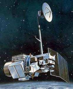
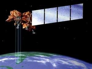
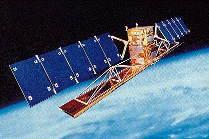


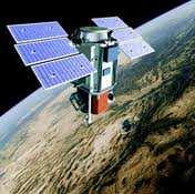
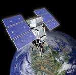
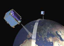
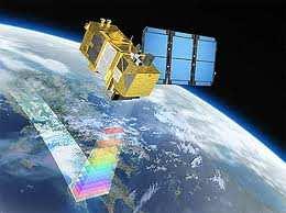
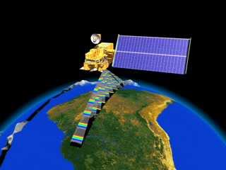
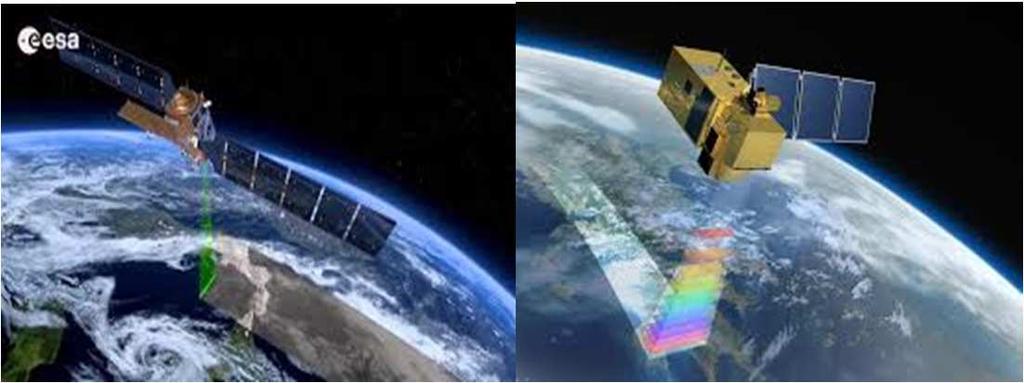
3 Satellite Data Sentinel Big Data: Free 3
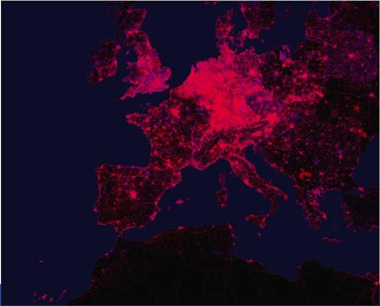
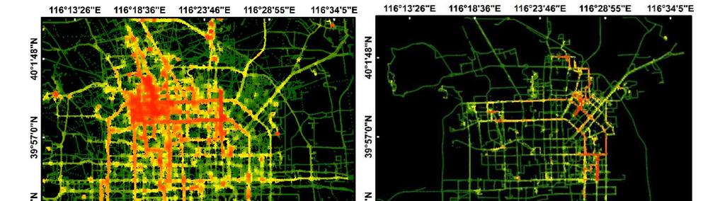
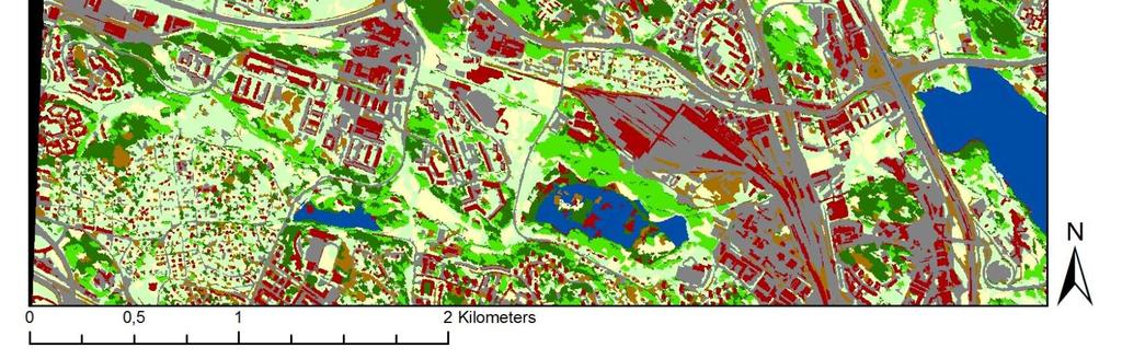
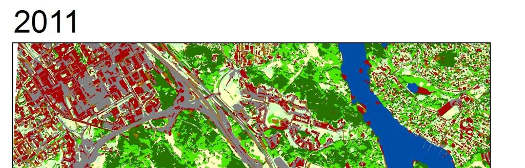
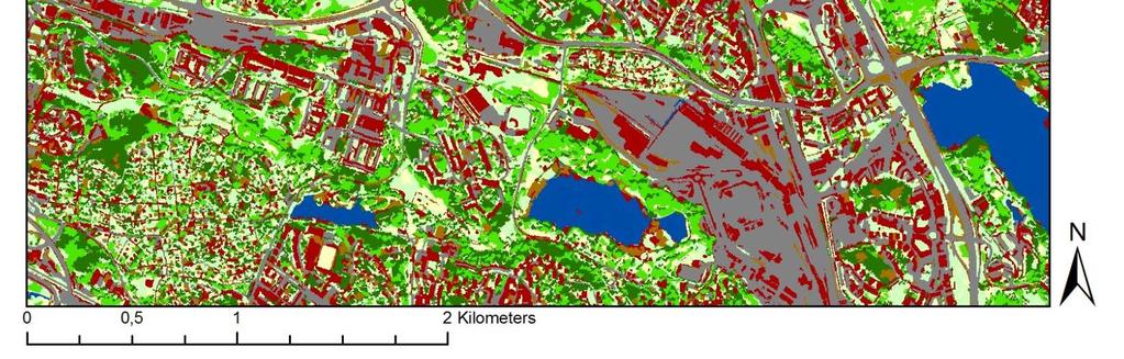
4 Volunteered GeographicInformation Mobility Data: GeoLife Beijing 4

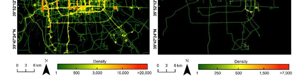
5 Mobility Data: Cycling footprint of Madrid Goal11. Make citiesand human settlements inclusive, safe, resilient and sustainable 5


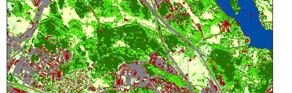
6 UN Urban SGD Indicators Goal 11: Make cities inclusive, safe, resilient& sustainable Target 11.3:By 2030, enhance inclusive and sustainable urbanization and capacity for participatory, integrated and sustainable human settlement planning and management in all countries. Indicator Ratio of land consumption rate to population growth rate Land use efficiency Target 11.7: is providing universal access to safe, inclusive and accessible, green and public spaces, in particular for women and children, older persons and persons with disabilities Average share of the built-up area of cities that is open space for public use for all, by sex, age and persons with disabilities EO4Urban The overall objective is to evaluate multi-temporal multi-resolution Sentinel-1A SAR and Sentinel-2A MSI data for developing a pilot global urban services based on user requirements to support smart and sustainable urban development. Team Users KTH Royal Institute of Technology, Sweden University of Pavia, Italy Stockholm County Administrative Board, Sweden National Geomatics Center, China 6


7 User Requirements: Urban Extent Maps 2015 and 2016 Urban extent maps for Stockholm and Beijing Minimum Mapping Unit at 30m x 30m. Historical urban extent maps from 1995, 2005 and 2010 if possible. UserRequirements: Urban Green Structure& Change Maps Maps of urban green structure changes in 2015 and updated yearly Minimum Mapping Unit at 30m x 30m. 7

8 8

 Replaced Internal Data Scaling Increased internal quantization from 6 to 8 bit SEED 4")
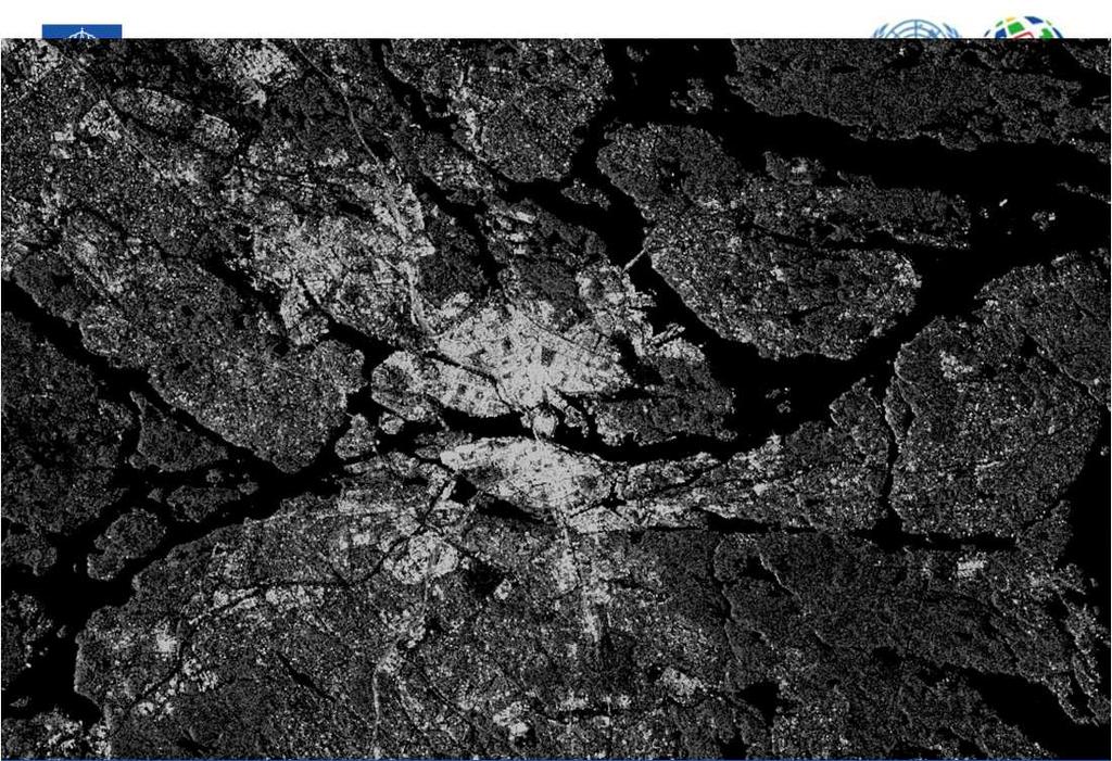
9 Sentinel-2A MSI & -1A SAR Data 2015/05/16 ASC 2015/06/04 DSC 2015/06/09 ASC 2015/06/28 DSC 2015/07/10 DSC 2015/07/15 ASC 2015/07/22 DSC 2015/08/08 ASC 2015/08/15 DSC 2015/08/20 ASC 2015/09/08 DSC 2015/09/20 DSC 2015/09/25 ASC 2015/10/02 DSC 2015/10/07 ASC 2015/10/19 ASC 2015/10/26 DSC 2015/10/31 ASC Urban Extractor Sentinal-1A ASAR ASAR intensity SAR image intensity image or stack of image stack images stack SAR Preprocessing (orbit, terrain, co-regis ) SRTM 30m DEM Image Stack Averaging Conversion to 8bit Linear Scale with Histrogram Clipping Removed filling operation Introduced effective minimum mapping unit GLCM MASK Dis, Var LISA MASK Moran, Geary, Getis Slope Image Slope Threshold (15%) Replaced Internal Data Scaling Increased internal quantization from 6 to 8 bit SEED 4 GLCM AND LISA Morphological filtering DENSITY ANALYSIS MASK GLCM OR LISA Mountain Mask Urban Builtup mask Mask stack Urban mask stack Logical Operators (AND, OR) 18 Urban Area Mask Corrected Urban Mask 9


10 Sentinel Big Data for Urban Extent Extraction Sentinel Big Data for Urban Change Detection 10


11 Stockholm Urban Extraction Using KTH-Pavia Urban Extractor Results: Stockholm Urban Extraction: Beijing 22 11

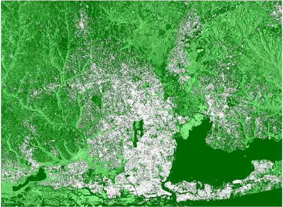

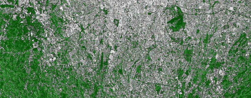
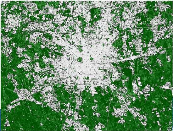
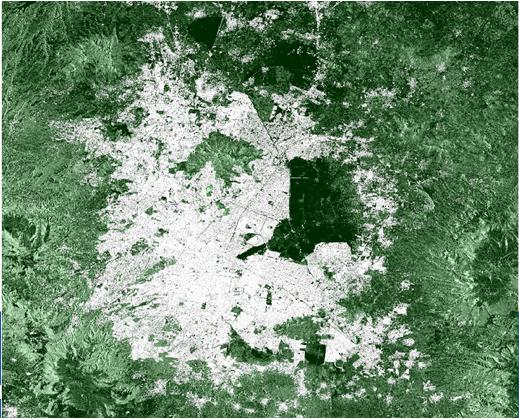
12 23 12


13 Urban Expansion in Beijing Urban Green Structure 13

14


15 Goal13. Takeurgent action to combat climate change and its impacts Climate Impact 13.1 Strengthen resilience and adaptive capacity to climaterelated hazards and natural disasters in all countries 15


16 Introduction For active wildfire monitoring Moderate Resolution Imaging Spectroradiometer (MODIS) Active Fire maps are often used for contextual awareness Introduction For active wildfire monitoring Landsat data are often deployed for postwildfire boundary determination and burn severity mapping 16
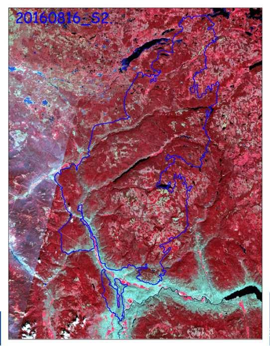
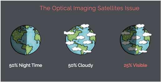
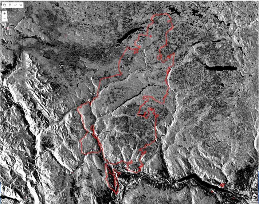
17 Limitation of Optical Images Sentinel-1 SAR Time Series 17


18 FireNet: A Deep Learning Framework Validations 18


19 Results Conclusions EO and geospatial big data and analytics can play a significant role in measuring and monitoring SDG indicators. 19
Maurice Borgeaud. Directorate of Earth Observation Programmes. Head of Science, Applications and Futures Technologies Department
 Maurice Borgeaud Directorate of Earth Observation Programmes Head of Science, Applications and Futures Technologies Department ESRIN ESA s Earth Observation HQ Personnel on site: ~ 550 Payload operations
Urbanization dynamics along the Belt and Road
 Human Planet Forum Enschede, Netherlands 12-15 September 2017 Urbanization dynamics along the Belt and Road Linlin Lu Key Lab. of Digital Earth Science Institute of Remote Sensing and Digital Earth, Chinese
UNECE Committee on Housing and Land Management activities on urban development
 UNECE Committee on Housing and Land Management activities on urban development GULNARA ROLL, UN ECONOMIC COMMISSION FOR EUROPE HOUSING AND LAND MANAGEMENT UNIT Areas of work Sustainable Housing and Real
MAKING CITIES INCLUSIVE, SAFE, RESILIENT, AND SUSTAINABLE: FOR AND WITH STAKEHOLDERS
 MAKING CITIES INCLUSIVE, SAFE, RESILIENT, AND SUSTAINABLE: FOR AND WITH STAKEHOLDERS Human Planet Forum 0 September 13, 2017 Eugenie L. Birch Nussdorf Professor University of Pennsylvania THE WORLD world
Making Asian Cities Livable and Smart Case Study from Kolkata. Neeta Pokhrel Principal Urban Development Specialist Asian Development Bank
 Making Asian Cities Livable and Smart Case Study from Kolkata Neeta Pokhrel Principal Urban Development Specialist Asian Development Bank Capital city of 4rth most populous state (West Bengal), and 6 th
Programme at a glance February 2018 Kuala Lumpur
 Programme at a glance 7-13 February 2018 Kuala Lumpur Wednesday 7 February 2018 Thursday 8 February 2018 09:00-10:30 Joint Opening for the WUF9 Assemblies 10:30-17:30 Women s Assembly Business Assembly
TOWARDS ACHIEVING SUSTAINABLE DEVELOPMENT GOALS IN EGYPT
 TOWARDS ACHIEVING SUSTAINABLE DEVELOPMENT GOALS IN EGYPT URBAN DEVELOPMENT FOCUS Nihal El-Megharbel, Urban Governance, Policies and Legislations Program Manager UNHABITAT, Egypt Office The Sustainable
Statement by Hon ble Minister of State (I/C) for Housing and Urban Affairs Government of India Hardeep S Puri
 for Housing and Urban Affairs Government of India Hardeep S Puri") Statement by Hon ble Minister of State (I/C) for Housing and Urban Affairs Government of India Hardeep S Puri High Level Political Forum on Sustainable Development 11 July 2018 Review of SDGs implementation:
Statement by Hon ble Minister of State (I/C) for Housing and Urban Affairs Government of India Hardeep S Puri High Level Political Forum on Sustainable Development 11 July 2018 Review of SDGs implementation:
TOWARDS SUSTAINABLE URBAN PRECINCTS
 TOWARDS SUSTAINABLE URBAN PRECINCTS Mark Allan Associate Director Billard Leece Partnership Architects & Urban Planners Melbourne Forum - Wednesday 29 September 2010 Towards sustainable precincts This
Methods to Simulate the Impact of BMPs
 LA221 Project Ortega Watershed Demonstration Area, Quito Ecuador Ricardo da Cruz e Sousa Master of Landscape Architecture & Environmental Planning University of California, Berkeley December 2011 Ortega
Fire Information for Resource Management System (FIRMS)
") Fire Information for Resource Management System (FIRMS) Diane Davies 1, Chris Justice 1, Jacques Descloitres 2, John Latham 3 John Musinsky 4 1 Department of Geography, University of Maryland 2 SSAI /
Fire Information for Resource Management System (FIRMS) Diane Davies 1, Chris Justice 1, Jacques Descloitres 2, John Latham 3 John Musinsky 4 1 Department of Geography, University of Maryland 2 SSAI /
Madam Maimunah Mohd Sharif Under-Secretary-General and Executive Director, UN-Habitat
 WUF 9 OPENING SPEECH: 8 February 2018 Madam Maimunah Mohd Sharif Under-Secretary-General and Executive Director, UN-Habitat The right honourable, Dato' Sri Haji Mohammad Najib bin Tun Haji Abdul Razak,
Vu Kim Chi Nguyen Thi Thuy Hang
 Vu Kim Chi Nguyen Thi Thuy Hang Tokyo, Dec 7, 2015 Introduction Data and methods Results and discussions Conclusion The city of Quy Nhon Urban planning in Quy Nhon Climate change and sea level rise Natural
Regional Training Workshop on Human Settlement indicators
 Regional Training Workshop on Human Settlement indicators Donatien Beguy, PhD Research and Capacity Development Branch UN-HABITAT Overview of 2030 Agenda for Sustainable Development and New Urban Agenda
FOR A BETTER URBAN FUTURE
 FOR A BETTER URBAN FUTURE Rapid urbanization and its links with poverty, inequality, public health, migration, climate change and natural disasters to be one of the most pressing concerns of the United
Our Cities Blue-Green Infrastructure & Innovative Stormwater Solutions
 Source of of image: DE DE URBANISTEN AND AND THE WONDROUS THE WONDROUS WATER WATER SQUARE SQUARE Our Cities Blue-Green Infrastructure & Innovative Stormwater Solutions Misagh Mottaghti, VA-teknik, Lund
Hydrologic Assessment of using Low Impact Development to Mitigate the Impacts of Climate Change. Chris Jensen, AScT Master of Science Thesis
 Hydrologic Assessment of using Low Impact Development to Mitigate the Impacts of Climate Change Chris Jensen, AScT Master of Science Thesis Bowker Creek Initiative April 12, 2012 Outline 1. Future Impacts
Status Update of Turf Work Order. January 18, 2013 MIDS Workgroup Meeting
 Photo: http://en.wikipedia.org/wiki/file:seededfertilizedlawn.jpg Status Update of Turf Work Order January 18, 2013 MIDS Workgroup Meeting Categories of Turf Credits 1. Impervious Surface Disconnection-turf
Standardization of Remote Sensing Technology. Yuan-Yuan Jia. Academy of Opto-Electronics (AOE), CAS
, CAS") WGCV-36 Shanghai, China May 13-17, 2013 Standardization of Remote Sensing Technology Yuan-Yuan Jia 1 Academy of Opto-Electronics (AOE), CAS 2 Secretariat of National Technical Committee 327 on RS of Standardization
WGCV-36 Shanghai, China May 13-17, 2013 Standardization of Remote Sensing Technology Yuan-Yuan Jia 1 Academy of Opto-Electronics (AOE), CAS 2 Secretariat of National Technical Committee 327 on RS of Standardization
Fire Mapping Chapter. Working Paper
 Fire Mapping Chapter Working Paper Version 1.0 as of September 2018 International Working Group on Satellite-based Emergency Mapping (IWG-SEM) Contents 1. FOREWORD... 3 2. IWG-SEM Fire delineation section...
New forms of territorial governance for the promotion of landscape policies in the field of water resources management at water
 New forms of territorial governance for the promotion of landscape policies in the field of water resources management at water territories i EU Community Initiative Interreg III B ArchiMed KEPEMEP-MedRegio
THE NORTHSTAR SYSTEM: A NEW ERA IN EARTH OBSERVATION
 THE NORTHSTAR SYSTEM: A NEW ERA IN EARTH OBSERVATION Daniel O Connell 1, Derek R. Peddle 2, 6, Stewart Bain 3, Douglas W. Bancroft 4, Kjell Stakkestad 5,7 NorthStar, Montréal, Québec, Canada. http://www.northstar-data.com
NEAR REAL TIME DETECTION OF BURNED SCAR AREA USING LANDSAT-8 IMAGERIES
 NEAR REAL TIME DETECTION OF BURNED SCAR AREA USING LANDSAT-8 IMAGERIES Danang Surya Candra Kustiyo - Indonesian National Institute of Aeronautics and Space (LAPAN) - Outline INTRODUCTION: Background, Problems,
SOUTH AFRICA S PREPARATIONS FOR HABITAT III COMMON AFRICAN POSITION FOR HABITAT III. Habitat III Urban Breakfast 5 October 2016
 SOUTH AFRICA S PREPARATIONS FOR HABITAT III COMMON AFRICAN POSITION FOR HABITAT III Habitat III Urban Breakfast 5 October 2016 Context and Background 1. Africa intends actively shaping the New Urban Agenda,
Urban Dimension of the SDGs in Asia and the Pacific
 Urban Dimension of the SDGs in Asia and the Pacific Kemitraan-Habitat Presented by Wicaksono Sarosa, Kemitraan-Habitat, Indonesia Expert Consultation on Implementing the 2030 Agenda for Sustainable Development
Cultural Heritage Sustainable Development Goal for the UN
 Cultural Heritage Sustainable Development Goal for the UN Christer Gustafsson Professor in Conservation, Uppsala University Member of the expert group for Cultural Heritage and UN SDGs Secretary-General
Presented by: Theuns van der Linde
 Introducing the concept of Disaster Risk Reduction Through Environmental Design (DRRTED), and proposing a methodology for the creation of safer environments. Presentation prepared for: Conference in Disaster
Pre-Event Activities. Capture that Rain! Pre-Field Trip Suggestions
 Capture that Rain! When it rains, it pours, creating storm water runoff and water quality problems in our region. Students will assist Ontario Municipal Utilities Company s Water Resources Coordinator
Imperviousness & Runoff
 North Texas Alternative Futures Imperviousness & Runoff A key indicator for comparing alternative future scenarios This powerpoint presents: What is this key indicator? How do the alternative future scenarios
Fire-Implementation Team (Fire-IT) Update and Future Steps
 Update and Future Steps") Global Observation of Forest and Land Cover Dynamics Fire-Implementation Team (Fire-IT) Update and Future Steps Fire-IT Co-Chair: Chris Justice (U. Maryland) Fire-IT Executive Officer: Krishna Vadrevu
Global Observation of Forest and Land Cover Dynamics Fire-Implementation Team (Fire-IT) Update and Future Steps Fire-IT Co-Chair: Chris Justice (U. Maryland) Fire-IT Executive Officer: Krishna Vadrevu
The Role of Cities in the 2030 Agenda for Sustainable Development
 The Role of Cities in the 2030 Agenda for Sustainable Development Lorenzo Santucci Chief, ad-interim, Sustainable Urban Development Section United Nations Economic and Social Commission for Asia and the
iwater project Holistic, Sustainable and Cost-Effective Stormwater Management
 iwater project Holistic, Sustainable and Cost-Effective Stormwater Management Nika Kotoviča Stockholm, 28 November 2017 Urban Climate Adaptation in the Baltic Sea Region Training Workshops Integrated Storm
MAYORS MEETING POLICYMAKERS DIALOGUE Creative city making and the New Urban Agenda CONCEPT NOTE
 X TH ANNUAL MEETING OF THE UNESCO CREATIVE CITIES NETWORK MAYORS MEETING POLICYMAKERS DIALOGUE Creative city making and the New Urban Agenda CONCEPT NOTE Date 3 p.m. to 5 p.m., 15 September 2016 Venue
THE ASEAN ESC COMMUNITY: BEYOND 2015 MR. SUPHOT TOVICHAKCHAIKUL DEPUTY PERMANENT SECRETARY MINISTRY OF NATURAL RESOURCES AND ENVIRONMENT, THAILAND
 THE ASEAN ESC COMMUNITY: BEYOND 2015 MR. SUPHOT TOVICHAKCHAIKUL DEPUTY PERMANENT SECRETARY MINISTRY OF NATURAL RESOURCES AND ENVIRONMENT, 1 OUTLINES ASEAN ESC MODEL CITIES PROGRAMME YEAR I ASEAN ESC MODEL
Towards the development of International Guidelines on Urban and Territorial Planning (IG-UTP)
") Towards the development of International Guidelines on Urban and Territorial Planning (IG-UTP) First meeting of the UNECE Task Group on Urban Planning 15 December 2014 Remy Sietchiping Overview 1. UN-Habitat,
Towards the development of International Guidelines on Urban and Territorial Planning (IG-UTP) First meeting of the UNECE Task Group on Urban Planning 15 December 2014 Remy Sietchiping Overview 1. UN-Habitat,
Verification and Validation of OOV-TET1 Multispectral Camera Observations within the FireBIRD Project
 DLR.de Chart 1 Verification and Validation of OOV-TET1 Multispectral Camera Observations within the FireBIRD Project O. Frauenberger **, A. Börner *, E. Borg **, W Halle *, E. Lorenz *, S. Mitchell *,
LID Permit Requirements. Lisa Austin. Geosyntec Consultants
 LID Permit Requirements Lisa Austin Geosyntec Consultants Presentation Outline Types of LID Permit Requirements Specified site design Specified LID BMPs LID performance metrics Specified Site Design (San
Airborne Imagery Potential Role in Monitoring Climate Change
 PC.DEL/773/09 13 October 2009 ENGLISH only Airborne Imagery Potential Role in Monitoring Climate Change US Department of State 5 October 2009 Briefing Topics Introduction Climate Change Threats to National
Urban Resilience and Disaster Vulnerability in the Asia-Pacific Region
 Urban Resilience and Disaster Vulnerability in the Asia-Pacific Region Rajib Shaw E-mail: shaw@global.mbox.media.kyoto-u.ac.jp Web: www.iedm.ges.kyoto-u.ac.jp/ Contents Urban Resilience and Disaster Vulnerability
Candidature: ISC - Christer Gustafsson - ISCEC
 Christer Gustafsson Skepparegatan 2 263 32 Höganäs 3 December 2018 Sweden Short biography Christer Gustafsson, Ph D is full professor in Cultural Heritage Management and Sustainable Development at Uppsala
Prof Barbara Norman, University of Canberra Prof Will Steffen, The Australian National University
 Prof Barbara Norman, University of Canberra Prof Will Steffen, The Australian National University Presentation to Resilient Cities 2011 2 nd World Congress on Cities and Adaptation to Climate Change Bonn,
ISO/TC 211 GEOGRAPHIC INFORMATION AND GEOMATICS A FRAMEWORK AND REFERENCE MODEL
 ISO/TC 211 GEOGRAPHIC INFORMATION AND GEOMATICS A FRAMEWORK AND REFERENCE MODEL Kian FADAIE Canada Centre for Remote Sensing Natural Resources Canada Fadaie@nrcan.gc.ca Paper number 1734 KEY WORDS: ISO/TC211,
Indicator : Average share of the built-up area of cities that is open space for public use for all, by sex, age and persons with disabilities
 Goal 11: Make cities and human settlements inclusive, safe, resilient and sustainable Target 11.7: By 2030, provide universal access to safe, inclusive and accessible, green and public spaces, in particular
Blue-Green Network and Urban Infrastructure Development
 Blue-Green Network and Urban Infrastructure Development Mahua Mukherjee, Ph.D Head, Centre of Excellence in Disaster Mitigation and Management Associate Professor; Department of Architecture & Planning
INTERNATIONAL GUIDELINES
 INTERNATIONAL GUIDELINES ON URBAN & TERRITORIAL PLANNING Bridge for Planning & Innovation 53rd ISOCARP Congress Smart Communities October 24, 2017 Portland, USA 1/3 BACKGROUND JUST TO NAME A FEW WHERE
Recent UN and EU Sustainable Development Policies (Post 2015): What challenges for city planning and governance
: What challenges for city planning and governance") Recent UN and EU Sustainable Development Policies (Post 2015): What challenges for city planning and governance Europe at a crossroads: the challenge for future sustainable development 20 July 2016 Roudaina
Recent UN and EU Sustainable Development Policies (Post 2015): What challenges for city planning and governance Europe at a crossroads: the challenge for future sustainable development 20 July 2016 Roudaina
100 Resilient City Singapore
 100 Resilient City Singapore Singapore Resilience Challenges Flooding (Coastal and Rainfall) Heat Wave Pollution or Environmental Degredation Rising Sea Level and Coastal Erosion Image from Wikimedia Commons
Landowner's Guide to the Lower St. Croix Riverway. Protect. Restore. Celebrate. stcroixriverassociation.org
 Landowner's Guide to the Lower St. Croix Riverway Protect. Restore. Celebrate. stcroixriverassociation.org Cover and page spread photographs by Craig Blacklock. For more information on how to be a river
Habitat III Urban Breakfast Durban South Africa. 5 October 2016
 Habitat III Urban Breakfast Durban South Africa 5 October 2016 HABITAT III The United Nations Conference on Housing and Sustainable Urban Development More than half of the World Population lives in cities:
An Assessment of Storm Water Runoff Issues in Pine Bluff, White Hall, the University of Arkansas at Pine Bluff and Jefferson County
 ETB259 An Assessment of Storm Water Runoff Issues in Pine Bluff, White Hall, the University of Arkansas at Pine Bluff and Jefferson County Cooperative Extension Program, University of Arkansas at Pine
Submitted by: Phillip L. Harrington, Director, Department of Public Works. Framework for Green Infrastructure Plan Development
 Page 1 of 8 Office of the City Manager CONSENT CALENDAR June 13, 2017 To: From: Honorable Mayor and Members of the City Council Dee Williams-Ridley, City Manager Submitted by: Phillip L. Harrington, Director,
CLIMATE CHANGE. DIALOGUE ON CITIES AND CLIMATE CHANGE World Bank Washington, September 21-23, 2009
 DIALOGUE ON CITIES AND CLIMATE CHANGE CLIMATE CHANGE CITIES IN ACTION World Bank Washington September 21-23, 2009 METROPOLIS Created in 1985, the association brings together major cities and metropolitan
Introduction to Low Impact Development. Dr Kathy Chaston Coral & Coastal Management Specialist NOAA Office of Ocean & Coastal Resource Management
 Introduction to Low Impact Development Dr Kathy Chaston Coral & Coastal Management Specialist NOAA Office of Ocean & Coastal Resource Management http://hawaii.gov/dbedt/czm/resource/publication.php A Comprehensive
iwater project Holistic, Sustainable and Cost-Effective Stormwater Management
 iwater project Holistic, Sustainable and Cost-Effective Stormwater Management Nika Kotoviča Copenhagen, 30 November 2017 Urban Climate Adaptation in the Baltic Sea Region Training Workshops Integrated
DRAINAGE CALCULATIONS
 DRAINAGE CALCULATIONS For the Carroll Single Family Residence At Santa Clara County Saratoga, California APN: 517-26-010 December 18, 2015 Prepared For: John and Peggy Carroll Prepared By: RI Engineering,
Recent Developments and Prospects for Innovative Remote Sensing of High-Temperature Events and Vegetation Fire Impacts
 Recent Developments and Prospects for Innovative Remote Sensing of High-Temperature Events and Vegetation Fire Impacts by D. Oertel, E. Lorenz, B. Zhukov German Aerospace Center, (DLR-OS) Berlin Adlershof
The Asia- Pacific Region
 The Asia- Pacific Region The Asia-Pacific region in 2013: 4.2 billion people (represents 60% of world s population) with an urban growth rate of 2% p.a. Comparatively under-urbanized: 46% living in cities
3. Are there any projects exempt from the definition of Regulated Projects?
 STORMWATER REQUIREMENTS: OVERVIEW OF PROVISION C.3 Background: On October 14, 2009, the Regional Water Quality Control Board, San Francisco Bay Region, issued a municipal regional stormwater permit (MRP)
Progress of ICLEI Strategic Plan 2021
 ICLEI Progress of ICLEI Strategic Plan 2021 Model for Collaboration in Achieving SDG 11 Outcomes Sustainable Development Transition Forum Incheon 31 October 2017 KANG Jeong-muk Manager Policy & Knowledge
SAN RAFAEL GENERAL PLAN 2040 INTRODUCTION AND OVERVIEW
 SAN RAFAEL GENERAL PLAN 2040 INTRODUCTION AND OVERVIEW Steering Committee Presentation February 14, 2018 Purpose of General Plan Guide land use and development decisions Coordinate transportation, infrastructure,
Developing SDG indicators for Africa. A harmonized and coordinated approach
 Developing SDG indicators for Africa A harmonized and coordinated approach Raj Gautam Mitra UN Economic Commission for Africa Adopting the proposed indicator framework 1 Approach Singular African approach
GIS Training of Undergraduates: Campus Stormwater Mapping. Joanne Logan, University of Tennessee. Gordie Bennett, University of Tennessee
 GIS Training of Undergraduates: Campus Stormwater Mapping Joanne Logan, University of Tennessee Gordie Bennett, University of Tennessee Seth Benge, University of Tennessee Tim Prather, University of Tennessee
Rainwater Harvesting Requirements Living Well Community October 2016/Harvey Harman
 Rainwater Harvesting Requirements Living Well Community October 2016/Harvey Harman Four main reasons Rainwater Harvesting is part of Sustainable Development and Green Building: 1. Resource conservation
THE SDG INDICATOR FRAMEWORK IN AFRICA
 THE SDG INDICATOR FRAMEWORK IN AFRICA Xiaoning Gong Chief, Economic Statistics and National Accounts Section, ACS, UNECA at International Seminar on World Statistics: Sustainable Data for Sustainable Development
the EU-Japan Support Mission in the Space Sector
 Astro- und Feinwerktechnik Adlershof GmbH the EU-Japan Support Mission in the Space Sector 07 th of September 2017 Sapporo, Japan Dr.-Ing. Sebastian Scheiding s.scheiding@astrofein.com www.astrofein.com
Smart City Governance URBIS Solutions. David Ludlow, Assoc. Professor European Smart Cities University of the West of England, Bristol
 Smart City Governance URBIS Solutions David Ludlow, Assoc. Professor European Smart Cities University of the West of England, Bristol Integrated smart city model Smart Mobility Services focused on decreasing
SCAPE Shaping Climate change Adaptive PlacEs
 SHAPING CLIMATE CHANGE ADAPTIVE PLACES SCAPE Shaping Climate change Adaptive PlacEs Based on a landscape led approach, SCAPE will develop (innovative) solutions for water management to enhance the resilience
Development of a Canadian Wildland Fire Monitoring Sensor (CWFMS)
") Unclassified Development of a Canadian Wildland Fire Monitoring Sensor (CWFMS) Helena (Marleen) van Mierlo 1 Linh Ngo Phong 1 Steeve Montminy 1 Joshua M. Johnston 2 Denis Dufour 3 (1) Canadian Space Agency
Unclassified Development of a Canadian Wildland Fire Monitoring Sensor (CWFMS) Helena (Marleen) van Mierlo 1 Linh Ngo Phong 1 Steeve Montminy 1 Joshua M. Johnston 2 Denis Dufour 3 (1) Canadian Space Agency
Rapid Prototyping of NASA Next Generation Sensors for the SERVIR System of Fire Detection in Mesoamerica
 Rapid Prototyping of NASA Next Generation Sensors for the SERVIR System of Fire Detection in Mesoamerica Joel S. Kuszmaul, Henrique Momm, Greg Easson University of Mississippi, University, MS 38677 Timothy
DETECTION AND MONITORING OF ACTIVE FIRES USING REMOTE SENSING TECHNIQUES
 DETECTION AND MONITORING OF ACTIVE FIRES USING REMOTE SENSING TECHNIQUES Source: Unknown n.d., http://www.hotrodsandclassics.net/featuredpictures/featurepictures2.htm. by Claire Riddell DETECTION AND MONITORING
Band Selection & Algorithm Development for Remote Sensing of Wildland Fires
 Band Selection & Algorithm Development for Remote Sensing of Wildland Fires Andy Fordham Chester F. Carlson Center for Imaging Science Rochester Institute of Technology Rochester, New York 14623-5604 ajf8207@cis
THE HUNGDUAN, IFUGAO RICE TERRACES: AN AGRI-CULTURAL HERITAGE
 International forum on Globally Important Agricultural Heritage Systems (GIAHS) Beijing, China - June 9, 2011 THE HUNGDUAN, IFUGAO RICE TERRACES: AN AGRI-CULTURAL HERITAGE CLARENCE L. BAGUILAT Regional
Global fire hotspots detected by NASA satellite to help United Nations
 Global fire hotspots detected by NASA satellite to help United Nations Published on 24 Sep 2010 is Image NASA's not found Moderate or type unknown Resolution Imaging Spectroradiometer (MODIS), an instrument
GOFC/GOLD Fire IT Strategic Planning. Day 1 - Break Out Group Discussion
 GOFC/GOLD Fire IT Strategic Planning Day 1 - Break Out Group Discussion Aims of the Fire IT refining and articulating the international requirements for fire related observations making the best possible
BMP Siting Tool. Step-by-Step Guide
 BMP Siting Tool Step-by-Step Guide ArcGIS 10.1 Service Pack 1 (Build 3143) Prepared by: Tetra Tech, Inc. 10306 Eaton Place, Suite 340 Fairfax, VA 22030 January 2013 Contents 1 Getting Started... 1 1.1
RAPID FIRE DETECTION IN MEXICO AND CENTRAL AMERICA USING REMOTE SENSING METHODS
 RAPID FIRE DETECTION IN MEXICO AND CENTRAL AMERICA Bart Wickel Gerardo Lopez Ma. Isabel Cruz Erik de Badts Raúl Jimenez Rosenberg Comisión nacional para el conocimiento y uso de la biodiversidad Organization
Resolution XII NOTING also that with the increasingly rapid urbanization, wetlands are being threatened in two principle ways:
 12 th Meeting of the Conference of the Parties to the Convention on Wetlands (Ramsar, Iran, 1971) Punta del Este, Uruguay, 1-9 June 2015 Resolution XII.10 Wetland City 1 Accreditation of the Ramsar Convention
Figure 1. Bioswale along roadside. Photo courtesy of CalTrans. Figure 2. Diagram of typical bioswale (adapted from UDFCD 1999)
") Design Manual: Biological Filtration Canal (Bioswale) Dayna Yocum, Bren School of Environmental Science and Management, University of California, Santa Barbara Figure 1. Bioswale along roadside. Photo
Design Manual: Biological Filtration Canal (Bioswale) Dayna Yocum, Bren School of Environmental Science and Management, University of California, Santa Barbara Figure 1. Bioswale along roadside. Photo
NEW CASTLE COUNTY S ZONING DISTRICTS
 NEW CASTLE COUNTY S ZONING DISTRICTS This is general information about New Castle County s zoning districts. The information included is by no means exhaustive or complete. Before designing plans to develop
Three threshold measures will be applied together to capture project scale and scope and impacts:
 The regulatory consequences to the County from State and Federal water quality regulations if the pollution impacts are not addressed by each project. The extreme difficulty, cost, and equity issues associated
Meeting the Climate Change Challenge with an Integrated Approach. Urban Visions and Challenges Seminar
 Cities cover 2% av world land areas but contribute to 67% of global energy use and 7% av global energirelated CO 2 emissions (OECD 20) Meeting the Climate Change Challenge with an Integrated Approach Urban
National initiatives in the field of Urban Sustainability to enhance local government role in the compliance with the ODS and the AICHI goals
 5 TH GLOBAL BIODIVERSITY SUMMIT FOR CITIES AND SUBNATIONAL GOVERNMENTS Official parallel event to the Convention on Biological Diversity s 13 th Conference of the Parties 10 11 December 2016, The Moon
Fire Detection and Monitoring
 Fire Detection and Monitoring Akli Benali Forest Research Center, University of Lisbon aklibenali@gmail.com Conference & Summer School on Forest Fire Management Istituto Superiore Antincendi, Rome, September
ORDINANCE NUMBER DRAFT. An ordinance amending Title 12 Environmental Protection of the Los Angeles County
 ORDINANCE NUMBER DRAFT 1 1 1 1 1 1 0 1 An ordinance amending Title 1 Environmental Protection of the Los Angeles County Code, establishing Low Impact Development standards. The Board of Supervisors of
International Guidelines on Urban and Territorial Planning (IG-UTP) Daniel Biau Tehran University, 02 November 2015
 Daniel Biau Tehran University, 02 November 2015") International Guidelines on Urban and Territorial Planning (IG-UTP) Daniel Biau Tehran University, 02 November 2015 1. Mandate and Alignment with Global Agendas and UN- Habitat Strategic Plan 2014-2019
International Guidelines on Urban and Territorial Planning (IG-UTP) Daniel Biau Tehran University, 02 November 2015 1. Mandate and Alignment with Global Agendas and UN- Habitat Strategic Plan 2014-2019
Draft Resolution XII.10
 12 th Meeting of the Conference of the Parties to the Convention on Wetlands (Ramsar, Iran, 1971) Punta del Este, Uruguay, 1-9 June 2015 Ramsar COP12 DR10, Rev. 2 21:45, 8 June Draft Resolution XII.10
Official Plan Review
 Official Plan Review Summary Report - The Built Environment August 2014 Part 1: Introduction Planning for a healthy, prosperous and sustainable community is an important goal for our municipality. From
Soil Moisture Data Assimilation in Process Based Models
 Soil Moisture Data Assimilation in Process Based Models Wade Crow, Rolf Reichle, John Bolten, and Iva Mladenova Emerging Technologies and Methods in Earth Observation for Agricultural Monitoring February
Evolving into the Networked Society
 Evolving into the Networked Society M2M evolution 2014 Las Vegas Magnus Lundgren Head of Connected Vehicle Cloud Ericsson A CONNECTED WORLD IS JUST THE BEGINNING When one person connects, their world changes.
EPA Research Advancing the discussion on stormwater and smart growth
 EPA Research Advancing the discussion on stormwater and smart growth Using Land Efficiently Scenario A: 1 unit/acre Scenario B: 4 units/acre Scenario C: 8 units/acre Impervious cover = 20% Runoff/acre
Composing Agent and Landscape Models
 Composing Agent and Landscape Models an Example from the Mediterranean Hessam Sarjoughian: School of Computing & Informatics C. Michael Barton: School of Human Evolution & Social Change Center for Social
A temporal active fire detection algorithm applied to geostationary satellite observations
 8 th 10 th June LSA-SAF Workshop 2015 A temporal active fire detection algorithm applied to geostationary satellite observations Gareth Roberts (University of Southampton) Outline Active fire detection
GOES-R AWG Land Team: Fire Detection and Characterization
 GOES-R AWG Land Team: Fire Detection and Characterization June 8, 2010 Presented By: Christopher C. Schmidt 1 1 UW-Madison/SSEC/CIMSS 1 FIRE Product Team AWG Land Team Chair: Yunyue (Bob) Yu FIRE Product
SECTION 1 CLEARING /GRADING PERMIT APPLICATION:
 PLEASE REFER TO THE CLEARING & GRADING PERMIT CHECKLIST BELOW FOR SUBMITTAL REQUIREMENTS. SECTION 1 CLEARING /GRADING PERMIT APPLICATION: PROJECT ADDRESS (Street, Suite #): Parcel(s) #: Total Site Area
Water for Productive and Multifunctional Landscapes: Findings from the SWH/SIWI Cluster Group
 Water for Productive and Multifunctional Landscapes: Findings from the SWH/SIWI Cluster Group Anna Tengberg Swedish Water House, Stockholm International Water Institute Swedish Water House Connects Swedish
Leveraging the Data Ecosystem for Smart, Resilient and Sustainable Cities
 Leveraging the Data Ecosystem for Smart, Resilient and Sustainable Cities -Urbanization in Uganda By Mr. Bernard Justus MUHWEZI Chairman, Geo-Information Management Working Group, Uganda Bureau of Statistics,
Using AutoCAD Civil 3D and ESRI ArcGIS to meet LEED-ND (Neighborhood Development) Requirements NDIA O Brien & Gere. All Rights Reserved.
 Requirements NDIA O Brien & Gere. All Rights Reserved.") Using AutoCAD Civil 3D and ESRI ArcGIS to meet LEED-ND (Neighborhood Development) Requirements NDIA 12457 1 Using AutoCAD Civil 3D and ESRI ArcGIS to meet LEED-ND (Neighborhood Development) Requirements
Using AutoCAD Civil 3D and ESRI ArcGIS to meet LEED-ND (Neighborhood Development) Requirements NDIA 12457 1 Using AutoCAD Civil 3D and ESRI ArcGIS to meet LEED-ND (Neighborhood Development) Requirements
BME680 Self-test application note
 Bosch Sensortec BME680 Application Note 1 14 BME680 Self-test application note BME680 Application Note Document revision 1.4 Document release date May 2018 Document number BST-BME680-AN014-04 Technical
Urban Risk and Resilience
 Urban Risk and Resilience Anshu Sharma http://picasaweb.google.com/dukebrac 1 megacity in the world in 1950; 17 in Asia Pacific alone now Upto 80% city dwellers living in sub-standard conditions Migration
Sustainable Urban Drainage Systems (SuDs)
") Sustainable Urban Drainage Systems (SuDs) Brendan Colgan, Chartered Engineer Hydrological Cycle - managing the entire cycle is the goal Disruption of the Hydrological Cycle Why use SuDS? G Traditional
Sustainable Urban Drainage Systems (SuDs) Brendan Colgan, Chartered Engineer Hydrological Cycle - managing the entire cycle is the goal Disruption of the Hydrological Cycle Why use SuDS? G Traditional