North Wallarah Peninsula Masterplan. Concept Development Planning - a reference for the masterplan
|
|
|
- Elwin Fleming
- 5 years ago
- Views:
Transcription

1 North Wallarah Peninsula Masterplan Concept Development Planning - a reference for the masterplan
2 The document entitled: Concept Development Planning A Reference for the Masterplan has been provided with the Masterplan for information purposes but does not form part of the formal development application. Developer: Lensworth Wallarah Peninsula Pty Ltd Project Director: Ekistics Australia Date of Issue: 3rd February, 2003 Disclaimer: The information contained in this document has been produced solely for the purpose of a Masterplan Development Application to Lake Macquarie City Council. The information is not to be used for marketing, sales, promotion or any use other than the identified purpose stated above. Copyright: This document is copyright to Lensworth Wallarah Peninsula Pty Ltd. No part of this document is allowed to be copied or retained in an electronic data storage system without the direct and written permission of the author and the owner of the information Lensworth Wallarah Peninsula Pty Ltd.
3 Contents The Wallarah Peninsula Vision 1 Coastal Settlement Context Regional Role Local Role Development Land Use Plan 6 2 Concept Development Planning Concept Development Plan Urban Design Rationale General Principles The Village and Sense of Place Community Infrastructure Environment, Open Space and Recreation Site Analysis Methodology 11 3 Village Precincts The Precincts Precinct Character Why Character is Important Point Morisset Lakeshore and Slopes Lakeside Ridge Swansea Valley Northern Spoon Rocks Valley Radar Hill Coastal Village 52 i
4 Executive Summary

5 CHAPTER THREE Village Precincts The Wallarah Peninsula Vision The Wallarah Peninsula will be a community where the lifestyle of the people and the health of the environment share sustainable outcomes. Source: Ric Woods Purpose of this Document The documents outlined in the Executive Summary and submitted for Council consideration fulfil all of the Masterplan submission requirements. In response to consulting agency requests, additional information is being provided by this document as a reference to further inform the review process and outline the concept planning for the development. All future development applications for the North Wallarah Peninsula site will also be required to meet the Masterplan requirements outlined in Part 5 of SEPP71 (Coastal Protection). This will include a requirement for the developer to prepare detailed Contextual Precinct Plans at the time the first Development Application is lodged for any precinct as identified in the CLUMP (Section 4). The content and issues to be addressed by the Contextual Precinct Plans are defined in the North Wallarah Peninsula Built Form Management Plan (Section 1.2). The following illustrations and text demonstrate an interpretation of the Development Land Use Plan and the objectives of the statutory and Masterplan documents. Wallarah Peninsula i
6 Concept Development Planning Source: Ric Woods ii Wallarah Peninsula

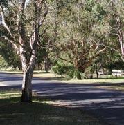
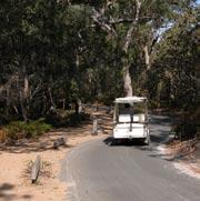
7 CHAPTER THREE Village Precincts Coastal Settlement Context The Wallarah Peninsula urban design outcome is governed by the principle that the development form should be defined by the natural landscape. In adopting this principle the development design establishes a framework that gives priority to the existing conditions on the land in both a regional and local context. The Flats, Swansea, looking towards Wangi At a regional level the design outcome recognises there is great diversity within the coastal zones and a natural succession of inter-connected landscapes. There is also recognition that the coastal landscape has an existing settlement character that has over time emerged in response to both the natural and economic conditions. Settlement along the NSW coastline reflects a pattern of small villages being established in response to natural and economic conditions and change over time. Swansea Bridge Circa 1900 Wallarah Peninsula 1


8 Concept Development Planning Figure 1.1 identifies a number of the small villages that are established in the coastal zone of Lake Macquarie. The sense of scale, urban form and the relationship of these villages with their landscape are characteristics that have provided guidance to the interpretation of the Wallarah Peninsula site. Another feature of the settlement character throughout the coastal environment of NSW is the established hierarchy that demonstrates a level of interdependence between the urban locations. The new community to be developed at Wallarah Peninsula is planned to become a sustainable component of both the natural and settlement hierarchies and share in those interdependent relationships. Nords Wharf Caves Beach Blacksmiths Lake Macquarie coastal villages Catherine Hill Bay & Middle Camp Gwandalan Summerland Figure 1.1 Coastal Settlements within the Lake Macquarie Region 2 Wallarah Peninsula
9 CHAPTER ONE Coastal Settlement Context 1.1 Regional Role The Wallarah Peninsula project is part of the Lake Macquarie City Council area. The region is steeped in the history of maritime trade, coal mining, fishing, timber and agriculture. Most recently, tourism and retirement have become primary economic drivers. Throughout their history, the people of the region have expressed an underpinning pride in who they are and the values they represent. This sense of pride and protection of specific values is a defining characteristic of small coastal settlements and is even more evident today than in the past. The regional infrastructure and amenities of Lake Macquarie are well established with defined areas of higher density development supported by a collection of smaller villages and suburbs. Each has a unique character, in most cases linked to a specific natural amenity. The diversity of the urban settlements is one of the region s great economic strengths. This strength comes from the attractiveness of each settlement in its natural setting, making Lake Macquarie one of the preeminent residential lifestyle communities in NSW. Wallarah Peninsula will build on the cohesive relationship that has already been established along the coastline and on the edges of the lake and waterways of the region. It will adopt an approach that recognizes the community equity already established by the existing settlements and build on that social and environmental equity through sustainable planning and design. This intent is reflected in the Concept Development Plan. The Concept Development Plan demonstrates a high level of regional connectivity through infrastructure, community facilities and environmental protection. This has been reflected in the following proposed outcomes: Redefining the urban concept to reflect and reinforce the natural relationship between the ocean and Lake Macquarie. This has been achieved through the Conservation Strategy linking retained biodiversity on both the coastal and lake shores along with connecting habitat corridors. Dedication of the Wallarah National Park to establish a permanent biodiversity catchment at the northern end of Wallarah Peninsula and promote the importance of the environmental linkage back to Munmorah State Reserve area. Establishing an infrastructure and servicing plan that consolidates the existing infrastructure and reinforces a link between the existing and new community. Protecting foreshore and headland areas from development by dedication of land to public access ensuring a regional link along the coast and around the lake. Reinforcing the scenic and tourist values of the region by retaining ridgelines and open space corridors linking to areas of interest. Facilitating $500 million of regional investment in the lower Lake Macquarie area over the next 10 years without usurping the character and amenity of the existing communities. Wallarah Peninsula 3

10 Concept Development Planning 1.2 Local Role The Wallarah Peninsula landscape is traversed by the Pacific Highway which has over time created a level of differentiation between the coastal and lake environments. Underlying this man made separation is the physical form of the land itself. The land has been described as having three distinct sectors. These sectors have a more intimate relationship with existing communities particular to their area (refer Figure 1.2). Figure 1.2 Aerial photograph of Wallarah Peninsula and Site Boundary 4 Wallarah Peninsula
11 CHAPTER ONE Coastal Settlement Context The Coastal Sector is defined by a pronounced topographic bowl at the base of ridges and headlands. The catchment spills towards Pinney Creek, a single defined creekline running down to the beach. The orientation of the land is to the south and the landscape draws all interest in that direction. There is a natural relationship in this area to the village of Catherine Hill Bay. The Lake Sector spills west and east off a central ridge of heavily wooded habitat. However, the drawing power of the landscape is the foreshore of the lake. Gentle sloping land with remnant forest and a broad frontage to western sunsets has created the opportunity for the primary development in this area to reflect the character and lifestyle of lake living. A second catchment is defined by Galgabba Creek that orients the senses to the northwest corridor linking directly to Swansea. In both catchments, the environmental and social linkages are pronounced. They have become the principle influences of the design footprint in the Lake Sector. The Northern Sector has a pronounced ridgeline that extends from elevated end points at the north and south of the sector. From an elevated position, the landscape swells up from the existing suburban settlement of Caves Beach. However, the panorama from the land is a reminder that the lakeshore communities of Swansea and Blacksmiths are also neighbours. This sector has been heavily impacted by previous mining and quarrying. The remnant bushland and elevated slopes provide both an opportunity to establish a distinctly separate settlement area yet retain a natural linkage to the surrounding environment. The significance of the role of the local relationships has been reflected in the following outcomes: Aboriginal heritage and existing European settlements have been recognised and become the spiritual, social and physical interpretive basis for tying a new development plan to the landscape. The visual amenity has been protected from both an internal and external perspective. The ecological network of biological diversity specific to the land including threatened species has been conserved in perpetuity. The conservation corridors extend into public land and private land to ensure full access and amenity. Clearly defined footprints for development have been created to promote diversity and protect local character. These have been determined by establishing landscape boundaries between areas of development within the site and between the new development area and existing settlement. Inter-connecting infrastructure, walkways, trails, habitats and corridors have ensured that a sustainable long term linkage can be implemented over the life of the development. Social infrastructure and contribution programs have been defined to ensure integration with existing facilities and shared outcomes are achieved. This includes a clear recognition that the existing local businesses, retail and commercial structures and community facilities are not replaced by unrelated or stand alone infrastructure. The Wallarah Peninsula project will develop character and qualities of its own reinforced by the market and the statutory legislation. The genesis of the character has been reproduced from the local influences in lifestyle, environmental protection and social commitment to nearby neighbours. Wallarah Peninsula 5
 is the outcome of the assessment of natural assets of the site against the suitability mapping of the land proposed for development.")
12 Concept Development Planning 1.3 Development Land Use Plan The Development Land Use Plan (refer Figure 1.3) is the outcome of the assessment of natural assets of the site against the suitability mapping of the land proposed for development. Each area of development within the 10(a) zone has been identified as having a defined development type and a designated level of suitability. All areas of suitability Level 3 and some areas of suitability Level 2 have additional special planning and design provisions that must be taken into account as part of the development application process. These provisions have been outlined in the relevant Management Plans. Figure1.3 Development Land Use Plan 6 Wallarah Peninsula

13 CHAPTER THREE Village Precincts Concept Development Planning 2.1 Concept Development Plan The illustrative Concept Development Plan is an indicative representation of an outcome that could be achieved by application of the information detailed in the Management Plans and the Development Land Use Plan (refer Figure 2.1). Figure2.1 Concept Development Plan Source: Civitas Wallarah Peninsula 7
14 Concept Development Planning Concept planning is a means by which the principles are tested in an integrated form in preparation for more detailed planning and implementation. The North Wallarah Peninsula Masterplan identifies the next level of detailed planning as being the preparation of Development Applications including Contextual Precinct Plans for individual stages. The Concept Development Plan is not the final development outcome for the site. It is an illustrative plan that shows where development can occur and the broad form of that development. It interprets and describes the various land uses, development types and densities, and primary circulation patterns for the overall development. These defining outcomes are reinforced by the Management Plans. At the time of development application over any part of the site, the developer may fine tune road and lot layouts, land uses and densities so long as there are no gross changes to the intent of the Masterplan documentation. 2.2 Urban Design Rationale The Wallarah Peninsula community will be a new coastal settlement. The urban form will be configured as a series of small villages ( dwelling units) within defined sectors or neighbourhoods (800-1,000 dwelling units). The urban design rationale reinforces a place-based approach to design that minimises impacts on the landscape and respects local settlement scale General Principles Integrated Community Integrate natural environment, housing, open space and infrastructure to achieve vibrant village neighbourhoods and integrated community. Plan compact housing clusters as solutions to preserving natural environments and significant vegetation (i.e. compact villages rather than subdivision sprawl). Survey and retain vegetation as a means of attaining habitat and linking villages. Limit the extent of the village centre, commercial uses and building sizes to ensure that the desired village character and form is achieved. Establish a hierarchy of natural amenities as marketable assets. Maximise pedestrian safety and access to encourage social interaction and reduce vehicle trips. Provide for a variety of housing types and products targeted to many markets. Allow for the Concept Development Plan to adapt and change over time to meet economic opportunities and demographic shift. Promote the concept of healthy community and shared responsibilities. Ensure that neighbourhoods are safe, accessible and adaptable by design. Provide desirable lifestyle amenities for living, working and recreational needs. Ensure the Concept Development Plan is conducive to aging in place by allowing changing product mix. Incorporate changing social infrastructure and uses to match and support target demographics. 8 Wallarah Peninsula
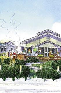
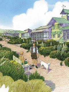
15 CHAPTER TWO Concept Planning Environment, Open Space and Recreation Promote patterns and forms of development that allow for retention of existing mature trees and vegetation. Respect existing topography, minimise regrading, integrate natural features and design open spaces to reflect the natural character and qualities of the landscape. Plan for linked park and open space networks that responds to recreation needs of the community and visitors. Maximise the multiple uses of trails and green corridors. Ensure significant environmental attributes of the site are protected or enhanced. Ensure that the land in forms development. Establish open space and landscape linkages to existing settlement. Integrate the established conservation outcomes. Incorporate the triple bottom line principles of economic, environmental and public benefit outcomes The Village and Sense of Place General Village Principles Provide clear definitions to identifiable village neighbourhoods within the community. Capitalise on the natural assets of location, landscape and topography to establish distinct points of difference in design form and outcome. Interconnected networks of streets should be provided to encourage walking, reduce the number and length of vehicle trips, and encourage social interaction amongst neighbours. Provide for a diversity of housing types within close proximity, as the environmental constraints allow, encouraging interaction between diverse social groups. Limit the need for vehicle trips by providing access to basic household needs within a short, safe and desirable walking distance. Provide a civic focus to each neighbourhood (park, civic building, viewing point area). Place most residents within a two-minute walk of a local park space. Form neighbourhoods where children are able to safely play in the streets or walk to the park and where there is a sense of social cohesion and awareness of local activity on streets. Residential buildings placed relatively close to the street to encourage social interaction. Encourage higher density forms in appropriate areas as a means by which residential areas can increase densities in a natural way over time. Ensure that community parks and gathering spaces define the village centre and each neighbourhood cluster. Provide a range of park types to be distributed within the overall development. Allow the village perimeters to spread by incorporating larger lot sizes, habitat protection buffers, bushfire and pedestrian trail systems and shared roadwork infrastructure. Village Centre Focus local village commercial development in a single village centre to achieve critical mass. Identify a key economic driver for each village to reinforce points of difference and character. Plan for pedestrian oriented village centres that are mixed-use. Wallarah Peninsula 9
16 Concept Development Planning Ensure that the form of the village centre achieves a character and atmosphere distinct from typical suburban form. Encourage village scale commercial development that accommodates mixed-use buildings integrating residential home-based business and village retail. Design to allow the village centre to develop and evolve over time by permitting diverse and changing mix of uses. All buildings should be of a scale and massing that reflect the context of coastal villages and hamlets. Retail buildings fronting onto the sidewalk to replicate coastal and lake village typology. Community Gathering Places Civic buildings and facilities should be afforded prominent places and positions to serve as icons, vistas and gathering places. Establish a village architecture and genre specific to each location that aids in defining the character of the community. Civic facilities should be accessible for shared users, as a means of achieving highest and best use of buildings. Community activities should be incorporated in neighbourhoods and not isolated in remote single-use complexes Community Infrastructure Organise streets in a safe and manageable network that reinforces the topography and organic form of the landscape. Diffuse traffic through a broad village network rather than concentrating on arterials. Utilise narrow roads with retained vegetation and verges where possible to provide for traffic calming and to preserve natural character. Interconnected networks of streets should be provided to encourage walking, reduce the number and length of vehicle trips, and encourage social interaction amongst neighbours. Keep block lengths short to encourage interconnectivity and provide a variety of pedestrian/ traffic routes. Provide for traffic calming devices such as staggered intersections and retained landscape. Use traffic calming design to encourage the mixing of cars and people, increasing the eyes on the street and to increase the convenience and use of neighbourhoods. Design for variation in road verges, set backs and footpaths to support soft stormwater outcomes, shared use pedestrian access and permeable surface off street parking for both residents and visitors. Encourage all streets within the neighbourhoods to be faced with building fronts or public spaces rather than serving as collector roads. Encourage the limitation of front yard driveways in residential areas, especially in narrower lot areas. Use lanes where appropriate to keep street fronts unbroken (reduce the impact of driveways and garage fronts dominating the streetscape). Fewer driveways allow for more onstreet parking. Encourage private parking in the rear of residential lots where possible. 10 Wallarah Peninsula
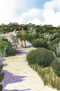
17 CHAPTER TWO Concept Planning Utilise bike and pedestrian routes as a means of improving integrated village networks, bushfire protection and environmental awareness. Place designated public parking lots at the rear of buildings or in parking lots at the edge of the village centre. Facilitate on-street parking wherever possible in the village centre Environment, Open Space and Recreation Protection of watercourses and their riparian zones. The number of crossings of watercourses should be minimised to reduce impacts and prevent intrusion into the habitat area. Protect foreshore erosion with setbacks from lake and ocean. Water quality and conservation of habitats used as part of design outcome. Natural open spaces should, wherever possible, be connected and/or continuous. Provide for easy public access to natural areas through walking trails, pedestrian bridges, designated viewing points and areas of interest. Maximise the amount of permeable surface throughout. Promote passive open space outcomes. Design active open space areas to be incorporated in central location. Provide equitable park area for all neighbourhoods. Promote park sites as the centre for the neighbourhoods. Open space and community amenities share uses. Support commercial relationships between business, the community and the designated community areas. 2.3 Site Analysis Methodology The design of the plans of subdivision and lotting plans for the project will be governed by the natural conditions of each precinct and the Considerations and Strategies for each of the Management Plans. This will reinforce the place based site specific outcomes that are encapsulated in the Vision and Cornerstones for the project. The Methodology of how this will be undertaken is outlined in the following section. Wallarah Peninsula 11
18 Concept Development Planning The following sequence demonstrates the validation of the methodology for place based, site specific design outcomes (refer Figures 2.2(a) to 2.2(g)). Figure 2.2 a) Site Analysis: Detailed assessment of the nominated areas of a precinct to examine the naturally occurring opportunities and constraints, existing roads and infrastructure, topography, catchments, and Contextual Precinct Plan requirements. b) Identify Ecological Outcomes: Assess and protect where necessary keystone species, habitats and cultural elements. c) Overlay Tree Survey and Mapping: Provide a site specific assessment (e.g. detailed tree survey) nominating key species, canopy corridors and connecting ecotones. 12 Wallarah Peninsula
19 CHAPTER TWO Concept Planning d) Define Building Footprints: Individual footprints for house lots will be defined by the natural amenities specific to that lot, ensuring a reciprocal relationship with the neighbouring lots. e) Nominated Access: The vehicle and pedestrian access to lots and subdivision becomes an outcome of the siting and design, not the defining element in determining where development occurs. f) Document Title and Easement Structure: The land ownership, title and management systems are incorporated to ensure implementation meets the Management Plan requirements. Wallarah Peninsula 13


20 Concept Development Planning g) Built form will respond to: VERTICAL AXIS - Landscape The height of Dwellings have been kept below the tree canopy level in order to minimise the visual impact of the built form. The designs have been developed and sited to minimise disturbance of native trees and primary root systems HORIZONTAL AXIS - Land Form Dwellings have been raised above ground level to encourage natural ventilation and ecological conservation. The natural features of the site have been retained and utilised in the design for access and balcony positioning. DIAGONAL AXIS - Sustainability Open deck spaces and living areas have been designed and articulated to take advantage of northern orientation and maximise the passive solar gains. Views where available have also been considered in the design and orientation of the living areas. Concept Design Outcomes 14 Wallarah Peninsula
.")
21 CHAPTER THREE Village Precincts Village Precincts 3.1 The Precincts The Wallarah Peninsula has been divided into three sectors and eight precincts which are illustrated on the Wallarah Peninsula Sector and Precinct Map (refer Figure 3.1). The sectors are: Lake Sector: Northern Sector; and Coastal Sector. Each sector is distinguished by a particular combination of characteristics that are summarised in Section 3.2 of this document and are defined below. Figure 3.1 Wallarah Peninsula Sector and Precinct Map Wallarah Peninsula 15


22 Concept Development Planning The Lake Sector The Lake Sector contains a number of areas suitable for a range of development types. These include areas that have been grossly disturbed by clay and gravel extraction as well as areas in which the ecological values have been severely impacted by clearing of vegetation, grazing and invasion of weeds. Precincts within the Lake Sector that have been identified as being suitable for development include: Point Morisset; Lakeshore and Slopes; Lakeside Ridge and Swansea Valley. 16 Wallarah Peninsula


23 CHAPTER THREE Village Precincts The Northern Sector The Northern Sector contains extensive areas suitable for a range of development types. These include areas that have been grossly disturbed by open cut mining and quarrying as well as areas in which the ecological values have been severely impacted by clearing of vegetation, regular burning and invasion of weeds. The Northern Sector is treated as a single precinct for purposes of identifying areas suitable for various development. It is called the: Northern Precinct. Wallarah Peninsula 17


24 Concept Development Planning The Coastal Sector Within the Coastal Sector, the landscape character is dominated by the high scenic quality of this coastal area and the ecological values contained within a significant proportion of the sector. Areas suitable for development are therefore restricted to those that have been grossly disturbed by quarrying and previous development activities. These precincts include: Spoon Rocks Valley; Radar Hill; and Coastal Village. 18 Wallarah Peninsula
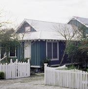
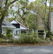
25 CHAPTER THREE Village Precincts 3.2 Precinct Character The Character Statements included in this reference document serve to demonstrate potential outcomes of the Development Land Use Plan and provide illustrative examples of how the proposed outcomes might be met, subject to final detailed planning and design. They reflect a significant amount of community consultation, stakeholder negotiation and strategic contextual research in the field with local and state agencies Why Character is Important Character is one of the principles that define a settlement type. It is also used to help to define the reasons why there are direct and underlying links between the natural and urban and elements. The character of a place is the essence of the reason these links occur. The existing character of a place verifies the current pattern of development and its surroundings. In many cases this may be deemed to be inappropriate, ill defined or not reflecting the importance of these links. By defining a desired character or intent, the existing qualities can be enhanced or protected. The character of a settlement area is often reinforced by the philosophies of the communities within that settlement area. While the natural elements of an area will remain the same, the existing and new communities may change the urban character of a place over time in response to the change in community expectations. The Character Statements contained in this reference document reflect the requirements already defined in the CLUMP and reinforce the directions that will need to be considered in the preparation of the Contextual Precinct Plans at the time Development Applications are submitted for any precinct within the North Wallarah Peninsula LEP. The Character Statements for each precinct are underpinned by these basis strategic goals: i) To protect and enhance the overall natural amenities of the land; ii) To improve the standards of planning and design in order to protect and enhance the specific precinct amenities; iii) To provide appropriate levels of community infrastructure designed to complement the local natural amenities; iv) To assist in producing settlement that is locally unique or distinctive; and v) To provide a place based outcome to the final settlement form. Wallarah Peninsula 19

26 Concept Development Planning Point Morisset CLUMP Requirements The precinct guidelines of how development should occur in this area are defined in Section of the CLUMP. The Objective as defined is: To allow site sensitive development that takes account of the archaeological and scenic resource values on this visually prominent lake foreshore site. Axonometric composition of portion of Lake Sector. Subject to future development application process. Intent The foreshore topography will remain intact protected by the foreshore public reserve and conservation area. A Plan of Management for this area will be prepared by LMCC in joint consultation with the community and Lensworth Wallarah Peninsula Pty Ltd. At the northern boundary of the Point Morisset Precinct and extending into the adjacent Murreys Beach area there is the opportunity for a low intensity village centre, including limited retail adjacent to the reserve and destination tourist amenities. The village centre will serve the local community as well as local and holidaying visitors. Co-ordinated improvements along the street frontages and foreshore reserve will maximise recreational opportunities and pedestrian safety. Future development will enhance the scenic quality of the area as well as protecting the amenity of the surrounding Angophora, Grey gums and Ironbark forest. Vehicle and pedestrian traffic will have high accessibility to the foreshore reserve. These principles are enunciated in the Built Form Management Plan and supported by the other Management Plans for the Masterplan. The village centre will have a defined footprint to allow for sustainable economic outcomes and reasonable flexibility over time to accommodate changing community needs and uses. The type of 20 Wallarah Peninsula


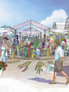
27 CHAPTER THREE Village Precincts activities, height, silhouette and orientation of any future development will preserve privacy, sunlight and visual amenity to enhance the lifestyle of neighbouring dwellings and their private open space. Building facades visible from public frontages should reflect patterns that are typical of traditional coastal villages, including the appearance of small scale individually designed retail buildings situated on narrow fronted allotments, continuous shopfronts located below awnings or upper storeys that are enclosed by balconies. Colour schemes of residential and commercial buildings should identify and promote a unique character for the location and distinct modest scale village overall footprint. Existing bushland and public open space will be reinforced by new indigenous planting and restoration to create a fully integrated canopy. Park structures, furniture and equipment will reflect a co-ordinated village theme that reflects the recreation and water based lifestyle of living adjacent to Lake Macquarie. Illustrative axonometric and artist s impressions of indicative outcomes subject to future development application process. Source: Civitas Wallarah Peninsula 21


28 Concept Development Planning Concept Plan of Lakeshore Village. Subject to future development application process. Source: Civitas 22 Wallarah Peninsula


29 CHAPTER THREE Village Precincts Wallarah Peninsula 23

30 Concept Development Planning 24 Wallarah Peninsula


31 CHAPTER THREE Village Precincts Wallarah Peninsula 25

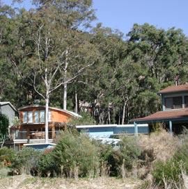
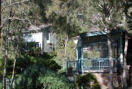
32 Concept Development Planning Lakeshore and Slopes CLUMP requirements The precinct guidelines of how this area should be developed are defined in Section of the CLUMP. The Objective, as defined is: To allow site sensitive residential development that responds to the ecological values of the site by maintaining wildlife habitat corridor connections between the proposed Conservation Reserve, the Red Gum Forest Reserve and the wildlife habitat on adjoining properties located to the north of the site. Axonometric composition of portion of Lake Sector. Subject to future development application process. 26 Wallarah Peninsula
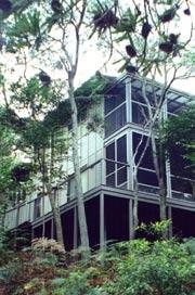
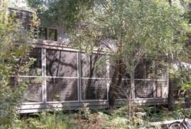
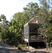
33 CHAPTER THREE Village Precincts Intent The northern end of this precinct interfaces with the 7(e) habitat corridor, a classified river and riparian zone and the keystone winter feeding habitat area of Swamp mahogany. These environmentally sensitive areas are protected by the guidelines provided in the Ecological Site Management Plan and other supporting Management Plans submitted as part of the Masterplan. They will also be determining criteria for the preparation of the Plan of Management for the 6(c) area of the foreshore reserve. All of these criteria will be considered when the Contextual Precinct Plan and the first Development Application is prepared for this precinct. The Lakeshore and Slopes will be designed as a mixed density wooded residential precinct. It will reflect a sense of affinity between the bush and the lake that occurs as the natural landscape condition. The scale and design of future buildings will protect the scenic qualities of the wooded foreshore visible from Nine Acres, Pulbah Island and other existing residential areas at the southern end of Lake Macquarie. Houses will be surrounded by retained foreshore forests and Angophora, Grey Gums, Spotted Gums and Ironbark. A canopy of woodlands will provide a natural backdrop to the shoreline and foreshore public reserve. Future siting of buildings and development infrastructure will minimise disturbance to natural slopes and existing bushland, in particular, the visually prominent 7(e) habitat corridor. Areas of undisturbed understorey will form sustainable corridors of bushland linking riparian areas. New building will be nestled below the woodland canopy, following the natural hillside profile. There will be an irregular siting of a mix of housing forms facing the Lake. Homes in this area will be designed to conserve surveyed and mapped trees, providing filtered water views from neighbouring residential areas. A range of articulated houses and setbacks will provide variety in height to homes with roofs that are designed to minimise the apparent scale of new buildings and respect views from neighbouring lots. There will be no slab on grade housing on natural slopes greater than 10%. Visible facades will generally exhibit a light weight appearance with raised floors screened by shaded balconies and verandas. Street frontages will not be dominated by wide garages and will encourage integration between pedestrian and public areas. Gardens will contain a selection of native species. Wide driveways will be restricted and screened by new native planting. Fences should be low or transparent in order to maintain filtered views and connectivity. Local streets will be informal and of a pedestrian character with unformed edges flanked by wide verges with retained vegetation. The scenic qualities established by existing trees will be preserved, particularly tall canopies along the wider verges. Wallarah Peninsula 27
34 Concept Development Planning As the development moves up the moderate footslopes, the overall density of development should decrease to reflect the Development Type 3 suitability defined in the Development Land Use Plan. The scale, design, and construction of development will protect the scenic quality of houses surrounded by a continuous canopy of woodland. This will aid in ensuring a sensitive environmental relationship between the 7(e) habitat corridor and defined riparian areas. Future development will avoid disturbance to natural slopes and the riparian creek lines particularly corridors of trees and understorey along the creek buffer areas. There will be no slab on grade development on slopes greater than 10%. Light weight construction with suspended floors and decks is most appropriate in these wooded areas. The guidelines of the Bushfire Management Plan will be a principal consideration in this area. New buildings should be nestled below the canopy, surrounded by an Asset Protection Zone, that conserves, where possible, existing vegetation. Forest roads should retain an informal quality with unformed edges and wide verges. The parkland areas established by retaining existing trees, internal to the precinct, will be a prime characteristic of this area. Safe and secure pedestrian access through the bushland and open space will be provided with minimal impact. 28 Wallarah Peninsula


35 CHAPTER THREE Village Precincts Illustrative axonometric and artist s impressions of indicative outcomes subject to future development application process. Source: Civitas Wallarah Peninsula 29
36 Concept Development Planning 30 Wallarah Peninsula


37 CHAPTER THREE Village Precincts Wallarah Peninsula 31

38 Concept Development Planning Lakeside Ridge CLUMP requirements The precinct guidelines of how this area should be developed are defined in Section of the CLUMP. The Objective, as defined is: To allow site sensitive residential development that responds to the ecological values and visual aspects of the site providing for road access across the Precinct connecting the Swansea Valley and Lakeshore and Slopes Precincts. Axonometric composition of portion of Lake Sector. Subject to future development application process. Intent This precinct will be established as a low density wooded residential area. A variety of residential neighbourhoods will be created on gentle to moderate footslopes surrounded by steep wooded residential hillsides and private open space. A continuous canopy will be retained to contribute to this scenically distinctive setting that provides a backdrop to the Pacific Highway and overlooks enclosed valley areas and the lake. Subdivision of Development Type 2 lots with irregular frontages will face the village drive and contour trails with narrow pavements and wide verges of retained trees. The scale and design of buildings should protect the scenic qualities of the hillside, in particular areas that are visible from the Pacific Highway. There will be no cut and fill, other than for access, on slopes greater than 32 Wallarah Peninsula


39 CHAPTER THREE Village Precincts 10%. New buildings will be established below the tree canopy and reflect an irregular siting of dwellings incorporating a stepped form that follows the natural hillside profile. Retained bushland and landscaping will restore disturbed hillside clearings and avoid the appearance of continuous development. Buildings should appear similar in height to their neighbours and contain rooflines that are designed to minimise their scale within the landscape. Street frontages should not be dominated by wide garages, driveways or fences. Bush gardens should retain a natural profile. Retaining walls for driveways will be restricted. Contour trails will retain an informal quality with unformed edges and wide verges. Illustrative axonometric and artist s impressions of indicative outcomes subject to future development application process. Source: Civitas Wallarah Peninsula 33

40 Concept Development Planning 34 Wallarah Peninsula


41 CHAPTER THREE Village Precincts Wallarah Peninsula 35

42 Concept Development Planning Swansea Valley CLUMP requirements The precinct guidelines of how this area should be developed are defined in Section of the CLUMP. The Objective, as defined is: To allow residential development that is directly accessible from Swansea within a visually confined area while maintaining the integrity of the wildlife habitat values of the tree canopy on the steep side slopes along the western edge of the Precinct. Axonometric composition of portion of Lake Sector. Subject to future development application process. Intent The topography of this precinct establishes a self-contained valley of gentle slopes and original vegetation drawing to a single catchment of a long narrow creek that contribute to a scenically distinctive wooded setting. This precinct is suitable for a mixture of regular subdivisions of single allotments and attached housing facing contour trails flanked by wide verges and front gardens of retained indigenous plants. The street patterns should retain an informal quality. A distinctive parkland atmosphere may be created within a landscape of scattered wetland ponds along the creekline. Dwellings will vary from traditional suburban bungalows that are of a modest scale, single storey timber framed buildings, to contemporary medium to large houses of one or two storeys. There may also be clusters of attached low-scale development. Garages should be incorporated into each dwelling or located as free-standing structures at the side or rear of the dwelling. 36 Wallarah Peninsula


43 CHAPTER THREE Village Precincts Front gardens will be predominantly open areas of native vegetation with planted native species that spill across the street verges. Along the creekline, wetland ponds will frame partly screened buildings on either side of the creek. Private lots may extend to newly created ponds and retention areas. Public and private open space will be used to create a series of interconnecting paths and bikeways linking this precinct to the lake and to Swansea. The scale, design and construction of buildings should enhance the scenic potential of the wetlands, ponds and creekline. This will promote houses dominated by natural gardens and retained understorey to frame or screen each building as well as protecting the water quality of the creek and ponds. Buildings should avoid disturbance to the natural slopes and creek interface areas. Light weight construction with suspended floors and decks is most appropriate. Bush gardens should retain a natural profile. Retaining walls or terraces will be restricted for access only and will be screened by native planting. Any infestation of environmental weed will be removed. Illustrative axonometric and artist s impressions of indicative outcomes subject to future development application process. Source: Civitas Wallarah Peninsula 37


44 Concept Development Planning 38 Wallarah Peninsula


45 CHAPTER THREE Village Precincts Wallarah Peninsula 39

46 Concept Development Planning Northern Precinct CLUMP requirements The precinct guidelines of how this area should be developed are defined in Section of the CLUMP. The Objective, as defined is: To allow development on the portion of the site that has been extensively disturbed by open cut mining and quarrying operations while protecting scenic resource values and avoiding environmental impacts on adjoining areas. Axonometric composition of portion of Northern Sector. Subject to future development application process. Intent The Northern Precinct is dominated by a single spine ridge that dissects the land. To the east the footslopes retain significant intact vegetation that forms a natural backdrop to the Caves Beach suburban development on the coastal plain. The scenic distinctiveness of the ridgeline and hillside will be preserved and remain intact other than where previous disturbance has occurred. The east slopes will create a continuous scenic frontage running along the face of the peninsula and establish a natural separation between the hilltop and beach front character of settlement. The retained vegetation will protect view lines upslope of the existing development and downslope from a new urban village to be established on the plateau. The future development will be concentrated in the disturbed quarry floor and mid-slopes. The scale of development will ensure the top of the quarry face is not broken. There is the opportunity to create higher density forms in areas of previous disturbance. The unique nature of the elevated site with panoramic views provides the opportunity for a more urbanized village with diverse amenities in an natural vegetated setting. 40 Wallarah Peninsula


47 CHAPTER THREE Village Precincts Residential development which will be established on a remediated plateau along the spine of the ridge, should capitalise on the panorama of filtered views through retained vegetation to either side of the ridge. On steeper slopes with remnant bushland, framed construction with suspended floors will preserve the scenic quality. Bushfire management will be a key component of the design outcome in these areas. Mid-slope development areas of the western edge of the ridge should range from typical residential lots to larger lots of Development Type 2 development on the higher slopes. Scenic buffers can be achieved by capitalising on the dissected topography and undisturbed hilltops. Open space corridors can be created along the riparian creeklines leading into the Galgabba Creek catchment. Illustrative axonometric and artist s impressions of indicative outcomes subject to future development application process. Source: Civitas Wallarah Peninsula 41
48 Concept Development Planning 42 Wallarah Peninsula


49 CHAPTER THREE Village Precincts Wallarah Peninsula 43

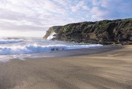
50 Concept Development Planning Spoon Rocks Valley Precinct CLUMP requirements The precinct guidelines of how this area should be developed are defined in Section of the CLUMP. The Objective, as defined is: To allow site sensitive development that results in rehabilitation of the areas that have been grossly disturbed, particularly by quarrying, while minimising potential visual impacts on the coastal environment. Axonometric composition of portion of Coastal Sector. Subject to future development application process. Intent This precinct will be a low density residential special use area with specific Management Plan requirements to be reinforced during the contextual precinct planning. The new development will establish a clear distinction from the existing development on Caves Beach headland. The scale and design of new buildings will enhance the remediation of the previously disturbed quarry and open cut areas and complement the scenic potential of the valley that is only visible from the Coastal Walk. The built form outcome will complement the need for public access through this area to the adjacent quarries head and 7(c) public open space public reserve as well as Spoon Rocks Beach and rock breakwall. Buildings will be nestled within remnant vegetation framed by a backdrop of indigenous trees running along the drainage gully and eastern slopes. Clusters of small footprint cottages will avoid disturbance to the natural hillside, enhance the prominent rock and geological features and protect any existing canopy trees within the valley or on the south facing headland. 44 Wallarah Peninsula


51 CHAPTER THREE Village Precincts New buildings on the western edge of the precinct will be set against a backdrop of ridgetop canopy trees and will follow the natural hillside profile. Buildings should be placed in an organic form to avoid a continuous line of buildings across the topography. The height of buildings will complement the consistent height of remnant vegetation that has evolved because of the prevailing east and southeast salt winds. Cottages will include roof designs to minimise the scale of the buildings. Buildings visible from the Coastal Walk and public lands will be constructed as light-weight aboveground structures. Exposed walls or reflective surfaces will be screened by balconies, verandas and pergolas. There will be no slab on grade construction. There will be no fences or double garages to street frontages. Hillside revegetation will retain the natural profile incorporating native species. Adjacent to the east ridge, canopy replanting of existing species and understorey ecotones will encourage a revitalisation of the coastal forest habitat to encourage a link across the ridge to the Wallarah National Park. Illustrative axonometric and artist s impressions of indicative outcomes subject to future development application process. Source: Civitas Wallarah Peninsula 45
52 Concept Development Planning 46 Wallarah Peninsula


53 CHAPTER THREE Village Precincts Spoon Rocks Concept - Simulations to Scale Before After Source: Civitas Wallarah Peninsula 47

54 Concept Development Planning Radar Hill Precinct CLUMP requirements The precinct guidelines of how this area should be developed are defined in Section of the CLUMP. The Objective, as defined is: To allow site sensitive development that results in rehabilitation of this grossly disturbed site while avoiding environmental impacts on the surrounding proposed Conservation Reserve. Axonometric composition of portion of Coastal Sector. Subject to future development application process. Intent This area of unremediated open cut quarry overlooks the Wallarah National Park and Pacific Ocean. It is an elevated detached portion of land surrounded by retained coastal bushland habitat. Steep slopes lead down to the foreshore of Pinney Beach, Pinney Headland, and the tidal rock platforms. A ridgetop canopy of trees creates the backdrop for an enclosed area of future development. This precinct will have a single access road leading from the Northern Sector. Emergency access will also be provided to the Pacific Highway and Old Mine Camp Road. The development form and its location will create its own unique urban character driven by its elevated northeast orientation and the opportunity to capture panoramic views across to the Wallarah National Park and along the northern coastline. Higher density forms of attached apartments built within the quarry floor and reaching the remnant canopy will create the critical mass for the heart of the precinct. Opportunities exist for lower density forms of townhouses, terraces, and single family lots at the edge of the precinct. 48 Wallarah Peninsula


55 CHAPTER THREE Village Precincts The scale, design and construction of buildings will protect the scenic qualities of the ridgetop and slopes which can be seen from the Coastal Village and Coastal Walk. Future development will avoid any disturbance to the buffer areas of the Wallarah National Park. On those portions of the precinct that are steep, there will be no slab on grade development on natural slopes greater than 10%. The final built form should present a varied and articulated facade to enhance the visual amenity and avoid the appearance of a single wall of construction. The facade should incorporate shaded balconies, decks and pergolas. Hillside gardens may be necessary to enhance remaining outcrops and will be planted with species native to the area. Retaining walls, terraces and areas of hardscape will be restricted to assist the water sensitive urban design outcome. It is intended that the Radar Hill Precinct become an additional component to the sustainable outcome of the Coastal Sector by complementing the village scale development in the Coastal Village and Spoon Rocks Valley. Shared use facilities, destination uses, strata title development, and tourist uses will encourage an outcome where the residents of Radar Hill participate in the community activities and social infrastructure of the overall development. Illustrative axonometric and artist s impressions of indicative outcomes subject to future development application process. Source: Civitas Wallarah Peninsula 49


56 Concept Development Planning 50 Wallarah Peninsula


57 CHAPTER THREE Village Precincts Wallarah Peninsula 51

58 Concept Development Planning Coastal Village Precinct CLUMP requirements The precinct guidelines of how this area should be developed are defined in Section of the CLUMP. The Objective, as defined is: To allow site sensitive development on a degraded portion of the site that takes advantage of the special site features while minimising potential environmental impacts within the coastal zone. Axonometric composition of portion of Coastal Sector. Subject to future development application process. Intent The Coastal Village will capture the essence of living in a seaside landscape. A mix of high and low density residential areas will infill the disturbed areas of the naturally occurring topographic bowl. The gentle slopes extending from the bowl to the crest of the exposed east ridge will form a prominent backdrop to Pinney Beach and the surrounding Wallarah National Park. The village will be planned and designed to reflect a distinct coastal settlement character encapsulated in defined architectural guidelines and built form controls as required by the CLUMP, Management Plans and Coastal Design Guidelines. The southeast facing orientation will align an irregular pattern of mixed frontage lots. Seaside cottages will be mixed with a scattering of multi unit and attached housing with a mixed use village centre. Less dense larger lots will be created at the fringe of the development area. Lots will address streets of narrow paved surfaces with wide vegetated verges covered with coastal grasses and heath. The principle outlook will be across the coastal heath reserve that slopes 52 Wallarah Peninsula

59 CHAPTER THREE Village Precincts up from Pinney Beach and its exposed rugged shoreline. The revegetated reserve and public foreshore will create a natural link of ground covers and low growing native coastal vegetation from the foreshore areas into the Coastal Village. Living in the Coastal Village will be an experience of shared environmental outcomes. Homes will be oriented towards the ocean and panoramic bushland views. Buildings will have a variety of setbacks to create the appearance of an undulated frontage in response to the organic coastal landscape. Within the village core, generally small open areas of retained landscape will reinforce a theme of retained heath and scrubland that will become natural boundaries to development and residential lots. There will be no slab on grade housing and no boundary fencing. Along the street frontage building setbacks and a stepped built form will provide a variety of natural garden and retained vegetation areas maintaining a typical informal atmosphere of coastal cottages in the landscape. Garages and carports will be integrated discreetly within the building facades or rear lanes. A village centre at the heart of the development will provide the opportunity for higher density forms including local retail, destination and tourist amenities. The village footprint will be intimately integrated with the landscape of the coastal setting and become a key component of the sustainable development outcome that incorporates the Wallarah National Park, Spoon Rocks and Radar Hill precincts. Illustrative axonometric of indicative outcomes subject to future development application process. Source: Civitas Wallarah Peninsula 53

60 Concept Development Planning 54 Wallarah Peninsula


61 CHAPTER THREE Village Precincts Wallarah Peninsula 55


62 Concept Development Planning 56 Wallarah Peninsula


63 CHAPTER THREE Village Precincts Wallarah Peninsula 57
64 Concept Development Planning 58 Wallarah Peninsula


65 CHAPTER THREE Village Precincts Wallarah Peninsula 59


66 Concept Development Planning Coastal Village Concept - Simulations to Scale Source: Civitas 60 Wallarah Peninsula
Lake Macquarie Development Control Plan
 PUBLIC EXHIBITION DOCUMENTS Lake Macquarie Development Control Plan Draft Area Plan North Wallarah Peninsula Exhibition Dates: Monday 19 August 2013 Monday 16 September 2013 EXHIBITION DOCUMENTS Lake Macquarie
4.3 Dudley Area Plan. Introduction. History and Existing Character. Desired Future Character for Dudley
 4.3 Dudley Area Plan Introduction The suburb of Dudley has developed as a result of various circumstances including its topography, history and mineral resources. Dudley development has been identified
I539. Smales 2 Precinct
 I539. Smales 2 Precinct I539.1. Precinct Description The Smales 2 Precinct applies to a 4.8 hectare block of land located on the southern side of Northcote Road and fronting Lake Pupuke, Takapuna. The
I615. Westgate Precinct
 I615. Westgate Precinct I615.1. Precinct Description The Westgate Precinct is located approximately 18km west of the Auckland city centre. There are seven Sub-precincts in the Westgate Precinct: Sub-precinct
GREENBANK DEVELOPMENT MASTERPLAN
 DEVELOPMENT MASTERPLAN POTENTIAL TRAIN STATION COMMUNITY CENTRE Greenbank will be a connected masterplanned community providing easy access to local and surrounding amenity. Affordable quality homes, green
Extract from Whitehorse Planning Scheme - LOCAL PLANNING POLICIES - CLAUSE Preferred Character Statements
 Extract from Whitehorse Planning Scheme - LOCAL PLANNING POLICIES - CLAUSE 22.03 22.03-5 Preferred Character Statements Bush Environment The streetscapes will be dominated by vegetation with subservient
H7 Open Space zones. (a) provide for the needs of the wider community as well as the needs of the community in which they are located;
 provide for the needs of the wider community as well as the needs of the community in which they are located;") H7. Open Space zones H7.1. Background The majority of land zoned as open space is vested in the Council or is owned by the Crown. However some areas zoned open space are privately owned. While the open
H7. Open Space zones H7.1. Background The majority of land zoned as open space is vested in the Council or is owned by the Crown. However some areas zoned open space are privately owned. While the open
Part 4.25 Pasminco Area Plan
 1 INTRODUCTION The purpose of this Area Plan is to guide the redevelopment of the former Pasminco Cockle Creek Smelter site and the former Incitec Pivot Fertilizer site. The Pasminco and Incitec sites
I403 Beachlands 1 Precinct
 I403. Beachlands 1 I403.1. Precinct Description Beachlands is a rural and coastal village located on the eastern side of Auckland, adjoining the Tamaki Strait coastline. The original Beachlands village
Part 9 Specific Land Uses - Housing on Small and Narrow Lots
 19 HOUSING ON SMALL AND NARROW LOTS This section of the DCP applies where development for the purpose of a dwelling house, attached dwellings, or semi-detached dwellings is or are proposed in the R2 Low
Development Control Plan
 Development Control Plan Liberty Grove Development Control Plan Date of Adoption: 4 September 2007 Effective Date: 7 March 2008 Index 1 INTRODUCTION... 3 1.1 NAME OF PLAN... 3 1.2 AREA TO WHICH THIS PLAN
Chapter 2: OUTLINE PLANNING APPLICATION PROPOSALS. A New Garden Neighbourhood Matford Barton 17
 Chapter 2: OUTLINE PLANNING APPLICATION PROPOSALS A New Garden Neighbourhood Matford Barton 17 2.1. SUMMARY AND STATUS OF THE PROPOSALS 2.1.1. The parameter plans and associated wording in this chapter
Tāhuhu whakaruruhau ā-taone The sheltering ridge pole
 B2. Tāhuhu whakaruruhau ā-taone - Urban growth and form B2.1. Issues Tāhuhu whakaruruhau ā-taone The sheltering ridge pole Auckland s growing population increases demand for housing, employment, business,
UNIVERSITY TOWN NEIGHBOURHOODS 5.2 ECO-CORRIDOR MELBOURNE CAMPUS MASTER PLAN 2014
 5.2 ECO-CORRIDOR 37 ECO-CORRIDOR EXISTING CONDITIONS & VISION NEIGHBOURHOOD VISION Investment in the Eco-corridor Neighbourhood will signify the University s commitment to supporting local ecology and
Draft Part 11 Heritage Area Plans West Wallsend / Holmesville
 TABLE OF CONTENTS: PART 1 WEST WALLSEND / HOLMESVILLE HERITAGE AREA PLAN... 3 1.1 INTRODUCTION... 3 1.2 BACKGROUND... 3 1.3 LAND TO WHICH THIS PLAN APPLIES... 3 PART 2 WEST WALLSEND / HOLMESVILLE HERITAGE
Section Three, Appendix 16C Medium Density Housing, Design Assessment Criteria (Residential 8A zone)
") APPENDIX 16C MEDIUM DENSITY HOUSING, DESIGN ASSESSMENT CRITERIA (RESIDENTIAL 8A ZONE) PURPOSE OF APPENDIX 16C (RESIDENTIAL 8A ZONE) In the Residential 8A Zone the following are defined as restricted discretionary
APPENDIX 16C MEDIUM DENSITY HOUSING, DESIGN ASSESSMENT CRITERIA (RESIDENTIAL 8A ZONE) PURPOSE OF APPENDIX 16C (RESIDENTIAL 8A ZONE) In the Residential 8A Zone the following are defined as restricted discretionary
Urban Design Brief to 1557 Gordon Street & 34 Lowes Road West
 Urban Design Brief 1533 to 1557 Gordon Street & 34 Lowes Road West Reid s Heritage Homes Ltd. & 883928 Ontario Ltd. and RHH Property Management Ltd. City of Guelph Zoning By-law Amendment November 2017
Complete Neighbourhood Guidelines Review Tool
 Complete Neighbourhood Guidelines Review Tool Prepared By: City of Regina Planning Department October 2014 Page 1 of 14 Community Development Review Checklist for Secondary Plans and Concept Plans The
FORMER CANADIAN FORCES BASE (CFB) ROCKCLIFFE SECONDARY PLAN. Official Plan Amendment XX to the Official Plan for the City of Ottawa
 ROCKCLIFFE SECONDARY PLAN. Official Plan Amendment XX to the Official Plan for the City of Ottawa") FORMER CANADIAN FORCES BASE (CFB) ROCKCLIFFE SECONDARY PLAN Official Plan Amendment XX to the Official Plan for the City of Ottawa 1 INDEX THE STATEMENT OF COMPONENTS PART A THE PREAMBLE PAGE Purpose...
FORMER CANADIAN FORCES BASE (CFB) ROCKCLIFFE SECONDARY PLAN Official Plan Amendment XX to the Official Plan for the City of Ottawa 1 INDEX THE STATEMENT OF COMPONENTS PART A THE PREAMBLE PAGE Purpose...
Section Three, Appendix 17C Multiple Unit Housing Design Assessment Criteria
 APPENDIX 17C MULTIPLE UNIT HOUSING DESIGN ASSESSMENT CRITERIA Purpose of Appendix 17C In the Residential 9 Zone the construction and use of multiple household units located within the Multiple Household
Water Sensitive Urban Design Site Development Guidelines and Practice Notes. Appendix
 Water Sensitive Urban Design Site Development Guidelines and Practice Notes Appendix 108 Appendix A Water sensitive developments involve simple design and management practices that take natural site features
The Proposed Auckland Unitary Plan (notified 30 September 2013)
") 3 Business zones Introduction There are 10 business zones in the Unitary Plan: City Centre Metropolitan Centre Town Centre Local Centre Neighbourhood Centre Mixed Use General Business Business Park Light
3 Business zones Introduction There are 10 business zones in the Unitary Plan: City Centre Metropolitan Centre Town Centre Local Centre Neighbourhood Centre Mixed Use General Business Business Park Light
Ensure that development within the Arrowtown Urban Growth Boundary provides:
 URBAN DEVELOPMENT 4 4.2.5.2 Ensure that development within the Arrowtown Urban Growth Boundary provides: an urban form that is sympathetic to the character of Arrowtown, including its scale, density, layout
LANDSCAPE GUIDELINES. Countryside & Coastal Countryside Environments. Landscape, Natural Character & Amenity Values Guide
 Landscape, Natural Character & Amenity Values Guide Copyright WDC 2009 Version A2 18May09 Environmental Services Group Publication Countryside & Coastal Countryside Environments START HERE Quality Land
CONTENTS 8.0 LAND USE 8.1 GENERAL LAND USE 8.2 RESIDENTIAL 8.3 MIXED USE 8.4 COMMERCIAL 8.5 EMPLOYMENT LANDS
 8-2 Land Use 8.0 LAND USE CONTENTS 8.1 GENERAL LAND USE 8.1.1 Uses provided for in all Land Use Designations 8.1.2 Uses prohibited in Hazardous Lands, Hazardous Sites and Special Policy Areas 8.1.3 Uses
Next Steps / Development Process. Structure Plan. June submitted to City of Fremantle. Structure Plan. July supported for advertising
 overview What is today about? In July 0, the City of Fremantle resolved that the be advertised for public comment. Today is about: Understanding the history and context of the site Having your say on the
Mark-up of the effect of the proposed Bronte Village Growth Area OPA No.18 on the text of section 24, Bronte Village, of the Livable Oakville Plan
 Mark-up of the effect of the proposed Bronte Village Growth Area OPA No.18 on the text of section 24, Bronte Village, of the Livable Oakville Plan Notes: This document is provided for information purposes
Plan Modification to Chapter B2 of the Auckland Unitary Plan(AUP) Operative in part (15 November 2016)
 Operative in part (15 November 2016)") UNITARY PLAN UPDATE REQUEST MEMORANDUM TO FROM Phill Reid Linley Wilkinson DATE 25 September 2018 SUBJECT Plan Modification to Chapter B2 of the Auckland Unitary Plan(AUP) Operative in part (15 November
UNITARY PLAN UPDATE REQUEST MEMORANDUM TO FROM Phill Reid Linley Wilkinson DATE 25 September 2018 SUBJECT Plan Modification to Chapter B2 of the Auckland Unitary Plan(AUP) Operative in part (15 November
Subdivision Design Criteria. Penihana North GUIDELINES TO THE RULES
 Created September 2013 Penihana North Subdivision Design Criteria GUIDELINES TO THE RULES This part of the Plan sets out the design criteria for subdivision in Penihana North. The criteria will be considered
TIDAPA Structure Plan
 TIDAPA Structure Plan Prepared by Tract Consultants 28 MARCH 2017 0217-0074 Table of Contents 01 STRATEGIC CONTEXT Executive Summary Regional Context Page 3 Page 4 02 LOCAL CONTEXT Aerial Photograph Local
City of Vaughan Urban Design Guidelines for Infill Development in Established Low-Rise Residential Neighbourhoods
 City of Vaughan Urban Design Guidelines for Infill Development in Established Low-Rise Residential Neighbourhoods DRAFT - September 2016 Contents 1. Introduction 1 2. Policy Context 3 3. Characteristics
Part 10 Town Centre Area Plans Toronto
 CONTENTS: 1 INTRODUCTION... 3 1.1 BACKGROUND... 3 1.2 EXISTING CHARACTER... 4 1.3 ENVIRONMENTAL CONSTRAINTS... 6 1.4 DESIRED FUTURE CHARACTER... 6 2 DEVELOPMENT CONTROLS... 8 2.1 BLOCK CONTROLS... 9 3
Draft Ada Street Cardiff Area Plan
 Draft Ada Street Cardiff Area Plan (Draft Amendment to Lake Macquarie Development Control Plan 2014) Exhibition: The draft Area Plan is on public exhibition from 29 February 2016 to 29 March 2016. Submissions:
OVERVIEW PROJECT SUMMARY
 OVERVIEW These five houses on Ridge View Crescent form an important part of the wider Anslemi Ridge development. They are the backdrop to the lake that is the community heart of the nieghbourhood, and
New-Cast Mixed-use Development Proposal King Street West, Newcastle, Ontario
 URBAN DESIGN BRIEF New-Cast Mixed-use Development Proposal King Street West, Newcastle, Ontario TABLE OF CONTENTS: 1.0 Executive Summary 2.0 Creating Vibrant and Sustainable Urban Places: Excerpts from
I511. Hatfields Precinct
 I511. Hatfields Precinct I511.1. Precinct Description The Hatfields Precinct is a contiguous 183.8 hectare block of rural land held in 8 freehold titles, located immediately to the north of Hatfields Beach.
LOW DENSITY RESIDENTIAL
 LOW DENSITY RESIDENTIAL Corner lots with coach houses to increase diversity, provide unity to the streetscape and increase eyes on the street. Garages and ancillary units accessed via rear lanes. Parking
URBAN DESIGN BRIEF 181 Burloak Drive, Oakville
 URBAN DESIGN BRIEF 181 Burloak Drive, Oakville February 2017 Our File: 1730B 230-7050 WESTON ROAD / WOODBRIDGE / ONTARIO / L4L 8G7 / T: 905 761 5588/ F: 905 761 5589/WWW.MHBCPLAN.COM TABLE OF CONTENTS
PART 05 VISUAL SETTING
 PART 05 VISUAL SETTING 5.1 How to use the Visual Settings 5.2 Views from the Headland 5.3 Creek Foreshore Park Looking North 5.4 Bridge looking North 5.5 Bridge looking West 5.6 Bridge looking South 5.7
3.1 community vision. 3.3 required plan elements
 Chapter 3 Community Form 3.1 community vision 3.2 Parks & landscaping concepts 3.3 required plan elements D R A F T 20 Community Form Chapter 3 3.0 Community form 3.1 community vision The Specific Plan
5.1 Site Plan Guidelines
 5. Community Core Guidelines Development of the Community Core will take place by plan of subdivision and site plan approval. It will occur in a phased manner that will reflect the timing of residential
4.0 URBAN DESIGN FRAMEWORK. The vision for the future development of the plan area is to:
 4.0 The vision for the future development of the plan area is to: Create a new neighbourhood that focuses on the highly valued natural and aesthetic features of the lands and provides good quality homes,
Page 1 of 19 URBAN DESIGN FRAMEWORK FOR BOLTON STREET WATERFORD
 Page 1 of 19 URBAN DESIGN FRAMEWORK FOR BOLTON STREET WATERFORD 1.0 Introduction: The relocation of the City Council stores and depot from Bolton Street creates an exciting opportunity for development
4 Residential and Urban Living Zones
 4 Residential and Urban Living Zones Refer to Chapters 11 to 20 for additional rules that may apply to these zones. 4.1 OBJECTIVES AND POLICIES Objective Res1 Policy 1 Policy 2 Policy 3 Policy 4 Policy
medium desnity housing
 This section updated September 2013 This part of the Plan sets out the assessment criteria for medium density housing. The criteria are designed to give designers and builders flexibility and to provide
The Vision. Photo provided by The Minervini Group. 46 Vision, Objectives & Strategies
 Vision, Objectives & Strategies The is the public framework and guide for future development of the Grand Traverse Commons. The establishes public polices for infrastructure, the preservation of natural
8.0 Design and Form of Development 43/
 42/ 8.0 Design and Form of Development 43/ Rothwells Farm, Golborne/ Development Statement Figure 7. Site Constraints Key 44/ Site Boundary 360 Bus Route/Stops Existing Trees Underground Water Pipe Sensitive
Keystone Business Park Precinct Structure Plan North East Industrial Precinct. Part 2 Design Principles
 Keystone Business Park Precinct Structure Plan North East Industrial Precinct Part 2 Design Principles Context Issues Services Landform Issues Geotech and contamination Ecology Traffic and access Issues
Part 12 Precinct Area Plans - Wyee West
 TABLE OF CONTENTS 1 INTRODUCTION... 1 1.1 BACKGROUND... 1 1.2 EXTENT OF AREA PLAN... 1 1.3 EXISTING CHARACTER... 2 1.4 ENVIRONMENTAL ATTRIBUTES AND CONSTRAINTS... 2 1.5 DESIRED FUTURE CHARACTER... 3 1.6
Cape Cabarita (Formerly known as the Wellcome Site) Development Control Plan. Date of Adoption: 4 September 2007 Effective Date: 7 March 2008
 Development Control Plan. Date of Adoption: 4 September 2007 Effective Date: 7 March 2008") Cape Cabarita (Formerly known as the Wellcome Site) Development Control Plan Date of Adoption: 4 September 2007 Effective Date: 7 March 2008 Development Control Plan Index 1 INTRODUCTION...3 1.1 LAND TO
Cape Cabarita (Formerly known as the Wellcome Site) Development Control Plan Date of Adoption: 4 September 2007 Effective Date: 7 March 2008 Development Control Plan Index 1 INTRODUCTION...3 1.1 LAND TO
22.15 OUTDOOR ADVERTISING SIGNAGE POLICY
 22.15 OUTDOOR ADVERTISING SIGNAGE POLICY This policy applies to all land where a planning permit is required to construct or display a sign under the provisions of the Kingston Planning Scheme. 22.15-1
STATEMENT OF OBJECTION TO THE PROPOSED DEVELOPMENT OF LAND AT CHURCH CLIFF DRIVE FILEY
 STATEMENT OF OBJECTION TO THE PROPOSED DEVELOPMENT OF LAND AT CHURCH CLIFF DRIVE FILEY You will be aware that Scarborough borough council have adopted a new local plan that includes land at Church Cliff
Appendix 1 Structure plan guidelines
 Appendix 1 Structure plan guidelines This appendix forms part of the regional policy statement [rps]. 1.1. Introduction Structure plans are an important method for establishing the pattern of land use
I611. Swanson North Precinct
 I611. Swanson North Precinct I611.1. Precinct Description Swanson North is located in the north eastern foothills of the Waitakere Ranges. It is outside the Waitakere Ranges Heritage Area Act and the Waitakere
PORT WHITBY COMMUNITY
 PORT WHITBY COMMUNITY SECONDARY PLAN UPDATE COMMUNITY IMPROVEMENT PLAN URBAN DESIGN GUIDELINES September 2015 DRAFT PROPOSED AMENDMENT NUMBER # to the Whitby Official Plan PURPOSE: The intent of this Amendment
Urban Design Brief. Watson Parkway North & Watson Road North Guelph, Ontario. Prepared by Coletara Development
 Urban Design Brief Watson Parkway North & Watson Road North Guelph, Ontario Prepared by Coletara Development December, 2013 Urban Design Brief, Coletara Development 1 Introduction This Urban Design Brief
East Bayshore Road Neighbourhood
 East Bayshore Road Neighbourhood Northridge Property Management Urban Design Brief 3195 East Bayshore Road City of Owen Sound January 2016 East Bayshore Road Neighbourhood Northridge Property Management
North Wallarah Peninsula Masterplan. Executive Summary
 North Wallarah Peninsula Masterplan Executive Summary Developer: Lensworth Wallarah Peninsula Pty Ltd Project Director: Ekistics Australia Date of Issue: 3rd February, 2003 Disclaimer: The information
WELLINGTON HOSPITAL DESIGN GUIDE TABLE OF CONTENTS
 WELLINGTON HOSPITAL DESIGN GUIDE TABLE OF CONTENTS 1.0 Introduction Page 2 The Place of Wellington Hospital 2 The Future of the Hospital 2 2.0 The Intention of the Design Guide 3 3.0 Analysis 4 General
RIVERSIDE DESIGN CD-1 GUIDELINES. Adopted by City Council August 9, 1983
 $1 City of Vancouver Land Use and Development Policies and Guidelines Community Services, 453 W. 12th Ave Vancouver, BC V5Y 1V4 F 604.873.7344 fax 873.7060 planning@city.vancouver.bc.ca RIVERSIDE DESIGN
REMARKABLES PARK ZONE
 .10 Remarkables Park Zone.10.1 Resources, Activities and Values The Remarkables Park Area comprises approximately 150 hectares of perimeter urban land in the vicinity of Frankton and occupies a strategic
2.0 Strategic Context 4
 2.0 Strategic Context 4 2.1 The Area Action Plan is a non-statutory plan, which forms a corporate policy document, expressing particular issues and areas of concern while also providing a vision for the
URBAN DESIGN BRIEF. 2136&2148 Trafalgar Road. Town of Oakville
 URBAN DESIGN BRIEF 2136&2148 Trafalgar Road Town of Oakville Prepared By: METROPOLITAN CONSULTING INC For 2500674 Ontario Inc November 2016 TABLE OF CONTENTS Page No. 1.0 Introduction/Description of Subject
Urban Design Manual PLANNING AROUND RAPID TRANSIT STATIONS (PARTS) Introduction. Station Study Areas
 Introduction. Station Study Areas") 111111 PLANNING AROUND RAPID TRANSIT STATIONS (PARTS) Introduction The ION rapid transit system will link Waterloo, Kitchener and Cambridge through a central transit corridor (CTC). There are a number
111111 PLANNING AROUND RAPID TRANSIT STATIONS (PARTS) Introduction The ION rapid transit system will link Waterloo, Kitchener and Cambridge through a central transit corridor (CTC). There are a number
QUEENSTOWN LAKES DISTRICT COUNCIL SUBDIVISION DESIGN GUIDELINES
 Attachment C: Draft QLDC Subdivision Design Guidelines QUEENSTOWN LAKES DISTRICT COUNCIL DESIGN GUIDELINES A DESIGN GUIDE FOR AND DEVELOPMENT IN THE URBAN ZONES QUEENSTOWN OFFICE 10 Gorge Road Queenstown
Planning Proposal Toronto Road, Booragul. Amendment to Lake Macquarie Local Environmental Plan (LMLEP) 2014
 2014") Planning Proposal Toronto Road, Booragul Amendment to Lake Macquarie Local Environmental Plan (LMLEP) 2014 Local Government Area: Name of Draft LEP: Subject Land: Land Owner: Applicant: Folder Number:
Planning Proposal Toronto Road, Booragul Amendment to Lake Macquarie Local Environmental Plan (LMLEP) 2014 Local Government Area: Name of Draft LEP: Subject Land: Land Owner: Applicant: Folder Number:
Nelson Residential Street Frontage Guideline
 DRAFT 22-06-2012 Nelson Residential Street Frontage Guideline June 2012 1317273 Contents and purpose Residential s are important Residential s are much more than corridors which move traffic. Streets allow
WINDSOR GLEN DESIGN GUIDELINES
 WINDSOR GLEN DESIGN GUIDELINES Adopted by Council, 2006 WINDSOR GLEN REDEVELOPMENT DESIGN GUIDELINES August 2006 1.0 Master Plan Organization For this area of the Coquitlam Town Centre, a mix of high,
URBAN DESIGN BRIEF URBAN DESIGN BRIEF 721 FRANKLIN BLVD, CAMBRIDGE August 2018
 URBAN DESIGN BRIEF URBAN DESIGN BRIEF 721 FRANKLIN BLVD, CAMBRIDGE August 2018 DESIGN BRIEF CONTENTS PART A 1.0 INTRODUCTION 2.0 DESCRIPTION & ANALYSIS OF SITE CONTEXT 3.0 DESIGN CONSTRAINTS AND OPPORTUNITIES
Infill Residential Design Guidelines
 Infill Residential Design Guidelines Adopted March 23, 2004 Amended September 10, 2013 City of Orange Community Development Department Planning Division Phone: (714) 744-7220 Fax: (714) 744-7222 www.cityoforange.org
A VISION FOR BLAIRGOWRIE
 Welcome to the Westpark Partnership and Lidl UK GmbH Community Presentation. The purpose of this presentation is for you to view and comment upon the revised and updated proposals for the allocated development
II. SINGLE FAMILY RESIDENTIAL
 II. SINGLE FAMILY RESIDENTIAL Castle Rock is made up of numerous individually built houses and subdivision tracts that have been developed during the past century. Some of the tracts are diverse in architectural
C176. Amendment C176 Riverdale Precinct Structure Plan List of Document Changes for Planning Panels Victoria. Version th November 2013
 C176 Amendment C176 Riverdale Precinct Structure Plan List of Document Changes for Planning Panels Victoria Version 1.0 18 th November 2013 Amendment C176 Riverdale Precinct Structure Plan List of Document
Exhibit A. 8:9 Scuffletown Rural Conservation District
 Exhibit A 8:9 Scuffletown Rural Conservation District 8:9.1 Intent and Purpose The Scuffletown Rural Conservation (SRC) District is intended to provide for residential development that supports the development
Northern Territory Compact Urban Growth Policy
 Northern Territory Compact Urban Growth Policy A Reference Policy Document to clause 2.7 (Reference to Policy) of the NT Planning Scheme May 2015 Table of Contents 1 Policy Setting... 3 1.1 Context for
B L A C K D I A M O N D D E S I G N G U I D E L I N E S for Multi-family Development
 B L A C K D I A M O N D D E S I G N G U I D E L I N E S for Multi-family Development Adopted June 18, 2009 This section of the Design and focuses on site planning and design guidance for new multi-family
Chapter 13 Residential Areas: Appendices APPENDIX 1 Residential Areas
 Chapter 13 Residential Areas: Appendices Page 1 Chapter 13 Residential Areas: Appendices APPENDIX 1 Residential Areas Design Code for Intensive Housing INTRODUCTION DESIGN ELEMENTS A NEIGHBOURHOOD DESIGN
Part 11 Heritage Area Plans West Wallsend / Holmesville
 TABLE OF CONTENTS: PART 1 WEST WALLSEND / HOLMESVILLE HERITAGE AREA PLAN... 3 1.1 INTRODUCTION... 3 1.2 BACKGROUND... 3 1.3 LAND TO WHICH THIS PLAN APPLIES... 3 PART 2 WEST WALLSEND / HOLMESVILLE HERITAGE
Section 12C Subdivision in the Rural Residential Zone
 Section 12C 12C Subdivision in the Rural Residential Zone The Rural Residential Zone provides part of the range of residential opportunities within the City. Land zoned rural residential is considered
CA.1 Coastal Area. Index. CA.1.1 Description and Expectations
 Index.1.2.3.4 CA.2 CA.2.1 CA.2.2 CA.2.3 CA.3 CA.3.1 CA.3.2 CA.3.1 CA.4 CA.4.1 CA.4.2 CA.4.3 CA.4.4 CA.5 CA.5.1 CA.5.2 Description and Expectations Objectives Policies Guidance Note Landuse Eligibility
2.0 AREA PLANS. Lakeside Business District. Lakeside Business District Land Use Categories:
 Lakeside Business District Lakeside Business District Land Use Categories: Campus Commercial Campus Commercial means a mixture of uses which includes corporate offices, office parks, hotels, commercial,
Urban Design Guidelines Townhouse and Apartment Built Form
 Urban Design Guidelines Townhouse and Apartment Built Form Town of Wasaga Beach Table of Contents 1. Introduction 1.1. Purpose 1.2. Urban Design Principles 1.3. Application of Guidelines 2. Site Design,
WELCOME GYPSY LANE. Wider Site Location plan. Proposals for the development of LAND OFF FOXLYDIATE LANE WEBHEATH. Proposals for the development of
 WELCOME The developers are preparing an outline planning application for a residential led development and need the community s views in order to develop the proposals further WHAT IS PROPOSED? A high
SCHEDULE THREE TO THE DEVELOPMENT PLAN OVERLAY EASTERN GOLF COURSE KEY REDEVELOPMENT SITE
 DD/MM/YY SCHEDULE THREE TO THE DEVELOPMENT PLAN OVERLAY Shown on the planning scheme map as DPO3 EASTERN GOLF COURSE KEY REDEVELOPMENT SITE 1.0 A permit may be granted before a development plan has been
Appendix H: Easement cross sections
 Appendix H: Easement cross sections SHARED PATH 1.5m FOOTPATH NATURE STRIP 7.3m CARRIAGEWAY 2.7m NATURE STRIP EXISTING PIPELINE 150mm DIA 5.0m (approx.) LOCAL ACCESS ROAD EXISTING PIPELINE 500mm DIA 2.7m
DRAFT Northeast Quadrant of Kipling Avenue and Highway 7 DRAFT AUGUST 29, Goals Land Use. The goals of this Plan are to:
 AUGUST 29, 2017 12.15 Northeast Quadrant of Kipling Avenue and Highway 7 12.15.1 Goals 12.15.2 Land Use The goals of this Plan are to: 12.15.2.1 General Provisions: a) Ensure the development of a compact
4.0 Design Guidelines For The Village Centre. South fields Community Architectural Design Guidelines Town of Caledon
 4.0 Design Guidelines For The Village Centre 4.0 Design Guidelines for the Village Centre The Village Centre is the focal point of the entire South Fields Community and is designed as a traditional commercial
MASTER PLAN NO. 62 (SITE DEVELOPMENT PLAN BIRTINYA VILLAGE CENTRE) 2009
 2009") Development Agreement, Development Control Plan 1 - Kawana Waters and Section 6.1.45A (Development Control Plans under Repealed Act) of the Integrated Planning Act 1997 MASTER PLAN NO. 62 (SITE DEVELOPMENT
Development Agreement, Development Control Plan 1 - Kawana Waters and Section 6.1.45A (Development Control Plans under Repealed Act) of the Integrated Planning Act 1997 MASTER PLAN NO. 62 (SITE DEVELOPMENT
DRAFT FOR YOUR FEEDBACK DRAFT LOGAN RESERVE PLAN
 DRAFT FOR YOUR FEEDBACK CONTENTS INTRODUCTION... BACKGROUND... State Government... Council... PLANNING LEGISLATION AND RULES... CONSULTATION PROCESS...... ENVIRONMENT AND CONSERVATION... HOUSING... Proposed
SITE ANALYSIS CALVARY HOSPITAL NORTH ADELAIDE LARGE INSTITUTIONS AND COLLEGES DPA CALVARY HOSPITAL
 SITE ANALYSIS Located at: 81-100 Strangways Terrace 55-79 Barnard Street 2-34 Hill Street 312-320 Ward Street HISTORY The Calvary Hospital was established in 1900 and is one of Adelaide's oldest hospitals.
13. New Construction. Context & Character
 13. New Construction Context & Character While historic districts convey a sense of time and place which is retained through the preservation of historic buildings and relationships, these areas continue
3. Highway Landscaping Assessment
 Guidelines for Highway Landscaping 3-1 3. Highway Landscaping Assessment 3.1 Introduction This section outlines the steps necessary to assess the highway landscaping component of a state highway construction
Contents of Part 6. Part 6 Zones
 Contents of Part 6 Part 6 Zones... 6-1 6.1 Preliminary... 6-1 6.2 Zone codes... 6-3 6.2.1 Low density residential zone code... 6-3 6.2.1.1 Application... 6-3 6.2.1.2 Purpose and overall outcomes... 6-3
Chapter 3: Natural Environment. Proposed Waikato District Plan Stage 1. (Notified version)
") Chapter 3: Natural Environment Proposed Waikato District Plan Stage 1 Page 2 of 7 Contents Chapter 3: Natural Environment... 3 3.1 Indigenous Vegetation and Habitats... 3 3.1.1 Objective Biodiversity and
Chapter 3: Natural Environment Proposed Waikato District Plan Stage 1 Page 2 of 7 Contents Chapter 3: Natural Environment... 3 3.1 Indigenous Vegetation and Habitats... 3 3.1.1 Objective Biodiversity and
PART 02 HASTINGS POINT IN CONTEXT
 PART 02 HASTINGS POINT IN CONTEXT 2.1 Background 2.1.1 Demographic Information 2.1.2 Existing Locality Characteristics 2.2 The Planning Framework 2.2.1 The Far North Coast Regional Strategy 2006 2.2.2
Section 3b: Objectives and Policies Rural Environment Updated 19 November 2010
 Page 1 of Section 3b 3b RURAL ENVIRONMENT 3b.1 Introduction The Rural Environment comprises all the land outside of the Residential, Town Centre and Industrial Environments. Most land within the District
THREE PARKS ZONE Three Parks Special Zone The process of applying for resource consents in the zone.
 .25 Three Parks Special Zone The purpose of this zone is to provide for growth and to give effect to the Wanaka 2020 Community (2002) and the more recent Wanaka Structure (2007) and Wanaka Transport Strategy
Part 10 Other plans
 Contents of Part 10 Part 10 Other plans... 10-1 10.1 Preliminary... 10-1 10.2 Palmview Structure Plan... 10-2 10.2.1 Preliminary... 10-2 10.2.2 Master Strategic Framework... 10-6 10.2.3 Master Precincts
Wide asphalt driveway abutting school property. garage built with incompatible materials, too close to park. incompatible fencing materials
 Wide asphalt driveway abutting school property incompatible fencing materials garage built with incompatible materials, too close to park Lack of plantings as a buffer between private property and open
FRUITVALE TRANSIT VILLAGE (Phase 2) Residential Project
 Residential Project") FRUITVALE TRANSIT VILLAGE (Phase 2) Residential Project DEVELOPER: SIGNATURE PROPERTIES ARCHITECT: HKIT ARCHITECTS April 23, 2010 TABLE OF CONTENTS 3 Vision 4 Description of Site 5 Guiding Concepts 6
FRUITVALE TRANSIT VILLAGE (Phase 2) Residential Project DEVELOPER: SIGNATURE PROPERTIES ARCHITECT: HKIT ARCHITECTS April 23, 2010 TABLE OF CONTENTS 3 Vision 4 Description of Site 5 Guiding Concepts 6