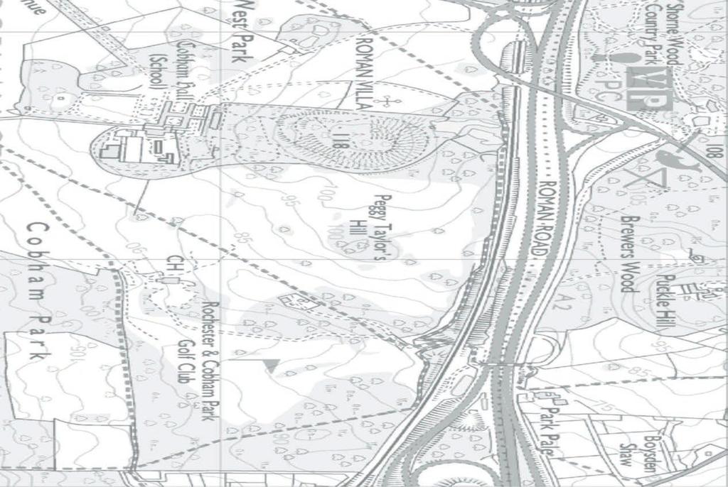
LAND USE SHEET 3 LOWER THAMES CROSSING LOWER THAMES CROSSING STATUTORY CONSULTATION. Main works construction compound
|
|
|
- Merryl Gallagher
- 5 years ago
- Views:
Transcription

1 Sheet Sheet 19 Sheet 13 Sheet 13 Sheet 11 Sheet 11 Sheet Sheet Sheet Sheet a a Sheet 10 Sheet 10 a a a Sheet a5 Sheet 1 Sheet 1 HE CJV-GEN-SZP_GN000000_Z-DR-CX dwg LEGEND: Flood compensation area Main works construction compound Development boundary Ecological Protection Measures Permanent rights to subsoil required Permanent rights to land required Temporary rights to land required Rights to land required for the diversion of utilities Property requiring demolition Property access affected/property partially affected SCALE 1:5000 at A3 LAND USE


 Ancient Woodland Registered")

 Tunnel Earthworks - Cutting Earthworks -")


2 HE CJV-GEN-SZP_GN000000_Z-DR-CX dwg SHEET 20a J29 A127 A128 SHEET 21 SHEET 20 SHEET 19 SHEET 19a SHEET 16a SHEET 16 ENGINEERING AND CONSTRUCTION New Carriageway Railway line Overbridge Underpass Traffic sign Gantry Lighting ENVIRONMENT Grade I listed building Grade II listed building Grade II* listed building Area of Outstanding Natural Beauty (AONB) Site of Special Scientific Interest (SSSI) Ancient Woodland Registered Park and Garden SHEET 18 SHEET 17 J30 North Ockendon South Ockendon Orsett SHEET 15 SHEET 15a SHEET 14 SHEET 13 SHEET 11 SHEET 10b Fence Pond Public Right of Way (PRoW) Tunnel Earthworks - Cutting Earthworks - Embankment Earthworks - Protection bund Verge Flood Compensation Area Conservation Area Travellers site Scheduled monument Replacement land allocated for Open Access Land Proposed woodland planting Proposed grassland planting Area returned to agriculture Potential receptor site for ancient woodland compensation Potential receptor site for translocation of protected species SHEET 12 Grays SHEET 10 SHEET 10a A1089 Chadwell St Mary East SHEET 9 SHEET 9b SHEET 9a UTILITIES DIV GAS DIV OH Realigned Gas Realigned Overhead cable Potential receptor site for excavated material/landscape enhancement Community Forest Solar Farm River Thames RMCZ (Recommended Marine Conservation Zone) BOUNDARIES Main river 82 Development boundary Watercourse Watercourse diversion SHEET 7 Dartford SHEET 8a SHEET 8 SHEET 5 Gravesend Chalk SHEET 6 SHEET 5a J2 26 HS1 SHEET 4 SHEET 2 SHEET 1 M2 LEGEND: LTC route above ground LTC route in tunnel Not to scale GENERAL ARRANGEMENT KEY PLAN AND LEGEND
3 HE CJV-GEN-SZP_GN000000_Z-DR-CH dwg Gravesend LTC to Essex To Gravesend LTC southbound splits to join westbound or M2 eastbound LTC northbound Thong LTC southbound to and M2 eastbound Shorne Woods Country Park LTC traffic to eastbound parallel road or M2 eastbound Thong Lane LTC traffic joins traffic eastbound Valley Drive Existing access altered to connect to only Local traffic joins LTC southbound traffic joins M2 eastbound eastbound traffic exits to join Splits to parallel road to 89 and Rochester and M2 eastbound Inn on the lake hotel Hever Ct Road M2 M2 to M2 1 to and Dartford LEGEND Structures Henhurst Road LTC southbound traffic joins westbound HS1 LTC southbound access to local network parallel road joins onto westbound Local road linking Brewers road and Gravesend East junction. westbound M2 access to local network westbound traffic joins Thong lane realigned westbound traffic splits to continue on existing alignment or join. leaves M2 Contains Ordnance Survey data. Crown copyright and database rights Ordnance Survey LTC/ SCALE 1:5000 (A3) SCALE 1:2500 (A1)


 Landscape Elements Special")

 Green Wall Green Bridge/Structure SHEET")
, Grassland with Bulbs (LE1.2), Species Rich (LE1.3), Rock and Scree (LE1.4), and Open Grassland (LE1.")
, Shrubs with Intermittent Trees (LE2.5), Shrubs (LE2.")

, and Native Hedgerows with Trees (LE4.4) CCS0818378410-001_Large map_land Use Plan_SRA3.indd 4 4. 5.")


4 HE CJV-EGN-SZP_ML000000_Z-DR-LX dwg GENERAL Not to Scale General Environmental Proposed Development Boundary ZB021R DIV OH KEY PLAN PROPOSED ELEMENTS Landscape Mitigation Area National Grid Overhead Line Diversion SHEET 11 Ancient Woodland Compensation Area EXISTING/ BASELINE Open Access Land Compensation Area Environmental Features Water Features, Ponds, Rivers & Watercourses Environmental Elements Water (E2) Woodland SHEET 10 Proposed Flood Compensation Area Hedgerows Indicative River Diversions Primary Planning and Policy Considerations Area of Outstanding Natural Beauty (AONB) Nature Conservation and Biodiversity (E3) SHEET 8 Ecological Protection/Mitigation Measures Site of Special Scientific Interest (SSSI) Landscape Elements Special Protection Areas (SPA) Grassland (*1) Ramsar Sites SHEET 7 Planting (*2) Ancient Woodland Hedgerows (*3) Open Access Land Land to be Returned to Agriculture Conservation Area Reinforced Hedgerows Listed Buildings SHEET 9 SHEET 6 Trees (LE5) Individual Trees Wetland Habitats (LE6) SHEET 4 SHEET 5 TILBURY Water Bodies and Associated Plants Hard Landscape Features (LE7) Green Wall Green Bridge/Structure SHEET 2 NOTES: *1 - Detailed grassland design will consist of; Amenity Grassland (LE1.1), Grassland with Bulbs (LE1.2), Species Rich (LE1.3), Rock and Scree (LE1.4), and Open Grassland (LE1.6). *2 - Detailed planting design will consist of; Woodland (LE2.1), Woodland Edge LE2.2, Linear Belts of Shrubs and Trees (LE2.4), Shrubs with Intermittent Trees (LE2.5), Shrubs (LE2.6), Scattered Trees (LE2.7), and Scrub (LE2.8). *3 - Detailed Hedgerow design will consist of; Ornamental Species Hedges (LE4.1), Native Species Hedges (Trimmed, LE4.2), Native Species Hedgerows (Untrimmed, LE4.3), and Native Hedgerows with Trees (LE4.4) CCS _Large map_land Use Plan_SRA3.indd *4 - The Outline Environmental Masterplan identifies a number of different options for ecological mitigation and/or compensation areas based on the current state of the design development and understanding of the potentially significant ecological impacts from survey data collected to date. The mitigation and compensation areas shown in this document will be further refined once survey work is completed and the design and construction requirements are finalised. 'LE' coding shown in notes a, b and c are from Highways England 'Design for Roads and Bridges, Volume 10 - Environmental Design' SHEET 1 DRAWING OUTLINE ENVIRONMENTAL MASTERPLAN KEY PLAN 29/08/ :47
5 HE CJV-EGN-SZP_ML000000_Z-DR-LX dwg Higham Shorne Shorne Ridgeway 9 8 Strood M SCALE 1:5000 (A1) SCALE 1:10000 (A3) CCS _Large map_land Use Plan_SRA3.indd DRAWING OUTLINE ENVIRONMENTAL MASTERPLAN SHEET 1 of 11 29/08/ :47
`Code 2 - Accepted with comments
 AE For Continuation Refer To CT-- A AE AE AE Realigned airfield Stopped Up AE Electricity substation Land drainage area Ecological mitigation pond Balancing pond South District Replacement floodplain storage
Fenstanton. Fen Drayton New A14. Boxworth. Welcome to this A14 Cambridge to Huntingdon improvement scheme public exhibition.
 A14 Cambridge to Huntingdon Welcome A1 Alconbury D3 A14 Woolley 1 S2 Huntingdon St Ives Town centre improvements including removal of A14 viaduct A14 Ellington D3 Brampton The Hemingfords D2 Godmanchester
A21. Start of works exhibition Tonbridge to Pembury. Welcome. Dualling Scheme
 Welcome We would like to welcome you to our start of works exhibition for the. On display you will see information about what is currently taking place and what will be happening during the coming months
Public Consultation. Land at Monks Farm, North Grove. Welcome
 Welcome Welcome to our public exhibition for development on Land at Monks Farm, orth Grove. Gallagher Estates and Gleeson Strategic Land are preparing an outline planning application for new homes, open
E16: MAINTENANCE OF LANDSCAPED AREAS
 HIGH SPEED TWO INFORMATION PAPER E16: MAINTENANCE OF LANDSCAPED AREAS This paper outlines the proposed approach to the maintenance of landscaped areas created for HS2 Phase One. It will be of particular
In Title Your Area 10: Lower Boddington to Southam & Offchurch
 LOCAL AREA In Title Your Area 10: Lower Boddington to Southam & Offchurch Find out here about: what is proposed between Lower Boddington and Southam & Offchurch; what this means for people living between
Legend. Pennsylvania Fields, Sedbury. River Wye. Aust Cliff. Severn Estuary. Cattybrook Brickpit Three Brooks. Severn Estuary
 Pennsylvania Fields, Sedbury River Wye Legend Other DCO Land Cooling Water Pipeline Corridor Electrical Connection & Utilities Corridor 10km buffer of Ramsar Severn Estuary Aust Cliff Local Nature Reserve
For Drawing extension See Sheet 2 of 7
 ..\..\..\..\projectwise\arup uk\kieran.reidy\dms988\97-rp-xx-xx-ph-ch-.png..\..\..\..\projectwise\arup uk\kieran.reidy\dms988\97-rp-xx-xx-ph-ch-.png..\..\..\..\projectwise\arup uk\kieran.reidy\dms988\97-rp-xx-xx-ph-ch-7.png..\..\..\..\projectwise\arup
UTT/17/2075/FUL - (BERDEN) (Referred to Committee by Councillor Janice Loughlin. Reason: In the Public Interest)
 (Referred to Committee by Councillor Janice Loughlin. Reason: In the Public Interest)") UTT/17/2075/FUL - (BERDEN) (Referred to Committee by Councillor Janice Loughlin. Reason: In the Public Interest) PROPOSAL: LOCATION: APPLICANT: Amendments to the design of a scheme for a 49.99MW battery
UTT/17/2075/FUL - (BERDEN) (Referred to Committee by Councillor Janice Loughlin. Reason: In the Public Interest) PROPOSAL: LOCATION: APPLICANT: Amendments to the design of a scheme for a 49.99MW battery
HUNGERFORD SOLAR FARM
 HUNGERFORD SOLAR FARM Key Facts The site comprises approximately 26 acres/10.6 hectares of Grade 3 and 4 agricultural land, currently in arable use. It will have a generation capacity of approximately
In Title Your Area 5: Amersham to Great Missenden
 LOCAL AREA In Title Your Area 5: Amersham to Great Missenden Find out here about: what is proposed between Amersham and Great Missenden; what this means for people living between Amersham and Great Missenden;
Experiences of dealing with Lesser Horseshoe Bats (Rhinolophus
 Experiences of dealing with Lesser Horseshoe Bats (Rhinolophus hipposideros) in Wales, UK Len Wyatt Environmental Science Advisor, Transport, Housing and Strategic Regeneration, Welsh Assembly Government,
Welcome to our Public Consultation
 About our development This exhibition gives you the chance to view and comment on our emerging plans for a proposed residential development located on land to the West of Alwyn Road, Rugby. Welcome to
Thank you for coming. We want to hear your views on proposed improvements to the A1 between junction 65 (Birtley) and junction 67 (Coal House).
 and junction 67 (Coal House).") Welcome Thank you for coming. We want to hear your views on proposed improvements to the between junction 65 (Birtley) and junction 67 (Coal House). This is your opportunity to provide comments on our
Welcome Thank you for coming. We want to hear your views on proposed improvements to the between junction 65 (Birtley) and junction 67 (Coal House). This is your opportunity to provide comments on our
SOUTH WOKINGHAM STRATEGIC DEVELOPMENT LOCATION PUBLIC CONSULTATION
 01 WELCOME Croudace Homes, Gleeson Strategic Land, Kier Ventures, Lightwood Strategic and Miller Homes are delighted to welcome you to this public exhibition. Proposals for the site have been developing
DraFt EnvironmEntal StatEmEnt
 PHASE ONE DraFt EnvironmEntal StatEmEnt Community Forum Area Report 17 Offchurch and Cubbington HS2 London-West Midlands May 2013 ENGINE FOR GROWTH DRAFT ENVIRONMENTAL STATEMENT Community Forum Area Report
NON-TECHNICAL SUMMARY
 Proposed Sand and Gravel Extraction and Associated Processing Operations with Restoration to a Mixture of Agriculture and Nature Conservation including Areas of Shallow Water at Hedgeley, Northumberland
Start of works exhibition
 Start of works exhibition Find out about the work that Highways England are undertaking to create a new interchange junction 700 metres east of junction 10 over the M20, a dual carriageway link road to
NON TECHNICAL SUMMARY
 CONTENTS Introduction...1 Site Setting and Description...3 Proposed Development...3 Proposed Time Extension...4 Proposed Lateral Extension...4 Improvement of the main access road (Downs Lane)...4 Restoration
Non-technical summary
 Non-technical summary Introduction NTS.1 is applying for outline planning permission for a residential development of up to 80 dwellings on land at Hambrook, on the northern fringe of Bristol. NTS.2 An
A1 in Northumberland Morpeth to Felton scheme. Preliminary environmental information report Non technical summary
 A1 in Northumberland Morpeth to Felton scheme Preliminary environmental information report Non technical summary Volume 1 - June 2018 INTRODUCTION This document provides a Non-Technical Summary (NTS) of
Chapter 2.4. Description of Development
 Chapter 2.4. Description of Development 42 4. Description of Development 4.1. Scheme Overview 4.1.1. The proposed South Bristol Link (SBL) comprises the construction and realignment of a section of highway
Summary Note on Landscape and Visual Impact and Mitigation
 East Anglia TWO Offshore Windfarm Appendix 4.4 Summary Note on Landscape and Visual Impact and Mitigation Preliminary Environmental Information Volume 3 Document Reference EA2-DEVWF-ENV-REP-IBR- 000799_004
Grantham Southern Quadrant Link Road Environmental Statement
 Grantham Southern Quadrant Link Road Environmental Statement Non Technical Summary Introduction Lincolnshire County Council (LCC) is submitting a planning application for the proposed implementation of
Town and Country Planning (Environmental Impact Assessment Regulations) 2011 SCOPING OPINION
 2011 SCOPING OPINION") Town and Country Planning (Environmental Impact Assessment Regulations) 2011 SCOPING OPINION Application Site and Description of Development Proposed new quarry at Culham, Oxfordshire Land and Mineral
Town and Country Planning (Environmental Impact Assessment Regulations) 2011 SCOPING OPINION Application Site and Description of Development Proposed new quarry at Culham, Oxfordshire Land and Mineral
HS2 Environment. Protecting the environment
 HS2 Environment Protecting the environment Approach to mitigation EIA Regulations require an ES to include a description of the measures envisaged in order to avoid, reduce and, if possible, remedy significant
Preferred route announcement M25 junction 10/A3 Wisley interchange Improvement scheme
 Preferred route announcement M25 junction 10/A3 Wisley interchange Improvement scheme Winter 2017 Introduction This section of the M25 is of nationally-strategic importance, as it provides vital access
Preliminary Ecological Appraisal
 Preliminary Ecological Appraisal Seminar Outline What is Preliminary Ecological Appraisal (PEA)? What are the main objectives of PEA? Methods of PEA Wildlife legislation and planning policy Examples of
Slough International Freight Exchange Proposals, Colnbrook+
 Welcome Welcome to this exhibition, which is being held in connection with our proposals for a new freight exchange facility on land to the north of the A4. Please take this opportunity to look at the
Report for Rother Valley Railway Limited Track Reinstatement between Northbridge Street and Junction Road Environmental Statement - Volume 1 Final
 Non-Technical Summary June 2014 Report for Rother Valley Railway Limited Environmental Statement - Volume 1 Document Version Control Version Date Author Approver 10 16/05/2014 Tess Murray Emma Devenport
8.0 Design and Form of Development 43/
 42/ 8.0 Design and Form of Development 43/ Rothwells Farm, Golborne/ Development Statement Figure 7. Site Constraints Key 44/ Site Boundary 360 Bus Route/Stops Existing Trees Underground Water Pipe Sensitive
Land North of Sidley between the Bexhill to Hastings Link Road and Watermill Lane
 Application No: Site Address: Development: RR/2017/962/P Land North of Sidley between the Bexhill to Hastings Link Road and Watermill Lane North Bexhill Access Road - Culvert for stream crossing as alternative
(blank page) WestConnex New M Roads and Maritime Services Environmental impact statement
 WestConnex New M Roads and Maritime Services Environmental impact statement") (blank page) WestConnex New M5 5-42 (blank page) WestConnex New M5 5-44 5.5 Tunnels 5.5.1 Main alignment tunnels The main alignment tunnels would be about nine kilometres long, with the western tunnel
(blank page) WestConnex New M5 5-42 (blank page) WestConnex New M5 5-44 5.5 Tunnels 5.5.1 Main alignment tunnels The main alignment tunnels would be about nine kilometres long, with the western tunnel
Welcome to the Public Consultation Exhibition
 Welcome to the Public Consultation Exhibition Today is your opportunity to: Speak to the team Learn more about the project Leave feedback on the plans The Secretary of State for Transport has recognised
UNCLASSIFIED. Risk of Flooding from Reservoirs - Severn River Basin District
 UNCLASSIFIED Flood Risk Maps Risk of Flooding from Reservoirs - Severn Why have we produced these maps what can they be used for? Under the Flood Risk Regulations Natural Resources Wales have worked in
Former RAF Sealand Site EIA
 Praxis (Holdings) Ltd. Former RAF Sealand Site EIA Environmental Statement - Non Technical Summary February 2012 in association with P a g e 1 1. Introduction Praxis (Holdings) Ltd. is applying to Flintshire
A38 Derby Junctions. Preliminary Environmental Information Report: Non-Technical Summary
 Preliminary Environmental Information Report: Preliminary Environmental Information Report Report No: P01 S4 September 2018 Table of contents Introduction... 1 The proposed scheme... 2 Scheme details...
Public Consultation 23 January Peel Hall, Warrington Board 1. A message from Satnam... Site history...
 Board 1 A message from Satnam... Thank you for attending today s public consultation about proposals to develop a new residential neighbourhood at. The display boards show why the development is needed
Response by the Wiltshire Archaeological and Natural History Society
 Highways England Consultation A303 Stonehenge Response by the Wiltshire Archaeological and Natural History Society Background About the Society Founded in 1853 to educate the public by promoting, fostering
A303 Stonehenge. Amesbury to Berwick Down Scheme Assessment Report Appendix D CSR and Policy Assessment. Volume 6
 A0 Stonehenge Amesbury to Berwick Down Scheme Assessment Report Appendix D CSR and Policy Assessment Volume 6 September 2017 Appendix D Client Scheme Requirements (CSRs) and Policy Assessment D.1 CSR Assessment
Welcome to our public exhibition
 About Our Scheme Welcome to our public exhibition This exhibition gives you the chance to view and comment upon our emerging proposals for a new residential development of 68 new homes on the site of the
Sandwich Town Tidal Defences Environmental Statement Non Technical Summary
 Sandwich Town Tidal Defences Environmental Statement Non Technical Summary Environment Agency Introduction The Environment Agency is proposing to construct a scheme to reduce the risk of tidal flooding
The Place Solar Farm
 The Place Solar Farm Environmental Statement Non-Technical Summary 28 August 2014 Produced for Prepared by St John s House Queen Street, Manchester M2 5JB Contents Contents... 2 1 Introduction... 3 1.1
Land at Whiteditch Lane, Newport, Essex
 Land at Whiteditch Lane, Newport, Essex Ecology Report Produced for Sworders Agricultural By March 2013 Document Control: Version Date Version Details Prepared by Checked by Approved by 0.1 01.03.2013
New Century Park Introduction and background
 Introduction and background Welcome to this exhibition on the planning application for the New Century Park project submitted by Luton (LLAL). These plans include significant benefits for the local area
Land at Porch Farm, Kingsclere Ecology Briefing Paper, April 2016 C_EDP3343_01a
 C_EDP3343_01a Introduction 1.1 This Ecology Briefing Paper has been prepared by The Environmental Dimension Partnership Ltd (EDP) on behalf of Linden Homes. This briefing paper considers the ecological
Mapping produced by the Bedfordshire and Luton Biodiversity Recording and Monitoring Centre
 Mapping produced by the Bedfordshire and Luton Biodiversity Recording and Monitoring Centre Chalton Parish Green Infrastructure Plan Methodology In April 2007 Chalton Parish Council were approached with
Landscape Guidelines. Landscape type: Valley Pasture Character areas: Frome Valley Pasture Stour Valley Pasture. Landscape change
 Landscape type: Valley Pasture Character areas: Frome Valley Pasture Stour Valley Pasture The valley pasture landscape type is found along the lower reaches of the Stour and Frome, formed from alluvial
Land to the North of Main Road, Wybunbury
 Land to the North of Main Road, Wybunbury Environmental Statement Non-Technical Summary November 2014 Land to the North of Main Road, Wybunbury Environmental Statement Non-Technical Summary Prepared on
A30 Chiverton to Carland Cross Consultation booklet 29 January - 12 March 2018
 A30 Chiverton to Carland Cross Consultation booklet 29 January - 12 March 2018 . About Highways England Highways England operates, maintains and improves England s motorways and major A-roads, known as
Environmental Assessment (Scotland) Act 2005: Clackmannanshire Council Sustainability Strategy Scoping Request
 Act 2005: Clackmannanshire Council Sustainability Strategy Scoping Request") TAYSIDE & CLACKMANNANSHIRE Tel: 01738 458582(direct line) Fax: 01738 458616 e-mail addresses: denise.reed@snh.gov.uk Niall Urquhart Team Leader Sustainability Clackmannanshire Council Kilncraigs Greenside
TAYSIDE & CLACKMANNANSHIRE Tel: 01738 458582(direct line) Fax: 01738 458616 e-mail addresses: denise.reed@snh.gov.uk Niall Urquhart Team Leader Sustainability Clackmannanshire Council Kilncraigs Greenside
LAND EAST OF HORNDEAN. 1. Welcome. Morrisons supermarket. Keydell Nurseries A3(M)
") 1. Welcome Bloor Homes welcomes you to today s Public Exhibition relating to development proposals for Land to the East of Horndean. Idsworth Close Rowlands Castle Road Roa d Dell Piece East J2 Pyle Farm
1. Welcome Bloor Homes welcomes you to today s Public Exhibition relating to development proposals for Land to the East of Horndean. Idsworth Close Rowlands Castle Road Roa d Dell Piece East J2 Pyle Farm
SHIRLEY MOTORWAY SERVICE AREA
 SHIRLEY MOTORWAY SERVICE AREA PROPOSED DEVELOPMENT OF A NEW MOTORWAY SERVICE AREA, WITH MEANS OF ACCESS, LANDSCAPING AND ASSOCIATED INFRASTRUCTURE ON LAND ADJACENT TO JUNCTION 4 OF THE M42 ENVIRONMENTAL
Salisbury Road, Marlborough. Outline Planning Application Environmental Statement: Non-technical Summary
 Salisbury Road, Marlborough Outline Planning Application Environmental Statement: Non-technical Summary Copyright and Non-Disclosure Notice The contents and layout of this report are subject to copyright
A737/A738 Trunk Road (Dalry Bypass)
") IN ASSOCIATION WITH DRAWING STATUS A737/A738 Trunk Road (Dalry Bypass) Environmental Statement July 2013 Introduction The A737 trunk road forms a strategic link from the M8 motorway, at Paisley, to Ayrshire.
IN ASSOCIATION WITH DRAWING STATUS A737/A738 Trunk Road (Dalry Bypass) Environmental Statement July 2013 Introduction The A737 trunk road forms a strategic link from the M8 motorway, at Paisley, to Ayrshire.
WELCOME LAND EAST OF TYE LANE, WALBERTON. Above all, it s about people
 WELCOME Welcome to this public exhibition relating to our draft residential proposals for the land east of Tye Lane, Walberton. Today gives you the opportunity to have an active role in shaping these ideas
Chapter 27 Route Window SE7 Church Manorway Bridge. Transport for London
 Chapter 27 Route Window SE7 Church Manorway Bridge Transport for London CHURCH MANORWAY BRIDGE 27 Route Window SE7 Church Manorway bridge Introduction 27.1 The North Kent Line will be converted to four
NON TECHNICAL SUMMARY
 NON TECHNICAL SUMMARY INTRODUCTION NTS.1 CEMEX UK Properties Limited is applying for planning permission to South Cambridgeshire District Council (SCDC) for the redevelopment of the former CEMEX cement
Replacement Golf Course Facilities and Residential Development, Churston. Environmental Statement Non-Technical Summary
 Replacement Golf Course Facilities and Residential Development, Churston Environmental Statement Non-Technical Summary July 2011 Reproduced from the Ordnance Survey s map with the permission of the Controller
Land at BROOK STREET PROPERTIES TENCREEK FARM, LISKEARD. Environmental Statement: Non-Technical Summary
 BROOK STREET PROPERTIES TENCREEK FARM, LISKEARD Land at Environmental Statement: Non-Technical Summary Introduction Brook Street Properties is applying to Cornwall Council for outline planning permission
WELCOME. North East Haverhill. The Planning Process
 WELCOME North East The site to the North East of, known as Great Wilsey Park, is identified by St Edmundsbury Borough Council in its Core Strategy as capable of delivering a Sustainable Urban Extension.
Roeshot & Burton SANG. Hinton Admiral Estate
 Who we are? The Hinton Admiral is the home of the Meyrick family and the Estate today is a 300-year old organisation. The Estate enjoys very diverse land types which range from heathland and river valley
UTT/16/1466/DFO GREAT DUNMOW MAJOR
 UTT/16/1466/DFO GREAT DUNMOW MAJOR PROPOSAL: LOCATION: APPLICANT: AGENT: Reserved matters approval for the accesses to the site and principal roads within the site including spine road following outline
Appendix B Figures L1 and L2 - Townscape Analysis
 The Derriford Transport Scheme WEBTag Townscape and Visual Impact Appraisal (WTVA) Appendix B Figures L1 and L2 - Townscape Analysis J:\29210 Plymouth City Modelling\Technical\Landscape\Reports\29210_De
Land at Rampton Road. Cottenham
 Land at Rampton Road Cottenham Introduction TEP is preparing an outline planning application for 54 dwellings on 6.9 hectares of land adjacent to Rampton Road, Cottenham on behalf of the owners Cambridgeshire
To what extent do you agree or disagree with the four options?
 Issues and options questions The easiest and most effective way to respond to the consultation is by using our online consultation portal www.spelthorne.gov.uk/localplan However you can also email us at
Ongar. Residential Sites. Vision for Ongar
 5.58 Located in the east of the district, is a District Centre of medieval origin that boasts a retail and service offer benefiting the local community and those in other settlements further afield. 5.59
M4-M5 Link Rozelle Interchange factsheet 2017
 M4-M5 Link Rozelle Interchange factsheet 017 WestConnex is part of the ustralian and NSW governments vision for supporting Sydney s growing population and keeping our economy strong. The M4-M5 Link is
Strategic Employment Site, on land to the East of the M5, south of Junction 6, west of Pershore Lane. Environmental Statement. Non Technical Summary
 Strategic Employment Site, on land to the East of the M5, south of Junction 6, west of Pershore Lane Environmental Statement Non Technical Summary March 2010 Strategic Employment Site, on Land to the East
NORTH WEST SECTOR HORLEY, SURREY
 Welcome to our Exhibition We are delighted to present our plans for the first phase of the North-West Sector Horley development. We are holding this exhibition to give you the chance to view and comment
Warwickshire County Council. Upper and Lower Brailes. Landscape Study
 Warwickshire County Council Upper and Lower Brailes Landscape Study Produced by WCC Landscape Architects March 2016 Landscape Assessment of Potential Development Sites within the parish of Brailes 1.0
Rannoch 132 / 33 kv Substation Extension
 Who we are Scottish and Southern Energy Power Distribution is part of the SSE plc group of companies. We own, maintain and invest in the networks in the north of Scotland the electricity transmission network
Welcome to our exhibition
 Welcome to our exhibition housing development A46 Wildmoor Alcester Road Canal Quarter A422 Town Centre housing development Warwickshire-based IM Properties, one of the UK s largest privately owned property
University Park, Worcester Non Technical Summary December 2011
 University Park, Worcester Non Technical Summary December 2011 Introduction UW Wrenbridge LLP, a Joint Venture Company of the University of Worcester and Wrenbridge Land Ltd (the Applicants ) intend to
Bloor Homes Stubbocks Walk North Hertfordshire ENVIRONMENTAL STATEMENT NON-TECHNICAL SUMMARY
 Bloor Homes Stubbocks Walk North Hertfordshire ENVIRONMENTAL STATEMENT NON-TECHNICAL SUMMARY December 2016 Environmental Statement: Non-Technical Summary Stubbocks Walk, North Hertfordshire J S Bloor
Birtley to Coal House improvement scheme. Preliminary Environmental Information Report Appendix A. February 2018
 A1 Birtley to Coal House improvement scheme Preliminary Environmental Information Report Appendix A February 2018 Acronym Description A ALC AOD AONB AQMA ARN Agricultural Land Classification Above Ordnance
Hunts Grove, Gloucestershire
 Hunts Grove, Gloucestershire Environmental Statement Non Technical Summary February 2007 ISSUING OFFICE OXFORD T: 01865 887050 F: 01865 887055 E: info@lda-design.co.uk HUNTS GROVE, GLOUCESTERSHIRE ENVIRONMENTAL
tributary farmland tributary farmland
 NORFOLK O R F O L K COAST C O A SAONB T A O NIntegrated B I n t elandscape g r a t e d L Guidance a n d s c a p e G u i d a n c e 1 Integrated landscape character MAP 23a - Landscape Character Type - Tributary
Route Alignment Options Summary Report
 Brechfa Forest Connection Project February 2014 Summary report 1. RSK Environment Ltd (RSK) was commissioned by Western Power Distribution (WPD) to provide environmental consultancy support services for
DESIGN AND MANAGEMENT PART 3 HA 57/92 NEW ROADS INTEGRATION WITH RURAL LANDSCAPES SUMMARY
 DESIGN MANUAL FOR ROADS AND BRIDGES VOLUME 10 SECTION 1 ENVIRONMENTAL DESIGN AND MANAGEMENT NEW ROADS PART 3 HA 57/92 NEW ROADS INTEGRATION WITH RURAL LANDSCAPES SUMMARY This Advice Note gives guidance
A46 Coventry Junctions Public information exhibitions
 A46 Coventry Junctions Public information exhibitions February 2017 We re making journeys better in the Midlands by operating, maintaining and modernising major A roads and motorways delivering an extensive
South Macclesfield Development Area Environmental Statement Non-Technical Summary March 2017
 South Macclesfield Development Area Environmental Statement March 2017 Contents 1.0 Introduction... 2 1.1 Background... 2 1.2 Environmental Assessment... 2 1.3 Site Description... 2 2.0 The Proposals...
Operation Stack: Initial Environmental / Policy Baseline Summary. Air Quality & Greenhouse Gas
 Operation Stack: Initial Environmental / Policy Baseline Summary Air Quality & Greenhouse Gas Cultural Heritage National & Highways England policy National Planning Policy Framework (NPPF) Compliance with
VALLEY PARK, DIDCOT. Non-Technical Summary. December On behalf of Taylor Wimpey UK Limited, Persimmon Homes and Hallam Land Management Ltd.
 VALLEY PARK, DIDCOT Non-Technical Summary December 2014 On behalf of Taylor Wimpey UK Limited, Persimmon Homes and Hallam Land Management Ltd. CONTENTS 1 Introduction... 2 2 The Proposed Development...
Neighbourhood Planning Guidance Local Green Spaces
 Neighbourhood Planning Guidance Local Green Spaces Introduction This guidance note has been produced for communities preparing neighbourhood plans in North Dorset to help them to identify, assess and designate
Report reference: LT/WTE/LZH/1655/01/SCOPING June 2015
 PROPOSALS FOR THE SCOPE AND CONTENT OF AN APPLICATION FOR PLANNING PERMISSION AND AN ENVIRONMENTAL STATEMENT FOR THE EXTRACTION OF LIMESTONE FROM EXTENSION AREAS AT WHITWELL QUARRY, DERBYSHIRE Report reference:
Local Wildlife Sites in Leicestershire and Rutland
 Local Wildlife Sites in Leicestershire and Rutland What are Local Wildlife Sites? From mystical ancient woodlands to quiet churchyards and bustling flower-rich roadsides; and from field-bordering hedgerows
LAND OFF TOLLBAR WAY, HEDGE END PUBLIC CONSULTATION. Proposed Residential Development
 LAND OFF TOLLBAR WAY, HEDGE END PUBLC CONSULTATON Proposed Residential Development YOUR VEW MATTERS TO US PROPOSED STE AREA Thank you for taking the time to read this information leaflet regarding a proposed
Galloper Wind Farm Limited
 Galloper Wind Farm Eastern Super Grid Transformer Project Environmental Statement Chapter 2 Site Description and Land Use Document Reference GWF/2/2/214 Galloper Wind Farm Limited CONTENTS Page 2 SITE
New horse training area, Manor Farm, Great Kimble, Buckinghamshire
 New horse training area, Manor Farm, Great Kimble, Buckinghamshire An Archaeological Watching Brief For Redwing Structures (Marlow) Limited by Andy Taylor Thames Valley Archaeological Services Ltd Site
DUNSFOLD NEIGHBOURHOOD PLAN Site Selection Policies
 DUNSFOLD NEIGHBOURHOOD PLAN Site Selection Policies The criteria for assessing sites for future housing and business development in Dunsfold are set out below. (Development criteria, covering what it is
GAEC synthesis from CwRS 2010 survey
 1 GAEC synthesis from Cw 2010 survey Vincenzo ANGILERI MarS Unit, IPSC, JRC Ispra Aim of the presentation 2 New GAEC framework applicable since 2010 (except buffer strips) Are minimum requirements for
Watford Local Plan Part 2 Publication Stage Environmental Report. Appendix 3: Consultation Comments
 Watford Local Plan Part 2 Publication Stage Environmental Report Appendix 3: Consultation Comments August 2016 Appendix 3 - Responses to Consultation of the Local Plan Part 2 As required by the SEA Directive,
Application No: Location: Coopers Beach Caravan Park, Church Lane, East Mersea, CO5 8TN. Scale (approx): 1:5000
: 1:5000") Application No: 146075 Location: Coopers Beach Caravan Park, Church Lane, East Mersea, CO5 8TN Scale (approx): 1:5000 The Ordnance Survey map data included within this publication is provided by Colchester
Application No: 146075 Location: Coopers Beach Caravan Park, Church Lane, East Mersea, CO5 8TN Scale (approx): 1:5000 The Ordnance Survey map data included within this publication is provided by Colchester
Taylor Wimpey UK Ltd Proposed Development at Haydock Grange, Hoyles Lane, Preston Non-Technical Summary Revision 1 October 2011
 Taylor Wimpey UK Ltd Proposed Development at Haydock Grange, Hoyles Lane, Preston Non-Technical Summary Revision 1 October 2011 Introduction An application for outline planning permission has been submitted
Tandridge Local Plan Assessing the Ecological Suitability of 183 sites considered for development Tandridge District Council, Surrey
 Tandridge Local Plan Assessing the Ecological Suitability of 183 sites considered for development Tandridge District Council, Surrey PLANNING I DESIGN I ENVIRONMENT 1.0 INTRODUCTION TEP conducted Site
Circular L8/08 2 September Water Services Investment and Rural Water Programmes Protection of Natural Heritage and National Monuments
 Circular L8/08 2 September 2008 Water Services Investment and Rural Water Programmes Protection of Natural Heritage and National Monuments 1. The purpose of this Circular is to provide local authorities
Canal & River Trust response to the Consultation on the Working Draft Environmental Impact Assessment Report
 High Speed Two Phase 2a: West Midlands to Crewe Response to Working Draft Environmental Impact Assessment Report Please find below the response of the Canal & River Trust. The Trust is the guardian of
South Whitehaven, Cumbria EIA
 South Whitehaven, Cumbria EIA Environmental Statement - Non Technical Summary June 2013 in association with 1. Introduction Story Homes is applying to Copeland Borough Council (CBC) for a new residential
Infrastructure and the environment
 INFRASTRUCTURE MATTERS Infrastructure and the environment December 2016 In this edition: Infrastructure and the environment: maximising environmental benefits Ancient woodland: a case study Image: Helix