Village of Bowler Comprehensive Plan
|
|
|
- Laura Small
- 5 years ago
- Views:
Transcription

1 PLAN COMMISSION RECOMMENDED: October 13, 2008 VILLAGE BOARD ADOPTION: December 8, 2008
2
3 Acknowledgements Acknowledgements Village Board: Raymond Murphy, Village President Robert Herberg, Trustee Mark Kropf, Trustee Earl Nelson, Trustee John Rickert, Trustee Ronnie Stillman, Trustee Todd Schmid, Trustee Village Plan Commission: Ray Murphy Kerry Breitrick John Rickert Georgia Truax Betty Anderson Village Staff: Kerry Breitrick, Village Clerk Shawano County Staff: Tim Reed, Planning Director Melinda Barlow, Shawano County Planner Jay Moynihan, UW Extension Community Development Educator David Poffinbarger, GIS Coordinator Frank Pascerella, Shawano County Administrator Planning and Design Assistance by: VANDEWALLE & ASSOCIATES Dan Moser, Lead Planner Mark Roffers, AICP, Principal Planner Michael Slavney, FAICP, Principal Planner Dana Jensen, AICP, Associate Planner Cathi Wielgus, AICP, Assistant Planner Jessica Schmiedicke, Assistant Planner Megan MacGlashan, AICP, Assistant Planner Rob Gottschalk, AICP, RLA, Principal Designer Justin Yonker, Assistant Designer Ben Webb, GIS Specialist Dave Schaefer, Mapping Specialist Ellen Hall, Communications Manager Stephanie Robey, Communications Specialist Nicole Anderson, Planning Assistant David Tollefson, Growth Management Intern Drew Pennington, Growth Management Intern Katie Davis, Planning Intern 120 East Lakeside Street Madison, WI (608) ADOPTED: DECEMBER 8,
4 Table of Contents ADOPTED: DECEMBER 8,
5 Table of Contents Table of Contents ACKNOWLEDGEMENTS... 1 TABLE OF CONTENTS... 3 INTRODUCTION... 5 Purpose of this Plan...5 General Regional Context...5 Selection of the Planning Area...6 Regional Planning Effort...6 CHAPTER ONE: ISSUES AND OPPORTUNITIES... 9 Population Trends and Forecasts...9 Demographic Trends...13 Household Trends and Forecasts...15 Employment Trends...16 Employment Projections...17 Education and Income Levels...18 Summary of Public Participation...20 Regional Context and Influences...23 Statement of Overall Goals...23 CHAPTER TWO: AGRICULTURAL, NATURAL, AND CULTURAL RESOURCES Agricultural Resource Inventory...25 Agricultural Resource Goals, Objectives and Policies...27 Agricultural Resource Recommendations and Programs...28 Natural Resource Inventory...31 Natural Resource Goals, Objectives and Policies...33 Natural Resource Recommendations and Programs...34 Cultural Resource Inventory...41 Cultural Resource Goals, Objectives and Policies...42 Cultural Resource Recommendations and Programs...42 CHAPTER THREE: LAND USE Land Use Map Categories...47 Existing Land Use Pattern...48 Land Use Goals, Objectives and Policies...52 Land Use Recommendations, Specific Policies, and Programs...54 Land Use Recommendations, Specific Policies, and Programs...55 Residential Land Use Categories...56 Non-Residential Land Use Categories...58 Rural/Environmental Land Use Categories...61 CHAPTER FOUR: TRANSPORTATION Existing Transportation Network...69 Transportation Goals, Objectives and Policies...72 Transportation Recommendations and Programs...73 ADOPTED: DECEMBER 8,
6 Table of Contents CHAPTER FIVE: UTILITIES AND COMMUNITY FACILITIES Existing Utilities and Community Facilities...79 Utilities and Community Facilities Goals, Objectives and Policies...81 Utilities and Community Facilities Recommendations and Programs...83 CHAPTER SIX: HOUSING & NEIGHBORHOOD DEVELOPMENT Existing Housing Framework...87 Housing Affordability...89 Housing and Neighborhood Development Programs...90 Housing and Neighborhood Development Goals, Objectives and Policies...90 Housing and Neighborhood Development Recommendations and Programs...91 CHAPTER SEVEN: ECONOMIC DEVELOPMENT Existing Economic Development Framework...97 Economic Development Goals, Objectives and Policies Economic Development Recommendations and Programs CHAPTER EIGHT: INTERGOVERNMENTAL COOPERATION Existing Regional Framework Intergovernmental Cooperation Goals, Objectives and Policies Intergovernmental Cooperation Recommendations and Programs CHAPTER NINE: IMPLEMENTATION Plan Adoption Implementation Recommendations Ordinance and Code Updates Plan Monitoring, Amendments, and Update Consistency Among Plan Elements ADOPTED: DECEMBER 8,

7 Introduction Introduction Located in western Shawano County, Bowler is a Village that retains many reminders of its historic role as a railroad stop, logging, and agricultural community. Surrounded by northern Wisconsin forests, the scenic natural beauty of the Village provides residents with a tranquil place to call home. The Village has experienced very little growth over the past 10 years, but has the potential to build on historic strengths and embrace new opportunities. The Village is dedicated to maintaining its small community character while promoting compatible economic, residential and civic development. Given the range of opportunities and challenges facing of the Village, decisions that are made over the next two decades will help shape the Village for generations to come. This Plan is intended to explore the opportunities, address the challenges, and present strategies that will help shape the Village of Bowler s growth, development, and preservation over the next 20 years. Purpose of this Plan The is intended to: Identify areas appropriate for development and preservation over the next 20 years; Recommend types of land use for specific areas in the Village; Preserve agricultural lands and farming near the community; Identify needed transportation and community facilities to serve future land uses; Direct private housing and other investment in the Village; and Provide detailed strategies to implement plan recommendations. This Comprehensive Plan is being prepared under the State of Wisconsin s comprehensive planning legislation, adopted in 1999 and contained in , Wisconsin Statutes. This Plan meets all of the statutory elements and requirements of the law. After 2010, only those plans that contain the nine required elements and were adopted under the prescribed procedures will have legal standing The remainder of this Comprehensive Plan is organized in nine chapters containing all of the required elements listed above. Each chapter begins with background information on the element (e.g., land use, transportation, economic development), followed by an outline of the Village s policy desires related to that element, and ends with detailed recommendations for the element. The final chapter (Implementation) provides recommendations, strategies, and timelines to ensure the implementation of this Plan. General Regional Context Map 1 shows the relationship of the Village to neighboring communities in the region. The Village is located approximately eight miles north east of the Village of Wittenberg, 23 miles west of the City of Shawano, and 30 miles southeast of the City of Antigo. The Village of Bowler is situated at the intersection of four towns in Shawano County. The Town of Almon is to the northwest, the Town of Bartlme to the northeast, the Town of Morris to the southwest, and Seneca to the southeast. The Stockbridge Munsee Native American community is located less than a mile east of the Village. In relationship to the wider region, the Village is located roughly 49 miles east of Wausau, 61 miles northwest of Appleton, the largest of the Fox Cities, 65 miles northwest of Green Bay. ADOPTED: DECEMBER 8,
8 Introduction Selection of the Planning Area The Village of Bowler encompasses an area of 664 acres or just over one square mile. The planning area has been selected as to generally include all lands in which the Village has both a short-term and long-term interest in planning and development activity. The planning area includes all of the incorporated land within the Village and land within the 1 ½ mile Extraterritorial Jurisdiction Limit (ETJ) of the Village, as defined under Wisconsin Statutes. Regional Planning Effort This Comprehensive Plan was prepared concurrently with 25 other neighboring communities in Shawano County as part of a State-funded multi-jurisdictional planning process. In order to facilitate this, process participating communities in Shawano County were organized into three clusters for planning purposes. The Village of Bowler is part of the Western Cluster, which is also comprised of the towns of Almon, Aniwa, Birnamwood, Germania, Hutchins, Morris, and Wittenberg, as well as the Villages of Aniwa, Eland, Tigerton, and Wittenberg. A County-wide comprehensive plan was also prepared as part of this planning effort. ADOPTED: DECEMBER 8,
9 Introduction Map 1: Jurisdictional Boundaries ADOPTED: DECEMBER 8,
10 Chapter One: Issues and Opportunities ADOPTED: DECEMBER 8,
11 Chapter One: Issues and Opportunities Chapter One: Issues and Opportunities This chapter reviews demographic trends and background information necessary to understand recent changes in the Village of Bowler. This chapter includes data on population, household and employment trends and forecasts, age distribution, educational attainment levels, and employment and income characteristics. It also includes overall goals to guide future preservation, development, and redevelopment over the 20-year planning period. SUMMARY OF KEY ISSUES AND OPPORTUNITIES Business retention and attraction Retention of the Village s Schools Provision of adequate housing and community facilities for all residents, including a growing percentage of elderly. Population Trends and Forecasts The Village of Bowler s overall population remained nearly unchanged between 1950 and 2000; although it did fluctuate within the fifty year span. As shown in Figure 1, other small Villages in the County including Aniwa, Eland, Matoon, and Tigerton have displayed similar low or no growth patterns during this time period. Other area Villages - such as Birnamwood, Gresham and Wittenberg - have shown more significant and sustained levels of growth. During this same time period, growth experienced by Shawano County (24.8 percent), the East Central Region - comprised of 10 counties: Calumet, Fond du Lac, Green Lake, Marquette, Menominee, Outagamie, Shawano, Waupaca, Waushara and Winnebago - (66.1 percent) and the State (56.2 percent) were significantly greater than the Village. Figures 1 and 2 indicate a slight shift in overall County population moving away from towns and into villages or cities in recent decades. This reflects the general increase in non-agricultural jobs and preferences for urban amenities. Among incorporated communities, cities and villages such as Bowler with municipal sewer and water and/or locations near regional transportation routes such as State Highway 29 and US Highway 45 have tended to grow more rapidly than Villages lacking one or both of these advantages. The population growth for Bowler s planning area mirror these trends. Since the 1970 s the Village of Bowler s population has grown by 26 % while the population of neighboring towns has grown even faster. Bowler s rate of growth also exceeded five of the eight comparison incorporated municipalities. The three incorporated municipalities that have grown faster than Bowler between 1970 and 2000 had comparative advantages in starting population, highway access, and - in the case of Shawano and Gresham - better access to the gaming industry in the Stockbridge Munsee and Menomonee Reservations. In spite of the trend toward greater growth in villages than in towns, some Shawano County towns adjacent to full service villages and regional highways have grown as fast or faster than many villages. This can be explained in terms of the state-wide trend in recent decades toward non-farming households moving to rural settings with lower taxes yet accessible to village amenities, employment and shopping. Towns in Bowler s planning area have grown more quickly than Bowler and mirror the State-wide trend more closely than the County trend. This is particularly true in the Town of Bartlme closest to the gaming and resort industry to the east. The trend toward dispersed growth in the neighboring towns has potential implications for the Village future growth and development. ADOPTED: DECEMBER 8,
12 Chapter One: Issues and Opportunities Figure 1: Historic Population of Area Communities, Village of Bowler City of Shawano 5,894 6,103 6,488 7,013 7,598 8,298 Village of Aniwa Village of Birnamwood Village of Eland Village of Gresham Village of Mattoon Village of Tigerton Village of Wittenberg ,145 1,177 Town of Almon Town of Bartelme Town of Morris Town of Seneca Shawano County 32,576 32,006 32,650 35,928 37,157 40,664 East Central Region** 366, , , , , ,438 Wisconsin 3,434,575 3,951,777 4,417,731 4,705,767 4,891,769 5,363,675 Shawano County Town Population 21,553 (66%) 20,805 (65%) 20,970 (64%) 23,002 (64%) 23,608 (64%) 25,805 (63%) Shawano County City and Village Population 11,063 (34%) 11,204 (35%) 11,680 (36%) 12,926 (36%) 13,549 (36%) 14,859 (37%) * Information unavailable ** The East Central Region includes Calumet, Fond du Lac, Green Lake, Marquette, Menominee, Outagamie, Shawano, Waupaca, Waushara, and Winnebago Counties Sources: U.S. Census of Population and Housing, ; East Central Wisconsin Regional Planning Commission, 2004 ADOPTED: DECEMBER 8,
13 Chapter One: Issues and Opportunities Figure 2: Population Change (%), Village of Bowler City of Shawano Village of Aniwa Village of Birnamwood Village of Eland Village of Gresham Village of Mattoon Village of Tigerton Village of Wittenberg Town of Almon Town of Bartelme Town of Morris Town of Seneca Shawano County East Central Region Wisconsin * Information unavailable Source: Wisconsin Department of Administration, U.S. Census of Population and Housing, ADOPTED: DECEMBER 8,
14 Chapter One: Issues and Opportunities Figure 3 indicates that the Village of Bowler s population is projected to increase slowly over the next 20 years by 37 residents (15.3 percent) between 2005 and Actual future population change will depend on market conditions, attitudes about growth, and development regulations. Figure 3: Population Forecasts, Village of Bowler 342* City of Shawano 8,488* 8,526 8,632 8,722 8,799 Village of Aniwa 269* Village of Birnamwood 811* Village of Eland 242* Village of Gresham 591* Village of Mattoon 453* Village of Tigerton 737* Village of Wittenberg 1,152* 1,180 1,181 1,179 1,177 Town of Almon 593* Town of Bartelme 782* ,068 Town of Morris 502* Town of Seneca 576* Shawano County 42,029* 42,987 44,077 45,058 45,995 East Central Region 638,699* 667,636** 691,308** 714,939** 737,521** Wisconsin 5,580,757* 5,751,470 5,931,386 6,110,878 6,274,867 * Estimates are from Wisconsin Department of Administration, 2005 ** Estimates are from the East Central Wisconsin Regional Planning Commission, 2003 Source: Wisconsin Department of Administration, 2004 ADOPTED: DECEMBER 8,
15 Chapter One: Issues and Opportunities Demographic Trends Figure 4 shows trends in the Village of Bowler s age and sex distribution from 1990 to 2000, and compares these trends with the surrounding communities, the County and the State. In 2000 the percentage of the Village s population less than 18 years old (33.2 percent) was significantly higher than that of Shawano County s (25.7 percent) and the State s (25.5 percent). Increasing from 29.4 percent in 1990, the percentage of Bowler s population less than 18 years old in 2000 was greater than all of the comparison communities. The percentage of the population over 65 in 2000 (12.8 percent) has significantly decreased since 1990 (17.9 percent), and is less than all of the comparison communities, the County, and the State. The relatively high number of people under the age of 18 may reflect the role of the Village s schools and other amenities in drawing working age households with children to live in Bowler. This presents the Village with both an opportunity to sustain growth and a challenge in the form of providing opportunities that will induce children to stay or return to the community after reaching adulthood. The Village also must find ways to continue to attract working age families and economic activities that will in turn sustain the schools. The marked decline in the number of residents over the age of 65 could indicate the preference for retirees to move to other, larger area communities such as Shawano and Wittenberg that provide more services and amenities geared toward the elderly. Figure 4: Age and Gender Distribution, 2000 Median Age (2000) Under 18 (1990), (%) Under 18 (2000), (%) Over 65 (1990), (%) Over 65 (2000), (%) Female (1990), (%) Female (2000), (%) Village of Bowler City of Shawano Village of Aniwa Village of Birnamwood Village of Eland Village of Gresham Village of Mattoon Village of Tigerton Village of Wittenberg Town of Almon Town of Bartelme Town of Morris Town of Seneca Shawano County Wisconsin Source: U.S. Census of Population and Housing, 1990, 2000 ADOPTED: DECEMBER 8,
16 Chapter One: Issues and Opportunities As shown in Figure 5, the Wisconsin Department of Administration has predicted that the average age of Shawano County residents will continue to increase. The percentage of people aged 65 and older has been projected to increase from 16.8 percent in 2000 to 24.5 percent in Although a slight percentage increase is predicted until 2010 for the population cohort aged 20 to 64, the overall percentage of the population in all age categories under 65 is projected to decrease by When compared to 2000 data, the population of people aged 65 or older is projected to almost double by 2030 while the other age groups will either decrease or increase at a more moderate rate. This data is not available at the Village level. Figure 5: Shawano County Age Cohort Forecasts, 2000 to 2030 Year Under ,500 (6.1%) ,465 (5.9%) ,530 (5.9%) ,605 (5.9%) ,658 (5.9%) ,636 (5.7%) ,564 (5.5%) 8,863 (21.8%) 8,729 (20.9%) 8,330 (19.4%) 8,185 (18.6%) 8,129 (18.0%) 8,261 (18.0%) 8,337 (17.9%) Source: Wisconsin Department of Administration, ,454 (55.2%) 23,779 (56.9%) 24,909 (57.9%) 25,405 (57.6%) 25,488 (56.6%) 25,032 (54.4%) 24,297 (52.1%) 6,847 (16.8%) 6,842 (16.4%) 7,218 (16.8%) 7,882 (17.9%) 8,783 (19.5%) 10,069 (21.9%) 11,423 (24.5%) ADOPTED: DECEMBER 8,
17 Chapter One: Issues and Opportunities Household Trends and Forecasts Figure 6 compares selected household characteristics in 2000 for the Village of Bowler with surrounding communities, the County, and the State. Following national trends the average household size in Bowler declined from 2.71 in 1990 to 2.62 in The average household size in all of Shawano County in 2000 was 2.57, a decrease from 2.64 in The Village s average household size is forecast to decrease from 2.62 to 2.53 by This projected household size is used to project future housing unit demand over the next 20 years. Figure 6: Household Characteristic Comparisons, 2000 Total Housing Units Total Households Average Household Size Village of Bowler City of Shawano 3,587 3, Village of Aniwa Village of Birnamwood Village of Eland Village of Gresham Village of Mattoon Village of Tigerton Village of Wittenberg Town of Almon Town of Bartelme Town of Morris Town of Seneca Shawano County 18,317 15, Wisconsin 2,321,144 2,084, Source: U.S. Census of Population and Housing, 2000 % Single-person Household ADOPTED: DECEMBER 8,
18 Chapter One: Issues and Opportunities Employment Trends According to 2000 Census data, the industry employing the highest percentages of the 169 employed persons living in the Village of Bowler are Arts, entertainment, recreation, accommodation and food services (21.3 percent), followed by education, health and social services (20.1 percent), and manufacturing (17.8 percent). The percentage of the Village s labor force employed in each sector in 2000 is shown in Figure 7 below. Figure 7: Village of Bowler Labor Force Characteristics, 2000 Occupational Group % of Labor Force Entertainment, Recreation, Accommodation, Food Services 21.3 Education, Health, Social Services 20.1 Manufacturing 17.8 Retail Trade 11.8 Agriculture, Forestry, Fishing, Hunting, Mining 7.1 Wholesale Trade 4.1 Transportation, Warehousing, Utilities 3.6 Finance, Insurance, Real Estate, Rental, Leasing 3.0 Public Administration 3.0 Construction 2.4 Information 1.2 Professional, Scientific, Management, Administrative, Waste Management 1.2 Source: U.S. Census of Population and Housing, 2000 More current employment data is available at the County level. According to Wisconsin s Department of Workforce Development, the unemployment rate for Shawano County has increased from 3.5 in 2000 to 5.0 in Jobs in services increased the most from 1996 to 2001, increasing from 8,865 jobs in 1996 to 9,711 jobs in The County also experienced a significant amount of growth in government-related jobs, and a small amount of growth in goods producing services such as construction, mining, and durable goods manufacturing. More recently, in 2002 Shawano County experienced an overall decrease in employment caused mostly by declines in professional and business services, manufacturing, and trade, transportation and utilities. In 2003 an overall increase in employment was driven primarily by increases in financial activities, trade, transportation, and utilities, and education and health. At the local level, the largest single employers in the Village are the Bowler Schools, followed by the Bowler Foodland grocery store. Overall, the total number of jobs provided in the County has remained fairly steady from 1997 to 2004, although a lack of consistent data reporting makes analysis uncertain. ADOPTED: DECEMBER 8,
19 Chapter One: Issues and Opportunities Employment Projections Forecasting employment growth for establishments located within the Village of Bowler is difficult because of the community s small number of employers. Shawano County employment projections provided by Woods & Poole Economics, Inc. - a regional economic and demographics analysis firm predicts the County s total employment to grow at a rate of 1.25 percent through the year 2030, as shown in Figure 8. The most significant expected increase in employment during this period is in government jobs which are predicted to grow from 12 percent in the year 2000 to 29 percent by During this time frame the percentage of County employment in manufacturing, services, and farming is expected to decline slightly (by 3 to 4%), as shown in Figure 9. Figure 8: Jobs in Shawano County, Manufacturing 2,423 2,426 2,302 2,383 2,275 2,189 2,200 2,329 Education, Health, Social Services 2,117 2,175 2,127 2,013 2,154 2,175 2,197 2,213 Retail Trade 1,572 1,576 1,611 1,598 1,556 1,491 1,562 1,572 Arts, Entertainment, Recreation, Accommodation, Food Services 1,826 1,884 1,980 1,923 1,935 1,952 1,879 1,840 Construction * Transportation, Warehousing, Utilities * Finance, Insurance, Real Estate, Rental, Leasing Public Administration 968 1,019 1,073 1,118 1,182 1,207 1,134 1,202 Professional, Scientific, Management, Administrative, Waste Management * Wholesale Trade Information * * * Total Jobs 10,796 11,492 11,744 11,372 11,813 11,599 11,613 11,519 * Incomplete or unavailable data Source: Wisconsin Department of Workforce Development Annual Census of Employment and Wages Figure 9: Projected Employment, Percent of Jobs in 2000 Percent of Jobs in 2015 Percent of Jobs in 2030 Manufacturing 13.98% 11.15% 9.73% Services 27.86% 22.13% 24.08% Farming 9.32% 7.30% 5.53% Government 12.48% 26.83% 29.23% Source: Woods and Poole Economics, Inc., 2004 State Profile ADOPTED: DECEMBER 8,
20 Chapter One: Issues and Opportunities Education and Income Levels Educational attainment is the highest degree or level of school completed and is one component used to assess a community s labor force potential. Educational attainment often differs by ethnicity, access to higher education, employer expectations and socioeconomic status. Figure 10 compares the educational attainment of Bowler residents to those from surrounding communities, the County and the State. According to the 2000 Census, 77.4 percent of the Village s population age 25 and older had attained a high school level education or higher. This level is less than the State s (85.1 percent) and the County s (81.5 percent) but greater than four of the seven comparison Villages. In addition, 14.9 percent of this same population had attained a college level education (bachelor s degree or higher). This is greater than the County average (12.6 percent), and all of the comparison communities with the exception of the City of Shawano (18.5 percent), but less than the State average (22.4 percent). Figure 10: Educational Attainment and Median Income Comparisons High School Graduate or Higher (%) Bachelor s Degree or Higher (%) Graduate or Professional Degree (%) 1989 Median Household Income ($) 1999 Median Household Income ($) Village of Bowler ,375 34,167 City of Shawano ,610 31,546 Village of Aniwa ,125 28,542 Village of Birnamwood ,953 37,813 Village of Eland ,813 37,917 Village of Gresham ,750 26,635 Village of Mattoon ,583 34,375 Village of Tigerton ,798 25,278 Village of Wittenberg ,078 29,926 Town of Almon ,583 37,663 Town of Bartelme ,167 32,788 Town of Morris ,361 36,875 Town of Seneca ,182 38,750 Shawano County ,841 38,069 Wisconsin ,442 43,791 Source: U.S. Census of Population and Housing, 1990, 2000 ADOPTED: DECEMBER 8,
21 Chapter One: Issues and Opportunities Another measure of a community s economic well-being is the average annual income. Per 2000 Census data, the 1999 median household income in the Village of Bowler was $34,167. This figure is less than that of the County, the State and most comparison towns, but higher than all but three comparison villages or cities (Birnamwood, Eland, and Mattoon). As shown in Figure 11, the greatest percentage of households in the Village (25.9 percent) reported an income between $50,000 and $74,999; 11.2 percent reported an income less than $10,000. More information on income characteristics can be found in Chapter Seven: Economic Development. Figure 11: Village of Bowler 1999 Earned Income Distribution by Household $200,000 or more $150,000 to $199,999 $100,000 to $149,999 $75,000 to $99,999 $50,000 to $74,999 $35,000 to $49,999 $25,000 to $34,999 $15,000 to $24,999 $10,000 to $14,999 Less than $10, % of Population 25.9 Source: U.S. Census of Population and Housing, 2000 ADOPTED: DECEMBER 8,

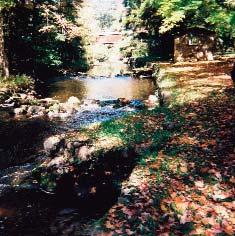
22 Chapter One: Issues and Opportunities Summary of Public Participation The Village s planning process was guided by several participation events and tools, in addition to regular meetings of the Village s Plan Commission. The following is a summary of those activities. Shawano County Western Cluster Meetings In order to facilitate large public meetings, communities in Shawano County multi-jurisdictional planning project were organized into three clusters. Though joining the County effort, somewhat late, the Village of Bowler was made part of the Western Cluster, which was also included the towns of Almon, Aniwa, Birnamwood, Germania, Hutchins, Morris, and Wittenberg, as well as the Villages of Aniwa, Eland, Tigerton and Wittenberg. The following is a description of the results for the Village of Bowler s public participation activities from each of the cluster workshops attended. Cluster Meetings: Sharing Future Land Use Maps The Western Cluster workshop Sharing Future Land Use Maps was held on October 16, Participants from each of the Western Cluster towns and villages compared their draft of the Future Land Use Maps with those prepared by other Western Cluster communities participating in the Shawano County multi jurisdictional planning process. Representatives from the Village of Bowler also gained additional understanding of methods implementing comprehensive plans and shared planning concerns for Shawano County. The Village of Bowler presented a preliminary draft future land use map available to share with other communities. Bowler representatives did not find significant incompatibilities or issues between the Village s draft future land use map and those from the towns of Almon or Morris, two of the four towns within the Village s 1.5 mile extraterritorial jurisdiction. The Village representatives recognized the need coordinate with the neighboring towns of Seneca and Bartlme (who were part of the Central Cluster and therefore not in attendance) at a later date, and to continue to monitor the progress of all neighboring plans. Special Places Photo Exercise In the summer of 2007, members of the Plan Commission completed a special places photo survey to capture the Village's defining character as seen from the eyes of residents. Commission members photographed the "special places" that capture this character. These photographs suggest places that Commission members wish to preserve or see more of in the future. Members also photographed places that they felt hurt the character and appearance of the community, or types of places elsewhere that they did not wish to see in the community. Of the 119 photos taken in Almon, the majority of photos were of good or special places. These photos can be grouped into four main categories: 1. A variety of natural and or recreational areas are found throughout the Village including a segment of the North Branch of the Embarrass River adjacent to the Ranger Station pictured here. Others photos showed Pond Park, the Mountain Bay Trail, the School Athletic fields, and the Elementary School Nature Area. ADOPTED: DECEMBER 8,


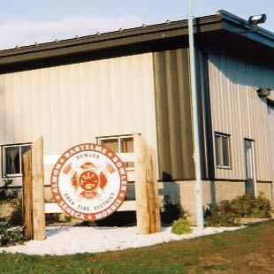
23 Chapter One: Issues and Opportunities 2. Many of the photos were of local businesses and employers. Many of these photos reflect not only the interest in economic development, but also the Village s historic small town character 3. A number of photos emphasized the range of community facilities and services, such as the Bowler Area Fire Department depicted here. Other photos showed the high school, elementary school, municipal well and sanitary sewer facilities, and community churches. 4. A number of photos reflected the range of housing options available in the Village, including senior housing (pictured here), single-family homes, apartments, manufactured homes, and low income housing. Photos of places that Commission members felt hurt the character of Village included poorly maintained residential properties, vacant (and sometimes blighted) commercial buildings, and vacant properties in high profile areas. ADOPTED: DECEMBER 8,
24 Chapter One: Issues and Opportunities County Survey A County-wide survey was conducted as part of the Shawano Area Communities Comprehensive Planning Project. In the fall of 2006, 9,993 surveys were sent out to a representative sampling of the 16,312 total households in the County. A total of 1,014 surveys were returned. This response rate, coupled with the large percentage of County households who received the survey, provides a significant result. Statistically speaking, the response rate yields a 95% certainty that if every household in the County had responded to a given question, the responses would have varied by less than 3% from the results that were obtained through this survey. The following is a brief list of key survey results. For a complete summary of survey results, see the Shawano County Comprehensive Plan. 68 percent of respondents considered the 1980 to 2005 County growth rate to be just right. Top responses for important key future directions included: maintaining rural character, promotion of business and industrial development, use of sign and other appearance regulations to preserve scenery, and the continuance of farming. 84 percent of respondents thought that new development should be planned by community with property owner input. Nearly half of respondents would like new recreational natural areas (trails, wildlife viewing, nature centers) in their community. When asked why they chose to live in Shawano County, over one-quarter of respondents selected near family or friends. The survey results were also analyzed by cluster (eastern, central, and western). The outcome of this analysis showed a remarkable consistency in responses. The top answers to each question were very similar no matter where in the county the respondent resided. One small difference noted was a difference in importance placed on preservation of farmland and forestland. Respondents in the eastern and central clusters tended to place more value on farmland, while preservation of forestland was more emphasized in the western cluster. The survey revealed that small town character, being close to outdoor recreational opportunities such as fishing and hunting, and natural beauty are important to residents of the Western Cluster. Nearly eight of ten though rated preservation of forest land, and surface waters such as lakes, rivers and streams as Very Important. Nearly seven of ten respondents rated preservation of farmland and wildlife habitat as Very Important. Over 7 in ten strongly agreed that maintaining rural character was important and over half strongly agree that their community should actively seek to protect the environment. When asked the top three reasons for living in western Shawano County, Small town character edged out living near family and friends as the most common response, while living close to outdoor recreational opportunities and natural beauty ranked third and fourth, ahead of living near jobs and low taxes. According to Western Cluster respondents, concerns over increased taxes and the lack of businesses, shopping, and services in the area were the two most common responses when asked for the top three problems facing the area. Low wages, a shortage of jobs, and a lack of opportunities for youth were next most common responses. Eighty-three percent of respondents thought that new development in their community should be thought out and planned by the community with proper input from the property owner. Local Land Use Workshop A meeting was held by the Village Plan Commission on September 20 th, 2007 to develop the Village s future land use map. Representatives from the Shawano County planning department facilitated the meeting and presented information relevant to development of the comprehensive plan, including differences between zoning and land use planning as well as an overview of the trends that are influencing land use in the County. The workshop results were as a basis for Map 5 Future Land Use included in this Plan. ADOPTED: DECEMBER 8,
25 Chapter One: Issues and Opportunities Open House and Public Hearing Once the public review draft of this Plan is completed, the Village solicited local public comment. This included a formal public hearing, held before the Board, in advance of Board adoption of this Plan. Regional Context and Influences It is useful to step back and understand the forces and factors that shape the area s physical, economic, and social environment. This Regional Influences analysis, considers both the assets and challenges of the County related to its position in the broader region. This analysis considers the County s proximity to growing metropolitan areas, commuting patterns, transportation, recreational resources, and the physical landscape as the key regional influences. These factors are illustrated on the Regional Influences Map in the Shawano County Comprehensive Plan and described in the Text of the County s Comprehensive Plan. BOWLER S OPPORTUNITIES Established local businesses Located near State Highway 29, area casinos and resorts, and outdoor recreation opportunities. Partnership with School District for mutual benefit. Strong investment in public services and facilities (sewer, water, emergency services). Statement of Overall Goals Each chapter of this Comprehensive Plan includes a set of goals, objectives and policies which will provide the vision and policy guidance that the Plan Commission, Village Board, Village residents, and other interested groups and individuals. For purposes of this plan, goals, objectives and policies are defined below: Goals are broad statements that express general public priorities about how the Village should approach development issues during the next 20+ years. These goals are based on key issues, opportunities and problems that affect the community. Objectives are more specific than goals and are usually attainable through planning and implementation activities. The accomplishment of an objective contributes to the fulfillment of a goal. Policies are rules or courses of action used to ensure Plan implementation and to accomplish the goals and objectives. The policies are intended to be used by decision-makers on a day to day basis. Programs are specific projects or services that are advised to achieve plan goals, objectives, and policies. Programs are sometimes included in the same list as policies and are sometimes included in the same section as recommendations, depending on the chapter. Below is a summary of the overall goals that will the future preservation and development in the Village of Bowler over the 20-year planning period. Objectives, policies, and programs that forward these goals relevant to each element of this Plan are presented in subsequent chapters. ADOPTED: DECEMBER 8,
26 Chapter One: Issues and Opportunities OVERALL GOALS Protect agricultural lands in areas in the Village s planning area, except in places advised by this Plan for future development within the Village. Protect valued and sensitive natural features including groundwater, wetlands, streams, lakes, woodlands, prairies, and sensitive wildlife habitats in and near the Village of Bowler. Preserve the Village s historic buildings, character, archeological sites, and cultural identity. Promote a range of residential types, businesses, and civic institutions in a pattern that is efficiently served and accessible to Village residents. Manage the extent, pace, character, and type of new development in a manner that preserves and enhances the quality of life for residents within the Village. Provide a safe, efficient transportation system that serves multiple users. Preserve the Village s sense of community and quality of life through maintaining and enhancing access to public services and utilities. Coordinate utility and community facility systems planning with land use, transportation, natural resource, and recreation planning. Plan for neighborhoods that contain a range of housing types, densities, and costs, but which also maintain the Village s mostly single-family character. Encourage the provision of an adequate supply of housing to meet current and future needs. Achieve a balanced economy in Bowler that features good jobs, services and shopping, commercial recreational opportunities, and a healthy tax base. Promote mutually beneficial intergovernmental relations with nearby and overlapping governments, and with the Bowler School District. Implement the recommendations of the Comprehensive Plan and update the Plan as needed to respond to changing conditions. ADOPTED: DECEMBER 8,
27 Chapter Two: Agricultural, Natural, and Cultural Resources Chapter Two: Agricultural, Natural, and Cultural Resources This chapter of the Comprehensive Plan contains background data, goals, objectives, policies, and recommended programs for agricultural preservation, natural resource conservation, and cultural resource protection. Agricultural Resource Inventory Character of Farming Farming has been a significant land use activity throughout the area s history. Cultivated crop land still accounts for 18%, 22%, and 25% of land use in the surrounding of towns of Morris, Seneca, and Almon respectively. This does not include the even larger percentage of for woodlands on parcels large enough for commercial timber operations. Over the past 20 years, local trends in farming mirrored the region and the state, with an overall decline in the number of full time farm operators and a drop in average farm sizes (see Figure 12). Overall during this time period over the past two decades, the County experienced a decline in the number of full time farm operators and a drop in average farm sizes. While these statistics indicate a decline in agriculture in the AGRICULTURAL RESOURCES RECOMMENDATIONS SUMMARY Protect large, contiguous tracts of farm and forest land outside of the Village s planned growth areas. Minimize development of agricultural land by directing development to appropriate area within the Village Work with surrounding jurisdictions to support local farms and farm land preservation. County overall, some inconsistencies in the data suggest that differences in methodology or the criteria use to classify farm use may lead to under-reporting actual farmland acreage losses. For instance, while the acreage of active agricultural land has declined as a whole, the acreage of land in smaller hobby farms may be increasing. The market value of agricultural products sold per farm increased from $81,188 in 1997 to $88,816 in Figure 12: Farm Changes in Shawano County, Number of Farms Number of Farms Lost / Gained Land in Farm Use (Acres) Average Farm Size (Acres) ,631 a - 326,323 a 200 a ,437 a ,984 a 207 a ,337 a 1,604 b -100 c 297,840 a 270,478 b 223 a 169 b ,465 b -139 d 270,534 b 185 b a Non-adjusted figure: this figure represents the old methodology for counting farms. b Adjusted figure: in 1997, the USDA revised its methodology for counting farms. The new methodology is more accurate and, as a result, is able to count small farms that would not be counted using the old methodology. c Calculated by comparing the non-adjusted figures from 1992 and d Calculated by comparing the adjusted figures from 1997 and Source: USDA Census of Agriculture, ADOPTED: DECEMBER 8,
28 Chapter Two: Agricultural, Natural, and Cultural Resources Assessment of Farmland Viability The Natural Resources Conservation Service groups soils based on their capability to produce common cultivated crops and pasture plants without deteriorating over a long period of time. These capability classifications are based on numerous criteria that include, but are not limited to, the soil s salinity, capacity to hold moisture, potential for erosion, depth, and texture and structure, as well as local climatic limitations (e.g. temperature and rainfall). Under this system of classification, soils are separated into eight classes. Generally, Class I and Class II soils are the best suited for the cultivation of crops. Class I soils have few limitations that restrict their use. These soils can sustain a wide variety of plants and are well suited for cultivated crops, pasture plants, range lands, and woodlands. Class II soils have moderate limitations that restrict the types of plants that can be grown or that require simple conservation practices or soil management techniques to prevent deterioration over time. However, these practices are generally easy to apply, and, therefore, these soils are still able to sustain cultivated crops, pasture plants, range lands, and woodlands. Soils in Class III have limitations that, under natural circumstances, restrict the types of plants that can be grown, and/or that alter the timing of planting, tillage, and harvesting. However, with the application and careful management of special conservation practices, these soils may still be used for cultivated crops, pasture plants, woodlands, and range lands. Soils in capability classes IV through VIII present increasingly severe limitations to the cultivation of crops. Soils in Class VIII have limitations that entirely preclude their use for commercial plant production. Map 4 depicts the locations of Class I, II, and III soils in and near the Village of Bowler. Generally, Class I and II soils are located primarily in the northwest and southeast portions of the Village. These areas some of these areas coincide with some of the largest remaining tracts of readily developable land in the Village. This Plan acknowledges that future development in the Village will likely come at the expense of some areas and soils otherwise suitable for agriculture, albeit in a manner that minimizes consumption of land and has less impact on agriculture than similar levels of development on larger lots outside of the Village. No Class III soils are depicted. Class IV or lower soils are located around the Village s creeks and streams and to the north of East Railroad Street. These areas coincide with valued water and other natural resources, and present other obstacles to both intensive agriculture and future development. Farmland Preservation Efforts Local farmers can participate in several federal, State, and Countywide programs and initiatives that are intended to preserve long-term farming activities. The 2002 Farm Bill reauthorized several federal programs, including: The Conservation Reserve Program (CRP), which provides technical and financial assistance to eligible farmers and ranchers to address soil, water, and related natural resource concerns on their lands in an environmentally beneficial and cost-effective manner. The Wetland Reserve Program, which provides technical and financial support to help landowners with their wetland restoration efforts. The Wildlife Habitat Incentives Program, which provides both technical assistance and up to 75 percent cost-share assistance to landowners to establish and improve fish and wildlife habitat on their property. The Grazing Lands Conservation Initiative, which focuses on providing technical assistance to help new grazers begin using rotational grazing methods. Trained grazing specialists work one-on-one with farmers, developing grazing plans, including seeding recommendations, fencing and watering plans. The Environmental Quality Incentives Program (EQIP), which provides a voluntary conservation program for farmers and ranchers that promotes agricultural production and environmental quality as compatible national goals. EQIP offers financial and technical help to assist eligible participants install or implement structural and management practices on eligible agricultural land. ADOPTED: DECEMBER 8,
29 Chapter Two: Agricultural, Natural, and Cultural Resources In addition, the Wisconsin Department of Revenue offers two important farmland preservation programs, the Farmland Preservation Credit Program and the Farmland Tax Relief Credit Program. The Farmland Preservation Credit Program strives to preserve Wisconsin farmland by means of local land use planning and soil conservation practices and provides property tax relief to farmland owners. To qualify for the credit, farmland must be 35 acres or more and zoned for exclusive agricultural use or be subject to a preservation agreement between the farmland owner and the State. In addition, all program participants must comply with soil and water conservation standards set by the State Land Conservation Board. The Village of Bowler does not have exclusive agriculture zoning, and its agricultural district is intended primarily as a holding district for existing agricultural uses until such time as more Village oriented development occurs. In 2005, there were no claims for this credit in the Village. County-wide, this program has a 31 percent participation rate. The Farmland Tax Relief Credit Program provides direct benefits to all farmland owners with 35 or more acres. The credit is computed as a percentage of up to $10,000 of property taxes, with the maximum credit of $1,500. In 2005, there were 3 claims for this credit in the Village. It should be noted that claims for both of the Farmland Preservation Credit and the Farmland Tax Relief Credit are documented for the municipality in which the claimant lives, which may not be where the farm is actually located. Agricultural Resource Goals, Objectives and Policies Goal: 1. Protect agricultural lands in areas in the Village s planning area, except in places advised by this Plan for future development within the Village. Objectives: 1. Maintain agriculture as a significant economic activity within Bowler s extraterritorial planning area. 2. Recognize the economic, recreational, aesthetic, and social value of farm and forest lands near the Village limits. 3. Protect farm and timber operations from incompatible land uses and activities that may adversely affect the capital investment in agricultural land, improvements, and equipment. 4. Work with surrounding jurisdictions to preserve farming as a viable occupation. Policies: 1. Carefully consider the location of productive agricultural lands before making decisions on the expansion of Village services or growth. 2. Work with neighboring towns and Shawano County to encourage a compact, orderly, efficient development pattern that minimizes conflicts between farming operations and non-farming operations, particularly residential development. 3. Consider using extraterritorial land division review in support of this adopted Plan to limit intensive development in productive farming areas outside of the Village. ADOPTED: DECEMBER 8,
30 Chapter Two: Agricultural, Natural, and Cultural Resources Agricultural Resource Recommendations and Programs The Village recognizes the importance of agricultural activities to Bowler s local economy and character and seeks to preserve the integrity of this resource in the Village s peripheral areas. To this end, the Village encourages the preservation of existing farmlands in areas designated as Agriculture and Preservation and Open Lands, Agriculture, and Residential (10-35) in the Towns of Almon, Morris, Seneca, and Bartlme, as shown on Map 5, by pursuing the following recommendations: 1. The Village will support County and Town planning efforts that allow only very low density non-farm development in areas mapped as Agriculture and Preservation and Open Lands, Agriculture, and Residential (10-35) areas on Map 5 Future Land Use. 2. The Village will consider exercising its 1½-mile extraterritorial jurisdiction (ETJ) subdivision review authority as established by State statutes to discourage rural housing development within this extraterritorial area. Specific steps to implement this recommendation are provided in Chapter Nine: Implementation. 3. The Village will promote the continuation of the local family farm and the growing of specialtyagricultural products by hosting markets, parades, festivals, fairs, auctions, and other farming related events, and by encouraging purchase of local farm produce by area businesses and public agencies in neighboring towns, the Bowler Area School District, and the County. 4. The Village will continue to provide suitable locations for agriculture and timber supporting businesses and industries such as equipment dealers and value-added processing or manufacturing. 5. The Village will support County, Regional, and State efforts to support new uses for agricultural and forestry related products, including potential bio-based industries (see call-out box below). THE WISCONSIN CONSORTIUM ON BIO-BASED INDUSTRY The term bio-economy is used to refer to the production of products, chemicals, and energy from renewable bio-mass (crops, crop waste, wood) that are currently produced primarily from non-renewable fossil fuels, such as petroleum. Ethanol from corn and bio-diesel from crop waste are well known examples of fuels created from biomass. Research is underway to unlock the potentially much higher energy yields from other organic sources such as grasses, legumes and timber, all of which are readily grown in Wisconsin. The potential for bio-mass is not limited to fuels. Many products that can be made from petroleum, such as plastics and lubricants, can also be made from bio-mass. Growing concerns over rising energy costs, dependency on foreign sources of petroleum, global climate change, and environmental degradation, have been matched by growing interest in the emerging bioeconomy. By virtue of its natural resources, strong agricultural and forestry economies, and research facilities, the State of Wisconsin is in a strong position to develop and expand its bio-economy and bio-based industries. In recognition of these assets and trends, Governor Doyle issued Executive Order #101 in 2005 establishing the Wisconsin Consortium on Bio-based Industry. The Consortium consists of six working groups (economics, education & outreach, regulatory issues, organizations & institutions, technology & science, and environment) to focus on improving each of these necessary aspects of biomass economy. The members were chosen from both the private and public spheres for their expertise in the relevant areas. The stated purposes of the consortium include making recommendations on how best to coordinate state, federal, and private initiatives to foster growth of the bio industry in an environmentally sound manner. More information is available on-line at ADOPTED: DECEMBER 8,
31 Chapter Two: Agricultural, Natural, and Cultural Resources Map 2: Soil Suitability for Agriculture ADOPTED: DECEMBER 8,
32 Chapter Two: Agricultural, Natural, and Cultural Resources ADOPTED: DECEMBER 8,
33 Chapter Two: Agricultural, Natural, and Cultural Resources Natural Resource Inventory Understanding the extent and location of the Village s natural features suggests possible advantages for particular land uses. It is also essential to understand the location of environmentally sensitive areas where development is not appropriate. This will prevent severe developmental or environmental problems that may be difficult or costly to correct in the future. Maintenance of these natural features is also important for community appearance and for the functions they perform for natural communities. Map 3 depicts the Village s environmentally sensitive areas and key natural resource areas, some of which are described in more detail below. Topography The topography in and near the Village of Bowler was shaped over 10,000 years ago by Wisconsin s most recent period of glacial activity. The landscape is characterized by gently NATURAL RESOURCES RECOMMENDATIONS SUMMARY Identify and protect environmental corridors as key open space and recreational features that define the community Protect and improve surface water quality, especially the North Branch of the Embarrass River and its tributaries. Promote environmentally sustainable recreation-based tourism rolling moraines and drumlins that were formed by material deposited along the edges of the ice sheet during the glacier s retreat. These landscape features are most prominent in the western half of the County where the Village is located. Metallic and Non-Metallic Minerals Glacial deposits consist of soil, subsoil, sediment, sand, gravel, and/or stone and are characterized by a variety of depths and patterns throughout the Village. Furthermore, the Village s glacial deposits provide many valuable non-metallic minerals such as sand and gravel that are used for road construction, housing, and commercial developments. No active non-metallic mining operations are located in the Village of Bowler. Currently, there are no active metallic mining activities anywhere in Shawano County because metallic minerals are not present in high quantities. However, there are some limited deposits of copper and other base metals in the northwestern portion of Shawano County. Groundwater Groundwater is comprised of the portion of rainfall that does not run off to streams or rivers and that does not evaporate or transpire from plants. This water percolates down through the soil until it reaches the saturated zone of an aquifer. Groundwater supplies all of the water for domestic, commercial and industrial uses in the Village of Bowler. The quality of groundwater in the Village is generally good. However, groundwater contamination is of concern due to the characteristics of the bedrock and surficial geology found in some parts of the Village. Areas with permeable soils and a high water table are the most susceptible to contamination from specific land uses. The majority of the Village of Bowler s groundwater is highly susceptible to contamination. In urban and rural areas, the most common groundwater contaminant is nitrate-nitrogen, which can come from improperly functioning on-site wastewater systems, animal feedlots, livestock waste facilities, sludge and septage application, lawn and agricultural fertilizers, and decaying plant debris. A 2002 report by the Central Wisconsin Groundwater Center found that 8.9 percent of private wells tested in Shawano County have levels of nitrate-nitrogen over the health standard (10 mg/liter). Nitrate-nitrogen is a potential human health threat, particularly for infants. This contaminant has been known to cause the condition methemoglobinemia, which interferes with the blood s ability to carry oxygen. This same report indicated that 15.3 percent of private wells sampled in Shawano County tested positive for fecal coliform bacteria, which indicates that fecal wastes may be contaminating the water and that pathogenic organisms could be present. ADOPTED: DECEMBER 8,

34 Chapter Two: Agricultural, Natural, and Cultural Resources Watersheds and Surface Waters The Village of Bowler is located entirely within the North Branch and Mainstem Embarrass River Watershed. This watershed is located within the Wolf River Basin, which drains over 3600 square miles and portions of eleven counties in northeastern Wisconsin into Lake Michigan. The Wolf River, which traverses the eastern portion of Shawano County, is the Basin s most significant water resource. Currently, the Basin faces many challenges to its overall ecological health, including nonpoint source water pollution, the loss of shoreland habitats, and the presence of various exotic invasive species. The North Branch of the Embarrass River generally flows from west to east in and near the Village; winding southward through the southwest part of the Village before turning and flowing in a northeasterly direction through the southeast corner of the Village. The tributary stream that forms the Bowler Pond drains the wetlands at the north end of the Village before meeting into the Embarrass River at a point west of Bowler s two public schools. The surface waters in Bowler are considered Class I Trout waters, and require protection of both water quality and shoreland in order to sustain trout and other native fish populations. Floodplains The Federal Emergency Management Agency (FEMA) designates floodplains. These are areas predicted to be inundated with flood waters in the 100-year storm event (e.g., a storm that has a 1% chance of happening in any given year). Development within floodplains is strongly discouraged so as to property damage. Map 3 shows extensive Floodplain areas in the Village associated with the North Branch of the Embarrass River and its tributary stream south of Bowler Pond. Much of the southwest portion of the Village west of the high school is classified floodplain, as is a substantial area on both banks of the Embarrass River in the southeast corner of the Village. A total of 122 acres lie in floodplains. The National Flood Insurance Program maps produced by the FEMA should be referenced for official delineation and elevations of floodplain boundaries. Wetlands Wetland ecosystems play significant roles in maintaining the quality of groundwater and surface water, provide valuable habitats for fish, birds, and other wildlife, and act to slow the rate of stormwater runoff. According the Wisconsin DNR s Wetland Inventory Maps, a large wetland marsh is located at the north end of the Village, with additional wetlands associated with the Embarrass River. Wetland habitats comprise approximately 100 acres percent of the Village s total land area, not including small tracts of wetland that are less than five acres. Approximately 80% percent of these wetlands are forested. Most of the remainder is owned by the School District and preserved as open space. Ecological Landscapes An ecological landscape is defined as a region characterized by a unique combination of physical and biological attributes, such as climate, geology, soils, water, or vegetation. Different ecological landscapes offer distinct management opportunities based upon their levels of biological productivity, habitat suitability for wildlife, and presence of rare species and natural communities. The Village of Bowler falls within the Forest Transition Landscape. Understanding the distinct attributes of this landscape will be important when identifying future land management and land use goals. Woodlands The Village of Bowler is located in Wisconsin s northern forest zone, which is characterized by a mixture of coniferous and deciduous forest types. Typical tree species include Hemlock, Beech, Spruce, Cedar, Tama- ADOPTED: DECEMBER 8,
35 Chapter Two: Agricultural, Natural, and Cultural Resources rack, Sugar Maple, Yellow Birch, and White and Red Pine. Dense hardwood forests and timber stands are characteristic of the western portion of Shawano County, and a significant portion of the lands within and around the Village remain wooded. Much of the Village remains in woodland, with large stands in wetland areas and near the Embarrass River environmental corridor. Steep Slopes As shown on Map 3, steep slopes exceeding a 12 percent grade are scarce and scattered throughout the Village and are most prevalent at certain locations near the Embarrass River and at the extreme northwest edge of the Village surrounding the wetland area. Generally, slopes that have between 12 and 20 percent grade present challenges for building site development, and slopes that exceed a 20 percent grade are not recommended for any disturbance or development. Rare Species Occurrences/Natural Areas WisDNR s Natural Heritage Inventory program maintains data on the general location and status of threatened or endangered plant and animal species and natural communities and species and communities of special concern. This information is not available at the Village level; however, the surrounding Towns have several plant species and natural communities that are categorized as such, including the northeast corner of the Town of Morris that abuts Bowler. More specific information on location and type of specie is available from the State s Bureau of Endangered Resources. State Natural Areas/Wildlife Areas There are no State Natural Areas or Wildlife Areas located in or near the Village of Bowler. Natural Resource Goals, Objectives and Policies Goal: 1. Protect valued and sensitive natural features including groundwater, wetlands, streams, lakes, woodlands, prairies, and sensitive wildlife habitats in and near the Village of Bowler. Objectives: 1. Preserve the Village Pond, the Embarrass River, other area surface waters, associated wetlands and shorelands; woodlands, and other valued natural open spaces - particularly those that constitute unique, sensitive and/or endangered wildlife habitat and trout streams within the Village s planning area. 2. Protect and improve groundwater and surface water quality, and maintain consistent water levels and seasonal variations of the Village s streams and ponds. 3. Direct development away from environmentally sensitive areas, including shorelands, floodplains, wetlands, and steep slopes (shown on Map 3). 4. Pursue opportunities that combine natural resource protection with nature-based recreation and local economic development. Policies: 1. Develop Shoreland standards which prohibit development and severely restrict non-native landscaping within 300 feet of the ordinary high water mark of surface waters. 2. Protect and improve surface water quality (e.g. lakes and wetlands) by supporting streambank management, natural shoreline restoration, erosion control, clean-up initiative, proper agricultural practices, stormwater management, water level monitoring, and use of vegetative buffers. 3. Work to identify and catalog unique natural features in the Village s planning area such as the rock formation northwest of the Bowler High School. 4. Consider the preservation of natural features of a site and natural resources in the area when development proposals are offered. ADOPTED: DECEMBER 8,

36 Chapter Two: Agricultural, Natural, and Cultural Resources 5. Work to protect endangered or rare species and wildlife habitat areas, such as trout streams. 6. Cooperate with other units of government and non-profit land conservation agencies on preservation of natural resources which are under shared authority or cross government boundaries 7. Recognize and promote the Village s natural resources base as an asset to local tourism and economic development. 8. Continue to support programs that help to educate citizens on the tools, programs, and incentives that protect the natural environment. 9. Carefully review proposals for metallic and non-metallic mineral extraction operations, requiring the submittal and careful review of site plans, and reclamation plans and the protection of adjacent property owners, natural resources, and roads. Natural Resource Recommendations and Programs Expanding on the policies listed above, this section provides specific recommendations for conserving the Village s natural areas. Protect Environmental Corridors Environmental corridors are, in effect, a compo site of important individual elements of the natural resource base. They have immeasurable environmental, ecological, passive recreational, stormwater management, groundwater protection and recharge, erosion control, wildlife, timber, and scenic value. Environmental corridors also have severe limitations for development; therefore, minimizing development in these areas also protects private property. Environmental corridors generally occur in a linear (corridor) pattern on the landscape (see Map 5 for Environmental Corridor delineations). Environmental corridors include the following areas: Wisconsin DNR-identified wetlands as mapped in the Wisconsin Wetlands Inventory and subject to existing zoning control. This layer may not include all wetlands that are subject to State and/or federal disturbance rules. Protection from development should be provided to these areas (also shown on Map 3) as well as those identified through more detailed field surveys to preserve the significant natural functions that wetlands provide. Federal Emergency Management Association (FEMA) designated floodplains subject to existing zoning control. These general floodplain delineations represent the areas potentially subject to the 100-year flood. All areas subject to flooding are not necessarily reflected in mapped floodplains (or within the environmental corridor delineation). The Village should protect areas within the 100-year floodplain as shown on Flood Insurance Rate Maps and more detailed surveys from development to avoid damage to property and the health, safety and welfare of the community. Lands with steep slopes of 12 percent or greater. Due to the instability of these soils and erosion concerns, development (including buildings and driveways) on these steep slopes is not advisable. New development should generally be prevented in environmental corridors. The intensity and range of land uses should be limited to those which will not impair the resource, and which are compatible to existing and ADOPTED: DECEMBER 8,
37 Chapter Two: Agricultural, Natural, and Cultural Resources proposed uses on surrounding lands. New homes and other buildings should not be placed in these areas if other, more appropriate, building sites are available outside the environmental corridor. Sensitivity to surrounding natural resources should be the guiding principal when reviewing the appropriateness of development in mapped environmental corridors. The Village encourages developers to minimize the footprint of any construction near corridor areas. The Environmental Corridors depicted in Map 5 are necessarily general and should be used to identify general areas where development may not be appropriate. Lands within that designation may be removed under one or more of the following circumstances: More detailed study reveals that the characteristic(s) which originally resulted in its designation as an environmental corridor no longer exists, never existed, or exists in a different location or configuration on the site, or Approvals from appropriate agencies are granted to alter a property so that the characteristic which resulted in its classification as an environmental corridor will no longer exist, or A mapping error has been identified. Protect Surface Water Quantity and Quality The North Branch of the Embarrass River and its tributary streams and wetlands are key natural features in and near the Village, forming the backdrop for much of the development and activity in the community. General recommendations designed to support the objectives of protecting the quality of the Village s water resources are offered below. Vegetative Buffers Vegetative buffers between developed areas and water bodies provide many benefits, including the protection of water quality, flood control, stream bank stabilization, water temperature control, and room for lateral movement of stream channels. Trees and shrubs retained in buffer areas provide the benefit of buffering noise from watercraft, providing privacy to residents, and serving as nesting areas for songbirds. The buffering techniques described below and illustrated in Figure 13 can maximize water quality protection, habitat, and erosion control benefits in buffer areas around lakes and rivers in the Village. The Village will consider incorporating these standards, including a recommended shoreline building setback (75 feet is a commonly use standard, but the Village may wish to be more restrictive) for new development and restrictions on grading, ground disturbance, and vegetation in its zoning ordinance: Landscaping with native sedges and grasses, broadleaf groundcover plants, shrubs, subcanopy, and canopy trees, instead of mowed lawns. A complete buffer contains a canopy tree layer, a mid-canopy layer (smaller or younger trees such as ironwoods, hazels, or willows), and a ground layer of shrubs, ferns, forbs, and native grasses. Encouraging wide buffer areas of natural vegetation. A good minimum standard for buffer area width is 35 feet. Wide buffer areas generally increase water quality, wildlife habitat, and erosion control. Minimizing use of pesticides and fertilizers in the buffer area. These chemicals can leach into the lake, compromising the water quality and killing insects that are important food for the fish, birds, and other wildlife. ADOPTED: DECEMBER 8,

38 Chapter Two: Agricultural, Natural, and Cultural Resources Figure 13: Example of Vegetative Buffer Erosion Control and Stormwater Management Plans Unmanaged construction sites are one of the greatest contributors to off-site sediment runoff. Under a recent change to State law, erosion control plans are required for all construction sites over 1 acre in area. The Village should help ensure erosion control and stormwater management techniques for protection and continued improvement of its water quality. In particular, stormwater management and erosion control systems should be components of planned new development areas, including subdivisions and commercial projects. Erosion control techniques include silt fencing, minimizing disturbed areas, and quickly reestablishing vegetation. Stormwater management techniques include natural drainage swales and retention and detention basins. These techniques control the quantity and improve the quality of water run-off during storms and enhance groundwater recharge, which is particularly critical near sensitive waters such as the North Branch of the Embarrass River and its tributaries. Monitor Area Dam Management, Maintenance and Repair Proposals Changes in the water levels of rivers and ponds in the Village s planning area due to dams and other water management strategies within and beyond the Village s planning area could have significant impacts not only the water resource, but also surrounding habitats and land uses and the enjoyment of area resources by residents and visitors. The Village maintains small dams to maintain the level of the Village Pond. Several other area dams, up and down stream from Bowler have potentially significant impacts on surface water bodies and habitat. The Village intends to monitor and maintain the Village s pond and waterways. Bowler also will strive to be kept notified and involved in any decisions involving dam repair or removal that effects water systems in the Village s planning area. Over the planning period, the Village will work closely with local communities and the WisDNR to consider dam management options, should issues with dams arise. Decisions to remove or repair dams in the Village s planning area or watershed should be based on a careful analysis of economic, social, and environmental factors. The Village has no major issues with area dams at the time this Plan was prepared. Protect Groundwater Quantity and Quality Groundwater is the source for all of the Village s drinking water supply. If groundwater is removed from an aquifer more quickly than it is recharged, the amount of water available in the aquifer is reduced. This may be of particular concern where water tables are dropping from groundwater use in portions of the Village with ADOPTED: DECEMBER 8,
39 Chapter Two: Agricultural, Natural, and Cultural Resources high concentrations of dwelling units. In addition, groundwater recharges local rivers and streams. For these reasons, groundwater protection is critical. The Village supports several efforts to protect groundwater quality and quantity, including the following: Remain informed and involved in decisions pertaining to high-capacity wells: Permits for high capacity wells (those withdrawing more than 100,000 gallons per day) must be registered with and permitted by WisDNR. The DNR will not approve wells that impair public water utility supplies. Wells drawing more than 2 million gallons per day are evaluated in terms of whether they impair public water rights, future water use plans, or cause adverse groundwater effects. The DNR also has authority to deny a request for a high-capacity well should it assess the environmental impacts as significant to outweigh the benefit. Should potential new sites be proposed in the Bowler area over the planning period, the Village should remain informed and involved in any WisDNR decisions regarding high-capacity well decisions. One way to stay involved in through regular communication and providing public comment during Environmental Impact Statement review periods. The Village will also consider participating in cooperative groundwater management plans with municipalities, industries, local and regional planning agencies, and State agencies where appropriate, should special groundwater protection priority areas be delineated in the future. Carefully consider and study new development in areas susceptible to groundwater contamination. The Village intends to limit the location of additional commercial and industrial uses with the potential to emit pollutants into the soil or groundwater in portions of the Village more highly susceptible to groundwater contamination. In particular, precautions should be used in siting gas stations or other uses that store fuel or other potential contaminants. The Village will consider working with existing business owners on plans to maximize the potential and severity of spills that may otherwise cause future contamination. Adopt a Wellhead Protection Ordinance. Wellhead Protection ordinances are enacted to protect groundwater and municipal drinking water supplies by limiting the type and intensity of uses near an active municipal well. Groundwater near wells are particularly susceptible to ground contamination because wells tend to draw contaminants that are otherwise suspended in moist soils toward the well and the groundwater reservoir it is drawing from. Wellhead Protection Ordinances are often incorporated into a communities zoning ordinance as an overlay district. Partner with property owners in the identification, assessment, remediation, and reuse of brownfield sites. These sites have the potential to contaminate groundwater. State and federal funding are now available for brownfield assessment, planning, and clean-up in advance of redevelopment. The Village will continue to be active in identifying and helping to clean up and restore to economic use those sites that contain soil contamination. See Chapter Seven: Economic Development, for more specific strategies. Protect Rare Species and Wildlife Habitat Areas Preservation of wildlife habitat and rare plant and animal species has many benefits. Not only does protecting wildlife and wildlife habitat benefit the environment, but it enhances the quality of residents lives, preserves rural character, increases pride and stewardship in private land ownership, and enhances recreation and tourism. Preserving habitat and protecting rare species at the local level may also minimize the potential that a species will officially become threatened or endangered, requiring federal intervention under the Endangered Species Act. The WisDNR Bureau of Endangered Resources maintains a database entitled the Wisconsin Natural Heritage Inventory (NHI). An area Sensitive or Endangered Habitat has been identified in the neighboring Town of Morris, part of which is within Bowler s planning area. In addition, the segments of the North Branch of the Embarrass River and its tributaries have been rated as Class I Trout Streams. Because rare species are vulnerable to collection and intentional destruction, the exact locations and type of rare species is not made readily accessible. However, this data is available through submittal of a Wisconsin Natural Heritage Inventory Request Form, which the Village will require whenever a new subdivision or major development proposal is offered within a section of land where a rare species has been identified. As suggested in the policies in the following chapter, specific measures should be taken to minimize the effects of development on rare species and their habitat. Strategies include encouraging developers to minimize the footprint of development, util- ADOPTED: DECEMBER 8,


40 Chapter Two: Agricultural, Natural, and Cultural Resources izing vegetative buffers to provide connectivity between habitat areas and create a more sensitive land use transition, encouraging natural landscaping, and directing development outside of environmental corridors. Build on the Bowler Area s Natural Resources to Promote Recreation Tourism The possibility for expanding the Bowler area s role in a nature-based tourism economy provides the opportunity for area residents to enjoy financial benefits of increased economic development while simultaneously preserving the area s environment. The Mountain Bay State Trail bicycle trail (described in greater detail in Chapter 4: Transportation) provides one local example of tying the Village s natural and cultural resources to outdoor recreation and tourism, and provides economic and recreational incentives to protect the Village s natural assets. Other opportunities for nature based recreation include fishing (especially trout fishing), paddling on the area s rivers and streams, and hiking and nature watching (such as birding ) in the areas woodlands and wetland areas. A proposed walking trail along the entire northern bank of North Branch of the Embarrass River through the Village could potentially provide access to many of these users. Bowler intends to promote these and other opportunities for tourists and locals alike to explore and enjoy natural resources, and encourage businesses that cater to these and related activities such as hunting in partnership with area towns and Shawano County. There are many types of businesses that respond to the market of tourists attracted to the area for its outdoor recreation opportunities, including restaurants, nature stores, (e.g. wildlife-related items, gift shops, and art galleries), and a sporting goods store. The Village is also an appropriate location for tours lodging such as a bed and breakfast or a small inn (4-6 rooms). These activities not only provide an economic incentive to preserve and open existing natural resource areas to the general public, but can, in turn, stimulate additional interest in -and develop constituencies for - even greater resource protection. ADOPTED: DECEMBER 8,
41 Chapter Two: Agricultural, Natural, and Cultural Resources Map 3: Natural Features ADOPTED: DECEMBER 8,
42 Chapter Two: Agricultural, Natural, and Cultural Resources ADOPTED: DECEMBER 8,
43 Chapter Two: Agricultural, Natural, and Cultural Resources Cultural Resource Inventory The Village of Bowler and the entire region was once home to the Menominee and Chippewa Native American tribes. They hunted and fished the rivers and lakes of this region for hundreds of years prior to the arrival of the Europeans. In 1673 French Jesuit priest Jacques Marquette and Jean Nicolet journeyed through the County, but did not settle. Samuel Farnsworth came to the region in 1843 via the Wolf River and realized the potential for lumbering. A year later Charles Wescott established a sawmill at the junction of the Wolf River and Shawano Lake. On the November 10, 1845, the first steam-powered boat, The Manchester, arrived at what is now the City of Shawano on the Wolf River. CULTURAL RESOURCES RECOMMENDATIONS SUMMARY Protect the remaining historic character of the downtown through design guidelines on new and rehabilitated buildings Promote community events as a way to build pride and attract visitors By 1851 logging had spread out from the Shawano area to other rivers that flowed into the Wolf. In 1853 the population of the region had grown to 254 inhabitants and Shawanaw County was established as a separate County from sections of Oconto and Outagamie Counties. The name Shawanaw comes from the Native American Sha-wa-Nah-Pay-Sa which meant lake to the south in Menominee and Chippewa; the current spelling was adopted in As the community grew and the land was cut-over, Germans came in large numbers to clear the land of stumps, drain the swamps, and establish farms that remain to this day. Joining these European pioneers were also Bohemians, Norwegians, Irish, and, to a lesser degree, English and French immigrants. While lumbering still played a small part in the economy after 1900, the primary economy was dairy farming and associated industries. Each generation of residents has added to the cultural, religious, and architectural flavor of the region. Preservation of these historic and cultural resources fosters a sense of pride, improves quality of life, and provides an important feeling of social and cultural continuity between the past, present, and future. The following sections describe the Village of Bowler significant historic and archeological resources. Historic Resources The Wisconsin Historical Society s Architecture and History Inventory (AHI) contains data on a wide range of historic properties throughout the State such as round barns, cast iron bridges, commercial buildings, school houses, and turn-of-the-century homes that create Wisconsin s distinct cultural landscape. There are no buildings listed by the AHI in the Village Bowler. There are also no properties in the Village listed on the National or State Historic Registers. The Shawano County Historical Society Heritage Park Museum, located in the City of Shawano, seeks to preserve and promote these types of historic resources. The six-building museum compound and its exhibits bring to life the history of immigrants, lumberjacks and early farmers who settled this area of Wisconsin. Archeological Resources There is only one archeological site within the Village of Bowler designated by the Wisconsin State Historical Society. The site is located near the center of the Village and named Bowler Field #1. Such designated sites include cemeteries/burial sites, effigy mounds, and campsites/villages. All human burial sites, including cemeteries and Indian mounds, are protected under State law. The National Historic Preservation Act of 1966 requires federal agencies to insure that their actions do not adversely affect archeological sites on or eligible for listing on the National Register of Historic Places. Archeological sites can be protected during the course of State agency activities if the sites have been recorded with the Office of the State Archeologist. ADOPTED: DECEMBER 8,
44 Chapter Two: Agricultural, Natural, and Cultural Resources Local Cultural Opportunities In addition to historic and archeological resources, Village groups and residents s host cultural and social events that reflect and promote the community s culture, history, and economy. Events and organizations include the following: Cultural Resource Goals, Objectives and Policies Goal: 1. Preserve the Village s historic buildings, character, archeological sites, and cultural identity. Objectives: 1. Identify and promote the preservation of the Village s cultural, historic, and archeological resources. 2. Cooperate with neighboring towns, the School District, local and Shawano County businesses and civic groups to promote the historic and cultural character of the Bowler area. Policies: 1. Emphasize the value of historic buildings as community focal points. 2. Encourage private landowners to protect and rehabilitate historic and cultural sites, and incorporate them into the planning of new development areas where appropriate. 3. Require new development to reflect the desired historic character and context of valued Village landmarks and neighborhoods. 4. Continue local cultural and recreational events and endeavors, partnering with local organizations and the School District. 5. Coordinate with other communities and the County to expand local events into County- and Regionwide events to increase awareness and participation. Cultural Resource Recommendations and Programs Expanding on the local planning policies listed above, through this Plan, the Village endeavors to preserve historic buildings and places, and promote and active civic and cultural life by pursuing the following strategies: Preserve Historically and Culturally Significant Buildings The Village will coordinate with property owners to identify existing buildings and sites that are of valued locally for their history or notable contribution to community character, and explore the possibility of nominating these properties to the State or National Register of Historic Places. The Village will also attempt to make property owners aware of resources to assist with historically-sensitive remodeling projects, including the following: Property owners can qualify for a 20% federal Investment Tax Credit (ITC) to rehabilitate their historic commercial, industrial, and rental residential properties. Preservation tax incentives are available for buildings that the Secretary of Interior has listed on the National Register of Historic Places. In Wisconsin, owners of historic properties can claim an additional 5% ITC from the State against the approved costs of the rehabilitation of their ADOPTED: DECEMBER 8,
45 Chapter Two: Agricultural, Natural, and Cultural Resources building. All work must comply with federal guidelines established in the Secretary of Interior s Standards for Historic Building Rehabilitation. At the state level, another tax relief program provides a 25% Wisconsin ITC for the rehabilitation of owner-occupied structures that either contribute to a National Register-listed historic district or that are individually listed or eligible for listing with the National or State Register. To qualify, rehabilitation expenditures must exceed $10,000 and the State Historical Society must certify that the work is compatible with the historic character of the building. All applications must be made to the State s Division of Historic Preservation, where required forms and additional information can be obtained. Historic property owners can apply for grant funding from the Wisconsin Humanities Council s Historic Preservation grant program. The program provided grants for projects that enhance the appreciation of important historic buildings or decorative art works. Preference is given to significant preservation projects in small towns with populations less than 30,000. All applications must be made to the Wisconsin Humanities Council, where additional information can be obtained. Historic Renovations Some structures, through incremental renovations over the years, no longer retain many internal or in some cases even exterior features from original construction. However, many of these structures are still valued for the character of their exteriors and the contribution that these facades make in establishing the character of the downtown or nearby neighborhoods. The Village will work to balance regulatory approaches such as architectural standards (described in greater detail below) with incentives and partnerships with private developer s and property owner s to encourage renovations of valued historic structures -particularly older homes and commercial buildings in the historic downtown. The goal is to retain historic character and appeal while allowing installation of modern levels of amenities. Various tax incentives and other programs to finance historic renovations exist to assist interested parties in achieving this goal. Adopt and Implement Design Guidelines for Commercial Structures Bowler s historic commercial downtown area is located primarily along Main Street and to a lesser extent, West Rail Road Street. Most of the commercial and some residential structures retain the traditional layout, with little or no setback from the public right of way, which contribute to the traditional character of the Village. In addition, some of older, historic structures further contribute to the Village s historic character through their architecture, and some more recent structures include at least some elements of traditional late 19 th century/early 20 th century styles. However, the design of other recently constructed buildings is not consistent with this historic character. The Village Zoning Ordinance currently permits commercial structures with zero setbacks except when abutting a residential district, but there are no additional design guidelines or requirements to ensure the future buildings will be required to contribute to this traditional pattern and compliment the valued existing structures. The Village intends to define the areas in which new commercial development must conform to the traditional downtown pattern. The Village will also adopt and enforce design standards when considering any new projects. Infill, redevelopment, and rehabilitation projects in the downtown should be regulated so as to maintain the desired character and image of this area of the Village. The Village would benefit from special, illustrated design standards such as Figure 14 to guide rehabilitation and redevelopment projects. Additional design guidelines for commercial structures appear in Chapter 7: Economic Development. Criteria may cover issues such as building height, width, setbacks, proportion of openings, horizontal rhythms, roof form, materials, color, sidewalk coverings, and signs. Special issues such as consideration of surrounding historic character and treatment of historic buildings will be considered. Design guidelines may be incorporated into downtown planning efforts, zoning ordinance, and other documents. ADOPTED: DECEMBER 8,

46 Chapter Two: Agricultural, Natural, and Cultural Resources Figure 14: Conceptual Example of Design Guidelines for New Construction Continue to Collaborate on Community Branding and Signage Program The Village of Bowler and neighboring jurisdictions have created several attractive community entrance and way-finding signs to promote the Village and its attractions and help visitors find their way around. The Village will continue to add additional signs to help visitors find and learn more about the Village s natural, recreational, cultural, and commercial assets such as the Mountain Bay State Trail, nature trails, canoe landings, and area historic and commercial sites. A unified design theme will help enhance the community s sense of place and character. Some guidelines to keep in mind when designing a community-wide signage system include the following: Use the design theme of the signage to help brand the community in a favorable light, suggesting both the area s unique heritage and future opportunities. Make sure that once the signage system starts to provide directions to a destination, subsequent signs are also in place to get travelers directly to their destination. Make a short list of destinations to include on each sign that are of general public interest. Avoid using the signs to direct people to private businesses except in cases where private businesses comprise and important destination in the area. Make sure the font is large enough and plain enough for drivers to read at a safe and comfortable distance, so that decisions on where and what direction to turn can be made well in advance. Control the temptation to put too much information on one sign. Information boards or kiosks near public gathering places or points of interest such as a Mountain Bay State Trail parking lot/trail head would provide an added benefit. ADOPTED: DECEMBER 8,

47 Chapter Two: Agricultural, Natural, and Cultural Resources Continue to Support and Sponsor Village Events The Village sponsors or hosts events that bolster the community s pride, cohesiveness, and sense of place by supporting and sponsoring local events that celebrate the history, culture, and values of Village residents. The Village will continue to coordinate with local businesses, clubs (such as 4H, FFA, and the Bowler Bay Riders), non-profit organizations, churches, the School District, the Chamber of Commerce, and other groups to help organize these events. Some other ideas to be explored include the following: Farmers Market: As discussed in the Agricultural Resource Recommendations section of this Plan, hosting a farmers market in Bowler would create an attraction for residents of the Village and the surrounding area, bring the community together, celebrate local agriculture, and encourage people to spend time and money at other downtown establishments. Bicycling events: In cooperation with other Mountain Bay State Trail communities, the Village could sponsor an annual ride or events as a way of bringing bicyclists and outdoor enthusiasts to the community and raise awareness of other area attractions. Protect and Rehabilitate Known Historic and Archeological Sites This Plan identifies known historic and archeological sites that are included in the Wisconsin Archeological Site Inventory (ASI) and the State Historic Society databases. Under Wisconsin law, Native American burial mounds, unmarked burials, and all marked and unmarked cemeteries are protected from intentional disturbance. The Village intends to make specific requests to the State Historical Society for more detailed information when development proposal is offered on land in an area where a historic or archeological site has been identified, or require that developers make such a request and provide information to the Village. ADOPTED: DECEMBER 8,
48 Chapter Three: Land Use ADOPTED: DECEMBER 8,
49 Chapter Three: Land Use Chapter Three: Land Use This chapter contains a compilation of background information, goals, objectives, policies and recommended programs to guide the future preservation and development of lands in the Village of Bowler. It includes maps showing existing land uses and recommended future land uses, and provides land use data analysis and advice. Land Use Map Categories Map 4 divides existing land uses in the community into several categories. These categories are representative of existing land use and do not necessarily reflect the current zoning designations. This set of categories was used to prepare existing and future LAND USE RECOMMENDATIONS SUMMARY Require that all new development in the Village connect to sanitary sewer and public water systems. Promote traditional compact residential neighborhoods to better manage the rate of community expansion, preserve farmland, and protect natural resources. Promote a mix of compatible uses in all new development areas. Adopt and use high-quality standards for building, site, landscape, signage, and lighting design in new development projects. land use maps over the entire County. The Village of Bowler may not have each of the categories listed here represented within the community. Public Open Space and Recreation: Publicly-owned land designated as State parks, scenic areas, or conservation areas; County parks or recreation areas; town, city, or village parks; or other recreational facilities open to the public and owned by public entities, non-profit agencies, or private owners (e.g. golf courses, campgrounds). Agriculture: Agricultural and related uses; associated home occupations and small family businesses which do not interfere with the interests of adjacent property owners; agricultural related businesses such as implement dealerships; and housing at a maximum density of one residence per 35 acres. Open Space and Forestry: Forestry and related uses; conservation of natural resources - swamps, marshlands, river and lakeshore, wildlife preserves; associated home occupations and small family businesses which do not interfere with the interests of adjacent property owners; and housing at a maximum density of one residence per 35 acres. Residential (Unsewered): Mainly single-family housing, served by individual on-site waste treatment (septic) systems. Residential (Sewered): Mainly single-family housing, potentially with groupings of two or more duplexes, generally at a density greater than 1 residence per acre, and served by a public sanitary sewer system or a group on-site waste treatment system. Mixed Residential: Variety of residential units, including single-family, duplex and multiple-family housing (3+ unit buildings), manufactured home parks, and mobile home parks, served by a public sanitary sewer system or group on-site waste treatment system. Commercial: Indoor commercial, retail, service, tourism-oriented, office, and institutional, uses, excluding manufacturing, warehousing, and distribution. Industrial: Indoor manufacturing, warehousing, distribution, and office uses, sometimes with outdoor storage areas. Mineral Extraction: Current use as a quarry, gravel pit, clay extraction, peat extraction, and related land uses. Community Facilities: Large-scale public buildings, hospitals, airports, power substations, and special-care facilities. ADOPTED: DECEMBER 8,
50 Chapter Three: Land Use Existing Land Use Pattern An accurate depiction of the Village s existing land use pattern is the first step in planning for a desired future land use pattern. The Village encompasses 1.03 square miles. The existing (2007) land use pattern is shown in Map 4. The existing land use pattern in Bowler is characterized by a range of uses. Large tracts of Open Space and Forestry remain and are primarily associated with the Villages extensive floodplains, wetlands and areas similarly difficult to develop. Some actively-farmed Agricultural land also remains within the Village boundary, the most significant portions of which are north of Railroad Street. A combination of Village parks, School District nature areas, and State-owned land associated with the Mountain Bay State Trail and ranger station comprise the Public Open Space and Recreation lands. The more developed portions of the Village include areas of sewered Residential, Mixed Residential, Commercial, Industrial, and Community Facility uses in a traditional, small Village arrangement. Commercial and institutional uses are concentrated along the Village s arterial roadways (Main, Almon, and Railroad Streets). Figure 15: Existing Land Use Totals, 2006 Land Use Acres Percent Public Open Space and Recreation Agriculture Open Space and Forestry Residential (Sewered) Mixed Residential Commercial Industrial 1.2 Community Facilities Surface Water Right of Way Total % Source: GIS Inventory, Shawano County, 2007 Land Development Trends There were seven building permits between the years of 1998 and 2006 for new single family residences in the Village of Bowler. The average rate of new home construction in the Village was one new home per year during this time frame. There was one new commercial structure constructed during this time frame ADOPTED: DECEMBER 8,
51 Chapter Three: Land Use Land Market Trends State of Wisconsin housing statistics provided by the Wisconsin Realtors Association s Multiple Listing Service show 2,865 home sales in Shawano County between the years of 1997 and 2005, with an average of 318 sales per year. Figure 16 shows the median sale price of a home in the County grew from $72,300 in 1997 to $101,200 in These figures show almost a 40 percent increase in the median sale price of homes in Shawano County from 1997 through Figure 16: Shawano County Home Sales Year Number of Home Sales Median Sale Price $72, $77, $81, $85, $89, $89, $98, $101, $101,200 Source: Wisconsin Realtors Association Consumer Resources Figure 17 shows the equalized value of all property in the Village of Bowler and Shawano County from 1998 to Village land values have increased at a fairly equal rate to that of the County during the period shown. Total equalized land value during this seven-year period has increased by just over 65 percent in the Village and by 57 percent in the County. The Village experienced a fairly steady increase in land value during the time period, with an average annual increase of 7.87%. Figure 17: Equalized Land Values Year Village Equalized Land Value Percent Increase County Equalized Land Value Percent Increase ,004, ,540,174, ,543, % 1,669,034, % ,065, % 1,816,665, % ,671, % 1,994,393, % ,136, % 2,108,200, % ,808, % 2,257,868, % ,284, % 2,423,871, % Source: Wisconsin Department of Revenue, ADOPTED: DECEMBER 8,
52 Chapter Three: Land Use Existing and Potential Land Use Conflicts The following existing land use conflicts exist in the Village of Bowler area: Within the Village, potential land use conflicts exist or potentially exist between residential and nonresidential land uses, particularly at locations where older commercial and industrial uses were constructed on smaller properties and are immediately adjacent to residential areas and prior establishment of stricter requirements for architectural standards, landscaping and buffering, and other performance standards. Other potential conflicts could occur between existing (or new) development and areas that the Village wishes to retain as natural areas. The Village of Bowler has few significant land use conflicts with other governmental jurisdictions. The State and Bowler Area School District own large amounts of property within the Village. The State has an interest in protecting its land for resource preservation and nature based recreation. The Village has expressed interest in retaining and improving these assets and has an interest in ensuring that future Village development is compatible with State objectives. Similarly, the School District retains much of its land as resource preservation for both recreational and educational purposes. Outside of the Village but within its Extraterritorial Jurisdiction, potential conflicts could occur over the growth of the Village, particularly along County Highways D (through the Towns of Almon and Seneca) and County Highway A (through the Town of Bartlme). The Village and towns may feel compelled to compete for revenue-producing development along these corridors to capture the property tax benefit of any new development. The Village and town residents may also disagree over the character and acceptable development standards for proposed new development and over the impact of future development in the towns on the Village s ability to grow. Conversely, Town residents wishing to remain rural may feel threatened by any growth and annexation of the Village. Finally, the Stockbridge Munsee community to the west lies within 1.5 miles east of the Village. The Reservation s gaming industry and related tourist based activities allow it to exert indirect influence over development within the Village s planning area, providing both potential benefits and challenges similar to those posed by neighboring Towns. Recommendations on how to address these concerns are dealt with in greater detail in Chapter 8: Intergovernmental Cooperation Given the relatively low rates of growth projected for the Village, and the Village s intent to accommodate projected residential and non-residential growth within the existing corporate limits, the Village will work cooperatively with neighboring towns and the State to ensure that unsewered development outside of the Village is minimized and to direct more intensive development requiring greater levels of municipal service (such as sanitary sewer) to the Village where these services can be provided. This will preserve the rural character around the Village and allow the Village to more efficiently serve future neighborhoods, businesses, and industry with municipal services as the Village grows. Projected Land Use Supply and Demand This Plan includes projections of land demand for residential, commercial, industrial, and agricultural uses through Various land demand projection scenarios were prepared for the purposes of this Plan. Given certain assumptions about Village growth over the planning period, one projection was selected to suggest how much land would be needed to accommodate future development under certain assumptions. Both projections are shown in Figure 18 and described as The projections are based on the following data and assumptions: New dwelling units per year: Based on historic development trends and planned future developments. From , the Village has added 7 new houses or slightly less than one new residence per year. This Plan assumes one additional house per year Growth factor: A 50 percent growth multiplier was added to the Village s development trend to account for future County-wide efforts to direct growth into existing cities, villages and hamlets, where it can be served with public utilities and where it will have less impact on rural character and community services, and also to reflect recent Village effort to promote more housing growth. ADOPTED: DECEMBER 8,
53 Chapter Three: Land Use Residential density: Describes how many homes can be accommodated on a given area of land, usually measured as an average number of dwelling units per acre. In 2006, residential densities in the Village were roughly 1.94 units per acre, or a gross area of 0.52 acres per unit. This density of development was projected to continue into the future. Non-residential development ratio: It was assumed that in the future, that privately developed nonresidential uses (commercial and industrial) will require only 25% of the area necessary for residential development. Currently, land used for commercial and industrial development is less than 10% of that used for residential purposes. Flexibility factor: Because the market for land is not only driven by demand, but is also dictated by the motivations and desires of land owners and developers, it is important to factor in an allowance for uncertainty. In other words, a given parcel of land may not be available for development when the market is ripe for development. Therefore, incorporating a flexibility factor into the projection ensures that the supply of land area designated as appropriate for development will actually accommodate future demand. The projections utilized a 100% flexibility factor (i.e. total projected land area needs were doubled). Figure 18: Projected Land Use Demand Projected Residential Land Use Acreage Demand Projected Non-Residential Land Use Demand Total Demand (acres) Total Base Land Use Acreage Demand Total Land Use Demand w/ Flexibility Factor Source: East Central Wisconsin Regional Planning Commission, Vandewalle & Associates Based on this projection, land demand for new development over the next 25 years will be roughly 37.5 acres. The Future Land Use Map (Map 5) indicates that the Village currently encompasses enough undeveloped land to accommodate projected future growth, even when the extensive areas of environmental corridor and public open space areas are excluded from consideration.. However, owing to location of existing and planned public infrastructure (such as municipal wells), the Village may have need to annex a limited amount additional territory from neighboring jurisdictions before 2030 in order to extend municipal services and develop in an efficient manner. Much of the Village remains in agriculture, forestry, or open space uses. Over the planning period, agricultural and forestry land uses are projected to decrease within the Village as land becomes developed. Based on the location of agriculturally suitable soils within the Village (as indicated on Map 2: Soil Suitability for Agriculture), areas shown as Agriculture on Map 4: Existing Land Uses, and the planned growth area indicated on Map 5: Future Land Use, approximately 50% of total (residential and non-residential) projected new development from 2005 through (approximately 9.5 acres) will occur on agricultural or areas suitable for agriculture. This translates into a loss acres of agricultural areas/soils per 5 year period. Future non-residential development in the Village is expected to include both commercial and industrial development over the planning period. The rate of commercial to industrial development is projected to occur at roughly the same rate: approximately.37 acres for both commercial and industrial uses each per five year period (or a total of 1.87 acres for each category through 2030). ADOPTED: DECEMBER 8,
54 Chapter Three: Land Use Land Use Goals, Objectives and Policies Goals: 1. Promote a range of residential types, businesses, and civic institutions in a pattern that is efficiently served and accessible to Village residents. 2. Manage the extent, pace, character, and type of new development in a manner that preserves and enhances the quality of life for residents within the Village. Objectives: 1. Ensure that the Village has adequate available and developable land for growth in a fiscally and environmentally sustainable pattern. 2. Plan for a sufficient supply of land for a variety of land uses, including residential (single-family, twofamily, and multi-family), commercial, light industrial and community facilities. 3. Ensure a compatible mix of land uses consistent with the Village s character and connected to one another with roads and trails. 4. Direct new development to areas easily served by sanitary sewer and public water service and adjacent to existing development. 5. Promote redevelopment and compact new developments that utilize existing infrastructure and utilities wherever practical. 6. Promote high-quality building design that corresponds with and complements the desirable characteristics of existing buildings and homes. 7. Maintain and enhance the visual appearance of the Village, especially at key community entrances. General Policies: 1. Maintain a hard edge between undeveloped open spaces (farmland, woods, etc.) and planned Village development areas, as opposed to scattered and leap frog development patterns. 2. Require that all new development in the Village connect to sanitary sewer and public water systems; discourage development until sewer and water services are available. 3. Guide new development to infill areas, areas adjacent to existing development, and where logical extensions to streets, sewer lines, and water lines may occur. Avoid extending sewer lines farther than 0.25 mile to serve new development where possible. 4. Use intergovernmental discussions and potentially extraterritorial authorities to direct intensive new development such as subdivisions, commercial development and industrial into the Village. 5. Promote compact residential neighborhoods to better manage the rate of community expansion, preserve farmland, and protect natural resources. To the extent possible, strive to direct residential development within a 0.5-mile development radius around the downtown or other shopping, school and recreation uses so that all residents are within a comfortable walking distance of at least some Village amenities. 6. Follow the land use recommendations that are mapped and described in this Plan when amending Village Ordinances and when reviewing development proposals. 7. Amend the Village Zoning Ordinances and enact a Village Subdivision Ordinance. Use these ordinances to prescribe and enforce standards for subdivisions, streets, lots, buildings, parking, driveways, landscape, signage, and lighting design, stormwater detention, environmental protection, and operational characteristics in all new development projects and major redevelopment projects. 8. When considering changes of zoning or land divisions for residential purposes, require the submittal of a conceptual neighborhood plan or subdivision plan with supporting technical data before considering granting subdivision, zoning, and site plan approvals. ADOPTED: DECEMBER 8,
55 Chapter Three: Land Use 9. When changes in zoning are proposed that would permit non-residential development or multi-family residential development on a lot or parcel of land, require the submittal of a specific development proposal (comprised of a detailed site plan and operational plan) before approving the rezoning. Approval of the development proposal should be based on the degree to which the project fulfills the goals, objectives, and policies of this Plan. 10. Maintain distinct separation and/or adequate buffering between incompatible uses such as residential areas and high traffic commercial or industrial areas. 11. Promote a mix of compatible uses in all new development areas (e.g. ensure residences of all types have reasonable access or proximity to community facility, open space, and possibly low intensity business uses), rather than segregating all land uses into different areas of the Village. 12. Extend new streets from the existing grid street pattern to maintain interconnectivity within the Village. Provide sidewalks or pedestrian paths where necessary to ensure safe and convenient alternatives to driving. 13. Require that street trees be planted along all new Village streets. Work to maintain the health and beauty of existing and mature street trees. 14. Enact ordinances to prevent new billboards and retire old billboards in the Village s planning area. 15. Ensure that new development projects are sustainable and have a positive impact on the community from a fiscal, economic, and environmental perspective, and also with respect to transportation and building quality. ADOPTED: DECEMBER 8,


56 Chapter Three: Land Use PRESERVING AND ENHANCING ELEMENTS OF VILLAGE CHARACTER Community Character is a term often used to describe the way a community looks, feels, and functions. It is much more than where land uses are located. Rather, a community s character is a function of the relationships between the built environment, the natural environment, and the people who live in, work in, or visit the community. Communities are usually comprised of different, but ideally compatible, components (historic downtown, residential neighborhoods, local employment and shopping etc.) that make up their overall character. As Bowler continues to grow and develop, it will be important for the Village to establish and enforce standards that help ensure that new development and redevelopment projects have a positive impact on the way the community looks and feels to residents and visitors. The Village of Bowler will strive to maintain and enhance the following characteristics: Development designed to foster a sense of community and facilitate human interaction: o Community gathering places incorporated into new developments whenever possible; o Walkable, pedestrian-friendly environment, with connecting paths or sidewalks; o Maintenance of a distinguishable downtown area as the Village s civic and commercial hub; o In the downtown areas along Main Street, Almon Street and Railroad Streets, buildings oriented toward streets and arranged to promote pedestrian access; o Benches, landscaping, sitting areas, and quality lighting provided in commercial developments, Opportunities for residents to meet most daily needs without leaving the Village; Balanced Development : commercial/residential balance, open space/development balance, balance of different housing types to meet different people s needs, and recreational opportunities; Environmental corridors and other valued natural and recreational resources within the Village incorporated into the Village s land use pattern as an interconnected network of natural habitats, accessible open space amenities, and recreational greenways. Commercial and community architecture that reflects the Village s historic character. Uniform public signage theme throughout the Village, with signs constructed of appropriate materials and compatible with private development. Maintain a hard-edge between the developed portions of the Village and the countryside, and preservation of open space, forests, and agricultural lands outside the Village. ADOPTED: DECEMBER 8,
57 Chapter Three: Land Use Land Use Recommendations, Specific Policies, and Programs Future Land Use Recommendations This section of the Plan is intended to guide land use and development in and around the Village over the next 25 years. Map 5, the Future Land Use Map, presented in this chapter, was based on an analysis of a variety of factors, including overall development trends, location and availability of vacant land in the Village, location of areas logical for future development based on existing development, and environmental constraints (soils, topography, drainage, etc.). The Future Land Use Map and the following detailed recommendations also reflect citizen input that was received at public meetings and events described in Chapter One: Issues and Opportunities. Wisconsin Statutes specifically allow villages to prepare plans for lands both inside and outside their municipal boundaries. These areas outside village boundaries are often called the village s extraterritorial jurisdiction, which under Wisconsin law extends 1 ½ mile from the village limits. The specific authorities and responsibilities vested within the extraterritorial jurisdiction are explained in more detail in Chapter Eight: Intergovernmental Cooperation. To effectively manage growth, this Plan identifies desirable land use patterns within the existing Village limits and in unincorporated areas around the Village, with the recognition that the Village s growth will be facilitated or impeded by the patterns of growth and preservation in the adjacent unincorporated area. Some additional land areas may be annexed into the Village over the course of the planning period. As a result, implementing many of the land use recommendations of this Plan will be greatly aided by intergovernmental coordination and cooperation. Specific strategies and opportunities for cooperation with neighboring communities are described in Chapter Eight: Intergovernmental Cooperation. The areas shown on Map 5 within the Village s extraterritorial jurisdiction can be classified within two main levels of interest to the Village: a. Areas anticipated or possible for Village growth/expansion over the year planning period, from the Village s perspective. These types of areas are designated in one or more of the development-oriented Future Land Use categories that are described in the section above. b. Areas not anticipated for Village growth or expansion over the year planning period, but still within the Village s 1 ½ mile Extraterritorial Jurisdiction (ETJ). In general, most of these areas are planned for agricultural, resource protection, and very limited development over the planning period. Although the following land use recommendations cover a large geographic area, it is not assumed that all areas depicted for development on the Future Land Use Map will be developed during the next years. Rather, the Future Land Use Map shows those areas in and around the Village that are the most logical development locations for new Village growth, regardless of the absolute timing of development. The Village advocates the development of a land use pattern that focuses growth in areas that can most efficiently be served by roads, public sanitary sewer, and water. The Future Land Use Map (Map 5) described below will be used as a basis to update the Village s regulatory land use tools, such as the zoning map. It will also be used as a basis for all public and private sector development decisions. These include annexations, rezonings, conditional use permits, subdivisions, extension of municipal utilities, and other public or private investments. Not all land shown for development on Map 5 will be immediately appropriate for rezoning and other land use approvals following adoption of this Plan. Changes in land use to implement the recommendations of this Plan will generally be initiated by property owners and private developers. In other words, this Plan does not automatically compel property owners to change the use of their land. Future land use categories shown on Map 5 are described below, along with descriptions of where these land uses should be promoted in the Village, policies related to each future land category, and approaches for preserving and enhancing overall Village character. ADOPTED: DECEMBER 8,
 category is to be served by the municipal sanitary sewer system.")
 land use category are also applicable to single family and two family residential components of the Planned Neighborhood future land use category")
58 Chapter Three: Land Use Residential Land Use Categories Residential (Sewered) Description: This future land use category is intended for mainly single-family housing, potentially with groupings of two or more duplexes, at a density higher than 1 residence per acre. Housing in the Residential (Sewered) category is to be served by the municipal sanitary sewer system. As depicted on Map 5, it is recommended that Residential (Sewered) development generally be located in existing single family residential areas and as infill near existing neighborhoods. The recommendations for the Residential (Sewered) land use category are also applicable to single family and two family residential components of the Planned Neighborhood future land use category (discussed in greater detail below). Policies and Programs: The following policies and programs are recommended for this future land use category in areas on Map 5 where this category is shown: 1. Retain existing lot size and setback standards that allow modest home sizes in order to increase housing affordability and contribute to the Village s traditional neighborhood land use pattern. 2. Require connection to sanitary sewer and water service for all new development in Residential (Sewered) areas. 3. Encourage residential development at net densities of 3 to 4 homes per acre. 4. Encourage the construction of relatively narrow local streets that primarily serve residences and require sidewalks on both sides of all streets where possible. This increases the safety of neighborhoods for pedestrians and children. 5. Plan for interconnected road and open space networks within and between individual subdivisions. 6. Minimize the potential for incompatible land uses (e.g. high traffic generators, noisy users, etc.) within Residential (Sewered) areas. Where such uses do occur in close proximity, the Village will require the use of landscape buffers. 7. Administer property maintenance codes to maintain the quality of individual properties and neighborhoods. 8. Continue to thoughtfully locate community facilities such as roads, paths, parks, sidewalks, schools, and churches in order to provide convenient access to residential areas. Mixed Residential Description: The Mixed Residential future land use category is intended to allow a variety of residential units, including single-family attached dwellings (e.g. townhomes); duplexes and multiple-family housing (3+ unit buildings), including condominiums, apartments, and senior housing developments; and manufactured home parks or mobile home parks, all served by the Village s sanitary sewer system. Existing Mixed Residential areas are mapped on Map 4. Future Mixed Residential housing types are also a recommended component of the Planned Neighborhood land use category (see description of this land use category below). ADOPTED: DECEMBER 8,

59 Chapter Three: Land Use Policies and Programs: The following policies and programs are recommended for this future land use category in areas on Map 5 where this category is shown and for areas of Planned Neighborhoods comprised of this housing type: 1. The existing Village zoning district appropriate to implement this future land use category includes the R Residential District under a Special Exception Permit. The Village will work to revise its zoning code to create a separate district or districts for multifamily housing and refining minimum design standards for multifamily housing and manufactured/mobile homes in accordance with recommendations presented in Chapter Six: Housing and Neighborhood Development of this Plan. 2. Disperse future Mixed Residential development areas throughout the Village and within Planned Neighborhoods, rather than creating large concentrations of this type of development in a just a few areas. 3. Require connections to sanitary sewer and water service for all new development in Mixed Residential areas. 4. Require that all proposed projects submit a detailed site plan including building elevations, landscape plan, parking and driveway access, lighting plan, grading/stormwater management plan, and signage plan prior to development approval. 5. New building sizes should generally be limited to 12 to 20 units each to maintain the existing smallcommunity character of the Village. Planned Neighborhoods Description: The Planned Neighborhoods land use category is shown on Map 5 over larger areas that should be carefully planned as a unified mixture of predominantly single-family residential land uses, combined with Mixed Residential, small scale Community Commercial, small-scale Community Facilities, and Public Open Space and Recreation land uses. In other words, Planned Neighborhoods should include a collection of certain other future land use categories described in this chapter. All development in Planned Neighborhoods in Bowler should be served by public sanitary sewer and water service. As the name implies, Planned Neighborhoods are not merely a random assemblage of uses in an improvised pattern. A variety of housing types (single-, two-, and multifamily) should be included in each Planned Neighborhood area and the specific amount and location of the different types should take the surrounding geography and the Village s housing goals into account. Non-residential uses such as parks, community facilities, and possibly small-scale shopping and service areas should be planned to serve and be accessible to all neighborhood residents while minimizing negative impacts such as excessive vehicular through-traffic from outside of the neighborhood. Map 5 illustrates areas of recommended Planned Neighborhood use. New housing development in these areas should basically mirror the historic mix of residential uses already present in the Village. This planning strategy will help to disperse different types of development and different housing types throughout the Village and will limit the concentration of any one type of development in any one area. Policies and Programs: The following policies and programs are recommended for this future land use category in areas on Map 5 where this category is shown: 1. Maintain a balance of housing types, with single-family residences comprising a minimum of percent of all housing units, and two-family or duplex housing comprising not more than 5-10 percent of dwelling units and multi-family housing or mobile homes comprising not more than percent of dwelling units in future Planned Neighborhood growth areas. ADOPTED: DECEMBER 8,

60 Chapter Three: Land Use 2. Establish a minimum net density standard of 5 dwelling units per net acre for Planned Neighborhood areas, with 2.5 to 4 dwelling units per acre for single-family components of these neighborhoods. 3. Utilize natural features to act as buffers between different land uses, when necessary. 4. When reviewing development proposals, land divisions, and/or zoning requests for areas planned for this land use category, ensure that they are compatible with the recommendations of this Plan. 5. The existing Village zoning districts most appropriate to implement this future land use category the R Residential District, C Commercial District, and PL Public Lands District. The Village will work to update is zoning code to include design standards tailored to ensure that the recommendations for the various future land use categories allowed within Planned Neighborhoods are sufficient to ensure high standards and compatibility between uses as recommended in this chapter and Chapter 6: Housing and Neighborhood Development. 6. Consider adoption of a Planned Unit Development (PUD) provision as part of the Village Zoning Code to facilitate the integration of various land uses and housing types within a single development while retaining high standards for design as recommended in this chapter and Chapter 6: Housing and Neighborhood Design. 7. For duplex, townhouse, and multiple-family residential development in these areas, also follow the policies listed for Residential Sewered and Mixed Residential land uses found in this chapter. 8. For commercial and office developments in these areas, also follow the policies for Community Commercial land use category in this chapter and in Chapter 7: Economic Development. 9. For parks and other community facilities follow the recommendations for the Community Facilities land use category and the recommendations found in Chapter 5: Utilities and Community Facilities. Non-Residential Land Use Categories Community Commercial Description: This category is intended for areas appropriate for indoor commercial, retail, service, tourismoriented, office, and community facility uses, excluding manufacturing, warehousing, and distribution uses. These commercial use areas are characterized by generous landscaping, screened storage areas, modest lighting and signage, and compliance with design standards. Community Commercial areas are generally planned for areas near arterial roads away from the Village s historic core. Small-scale Community Commercial uses are also compatible with Planned Neighborhoods Policies and Programs: The following policies and programs are recommended for this future land use category in areas on Map 5 where this category is shown: 1. Amend the Village s existing C Commercial District to implement this future land use category and incorporate design guidelines and recommendations for Community Commercial in this section and in Chapter 7: Economic Development. 2. Control access off of CTH D and CTH D by limiting the number and ensuring adequate spacing between driveways points. Promote crossaccess between individual developments, shared driveways, and access to minor streets that connect to arterial roads. This will help avoid future congestion and traffic safety problems along the Example of community commercial development with small village character ADOPTED: DECEMBER 8,

61 Chapter Three: Land Use corridor. 3. Require buffers between new commercial development and nearby existing or future residential uses to reduce conflicts such as traffic noise and light pollution. 4. Avoid extensive, uninterrupted areas of strip commercial development. 5. Require that all proposed commercial projects submit a detailed site plan, building elevations, lighting plan, grading/stormwater management plan, and signage plan for review and approval by the Village prior to approval of zoning changes, conditional uses permits, or building permits. Require the use of high-quality building materials, attractive lighting, and signage that is compatible with a village setting. 6. Keep unattractive commercial uses out of high-visibility areas, such as major intersections and community entryways. 7. Retain in the Village s zoning ordinance the requirement for a conditional use permit for large-scale outdoor retail uses, and consider adding conditional use permit requirements for large outdoor buildings and multi-building developments. Discourage large scale commercial uses at locations that would disrupt the connectivity between less intensive commercial, residential and institutional uses. Downtown Description: The Downtown future land use category is intended for pedestrian-oriented commercial, office, institutional, and residential uses in a historic downtown setting. The Downtown land use category is not mapped as a separate category on Map 5 but could include sub-areas mapped as Community Commercial uses west of CTH A on Main and Railroad Streets. Policies and Programs: The following policies and programs are recommended for this future land use category: 1. Consider adding Downtown Commercial District or Downtown Overlay District to the Village s zoning ordinance that establishes unique requirements for structures located in a downtown setting (e.g. requires rather than allows minimal front and side setbacks, design requirement that include architectural elements consistent with recommendations of Chapter 2: Agricultural, Natural, and Cultural Resources in addition to Chapter 7: Economic Development). 2. Preserve and enhance the character of the downtown by encouraging compatible new development, infill development, and redevelopment. 3. Continue to work with downtown property owners, businesses, and civic groups to preserve and renovate historically significant buildings for modern commercial use. 4. Continue to promote the downtown as a civic and social center. Integrate park and trail planning with commercial projects. 5. Use marketing, investment, and incentive strategies to promote and retain specialty retail, dining, and entertainment business and services in the downtown. 6. Promote the use of second story space for housing. 7. Consider downtown revitalization through a Main Street Program or similar initiatives. See Chapter Seven: Economic Development for additional details. Light Industrial Description: This designation includes indoor manufacturing, warehousing, distribution, and office uses, some allowing for screened outdoor storage areas. New development should adhere to high-quality building design, generous landscaping, modest lighting, screened storage areas, and limited and attractive signage. In Bowler, this designation is mapped in the undeveloped land at the northeast end of the Village adjacent to ADOPTED: DECEMBER 8,


62 Chapter Three: Land Use Main Street/ County Highway D to provide the most direct truck access to State Highway 29 without encouraging truck traffic through the Village. Policies and Programs: The following policies and programs are recommended for this future land use category: 1. Extend Village utilities and services to future industrial use areas to allow them to be intensively developed and generally of higher assessed value, requiring annexation to get such services if land is not already in the Village. 2. Amend the Village s I Industrial District to reflect the design and performance standard recommendations set forth in this section and Chapter 7: Economic Development. 3. The Village will consider amending its Zoning Ordinance to refine the definition between light and heavy industry. The Village will further consider prohibiting heavy industries, adopting a separate zoning district for heavy industries, or at minimum, detail specific conditional use permit requirements for heavier industries. 4. The Village will require that all new industrial uses or major redevelopments submit a detailed site plan that includes building elevations, landscape plan, lighting, grading/stormwater management, signage plan, and operational plan prior to consideration of any zoning, conditional use permit, building permits and/or site plans approvals. Recommended design standards for industrial development projects are provided in Chapter Seven of this Plan. 5. Ensure that future industrial development is appropriately buffered from existing and planned residential uses, environmentally sensitive areas, and other incompatible uses. Depending on operational characteristics, special consideration will be given to measures that protect sensitive environmental resources such as ground and surface water. Much of the area planned for Light Industrial is in close proximity to a municipal well, which is regulated by the Wisconsin Department of Natural Resources NR 811 and other regulations. 6. Encourage vehicle access control to and from County Highway D and other arterial roads. Numerous driveway connections can result in more congestion and more traffic-related conflicts along the highway, as well as create problems for parking and loading. Limiting the number of and ensuring adequate spacing between access points can help to control the type and pace of new development. Shared access drives and interconnected local access roads are promoted. Community Facilities Description: This future land use category generally includes larger-scale public buildings, including the school buildings, the Village Hall, the fire department, and institutional uses such as churches. The Village existing community facilities have been identified within this land use category on Map 5. Smaller community facilities may also be included in other land use categories such inclusion in a Planned Neighborhood. The Village currently permits uses in this category in its R Residential and C Commercial districts. Policies and Programs: The following policies and programs are recommended for this future land use category: ADOPTED: DECEMBER 8,

63 Chapter Three: Land Use 1. Integrate community facilities into new neighborhoods and residential areas, and provide an adequate distribution of community facilities throughout the Village. 2. Ensure that land use decisions and future growth are consistent with the community facility recommendations in Chapter Five: Utilities and Community Facilities. 3. Amend this Plan as necessary to accommodate future utility and community facility locations, whose locations can be difficult to predict in advance. Rural/Environmental Land Use Categories Public Open Space and Recreation Description: This category generally includes all publiclyowned land such as the state-owned ranger station and adjacent Bowler Recreation Park, the Mountain Bay Trail, Bowler Pond Park, the Bowler Elementary School Nature Area, and other recreational facilities owned by public or non-profit agencies. Some Public Open Space and Recreation areas may also be accommodated within other land use categories, such as in Residential (Sewered) areas, Community Facilities (in the case of the school athletic fields) and Planned Neighborhoods. Policies and Programs: The following policies and programs are recommended for this future land use category in areas on Map 5 where this category is shown: 1. The existing Village zoning districts appropriate to implement this future land use category include the PL Public Lands District, and the AG Agricultural District. This land use category is also explicitly allowed in the R Residential District. 2. Adopt a subdivision ordinance and revised zoning code that requires new residential development to provide public park and recreational facilities, or fees in lieu of such facilities, following State statutory requirements. 3. Update the Village s 1994 Open Space and Recreation Plan to reflect the recommendations of this Plan including those found in Chapter Five: Utilities and Community Facilities. 4. Ensure that all land use decisions take into consideration the recommendations for design of future planned neighborhoods around and with access to Environmental Corridors and Public Open Spaces and Recreation areas without negatively affecting them from an environmental standpoint. Environmental Corridor Overlay Description: The Environmental Corridor overlay category includes generally continuous open space systems based on lands that have sensitive natural resources and limitations for development. This designation includes Wisconsin DNR identified wetlands subject to existing State-mandated zoning, FEMA designated floodplains, shoreland setback areas, and slopes of 12 percent or greater. Environmental Corridor areas are generally located around the North Branch Embarrass River, its tributary streams, and adjacent wetland and flood plain areas. ADOPTED: DECEMBER 8,

64 Chapter Three: Land Use Policies and Programs: The following policies and programs are recommended for this overlay future land use category in areas on Map 5 where the category is shown. In addition, the policies and programs of the underlying future land use category apply: 1. New development in mapped Environmental Corridor overlay areas will generally be prohibited. Alteration or clearance of vegetation or slopes for passive public access and recreation or habitat restoration will only be considered in conjunction with the natural resource, community facility, and public recreation goals of this Plan. 2. As part of the development review process for any future development on a parcel where this overlay category is mapped, the property owner or developer will be required to pay for and submit a professionally prepared delineation of the exact boundaries of the Environmental Corridor based on the wetland, floodplain, or steep slope feature that defines the corridor. Refer to Chapter Two: Agricultural, Natural and Cultural Resources for more information on mapping and protecting Environmental Corridors. 3. Existing agricultural uses (cropping, grazing, or other preexisting agricultural uses) within Environmental Corridors will generally be allowed to continue. Open Lands, Agriculture, and Residential (10-35) Description: This future land use category includes farmland, privately owned undeveloped lots, small woodlots, grasslands, forestland and open lands in agriculture, aqua culture, commercial forestry use; and housing at a density between 1 residence per 10 acres and 1 new residence per 35 acres. This future land use category is the predominant future land use category mapped within the Villages 1.5 mile extraterritorial jurisdiction for the Towns of Almon, Morris, and Seneca, as well as a small area at the northwest end of the Village. In addition to agricultural and forestry uses, small-scale forest production and processing, seasonal and permanent single family homes, associated home occupations and small family businesses which do not interfere with the interests of nearby property owners would generally be allowed. Policies and Programs: The following policies and programs are recommended for this future land use category, in areas on Map 5 where the category is shown: 1. The Village will adopt a policy of not extending or providing municipal sewer and water to development in this future land use category prior to annexation. 2. Within the Village limits, residential and non-agricultural uses and lots will be subject to the uses and lot size requirements set forth in the Village s Zoning ordinance AG-District. The Village will amend these requirements as necessary to implement the recommendations of this Plan. The Non-Agricultural uses will be required to connect to Village sanitary sewer and water. 3. The Village will work toward adopting a Subdivision Ordinance that will restrict the number, size, density and layout of new lots in accordance with recommendations below. 4. Inside the Village and within the Village s 1.5 mile extraterritorial jurisdiction, residential density shall be not greater than 1 dwelling unit per 10 acres, with some examples of flexibility in achieving this density based on cluster or conservation subdivision design as discussed in the 2008 Shawano County Comprehensive Plan The Village will ensure that the location of lots new lots and driveways will not pose a significant barrier to more intensive development or the extension of public roads or infrastructure in the future. ADOPTED: DECEMBER 8,

65 Chapter Three: Land Use 5. Within the Village s 1.5 mile ETJ will establish a minimum lot size of 2-acres for residential development in this future land use category to provide flexibility in lot sizes, minimize fragmentation and loss of open space, and ensure an adequate area for private septic systems. The Village will work with the Town of Bartlme and Shawano County to achieve these policies and programs in a cooperative manner. 6. Work with Shawano County and neighboring towns to enact and enforce animal density standards and regulate confined livestock operations to ensure compatibility with non-agricultural uses. Agriculture and Resource Preservation Description: The Agriculture and Resource Preservation future land use category is established and mapped on Map 5 within certain parts of the Village and the Village s extraterritorial jurisdiction in the Town of Bartleme to preserve productive agricultural and forest lands in the long-term, protect existing farm operations from encroachment by incompatible uses, promote further investments in farming, and maintain farmer eligibility for incentive programs. This category focuses on lands actively used for farming, with productive agricultural soils, with topographic conditions suitable for farming, and with long-term suitability for farming. This category also includes scattered open lands and woodlots, farmsteads, agricultural-related uses, such as implement dealerships, associated home occupations and small family businesses which do not interfere with the interests of nearby property owners, small-scale forest production and processing, and limited single-family residential development at densities at or below one home per 35 acres. Policies and Programs: The following policies and programs are recommended for this future land use category, in areas on Map 5 where the category is shown: 1. The Village will adopt a policy of not extending or providing municipal sewer and water to development in this future land use category prior to annexation. 2. Within the Village limits, residential and non-agricultural uses and lots will be subject to the uses and lot size requirements set forth in the Village s Zoning ordinance AG-District. The Village will amend these requirements as necessary to implement the recommendations of this Plan. Non-Agricultural uses including residences will be required to connect to Village sanitary sewer and water. 3. The Village will work toward adopting a Subdivision Ordinance that will restrict the number, size, density and layout of new lots in accordance with recommendations below. 4. Inside the Village and within the Village s 1.5 mile extraterritorial jurisdiction, residential density shall be not greater than 1 dwelling unit per 35 acres, with some examples of flexibility in achieving this density based on cluster or conservation subdivision design as discussed in the 2008 Shawano County Comprehensive Plan The Village will ensure that the location of lots new lots and driveways will not pose a significant barrier to more intensive development or the extension of public roads or infrastructure in the future. 5. Within the Village s 1.5 mile ETJ will establish a minimum lot size of 2-acres for residential development in this future land use category to provide flexibility in lot sizes, minimize fragmentation and loss of open space, and ensure an adequate area for private septic systems. The Village will work with the Town of Bartlme and Shawano County to achieve these policies and programs in a cooperative manner. 6. Work with Shawano County and neighboring towns to enact and enforce animal density standards and regulate confined livestock operations to ensure compatibility with non-agricultural uses. ADOPTED: DECEMBER 8,

66 Chapter Three: Land Use Agricultural Transition Description: This future land use overlay category is designed to identify certain lands in proximity to developed areas, to be preserved in mainly agricultural and open space uses until such time as more intensive development may be appropriate. The area shown on Map 5 in this category include forestry and farm areas in the southern half of the Village and areas within the Town of Seneca adjacent to County Highway D that the Town has identified as a potential future growth corridor if and when the Village of Bowler and/or the Town of Seneca amend their comprehensive plans to allow more intensive development. The Agricultural Transition land is mostly used for farming or forestry purposes today, but also includes existing scattered, low density single-family residential development and farm and forest related uses. The Agriculture and Resource Preservation and Open Space and Forestry categories are the underlying categories in areas. Development beyond these uses and densities should be deferred based on the policies described below. Policies and Programs: The following policies and programs are recommended for this future land use category, in areas on Map 5 where the category is shown: 1. Within the Agricultural Transition overlay category, new development should be limited in accordance with all policies applicable to the underlying Agriculture and Resource Preservation future land use category (described above), until such time when the area is identified as appropriate for more intensive development. Generally, residential density will be limited to not more than one home per 35 acres, and new residential lots with direct driveway access to a County Highway or other arterial road will be discouraged. 2. All non-farm development projects approved within the Agricultural Transition category shall be designed and laid out in such a manner to not impede the orderly future development of the surrounding area, at such time when the area is identified as appropriate for more intensive development. 3. For land within the Agricultural Transition overlay category, more intensive (i.e. non agricultural) development should be delayed until an amendment to this Comprehensive Plan is adopted to identify specific future land uses for the area, and until public sewer and water service is extended to new development in the area. Opportunities for Redevelopment Opportunities for redevelopment currently exist within the Village s downtown, including the abandoned Mid County coop building and several other abandoned or vacant commercial properties. Redevelopment may involve the rehabilitation of aging buildings, additions to existing structures to facilitate reuse, demolition of blighted properties, and/or construction of new buildings to infill vacant lots or to replace buildings where rehabilitation is impractical. All of these potential activities will be balanced against historic preservation interests. Several residential properties have also been identified as needing substantial refurbishment and general property maintenance. Smart Growth Areas Smart Growth Areas are defined by the State of Wisconsin as areas that will enable the development and redevelopment of lands with existing infrastructure and municipal, State, and utility services, where practical, or that will encourage efficient development patterns that are both contiguous to existing development and at densities which will have relatively low municipal, State governmental, and utility costs. In Bowler, Smart Growth areas are located within and near areas of existing development within the Village, including the areas along both sides of Main Street, the south side of Railroad Street, and along Almon Street between Wall Street and Rail Road Street. Redevelopment and infill development in these areas is a priority and will not only be cost efficient, but it will help the Village enhance its image, character, and non-residential tax and job base. The area reserved for new development at the east and west end of the Village are locations where extensions of local streets and public services can be done most efficiently. ADOPTED: DECEMBER 8,
67 Chapter Three: Land Use Map 4: Existing Land Use ADOPTED: DECEMBER 8,
68 Chapter Three: Land Use ADOPTED: DECEMBER 8,
69 Chapter Three: Land Use Map 5: Future Land Use ADOPTED: DECEMBER 8,
70 Chapter Four: Transportation ADOPTED: DECEMBER 8,
71 Chapter Four: Transportation Chapter Four: Transportation This chapter includes background information, goals, objectives, policies, and recommended programs to guide the future development and maintenance of various modes of transportation in the Village of Bowler over the 20-year planning period. The chapter compares the Village s transportation policies and programs to State and regional transportation plans. TRANSPORTATION RECOMMENDATIONS SUMMARY Adopt a Village subdivision and amend the Village Zoning Ordinances accordingly to implement transportation recommendations in this Plan. Plan for interconnected streets connecting new neighborhoods to the older parts of the Village. Expand bicycling and walking opportunities in and near the Village. Take actions to protect the function and usefulness of the main routes through the Village such as County Highways A and D. Existing Transportation Network The Village is relatively well connected to the region through the existing roadway network. This section describes the Village s existing transportation facilities. Roadways The Village of Bowler is served by County Trunk Highways (CTH) A and D, which link the Village with the region s major cities and villages. These roads channel commuter traffic and provide quality access to other destinations in the region. According to the Wisconsin Department of Transportation (WisDOT), which records average daily traffic volumes (number of cars) for major State roadways, traffic volumes remained constant at all major intersections from 2002 to County trunk highways (CTHs) act as collector roads that serve rural land uses and distribute traffic to the regional arterial system. Village roads serve local residents, commercial and industrial areas, and connect to arterial and collector streets. Village roads are an important component of the County-wide transportation system. East-west Village roads include Main Street, Railroad Street, and Rollman Street. North-south roads include Almon Road, Park Street, Schenks Street, 1 st street and 2 nd street. Bridges There is one county-maintained bridge in the Village of Bowler. It is located on East School House Road. There are currently no plans to transfer ownership of this bridge to the Village. ROADWAY FUNCTIONAL CLASSIFICATION SYSTEM Throughout Wisconsin, all local, county, state and federal transportation routes are classified in categories under the Roadway Functional Classification system. As identified by WisDOT, the functional classification system groups roads and highways according to the character of service they offer, ranging from rapid through access to local land access. The purpose of functional classification is to enhance overall travel efficiency and accommodate traffic patterns and land uses by designing streets to the standards suggested by their functional class. The three main rural roadway functional classes include: Arterials that provide primary access to and through an area (USH 45 and STH 29) Collectors that disperse traffic within an area (CTH Q, CTH M) Local streets that provide access to individual properties. ADOPTED: DECEMBER 8,
72 Chapter Four: Transportation Airports Village residents are served by several airports in the region. The Central Wisconsin Airport in Mosinee provides regular commuter flights and is easily reached by western Shawano County residents. Village residents are also served by the Shawano Municipal Airport. The Shawano Municipal Airport has two paved runways in good condition; the main runway is 3,900 feet long and the smaller runway is 2,225 feet long. The airport is open to the public and mainly serves local aviation needs. Located southeast of Shawano Lake, the airport also acts as a seaplane base. Austin Straubel International in Green Bay, Outagamie County Regional Airport in Appleton, Wittman Regional Airport in Oshkosh, the Central Wisconsin Airport in Wausau/Mosinee, and General Mitchell International Airport in Milwaukee also serve the region. Water and Truck Transportation There is no waterborne freight movement in the Village and none is anticipated. Most freight shipments in the Village of Bowler occur by truck. Semi-truck shipments are most prevalent along CTHs A and D. Rail There are no rail lines in the Village. The City of Shawano has the only active rail line in the County. It runs from the Fox River Valley north to the City of Shawano. This line is owned by Canadian National. Recreational Trails Acquisition of abandoned railroad rights-of-way by Wisconsin Department of Natural Resources (WisDNR) and conversion to regionally significant multi-use recreational trails has provided new opportunities for linear recreation in Shawano County as well as elsewhere throughout the State. Although ownership of the right-ofway is retained by WisDNR, under a Letter of Agreement, Shawano County maintains the two Statedesignated recreational trails which pass through the County. Permitted users on the Shawano County trail segments include hikers, bicyclists, motorized wheel chairs, equestrians, horse drawn vehicles and, - during the winter - snowmobiles and ATV's. The Mountain Bay Trail stretches 83 miles to connect the Green Bay and Wausau areas, passes through the northern portion of the Village of Bowler. Named for two geological features it connects - Rib Mountain in Marathon County and Green Bay in Brown County - the trail is built on the former Chicago and Northwestern right-of-way. Restrooms and other support facilities are generally available in local parks along the trail in the communities of Pulaski, Bonduel, Shawano, Bowler, and Eland. The Mountain Bay Trail was developed by the Wisconsin Department of Natural Resources and parks departments of Marathon, Shawano and Brown County, and is currently maintained through the generous contributions and volunteer efforts of the Friends of the Mountain Bay Trail of the three counties through which the trail passes: Marathon, Shawano and Brown. Though not intended to pass through the Village of Bowler, the Wiouwash Trail will ultimately extend from Oshkosh northward through Langlade County, enters Shawano County near Split Rock and passes through the southwest part of Shawano County. This County-operated trail was named for Winnebago, Outagamie, Waupaca, and Shawano counties. Although several gaps remain before a continuous trail is in place, ongoing efforts are being made to acquire right-of-way, obtain the necessary easements, or find alternative routes to complete the trail. Once completed, the Shawano County portion of the Wiouwash Trail will be approximately 30 miles in length and intersects the Mountain Bay Trail in the Village of Eland in western Shawano County. Paratransit Paratransit is specialized transit service to specific segments of the population that require more accessible vehicles and flexible routing. While the Village does not have its own paratransit service, Shawano County has several paratransit providers who serve the elderly and disabled including Workshop Transportation run by Shawano County Department of Community Programs. Some counties provide flexible fixed route services ADOPTED: DECEMBER 8,
73 Chapter Four: Transportation with buses or minibuses, to give elderly and disabled persons in rural areas an opportunity to travel to larger communities for shopping, nutrition, or other appointments. One example of this type of flexible fixed route service is provided in Shawano County, picking up persons in a different area of the County one day each week, into the City of Shawano, and occasionally to larger shopping areas in Appleton or Green Bay. Review of State and Regional Transportation Plans The following are State and regional transportation plans and studies relevant to this Plan. There are no conflicts between these State and regional plans and this Village Plan. Shawano County Transportation Improvement Plan. The Shawano County Highway Department maintains an ongoing list of transportation improvements, both short term (5 years or less) and longer term (up to 15 years). There were no projects listed for the Village of Bowler planning area. East Central Wisconsin Regional Planning Commission Highway 29 Preservation Plan. The Wisconsin Department of Transportation (WisDOT) has started a process to preserve the right of way that will be needed to keep drivers safe and STH 29 functional long into the future. As part of the right of way preservation effort in Shawano County, the project team will examine existing conditions and identify future needs along the STH 29 corridor. WisDOT will work with communities to identify the locations of future interchanges, overpasses and local road modifications. These solutions are intended to maintain safe and efficient traffic operation on STH 29 well into the future. North Central Region Six Year Highway Improvement Plan. Transportation improvements to the County s highways include relatively minor activities such as resurfacing. There are no projects planned for the Village of Bowler planning area. Wisconsin State Highway Plan This plan focuses on the 11,800 miles of State Trunk Highway routes in Wisconsin. The plan does not identify specific projects, but broad strategies and policies to improve the State highway system over the next 20 years. Given its focus, the plan does not identify improvement needs on roads under local jurisdiction. The plan includes three main areas of emphasis: pavement and bridge preservation, traffic movement, and safety. There are no recommendations related to the Village. Translinks 21: A Multimodal Transportation Plan for Wisconsin s 21 st Century. This plan provides a broad planning umbrella including an overall vision and goals for transportation systems in the State for the next 25 years. This 1995 plan recommends complete construction of the Corridors 2020 backbone network by 2005, the creation of a new State grant program to help local governments prepare transportation corridor management plans to deal effectively with growth, the provision of State funding to assist small communities in providing transportation services to elderly and disabled persons, and the development of a detailed assessment of local road investment needs. At the time of writing this Comprehensive Plan, WisDOT is in the process of updating the Translink Plan in Connections Wisconsin Bicycle Transportation Plan This plan presents a blueprint for improving conditions for bicycling, clarifies the Wisconsin Department of Transportation s role in bicycle transportation, and establishes policies for further integrating bicycling into the current transportation system. The plan reports that, according to a University of Wisconsin survey conducted in August of 1998, more than onethird of all Wisconsin households included someone who took at least one bike trip in the previous week. There are no recommendations related to the Village. Wisconsin Pedestrian Plan This plan outlines Statewide and local measures to increase walking and to promote pedestrian comfort and safety. The plan provides a policy framework addressing pedestrian issues and clarifies WisDOT s role in meeting pedestrian needs. Pedestrian facilities include sidewalks, walkways, streetscapes, crosswalks, traffic controls signals, overpasses and underpasses, bridges, multi-use paths, curb cuts and ramps, transit stops, and paved shoulders. Many of these types of facilities are found in the Village. Wisconsin State Airport System Plan This plan includes a general inventory of existing airport facilities in the State and provides a framework for the preservation and enhancement of a system of pub- ADOPTED: DECEMBER 8,

74 Chapter Four: Transportation lic-use airports to meet the current and future aviation needs of the State. It includes recommendations to upgrade existing facilities through runway extensions and replacements and facility improvements, but does not identify any new locations for airports to meet future needs. There are no recommendations related to the Shawano Municipal Airport. Wisconsin Rail Issues and Opportunities Report. This report summarizes critical rail transportation issues identified during a public outreach effort The report serves as a point of departure for the rail component of the upcoming Connections 2030, WisDOT s next multimodal transportation plan set for completion in The report identifies the existing rail line in Shawano County as light density carrying less then 3 million gross tons annually. These light density lines could require financial assistance in order to preserve rail service and avoid abandonment of track. Transportation Goals, Objectives and Policies Goal: 1. Provide a safe, efficient transportation system that serves multiple users. Objectives: 1. Provide for adequate roadway capacities and safe conditions in conjunction with the County and State Highway plans. 2. Develop standard specifications and classifications for new Village roads. 3. Ensure that transportation system improvements are coordinated with future land development, existing land uses, and community appearance objectives. 4. Provide for adequate on- and off-street parking facilities. 5. Facilitate safe and convenient navigation between highways and key Village destinations. 6. Support safe biking and walking routes that serve neighborhoods, schools, parks, playgrounds and activity centers. Policies: 1. Prepare and adopt Village s subdivision ordinance that reflects the transportation recommendations in this Plan. The subdivision ordinance should include appropriate standards for minor, collector, and arterial streets and include requirements for right-of-way widths, paved widths, pedestrian ways and safety, and street terraces/landscaping, block length and interconnectivity. 2. Prepare standards specifications for pavement, curb cutter, etc. for Village transportation improvements. 3. Consider preparing and adopting an Official Map that accurately expresses the Village s long term plans for road right-of-way expansions and extensions. 4. Require developers to dedicate and improve to Village standards any transportation infrastructure necessary to serve their developments in accordance with the recommendations of this Plan and the Village Subdivision Ordinance. 5. Ensure maintenance and upgrades of existing roads are performed in a cost-effective manner through a local transportation improvement program and through the Village s five year capital improvements program. ADOPTED: DECEMBER 8,

75 Chapter Four: Transportation 6. Provide a continuous interconnected network of local streets, sidewalks, bicycle routes, and paths for planned neighborhood growth areas that result in safe and convenient access between neighborhoods, employment centers, schools, service centers, and recreational areas. This is an integral part of achieving the goals for Planned Neighborhood, as outlined in Chapter 3: Land Use and Chapter 6: Housing and Neighborhood Development of this Plan. 7. Take advantage of road upgrades and improvements to establish bike paths and routes on local streets throughout the Village to connect neighborhoods with schools, parks, jobs, and shopping. 8. Coordinate with the Towns of Seneca, Morris, and Wittenberg, with the Stockbridge-Munsee Community, and with Shawano County and WisDOT on transportation improvements affecting the Village. Particular attention will be paid to the proposed State Highway 29 improvements and alterations depicted on Maps 5 and 6, and routes leading through the Village to the Stockbridge Munsee Casinos. 9. Work with Shawano County and private providers to continue and expand transportation options to those who require them, such as the elderly, disabled, and children. 10. Expand on the attractive, community-themed system of way finding signage to guide visitors to nonhighway destinations in the Village. Transportation Recommendations and Programs This section builds from the policies identified above, and suggests particular actions, positions, and programs that the Village intends to undertake over the next 20 years. This section builds from the policies identified above, and suggests particular actions, positions, and programs that the Village intends to undertake over the next 20 years. 1. Maintain, upgrade, and ensure safety on roadways that serve the Village by: Discouraging the use of local Village streets for through and truck traffic. The Village has established weight limits to direct heavy truck traffic from local streets. Ensuring maintenance of roads to meet acceptable standards for safe cycling, such as by removing obstacles and providing bike lanes and crossings where appropriate (e.g. CTH D, CTH A, Railroad Avenue). Supporting applications to federal and state programs and funding sources, such as the Transportation Enhancement Grant program, available to the County and the Village for transportation projects. Additional information on these programs is available in the Shawano County Comprehensive Plan, from the WisDOT North Central Region office in Wisconsin Rapids, and from the University of Wisconsin Transportation Information Center. 2. Plan for an interconnected local street pattern to serve new development areas. The Future Land Use Map (Map 5) shows conceptual alignments of new proposed streets to serve future planned development areas. Determining actual layouts and construction of these roads would occur with new subdivision development. Planning for pedestrian sidewalks, bike lanes and/or paths is an integral part of the planning for new local streets and subdivisions. 3. In general, the Village will require a street system that provides multiple routes to most destinations; minimizes potential conflicts between residential and non-residential land uses and traffic; and minimizes traffic congestion. An interconnected system also facilitates bike and pedestrian access, police and fire service, street maintenance, and snow plowing. All new subdivisions should be designed with road connections to future planned subdivisions. Cul-de-sacs should be avoided unless natural features (e.g., topography, wetlands) prevent the extension of a looping or through-road. ADOPTED: DECEMBER 8,
76 Chapter Four: Transportation 4. Adopt a Village subdivision ordinance. Following adoption of this Plan, the Village will work to enact a subdivision ordinance to ensure that it includes standards for proper design and placement of new roads, sidewalks, and paths, and require roads be stubbed to allow for future development on adjacent parcels where appropriate. Before the Village approves any certified survey map, preliminary plat, or final plat, it should ensure that the proposed subdivision is consistent with all subdivision ordinance standards, applicable zoning ordinance standards, and this Comprehensive Plan. 5. Expand bicycling and walking opportunities in and near the Village. Biking and walking are a growing recreational activity for residents and visitors. In addition to providing a safe, interconnected street network, the following recommendations will help improve the environment for cycling and walking in the Bowler area: Create and maintain sidewalks or multi-use paths that provide safe routes between schools, parks, other community facilities, and between neighborhoods. The State and Federal government have a new grant program, called safe roads to schools, to assist in this endeavor. Encourage the provision on street bike lanes or separate paths along highways (CTH A, CTH D) and designated on-street bicycle lanes along other arterials and collector streets. Work with Shawano County and the DNR to designate and improve signage for the official on-street portion of the Mountain Bay State Trail through the Village. Include additional recreational trail ideas in a community-wide park and open space plan, suggested in Chapter Five. 6. Ensure adequate downtown parking and off-street parking for new developments to prevent congestion of public rights-of-way. The Village will review current parking requirements in the zoning code. 7. Continue to monitor Federal, State, regional, county, and local long range transportation plans for potential impacts on the Village. Coordinate with other agencies and units of governments to complete and maintain the transportation enhancements that are associated with the State Highway 29 projects, and roads affected by these enhancements. Monitor and participate in pending state-wide long-range plans (Connections 2030) for highways and local roads. 8. Work with the Towns of Seneca, Morris, and Wittenberg; Shawano County on developing a common vision for proposed improvements to the State Highway 29 Corridor. Current WisDOT and Shawano County Plans call for a number of significant modifications to State Highway 29 access that will have potentially significant impacts on the Village s planning transportation, land use, and economic development. Major changes include the proposed addition of full interchanges at the junctions of Highway 29 and County Trunk Highways D and J. Other changes will affect truck access at the junction of CTH Q and STH 29 in the Town of Wittenberg. In addition to bringing potential benefits, these alternations could increase and alter the flow of local truck traffic through the Village, disrupt the connectivity between the two sides of Main Street and Almon Street, and induce development outside of the Village and near the interchanges. 9. Work with neighboring towns, Shawano County, and the Mohican Nation on highway corridor planning along County Highway A east of the Village. 10. Cooperate with affected property owners, trail users, neighboring towns, Shawano County, and State agencies and affected agencies maintain the Mountain Bay State Trail. Explore ways the possibility for local extensions and connections to the Mountain Bay Trail and improving the trailhead in Bowler. 11. Coordinate with other units of government on other forms of transportation, such as transit, rail, air, trucks, and water. 12. Continue to work with the County to support other transportation options, including commuter facilities, para-transit for the growing elderly and disabled populations and transportation services for lower income workers. Available programs include: Specialized Transportation Assistance Program for Counties program, which provides funding for transportation services, purchasing services from any public or private organization, subsidizing elderly and dis- ADOPTED: DECEMBER 8,
77 Chapter Four: Transportation abled passengers for their use of services or use of their own personal vehicles, performing or funding management studies on transportation, training and the purchase of equipment. This program requires a 20% local match in funding. Elderly and Disabled Transportation Capital Assistance program. Eligible applicants include private and non-profit organizations, local public bodies that do not have private or public transportation providers available, and local public bodies that are approved providers of transportation services for the elderly and disabled. The program covers 80% of the cost of eligible equipment. Wisconsin Employment Transportation Assistance Program (WETAP). This program supports transportation services to link low-income workers with jobs, training centers and childcare facilities. Applicants must prepare a Regional Job Access Plan that identifies the needs for assistance. Eligible applicants include local governments and non-profit agencies. ADOPTED: DECEMBER 8,
78 Chapter Four: Transportation ADOPTED: DECEMBER 8,
79 Chapter Four: Transportation Map 6: Existing and Planned Transportation and Community Facilities ADOPTED: DECEMBER 8,
80 Chapter Five: Utilities and Community Facilities ADOPTED: DECEMBER 8,

81 Chapter Five: Utilities and Community Facilities Chapter Five: Utilities and Community Facilities This chapter contains a compilation of background information, goals, objectives, policies and recommended programs to guide the future maintenance and development of utilities and community facilities in the Village of Bowler. Existing Utilities and Community Facilities UTILITIES AND COMMUNITY FACILITIES RECOMMENDATIONS SUMMARY Coordinate future land development in areas that can be serviced by public sanitary sewer and water systems Work with the Bowler School District to retain and improve schools in the Village. Adopt a Village park and open space Water Supply plan to ensure eligibility for State grants The Village of Bowler gets its water from 2 municipal wells. and ensure appropriate levels of park Water is stored in a 50,000-gallon elevated storage tank and services. a 100,000 gallon reservoir. The Village pumps an average of 26,000 gallons of water per day from the 2 wells. Water supply is adequate to meet demand through the planning period. Sanitary Waste Treatment Facilities Public sanitary sewer service is available to all households within the Village of Bowler s current municipal limits. The Village has the authority to extend its sanitary sewer service to all properties within its Sewer Service Area (SSA). Water is treated at the Village s wastewater treatment plant. The plant uses two lagoons each with a design capacity of 3.47 million gallons per day (mgd). The current plant is adequate to meet demand through the planning period. Solid Waste Disposal and Recycling Garbage collection in the Village of Bowler is provided by the Village. Recyclables are also collected. Shawano County is party to a tri-county agreement with Portage and Marathon counties wherein waste is hauled to the City of Shawano (where the landfill is soon to reach its design capacity) and then transported to Marathon County. Shawano County s current landfill is located east of the Town in the City of Shawano. The landfill is partially closed. Recycling in the County is handled through a contract with One Source, which was building a facility in Howard, Wisconsin at the time this Plan was written. Hazardous waste is handled through an agreement with Brown County Port and Solid Waste. Shawano County residents can deposit their hazardous waste at the Brown County Household Hazardous Waste Site. The County has a County Solid Waste Management Plan, however this plan was out of date at the time this Comprehensive Plan was prepared. Stormwater Management Stormwater management has become a significant aspect of comprehensive planning in recent years due to concerns about flooding, property damage, and surface and groundwater quality issues. Many communities around the State are adopting stormwater management rules to control run-off from both urban and rural land uses. Shawano County has a Land and Water Resource Management Plan, a Pensaukee River Watershed Plan, and an Animal Waste Management Ordinance, all of which contribute to the management of stormwater throughout the County. ADOPTED: DECEMBER 8,

82 Chapter Five: Utilities and Community Facilities Village Facilities and Services Village Hall: The Village Hall is located at 107 W Main Street in Bowler. This facility is open to all Village residents for meetings. Law Enforcement and Protection: The Shawano County Sheriff s Department serves as the primary law enforcement agency to Village residents. Fire Protection: Fire services are provided to the by the Bowler Area Fire District. This volunteer department is maintained by the Village and the four adjacent towns (Bartlme, Seneca, Morris, and Almon). The Fire Department has sufficient capacity to meet foreseeable needs. Emergency Medical Services: The Tigerton Area Ambulance Service and Stockbridge-Munsee EMTs provide emergency medical services to the Village. These services are expected to adequately serve the Village throughout the duration of the planning period. Library: The Village does not have a public library. Village residents are served by the Shawano City/County Public Library system. This library is a member of the Nicolet Federated Library System, which is a State funded organization assisting 42 member public libraries in providing better services to the people of northeastern Wisconsin. The library system has branches located in the Villages of Birnamwood, Tigerton, Bonduel, Mattoon, and Wittenberg as well as the City of Shawano. Telecommunication and Power Facilities Frontier Communications is the Village s primary Telephone and internet provider. Charter Communications provides cable television, internet, and phone services. Alliant Energy and Wisconsin Power and Light provide electric and gas services to the Village. No power generation facilities are located within the Village. However, five hydroelectric facilities are located in Shawano County. High voltage electric transmission lines are provided by the American Transmission Company. Schools The Village of Bowler is located entirely within the Bowler School District, which serves students in the towns of Morris, Seneca, Bartelme, Almon, and Hutchins and the Village of Bowler. The District operates one middle/high school and one elementary school and had a K-12 enrollment of 426 during the 2005/06 school year. ADOPTED: DECEMBER 8,

83 Chapter Five: Utilities and Community Facilities Parks and Recreation Facilities The Village owns and maintains 2 parks. Bowler Pond Park is a.4 acre park located to the Village s historic mill pond. The park includes community shelters and play equipment. The Village also owns a 10-acre park adjacent to the former ranger station just south of the Mountain Bay State Bicycle Trail at the western edge of the Village. The Bowler School District and Village jointly own and maintain a 23.5 acre Nature Area and Trail and the property is open to the general public. A shelter and trail are located on the site. The Mountain-Bay Trail is a multi-use recreation trail owned by the State of Wisconsin that runs from east to west through the Village of Bowler. The trail can be accessed from the former State Ranger Station property and from Village Pond Park. The Trail is described in greater detail in Chapter 4: Transportation. Health and Child Care Facilities While there are no health care facilities in the Village, Theda Care Physicians operates in the Village of Tigerton, The Marshfield Clinic is located in the Village of Wittenberg, and the Shawano Medical Center, also located in the City of Shawano, is the only general hospital in the County. North Central Health Care (NCHC) is a public health care agency with an office in the City of Antigo. The Langlade Health Care Center, located in Wausau, offers services for mental problems, life skill training, early intervention, housing and care management services for the developmentally disabled, individual and outpatient group counseling, and education for alcohol and other drug problems. There is also a health care clinic and other services located in the Village and Birnamwood. Other area hospitals include the Aspirus Wausau Hospital, St. Claire s Hospital in Weston, and the Langlade Memorial Hospital in Antigo. The Stockbridge-Munsee Head Start Service is located in the Village of Bowler. There are 32 County or State licensed child care facilities within Shawano County. Cemeteries There are no cemeteries located in the Village of Bowler. Utilities and Community Facilities Goals, Objectives and Policies Goals: 1. Preserve the Village s sense of community and quality of life through maintaining and enhancing access to public services and utilities. 2. Coordinate utility and community facility systems planning with land use, transportation, natural resource, and recreation planning. Objectives: 1. Discourage unsewered development in unincorporated areas within the Village s planning areas. 2. Encourage logical, cost-efficient expansion of public facilities to serve compact development patterns. 3. Ensure that basic public services, such as adequate police and fire protection, street services, sanitary sewer services, and education, are made available to all residents. 4. Provide quality accessible park, recreation, community gathering, and open space facilities and services to meet the needs of all age groups. 5. Maximize the use of existing utilities and facilities within the Village, and plan for an orderly extension of municipal utilities and facilities in the planned growth areas (shown on Map 5). ADOPTED: DECEMBER 8,
84 Chapter Five: Utilities and Community Facilities Policies: 1. Require annexation and development in accordance with the land use recommendations of this Plan as a condition providing Village sanitary sewer and municipal water. 2. Discourage extensions of municipal sanitary sewer service and municipal water to isolated developments, and promote compact land use pattern that increases the efficiency of utility and community services. 3. Prepare and annually update a 5-Year Capital Improvement Program to set priorities and budget for maintaining and improving public facility needs such as roads, municipal wells, sanitary sewer treatment, and other utilities. 4. Work to maintain high standards of excellence in the provision of public safety services, especially fire and EMS. 5. Ensure adequate provision of public open space and recreation facilities to ensure residents of all ages have adequate outdoor and recreational opportunities. 6. Require that all proposed residential developments dedicate land for public parks or pay a fee-in-lieu of land dedication. 7. Require all new large-scale development in the Village to make provisions for handling stormwater. Such facilities shall be constructed prior to the commencement of development. 8. Explore instituting impact fees to help cover the public facility and utility costs of new development. 9. Continue to cooperate with the private sector to provide access to electric and heating utilities, senior housing, garbage and recycling pick-up, health care and child care facilities, and cemeteries. 10. Work with the School District to provide quality accessible school facilities and services to meet the needs of Village students and continuing education. 11. Cooperate with Shawano County efforts to prepare an update to the Shawano County Solid Waste Management Plan, and work to ensure no landfills are located within the Village s planning area. ADOPTED: DECEMBER 8,

85 Chapter Five: Utilities and Community Facilities Utilities and Community Facilities Recommendations and Programs The following programs will help ensure that the Bowler area provides a high-quality of life for its residents through its cost effective public utilities and community facilities. The following programs will help ensure that the Bowler area continues to provide a high-quality of life for its residents through its public utilities and community facilities. 1. Work to focus growth in areas of the Village efficiently served by the Village s public sanitary sewer and water systems (see Map 5). This approach will maximize the considerable investment that has already been made into public utilities and result in more compact, higher value commercial, industrial, and residential uses. 2. Explore avenues to assure a high-quality and abundant supply of groundwater. The Village s current municipal water system will meet the needs of residents through the planning period. However, the Village should consider the following steps to protect its groundwater resource: Continue to work to clean-up and promote the clean-up of remaining contaminated sites (brownfields) in the Village. Identify and protect the land around the Village that recharges (through infiltration) the municipal well(s) through the establishment of a Village Wellhead Protection Ordinance. Recharge areas around actively pumping municipal wells can allow contaminates to enter the subsurface. Underground storage tanks, landfills, and certain industrial and commercial activities are of particular concern within a municipal well re-charge area. Bowler can identify and define the recharge area for each municipal well with assistance from WisDNR. Limit the types of land uses and activities within recharge areas and areas particularly susceptible to groundwater contamination. Uses that should be prohibited or restricted include such uses as chemical storage facilities, road salt usage and storage, animal feedlots, fertilizer and pesticide use, septic tanks and drain fields, underground storage tanks, underground pipelines and sewers, landfills, and quarries. Develop contamination contingency plans for accidental spills. Wisconsin statutes require that spills of hazardous materials be immediately reported and cleaned up to protect Wisconsin citizens and resources. WisDNR Regional Spill coordinators work with local emergency planning agencies and fire departments on spill response issues. Minimize impervious surfaces (e.g., rooftops, paved areas) and promote water infiltration (e.g., stormwater basins, bioretention areas, drainage swales) in groundwater recharge areas. Limit the use of salt on roads, and locate and manage snow and salt storage areas to avoid groundwater and stream pollution. 3. Encourage erosion control practices during site construction and ongoing stormwater management after construction for subdivisions and other larger projects to protect water quality and prevent flooding. Progressive stormwater management practices, such as infiltration and retention ponds, should be incorporated into development proposals to address the water quantity impacts to area waterways and downstream property owners. Post-development stormwater run-off should not exceed pre-development conditions. 4. Work with the County and neighboring communities on forming and revisiting joint service agreements for such services as fire, emergency services, recycling, etc., as a means to consolidate and coordinate services, to achieve better services and/or cost savings. ADOPTED: DECEMBER 8,
 which provides an assessment of community recreation services and")
86 Chapter Five: Utilities and Community Facilities 5. Update the 1994 Village Open Space and Recreation Plan to meet the standards of a Comprehensive Outdoor Recreation Plan (CORP) which provides an assessment of community recreation services and projected needs; provides guidance for maintaining and improving existing parks and adding parks as desired to meet the future recreational goals, establishes the means to realize these improvements. Among other requirements, the Village s CORP must be updated a minimum of once every five years and include projected park and op en space needs for 10 and 20 year periods. A State-compliant CORP would make the Village eligible for state and federal park and recreation grants and programs. The Plan should include such recommendations as: Planning for new neighborhood parks in conjunction with new subdivision developments. In general, park siting should provide for a combination of active and passive features in the same park. Where possible, neighborhood parks should locate adjacent to environmental corridors (which ultimately may carry trail facilities). All residents should ideally be within a 10-minute walk (¼- ½ mile) from a park. An outdoor recreation plan could also detail out a preferred bike route system elsewhere in the Village. Require parkland dedication or collect fees in-lieu-of dedication with new subdivisions. In addition to a land dedication or fee-in-lieu amount, many communities are also now requiring payment of a park improvement fee. These fees are used by the communities to develop parks with appropriate facilities. In cooperation with WisDNR, Shawano County and neighboring communities, work to establish an Embarrass River Trail including obtaining state or federal grants for this project. Upgrade the Mountain Bay Trail head in the Village Downtown to include parking, information kiosks with trail and community information, and directional signage in coordination with WisDOT, WisDNR, and Shawano County. Continue to provide lifetime recreational activities and winter recreational programs and facilities to better serve the recreational needs and desires of all Bowler residents, not just local traditional sports organizations. Particular focus will be on facilities and programs for seniors and youth. Obtain State and federal recreation grants for projects like the maintenance of the former Ranger Station and the Mountain Bay State Trail improvements through and near the Village and the expansion/improvements to the Village s existing parks. 6. Work with area health care providers from such communities as Tigerton, Wittenberg, Birnamwood and the Stockbridge Munsee Community to ensure critical health care services are available to area residents. 7. Encourage efforts to retain the Bowler School District and keep the schools in the Village. To make sure they have a voice in school district decision-making, the Village should cooperate with the School District in long-range planning and decision-making district-wide. Strategies that involve bolstering attendance at the School may be useful. This may be accomplished through ideas like: Amending district boundaries to add students currently in other school districts. Promoting the high school as a venue for countywide and district-wide events. Coordinating with the School District on joint community programming and facilities such as the athletic fields and Nature Area and Trail and collaborating on future space acquisition/allocation should the School District or the Village need upgraded space. Marketing the unique attributes of the schools and the district s communities to increase the area s student population. The school s assets include small class sizes and exceptional test scores. The schools curriculum could also be tailored to the unique aspects of the region, enhancing the schools ADOPTED: DECEMBER 8,
87 Chapter Five: Utilities and Community Facilities technological capacities, and providing special educational opportunities. The school should also be considered an economic development amenity. Expanding the range of housing and employment options available to potential Bowler residents. One innovative approach to this was explored in an Iowa community where a homesteading program made land available to families at an affordable price, thus creating opportunities and increasing the local student population. Motorized trail use had grown in popularity over the less several years. Snowmobiling has been a large part of the local recreation and tourism scene for decades, and is generally viewed as more compatible with other forms of (non-motorized) recreational trail use, owing to its seasonal use and limited impact on trails, terrain, and erosion. More recently, wheeled, all-season, All Terrain Vehicles (ATV) riding has grown in popularity and in economic importance. However, owing to their yearround capability, permanent impact on the natural environment and improved trails, and greater incompatibility with other trail users, ATV s are generally banned from local and regional trails such as the Mountain Bay Trail. One answer is to create dedicated ATV parks (such as Tigerton s) or separate trails. The Village will work with neighboring communities to explore the possibility of providing a separate, dedicated ATV facility in the area. ADOPTED: DECEMBER 8,
88 Chapter Five: Utilities and Community Facilities Figure 19: Timetable to Expand, Rehabilitate, or Create New Community Utilities or Facilities Town Utilities & Community Facilities Timeframe Comments Water Supply Ongoing Undertake various efforts described in this Plan to protect groundwater quality. Work with area property owners and jurisdictions to secure wellsites. Sanitary Wastewater Disposal Ongoing Upgrade sewer lines and treatment plant capacity and design as needed Solid Waste & Recycling N/A Continue to contract with private companies for waste disposal and recycling Ongoing Participate in Shawano County solid waste management plan. Stormwater Management Ongoing Ensure that subdivision and zoning ordinances contain erosion and stormwater management standards for new subdivisions; enforce those standards Village Buildings Ongoing Maintain existing facilities. Parks Write a Village Comprehensive Outdoor Recreation Plan Apply for grant(s) to improve Mountain Bay Trail and trail head, and implement other elements of the Village Comprehensive Outdoor Recreation Plan. Telecommunication Facilities Update the Village zoning ordinance to include standards related to telecommunication facilities Power Plants/Transmission Ongoing Continue to stay informed on any plans by ATC for improvements to and location of power lines/transmission stations Child Care Facilities N/A Future needs will be met by private providers Health Care Facilities Ongoing Work with area private health care providers to ensure access Village residents. Senior Center/Care Facilities Ongoing Support private senior housing in the Village. Specialized care will be met by private providers. Schools Ongoing Work with School District on retaining and improving schools within the Village and cooperating on joint services such as recreation facilities and nature trails. Library Ongoing Work with other western Shawano County communities to retain area libraries. Police Assess projected police service needs and plan capacity accordingly Fire and EMS Ongoing Maintain and expand services to meet changing needs. Continue to seek efficiencies through cooperation with neighboring communities Cemeteries N/A Future needs will be met by private parties ADOPTED: DECEMBER 8,
89 Chapter Six: Housing & Neighborhood Development Chapter Six: Housing & Neighborhood Development This chapter contains a compilation of background information, goals, objectives, policies and recommended programs aimed at providing an adequate housing supply that meets existing and forecasted housing demand in the Village of Bowler. It also provides standards for neighborhood and subdivision development where appropriate. Existing Housing Framework This section describes Bowler s housing stock characteristics such as type, value, occupancy status, age and structural condition. This section also provides projected housing demand information in Bowler and describes housing development and rehabilitation programs available to residents. According to 2000 Census data, the 127 housing units in the Village were predominately single-family detached homes (see Figure 20). In comparison, the County had 80 percent, the region had 75 percent HOUSING & NEIGHBORHOOD DEVELOPMENT RECOMMENDATIONS SUMMARY Plan for a sufficient supply of developable land and lot sizes for a range of housing types Encourage planned neighborhoods design that incorporates street and pedestrian connections, recreational and natural open spaces, and community facilities Require high quality designs for multi-family and mobile/manufactured homes. and the State had 69 percent single family homes. The Village has a small percentage (1.6 percent) of housing categorized as mobile homes, trailers, boats, recreational vehicles, van or similar types. Figure 20: Village of Bowler Housing Types, 2000 Units per Structure 2000 Units 2000 Percent Single Family Two Family (Duplex) Multi-Family Mobile Home or Other Source: U.S. Census of Population & Housing, 2000 ADOPTED: DECEMBER 8,
90 Chapter Six: Housing & Neighborhood Development Figure 21 compares some of Bowler s year 2000 housing stock characteristics with surrounding communities, the County and the State. Of Bowler s 9 vacant housing units, 4 were vacant because of their seasonal, recreational or occasional use. Total housing occupancy was 93 percent. Of these occupied units, 61 percent were owner-occupied. The median housing value in the Village of Bowler increased 125 percent from 1990 to This percent increase was greater than that experienced by all comparison communities except the Towns of Almon and Morris. During the same time period, the median sale price for a home in Shawano County increased 85 percent, and the median sale price for a home in Wisconsin increased 80 percent, according to U.S. Census data. Figure 21: Housing Stock Characteristics, 2000 Total Housing Units Seasonal, Recreational, or Occasional Use Housing Units % Vacant (Homeowner) % Vacant (Rental) % Owner Occupied Median Housing Value ($) % Median Housing Value Increase from 1990 Village of Bowler , City of Shawano 3, , Village of Aniwa , Village of Gresham , Village of Mattoon , Village of Tigerton , Village of Wittenberg , Town of Almon , Town of Bartelme , Town of Morris , Town of Seneca , Shawano County 18,317 1, , Wisconsin 2,321, , , Source: U.S. Census of Population and Housing, 2000 ADOPTED: DECEMBER 8,
91 Chapter Six: Housing & Neighborhood Development Figure 22 illustrates the age of Bowler s housing stock based on the 2000 Census data. The age of a community s housing stock is sometimes used as a measure of the general condition of the community s housing supply. Bowler has a mixed housing stock, with about 44 percent of housing having been constructed within the since Additionally, about 31 percent of the Village s homes were built before Over the planning period, owners of these older homes may be interested in rehabilitation efforts and programs. Figure 22: Age of Village Housing as a Percent of the Total 2000 Housing Stock 1939 or earlier to to to to to to to March Source: U.S. Census of Population and Housing, 2000 New Residential Construction The Village has had little new residential construction in the last 6 years preceding he adoption of this Plan ( ). Housing Affordability In 1999, the percentage of homeowners in the Village of Bowler paying 30 percent or more of their income for housing was 23.6 percent, compared to Shawano County s 16 percent and the State s 18 percent. The percentage of Bowler renters paying 30 percent or more of their income for housing was 29.7 percent, compared to Shawano County s 26 percent and the State s 32 percent. The East Central Wisconsin Regional Planning Commission compiled ten variables (including age of occupied units, homeowner and rental vacancy rates, owner-occupied housing values, renter and owner-occupied housing affordability and housing conditions) from the 2000 Census to produce a composite map of the region indicating the level of housing stress in each jurisdiction. The levels range from adequate to moderate to substantial to severe. It is important to note that this compilation did not include household incomes or household HOUSING AFFORDABILITY Housing affordability may be measured by the proportion of household income spent for rent or home ownership costs. The national standard for determining whether rent or home ownerships costs comprise a disproportionate share of income is set at 30 percent of gross household income. Households spending more than 30 percent of their income for housing may be at risk of losing their housing should they be confronted with unemployment, unexpected bills, or other unexpected events. ADOPTED: DECEMBER 8,
92 Chapter Six: Housing & Neighborhood Development wealth, which could alleviate individual housing stress conditions through the region. According to this composite map (ECWRP 2003 State of the Region Report, page 95); Bowler is identified as having a substantial level of housing stress. Housing and Neighborhood Development Programs Throughout Shawano County, several governmental, private and nonprofit agencies provide some form of assistance to meet the needs of individuals who lack adequate housing due to financial difficulties, disabilities, age, domestic violence situations, or drug abuse problems. According to the Wisconsin Housing and Economic Development Authority (WHEDA), there were 567 federally assisted rental units in the County in Of these, 356 were elderly units, 198 were family units, and 13 were units for disabled individuals. The following housing providers and programs are available to Shawano County, its communities and/or its residents: The U.S. Veterans Administration provides low-cost loans and other housing assistance to veterans in the County. WHEDA is the most active housing agency in Shawano County and has constructed most of the affordable housing for low-income families and seniors. The Wisconsin Department of Administration provides loans to low and moderate income homebuyers in the County. The Shawano County Community Development Block Grant (CDBG) Housing Rehabilitation Program provides no-interest loans and down payment assistance to homeowners and landlords for housing rehabilitation projects. Rural Development is a nonprofit agency active in central Wisconsin that provides housing assistance in the form of low-interest loans to low-income homebuyers. Habitat for Humanity offers homeownership opportunities to people of moderate or low incomes in Shawano County. Habitat for Humanity asks able-bodied purchasers to help build their new home and, in return, receive low interest loans. County of Shawano Housing Authority provides housing of various types to low-income individuals and families, based on income and need. Other agencies providing housing services in the County include religious institutions and social service agencies that provide housing services to persons with disabilities, persons with HIV/AIDS, and seniors. Housing and Neighborhood Development Goals, Objectives and Policies Goal: 1. Plan for neighborhoods that contain a range of housing types, densities, and costs, but which also maintain the Village s mostly single-family character. 2. Encourage the provision of an adequate supply of housing to meet current and future needs. Objectives: 1. Support a range of housing opportunities to meet the needs of persons of all income levels, age groups, and special needs, while maintaining single family housing as the most numerous type. 2. Encourage high quality new housing construction and maintenance of the existing housing stock. 3. Make lands available for new low-income and moderate-income housing. 4. Encourage neighborhood designs and locations that protect residential areas from incompatible land uses; promote connected street, path, and environmental systems, and preserve the Village s historic development character. ADOPTED: DECEMBER 8,
93 Chapter Six: Housing & Neighborhood Development 5. Phase new residential development in a manner consistent with public facility and service capacity. Policies: 1. Guide new housing to areas of the Village with convenient access to public sanitary sewer service, parks and recreational facilities, roads, shopping, jobs, and other facilities and services. 2. For Planned Neighborhood areas depicted on Map 5, incorporate subdivision, use, and design standards described in the Recommendations and Programs and illustrated in Figure 22 below (See also recommendations for Planned Neighborhoods in Chapter 3: Land Use). 3. Encourage initiatives that strengthen existing neighborhoods and housing stock through continued use of CDBG funds and establishment and enforcement of property maintenance standards, and other incentives for the creative reuse of vacant or under-utilized buildings, infill development, and maintenance and improvement of parks. 4. Promote affordable housing for all residents through maintaining an available supply of lots, small lot sizes, revisiting certain public improvement requirements (e.g., street widths), appropriately planned and located attached and multi-family and manufactured housing. 5. Allow residential uses near and in the upper stories of downtown commercial buildings in an effort to increase housing affordability and enhance the vitality of the Village center. 6. Plan for multi-family and manufactured housing in parts of the Village where streets and sidewalks can handle increased amounts of traffic; there are adequate parks, open spaces, shopping, and civic facilities existing or planned nearby; and the utility system and schools in the area have sufficient capacity. Disperse such developments in smaller projects throughout Village neighborhoods, rather than concentrating them larger projects or placing them in isolated areas. Housing and Neighborhood Development Recommendations and Programs Expanding on the planning policies listed above, this section of the Plan provides specific recommendations related to ensuring an adequate supply of affordable, safe and attractive housing in the Village: 1. Plan for a sufficient supply of developable land for a range of different housing types and lot sizes, in areas consistent with Village land use goals, and of densities and types consistent with community service and utility availability. The recommended Future Land Use Map for the Village of Bowler (Map 5) will accommodate expected housing demand over the 20 year planning period and beyond, within a variety of residential designations. Redevelopment opportunities for housing will also be available, particularly in and near the downtown. 2. Promote quality neighborhood design and layout in new residential areas. Within the Planned Neighborhood areas shown on Map 5, the Village will promote the following concepts of neighborhood design in addition to those depicted in Figure 23: Ensure a mix of housing types, lot sizes and densities served by municipal sanitary sewer. Maintain an emphasis on single family homes as the majority of housing units while preventing exclusion of other types. Use clustered development layouts where projects are adjacent to natural areas. Focus homes toward the street, and incorporate site and building design strategies like decreased setbacks on minor streets, front porches, balconies, and other interesting architectural features that help create a safe, pleasant walking environment. Minimize the appearance of garages on streetscapes by requiring or encouraging set back garages from the main body of the house or orienting garage doors away from streets wherever possible. Locate housing and design neighborhoods around community gathering places such as parks, public squares, schools, churches, and other community facilities. ADOPTED: DECEMBER 8,
94 Chapter Six: Housing & Neighborhood Development Preserve environmental features and, where appropriate, integrate them into neighborhoods and subdivisions as active or passive public recreation spaces (i.e. greenways etc). Use of natural approaches to stormwater management (buffer yards, natural vegetation, etc.) to control water quality and quantity where possible. Require construction of adequate storm water facilities where natural stormwater systems are insufficient. Provide adequate vegetated buffers between development and natural features. Encourage restoration of degraded environmental features, such as wetlands and stream banks. Allow neighborhood-scale commercial uses, office uses, and other small-scale community facilities in appropriate locations (generally along busier streets and intersections at least one-half mile from the existing downtown to draw on a broader market and focus economic activity in the existing downtown.). Create an interconnected network of streets sized to correspond to traffic volumes. Extend the existing street grid pattern wherever practical. Create through-streets, prevent permanent dead-ends, and minimize the creation of cul-de-sacs to where environmental features and odd property configurations require them. Design the neighborhood to facilitate pedestrian movement within the neighborhood and between the neighborhood and other nearby destinations (parks, schools, the downtown, adjacent exiting or planned neighborhoods) through a system of interconnect streets with sidewalks and/or separate pedestrian and bike paths. Accommodate on-street parking and promote narrower streets (maximum 32 feet for minor streets) to calm traffic and increase pedestrian safety. Consider other traffic calming approaches on a case-bycase basis. Require street trees to be planted along all new streets. 3. Encourage efforts to maintain existing housing and residential areas by: Encouraging owners of historic homes or buildings to pursue State and federal programs to assist in rehabilitation efforts. See Chapter Two: Agricultural, Natural, and Cultural Resources for more detailed recommendations related to protecting and rehabilitating historic properties. Establishing and enforcing a Village property maintenance code to address issues of basic house and lot maintenance; updating it as necessary. Working with the County or other entities to identify and obtain funding sources to rehabilitate housing that has deteriorated in condition. Continue to encourage use of CDBG funds and explore options for establishing rehabilitation loans or grants to assist owner-occupants with repairs. 4. Support the private market in developing and sustaining rental housing, affordable housing (low and moderate income) and housing for the elderly and those with special needs. Several State and federal programs and funding sources are available to assist private developers, local governments, and residents meet housing objectives. Examples of these are described earlier in this chapter. 5. Promote infill housing development. The Village could encourage infill development on vacant lots or underutilized buildings within the built-up area of Bowler as a means to promote affordable housing. This Plan identifies some of these vacant or underutilized parcels inside the Village limits as Smart Growth and Redevelopment areas (See Chapter Three: Land Use). ADOPTED: DECEMBER 8,
95 Chapter Six: Housing & Neighborhood Development 6. Strengthen site and design guidelines for mobile/manufactured housing. Manufactured housing and mobile homes are another source of affordable housing in the Village. The term manufactured housing describes housing that was constructed in a factory after 1976 and delivered to the site as a finished product. Since 1976, construction of these factory-built units has been regulated by U.S. Department of Housing and Urban Development (HUD) building codes. Factory-built homes constructed prior to 1976 are commonly referred to as mobile homes or trailer homes. The factory-built homes placed on sites in the Village generally are of this variety. According to the 2000 Census, there were 39 mobile homes in the Village (comprising about 10% of the total housing stock). Through its zoning ordinance, Bowler could continue to limit the siting or relocation of all mobile homes or trailer homes built before Local governments also have this authority under Wisconsin law. The Village currently allows such homes only in a licensed mobile home parks and as a special exception in AG Agriculture District. The Village will consider revising its code to include mobile home parks as a special or conditional use in a residential district while strengthening provisions to its licensing and special use permit requirements to further improve the overall appearance of mobile or trailer homes and parks. For example, the ordinance could require that certain improvements be made when there is an enlargement or extension of an existing unit. Types of improvements might include the installment of skirting or similar structural enclosure around the entire base of the unit; the removal of all wheels, axles, transportation lights and towing apparatuses; and the construction of permanent steps at all exits. The Village will consider updating its regulatory approaches and development standards to ensure highquality design and siting of new manufactured homes (i.e., those built after 1976). For example, the following types of standards could be reviewed and possibly updated: A minimum width and living space area for each unit. The placement of the unit on a permanent foundation. A shingled, pitched roof on each unit. Exterior siding that conforms to any requirements for exterior siding on site-built housing. Minimum land area for park development and maximum density of units. Minimum lot or site area, lot or site width, lot coverage, unit setback and unit separation requirements. More detailed provisions for common opens space, bufferyards and landscaping, exterior lighting. Minimum street width, sidewalk and parking requirements, including standard specifications for pavement type, etc. Adequate stormwater detention facilities. 7. Require high-quality designs for multiple family developments. Multiple family housing is an important component of the community to provide options for the elderly, younger residents, and employees for Bowler area businesses. New areas where multi-family residential development would be appropriate for the Village are planned for in this Comprehensive Plan, and shown on Map 5. It is, however, important that the design and scale of these types of residential projects fit within the historic fabric of the community. The Village intends to review proposals for multi-family residential developments against the guidelines listed below (and as illustrated in Figure 24). The Village zoning ordinance requires at least Plan Commission review of such projects before they get built. Incorporate architectural design that fits the context of the surrounding neighborhood, and Bowler s overall (or desired) character. Encourage layouts where buildings appear as a grouping of smaller residences. Within and near the downtown, promote building materials, designs, scale, and setbacks that are compatible with the surrounding historic character. Avoid monotonous facades and box-like buildings. Incorporate balconies, porches, garden walls, varied building and facade setbacks, varied roof designs, and bay windows. ADOPTED: DECEMBER 8,
96 Chapter Six: Housing & Neighborhood Development Orient buildings to the street with modest front yard setbacks, bringing street-oriented entries close to streets to increase pedestrian activity. Include private sidewalk connections. Locate parking, dumpsters, and other unattractive uses behind buildings. For parking lots and garages, (a) locate garage doors and parking lots so they are not the dominant visual element; (b) screen parking areas from public view; (c) break up large parking lots with landscaped islands and similar features; (d) large parking garages are undesirable, but where necessary, break up facades with landscaping, varied facade setbacks, and recessed garage doors. Provide generous landscaping of sufficient size at time of planting. Emphasize landscaping (a) along all public and private street frontages; (b) along the perimeter of all paved areas and in islands in larger parking lots; (c) along all building foundations; (d) along yards separating land uses which differ in intensity, density or character; (e) around all outdoor storage areas such as trash receptacles and recycling bins (also include screening walls in these areas). Provide on-site recreational and open space areas to serve resident needs. Whenever possible, develop contiguous rear yards as a unit to encourage use by residents and guests. ADOPTED: DECEMBER 8,

97 Chapter Six: Housing & Neighborhood Development Figure 23: Planned Neighborhood Design Guidelines ADOPTED: DECEMBER 8,
98 Chapter Six: Housing & Neighborhood Development Figure 24: Desired Multiple Family Housing Layout ADOPTED: DECEMBER 8,
99 Chapter Seven: Economic Development Chapter Seven: Economic Development This chapter contains a compilation of background information, goals, objectives, policies and recommended programs to promote the retention and stabilization of the economic base in the Village of Bowler. This chapter includes an assessment of new businesses and industries that are desired in the Village, an assessment of the Village s strengths and weaknesses with respect to attracting and retaining businesses and industries, and an inventory of environmentally contaminated sites. ECONOMIC DEVELOPMENT RECOMMENDATIONS SUMMARY Encourage new and expanded businesses appropriate to the Village s infrastructure and regional opportunities. Encourage cooperative efforts to promote Bowler as a place to live, visit, or locate a business. Lead efforts to bring new residents and entrepreneurs to the Bowler area. Establish development standards for commercial and industrial uses that will contribute to the Village s sense of place and provide lasting improvements to the tax base. Existing Economic Development Framework This section details labor force trends, educational attainment, employment forecasts, income data and other economic development characteristics of the Village. The economic base of lands within the Village primarily consists of service (including governmental), retail and small contractor businesses and manufacturing businesses. Labor Force Trends The Village s labor force is the portion of the population that is employed or available for work. The labor force includes people who are in the armed forces, employed, unemployed, or actively seeking employment. According to 2000 Census data, 178 Village residents age 16 or older are in the labor force (72.4 percent of the population over age 16). Of those in the labor force, 169 are employed. The Village s unemployment rate in 2000 was 2.8 percent. Detailed information regarding County labor force trends is included in Chapter One: Issues and Opportunities. Educational Attainment Educational attainment is another component of a community s labor force. According to the 2000 Census, 77 percent of the Village s population age 25 and older had attained a high school level education or higher. Approximately 14.9 percent of this same population had attained a college level education (bachelor s degree or higher). ECONOMIC STRENGTH POLICOM Corporation-an independent economic research firm specializing in analyzing local and state economies-annually ranks the local economies of the 361 Metropolitan and 577 Micropolitan Statistical Areas in the United States. Metropolitan Statistical Areas have at least one urbanized area of 50,000 or more population, plus any adjacent territory that is economically and socially tied to the urbanized core, as evidenced by workforce commuting patterns. Micropolitan areas must have an urbanized area of at least 10,000 population but less than 50,000 population and must include at least one county. The rankings are based on the area s level of consistent quality growth over an extended period of time, using various data sectors such as the growth of workers earnings, overall economic stability, and per capita income maintenance (welfare). Although Shawano County is not part of a Metro or Mircro area, the adjacent Metro areas of Green Bay (ranked 48 in 2006), Oshkosh (107), Appleton (99), and Wausau (82); as well as the Micro areas of Stevens Point (43), Marshfield/Wisconsin Rapids (25), and Merrill (115) are represented. These economic health rankings show that all neighboring Metro economies were in the top 1/3 of the national rankings, and all neighboring Micro economies were in the top 1/5. The greater east-central region of the State has a high level of economic health when compared on a national level. ADOPTED: DECEMBER 8,
100 Chapter Seven: Economic Development Income Data According to 2000 Census data, the 1999 median household income in the Village of Bowler was $34,167. Over twenty-five percent of households reported an income between $50,000 and $74,999, with the next highest percentage of Village residents (19 percent) earning from $25,000 to $34,999 or from $35,000 to $49,999. Figure 25 compares the Village s median household income and per capita income with neighboring communities. Figure 25: Median Household Incomes Median Household Income ($) Per capita Income ($) Village of Bowler 34,167 13,285 City of Shawano 31,546 17,380 Village of Aniwa 28,542 13,203 Village of Gresham 26,635 13,740 Village of Mattoon 34,375 18,969 Village of Wittenberg 29,926 17,695 Town of Almon 37,663 15,893 Town of Bartelme 32,788 15,156 Town of Morris 36,875 14,627 Town of Seneca 38,750 15,601 Shawano County 38,069 17,991 Wisconsin 43,791 21,271 Source: U.S. Census of Population and Housing, 2000 Commuting Patterns Approximately half of Shawano County s workforce is employed outside the County, according to 2000 statistics compiled by WisDWD. Of the 8,024 workers commuting to places outside the County, 36 percent (2,910 workers) commute to Brown County to the southeast. Waupaca County and Marathon County are the second and third most common workplace destinations, drawing 15 and 13 percent of the commuting workforce respectively (1,199 and 1,066 workers). The fourth most common workplace destination was Outagamie County with approximately 10 percent of commuters or 812 workers. Nearly 300 or more Shawano County workers commute to one of the other nearby counties: Outagamie, Menominee, Langlade, Oconto, and Winnebago. In contrast, about 2,505 workers commute into Shawano County for employment. Substantial numbers drive in from Wauapaca (464 workers), Oconto (436 workers), Marathon (391 workers), and Brown (381 workers) counties. The average time a County resident travels to work increased from 19 minutes COMMUTER CHALLENGES Many communities in rural areas loose a large percentage of their workforce to neighboring metro areas. The communities of Shawano County face difficult commuter related challenges due to the County s geographic position. Located between Green Bay, the Fox Valley, and Wausau, nearly half of all workers commute outside Shawano County. Common concerns for heavy commuter counties include increased fuel consumption, the loss of a valuable labor source, and a disproportionate share of the tax base dedicated to maintaining local roadways. Communities facing these challenges need to find innovative ways to promote local assets. New businesses can benefit from superior existing infrastructure. Significant advances in technology now make telecommuting a viable option. Losing workers via inter-county commuting is an important issue that many rural communities will need to address in the future. ADOPTED: DECEMBER 8,
101 Chapter Seven: Economic Development in 1990 to almost 23 minutes in 2000, suggesting that many are taking jobs even further away. Location of Economic Development Activity Map 4 shows the location of current economic development activity in the Village of Bowler. These areas are generally focused on the central parts of the Village, along Almon Street, West Main Street and Railroad Street. Environmentally Contaminated Sites The Wisconsin DNR s Environmental Remediation and Redevelopment Program maintains a list of contaminated sites, or brownfields, in the State. WisDNR defines brownfields as abandoned or under-utilized commercial or industrial properties where expansion or redevelopment is hindered by real or perceived contamination. Examples of brownfields might include a large abandoned industrial site or a small corner gas station. Properties listed in the WisDNR database are self-reported, and do not necessarily represent a comprehensive listing of possible brownfields in a community. There are three types of sites listed in the database: Spills, Leaking Underground Storage Tanks (LUST), and Environmental Repair Sites. The database lists both open and closed sites. As of December 2007, there were two sites listed as open in the Village listed in WisDNR s system. These sites are as follows: Site Description & Location Type Mary s Place, 101 West Main Street LUST A to Z Sales and Service, 100 West Main Street LUST Brownfield redevelopment programs seek to return abandoned or underused industrial and/or commercial sites to active use through cleaning up environmental contamination and encouraging redevelopment of the sites. The Wisconsin Department of Commerce and WisDNR work together to administer a grant program that funds brownfields cleanup. This program provides funds for environmental studies that determine the nature and extent of contamination as well as for the actual remediation of contaminated sites. More information on the requirements a community must meet to receive these grants is available through the Department of Commerce and WisDNR. Economic Development Programs and Agencies The following list provides information on programs designed to stimulate economic development in developed areas. Shawano County Economic Progress, Inc. (SCEPI) is a non-profit corporation dedicated to the mission of promoting economic vitality throughout Shawano County by acting as a technical resource and facilitator for communities and business partners. SCEPI is dedicated to assisting our business partners by providing services that address their top priorities: business start-ups, business expansions, new business development, relocation, technical and financial assistance, planning, research and application preparation, government liaison, and technology zone tax credits. Other organizations that assist businesses seeking to relocate to the Shawano area include: the Shawano Area Chamber of Commerce, the City of Shawano Industrial and Economic Development Commission, Wittenberg Area Development Corp., Tigerton Advancement Association, and Shawano Improvement, Inc. Shawano County s Revolving Fund Loan Program provides assistance to business and industry seeking to relocate in Shawano County. The State s Community Based Economic Development Program (CBED) provides funding assistance to local governments and community-based organizations that undertake planning, development and technical assistance projects that support business development. Any Wisconsin municipality or communitybased organization is eligible to apply for funding. Funds are available on an annual basis through a com- ADOPTED: DECEMBER 8,
102 Chapter Seven: Economic Development petitive application process. Application materials are available from the Wisconsin Department of Commerce. The U.S. Small Business Administration s Certified Development Company (504) Loan Program provides growing businesses with long-term, fixed-rate financing for major fixed assets, such as land and buildings. 504 loans can be used to fund land purchases and improvements, grading, street improvements, utilities, parking lots and landscaping, construction of new facilities, or modernizing, renovating or converting existing facilities. The Wisconsin Department of Commerce administers several financial assistance programs to communities to promote economic development by linking them to applicable programs within the Department of Commerce or other agencies. The State Infrastructure Bank Program is administered through the Wisconsin Department of Transportation to provide revolving loans used by communities for transportation infrastructure improvements to preserve, promote, and encourage economic development and transportation efficiency, safety, and mobility. Assessment of Desired Economic Development Focus The Wisconsin comprehensive planning statute requires that this Plan assess categories or particular types of new businesses and industries that are desired by the local government unit. This information will be obtained during Plan Commission meetings and through public input. Further information regarding economic development is provided in the Shawano County Comprehensive Plan. Figure 26 considers strengths and weaknesses for economic development in the Village of Bowler. Based on these strengths and weaknesses, the Village s desired economic focus is reflected in the goals, objectives, policies, and recommendations below. Figure 26: Village of Bowler Economic Development Strengths and Weaknesses Strengths Urban services (municipal sanitary sewer, water, cable communications, utilities, fire protection, public schools) Location near natural amenities and opportunities for nature based recreation (e.g. North Branch Embarrass River, the Mountain Bay recreation trail). Location near forests farms capable of supporting ag and timber related businesses Historic charm Near area casinos and resorts Weaknesses Wetlands and soils present barriers to efficient expansion of public services Lack of public schools or post secondary educational opportunities Somewhat removed from major transportation corridors such as State Highway 29 ADOPTED: DECEMBER 8,
103 Chapter Seven: Economic Development Economic Development Goals, Objectives and Policies Goal: 1. Achieve a balanced economy in Bowler that features good jobs, services and shopping, commercial recreational opportunities, and a healthy tax base. Objectives: 1. Promote a vital and healthy downtown through approaches like encouraging the redevelopment and reuse of vacant and/or contaminated buildings and sites. 2. Diversify economic opportunities including encouraging more tourism, retail, commercial services, professional services and light industrial development in the Bowler area. 3. Ensure that the Village zoning ordinance provides appropriate non-residential zoning districts and standards based on the desired type, scale, layout, and character of different planned areas of development, with special attention to special character places such as the downtown and highway corridors. 4. Encourage housing and community development as a way to attract new residents and increase economic activity. Policies: 1. Maintain an adequate supply of improved land in the Village for new industrial, commercial, and residential development, per the Future Land Use Map (Map 5). 2. Provide and support infrastructure improvements that foster the desired types of economic activity in the Bowler area, including high-speed telecommunications services to promote information-based business development, public improvements, and incentives to promote downtown revitalization. 3. Prioritize economic development by implementing creative approaches for economic development, and collaborate with existing economic development interests such as Shawano County Economic Progress, Inc. (SCEPI). 4. Support a vital and healthy downtown through approaches like encouraging the redevelopment and reuse of vacant buildings, redevelopment of contaminated or blighted sites, and beautification projects, in collaboration with local banks and civic groups. 5. Build on the area s historic, natural, and cultural heritage to promote day-trip tourism. Efforts may include developing and marketing a brand for the Bowler area, restoring historic buildings, developing historic walking tours and nature tours, establishing a wayfinding signage system, and promoting events that celebrate the Village s past and present. 6. Discourage unplanned, continuous strip commercial development, and limit large commercial signage (billboards) along major roadways in the Village s planning area such as County Trunk Highways A, D, and J. 7. Support efforts that enhance opportunities for local entrepreneurs to start and grow small businesses in Bowler, particularly those that provide jobs or services that do not currently exist in the area. 8. Support proposals that provide a range of new commercial development opportunities, while considering the importance of preserving the area s character, existing locally owned businesses, and the downtown. 9. Incorporate standards for commercial and industrial building and site design in the Village s zoning ordinance, with an emphasis on commercial buildings in the downtown. Amend exterior lighting and signage ordinances as necessary to emphasize monument signs, disallow new billboards, and limit lighting that would detract from the rural/woodland character of the community. 10. Support the economic health of western Shawano County s production agriculture, farm family businesses, forestry, and nature based sports and recreation, and the development and expansion of markets for new agricultural and forest products from the emerging bio-based economy. ADOPTED: DECEMBER 8,

104 Chapter Seven: Economic Development 11. Partner with local and regional educational institutions like the Bowler School District and the area s technical college system to provide appropriate workforce and entrepreneurial training opportunities. Economic Development Recommendations and Programs Expanding on the policies listed above, the following are more detailed economic development recommendations for the Village of Bowler. The Village should collaborate with local, County, and State organizations to further consider, refine, and implement the recommendations outlined below. 1. Maintain and further the vital services and functions of the downtown area as a commercial, service, and social center. The schools, parks, post office, and Village Hall serve as vital Village focal points and bring activity to the downtown. The Village will make retaining these core civic functions in the downtown a priority. 2. Continue to use marketing, investment, and incentive strategies to promote and retain specialty retail, financial, offices, retail, entertainment business and services. The Village and local businesses have demonstrated commitment to retaining and enhancing the downtown as the hub of commerce in Bowler. A range of opportunities and assistance programs exist to retain existing businesses, expand opportunities for local entrepreneurs, and recruit additional firms to the downtown area and other redevelopment sites, including brownfields. 3. Continue supporting quality elderly and other multi-family housing near Village center. The Village recognizes the value of past and present housing in and near the downtown as a compliment to the downtown s economic and civic life. 4. Foster entrepreneurship and innovation. Innovation and an entrepreneurial mindset can keep existing businesses vital and competitive in addition to creating wholly new services, products, employment, and firms. Challenges facing would-be entrepreneurs include access to start up capital, availability of affordable sites and equipment, access to information on starting and running small businesses, and aversion to investing in high-risk research and development. The Village s zoning code currently allows for home occupations in all residential districts that provide the individual entrepreneur with an opportunity to minimize overhead costs associated with purchasing or leasing commercial real estate. To encourage small businesses with little capital but that still require dedicated commercial or industrial facility, the Village can encourage the establishment of business incubators. These usually consist of a general purpose office or industrial space that is typically owned by a governmental or private, non-profit economic development agency and leased to start up or small businesses on very favorable terms. The goal is to facilitate local business growth and expansion until the business is able to move to a permanent, market rate site in the community, thereby enhancing the local tax and employment base. Numerous County, Regional, State and Federal programs, agencies, and private organizations exist to provide would-be entrepreneurs with information and financial assistance on an array of issues including training, grants, and on research on specific products and services. The Main Street Program, SCEPI, and the Northeast Wisconsin Regional Economic Partnership (NEWREP) are but a few examples of organizations that provide staff capable of matching interested individuals with links to these numerous and varied resources. The Village will work with the County to continue efforts to improve, and where possible streamline these efforts. ADOPTED: DECEMBER 8,
. Typically, business properties included in a BID contribute to programs designed to promote, manage, maintain, develop, and beautify the district.")
105 Chapter Seven: Economic Development 5. Consider pursuing one or more State authorized economic incentive or grant programs, possible including the following: Establish a Main Street Program. Establish Business Improvement District (BID). Typically, business properties included in a BID contribute to programs designed to promote, manage, maintain, develop, and beautify the district. Special assessments on businesses within the BID raise the funds to implement a variety of programs to improve the business climate. Support clean-up of brownfield sites. The Village intends to proactively support clean-up of contaminated sites, and make sure to require proper environmental assessment and any required cleanup before offering final approval of a development proposal on any property identified as possibly having environmental contamination. This is a critical first step in ultimately reusing brownfields. Several State and federal grant programs are available to assist with environmental assessments. After the site assessment process, private property owners should prepare a unique redevelopment strategy for the site. Consider the use of Tax Increment Financing (TIF) districts. TIF may be used to create incentives for blighted downtown and other redevelopment sites. TIF provides for up-front public expenditures for land, infrastructure for development, and other creative uses like building demolition or site clean-up. The resulting new development and investments pay for such initial expenditures over time through dedicated property tax revenue. 6. Explore other programs for workforce development and retention, and business recruitment including many of those listed earlier in this chapter. For example, the Village may choose to work with the County, local businesses, governments, and educational institutions, in an effort to retain younger workers in Shawano County. Educational institutions, like Bowler High School and the Technical College System, should direct their programs to training needs of local workers and businesses. The types of customized programs needed in the County include computer skill training, supervisor training, and workplace safety. 7. Ensure that the Village zoning ordinance includes commercial and industrial districts that achieve the goals of the non-residential land use categories shown on Map 5, in particular the Downtown, Community Commercial, Light Industrial and Community Facilities land use categories. The zoning map should also be prepared in a manner that corresponds with the categories designated on Map 5 to carry out the recommendations of this Plan. 8. Enhance site plan review provisions in the Village s zoning ordinance. When reviewing applications and site plans for new commercial or industrial development projects, refer to the policies for Community Commercial, Downtown, and Light Industrial areas in Chapter Three: Land Use (with additional standards for the Downtown future land use category found in Chapter 2), Figures 27 and 28; and the following: High-quality building materials and architectural details, such as masonry and/or high quality wood or simulated wood siding, canopies, generous ground story windows, and articulations in facades and roofs. In the Downtown future land use category, consider additional provisions to ensure compatibility of building style and height with valued existing neighboring structures found in Cultural Resource Recommendations in Chapter 2: Agricultural, Natural, and Cultural Resources. Require parking lots landscaped with perimeter landscaping and/or landscaped islands, along with screening (hedges, berms, decorative walls) to limit views from streets and adjacent uses. Locate ADOPTED: DECEMBER 8,
106 Chapter Seven: Economic Development parking to the sides and rear of buildings wherever possible, rather than having all parking in the front. Locate driveways on local access roads rather than major arterials or collectors. Where driveway and road access are limited, provide for interconnected parking lots and driveways to facilitate movement between sites. Location of loading docks, dumpsters, mechanical equipment, and outdoor storage areas behind buildings and complete screening through use of landscaping, walls, and architectural features. Require screening in the form of hedges, evergreen trees, berms, decorative fences or a combination where intensive uses abut residential or high-profile areas, Encourage retention of existing vegetation and require high quality landscaping treatment of bufferyards, street frontages, paved areas and building foundations. Limited use of chain-link and other non-decorative fencing. Limit amount of signage and require high quality design for signs on a given structure or property. Prohibit or severely limit creation of new billboards, and encourage removal of existing billboards. Limit intensity of outdoor illumination and ensure that light is not directed onto adjacent property or into the sky. Establish performance standards for mitigating run-off, noise, vibration, odor, glare, and other nuisances. ADOPTED: DECEMBER 8,
107 Chapter Seven: Economic Development Figure 27: Desired Industrial Layout Concept Figure 28: Desired Downtown and Community Commercial Layout Concept ADOPTED: DECEMBER 8,
108 Chapter Seven: Economic Development 9. Cooperate in a countywide effort to create and support a healthy rural economy. The Village and the surrounding area s resources provide opportunities for production, tourism, and other nature-based economic development activities. The Village will work with SCEPI and neighboring communities to seek economic development strategies that capitalize on the area s natural resource base, such as: Exploring options for strengthening the connection between the Mountain Bay State Trail and other recreation and/or nature trails, providing opportunities for spin-off commercial development, such as outfitters, lodging, retailers, and entertainment. Encouraging businesses in the Village that cater to natural resource recreation, tourism, or outdoor enthusiasts. These would include outfitters, nature-based shops, and restaurants, cafes, accommodations and other businesses catering to tourism. The downtown is also an appropriate location for lodging facilities such as bed and breakfast establishments, a small inn (4-6 rooms), or rental homes. Coordinating with the County and local communities to market the County, not only as a tourist destination, but also and as a smart place to do business and a desirable place to live. The Village and County should continue to explore ways to simultaneously market specific attractions to appropriate audiences and market the County as a whole as a place with multiple attractions and activities that will appeals to tourists and prospective residents alike. Continuing and expanding the promotion and marketing of farm products and agriculture-related activities, such as through seminars, markets, farm days, and festivals (See also Chapter 2: Agricultural, Natural and Cultural Resources. Exploring opportunities to grow bio-based industry in the Village and region to capture a share of the growth in this economic sector. This will likely be a major economic initiative described in the Shawano County Comprehensive Plan. 10. Work to implement a collaborative Bowler area economic development strategy: The Village desires to work with local businesses, civic groups, neighboring towns, SCEPI, and the Mohican Nation to develop and implement an economic development strategy for the Village s planning area. That strategy should be multi-faceted, and include the following components: Light industrial development focused within the Village. Commercial retail and service development focused near CTH A, CTH D/Main Street and Railroad Street in areas served by municipal water and sewer service wherever possible and in line with intergovernmental agreements. A long-range vision and implementation plan for land use and economic growth along County Highways A, J, and D, to include areas outside of the Village s planning area along critical transportation routes and junctions, such as State Highway 29 interchanges. Redevelopment of key parcels, particularly in the Village s downtown area. Unified standards related to the quality of new commercial and industrial development, whether within the Village or Town, and including such aspects as building design, signage, landscaping, lighting, and site design and improvement levels. ADOPTED: DECEMBER 8,

109 Chapter Eight: Intergovernmental Cooperation Chapter Eight: Intergovernmental Cooperation This chapter of the Plan contains a compilation of background information, goals, objectives, policies and recommended programs for joint planning and decision making for the Village of Bowler with other jurisdictions. It also incorporates by reference all plans and agreements to which the Village is a party. Existing Regional Framework The following are other local and State jurisdictions operating within or adjacent to the Village: Town of Almon The Town of Almon is located on the northwestern border of Bowler. The Town s population was 591 in 2000, which is a 6.1 percent increase from The Town adopted the Town of Almon Land Use Management INTERGOVERNMENTAL COOPERATION RECOMMENDATIONS SUMMARY Continue to work with the Bowler School District on retention and collaborative services and facility usage. Continue intergovernmental and shared service agreements for public facilities and services Work with the neighboring towns and the Stockbridge-Munsee Community toward mutually agreeable outcomes to intergovernmental issues when needs arise Collaborate with local, county, and regional economic development and business associations. Plan in 1999, prepared with the assistance of the East Central Wisconsin Regional Planning Commission. The Town is updating its plan concurrent with Bowler as part of the Shawano Area Communities Comprehensive Planning Project. There are no apparent conflicts between the Town and Village comprehensive plans. Town of Bartelme The Town of Bartelme shares Bowler s northeastern border. The Town s population was 700 in (The majority of the population reported for the town actually reside in that portion of the Stockbridge-Munsee Community located within the Town). This is a 13.3 percent increase in overall population from The Town does not have a land use plan in place. The majority of non-tribal land is forested, used for recreation and hunting. Very little growth is occurring on non-tribal land within the Town. The Town supports the Stockbridge Munsee Community plans for the tribal lands, and County plans for non-tribal lands (see below). Stockbridge-Munsee Community The Stockbridge-Munsee Community Trust Lands lie within 1.5 miles of the Village boundary in the Town of Bartlme. The Community s population was 1,527 in 2000, a percent increase from The tribe and surrounding towns collaborate on many services and initiatives, including Fire, EMS and police protection, and joint road projects. The Tribe has a land use code in place that is used to help direct and regulate new development in the community. The Tribe also participated in the Shawano Area Communities Comprehensive Planning Process. The Tribe s comprehensive plan recommends preservation throughout most of its trust land, with new development focused along CTH A. The plan recommends development in certain locations corresponding with both fee and trust land, but none that are in conflict with Village recommendations for its ETJ. There is an existing rural residential area approximately 1 mile east of the Village that the Stockbridge Munsee Community Comprehensive Plan indicates will remain at its current extent through The Village recognizes the current extent of this resi- ADOPTED: DECEMBER 8,
110 Chapter Eight: Intergovernmental Cooperation dential land use pattern but will work to limit development elsewhere within its 1.5 mile extraterritorial jurisdiction. The future land use maps for the Village and Stockbridge Munsee plans are essentially compatible. Town of Morris The Town of Morris shares Bowler s southwestern border. The Town s population was 485 according to the 2000 census, a 7.1 percent increase from The Town is preparing a comprehensive plan concurrently with Bowler as part of the Shawano Area Communities Comprehensive Planning Project. The Town s plan recommends the preservation of open land throughout the Town with limited residential growth and using similar land use categories as the neighboring Towns of Almon and Seneca. There are no apparent conflicts between the Town and Village comprehensive plans. Town of Seneca The Town of Seneca is located on the southeastern border of Bowler. The Town s population was 567 in 2000, which is a 5.4 percent increase from The Town adopted the Town of Seneca Land Use Management Plan in 1998, prepared with the assistance of the East Central Wisconsin Regional Planning Commission. That plan recommends that the great majority of land in the Town be preserved in agricultural and resource protection uses, including all land on the border of Bowler. The Town is updating its plan concurrent with Bowler as part of the Shawano Area Communities Comprehensive Planning Project. The Town s plan generally recommends the preservation of open land within the Village of Bowler s planning area and uses similar land use descriptions and policies for these areas. There are no apparent conflicts between the Town and Village comprehensive plans, and both the Village and Town share an interest in managing growth along the County Trunk Highway A and J Corridor through the Agricultural Transition Future Land Use designation. Shawano County Over the past fifty years, Shawano County has experienced less than average population growth when compared to the State and region. Little or no population growth occurred during the 1950s and 1960s. However, since the 1970s, Shawano County has grown at a rate slightly greater than the State average, and slightly below the regional rate. The County s population in 2000 was 40,664, an increase of 9.4 percent from In 2000, 63 percent of the County s population is located in towns, and 37 percent in cities and villages, a rate that has remained almost constant since According to Wisconsin s Department of Administration, the estimated 2005 population is 42,029, and the projected 2030 population is 46,621. In recognition of continued future growth and the stress it will place on both natural and human systems, Shawano County applied for and received a grant to complete a comprehensive plan for the County and 22 of its municipalities. Regional Planning Jurisdictions The Village of Bowler is located within the jurisdiction of the East Central Wisconsin Regional Planning Commission (ECWRPC). The East Central Wisconsin Regional Planning Commission is the official comprehensive planning agency for the East Central Wisconsin Counties of Calumet, Fond du Lac, Green Lake, Marquette, Menominee, Outagamie, Shawano, Waupaca, Waushara and Winnebago. Services provided by the Commission include Comprehensive and Land Use Planning; Transportation Improvement and Corridor Planning; Open Space, Recreational and Environmental Planning; Economic Development; Demographic Information and Projections; Technical Assistance to Local Governments; Geographic Information Services and Aerial Photography Distribution. The ECWRPC prepared land use and development plans for many of the Shawano County communities in the mid-to late-1990 s. Within the state Administrative Code for Water Quality Management, ECWRPC is the responsible agency for sewer service area delineation and administration in Shawano County. ECWRPC has prepared water quality plans, delineation and amendment of sewer service areas, and delineation and amendment of environmental corridors in coordination with WisDNR. ECWRPC also administers the County s Non-Metallic Mining Ordinance. ADOPTED: DECEMBER 8,
111 Chapter Eight: Intergovernmental Cooperation Important State Agency Jurisdictions The Wisconsin Department of Transportation s (WisDOT) North Central Region main office, located in Rhinelander, and its second office in Wisconsin Rapids, serves all of Shawano County. The Wisconsin Department of Natural Resources (WisDNR) Northeast Region provides service to Shawano County residents with offices in Green Bay, Oshkosh, and Peshtigo. The Department of Agriculture, Trade and Consumer Protection (DATCP) is the State agency which administers the State s Farmland Preservation Program. There are no apparent conflicts between State plans and policies and this Plan. School District The Village of Bowler is located entirely within the Bowler School District. These district boundaries are shown on Map 1. There are no conflicts between School District plans and this Plan. Intergovernmental Cooperation Goals, Objectives and Policies Goal: 1. Promote mutually beneficial intergovernmental relations with nearby and overlapping governments, and with the Bowler School District. Objectives: 1. Work with the neighboring towns, Shawano County, the School District, the Stockbridge Munsee Community, and State agencies on land use, natural resource, transportation, and community development issues of mutual concern. 2. Cooperate with neighboring governments, the School District, Shawano County and State agencies on providing shared services and facilities, in particular efforts to retain local schools. 3. Stay informed on activities of the School District to ensure the Village has the opportunity to be involved in decisions that affect Village residents, such as building improvements, tax issues, and transportation. 4. Participate in County-level transportation, land use, and economic development efforts. Policies: 1. Provide copies of this Comprehensive Plan and future amendments to surrounding governments. 2. Continue intergovernmental and shared service agreements for public facilities and services and consider additional joint services and facilities where consolidating, coordinating, or sharing services or facilities will result in better services or cost savings. 3. Work with the Bowler School District on pursuing specific opportunities and challenges identified in this Plan, including school retention, long-term facility needs, appropriate training for local workers, and logical use and management of open space and recreational lands and facilities. 4. Work with the towns within the Village s planning area on future comprehensive planning efforts, with a goal of achieving full consistency between future town plans and this. 5. Continue to work with Shawano County in areas related to growth management, farmland preservation, plan implementation, grant opportunities, and local and County ordinance development. 6. Work with agencies like the Shawano County Economic Development, Inc. and ECWRPC to help advance the economic viability of the agriculture, forestry, and business economies of the Bowler area. Where appropriate, invite neighboring towns and the Stockbridge-Munsee community into the discussions. ADOPTED: DECEMBER 8,
112 Chapter Eight: Intergovernmental Cooperation Intergovernmental Cooperation Recommendations and Programs Intergovernmental communication, coordination, and cooperation are critical in implementing many of the recommendations in this Plan. This section attempts to coordinate recommendations for adjacent and overlapping jurisdictions, avoid inefficient or conflicting development patterns, and promote intergovernmental cooperation. The State comprehensive planning law requires that this Plan identify existing and potential conflicts between the Town and other governmental units, and describe processes to resolve such conflicts. This planning process has been designed to avoid and minimize potential conflicts, yet some still exist. The following subsections address remaining or potential conflicts areas and potential resolution processes. Between the Village Plan and County Plans This Plan is generally consistent with existing Shawano County plans and policies. Preparing the Village s and the County s plans concurrently will minimize potential conflicts by providing a forum for resolution. The Village will consider working with the County and other communities to update zoning and subdivision regulations that are consistent with the recommendations of this Plan and the Shawano County Comprehensive Plan, especially with regard to environmental protection, agricultural protection, farm management, communications facilities, and design standards. Between the Village and the Town Plans The Village and surrounding towns should cooperate to agree on future plans for development, including the possibility of future annexations into the Village. While formal intergovernmental boundary/land use agreements are not necessary at this time, an agreement may be considered in the future. This is particularly true if extraterritorial zoning or other types of joint decision making are proposed within the Village s planning area. There are two main formats for intergovernmental agreements under Wisconsin Statutes (see the call out box). The following is a draft outline of issues that an intergovernmental agreement could cover. Often, intergovernmental agreements are executed after a year or more of meetings, research, consideration of options, writing, and legal review. a. Municipal Boundary Changes: Intergovernmental agreements between villages and towns frequently suggest limits to long-range annexation, generally in exchange for some compromises from the town. Such compromises may include the town s agreement not to legally contest any annexation petition that is within the agreed annexation area and/or to limit town development in the possible future annexation area. b. Utility Service Area Boundaries: Some intergovernmental agreements include provisions that define where public sewer and/or water services may be extended and where they may not. These areas largely define where fairly intensive urban (publicly sewered) growth may occur and must also include existing rural development areas that might require sewer. Some agreements include provisions that do not allow further intensive development with on-site waste disposal systems in such designated utility service areas. These areas may extend into areas where future municipal boundary changes are agreed to. c. Future Land Use Recommendations: Frequently, intergovernmental agreements address future land uses or development densities considered acceptable or unacceptable in areas that concern both communities. Some agreements also include provisions that the communities will then amend their comprehensive plans to be consistent with the future land use recommendations negotiated in the agreement, or to not amend their comprehensive plans in a manner that would be inconsistent with the agreement. Within the context of an intergovernmental agreement focused particularly on the Bowler area, the negotiations and resulting agreement could focus on provisions to: ADOPTED: DECEMBER 8,
113 Chapter Eight: Intergovernmental Cooperation Amend this Comprehensive Plan and the neighboring Towns Plans as necessary to achieve full compliance with the future agreement. It should be noted that this Comprehensive Plan and the draft plan for the Towns were in general alignment with respect to land use recommendations. Make development (e.g., rezoning) decisions that are consistent with the comprehensive plans and the agreement. Implement innovative approaches to achieving shared land use objectives. This may include cooperative extraterritorial zoning, whereby the Village and Towns could jointly make zoning decisions within 1½ miles of the Village limits. d. Shared Programs or Services: The most common types of intergovernmental agreements focus on shared services or programs between communities. The communities already have such an agreement with respect to fire services, for example. The management of recreational lands and programs is another service that is occasionally shared across municipal boundaries. Within the context of an intergovernmental agreement between the Village and the Towns, the communities could discuss greater opportunities for cooperation or consolidation of recycling and waste management. Another issue that could be advanced through the intergovernmental agreement is a joint commitment to work with WisDNR, lake organizations, and potentially non-profit groups to improve upon parks, water bodies, and trails. e. Agreement Term and Amendments: An intergovernmental agreement should specify the length of time that it is applicable. Twenty years is a typical timeframe (e.g., through 2030), as this corresponds with the comprehensive plan time horizon. Occasionally, agreements have provisions for automatic extensions if neither party decides to withdraw. Most agreements also include provisions for periodic review and possible amendments if both parties agree. This keeps the agreement fresh in peoples minds and allows adaptability as conditions change. Between the Village and the Stockbridge- Munsee Community Plans The Village of Bowler and the Stockbridge Munsee Community have through their plans identified areas of mutual concern including terms of land use, transportation, economic development, and natural resource management. Some of these potential issues are over specific land uses and transportation within the Village s 1.5 mile extraterritorial jurisdiction and planning area (e.g. County Trunk Highway A, level of and types of development, etc). Others are more general in nature such as the sharing of services and development of complimentary economic development strategies. On many issues, including land use, the two communities seem to be in general agreement. On other issues, additional opportunities for further cooperation remain to be explored and potential for disagreement may occur in the future. The Village of Bowler should work with the Stockbridge Munsee Community to identify areas of mutual concern and work toward mutually agreeable solutions. Because the Stockbridge Munsee Community does not fall under the same Statutory framework as Wisconsin s towns, villages, cities, and counties, the Village will need to investigate approaches to entering into formal agreements resulting from such efforts. ADOPTED: DECEMBER 8,
114 Chapter Nine: Implementation ADOPTED: DECEMBER 8,
115 Chapter Nine: Implementation Chapter Nine: Implementation Few of the recommendations of this Comprehensive Plan will be automatically implemented. Specific follow-up actions will be required for the Plan to become reality. This final chapter is intended to provide the Village of Bowler with a roadmap for these implementation actions. Plan Adoption A first step in implementing the 2008 is making sure that it is adopted in a manner which supports its future use for more detailed decision making. The Village included all necessary elements for this Plan to be adopted under the State s comprehensive planning statute. Section (4), Wisconsin Statutes, establishes the procedures for the adoption of a comprehensive plan. The Village followed this process in adopting this Plan. Implementation Recommendations Figure 29 provides a detailed list and timeline of the major actions that the Village intends to complete to implement the Comprehensive Plan. Often, such actions will require substantial cooperation with others, including county government and local property owners. The table has three different columns of information, described as follows: Category: The list of recommendations is divided into six different categories loosely based on the different chapters of this Plan. Recommendation: The second column lists the actual steps, strategies, and actions recommended to implement key aspects of the Comprehensive Plan. The recommendations are for Village actions, recognizing that many of these actions may not occur without cooperation from others. Implementation Timeframe: The third column responds to the state comprehensive planning statute, which requires implementation actions to be listed in a stated sequence. The suggested timeframe for the completion of each recommendation reflects the priority attached to the recommendation. Suggested implementation timeframes span the next 10 years, because the Plan will have to be updated by Category Agricultural, Natural, and Cultural Resources Figure 29: Implementation Strategies Timetable Program/Recommended Action Revise zoning ordinance and subdivision regulations to include provisions to implement the recommendations for agricultural, natural resource, and cultural preservation in this Plan (e.g. maximum density standards for agricultural and open space areas, conservation zoning for environmental corridors, design standards for Downtown development, etc.) Ensure that appropriate erosion control, stormwater management and groundwater protections (i.e. wellhead protection ordinance, etc.) are in place. Implementation Timeframe Ongoing ADOPTED: DECEMBER 8,
116 Chapter Nine: Implementation Category Land Use Transportation Utilities and Community Facilities (see also figure in Chapter Five: Utilities and Community Facilities) Housing & Neighborhood Development Implementation Program/Recommended Action Timeframe Revise the zoning ordinance and zoning map as necessary to implement the recommendations of this Plan (e.g. appropriate zoning districts for future land use categories, design standards and development review processes for non residential and mixed residential developments, etc). The two documents should work hand-in-hand. Adopt a Village subdivision ordinance to carry out the recommendations of this Plan (e.g. subdivision design and review procedures, street and block standards, park dedication requirements, stormwater management, public improvements, maximum densities and minimum lot sizes for ETJ, etc.). Maintain a Local Road Improvement Program to ensure efficient and cost effective maintenance of Village streets Provide input to the County on the County s highway improvement plan, requesting particular projects that are important to the Village. Work with the County on transportation options for those without access to vehicles and connect residents with those programs. Through the County, work with WisDOT and Native American communities on regional transportation plans affecting the Village. Prepare a Comprehensive Outdoor Recreation Plan to assure the Village is positioned for State funding for parks and recreation projects. Update the plan every 5 years to keep it current. Maintain and improve Fire, EMS, and other vital services. Ensure 5 Year Capital Improvements Program is in place to program and finance necessary upgrades to Village services in an efficient manner Continue to cooperate with School District on facilities planning, growth management, vocational training, and joint use of recreational facilities such as the aquatic center and annually 2008 and annually Ongoing Ongoing 2008, 2013, 2018 Ongoing Ongoing Ongoing Improve Mountain Bay Recreational Trail Head and former Ongoing Ranger Station building; seek outside funding to assist implementing the improvements Enact a Village s subdivision ordinance to incorporate principles of conservation subdivision design and planned neighbor hoods for areas to remain in Agriculture and Preservation Update the Village s zoning ordinance to implement recommendations for multi-family and manufactured housing devel opments. ADOPTED: DECEMBER 8,
117 Chapter Nine: Implementation Category Economic Development Intergovernmental Cooperation Program/Recommended Action Implement design guidelines for Community Commercial, Light Industrial, and Downtown development. Continue to cross promote the Village as a multi-purpose destination for shopping, recreation, employment, and tourism. Through private-public partnerships, continue efforts to market and develop both redevelopment sites and new sites in the Village. Consider entering into an Intergovernmental Agreements with neighboring Towns as needed. Implementation Timeframe Ongoing Ongoing Work with Shawano County on matters of county- and regional concern such as economic development, solid waste disposal, transportation and utility planning, and environmental regulation 2008-Ongoing Work with WisDNR on disposition of former Ranger Station, 2008-Ongoing upkeep and improvements to the Mountain Bay Trail, possible creation of additional recreation trails, and programs that promote hunting and conservation. ADOPTED: DECEMBER 8,


118 Chapter Nine: Implementation Ordinance and Code Updates Figure 30 provides a list of potential ordinances and codes, indicating generally for each how or if the Village of Bowler will update to implement this Comprehensive Plan. Code or Ordinance Zoning ordinance Official Map Sign regulations Erosion Control / Stormwater Management Ordinances Historic Preservation Ordinance Site Plan Regulations Design Review Ordinances Building Codes Mechanical Codes Housing Codes Property Maintenance Codes Subdivision/Land Division Ordinance Figure 30: Ordinance and Code Updates Programs or Specific Actions Update the zoning ordinance to implement specific recommendations of this Plan and actively participate in its administration and enforcement Consider adopting an Official Map. The Village does not have one at this writing. As part of the zoning ordinance updates, review, and as necessary revise sign regulations to reflect Village s desired aesthetic goals and character. Work with the County and State on administration of requirements and improvements where warranted. The Village does not have a historic preservation ordinance. As part of zoning ordinance review, ensure site plan regulations include both procedures and standards to implement Plan recommendations. Include design review provisions for commercial, industrial, multifamily, and institutional uses in zoning ordinance. Refer to this Plan and the Shawano County Comprehensive Plan for model provisions. Village adopted Unified Dwelling Code (UDC), administered by the Village; no further recommendations Village adopted UDC, administered by the Village; no further recommendations Village adopted UDC, administered by the Village; no further recommendations Update and enforce property maintenance standards for residential and non-residential uses that address upkeep of buildings, outside storage, nuisances, etc. Adopt a Village subdivision ordinance to carry out the recommendations of this Plan. Consider implementing extraterritorial land division authority to ensure compliance with this Plan s recommendations for the Village s 1.5 mile extraterritorial jurisdiction. ADOPTED: DECEMBER 8,
Town of Almon Comprehensive Plan
 PLAN COMMISSION RECOMMENDED: June 12, 2008 TOWN BOARD ADOPTION: August 11, 2008 Acknowledgements Acknowledgements Town Board: Marion Wnek, Chair Mike Thiex, Supervisor Scott Matsche, Supervisor Town Plan
Town of Morris Comprehensive Plan. PLAN COMMISSION RECOMMENDED: June 16, 2008 TOWN BOARD ADOPTION: September 9, 2008
 Town of Morris Comprehensive Plan PLAN COMMISSION RECOMMENDED: June 16, 2008 TOWN BOARD ADOPTION: September 9, 2008 Acknowledgements Acknowledgements Town Board: Kurt Klinner, Chairman, Lloyd Gutt, Supervisor
Town of Wittenberg Comprehensive Plan
 PLAN COMMISSION RECOMMENDED: July 15, 2008 TOWN BOARD ADOPTION: September 16, 2008 Acknowledgements Acknowledgements Town Board: Dick Beversdorf, Town Chair Dale Gunderson, Town Supervisor Sandy Lewis,
Village of Wittenberg Comprehensive Plan
 PLAN COMMISSION RECOMMENDED: Date VILLAGE BOARD ADOPTION: Date Acknowledgements Draft: December 31, 2007 2 Acknowledgements Acknowledgements Village Board: Paul Yaeger, President Jeff Low David Luber Mary
Town of Navarino Comprehensive Plan
 PLAN COMMISSION RECOMMENDED: May 13, 2008 TOWN BOARD ADOPTION: July 8, 2008 Acknowledgements Acknowledgements Town Board: James Johnson Kevin Conradt Steve Schinke Town Plan Commission: Jim Johnson Nancy
CHAPTER 1: INTRODUCTION
 CHAPTER 1: INTRODUCTION MAP OF OUTAGAMIE COUNTY, WI N 1 = 6 miles INTRODUCTION The Town and Village of Black Creek are located in central Outagamie County, Wisconsin. The Village is located in the north
Chapter 10 IMPLEMENTATION RECOMMENDATIONS
 Chapter 10 IMPLEMENTATION RECOMMENDATIONS The recommended land use plan presented in the previous chapter provides a design for the attainment of the urban and rural development and open space preservation
This page intentionally blank.
 This page intentionally blank. Parks, Recreation, and Open Space Chapter Relationship to Vision Vision Parks, Recreation and Open Space Chapter Concepts County Government. County government that is accountable
CITY OF COLWICH COMPREHENSIVE PLAN LAND USE LAND USE 1
 LAND USE LAND USE 1 WHAT YOU WILL FIND IN THIS CHAPTER: Discussion of today s conditions and tomorrow s projections Discussion of challenges and opportunities Discussion of the environmental quality goals,
2040 LUP is a part of the Comprehensive Plan and carries the same legal authority. Economic Challenges
 1.1. Guiding Anchorage s Growth Where will new residents settle over the next two decades? Where will people work, shop, and play? Will there be enough room to grow? How will Anchorage look? Will growth
Town of Peru Comprehensive Plan Executive Summary
 Town of Peru Comprehensive Plan Executive Communities that plan grow by choice, not by chance. A plan makes growth thoughtful, understandable, and predictable. A plan shows that a community is managing
TOWN OF BRUDERHEIM Report to the capital region board
 TOWN OF BRUDERHEIM Report to the capital region board Introduction to the Town of Bruderheim Municipal Development Plan amendment and Relation to the CRB Evaluation Criteria 02 march 2017 1 Introduction
This chapter describes the purpose of the Plan, introduces how the Plan is organized and provides contextual background for the Plan.
 Chapter 1: INTRODUCTION Purpose of a Comprehensive Plan The 2040 Comprehensive Plan establishes Medina s vision as a community and sets goals and objectives which guide future decisions and policies. The
PSRC REVIEW REPORT & CERTIFICATION RECOMMENDATION
 PSRC REVIEW REPORT & CERTIFICATION RECOMMENDATION KITSAP COUNTY COUNTYWIDE PLANNING POLICIES July 2, 2012 BACKGROUND A major emphasis of the Washington State Growth Management Act (GMA) is the need to
Arlington, Virginia is a worldclass
 EXECUTIVE S U M M A RY Arlington maintains a rich variety of stable neighborhoods, quality schools and enlightened land use policies, and received the Environmental Protection Agency s highest award for
Land Use. Chapter 8: Introduction. Land Use Vision. Section I: Current Land Use 8-1
 Introduction Land use is the defining element of the comprehensive plan. It will serve as a framework for decision makers, guiding future growth and development in the Town of Oconto Falls. This chapter
2018 Northampton Township Comprehensive Plan
 2018 BUCKS COUNTY, PENNSYLVANIA What is a? A comprehensive plan is a municipality s main policy document that details the collective vision for the future, the historic, environmental, and cultural facilities
TREASURE COAST REGIONAL PLANNING COUNCIL M E M O R A N D U M. To: Council Members AGENDA ITEM 5I
 TREASURE COAST REGIONAL PLANNING COUNCIL M E M O R A N D U M To: Council Members AGENDA ITEM 5I From: Date: Subject: Staff December 12, 2008 Council Meeting Local Government Comprehensive Plan Review Town
SALISBURY TOMORROW Our Vision
 SALISBURY TOMORROW Our Vision Salisbury is committed to supporting a high quality of life and sense of community for all residents. These commitments need to be reflected in our community programs, services
LU Encourage schools, institutions, and other community facilities that serve rural residents to locate in neighboring cities and towns.
 Application No. 891627: Comprehensive Plan Text Amendment - Rural School Policies - Amend policies consistent with State Legislation allowing schools in the rural area and extension of sewer service to
Staff Report and Recommendation
 Community Planning and Development Planning Services 201 W. Colfax Ave., Dept. 205 Denver, CO 80202 p: 720.865.2915 f: 720.865.3052 www.denvergov.org/cpd TO: City Council Neighborhoods and Planning Committee
LAND USE TANGLEWILDE/THOMPSON PLACE PLANNING AREA. C. Identified Neighborhood Groups and Homeowner s Associations
 LAND USE TANGLEWILDE/THOMPSON PLACE PLANNING AREA I. Profile of Tanglewilde/Thompson Place Planning Area (Revised 3/5/02) A. Location The Tanglewilde/Thompson Place Planning Area is located just east of
Rural Land Use Designations Kittitas County December 6, 2007 Draft
 KITTITAS COUNTY COMMUNITY DEVELOPMENT SERVICES 411 N. Ruby St., Suite 2, Ellensburg, WA 98926 CDS@CO.KITTITAS.WA.US Office (509) 962-7506 Fax (509) 962-7682 Rural Land Use Designations Kittitas County
2.7 ac park. TOTAL 5,403 DU 1,297,900 sf 1,105,450 sf 3.87 ac 5,563 DU 1,121,200 sf 1,105,450 sf 3.87 ac
 PLAN AMENDMENT 2013-I-B1: SEVEN CORNERS SPECIAL STUDY Summary of Pre-staffing Comments Planner: Bernard Suchicital bsuchi@fairfaxcounty.gov (703) 324-1254 Background On October 29, 2013, the Board of Supervisors
Land Use Amendment in Southwood (Ward 11) at and Elbow Drive SW, LOC
 at and Elbow Drive SW, LOC") 2018 November 15 Page 1 of 10 EXECUTIVE SUMMARY This land use amendment application was submitted by Rick Balbi Architect on 2017 August 31 on behalf of Sable Developments Ltd, and with authorization from
2018 November 15 Page 1 of 10 EXECUTIVE SUMMARY This land use amendment application was submitted by Rick Balbi Architect on 2017 August 31 on behalf of Sable Developments Ltd, and with authorization from
2010 Plan of Conservation and Development
 2010 Plan of Conservation and Development Wilton Planning and Zoning Commission Adopted November 2, 2009 Effective January 1, 2010 WILTON 2010 PLAN OF CONSERVATION & DEVELOPMENT PARTICIPANTS Planning &
CHAPTER 4 FUTURE LAND USE AND URBAN SERVICES DISTRICTS
 CHAPTER 4 FUTURE LAND USE AND URBAN SERVICES DISTRICTS Introduction This chapter discusses how Benzie County should grow and change in the future. A community can grow and change in many different ways.
Town of Roxbury Comprehensive Plan
 i Adopted: April 10, 2012 Town of Roxbury Comprehensive Plan Plan Summary A Snapshot of Roxbury The Town of Roxbury, located in northwestern Dane County, is a small community anchored by its farming heritage.
3. VISION AND GOALS. Vision Statement. Goals, Objectives and Policies
 Vision Statement Queen Creek s interconnected network of parks, trails, open spaces and recreation opportunities provide safe and diverse activities and programs that sustain its unique, small town, equestrian
Comprehensive Plan. Faribault, Minnesota. Hoisington Koegler Group Inc. Claybaugh Preservation Architecture Inc. Howard R. Green Company Bonz/REA
 Comprehensive Plan Faribault, Minnesota Adopted by the Faribault City Council July 8, 2003 prepared for: prepared by: Hoisington Koegler Group Inc. Claybaugh Preservation Architecture Inc. Howard R. Green
Woodburn Comprehensive Plan Growth Management Goals and Policies
 Goal Woodburn Comprehensive Plan Growth Management Goals and Policies G-1. The City's goal is to manage growth in a balanced, orderly and efficient manner, consistent with the City s coordinated population
Silverwood Masterplan Kickoff Meeting. Jim Neidhart Dane County Parks Planning
 Silverwood Masterplan Kickoff Meeting Jim Neidhart Dane County Parks Planning 608-224-3614 January 30, 2014 Silverwood County Park Public Information Meeting Notice Sent notice to all landowners adjacent
City of Mahtomedi Park System Plan Public Hearing Draft: September 13, 2006
 Chapter 6: IMPLEMENTATION INTRODUCTION Earlier chapters of this Plan analyzed existing conditions, identified park and recreation needs, and proposed park, trail, and open space recommendations. This chapter
SHEBOYGAN COUNTY, WISCONSIN JUNE Assistance Provided by:
 SHEBOYGAN COUNTY, WISCONSIN JUNE 2015 Assistance Provided by: Sheboygan County UW-Extension Bay-Lake Regional Planning Commission This Page Intentionally Left Blank TABLE OF CONTENTS Chapter 1 - Introduction...
TABLE OF CONTENTS. Transportation Chapter 1 - Introduction and Purpose of Planning to 1-3. Utilities
 Chapter 1 - Introduction and Purpose of Planning... 1-1 to 1-3 Pennsylvania Municipalities Planning Code (Act 247)...1-1 Previous County Planning Activities...1-1 Objectives of the Plan...1-2 Elements
CHAPTER 12 IMPLEMENTATION
 CHAPTER 12 IMPLEMENTATION The 2010 Town of Denton Comprehensive Plan is intended to capture a vision of the future of Denton. As such, it provides a basis for a wide variety of public and private actions
IMPLEMENTING SOMERSET COUNTY S INVESTMENT FRAMEWORK
 IMPLEMENTING SOMERSET COUNTY S INVESTMENT FRAMEWORK SMART CONSERVATION THROUGH SMART GROWTH NJ LAND CONSERVATION RALLY March 22, 2014 Laurette Kratina, PP, AICP, Supervising Planner Somerset County Planning
TREASURE COAST REGIONAL PLANNING COUNCIL M E M O R A N D U M. To: Council Members AGENDA ITEM 5H
 TREASURE COAST REGIONAL PLANNING COUNCIL M E M O R A N D U M To: Council Members AGENDA ITEM 5H From: Date: Subject: Staff October 17, 2008 Council Meeting Local Government Comprehensive Plan Review Draft
A BLUEPRINT FOR BROCKTON A CITY-WIDE COMPREHENSIVE PLAN
 A BLUEPRINT FOR BROCKTON A CITY-WIDE COMPREHENSIVE PLAN Public Meeting October 2016 1 Plan Summary and Discussion Public Meeting May 4 2017 City of Brockton Bill Carpenter, Mayor Department of Planning
Gadsden County Planning Commission Agenda Request
 Date of Meeting: November 16, 2017 To: From: Through: Subject: Gadsden County Planning Commission Agenda Request Honorable Chairperson and Members of the Board Jill A. Jeglie, AICP, Senior Planner Clyde
INTRODUCTION PLANNING HISTORY
 INTRODUCTION The Upper Rock Creek Master Plan Area lies in the east central part of Montgomery County. The Master Plan Area is adjacent to the City of Rockville to the south, the Olney Planning Area to
Laberge Group. Town of Coeymans. Draft Comprehensive Plan. Overview of Planning Process
 Draft : Presentation of Goals & Strategies Laberge Group Benjamin H. Syden, A.I.C.P., E.D.P Director in Charge Nicole Allen, A.I.C.P. Senior Planner Anjali Malhotra Planner Presentation Outline Introductions
Concord Community Reuse Project Goals and Guiding Principles. Overarching Goals (OG)
") Concord Community Reuse Project Goals and Guiding Principles Overarching Goals (OG) No priority is implied by the order of presentation of the goals and guiding principles. Overarching goals for the Concord
Concord Community Reuse Project Goals and Guiding Principles Overarching Goals (OG) No priority is implied by the order of presentation of the goals and guiding principles. Overarching goals for the Concord
Subject: City of Richfield Cedar Avenue Corridor Plan Comprehensive Plan Amendment, Review File No
 Committee Report Business Item No. 2017-21 Community Development Committee For the Metropolitan Council meeting of January 25, 2017 Subject: City of Richfield Cedar Avenue Corridor Plan Comprehensive Plan
Sustainably Repositioning Greyfield Sites. Greyfield Sites Anywhere
 Sustainably Repositioning Greyfield Sites Jim Constantine Looney Ricks Kiss Architects Todd Poole 4ward Planning Greyfield Sites Anywhere Pennsylvania Chapter American Planning Association Conference 2009
Hockessin Community Redevelopment Plan
 Hockessin Community Redevelopment Plan 3.1 Introduction The Community Redevelopment Plan for the Village of Hockessin is the result of the people s vision for a distinct village center that serves as the
EDC ADDENDUM to the INTERIM REPORT
 EDC ADDENDUM to the INTERIM REPORT Economic Impact Assessment of Mansfield Park November 2018 STEWARDSHIP STRATEGIES Design Planning Historic Preservation Economic Development INTERIM REPORT - Economic
Location. Need GOAL 14 URBAN GROWTH BOUNDARY. Urban Planning in Oregon 7/8/2015
 Urban Planning in Oregon June 24, 2015 Redmond, Oregon Gordon Howard, DLCD Urban Planning Specialist GOAL 14 URBAN GROWTH BOUNDARY To provide for an orderly and efficient transition from rural to urban
HAZARD MITIGATION GOALS AND OBJECTIVES
 SEWRPC Community Assistance Planning Report No. 282, 2nd Edition CITY OF MILWAUKEE ALL HAZARDS MITIGATION PLAN UPDATE Chapter IV HAZARD MITIGATION GOALS AND OBJECTIVES [NOTE: Throughout this plan update
RECREATION AND OPEN SPACE ELEMENT GOALS, OBJECTIVES, AND POLICIES
 RECREATION AND OPEN SPACE ELEMENT GOALS, OBJECTIVES, AND POLICIES Goal 7 To provide park facilities, recreation programs, and open space resources that are safe, adequate, and accessible to all City residents,
CITY OF PUYALLUP. Background. Development Services
 CITY OF PUYALLUP Development Services 333 South Meridian Puyallup WA 98371 To: City Council From: Katie Baker, AICP, Planning Division Re: South Hill Neighborhood Plan Adoption Date: (Meeting date: February
Ten Mile Creek Planning Area
 PLANNING AREA POLICIES TEN MILE CREEK Ten Mile Creek Planning Area Location and Context The Ten Mile Creek Planning Area ( Ten Mile Creek area ) is located south of the current Boise AOCI, generally south
7Page 1 CLEMMONS COMMUNITY COMPASS 1 PLAN OVERVIEW
 1 Plan Overview WHAT IS I THE CLEMMONS COMMUNITY COMPASS? The Clemmons Community Compass is our community s comprehensive plan. It serves as our blueprint and provides direction for the future of the Village
SECTION 1 Introduction...1. SECTION 2 Regional Context Criteria for Planning Districts Description of Planning District...
 Table of Contents SECTION 1 Introduction...1 SECTION 2 Regional Context...2 2.1 - Criteria for Planning Districts...2 2.2 - Description of Planning District...2 SECTION 3 Goals & Objectives...5 SECTION
THAT the attached Terms of Reference for the Thornhill Centre Street Study be approved.
 COMMITTEE OF THE WHOLE AUGUST 18, 2003 THORNHILL CENTRE STREET STUDY PLANNING FILE: 15.92 Recommendation The Commissioner of Planning recommends: THAT the attached Terms of Reference for the Thornhill
TRANSPORTATION AND LAND USE
 CHAPTER 10 TRANSPORTATION AND LAND USE Transportation and land use are intimately linked. The expansion of a highway typically spurs housing, employment growth and land development in the communities that
Dwelling Units Max 12 dwelling units per acre/min 8 dwelling units per acre. Development Mix 80% non residential/20% residential
 13. OSTEEN LOCAL PLAN Background: The Osteen Local Plan area is located in southwest Volusia County along the SR 415 corridor between Lemon Bluff Road and Acorn Lake Road and includes 3,990 acres. The
Yadkin River Greenway Feasibility Study Fact Sheet Village of Clemmons, Town of Lewisville, Town of Bermuda Run
 Fact Sheet Village of Clemmons, Town of Lewisville, Town of Bermuda Run Project Background The Yadkin River Greenway Feasibility Study is a joint project with the Village of Clemmons, the Town of Bermuda
Town of Union Year 2030 Comprehensive Plan
 Town of Union Year 2030 Comprehensive Plan Contents Page 1. Issues and Opportunities... 1-1 1.1 Introduction 1-1 1.2 Plan Summary 1-2 1.3 Town of Union 2030 Vision 1-7 1.4 Comprehensive Plan Development
3.10 LAND USE SETTING PROJECT SITE EXISTING LAND USE DESIGNATIONS AND ZONING. General Plan Land Use Designations.
 This section of the Draft EIR addresses the existing land uses on and adjacent to the project site and discusses the potential impacts of the proposed project on existing land uses. Key issues addressed
U.S. Fire Department Profile 2015
 U.S. Fire Department Profile 2015 April 2017 Hylton J.G. Haynes Gary P. Stein April 2017 National Fire Protection Association Abstract NFPA estimates there were approximately 1,160,450 firefighters in
DRAFT Amsterdam/Churchill Community Plan (4/17/08) Adopted By the Gallatin County Commission
 Adopted By the Gallatin County Commission") DRAFT Amsterdam/Churchill Community Plan (4/17/08) Adopted By the Gallatin County Commission Table of Contents Acknowledgements Chapter 1: Introduction A Brief History What s Next Authority Organization
DRAFT Amsterdam/Churchill Community Plan (4/17/08) Adopted By the Gallatin County Commission Table of Contents Acknowledgements Chapter 1: Introduction A Brief History What s Next Authority Organization
9 CITY OF VAUGHAN OFFICIAL PLAN AMENDMENT NO BOCA EAST INVESTMENTS LIMITED
 9 CITY OF VAUGHAN OFFICIAL PLAN AMENDMENT NO. 631 - BOCA EAST INVESTMENTS LIMITED The Planning and Economic Development Committee recommends the adoption of the recommendations contained in the following
SECTION ONE: INTRODUCTION. introduction
 introduction 1 INTRODUCTION Since it was first established in 1843 as a trading post for the Hudson s Bay Company, Victoria has evolved into a Provincial capital city that is recognized across Canada and
WATERFORD Plan of Preservation, Conservation and Development Supplement Part 1 - Policy Element
 WATERFORD 2012 Plan of Preservation, Conservation and Development 2015 Supplement Part 1 - Policy Element Effective June 11, 2015 2015 Plan Update GOAL To respond to the evolving land use needs and continually
implementation10 Village of Greendale Comprehensive Plan: Greendale, Wisconsin. Revisiting a Greenbelt Community
 implementation10 Village of Greendale Comprehensive Plan: 2010 - Village of Greendale Comprehensive Plan: 2010 - Implementation The recommendations of this Plan must be implemented by the Village of Greendale,
Ottawa County Parks, Recreation & Open Space Plan. February, 2006
 2006 Ottawa County Parks, Recreation & Open Space Plan February, 2006 TABLE OF CONTENTS ACKNOWLEDGMENTS.................................................... v PLAN ADOPTION..........................................................vi
Secrest Short Cut and Monroe Expressway Small Area Plan AUGUST 29, 2018
 Secrest Short Cut and Monroe Expressway Small Area Plan AUGUST 29, 2018 Background and Process Monroe Expressway will be open by the end of 2018 Union County and Indian Trail identified a need to revisit
CHAPTER 3 VISION, GOALS, & PLANNING PRINCIPLES. City of Greensburg Comprehensive Plan. Introduction. Vision Statement. Growth Management Goals.
 CHAPTER 3 VISION, GOALS, & PLANNING PRINCIPLES Introduction The Greensburg Comprehensive Plan is intended as a working community document. A combination of long and short-term goals, this document is intended
Public Information Meeting
 Lavon Lake Master Plan Revision Public Information Meeting March 10, 2015 Presented By Michael Kinard Lake Manager U.S. Army Corps of Engineers Fort Worth District US Army Corps of Engineers Purpose of
City of Melissa Comprehensive Plan Update
 City of Melissa Draft: April 1, 2015 TABLE OF CONTENTS Chapter 1: Existing Conditions Analysis Introduction... 1.1 Demographic Characteristics... 1.3 Housing Characteristics... 1.22 Land Use Characteristics...
2.0 AREA PLANS. Lakeside Business District. Lakeside Business District Land Use Categories:
 Lakeside Business District Lakeside Business District Land Use Categories: Campus Commercial Campus Commercial means a mixture of uses which includes corporate offices, office parks, hotels, commercial,
Chapter 1: Introduction
 Chapter 1: Introduction The Penn Avenue Community Works Corridor Vision and Implementation Framework presents an integrated communitybased vision and a coordinated, long-term implementation framework for
Request for Statement of Interest in Implementation of the Roosevelt Road Redevelopment Plan
 425 Hillside Avenue Request for Statement of Interest in Implementation of the Roosevelt Road Redevelopment Plan I. INTRODUCTION The is seeking the services of a qualified consulting firm to prepare plans
Lewisville Lake Master Plan Revision Public Information Meeting May 2 & 4, 2017
 Lewisville Lake Master Plan Revision Public Information Meeting May 2 & 4, 2017 Presented By Rob Jordan Lake Manager U.S. Army Corps of Engineers Fort Worth District US Army Corps of Engineers Purpose
OVERVIEW OF PLANS FOR THE JEFFERSON COUNTY COUNTRYSIDE FARM In the Context of Quality Place Characteristics
 OVERVIEW OF PLANS FOR THE JEFFERSON COUNTY COUNTRYSIDE FARM In the Context of Quality Place Characteristics By Steve Grabow, Professor and Community Development Educator University of Wisconsin-Extension,
Canyon Lake Master Plan Revision Public Information Meeting March 18, 2016
 Canyon Lake Master Plan Revision Public Information Meeting March 18, 2016 Marcus Schimank Canyon Lake Manager Capital Regional Office U.S. Army Corps of Engineers Fort Worth District US Army Corps of
FUTURE LAND USE PLAN 7
 FUTURE LAND USE PLAN 7 The recommendations of each of the preceding chapters can be combined to present an overall Future Land Use Plan for Wilton. The Future Land Use Plan, presented on the following
1.0 INTRODUCTION 1.1 TH 14 WEST STUDY AREA Project Description Functional Classification Purpose of the Project
 1.0 INTRODUCTION 1.1 TH 14 WEST STUDY AREA 1.1.1 Project Description The Trunk Highway (TH) 14 West Corridor is a two-lane roadway approximately 22 miles in length. Located in Nicollet County, the corridor
LAND USE OVERVIEW WHAT YOU WILL FIND IN THIS CHAPTER
 LAND USE WHAT YOU WILL FIND IN THIS CHAPTER Information about the City s expected population and employment growth. Description and capacity of existing and future land use designations. Policies that
Midtown Greenway PROJECT REPORT CARD
 Midtown Greenway PROJECT REPORT CARD Project Overview and History The Midtown Greenway is a 5.5-mile multi-use trail that connects the Mississippi River to the Minneapolis Chain of Lakes. The corridor,
4.1.3 LAND USE CATEGORIES
 4.1.3 LAND USE CATEGORIES a. City Center District The City Center District incorporates the existing character and mix of uses in downtown Belmont to encourage redevelopment and new development in keeping
Urban Planning and Land Use
 Urban Planning and Land Use 701 North 7 th Street, Room 423 Phone: (913) 573-5750 Kansas City, Kansas 66101 Fax: (913) 573-5796 Email: planninginfo@wycokck.org www.wycokck.org/planning To: From: City Planning
COMMISSION ACTION FORM
 ITEM #: 6 DATE: 09-06-17 COMMISSION ACTION FORM REQUEST: Introduction and Initial Review of Proposed Amendments to the Ames Urban Fringe Future Land Map for the North Growth Gap Area BACKGROUND INFORMATION:
1.0 Purpose of a Secondary Plan for the Masonville Transit Village
 Report to Planning and Environment Committee To: Chair and Members Planning & Environment Committee From: John M. Fleming Managing Director, Planning and City Planner Subject: Masonville Transit Village
Benzie County Master Plan: Priority Issues & Opportunities
 Benzie County Master Plan: Priority Issues & Opportunities From March 2015 through January 2016, Networks Northwest staff worked with the Benzie County Master Plan Committee to obtain input from the public
A citizen s guide to the. Comprehensive Plan. City of Lakeville, Minnesota 1
 A citizen s guide to the Comprehensive Plan 2008 City of Lakeville, Minnesota 1 Introduction The City of Lakeville completed an update of its Comprehensive Plan in 2008. A comprehensive plan is a tool
Planning Proposal Charlestown Swim and Leisure Centre LEP Amendment
 Planning Proposal Charlestown Swim and Leisure Centre LEP Amendment Amendment No. 4 to Lake Macquarie Local Environmental Plan 2014 (PP_2014_LAKEM_005_00) Local Government Area: Name of Draft LEP: Lake
PARKS AND RECREATION
 PARKS AND RECREATION WHAT YOU WILL FIND IN THIS CHAPTER: Background information on the development of the Park, Recreation, and System Plan (PRSP). General overview of Ellensburg s parks and recreation
COUNTY-WIDE PLANNING POLICIES
 Thurston County COUNTY-WIDE PLANNING POLICIES November 10, 2015 These policies were adopted by the Board of County Commissioners on September 8, 1992. They were ratified earlier by each of the seven cities
Overview of Southwestern Pennsylvania Commission s (SPC) 2040 Long Range Transportation Plan (LRTP)
 2040 Long Range Transportation Plan (LRTP)") Overview of Southwestern Pennsylvania Commission s (SPC) 2040 Long Range Transportation Plan (LRTP) Presented to Pennsylvania Agency Coordination Meeting May 27, 2015 Doug Smith & Ryan Gordon 1 Southwestern
Overview of Southwestern Pennsylvania Commission s (SPC) 2040 Long Range Transportation Plan (LRTP) Presented to Pennsylvania Agency Coordination Meeting May 27, 2015 Doug Smith & Ryan Gordon 1 Southwestern
AWH REPORT OF THE PLANNING AND DEVELOPMENT DEPARTMENT FOR APPLICATION FOR REZONING ORDINANCE TO PLANNED UNIT DEVELOPMENT
 AWH REPORT OF THE PLANNING AND DEVELOPMENT DEPARTMENT FOR APPLICATION FOR REZONING ORDINANCE TO PLANNED UNIT DEVELOPMENT MAY 8, 2014 The Planning and Development Department hereby forwards to the Planning
Sewanee Village + Request for Builder/Developer Proposals
 Sewanee Village + Request for Builder/Developer Proposals Contact: Frank X. Gladu Special Assistant to the Vice Chancellor University of the South 735 University Ave Version 3 Sewanee TN 37383 Released:
PRELIMINARY REPORT. HIGHWAY 18 CORRIDOR NEIGHBORHOOD PLAN VILLAGE OF DOUSMAN November, 2014
 PRELIMINARY REPORT HIGHWAY 18 CORRIDOR NEIGHBORHOOD PLAN VILLAGE OF DOUSMAN November, 2014 This preliminary report presents the initial recommendations for land use within the Highway 18 corridor along
Ridgefield and the Growth Management Act
 1 2 Ridgefield and the Growth Management Act 3 Why Do We Plan History of Planning in Ridgefield Washington experiences rapid growth in the late 1980 s that began to change the perceived quality of life.
Municipal Plan*Assessment
 Municipal Plan*Assessment This tool was developed to assist in reviewing municipal master plans and in determining if these plans are consistent with smart growth principles, neighboring municipal plans,
HELPING SMALL TOWNS AND RURAL AREAS THRIVE
 EPA Office of Sustainable Communities HELPING SMALL TOWNS AND RURAL AREAS THRIVE Village of Vinton, Texas May 30, 2013 Katharine Ange, AICP Renaissance Planning Group Overview of Workshop Discussion of
CHAPTER 2: PLANNING PRINCIPLES
 CHAPTER 2: PLANNING PRINCIPLES 2 Comprehensive Principles The following overarching Principles provide the basis for the goals and policies included in the Mendocino County General Plan. These Principles
Making Transit Oriented Development Work For Boonton, NJ
 Making Transit Oriented Development Work For Boonton, NJ Bloustein School of Planning and Public Policy Studio Dan Burton Loannie Dao Webster Slater Brandon Williams Ian Watson Maria Laham Nicola Mammes
Outlawing Sprawl. Pennsylvania Chapter American Planning Association October 6, 2009
 Outlawing Sprawl Pennsylvania Chapter American Planning Association October 6, 2009 Presented by: Ronald T. Bailey, AICP Executive Director Chester County Planning Commission Location: 2009 PA Chapter