Mendota/Lebanon Hills Greenway. Master Plan
|
|
|
- Willa Hunter
- 5 years ago
- Views:
Transcription
1 Mendota/Lebanon Hills Greenway Master Plan Preliminary DRAFT chapters 1 & 2-27 Feb 2013
2 Mendota/Lebanon Hills Greenway DRAFT Master Plan
3 Acknowledgements Dakota County Board of Commissioners District 1 - Joseph A. Harris (2012), Mike Slavik (2013) District 2 - Kathleen A. Gaylord District 3 - Thomas A. Egan District 4 - Nancy Schouweiler District 5 - Liz Workman District 6 - Paul J. Krause District 7 - Willis E. Branning (2012), Chris Gerlach (2013) Mendota/Lebanon Hills Greenway Master Plan Project Manager John Mertens, Senior Planner, Dakota County Oice of Planning & Analysis Master Plan Consultants Hoisington Koegler Group, Inc. Mendota/Lebanon Hills Greenway Technical Advisory Committee Kurt Chatfield, Dakota County Steve Sullivan, Dakota County Dan Patterson, Dakota County Chris Hartzell, Dakota County Eric Carlson, City of Inver Grove Heights Allan Hunting, City of Inver Grove Heights Scott Thureen, City of Inver Grove Heights Tom Link, City of Inver Grove Heights Jake Sedlacek, City of Mendota Heights Mike Albers, City of Mendota Heights Juli Johnson, City of Eagan Mike Ridley, City of Eagan Tim Plath, City of Eagan Chad Roberts, Dakota County Historical Society Bolton & Menk The 106 Group Funded in part by DRAFT 27 Feb 2013 Mendota/Lebanon Hills Greenway Master Plan 2013 i
4 Table of Contents Chapter 1: Introduction Overview Planning Context & Master Plan Process Recreation Needs Chapter 2: Existing ConditionS - Forthcoming Overview Existing Cultural Resources Existing Natural Resources Chapter 3: THE PLAN - Forthcoming Development Plan Key Initiatives Interpretive Plan Stewardship Plan x x x Chapter 4: IMPLEMENTATION & MANAGEMENT -Forthcoming x Appendix A: Public Input A-1 Open House #1 Summary Open House #2 Summary - Forthcoming ii Mendota/Lebanon Hills Greenway Master Plan 2013 DRAFT 27 Feb 2013
5 Figures & Tables Figures Fill in list of Figures x Tables Fill in list of tables x DRAFT 27 Feb 2013 Mendota/Lebanon Hills Greenway Master Plan 2013 iii

6 Village at Mendota Heights iv Mendota/Lebanon Hills Greenway Master Plan 2013 DRAFT 27 Feb 2013

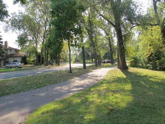
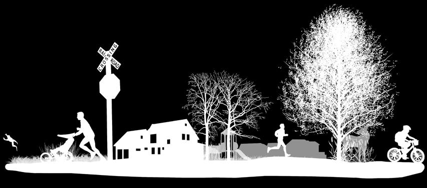
7 Introduction 1 OVERVIEW The Mendota/Lebanon Hills Greenway travels 8 miles through Mendota Heights, Inver Grove Heights, and Eagan. Today, the landscape is largely developed residential, commercial, oice, and industrial areas. There are some areas of agricultural land that may be developed in the next 5-20 years. This land is primarily in the northwest corner of Inver Grove Heights. In these areas, future development patterns could be organized around and shaped by the greenway s natural, cultural and recreational amenities. The Mendota/Lebanon Hills Greenway will link Lebanon Hills Regional Park to the North Urban Regional Trail, which connects to the Minnesota River and downtown Saint Paul. Like all Dakota County Greenways, the Mendota/Lebanon Hills Greenway is envisioned to provide multiple benefits to water quality, habitat, recreation, and nonmotorized transportation. The master plan: Expresses an integrated vision for recreation, nonmotorized transportation, habitat and water quality. Determines preferred regional trail alignment and design. Provides strategies for interpretation, resource stewardship, development, land acquisition and operations. Estimates project costs. Satisfies requirements for Metropolitan Council regional destination trail and greenway planning. The Mendota/Lebanon Hills Greenway is shown in red on the map above. DRAFT 27 Feb 2013 Mendota/Lebanon Hills Greenway Master Plan


8 Dakota County Greenway Vision With the 2008 Park System Plan and 2010 Greenway Guidebook, Dakota County has established a progressive vision for an interconnected system of open space corridors greenways. We need only look as far as Minneapolis Grand Rounds to realize the powerful legacy of community benefits that greenways can bestow. Dakota County Park System Plan The 2008 Dakota County Park System Plan established the foundation for a county wide greenway network by envisioning regional greenways that connect parks, schools, local trails and libraries through the nonrural portions of the county. Dakota County s greenway vision suggests 200 miles of regional greenways, 2/3 of which are on land currently in public or semipublic ownership. A priority is to implement more than 50 miles of greenways by Dakota County Greenway Collaborative: the Greenway Guidebook In 2010, Dakota County adopted the Dakota County Greenway Guidebook as a framework for greenway development. The guidebook establishes a framework for a collaborative approach to governance, stewardship, design and operation of greenways. 2 Mendota/Lebanon Hills Greenway Master Plan 2013 DRAFT 27 Feb 2013


 City of Inver Grove Heights 2030 Comprehensive Plan City of Eagan")
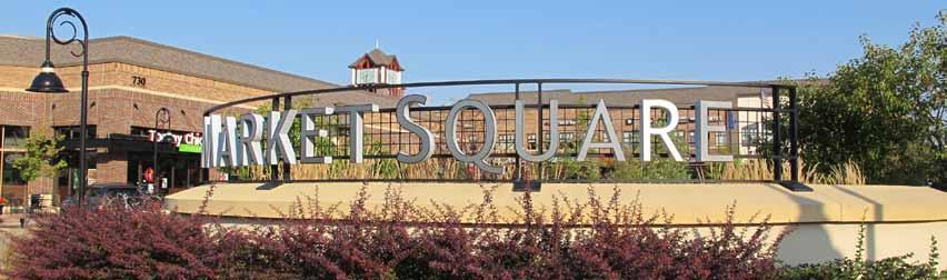
 Future Development at Mendota Plaza")
9 PLANNING CONTEXT The Mendota/Lebanon Hills Greenway travels through the cities of Mendota Heights, Eagan, and Inver Grove Heights. Several planning eorts aect the greenway s future development: Metropolitan Council 2030 Regional Parks Policy Plan, December 2010 Dakota County Park System Plan, 2008 Dakota County Greenway Guidebook, 2010 Lebanon Hills Regional Park Master Plan, March 2001; and Update currently underway (2012) City of Inver Grove Heights 2030 Comprehensive Plan City of Eagan 2030 Comprehensive Plan City of Mendota Heights 2030 Comprehensive Plan Inver Grove Heights Northwest Area Collector Street Plan (October 2012) Future Development at Mendota Plaza DRAFT 27 Feb 2013 Mendota/Lebanon Hills Greenway Master Plan
10 GREENWAY MASTER PLANNING The -month planning process was a collaborative eort of multiple agencies and jurisdictions. Dakota County led the process with advice from a technical advisory group formed to guide the master plan. Stakeholder Input A Technical Advisory Group met during each phase of master planning to provide guidance, provide insight into technical questions, explore options, identify partnership opportunities and discuss concurrent projects. In addition to providing specific guidance, the TAG institutionalized a collaborative planning process and established relationships across agencies with a stake in implementing the master plan. TAG meetings were held on September 11, 2012,, 2012, and February 27, In addition to the TAG meetings, individual meetings were held with key stakeholders as needed during the planning process to discuss specific issues. Meetings were held with representatives from Thomson Reuters and. Technical Advisory Group A technical advisory group met regularly, including representatives from: City of Mendota Heights City of Eagan City of Inver Grove Heights Dakota County Parks and Open Space Dakota County Planning and Analysis Dakota County Historical Society January 2013 Open House The first open house was held on January 15, 2013, to gather input on the draft greenway trail alignment, interpretive themes and approaches to natural resources and water quality improvement. This Open House was held jointly with the Lebanon Hills Regional Park Master Plan Open House. Each project had display boards in a separate room in the Visitor Center. Over 50 people attended the joint open house. Overall, the comments were positive about the greenways, but several questions were asked about the specific alignment options. Attendees expressed interest in both on-road and o-road trails for varying reasons, including cost, maintenance, access, and experience. Most attendees were Eagan residents who had received mailings notifying them of the open house. 4 comment forms were returned at the meeting Specific comments included: O-road paths are preferred for the higher quality experience; preference that money is spent on more trails rather than expensive grade-separated crossings; preference that trails are along roads to avoid going through private backyards; desire for grade-separated crossings over busy roads; desire for more plantings and trees along the trails; desire for maps along the greenway. 4 Mendota/Lebanon Hills Greenway Master Plan 2013 DRAFT 27 Feb 2013
11 Stakeholder Outreach During the alignment evaluation portion of the project, individual meetings with key stakeholders were held. A list of these meetings is below. Detailed meeting summaries can be found in the appendix. Spring 2013 Open House PLACEHOLDER Project Website A project website established for the North Creek and Minnesota River Greenways in 2010, was continued as a resource for the Mendota/Lebanon Hills Greenway. The website address is Materials from the open houses were posted online and an on-line questionnaire was available for those interested as a way to provide feedback. Public Review PLACEHOLDER DRAFT 27 Feb 2013 Mendota/Lebanon Hills Greenway Master Plan
12 RECREATION NEEDS The Mendota/Lebanon Hills Greenway will enhance access to natural areas, trails, and cultural resources. These activities are important for quality of life and are high demand recreational activities. Respondents to Dakota County s 2006 park survey cited these among the top activities residents would like to see in the County s park system. Current recreation and demographic trends suggest these needs will continue well into the future. The need for a continuous trail in the Mendota/Lebanon Hills location has been referenced in other planning documents. The Metropolitan Council s 2030 Parks Policy Plan references a Dakota North-South Regional Trail Search Corridor that connects the North Urban Regional Trail and Lebanon Hills Regional Park; it is called the Rich Valley Greenway Regional Trail. In Dakota County s Park System Plan, the greenway is identified as the Rich Valley Greenway Regional Trail and is listed as second level priority (out of three levels). Visitors A broadly generalized profile of greenway visitors was created based on input from existing visitors to Dakota County parks and trails, from stakeholders in the master planning process and from demographics of the population within 30 miles of Dakota County (see sidebar on page 7). The following observations can be made about potential visitors based on comparative census data from 1990, 2000, and The people served by Dakota County parks and trails are becoming increasingly diverse. As recreation, interpretation and education are developed, outreach should be considered. There are more than half a million children enrolled in schools in the area served by Dakota County parks; more than one quarter of the population is younger than 17. School children and families are a large group of potential greenway users. In the 2010 U.S. Census, 10 percent of the population in Dakota County is over the age of 65, and this age group is projected to increase dramatically in number and proportion in the next 20 years. The influx of baby boomers into this age category will influence interpretive and education program development. Based on the American Community Survey, the average per capita income for the U.S. was $26,942. The average per capita income for Dakota County was more than 24 percent higher, at $33,508. Higher incomes have historically been associated with greater participation in recreation activities. 6 Mendota/Lebanon Hills Greenway Master Plan 2013 DRAFT 27 Feb 2013
13 Trends Popularity of trail-based activities, active living, interest in nature, transportation and connectivity, aging actively, interest in history and culture and population growth are all current trends that indicate that interest in and visits to Dakota County Greenways are likely to increase. Trail Use Trails are the number one desired recreation facility in poll after poll. Trails can be enjoyed by people of all ages and abilities, they are inexpensive for users, and they often are close to home. The Minnesota Statewide Comprehensive Outdoor Recreation Plan (SCORP) notes that the interest and demand for more trails are being felt at all levels of government. According to the 2008 Metropolitan Council Regional Parks and Trails Survey, at least two thirds of people using recreational facilities in the metro area were using trails. Among these trail users, biking and walking are the most common recreation form, while running, inline skating, and dog-walking were also popular. Active Living In 2009, 64.3 percent of adults in Dakota County were either overweight or obese. If the current trend continues, the percentage is expected to be 76 percent by Nationally, the obesity rate in children has tripled over the past 30 years. Today about 20 percent of school-age children are overweight or obese (Source: Dakota County Public Health Department). Regular moderate physical activity can help prevent a host of disorders, including heart disease, obesity, high blood pressure, Type 2 diabetes and osteoporosis. More physical activity at a population level can reduce health care costs and other costs to society. Walking and biking are two of the simplest and most popular ways to integrate regular physical activity into daily routines, referred to as active living. Places that have physical infrastructure such as trails and programs to promote walking and biking tend to have more physical active and healthier populations. During the master planning process, stakeholders identified the following groups as current visitors to Dakota County Parks: Wildlife/bird watchers School groups Senior citizens Non-motorized commuters Hikers, walkers, runners, cyclists Regional users Anglers Park users (Athletics and community events/activities) Residents Families Disabled users Bicycle racers Boaters Stakeholders also identified groups of visitors they would like to see as greenway users in the future: Groups needing increased activity Corporate users Foragers (fruit, flowers) Commercial and business connections Art community DRAFT 27 Feb 2013 Mendota/Lebanon Hills Greenway Master Plan
14 Interest in Nature and Sustainability Increased sensitivity to ecological issues and the benefits of healthy ecosystems has led to people seeking more natural experiences. There also is increased interest in and opportunities for environmental stewardship such as stream and riparian restoration and the removal of invasive species. People also desire educational and interpretive programs and seek a balance of environment and recreation. Transportation and Connectivity Health benefits, concerns about climate change and rising energy costs have increased demand for trails and bikeways as preferable transportation options. Regional trails with gradeseparated crossings oer cyclists the advantages that motorists enjoy on freeways. Connectivity to local trails is essential. The more connected the trail system, the more use it will see. Connecting trails reduce the need for vehicle parking at trailheads. In 2008, half of all regional trail users arrived by bicycle or on foot (Metropolitan Council Regional Parks and Trails Survey 2008). Table 8. Population forecasts for communities adjacent to the Mendota/Lebanon Hills Greenway. Source: Metropolitan Council Community Profiles, MUNICIPALITY 2010 CENSUS 2030 FORECAST % CHANGE Core Service Area (areas within 3/4 mile of greenway) Mendota Heights 11,071 11,080 0% Inver Grove Heights 33,880 47,300 40% Eagan 64,206 71,250 11% Primary Service Area (areas within 3 miles of greenway) Apple Valley 49,084 71,000 45% Rosemount 21,874 42,000 92% West St. Paul 19,540 21,700 11% Total (Core + Primary) 199, ,330 32% Dakota County 398, ,275 32% Engaged aging Trail users tend to be older than park users. In 2008, 54 percent of Big Rivers Regional Trail users polled were between the ages of 45 and 64. Trail use likely will remain high as the baby boom generation ages and remains physically active or gets more physical activity with increased leisure time by walking, hiking or biking on trails. Interest in history and culture As society has become more mobile, interest in local culture and history has increased. The ability to integrate cultural, historic and environmental interpretation into the greenway will add richness to the greenway experience. Population Metropolitan Council studies indicate that half of regional trail users live within 3/4 mile of a trail and 3/4 live within 3 miles of the trail. The 3/4 mile area around the trail is considered the core service area and the 3-mile area the primary service area. Communities that fall within the Mendota/Lebanon Hills Greenway s core and primary service areas are all expected to see growth within the next 20 years, including significant growth in Inver Grove Heights. 8 Mendota/Lebanon Hills Greenway Master Plan 2013 DRAFT 27 Feb 2013
15 Use forecasts Placeholder Figure 9. Core and primary service areas Placeholder DRAFT 27 Feb 2013 Mendota/Lebanon Hills Greenway Master Plan
16 This page intentionally left blank. 10 Mendota/Lebanon Hills Greenway Master Plan 2013 DRAFT 27 Feb 2013
17 Existing Conditions 2 Overview The Mendota/Lebanon Hills Greenway travels approximately 8 miles from the Village at Mendota Heights to Lebanon Hills Regional Park through residential and commercial areas in the communities of Mendota Heights, Inver Grove Heights, and Eagan. The greenway links destinations including: Lebanon Hills Regional Park, neighborhood parks in Mendota Heights and Eagan, oice and retail hubs in Mendota Heights and Eagan, several schools, and community parks. The greenway area contains a rich cultural history with stories of key movement corridors that have changed and maintained over time, including Dodd Road, Highway 55, the early railroad from Minneapolis to Chicago, I-494, and Yankee Doodle Road. Cultural sites that can be highlighted along the greenway include residential communities, commercial hubs, the last remaining agricultural plots in Northern Dakota County, large employment centers, parks, and schools. This chapter presents: Existing Greenway corridor character and land use Relationship to the larger transportation system Existing cultural resources Existing natural resources The Mendota/Lebanon Hills Greenway links two natural areas of significance: Lebanon Hills Regional Park and the Minnesota River, by way of the North Urban Regional Trail. Between these anchors is a mosaic of farmland, suburban development, and patches of woodlands, ponds, and lakes. In the future, the northwest area of Inver Grove Heights expected to develop, heightening the importance of the greenway s connective infrastructure. Greenway Character & Land Use Today, the surrounding landscape is mostly residential development. In the future, the land will most likely maintain the suburban character that it has today. The greenway can be broken into two segments, a brief description of each segment follows. DRAFT 27 Feb 2013 Mendota/Lebanon Hills Greenway Master Plan


18 Segment 1: North Urban Regional Trail / Hwy 110 to Hwy 55 (4 miles) The northern terminus of the greenway is the Village at Mendota Heights and the existing North Urban Regional Trail. From there the greenway follows a wooded trail through Friendly Marsh Park and through a residential neighborhood connecting to Copperfield Pond Park and Friendly Hills Park. Finally, the greenway runs along Kensington Park before crossing I-494 and weaving through oice development in Eagan / future residential development in Inver Grove Heights. South of 494, there are frequent patches of woods, ponds, and wetlands 12 Mendota/Lebanon Hills Greenway Master Plan 2013 DRAFT 27 Feb 2013


19 Segment 2: Hwy 55 to Lebanon Hills Regional Park (4.5 miles) South of Hwy 55, the greenway winds through light industrial, commercial, oice development, and farmland. The green will be a respite to employees and commuters of these businesses. Once the greenway crosses south of Hwy 43, it will again enter suburban residential landscape, connecting neighborhood parks, schools, and homes in Eagan. The greenway will cross Hwy 30 and Hwy 32 / Cli Road before reaching Lebanon Hills Regional Park. Transportation system The Mendota/Lebanon Hills Greenway will support non-motorized transportation by providing a regional corridor for bicycle and pedestrian transportation. The greenway will intersect with existing local trails in Mendota Heights, Eagan, and Inver Grove Heights that connect residential areas, commercial destinations, schools, and employment destinations. Further linking trails will lead to St. Paul and Minneapolis. DRAFT 27 Feb 2013 Mendota/Lebanon Hills Greenway Master Plan
20 Existing Cultural Resources Historic Overview Every place has a unique history with resources with which people have an emotional connection. Crossing the greenway corridor, there are many resources that have important cultural meaning. There are key historical corridors including an early railroad connecting Minneapolis and St. Paul with Chicago, Highway 55 that roughly parallels trails that have been used for centuries, and perhaps most significant, Dodd Road. Within Dakota County, there may not be a more historic corridor. The corridor has adapted to new forms of travel through the years but the path that is seen today is roughly the same as the path that was likely travelled for centuries by Native Americans and early settlers. Though few of these resources are considered historic by state or federal definitions, or simply have yet to be evaluated, they are an important part of the landscape to the people along the greenway corridor. There are few other cultural resources recognized by the State Historic Preservation Oice within and around the Mendota/Lebanon Hills Regional Greenway. There are few known archaeological sites along the greenway likely due to few archaeological studies having been completed within and around the proposed greenway. The area s rich resources have attracted people for thousands of years: additional sites likely remain undiscovered in the corridor. The interpretation section of this plan identifies strategies to share the cultural resources of the area while protecting them. Dodd Road Native Americans and early Europeans were known to have traversed the area on ungraded trails. It wasn t until statehood that the real planning for Dodd road began. The state commissioned a road to be surveyed to connect Mendota with St. Peter, Minnesota. The road was surveyed and cleared during the summer of 1853 taking just 109 days to complete. The connections that were created became critical to the development of many communities including, Mendota, Lakeville and the south terminus of the road, St. Peter a community founded by the namesake of the road, William Dodd. Though the portion within Dakota County bears little resemblance to the historic road, through interpretation, greenway visitors can envision how the trail was used throughout history and understand how important this corridor was for the development of Dakota County. 14 Mendota/Lebanon Hills Greenway Master Plan 2013 DRAFT 27 Feb 2013

21 Figure 15. Known Cultural Resources Dodd Road DRAFT 27 Feb 2013 Mendota/Lebanon Hills Greenway Master Plan
22 Existing Natural Resources The natural resources in the area surrounding the Mendota/Lebanon Hills Greenway consist of patches of woodlands and wetlands, mostly within neighborhood parks and residential areas. The greenway is anchored on the south by a large natural area: Lebanon Hills Regional Park, which contains the only area of MCBS ecological significance within the corridor. Vegetative Cover Minnesota Land Cover Classification System (MLCCS) According to Minnesota Department of Natural Resources Land Cover Classification System, the majority of land cover along the Mendota/Lebanon Hills Greenway is developed land, non-native grasses, or forest cover. Lebanon Hills Regional Park is a diverse preserve of prairie, shrub land, woodland and wetlands. There are scattered patches of wetlands and open water along the corridor. Water Resources Water resources within the greenway corridor consist of scattered wetlands and small bodies of open water. Many of these water bodies are surrounded by forest cover or non-native grasses and some are directly adjacent to developed landscapes. Throughout the residential and commercial developments, most of these ponds and wetlands take in street and parking lot runo that contains significant nutrients and sediment. This runo contributes to poor water quality and dimishing wildlife habitat. Ecological Quality With the exception of some areas in Lebanon Hills Regional Park, the majority of the land surrounding the greenway corridor has been altered or disturbed. The highest quality natural area along the corridor is in Lebanon Hills Regional Park and is identified by the MCBS as moderate biodiversity significance. There are also a few small native plant communities within the boundary of Lebanon Hills Regional Park. Ecological Impacts A significant ecological impact to the landscape within the greenway corridor has been conversion of native forest and prairie landscapes and draining of natural wetland complexes for agricultural and urban land uses. Interruption of disturbance regimes (fire), invasive species colonization, habitat fragmentation, and agricultural runo have all contributed a landscape with low ecological quality. 16 Mendota/Lebanon Hills Greenway Master Plan 2013 DRAFT 27 Feb 2013
 DRAFT 27 Feb 2013")
23 Figure 17. Existing Natural Resources (MLCCS & MCBS) DRAFT 27 Feb 2013 Mendota/Lebanon Hills Greenway Master Plan
24 This page intentionally left blank. 18 Mendota/Lebanon Hills Greenway Master Plan 2013 DRAFT 27 Feb 2013
Lake Marion/ South Creek Greenway
 Lake Marion/ South Creek Greenway Master Plan Preliminary DRAFT Chapters 1 & 2-27 Feb 2013 Lake Marion/ South Creek Greenway Preliminary DRAFT Master Plan Acknowledgements Dakota County Board of Commissioners
Mendota-Lebanon Hills Greenway Master Plan Executive Summary. August draft for more information visit
 Mendota-Lebanon Hills Greenway Master Plan Executive Summary August 2013 draft for more information visit www.hkgi.com/projects/dakota INTRODUCTION The Mendota-Lebanon Hills Greenway Master Plan portrays
Rosemount Greenway Master Plan Executive Summary. draft. Spring for more information visit
 Rosemount Greenway Master Plan Executive Summary Spring 2012 draft for more information visit www.hkgi.com/projects/dakota INTRODUCTION The Rosemount Greenway Master Plan portrays a vision to establish
Metropolitan Parks and Open Space Commission
 Business Item No. 2013-xxx Metropolitan Parks and Open Space Commission Meeting date: October 1, 2013 For the Community Development Committee meeting of October 7, 2013 Subject: Mendota-Lebanon Hills Greenway
METROPOLITAN COUNCIL 390 North Robert Street, St. Paul, MN Phone (651) ; TDD (651)
 ; TDD (651)") DATE: October 24, 2012 METROPOLITAN COUNCIL 390 North Robert Street, St. Paul, MN 55101 Phone (651) 602-1000; TDD (651) 291-0904 TO: Metropolitan Parks and Open Space Commission FROM: Tori Dupre, Senior
DATE: October 24, 2012 METROPOLITAN COUNCIL 390 North Robert Street, St. Paul, MN 55101 Phone (651) 602-1000; TDD (651) 291-0904 TO: Metropolitan Parks and Open Space Commission FROM: Tori Dupre, Senior
Rich Valley Greenway Master Plan. Central Greenway Connectivity Study
 Rich Valley Greenway Master Plan Central Greenway Connectivity Study Dakota County Planning Commission February, 2017 Rich Valley Greenway Master Plan Dakota County Greenway Vision Establish a County-wide
Mendota Heights 2040 Comprehensive Plan Draft Vers
 4 Parks and Trails The City of Mendota Heights boasts a variety of recreational and open space opportunities. Few cities can claim access to regional trails, riverside and lakeside parks, scenic bluffs
METROPOLITAN COUNCIL 390 North Robert Street, St. Paul, MN Phone (651) ; TDD (651)
 ; TDD (651)") DATE: December 20, 2011 METROPOLITAN COUNCIL 390 North Robert Street, St. Paul, MN 55101 Phone (651) 602-1000; TDD (651) 291-0904 TO: Metropolitan Parks and Open Space Commission FROM: Tori Dupre, Senior
DATE: December 20, 2011 METROPOLITAN COUNCIL 390 North Robert Street, St. Paul, MN 55101 Phone (651) 602-1000; TDD (651) 291-0904 TO: Metropolitan Parks and Open Space Commission FROM: Tori Dupre, Senior
This page intentionally blank.
 This page intentionally blank. Parks, Recreation, and Open Space Chapter Relationship to Vision Vision Parks, Recreation and Open Space Chapter Concepts County Government. County government that is accountable
1.0 INTRODUCTION 1.1 TH 14 WEST STUDY AREA Project Description Functional Classification Purpose of the Project
 1.0 INTRODUCTION 1.1 TH 14 WEST STUDY AREA 1.1.1 Project Description The Trunk Highway (TH) 14 West Corridor is a two-lane roadway approximately 22 miles in length. Located in Nicollet County, the corridor
City of Missoula and Missoula County Open Space Planning Open House
 City of Missoula and Missoula County Open Space Planning Open House FEBRUARY 6, 2018 The following slides contain the display board content from the open house. Please use boards to answer questions in
Arlington, Virginia is a worldclass
 EXECUTIVE S U M M A RY Arlington maintains a rich variety of stable neighborhoods, quality schools and enlightened land use policies, and received the Environmental Protection Agency s highest award for
Introduction. Chapter 1. Purpose of the Comprehensive Plan Plan Organization Planning Process & Community Input 1-1
 Chapter 1 Introduction Lakewood 2025: Moving Forward Together Purpose of the Comprehensive Plan Plan Organization Planning Process & Community Input 1-1 Purpose of the Comprehensive Plan The Comprehensive
CHAPTER 1 Introduction
 CHAPTER 1 Introduction From sea to summit, Lane County covers almost 4,800 square miles of diverse Oregon landscape. Stretching from the Pacific Ocean through the Coastal Range, the Willamette Valley to
Plan Overview. Manhattan Area 2035 Reflections and Progress. Chapter 1: Introduction. Background
 Plan Overview The Manhattan Urban Area Comprehensive Plan (the Comprehensive Plan) is a joint planning initiative of the City of Manhattan, Pottawatomie County, and Riley County. The 2014 Comprehensive
ARGENTA TRAIL (CSAH 28/63) REALIGNMENT SOUTH PROJECT (CP 63-25)
 REALIGNMENT SOUTH PROJECT (CP 63-25)") ARGENTA TRAIL (CSAH 28/63) REALIGNMENT SOUTH PROJECT (CP 63-25) Preliminary Design Report February 2015 Prepared For: City of Inver Grove Heights Dakota County Prepared By: Kimley-Horn and Associates,
ARGENTA TRAIL (CSAH 28/63) REALIGNMENT SOUTH PROJECT (CP 63-25) Preliminary Design Report February 2015 Prepared For: City of Inver Grove Heights Dakota County Prepared By: Kimley-Horn and Associates,
Streets for People, Place-Making and Prosperity. #TOcompletestreets
 COMPLETE STREETS FOR TORONTO Streets for People, Place-Making and Prosperity COMPLETE STREETS: A NEW APPROACH A Complete Streets design approach considers the needs of all users people who walk, bicycle,
Lake Marion-South Creek Greenway
 LAKE MARION-SOUTH CREEK GREENWAY MASTER PLAN 2013 Lake Marion-South Creek Greenway MASTER PLAN Executive Summary MAY 2013 DRAFT FOR MORE INFORMATION VISIT WWW.HKGI.COM/PROJECTS/DAKOTA INTRODUCTION The
2040 LUP is a part of the Comprehensive Plan and carries the same legal authority. Economic Challenges
 1.1. Guiding Anchorage s Growth Where will new residents settle over the next two decades? Where will people work, shop, and play? Will there be enough room to grow? How will Anchorage look? Will growth
2011 ASLA Design Awards. Westside Creeks Restoration Plan Merit Award AECOM, Fort Collins. Planning & Urban Design
 2011 ASLA Design Awards Westside Creeks Restoration Plan Merit Award AECOM, Fort Collins Planning & Urban Design Project Fact Sheet Category of Entry: Rotating Specialty Award: 2011 2011 ASLA Colorado
PREVIOUS PUBLIC PARTICIPATION BRIEF October 2014
 Comprehensive Planning During the development of the county comprehensive plan, Cultivating Community: A Plan for Union County s Future from 2007 through 2009, and three concurrent multi municipal plans
Yadkin River Greenway Feasibility Study Fact Sheet Village of Clemmons, Town of Lewisville, Town of Bermuda Run
 Fact Sheet Village of Clemmons, Town of Lewisville, Town of Bermuda Run Project Background The Yadkin River Greenway Feasibility Study is a joint project with the Village of Clemmons, the Town of Bermuda
Mississippi Skyway Preliminary Engineering Report
 EXECUTIVE SUMMARY Mississippi Skyway Preliminary Engineering Report CITY OF RAMSEY, MINNESOTA DECEMBER 2014 City of RAMSEY EXECUTIVE SUMMARY Project Need and Intent The Mississippi Skyway pedestrian bridge
INTRODUCING THE BALTIMORE CITY GREEN NETWORK VISION PLAN
 INTRODUCING THE BALTIMORE CITY GREEN NETWORK VISION PLAN GOALS OF THE GREEN NETWORK PLAN Protect and enhance the unique ecological resources of our city Support economic growth and sustainable redevelopment
City of Nogales General Plan
 Open Space, Parks, Recreation and Trails City of Nogales General Plan Residents of Nogales place a high priority in the development of a comprehensive system of open space, parks, recreation and trails
PUBLIC SPACES MASTER PLAN UPDATE (POPS) Joint Facilities Advisory Commission (JFAC) November 28, 2018
 Joint Facilities Advisory Commission (JFAC) November 28, 2018") PUBLIC SPACES MASTER PLAN UPDATE (POPS) Joint Facilities Advisory Commission (JFAC) November 28, 2018 1 AGENDA POPS Planning Context Timeline Public Input Final POPS Draft Next Steps 2 PLANNING CONTEXT
PUBLIC SPACES MASTER PLAN UPDATE (POPS) Joint Facilities Advisory Commission (JFAC) November 28, 2018 1 AGENDA POPS Planning Context Timeline Public Input Final POPS Draft Next Steps 2 PLANNING CONTEXT
WARM SPRINGS PARK MASTER PLAN
 TABLE OF CONTENTS page 1.0 Introduction and Overview 1 2.0 Information Gathering 2 3.0 Conceptual Alternative Development 8 4.0 Master Plan Development 14 5.0 Construction Cost Estimates 19 LIST OF FIGURES
East Central Area Plan
 East Central Area Plan Steering Committee Meeting January 10 th, 2019 Tears-McFarlane House Community Room East Central Area Plan Steering Committee Meeting January 10 th, 2019 CHUN Tears-McFarlane House
Parks, Open Space and Trails
 Introduction Parks have often been referred as the lungs of our cities, cleansing the air of pollutants and particulate matter. Parks are also gathering places for families and community. They offer spaces
CHAPTER 8 ISSUES, CONCERNS, CONSTRAINTS AND OPPORTUNITIES
 CHAPTER 8 ISSUES, CONCERNS, CONSTRAINTS AND OPPORTUNITIES Introduction This River Conservation Plan was developed during a time of tremendous activity and effort in planning the transformation of the Delaware
General Plans. Tom Dansie, AICP Steve Pastorik, AICP
 General Plans Tom Dansie, AICP Steve Pastorik, AICP General Plans What is a General Plan? What does State code say? How is a General Plan used? How is a General Plan developed? Suggested considerations
edmonton.ca/ribbonofgreen #ribbonofgreen
 WHAT IS THE RIBBON OF GREEN? The Ribbon of Green is Edmonton s entire river valley and ravine system. The Ribbon of Green (2018) Project will provide strategic guidance for the southwest and northeast
Concord Community Reuse Project Goals and Guiding Principles. Overarching Goals (OG)
") Concord Community Reuse Project Goals and Guiding Principles Overarching Goals (OG) No priority is implied by the order of presentation of the goals and guiding principles. Overarching goals for the Concord
Concord Community Reuse Project Goals and Guiding Principles Overarching Goals (OG) No priority is implied by the order of presentation of the goals and guiding principles. Overarching goals for the Concord
PARKS AND RECREATION
 PARKS AND RECREATION WHAT YOU WILL FIND IN THIS CHAPTER: Background information on the development of the Park, Recreation, and System Plan (PRSP). General overview of Ellensburg s parks and recreation
4 Park Planning and Design
 4 Park Planning and Design Park Constellations Elliot Gateway/Mills Loring North Loop Commons Twins Minneapolis Park & Recreation Board Downtown Service Area Master Plan 4-1 PROJECT APPROACH REFERENCE
Concept Master Plan. for. Draft of. Wildlife Management Area. Prepared for. June, 2008
 Draft of Concept Master Plan for Vermillion Highlands: A Research, Recreation and Wildlife Management Area Prepared for Vermillion Highlands Steering Committee - Minnesota Department of Natural Resources
Business Item No
 Community Development Committee For the Community Development Committee meeting of December 19, 2016 For the Metropolitan Council meeting of January 11, 2017 Business Item No. 2016-255 Subject: River to
7Page 1 CLEMMONS COMMUNITY COMPASS 1 PLAN OVERVIEW
 1 Plan Overview WHAT IS I THE CLEMMONS COMMUNITY COMPASS? The Clemmons Community Compass is our community s comprehensive plan. It serves as our blueprint and provides direction for the future of the Village
2035 General Plan Update and Belmont Village Specific Plan. Joint Study Session with the City Council and Planning Commission April 12, 2016
 2035 General Plan Update and Belmont Village Specific Plan Joint Study with the City Council and Planning Commission April 12, 2016 Agenda 1. Welcome and Introductions 2. General Plan Update Status of
2 Vision. Master Plan
 19 2 Vision Master Plan 20 Chapter 2 MASTER PLAN VISION 2.1 Master Plan Organization Lake Calhoun/Bde Maka Ska and Lake Harriet are places where complex human and natural systems intersect and converge.
PUBLIC ENGAGEMENT & SIX THEMES OF THE PLAN
 Connecting the heart of Eagle to the soul of the river - Kathy Chandler-Henry, Commissioner Eagle County CHAPTER 1 PUBLIC ENGAGEMENT & SIX THEMES OF THE PLAN town of eagle - river corridor plan 1 PUBLIC
Countywide Green Infrastructure
 Montgomery County s Countywide Green Infrastructure F U N C T I O N A L M A S T E R P L A N The Maryland National Capital Park and Planning Commission INFRASTRUCTURE An underlying base or foundation especially
East Bench Master Plan Update
 Community & Economic Development Office of the Director East Bench Master Plan Update To: From: Planning Commission Wayne Mills, Senior Planner Date: November 18, 2015 CC: Re: Nora Shepard, City Planning
DRAFT FOR PUBLIC REVIEW. Game Plan for a Healthy City
 DRAFT FOR PUBLIC REVIEW 2018 Game Plan for a Healthy City 2 Denveright. Parks & Recreation Game Plan Draft for Public Review Draft for Public Review Executive Summary Game Plan Overview Executive Summary
Comprehensive Plan ADOPTED APRIL 2014
 Comprehensive Plan ADOPTED APRIL 2014 8 8. Outstanding Recreational & Cultural Opportunities We are proud of our community s parks and recreation system. Our community will ensure that the legacy of our
Comprehensive Plan. Faribault, Minnesota. Hoisington Koegler Group Inc. Claybaugh Preservation Architecture Inc. Howard R. Green Company Bonz/REA
 Comprehensive Plan Faribault, Minnesota Adopted by the Faribault City Council July 8, 2003 prepared for: prepared by: Hoisington Koegler Group Inc. Claybaugh Preservation Architecture Inc. Howard R. Green
June 14, 2017 for the June 20, 2017 Parks and Trails Commission Meeting
 105 South Fifth Avenue Suite 513 Minneapolis, MN 55401 Tel: 612-252-9070 Fax: 612-252-9077 www.landform.net TO: FROM: DATE: Corcoran Parks and Trails Commission Kendra Lindahl, Landform June 14, 2017 for
The Trust for Public Land. in Minnesota
 The Trust for Public Land in Minnesota Protecting Minnesota s Natural Legacy In Minnesota, The Trust for Public Land (TPL) is protecting strategic land and water resources for people to enjoy as parks,
MONTCO 2040: A SHARED VISION The New Comprehensive Plan for Montgomery County. Dra Themes and Goals March, 2014
 MONTCO 2040: A SHARED VISION The New Comprehensive Plan for Montgomery County Dra Themes and Goals March, 2014 INTRODUCTION 2 WHAT IS A COMPREHENSIVE PLAN? A comprehensive plan is a long-range plan required
Midtown Greenway PROJECT REPORT CARD
 Midtown Greenway PROJECT REPORT CARD Project Overview and History The Midtown Greenway is a 5.5-mile multi-use trail that connects the Mississippi River to the Minneapolis Chain of Lakes. The corridor,
PUBLIC SPACES MASTER PLAN UPDATE (POPS) Crystal City Citizen s Review Council October 24, 2018
 Crystal City Citizen s Review Council October 24, 2018") PUBLIC SPACES MASTER PLAN UPDATE (POPS) Crystal City Citizen s Review Council October 24, 2018 1 PLANNING CONTEXT Arlington County Comprehensive Plan UPDATE Related Documents: CIP Sector Plans Area Plans
PUBLIC SPACES MASTER PLAN UPDATE (POPS) Crystal City Citizen s Review Council October 24, 2018 1 PLANNING CONTEXT Arlington County Comprehensive Plan UPDATE Related Documents: CIP Sector Plans Area Plans
10.0 Open Space and Public Realm
 10.0 Open Space and Public Realm 10.0 Open Space and Public Realm The Public Open Space System is comprised of: outdoor spaces available for public use that are either publicly owned (e.g., parks and
CAMPUS PLACEMAKING: CAC WORK SESSION. August 23, 2018
 CAMPUS PLACEMAKING: CAC WORK SESSION August 23, 2018 AGENDA Public Realm Framework Overview & Discussion (~20 minutes) Health & Wellness Report Overview & Discussion (~15 minutes) Riverfront Update & Discussion
WAC #7 3/14/14. Coachella General Plan Update
 WAC #7 3/14/14 Coachella General Plan Update Agenda 2 Introductions Public Draft General Plan Overview and Discussion of Next Steps Implementation and Evaluation Health Element Process Evaluation (discussion)
Preface. Erie. Scranton. Allentown. Pittsburgh. Harrisburg. Philadelphia
 The Southern Alleghenies Region The Southern Alleghenies Region spans the Laurel Highlands and Allegheny Front in the west across the Appalachians to the east. It is comprised of Blair, Bedford, Cambria,
I-1 COMMENCEMENT. History
 COMMENCEMENT Nature connects us to each other. All of creation has developed from natural processes, and thus by instinct, we are drawn back into them. Whether it be a forest, prairie, beach or community
Corridor Vision. 1Pursue Minnehaha-Hiawatha Community Works Project. Mission of Hennepin County Community Works Program
 1Pursue Minnehaha-Hiawatha Community Works Project Minnehaha-Hiawatha Community Works is a project within the Hennepin Community Works (HCW) program. The mission of the HCW program is to enhance how the
SALISBURY TOMORROW Our Vision
 SALISBURY TOMORROW Our Vision Salisbury is committed to supporting a high quality of life and sense of community for all residents. These commitments need to be reflected in our community programs, services
Chapter 5: Natural Resources and Environment
 NATURAL RESOURCES AND ENVIRONMENT 5-1 5 Chapter 5: Natural Resources and Environment BACKGROUND AND INTENT Urban expansion represents the greatest risk for the future degradation of existing natural areas,
North Salt Lake General Plan Update 2013
 North Salt Lake General Plan Update 2013 Acknowledgements Updating the North Salt Lake General Plan was a process that would not have been possible without the support of elected officials and the general
OPEN HOUSE #3. Project Manager Kristi Sebastian, PE, PTOE
 OPEN HOUSE #3 Project Manager Kristi Sebastian, PE, PTOE kristi.sebastian@co.dakota.mn.us 952-891-7100 WHY ARE WE CONDUCTING THE ARTERIAL CONNECTOR STUDY? Dakota County and the cities of Rosemount, Inver
This chapter describes the purpose of the Plan, introduces how the Plan is organized and provides contextual background for the Plan.
 Chapter 1: INTRODUCTION Purpose of a Comprehensive Plan The 2040 Comprehensive Plan establishes Medina s vision as a community and sets goals and objectives which guide future decisions and policies. The
Great Rivers Greenway CLEAN GREEN CONNEC TED T RAILS
 Great Rivers CLEAN GREEN CONNEC TED T RAILS Great Rivers (GRG) was established in 2000 to create a clean, green, connected St. Louis region. Today, many new and exciting projects demonstrate the social,
7.0 SOCIAL, ECONOMIC, AND ENVIRONMENTAL ISSUES
 7.0 SOCIAL, ECONOMIC, AND ENVIRONMENTAL ISSUES The following list of social, economic, and environmental issues have been identified based on a preliminary inventory of resources in the project area, an
Pinellas County Greenways
 Pinellas County Greenways USING GREENWAYS TO LINK OPEN SPACES The Florida Greenways Commission has defined a greenway as...a corridor of protected open space that is managed for conservation and/or recreation.
1 Introduction. Chapter. In this chapter:
 Chapter 1 Introduction In this chapter: 1.1 A Snapshot of the Region 1.2 Towards a Sustainable Region 1.3 The Provincial Context 1.4 Purpose and Organization The Regional Municipality of York Official
SECTION ONE: INTRODUCTION. introduction
 introduction 1 INTRODUCTION Since it was first established in 1843 as a trading post for the Hudson s Bay Company, Victoria has evolved into a Provincial capital city that is recognized across Canada and
THE COMMUNITY-DRIVEN DESIGN PROCESS
 THE COMMUNITY-DRIVEN DESIGN PROCESS A PUBLIC DRIVEN PROCESS STEERING COMMITEE THE COMPREHENSIVE PLAN OPPORTUNITIES AND CONSTRAINTS THE COMMUNITY DRIVEN DESIGN PROCESS A Public Driven Process Beginning
1.0 Introduction. Purpose and Basis for Updating the TMP. Introduction 1
 1.0 Introduction The Town of Castle Rock is situated between the metropolitan areas of Denver and Colorado Springs, amidst a unique terrain of rolling hills, mesas, ravines, and waterways. Like many Front
City of Brookfield 2035 Comprehensive Plan. DRAFT #2 October 6, 2009
 City of Brookfield 2035 Comprehensive Plan DRAFT #2 October 6, 2009 Public Hearing Presentation: December 1, 2009 Process Overview Phase I: Community Visioning (2008) - Developed long-term vision to direct
Lone Oak Road/ 70 th Street West. Efficient, Effective, Responsive. Preliminary Design Services (CP 26-54)
") (CP 26-54) Dakota County Board of Commissioners September 12, 2017 Purpose of Request Award Design Contract to Kimley-Horn and Associates Approve Joint Powers Agreements with the Cities of Eagan and Inver
(CP 26-54) Dakota County Board of Commissioners September 12, 2017 Purpose of Request Award Design Contract to Kimley-Horn and Associates Approve Joint Powers Agreements with the Cities of Eagan and Inver
Silverdale Regional Center
 Silverdale Regional Center Vision for Silverdale Regional Center The Silverdale Regional Center Plan (Plan) will guide the evolution of the Silverdale Regional Center from a collection of strip malls and
A citizen s guide to the. Comprehensive Plan. City of Lakeville, Minnesota 1
 A citizen s guide to the Comprehensive Plan 2008 City of Lakeville, Minnesota 1 Introduction The City of Lakeville completed an update of its Comprehensive Plan in 2008. A comprehensive plan is a tool
CHAPTER 7: Transportation, Mobility and Circulation
 AGLE AREA COMMUNITY Plan CHAPTER 7 CHAPTER 7: Transportation, Mobility and Circulation Transportation, Mobility and Circulation The purpose of the Transportation, Mobility and Circulation Chapter is to
Riverwalk Dreams compiled by Thomas P. Healy November 16, 2017
 Riverwalk Dreams compiled by Thomas P. Healy November 16, 2017 1986 Ripple Village Plan: A neighborhood plan developed by the City of Indianapolis Department of Metropolitan Development s Division of Planning
Land Use Regional Planning in Alberta Collaborating with Stakeholders
 Land Use Regional Planning in Alberta Collaborating with Stakeholders Trevor Lema, Land & Integrated Management Planner September 2018 Overview Why Regional Planning? An Integrated Perspective Integrated
12/9/2013. HOLLYWOOD/PINES CORRIDOR PROJECT AMPO 2013 Annual Conference October 24, Our Perspective. Broward.
 HOLLYWOOD/PINES CORRIDOR PROJECT AMPO 2013 Annual Conference October 24, 2013 Our Perspective Broward Fort Lauderdale 1 Broward Metropolitan Planning Organization Fort Lauderdale Fort Lauderdale Skyline
1.0 PROJECT PURPOSE AND NEED
 1.0 PROJECT PURPOSE AND NEED The FasTracks Plan includes the extension of the Central Corridor from its current terminus at 30th/Downing to a connection to the East Corridor commuter rail service planned
PSRC REVIEW REPORT & CERTIFICATION RECOMMENDATION
 PSRC REVIEW REPORT & CERTIFICATION RECOMMENDATION KITSAP COUNTY COUNTYWIDE PLANNING POLICIES July 2, 2012 BACKGROUND A major emphasis of the Washington State Growth Management Act (GMA) is the need to
February 27, 2018 City Council Presentation The Crown Jewel Park in the City of Fairfax
 February 27, 2018 City Council Presentation The Crown Jewel Park in the City of Fairfax Master Planning Charge Van Dyck Park s first Master Plan will provide the City with a road map as to how best incorporate
Urban Planning and Land Use
 Urban Planning and Land Use 701 North 7 th Street, Room 423 Phone: (913) 573-5750 Kansas City, Kansas 66101 Fax: (913) 573-5796 Email: planninginfo@wycokck.org www.wycokck.org/planning To: From: City Planning
Office of Greenways & Trails Providing Statewide Leadership and Coordination. Southeast Greenways and Trails Summit October 1-3, 2017
 Office of Greenways & Trails Providing Statewide Leadership and Coordination Southeast Greenways and Trails Summit October 1-3, 2017 1 Office of Greenways and Trails The Office of Greenways and Trails
Parks, Trails, and Open space Element
 Parks, Trails, and Open space Element Parks, Trails, and Open Space element Parks, Recreation, and Open Space are important components of the quality of life desired by the residents of Elk Grove. This
Route 1 Corridor Study
 Route 1 Corridor Study Westbrook, Connecticut A Vision for the Connecticut Shoreline Public Informational Meeting July 28, 2015 Lower Connecticut River Valley Council of Governments Fitzgerald & Halliday,
Chapter 2: Vision, Goals and Strategies
 Chapter 2: Vision, Goals and Lake Elmo Today & Tomorrow Comprehensive Plan 2040 2 VISION, GOALS & STRATEGIES - DRAFT 4-6-2018 INTRODUCTION Comprehensive Plan Purpose Perhapse the most important objective
Secrest Short Cut and Monroe Expressway Small Area Plan AUGUST 29, 2018
 Secrest Short Cut and Monroe Expressway Small Area Plan AUGUST 29, 2018 Background and Process Monroe Expressway will be open by the end of 2018 Union County and Indian Trail identified a need to revisit
Oakridge Redevelopment: New Park Concept Overview and Phase 1 Engagement Results
 Oakridge Redevelopment: New Park Concept Overview and Phase 1 Engagement Results REPORT REFERENCE Regular Park Board Meeting Monday, February 19, 2018 Purpose of Presentation To provide the Board with
Joe Pool Lake Master Plan Revision Public Information Meeting May 23, 2017
 Joe Pool Lake Master Plan Revision Public Information Meeting May 23, 2017 Presented By Jason Owen Lake Manager U.S. Army Corps of Engineers Fort Worth District US Army Corps of Engineers Purpose of this
Candlestick Point SRA Yosemite Slough Restoration Project. Presented by
 Candlestick Point SRA Yosemite Slough Restoration Project Presented by Yosemite Slough Restoration Project The Center of a Revitalized Waterfront in Southeastern San Francisco The Yosemite Slough Restoration
RECREATION AND OPEN SPACE VISION
 City of South Lake Tahoe General Plan Policy Document Recreation and Open Space Element INTRODUCTION This element provides the policy context for the City of South Lake Tahoe to achieve its vision for
Lewisville Lake Master Plan Revision Public Information Meeting May 2 & 4, 2017
 Lewisville Lake Master Plan Revision Public Information Meeting May 2 & 4, 2017 Presented By Rob Jordan Lake Manager U.S. Army Corps of Engineers Fort Worth District US Army Corps of Engineers Purpose
Small Area Plan. South Gateway
 Small Area Plan Adopted May 12, 2008 South Gateway Purpose. The South Gateway Small Area Plan defines the City s expectations for the future of the southern entrance to the City at Interstate 85 and Highway
HE VISION. Building a Better Connected Place
 HE VISION Building a Better Connected Place WALK INTO THE FUTURE. Life in Cranberry, 2030 Here s what our residents told us they wanted to see in their community by 2030: The Cranberry of 2030 is a place
1.0 Purpose of a Secondary Plan for the Masonville Transit Village
 Report to Planning and Environment Committee To: Chair and Members Planning & Environment Committee From: John M. Fleming Managing Director, Planning and City Planner Subject: Masonville Transit Village
CHAPTER 1: INTRODUCTION
 CHAPTER 1: INTRODUCTION MAP OF OUTAGAMIE COUNTY, WI N 1 = 6 miles INTRODUCTION The Town and Village of Black Creek are located in central Outagamie County, Wisconsin. The Village is located in the north
Denver Moves: Transit Task Force
 Insert transit picture Denver Moves: Transit Task Force Meeting #8 October 5, 2017 1. Welcome & Introductions Opening remarks and housekeeping Task Force and audience introductions Upcoming events and
1.0 Background. 1.1 Study Process
 1.0 Background Planning for Terwillegar Park began in 2005 with the preparation of A Vision for Terwillegar Park (Randall Conrad & Associates), a City wide public consultation and visioning exercise. The
Chapter 1.0 Introduction
 Chapter 1.0 Introduction 1.1 Background The North Metro commuter rail line is part of the RTD FasTracks regional transit system expansion program to build more than 100 miles of rail transit throughout
ADOPTION OF THE REVISED OPEN SPACE AND CONSERVATION ELEMENT OF THE GENERAL PLAN
 TO: FROM: SUBJECT: Honorable Mayor and City Council Planning Department ADOPTION OF THE REVISED OPEN SPACE AND CONSERVATION ELEMENT OF THE GENERAL PLAN RECOMMENDATION: It is recommended that the City Council:
OPEN SPACE CHAPTER 7: OVERVIEW. Preserve open space to protect natural resources, enhance character and provide passive recreation opportunities
 CHAPTER 7: OPEN SPACE OVERVIEW Ridgefield has made tremendous progress permanently preserving areas of town as open space. Open space preservation can serve many important purposes, including: protect