I'm requesting the attachment be included for formal hearings and review and presented during the next meeting.
|
|
|
- Augusta Cain
- 5 years ago
- Views:
Transcription
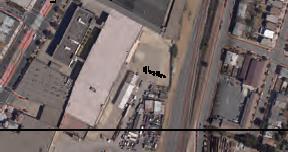
1 From: Danny Ames Sent: Friday, March 24, :58 PM Subject: Must add Schlage Lock to the agenda soon. Dear City Counsel Members, Lets go into this with eyes wide open as to the immensity and scope of the Schlage Lock project, and its impacts on Brisbane. I'm requesting the attachment be included for formal hearings and review and presented during the next meeting. This should be placed on the agenda soon. Council Members must make known the effects of this project and take them into consideration when you enter Baylands deliberations. Regards, Danny Ames
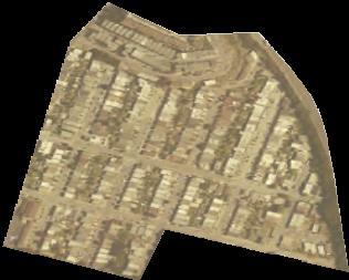
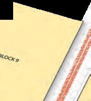
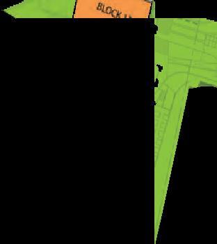
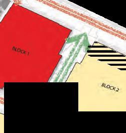
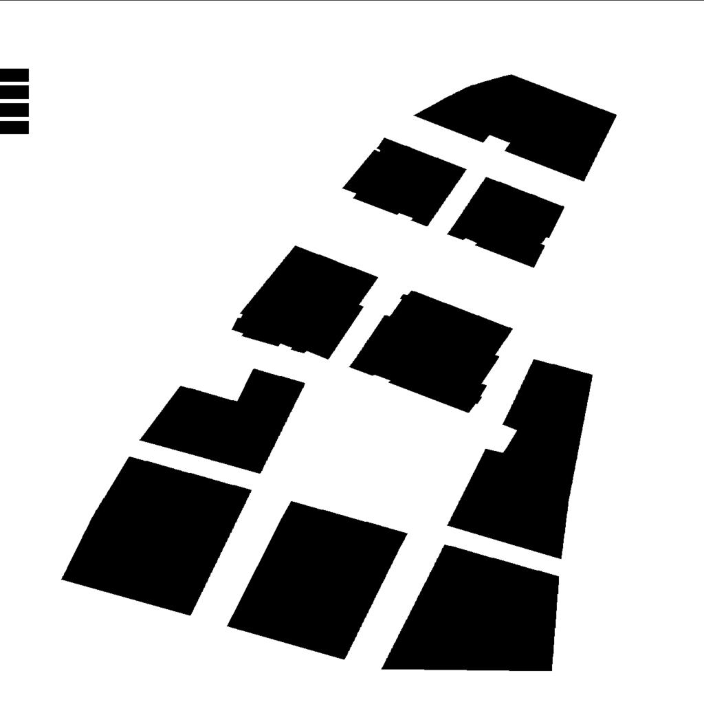
2 TOC SCHLAGE LOCK PROJECT Excerpts CONTENTS CONTENTS Introduction & Project Background 2 Goals For The Schlage Lock Site 8 Existing Conditions 9 Urban Design Framework 20 2 PART II: DEVELOPMENT CONTROLS & GUIDELINES 34 LAND USE 36 BUILDING FORM 38 Building Height 38 Density 40 Massing 40 Setbacks 46 Retail Entrances 46 Residential Entrances 48 Facade Design 49 Roof Design 51 Private Open Space 51 Lighting 54 Signage 55 Visual Screens and Sound Buffers 55 SUSTAINABLE SITE DEVELOPMENT 56 TRANSPORTATION, PARKING, & LOADING 57 Transportation Demand Management 57 Off-Street Parking Requirements 58 Off-Street Loading 58 Curb Cuts / Driveways and Garage Doors 58 PUBLIC REALM - STREETS, BLOCKS AND OPEN SPACE 59 Street Grid / Block Layout 59 Street and Pathway Design 59 Public Open Space 64 APPENDIX 67 FIGURES Figure 1-1 Visitacion Valley/Schlage Lock Special Use District (SUD) Area 4 Figure 1-2 SUD Area and Surrounding Neighborhoods 9 Figure 1-3 Existing Circulation Conditions 12 Figure 1-4 Remediation on the Schlage Lock Site 15 Figure 1-5 Land Use Context 16 Figure 1-6 Projects Underway in the Plan Vicinity 18 Figure 1-7 Urban Design Concept Plan 23 Figure 1-8 Development and Heights of Schlage Lock Site 24 Figure 1-9 Pedestrian Connections 27 Figure 1-10 Open Space Plan 29 Figure 2-1 Special Use District (SUD) Area 35 Figure 2-2 Required Ground Floor Frontages 37 Figure 2-3 Height Map 39 Figure 2-4 Heights, Concept View from South 41 Figure 2-5 Concept Sketch, View from South 43 Figure 2-6 Required Setbacks 45 Figure 2-7 Open Space Map (with Blanken Park Alternative) 53 Figure 2-8 Circulation Map 61 Figure 2-9 Bayshore Boulevard and Leland Avenue Intersection Concept Plan 62 Figure 2-10 Leland Avenue Section at Leland Park 62 Figure 2-11 Street A, cross section between Block 2 and Block


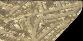


3 San. VISITACION VALLEY/SCHLAGE LOCK FIGURE DESIGN FOR 1-1 DEVEL OPMENT Visitacion Valley/Schlage Lock Special Use District Area (SUD) ZONE 2 ZONE 1 I VISITACION VALLEY/ SCHLAGE LOCK Planning Area Project Area Visitacion Valley Greenway FIGURE 1-2 SUD Area and Surrounding Neighborhoods Visitacion Valley Playground Little Hollywood Neighborhood Visitacion Valley Neighborhood SUD AREA Little Hollywood Community Park Recycling Center/ Sculpture Garden SAN FRANCISCO COUNTY SAN MATEO COUNTY 2

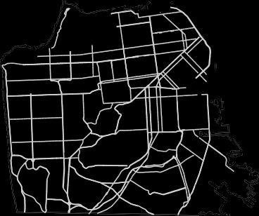
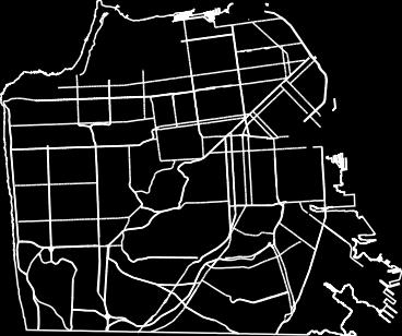
4 PART I: Vision, Goals and Framework The T-Third Muni Metro-line, has two stops along Bayshore Boulevard, and the Caltrain Bayshore stop, located east of Sunnydale Avenue at Tun- nel Avenue, all of which serve the neighborhood. Potential future improvements to the T-Third Muni Metro line include extending its terminus, currently situated near Sunnydale Avenue, to connect as a direct intermodal link with Caltrain s Bayshore Station, although specific project plans have not yet been approved. In addition, several cross-town and express Muni bus routes serve the area, with stops along Bayshore Boulevard. Because of all of these transit connections, the Project Site is considered an intensive transit-oriented development (TOD) area. A number of transit improvements have recently been constructed or are planned in the Plan vicinity. The Muni Metro T- Third Street light rail line along Bayshore Bou- levard was a major improvement to the future of the neighborhood that will support new development in the area. SFMTA s Transit Effectiveness Project proposes future improvements to the area s Muni network, which simplify routes in the Bayview, Hunters Point and Visitacion Valley to provide shorter trips and more frequent service between Downtown/Chinatown and Visitacion Valley on the 8X-Bayshore Express. FIGURE 1-3 Existing Circulation Conditions SUD AREA (NOT FULL EXTENT) 3


5 VISITACION VALLEY/SCHLAGE LOCK DESIGN FOR DEVEL OPMENT Circulation and Access Visitacion Valley can be accessed from Highway 101 via Bayshore Boulevard for regional north and south travel and Geneva Avenue, a major arterial, for cross town travel toward western San Francisco. Bayshore Boulevard links the neighborhood to other points in San Francisco and south to Brisbane and supports transit service to downtown San Francisco via Muni s T-Third Street light rail line. Vehicular access to the Schlage Lock site from the north is limited and pedestrian access to the site is difficult. The local street networks east-west streets, Leland Avenue, Arleta, Raymond, and Visitacion Avenue, all terminate at Bayshore Boulevard and do not continue into the site. Blanken Avenue provides access to Little Hollywood east of Bayshore Boulevard, as well as to the Caltrain station. No public rights-of-way extend east across the Schlage Lock site to the Caltrain Bay- shore station. Vehicular and pedestrian access to the Caltrain station is limited due to land ownership patterns and the lack of a complete street grid in this area. Blanken Avenue provides access to Little Hollywood and the Caltrain Station. Currently, Visitacion Valley residents access the Caltrain station by car via Blanken Avenue to the north. Others have created their own access point at the southern edge of the site by walking along the constructed portion of Sunnydale Avenue and then continuing along unimproved, privately-owned property. Create Neighborhood Fabric Introduce Street Grid Pedestrian access to the site is constrained as well. Bayshore Boulevard s lack of crossings, extreme width, and high traffic, particularly during rush hour, make east- west crossings difficult and unsafe. They also increase the gulf between the existing Visitacion Valley neighborhood and the Schlage Lock site and Little Hollywood neighborhood. Initial efforts to address these crossings were begun with the streetscape and signaliza- tion changes that accompanied the Muni T-Third line, including reducing vehicle travel lanes, installing countdown pedestrian signals, creating a pedestrian refuge, and adding bike lanes to Bayshore Boulevard. Activities to improve the neighborhood s pedestrian environment continued with the redesign of Leland Avenue to revitalize the street as a commercial district, increase the economic viability of businesses, enhance pedestrian safety, and create better connections to the Third Street Light Rail. Specific design improvements include corner bulb-outs and other traffic calming strategies, paving and crosswalk improvements, new street trees and landscaping, street furniture and pedestrian-scale lighting. Build Greenway Linkages Planning for additional traffic improvements is also underway in the area. The Bi-County Transportation Study, led by the San Francisco County Transportation Authority in partnership with the Cities of Brisbane and Daly City and the County of San Mateo, evaluated potential transportation improvements needed to address this anticipated land use growth. Projected land use changes surrounding Visitacion Valley, including development on the Schlage Lock site and expected development at Executive Park, Candlestick Point, Hunter s Point, and Brisbane Baylands (described further on page 18) are expected to create impacts on the regional transportation network. Hazardous Materials and Site Contamination 4 The Schlage Lock site is considered a brownfield site. The soil and groundwater on the site was contaminated with materials used by the manufacturing and rail yard uses formerly on the property.


6 PART I: Vision, Goals and Framework Contaminated soils and groundwater remain in the south portion of the site. The property owner is responsible for remediating toxic soil and groundwater, according to the standards established by the California Department of Toxic Substances Control (DTSC), a state agency, responsible for regulating toxic substances that may affect public health. The site is also currently subject to long term groundwater monitoring by DTSC. A Remedial Action Plan, including a funding program for hazardous material reme- diation, was approved by DTSC in Since then, the entire site has undergone active groundwater and soil vapor remediation. Contaminated soil will be relocated on-site and capped prior to site development. Active groundwater remediation has been completed. The part of the site north of the Visitacion Avenue alignment was remediated and approved for development by the DTSC. The area with the more contaminated soils and groundwater, located in the south portion of the site, is FIGURE 1-4 Remediation on the Schlage Lock Site 2. Remediation complete, approved for development by the DTSC 1. Shallower groundwater contamination build over parking garage 3. Soil and deep groundwater contamination build over parking garage being reviewed by DTSC. In addition, clean fill will be used to as cap to separate contaminated soils from human contact. Completion of active remediation and approval from DTSC will be required before development of the southern portion of the site can proceed. Other Planning Efforts The Schlage Lock development will also be influenced by a number of significant projects in the area that are scheduled to be developed in a similar time frame. They include: 5


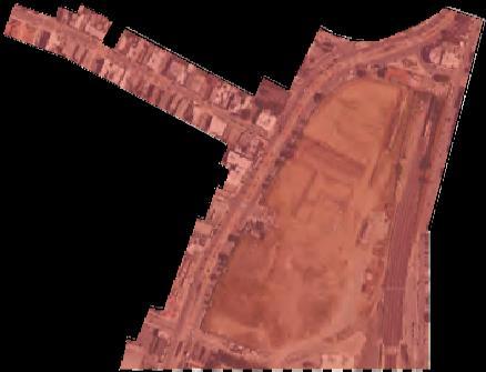
7 VISITACION VALLEY/SCHLAGE LOCK DESIGN FOR DEVEL OPMENT Candlestick Point/Hunters Point Shipyard: Development approved for Candlestick Point includes 7,850 dwelling units, over 100 acres of new parks, and 1.14 million square feet of commercial space - mostly oriented around a green science and technology campus. Development approved for Hunters Point Shipyard includes 2,650 dwelling units, over 2.5 million square feet of research and development space, as well as neighborhood retail, artist housing and work space. Brisbane Baylands: South of the Schlage Lock site in San Mateo County is Universal-Paragon Corporation s proposed Brisbane Baylands development. The Brisbane Baylands development is a 660 acre mixed-use project with a large open space component. The project will incorporate sustainable development features including directing surface drainage flows to the Brisbane lagoon to the south of the site. BAYVIEW PARK CANDLESTICK POINT OPEN SPACE CANDLESTICK POINT DEVELOPMENT AREA EXECUTIVE PARK LITTLE HOLLYWOOD BAYSHORE CALTRAIN RECOLOGY Recology Site Master Plan: Recology owns and operates a waste transfer and recycling facility east and of the Schlage Lock site, across the Caltrain right- of-way. The 45-acre site straddles the San Mateo-San Francisco County line, and forms the northeast corner of the Baylands, although it is not included in the project sponsor-sponsored Baylands proposal. The proposal would replace outdated buildings and utilities with a green, LEED-certified resource recovery and maintenance facilities, administrative offices and supporting operations buildings. Recycling and waste transfer facilities would be located further South and Southeast of their current location. San Francisco-San Mateo Bi-County Study: The Bi-County Transportation Study is a multi-agency effort that identifies priority projects and funding for the southeastern corner of San Francisco County and northeastern corner of San Mateo County. The growth in this area will transform what are now mainly industrial or under-utilized lands into mixed- 6


8 PART I: Vision, Goals and Framework use developments that could exceed 15,000 additional housing units and 14 million square feet of new employment uses, including the Schlage and some of the aforemen- tioned projects. Recommendations include re-configurations of the US 101 interchange and Bayshore Caltrain, as well as a BRT line, T-Third light rail extension and bicyclepedestrian connections. 8X Transit Effectiveness Project Improvements: SFMTA s Transit Effective- ness Project (TEP), which aims to improve transit reliability, travel times, and customer experience, has identified Muni s 8X Bayshore Express bus line as part of its proposed Rapid Network. The 8X Bayshore Express route carries more than 23,000 daily customers on an average weekday. FIGURE 1-7 Urban Design Concept Plan * allowed as-of-right or with conditional use by underlying zoning. 7

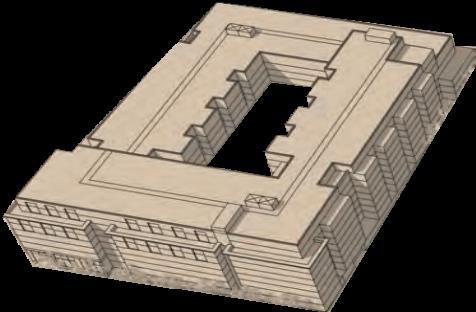
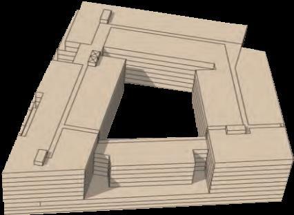
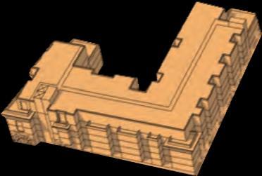
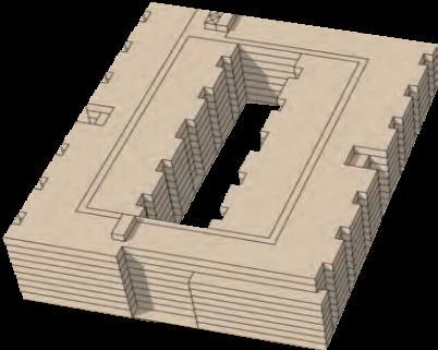
9 VISITACION VALLEY/SCHLAGE LOCK DESIGN FOR DEVEL OPMENT FIGURE 1-8 Development and Heights of Schlage Lock Site A mix of 6 and 8 story buildings on the southeastern corner of the Schlage Lock site. 86 HEIGHT LEGEND 5 Stories 57FT 6 Stories 68FT 6 Stories 76FT 8 Stories 86FT Mid-rise residential units Street-facing, individual entry homes with front stoops. * NORTH Grocery store and retail extends Leland Avenue into the site. * The Blanken Park alternative and conceptual designs on the Union Pacific Railroad and the Peninsula Corridor Joint Powers Board properties (parcel numbers 5087/004 and 5087/005) do not preclude other uses allowed as-of-right or with a conditional use by the underlying M-1 zoning. This applies to all maps in this document. Final use and/or building form requires further planning with property owners. Built Form The Site s mixed-use development will contain both retail/residential buildings, and stand-alone residential. Housing on the Site will be primarily low- and mid-rise multifamily podium construction, with grand multi-unit entrances marking major thoroughfares, and ground-floor walk-up, townhome-style units lining key residential street frontages. Podium buildings constructed on long north/south blocks will have frequent breaks, variation and articulation in their facades to reduce the apparent building mass and bulk.... One of the core recommendations from the community was that the architecture and the massing of the buildings be articulated that building heights setback over the Site to provide visual interest and provide opportunities to create one or more visual landmarks that will act as reference points for the neighborhood. To achieve this, as well as to establish densities consistent with a transit village, the Design for Development designates the location of building forms that range in height up to a maximum of eight stories. These building forms will enable construction of up to 1679 units, 8


10 PART I: Vision, Goals and Framework 6-8 story buildings are proposed along Bayshore south of Leland Avenue, Transportation and Circulation The aim of the plan is to seamlessly connect the Schlage site to the Visitacion Valley neighborhood, and to encourage walking and use of public transit as the primary travel modes for neighborhood residents and visitors. The Design for Development establishes a new street grid on the Schlage Lock site, connecting the site to the existing Visitacion Valley neighborhood to the West and the future Brisbane Baylands Development to the South. The project will extend Leland Avenue, as the primary entrance and retail spine of the development, across Bayshore Boulevard. Raymond, Visitacion and Sunnydale Avenues will also continue east across Bayshore Boulevard to the project site. The street grid system will be designed and constructed to safely encourage walking, cycling and use of public transit for neighborhood residents and visitors, while meeting the needs for vehicular access to retail and housing. Pedestrian paths will be required through large development blocks providing shorter paths of travel and breaking up the massing of new building. The new streets and pedestrian paths will incorporate a variety of streetscape design elements, including consistent planting of street trees and other landscape material, pedestrian-scale lighting and street furniture similar to Leland Avenue west of Bayshore. Strategies to slow traffic from the US 101 off-ramp,include rumble strips, speed limit signs, and radar information signs. Route 1 Route 2 FIGURE 1-9 Pedestrian Connections Short-term and a long term pedestrian connections will link the T-Third Muni line to the Caltrain station. BAYSHORE CALTRAIN STATION 9
11 VISITACION VALLEY/SCHLAGE LOCK DESIGN FOR DEVEL OPMENT In the Project s first phase, a complete pedestrian connection between Bayshore Boulevard and the Caltrain Bayshore station. In addition, the Planning Department will continue to participate, in partnership with the Office of Economic and Workforce Development, the San Francisco Transporta- tion Authority and several other jurisdictions on both sides of the San Francisco/San Mateo county line in the implementation of the Bi-County Transportation Study or an equivalent successor plan. The Study addresses project priorities, schedules, and funding strategies to accommodate anticipated cumulative developments in the southeast San Francisco/Brisbane/Daly City area. These inter-jurisdictional improve- ment priorities include the Geneva-Harney BRT, the Geneva Avenue extension, the planned Geneva-Candlestick U. S. 101 interchange reconfiguration, and additional improvements to the Bayshore Intermodal Station and station area. Excess (clean) rainwater may flow by gravity to the larger, sustainable watershed system of the Brisbane Baylands, and ultimately to the Baylands lagoon and wetlands south of the site where feasible. 36
12


13 VISITACION VALLEY/SCHLAGE LOCK DESIGN FOR DEVEL OPMENT BUILDING FORM Building Height Ground floor commercial and upper story heights Height limit extends from uphill property line because the extension does not allow for an extra occupied floor. Height limit does NOT extend from uphill property line, because the extension allows an extra occupied floor. 38


14 PART II: Development Controls and Design Guidelines FIGURE 2-3 Height Map 5 Stories 57FT 6 Stories 68FT 7 Stories 76FT 8 Stories 86FT 39


15 VISITACION VALLEY/SCHLAGE LOCK DESIGN FOR DEVEL OPMENT FIGURE 2-4 Heights, Concept View from South HEIGHT LEGEND 5 Stories 57FT 6 Stories 68FT 6 Stories 76FT 8 Stories 86FT 40
16 FIGURE 2-5 Concept Sketch, View from South PART II: Development Controls and Design Guidelines TRANSPORTATION, PARKING & LOADING Transportation Demand Management Off-Street Parking Requirements DE VEL OPMENT CONTROLS USE OR ACTIVITY MAXIMUM AMOUNT OF OFF-STREET PARKING Residential One parking space per dwelling unit Grocery Retail School, fitness or community center use All other nonresidential uses One parking space per 333 gross square feet With the exception of grocery retail as set forth above, one parking space per 500 occupied square feet One parking space per 1,000 square feet of occupied space One parking space per 750 square feet of occupied space 41
17
18 PART II: Development Controls and Design Guidelines 67
Visitacion Valley/ Schlage Lock
 Visitacion Valley/ Schlage Lock DESIGN FOR DEVELOPMENT San Francisco Redevelopment Agency SAN FRANCISCO PLANNING DEPARTMENT Visitacion Valley/ Schlage Lock DESIGN FOR DEVELOPMENT FEBRUARY 2009 San Francisco
THE PLANNING AREA 2.1 PLANNING AREA LOCATION
 2. The Planning Area Brisbane Baylands Specific Plan 21 2 THE PLANNING AREA 2.1 PLANNING AREA LOCATION The Baylands is located approximately midway between San Francisco s central business district and
Transportation. Strategies for Action
 Transportation A major priority for the Overlake Neighborhood is to develop a multimodal transportation system. To achieve this system, a balance has to be found among travel, circulation and access needs;
THE NEIGHBORHOOD TODAY
 THE NEIGHBORHOOD TODAY CORE AREA VISION How are we Good Urbanism A Site s DNA thinking about Elements of great Unique elements urban communities embedded in a place the site and design? ELEMENTS LIKE:
FRUITVALE TRANSIT VILLAGE (Phase 2) Residential Project
 Residential Project") FRUITVALE TRANSIT VILLAGE (Phase 2) Residential Project DEVELOPER: SIGNATURE PROPERTIES ARCHITECT: HKIT ARCHITECTS April 23, 2010 TABLE OF CONTENTS 3 Vision 4 Description of Site 5 Guiding Concepts 6
FRUITVALE TRANSIT VILLAGE (Phase 2) Residential Project DEVELOPER: SIGNATURE PROPERTIES ARCHITECT: HKIT ARCHITECTS April 23, 2010 TABLE OF CONTENTS 3 Vision 4 Description of Site 5 Guiding Concepts 6
VISION & EXECUTIVE SUMMARY
 Vision and Executive Summary Brisbane Baylands Specific Plan i * VISION & EXECUTIVE SUMMARY PROJECT OVERVIEW The Baylands, comprising the 684-acre Planning Area 1 of this Brisbane Baylands Specific Plan,
Gold Line Bus Rapid Transit Transit Oriented Development (BRTOD) Helmo Station Area Plan
 Helmo Station Area Plan") Appendix F Gold Line Bus Rapid Transit Transit Oriented Development (BRTOD) Helmo Station Area Plan Introduction and Purpose of the Plan The Gold Line Bus Rapid Transit facility is an eleven-mile dedicated
Appendix F Gold Line Bus Rapid Transit Transit Oriented Development (BRTOD) Helmo Station Area Plan Introduction and Purpose of the Plan The Gold Line Bus Rapid Transit facility is an eleven-mile dedicated
REQUEST Current Zoning: O-15(CD) (office) Proposed Zoning: TOD-M(CD) (transit oriented development mixed-use, conditional)
 (office) Proposed Zoning: TOD-M(CD) (transit oriented development mixed-use, conditional)") Rezoning Petition 2016-117 Zoning Committee Recommendation January 4, 2017 REQUEST Current Zoning: O-15(CD) (office) Proposed Zoning: TOD-M(CD) (transit oriented development mixed-use, conditional) LOCATION
Rezoning Petition 2016-117 Zoning Committee Recommendation January 4, 2017 REQUEST Current Zoning: O-15(CD) (office) Proposed Zoning: TOD-M(CD) (transit oriented development mixed-use, conditional) LOCATION
The West Vaughan Employment Area Secondary Plan Policies
 Part 2: The West Vaughan Employment Area Secondary Plan Policies 2.1 General Policies It is the policy of Council: 2.1.1. That the West Vaughan Employment Area (the WVEA), identified on Schedule 1, will
Be it enacted by the Town Board of the Town of Guilderland that the following new A (Transit Oriented Development (TOD) District) is adopted:
 District) is adopted:") Local Law No. 4 of 2018 (Adoption of 280-18A (Transit Oriented Development District) Be it enacted by the Town Board of the Town of Guilderland that the following new 280-18A (Transit Oriented Development
Local Law No. 4 of 2018 (Adoption of 280-18A (Transit Oriented Development District) Be it enacted by the Town Board of the Town of Guilderland that the following new 280-18A (Transit Oriented Development
Metro. Activity Center Design Guidelines. Recommendations For Developing Focused, Mixed-Use Commercial/Residential Centers
 Metro Activity Center Design Guidelines Recommendations For Developing Focused, Mixed-Use Commercial/Residential Centers Metro Activity Centers What is a MAC? Legacy, the adopted guide for the future growth
A. WHAT IS A GENERAL PLAN?
 I. Introduction A. WHAT IS A GENERAL PLAN? A general plan is the planning guideline for the future of a city. It contains goals and policies which regulate urban development, the protection of the natural
DRAFT. 10% Common Open Space
 % OF CHARLOTTE IS CATEGORIZED AS A. LAND USES : Placeholder map displaying location of Place Type GOALS: Accommodate XX% of future growth. Provide a concentration of primarily commercial and civic activity
DRAFT. October Wheaton. Design Guidelines
 October 2011 DRAFT Wheaton Design Guidelines 2 Draft - Design Guidelines - Wheaton Sector Plan Contents 04 Section 1: Introduction 06 Section 2: Context 08 Section 3: Design Guidelines 09 Goal 1: Create
Regency Developments. Urban Design Brief. Holyrood DC2 Rezoning
 Regency Developments Urban Design Brief Holyrood DC2 Rezoning Stantec Consulting Ltd. 7-31-2017 1. Overview Regency Developments intends to rezone the lands located at 8510 and 8511 93 Avenue, within the
Chapter PEDESTRIAN COMMERCIAL (PC) ZONING DISTRICT
 ZONING DISTRICT") Chapter 11-17 PEDESTRIAN COMMERCIAL (PC) ZONING DISTRICT Sections: 11-17-01 GENERAL PURPOSE 11-17-02 PERMITTED BUILDING TYPES 11-17-03 USES PERMITTED WITH DESIGN REVIEW 11-17-04 USES PERMITTED BY CONDITIONAL
Chapter 11-17 PEDESTRIAN COMMERCIAL (PC) ZONING DISTRICT Sections: 11-17-01 GENERAL PURPOSE 11-17-02 PERMITTED BUILDING TYPES 11-17-03 USES PERMITTED WITH DESIGN REVIEW 11-17-04 USES PERMITTED BY CONDITIONAL
City of Farmington. Downtown Plan. Amendment to the 1998 Master Plan Adopted October 11, 2004
 City of Farmington Amendment to the 1998 Master Plan Adopted October 11, 2004 Introduction Planning Background 1 Scope and Components of the Plan Amendment 2 Concept Introduction 3 Plan Concepts 3 Conceptual
appendix and street interface guidelines
 appendix five: building and street interface guidelines appendix 5 building and street interface guidelines BOULEVARDS Boulevards are generally characterized by higher levels of traffic movement at higher
Subarea 5 Southern Gateway. Vision. Mobility The proposed street network will create developable blocks that are scaled appropriately for the area.
 southern gateway 194 Southern Gateway extends south of I-435 to 123 rd Street and includes the area past the Blue Valley Parkway division. This area is adjacent to major office centers such as the College
5.1 Site Plan Guidelines
 5. Community Core Guidelines Development of the Community Core will take place by plan of subdivision and site plan approval. It will occur in a phased manner that will reflect the timing of residential
The Village. Chapter 3. Mixed Use Development Plan SPECIFIC PLAN
 The Village SPECIFIC PLAN Chapter 3 3.1 INTRODUCTION 3.1.1 Purpose This Chapter describes the development regulations applicable to the Mixed-Use and Transit Center Planning Areas. These form-based regulations
Complete Neighbourhood Guidelines Review Tool
 Complete Neighbourhood Guidelines Review Tool Prepared By: City of Regina Planning Department October 2014 Page 1 of 14 Community Development Review Checklist for Secondary Plans and Concept Plans The
PROPOSED REDEVELOPMENT OF THE GLEN ABBEY GOLF CLUB. STREETSCAPE DESIGN STUDY (excerpt from the Urban Design Brief) TOWN OF OAKVILLE.
 TOWN OF OAKVILLE.") PROPOSED REDEVELOPMENT OF THE GLEN ABBEY GOLF CLUB STREETSCAPE DESIGN STUDY (excerpt from the Urban Design Brief) TOWN OF OAKVILLE OCTOBER, 2016 for 2.4.2 STREETS Streets are the single largest component
PROPOSED REDEVELOPMENT OF THE GLEN ABBEY GOLF CLUB STREETSCAPE DESIGN STUDY (excerpt from the Urban Design Brief) TOWN OF OAKVILLE OCTOBER, 2016 for 2.4.2 STREETS Streets are the single largest component
B. Blocks, Buildings and Street Networks
 B. Blocks, Buildings and Street Networks Figure IV.4 A rational block pattern with connected streets Introduction The single most important element in the physical and functional integration of mixed use
4.1.3 LAND USE CATEGORIES
 4.1.3 LAND USE CATEGORIES a. City Center District The City Center District incorporates the existing character and mix of uses in downtown Belmont to encourage redevelopment and new development in keeping
Clairtrell Area Context Plan
 Clairtrell Area Context Plan March 2005 Urban Development Services City Planning Contents 1. Introduction... 4 2. Development Structure... 6 2.1 Streets... 7 2.1.1 Sheppard Avenue and Bayview Avenue...
3.1 community vision. 3.3 required plan elements
 Chapter 3 Community Form 3.1 community vision 3.2 Parks & landscaping concepts 3.3 required plan elements D R A F T 20 Community Form Chapter 3 3.0 Community form 3.1 community vision The Specific Plan
2.0 THE PLATINUM TRIANGLE VISION
 2.0 THE PLATINUM TRIANGLE VISION The envisions an exciting future for the area surrounding Angel Stadium of Anaheim, the Honda Center and The Grove of Anaheim. 2.1 Planning Principles In order to further
2. Form and Character. 2.1 Introduction. 2.2 The Downtown Addition Plan. 2.1 Introduction
 2.1 Introduction 2.1 Introduction This section of the Specific Plan describes and illustrates the desired form, character and uses of the Downtown Addition and explains the underlying design principles.
The transportation system in a community is an
 7 TRANSPORTATION The transportation system in a community is an important factor contributing to the quality of life of the residents. Without a sound transportation system to bring both goods and patrons
Derry Green Corporate Business Park
 Town of Milton Derry Green Corporate Business Park Urban Design Guidelines BMI/Pace - June 2010 Draft 3 Prepared by: Brook McIlroy Planning + Urban Design / Pace Architects Suite 300-51 Camden Street Toronto,
Carlsbad Village Redevelopment Concept Summary of Features
 Carlsbad Village Redevelopment Concept Summary of Features Calthorpe Associates November 5, 2003 The Redevelopment Concept illustrates a vision for the future of Carlsbad Village. The overall vision of
Corridor Transformation Strategy
 Corridor Transformation Strategy County Road 22 Special Planning Area Design Guidelines January 2012 D14-06017 Corridor Transformation Strategy County Road 22 Special Planning Area Corridor Design Guidelines
Establish a network of streetscaped vehicle and pedestrian routes that connect within and outside the Plan area.
 This Plan s urban design goals are to create an urban scale, walkable community with connections to transit, parks, and services and with amenities and facilities for residents and employees. The 1992
September 30, 2014 Ms. Lorraine Weiss Department of Community Development City of San Mateo 330 West 20th Avenue San Mateo, CA
 ARCHITECTURE PLANNING URBAN DESIGN September 30, 2014 Ms. Lorraine Weiss Department of Community Development City of San Mateo 330 West 20th Avenue San Mateo, CA 94403-1388 RE: Station Park Green Dear
Citizen Advisory Group Meeting 5: Land Use April 14, 2011
 Citizen Advisory Group Meeting 5: Land Use April 14, 2011 Meeting Agenda 1. Background Review 2. Transportation Follow-up 3. PED Overlay Approach 4. Land Use Mapping 5. Group Exercise 6. Wrap-up and Next
Seneca Meadows. Block 4 Locate office, technology, and medical development adjacent to I Screen views of garage structures from I-270.
 Seneca Meadows Seneca Meadows has an industrial park in its southern end and a mixed-use employment area planned for the north end. The district benefits from extensive I-270 visibility, stream valley
12600 S Existing Conditions
 STUDY AREA BOUNDARY Study Area Boundary Study Area Context The District Riverton Meadows Vista Station Mountain View Village Market Center 2 Mile Radius 12600 S Existing Conditions 12600 S is a river of
Bayshore Boulevard Home Improvement District Design Guidelines
 Bayshore Boulevard Home Improvement District Design Guidelines guidelines for New construction projects and major alterations IN the bayshore boulevard home improvement special use DISTRICT SAN FRANCISCO
FUTURE LAND USE ELEMENT
 FUTURE LAND USE ELEMENT GOAL I: To create and sustain a great place to live, play, and prosper Objective 1: The City of Ocala shall incorporate the principles and strategies of the Ocala 2035 Vision into
Town Center (part of the Comprehensive Plan)
") Town Center (part of the Comprehensive Plan) Mercer Island Town Center Looking North (2014) In 1994, a year-long process culminated in a set of design guidelines and code requirements for the Town Center
Town Center (part of the Comprehensive Plan) Mercer Island Town Center Looking North (2014) In 1994, a year-long process culminated in a set of design guidelines and code requirements for the Town Center
APPENDIX C SPECIAL PLANNING AREAS
 SPECIAL PLANNING AREAS There are five Special Planning Areas (SPAs) on the Land Use Diagram (Figure LU-2). The SPAs are areas with significant new growth potential that require more detailed subsequent
Subarea 4 Indian Creek. Vision The combination of park networks and transportation amenities make Subarea 4 the greenest hub in the Corridor.
 indian creek 180 extends south from 101st Street to I-435. The I-435 and Metcalf intersection is one of the primary intersections in the Kansas City Metro Area. The area includes several residential neighborhoods
This page left intentionally blank.
 July 2012 This page left intentionally blank. Table of Contents Appendix A : Project Development Checklist Appendix B: At-Grade Rail Crossings Appendix C: Maintenance and Operations Examples Appendix D:
Planning Commission March 14, Presented by: City of Bellingham Port of Bellingham
 Planning Commission March 14, 2013 Presented by: City of Bellingham Port of Bellingham 1 Agenda Waterfront District Background Waterfront District Proposal Overview Sub-area Plan Development Regulations
PLAN ELEMENTS WORKSHOP. April 5, 2016
 PLAN ELEMENTS WORKSHOP April 5, 2016 needs more housing. But there is no one-size fits-all solution. Every neighborhood has its own character. In some places, density is not only appropriate it is badly
Bylaw No. B-03/2011 Adopted by Airdrie City Council February 21, 2012
 COOPER S CROSSING STAGE 4 Neighbourhood Structure Plan City of Airdrie WESTMARK HOLDINGS LTD. Bylaw No. B-03/2011 Adopted by Airdrie City Council February 21, 2012 CONSULTANTS: LAND USE PLANNING: Southwell
Outline Plan in Belvedere (Ward 9) at Street SE, LOC (OP)
 at Street SE, LOC (OP)") 2018 October 04 Page 1 of 12 EXECUTIVE SUMMARY This outline plan application was submitted by B&A Planning Group on 2016 July 15, on behalf of Tristar Communities Inc. for 50.14 hectares (123.89 acres)
2018 October 04 Page 1 of 12 EXECUTIVE SUMMARY This outline plan application was submitted by B&A Planning Group on 2016 July 15, on behalf of Tristar Communities Inc. for 50.14 hectares (123.89 acres)
San Francisco, California. Candlestick Point. Design for Development
 San Francisco, California Candlestick Point Design for Development 2 San Francisco, California Candlestick Point Design for Development Adopted June 3, 2010 by: San Francisco Planning Commission Motion
9IMPLEMENTATION AND PHASING
 9IMPLEMENTATION AND PHASING Purpose A key objective of the Railyard Master Plan is the integration of the public and private realm to provide a network of places that connect to and complement Commercial
Town Center. Block 5 Existing multifamily residential units are expected to remain.
 Area Guidelines Germantown s districts should be developed as distinct communities with unique features that are supported through the guidelines. The guidelines not only help distinguish these districts
Policies and Code Intent Sections Related to Town Center
 Policies and Code Intent Sections Related to Town Center The Town Center Vision is scattered throughout the Comprehensive Plan, development code and the 1994 Town Center Plan. What follows are sections
Hockessin Community Redevelopment Plan
 Hockessin Community Redevelopment Plan 3.1 Introduction The Community Redevelopment Plan for the Village of Hockessin is the result of the people s vision for a distinct village center that serves as the
The principal elements of the NTC Strategic Vision plan are as follows.
 The proposed project would improve the NTC site plan, circulation, visitor amenities, and landscaping, and would include construction of two new stadiums to replace the existing Louis Armstrong Stadium
Dwelling Units Max 12 dwelling units per acre/min 8 dwelling units per acre. Development Mix 80% non residential/20% residential
 13. OSTEEN LOCAL PLAN Background: The Osteen Local Plan area is located in southwest Volusia County along the SR 415 corridor between Lemon Bluff Road and Acorn Lake Road and includes 3,990 acres. The
Cit of Kitchener Ur 6 an Design Manual PARTA. Desi n for _--::
 Cit of Kitchener Ur 6 an Design Manual Date PARTA Year ) Desi n for k Nodes Corridors _--:: Section Page 01 of 12 2 INTRODUCTION Purpose & Application Nodes and Corridors have been identified as key intensification
The petition proposes the development of five townhomes on a vacant parcel between Charlotte Latin School and Providence Presbyterian Church.
 Rezoning Petition 2017-202 Final Staff Analysis June 18, 2018 REQUEST LOCATION Current Zoning: R-3 (single family residential) Proposed Zoning: UR-2(CD) (urban residential, conditional) with five-year
San Francisco, California Hunters Point Shipyard. Design for Development
 San Francisco, California Hunters Point Shipyard Design for Development San Francisco, California Hunters Point Shipyard Design for Development Adopted June 3, 2010 by: San Francisco Planning Commission
3.0 URBAN DESIGN. December 6, OVERVIEW
 Urban Design 3.0 URBAN DESIGN December 6, 2007 3.1 OVERVIEW The highly urban character of Easton Place is defined by the overall design of the community. The following sections provide an overview of the
The Baileys Planning District portion of the Comprehensive Plan contains site design recommendations for both the Baileys Crossroads Community
 The Baileys Planning District portion of the Comprehensive Plan contains site design recommendations for both the Baileys Crossroads Community Business Center and the Seven Corners Community Business Center.
Public Frontage Regulations Map
 2.4. PUBLIC FRONTAGE REGULATIONS The Public Frontage is the area between the face of the curb and the back of the sidewalk. It includes the sidewalk, street trees, street lighting, and any landscaped planting
DRAFT Northeast Quadrant of Kipling Avenue and Highway 7 DRAFT AUGUST 29, Goals Land Use. The goals of this Plan are to:
 AUGUST 29, 2017 12.15 Northeast Quadrant of Kipling Avenue and Highway 7 12.15.1 Goals 12.15.2 Land Use The goals of this Plan are to: 12.15.2.1 General Provisions: a) Ensure the development of a compact
EXISTING COMPREHENSIVE PLAN
 EXISTING COMPREHENSIVE PLAN Town Center Land Use Element: V. LAND USE POLICIES Town Center Mercer Island's business district vision as described in "Your Mercer Island Citizen-Designed Downtown" was an
Tyvola & Archdale Transit Station Area Plan. June 5, 2008
 Tyvola & Archdale Transit Station Area Plan Second Public Meeting June 5, 2008 Presentation Outline 1. Purpose and Process 2. Station Area Overview 3. Plan Recommendations 4. Comments Received and Proposed
Sub Area 2: Downtown Overland Park
 Downtown 132 2.12 encompasses over 600 acres and extends between 71st Street and 87 th Street including Downtown Overland Park. The area is home to several individual historic sites and structures, including
Review of Opportunity Area C Draft Comprehensive Plan and Draft BOS Follow-On Motions. Special Working Group Meeting March 4, 2015
 Review of Opportunity Area C Draft Comprehensive Plan and Draft BOS Follow-On Motions Special Working Group Meeting March 4, 2015 The slides that follow identify where the draft Comprehensive Plan has
CHARLES PUTMAN CHARLES PUTMAN AND ASSOCIATES, INC
 MEMORANDUM CHARLES PUTMAN & ASSOCIATES, INC. LAND DEVELOPMENT CONSULTANTS PLANNING ZONING PERMITTING 4722 NW Boca Raton Boulevard, Suite C-106 Boca Raton, Florida 33431 Phone: 561/994-6411 FAX: 561/994-0447
B L A C K D I A M O N D D E S I G N G U I D E L I N E S for Multi-family Development
 B L A C K D I A M O N D D E S I G N G U I D E L I N E S for Multi-family Development Adopted June 18, 2009 This section of the Design and focuses on site planning and design guidance for new multi-family
TRANSPORTATION ELEMENT GOALS, OBJECTIVES, AND POLICIES
 TRANSPORTATION ELEMENT GOALS, OBJECTIVES, AND POLICIES GOAL 2 The City shall provide a safe, convenient, effective, and energy efficient multimodal transportation system which is coordinated with the Future
Chapter 6--Urban Design
 6.1 Introduction... 6-1 6.1.1 Background & Scope... 6-1 6.1.2 Relationship to State Law... 6-2 6.1.3 Relationship to Other General Plan Chapters... 6-2 6.2 Guiding Principles... 6-2 6.3 Urban Design Guidelines...
13 THORNHILL YONGE STREET STUDY IMPLEMENTATION CITY OF VAUGHAN OPA 669 AND TOWN OF MARKHAM OPA 154
 13 THORNHILL YONGE STREET STUDY IMPLEMENTATION CITY OF VAUGHAN OPA 669 AND TOWN OF MARKHAM OPA 154 The Planning and Economic Development Committee recommends the adoption of the recommendations contained
Though functionally a part of the Ocean Avenue Neighborhood Commercial
 Phelan Loop area, existing conditions Phelan Loop area, with proposed infill development and open space Though functionally a part of the Ocean Avenue Neighborhood Commercial District, the, along the north
Potential Green Infrastructure Strategies May 6, 2015 Workshop
 Potential Green Infrastructure Strategies May 6, 2015 Workshop Background The City of Cortland is developing the Tioughnioga Urban Headwaters Green Infrastructure Action Plan with funding from the National
Wheaton CBD & Vicinity Sector Plan D E S I G N G U I D E L I N E S
 Wheaton CBD & Vicinity Sector Plan D E S I G N G U I D E L I N E S 1 a b s t r a c t This document contains the design guidelines the property owners, community members, and planners should use to implement
Executive Summary. NY 7 / NY 2 Corridor
 Executive Summary NY 7 / NY 2 Corridor Transportation and Land Use Study December 2005 Prepared for: Town of Colonie Capital District Transportation Committee Prepared by: Introduction: Land use decisions
Harmony Technology Park Third Filing, Second Replat Custom Blending, Project Development Plan/Final Development Plan - FDP #130021
 ITEM NO FDP #130021 MEETING DATE July 23, 2013 STAFF Pete Wray ADMINISTRATIVE TYPE I HEARING STAFF REPORT PROJECT: APPLICANT: OWNER: Harmony Technology Park Third Filing, Second Replat Custom Blending,
Urban Design Brief December 23, 2015 Southside Construction Group Official Plan & Zoning By-Law Amendment
 Urban Design Brief Proposed Official Plan & Zoning By-Law Amendment 3244, 3263 and 3274 Wonderland Road South Southside Group December 23, 2015 TABLE OF CONTENTS Page No. INTRODUCTION... 1 SECTION 1 LAND
MIXED-USE VILLAGE OVERLAY FLOATING DISTRICT
 MIXED-USE VILLAGE OVERLAY FLOATING DISTRICT Zoning regulations developed by committee to the Planning Board for the Town of DeWitt, NY Issue date: 13 July 2017 revised 3/12/2018, revised 4/26/2018, 5/9/2018
[PLANNING RATIONALE] For Site Plan Control and Lifting of Holding Zone By-Law 101 Champagne Avenue. May 23, 2014
![[PLANNING RATIONALE] For Site Plan Control and Lifting of Holding Zone By-Law 101 Champagne Avenue. May 23, 2014](/thumbs/75/71599615.jpg "[PLANNING RATIONALE] For Site Plan Control and Lifting of Holding Zone By-Law 101 Champagne Avenue. May 23, 2014") [PLANNING RATIONALE] For Site Plan Control and Lifting of Holding Zone By-Law 101 Champagne Avenue May 23, 2014 Contents 1.0 Introduction... 2 2.0 Site Context... 2 2.1 Adjacent Uses... 2 Figure 1: Site
[PLANNING RATIONALE] For Site Plan Control and Lifting of Holding Zone By-Law 101 Champagne Avenue May 23, 2014 Contents 1.0 Introduction... 2 2.0 Site Context... 2 2.1 Adjacent Uses... 2 Figure 1: Site
LELAND & VISITACION PARK COMMUNITY MEETING
 LELAND & VISITACION PARK COMMUNITY MEETING July 16th, 2016 SAN FRANCISCO RECREATION AND PARK GLS LANDSCAPE ARCHITECTURE BAYSIDE DEVELOPMENT LLC MEETING OBJECTIVES 1. FEEDBACK ON LELAND / BAYSHORE CORNER
DOWNTOWN RESIDENTIAL DISTRICT DEVELOPMENT OPPORTUNITES
 DOWNTOWN RESIDENTIAL DISTRICT DEVELOPMENT OPPORTUNITES Out of all the areas in Downtown Painesville, this district provides the greatest opportunity for change with the vacation of Lake East Hospital.
ELMVALE ACRES SHOPPING CENTRE MASTER PLAN
 ELMVALE ACRES SHOPPING CENTRE MASTER PLAN Contents 1.0 INTRODUCTION... 2 2.0 LOCATION... 2 3.0 EXISTING CONTEXT... 2 4.0 VISION & GUIDING PRINCIPLES... 2 5.0 LAND USE AND BUILT FORM... 4 5.1 St. Laurent
U T D N o r t h C a m p u s T O D and D o w n t o w n D e n t o n T O D
 U n i v e r s i t y o f T e x a s a t D a l l a s C i t y o f R i c h a r d s o n U T D N o r t h C a m p u s T O D and D o w n t o w n D e n t o n T O D Rick Leisner, AICP Assistant Director of Development
Figure 3-1: Public Realm Plan
 3 Public Realm Figure 3-1: Public Realm Plan 3.1 Public Realm Concept The public realm concept for the Little Mountain site integrates a clear and accessible movement network with public spaces for social
Strategic Growth Area #1 Northampton Boulevard Corridor Area
 Strategic Growth Area #1 Northampton Boulevard Corridor Area Description Strategic Growth Area #1 has established itself as a major employment center in Southside Hampton Roads. Opportunities exist to
Welcome. Comprehensive Plan & Transportation Plan Open House November 7, 2012
 Welcome Comprehensive Plan & Transportation Plan Open House November 7, 2012 Agenda Proposed future land use plan Comprehensive Plan strategies Traffic forecasts Future traffic operations Possible future
Highland Village Green Design Guidelines
 Highland Village Green Design Guidelines Publishing Information Title Highland Village Green Design Guidelins Author The City of Calgary Status DRAFT - Proposed document subject to changes Additional Copies
4 LAND USE DESIGNATIONS
 4 LAND USE DESIGNATIONS Chapter 4 describes the land use designations and densities that will implement the development vision for North Burlingame outlined in Chapter 3. Land use densities are described
Mark-up of the effect of the proposed Bronte Village Growth Area OPA No.18 on the text of section 24, Bronte Village, of the Livable Oakville Plan
 Mark-up of the effect of the proposed Bronte Village Growth Area OPA No.18 on the text of section 24, Bronte Village, of the Livable Oakville Plan Notes: This document is provided for information purposes
11.5 Kipling Avenue Corridor Secondary Plan
 11.5 Kipling Avenue Corridor Secondary Plan ADOPTED BY VAUGHAN CITY COUNCIL NOT YET APPROVED BY THE ONTARIO MUNICIPAL BOARD 11.5.1 Development Principles and Objectives The following principles support
URBAN DESIGN BRIEF. 2136&2148 Trafalgar Road. Town of Oakville
 URBAN DESIGN BRIEF 2136&2148 Trafalgar Road Town of Oakville Prepared By: METROPOLITAN CONSULTING INC For 2500674 Ontario Inc November 2016 TABLE OF CONTENTS Page No. 1.0 Introduction/Description of Subject
ESTABLISH AN EFFICIENT TOWN CENTER
 ESTABLISH AN EFFICIENT TOWN CENTER 4 Overview Lisbon residents are proud of the history of Newent and at the same time recognize its current importance as a centralized location for a variety of municipal
Table of Contents. Elm Avenue Improvement Plan City of Waco, Texas. Introduction 1. Existing Context 1 Figure 1 2.
 Table of Contents Introduction 1 Existing Context 1 Figure 1 2 Plan Guidelines 3 Future Urban Form 4 The West-End 4 Main Street 6 The East-End 7 Figure 2 9 Public Improvement Recommendations 7 General
City of Fort Lauderdale UPTOWN URBAN VILLAGE. Public Workshop December 7, 2016
 Public Workshop December 7, 2016 Workshop Agenda Introductions Project Presentation o o o History Project Scope/Timeline Character of Study Area o o o o Land Use Public Realm/Pedestrian Mobility Multimodal
The Humber Bay Shores. Urban Design Guidelines Update and Public Realm Plan. January, 2008
 The Humber Bay Shores Urban Design Guidelines Update and Public Realm Plan January, 2008 prepared by Brook McIlroy Planning and Urban Design / Pace Architects Content i EXECUTIVE SUMMARY KEY RECOMMENDATIONS
Lower Merion Commercial Districts Issues and Characteristics Handbook November 2013
 Lower Merion Commercial Districts Issues and Characteristics Handbook November 2013 DRAFT TOWNSHIP-WIDE VISION: To maintain and enhance commercial areas to complement the surrounding high-quality residential
URBAN DESIGN BRIEF URBAN DESIGN BRIEF 721 FRANKLIN BLVD, CAMBRIDGE August 2018
 URBAN DESIGN BRIEF URBAN DESIGN BRIEF 721 FRANKLIN BLVD, CAMBRIDGE August 2018 DESIGN BRIEF CONTENTS PART A 1.0 INTRODUCTION 2.0 DESCRIPTION & ANALYSIS OF SITE CONTEXT 3.0 DESIGN CONSTRAINTS AND OPPORTUNITIES
PUBLIC FRONTAGE REGULATIONS MAP
 2.4. PUBLIC FRONTAGE REGULATIONS The Public Frontage is the area between the face of the curb and the back of the sidewalk. It includes the sidewalk, street trees, street lighting, and any landscaped planting
Westwind Developments Ltd. PIONEER LANDS AREA STRUCTURE PLAN - PROPOSED AMENDMENT
 FEBRUARY 2013 TABLE OF CONTENTS 1.0 BACKGROUND... 1 1.1 Amendment... 1 2.0 LOCATION & CONTEXT... 2 2.1 Land Ownership... 2 3.0 POLICY CONTEXT... 3 3.1 Municipal Development Plan... 3 3.2 Capital Region
URBAN DESIGN BRIEF REPORT
 URBAN DESIGN BRIEF REPORT PREPARED FOR 2568401 ONTARIO INC NEW GASBAR, CONVENIENCE STORE & CARWASH DEVELOPMENT @ 1509 FANSHAWE PARK ROAD WEST LONDON, ONTARIO GAMA ENGINEERING INC. PROJECT NUMBER 1669 PREPARED