Introduction. Background
|
|
|
- Emory Fisher
- 5 years ago
- Views:
Transcription
1
2
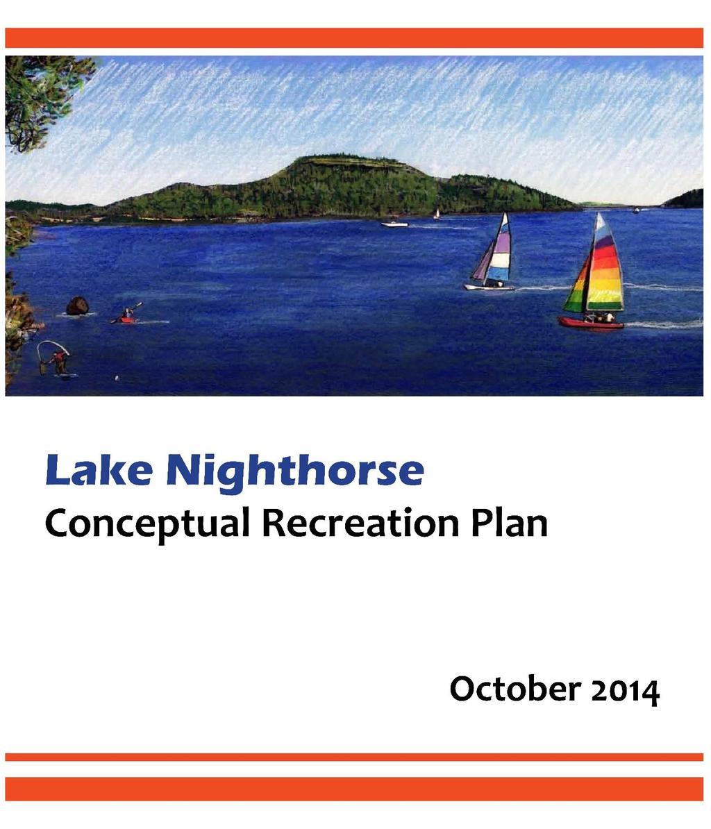
3 Introduction The City of Durango Parks and Recreation Department in collaboration with the Bureau of Reclamation prepared this conceptual plan for recreation facilities and management at Lake Nighthorse. As follows are several documents which provided the foundation for the development of the Lake Nighthorse Conceptual Recreation Plan: Draft Lake Nighthorse Recreation Master Plan prepared by the Animas-La Plata Water Conservancy District (May 2011); Preliminary Draft Environmental Assessment for Lake Nighthorse Recreation Master Plan prepared by the Bureau of Reclamation (October 2012); Animas-La Plata (ALP) Project Final Supplemental Environmental Impact Statement (FSEIS) prepared by the Bureau of Reclamation (2000); Recreation Market Assessment, Lake Nighthorse, Durango, Colorado Prepared by RPI Consulting for the Animas-La Plata Water Conservancy District (June 2010); Draft Lease Agreement between United States of America and City of Durango, Colorado, for Administration of Recreation at Lake Nighthorse (In progress, available upon completion 2014); Draft Lake Nighthorse Annexation Agreement (In progress, available upon completion 2014); and Draft Memorandum of Agreement (MOA) among Animas La-Plata Operation, Maintenance, and Replacement Association and City of Durango and Ute Mountain Ute Tribe and Southern Ute Indian Tribe and Bureau of Reclamation for Recreation Planning and Development at Lake Nighthorse for Animas-La Plata Project, Colorado and New Mexico (In progress, available upon completion 2014). Background Ridges Basin Dam and Lake Nighthorse were constructed by the Bureau of Reclamation (Reclamation) as a component of the Animas-La Plata (ALP) Project. The ALP Project was built to fulfill the water rights settlement of the Ute Mountain Ute and the Southern Ute Indian Tribes of southwestern Colorado (Colorado Ute Tribes) and to provide a municipal and industrial water supply to various entities in the region. Reclamation prepared a Final Supplemental Environmental Impact Statement in 2000, and subsequently signed a Record of Decision which envisioned development and management of recreation by a nonfederal entity. The reservoir area encompasses approximately 5,500 acres, and the water surface area is 1,500 acres at normal high water elevation and 750 acres at minimum pool. In 2004, Ridges Basin Reservoir was renamed Lake Nighthorse, in honor of Ben Nighthorse Campbell, the former U.S. senator from Colorado who served as the primary author for the Settlement Act and its amendments. Construction of the dam and reservoir started in May 2003 and the initial reservoir filling was completed in June In 2008, Colorado State Parks declined to accept the development and management of recreation at Lake Nighthorse and agreed to allow Reclamation to seek other nonfederal partners. The State gave Reclamation a $3 million Motorboat Access grant for construction of a boat ramp, a parking area, a vault restroom, and an access road. Construction of the boat ramp project was completed in June
4 Recognizing the potential of the reservoir to serve as an important recreational amenity, the Animas-La Plata Water Conservancy District initiated public meetings in 2009 and contracted for the preparation of a recreation master plan in 2010 for development and management of recreation at Lake Nighthorse. The final Draft Lake Nighthorse Recreation Master Plan was completed in May Since then, considerable discussion has been ongoing with individual members of the Animas La-Plata Operation, Maintenance, and Replacement Association and Reclamation regarding recreation at Lake Nighthorse in an effort to determine what level of recreation might be appropriate and compatible with the project s primary purpose. The City of Durango recognized that a nonfederal recreation manager for Lake Nighthorse has not been found by the Bureau of Reclamation. Several nonfederal agencies were approached by Reclamation and all entities declined to accept the management and development of recreation at Lake Nighthorse. In 2012, the City of Durango Parks and Recreation Department received the National Gold Medal Award for Excellence in the Field of Park and Recreation Management, granted by the American Academy for Park and Recreation Administration in partnership with the National Recreation and Park Association. This most prestigious award is given to only one Parks and Recreation agency in the entire nation each year by population. Durango Parks and Recreation received the award for cities less than 25,000. The Durango Parks and Recreation Department has the expertise to manage Lake Nighthorse and there is significant community interest in opening the facility to the public for recreation. The City of Durango is a member on the Animas-La Plata Operation, Maintenance and Replacement Association (Association) and has an interest in the future of recreation at Lake Nighthorse. Other representatives on the Association include the Ute Mountain Ute Tribe, Southern Ute Indian Tribe, La Plata Conservancy District, Navajo Nation, Animas-La Plata Water Conservancy District, San Juan Water Commission, and the Colorado Water Conservation Board. The members of the Association represent the project beneficiaries for whom the project was constructed. In 1874, Congress approved an agreement between the United States and certain Ute Indians in Colorado, known as the Brunot Agreement, pursuant to which the Utes ceded certain land to the United States and reserved a right to hunt on the land. The Brunot Agreement enables members of the Ute Indians to hunt, fish and gather, by which the Utes supported themselves in the region for centuries. Almost all of the federal property encompassing Lake Nighthorse is located within the Brunot area and subject to the Brunot Agreement rights. Reclamation, the Tribes, and the City area are having ongoing discussions regarding implementation of these rights. Recreation Management and Development Discussions regarding the City of Durango exploring the feasibility of accepting the responsibility for management and development of recreation at Lake Nighthorse were initiated with Reclamation in The management and development of recreation at Lake Nighthorse is a complex negotiation process involving multiple stakeholders. Consensus has been reached to establish the framework for proceeding with recreation at Lake Nighthorse in a cautious and respectful manner. The management and development of recreation at Lake Nighthorse is intended to occur in manner consistent with the primary purpose of the project, and will be managed in accordance with the following guiding principles: 2
5 Guiding Principles Protection of cultural resources. Ensure compliance with all applicable local, state, and federal development standards and environmental regulations and requirements. Monitor and protect water quality. Honor Brunot Agreement/Treaty rights. Promote ecological sustainability and preserve wildlife habitat. Provide ongoing care, stewardship, law enforcement, and patrol the property consistent with City parks and open space areas. Provide improvements within the development area to enable public access to recreational amenities. Ensure that recreation management and development does not adversely impact the primary purpose of the ALP Project for municipal and industrial water supply. Pursuant to the draft MOA and ongoing discussions, the Recreation Planning and Development Committee (Committee) will include representation from the Animas-La Plata Operation, Maintenance and Replacement Association, City of Durango, Ute Mountain Ute Tribe, Southern Ute Indian Tribe, and Reclamation. The purpose of the Committee is to review and discuss recreation planning and development at Lake Nighthorse to ensure compatibility with the primary purpose of the ALP Project for municipal and industrial water supply, including initial development and any future development of recreation facilities. Lake Nighthorse is currently outside the jurisdictional boundaries of the City of Durango. In order for the City to undertake the administration of recreation at Lake Nighthorse in accordance with the terms of the Lease Agreement between Reclamation and the City of Durango, annexation of the property into the City is necessary to facilitate the provision of municipal services and, in particular, law enforcement. The annexation of federal land encompassing Lake Nighthorse is limited to the recreation area and facilities to be managed by the City of Durango. Initial Recreation Development The development of recreational improvements at Lake Nighthorse will be phased to ensure compatibility with the primary purpose of the ALP Project, subject to the availability of funding, and consistent with the decisions of the Committee. Initially, Lake Nighthorse will be open for day use only, including minimum facilities necessary for public health and safety, law enforcement, and protection of the environment. The map below illustrates the current and future recreation area, highlighted in green. 3
, City of Durango ($285,000), and La Plata County road improvements involving the CR 210 turn lane into Lake Nighthorse ($350,000).")
6 Figure 1: Proposed Recreation Footprint The initial phase of recreation development to enable Lake Nighthorse to be open to the public has been funded by a variety of sources to Reclamation ($3,350,000), City of Durango ($285,000), and La Plata County road improvements involving the CR 210 turn lane into Lake Nighthorse ($350,000). Below is an overview of the basic necessary improvements to open Lake Nighthorse to the public: Aquatic Nuisance Species Inspection Station and Decontamination Area Reclamation will coordinate with the Committee to plan and develop at the entry to Lake Nighthorse an aquatic nuisance species (ANS) inspection station and decontamination area. Near the existing access to CR 210, the Lake Nighthorse entrance will be located to ensure that all vehicular traffic will pass through the entrance and all motorized boats will be inspected for potential presence of ANS on vessels. The decontamination area will capture and contain all fluids associated with the treatment for ANS. 4
7 Water Quality Reclamation will continue its ongoing water quality activities for monitoring and protection purposes. The following provides a description of Reclamation s water quality activities associated with the Animas-La Plata Project and Lake Nighthorse. Lake Nighthorse Since 2009, Reclamation has periodically conducted water quality sampling at Lake Nighthorse which includes a petroleum product monitoring element. The data gathered will provide a baseline to compare future monitoring. A regular water quality sampling program will start when the reservoir opens for public use. The sampling will include monitoring for potential pollutants such as benzene, toluene, ethyl benzene, and xylenes which are some of the volatile organic compounds found in petroleum derivatives such as gasoline. Reclamation does not believe there will be adverse impacts on water quality due to the use of motor boats on the reservoir. However, if applicable water quality parameters are exceeded, Reclamation will work with the appropriate entity/entities to resolve the issue(s) while involving the recreation manager and project stakeholders. In order to establish a baseline for E. coli, initial sampling occurred on the reservoir in late September 2014 and will be conducted again in October and November, weather permitting. After the E. coli data is gathered, the next step will be to analyze all the collected data and provide the information to project stakeholders. After the reservoir opens for public use, appropriate sampling will be conducted for E. coli and additional sampling will include monitoring for invasive species such as quagga and zebra mussels. Water sampling for larval mussel detection will include lab analyses to ascertain the potential for mussel survival in the reservoir with emphasis on key parameters including calcium, ph, temperature, dissolved oxygen, and nutrients. The data gathered from the sampling will be analyzed and provided to project stakeholders. Animas River Reclamation developed and implemented a program to monitor water quality in the Animas River from the Durango Pumping Plant (DPP) to the confluence with the San Juan River for five years after the DPP began operation in This sampling includes monitoring general water quality (major constituents, heavy metals, nutrients, and total organic carbon) and radiochemistry (radioactive materials). Weather permitting; sampling is done year round on a monthly basis. Two sites are located upstream from the Durango Pumping Plant (DPP); one is located behind the Doubletree Hotel and the other is near the DPP. The third site is located about ½ a mile downstream from the DPP. Reclamation also samples the Animas River at two other locations on a quarterly basis; one site is located upstream from the DPP at East 32nd Street and the other site is located near Farmington, New Mexico, upstream from confluence of the Animas and San Juan Rivers. After Lake Nighthorse opens for public use, sampling on the Animas River will also include larval mussel detection and lab analyses to ascertain the potential for mussel survival in the river with emphasis on key 5

8 parameters including calcium, ph, temperature, dissolved oxygen, and nutrients. The data gathered from the river sampling will be analyzed and provided to project stakeholders. In the event larval mussels are found in the river, Reclamation will work with the appropriate entity/entities to address potential introduction in the reservoir. Cultural Resources The City of Durango will work with Reclamation and the Tribes to ensure protection of cultural resources pursuant to the Ridges Basin Cultural Resource Management Plan. Below is a schematic overview of the Section 106 Process that is required by the Bureau of Reclamation. Figure 2: Cultural Resources Section 106 National Historic Preservation Act 6
9 In general, the goal for future development of recreation amenities at Lake Nighthorse would be to avoid disturbance of existing cultural resources to the extent feasible. Entrance Area The City of Durango will coordinate with the Committee to plan and develop an entrance station to include a temporary building(s) for staff to greet visitors to Lake Nighthorse, collect fees, conduct ANS boat inspections, equipment storage, etc. The entrance area will also provide a designated space for fueling motorized boats by the public with their personal portable gas containers. Figure 3: Entry Station 7

10 Overflow Parking The City of Durango will coordinate with the Committee to plan and develop an overflow parking area to accommodate the parking demands for the site and eliminate the potential of parking congestion on the primary boat ramp access road. There will be a non-motorized trail adjacent to the road linking the overflow parking lot to the existing paved parking lot at the boat ramp. Figure 4: Overflow Parking Area 8

11 Road Improvements The City of Durango will coordinate with the Committee to plan and improve the boat ramp access road from the entrance at CR 210 to the paved parking lot at the boat ramp. The road will be re-graded and finished with a chip seal surface to mitigate dust and alleviate the wash-board condition of the existing gravel road. Boat Dock and Buoys The City of Durango will coordinate with the Committee to plan and develop a courtesy dock system at the boat ramp to enable efficient, effective, and safe launching and removal of boats from the water. Safety buoys will be placed in the water to identify the slow wakeless zone near the boat ramp. Figure 5: Boat Dock Commitments The following environmental commitments and recommendations were identified in the FSEIS or developed to address specific concerns expressed by ALP Project stakeholders and the public: The lake and recreation area would be initially designated as day use only. The lake would be closed to all boating recreation from mid-november to mid-may. The City would provide law enforcement within the annexed area, and all areas outside of the annexation footprint will remain closed to public access unless a land manager can be secured. 9
12 An ANS monitoring, education, and inspection program would be implemented. All motor boats would be required to be equipped with mufflers that maintain sound levels below 86 decibels on the A-weighted scale (dba) at 50 feet from the boat and below 55 dba in neighboring residential areas. The lake would be zoned and marked with buoys to denote no boating near the swim beach, the inlet, and the dam; no wake zones at the west end of the lake and around the lake shoreline; and open use areas where motorized boat travel up to 40 miles per hour (mph) would be allowed. At minimum pool (750 acres), the entire lake would be zoned as a no wake zone. Breakwaters would be constructed at the swim beach and boat ramp areas. Swimming, wading, snorkeling, scuba diving, rafting, or tubing would be prohibited within 300 yards of the dam and inlet structure; within 100 yards of buoys or barriers marking public access limits; at the boat dock and boat launch site; and in designated mooring areas. Motorized personal watercraft (i.e. jet skis); houseboats that are used as a human dwelling; cabin cruisers with full living quarters on board, including plumbing; and open-air-exhaust boats would not be allowed on the lake. All boats would be required to operate at safe speeds, not exceeding 40 mph in open use zones and not exceeding 5 mph in no wake zones. No fueling would be allowed on the lake, and all fueling would be required to occur at the entrance station. Water quality was monitored for four years after construction (lake filling) was completed. This data will provide a baseline for future monitoring. Potential pollutants from combustible engines (benzene, toluene, ethyl benzene, and xylenes) would be monitored on a regular basis. Scuba diving would require the use of a diver s flag to warn other boaters. Water-skiing would be allowed only in areas of the lake zoned for open use. Flotation devices would be required for all persons being pulled or towed by a boat, and this activity would be prohibited within 500 feet of entrances, swim beach, and mooring areas, and within 100 feet of any person swimming, fishing, or diving; motorized boat travel would be required to proceed in a counterclockwise direction. Efforts would be made to avoid construction from May July in the vicinity of elk calving areas. Snowmobiles, off-road vehicles, and aircraft would be prohibited. Facilities would be designed to prevent future erosion and sedimentation. All parking lots and roads would be set back a minimum of 150 feet from the full pool elevation and would provide treatment of runoff. A storm water management plan would be prepared and implemented, and best management practices would be installed prior to all construction activities in accordance with state and federal regulations. All lighting would be dark-sky compliant. Lighting would be solar-powered, to the extent feasible. All roadways open to public and other use would be graveled initially and paved as need arises and funding allows. All structures would complement the existing landscape with the use of natural materials; and utilities would be installed underground. All landscaping would consist of native and adapted vegetation. Structures would be constructed of fire-resistant materials, and locations of existing utilities would be verified prior to construction. 10

13 Disturbance and removal of slow-growing trees, such as pinyon pine, juniper, and ponderosa pine, would be minimized to the extent possible. Dogs would be required to be kept on a 6-foot maximum leash. Reclamation would commit to providing trout to be stocked in Lake Nighthorse to provide a recreational fishery. Effects on cultural resources would be evaluated through the process outlined in the Ridges Basin Cultural Resource Management Plan in compliance with the National Historic Preservation Act Section 106. All areas to be disturbed would be field surveyed prior to construction disturbance, and construction monitoring would be conducted where deemed appropriate. Construction contractors would be required to implement measures to control fugitive dust and exhaust emissions during construction, such as water spraying of access roads and materials storage piles. Construction activities would be scheduled to avoid or minimize loud activities in the vicinity of golden eagle nesting areas during the nesting season. Future Recreation Development It is anticipated that future phases of recreation development will include the following improvements. Expansion of recreation beyond the initial development described previously (see Figure 1) will only occur with coordination of the Committee and approval by Reclamation. Interpretive Displays/Education In consultation with the Tribes, implement and support an education and outreach program to inform the public of the historical significance of Lake Nighthorse including the cultural resource stewardship responsibility, activities, and accomplishments. Figure 6: Interpretive Signage 11

14 Natural Surface Trail A natural surface trail may be constructed to connect Lake Nighthorse to the Animas River Trail, and a looped natural surface trail system would be constructed on the east side of the Lake linking recreational amenities and enhancing the user experience. Opportunities for linkage with other trail systems outside the project area would be considered. Swim Beach A public swim beach may be constructed on the eastern shoreline, including shade structures with picnic areas and a restroom. A trail would link the swim beach to the overflow parking area with an underpass to avoid an at-grade crossing of the main boat ramp access road. Breakwater would be installed to mitigate wave action. Figure 7: Beach Area Concept Breakwater Two locations for breakwater may be installed. The initial installation would be located to alleviate wave action at the boat ramp for launching and the removal of boats from the water. The second location would be at the swim beach. 12
15 A public campground with access near the entrance station may be developed to accommodate multiple day visits to Lake Nighthorse. The campground would provide potable water, electricity and toilets and would accommodate both RV sites and tent camping. Campgrounds would have hosts and would be managed and patrolled 24 hours a day and seven days a week when open. Quiet hours would be designated from 10 p.m. to 6 a.m. Fire hazard mitigation plans would be developed and implemented and would specify, at a minimum, no fires outside grills or fire rings, no unattended fires, and no discharge or use of fireworks. The eventual possibility of campground development could be dependent on issues including but not limited to cultural resources, topography, and erosive soils. Permanent Entrance Building A permanent park building may be constructed at the entrance station to include administrative office space, public restrooms and an informational display about Lake Nighthorse. Picnic Areas Day use picnic areas with picnic shelters and a restroom may be located adjacent to the shoreline along the road to the dam. A gate would be installed on the road to the dam with signage to clarify no public access near the dam. Conclusion The development and management of recreation at Lake Nighthorse is within reach and requires the following steps: Concurrence among stakeholders on the Lake Nighthorse Conceptual Recreation Plan prepared by the City of Durango. Completion of the Environmental Assessment for the Lake Nighthorse Recreation Plan. Execution of the Lease Agreement between United States of America and City of Durango, Colorado, for Administration of Recreation at Lake Nighthorse. Execution of the Lake Nighthorse Annexation Agreement between the City of Durango and the United States of America. Execution of the Memorandum of Agreement Among Animas-La Plata Operation, Maintenance, and Replacement Association and City of Durango and Ute Mountain Ute Tribe and Southern Ute Indian Tribe and Bureau of Reclamation for Recreation Planning and Development at Lake Nighthorse (to create the Committee). Finalization of planning and design, including environmental and cultural clearances, of the initial phase of recreation development to enable Lake Nighthorse to open for public use. Construction of the initial phase of recreation development projects to open Lake Nighthorse to the public. 13
Ashbridges Bay Erosion and Sediment Control Project
 Ashbridges Bay Erosion and Sediment Control Project Project Brief Overview Toronto and Region Conservation Authority, in partnership with the City of Toronto, intends to carry out remedial erosion control
Pine Flat Lake Master Plan Update FACT SHEET September 2014
 Pine Flat Lake Master Plan Update FACT SHEET September 2014 PURPOSE AND OBJECTIVE The U.S. Army Corps of Engineers Sacramento District is revising the 1976 Pine Flat Lake Master Plan and is seeking public
& SUSTAINABILITY PLAN
 Chapter 6: IMPLEMENTATION, MANAGEMENT, & SUSTAINABILITY PLAN Overview The Chester Woods Master Plan presents a long-term vision for the park. While phasing of improvements is suggested, Olmsted County
Durango Parks & Recreation Department. Strategic Plan
 Durango Parks & Recreation Department Strategic 2019-2023 Adopted April 2019 Overview The purpose of the adopted 2010 Parks, Open Space, Trails and Recreation Master is to provide a 10-year road map for
Dalla Mountain Park Management Plan
 Dalla Mountain Park Management Plan Adopted by Durango City Council February 7, 2006 I. INTRODUCTION Dalla Mountain Park, located on the southwestern slope of Animas Mountain, is a 177.8 acre tract rich
April 11, 2016 Park Board Chair and Commissioners General Manager Vancouver Board of Parks and Recreation New Brighton Salt Marsh - Preferred Concept
 TO: FROM: SUBJECT: April 11, 2016 Park Board Chair and Commissioners General Manager Vancouver Board of Parks and Recreation New Brighton Salt Marsh - Preferred Concept RECOMMENDATION A. THAT the Vancouver
City of Bonney Lake Allan Yorke Park. MASTER PLAN SUMMARY REPORT June 30, 2016
 City of Bonney Lake Allan Yorke Park MASTER PLAN SUMMARY REPORT June 30, 2016 TABLE OF CONTENTS INTRODUCTION PUBLIC INVOLVEMENT PROCESS MASTER PLAN North Park Central Park South Park East Park Field Development
OPPORTUNITIES AND CONSTRAINTS - OXBOW PARK ENTRANCE AND PUT-IN
 OPPORTUNITIES AT OXBOW EXISTING WETLANDS Site is undeveloped and we can design a park that works well from the start. SAND BEACH Potential to eliminate invasive species. DEBRIS (CONCRETE, OLD CARS) VEGETATION
ADOPTED CAPITAL IMPROVEMENT PROGRAM BUDGET ARROYO PROJECTS
 ADOPTED CAPITAL IMPROVEMENT PROGRAM BUDGET ARROYO PROJECTS HAHAMONGNA FY 212-216 Capital Improvement Program Priority Description Total Estimated Costs Appropriated Through FY 211 Adopted FY 212 FY 213
PURPOSE AND NEED FOR ACTION PUBLIC SCOPING LETTER SILVER GLEN SPRINGS RECREATION ENHANCEMENT PROJECT. Ocala National Forest
 File Code: 1950/2300/2720 PUBLIC SCOPING LETTER SILVER GLEN SPRINGS RECREATION ENHANCEMENT PROJECT Lake George Ranger District Marion County, Dear Visitor: The of the has developed a proposal (Proposed
& SUSTAINABILITY PLAN
 Chapter 6: IMPLEMENTATION, MANAGEMENT, & SUSTAINABILITY PLAN Overview The Oxbow Park and Zollman Zoo Master Plan presents a long-term vision for the park. While phasing of improvements is suggested, Olmsted
Lake O the Pines Master Plan Revision Public Information Meeting April 25 & 27, 2017
 Lake O the Pines Master Plan Revision Public Information Meeting April 25 & 27, 2017 Presented By Matthew Like, Lake Manager U.S. Army Corps of Engineers Fort Worth District US Army Corps of Engineers
RECREATION, OPEN SPACE AND GREENWAYS ELEMENT GOALS, OBJECTIVES, AND POLICIES
 RECREATION, OPEN SPACE AND GREENWAYS ELEMENT GOALS, OBJECTIVES, AND POLICIES GOAL R-1: DEVELOP A RECREATION, OPEN SPACE AND GREENWAYS SYSTEM AS AN INTEGRAL COMPONENT OF AN OVERALL, COUNTY-WIDE ECONOMIC
ARROYO PROJECTS ADOPTED CAPITAL IMPROVEMENT PROGRAM BUDGET
 A RROYO P ROJECTS ADOPTED CAPITAL IMPROVEMENT PROGRAM BUDGET FISCAL YEARS 214-218 HAHAMONGNA Priority Description 1 Hahamongna Watershed Park - Implement Master Plan 211,6 211,6 (77565) 2 Hahamongna -
Lewisville Lake Master Plan Revision Public Information Meeting May 2 & 4, 2017
 Lewisville Lake Master Plan Revision Public Information Meeting May 2 & 4, 2017 Presented By Rob Jordan Lake Manager U.S. Army Corps of Engineers Fort Worth District US Army Corps of Engineers Purpose
RE: Application for FERC Project No , Scott s Mill dam hydropower proposal
 RE: Application for FERC Project No. 14425, Scott s Mill dam hydropower proposal To Whom It May Concern: James River Association (JRA) is a conservation organization that has been solely dedicated to restoring
Joe Pool Lake Master Plan Revision Public Information Meeting May 23, 2017
 Joe Pool Lake Master Plan Revision Public Information Meeting May 23, 2017 Presented By Jason Owen Lake Manager U.S. Army Corps of Engineers Fort Worth District US Army Corps of Engineers Purpose of this
CONSERVATION ELEMENT GOALS, OBJECTIVES, AND POLICIES
 CONSERVATION ELEMENT GOALS, OBJECTIVES, AND POLICIES Goal 4 To conserve, manage, appropriately use and protect the natural resources of the City ensuring continued resource availability and environmental
McArthur Swamp Planning Unit. Fish, Plant, and Wildlife Habitat MCARTHUR SWAMP PLANNING UNIT
 McArthur Swamp Planning Unit Fish, Plant, and Wildlife Habitat Conduct surveys of the planning unit to identify biological resources and enable their protection. Most of the McArthur Swamp land acreage
PARTF Scoring System for Grants
 PARTF Scoring System for Grants The members of the N.C. Parks and Recreation Authority use the PARTF scoring system as one of several tools to select grant recipients. Please provide all of the information
Open Space, Natural Areas, Parks, and Recreation
 Open Space, Natural Areas, Parks, and Recreation WHAT ARE THE CITY S CURRENT VALUES? This section addresses open spaces, natural areas, parks and recreation, and stormwater multi-use projects under separate
Provide and maintain sufficient public parks, recreation facilities, and open space to meet the recreational needs of County residents and visitors.
 (ROS) Goal Provide and maintain sufficient public parks, recreation facilities, and open space to meet the recreational needs of County residents and visitors. OBJECTIVE ROS.01 The County shall acquire,
Public Information Meeting
 Lavon Lake Master Plan Revision Public Information Meeting March 10, 2015 Presented By Michael Kinard Lake Manager U.S. Army Corps of Engineers Fort Worth District US Army Corps of Engineers Purpose of
WELCOME! 8 8:30 6: TH STREET IMPROVEMENTS. Open House. Presentation & Q&A
 WELCOME! 168 TH STREET IMPROVEMENTS 6:30 Open House 7 8 Presentation & Q&A 8 8:30 Open House WELCOME Todd Pfitzer City of Omaha Engineer Bob Stubbe City of Omaha Public Works Director Jon Meyer Project
Rogue River Recreation and Access Management Plan- Table Rocks Reach. Jackson County, Oregon Department of Fish and Wildlife, National Park Service
 Rogue River Recreation and Access Management Plan- Table Rocks Reach Jackson County, Oregon Department of Fish and Wildlife, National Park Service Today s Agenda Welcome Project refresher Project status/timeline
Potential Green Infrastructure Strategies May 6, 2015 Workshop
 Potential Green Infrastructure Strategies May 6, 2015 Workshop Background The City of Cortland is developing the Tioughnioga Urban Headwaters Green Infrastructure Action Plan with funding from the National
Preliminary Management Recommendations for the proposed Sedona Verde Valley Red Rock National Monument
 Preliminary Management Recommendations for the proposed Sedona Verde Valley Red Rock National Monument The Monument shall be managed consistent with the values that underlie the designation as a National
Canyon Lake Master Plan Revision Public Information Meeting March 18, 2016
 Canyon Lake Master Plan Revision Public Information Meeting March 18, 2016 Marcus Schimank Canyon Lake Manager Capital Regional Office U.S. Army Corps of Engineers Fort Worth District US Army Corps of
The River Future. San Gabriel River Confluence with Cattle Canyon Creek Improvements Project (the Cattle Canyon Project)
") The River Future San Gabriel River Confluence with Cattle Canyon Creek Improvements Project (the Cattle Canyon Project) Collaboration Agency Leads Engaged Stakeholders Non-Profit Organizations USFS Pacific
The River Future San Gabriel River Confluence with Cattle Canyon Creek Improvements Project (the Cattle Canyon Project) Collaboration Agency Leads Engaged Stakeholders Non-Profit Organizations USFS Pacific
Storm Water Quality and Shoreline Restoration Improvements - Grant Funding Request City of Mound Carlson Park Bolton & Menk Project No.
 September 15, 2016 Brett Eidem Cost Share Grant Administrator Minnehaha Creek Watershed District 15320 Minnetonka Boulevard Minnetonka, MN 55345 RE: Storm Water Quality and Shoreline Restoration Improvements
Western Pennsylvania Conservancy Clairton & Harrison Community Greening Assessment Projects Request for Proposals July 2018
 Western Pennsylvania Conservancy Clairton & Harrison Community Greening Assessment Projects Request for Proposals July 2018 Proposal Information The Western Pennsylvania Conservancy (WPC) is seeking proposals
A cknovvledgements. Table of Contents. Project Introduction...1
 Pashek Asscx::iates MARCH2007 A cknovvledgements Pashek Associates would like to thank Jackson Township and the Jackson Township Recreation Board for their valuable contributions, support, and input during
ASHTABULA COUNTY COASTAL MANAGEMENT PLAN
 Location Ashtabula County, Ohio Planning Grantwriting ODNR, Office of Coastal Management, $25,000 Local Match $25,000 Size 21 miles of coastal area Professional Services 2012 Project Team Randy Mielnik,
SCC PRD (2016) COUNTY PARK MASTER PLAN
 COUNTY PARK MASTER PLAN") SCC PRD (2016) COUNTY PARK MASTER PLAN MASTER PLAN UPDATE PARKS AND RECREATION COMMISSION NOVEMBER 7, 2018 PURPOSE OF THE MASTER PLAN The Sanborn County Park Master Plan will provide the Department with
SCC PRD (2016) COUNTY PARK MASTER PLAN MASTER PLAN UPDATE PARKS AND RECREATION COMMISSION NOVEMBER 7, 2018 PURPOSE OF THE MASTER PLAN The Sanborn County Park Master Plan will provide the Department with
RESPONSES TO PUBLIC CONCERNS AND QUESTIONS
 RESPONSES TO PUBLIC CONCERNS AND QUESTIONS Stations and Summary Questions for Public Meeting #2 June 23, 2015 General Questions / Concerns: 1. Is there any way this development can raise revenue for the
Study Area Map. Wasatch Hollow Open Space Restoration, Use, & Management Plan. Legend. Harrison Ave East. Roosevelt East.
 Harrison Ave Roosevelt Emerson «4 «5 Rosecrest 1900 East «3 1800 East Wasatch Hollow Open Space Restoration, Use, & Management Plan Study Area Map Legend «2 «1 Potential Access Location Emigration Creek
Master Plan Objectives and Policies
 Master Plan Objectives and Policies Introduction This chapter identifies the Park issues and recommended policies established by this Master Plan. The issues were identified through meetings with staff,
MASTER PLAN for the EARL NEWHOUSE WATERFRONT
 MASTER PLAN for the EARL NEWHOUSE WATERFRONT on RESERVOIR POND - CANTON, MA Community Meeting #2 - Thursday, January 11 th PROJECT INTRODUCTION Project Goals: To prepare a MASTER PLAN which develops the
WATERLOO RECREATION AREA PHASE 2 LONG-RANGE ACTION GOALS. September 2012
 September 2012 PHASE 2 LONG RANGE ACTION GOALS PLAN Long-range management guidance focused on the specific natural resources, historic-cultural resources, recreation opportunities and the education-interpretation
Chapter Master Planned Communities (MPC) District
 District") Sections 14.53.010 Purpose and Intent 14.53.020 Applicability 14.53.030 Procedure 14.53.040 MPC Standards 14.53.050 Required Findings 14.53.010 Purpose and Intent Chapter 14.53 Master Planned Communities
Sections 14.53.010 Purpose and Intent 14.53.020 Applicability 14.53.030 Procedure 14.53.040 MPC Standards 14.53.050 Required Findings 14.53.010 Purpose and Intent Chapter 14.53 Master Planned Communities
SUMMER VILLAGE OF SUNRISE BEACH
 SUMMER VILLAGE OF SUNRISE BEACH Municipal Development Plan Bylaw No. 132-13 ~ 2 ~ Summer Village of Sunrise Beach Municipal Development Plan 1 INTRODUCTION 1.1 SETTING The Summer Village of Sunrise Beach
City of Calgary and MD of Foothills Intermunicipal Development Plan
 City of Calgary and MD of Foothills Intermunicipal Development Plan Information Package for Public Open House #3 March 2, 2016 at the DeWinton Community Hall 3-8pm This information package is being provided
{Best Practices. Summary of Tools, Strategies and Best Practices from 11 Michigan Case Study Communities
 Case Studies Michigan Coastal Community Working Waterfronts { Summary of Tools, Strategies and from 11 Michigan Case Study Communities Table of Contents Zoning...2 Community and Stakeholder Collaboration
BUSINESS OF THE PLANNING COMMISSION OF THE CITY OF HALF MOON BAY AGENDA REPORT
 For meeting of: BUSINESS OF THE PLANNING COMMISSION OF THE CITY OF HALF MOON BAY AGENDA REPORT TO: FROM: Honorable Chair and Planning Commissioners Jill Ekas, Community Development Director Brittney Cozzolino,
City of Mahtomedi Park System Plan Public Hearing Draft: September 13, 2006
 Chapter 6: IMPLEMENTATION INTRODUCTION Earlier chapters of this Plan analyzed existing conditions, identified park and recreation needs, and proposed park, trail, and open space recommendations. This chapter
Shoreline Master Program Town of La Conner, Washington
 Shoreline Master Program Town of La Conner, Washington Department of Ecology approval effective Adopted September 24, 2013 by Town of La Conner Ordinance No.1106 Amended May 13, 2014 by Town of La Conner
4.0 Concept Plan Implementation
 4.0 Concept Plan Implementation The following section defines the recommended strategy for the implementation of the Terwillegar Park Concept Plan including park management guidelines, capital costs, development
Chapter 5: Recreation
 Chapter 5: Recreation Introduction and Setting Recreational opportunities within Nevada County are varied, ranging from public parks with intensively used active recreational facilities, to vast tracts
EL DORADO COUNTY GENERAL PLAN PARKS AND RECREATION ELEMENT PRINCIPLE INTRODUCTION STATE AUTHORIZATION
 EL DORADO COUNTY GENERAL PLAN PARKS AND RECREATION ELEMENT PRINCIPLE The General Plan must identify the types of governmental services, including parks and recreation facilities, which are necessary to
Mississippi Skyway Preliminary Engineering Report
 EXECUTIVE SUMMARY Mississippi Skyway Preliminary Engineering Report CITY OF RAMSEY, MINNESOTA DECEMBER 2014 City of RAMSEY EXECUTIVE SUMMARY Project Need and Intent The Mississippi Skyway pedestrian bridge
Goals and Action Items
 Goals and Action Items Developing goals and action items is an important part of the recreation planning process. The overall goals of a recreation department are to provide recreation opportunities for
Pinellas County Greenways
 Pinellas County Greenways USING GREENWAYS TO LINK OPEN SPACES The Florida Greenways Commission has defined a greenway as...a corridor of protected open space that is managed for conservation and/or recreation.
3. VISION AND GOALS. Vision Statement. Goals, Objectives and Policies
 Vision Statement Queen Creek s interconnected network of parks, trails, open spaces and recreation opportunities provide safe and diverse activities and programs that sustain its unique, small town, equestrian
Appendix E Section 4(f) Evaluation
 Evaluation") Appendix E Section 4(f) Evaluation Appendix E Draft Section 4(f) Evaluation E.1 Introduction This appendix addresses a federal regulation known as Section 4(f), which protects parks, recreation areas,
Appendix E Section 4(f) Evaluation Appendix E Draft Section 4(f) Evaluation E.1 Introduction This appendix addresses a federal regulation known as Section 4(f), which protects parks, recreation areas,
GENERAL PLAN UPDATE ISSUES MEETING. January 21, 2010 City Hall Mitchell Room 6:00 pm 9:00 pm
 GENERAL PLAN UPDATE ISSUES MEETING January 21, 2010 City Hall Mitchell Room 6:00 pm 9:00 pm WELCOME! Introductory Comments Continued Review of Quality of Life Standards, Growth Management, Proposition
Las Colonias Park Master Plan
 2013 Las Colonias Park Master Plan City of Grand Junction June 2013 Introduction Las Colonias Park, a 101 acre parcel on the edge of the Colorado River south of downtown, was deeded to the City of Grand
Working together to leverage limited Funds
 Working together to leverage limited Funds ARAPAHOE COUNTY OPEN SPACES 10 County Budget Conference September 20, 2013 The Power of Partnerships 2013 SORP Conference 5/23/2014 Why Talk About Open Space?
Highland Falls Waterfront Redevelopment Feasibility Study Village Board Meeting March 20, 2017
 Village Board Meeting March 20, 2017 Agenda I. Public Meeting #1 Visioning Summary II. Public Meeting #2 Comment Summary III. IV. IV. Case Study: Milton Train Station Schematic Design Concepts Schedule/Next
Albion Hills Conservation Area Master Plan. Public Information Session
 Albion Hills Conservation Area Master Plan Public Information Session 1 03.25.2014 Meeting Agenda 1. Project Introduction Property History Current Use Master Plan Process 2. Draft Vision Goals and Objectives
City of Miami MIAMI RIVER BASIN WATER QUALITY IMPROVEMENT REPORT FOR FIRST AND SECOND QUARTER 2010
 Action Items 1. Storm water* a. Retrofit drainage in remaining areas of Miami River starting with Pinehurst neighborhoods This project included drainage work that consist of French drains, solid piping,
DRAFT SECTION 4(F) EVALUATION KOLLINER PARK
 EVALUATION KOLLINER PARK") DRAFT SECTION 4(F) EVALUATION I. DESCRIPTION OF SECTION 4(F) RESOURCE The Section 4(f) resource potentially affected by the proposed action is Kolliner Park. The Alternative B-1 and C bridge crossings
DRAFT SECTION 4(F) EVALUATION I. DESCRIPTION OF SECTION 4(F) RESOURCE The Section 4(f) resource potentially affected by the proposed action is Kolliner Park. The Alternative B-1 and C bridge crossings
The Rocky Mountain Arsenal and the Northeast Greenway Corridor Project:
 The Rocky Mountain Arsenal and the Northeast Greenway Corridor Project: Contamination to Collaboration Presented by Howard Kenison Overview of Presentation Rocky Mountain Arsenal Contamination Litigation,
13 Maintenance and Operations Plan 223
 222 13 Operations Maintenance and Plan 223 Chapter 13 MAINTENANCE AND OPERATIONS PLAN 13.1 Stewardship The Minneapolis Park and Recreation Board (MPRB) is the steward of a nationally-acclaimed park system.
Port of Camas-Washougal Waterfront Trail Master Plan
 Port of Camas-Washougal Waterfront Trail Master Plan The Port s facilities are the products of its mission: To make strategic investments that enhance the community s quality of life by bringing jobs,
systems is available on the Colorado Wetland Information Center (CWIC) website.
 website.") Colorado Natural Heritage Program Wetland Program Plan -- Dec 2015 Status Update and Addendum -- The Colorado Natural Heritage Program (CNHP) developed a Wetland Program Plan (WPP) in 2010 for the planning
Colorado Natural Heritage Program Wetland Program Plan -- Dec 2015 Status Update and Addendum -- The Colorado Natural Heritage Program (CNHP) developed a Wetland Program Plan (WPP) in 2010 for the planning
HEALTH SCIENCES BUILDING REDEVELOPMENT PROJECT
 INTRODUCTION In recent years, the University of Cincinnati (University) has demonstrated a commitment to identifying and implementing sustainable goals and objectives throughout University s Uptown Campuses.
ARLINGTON COUNTY, VIRGINIA. County Board Agenda Item Meeting of January 28, 2017 SUPPLEMENTAL REPORT-2
 ARLINGTON COUNTY, VIRGINIA County Board Agenda Item Meeting of January 28, 2017 SUPPLEMENTAL REPORT-2 DATE: January 27, 2017 SUBJECT: The Virginia Department of Transportation s Transform I-66 Inside the
Decision Notice. Proposed Action
 Decision Notice Paving Weld County Road 105 USDA Forest Service Arapaho and Roosevelt National Forest and Pawnee National Grassland Pawnee National Grassland Ranger District Weld County, Colorado November
DATE: May 25, Watershed Conservation Authority Governing Board. Johnathan Perisho, Project Manager. Mark Stanley, Executive Officer
 DATE: May 25, 2017 TO: FROM: THROUGH: SUBJECT: Watershed Conservation Authority Governing Board Johnathan Perisho, Project Manager Mark Stanley, Executive Officer : Consideration of a resolution to approve
2011 ASLA Design Awards. Coyote Gulch Honor Award and Land Stewardship Designation Valerian LLC. Environmental Restoration and Reclamation
 2011 ASLA Design Awards Honor Award and Land Stewardship Designation Valerian LLC Environmental Restoration and Reclamation Project Name: Category : Project Location: 5 2011 Environmental Restoration and
VIRGINIA KEY CONSENSUS MASTER PLAN
 VIRGINIA KEY CONSENSUS MASTER PLAN JULY 2010 Existing Conditions JULY 2010 STAKEHOLDER INTERVIEW PROCESS, January 18-22, 2007 PUBLIC MEETING #1: SITE INVENTORY AND ANALYSIS, March 29, 2007 PUBLIC MEETING
Client #: Dawson /91. NRCS Tract #(s): Location: Fleming Memorial Park Field #(s): Program(s): Urban Project Name: Date:
: Location: Fleming Memorial Park Field #(s): Program(s): Urban Project Name: Date:") Natural Resource Stewardship Plan Jackson Soil and Water Conservation District 89 Alder Street Central Point, Oregon 97502 Ph. (541) 664-1070 www.jswcd.org Client Name: Elisa Dawson, City of Rogue River
Natural Resource Stewardship Plan Jackson Soil and Water Conservation District 89 Alder Street Central Point, Oregon 97502 Ph. (541) 664-1070 www.jswcd.org Client Name: Elisa Dawson, City of Rogue River
Grand River Ravines Georgetown Township
 Grand River Ravines Georgetown Township Project Description: The Grand River Ravines County Park property is composed of the 68-acre former Fillmore at the Bend Open Space purchased in 1999 and two more
process of the Land Development Code to assure regional parks are available County-wide.
 GOAL 9.0. It is the goal of the Broward County Board of County Commissioners to provide safe and adequate recreation sites and facilities, including cultural art facilities, and open space to satisfy the
Philip A. Ginsburg, General Manager Dawn Kamalanathan, Director, Planning and Capital Projects
 Date August 5, 2015 To: Through: From: Subject: Recreation and Park Commission Capital Committee Philip A. Ginsburg, General Manager Dawn Kamalanathan, Director, Planning and Capital Projects Nicole Avril,
COLLIER BOULEVARD (CR 951) CORRIDOR
 CORRIDOR") Project(s) Goals Improve Traffic Circulation, Capacity & Safety Focus on Safety During Design & Construction Address Public Concerns Design an Aesthetically Pleasing Project Limit Environmental Impacts
Project(s) Goals Improve Traffic Circulation, Capacity & Safety Focus on Safety During Design & Construction Address Public Concerns Design an Aesthetically Pleasing Project Limit Environmental Impacts
2.4 FUTURE LAND USE ELEMENT Goals, Objectives and Policies
 GOAL 1: To create developmental patterns that direct future growth to appropriate areas on campus, in a manner that promotes the educational mission of the University, the protection of environmentally
The Vision. Photo provided by The Minervini Group. 46 Vision, Objectives & Strategies
 Vision, Objectives & Strategies The is the public framework and guide for future development of the Grand Traverse Commons. The establishes public polices for infrastructure, the preservation of natural
Route 347. New York State Department of Transportation Region 10, Long Island. THE GREENING of ROUTE 347
 The GREENING of Route 347 The Greening of Route 347 The Greening of Route 347: History 3 The Greening of Route 347 4 The Greening of Route 347 5 The Greening of Route 347 Smith Haven Mall 6 The Greening
MEMORANDUM OF UNDERSTANDING REGARDING MANAGEMENT OF THE LAKE MERCED TRACT
 June 24, 2011 Draft MEMORANDUM OF UNDERSTANDING REGARDING MANAGEMENT OF THE LAKE MERCED TRACT THIS MEMORANDUM OF UNDERSTANDING ("MOU"), dated for reference purposes only as of, 2011, is entered into by
City of Petersburg, VA Stormwater Utility Frequently Asked Questions
 Q. What is stormwater runoff? A. Stormwater runoff is the water that flows off roofs, driveways, parking lots, streets and other hard surfaces during rain storms. Stormwater runoff is also the rain that
MADRID MINING LANDSCAPE Western Planner/Nevada APA Conference. A New Mexico Abandoned Mine Land (AML) Program Community-Based Planning Project
 Program Community-Based Planning Project") MADRID MINING LANDSCAPE 2013 Western Planner/Nevada APA Conference A New Mexico Abandoned Mine Land (AML) Program Community-Based Planning Project Presented by: Ken Romig, ASLA Associate, Dekker/Perich/Sabatini
MADRID MINING LANDSCAPE 2013 Western Planner/Nevada APA Conference A New Mexico Abandoned Mine Land (AML) Program Community-Based Planning Project Presented by: Ken Romig, ASLA Associate, Dekker/Perich/Sabatini
SHORELINE, FLOOD AND COASTAL DEFENCE MANAGEMENT PLANS
 These plans may provide opportunities as well as concern for recreational boating. They are currently being revised and consulted on. This document explains how we can engage in the process. Shoreline,
Call for Artists for: Design and Construction of Environmental Art Activation Story Mill Community Park, Bozeman, MT
 Call for Artists for: Design and Construction of Environmental Art Activation Story Mill Community Park, Bozeman, MT Seeking artists to design, fabricate and install art elements in the nature sanctuary
2.0 REGULATORY CONTEXT
 2.0 REGULATORY CONTEXT 2.1 CEAA and BC Parks Cooperation This Environmental Assessment Report (EAR) reflects the Terms of Reference for a Screening Report under the Canadian Environmental Assessment Act
BISCUIT RUN PARK MASTER PLAN
 BOARD OF SUPERVISORS November 14, 2018 BISCUIT RUN PARK MASTER PLAN COUNTY OF ALBEMARLE ANHOLD ASSOCIATES Contents Project Introduction Property Background County Park Planning Process Existing Site &
Corridor Management Committee. September 29, 2017
 Corridor Management Committee September 29, 2017 1 Today s Topics Chair s Update Proposed Corridor Protection Wall Aesthetic Design Overview Public Outreach Environmental Review Civil Construction Update
Daniels Park Master Plan
 Daniels Park Master Plan Prepared for: Douglas County & The City and County of Denver October, 2007 EXHIBIT A Contents Daniels Park Overview 2 Project History & Goals 2-3 Regional Context Map 4 Park Zone
EIR Scoping Meeting MULTI-BENEFIT/MULTI USE PROJECT
 EIR Scoping Meeting MULTI-BENEFIT/MULTI USE PROJECT in Hahamongna Watershed Park July 12, 2012 and July 14, 2012 presented by City of Pasadena, Department of Public Works and Willdan Engineering Purpose
Prepared for: East Park Leadership Conservation Center Prepared by: CVM Construction Managers, Inc.
 Environmental Assessment East Park Reservoir Prepared for: East Park Leadership Conservation Center Prepared by: CVM Construction Managers, Inc. Environmental Assessment, East Park Reservoir 1 Contents
Please read the entire document
 projects impacting the waterfront revitalization area. The waterfront revitalization area of the town will have to subareas to the west and east of the village. Page 6 of 6 Wayfinding master plan create
Bullhead City Rotary Park Plan Update
 Bullhead City Rotary Park Plan Update PLANNERS/LANDSCAPE ARCHITECTS: RBF Consulting 16605 N 28 th Avenue Suite 100 Phoenix, Arizona 85053-7550 (602) 467-2200 CIVIL ENGINEER: RBF Consulting 16605 N. 28
PUBLIC ENGAGEMENT & SIX THEMES OF THE PLAN
 Connecting the heart of Eagle to the soul of the river - Kathy Chandler-Henry, Commissioner Eagle County CHAPTER 1 PUBLIC ENGAGEMENT & SIX THEMES OF THE PLAN town of eagle - river corridor plan 1 PUBLIC
Support the implementation of Cape Coral's Comprehensive Plan. Protect and utilize the unique natural resources in the City.
 7.0 OVERVIEW - RECOMMENDATIONS Chapter 7 The preparation of the Cape Coral Parks and Recreation Master Plan spanned a period of approximately 12 months. Plan preparation included the input of a wide range
Hedges Pond Recreation Area & Preserve
 INTRODUCTION Weston & Sampson Master Plan Presentation Hedges Pond Recreation Area & Preserve Plymouth, Massachusetts June 11, 2009 Our Priority: Completion of a Master Plan that establishes realistic
Summary of Changes in the DRAFT Rivers Project Natural Resource Master Plan from the 2001 approved plan to 2014 plan
 Summary of Changes in the DRAFT Rivers Project Natural Resource Master Plan from the 2001 approved plan to 2014 plan The entire Master Plan format and layout has been changed to comply with regulation
At Your Disposal CUP Amendment, Lot 20, Village Service Commercial, at 128 Bastille Dr. (PLN17-208)
") MEMORANDUM Archuleta County Development Services Planning Department 1122 HWY 84 P. O. Box 1507 Pagosa Springs, Colorado 81147 970-264-1390 Fax 970-264-3338 TO: Archuleta County Planning Commission FROM:
MEMORANDUM Archuleta County Development Services Planning Department 1122 HWY 84 P. O. Box 1507 Pagosa Springs, Colorado 81147 970-264-1390 Fax 970-264-3338 TO: Archuleta County Planning Commission FROM:
Narcoossee Roadway Corridor
 Community Meeting Narcoossee Roadway Corridor April 5, 2012 Meeting Agenda Purpose of Meeting Continuation of Study Update Process (Previous Meetings Oct. & Nov., 2011) Tonight s Objective Review Proposals
implementation r expression in landscape
 6 ubc okanagan implementation campus plan r expression in landscape 68 6 implementation campus plan sections The Campus Plan supports the academic mission, values and commitments of the University by providing
Parks Master Plan Implementation: Phase I Waterfront Use and Design REPORT #: September 7, 2016 File #
 0 'O DI Lan-171-14 1 - THE CORPORATION OF THE TOWN OF COBOURG..,. STAFF REPORT TO: FROM: Mayor and Members of Council Dean A. Hustwick, Director of Recreation and Culture DATE OF MEETING: Committee of