MASTER PLAN TEAM. Master Plan and Urban Design. Urbis. Architecture and Built Form. PBD Architects. Landscape Architecture. Urbis. Strategic Planning
|
|
|
- Sheryl Watts
- 6 years ago
- Views:
Transcription

1
2 MASTER PLAN TEAM The Telopea Master Plan has been prepared by a multi-disciplinary team of specialist consultants. The expertise of the project team has been harnessed through a collaborative approach to ensure high quality outcomes for both the community and the urban environment. This master plan report has been prepared in collaboration with NSW Land and Housing Corporation and City of Parramatta Council. The following specialist consultant inputs have been integral to the master planning preparation: Master Plan and Urban Design Architecture and Built Form Landscape Architecture Strategic Planning Social Needs Assessment Heritage Retail and Residential Assessment Traffic and Transport Infrastructure Services Contamination Flooding and Drainage Environment and Ecology Quantity Surveying Community Engagement Urbis PBD Architects Urbis Urbis Urbis Urbis Urbis GTA Mott MacDonald Mott MacDonald Mott MacDonald EcoLogical Australia RBL Straight Talk 2
3 PAGE NUMBER VISION FOR TELOPEA Sets out the primary objectives and goals for the future of Telopea to be realised by the master plan. 4 INTRODUCTION Provides an overview of Telopea and the master planning process. 10 COMMUNITY CONSULTATION Provides a summary of the consultation process undertaken with the community and key stakeholders, and the key outcomes which have informed the master plan. 12 DRIVERS FOR CHANGE Provides an overview of the drivers for the revitalisation of Telopea. These factors include Parramatta light rail service, ageing housing stock and the proximity of Telopea to services and employment. 14 KEY CONSIDERATIONS A high level assessment of the key issues and opportunities to be addressed in the Telopea Master Plan. Detailed analysis of opportunities and constraints are outlined in the Background Report. 18 TELOPEA MASTER PLAN Based on findings from the community consultation and consideration of key issues, a master plan has been developed. This section sets out the principles, key projects and outcomes for Telopea. 32 NEXT STEPS This final section provides an indicative time line for progressing the master plan. 74 TELOPEA MASTER PLAN 3
4 VISION FOR TELOPEA The master plan aims to transform Telopea into a vibrant neighbourhood that will appeal to a diverse residential population. People will choose to live here because of its attractive setting and connections to transport, schools, employment and essential services. The neighbourhood will be serviced by a new arrival plaza, shops, cafes, improved parks and a new multifunctional community centre, with new convenient connections to help navigate the topography. New housing, transport and social infrastructure will support a growing and more diverse community. Telopea s natural setting will be complemented with upgraded parks positioned amongst its mature trees. Telopea will be a desirable place to live, socialise and take part in daily urban life. The master plan guides Telopea through the process of renewal, building on Telopea s key assets to create a more vibrant community, located within close proximity to Parramatta s growing city centre. Key elements that will drive this transition include: LIGHT RAIL The proposed light rail service is central to the growth and prosperity of Telopea and is a catalyst for redevelopment. A new stop and arrival plaza near the existing rail will create an arrival point within an active and walkable central hub. More frequent services will significantly improve access to employment and education opportunities. The light rail will be integrated into the urban fabric of Telopea s core to ensure direct access, and easy navigation and way finding for residents and visitors. HOUSING Another driver for renewal is the opportunity to redevelop the aged social housing dwellings. This, along with the Parramatta region s population growth and the ever increasing cost of housing, calls for a commitment to improve quality and quantity of housing in Telopea. It is estimated that Telopea could deliver between 3,500 and 4,500 new dwellings by New development will include around 1,000 social and affordable housing dwellings. New private, affordable and social housing in Telopea will be fully integrated, providing a better quality of life and built environment to support a diverse and growing population. PUBLIC DOMAIN The master plan leverages off the natural amenity of the neighbourhood including topography, parks, creek reserves and tree lined streets. The revitalisation of Telopea will retain and improve most of these prominent features to maintain the sense of place and belonging currently experienced by residents. The key elements contributing to the sense of place include, retention of mature trees within street verges, an upgrade of existing parks, delivery of new parks and plazas, and improvements to streets through lighting, footpaths, street furniture and addition of street trees. A new plaza will be provided to celebrate the light rail stop and create a sense of welcoming to Telopea. The overall edges of the neighbourhood will be defined by the retention of creek reserves. Open space will be better connected, providing safe and functional public spaces for the community. COMMUNITY FACILITIES The master plan provides the opportunity for improved community facilities and programs that are better connected to support the growing population. Future facilities to be located in proximity to the future retail and Telopea Public School include: A multi-purpose community centre (3,000 sq.m) that incorporates an upgraded and expanded Neighbourhood Centre and Branch Library. A new child care centre and after school centre that could be co-located on the multi-purpose community centre or with Telopea Public School Telopea Public School currently has capacity to increase enrolments and may require additional teaching spaces to accommodate the growing student population. Local Government and Non-Government Organisations retain their existing involvement with the community either in their existing location or in new upgraded buildings that meet their needs and enable delivery of great services and support for residents. 4
 Transition Area (5-8 storeys) Low Rise Apartments (3-4 storeys) Townhouse (1-2 storeys) New/Upgraded Parks and Greenway Core Elements Taller Marker")
5 Key for Master Plan Circulation New or Relocated Roads Minor Connectors Potential Pedestrian Links Improve pedestrian/cycle connection Potential Intersections Upgrade Land Use & Built Form Mixed Use and Residential Core (predominantly 8-12 storeys) Transition Area (5-8 storeys) Low Rise Apartments (3-4 storeys) Townhouse (1-2 storeys) New/Upgraded Parks and Greenway Core Elements Taller Marker Buildings (15-20 storeys) Retail and Services Community Facilities Indicative Light Rail Stop ELIZABETH MACARTHUR RESERVE Adderton Road Sturt Street HOMELANDS RESERVE New pedestrian/ cycle connection can be provided as an extension of either The Parade or Sophie Street Shortland Street Wade Street Eyles Street Marshall Road Fig Tree Avenue Shortland Street The Parade Marshall Road Evans Road Sophie Street Simpson Street RAPANEA COMMUNITY FOREST Brand Street Fullarton Street Cook Street Osborne Avenue ACACIA PARK Tilley Street Manson Street Sturt Street TELOPEA PUBLIC SCHOOL Moffats Drive PONDS CREEK RESERVE Cunningham Street STURT PARK Holland Place Burke Street Adderton Road Chestnut Avenue Kissing Point Road SCALE: A4 THE PONDS WALK VISION FOR TELOPEA SCALE: A4 The costing and funding of infrastructure by developers, Council and State Government is subject to further work. A levy on new development may be required to fund new infrastructure. TELOPEA MASTER PLAN 5
6 ACCESSIBILITY A key challenge in Telopea is the steep slopes, particularly on walking routes between homes and community facilities, the school, shopping activities and public transport. The redevelopment of the core will allow an opportunity for lifts, escalators and/or travellators to be built to support mixed-use and community buildings. The pedestrian journey through the core will be improved by ground level shops, community spaces, comfortable rest stops and improved footpaths. Areas adjacent to the core will be better connected with a new north-south street connecting Manson Street and Marshall Road. An extension of Eyles Street from Sturt Street to Evans Road will also be provided to accommodate a new east-west pedestrian and, where suitable, vehicular connection through the core area. URBAN STRUCTURE, LAND USES & BUILT FORM The master plan will enable positive changes to the existing urban form in Telopea: The master plan will improve permeability by introducing new connections across the rail corridor to the areas west of Adderton Road and through the social housing core that currently divides the north and south of Telopea. This increased permeability will improve access to community and retail services provided in the core and precinct. The tallest buildings will be located opposite the light rail stop and transition appropriately within the core to facilitate the renewal of the denser and aged social housing stock. The redevelopment of the core will also help deliver improved quality of housing and public domain, as well as new roads and pedestrian connections. These outcomes will help to activate and improve pedestrian safety in this central area. Outside of the core, the proposed land use is primarily residential. The density and height of new development will decrease moving outward and away from the light rail stop. The transitioning of building heights, together with the topography, will provide a clear urban structure focused on the light rail stop and core, and facilitate good solar access and views. SUSTAINABILITY The urban renewal of Telopea reflects sustainable and ecological design priorities, as the master plan intends to create a walkable, bike-friendly, mixed-use, socially inclusive neighbourhood. Ample park space, landscaped area within footpaths, and green roofs provide permeable surfaces to absorb storm water, and tree retention is a priority to enhance liveability and moderate temperatures. New street trees across Telopea will be planted as development occurs. The master plan respects the current environment by retaining and protecting existing riparian corridors, critical communities, endangered communities and hollow bearing trees. These corridors are connected to the greater ecological network in Parramatta LGA, and the master plan supports these links and their growth. The master plan also creates a sustainable built environment. The placement of buildings maximises solar access to residents and minimises overshadowing to adjacent buildings and key public spaces. The scale of the urban renewal provides an opportunity to collect and reuse wastewater throughout the project and produce energy on site. Storm water volumes can be reduced by careful selection of plantings in new parklands and on-site rainwater harvesting. Water-sensitive urban design (WSUD) strategies such as bio-retention swales and tree bays are placed along new streets to further reduce storm water flows and improve the quality of storm water leaving the area. Building rooftops provide space for on-site energy production through solar PV or solar hot water systems. The urban heat island effect can be further reduced with use of light-coloured ground and roof paving. 6

7 NEW LIGHT RAIL NEW PARKS, PLAZAS, SUPERMARKET, CAFES AND SHOPS 3,500-4,500 ADDITIONAL HOMES OVER 20 YEARS BIGGER, MODERN LIBRARY + COMMUNITY SPACES AROUND 1000 SOCIAL + AFFORDABLE HOMES STURT + ACACIA PARK UPGRADES NEW + IMPROVED STREETS PROVIDING BETTER ACCESS + SAFETY RETENTION OF MATURE TREES TELOPEA MASTER PLAN 7
8 MASTER PLAN OBJECTIVES Telopea is already in a state of transition with new housing construction and approvals steadily increasing in the area. The opportunity for redevelopment in Telopea has been identified for some time and previous studies have outlined Telopea s future potential. This work provides a solid background for further investigations that support the current master planning process. URBAN DESIGN To promote high quality buildings and public spaces. To promote better access and connections to retail, social services and public transport. To design a public domain with high social interaction. To maintain existing site characteristics such as mature trees, topography and open spaces to retain and enhance the sense of place. To ensure that community needs and aspirations are considered in the design process. ECONOMIC To facilitate financially viable outcomes for all land owners. To capitalise on infrastructure investment in the light rail. SOCIAL To increase the amount of social housing while reducing its concentration. To provide more private dwellings to facilitate deconcentration and activate the precinct. To ensure that community facilities and support services are provided for the future population. ENVIRONMENTAL/ LANDSCAPE To promote buildings and landscapes that reduce energy and water consumption. To retain mature native vegetation wherever possible. 8

9 TELOPEA MASTER PLAN 9
10 INTRODUCTION As Parramatta positions itself as Sydney s second CBD and its employment base grows, the surrounding neighbourhoods have an increased demand for housing, retail and public spaces. The existing development controls in Telopea do not provide the capacity or flexibility to respond to demand for new housing, nor the renewal of ageing social housing. Furthermore, the Parramatta Light Rail, which will include a stop at Telopea, has been a key driver in progressing and prioritising the future development of the neighbourhood. Telopea station is ten minutes-drive north-east of Parramatta CBD and is characterised by its natural amenity, mature tree canopies and quiet green corridors. Telopea and the railway line form the western boundary of the study area. The neighbourhood comprises land within walking distance to the future Parramatta Light Rail stop. The Parramatta Light Rail will provide a better frequency of service and route destinations by directly linking Parramatta CBD, Western Sydney University, Westmead and other destinations (including heavy rail). As such, this area is set to benefit from improved access to employment and education, while offering residents an environment with pleasant open spaces to enjoy. NSW Land and Housing Corporation (LAHC) have partnered with City of Parramatta Council (CoP) to plan for a sustainable and feasible urban renewal outcome for Telopea. A large area of land, bound by and fronting Sturt Street, Shortland Street and Evans Road on the eastern side of the rail line, currently forms the core of the neighbourhood and accommodates social housing, community facilities and shops. There is an opportunity to use this area as a catalyst to renew, increase, and integrate social housing with private housing as part of the broader redevelopment of the neighbourhood. In doing so, the area will benefit from improved connections to community facilities and parks, new public spaces, shopping areas, as well as a more diverse mix of housing. STAKEHOLDER ENGAGEMENT The master plan has been informed by comments received from extensive community and stakeholder consultation activities throughout the development of the master plan. Consultation was undertaken to ensure the communities views were considered during the master planning process. Community engagement was undertaken in the following stages: Stage 1: In March and April 2016 the project team undertook extensive consultation with the community to understand key issues about Telopea and how the master plan could address these issues. Stage 2: A draft master plan was presented to the community in August and September 2016 and the community were invited to provide feedback. Comments received during Stage 2 have informed the final master plan. The aims of the second stage of engagement were to: Explain how issues raised in Stage One have been addressed and included where possible into the master plan. Provide opportunities for all stakeholders to participate and offer feedback. Ensure social housing residents understand the relocation processes and time frames. Consultation activities across both stages included meetings and workshops with key stakeholders, barbecues with social housing residents, pop up stalls in various locations and community meetings. A standalone Community and Stakeholder Engagement Summary Report can be found at Appendix 1. MASTER PLAN PROCESS The concepts incorporated in this master plan have been refined and developed following consultation with the community and relevant stakeholders. The next steps include: Rezoning the land to allow realisation of the master plan. Obtaining the necessary development approvals as required for redevelopment of the master plan area. Developing new buildings, community facilities and public spaces as envisaged by the master plan. 10

11 CUMBERLAND HIGH SCHOOL Pennant Hills Road COX PARK COX PARK BUSHLAND Cumberland Highway CALANGARA PARK HOMELANDS RESERVE RAPANEA COMMUNITY FOREST SIR THOMAS MITCHELL RESERVE VINEYARD CREEK RESERVE ELIZABETH MACARTHUR RESERVE Adderton Road TELOPEA TELOPEA PUBLIC SCHOOL STURT PARK ACACIA PARK PONDS CREEK RESERVE DUNDAS PARK Kissing Point Road ST PATRICK S MARIST COLLEGE DUNDAS PUBLIC SCHOOL WILLIAMS RESERVE THE PONDS CREEK TELOPEA STUDY AREA SILVER WATER ROAD SCALE: A4 TELOPEA MASTER PLAN 11
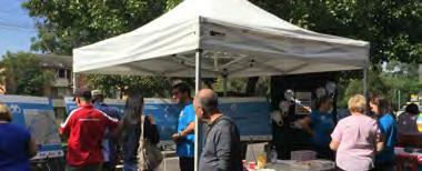
12 COMMUNITY CONSULTATION STAGE 1 In March and April 2016 the project team undertook extensive consultation with the community to understand their key issues and values in Telopea and how they could be addressed through the master plan. Engagement was undertaken to explain the master planning process to the local community and provide specific information to social housing residents about the relocation process KEY FINDINGS Connectivity -- Difficulty with moving around the area due to the topography Traffic and transport -- Strong support for Light Rail -- Generally happy with current bus services -- Concern about traffic from increased development, as well as the need for more parking in the area Retail -- Shops are frequently used, but in need of upgrade and a broader variety of shops and services -- Feeling that the area is unsafe -- There were mixed views about moving the retail precinct Sturt Park -- Residents like Sturt Park but would like to see it improved with better facilities for families -- Concern about some illegal activity that occurs in the park Safety -- The majority of people feel safe walking around during the day, however not at night -- There may be a perception that the neighbourhood is unsafe due to its stigma and reputation, rather than it being a reality. Design, height and density: -- Feeling that the area needs more character -- There were mixed views on the scale of development, and some concerns that the area will eventually be overdeveloped like Carlingford and Parramatta Community facilities -- Residents use the current community facilities, DANC and Library, but would like to see the facilities rebuilt as they are old and run down -- Would like to see cleaner and safer public toilets in Telopea Overall, there was strong support for the planning and development of a master plan for Telopea. STAGE 2 Following the first stage of the engagement process, a draft master plan was presented to the community in August and September The aims of the second stage of engagement were to: Explain how issues raised in Stage One have been addressed and included in the master plan Provide opportunities for all stakeholders to participate and offer feedback. Reiterate the key messages to social housing residents regarding the relocation process and time frames. KEY FINDINGS Supportive of master plan -- Happy and excited to see renewal in Telopea -- Proposed heights are welcome but many want the extent of low rise apartment area reconsidered -- Supportive of 70/30 split between private and social housing as the mix will improve moral, culture and self-esteem of social housing residents Traffic -- Concern about increase in traffic in the area and that the roads will not be able to support additional cars -- Consider traffic lights at Evans Road/Pennant Hills Road Retail -- Happy to see an upgraded shopping precinct -- Would like a large supermarket and shops at the top of the hill -- Would like the shops at Evans Road/Benaud Place to remain Parking -- Concern there will not be adequate parking Light rail -- Supportive of Light Rail and would like to see it extended to Epping Over development -- Concern Telopea will become like Parramatta -- Concern new development will overshadow or impact on existing developments -- Concern wildlife will be disturbed Social housing resident relocation -- Worried about relocation process and would like assurance that residents will return -- Would like to see examples of other renewed housing estates All feedback received at the workshops, meetings, pop up stalls, address and project office was provided to the project team for consideration into the final master plan. 12


13 feeling safe transport walkability retail centre Landscape & environment community facilities TELOPEA MASTER PLAN 13
14 DRIVERS FOR CHANGE Telopea is an ideal location for renewal, more housing and better facilities. It is a tree-covered suburb amidst rapidly growing employment and education hubs. As Parramatta develops a stronger character and identity within the growing Sydney region, Telopea has an opportunity to strengthen its own identity as an active and inclusive community. The planned light rail stop will provide an arrival point into Telopea, linking a plaza to community and retail spaces. Telopea s existing natural amenities and plans for future infrastructure mean it is well positioned for urban renewal. Telopea is a suburb positioned for change. It is only 10 minutes north of Parramatta and is in close proximity to several major retail centres such as Westfield Parramatta and Carlingford Court; and employment precincts including Rydalmere, Parramatta CBD, Macquarie Park and Norwest. It has convenient access to a range of public and private schools and nearby bushland and park areas. Arguably, the quantum and quality of social housing, and infrequent rail services linking with key destinations, present the most significant barriers to transform the suburb into a vibrant community and highly sought after place to live. However, the NSW Government s commitment to the Parramatta Light Rail, offering more frequent services and better routes as well as the opportunity to develop the current housing stock will facilitate the urban renewal of Telopea. PARRAMATTA LIGHT RAIL The NSW Government is developing a light rail network that will kick-start revitalisation and job growth along a corridor more than 20 km long. The Parramatta Light Rail network will connect key services, employment and educational facilities at Parramatta CBD, Westmead, Western Sydney University Rydalmere, Sydney Olympic Park, Rydalmere Industrial Precinct and Strathfield. The preferred network for Parramatta Light Rail will include: A core spine linking precincts within Greater Parramatta including Westmead Health Precinct, Parramatta CBD and Camellia. The replacement of the existing heavy rail service between Camellia and Carlingford with a more frequent light rail service. Transport interchanges at Westmead. Parramatta, Carlingford, Olympic Park and Strathfield Stations will be designed to facilitate access to the wider transport network. INDICATIVE TIMELINE Late 2016 Transport for NSW consulted with the community about the future light rail service Transport for NSW will consult formally on an Environmental Impact Statement and procure construction contracts Construction will commence. 14

15 TELOPEA Stage 1 of the Parramatta Light Rail (Source: TfNSW) IMPLICATIONS ON THE MASTER PLAN The light rail will increase public transport accessibility in Telopea, with better access to essential services, education and employment. Telopea will become more attractive as a place to live and more suitable for higher residential densities. The delivery of a new light rail stop provides the opportunity to better integrate public transport with new public space, retail and community facilities. TELOPEA MASTER PLAN 15
16 SOCIAL HOUSING Telopea currently has a significant amount of social housing that lies within walking distance of the future light rail stop. The social housing dwellings largely exist on large parcels of land in single ownership within the central core of Telopea and the accommodation is near the end of its lifecycle. The redevelopment of social housing with modern, well designed dwellings provide a better housing experience for residents and help improve the amenity of Telopea. The redevelopment of the large sites of social housing will also facilitate the delivery of new roads, public spaces and facilities for the neighbourhood and new modern housing with a mix of private, affordable and social housing. FUTURE DIRECTIONS FOR SOCIAL HOUSING Future Directions for Social Housing in NSW sets out the NSW Government s vision for social housing over the next 10 years. Future Directions is underpinned by three strategic priorities: More social housing. More opportunities, support and incentives to avoid and/or leave social housing. A better social housing experience. As part of Future Directions, Communities Plus is committed to a large-scale building program to deliver new social, affordable and private housing. Communities Plus is a new approach to delivering integrated communities and improved social outcomes. Telopea is a key project within the Communities Plus Program. IMPLICATIONS ON THE MASTER PLAN The Telopea Master Plan will assist the NSW Government to provide more social housing. Currently, there are approximately 640 government-owned social housing units clustered in Telopea. There is an opportunity to upgrade the current social housing, provide new social housing and develop a range of new private dwellings. The integrated housing model will create diverse housing opportunities to appeal to a range of future residents of a variety of ages, incomes and family structures. 16


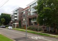


17 OLDER HOUSING STOCK IN TELOPEA NEW HOUSING IN TELOPEA TELOPEA MASTER PLAN 17

18 KEY CONSIDERATIONS In addition to the key drivers for change, a number of existing conditions throughout the site contribute to its immediate redevelopment potential. To ensure its long-term sustainability and vitality, the master planning and consultation process identified and explored Telopea s opportunities, its strengths and areas that need improvement. PERMEABILITY AND SAFETY Concerns over permeability and safety in Telopea are in part caused by physical barriers to movement and poorly defined public and private domain. The rail line creates an east-west barrier through the centre of the suburb, and the core (between the shops and the station) limits options for north-south movement. Walking in and around the site is often difficult due to the steep terrain and the lack of footpaths on some streets and quality and maintenance of paths. The structure, form and relationship of buildings to the street also affect way-finding and perception of safety. There are substantial setbacks of existing apartments from the street, and ownership of the large front yards are not well defined as private or public domain. Benaud Lane housing facing rear servicing of shops. Areas adjacent to the rear lane servicing Waratah Shops and the Evans Road toilet blocks have been identified as unsafe. Both lack passive surveillance and activity. Specific streets including Eyles Street and The Parade, were mentioned by the community as unsafe. Lack of footpaths, street lighting and passive surveillance were given as the main causes. Large building setbacks and lack of public/private domain definition are large contributing factors. The master plan can improve permeability by providing new connections and improving links throughout the neighbourhood. Future redevelopment in the neighbourhood can also ensure better definition of the public and private domain and increased surveillance of streets. Other areas identified as unsafe will need specific design solutions including measures to facilitate better surveillance, activation and lighting. 18 Telopea and rail line barriers to west connection. Telopea residents like their neighbourhood but want to see improvements in pedestrian movement. Redevelopment should eliminate unsafe environments, provide a better built form, and improve connections to community and retail services.


19 Permeability and Safety Study Area Railway Line Arterial Roads Collector Roads Streets with No Footpaths Barriers and High Fences Spaces Lacking Territorial Definition Ageing Apartments with Poor Passive Surveillance SCALE: A4 TELOPEA MASTER PLAN 19
20 INFRASTRUCTURE The master plan considers the capacity of existing infrastructure, and the ability to upgrade it to accommodate a growing population in Telopea. In particular, the master plan considers roads, public transport, storm water, drainage and utilities infrastructure. ROAD ENVIRONMENT About 84% of Telopea residents travel to work by car to destinations including Sydney CBD (16%), Carlingford (15%), Ryde (14%), and Parramatta (10%). Traffic congestion builds along Pennant Hills Road and Kissing Point Road during peak AM and PM periods. As the frequency of the light rail service vastly improves, car dependency is likely to decrease. The suburb of Telopea is affected by a large number of vehicle trips that rat run between Kissing Point Road and Pennant Hills Road. At present: Adderton Road and Evans Road are the vehicular routes that experience the highest AM and PM peak traffic. The intersection of Manson Street and Adderton Road, which connects to both Pennant Hills Road and Kissing Point Road, experiences traffic congestion during both AM & PM peak hours. The intersection of Manson Street and Sturt Street is busy at AM & PM peak hours due to its proximity to Telopea Public School, Dundas Branch Library and the Dundas Community Centre. Sturt Street turning into Evans Road experiences high traffic volumes during AM peak hours. The existing traffic, transport and access conditions in Telopea indicate that internal un-signalised intersections are operating well below capacity. The links with the external road network, namely Pennant Hills Road at Evans Road and Kissing Point Road at Sturt Street exhibit queues during the peak periods. These have been observed to be within acceptable and manageable limits. Mid-block traffic surveys undertaken for local roads in the precinct indicate a high tendency for through traffic between Pennant Hills Road and Kissing Point Road to rat-run via Evans Road and to some extent Marshall Road. On average, through traffic travels at speeds slightly higher than posted speed limits. There are opportunities to improve the accessibility of a redeveloped core by refining the hierarchy of the road network structure, while introducing local area traffic management. Evans Road, parts of Sturt Street and Shortland Street near the station are of sufficient width to allow parallel kerbside parking with a clear traffic lane in each direction. Evans Road continues as the main north south route through the study area, connecting to Pennant Hills Road in the north and Kissing Point Road in the south. The remaining streets within the study area are narrower, slowing traffic and limiting two-way passing when kerbside parking occurs. Manson Street and Marshall Road function as collector roads linking Adderton Road to Pennant Hills Road. It will be important for future developments along the roads to provide on-site parking to reduce impacts on key traffic routes. PUBLIC TRANSPORT The frequency of the existing railway service is a significant weakness identified by the community. Currently the rail service connects residents to Carlingford (two minutes travel time) and Clyde (10 minutes travel time). Connections to Parramatta (19 minutes) or Sydney (44 minutes) require interchange at Clyde. The frequency of service, is relatively poor being longer than half an hour in peak times and generally hourly throughout the day. The interchange at Clyde is not wheelchair accessible, although staff operate stair lifts from 7am to 8pm, Monday to Friday and 7am to 3pm Saturdays, Sundays and public holidays. The new two-way light rail system with direct route to Parramatta will address, to a large extent, the weaknesses identified by the community. The site is serviced by several bus routes that connect Telopea regionally including the 545 with travel time of minutes to Parramatta, minutes to Macquarie Centre and minutes to Chatswood. UTILITY INFRASTRUCTURE The master planning process has identified the capacity of existing utilities infrastructure to determine the upgrades required to accommodate the growing population of Telopea. Expert advice regarding utilities infrastructure including gas / telco / electricity and sewer / water has informed the master plan outcomes. Traffic and parking were significant concerns for local residents, together with public transport options and availability. 20
21 Infrastructure Study Area Railway Line and Bus Stops and Routes in Telopea Arterial Roads Collector Roads Bridges/Overpasses Signalised Intersections Key Intersections in Telopea 800m Radius from Train SCALE: A4 TELOPEA MASTER PLAN 21
22 NATURAL ENVIRONMENT TOPOGRAPHY Telopea lies amidst hilly topography, bordered by north-eastern and north-western ridge lines that slope downwards to the Waratah Shops. Although this creates beautiful views, it is often difficult for people with mobility issues to access local shops, community facilities and the train stop. North-south aligned roads, following the dominant ridge, provide relatively easy walks to the facilities in the core. However, once in the core, the journey between Waratah Shops and the future light rail stop requires walking up roads with moderate grades. Key streets with steep slopes for walking include: -- Sturt Street, between Manson Street and Wade Street. -- Eyles Street. -- Shortland Street. The ridge line provides views from the upper parts of Sophie Street, Marshall Road, Manson Street and Sturt Street. The topography can be used as a tool to maximise views. Vistas occurring from outside of the master plan area looking into Telopea are generally restricted due to the height and density of surrounding vegetation. VEGETATION AND ECOLOGY Telopea is framed by a vegetation corridor mainly following the creek lines at the bottom of the catchment. Mature trees are located along streets and in clumps on private land. This vegetation is valued by the community and is to be retained. Parts of Telopea contain Critically Endangered Ecological Communities (CEEC), Endangered Ecological Communities (EEC) and hollow-bearing trees that provide potential habitats for threatened species. These are mostly within creek corridors or open spaces and/or outside the study area. These will not be developed as part of the master plan. However, there are small stands of Blue Gum High Forest and hollow-bearing trees generally in the rear of private properties to the north east of the study area. These areas are to be retained, protected and improved wherever possible. Given the current treed urban landscape within large parts of Telopea, the City of Parramatta Council (CoP) has identified the northern half of the precinct as an Urban Landscape Corridor. This comprises urban vegetation including mature trees that can provide links between core habitat areas. These are often located at the rear or front of lots within the building setback or comprise the street trees themselves. These areas may also contain hollow-bearing trees that have not been mapped. Street trees will be retained and future development will seek to increase the tree canopy by preserving, replacing or planting new trees to maintain the urban landscape corridor concept and minimise the urban heat island effect. FLOODING Telopea is located in the Ponds Subiaco Creek catchment, which is part of the larger Parramatta River Catchment. There is flood risk at the southern portion of Sturt Park near Kissing Point Road. Most of the proposed development area is outside of the 100 year ARI flood extent. A small number of properties likely to be affected in a 100 year ARI flood are located on Kissing Point Road at the Sturt Road intersection. This combined with limited access options, means the properties are not considered suitable for higher densities. Mature trees, undulating landscapes and ecological corridors are essential elements valued by the community. They give a sense of place to Telopea and differentiate it from other surrounding neighbourhoods. 22


23 SCALE: A4 Natural Environment Ridge Line Creek Catchment Water Flow Key Open Spaces High Points High Points Outside Site Key Vistas Areas with Steep Slope Hollow Bearing Trees Existing Matured Vegetation Core Habitat Vegetation Habitat Vegetation 100 ARI Flood Extent TELOPEA MASTER PLAN 23
24 PUBLIC DOMAIN Telopea is well connected to open space areas. There is approximately 197 ha of open space within a 2 km radius of the neighbourhood and 330 ha within 20 minute cycle, which exceeds the benchmark standards for existing urban areas. More specifically, the neighbourhood has 30 ha of existing open space in total. The master plan provides an excellent opportunity to facilitate the linking of existing open spaces in and around Telopea with the green links being considered as part of the broader CoP initiatives in the Parramatta Ways plan. PARKS Existing parks in Telopea are mainly located within the lower parts of the neighbourhood. These are sufficient in area to serve the current and growing population. Improved facilities and activation within each park will help to improve usability and safety. New centrally located recreation space at the top of the catchment will improve access and opportunities for passive recreation. The existing parks in and directly adjoining the study area include: Sturt Park: There is a need to address perceptions of safety at Sturt Park. The park is perceived to be unsafe by the community due to: The lack of street and night lighting; Poor surveillance, in part caused by having only one main road frontage on Sturt Street; High security fencing along the school; and Densely vegetated areas. Currently, the park comprises a small skate park, playground, basketball court and open playing field, picnic shelters, cricket cages and a toilet block. It is heavily vegetated on the southern portion and has a direct link to the creek and adjoining environmental conservation areas. The park has no clear arrival point and has limited activation. This discourages a variety of potential recreational users and raises concerns around antisocial behaviour. Acacia Park: Located on a high point, it offers panoramic views to the wider Telopea area. It has a good quality playground, kick-about space, open lawn, and mature perimeter trees around the park to offer shade. Despite this, many residents are unaware of Acacia Park as a recreation resource. Generally, improved awareness of the park system can be addressed by providing a cohesive way finding strategy. Rapanea Community Forest: This provides access to Ponds Creek for bush walking and the potential for improved connections to Dundas Park, Vineyard Creek corridor and Cox Reserve. Telopea-Carlingford Greenway: A wide corridor between the railway and private properties known as the Telopea Carlingford Greenway has poor security and passive surveillance. This land can potentially be used as an off-road cycleway adjacent to the light rail. Future development backing into the corridor should promote pedestrian connections from Marshall Street to the corridor and increased surveillance. There are opportunities immediately south of the Telopea- Carlingford Greenway for the creation of new public space within the core, and particularly as part of any development adjacent to the new light rail stop. These will be important to help activate the area and provide more convenient access at this ridge location. CYCLE PATHS The master plan leverages off the existing cycle path network of Telopea that adequately connects green open spaces and urban infrastructure around the neighbourhood. The cycle paths proposed by CoP will improve the permeability to the Telopea light rail stop. There is an opportunity to extend this cycle network into the Telopea-Carlingford Greenway Corridor with an offroad cycleway and to other parks. The community want parks to stay and improvements made including more activities that attract families, more lighting, rest areas and active recreation options. 24
25 Legend Study Area On Road Cycle Path Proposed Cycle Path (by CoP) Walking Trail Open Space and Environmental Management Riparian Corridors Undefined Private Open Spaces Community Garden SCALE: A4 TELOPEA MASTER PLAN 25
26 SOCIAL INFRASTRUCTURE Telopea benefits from a range of social infrastructure services, mostly centrally located in and adjacent to the core. However, many of these services are at capacity. The urban renewal of Telopea will bring increased population which will also increase demand for social infrastructure. Social infrastructure should be expanded and redesigned to accommodate a larger and more diverse population. EDUCATION Within 10 minutes drive, residents of Telopea have access to a range of public and private schools, as well as several established colleges, universities and TAFEs. Primary Schools: Carlingford Public School, Carlingford West Public School, Dundas Public School, Ermington West Public School, Yates Avenue Public School and Telopea Public School. High Schools: James Ruse Agricultural School, Cumberland High School, St Patrick s Marist College, Marsden High School, Tara Anglican School for Girls and The Kings School. College & Universities: Western Sydney University (WSU), Macquarie University, Macquarie Community College and United Theological College. TAFEs: English Language Centre Meadowbank and the Northern Sydney Institute Ryde Campus. Telopea Primary School is centrally located on a 2 hectare site adjacent to the core. It incorporates a Montessori Preschool and the Waratah Centre (which provides a parallel academic program for Years 7 to 12 before entering back into main stream education). The school provides primary education catering for a diverse student community and offers a range of cultural, sporting and social programs including a community garden. At a current enrolment of some 60 students there is capacity to increase enrolments within the existing school. Increased enrolments are likely to increase demand for new classrooms and associated educational infrastructure. New school buildings in other higher density areas are increasingly being geared to providing classrooms in multi storey developments. This provides economies in terms of construction and maintenance and retains open play space. The redevelopment of Arthur Phillip High School and Parramatta Public School in Parramatta CBD are recent examples of the delivery of multi-storey education facilities in response to metropolitan Sydney s increasing residential density. Planning for education has also evolved to recognise the importance and potential benefits from the colocation of facilities within the broader community. Libraries, meeting rooms, performing spaces, auditoriums and open spaces are facilities that can be potentially shared. The school is well placed in the core to enable co-location and sharing of other community facilities. COMMUNITY FACILITIES AND PROGRAMS Presently, community facilities located across Telopea have limited physical integration. Community facilities, programs and services in Telopea currently comprise: The Dundas Community Centre - A community facility which includes a two hundred people main hall, meeting rooms and craft room. It contains the Dundas Area Neighbourhood Centre (DANC), Dundas Branch Library and community health centre. The Dundas Area Neighbourhood Centre (DANC) - A neighbourhood centre which provides daily activities and support for residents across a diverse spectrum of interests and needs. The Dundas Branch Library - A branch library which provides books, e-material and reference services, as well as the delivery of books to housebound people, and other lifelong learning programs, services, and events. Waratah Montessori Preschool and Sophie s Cottage Kindergarten. Two community gardens - one on Shortland Street and the other at the school. Dundas Valley Medical Centre. Hope Connect, family support services and the HuB. Community rooms within Hume Housing developments. Schools as Community Centres project within Telopea Public School. The community supports new spaces such as an improved and expanded library, child care centre, additional meeting rooms, landscaping and public Wi-Fi. 26


27 COMMUNITY FACILITIES IN TELOPEA Dundas Branch Library Telopea Christian Centre Community Garden on Shortland Street Dundas Area Neighbourhood Centre COMMUNITY FACILITIES OPPORTUNITIES SCALE: A The Dundas Community Centre at Sturt Street incorporates the Dundas Branch Library, DANC and Community Health Centre. These facilities could be upgraded with expanded programs and spaces to cater for a diverse population. 2 Telopea Public School could provide community rooms, hall or open space that are shared with the broader community out of school hours or could utilise these same facilities provided on adjacent sites. 3 TRED Community Leaders Group in association with the DANC oversee the community gardens on Shortland Street. Community gardens could be provided within new development sites to be accessible to a range of people. 4 The HuB on Wade Street could be relocated to a suitable location in consultation with the service provider. 5 Hope Connect, which is located within the Telopea Christian Centre on Shortland Street and provides family support services (and The HuB), could be integrated within a multi-purpose community centre, remain in its current location or relocated to a suitable alternative identified by the service provider. TELOPEA MASTER PLAN 27
, including: Regional Centres: Westfield Parramatta (south-west).")

.")
28 RETAIL AND EMPLOYMENT Telopea residents currently carry out most shopping trips in nearby centres outside of the neighbourhood. Telopea has access to a range of retail outlets and major retail centres within a 6 km radius (approximately 10 minutes drive), including: Regional Centres: Westfield Parramatta (south-west). Sub-regional Centres: Westfield North Rocks, Carlingford Court Supermarket Centres: Carlingford Village, Eastwood Shopping Centre, West Ryde Urban Village, West Ryde Marketplace, Newington Marketplace and Northmead Plaza. Within the neighbourhood, existing retail services are located at the Waratah Shops on Benaud Place. These comprise a 900 sq.m supermarket and additional 1,400 sq.m of specialty retail shops and an automotive service centre. Retail demand analysis identifies that in order to support the future population, over 7,000 sq.m of retail is needed, anchored by a large-scale supermarket (3,000-4,000 sq.m). Expansion at the current location presents the following challenges: Land ownership is fragmented, with the exception of the existing 900 sq.m supermarket and adjoining car park. Development of a new full line supermarket on Benaud Place would require demolition of the existing buildings and car park as well as additional tenancies. This will disrupt the commercial offering while works are being undertaken. Many of the existing shops are older, and community feedback has supported the upgrade, renewal and possible long term relocation of the shops near the train where there will be greater pedestrian activity and movements. In the short term, there will be a continued need for shops in this part of the neighbourhood. However, even with significant expansion or renewal, the existing shopping strip cannot support the growing population (as shown over the page). Telopea is well located close to employment at Parramatta CBD, Macquarie Park, Norwest and Rydalmere. Local employment opportunities in Telopea are limited to the shops, schools and community facilities within and nearby the master plan area. Existing shopping experience, with car parking dominant Steep verge between Evans Road and Benaud Place IGA as a current convenience offer Many residents support having access to a great variety of shops and services, a bigger supermarket, more restaurants and cafes, more parking and improved public spaces around the shopping centre. 28
 Building Service Area (1500 sq.m) Specialty Retail (1400 sq.m) Street Parking (2700 sq.m) Telopea Service Centre (300 sq.m) Surface Parking Lot (600 sq.")


29 DEVELOPMENT OPPORTUNITIES FOR WARATAH SHOPS Existing Waratah Shops Condition Option 1 : Develop New Supermarket in Existing Area Surface Parking Lot (1100 sq.m) Supermarket (900 sq.m) Building Service Area (1500 sq.m) Specialty Retail (1400 sq.m) Street Parking (2700 sq.m) Telopea Service Centre (300 sq.m) Surface Parking Lot (600 sq.m) Sturt street Shortland Street Lane Benaud Place Evans Road Supermarket + Additional Parking Large level change Proposed Speciality Retail Sturt street Shortland Street Lane Benaud Place 3500 sq.m Evans Road SCALE: A4 SCALE: A4 Existing Waratah Shops will not be able to serve the capacity of Telopea in the future, having a limited area and parking. In any future expansion, the development will face challenges in terms of access due to the significant slope. This option would need underground parking to enable a new supermarket. Most of the existing shops would need to be demolished for redevelopment to occur. The elongated shape will not work well for supermarket layout and function. Limited connectivity due to the significant slope is likely to be a barrier to patronage. Option 2 : Develop Supermarket on East Side of Evans Road Surface Parking Lot (1100 sq.m) Supermarket (900 sq.m) Large Level Change Specialty Retail (1400 sq.m) Proposed Specialty Retail Sturt street Shortland Street Lane Benaud Place Evans Road 3280sq.m 3700sq.m Option 3 : Develop Supermarket on West Side of Existing Retail Supermarket Potential service and loading access Proposed Specialty Retail Shortland Street 4000 sq.m Lane Benaud Place Evans Road SCALE: A4 SCALE: A4 Sturt street Limited space for a large format supermarket. Elongated shape will not work well for supermarket layout and function. Limited connectivity to existing shops. Distance between east side of Evans Road and existing slope is not ideal for pedestrian movement, particularly due to significant level changes between Benaud Place and Evans Road. The supermarket can be developed at this area but there will be vehicular conflicts between servicing and pedestrian movement. Development will result in conflict between the proposed supermarket, and future residential areas (south and west of the supermarket). Poor pedestrian connectivity, amenity and different level changes would create two separate shopping areas (east and west of the lane). Additional parking for the supermarket would need to be under the building. TELOPEA MASTER PLAN 29
30 BUILT FORM Housing in Telopea, particularly social housing, requires renewal to improve built form, better choice and respond to needs. Existing housing in the area currently presents a number of issues including: Lack of accessibility for people with disabilities because there are no lifts in older apartment buildings. Poor public and private interface because buildings do not face the street and do not reinforce public/private boundaries. Poor design and age of housing presents a poor streetscape, raising concerns for safety. Recent private developments in the neighbourhood have been limited to corner sites requiring no amalgamation, and these are not well integrated with the broader context. Surface car-parking and ground level garages dominate the fronts of these buildings and place pressure on street parking. There is an opportunity to encourage viable development and amalgamation of sites to create inclusive, quality housing that integrates well with the public domain and reflects the values of the community. DEVELOPMENT FEASIBILITY Proposed density and built form should consider the viability of controls and the potential for site amalgamation, and housing delivery. Sites that can be amalgamated provide a better development outcome in terms of siting, design, variety of apartment types and servicing of townhouses. LAND CONSTRAINED BY DEVELOPMENT A number of sites are constrained and unlikely to be redeveloped in the next twenty years. These include: A State heritage site located at the corner of Adderton Road and Manson Street. The site features a singlestorey house in an inter-war era, built of sandstone and brick, and surrounding gardens. This Winter House, designed by Sir Walter Burley Griffin in 1935, is known as the Redstone. Existing strata titled and small lot sites (townhouses, apartments and dual occupancies). Recently completed developments. Recently approved development applications that are currently under construction. The community want to see the aged social housing upgraded with better quality buildings, good landscaping and improved passive surveillance. 30


31 Legend Study Area Existing Buildings Community Use Buildings Aged Social Housing Heritage Items Strata Recently Built Strata Buildings Recently Built Developments Approved DAs Sites and BCs Approved DA Sites Under Construction Vacant Concentrated Area of Ageing Housing SCALE: A4 TELOPEA MASTER PLAN 31

32 TELOPEA MASTER PLAN The master plan will foster the long-term growth of a vibrant, cohesive and safe neighbourhood. Telopea will be an inclusive community with shared civic spaces, relevant community services and facilities, and housing choices for a diversity of residents. The new light rail stop marks the main point of arrival to Telopea, strengthening its identity within the greater Parramatta area. Telopea s key areas of change include: 1. Creating a welcoming arrival point in Telopea The proposed light rail stop will become a key arrival point in Telopea, welcoming residents and visitors and signalling entry to the neighbourhood. A new pedestrian civic plaza adjacent to the light rail stop will lead pedestrians to ground level shops and cafes that open onto footpath and pedestrian spaces. This activated pedestrian area will be the point of access to lifts and/ or escalators serving different levels of the new community facilities space, lower level supermarket and relocated Wade Street entry (adjacent to the existing school and Council s current community facilities). This will ease pedestrian movement across the steepest part of the hill to access the light rail stop. There is potential to follow a similar approach on other parts within the core that have steep slopes. 2. Emphasising a sense of place in Telopea Better parks, public spaces and outdoor café seating will be shaded by Telopea s existing mature trees. Within parks, new furniture and facilities, and better design will improve outdoor activity and neighbourhood safety. Many of Telopea s trees are preserved throughout parks, undulating landscapes and footpaths so that the sense of place remains alongside residential development. 3. Building a diverse residential population in Telopea The addition of 3,500-4,500 mixed residential dwellings will stimulate change in the make up of local households in Telopea. The provision of new and upgraded community facilities and retail options will cater to a diversity of age groups, cultural backgrounds, needs and interests. Each of these key changes deliver a vital component of the overall master plan. Together, they build on existing community strengths to create an enjoyable, vibrant and supportive neighbourhood, bringing to life Telopea s vision for the future. 32
33 Artist Impression of Telopea Core development adjacent to Telopea s future light rail stop TELOPEA MASTER PLAN 33


34 ORGANISING PRINCIPLES The Telopea Master Plan has been developed following site and urban design analysis and an extensive consultation process with the community and key stakeholders. ACCESS AND MOVEMENT: The master plan will deliver a pedestrian friendly environment whilst balancing the necessary vehicular and servicing functions. The proposed light rail will provide improved frequency of public transport, and more crossings over the light rail. Increased connections through the core will facilitate improved movement up the steep hill to the light rail stop. The clear road hierarchy and future parking strategies will improve functionality and safety of local streets. LAND USE: Whilst the dominant land-use will be residential, a mixed-use precinct is key to servicing the future population. Located in the core and easily accessed from the adjoining neighbourhood, it will include more retail and community facilities helping to activate and service the neighbourhood. OPEN SPACE: To enhance the natural amenity of Telopea, public spaces and streets require an identifiable hierarchy and design strategy. They will be safe, pedestrian friendly and designed for a diverse population. New, active and improved parks, playgrounds, and public spaces will encourage interaction and provide a variety of meeting places. They will be integrated with key community facilities, shops and the light rail stop. SOCIAL INFRASTRUCTURE: New and upgraded community facilities will respond to Telopea s growing population, as well as its changing social and demographic mix. Community facilities will be provided in a multi-purpose environment that may host a range of services including an upgraded library, multi-purpose meeting spaces, performance spaces, heath centre, neighbourhood centre, and child care centre. Co-location and sharing of facilities are key considerations, where this makes sense to do so. BUILT FORM: Telopea s built form strategy will locate highest densities around high amenity - near the light rail, shops and services. Taller buildings on the ridge lines reduce solar impact and provide outlook. Height will transition down to more sensitive areas. Buildings will be designed to improve safety and connectivity by clearly identifying private and public spaces. 34
35 Key for Master Plan Circulation New or Relocated Roads Minor Connectors Potential Pedestrian Links Improve pedestrian/cycle connection Potential Intersections Upgrade Land Use & Built Form Mixed Use and Residential Core (predominantly 8-12 storeys) Transition Area (5-8 storeys) Low Rise Apartments (3-4 storeys) Townhouse (1-2 storeys) New/Upgraded Parks and Greenway Core Elements Taller Marker Buildings (15-20 storeys) Retail and Services Community Facilities Indicative Light Rail Stop ELIZABETH MACARTHUR RESERVE Adderton Road Sturt Street HOMELANDS RESERVE New pedestrian/ cycle connection can be provided as an extension of either The Parade or Sophie Street Shortland Street Wade Street Eyles Street Marshall Road Fig Tree Avenue Shortland Street The Parade Marshall Road Evans Road Sophie Street Simpson Street RAPANEA COMMUNITY FOREST Brand Street Fullarton Street Cook Street Osborne Avenue ACACIA PARK Tilley Street Manson Street Sturt Street TELOPEA PUBLIC SCHOOL Moffats Drive PONDS CREEK RESERVE Cunningham Street STURT PARK Holland Place Burke Street Adderton Road Chestnut Avenue Kissing Point Road THE PONDS WALK SCALE: A4 SCALE: A4 TELOPEA MASTER PLAN 35
36 ACCESS AND MOVEMENT STRATEGY Residents of Telopea will have greater access to essential services, schools, public transport and open space areas. An important part of the master plan will be to improve connections to existing facilities both within and outside Telopea. A clear road hierarchy is established to ensure road treatments, traffic calming measures and parking availability responds to the traffic functionality of each street. PRINCIPLES This strategy is based on the following key principles: Provide better connections for pedestrian, cyclist and vehicles throughout the neighbourhood. Improve safety and comfort along key roads. Reduce the impact of development on on-street parking. Assist with vertical movement between Wade Street and Sturt Street which is the steepest part of the Telopea. Improve access to and from the future light rail stop. LIGHT RAIL AND BUSES The proposed light rail stop is central to the growth of Telopea and a key catalyst for redevelopment. The stop, integrated with an active and walkable hub, will become a key arrival point to Telopea. The location of the light rail and bus interchange area will be integrated into the walking and driving routes within the precinct to ensure direct accessibility, navigation and way finding for residents and visitors. The existing bus stop will be relocated to the north of the proposed light rail stop to facilitate the efficient interchange between buses and the light rail. NEW CONNECTIONS New road connections that will improve legibility and permeability to and within Telopea include: Wade Street relocated east to connect Marshall Road and Manson Street. This connection will remove the barrier limiting movement north and south of the core, providing improved access to Telopea Public School and community facilities. A new road connection between Adderton Road and Sturt Street will allow improved movements of vehicles and buses across the light rail corridor and improved access to community facilities and services for the residents in the western parts of Telopea. Eyles Street will be extended to Benaud Lane to improve safety and access through the core. Minor connectors of Eyles Street linking Benaud Lane to Evans Road (eastern extension) and Wade Street to Sturt Street (western extension) will promote a predominately pedestrian environment within these parts of the core area. Council and Department of Education to consider providing a new road connecting Sturt Street to Chestnut Avenue as part of any future master plan for the school. TRAFFIC MANAGEMENT Necessary intersections will be upgraded for safety and improved legibility. Local area traffic management will occur through speed humps, road constructions and kerbside parking provisions and restrictions. PEDESTRIAN AND CYCLING ENVIRONMENT The precinct will be integrated with the City of Parramatta cycling strategy, providing key cycling links and facilities through and around the study area. The Greenway Corridor along on the eastern side of the light rail corridor between Telopea and Carlingford can incorporate a new cycleway connection linking Pennant Hills Road to Kissing Point Road. Cycleways are proposed across the Ponds Creek Reserve to link to Dundas Park and Sturt Park to the Light Rail stop and the Greenway Corridor. Footpaths will be provided as new development occurs, including upgrades to kerbs to ensure accessible paths of travel. Streetscape improvements that include lighting, seating areas and additional planting will be provided in the Core area. Provide two new public pedestrian/cycle connections between Marshall Road and the Greenway, extending from existing roads (i.e. Howard Street and The Parade/Sophie Street) PARKING New development will incorporate on-site parking rates that encourage the use of public transport within a 5-minute walking catchment to the future light rail stop. 36

37 New pedestrian/ cycle connection can be provided as an extension of either The Parade or Sophie Street Marshall Road Fullarton Street RAPANEA COMMUNITY FOREST Brand Street Realignment of Wade Street ELIZABETH MACARTHUR RESERVE Potential Light Rail Stop New Crossing Adderton Road Sturt Street Wade Street Marshall Road Shortland Street Eyles Street Sturt Street Fig Tree Avenue Benaud Lane The Parade Sophie Street Evans Road Simpson Street Cook Street Tilley Street Osborne Avenue ACACIA PARK Manson Street TELOPEA PUBLIC SCHOOL Moffatts Drive PONDS CREEK RESERVE Adderton Road Cunningham Street STURT PARK Holland Place Chestnut Avenue Kissing Point Road SCALE: A4 Access and Movement Strategy Map Legend Sub Arterial Road Collector Road Local Road Proposed Collector Road Connection Potential Local Road Cycle Route Light Rail Indicative Location of Light Rail Stop Greenway Corridor Minor Connector Potential Intersection Upgrades Existing Signalised Intersections Pedestrian/Cycle Connection TELOPEA MASTER PLAN 37
38 LAND USE STRATEGY The land use strategy for Telopea introduces areas for residential density and street activation anchored by an expanded retail offer. This will ensure a mixed-use precinct that can generate a sustainable level of activity. PRINCIPLES The key principles guiding the land use within Telopea include: Maintain the predominately residential land uses. Create an active and safe precinct around the light rail with additional retail and community facility uses. Provide additional open and public spaces to support the new community and reflect current character areas. RESIDENTIAL USES The residential aspect of the land use strategy involves the implementation of a diverse residential offer that will generate approximately 3,500 to 4,500 new dwellings over the next 20 years. This will create opportunities for more people to live close to the light rail stop to maximise convenience, amenity and contribute to village activation and vibrancy. Government owned land will be redeveloped to provide a mix of private, social and affordable housing. This will facilitate the increase of social and affordable housing in Telopea from 640 to around 1,000 dwellings. RETAIL The community and retail core is directly across from the light rail stop to best capture foot traffic and provide convenience to a growing population. The centre opens onto an arrival plaza to engage Telopea residents with the day-to-day events that are hosted there. Seating beneath retained trees allows residents to continue to enjoy the beauty of their neighbourhood and benefit from interactions with the community on the Arrival and Civic plazas. Retail will continue to be permitted along Benaud Place and existing shops can remain in their current location. Evans Road will grow as a key traffic and pedestrian route. This, along with proximity to Sturt Park, Telopea Public School, bus stops and Kissing Point Road, supports some retention of small shops, cafes or restaurants on the site of the current Waratah shops. If land owners want to renew or redevelop land along Benaud Place/Evans Road, they will not be required to provide retail on the ground level. OPEN SPACE Existing open spaces are upgraded and new open spaces are provided, including the arrival plaza co-located with the light rail stop, the civic plaza fronting the community facility building and a new pocket park on Shortland Street. 38
39 Marshall Road RAPANEA COMMUNITY FOREST Brand Street Fullarton Street ELIZABETH MACARTHUR RESERVE Sturt Street Adderton Road Manson Street Wade Street Marshall Road TELOPEA PUBLIC SCHOOL Shortland Street Eyles Street Sturt Street Fig Tree Avenue Benaud Lane The Parade Sophie Street Evans Road Simpson Street Cook Street Tilley Street Osborne Avenue ACACIA PARK Moffatts Drive PONDS CREEK RESERVE Adderton Road Cunningham Street STURT PARK Holland Place Chestnut Avenue Kissing Point Road Legend Mixed Use Precinct SCALE: A4 Residential Open Spaces Land Use Strategy Map TELOPEA MASTER PLAN 39
40 OPEN SPACE STRATEGY Parks, plazas and streets are one of the primary elements to a good sense of place and an attractive urban environment. An activated, engaging, sustainable environment will be created at Telopea through the creation of a diverse public realm network. PRINCIPLES The key principles guiding the design of the public domain and open space include: Upgrading existing parks to accommodate additional sporting and passive recreation activities. Provide an arrival plaza and park, near the light rail stop to cater for the additional population in this area. Retaining mature trees where possible and provide new street trees. Improve safety by upgrading streets with footpaths, lighting and seating, the delineation of public and private domain and improved casual surveillance. Incorporating WSUD into new streets and promoting permeable surfaces for rain water harvesting. TREES AND VEGETATION Throughout the neighbourhood, mature trees along the street will be retained. Opportunities also exist to retain trees in new activated spaces and in development sites. Many of these have already influenced the siting of buildings and sit within rear and front setbacks to be incorporated in future landscaped areas. PUBLIC SPACES Telopea currently has great parks and open spaces. With the growing population, however, these parks will be in greater demand. The master plan proposes to improve facilities within existing parks and provide new public plazas and landscaped areas. Options for active recreation in Telopea are limited but the master plan will facilitate improvements to Sturt Park, Acacia Park and the overall network of footpaths and cycle ways to ensure there is infrastructure to support a healthy and active lifestyle for the future population. The key public spaces include: Sturt Park which will be upgraded with a range of passive and active recreation facilities including seating, BBQs, children and young people s play spaces. Acacia Park which will be upgraded with BBQs, seating and children s play spaces. Ponds Creek Reserve which will be improved with additional pedestrian and cycleway connections linking to Dundas Park. A new arrival plaza and pocket park (6,500 sq.m) at the light rail stop to integrate with shops, cafes and restaurants and forming part of a new retail centre. The pavement design will extend across both sides of Sturt Street to reinforce the civic nature of the space. A new community facilities plaza (900 sq.m) will be located at Eyles Street and the new Wade Street. The plaza will be the forecourt to the future multipurpose community centre and also provide access to the lower level of the new retail centre. The detailed redesign of any existing parks will be undertaken by Council in consultation with the local community. SAFETY Lighting and street seating improvements will be added to footpaths and the Greenway Corridor to increase safety. Rest areas will be provided along the footpath of steep streets and in other locations where it makes sense to do so. New and replacement footpaths will be required as development occurs in the neighbourhood. SUSTAINABILITY Water Sensitive Urban Design (WSUD) will be incorporated into new streets, including bio-retention swales or tree bays. Retain and protect existing riparian corridors through Ponds Creek Reserve, Sturt Park and Rapanea Community Forest. Future development will retain, protect and improve critically endangered ecological communities, endangered ecologically communities and hollow bearing trees where possible. 40


41 Marshall Road RAPANEA COMMUNITY FOREST Brand Street Fullarton Street ELIZABETH MACARTHUR RESERVE 2 1 Sturt Street Adderton Road Manson Street Wade Street Marshall Road TELOPEA PUBLIC SCHOOL Shortland Street Eyles Street Sturt Street 7 Fig Tree Avenue 10 Benaud Lane 9 The Parade 7 Sophie Street Evans Road Simpson Street Cook Street Tilley Street Osborne Avenue 4 ACACIA PARK Moffatts Drive PONDS CREEK RESERVE Adderton Road Cunningham Street Chestnut Avenue STURT PARK 3 Kissing Point Road Legend Light Rail Precinct - New Civic 1 Plaza 2 New Public Plaza 3 Revitalisation of Sturt Park 4 Revitalisation of Acacia Park 5 New Pocket Park SCALE: A4 6 Street Upgrades Streetscape improvements - 7 including footpaths, lighting and seating 8 Greenway Corridor Upgrades Pedestrian Connection with 9 Potential Vehicular Access 10 Private Open Space Bio-retention Swales or Tree Bays Open Space Strategy Map TELOPEA MASTER PLAN 41
")
42 INDICATIVE STREET CROSS SECTIONS SECTION D-D SECTION F-F SECTION B-B SECTION A-A SECTION C-C SECTION E-E PROPERTY BOUNDARY PROPERTY BOUNDARY SECTION A-A 3m SETBACK 5m SETBACK 18m STREET WIDTH 5m SETBACK 3m SETBACK 6 STOREY STREET WALL RESIDENTIAL RESIDENTIAL CAR PARKING CAR PARKING RESIDENTIAL PRIVATE GARDEN FOOTPATH WITH LANDSCAPE VERGE EXTENDED EYLES STREET (AS EXISTING CARRIAGEWAY) FOOTPATH WITH LANDSCAPE VERGE PRIVATE GARDEN RESIDENTIAL 0.5m 1.5m 1m 10m 1m 2m 2m 42

43 PROPERTY BOUNDARY EXISTING PROPERTY BOUNDARY FUTURE PROPERTY BOUNDARY SECTION B-B 3m SETBACK 26m STREET WIDTH UP TO 3 STOREY STREET WALL RESIDENTIAL COMMUNITY FACILITIES / RETAIIL COMMUNITY FACILITIES RESIDENTIAL COMMUNITY FACILITIES COMMUNITY FACILITIES CAR PARKING CAR PARKING COMMUNITY FACILITIES ON GROUND LEVEL WITH RESIDENTIAL ABOVE FOOTPATH WITH ACTIVATED FRONTAGE LANDSCAPE AREA WADE STREET FOOTPATH WITH LANDSCAPE AREA ACTIVATED FRONTAGE COMMUNITY FACILITIES ON GROUND LEVEL WITH RESIDENTIAL ABOVE 3m 2m 13m 2m 1m 5m FUTURE PROPERTY BOUNDARY EXISTING PROPERTY BOUNDARY EXISTING PROPERTY BOUNDARY FUTURE PROPERTY BOUNDARY SECTION C-C 3m SETBACK 3m SETBACK 15m STREET WIDTH 3m SETBACK 3m SETBACK 6 STOREY STREET WALL RESIDENTIAL RESIDENTIAL CAR PARKING CAR PARKING RESIDENTIAL PRIVATE GARDEN FOOTPATH WITH LANDSCAPE AREA BENAUD PLACE (EXISTING CARRIAGEWAY) FOOTPATH WITH LANDSCAPE AREA PRIVATE GARDEN RESIDENTIAL 0.5m 1.5m 1m 9m 1m 1.5m 0.5m TELOPEA MASTER PLAN 43
 FOOTPATH WITH LANDSCAPE AREA PRIVATE GARDEN RESIDENTIAL 2m 1m")

44 PROPERTY BOUNDARY PROPERTY BOUNDARY SECTIOND-D 3m SETBACK 9m SETBACK 15m STREET WIDTH 5m SETBACK 3m SETBACK 6 STOREY STREET WALL RESIDENTIAL RESIDENTIAL CAR PARKING CAR PARKING RESIDENTIAL PRIVATE GARDEN CONSERVING EXISTING TREES FOOTPATH WITH LANDSCAPE AREA SHORTLAND STREET (EXISTING CARRIAGEWAY) FOOTPATH WITH LANDSCAPE AREA PRIVATE GARDEN RESIDENTIAL 2m 1m 7m 1m 2m 2m FUTURE PROPERTY BOUNDARY PROPERTY BOUNDARY SECTION E-E 3m SETBACK 19.5m STREET WIDTH 5m SETBACK 3m SETBACK 6 STOREY STREET WALL RESIDENTIAL RETAIL RESIDENTIAL CAR PARKING CAR PARKING RESIDENTIAL WITH GROUND FLOOR RETAIL ACTIVATED FRONTAGE LANDSCAPE AREA EVANS ROAD (EXISTING CARRIAGEWAY) FOOTPATH WITH LANDSCAPE AREA PRIVATE GARDEN RESIDENTIAL 3.5m 1m 10m 1m 1.5m 1.5m 44
 AREA CONSERVING EXISTING AREA TREES RESIDENTIAL WITH GROUND LEVEL RETAIL 2m 1m 11m 1m 2m 2m TELOPEA MASTER")
45 PROPERTY BOUNDARY PROPERTY BOUNDARY SECTION F-F 5m SETBACK 19m STREET WIDTH 3m SETBACK FOR PODIUM RESIDENTIAL RETAIL RESIDENTIAL RETAIL CAR PARKING CAR PARKING RESIDENTIAL PRIVATE GARDEN FOOTPATH WITH STURT STREET FOOTPATH WITH LANDSCAPE PRIVATE GARDEN LANDSCAPE (EXISTING CARRIAGEWAY) AREA CONSERVING EXISTING AREA TREES RESIDENTIAL WITH GROUND LEVEL RETAIL 2m 1m 11m 1m 2m 2m TELOPEA MASTER PLAN 45
46 SOCIAL INFRASTRUCTURE STRATEGY Telopea is currently well serviced by community and social infrastructure. However existing facilities are ageing and will need to be expanded to cater for a growing population. The social infrastructure strategy for Telopea enhances existing community facilities and provides new spaces for residents to gather, find support, have their needs met and enjoy a variety of shared interests. PRINCIPLES The key principles guiding the delivery of improved social infrastructure in Telopea are: Location of facilities in close proximity of the school and the future retail area. Co-location of facilities wherever possible in one, two or three multi-purpose buildings and potentially with the school. Shared use of facilities wherever possible. Flexibility of spaces to respond to changing demographic profiles and needs. Ensure ease of access for all. FUTURE FACILITIES The increase in population will require the provision of additional and upgraded facilities in Telopea. It is estimated that the facilities will include a new multi-purpose community centre of 3,000 sq.m to replace the Dundas Area Neighbourhood Centre. This facility would be 1,200 sq.m larger than the existing centre could be spread over several levels, and can be located close to the retail area in one or a number of buildings. The facility would accommodate the following: New neighbourhood centre (2,100sq.m) accommodating Dundas Area Neighbourhood Centre (DANC) services (including office space and program rooms), community health services, multi-purpose hall (200 seats) and meeting rooms. A new branch library (900sq.m) which more than doubles the size of the existing library. The total area and multi-level design will allow Council to change and adapt the facility to respond to future detailed designs and meet evolving requirements of a changing and growing population. The multi-purpose community centre will be integrated with the retail centre and new community facilities plaza to allow: Ease of movement up and down the sloping topography of the area Co-location of parking and loading facilities. Additional community facilities in Telopea may include: New child care centres After school care facilities to cater for 25 places Community Hall The additional facilities may be located within Telopea Public School, as it would benefit from the sharing of facilities and equipment. Alternatively, the after school care and child care facility could be co-located off-site in conjunction with other community facilities. Above podium outdoor open spaces within a mixed used building in the core of the site could be used for community gardens or as playing areas for child care facilities. Local and non-government organisations such as Hope Connect (including The HuB) will retain their involvement within the community and either choose to maintain services in their existing location or in new upgraded locations. 46
47 1 Marshall Road RAPANEA COMMUNITY FOREST Brand Street Fullarton Street ELIZABETH MACARTHUR RESERVE Potential Co-location of Community Facilities on the School Site Sturt Street Adderton Road Manson Street Wade Street Marshall Road TELOPEA PUBLIC SCHOOL Shortland Street Eyles Street Sturt Street Fig Tree Avenue Benaud Lane The Parade Sophie Street Evans Road Simpson Street Cook Street Tilley Street Osborne Avenue ACACIA PARK Moffatts Drive PONDS CREEK RESERVE Adderton Road Cunningham Street STURT PARK Holland Place Chestnut Avenue Kissing Point Road Legend New Multi-Purpose Community Centre Telopea Public School SCALE: A4 Existing Dundas Community Centre and potential future facilities Potential for community facilities on the school site Community and Social Facilities Strategy Map TELOPEA MASTER PLAN 47
48 BUILT FORM STRATEGY The master plan aims to improve built form and architectural outcomes, while providing more opportunities for people to live within easy access to the new light rail network. PRINCIPLES The key principles of the built form strategy are: Place density where there is best access to public transport, retail and community services to maximise convenience and opportunities for activity and surveillance. This corresponds with the area in greatest need of urban renewal. The transition area allows for a change in height between the high rise core and the low rise outer areas of Telopea. Encourage an urban structure that works with the topography transitioning down in scale as distance increases from the core. This structure and form maximises solar access and retention, and creation of views. Locate taller buildings on the ridge line to frame the arrival plaza as a visual marker, and support activation and surveillance. Setbacks should balance activation, surveillance and retention of existing trees. Create consistent streetscapes where possible. HEIGHTS AND DENSITY The core will have taller buildings of between 8 to 12 storeys. Buildings gradually transition down as distance increases from the core. A small number or taller buildings (between 15 to 20 storeys) will be placed adjacent to the light rail precinct to frame the arrival plaza and be visual markers to identify the Telopea light rail. Medium-rise buildings (5-8 storeys) will be located generally within a m walking catchment outside the core. Low rise buildings in areas beyond the walking catchment will be redeveloped with terraces or town houses. Any future development controls will consider detailed sustainability opportunities to be incorporated in new development. BUILDING DESIGN Detailed building designs will not be determined through the master plan but they should incorporate the following: Building materials and details that respond to climatic conditions allowing cooling breezes through the summer whilst shaded from the heat of the summer sun. Taller forms of storeys should be slender in form and evenly dispersed to ensure faster moving shadows and solar access on public domain. Buildings overlook and inject life into the streets at the ground and upper levels providing activity and passive surveillance. Buildings that are designed efficiently to reduce the impact of and conceal loading and servicing areas. Buildings in the core include a podium-level communal open space that provides outdoor privacy for residents. Setbacks of 5m to 9m as per Council s current DCP, with the 5m setbacks applied wherever existing mature trees are to be maintained. Incorporate controls that manage the transition between different typologies and existing buildings unlikely to be redeveloped. Minimise solar impact on public open spaces and internal residential amenity. The building typologies indicate the distribution of height and building types across Telopea. Key elements of these building typologies are described over the page. 48


49 BUILT FORM PRINCIPLES 200m 400m 600m 800m 200m 400m 600m Higher density located within 200m radius of the light rail stop, followed by medium density within a 400m radius Taller buildings to be located along the ridge line to capture views and orientated to minimise overshadowing impacts 200m 400m 600m 200m 400m 600m Taller buildings to mark the light rail stop Higher densities located in the core to facilitate renewal of ageing social housing and shops. TELOPEA MASTER PLAN 49


50 200m 400m 600m 200m 400m 600m Transition heights to lower density areas and along high amenity open space corridor Lower scale development at fringe of study area and to maintain heritage character Taller built form on the ridge gives better views, reinforces land form and balances solar access Homogenous height built form will obstruct views and solar access Thinner and taller built form casts longer fast moving shadows compared to short but thicker built form 50
51 Marshall Road RAPANEA COMMUNITY FOREST Brand Street Fullarton Street D ELIZABETH MACARTHUR RESERVE Adderton Road Marshall Road B Fig Tree Avenue Shortland Street The Parade Sophie Street C Cook Street Osborne Avenue ACACIA PARK Adderton Road C E D C Sturt Street B Manson Street B A Cunningham Street Wade Street Eyles Street Sturt Street TELOPEA PUBLIC SCHOOL Benaud Lane STURT PARK B C D Simpson Street Holland Place Tilley Street Moffatts Drive PONDS CREEK RESERVE C Chestnut Avenue C D Kissing Point Road Legend Mixed use and residential core predominantly 8-12 A storeys with taller elements at the light rail stop precinct (15-20 storeys) B Transition area (5-8 storeys) SCALE: A4 Building Height and Typology Map C D E Low rise apartments (3-4 storeys) Townhouse (1-2 storeys) and houses Heritage Items and Setting Potential location of high rise residential (15-20 storeys) TELOPEA MASTER PLAN 51


52 MIXED USE AND RESIDENTIAL CORE PREDOMINANTLY 8-12 STOREYS ADDERTON ROAD Retail Podium 5m Setback WADE STREET Community Facilities EYLES STREET Key Plan shows indicative built form within part of the Mixed Use Core and High Density Housing The core comprises predominately buildings between 8 to 12 storeys with taller buildings opposite the light rail stop. Higher densities are promoted in the core to encourage the redevelopment of existing social housing apartment stock and the Waratah Shops. Key built form parameters include: Landscaped podiums and/or rooftops provide additional outdoor amenity. New connections and/or publicly accessible podiums integrated with retail and community areas are to provide vertical circulation, via escalators and lifts. Where retail or community facilities are not provided, ground floor apartments should front the streets with a private terrace. Buildings frame the streets to ensure surveillance by residents to street boundaries. Buildings should be setback from the existing street boundaries by 5-9 m along Shortland Street and Sturt Street where existing trees can be retained. Buildings are designed to provide solar access to dwellings and new public spaces. Access to basement parking or service areas should be located in combined and consolidated entries to minimise impacts on pedestrian routes. Upgrades to the street and pedestrian environment should be undertaken concurrently with new development. Artist Impression of Mixed Use and Residential Core 52


53 TRANSITION AREA ( 5-8 STOREYS ) The residential densities in these areas allow for the redevelopment of old housing stock and the amalgamation of single dwelling lots. The transition area is within a 400 to 600 m walking catchment to the light rail stop and is within close proximity of shops, community facilities and the school. Key design parameters include: Buildings between 5 to 8 storeys. 8 storeys building will be located on sites fronting the core area. 5 storeys will be located in areas adjoining low rise apartments. 5 m setbacks along all streets. 3m additional setback for upper storey. Buildings fronting the Greenway Corridor should allow where possible for direct access to the corridor from the site. Buildings adjacent to the Greenway Corridor should have balconies or terraces overlooking the corridor. Access to basement parking or service areas should be located in combined and consolidated entries to minimise impacts on pedestrian routes. A new 5 m wide pedestrian link from Marshall Street to the Greenway Corridor could be encouraged with a bonus height of an additional storey on adjacent development after dedication. 5m Setback FIG TREE AVENUE 8 Storey Building opposite the core THE PARADE SHORTLAND STREET Key Plan shows indicative built form within part of the Transition Area of Telopea Artist Impression of Transition Area TELOPEA MASTER PLAN 53
 and areas that will be developed with two storey town houses, duplexes or detached dwellings.")

54 LOW-RISE APARTMENT ( 3-4 STOREYS ) ADDERTON ROAD MARSHALL ROAD The low-rise apartment area allows buildings up to 4 storeys to be located over 600 m from the light rail stop. This lower building form manages the interface between the transition area (5 to 8 storeys) and areas that will be developed with two storey town houses, duplexes or detached dwellings. Key design parameters are: 5 m front setback. 3 m additional front setback for the upper storey. Buildings fronting the Greenway Corridor should allow for direct access to the corridor from the site where possible. Buildings adjacent to the Greenway Corridor should have balconies or terraces overlooking the corridor. Apartment buildings with maximum heights of 3 storeys will be provided on the interface between this area and the 1-2 storey areas along Sophie Street and Marshall Road. Key Plan shows indicative built form within part of the Low Rise Apartments Artist Impression of Low Rise Apartments 54


55 TOWNHOUSE AND HOUSE (1-2 STOREYS) SIMPSONS STREET OSBORNE AVENUE The townhouse area, located at the fringe of Telopea, manages the interface with the existing low scale built environment and sensitive land uses - particularly the riparian corridors. Townhouse developments are encouraged in this area. Key design parameters will: Adopt existing controls in the Parramatta DCP for townhouse areas in the Parramatta LGA. TILLEY STREET 5m Setback Key Plan shows indicative built form within part of the Townhouses located at the periphery of Telopea Artist Impression of Townhouses TELOPEA MASTER PLAN 55

56 KEY MASTER PLAN PROJECTS The following key projects will deliver Telopea s vision, adding a new public space surrounding the light rail stop, a functional town centre with improved facilities and parks. These projects highlight the benefits and improvements that can be achieved through the Telopea Master Plan. They demonstrate how the movement, public domain, social infrastructure, land use and built form strategies integrate to deliver significant change and renewal in Telopea. EL A B LIGHT RAIL PRECINCT ARRIVAL PLAZA AND POCKET PARK TELOPEA VILLAGE C STURT PARK D ACACIA PARK 56

57 HOMELANDS RESERVE RAPANEA COMMUNITY FOREST Marshall Road Brand Street Fullarton Street IZABETH MACARTHUR RESERVE Robert Street A Adderton Road Sturt Street Wade Street Marshall Road Eyles StreetEyles Street Fig Tree Avenue Shortland Street The Parade Sophie Street B Simpson Street Cook Street Osborne Avenue D ACACIA PARK Evans Road Tilley Street Sturt Street Manson Street TELOPEA PUBLIC SCHOOL PONDS CREEK RESERVE Moffatts Drive Cunningham Street C STURT PARK Holland Place Adderton Road Burke Street Chestnut Avenue Kissing Point Road THE PONDS WALK SCALE: A4 TELOPEA MASTER PLAN 57

58 LIGHT RAIL PRECINCT The light rail stop and adjoining plaza will be Telopea s key arrival point. This public space will create a welcoming environment for locals and visitors entering the precinct with activity consistent with its hub location. The design of the main arrival plaza will be a district gateway for Telopea and will be fully integrated with the adjoining light rail precinct. The arrival experience is supported by the following key design features and built form outcomes including: A LIGHT RAIL STOP (INDICATIVE LOCATION) B ARRIVAL PLAZA AND ADJOINING PARK C BUS INTERCHANGE D TAXI RANK E CYCLING PATH F CYCLE RACKS G MATURE TREE RETENTION H NEW ROAD CROSSING Built form around the precinct will reflect the node of activity with taller heights. Buildings will overlook the public spaces to ensure safety and activation. The detailed design of the light rail precinct will continue in consultation with Transport for NSW particularly to ensure full integration of the stop with new public space as part of the master plan. 58


59 EYLES ST STURT ST SHORTLAND ST D ROBERT ST E STURT ST INDICATIVE LOCATION OF LIGHT RAIL STOP A B C F G ADDERTON ROAD B G H G G POLDING PL WINTER STREET SCALE: A4 TELOPEA MASTER PLAN 59

60

61 Artist Impression of Telopea arrival precinct with the light rail stop TELOPEA MASTER PLAN 61

62 TELOPEA VILLAGE ADDERTON ROAD Pedestrian Connection with potential to be shared with vehicular movement A seamless extension of the light rail precinct leads to Telopea Village and the core which includes shopping, community facilities, public plazas and improved residential dwellings. Residents will be surrounded by amenities to support their daily needs, all within walking distance of their homes. SHORTLAND ST The living experience is supported by the following key design features and built form outcomes including: E E A SHOPPING SQUARE B C COMMUNITY FACILITIES ON LOWER LEVELS PUBLIC PLAZA D D EYLES STREET CONNECTION - VISUAL AND PEDESTRIAN CONNECTION BETWEEN STURT STREET TO EVANS ROAD A E F RESIDENTIAL WITH PODIUM LANDSCAPED AREA WITH MATURE TREES RETAINED AND PUBLIC LINK BETWEEN SHORTLAND STREET AND EYLES STREET E C G REALIGNED WADE STREET WITH BIO SWALE B The proposed Eyles Street connection has been designed to visually connect Sturt Street with Moffatts Drive through the centre of the core. This link increases pedestrian permeability and activity within the core and provides integration into the surrounding neighbourhood including Sturt Park, Acacia Park and the school. The Eyles Street connection facilitates safe and efficient pedestrian movements, providing surveillance from ground level activation. Level changes can be accommodated via lifts and/or escalators along the new Eyles Street at key pedestrian connections and plazas. Escalators for Vertical Movement G MANSON STREET 62

63 Realigned Wade St to improve connection through the core MARSHALL ROAD FIG TREE AVENUE THE PARADE WADE STREET E F E D EYLES ST E B E E BENAUD LANE Pedestrian Connection with potential to be shared with vehicular movement EVANS ROAD STURT ST E Potential Retail Frontages SCALE: A4
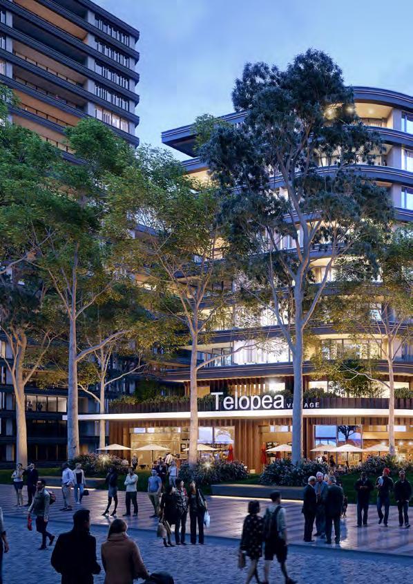
64 64

65 Artist Impression of Telopea Retail Plaza in connection with the light rail stop TELOPEA MASTER PLAN 65


66 INDICATIVE CROSS SECTIONS Retail SECTION A-A SECTION B-B PROPOSED CORE Community Facilities/ Retail Supermarket and Retail ADDERTON RD LIGHT RAIL STURT ST REALIGNED WADE ST CORRIDOR 66


67 SECTION BB SCALE: A4 Landscape Podium Residential Community Facility Residential Community Facilities / Retail PLAZA BEYOND PROPOSED COMMUNITY FACILITIES PLAZA PROPOSED RESIDENTIAL REALIGNED WADE STREET SECTION AA SCALE: A4 Community Facility Residential Retail BENAUD LANE EVANS RD Legend Residential Commercial Community Facilities Car Park TELOPEA MASTER PLAN 67

68 Artist Impression of Telopea Village Community Facilities Plaza 68

69 TELOPEA MASTER PLAN 69

70 STURT PARK AND ACACIA PARK The 3 hectare Sturt Park will be upgraded to offer new recreational facilities and passive uses in line with community expectations. The open space strategy will embrace the existing topography and vegetation in Sturt Park, while introducing key amenities and facilities integrated into the landscape. The 1.5 hectare Acacia Park is adjacent to the master plan area. It is a significant open space asset surrounded by housing and is currently underutilised. Although it is not within the master plan area, the revitalisation of Acacia Park will break up the existing landscape into formal elements the community can enjoy. The revitalisation will preserve existing play areas and trees, while adding new design elements to engage with residents, both visually and actively. Improved wayfinding will be incorporated in the street and public domain design to better integrate the parks with the surrounding community. The detailed design of Sturt and Acacia Parks will continue in consultation with Council and the local community to ensure it is well utilised and suits the needs of the future population. 70

71 Artist Impression of revitalised Sturt Park TELOPEA MASTER PLAN 71
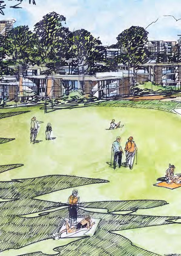
72 72

73 Artist Impression of revitalised Acacia Park TELOPEA MASTER PLAN 73
Draft Western District Plan
 Powered by TCPDF (www.tcpdf.org) Draft Western District Plan Submission_id: 31440 Date of Lodgment: 15 Dec 2017 Origin of Submission: Online Organisation name: Goodman Property Services Australia Pty Ltd
Northern Territory Compact Urban Growth Policy
 Northern Territory Compact Urban Growth Policy A Reference Policy Document to clause 2.7 (Reference to Policy) of the NT Planning Scheme May 2015 Table of Contents 1 Policy Setting... 3 1.1 Context for
Capital works Curtin group centre - central plaza Infrastructure and public space improvements may be
 1 Introduction How is a master plan implemented? When a master plan is finished, the following generally occurs. What is a master plan? A master plan is not a detailed design, but: a process that defines
DRAFT GREATER SYDNEY REGION PLAN OBJECTIVES, STRATEGIES AND ACTIONS
 Greater Sydney Commission DRAFT GREATER SYDNEY REGION PLAN OBJECTIVES, STRATEGIES AND ACTIONS Issued: 26 OCTOBER 2017 Version: 1 Subject: Greater Sydney Region and District Plans This information note
EAST VILLAGE STRATEGIC SITE NOVEMBER 2017
 EAST VILLAGE STRATEGIC SITE NOVEMBER 2017 East Village will be a sustainable, mixeduse precinct with a focus on innovative employment and education opportunities. Enhanced by green spaces and places for
Wollondilly Resilience Network (WReN) Inc. Comments on the Draft South West District Plan
 Inc. Comments on the Draft South West District Plan") Wollondilly Resilience Network (WReN) Inc. Comments on the Draft South West District Plan March 2017 About WReN Wollondilly Resilience Network (WReN) Inc. is a not for profit community association based
Wollondilly Resilience Network (WReN) Inc. Comments on the Draft South West District Plan March 2017 About WReN Wollondilly Resilience Network (WReN) Inc. is a not for profit community association based
North District What we heard
 What we heard Vision to 2056 and Priorities Governance and implementation Infrastructure and funding The vision for a metropolis of three cities, and the 30 minute city. Feedback emphasised: That for the
GREENBANK DEVELOPMENT MASTERPLAN
 DEVELOPMENT MASTERPLAN POTENTIAL TRAIN STATION COMMUNITY CENTRE Greenbank will be a connected masterplanned community providing easy access to local and surrounding amenity. Affordable quality homes, green
Central City District Plan
 OUR GREATER SYDNEY 2056 Revised Draft Central City District Plan OVERVIEW Blacktown Cumberland Parramatta The Hills Snapshot of the Central City District today and into the future People Population, age
This Review Is Divided Into Two Phases:
 Semiahmoo Town Centre Review The purpose of this review: To review the Semiahmoo Town Centre Concept Plan, originally approved in 1993, to ensure that this centre will continue to serve the needs of South
97 Lea Bridge Road, Leyton, E10 7QL London Borough of Waltham Forest December 2015
 97 Lea Bridge Road, Leyton, E10 7QL London Borough of Waltham Forest December 2015 Public Realm and Landscape Proposals LEA BRIDGE ROAD, WALTHAMSTOW Public Realm & Landscape Proposals BDP(90)RPT001 December
Subdivision Design Criteria. Penihana North GUIDELINES TO THE RULES
 Created September 2013 Penihana North Subdivision Design Criteria GUIDELINES TO THE RULES This part of the Plan sets out the design criteria for subdivision in Penihana North. The criteria will be considered
WATERLOO STATE SIGNIFICANT PRECINCT SUMMARY OF STUDIES
 WATERLOO STATE SIGNIFICANT PRECINCT SUMMARY OF STUDIES Technical studies will be undertaken to inform the master planning process for the Waterloo precinct to develop a Precinct Proposal to redevelop the
DAREBIN PLANNING SCHEME AMENDMENT C137
 Who is the planning authority? Planning and Environment Act 1987 DAREBIN PLANNING SCHEME AMENDMENT C137 EXPLANATORY REPORT This amendment has been prepared by the Darebin City Council, who is the planning
Appendix H: Easement cross sections
 Appendix H: Easement cross sections SHARED PATH 1.5m FOOTPATH NATURE STRIP 7.3m CARRIAGEWAY 2.7m NATURE STRIP EXISTING PIPELINE 150mm DIA 5.0m (approx.) LOCAL ACCESS ROAD EXISTING PIPELINE 500mm DIA 2.7m
Western City District What we heard
 What we heard Vision to 2056 and Priorities Governance and implementation Infrastructure and funding The protection of the natural landscape including biodiversity and the Metropolitan Rural Area for food
Thanks for attending this information session about plans to provide new housing, open space and community facilities at North Eveleigh.
 Welcome Thanks for attending this information session about plans to provide new housing, open space and community facilities at North Eveleigh. We received your feedback on an initial concept in late
Section 5 (S5) - Sneydes Parade
 - Sneydes Parade") EAST WERRIBEE EMPLOYMENT PRECINCT PRECINCT STRUCTURE PLAN 15m High Large Canopy Tree encouraged 41.4 6.0 4.2 2.0 0.3 300mm Kerb 3 Lane incl. dedicated bus lane 6m median (Trees at 25m spacing) 3 Lane incl.
EAST WERRIBEE EMPLOYMENT PRECINCT PRECINCT STRUCTURE PLAN 15m High Large Canopy Tree encouraged 41.4 6.0 4.2 2.0 0.3 300mm Kerb 3 Lane incl. dedicated bus lane 6m median (Trees at 25m spacing) 3 Lane incl.
UNIVERSITY TOWN NEIGHBOURHOODS 5.5 HOUSING MELBOURNE CAMPUS MASTER PLAN 2014
 5.5 169 EXISTING CONDITIONS & VISION NEIGHBOURHOOD VISION The provision of on-campus housing into the future will continue to be an important element of the La Trobe University experience. A long-term
REVISED DRAFT NORTH DISTRICT PLAN PLANNING PRIORITIES AND ACTIONS
 Greater Sydney Commission REVISED DRAFT NORTH DISTRICT PLAN PLANNING PRIORITIES AND ACTIONS Issued: 26 OCTOBER 2017 Version: 1 Subject: Greater Sydney Region and District Plans This information note is
TIDAPA Structure Plan
 TIDAPA Structure Plan Prepared by Tract Consultants 28 MARCH 2017 0217-0074 Table of Contents 01 STRATEGIC CONTEXT Executive Summary Regional Context Page 3 Page 4 02 LOCAL CONTEXT Aerial Photograph Local
Integrated Urban Structuring in Australia An Overview of Principles and Practice
 ACNU08 Brisbane Integrated Urban Structuring in Australia An Overview of Principles and Practice Wendy Morris Ecologically Sustainable Design Pty Ltd Melbourne, Australia esdesign@netspace.net.au Ecologically
SCHEDULE 12 TO THE DESIGN AND DEVELOPMENT OVERLAY GLEN WAVERLEY ACTIVITY CENTRE STRUCTURE PLAN
 DD/MM/YY Proposed C120 SCHEDULE 12 TO THE DESIGN AND DEVELOPMENT OVERLAY Shown on the planning scheme map as DDO12. GLEN WAVERLEY ACTIVITY CENTRE STRUCTURE PLAN 1.0 Design objectives DD/MM/YY Proposed
Welcome to our exhibition
 Welcome to our exhibition The Homes & Communities Agency (HCA) welcomes you to this public exhibition explaining our proposals for the redevelopment of the former Lea Castle Hospital site. About the Homes
Draft Eastern District Plan
 Draft Eastern District Plan Submission_id: 31238 Date of Lodgment: 13 Dec 2017 Origin of Submission: Online Organisation name: Turrulla Gardens Pty Ltd C/- Mecone Organisation type: Industry First name:
04Design. Methodology. Future of Jacksons Hill Identifying Potential Uses Building Typology and Adaptability Community Engagement
 Jacksons Hill Adaptive Re-Use Study 25 04Design Methodology Objectives Future of Jacksons Hill Identifying Potential Uses Building Typology and Adaptability Community Engagement Jacksons Hill Adaptive
1 Welcome! UBC Okanagan Master Plan Update - Open House
 1 Welcome! UBC Okanagan Master Plan Update - Open House UBC is updating the Master Plan for the Okanagan Campus. The purpose of today s Open House is to: Present the draft 2015 Master Plan Answer any questions
I615. Westgate Precinct
 I615. Westgate Precinct I615.1. Precinct Description The Westgate Precinct is located approximately 18km west of the Auckland city centre. There are seven Sub-precincts in the Westgate Precinct: Sub-precinct
Central City District What we heard
 What we heard Vision to 2056 and Priorities Governance and implementation Infrastructure and funding The vision for a metropolis of three cities, and the 30 minute city. Feedback requested: Clearer communication
Keystone Business Park Precinct Structure Plan North East Industrial Precinct. Part 2 Design Principles
 Keystone Business Park Precinct Structure Plan North East Industrial Precinct Part 2 Design Principles Context Issues Services Landform Issues Geotech and contamination Ecology Traffic and access Issues
Response to the London Bridge Area Vision and Site Allocations within the New Southwark Plan
 1 Melior Place London SE1 3SZ 020 7407 4701 teamlondonbridge.co.uk info@teamlondonbridge.co.uk 28 April 2017 Response to the London Bridge Area Vision and Site Allocations within the New Southwark Plan
Section 4 - Public Realm & Landscape proposals Landscape Masterplan. Section 4 52
 - Public Realm & Landscape proposals Landscape Masterplan 52 Proposed Masterplan - Green Infrastructure Strategy District Park 4.33 Ha to provide Passive and active recreation with a large play area which
DRAFT WESTERN CITY DISTRICT PLAN PLANNING PRIORITIES AND ACTIONS
 Greater Sydney Commission DRAFT WESTERN CITY DISTRICT PLAN PLANNING PRIORITIES AND ACTIONS Issued: 26 OCTOBER 2017 Version: 1 Subject: Greater Sydney Region and District Plans This information note is
MDP -- District Plan Webform Submissions Submission Details
 MDP -- District Plan Webform Submissions Submission Details Completed Time Represented By Who Title Age Bracket 03/31/2017-16:44 I am submitting my Mr 40-49 organisation's submission First Name Last Name
Urban Design Manual PLANNING AROUND RAPID TRANSIT STATIONS (PARTS) Introduction. Station Study Areas
 Introduction. Station Study Areas") 111111 PLANNING AROUND RAPID TRANSIT STATIONS (PARTS) Introduction The ION rapid transit system will link Waterloo, Kitchener and Cambridge through a central transit corridor (CTC). There are a number
111111 PLANNING AROUND RAPID TRANSIT STATIONS (PARTS) Introduction The ION rapid transit system will link Waterloo, Kitchener and Cambridge through a central transit corridor (CTC). There are a number
UNIVERSITY TOWN NEIGHBOURHOODS 5.2 ECO-CORRIDOR MELBOURNE CAMPUS MASTER PLAN 2014
 5.2 ECO-CORRIDOR 37 ECO-CORRIDOR EXISTING CONDITIONS & VISION NEIGHBOURHOOD VISION Investment in the Eco-corridor Neighbourhood will signify the University s commitment to supporting local ecology and
elbridge Core Strategy
 C elbridge Core Strategy Celbridge is designated as a Moderate Growth Town in the RPGs. The County Development Plan reinforces this designation in its settlement strategy. Moderate Growth Towns within
OUR GREATER SYDNEY A metropolis of three cities. OVERVIEW. connecting people. DRAFT Greater Sydney Region Plan
 OUR GREATER SYDNEY 2056. A metropolis of three cities. OVERVIEW. connecting people. DRAFT Greater Sydney Region Plan October 2017 This document is an overview of the draft Greater Sydney Region Plan. To
8.0 Design and Form of Development 43/
 42/ 8.0 Design and Form of Development 43/ Rothwells Farm, Golborne/ Development Statement Figure 7. Site Constraints Key 44/ Site Boundary 360 Bus Route/Stops Existing Trees Underground Water Pipe Sensitive
Transportation. Strategies for Action
 Transportation A major priority for the Overlake Neighborhood is to develop a multimodal transportation system. To achieve this system, a balance has to be found among travel, circulation and access needs;
The West Vaughan Employment Area Secondary Plan Policies
 Part 2: The West Vaughan Employment Area Secondary Plan Policies 2.1 General Policies It is the policy of Council: 2.1.1. That the West Vaughan Employment Area (the WVEA), identified on Schedule 1, will
PMP PRINTING SITE COMMUNITY ENGAGEMENT - PHASE 2
 PMP PRINTING SITE COMMUNITY ENGAGEMENT - PHASE 2 FEBRUARY 2019 0317-0511 - PMP Printng - M001 (8 -Floors) -Final date 14.11.2018 Vision: The PMP Printing site will be transformed into a contemporary mixed-use
Chapter 2: OUTLINE PLANNING APPLICATION PROPOSALS. A New Garden Neighbourhood Matford Barton 17
 Chapter 2: OUTLINE PLANNING APPLICATION PROPOSALS A New Garden Neighbourhood Matford Barton 17 2.1. SUMMARY AND STATUS OF THE PROPOSALS 2.1.1. The parameter plans and associated wording in this chapter
Projects Include: Joseph Rega. The Regalia Partnership
 Projects Include: Kensington Urban Improvement Program and Kensington Town Centre Development Control Plan for Randwick City Council and DIPNR Matraville Town Centre Development Control Plan for Randwick
Development of land adjacent to Braggs Farm Lane and Rumbush Lane, Dickens Heath. Welcome. Today s exhibition. The proposal site
 Welcome Welcome to this event to discuss the development of land adjacent to Braggs Farm Lane. is currently in the preliminary stages of designing proposals to sensitively develop this site with high-quality
Page 1 of 19 URBAN DESIGN FRAMEWORK FOR BOLTON STREET WATERFORD
 Page 1 of 19 URBAN DESIGN FRAMEWORK FOR BOLTON STREET WATERFORD 1.0 Introduction: The relocation of the City Council stores and depot from Bolton Street creates an exciting opportunity for development
Appendix D: Rockbank Major Town Centre key design principles
 Appendix D: Rockbank Major Town Centre key design principles ATTRACTING INVESTMENT & SUPPORTING THE COMMUNITY Principle 1 Create a focal point for a diverse range of uses within the town centre that are
City of Farmington. Downtown Plan. Amendment to the 1998 Master Plan Adopted October 11, 2004
 City of Farmington Amendment to the 1998 Master Plan Adopted October 11, 2004 Introduction Planning Background 1 Scope and Components of the Plan Amendment 2 Concept Introduction 3 Plan Concepts 3 Conceptual
Draft South West District Plan - Campbelltown City Council Submission Attachment 1
 Draft South West District Plan - Campbelltown City Council Submission Attachment 1 Campbelltown City Council Report and Resolution - Draft South West District Plan - Draft Submission Ordinary Meeting 28/03/17
10.0 Open Space and Public Realm
 10.0 Open Space and Public Realm 10.0 Open Space and Public Realm The Public Open Space System is comprised of: outdoor spaces available for public use that are either publicly owned (e.g., parks and
H7 Open Space zones. (a) provide for the needs of the wider community as well as the needs of the community in which they are located;
 provide for the needs of the wider community as well as the needs of the community in which they are located;") H7. Open Space zones H7.1. Background The majority of land zoned as open space is vested in the Council or is owned by the Crown. However some areas zoned open space are privately owned. While the open
H7. Open Space zones H7.1. Background The majority of land zoned as open space is vested in the Council or is owned by the Crown. However some areas zoned open space are privately owned. While the open
North Oakville East Parks Facilities Distribution Plan. November, 2009
 North Oakville East November, 2009 POLICY CONTEXT 1) Purpose a) The purpose of this document is to be a guide for the location, configuration, design and development of the parks system for the North Oakville
C. Westerly Creek Village & The Montview Corridor
 C. Westerly Creek Village & The VISION Community Vision When the goals of the city are achieved Westerly Creek Village, a distinctive community defined by Montview Boulevard and Westerly Creek, is a strong
As will be detailed, our site plays a strategic role in providing these opportunities.
 29 March 2017 Greater Sydney Commission PO Box 257 Parramatta NSW 2124 Email: info@gsc.nsw.gov.au Dear Sir/Madam, RE: DISTRICT PLAN-SOUTH WEST AREA. Woodward Park and Liverpool CBD. I have been requested
Complete Neighbourhood Guidelines Review Tool
 Complete Neighbourhood Guidelines Review Tool Prepared By: City of Regina Planning Department October 2014 Page 1 of 14 Community Development Review Checklist for Secondary Plans and Concept Plans The
Preston Market. Design review and master planning. Victorian Planning Authority. June 8, :24 PM. Prepared for: Date:
 Prepared for: Victorian Planning Authority Date: June 8, 2018 3:24 PM Design review and master planning Preston Market What we know about the markets Preston Markets The existing site features are: Approximately
Town Center (part of the Comprehensive Plan)
") Town Center (part of the Comprehensive Plan) Mercer Island Town Center Looking North (2014) In 1994, a year-long process culminated in a set of design guidelines and code requirements for the Town Center
Town Center (part of the Comprehensive Plan) Mercer Island Town Center Looking North (2014) In 1994, a year-long process culminated in a set of design guidelines and code requirements for the Town Center
2.0 Strategic Context 4
 2.0 Strategic Context 4 2.1 The Area Action Plan is a non-statutory plan, which forms a corporate policy document, expressing particular issues and areas of concern while also providing a vision for the
Land Use Amendment in Southwood (Ward 11) at and Elbow Drive SW, LOC
 at and Elbow Drive SW, LOC") 2018 November 15 Page 1 of 10 EXECUTIVE SUMMARY This land use amendment application was submitted by Rick Balbi Architect on 2017 August 31 on behalf of Sable Developments Ltd, and with authorization from
2018 November 15 Page 1 of 10 EXECUTIVE SUMMARY This land use amendment application was submitted by Rick Balbi Architect on 2017 August 31 on behalf of Sable Developments Ltd, and with authorization from
Create Policy Options Draft Plan Plan Approval. Public Consultation Events. Phase 2
 Background Grandview-Woodland Community Plan In the spring of 2012, the City of Vancouver embarked on a comprehensive community planning program in the Grandview-Woodland neighbourhood. The process has
ELMVALE ACRES SHOPPING CENTRE MASTER PLAN
 ELMVALE ACRES SHOPPING CENTRE MASTER PLAN Contents 1.0 INTRODUCTION... 2 2.0 LOCATION... 2 3.0 EXISTING CONTEXT... 2 4.0 VISION & GUIDING PRINCIPLES... 2 5.0 LAND USE AND BUILT FORM... 4 5.1 St. Laurent
Downtown Whitby Action Plan
 Downtown Whitby Action Plan Final Report October 2016 Table of Contents Introduction 1 Public Consultation 2 Walkability 3 Downtown Whitby Walkability Map 4 Vision 5 Goal & Objectives 6 Objective 1 7 Objective
CENTRAL BEDFORDSHIRE COMMITTED TO WORKING TOGETHER WITH LOCAL COMMUNITIES
 WELCOME Thank you for coming to our consultation event to find out more about our emerging proposals for Hayfield Park, a residential development jointly promoted by the Hayfield Consortium: Martin Grant
Tāhuhu whakaruruhau ā-taone The sheltering ridge pole
 B2. Tāhuhu whakaruruhau ā-taone - Urban growth and form B2.1. Issues Tāhuhu whakaruruhau ā-taone The sheltering ridge pole Auckland s growing population increases demand for housing, employment, business,
38 Queen s University Campus Master Plan Part 1
 38 Queen s University Campus Master Plan Part 1 46 The Campus at the City Scale Chapter 4 The Campus at the City Scale 39 Queen s is an urban University centrally located in Kingston. Decisions made by
Further input invited as Colchester Growth Strategy nears final phase
 IUE 3 / NOVEMBER 2015 Further input invited as Colchester Growth trategy nears final phase trathcona County is seeking public feedback as it enters the final phase of work on a Growth Management trategy
LOW DENSITY RESIDENTIAL
 LOW DENSITY RESIDENTIAL Corner lots with coach houses to increase diversity, provide unity to the streetscape and increase eyes on the street. Garages and ancillary units accessed via rear lanes. Parking
URBAN DESIGN BRIEF URBAN DESIGN BRIEF 721 FRANKLIN BLVD, CAMBRIDGE August 2018
 URBAN DESIGN BRIEF URBAN DESIGN BRIEF 721 FRANKLIN BLVD, CAMBRIDGE August 2018 DESIGN BRIEF CONTENTS PART A 1.0 INTRODUCTION 2.0 DESCRIPTION & ANALYSIS OF SITE CONTEXT 3.0 DESIGN CONSTRAINTS AND OPPORTUNITIES
Draft Western District Plan
 Powered by TCPDF (www.tcpdf.org) Draft Western District Plan Submission_id: 31356 Date of Lodgment: 14 Dec 2017 Origin of Submission: Online Organisation name: APP Corporation PTY LTD Organisation type:
Figure 3-1: Public Realm Plan
 3 Public Realm Figure 3-1: Public Realm Plan 3.1 Public Realm Concept The public realm concept for the Little Mountain site integrates a clear and accessible movement network with public spaces for social
Former Rockcliffe Airbase Community Design Plan Guiding Design Vision and Principles December 4, 2013
 APPENDIX 5 - Guiding Design Vision and Principles Former Rockcliffe Airbase Community Design Plan Guiding Design Vision and Principles December 4, 2013 Vision Statement The redevelopment of the former
Eastern City District Plan
 OUR GREATER SYDNEY 2056 Revised Draft Eastern City District Plan OVERVIEW Bayside Burwood Canada Bay City of Sydney Inner West Randwick Strathfield Waverley Woollahra Snapshot of the Eastern City District
THE STORY SO FAR... THE STORY SO FAR...
 THE STORY SO FAR... Levitt Bernstein architects Levitt Bernstein are award winning architects who have designed many successful retail and residential projects. We are specialists in working with local
SQUAMISH 2010 AND BEYOND COMMUNITY VISION
 Our plan has been imagined and created to be both pragmatic and visionary. At the core of the strategy is a consideration of the highway s role and its impact on the community. First and foremost in creating
LIVEABLE. A diverse and welcoming capital city with an enviable lifestyle and strong community. Liveable City of Adelaide Strategic Plan
 LIVEABLE A diverse and welcoming capital city with an enviable lifestyle and strong community 38 Liveable City of Adelaide 2016-2020 Strategic Plan City of Adelaide 2016-2020 Strategic Plan 39 LIVEABLE
Land at Rampton Road. Cottenham
 Land at Rampton Road Cottenham Introduction TEP is preparing an outline planning application for 54 dwellings on 6.9 hectares of land adjacent to Rampton Road, Cottenham on behalf of the owners Cambridgeshire
Public Consultation. Land at Monks Farm, North Grove. Welcome
 Welcome Welcome to our public exhibition for development on Land at Monks Farm, orth Grove. Gallagher Estates and Gleeson Strategic Land are preparing an outline planning application for new homes, open
The Proposed Auckland Unitary Plan (notified 30 September 2013)
") 3 Business zones Introduction There are 10 business zones in the Unitary Plan: City Centre Metropolitan Centre Town Centre Local Centre Neighbourhood Centre Mixed Use General Business Business Park Light
3 Business zones Introduction There are 10 business zones in the Unitary Plan: City Centre Metropolitan Centre Town Centre Local Centre Neighbourhood Centre Mixed Use General Business Business Park Light
Planning Board Briefing
 Planning Board Briefing Why Now? The Sector Plan Implementation Chapter States: Before Stage 1 begins, the following must occur: Approval of the Sectional Map Amendment. Approval of the Greater Lyttonsville
Neighborhood Districts
 NEIGHBORHOOD DISTRICTS SEVEN MAIN DISTRICTS Neighborhood Districts While the Development Plan provides a broad-scale overview of the neighborhood, this section focuses on uses and relationships at the
Smart Growth Development Checklist
 2004 Smart Growth Development Checklist Smart Growth Development Checklist Corporation of the City of New Westminster Guide and manage growth in a manner which is consistent with the principles of sustainable
Scottish Natural Heritage. Better places for people and nature
 Scottish Natural Heritage Better places for people and nature Contents Summary... 3 SNH approach... 5 Place-making in policy and practice... 6 Developing the contribution of the natural heritage to place-making...
INCREMENTAL CHANGE AREA REVIEW March 2015 Page 1
 INCREMENTAL CHANGE AREA REVIEW March 2015 Page 1 Table of Contents Introduction... 3 Background to Review... 3 Comparison of the Schedules to the General Residential Zone... 7 Methodology... 7 Policy Context...
Nelson Residential Street Frontage Guideline
 DRAFT 22-06-2012 Nelson Residential Street Frontage Guideline June 2012 1317273 Contents and purpose Residential s are important Residential s are much more than corridors which move traffic. Streets allow
MALL REVITALIZATION CASE STUDIES
 MALL REVITALIZATION CASE STUDIES DECEMBER 9, 2012 MALL REVITALIZATION OVERVIEW Introduction Sample Case Studies prepared for Lacey Woodland District Steering Committee as it considers strategies to revitalize
BROOKLYN PARK / 85TH AVE LRT STATION CDI DEVELOPMENT GUIDELINES DRAFT
 August 2018 Page intentionally left blank The Brooklyn Park Library adjacent to the 85th Ave LRT Station Area. OVERVIEW The Blue Line LRT Extension / Bottineau corridor offers a unique opportunity to leverage
RE: AMENDMENT C375 GEELONG PLANNING SCHEME 1900 BARWON HEADS ROAD, BARWON HEADS
 Reference: #V157080 14 August 2018 Barwon Heads Lifestyle Group Pty Ltd C/- Best Hooper Lawyers Level 9, 451 Little Bourke Street MELBOURNE VIC 3000 Attention: Mr. Edward Mahony (Lawyer) Dear Edward RE:
Our City Centre is a vibrant, creative and welcoming destination, with a modern business, cultural, shopping, leisure and residential offer
 3. Sheffield in 2034 Our City sits at the heart of a strong, distinctive and internationally successful City Region economy which supports innovation and enterprise Our City Centre is a vibrant, creative
CANOPY AT AMSTEL (THE AMSTEL GOLF COURSE REDEVELOPMENT)
") CANOPY AT AMSTEL (THE AMSTEL GOLF COURSE REDEVELOPMENT) 1000 CRANBOURNE FRANKSTON ROAD, CRANBOURNE The former Amstel Golf Course was rezoned to a General Residential Zone in 2015 to facilitate its redevelopment
CANOPY AT AMSTEL (THE AMSTEL GOLF COURSE REDEVELOPMENT) 1000 CRANBOURNE FRANKSTON ROAD, CRANBOURNE The former Amstel Golf Course was rezoned to a General Residential Zone in 2015 to facilitate its redevelopment
South District Plan OVERVIEW
 OUR GREATER SYDNEY 2056 Revised Draft South District Plan OVERVIEW Canterbury-Bankstown Georges River Sutherland Snapshot of the South District today and into the future The Greater Sydney Commission acknowledges
GREENVALE CENTRAL PRECINCT STRUCTURE PLAN
 76 Conservation area boundary. Low Fence to exclude vehicles but allow pedestrian access Front boundary of allotment 5.0m MINIMUM SETBACK Path providing public access to dwellings fronting Conservation
Welcome to the Oakridge Centre Open House
 Welcome to the Oakridge Centre Open House Why is the City hosting this event? This open house is to inform you of a rezoning application submitted to the City of Vancouver to amend the existing CD-1 (Comprehensive
University of Saskatchewan CAMPUS MASTER PLAN. Senate Meeting Preliminary Presentation. April 21, 2018 DIALOG ECS DA WATT
 University of Saskatchewan CAMPUS MASTER PLAN Senate Meeting Preliminary Presentation April 21, 2018 DIALOG ECS DA WATT project process presentation agenda Stakeholder Engagement Project Control phase1
V. Vision and Guiding Principles
 V. Vision and Guiding Principles The Master Plan for the Powers Ferry Corridor seeks a foundation in the desires of the community. At times, various elements of the community offered opposing viewpoints,
Next Steps / Development Process. Structure Plan. June submitted to City of Fremantle. Structure Plan. July supported for advertising
 overview What is today about? In July 0, the City of Fremantle resolved that the be advertised for public comment. Today is about: Understanding the history and context of the site Having your say on the
PORT WHITBY COMMUNITY
 PORT WHITBY COMMUNITY SECONDARY PLAN UPDATE COMMUNITY IMPROVEMENT PLAN URBAN DESIGN GUIDELINES September 2015 DRAFT PROPOSED AMENDMENT NUMBER # to the Whitby Official Plan PURPOSE: The intent of this Amendment
Chapter 5 Urban Design and Public Realm
 5.1 Introduction Public realm is all areas of the urban fabric to which the public have access. It is where physical interaction takes place between people. It therefore, includes buildings and their design,
4 RESIDENTIAL ZONE. 4.1 Background
 4 RESIDENTIAL ZONE 4.1 Background The residential areas within the City are characterised by mainly lowrise dwellings sited on individual allotments. Past architectural styles, settlement patterns and
RESIDENTIAL ACTIVITY PERFORMANCE STANDARDS
 Preferred Options Consultation Q&A Sheet RESIDENTIAL ACTIVITY PERFORMANCE STANDARDS What are the key goals for managing the design of residential buildings in the Second Generation Plan (2GP)? The key
Workshop 3. City of Burlington Waterfront Hotel Planning Study. September 14, The Planning Partnership
 Workshop 3 City of Burlington Waterfront Hotel Planning Study September 14, 2017 The Planning Partnership The Waterfront Hotel Planning Study 01 The Brant & Lakeshore Planning Study will establish a Strategic