Update to Town of Owasco Comprehensive Plan
|
|
|
- Winifred Oliver
- 6 years ago
- Views:
Transcription


1 Update to Town of Owasco Comprehensive Plan with Conservation Lands and Trails Plan September 2016 Town of Owasco Comprehensive Plan Update - April
2
3 Table of Contents Introduction... 5 Public Participation... 6 Plan Structure... 7 Adopting and Implementing the Comprehensive Plan... 7 History of Planning and Land Use in the U.S... 9 Prior Local and Regional Planning Initiatives Federal and State Planning Initiatives Chapter 1: Goals and Recommendations Community Vision Statement Agriculture and Farmland Protection Land Use, Planning, and Subdivision Regulation Supportive of the Community Vision Environmental Stewardship and Water Quality Protection Improved Public Utilities and Services Community Revitalization and Historic Preservation Chapter 2: Community Inventory and analysis Location History of the Community Historic and Cultural Resources Demographic Profile Population Housing Business/Economic Base Municipal Infrastructure and Services Land Use and Zoning Watershed Protection and Environmental Quality BioEnergy Solar Energy Wind & Wind Energy The Marcellus Shale & Natural Gas Chapter 3: Conservation Lands and Trails Public Parks, Recreation and Protected Areas Pedestrian and Bicycle Infrastructure Recreational Routes and Trails Conservation lands Chapter 4: Regional Influences The Finger Lakes Region The Erie Canalway National Heritage Corridor The Cayuga Lake Scenic Byway The Harriet Tubman Home Appendix A: Principals of Smart Growth Appendix B: Conservation Subdivisions Appendix C: Issues of Community Concern Appendix D: Community Comments of Draft Plan Appendix E: National Register Listings Town of Owasco Comprehensive Plan Update - September
4 List of Maps Regional Colleges and Universities Map Roads and Scenic Views Map Pre-1853 Existing Historic Resources Map School District Map Land Use Map Zoning Map EPOD 1: Stream Corridor, Lakeshore, and Floodplain Protection District Map EPOD 2: Woodlot Protection District Map EPOD 3: Steep Slope Protection District Map Agricultural Lands Wetlands Map Farmland Classification of Soils Map Cayuga County Consolidated Agricultural District Map Wind Energy Map Recreational Trail Routes and Linkages Map Recreational Trail Routes and Linkages (Detail) Map Finger Lakes Cycling Club Bike Route Map Marcellus-Owasco Metric Century Bike Route Map Eastern Finger Lakes Century Bike Route Map Marowaskaoti Tour Bike Route Map Owasco Flyer Race Map Owasco Velo Club Routes around Owasco Lake Owasco Velo Club Hilly Routes Owasco Velo Club Routes Existing Trail Map Parcel Suitability for Conservation Map Public Lands Map GIS DATA Disclaimer The original sources of each dataset is identified on the maps. Due to the different sources and scales of projection, key features such as roads, parcel boundaries and streams may not overlap accurately when comparing several data layers on the same map. Acreage calculations for various parameters in this report were generated through the use of ArcGIS and are an approximation of the actual size. For more precise measurements, contact the Cayuga County Planning Department. 4 Town of Owasco Comprehensive Plan Update - September 2016

5 Finger Lakes Mud Run (Source: Finger Lakes Mud Run) A lake is the landscape s most beautiful and expressive feature. It is earth s eye; looking into which the beholder measures the depth of his own nature. -Henry David Thoreau Introduction The Town of Owasco Comprehensive Plan Update was initiated, generated, and supported by the Owasco community in a collaborative process intended to guide town officials and the community in making decisions that affect the future of the town. The comprehensive plan update provides a basis for guiding future growth, development and community preservation. The update also acts as a historical document that identifies present land use and infrastructure, as well as the physical, cultural, and demographic characteristics of the town. A grant award from NYSERDA for Comprehensive Planning and/or Land Use regulatory updates was made available to participating municipal partners in the Vision CNY - Regional Partnership For Comprehensive Planning, a project of the Central New York Regional Planning and Development Board (CNY RPDB) in collaboration with five Central New York Counties. The Town of Owasco provided a letter of support in August of 2013 for the grant proposal submitted by CNY RPDB and as a result became an eligible municipality for funding to develop and implement planning components and regulatory updates in support of future land uses and development that support climate resiliency and smart growth practices for environmental, economic and cultural sustainability. With the award of the grant, the town became eligible for funding assistance in updating a Comprehensive Plan and consulting services through the CNY RPDB. In August of 2014, the project was introduced to the Town of Owasco Comprehensive Plan Update - September
6 town. The CNY RPDB met with town representatives who established a working committee to pursue the development and implementation of planning components to guide smart land use practices and sustainable development locally, including economic and environmental resiliency. Potential sustainable planning policies, regulatory tools, and strategies eligible for funding assistance through the project included: Municipal Comprehensive Plans Comprehensive Plan Updates Separate Components of Comprehensive Plans (such as Greenprint Plans identifying local conservation land priorities) New Smart Growth Zoning, and Sustainable Land Use Updates to Local Ordinances. The Town of Owasco determined that a Comprehensive Plan Update with new maps, demographics, analysis, and goals, and a town-wide conservation and recreation plan would best serve the town s needs. The town established a local committee comprised of diverse members of the community to consult with CNY RPDB staff monthly in the development of the Plan. In December 2014, the Comprehensive Planning Committee (CPC) held its first meeting and began to identify the formal process it would follow to develop the plan. The CPC used the Technical Guidance Manual for Sustainable Neighborhoods, published in 2013 by the U.S. Green Building Council and the Pace University Land Use Law Center as the primary guidance resource to guide discussions and the format of this Comprehensive Plan. The manual provides criteria based on the Leadership in Energy and Environmental Design (LEED) for Neighborhood Development rating system. Through in-depth study, analysis, and community participation, the Comprehensive Plan provides a sound basis for guiding future growth, development, and community preservation. Community input from surveys and the Comprehensive Planning Committee played an important role in the development of the Comprehensive Plan by directly informing a series of clearly defined goals and recommended actions for the town to pursue. Any future land use or zoning regulations must be consistent with the findings and recommendations of the Comprehensive Plan. Members of the Comprehensive Plan Committee: Ed Wagner, Chair and Supervisor Patricia Holt Bill Phillips Laurel Auchampaugh Tim Kerstetter Ron Podolak Mark Coleman Ashley Melendez Bill Prosser Gerard Guiney John Mizro Public Participation The Comprehensive Planning Committee formulated a survey which was mailed to 1,476 town residences and property owners and was available for public review at two public locations, with an option also to take the survey online. The intent of the survey was to seek out opinions on present day Owasco and what the public sees for the Town of Owasco in the future. 411 completed surveys were returned, a 27.8% response rate. Analysis of the results of the written survey and community inventory formed the basis for this comprehensive plan. All CPC meetings were open to the public. 6 Town of Owasco Comprehensive Plan Update - September 2016
7 Plan Structure The contents of this plan include an Introduction and four chapters. Chapter 1: Goals and Recommendations lays out the specific goals and recommendations by topic area; Chapter 2: Community Inventory and Analysis explains the historic and current state of the town and what it has to offer; Chapter 3: Conservation Lands and Trails provides a summary of existing and priority conservation land and trail locations in Owasco; and Chapter 4: Regional Influences is intended to give background information on existing conditions in the town and region. Five Appendices in the back of the Plan contain information on Principals of Smart Growth, Conservation Subdivisions, Issues of Community Concern, the Community Survey and Comments, and National Register Listings. Adopting and Implementing the Comprehensive Plan Legislative Authority In the State of New York, village and town governments are granted authority to adopt a comprehensive plan pursuant to Village Law or Town Law 272-a. The comprehensive plan, a set of policy and analytic documents and maps, strategies and tools for the guidance of community well-being, land use, and development, is also intended to provide the foundation for local zoning laws. Once adopted, all land use policy decisions in the town must be in accordance with the comprehensive plan. The review of future projects no longer occurs on an independent project-by-project basis, but rather in consideration of the comprehensive plan and the community vision. This Plan provides guidance as to where and how future development should occur in the town. In addition, all other governmental agencies must consider this plan when directing or funding capital projects that occur within the town. Adopting a Comprehensive Plan The purpose of adopting a comprehensive plan is the protection of the health, safety, and general welfare of the citizens of the community and their environment. Once adopted, review of future projects occurs in consideration of the community vision and the Comprehensive Plan. In addition, all other governmental agencies must consider this plan when directing or funding capital projects that occur within the town. Adoption of a comprehensive plan is a discretionary decision and is considered a Type I action pursuant to Article 8 of the Environmental Conservation Law and Title 6 of the New York Code of Rules and Regulations Part 617.4(b)(1).This means that the plan must meet the provisions of the New York State Environmental Quality Review Act (SEQRA) prior to final adoption by Town Board. In accordance with New York State General Municipal Law 239, the Governing Board must refer the adoption or amendment of the proposed comprehensive plan to the County Planning Board s 239 Land Use Committee for review for potential inter-municipal impacts of the proposed plan. The Governing Board may adopt a Comprehensive Plan (or an amendment to a Comprehensive Plan) by resolution. Review and Maintenance of the Plan Because communities are continually changing and adjusting to new conditions, the 2002 Comprehensive Plan together with this comprehensive plan update are works in progress, and can be thought of as documents that provide guiding principles for the future development and growth decisions. The town s Comprehensive Plan and this update should be reviewed regularly to ensure continued relevance with the existing conditions, goals and objectives of the Town of Owasco. Every five years, the Town Board should conduct an in-depth review of the Comprehensive Plan and plan updates and make changes as needed. This review should assess the status of the plan s recommendations and implementation actions, such as land use regulation revisions, Town of Owasco Comprehensive Plan Update - September
8 capital improvement programming, expansion of recreational opportunities, tourism, economic development, and progress on other work identified in the Goals & Recommendations (Chapter 1) of the plan. As policy-making changes and the physical characteristics of the community change, the comprehensive plan should also change. The plan should be a living document. Circumstances that may warrant revising the plan include: A finding of significant change within the community or substantial unforeseen circumstances or impacts; A finding of significant public benefit associated with the proposed revision or a need to maintain and protect public investments and resources; or The need to maintain compliance with new laws, regulations, court actions, or other mandates Implementing the Owasco Comprehensive Plan Update All of the work that the community has done thus far in preparing the Comprehensive Plan and this update can be lost without a solid framework for implementation based on available funding resources and realistic expectations. Some recommendations in the Update may be implemented over a longer period of time, others will be a concentrated, short-term effort, but all elements of the Plan and the update should be considered in terms of budgets and time frame. A Comprehensive Plan is a valuable resource a community can use to win significant grant funding from a wide variety of sources. Forming partnerships with various public agencies at the local, county, state and federal levels is advisable as these agencies can often assist communities in their funding and implementation efforts. Special committees may be established by the Town Board to address specific focus areas identified in the Plan. These committees should include members of the community most familiar with the Comprehensive Plan and its guiding principles. Examples of such committees are a Farmland Preservation Committee, An Historic Preservation Committee, or a Energy and Technology Committee. Community efforts can often be strengthened and community benefits broadened by cooperative planning and promotional strategies among neighboring communities. Through cooperative efforts with other agencies and inter-municipal relationships with neighboring municipalities, planning can have positive impacts on the community, as well as on the region as a whole. Suggestions for priority implementation actions noted in this Comprehensive Plan include the following: Short-term recommendations: Expand pedestrian infrastructure in The Avenues, including creating a trail that will connect the Bench Track to Owasco Elementary School Encourage the establishment of quality senior assisted or independent living housing Long-term recommendations: Implement more stringent, town-specific regulations for erosion and sediment control to reduce water quality issues in Owasco Lake, and encourage other towns on the lake to follow. Expand bicycling infrastructure along existing routes, including widening shoulders, sharrows, and/or creating bike paths Update zoning to incorporate conservation subdivision principles 8 Town of Owasco Comprehensive Plan Update - September 2016
9 History of Planning and Land Use in the U.S. Towns across America, as a result of an evolving story of settlement, bare unique physical and cultural characteristics reflected in their villages and along their roadsides. Rural towns like Owasco contribute to and are affected by regional centers of social, cultural, and economic activity. Rural life offers residents, employees, and visitors a wealth of opportunities and experiences to enjoy every day. Rural character and identity rests upon both tangible and intangible elements such as sights, sounds, scents and experiences that combine to provide the Owasco community with a familiar sense of place, and for many, a profound sense of meaning. A Comprehensive Plan provides a framework within which these unique characteristics and elements of a place can be drawn upon to create or preserve an environment supportive of a community s vision for itself. Through careful analysis, including direct community involvement in the process, rural planning addresses problems and takes advantage of opportunities to create unique, viable and pleasant rural places. This Comprehensive Plan Update for the Town of Owasco strives to do just that for a community already rich in citizen commitment and possibilities. As European settlers emigrated to the United States, they adopted English common law under which land they owned, their property, meant a place in which they held a bundle of rights including: 1) the right to control and use the property; 2) the right to benefits from the property; 3) the right to transfer or sell the property; and 4) the right to exclude others from the property. However, those rights were not absolute; they were, as they still are, subject to the rights of society often as codified in law. In the early history of the United States, society placed few limitations on the use of land as it seemed an endless resource, especially with a limited population base. From Jefferson s Corps of Discovery to the Homestead Act to massive federal irrigation, road building, and energy producing projects, the challenge was not limiting use of land but rather getting it settled, cultivated, and developed. However, as the population increased and people began to congregate in cities, the need arose for local governmental control to put some limits on the movement of industry and commerce into residential areas and to prevent residents from becoming nuisances to each other. These limitations generally took the form of zoning ordinances regulating incompatible uses, building heights, setbacks, and lot sizes. However, as the density of populations grew and spread, some began to recognize a need for planning, and noting the changing times, Theodore Roosevelt reminded his constituents in the summer of 1910: Every man holds his property subject to the general right of the community to regulate its use to whatever degree the public welfare may require it. Concern for the public welfare reached a peak in the 1960s and 70s as members of Congress observed that the balance between economic growth and development on the one hand, and protection of natural resources on the other, had tipped too far in the direction of growth and development. Congress moved to expand legal limitations that would address the issue of dwindling natural resources and environmental degradation. As a result, federal laws such as The National Environmental Policy Act, The Wilderness Act, The National Forest Management Act, The Endangered Species Act, etc., were enacted that have had significant impacts on land use. Many states also passed their own laws and adopted policies that complemented the new federal laws. In New York, the enactment of Article IX of the State Constitution, the Municipal Home Rule Law, the Statute of Local Governments, and the State Environmental Quality Review Act have provided municipalities the power to enact local laws that compliment several of the federal laws mentioned above. The scope of this power and the procedures for implementing it are set out in the Municipal Home Rule Law, adopted Town of Owasco Comprehensive Plan Update - September
10 in Section 10 of the Municipal Home Rule Law contains the constitutional grants of power to local governments and adds thereto the powers to collect local taxes authorized by the Legislature, to provide for the protection and enhancement of the physical and visual environment, the apportionment of local legislative bodies, and assessments for local improvements, as well as the powers granted to local governments in the Statute of Local Governments. The Municipal Home Rule Law also includes a Bill of Rights for Local Governments and provision for a unique Statute of Local Governments, under which home rule powers may be given to quasi-constitutional protection against change (Section 2(b)(1)). Among the rights and powers enumerated under the Bill of Rights for Local Governments are the right to have a legislative body elected by the people; to adopt local laws; to have local officers elected or appointed by the local residents or officers; the power to agree (as authorized by the Legislature) with the federal government, a State, or other government, to provide cooperative governmental services and facilities. Also included are the power of eminent domain; the power to make a fair return on the value or property used in the operation of certain utility services, and the right to use the profits therefore for refunds or any other lawful purpose; and the power to apportion costs of governmental services of function upon portions of local areas as authorized by the Legislature. Prior Local and Regional Planning Initiatives Various community-based planning initiatives have contributed to the development of the Owasco Comprehensive Plan Update. Guidelines for future growth and development in the Town of Owasco came from the Town of Owasco Comprehensive Plan adopted in 2002 and the Town of Owasco Zoning Ordinance adopted in 1988 and amended with Local Laws in The Zoning Law of the Town of Owasco includes Articles regarding Planned Development Districts, Use Regulations, Dimensional Requirements, Parking and Loading, Signs, and Nonconformities in addition to general and administrative legislation for the town. The 2002 Comprehensive Plan is a culmination of a planning effort that begin in August 2000 with monthly meetings by a Comprehensive Plan Committee, input from Stuart I. Broan Associates, a planning and management consulting firm, and input from MRB Group, which provided engineering assistance, prepared the maps, and assisted in public participation and coordination. The planning process included significant input from local stakeholders, including farmers, environmentalists, business representatives, and developers. The Comprehensive Plan presents goals, background information, issues and opportunities, tools and techniques, and recommended actions for each of six sections, including: watershed protection and environmental quality; farmland and agriculture; housing and residential neighborhoods; parks and recreation; transportation and infrastructure; and government and community services. The development of the Owasco Lake Watershed Management Plan in July of 2001 and revised plan adopted in March 2016 were the result of the collaboration, cooperation, and work of agency staff, municipal officials, and the public. The plans were produced by the Cayuga County Department of Planning and Development. Owasco Lake is an important resource to the communities within its watershed. Indeed, over 70% of the people residing in Cayuga County use it as a drinking water source. Residents and tourists enjoy recreational opportunities and the scenic views of the lake, while agriculture, fisheries, and wildlife depend on its water. The development of the Owasco Lake Watershed Management Plan and update were important community actions taken for the protection of the watershed and Owasco Lake water quality. The plans document on-going lake management efforts, serves as a guide for future development and environmental initiatives in the watershed, and lists sources of revenue to fund projects. The Owasco Lake Watershed Management Plan Steering Committee and the Cayuga County Water Quality Management Agency, with the support of the New York State Department of Environmental Conservation and the Owasco Watershed Lake Association, produced The State of the Owasco Lake Watershed Report, which contains information on 10 Town of Owasco Comprehensive Plan Update - September 2016
11 watershed characteristics, land use, economy, cultural resources, laws, ordinances, regulations, management programs, municipalities, and issues of concern. The report also discusses issues that affect or will affect the future of the lake. The information contained in the report was used in the development of the Owasco Lake Watershed Management Plan. Since watershed management is a dynamic process, the action plan will be evaluated and updated yearly by the Water Quality Management Agency. The 2013 Cayuga County Multi-Jurisdictional All-Hazard Mitigation Plan was developed by Cayuga County in response to the Disaster Mitigation Act of The goal of the Hazard Mitigation Plan is to improve planning for, response to, and recovery from disasters. All jurisdictions within Cayuga County with the exception of the Town of Cato participated in the planning process and have their own section dedicated to disaster preparedness within the county s plan. The Town of Owasco s section discusses historic instances of disasters in the town and a plan for reducing long-term impacts of these disasters, including flooding, ground failure, severe storms, severe winter storms, and transportation hazards. The New York State Department of Agriculture and Markets awarded Cayuga County an Agriculture and Farmland Protection Planning Grant in 2012 to update the original County Agriculture and Farmland Protection Plan, adopted in The Cayuga County Agriculture and Farmland Protection Board (AFPB) established a steering committee made up of the AFPB, additional farmers, agriculture-related business representatives, and agricultural service providers to complete the plan update. An extensive public outreach campaign and opportunities for public input were crucial to the planning process. The Cayuga Countywide Agriculture and Farmland Protection Plan was adopted by the Cayuga County Legislature in August of The Plan includes information about the strengths, opportunities, needs, and challenges that the agricultural industry faces in Cayuga County and puts forward the overall vision of creating sustainable farms and agriculture-related businesses throughout the county. Federal and State Planning Initiatives As a part of the development of this Comprehensive Plan, relevant federal and state planning initiatives were reviewed. The Draft New York State Open Space Conservation Plan (2014), once finalized, will serve as the blueprint for the State s land conservation efforts, which between 1998 and 2011 have conserved nearly a million acres of land with an investment of $2.42 billion in land conservation and natural resource protection. 1 The Draft Plan is an update of the 2009 Plan and is required by law to be revised every three years. The fundamental purpose of the 2014 Draft Plan is the same as the 2009 Plan- to urge increased protection of New York s natural, scenic, recreational, historic and cultural resources. The updated Draft Plan addresses open space and conservation actions with four critical priorities: promoting outdoor recreation; addressing climate change; ensuring clean water, air and land for a healthy public and vibrant economy; and protecting, using and conserving our natural resources and cultural heritage. Issues in the New York State Open Space Conservation Plan of particular importance to the Town of Owasco concern the Finger Lakes shorelines which are considered part of a Major Resource Area. The Plan notes that the shorelines of the Finger Lakes are tied up in private ownership to a degree seldom seen in other states resulting in most citizens having little direct experience of these unique lakes, even though their length provides hundreds of miles of shoreline. Public access for swimming, photography, shoreline fishing, and canoeing is extremely minimal, and natural, forested shoreline is itself a scarce resource having been incrementally lost over time to home site development. Strategies for these unique shorelines mentioned in the Plan include acquisition of additional public access and consolidation of existing State projects. Specifically, lakeshore protection projects are recommended that would establish a network of strategically spaced open 1 Town of Owasco Comprehensive Plan Update - September
12 shoreline parcels to support low intensity and passive recreational uses including: kayaking, boating, birdwatching, angling, hunting, and simply seeking solitude by the water (pg. 136). The Finger Lakes support a large and diverse population of waterfowl and raptors, which in turn generates significant public interest and educational opportunities. Four of the lakes are designated Important Bird Areas by New York Audubon and are a significant wintering area for waterfowl. Forested areas along and above the lakeshores provide habitat for raptors and neo-tropical songbirds. The State Open Space Conservation Plan suggests that projects to preserve portions of the shoreline of these lakes, including Owasco Lake, for public access or wildlife could utilize acquisitions, easements, or additions to existing public segments. Parties including New York State, local governments, and non-profit organizations should prepare to capitalize on opportunities which will become increasingly critical as shoreline development and prices continue to climb, and while it is not possible to predict future opportunities, potential lakeshore protection projects should be considered wherever possible. The New York Statewide Comprehensive Outdoor Recreation Plan (SCORP) is prepared periodically by the New York State Office of Parks, Recreation and Historic Preservation (OPRHP) to provide statewide policy direction and to fulfill the agency s recreation and preservation mandate. The updated SCORP refers to the Finger Lakes as a major water recreational resource. The document serves as a status report and for overall guidance in recreation resource preservation, planning, and development from 2014 through The document is also used to guide the allocation of state and federal funds for recreation and open space projects as well as for the allocation of municipal and not-for-profit funds to local areas and facilities with the greatest needs. Every five years, the NYS Division for Historic Preservation, which includes the State Historic Preservation Office, prepares a statewide preservation plan which notes preservation progress, needs, and opportunities throughout the entire state. The NYS Historic Preservation Plan sets seven goals for historic preservation, including: catalyze New York s state and local economies using historic preservation, heritage development, and tourism; expand incentives, technical assistance programs and policies to stimulate rehabilitation and reuse in older and historic residential and commercial areas and to encourage the preservation and interpretation of archeological sites; integrate historic preservation into smart growth policies, local and regional planning, and decision-making to enhance economic competitiveness, community sustainability, and quality of life; strengthen collaboration and partnerships among preservation and related organizations; expand and strengthen education, outreach, and capacity building efforts; integrate historic and cultural resource preservation into New York s sustainability and green building efforts; and increase awareness, identification, interpretation, preservation, protection, and stewardship of both prehistoric and historic sites and artifacts located on private and state-owned lands. The NYS Historic Preservation Plan sets similar goals, including: expanding preservation efforts across the state by strengthening the practice of preservation, enhancing collaboration to advance preservation, training New Yorkers in preservation trades, skills and crafts, and showcasing preservation contributions; promoting preservation at the local and regional level by integrating preservation into local and regional decision making and building support for preservation among local officials and developers; and cultivating pride of place by expanding and diversifying participation in preservation, engaging New Yorkers in historic sites and museums, and capitalizing on heritage tourism opportunities. These state-wide goals were kept in mind while creating this Comprehensive Plan update and drafting the goals and recommendations for the Town of Owasco. 12 Town of Owasco Comprehensive Plan Update - September 2016

13 View from Swartout Road west toward Owasco Lake Chapter 1: Goals and Recommendations During December 2015, 411 residents completed a Town of Owasco Community Survey. The replies are helping to guide future growth and development in the town and will be incorporated into the goals identified in the Comprehensive Plan update. The survey was distributed the first week of December with a December 31 due date. The survey was designed, printed, and analyzed by the Central New York Regional Planning and Development Board (CNY RPDB). Members of the Comprehensive Planning Committee took a leading role in distributing the survey via mail. Surveys were also available at the Town Hall, Recycling Center, and could be taken online. Supervisor Wagner gave an interview about the endeavor to the local newspaper to encourage response. There are approximately 3,761 people residing in Owasco, with 1,538 occupied households. 1,476 copies of the survey were sent out, with 411 surveys eventually returned representing a 27.8% return rate. 41.9% of respondents were over the age of 65; 25.9% were between the ages of 56 and 65; 25.4% were between 36 and 55; and 6.8% were between the ages of 21 and 35. Because 67.8% of respondents were over 55 but only about 34.6% of the total population in Owasco is over 55, the survey results do not necessarily reflect the opinions of the younger populations in the town. 53.2% of respondents had lived in Owasco 21 years or longer, with the vast majority of respondents full-time residents that own their home. It is clear from the survey that most have chosen to live in Owasco primarily because of the location, environment, and rural character of the town. Town of Owasco Comprehensive Plan Update - September
14 The survey respondents noted that maintaining a healthy environment with a safe community and clean, safe drinking water were most important. Respondents were generally pleased with the ambulance service, fire protection, police services, and emergency medical services. Only 14.4% responded that childcare services were good or adequate, although the majority (80.9%) had no opinion which may be an indication of the age of the majority of respondents. Residents were generally happy with the proximity to jobs, health and social services, and the quality of the school district. Phone service for cellular and land lines and internet service also received good ratings. Many respondents thought there should be a greater focus on single family and senior citizen housing options, and most respondents did not want the town to encourage mobile homes, rental housing, multi-unit housing (apartments, town homes), duplexes, or clustering of homes. 36.6% of respondents thought that Owasco Lake water quality is poor, with 96.1% concerned about the quality of Owasco Lake. According to respondents of the survey, lake clean-up should be the priority of the town, followed by preservation of farmland and open space. The majority of respondents (69.5%) were concerned about loss of farm land and open space in Owasco, and most respondents would like the town to maintain its rural character. Many respondents thought that Owasco should encourage new policies to help reduce agriculture-related neighbor conflicts, to encourage farmland protection through long term land agreements, to limit the conversion of farmland for non-agricultural uses, to encourage niche-farming and agri-tourism, to increase erosion management practices on agricultural land, and to offer tax incentives to keep land in production. Most farmers (44.8%) hope to pass their land on to children or other family members. 27.6% do not know what they will do with their farm upon retirement, and 10.3% hope to sell their land to another farmer. Respondents felt that Owasco leaders should work to develop local laws to protect the environment and natural resources, specifically Owasco Lake, and to preserve scenic views and natural areas. Most respondents (64%) were supportive of tax incentives for the preservation of undeveloped, natural areas and open space. Respondents thought that town services were generally good or adequate. While the majority of respondents (90.2%) were pleased with the Town Recycling Center, 53.8% of respondents would like to see a town-sponsored curbside trash and recycling service. 53% of respondents noted that they have municipal water and most were happy with the quality of their drinking water. 42% of respondents noted that they have well water, with 36.8% of that group noting that drinking water quality was poor. Respondents were generally pleased with road maintenance and snow plowing; however, 12.7% responded that road maintenance was poor, with Route 38A the most often cited road as in need of maintenance. Many respondents also feel that sidewalks and shoulders for walking/biking and walking paths and trails are not adequately provided in Owasco. 77.6% of respondents are concerned about big truck traffic and 68.8% are concerned about increased traffic specifically on Route 38A, Owasco Road, and East Lake Road. 77.2% of respondents are concerned with speeding through the town, especially on Route 38A, Owasco Road, Oakridge Road, East Lake Road, Melrose Road, Stryker Ave, and Rockefeller Road. Many respondents noted concerns about traffic safety near Owasco Elementary School, specifically that vehicles speed and do not obey stop signs in the area, as well as there being a lack of sidewalks for students and parents to walk or bike down safely. 84.8% also indicated they were concerned about pesticide application in the town, with 9% of those respondents concerned about residential applications, 27% concerned about agricultural applications, and 64% concerned about both. Most respondents (51.6%) are not concerned about the current access to Owasco Lake, although most of those that are concerned (80%) feel there is too little access to the lake. 14 Town of Owasco Comprehensive Plan Update - September 2016
15 Most respondents are interested in economic development and felt that Owasco leaders should encourage at home businesses, retail businesses, professional services, and restaurants. Most respondents did not want to see manufacturing business in their town. While the majority (45.8%) were supportive of commercial wind turbine development, 32.1% of respondents were not. Many respondents were supportive of at home businesses, such as a daycare or salon, as long as neighbors wouldn t be impacted by increased traffic or signage. Respondents would also like to see restaurants/bars on the lake, additional business opportunities to increase tourism (i.e. boat rentals on the lake), a grocery store/food market, or other small businesses. The majority of respondents felt that land use regulations should be developed to address upkeep of vacant parcels and dilapidated buildings, upkeep of occupied structures, routine septic system inspections, rental housing inspections and landlord registration, land use that adversely impacts the environment or significantly lowers surrounding land values, degradation of environmentally sensitive areas, design standards for commercial development, future subdivision of larger parcels, mobile home placement and site requirements, clustering of homes to protect green space, and conversion of season homes to year-round homes. Many (54%) expressed support for regulations for minimum lot sizes, with the majority noting that minimum lot size requirements should remain the same. Also, many (42%) were supportive of regulations to address short-term rentals, with the majority noting that short-term rentals should be discouraged. There was strong support for publishing a community events calendar and for the town s newsletter. Respondents were also supportive of placing community events in the local newspaper, improving communications with neighboring municipalities, conducting an inventory of historical sites, and improving the town s website. Most respondents normally receive information about the town through word of mouth, with a significant amount of people also receiving information from the local newspapers, most notably the Auburn Citizen. Respondents provided suggestions for buildings that they wanted to protect for their historic value, with Emerson Park (23 respondents), Green Shutters (17 respondents), the Ward O Hara Agricultural Museum (16 respondents), the Owasco Reformed Church (13 respondents), and the Merry-Go-Round Theater (11 respondents) at the top of the list. Most people felt that protecting natural resources and water quality would be the biggest challenge for the Town of Owasco in the future, followed by maintaining tax levels in relation to services provided, encouraging attendance at town-related meetings, and improving town infrastructure (roads, water). The majority (72%) responded that they never attend Town Board meetings. When asked what alternative time and day might work better, most respondents noted that evening meetings at 7:00pm would work best, with many available on Mondays, Tuesdays, or Wednesdays. Community Vision Statement The Town of Owasco would like to protect and improve Owasco Lake water quality, support recreational opportunities for all, encourage sustainable farming practices, and preserve open space as it continues to accommodate new growth and services that meet the needs of the community now and in the future. Town of Owasco Comprehensive Plan Update - September
16 The community survey and the community inventory and analysis have formed the basis for the following goals and recommendations. These goals and recommendations are referenced in Appendix D Issues of Community Concern/Community Survey. The Parcel Suitability for Conservation Map for tax parcels in the Town of Owasco (page 101) highlights important physical features of lands in the town including large (40+ acre) parcels, lands with 15% or greater slopes, wetlands, protected areas, land with prime agricultural soil, recreation land, and forested land. The map provides a visual reference to potentially high priority conservation areas or conditions that call for special attention in future planning and development decisions. Goals and Recommendations Agriculture and Farmland Protection 1. Preserve the rural-agrarian character of the town a. Facilitate the protection of farmland balanced with managed community growth and preservation of open space through farmland protection and agricultural easements. b. Facilitate a collaborative relationship with educational institutions and community-oriented organizations in support of local agriculture and the farming community (ex. Sponsor an annual Agricultural Day to educate the general public about the importance of agriculture, local foods, etc.). c. Encourage farmland preservation by working in collaboration with related NYS, County and other agencies and programs. 2. Support the future viability of local agricultural practices a. Encourage the establishment of a local food eatery or restaurant. b. Encourage the establishment of a local small grocery store and continue support of the local farm market. Land Use, Planning, and Subdivision Regulation Supportive of the Community Vision 3. Protect natural resources and improve existing open space, trails, and scenic views of farmland and the Lake in the Town of Owasco a. Create recreational trails to attract visitors and provide recreational activities to residents in the town. b. Connect new Owasco trails to trails in neighboring municipalities, i.e. the Owasco River Greenway Trail, expected to be completed in c. Create trails by scenic vistas, i.e. near Owasco Lake shore. d. Encourage use of existing hiking and biking routes, explore possible additional routes on roadways, consider obtaining rights-of-ways and easements, and consider placing trails in agricultural buffer areas to avoid issues related to liability and infringing on private property. e. Consider placing trails in agricultural buffer areas so as not to disturb prime farmland. f. Consider using eminent domain for placement of trails so that landowners do not need to be concerned about liability issues. 16 Town of Owasco Comprehensive Plan Update - September 2016
17 4. Plan for and seek opportunities to increase the availability of affordable senior citizen housing in the town a. Encourage the establishment of a quality senior assisted or independent living facility or community that can both add to, and capitalize on, the quality of life in the town and views of Owasco Lake. 5. Encourage efficient, well-planned development that supports the Community s Vision a. Revise zoning regulations to require density averaging in the rural areas and ecologically sensitive areas of the town, and in other areas where lot sizes are large enough to incorporate significant open space. b. Revise zoning to allow reduced minimum lot sizes in residential areas with municipal sewer services. c. Consider creating light commercial or mixed-use development zones to create walkable neighborhoods and decrease pressure to develop open rural space in the future. Consider allowing this type of development in the following areas: 1. Route 38A between Owasco Wines & Liquors and Smiley s Town and Country Florist on either side of the road 2. Route 38A between 4th Ave and Bristol Ave on either side of the road 3. Area around Route 38A, Waterford Lane, and White Bridge Road by Green Shutters 4. Route 38A close to the intersection with Swartout Road 6. Minimize issues associated with daily/weekly home rental and conversion of seasonal homes to yearround homes a. Amend town zoning to restrict occupancy and square footage of facilities that allow weekly/daily rental based on State and Federal fire codes. b. Encourage extended (6 or 12 month) leases instead of weekly/daily rental. c. Encourage conversion from seasonal rentals/homes to year-round homes where adequate wastewater services are available and expand municipal services accordingly. d. Amend town zoning to reduce maximum dimensions for homes in Lakeshore District so that if homes are converted from seasonal to year-round they cannot be expanded too much that they would significantly impact water/sewer/septic systems. e. Survey and collect data about homes in the Lakeshore District to see how many homes and total population are now living year-round in the district so the town can expand services accordingly. f. Require landlord registration and rental housing inspections by the Code Enforcement Officer. Environmental Stewardship and Water Quality Protection 7. Support water quality preservation through good stewardship of Owasco Lake and nearby watersheds a. Implement more stringent, town-specific regulations for erosion and sediment control to reduce water quality issues in Owasco Lake, and encourage other towns on the lake to follow. b. Monitor and report issues dealing with CAFO regulations and encourage best management practices on farms for reducing agricultural runoff, including runoff from chemical pesticides. c. Work with NYS DEC and Cayuga County Soil and Water District to ensure that sensitive areas are protected from agricultural run-off. d. Maintain and reference (prior to development decisions) a current map of potential conserva- Town of Owasco Comprehensive Plan Update - September
18 tion lands with all natural resources including stream corridors, water bodies, undeveloped shoreline, beaches, wetlands, watershed areas, vegetation communities, woodlands, steep slopes, meadows, specimen trees, wildlife habitats, soils, geology, and aquifer contribution areas. e. Use overlay zones to place regulatory buffers around wetlands and water bodies. f. Adopt the Cayuga County Soil and Water Conservation District s model sedimentation and control law, whereby any development that will disturb more than one acre of land must prepare an erosion and sediment control plan approved by the SWCD. g. Require routine septic system inspections. 8. Protect the natural resources of significance in the Owasco community a. Conserve imperiled species and ecological communities, and protect and restore native plants and wildlife habitat. b. Educate community members about the dangers of invasive species in the area and work to contain the spread of both aquatic and terrestrial invasives. c. Implement or participate in an invasive species monitoring program, including compiling an inventory of ash trees in the town, utilizing information provided by the New York State Invasive Species Clearinghouse and Cornell Cooperative Extension. d. Consider becoming a Tree City USA community. e. Consider providing tax incentives for the preservation of undeveloped, natural areas and open space. Improved Public Utilities and Services 9. Improve communications infrastructure a. Survey and assess where the need is greatest for high speed fiber optic internet options in Owasco and encourage new internet providers to provide service in town, especially in priority areas identified by a survey. Consider fixed Wi-Fi service for areas that do not currently have internet service. 10. Explore potential opportunities for renewable energy resource development and use a. Allow and encourage on-site renewable energy generation systems, such as solar, wind, geothermal, hydroelectric, and biomass in zoning regulations b. Assess the viability of various renewable energy forms throughout the town, including solar, wind, geothermal, and biomass. c. Work towards the renewable energy goals written in the town s Climate Action Plan. 11. Maintain or improve the present quality of town services and roads a. Create a single waste district for the town with one hauler providing service to all residents by contracting out for a single hauler for the town and include in tax bill. This will encourage residents to utilize the single waste hauler to reduce emissions and road maintenance. b. Investigate options for future public water and sewer districts. Expand service as population increases and also as seasonal homes in the Lakeshore District are converted to larger year-round homes. c. Continue working with the state to improve the quality of Route 38A, the most often cited road as in need of better maintenance. 12. Maintain or improve the quality and safety of transportation and circulation through the town, 18 Town of Owasco Comprehensive Plan Update - September 2016
19 especially on route to and from Owasco Elementary School a. Consider asking the state and county for permission to put a 3-way stop sign at the corner of Oakridge Road (county road) and Stryker Road (town road) to encourage decreased speed and increased pedestrian safety. b. Become a walking and bicycling friendly town by implementing sidewalks, wide shoulders, and hiking/biking paths in The Avenues to safely connect the community, especially to Owasco Elementary School and Emerson Park. Encourage use of existing bicycling routes, especially along Route 38A, to provide alternative transportation options throughout the town to residents and visitors, and work in partnership with road owners to implement bicycle lanes, paths, or signage to indicate designated bicycling areas. c. Pursue opportunities to install sidewalks/paths or widen shoulders on Owasco Road, Oakridge Road, Melrose Road, and on bicycle routes throughout the town. Install pedestrian/biking path between the Dickman Track to Owasco Road by Emerson Park, passing through the town-owned conservation land parcel and the Cayuga County Parks land. e. Pursue options to install pedestrian/biking path between Owasco Elementary School and Oakridge Heights to allow for better connection for children from their neighborhoods to the school. f. Require construction of wide shoulders or sidewalks with new development to allow for safe pedestrian and bicycle travel, especially in The Avenues and by Owasco Elementary School. g. Pursue opportunities for reducing speed throughout the town and encourage additional police monitoring of traffic violations, especially by Owasco Elementary School and on narrow, winding roads to improve safety. h. Encourage expansion of private roads for better access for emergency service vehicles. Community Revitalization and Historic Preservation 13. Encourage revitalization of the community a. Encourage the establishment of small business, such as restaurants, a grocery store, and/or a fitness/ wellness center. b. Upgrade playground facilities. Explore grant opportunities to update playground facilities to handicapped accessible, ADA compliant facilities. c. Implement signage along Great Race course marking mileage, and implement signage along North Road noting location of Everest Park for Mud Run participants. d. Update land use regulations to encourage upkeep of vacant parcels and dilapidated buildings. 14. Support volunteer recruitment for fire and ambulance services a. Encourage residents to enroll as a volunteer fire fighter or EMT by providing incentives and/or advertising $500 tax credit available for volunteer fire fighters and the Firemen s Association of the State of New York (FASNY) s Tuition Reimbursement Program FASNY Higher Education Learning Plan (HELP), which makes student-volunteers eligible to have 100% of their tuition reimbursed in exchange for maintaining their grades and fulfilling defined service requirements. 15. Maximize the potential of the town s history and historic resources to become sources of economic and cultural benefit to the community a. Consider establishing a local landmark preservation board or other historic preservation review Town of Owasco Comprehensive Plan Update - September
20 committee. b. Prevent the demolition of historic buildings and cemeteries without approval from a local historic preservation review board or landmarks commission. c. Prevent alterations to the community s historic architecture and cultural landscape without approval from a local historic preservation review board or landmarks commission. d. Facilitate the rehabilitation of historic buildings and cemeteries through volunteer or grant-funded projects as feasible. e. Apply to NYS Office of Parks, Recreation and Historic Preservation to become a Certified Local Government (CLG), and then seek designation as a Preserve America Community to be eligible for possible future federal preservation grant funding through the Preserve America Grants Program. f. Create a system of conservation land and trails that is consistent with residents and local landowners wishes and goals. g. Include residents and landowners in the planning phase of the conservation land and trails project to ensure support from the community. h. Encourage upkeep and protection of historic resources. i. Encourage and facilitate tourism based on historic resources. j. Limit future development of additional holy exempt buildings, such as churches, to prevent competition with existing structures. 16. Plan for and seek opportunities to add to or improve conservation and recreational lands and trails of significance in the Owasco Community a. Obtain the right of first refusal and acquire Camp Columbus should the property come up for sale. b. Guide development away from habitat for imperiled species and ecological communities. Where this is not possible, implement conservation plans to protect habitat. c. Consider land use regulatory buffers to significant habitat and prevent development from disturbing these areas. 20 Town of Owasco Comprehensive Plan Update - September 2016

21 Owasco Farmer s Market (Credit: Wendy Alberici) Location Chapter 2: Community Inventory and analysis The Town of Owasco is located in western Cayuga County in the heart of the Finger Lakes Region of Central New York. Bounded on the north by Sennett, on the northwest by Auburn, on the south by Niles, and on the east by Skaneateles; the western border of the Town of Owasco is formed by Owasco Lake. Cayuga County is comprised of a hilly southern plateau, a relatively flat central plain region where the town is located, and drumlins in the north. Cayuga means People of the Great Swamp in the Iroquois language of the Cayuga people native to the region. Primarily a rural, agricultural community, Owasco is located to the southeast of the City of Auburn and is nestled between Owasco Lake to the west and Skaneateles Lake to the east, approximately halfway between the southeastern shore of Lake Ontario and the New York/Pennsylvania border. The region features deep north-south valleys bordered by beautiful sloping shorelines occasionally cut by picturesque glens and gorges. 2 The gently rolling farmland in Owasco varies in elevation between about 700 and 1120 feet. In places, the landscape of the town offers spectacular views of the deep, glacially-formed lake and surrounding farmland. Owasco Lake, though recently indicating a decline in water quality, offers a prime water supply sources to populations in the region. The Town of Owasco is within easy commuting distance of several state and private Colleges and Universities, including: Cayuga County Community College, Cornell University, Hobart and William Smith Colleges, Ithaca College, Le Moyne College, Onondaga Community College, Rochester Institute of Technology (RIT), SUNY College of Environmental Science & Forestry (ESF), SUNY - Cortland, SUNY Health Science Center, SUNY - Oswego, Syracuse University, Tompkins-Cortland Community College, University of Rochester, and Wells College. 2 Town of Owasco Comprehensive Plan Update - September

22 The quality of life in Owasco is enhanced by the availability of low-cost, and architecturally intact historical housing, good schools, nearby cultural attractions, parks and recreational opportunities, and low crime rates. Outdoor recreation opportunities abound in central Cayuga County with opportunities for hiking, biking, cross-country skiing, snowmobiling, snowshoeing and enjoying the outdoors. In the Town of Owasco, direct access to Owasco Lake offers opportunities for water activities including boating, sailing, canoeing, kayaking, swimming, and sport fishing, although there is little public access available to these resources. History of the Community Cultural History Prior to European colonization, lands in the Finger Lakes Region of Central New York were home to the Haudenosaunee (ho-den-o-shawnee) People of the Six Nations of the Iroquois. The Cayugas, one of the six nations, were known as the People of the Great Swamp. The Haudenosaunee raised crops and livestock in clearings, wetlands, and forested areas they maintained near regionally nomadic settlements. During the Revolutionary War, both New York State and the Continental government offered land as a bounty for enlistment in the military forces. In 1779, George Washington launched an effort to clear the Iroquois people from their ancestral homes across New York State, and that year the Sullivan-Clinton Campaign employed over 5,000 troops, roughly one third of the Revolutionary Army, in that effort. By Sullivan s official report, the 1779 Campaign burned 40 Haudenosaunee towns and their agricultural fields including those of the settlement at Cayuga Castle to the west of the Town of Owasco. 3 On March 20, 1781, in an attempt to raise two military regiments, New York State passed legislation promising bounties of unappropriated land 3 Source: ( 22 Map of the Expedition of the army under General John Sullivan against the Indians of Western New York, in the Seneca and Cayuga lake regions, June 18th to Sept. 15, Manuscript. (Source: Town of Owasco Comprehensive Plan Update - September 2016
23 1. BRYANT AND STRATTON BUSINESS INSTITUTE-PENN CAN CAMPUS 2. BRYANT AND STRATTON BUSINESS INSTITUTESYRACUSE 3. CAYUGA COUNTY COMMUNITY COLLEGE 4. CAZENOVIA COLLEGE 5. CENTRAL CITY BUSINESS INSTITUTE 6. COLGATE UNIVERSITY 7. CORNELL UNIVERSITY 8. CROUSE HOSPITAL SCHOOL OF NURSING 9. FINGER LAKES COMMUNITY COLLEGE 10. HOBART AND WILLIAM SMITH COLLEGES 11. ITHACA COLLEGE 12. KEUKA COLLEGE 13. LE MOYNE COLLEGE 14. NEW YORK CHIROPRACTIC COLLEGE 15. NEW YORK STATE COLLEGE OF AGRICULTURE AND LIFE SCIENCES AT CORNELL 16. NEW YORK STATE COLLEGE OF HUMAN ECOLOGY AT CORNELL 17. NEW YORK STATE COLLEGE OF VETERINARY MEDICINE AT CORNELL 18. NEW YORK STATE SCHOOL OF INDUSTRIAL AND LABOR RELATIONS AT CORNELL 19. ONONDAGA COMMUNITY COLLEGE 20. ROCHESTER BUSINESS INSTITUTE 21. SAINT JOSEPH'S HOSPITAL HEALTH CENTER SCHOOL OF NURSING-SYRACUSE 22. STATE UNIVERSITY COLLEGE AT CORTLAND 23. STATE UNIVERSITY COLLEGE AT OSWEGO 24. STATE UNIVERSITY OF NEW YORK COLLEGE OF AGRICULTURE AND TECHNOLOGY AT MORRISVILLE 25. STATE UNIVERSITY OF NEW YORK COLLEGE OF AGRICULTURE AND TECHNOLOGY AT MORRISVILLE - MAIN 26. STATE UNIVERSITY OF NEW YORK COLLEGE OF ENVIRONMENTAL SCIENCE AND FORESTRY AT SYRACUSE 27. STATE UNIVERSITY OF NEW YORK HEALTH SCIENCE CENTER AT SYRACUSE 28. SYRACUSE UNIVERSITY 29. TOMPKINS-CORTLAND COMMUNITY COLLEGE 30. UTICA SCHOOL OF COMMERCE-CANASTOTA 31. WELLS COLLEGE Regional Location Colleges & Universities Town of Owasco Comprehensive Plan Update Municipal Urban Areas above 75,000 Natural Features AreaHydro_disByName Regional Colleges and Universities Map LinearHydro_disByName Transportation Limited Access 23! ( Highway ` _ 11 Lake Ontario Major Road \ ] ^ \ ] ^ \ ] ^ 20! ( On e ida 390 \ ] ^ X Y Z ` _! ( 9 le te ga ke La Cay u Lak e ka Ke u X Y Z ca Sene La ke! ( _ ` X Y Z! ( 6 s ak e! ( (! ea Lake an Sk al Miles 0.5 Ithaca \ ] ^ _ ` e Lak nd aig u 30! ( sco! ( 31 Ca na 2! (4 a Ow b a I Syracuse ! (! (3 14! ( 10! ( 20A 1 Miles 13! ( \ ] ^ 0.75 Data obtained from NYS Dept. of Education. This map was created for planning purposes only. The CNY RPDB does not guarantee the accuracy or completeness of this map. Please see text for full disclaimer. Map created: MMMM yyyy Lak e 590! ( E F 22! ( A 29! ( 96B E F Owasco_Colleges Miles 0.5

24 Land of the Cayugas map created in 1964 showing locations of some Haudenoshaunee villages, sites and orchards in the vicinity of the Town of Owasco prior to the 1779 Sullivan Campaign. (Source: Town of Owasco Comprehensive Plan Update - April

25 equal to five times the grant of the federal government (500 acres) to an enlisting private fulfilling a three year enlistment. By July 1782, an area in central New York known as the Military Tract was set aside for this purpose. The Military Tract, located in the Finger Lakes area, contained 28 Townships, including two Native American reservations for the Cayugas and the Onondagas. In both 1795 and 1807, as the new American colonial government continued to pursue a westward push, the State of New York purchased Map of the Military Tract of Central New York, 1793 (Source: 26 Town of Owasco Comprehensive Plan Update - September 2016

26 the lands of the region from the Iroquois, although the state land purchases were never ratified by the U.S. Congress. 4 Each of the subsections, or townships, within the Military Tract was comprised of 60,000 acres, and the Townships were named for classical heroes as they were surveyed, mapped and numbered 1 through 26. The townships as originally surveyed were too large and geographically challenging to administer and were gradually divided into smaller towns. Owasco was formed on March 30, 1802 out of one of the earliest townships of the Military Tract, Aurelius. Aurelius, originally township 8, also contained what later became the City of Auburn. 5 With a western boundary of Owasco lake, the land gradually ascends from the lake and has a rolling surface with an inclination toward the north-west. This area also was originally covered with thick forests and had deep, fertile soil. 6 In 1810, the town had a population of 946 persons, and by 1875, the Town of Owasco consisted of 13,262 acres of land, with a population of 1,286 people. 11,112 acres of that land was considered improved, while 1,606 acres were woodland and 544 acres were unimproved. 7 The History 4 Source: Iroquois, Engelbrecht, William, Source: 1789 History of Cayuga County, New York, by Elliot G. Storke, Syracuse, NY 6 Source: 1789 History of Cayuga County, New York, by Elliot G. Storke, Syracuse, NY, chpt. 6 7 Source: 1789 History of Cayuga County, New York, by Elliot G. Storke, Syracuse, NY Detail of an 1825 map of Owasco and surrounding towns. (Source: Town of Owasco Comprehensive Plan Update - April

27 of Cayuga County by Elliot G. Storke calls attention to the productive soil in the town and the springs of pure water that produced rich and sweet grasses and grains of the finest quality, which inevitably led to the growth of a wealth of farming enterprises in Owasco. Owasco was the birthplace of portrait artist Charles W. Jenkins in July of Jenkins began studying art in Owasco at age fourteen, and eventually moved to New York City to pursue his career. His best known works were portraits of the faculty of Princeton College, and he contributed to the exhibitions of the Academy of Design for many years. He was also an accomplished musician and Vice President of the New York Skating Club. 8 The Southern Central Railroad along the western shore of Owasco Lake was in operation until nearly the middle of the twentieth century. Soon after it was constructed, Owasco became a high-profile resort lake catering to the elite. Owasco Lake became known for drinking, gambling and entertainment and featured a large amusement resort to the north, which was located at present day Emerson Park in the Town of Owasco. 9 8 Source: New York Times, 9 Source: NY Falls, Brinkerhoff farm, Town of Owasco, The Brinkerhoffs were one of the first families to settle in the Aurelius/Auburn/Owasco area. (Source: 28 Town of Owasco Comprehensive Plan Update - September 2016


28 Above is a lithograph by J.S. Skinner of the 1850 Agricultural Fair at Auburn, NY showing a variety of livestock, visitors and buildings in an enclosed fairgrounds, looking like an early predecessor of the New York State Fair. (Source: genealogy.rootsweb.ancestry.com) At right a Comparitive View of the Agricultural Condition of the County of Cayuga in 1850 and 1845 (Source: Town of Owasco Comprehensive Plan Update - April

29 Map of Town of Owasco, (Source:


30 During and following the Civil War years, at around the time of the introduction of the railroads across Cayuga County, the county became a center for social reform movements including abolitionism, the underground railroad, education and women s rights. Close-by Auburn became home to Harriet Tubman after the Civil War, where she started a home for elderly African-Americans, known today as the Harriet Tubman Home. A predominant contingent of the Society of Friends, or Quaker faith, settled in the Finger Lakes region during the late 18th century and was catalyst to an unusually dedicated and effective community effort toward equal rights reforms in the young nation including equal access to education. Hamlets and Historic Settlements As the Owasco population grew to 1,286 in 1878, so too did the need for local products and services. Community settlements and small centers of activity developed at the Hamlet of Owasco, located in the southeastern portion of the town, at Baptist Four Corners, located towards the northeastern portion of the town, and at Degroff, located in the center of the town. Hamlet The Hamlet of Owasco, formerly known as the Village of Owasco, is situated on State Route 38A at the intersection of North Road, Twelve Corners Road, and Gahwiler Road. According to Elliot Storke, Cornelius Delamater started the first tavern in this location in 1800 which continued in existence until sometime after The hamlet centered around the Owasco Reformed Church and previously School No. 2, which today is a private residence. Today, the Hamlet of Owasco consists of a cluster of several residences, the Owasco Reformed Church, The Store, and the Owasco Fire Department Fire Hall No. 2. The Store has been a corner store throughout history, and in 1810 it was also the local Post Office. Owasco Village map, (Source: rootsweb.ancestry.com) The Hamlet of Owasco, characterized by a mix of historic homes and buildings and surrounded by Owasco Hamlet sign Town of Owasco Comprehensive Plan Update - April


31 Top: Map of Degroff, Town of Owasco, 1904 (Source: Left: Map of Baptist Four Corners, Town of Owasco, 1875 (Source: 32 Town of Owasco Comprehensive Plan Update - September 2016
32 ZOAR ST SWIFT ST EXT S SEWARD AVE OWASCO RD 1ST AVE ARCHIE ST 3RD AVE Town of Auburn Roads and Scenic Views Map 2ND AVE Town of Sennett BYRNE RD WALKER RD BEECH RD Town of Sennett Town of Owasco OAKRIDGE RD MELROSE RD O'NEIL RD ADAMS AVE SHEARIN ST MEADOW LN FAIRWAY DR BROADWAY RD STRYKER AVE GREEN LINKS TURN BRAE RIDGE RD COUNTY LINE RD EF 437 JI DC DR TOWN HALL RD BAPTIST CORNER RD O W A S C O L A K E LAKESHORE DC PO FIRE LANE 3 BEVIER RD PO DC GIZA RD CEDAR SWAMP RD SWARTOUT RD PO DC NORTH RD Town of Skaneateles Town of Owasco FIRE LANE 6B Roads & Scenic Views Town of Owasco Comprehensive Plan Update Average Annual Daily Traffic (AADT) Source: NYSDOT ,000 5,001-15,000 Streams DCViews Cayuga Tax Parcels Town Boundary Miles Town of Fleming Town of Scipio I POPLAR BCH WATERS EDGE BURTIS POINT RD SCHMIDT LN GLEASON DR DENMAN CV CLIFFSIDE DR HONEYSUCKLE RD SUNSET BEACH RD ROCKEFELLER RD FIRE LANE 14 KOENIGS POINT RD DC DC D C DC JI Town of Owasco Comprehensive Plan Update - April Data obtained from Cayuga County Planning Department and the New York State Office of Real Property Services. This map was created for planning purposes only. The CNYRPDB does not guarantee the accuracy or completeness of this map. Please see text for full disclaimer. Map created: February 2016 MARTIN RD E LAKE RD DC EF 38A Town of Owasco Town of Niles VALENTINE RD THE LANE WAY BARSKI RD MURPHYS WAY COUNTY HWY 75 SCHOOL ST GAHWILER RD REYNOLDS RD TWELVE CORNERS RD

33 open farm fields, is the most geographically extensive hamlet in the Town of Owasco. State Route 38A runs from the northwest of town to the south along Owasco Lake, turning east in the south of the town and running through the hamlet, connecting Auburn to the northwest with Niles to the southeast. North and Gahwiler Roads run north and south through the hamlet connecting Sennett to the north with Niles to the south. Baptist Four Corners Baptist Four Corners is in the northeastern part of the township, at the intersection of Broadway/ North Road and Melrose/Baptist Corner Road. Today, Baptist Corners consists of a small cluster of residences, mainly along North Road to the south of the intersection, surrounding farm fields, hedgerows, and a scattering of small wood lots. Current photo of The Store, located in the Hamlet of Owasco. Degroff The Hamlet of Degroff, settled by the Degroff family by 1875, is located in the center of the town at the intersection of Swartout Road and Town Hall Road. Degroff is the historic location of the Town Hall. Today, Degroff consists of a small cluster of residences surrounded by farm fields and small wood lots, and the Town Hall has been moved to the northwest corner of the town on Bristol Avenue, close to the City of Auburn. Historic and Cultural Resources The Rural-Agrarian Landscape As described by O. D. Von Engeln in his 1988 book The Finger Lakes Region, Its Origin and Environment, the Town of Owasco is located in a region that is scenically unique. Von Engeln s description of the geographical environment of the Finger Lakes Region with its general expression wide farm acres and level upland pastures [amid] long, narrow, roughly parallel lakes...with high, almost cliff-steep shores [and] narrow, deep gorges is an accurate description of the landscape surrounding the Town of Owasco. NYS Route 38A originates in the City of Auburn and travels south through the Town of Owasco along Owasco Lake, turning east at the south end of the town. There are scenic vistas of Owasco Lake all along Route 38A, with especially breathtaking views looking south from the north end of the lake by the entrance to Owasco Country Club. Scenic vistas of farmland can be seen throughout the town as well, with noticeable views looking east at the intersection of North Road and Swartout Road and looking east at the intersection of Town Hall Road and Giza Road. Historic Resources The Town of Owasco has many important historic resources that were not highlighted in the 2002 Compre- 34 Town of Owasco Comprehensive Plan Update - September 2016

34 hensive Plan that are explained in the following pages. Emerson Park Emerson Park is located in the Town of Owasco at the outlet of Owasco Creek on the north end of Owasco Lake. The park covers 138 acres of land with one mile of lakefront and two miles of riverfront. The parkland is mostly flat and open with trees scattered throughout. The Park provides the only public access to Owasco Lake for fishing, launching boats, and swimming. Emerson Park is listed on the National Register of Historic Places. Historically known as Lakeside Park, the park once featured live bands, carnivals, an amusement park and carousel, trolley car transportation, and steamboat rides on the lake. The pavilion was first constructed in 1895 to host big bands and dancing. The original facility burned to the ground in 1912, was rebuilt in the same location and remains open for weddings and special events today. The park was purchased in the 1930s by Fred L. Emerson, who donated the park to Cayuga County in The county renamed it Emerson Park to thank Mr. Emerson for his generous donation. Emerson Park used to contain an amusement park and hotel that were popular tourist attractions. A fire occurred at the Deauville Hotel in 1963 and the hotel was never rebuilt. Around the same time, the surrounding amusement park had significantly deteriorated and was subsequently taken down by Emerson Park was also the location of Professor Walter Long s Owasco Stockade Indian Village, a popular attraction from the 1960s until the late 1980s when most of the structures were taken down and replaced with a boat launch. The Stockade Indian Village was open to the public with free admission and was a representation of the Owasco Indians who lived in the area from 100 to 1156 AD. Professor Long s Indian Village was reconstructed exactly on the site of the largest settlement of the Owasco people, which was also used by the Cayugas at a later date. Walter Long s Owasco Stockade Indian Village. Credit: Cayuga Museum Town of Owasco Comprehensive Plan Update - April
 (Source: H&J Hospitality)")

35 Historic postcard of Lakeside Park (Emerson Park) (Source: H&J Hospitality) Ward W. O Hara Agricultural Museum 36 Town of Owasco Comprehensive Plan Update - September 2016


36 The Ward W. O Hara Agricultural Museum, found across the street from the park, includes insights into the agricultural and rural heritage of Auburn and Cayuga County during the 19th and early 20th century, as well as artifacts reflecting rural life during that era. Admission is free, and the museum is open following the schedule below: November 1st May 23rd, open Saturdays 11:00am-4:00pm May 25 October 31st, open daily 11:00am-4:00pm During July and August, also open every Wednesday from 11:00am-9:00pm Tours can also be arranged by appointment. More information can be found at us/community/parks-and-trails/ag-museum/information. The museum is also currently being expanded. Owasco Reformed Church The Owasco Reformed Church is also listed on the National Register of Historic Places. The church is located at 5105 State Route 38A in the center of the Hamlet and has been used for over 200 years, since the time of the first European settlers in the region. The pioneer families stockpiled lumber to build the church, often delaying the building of their own homes or barns. The first meeting was held inside the shell of the Above: Owasco Reformed Church. Above Right: Van Etten Cemetery. Right: Parsell Cemetery. Town of Owasco Comprehensive Plan Update - April
37 new church on September 8, The building continues to function as a church to this day. Other Churches St. Ann s Church and Sacred Heart Church are also important religious resources in the Town of Owasco. St. Ann s Church is over 100 years old and is located in the Hamlet of Owasco. The church is still used for worship today. Sacred Heart Church was built more recently on Melrose Road and is also used to worship today. Sacred Heart s property has a rectory, classrooms, and a chapel located behind the church. The classrooms were once part of the local school system but are now used only for religious education. The chapel is sometimes used for wedding services. Cemeteries While not listed on the National Register of Historic Places, the Van Etten and Parsell Cemeteries as well as the Owasco Reformed Church Cemetery are also important historic resources in the Town of Owasco. The cemeteries are located on private land and contain the remains of former slaves and Civil War soldiers. Upkeep has become an issue at the cemeteries, however, as the headstones fall into disrepair and are sometimes stolen. These and the other few historic burial grounds in the town contain the remains of pioneers and slaves and date back to the early 1800s. The Town of Owasco has applied to Cornell University for assistance scanning old cemetery sites to find and mark currently unmarked graves. Green Shutters Green Shutters is a century-old restaurant located on the corner of Owasco Road and White Bridge Road. Over the years, the restaurant has focused on providing good service with options for the whole family. In the community survey, Green Shutters was one of the most frequently mentioned locations that should be preserved for historic value, second only to Emerson Park. Martin Point Martin Point, origionally known as Willowbrook, is a residential development in the Lakeshore District of the town across Route 38A from Bevier Road. Historically, this development is the location of the Martin family, some of the earliest European settlers in the area, beginning with George Enos Throop Martin, the nephew of Governor Enos Throop who previously lived in the area. At one time, the Martin family also hosted General Custer at their home. Pre-1853 Existing Historic Resources Many historic structures that were built over 160 years ago still exist today, including historic school houses, historic cemeteries, homes of the first settlers in the town, and churches. The historic school houses have since been converted into private residences. Refer to the Pre-1853 Existing Historic Resources map on the next page for more information about the location of these resources. 38 Town of Owasco Comprehensive Plan Update - September 2016

38 Pre-1853 Existing Historic Resources Map TOWN OF OWASCO Pre-1853 Existing Historic Resources Historic school houses Historic cemeteries Historic homes and churches Data obtained from Laurel Auchampaugh, Owasco Town Historian, and existing 1853 map from rootsweb.ancestry.com. This map was created for planning purposes only. The CNY RPDB does not guarantee the accuracy or completeness of this map. Please see text for full disclaimer. Map created: September 2015.
39 Demographic Profile Population Cayuga County s total population for 2010 was 80,026. The largest proportion of this population resides within the center of the county and includes the City of Auburn, with a population of 27,687, surrounded by the five towns of Sennett, Throop, Owasco, Fleming, and Aurelius. Other than the City of Auburn, there are twenty-three incorporated towns in Cayuga County ranging in population from Brutus, with 4,464 residents in 2010, to Sempronius, with 895 residents. Age Distribution of Town of Owasco Residents in % 34% 23% 19% 4% Under to to to (Source: U.S. Census Bureau, 2010 Census) The total number of households in the county is approximately 36,489, with approximately 12,639 of those in Auburn. The county offers a diversity of housing choices, with the majority of homes built before 1939 or since The county is well known for its wealth of 19th century architecture. The population of the Town of Owasco has remained relatively steady since 1960, ranging from a low of 3,409 persons in 1960 to a high of 3,793 persons in Population in other municipalities in Cayuga County have been similarly steady, although some have significantly increased since 1960, such as in the towns of Brutus and Moravia. In 2010, 54% of Owasco residents were 45 years of age or older, and 27% were under 24 years old. The Town of Owasco has a more educated population than the U.S. average, and less families and individuals below poverty than the U.S. averages. 40 Town of Owasco Comprehensive Plan Update - September 2016
40 Population Trends for Several Counties in CNY Population (persons) 500, , , , , , , , ,000 50, Year Cayuga County Cortland County Jefferson County Madison County Onondaga County Oswego County (Source: U.S. Census Bureau, 2010 Census) 6,000 Population Trends for Several Municipalities in Cayuga County Population (persons) 5,000 4,000 3,000 2,000 1, Year Town of Montezuma Town of Owasco Town of Brutus Town of Moravia Town of Sennett Town of Throop (Source: U.S. Census Bureau, 2010 Census) Town of Owasco Comprehensive Plan Update - April
41 Comparison of Select Social Characteristics of the Town of Owasco by Percent Percent 50% 45% 40% 35% 30% 25% 20% 15% 10% 5% 0% Bachelor's Degree or Higher Families Below Poverty Level Individuals Below Poverty Level U.S. Town of Owasco Social Characteristic *Note: 2014 year reflects results of the ACS year estimate (Source: American Community Survey) Percentage of Vacant Homes in Several Counties in CNY 18.0% 16.0% 14.0% 12.0% 10.0% 8.0% 6.0% 4.0% 2.0% 0.0% Cayuga County Cortland County Madison County Onondaga County Oswego County (Source: U.S. Census Bureau ) 42 Town of Owasco Comprehensive Plan Update - September 2016
42 Comparison of Owasco 2010 Housing Occupancy with Several Municipalities in Cayuga County by Percent Village of Weedsport 6.3% 15.7% 93.7% Town of Moravia 16.7% 64.5% 83.3% Occupied Housing Units Town of Brutus 6.8% 18.3% 93.2% Vacant Housing Units Town of Owasco 12.9% 75.3% 87.1% Percentage of Vacant Housing used for Seasonal/Recreational Use Town of Montezuma 8.9% 34.0% 91.1% 0.0% 20.0% 40.0% 60.0% 80.0% 100.0% (Source: U.S. Census Bureau, 2010 Census) Housing The U.S. Census Bureau reported that there were 1,765 total housing units in the Town of Owasco in 2010, up from 1,608 total units in residences, or 13% of total housing units, were reportedly vacant in % of the vacant homes were reported to be used primarily for seasonal/recreational purposes. Housing vacancy rates in the CNY region since 1980 have trended higher. Although Madison County vacancy rates have slightly decreased overall, they still remain high at 12.6%. Between 1970 and 1980, Cayuga County vacancy rates increased significantly, from 8.1% to 15.9%. One explanation for the sharp increase in housing vacancy rates in Cayuga County between 1970 and 1980 is that housing stock increased by 17.5%, from 26,348 to 30,955 homes, while population in the county only grew 3.2%. Housing vacancy rates have most likely remained high because county population has decreased by 2.8% since its peak in 1990, but housing stock has grown 9.6% during the same time period. Since then, housing vacancy rates throughout Cayuga County have remained some of the highest in the five county CNY region, at about 13.8% in This suggests a trend of development that is not sustainable, and growth should be redirected towards existing housing and rehab programs rather than continued new development. The median cost of housing in Owasco as reported by the American Community Survey (ACS) is $170,200 with a wide variety of housing prices in the town, and median gross monthly rent is $773. There are not many rental opportunities or multi-family homes in Owasco, with 91% of homes owner occupied and 97% single-unit homes, but the town does not see a large demand for general rental properties or multifamily homes at this time. The town does, however, see a need for rental properties related to senior housing, especially places where snow-birds can live for part of the year. While most of the homes in the town are older homes, with 45% built prior to 1959, many have already been Town of Owasco Comprehensive Plan Update - April
43 Type of Housing in the Town of Owasco 1.8% 0.4% Single Unit Two Units 3-9 Units 10+ Units Mobile Homes 97.8% Boat, RV, Etc. *Note: 2014 year reflects results of the ACS year estimate (Source: American Community Survey) Age of Housing (year built) in Town of Owasco 2000 or later 25.2% 9.9% 19.2% 9.2% 9.4% 5.7% 8.0% 13.5% or earlier *Note: 2014 year reflects results of the ACS year estimate (Source: American Community Survey) 44 Town of Owasco Comprehensive Plan Update - September 2016
44 $35,000 $30,000 Per Capita Income for Several Counties and CNY $25,000 Cayuga County Cortland County Jefferson County Madison County Onondaga County Oswego County CNY $20,000 $15,000 $10,000 $5,000 $ Dollars Year *Note: 2014 year reflects results of the ACS year estimate (Source: American Community Survey) extensively renovated, especially along the lake as seasonal homes become year-round homes. Homes are often also updated when they are bought and sold. There are still many seasonal camps and farm houses in the town that need to be updated, however, many of which are expected to be updated with the expansion of Sewer District 3 as homes along the lake can expand and become year-round homes. Business/Economic Base Situated in central New York State between Syracuse and Rochester, Cayuga County s principal sources of employment are health services, manufacturing, and retail/wholesale, with about 15% of the population employed in each of these industries. Agriculture is also vital to the Central New York economy, with Cayuga County producing some of the state s finest livestock, dairy products and cash crops. Cayuga County is the second largest producer of agricultural commodities in New York State, producing goods with a market value of $293.4 million and providing nearly 2,900 jobs in The products of agriculture in Cayuga County are led by field crops and dairy, representing 77% of total agricultural sales. Based on the American Community Survey (ACS), per capita income for Cayuga County was $25,070, up from $18,003 in Owasco resident occupations were reported in the ACS as largely health services (18%), followed by manufacturing (13%), education services (12%), public administration (11%), and retail/wholesale (11%). Average time spent traveling to work is 23.0 minutes, with 4.6% of people working from home. Major employers in the town include: the Town of Owasco Fire Protection (86 employees), Auburn Enlarged City School (65 employees), Dickman Farms LLC (50 employees), D Dow Inc. (pretzel store with 40 employees), Owasco Country Club Inc. (35 employees), Forty Bear Golf Inc. (35 employees), and New York Office of Children (30 employees). There are a number of small businesses serving local markets in Owasco, and a few that supply regional products and services. Local products include farm and greenhouse- Town of Owasco Comprehensive Plan Update - April
45 Town of Owasco Workforce Composition 2.3% 12.9% 10.6% 3.0% Retail, Wholesale Finance, Insurance & Real Estate Health Services 3.5% Education Services Public Administration 10.8% 17.7% Other Services Manufacturing 11.9% Agriculture, Fishing, etc. *Note: 2014 year reflects results of the ACS year estimate (Source: American Community Survey) $120,000 Median Family Income for Several Municipalities in Cayuga County $100,000 $80,000 Town of Montezuma Town of Owasco Dollars $60,000 Town of Brutus Town of Moravia $40,000 Town of Sennett Town of Throop $20,000 Village of Moravia $ Village of Weedsport Year *Note: 2014 year reflects results of the ACS year estimate (Source: American Community Survey) 46 Town of Owasco Comprehensive Plan Update - September 2016
46 9.0% Unemployment Rate for Several Municipalities in Cayuga County 8.0% 7.0% % Unemployed 6.0% 5.0% 4.0% 3.0% 2.0% 1.0% Town of Montezuma Town of Owasco Town of Brutus Town of Moravia Town of Sennett Town of Throop Village of Moravia Village of Weedsport 0.0% Year *Note: 2014 year reflects results of the ACS year estimate (Source: American Community Survey) grown produce, flowers, and plant materials. There are medical, agricultural, technical, educational, construction, and law services as well. Visitors to the town can enjoy the many historic and natural resources that Owasco has to offer. Resources such as Emerson Park, the Merry-Go-Round Playhouse, and Ward W. O Hara Agricultural Museum illustrate Owasco s rich history and should be capitalized on for economic development in the town. Visitors can hunt, fish, boat, and enjoy the beautiful rural landscape of the town and scenic views of Owasco Lake. Historically, businesses in the town included manufacturing, super markets/small grocery stores, and restaurants; however, these types of businesses are much less common in Owasco today. There are only two restaurants in town and neither is open year-round. Owasco also lacks a grocery store, senior housing facility, and a fitness/wellness center. The idea of a year-round restaurant is being pursued by the Owasco Country Club, which is considering expanding and becoming a semi-private facility that community members and visitors would be able to utilize more readily. Public water and sewer provided by the town, along with its close proximity to interstate routes, Auburn, Syracuse, and Rochester, make Owasco attractive for these and other types of businesses to locate. Owasco s quality of life, location on Owasco Lake, and beautiful rural landscapes also make Owasco the perfect place for these types of businesses to locate. The ACS shows an increase in unemployment rates in the Town of Owasco, rising to 3.6% in 2014 from 1.8% in This may be a reflection of changes in employment opportunities in Cayuga County, as larger-scale manufacturing employers have become less common and employers in the employee level have become more common. Also, based on the ACS and 2000 U.S. Census, agricultural employment in the Town of Owasco has decreased from 3.5% in 2000 to 2.3% in 2014 as farm sizes have grown and agricultural practices have become more mechanized. Median family income for Owasco residents did, however, rise up from $60,978 in 2000 to $96,141, which is higher than the US average median family income of $64,719. Town of Owasco Comprehensive Plan Update - April

47 Owasco Town Hall Municipal Infrastructure and Services The Town of Owasco has two voting districts. Owasco Town government consists of an elected Town Supervisor, Town Clerk/Registrar, and Highway Superintendant serving two year terms, and an elected Town Board with five members (including the Town Supervisor) serving terms of four years. The Town Board appoints the Planning Board, Code Enforcement Officer, Assessment Board, and Zoning Board of Appeals. The town also holds two positions for Town Justice, and one position for Tax Assessor, Town Historian, and Animal Control Officer. The Town of Owasco currently provides water service for the more densely developed residential areas within the town, including nearly all of Route 38A, Rockefeller Road, and the Hamlet of Owasco. The town also has two sewer districts with a third planned district that will service the lakeshore areas along Rockefeller Road. The Town Highway Department provides plowing and paving of town roads. The town spends approximately $200,000 each year in road repair and paving, with about $71,000 coming from the state annually and the rest funded through town taxes. The town is also working to seal cracks in all roads, even newly paved roads, to prevent issues in the future. The county and state are responsible for plowing and paving their roads that fall within the town, although there are some municipal agreements between the town and county to plow and pave each other s roads. There are currently no major issues with plowing or paving in the town, although the state does not always have enough money to repair their roads, and the town has occasionally had to patch some potholes for the state. There are no major issues with bridges in the town. The 2002 Comprehensive Plan includes recommendations to improve general traffic patterns and connectivity through the town on page 79, including conducting a traffic study to quantify volume, speed, and weight of vehicles through the town. While no such study has occurred to date, the state performs regular speed analyses and traffic counts, and the town implemented a Truck Task Force to perform a study about 48 Town of Owasco Comprehensive Plan Update - September 2016

48 waste hauling from New York City to the Seneca Meadows Landfill. Based on the results of their study, the state now requires full waste hauling trucks to travel on main interstate routes, with empty vehicles having the freedom to travel on any local roads. However, this new requirement is often disregarded as full waste hauling trucks continue to travel on local roads in Owasco. There are issues with speeding throughout town, as there is little monitoring of speed. Specifically, the town has noticed significant issues of speeding on Route 38A, Owasco Road through The Avenues, Oakridge Road, and through the Hamlet of Owasco. Narrow roads throughout town make speeding especially precarious. Children who attend Owasco Elementary School are not provided bus services if they live within one mile of the school. However, the area around the school lacks sufficient sidewalks or walking paths, and parents end up driving their children to school, causing major traffic control issues at the school entrance. This area in particular should be targeted as a location for future sidewalk/shoulder upgrades, as well as for monitoring of traffic violations related to speed and stopping at stop signs. Providing safe routes for walking and biking to school will reduce congestion and the potential for accidents in the area. The town is interested in pursing the New York State Environmental Facilities Corporation grant for sewer and water separation in the area, and if that funding is provided, the town is hoping to also implement curbing and sidewalks as part of that project. There are no opportunities for transport via rail or bus in Owasco. Bus service was dropped in the past few years because it was underutilized, and the town does not feel that additional transit opportunities would be utilized at this time. Water transport is not used, as there are no major connecting waterways, and Owasco Lake is instead used exclusively for pleasure boating. The closest airports are the Skaneateles Aerodrome and the Whitfords Airport in Weedsport. Owasco Fire Department Fire Hall No. 1 Town of Owasco Comprehensive Plan Update - April

49 Healthcare and emergency services in Owasco are not always easily accessible. The closest hospital, doctor s office, and pharmacy are all located in Auburn, requiring residents to travel about 2-10 miles to reach these services. The Owasco Fire Department is an all-volunteer fire department, operating from two stations, Fire Hall No. 1 on Owasco Road near the Town Hall servicing the northern portion of the town, and Fire Hall No. 2 on Twelve Corners Road in the Hamlet servicing the southern portion of the town. The Fire Department has a total of about 90 members, about 40 of which are active. The Fire Department is run by a private organization ruled by a Board of Commissions made up of five elected members that serve five year terms. The department has taxing authority with an annual budget of about $400,000. The Fire Department provides fire suppression, rescue, and EMS first-response services to all of the Town of Owasco. The Owasco Fire Department participates in a mutual aid system, cooperating with neighboring departments in providing apparatus and manpower for working fires and other large incidents both inside and outside of town. The Owasco Fire Department is dispatched by the Cayuga County 911 Center. The Town of Owasco does not have municipal water throughout the whole town. Fires that occur within areas without municipal water service must draft water from static sources, such as portable ponds, existing ponds, or Owasco Lake, and/ or use tanker trucks to bring water to the scene of an emergency. Emergency response within the Town of Owasco is provided by the Owasco Fire Department, whose personnel operate at a Basic Life Support Level. Ambulance services are provided by Rural Metro Medical Services, based in Auburn, which provides Advanced Life Support Services if needed. There are also a few locations in town, such as in the Lakeshore District, where private roads were built too narrow causing access issues for emergency vehicles. While the town cannot require existing property Owasco Fire Department Fire Hall No Town of Owasco Comprehensive Plan Update - September 2016
50 St Archie St Ln Burtis Broadway Rd ONONDAGA COUNTY CAYUGA COUNTY North Rd Bradford St Frances St Augustus St Walker Rd Tracy Dr Beech Rd Andrews Rd Lake Ave Osborne St Silver Ave Swift St 1st Ave 3rd Ave 2nd Ave Byrne Rd O'Neil Rd Lake Ave Throop Ave Owasco Rd Letch worth School District Map County Line Rd Wilbur Ave Copley St Jarvis St Locust St Fleming St French Ave Meadow Stryker Ave Fairway Dr Oakridge Rd Town Hall Rd Melrose Rd EF 437 Sand Beach Rd E LakeRd Cedar Swamp Rd Baptist Corner Rd Bevier Rd W L ake Rd Dr W il l o wbrook Giza Rd Benson Rd Swartout Rd Poplar Bch Stone School Rd Honeysuckle Rd Barski Rd Reynolds Rd O W A S C O L A K E Waters Edge Point Rd Martin 38 Rockefeller Rd EF 38A Valentine Rd T he L ane Way Wiggins R d Twelve Corners Rd AUBURN SCHOOL DISTRICT SKANEATELES SCHOOL DISTRICT Gahwiler Rd Town of Owasco Town of Owasco Comprehensive Plan Update - April Miles [ School Districts Town of Owasco Data obtained from the Cayuga County Planning Department and the New York State Office of Real Property Services. This map was created for planning purposes only. The CNYRPDB does not guarantee the accuracy or completeness of this map. Please see text for full disclaimer. Map created: January 2015.
51 owners to make updates to these roads, a new state fire code requires new developments to build roads appropriately for emergency vehicle access. Owasco does not have its own police department. The town is served primarily by State Police and County Sheriffs. Because there are no local police services, calls can take only a few minutes to up to over an hour to receive service. However, there is generally minimal crime in the town, with less than 10 arrests per year, most likely because most of the town is rural and not densely developed. Residents currently contract out individually for solid waste haulers or bring refuse to the Owasco Recycling Center, operated by the Owasco Highway Department. The town is considering creating a single waste district for the town with one hauler providing service to all residents. This would reduce vehicle trips and provide environmental benefits while reducing the need for road maintenance, as often multiple haulers service the same roads on the same days. The town also offers brush and leaf pick-up monthly from the beginning of April until the end of October. The Auburn School District and the Skaneateles Central School District serve the Town of Owasco in public education. The Auburn School District serves the City of Auburn and parts of the adjoining towns. Owasco Elementary School, located on Letchworth Avenue, is the only school building located in the Town of Owasco. It serves approximately 440 students in grades K-6. The Skaneateles Central School District serves the eastern portion of the Town of Owasco. All Skaneateles Central Schools are located in the Village of Skaneateles. The Seymour Public Library in the City of Auburn is the primary library serving the Town of Owasco. The Seymour Public Library is part of the Finger Lakes Library System, which received its Charter from the Regents of the University of the State of New York in 1958 to serve the public libraries in Cayuga, Cortland, Seneca, Tioga, and Tompkins Counties. The library is located at Genesee St., in a 1903 building that is listed on the National Register of Historic Places. The Seymour Public Library, Cayuga Community College Library, and the Auburn High School Library also provide access to public internet, although the High School Library is closed in the summer. Internet access throughout Owasco is reliable in most areas, although some of the more rural areas of the town (i.e. North Road, parts of Baptist Road) do not have access to broadband. Broadband is provided by Time Warner and Verizon Fios, and areas without broadband access use dial-up services. Electric and natural gas services are provided by NYSEG. The construction of a cell tower on Melrose Road was approved in late 2015 and will be constructed in The developer of this cell tower is Crown Castle International Corp. which plans to rent out services to Verizon Wireless, AT&T, Sprint, and possibly other wireless carriers in order to provide increased wireless data service and usage in the area. Currently, the Fire Department, churches, and Emerson Park Pavilion act as community centers in town, providing available space for meetings and events. In the coming years, the town hopes to expand the Town Hall building to include a court room, sufficient office spaces, and public meeting space to allow for another year-round community center and public meeting venue. The town recently purchased the parcel next to the Town Hall facility and cleared the land with this project in mind. 52 Town of Owasco Comprehensive Plan Update - September 2016
52 DR VALENTINE RD HAVENS AVE EMMA ST CITY OF AUBURN HAVENS AVE WALKER RD Town of Sennett Town of Owasco BEECH RD Land Use OWASCO RD M E LR OSE PKWY 1ST AVE 2ND AVE 3RD AVE 4TH AVE BRISTOL AVE ADAMS AVE VAN DUYNE AVE FRENCH AVE KITTY LN LETCHWORTH ST ARCHIE ST ALDRICH AVE SHEARIN ST EASTWOOD AVE MELROSE RD Detail Map of Northwest Section Town of Owasco MORNIN G SIDE MEADOW LN Land Use Map FAIRWAY DR Town of Auburn Town of Owasco RI V E OWASCO RD 1ST AVE LETCHWO RTH ST RSIDE DR STRYKER AVE EF 437 FAIRWAY DR OAKRIDGE RD BYRNE RD D R W BROO K WI LL O BEVIER RD TOWN HALL RD GIZA RD CEDAR SWAMP RD O'NEIL RD MELROSE RD BROADWAY RD BAPTIST CORNER RD COUNTY LINE RD Town of Owasco Comprehensive Plan Update Agricultural District Agricultural Amusement Commercial Community Services Public Parks Public Service Residential Vacant Land Town of Owasco Miles Town of Niles I CITY OF AUBURN RIVERSIDE DR HAZELHURST AVE STRYKER AVE BRAE RIDGE RD OAKRIDGE RD See Detail Map of Northwest Section E LAKE RD SWARTOUT RD NORTH RD Town of Skaneateles Town of Owasco Data obtained from Cayuga County Planning Department and the New York State Office of Real Property Services. This map was created for planning purposes only. The CNYRPDB does not guarantee the accuracy or completeness of this map. Please see text for full disclaimer. Map created: February 2016 GREEN LINKS TURN O W A S C O L A K E EF 437 POPLAR B C H EF 38A E LAKE RD BURTIS POINT RD HONEYSUCKLE RD MARTIN RD BARSKI RD REYNOLDS RD O W A S C O L A K E LAKESHORE D R E NMAN D C V ROCKEFELLER RD EF 38A THE ANE WAY L GAHWILER RD WIGGINS RD TWELVE CORNERS RD Town of Skaneateles Town of Niles Miles Town of Fleming Town of Scipio Town of Owasco Town of Niles
53 Zoning Map Town of Owasco Comprehensive Plan Update - September

54 Land Use and Zoning Zoning in the Town of Owasco currently consists of four zoning districts: Residential, Agricultural/Rural Residential, Lakeshore, and Planned Development Districts. The town has subdivision and site plan review regulations to regulate new development/redevelopment on properties with lakeshore frontage to protect water quality and open space. 10 The 2002 Comprehensive Plan for the town discusses future land uses in these zones, including recommendations to increase minimum lot size requirements in all zones and shifting the boundaries of the Agricultural/Rural Residential zone to incorporate some of the Residential zone. All of these suggestions have since been implemented, and the current zoning map is very similar to the suggested Future Land Use Map found on page 25 of the 2002 Comprehensive Plan. The following residential developments have been completed since the completion of the 2002 Comprehensive Plan: Brookside Trace, Martins Point, Oakridge Heights (the Bench Track), and The Woodlands. Since the 2002 plan, 112 new homes have been built in the Town of Owasco, with most (84) of the new homes built between 2002 and 2007 and an average of 8.6 new homes per year. 11 The town does not currently see a need for any further significant residential development, although there may be some residential development with the expansion of Sewer District 3, as farmers may choose to sell their land to be subdivided for residential purposes. Conservation subdivision 12 for future subdivision of land in order to conserve open space and prime agricultural lands would be a useful tool to encourage preservation of open space, and the town would like to encourage this type of residential development where possible. Newer residential neighborhoods, such as Oakridge Heights have utilized this concept of 10 For more detailed information on Land Use Law in New York State, see Pace University Law School s What is Land Use Law, A Beginner s Guide on-line at 11 Information provided by Patrick Doyle, Town of Owasco Code Enforcement Officer 12 See Appendix B for more information (Source: NYS Office of Real Property Services, 2014) 56 Town of Owasco Comprehensive Plan Update - September 2016
 to provide special controls over new land development located in sensitive environmental areas")
55 designated green spaces successfully. Since the 2002 Plan, the town has also enacted three Environmental Protection Overlay Districts (EPODs) to provide special controls over new land development located in sensitive environmental areas in the town as a supplement to the underlying zoning designations. The EPODs are as follows: 1. EPOD 1: Stream Corridor, Lakeshore, and Floodplain Protection District, 2. EPOD 2: Woodlot Protection District, and 3. EPOD 3: Steep Slope Protection District. The majority of the land in the Town of Owasco is used for residential (45%) or agricultural (43%) purposes % of land parcels and 30.7% of total assessed value of land in the town falls within the 100-year FEMA floodplain. This is a significant issue for development, health, and safety in the community. The town has a history of significant flooding along Dutch Hollow Brook and Sucker Brook, which affects agricultural and residential lands as well as lake water quality, as streambanks have eroded and get blocked by ice build-up, causing extreme flooding and rise in lake depth with spring melt. The northern portion of the town also has significant wetland areas which provide important wildlife habitat and water quality and flooding mitigation benefits. These wetland areas should be preserved to help mitigate harmful effects of flooding in the town. In recent years, seasonal camps in the Lakeshore District have begun to be rented out for weekly or daily use. This has been concerning to some residents, as small camps are often overpopulated on weekends and holidays, disturbing neighbors and causing water quality issues as septic systems are overwhelmed with a higher occupancy than intended. Seasonal rentals often occur from May through October, although rentals 13 Information obtained from the New York State Office of Real Property Services, 2014 View from Town Hall Road facing west Town of Owasco Comprehensive Plan Update - September
56
57
58
59 have sometimes continued through November or December with the duck hunting season. There are also some Bed and Breakfast businesses in the town where homeowners rent out rooms while also occupying the home. This is often viewed as a more favorable option, as it is thought that homeowners will require guests to be more courteous to neighbors and more cautious about not overwhelming water, sewer, and septic systems. The town is also seeing many summer homes in the Lakeshore District being converted into permanent homes. While this is often the preference of town residents, there are sometimes concerns with these conversions as well, as the homes are often enlarged for year-round living, causing pressure on septic, sewer, and water systems. As seasonal homes continue to be expanded and converted to year-round homes, municipal services will have to be expanded as well. Commercial uses exist almost exclusively in The Avenues area, located in the northwest of the town close to the border with the City of Auburn. To date, there have not been any issues with commercial development creeping into the Lakeshore District with the expansion of municipal sewer or water districts, and the town does not expect this to be an issue due to a lack of developable lands in the district. The town has been seeing more requests for Planned Development Districts and continues to deal with these requests individually through the provision of special use permits and Planned Development Districts where deemed acceptable. While expansion of commercial areas in The Avenues and the Lakeshore District is unlikely due to the overwhelming landscape of existing residential housing units, the town feels it would be a good idea to consider creating mixed-use or light commercial zones in these two districts to encourage compact development and walkable neighborhoods and to decrease pressure to develop open rural spaces in the future. The town feels that the following areas should be considered as future centers of light commercial or mixed-use development: 1. Route 38A between Owasco Wines & Liquors and Smiley s Town and Country Florist on either side of the road; 2. Route 38A between 4th Ave and Bristol Ave on either side of the road; 3. Area around Route 38A, Waterford Lane, and White Bridge Road by Green Shutters; 4. Route 38A close to the intersection with Swartout Road. The town does not feel that industrial development will occur in Owasco without the expansion of municipal infrastructure, including water and sewer services. Relatively dense residential and light commercial development has already occurred throughout the town in areas where water and sewer services are currently provided, leaving no suitable location for industrial development. Should municipal services be expanded in the future, the town should carefully consider their location so as to encourage industrial development while preserving rural open space. Watershed Protection and Environmental Quality The 2002 Plan discuses four town goals relating to watershed protection and environmental quality that remain goals today, including: 1. Protect and improve the quality of the water in Owasco Lake. 2. Preserve the quality of water in Dutch Hollow Brook, Sucker Brook and other tributaries of Owasco Lake. 3. Protect the quality of groundwater. Town of Owasco Comprehensive Plan Update - September

60 Owasco Lake at Auburn (Source: Eastern Regional Headquarters, NOAA) 4. Protect environmentally sensitive natural areas such as woodlands and wetlands. The 2002 Plan describes the importance of Owasco Lake as a freshwater resource that provides drinking water, wildlife habitat, and recreational opportunities. Dutch Hollow Brook and Sucker Brook are two important tributaries in the town that affect Owasco Lake water quality. Watershed issues are noted as related to agricultural run-off, septic system failure, sedimentation and erosion, aquatic nuisance vegetation, siltation issues in tributaries affecting fishery spawning areas, and bacteria growth at the north end of Owasco Lake caused by manure run-off, which affects public swimming access. Techniques for minimizing these issues are included in the plan as well, including barnyard management, installation of grassed waterways, participating in various agricultural management programs, surface water diversions, streambank erosion control, regular inspection of septic systems, stormwater management, erosion and sedimentation controls, and implementation of conservation overlay districts. In the Town of Owasco, Concentrated Animal Feeding Operations (CAFO) regulations will help to reduce effects of agricultural runoff in the Owasco Lake watershed by requiring all concentrated animal operations to apply for a State Pollutant Discharge Elimination System (SPDES) permit and to develop Comprehensive Nutrient Management Plans (CNMP) to mitigate farmstead runoff. The CNMP must explain measures that the farming operation will take to prevent pollutants from all areas of the facility from entering waterbodies, including pollution from manure, litter, process wastewater, food processing waste, digestate and fertilizer. The CNMP must explain the individual(s) at a facility that is in charge of implementing the plan in conjunction with an Agricultural Environmental Management (AEM) certified planner. The Town of Owasco also voted in 2014 to approve plans for Sewer District #3, an additional sewer district that will serve lakeshore areas along Rockefeller Road and help to reduce lake pollution from septic systems. 62 Town of Owasco Comprehensive Plan Update - September 2016

, threaten native species in the Town of Owasco.")
61 Emerald Ash Borer (Source: Cornell Cooperative Extension) The goals listed above continue to be priorities of the town, as Owasco Lake remains an important source of drinking water, recreational activities, and wildlife habitat. Focusing on riverbank stabilization and enforcement of agricultural setbacks and buffers along tributaries by a watershed inspector will help to achieve these goals. The creation of Sewer District #3 will also assist in protecting water quality, as septic run-off will be less of an issue in the town once septic systems are converted to a public sewer system. Invasive species, such as the Emerald Ash Borer (EAB), threaten native species in the Town of Owasco. The EAB represents a significant threat to local ash trees, and the nearby Town of Montezuma contains a confirmed EAB core. Other locations of confirmed EAB cases in New York State can be seen on the map on page 64. Wild parsnips represent another problematic invasive in Owasco, as they grow large by roadsides and on edges of farmers fields and block views at intersections. Wild parsnip can also cause a painful rash in some people when the leaves or plant sap come into contact with skin in the presence of sunlight. The town also currently holds one 2.6-acre parcel of wooded land off of Green Links Turn used for conservation purposes, specifically for stormwater control, and is in the process of acquiring another 1.2-acre wooded parcel off of Morningside Drive to be used for a retention pond for phosphorus/stormwater control as well. Both parcels are used for stormwater control to reduce phosphorus run-off into Owasco Lake and its tributaries. Agricultural Lands While only about 2.3% of the population is involved in agriculture, forestry, fishing and hunting, and min- Mizro Farm, Owasco NY Town of Owasco Comprehensive Plan Update - September
 64 New York State Ash")

62 New York State EAB risk areas (Source: NYS DEC) 64 New York State Ash Distribution map (Source: NYS DEC) Town of Owasco Comprehensive Plan Update - September 2016
63 DR RD VALENTINE RD NORTH RD HAVENS AVE OWASCO RD EMMA ST M E LR OSE PKWY 1ST AVE 3RD AVE 4TH AVE BRISTOL AVE ADAMS AVE 2ND AVE VAN DUYNE AVE KITTY LN LETCHWORTH ST ARCHIE ST ALDRICH AVE SHEARIN ST MELROSE RD Detail Map of Northwest Section Town of Owasco MORNIN G SIDE MEADOW LN FAIRWAY DR Sucker Brook Town of Auburn CITY OF AUBURN HAVENS AVE Town of Owasco OWASCO RD 1ST AVE LETCHWO RTH ST STRYKER AVE Wetlands Map Owasco Outlet EF 437 FAIRWAY DR OAKRIDGE RD S u c ker Brook BYRNE RD WALKER RD Town of Sennett Town of Owasco TOWN HALL RD Sucker B rook BEECH RD MELROSE RD O'NEIL RD BROADWAY RD BAPTIST CORNER RD COUNTY LINE RD Wetlands and Flood Zones Town of Owasco Comprehensive Plan Update State Wetlands Federal Wetlands Town of Owasco Miles Town of Skaneateles Town of Niles I CITY OF AUBURN FRENCH AVE RIVERSIDE D R Owasco Outlet HAZELHURST AVE EASTWOOD AVE STRYKER AVE BRAE RIDGE RD GREEN LINKS TURN OAKRIDGE RD Ven e ss Broo k D R WI LL O W BROOK See Detail Map of Northwest Section E LAKE RD BEVIER RD GIZA RD CEDAR SWAMP RD SWARTOUT RD Town of Skaneateles Town of Owasco Data obtained from Cayuga County Planning Department and the New York State Office of Real Property Services. This map was created for planning purposes only. The CNYRPDB does not guarantee the accuracy or completeness of this map. Please see text for full disclaimer. Map created: February 2016 O W A S C O L A K E EF 437 POPLAR B C H EF 38A E LAKE RD Sucker Brook BURTIS POINT RD Dutch Hollo w HONEYSUCKLE RD Brook MARTIN BARSKI RD REYNOLDS RD Dutch Hollow Brook O W A S C O L A K E LAKESHORE D R E NMAN D C V ROCKEFELLER RD EF 38A THE ANE WAY L GAHWILER RD WIGGINS RD TWELVE CORNERS RD Miles WILL O W BROOK DR Town of Fleming Town of Scipio Town of Owasco Town of Niles Town of Skaneateles Town of Niles
64 CITY OF AUBURN RIV ST COUNTY LINE RD Town of Skaneateles Town of Owasco NORTH RD Town of Auburn HAVENS AVE Town of Owasco WALKER RD Sucker Brook Town of Sennett Town of Owasco BEECH RD O'NEIL RD OWASCO RD 1ST AVE LETCHWO RTH BYRNE RD Sucker Brook E RSIDE DR FAIRWAY DR STRYKER AVE Farmland Classification of Soils Map OAKRIDGE RD MELROSE RD Owasco Outlet EF 437 TOWN HALL RD BROADWAY RD BAPTIST CORNER RD O W A S C O L A K E CEDAR SWAMP RD D R BEVIER RD W I LL O W BROOK E LAKE RD GIZA RD Veness Brook SWARTOUT RD POPLAR B C H Farmland Classification of Soils Town of Owasco Comprehensive Plan Update BURTIS POINT RD HONEYSUCKLE RD Dutch Hollow Brook MARTIN RD BARSKI RD Dutch Hollow Brook REYNOLDS RD All areas are prime farmland Farmland of statewide importance Prime farmland if drained Not prime farmland Town of Owasco Miles I E NMAN D C V ROCKEFELLER RD EF 38A THE ANE WAY L VALENTINE RD GAHWILER RD WIGGINS RD TWELVE CORNERS RD Town of Fleming Town of Owasco Town of Niles Town of Owasco Comprehensive Plan Update - September Town of Scipio Data obtained from Cayuga County Planning Department and the New York State Office of Real Property Services. This map was created for planning purposes only. The CNYRPDB does not guarantee the accuracy or completeness of this map. Please see text for full disclaimer. Map created: February 2016
65 Farmland, Owasco NY ing operations, 43% of Owasco s land is used for agricultural purposes. Known for its excellent agricultural soils, farming has historically been, and continues to be a key component of the Owasco s character and economy. Cayuga County and the Town of Owasco have a long history of agricultural production. Approximately 5,556 acres in the town are classified as agricultural land use. Owasco s highly productive fine loamy soils are underlaid with limestone and shale. Vast tracts of productive land and open space characterize the town and are interspersed with a scattering of wetlands and forested areas. The majority of farmed lands in Owasco produce hay, corn, and soy beans, and the major livestock operations are dairy and beef cattle with one large pork operation. Sparsely populated rural residential clusters and occasional views of Owasco Lake seem accessories to a predominately agricultural landscape throughout the Town. The major center of development is in the northwestern portion of the town, in an area that borders the City of Auburn, known as The Avenues. In addition to supporting a wealth of agricultural products to local and national markets, the many fields cleared for farming in Owasco afford spectacular views of the surrounding countryside for which the Finger Lakes Region is famous. Since the 1970s and the rise of the mentality of global economies of scale, the consolidation of many smaller farms into much larger operations has had environmental and other impacts on rural communities. In the Town of Owasco, as elsewhere in Cayuga County, dairy farming operations have grown in scale and local crop production percentages have favored feed crops for dairy cows. Technological changes in agricultural practice in recent decades have included biological engineering, 68 Town of Owasco Comprehensive Plan Update - September 2016
 Town of Owasco Comprehensive Plan Update - September 2016")
66 (Source: U.S. Census Bureau, 2000 Census) (Source: U.S. Census Bureau, 2000 Census) Town of Owasco Comprehensive Plan Update - September
67 chemical inputs, and considerable advances in farm machinery including greatly increased scale. Since 1993, the use of bovine somatotropin (BST), a synthetic hormone that may increase milk production, has been common in dairy production; and in 1996, Genetically Modified Organisms (GMOs) were introduced across the U.S. in agricultural production of corn, soybeans, cotton, and milk. These trends underscore the dilemma farmers face over production and pricing requirements that are increasingly challenging to meet, even as there has been concern over the potential long-term impacts of genetic modification of crops, as well as chemical additives and hormones in food supplies. With increasing demand from consumers for hormone and chemical-free products, organic farming has been on the rise across New York State in recent years. Other things to consider in light of resource conservation, global food security and sustainability include that 70% of grain grown in the U.S. is fed to animals in feedlots and 23% of the Earth s available fresh water is used to produce grain fed to livestock. On one acre of land, seven times more plant protein can be produced than meat protein. Because of the fossil fuels used to produce and transport livestock as well as greenhouse gases produced by livestock themselves, livestock production also accounts for anywhere between 14.5% and 51% of global greenhouse gas emissions. Beef production creates the most greenhouse gas emissions at about 30 pounds of CO 2 e per pound of beef, compared to broccoli, for example, which creates 2.2 pounds of CO 2 e per pound. 14 Concerns have been raised in the Owasco community about the associated impacts of large-scale farming in the town, including the impacts of manure spreading and the associated nutrient-rich runoff to Owasco Lake and its tributaries. In 2008, the Cayuga County Soil and Water Conservation District launched an Agricultural Environmental Management (AEM) program to assist county farmers in improving their environmental stewardship as well as their economic viability. The vision of the AEM program is to have a strong, progressive and sustainable farming sector in Cayuga County through a voluntary method of assessment, planning, implementation and education addressing natural resource concerns related to agriculture. As mentioned previously, national and state Concentrated Animal Feeding Operation (CAFO) regulations also require larger consolidated livestock operations to create a Comprehensive Nutrient Management Plan (CNMP) to reduce the potential for nutrient runoff from farms. Environmental Best Management Practices (BMPs) used faithfully in farm management that strive to protect Owasco s natural resources can assure that farming continues as good land stewardship. Agricultural soils continue to be an important natural resource in the Town of Owasco. Diverse and sustainable practices in farming open land contribute to high aesthetic values associated with scenic farmland views from surrounding lands, and, in addition, provide an important source of food and forage for migrating birds and pollinator species. The working farms that continue the practice of agriculture in Owasco today also give the community its much valued rural-agrarian character. As evidenced by U.S. Census data, the number of farms in Cayuga County has dropped dramatically in recent decades, down over 70%, from 2,934 farms in 1950 to 873 farms in The number of farms in Cayuga County grew about 7% from 1992 to a reported 936 farms in the 2007 agricultural census, but the number of farms in the county has since decreased almost 5% to 891 farms, according to the 2012 agricultural census. Land in farming in Cayuga County, as in other central New York counties, also trended Town of Owasco Comprehensive Plan Update - September 2016
68 Consolidated Agricultural District #5 Cayuga County Original Parcel Data from April 29, 2013 Certified by NYS Dept. of Ag & Markets on October 9, 2013 Updated July 2014 µ Legend Interstate State Highway County Highway Local or Private Parcels in Ag Dist No5 Parcels NOT in Ag Dist Lakes Cayuga County Consolidated Agricultural District Map Map showing the location of current agricultural district in Cayuga County (Source: Cayuga County Planning, 2014) Miles 10

69 Solar PV array on Owasco home downward steadily and significantly, a 33% decline between 1950 and 2000, and has continued to decrease close to 11% between 2000 and 2012, according to the U.S. Census. The majority of the Town of Owasco is located within Cayuga County Consolidated Agricultural District No. 5, created in 2013 out of six previous agricultural districts in the county. 82% of total county land area falls within the consolidated district, with 64% of that land as active viable agricultural land. The purpose of agricultural districting is to encourage the continued use of farmland for agricultural production. Based on a combination of landowner incentives and protections, districting is designed to forestall the conversion of farmland to non-agricultural uses. Included in the benefits to farmers are preferential real property tax treatment (agricultural assessment and special benefit assessment), and protections against overly restrictive local laws, government funded acquisition or construction projects, and private nuisance suits involving agricultural practices. The Agricultural Districts Law was established to protect and promote a farmer s opportunity to operate a successful business and protects farmers against local laws which unreasonably restrict farm operations located within an agricultural district. Under the Agricultural Districts Law, farmers are provided: Limitations on eminent domain, other public projects, or private citizen construction projects Protection from unreasonably restrictive anti-farming local laws Right to Farm Law protection from nuisance lawsuits Exemption of the land s non-agricultural value from local real property taxes through an agricultural assessment. BioEnergy Sustainable agricultural practice such as biomass production offers potential for economic growth in agriculture in Owasco as well as for environmental benefits provided by this kind of land cover, including water quality protection and habitat support. Emerging technologies in the use of biomass as a feedstock for biofuels, bioproducts, and bioenergy will likely lead to economic advantages in the development of biomass resources over many other agricultural products. Because bioenergy and bioproducts from biomass offer 72 Town of Owasco Comprehensive Plan Update - September 2016
![National Solar Radiation Map (Source: National Renewable Energy Lab [NREL]) higher net energy ratios in the generation of end products, a growing market for their use is opening up.](/docs-images/73/68152942/images/70-0.jpg "Biomass, although not currently a significant component of Owasco land cover, can be produced and harvested on a sustainable basis as short-rotation woody crops (SRWC) such as shrub willow or")
70 National Solar Radiation Map (Source: National Renewable Energy Lab [NREL]) higher net energy ratios in the generation of end products, a growing market for their use is opening up. Biomass, although not currently a significant component of Owasco land cover, can be produced and harvested on a sustainable basis as short-rotation woody crops (SRWC) such as shrub willow or switchgrass. Biomass crops can easily be grown in ways that reduce total carbon in the atmosphere by capturing the carbon in the soil. They can also be raised in areas of lower quality soils or areas that would otherwise require drainage. Untilled soil with perennial grasses, woody crops, or no-till annual crops not only captures carbon from the atmosphere that is held in the roots, leaves, and stalks left on the soil, it also prevents soil erosion and minimizes storm water runoff and sedimentation of water resources, an especially important environmental benefit for agriculture in the Finger Lakes Region. Another benefit with the growing economic viability of biomass production is the preservation of Owasco s beautiful rural-agrarian landscapes. Solar Energy While Central New York may not have the abundant solar resources of Southern California or the southwestern states, it is important to recognize that photovoltaic (PV) systems can perform well in relatively cloudy and cold climates. In fact, cold temperatures can actually increase the electrical output of PV modules. While cloudy regions will require larger, more expensive solar arrays than sunny regions, the size and cost of other components such as inverters will stay the same. Because a system s PV panels represent only about 30 percent of a system s total installed costs, a system installed in an area with one-half the sunlight of another area does not cost twice as much. Even in Syracuse, which averages only about 3.65 kwh per square meter per day of solar radiation capacity for the year, PV systems can be cost-effective under certain conditions. There are state (NYSERDA) incentives and state and federal tax credits in place currently to encourage both municipal and private solar energy investment. An emerging tool that municipalities can use to help spur investment in residential PV systems is the property tax assessment model, pioneered by the Berkeley Town of Owasco Comprehensive Plan Update - September


71 St Archie St Ln Burtis County Line Rd ONONDAGA COUNTY CAYUGA COUNTY North Rd Bradford St Frances St Augustus St Walker Rd Tracy Dr Beech Rd Andrews Rd Lake Ave Lake Ave Osborne St Silver Ave Swift St Throop Ave 1st Ave 3rd Ave 2nd Ave Wind Energy Map Letch worth Byrne Rd O'Neil Rd Broadway Rd Wilbur Ave Copley St Jarvis St Locust St Fleming St Owasco Rd French Ave Meadow Stryker Ave Fairway Dr Oakridge Rd Town Hall Rd Melrose Rd EF 437 Sand Beach Rd E LakeRd Cedar Swamp Rd Baptist Corner Rd Bevier Rd W L ake Rd Dr W il l o wbrook Giza Rd Benson Rd Swartout Rd Poplar Bch Stone School Rd Honeysuckle Rd Barski Rd Reynolds Rd O W A S C O L A K E Waters Edge Point Rd Martin Rd Average Annual Wind Speed Hub Height m/s mph Rockefeller Rd EF 38A Valentine Rd T he L ane Way Wiggins R d Twelve Corners Rd m/s mph m/s mph Gahwiler Rd Town of Owasco Miles [ Wind Energy Town of Owasco Town of Owasco Comprehensive Plan Update - September 2016 Data obtained from the Cayuga County Planning Department and the New York State Office of Real Property Services. This map was created for planning purposes only. The CNYRPDB does not guarantee the accuracy or completeness of this map. Please see text for full disclaimer. Map created: January 2015.


72 FIRST (Financing Initiative for Renewable and Solar Technology) program, and known as PACE (Property Assessed Clean Energy) financing. PACE financing allows property owners to borrow money to pay for renewable energy systems, energy efficiency improvements, water conservation, and/or seismic retrofits and spread the cost of the upgrade over a period of time through an annual special tax on their property tax bill. The primary innovation of this program is that since both the solar system and the tax obligation remain with the property, if the property is transferred or sold, the new owners will pay the remaining tax obligation. Since there is little or no up-front cost for the property owner, it eliminates the primary risk that has discouraged investment in PV systems, i.e., that the property owner may move before they recoup their investment in reduced energy costs. NYSERDA, New York Power Authority (NYPA) and City University of New York (CUNY) developed a NYS Unified Solar Permit that helps to reduce costs for solar projects by streamlining municipal permitting processes and supports the growth of clean energy jobs across the state. The unified solar permit is part of Governor Cuomo s NY-Sun initiative to create a more flexible power grid, lower NY s carbon footprint, and promote clean energy. Adoption of a standardized residential/small business solar permit is a key element to help New York municipalities remove barriers to local economic development in the growing solar industry. The standardized permit cuts costs by creating a uniform permitting process in municipalities across the state. Installers in New York State have had to work with different permits and permitting processes in each of the State s 1,550 municipalities, which increases the complexity of permitting and has caused project delays and added costs. The Town of Owasco has adopted the unified solar permit to reduce soft costs associated with solar installations and should continue to encourage renewable energy development. The town is currently participating in the Central New York Regional Planning and Development Board s municipal procurement program for solar PV energy and may install solar PV on town property as part of the program. The town also assisted in the Solarize CNY program, a bulk solar purchasing program, in the fall of Solarize CNY provided opportunities for below-market solar options for Cayuga, Cortland, Madison, Onondaga, and Oswego Counties. Variations of on-site small wind energy (Source: American Wind Energy Association) Town of Owasco Comprehensive Plan Update - September

73 The Town of Owasco is also working to reduce their overall energy usage and emissions by undertaking projects such as LED lighting at the Town Hall, Water Department, and Recycling Center, completed in the summer of 2015, as well as planned upgrades at the Water Department that will reduce energy use and emissions. The town also adopted a Climate Action Plan in November of 2015 which set targets of reducing municipal emissions by 50% and community emissions by 20% by the year 2025, primarily by using renewable energies and through energy efficiency projects. Wind & Wind Energy Wind energy is a renewable resource that is abundant in Owasco. Due to the geography of the Town of Owasco, the Town is well situated to take advantage of this resource. Community-based wind energy projects are typically developed by local farmers, ranchers, and investors, or local governments or educational institutions rather than national or local professional developers and have historically been smaller in size than corporate-owned projects. Publicly-owned community-based projects have often been used to provide on-site or behind-the-meter lower-cost energy for local governments or community institutions. Unlike community-based wind energy projects, which typically use megawattscale turbines to produce electricity for export to the grid, on-site generation typically uses smaller turbines to power a facility directly, offsetting the need to purchase more expensive retail electricity. The Marcellus Shale & Natural Gas Marcellus Shale, also referred to as the Marcellus Formation, is a Middle Devonian-age carbonaceous shale that occurs in the subsurface beneath a large swath of the northeastern U.S. The Town of Owasco is located (Source: 76 Town of Owasco Comprehensive Plan Update - September 2016

74 (Source: within the Marcellus Formation which is estimated to contain an undiscovered resource of about 1.9 trillion cubic feet of natural gas. Natural gas occurring within the Marcellus Shale can be difficult to extract through tiny disconnected pore spaces, but recently energy companies have begun to employ a new extraction technique known as hydraulic fracturing that creates fractures in the shale and allows the gas to flow more readily through the rock and into a well bore. This extraction method involves high-pressure and high volumes of water along with a chemical gel injection to induce fractures in the rock surrounding the well bore to increase the flow of gas to the well. Comments on NYSDEC s draft Supplemental Generic Environmental Impact Statement were submitted in December 2009 by the Federal Environmental Protection Agency (EPA) citing concerns about potential impacts to human health and the environment. Of particular concern to EPA were issues involving water supply, water quality, wastewater treatment operations, local and regional air quality, management of naturally occurring radioactive materials disturbed during drilling, and cumulative environmental impacts of hydraulic fracturing for natural gas extraction. The hydraulic fracturing method for gas extraction has been banned in New York State by Governor Andrew Cuomo. Natural gas is a highly valuable resource and royalties to property owners from a well yielding over one million cubic feet of natural gas per day can be very high. In the future, landowners in Towns like Owasco Town of Owasco Comprehensive Plan Update - September
75 within the extent of the Marcellus Shale may be entertaining offers to lease their land for signing bonuses or royalties for gas production on their land. In addition to protecting vulnerable water supplies, communities located within the targeted region may want to review local regulations to assure protection from environmental impacts such as air-born emissions, noise and light, and impacts to existing rural character and municipal infrastructure, such as roads, culverts, and bridges. Other issues with hydrofracking include road degradation from excessive truck traffic, transient worker population that does not add to town character (i.e. wages being paid to out of state workers with experience in the oil and gas industries), the risk of increased seismic activity and/or methane leaking, and farmland degradation. Currently, the NYS DEC lists just two active vertical gas wells in the Town of Owasco, one on Melrose Road and one on Oneil Road. One other gas well operated in the town has been shut in, meaning that it is still capable of producing but is not currently producing. 78 Town of Owasco Comprehensive Plan Update - September 2016

76 Current photo of playground on Gahwiler Road Chapter 3: Conservation Lands and Trails As highlighted by the community survey, one of the priorities of the Owasco community is to conserve open space and farmland and to have improved recreational use trails for biking, hiking, and walking. Some parks, conservation land, and recreational trail opportunities exist in Owasco, but conserved areas and pedestrian and bicycling trails should be expanded to improve interconnectivity and conservation efforts in the town, especially in The Avenues, linking residential neighborhoods to Owasco Elementary School, Emerson Park, and other community resources. Public Parks, Recreation and Protected Areas The 2002 Plan discusses one goal relating to parks and recreation: continue to maintain the existing level and quality of recreational opportunities for Owasco residents, and enhance recreational opportunities as feasible. The community still wishes to maintain existing level of recreational opportunities, but at this time, some of the recreational opportunities, such as the playgrounds, need to be updated. Playgrounds The 2002 Plan describes two town playgrounds in operation; one adjacent to the Town Hall known as the Michael J. O Leary Community Playground, and one adjacent to Fire Hall No. 2 in the Hamlet of Owasco, along with Owasco Elementary School s playground that is open to the public when school is not in session. In 2002, both town playgrounds were noted as in very good operating condition with relatively new equipment. At that time, the playground in the Hamlet was not serving the community well because of the small Town of Owasco Comprehensive Plan Update - September

77 population of the Hamlet, and the town was looking to acquire a parcel of land elsewhere where it could be relocated and made more accessible to families and children. The 2002 Plan mentions summer recreation programs at the playgrounds and a summer swimming program that the town provided through arrangements with the Auburn YMCA. Since the 2002 Plan, neither town playground has been updated. The playground near Fire Hall No. 2 is currently in disrepair and not in safe-working condition. It was never relocated as discussed in the 2002 Plan. The town is Current photo of Michael J. O Leary Community Playground looking for funding opportunities to upgrade its two playgrounds, including creating handicapped-accessible, ADA-compliant playgrounds. Summer programs at the playgrounds are still popular, although the swimming program for town residents is no longer run by the town in cooperation with the Auburn YMCA as mentioned in the 2002 Plan; the YMCA alone now runs the program for Owasco residents Ft Owasco Lake Outlet Green Shutters Restaurant Park Maintenance Merry-Go-Round Scene Shops NYS ROUTE 38 (LAKE AVENUE) WHITE BRIDGE ROAD Boat Launch Little League Fields Little League Bathrooms Parks & Trails Administrative Office Ward W. O'Hara Agricultural Museum Express Mart Conservation Shelter Boat Launch Shelter Ticket Booth MGR Main Parking Bathrooms Log Cabin Disc Golf Course NYS ROUTE 38 (WEST LAKE RD) Canoe Launch Island Shelter Island Bathrooms Owasco Lake Main Parking Lot Seawall Shelter Merry-Go-Round Theater Playground Pavillion NYS ROUTE 38A Beach and Swimming Area Pump House Emerson Park Cayuga County Parks and Trails Seawall Gazebo Emerson Park map (Source: Cayuga County Parks and Trails) 80 Town of Owasco Comprehensive Plan Update - September 2016
")

 Town of Owasco")
78 Top: Seawall Shelter at Emerson Park (Source: Cayuga County Parks and Trails) Middle: Boating at Emerson Park (Source: Fingerlakes.com) Bottom: The Pavilion at Emerson Park (Source: H&J Hospitality) Town of Owasco Comprehensive Plan Update - September
79 Emerson Park Emerson Park is a Cayuga County Park located in the Town of Owasco on the north end of Owasco Lake. The park covers 138 acres of land with one mile of lakefront and two miles of riverfront. The parkland is mostly flat and open with trees scattered throughout. Access roads throughout the park allow vehicles to enter the park, pull up to the boat and canoe launches, and park for the day. Recreational trails allow foot traffic to travel throughout the park. There is a small parking fee to use the park, with seasonal and day passes available. Since the 2002 Comprehensive Plan, the Dr. Joseph Karpinski Education Center has been added to the Ward W. O Hara Agricultural Museum. A popular Frisbee golf course is also a recent addition to Emerson Park, as well as a well-used dog park. The Park also still provides the only public access to Owasco Lake for fishing, launching boats, and swimming. Recreational facilities available at Emerson Park, include: Boat launch Canoe launch 34 boat slips with varying depths, the shallowest is about 4 feet deep. Boats up to 25 feet can use the slips. Swimming beaches Children s playground Four picnic shelters with tables, including the Island Shelter, Conservation Shelter, Boat Launch Shelter, and Seawall Shelter, which can each be rented for a fee Youth baseball fields The Pavilion, which can be rented for weddings and special events Ward W. O Hara Agricultural Museum of Cayuga County Merry-Go-Round Playhouse The park s 2001 Master Plan is also discussed in the 2002 Comprehensive Plan, which explains Cayuga County s proposed updates to the park facilities, including adding: Year-round restaurant Picnic shelters with rest rooms Multi-functional conservatory/pavilion Ice skating trail Swimming pool Lakeshore promenade Hotel/conference center Nature trails Trolley Cayuga County is currently in the process of updating the Emerson Park Master Plan to affirm and/or renew goals and objectives for the future of the Park and develop a feasible approach to achieving those goals over the next five years. Emerson Park does not currently have a year-round restaurant, but locating a year-round restaurant in the park boundaries could help to capitalize on local food production and draw in tourists. The park could 82 Town of Owasco Comprehensive Plan Update - September 2016


80 also provide winter recreation activities, such as cross-country skiing or snow-shoeing on walking trails to attract tourists and community members throughout the year. The Park Plan indicates that a ice skating trail is in development. Camp Columbus Camp Columbus is a privately-owned and operated summer camp that is open starting in July for five week-long sessions of day activities. Baseball and other field sports can be played on the camp s more than 6 acres of mostly flat terrain. The camp also has close to 400 feet of waterfront access. The upper campground, set back 400 feet from the road, consists of a cafeteria, arts and crafts building, two sports fields, and a playground with a fully accessible wheelchair swing. The former chapel building has been renovated to hold music and drama classes as well. All campers can enjoy the lake, as the camp is equipped with an Incline Lift System to transport wheelchairs to the supporting ramp and dock below. Camp Columbus swimming area (Source: Panoramio user BWatkins Jr.) Camp Columbus represents one of the few remaining parcels of land that abuts Owasco Lake which has not been developed for residential use. The 2002 Plan suggests that the Town of Owasco obtain the right of first refusal for the purchase of Camp Columbus should the property come up for sale. The town has not yet obtained the right of first refusal, but should continue to pursue this option. The town has recently inquired about teaming up with Camp Columbus to allow town programs and public access at the camp on nights and weekends when the camp is usually not in operation. The town hopes that this will provide another public swimming access point within the Town of Owasco. Everest Park Everest Park is not mentioned in the 2002 Comprehensive Plan. Everest Park is a 160-acre private park located at 5343 North Road. The park includes: Open grassy fields Wooded trails for hiking, jogging, and mountain biking Horseshoe pits A baseball field and athletic field An acre-sized, fully-stocked pond on which visitors can enjoy paddle boating, kayaking, and fishing A pavilion that can be reserved for family picnics, reunions, club activities, and special parties Everest Park entrance, Owasco Town of Owasco Comprehensive Plan Update - September
81 Membership fees are as follows: Individual season $60 Couple season $75 Family Season $100 More information can be found at Other parks and recreational facilities are noted in the 2002 Plan, including the presence of the Owasco Yacht Club, Cayuga County Sportsman s Club, and three privately-owned golf courses. Pedestrian and Bicycle Infrastructure Sidewalks and bicycle lanes or pathways are not a part of the current transportation infrastructure in Owasco. There is a seasonal path from the fire house to the elementary school, but the path is not paved and not cleared in winter. The best locations for paths and/or sidewalks are in The Avenues close to Owasco Elementary School, and on Owasco Road, Oakridge Road, and Melrose Road where community members frequent. However, many of these roads are state roads and the town would need to get permission to perform any updates. The town is also interested in installing two walking/biking paths in The Avenues: one path located on the existing 20 foot wide town right-of-way between Owasco Elementary School and the Oakridge Heights subdivision (the Bench Track) to allow better connection for children from their neighborhoods to the school, and one path connecting the Dickman Track to Owasco Road by Emerson Park, passing through the town-owned conservation land parcel and the Cayuga County Parks land (Concepts 1-3). The 2002 Comprehensive Plan also notes various tools and techniques for improving pedestrian and bicycle access in the town on page 78. The 2002 Plan suggests requiring the construction of sidewalks and bike paths for new development when it lends itself to desired destinations. This suggestion has not been implemented over the years, and the town is now interested instead in requiring wide shoulders or sidewalks with new development. The existing Comprehensive Plan suggests that Special consideration should be given to the reconstruction of a pedestrian/bicycle path along Owasco Road possibly where the foot path was formerly located. This suggestion has not yet been put into action, and the town is now considering the idea of widening Owasco Road to allow for larger shoulders for pedestrian and bicycle access, with state permission. The 2002 Plan notes that the town should secure easements over utilities as they are constructed to be utilized for pedestrian walkways. The town has not secured any additional easements based on this suggestion to date but is interested in utilizing their existing 20 foot wide right-of-way between Owasco Elementary School and the Bench Track for a walking/biking trail, as noted above. This suggested trail is shown in the Recreational Trail Routes and Linkages maps as well as in Concepts 1 and 3 in the pages that follow. Since the 2002 Comprehensive Plan was adopted, the pedestrian walkway across the dam on Owasco Lake connecting with the City of Auburn has been updated. In 2014, the City of Auburn received funding to widen the trail, update railings for safety, and make an access path to the crossing. This crossing now provides a safe pedestrian connection between Auburn and Owasco, which many high school students utilize to walk to and from school. 84 Town of Owasco Comprehensive Plan Update - September 2016
 While many residents agree that a trail system for the town would be beneficial for the local economy and for quality of life in the town,")
82 Bicycle riders at rest stop at top of Owasco Lake (Source: While many residents agree that a trail system for the town would be beneficial for the local economy and for quality of life in the town, the concern remains about infringing on private property and the liability issues related to trails that may be located on private property. The town should encourage use of existing hiking and biking routes, explore possible additional routes on roadways, consider obtaining rights-of-ways and easements, and consider placing trails in agricultural buffer areas to avoid these issues. The Recreational Trail Routes and Linkages Maps shows priority locations for community linkages and pedestrian and cycling improvement based on existing cycling routes and the desires of the community that have been voiced via the Comprehensive Planning Committee and the Community Survey responses. As shown on the maps, the priority locations for cycling improvement follow the routes of many existing bicycle routes along Broadway/North Road, Route 38A, and Swartout Road, and also include the roads along the boundary of The Avenues. Priority pedestrian improvement areas include roads in The Avenues close to Owasco Elementary School. Oakridge Road is purposely not included as a pedestrian improvement aread because the town would like to encourage pedestrians to utilize the Meadow Lane, Fairway Drive, and Morningside Drive (roads in the Bench Track) instead. The town feels that this pedestrian corridor would be much safer and easily modified to accommodate pedestrian traffic. Community trail linkages show the trails mentioned previously between the Bench Track and the elementary school and between the Dickman Track and Emerson Park. The suggested community trail linkages are described in more detail in Concepts 1 and 2, which show aerial views of a trail concepts, and Concept 3, which shows a concept for what the finished trails could look like. The areas highlighted by the Recreational Trail Routes and Linkages Maps should be the focus of trail, bicycle, and pedestrian infrastructure improvements in Owasco going forward. Recreational Routes and Trails There are various paddling opportunities for Owasco residents and visitors to take advantage of. Starting at Emerson Park, essentially a blueway trailhead, paddlers can travel north to the dam on the Owasco River or south on Owasco Lake. While Emerson Park currently provides the only public access to Owasco Lake, Town of Owasco Comprehensive Plan Update - September

83 Recreational Trail Routes and Linkages Map
 Map")
84 Recreational Trail Routes and Linkages (Detail) Map


85 Concept 1: Aerial view of Wetland Connector Trail from Bench Track to Owasco Elementary School Concept 2: Aerial view of Emerson Park Connector trail from Dickman Track to Emerson Park 88 Town of Owasco Comprehensive Plan Update - September 2016

86 Concept 3: Conceptual perspective view of Wetland Connector Trail and Park Connector Trail the Owasco Yacht Club is taking memberships and provides lake access as well. Although very few hiking trails currently exist in Owasco, the town, due to its gently rolling terrain and scenic eastern Finger Lakes setting, is host to various bicycling routes that pass through the town, most notably the Finger Lakes Cycling Club route, the Marcellus-Owasco Metric Century route, the Eastern Finger Lakes Century route, and the Marowaskaoti Tour, as well as a few annual running/biking races, including the Great Race, the Owasco Flyer, and the Bon-Ton Roulet. The Owasco Velo Club has also mapped various routes that its members frequently ride, many of which pass through the Town of Owasco. The Finger Lakes Cycling Club route is a 32.5 mile route that travels around Owasco Lake, via NYS Routes 38 and 38A. The Marcellus-Owasco Metric Century is a 46.8 or 63.8 mile route that travels from Marcellus Park to Auburn, around Owasco Lake, to Skaneateles, and back to Marcellus Park. The Eastern Finger Lakes Century is a 64 or 100 mile route that begins at Carpenter s Brook Fish Hatchery in Elbridge and heads east to Skaneateles Falls where the route splits depending on your length of travel. The 64 mile route turns south in Skaneateles Falls and takes a wide route around Skaneateles Lake, passing through the Town of Owasco at Broadway/North Road and Twelve Corners Road. The 100 mile route travels south between Cayuga and Owasco Lakes and then meets with the 64 mile route in Sempronius. The merged routes turn northward and follow Skaneateles Lake via NYS Route 41, finishing back at the Carpenter s Brook Fish Hatchery. The Marowaskaoti Tour is a 33, 50, or 65 mile route that travels from Marcellus around Skaneateles and Town of Owasco Comprehensive Plan Update - September


87 Otisco Lakes. The Great Race is an annual run, bike, and paddle team triathlon that begins at Emerson Park with a 10-kilometer run. The run travels north through Auburn and back to Emerson Park. Once the runners are finished, it is the bicyclists turn for a 20 mile ride. The ride heads south on Route 38A to Valentine Road and back to Emerson Park. At this point, the paddlers take a 4 mile turn paddling on Owasco Lake through the designated out and back course. The Owasco Flyer is an annual mile cycling road race around Owasco Lake that benefits the local YMCA youth programs. The route begins at Emerson Park and travels around Owasco Lake and through the Town of Owasco, ending on Bevier Road (36 mile route), although most people begin and end the ride at Emerson Park (38 mile route). The Bon-Ton Roulet is a 7-day, mile bicycle ride or mile ride through the Finger Lakes, stopping at different local cities and towns along the way to enjoy local goods, food, and scenery that they have to offer. Each year, the trail route varies slightly, allowing participants to experience different resources in the Finger Lakes each year. The Owasco Velo Club (OVC), founded in 2003 by local cyclist Dean Furnia, has also mapped many local bicycling routes, including various routes around Owasco Lake. See the maps on the following pages for additional information on these routes. A few small walking/jogging trails exist within Emerson and Everest Parks, and a few local snowmobile trails cut through the town, but there are no town, county, or state snowmobile or major hiking trails in the town. There are also county snowmobile trails close by in the Towns of Sennett, Niles, Skaneateles, and Fleming, as well as a hiking trail, the 1.6-mile Auburn-Fleming Trail, in the Town of Fleming. The City of Auburn s planned Owasco River Greenway Trail Project, a 12-mile recreational trail, will pass through downtown Auburn to connect Wadsworth Park to Emerson Park. The project is expected to be installed in phases, starting in the summer of 2016 with a total completion projected by Conservation lands The town holds one 2.6-acre parcel of wooded land off of Green Links Turn used for conservation purposes, specifically for stormwater control, and is in the process of acquiring another 1.2-acre wooded parcel off of Morningside Drive to be used for a retention pond for phosphorus/stormwater control as well. Both parcels are used for stormwater control to reduce phosphorus run-off into Owasco Lake and its tributaries. As noted previously, the town has also enacted three Environmental Protection Overlay Districts (EPODs) to provide special controls over new land development located in sensitive environmental areas in the town as a supplement to the underlying zoning designations. Also previously noted, the town is interested in encouraging 90 Town of Owasco Comprehensive Plan Update - September 2016

88 Finger Lakes Cycling Club Bike Route Map Finger Lakes Cycling Club Bike Route with mile markers (Source:
89 Marcellus-Owasco Metric Century Bike Route Map Marcellus-Owasco Metric Century Bike Route (Source:

90 Eastern Finger Lakes Century Bike Route Map Eastern Finger Lakes Century Bike Route (Source:
91 Marowaskaoti Tour Bike Route Map Marowaskaoti Tour Bike Route (Source:

92 Owasco Flyer Race Map Owasco Flyer Race Route (Source: Linda and Mike Tersegno, Owasco Flyer Race Committee, Owasco Velo Club)
93 ROCKEFELLER GALLERY GAHWILER CASE BENSON SOUTH SWIFT METCALF THROOP PULSIFER 2ND KITTY Owasco Lake Routes ADAMS OWASCO OAKRIDGE BROADWAY COUNTY LINE LAKE LAKE SAND BEACH TOWN HALL CEDAR SWAMP BAPTIST CORNER GILES Skaneateles Lake BEVIER MOBBS STONE SCHOOL STATE HWY 38 Owasco Lake HIGHLAND LAKE MARTIN HONEYSUCKLE SWARTOUT BARSKI NORTH HENCOOP Owasco Velo Club Routes around Owasco Lake REYNOLDS MURPHYS LACY WEEKS LAKE RAILROAD WIGGINS HEIFER FLEMING SCIPIO TOWN LINE LAKE STATE HWY 38 ROWE SKILLET SAM ADAMS CROSS CEMETARY FITZPATRICK TWELVE CORNERS MURRAY HARTER DUCK WIDEWATERS ARNOLD VALENTINE GRANGE HALL VANDERSTOUW CREAM HOLLOW HUNTER HICKS STATE ROUTE 38 QUARRY GRANGER HILL STATE ROUTE 34 CENTER CARTER DURYEA CHURCH WYCKOFF BURTLESS KENNEDY INDIAN LISA HALL OAK HILL JUGG I MATHER WELCH SALLY RILEY CHEESE FACTORY BOOTH START/FINISH Emerson Park NEW LYONS LONG HILL ROCKEFELLER Owasco Lake Options Loop CHESTNUT RIDGE Basic Loop STEWARTS CORNERS Miles W CAYUGA OLD STATE Oak Hill ABRIO DUMPLIN HILL Twelve Corners Great Race Finish AURORA MAIN Owasco Velo Club Routes around Owasco Lake (Source: Linda and Mike Tersegno, Owasco Velo Club)
94 MAIN SAM ADAMS GAHWILER CASE BENSON QUARRY WEEKS JUGG CORRIGAN OWASCO OAKRIDGE BROADWAY Mike's Hill Loop #2 NTY LINE Skaneateles Lake STATE HWY 38 Owasco Lake BEVIER MARTIN SWARTOUT Owasco Velo Club Hilly Routes NORTH HONEYSUCKLE REYNOLDS LACY EAST LAKE RD (38A) HEIFER WEST LAKE RD (38) CROSS FITZPATRICK ROWE TWELVE CORNERS VALENTINE HARTER DURYEA CHURCH HALL Inset Directions To Long Hill in Moravia - Loop 1 South from RockeFeller/ Main Street to Aurora St - R BOOTH LISA SALLY RILEY DECKER HILL To Tollgate Hill in Moravia - Loop 2 Route 38 to Main St - L South on Main St to Toll Gate Hill Rd - L LONG HILL LYONS To Oak Hill in Moravia Loop 3 North on Main St to Oak Hill - R STATE ROUTE 38 ROCKEFELLER OAK HILL OAK HILL RT 38A DRESSERVILLE KEELER AURORA ROUTE 38A DRESSERVILLE LONG HILL AURORA DOOLITTLE MAIN SKINNER HILL PARK HARRIS HILL TOLLGATE HILL ROUTE Miles I Owasco Velo Club Hilly Routes (Source: Linda and Mike Tersegno, Owasco Velo Club)
95 FRY SANDS BRICK CHURCH DIXON CORK COREY CARTER WYCKOFF VENICE SAM ADAMS MAIN MORAVIA VENICE TOWNLINE W CAYUGA OVC Routes FRANKLIN STREET FRANKLIN JORDAN WEBB OAKWOOD Owasco Velo Club Routes GENESEE STREET STATE ROUTE 326 SEVIOR PINCKNEY GENESEE KOON RIESTER FITCH CLYMER MOBBS OSBORNE SWIFT METCALF LAKE LAKE SAND BEACH OWASCO OAKRIDGE BEVIER MELROSE SWARTOUT WEED FITZPATRICK SKILLETT STONE SCHOOL Owasco Lake START/FINISH Emerson Park Skaneateles Lk LAKE HONEYSUCKLE Cayuga Lake BACKUS HILLVIEW SPRING DAVIS POWERS DELANEY BLUEFIELD DUBLIN STATE ROUTE 34 SILVER STREET MILL SLOAN LAKE STATE ROUTE 38A SEMINARY CAYUGA HOMER CREAGER TRUESDALE WALDRON NUMBER ONE RIDGE STATE HWY 34B FLEMING SCIPIO TOWN LINE MOSHER GILLING SKILLET CROSS HARDY GREAT GULLY DILLS KINGS CORNERS BLACK MANCHESTER HUNTER STATE ROUTE 90 LEVANNA CENTER DURYEA GULLY GOOSE SHERWOOD STATE ROUTE 34 BURTLESS STATE ROUTE 38 LISA HALL MAIN DUBLIN HILL SCIPIO VENICE TOWN LINE MATHER DOG CORNERS BURNS BOOTH SALLY RILEY MOONSHINE POPLAR RIDGE LONG HILL LYONS ROCKEFELLER OAK HILL BLACK ROCK STEWARTS CORNERS SCHOOLHOUSE AURORA I Miles DOOLITTLE HILL STATE ROUTE 38 MORSE OVC Routes Route 11 Route 12 Route 13 MAIN Owasco Velo Club Routes (Source: Linda and Mike Tersegno, Owasco Velo Club)
96 MURRAY RD D TANNER RD T RD STRONG RM O O P MC DONALD RD DAY RD URNPIKE RD WEBSTER RD POWERS RD POWERS RD BARNES N DIVI SION ST BEECH TREE RD SINE RD STATE ST ROBINSON RD LEWIS CENTERPORT RD N DIVISION HIGH BRIDGE POTTER RD SITTSER MANROW RD POTTER RD B? 38 B? 34 Sennett! B? 5 Existing Trail Map NORTH ST TURNPIKE RD MUTTON HILL RD COUNTY HOUSE RD WEDSPORT SENNETT RD GRANT AV GATES RD GRANT AV DEPOT MILLER RD CHESTNUT NELSON S E N N E T T CENTER ST RIDGE RD CHERRY ST FREEMAN BAKER RD PARCELL RD CALEMAD DR PARCELL RD TAYLOR RD MILLER RD CENTER ST FRANKLIN ST DEPOT RD COUNTY LINE RD Cayuga County Trails Cayuga County Snowmobile Association Trails Miles AUBURN FRANKLIN ST PINE RIDGE SWAMP Half Acre CAN OGA B? MELROSE RD WALKER WALKER RD BYRNE TOWN HALL RD MELROSE RD E GENESEE ST BEECH RD ONEIL RD BROADWAY RD ONEIL RD RIDGE RD 26 PINCKNEY SEVIOR RD LARGE RD WHITE AV DELANEY RD VAN LIEW RD WALTERS RD CORK ST EXPERIME NTAL DOUGALL RD BLUEFIELD KIJOWSKI BERGERSTOCK RD B? 34 SILVER ST F L E M I N G DETRICK RD B? SKILLET RD BLUEFIELD RD DUNNING AV! Fleming B? 34 B? 38 HUNTER RD B? 38 STONE SCHOOL RD S C I P I O WYCKOFF RD B? 38A DUCK TOWN HALL RD BEVIER RD GIZA SWAMP O W A S C O TOWN HALL SWAMP RD SWARTOUT RD 34B B?38A MOSHER RD MANCHESTER RD DUBLIN RD FLEMING SCIPIO TOWN LINE RD BLACK ST MILL ST SLOAN RD SAND BEACH MOBBS RD SILVER ST GILLING RD SKILLETT RD RICE RD OWASCO RD W LAKE RD OAKRIDGE RD O W A S C O L A K E HICKS BEVIER HONEY- SUCKLE ROCKEFELLER RD MARTIN RD SAM ADAMS LN MELROSE RD MARTIN RD CROSS RD BARSKI RD ROCKEFELLER RD VALENTINE RD BAPTIST CORNERS NORTH RD REYNOLDS Owasco! TWELVE GAHWILER RD OAK HILL RD CASE RD CORNERS RD FITZPATRICK RD HARTER RD VANDERSTOUW RD ROWE RD GRANGE HALL RD QUARRY RD S K A N E A T E L E S L A K E Niles! ALBRING B? 38A N I L E S CORRIGAN RD DEWITT RD CREAM HOLLOW RD TWELVE CORNERS RD KAHLER AMERMAN OLD SALT RD SPLIT ROCK RD BURDOCK! Scipioville Scipio Center Casowasco! Existing trail map near Owasco (Source: Cayuga County Department of Planning and Economic Development) CENTER RD CENTER RD CARTER RD WYCKOFF RD ROCKEFELLER DURYEA ST CHURCH RD CHURCH GLOBE R CORK ST BLACK BURTLESS RD ALL RD OAK HIL JUGG ST MURPHY HILL RD
97 conservation subdivision for any future residential development projects. Residents can explore conservation techniques as well, including designating land as conservation easements. The Parcel Suitability for Conservation Map, found on the following page, was created by analyzing important physical features of each parcel in the town including: quality of agricultural land; parcel size; proximity of parcel to protected lands including federal or state wetlands; proximity of parcel to active recreation lands; predominant percent slope of parcel; amount of stream or undeveloped shoreline in parcel; length of road frontage in parcel; acres of forested land; whether the parcel contains unregulated wetlands; and whether the parcel features a historically significant structure or landscape. Significant viewsheds were also included in the analysis. The Parcel Suitability for Conservation Map provides a visual reference to potentially high priority conservation areas or conditions that call for special attention in future planning and development decisions. The parcels noted in dark green represent parcels that should be the focus of conservation efforts based on the criteria analyzed. These parcels were rated as the highest priority for conservation due to the analysis of factors noted above; for example, larger parcels were rated higher than smaller parcels, parcels with high quality agricultural land were rated higher than parcels with low quality agricultural land, etc. Future development should be directed away from these areas, or conservation subdivision practices should be encouraged in the vicinity of these valued open space locations. The Town of Owasco should continue to build on existing conservation lands and trails and create more opportunities for conservation, recreation, and connectivity through the town. Future development in Owasco should focus on the priority locations for recreational trails and community trail linkages explained in the Recreational Trail Routes and Linkages Maps and the priority conservation land parcels identified by the Parcel Suitability for Conservation Map. Focusing on expanding the identified priority pedestrian and bicycling and conservation areas will help to create a town-wide network of trails and open spaces for community members and visitors to enjoy. 100 Town of Owasco Comprehensive Plan Update - September 2016

98 Parcel Suitability for Conservation Map Town of Owasco Comprehensive Plan Update - September
99
100 ARCHIE ST 250 LN DENMA N HAVENS AVE EMMA ST M Y ELROSE PKW Town of Auburn CITY OF AUBURN Town of Owasco HAVENS AVE 1ST AVE 3RD AVE 250 BYR NE RD WALKER RD Town of Sennett Town of Owasco BEECH RD O'NEIL RD MELROSE RD R I 220 OWASC O RD LETCHWORT H V ERSIDE DR ST EF 437 MEADOW STRYKER AVE Lakeside Park FAIRWAY DR OAKRIDGE RD Public Lands Map TOWN HALL RD CEDAR SWAMP RD 290 MELROSE RD BROADWAY RD BAPTIST CORNER RD 330 COUNTY LINE RD CITY OF AUBURN OAKRIDGE RD Town of Sennett Public Lands & Topography Town of Owasco Comprehensive PlanUpdate 220 OWASCO RD 1ST AVE 3RD AVE 4TH AVE BRISTOL AVE 230 ADAMS AVE 2ND AVE KITTY LN LETCHWORTH ST ALDRICH AVE SHEARIN ST 240 MEADOW LN 250 FAIRWAY DR 250 BYRNE RD 240 Cemetery County Land Fire District Town Land Bridges Town of Owasco Miles Town of Skaneateles Town of Niles I FRENCH AVE HAZELHURST AVE 230 EASTWOOD AVE STRYKER AVE See Detail Map of Northwest Section 220 W R D BR OOK IL L O W 250 E LAKE RD 260 BEVIER RD 270 GIZA RD NORTH RD Data obtained from Cayuga County Planning Department and the New York State Office of Real Property Services. This map was created for planning purposes only. The CNYRPDB does not guarantee the accuracy or completeness of this map. Please see text for full disclaimer. Map created: February 2016 RIVERSIDE DR RIDGE RD BRAE SWARTOUT RD Town of Skaneateles Town of Owasco 220 GREEN LINKS TURN O W A S C O L A K E 230 EF 437 WATERS EDG POPLAR B C H 230 EF 38A Lakeside Park 220 E LAKE RD BURTIS POINT RD 220 E 240 HONEYSUCKLE RD MARTIN RD 250 BARSKI RD REYNOLDS RD 320 GL E ASON LAKESHORE DR 220 D R ROCKEFELLER RD EF 38A WIGGINS RD O W A S C O L A K E CV VALENTINE RD ANE WAY THE L GAHWILER RD TWELVE CORNERS RD Detail Map of Northwest Section Town of Owasco Miles WIL LOW BROOK DR Town of Fleming Town of Scipio Cayuga County Sportsman Assoc Town of Owasco Town of Niles Town of Skaneateles Town of Niles

101 The Finger Lakes Region Chapter 4: Regional Influences The Finger Lakes Region The Town of Owasco is located in the Finger Lakes Region of Central New York State. The Finger Lakes Region, approximately midway between New York City and Niagara Falls, encompasses 14 counties with 11 lakes ranging in size from 11 to 40 miles in length with more than 650 miles of shoreline. Located in the area formed by the cities of Rochester, Syracuse, Binghamton, and the Corning/Elmira area, the region is bordered by Pennsylvania to the south and Lake Ontario to the north. Lakes in the region include Canandaigua, Cayuga, Owasco, Keuka, Seneca, Skaneateles, Canadice, Conesus, Hemlock, Honeoye and Otisco. The names of these lakes reflect the region s rich Native American heritage. The region draws visitors from all over the world to experience Finger Lakes Region Wines, stunning rural scenery, historic villages, beautiful waterfalls, and recreational opportunities that abound throughout the area during all four seasons of the year. Many major cities lie within 500 miles of the Town of Owasco including Syracuse (33 miles), Rochester (72 miles), Albany (177 miles), Toronto (230 miles), New York City (244 miles), Philadelphia (251 miles), Baltimore (330 miles), Boston (344 miles), and Pittsburgh (346 miles). Immediate support industries in Cayuga County include trucking, warehousing and an array of small manufacturing facilities. For employment, entertainment, and other needs, the Town of Owasco has easy access to the cities of Auburn (9 miles), Cortland (29 miles) and Syracuse (33 miles) away. The City of Ithaca, Ithaca College and Cornell University are all approximately 40 miles from Owasco; just a minute drive. Owasco is also located approximately 10 miles from each of the two county correctional facilities; Cayuga Correctional Facility in Town of Owasco Comprehensive Plan Update - September

102 Finger Lakes Winery (Source: Grapevine Country Tours) Moravia, and the correctional facility at Auburn, NY. The nearest railroad to the Town of Owasco is the Finger Lakes Scenic Railway offering limited passenger excursion service between Syracuse and Victor, New York with a stop at Skaneateles Junction. The railway is a part of the Empire Link, a collaborative business arrangement between Norfolk Southern Corporation and ten short line railroad members of the American Short Line and Regional Railroad Associations Eastern Region with limited seasonal east/west passenger service. The railroad collaborative has also allowed the conversion of short haul truck traffic to rail, an attractive option for shippers in New York, Pennsylvania and New Jersey, by using excess freight capacity on these lines. Amtrak offers daily service to major cities throughout the region from Syracuse. There are no airport facilities in the Town of Owasco. The Skaneateles Aerodrome, a small regional airport, is located about 5 miles away in Skaneateles, and the Ithaca/ Tompkins Regional Airport is located about 37 miles away, just northeast of Ithaca, New York. Hancock International Airport is located about 37 miles away in Syracuse, New York. The Finger Lakes region provides important water resources for recreation and wildlife habitat and are a source of public drinking water to the 1.5 million residents in the surrounding communities. Cayuga County contains portions of Cayuga Lake, Owasco Lake, and Skaneateles Lake, each of which provide drinking water to nearby communities. Owasco Lake is the primary source of water for Cayuga County residents, with 70% of the county relying on the lake as a drinking source. Cayuga Lake provides drinking water to many nearby communities as well, including the City of Ithaca, while Skaneateles Lake provides drinking water to the City of Syracuse and other close-by towns and villages. 106 Town of Owasco Comprehensive Plan Update - September 2016

103 Map of the Erie Canalway National Heritage Corridor (Source: ithacafingerlakes.com)
104 The Owasco River Greenway Trail Project will create a multi-modal trail system along the Owasco River that extends from Emerson Park in the Town of Owasco to Wadsworth Park in the City of Auburn. Fillmore Glen State Park, located at the south-end of Owasco Lake in Moravia, also offers scenic hiking trails to waterfalls and other unique geological formations. The Erie Canalway National Heritage Corridor Cayuga County is traversed by the Erie Canalway National Heritage Corridor, a 524 mile-long scenic navigable waterway constructed in 1825 connecting the Great Lakes of New York State with the Atlantic Ocean at New York City via the St. Lawrence Seaway and the Hudson River. The federally designated National Heritage Corridor is located just to the northwest of the Town of Owasco. This National Heritage Corridor is celebrated as the birthplace of the women s rights movement and a region of natural beauty, elegant architecture, wine country, and world-class cultural and recreational attractions. Cultural events and festivals along its route are taking root as well as a multiple-use trail currently in development that will stretch 360 miles when completed and become the longest such trail in the nation. Currently, there are over 280 miles of completed trail that are open to the public. As the Canalway Trail continues development, it will become a significant recreational and economic asset promoted and open to hikers, joggers, bicyclists, cross country skiers, and visitors to the region, connecting and benefiting hamlets, villages and cities across New York State. The Cayuga Lake Scenic Byway The Cayuga Lake Scenic Byway along Route 90 lies to the west of the Town of Owasco encircling Cayuga Lake. With gorges at its southern end, vineyards on its gentle slopes, and marshes at its northern end, the Cayuga Lake Scenic Byway features diverse landscapes and spectacular views. A tour of 87 miles around Cayuga Lake leads through charming, historic villages, past scenic waterfalls, parks, and farmland, with opportunities for bird watching and sightseeing along the way. The Harriet Tubman Home Harriet Tubman moved to Auburn in 1859 and later purchased 25 acres of adjacent property in order to open a home for elderly African-Americans, known as the Harriet Tubman Home for the Aged. In April 2016, U.S. Attorney General Loretta Lynch signed an agreement that will allow the transfer of the 26-acre property from Harriet Tubman Home, Inc. to the National Park Service, formally establishing the location as a national park. Town of Owasco Comprehensive Plan Update - September
105 Appendix A: Principals of Smart Growth Smart growth is development that serves the economy, community, and the environment. It provides a framework for communities to make informed decisions about how and where they grow. Smart growth makes it possible for communities to grow in ways that support economic development and jobs; create strong neighborhoods with a range of housing, commercial, and transportation options; and achieve healthy communities that provide families with a clean environment. In so doing, smart growth provides a solution to the concerns facing many communities about the impacts of the highly dispersed development patterns characteristic of the past 50 years. Though supportive of growth, communities are questioning the economic costs of abandoning infrastructure in the city and rebuilding it farther out. They are questioning the necessity of spending increasing time in cars locked in traffic and traveling miles to the nearest store. They are questioning the practice of abandoning brownfields in older communities while developing open space and prime agricultural land and thereby damaging our environment at the suburban fringe. As these quality-of-life issues become increasingly important for American communities, local and state policymakers, planners, developers, and others are turning to smart growth as one solution to these challenges. In the early 1990s, numerous national private sector, public sector and nongovernmental partner organizations also recognized the problems facing communities, and in 1996, they came together to form the Smart Growth Network, a broad coalition of 32 organizations that support smart growth. As a first step, the network examined the breadth of characteristics of successful communities and from that process, developed ten guiding principles for smart growth. They illustrate the characteristics associated with healthy, vibrant, and diverse communities that offer their residents choices of how and where to live, and were a first step in articulating the goals of smart growth. The ten principals of Smart Growth are: 1 MIX LAND USES 2 TAKE ADVANTAGE OF COMPACT DESIGN 3 CREATE A RANGE OF HOUSING OPPORTUNITIES AND CHOICES 4 CREATE WALKABLE COMMUNITIES 5 FOSTER DISTINCTIVE, ATTRACTIVE COMMUNITIES WITH A STRONG SENSE OF PLACE 6 PRESERVE OPEN SPACE, FARMLAND, NATURAL BEAUTY, AND CRITICAL ENVIRONMENTAL AREAS 7 STRENGTHEN AND DIRECT DEVELOPMENT TOWARD EXISTING COMMUNITIES 8 PROVIDE A VARIETY OF TRANSPORTATION OPTIONS 9 MAKE DEVELOPMENT DECISIONS PREDICTABLE, FAIR, AND COST EFFECTIVE 10 ENCOURAGE COMMUNITY AND STAKEHOLDER COLLABORATION IN DEVELOPMENT DECISIONS More detailed information is available on Smart Growth, along with technical assistance and options for forming policy direction at the local level to implement smart growth from the Smart Growth Network in Getting to Smart Growth, at and from New York State s Smart Growth Task Force at Town of Owasco Comprehensive Plan Update - September 2016
106 Appendix B: Conservation Subdivisions Small rural-agricultural towns like Owasco will inevitably face development pressures as a consequence of regional population growth and the attraction of scenic farmlands and lakefront and lakeview land for residential housing. Rural residential development, in its conventional form of two acre lots subdivided out of large agricultural parcels and commercial strip malls along rural roadways, multiplies quickly to produce sprawling suburban developments that consume large areas of open space and drastically alter a town s rural-agrarian character. The existing rural character of the Town of Owasco was the single most common reason chosen by survey respondents for living in Owasco, and is therefore an important quality to protect. There are effective land use tools for residential and other kinds of development that foster protection of the open space that is a key component of Owasco s rural character. One of the most effective methods used takes place in the process of the subdivision of land. It is called Conservation Subdivision Regulation. This method of regulating the subdivision of land is intended to preserve or protect natural, scenic, historic, or cultural features of value to a community while allowing flexibility in the overall development design and layout of major subdivisions (4 or more lots), and while not reducing the number of lots that can be developed. Planning and development studies in recent years have demonstrated clear economic and environmental benefits of using Conservation Subdivision Design methods versus conventional subdivision methods. One example, The Belle Hall Study, evaluated the economic and environmental costs of two different residential subdivision plans and concluded that a conservation-oriented design that maintained half of the tract as green space, yet had the same number of developed lots, has substantially less environmental impact and cost half as much to build. Conservation design can make the difference in our perception and acceptance of density in developments and can also offer great added benefit to a community in terms of municipal cost, community amenities, environmental protection, and farmland conservation. Specifications set for lot sizes in a single residential subdivision may not seem significant; however, conventional large lot size requirements of two to five acres implemented in communities across a county or region can have a staggering cumulative impact consuming open space, scenic views, and the viability of agriculture. Smart planning strategies (and land use regulation that conserves open space) result in far less land being consumed by development. These strategies also ensure that much less of the municipal budget is spent on infrastructure and community services than with conventional development patterns. Conventional subdivision regulations currently in use in the Town of Owasco may not support the community s desire to protect the rural-agrarian character of the town. Implementing a Conservation Subdivision Design approval process with a conservation site analysis prior to site plan layout would be very beneficial. This would include identifying the location of any significant natural or cultural resources on a sketch plan, followed by a dialogue between the property owner (or developer) and the planning board about the conservation value of the lands proposed for development. The conservation method of subdivision of land is intended to allow an opportunity to preserve or protect natural, scenic, historic, or cultural features of value Town of Owasco Comprehensive Plan Update - September
. 112 Town of Owasco Comprehensive Plan Update - September 2016")
107 to the community while also allowing flexibility and an opportunity for developers to initiate creative solutions to protecting important community resources (i.e. steep slopes, scenic views, prime agricultural soils, trail corridors, stream corridors, wetlands, woodlands, historic sites, stone walls, etc.). 112 Town of Owasco Comprehensive Plan Update - September 2016
108 Appendix C: Issues of Community Concern Agriculture and Farmland Protection (See Goals 1 and 2) While only about 2.3% of the population is involved in agriculture, forestry, fishing and hunting, and mining operations, 43% of Owasco s land is used for agricultural purposes. However, complementary agriculturerelated businesses in Owasco are lacking. Locating a year-round restaurant within the town to capitalize on local food production would benefit Owasco by providing local customers for farmers, creating local jobs, and providing another resource that visitors can take advantage of while spending time in the town. Land Use, Planning, and Subdivision Regulation Supportive of the Community Vision (See Goals 3-8) Owasco lacks senior housing facilities. The community has a significant and growing population aged 65 and older, which has risen from about 16% in 2000 to about 20% in 2013 according to the 2013 ACS, although the 2014 ACS shows that the population aged 65 and older has decreased again to around 17%. This could be because of the lack of elderly housing options available within the town. The rural landscape and scenic views of the lake in the Town of Owasco offer attractive locations for a senior housing facility. In recent years, seasonal camps in the Lakeshore District have begun to be rented out for weekly or daily use. This has been concerning to some residents, as small camps are often overpopulated on weekends and holidays, disturbing neighbors and causing water quality issues as septic systems are overwhelmed with a higher occupancy than intended. Seasonal rentals often occur from May through October, although rentals have sometimes continued through November or December with the duck hunting season. The town is also seeing many summer homes in the Lakeshore District being converted into permanent homes. While this is often the preference of town residents, there are sometimes concerns with these conversions as well, as the homes are often enlarged, causing pressure on septic, sewer, and water systems. As seasonal homes are converted to year-round homes, municipal services will have to be expanded as well. Owasco has significant historic and natural resources that need to be protected to preserve the town s identity. The Town of Owasco s 2002 Comprehensive Plan discusses the idea of the town acquiring Camp Columbus in the event that the property is listed for sale as a means of converting the private camp to a more public opportunity and preserving one of the last remaining parcels of waterfront land not developed for residential use. This still represents a good potential opportunity, and the town should consider asking for a right to first refusal in the event of a sale of the property. Tourists and residents alike could benefit from the additional public open-space or park land. Tourism related to historic and natural resources can help to spur economic development in the area by bringing customers to local businesses. This economic development can help to encourage preservation of historic and natural resources as well. The Town of Owasco does not have many existing public recreational trails outside of Emerson Park. The town also wishes to protect open space and viewsheds. While many residents agree that a trail system for the town would be beneficial for the local economy and for quality of life in the town, the concern remains Town of Owasco Comprehensive Plan Update - September
109 about infringing on private property and the liability issues related to trails that may be suggested on private property. The process of planning and developing recreational trails in the Town of Owasco should involve community members to ensure support. Trails could also be placed in agricultural buffer areas or created using eminent domain so that landowners do not need to be concerned about liability issues. Connecting to existing trails and routes could also create a regional recreational network, bringing visitors to the area. The town is currently interested in utilizing the concept of conservation subdivision for future subdivision of land in order to conserve open space and prime agricultural lands. Public water and sewer access needs to be taken into account for this type of cluster development that will encourage preservation of open space, but this is the type of residential development that the town would like to encourage where feasible. One of the goals from the 2002 Comprehensive Plan was to revise zoning regulations to require density averaging in the rural areas and ecologically sensitive areas of the Town, and in other areas where lot sizes are large enough to incorporate significant open space. This has not yet happened, but should be reconsidered. Environmental Stewardship and Water Quality Protection (See Goal 9) The major concern regarding natural resources in the Town of Owasco is protecting Owasco Lake water quality. The 2002 Comprehensive Plan document mentions the Cayuga County Soil and Water Conservation District s model sedimentation and control law opportunity, whereby any development that will disturb more than one acre of land must prepare an erosion and sediment control plan approved by the SWCD. The town never officially adopted this law, but rather follows the DEC s New York Standards and Specifications for Erosion and Sediment Control, updated in Agricultural runoff remains an issue affecting water quality of the lake as well and should be more closely monitored. Invasive species threaten native species in the Town of Owasco. EAB is extremely aggressive and kills both stressed and healthy ash trees. Most trees that are infested die within 2-3 years. Because EAB is native to Asia, there are no natural EAB predators in North America, and EAB has killed millions of ash trees since it was first discovered in Michigan in Since ash trees provide increased property values, storm water mitigation, and decreased energy demands, ash trees are commonly found both in natural areas and urban forests, with about 1 in every 10 trees in NYS hardwood forests an ash tree. As ash trees are infected and die off, the benefits provided by the trees will be lost. Development similarly threatens native species in Owasco. Where possible, development should be focused away from habitat for imperiled species and ecological communities, or conservation plans should be implemented to protect important habitat. Regulatory buffers and community education could also help to conserve habitat and prevent the spread of invasive species. Improved Public Utilities and Services (See Goals 10-13) Most residents currently contract out individually for solid waste haulers, often causing multiple haulers to be servicing the same roads on the same days. This increases town emissions and roadway maintenance needs. Even though about 1/3 of residents utilize the Town Recycling Center for disposal of waste and most are pleased with service provided at this location, the majority of respondents to the community survey 114 Town of Owasco Comprehensive Plan Update - September 2016
110 would like to see a town-sponsored curbside trash and recycling service. Reducing trips made by waste haulers and community members traveling to the Recycling Center could cut down on transportationrelated emissions in town and reduce road maintenance. The Town of Owasco has great potential for renewable energy production. Dutch Hollow Brook and Sucker Brook provide microhydro opportunities, solar resources are significant, wind resources can be taken advantage of, and larger farms can utilize biodigesters and utilize methane for energy production. Internet access throughout Owasco is reliable in most areas, although some of the more rural areas of the town (i.e. North Road, parts of Baptist Road) do not have access to broadband. The town should look into opportunities to expand internet access where it is not currently provided. The Town of Owasco currently provides water service for the more densely developed residential areas within the town, including nearly all of Route 38A, Rockefeller Road, and the Hamlet of Owasco. The town also has two sewer districts with a third planned district that will service the lakeshore areas along Rockefeller Road. There are, however, still areas in the town that do not have access to public water and/ or sewer that could benefit from these services. There are issues with speeding throughout town, as there is little monitoring of speed. Specifically, the town has noticed significant issues of speeding on Route 38A, Owasco Road through The Avenues, Oakridge Road, and through the Hamlet of Owasco. Narrow roads throughout town make speeding especially precarious. Children who attend Owasco Elementary School are not provided bus services if they live within one mile of the school. However, the area around the school lacks sufficient sidewalks or walking paths, and parents end up driving their children to school, causing major traffic control issues at the school entrance. This area in particular should be targeted as a location for future sidewalk/shoulder upgrades, as well as for monitoring of traffic violations related to speed and stopping at stop signs. Providing safe routes for walking and biking to school will reduce congestion and the potential for accidents in the area. The town is interested in pursing the New York State Environmental Facilities Corporation grant for sewer and water separation in the area, and if that funding is provided, the town is hoping to also implement curbing and sidewalks as part of that project. As is common with many volunteer Fire Departments, the Owasco Fire Department has experienced some difficulty recruiting and retaining volunteer members. The town should advertise the benefits of becoming a volunteer fire fighter or EMT, such as a $500 tax credit available to volunteer fire fighters. Community Revitalization and Historic Preservation (See Goals 14-16) Owasco lacks restaurants, a grocery store, and a fitness/wellness center. Locating these types of resources in the town will better serve the community and could also help to attract new residents and businesses. Many of the historic and cultural resources previously located at Emerson Park have disappeared over the years; for example, the replacement of Professor Long s Stockade Indian Village with a boat launch and Town of Owasco Comprehensive Plan Update - September
111 the removal of the Deauville Hotel and amusement park. Historic cemeteries also struggle with upkeep and with the threat of thieves who steal historic headstones. The town should consider expanding efforts to preserve historic and cultural resources. Signage is lacking for the various races and events that occur in the Town of Owasco, such as the Mud Run at Everest Park and the Great Race. Increasing signage could help advertise for these events, drawing more visitors to the area. 116 Town of Owasco Comprehensive Plan Update - September 2016
112 Appendix D: Community Comments of Draft Plan Summaries of the comments received during the public meeting for the Draft Comprehensive Plan Update held on July 14, 2016 included the following: 1. Will there be any type of mechanism to control the deer population, especially behind Sacred Heart Church? It was explained that the Town is talking with DEC and other towns regarding this issue. A committee will be formed to address this topic before next year. A member of the public suggested having a starting and ending date for this plan. 2. A community member is concerned that the water trail noted in the Update will increase the number of people using the Owasco River, to the point of invading the privacy of homeowners along the way, leading to persons coming on private property, especially now that many trees have been removed during the sewer project that effected their property. It was explained that the water trail should not cause any problems of this nature. If persons are coming onto private property, it is suggested that community members call the police, if necessary. 3. Issue of eminent domain regarding proposed kayak / canoe launch on Town pump station property, opposite VanDuyne Avenue - when the pump station property was taken by eminent domain years ago, it was promised to property owners nearby that it would be used only for a pump station. Another comment objecting the kayak launch area due to impact on traffic: if there is only room for two cars to park in the area, what happens when others try to access the area? It was explained that this project is only a suggestion at this time and that this item will be reassessed by the Comprehensive Planning Committee. After further discussion, the Committe decided to remove mention of this idea from the Update. 4. If and when is work to be done on the Route 38A roadway? It was explained that the NYSDOT is supposed to work on the road in Concern was raised by a resident regarding possible future sidewalks and who would be responsible for maintenance of the sidewalks if installed. Another resident asked if research had been done as to cost of installation, liability insurance and responsibility for maintenance. It was explained installing sidewalks is a suggestion at this time and that any sidewalk installations would require a new local law be created to dictate who is responsible for maintenance. The process of creating this local law would require public input. Town of Owasco Comprehensive Plan Update - September
113 6. A question was asked about affordable senior housing proposed in the Update. It was explained that the Town is looking at different areas for development of senior housing, but nothing is definitive at this time. 7. Concern was raised by a resident regarding Emerson Park and the requirement of Cayuga County residents to pay to park vehicles at the Park. This was not a requirement years ago. It was also mentioned that many areas of the Park need improvement, and that the Town should try to have more influence over what happens at the Park. It was explained that Emerson Park is owned by the County, and the Town therefore has no control over the park. The Town has voiced opinions in Park matters in the past to no avail. If community members are concerned about issues at the Park, they can contact their County Legislators. 118 Town of Owasco Comprehensive Plan Update - September 2016
114 Appendix E: National Register Listings Lakeside Park Owasco, Cayuga County, New York Owasco Reformed Church Owasco, Cayuga County, New York Town of Owasco Comprehensive Plan Update - September
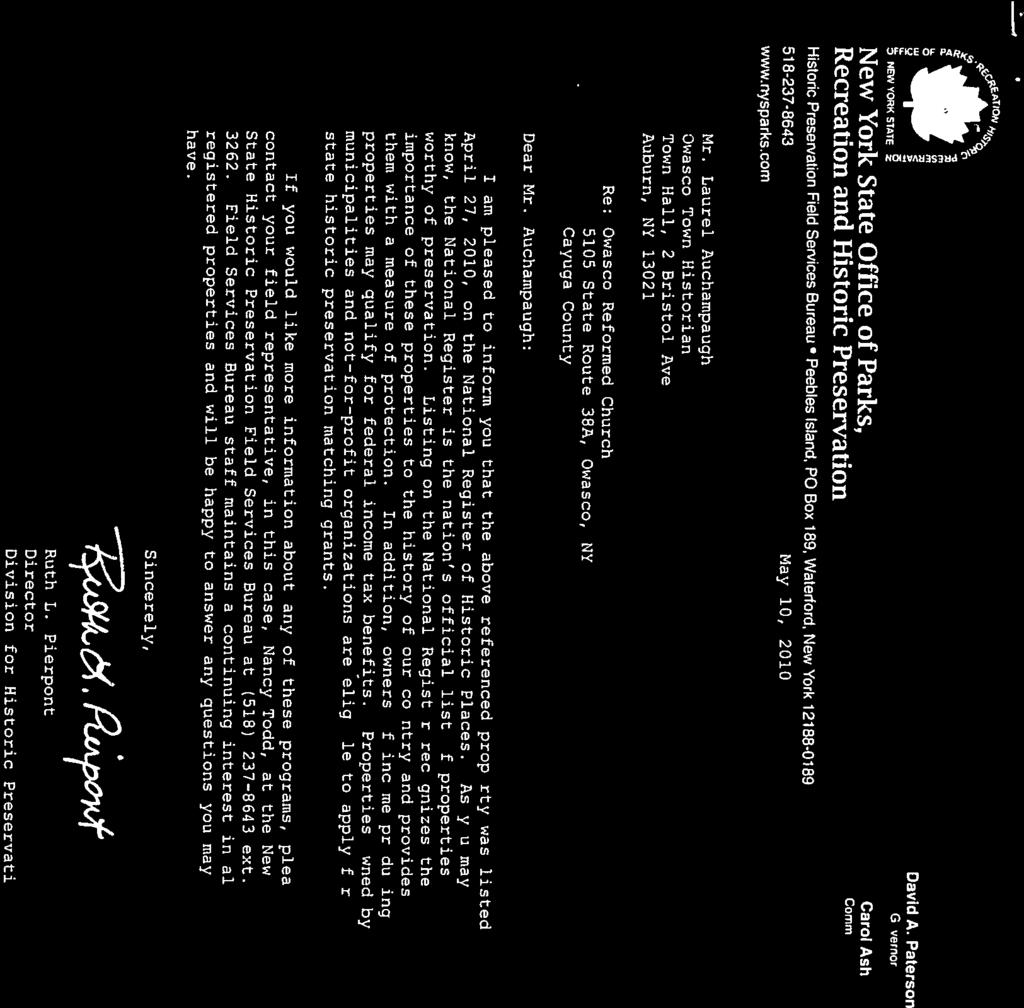
115


116
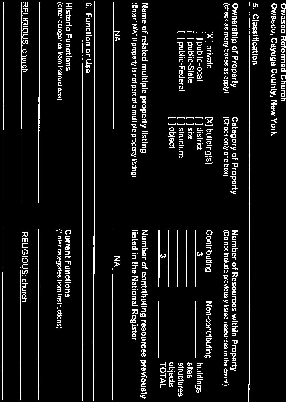
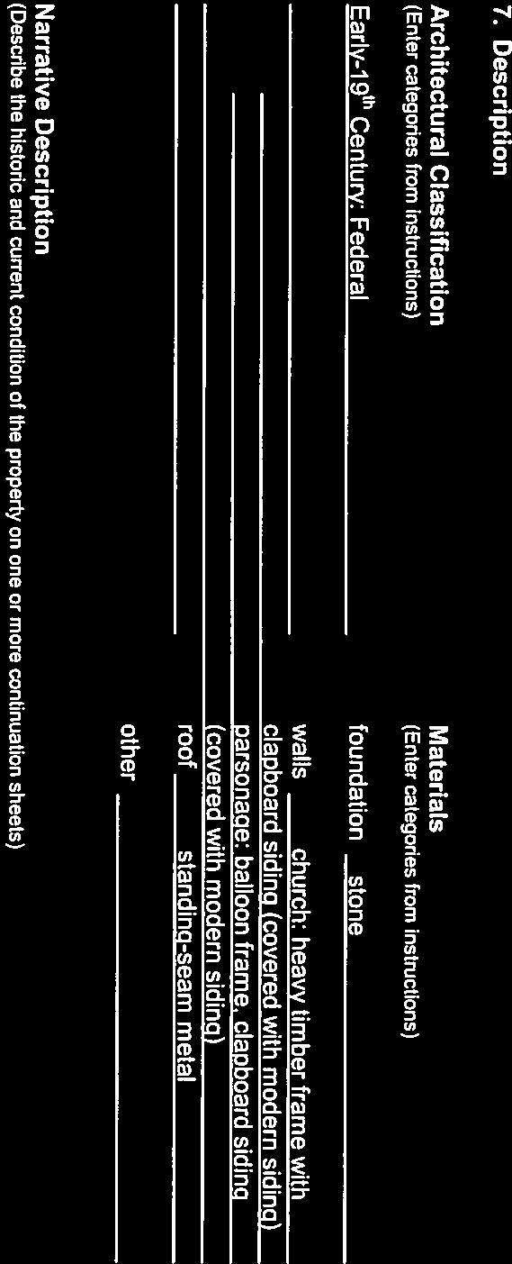
117
118
119


120


121
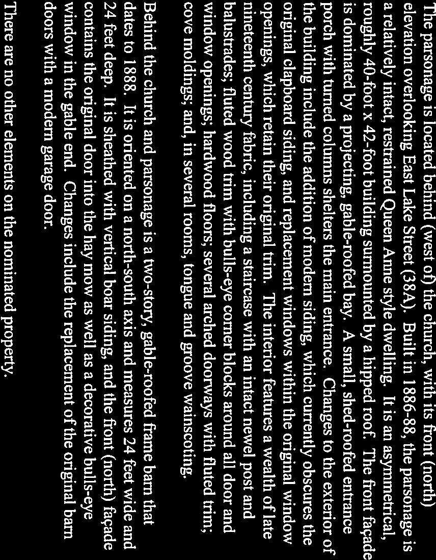
122
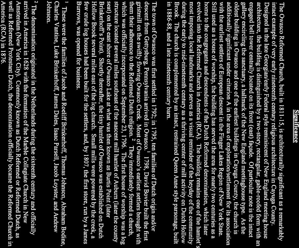
123


124

125
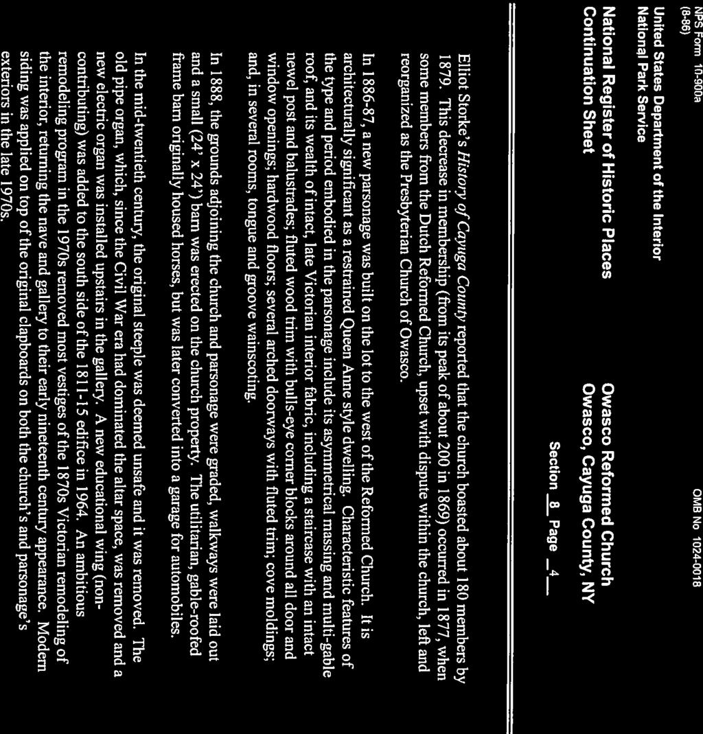
126
127
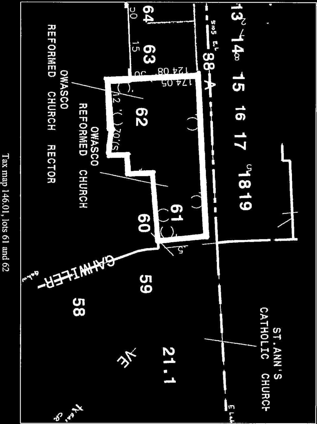


128
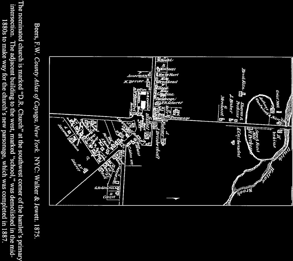
129
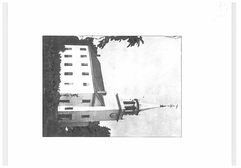


130
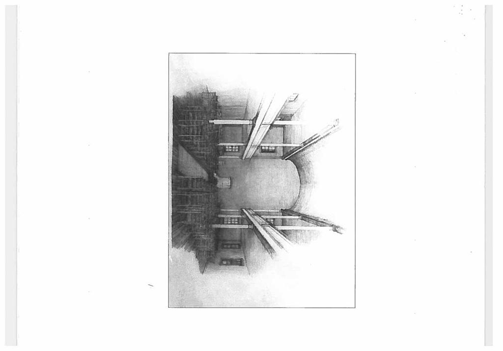

131
132


133
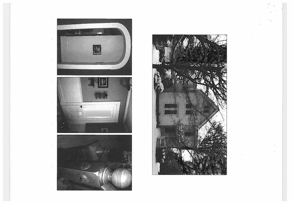


134

135
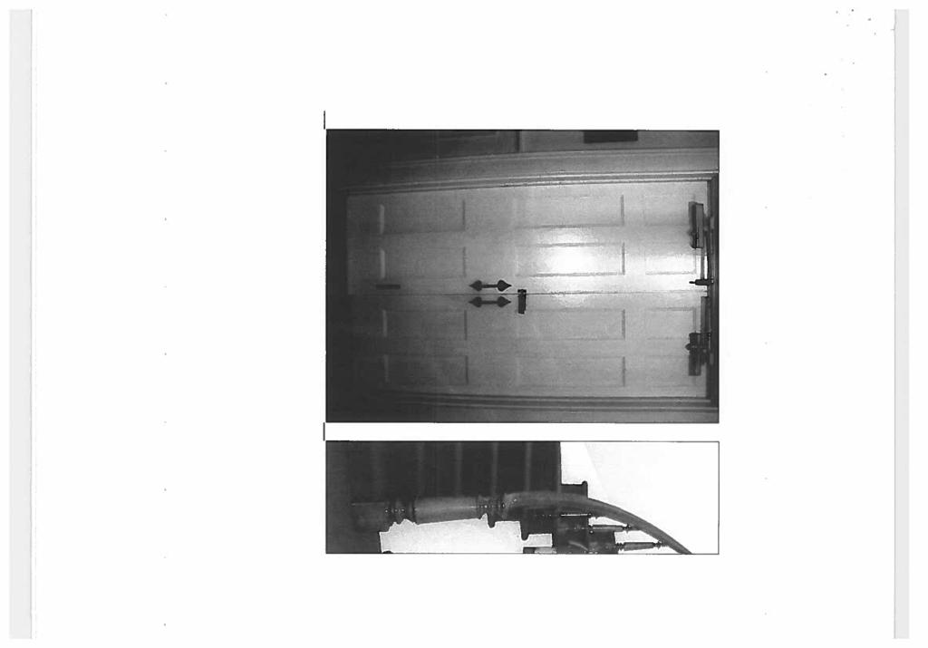
136
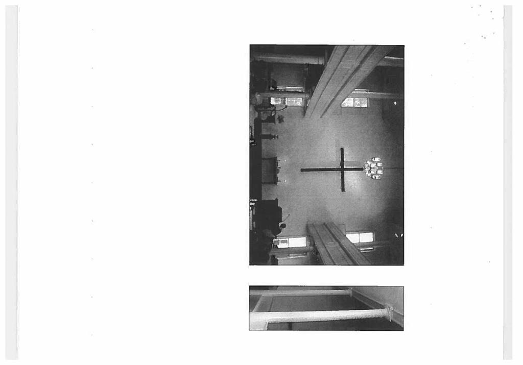

137
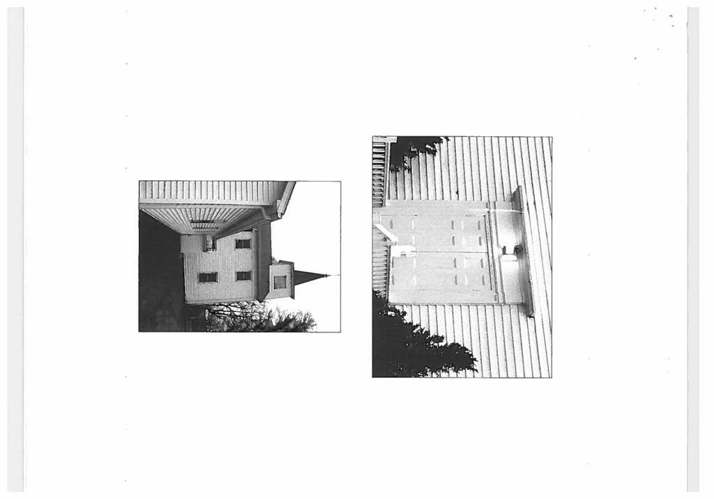

138
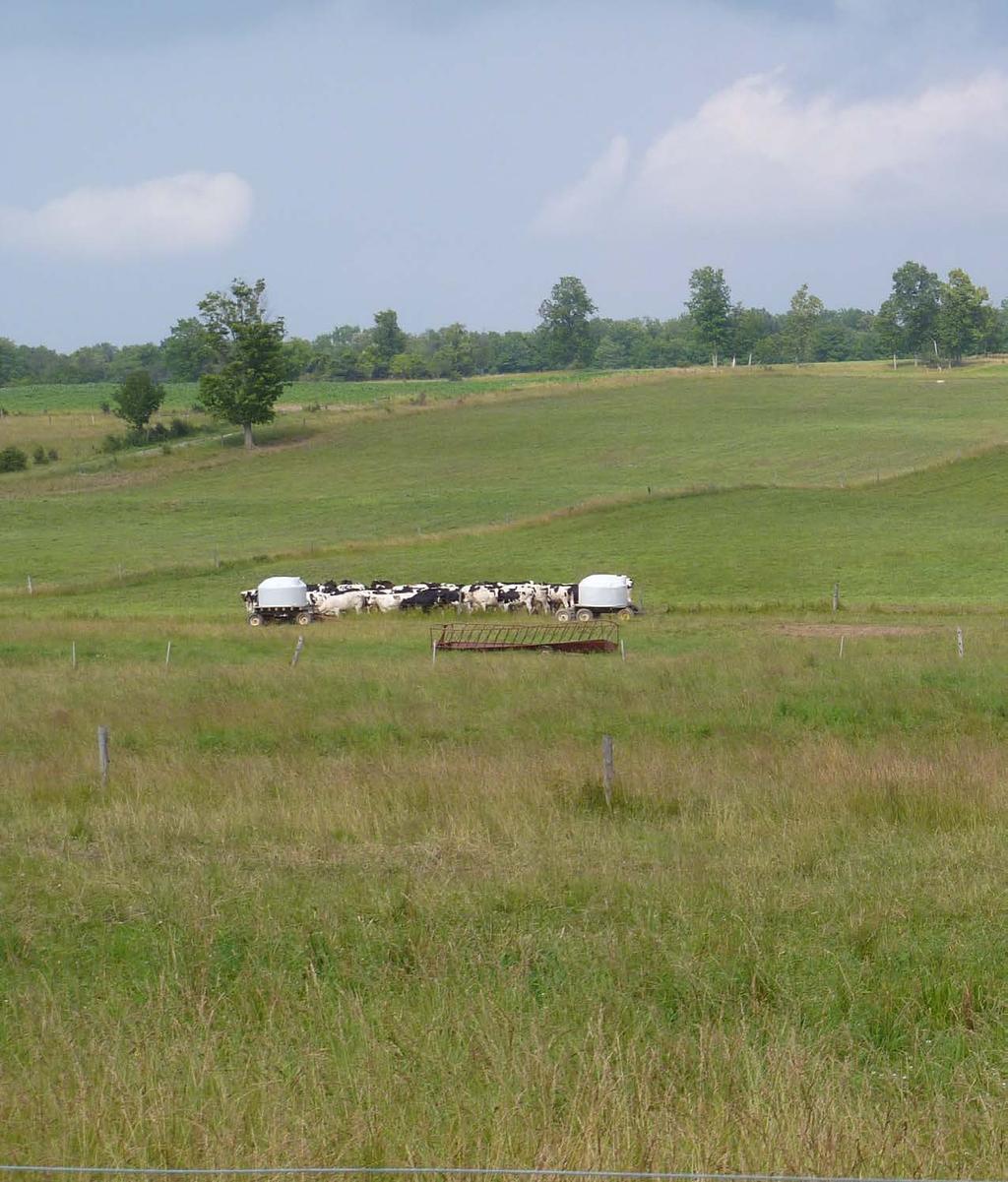
139
Town of Peru Comprehensive Plan Executive Summary
 Town of Peru Comprehensive Plan Executive Communities that plan grow by choice, not by chance. A plan makes growth thoughtful, understandable, and predictable. A plan shows that a community is managing
This page intentionally blank.
 This page intentionally blank. Parks, Recreation, and Open Space Chapter Relationship to Vision Vision Parks, Recreation and Open Space Chapter Concepts County Government. County government that is accountable
SALISBURY TOMORROW Our Vision
 SALISBURY TOMORROW Our Vision Salisbury is committed to supporting a high quality of life and sense of community for all residents. These commitments need to be reflected in our community programs, services
TABLE OF CONTENTS. Transportation Chapter 1 - Introduction and Purpose of Planning to 1-3. Utilities
 Chapter 1 - Introduction and Purpose of Planning... 1-1 to 1-3 Pennsylvania Municipalities Planning Code (Act 247)...1-1 Previous County Planning Activities...1-1 Objectives of the Plan...1-2 Elements
Town of Genoa Comprehensive Plan - April
 Town of Genoa Comprehensive Plan - April 2013 1 2 Town of Genoa Comprehensive Plan - April 2013 Table of Contents Introduction... 5 Public Participation... 6 Plan Structure... 7 Adopting and Implementing
Support the implementation of Cape Coral's Comprehensive Plan. Protect and utilize the unique natural resources in the City.
 7.0 OVERVIEW - RECOMMENDATIONS Chapter 7 The preparation of the Cape Coral Parks and Recreation Master Plan spanned a period of approximately 12 months. Plan preparation included the input of a wide range
DRAFT Amsterdam/Churchill Community Plan (4/17/08) Adopted By the Gallatin County Commission
 Adopted By the Gallatin County Commission") DRAFT Amsterdam/Churchill Community Plan (4/17/08) Adopted By the Gallatin County Commission Table of Contents Acknowledgements Chapter 1: Introduction A Brief History What s Next Authority Organization
DRAFT Amsterdam/Churchill Community Plan (4/17/08) Adopted By the Gallatin County Commission Table of Contents Acknowledgements Chapter 1: Introduction A Brief History What s Next Authority Organization
3. VISION AND GOALS. Vision Statement. Goals, Objectives and Policies
 Vision Statement Queen Creek s interconnected network of parks, trails, open spaces and recreation opportunities provide safe and diverse activities and programs that sustain its unique, small town, equestrian
2018 Northampton Township Comprehensive Plan
 2018 BUCKS COUNTY, PENNSYLVANIA What is a? A comprehensive plan is a municipality s main policy document that details the collective vision for the future, the historic, environmental, and cultural facilities
SECTION II SECTION II STATEMENT OF GOALS, OBJECTIVES, PRINCIPLES, ASSUMPTIONS, POLICIES AND STANDARDS
 STATEMENT OF GOALS, OBJECTIVES, PRINCIPLES, ASSUMPTIONS, POLICIES AND STANDARDS 1 2 STATEMENT OF GOALS, OBJECTIVES, PRINCIPLES, ASSUMPTIONS, POLICIES AND STANDARDS INTRODUCTION The New Jersey Municipal
4-Town Comprehensive Plan DRAFT 7/30/07
 4-Town Comprehensive Plan DRAFT 7/30/07 Acknowledgements ning Committee Town of Harrisburg Norman Roof Randy Nicol Town of Martinsburg Terry Thisse Paul Kelly Town of Montague Jan Bagdanowicz Wendy Perry
A BLUEPRINT FOR BROCKTON A CITY-WIDE COMPREHENSIVE PLAN
 A BLUEPRINT FOR BROCKTON A CITY-WIDE COMPREHENSIVE PLAN Public Meeting October 2016 1 Plan Summary and Discussion Public Meeting May 4 2017 City of Brockton Bill Carpenter, Mayor Department of Planning
CHAPTER 12 IMPLEMENTATION
 CHAPTER 12 IMPLEMENTATION The 2010 Town of Denton Comprehensive Plan is intended to capture a vision of the future of Denton. As such, it provides a basis for a wide variety of public and private actions
Chapter 2: Vision, Goals and Strategies
 Chapter 2: Vision, Goals and Lake Elmo Today & Tomorrow Comprehensive Plan 2040 2 VISION, GOALS & STRATEGIES - DRAFT 4-6-2018 INTRODUCTION Comprehensive Plan Purpose Perhapse the most important objective
WATERFORD Plan of Preservation, Conservation and Development Supplement Part 1 - Policy Element
 WATERFORD 2012 Plan of Preservation, Conservation and Development 2015 Supplement Part 1 - Policy Element Effective June 11, 2015 2015 Plan Update GOAL To respond to the evolving land use needs and continually
10 Implementation. Implementation. Responsibility for Implementation. Blueprint for Bloomsburg. Town of Bloomsburg Comprehensive Plan 10-1
 Implementation 10 Implementation This chapter overviews how to use the comprehensive plan as a land use and programming tool for the Town of Bloomsburg and recommends annual review of the plan by the Town
Town of Victory Comprehensive Plan - May
 Town of Victory Comprehensive Plan - May 2011 1 2 Town of Victory Comprehensive Plan - May 2011 Table of Contents Introduction... 5 Chapter 1 Goals and Recommendations... 7 Community Vision Statement...
Chapter 10 IMPLEMENTATION RECOMMENDATIONS
 Chapter 10 IMPLEMENTATION RECOMMENDATIONS The recommended land use plan presented in the previous chapter provides a design for the attainment of the urban and rural development and open space preservation
Secrest Short Cut and Monroe Expressway Small Area Plan AUGUST 29, 2018
 Secrest Short Cut and Monroe Expressway Small Area Plan AUGUST 29, 2018 Background and Process Monroe Expressway will be open by the end of 2018 Union County and Indian Trail identified a need to revisit
Municipal Plan*Assessment
 Municipal Plan*Assessment This tool was developed to assist in reviewing municipal master plans and in determining if these plans are consistent with smart growth principles, neighboring municipal plans,
CHAPTER 2: PLANNING PRINCIPLES
 CHAPTER 2: PLANNING PRINCIPLES 2 Comprehensive Principles The following overarching Principles provide the basis for the goals and policies included in the Mendocino County General Plan. These Principles
Subject: Hendry County Evaluation and Appraisal Report Letter of Understanding - Identification of Major Issues
 HENDRY COUNTY PLANNING & ZONING DEPARTMENT POST OFFICE BOX 2340 165 S. LEE STREET LABELLE, FLORIDA 33975 (863) 675-5240 FAX: (863) 675-5317 SUNCOM 744-4750 November 16, 2007 Mr. Mike McDaniel, Chief Office
Gloucester County s Comprehensive Plan. The Community Connection
 Gloucester County s Comprehensive Plan The Community Connection Current Comp Plan Adopted in 1991 with a 20 year planning horizon Updated in 1995 with Part V- Implementation Recommendations and Appendix
1 Introduction. Chapter. In this chapter:
 Chapter 1 Introduction In this chapter: 1.1 A Snapshot of the Region 1.2 Towards a Sustainable Region 1.3 The Provincial Context 1.4 Purpose and Organization The Regional Municipality of York Official
Arlington, Virginia is a worldclass
 EXECUTIVE S U M M A RY Arlington maintains a rich variety of stable neighborhoods, quality schools and enlightened land use policies, and received the Environmental Protection Agency s highest award for
Planned Development Review Revisions (Project No. PLNPCM )
") Planned Development Review Revisions (Project No. PLNPCM2014-00139) Standard residential development Planned Development Example: Smaller lot sizes than what is allowed to create open space amenity. What
Planned Development Review Revisions (Project No. PLNPCM2014-00139) Standard residential development Planned Development Example: Smaller lot sizes than what is allowed to create open space amenity. What
Sustainable Keuka Lake
 Sustainable Keuka Lake Steve Butchko, Town of Wayne Supervisor Chelsea Robertson, Senior Planner STC Kemberli Sargent, Planner STC www.sustainablekeuka.net This presentation was prepared for the New York
Sorted citizen input comments in review of Blount County plans July, August, and September 2007
 Sorted citizen input comments in review of Blount County plans July, August, and September 2007 The following presents sorted citizen input comments from three sessions held in July, August and September
Chapter 13: Implementation Plan
 Implementation A. Introduction The Implementation Plan, in table form on the following pages, provides a summary of all the Action Items recommended in Chapters 2 through 12. The table also indicates which
Improve Neighborhood Design and Reduce Non Point Source Water Pollution
 HOW TO Planning Guide Improve Neighborhood Design and Reduce Non Point Source Water Pollution This document was funded by a grant from the New Hampshire Coastal Program with funding from the National Oceanic
CHAPTER 4 FUTURE LAND USE AND URBAN SERVICES DISTRICTS
 CHAPTER 4 FUTURE LAND USE AND URBAN SERVICES DISTRICTS Introduction This chapter discusses how Benzie County should grow and change in the future. A community can grow and change in many different ways.
Village of Fair Haven Goals & Objectives
 Village of Fair Haven Goals & Objectives 1 Natural Environmental Quality & Aesthetics Embrace policies and programs that preserve and enhance the Village s natural resources, environment, water quality,
Urban Planning and Land Use
 Urban Planning and Land Use 701 North 7 th Street, Room 423 Phone: (913) 573-5750 Kansas City, Kansas 66101 Fax: (913) 573-5796 Email: planninginfo@wycokck.org www.wycokck.org/planning To: From: City Planning
VILLAGE & TOWN OF BERGEN: COMPREHENSIVE PLAN
 VILLAGE & TOWN OF BERGEN: COMPREHENSIVE PLAN CPC Public Hearing April 21, 2016 History 1996 Comprehensive Plan Comprehensive Plan Update Committee Consultant (LaBella Associates): December 2014 Residents
Whitemarsh Comprehensive Plan Update: Housing & Land Use. Public Workshop #3: September 20, 2018
 Whitemarsh Comprehensive Plan Update: Housing & Land Use Public Workshop #3: September 20, 2018 Agenda Welcome Process Recap What We ve Heard The Plan Framework Review of Recommended Actions Land Use Housing
Implementation Guide Comprehensive Plan City of Allen
 Implementation Guide 2030 Comprehensive Plan City of Allen DRAFT 2015 Implementation Guide Allen 2030 Comprehensive Plan INTRODUCTION The Comprehensive Plan serves as a guide for the growth and development
REQUEST FOR QUALIFICATIONS
 REQUEST FOR QUALIFICATIONS VILLAGE OF HAMBURG COMPREHENSIVE ZONING/LAND USE REGULATIONS UPDATE Prepared By: Village of Hamburg 100 Main Street Hamburg, New York 14075 Village of Hamburg RFQ Page 1 of 10
V. Vision and Guiding Principles
 V. Vision and Guiding Principles The Master Plan for the Powers Ferry Corridor seeks a foundation in the desires of the community. At times, various elements of the community offered opposing viewpoints,
LU Encourage schools, institutions, and other community facilities that serve rural residents to locate in neighboring cities and towns.
 Application No. 891627: Comprehensive Plan Text Amendment - Rural School Policies - Amend policies consistent with State Legislation allowing schools in the rural area and extension of sewer service to
PARTF Scoring System for Grants
 PARTF Scoring System for Grants The members of the N.C. Parks and Recreation Authority use the PARTF scoring system as one of several tools to select grant recipients. Please provide all of the information
IMPLEMENTING SOMERSET COUNTY S INVESTMENT FRAMEWORK
 IMPLEMENTING SOMERSET COUNTY S INVESTMENT FRAMEWORK SMART CONSERVATION THROUGH SMART GROWTH NJ LAND CONSERVATION RALLY March 22, 2014 Laurette Kratina, PP, AICP, Supervising Planner Somerset County Planning
Chapter 3. Community Vision and Goals
 Chapter 3. Community Vision and Goals 3.1 Public Involvement Charlevoix s master plan was prepared in a way that maximized public participation. Dating back to 2004, the Planning Commission and staff held
{Best Practices. Summary of Tools, Strategies and Best Practices from 11 Michigan Case Study Communities
 Case Studies Michigan Coastal Community Working Waterfronts { Summary of Tools, Strategies and from 11 Michigan Case Study Communities Table of Contents Zoning...2 Community and Stakeholder Collaboration
Implementation Vision
 Introduction The implementation chapter is the how to portion of the plan. It describes the actions necessary to realize the visions presented in this document through the goals, objectives, and policies
Town of Scipio Comprehensive Plan - January
 Town of Scipio Comprehensive Plan - January 2011 1 2 Town of Scipio Comprehensive Plan - January 2011 Table of Contents Introduction... 5 Public Participation... 6 Plan Structure... 6 Adopting and Implementing
TOWN OF BETHLEHEM OPEN SPACE CONSERVATION PLAN PUBLIC MEETING: OCTOBER 12, 2017
 TOWN OF BETHLEHEM OPEN SPACE CONSERVATION PLAN PUBLIC MEETING: OCTOBER 12, 2017 Welcome and Agenda 6:00 6:45: Open House, Part One 6:45 7:15: Presentation and Questions 7:15 8:00: Open House, Part Two
Executive Summary Purpose of the Plan Defining Open Space and Greenways
 Executive Summary Bucks County possesses a vast array of open space resources including natural areas, parks, farmland and historic and cultural resources that contribute to a high quality of life valued
Illustration of Eastlake Farmer s Cooperative Grain Elevator. Chapter 5: implementation 5-1
 Illustration of Eastlake Farmer s Cooperative Grain Elevator Chapter 5: implementation 5-1 chapter 5: implementation Introduction The Eastlake Subarea Plan includes a wide range of recommendations intended
Concord Community Reuse Project Goals and Guiding Principles. Overarching Goals (OG)
") Concord Community Reuse Project Goals and Guiding Principles Overarching Goals (OG) No priority is implied by the order of presentation of the goals and guiding principles. Overarching goals for the Concord
Concord Community Reuse Project Goals and Guiding Principles Overarching Goals (OG) No priority is implied by the order of presentation of the goals and guiding principles. Overarching goals for the Concord
CONSERVATION ELEMENT GOALS, OBJECTIVES, AND POLICIES
 CONSERVATION ELEMENT GOALS, OBJECTIVES, AND POLICIES Goal 4 To conserve, manage, appropriately use and protect the natural resources of the City ensuring continued resource availability and environmental
LAND USE ELEMENT. Purpose. General Goals & Policies
 LAND USE ELEMENT Purpose This Land Use Element contains the goals and policies necessary to support the City s responsibility for managing land resources and guiding development through implementing regulations,
TOWN OF SPRINGFIELD, NEW HAMPSHIRE
 TOWN OF SPRINGFIELD, NEW HAMPSHIRE NATURAL RESOURCES INVENTORY EXECUTIVE SUMMARY March 2008 Prepared by: Watershed to Wildlife, Inc. Natural Resource Consultants 42 Mill Street, Suite 3 Littleton, NH 03561
PSRC REVIEW REPORT & CERTIFICATION RECOMMENDATION
 PSRC REVIEW REPORT & CERTIFICATION RECOMMENDATION KITSAP COUNTY COUNTYWIDE PLANNING POLICIES July 2, 2012 BACKGROUND A major emphasis of the Washington State Growth Management Act (GMA) is the need to
Dwelling Units Max 12 dwelling units per acre/min 8 dwelling units per acre. Development Mix 80% non residential/20% residential
 13. OSTEEN LOCAL PLAN Background: The Osteen Local Plan area is located in southwest Volusia County along the SR 415 corridor between Lemon Bluff Road and Acorn Lake Road and includes 3,990 acres. The
The Five Components of the McLoughlin Area Plan
 The Five Components of the McLoughlin Area Plan This documents contains the complete language of the five components of the McLoughlin Area Plan: The Vision Statement The Values The Guiding Principles
DRAFT MAP AMENDMENT FLU 04-4
 DRAFT MAP AMENDMENT FLU 04-4 SW 24 TH AVENUE ROADWAY CORRIDOR The University of Florida participates with the Metropolitan Transportation Planning Organization (MTPO) in its responsibilities for the continuing,
RECREATION AND OPEN SPACE ELEMENT GOALS, OBJECTIVES, AND POLICIES
 RECREATION AND OPEN SPACE ELEMENT GOALS, OBJECTIVES, AND POLICIES Goal 7 To provide park facilities, recreation programs, and open space resources that are safe, adequate, and accessible to all City residents,
CHAPTER 1: INTRODUCTION
 CHAPTER 1: INTRODUCTION MAP OF OUTAGAMIE COUNTY, WI N 1 = 6 miles INTRODUCTION The Town and Village of Black Creek are located in central Outagamie County, Wisconsin. The Village is located in the north
Lake O the Pines Master Plan Revision Public Information Meeting April 25 & 27, 2017
 Lake O the Pines Master Plan Revision Public Information Meeting April 25 & 27, 2017 Presented By Matthew Like, Lake Manager U.S. Army Corps of Engineers Fort Worth District US Army Corps of Engineers
Section 4 BUILDING THE MASTER PLAN
 The Master Plan 33 Section 4 BUILDING THE MASTER PLAN Figure 4:1. A collaborative effort characterized the two design workshops sponsored by DISC to create hypothetical Master Plans for the Towers Property
10.0 Open Space and Public Realm
 10.0 Open Space and Public Realm 10.0 Open Space and Public Realm The Public Open Space System is comprised of: outdoor spaces available for public use that are either publicly owned (e.g., parks and
TABLE OF CONTENTS HISTORIC PRESERVATION ELEMENT I. INTRODUCTION HP. A. Purpose HP B. Assessment and Conclusions...
 TABLE OF CONTENTS HISTORIC PRESERVATION ELEMENT I. INTRODUCTION... 1 - HP A. Purpose... 1 - HP B. Assessment and Conclusions... 1 - HP II. GOAL, OBJECTIVES AND POLICIES... 3 - HP GOAL 1: PROTECTION AND
SECTION 4(f) DE MINIMIS DOCUMENTATION
 DE MINIMIS DOCUMENTATION") SECTION 4(f) DE MINIMIS DOCUMENTATION Illinois Route 60/83 IL 176 to the intersection of IL 60 (Townline Road) Lake County P-91-084-07 Mundelein Park and Recreation District Project Limit SECTION 4(f)
SECTION 4(f) DE MINIMIS DOCUMENTATION Illinois Route 60/83 IL 176 to the intersection of IL 60 (Townline Road) Lake County P-91-084-07 Mundelein Park and Recreation District Project Limit SECTION 4(f)
Purpose of the Master Plan
 Purpose of the Master Plan 4 Master Plan Purpose The Master Plan is a policy framework for decisions that affect the physical, social and economic environment of the Town. The Parker 2035: Master Plan
Preliminary Plan Framework: Vision and Goals
 Preliminary Plan Framework: Vision and Goals Draft: May 2015 Introduction Since the Town of Milliken s comprehensive plan was last updated in 2010, the community was heavily impacted by the 2013 flood,
I. STAFF POLICY RECOMMENDATIONS. The following RMP policy strategies are proposed by staff in support of a Scenic Resource Protection Program:
 Policy Consideration: Scenic Resource Protection Program Status: For Consideration by the Highlands Council at September 14, 2006 Work session Date: September 12, 2006 I. STAFF POLICY RECOMMENDATIONS The
COMMISSION ACTION FORM
 ITEM #: 6 DATE: 09-06-17 COMMISSION ACTION FORM REQUEST: Introduction and Initial Review of Proposed Amendments to the Ames Urban Fringe Future Land Map for the North Growth Gap Area BACKGROUND INFORMATION:
Chapter 1 Vision Statement & Goals
 Chapter 1 Section 1.1 Section 1.2 Section 1.3 Section 1.4 Section 1.5 Introduction Vision Statement Visioning Exercise Prioritization of Land Use Issues Goals of the Comprehensive Plan CHAPTER 1 SECTION
4.1.3 LAND USE CATEGORIES
 4.1.3 LAND USE CATEGORIES a. City Center District The City Center District incorporates the existing character and mix of uses in downtown Belmont to encourage redevelopment and new development in keeping
13 Maintenance and Operations Plan 223
 222 13 Operations Maintenance and Plan 223 Chapter 13 MAINTENANCE AND OPERATIONS PLAN 13.1 Stewardship The Minneapolis Park and Recreation Board (MPRB) is the steward of a nationally-acclaimed park system.
EXECUTIVE SUMMARY DRAFT CHAPTER 1 INTRODUCTION EXECUTIVE SUMMARY
 CHAPTER 1 EXECUTIVE SUMMARY INTRODUCTION Through the joint efforts of the City of Tulsa planning staff and the Land Services division of Indian Nations Council of Governments (INCOG), the Berryhill Land
MAYFIELD WEST SECONDARY PLAN PHASE 2
 MAYFIELD WEST SECONDARY PLAN PHASE 2 Public Open House #3 February 25, 2010 Draft Preferred Land Use Scenario TOWN OF CALEDON PLANNING & DEVELOPMENT DEPARTMENT Open House Agenda TOWN OF CALEDON 1. Welcome
COMMUNITY DESIGN. GOAL: Create livable and attractive communities. Intent
 COMMUNITY DESIGN Intent An attractive, well-designed County will attract quality development, instill civic pride, improve the visual character of the community, and create a strong, positive image for
HOUSING ELEMENT GOALS, OBJECTIVES, AND POLICIES
 HOUSING ELEMENT GOALS, OBJECTIVES, AND POLICIES Goal 6 Maintain and enhance the supply of decent, safe, energy efficient and affordable housing and maximize viable options and opportunities for present
Official Plan Review
 Official Plan Review Summary Report - The Built Environment August 2014 Part 1: Introduction Planning for a healthy, prosperous and sustainable community is an important goal for our municipality. From
Executive Summary. Parks and Recreation Plan. Executive Summary
 Parks and Recreation Plan Executive Summary The Whitemarsh Township Parks and Recreation Plan sets forth a vision for how Whitemarsh Township can provide a premiere parks and recreation system reflective
Preface. Erie. Scranton. Allentown. Pittsburgh. Harrisburg. Philadelphia
 The Southern Alleghenies Region The Southern Alleghenies Region spans the Laurel Highlands and Allegheny Front in the west across the Appalachians to the east. It is comprised of Blair, Bedford, Cambria,
Member Service Plan Sierra Nevada AmeriCorps Partnership
 Member Service Plan Sierra Nevada AmeriCorps Partnership Service plans lay the framework for what each Member will be doing during their service. Service plans detail the major projects and expected results
Canyon Lake Master Plan Revision Public Information Meeting March 18, 2016
 Canyon Lake Master Plan Revision Public Information Meeting March 18, 2016 Marcus Schimank Canyon Lake Manager Capital Regional Office U.S. Army Corps of Engineers Fort Worth District US Army Corps of
TOWN OF BETHLEHEM MEETING SUMMARY LOCAL WATERFRONT REVITALIZATION PROGRAM UPDATE
 TOWN OF BETHLEHEM LOCAL WATERFRONT REVITALIZATION PROGRAM UPDATE MEETING SUMMARY Purpose: LWRP Update Public Workshop #3 Date and Time: October 24, 2017, 6:00 pm - 8:00 pm Location: Town Hall, 445 Delaware
CITY OF LANGLEY OFFICIAL COMMUNITY PLAN BYLAW, 2005, NO APPENDIX II - REGIONAL CONTEXT MAP
 CITY OF LANGLEY OFFICIAL COMMUNITY PLAN BYLAW, 2005, NO. 2600 APPENDIX II - REGIONAL CONTEXT MAP ± Legend Agricultural Mixed Employment Industrial Conservation & Recreation Regional City Centre Urban Containment
Silverwood Masterplan Kickoff Meeting. Jim Neidhart Dane County Parks Planning
 Silverwood Masterplan Kickoff Meeting Jim Neidhart Dane County Parks Planning 608-224-3614 January 30, 2014 Silverwood County Park Public Information Meeting Notice Sent notice to all landowners adjacent
Growth Management: Common Value 2 of Community Character
 Growth Management: Common Value 2 of Community Character 24 Why is Growth Management a Common Value? Effective Growth Management is essential to protecting our surrounding ecosystem and reinforcing our
ELK GROVE GENERAL PLAN VISION
 2-1 CHAPTER 2: 2-2 CREATING OUR The Community Vision for Elk Grove, expressed through a Vision Statement and a series of Supporting Principles, is a declaration of the kind of community that Elk Grove
Economy Vision Statements: Social Wellbeing Vision Statements: Natural Environment Vision Statements:
 Economy Vision Statements: 1. Our business environment makes us a region of choice for new employers as we encourage entrepreneurship and have a vibrant, diversified and resilient regional economy. 2.
DISCUSSION TOPIC: ST JOHNS RIVER & ITS TRIBUTARIES (BPII) 2030 COMPREHENSIVE PLAN POLICES AND REGULATORY FRAMEWORK
 2030 COMPREHENSIVE PLAN POLICES AND REGULATORY FRAMEWORK") DISCUSSION TOPIC: ST JOHNS RIVER & ITS TRIBUTARIES (BPII) 2030 COMPREHENSIVE PLAN POLICES AND REGULATORY FRAMEWORK St. John s River & Its Tributaries Issue Summary: The St. Johns River is an important
DISCUSSION TOPIC: ST JOHNS RIVER & ITS TRIBUTARIES (BPII) 2030 COMPREHENSIVE PLAN POLICES AND REGULATORY FRAMEWORK St. John s River & Its Tributaries Issue Summary: The St. Johns River is an important
TOWN OF BRUDERHEIM Report to the capital region board
 TOWN OF BRUDERHEIM Report to the capital region board Introduction to the Town of Bruderheim Municipal Development Plan amendment and Relation to the CRB Evaluation Criteria 02 march 2017 1 Introduction
Plano Tomorrow Vision and Policies
 Plano Tomorrow Vision and Policies PLANO TOMORROW PILLARS The Built Environment The Social Environment The Natural Environment The Economic Environment Land Use and Urban Design Transportation Housing
CHAPTER VI Plan Implementation
 Versailles-Midway CHAPTER VI Plan Implementation While prior sections focused on the tools the Commission needs to help it make the dayto-day decisions associated with subdivision, site plan and rezoning
Please read the entire document
 projects impacting the waterfront revitalization area. The waterfront revitalization area of the town will have to subareas to the west and east of the village. Page 6 of 6 Wayfinding master plan create
Community Conservation Workshop. Lake Placid
 Community Conservation Workshop Lake Placid 2 Community Conservation Program Welcome! We have designed a Community Conservation Program that listens to the needs of community members. We are conducting
Whitemarsh Township Greenway Plan
 Whitemarsh Township Greenway Plan Prepared for: Whitemarsh Township August 16, 2007 Table of Contents Table of Contents... i Introduction... 1 Study Area Setting... 2 Regional Setting... 2 Township Character...
2040 LUP is a part of the Comprehensive Plan and carries the same legal authority. Economic Challenges
 1.1. Guiding Anchorage s Growth Where will new residents settle over the next two decades? Where will people work, shop, and play? Will there be enough room to grow? How will Anchorage look? Will growth
SUSTAINABILITY PLAN OTTAWA COUNTY PARKS AND RECREATION COMMISSION FALL 2017
 SUSTAINABILITY PLAN OTTAWA COUNTY PARKS AND RECREATION COMMISSION FALL 2017 Table of Contents Introduction Natural Resources Quality of Life Community Continuing the Mission Sustainability Measuring Sustainability
REGIONAL ACTIVITY CENTER
 DRAFT REGIONAL ACTIVITY CENTER 70 EAST BENCH MASTER PLAN DRAFT 06 Introduction The East Bench Regional Activity center is comprised of large educational, research, medical, and employment centers. These
Central Lake Ontario Conservation Conservation Lands Master Plan
 Conservation Lands Master Plan Top 13 Frequently Asked Questions 1. What are conservation lands? Where are these conservation lands located in the Central Lake Ontario Conservation watershed? Conservation
1.0 INTRODUCTION 1.1 TH 14 WEST STUDY AREA Project Description Functional Classification Purpose of the Project
 1.0 INTRODUCTION 1.1 TH 14 WEST STUDY AREA 1.1.1 Project Description The Trunk Highway (TH) 14 West Corridor is a two-lane roadway approximately 22 miles in length. Located in Nicollet County, the corridor
2030 Comprehensive Plan VISION STATEMENT
 RESOURCE DOCUMENT for Steering Committee Meeting #2 July 12, 2017 2030 Comprehensive Plan VISION STATEMENT Steering Committee from 2008 Established the Lauderdale s Vision as: Creating a livable, lovable
Special Joint Meeting. Emerald Isle Planning Board. Emerald Isle Board of Commissioners. January 18, 2017
 Special Joint Meeting Emerald Isle Planning Board Emerald Isle Board of Commissioners January 18, 2017 STEERING COMMITTEE: Jim Normile Town Commissioner Ken Sullivan Planning Board Larry Watson Retail
Purpose of the Master Plan
 Purpose of the Master Plan 4 Master Plan Purpose The Master Plan is a policy framework for decisions that affect the physical, social and economic environment of the Town. The Parker 2035: Master Plan