Sustainable Keuka Lake
|
|
|
- Hugh Hutchinson
- 6 years ago
- Views:
Transcription

1 Sustainable Keuka Lake Steve Butchko, Town of Wayne Supervisor Chelsea Robertson, Senior Planner STC Kemberli Sargent, Planner STC This presentation was prepared for the New York State Department of State with funds provided under Title 11 of the Environmental Protection Fund.
2

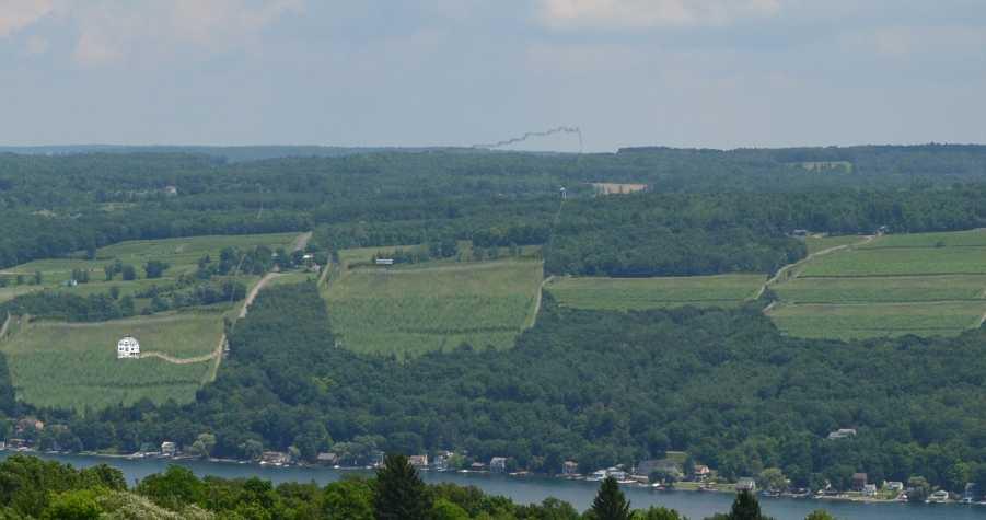
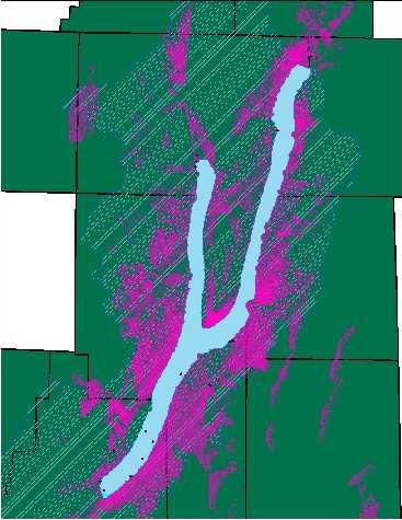
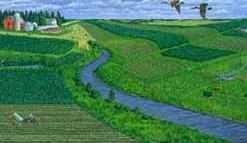
3 BEAUTIFUL KEUKA LAKE Why is Keuka Lake special? AA rated water Pristine, untouched landscape Rural resort tourism Why should we preserve those qualities? Positive economic impact Impacts of incremental growth Maintain water quality This presentation was prepared for the New York State Department of State with funds provided under Title 11 of the Environmental Protection Fund.
 Yates CCE STC Cornell University Keuka Lake Association Undergraduate and Graduate interns from Cornell, Alfred State and Hobart William")
4 BACKGROUND What is LULA? 2013 Local Waterfront Revitalization (LWRP) Grant awarded LULA serves as an advisory committee for Sustainable Keuka Lake project. LWRP project partners include: Town of Wayne (Lead contractor) Yates CCE STC Cornell University Keuka Lake Association Undergraduate and Graduate interns from Cornell, Alfred State and Hobart William Smith This presentation was prepared for the New York State Department of State with funds provided under Title 11 of the Environmental Protection Fund.

5 WHAT WAS THE GOAL OF THE LWRP? Discover and investigate watershed issues Learn the desires of the residents problems, solutions, ideas Update old documents Create new documents Identify gaps in data and laws Educate Leaders Educate Residents This presentation was prepared for the New York State Department of State with funds provided under Title 11 of the Environmental Protection Fund

6 WHAT DID WE DO? Community Surveys Watershed-wide trainings Yearly in the Spring Summer Interns Semester Long Student Workshops This presentation was prepared for the New York State Department of State with funds provided under Title 11 of the Environmental Protection Fund.
7 WHAT WAS PRODUCED? A watershed wide vision To protect the pristine water of Keuka Lake, the scenic views in the Keuka Lake Watershed, and the excellent quality of life of our residents by preserving the agricultural-rural-tourism character that make us special while allowing for smart new development that enhances our natural resources, built surroundings, and economic livelihoods. Reports: Agriculture, Waterfront Revitalization, Viewshed Identification and Prioritization, Watershed-Wide analysis Education Materials: Fact sheets, Prezi Municipal Tools: Mapper and Handbook This presentation was prepared for the New York State Department of State with funds provided under Title 11 of the Environmental Protection Fund.
8 MAJOR ISSUES Issues that were discovered and evaluated during the LWRP project were as follows: Water Quality Sustainable Built Environment How to build sustainably Natural Resources and Environment How to preserve what we already have Local Character Scenic Views How to protect and which ones to protect Small Towns and Villages Maintaining the local character Historic Resources Preserving history Economic Sustainability Agriculture Protecting Tourism - Maintaining This presentation was prepared for the New York State Department of State with funds provided under Title 11 of the Environmental Protection Fund.
9 MAJOR ISSUES Issues that were discovered and evaluated during the LWRP project were as follows: Water Quality Sustainable Built Environment How to build sustainably Natural Resources and Environment How to preserve what we already have Local Character Scenic Views How to protect and which ones to protect Small Towns and Villages Maintaining the local character Historic Resources Preserving history Economic Sustainability Agriculture Protecting Tourism - Maintaining This presentation was prepared for the New York State Department of State with funds provided under Title 11 of the Environmental Protection Fund.
10 Natural Resources & Environment Sustainable Built Environment Water Quality Sustainable Keuka Lake Watershed Economic Sustainability Agriculture Tourism Scenic Views Local Character Historic Resources Small Towns and Villages
11 Natural Resources & Environment Sustainable Built Environment Water Quality Sustainable Keuka Lake Watershed Economic Sustainability Agriculture Tourism Scenic Views Local Character Historic Resources Small Towns and Villages
12 Natural Resources & Environment Sustainable Built Environment Water Quality Sustainable Keuka Lake Watershed Economic Sustainability Agriculture Tourism Scenic Views Local Character Historic Resources Small Towns and Villages
13 Natural Resources & Environment Sustainable Built Environment Water Quality Sustainable Keuka Lake Watershed Economic Sustainability Agriculture Tourism Scenic Views Local Character Historic Resources Small Towns and Villages
14 Natural Resources & Environment Sustainable Built Environment Water Quality Sustainable Keuka Lake Watershed Economic Sustainability Agriculture Tourism Scenic Views Local Character Historic Resources Small Towns and Villages
15 Natural Resources & Environment Sustainable Built Environment Water Quality Sustainable Keuka Lake Watershed Economic Sustainability Agriculture Tourism Scenic Views Local Character Historic Resources Small Towns and Villages
16 Natural Resources & Environment Sustainable Built Environment Water Quality Sustainable Keuka Lake Watershed Economic Sustainability Agriculture Tourism Scenic Views Local Character Historic Resources Small Towns and Villages

17 MUNICIPAL HANDBOOK The Municipal Handbook is a guide for municipal leaders on the issues in the watershed and the tools available to them to address those issues. This presentation was prepared for the New York State Department of State with funds provided under Title 11 of the Environmental Protection Fund.

18 UNDERSTANDING THE HANDBOOK - ISSUES Issues that were discovered and evaluated during the LWRP project were as follows: Water Quality Sustainable Built Environment How to build sustainably Natural Resources and Environment How to preserve what we already have Local Character Scenic Views How to protect and which ones to protect Small Towns and Villages Maintaining the local character Historic Resources Preserving history Economic Sustainability Agriculture protecting Tourism - Maintaining This presentation was prepared for the New York State Department of State with funds provided under Title 11 of the Environmental Protection Fund.

19 UNDERSTANDING THE HANDBOOK BEST PRACTICES Best Practices are tools and strategies that are voluntary. These may be practices for individual residents or municipalities/leaders. Regardless, best practices are things that we should be striving to do to protect our watershed. Includes: Environmental Protection as Economic Development Natural Resource Protection Open Space Preservation Viewshed Protection Preserving Agriculture Smart Growth Green Infrastructure Historic Preservation This presentation was prepared for the New York State Department of State with funds provided under Title 11 of the Environmental Protection Fund.
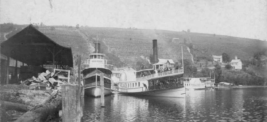
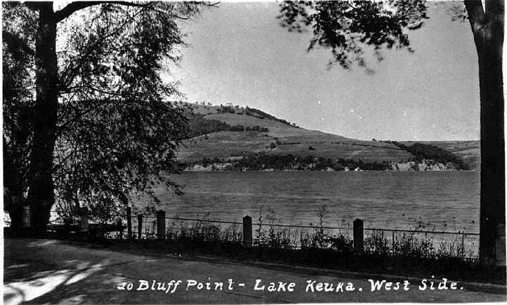
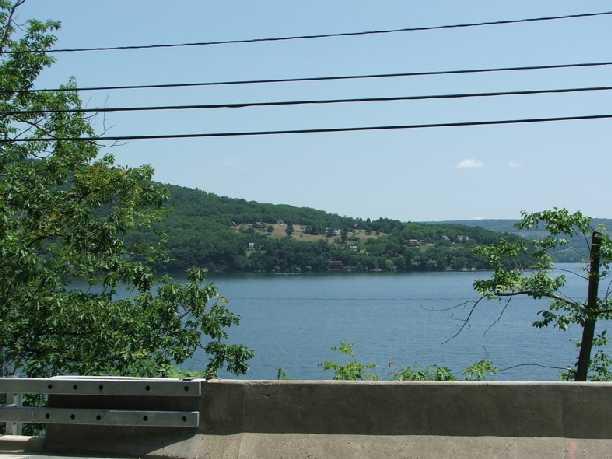
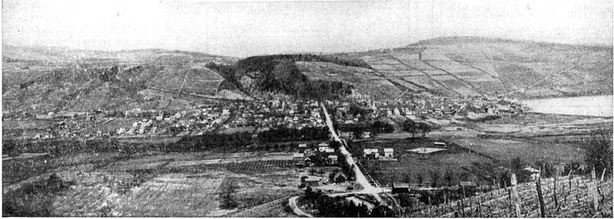
20 Viewshed Preservation This presentation was prepared for the New York State Department of State with funds provided under Title 11 of the Environmental Protection Fund.

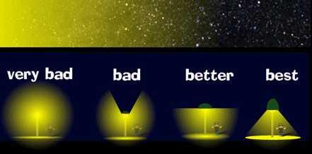
21 UNDERSTANDING THE HANDBOOK TOOL HIGHLIGHT : DESIGN GUIDELINES Design Guidelines are tools to shape the visual impact of new development within your community. They can be adopted as regulation and enforced as law or simply used as a guideline that you share with new developments as your desires. Includes: Limiting size and scale Inconspicuous siting Landscaping Lighting Restrictions Color Restrictions This presentation was prepared for the New York State Department of State with funds provided under Title 11 of the Environmental Protection Fund.
22
23
24 Issues with Landscape Preservation Ownership Opinions and Preferences Permanence Balance of Values Forms of Change Many Landscapes
25
26
27
28
29
30
31
32
33
34 Why is preserving viewsheds important? What are the potential impacts of incremental development? Which impacts are most important to you?
35
36
37
38
39
40
41
42
43
44
45 Public Input Design Guidelines & Priority Viewsheds
46 Design Guidelines

47 2014 Community Feedback Survey Over 600 Responses 8 Municipalities Represented


48 Changes to the Scenic Character Preferences for Design Guidelines
49 2015 Annual LULA Training
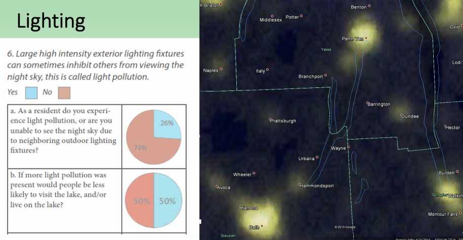
50 Design Guidelines Activity I am from the town/village of: The potential negative impacts The potential negative impacts The potential negative impacts from this development design from this development design from this development design factor are great enough that: factor are great enough that: factor are: Development Design Factors Size and Scale Color Siting Landscaping Lighting I would support its regulation I would support its regulation in ALL AREAS OF THE ONLY in HIGH PRIORITY WATERSHED. viewshed areas. NOT great enough for me to support their regulation.
51 Size and scale

52 Size and scale
53
54
55 Color
56
57
58 Siting
59
60
61
62 Landscaping
63
64
65 Lighting
66
67
68 Which guidelines do residents support?
69 Results The potential negative impacts from this development design factor are great enough that: The potential negative impacts from this development design factor are great enough that: The potential negative impacts from this development design factor are: I would support its regulation I would support its regulation NOT great enough for me to in ALL AREAS OF THE ONLY in HIGH PRIORITY Development Design support their regulation. WATERSHED. viewshed areas. Factors Size and Scale 67% 29% 4% Color 31% 39% 31% Siting 57% 35% 8% Landscaping 43% 49% 9% Lighting 73% 20% 6%
70 Viewshed Prioritization


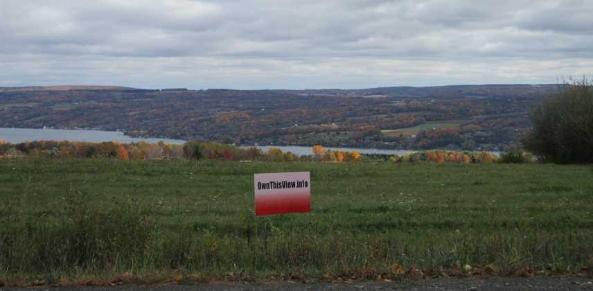
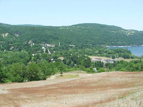
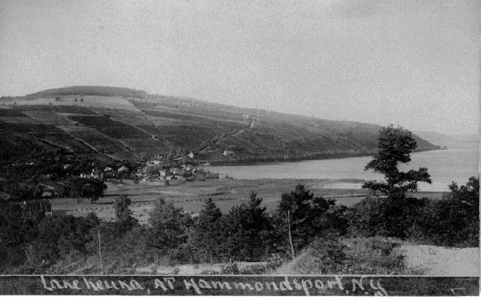
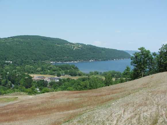
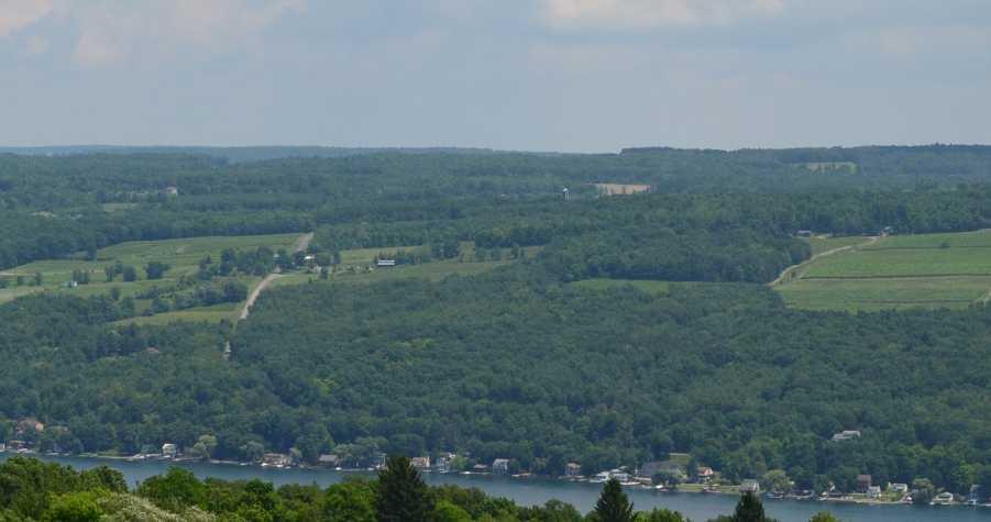
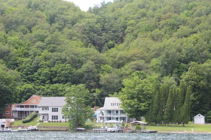
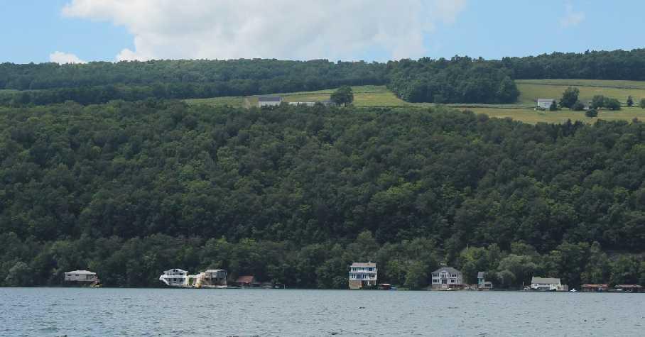
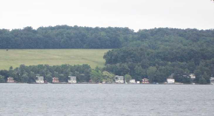
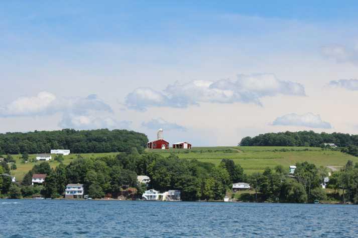
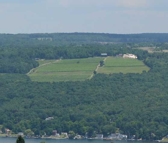
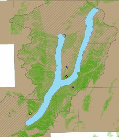
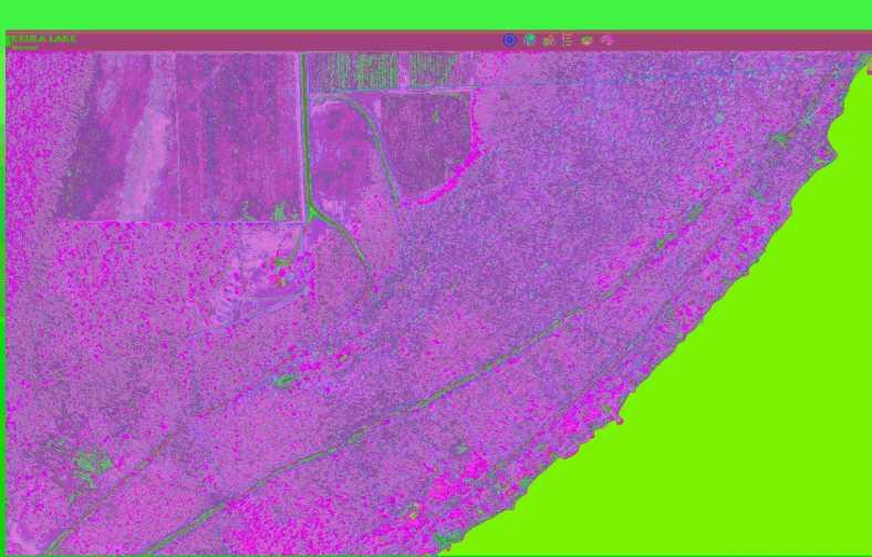
71 UNDERSTANDING THE HANDBOOK ISSUE HIGHLIGHT: HIGH PRIORITY VIEWSHEDS A viewshed is the area visible from a particular point. There are many nice viewsheds around Keuka Lake. Unreasonable to protect all views, so we prioritized the views. Overlay zones could be adopted to protect and limit development within the priority areas. This presentation was prepared for the New York State Department of State with funds provided under Title 11 of the Environmental Protection Fund.
72 How did we choose? Gather Many Potential Viewsheds Viewshed Characterization Prioritization Voting Mapping to Provide Data Decision Making
73 ^ View 1
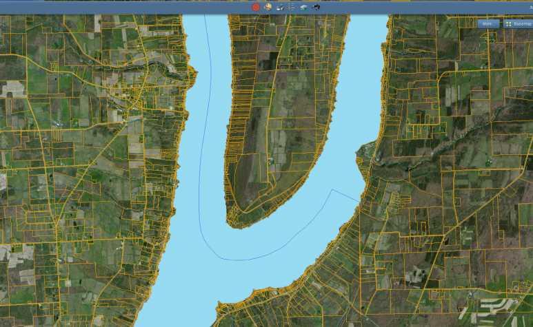
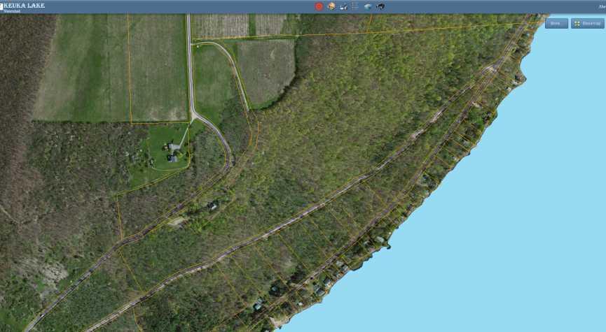
74 View 2 ^

75 2 Combined

76 All: Combined
77 All: Prioritized

78 Choosing Specific Viewsheds
79 Top Priority One of the Best Views Medium Priority Very Good View, Unique, but not the best Low Priority Good View, but not very unique or important
80 Results 1.Garrett Memorial Chapel 2.Esperanza Mansion 3.Keuka Hill Road 4.Bully Hill Vineyards 5.Skyline Drive
81

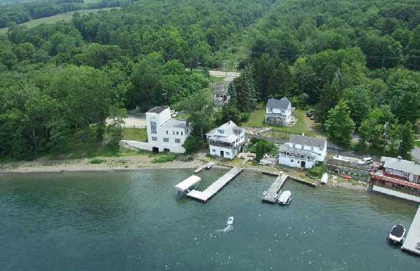
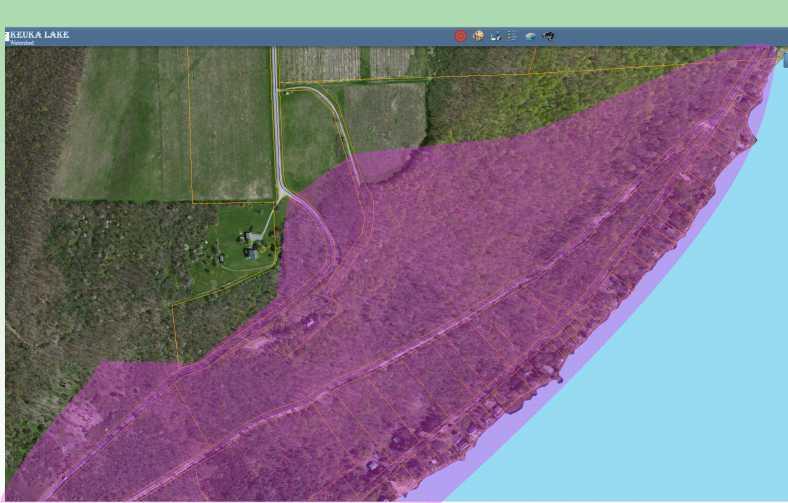
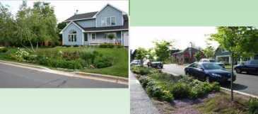
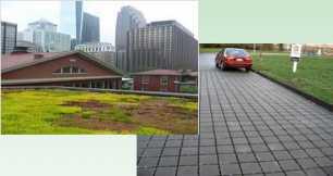
82 UNDERSTANDING THE HANDBOOK TOOL HIGHLIGHT : ONLINE MAP VIEWER Also created during the LWRP grant was an online map viewer. This has parcel information overlaid onto aerial photography for the watershed. It can be useful when making planning decisions. In the handbook you find a guide on how to use the mapper. Can be found at: This presentation was prepared for the New York State Department of State with funds provided under Title 11 of the Environmental Protection Fund.

83 Online Map Viewer
84
85
86

87 Using the Online Map Viewer Click Click

88 UNDERSTANDING THE HANDBOOK LEGAL TOOLS Legal Tools are legally binding options that municipalities can adopt in the way of regulations. Includes: Conservation Easements Purchase of Development Rights Stream Buffer Setbacks Flag Lots Steep Slope Limitations and Ridgeline Overlay Zones Cluster Subdivisions This presentation was prepared for the New York State Department of State with funds provided under Title 11 of the Environmental Protection Fund.


89 Conservation Easement & Purchase of Development Right Conservation Easement Legal agreement between land owner and state/local government or non-profit. The agreement clearly lays out what is to be preserved on a certain piece of land and what activities will be permitted or banned and where on the property. Finger Lakes Land trust utilizes this. Municipalities could seek these agreements, or work with a land trust to achieve them. Purchase of Development Rights Type of conservation easement where municipality or non-profit actually purchases the right to develop a certainly piece of land and therefore maintain it for open space. Currently NYS has a competitive program which land owners can be reimbursed up to 87.5% of the value of the development rights on their land through acquisition of an agricultural conservation easement. By allowing the actual purchase the land owner only pays taxes as an open space or agricultural use.

90 Green Infrastructure Raingarden Bioswales Permeable Pavements & Green Roofs Street Trees Stream Buffer Setbacks


91 UNDERSTANDING THE HANDBOOK ENGAGING THE PUBLIC This section offers not only the municipalities legal responsibility for engaging the public pursuant Open Meetings Laws but also tools for keeping the public informed. Tools include: Voluntary public comment time Training in meeting facilitation Municipal websites Facebook, twitter and other social media Regular newsletters Regular public meetings outside of monthly business board meetings Non Traditional Office Hours This presentation was prepared for the New York State Department of State with funds provided under Title 11 of the Environmental Protection Fund.

92 UNDERSTANDING THE HANDBOOK MUNICIPAL PROFILES Sections Your Municipality s Comprehensive Plan Goals Gaps in current law Broken down into categories Resident Support Survey Results Resources This presentation was prepared for the New York State Department of State with funds provided under Title 11 of the Environmental Protection Fund.


93 UNDERSTANDING THE HANDBOOK This presentation was prepared for the New York State Department of State with funds provided under Title 11 of the Environmental Protection Fund.


94 UNDERSTANDING THE HANDBOOK This presentation was prepared for the New York State Department of State with funds provided under Title 11 of the Environmental Protection Fund.


95 UNDERSTANDING THE HANDBOOK This presentation was prepared for the New York State Department of State with funds provided under Title 11 of the Environmental Protection Fund.

96 UNDERSTANDING THE HANDBOOK - RESOURCES Resource section gives basic contact information for important local, state, county and non-profit organizations. This section also offers information on grant programs available. This presentation was prepared for the New York State Department of State with funds provided under Title 11 of the Environmental Protection Fund.

97 UNDERSTANDING THE HANDBOOK - RESOURCES Complete list of the tools and resources used for this project Digital version Clickable Links This presentation was prepared for the New York State Department of State with funds provided under Title 11 of the Environmental Protection Fund.

98 Understanding the Handbook - Resources
99 WHERE DO WE GO FROM HERE? Now it is your turn Use the resources we have provided. Work to improve your laws where you can. Work to continued educating your residents and boards. Apply for available grants. Further tailor resources to your municipality; keep questioning residents on their desires for the future. Keep communication open between residents, boards, agencies and neighboring municipalities. Remember we (STC) are only a phone call away. Remember you have experts at LULA! This presentation was prepared for the New York State Department of State with funds provided under Title 11 of the Environmental Protection Fund.
100 QUESTIONS? This presentation was prepared for the New York State Department of State with funds provided under Title 11 of the Environmental Protection Fund.
Town of Peru Comprehensive Plan Executive Summary
 Town of Peru Comprehensive Plan Executive Communities that plan grow by choice, not by chance. A plan makes growth thoughtful, understandable, and predictable. A plan shows that a community is managing
Laberge Group. Town of Coeymans. Draft Comprehensive Plan. Overview of Planning Process
 Draft : Presentation of Goals & Strategies Laberge Group Benjamin H. Syden, A.I.C.P., E.D.P Director in Charge Nicole Allen, A.I.C.P. Senior Planner Anjali Malhotra Planner Presentation Outline Introductions
Green Infrastructure Policies and Ordinances
 Green Infrastructure Policies and Ordinances October 23, 2013 By Karen Firehock, Green Infrastructure Center 2013 Georgia Urban Forest Council s 23 rd Annual Conference The mission of the nonprofit Green
Sorted citizen input comments in review of Blount County plans July, August, and September 2007
 Sorted citizen input comments in review of Blount County plans July, August, and September 2007 The following presents sorted citizen input comments from three sessions held in July, August and September
Municipal Comprehensive and Open Space Plans
 Appendix 13-A Local Historic Policy Municipal Comprehensive and Open Space Plans Oxford Regional Comprehensive Plan (1969) The Oxford Regional Comprehensive Plan serves as the Comprehensive Plan for Oxford
Local Waterfront Revitalization Programs
 Local Waterfront Revitalization Programs Jaime Ethier Coastal Resources Specialist Mid-Hudson Region Supervisor April 27, 2017 April 27, 2017 2 NYS Coastal Area Roughly 1000 feet inland from these waters
How To Get the Development You Planned
 How To Planning Series Prepared by Strafford Regional Planning Commission. Funded by the NH Office of State Planning How To Get the Development You Planned The purpose of the master plan is... to guide
Community Conservation Workshop. Lake Placid
 Community Conservation Workshop Lake Placid 2 Community Conservation Program Welcome! We have designed a Community Conservation Program that listens to the needs of community members. We are conducting
Whitemarsh Township Greenway Plan
 Whitemarsh Township Greenway Plan Prepared for: Whitemarsh Township August 16, 2007 Table of Contents Table of Contents... i Introduction... 1 Study Area Setting... 2 Regional Setting... 2 Township Character...
TOWN OF BETHLEHEM MEETING SUMMARY LOCAL WATERFRONT REVITALIZATION PROGRAM UPDATE
 TOWN OF BETHLEHEM LOCAL WATERFRONT REVITALIZATION PROGRAM UPDATE MEETING SUMMARY Purpose: LWRP Update Public Workshop #3 Date and Time: October 24, 2017, 6:00 pm - 8:00 pm Location: Town Hall, 445 Delaware
Chapter 10 IMPLEMENTATION RECOMMENDATIONS
 Chapter 10 IMPLEMENTATION RECOMMENDATIONS The recommended land use plan presented in the previous chapter provides a design for the attainment of the urban and rural development and open space preservation
TOWN OF BETHLEHEM OPEN SPACE CONSERVATION PLAN PUBLIC MEETING: OCTOBER 12, 2017
 TOWN OF BETHLEHEM OPEN SPACE CONSERVATION PLAN PUBLIC MEETING: OCTOBER 12, 2017 Welcome and Agenda 6:00 6:45: Open House, Part One 6:45 7:15: Presentation and Questions 7:15 8:00: Open House, Part Two
Regional Economic Development Councils & The Consolidated Funding Application. Khris Dodson SU-EFC
 Regional Economic Development Councils & The Consolidated Funding Application Khris Dodson SU-EFC REDCs and You Each Region created a strategic plan. Strategic goals to improve economy: 1. Strengthen
4-Town Comprehensive Plan DRAFT 7/30/07
 4-Town Comprehensive Plan DRAFT 7/30/07 Acknowledgements ning Committee Town of Harrisburg Norman Roof Randy Nicol Town of Martinsburg Terry Thisse Paul Kelly Town of Montague Jan Bagdanowicz Wendy Perry
Secrest Short Cut and Monroe Expressway Small Area Plan AUGUST 29, 2018
 Secrest Short Cut and Monroe Expressway Small Area Plan AUGUST 29, 2018 Background and Process Monroe Expressway will be open by the end of 2018 Union County and Indian Trail identified a need to revisit
Protecting Scenic Views
 The Genesee-Finger Lakes Region is distinguished by roadway corridors and locations from which outstanding scenic views can be appreciated. Our special views encompass agricultural lands, natural areas,
Genesee/Finger Lakes Regional Planning Council (G/FLRPC) February Webinar Series. Regional Planning Councils. G/FLRPC - February 10, 2016, 12:00-1:00
 February Webinar Series. Regional Planning Councils. G/FLRPC - February 10, 2016, 12:00-1:00") Genesee/Finger Lakes Regional Planning Council (G/FLRPC) February Webinar Series G/FLRPC - February 10, 2016, 12:00-1:00 Exploring Census Data Tools - February 17, 2016, 12:00-1:00 Economic Development
Genesee/Finger Lakes Regional Planning Council (G/FLRPC) February Webinar Series G/FLRPC - February 10, 2016, 12:00-1:00 Exploring Census Data Tools - February 17, 2016, 12:00-1:00 Economic Development
Port Lavaca Future Land Use
 Port Lavaca Future Land Use Introduction The City of Port Lavaca is beginning to see sustained growth, after many years of relative stable population. New single family homes, apartments, and businesses
Green Infrastructure Codes and Ordinances
 1 Green Infrastructure Codes and Ordinances Emily Vail Hudson River Estuary Program NYS Department of Environmental Conservation New York State Water Resources Institute at Cornell University March 19,
Community Conservation Workshop. Saranac River Basin Communities
 Community Conservation Workshop Saranac River Basin Communities 2 Community Conservation Program Welcome! We have designed a Community Conservation Program that listens to the needs of community members.
Whitemarsh Comprehensive Plan Update: Housing & Land Use. Public Workshop #3: September 20, 2018
 Whitemarsh Comprehensive Plan Update: Housing & Land Use Public Workshop #3: September 20, 2018 Agenda Welcome Process Recap What We ve Heard The Plan Framework Review of Recommended Actions Land Use Housing
Please read the entire document
 projects impacting the waterfront revitalization area. The waterfront revitalization area of the town will have to subareas to the west and east of the village. Page 6 of 6 Wayfinding master plan create
3. VISION AND GOALS. Vision Statement. Goals, Objectives and Policies
 Vision Statement Queen Creek s interconnected network of parks, trails, open spaces and recreation opportunities provide safe and diverse activities and programs that sustain its unique, small town, equestrian
NEW YORK STATE WATER RESOURCES INSTITUTE Department of Biological and Environmental Engineering
 NEW YORK STATE WATER RESOURCES INSTITUTE Department of Biological and Environmental Engineering 230 Riley-Robb Hall, Cornell University Tel: (607) 254-7163 Ithaca, NY 14853-5701 Fax: (607) 255-4449 http://wri.cals.cornell.edu
I. STAFF POLICY RECOMMENDATIONS. The following RMP policy strategies are proposed by staff in support of a Scenic Resource Protection Program:
 Policy Consideration: Scenic Resource Protection Program Status: For Consideration by the Highlands Council at September 14, 2006 Work session Date: September 12, 2006 I. STAFF POLICY RECOMMENDATIONS The
Keuka Lake Watershed Viewshed Identification and Prioritization
 Keuka Lake Watershed Viewshed Identification and Prioritization Developed at Cornell University in the College of Architecture, Art, & Planning in the City & Regional Planning Fall 2014 course Land Use
Learning from Other Communities Western Nassau Heritage Preservation Committee Nassau County Planning + Zoning Board May 1, 2018
 Learning from Other Communities Western Nassau Heritage Preservation Committee Nassau County Planning + Zoning Board May 1, 2018 Overview ULI Report References Other Florida Communities Communities Outside
COMMUNITY ENVIRONMENTAL MANAGEMENT
 COMMUNITY ENVIRONMENTAL MANAGEMENT CEM HANDBOOK FOR COMMUNITY CONSERVATION PLANNING ----- Draft ----- Prepared by the CENTER FOR COMMUNITY ENVIRONMENTAL MANAGEMENT in association with the NEW YORK STATE
City of Missoula and Missoula County Open Space Planning Open House
 City of Missoula and Missoula County Open Space Planning Open House FEBRUARY 6, 2018 The following slides contain the display board content from the open house. Please use boards to answer questions in
{Best Practices. Summary of Tools, Strategies and Best Practices from 11 Michigan Case Study Communities
 Case Studies Michigan Coastal Community Working Waterfronts { Summary of Tools, Strategies and from 11 Michigan Case Study Communities Table of Contents Zoning...2 Community and Stakeholder Collaboration
STEWARDSHIP OF LONG ISLAND SOUND S ECOLOGICAL AND RECREATIONAL RESOURCES
 STEWARDSHIP OF LONG ISLAND SOUND S ECOLOGICAL AND RECREATIONAL RESOURCES Robin Kriesberg, Save the Sound, Inc. Thomas Halavik, US Fish and Wildlife Service Coastal Program An Initiative to Identify, Protect
Scaling Up Stormwater Green Infrastructure in the Hudson Valley
 1 Scaling Up Stormwater Green Infrastructure in the Hudson Valley Emily Vail Hudson River Estuary Program, NYS Department of Environmental Conservation NYS Water Resources Institute at Cornell University
This page intentionally blank.
 This page intentionally blank. Parks, Recreation, and Open Space Chapter Relationship to Vision Vision Parks, Recreation and Open Space Chapter Concepts County Government. County government that is accountable
Central Lake Ontario Conservation Conservation Lands Master Plan
 Conservation Lands Master Plan Top 13 Frequently Asked Questions 1. What are conservation lands? Where are these conservation lands located in the Central Lake Ontario Conservation watershed? Conservation
North Fair Oaks Community Plan Summary and Information
 North Fair Oaks Community Plan Summary and Information WHAT IS THE NORTH FAIR OAKS COMMUNITY PLAN? The North Fair Oaks Community Plan is part of the San Mateo County General Plan, and establishes policies
THE TOWN OF WASAGA BEACH
 THE TOWN OF WASAGA BEACH Downtown Development Master Plan Committee of the Whole Presentation January 26 th 2017 Uses within this designation should reflect a dependence on tourism as opposed to the permanent
One County s Success in Linking Watershed Protection and Land Use Planning
 One County s Success in Linking Watershed Protection and Land Use Planning Bob Thompson Porter County Plan Commission March 28, 2012 Indiana Watershed Leadership Academy Population 160,000 Approximately
Regional Engagement Sub-Regional Forum Monroe County
 Regional Engagement Sub-Regional Forum Monroe County Brownfields Eastman Business Park South (2014) JMT Properties Site- Brockport (2012) Barthelmes Manufacturing Site- Rochester (2013) Economic Distress
Innovative Land Use Techniques
 Innovative Land Use Techniques A Handbook for Sustainable Development Eric Williams, Assistant Administrator, NHDES Carolyn Russell, Principal Planner, NHDES Cliff Sinnott, Executive Director, RPC Jill
Final Generic Environmental Impact Statement for Adoption of the Town of New Hartford Comprehensive Plan Update
 for Adoption of the Town of New Hartford Comprehensive Plan Update Name of Action: Adoption of the Town of New Hartford Comprehensive Plan Update by the Town of New Hartford Town Board Location: Lead Agency:
Gloucester County s Comprehensive Plan. The Community Connection
 Gloucester County s Comprehensive Plan The Community Connection Current Comp Plan Adopted in 1991 with a 20 year planning horizon Updated in 1995 with Part V- Implementation Recommendations and Appendix
GENERAL PLAN UPDATE ISSUES MEETING. January 21, 2010 City Hall Mitchell Room 6:00 pm 9:00 pm
 GENERAL PLAN UPDATE ISSUES MEETING January 21, 2010 City Hall Mitchell Room 6:00 pm 9:00 pm WELCOME! Introductory Comments Continued Review of Quality of Life Standards, Growth Management, Proposition
Brice Prairie Master Plan
 Brice Prairie Master Plan Town of Onalaska Community Meeting #1 Sand Lake Elementary School January 28, 2006 9 am 11 am Agenda Background What is a Master Plan? Brice Prairie Capacity Reports Starter Ideas
Town of Blooming Grove Comprehensive Plan. Public Meeting October 13, 2004
 Town of Blooming Grove Comprehensive Plan Public Meeting October 13, 2004 Overview of Presentation Process Plan Vision Recommendations Next Steps Process: Listening to the Public Monthly meetings with
Title slide..poughkeepsie Planning Initiatives POUGHKEEPSIE PLANNING INITIATIVES
 Title slide..poughkeepsie Planning Initiatives Overview Revitalization Projects Waterfront Redevelopment Strategy Local Waterfront Revitalization Program Update Kaal Rock Connector Fallkill Creek Plan
Communities Plan. Parkland-Spanaway-Midland. LUAC Review of Draft Policies
 Parkland-Spanaway-Midland Communities Plan LUAC Review of Draft Policies Presented by: Tiffany O Dell, Senior Planner Planning & Public Works Tiffany.Odell@co.pierce.wa.us 253-798-6859 November 1, 2017
Summary of Action Strategies
 Strategic Action Plan 6 Summary of Action Strategies Action Strategy Categories: 1. Organization and Management 2. Implementation 3. Marketing and Promotion This chapter summarizes all of the action strategies
CHAPTER 4 FUTURE LAND USE AND URBAN SERVICES DISTRICTS
 CHAPTER 4 FUTURE LAND USE AND URBAN SERVICES DISTRICTS Introduction This chapter discusses how Benzie County should grow and change in the future. A community can grow and change in many different ways.
CHAPTER 12 IMPLEMENTATION
 CHAPTER 12 IMPLEMENTATION The 2010 Town of Denton Comprehensive Plan is intended to capture a vision of the future of Denton. As such, it provides a basis for a wide variety of public and private actions
CHAPTER 7: ELEMENT F. - SCHEDULE
 CHAPTER 7: ELEMENT F. - SCHEDULE Chapter 4 identified management measures and objectives to address issues and concerns in the Deer Creek Watershed. Chapter 5 further detailed technical and financial support
Streets for People, Place-Making and Prosperity. #TOcompletestreets
 COMPLETE STREETS FOR TORONTO Streets for People, Place-Making and Prosperity COMPLETE STREETS: A NEW APPROACH A Complete Streets design approach considers the needs of all users people who walk, bicycle,
WAC #7 3/14/14. Coachella General Plan Update
 WAC #7 3/14/14 Coachella General Plan Update Agenda 2 Introductions Public Draft General Plan Overview and Discussion of Next Steps Implementation and Evaluation Health Element Process Evaluation (discussion)
Provide and maintain sufficient public parks, recreation facilities, and open space to meet the recreational needs of County residents and visitors.
 (ROS) Goal Provide and maintain sufficient public parks, recreation facilities, and open space to meet the recreational needs of County residents and visitors. OBJECTIVE ROS.01 The County shall acquire,
Minnesota Department of Natural Resource - Natural Resource Guidance Checklist Conserving Natural Resources through Density Bonuses
 Minnesota Department of Natural Resource - Natural Resource Guidance Checklist Conserving Natural Resources through Density Bonuses NRDB Why Use Density Bonuses & This Checklist Local units of government
Lake Arlington Master Plan. Presented by Randle Harwood, Planning and Development Director October 27, 2015
 Lake Arlington Master Plan Presented by Randle Harwood, Planning and Development Director October 27, 2015 1 Land Use Strategy 4 Land Use Strategy Typical Residential Development New residential development
2014 South Atlantic LCC
 2014 South Atlantic LCC Annual Report 1 Allie Stewart, U.S. FWS The South Atlantic LCC s 2014 Annual Report this year of progress and accomplishments is dedicated to South Atlantic LCC Coordinator, Ken
South Central Connecticut Region Plan of Conservation & Development 2018 Update. Municipal Planners
 South Central Connecticut Region Plan of Conservation & Development 2018 Update Municipal Planners July 28th, 2017 1 Introductions 2 Purpose of Today s Meeting Supplement data analysis with qualitative
Planning Department. Director of Planning. Manager of Planning. Planning Technician/ Sustainability Coordinator. Planner II/ Heritage Coordinator
 Department Director of Manager of Policy Planner Planner II (2) Planner II/ Heritage Coordinator Technician/ Sustainability Coordinator Technician Administrative Clerk March 2017 Department 2018 Business
Waterfront Land Use Planning Survey! Celebrating 20 years of Partnership
 Waterfront Land Use Planning Survey! Celebrating 20 years of Partnership Waterfront Land Use Planning Survey! 46 respondents 74% Lake Ontario / 26% St Lawrence River 4 Case Studies: Grimsby, Prescott,
Cooperative Extension s Role in Land Use Planning and Conservation. Sabrina Drill UCCE- Los Angeles/Ventura Integrated Hardwood Range Mgmt.
 Cooperative Extension s Role in Land Use Planning and Conservation Sabrina Drill UCCE- Los Angeles/Ventura Integrated Hardwood Range Mgmt. Program Cooperative Extension Land Grant Universities: 1862 Agricultural
Mixed Use Zoning A Citizens Guide
 Mixed Use Zoning A Citizens Guide Prepared by the Metropolitan Area Planning Council with support from The Minuteman Advisory Group on Interlocal Coordination and the Commonwealth s Priority Development
LU Encourage schools, institutions, and other community facilities that serve rural residents to locate in neighboring cities and towns.
 Application No. 891627: Comprehensive Plan Text Amendment - Rural School Policies - Amend policies consistent with State Legislation allowing schools in the rural area and extension of sewer service to
TOWN AND VILLAGE OF NAPLES JOINT COMPREHENSIVE PLAN 2013 VOLUME II GOALS, OBJECTIVES, AND RECOMMENDATIONS
 NAPLES Ontario County, New York TOWN AND VILLAGE OF NAPLES JOINT COMPREHENSIVE PLAN 2013 VOLUME II GOALS, OBJECTIVES, AND RECOMMENDATIONS TABLE OF CONTENTS VOLUME I Page 1.0 The Comprehensive Plan Defined...
The following principles guide the development of goals and strategies to protect and promote these amenities:
 OPEN SPACE/PARKS/TRAILS/RECREATION GOALS/STRATEGIES Cherry Hills Village is a living environment that offers low density development, open areas, public scenic vistas, public trails and public parks. This
CONSULTING SERVICES FOR THE WHITEBELT VISIONING EXERCISE ADDENDUM TO THE GTA WEST LAND USE STUDY WORK PROGRAM
 CONSULTING SERVICES FOR THE WHITEBELT VISIONING EXERCISE ADDENDUM TO THE GTA WEST LAND USE STUDY 1. Introduction WORK PROGRAM The Town of Caledon is a large, local municipality located in the Greater Toronto
10 Implementation. Implementation. Responsibility for Implementation. Blueprint for Bloomsburg. Town of Bloomsburg Comprehensive Plan 10-1
 Implementation 10 Implementation This chapter overviews how to use the comprehensive plan as a land use and programming tool for the Town of Bloomsburg and recommends annual review of the plan by the Town
Recommendations and Best Practices: City of Goodyear Demonstration Garden
 Recommendations and Best Practices: City of Goodyear Demonstration Garden Kayce Flowers Andy Stein December 2014 1 1 Table of Contents 1 Introduction... 3 2 Background and purpose... 3 3 Methods... 4 4
Manchester. Vision for Manchester
 Manchester Vision for Manchester The Manchester Community Plan is a statement of the community values and aspirations for the future. This is an effort to recognize what originally attracted visitors in
COMMUNITY DESIGN. GOAL: Create livable and attractive communities. Intent
 COMMUNITY DESIGN Intent An attractive, well-designed County will attract quality development, instill civic pride, improve the visual character of the community, and create a strong, positive image for
Section 4 BUILDING THE MASTER PLAN
 The Master Plan 33 Section 4 BUILDING THE MASTER PLAN Figure 4:1. A collaborative effort characterized the two design workshops sponsored by DISC to create hypothetical Master Plans for the Towers Property
SALISBURY TOMORROW Our Vision
 SALISBURY TOMORROW Our Vision Salisbury is committed to supporting a high quality of life and sense of community for all residents. These commitments need to be reflected in our community programs, services
STORMWATER GREEN INFRASTRUCTURE AND PLANNING/ZONING BOARDS
 STORMWATER GREEN INFRASTRUCTURE AND PLANNING/ZONING BOARDS Source: Center for Watershed Protection, 2007 Southern Tier Central Regional Planning & Development Board Chemung County Stormwater Team OUTLINE
DRAFT SCOPE FOR THE DRAFT ENVIRONMENTAL IMPACT STATEMENT FOR HUDSON HIGHLANDS RESERVE TOWN OF PHILIPSTOWN, NEW YORK June 5, 2018
 DRAFT SCOPE FOR THE DRAFT ENVIRONMENTAL IMPACT STATEMENT FOR HUDSON HIGHLANDS RESERVE TOWN OF PHILIPSTOWN, NEW YORK June 5, 2018 Project Name: Project Location SEQRA Classification of Project: Lead Agency:
20 & 30 Frank Nighbor Place
 Engineering Land / Site Development Municipal Infrastructure Environmental / Water Resources Traffic / Transportation Structural Recreational Planning Land / Site Development Planning Application Management
FINDING WAYS TO CONNECT
 FINDING WAYS TO CONNECT Linking habitat together to function as an ecological whole The Green Leap: A Primer for Conserving Biodiversity in Subdivision Development. Mark E. Hostetler. University of California
Preface. Erie. Scranton. Allentown. Pittsburgh. Harrisburg. Philadelphia
 The Southern Alleghenies Region The Southern Alleghenies Region spans the Laurel Highlands and Allegheny Front in the west across the Appalachians to the east. It is comprised of Blair, Bedford, Cambria,
SECTION II SECTION II STATEMENT OF GOALS, OBJECTIVES, PRINCIPLES, ASSUMPTIONS, POLICIES AND STANDARDS
 STATEMENT OF GOALS, OBJECTIVES, PRINCIPLES, ASSUMPTIONS, POLICIES AND STANDARDS 1 2 STATEMENT OF GOALS, OBJECTIVES, PRINCIPLES, ASSUMPTIONS, POLICIES AND STANDARDS INTRODUCTION The New Jersey Municipal
Public Open House. Overview of the Downtown Plan Official Plan Amendment April 23, 2018
 Public Open House Overview of the Downtown Plan Official Plan Amendment April 23, 2018 1 A 25-Year Plan for Downtown To ensure growth contributes positively to Toronto s Downtown as a great place to live,
The City shall enhance and improve the accessibility of parks and recreational facilities while protecting their quality. by:
 GOALS, OBJECTIVES AND POLICIES GOAL 1: To provide open space and recreation as an essential element needed for the betterment of the City s character and quality of urban life. The City shall plan for
Introducing the Main Street Strategic Toolbox
 Ulster County Main Streets: A Regional Approach Ulster County Planning Department, 244 Fair Street, Kingston NY 12401 Why do we take a regional approach to Main Streets? There are many different approaches
Chapter 5 Greenway Corridors
 Chapter 5 Greenway Corridors Corridor Identification and Prioritization The inventory and analysis phase identified and mapped resources that contribute to greenway development. Corridors were then designated
A study on the regional landscape planning framework on the relationships between urban and rural areas: case study of Tokachi region, Hokkaido, Japan
 A study on the regional landscape planning framework on the relationships between urban and rural areas: case study of Tokachi region, Hokkaido, Japan K. Yamagishi & H. Kobayashi Laboratory of Urban Planning
Stillwater Comprehensive Plan. Discussion Draft. Informational Open House. February 9, 2006
 Stillwater Comprehensive Plan Discussion Draft Informational Open House February 9, 2006 Purpose Goal for Tonight s Meeting How We Got Here Present Recommendations How you can provide Comment Next Steps
Town of Brookfield Master Plan Implementation Matrix Action
 1 Econ Dev 1 Establish Economic Development Commitee Econ Dev 2 Develop streamlined permitting process Econ Dev 3 Increase economic development in town center Econ Dev 4 Revise town bylaws/zoning for commercial/industrial
RECREATION AND OPEN SPACE ELEMENT GOALS, OBJECTIVES, AND POLICIES
 RECREATION AND OPEN SPACE ELEMENT GOALS, OBJECTIVES, AND POLICIES Goal 7 To provide park facilities, recreation programs, and open space resources that are safe, adequate, and accessible to all City residents,
Member Service Plan Sierra Nevada AmeriCorps Partnership
 Member Service Plan Sierra Nevada AmeriCorps Partnership Service plans lay the framework for what each Member will be doing during their service. Service plans detail the major projects and expected results
THE COMMUNITY-DRIVEN DESIGN PROCESS
 THE COMMUNITY-DRIVEN DESIGN PROCESS A PUBLIC DRIVEN PROCESS STEERING COMMITEE THE COMPREHENSIVE PLAN OPPORTUNITIES AND CONSTRAINTS THE COMMUNITY DRIVEN DESIGN PROCESS A Public Driven Process Beginning
PARK AND RECREATION MASTER PLAN UPDATE
 PARK AND RECREATION MASTER PLAN UPDATE 2014-2018 Prepared for: Avon Parks, Recreation and Beautification Council (PRBC) and Town of Avon Prepared by: Lehman & Lehman, Inc. 24-Apr-14 Mission Statement The
Hibbing. Land Use. Hibbing Comprehensive Plan 8.1. Land Use
 Hibbing 8.1 Introduction 8.3 Information and Assessment 8.5-8.14 Recommendations 8.15-8.17 Implementation 8.18-8.19 8.2 Introduction Although land use was not identified as a discrete goal during the community
WATERFORD Plan of Preservation, Conservation and Development Supplement Part 1 - Policy Element
 WATERFORD 2012 Plan of Preservation, Conservation and Development 2015 Supplement Part 1 - Policy Element Effective June 11, 2015 2015 Plan Update GOAL To respond to the evolving land use needs and continually
City of Westbrook. 2 York Street Westbrook, Maine (207) Fax:
 Fax:") City of Westbrook DEPARTMENT OF PLANNING & CODE ENFORCEMENT 2 York Street Westbrook, Maine 04092 (207) 854-0638 Fax: 1-866-559-0642 WESTBROOK PLANNING BOARD TUESDAY, JANUARY 2, 2018, 7:00 P.M. WESTBROOK
City of Westbrook DEPARTMENT OF PLANNING & CODE ENFORCEMENT 2 York Street Westbrook, Maine 04092 (207) 854-0638 Fax: 1-866-559-0642 WESTBROOK PLANNING BOARD TUESDAY, JANUARY 2, 2018, 7:00 P.M. WESTBROOK
Ontario Invasive Plant Council
 Ontario Invasive Plant Council Ontario Invasive Plant Council What is the problem? How it all began 2007 AGM Highlights from the framework Mission statement Objectives What has the council be up to? Council
CITY OF CHARLOTTESVILLE, VIRGINIA CITY COUNCIL AGENDA
 CITY OF CHARLOTTESVILLE, VIRGINIA CITY COUNCIL AGENDA Agenda Date: December 16, 2013 Action Required: Adoption of Resolution Presenter: Staff Contacts: Title: James E. Tolbert, AICP, Director of NDS James
TOWN OF SPRINGFIELD, NEW HAMPSHIRE
 TOWN OF SPRINGFIELD, NEW HAMPSHIRE NATURAL RESOURCES INVENTORY EXECUTIVE SUMMARY March 2008 Prepared by: Watershed to Wildlife, Inc. Natural Resource Consultants 42 Mill Street, Suite 3 Littleton, NH 03561
City of Lake Mary, Florida. Evolution of a Historic Downtown with Transit Oriented Development Strategies
 City of Lake Mary, Florida Evolution of a Historic Downtown with Transit Oriented Development Strategies What is Transit Oriented Development? Walkable villages located at and around transit stations in
Integrating Sustainability in Policy, Planning and Zoning. Jeff LeJava Associate Counsel Open Space Institute
 Integrating Sustainability in Policy, Planning and Zoning Jeff LeJava Associate Counsel Open Space Institute WELCOME& OVERVIEW Pace LULC awarded a Cleaner, Greener Communities Program Grantfrom NYSERDAto
It Takes A Village.. Preserving Rural Character In Standish
 It Takes A Village.. Preserving Rural Character In Standish A Public Workshop Hosted by Conservation and Open Space Plan Committee & Standish Corner Village Implementation Committee June 12, 2008 Desired
Vancouver. Title of the Initiative. Initiative Duration. Submitted by. Comments by the Jury
 134 Vancouver Title of the Initiative Initiative Duration Submitted by Comments by the Jury Visionary Vancouver: Creating a Welcoming and Sustainable Place for All 2009-2020 Wendy Au, Deputy City Manager,
Chapter 6: Community Character
 Chapter 6: Community Character The term "community character" covers a broad spectrum of concerns. First and foremost, community character is a visual concept. In Long Grove, however, community character
Milwaukee River Watershed Fish Passage Program. Making Connections Across Our Watershed
 Milwaukee River Watershed Fish Passage Program Making Connections Across Our Watershed 2 71 st Annual Upper Midwest Fish & Wildlife Conference Wednesday, December 15, 2010 Milwaukee River Watershed Fish