ADOPTED BY THE VILLAGE OF HARTLAND. 10 December 2012
|
|
|
- Joseph Johnston
- 6 years ago
- Views:
Transcription

1
2 ADOPTED BY THE VILLAGE OF HARTLAND 10 December 2012 VILLAGE BOARD David Lamerand, President Karen Compton Richard Landwehr Michael C. Meyers Rick Stevens Randy Swenson Jack Wenstrom PARK AND RECREATION BOARD Tim Hallquist, Chair Tina Bromberger Matt Carrico Jeff Greger Duane Grimm Peggy Kallenberger Richard Landwehr With the assistance of Place Dynamics LLC New Berlin, Wisconsin
3 CONTENTS Introduction... 1 Public Participation... 1 Plan Preparation... 1 Background... 2 Demographics... 2 Natural Resources... 3 Wisconsin State Comprehensive Outdoor Recreation Plan... 4 Waukesha County...5 Hartland Community Center Study... 6 A Focus On Health... 6 Classification and Service Standards... 8 Park Classification... 9 Capacity Standards Maintenance Park and Recreation Area Inventory Village of Hartland Park and Recreation Sites Sunnyslope Park Nottingham Park Louis Joliet Park Castle Park Bark River Park Hartbrook Park Penbrook Park Centennial Park Nixon Park Bark River Greenway Mill Place Greenway Cottonwood Wayside Maple Wayside Future Park Site Northwest Park Privately Owned Park and Recreation Sites Ice Age Wetland Homeowner Association Open Space School Parks... 23
4 Trail Systems Ice Age Trail and Ice Age Scenic Drive Waukesha County Recreation Areas State of Wisconsin Recreation Areas Park and Recreation Assessment General Maintenance Review Playground Safety Evaluation ADA Compliance Level of Service Park Land Area Trail Systems...27 Recreational Facilities Access Standard Goals and Policies Comprehensive Plan Objective No. 5 Recreation Outdoor Recreation Goals and Objectives Development Plan Community-Identified Needs Development Plan State of Wisconsin Financial Assistance Programs County Conservation Aids Federal Aid in Sport Fish Restoration Knowles-Nelson Stewardship Local Assistance Programs: Acquisition and Development of Local Parks Knowles-Nelson Stewardship Local Assistance Programs: Acquisition of Development Rights Knowles-Nelson Stewardship Local Assistance Programs: Urban Green Space Knowles-Nelson Stewardship Local Assistance Programs: Urban Rivers Land and Water Conservation Fund (LWCF) Recreational Boating Facilities Recreational Trails Program Transportation Enhancements (Statewide Multimodal Improvement Program - SMIP) Congestion Mitigation and Air Quality Resolution Adopting the Comprehensive Outdoor Recreation Plan... 40
5 INTRODUCTION The Village of Hartland places a high priority on providing diverse and well-maintained recreational facilities to its citizens. Parks and other recreation areas have been shown to have numerous benefits to communities and their residents, such as: Increasing the value of nearby properties Encouraging physical activity that results in a healthier population, including lowering the risk of many diseases, increasing longevity, and maintaining the physical capabilities of an older population Relieving stress and improving mental fitness Providing opportunities for formal and informal social interaction Reducing criminal activity Enhancing environmental quality (i.e., water and air quality) and preserving important natural features Generally improving resident satisfaction and quality of life The Wisconsin Department of Natural Resources requires communities to adopt a comprehensive outdoor recreation plan and to update it every five years in order to establish eligibility for funding under the Nelson- Knowles Stewardship Grant Program. This Comprehensive Outdoor Recreation Plan for the Village of Hartland sets forth the standards used by the Village to assess its parks and other recreational facilities, and identifies priorities for enhancements over a five year period from 2013 to The Village of Hartland first adopted its Comprehensive Outdoor Recreation Plan in 1988 and subsequently updated it three times, most recently in The Village s park system includes developed facilities for active recreation, trail systems, and natural areas for passive enjoyment. Since it began implementing the 1988 Comprehensive Outdoor Recreation Plan, the Village has made significant improvements to its parks, often in partnership with other organizations such as the Ice Age Park and Trail Foundation. Additionally, residents benefit from related facilities owned and maintained by others, such as the Wisconsin Department of Natural Resources, Waukesha County, and local schools. PUBLIC PARTICIPATION Public input was sought throughout the planning process. This began with a review of survey information collected in 2011 to evaluate the need for an indoor recreational facility, along with user survey data collected by the Village. Additional input was encouraged during three meetings of the Village s Park and Recreation Board, held as the plan was prepared in October, November, and December of PLAN PREPARATION This update to the Comprehensive Outdoor Recreation Plan was prepared under the supervision of the Village s Park and Recreation Board. The plan is organized in six main sections: 1) a background section that assesses community demographics and potential demand for park facilities; 2) a section to establish Village standards for Level of Service; 3) an Inventory section that documents existing facilities and equipment; 4) an assessment of parks and recreational facilities to determine their ability to meet existing and projected demand, as well as to review safety and accessibility; 5) goals and policies that the Village will follow in considering issues related to parks and recreation; and 6) a multi-year development plan identifying priorities for investment in the park system. 1
6 BACKGROUND There are any number of conditions that may influence the need for particular types of parks and recreational facilities within a community. It should also be understood that these conditions change over time, causing a need for communities to provide new types of facilities even when there may not be a change in the overall population size or location of these residents. Some of the more common factors to be considered are highlighted below. The population is aging The Baby-Boomers had a tremendous impact on communities as they swelled the population between 1945 and The leading edge of this generation began to turn 65 around Unlike their parents, the Baby-Boomers are more likely to age in place and to remain physically active in their retirement years. Active retired seniors are likely to increase the overall demand on recreational facilities and services. Children make up a smaller part of the total population Although the numbers will increase, the share of the population under 18 will decrease in coming years. Part of the challenge for park planners will be monitoring where these children locate. If older residents remain in their homes after their children grow, some neighborhoods may see a decrease in demand for equipment oriented to the under 18 age brackets. We are becoming more diverse While Hartland (and most of Waukesha County) is largely homogeneous, there is a growing presence of ethnically diverse subgroups within the population, creating demand for additional or new kinds of recreational facilities. Non-traditional households are becoming more common Traditional family households once made up over three-quarters of the total, but have declined to fewer than half. People living alone, in one-parent households, or in non-family situations make up the remainder, and are expected to continue to rise. It is becoming increasingly common for both heads of household to work, particularly as higher housing and living costs strain the family budget. Childcare and recreation programs for children will continue to be in demand. Women s sports are on the increase With the passage of the Title IX Amendment to the Education Act, women are now offered greater access to sport facilities. In addition, girls are finding their way into the male dominated sports, such as youth baseball, soccer, etc. The result has been dramatic increase in recreation interests and a nearly doubling of demand for some types of facilities. Recreational preferences change over time As the population and culture evolves, the demand for various activities can be expected to change. Interest in activities like rollerblading, which enjoyed brief popularity, has ebbed. New activities like geocaching have appeared for the first time. As the number of dogs has grown and people s relationships with their dogs has changed, dog parks have become the fastest-growing type of new park in the nation. Changes such as these may be reflected in decisions to add or remove facilities within the Village s parks. DEMOGRAPHICS Hartland is a suburban community located in Waukesha County, in southeastern Wisconsin. The Village comprises an area of roughly 4.5 square miles and supports a 2012 population of 9,118 persons. This represents an increase of 669 persons, or 7.9 percent since the previous Comprehensive Outdoor Recreation Plan was prepared. While the Wisconsin Department of Administration last prepared population projections in 2008, indicating continued growth over the next decade, the weak housing market since 2007 may slow growth to considerably below the estimate. 2
7 TABLE 1 POPULATION CHANGE IN THE VILLAGE OF HARTLAND AND WAUKESHA COUNTY Change Change Village of Hartland 5,559 6,906 7,905 9,118 1,213 9, Waukesha County 280, , , ,891 29, ,489 31,598 Source: US Census Bureau and Wisconsin Department of Administration The community s early growth was centered around the intersections of Cottonwood Avenue, Hill Street, Capitol Drive. The central area continues to be one of the community s most desirable neighborhoods, attracting considerable reinvestment in recent years. Most municipal offices and public buildings are located in or adjacent to this downtown area, as is Nixon Park, the primary community park in the Village. Residential land uses make up the largest part of the Village s land area. These tend to be concentrated in the northeast, northwest, and southeast quadrants of the village. Future residential growth is expected to occur mostly to the north, with a new subdivision near County Highway K and Jungbluth Road in the planning stages. Industrial and commercial uses are predominantly located in the southwest quadrant. Perhaps the most notable change in Village demographics has been the growth in the older population. In 2000 only 14.9 percent of households included somebody aged 65 or older. By 2010 that percentage had grown to 19.8 percent. At the same time the percentage of households with children under 18 fell from 42.5 to 37.3 percent. The median age increased from 34.1 to 37.5 years. Clearly, while children will remain a primary driver of demand for parks, there will be growing demand for activities associated with an older population base. NATURAL RESOURCES The natural resources of the Hartland area provide an ideal starting point for identifying park and recreation sites. These lands are often unsuitable for development or may contain amenities conducive to park uses. Many of these resource areas are already contained TABLE 2 POPULATION BY AGE within the Village s system of parks and Number Percent Number Percent open spaces. Under 5 years Environmental Corridors The Southeastern Wisconsin Regional Planning Commission identified environmental corridors and isolated natural areas throughout the region. Hartland contains approximately 998 acres of primary environmental corridors, often found along major streams. They contain most remaining wetlands, woodlands, and wildlife habitat areas, as well as major lakes and streams and associated flood lands. These corridors offer many of the best remaining potential park sites. 5 to 9 years to 14 years to 19 years to 24 years to 34 years 1, , to 44 years 1, , to 54 years 1, , to 59 years to 64 years to 74 years to 84 years years and over Source: US Census Bureau 3
8 An estimated 33 acres of secondary environmental corridors are found in Hartland. These corridors are often remnants of primary environmental corridors that have been partially converted to intensive urban or agricultural use. Secondary environmental corridors facilitate surface water drainage and maintain pockets of natural resource features. Such corridors should be considered for preservation as the process of development proceeds. Isolated natural resource areas are smaller pockets of natural elements that are isolated from the environmental corridors by urban development or agricultural uses. Approximately 81 acres of isolated natural resource areas are found in Hartland. These primary and secondary environmental corridors and isolated natural resource areas may represent the only wildlife habitat in the area, provide good locations for local parks and nature study areas, and lend unique aesthetic character and natural diversity to an area. The Village s Master Plan has recommended preservation of remaining environmentally significant lands by limiting the impact of future development. Wildlife Habitats The region is home to a variety of wildlife species, many of which have adapted to urban conditions. These include birds, small mammals, and aquatic species. Designated wildlife habitat areas tend to be located within environmental corridors. Future park and open space plans may include protection or restoration of these areas. Wildlife viewing opportunities may be considered in future development of these lands. Water Resources The Village of Hartland contains approximately 33 acres of surface water. The most significant waterway is the Bark River, which flows through the western third of the Village and into Lake Nagawicka. Residents of Hartland have significant access to water-based recreation on nearby lakes such as Pine Lake, Beaver Lake, Nagawicka Lake, and Pewaukee Lake. WISCONSIN STATE COMPREHENSIVE OUTDOOR RECREATION PLAN Wisconsin prepares a Statewide Comprehensive Outdoor Recreation Plan (SCORP) every five years, with the most recent update addressing 2011 through This plan includes research into the outdoor recreational preferences of state residents as well as establishing priorities for parks and open space. Goals included in the plan are: Assess, understand, and adapt to growing recreation tourism demands and preferences Improve integration of outdoor recreation interests and needs in land use and other relevant plans Continue to provide and enhance public access to Wisconsin recreational lands and waters Conserve rural landscapes and forests through partnerships and incentives Address funding challenges associated with managing Wisconsin outdoor recreation resources Promote outdoor recreation as a means of improving public health among Wisconsinites Establish great urban parks and community green spaces The role of parks in public health is a recent addition to the SCORP. A lengthy chapter notes that the availability and accessibility of parks and recreational facilities can have a major bearing on participation in physical activities. Parks, trails, open spaces, waterways, and other recreational facilities support a wide variety of activities such as walking or running, bicycling, team sports, etc., through which people can get regular exercise. Connectivity or accessibility is another critical consideration in the SCORP, with a finding that about 70 percent of Wisconsin residents do not live within ½ mile of a public park or recreation area. Even within urban areas, barriers may impede accessibility, particularly to young or elderly park users. Examples of barriers may include limitedaccess freeways or roads with high traffic volumes, or concerns about safety. 4
9 In a similar vein, planners have traditionally defined walkable as a distance of ¼ mile or less. Recent research, however, has shown that distance is not as important as having a route free from barriers. People will walk a greater distance when there are no major obstacles, and particularly those associated with perceived safety (such as traffic or criminal activity). The SCORP recommends that parks be easily accessible by walking or bicycling in addition to driving, and that they be designed so as to minimize internal conflicts between cars and pedestrians or cyclists. Table 3 provides a partial list of activities in which Wisconsin residents regularly engage in an outdoor setting. Walking remains the most popular of these activities, with 87.7 percent of state residents participating. This is followed by gardening. In recent years there have been a growing number of communities providing public space for community gardening, in which the municipality designates plots that may be reserved by residents to grow their own produce. Other communities have introduced edible plants into their public spaces, planting fruit trees or berries in open spaces, and even introducing vegetables into downtown streetscapes. The SCORP notes that in prior years the fastest-growing activities have included soccer, wildlife viewing, golf, handball or racquetball, walking, attending outdoor sporting events, bicycling, day hiking, running, and bird watching. Looking forward, the state is anticipating the growing popularity of a handful of activities that may be considered in Hartland. These include kayaking, dog parks, soccer, BMX biking, climbing, and gardening. Activities with stable demand include walking, running, water parks, day hiking, golf, trail running, wildlife watching, bicycling, and snowshoeing. Inline skating, skateboarding, and softball are among those activities with declining demand. The SCORP, for the first time, establishes some baseline data by which to benchmark park and recreational facilities within communities. This includes information on supply and budgeting, and is further discussed in the following section of this document. WAUKESHA COUNTY Park and recreation initiatives are addressed through two Waukesha County documents, the Comprehensive Development Plan for Waukesha County (2009) and the Waukesha County Park and Open Space Plan, which is Appendix A of the comprehensive plan. The Waukesha County Park and Open Space Plan documents existing County park and recreation facilities, itemizes planned improvements to the park system, and establishes criteria for levels of service (including recommendations for local governments). The Comprehensive Development Plan for Waukesha 5 TABLE 3 WISCONSIN RESIDENT PARTICIPATION IN OUTDOOR ACTIVITIES Activity Percent participating Walk for pleasure 87.7 Gardening or landscaping for pleasure 65.4 View/photograph natural scenery 65.3 Attend outdoor sports events 65.0 Family gathering 63.5 Visit nature centers, etc View/photograph other wildlife 57.9 View/photograph wildflowers, trees, etc Sightseeing 50.6 Bicycling 48.7 Picnicking 47.0 Snow/ice activities (any type) 45.9 Yard games, e.g., horseshoes 44.7 Gather mushrooms, berries, etc Golf 41.8 Swimming in lakes, streams, etc View/photograph birds 41.7 Day hiking 36.7 Swimming in an outdoor pool 34.5 Visit a wilderness or primitive area 33.7 Attend outdoor concerts, plays, etc Soccer outdoors 32.3 Running or jogging 32.1 Mountain biking 30.7 Sledding 28.2 Handball or racquetball outdoors 23.5 Trail running 18.6 Cross country skiing 8.8 Tennis outdoors 8.5 Snowshoeing 6.1 Inline skating 2.5 Orienteering 1.6 Source: Wisconsin SCORP
10 County addresses related topics such as natural resources and transportation. It includes recommendations for onand off-road trails for bicycles and pedestrians. HARTLAND COMMUNITY CENTER STUDY In 2011 the Village commissioned a study to assess potential demand for an indoor recreation center. While the focus of this study was on indoor recreational activities, it did document the change in demand for many types of outdoor recreational pursuits. These are noted in Table 4. The study used a survey to identify likely users of an indoor facility and documented those features of a facility that would be most in demand. Teens and seniors were the most likely to use the space. Programming might include an indoor track, space for aerobics exercise and fitness equipment, gyms, multi-purpose classroom space, and potentially a pool. About half of those surveyed were currently using a facility offering some or all of these features. Most were members of private fitness clubs, followed by users of school facilities and the YMCA. TABLE 4 CHANGE IN PARTICIPATION A FOCUS ON HEALTH Evolving technology, entertainment, and work situations have resulted in people living a more sedentary lifestyle than in previous generations. This has led organizations such as the Center for Disease Control (CDC) to note rising levels of obesity and diseases such as diabetes. Almost two-thirds of American adults do not get the recommended level of physical activity. While this may seem to signal decreased demand for recreational facilities, the response has been a concerted campaign to educate people and to get them to exercise. The end result may be increased demand for recreational facilities and programming. The CDC has established guidelines for physical activity recommended to provide substantial health benefits. These are as follows: Children and Adolescents (aged 6 17) Children and adolescents should do one hour or more of physical activity every day. Most of the hour or more a day should be either moderate- or vigorous-intensity aerobic physical activity. As part of their daily physical activity, children and adolescents should do vigorous-intensity activity on at least three days per week. They also should do muscle-strengthening and bone-strengthening activity on at least three days per week. Adults (aged 18 64) Adults should do two hours and 30 minutes a week of moderate-intensity, or one hour and 15 minutes a week of vigorous-intensity aerobic physical activity, or an equivalent combination of moderate- and vigorous-intensity aerobic physical activity. Aerobic activity should be performed in episodes of at least ten minutes, preferably spread throughout the week. Additional health benefits are provided by increasing to five hours a week of moderate-intensity aerobic physical activity, or two hours and 30 minutes a week of vigorous-intensity physical activity, or an equivalent combination of both. Adults should also do musclestrengthening activities that involve all major muscle groups performed on two or more days per week. Older Adults (aged 65 and older) Older adults should follow the adult guidelines. If this is not possible due to limiting chronic conditions, older adults should be as physically active as their abilities allow. They should avoid inactivity. Older adults should do exercises that maintain or improve balance if they are at risk of falling. 6 Activity Percent Change Hockey (ice) 63.2 Running/jogging 41.2 Aerobic exercise 24.0 Walking 14.9 Tennis 8.0 Soccer 5.4 Skateboarding -7.7 Basketball Volleyball Swimming Softball Baseball -26.3
11 Studies show that people will tend to sustain activities that they enjoy. These are activities with a broad appeal, such as walking, bicycling, etc. conversely, people do not tend to stick with activities taken up for the purpose of exercise, such as joining a gym. After a period of a few months participation in these activities drops off significantly. It is also worth noting that the CDC and other health organizations have drawn attention to the critical role that public parks and good urban design in general play in providing opportunities for recreation. This is especially true in a recessionary environment when fewer households may be able to afford the cost of private facilities. 7
12 CLASSIFICATION AND SERVICE STANDARDS Each of the Village of Hartland s park facilities was inventoried and evaluated during preparation of the plan update. The evaluation was based on level of service criteria established by the Village for park area by type, access, and facilities (equipment, structures, various types of recreational spaces, etc.). Defining the level of service helps to measure how well an overall park system serves community residents. Other potential benefits of establishing these criteria include: Measuring change over time Comparing Village services with those of other communities Ensuring equity between neighborhoods and user groups Relating budget costs to levels of use Serving as justification for impact fees Projecting future facility needs Facility needs are typically expressed as a ratio of facilities provided per unit of population, as in x (number, acres, etc.) per 1,000 residents. In addition, communities will usually establish access standards. This is a measure of a service territory for the park or recreation area, or maximum distance the targeted population should be located from the facility. While a straight line distance has been the norm, communities have more recently tended to define service areas using transportation networks and recognizing barriers to access. Some objective standards have been used to help in establishing level of service standards. The most widely used guidance comes from National Park, Recreation and Open Space Standards (1996 edition), published by the National Park and Recreation Association (NPRA). Recognizing the diversity of communities, urban and rural areas, and park types, the NPRA has moved away from these standards to suggest a more community-specific approach may be appropriate. Some additional guidance, specific to Wisconsin, was established in the Wisconsin Statewide Comprehensive Outdoor Recreation Plan. Communities around the state (including Hartland) were surveyed to ascertain averages for various park and recreation measures among peer community groupings. These are identified in Table 5. Hartland falls within peer group 4. TABLE 5 AVERAGE SUPPLY OF RECREATION FACILITIES BY PEER COMMUNITY GROUP Recreation Type (per 1000 residents) Peer Group 1 45,000 to 150,000 Peer Group 2 20,000 to 45,000 Peer Group 3 10,000 to 20,000 Peer Group 4 1,000 to 10,000 Average of Municipalities Non-school equipped playground (number per 1,000) Parks (number per 1,000) Parks (acres per 1,000) Trails, bicycle (miles per 1,000) Trails, hiking (miles per 1,000) Operating and capital expenditures (% of municipal budget) 5.58% 6.95% 8.51% 6.83% 7.06% Source: Wisconsin Statewide Comprehensive Outdoor Recreation Plan 8
13 Each year the Trust for Public Land publishes a report documenting national statistics for parks. The 2011 City Park Facts Report contains the following information: The average community has 5.4 park and recreation employees There are an average of 12.4 park acres per 1,000 community residents There are an average 2.1 playgrounds per 10,000 residents The average community spends $74 per capita on parks, consisting of $18 on capital expenditures and $56 for operational expenditures. Finally, the Center for City Park Excellence has provided some comparative information through an analysis of communities across the United States. This benchmarking data includes the following: Park acres as a percent of community area averages 9.1 percent A median of 1.89 playgrounds are provided per 10,000 residents Median capital and operational spending (a three-year average from FY 2007 to FY 2009), is $85 per capita. A median of 57 percent of community residents live within ½ mile (a ten minute walk) of a park entrance, where that half-mile is entirely within the public road network and uninterrupted by physical barriers such as highways, train tracks, rivers, and fences. PARK CLASSIFICATION Community residents are served by a hierarchy of park and recreation units made up not only of those facilities owned and maintained by the Village of Hartland, but also including resources provided through local schools, Waukesha County, the State of Wisconsin, and even some private entities. The following park classifications have been revised in this update to the Comprehensive Outdoor Recreation Plan, based on evolving needs and standards recommended by the State of Wisconsin, Waukesha County, and others. TABLE 6 HARTLAND PARK AND RECREATION RESOURCES BY TYPE Regional Park Community Park Neighborhood Park Mini Park Special Use Area Naga-Waukee Park Nashotah Park Ryan Park Lapham Peak State Park Centennial Park Hartbrook Park Nixon Park Bark River Park Castle Park Joliet Park Penbrook Park Sunnyslope Park Nottingham Park Conservancy Area Greenway School Park Private Park Trail Cottonwood Wayside Maple Wayside Bark River Greenway Mill Place Greenway Arrowhead High Sch. Hartland North Elem. Hartland South Elem. North Shore Middle Swallow School Ice Age Wetlands Ice Age Trail Ice Age Wetlands Trail Village of Hartland Tr. Mini Park A mini park is a small site used to address limited, isolated, or unique recreational needs. These parks may be found in any type of setting. Examples might include a downtown pocket park or plaza, a memorial or historic site, or small open areas. These parks may be either active or passive, but speak to a specific recreational need rather than a particular population density. 9
14 Neighborhood Park Neighborhood parks are designed to meet the immediate active and passive recreation needs of those people living within a short distance of the park (usually between ¼ and ½ miles uninterrupted by nonresidential roads and other physical barriers). These parks serve as the recreational and social focus of their neighborhood, helping to establish a neighborhood identity. The average neighborhood park serves from 500 to 2,500 people. Neighborhood parks commonly range from 5-10 acres in size. The design focus is typically on children (five to fifteen years old) and families, although the demographic composition of the neighborhood should determine if facilities for other population groups are warranted. Neighborhood parks will usually provide play apparatus for preschoolers and school age children. They typically provide informal recreational facilities, stressing versatility to accommodate multiple recreational pursuits. Examples include multi-purpose turf fields and paved court areas, and lawn areas that may be used for intermittent activities (horseshoes, lawn games, badminton, etc.) and seasonal activities (ice rinks, etc.). Other features found in neighborhood parks may include picnic shelters, restroom facilities, and maintenance or storage buildings. They may include passive recreation areas with naturalized landscaping. As neighborhood parks are intended to meet the needs of persons living within a walkable distance, vehicle parking will usually be provided on the street, rather than in the park. Bike racks should be provided. Where feasible, neighborhood parks will provide connectivity to a regional path system. The service area for a neighborhood park should include the entire adjoining neighborhood. If the park contains some unique features, such as a wading pool, the service area may be slightly larger. Community Park Community Parks are designed to serve several neighborhoods or an entire community, meeting the needs of all age groups. Whereas neighborhood parks cater to younger children, a community park will contain features geared toward teenagers and an adult population. Although size is not always a sound criterion for classifying parks, it is generally recognized that community parks are more spacious than neighborhood parks or playgrounds. Most community parks have an average size of between 20 and 35 acres, but may be larger. Community parks have an effective service area of one to three miles (or an entire municipality) and can serve from 2,500 to 20,000 people. Community parks provide a combination of intensive and non-intensive development ranging from play apparatus to trail systems. In addition to the kinds of facilities provided at neighborhood parks, community parks may provide facilities such as swimming pools, formal playing fields, sports complexes, community centers, amphitheaters, and other facilities serving a large population base. Parking is typically provided within the park, with the amount determined based on the types of uses the park will accommodate. Regional Park Regional Parks provide a wide range of natural resource-related recreation opportunities as well as preserving high quality and unique landscapes and open spaces. They meet the needs of multiple communities. Waukesha County has established criteria for regional parks including a 250 acre minimum size, four mile service area, and access to natural areas and water bodies. They support activities such as camping, swimming, walking and hiking, picnicking, boating and canoeing, nature study, cross county skiing, sledding, and snowshoeing. Although these parks are owned and maintained by Waukesha County (or the State of Wisconsin, in the case of Lapham Peak State Park), they are accessible to Village residents and a part of the overall park system. Where facilities have been provided by the County, it may not be necessary for the Village to provide duplicate services. In other cases, the resources contained within these parks may not be available within Village boundaries. 10
15 Special Use Area A special use park is often created to satisfy demand for a particular sport, recreational activity, or special event. Examples might include a sports park, water park or pool, arena, community center, fitness center, or theater/event center. These are needs that are not generally found in neighborhood or community parks, greenways, or trail corridors, or may be incompatible with passive, nature-based outdoor recreation. The actual size of a special use park is determined by land availability and facility/market demand for special uses or recreation programs. These parks may be designed as a revenue-generating enterprise. Conservancy Area Conservancy areas or natural resource areas are lands set aside to preserve significant natural resources, remnant landscapes, or open space. They may also be used to provide buffering between residential and more intensive land uses. Aside from habitat preservation and visual aesthetics, uses within these areas are generally limited to activities such as hiking trails and wildlife viewing. Greenway Greenways are corridors providing connections between parks or other community destinations, and may preserve significant environmental resources in the area. The majority of land area within greenway corridors is used to preserve natural features such as floodways, wetlands, river corridors, and woodlands. Trails will often be found located within the greenway. Other active and passive uses may be found at nodes within the greenway system. Greenways may be owned and maintained by the local or county governments, as well as conservation organizations and others. School Park Depending on circumstances, combining parks with school sites can fulfill the space requirements for other classes of park, such as neighborhood, community, and special use parks. Shared use of school park facilities can provide cost and operational efficiencies benefitting both the Village and the school district, while ensuring that student and neighborhood needs are adequately served. The criteria established for neighborhood parks and community parks should be used to determine how a school park site is developed and programmed. Establishing a clearly defined joint-use agreement between involved agencies is critical to making school park relationships workable. This is particularly important with respect to acquisition, development, maintenance, liability, use, and programming of facility issues. Private Parks and Recreational Facilities Private parks and recreation areas are sites owned by organizations, clubs, or homeowner associations, which provide public access to privately owned open space or recreational facilities. Trail System A trail system is comprised of hard and soft-surfaced paths designed to accommodate some combination of hiking, walking, bicycling, mountain biking, skating, horseback riding, and similar activities. Nature trails are also included in the trail system. Trails may be designed for a single purpose, or as multi-use paths for several kinds of users (ex., cyclists and pedestrians). Standards for bicycle and pedestrian path design and maintenance have been established by the American Association of State Highway and Transportation Officials (AASHTO). CAPACITY STANDARDS Village standards for recreation facilities were first presented in the 1988 Comprehensive Outdoor Recreation Plan. The Master Plan for the Village of Hartland also contains standards related to parks and recreation. These standards are presented as a basis for evaluating the existing park and open space resources of the Village. 11
16 TABLE 7 TYPICAL CAPACITY OF COMPETITIVE SPORTS FACILITIES Facility Recommended Standard Normal Capacity Baseball Fields Softball Fields One ball field can accommodate 72 players per day / one per 5,000 people One ball field can accommodate 80 players per day / one per 5,000 people 18 players on the field per game Turnover rate equals four games per day 1.1% community usage per day 20 players on the field per game Turnover rate equals four games per day 1.1% community usage per day Picnic Tables One table accommodates six persons per day 1.8% population usage per day Outdoor Grills One grill per 4 picnic tables None Outdoor Skating Rinks One 185' by 85' rink accommodates 250 persons per day 1.5 hours per outing Turnover rate equals three outings per day 1.4% population usage Outdoor Swimming Pools Basketball Football Each swimmer requires 27 square feet of surface water / one per 20,000 people One court can accommodate 40 players per day / one per 5,000 residents One field can accommodate 66 players per day / one per 20,000 people Turnover rate equals three groups per day 3.8% population usage per day Ten players per court Turnover rate equals four games per day 1.1% community usage per day 22 players per game Turnover rate equals three games per day 0.6% community usage per day Horseshoes One pit can accommodate 32 players per day Four players per match per pit One hour per match Turnover rate equals seven matches per day 0.2% population usage Tennis Soccer Volleyball One court can accommodate 28 players per day / one per 2,000 people One field can accommodate 44 players per day / one per 10,000 residents One court can accommodate 96 players per day / one per 5,000 people Four players per court 1.5 hours per game Turnover rate equals seven games per day 1.0% community usage per day 22 players per game Turnover rate equals two games per day 1.8% community usage per day One hour per match 12 players per court Turnover rate equals eight games per day 0.7% community usage per day Source: Recreation, Park, and Open Space Standards and Guidelines, National Park and Recreation Association MAINTENANCE The cost of ongoing park and facility maintenance is becoming a greater concern for the Village. Annual budgets have grown very little and are projected to remain flat for the foreseeable future, yet the costs of maintenance continue to rise. A substantial part of the rising cost is made up of materials such as fuel, landscaping materials, and 12
17 supplies. The other contributing factor is the cost to maintain additional facilities. The splash pad intended for construction in Nixon Park, for example, may have an annual maintenance cost of $15,000. Meanwhile, staffing reductions have resulted in the loss of one full-time public works crew member, so that there are fewer workers available to maintain Village assets. These concerns need to be taken into account when considering new park facilities or even routine maintenance needs. Data on average maintenance costs is scarce, however, the State of Colorado has conducted an empirical study of parks in communities with populations under 10,000, deriving the estimates contained in Table 8. TABLE 8 ESTIMATED WEEKLY MAINTENANCE NEEDS (IN SEASON) Facility Hours Facility Hours Baseball diamond Playground 2-3 Basketball court Football / Soccer field General park Tennis court 1-2 Paved trail 2-3 Volleyball court Source: Small Community Parks & Recreation Standards, State of Colorado Village staff provided input to determine additional maintenance needs for park shelters and the Fine Arts Center. Park shelters require 5 to 10 hours of maintenance weekly. The Fine Arts Center requires 12 to 15 hours each week. 13
, on which it intends to construct a new park.")
18 PARK AND RECREATION AREA INVENTORY The Village of Hartland contains 14 existing parks and recreation sites providing outdoor recreational opportunities to its residents. Additionally, the Village has acquired a site in the northwestern part of the Village (Northwest Park site), on which it intends to construct a new park. Park and recreation sites owned by the Village are supplemented with Waukesha County and State of Wisconsin facilities, and private facilities in the Village. VILLAGE OF HARTLAND PARK AND RECREATION SITES The following pages identify and describe these parks and note potential areas for improvement based on a comprehensive site assessment, using guidance from a variety of sources. SUNNYSLOPE PARK Classification: Mini park Area: 0.1 acres Description Sunnyslope Park is the smallest park within the Village of Hartland. It is located in the northeastern part of the Village on Merton Avenue. It formerly contained a small playground, which was removed in 2007 due to safety concerns. It is poorly accessed by pedestrians or bicyclists. Resources Sign Bench (1) Comments Sunnyslope Park is a small passive park. Two potential uses could be considered: 1) Create a Village entry feature at the intersection, including a sign and landscaping 2) Use the site for a garden. Options might include a formal garden, prairie demonstration plot, or community gardening site 14


19 NOTTINGHAM PARK Classification: Mini park Area: 1.8 acres Description Nottingham Park is an urban greenspace located in the southeastern portion of the Village. The park was developed around a Village water tower. It is a wooded hill with a paved trail leading up to the water tower, and connecting to a private path system through the surrounding residential development. The park is not heavily used and is only developed for passive uses such as walking and bird watching. Resources Paved path Comments The Village may consider signage to denote that this is a public park. LOUIS JOLIET PARK Classification: Neighborhood park Area: 1.4 acres Description Joliet Park serves the northeastern section of the community. It is bounded by Anton Road on the north and west, by Dona Road on the south, and by private residences on the east. The extensive road frontage provides excellent visibility to the park. The street frontage is lined with trees. The park contains uses appropriate to a wide age range. Resources Sign Play structure Swing, child (2) Swing, infant (2) Spring horses (2) Merry-go-round Basketball ½ court T-ball field w/backstop Multi-purpose field Benches (4) Comments The surface of the basketball court is deteriorating and may need replacement in the near future. 15
, Penbrook Way (2), and Hartbrook Drive (2).")
 Sand box Slide Teeter-totter Swing, child (4) Swing, infant (2) Spring horses (2) Merry-go-round Sledding hill Multi-purpose field Benches (3) Paved path Shelter")
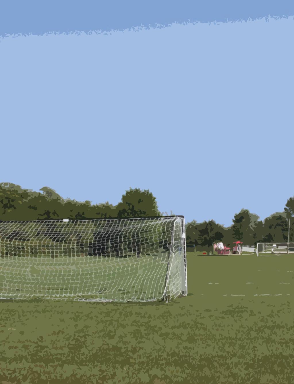
20 CASTLE PARK Classification: Neighborhood park Area: 4.2 acres Description Castle Park serves as a neighborhood park for the southeast part of the community. The park is situated in the center of a large block with limited visibility from the public roads. Pedestrian paths lead into the park from Oxford Drive (1), Penbrook Way (2), and Hartbrook Drive (2). These connect to form a trail system through the park. Castle Park received its name from the concrete, castle-like structures that were once located in the park. These were removed several years ago. Resources Sign Play structure (2) Sand box Slide Teeter-totter Swing, child (4) Swing, infant (2) Spring horses (2) Merry-go-round Sledding hill Multi-purpose field Benches (3) Paved path Shelter Comments BARK RIVER PARK Classification: Neighborhood park Area: 6.0 acres Description Bark River Park is a neighborhood park immediately south of Highway 16 along either side of Bark River. The portion lying west of the river is wooded with a trail following the river. A foot bridge connects to the eastern portion of the park, where the more developed uses are located. The park is adjacent to Hartland North Elementary School, offering play areas and athletic fields associated with the school. Resources Sign Scenic/natural area Softball diamond Multi-purpose field Paved path Parking lot Benches (2) Bleachers (4) Restrooms Drinking fountain Shelter Concession Barbeque grill Comments Village staff have indicated that the pedestrian bridge over the Bark River will need replacement. Several of the ball field improvements in this park are owned and maintained by HAAA through a formal agreement with the Village. 16


21 HARTBROOK PARK Classification: Community park Area: 12.5 acres Description Hartbrook Park is located north of Highway 16 and straddles the Bark River on the Village s north side. It contains areas for passive and active use. The area along the river and to the west is predominantly wooded. The Ice Age Trail and a small wood chip trail pass through this part of the park, and are accessed by a pedestrian bridge over the river. Active uses are located on the eastern portion of the park site, along Rae Drive. Resources Sign Basketball court Baseball diamond T-ball diamond Soccer field (2) Multi-purpose field Volleyball court Paved path Nature trail Scenic/natural area Parking lot Play structure Swing, child (3) Swing, infant (2) Merry-go round Benches (9) Bleachers (2) Restrooms Drinking fountain Shelter Barbeque grill (4) Comments PENBROOK PARK Classification: Community park Area: 28.8 acres Description Penbrook Park is a neighborhood park on the Village s south side. A large portion of this park is made up of wetlands and woodlands. A path connects to Maple Avenue and the Maple Wayside. There are benches along the path, and an overlook of a small wetland. Growing brush has obscured the view. The path is steep and may be difficult for persons with mobility limitations. It is not lighted. Resources Sign Baseball diamond Basketball court Soccer field Multi-purpose field Tennis court (2) Paved path Portable toilets Parking lot Play structure Swing, infant (2) Spring horse (3) Benches (5) Bleachers (2) Shelter Barbeque grill (2) Drinking fountain Comments Portable toilets have been located near the picnic shelter. The distance to existing water and sanitary sewer lines makes installation of a permanent facility in this area overly costly. If provided near the park entrance, the facility would be some distance from the center of use. 17

22 CENTENNIAL PARK Classification: Community park Area: 14.5 acres Description Located on the Village s north side on Highway K, Centennial Park is the newest of the Village s parks. The park is located on the Bark River and the Ice Age Trail passes through it. Both active and passive uses are provided in the park, which contains a significant sports complex for football, baseball, and soccer. Resources Sign Baseball diamond Football field Soccer field (1) Multi-purpose field Volleyball court Paved path Scenic/natural area Play structure Swing, child (2) Swing, infant (2) Benches (4) Bleachers (5) Portable toilets Barbeque grill (6) Parking lot Comments The park does not have a permanent restroom facility. This need was documented in the previous edition of the CORP. The Village may consider providing bicycle racks in the park. The river bank is overgrown with invasive European buckthorn and other plants. Cutting these plants and restoring a native landscape could provide attractive views of the river. Some ball field improvements are owned by the Chiefs, which has entered into a formal agreement with the Village. NIXON PARK Classification: Community park Area: 16.0 acres Description Nixon Park is adjacent to the downtown, east of the Bark River, and is connected to other parks on the river by the Ice Age Trail. It is the most heavily used of the Village s parks. The Village s Fine Arts Center is located within the park. This building provides a stage and backdrop, along with lighting and sound system for live performances. In addition to the Bark River, there is a constructed pond on the south side of the park. Resources Sign Basketball court Baseball diamond T-ball diamond Multi-purpose field Volleyball court Tennis court (2) Paved path Scenic/natural area Parking lot Restrooms Fine arts center Shelter (2) Play structure (2) Sand box Slide Swing, child (3) Swing, infant (2) Merry-go round Balance beam Parallel bars Climbing structure Benches (12) Bleachers (2) Drinking fountain (3) Barbeque grill (9) Comments Village staff have indicated that the pedestrian bridge over the Bark River, at the southern end of the park, will need replacement. In 2013, the Village will replace the basketball court with a splash pad. 18

 Comments Village staff have indicated that the pedestrian bridge over the Bark River, at the southern end of the park, will need replacement.")
23 BARK RIVER GREENWAY Classification: Greenway Area: 1.7 acres Description The Bark River Greenway is an urban greenspace extending from Bark River Park south to the central business district, along the Bark River. The Ice Age Trail runs through this greenway. It is an attractive semi-natural environment with grass and mature trees. Resources Paved path Scenic/natural area Benches (3) Comments Village staff have indicated that the pedestrian bridge over the Bark River, at the southern end of the park, will need replacement. MILL PLACE GREENWAY Classification: Greenway Area: 7.3 acres Description The Mill Place Greenway is an urban greenspace lying south of the railroad tracks and along the east bank of the Bark River, extending south from Nixon Park to Cardinal Lane. The Ice Age Trail runs through this greenway. It is an attractive semi-natural environment with grass and mature trees. Resources Paved path Scenic/natural area Benches (3) Comments The open space was not noted in previous editions of the CORP. 19

24 COTTONWOOD WAYSIDE Classification: Conservancy Area Area: 52.7 acres Description Cottonwood Wayside is a small trailhead area providing access to the Ice Age Wetland, an extensive natural area owned by private conservation organizations. The primary feature of the area is a wood chip path and shelter. Resources Scenic/natural area Wood chip path Bench (1) Parking lot Shelter Comments In previous editions of the CORP, the area of this recreation site was combined with a portion of the conservation land owned by others. MAPLE WAYSIDE Classification: Conservancy Area Area: 28.9 acres Description Maple Wayside is a small trailhead area providing access to the Ice Age Wetland. The land on which the facility is located is owned by the Ice Age Park and Trail Foundation. In addition to wetland features, this natural area includes a steep hillside with many mature oak trees. While there are many invasive species, the Village has worked with volunteer groups to remove these. Resources Scenic/natural area Gravel path/boardwalk Parking lot Comments In previous editions of the CORP, the area of this recreation site was combined with a portion of the conservation land owned by others. FUTURE PARK SITE NORTHWEST PARK Classification: undeveloped Area: 6.0 acres (approximately) Description This is an undeveloped site intended as a future passive park. Resources none Comments Due to the topography, this site will be developed primarily as a passive park. 20
25 Sunnyslope Park Nottingham Park Louis Joliet Park Castle Park Bark River Park Hartbrook Park Penbrook Park Centennial Park Nixon Park Bark River Greenway Mill Place Greenway Cottonwood Wayside Maple Wayside Future Park Site TABLE 9 SUMMARY OF PARK FACILITIES AND EQUIPMENT Area (acres) Classification M M N N N C C C C G G R R U Park sign Parking lot Shelter Restrooms 1 1 a a 1 Concession 1 Stage (Fine Arts Center) 1 Drinking fountain Bleacher Bench Barbeque grill Paved path Nature trail 1 1 Natural/scenic area Sledding hill 1 Play structure Swing, child Swing, infant Spring horse Merry-go-round Teeter totter 1 Slide 1 1 Balance beam 1 Parallel bars 1 Climbing structure 1 Sand box 1 1 Baseball diamond Softball diamond Football field 1 Soccer field Multi-purpose field Basketball court Basketball ½ court 1 Tennis court 2 2 Volleyball court a) portable toilets M Mini park; N Neighborhood park; C Community park; G Greenway; R Conservancy area; U Undeveloped 21

26 TABLE 10 TOTAL ACRES OF VILLAGE PARK LAND Facility Type Number Acres Community parks Neighborhood parks Mini parks Conservancy areas Greenways Undeveloped TOTAL PRIVATELY OWNED PARK AND RECREATION SITES Recreation opportunities can be provided by organizations other than governments. Residential subdivisions may hold land in common ownership, often to provide stormwater management or similar functions, but also to meet the recreational needs of residents. In other cases a non-profit land conservancy may acquire property containing significant environmental or cultural features, and providing public access. Within Hartland, the Ice Age Park and Trail Foundation and the Waukesha County Land Conservancy have acquired several properties for conservation purposes. Several subdivisions have constructed walking and cycling paths on property they own in common. ICE AGE WETLAND Classification: Private Park / Conservancy Area Area: acres Description The Ice Age Wetland is a large natural area owned by two conservation organizations. The Ice Age Park and Trail Foundation owns a total of acres lying on either side of Cottonwood Avenue. The Waukesha County Land Conservancy owns another 27.6 acres west of Cottonwood Avenue. In addition to the wetland, this area contains significant oak uplands. Access is provided through Cottonwood Wayside and Maple Wayside. Resources Comments Scenic/natural area Gravel path/boardwalk Only a portion of these conservancy lands were identified in previous editions of the CORP, combined with Cottonwood Wayside. The Ice Age Park and Trail Foundation may look to the Village or Waukesha County to take ownership of its portion of the wetland, as the organization does not have the capacity to sustain restoration and maintenance. HOMEOWNER ASSOCIATION OPEN SPACE Many of Hartland s subdivisions have provided open space for the use of home owners. These open spaces frequently serve as buffers from other development, utility easements or drainage corridors. Trails have been developed through some of these corridors to provide walking opportunities for residents of the subdivision. The 22
27 Village should secure public access easements to these open spaces through the subdivision review process, especially if they will be used to offset park land and facility impact fees. SCHOOL PARKS Recreational facilities associated with schools can help to meet the demand generated by community residents. Five public schools are located in or adjacent to Hartland neighborhoods. These total acres and include: Arrowhead High School a 69.2 acre site with baseball diamonds (2), running track, soccer fields (3), softball diamonds (3), tennis courts (12), a field hockey/lacrosse field, and football stadium. Hartland North Elementary School a 13.8 acre site with baseball diamond, basketball courts (3), playground, and soccer field. This site is located adjacent to Bark River Park. Hartland South Elementary School a 10.2 acres site with baseball diamond, basketball courts (3) and playground. North Shore Middle School a 48.9 acre site with baseball diamond, basketball courts (2), playground, and soccer field. Swallow School a 10.3 acre site with playground and soccer field. TRAIL SYSTEMS Hartland is well served by approximately 8.7 miles of trails, including both those maintained by the Village and the Ice Age Park and Trail Foundation. These include 6.0 miles of paved surfaces and 2.7 miles of unpaved surfaces, which may include wood chip paths, gravel or earthen trails, and boardwalks. These are summarized in Table 11. TABLE 11 APPROXIMATE LENGTH OF HARTLAND TRAILS (MILES) Total Length Asphalt of Concrete Surface Wood Chip, Gravel, Earthen, or Boardwalk Surface Ice Age Trail Village of Hartland Trail Ice Age Wetlands Trail TOTAL Does not include on-street segment through downtown Hartland. A portion of the trail is owned and maintained by Waukesha County. 2 Trail segments in Centennial, Hartbrook, Penbrook, and Castle Parks, Mill Place Greenway, and Cottonwood Wayside, does not include segments of designated Ice Age Trail In addition to these trails, several more miles of trails have been developed within subdivisions in the community. The Hartridge Homeowners Association, for instance, maintains approximately 1.5 miles of trails on common space within the subdivision, and the River Reserve Homeowners Association maintains about 1.6 miles of trails. ICE AGE TRAIL AND ICE AGE SCENIC DRIVE A segment of the 1000-mile long Ice Age National Scenic Trail passes through Hartland. While the entire trail is still under development, those portions passing through Hartland have been completed. The Aldo Leopold Overlook and Cottonwood Wayside, and the John Muir Overlook and Maple Wayside are a part of the Ice Age Trail. It also 23
28 passes through Penbrook Park, Nixon Park, Bark River Park, Hartbrook Park, and Centennial Park. The Village may consider two enhancements to the trail: Install additional signage, particularly directional signs in places where the trail is routed onto local streets, such as through the downtown and under Highway 16. Install trailhead features at the Cottonwood Wayside, Nixon Park, and Centennial Park, providing information about the Ice Age Trail and a map of its route through Hartland. WAUKESHA COUNTY RECREATION AREAS Four County parks are located in or near the Village of Hartland. Due to their proximity these facilities may be considered the most likely to meet the needs of community residents. In addition to these parks, the County has developed several special use facilities meeting the needs of all County residents, including the Eble Ice Arena, the Retzer Nature Center, and the Exposition Center. Naga-Waukee Park is a 414-acre park located within the City and Town of Delafield. It includes land along the shoreline of Pewaukee and Nagawicka Lakes and the Naga-Waukee War Memorial Golf Course. The Lake Country Recreation Bike Trail is located along the southern boundary of the park. The Ice Age Trail passes through the park. Other facilities include a beach with beach house, boat launches on both lakes, a campground, hiking trails, five covered picnic shelters, a multi-purpose field, and a legacy forest. There is also a barn and maintenance building. Improvements recommended in the County s 2009 plan include restroom upgrades, a color-coded looped trail system, upgrade for RV sites in the campground, and a sledding hill. Nashotah Park is located in the Towns of Merton and Delafield, and totals 444 acres. The County has identified another 9.5 acres for potential acquisition and access to Forest Lake. The conservancy area for Nashotah Park covers acres. The park has a varied glacial terrain, and contains trails, multi-purpose field, two picnic shelters, a sledding hill, a legacy forest, and a barn and maintenance building. It is also home to one of two dog exercise areas currently in the County park system. Planned improvements include a developing campground with an overnight lodge, restroom upgrades, constructing a natural outdoor amphitheater, and installing nature trails and interpretive signage. Ryan Park is a largely undeveloped 204 acre site within the Town of Lisbon and City of Pewaukee. Another 112 acres has been identified for potential acquisition. Approximately half of the existing park area is maintained in agriculture. There are maintained trails for equestrian, dog walking, and hiking. The County maintains a native plant nursery on the site. Minimal improvements are planned, aside from prairie and forest restoration activities and trail development. Bark River Greenway and Trail is a 16-mile route following the Bark River through the Town of Lisbon, the Town and Village of Merton, the Village of Hartland, and the City of Delafield, where it enters Lake Nagawicka. It then continues through the Town of Summit, the Village of Dousman, and Town of Ottawa before crossing into Jefferson County. A total of 402 acres of the greenway are presently in public ownership, with another 1,082 acres identified for acquisition. The Bark River Trail, which shares sections with the Ice Age Trail, would provide a north-south trail in the northwestern portion of the County, since bicycling and horses are not permitted on the Ice Age Trail property. Waukesha County will develop the trail, connecting to the Bugline Trail, the Lake Country Trail, and Glacial Drumlin Trail. STATE OF WISCONSIN RECREATION AREAS Lapham Peak is the nearest unit of the Wisconsin State Park system. The park contains the highest point in Waukesha county with a elevation of 1,233 feet above sea level. It is maintained in a natural condition with ongoing restoration of the native landscape. The park contains over 25 miles of trails maintained for hiking and cross country skiing, an outdoor stage, a 45-foot tall observation tower, picnic areas, and a nature center. 24
29 PARK AND RECREATION ASSESSMENT As a part of its Comprehensive Outdoor Recreation Plan update, the Village of Hartland has included an evaluation of its existing park and recreation facilities to assess compliance with common standards for maintenance, safety, and handicapped accessibility. The key findings of the Village s parks system assessment include: Parks are well-distributed throughout the community. Most residents are within walking distance (½ mile) of a park. Pedestrian and vehicular access to the park system is very good with path or sidewalk access and adequate on-street parking available for the majority of park sites. Parks are very well maintained and relatively free from safety or ADA compliance concerns. The level of service compares well to the Village s adopted standards. GENERAL MAINTENANCE REVIEW A handful of observations were made during a physical reconnaissance of the Village s parks and recreation areas. These include: The drought of 2012 has taken a toll on vegetation in several parks. The Village will need to monitor conditions in subsequent years and may need to invest in additional landscaping to replace trees and shrubs that do not survive. It may be necessary to increase the frequency of ball field maintenance. Several benches, particularly in Hartbrook Park, have settled at odd angles. These should be reset. While path surfaces are generally good, there were two areas of concern. The shelter in Hartbrook Park is in need of painting. PLAYGROUND SAFETY EVALUATION The 1997 edition of the U.S. Consumer Product Safety Commission s Handbook for Public Playground Safety establishes standards for the design and installation of common park furnishings and athletic facilities. This is the third time that Village parks have been assessed to identify potential conflicts with these standards, and as might be expected, few concerns were identified. It should be noted that Village parks contain two slides with metal surfaces. The Handbook for Public Playground Safety discourages use of metal surfaced slides as they can become hot, potentially causing injury. Hartland has noted that plastic slides recommended for safety purposes will cause problems for persons with ear implants. For this reason, the Village has made a decision to leave some of the metal-surfaced slides in its parks. As a guideline, these slides should be located facing north, and where possible, in shaded locations to reduce the chance of the metal becoming overly hot. The assessment was conducted in August of Concerns identified at the time include the following: As a safety measure, the Village may want to consider placing warning signage along heavily traveled roads where the Ice Age Trail crosses (ex., East Capitol Drive, Cottonwood Avenue, Lisbon Road, and North Shore Drive these last two roads are county highways) The Village provides grills in several parks, but does not provide a place to dispose of hot coals. This may be a consideration to discourage people from dumping coals onto the ground where they may kill vegetation, or in waste cans where they may cause a fire. 25
30 Two tennis courts are located within Nixon Park, surrounded by a chain link fence. Standard recommendations for a safety zone around tennis courts are 12 feet on either side and 21 feet on either end. The asphalt basketball court in Nixon Park is deteriorating and would have needed eventual resurfacing. This issue will be eliminated as the court will be replaced in 2013 with a splash pad. Swings provided in Castle Park are very high off the ground (30 inches or more). While the Handbook for Public Playground Safety establishes a minimum distance of 12 to 24 inches off the ground, it is silent on a maximum height. Still, the village may consider lowering the swings to 24 inches from the ground. ADA COMPLIANCE Hartland has made exceptional efforts to provide access to provide access to its park and recreation facilities to residents with physical disabilities. The Village has acted on recommendations in the prior edition of the CORP to provide an off-street, handicapped-accessible parking stall at Castle Park and ensure that all entrances have a handicapped mountable curb. The only potential issue noted during this evaluation is that a bench chained to a post for the concession stand in Bark River Park blocks the only accessible access to the bleachers. This bench should be moved. LEVEL OF SERVICE The Village has established two types of measures used to determine if community outdoor recreation needs are being adequately met. The first of these is what is commonly referred to as a level of service ratio, or the number of a particular kind of feature provided per a given number of persons. The standards adopted by the Village, and the actual ratios attained, are summarized in Tables 12 through 14. The second measure is related to accessibility. Previously, the Village has used a linear distance from a park to determine whether residents are adequately served. In this update to the plan, the Village has designated neighborhood and community areas served by its parks. This evaluation also projects future park needs as the community population grows. Even before considering the availability of school resources, Hartland has a surplus capacity for most sports fields, such as baseball diamonds and soccer fields. Projected demand for these resources, as the population increases in coming years, will not create a demand for new sports facility construction. PARK LAND AREA Table 12 shows the amount of land area in Hartland parks compared to Wisconsin and National Park and Recreation Association standards. Hartland currently has a total of acres of park land, not including an undeveloped Northwest Park site, or open space and recreation lands owned by others. Wisconsin communities of a similar size have an average of acres of park land for every 1,000 residents. Including only Village-owned properties, Hartland provides acres per 1,000 residents, or slightly below state average. When land owned by the Ice Age Park and Trail Foundation (132.0 acres), and Waukesha County Land Conservancy (27.6 acres) are added in, the number of acres per 1,000 residents increases to This exceeds the state average. Additionally, many of the Village s subdivisions provide commonly-owned open space for their home owners. Anticipated population growth by 2020 will create an increased demand for park space. Based on the projected population of 9,898, the Village would need to maintain a total of acres of park and recreation land to reach the state average. With acres of public park land, (including the approximately 6-acre Northwest Park site) the Village would fall short of that mark. Once the acres of private conservancy land are added in, there is a surplus of acres (or an average of acres per 1,000 residents). 26
31 The National Park and Recreation Association has established widely used standards for the provision of parks in a community. These recommend ten acres of park land (of all types) per 1,000 residents, and also establish a range of acres to be provided for specific park types. For community parks, a range of five to eight acres per 1,000 residents is recommended. One to two acres of neighborhood parks should be provided for each 1,000 residents. The Village currently meets or exceeds these standards. Assuming that the Northwest Park is developed, in 2020 the Village will have acres of park land for every 1,000 residents. Park Type TABLE 12 LEVEL OF SERVICE COMPARISON FOR PARK AREA Standard (acres/1000) Village Facilities (acres/1000) 2012 Acres Surplus or (Need) in acres Target 2020 Need (acres) 2020 Acres Surplus or (Need) in acres All Parks (WI Avg.) (23.99) (33.98) All Parks (NPRA) Community Parks 5 to to Neighborhood Parks 1 to to Based on this analysis alone, it does not appear that the Village will need to obtain additional park and recreation lands to continue to meet its service standards through However, the Village has also established an accessibility standard (barrier-free, walkable access to a neighborhood park), and potential growth in the northeastern part of the Village suggests the need to acquire a future park site in that area. TRAIL SYSTEMS Trail systems are a more recent consideration in local park and recreation planning. Walking or hiking, as well as bicycling, are among the most popular outdoor recreational activities. A good trail system provides a safe and pleasant means of accessing parks, recreation sites, and other community destinations, such as the downtown business district or library. Recognizing this, communities have made significant investments in establishing trail systems over the past two decades. In its analysis for the Statewide Comprehensive Outdoor Recreation Plan, the State of Wisconsin found that the typical community the size of Hartland provides a total of 1.1 miles of trail for each 1,000 residents. Table 13 compares Hartland s trail system to these averages. Trail lengths are estimated. Trail Type TABLE 13 LEVEL OF SERVICE COMPARISON FOR TRAILS Standard (miles per 1,000 residents) Village Facilities (miles) Target for Current Population (miles) Surplus or (Need) Target 2020 Need Surplus or (Need) Trails, bicycle (paved) Trails, hiking (unpaved) (3.59) 6.83 (4.13) TOTALS (1.33) (2.19) Hartland has a far greater number of miles of paved surface trails than is typical, while having fewer trails with an unpaved surface. As paved trails may be used by either walkers or bicyclists, this should not be perceived as a deficit situation. 27
32 Overall, the Village falls below the average length of trail provided per 1,000 residents. These figures, however, do not include trail systems provided by homeowner associations within subdivisions, which often connect residents to public park sites, or at a minimum will provide recreational walking opportunities within the subdivision. As the population increases there will continue to be a demand for trails within the community. These may be provided by the Village or by individual subdivisions, with consideration for the following standards: Trails within subdivisions should be designed as a network to connect with trail systems in adjoining subdivisions, and to lead to public parks or other common destinations Trails should be constructed to Village-defined engineering standards The Village should secure public access easements to assure continued access by all residents to these trails RECREATIONAL FACILITIES Table 14 identifies standards for recreational fields and other facilities, and measures the provision of these resources within Hartland. Even without counting facilities available at local school sites, Hartland does a good job of providing the resources to meet the athletic and play needs of its residents. Based on the analysis, there does not appear to be a need to construct additional facilities based on demand. It is expected, however, that the Northwest Park site may need facilities to serve its neighborhood population. In prior years the Village did prepare an outdoor skating rink in Nixon Park during winter months. This practice was discontinued after a series of warm winters made maintaining the rink difficult. With increasing levels of interest in hockey and ice skating, the Village may continue to monitor weather patterns and periodically assess whether it may once again construct ice skating rinks in its parks. Recreational Facility Type TABLE 14 LEVEL OF SERVICE COMPARISON FOR RECREATION FACILITIES Standard (per 10,000 people) Village Facilities Target for Current Population Surplus or (Need) Target 2020 Need Surplus or (Need) School Facilities Baseball diamond Baseball diamond (lighted) Total Village and School Softball diamond Football field Soccer field Basketball court Tennis court (0.56) 4.95 (0.95) Volleyball court Sledding hill Ice rink (outdoor) (0.46) 0.49 (0.46) 0 0 Playground

33 ACCESS STANDARD The Village seeks to ensure that all community residents have walkable access to a neighborhood park. In prior iterations of the plan, this was defined as having a neighborhood park located within a ¼ to ½ mile radius of all residential areas. Figure 1 is a map from the 2007 Comprehensive Outdoor Recreation Plan depicting a ¼ mile radius (shaded yellow) and ½ mile radius (dashed black line) around the Village s neighborhood parks. It includes a proposed Northwest Park site among these. The map demonstrates that most parts of the Village are located near a neighborhood park, with the exception of the east and northeastern residential neighborhoods. An additional residential area to the south also fails to meet the distance standard. Park planners are increasingly shunning the distance/radius approach to defining park service areas. Straight line distances do not reflect street networks, the availability of sidewalk or path connections to parks, barriers such as high-traffic roadways, rivers, or railroads, and other features that may discourage walking to a particular park. At the same time, there is a realization that people will walk a distance greater than ½ mile. This update to the Comprehensive Outdoor Recreation Plan establishes neighborhood service areas for neighborhood parks, based on development patterns and density, barriers (the railroad, Highway 16, and heavily traveled roads), and proximity of other parks. The new neighborhood service areas are depicted in Figure 2 on the following page. Figure 2 suggests that there are three parts of the Village that may not be well served by the existing park system. 1. North of County Highway K, residents may have to cross a street with a traffic count in excess of 5,000 cars per day, or may be more than ½ mile from Centennial Park. As new residential development occurs in this area, the Village should assess opportunities to acquire land for a new park, perhaps through the park dedication requirement in the Subdivision Ordinance. FIG. 1 NEIGHBORHOOD PARK SERVICE AREAS 2007 CORP 2. The central western part of the Village is cut off from existing parks by Highway 16 on the north, the railroad tracks to the south, and high volume roadways on the west. Distance is also a factor. This area, including the unincorporated lands outside of Village borders, is settled with a low density development pattern. Some sites may still be developed. If this were to occur, the Village may have an opportunity to acquire land for a park to serve this part of the community. 29

34 Fig. 2 Neighborhood Park Service Areas 3. While the southwestern portion of the Village is dominated by commercial or industrial uses, there is a small residential area that is presently not well served by a neighborhood park. The Ice Age Park and Trail Foundation and the Waukesha County Land Conservancy both own a substantial land area (the Ice Age Wetlands). There have been prior discussion about the opportunity to provide a small playground or other neighborhood park amenities on these sites, however, the Village has determined that there is not sufficient demand to warrant the substantial investment. Census data from 2010 show that there are a total of 416 people residing in
1. Parks & Recreation Neighborhood Parks Community Parks Special Use Sites 2. Open Space 3. Trails
 Appendix A: Park Classifications The intent of parks and recreation classifications is to aid in making acquisition and design decisions for park sites, facilities and the organization of recreation space
Appendix A. Park Land Definitions
 Appendix A Park Land Definitions Mini Park May serve specific function for any and all ages, depending on need of the user area. Size range 1-5 acres with optimum size being 3 acres. Service area is sub-neighborhood
Courthouse Planning Area
 Courthouse Planning Area Current Reality The Courthouse Planning Area is the characterized by expansive suburbanscale residential areas as well as the community resource planned area of athletic, educational,
Outdoor Recreation Facilities Inventory
 Outdoor Recreation Facilities Inventory Allouez Neighborhood Parks: East Lawn Park (4.90 acres) is located in the northeastern corner of Allouez near Boyd Street. This site contains: Baseball diamond with
PARTF Scoring System for Grants
 PARTF Scoring System for Grants The members of the N.C. Parks and Recreation Authority use the PARTF scoring system as one of several tools to select grant recipients. Please provide all of the information
6. RECREATION AND OPEN SPACE ELEMENT
 6. RECREATION AND OPEN SPACE Introduction This Recreation and Open Space Element includes Goals, Objectives and Policies (GOP) that apply to the main campus in Gainesville and the Lake Wauburg Recreation
3.2 P - Park District
 3.2 P - Intent - The P: s are established to promote and maintain the development of recreational opportunities within the. The development of new parks or the major expansion of existing parks within
APPENDIX D2: PARKS AND TRAILS
 APPENDIX D2: PARKS AND TRAILS Cultivate Hopkins Comprehensive Plan 8/15/18 DRAFT Cultivate Hopkins Appendix D2 1 Existing Conditions Local Parks and Trails Figure D2.1 shows the existing park and trail
SEWRPC OUTDOOR RECREATION AND OPEN SPACE PLANNING OBJECTIVES, PRINCIPLES, AND STANDARDS
 SEWRPC OUTDOOR RECREATION AND OPEN SPACE PLANNING OBJECTIVES, S, AND STANDARDS Introduction The Southeastern Wisconsin Regional Planning Commission (SEWRPC), as part of the regional park and open space
Mendota Heights 2040 Comprehensive Plan Draft Vers
 4 Parks and Trails The City of Mendota Heights boasts a variety of recreational and open space opportunities. Few cities can claim access to regional trails, riverside and lakeside parks, scenic bluffs
CHAPPLES PARK MASTER PLAN
 CHAPPLES PARK MASTER PLAN Presentation of Preliminary Development Options Public Open House #2 Wednesday November 2 nd, 2016 TONIGHT S AGENDA 1. Welcome & Introductions 2. Presentation by Sierra Planning
Support the implementation of Cape Coral's Comprehensive Plan. Protect and utilize the unique natural resources in the City.
 7.0 OVERVIEW - RECOMMENDATIONS Chapter 7 The preparation of the Cape Coral Parks and Recreation Master Plan spanned a period of approximately 12 months. Plan preparation included the input of a wide range
Southeast Quadrant Plan
 Southeast Quadrant Plan Southeast Quadrant Distinctive Features Land Use The Southeast Quadrant includes all the area within the planning area that is east of Interstate 5 and south of State Route 44.
a) Inventory of all existing privately-owned, state-owned, or local governmentowned recreational facilities and open spaces within the context area
 Inventory of all existing privately-owned, state-owned, or local governmentowned recreational facilities and open spaces within the context area") 8.0 RECREATION AND OPEN SPACE ELEMENT (1) DATA REQUIREMENTS a) Inventory of all existing privately-owned, state-owned, or local governmentowned recreational facilities and open spaces within the context
8.0 RECREATION AND OPEN SPACE ELEMENT (1) DATA REQUIREMENTS a) Inventory of all existing privately-owned, state-owned, or local governmentowned recreational facilities and open spaces within the context
Parks, and Recreation & Cultural Arts Master Plan Update
 Parks, and Recreation & Cultural Arts Master Plan Update Community Profile Public Input Summary: Staff Interviews conducted April 14 and 15, 2014 Citizens Workshop - conducted April 15 th and 24 th, May
Section 3 INVENTORY OF RECREATION LAND AND FACILITIES
 Photo of Juan Bautista de Anza Park Section 3 INVENTORY OF RECREATION LAND AND FACILITIES Summary of Findings Park Definitions Summary of Recreation Facilities Other Recreation Facilities Nearby Recreation
PARKS & RECREATION SUBCOMMITTEE. Oct. 1, 2015
 PARKS & RECREATION SUBCOMMITTEE Oct. 1, 2015 1999 Bond - $22,000,000 Land Acquisition Allen Station Phase II Neighborhood Parks PREVIOUS BOND ELECTIONS 1999 & 2007 2002 Bond - $4,000,000 Allen Senior Recreation
Pungo/Blackwater Planning Area
 Pungo/Blackwater Planning Area Current Reality The Pungo/Blackwater Planning Area represents the rural landscape and lifestyle that encompasses nearly 40% of Virginia Beach. The Agricultural Reserve Program
STAFF RECOMMENDATION: Adopt the Parks and Recreation Master Plan 2013, or take other action as deemed appropriate.
 Regular 7. CITY COUNCIL AGENDA Meeting Date: 12/02/2013 TITLE: Parks and Recreation Master Plan 2013 Adoption Proposal - Dwight Curtis Responsible Staff: Dwight Curtis Backup Material: Backup material
SCHOOLS, PARKS AND TRAILS
 Schools, Parks, and Trails Page 1 of 12 SCHOOLS, PARKS AND TRAILS BACKGROUND Public Schools in the Clifton-Fruitvale Community include Clifton Elementary, Rocky Mountain Elementary, Grand Mesa Middle,
City Council March 27, Parks, Recreation, and Trails Master Plan
 City Council March 27, 2018 Parks, Recreation, and Trails Master Plan Planning Process Develop Goals and Objectives Inventory of Areas and Facilities Needs Assessment And Identification Public Participation
Executive Summary. Parks and Recreation Plan. Executive Summary
 Parks and Recreation Plan Executive Summary The Whitemarsh Township Parks and Recreation Plan sets forth a vision for how Whitemarsh Township can provide a premiere parks and recreation system reflective
Appendix D OUTDOOR RECREATION AND OPEN SPACE PLANNING OBJECTIVES, PRINCIPLES, AND STANDARDS FOR WASHINGTON COUNTY
 Appendix D OUTDOOR RECREATION AND OPEN SPACE PLANNING OBJECTIVES, S, AND FOR WASHINGTON COUNTY OBJECTIVE NO. 1 The provision of an integrated system of public -use outdoor recreation sites and related
Little Neck Planning Area
 Little Neck Planning Area Current Reality The Little Neck Planning Area is characterized by established residential neighborhoods, Town Center and Pembroke. The Eastern and Western Branches of the Lynnhaven
Northeast Quadrant Plan
 Northeast Quadrant Plan Northeast Quadrant Distinctive Features Land Use The Northeast Quadrant includes all the area within the planning area that is east of Interstate 5 and to the north of State Route
Provide and maintain sufficient public parks, recreation facilities, and open space to meet the recreational needs of County residents and visitors.
 (ROS) Goal Provide and maintain sufficient public parks, recreation facilities, and open space to meet the recreational needs of County residents and visitors. OBJECTIVE ROS.01 The County shall acquire,
Great Neck Planning Area
 Great Neck Planning Area Current Reality The Great Neck Planning area is characterized primarily by large lot/lowdensity residential development with the majority of recreational opportunity existing as
PARKS AND RECREATION
 PARKS AND RECREATION WHAT YOU WILL FIND IN THIS CHAPTER: Background information on the development of the Park, Recreation, and System Plan (PRSP). General overview of Ellensburg s parks and recreation
Open Space and Recreational Facilities
 Chapter 5: Open Space and Recreational Facilities A. INTRODUCTION According to the guidelines of the 2001 New York City Environmental Quality Review (CEQR) Technical Manual, an open space analysis is necessary
Kempsville Planning Area
 Kempsville Planning Area Current Reality The Kempsville Planning Area is by far the most populated planning area in the City. The preservation of the 1,422 Stumpy Lake Natural Area, the largest City-owned
The urban parks in Charlottesville include Jackson Park, Lee Park, and McGuffey Park.
 Park Classifications Charlottesville s parks can be grouped into 4 different classifications: urban parks, neighborhood parks, community parks, and regional parks. Figure 1 on page 5 inventories the facilities
RECREATION AND OPEN SPACE VISION
 City of South Lake Tahoe General Plan Policy Document Recreation and Open Space Element INTRODUCTION This element provides the policy context for the City of South Lake Tahoe to achieve its vision for
Neighborhood Districts
 NEIGHBORHOOD DISTRICTS SEVEN MAIN DISTRICTS Neighborhood Districts While the Development Plan provides a broad-scale overview of the neighborhood, this section focuses on uses and relationships at the
Chapter 6. Overall Vision RECOMMENDATIONS. More Trail and Trail. Connections. Equal Access to Park. Facilities and Programs. Water Access.
 Overall Vision More Trail and Trail Connections Equal Access to Park Facilities and Programs Water Access Environment Variety Chapter 6 RECOMMENDATIONS Chapter 6 The following recommendations for park,
Draft Stillwater 2030 Comprehensive Plan- Goals and Policies
 Draft Stillwater 2030 Comprehensive Plan- Goals and Policies Instructions- Review each goal and policy and discuss with group any changes, deletions for additions to the list using your groups pen. Keep
Comprehensive Plan ADOPTED APRIL 2014
 Comprehensive Plan ADOPTED APRIL 2014 8 8. Outstanding Recreational & Cultural Opportunities We are proud of our community s parks and recreation system. Our community will ensure that the legacy of our
ANCHORAGE PARK REPORT CARD Assessing A Park s Appearance, Function, & Condition
 ANCHORAGE PARK REPORT CARD Assessing A Park s Appearance, Function, & Condition Park Name: Is Your Park an A or an F? Your Name: Contact Information Optional: Date: General Instructions: Phone: Email:
Comprehensive Park System Master Plan
 PARKS AND RECREATION Comprehensive Park System Master Plan Citizen Advisory Committee, June 5, 2012 - Meeting Notes Transcription MIG met with the Parks Citizen Advisory Committee on Tuesday, June 5th,
City of Bonney Lake Allan Yorke Park. MASTER PLAN SUMMARY REPORT June 30, 2016
 City of Bonney Lake Allan Yorke Park MASTER PLAN SUMMARY REPORT June 30, 2016 TABLE OF CONTENTS INTRODUCTION PUBLIC INVOLVEMENT PROCESS MASTER PLAN North Park Central Park South Park East Park Field Development
Chapter 5: Recreation
 Chapter 5: Recreation Introduction and Setting Recreational opportunities within Nevada County are varied, ranging from public parks with intensively used active recreational facilities, to vast tracts
Master Plan Workshop October 25, 2007 Charlotte Mecklenburg Government Center
 Master Plan Workshop October 25, 2007 Charlotte Mecklenburg Government Center Land Discussion 1. What are the most important land related issues we need to address? Protect natural areas Passive walking
RECREATION AND OPEN SPACE ELEMENT GOALS, OBJECTIVES, AND POLICIES
 RECREATION AND OPEN SPACE ELEMENT GOALS, OBJECTIVES, AND POLICIES Goal 7 To provide park facilities, recreation programs, and open space resources that are safe, adequate, and accessible to all City residents,
CHAPPLES PARK MASTER PLAN. Presentation to Council April 10, 2017
 CHAPPLES PARK MASTER PLAN Presentation to Council April 10, 2017 1 PRESENTATION AGENDA 1. Project Background, Aim and Process 2. The Site Issues and Opportunities 3. Community Engagement 4. Vision and
PARKS. Chapter Introduction
 Chapter 4. PARKS 4.1. Introduction This Parks Element of the 2016 Comprehensive Plan Update provides direction and guidance, based on citizen input, in order to improve and maintain the City s existing
The following principles guide the development of goals and strategies to protect and promote these amenities:
 OPEN SPACE/PARKS/TRAILS/RECREATION GOALS/STRATEGIES Cherry Hills Village is a living environment that offers low density development, open areas, public scenic vistas, public trails and public parks. This
The only significant recreation deficiency in Conway is the absence of an integrated greenway and multipurpose trail system.
 CHAPTER 6 RECREATION 1. Introduction This recreation chapter is prepared in compliance with recently revised state statutes dealing with the completion of municipal master plans [RSA 674:2 III (F)]. This
Improve Neighborhood Design and Reduce Non Point Source Water Pollution
 HOW TO Planning Guide Improve Neighborhood Design and Reduce Non Point Source Water Pollution This document was funded by a grant from the New Hampshire Coastal Program with funding from the National Oceanic
The transportation system in a community is an
 7 TRANSPORTATION The transportation system in a community is an important factor contributing to the quality of life of the residents. Without a sound transportation system to bring both goods and patrons
Durango Parks & Recreation Department. Strategic Plan
 Durango Parks & Recreation Department Strategic 2019-2023 Adopted April 2019 Overview The purpose of the adopted 2010 Parks, Open Space, Trails and Recreation Master is to provide a 10-year road map for
CARMODY PARK MASTER PLAN
 the site Smith Reservoir Cottonwood Lake Kendrick Lake Carmody Rec Center Carmody Middle School Pool Court Play Carmody Pond Sanderson Ditch Sports Fields Foothills Ice Arena Open Field why a master plan?
OPEN SPACE CHAPTER 7: OVERVIEW. Preserve open space to protect natural resources, enhance character and provide passive recreation opportunities
 CHAPTER 7: OPEN SPACE OVERVIEW Ridgefield has made tremendous progress permanently preserving areas of town as open space. Open space preservation can serve many important purposes, including: protect
GOALS, OBJECTIVES, POLICIES & PROGRAMS
 Chapter 5 GOALS, OBJECTIVES, POLICIES & PROGRAMS 5.1 Goals, Objectives, Policies & Programs This is a joint plan adopted by both the Village of Waunakee and the Town of Westport. Both communities will
Canal Winchester Parks Master Plan. Public Meeting 2 Thursday, February 2 6:30pm
 Canal Winchester Parks Master Plan Public Meeting 2 Thursday, February 2 6:30pm Meeting Agenda 1. Project overview 2. Project schedule 3. Public input results Survey Public Meeting #1 Stakeholder Interviews
FY Capital Improvement Program Parks and Landscaping. 8 - Summary
 PARK PROJECTS FY 211-215 Capital Improvement Program Description FY 21 FY 211 FY 212 FY 213 FY 214 FY 215 1 Restroom Bldgs (Replace or Construct)-Jefferson, McDonald, 5,774,623 4,669,623 1,15, Allendale,
A citizen s guide to the. Comprehensive Plan. City of Lakeville, Minnesota 1
 A citizen s guide to the Comprehensive Plan 2008 City of Lakeville, Minnesota 1 Introduction The City of Lakeville completed an update of its Comprehensive Plan in 2008. A comprehensive plan is a tool
CITY OF GAINESVILLE PARKS, RECREATION AND CULTURAL AFFAIRS DEPARTMENT VISION 2020
 CITY OF GAINESVILLE PARKS, RECREATION AND CULTURAL AFFAIRS DEPARTMENT VISION 2020 A BLUE PRINT FOR THE NEXT 20 YEARS The PRCA Vision 2020 Master Plan, adopted in November 2012, addresses the current state
3. VISION AND GOALS. Vision Statement. Goals, Objectives and Policies
 Vision Statement Queen Creek s interconnected network of parks, trails, open spaces and recreation opportunities provide safe and diverse activities and programs that sustain its unique, small town, equestrian
North Oakville East Parks Facilities Distribution Plan. November, 2009
 North Oakville East November, 2009 POLICY CONTEXT 1) Purpose a) The purpose of this document is to be a guide for the location, configuration, design and development of the parks system for the North Oakville
Special Revenue Funds
 Special Revenue Funds Special Revenue Funds account for the proceeds of specific revenue sources (other than special assessments for major capital projects) that are legally restricted to expenditures
3.10 LAND USE SETTING PROJECT SITE EXISTING LAND USE DESIGNATIONS AND ZONING. General Plan Land Use Designations.
 This section of the Draft EIR addresses the existing land uses on and adjacent to the project site and discusses the potential impacts of the proposed project on existing land uses. Key issues addressed
(ALL TIMES LISTED ARE APPROXIMATE AND SUBJECT TO CHANGE. )
") AGENDA TANGENT CITY COUNCIL AND PLANNING COMMISSION JOINT PUBLIC HEARING Wednesday March 16, 2011 PARK COMMISSION SESSION 7:00 p.m.. Bass Estate 32166 Old Oak Drive, Tangent, OR 97389 (ALL TIMES LISTED
AGENDA TANGENT CITY COUNCIL AND PLANNING COMMISSION JOINT PUBLIC HEARING Wednesday March 16, 2011 PARK COMMISSION SESSION 7:00 p.m.. Bass Estate 32166 Old Oak Drive, Tangent, OR 97389 (ALL TIMES LISTED
29 Bella Fontaine Park
 29 Bella Fontaine Park 9565 Bellefontaine Road St. Louis County Parks Master Plan Planning Zone 2 Visit Date: July 2016 Page 1 129 Bella Fontaine Park 9565 Bellefontaine Road St. Louis County Parks Master
Bullhead City Rotary Park Plan Update
 Bullhead City Rotary Park Plan Update PLANNERS/LANDSCAPE ARCHITECTS: RBF Consulting 16605 N 28 th Avenue Suite 100 Phoenix, Arizona 85053-7550 (602) 467-2200 CIVIL ENGINEER: RBF Consulting 16605 N. 28
Comprehensive Parks and Recreation Master Plan. Executive Summary. Submitted To: City of Milton, GA October 2012
 Comprehensive Parks and Recreation Master Plan Executive Summary Submitted To: City of Milton, GA October 2012 Executive Summary The City of Milton envisioned the need for an effective Master Planning
PARK DATA THEMES SUMMARY:
 area and identified key themes that should be addressed in the upcoming design process. The following is a compilation of the themes identified (organized by park). Not every park was addressed in this
Memo Preliminary. City of Miamisburg Parks Site Reconnaissance
 Memo Preliminary To: From: Ms. Rebecca Benna Woolpert, Inc. Date: Subject: City of Miamisburg Parks Site Reconnaissance The consultant team toured the existing Miamisburg Parks to assess current levels
APPENDIX D: PARKS AND RECREATION ACTION PLAN
 APPENDIX D: PARKS AND RECREATION ACTION PLAN Goals The following goals are specific to the development, maintenance, and operation of the existing parks in the Township, as well as the acquisition and
10.0 Open Space and Public Realm
 10.0 Open Space and Public Realm 10.0 Open Space and Public Realm The Public Open Space System is comprised of: outdoor spaces available for public use that are either publicly owned (e.g., parks and
Element 0X Parks, Recreation and Open Space
 Element 0X Parks, Recreation and Open Space Table of Contents 1. Introduction 2. Major Issues, Concerns, and Citizen Input 3. Parks, Recreation and Open Space Goals & Policies 4. Analysis Background and
3.0 Community Consultation. BW Land
 3.0 Community Consultation A BW Land 3.0 Community Consultation See Appendix G The Results of the Public Consultation 3.1 Community Consultation The community consultation consisted of three open house
CITY OF ANN ARBOR // Parks + Recreation. Hillary Hanzel Park Planner + Landscape Architect
 CITY OF ANN ARBOR // Parks + Recreation Hillary Hanzel Park Planner + Landscape Architect CITY OF ANN ARBOR // Parks + Recreation 1. Overview of Parks System 2. Recent + Upcoming Capital Projects 3. History
Oregon SCORP. Assessing Recreation Demand & Supply
 2013-2017 Oregon SCORP Assessing Recreation Demand & Supply SORP Conference: April 13, 2015 2013-2017 Oregon SCORP Supply/Demand Planning Components A County-Level and Regional Planning Approach Oregon
4 C OMMUNITY D ISTRICTS
 4 C OMMUNITY D ISTRICTS N ew development in the Area will include many different types of land uses, including a destination retail area that attracts people from all over the region; recreation opportunities
Concord Community Reuse Project Goals and Guiding Principles. Overarching Goals (OG)
") Concord Community Reuse Project Goals and Guiding Principles Overarching Goals (OG) No priority is implied by the order of presentation of the goals and guiding principles. Overarching goals for the Concord
Concord Community Reuse Project Goals and Guiding Principles Overarching Goals (OG) No priority is implied by the order of presentation of the goals and guiding principles. Overarching goals for the Concord
Arlington, Virginia is a worldclass
 EXECUTIVE S U M M A RY Arlington maintains a rich variety of stable neighborhoods, quality schools and enlightened land use policies, and received the Environmental Protection Agency s highest award for
SECTION 4 OPEN SPACE ELEMENT
 Open Space Element SECTION 4 OPEN SPACE ELEMENT c 4.1 INTRODUCTION 4.1.1 SCOPE OF ELEMENT The state requires every general plan to have an open space element Section 65302{e». The open space element must
PRELIMINARY REPORT. HIGHWAY 18 CORRIDOR NEIGHBORHOOD PLAN VILLAGE OF DOUSMAN November, 2014
 PRELIMINARY REPORT HIGHWAY 18 CORRIDOR NEIGHBORHOOD PLAN VILLAGE OF DOUSMAN November, 2014 This preliminary report presents the initial recommendations for land use within the Highway 18 corridor along
Master Site Development Plan (MSDP) Rocky View County Campus at Balzac East
 Rocky View County Campus at Balzac East") Master Site Development Plan (MSDP) Rocky View County Campus at Balzac East Balzac East, Alberta July 2009 CONTENTS 1.0 purpose 1 2.0 guiding principles 2 3.0 site description 3 4.0 site analysis and county
Master Site Development Plan (MSDP) Rocky View County Campus at Balzac East Balzac East, Alberta July 2009 CONTENTS 1.0 purpose 1 2.0 guiding principles 2 3.0 site description 3 4.0 site analysis and county
TABLE OF CONTENTS. Tables Table UC Davis Park and Open Space Resources
 TABLE OF CONTENTS 4.13 Recreation... 4.13-1 4.13.1 Environmental Setting... 4.13-1 4.13.2 Impacts and Mitigation Measures... 4.13-4 4.13.3 References... 4.13-8 Tables Table 4.13-1 UC Davis Park and Open
Appendix 4 Park, Trail, and Recreation Facilities For more information, call the Park Planning and Stewardship Division at
 Appendix 4 Park, Trail, and Recreation Facilities For more information, call the Park Planning and Stewardship Division at 301-650-4380 montgomery county planning board maryland-national capital park and
Section 4 - Public Realm & Landscape proposals Landscape Masterplan. Section 4 52
 - Public Realm & Landscape proposals Landscape Masterplan 52 Proposed Masterplan - Green Infrastructure Strategy District Park 4.33 Ha to provide Passive and active recreation with a large play area which
Yadkin River Greenway Feasibility Study Fact Sheet Village of Clemmons, Town of Lewisville, Town of Bermuda Run
 Fact Sheet Village of Clemmons, Town of Lewisville, Town of Bermuda Run Project Background The Yadkin River Greenway Feasibility Study is a joint project with the Village of Clemmons, the Town of Bermuda
Proposed Walkability Ordinance for City of Knoxville (6/16/17)
") Proposed Walkability Ordinance for City of Knoxville (6/16/17) New or revised text is highlighted Section 1: Purpose The purpose of this ordinance is to set requirements for walkability and pedestrian
Proposed Walkability Ordinance for City of Knoxville (6/16/17) New or revised text is highlighted Section 1: Purpose The purpose of this ordinance is to set requirements for walkability and pedestrian
SECTION 4(f) DE MINIMIS DOCUMENTATION
 DE MINIMIS DOCUMENTATION") SECTION 4(f) DE MINIMIS DOCUMENTATION Illinois Route 60/83 IL 176 to the intersection of IL 60 (Townline Road) Lake County P-91-084-07 Mundelein Park and Recreation District Project Limit SECTION 4(f)
SECTION 4(f) DE MINIMIS DOCUMENTATION Illinois Route 60/83 IL 176 to the intersection of IL 60 (Townline Road) Lake County P-91-084-07 Mundelein Park and Recreation District Project Limit SECTION 4(f)
Throughout. square. (Crystal City Vision Plan 2050)
") 1: Terms related to the PSMP document 1 public space (see also public realm, civic space) An open space designated on the regulating plan, accessible to all, including Plazas, Mini Parks, and Neighborhoods
1: Terms related to the PSMP document 1 public space (see also public realm, civic space) An open space designated on the regulating plan, accessible to all, including Plazas, Mini Parks, and Neighborhoods
Minto-Brown Island. November 18, City of Salem, Parks & Transportation Services
 Minto-Brown Island Park Master Plan Public Meeting #1 November 18, 2014 City of Salem, Parks & Transportation Services Division, i i Public Works Welcome... and thanks for participating in the master planning
PLANNING & DEVELOPMENT BOARD
 PLANNING & DEVELOPMENT BOARD AGENDA The regular meeting of the PLANNING & DEVELOPMENT BOARD will be held at 6:00 p.m. on DECEMBER 19TH, 2017 in COMMON COUNCIL CHAMBERS, City Hall, 108 E. Green Street,
Appendix E Section 4(f) Evaluation
 Evaluation") Appendix E Section 4(f) Evaluation Appendix E Draft Section 4(f) Evaluation E.1 Introduction This appendix addresses a federal regulation known as Section 4(f), which protects parks, recreation areas,
Appendix E Section 4(f) Evaluation Appendix E Draft Section 4(f) Evaluation E.1 Introduction This appendix addresses a federal regulation known as Section 4(f), which protects parks, recreation areas,
The Recreational Heart of Cannington - MacLeod & Claire Hardy Parks
 The Site Claire Hardy Park and MacLeod Park are both located within the community of Cannington on opposing shorelines of the Beaver River and are accessible to each other by a footbridge spanning the
Focus Groups. 8 Focus Group meetings including 2 with staff, 1 with seniors, and 1 with students
 Project Team Nan Lanahan, Parks & Recreation Jason Gallo, Parks & Recreation Rob Leslie, DEDP John Smolinsky, Planning Board Brent Meredith, Highway Joan Gavrilik, Friends of Parks & Rec MaryLyn Koval,
A LONG RANGE PLAN FOR PARKS AND OPEN SPACES
 A LONG RANGE PLAN FOR PARKS AND OPEN SPACES Town of Lisbon Park Committee Waukesha County, Wisconsin 1 Ver. 2.1 May 2017 A LONG RANGE PLAN FOR PARKS AND OPEN SPACE TOWN of LISBON WAUKESHA COUNTY, WISCONSIN
PCAL Case Study Open Spaces: Blayney Heritage Park
 PCAL Case Study Open Spaces: Blayney Heritage Park Introduction Blayney Heritage Park is an area of high quality open space that offers a range of active and passive recreation facilities. The multi-purpose
RECREATION AND OPEN SPACE ELEMENT
 RECREATION AND OPEN SPACE ELEMENT Last amended August 19, 2008 Table of Contents Objective Page 5.1 Park system defined... 5-1 5.2 Access to parks and recreational facilities... 5-2 5.3 Recreation and
Citizen s Advisory Committee
 Citizen s Advisory Committee 13 Members 6 Meetings (5 Locations) 1 Public Meeting Numerous Report Drafts Countless Hours of Review Immeasurable Input Special Thank You To: Jack Cohen Brian Kile George
City of Fredericksburg, Texas
 City of Fredericksburg Acknowledgements City of Fredericksburg, PARKS, Texas RECREATION & OPEN SPACE Master Plan Prepared by: Dunkin Sims Stoffels, Inc. Landscape Architects / Planners Acknowledgements
City of Talent Capital Improvements Plan
 City of Talent Capital Improvements Plan Report Prepared For: City of Talent Prepared by: Community Planning Workshop Community Service Center 1209 University of Oregon Eugene, OR 97403-1209 Email: cpw@uoregon.edu
Land Use. Chapter 8: Introduction. Land Use Vision. Section I: Current Land Use 8-1
 Introduction Land use is the defining element of the comprehensive plan. It will serve as a framework for decision makers, guiding future growth and development in the Town of Oconto Falls. This chapter
PARK AND RECREATION MASTER PLAN UPDATE
 PARK AND RECREATION MASTER PLAN UPDATE 2014-2018 Prepared for: Avon Parks, Recreation and Beautification Council (PRBC) and Town of Avon Prepared by: Lehman & Lehman, Inc. 24-Apr-14 Mission Statement The
Planning for and Managing Open Space and Natural Areas
 Planning for and Managing Open Space and Natural Areas Increasingly, development proposals in Delaware include large amounts of open space and natural areas. While open space is important as a community
SECTION II SECTION II STATEMENT OF GOALS, OBJECTIVES, PRINCIPLES, ASSUMPTIONS, POLICIES AND STANDARDS
 STATEMENT OF GOALS, OBJECTIVES, PRINCIPLES, ASSUMPTIONS, POLICIES AND STANDARDS 1 2 STATEMENT OF GOALS, OBJECTIVES, PRINCIPLES, ASSUMPTIONS, POLICIES AND STANDARDS INTRODUCTION The New Jersey Municipal