Milwaukee Avenue Corridor Plan
|
|
|
- Belinda Barker
- 6 years ago
- Views:
Transcription


1 Milwaukee Avenue Corridor Plan Public Workshop Agenda 1. Welcome 2. Project scope and process 3. Visioning 4. Existing conditions 5. Workshop stations 6. Tonight's big ideas


2 Project Consultant Scope Team and Process Barry Gore, Project Manager, Camiros Issue sets to be addressed by the study: Real Traffic Site Transit estate capacity markets and planning improvements and movement and streetscape potential redevelopment Intersections Site RTA layout: Grant access control and parking Existing Bus markets and niches Pedestrian Pace movement and environment Niles Free Bus Future Access land uses Decorative Facilities elements and service Potential development sites and concepts
3 Project Schedule Steering Committee and Village Officials and Staff: On-going coordination Public Workshop: Tonight! Design Workshop (Charrette): Mid summer Draft Plan Open House: September Draft Plan Document: October Presentation to Village Board: October

4 Visioning Leslie Pollock, Principal, Camiros Visioning is an exercise for thinking about the future In the future... Milwaukee Avenue is a corridor with attractive shopping destinations.
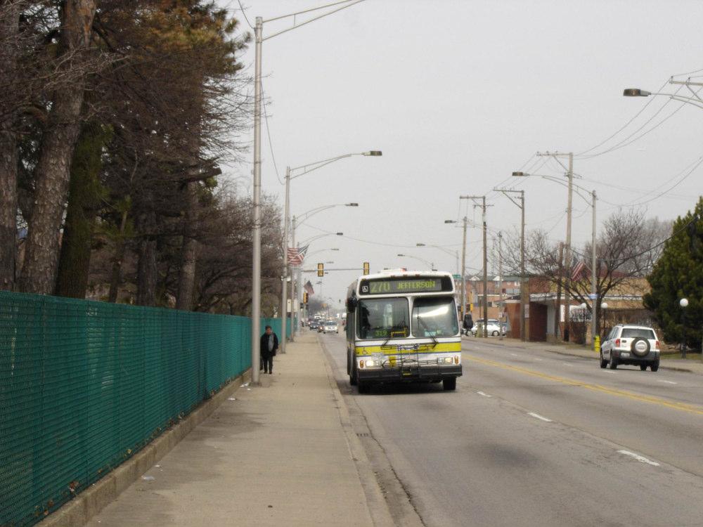
5 Visioning example Doug Hammel, Wilbur Smith Associates Pace's "Vision 2020 Plan" envisions a Milwaukee Avenue Bus Rapid Transit

6 Milwaukee Avenue Bus Rapid Transit concept
7 What is BRT? Bus Rapid Transit (BRT) is a bus transit system that utilizes efficient and comfortable vehicles, upgraded passenger facilities and infrastructure, and state-of-the-art technologies to maximize efficiency and comfort in bus transit operations Key aspects of BRT include: Efficient and predictable regional bus service Safe and comfortable vehicles and station facilities with additional amenities to riders Installation of real-time information to inform riders when buses will arrive


8 BRT Vehicles Gas/Electric Hybrid BRT Vehicle Modern transit vehicles Low-floor buses for easy boarding Fuel efficient, hybrid buses Comfortable vehicles with on-board information technologies Lane County, OR BRT Concept Los Angeles Metro BRT Vehicle


9 BRT Infrastructure Cleveland Euclid Avenue BRT Corridor Concept Dedicated bus travel and turn lanes Innovative pedestrian solutions Attractive urban design treatments along BRT corridor Roadway technologies to ensure efficient travel times Pace BRT Pedestrian Access Improvement Concepts


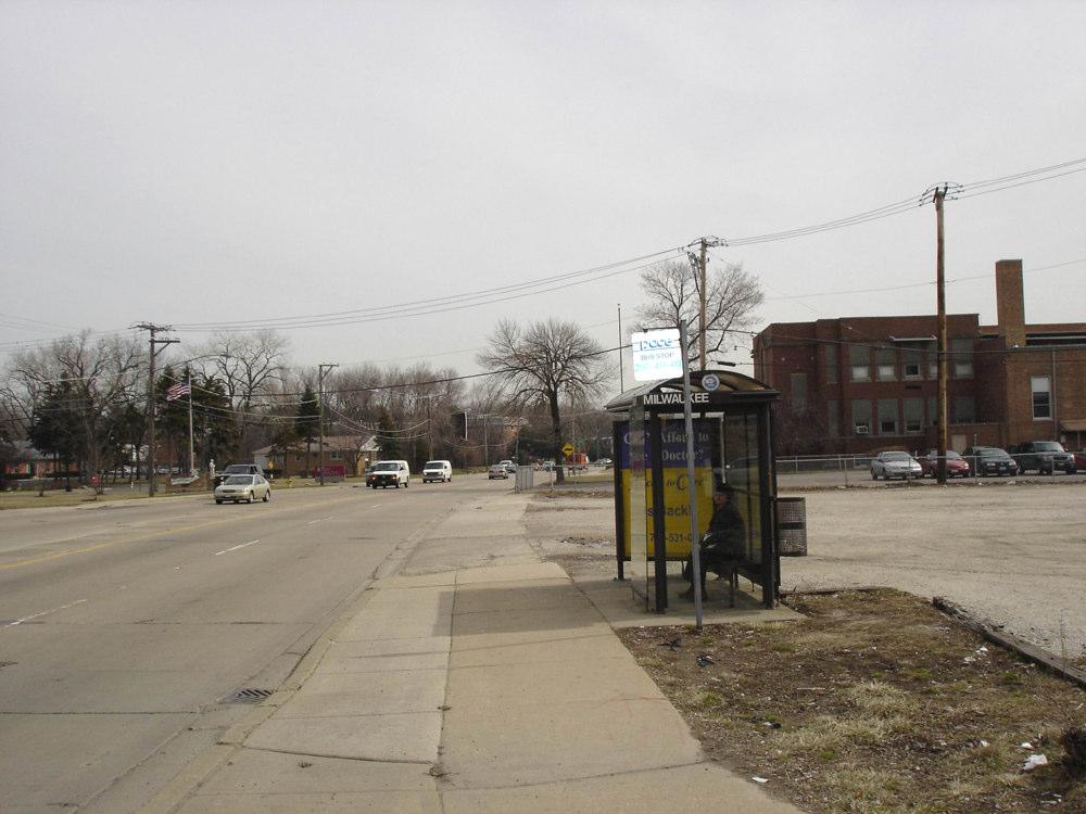
10 BRT Passenger Facilities Unique and attractive shelters High-tech, real time passenger information Raised platforms for floor-level boarding Attractive and comfortable design Pace BRT Station Shelter Concept Community Transportation Centers Pace BRT Regional Transportation Center Concept Regional Transportation Centers BRT Station, Curitiba, Brazil Lane County, OR BRT Station Concept
 Los")
")

11 BRT Technologies Automatic Vehicle Location (AVL) Los Angeles Metro ATSS Sign Active Transit Station Signage (ATSS) Transit Signal Priority (TSP) Pace ATSS Concept Pace TSP Signal Concept
12 How does Niles Benefit? BRT is overlaid with local Niles Free Bus services to create regional and local bus transit network Shared passenger facilities Increased regional mobility BRT stops may create more significant nodal development opportunities Clearer definition of the role of the Niles Free Bus service
13 Existing Conditions Analysis Real Estate Market Analysis Valerie Kretchmer, VSKA

14 Niles and Surrounding Area 2004 Median Household Income by Zip Code Wheeling Prospect Heights rlington Heights Arlington Heights Mount Prospect Des Plaines Des Plaines Northbrook Glencoe Techny Winnetka Northfield 43 Kenilw 41 Glenview Wilmette Golf Evansto Evanston Morton Grove Skokie Evan Niles 294 Park Ridge Des Plaines Elk Grove Village Amf Ohare Rosemont Chicago Chicago 90 Lincolnwood Chicago Chicago Chicago Chicago Harwood Heights Norridge Bensenville Schiller Park Chicago Chicago Franklin Park 50 Franklin Park Elmhurst Chicago
15 Niles and Surrounding Area 2004 Median Age by Zip Code Wheeling Prospect Heights rlington Heights Arlington Heights Mount Prospect Des Plaines Des Plaines Northbrook Glencoe Techny Winnetka Northfield 43 Kenilw 41 Glenview Wilmette Golf Evansto Evanston Morton Grove Skokie Evan Niles 294 Park Ridge Des Plaines Elk Grove Village Amf Ohare 12 Rosemont Chicago Chicago 90 Lincolnwood Chicago Chicago Chicago Chicago Harwood Heights Norridge Bensenville Schiller Park Chicago Chicago Franklin Park 50 Franklin Park Elmhurst Chicago

16 Retail Market Areas Golf-Milwaukee

17 Retail Market Areas Oakton-Milwaukee
18 Retail Spending Power Primary Market Area Secondary Market Area Total Market Area Golf- Milwaukee Market Area $1.4 billion $505 million $1.9 billion Oakton- Milwaukee Market Area $305 million $368 million $673 million
19 High Level of Overall Retail Sales Compared to Neighbors Total Sales for Niles and Surrounding Municipalities Year 2004 Total Sales $1,400,000,000 $1,200,000,000 $1,000,000,000 $800,000,000 $600,000,000 $400,000,000 $200,000,000 $0 Niles Skokie Glenview Des Plaines Park Ridge Morton Grove
20 High Level of Per Capita Retail Sales Compared to Neighbors 2004 Per Capita Total Sales and Non-Automotive Sales in Niles and Nearby Communities $45,000 $40,000 $35,000 $30,000 $25,000 Sales $20,000 $15,000 $10,000 $5,000 $0 Niles Skokie Glenview Des Plaines Park Ridge Morton Grove Cook County Total Sales Total Non- Automotive Sales
21 Niles Compared to Neighbors Higher sales than all except Skokie and Glenview Higher than Skokie in: General Merchandise Food Automotive Lumber and Hardware Drugs and Miscellaneous Retail
22 Niles Compared to Neighbors Lower than Skokie in: Apparel Eating and Drinking Furniture, Household and Electronics Lower than Glenview in: Automotive Eating and Drinking Furniture, Household and Electronics
23 Niles Retail Sales Trends Total Sales up 2% Lumber and Hardware up 54% Automotive up 36% Eating and Drinking up 18% Drugs and Miscellaneous Retail up 4% General Merchandise stable
24 Niles Retail Sales Trends Declining Sales in: Apparel down 40% Food down 11% but increased after 2001 Furniture and Electronics down 4%
25 Niles Office Market Few traditional office buildings Most space is Class C (lowest quality) Little professional office space other than medical Low overall vacancy rates compared to neighboring communities May be potential for offices targeting finance, real estate, insurance, professional services firms, etc.
26 Residential Demand Steady demand for new condominiums Price range for newer 1 bedroom condos from $185, ,000 Price range for newer 2 bedroom condos from $210, ,000 Concern over traffic implications from more multi-family buildings
27 Existing Conditions Analysis Milwaukee Avenue Character and Function Barry Gore, Camiros and Tim Doron, KLOA Land use and Districts Site planning issues, Pedestrian environment, Streetscape Potential redevelopment sites Traffic, traffic, and MORE TRAFFIC!

28 Existing Land Use Survey

29 Urban Character Districts

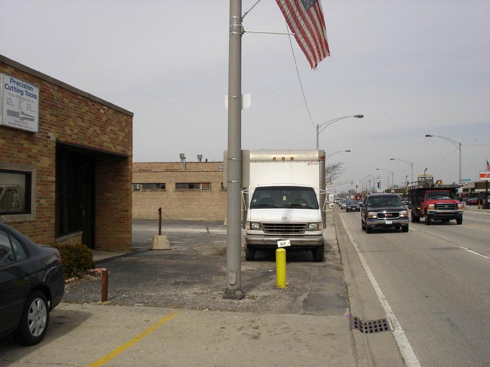
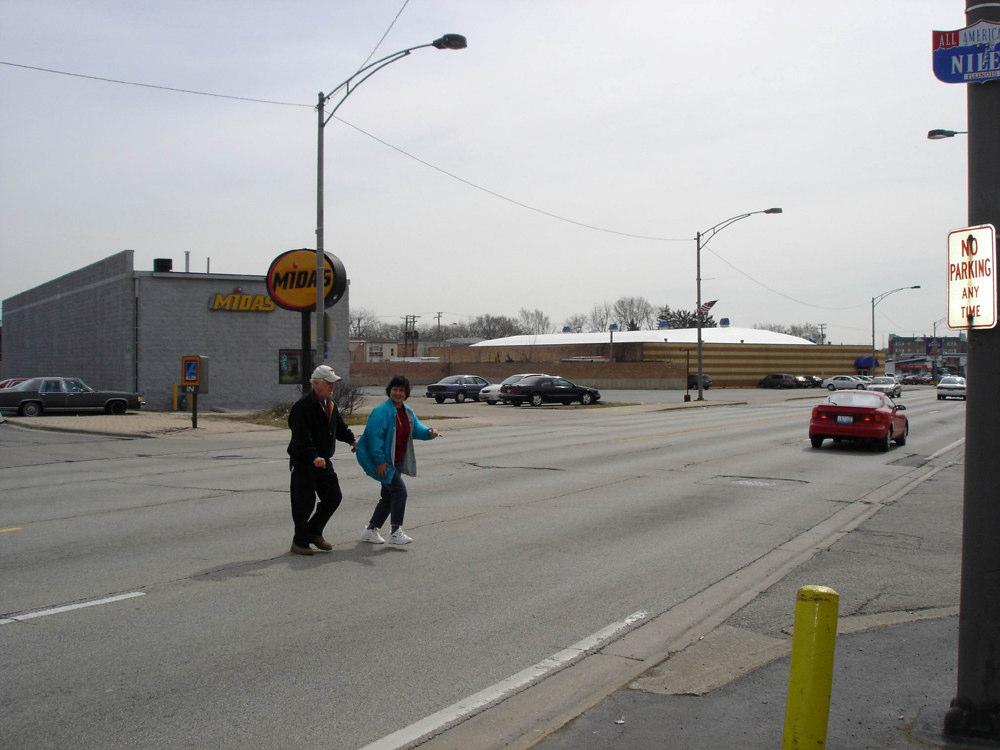
30 Site Planning Issues: Pedestrian Environment


31 Site Planning Issues: Access, Parking, and Sidewalks


32 Site Planning Issues: Model Block Improvements Existing Condition No sidewalk 76 parking spaces Uncontrolled access Little or no landscaping Proposed Improvement Consistent sidewalk 94 parking spaces Controlled access Landscaping and street trees


33 Site Planning Issues: Streetscape and Architectural Character

34 Site Planning Issues: Streetscape and Architectural Character

35 Site Planning Issues: Streetscape and Architectural Character

36 Potential Redevelopment Sites
37 Traffic Issues Traffic Flow vs. Corridor Destination Local Trips vs. Through Volumes What can be done Access to land uses Transit Auto Compatibility Bus turnouts Signal Preemption Access Control
38 Existing Traffic Volumes: 2005 Daily Traffic Volumes 32,000 to 37,000 vehicles per day (vpd) Intersections Touhy/Milwaukee: 5,000 vehicles per hour Oakton/Milwaukee: 4,900 vehicles per hour Harlem/Milwaukee: ~3,000 vehicles per hour
39 Oakton/Milwaukee 4,900 vph Harlem/Milwaukee +/- 3,000 vph Touhy/Milwaukee 5,000 vph
40 Workshop Stations Visioning and Big Ideas: Les Pollock Markets and Business Mix: Valerie Kretchmer Transit: Doug Hammel Traffic: Tim Doron Redevelopment and Site Planning: Barry Gore
Port Credit Local Advisory Panel October 20 th Meeting
 Port Credit Local Advisory Panel October 20 th Meeting Focus Of This Evening s Meeting: 1. Hurontario Main Street Higher Order Transit Study 2. Port Credit Mobility Hub & GO Station Parking Structure Study
History: a Grand Urban Boulevard
 History: a Grand Urban Boulevard 1890 1910: At its peak, Euclid Avenue, "Millionaire's Row," was considered the second most beautiful urban street in the country next to Fifth Avenue in Manhattan. 1910-2030:
Rapid Transit Implementation Working Group
 Rapid Transit Implementation Working Group October 12, 2017 1 Agenda 1. Consultation Update 2. Technical Work Update 3. LTC Rapid Transit Integration 4. Next Steps 2 Consultation Update 3 Consultation
Gratigny Parkway East Extension Project Development & Environment (PD&E) Study
 Study") Gratigny Parkway East Extension Project Development & Environment (PD&E) Study Session 4: Presentation of Charrette Results December 8, 2010 MDX Work Program #: 92407 ETDM#: 11500 Project Location & Description
Gratigny Parkway East Extension Project Development & Environment (PD&E) Study Session 4: Presentation of Charrette Results December 8, 2010 MDX Work Program #: 92407 ETDM#: 11500 Project Location & Description
40 Years of Smart Growth Arlington County s Experience with Transit Oriented Development in the Rosslyn-Ballston Metro Corridor
 40 Years of Smart Growth Arlington County s Experience with Transit Oriented Development in the Rosslyn-Ballston Metro Corridor A presentation by the Arlington County Department of Community Planning,
Harlem Avenue Corridor Plan: Corridor Planning Across Municipal Boundaries
 Harlem Avenue Corridor Plan: Corridor Planning Across Municipal Boundaries Heather Tabbert, Manager, Local Planning and Programs Division Regional Transportation Authority (RTA) Jen McNeil Dhadwal, Principal
SH 199 Corridor Master Plan. Community Meeting No. 2 May 31, 2017
 Community Meeting No. 2 May 31, 2017 Transportation Projects On or Near SH 199 SH 199 from 0.3 miles south of FM 1886 to south end of Lake Worth bridge Construct freeway mainlanes and frontage roads 10-Year
Chapter 1: Introduction
 Chapter 1: Introduction The Penn Avenue Community Works Corridor Vision and Implementation Framework presents an integrated communitybased vision and a coordinated, long-term implementation framework for
Scope of Services. River Oaks Boulevard (SH 183) Corridor Master Plan
 Corridor Master Plan") Scope of Services River Oaks Boulevard (SH 183) Corridor Master Plan PROJECT AREA The project area consists of the River Oaks Boulevard (SH 183) corridor bounded by SH 199 at the northern end and the Trinity
Scope of Services River Oaks Boulevard (SH 183) Corridor Master Plan PROJECT AREA The project area consists of the River Oaks Boulevard (SH 183) corridor bounded by SH 199 at the northern end and the Trinity
This Review Is Divided Into Two Phases:
 Semiahmoo Town Centre Review The purpose of this review: To review the Semiahmoo Town Centre Concept Plan, originally approved in 1993, to ensure that this centre will continue to serve the needs of South
A BLUEPRINT FOR BROCKTON A CITY-WIDE COMPREHENSIVE PLAN
 A BLUEPRINT FOR BROCKTON A CITY-WIDE COMPREHENSIVE PLAN Public Meeting October 2016 1 Plan Summary and Discussion Public Meeting May 4 2017 City of Brockton Bill Carpenter, Mayor Department of Planning
WELCOME and introduction
 1 WELCOME and introduction Mobility Hub Locations within Burlington STUDY OVERVIEW STUDY OBJECTIVES The City of Burlington is developing four Area Specific Plans, one for each of Burlington s Mobility
Lambeth Main Street Streetscape Improvements
 Lambeth Main Street Streetscape Improvements Open House October 5th, 2017 Agenda 1. Introduction 2. Project Background 3. Context 4. Project Objectives 5. Design Principles & Approach 6. Streetscape Design
Executive Summary. NY 7 / NY 2 Corridor
 Executive Summary NY 7 / NY 2 Corridor Transportation and Land Use Study December 2005 Prepared for: Town of Colonie Capital District Transportation Committee Prepared by: Introduction: Land use decisions
40 Years of Smart Growth Arlington County s Experience with Transit Oriented Development in the Rosslyn-Ballston Metro Corridor
 40 Years of Smart Growth Arlington County s Experience with Transit Oriented Development in the Rosslyn-Ballston Metro Corridor A presentation by the Arlington County Department of Community Planning,
Design Fort Ord. welcome why we are here what happened this week design guidelines: ideas so far 2/12/2015. Regional Urban Design Guidelines (RUDG)
") Design Fort Ord Regional Urban Design Guidelines (RUDG) Welcome Back! Strategic Economics Alta Planning + Design National Charrette Institute Helix Environmental Planning Jeff Speck & Peter Katz Civitas
Design Fort Ord Regional Urban Design Guidelines (RUDG) Welcome Back! Strategic Economics Alta Planning + Design National Charrette Institute Helix Environmental Planning Jeff Speck & Peter Katz Civitas
International Blvd. TOD Plan Public Workshop #1
 International Blvd. TOD Plan Public Workshop #1 Add photos or project images September 21 and 22, 2010 Workshop Purpose Introduce the public to the Project Review and discuss the existing conditions analysis
John M. Fleming Managing Director, Planning and City Planner. Old East Village Dundas Street Corridor Secondary Plan Draft Terms of Reference
 Report to Planning and Environment Committee To: From: Subject: Chair and Members Planning & Environment Committee John M. Fleming Managing Director, Planning and City Planner Old East Village Dundas Street
Town Center (part of the Comprehensive Plan)
") Town Center (part of the Comprehensive Plan) Mercer Island Town Center Looking North (2014) In 1994, a year-long process culminated in a set of design guidelines and code requirements for the Town Center
Town Center (part of the Comprehensive Plan) Mercer Island Town Center Looking North (2014) In 1994, a year-long process culminated in a set of design guidelines and code requirements for the Town Center
REVIEW AND EVALUATION OF REGIONAL LAND USE
 REVIEW AND EVALUATION OF REGIONAL LAND USE AND TRANSPORTATION SCENARIOS #220831 Environmental Justice Task Force October 7, 2014 VISION 2050 Process Development of Guiding Vision for Land Use and Transportation
JANUARY 19, 2011 CENTRAL AVENUE-METRO BLUE LINE TRANSIT-ORIENTED DEVELOPMENT IMPLEMENTATION PROJECT COMMUNITY FORUM
 CENTRAL AVENUE-METRO BLUE LINE TRANSIT-ORIENTED DEVELOPMENT IMPLEMENTATION PROJECT COMMUNITY FORUM JANUARY 19, 2011 THE MARYLAND-NATIONAL CAPITAL PARK AND PLANNING COMMISSION PRINCE GEORGE S COUNTY PLANNING
CHAPTER 7: Transportation, Mobility and Circulation
 AGLE AREA COMMUNITY Plan CHAPTER 7 CHAPTER 7: Transportation, Mobility and Circulation Transportation, Mobility and Circulation The purpose of the Transportation, Mobility and Circulation Chapter is to
VIRGINIA / LAKE HIGHLAND TRANSPORTATION AND LAND USE STUDY
 VIRGINIA / LAKE HIGHLAND TRANSPORTATION AND LAND USE STUDY COMMUNITY MEETING #2 - PRESENTATION OVERVIEW 1 INTRODUCTION 2 CONTEXT STUDIES 3 VISION FRAMEWORK 4 DEVELOPMENT SCENARIOS 2 1 INTRODUCTION Project
The Urban Transit Challenge
 On-Street Priority Transitways Sustainable Transport Using Available Right-of-Ways Mark C. Walker, AICP The Urban Transit Challenge Increase urban mobility & transit speed Use available rights-of-way Minimize
MONTGOMERY COUNTY METRO STATION AREA DESIGN CHARRETTE
 MONTGOMERY COUNTY METRO STATION AREA DESIGN CHARRETTE Shady Grove Metro Station Area Charrette Closing Presentation October 25-28, 2000 MONTGOMERY COUNTY, MD M-NCPPC Design Collective, Inc. Architects
PACE CENTRAL HARLEM AVENUE CORRIDOR STUDY. Steering Committee Meeting #1 January 18, 2018
 PACE CENTRAL HARLEM AVENUE CORRIDOR STUDY Steering Committee Meeting #1 January 18, 2018 1 Agenda 1. Welcome & Introductions 2. Project Overview 3. Public Involvement Plan Highlights 4. Framing Workshop
PLAN ELEMENTS WORKSHOP. April 5, 2016
 PLAN ELEMENTS WORKSHOP April 5, 2016 needs more housing. But there is no one-size fits-all solution. Every neighborhood has its own character. In some places, density is not only appropriate it is badly
CITY OF CAMBRIDGE Growth & Intensification Study Secondary Plan Stakeholder Session September 12th, 2016
 CITY OF CAMBRIDGE Growth & Intensification Study Secondary Plan Stakeholder Session September 12th, 2016 Dillon Consulting Limited Watson & Associates Economists Curtis Planning Inc. Tim Welch Consulting
TOD 101 CREATING LIVABLE COMMUNITIES WITH TRANSIT
 1 CREATING LIVABLE COMMUNITIES WITH TRANSIT What are transit Centered Communities? Benefits of Partnerships to Support and Implement What You Will Learn Portland s Pearl District Your Trainers Today Catherine
NORTH CENTRAL DISTRICT (Highlands & Centennial Park Neighborhoods)
") City of Highland Park NORTH CENTRAL DISTRICT (Highlands & Centennial Park Neighborhoods) Neighborhood Strategic Plan Approved February 2001 TABLE OF CONTENTS INTRODUCTION...3 Relationship to Master Plan...3
City of Highland Park NORTH CENTRAL DISTRICT (Highlands & Centennial Park Neighborhoods) Neighborhood Strategic Plan Approved February 2001 TABLE OF CONTENTS INTRODUCTION...3 Relationship to Master Plan...3
LUNDY S LANE COMMUNITY IMPROVEMENT PLAN STUDY
 PUBLIC INFORMATION MEETING #2 October 12, 2016 LUNDY S LANE COMMUNITY IMPROVEMENT PLAN STUDY AGENDA 5:00 to 5:30pm: Open House 5:30 to 6:15pm: Presentation 6:15 to 7:00pm: Individual paced workshop with
Project Team and Committee
 Project Team and Committee Village of Northfield (lead agency) staff: Stacy Sigman Michael Nystrand Cook County (partner agency) staff Tara Fifer Tara Orbon Consultant Engineering staff: Jarrod Cebulski
Public input has been an important part of the plan development process.
 Lakewood s Comprehensive Plan recognizes that transportation helps shape the community, and that the way the community provides for the safe and efficient movement of people affects the character of the
Transportation Land Use Integration & Regional Planning. Don Kostelec, AICP Senior Planner, Louis Berger Group February 1, 2010
 Transportation Land Use Integration & Regional Planning Don Kostelec, AICP Senior Planner, Louis Berger Group February 1, 2010 Transportation Land Use Integration DOT-HUD-EPA Sustainable Communities Initiative
3. Urban Design in the Central Area
 3. Urban Design in the Central Area The Central Area Planning and Design Group assumes the responsibility to promote high quality urban and architectural design in the Central Area, plan and ensure the
WALTER RAND TRANSPORTATION CENTER
 WALTER RAND TRANSPORTATION CENTER PLANNING AND DESIGN STUDY Public Meeting May 25, 2017 TONIGHT S AGENDA Introduction and Welcome Project Objectives The Study Area: WRTC and its Context Circulation Assessment
KCATA Transit Oriented Development Initiatives
 KCATA Transit Oriented Development Initiatives KCATA: Regional Transportation Authority Created by bi-state compact Approved by Congress 7 County service area Quasi-governmental with broad powers Power
Rio/29 Small Area Plan. Design Plan & Implementation Framework Open House - January 25, 2018
 Rio/29 Small Area Plan Design Plan & Implementation Framework Open House - January 25, 2018 MEETING PURPOSE PRESENTATION 1. Orient to the updated design plans 2. Introduce implementing options 3. Explain
The Village of Shirlington
 The Village of Shirlington Suburban Smart Growth Without Rail Transit July 2018 Agenda History (1940 to present) Attributes and Outcomes Lessons Learned Setting the Stage Arlington County Arlington is
38 Queen s University Campus Master Plan Part 1
 38 Queen s University Campus Master Plan Part 1 46 The Campus at the City Scale Chapter 4 The Campus at the City Scale 39 Queen s is an urban University centrally located in Kingston. Decisions made by
Hillsborough County MPO Transit Study. Citizens Team Workshop Wednesday, February 28 th, 2006 Hillsborough Community College - Brandon
 Hillsborough County MPO Transit Study Citizens Team Workshop Wednesday, February 28 th, 2006 Hillsborough Community College - Brandon What is the MPO Transit Study? An effort to look at the full range
Whitemarsh Comprehensive Plan Update: Housing & Land Use. Public Workshop #3: September 20, 2018
 Whitemarsh Comprehensive Plan Update: Housing & Land Use Public Workshop #3: September 20, 2018 Agenda Welcome Process Recap What We ve Heard The Plan Framework Review of Recommended Actions Land Use Housing
Draft Bergamot Area Plan
 ATTACHMENT 1 Draft Bergamot Area Plan Taskforce on the Environment April 15, 2013 www.bergamotplan.net 1 Overview WHAT IS THE BERGAMOT AREA PLAN? A Community-Based Planning Document Guiding the Future
7Page 91 CLEMMONS COMMUNITY COMPASS 7 COMMUNITY CHARACTER
 7 Community Character The beauty of Clemmons won t necessarily be a reflection of our past, but our future. This quote from Comprehensive Plan Steering Committee member Wayne Dodson captures the essence
WELCOME. The Yonge-Eglinton area has experienced significant growth and change in the last decade.
 WELCOME DID YOU KNOW? MIDTOWN IS REPRESENTED BY 3 CITY COUNCILLORS: WARD 16 EGLINTON-LAWRENCE WARD 22 ST. PAUL S WARD 25 DON VALLEY WEST Midtown in Focus: Building a Livable Yonge-Eglinton The Yonge-Eglinton
City of Farmington. Downtown Plan. Amendment to the 1998 Master Plan Adopted October 11, 2004
 City of Farmington Amendment to the 1998 Master Plan Adopted October 11, 2004 Introduction Planning Background 1 Scope and Components of the Plan Amendment 2 Concept Introduction 3 Plan Concepts 3 Conceptual
Courtice Main Street Study Community Vision Workshop PLANNING SERVICES DEPARTMENT
 Courtice Main Street Study Community Vision Workshop PLANNING SERVICES DEPARTMENT July 22, 2009 Tonight s Meeting 7:00 pm Introduction David Crome, Director of Planning 7:05 Presentation Stasia Bogdan,
NORTH LAKE SPECIFIC PLAN AREA
 NORTH LAKE SPECIFIC PLAN AREA June 21, 2018 WELCOME Workshop Agenda Introduction Provide information about the program and introduce the team Background Information Share information about the North Lake
Lower Merion Commercial Districts Issues and Characteristics Handbook November 2013
 Lower Merion Commercial Districts Issues and Characteristics Handbook November 2013 DRAFT TOWNSHIP-WIDE VISION: To maintain and enhance commercial areas to complement the surrounding high-quality residential
South Davis County COMMUNITY SPOTLIGHT
 South Davis County COMMUNITY SPOTLIGHT Davis/SLC Community Connector Bus Rapid Transit line connecting SLC & Davis County RTP Phase 1 Project Generate 3,100 average weekday riders Relieve congestion on
Atlanta BeltLine. Subareas 9 & 10. Master Plan Updates. March 26, Washington Park Jamboree 1
 Atlanta BeltLine Subareas 9 & 10 Master Plan Updates March 26, 2018 Washington Park Jamboree 1 22 miles, connecting 45 neighborhoods 22 MILES of transit 46 MILES of streetscapes and complete streets 33
What Does It Take To Create A Town Center?
 What Does It Take To Create A Town Center? Context, Design, and Process The Prince Frederick Master Plan Update 1 Background and Overview A Brief History of Town Centers in Calvert County 2 Background
Shift Rapid Transit Public Participation Meeting May 3, 2017
 Shift Rapid Transit Public Participation Meeting May 3, 2017 Shift Rapid Transit Initiative Largest infrastructure project in the city s history. Rapid Transit initiative will transform London s public
Making TOD Work in the Heart of Suburban Sprawl
 Making TOD Work in the Heart of Suburban Sprawl Rocky Mountain Land Use Institute March 6, 2009 Speakers Ben Herman, FAICP, Principal Clarion Associates Darcie White, AICP, Principal Clarion Associates
Denver Moves: Transit Task Force
 Insert transit picture Denver Moves: Transit Task Force Meeting #8 October 5, 2017 1. Welcome & Introductions Opening remarks and housekeeping Task Force and audience introductions Upcoming events and
GO Station Mobility Hubs: Draft Precinct Plans. Committee of the Whole July 12, 2018
 GO Station Mobility Hubs: Draft Precinct Plans Committee of the Whole July 12, 2018 Purpose of this Workshop Present Draft Precinct Plans for the 3 GO Station Mobility Hubs Continue the conversations that
1.3 TRANSIT VISION 2040 FROM VISION TO ACTION THEME 1: PUTTING TRANSIT AT THE CENTRE OF COMMUNITIES. Fully integrate transit with community planning
 TRANSIT VISION 2040 FROM VISION TO ACTION TRANSIT VISION 2040 defines a future in which public transit maximizes its contribution to quality of life with benefits that support a vibrant and equitable society,
Elgin O Hare Western Access Project Local Advisory Committee. February 10, 2014
 Elgin O Hare Western Access Project Local Advisory Committee February 10, 2014 Agenda Project status update Design and construction Funding Aesthetics Project events and outreach Land acquisition Next
Route 1 Corridor Study
 Route 1 Corridor Study Westbrook, Connecticut A Vision for the Connecticut Shoreline Public Informational Meeting July 28, 2015 Lower Connecticut River Valley Council of Governments Fitzgerald & Halliday,
Richmond Road Complete Street Meeting #1, April 25, 2016
 Richmond Road Complete Street Meeting #1, April 25, 2016 Agenda Overview Richmond Road Complete Street Other Ongoing Studies Discussion Map buses/day removed from Sir John A. Macdonald Parkway Confederation
Union Station Master Plan Task 3 Update
 Union Station Master Plan Task 3 Update June 18, 2014 1 2 3 4 5 6 7 8 9 10 11 12 13 14 15 16 17 18 19 20 21 22 23 24 25 26 27 2012 2013 2014 A S O N D J F M A M J J A S O N D J F M A M J J A S O Task 1`
Committee Meeting: Downtown Today & Concept Refinement September 11, 2017
 Committee Meeting: Downtown Today & Concept Refinement September 11, 2017 AGENDA 1. Brief Input Update 2. Comprehensive Plan Principles 3. Downtown Today 4. Concept Updates 5. Future Schedule What is a
13 THORNHILL YONGE STREET STUDY IMPLEMENTATION CITY OF VAUGHAN OPA 669 AND TOWN OF MARKHAM OPA 154
 13 THORNHILL YONGE STREET STUDY IMPLEMENTATION CITY OF VAUGHAN OPA 669 AND TOWN OF MARKHAM OPA 154 The Planning and Economic Development Committee recommends the adoption of the recommendations contained
5.1 Site Plan Guidelines
 5. Community Core Guidelines Development of the Community Core will take place by plan of subdivision and site plan approval. It will occur in a phased manner that will reflect the timing of residential
Request for Statement of Interest in Implementation of the Roosevelt Road Redevelopment Plan
 425 Hillside Avenue Request for Statement of Interest in Implementation of the Roosevelt Road Redevelopment Plan I. INTRODUCTION The is seeking the services of a qualified consulting firm to prepare plans
Welcome! MILLENNIUM LINE BROADWAY EXTENSION. Over the next 30 years, Metro Vancouver will welcome 1 million new residents and 600,000 new jobs.
 WELCOME Welcome! MILLENNIUM LINE BROADWAY EXTENSION Over the next 30 years, Metro Vancouver will welcome 1 million new residents and 600,000 new jobs. The Broadway Corridor is home to the second largest
Lesson 6. Corridor Planning
 Lesson 6 Corridor Planning 1 Learning Outcomes Identify land use strategies and solutions that can be incorporated into multimodal transportation corridor plans Identify land use stakeholders and describe
Pine Island Road Corridor Master Plan
 RECOMMENDED DEVELOPMENT PLAN Figure 9: Del Prado Village District Conceptual Framework The Conceptual Framework (Figure 8) for development of the Pine Island Corridor is to encourage mixed-use development
Commercial Node Plan Devine Street/Jackson Blvd. COLUMBIA, SC
 Commercial Node Plan Devine Street/Jackson Blvd. COLUMBIA, SC 9.17.13 AGENDA 1 Introductions 2 Project Update 3 Concepts 4 Recommendations 5 Next Steps Introductions Project Update Process 5-Phase Process
The Lincoln Neighborhood Corridor Plan. The LiNC
 October 1, 2014 Planning Commission Study Session The Lincoln Neighborhood Corridor Plan The LiNC Purpose of Tonight s Meeting Introduction to The LiNC Review of Existing Conditions and Community Identified
Public Open House. Yonge Street and Bernard Avenue (Bernard KDA) Planning Study Update Town of Richmond Hill. March 30, 2017
 Planning Study Update Town of Richmond Hill. March 30, 2017") Public Open House Yonge Street and Bernard Avenue (Bernard KDA) Planning Study Update Town of Richmond Hill March 30, 2017 Open House Review of Project Purpose and Process Policy Refresher Highlights of
Public Open House Yonge Street and Bernard Avenue (Bernard KDA) Planning Study Update Town of Richmond Hill March 30, 2017 Open House Review of Project Purpose and Process Policy Refresher Highlights of
3 MARKHAM NORTH-SOUTH LINK CORRIDOR PUBLIC TRANSIT IMPROVEMENTS ENVIRONMENTAL ASSESSMENT UPDATE
 3 MARKHAM NORTH-SOUTH LINK CORRIDOR PUBLIC TRANSIT IMPROVEMENTS ENVIRONMENTAL ASSESSMENT UPDATE The Rapid Transit Public/Private Partnership Steering Committee recommends the adoption of the recommendations
Transportation. Strategies for Action
 Transportation A major priority for the Overlake Neighborhood is to develop a multimodal transportation system. To achieve this system, a balance has to be found among travel, circulation and access needs;
Issues, Challenges & Opportunities
 Below is a summary of issues, challenges, and opportunities relating to the revitalization of Downtown Romeoville and potential development of the Village s East Side TOD Area. Current Issues & Challenges
Aldershot GO Draft Mobility Hub Concepts. East Plains United Church September 13, :30 8:30 pm
 Aldershot GO Draft Mobility Hub Concepts East Plains United Church September 13, 2017 6:30 8:30 pm Today s Agenda 6:30pm: 6:35pm: 7:10pm: 8:10pm: 8:25pm: Opening Remarks Rosa Bustamante, Manager Mobility
EXPANDING THE NETWORK ALEXANDRIA, VIRGINIA
 EXPANDING THE NETWORK ALEXANDRIA, VIRGINIA David Whyte david.whyte@kimley-horn.com Overview Project Context Corridors Land Use Coordination Concepts Outreach and Coordination Results Core of the region
Village Center Zoning. Town of Sutton, MA June 15, 2016
 Village Center Zoning Town of Sutton, MA June 15, 2016 Village Center Zoning Project Phase 1 was the development of the new Model Bylaw Phase 2 sought communities to work with to update existing or create
City of Fort Lauderdale UPTOWN URBAN VILLAGE. Public Workshop December 7, 2016
 Public Workshop December 7, 2016 Workshop Agenda Introductions Project Presentation o o o History Project Scope/Timeline Character of Study Area o o o o Land Use Public Realm/Pedestrian Mobility Multimodal
Comprehensive Plan & Station Area Zoning
 Village of Tarrytown Comprehensive Plan & Station Area Zoning Public Workshop November 5, 2017 Warner Library WXY architecture + urban design Pace University - Land Use Law Center George M. Janes & Associates
ELK GROVE GENERAL PLAN VISION
 2-1 CHAPTER 2: 2-2 CREATING OUR The Community Vision for Elk Grove, expressed through a Vision Statement and a series of Supporting Principles, is a declaration of the kind of community that Elk Grove
Status Report: MD 355 Project
 Status Report: MD 355 Project OCTOBER 2006 M-NCPPC MONTGOMERY COUNTY PLANNING DEPARTMENT Summary of Community Comments, and break to the Results of the MD 355 Participation Session Brookside Gardens -
August 2016 COTTAGE GROVE STATION AREA PLANNING REPORT
 August 2016 COTTAGE GROVE STATION AREA PLANNING REPORT Introduction The Red Rock Corridor is a proposed 30 mile transitway that runs along Highway 61 and Interstate 94 between Hastings and Union Depot
CITY OF VAUGHAN D R A F T YONGE STREET STUDY. June 2008 YOUNG + WRIGHT /IBI GROUP ARCHITECTS DILLON CONSULTING LTD.
 CITY OF VAUGHAN June 2008 YOUNG + WRIGHT /IBI GROUP ARCHITECTS GHK SUSTAINABILITY INTERNATIONAL + LIVABILITY (CANADA) LTD. = COMMUNITY VALUE DILLON CONSULTING LTD. Public Open House Tonight s Meeting WELCOME
TOWN OF NEW CASTLE - Master Plan Update
 Our Presentation Today (1) Recap the Master Planning Process To Date (2) Present the Outline of the Master Planning Work Plan (3) Present the Calendar for the Master Plan (4) Outline the scope of a Downtown
Knoxville Area Transit (KAT) Transit Development Plan Corridor Analysis
 Transit Development Plan Corridor Analysis") Knoxville Area Transit (KAT) Transit Development Plan Submitted to: Knoxville-Knox County Metropolitan Planning Commission Submitted by: PB Americas, Inc. Under contract to: The Corradino Group, Inc. October
Knoxville Area Transit (KAT) Transit Development Plan Submitted to: Knoxville-Knox County Metropolitan Planning Commission Submitted by: PB Americas, Inc. Under contract to: The Corradino Group, Inc. October
EXPO LINE COMMUNITY WORKSHOPS NOVEMBER 27 TH & DECEMBER 3 RD Los Angeles Department of City Planning
 EXPO LINE COMMUNITY WORKSHOPS NOVEMBER 27 TH & DECEMBER 3 RD 2012 Los Angeles Department of City Planning Agenda for Tonight Open House 6:00 to 6:15pm Presentation and Questions 6:15 to 6:50 Small Group
Peoria Avenue BRT Land Use Framework
 Planning Urban Design Landscape Architecture Historic Preservation Community Engagement Peoria Avenue BRT Land Use Framework Public Workshop Presentation Central Center Partners: Duncan Associates CLUE
Sub Area 2: Downtown Overland Park
 Downtown 132 2.12 encompasses over 600 acres and extends between 71st Street and 87 th Street including Downtown Overland Park. The area is home to several individual historic sites and structures, including
Welcome to the LYNX Blue Line Extension Transit Station Area Plans Public Workshop No. 3. Presentation will begin at 6:00 P.M.
 Welcome to the LYNX Blue Line Extension Transit Station Area Plans Public Workshop No. 3 Presentation will begin at 6:00 P.M. Meeting Agenda Blue Line Extension (BLE) Project Update LYNX Blue Line Extension
Vision Statement. District Objectives. Oakton Mixed-use District Vision and Objectives
 Vision Statement The Oakton Mixed-use District is a unique place in Des Plaines. Its traditional development pattern will be the foundation for improvements that help create a strong pedestrian environment
The transportation system in a community is an
 7 TRANSPORTATION The transportation system in a community is an important factor contributing to the quality of life of the residents. Without a sound transportation system to bring both goods and patrons
 Community Workshop #2 December 4, 2014 Team Tonight s Agenda 6:00 pm Welcome! 6:05 pm The Future of Downtown Tustin Ideas, Strategies and Recommendations 6:35 pm Questions and Comments 6:50 pm Open
Tonight s Agenda. Summary Presentation Open House. Group Discussion Next Steps: online community wide survey
 Community Open House February 22, 2018 Tonight s Agenda Summary Presentation Open House Station 1: Project Overview and Community Input Station 2: Draft Vision and Guiding Principles Station 3: Western,
Imagining Ward 3 Session #2. April 18, :00 pm 8:30 pm
 Imagining Ward 3 Session #2 April 18, 2016 7:00 pm 8:30 pm Project Team City of Mississauga Karen Crouse, Project Leader, Policy Planning Division Frank Marzo, Planner, Policy Planning Division Brook McIlroy
INTRODUCTION 1 A. Need for an Updated Plan 1 B. The Planning Process 2 C. Organization of the Report 3
 TABLE OF CONTENTS INTRODUCTION 1 A. Need for an Updated Plan 1 B. The Planning Process 2 C. Organization of the Report 3 I. PHYSICAL PLANNING CONTEXT 4 A. Locational Framework 4 B. Existing Land Use and
SOUTHWEST TRANSITWAY (STAGE 2) PUBLIC OPEN HOUSE
 PUBLIC OPEN HOUSE") WELCOME! SOUTHWEST TRANSITWAY (STAGE 2) PUBLIC OPEN HOUSE Monday, November 18, 2013 3:30 to 5:30PM and 7:00 to 9:00PM Tuesday, November 19, 2013 3:30 to 5:30PM and 7:00 to 9:00PM Welcome to the Southwest
WELCOME! SOUTHWEST TRANSITWAY (STAGE 2) PUBLIC OPEN HOUSE Monday, November 18, 2013 3:30 to 5:30PM and 7:00 to 9:00PM Tuesday, November 19, 2013 3:30 to 5:30PM and 7:00 to 9:00PM Welcome to the Southwest
St. Clair Avenue West Area Transportation Master Plan
 1 (Between Keele Street and Old Weston Road) Public Information Centre 1 December 2, 2015 2 Welcome Welcome to the first Public Information Centre for the St. Clair Avenue West Area. The panels will present
ELMVALE ACRES SHOPPING CENTRE MASTER PLAN
 ELMVALE ACRES SHOPPING CENTRE MASTER PLAN Contents 1.0 INTRODUCTION... 2 2.0 LOCATION... 2 3.0 EXISTING CONTEXT... 2 4.0 VISION & GUIDING PRINCIPLES... 2 5.0 LAND USE AND BUILT FORM... 4 5.1 St. Laurent
The University District envisions, in its neighborhood
 Envisioning the University District Link Light Rail in Seattle s neighborhoods CIY OF SEALE CONCEP-LEVEL SAION AREA PLANNING RECOMMENDAION RESOLUION # 30165 EXHIBI L Vision 08.2000 he University District
Appendix B-13: Community Stakeholders Group Meeting Materials and Minutes
 Appendix B-13: Community Stakeholders Group Meeting Materials and Minutes PREPARED BY IBI Group and WSP London s Rapid Transit Initiative Community Stakeholder Group Meeting Summary Report for October