DOWNTOWN STAKEHOLDER WORKING GROUP REPORT
|
|
|
- Kristin Dalton
- 6 years ago
- Views:
Transcription
1

2 DOWNTOWN STAKEHOLDER WORKING GROUP REPORT October 2014

3 Forward from Senator Kirk Watson October 2014 This report is about preparing for Austin s future by planning a better I-35. It s a story of interested citizens with varied backgrounds and experiences working together for the past year to improve I-35 in downtown Austin, part of the most congested stretch of highway in Texas in Members of the I-35 Downtown Stakeholder Working Group represented neighborhood groups, business organizations, local governmental entities, I-35 users and other stakeholders with an interest in the roadway. They didn t get paid for their work. Their monthly meetings were long and focused on important, but often technical topics: the federally-mandated transportation development process; current conditions and constraints along I-35; the transportation funding process; and options for the downtown area. As individuals, probably no one got everything they wanted, but as a group their input moves Austin toward a better I-35. Going beyond the obvious need to add a new lane to I-35, the priorities they voiced for I-35 in downtown Austin are significant. They emphasized the critical need for east/west connectivity. They encouraged the team to take advantage of this opportunity to reduce the barrier effect of I-35. They made suggestions to change the entrance and exit ramps, revisions to keep the City s core vital. The Stakeholder Working Group worked hard to develop the urban design standards that will transform I-35 through downtown. 1
4 The group started with two technically feasible concepts from the Texas Department of Transportation and the city of Austin. Over the course of the year they added their vision, and as a result: East/west connectivity at 6th Street will be maintained, along with all current interstate crossings; Potential east/west connections at 2nd and 3rd streets are being considered; Urban design principles will be incorporated, whether I-35 in downtown is built above or below ground level; and Connections across I-35 will include wider, safer bicyclist/pedestrian crossings. While the final design concept for I-35 downtown will be determined through a federal environmental study, the working group voiced a strong preference for depressing the mainlanes of I-35 below ground and adding caps, or a lid, on top, as opposed to building the mainlanes above ground. The working group has played a key role refining I-35 downtown improvement concepts, but there is much work ahead to make plans a reality. The biggest need is to identify funding to continue the engineering and design through the next phase and, if approved, final design and construction. The work that is reflected in this report will be critical to our eventual success. Thanks to the efforts of the Downtown Stakeholder Working Group, we are a major step closer to preparing for the future with a better I-35. Sincerely, Kirk Watson State Senator Honorary Chair I-35 Downtown Stakeholder Working Group I-35 Downtown Stakeholder Working Group Report 2
5 Resolution WHEREAS, I-35 through Austin is one of the most congested highways in Texas, according to the Texas A&M Transportation Institute; and WHEREAS, I-35 in Austin was originally constructed more than 50 years ago as part of the federal Interstate Highway System and was designed to meet interstate design standards and anticipated traffic volumes of the 1960s; and WHEREAS, some sections of I-35 in Austin now carry more than 200,000 vehicles per day; and WHEREAS, I-35 in Austin has a higher crash rate than the statewide average for urban interstates; and WHEREAS, improvements to I-35 have not kept pace with significant population and economic growth in the Austin area, resulting in increased traffic congestion and less reliability on this critical roadway; and WHEREAS, the Texas Department of Transportation (TxDOT), the city of Austin, the Capital Area Metropolitan Planning Organization, other local agencies and the public are partnering to develop mobility and urban design solutions for I-35 in Williamson, Travis and Hays counties; and WHEREAS, in October 2013, Senator Kirk Watson invited a diverse body of stakeholders to participate in the I-35 Downtown Stakeholder Working Group to recommend solutions to mobility, safety, access and connectivity challenges along the interstate corridor in the downtown Austin area; and WHEREAS, the working group focused for nearly a year on a wide range of issues involving I-35 in downtown Austin, meeting in monthly sessions and two separate Data Digs so members could focus on specific details; and WHEREAS, the working group considered concepts for downtown Austin as laid-out in the 2013 Corridor Implementation Plan, including a Modified Existing Concept that elevates the southbound mainlanes over Cesar Chavez Street and retains the current elevated configuration through downtown, and a Depressed Concept that would lower the mainlanes of the roadway below ground from approximately 12th Street to south of Cesar Chavez Street; and WHEREAS, input from the working group helped mold and refine the downtown concepts; and WHEREAS, both concepts would provide the additional lane in each direction through downtown; and 3
6 WHEREAS, the working group also considered a concept to install caps, or lids, covering the depressed freeway either as part of the initial construction or added at a later date; and WHEREAS, a common theme from members during the yearlong process was the importance of east/ west connectivity across I-35 for motorists, rail, bicyclists and pedestrians; and WHEREAS, TxDOT is committed, at a minimum, to maintaining east/west connectivity at every crossing that currently exists; and WHEREAS, the working group desires to further explore connections at 2nd, 3rd and 5th Streets; and WHEREAS, TxDOT is also committed to designing wider, more inviting bicyclist/pedestrian crossings; and WHEREAS, TxDOT is further committed to developing a multimodal corridor that provides for improved transit access to service reliability within the I-35 corridor; and WHEREAS, the working group highlighted four important goals regarding entrance and exit ramp revisions to achieve enhanced: safety, mobility, access and connectivity; and WHEREAS, the working group recommended urban design principles to improve mobility; improve connectivity; and foster core Austin community values including diversity, economic opportunity, healthy living, environmental sustainability, and art and cultural expression. NOW THEREFORE BE IT RESOLVED, that the I-35 Downtown Stakeholder Working Group recommends Mobility35 proceed to a National Environmental Policy Act study process incorporating the working group s input to the process. BE IT FURTHER RESOLVED that the I-35 Downtown Stakeholder Working Group supports depressing the I-35 mainlanes below ground and constructing the mainlanes so that caps may cover the depressed freeway as part of the initial construction or added at a later date. AND BE IT FURTHER RESOLVED that the I-35 Downtown Stakeholder Working Group encourages TxDOT, the city of Austin and the private sector to work together to develop a funding strategy to pay for the Depressed Concept with caps. Approved by the Downtown Stakeholder Working Group on Wednesday, October 8, 2014 I-35 Downtown Stakeholder Working Group Report 4
7 The I-35 Downtown Stakeholder Working Group was formed in the fall of 2013 as part of the Mobility35 program. Members engaged in a yearlong community process aimed at exploring solutions to mobility and safety challenges associated with the I-35 corridor in the downtown Austin Area. The working group was one aspect of a comprehensive effort to ensure the public s continuous involvement in driving the improvement process. This report is the work of the Texas Department of Transportation and represents TxDOT s understanding of the working group s recommendations. 5
8 Goal of the I-35 Downtown Stakeholder Working Group: To foster and encourage an informed regional dialogue about conceptual solutions along I-35 through downtown Austin. Information about Moblity35 is available online at I-35 Downtown Stakeholder Working Group Report 6
.")
9 The I-35 Challenge Anyone who travels on or across I-35 through Austin is familiar with the issues and challenges it presents on a daily basis for drivers, bicyclists, pedestrians and transit riders. The section of I-35 through Austin is one of the most congested highways in Texas, according to the Texas A&M Transportation Institute (TTI). 1 Some segments of the interstate in Austin currently carry more than 200,000 vehicles per day. 2 As bad as highway congestion is now, it will only get worse as the area s population continues to grow. The Texas Department of Transportation (TxDOT), in partnership with the city of Austin, the Capital Area Metropolitan Planning Organization (CAMPO), and representatives from a wide and diverse group of community leaders and agencies, is studying ways to address existing issues on I-35, while ensuring the roadway meets the needs of all users local, regional and national in the years to come. This effort is known as the I-35 Capital Improvement Program, or Mobility35. Background I-35 was originally constructed more than 50 years ago. It was designed to interstate design standards of the time and for traffic volumes far less than experienced today. Since I-35 s construction, our region has experienced significant population and economic growth. Improvements to I-35 have not kept pace with this growth, resulting in increased traffic congestion, and less reliability on this critical roadway. I-35, a critical element of the Interstate Highway System, does not meet the needs of local, regional or national users. With the exception of the upper deck construction in the early 1970s and other limited safety and mobility enhancements, I-35 through Austin remains much like it was when it opened in Most Congested Roadways in Texas 2 TxDOT Annual Count Data 7

10 The need to improve I-35 has been recognized for many years. Improvements have been studied but not implemented due to high construction costs, limited right-of-way, and community concerns. From a safety standpoint, I-35 in Austin has a much higher crash rate than the statewide average for urban interstates. In fact, a motorist s chance of being in an accident on I-35 in the Austin area is more than 33 percent higher than the average on other Texas interstate highways. I-35 downtown has too many ramps. Many of these ramps, designed to 1960 s standards, are challenging for motorists to use, and cause conflicts between local and regional users. East/west crossings do not serve the needs of non-motorized traffic and the interstate frontage roads are not integrated into the urban fabric of downtown. I-35 Downtown Stakeholder Working Group Report 8

11 The I-35 Challenge From a community perspective, the I-35 corridor is seen as a barrier that divides Austin both literally and figuratively. Some find it difficult to physically cross the interstate by car, truck, transit, bicycle, or on foot, while others see the roadway as a social barrier that separates historically minority and low-income neighborhoods from other parts of Austin. 9
12 Spotlight on the Planning and Environmental Linkages Study A key concept for Mobility35 is to add one lane in each direction to the I-35 mainlanes through Williamson, Travis and Hays counties. The concept, called the Future Transportation Corridor (FTC), is the centerpiece of Mobility35 and would increase roadway capacity, improve mobility and enhance reliability of travel along the corridor. The FTC is the focus of a Planning and Environmental Linkages (PEL) study in Travis County. The study will develop the purpose and need for the FTC and determine how the lanes will be used. The PEL is anticipated to be complete in early Watch for public input opportunities on I-35 Downtown Stakeholder Working Group Report 10
13 Introduction - Mobility35 Mobility35 I-35 is too important to ignore, and doing nothing is not an option. Improvements are needed to keep pace with travel demand resulting from a healthy economy and the ever-increasing population. Mobility35 is a partnership between TxDOT, the city of Austin, CAMPO and other local agencies and the public to develop mobility solutions for I-35 in Williamson, Travis and Hays counties. The Mobility35 Goals Are To: Increase capacity Enhance safety Better manage traffic Optimize the existing facility Minimize the need for additional right-of-way Improve east/west connectivity Improve compatibility with neighborhoods Enhance bicycle, pedestrian and transit options Beginning in August 2011, the Mobility35 Program team engaged the public and other governmental entities to explore potential short- and mid-term mobility improvements in Travis County. More recently, the effort has expanded into Williamson and Hays counties, encompassing the area between SH 130 (north of Georgetown) and Posey Road (south of San Marcos). Improving I-35 is a community-driven effort. Community input continues to be crucial in the development of the I-35 Capital Area Improvement Program Corridor Implementation Plan for Travis County. The plan, first published in August 2013, identifies location-specific improvement concepts for I-35 in Travis County. There have been approximately 200 stakeholder meetings, 25 public open houses and 11 online open houses (as of September 2014). The Implementation Plan continues to be updated based on public input and serves as a living document for improving I-35. It reflects the community s vision for the interstate. 11

14 Mobility35 and each associated project is advanced through a 5-phase process. The five phases take improvements from conceptual planning to construction as funding is identified. I-35 Downtown Stakeholder Working Group Report 12

15 Mobility35 Mobility35 Program Map A series of individual projects - each of which addresses a specific issue(s) - comprise the Mobility35 Program in Williamson, Travis and Hays counties. While each individual project provides stand-alone benefit, when viewed collectively, the benefits are even greater. 13
16 Spotlight on Transportation Funding in Texas Texas transportation revenues are generated by motor fuel taxes, vehicle registration fees, federal funds, bonds, and Public-Private Partnerships. Until 2002, TxDOT s projects were funded largely with state and federal revenues. Since 2002, revenues have been supplemented by allocations from private partners and borrowed funds generated by bond issues. Currently the primary source of transportation funding is the federal and state motor fuel tax. The state tax on gasoline of 20 cents per gallon has not changed since 1991, while the federal gas tax of 18.4 cents has not changed since While fuel costs have tripled, the gas tax the primary way we pay for our roads has stayed the same for more than two decades. Both the state and federal gas taxes are flat taxes and do not vary according to the price of gasoline; many people are purchasing fewer gallons of fuel because of increasingly fuel-efficient vehicles; and the purchasing power of the motor fuel tax is declining due to inflation. With limited funding, TxDOT must maximize its resources to ensure safety and mobility statewide. A variety of funding mechanisms exist that could be applied to I-35 projects in the Austin area. As part of continued implementation assessment, these funding options will be evaluated. Program of Projects The 2013 I-35 Capital Area Improvement Program Corridor Implementation Plan for Travis County (Implementation Plan) identified 27 individual projects for further development. Each of these projects provide individual benefit and together provide substantial mobility improvements for the corridor. Mobility35 is part of a larger regional mobility system that includes the Bergstrom Expressway (a potential relief route during I-35 construction) and the MoPac managed lanes (currently under construction). Nov. 6, 2013 Agenda Items: I-35 as part of the US Interstate System I-35 perspective from the State History of I-35 in Austin Key topics addressed: Mobility Funding I-35 Downtown Stakeholder Working Group Report 14

17 Downtown Stakeholder Working Group In October 2013, Senator Kirk Watson invited stakeholders to participate in an I-35 Downtown Stakeholder Working Group to help address the I-35 challenge in downtown Austin a bottleneck that affects the entire corridor from Georgetown to San Marcos. The diverse group included representatives from neighborhood and business organizations, local government entities, I-35 users and other stakeholders with an interest in the roadway. Its main focus was on the federally-mandated transportation development process; current conditions and challenges along and across I-35; options along with planned improvements for the downtown area; and urban design concepts. Throughout the year, the Downtown Stakeholder Working Group explored a wide range of topics including: east/west connectivity, access, mobility, funding, technical feasibility, aesthetics, and community compatibility. (See Appendix 1 for meeting notes.) Dec. 4, 2013 Agenda Items: Social significance of I-35 What is I-35 to you? Overview of previous I-35 studies Overview of the planning process - How do you develop a project? I-35 Downtown Concepts Key topics addressed: East/west connectivity Access Mobility Caps Community Compatibility 15
18 Members The stakeholder group brought many varied and distinct perspectives to the table, including ideas from urban neighbors, diverse users and local entities. Members are listed below; alternates occasionally attended. Aundre Dukes Texas Facilities Commission Bill Blackstone Greater Austin Chamber of Commerce Blanca Juarez The University of Texas at Austin Bob Harkins The University of Texas at Austin Bob Daigh Williamson County Bonita White Rainey Neighbors Association, Inc. Celia Israel Greater Austin Hispanic Chamber of Commerce Christy D. Willhite Capital Metropolitan Transportation Authority Cid Galindo Congress for New Urbanism Diane Hervol City of Kyle Dick Kallerman Sierra Club Gary Hudder City of Round Rock Heyden Black Walker Reconnect Austin Les Findeisen Texas Trucking Association John Hernandez East Cesar Chavez Neighborhood Association Keith Donahoe Real Estate Council of Austin Keith Walker City of Austin Police Department Lily Smullen City of Austin Linda Y. Jackson Huston-Tillotson University Margaret Gomez Travis County Matt Orta City of Austin Fire Department Cathy Stephens Capital Area Metropolitan Planning Organization (CAMPO) Mario Espinoza Central Texas Regional Mobility Authority Natalie Madeira Cofield Greater Austin Black Chamber of Commerce Pam Power Downtown Austin Neighborhood Association (DANA) Stan Strickland Organization of Central East Austin Neighborhoods (OCEAN) John Rigdon Waller Creek Conservancy Susana Almanza People Organized in Defense of Earth and her Resources (PODER) Todd Ruge City of Buda Tom Stacy Downtown Austin Alliance Tom Word City of Pflugerville Will Conley Hays County I-35 Downtown Stakeholder Working Group Report 16

19 Downtown Stakeholder Working Group Member Responsibilities All members of the Downtown Stakeholder Working Group were encouraged to provide essential, substantive input through participation in regular group discussions regarding the development of I-35 improvements through downtown. Members were encouraged to: Communicate their organization s needs, ideas and perspective Report back to their organization with timely, accurate information regarding Mobility35 and downtown options being considered Attend a minimum of 75 percent of group meetings Avoid missing two consecutive meetings Feb. 5, 2014 Agenda Items: What is Technical Feasibility? Overview of downtown concepts and their evolution through stakeholder outreach Key topics addressed: Mobility Caps Technical feasibility 17
20 Working Group Format and Meetings The Downtown Stakeholder Working Group held its first meeting in November Subsequent meetings were held on the first Wednesday of the first full week of each month through October 2014 (there was not a meeting in January). All meetings were held 4-7 p.m. in central Austin at the Omni Hotel. Each meeting focused on specific topics, along with a work group activity to foster discussion and input from the members. A building block method was used to develop the yearlong, working group agenda. Discussions at each meeting built upon discussions at proceeding meetings. In addition to the monthly meetings, two Data Digs where held for Downtown Stakeholder Working Group members to focus on specific details. A Data Dig was held on Feb. 27, 2014 to delve into numerous technical issues (design speed, ramp locations, cross street access, the project typical section and adjacent properties). A second meeting was held on March 26, 2014 to concentrate on a northbound exit ramp north of Cesar Chavez, depressing I-35 under Holly Street, and other east/west connectivity issues. March 5, 2014 Agenda Items: Summary of the Feb. 27 Data Dig Bike, pedestrian and ADA connectivity Working group discussion: Connectivity and community compatibility Key topics addressed: East/west connectivity Access Community Compatibility Technical feasibility I-35 Downtown Stakeholder Working Group Report 18
21 Downtown Stakeholder Working Group Guiding Principles Given that each stakeholder had a diverse perspective, it was important that every member of the Downtown Stakeholder Working Group participated in positive and meaningful dialogue. To help foster discussion, a list of Guiding Principles was developed. The principles included: Prepare in advance for and attend all meetings Treat each member with courtesy and respect Agree or disagree with ideas, not with people Identify issues rather than taking positions Listen to and consider the opinions of others, continually seeking common ground Be brief and clear in comments; avoid repetition of what has already been said and focus on the meeting objectives Concentrate on problem-solving, not fault-finding Focus on providing thoughtful, well-meaning comments that represent the community s interests and needs April 9, 2014 Agenda Items: Summary of the March 26 Data Dig Downtown Transportation and Development Plans Mobility35 online neighborhood survey results Working group connectivity priorities Mobility35 activity update Key topics addressed: East/west connectivity Access Mobility Funding Technical feasibility 19
22 Where we started Two concepts for downtown Austin were included in the 2013 I-35 Capital Area Improvement Program Corridor Implementation Plan for Travis County (Implementation Plan) and served as a starting point for the Downtown Stakeholder Working Group discussion. The Modified Existing concept would raise the southbound mainlanes to go over Cesar Chavez Street and rebuild I-35 from 12th Street to Cesar Chavez Street with I-35 passing over the cross streets. Current bridge standards would be utilized to widen crossings under the interstate and enhanced bicyclist/pedestrian accommodations would be provided The Depressed concept would lower the mainlanes of the roadway below ground from approximately 12th Street to south of Cesar Chavez Street. Caps covering the depressed freeway could be constructed as part of initial construction or added at a later date. Caps could be constructed between 12th Street and 11th Street, between 8th Street and 6th Street, and between 4th and Driskill. Caps would require additional funding from alternative funding sources. Enhanced bicyclist/pedestrian accommodations would be provided Both concepts, as presented in the 2013 Implementation Plan, provided identical mobility improvements and included the following: A northbound collector-distributor road from south of Lady Bird Lake to provide access to Holly Street through 12th Street Northbound exits to the frontage road at Holly Street, Cesar Chavez Street, and 6th Street Closure of 6th Street to through traffic to facilitate an exit ramp at that location A southbound entrance ramp south of 11th Street May 7, 2014 Agenda Items: Connectivity and community compatibility refinement results Aesthetics Mobility35 activity update Key topics addressed: East/west connectivity Access Mobility Technical feasibility Aesthetics I-35 Downtown Stakeholder Working Group Report 20

23 Where we started A southbound collector-distributor road starting at Cesar Chavez Street through Riverside Drive Reducing the number of ramps through downtown to facilitate better traffic movements and improve safety Implementing a super street concept on the frontage roads through downtown limiting the number of locations with direct east-west access across I-35 to facilitate better traffic flow along the frontage roads Maintaining the existing braided exit and entrance ramps on both the northbound and southbound side of I-35 north of 12th Street Adding auxiliary lanes between ramps downtown and implementation of the Future Transportation Corridor Improving bicycle and pedestrian facilities along and across I-35 Improving the aesthetics of I-35 through downtown These concepts provided a starting point for stakeholder working group discussions. As a result of the working group input and feedback from other stakeholders, the downtown concepts (described above) have been modified. See pages 27 through 34 for information. 21 Modified Existing Concept - Bird s-eye Artist s Rendering at Cesar Chavez

24 Artist s rendering of Depressed Concept Artist s rendering of Depressed Concept with Caps I-35 Downtown Stakeholder Working Group Report 22
25 Where we started A third concept, locally referred to as Reconnect Austin, was a stakeholder proposal for the reconstruction of I-35 through downtown Austin. The stated goal of the Reconnect Austin Concept is to lower the main lanes of this one mile stretch of I-35, cover that mile with a continuous cap, and place a city boulevard on top. The at-grade boulevard would be reconnected to the surface cross streets and the land where the frontage roads now sit would be converted to developable land... This liberates 30 acres of downtown real estate and creates substantial new tax base. (according to The Reconnect Austin Concept generally would: Lower mainlanes, cover with a continuous cap Maintain existing three lanes in each direction Add one managed lane in each direction Place a city boulevard on top of cap Reconnect east-west streets that currently end at the I-35 frontage road Sell, lease or develop redeemed land under existing frontage roads Limit and reconfigure entrance and exit ramps Reduce current highway right-of-way to unlock 30 acres of real estate June 4, 2014 Agenda Items: Urban design and aesthetics Working group recommendations on urban design principles and goals Key topics addressed: Technical feasibility Aesthetics 23
26 Technical Feasibility Technical Feasibility Consistent with rules and regulations governing the project development process, only technically feasible alternatives that satisfy a project s purpose are considered viable candidates for possible implementation. As discussed with the Working Group in February 2014, when assessing technical feasibility the following factors are considered: Legal Federal and state statutes dictate legal requirements Environmental governed by applicable local, state and federal laws, rules and regulations Cost/Funding must be analyzed to determine if a project can be completed Constructability considers how construction impacts traffic Schedule determines the viability of a project s timeline Operational analyzes the proposed solution to ensure it meets the project need Design ensures safety standards are met In the case of I-35, its role as an element of the Interstate Highway System affects technical feasibility. With assistance from the program team, the working group explored the technical feasibility of all three concepts over multiple meetings. Although the Reconnect Austin concept is not technically feasible (see Appendix 2) in its entirety, individual aspects of the Reconnect Austin concept that were determined to be feasible have been incorporated into the Depressed concept. The two technically feasible alternatives identified for I-35 in downtown Austin are (1) the modified existing concept and (2) the depressed concept. They are discussed in the following sections of this report in greater detail. July 9, 2014 Agenda Items: I-35 urban design discussion outcomes Working group survey on revised urban design principles Case studies - Creating successful public/private partnerships Key topics addressed: East/west connectivity Mobility Funding Technical feasibility Aesthetics I-35 Downtown Stakeholder Working Group Report 24

27 I-35 through downtown Austin is one of the most congested highways in Texas. Aug. 6, 2014 Agenda Items: Updated Downtown Concepts Answering your questions Group discussion: Developing a Public/Private Partnership for I-35 in downtown Austin Key topics addressed: East/west connectivity Access Mobility Funding Caps Technical feasibility 25
28 Priorities Downtown Stakeholder Working Group Priorities of the Working Group The working group identified the following as priorities for I-35 through downtown: Need for added capacity Critical nature of east/west connectivity Importance of reducing the barrier effect Need to balance safety, mobility and connectivity These priorities and input from the working group resulted in changes to the downtown concepts. These changes are addressed in this report and will be captured in the 2014 Implementation Plan. Sept. 10, 2014 Agenda Items: Technical Update Review of Urban Design Principles Caps Action Plan Working Group Resolution Key topics addressed: Access Funding Caps Technical feasibility Aesthetics I-35 Downtown Stakeholder Working Group Report 26
29 Priorities and Concept Modifications Priority The need for added capacity Consistent with many other stakeholders, the Downtown Stakeholder Working Group voiced support for added north/south capacity along the I-35 corridor. In fact, during self-introductions at the group s initial meeting, members were asked, In one word, describe I-35. The most popular answer was congested. That sentiment was echoed repeatedly throughout group meetings. TxDOT Response: Adding Capacity With a section of I-35 through Travis County ranked as one of the most congested highway in Texas, increased capacity along the interstate has long been a goal for TxDOT and the city of Austin. It is considered a must have if the interstate is improved. After much study, TxDOT determined it is technically feasible to add one lane in each direction of I-35 from north of Georgetown to south of San Marcos. No assumption is made regarding the nature of these future lanes. They could be general purpose lanes, High Occupancy Vehicle lanes, express lanes or a combination of these. TxDOT is seeking public input through a Planning and Environmental Linkages Study underway in Travis County. In addition to one lane in either direction, proposed collector-distributor roads add additional ingress/egress capacity from the south. Transit is a very important component for developing mobility solutions in Austin and is considered throughout the I-35 improvements. Oct. 8, 2014 Agenda Items: Presentation of Final Report Awards presentation Key topics addressed: East/west connectivity Access Mobility Funding Caps Technical feasibility Aesthetics Community Compatibility 27
30 Priority The critical nature of east/west connectivity Throughout the yearlong working group process, a common theme from the working group was the importance of east/west connectivity across I-35 for motorists, bicyclists and pedestrians. It was clear from the first group meeting that members wanted to enhance east/west connectivity. When asked to describe I-35 in one word, the top answer from members was congested followed by barrier, and then opportunity. The working group consistently favored concepts that provide connectivity, and questioned concepts they felt did not provide the desired east/west access. Some working group members want every historic connection across I-35 re-established, including locations where east/west access is not available today (2nd, 3rd, 4th, 5th, 9th, and 10th Streets). The group identified connectivity at 6th Street as a must have. The Texas Super Street Concept would have provided overall mobility improvements by moving traffic more efficiently along the frontage roads, however the working group and the public opposed the super street concept due to a concern it would hamper east/west connectivity, and not provide an appropriate solution. TxDOT Response: Improving Connectivity Texas Super Streets are no longer proposed for I-35 in Austin. TxDOT has made a commitment to maintain east/west connectivity at every crossing where it currently exists. That means where drivers, bicyclists and pedestrians cross today, they will continue to have the opportunity to cross I-35 in the future. TxDOT revised its original concept and -- working with Capital Metro to move the Red Line Rail track developed a plan allowing 6th Street to be reconnected across I-35. TxDOT also developed a plan that would allow 2nd and 3rd Streets to connect across I-35. The elimination of Super Streets also requires a review of ramp access and placement as discussed later in this section. Specific details on how mobility and connectivity improvements are achieved will be identified at each location during the design process. To the maximum extent possible, east/west connectivity solutions will include unclogged intersections, wider sidewalks, and better bicycle and pedestrian accommodations. I-35 Downtown Stakeholder Working Group Report 28
31 Priorities and Concept Modifications Priority The Importance of reducing the barrier effect Visualization videos of both the Modified Existing and Depressed concepts were shown at the December 2013 working group meeting. The working group favors depressing the interstate and potentially adding caps. Throughout the yearlong working group process, little interest, if any, was expressed by the working group for the Modified Existing concept. This lack of support seemed based on the desire to reduce the visual barrier between east and west Austin, and a belief that a depressed I-35 provides more opportunity for cross street connections. TxDOT Response: Modifying the concepts Because both the Modified Existing and the Depressed concepts are technically feasible and would satisfy the project purpose, it is currently anticipated that both would advance to Phase 3: Environmental and Schematic preparation. TxDOT has made modifications to both concepts based on working group feedback. For example, the Depressed concept was modified so that an additional cap could be installed over the depressed mainlanes from 6th Street to 4th Street. With this additon, caps could be installed on the Depressed concept from 12th to 11th and 8th to Driskill. Extending the depressed concept north of 12th Street was reviewed and determined to not be technically feasible; see Appendix 2. The modifications to both concepts include enhancements to bicyclist/pedestrian accommodations. The yearlong discussion has also solidified the idea that a total reconstruction of I-35 in downtown Austin is needed. Group members focusing on Mobility35 goals to increase capacity, improve east/west connectivity, improve compatibility with neighborhoods and enhance bicycle, pedestrian and transit options indicated the region has a unique opportunity to achieve those objectives if the job is done right. 29
32 Priority Need to balance safety, mobility and connectivity The location of entrance and exit ramps along I-35 in downtown Austin was a frequent topic of lengthy and detailed discussions during working group meetings. These discussions highlighted the impact of ramp revisions on three important goals: safety, mobility and connectivity. Existing ramps along I-35 between MLK Boulevard and Lady Bird Lake do not meet current design standards for length and spacing. Changes to individual ramps were explored to show how changes have an effect on various goals. For instance, removal of a ramp may improve connectivity at one location, but have a detrimental impact on mobility at another location. TxDOT Response: Improving ramps Ramp revisions were studied on a case-by-case basis and possible revisions to the August 2013 concepts were reviewed for safety, mobility and connectivity. TxDOT revised its original concept by modifying the northbound exit ramp at 6th Street to address safety concerns and to maintain east/west connectivity at 6th Street. The revisions were developed in cooperation with Capital Metro. Maintaining the connection at 6th Street impacts the ability to connect 5th Street and the modes that can be connected at 4th Street. (See Appendix 2) After superstreets were removed from the program and in response to a concern expressed by a member of the working group, ramp access to the northern part of downtown was reviewed. To facilitate access, two additional ramps were added to the concepts: a northbound entrance ramp south of 11th Street and a southbound exit ramp north of 8th Street. These changes still maintain the overall program goal of reducing the number of ramps in the downtown area. An overview of geometric refinements as a result of the working group is attached in Appendix 3. I-35 Downtown Stakeholder Working Group Report 30

33 Aesthetics and Urban Design Principles Urban Design Principles from the Working Group Principle 1 Improve Mobility Principle 2 Improve Connectivity Principle 3 Foster Core Values Priority Transforming I-35 through urban design In June and July 2014, the working group focused on aesthetics and urban design to make I-35 functional, attractive and sustainable. Based on feedback from the June meeting, revised urban design principles were presented in July. In September, the working group endorsed three recommended urban design principles and a set of strategies it desired TxDOT to consider for each: Principle 1 Improve Mobility: In addition to building the best vehicular highway possible, the project will also help achieve mobility for all other modes: pedestrian, bicycle and transit, both north/south and east/ west. When possible, the curbside zone along the frontage roads should contain wide, shaded pedestrian paths that are protected from the moving vehicle lanes by trees planted at the curbside. When possible, off-street bicycle/pedestrian paths or shared use paths should be provided along frontage roads. Where there is not enough space for these, work with the city of Austin to ensure that bike facilities are on parallel, north-south streets. Transit service should be located conveniently in the corridor and integrated carefully with pedestrian and bicycle facilities, as these are implemented. The project frontage roads should function as multi-modal corridors and feel like urban boulevards. The city of Austin should implement building setback regulations to achieve the desired curbside zones, sidewalk widths, trees, etc. Depressed Concept - 6 th St Bridge with Cap (Development Concept) 31

34 Principle 2 Improve Connectivity: The project will help physically reconnect the communities and spaces east and west of I-35. In addition to accommodating vehicular through, turn and U-turn lanes, the project s east-west bridges and/or underpasses should be designed to carry bicycles and pedestrians in their own dedicated spaces The project should consider the design of the east-west streets within and beyond the I-35 right-ofway to ensure smooth transitions for all modes into the existing street network If a 2nd Street crossing is built, it should include pedestrians and bicyclists and consider vehicular traffic as well A 3rd Street crossing should be built for motorists, pedestrians and bicyclists Improving east/west connectivity is a goal of Mobility35 (Development Concept) I-35 Downtown Stakeholder Working Group Report 32
35 Aesthetics and Urban Design Principles Principle 3 Foster Core Values: The project will reflect the core values of the Austin Community. Core values include diversity; economic opportunity; healthy living, including physical activity; environmental sustainability; and art and cultural expression Along the surface streets of the corridor, public art and/or interpretive elements should celebrate the culture and identity of the area s diverse communities The project should celebrate the history of Austin as the State Capitol and Live Music Capital of the World, through public art elements and/or aesthetic treatments The project should reinforce the image of Downtown as the heart of Austin, marking it as an attractive place to live and visit, through great urban design, place-making and way-finding The project should incorporate green infrastructure in keeping with the city s sustainability goals The project should create a strong landscape expression with native and adapted trees and plants that bring nature to the city and the corridor Canopy trees should be planted at the curbs of all streets throughout the corridor to provide a comfortable pedestrian and cycling environment and to mitigate heat island impacts The Depressed Option should be designed to accept freeway caps between Driskill and 8th Street, and between 11th and 12th streets. The caps should be designed to support fully landscaped parks and open spaces Highest priority should be given to the early implementation of the freeway cap between 3rd and 8th Streets Freeway caps should be programmed and designed to be flexible and to support multiple activities including: Recreational and informal sports Entertainment and performance Small scale food kiosks and carts 33

36 Farmers and other markets Children s play and activities Public art and exhibitions Public gardens Restrooms Consideration of 1-story retail A community driven master planning process should guide the design and programming of the caps. A partnership between public and private entities should be established to fund and manage the design and implementation of the freeway caps. Urban Design Typical Section Additional urban design graphics are included in Appendix 4 TxDOT Response: Implementing urban design principles TxDOT will work with the city of Austin and the community to refine the work group s recommended urban design principles and to implement the principles to the extent that is technically feasible in the next phase of I-35 downtown development. Key steps include identifying a funding source for urban design elements and development of an action plan to add caps if the concept to depress the mainlanes is determined as the preferred alternative through the federal environmental study. I-35 Downtown Stakeholder Working Group Report 34
37 Planning for the Caps Before potential caps can be built over depressed I-35 mainlanes in downtown Austin, several key actions must be completed. A critical step is the determination through the National Environmental Policy Act study whether depressing I-35 is the preferred alternative to address mobility and safety needs in the downtown corridor. Meanwhile, if caps are to become a reality, the community would need to identify a way to champion, fund and construct the potential caps. Case Studies Klyde Warren Park The Klyde Warren Park sits above the Woodall Rodgers Freeway in downtown Dallas. While the decision to depress the freeway was made back in the 1960s, it was 2002 before an idea began surface to install caps over the freeway for use as a park. In 2012, the park opened following several years of planning that included: A local project champion rallying support for the idea Private grants to fund feasibility studies Creation of the Woodall Rodgers Park Foundation Community input through multiple public involvement sessions Solutions to structural challenges related to cap weight, support, and design Design and construction Today the Klyde Warren Park is owned by the city of Dallas and is privately operated and managed by the Woodall Rodgers Park Foundation. The $110M project was funded through a public-private partnership which included $56.7 million in public funds and $53.3 million in private support. Private donations were received from Communities Foundation of Texas, Real Estate Council of Dallas, Jody Grant and Texas Capital Bank, Chase Bank of Dallas, Real Estate Owners, Wyly Theater and Winspear Opera House, and the Warren Family. (Source: Woodall Rodgers Park Foundation and D Magazine) 35

38 Waller Creek Conservancy and Lady Bird Lake Boardwalk If the Depressed Concept with Caps is determined to be the preferred alternative resulting from the environmental process, one possible source of funding for the caps could be through a Public-Private Partnership. During the July 2014 working group meeting, members heard Public-Private Partnership case studies from two local projects: The Waller Creek Conservancy and the Lady Bird Lake Boardwalk. Both projects were successful through the creation of Public-Private Partnerships. Sometimes referred to as a P3, this contractual arrangement between a public agency and a private sector entity can allow skills and assets of each sector to be shared in the delivery of a service or facility for public use. A P3 offers one funding model for non-mobility related improvements such as the caps. Photo courtesty of Lady Bird Lake Boardwalk and City of Austin I-35 Downtown Stakeholder Working Group Report 36
39 Working Group Outcomes The Downtown Stakeholder Working Group played a key role in refining the two technically feasible alternatives. Refinements include: Maintaining east/west connectivity at 6th Street Identifying potential east/west connections at 2nd and 3rd Streets Improving urban design to enhance both the Depressed and Modified Existing concepts and developing recommended urban design principles Ensuring safer, wider bicyclist/pedestrian crossings In addition, should I-35 be depressed, efforts of the working group can serve as the starting point to build upon for purposes of developing caps, parks, and a Public Private Partnership. Unresolved Issues Although work is ongoing, three issues discussed by the Downtown Stakeholder Working Group remain unresolved at the time of this report: Some working group members desire continued discussion on the technical feasibility of an east/west crossing at I-35 and 5th Street The nature of the desired development on potential caps over depressed I-35 mainlanes has yet not been fully defined An action plan to champion, fund and construct the potential caps has not been established 37
40 Next Steps Path Forward/Next Steps The Downtown Stakeholder Working Group has played a key role in refining the two technically feasible alternatives. With their valuable input, and with continued input from the public, TxDOT will move forward in refining the Corridor Implementation Plan through: Continued public input Completion of the Planning and Environmental Linkages Study Continued discussion of funding for safety, mobility and urban design improvements A National Environmental Policy Act (NEPA) study on downtown concepts Continued refinement of downtown concepts The working group also played a key role in initiating ideas for developing a plan to fund and utilize possible caps if I-35 is depressed. Remaining phases after environmental studies will be final design and actual construction, all subject to funding availability. The Downtown Stakeholder Working Group has helped identify and balance the needs of all stakeholders residents, businesses, government and commuters in shaping these concepts to best represent community desires within the constraints of technical feasibility. As individuals, probably no one got everything they wanted, but as a group their input moves Austin toward a better I Senator Kirk Watson This report is the work of the Texas Department of Transportation and represents TxDOT s understanding of the working group s recommendations. Comments received from working group members are included in Appendix 5 I-35 Downtown Stakeholder Working Group Report 38
41 Appendix 1 I-35 Downtown Stakeholder Working Group meeting summaries and Data Dig notes
42 Meeting 1 Summary I- 35 Downtown Stakeholder Working Group Meeting 1 November 6, 2013 Welcome, Greg Malatek, Texas Department of Transportation Improvements to I- 35 are overdue, and this group is part of the TxDOT s long- reaching process for improving the interstate system. This working group was designed to represent the diversity of interests within the Austin region and particularly downtown Austin. Introduction, State Senator Kirk Watson The unprecedented growth in the region has demanded that we pay attention to mobility. This attention has led to good work along I- 35 but this working group is needed to define and refine the concepts to improve I- 35. The City of Austin has focused on I- 35 and committed significant resources to make a significant difference. A state legislative budget rider, Rider 42, put $300 million to study the 50 most congested roadways in Texas, including I- 35 in Austin. This group will need to pay attention to other work going on in the region, including: Manor Expressway, US 183, SH 71 and the MoPac Improvement Project. The comments from everyone on this working group matter and each member will provide a unique perspective. The working group will produce a report covering all proceedings. Expectations are commitment to attend work group meetings, for each member to provide the unique perspective of the group/organization represented, and to help push momentum by reporting to your group and getting input. Objectives, Carlos Lopez, HNTB The goal of the working group is to foster and encourage an informed dialogue about the conceptual solutions along I- 35 through downtown Austin. The working group will look at the planning process, needs and limitations of I- 35 and varying stakeholder priorities. I- 35 as Part of the U.S. Interstate System, Al Alonzi, Federal Highway Administration Most of the intestate was constructed between 1957 and 1992; the historical context of that time period can enlighten us to some of the choices for the roadway that remain evident today. The interstate system was constructed to improve national defense, national mobility and commerce. Today, there are 3,400 miles of interstate highways in Texas, more miles than any other state in the country. The Federal Highway Administration (FHWA) approves actions to modify these corridors, sets overall guidance and standards, and administers the Highway Trust Fund. I- 35 connects not only our city but our nation, so we have an opportunity to show the rest of the country what can be accomplished when great minds come together.
43 I- 35 State Perspective, Marc Williams, Texas Department of Transportation As an international corridor that also serves Austin, TxDOT s primary role is to manage and maintain it and plan for future growth. I- 35 through Austin is the number one most congested highway in the state, and with a population that is expected to grow 30% by 2030, improving interstates throughout Texas, especially I- 35, is an immediate need. There have been several programs and about $5.3B dedicated to I- 35 in Texas during the past few years but the future doesn t look bright in terms of funding. We need a plan for I- 35 that addresses transportation objectives and needs, sets priorities and is flexible and adaptable. History of I- 35 in Austin, Rob Spillar, City of Austin Commuters make up 80-85% of trips along I- 35 through Austin, meaning I- 35 serves as a main street with a regional and national purpose. Unfortunately, it is also a barrier. The city and state are long- term partners in mobility improvements, beginning with the construction of East Avenue built as a bypass to Congress Ave. Later, I- 35 was built to follow the path of East Avenue and it has undergone many big and small changes since its construction. This group will help to figure out how to implement improvements; it may not look like one grand project it may be 100 good projects that create a grand vision. I- 35 Capital Area Improvement Program (CAIP) in Downtown Austin, Carlos Lopez The CAIP program focuses on identifying short- term to mid- term solutions to improve traffic. Some of the program s goals are to increase capacity and enhance safety while minimizing the need for additional right- of- way. We are in phase two of the five- phase project development process; this is the point at which public outreach and community input is emphasized. Some concepts have been identified for downtown Austin, but no final decisions have been made.
44 Meeting 2 Summary I- 35 Downtown Stakeholder Working Group Meeting 2 December 4, 2013 Stakeholders and Planning, Carlos Lopez, HNTB Meeting topic is Planning and Stakeholders because stakeholders are an integral part of the planning process. The result of this stakeholder group will be a report that covers the ideas we consider, records items resolved and lists items that require additional investigation. Social Significance of I- 35, Gregory Smith, Austin Revitalization Authority A common perception is that I- 35 segregates east and west Austin. A number of historical events predated the facility, including standards that resulted from the New South Era and the city s 1928 Master Plan. Despite changes in the demographic makeup of east and west Austin communities, I- 35 remains a barrier. Stakeholder Discussion What are the problems along I- 35 that need to be solved? Ramps, particularly downtown Need for additional capacity Lack of transportation and route alternatives Lack of ability to quickly clear incidents Ramp weaving Signage Lack of HOV lanes Lack of predictability What are the challenges to solving these problems? Funding Lack of right- of- way Public support Institution resistance Mobility during construction Population growth Driver habits Jobs are distant from housing Topography/physical constraints Overview of Previous I- 35 Studies, Bob Daigh, Williamson County I- 35 has a history of studies, many of the results have not been implemented. Although lack of funding is often thought to be the biggest challenge, in the case of I- 35 there are several additional significant factors that contributed to the lack of implementation. Lack of consensus Lack of public support Lack of political support Lack of funding options How do you Develop a Project?, Chuck Fuhs, City of Austin The first step in any project is to identify the issues that must be solved, a discussion which leads to the definition of the project and allows the agency to vet the project through the local metropolitan planning organization. After the MPO vets the project, the project goes through a robust process that includes hundreds of steps and extensive stakeholder involvement. The speed at which the project
45 moves through the process is largely based on stakeholder support and the success of the project hinges on whether or not everyone involved pulls in the same direction. Preview of Concept Animations, Terry McCoy, Texas Department of Transportation The I- 35 implementation plan was developed as part of the Rider 42 effort. The two concepts shown, modified existing and fully depressed with caps, were identified in the implementation plan - the result of more than two years of study and stakeholder comments. The animations shown accurately reflect concepts in the plan and each is technically feasible and provides the same mobility benefits. The primary difference between the two concepts is that the modified existing concept generally maintains the current roadway configuration and the depressed concept fully depresses the roadway s mainlanes. If depressed, caps could be added during initial construction or phased over time.
46 Meeting 3 Summary I- 35 Downtown Stakeholder Working Group Meeting 3 February 5, 2014 Welcome, Senator Kirk Watson We are at a critical time. With more than two years and a lot of good work behind us, we can either choose to start implementing the plan or we can continue to talk about the problem. To move forward, we must be biased toward action, without fear of failure or paralyzed by fear that a better idea will come along. What is Technical Feasibility?, Chuck Fuhs Feasibility truly represents how we meet our program goals and objectives in a responsible and reasonable fashion, and it is through this examination that concepts are developed. The concepts you see today may seem like a limited subset, but they are actually composites of the many different concepts that were fed into this process. Not all concepts make it through this process and the feasible aspects of failed concepts can be incorporated into another concept; this is the process of consensus building. Aspects of feasibility include legal, environmental, funding, constructability, schedule, operational and design. An Overview of Current Downtown Concepts, Joe Cantalupo, K. Friese and Associates Several long- term solutions have been considered for I- 35 through the greater Austin area including an SH 130/I- 35 swap, the construction of a six- lane tunnel under I- 35, and major reconstruction of the roadway as a result of a major investment study. These options have not been pursued because they don t meet the criteria of short- and mid- term solutions to the issues facing I- 35. Two concepts are currently under consideration by Mobility35. The first is Modified Existing, which incorporates mobility improvements in a similar configuration to the existing roadway. The second is Depressed, which incorporates mobility improvements by depressing the mainlanes from approximately 12 th Street to south of Cesar Chavez. This concept could incorporate capped sections. Evolution of Downtown Concepts through Stakeholder Outreach, Terry McCoy, TxDOT The city of Austin reignited the initiative to improve I- 35 in Initially, this was development from a plan that incorporated a series of small improvements, within the right- of- way, that could be pursued in the near future. One of the first discussions focused on Cesar Chavez. The original proposal was to widen the mainlanes, but it was determined that widening would not be enough and the lane directions should be brought to the same elevation up or down. TxDOT was also working with the city of Austin on a bigger feasibility study for I- 35. At the same time, the Reconnect Austin proposal was released. Upon receipt of the proposal, TxDOT initiated a detailed review of the concept for technical feasibility. The result of these considerations is the Mobility 35 depressed concept, which borrows the idea of depressing the mainlanes from the Reconnect Austin concept while meeting technical feasibility requirements.
47 Meeting 4 Summary I- 35 Downtown Stakeholder Working Group Meeting 4 March 5, 2014 Data Dig Summary, Terry McCoy, TxDOT Several technical issues were discussed in- depth at the data dig. Topics included design speed, lane widths, shoulder widths, ramp locations, cross street access, property along frontage road, estimated costs and more. TxDOT agreed to reexamine several aspects of the corridor and report findings during a second data dig, scheduled for March 26 th 2014 at 4 p.m. Bike, Pedestrian and ADA Connectivity, Mark Matthews, HNTB More than any other section of the corridor, the downtown area must consider accommodations for diverse populations, traveling in many different ways within a limited right- of- way. As development of downtown continues, there will be more residences, hotel rooms and outdoor activities to entice bicycle and pedestrian users. When TxDOT and the city of Austin conducted an inventory of current bicycle and pedestrian facilities, they found narrow sidewalks, missing sections of sidewalk, missing ADA ramps and pedestrian signals and lack of bike accommodations. These findings led to discussions of possible improvements, some of which can be incorporated into plans for I- 35. Options including designation/construction of a parallel route and constructing a shared- use path for cyclists have been discussed along with improvements to the current facilities. Community Compatibility, Steve Miller, HNTB One of the goals of the Mobility 35 program is to maintain and, where possible, increase east- west connectivity for drivers, pedestrians and cyclists. Some existing challenges to east- west movement at key intersections include narrow bridges with narrow or missing sidewalks, skewed alignment, poor aesthetics under overpasses, missing ADA ramps, lack of bicycle accommodations, low bridge height and large number of columns under bridges. The Mobility35 concepts address these issues in a number of ways. Update on Mobility35 Activity, Stacey Benningfield, TxDOT As Phase 3 advances, public involvement activities related to intersection improvements at Oltorf, William Cannon and Stassney Lane will be held. Additionally, the Planning and Environmental Linkage Study (PEL) process will begin for the Future Transportation Corridor (FTC). This study will examine the purpose and need for the lane and how the lane might be used. The planning process has already begun for Travis County; at the end of an 18- month planning process, an implementation plan for Hays and Williamson counties will be completed. These plans, combined, will form a single plan for I- 35 from SH 130 north of Georgetown to Posey Road in San Marcos.
48 Meeting 5 Summary I- 35 Downtown Stakeholder Working Group Meeting 5 April 9, 2014 Data Dig #2 Summary, Terry McCoy, TxDOT In response to questions posed during the first Working Group Data Dig, the project team coordinated extensive additional research. The project team is confident that a solution can be found to lengthen the northbound off ramp and maintain east- west connectivity at 6 th Street, Mobility 35 Neighborhood Survey Results, Lynda Rife, Rifeline The Mobility 35 Neighborhood Survey was available March 31 April 11. Although it was not a scientific survey, it was targeted to residents of neighborhoods along I- 35 and the results can add to the knowledge that we have about I- 35 users. Downtown Transportation and Development Plans I- 35 and Transit: Key Issues, Todd Hemingson, Capital Metro The relationship between I- 35 and tranist is mutual; transit needs I- 35 for access and connectivity and I- 35 needs transit to maximize capacity on a very constrained roadway. Although the congestion on I- 35 is one of transit s biggest concerns, transit has the opportunity to play a role in congestion relief by reducing delay and increasing person throughput on I- 35. City of Austin 2014 Bike Plan Update, Nathan Wilkes, City of Austin The focus for the city s updated bike plan is to maximize the contribution of bicycling to Austin s quality of life. Using studies of current and potiential cyclists, the city has determined that the installation of protected bicycle lanes will attract 55+% of the population, which benefits not only bicycle riders, but the entire community by reducing air pollution and congestion of Austin s major thorougfares. Waller Creek Conservancy Project Overview, John Rigdon, Waller Creek Conservancy The Austin community has six priorities for downtown including livability, sustainabillity, beauty, respect for history and culture, engagement, and diversity and inclusivity. These priorities are embodied by the plans for the future of Waller Creek, which minimize the flood plain and allow for the construction of five parks along the creek bank. Austin Innovation Zone, Sly Majid, City of Austin The concept of the Innovation District is becoming increasingly popular in cities like Boston, San Fransciso, St. Louis and Seattle. These districts act as mixed- use zones where reasearch and development meet to increase quality of life, attract talent, and collobrate on new ideas and products. Downtown and Near East Austin Emerging Projects, Michael Knox, City of Austin There are a number of exciting emerging projects downtown and near east Austin that will change the landscape of Austin s downtown corridor and add a significant number of residents and visitors to the city.
49 Meeting 6 Summary I- 35 Downtown Stakeholder Working Group Meeting 6 May 7, 2014 Technical Feasibility Wrap- Up, Terry McCoy, TxDOT Must- haves for I- 35 downtown: Frontage roads at the right- of- way line Ramps within downtown East/west connectivity Multi- modal facilities Better frontage road and cross- street operations Multiple ramping alternatives to allow the 6 th Street intersection to remain open were considered including grade- separating the RedLine and rerouting 6 th Street. Ultimately, it was determined that the only feasible option is to modify the alignment of the RedLine and remove the north- to- south turnaround at 4 th Street to give the 6 th Street ramp enough space to meet minimum design criteria. This also allows for possible connection of 2 nd and 3 rd Streets. The possibility of a 5 th Street connection was also examined and determined technically infeasible. Aesthetics Overview, Mark Matthews, HNTB Context Sensitive Solutions is a collaborative, interdisciplinary approach that involves all stakeholders in providing a transportation facility that fits its setting. It is an approach that leads to preserving and enhancing scenic, aesthetic, historic, community and environmental resources, while improving or maintaining safety, mobility and infrastructure conditions. Aesthetic choices must be feasible and are measured against the same feasibility criteria as the corridor itself. To evaluate the aesthetic needs for I- 35, several influences must be considered, including: Existing corridor aesthetics Connecting corridor aesthetics Aesthetics of facilities adjacent to I- 35 downtown Planned development adjacent to the corridor Update on I- 35 Capital Area Improvement Program Activity, Stacey Benningfield, TxDOT The public outreach process for Mobility35 is ongoing with more than 121 stakeholder meetings as of May 2014 and community events since Phase 2 efforts are underway for the Williamson County Implementation Plan, which extends from SH 130 to RM RM 1431 to SH 45N auxiliary lanes and ramp improvements are in Phase 3, environmental and schematic development. In Travis County, Phase 2 efforts are underway for the Future Transportation Corridor Planning and Environmental Linkages Study, which officially kicked off in March Several additional Travis County projects, including Oltorf Street and William Cannon Drive/Stassney Lane are in Phase 3 of development. In Hays County, the Phase 2 Implementation Plan is underway, with public involvement opportunities throughout.
50 Meeting 7 Summary I- 35 Downtown Stakeholder Working Group Meeting 7 June 4, 2014 Urban Design and Aesthetics, Jana McCann, McCann- Adams Studio The goal of today s activities is to begin to craft a set of urban design and aesthetics recommendations that will move forward with the program and help to ensure that the thoughts of this working group are captured as it progresses. As the group contemplates urban design, a few TxDOT and FHWA must- haves should be considered. These include: Increased vehicular capacity Improved corridor operations Improved efficiency of access to downtown Constructability Fit within TxDOT s right- of- way Examination of multiple alternatives, including no- build through the NEPA process The community has the following should- haves to consider: Removal of the physical and cultural barriers between east and west Creation of a signature place for the community Creation of a green river though downtown The urban design discussion requires examination of the needs of each of the corridor s users and the space required to meet each of those needs. Without acquiring additional right- of- way, there is approximately 168 of right- of- way from the centerline of the freeway to the right- of- way border. Beginning in the center, the following must fit within the available right- of- way: Future Transportation Corridor 28 Mainlanes 36 Auxiliary lanes/shoulder 22 Transition zone approximately 2 20 (varies) Frontage road 47 Pedestrian zone 18 Although there are locations where the right- of- way is available to meet each users space needs, there are some locations at which private property borders the right- of- way line so closely that it would be impossible to fit all of the elements on the wish list. Another urban design consideration is aesthetic treatments, including bridges, frontage roads and landscaping. Options include public art, retaining wall treatments, signature bridges, temporary art, programming on caps, and landscaping where possible.
51 Meeting 8 Summary I- 35 Downtown Stakeholder Working Group Meeting 8 July 9, 2014 I- 35 Urban Design Outcomes, Jana McCann, McCann- Adams Studio The goal of today s presentation is to test urban design ideas in both the Depressed and Modified Existing concepts and to assist the Stakeholder Working Group in the development of recommendations for the group s final report. Within a sometimes constrained right- of- way, there are several TxDOT and FHWA must haves including: Increased vehicular capacity Improved corridor operations Improved efficiency of access to downtown Constructability Stay within right- of- way Examine alternatives for the downtown area through the NEPA process Through the working group discussions during Meeting 7, several revised urban design principles were developed. These include: Improve mobility: In addition to building the best vehicular highway possible, the project will also help achieve mobility for all other modes, including pedestrian, bicycle and transit, both north/south and east/west. Improve connectivity: The project will help physically reconnect the communities and spaces east and west of I- 35. Foster core values: The project will reflect the core values of the Austin community, including diversity, economic opportunity, healthy living and physical activity, environmental sustainability and art and cultural expression. Introduction to Funding Case Studies An examination of other projects funded through public- private partnerships within the Austin community can help the Working Group to understand the types of actions that may be needed to move the caps project forward. Lady Bird Lake Boardwalk Trail, David Taylor, City of Austin The Boardwalk Trail was a $28M joint effort of the Parks and Recreation and Public Works Departments. The City of Austin process progressed through many steps including: Political inception Consultant selection Public input Collaborative design and permitting Construction bond funding
52 Bid and construction The project was completed with the support of many successful partnerships, including TxDOT s multiple use agreement; The Trail Foundation s funding agreement; and Developers easements and dedications. The Boardwalk Trail team took away several important lessons from the project, including: Take the time to do a full concept study Sort out ROW issues as early as possible Work cooperatively with owner/developers Private partners need experience Waller Creek Conservancy, Melanie Barnes The Waller Creek Conservancy is the result of a Public- Private (non- profit) Partnership (P3). Some benefits of P3 s include: Increased funding opportunities Amplified public tax dollar investments Improved public services and/or amenities Mutual accountability Expedited project delivery timeline Economic development The Waller Creek team shared ten principles for successful P3 s. These include: 1. Prepare properly 2. Create a shared vision 3. Understand your partners and key players 4. Be clear on risks and rewards for all parties 5. Establish a clear and rational decision- making process 6. Make sure all parties do their homework 7. Secure consistent and coordinated leadership 8. Communicate early and often 9. Negotiate a fair deal structure 10. Build trust as a core value
53 Meeting 9 Summary I- 35 Downtown Stakeholder Working Group Meeting 9 August 6, 2014 Concept Updates and Answering your Questions, Terry McCoy, TxDOT Through discussions with the Working Group and other stakeholders, several key updates have been made to concepts within the Mobility35 Plan. These include accommodation of 2 nd and 3 rd Street connections in both the Modified Existing and Depressed concepts and maintenance of the 6 th Street connection and the northbound exit ramp to 6 th Street in the depressed concept. Several outstanding questions remained from Working Group members, giving the Mobility35 team the opportunity to do some research and provide answers. Questions included: Who is the owner of property constructed on top of the cap? Who is responsible for upkeep and maintenance? What will the response be to an accident under or on top of the caps? How do caps fit into the overall mobility goals of Mobility35? How is congestion and throughput improved? What is the updated cost figure for the downtown corridor? Has there been any thought to parking? Is it possible to connect 5 th Street? Would it be possible to build larger structures on top of the caps? Developing a P3, Chuck Fuhs Chuck Fuhs led the Working Group through a discussion about the potential development of a P3 to move the caps project forward. Discussion questions included: What is the vision? Who are the key players? What is the timeline? What are the potential funding options? Final Report Walk Through, Steve Miller, HNTB The Final Report will serve to summarize the Working Group s activities and record what TxDOT heard from the working group. The outline of the report includes the following sections: Year in Review Key Issues Raised by the Working Group Outcomes of the Working Group o East/west connectivity o Balance local and regional mobility o I- 35 barrier effect o Urban design principles o Caps The Path Forward
54 Meeting 10 Summary I- 35 Downtown Stakeholder Working Group Meeting 10 September 10, 2014 Technical Update, Terry McCoy, TxDOT The Super Street concept was proposed to enhance frontage road operations. Because the concept was dropped from the plan, the frontage roads were overloaded in some areas. Modifications were made to the Mobility35 concepts to compensate, including: Addition of northbound entrance ramp and southbound exit ramp between 8 th and 11 th Streets Addition of northbound exit ramp to MLK Blvd., elimination of northbound exit to 15 th Street Review of Urban Design Principles and Consideration of Resolution, Mark Mathews, HNTB The urban design principles developed by the Working Group will be a part of the Working Group Report, so they were presented for a Working Group vote. These principles include: Improve mobility: In addition to building the best vehicular highway possible, the project will also help achieve mobility for all other modes, including pedestrian, bicycle and transit, both north/south and east/west. Improve connectivity: The project will help physically reconnect the communities and spaces east and west of I- 35. Foster core values: The project will reflect the core values of the Austin community, including diversity, economic opportunity, healthy living and physical activity, environmental sustainability and art and cultural expression. Caps Action Plan, Rob Spillar, City of Austin Klyde Warren Park is an excellent example of a successful public- private partnership that resulted in a capped roadway. Because the project has many similarities with I- 35, it can be a great resource for guidance on best practices and next steps. The Klyde Warren Park model followed some clear steps, in the beginning, to get the project off the ground: Identification of project sponsors, champions and stakeholders Identification of funding sources for project development Downtown Stakeholder Working Group Report Overview, Carlos Lopez, HNTB The I- 35 Working Group Report will include the following sections: Forward Introduction o Mobility35 Purpose and Need o Background Downtown Stakeholder Working Group o Members o Member Responsibilities o Working Group Format and Meetings
55 o Guiding Principles Where we Started o Year in Review Key Issues Working Group Outcomes o Accomplishments o Unresolved Issues o Path Forward/Next Steps
56 Data Dig #1 Summary I- 35 Downtown Stakeholder Working Group Data Dig February 27, 2014 Data Dig Format The Data Dig was held in an open forum format, in which members of the working group were invited to ask questions, examine data and exhibits and discuss technical issues in- depth with the Mobility35 team. The results of this data dig were reported at the March Stakeholder Working Group meeting. Issues Discussed at the Data Dig Design speed/design criteria Shoulder widths Ramp locations Cross- street access Incorporation of Reconnect Austin elements Property along frontage road Estimated costs Environmental process Resulting Action Items The Mobility35 team committed to several action items as a result of the Data Dig discussion. These items include: Reexamine northbound off- ramp at 6 th Street Explore challenges of depressing I- 35 under Holly Street Examine additional east/west connectivity options, including access at 5 th Street, 6 th Street and in the area of Rainey Street Provide traffic modeling of the impact of additional ramp reductions


57 Data Dig #2 Summary I- 35 Downtown Stakeholder Working Group Data Dig #2 March 26, 2014 Data Dig Format The second Data Dig was held to review the results of the Mobility35 Team s Data Dig #1 action items and discuss any other technical issues as needed by the I- 35 Downtown Stakeholder Working Group. The results of this data dig were reported at the April Stakeholder Working Group meeting. Issues Discussed at Data Dig #2 Location of northbound exit ramp north of Cesar Chavez Depressing I- 35 under Holly Street Additional east/west connections Results of Mobility35 Research Northbound Exit Ramp The initial 2013 Mobility35 Plan concept included a ramp at 6 th Street which would require closure of 6 th Street. This ramp required no changes to 2 nd 5 th Streets. Several concepts were considered that would allow 6 th Street to remain open. Ultimately, the team found one technically feasible alternative that would allow 6 th Street to maintain existing east/west connectivity. This alternative requires an adjustment to the alignment of the Red Line and the removal of the northbound- to- southbound U- turn at 4 th Street. Holly Street The initial 2013 Mobility35 Plan concept proposed that the I- 35 mainlanes travel over Holly Street. The I- 35 Downtown Stakeholder Working Group encouraged the Mobility35 Team to look for an option that would allow for depression of the I- 35 mainlanes under Holly Street. Because the profile of the mainlanes is lower than the normal water surface elevation of Lady Bird Lake and the grades are too steep to connect safely over the mainlanes, it was determined that the mainlanes would remain over Holly Street. East/west Connections Assuming the revised 6 th Street concept is implemented, all existing east/west I- 35 crossings will be maintained in the revised Mobility35 Plan. Additionally, the team found that it is possible to add east/west connections at 2 nd and 3 rd Streets.
58 Appendix 2 White papers covering: Reconnect Austin Plan Depressed section at 15th Street 6th Street ramp

59 Reconnect Austin s I-35 Concept Preliminary Analysis Reconnect Austin is a group of volunteers that offered a concept, described below, for I-35 through Austin s dense urban core. As part of a comprehensive project development process with a strong emphasis on public feedback, the Mobility35 team vetted the Reconnect Austin concept to determine if it was technically feasible. An overview of the primary tenants of the Reconnect Austin concept and the Mobility35 review, as well as the Mobility35 response to the concept, is described below. Reconnect Austin concept: Depresses and caps I-35 mainlanes through downtown Austin Continuous cap through downtown, presumes that mainlanes can be depressed between MLK Boulevard to Lady Bird Lake and all areas can be capped. Shifts frontage roads from near right-of-way lines onto capped sections over the mainlanes, in a stacked configuration. Identifies revenue from managed lanes as a funding source. Presumes that all areas not occupied by surface roadway would be available for sale or lease and suggests sale or lease of resultant unused right-of-way as a revenue source. Presumes that ramps are not needed within capped section. Presumes that mainlane traffic would be routed to frontage roads, alternate facilities and the local roadway system during construction. Proposed Reconnect Austin cross-section Reconnect Austin concept: Limitations The Reconnect Austin concept does not account for all roadway elements, including utilities and drainage features, that must be contained within right-of-way. The concept does not accommodate all entrance and exit ramps that are required to attain acceptable levels of operations at intersections. Requires closure of mainlanes during construction and has no identified detour location. The concept typical section does not account for consistency with freeway standards. Additionally, the typical section does not account for accommodation of all retaining walls, safety barriers, ventilation and life/safety features, and structural elements (columns, supports, etc.). The concept does not account for the inability to depress the mainlanes under Holly Street or 15 th Street. The concept does not account for the excessive grade differentials between the east and west frontage roads from 8 th to 11 th Streets, which makes capping impractical. As noted below, the sale or lease of unused right-of-way does not offset additional costs incurred, is much less than purported and is significantly insufficient to cover the costs of the caps. However, full funding and construction of the caps is required at the time of mainlane construction.


60 The following reflects the modifications required to account for limitations discussed below and the commensurate adjustment to the right-of-way. Adjusted cross-section, looking south at 5 th Street Implications and Extrapolations The slivers of right-of-way that result from the Reconnect Austin plan as proposed are significantly smaller than stated, as many right-of-way sections are adjacent to existing developments, like the Methodist Church, Palm Park and the Hilton Garden Inn. Additionally, when considering sections of right-of-way adjacent to undevelopable property, the estimated total amount of resulting available right-of-way from the proposed Reconnect Austin plan is approximately 2-4 acres. Per state law, the state would be required to pay for relocation of utilities from existing locations near the current right-ofway line, a cost that is not factored into the Reconnect Austin estimate. Providing ramps between mainlanes and a stacked urban boulevard would require severing of driveway and cross street access in the vicinity of ramps. Property owners would receive compensation for any loss of access to frontage roads that are severed by ramps. This cost is not factored into the Reconnect Austin estimate. Revenue generated by managed lanes, one of the revenue sources named in by the Reconnect Austin concept, is not restricted to the Reconnect Austin concept. Any concept could potentially derive revenue from managed lanes. Alternative proposal (Depressed mainlanes) Incorporates all technically feasible elements of the Reconnect Austin concept into a viable alternative. Retains frontage roads at current location near existing right-of-way. Accommodates critical ramps. Depresses mainlanes from Cesar Chavez to 12 th Street. Provides capping opportunities Cesar Chavez to 8 th Street (must allow for northbound ramp at 6 th Street) 11 th Street to 12 th Street Provides ability to depress mainlanes with initial construction and construct caps at a future date when funding becomes available. Allows for a phased approach to construction, providing for maintenance of traffic Construct northbound collector-distributor (traffic will shift to northbound collector-distributor during construction on northbound mainlanes) Construct northbound mainlanes (traffic will shift to northbound collector-distributor and northbound mainlanes during construction on southbound mainlanes) Construct southbound mainlanes
61 Depressed Concept cross-section (note: no excess right-of-way results if conventional, non-stacked frontage roads are maintained) Conclusion As outlined above, the Reconnect Austin concept as a whole is not technically feasible. However, many aspects of the concept have been captured and are reflected in the Depressed concept. This is a strong example of the value of public involvement in the project development process and the role that the public can plan in shaping the future of I-35.
62 Ramp Development: 6 th Street The first release of the Mobility35 Plan in August 2013 described a ramp configuration through Downtown Austin that would prevent east/west connectivity at 6 th Street. When presented for public vetting, particularly within the I-35 Downtown Stakeholder Working Group, the Mobility35 team was encouraged to revisit the plan to determine if an alternate configuration could be developed to maintain east/west connectivity for all modes at 6 th Street. These efforts, and the updated concept that resulted, are described below. Downtown Ramp Development: Limitations Approximately 1 / 3 to 1 / 2 of peak period traffic on I-35 is entering or leaving downtown Austin. Alternate routes into downtown are already heavily congested. Reduction in the number of ramps downtown is desired. Ramps that remain must be strategically placed to avoid overloading the downtown grid. Ramps must be designed to distribute exiting traffic throughout the grid in a way that does not overwhelm any one intersection with the heavy number of northbound to westbound turns during the morning peak period. August 2013 Mobility35 Plan The plan included northbound exit ramps to Holly Street, Cesar Chavez Boulevard, 6 th Street and 15 th Street. To clear the turnaround at 4 th Street and meet design standards, the current 6 th Street ramp was pushed north, requiring closure of 6 th Street. The Super Street concept, initially included in plans for the Downtown area, helped to facilitate frontage road movements. Stakeholder Feedback & Team Response I-35 Downtown Stakeholder Working Group expressed that a connected 6 th Street is a must-have. The Group also expressed the desire for a connected 5 th Street. The Mobility35 Team examined multiple concepts to move northbound 6 th Street ramp, enabling 6 th Street to remain connected across I-35. The following describes a series of concepts examined by the Mobility35 Team in an effort to find a solution to connect 6 th Street. 6 th Street Ramp Removal A concept to remove the northbound 6th Street ramp and require traffic to exit Cesar Chavez was developed. Concept required traffic that desired to access 6 th, 7 th, or 8 th streets to cross the Red Line tracks, leading to traffic stops multiple times per hour. The option to solve this problem through a grade separation of the Red Line was considered, but was determined technically infeasible by TxDOT and Capital Metro. Concept was ultimately deemed technically infeasible. Exiting traffic would require a two-lane ramp at Cesar Chavez and would overwhelm the Cesar Chavez intersection. Ramp Relocation: South of 4 th Street A concept to move the northbound 6 th Street ramp south of the Red Line crossing at 4 th Street was considered. Concept required traffic that desired to access 6 th, 7 th, or 8 th streets to cross the Red Line tracks, leading to traffic stops multiple times per hour. The option to solve this problem through a grade separation of the Red Line was considered, but was determined infeasible by TxDOT and Capital Metro. Concept was ultimately deemed technically infeasible. With a significant increase in the amount of traffic that would be forced to stop at the Red Line tracks, ramp traffic backed up onto the mainlanes, creating a safety hazard.

63 Ramp Relocation: North of 8 th Street (exit to 11 th Street) A concept to move the northbound 6 th Street ramp north, to the area between 8 th and 11 th streets was developed. Required northbound traffic that desired to access 6 th, 7 th, 8 th streets to U-turn at 11 th Street. U-turn traffic causes intersection at 11 th Street to fail. Additional frontage road traffic (both southbound and northbound U-turn traffic) between 11 th and 6 th streets causes heavy congestion. Modeling indicated that a significant number of vehicles would exit early to Cesar Chavez, causing a failure of that intersection. Ultimately, the concept was determined to be technically infeasible. Ramp Design Adjustment: Enables 6 th Street to Cross I-35 A concept to modify the 6 th Street ramp design to allow 6 th Street to cross I-35 was developed. Working with Capital Metro, the team adjusted the alignment of the Red Line by moving the tracks slightly south in the area of I-35. The team also removed the southbound to northbound U-turn at 4 th Street. These adjustments allow the 6 th Street ramp to shift south, far enough to connect 6 th Street. If 6 th Street is closed, connection of 5 th Street may be possible. It is not technically feasible to connect both 5 th and 6 th streets at grade with a ramp in place. Technically feasible concept that allows for both a ramp at 6 th Street and for 6 th Street to remain open. Conclusion As described above, the Mobility35 team devoted a significant amount of effort to the goal of maintaining cross-street access at 6 th Street for all modes. Ultimately, the team determined that with an adjustment to the alignment of the Red Line and the removal of the northbound-to-southbound U-turn at 4 th Street, the ramp to 6 th Street could be moved far enough south to maintain the existing east/west connectivity at the intersection.

64 The August 2013 Mobility35 Plan initially left 15 th Street in a similar configuration to what exists today, in which the mainlanes travel over 15 th Street, with ramping between 15 th and 12 th streets. As part of the concept evaluations conducted in association with the I-35 Downtown Stakeholder Working Group, the Mobility35 team evaluated the feasibility of extending the depressed section through MLK Boulevard. Extension Issues To depress the mainlanes of I-35 below 15 th Street, the grade of the mainlanes would need to be dropped by approximately 30 feet. This drop creates an extended steep grade (~5%) from 15 th Street to the upper and lower deck split that negatively impacts travel speeds. Flipping the configuration of 15 th Street would require raising 15 th Street on either side of I-35. The change in elevation is compounded on the west side of I-35 as 15 th Streets drops from I-35 down to Waller Creek. On the east side, raising 15 th Street causes impacts to adjacent roadways and properties and would likely require the acquisition of right-of-way. Ramping Issues If the configuration at 15 th Street were modified to depress the mainlanes below 15 th Street, the braided ramps that currently exist between 15 th Street and 12 th Street - and are proposed in the current concept - would no longer work at this location. Modeling shows that these ramps are required to provide acceptable levels of service along the corridor. Removing one or more of these ramps would have severe impacts to mobility in this area Constructability Concerns A Closer Look: 15 th Street In the area between Holly Street and 8 th Street, the new collector-distributor road provides an opportunity for temporary driving lanes to maintain traffic during construction. In the area around 15 th Street, there is no right-of-way available for the construction of a temporary driving surface like the collector-distributor road. Construction for depressing the mainlanes below 15 th Street would require closure of several mainlanes, which would greatly impact mobility during construction. During construction of the current concept, it is possible to maintain the existing three travel lanes in each direction. If the mainlanes were depressed under 15 th Street, it would not be possible to maintain three lanes in the area during construction. Conclusion 15th Street concept as currently proposed As described above, extending the depressed section would require the I-35 mainlanes to travel under 15 th Street. Several issues arose during the evaluation of this potential extension to the depressed section, particularly in the area of 15 th Street. These issues ultimately determined that an extension of the proposed depressed section would be technically infeasible.
65 Appendix 3 Geometric refinements as a result of the working group
66 MLK Blvd. to 12 th Street: Original Concept I-35 Downtown Stakeholder Working Group Summary of Concept Refinements The I-35 Downtown Stakeholder Working Group has played a key role in refining two technically feasible alternatives. With the group s input, the following refinements were developed over the course of the last year. Not to scale DRAFT: SUBJECT TO CHANGE MLK Blvd. to 12 th Street: Updated Concept Northbound exit ramp Ramp removal Turnaround Not to scale REFINEMENTS Addition of a northbound exit to MLK Blvd. Addition of north-to-south turnaround at MLK Blvd. Elimination of the northbound exit to 15 th St. Does not affect cap placement Does not affect east/west connectivity DRAFT: SUBJECT TO CHANGE
67 12 th Street - 8 th Street: Original Concept Not to scale DRAFT: SUBJECT TO CHANGE 12 th Street - 8 th Street: Updated Concept Northbound entrance ramp Southbound exit ramp Not to scale DRAFT: SUBJECT TO CHANGE REFINEMENTS Addition of a northbound entrance ramp between 8 th and 11 th streets Addition of a southbound exit ramp to 8 th Street Does not affect cap placement Improves operation of 11 th and 12 th street intersections
68 8 th Street - 4 th Street: Original Concept Not to scale DRAFT: SUBJECT TO CHANGE 8 th Street - 4 th Street: Updated Concept Connected 6th Street Northbound exit ramp Red Line realignment U-turn removal Not to scale DRAFT: SUBJECT TO CHANGE REFINEMENTS Modification of Red Line alignment at I-35 Removal of south-to-north turnaround at 4 th Street 6 th Street connected across I-35 Preserves existing cross street connections for all current modes
69 4 th Street - Holly Street: Original Concept Not to scale DRAFT: SUBJECT TO CHANGE 4 th Street - Holly Street: Updated Concept 2 nd and 3 rd streets potentially open, mode to be determined Not to scale DRAFT: SUBJECT TO CHANGE REFINEMENTS Possible to accommodate both 2 nd and 3 rd street connections Type of crossing to be further evaluated Accommodation can be made in both Modified Existing and Depressed concepts
70 Appendix 4 Additional urban design graphics

71 The following artistic renderings were prepared for the I-35 Downtown Stakeholder Working Group to represent how the group s urban design principles could influence the final look and feel of the I-35 Depressed with Caps concept for downtown Austin. Envisioning the Cap I-35 Downtown Stakeholder Working Group Urban Design and Aesthetics I-35 Depressed with Caps concept cross-section rendering


72 I-35 Depressed with Caps concept bird s-eye view at 15 th Street I-35 Depressed with Caps concept, 8 th Street Downtown
73 I-35 Depressed with Caps concept, 6 th Street bridge
74 Appendix 5 Comments from working group members
75 From: Will Conley Sent: Friday, September 26, :25 AM To: Carlos Lopez; Subject: RE: Draft Mobility35 Report Mr. Lopez, Thank you for the information and opportunity to share opinions on this vital project for Central Texas. I know all the work staff and volunteers have put into this process. I am very pleased to see we are close to consensus and have developed many ideas to improve many different issues. As an outsider looking in I do want to share a basic 100,000 ft observation. It seems the delta between the compressed version compared to the modified version is basically $300,0000,000. If this is the case, I hope it s made clear to volunteers and staff that traditionally these additional cost our carried by local governments. In this case, it would obviously fall on the shoulders of the City of Austin and Travis County. From what I know today, we estimate about $4 to $4.5 billion to improve I 35 from Williamson County to Hays County. Roughly $2 billion in Hays/Williamson and $2 billion in Travis. The long standing position of the state has been for local governments to pick up the cost associated with local issues and improvements. Someone from the state can feel free to correct this statement but this has been my experience over the last 13 years. Furthermore, the CAMPO policy board has developed a strong consensus to focus on I 35. I also believe there is a strong consensus to focus the initial improvements basically in Travis county, but that consensus would be weakened if dollars were being committed on purely locally driven additions that escalated cost. In conclusion, I want thank Senator Watson for his leadership and for all the many people that have dedicated a tremendous amount of time and effort to help improve I 35. The region stands committed,working with the state, to follow through with these improvements to the best of our ability for the foreseeable future. Sincerely, Will Conley Hays County 1
76 From: Smullen, Lily Sent: Friday, September 26, :37 PM To: Carlos Lopez; Subject: RE: Draft Mobility35 Report Carlos, Please thank the whole team for me. I think this report turned out great. My statement of support is below: I am very pleased with the Downtown Stakeholder Working Group Report and consider myself lucky to have participated in the process for this last year. TXDOT has done a great job of prioritizing our desperate, regional need for increased mobility along the I 35 corridor. At the same time, TXDOT has heard the concerns of our Austin community regarding the need for an increase in east west connectivity, and have addressed that as well. In short, our Working Group should be proud of this report. Lily Smullen Representing Mayor Leffingwell and the City of Austin 1
77 From: Mayor Ruge Sent: Friday, September 26, :16 PM To: Carlos Lopez Cc: Subject: Re: Draft Mobility35 Report Carlos, I agree with what is in the report, it truly represents plenty of give and take. Given the size and diverse background of our group I believe you did an excellent job pulling ideas from everyone. I know some may not completely agree with the findings but this document does reflect the hard work and opinions of all members. Thanks to all members and staff for their dedication during this process, it was a lot of fun to serve on this committee. Regards Todd Ruge Mayor City of Buda breathe easy here 1
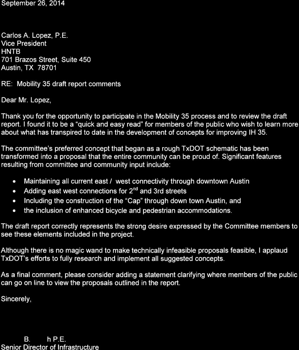

78
79 From: Gary Hudder Sent: Monday, September 29, :25 AM To: Carlos Lopez; Subject: RE: Draft Mobility35 Report After reviewing the report, I am fully supportive and appreciate the time that all of the committee members contributed. Thanks to the TxDOT staff and the members of the HNTB team for your commitment to keeping the group focused and on point a difficult task at times! Gary D. Hudder Director of Transportation 1
80 From: Harkins, Gerald R Sent: Monday, September 29, :04 AM To: Carlos Lopez Cc: Clubb, Patricia L Subject: RE: Draft Mobility35 Report Carlos: UT is supportive of the report. We remain concerned about the 15 th and MLK ramps. With the new Dell Medical Center added to the current mix of University of Texas and Capitol area traffic this are must work and work well. Bob Dr. Gerald Robert Harkins Associate Vice President Campus Safety and Security The University of Texas Austin, TX
81 From: Willhite, Christy Sent: Monday, September 29, :38 AM To: Carlos Lopez; ' Subject: RE: Draft Mobility35 Report Carlos and team, Capital Metro was pleased to participate in the I 35 Downtown Stakeholder Working Group. The future transportation corridor will be critical to the movement of commuters on our express service, and therefore, is a great contribution to transit. However, the report lacks specificity on such things like the significance of east/west connectivity in regards to transit mobility. The improvements to transit that will be realized with this project are of tremendous benefit to our city, and those benefits should not be understated. We appreciate the team s willingness to work with us both through the Stakeholder and Working groups, and we look forward to working with TxDOT during the environmental process. Christy D. Willhite Government Relations Program Manager Capital Metro Transportation Authority 2910 East 5th Street Austin, Texas
82 From: Tom Word Sent: Monday, September 29, :39 AM To: Carlos Lopez Subject: RE: Draft Mobility35 Report Carlos, I am happy with the draft report as presented, and I have no additional comments. I will be attending the October 8 th meeting. I look forward to seeing you then. Tom Word Assistant City Manager City of Pflugerville 1

83
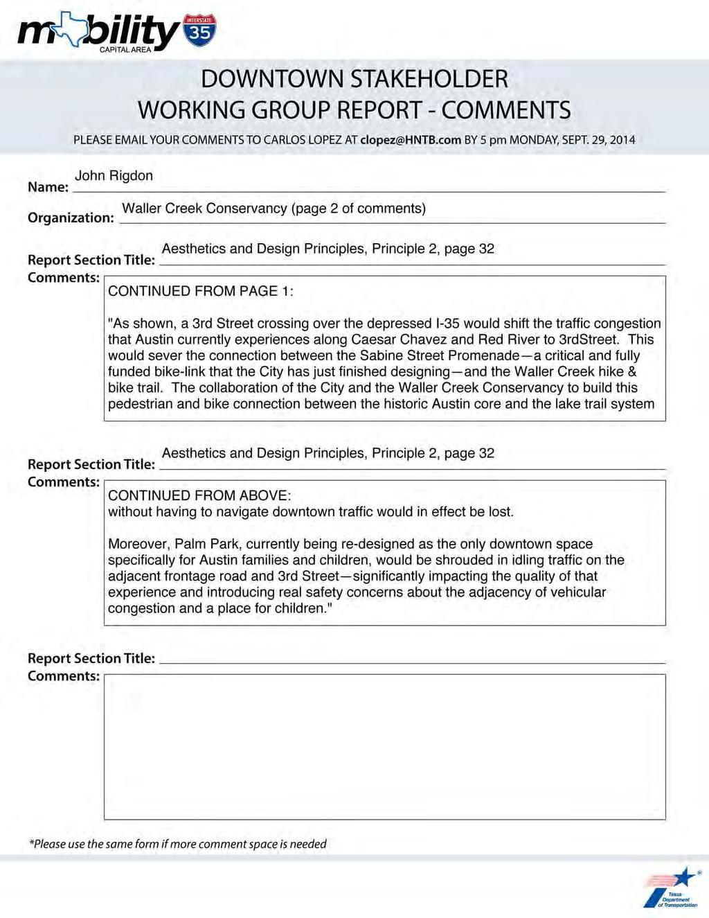
84
85 From: Jackson, Linda Y. Sent: Monday, September 29, :58 PM To: Carlos Lopez Subject: RE: Draft Mobility35 Report Thank you for the opportunity to review prior to releasing. See one typo on page 28, second column. Should be are no longer proposed instead of are no long proposed.. I saw after reading, that we said there were too many exits ramps from IH-35, but, later we come back to say that we need more exit ramps. The public might perceive that as contradictory. Linda Y. Jackson Huston-Tillotson University Director of University Relations 900 Chicon Street Austin, Texas
86 DOWNTOWN STAKEHOLDER WORKING GROUP REPORT - COMMENTS PLEASE YOUR COMMENTS TO CARLOS LOPEZ AT clopez@hntb.com BY 5 pm MONDAY, SEPT. 29, 2014 Name: Organization: Report Section Title: Comments: Report Section Title: Comments: Report Section Title: Comments: *Please use the same form if more comment space is needed
87

88
Southern Gateway Project and Public Green
 Southern Gateway Project and Public Green Transportation and Trinity River Project Committee May 23, 2016 Purpose of Presentation Provide the history and an overview of the Southern Gateway Project (SGP)
V. Vision and Guiding Principles
 V. Vision and Guiding Principles The Master Plan for the Powers Ferry Corridor seeks a foundation in the desires of the community. At times, various elements of the community offered opposing viewpoints,
ARLINGTON COUNTY, VIRGINIA. County Board Agenda Item Meeting of January 28, 2017 SUPPLEMENTAL REPORT-2
 ARLINGTON COUNTY, VIRGINIA County Board Agenda Item Meeting of January 28, 2017 SUPPLEMENTAL REPORT-2 DATE: January 27, 2017 SUBJECT: The Virginia Department of Transportation s Transform I-66 Inside the
ARLINGTON COUNTY, VIRGINIA. County Board Agenda Item Meeting of January 28, 2017 SUPPLEMENTAL REPORT
 ARLINGTON COUNTY, VIRGINIA County Board Agenda Item Meeting of January 28, 2017 SUPPLEMENTAL REPORT DATE: January 26, 2017 SUBJECT: The Virginia Department of Transportation s Transform I-66 Inside the
Honorable Members of the Mobility Solutions, Infrastructure and Sustainability Committee
 Memorandum DATE January 23, 2019 CITY OF DALLAS TO Honorable Members of the Mobility Solutions, Infrastructure and Sustainability Committee SUBJECT I-30 East Project Update On Monday, January 28, 2019,
Public input has been an important part of the plan development process.
 Lakewood s Comprehensive Plan recognizes that transportation helps shape the community, and that the way the community provides for the safe and efficient movement of people affects the character of the
Route 1 Corridor Study
 Route 1 Corridor Study Westbrook, Connecticut A Vision for the Connecticut Shoreline Public Informational Meeting July 28, 2015 Lower Connecticut River Valley Council of Governments Fitzgerald & Halliday,
Urban Planning and Land Use
 Urban Planning and Land Use 701 North 7 th Street, Room 423 Phone: (913) 573-5750 Kansas City, Kansas 66101 Fax: (913) 573-5796 Email: planninginfo@wycokck.org www.wycokck.org/planning To: From: City Planning
CITY OF CHARLOTTESVILLE, VIRGINIA CITY COUNCIL AGENDA
 CITY OF CHARLOTTESVILLE, VIRGINIA CITY COUNCIL AGENDA Agenda Date: December 16, 2013 Action Required: Adoption of Resolution Presenter: Staff Contacts: Title: James E. Tolbert, AICP, Director of NDS James
Town Center (part of the Comprehensive Plan)
") Town Center (part of the Comprehensive Plan) Mercer Island Town Center Looking North (2014) In 1994, a year-long process culminated in a set of design guidelines and code requirements for the Town Center
Town Center (part of the Comprehensive Plan) Mercer Island Town Center Looking North (2014) In 1994, a year-long process culminated in a set of design guidelines and code requirements for the Town Center
2.0 PURPOSE AND NEED. 2.1 Purpose. 2.2 Need Traffic Congestion in and around Downtown Derry
 2.0 PURPOSE AND NEED Taking into consideration agency and public input, the purpose and need for the Project was identified early in Project planning. As noted in Appendix A, for purposes of meeting the
RESOLUTION NO. R Refining the route, profile and stations for the Downtown Redmond Link Extension
 RESOLUTION NO. R2018-32 Refining the route, profile and stations for the Downtown Redmond Link Extension MEETING: DATE: TYPE OF ACTION: STAFF CONTACT: Capital Committee Board PROPOSED ACTION 09/13/2018
Policies and Code Intent Sections Related to Town Center
 Policies and Code Intent Sections Related to Town Center The Town Center Vision is scattered throughout the Comprehensive Plan, development code and the 1994 Town Center Plan. What follows are sections
July 12, Columbus City Council City Hall 90 West Broad Street Columbus, OH RE: I-70/71 Columbus Crossroads Project
 OHIO DEPARTMENT OF TRANSPORTATION DISTRICT 6 400 EAST WILLIAM STREET DELAWARE, OHIO 43015 800.372.7714 Columbus City Council City Hall 90 West Broad Street Columbus, OH 43215-9015 RE: I-70/71 Columbus
ITEM #8. Regional Smart Growth Program. Regional Smart Growth Program. Presentation Overview. Coast Highway Vision and Stategic Plan.
 Regional Smart Growth Program Economic Development Commission What is Smart Growth? Adopted as part of the Regional Comprehensive Plan (RCP) RCP provides vision for region based on Smart Growth and sustainability
Mississippi Skyway Preliminary Engineering Report
 EXECUTIVE SUMMARY Mississippi Skyway Preliminary Engineering Report CITY OF RAMSEY, MINNESOTA DECEMBER 2014 City of RAMSEY EXECUTIVE SUMMARY Project Need and Intent The Mississippi Skyway pedestrian bridge
Executive Summary. NY 7 / NY 2 Corridor
 Executive Summary NY 7 / NY 2 Corridor Transportation and Land Use Study December 2005 Prepared for: Town of Colonie Capital District Transportation Committee Prepared by: Introduction: Land use decisions
PLAN ELEMENTS WORKSHOP. April 5, 2016
 PLAN ELEMENTS WORKSHOP April 5, 2016 needs more housing. But there is no one-size fits-all solution. Every neighborhood has its own character. In some places, density is not only appropriate it is badly
Introduction. Chapter 1. Purpose of the Comprehensive Plan Plan Organization Planning Process & Community Input 1-1
 Chapter 1 Introduction Lakewood 2025: Moving Forward Together Purpose of the Comprehensive Plan Plan Organization Planning Process & Community Input 1-1 Purpose of the Comprehensive Plan The Comprehensive
ELK GROVE GENERAL PLAN VISION
 2-1 CHAPTER 2: 2-2 CREATING OUR The Community Vision for Elk Grove, expressed through a Vision Statement and a series of Supporting Principles, is a declaration of the kind of community that Elk Grove
1.0 Introduction. Purpose and Basis for Updating the TMP. Introduction 1
 1.0 Introduction The Town of Castle Rock is situated between the metropolitan areas of Denver and Colorado Springs, amidst a unique terrain of rolling hills, mesas, ravines, and waterways. Like many Front
HIGHWAY INFLUENCES ON REGIONAL DEVELOPMENT. Tony Hartzel, TxDOT Northeast Texas Public Information Mgr.
 HIGHWAY INFLUENCES ON REGIONAL DEVELOPMENT Tony Hartzel, TxDOT Northeast Texas Public Information Mgr. Feb. 2, 2018 Highways and Redevelopment Central Expressway LBJ Freeway 2 What is Dallas CityMAP? Process
The Illinois Department of Transportation and Lake County Division of Transportation. Route 173, including the Millburn Bypass
 The Illinois Department of Transportation and Lake County Division of Transportation welcome you to this Public Hearing for U.S. Route 45 from Illinois Route 132 to Illinois Route 173, including the Millburn
Issues Requiring Future Study
 Issues Requiring Future Study Transportation planning is an ongoing process that tends to identify new issues as it finds solutions for others. Some issues are so complex that a solution to one problem
DRAFT PLAN PRESENTATION
 DRAFT PLAN PRESENTATION 1.23.2018 AGENDA Process Project Schedule Results from Visioning Workshop Draft Plan Highlights Concept Plans Feedback Next Steps PROJECT SCHEDULE KICK-OFF WORKSHOP August 29 th
CHAPTER 7: Transportation, Mobility and Circulation
 AGLE AREA COMMUNITY Plan CHAPTER 7 CHAPTER 7: Transportation, Mobility and Circulation Transportation, Mobility and Circulation The purpose of the Transportation, Mobility and Circulation Chapter is to
Concord Community Reuse Project Goals and Guiding Principles. Overarching Goals (OG)
") Concord Community Reuse Project Goals and Guiding Principles Overarching Goals (OG) No priority is implied by the order of presentation of the goals and guiding principles. Overarching goals for the Concord
Concord Community Reuse Project Goals and Guiding Principles Overarching Goals (OG) No priority is implied by the order of presentation of the goals and guiding principles. Overarching goals for the Concord
City of Plattsburgh DRI: Downtown Streetscapes & Riverfront Access. Downtown Streetscape and Riverfront Access Design
 City of Plattsburgh DRI: Downtown Streetscapes & Riverfront Access Welcome Thank you for coming this evening. Agenda PART I - Project Context The Downtown Revitalization Program Our DRI Projects Other
2040 LUP is a part of the Comprehensive Plan and carries the same legal authority. Economic Challenges
 1.1. Guiding Anchorage s Growth Where will new residents settle over the next two decades? Where will people work, shop, and play? Will there be enough room to grow? How will Anchorage look? Will growth
The transportation system in a community is an
 7 TRANSPORTATION The transportation system in a community is an important factor contributing to the quality of life of the residents. Without a sound transportation system to bring both goods and patrons
Toronto Complete Streets Guidelines
 c. DTAH 58 60 3.1 70 3.2 Performance Measurement 71 3.3 Exceptions Chapter 3 describes the five general steps in the street design process. Not all projects follow these steps, as the number of steps and
Denton. A. Downtown Task Force
 2 Public Involvement Early and ongoing public involvement was solicited so that the public had ample opportunity to help direct the DTIP s concepts and implementation strategies. The residents of Denton
SH 199 Corridor Master Plan. Community Meeting No. 2 May 31, 2017
 Community Meeting No. 2 May 31, 2017 Transportation Projects On or Near SH 199 SH 199 from 0.3 miles south of FM 1886 to south end of Lake Worth bridge Construct freeway mainlanes and frontage roads 10-Year
master plan of highways bus rapid transit amendment
 Scope of Work master plan of highways bus rapid transit amendment September 2011 Montgomery County Planning Department M-NCPPC MontgomeryPlanning.org 1 Scope of Work master plan of highways bus rapid transit
Ashland BRT Environmental Assessment: logos of CTA, CDOT, Chicago Department of Housing and Economic Development
 Ashland BRT Environmental Assessment: logos of CTA, CDOT, Chicago Department of Housing and Economic Development Overview The Chicago Transit Authority (CTA), in partnership with the Chicago Department
Port Lavaca Future Land Use
 Port Lavaca Future Land Use Introduction The City of Port Lavaca is beginning to see sustained growth, after many years of relative stable population. New single family homes, apartments, and businesses
DRAFT Subject to Modifications
 TREASURE COAST REGIONAL PLANNING COUNCIL M E M O R A N D U M To: Council Members AGENDA ITEM 8 From: Date: Subject: Staff May 19, 2017 Council Meeting Florida Department of Transportation Complete Streets
Project Overview. Get Involved. Public Information Meeting. Contact Information
 Get Involved VDOT representatives will review and evaluate information received as a result of this meeting. Please fill out the comment sheet provided in this brochure if you have any comments or questions.
I-70 Corridor Enhancement Plan
 i - Table of Contents Table of Contents Chapter I Overview Chapter II Bridge and Roadway Improvements Chapter III Landscape Enhancements Chapter IV Riparian Corridors Chapter V Showcase Missouri Plan Chapter
3. VISION AND GOALS. Vision Statement. Goals, Objectives and Policies
 Vision Statement Queen Creek s interconnected network of parks, trails, open spaces and recreation opportunities provide safe and diverse activities and programs that sustain its unique, small town, equestrian
Rezoning Issues Setting a Foundation for Zoning Decisions
 Rezoning Issues Setting a Foundation for Zoning Decisions City Council Workshop May 2, 2016 Agenda Goal Need actionable items and sequence of steps Foundation for Zoning Decisions Council Workshop Discussion
SUBJECT: Waterfront Hotel Planning Study Update TO: Planning and Development Committee FROM: Department of City Building. Recommendation: Purpose:
 Page 1 of Report PB-23-18 SUBJECT: Waterfront Hotel Planning Study Update TO: Planning and Development Committee FROM: Department of City Building Report Number: PB-23-18 Wards Affected: 2 File Numbers:
1.0 INTRODUCTION 1.1 TH 14 WEST STUDY AREA Project Description Functional Classification Purpose of the Project
 1.0 INTRODUCTION 1.1 TH 14 WEST STUDY AREA 1.1.1 Project Description The Trunk Highway (TH) 14 West Corridor is a two-lane roadway approximately 22 miles in length. Located in Nicollet County, the corridor
40 Years of Smart Growth Arlington County s Experience with Transit Oriented Development in the Rosslyn-Ballston Metro Corridor
 40 Years of Smart Growth Arlington County s Experience with Transit Oriented Development in the Rosslyn-Ballston Metro Corridor A presentation by the Arlington County Department of Community Planning,
Memorandum CITY OF DALLAS
 Memorandum DATE September 23, 2016 CITY OF DALLAS TO The Honorable Members of the Transportation and Trinity River Project Committee: Lee M. Kleinman (Chair), Deputy Mayor Pro Tem Erik Wilson (Vice-Chair),
Mavis Road Class Environmental Assessment
 Mavis Road Class Environmental Assessment Public Information Centre #2 Wednesday November 9, 2016 6:00 to 8:00 p.m. Please sign in and complete a comment sheet Review the displays on your own or join in
Comprehensive Plan. Faribault, Minnesota. Hoisington Koegler Group Inc. Claybaugh Preservation Architecture Inc. Howard R. Green Company Bonz/REA
 Comprehensive Plan Faribault, Minnesota Adopted by the Faribault City Council July 8, 2003 prepared for: prepared by: Hoisington Koegler Group Inc. Claybaugh Preservation Architecture Inc. Howard R. Green
Ballston Station Multimodal Study. Stakeholder Meeting October 5, 2010
 Ballston Station Multimodal Study Stakeholder Meeting October 5, 2010 Agenda Welcome and Introductions Update on Short Term Improvements Update on the Multimodal Study Recap of Goals and Key Issues Working
Community Workshop November 19, 2014
 Community Workshop November 19, 2014 Agenda Welcome and Introduction What is a General Plan? About the General Plan Update Our General Plan Topics to be included in the Update Update process Opportunities
People who are members of historically disenfranchised racial, ethnic, cultural, and other identity groups are encouraged to apply.
 CALL TO ARTISTS REQUEST FOR QUALIFICATIONS CITY OF TACOMA MUNICIPAL ART PROGRAM East 64 th Streetscape, Tacoma, WA APPLICATION DEADLINE October 10, 2018, 11:59pm BUDGET $72,000, all-inclusive SUMMARY The
1 October Dear Citizens of Charlotte and Mecklenburg County,
 1 October 2011 Dear Citizens of Charlotte and Mecklenburg County, As co-chairs of the Center City 2020 Vision Plan Steering Committee, we are proud to present the Center City 2020 Vision Plan, which sets
CHAPTER 7: VISION AND ACTION STATEMENTS. Noble 2025 Vision Statement
 CHAPTER 7: VISION AND ACTION STATEMENTS This chapter presents the vision, policy and action statements that transform the comprehensive planning study, an analysis of Noble s past, future trends and community
Atlanta BeltLine Corridor Environmental Study. Scoping Meeting August 2008
 Atlanta BeltLine Corridor Environmental Study Scoping Meeting August 2008 What Will We Be Discussing Today? Study Overview - How Did We Get Here? - What Is the Study About? - Who Is Involved? - Where Is
The University District envisions, in its neighborhood
 Envisioning the University District Link Light Rail in Seattle s neighborhoods CIY OF SEALE CONCEP-LEVEL SAION AREA PLANNING RECOMMENDAION RESOLUION # 30165 EXHIBI L Vision 08.2000 he University District
MEMO 1. INTRODUCTION PURPOSE & PROCESS REQUEST
 MEMO Date: August 22, 2017 To: Board of Commissioners From: Jason Burdette, Planning Director Re: Davidson Commons East Hotel Stakeholder Feedback 1. INTRODUCTION PURPOSE & PROCESS This memorandum summarizes
D2 Subway Project Development. Public Meeting September 12, 2018
 D2 Subway Project Development Public Meeting September 12, 2018 1 Agenda Project Background Process, Funding and Schedule Project Development (PD) Efforts Preliminary Engineering (PE) Environmental Impact
The Village of Sugar Grove, in partnership with Kane County, the Illinois Department of Transportation, and the Illinois Tollway welcomes you to the
 The Village of Sugar Grove, in partnership with Kane County, the Illinois Department of Transportation, and the Illinois Tollway welcomes you to the first Public Meeting for the proposed interchange improvement
PREPARED FOR: PLATTEVIEW ROAD CORRIDOR STUDY EXECUTIVE SUMMARY
 PREPARED FOR: PLATTEVIEW ROAD CORRIDOR STUDY EXECUTIVE SUMMARY SEPTEMBER 2016 Introduction The Platteview Road Corridor Study was led by the Metropolitan Area Planning Agency (MAPA) with assistance from
CHAPTER 1. Ms. Guajardo s Class - Central Elementary CH 1 1
 INTRODUCTION CHAPTER 1 Ms. Guajardo s Class - Central Elementary CH 1 1 1.1 SETTING South Centre City is a linear corridor south of Downtown Escondido paralleling Centre City Parkway and South Escondido
SECTION 4(f) DE MINIMIS DOCUMENTATION
 DE MINIMIS DOCUMENTATION") SECTION 4(f) DE MINIMIS DOCUMENTATION Illinois Route 60/83 IL 176 to the intersection of IL 60 (Townline Road) Lake County P-91-084-07 Mundelein Park and Recreation District Project Limit SECTION 4(f)
SECTION 4(f) DE MINIMIS DOCUMENTATION Illinois Route 60/83 IL 176 to the intersection of IL 60 (Townline Road) Lake County P-91-084-07 Mundelein Park and Recreation District Project Limit SECTION 4(f)
TOWN COUNCIL / PLANNING COMMISSION
 Workshop #3 TOWN COUNCIL / PLANNING COMMISSION January 20, 2011 Consultant Team In Attendance Tonight BMS Design Group Nevada City and San Francisco Michael Smiley, AICP, ASLA Partner-in-Charge Nancy L.
Scope of Services. River Oaks Boulevard (SH 183) Corridor Master Plan
 Corridor Master Plan") Scope of Services River Oaks Boulevard (SH 183) Corridor Master Plan PROJECT AREA The project area consists of the River Oaks Boulevard (SH 183) corridor bounded by SH 199 at the northern end and the Trinity
Scope of Services River Oaks Boulevard (SH 183) Corridor Master Plan PROJECT AREA The project area consists of the River Oaks Boulevard (SH 183) corridor bounded by SH 199 at the northern end and the Trinity
Parks Master Plan Implementation: Phase I Waterfront Use and Design REPORT #: September 7, 2016 File #
 0 'O DI Lan-171-14 1 - THE CORPORATION OF THE TOWN OF COBOURG..,. STAFF REPORT TO: FROM: Mayor and Members of Council Dean A. Hustwick, Director of Recreation and Culture DATE OF MEETING: Committee of
I-84 Hartford Project Open Planning Studio #12. April 25, 2017
 I-84 Hartford Project Open Planning Studio #12 April 25, 2017 Meeting Agenda 1. I-84 Hartford Project alternatives update 2. Multimodal station area planning 3. I-84 / I-91 Interchange Study coordination
This page left intentionally blank.
 July 2012 This page left intentionally blank. Table of Contents Appendix A : Project Development Checklist Appendix B: At-Grade Rail Crossings Appendix C: Maintenance and Operations Examples Appendix D:
MOBILITY35 AESTHETICS
 MOBILITY35 AESTHETICS Aesthetics Working Group 3 March 29, 2016 What we heard regarding three themes Connectivity: Improve east/west pedestrian connections Safe and well marked Local identity defined by
HE VISION. Building a Better Connected Place
 HE VISION Building a Better Connected Place WALK INTO THE FUTURE. Life in Cranberry, 2030 Here s what our residents told us they wanted to see in their community by 2030: The Cranberry of 2030 is a place
The Ambassador Bridge/ Gateway Project
 The Ambassador Bridge/ Gateway Project Connecting Neighbors & Driving the Economy 2008 Ohio Conference on Freight Given by the Toledo Metropolitan Area Council of Governments, National Association of Regional
INDEPENDENCE BOULEVARD AREA PLAN. June 24, 2008
 INDEPENDENCE BOULEVARD AREA PLAN Public Meeting #1 June 24, 2008 Tonight s Agenda Introduction Welcome and Ground Rules Overview Presentation Purpose of the Plan What Brings Us Here? A Tour of the Corridor
Southeast Extension to RidgeGate Parkway Scoping Booklet
 Southeast Extension to RidgeGate Parkway Scoping Booklet PUBLIC SCOPING MEETING SCHEDULE Public Scoping Meeting Wednesday, November 2, 2011 6:00pm to 7:30pm City of Lone Tree Recreation Center Willow Room
This Review Is Divided Into Two Phases:
 Semiahmoo Town Centre Review The purpose of this review: To review the Semiahmoo Town Centre Concept Plan, originally approved in 1993, to ensure that this centre will continue to serve the needs of South
ARLINGTON COUNTY, VIRGINIA
 ARLINGTON COUNTY, VIRGINIA County Board Agenda Item Meeting October 15, 2005 DATE: September 28, 2005 SUBJECT: Request to Advertise the adoption of the 2005 Clarendon Sector Plan C. M. RECOMMENDATION:
EXISTING COMPREHENSIVE PLAN
 EXISTING COMPREHENSIVE PLAN Town Center Land Use Element: V. LAND USE POLICIES Town Center Mercer Island's business district vision as described in "Your Mercer Island Citizen-Designed Downtown" was an
Future Proposed Development
 Future Proposed Development on and around Link light rail s Capitol Hill Station Meeting September 24, 2012 Tonight s Agenda 6:00 pm Open House 6:30 pm Introductions Richard Conlin, City of Seattle Councilmember/Sound
Chapter 1: Introduction
 Chapter 1: Introduction The Penn Avenue Community Works Corridor Vision and Implementation Framework presents an integrated communitybased vision and a coordinated, long-term implementation framework for
We d like to thank you for attending this Wekiva Parkway Section 8 Preliminary Design Update hosted by the Florida Department of Transportation.
 We d like to thank you for attending this Wekiva Parkway Section 8 Preliminary Design Update hosted by the Florida Department of Transportation. We will provide you information on the overall project and
Downtown Lead Revitalization Project Final Recommendations. Three Proposed Options for the Revitalization of Downtown Lead
 Downtown Lead Revitalization Project Final Recommendations Three Proposed Options for the Revitalization of Downtown Lead November 1, 2011 Three Proposed Options for the Revitalization of Downtown Lead
CITY COUNCIL AGENDA REPORT
 CITY COUNCIL AGENDA REPORT Subject: COUNCIL MOTION LRT ALIGNMENT REMOVAL FROM THE TRANSPORTATION MASTER PLAN On February 10, 2016 Councillor Hughes provided notice in accordance with Section 23 of Procedure
WELCOME TO OPEN HOUSE TWO November 28, 2018
 Langstaff Road Weston Road to Highway 7 Class Environmental Assessment Study WELCOME TO OPEN HOUSE TWO November 28, 2018 Please sign in and join our mailing list Study Overview York Region is conducting
SAN RAFAEL GENERAL PLAN 2040 INTRODUCTION AND OVERVIEW
 SAN RAFAEL GENERAL PLAN 2040 INTRODUCTION AND OVERVIEW Steering Committee Presentation February 14, 2018 Purpose of General Plan Guide land use and development decisions Coordinate transportation, infrastructure,
D2 Subway Project Development. Interagency Meeting July 27, 2018
 D2 Subway Project Development Interagency Meeting July 27, 2018 1 Agenda Welcome and Introductions Project Background D2 Project Overview Project Development (PD) Efforts Preliminary Engineering (PE) Environmental
greenprint midtown SUSTAINABILITY ACTION PLAN 2012
 greenprint midtown SUSTAINABILITY ACTION PLAN 2012 MIDTOWN ALLIANCE SOUTHFACE ENERGY INSTITUTE RENAISSANCE PLANNING GROUP SUSTAINABLE ATLANTA PERKINS+WILL 2 GREENPRINT MIDTOWN 1. Introduction Sustainability
Honorable Mayor and Members of the City Council. Submitted by: Eric Angstadt, Director, Planning and Development
 Office of the City Manager ACTION CALENDAR January 29, 2013 To: From: Honorable Mayor and Members of the City Council Christine Daniel, City Manager Submitted by: Eric Angstadt, Director, Planning and
Welcome to the. Open House
 Welcome to the 5th Street to Kinsman Road Open House November 14 5:30 7:00 p.m. Please sign in Project Overview In December 2016, City Council adopted SW 5th Street as the preferred alignment to connect
Blueprint Denver Task Force Meeting #
 Blueprint Denver Task Force Meeting #1 6.23.16 1. Welcome and Introductions Your name and affiliation Name 1 thing you love about Denver Name 1 thing you d change about Denver All in 30 seconds! Ready,
1.0 Circulation Element
 5/9/18 1.0 Circulation Element 1.1 Introduction As growth and development occur in Apache County, enhancements to its circulation system will be necessary. With time, more roads will be paved and air and
40 Years of Smart Growth Arlington County s Experience with Transit Oriented Development in the Rosslyn-Ballston Metro Corridor
 40 Years of Smart Growth Arlington County s Experience with Transit Oriented Development in the Rosslyn-Ballston Metro Corridor A presentation by the Arlington County Department of Community Planning,
WAC #7 3/14/14. Coachella General Plan Update
 WAC #7 3/14/14 Coachella General Plan Update Agenda 2 Introductions Public Draft General Plan Overview and Discussion of Next Steps Implementation and Evaluation Health Element Process Evaluation (discussion)
The Emerald Bracelet Dallas, Texas. October 2005
 The October 2005 TABLE OF CONTENTS: Tab I Project Summary Master Illustrative Plan Tab II Woodall Rodgers Freeway Segment Tab III U.S. Highway 75 Segment Tab IV Interstate Highway 30 Segment Tab V Interstate
Sherri Ferguson. President/CEO Portland Chamber of Commerce. Tennessee Certified Economic Developer Capstone Project
 Sherri Ferguson President/CEO Portland Chamber of Commerce Tennessee Certified Economic Developer Capstone Project Strategic Plan Development for the North Gateway of Portland, Tennessee The New Gateway
S A C R A M E N T O C O U N T Y JACKSON HIGHWAY & GRANT LINE EAST VISIONING STUDY
 JACKSON HIGHWAY & GRANT LINE EAST S A C R A M E N T O C O U N T Y P L A N N I N G D E P A R T M E N T SUMMARY AND WORKBOOK November 19, 2008 History of the Visioning Study Sacramento County has two growth
DRAFT FOR PUBLIC REVIEW. Game Plan for a Healthy City
 DRAFT FOR PUBLIC REVIEW 2018 Game Plan for a Healthy City 2 Denveright. Parks & Recreation Game Plan Draft for Public Review Draft for Public Review Executive Summary Game Plan Overview Executive Summary
Existing Transportation System 5-1
 5-1 The Jackson County transportation system is served by several modes of transportation including streets and highways, multi-modal, non-motorized, rail, and aviation. While the focus of the transportation
CHAPTER 8 ISSUES, CONCERNS, CONSTRAINTS AND OPPORTUNITIES
 CHAPTER 8 ISSUES, CONCERNS, CONSTRAINTS AND OPPORTUNITIES Introduction This River Conservation Plan was developed during a time of tremendous activity and effort in planning the transformation of the Delaware
New Westminster Downtown Parking Strategy Public Open House #1 September 13, 2012
 New Westminster Downtown Parking Strategy Public Open House #1 September 13, 2012 The City is preparing a strategy for parking in Downtown New Westminster. The study team and a group of key stakeholders
University of the District of Columbia Van Ness Campus Master Plan Community Open House 3. December 8, 2010
 University of the District of Columbia Van Ness Campus Master Plan Open House 3 December 8, 2010 Introductions Sequence of Work: Campus Master Plan BEGIN: INTRODUCE AND START WORK Project Initiation Team
Atlanta BeltLine, Inc. Pathways to Urban Sustainability
 Atlanta BeltLine, Inc. Pathways to Urban Sustainability September 30, 2010 WHAT IS THE ATLANTA BELTLINE? Transit 22-mile loop Parks 1300 + new acres Trails 33 miles Jobs & Economic Development 20 areas,
Chapter 1.0 Introduction
 Chapter 1.0 Introduction 1.1 Background The North Metro commuter rail line is part of the RTD FasTracks regional transit system expansion program to build more than 100 miles of rail transit throughout
South Davis County COMMUNITY SPOTLIGHT
 South Davis County COMMUNITY SPOTLIGHT Davis/SLC Community Connector Bus Rapid Transit line connecting SLC & Davis County RTP Phase 1 Project Generate 3,100 average weekday riders Relieve congestion on
City of Farmington. Downtown Plan. Amendment to the 1998 Master Plan Adopted October 11, 2004
 City of Farmington Amendment to the 1998 Master Plan Adopted October 11, 2004 Introduction Planning Background 1 Scope and Components of the Plan Amendment 2 Concept Introduction 3 Plan Concepts 3 Conceptual