Morpeth Flood Alleviation Scheme. An Example of Partnership Funding & Community Engagement
|
|
|
- Francine Walters
- 5 years ago
- Views:
Transcription

1 Morpeth Flood Alleviation Scheme An Example of Partnership Funding & Community Engagement Ruth Bendell Infrastructure Manager - Northumberland County Council Chair of the TAG FCRM Committee
2 Overview Setting the Scene Engagement Partnership Approach Agreed Scheme Wider Community Engagement Community Agreement

3 Setting the Scene Northumberland Population 316,000 Area 5000 km 2 Predominantly rural SCOTLAND N NORTH SEA Morpeth Population 14,000 County Town of Northumberland Strategic importance Major historic flooding 1963, 2008, 2012 Morpeth
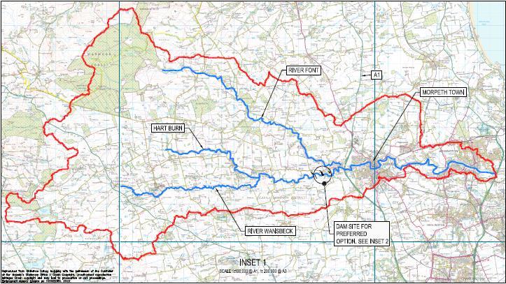
4 Catchment

5 Morpeth the River Wansbeck

6 Morpeth the River Wansbeck

7 Morpeth the River Wansbeck


8 1963 Flood 1963 floods Oldgate Bridge Elliot Footbridge


9 Sat 6 th September 2008 Low Stanners


10 Sat 6 th September 2008 Middle Greens


11 Sat 6 th September 2008 Town Centre


12 Sat 6 th September 2008 Bridge Street


13 Sat 6 th September 2008 Bridge Street


14 Sat 6 th September 2008 High Stanners

15 Flood Risk With Current Defences This map is reproduced from Ordnance Survey material with the permission of Ordnance Survey on behalf of the Controller of Her Majesty s Stationery Office Crown copyright. Unauthorised reproduction infringes Crown copyright and may lead to prosecution. Licence No

16 Defences in Morpeth (town works) Debris screen New defences Upstream Storage Replace / raise existing defences
17 Timescales NCC joint funding agreed (late summer 2011) Project review (Nov/Dec 2011) Communications plan (2012) Detailed design (2012) Planning approval (2013) Construction ( )


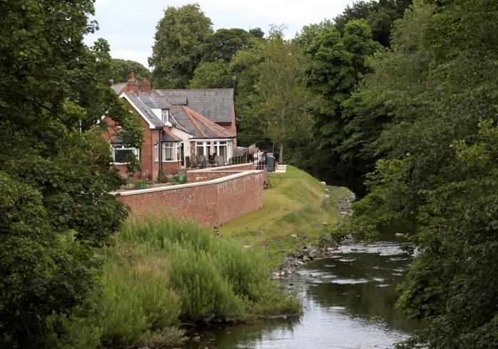
18 High Stanners - visualisation Wide green area - allows for gently sloping embankment


19 High Stanners - visualisation Narrow green area - space restricted so flood wall will defend properties


20 Upstream dam - Mitford Estate This map is reproduced from Ordnance Survey material with the permission of Ordnance Survey on behalf of the Controller of Her Majesty s Stationery Office Crown copyright. Unauthorised reproduction infringes Crown copyright and may lead to prosecution. Licence No
21 Mitford Estate - visualisation
22 Partnership Approach Partnership agreements legal Project Board - EA, NCC, NWL, consultants, contractors Project Team - Personalities - Positive approach to joint benefits - Multi-disciplinary capability Joint Branding Engagement
23 Engagement Deliver more for people and the environment Working with communities can help reach a consensus on how flood risk can best be managed Greater ownership of flood risk Engage early before decisions are made

24 Working Together through and with others Morpeth Flood Action Group Political buy in from MP and Councillors Local media

25 Joined up communications Joint communication & engagement plan Agreed messages Joint events Existing communication channels including council magazine Digital communications

26 Tailored engagement Whole town drop-in events Events for specific areas of the town Consultation with Flood Action Group One-to-one meetings with directly affected residents and landowners

27 Final Scheme Consistent standard of protection throughout Morpeth at 1 in 50 These defences contain the passforward flow from the dam.
28 How does the dam store flood water? River water levels will be measured using sensors located upstream of the inlet structure. These control the penstocks. The penstocks will open and allow the flood storage area to empty once the high flows through the town have reduced. The penstocks on the five larger culverts will close one by one to maintain a peak outflow (150m 3 /s).
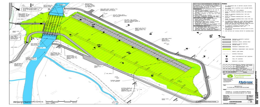
29 Mitford Flood Storage Area Design Online storage area. Flows maintained through one 1.8x1.8m and five 3x3m precast culverts. Flows up to 150m 3 /s (c. 1:35 year event) pass through the dam unnattenuated. This pass forward flow equates to maximum flow that urban defences can protect against. Once pass forward flow exceeded, 3 of the 5 penstocks will close, 1 by 1. 2 remain open; these discharge the pass forward flow when the dam is full.
30 Mitford Flood Storage Area Hydrograph

31 Dam Function Design 1.8 x 1.8m culvert designed to maintain the movement of crayfish and eels Baffles reduce the velocities provide hiding places for crayfish. Matting to improve bed conditions. Fish blocks provided to reduce velocity. Low flow channel for fish passage.

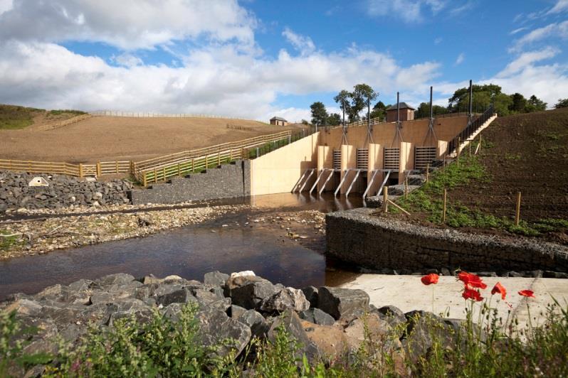
32 Scheme launch event Removal of Collingwood oaks at High Stanners Replanting of Collingwood Oaks at Abbey Fields First School

33 Construction Phase


34 Town Works Flood walls both new and upgraded Flood bund and gates at High Stanners Local road raising Locking down of Storm water manhole covers

35 Community information Visitor centre & scheme HQ Detailed information available to public 150 visitors in first six weeks Twitter account Resident Public Liaison Officer

36 Completed Town Works


37 Completed Town Works
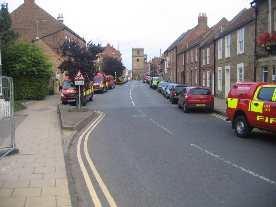
38 Dam Works
39 Dam Construction Structure constructed first RC construction with Stainless Steel Penstocks


40 Dam Construction


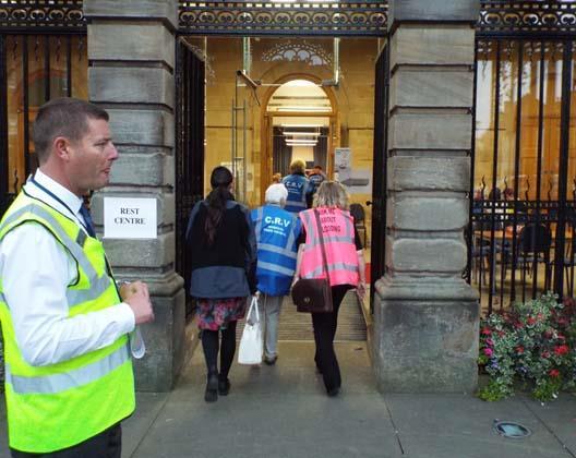
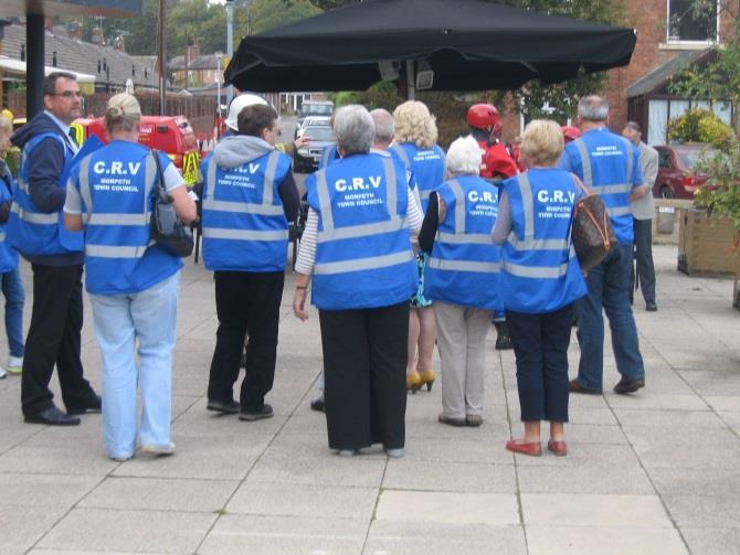
41

42 Working with schools


43 Wider Community Engagement Host Community Flood Groups and Engagement Officer through Northumbria RFCC


44 Northumberland Flood Improvement Delivery Group Morpeth Community Agreement


45 Community Agreement Live Test


46 Demonstrations


47 Demonstrations


48 Community Resilience Volunteers
49 Thank you for listening Ruth Bendell, Infrastructure Manager Northumberland County Council
Landscape and Heritage
 86 Park Development Framework Our Aim for A Park landscape that embraces the physical, cultural and social heritage of the area Why do we think it is important? The landscape provides a setting for every
Landscape and Heritage A Park landscape that embraces the physical, cultural and social heritage of the area
 80 Park Development Framework Our Aim for Landscape and Heritage A Park landscape that embraces the physical, cultural and social heritage of the area Why do we think it is important? The landscapes of
Former North Works, Lickey Road, Longbridge, Birmingham
 Committee Date: 14/11/2013 Application Number: 2013/06431/PA Accepted: 27/08/2013 Application Type: Full Planning Target Date: 26/11/2013 Ward: Longbridge Former North Works, Lickey Road, Longbridge, Birmingham
MAKING SENSE OF PLACE
 MAKING SENSE OF PLACE Landscape Character Assessment Summary Guidance for England and Scotland MAKING SENSE OF PLACE People can welcome development if it is well designed and contributes to quality of
Ballincollig Carrigaline Municipal District
 Ballincollig Carrigaline Municipal District Local Area Plan 21 st August 2017 VOLUME THREE Map Browser 3 Map Browser Volume 3 Map Browser List of maps available to view on the Local Area Plan Map Browser:
St Michaels C of E Junior & Infant School, Nantmel Grove, Bartley Green, Birmingham, B32 3JS
 Committee Date: 06/03/2014 Application Number: 2013/08595/PA Accepted: 19/11/2013 Application Type: Full Planning Target Date: 14/01/2014 Ward: Bartley Green St Michaels C of E Junior & Infant School,
Birmingham University, Pritchatts Road, Adjacent to Gisbert Kapp Building, Edgbaston, Birmingham, B15
 Committee Date: 07/03/2013 Application Number: 2013/00181/PA Accepted: 10/01/2013 Application Type: Reserved Matters Target Date: 11/04/2013 Development Ward: Edgbaston Birmingham University, Pritchatts
Committee Date: 19/03/2015 Application Number: 2014/06414/PA Accepted: 06/01/2015 Application Type: Full Planning Target Date: 03/03/2015
 Committee Date: 19/03/2015 Application Number: 2014/06414/PA Accepted: 06/01/2015 Application Type: Full Planning Target Date: 03/03/2015 Ward: Sparkbrook 41 White Road, Sparkbrook, Birmingham, B11 1EH
St Barnabas C of E Primary School, Spring Lane, Erdington, Birmingham, B24 9BY
 Committee Date: 12/06/2014 Application Number: 2014/02967/PA Accepted: 29/04/2014 Application Type: Full Planning Target Date: 24/06/2014 Ward: Erdington St Barnabas C of E Primary School, Spring Lane,
Draft Municipal District Local Area Plans. Map Browser. VOLUME THREE Map Browser th November 2016
 Draft Municipal District Local Area Plans Map Browser 16 th November 2016 VOLUME THREE Map Browser 3 Draft Municipal District Local Area Plans How to make a Submission The Draft Municipal District Local
YMCA Erdington (Phase 2), 300 Reservoir Road, Erdington, Birmingham, B23 6DB
, 300 Reservoir Road, Erdington, Birmingham, B23 6DB") Committee Date: 13/06/2013 Application Number: 2013/03011/PA Accepted: 30/04/2013 Application Type: Full Planning Target Date: 30/07/2013 Ward: Stockland Green YMCA Erdington (Phase 2), 300 Reservoir Road,
Committee Date: 13/06/2013 Application Number: 2013/03011/PA Accepted: 30/04/2013 Application Type: Full Planning Target Date: 30/07/2013 Ward: Stockland Green YMCA Erdington (Phase 2), 300 Reservoir Road,
Velindre Cancer Centre Environmental Statement Vol.1: Environmental Statement Text. Chapter 1: Introduction
 Velindre Cancer Centre Environmental Statement Vol.1: Environmental Statement Text Chapter 1: Introduction Draft - March 2017 Prepared by: Address: Email: Website: Mott McDonald, The Urbanists and HLM
Land off Longbridge Lane, Longbridge, Birmingham, B31. Development of a Park and Ride facility to serve Longbridge Station
 Committee Date: 07/03/2013 Application Number: 2012/08394/PA Accepted: 02/01/2013 Application Type: Full Planning Target Date: 27/02/2013 Ward: Northfield Land off Longbridge Lane, Longbridge, Birmingham,
Land Adj. 63 Sunny Bank Road, Sutton Coldfield, Birmingham, B73 5RJ
 Committee Date: 11/07/2013 Application Number: 2013/03520/PA Accepted: 20/05/2013 Application Type: Full Planning Target Date: 15/07/2013 Ward: Sutton Vesey Land Adj. 63 Sunny Bank Road, Sutton Coldfield,
Fluvial non-tidal Fluvial tidal Coastal. PFRA database comments (in italics): OPW comments Minor flooding of residents on golf links road
: OPW comments Minor flooding of residents on golf links road") Location: Charleville, Co. Cork Unique ID: 240375 (from PFRA database) Initial OPW Designation APSR AFRR IRR Co-ordinates Easting: 152250 Northing: 122500 River / Catchment / Sub-catchment Glen River /
Location: Charleville, Co. Cork Unique ID: 240375 (from PFRA database) Initial OPW Designation APSR AFRR IRR Co-ordinates Easting: 152250 Northing: 122500 River / Catchment / Sub-catchment Glen River /
UNCLASSIFIED. Risk of Flooding from Reservoirs - Severn River Basin District
 UNCLASSIFIED Flood Risk Maps Risk of Flooding from Reservoirs - Severn Why have we produced these maps what can they be used for? Under the Flood Risk Regulations Natural Resources Wales have worked in
Initial OPW Designation APSR AFRR IRR Co-ordinates Easting: Northing: Fluvial non-tidal Fluvial tidal Coastal
 Location: Athlone, Co. Westmeath (including townland in Roscommon) Unique ID: 260448 (from PFRA database) Initial OPW Designation APSR AFRR IRR Co-ordinates Easting: 205000 Northing: 239999 River / Catchment
Small Heath Rail Sidings, Anderton Road, Small Heath, Birmingham, B11 1TG
 Committee Date: 20/03/2014 Application Number: 2013/07749/PA Accepted: 04/03/2014 Application Type: Full Planning Target Date: 03/06/2014 Ward: Sparkbrook Small Heath Rail Sidings, Anderton Road, Small
TOPIC PAPER 2: Links to other sustainability tools
 TOPIC PAPER 2: INTRODUCTION 1.1 Landscape Character Assessment can inform a range of other sustainability tools and methodologies. Equally these other tools may assist in reaching decisions concerning
Unique ID: (from PFRA database) Location: Tralee, Co. Kerry. Stage 1: Desktop Review
 Location: Tralee, Co. Kerry. Stage 1: Desktop Review") Location: Tralee, Co. Kerry Unique ID: 230361 (from PFRA database) Initial OPW Designation APSR AFRR IRR Co-ordinates Easting: 82750 Northing: 114000 River / Catchment / Sub-catchment Lee River & Big River/
Location: Tralee, Co. Kerry Unique ID: 230361 (from PFRA database) Initial OPW Designation APSR AFRR IRR Co-ordinates Easting: 82750 Northing: 114000 River / Catchment / Sub-catchment Lee River & Big River/
Land at Cardigan Street / Belmont Row / Gopsal Street, Eastside, Birmingham, B4 7RJ
 Committee Date: 02/10/2014 Application Number: 2014/05637/PA Accepted: 07/08/2014 Application Type: Full Planning Target Date: 02/10/2014 Ward: Nechells Land at Cardigan Street / Belmont Row / Gopsal Street,
The Duke s River: Revitalising the link between the River Crane and the River Thames
 The Duke s River: Revitalising the link between the River Crane and the River Thames The project The eastern section of the Duke of Northumberland s River runs for approximately four kilometres, from where
Unique ID: (from PFRA database) Location: Birr, Co. Offaly. Stage 1: Desktop Review
 Location: Birr, Co. Offaly. Stage 1: Desktop Review") Location: Birr, Co. Offaly Unique ID: 250410 (from PFRA database) Initial OPW Designation APSR AFRR IRR Co-ordinates Easting: 206,007 Northing: 204,990 River / Catchment / Sub-catchment Camcor River /
Location: Birr, Co. Offaly Unique ID: 250410 (from PFRA database) Initial OPW Designation APSR AFRR IRR Co-ordinates Easting: 206,007 Northing: 204,990 River / Catchment / Sub-catchment Camcor River /
GREENFORD HALL & ADJOINING LAND
 GREENFORD HALL & ADJOINING LAND CONTENTS 1. Introduction 1. Introduction 2. Urban Context 2.1 The Site and Surroundings 2.2 Urban Context Map 2.3 Access and Movement 3. Planning Context 3.1 Planning History
2.0 RETAIL & HOTEL PLOTS, BRENT CROSS MAIN SQUARE THRESHOLD SPACES & ENERGY CENTRE BRENT CROSS LONDON - DESIGN DEVELOPMENT REPORT
 2. RETAIL & HOTEL PLOTS, BRENT CROSS MAIN SQUARE THRESHOLD SPACES & ENERGY CENTRE 267 2. RETAIL & HOTEL PLOTS, BRENT CROSS MAIN SQUARE THRESHOLD SPACES & ENERGY CENTRE 2.7.8 Sustainability The key sustainability
orld Heritage Site W
 World Heritage Site Stonehenge Historic England Avebury Henge and Stone Circle Historic England The Great Wall of China The Pyramids of Giza, Egypt Stonehenge Mike Goddard Stonehenge and Avebury WHS Vision
Sandscaping in Bacton, North Norfolk
 Sandscaping in Bacton, North Norfolk Protecting critical infrastructure and benefitting communities Flood & Coast 29 March 2017 Jaap Flikweert CEng FCIWEM C.WEM Jaap.flikweert@rhdhv.com @JaapJFlikweert
Plots 4 & 6, Prologis Park, Midpoint Way, Sutton Coldfield, Birmingham, B76 9EH
 Committee Date: 19/03/2015 Application Number: 2015/00285/PA Accepted: 19/01/2015 Application Type: Full Planning Target Date: 20/04/2015 Ward: Sutton New Hall Plots 4 & 6, Prologis Park, Midpoint Way,
Saltmarsh Conference. 8 October in the Suffolk Coast & Heaths Area of Outstanding Natural Beauty
 Saltmarsh Conference 8 October 2015 in the Suffolk Coast & Heaths Area of Outstanding Natural Beauty Conference organised by Haidee Stephens, Suffolk Estuaries Officer Suffolk Coast & Heaths AONB t: 01394
INTRODUCTION NORTH HEYBRIDGE GARDEN SUBURB
 INTRODUCTION This event is being hosted by the promoters of the proposed North Heybridge Garden Suburb who are working with Maldon District Council and other key stakeholders on the preparation of a comprehensive
North Somerset Council Local Development Framework
 North Somerset Council Local Development Framework Sites and Policies Development Plan Document Evidence Paper Re-opening Portishead Railway Line and Options for the Location of Portishead Railway Station
Newcastle Learning and Action Alliance. Wednesday 1 st March 2017
 Newcastle Learning and Action Alliance Wednesday 1 st March 2017 Agenda items and meeting aim New Blue-Green Declaration signatories Plans for continuing the Newcastle LAA Group Discussion: Meeting frequency
Ward: West Wittering. Proposal Change of use from public highway pavement to residential garden use.
 Parish: West Wittering Ward: West Wittering WW/17/03295/FUL Proposal Change of use from public highway pavement to residential garden use. Site Izora 1 Watersedge Gardens West Wittering PO20 8RA Map Ref
Reconnecting rivers in urban areas; challenges and considerations
 River Forth Fisheries Trust Reconnecting rivers in urban areas; challenges and considerations RAFTS-ASFB conference 2016 Currently five morphology project sites in the Forth District with three informing
OAK LODGE INVERESK, MIDLOTHIAN
 OAK LODGE INVERESK, MIDLOTHIAN OAK LODGE 14 INVERESK VILLAGE MUSSELBURGH MIDLOTHIAN EH21 7TE A CHARMING GEORGIAN HOUSE IN CONSERVATION VILLAGE JUST 7 MILES EAST OF EDINBURGH Hallway, Drawing Room, Dining
URBAN FLOOD MANAGEMENT IN CYPRUS CASE STUDY IN NICOSIA URBAN AREA
 URBAN FLOOD MANAGEMENT IN CYPRUS CASE STUDY IN NICOSIA URBAN AREA Antonis D. Toumazis Partner, Dion Toumazis & Associates Visiting Lecturer, University of Cyprus Abstract Cyprus is experiencing negative
Rainwise. Sustainable Drainage Solutions. Working with communities to manage rainwater. SuDS For Schools and Communities
 Rainwise Sustainable Drainage Solutions Working with communities to manage rainwater SuDS For Schools and Communities This overview outlines the collaborative and sustainable approach undertaken by Northumbrian
In Title Your Area 10: Lower Boddington to Southam & Offchurch
 LOCAL AREA In Title Your Area 10: Lower Boddington to Southam & Offchurch Find out here about: what is proposed between Lower Boddington and Southam & Offchurch; what this means for people living between
A1 Scotswood to North Brunton Public Information Exhibition Executive Summary
 A1 Scotswood to North Brunton Public Information Exhibition Executive Summary Introduction The A1 Scotswood to North Brunton scheme is proposed on the A1 Newcastle Gateshead Western Bypass (NGWB) between
Coastal Erosion Protection Strategies Private Works on Public Land
 Coastal Erosion Protection Strategies Private Works on Public Land Arron Broom Coastal Policy Planner Coastal Management Branch, SA DEW Delegate for the Coast Protection Board 2016 Storm Events SA experienced
REFERENCE: 15/01661/FUL Registered: 16 March 2015 Expiry date: 25 October 2016
 LOCATION: Land North Of Charcot Road, Colindale REFERENCE: 15/01661/FUL Registered: 16 March 2015 Expiry date: 25 October 2016 WARD: Colindale APPLICANT: PROPOSAL: Fairview New Homes (Colindale) Ltd Erection
Baberton House JUNIPER GREEN EDINBURGH
 Baberton House JUNIPER GREEN EDINBURGH Baberton House JUNIPER GREEN EDINBURGH A wonderful opportunity to acquire an exceptional property in landscaped grounds of 10.8 acres Dating from 1622 Superb period
93 Rednal Road and 101 Rednal Road, Kings Norton, Birmingham, B38 8DT
 Committee Date: 28/11/2013 Application Number: 2013/06163/PA Accepted: 29/08/2013 Application Type: Outline Target Date: 28/11/2013 Ward: Kings Norton 93 Rednal Road and 101 Rednal Road, Kings Norton,
ROSKRUGE BARTON COTTAGE MANACCAN, THE LIZARD
 ROSKRUGE BARTON COTTAGE MANACCAN, THE LIZARD ROSKRUGE BARTON COTTAGE MANACCAN, THE LIZARD, TR12 6EN A charming cottage in an idyllic rural location. Manaccan: 1 Gillan Cove: 2.1 Helford Village: 2 Helston:
SHORELINE, FLOOD AND COASTAL DEFENCE MANAGEMENT PLANS
 These plans may provide opportunities as well as concern for recreational boating. They are currently being revised and consulted on. This document explains how we can engage in the process. Shoreline,
Aire Valley Leeds Area Action Plan - Marsh Lane Allocation (AV18)
") City Development Policy and Plans Group The Leonardo Building 2 Rossington Street LDS LS2 HD 3 th January 207 Our ref: TP/LN/207-006 Network Rail Floor 3A/55 George Stephenson House Toft Green York YO
City Development Policy and Plans Group The Leonardo Building 2 Rossington Street LDS LS2 HD 3 th January 207 Our ref: TP/LN/207-006 Network Rail Floor 3A/55 George Stephenson House Toft Green York YO
Public Consultation. Land at Monks Farm, North Grove. Welcome
 Welcome Welcome to our public exhibition for development on Land at Monks Farm, orth Grove. Gallagher Estates and Gleeson Strategic Land are preparing an outline planning application for new homes, open
Draft Rhode Island Stormwater Design and Installation Standards Manual
 Draft Rhode Island Stormwater Design and Installation Standards Manual Summary The May 2009 Public Review Draft version of the RI Stormwater Design and Installation Standards Manual consists of approximately
Lower Sensitivity. VS Classification Level 2: Exposed Upland/Plateau
 S05 Y Moelwynion Reproduced from the Ordnance Survey map with the permission of Ordnance Survey on behalf of the Controller of Her Majesty s Stationery Office, Crown copyright Licence No. 100023387 Location
Design Considerations for Open Channel and Detention Pond Design. Howard Redfearn, City of Mansfield
 Design Considerations for Open Channel and Detention Pond Design Howard Redfearn, City of Mansfield Previous Experience/Criteria/Maintenance Issues New Criteria Discussion Overview Where is Mansfield?
25 Clarry Drive, Sutton Coldfield, Birmingham, B74 2QT
 Committee Date: 04/09/2014 Application Number: 2014/02480/PA Accepted: 09/04/2014 Application Type: Full Planning Target Date: 04/06/2014 Ward: Sutton Four Oaks 25 Clarry Drive, Sutton Coldfield, Birmingham,
 Skipton Flood Alleviation Scheme Environmental Statement We are the Environment Agency. We protect and improve the environment and make it a better place for people and wildlife. We operate at the place
Sustainable Urban Drainage Systems (SuDS): Design and Implementation
: Design and Implementation") Sustainable Urban Drainage Systems (SuDS): Design and Implementation Climate Northern Ireland in collaboration with Institution of Civil Engineers and Business in the Community/Arena Network Thursday 5th
Sustainable Urban Drainage Systems (SuDS): Design and Implementation Climate Northern Ireland in collaboration with Institution of Civil Engineers and Business in the Community/Arena Network Thursday 5th
Managing a flood event
 Managing a flood event Keith Little Portfolio Holder Highways and Transport 500,000 residents One county council Six district councils Two National Park Authorities Six NHS organisations 250+ parish and
Demolition of existing dwelling and erection of 4 no. detached dwellings, including new service road, car parking and landscaping.
 Committee Date: 21/03/2013 Application Number: 2013/00554/PA Accepted: 28/01/2013 Application Type: Full Planning Target Date: 25/03/2013 Ward: Sutton Trinity 5 Manor Drive, Sutton Coldfield, Birmingham,
Examination of South Cambridgeshire Local Plan
 Matter SC6A - Policy SS/5 Waterbeach New Town Historic England( formerly English Heritage) 874 Rep Nos 59748, 60250, 60253 Examination of South Cambridgeshire Local Plan Historic England, Hearing Statement
Priors Farm Estate SuDS Retrofitting Project, Cheltenham
 Priors Farm Estate SuDS Retrofitting Project, Cheltenham SuDS used Detention basins Bioretention Planters Rain Gardens Benefits Reduction of surface water flooding 1. Location Priors Farm Estate, Oakley,
Residential development comprising 20 No. apartments, access, parking & landscaping
 Committee Date: 30/04/2015 Application Number: 2015/01114/PA Accepted: 16/02/2015 Application Type: Full Planning Target Date: 18/05/2015 Ward: Longbridge Lickey Road, Longbridge, Birmingham Residential
Perth and Kinross Council Development Management Committee 24 April 2013 Report of Handling by Development Quality Manager
 Perth and Kinross Council Development Management Committee 24 April 2013 Report of Handling by Development Quality Manager Alterations,Carpenter House, Carpenter Street, Perth, PH1 5GB Ref. No: 13/00303/FLL
Implementing sustainable water strategy through development industry engagement
 Implementing sustainable water strategy through development industry engagement Ian Director, Organica Engineering, Melbourne, Australia E-mail: iadams@organicaeng.com.au Edward Cotter Sustainability Leader,
The Moors at Arne Project, Managing Coastal Change
 General Questions What are we doing? The Environment Agency, RSPB and Natural England are working together to adapt approximately 150ha of The Moors at Arne into a diverse wetland habitat. With the sea
YEARLE HOUSE WOOLER, NORTHUMBERLAND, NE71 6RB. A FINE VILLAGE HOUSE in A STUNNING country SETTING
 YEARLE HOUSE WOOLER, NORTHUMBERLAND, NE71 6RB A FINE VILLAGE HOUSE in A STUNNING country SETTING YEARLE HOUSE, WOOLER, NORTHUMBERLAND, NE71 6RB Wooler 1.5 miles Berwick upon Tweed 18 miles Alnwick 19
CITY COUNCIL AGENDA REPORT
 CITY COUNCIL AGENDA REPORT Subject: DESIGNATED FLOOD LINE CARROT CREEK Recommendation(s) That Administration bring forward a Land Use Bylaw amendment in October 2014 establishing the Designated Flood Line
26 Park West Exploring Abergavenny
 26 Park West Exploring Abergavenny Cover: Park Avenue 2 park west EXPLORING ABERGAVENNY For several years the Abergavenny and District Civic Society has been studying the streets, spaces and buildings
5 TH ANNUAL CAPE COASTAL CONFERENCE COONAMESSETT RIVER RESTORATION PROJECT. Elizabeth H. Gladfelter, Ph.D. Conservation Commission Town of Falmouth
 5 TH ANNUAL CAPE COASTAL CONFERENCE COONAMESSETT RIVER RESTORATION PROJECT Elizabeth H. Gladfelter, Ph.D. Conservation Commission Town of Falmouth Mural by Teaticket Elementary School 2 nd graders, Spring
Technical note. Option 3a (cyan route) Project: To: A428 Bus Enhancement Scheme. Rid Hollands, Colin Young
 Project: To: A428 Bus Enhancement Scheme. Rid Hollands, Colin Young") Project: A428 Bus Enhancement Scheme To: Rid Hollands, Colin Young Subject: Flood Risk Desktop study From: Liz Hillcoat, Charlotte Nunns Date: 26 Jan 2017 cc: Term Awarded Watercourse Main River Ordinary
Project: A428 Bus Enhancement Scheme To: Rid Hollands, Colin Young Subject: Flood Risk Desktop study From: Liz Hillcoat, Charlotte Nunns Date: 26 Jan 2017 cc: Term Awarded Watercourse Main River Ordinary
Land at the Junction of White Farm Road & Harrison Road, Four Oaks, Sutton Coldfield, B74 4LQ
 Committee Date: 18/04/2013 Application Number: 2013/00924/PA Accepted: 13/02/2013 Application Type: Full Planning Target Date: 15/05/2013 Ward: Sutton Four Oaks Land at the Junction of White Farm Road
SUDS: Innovation or a Tried and Tested Practice?
 SUDS: Innovation or a Tried and Tested Practice? Anthony Kirby Entered in ICE Papers Competition 2003 Winner of James Forrest Medal in Nov 2004 1 Scope of Presentation SUDS principles SUDS overview SUDS:
STAPLEHURST NEIGHBOURHOOD PLAN. RESULTS OF THE VILLAGE VISIONING EVENT 12 th SEPTEMBER 2013
 STAPLEHURST NEIGHBOURHOOD PLAN RESULTS OF THE VILLAGE VISIONING EVENT 12 th SEPTEMBER 2013 urbanism / 2 RESULTS FROM THE VILLAGE VISIONING EVENT SEPTEMBER 2013 / 4 doc. ref: 099_Q_131005_Feria-Urbanism_FINAL
WWT Steart Marshes: a coastal wetland that works for people and wildlife
 Background Environment Agency required to compensate for loss of internationally important intertidal habitat from process of coastal squeeze (3000ha in next 100 years) Severn Estuary: 200km flood defence
BEEL HOUSE LITTLE CHALFONT BUCKINGHAMSHIRE
 BEEL HOUSE LITTLE CHALFONT BUCKINGHAMSHIRE BEEL HOUSE LITTLE CHALFONT BUCKINGHAMSHIRE HP7 9QP Chalfont and Latimer Station 0.8 mile (Chiltern Railways to London Marylebone from 37 mins and Metropolitan
Ward: Southbourne. White Croft 14 Breach Avenue Southbourne West Sussex PO10 8NB
 Parish: Southbourne Ward: Southbourne Proposal Site SB/15/01827/FUL Erection of a detached chalet bungalow. White Croft 14 Breach Avenue Southbourne West Sussex PO10 8NB Map Ref (E) 477023 (N) 106593 Applicant
MORETON, BOBBINGWORTH AND THE LAVERS OPEN SPACE AUDIT JULY Chapter 1 Introduction Page 2. Chapter 2 Allotments Page 3
 MORETON, BOBBINGWORTH AND THE LAVERS OPEN SPACE AUDIT JULY 2009 CONTENTS Chapter 1 Introduction Page 2 Chapter 2 Allotments Page 3 Chapter 3 Cemeteries And Graveyards Page 5 Chapter 4 Formal Playing Pitches
Highways England Environment Fund. Graeme Hull Tyne Tees Catchment Coordinator
 Highways England Environment Fund Graeme Hull Tyne Tees Catchment Coordinator 2 3 Strategic Road Network HE Road Investment Strategy 2015/16 to 2019/20 Part 1: Strategic Vision Part 2: Investment Plan
City of Hume Planning Scheme Amendment C207. Statement of Expert Evidence Provided to Planning Panels Victoria
 14 August 2017 Revision: 1 Reference: 1702 City of Hume Planning Scheme Amendment C207 Statement of Expert Evidence Provided to Planning Panels Victoria Stormwater Management Evidence for 35 Buckland Way
REPORT TO THE WESTERN AREA PLANNING COMMITTEE
 REPORT TO THE WESTERN AREA PLANNING COMMITTEE Date of Meeting 07.09.2011 Application Number Site Address Proposal Applicant W/11/01697/FUL Land West Of Biss Farm West Ashton Road West Ashton Wiltshire
14A Moor Hall Drive, Sutton Coldfield, Birmingham, B75 6LP
 Committee Date: 06/03/2014 Application Number: 2014/00024/PA Accepted: 03/01/2014 Application Type: Full Planning Target Date: 28/02/2014 Ward: Sutton Trinity 14A Moor Hall Drive, Sutton Coldfield, Birmingham,
Rainwise. Sustainable Drainage Solutions. Working with communities to manage rainwater. Wuppertal Court, Jarrow
 Rainwise Sustainable Drainage Solutions Working with communities to manage rainwater Wuppertal Court, Jarrow Wuppertal Court is located near the centre of Jarrow and is approximately 1km south of the River
Cost 24.1m Benefit Cost Ratio: Potential Measures. A2 - Verdant Place Steps and Crèche. A5 - Star Rovers to Athlunkard Boat Club
 Introduction Limerick City and County Council has appointed the Arup JBA team to assess, develop and design a sustainable flood relief scheme for King s Island. This is our third public consultation event.
edge of gas line corridor setback edge of gas line corridor aligned with Schlumberger building 37.0 m AOD 33.0 m AOD max
 7. Heights and Street Frontage: In accordance with the approved heights parameters, heights to along Western Access Road must respond to the existing low density character in this location. Heights are
Alma Road Rain Gardens, London
 Alma Road Rain Gardens, London SuDS used Rain gardens Permeable paving Tree planting Benefits 1. Location Reduction in flooding from intense rainfall. Reduced surface water pollution to receiving water
Land off Nursery Road / Church Street, Lozells, Birmingham, B19. Erection of 5 no. dwellings and retention of area of public open space.
 Committee Date: 08/08/2013 Application Number: 2013/03635/PA Accepted: 14/06/2013 Application Type: Full Planning Target Date: 09/08/2013 Ward: Lozells and East Handsworth Land off Nursery Road / Church
St. Asaph Flood Risk Management Scheme Case Study KS2/3
 St. Asaph Flood Risk Management Scheme Case Study KS2/3 St. Asaph Awarded city status 2012, St Asaph is a small city in North Wales, situated in the Vale of Clwyd between Denbigh and the coastal resort
75-89 Wallis Road & 59 Berkshire Road, Hackney Wick, London, E9 5LN
 East London Mixed-Use Development Opportunity CGI of Proposed Scheme Summary A mixed-use development opportunity located in Hackney Wick within the jurisdiction of the London Legacy Development Corporation.
Pitmaston House, 123 Moor Green Lane, Moseley, Birmingham, B13 8NF
 Committee Date: 16/05/2013 Application Number: 2013/01638/PA Accepted: 22/03/2013 Application Type: Full Planning Target Date: 21/06/2013 Ward: Moseley and Kings Heath Pitmaston House, 123 Moor Green Lane,
CAIRNGORMS NATIONAL PARK AUTHORITY
 Title: REPORT ON CALLED-IN PLANNING APPLICATION Prepared by: KATHERINE DONNACHIE (SENIOR PLANNING OFFICER, DEVELOPMENT MANAGEMENT) DEVELOPMENT PROPOSED: FULL PLANNING PERMISSION FOR REPLACEMENT BRIDGE
CRAIL GREENBANK 3 WEST GREEN KY10 3RD
 CRAIL GREENBANK 3 WEST GREEN KY10 3RD CRAIL GREENBANK 3 WEST GREEN This is a most handsome traditional home pleasantly located in this quiet lane behind the High Street convenient for the excellent local
STREAM BANK STABILIZATION THORPS MORTIMER RECREATION AREA Grandfather Ranger District SITE LOCATION & DRAINAGE AREA
 STREAM BANK STABILIZATION THORPS CREEK @ MORTIMER RECREATION AREA SITE LOCATION & DRAINAGE AREA SITE LOCATION Drainage Area = 1.14 sq. miles STREAM BANK STABILIZATION THORPS CREEK @ MORTIMER RECREATION
River Thames Scheme. Jenny Marshall-Evans Environmental Scientist. Handing over design to the public did it make a difference?
 River Thames Scheme Handing over design to the public did it make a difference? 24 April 2018 Jenny Marshall-Evans Environmental Scientist 1 1 Agenda Introduction RTS Vision Deliberative approach Enhancement
PUBLIC ART COMMISSION FOR KIRKSTALL, LEEDS ARTIST BRIEF
 PUBLIC ART COMMISSION FOR KIRKSTALL, LEEDS The Tetley and Leeds City Council ARTIST BRIEF May 2016 The Tetley Hunslet Road, Leeds LS10 1JQ, UK www.thetetley.org Registered Charity No: 1148716 Company No:
Bigger Better and. Giving nature a home in the Trent Valley: Newark to South Clifton Concept Plan
 Bigger Better and Giving nature a home in the Trent Valley: Newark to South Clifton Concept Plan Our 2050 vision Objectives The Trent and Tame River Valleys will once again be one of the great British
Legal, financial and property specialists NEWINGTON GRANBY ROAD EDINBURGH EH16 5NL
 Legal, financial and property specialists NEWINGTON 38 GRANBY ROAD EDINBURGH EH16 5NL 38 GRANBY ROAD, NEWINGTON EDINBURGH, EH16 5NL OFFERS OVER 765,000 A magnificent traditional stone built Victorian End
4. Contractor (and subcontractors if applicable) certification statement(s)
 certification statement(s)") CHEMUNG COUNTY STORMWATER COALITION STORMWATER POLLUTION PREVENTION PLAN (SWPPP) SUBMITTAL CHECKLIST GENERAL INFORMATION: 1. Owner/Operator name, legal address, phone number 2. Copy of signed Notice of
CHEMUNG COUNTY STORMWATER COALITION STORMWATER POLLUTION PREVENTION PLAN (SWPPP) SUBMITTAL CHECKLIST GENERAL INFORMATION: 1. Owner/Operator name, legal address, phone number 2. Copy of signed Notice of
Warstone Lane and Vyse Street, Land at corner of, Jewellery Quarter, Birmingham
 Committee Date: 31/10/2013 Application Number: 2013/06142/PA Accepted: 21/08/2013 Application Type: Full Planning Target Date: 16/10/2013 Ward: Ladywood Warstone Lane and Vyse Street, Land at corner of,
MADRID MINING LANDSCAPE Western Planner/Nevada APA Conference. A New Mexico Abandoned Mine Land (AML) Program Community-Based Planning Project
 Program Community-Based Planning Project") MADRID MINING LANDSCAPE 2013 Western Planner/Nevada APA Conference A New Mexico Abandoned Mine Land (AML) Program Community-Based Planning Project Presented by: Ken Romig, ASLA Associate, Dekker/Perich/Sabatini
MADRID MINING LANDSCAPE 2013 Western Planner/Nevada APA Conference A New Mexico Abandoned Mine Land (AML) Program Community-Based Planning Project Presented by: Ken Romig, ASLA Associate, Dekker/Perich/Sabatini
Blenheim Lane. Nottingham Energy Park. Informal Planning Guidance January Approved By: Portfolio Holder for Planning & Transportation
 Blenheim Lane Former Allotments Site Nottingham Energy Park Approved By: Portfolio Holder for Planning & Transportation Informal Planning Guidance January 2012 Cities Revealed Copyright by The Geoinformation
The Golf House. Kingswear South Hams Devon
 The Golf House Kingswear South Hams Devon The Golf House Kingswear Dartmouth TQ6 0DZ Kingswear village about 3 miles Dartmouth (via Higher Ferry) about ½ mile Totnes (main line rail station) about 11
Brookside Walk Children's Play Area, London, NW4
 LOCATION: Brookside Walk Children's Play Area, London, NW4 REFERENCE: H/05584/13 Received: 26 November 2013 Accepted: 11 December 2013 WARD(S): Hendon Expiry: 05 February 2014 Final Revisions: APPLICANT:
WELCOME 66% 64% 22% 27% 47% 17% 20% 16% 41% 39%
 WELCOME 64% OF LOCAL PEOPLE think new homes are needed 66% OF LOCAL PEOPLE think new affordable homes are needed 47% 27% 22% 20% 17% 16% Greenery/Open space Easy access to London Shopping Good transport
Lower Sensitivity. VS Classification Level 2: Hills, Lower Plateau & Scarp Slopes (74%)/ Lowland Valleys (17%) / Exposed Upland/Plateau (7%)
/ Lowland Valleys (17%) / Exposed Upland/Plateau (7%)") S06 Coedwig Gwydyr Reproduced from the Ordnance Survey map with the permission of Ordnance Survey on behalf of the Controller of Her Majesty s Stationery Office, Crown copyright Licence No. 100023387 Location
S06 Coedwig Gwydyr Reproduced from the Ordnance Survey map with the permission of Ordnance Survey on behalf of the Controller of Her Majesty s Stationery Office, Crown copyright Licence No. 100023387 Location