COUNTY OF SACRAMENTO CALIFORNIA. PLNP Jackson Township Specific Plan. Workshop And Initiation of Environmental Review Process
|
|
|
- Margery Warren
- 5 years ago
- Views:
Transcription
1 COUNTY OF SACRAMENTO CALIFORNIA #102 For the Agenda of: June 18, 2013 Timed: 2:00 PM To: From: Subject: Supervisorial District(s): Board of Supervisors Department of Community Development PLNP Jackson Township Specific Plan. Workshop And Initiation of Environmental Review Process Nottoli Contact: Cindy Storelli, Principal Planner, Dave Defanti, Senior Planner, Overview The purpose of this workshop is to provide the Board of Supervisors (Board) with an update on the Jackson Township Specific Plan (Jackson Township) prior to initiation of the environmental review process. Jackson Township is a proposed 1,391+ acre master planned community located south of the Mather Specific Plan Area, east of Excelsior Road, north of Jackson Highway and west of Eagles Nest Road in the Vineyard Community (see Attachment 1 for more details). Staff will provide a summary of comments received at the County Planning Commission workshop held May 20, 2013 and Community Planning Advisory Council (CPAC) workshops held on April 18, 2013 with the Cordova CPAC and May 7, 2013 with the Vineyard CPAC (Attachment 2). Recommendation Review application and provide comments; and direct staff to begin the environmental review process. Measures/Evaluation Processing of this Specific Plan is pursuant to the 2030 General Plan and Master Plan Guidelines. Project approval will ultimately allow for urban development with housing, commercial, and open space uses and provide for employment opportunities, as indicated in the General Plan. Fiscal Impact Application processing costs will be paid by the applicant pursuant to the Funding Agreement for Jackson Township Specific Plan Process. BACKGROUND On November 9, 2011, the Board adopted the 2030 Sacramento County General Plan (General Plan). The General Plan includes a new policy framework for acceptance and approval of private applications to expand the Urban Policy Area (UPA) and create a master plan for the area. On
2 PLNP Jackson Township Specific Plan. Workshop And Initiation of Environmental Review Process Page 2 January 24, 2012, the Board adopted Master Plan Guidelines (Guidelines) to assist applicants and staff in processing these master plans. The Guidelines break the process into four (4) steps; at each step, there is a check-in with the appropriate CPACs, the Planning Commission, and the Board to ensure adequate outreach to the public and hearing bodies. Jackson Township is currently at step three of the four step process (Master Plan Preparation Phase). Check-ins with the CPACs, Planning Commission and Board are required during this phase prior to initiation of the environmental review process. The Jackson Township application was accepted and initiated by the Board on June 19, Jackson Township encompasses 1,391+ acres, consisting of 838+ acres owned and/or controlled by the applicant, and 553+ acres owned by approximately 23 individual landowners. DISCUSSION The purpose of this report is to provide a synopsis of feedback received during recent CPAC and Planning Commission workshops and to summarize public outreach planned in the near future. Additional detail about the proposed project can be found in Attachment 1. CPAC and Planning Commission Workshops Planning and Environmental Review staff presented the proposed project to the Planning Commission as a workshop item on May 20, The attached Planning Commission staff report (Attachment 1) summarizes the proposed project and provides an initial review of consistency with General Plan Land Use Element Policy LU-120. During this workshop, the Commissioners provided the following feedback and questions: Does the project need to meet requirements per the Sacramento Area Council of Governments Metropolitan Transportation Plan? What are the other proposed master plan projects in the area? What is the status of these applications? What is the timing of the Joint Traffic Impact Study? When will it be complete? The Sacramento Raceway is an eyesore. What if it wants to stay? How will this Raceway be considered in the Specific Plan and through the environmental review process? What has the applicant done to outreach to other property owners in the area? How will infrastructure be phased in for this project? What are the options for individual property owners in the proposed project area? Can they rezone their property as part of this application? Can they retain their existing use indefinitely? Two members of the public also provided comments, including: Concerned that property owners and the public are intimidated by the process and may feel their comments are falling on deaf ears. The Sacramento Raceway has no intention of moving.
3 PLNP Jackson Township Specific Plan. Workshop And Initiation of Environmental Review Process Page 3 The proposed project was also presented two times to the Vineyard CPAC and two times to the Cordova CPAC during this Master Plan Preparation Phase. Minutes from the May 7, 2013 Vineyard CPAC and April 18, 2013 Cordova CPAC workshops are included with this report as Attachment 2; minutes from prior CPAC workshops are attached to the Planning Commission staff report (Attachment 1). CPAC members and community members asked a number of questions during these workshops about the following: the master planning process and proposed timeline; the entitlements being requested; the timing of potential development in the area; and what studies would need to be conducted to address key issues such as water, sewer and transportation. Other specific questions, comments and concerns included: Concern about density and potential for rentals and starter homes. Need to ensure high quality homes and development. Concern about potential impacts to wetlands, water quality and existing wells/septic systems Some property owners within the proposed project area expressed interest in rezoning their property as part of the application. Applicant should outreach to owners within the proposed project regarding potential rezone requests. Questions about how the project will consider the Sacramento Raceway. Commercial use needed in northeast portion of plan. Bike and pedestrian trails must connect to adjacent planned development. High density use at Excelsior/Kiefer intersection may not be desirable to Independence at Mather; applicant should meet with Independence Home Owners Association. Infrastructure should be installed up front; do not allow interim facilities. Questions about public outreach. Response to Feedback Received During CPAC and Planning Commission Workshops First, based on feedback received during recent workshops and coordination with the adjacent proposed West Jackson Highway Master Plan, minor revisions have been made to the proposed Jackson Township land use and circulation plan, including: 1. Based on a comment from a resident of Independence at Mather, received at the Cordova CPAC workshop on April 18, 2013, the High Density Residential site (HD) located at the corner of Kiefer Boulevard and Excelsior Road has been switched in location with the adjacent Medium Density Residential (MD) site. This will result in a better land use/density transition and compatibility with the Independence neighborhood. 2. Based on a request from a property owner within the proposed project, a 19.6 acre parcel located near the corner of Jackson Highway and Excelsior Road has been re-designated from Medium Density Residential (MD) to General Commercial (GC). The GC at this location is compatible with the Commercial and Mixed Use proposed in the West Jackson Highway Master Plan located directly across Excelsior Road. 3. At this same location, the alignment of a traffic signal and future local street intersection along Excelsior Road was coordinated with County DOT and the West Jackson Master Plan Area.
4 PLNP Jackson Township Specific Plan. Workshop And Initiation of Environmental Review Process Page 4 The applicant has provided a revised Project Description (Attachment 3) that incorporates these revisions. Second, as follow up to questions and comments about the Sacramento Raceway, staff recently met with the Raceway s owners to discuss the facility s future. This meeting was the latest in a series of discussions between the County and the Raceway s owners started in the early 1990 s regarding portions and uses of the Raceway that are illegal non-conforming and associated building and zoning code violations. Since the Raceway continues to operate today, the environmental analysis conducted for Jackson Township will likely consider two scenarios: 1) the Raceway property transitioning to urban uses as contemplated by the proposed project (including residential, parks, and a school), and; 2) continued operation of the Raceway and potential impacts to surrounding uses. Finally, the County received a request from the owner of a property south of Jackson Township to consider expanding the proposed West Jackson Highway Master Plan or Jackson Township Specific Plan boundaries to include 18 parcels encompassing 300+ acres located generally south of Jackson Highway and east of Excelsior Road. Staff received correspondence from other property owners in this area stating that they did not support the request. Staff evaluated the request and determined that, for many reasons, it is infeasible to expand the boundaries of either application at this time. Staff sent a letter on June 3, 2013 to the property owner (Attachment 4) with a detailed explanation of this determination. Additional Public Outreach On May 13, 2013, the applicant sent a letter to all property owners within the proposed project area to provide an opportunity to meet and discuss any questions, concerns, and/or interests regarding the proposed project and process. The applicant is currently scheduling meetings with landowners that have responded to the letter. In addition, staff plans to conduct at least four additional workshops with both the Vineyard and Cordova CPACs throughout the summer of 2013 to discuss key topics associated with all proposed master plans along the Jackson Highway. Additional CPAC workshops will be scheduled in the fall and winter of 2013 to discuss each proposed master plan. Outreach to public and quasi-public agencies and organizations, non-profit organizations, community groups, individual landowners and others will continue throughout the environmental review process. Once Draft Environmental Impact Reports (EIRs) are released for each individual master plan, hearings will be held with the CPACs, Planning Commission and Board to consider approval of the project(s). CONCLUSION Staff will begin the environmental review process following today s workshop. This process is anticipated to take months to complete. Extensive public outreach is planned to occur throughout the environmental review process and after the draft EIR is released. Staff and the applicant will continue to engage the public throughout the planning process to address questions, comments and concerns expressed.
5 PLNP Jackson Township Specific Plan. Workshop And Initiation of Environmental Review Process Page 5 MEASURES/EVALUATION Processing of this Specific Plan is pursuant to the 2030 General Plan and Guidelines. Project approval will ultimately allow for urban development with housing, commercial, and open space uses and provide for employment opportunities, as indicated in the General Plan. FINANCIAL ANALYSIS Application processing costs will be paid by the applicant pursuant to the Funding Agreement for Jackson Township Specific Plan Process. Respectfully submitted, LORI A. MOSS, Director Department of Community Development APPROVED: BRADLEY J. HUDSON County Executive By: ROBERT B. LEONARD Chief Deputy County Executive Attachments: BOS ATT 1 - Planning Commission Staff Report and Attachments BOS ATT 2 - Minutes from April 18, 2013 Cordova CPAC and May 7, 2013 Vineyard CPAC Workshops BOS ATT 3 - Applicant Prepared Project Description Packet - Revised May 20, 2013 BOS ATT 4 - Letter Responding to Property Owner Request
6
7 1 of 98 COUNTY OF SACRAMENTO CALIFORNIA PLANNING COMMISSION REPORT Control No.: PLNP TO: FROM: SUBJECT: COUNTY PLANNING COMMISSION (Final Approval by the Board of Supervisors) DEPARTMENT OF COMMUNITY DEVELOPMENT Jackson Township Specific Plan. Workshop Prior To Initiation of Environmental Review Process CONTACT: Dave Defanti, Senior Planner, ; Overview The purpose of this update is to inform the Planning Commission (Commission) about the status of the Jackson Township Specific Plan (Jackson Township) prior to initiation of the environmental review process. The Land Use Element of the General Plan requires that any expansion of the Urban Policy Area (UPA) be accompanied by a request for a master plan to be found consistent with smart growth policies in the General Plan (including LU-119 and LU-120). LU-120 requires consistency with one of two alternative performance metrics; Jackson Township has tentatively chosen to achieve consistency with the criteria-based alternative. Master Plan Guidelines (Guidelines) were adopted to assist applicants and staff in processing master plans. The Guidelines break the process into four steps; at each step, there is a check-in with the appropriate Community Planning Advisory Council (CPAC), the Commission and the Board of Supervisors (Board) to ensure adequate outreach to the public and hearing bodies. Today s workshop is a check-in prior to initiation of environmental review. Recommendation Provide comments on the Plan and forward the item to the Board of Supervisors. Measures/Evaluation Processing of this Specific Plan is pursuant to the 2030 General Plan and Guidelines. Project approval will ultimately allow for urban development with housing, commercial, employment, and open space. Fiscal Impact Costs related to this application are paid for by the applicant pursuant to the Jackson Township Specific Plan Funding Agreement executed June 19, 2012.
.")
8 2 of 98 PLNP Jackson Township Specific Plan. Workshop Prior To Initiation of Environmental Review Process I. LOCATION MAP II. BACKGROUND A. Project Initiation On November 9, 2011, the Board adopted the 2030 Sacramento County General Plan (General Plan). The General Plan includes a new policy framework for acceptance and approval of private applications to expand the UPA and create a master plan for the area. On January 24, 2012, the Board adopted Guidelines to assist applicants and staff in processing these master plans. The Guidelines break the process into four (4) steps; at each step, there is a check-in with the appropriate CPAC, the Commission and the Board to ensure adequate outreach to the public and hearing bodies. On June 19, 2012, the Board accepted and initiated the Jackson Township Specific Plan application. Jackson Township encompasses 1,391+ acres, consisting of 838+ acres owned and/or controlled by the applicant, and 553+ acres owned by approximately 23 individual landowners. 2
9 3 of 98 PLNP Jackson Township Specific Plan. Workshop Prior To Initiation of Environmental Review Process B. Project Context Jackson Township is located in the geographic center of Sacramento County, south of the Mather Specific Plan Area, east of Excelsior Road, north of Jackson Highway and west of Eagles Nest Road in the Vineyard Community. Current land uses within the Plan Area include grazing, small ranches, agricultural residential homes and the Sacramento Raceway. County staff continues to meet with the owner of the Raceway to determine future plans for their facility. Adjacent land uses include: West: Generally industrial and agricultural in nature, including mining and decorative stone and rock sales. This area is included in the proposed West Jackson Highway Master Plan. East: Generally industrial and agricultural in nature, including agricultural residential properties and the Sacramento Rendering Plant. This area is included in the proposed NewBridge Specific Plan. North: Mather Specific Plan Area, including Independence at Mather, Mather Commerce Center, Mather Regional Park, Mather Airfield and proposed wetland preserve. South: Small ranches, agriculture and wetland preserves. A project description packet with more information and diagrams prepared by the applicant is provided as Attachment A; a project vision is provided in Attachment B. C. Requested Entitlements The Jackson Township application includes requests to amend various elements of the General Plan, including moving the UPA boundary and amending the Land Use Diagram, Land Use Element, Transportation Diagram and Bikeway Master Plan; a Community Plan Amendment to amend the Vineyard Community Plan to reflect the Jackson Township Specific Plan; a Zoning Ordinance Amendment and Rezone request for the 838+ acre portion owned by the applicant; a Large Lot Tentative Subdivision Map for the 838+ acre portion owned by the applicant; adoption of a Development Agreement; approval of an Affordable Housing Plan, and; adoption of a Public Facilities Financing Plan. A full description of the proposed entitlements can be found in Attachment A. Entitlements sought for applicant- and non-applicant owned properties differ in two ways: The rezone request only applies to applicant owned properties; no rezones are being requested for non-applicant owned properties. The reason for this is two-fold. First, rezoning a property from a non-urban use (such as AG-20, or agricultural parcels with a minimum size of 20 acres) to an urban use (such as RD-5, or five residential units to the acre) may result in significant increases to taxes and/or assessments. A property owner not currently interested in rezoning and developing their land should not be subject to such increases. 3
10 4 of 98 PLNP Jackson Township Specific Plan. Workshop Prior To Initiation of Environmental Review Process III. DISCUSSION Second, applicants generally do not request zoning changes for property they do not own without the owner s express willing consent. Avoiding unwanted rezones allows property owners to continue using their land consistent with the current zoning while also providing them with the option to apply for a rezone in the future. In early 2012, some properties were added to the southeast corner of the project area at the request of the property owners. The draft land use plan shows these properties designated as Agriculture, which is consistent with the existing zoning. However, technical studies to be conducted as part of the Jackson Township application will assume the potential for six units per gross acre to ensure infrastructure for the area is right sized for eventual build out after a future master planning effort for this area is conducted. Inclusion of these properties in this manner provides a number of benefits to the land owners while protecting them from unintended consequences that could result from changes to their allowed uses and zone. Should Jackson Township be approved, these properties would be within the UPA and included in initial infrastructure and service planning for the area. In addition, they would be part of the environmental analysis conducted for Jackson Township. All of these actions serve to make future applications for changes to the General Plan land use designations more streamlined while protecting them from premature land planning that may impact their existing activities or trigger a change in assessments. A. Master Plan Process Per the County s Guidelines, the preparation of a master plan is divided into four phases. The following is a summary of the Jackson Township Specific Plan s progression through these phases: 1. Pre-Application Phase The pre-application phase began in May The applicants worked with the County, the public and other infrastructure and service providers during this process to discuss the scope of the project, the master planning process to be used, potential issues, project concepts and boundaries. 2. Master Plan Initiation Phase The proposed application was presented to the Vineyard and Cordova CPACs, the Commission and the Board. On June 19, 2012, the Board found the proposed application consistent with Land Use Element Policy LU-119 and formally initiated the master plan process. 4
11 5 of 98 PLNP Jackson Township Specific Plan. Workshop Prior To Initiation of Environmental Review Process 3. Master Plan Preparation Phase Jackson Township is currently in the third phase. This phase includes community outreach, CPAC workshops, Technical Advisory Committee (TAC) meeting(s), preparation of the master plan application and technical studies, and environmental review. As a result of progress made through this phase, the application is now at a point that the environmental review process can begin. Public outreach, CPAC workshop and meetings with the County and other infrastructure and service providers will continue throughout the environmental review process. 4. Master Plan Hearing and Adoption Phase Once the environmental analysis is complete, additional workshops and hearings will be schedule with the CPACs, the Commission and the Board to consider the proposed project. B. Proposed Project The proposed land use plan (Attachment A Figure 3) closely reflects the conceptual land use plan created through the County s Jackson Highway Visioning process conducted in The plan features a town center along Jackson Highway that contains commercial, office, mixed use and higher density residential uses. Two other key activity nodes are located where Excelsior Road intersects with Jackson Highway and with Kiefer Boulevard; these areas also feature commercial uses, higher density residential uses, parks and greenbelts. These three nodes contain sufficient densities and appropriate uses to facilitate transit ridership and make walking and biking viable alternatives to automobile travel for daily needs. Roads interior to the plan area are all planned as two lane roads to facilitate safe walking and biking (Attachment A Figure 4). Extensive greenbelts/trails and both Class 1 (off road) and Class 2 (on road) bikeways link all major uses throughout the plan area and provide connections to adjacent master plans (Attachment A Figure 9). The plan contains three elementary school sites, a middle school/high school site, and a public/quasi-public site suitable for a fire station, community center or similar use. The plan also features over 150 acres of parks and open space and a 225+ acre wetland preserve that is consistent with the anticipated South Sacramento Habitat Conservation Plan. The applicant is meeting with the Cordova Recreation and Park District to address some remaining issues related to the location of certain park facilities and park credit per the Quimby Act. In addition, the applicant is currently preparing a draft Specific Plan, which will contain detailed design guidelines and development standards to ensure high quality architecture, community design and amenities. C. Preliminary Review of Project Consistency with General Plan Policy LU-120 The materials submitted by the applicants include a draft land use plan and an analysis of the project s compliance with the requirements of General Plan Policy 5
12 6 of 98 PLNP Jackson Township Specific Plan. Workshop Prior To Initiation of Environmental Review Process LU-120 (see Attachment C). The applicants are still preparing the text for the Specific Plan that will contain the policies and performance criteria for ultimate development of the area. The project contemplated by the applicants contains a broad spectrum of uses including commercial and mixed uses, recreation uses, schools, parks, wetland preserve, and a diverse range of housing types from suburban type residential neighborhoods to higher density, multiple family developments. Planning and Environmental Review staff has reviewed the application package and believes the proposed project has the ability to comply with the criteria of LU-120. Therefore, staff is recommending that the project continue to the next step in the project review process: issue the Notice of Preparation (NOP) and begin the environmental review process. Staff will conduct a full analysis of the project s conformance with the LU-120 criteria and other relevant land use policies, plans and codes once the Draft Environmental Impact Report (EIR) is complete. D. Environmental Review Process Updated application materials have been submitted and staff has determined that they are sufficient to issue an NOP and begin preparation of the EIR. However, a number of documents and studies will either need to be prepared by the applicant or by the County, with information provided by the applicants, before the EIR can be completed. A table outlining the anticipated EIR data needs is included as Attachment D. The environmental review process is expected to take approximately one year and will include additional public review and comment as required by the California Environmental Quality Act (CEQA). E. Public Outreach Public outreach (with County staff participation) conducted for the Jackson Township application in the past year includes: Two workshops at the Cordova CPAC (May 17, 2012 and April 18, 2013) Two workshops at the Vineyard CPAC (May 1, 2012 and May 7, 2013) Two neighborhood meetings (April 16 and September 12, 2012) to discuss the proposed project with property owners and residents in the area, including proposed project boundaries and its relationship to the Draft South Sacramento Habitat Conservation Plan. Two Planning Commission workshops (July 23, 2012 and today) Two Board workshops (June 19, 2012 and one planned for June 2013) During these meeting, community members asked a number of questions about: the master planning process and proposed timeline; the entitlements being requested via this application; the timing of potential development in the area; the timing and delivery of infrastructure and services to the area; individual property owners ability to participate in the Specific Plan and/or seek rezones; potential impacts to wetlands; how the application addresses the Sacramento Raceway; and, what studies would 6
13 7 of 98 PLNP Jackson Township Specific Plan. Workshop Prior To Initiation of Environmental Review Process need to be conducted to address key issues such as water, sewer and transportation. Attachment E includes meeting minutes from the May 1 and May 17, 2012 CPAC meetings. Minutes from the April 18 and May 7, 2013 CPAC meetings will be provided to the Commission during this workshop. In addition, Attachment F provides a summary of public outreach conducted by the County from regarding potential development along the Jackson Highway. Staff plans to conduct three or four additional workshops with both the Vineyard and Cordova CPACs throughout the summer of 2013 to discuss key topics associated with all master plan applications along the Jackson Highway. Additional CPAC workshops will be scheduled in the fall of 2013 to discuss each individual master plan application currently being processed, including Jackson Township. Once Draft EIRs are released for individual master plans applications, hearings will be held with the CPACs, Commission and Board to consider adoption of the application(s). Finally, outreach to public and quasi-public agencies and organizations, non-profit organizations, community groups, individual landowners and others will continue throughout this timeframe. IV. CONCLUSION Planning and Environmental Review staff has reviewed the applicant s analysis and has made a preliminary determination that the project has the ability to comply with the criteria of LU-120. Additionally, the applicant has indicated that they will be able to provide all necessary technical studies needed for the EIR. Therefore, staff is recommending that Jackson Township continue to the next step in the project review process: issue the NOP and begin preparation of the EIR. This process is anticipated to take one year to complete. Extensive public outreach is planned to occur throughout the environmental review process and after the draft EIR is released. Staff and the applicant will continue to engage the public throughout the planning process to address questions, comments and concerns expressed. V. ATTACHMENTS A. Applicant Prepared Project Description Packet B. Applicant Prepared Project Vision C. Applicant Prepared Analysis - Project Conformance with LU-120 D. Technical Studies for EIR E. CPAC Meeting Minutes F. Summary of County-Led Public Outreach Conducted From This staff report was prepared on May 3,
14 8 of 98
15 Jackson Township Specific Plan Applicant Prepared Project Description Revised BOS ATTACHMENT 1 9 of 98 Project Location The proposed Plan Area, approximately 1391 acres, is located in southeastern Sacramento County, lying south of the Mather Specific Plan Area, east of Excelsior Road, north of Jackson Highway and west of Eagles Nest Road in the Vineyard Community as shown in Figure 1. The Jackson Township Specific Plan Study Area map, Figure 2, depicts the Plan Area boundaries. The Plan Area is designated by the Sacramento General Plan with land use designations of Extensive Industrial and General Agricultural. The property has current zoning of Light Industrial (M-1), Industrial Reserve (IR) and Permanent Agriculture (AG-80). Figure 1 - Location Map Page 1 of 20
16 10 of 98 Assessor Parcel Numbers The Plan Area is comprised of 24 different landowners. The largest landowner is Excelsior Estates LLC, represented by Angelo G. Tsakopoulos as the applicant, owns and/or controls approximately 862 acres (approx. 62 % of the total) within the Plan Area boundaries. Table 3 on page 14 lists the Assessor Parcel Numbers that comprise the Project Area. Existing Uses The current land uses on the properties within the Plan Area include grazing, small ranches, agricultural residential homes and the Sacramento Raceway. Adjacent land uses to the Specific Plan Area include the following: West The site is bound to the west by Excelsior Road and the area is characterized by an assortment of industrial and agricultural uses, including mining, decorative stone and rock sales. This area is within the West Jackson Master Plan area, which is undergoing a planning process for urbanization. It is anticipated that this area will develop together with the Jackson Township to create a smart growth corridor along Jackson Highway. North The Mather Specific Plan Area is located north of the Jackson Township boundary and includes Independence at Mather, Mather nature preserve, Mather Golf Course and Park, Mather Airport facility, South Mather General Plan, Mather Commerce Center and Mather Regional Park. Additional land uses north of the Mather Specific Plan Area include the Stone Creek residential community. East Existing land uses along the eastern Jackson Township boundary include agricultural and industrial lands, including, grazing, a small assortment of agricultural residential uses and the Sacramento Rendering Plant. This area is also generally within the New Bridge Specific Plan area, which is undergoing a planning process for urbanization of the land east of Eagles Nest Road. It is anticipated that natural preserves associated with Jackson Township and the New Bridge Specific Plan will create a natural corridor consistent with the goals of the proposed South Sacramento Habitat Conservation Plan. South Existing land uses to the south of the Plan Area are primarily small ranches, agriculture and wetland preserve. Proposed Project The Jackson Township Specific Plan proposes a self sustaining, mixed use complete community including a broad range of residential uses, employment, retail and supporting uses, recreational, open space and public uses which are in symmetry and balance with the surrounding and planned land uses. The land use plan is estimated to result in approximately 6,415 dwelling units and a potential range of 1.3 to 2.9 million square feet (msf) of employment, commercial services and public land uses. The on-site jobs will complement the existing and planned job centers located within a 5 mile radius of the Plan Area. Existing major employment centers in close proximity to the Plan Area include Bradshaw Center Area, Mather Airport, Mather Commerce Center, Capital Center / Rancho Cordova Town Center, employment centers along Sunrise Blvd., the Power Inn Road industrial area, and the former Army Depot industrial area. Page 2 of 20
17 Figure 2 - Plan Area Map BOS ATTACHMENT 1 11 of 98 Page 3 of 20
18 12 of 98 The Jackson Township Project is located in an area of Sacramento County that is clearly a logical extension for urban development. As described below and depicted in the Figure 2, the Jackson Township Specific Plan Study Area map, the Plan Area is adjacent to urban uses and infrastructure to the north and to planned development to the west and east. The Jackson Township area has also been recognized in the SACOG Blueprint as an appropriate area to urbanize. Finally, the Specific Plan will result in a smart growth community that will meet and exceed the requirements of LU-120 and fulfill the Jackson Vision Plan by placing a town hub along Jackson Highway at this appropriate location. The strategic location of the property enhances its role as a hub within the larger eastern Sacramento County/Jackson Highway area, as a place where residents can live, work, shop, educate, recreate and gather as a community. Project design: The mix of land uses types, densities and intensities will provide for a diverse and self-sufficient community with economic stability. The variety of housing types and densities will accommodate a wide range of families, singles, seniors and people with special needs. Housing types included are single family homes, apartments, condominiums, townhouses and live-work buildings. Appropriate amounts of higher density zoning are disbursed throughout the Plan Area to ensure availability of housing sites which are affordable to moderate, low and very low incomes. The approximate double net density is 10.6 du/acre, which is consistent with General Plan policies. The Draft Land Use Plan is depicted in Figure 3 and the Land Use Summary Table 1, is shown on page 6. The land plan is organized into two distinct hubs that form the focus for the community. The Town Center hub is strategically located along Jackson Highway between Excelsior Road and Tree View Lane. This gridded, compact block area will provide vibrant commercial, employment and mixed use residential uses to serve at a sub-regional, community and neighborhood level. Higher intensity uses within this hub of community activity will help support transit use along the Jackson Highway corridor and the densities reduce in a radial pattern away from the higher intensity nodes. A smaller village hub at the re-aligned western extension of Excelsior Road will provide moderate intensity community commercial and compact, high and medium density residential uses to serve as focal areas of activity for the northern and eastern residential neighborhoods and to serve the Independence at Mather residents. Agricultural Parcels in southeastern area: The southeastern portion of the Plan Area includes approximately acres, comprised of 6 large agricultural-residential properties. The applicant has integrated these properties into the request for the UPA expansion and the amendment to the Vineyard Community Area Plan to change the entire Plan Area to a Special Planning Area designation. The land use plan identifies these properties as Agriculture to reflect existing uses, however a future master planning effort will be required. Although the land use plan reflects the existing AG use, the technical studies will assume the potential for 6 units per gross acre to ensure infrastructure for the area is correctly sized for eventual build out, pursuant to the subsequent master planning effort for this portion of the Plan Area. Page 4 of 20
19 13 of 98 Figure 3 - Land Use Plan Page 5 of 20
20 Table 1: Jackson Township Land Use Summary Residential Designations Acres Ave. Density LD- Low Density Residential MD-Medium Density Residential HD- High Density Residential Density Range D.U % of D.U. s 33.0% 32.1% 33.4% 7 Subtotal , % Commercial + Office Zones f.a.r. Approx. s.f. GC-General Commercial CC-Community Commercial MU-Mixed Use O- Office , , , , ,000-1,463,000 n/a 1 n/a n/a 1 1.5% 7 Subtotal m.s.f % Public/Quasi Public Zones PQP-Fire Station/Community Center PQP-High School/Middle School PQP-Elementary School Subtotal Park + Open Space Zones CP- Community Park P- Neighborhood Park OS- Wetland Preserve OS- Greenbelt/Drainage Corridor 59.1 OS- Landscape Corridor 14.5 OS- Detention Basin 3.2 BOS ATTACHMENT 1 14 of 98 Subtotal AG-Agriculture RW- Primary Roadways TOTAL 1, , % 1. Dwelling units are not permitted in these designations. 2. Population calculation is 6,415 d.u x 2.64 pph=16,807 total population 3. Park requirement calculation (not including AG zoning): LD/MD 4178 d.u. x.0146=61.0 ac. and HD/MU 2237 d.u. x.0122=27.3 Total acres= Park credit calculations: 78.3 acres of Comm/ Neigh. Parks ac.(25% credit for 48.3 acres of greenbelts along drainageways and wetland preserve)= 90.4 acres dwelling units are assigned to the 8.2 acre MU parcel only, 0 units assigned to the 11.4 acre parcel. 6. Double net density calculation: 6,415 d.u./605.3 acres ( ac ac. of MU)= 10.6 du/ac. Note: this does not include the acres of AG or the 10% net residential acreage exclusion allowed per Policy LU 120 CB A minimum 34.8% of a Master Plan s units must be accommodated on multi-family zoned land, this includes HD and MU parcel allocations of 2,237 d.u. = 34.9%. Page 6 of 20
21 15 of 98 Habitat Preservation: A 225 acre habitat preserve is located along the eastern and northern Plan Area boundaries and is consistent with the South Sacramento Habitat Conservation Plan (SSHCP). This strategy preserves and protects the highest, best quality habitat and facilitates the compatible development of lesser quality habitat for urban uses. The preserve will serve as a linkage between wetland preservation areas located north and south of the project, providing habitat connectivity. Vehicular and Non-Vehicular Circulation: The project design supports the use of alternative transportation by making walking and biking more convenient, by providing tree-lined streets, convenient trails and safe street crossings. Most homes within the Plan Area will be within a five minute walk (1/4 mile) of an open space area, either a park, linear parkway or natural open space and be within one-half mile of the retail/employment land uses. A key feature of the Plan Area is a large centrally located greenway/drainage corridor with a trail on one side that will provide easy, nonvehicular linkages from one area of the community to the other. An interconnected smart growth street system, connecting trails and paths and potential for future transit connections are provided throughout the Plan Area. The scale and compact nature of this hub will encourage alternative modes of transportation and the land plan provides the density and intensity of uses that will support transit usage. The Circulation Plan is depicted in Figure 4 and the Bikeway Master Plan is depicted in Figure 9. The site is surrounded and fed by significant transportation options north/south and east/west connections- provided by the adjacency to existing transportation corridors of Jackson Highway, Excelsior Road and Kiefer Boulevard. Jackson Highway and Excelsior Road are designated as future transit corridors (post 2030) for bus rapid transit/hi bus and Kiefer Boulevard can possibly accommodate light rail. Bus/shuttle service in the Plan Area could connect to RT bus stops or Sacramento Light Rail at Mather/Mills, Zinfandel or Cordova Town Center stations. Bus/shuttle service could be extended into the Project Area from Jackson Highway on Tree View Lane and then west into the Town Center and looped back to Jackson Highway. The General Plan Transportation Diagram is depicted in Figure 8. Public Utilities and Services: Schools: The Plan Area is within the Elk Grove Unified School District. The Project includes three (3) sites designated as elementary school sites of approximately ten (10) acres each and one (1) site designated as a joint middle school/high school (approximately 70 acres). The elementary schools are co-located with neighborhood parks to invite joint use and serve as focal points for the neighborhoods. Each elementary school/park site is approximately within ¼ mile walking or biking distance of most homes. Parks: The Plan Area is within the Cordova Recreation and Parks District. A total of eight (8) neighborhood parks and one (1) Community Park are located to serve the Plan Area. As noted above, neighborhood parks have been co-located with the 3 elementary schools and the other parks have been located to be within walking or biking distance of most homes. Page 7 of 20
22 16 of 98 Figure 4 - Circulation Plan Page 8 of 20
23 17 of 98 Fire Protection and Law Enforcement: The Plan Area will be served by Sac Metro Fire and the Sacramento County Sheriff. A five (5) acre PQP site is located along Tree View Lane adjacent to the Community Park to provide opportunity for these departments to provide stations to serve the Plan Area. Water Supply: The Plan Area is within the Zone 40 service area of the Sacramento County Water Agency (SCWA). Offsite extension of water lines to serve the Plan Area may be required. On-site transmission lines will be routed throughout the Project area. Generally, the on-site transmission system will consist of transmission mains extending through the Plan Area and a grid of distribution mains to serve the development. Water infrastructure will be phased with development to meet end user demands as well as operational criteria of the system. Wastewater/Recycled Water: The Plan Area will require annexation into the Sacramento Area Sewer District (SASD) and the Sacramento Regional County Sanitation District (SRCSD). Jackson Township is within the Sphere of Influence (SOI) for SASD and SRCSD. The SOI is coterminous with the Urban Services Boundary and their service boundary is coterminous with the Urban Policy Area. Existing utility infrastructure is in close proximity to site, thus conserving resources by not requiring extensive expansion of utilities in order to serve the new development. On-site transmission lines will be routed throughout the Plan Area. In addition, non-potable water trunk lines exist on-site within the Kiefer Boulevard ROW. A recycled water distribution system (purple pipe) will be installed for future use, so that recycled water may be used if an off-site treatment facility and recycled water delivery system to the Project site is made available. Storm Drainage: The waterways within Jackson Township are tributaries to two creek systems: Morrison Creek and Elder Creek. The north and western portions of the Plan Area drain to a tributary of Morrison Creek, which traverses the northeastern corner of the Plan Area. The central and eastern portions of the Plan Area drain to a tributary of Elder Creek, exiting the site near the southwest corner, at the intersection of Jackson Highway and Excelsior Road. The Project includes detention basins and open stormwater swales, as well as an underground pipe system. Natural and created drainage corridors will provide passive recreation opportunities, preserve existing resources, provide floodwater conveyance and retention, storm water quality treatment, and provide interfaces between land uses. Water quality will be protected through the use of local water quality features such as grassy swales, settling basins, and natural filters to clean surface runoff water before it reaches the natural drainage channels. These features will be incorporated in the pedestrian open space corridors. Land Plan Alternative: The applicant is requesting the equal analysis of a modification to the proposed land use plan as described above, in order to facilitate the possible location of a large technology user within the project. In the Alternative, a 40.1 acre Office (O) use is designated along Tree View Lane, in the place of the 22.3 acre MD and the 16.9 acres HD sites. The Land Plan Alternative is shown in Figure 5 and the land use summary which accompanies the Alternative, Table 2, is shown on page 11. Page 9 of 20
24 18 of 98 Figure 5 - Alternative Land Plan Page 10 of 20
25 Table 2-Alternative Land Use Summary Residential Designations Acres Ave. Density LD- Low Density Residential (LD-5, 6 & 7) MD-Medium Density Residential (MD-11 & 15) HD- High Density Residential ( HD-22, 25 & 28) Density Range D.U. s % of D.U. s 35.5% 29.6% 33.3% 7 Subtotal , % Commercial + Office Zones f.a.r. Approx. s.f. GC-General Commercial CC-Community Commercial MU-Mixed Use O- Office , , , , , msf n/a 1 n/a n/a 1 1.6% 7 Subtotal m.s.f % Public/Quasi Public Zones PQP-Fire Station/Community Center PQP-High School/Middle School PQP-Elementary School Subtotal Park + Open Space Zones CP- Community Park P- Neighborhood Park OS- Wetland Preserve OS- Greenbelt/Drainage Corridor 59.1 OS- Landscape Corridor 14.5 OS- Detention Basin 3.2 BOS ATTACHMENT 1 19 of 98 Subtotal AG-Agriculture RW- Primary Roadways TOTAL 1, , % 1. Dwelling units are not permitted in these designations. 2. Population calculation is 5,977 d.u x 2.64 pph=15,779 total population 3. Park requirement calculation (not including AG zoning): LD/MD 3888 d.u. x.0146=56.8 ac. and HD/MU 2089 d.u. x.0122=25.5 Total acres= Park credit calculations: 78.3 acres of Comm/ Neigh. Parks ac.(25% credit for 48.3 acres of greenbelts along drainageways and wetland preserve)= 90.4 acres dwelling units are assigned to the 8.2 acre MU parcel only, 0 units assigned to the 11.4 acre parcel. 6. Double net density calculation: 5977 d.u./566.1 acres ( ac ac. of MU)= du/ac. Note: this does not include the acres of AG or the 10% net residential acreage exclusion allowed per Policy LU 120 CB A minimum 34.8% of a Master Plan s units must be accommodated on multi-family zoned land, this includes HD and MU parcel allocations of 2089 d.u. = 34.9%. Page 11 of 20
26 Requested Entitlements and Actions The Project requests the approval of the entitlements listed below: BOS ATTACHMENT 1 20 of A General Plan Amendment to move the Urban Policy Area (UPA) boundary south to include approximately 1,391 acres encompassing the Jackson Township Specific Plan as depicted in Figure A General Plan Amendment to amend the Land Use Diagram designations within the Jackson Township Specific Plan from General Agriculture ( acres) and Extensive Industrial (823 +-acres) to Low Density Residential, Medium Density Residential, Commercial and Office, Mixed Use, Recreation, Natural Preserve, and Public/Quasi Public as depicted in Figure A General Plan Amendment to amend the General Plan, including the Land Use Diagram, to include a Mixed Use Land Use Designation. 4. A General Plan Amendment to amend the Transportation Diagram to reflect proposed roadway alignments as depicted in Figure A General Plan Amendment to amend the Bicycle Master Plan to add on- and off-street bikeways as depicted in Figure A Community Plan Amendment to amend the Vineyard Community Area Plan to change the Community Plan designation of the parcels located within the Jackson Township Specific Plan area (1,391+-acres) from Permanent Agriculture (AG-80) (772.5 acres), Light Industrial (596.5 acres) and Industrial Reserve (IR) (22 acres) to Jackson Township Specific Plan Area (1,391+acres), as depicted in Figure Adoption of the Jackson Township Specific Plan for the approximately 1,391 acre Jackson Township Specific Plan area, including a Specific Plan land use diagram, Design Guidelines and Development Standards. 8. A Zoning Ordinance Amendment to establish a Special Planning Area (SPA) Ordinance for a acre portion of the Jackson Township Specific Plan area and a Rezone to amend the the Zoning Designations for a acre portion (owned by the applicant) of the Jackson Township Specific Plan Area from AG-80 (489+-acres), M-1(+-327acres) and IR (22 +-acres) to Jackson Township Special Planning Area (SPA), as depicted in Figure A Large Lot Tentative Subdivision Map for the lands owned by Tsakopoulos Family Trust, consisting of 12 existing parcels of approximately 838 acres, to be divided into 44 parcels for the purpose of creating legal parcels corresponding to land use blocks within the Jackson Township Specific Plan. 10. Adoption of an Affordable Housing Plan for the Jackson Township Specific Plan. 11. Adoption of a Development Agreement for the Jackson Township Specific Plan by and between the County of Sacramento and the landowners. 12. Adoption of a Public Facilities Financing Plan for the Jackson Township Specific Plan that includes a Capital Improvement Program and Financing Plan. Page 12 of 20
27 21 of Adoption of a Water Supply Master Plan Amendment to amend the existing Zone 40 Water Supply Master Plan to include provision of water service to the Jackson Township Specific Plan Area. This action requires Sacramento County Water Agency Board of Directors approval. 14. Approval of a Water Supply Assessment for the Jackson Township Specific Plan required by the California Water Code to link land use and water supply planning activities. This action requires Sacramento County Water Agency Board of Directors approval. In addition to the above listed entitlements, separate annexation requests to LAFCo will include: Sphere of Influence Amendment (SOIA) and concurrent Annexation to County Service Area (CSA) 10 or creation of a new CSA. Note: a separate subsequent action may be required by the Sacramento County Board of Supervisors to establish a Benefit Zone, to implement funding and service provision. Annexation to Sacramento Regional County Sanitation District (SRCSD). Annexation to Sacramento Area Sewer District (SASD). It should be noted that this application request does not include rezone of the properties not owned by the applicant and that subsequent rezones will be the subject of future applications. Project Objectives The following summarizes the project objectives that guided the planning of Jackson Township Specific Plan: 1. Establish a 1,400+ acre mixed-use community that includes residential, commercial, office/professional, mixed-use, recreational, public and educational land uses, and which incorporates feasible smart growth principles, provides protection of valuable environmental resources and improves the jobs/housing balance within the eastern Jackson Highway corridor. 2. Establish a land use and circulation system that promotes convenient mobility and a variety of non-vehicular modes as an alternative to fossil-fuel consuming car usage within a community environment that is safe, accessible and convenient for all modes of travel. 3. Promote a diversity of housing opportunities responsive to regional needs and market conditions including single-family dwellings, apartments, townhouses and live-work units to serve a broad range of family incomes. 4. Provide community-wide public facilities to serve residential areas, including elementary schools, a middle/ high school, passive open space, and neighborhood and community parks. 5. Create a land use plan for the community that reasonably minimizes its impact on biologically sensitive natural resources with feasible, onsite wetland avoidance and preservation. 6. Create a financially viable, fiscally stable and balanced community that is responsive to market demand and provides a revenue source sufficient to service the on-going maintenance needs of the Plan Area open space areas, park facilities, public services and infrastructure. 7. Create a land use plan that accomplishes the goals and policies of the County General Plan by establishing a smart growth community adjacent to the Urban Policy Area. Page 13 of 20
28 22 of 98 Table 3- Subject Site Parcel Numbers and Owner of Record Assessor Parcel Number Owner of Record Excelsior Estates LLC Excelsior Estates LLC Smith Racing Enterprises LLC Excelsior Estates LLC Excelsior Estates LLC Excelsior Estates LLC Excelsior Estates LLC Excelsior Estates LLC Cay and Eric Goude Gibson Ranch Llc Excelsior Estates LLC Excelsior Estates LLC Excelsior Estates LLC Excelsior Four Partnership Kenneth & Kathryn Whipple James & Margaret Matthews Richard Huffman Ronald & Kristy Giles Mira & Lazar Dijamatovich Excelsior & Jackson Sheryl Cecchettini Christopher Mc Hale Excelsior Estates LLC Daniel Schmidt Martin Pham Ferguson Family 2009 Trust Ronald Adams James & Marilyn Schlaegel Roy Lanza Tsakopoulos Investments LLC Michael and Judith Clemons Steven and Teresa Matulich Chetcuti Family 1992 Trust Chetcuti Family 1992 Trust Excelsior Estates LLC Excelsior Estates LLC Andrew and Lisa Chatoian Susan King Terry & Jane Christensen Page 14 of 20
29 Figure 6 - Urban Policy Area Expansion BOS ATTACHMENT 1 23 of 98 Page 15 of 20
30 24 of 98 Figure 7 - General Plan Land Use Diagram Amendment Page 16 of 20
31 Figure 8 - General Plan Transportation Diagram BOS ATTACHMENT 1 25 of 98 Page 17 of 20
32 26 of 98 Figure 9 - Bikeway Master Plan Page 18 of 20
33 Figure 10 - Vineyard Area Community Plan Amendment BOS ATTACHMENT 1 27 of 98 Page 19 of 20
34 Figure 11 - Rezone Exhibit BOS ATTACHMENT 1 28 of 98 Page 20 of 20
35 29 of 98
36 30 of 98
37 31 of 98
38 32 of 98
39 33 of 98
40 34 of 98
41 35 of 98 Jackson Township Specific Plan Applicant Prepared LU-120 Consistency Matrix The Sacramento County General Plan requires that specific plans outside the Urban Policy Area demonstrate compliance with Land Use Policy LU-120 at the time of adoption. Jackson Township Specific Plan has been designed to comply with LU-120 requirements as is depicted below in the following analysis: Summary Tables Summary of Consistency with the Planning Criteria Criteria Project Consistency PC-1 Vision for connection to other adjacent existing and potential future development areas. The Jackson Township Project is located in an area of Sacramento County that is clearly a logical extension for urban development. The Plan Area is adjacent to urban uses and infrastructure to the north and to planned development to the west and east. The Project provides linkages via roads, transit, preserve connectivity, and infrastructure. PC-2 Housing choice. The Jackson Township Project provides an opportunity for a significant number of housing choices. The project s variety of housing types and densities will accommodate a wide range of families, singles, seniors and people with special needs. Housing types included are single family homes, apartments, condominiums, townhouses and livework buildings. PC-3 Quality. The Jackson Township Specific Plan will ensure a high quality of development through design guidelines and development standards. PC-4 Accommodate the percentage of low and very low income residential units required by state law per the County s current Housing Element based on the Regional Housing Needs allocation (RHNA). The Project design accommodates 2,237 residential units in the Project (34.9%) which are designated with densities of 20 units per acre or denser. 1
42 36 of 98 PC-5 Pedestrian- and transit-oriented design. The design of the project includes significant trails and bicycle connections. All residential units are within 1,320 feet (one quarter mile) of a neighborhood park, open space, school, and/or bicycle/pedestrian trail. PC-6 Infrastructure Master Plan and Financing Plan. A comprehensive Infrastructure Financing Plan will be prepared for the project that will identify funding mechanisms and meet the policy requirements. PC-7 Services Plan. A comprehensive Services Plan will be prepared for the Project and meet the policy requirements. PC-8 Consistency with County-adopted plans. The Project is consistent with County adopted plans that affect the Project area as well as pending plans such as the South Sacramento Habitat Conservation Plan. PC-9 Consideration of Regional Planning efforts. The Project is consistent with the intent of the SACOG Preferred Blueprint Scenario and will implement the Blueprint Planning Principles. PC-10 Consideration of jobs housing balance. The Jackson Township Project will accommodate approximately 4,770 employees with an estimated internal jobs/housing ratio of 0.74 jobs per 1 housing unit. Summary of Consistency with the Criteria-Based Points (CB-1 through CB-5) Criteria Points Scored By Project CB-1 Minimum density >10 dwelling units per net acre if using double net methodology, or >13.3 dwelling units per acre in using triple net methodology 5 points CB-2 Proximity to Amenities >90 percent of all units located within one mile of at least four of the amenity categories 4 points CB-3 Mixed Use At least 5 percent of the developable land will be located and built within vertically integrated mixed-use buildings. 0 points 2
43 37 of 98 CB-4a Transit Proximity >80 percent of residential units located within ½ mile of existing or planned transit service. 4 points CB-4b Transit Headway Transit service with headways of 30 minutes or less during peak hours (Monday through Friday from 7-9 am and 4-6 pm). 2 points CB-5 Employment Proximity Between 50, ,000 existing employees/jobs within a five mile radius of the proposed project 3 points Total 18 points LU-120 Consistency Analysis Consistency with the Planning Criteria (PC-1 through PC-10) PC-1. Vision for connection to other adjacent existing and potential future development areas. Required: Include a vision of how the development will connect to other adjacent existing and potential future development areas within the USB, including how roadways, transit, sewer, and water could occur within all adjacent areas. Analysis: Land Use Connectivity. The Jackson Township Specific Plan proposes a self sustaining, mixed use complete community including a broad range of residential uses, employment, retail and supporting uses, recreational, open space and public uses which are in symmetry and balance with the surrounding and planned land uses. The land use plan is estimated to result in approximately 6,415 dwelling units and a potential range of 1.3 to 2.9 million square feet (msf) of employment and commercial services land uses. The on-site jobs will complement the existing and planned job centers located within a 5 mile radius of the Plan Area. Existing major employment centers in close proximity to the Plan Area include 3
44 38 of 98 Bradshaw Center Area, Mather Airport, Mather Commerce Center, Capital Center / Rancho Cordova Town Center, employment centers along Sunrise Blvd., the Power Inn Road industrial area, and the former Army Depot industrial area. The Jackson Township Project is located in an area of Sacramento County that is clearly a logical extension for urban development. The Plan Area is adjacent to urban uses and infrastructure to the north and to planned development to the west and east. Roadway, Transit and Bicycle Connectivity. The project boundaries are defined on three sides by major county roadways - Excelsior Road on the west, Kiefer Boulevard on the north and Jackson Highway on the south. The design of these major roads is being coordinated through the Department of Transportation with the other master plan projects in the area in order to accommodate traffic from both the new plan areas as well as existing and future regional traffic. In particular, the design of Excelsior Road has been coordinated with the West Jackson Master Plan in order to direct significant north south traffic away from the existing Mather Independence residential community. Transit connectivity is also being coordinated with the Department of Transportation and Regional Transit. Finally, the project includes extensive trail and bicycle lanes as depicted in the General Plan amendment for the Bicycle Master Plan in order to provide bicycle connectivity within the project and connections outside the project. Infrastructure Connectivity. The project is near significant infrastructure, including the Vineyard Water Treatment Plant and the Bradshaw Sewer Interceptor. The waterways within Jackson Township are tributaries to two creek systems: Morrison Creek and Elder Creek. The north and western portions of the Plan Area drain to a tributary of Morrison Creek, which traverses the northeastern corner of the Plan Area. The central and eastern portions of the Plan Area drain to a tributary of Elder Creek, exiting the site near the southwest corner, at the intersection of Jackson Highway and Excelsior Road. The Project includes detention basins and open stormwater swales, as well as an underground pipe system. Wetland Preserve Connectivity. The land plan for the Jackson Township Specific Plan has been designed to be consistent with the South Sacramento Habitat Conservation Plan. As such, it includes a 225 acre habitat preserve located along the eastern and northern Plan Area boundaries. This strategy preserves and protects the highest, best quality habitat and facilitates the compatible development of lesser quality habitat for urban uses. The preserve will serve as a linkage between wetland preservation areas located north and south of the project, providing habitat connectivity. 4
45 39 of 98 PC-2. Housing Choice. Required: A variety of housing types and densities, including single-family homes, duplexes, triplexes, accessory dwelling units, townhomes, condominiums, apartments and similar multifamily units, in a variety of settings including both residential neighborhoods and mixed use nodes. Analysis: The Specific Plan provides for a wide variety of housing types and densities that will accommodate a wide range of families, singles, seniors and people with special needs. Housing types included are single family homes (including estate homes), apartments, condominiums, townhouses and live-work buildings. Appropriate amounts of higher density zoning are disbursed throughout the Plan Area to ensure availability of housing sites which are affordable to moderate, low and very low incomes. The approximate double net density is 10.6 du/acre, which is consistent with General Plan policies. PC-3 Quality. Required: Design guidelines, development standards and/or similar assurances that will require highquality development consistent with the vision set forth in the Master Plan. Analysis: The Jackson Township Specific Plan will ensure a high quality of development through design guidelines and development standards that will be adopted as part of the Specific Plan approval. PC-4 Accommodate the percentage of low and very low income residential units required by state law per the County s current Housing Element based on the Regional Housing Needs Allocation (RHNA). Required: 5
46 40 of 98 Accommodate > 90 percent of the obligation per RHNA (currently 33% of units accommodated in RD-20 or higher). Analysis: The Specific Plan includes 85 acres of High Density Residential land (average density of 25) and 100 units within land designated for Mixed Use. These properties will accommodate 2,237 residential units in the Project at densities of 20 units per acre or denser. As a result the project will have 34.9% of its units accommodated on multi-family zoned property. PC-5 Pedestrian- and transit-oriented design. Required: Pedestrian- and transit-oriented design, including: Analysis: Sidewalks and bike routes along interconnected street with short block lengths and a high intersection density. Prominent pedestrian and bicycle network. Few if any cul-de-sacs. Pedestrian and bike connections at the ends of all cul-de-sacs unless infeasible due to topography or similar impediments inherent in the project site. The land plan is organized into two distinct hubs that form the focus for the community. The Town Center hub is strategically located along Jackson Highway between Excelsior Road and Tree View Lane. This gridded, compact block area will provide vibrant commercial, employment and mixed use residential uses to serve at a sub-regional, community and neighborhood level. Higher intensity uses within this hub of community activity will help support transit use along the Jackson Highway corridor and the densities reduce in a radial pattern away from the higher intensity nodes. A smaller village hub at the re-aligned western extension of Excelsior Road will provide moderate intensity community commercial and compact, high and medium density residential uses to serve as focal areas 6
47 41 of 98 of activity for the northern and eastern residential neighborhoods and to serve the Independence at Mather residents. An extensive set of trails and bikeways are depicted in the proposed Master Bikeway Plan amendment consistent with criteria PC-5. Development standards and design guidelines adopted with the Specific Plan will address connectivity requirements in the event that any cul-de-sacs are proposed in future tentative maps. PC-6. Infrastructure Master Plan And Financing Plan. Required: Inclusion of an Infrastructure Master Plan and Financing Plan that include the following: Analysis: The Infrastructure Master Plan shall indentify required public facilities and infrastructure (including roads, transit, water, sewer, storm drainage, schools, fire, park, library, and other needed community facilities) and associated costs for the development of the proposed UPA expansion/master Plan; The Financing Plan shall: o Include an infrastructure phasing analysis that examines development through buildout taking into consideration potential development activities, facilities requirements and constraints; o Identify the phase or timing for when the facilities are needed; o Identify the funding mechanisms proposed to pay for the identified infrastructure and facilities; o Demonstrate that Infrastructure requirements and the associated costs are reasonably balanced throughout each development phase and outline solutions for any potential constraints and/or shortfalls for any given phase. The Jackson Township Specific Plan will include as part of its adoption a comprehensive Infrastructure Master Plan and Financing Plan consistent with the requirements of PC-6. 7
48 42 of 98 PC-7. Services Plan. Required: Inclusion of Services Plan to demonstrate: Analysis: That provision of services to the proposed UPA expansion/master Plan are costneutral to the County s General Fund and existing ratepayers; That the operations and maintenance costs stemmed from the required public facilities and infrastructure for the development of the proposed UPA expansion/master Plan are cost-neutral to the County s General Fund and existing ratepayers, and; That existing levels of municipal services will not be negatively impacted by approval and buildout of the proposed UPA expansion/master Plan. The Jackson Township Specific Plan will include as part of its adoption a comprehensive Services Plan consistent with the requirements of PC-7. PC-8. Consistency with County-adopted plans. Required: Consistency with all applicable County adopted plans not sought to be amended by the proposed project. Analysis: The Jackson Township Specific Plan has been designed to implement the policies of the County General Plan through the development of a smart growth community along Jackson Highway. The Project does propose a number of general plan amendments, community plan amendments and infrastructure plan amendments described in the application packet. These amendments are necessary to implement the project and consistent with the requirements for a new growth area in the County General Plan. PC-9. Consideration of regional planning efforts. Required: Inclusion of a discussion/analysis of how the proposed UPA expansion/master Plan relates to broad-based and regional planning efforts, such as SACOG s adopted Blueprint Vision and Metropolitan Transportation Plan, Sacramento County s Visioning documents created 8
49 43 of 98 for the Jackson Highway and Grant Line East Areas, any applicable Habitat Conservation Plan(s), the Sacramento Metropolitan Air Quality Management District s State Implementation Plan, and Regional Transit s Master Plan. Analysis: SACOG Blue Print and Metropolitan Transportation Plan: The Jackson Township area is recognized in the SACOG Blueprint as an appropriate area to urbanize. The project has been designed with smart growth principles including an average double net density of 10.6 units per acre consistent with Blueprint principles. Although the project is not currently included in the developing land use scenario of the 2035 Metropolitan Transportation/Sustainable Communities Strategy (MTP/SCS), it is directly adjacent to it on the north and west. Jackson Highway Visioning Plan: The design of the Jackson Township Specific Plan will fulfill the Jackson Vision Plan by placing a town hub along Jackson Highway at this appropriate location. The strategic location of the property enhances its role as a hub within the larger eastern Sacramento County/Jackson Highway area, as a place where residents can live, work, shop, educate, recreate and gather as a community. South Sacramento Habitat Conservation Plan (HCP): The land plan for the Jackson Township Specific Plan has been designed to be consistent with the South Sacramento HCP. As such, it includes a 225 acre habitat preserve located along the eastern and northern Plan Area boundaries. This strategy preserves and protects the highest, best quality habitat and facilitates the compatible development of lesser quality habitat for urban uses. The preserve will serve as a linkage between wetland preservation areas located north and south of the project, providing habitat connectivity. Sacramento Metropolitan Air Quality Management District s State Implementation Plan (SIP): The project will include at the time of adoption an Air Quality Mitigation Plan and Green House Gas plan that will assure that the project is consistent with the SIP. Sacramento Regional Transit Master Plan: As part of the analysis for this project, a comprehensive joint traffic study is being prepared for the Jackson Highway Corridor. This study will include participation of Regional Transit to determine appropriate improvements and service requirements to integrate the project into the Regional Transit system. 9
50 44 of 98 PC-10. Consideration of jobs-housing balance. Required: Inclusion of a discussion/analysis of the proposed UPA expansion/master Plan s jobshousing balance. Master Plans should provide an internal jobs-housing balance and/or improve the jobs housing balance within the project s vicinity. Analysis: The Project is located in close proximity (5 miles) to approximately 82,563 jobs (per 2008 SACOG data), which are located in numerous nearby job centers, including but not limited to Mather, Capital Center, Bradshaw Center and Sunrise Blvd south. Based upon the commercial, office, mixed use, schools and public facilities (fire station) acreage, the project will generate an estimated 4,770 jobs for 6,415 housing units, resulting in a 0.74 to 1 jobs to housing ratio internal to the project. Consistency with Criteria-Based Points (CB-1 through CB-5) Based upon the information available at this time, the Jackson Township Specific Plan scores a total of 18 Criteria Based points as depicted in the analysis below: CB-1: Density- The double net density of the project is 10.6 du/acre. (Note: this does not include the acres of AG or the 10% net residential acreage exclusion.) Points = 5 (max available) CB-2: Proximity to amenities- Every unit within the Specific Plan area is within 1 mile of 4 of the listed amenities; school, park, commercial center and employment center Points = 4 (max available) CB-3: Mixed use-the criteria requires a mixed use zoning or an overlay zoning that allows mixed use by right. The current land use plan designates 19.6 acres and 100 du for mixed use, which is 2.2% based on the overall master plan gross developable acres of 890, which excludes the wetland preserve, detention basin, the open space/greenbelt corridors and major roadways. 5% is the lowest points available. Although, the project has a small percentage of mixed use zoning proposed, it does have two significant hubs that include mixes of land uses within easy walking distance of ½ mile. 10
51 45 of 98 Points = 0 CB-4: Transit- Proximity of the dwelling units are within ½ mile of Jackson Highway and Excelsior Road, achieving 82% proximity. Points=4 (max available) We anticipate that the ultimate headways will be 30 minutes during peak hours along Excelsior Road and Jackson Highway. Points=2 CB-5 Proximity to employment- The County analysis for the general plan update found that there are 82,563 existing jobs within a five mile radius of the Specific Plan per SACOG s 2008 analysis Points-3 11
52 46 of 98
53 Technical Study Wetland Delineation Special Status Species Survey Arborist Report Cultural Resources Assessment Sacramento Raceway Noise Assessment Mather Airport Noise Assessment Jackson Township Specific Plan Technical Studies for EIR Date of Study TBD TBD TBD TBD TBD TBD Biological Resources Notes Standard delineation for applicant-owned property. Use existing aerial photography and GIS to approximate wetland boundaries and acreage on properties not owned by applicant or where permission to enter has not been granted. Can include plants and vernal pool branchiopods. If not already done, EIR analysis can rely on CNDDB and USFWS species lists. Should include all trees due to General Plan policies for tree canopy Use existing aerial photography and GIS to calculate approximate tree canopy acreage on properties not owned by applicant or where permission to enter has not been granted. Cultural Resources Should be performed to Section 106 standard for use in federal permitting process Noise Need noise levels for Sacramento Raceway residential uses proposed adjacent to raceway property. May be able to get adequate info from Airports re: flight paths and associated noise levels Traffic noise analysis TBD PER will do in-house; relies on data from Joint TIS Infrastructure BOS ATTACHMENT 1 47 of 98 Drainage Study TBD Sewer Study Water Supply Assessment TBD TBD Traffic Study TBD Joint TIS by DKS Phase I Environmental Site Assessment TBD Sacramento County Water Agency to provide WSA need to set up meeting with them. Project is in Zone 40/41. Will need Zone 40 WSMP Update. Other Air Quality TBD PER will do in-house; relies on data from Joint TIS Climate Change/GHG emissions TBD PER will do in-house; relies on data from Joint TIS
54 48 of 98
55 49 of 98
56 50 of 98
57 51 of 98
58 52 of 98
59 53 of 98
60 54 of 98
61 55 of 98 County-Led Public Outreach Regarding Potential Development Along Jackson Highway Below is a summary of public outreach conducted by the County during the General Plan Update process ( ) regarding potential development along the Jackson Highway. Twenty six public workshops conducted with the Board and the general public during to scope the Draft General Plan released in Many of these workshops focused specifically on growth management and potential development along the Jackson Highway. Four focus group meetings regarding growth management and potential new growth along the Jackson Highway Ten large public workshops held throughout the County in the fall of 2006 to address growth accommodation and growth management strategies being considered by the Board, with a specific focus on potential new growth along the Jackson Highway and in the Grant Line East Area. More than 600 County residents attended these workshops. The results of this outreach effort were documented and presented to the Board on October 31, Jackson Highway and Grant Line East visioning studies conducted by the County in 2008 to create a cohesive conceptual vision for these potential new growth areas that could be used to guide individual master planning processes toward a common vision of sustainable and responsible development. The resulting studies (which include a policy document, conceptual maps, background information, public outreach summaries, etc.) are companion pieces to the County s General Plan and will help inform future decision-making regarding urbanization and conservation in the Jackson Highway and Grant Line East areas. The studies were presented to the Board in November Outreach conducted for the visioning studies included: o 26 stakeholder interviews, including interviews with the Vineyard, Cordova and Cosumnes CPAC chairs, ranching and farming interests, environmental groups, development interests, and others. o Four large community workshops, with between residents in attendance at each workshop. o Planning Commission public workshop o Board public workshop Sixteen public adoption hearings with the Planning Commission in , at least eight of which specifically focused on growth management and potential new growth along the Jackson Highway. Over 20 public adoption hearings with the Board in , many of which were specifically focused on growth management and potential new growth along the Jackson Highway.
62 Jackson Township Specific Plan Applicant Prepared Project Description Revised BOS ATTACHMENT 1 56 of 98 Project Location The proposed Plan Area, approximately 1391 acres, is located in southeastern Sacramento County, lying south of the Mather Specific Plan Area, east of Excelsior Road, north of Jackson Highway and west of Eagles Nest Road in the Vineyard Community as shown in Figure 1. The Jackson Township Specific Plan Study Area map, Figure 2, depicts the Plan Area boundaries. The Plan Area is designated by the Sacramento General Plan with land use designations of Extensive Industrial and General Agricultural. The property has current zoning of Light Industrial (M-1), Industrial Reserve (IR) and Permanent Agriculture (AG-80). Figure 1 - Location Map Page 1 of 20
63 57 of 98 Assessor Parcel Numbers The Plan Area is comprised of 24 different landowners. The largest landowner is Excelsior Estates LLC, represented by Angelo G. Tsakopoulos as the applicant, owns and/or controls approximately 862 acres (approx. 62 % of the total) within the Plan Area boundaries. Table 3 on page 14 lists the Assessor Parcel Numbers that comprise the Project Area. Existing Uses The current land uses on the properties within the Plan Area include grazing, small ranches, agricultural residential homes and the Sacramento Raceway. Adjacent land uses to the Specific Plan Area include the following: West The site is bound to the west by Excelsior Road and the area is characterized by an assortment of industrial and agricultural uses, including mining, decorative stone and rock sales. This area is within the West Jackson Master Plan area, which is undergoing a planning process for urbanization. It is anticipated that this area will develop together with the Jackson Township to create a smart growth corridor along Jackson Highway. North The Mather Specific Plan Area is located north of the Jackson Township boundary and includes Independence at Mather, Mather nature preserve, Mather Golf Course and Park, Mather Airport facility, South Mather General Plan, Mather Commerce Center and Mather Regional Park. Additional land uses north of the Mather Specific Plan Area include the Stone Creek residential community. East Existing land uses along the eastern Jackson Township boundary include agricultural and industrial lands, including, grazing, a small assortment of agricultural residential uses and the Sacramento Rendering Plant. This area is also generally within the New Bridge Specific Plan area, which is undergoing a planning process for urbanization of the land east of Eagles Nest Road. It is anticipated that natural preserves associated with Jackson Township and the New Bridge Specific Plan will create a natural corridor consistent with the goals of the proposed South Sacramento Habitat Conservation Plan. South Existing land uses to the south of the Plan Area are primarily small ranches, agriculture and wetland preserve. Proposed Project The Jackson Township Specific Plan proposes a self sustaining, mixed use complete community including a broad range of residential uses, employment, retail and supporting uses, recreational, open space and public uses which are in symmetry and balance with the surrounding and planned land uses. The land use plan is estimated to result in approximately 6,415 dwelling units and a potential range of 1.3 to 2.9 million square feet (msf) of employment, commercial services and public land uses. The on-site jobs will complement the existing and planned job centers located within a 5 mile radius of the Plan Area. Existing major employment centers in close proximity to the Plan Area include Bradshaw Center Area, Mather Airport, Mather Commerce Center, Capital Center / Rancho Cordova Town Center, employment centers along Sunrise Blvd., the Power Inn Road industrial area, and the former Army Depot industrial area. Page 2 of 20
64 Figure 2 - Plan Area Map BOS ATTACHMENT 1 58 of 98 Page 3 of 20
65 59 of 98 The Jackson Township Project is located in an area of Sacramento County that is clearly a logical extension for urban development. As described below and depicted in the Figure 2, the Jackson Township Specific Plan Study Area map, the Plan Area is adjacent to urban uses and infrastructure to the north and to planned development to the west and east. The Jackson Township area has also been recognized in the SACOG Blueprint as an appropriate area to urbanize. Finally, the Specific Plan will result in a smart growth community that will meet and exceed the requirements of LU-120 and fulfill the Jackson Vision Plan by placing a town hub along Jackson Highway at this appropriate location. The strategic location of the property enhances its role as a hub within the larger eastern Sacramento County/Jackson Highway area, as a place where residents can live, work, shop, educate, recreate and gather as a community. Project design: The mix of land uses types, densities and intensities will provide for a diverse and self-sufficient community with economic stability. The variety of housing types and densities will accommodate a wide range of families, singles, seniors and people with special needs. Housing types included are single family homes, apartments, condominiums, townhouses and live-work buildings. Appropriate amounts of higher density zoning are disbursed throughout the Plan Area to ensure availability of housing sites which are affordable to moderate, low and very low incomes. The approximate double net density is 10.6 du/acre, which is consistent with General Plan policies. The Draft Land Use Plan is depicted in Figure 3 and the Land Use Summary Table 1, is shown on page 6. The land plan is organized into two distinct hubs that form the focus for the community. The Town Center hub is strategically located along Jackson Highway between Excelsior Road and Tree View Lane. This gridded, compact block area will provide vibrant commercial, employment and mixed use residential uses to serve at a sub-regional, community and neighborhood level. Higher intensity uses within this hub of community activity will help support transit use along the Jackson Highway corridor and the densities reduce in a radial pattern away from the higher intensity nodes. A smaller village hub at the re-aligned western extension of Excelsior Road will provide moderate intensity community commercial and compact, high and medium density residential uses to serve as focal areas of activity for the northern and eastern residential neighborhoods and to serve the Independence at Mather residents. Agricultural Parcels in southeastern area: The southeastern portion of the Plan Area includes approximately acres, comprised of 6 large agricultural-residential properties. The applicant has integrated these properties into the request for the UPA expansion and the amendment to the Vineyard Community Area Plan to change the entire Plan Area to a Special Planning Area designation. The land use plan identifies these properties as Agriculture to reflect existing uses, however a future master planning effort will be required. Although the land use plan reflects the existing AG use, the technical studies will assume the potential for 6 units per gross acre to ensure infrastructure for the area is correctly sized for eventual build out, pursuant to the subsequent master planning effort for this portion of the Plan Area. Page 4 of 20

66 60 of 98 Figure 3 - Land Use Plan Page 5 of 20
67 Table 1: Jackson Township Land Use Summary Residential Designations Acres Ave. Density LD- Low Density Residential MD-Medium Density Residential HD- High Density Residential Density Range D.U % of D.U. s 33.0% 32.1% 33.4% 7 Subtotal , % Commercial + Office Zones f.a.r. Approx. s.f. GC-General Commercial CC-Community Commercial MU-Mixed Use O- Office , , , , ,000-1,463,000 n/a 1 n/a n/a 1 1.5% 7 Subtotal m.s.f % Public/Quasi Public Zones PQP-Fire Station/Community Center PQP-High School/Middle School PQP-Elementary School Subtotal Park + Open Space Zones CP- Community Park P- Neighborhood Park OS- Wetland Preserve OS- Greenbelt/Drainage Corridor 59.1 OS- Landscape Corridor 14.5 OS- Detention Basin 3.2 BOS ATTACHMENT 1 61 of 98 Subtotal AG-Agriculture RW- Primary Roadways TOTAL 1, , % 1. Dwelling units are not permitted in these designations. 2. Population calculation is 6,415 d.u x 2.64 pph=16,807 total population 3. Park requirement calculation (not including AG zoning): LD/MD 4178 d.u. x.0146=61.0 ac. and HD/MU 2237 d.u. x.0122=27.3 Total acres= Park credit calculations: 78.3 acres of Comm/ Neigh. Parks ac.(25% credit for 48.3 acres of greenbelts along drainageways and wetland preserve)= 90.4 acres dwelling units are assigned to the 8.2 acre MU parcel only, 0 units assigned to the 11.4 acre parcel. 6. Double net density calculation: 6,415 d.u./605.3 acres ( ac ac. of MU)= 10.6 du/ac. Note: this does not include the acres of AG or the 10% net residential acreage exclusion allowed per Policy LU 120 CB A minimum 34.8% of a Master Plan s units must be accommodated on multi-family zoned land, this includes HD and MU parcel allocations of 2,237 d.u. = 34.9%. Page 6 of 20
68 62 of 98 Habitat Preservation: A 225 acre habitat preserve is located along the eastern and northern Plan Area boundaries and is consistent with the South Sacramento Habitat Conservation Plan (SSHCP). This strategy preserves and protects the highest, best quality habitat and facilitates the compatible development of lesser quality habitat for urban uses. The preserve will serve as a linkage between wetland preservation areas located north and south of the project, providing habitat connectivity. Vehicular and Non-Vehicular Circulation: The project design supports the use of alternative transportation by making walking and biking more convenient, by providing tree-lined streets, convenient trails and safe street crossings. Most homes within the Plan Area will be within a five minute walk (1/4 mile) of an open space area, either a park, linear parkway or natural open space and be within one-half mile of the retail/employment land uses. A key feature of the Plan Area is a large centrally located greenway/drainage corridor with a trail on one side that will provide easy, nonvehicular linkages from one area of the community to the other. An interconnected smart growth street system, connecting trails and paths and potential for future transit connections are provided throughout the Plan Area. The scale and compact nature of this hub will encourage alternative modes of transportation and the land plan provides the density and intensity of uses that will support transit usage. The Circulation Plan is depicted in Figure 4 and the Bikeway Master Plan is depicted in Figure 9. The site is surrounded and fed by significant transportation options north/south and east/west connections- provided by the adjacency to existing transportation corridors of Jackson Highway, Excelsior Road and Kiefer Boulevard. Jackson Highway and Excelsior Road are designated as future transit corridors (post 2030) for bus rapid transit/hi bus and Kiefer Boulevard can possibly accommodate light rail. Bus/shuttle service in the Plan Area could connect to RT bus stops or Sacramento Light Rail at Mather/Mills, Zinfandel or Cordova Town Center stations. Bus/shuttle service could be extended into the Project Area from Jackson Highway on Tree View Lane and then west into the Town Center and looped back to Jackson Highway. The General Plan Transportation Diagram is depicted in Figure 8. Public Utilities and Services: Schools: The Plan Area is within the Elk Grove Unified School District. The Project includes three (3) sites designated as elementary school sites of approximately ten (10) acres each and one (1) site designated as a joint middle school/high school (approximately 70 acres). The elementary schools are co-located with neighborhood parks to invite joint use and serve as focal points for the neighborhoods. Each elementary school/park site is approximately within ¼ mile walking or biking distance of most homes. Parks: The Plan Area is within the Cordova Recreation and Parks District. A total of eight (8) neighborhood parks and one (1) Community Park are located to serve the Plan Area. As noted above, neighborhood parks have been co-located with the 3 elementary schools and the other parks have been located to be within walking or biking distance of most homes. Page 7 of 20
69 63 of 98 Figure 4 - Circulation Plan Page 8 of 20
70 64 of 98 Fire Protection and Law Enforcement: The Plan Area will be served by Sac Metro Fire and the Sacramento County Sheriff. A five (5) acre PQP site is located along Tree View Lane adjacent to the Community Park to provide opportunity for these departments to provide stations to serve the Plan Area. Water Supply: The Plan Area is within the Zone 40 service area of the Sacramento County Water Agency (SCWA). Offsite extension of water lines to serve the Plan Area may be required. On-site transmission lines will be routed throughout the Project area. Generally, the on-site transmission system will consist of transmission mains extending through the Plan Area and a grid of distribution mains to serve the development. Water infrastructure will be phased with development to meet end user demands as well as operational criteria of the system. Wastewater/Recycled Water: The Plan Area will require annexation into the Sacramento Area Sewer District (SASD) and the Sacramento Regional County Sanitation District (SRCSD). Jackson Township is within the Sphere of Influence (SOI) for SASD and SRCSD. The SOI is coterminous with the Urban Services Boundary and their service boundary is coterminous with the Urban Policy Area. Existing utility infrastructure is in close proximity to site, thus conserving resources by not requiring extensive expansion of utilities in order to serve the new development. On-site transmission lines will be routed throughout the Plan Area. In addition, non-potable water trunk lines exist on-site within the Kiefer Boulevard ROW. A recycled water distribution system (purple pipe) will be installed for future use, so that recycled water may be used if an off-site treatment facility and recycled water delivery system to the Project site is made available. Storm Drainage: The waterways within Jackson Township are tributaries to two creek systems: Morrison Creek and Elder Creek. The north and western portions of the Plan Area drain to a tributary of Morrison Creek, which traverses the northeastern corner of the Plan Area. The central and eastern portions of the Plan Area drain to a tributary of Elder Creek, exiting the site near the southwest corner, at the intersection of Jackson Highway and Excelsior Road. The Project includes detention basins and open stormwater swales, as well as an underground pipe system. Natural and created drainage corridors will provide passive recreation opportunities, preserve existing resources, provide floodwater conveyance and retention, storm water quality treatment, and provide interfaces between land uses. Water quality will be protected through the use of local water quality features such as grassy swales, settling basins, and natural filters to clean surface runoff water before it reaches the natural drainage channels. These features will be incorporated in the pedestrian open space corridors. Land Plan Alternative: The applicant is requesting the equal analysis of a modification to the proposed land use plan as described above, in order to facilitate the possible location of a large technology user within the project. In the Alternative, a 40.1 acre Office (O) use is designated along Tree View Lane, in the place of the 22.3 acre MD and the 16.9 acres HD sites. The Land Plan Alternative is shown in Figure 5 and the land use summary which accompanies the Alternative, Table 2, is shown on page 11. Page 9 of 20

71 65 of 98 Figure 5 - Alternative Land Plan Page 10 of 20
72 Table 2-Alternative Land Use Summary Residential Designations Acres Ave. Density LD- Low Density Residential (LD-5, 6 & 7) MD-Medium Density Residential (MD-11 & 15) HD- High Density Residential ( HD-22, 25 & 28) Density Range D.U. s % of D.U. s 35.5% 29.6% 33.3% 7 Subtotal , % Commercial + Office Zones f.a.r. Approx. s.f. GC-General Commercial CC-Community Commercial MU-Mixed Use O- Office , , , , , msf n/a 1 n/a n/a 1 1.6% 7 Subtotal m.s.f % Public/Quasi Public Zones PQP-Fire Station/Community Center PQP-High School/Middle School PQP-Elementary School Subtotal Park + Open Space Zones CP- Community Park P- Neighborhood Park OS- Wetland Preserve OS- Greenbelt/Drainage Corridor 59.1 OS- Landscape Corridor 14.5 OS- Detention Basin 3.2 BOS ATTACHMENT 1 66 of 98 Subtotal AG-Agriculture RW- Primary Roadways TOTAL 1, , % 1. Dwelling units are not permitted in these designations. 2. Population calculation is 5,977 d.u x 2.64 pph=15,779 total population 3. Park requirement calculation (not including AG zoning): LD/MD 3888 d.u. x.0146=56.8 ac. and HD/MU 2089 d.u. x.0122=25.5 Total acres= Park credit calculations: 78.3 acres of Comm/ Neigh. Parks ac.(25% credit for 48.3 acres of greenbelts along drainageways and wetland preserve)= 90.4 acres dwelling units are assigned to the 8.2 acre MU parcel only, 0 units assigned to the 11.4 acre parcel. 6. Double net density calculation: 5977 d.u./566.1 acres ( ac ac. of MU)= du/ac. Note: this does not include the acres of AG or the 10% net residential acreage exclusion allowed per Policy LU 120 CB A minimum 34.8% of a Master Plan s units must be accommodated on multi-family zoned land, this includes HD and MU parcel allocations of 2089 d.u. = 34.9%. Page 11 of 20
73 Requested Entitlements and Actions The Project requests the approval of the entitlements listed below: BOS ATTACHMENT 1 67 of A General Plan Amendment to move the Urban Policy Area (UPA) boundary south to include approximately 1,391 acres encompassing the Jackson Township Specific Plan as depicted in Figure A General Plan Amendment to amend the Land Use Diagram designations within the Jackson Township Specific Plan from General Agriculture ( acres) and Extensive Industrial (823 +-acres) to Low Density Residential, Medium Density Residential, Commercial and Office, Mixed Use, Recreation, Natural Preserve, and Public/Quasi Public as depicted in Figure A General Plan Amendment to amend the General Plan, including the Land Use Diagram, to include a Mixed Use Land Use Designation. 4. A General Plan Amendment to amend the Transportation Diagram to reflect proposed roadway alignments as depicted in Figure A General Plan Amendment to amend the Bicycle Master Plan to add on- and off-street bikeways as depicted in Figure A Community Plan Amendment to amend the Vineyard Community Area Plan to change the Community Plan designation of the parcels located within the Jackson Township Specific Plan area (1,391+-acres) from Permanent Agriculture (AG-80) (772.5 acres), Light Industrial (596.5 acres) and Industrial Reserve (IR) (22 acres) to Jackson Township Specific Plan Area (1,391+acres), as depicted in Figure Adoption of the Jackson Township Specific Plan for the approximately 1,391 acre Jackson Township Specific Plan area, including a Specific Plan land use diagram, Design Guidelines and Development Standards. 8. A Zoning Ordinance Amendment to establish a Special Planning Area (SPA) Ordinance for a acre portion of the Jackson Township Specific Plan area and a Rezone to amend the the Zoning Designations for a acre portion (owned by the applicant) of the Jackson Township Specific Plan Area from AG-80 (489+-acres), M-1(+-327acres) and IR (22 +-acres) to Jackson Township Special Planning Area (SPA), as depicted in Figure A Large Lot Tentative Subdivision Map for the lands owned by Tsakopoulos Family Trust, consisting of 12 existing parcels of approximately 838 acres, to be divided into 44 parcels for the purpose of creating legal parcels corresponding to land use blocks within the Jackson Township Specific Plan. 10. Adoption of an Affordable Housing Plan for the Jackson Township Specific Plan. 11. Adoption of a Development Agreement for the Jackson Township Specific Plan by and between the County of Sacramento and the landowners. 12. Adoption of a Public Facilities Financing Plan for the Jackson Township Specific Plan that includes a Capital Improvement Program and Financing Plan. Page 12 of 20
74 68 of Adoption of a Water Supply Master Plan Amendment to amend the existing Zone 40 Water Supply Master Plan to include provision of water service to the Jackson Township Specific Plan Area. This action requires Sacramento County Water Agency Board of Directors approval. 14. Approval of a Water Supply Assessment for the Jackson Township Specific Plan required by the California Water Code to link land use and water supply planning activities. This action requires Sacramento County Water Agency Board of Directors approval. In addition to the above listed entitlements, separate annexation requests to LAFCo will include: Sphere of Influence Amendment (SOIA) and concurrent Annexation to County Service Area (CSA) 10 or creation of a new CSA. Note: a separate subsequent action may be required by the Sacramento County Board of Supervisors to establish a Benefit Zone, to implement funding and service provision. Annexation to Sacramento Regional County Sanitation District (SRCSD). Annexation to Sacramento Area Sewer District (SASD). It should be noted that this application request does not include rezone of the properties not owned by the applicant and that subsequent rezones will be the subject of future applications. Project Objectives The following summarizes the project objectives that guided the planning of Jackson Township Specific Plan: 1. Establish a 1,400+ acre mixed-use community that includes residential, commercial, office/professional, mixed-use, recreational, public and educational land uses, and which incorporates feasible smart growth principles, provides protection of valuable environmental resources and improves the jobs/housing balance within the eastern Jackson Highway corridor. 2. Establish a land use and circulation system that promotes convenient mobility and a variety of non-vehicular modes as an alternative to fossil-fuel consuming car usage within a community environment that is safe, accessible and convenient for all modes of travel. 3. Promote a diversity of housing opportunities responsive to regional needs and market conditions including single-family dwellings, apartments, townhouses and live-work units to serve a broad range of family incomes. 4. Provide community-wide public facilities to serve residential areas, including elementary schools, a middle/ high school, passive open space, and neighborhood and community parks. 5. Create a land use plan for the community that reasonably minimizes its impact on biologically sensitive natural resources with feasible, onsite wetland avoidance and preservation. 6. Create a financially viable, fiscally stable and balanced community that is responsive to market demand and provides a revenue source sufficient to service the on-going maintenance needs of the Plan Area open space areas, park facilities, public services and infrastructure. 7. Create a land use plan that accomplishes the goals and policies of the County General Plan by establishing a smart growth community adjacent to the Urban Policy Area. Page 13 of 20
75 69 of 98 Table 3- Subject Site Parcel Numbers and Owner of Record Assessor Parcel Number Owner of Record Excelsior Estates LLC Excelsior Estates LLC Smith Racing Enterprises LLC Excelsior Estates LLC Excelsior Estates LLC Excelsior Estates LLC Excelsior Estates LLC Excelsior Estates LLC Cay and Eric Goude Gibson Ranch Llc Excelsior Estates LLC Excelsior Estates LLC Excelsior Estates LLC Excelsior Four Partnership Kenneth & Kathryn Whipple James & Margaret Matthews Richard Huffman Ronald & Kristy Giles Mira & Lazar Dijamatovich Excelsior & Jackson Sheryl Cecchettini Christopher Mc Hale Excelsior Estates LLC Daniel Schmidt Martin Pham Ferguson Family 2009 Trust Ronald Adams James & Marilyn Schlaegel Roy Lanza Tsakopoulos Investments LLC Michael and Judith Clemons Steven and Teresa Matulich Chetcuti Family 1992 Trust Chetcuti Family 1992 Trust Excelsior Estates LLC Excelsior Estates LLC Andrew and Lisa Chatoian Susan King Terry & Jane Christensen Page 14 of 20
76 Figure 6 - Urban Policy Area Expansion BOS ATTACHMENT 1 70 of 98 Page 15 of 20
77 71 of 98 Figure 7 - General Plan Land Use Diagram Amendment Page 16 of 20
78 Figure 8 - General Plan Transportation Diagram BOS ATTACHMENT 1 72 of 98 Page 17 of 20
79 73 of 98 Figure 9 - Bikeway Master Plan Page 18 of 20
80 Figure 10 - Vineyard Area Community Plan Amendment BOS ATTACHMENT 1 74 of 98 Page 19 of 20
81 Figure 11 - Rezone Exhibit BOS ATTACHMENT 1 75 of 98 Page 20 of 20

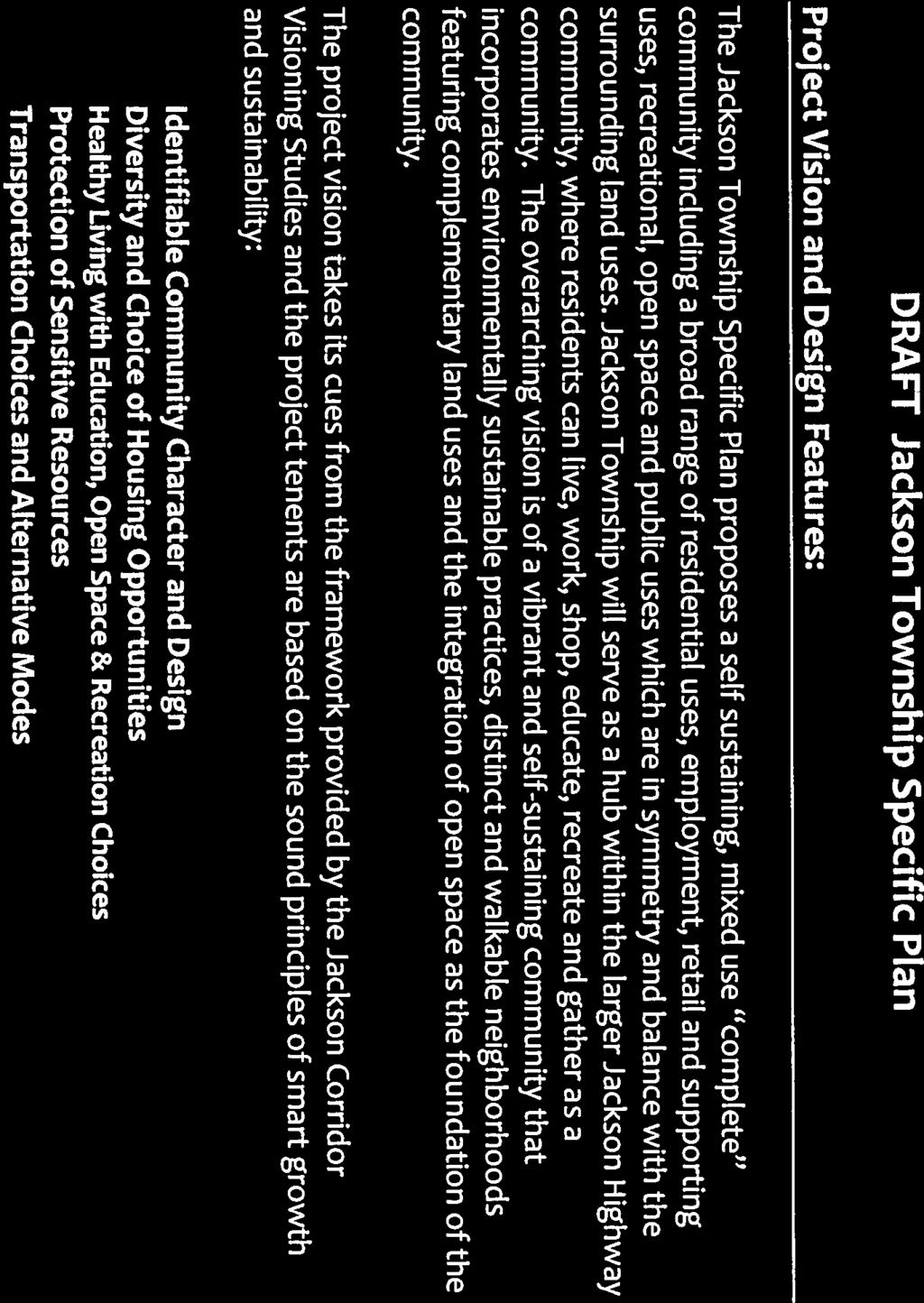
82 76 of 98 B

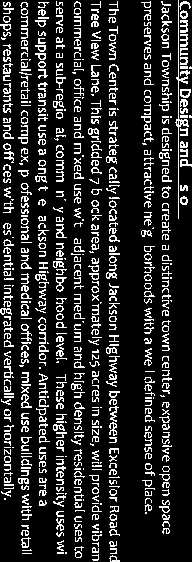


83 77 of 98 B


84 78 of 98 B
85 79 of 98 B

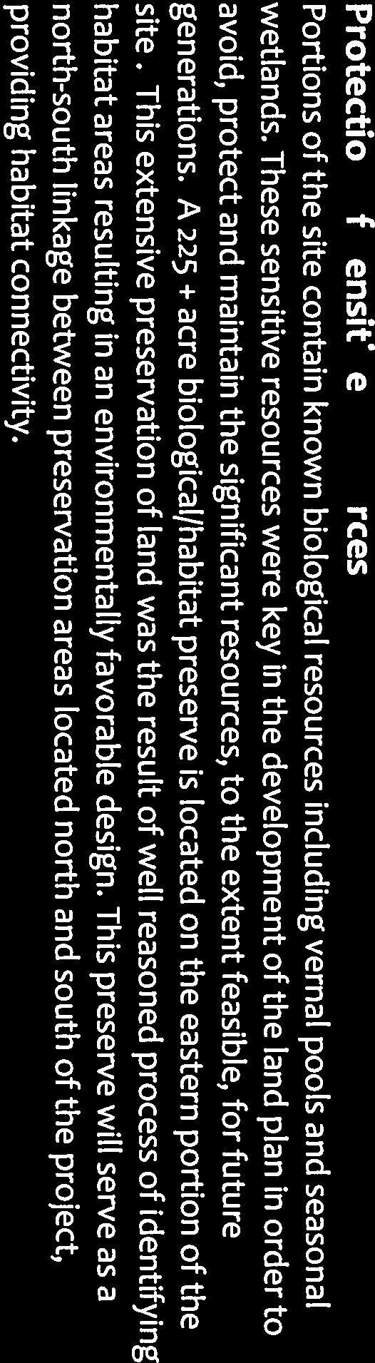
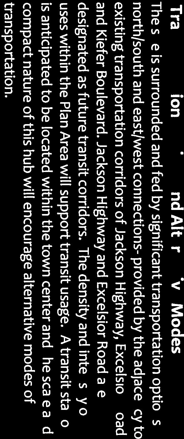
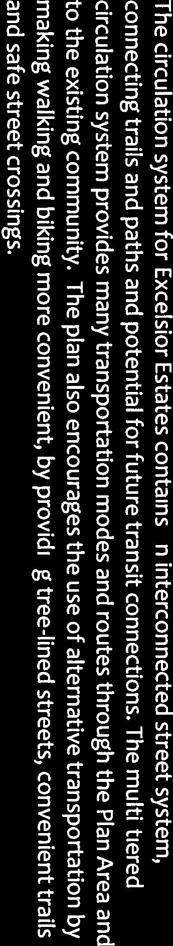


86 80 of 98 B
87 81 of 98 Jackson Township Specific Plan Applicant Prepared LU-120 Consistency Matrix The Sacramento County General Plan requires that specific plans outside the Urban Policy Area demonstrate compliance with Land Use Policy LU-120 at the time of adoption. Jackson Township Specific Plan has been designed to comply with LU-120 requirements as is depicted below in the following analysis: Summary Tables Summary of Consistency with the Planning Criteria Criteria Project Consistency PC-1 Vision for connection to other adjacent existing and potential future development areas. The Jackson Township Project is located in an area of Sacramento County that is clearly a logical extension for urban development. The Plan Area is adjacent to urban uses and infrastructure to the north and to planned development to the west and east. The Project provides linkages via roads, transit, preserve connectivity, and infrastructure. PC-2 Housing choice. The Jackson Township Project provides an opportunity for a significant number of housing choices. The project s variety of housing types and densities will accommodate a wide range of families, singles, seniors and people with special needs. Housing types included are single family homes, apartments, condominiums, townhouses and livework buildings. PC-3 Quality. The Jackson Township Specific Plan will ensure a high quality of development through design guidelines and development standards. PC-4 Accommodate the percentage of low and very low income residential units required by state law per the County s current Housing Element based on the Regional Housing Needs allocation (RHNA). The Project design accommodates 2,237 residential units in the Project (34.9%) which are designated with densities of 20 units per acre or denser. 1
88 82 of 98 PC-5 Pedestrian- and transit-oriented design. The design of the project includes significant trails and bicycle connections. All residential units are within 1,320 feet (one quarter mile) of a neighborhood park, open space, school, and/or bicycle/pedestrian trail. PC-6 Infrastructure Master Plan and Financing Plan. A comprehensive Infrastructure Financing Plan will be prepared for the project that will identify funding mechanisms and meet the policy requirements. PC-7 Services Plan. A comprehensive Services Plan will be prepared for the Project and meet the policy requirements. PC-8 Consistency with County-adopted plans. The Project is consistent with County adopted plans that affect the Project area as well as pending plans such as the South Sacramento Habitat Conservation Plan. PC-9 Consideration of Regional Planning efforts. The Project is consistent with the intent of the SACOG Preferred Blueprint Scenario and will implement the Blueprint Planning Principles. PC-10 Consideration of jobs housing balance. The Jackson Township Project will accommodate approximately 4,770 employees with an estimated internal jobs/housing ratio of 0.74 jobs per 1 housing unit. Summary of Consistency with the Criteria-Based Points (CB-1 through CB-5) Criteria Points Scored By Project CB-1 Minimum density >10 dwelling units per net acre if using double net methodology, or >13.3 dwelling units per acre in using triple net methodology 5 points CB-2 Proximity to Amenities >90 percent of all units located within one mile of at least four of the amenity categories 4 points CB-3 Mixed Use At least 5 percent of the developable land will be located and built within vertically integrated mixed-use buildings. 0 points 2
89 83 of 98 CB-4a Transit Proximity >80 percent of residential units located within ½ mile of existing or planned transit service. 4 points CB-4b Transit Headway Transit service with headways of 30 minutes or less during peak hours (Monday through Friday from 7-9 am and 4-6 pm). 2 points CB-5 Employment Proximity Between 50, ,000 existing employees/jobs within a five mile radius of the proposed project 3 points Total 18 points LU-120 Consistency Analysis Consistency with the Planning Criteria (PC-1 through PC-10) PC-1. Vision for connection to other adjacent existing and potential future development areas. Required: Include a vision of how the development will connect to other adjacent existing and potential future development areas within the USB, including how roadways, transit, sewer, and water could occur within all adjacent areas. Analysis: Land Use Connectivity. The Jackson Township Specific Plan proposes a self sustaining, mixed use complete community including a broad range of residential uses, employment, retail and supporting uses, recreational, open space and public uses which are in symmetry and balance with the surrounding and planned land uses. The land use plan is estimated to result in approximately 6,415 dwelling units and a potential range of 1.3 to 2.9 million square feet (msf) of employment and commercial services land uses. The on-site jobs will complement the existing and planned job centers located within a 5 mile radius of the Plan Area. Existing major employment centers in close proximity to the Plan Area include 3
90 84 of 98 Bradshaw Center Area, Mather Airport, Mather Commerce Center, Capital Center / Rancho Cordova Town Center, employment centers along Sunrise Blvd., the Power Inn Road industrial area, and the former Army Depot industrial area. The Jackson Township Project is located in an area of Sacramento County that is clearly a logical extension for urban development. The Plan Area is adjacent to urban uses and infrastructure to the north and to planned development to the west and east. Roadway, Transit and Bicycle Connectivity. The project boundaries are defined on three sides by major county roadways - Excelsior Road on the west, Kiefer Boulevard on the north and Jackson Highway on the south. The design of these major roads is being coordinated through the Department of Transportation with the other master plan projects in the area in order to accommodate traffic from both the new plan areas as well as existing and future regional traffic. In particular, the design of Excelsior Road has been coordinated with the West Jackson Master Plan in order to direct significant north south traffic away from the existing Mather Independence residential community. Transit connectivity is also being coordinated with the Department of Transportation and Regional Transit. Finally, the project includes extensive trail and bicycle lanes as depicted in the General Plan amendment for the Bicycle Master Plan in order to provide bicycle connectivity within the project and connections outside the project. Infrastructure Connectivity. The project is near significant infrastructure, including the Vineyard Water Treatment Plant and the Bradshaw Sewer Interceptor. The waterways within Jackson Township are tributaries to two creek systems: Morrison Creek and Elder Creek. The north and western portions of the Plan Area drain to a tributary of Morrison Creek, which traverses the northeastern corner of the Plan Area. The central and eastern portions of the Plan Area drain to a tributary of Elder Creek, exiting the site near the southwest corner, at the intersection of Jackson Highway and Excelsior Road. The Project includes detention basins and open stormwater swales, as well as an underground pipe system. Wetland Preserve Connectivity. The land plan for the Jackson Township Specific Plan has been designed to be consistent with the South Sacramento Habitat Conservation Plan. As such, it includes a 225 acre habitat preserve located along the eastern and northern Plan Area boundaries. This strategy preserves and protects the highest, best quality habitat and facilitates the compatible development of lesser quality habitat for urban uses. The preserve will serve as a linkage between wetland preservation areas located north and south of the project, providing habitat connectivity. 4
91 85 of 98 PC-2. Housing Choice. Required: A variety of housing types and densities, including single-family homes, duplexes, triplexes, accessory dwelling units, townhomes, condominiums, apartments and similar multifamily units, in a variety of settings including both residential neighborhoods and mixed use nodes. Analysis: The Specific Plan provides for a wide variety of housing types and densities that will accommodate a wide range of families, singles, seniors and people with special needs. Housing types included are single family homes (including estate homes), apartments, condominiums, townhouses and live-work buildings. Appropriate amounts of higher density zoning are disbursed throughout the Plan Area to ensure availability of housing sites which are affordable to moderate, low and very low incomes. The approximate double net density is 10.6 du/acre, which is consistent with General Plan policies. PC-3 Quality. Required: Design guidelines, development standards and/or similar assurances that will require highquality development consistent with the vision set forth in the Master Plan. Analysis: The Jackson Township Specific Plan will ensure a high quality of development through design guidelines and development standards that will be adopted as part of the Specific Plan approval. PC-4 Accommodate the percentage of low and very low income residential units required by state law per the County s current Housing Element based on the Regional Housing Needs Allocation (RHNA). Required: 5
92 86 of 98 Accommodate > 90 percent of the obligation per RHNA (currently 33% of units accommodated in RD-20 or higher). Analysis: The Specific Plan includes 85 acres of High Density Residential land (average density of 25) and 100 units within land designated for Mixed Use. These properties will accommodate 2,237 residential units in the Project at densities of 20 units per acre or denser. As a result the project will have 34.9% of its units accommodated on multi-family zoned property. PC-5 Pedestrian- and transit-oriented design. Required: Pedestrian- and transit-oriented design, including: Analysis: Sidewalks and bike routes along interconnected street with short block lengths and a high intersection density. Prominent pedestrian and bicycle network. Few if any cul-de-sacs. Pedestrian and bike connections at the ends of all cul-de-sacs unless infeasible due to topography or similar impediments inherent in the project site. The land plan is organized into two distinct hubs that form the focus for the community. The Town Center hub is strategically located along Jackson Highway between Excelsior Road and Tree View Lane. This gridded, compact block area will provide vibrant commercial, employment and mixed use residential uses to serve at a sub-regional, community and neighborhood level. Higher intensity uses within this hub of community activity will help support transit use along the Jackson Highway corridor and the densities reduce in a radial pattern away from the higher intensity nodes. A smaller village hub at the re-aligned western extension of Excelsior Road will provide moderate intensity community commercial and compact, high and medium density residential uses to serve as focal areas 6
93 87 of 98 of activity for the northern and eastern residential neighborhoods and to serve the Independence at Mather residents. An extensive set of trails and bikeways are depicted in the proposed Master Bikeway Plan amendment consistent with criteria PC-5. Development standards and design guidelines adopted with the Specific Plan will address connectivity requirements in the event that any cul-de-sacs are proposed in future tentative maps. PC-6. Infrastructure Master Plan And Financing Plan. Required: Inclusion of an Infrastructure Master Plan and Financing Plan that include the following: Analysis: The Infrastructure Master Plan shall indentify required public facilities and infrastructure (including roads, transit, water, sewer, storm drainage, schools, fire, park, library, and other needed community facilities) and associated costs for the development of the proposed UPA expansion/master Plan; The Financing Plan shall: o Include an infrastructure phasing analysis that examines development through buildout taking into consideration potential development activities, facilities requirements and constraints; o Identify the phase or timing for when the facilities are needed; o Identify the funding mechanisms proposed to pay for the identified infrastructure and facilities; o Demonstrate that Infrastructure requirements and the associated costs are reasonably balanced throughout each development phase and outline solutions for any potential constraints and/or shortfalls for any given phase. The Jackson Township Specific Plan will include as part of its adoption a comprehensive Infrastructure Master Plan and Financing Plan consistent with the requirements of PC-6. 7
94 88 of 98 PC-7. Services Plan. Required: Inclusion of Services Plan to demonstrate: Analysis: That provision of services to the proposed UPA expansion/master Plan are costneutral to the County s General Fund and existing ratepayers; That the operations and maintenance costs stemmed from the required public facilities and infrastructure for the development of the proposed UPA expansion/master Plan are cost-neutral to the County s General Fund and existing ratepayers, and; That existing levels of municipal services will not be negatively impacted by approval and buildout of the proposed UPA expansion/master Plan. The Jackson Township Specific Plan will include as part of its adoption a comprehensive Services Plan consistent with the requirements of PC-7. PC-8. Consistency with County-adopted plans. Required: Consistency with all applicable County adopted plans not sought to be amended by the proposed project. Analysis: The Jackson Township Specific Plan has been designed to implement the policies of the County General Plan through the development of a smart growth community along Jackson Highway. The Project does propose a number of general plan amendments, community plan amendments and infrastructure plan amendments described in the application packet. These amendments are necessary to implement the project and consistent with the requirements for a new growth area in the County General Plan. PC-9. Consideration of regional planning efforts. Required: Inclusion of a discussion/analysis of how the proposed UPA expansion/master Plan relates to broad-based and regional planning efforts, such as SACOG s adopted Blueprint Vision and Metropolitan Transportation Plan, Sacramento County s Visioning documents created 8
95 89 of 98 for the Jackson Highway and Grant Line East Areas, any applicable Habitat Conservation Plan(s), the Sacramento Metropolitan Air Quality Management District s State Implementation Plan, and Regional Transit s Master Plan. Analysis: SACOG Blue Print and Metropolitan Transportation Plan: The Jackson Township area is recognized in the SACOG Blueprint as an appropriate area to urbanize. The project has been designed with smart growth principles including an average double net density of 10.6 units per acre consistent with Blueprint principles. Although the project is not currently included in the developing land use scenario of the 2035 Metropolitan Transportation/Sustainable Communities Strategy (MTP/SCS), it is directly adjacent to it on the north and west. Jackson Highway Visioning Plan: The design of the Jackson Township Specific Plan will fulfill the Jackson Vision Plan by placing a town hub along Jackson Highway at this appropriate location. The strategic location of the property enhances its role as a hub within the larger eastern Sacramento County/Jackson Highway area, as a place where residents can live, work, shop, educate, recreate and gather as a community. South Sacramento Habitat Conservation Plan (HCP): The land plan for the Jackson Township Specific Plan has been designed to be consistent with the South Sacramento HCP. As such, it includes a 225 acre habitat preserve located along the eastern and northern Plan Area boundaries. This strategy preserves and protects the highest, best quality habitat and facilitates the compatible development of lesser quality habitat for urban uses. The preserve will serve as a linkage between wetland preservation areas located north and south of the project, providing habitat connectivity. Sacramento Metropolitan Air Quality Management District s State Implementation Plan (SIP): The project will include at the time of adoption an Air Quality Mitigation Plan and Green House Gas plan that will assure that the project is consistent with the SIP. Sacramento Regional Transit Master Plan: As part of the analysis for this project, a comprehensive joint traffic study is being prepared for the Jackson Highway Corridor. This study will include participation of Regional Transit to determine appropriate improvements and service requirements to integrate the project into the Regional Transit system. 9
96 90 of 98 PC-10. Consideration of jobs-housing balance. Required: Inclusion of a discussion/analysis of the proposed UPA expansion/master Plan s jobshousing balance. Master Plans should provide an internal jobs-housing balance and/or improve the jobs housing balance within the project s vicinity. Analysis: The Project is located in close proximity (5 miles) to approximately 82,563 jobs (per 2008 SACOG data), which are located in numerous nearby job centers, including but not limited to Mather, Capital Center, Bradshaw Center and Sunrise Blvd south. Based upon the commercial, office, mixed use, schools and public facilities (fire station) acreage, the project will generate an estimated 4,770 jobs for 6,415 housing units, resulting in a 0.74 to 1 jobs to housing ratio internal to the project. Consistency with Criteria-Based Points (CB-1 through CB-5) Based upon the information available at this time, the Jackson Township Specific Plan scores a total of 18 Criteria Based points as depicted in the analysis below: CB-1: Density- The double net density of the project is 10.6 du/acre. (Note: this does not include the acres of AG or the 10% net residential acreage exclusion.) Points = 5 (max available) CB-2: Proximity to amenities- Every unit within the Specific Plan area is within 1 mile of 4 of the listed amenities; school, park, commercial center and employment center Points = 4 (max available) CB-3: Mixed use-the criteria requires a mixed use zoning or an overlay zoning that allows mixed use by right. The current land use plan designates 19.6 acres and 100 du for mixed use, which is 2.2% based on the overall master plan gross developable acres of 890, which excludes the wetland preserve, detention basin, the open space/greenbelt corridors and major roadways. 5% is the lowest points available. Although, the project has a small percentage of mixed use zoning proposed, it does have two significant hubs that include mixes of land uses within easy walking distance of ½ mile. 10
97 91 of 98 Points = 0 CB-4: Transit- Proximity of the dwelling units are within ½ mile of Jackson Highway and Excelsior Road, achieving 82% proximity. Points=4 (max available) We anticipate that the ultimate headways will be 30 minutes during peak hours along Excelsior Road and Jackson Highway. Points=2 CB-5 Proximity to employment- The County analysis for the general plan update found that there are 82,563 existing jobs within a five mile radius of the Specific Plan per SACOG s 2008 analysis Points-3 11
98 Technical Study Wetland Delineation Special Status Species Survey Arborist Report Cultural Resources Assessment Sacramento Raceway Noise Assessment Mather Airport Noise Assessment Jackson Township Specific Plan Technical Studies for EIR Date of Study TBD TBD TBD TBD TBD TBD Biological Resources Notes Standard delineation for applicant-owned property. Use existing aerial photography and GIS to approximate wetland boundaries and acreage on properties not owned by applicant or where permission to enter has not been granted. Can include plants and vernal pool branchiopods. If not already done, EIR analysis can rely on CNDDB and USFWS species lists. Should include all trees due to General Plan policies for tree canopy Use existing aerial photography and GIS to calculate approximate tree canopy acreage on properties not owned by applicant or where permission to enter has not been granted. Cultural Resources Should be performed to Section 106 standard for use in federal permitting process Noise Need noise levels for Sacramento Raceway residential uses proposed adjacent to raceway property. May be able to get adequate info from Airports re: flight paths and associated noise levels Traffic noise analysis TBD PER will do in-house; relies on data from Joint TIS Infrastructure BOS ATTACHMENT 1 92 of 98 Drainage Study TBD Sewer Study Water Supply Assessment TBD TBD Traffic Study TBD Joint TIS by DKS Phase I Environmental Site Assessment TBD Sacramento County Water Agency to provide WSA need to set up meeting with them. Project is in Zone 40/41. Will need Zone 40 WSMP Update. Other Air Quality TBD PER will do in-house; relies on data from Joint TIS Climate Change/GHG emissions TBD PER will do in-house; relies on data from Joint TIS

99 93 of 98 E Page 1 of 5

100 94 of 98 E Page 2 of 5

101 95 of 98 E Page 3 of 5

102 96 of 98 E Page 4 of 5

103 97 of 98 E Page 5 of 5
104 98 of 98 County-Led Public Outreach Regarding Potential Development Along Jackson Highway Below is a summary of public outreach conducted by the County during the General Plan Update process ( ) regarding potential development along the Jackson Highway. Twenty six public workshops conducted with the Board and the general public during to scope the Draft General Plan released in Many of these workshops focused specifically on growth management and potential development along the Jackson Highway. Four focus group meetings regarding growth management and potential new growth along the Jackson Highway Ten large public workshops held throughout the County in the fall of 2006 to address growth accommodation and growth management strategies being considered by the Board, with a specific focus on potential new growth along the Jackson Highway and in the Grant Line East Area. More than 600 County residents attended these workshops. The results of this outreach effort were documented and presented to the Board on October 31, Jackson Highway and Grant Line East visioning studies conducted by the County in 2008 to create a cohesive conceptual vision for these potential new growth areas that could be used to guide individual master planning processes toward a common vision of sustainable and responsible development. The resulting studies (which include a policy document, conceptual maps, background information, public outreach summaries, etc.) are companion pieces to the County s General Plan and will help inform future decision-making regarding urbanization and conservation in the Jackson Highway and Grant Line East areas. The studies were presented to the Board in November Outreach conducted for the visioning studies included: o 26 stakeholder interviews, including interviews with the Vineyard, Cordova and Cosumnes CPAC chairs, ranching and farming interests, environmental groups, development interests, and others. o Four large community workshops, with between residents in attendance at each workshop. o Planning Commission public workshop o Board public workshop Sixteen public adoption hearings with the Planning Commission in , at least eight of which specifically focused on growth management and potential new growth along the Jackson Highway. Over 20 public adoption hearings with the Board in , many of which were specifically focused on growth management and potential new growth along the Jackson Highway.
105 Minutes Thursday, April 18, :00 p.m. CORDOVA COMMUNITY PLANNING ADVISORY COUNCIL BOS ATTACHMENT 2 Page 1 of 10 County of Sacramento Branch Center OB3, Conference Room Branch Center Road Sacramento, CA Note: Applicant or appointed representative should be present. If unable to attend, please contact the Cordova CPAC Chairman, Paul Bowers at To contact the Sacramento County Planning Division representative for the Cordova area, please call Cindy Storelli at or Jeff Gamel at (or send to storellic@saccounty.net or gamelj@saccounty.net ) To speak with the CPAC support staff, call Eleanor Tyler at , address is: tylere@saccounty.net CALL MEETING TO ORDER EXPLANATION OF ROLE OF THE COUNCIL ROLL CALL INTRODUCTION OF MEMBERS, STAFF, AND COUNTY REPRESENTATIVES OFFICERS: P - PAUL W. BOWERS (CHAIR) E - GAY JONES (VICE CHAIR) P - JON MONEY (SECRETARY) MEMBERS: U - DENNIS DEAN P JASON MCCOY E - MICHAEL KAST P ROBERT TRONVIG JR. P - DWIGHT HELMICK E - DEE GAVALDON P NANCY GARCIA-JOHNSON COUNTY REPRESENTATIVES: P DAVID DEFANTI, Senior Planner, County Planning Division EXA EXCUSED ABSENCE R RESIGNED U - UNEXCUSED ABSENCE TE - TERM EXPIRED P PRESENT QUORUM DETERMINATION: Yes No COUNTY REPRESENTATIVE Yes No Matters under the jurisdiction of the CPAC and not on the posted agenda may be addressed by the general public following completion of the regular agenda. The CPAC may limit the length of any off-agenda testimony. PLANNING ITEMS FOR REVIEW: 1. Control No.: PLNP Assessor s Parcel No.: Various Applicants: County Contact: Excelsior Estates, LLC dba Jackson Township 7423 Fair Oaks Boulevard, Suite 10, Sacramento, CA Dave Defanti, Senior Planner;defantid@saccounty.net
106 BOS ATTACHMENT 2 Page 2 of 10 CORDOVA COMMUNITY PLANNING ADVISORY COUNCIL Page 2 Project JACKSON TOWNSHIP SPECIFIC PLAN Name: Location: 1,391 acres bound generally by Mather Field to the north, Jackson Road to the south, Excelsior Road to the west and Eagles Nest Road to the east. Request: The Jackson Township Specific Plan is a proposed master plan for approximately 1,391 acres south of Mather Field, north of Jackson Road, east of Excelsior Road and generally west of Eagles Nest Road in the Vineyard community. Proposed uses include approximately 6,415 housing units; 1,156,000 square feet of commercial, office and mixed use development; schools; a fire station/community center; parks; wetland preserve; open space; and agriculture. Requested entitlements include General Plan Amendments to move the Urban Policy Area (UPA), amend the Land Use Diagram, and amend the Transportation Diagram; a Community Plan Amendment to amend the Vineyard Community Area Plan; an Affordable Housing Plan, a Development Agreement and a Public Facilities Financing Plan. Investigating Member: COUNCIL RECOMMENDATION: Motion by: Seconded by: Vote: Denial Yes No Abstain Absent Action: Note: This CPAC has the right to file an appeal with the County of Sacramento when the committee, commission or official takes an action or determination that conflicts with community-wide policies as understood by the respective CPAC and its constituency. Motion by: Seconded by: Vote: Yes: No: Abstain: Absent:
107 CORDOVA COMMUNITY PLANNING ADVISORY COUNCIL Page 3 Comments: This presentation was for informational purposes only, no vote was taken. David Defanti by explaining that the Jackson Township Specific Plan was being submitted under the recently adopted Sacramento County General Plan. Members from Jackson township then presented conceptional land use for the properties they owned as well as proposed land uses for adjacent properties owned by others. The purpose of this combined approach is to unify land uses moving forward. It also allows individual land owners to voice their concerns upfront, and piggy back on the upcoming EIR and environmental documentation required to approve the specific plan if they are in agreement with the proposed uses. The proposed Jackson Township Plan includes mitigation of vernal pools and wetlands that will be displaced by development. Concerns were voiced from multiple residents in regards to the land uses that were proposed with in the plan and more specifically how these uses would affect existing properties. Moving forward a comprehensive traffic study will be completed incorporated not only the proposed land uses by Jackson Township, but also adjacent plans that are currently being reviewed by the county. In addition, County staff has agreed to by and coordinate proposals from each of the developments to combined CPAC meetings so that each CPAC receives the same information moving forward. PUBLIC COMMENT: BOS ATTACHMENT 2 Page 3 of 10 OTHER BUSINESS: Paul Bowers announced that he had termed out and was being asked to step down from the council. He stated that this would be his last meeting. The council and many others in attendance expressed their gratitude and thanks for Paul s hard work, professional demeanor, and past participation. APPROVAL OF MINUTES: Minutes for 2/21/2013 meeting were approved. Motion for approval by Dwight Helmick second by Jason McCoy. ADJOURNMENT: Motion to Adjourn by, Second by CPAC Member forwarding minutes to County Planning: The meeting facility is accessible to persons with disabilities. Request for interpreting services, assistive listening devices, or other considerations should be made through the County Planning Division at (916) or (TTY), no later than five working days prior to the meeting. California Relay Service (CRS) is a third party interpretation service for deaf, hard-of-hearing, and/or speech-impaired persons. CRS can be reached by dialing 711 or
108 BOS ATTACHMENT 2 Page 4 of 10
109 BOS ATTACHMENT 2 Page 5 of 10 P P P R P P X X
110 BOS ATTACHMENT 2 Page 6 of 10 Stuart Helfand Neighbors are very concerned over water. How will we get water to all the new buildings and dwellings? We would like to see the plans for infrastructure for water and sewer. Want to see both sewer and water lines be installed simultaneously so the community doesn t have to be inconvenienced more than once and so we don t have twice the work being done and see our taxes be raised due to lack of planning. Current well owners are very concerned as to how this will affect their current wells. They do not want to be forced to hook up to county lines for water and sewer. They want reassurance that down the road they will NOT be forced to do so and that their water and septic tanks will not be affected. Neighbors are concerned that even though County says they will not make anyone hook up to water and sewer lines going in, due to roadways and developments going in, sometime in the future they will be forced to hook up to county resources. What is the county going to do to alleviate homeowners concerns?
111 BOS ATTACHMENT 2 Page 7 of 10 Continue Stuart Helfand Tammy Trujillo Neighbors are concerned over Water! How will we get water to all the new buildings and dwellings? Want to know much more detail as to houses types and descriptions. Huge concern over High and Medium density housing: not being built to sustain a community but to have people start in them but not want to stay so they end up as rental properties. Some believe that will contribute to more crime in the area. Medium density is 13 homes per acre that will not lead to a quality community. Price point is also a concern. The community would like to see your marketing plan. We would like to see something like Roseville come to us like the Plaza or the Fountains with higher end retail, restaurants and entertainment for families to build a better community instead of lowering our standards. We would like to see the plans for infrastructure for water and sewer. Want to see both sewer and water lines be installed simultaneously so the community doesn t have to be inconvenienced more than once and so we don t have twice the work being done and see our taxes be raised due to lack of planning. Current well owners are very

112 BOS ATTACHMENT 2 Page 8 of 10
113 BOS ATTACHMENT 2 Page 9 of 10 Due to time will did not have time to talk about this but will put it on the agenda for our next meeting to do first thing. Tammy Trujillo motioned to have Stuart Helfand continue to be our ground water authority representative. Connie Ford said no, Tim Murphy would like us to take 5 minutes at the next meeting to talk about the position before we take a vote. Tim Murphy Motioned, Mary Duncan second, all in favor- 5 yes Per Connie Ford we need to re-elect the board positions every September. Tim Murphy asked if anyone else would like to take over Chair position. Connie Ford motioned to have Tim Murphy take over the chair position, Tim Murphy declined. Tim Murphy motioned to have Connie Ford as Vice Chair; Mary Duncan Seconded. Before a vote was taken Tim Murphy tabled his motion. Stuart Helfand Table his motion. Tim Murphy motioned to have 3 separate votes for the three positions available. Tammy Trujillo motioned to have Stuart Helfand continue as chairman, Tim Murphy seconded all in favor 3 yes, one No by Connie Ford and one abstention by Mary Duncan. Tim Murphy motioned to appoint Tammy Trujillo as Secretary. Stuart Helfand Seconded. Vote 3 yes, one No by Connie Ford, one abstention, Mary Duncan. Tim Murphy motioned to appoint Connie Ford Vice Chair, Mary Duncan Seconded. Vote 3 yes, Stuart Helfand said no, Tammy Trujillo Abstained. No approval of minutes. Us Army Corps. Of Engineering is having a workshop on June 7 th regarding Regulatory Information Forum.
114 BOS ATTACHMENT 2 Page 10 of 10 Additional Comment: Page 6 Community would like to have more detail as to house types and descriptions. Huge concern over high and medium density housing. Concerns that housing is not being built to sustain a community, but rather to build starter homes where the owners have no intention of staying. Then the neighborhood ends up with an abundance of rental properties. It is also believed that this type of development will contribute to more crime in the area. Medium density is 13 homes per acre. There is concern that this will not lead to a quality community. Price point is also a concern. The community would like to see the developers marketing plan. We would like to see something like the Roseville Plaza or the Fountains with higher end retail, restaurants and entertainment for families to build a better community instead of lowering our standards. Will there be some sort of financing or alternative fees for those being forced to make these changes due to roadways and development? Neighbors would like infrastructure in before any building can happen. Concern over raceway. How will they co-exist with new development? Raceway has no intention of moving. Community is concerned that there is not going to be a buffer around the raceway. Concern over schools encroaching on raceway. All are against high density housing. Concern that the current owner may submit plans get them approved then sells to a developer and the new developer asking for density bonus on top of what is believed as far too many houses being proposed to the area. Mr. Tsakopoulos attorney did address this issue in that he said he would put into any contract that might be written that the purchaser of the land will not be able to ask for a density bonus. Note: Property owners have been notified by county staff and the developer both. Future workshops: Traffic, water and sewer, infrastructure and financing Other comments: State law refers to air quality not so much to water, so laws may change as necessary. Also if the law is detrimental to our community we do not have to follow them. Concern regarding wetlands and open space. With all the development coming we are losing our heritage in agriculture and open space.
115 Jackson Township Specific Plan Applicant Prepared Project Description Revised BOS ATTACHMENT 3 Page 1 of 30 Attachment 3 Project Location The proposed Plan Area, approximately 1391 acres, is located in southeastern Sacramento County, lying south of the Mather Specific Plan Area, east of Excelsior Road, north of Jackson Highway and west of Eagles Nest Road in the Vineyard Community as shown in Figure 1. The Jackson Township Specific Plan Study Area map, Figure 2, depicts the Plan Area boundaries. The Plan Area is designated by the Sacramento General Plan with land use designations of Extensive Industrial and General Agricultural. The property has current zoning of Light Industrial (M-1), Industrial Reserve (IR) and Permanent Agriculture (AG-80). Figure 1 - Location Map Page 1 of 30
116 BOS ATTACHMENT 3 Page 2 of 30 Attachment 3 Assessor Parcel Numbers The Plan Area is comprised of 24 different landowners. The largest landowner is Excelsior Estates LLC, represented by Angelo G. Tsakopoulos as the applicant, owns and/or controls approximately 862 acres (approx. 62 % of the total) within the Plan Area boundaries. Table 3 on page 14 lists the Assessor Parcel Numbers that comprise the Project Area. Existing Uses The current land uses on the properties within the Plan Area include grazing, small ranches, agricultural residential homes and the Sacramento Raceway. Adjacent land uses to the Specific Plan Area include the following: West The site is bound to the west by Excelsior Road and the area is characterized by an assortment of industrial and agricultural uses, including mining, decorative stone and rock sales. This area is within the West Jackson Master Plan area, which is undergoing a planning process for urbanization. It is anticipated that this area will develop together with the Jackson Township to create a smart growth corridor along Jackson Highway. North The Mather Specific Plan Area is located north of the Jackson Township boundary and includes Independence at Mather, Mather nature preserve, Mather Golf Course and Park, Mather Airport facility, South Mather General Plan, Mather Commerce Center and Mather Regional Park. Additional land uses north of the Mather Specific Plan Area include the Stone Creek residential community. East Existing land uses along the eastern Jackson Township boundary include agricultural and industrial lands, including, grazing, a small assortment of agricultural residential uses and the Sacramento Rendering Plant. This area is also generally within the New Bridge Specific Plan area, which is undergoing a planning process for urbanization of the land east of Eagles Nest Road. It is anticipated that natural preserves associated with Jackson Township and the New Bridge Specific Plan will create a natural corridor consistent with the goals of the proposed South Sacramento Habitat Conservation Plan. South Existing land uses to the south of the Plan Area are primarily small ranches, agriculture and wetland preserve. Proposed Project The Jackson Township Specific Plan proposes a self sustaining, mixed use complete community including a broad range of residential uses, employment, retail and supporting uses, recreational, open space and public uses which are in symmetry and balance with the surrounding and planned land uses. The land use plan is estimated to result in approximately 6,143 dwelling units and 2 million square feet (msf) of employment, commercial services and public land uses. The on-site jobs will complement the existing and planned job centers located within a 5 mile radius of the Plan Area. Existing major employment centers in close proximity to the Plan Area include Bradshaw Center Area, Mather Airport, Mather Commerce Center, Capital Center / Rancho Cordova Town Center, Page 2 of 30
117 BOS ATTACHMENT 3 Page 3 of 30 Attachment 3 employment centers along Sunrise Blvd., the Power Inn Road industrial area, and the former Army Depot industrial area. Page 3 of 30

118 BOS ATTACHMENT 3 Page 4 of 30 Attachment 3 Figure 2 - Plan Area Map Page 4 of 30
119 BOS ATTACHMENT 3 Page 5 of 30 Attachment 3 The Jackson Township Project is located in an area of Sacramento County that is clearly a logical extension for urban development. As described below and depicted in the Figure 2, the Jackson Township Specific Plan Study Area map, the Plan Area is adjacent to urban uses and infrastructure to the north and to planned development to the west and east. The Jackson Township area has also been recognized in the SACOG Blueprint as an appropriate area to urbanize. Finally, the Specific Plan will result in a smart growth community that will meet and exceed the requirements of LU-120 and fulfill the Jackson Vision Plan by placing a town hub along Jackson Highway at this appropriate location. The strategic location of the property enhances its role as a hub within the larger eastern Sacramento County/Jackson Highway area, as a place where residents can live, work, shop, educate, recreate and gather as a community. Project design: The mix of land uses types, densities and intensities will provide for a diverse and self-sufficient community with economic stability. The variety of housing types and densities will accommodate a wide range of families, singles, seniors and people with special needs. Housing types included are single family homes, apartments, condominiums, townhouses and live-work buildings. Appropriate amounts of higher density zoning are disbursed throughout the Plan Area to ensure availability of housing sites which are affordable to moderate, low and very low incomes. The approximate double net density is 10.5 du/acre, which is consistent with General Plan policies. The Draft Land Use Plan is depicted in Figure 3 and the Land Use Summary Table 1, is shown on page 6. The land plan is organized into two distinct hubs that form the focus for the community. The Town Center hub is strategically located along Jackson Highway between Excelsior Road and Tree View Lane. This gridded, compact block area will provide vibrant commercial, employment and mixed use residential uses to serve at a sub-regional, community and neighborhood level. Higher intensity uses within this hub of community activity will help support transit use along the Jackson Highway corridor and the densities reduce in a radial pattern away from the higher intensity nodes. A smaller village hub at the re-aligned western extension of Excelsior Road will provide moderate intensity community commercial and compact, high and medium density residential uses to serve as focal areas of activity for the northern and eastern residential neighborhoods and to serve the Independence at Mather residents. Agricultural Parcels in southeastern area: The southeastern portion of the Plan Area includes approximately acres, comprised of 6 large agricultural-residential properties. The applicant has integrated these properties into the request for the UPA expansion and the amendment to the Vineyard Community Area Plan to change the entire Plan Area to a Special Planning Area designation. The land use plan identifies these properties as Agriculture to reflect existing uses, however a future master planning effort will be required. Although the land use plan reflects the existing AG use, the technical studies will assume the potential for 6 units per gross acre to ensure infrastructure for the area is correctly sized for eventual build out, pursuant to the subsequent master planning effort for this portion of the Plan Area. Page 5 of 30
120 BOS ATTACHMENT 3 Page 6 of 30 Attachment 3 Page 6 of 30

121 BOS ATTACHMENT 3 Page 7 of 30 Attachment 3 Figure 3 - Land Use Plan Page 7 of 30
122 Table 1: Jackson Township Land Use Summary Residential Designations Acres Ave. Density LD- Low Density Residential MD-Medium Density Residential HD- High Density Residential Density Range BOS ATTACHMENT 3 Page 8 of 30 Attachment 3 D.U. s % of D.U. s 34.7% 28.9% 34.8% 7 Subtotal , % Commercial + Office Zones f.a.r. Approx. s.f. GC-General Commercial CC-Community Commercial MU-Mixed Use , , ,000 n/a 1 n/a % 7 O- Office ,800 n/a 1 Subtotal ,996, % Public/Quasi Public Zones PQP-Fire Station/Community Center PQP-High School/Middle School PQP-Elementary School Subtotal Park + Open Space Zones CP- Community Park P- Neighborhood Park OS- Wetland Preserve OS- Greenbelt/Drainage Corridor 57.7 OS- Landscape Corridor 14.5 OS- Detention Basin 3.2 Subtotal AG-Agriculture RW- Primary Roadways 90.2 TOTAL 1, , % 1. Dwelling units are not permitted in these designations. 2. Population calculation is 6,143 d.u x 2.64 pph=16,217 total population 3. Park requirement calculation (not including AG zoning): LD/MD 3906 d.u. x.0146=57.0 ac. and HD/MU 2237 d.u. x.0122=27.3 Total acres= Park credit calculations: 78.3 acres of Comm/ Neigh. Parks ac.(25% credit for 48.2 acres of greenbelts along drainageways and wetland preserve)= 90.3 acres dwelling units are assigned to the 8.2 acre MU parcel only, 0 units assigned to the 11.4 acre parcel. 6. Double net density calculation:6,143 d.u./585.7 acres(577.5 ac.+8.2 ac. of MU)= 10.5 du/ac. Note: this does not include the acres of AG or the 10% net residential acreage exclusion allowed per Policy LU 120 CB A minimum 34.8% of a Master Plan s units must be accommodated on multi-family zoned land, this includes HD and MU parcel allocations of 2,237 d.u. = 36.4%. Page 8 of 30
123 BOS ATTACHMENT 3 Page 9 of 30 Attachment 3 Habitat Preservation: A 225 acre habitat preserve is located along the eastern and northern Plan Area boundaries and is consistent with the South Sacramento Habitat Conservation Plan (SSHCP). This strategy preserves and protects the highest, best quality habitat and facilitates the compatible development of lesser quality habitat for urban uses. The preserve will serve as a linkage between wetland preservation areas located north and south of the project, providing habitat connectivity. Vehicular and Non-Vehicular Circulation: The project design supports the use of alternative transportation by making walking and biking more convenient, by providing tree-lined streets, convenient trails and safe street crossings. Most homes within the Plan Area will be within a five minute walk (1/4 mile) of an open space area, either a park, linear parkway or natural open space and be within one-half mile of the retail/employment land uses. A key feature of the Plan Area is a large centrally located greenway/drainage corridor with a trail on one side that will provide easy, nonvehicular linkages from one area of the community to the other. An interconnected smart growth street system, connecting trails and paths and potential for future transit connections are provided throughout the Plan Area. The scale and compact nature of this hub will encourage alternative modes of transportation and the land plan provides the density and intensity of uses that will support transit usage. The Circulation Plan is depicted in Figure 4 and the Bikeway Master Plan is depicted in Figure 9. The site is surrounded and fed by significant transportation options north/south and east/west connections- provided by the adjacency to existing transportation corridors of Jackson Highway, Excelsior Road and Kiefer Boulevard. Jackson Highway and Excelsior Road are designated as future transit corridors (post 2030) for bus rapid transit/hi bus and Kiefer Boulevard can possibly accommodate light rail. Bus/shuttle service in the Plan Area could connect to RT bus stops or Sacramento Light Rail at Mather/Mills, Zinfandel or Cordova Town Center stations. Bus/shuttle service could be extended into the Project Area from Jackson Highway on Tree View Lane and then west into the Town Center and looped back to Jackson Highway. The General Plan Transportation Diagram is depicted in Figure 8. Public Utilities and Services: Schools: The Plan Area is within the Elk Grove Unified School District. The Project includes three (3) sites designated as elementary school sites of approximately ten (10) acres each and one (1) site designated as a joint middle school/high school (approximately 70 acres). The elementary schools are co-located with neighborhood parks to invite joint use and serve as focal points for the neighborhoods. Each elementary school/park site is approximately within ¼ mile walking or biking distance of most homes. Parks: The Plan Area is within the Cordova Recreation and Parks District. A total of eight (8) neighborhood parks and one (1) Community Park are located to serve the Plan Area. As noted above, neighborhood parks have been co-located with the 3 elementary schools and the other parks have been located to be within walking or biking distance of most homes. Page 9 of 30
124 BOS ATTACHMENT 3 Page 10 of 30 Attachment 3 Figure 4 - Circulation Plan Page 10 of 30
125 BOS ATTACHMENT 3 Page 11 of 30 Attachment 3 Page 11 of 30
126 BOS ATTACHMENT 3 Page 12 of 30 Attachment 3 Fire Protection and Law Enforcement: The Plan Area will be served by Sac Metro Fire and the Sacramento County Sheriff. A five (5) acre PQP site is located along Tree View Lane adjacent to the Community Park to provide opportunity for these departments to provide stations to serve the Plan Area. Water Supply: The Plan Area is within the Zone 40 service area of the Sacramento County Water Agency (SCWA). Offsite extension of water lines to serve the Plan Area may be required. On-site transmission lines will be routed throughout the Project area. Generally, the on-site transmission system will consist of transmission mains extending through the Plan Area and a grid of distribution mains to serve the development. Water infrastructure will be phased with development to meet end user demands as well as operational criteria of the system. Wastewater/Recycled Water: The Plan Area will require annexation into the Sacramento Area Sewer District (SASD) and the Sacramento Regional County Sanitation District (SRCSD). Jackson Township is within the Sphere of Influence (SOI) for SASD and SRCSD. The SOI is coterminous with the Urban Services Boundary and their service boundary is coterminous with the Urban Policy Area. Existing utility infrastructure is in close proximity to site, thus conserving resources by not requiring extensive expansion of utilities in order to serve the new development. On-site transmission lines will be routed throughout the Plan Area. In addition, non-potable water trunk lines exist on-site within the Kiefer Boulevard ROW. A recycled water distribution system (purple pipe) will be installed for future use, so that recycled water may be used if an off-site treatment facility and recycled water delivery system to the Project site is made available. Storm Drainage: The waterways within Jackson Township are tributaries to two creek systems: Morrison Creek and Elder Creek. The north and western portions of the Plan Area drain to a tributary of Morrison Creek, which traverses the northeastern corner of the Plan Area. The central and eastern portions of the Plan Area drain to a tributary of Elder Creek, exiting the site near the southwest corner, at the intersection of Jackson Highway and Excelsior Road. The Project includes detention basins and open stormwater swales, as well as an underground pipe system. Natural and created drainage corridors will provide passive recreation opportunities, preserve existing resources, provide floodwater conveyance and retention, storm water quality treatment, and provide interfaces between land uses. Water quality will be protected through the use of local water quality features such as grassy swales, settling basins, and natural filters to clean surface runoff water before it reaches the natural drainage channels. These features will be incorporated in the pedestrian open space corridors. Land Plan Alternative: The applicant is requesting the equal analysis of a modification to the proposed land use plan as described above, in order to facilitate the possible location of a large technology user within the project. In the Alternative, a 40.1 acre Office (O) use is designated along Tree View Lane, in the place of the 22.3 acre MD and the 16.9 acres HD sites. The Land Plan Alternative is shown in Figure 5 and the land use summary which accompanies the Alternative, Table 2, is shown on page 11. Page 12 of 30
127 BOS ATTACHMENT 3 Page 13 of 30 Attachment 3 Page 13 of 30

128 BOS ATTACHMENT 3 Page 14 of 30 Attachment 3 Figure 5 - Alternative Land Plan Page 14 of 30
129 BOS ATTACHMENT 3 Page 15 of 30 Attachment 3 Table 2-Alternative Land Use Summary Residential Designations Acres Ave. Density LD- Low Density Residential MD-Medium Density Residential HD- High Density Residential Density Range D.U. s % of D.U. s 37.4% 26.0% 34.9% 7 Subtotal , % Commercial + Office Zones f.a.r. Approx. s.f. GC-General Commercial CC-Community Commercial MU-Mixed Use , , ,000 n/a 1 n/a % 7 O- Office ,605,100 n/a 1 Subtotal ,869, % Public/Quasi Public Zones PQP-Fire Station/Community Center PQP-High School/Middle School PQP-Elementary School Subtotal Park + Open Space Zones CP- Community Park P- Neighborhood Park OS- Wetland Preserve OS- Greenbelt/Drainage Corridor 59.1 OS- Landscape Corridor 14.5 OS- Detention Basin 3.2 Subtotal AG-Agriculture RW- Primary Roadways 87.9 TOTAL 1, , % 1. Dwelling units are not permitted in these designations. 2. Population calculation is 5,705 d.u x 2.64 pph=15,061 total population 3. Park requirement calculation (not including AG zoning): LD/MD 3616 d.u. x.0146=52.8 ac. and HD/MU 2089 d.u. x.0122=25.5 Total acres= Park credit calculations: 78.3 acres of Comm/ Neigh. Parks ac.(25% credit for 48.2 acres of greenbelts along drainageways and wetland preserve)= 90.3 acres dwelling units are assigned to the 8.2 acre MU parcel only, 0 units assigned to the 11.4 acre parcel. 6. Double net density calculation: 5,705 d.u./546.5 acres (538.3 ac.+8.2 ac. of MU)= 10.4 du/ac. Note: this does not include the acres of AG or the 10% net residential acreage exclusion allowed per Policy LU 120 CB A minimum 34.8% of a Master Plan s units must be accommodated on multi-family zoned land, this includes HD and MU parcel allocations of 2,089 d.u. = 36.6%. Page 15 of 30
130 BOS ATTACHMENT 3 Page 16 of 30 Attachment 3 Requested Entitlements and Actions The Project requests the approval of the entitlements listed below: 1. A General Plan Amendment to move the Urban Policy Area (UPA) boundary south to include approximately 1,391 acres encompassing the Jackson Township Specific Plan as depicted in Figure A General Plan Amendment to amend the Land Use Diagram designations within the Jackson Township Specific Plan from General Agriculture ( acres) and Extensive Industrial (823 +-acres) to Low Density Residential, Medium Density Residential, Commercial and Office, Mixed Use, Recreation, Natural Preserve, and Public/Quasi Public as depicted in Figure A General Plan Amendment to amend the General Plan, including the Land Use Diagram, to include a Mixed Use Land Use Designation. 4. A General Plan Amendment to amend the Transportation Diagram to reflect proposed roadway alignments as depicted in Figure A General Plan Amendment to amend the Bicycle Master Plan to add on- and off-street bikeways as depicted in Figure A Community Plan Amendment to amend the Vineyard Community Area Plan to change the Community Plan designation of the parcels located within the Jackson Township Specific Plan area (1,391+-acres) from Permanent Agriculture (AG-80) (772.5 acres), Light Industrial (596.5 acres) and Industrial Reserve (IR) (22 acres) to Jackson Township Specific Plan Area (1,391+acres), as depicted in Figure Adoption of the Jackson Township Specific Plan for the approximately 1,391 acre Jackson Township Specific Plan area, including a Specific Plan land use diagram, Design Guidelines and Development Standards. 1. A Zoning Ordinance Amendment to establish a Special Planning Area (SPA) Ordinance for a acre portion of the Jackson Township Specific Plan area and a Rezone to amend the the Zoning Designations for a acre portion (owned by the applicant) of the Jackson Township Specific Plan Area from AG-80 (489+-acres), M-1(+-327acres) and IR (22 +-acres) to Jackson Township Special Planning Area (SPA), as depicted in Figure A Large Lot Tentative Subdivision Map for the lands owned by Tsakopoulos Family Trust, consisting of 12 existing parcels of approximately 838 acres, to be divided into 44 parcels for the purpose of creating legal parcels corresponding to land use blocks within the Jackson Township Specific Plan. 10. Adoption of an Affordable Housing Plan for the Jackson Township Specific Plan. 11. Adoption of a Development Agreement for the Jackson Township Specific Plan by and between the County of Sacramento and the landowners. Page 16 of 30
131 BOS ATTACHMENT 3 Page 17 of 30 Attachment Adoption of a Public Facilities Financing Plan for the Jackson Township Specific Plan that includes a Capital Improvement Program and Financing Plan. 13. Adoption of a Water Supply Master Plan Amendment to amend the existing Zone 40 Water Supply Master Plan to include provision of water service to the Jackson Township Specific Plan Area. This action requires Sacramento County Water Agency Board of Directors approval. 14. Approval of a Water Supply Assessment for the Jackson Township Specific Plan required by the California Water Code to link land use and water supply planning activities. This action requires Sacramento County Water Agency Board of Directors approval. In addition to the above listed entitlements, separate annexation requests to LAFCo will include: Sphere of Influence Amendment (SOIA) and concurrent Annexation to County Service Area (CSA) 10 or creation of a new CSA. Note: a separate subsequent action may be required by the Sacramento County Board of Supervisors to establish a Benefit Zone, to implement funding and service provision. Annexation to Sacramento Regional County Sanitation District (SRCSD). Annexation to Sacramento Area Sewer District (SASD). It should be noted that this application request does not include rezone of the properties not owned by the applicant and that subsequent rezones will be the subject of future applications. Project Objectives The following summarizes the project objectives that guided the planning of Jackson Township Specific Plan: 1. Establish a 1,400+ acre mixed-use community that includes residential, commercial, office/professional, mixed-use, recreational, public and educational land uses, and which incorporates feasible smart growth principles, provides protection of valuable environmental resources and improves the jobs/housing balance within the eastern Jackson Highway corridor. 2. Establish a land use and circulation system that promotes convenient mobility and a variety of non-vehicular modes as an alternative to fossil-fuel consuming car usage within a community environment that is safe, accessible and convenient for all modes of travel. 3. Promote a diversity of housing opportunities responsive to regional needs and market conditions including single-family dwellings, apartments, townhouses and live-work units to serve a broad range of family incomes. 4. Provide community-wide public facilities to serve residential areas, including elementary schools, a middle/ high school, passive open space, and neighborhood and community parks. 5. Create a land use plan for the community that reasonably minimizes its impact on biologically sensitive natural resources with feasible, onsite wetland avoidance and preservation. Page 17 of 30
132 BOS ATTACHMENT 3 Page 18 of 30 Attachment 3 6. Create a financially viable, fiscally stable and balanced community that is responsive to market demand and provides a revenue source sufficient to service the on-going maintenance needs of the Plan Area open space areas, park facilities, public services and infrastructure. 7. Create a land use plan that accomplishes the goals and policies of the County General Plan by establishing a smart growth community adjacent to the Urban Policy Area. Table 3- Subject Site Parcel Numbers and Owner of Record Assessor Parcel Number Owner of Record Excelsior Estates LLC Excelsior Estates LLC Smith Racing Enterprises LLC Excelsior Estates LLC Excelsior Estates LLC Excelsior Estates LLC Excelsior Estates LLC Excelsior Estates LLC Cay and Eric Goude Gibson Ranch Llc Excelsior Estates LLC Excelsior Estates LLC Excelsior Estates LLC Excelsior Four Partnership Kenneth & Kathryn Whipple James & Margaret Matthews Richard Huffman Ronald & Kristy Giles Mira & Lazar Dijamatovich Excelsior & Jackson Sheryl Cecchettini Christopher Mc Hale Excelsior Estates LLC Daniel Schmidt Martin Pham Ferguson Family 2009 Trust Ronald Adams James & Marilyn Schlaegel Roy Lanza Tsakopoulos Investments LLC Michael and Judith Clemons Steven and Teresa Matulich Chetcuti Family 1992 Trust Chetcuti Family 1992 Trust Excelsior Estates LLC Excelsior Estates LLC Page 18 of 30
133 BOS ATTACHMENT 3 Page 19 of 30 Attachment Andrew and Lisa Chatoian Susan King Terry & Jane Christensen Page 19 of 30

134 BOS ATTACHMENT 3 Page 20 of 30 Attachment 3 Figure 6 - Urban Policy Area Expansion Page 20 of 30
135 BOS ATTACHMENT 3 Page 21 of 30 Attachment 3 Figure 7 - General Plan Land Use Diagram Amendment Page 21 of 30
136 BOS ATTACHMENT 3 Page 22 of 30 Attachment 3 Page 22 of 30
137 BOS ATTACHMENT 3 Page 23 of 30 Attachment 3 Page 23 of 30
138 BOS ATTACHMENT 3 Page 24 of 30 Attachment 3 Figure 8 - General Plan Transportation Diagram Page 24 of 30
139 BOS ATTACHMENT 3 Page 25 of 30 Attachment 3 Page 25 of 30
140 BOS ATTACHMENT 3 Page 26 of 30 Attachment 3 Figure 9 - Bikeway Master Plan Page 26 of 30
141 BOS ATTACHMENT 3 Page 27 of 30 Attachment 3 Page 27 of 30
142 BOS ATTACHMENT 3 Page 28 of 30 Attachment 3 Figure 10 - Vineyard Area Community Plan Amendment Page 28 of 30
143 BOS ATTACHMENT 3 Page 29 of 30 Attachment 3 Figure 11 - Rezone Exhibit Page 29 of 30
144 BOS ATTACHMENT 3 Page 30 of 30 Attachment 3 Page 30 of 30
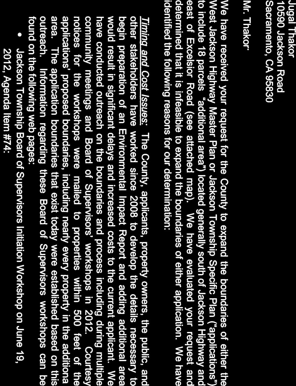


145 BOS ATTACHMENT 4 Page 1 of 3
146 BOS ATTACHMENT 4 Page 2 of 3

147 EXCELSIOR RD TREE VIEW RD TREE VIEW RD EXCELSIOR RD BOS ATTACHMENT 4 Page 3 of 3 Zoning Parcels M 1 South of Jackson Township AG80 Flood Zone Natural Stream JACKSON RD 21.1 ac. 27 ac ac. TREE VIEW RD 9.7 ac. 8.9 ac. 10 ac. AG ac. 3.4 ac ac. 10 ac ac ac. 3.2 ac. 3.3 ac. 3.5 ac. 3.4 ac. ELDER CREEK RD 18.2 ac. TREE VIEW RD 19.2 ac. AG20 AG Aerial JACKSON RD ELDER CREEK RD ,600 Feet
Jackson Township Specific Plan Applicant Prepared Project Description Revised
 Jackson Township Specific Plan Applicant Prepared Project Description Revised 4-11-13 Project Location The proposed Plan Area, approximately 1391 acres, is located in southeastern Sacramento County, lying
Jackson Highway Master Plans
 Jackson Highway Master Plans West Jackson Highway Master Plan (PLNP2008-00240) Jackson Township Specific Plan (PLNP2011-00095) NewBridge Specific Plan (PLNP2010-00081) Mather South Community Master Plan
COUNTY OF SACRAMENTO CALIFORNIA PLANNING COMMISSION REPORT
 COUNTY OF SACRAMENTO CALIFORNIA PLANNING COMMISSION REPORT TO: FROM: SUBJECT: COUNTY PLANNING COMMISSION DEPARTMENT OF COMMUNITY DEVELOPMENT GROWTH AREA PLANS UPDATE CONTACT: Cindy Storelli, Principal
NEWBRIDGE SPECIFIC PLAN PROJECT DESCRIPTION SEPTEMBER 24, 2012
 PROJECT DESCRIPTION SEPTEMBER 24, 2012 Project Location The NewBridge Specific Plan project area consists of 1,095.3 acres south of Mather Airport between Kiefer Boulevard and Jackson Road, west of Sunrise
Natomas Vision Plan and PLNP
 Natomas Vision Plan 20030171 and PLNP2014-00172 Department of Community Development Planning and Environmental Review Leighann Moffitt Sub-Agenda 1. Staff Presentation Leighann Moffitt, County Planning
COUNTY OF SACRAMENTO CALIFORNIA
 COUNTY OF SACRAMENTO CALIFORNIA For the Agenda of: December 11, 2012 Timed: 10:15 a.m. To: From: Subject: Supervisorial District: Contact: Board of Supervisors Department of Community Development PLNP2010-00081
Department of Community Development. Planning and Environmental Review Division Revised Notice of Preparation
 Department of Community Development Michael J. Penrose, Acting Director Divisions Building Permits & Inspection Code Enforcement County Engineering Economic Development & Marketing Planning & Environmental
DEPARTMENT OF COMMUNITY DEVELOPMENT Planning and Environmental Review Division DRAFT NOTICE OF PREPARATION
 Department of Community Development Lori A. Moss, Director Divisions Building Permits & Inspection Code Enforcement County Engineering Economic Development & Marketing Planning & Environmental Review [CLICK
S A C R A M E N T O C O U N T Y JACKSON HIGHWAY & GRANT LINE EAST VISIONING STUDY
 JACKSON HIGHWAY & GRANT LINE EAST S A C R A M E N T O C O U N T Y P L A N N I N G D E P A R T M E N T SUMMARY AND WORKBOOK November 19, 2008 History of the Visioning Study Sacramento County has two growth
DEPARTMENT OF COMMUNITY DEVELOPMENT Planning and Environmental Review Division NOTICE OF PREPARATION
 Department of Community Development Lori A. Moss, Director Divisions Building Permits & Inspection Code Enforcement County Engineering Economic Development & Marketing Planning & Environmental Review SEPTEMBER
ACTION SUMMARY VINEYARD CPAC Smedberg Middle School Library 8239 Kingsbridge Drive Sacramento, CA 95829
 ACTION SUMMARY VINEYARD CPAC Smedberg Middle School Library 8239 Kingsbridge Drive Sacramento, CA 95829 TUESDAY August 7, 2018 7:00 PM MEMBERS: JOHN COSTA(CHAIR), BARTLEY BAER(VICE-CHAIR), SOPHIA TROTTER-GOETZE(SECRETARY),
DISCUSSION ON VACAVILLE S2 INVESTORS PROPERTY IN URBAN RESERVE
 Agenda Item No. 9C April 25, 2017 TO: FROM: SUBJECT: Honorable Mayor and City Council Attention: Jeremy Craig, Interim City Manager Barton Brierley, AICP, Community Development Director (Staff Contact:
Staff Report and Recommendation
 Community Planning and Development Planning Services 201 W. Colfax Ave., Dept. 205 Denver, CO 80202 p: 720.865.2915 f: 720.865.3052 www.denvergov.org/cpd TO: City Council Neighborhoods and Planning Committee
01 PROJECT DESCRIPTION
 01 PROJECT DESCRIPTION PROJECT LOCATION The proposed Barrett Ranch East project (the Project) site is in northern Sacramento County in the Antelope community, north of the intersection of Don Julio Boulevard
Gold Line Bus Rapid Transit Transit Oriented Development (BRTOD) Helmo Station Area Plan
 Helmo Station Area Plan") Appendix F Gold Line Bus Rapid Transit Transit Oriented Development (BRTOD) Helmo Station Area Plan Introduction and Purpose of the Plan The Gold Line Bus Rapid Transit facility is an eleven-mile dedicated
Appendix F Gold Line Bus Rapid Transit Transit Oriented Development (BRTOD) Helmo Station Area Plan Introduction and Purpose of the Plan The Gold Line Bus Rapid Transit facility is an eleven-mile dedicated
Glenborough at Easton Land Use Master Plan
 Implementation 114 9.0 IMPLEMENTATION 9.1 OVERVIEW This chapter summarizes the administrative procedures necessary to implement the proposed land use plan, infrastructure improvements, development standards,
Joint Study Session of the Sutter County. March 2, 2009
 Joint Study Session of the Sutter County Board of Supervisors and Planning Commission March 2, 2009 CURRENT APPLICATION General Plan Amendment Specific Plan Specific Plan Appendices Utility Plans Transit/AQ
CITY OF ROHNERT PARK CITY COUNCIL AGENDA REPORT
 Mission Statement We Care for Our Residents by Working Together to Build a Better Community for Today and Tomorrow. CITY OF ROHNERT PARK CITY COUNCIL AGENDA REPORT ITEM NO. 5 Meeting Date: July 23, 2013
1.0 Purpose of a Secondary Plan for the Masonville Transit Village
 Report to Planning and Environment Committee To: Chair and Members Planning & Environment Committee From: John M. Fleming Managing Director, Planning and City Planner Subject: Masonville Transit Village
7 PUBLIC SERVICES ELEMENT
 7 PUBLIC SERVICES ELEMENT 7.1 PURPOSE The (RDOSP) will provide public services necessary to meet the needs of the Plan Area residents, in accordance with the policies of the City of Rancho Cordova s General
2.0 PROJECT DESCRIPTION
 2.0 PROJECT DESCRIPTION 2.1 PROJECT LOCATION The proposed Arboretum project (hereafter referred to as the proposed project ) is located on 1,349 acres within the Grant Line North Planning Area of the City
AWH REPORT OF THE PLANNING AND DEVELOPMENT DEPARTMENT FOR APPLICATION FOR REZONING ORDINANCE TO PLANNED UNIT DEVELOPMENT
 AWH REPORT OF THE PLANNING AND DEVELOPMENT DEPARTMENT FOR APPLICATION FOR REZONING ORDINANCE TO PLANNED UNIT DEVELOPMENT MAY 8, 2014 The Planning and Development Department hereby forwards to the Planning
LAND USE AMENDMENT CORNERSTONE (WARD 3) 60 STREET NE AND COUNTRY HILLS BOULEVARD NE MAP 26NE BYLAW 22D2017
 60 STREET NE AND COUNTRY HILLS BOULEVARD NE MAP 26NE BYLAW 22D2017") Page 1 of 14 EXECUTIVE SUMMARY This Land Use Amendment application covers an area of 43.76 hectares ± (108.14 acres ±) located in northeast Calgary, bound by Country Hills Boulevard NE to the south and
Page 1 of 14 EXECUTIVE SUMMARY This Land Use Amendment application covers an area of 43.76 hectares ± (108.14 acres ±) located in northeast Calgary, bound by Country Hills Boulevard NE to the south and
Ten Mile Creek Planning Area
 PLANNING AREA POLICIES TEN MILE CREEK Ten Mile Creek Planning Area Location and Context The Ten Mile Creek Planning Area ( Ten Mile Creek area ) is located south of the current Boise AOCI, generally south
& 035; ; ;
 County of Sacramento Community Planning & Development Department 827 7 th Street, Room 230 Sacramento, CA 95814 (916) 874-6141 Planning Application Form This application form is required as part of any
6 Growth Management Challenges and Opportunities
 6 Growth Management Challenges and Opportunities The Town has established a goal of attaining a 50% participation rate with respect to employment opportunities versus residential population. The Town s
Land Use element LAND USE POLICY AREAS ESTATE AND RURAL RESIDENTIAL AREAS/RURAL SHELDON AREA OLD TOWN ELK GROVE
 Land Use element Land Use is often considered the heart of the General Plan. The statement of future land uses describes how the City believes it should develop in the future where housing, shopping, open
Land Use Amendment in Southwood (Ward 11) at and Elbow Drive SW, LOC
 at and Elbow Drive SW, LOC") 2018 November 15 Page 1 of 10 EXECUTIVE SUMMARY This land use amendment application was submitted by Rick Balbi Architect on 2017 August 31 on behalf of Sable Developments Ltd, and with authorization from
2018 November 15 Page 1 of 10 EXECUTIVE SUMMARY This land use amendment application was submitted by Rick Balbi Architect on 2017 August 31 on behalf of Sable Developments Ltd, and with authorization from
Planning Commission Staff Report June 5, 2008
 Owner/Applicant Taylor Village Sacramento Investments Partners, LP c/o Kim Whitney 1792 Tribute Road #270 Sacramento, CA 95815 Staff Recommendation Planning Commission Staff Report Project: File: Request:
Review of Opportunity Area C Draft Comprehensive Plan and Draft BOS Follow-On Motions. Special Working Group Meeting March 4, 2015
 Review of Opportunity Area C Draft Comprehensive Plan and Draft BOS Follow-On Motions Special Working Group Meeting March 4, 2015 The slides that follow identify where the draft Comprehensive Plan has
Glenborough at Easton Land Use Master Plan
 Vision Statement Sunrise Blvd. Hazel Ave. Prairie City Rd. Gencorp Property Lincoln Regional Airport 1.0 VISION STATEMENT The identifies City of the principles, goals, policies, and standards Lincoln that
CHAPTER 2 SUMMARY 1. PROJECT SUMMARY DATA
 CHAPTER 2 SUMMARY This is an Initial Study format used to determine, pursuant to CEQA Guidelines Section 15177, whether a project 1) is within the scope of a Master EIR (MEIR), 2) may result in additional
2.7 ac park. TOTAL 5,403 DU 1,297,900 sf 1,105,450 sf 3.87 ac 5,563 DU 1,121,200 sf 1,105,450 sf 3.87 ac
 PLAN AMENDMENT 2013-I-B1: SEVEN CORNERS SPECIAL STUDY Summary of Pre-staffing Comments Planner: Bernard Suchicital bsuchi@fairfaxcounty.gov (703) 324-1254 Background On October 29, 2013, the Board of Supervisors
Planning Commission Staff Report March 15, 2007
 Planning Commission Staff Report Project: Request: Madeira East Tentative Subdivision Map, Design Review for Subdivision Layout & Abandonment of Easements Location: Phase IV of the Laguna Ridge Specific
ARTICLE 6: Special and Planned Development Districts
 ARTICLE 6: Special and Planned Development Districts 6-10 Traditional Neighborhood Development (TND) District 6-10.10 Purpose and Intent The Traditional Neighborhood Development (TND) District provides
CONSENT CALENDAR CITY PLANNING COMMISSION AGENDA ITEM NO: A.1, A.2 STAFF: LARRY LARSEN
 Page 8 CONSENT CALENDAR CITY PLANNING COMMISSION AGENDA ITEM NO: A.1, A.2 STAFF: LARRY LARSEN FILE NO: CPC PUZ 14-00013 - QUASI-JUDICIAL FILE NO: CPC PUD 14-00014 QUASI-JUDICIAL PROJECT: APPLICANT: OWNER:
City Of Sparks Planning Commission Item
 Page 1 of 12 City Of Sparks Planning Commission Item Meeting Date: May17, 2012 Subject: PCN12009, Public Hearing, Consideration and possible action on a Master Plan Amendment and Rezoning request to change
CITY OF VAUGHAN EXTRACT FROM COUNCIL MEETING MINUTES OF NOVEMBER 15, 2016
 Item 11, Report No. 38, of the Committee of the Whole, which was adopted without amendment by the Council of the City of Vaughan on November 15, 2016. Regional Councillor Di Biase declared an interest
PLANNING COMMISSION. Submitted
 PLANNING COMMISSION City Hall 1275 Main Street El Centro, CA 92243 Submitted PLANNING COMMISSION ACTION ITEM (1844) Meeting: 05/10/16 12:00 AM Department: Community Development Category: Public Hearing
SPECIFIC PLAN Requirements
 CITY OF LANCASTER PLANNING DEPARTMENT 44933 Fern Avenue, Lancaster, California 93534 (661) 723-6100 SPECIFIC PLAN Requirements Purpose The purpose of a specific plan is to provide for the logical development
Planning Commission Report
 Planning Commission Report To: From: Subject: Planning Commission Meeting: January 6, 2016 Agenda Item: 8-B Planning Commission David Martin, Planning & Community Development Director Introduction to the
COUNTY OF SACRAMENTO Inter-Departmental Correspondence
 COUNTY OF SACRAMENTO Inter-Departmental Correspondence For the Agenda of December 10, 2003 To: From: BOARD OF SUPERVISORS PLANNING AND COMMUNITY DEVELOPMENT DEPARTMENT Subject: WORKSHOP ON THE FLORIN-VINEYARD
III. PROJECT DESCRIPTION
 III. PROJECT DESCRIPTION A. PROJECT LOCATION Regional Setting The project site is located in the southeast quadrant of the City of Chico in Butte County, California and is comprised of four parcels totaling
Isabel Neighborhood Plan: Alternatives
 Isabel Neighborhood Plan: Alternatives Presented by: Lori Parks, Associate Planner February 2, 2015 Agenda 1. Background on BART to Livermore 2. Isabel Neighborhood Plan 3. Alternative Scenarios 4. General
Staff Report to the North Ogden City Planning Commission
 Staff Report to the North Ogden City Planning Commission SYNOPSIS / APPLICATION INFORMATION Application Request: Concept review on a legislative application to rezone land located at approximately 1750
S C O P E O F W O R K A P R I L
 white flint 2 sector plan S C O P E O F W O R K A P R I L 2 0 1 2 MONTGOMERY COUNTY PLANNING DEPARTMENT M-NCPPC MontgomeryPlanning.org 1 white flint 2 sector plan Scope of Work abstract This scope of work
4.0 INTRODUCTION TO THE ENVIRONMENTAL ANALYSIS AND ASSUMPTIONS USED
 The following is an introduction to the environmental analysis of project-specific and cumulative impacts and general assumptions used in the analysis. The reader is referred to the individual technical
North Fair Oaks Community Plan Summary and Information
 North Fair Oaks Community Plan Summary and Information WHAT IS THE NORTH FAIR OAKS COMMUNITY PLAN? The North Fair Oaks Community Plan is part of the San Mateo County General Plan, and establishes policies
Planning Commission April 4, 2013 BOCC Workshop Page 1
 Planning Commission April 4, 2013 BOCC Workshop Page 1 Planning Commission April 4, 2013 BOCC Workshop Page 2 Planning Commission April 4, 2013 BOCC Workshop Page 3 Planning Commission April 4, 2013 BOCC
Mariposa Lakes. Planned Community. Project Overview. Stockton, CA
 Planned Community Stockton, CA Project Overview March 2007 Summary of Proposed Community is a master-planned community proposed for development on approximately 3,810 acres in southeast Stockton. In 2004,
Executive Summary. NY 7 / NY 2 Corridor
 Executive Summary NY 7 / NY 2 Corridor Transportation and Land Use Study December 2005 Prepared for: Town of Colonie Capital District Transportation Committee Prepared by: Introduction: Land use decisions
CHAPTER 12 IMPLEMENTATION
 CHAPTER 12 IMPLEMENTATION The 2010 Town of Denton Comprehensive Plan is intended to capture a vision of the future of Denton. As such, it provides a basis for a wide variety of public and private actions
9 CITY OF VAUGHAN OFFICIAL PLAN AMENDMENT NO BOCA EAST INVESTMENTS LIMITED
 9 CITY OF VAUGHAN OFFICIAL PLAN AMENDMENT NO. 631 - BOCA EAST INVESTMENTS LIMITED The Planning and Economic Development Committee recommends the adoption of the recommendations contained in the following
Silver Line CPAM UPDATE. Transportation and Land Use Committee October 14, 2016
 Silver Line CPAM UPDATE Transportation and Land Use Committee October 14, 2016 Purpose Recap Project History and Map Changes Provide Overview of CPAM Components Discuss Transportation Impacts Discuss Fiscal
Subject: City of Richfield Cedar Avenue Corridor Plan Comprehensive Plan Amendment, Review File No
 Committee Report Business Item No. 2017-21 Community Development Committee For the Metropolitan Council meeting of January 25, 2017 Subject: City of Richfield Cedar Avenue Corridor Plan Comprehensive Plan
RESOLUTION NO. R Refining the route, profile and stations for the Downtown Redmond Link Extension
 RESOLUTION NO. R2018-32 Refining the route, profile and stations for the Downtown Redmond Link Extension MEETING: DATE: TYPE OF ACTION: STAFF CONTACT: Capital Committee Board PROPOSED ACTION 09/13/2018
SUBJECT: LOCAL GOVERNMENT COMPREHENSIVE PLAN PROPOSED AND ADOPTED AMENDMENT CONSENT AGENDA
 MEMORANDUM AGENDA ITEM #IV.C DATE: APRIL 15, 2019 TO: FROM: COUNCIL MEMBERS STAFF SUBJECT: LOCAL GOVERNMENT COMPREHENSIVE PLAN PROPOSED AND ADOPTED AMENDMENT CONSENT AGENDA Pursuant to the 1974 Interlocal
Land Use Element. policy areas are discussed in this Element:
 Land Use Element Land Use is often considered the heart of the General Plan. The statement of future land uses describes how the City believes it should develop in the future where housing, shopping, open
Public may provide comments on the GDP within the next two weeks (December 24)
") 25/70 General Development Plan (GDP) Public Meeting Wednesday, December 10, 2014 6:00 8:00 P.M. District 1 Police Station Community Room 1311 W 46th Ave, Denver, CO 80211 Council Woman Montero: This particular
25/70 General Development Plan (GDP) Public Meeting Wednesday, December 10, 2014 6:00 8:00 P.M. District 1 Police Station Community Room 1311 W 46th Ave, Denver, CO 80211 Council Woman Montero: This particular
The transportation system in a community is an
 7 TRANSPORTATION The transportation system in a community is an important factor contributing to the quality of life of the residents. Without a sound transportation system to bring both goods and patrons
ROAD CLOSURE AND LAND USE AMENDMENT SILVER SPRINGS (WARD 1) NORTHEAST OF NOSEHILL DRIVE NW AND SILVER SPRINGS ROAD NW BYLAWS 2C2018 AND 29D2018
 NORTHEAST OF NOSEHILL DRIVE NW AND SILVER SPRINGS ROAD NW BYLAWS 2C2018 AND 29D2018") Page 1 of 19 EXECUTIVE SUMMARY This application proposes redesignating two parcels in the community of Silver Springs from Special Purpose Future Urban Development (S-FUD) District and undesignated road
Page 1 of 19 EXECUTIVE SUMMARY This application proposes redesignating two parcels in the community of Silver Springs from Special Purpose Future Urban Development (S-FUD) District and undesignated road
Planning, Property and Development Department Report. To the Riel Community Committee
 Planning, Property and Development Department Report To the Riel Community Committee Date: October 30, 2006 File: SP 5/2006 Subject: Waverley West Northeast Neighbourhood Area Structure Plan Location:
master plan of highways bus rapid transit amendment
 Scope of Work master plan of highways bus rapid transit amendment September 2011 Montgomery County Planning Department M-NCPPC MontgomeryPlanning.org 1 Scope of Work master plan of highways bus rapid transit
Asbury Chapel Subdivision Sketch Plan
 Asbury Chapel Subdivision Sketch Plan PART 1: PROJECT SUMMARY Applicant: NVR Inc. Project Size: +/- 76.13 acres Parcel Numbers: 02101112,02116101,02116112, 02116113 Current Zoning: Transitional Residential
COMMISSION ACTION FORM
 ITEM #: 6 DATE: 09-06-17 COMMISSION ACTION FORM REQUEST: Introduction and Initial Review of Proposed Amendments to the Ames Urban Fringe Future Land Map for the North Growth Gap Area BACKGROUND INFORMATION:
CHAPTER 1. Ms. Guajardo s Class - Central Elementary CH 1 1
 INTRODUCTION CHAPTER 1 Ms. Guajardo s Class - Central Elementary CH 1 1 1.1 SETTING South Centre City is a linear corridor south of Downtown Escondido paralleling Centre City Parkway and South Escondido
Urban Planning and Land Use
 Urban Planning and Land Use 701 North 7 th Street, Room 423 Phone: (913) 573-5750 Kansas City, Kansas 66101 Fax: (913) 573-5796 Email: planninginfo@wycokck.org www.wycokck.org/planning To: From: City Planning
TREASURE COAST REGIONAL PLANNING COUNCIL M E M O R A N D U M. To: Council Members AGENDA ITEM 5H
 TREASURE COAST REGIONAL PLANNING COUNCIL M E M O R A N D U M To: Council Members AGENDA ITEM 5H From: Date: Subject: Staff October 17, 2008 Council Meeting Local Government Comprehensive Plan Review Draft
COLVER ROAD INDUSTRIAL CONCEPT PLAN
 COLVER ROAD INDUSTRIAL CONCEPT PLAN A CONCEPTUAL LAND USE AND TRANSPORTATION PLAN FOR TA-4 AN URBAN RESERVE AREA OF THE CITY TALENT City of Talent Adopted by City Council Resolution No., June, 2015 PART
Natomas Joint Vision Open Space Plan
 Natomas Joint Vision Open Space Plan First Workshop series The City of Sacramento The County of Sacramento LAFCo ERA Economic Research Associates EIP Associates a Division of PBS & J Natomas Joint Vision
Secrest Short Cut and Monroe Expressway Small Area Plan AUGUST 29, 2018
 Secrest Short Cut and Monroe Expressway Small Area Plan AUGUST 29, 2018 Background and Process Monroe Expressway will be open by the end of 2018 Union County and Indian Trail identified a need to revisit
Chapter 1.0 Introduction
 Chapter 1.0 Introduction 1.1 Background The North Metro commuter rail line is part of the RTD FasTracks regional transit system expansion program to build more than 100 miles of rail transit throughout
CHARLES PUTMAN CHARLES PUTMAN AND ASSOCIATES, INC
 MEMORANDUM CHARLES PUTMAN & ASSOCIATES, INC. LAND DEVELOPMENT CONSULTANTS PLANNING ZONING PERMITTING 4722 NW Boca Raton Boulevard, Suite C-106 Boca Raton, Florida 33431 Phone: 561/994-6411 FAX: 561/994-0447
COMMUNITY DEVELOPMENT SERVICES PLANNING AND BUILDING DEPARTMENT PLACERVILLE OFFICE:
 COMMUNITY DEVELOPMENT SERVICES PLANNING AND BUILDING DEPARTMENT http://www.edcgov.us/devservices/ PLACERVILLE OFFICE: LAKE TAHOE OFFICE: 2850 Fair Lane Court, Placerville, CA 95667 924 B Emerald Bay Rd.
DOMINION BOULEVARD CORRIDOR STUDY AND ECONOMIC DEVELOPMENT STRATEGIC PLAN A MODEL FOR CHESAPEAKE S FUTURE
 DOMINION BOULEVARD CORRIDOR STUDY AND ECONOMIC DEVELOPMENT STRATEGIC PLAN A MODEL FOR CHESAPEAKE S FUTURE Overview I. Draft Plan Process II. Draft Plan Overview a. Market Analysis b. Master Land Use Plan
APPENDIX D: BACKGROUND AND VISION
 APPENDIX D: BACKGROUND AND VISION BACKGROUND A. Specific Plan Location Jordan Downs is located at 9800 Grape Street in Los Angeles, California, 90002. The Jordan Downs Urban Village Specific Plan area
REQUEST FOR QUALIFICATIONS
 REQUEST FOR QUALIFICATIONS VILLAGE OF HAMBURG COMPREHENSIVE ZONING/LAND USE REGULATIONS UPDATE Prepared By: Village of Hamburg 100 Main Street Hamburg, New York 14075 Village of Hamburg RFQ Page 1 of 10
Appendix C: Interim Mixed-Use Evaluation Criteria
 Appendix C: Interim Mixed-Use Evaluation Criteria C-1 Appendix C: Interim Mixed-Use Evaluation Criteria PURPOSE: The implementation of numerous policies contained within the Master Plan hinges on the creation
CITY OF VACAVILLE PLANNING COMMISSION Agenda Item No. G.1 STAFF REPORT February 21, 2012 BRIGHTON LANDING SPECIFIC PLAN & DEVELOPMENT PROJECT
 CITY OF VACAVILLE PLANNING COMMISSION Agenda Item No. G.1 STAFF REPORT February 21, 2012 Staff Contact: Fred Buderi (707) 449-5307 TITLE: PURPOSE: BRIGHTON LANDING SPECIFIC PLAN & DEVELOPMENT PROJECT INFORMATIONAL
Westwind Developments Ltd. PIONEER LANDS AREA STRUCTURE PLAN - PROPOSED AMENDMENT
 FEBRUARY 2013 TABLE OF CONTENTS 1.0 BACKGROUND... 1 1.1 Amendment... 1 2.0 LOCATION & CONTEXT... 2 2.1 Land Ownership... 2 3.0 POLICY CONTEXT... 3 3.1 Municipal Development Plan... 3 3.2 Capital Region
Request for Statement of Interest in Implementation of the Roosevelt Road Redevelopment Plan
 425 Hillside Avenue Request for Statement of Interest in Implementation of the Roosevelt Road Redevelopment Plan I. INTRODUCTION The is seeking the services of a qualified consulting firm to prepare plans
CHUGIAK-EAGLE RIVER SITE-SPECIFIC LAND USE PLAN
 CHUGIAK-EAGLE RIVER SITE-SPECIFIC LAND USE PLAN JUNE 2010 Final Prepared for The Heritage Land Bank, Municipality of Anchorage by Agnew: :Beck Consulting www.agnewbeck.com 907.222.5424 Chugiak-Eagle River
ADMINISTRATION RECOMMENDATION 2016 November 03. That Calgary Planning Commission recommends APPROVAL of the proposed Land Use Amendment.
 Page 1 of 12 EXECUTIVE SUMMARY This Land Use Amendment application covers an area of 75.76 hectares ± (187.20 acres ±) located in northeast Calgary, bound by Stoney Trail NE to the north, 128 Avenue NE
THAT the attached Terms of Reference for the Thornhill Centre Street Study be approved.
 COMMITTEE OF THE WHOLE AUGUST 18, 2003 THORNHILL CENTRE STREET STUDY PLANNING FILE: 15.92 Recommendation The Commissioner of Planning recommends: THAT the attached Terms of Reference for the Thornhill
SAN RAFAEL GENERAL PLAN 2040 INTRODUCTION AND OVERVIEW
 SAN RAFAEL GENERAL PLAN 2040 INTRODUCTION AND OVERVIEW Steering Committee Presentation February 14, 2018 Purpose of General Plan Guide land use and development decisions Coordinate transportation, infrastructure,
MONTGOMERY COUNTY PLANNING DEPARTMENT
 MONTGOMERY COUNTY PLANNING DEPARTMENT THE MARYLAND-NATIONAL CAPITAL PARK AND PLANNING COMMISSION MCPB Item No.: Date: 5-03-18 Pike and Rose, Phase I: Site Plan Amendment No. 82012002D Rhoda Hersson-Ringskog,
COUNTY OF SACRAMENTO CALIFORNIA
 COUNTY OF SACRAMENTO CALIFORNIA Control No.: 20040096 Type: GPB-CPB TO: FROM: SUBJECT: BOARD OF SUPERVISORS - COUNTY PLANNING COMMISSION PLANNING AND COMMUNITY DEVELOPMENT DEPARTMENT FLORIN VINEYARD GAP
Behnke Ranch Property, Pasco County: Master Plan Development Approach
 February 24, 2014 , Pasco County: Master Plan Development Approach Location & Program The (Legacy PUD) is located in southwest Pasco County along State Road 54 approximately 1.5 miles west of the Suncoast
DRAFT Subject to Modifications
 TREASURE COAST REGIONAL PLANNING COUNCIL M E M O R A N D U M To: Council Members AGENDA ITEM 5P From: Date: Subject: Staff February 20, 2009 Council Meeting Local Government Comprehensive Plan Review Draft
~!VAUGHAN NOV Z November 21, Mr. Denis Kelly, Regional Clerk The Regional Municipality of York Yonge Street Newmarket, ON L3Y 6Z1
 ~!VAUGHAN NOV Z 5 2016 November 21, 2016 Mr. Denis Kelly, Regional Clerk The Regional Municipality of York 17250 Yonge Street Newmarket, ON L3Y 6Z1 Dear Mr. Kelly: RE: NEW KIRBY GO STATION IN BLOCK 27
OP Council Resolution June 16, Planning and Development Services
 OP-08-01 Council Resolution June 16, 2008 Planning and Development Services Kingsgate Landing Outline Plan Table of Contents 1.0 Introduction 1 1.1 Purpose of Plan 1 1.2 Plan Area Location 1 1.3 Ownership
Mitchell Ranch South MPUD Application for Master Planned Unit Development Approval Project Narrative. Introduction
 Mitchell Ranch South MPUD Application for Master Planned Unit Development Approval Project Narrative Introduction Mitchell Ranch South is a proposed single family (detached) residential development on
Master Zoning Plan for the Northeast Property. in El Paso, Texas. Approved August Master Zoning Plan for the Northeast Property. City of.
 El Paso, Texas in El Paso, Texas Prepared for: City of Prepared by: Texas Kimley-Horn and Associates, Inc. 12700 Park Central Drive Suite 1800 Dallas, Texas 75251 Tel: (972) 770-1300 Approved August 2008
12 AMENDMENT NO. 149, TOWN OF MARKHAM HIGHWAY 404 NORTH SECONDARY PLAN
 12 AMENDMENT NO. 149, TOWN OF MARKHAM HIGHWAY 404 NORTH SECONDARY PLAN The Planning and Economic Development Committee recommends the adoption of the recommendation contained in the following report August
2035 General Plan Update and Belmont Village Specific Plan. Joint Study Session with the City Council and Planning Commission April 12, 2016
 2035 General Plan Update and Belmont Village Specific Plan Joint Study with the City Council and Planning Commission April 12, 2016 Agenda 1. Welcome and Introductions 2. General Plan Update Status of
LAND USE AMENDMENT CORNERSTONE (WARD 3) COUNTRY HILLS BOULEVARD AND STONEY TRAIL NE BYLAW 9D2017
 COUNTRY HILLS BOULEVARD AND STONEY TRAIL NE BYLAW 9D2017") Page 1 of 12 EXECUTIVE SUMMARY This Land Use Amendment application covers an area of 54.92 hectares ± (135.71 acres ±) located in northeast Calgary, bound by Country Hills Boulevard NE to the north and
Page 1 of 12 EXECUTIVE SUMMARY This Land Use Amendment application covers an area of 54.92 hectares ± (135.71 acres ±) located in northeast Calgary, bound by Country Hills Boulevard NE to the north and
Shady Grove Sector Plan
 Montgomery Planning Area 2 Division 11/15/2018 Shady Grove Sector Plan Minor Master Plan Amendment Scope of Work Edit presentation title MM/DD/YYYY 1 Purpose for the Plan Amendment 1. Reevaluate/status
SOUTH NATOMAS COMMUNITY PLAN
 SOUTH NATOMAS Community Plan Part Three : COMMUNITY PLAN AREAS AND SPECIAL STUDY AREAS SACRAMENTO 2030 GENERAL PLAN Contents Community Location... 3-SN-3 Community Vision... 3-SN-4 Community Profile...
open public hearing and allow public comment request to continue LPA public hearing to January 16, 2014 at 10:30 am
 TODAY S AGENDA Work Session LPA Transmittal Public Hearing open public hearing and allow public comment request to continue LPA public hearing to January 16, 2014 at 10:30 am staff will issue a recommendation
Complete Neighbourhood Guidelines Review Tool
 Complete Neighbourhood Guidelines Review Tool Prepared By: City of Regina Planning Department October 2014 Page 1 of 14 Community Development Review Checklist for Secondary Plans and Concept Plans The