SEPTEMBER Batavia Coast Marina DESIGN GUIDELINES
|
|
|
- Annabella Summers
- 5 years ago
- Views:
Transcription


1 SEPTEMBER 2016 Batavia Coast Marina DESIGN GUIDELINES

2 BATAVIA COAST MARINA DESIGN GUIDELINES REVISION SCHEDULE Rev. Date Details Issued To Approved By A 26/02/2015 First Draft LandCorp M Somers B 19/03/2015 Revised to City comments LandCorp M Somers C 16/07/2015 Changes to LandCorp Concept Plan LandCorp S O Shea D 06/10/2015 Revised Draft LandCorp S O Shea E 11/01/2016 Revised to LandCorp Comments LandCorp S O Shea F 04/07/2016 Revised to the City s Comments LandCorp S O Shea G 20/09/2016 Updated to City Comments LandCorp S O Shea 2 BATAVIA COAST MARINA DESIGN GUIDELINES
3 CONTENTS 1.0 INTRODUCTION SITE AND PROJECT CONTEXT 1.2 STATUTORY CONTEXT 1.3 VISION 1.4 OBJECTIVES 1.5 PURPOSE 1.6 STRUCTURE 1.7 RELATIONSHIP TO OTHER PLANNING DOCUMENTS 1.8 CONCEPT PLAN 2.0 APPROVAL PROCESS DEVELOPMENT APPROVAL 2.2 PRE-APPROVAL PROCESS 2.3 LODGEMENT REQUIREMENTS 3.0 URBAN CONTEXT PUBLIC REALM INTERFACE 3.2 CHARACTER AREAS 3.3 DEVELOPMENT DIVERSITY 3.4 RESPONDING TO CULTURAL HERITAGE 3.5 VIEW CORRIDORS 3.6 PEDESTRIAN LINKS 3.7 PUBLIC ART 3.8 SAFETY AND SURVEILLANCE 3.9 SIGNAGE 3.10 LIGHTING 3.11 VEHICLE ACCESS AND PARKING 5.0 ARCHITECTURAL CHARACTER BUILDING CORNERS 5.2 ROOF FORM 5.3 EXTERNAL MATERIALS AND DETAILING 5.4 BUILDING ENTRANCES 5.5 FENCING 5.6 SCREENS AND BALUSTRADES 5.7 OUTDOOR SPACE 5.8 BUILDING SERVICES 6.0 ENVIRONMENTAL DESIGN SOLAR ACCESS AND VENTILATION 6.2 OVERHANGS AND SHADING 6.3 ENERGY EFFICIENCY 6.4 ACOUSTIC PRIVACY 6.5 GROUNDWATER MANAGEMENT 6.6 WATER SENSITIVE URBAN DESIGN 7.0 LOT SPECIFIC REQUIREMENTS SUBDIVISION 7.2 ADDITIONAL CRITERIA FOR HEIGHT BONUSES 7.3 KEY BUILDING ELEMENTS 7.4 MONUMENT PROMENADE - NORTH (LOTS 1-18) 7.5 MONUMENT PROMENADE - SOUTH (LOTS 19-22) 7.6 STATION SQUARE (LOT 23) 7.7 STATION SQUARE (LOTS 24-27) 7.8 MONUMENT PROMENADE - NORTH (LOTS 29-37) 7.9 CHAPMAN ROAD (LOTS 28, 38-40) 4.0 BUILT FORM BUILDING HEIGHT 4.2 SETBACKS 4.3 DEVELOPMENT FRONTAGES 4.4 FLOOR LEVELS 8.0 APPLICATION FORM AND CHECKLIST APPLICATION FORM 8.2 DESIGN GUIDELINE CHECKLIST GLOSSARY 62 SEPTEMBER

4 1.0 INTRODUCTION 1.1 SITE AND PROJECT CONTEXT The Batavia Coast Marina Stage I was the first phase of the Batavia Coast Marina (BCM) development, and was completed approximately 10 years ago. It has provided a catalyst for investment in this strategic waterfront location. BCM Stage 2 is located at the northern extent of the central Geraldton CBD area, directly adjacent to BCM Stage 1. BCM Stage 2 is situated in a strategic location suitable for intensive development due to its centrality, and location on a key north-south axis through the centre. When completed BCM Stage 2 will provide a link connecting the CBD to the Marina and Northgate Shopping Centre, and facilitate an east-west link from the Western Australia Museum - Geraldton to the HMAS Sydney II Memorial Site. The BCM Stage 2 development has been divided into two phases. These Design Guidelines apply to both Stages 1 and 2 (see Figure 1), however the second phase of BCM Stage 2 will require updated design guidelines once that phase is further progressed. 1.2 STATUTORY CONTEXT In February 1999, LandCorp produced the Batavia Coast Marina Structure Plan which included a development plan and development manual. These were used as the framework for development in BCM Stage 1. Given the substantial development that has progressed in BCM Stage I and the need for a more contemporary set of planning guidelines it is proposed that these Design Guidelines will replace the 1999 Structure Plan. The City s Local Planning Scheme No. 1 the site is zoned as Regional Centre. Under this zone development is guided by the City Centre Planning Policy (CCPP). This policy identifies that specific sites will require more detailed design parameters, and these will be attached to the policy as addendums. These Design Guidelines are intended to be read as an addendum to the CCPP. Figure 1: Location Plan 4 BATAVIA COAST MARINA DESIGN GUIDELINES


5 1.3 VISION The vision for the Batavia Coast Marina is: The Batavia Coast Marina will become a renowned waterfront revitalisation development, providing a vibrant mixed use precinct defined by an eclectic mix of residential, retail, entertainment and commercial land uses. Batavia Coast Marina development will integrate the urban core of Geraldton, providing a cohesive city centre link. Defined by a built form comprised by both heritage preservation and contemporary landmark developments, Batavia Coast Marina will establish itself as the pre-eminent tourism hot-spot of Geraldton and the Midwest Region. These Design Guidelines have been prepared to assist in achieving the vision. 1.4 OBJECTIVES In addition to the objectives of the CCPP, the following objectives further reflect the intent of these Design Guidelines: Integrate the Batavia Coast Marina with the city centre and surrounding developments. Create destinations which promote activity and vibrancy in the Batavia Coast Marina. Provide high quality mixed use residential development within the Batavia Coast Marina that offer housing choice and diversity. Facilitate investment and the establishment of commercial/business activity in the Batavia Coast Marina. Minimise the impact of vehicular traffic and car parking in Batavia Coast Marina. Provide attractive and pedestrian-oriented streets and public spaces. Reflect Geraldton s unique culture and heritage throughout the built form and character of Batavia Coast Marina. Promote the Batavia Coast Marina as a tourist destination. Be a water sensitive City exemplar. Figure 2: Conceptual Massing Model Figure 3: Station Square Perspective Source: Realm Landscape Concept Report SEPTEMBER
6 1.5 PURPOSE The purpose of the Design Guidelines is to guide and facilitate development within the BCM precinct. They are intended to be read as an addendum to the CCPP, forming part of a suite of development guidelines proponents need to address under LandCorp s contract of sale. 1.6 STRUCTURE The Design Guidelines have been structured to include the following elements to assist proponents in preparing their development applications. DESIGN OBJECTIVES The Design Objectives outline the overall design intent or philosophy underpinning the best practice criteria and explain the desired outcome achieved by them. DEVELOPMENT CONTROLS The Development Controls are mandatory criteria which must be met in all development proposals. They will collectively ensure that the Design Objectives are achieved. Applicants may provide alternative design solutions if it can be demonstrated to the satisfaction of the relevant decision-maker that the Design Objectives are clearly met or exceeded. DESIGN GUIDANCE The Design Guidance section recommends some additional measures by which a building can achieve a higher level of sustainable design, community interaction and/or architectural character. 1.7 RELATIONSHIP TO OTHER PLANNING DOCUMENTS The Design Guidelines will be used by the City as the primary criteria for assessing development applications within BCM, and should be read in conjunction with: City of Greater Geraldton, Local Planning Scheme No.1 (LPS) City of Greater Geraldton, City Centre Planning Policy (CCPP) BCM Stage 2 - Public Realm Master Plan Report (REALMstudios, 2015) BCM Stage 2 - Public Realm Landscape Concept Report (REALMstudios, 2015) Station Square at Batavia Coast Marina, Urban Water Management Plan (Essential Environmental, 2015) Station Square at Batavia Coast Marina, Public Art Strategy (REALMstudios, 2015) Residential Design Codes City of Greater Geraldton, Batavia Coast Marina Structure Plan, 1999 WA Museum - Geraldton Site Masterplan, CONCEPT PLAN The Batavia Coast Marina Stage 2 Concept Plan (Figure 4) provides a guide to the desired layout of the precinct that will occur after subdivision. Within BCM2 it is intended for development of the southern portion (Phase 1) to commence first, with the northern extent (Phase 2) to be developed in the longer term. Therefore, the Design Guidelines act as a guiding document for development controls within BCM2 (Phase 1) but also provide guidance for BCM2 (Phase 2), and the existing Batavia Coast Marina Stage 1 development (which is almost fully constructed). The Design Guidelines provide overarching parameters for development control across the precinct as well as (where applicable) within Lot Specific controls (in Section 5.0). The following provides an outline of key features representing an indicative range of activities and land uses supported by the development of Station Square. These are suggestions to make it a sustainable centre incorporating a mix of uses within a vibrant public realm. 1. Development of a new Community Square (Station Square) creating a central community node linked to the existing railway station. 2. Continuous high quality Main Street environment with generous uncluttered footpaths providing sufficient space for alfresco seating and pedestrian movement. 3. Integration of the existing railway platform linking the Museum to Monument Link. 4. Constructed ephemeral wetland. 5. Regular tree planting along the footpath paving with good canopy coverage providing a continuous line of site down Monument Promenade. 6. Pedestrian Access Way linking Monument Promenade through to Foreshore Drive. 7. Mixed-use development accommodating ground level retail with commercial and multi unit residential dwellings above. 8. Multiple unit residential dwellings. 9. Single residential dwellings fronting Monument Promenade. 10. Rear lanes for car parking access. 11. Phase 2 development. 6 BATAVIA COAST MARINA DESIGN GUIDELINES

7 Figure 4: Batavia Coast Marina Stage 2 - Concept Plan SEPTEMBER
8 2.0 APPROVAL PROCESS 2.1 DEVELOPMENT APPROVAL All development proposals within Batavia Coast Marina require preliminary approval by LandCorp and then final approval from the City of Greater Geraldton or in some instances the the Mid West Joint Development Assessment Panel, prior to development occurring on site. In considering any development application, the City will have regard for the provisions of their Local Planning Scheme, City Centre Planning Policy and Batavia Coast Marina Design Guidelines (which are incorporated as an addendum into the City Centre Planning Policy). This process is set out in the Development Approval flow chart (Table 1). 2.2 PRE-APPROVAL PROCESS To assist developments to comply with these guidelines, it is a requirement of the contract of sale that applicants submit a preliminary concept design to the LandCorp appointed Project Architect prior to lodging an application for the Development Approval with the City of Greater Geraldton. To ensure this occurs, the developer will lodge a caveat on the title pertaining to the conditions of the contract of sale which requires the property to be built in accordance with these guidelines and within the time period specified in the contract (if applicable). The caveat can be removed once these conditions are satisfied. An owner or the architect or builder, must submit to the LandCorp appointed Project Architect: An Application for Design Guidelines Approval form; including completed checklist. Two full hard copy sets of all appropriate drawings as outlined in the Application form. Should the LandCorp appointed Project Architect consider that the plans do NOT substantially achieve any one of the Design Criteria, they will be returned with a request to amend the plans or provide additional justification for the variation. Once the endorsement of the LandCorp appointed Project Architect has been achieved, the plans are submitted for Planning Approval under the standard procedures of the City of Greater Geraldton Planning Department. The City of Greater Geraldton will not process any plans unless they are stamped approved and are accompanied with a stamped checklist. 2.3 LODGEMENT REQUIREMENTS Formal applications can be submitted to the City of Greater Geraldton in hard copy. The application must include the following: A completed development application form signed by the owner of the land; Three (3) copies of completed scaled and dimensioned plans. Scale is to be nominated on plans (an extra set of scaled plans may be required if the works require referral or determination by an external authority). At a minimum, plans are to include: -- Site Plan (scale not less than 1:200); -- Floor Plans (Scale 1:100 or 1:200); -- Elevations (Scale 1:100 or 1:200); -- Building Materials and Colour Scheme; -- A full overshadowing and wind analysis for both summer and winter; and -- Landscaping Plan including species list (Scale 1:100 or 1:200). Payment of planning application fee (refer to the City s Schedule of Fees and Charges); Written justification for any variations to the Local Scheme, Residential Design Codes or Local Planning Policy requirements; and Covering letter or report outlining the general nature and details of the proposal as well as an urban design statement demonstrating how the proposal accords with the Batavia Coast Marina Design Guidelines. Should the LandCorp appointed Project Architect deem the plans to substantially achieve ALL the Design Criteria or be satisfied with any justified variation, the plans will then be endorsed and one full signed set with the checklist returned so that the endorsed plans and checklist can then be lodged as part of the development application. 8 BATAVIA COAST MARINA DESIGN GUIDELINES
9 STEP PROCESS SUBMISSION TO REQUIRED Step 1 a. Prepare Design/Plan in accordance with Batavia Coast Marina Design Guidelines. b. Submit preliminary application / Concept Design. Meeting to discuss proposal if required. c. Amend Plans or provide additional information/justification (if required). LandCorp appointed Project Architect Application Form and Checklist, Cover letter. 2 x hard copy sets of drawings: Site Plan, Floor Plans (including any below ground levels), Roof Plan, 4 x Elevations, 2 x Cross Sections. DEVELOPMENT APPLICATION BUILDING PERMIT Step 2 Step 3 d. Determination of preliminary Development Application Endorsement or Variation sought. e. Lodge formal development application with City of Greater Geraldton. f. Assessment of proposal against the Design Guidelines, LPS and relevant City of Greater Geraldton policies. g. Development Application approved (by City of Greater Geraldton or Joint Mid West Development Assessment Panel). h. Determination of Development Application Amendments, Deferral, Approval, Refusal. i. Prepare Building Permit Application. j. Lodge Building Permit Application with the City of Greater Geraldton. k. Approval Received. l. Commence Construction. City of Greater Geraldton City of Greater Geraldton Development Application Form, Application Fee, Cover letter, 3 x hard copy set scaled and dimensioned plans - as per City of Greater Geraldton requirements Section 2.3. As per City of Greater Geraldton requirements. Table 1: Development and Building Approval Process SEPTEMBER

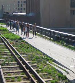
10 3.0 URBAN CONTEXT 3.1 PUBLIC REALM INTERFACE The quality of the public realm is a key determinant in creating this vibrant, pedestrian friendly, safe and attractive activity centre. The design philosophy of BCM is to celebrate Geraldton s progressive, engaging and innovative spirit in a transformative and creative urban landscape. The Batavia Coast Marina Stage 2 - Station Square Landscape Master Plan (REALMstudios, 2015) outlines the design intentions for the public realm featuring key landscaping elements within the site. The landscape is designed not only to reflect the area s rich heritage, microclimate and coastal location, but also its aspirations of becoming a revitalised inner-urban centre by providing flexible places that foster a local sense of place. Whilst LandCorp is responsible for the implementation of the public realm, these themes should be expressed through building design, character, detail and public art. It is anticipated that any landscape within private development lots will be developed in a consistent manner using compatible themes, species and materials. Objectives: Establish Station Square as the focal point and prime public space of the Marina. Development Controls: Buildings shall address the public domain with active frontages to enhance the interface with the street. Blank walls to the public domain are not permitted. Buildings shall provide integration with local landmarks, public artwork, landscape and street trees to improve legibility of the public realm. Pedestrian access shall be provided throughout the public realm. High quality pedestrian access should be adopted throughout the public realm. For ground floor residential, at the pedestrian level planting is encouraged (i.e. in front of houses and within front courtyards) to add interest and variety to the streetscape. Design and development within the public realm should have due consideration for Crime Prevention Through Environmental Design (CPTED) principles. Water Sensitive Urban Design (WSUD) principles should be applied to effectively manage water within the public realm. Ensure buildings provide an appropriate integrated response to the adjacent public realm that corresponds to the overall character and sense of place. Establish a sense of shared ownership and accessibility of public spaces. Station Square Perspective - Source: REALM, Public Realm Master Plan Report (2015) 10 BATAVIA COAST MARINA DESIGN GUIDELINES


 Urban")
")


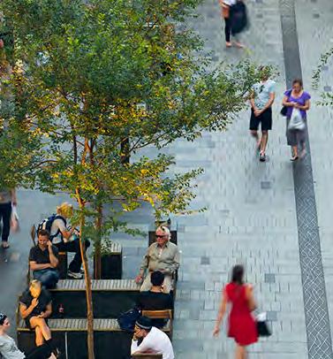

11 Station Square Source: REALM, Public Realm Master Plan Report (2015) Urban Wetland Source: REALM, Public Realm Master Plan Report (2015) Platform Lane Source: REALM, Public Realm Master Plan Report (2015) Public Access Way Source: REALM, Public Realm Master Plan Report (2015) SEPTEMBER


 The primary residential component of BCM2, this area seeks to establish a finer-grained residential fringe accommodating a mix of 2-4 storey residential dwellings")

12 3.2 CHARACTER AREAS Development should consider and respond to the surrounding urban fabric and built form to add to the areas distinctive character. Stage 2 of Batavia Coast Marina is envisaged as a mixed use development project led by LandCorp in co-ordination with key stakeholders. The site, located between Batavia Coast Marina Stage 1 and the Geraldton City Centre, forms a key focal point to activate and integrate the surrounding areas. Development of Station Square will provide an engaging public space for locals, visitors and workers in the area. Example - Monument Promenade (South) Within the precinct, four character areas have been formulated (Figure 5) to establish a distinctive sense of place as these relate to adjacent land uses. 1. MONUMENT PROMENADE (NORTH) The primary residential component of BCM2, this area seeks to establish a finer-grained residential fringe accommodating a mix of 2-4 storey residential dwellings attracting a greater diversity of people to live in the city centre. This area aims to facilitate a 24 hour culture, bringing life and vibrancy to the city centre and retail customers. 2. STATION SQUARE Museum Place and parts of Marine Terrace (adjacent to Station Square) will act as the primary nodes of activity and pedestrian movement with land uses fronting these streets contributing to a high quality pedestrian environment. Forming a central public open space, Station Square will provide reference to Geraldton s rail history and coastal character. It will act as the primary point of activity for the development. 3. MONUMENT PROMENADE (SOUTH) Providing key linkage from the City Centre, the streetscape and buildings within this precinct will incorporate detailed design qualities that recognise and respond to the importance of Batavia Coast Marina as a strategic location. 4. CHAPMAN ROAD Defined by frontages to Chapman Road, this precinct contains mixed-use commercial lots designed to improve the relationship between Chapman Road and its adjacent land uses, facilitating a pedestrian friendly environment. Example - Station Square Example - Monument Promenade (North) Residential Character Example - Chapman Road 12 BATAVIA COAST MARINA DESIGN GUIDELINES

13 Objectives: Development should celebrate the rail heritage, indigenous heritage, micro-climate and coastal location. Provide a cohesive approach to development throughout the precinct. Buildings are to complement: -- the character and attributes of the locality; -- the architectural theme of the public realm; and -- buildings on adjacent development sites. Buildings to incorporate detailed design qualities that recognise and respond to the importance of Batavia Coast Marina as a strategic location. Development Controls: Development is to address, complement and not compromise the future character and position of the railway platform and Station Square. Design of individual sites shall be responsive to neighbouring sites and the public realm. Buildings are required to address the street/or public realm in a manner that promotes variety and visual interest. New development, largely influenced by the surrounding built form, should respond to each other to establish elements of cohesiveness throughout the precinct. LEGEND: MONUMENT PROMENADE (NORTH) STATION SQUARE MONUMENT PROMENADE (NORTH) CHAPMAN ROAD BCM STAGE 1 BCM STAGE 2 (PHASE 1) BCM STAGE 2 (PHASE 2) Figure 5: Character Areas SEPTEMBER

14 3.3 DEVELOPMENT DIVERSITY It is envisaged that BCM will integrate with the urban core of Geraldton, providing cohesive city centre linkages through to the Marina. To assist in improving the vibrancy and vitality of inner city areas a range of cultural, entertainment, residential and recreational uses, such as unique restaurants, cafes and small bars will be encouraged within BCM. These land uses should be concentrated around Station Square. A range of dwelling types and sizes, as well as opportunities for commercial and retail are required in order to complement and invigorate the area. COMMERCIAL / RETAIL DIVERSITY To encourage a sustainable urban development embracing a diversity of retail and commercial uses it is essential to establish Batavia Coast Marina as a vibrant and active destination. Integrated with a high quality public realm, public spaces linking development frontages aim to service the community and encourage visitors to the area. Objectives: Provide the opportunity for new businesses to be established with retail, office and commercial space encouraged at ground floor levels facilitating a vibrant pedestrian environment. Establish a precinct that includes activities that service and complement the surrounding district. Encourage a variety of businesses that will activate the precinct during both daytime and evening hours. LEGEND: MIXED USE SINGLE RESIDENTIAL DWELLINGS MULTIPLE RESIDENTIAL DWELLINGS TOURIST ACCOMMODATION HOTEL MUSEUM POS BCM STAGE 1 BCM STAGE 2 (PHASE 1) BCM STAGE 2 (PHASE 2) Figure 6: Land use 14 BATAVIA COAST MARINA DESIGN GUIDELINES


15 Development Controls: The ground floor of mixed use development sites shall provide active retail/commercial frontages that address the public realm (e.g. shops, restaurants, consulting rooms, offices). Figure 6 outlines the types of uses desirable within BCM. Where a vertical mixed use development is proposed to incorporate a residential component, the residential component should be restricted to above ground floors only with an emphasis on providing for permanent residential dwellings, unless otherwise approved by the City. A retail uses, such as restaurants and cafés that will activate the Precinct during both daytime and evening hours are encouraged on ground floors. Building design should consider the potential future flexibility and adaptability to different ground floor uses over time. Simple consideration such as generous ground level ceiling heights can contribute to the robustness and enduring qualities of a building. Example - Mixed-Use development Residential Mixed use Cafe/ restaurant Example - Vertical mixed-use development RESIDENTIAL DIVERSITY Batavia Coast Marina will provide lot types that will facilitate the development of higher density living options. Townhouses and apartments will accommodate a gap in the current market, providing affordable living options in an active and vibrant precinct. Objectives: Enhance housing diversity by providing a variety of dwellings of varying size and affordability. Support residential living within the city both around the edges and in the upper storeys of buildings. Development Control: Residential land use is permitted above the ground floor on lots designated as mixed-use. Residential developments should provide a range of dwelling sizes and types providing a variety of housing types and affordability options. Consider building design with the long term flexibility, such as buildings with floor plan dimensions and ceiling heights suitable for residential and commercial uses. Example - Apartment development Example - Townhouse development SEPTEMBER
.")

16 3.4 RESPONDING TO CULTURAL HERITAGE BCM is a new development, as such, building designs should respect the style, form, proportions, materials and textures of heritage buildings located adjacent to the site such as: the former Geraldton Railway Station and existing railway platform; and the Bill Sewell Community Recreation Complex (Figure 7). Key features of scale and architectural detailing add identity, interest and amenity to the area. The adaptive reuse of the existing railway platform will help create a positive climate for investment and revitalisation by strengthening links from the core of BCM development to adjacent heritage sites. Objective: Ensure development does not adversely affect the railway station. Development Control: Development adjacent to heritage sites shall give due regard to Heritage controls outlined in the CCPP. Buildings should respond in a contemporary way to the history, climate and culture of the location. Development is encouraged to integrate heritage elements into the urban fabric. Building heights adjacent to the station should not adversely impact the design integrity of the heritage buildings. Geraldton Railway Station Existing Railway Platform LEGEND: HERITAGE BUILDING CULTURALLY SIGNIFICANT POS BCM STAGE 1 BCM STAGE 2 (PHASE 1) BCM STAGE 2 (PHASE 2) Figure 7: Heritage and Culture 16 BATAVIA COAST MARINA DESIGN GUIDELINES


17 3.5 VIEW CORRIDORS The waterfront, old railway station and Western Australia Museum - Geraldton are the major destination elements that define BCM. BCM endeavours to establish views and vistas from the waterfront to Station Square and the railway station by providing defined and activated pedestrian links and view corridors. Objectives: Building heights and footprints to maximise opportunities for views and vistas of the waterfront, museum and Station Square. Maximise legibility of visual linkages between key points of activity, such as Station Square. Development Control: Buildings shall not obstruct views of Station Square and the railway station. Building designs are to maximise views from living spaces, balconies and terraces to the public realm and toward the future open space. Buildings should provide pedestrian shelter along defined view corridors identified in Figure 8. War Memorial Geraldton Railway Station Western Australia Museum - Geraldton LEGEND: VIEW CORRIDOR POS BCM STAGE 1 BCM STAGE 2 (PHASE 1) BCM STAGE 2 (PHASE 2) Figure 8: View Corridors SEPTEMBER
18 3.6 PEDESTRIAN LINKS The BCM site will establish an enhanced pedestrian experience, through the creation of a vibrant and active public realm. Interesting, attractive and safe streets and public spaces will be provided to contribute to clear wayfinding and the pedestrian experience. The BCM site has a number of important pedestrian links. The pedestrian link hierarchy for the site is illustrated on Figure 9. Objectives: Incorporate active land uses and edges adjacent to the streetscape where possible. Ensure pedestrian safety is a priority consideration of new developments. Reinforce clear wayfinding as part of the Museum to Monument Link. Development Controls: Pedestrian links shall be provided in accordance with Figure 9. Building façades shall address streets and public places, maximising the relationship between the building and adjacent street or public realm. Weather protection, such as verandas and awnings, shall be provided to any development fronting primary pedestrian linkages. No buildings back of house services shall be oriented along defined pedestrian routes. Links through pedestrian arcades to access rear parking shall provide for a walkway width of 3 metres minimum. High quality pedestrian access should be adopted throughout the public realm. Open sight lines are recommended to maximise the public perception of safety. Lighting, signage, materials and landscape elements should be utilised to facilitate safe, accessible and convenient pedestrian access throughout the precinct, and to and within specific sites. Pedestrian access should be provided from any on-site parking areas to the relevant building entrance. LEGEND: MUSEUM TO MONUMENT LINK PRIMARY LINK SECONDARY LINK BCM STAGE 1 BCM STAGE 2 (PHASE 1) BCM STAGE 2 (PHASE 2) Figure 9: Pedestrian Links 18 BATAVIA COAST MARINA DESIGN GUIDELINES


19 3.7 PUBLIC ART Geraldton has a unique culture with strong links to indigenous, maritime and railway heritage. The successful integration of art into public spaces and buildings will assist in fostering a unique sense of character and identity for the BCM precinct. Design guidance should be read in conjunction with the Station Square Public Art Strategy and BCM Stage 2 Public Realm Master Plan Report (REALMstudios, 2015) which establish a series of over-arching narratives to be adopted in the future development of the area. Design Controls: Provision of public art to the value of 1% of the estimated development cost (or equivalent cash contribution) for any development over $500,000 in value. Public art shall be integrated into the design of buildings and the proposed public realm. Public art should enhance and complement the unique character and heritage of Geraldton, contributing to the BCM s sense of place. Public Art Indigenous - Geraldton Eggs Objective: Enhance the urban environment through the integration of public art in public spaces and buildings. Public Art Rail - Workers Sculpture Midland Railway Workshops 3.8 SAFETY AND SURVEILLANCE Improving the perception of safety through the built environment is a key consideration for BCM. Crime Prevention Through Environmental Design (CPTED) principles have been applied in the design of public spaces, providing a response to improving the safety of the urban environment. Buildings should respond to the public realm through CPTED principles. Objectives: Encourage passive surveillance of the public realm and pedestrian links, through active street frontages and the location of balconies and major openings. Maintain open sight lines at eye level. Development Controls: The size and position of windows and major openings shall promote passive surveillance of the public realm. Service areas shall be well-lit to facilitate safe after hours use. Openings shall be designed to provide passive surveillance of streets and public spaces. Incorporate Crime Prevention Through Environmental Design (CPTED) principles in the design of buildings. Example - Overlooking of public spaces Example - Overlooking Public Lane SEPTEMBER


20 3.9 SIGNAGE Signage will form an important component of navigation and business operation throughout the Batavia Coast Marina. However, an excess of signage can impinge on visual amenity and the form and type of signage permitted on new developments needs to be carefully managed. Objectives: Ensure signage is integrated into building design and improves the overall appearance and legibility of the public realm. Promote well designed commercial signage that is complementary to business and its location. Development Controls: Signage suspended beneath a canopy shall have a minimum clearance of 2.75m (Figure 10). All signage must be of a scale and design character that complements the pedestrian experience, rather than relating to views from passing traffic. Signage should be of a high quality graphic design, simple in format and appropriately located and integrated with the building design, scale of the street and adjacent buildings. Signage should not dominate the built form. Example - Desired Signage PARALLEL PARKING 2.5m Min 2.75m FOOTPATH 3.8m Figure 10: Cross Section - Street Signage 3.10 LIGHTING Lighting should be carefully integrated into the buildings and features of the public realm to create a safe and attractive night-time environment. Consideration should also be given to the illumination of footpaths under awning structures and building entrances, signage and way finding to provide safe pedestrian movement around buildings. Objectives: Provide appropriate levels of lighting for both the private and public realm for safety, security and aesthetic impact. Reduce energy consumption through the use of energy efficient and innovative lighting technologies. Provide lighting to add ambience and interest to the night-time environment. Development Controls: Lighting shall be concealed under verandah roof overhangs or otherwise shielded to minimise glare. All outdoor lighting shall be directed downward with no light spill above the horizontal plane. Lighting should serve to highlight the key features of buildings and landscape. Well positioned windows and skylights can reduce the need for internal lighting during the day. Lighting should be used as a method of pedestrian way-finding through secure routes. Example - Lighting Example - Lighting 20 BATAVIA COAST MARINA DESIGN GUIDELINES


21 3.11 VEHICLE ACCESS AND PARKING Efficient access and location of parking and end of trip bicycle facilities are essential design components, which contributes to both the functionality and visual quality of BCM. VEHICULAR ACCESS Vehicle accessibility and movement requires careful management and effective planning to limit the potential impact vehicular traffic can have on the quality of the public realm. Objectives: Establish an appropriate balance between vehicle and pedestrian movement, providing safety for pedestrians and accessibility for vehicles. Ensure vehicle movement is convenient and efficient with safe access and parking. Development Controls: Pedestrian and vehicle entry points shall be defined and separated from one another. Footpaths are to be maintained as the priority movement, crossovers and driveways shall be terminated at the footpath. The visual impact of car parking entrances shall be minimised from street frontages. Drive-through uses across street frontages are highly discouraged. The location of crossovers, driveways and access points should be carefully considered in relation to vehicular and pedestrian traffic. Example - Laneway access to vehicle parking Example - Laneway access to vehicle parking VEHICLE PARKING A staging plan to accommodate vehicle parking is outlined below in line with the development staging 1-4. Objectives: Provide sufficient and safe car parking. Ensure on site vehicle parking and access is appropriately located, minimising the adverse visual impact on the streetscape. Improve walking and cycling conditions to link destinations serviced by alternative parking facilities. Development Controls: Car parking shall not be visible or dominate the street frontage. On-site car parking bays shall be provided in accordance with the Scheme. Car parking for permanent residential uses should be provided in accordance with the provisions of the R-Codes. Parking should occur to the rear of building structures with access from secondary streets or lane ways. Car parking should not occur at grade, adjacent to the streetscape or public realm. SEPTEMBER
.")
22 STAGING PLAN - PUBLIC PARKING LEGEND: AT GRADE PARKING SITE BOUNDARY Existing Access is maintained to the existing at-grade public parking along Foreshore Drive and parking adjacent to the railway station (Figure 11). Figure 11: Existing public parking - construction Stage 1 LEGEND: ON-STREET PARKING AT GRADE PARKING UPGRADED BUS PARKING DEVELOPMENT AREA SITE BOUNDARY Stage 1 Completion of stage 1 residential development with rear lane access to private parking. At grade public parking retained along Foreshore Drive (Figure 12). On-street car parking provided along the newly constructed Chambers Way and Monument Promenade (North). Bus parking upgraded on Foreshore Drive. Figure 12: Stage 1 public parking 22 BATAVIA COAST MARINA DESIGN GUIDELINES
.")


23 LEGEND: ON-STREET PARKING AT GRADE PARKING BUS LAY-BY UPGRADED BUS PARKING PUBLIC OPEN SPACE DEVELOPMENT AREA SITE BOUNDARY Stage 2 Completion of Stage 2 mixed use development with provision for rear lane access to private parking. At-grade public parking relocated north with access off Stella Maris Drive (Figure 13). Additional on-street car parking provided along the newly constructed Monument Promenade (South) and Innisfail Entrance. Bus parking bay upgraded on Chapman Road. New bus lay-by provided on Monument Promenade, adjacent to Station Square. Figure 13: Stage 2 public parking BICYCLE FACILITIES AND END OF TRIP FACILITIES Objectives: Promote active transport as a viable mode of transport throughout Batavia Coast Marina. Ensure bicycle parking and end of trip facilities are provided for both public and private use. Ensure dwellings are provided with functional and accessible storage areas in addition to bicycle parking facilities. Development Controls: All new developments shall provide adequate supply of bicycle parking bays in accordance with the Scheme. Storage functions shall be incorporated into the building design. Bicycle parking shall be in accordance with the R-Codes. Buildings that include any nonresidential development should include end of trip facilities to support active transport modes. Example - Bicycle Parking Example - Internal Bicycle Storage SEPTEMBER
24 4.0 BUILT FORM 4.1 BUILDING HEIGHT It is intended that building heights in BCM will be reflective of the surrounding context and built form providing a transition in building bulk and scale from the Geraldton City Centre in the south to a finer grain of urban development both north and east of the BCM. Generally, new development is required to be 2-5 storeys with provision for the sixth floor to operate as a residential roof terrace or be located within the roof space. Objectives: Ensure building heights effectively respond to existing and future development of the BCM Precinct. Capitalise on views of the foreshore, water and surrounding coastal environment given the mostly flat topography of the land. LEGEND: 5 STOREYS (20M) 4 STOREYS (16M) 3 STOREYS (12M) 2 STOREYS (8M) POS BCM STAGE 1 BCM STAGE 2 (PHASE 1) BCM STAGE 2 (PHASE 2) LANDMARK SITE (POTENTIAL 8 STOREYS-32M) Ensure buildings limit overshadowing of the public realm and optimise access to the sun, breezes, views and privacy. Consider the development of landmark sites to allow for iconic developments (Figure 14). Development Controls: Building heights shall be measured from the Average Natural Ground Level (ANGL) at the street (or road) frontage. Maximum building heights shall be in accordance with Building Heights Plan Figure 14. The maximum podium building height is 3 storeys (12m). Use of parapets or a gabled roofline shall not exceed 2 metres above the podium of the building. Where single residential dwellings are proposed, a minimum height of 2 storeys applies to achieve a vertical element. Buildings should consider maximum unobstructed views of the coastline. The floor to ceiling heights for retail and commercial floors of mixed use developments are encouraged be greater than 3.5m to promote flexibility of use. Cafe and restaurant uses need greater minimum ceiling heights of 4m to allow for additional servicing needs. Landmark sites will only be considered if the development can be rationalised as iconic, has a significant environmental rating and does not adversely impact the surrounding development. Development proposals will need to address the Additional Criteria for Height Bonuses in Section Figure 14: Maximum Building Heights BATAVIA COAST MARINA DESIGN GUIDELINES

25 4.2 SETBACKS A variety of setbacks are proposed throughout BCM to create a visually appealing and diverse built environment. This is to allow effective use of awnings and verandas essential in creating a pedestrian friendly environment, and alfresco dining areas which are strongly encouraged. Objectives: Ensure that buildings respect the traditional built form of the street. Provide minimal setbacks to allow buildings to maximise their development opportunity and integration with the public realm. Ensure that multi-level developments are sensitive to the scale of existing heritage buildings. LEGEND: BUILT TO BOUNDARY 0-1.5M GROUND FLOOR SETBACK 0-3M GROUND FLOOR SETBACK COLONNADE POS BCM STAGE 1 BCM STAGE 2 (PHASE 1) BCM STAGE 2 (PHASE 2) Development Controls: Any floor level above podium height (12 metres) shall be setback a minimum of 3 metres from the property boundary (Figure 15). An increased podium height of up to 3 metres is permitted for corner buildings in accordance with the CCPP. Balconies are permitted within the setback provided they are open on 3 sides and visually permeable and do not occupy any more than ¼ of the building façade width at any one level. Setbacks shall be in accordance with Figure 16. Development along Monument Promenade and on the perimeter of Station Square is encouraged to retain a human scale, minimising the impact on the historical building and traditional Main Street environment. The following general principles apply to setbacks within BCM: Generally, a 0m setback will be observed at the front, rear and side of developments of nonresidential developments. Generally, a front setback of 1.5m is required for ground level residential dwellings to provide additional privacy. Minimum setback of 3m for floors above podium height Podium height 12 metres Lot Boundary Figure 15: Minimum setback for floors above podium height Figure 16: Setbacks SEPTEMBER
26 4.3 DEVELOPMENT FRONTAGES Through considering building design, the orientation and location of street level activity and visual connections between internal areas of buildings and the adjacent public realm, all contribute to a sense of liveliness, creating interest and attractive public places. Making frontages active, adding interest, life and vitality to the public realm means: the primary pedestrian corridors that buildings must respond to; providing frequent doors and windows, with few blank walls; having narrow frontage buildings, giving vertical rhythm to the street scene; high quality materials and refined details; and strong visual connection between internal spaces and the adjacent public realm. Where frontages are defined as semiactive, which includes residential frontage, this means: passive surveillance through the direction of windows and building openings onto all other streets and public spaces; few blind or passive facades; some depth and modelling in the building facade; and good quality materials and refined details. Objectives: Buildings to address the street and public realm along Station Square, Chambers Way and Monument Promenade. Ensure appropriate levels of activation to address the adjacent public realm that correlates to the overall character and sense of place. Development Controls: Active Frontages shall be in accordance with Figure 17. Servicing and access shall not be permitted along building edges designated as active. Large areas of blank wall will not be accepted on the primary street frontage or where visible from the street or other public space. Where walls without glazed penetrations are unavoidable, other design features must be incorporated, such as colour and texture variation. Façade openings are recommended to maximise connections to all public spaces. LEGEND: ACTIVE FRONTAGE SEMI-ACTIVE FRONTAGE POS BCM STAGE 1 BCM STAGE 2 (PHASE 1) BCM STAGE 2 (PHASE 2) 26 Figure 17 Active Frontages BATAVIA COAST MARINA DESIGN GUIDELINES


27 4.4 FLOOR LEVELS Objectives: To ensure that floor levels and entrances to buildings meet appropriately with the ground floor plain of the adjoining public realm. Ensure appropriate activation and natural surveillance of the ground plane. Development Controls: The lowest occupied floor level on Monument Promenade and Station Square shall be no more than 100mm above ANGL to enable floor levels to connect directly with the public realm. Changes in level across development sites are to be accommodated within the ground floor built form. New development fronting directly onto the railway platform shall provide a seamless connection between ground floor level and public amenity along the platform (Figure 18). The ground floor level of development fronting Foreshore Drive and Chapman Road shall be no more than 1.2m above the average natural ground level which allows a step up from the street level, therefore, accommodating potential undercroft car parking without the floor/door being separated from street level activity. Universal access should be considered with regard to building entrances. Section 1 Lot Boundary Lot Boundary Lot Boundary Lot Boundary BOSCHETTI WALK LECOLLIE WAY Figure 18: Section 1 - Changes in building height for development fronting the railway platform SEPTEMBER


28 5.0 ARCHITECTURAL CHARACTER 5.1 BUILDING CORNERS It is encouraged that key building elements identified within lots in Section 7.0 have a distinctive presence that reflects their position as a link between streets, a vista termination, or entry statement. Objectives: Improve wayfinding by providing landmark buildings at the intersection of roads, lanes and pedestrian accessways. Create prominent corners to facilitate extra height. Development Controls: Corner buildings shall address both frontages, and special treatment is encouraged to mark corners and link streets. Buildings that terminate vistas shall ensure they address that vista. Architectural details are encouraged to distinguish that site as a point of visual focus. Examples of such special treatment include: -- Additional floor height; -- Distinctive roof form; -- Articulation of corner wall elements; -- Variation in materials and colours; and -- Special boundary treatments. In approved instances corner elements may take the form of an additional storey if the City of Greater Geraldton is satisfied that it contributes to the landmark quality of the building. Refer to Section 7.0 for the location of these lots. Example - Building Corner Example - Building Corner 5.2 ROOF FORM The design criteria contain no specific requirement with regard to roof form and variety is encouraged. Objective: Promote a high standard of roof form and design quality that provides a strong architectural character and sense of place. Development Control: Residential roof terraces or loft spaces are permissible within the roof space without extending beyond the maximum building height. Roof forms should be designed to consider the impact at street level. Roof design should facilitate adequate access to light, air and shade for building occupants. Awnings with large overhangs should be provided over significant openings on the north, east and west, and to shade outdoor areas. Due consideration of wind orientation and local environmental conditions should be taken. Example - Roof Form Example - Roof Form 28 BATAVIA COAST MARINA DESIGN GUIDELINES


 to reduce heat absorption.")
29 5.3 EXTERNAL MATERIALS AND DETAILING Colour, texture, material and detail are important to provide scale and visual interest within the urban environment. Whilst these Design Guidelines do not prescribe a schedule of materials and colours, the intent of this section is to provide a visual palette to inspire and infirm design direction. Objectives: Ensure development complements the historic and/or architecturally significant character of the locale, whilst simultaneously expressing contemporary design. Promote visual interest and diversity through the use of a variety of materials, textures and colour that provides a sense of depth to building facades. Development Controls: New development shall incorporate a variety of materials such as rendered masonry, face brick, stone, steel, glazing and modern cladding material. Select colours that reflect the local environment, but generally lighter shades (unless used for accentuation) to reduce heat absorption. Fine grain design for the ground plane with innovative use of colour and materials is required to ensure a positive pedestrian experience, creating a personal and human scale to the active frontages of buildings. The use of building materials that are suitable to the local climatic conditions and responding to the local character are recommended. Locally produced and manufactured or recycled materials should be used. Example - Mix of Building Materials Example - Mix of Building Materials 5.4 BUILDING ENTRANCES Mixed-use buildings cater for a variety of functions and activities. Welldesigned access and entrances to buildings enable pedestrians to read visual cues and intuitively understand the intended purpose and function of buildings. Objective: Provide building entrances that are clearly defined and legible from the public realm. Development Controls: Commercial and residential entrances shall be separate and well defined. Pedestrian and vehicle entry points shall be separate and well defined. Weather protection shall be provided to entrances of residential buildings. Lighting, signage, materials and landscape elements shall be utilised to highlight building usage and entrances. Example - Building Entrance SEPTEMBER


30 5.5 FENCING The heights, type and materiality of fencing can have a significant impact on the appearance and visual quality of urban environments. They are also an important means of establishing security and demarcation between the public and private realm and the creation of discernible private space. Objective: Promote fencing of minimum height to provide adequate separation and surveillance of the adjacent space. Enhance the visual quality of the public realm. Development Controls: Fencing and gates in front of built form shall be a maximum 900mm high to allow interaction between residents and neighbours. This may increase to a maximum of 1200mm high in justifiable situations and locations. Fences should be specifically designed to integrate with the development to which they belong, and as far as it possible, enhance, rather than detract from, the adjacent public realm. Example - Low level fencing Example - Visual permeability 5.6 SCREENS AND BALUSTRADES Screens and balustrades, as distinct from fences, must also be carefully considered in the context of the urban environment. The use of both balustrades and screens to the upper levels lend themselves to being used as flexible elements in the articulation and expression of the architecture of the building from the street. Objective: Ensure the use of balustrades and screens do not inhibit the close relationship between public and private space. Ensure screens and balustrades integrate with fully with the quality of the architecture which they belong. Development Control: All balustrades addressing the street or public space must be at least 60% visually permeable by area. Balustrades at ground level, in front of buildings, should be 1000mm high to allow interaction between residents and the public realm. This may increase to a maximum of 1200mm high in justifiable situations and locations. Screens and balustrades should inform the architecture in both form and materiality. Offset openings, louvres or other appropriate treatments can be used to improve the level of visual privacy where distance separation is not desired or achievable. Example -Movable screens Example - Balustrades 30 BATAVIA COAST MARINA DESIGN GUIDELINES


31 5.7 OUTDOOR SPACE Outdoor areas such as gardens, courtyards and balconies within private residences and communal areas accessible to residents contribute to the amenity of apartment living, as well as for workers of commercial buildings. These spaces provide a valuable contribution to the form, articulation and identity of buildings. PRIVATE OUTDOOR SPACE (INCLUDING BALCONIES) Objectives: Ensure all residential units have access to functional and usable private open space that is suitable for the purpose of relaxation and entertaining. Provide an appropriate balance between the requirement for privacy and optimisation of the views into the public realm. Development Control: Every apartment shall have a balcony, terrace or courtyard with a minimum of 2.5m and 10sqm area, accessed from a main living area. Overlooking between balconies and adjoining residences should be carefully considered and privacy screening provided where necessary. The location of private open space (including courtyards or gardens) is to consider adjacent, existing or proposed built form, wind, solar penetration and overlooking. Consider the inclusion of roof decks and gardens, particularly in higher density housing developments where private outdoor space is limited. Example - Balconies as Private Open Space Example - Private residential courtyard COMMUNAL OUTDOOR SPACE Objectives: Ensure that developments incorporate plazas, terraces and other public spaces that provide for public areas. Ensure non-residential buildings provide access to protected open space for workers. Development Control: Continuity of materials, finishes, landscape elements etc is required between the public and private realms to diffuse the boundary between the two. Multi-residential developments should consider a communal outdoor area to be shared by residents. This may occur as terraces or as part of the roofscape. Example - Communal outdoor space Example - Roof terrace as communal open space SEPTEMBER


32 5.8 BUILDING SERVICES Careful consideration is required when determining the location of services. It is important to minimise the visual impact these areas can have on the character of an area, particularly when adjacent to the public realm. Objective: Service areas (including external storage and rubbish) are visually and acoustically screened from public view. Design Controls: Services, including satellite dishes, air conditioning units, solar collectors and other plant and equipment, shall be located to minimise visual and acoustic impact on neighbouring properties and the public realm. All piped and wired services, vents, clothes drying areas and hot water storage shall be concealed from the street and public realm (i.e. located to the back of developments or screened). Plant must not be visible from the street and must not be visible below the roof line of buildings with street facing elevations. Meters must be contained within development lots, screened and integrated in the overall development. Storage areas, service areas and any ancillary equipment shall be screened from public view. Solar panels and solar water systems may be visible only where they are located in the same plane as the roof and there is not alternative location that can offer a similar level of solar efficiency. Service doors and other utilitarian features should be located away from street frontages and treated to reduce their visual impact. In general, lot services are located within easements adjacent to rear laneways. Example - Screening of Services 32 BATAVIA COAST MARINA DESIGN GUIDELINES
33 SEPTEMBER


34 6.0 ENVIRONMENTAL DESIGN 6.1 SOLAR ACCESS & VENTILATION Building design throughout BCM should respond to Geraldton s coastal environment and conditions by offering protection from the sun and prevailing winds to create a microclimate (Figure 19). Objectives: Ensure that the design of buildings creates comfortable internal and external environments for its occupants. Incorporate passive solar design principles to optimise cross ventilation, solar gain in winter and protection from heat gain in summer. Development Control: All buildings shall optimise solar passive design through orientation of openings and living zones to the north. LEGEND: MAJOR WIND FLOW MINOR WIND FLOW BCM STAGE 1 BCM STAGE 2 (PHASE 1) BCM STAGE 2 (PHASE 2) Single aspect apartments with a depth of no greater than 8m will ensure adequate ventilation and daylighting to apartment back walls. Dual aspect apartments benefit from the opportunity for crossventilation through the apartment, increasing the maximum apartment/building depth up to 14 metres, beyond which both become difficult to achieve. An enhanced ceiling height, greater than 2.5m may enable adequate daylighting and ventilation for greater apartment depths. Adjacent building envelopes or development should be taken into account when considering solar access to residential units. Example - Cross-ventilation within single aspect apartment Example - Cross-ventilation through dual aspect apartment Figure 19: Micro climate 34 BATAVIA COAST MARINA DESIGN GUIDELINES


 at a minimum depth of 2.5m, providing a clearance height of between 3.")
35 6.2 OVERHANGS AND SHADING The use of awnings, balconies and street trees create visual interest to the precinct and a comfortable experience for pedestrians, essential to establishing a vibrant and activated place that encourages walking and participation in public life. Objectives: To provide a variety of verandas, balcony and awning types to facilitate a high-level pedestrian environment. Encourage weather protection through the provision of cantilevered verandas (where permitted), canopies or awnings. Minimise heat gain and optimise solar passive design. Development Controls: North facing balconies shall all be provided with a fixed or moveable shading device. Minimise heat gain through all East and West facing openings by providing adequate shade. Awnings and canopies shall be provided along the frontages of buildings where ground floor retail and commercial uses occur, providing continuous cover to pedestrian walkways within designated areas. Structurally cantilevered awnings, verandas and balconies are permitted to extend into the street space (footpath or verge) at a minimum depth of 2.5m, providing a clearance height of between 3.0m and 4.5m (Figure 20). Street shading and overhangs must be considered in tandem with public infrastructure and street trees to ensure appropriate integration and lighting for effect and security. Awnings with large overhangs should be provided over significant openings on the north, east and west to shade outdoor areas. Discretion may be applied for south facing façades; however visual interest and articulation of built form will be required. Screens and awnings should inform the architecture in both form and materiality. Example - Awnings and Alfresco Area Min 2.5m Min 3m Figure 20 Awning Design Example - Screens to improve visual privacy SEPTEMBER


36 6.3 ENERGY EFFICIENCY Selecting the most appropriate energy source can significantly improve the environmental performance of buildings while minimising demand for energy through conservation and efficiency, reducing operational costs and environmental impacts. Objective: Integrate innovative design, technology and material into the design of buildings to establish high standards of energy efficiency and sustainability of new buildings. Development Control: New development must integrate design, water, energy savings, materials and ratings assessments as per the City Centre Planning Policy, 2009 and Towards Sustainable Residential Development LPP, Construction material should consider renewable sources and have regard for their embodied energy levels. Where possible they should be sourced locally. Air conditioning systems should be a minimum of 3 star energy rating and sized appropriately for the space. Where installed, electrical appliances should have a minimum 4 star rating. Roof colour should have a Solar Absorbency Rating of less than Example - Integrating Energy Efficiencies 6.4 ACOUSTIC PRIVACY A high standard of acoustic and visual privacy is required for the amenity of residential uses. Objective: Encourage the use of construction materials and techniques that reduce noise transmission between buildings. Sound insulation is particularly relevant to the conditions experienced within a mixed-use environment. Design Control: Acoustic treatment of machinery such as air conditioning, lifts and mechanical services to commercial uses is required. Equipment should be located, enclosed and acoustically treated to ensure acceptable noise levels are achievable. Example - Screening of Services 36 BATAVIA COAST MARINA DESIGN GUIDELINES
37 6.5 GROUNDWATER MANAGEMENT Historically, the area within BCM2 was used as part of the Western Australian government railway marshalling yard. Site investigations and remediation by GHD in 2013 and 2015 have indicated that the lots are suitable for residential development and/ or commercial developments with appropriate restrictions and controls on Site development. The restrictions and controls on Site development relate to limiting access to groundwater (not suitable for drinking/irrigation) and limiting contact to soils (to reduce exposure risks) which applies to all lots. In response to the need to alleviate groundwater contamination risks, Figure 21 outlines the lots (30-36, 29, in yellow) which will be directly connected to the centralised stormwater management system to avoid infiltration of surface water into the groundwater system. All other lots will be expected to retain and infiltrate stormwater on-site (blue), excluding Lots 1-16 (red), which are to be connected to the existing external drainage system. Further guidance on stormwater connections and landscaping requirements is provided in Section 7.0 Lot Specific Requirements. Objective: Limit the possible risk of impacts to human health and environment derived from soil and/or groundwater contamination within the vicinity of the development area. Development Controls: The development of lots shall be consistent with Figure 21, Stormwater Management systems. Memorials on Certificates of Title indicate restrictions on the access to groundwater. LEGEND: CONNECTION CENTRAL STORMWATER MANAGEMENT SYSTEM CONNECTION EXISTING EXTERNAL STORMWATER MANAGEMENT SYSTEM ON-SITE RETENTION RESTRICTED ACCESS TO GROUND WATER Figure 21: Stormwater Management Systems SEPTEMBER


38 6.6 WATER SENSITIVE URBAN DESIGN Water Sensitive Urban Design (WSUD) principles integrated with the Landscape Design should be employed throughout the site to manage stormwater run-off from driveways, open space and parking. The purpose of this is to address water availability issues within the City of Greater Geraldton. With the identification of site contamination impacts, lot specific requirements are outlined in Section 5.0 with further detail provided in the Station Square at Batavia Coast Marina, Urban Water Management Plan, Objectives: Protect waterway health by minimising pollutant runoff. Provide a range of stormwater management options for development, including landscape alternatives. Maximise the benefits of stormwater collection and water conservation. Promote use of green infrastructure to improve liveability and reduce urban heat effect. Maximise the percentage of pervious surfaces to direct stormwater into bio-filtration system / urban wetland within the site. Ensure ongoing water quality within the urban wetland. Development Controls: For lots directly connected to the centralised stormwater management system, consideration shall be given to the quality of storm water disposal having a direct impact on the quality of urban wetland. The following strategies are recommended: -- Use of planting with low water and nutrient requirements. -- Minimise the use of fertilisers and pesticides within landscaped areas. -- Installation of information signage to inform users and the community of the connection between local stormwater drainage and the Station Square Urban Wetlands. All other lots not directly connected to the centralised or external drainage system are required to provide on-site retention to the approval of the City. This can be achieved in a variety of ways including (but not limited to): -- Integration of green roofing -- 30kL rainwater tank for on-site non-potable use -- Permeable paving surfaces -- Rain gardens -- Underground soakage devices Consider the integration of Green/ living walls to capture, detain and treat rainwater before it enters the drainage system. Consider rainwater tanks for the collection of non-potable stormwater for irrigating gardens and washing cars. Example - Information Signage within public realm Example - Permeable Paving Example - Green roof Example - Rain Gardens 38 BATAVIA COAST MARINA DESIGN GUIDELINES


39 WATER CONSERVATION Reducing Geraldton s reliance on limited potable (drinkable) water supplies can be achieved through the development of water efficient buildings. The design of buildings can significantly reduce the consumption of potable water, positively impact the quality of urban stormwater and increase the reuse of wastewater and stormwater on-site. Objectives: Promote an efficient approach to water management to reduce water demand, maximising water efficiency and incorporating water management initiatives. Ensure the most water efficient facilities and fixtures are installed for maximum water conservation. Design Controls: Reduce the main consumption of potable water through the installation of water-wise fixtures and fittings (Table 2). Installation of water meters or sub-meters for individual apartments. Re-using water through rainwater harvesting for non-potable water use (such as garden water, washing machines, and car washing). Integration of planting, particularly climbing species within the built form adding to the comfort of the built environment, slowing and cooling of air and reducing heat island effects. Example - Rainwater Tank Example - Trellis planting Fixture Minimum WELS rating Shower Fitting 3 WC 4 Basin Taps 6 All other taps (excluding outdoor & bathtubs) 2 Table 2: Waterwise fixtures SEPTEMBER
40 7.0 LOT SPECIFIC REQUIREMENTS In addition to the general development controls and guidelines outlined in previous sections, each lot also has additional development requirements. 7.1 SUBDIVISION Further subdivision of the lots will not be supported in the BCM development, however, built strata arrangements may be considered at the discretion of the City. 7.2 ADDITIONAL CRITERIA FOR HEIGHT BONUSES Given the iconic nature and significant public investment in the development of the BCM, additional height is encouraged in accordance with the Building Heights plan (Figure 22). Objectives: Ensure that adequate development opportunities exist to meet the floor space demands of various activities, and to ensure their efficient arrangement. Achieve design standards of a very high order. Offer market incentives for actions which contribute to achieving other objectives of these design guidelines , , , and no restriction on built form percentage The provision of Station Square and the public realm improvements have satisfied this criteria. Other applicable criteria will need to be met by the developer. 7.3 KEY BUILDING ELEMENTS Lots indicating Key Building Elements should be considered as key elements that will contribute to the urban character and sense of place in BCM. It requires careful design consideration of: Building character in response to history, climate and location; Building form viewed from all directions; and Pedestrian experience - amenity, detail and scale at ground level. Development applications must include a response to all these aspects including a 3 dimensional representation of the design. Development Control: For the City to consider development that proposes additional heights, the applicant will pay due regard to Additional Criteria for Height Bonuses in the CCPP, and meet (as a minimum, but preferably exceed) those design guideline standards applicable to the individual site. The following criteria for additional height (as prescribed in the CCPP) are not considered applicable or have either been met through the development of Station Square and improvements to the public realm: provision has been made for pedestrian and public access via the road layout, arcade style development and retention of the railway platform and minimum lot size is not applicable buildings may have their main axis running parallel to the foreshore (i.e. running NW SE) given the road layout of the site. 40 BATAVIA COAST MARINA DESIGN GUIDELINES
41 LEGEND: AWNINGS ALFRESCO DINING ACTIVE FRONTAGES COLONNADE KEY BUILDING ELEMENT SITE ACCESS & PARKING POS LOT BOUNDARY Figure 22: Site Plan - Specific Guidelines for Lots North SEPTEMBER
42 7.4 MONUMENT PROMENADE - NORTH (LOTS 1-18) Lots 1-18 frame part of BCM s residential fringe. It is important to increase the number of residents within the precinct to facilitate a vibrant environment for the local community. Additionally, it assists in providing a finer grain of development transitioning away from the City Centre. Objective: To integrate permanent residential dwellings in order to generate greater activation of the precinct. Development Controls: Use Lots 1-16 are permanent single residential lots (RAC3 as per the Scheme) with additional studio units encouraged above garages fronting the rear lane. Lots will comprise permanent multiple residential apartments (minimum R60) with provision for a corner cafés on the ground floor to activate frontages along the Museum to Monument Link (Figure 23). Building Envelope Lots are to be designed at a maximum of 4 storeys, stepping down to 3 storeys for lots A residential roof terrace (or green roof) on the fifth storey is permissible. Loft spaces or attic spaces within the maximum building height are permissible. Studio apartments may be built over parking garages fronting the rear lane. Habitable rooms of residential dwellings on ground floor levels (lots 1-16) shall have a minimum floor to ceiling height of 3.3m to ensure their long term adaptability for other uses. Cafes and restaurants on the ground floor levels shall provide for greater minimum ceiling heights of 4m to allow for additional servicing needs (Figure 24). Setbacks and Built Form Single residential dwellings within lots 1-16 shall provide setbacks between 0-3m along Monument Promenade. 0m setback shall be provided to lots 17 and 18. A pedestrian arcade (minimum of 3m) shall be provided for lot 18 to create visual linkages between Chambers Way and the rear access lane (Figure 24). Balconies, major openings and living spaces shall address the street. Where practicable every residence should have direct access from a living space to a northerly facing outdoor living area of minimum dimension 2.5m and 10sqm area. Floors above podium height (12 metres) shall be setback a minimum of 3 metres from the lot boundary. Ground level garages to the rear of dwellings shall provide a 1 metre setback from the boundary to provide sufficient space for services and to avoid visually unattractive narrow lanes. Parking Vehicle access is only permitted from the Right of Way to the rear of lots Vehicle crossovers shall not be permitted on Chambers Way and Monument Promenade. Stormwater Management Lots 1-16 are required to be directly connected to the centralised stormwater management system. Lots 17 and 18 are not connected to the centralised stormwater system, therefore, these lots will require onsite infiltration of stormwater. Landscape Treatment Rear courtyards are required to have hard landscaping with raised planter beds to avoid direct contact with soils. Fencing and gates in front of buildings shall be preferably 900mm high. Building Envelope Ceiling heights of habitable rooms within residential apartments above ground floor levels should be a minimum of 2.7m to help achieve good daylight access and natural ventilation (Figure 24). Setbacks and Built Form Occasional breaks in awnings may be required along both Chambers Way and Monument Promenade to accommodate tree planting within the footpath. 42 BATAVIA COAST MARINA DESIGN GUIDELINES


43 LEGEND: AWNINGS ACTIVE FRONTAGES KEY BUILDING ELEMENT LOT BOUNDARY PEDESTRIAN ARCADE Figure 23: Site Specific Guidelines Lots North LOT 19 CHAMBERS WAY LOT 18 Boundary Line Boundary Line 2.7m Residential habitable 2.7m Residential habitable 2.7m Residential habitable 4m Cafe / restaurant COLONNADE 4m FOOTPATH 3.6m Figure 24: Section 2 - Chambers Way 90 O PARKING CARRIAGEWAY PARALLEL 7.54m PARKING 2.5m FOOTPATH 2.7m SEPTEMBER
44 7.5 MONUMENT PROMENADE -SOUTH (LOTS 19-22) Lots have rear access from Foreshore Drive. A pedestrian access way is located between Foreshore Drive and Monument Promenade, providing frontages to residential dwellings and a secondary linkage between the Marina and Main Street environment. 44 Objective: Provide an entry statement into the BCM precinct, linking the town centre and Marina development. Development Controls: Use Lots 19 and 22 are envisaged as mixed use buildings, supporting ground level retail, entertainment, civic and community uses with a mix of office, commercial, residential or tourist accommodation above. Active frontages are required at ground level along Monument Promenade, Chambers Way, Forest Street and parts of Foreshore Drive. Lots 20 and 21 shall have permanent multiple residential apartments (R80 minimum). The residential built form shall contribute to the main street environment. Building Envelope Lots have a maximum height of 5 storeys with a minimum 3m setback from the podium building edge on the fourth level. A residential roof terrace (or green roof) on the sixth storey is permissible. Retail and commercial floor to ceiling heights on ground floor and first floor levels (lots 19 and 22) shall be a minimum 3.5m. Cafes and restaurants on the ground floor shall provide for greater minimum ceiling heights of 4m to allow for additional servicing needs. Habitable rooms of residential apartments on ground floor levels (lots 20 and 21) shall have a minimum floor to ceiling height of 3.3m to ensure their long term adaptability for other uses (Figure 26). Setbacks and Built Form Ground level street frontages to Monument Promenade shall have a 0m setback from the lot boundary. Ground level street frontages to Foreshore Drive shall have a 0-1.5m setback from the lot boundary. Where side boundaries front onto the Public Access Way (P.A.W.) in lots 20 and 21, setbacks for building envelopes shall be between 0-1.5m. Outlook to the access way from habitable rooms is required. Residential dwellings on the corners of Foreshore Drive and Marine Terrace are required to wrap active frontages with outlook from habitable rooms. BATAVIA COAST MARINA DESIGN GUIDELINES Where practicable every residence should have direct access from a living space to a northerly facing outdoor living area of minimum dimension 2.5m and 10sqm area. A 4m wide colonnade shall be provided to the northern boundary of Lot 19 to reinforce the Museum to Monument Link and to provide protection from the elements (Figure 25 and 26). A 4m wide colonnade shall be provided to the southern boundary of Lot 22 to provide protection from the elements. Podium height of buildings along Foreshore Drive may be increased to 5 storeys (20m) to transition with the existing development at Batavia Coast Marina. Parking Vehicle access shall only be permitted from Foreshore Drive. Combined access must be provided for lots 22 and 21 as well as lots 20 and 19 from Foreshore Drive. Vehicle crossovers shall not be permitted on Monument Promenade. Car parking shall be sleeved by active frontages on the ground floor level to ensure continuous building frontages to all streets. Stormwater Management Lots are required to retain and infiltrate stormwater on-site. Landscape Treatment Fencing and gates in front of buildings shall be preferably 900mm high. Building Envelope Ceiling heights of habitable rooms within residential apartments above ground floor and first floor levels should be a minimum of 2.7m to help achieve good daylight access and natural ventilation (Figure 26). Setbacks and Built Form Occasional breaks in awnings may be required along both Monument Promenade and Foreshore Drive to accommodate tree planting within the footpath. Parking Provision can be made for parking bays within internal courtyard space (Figure 26).


45 P.A.W LEGEND: AWNINGS ACTIVE FRONTAGES COLONNADE KEY BUILDING ELEMENT SITE ACCESS & PARKING PUBLIC ACCESS WAY (P.A.W) LOT BOUNDARY Figure 25: Site Specific Guidelines Lots North LOT 22 LOT 21 PUBLIC ACCESS LOT 20 WAY Boundary Line Boundary Line Boundary Line SUN ACCESS 2.7m Residential habitable 2.7m Residential habitable 2.7m Residential habitable 2.7m Residential habitable 3.3m Residential habitable PARKING VEHICLE ACCESS COMMON COURTYARD VEHICLE ACCESS PARKING PUBLIC ACCESS WAY 6m 5m 2.7m 18m 2.7m 5m 6m 0-1.5m 8m 0m Figure 26: Section 3 - Example internal parking courtyard sleeved by active frontages SEPTEMBER

46 7.6 STATION SQUARE (LOT 23) Lot 23 abuts Station Square and the Railway Station which are key elements of the precinct. Activation of these interfaces is important in maximising the level of activity within the public realm. Objective: Provide a seamless integration with Station Square, ensuring buildings provide an appropriate response to the adjacent Railway Station and public realm that corresponds to the overall character and sense of place. Development Controls: Use Lot 23 will comprise a mix of uses such as cafés, restaurants and retail at ground level providing active edges to Station Square and Monument Promenade with upper levels supporting uses such as offices, residential and tourist accommodation. A 4m alfresco area shall be provided overlooking Station Square to enhance activation of the Square (Figure 27). Building Envelope The building envelope for lot 23 is a maximum of 5 storeys with a 3m setback from the podium building edge on the fourth floor. A residential roof terrace (or green roof) on the sixth storey is permissible. Retail and commercial floor to ceiling heights on ground floor and first floor levels shall be a minimum 3.5m. Cafes and restaurants on the ground floor shall provide for greater minimum ceiling heights of 4m to allow for additional servicing needs (Figure 28). Setbacks and Built Form Balconies, major openings and living spaces shall address Station Square and Monument Promenade providing passive surveillance to the public open space. Parking Vehicle access is permitted from Monument Promenade (Figure 27). Parking shall be contained on site and sleeved by active frontages, screened from public view. Stormwater Management Lot 23 is required to retain and infiltrate stormwater on-site. Building Envelope Ceiling heights of habitable rooms within residential apartments above ground floor and first floor levels should be a minimum of 2.7m to help achieve good daylight access and natural ventilation (Figure 28). Setbacks and Built Form The treatment of the façade fronting Station Square should display an appropriate scale, rhythm and proportion of elements in relation to the existing heritage listed railway station. It is recommended that detailing of façade elements make reference to the historical aesthetic of the shed form, previously located on the site (see Photo below). Clearly define building entries with awnings, recesses or projecting bays incorporating balcony types that respond to street and building orientation are encouraged. Landscape Treatment Integration of a trellis structure to the frontage of Station Square should be designed to support creeper and vertical greening (see adjacent image). Ground floor frontages should have a 0m setback to Monument Promenade and Station Square. The building is to accommodate a 4m wide colonnade at ground level, fronting Station Square, to provide additional protection from the elements. Where practicable every residence should have direct access from a living space to a northerly facing outdoor living area of minimum dimension 2.5m and 10sqm area. Photo - Railway service sheds previously on site 46 BATAVIA COAST MARINA DESIGN GUIDELINES


47 LEGEND: AWNINGS ALFRESCO DINING ACTIVE FRONTAGES COLONNADE KEY BUILDING ELEMENT SITE ACCESS & PARKING POS LOT BOUNDARY Figure 27: Site Specific Guidelines Lot North Residential habitable 2.7m Boundary Line STATION SQUARE Residential habitable 2.7m Image: Shade structures supporting vertical greening Source: Realm Landscape Concept Report Residential habitable 2.7m Mixed use 3.5m Cafe / restaurant 4m (3.5m) COLONNADE 4m Figure 28: Section 4 - Station Square ALFRESCO 4m STATION SQUARE SEPTEMBER
48 7.7 STATION SQUARE (LOTS 24-27) Lots abut the existing railway station platform which is intended as a key pedestrian link connecting Station Square through to the Museum to Monument Link. This area becomes an extension of Station Square providing for high quality public amenities. Objectives: Provide a seamless integration of the public realm linked to Station Square. Contribute to the activation of the public realm forming a key link along the Museum to Monument Link. Development Controls: Use Lots will comprise a mix of uses with restaurants, retail and café uses to provide activation at ground levels abutting the railway platform. Upper levels will comprise a mix of artisan/craft studios, offices, tourist accommodation or residential uses. Lot 24 will comprise a mix of uses supporting ground level retail and commercial uses with residential apartments above. Building Envelope The building envelope to lots is a maximum 5 storeys with a 3m setback from the podium building edge on the fourth floor. A residential roof terrace (or green roof) on the sixth storey is permissible. The finished ground floor level to lots are required to meet with the railway platform, providing a seamless connection between ground floor uses and public amenity along the platform (Figure 30). Detailing of the threshold connection are required to meet Australian Standards for (disabled) access. Retail and commercial floor to ceiling heights on ground floor and first floor levels shall be a minimum 3.5m. Cafes and restaurants on the ground floor shall provide for greater minimum ceiling heights of 4m to allow for additional servicing needs (Figure 30). Setbacks and Built Form A setback of 0m is required for ground floor frontages to Monument Promenade and the constructed ephemeral wetland, as well as lots fronting the railway platform. A 4m alfresco area shall be provided along the existing platform to enhance activation of the lane (Figure 29). Upper level façades to the rear of lot 24 are to provide for outlook onto the rear laneway. Where practicable every residence should have direct access from a living space to a northerly facing outdoor living area of minimum dimension 2.5m and 10sqm area. Balconies and living spaces shall address and overlook the streetscape and public realm. Parking Parking and access for lot 24 is only permitted from Boschetti Walk, to the rear of the development (Figure 28). Parking and access for lots is permitted from Lecaille Way at the rear of the development. Stormwater Management Lots are required to retain and infiltrate stormwater on-site. Building Envelope Ceiling heights of habitable rooms within residential apartments above ground floor and first floor levels should be a minimum of 2.7m to help achieve good daylight access and natural ventilation (Figure 30). Setbacks and Built Form The detailing of crossover between the existing railway platform and new built structure should not detract from the integrity of the existing platform. Buildings fronting the railway platform should provide for occasional breaks in awnings to accommodate tree planting central to the platform. Parking Car parking to the rear of lot 24 can have a significant impact on the appearance and amenity of the public realm fronting lots Figure 30 provides an example of screening to ground level parking and services to mitigate any negative impacts on the streetscape and public amenity. 48 BATAVIA COAST MARINA DESIGN GUIDELINES

 4m Cafe / restaurant SCREENED CAR PARKING Figure 30: Section 5 - Boschetti Walk PUBLIC RIGHT-OF-WAY 8.")
49 LEGEND: AWNINGS ALFRESCO DINING ACTIVE FRONTAGES KEY BUILDING ELEMENT SITE ACCESS & PARKING POS LOT BOUNDARY Figure 29: Site Specific Guidelines Lots North LOT 24 BOSCHETTI RAILWAY LOT 26 WALK PLATFORM Boundary Line Boundary Line 2.7m Residential habitable 2.7m Residential habitable 2.7m Residential habitable 3.5m Mixed use (3.5m) 4m Cafe / restaurant SCREENED CAR PARKING Figure 30: Section 5 - Boschetti Walk PUBLIC RIGHT-OF-WAY 8.7m ALFRESCO 4m ACCESS 2m SEPTEMBER
50 7.8 MONUMENT PROMENADE - NORTH (LOTS 29-37) Lots 29 and 37 accommodate mixed-use buildings with residential apartments above, framing part of the important Museum to Monument pedestrian link, while residential Lots facilitate a vibrant environment to support the local community. Objective: To integrate permanent residential dwellings in order to generate greater activation of the precinct. Development Controls: Use Lots are permanent single residential lots with studio units encouraged above garages fronting the rear lane. Lots 29 and 37 will comprise multiple residential apartments (minimum R60) with provision for corner cafés on the ground floor to activate primary pedestrian linkages. Building Envelope The building envelope to Lots are a maximum of 3 storeys, stepping up to 4 storeys for lots 29 and 37. Residential roof terraces on the fourth storey for lots 30-36, and fifth storey for lot 29 and 37 are permissible. Loft spaces or attic spaces within the maximum building height are permissible. Studio apartments may be built over garages. Habitable rooms of residential dwellings on ground floor levels shall have a minimum floor to ceiling height of 3.3m to ensure their long term adaptability for other uses (Figure 32). Cafes and restaurants on the ground floor shall provide for greater minimum ceiling heights of 4m to allow for additional servicing needs (Figure 32). Setbacks and Built Form Setbacks to single residential dwellings in lots are to be between 1.5-3m along Monument Promenade. Where practicable every residence shall provide direct access from a living space to a northerly facing outdoor living area of minimum dimension 4m. Ground level garages to the rear of dwellings shall have a 0-1m setback. Parking Vehicle parking and access is only permitted from Cardilini Lane (Figure 31). Vehicle crossovers shall not be permitted on Monument Promenade, Bayly Street or Innisfail Entrance. Stormwater Management Lots 29 to 37 are required to be directly connected to the centralised stormwater management system to avoid infiltration of ground water in the immediate vicinity. Landscape Treatment To further restrict infiltration, private residential courtyards are required to have hard landscaping with raised planter beds to avoid direct contact with soils. Fencing and gates in front of buildings shall be preferably 900mm high. Building Envelope Ceiling heights of habitable rooms within residential dwellings above ground floor levels should be a minimum of 2.7m to help achieve good daylight access and natural ventilation (Figure 32). Setbacks and Built Form Occasional breaks in awnings may be required along both Monument Promenade and Innisfail Entrance to accommodate tree planting within the footpath. 0m setback to lot 29 frontages on Monument Promenade and Innisfail Entramce, and 0-1.5m setback to lot 37 frontages on Monument Promenade and Bayly Street. Balconies, major openings and living spaces shall address the streetscape. 50 BATAVIA COAST MARINA DESIGN GUIDELINES


51 LEGEND: AWNINGS ACTIVE FRONTAGES KEY BUILDING ELEMENT LOT BOUNDARY Figure 31: Site Specific Guidelines Lots North LOT 8 MONUMENT PROMENADE LOT 29 Boundary Line Boundary Line 2.7m Residential habitable 3m Residential habitable Residential habitable Residential habitable 2.7m 2.7m 3.3m 4m 2.7m 2.7m Residential habitable Residential habitable Cafe / restaurant SETBACK 1.5m FOOTPATH 3.8m PARALLEL PARKING 2.5m Figure 32: Section 6 - Monument Promenade (North) CARRIAGEWAY 7.4m PARALLEL PARKING 2.5m FOOTPATH 3.8m SEPTEMBER
52 7.9 CHAPMAN ROAD (LOTS 28, 38-40) Lots 28 and are situated on the eastern edge of the site. The interface with Chapman Road is important and requires improved activation and treatment of façades to accommodate pedestrian movement along this corridor. Objective: Improve reinforce the Chapman Road interface. Development Controls: Use Lots will comprise a mix of uses supporting ground level office, commercial, community and consulting activities with upper levels integrating residential apartments. Building Envelope The building envelope for lot 28 is to be a maximum of 5 storeys, stepping down to 4 storeys for lots A residential roof terrace to the fifth storey is permissible. Balconies and living spaces shall address and overlook the street. Stormwater Management Lots are required to be directly connected to the centralised external stormwater management system to avoid infiltration of ground water in the immediate vicinity. Lot 28 is required to retain and infiltrate stormwater on-site. Building Envelope Ceiling heights of habitable rooms within residential apartments above ground floor and first floor levels should be a minimum of 2.7m to help achieve good daylight access and natural ventilation (Figure 34). Setbacks and Built Form Occasional breaks in awnings may be required along Chapman Road to accommodate tree planting within the footpath. Where practicable every residence should have direct access from a living space to a northerly facing outdoor living area of minimum dimension 2.5m and 10sqm area. A pedestrian arcade is to be provided through Lot 39 creating visual connections from Chapman Road through to the Cardilini Lane (Figure 33). Retail and commercial floor to ceiling heights on ground floor and first floor levels shall be a minimum 3.5m. Cafes and restaurants on the ground floor shall provide for greater minimum ceiling heights of 4m to allow for additional servicing needs (Figure 34). Setbacks and Built Form Ground level street frontages to Chapman Road shall have a setback between 0-1.5m from the lot boundary. Parking Vehicle parking and access is only permitted from Cardilini Lane. Vehicle crossovers shall not be permitted on Chapman Road. 52 BATAVIA COAST MARINA DESIGN GUIDELINES

 FOOTPATH 3.")
53 LEGEND: AWNINGS ACTIVE FRONTAGES KEY BUILDING ELEMENT LOT BOUNDARY PEDESTRIAN ARCADE Figure 33: Site Specific Guidelines Lots 28, North LOT 28 Boundary Line CHAPMAN ROAD Boundary Line Residential habitable 2.7m Residential habitable 2.7m Mixed use 3.5m Cafe / restaurant 4m (3.5m) FOOTPATH 3.8m Figure 34: Section 7 - Chapman Road SEPTEMBER
SCHEDULE 12 TO THE DESIGN AND DEVELOPMENT OVERLAY GLEN WAVERLEY ACTIVITY CENTRE STRUCTURE PLAN
 DD/MM/YY Proposed C120 SCHEDULE 12 TO THE DESIGN AND DEVELOPMENT OVERLAY Shown on the planning scheme map as DDO12. GLEN WAVERLEY ACTIVITY CENTRE STRUCTURE PLAN 1.0 Design objectives DD/MM/YY Proposed
APPENDIX MATAKANA COMMERCIAL URBAN DESIGN GUIDELINES
 APPENDIX MATAKANA COMMERCIAL URBAN DESIGN GUIDELINES 1.0 INTRODUCTION The following urban design guidelines are to be utilised by landowners, planners and other persons involved in development at early
22.15 OUTDOOR ADVERTISING SIGNAGE POLICY
 22.15 OUTDOOR ADVERTISING SIGNAGE POLICY This policy applies to all land where a planning permit is required to construct or display a sign under the provisions of the Kingston Planning Scheme. 22.15-1
Keystone Business Park Precinct Structure Plan North East Industrial Precinct. Part 2 Design Principles
 Keystone Business Park Precinct Structure Plan North East Industrial Precinct Part 2 Design Principles Context Issues Services Landform Issues Geotech and contamination Ecology Traffic and access Issues
(DC1) Direct Development Control Provision DC1 Area 4
 Direct Development Control Provision DC1 Area 4") . General Purpose (DC) Direct Development Control Provision DC Area 4 The purpose of this Provision is to provide for an area of commercial office employment and residential development in support of the
. General Purpose (DC) Direct Development Control Provision DC Area 4 The purpose of this Provision is to provide for an area of commercial office employment and residential development in support of the
Highland Village Green Design Guidelines
 Highland Village Green Design Guidelines Publishing Information Title Highland Village Green Design Guidelins Author The City of Calgary Status DRAFT - Proposed document subject to changes Additional Copies
Cape Cabarita (Formerly known as the Wellcome Site) Development Control Plan. Date of Adoption: 4 September 2007 Effective Date: 7 March 2008
 Development Control Plan. Date of Adoption: 4 September 2007 Effective Date: 7 March 2008") Cape Cabarita (Formerly known as the Wellcome Site) Development Control Plan Date of Adoption: 4 September 2007 Effective Date: 7 March 2008 Development Control Plan Index 1 INTRODUCTION...3 1.1 LAND TO
Cape Cabarita (Formerly known as the Wellcome Site) Development Control Plan Date of Adoption: 4 September 2007 Effective Date: 7 March 2008 Development Control Plan Index 1 INTRODUCTION...3 1.1 LAND TO
SITE ANALYSIS CALVARY HOSPITAL NORTH ADELAIDE LARGE INSTITUTIONS AND COLLEGES DPA CALVARY HOSPITAL
 SITE ANALYSIS Located at: 81-100 Strangways Terrace 55-79 Barnard Street 2-34 Hill Street 312-320 Ward Street HISTORY The Calvary Hospital was established in 1900 and is one of Adelaide's oldest hospitals.
Subdivision Design Criteria. Penihana North GUIDELINES TO THE RULES
 Created September 2013 Penihana North Subdivision Design Criteria GUIDELINES TO THE RULES This part of the Plan sets out the design criteria for subdivision in Penihana North. The criteria will be considered
Urban Design Manual PLANNING AROUND RAPID TRANSIT STATIONS (PARTS) Introduction. Station Study Areas
 Introduction. Station Study Areas") 111111 PLANNING AROUND RAPID TRANSIT STATIONS (PARTS) Introduction The ION rapid transit system will link Waterloo, Kitchener and Cambridge through a central transit corridor (CTC). There are a number
111111 PLANNING AROUND RAPID TRANSIT STATIONS (PARTS) Introduction The ION rapid transit system will link Waterloo, Kitchener and Cambridge through a central transit corridor (CTC). There are a number
WINDSOR GLEN DESIGN GUIDELINES
 WINDSOR GLEN DESIGN GUIDELINES Adopted by Council, 2006 WINDSOR GLEN REDEVELOPMENT DESIGN GUIDELINES August 2006 1.0 Master Plan Organization For this area of the Coquitlam Town Centre, a mix of high,
Policies and Code Intent Sections Related to Town Center
 Policies and Code Intent Sections Related to Town Center The Town Center Vision is scattered throughout the Comprehensive Plan, development code and the 1994 Town Center Plan. What follows are sections
New-Cast Mixed-use Development Proposal King Street West, Newcastle, Ontario
 URBAN DESIGN BRIEF New-Cast Mixed-use Development Proposal King Street West, Newcastle, Ontario TABLE OF CONTENTS: 1.0 Executive Summary 2.0 Creating Vibrant and Sustainable Urban Places: Excerpts from
PART AOTEA PRECINCT
 CONTENTS... PAGE AOTEA PRECINCT...4 14.5.1 INTRODUCTION...4 14.5.2 RESOURCE MANAGEMENT ISSUES...4 14.5.3 RESOURCE MANAGEMENT OBJECTIVES AND POLICIES... 4 14.5.4 RESOURCE MANAGEMENT STRATEGY...5 14.5.5
Section Three, Appendix 16C Medium Density Housing, Design Assessment Criteria (Residential 8A zone)
") APPENDIX 16C MEDIUM DENSITY HOUSING, DESIGN ASSESSMENT CRITERIA (RESIDENTIAL 8A ZONE) PURPOSE OF APPENDIX 16C (RESIDENTIAL 8A ZONE) In the Residential 8A Zone the following are defined as restricted discretionary
APPENDIX 16C MEDIUM DENSITY HOUSING, DESIGN ASSESSMENT CRITERIA (RESIDENTIAL 8A ZONE) PURPOSE OF APPENDIX 16C (RESIDENTIAL 8A ZONE) In the Residential 8A Zone the following are defined as restricted discretionary
Chapter 5 Urban Design and Public Realm
 5.1 Introduction Public realm is all areas of the urban fabric to which the public have access. It is where physical interaction takes place between people. It therefore, includes buildings and their design,
I615. Westgate Precinct
 I615. Westgate Precinct I615.1. Precinct Description The Westgate Precinct is located approximately 18km west of the Auckland city centre. There are seven Sub-precincts in the Westgate Precinct: Sub-precinct
Welcome. Walk Around. Talk to Us. Write Down Your Comments
 Welcome This is an information meeting introducing the applications for proposed redevelopment of the Yorkdale Shopping Centre site at 3401 Dufferin Street and 1 Yorkdale Road over the next 20+ years,
therry, elizabeth, franklin and queen: BLOCK plan
 therry, elizabeth, franklin and queen: BLOCK plan INTRODUCTION Therry, Elizabeth, Franklin and Queen Street block Purpose & background The City of Melbourne has prepared this document for developers and
DRAFT Northeast Quadrant of Kipling Avenue and Highway 7 DRAFT AUGUST 29, Goals Land Use. The goals of this Plan are to:
 AUGUST 29, 2017 12.15 Northeast Quadrant of Kipling Avenue and Highway 7 12.15.1 Goals 12.15.2 Land Use The goals of this Plan are to: 12.15.2.1 General Provisions: a) Ensure the development of a compact
Future Five. Design/ Development Guidelines. January 2008 Amended June 08 per City Council motion
 Future Five Design/ Development Guidelines January 2008 Amended June 08 per City Council motion 5-Points Design Guidelines Table of Contents I. Introduction 3 II. Area boundaries 4 III. Review Process
URBAN DESIGN BRIEF URBAN DESIGN BRIEF 721 FRANKLIN BLVD, CAMBRIDGE August 2018
 URBAN DESIGN BRIEF URBAN DESIGN BRIEF 721 FRANKLIN BLVD, CAMBRIDGE August 2018 DESIGN BRIEF CONTENTS PART A 1.0 INTRODUCTION 2.0 DESCRIPTION & ANALYSIS OF SITE CONTEXT 3.0 DESIGN CONSTRAINTS AND OPPORTUNITIES
4.0 Design Guidelines For The Village Centre. South fields Community Architectural Design Guidelines Town of Caledon
 4.0 Design Guidelines For The Village Centre 4.0 Design Guidelines for the Village Centre The Village Centre is the focal point of the entire South Fields Community and is designed as a traditional commercial
MVRC ARCHITECTURAL DESIGN STATEMENT
 11251 MOONEE VALLEY RACING CLUB MAY 201 CONTENTS 0 Contents Introduction 1 Site Analysis a. Site Features b. Built form Interfaces c. Existing Streetscape d. Site Opportunities and Constraints 2 Masterplan
Next Steps / Development Process. Structure Plan. June submitted to City of Fremantle. Structure Plan. July supported for advertising
 overview What is today about? In July 0, the City of Fremantle resolved that the be advertised for public comment. Today is about: Understanding the history and context of the site Having your say on the
MASTER PLAN NO. 62 (SITE DEVELOPMENT PLAN BIRTINYA VILLAGE CENTRE) 2009
 2009") Development Agreement, Development Control Plan 1 - Kawana Waters and Section 6.1.45A (Development Control Plans under Repealed Act) of the Integrated Planning Act 1997 MASTER PLAN NO. 62 (SITE DEVELOPMENT
Development Agreement, Development Control Plan 1 - Kawana Waters and Section 6.1.45A (Development Control Plans under Repealed Act) of the Integrated Planning Act 1997 MASTER PLAN NO. 62 (SITE DEVELOPMENT
B L A C K D I A M O N D D E S I G N G U I D E L I N E S for Multi-family Development
 B L A C K D I A M O N D D E S I G N G U I D E L I N E S for Multi-family Development Adopted June 18, 2009 This section of the Design and focuses on site planning and design guidance for new multi-family
East Bayshore Road Neighbourhood
 East Bayshore Road Neighbourhood Northridge Property Management Urban Design Brief 3195 East Bayshore Road City of Owen Sound January 2016 East Bayshore Road Neighbourhood Northridge Property Management
Mixed Use Centres Development Permit Guidelines
 1 Mixed Use Centres Development Permit Guidelines Area Commercial or Mixed Use development occurring in City Centre, Urban Centre, Neighbourhood Centre, or Institutional Complex land use designations is
VILLAGE OF SKOKIE Design Guidelines for Mixed-Use Districts NX Neighborhood Mixed-Use TX Transit Mixed-Use CX Core Mixed-Use
 VILLAGE OF SKOKIE Design Guidelines for Mixed-Use Districts NX Neighborhood Mixed-Use TX Transit Mixed-Use CX Core Mixed-Use TABLE OF CONTENTS CHAPTER 1 SITE DESIGN Purpose 1 CHAPTER 2 SITE DESIGN Streetscape
appendix and street interface guidelines
 appendix five: building and street interface guidelines appendix 5 building and street interface guidelines BOULEVARDS Boulevards are generally characterized by higher levels of traffic movement at higher
Duplex Design Guidelines
 Duplex Design Guidelines Adopted by Council May 29, 2006 Prepared By: Table of Contents 1.0 Application and Intent 1 2.0 Areas of Application 2 3.0 Design Principles 3 4.0 Design Guidelines 4 4.1 Site
Urban Design Brief to 1557 Gordon Street & 34 Lowes Road West
 Urban Design Brief 1533 to 1557 Gordon Street & 34 Lowes Road West Reid s Heritage Homes Ltd. & 883928 Ontario Ltd. and RHH Property Management Ltd. City of Guelph Zoning By-law Amendment November 2017
medium desnity housing
 This section updated September 2013 This part of the Plan sets out the assessment criteria for medium density housing. The criteria are designed to give designers and builders flexibility and to provide
Nelson Residential Street Frontage Guideline
 DRAFT 22-06-2012 Nelson Residential Street Frontage Guideline June 2012 1317273 Contents and purpose Residential s are important Residential s are much more than corridors which move traffic. Streets allow
URBAN DESIGN BRIEF REPORT
 URBAN DESIGN BRIEF REPORT PREPARED FOR 2568401 ONTARIO INC NEW GASBAR, CONVENIENCE STORE & CARWASH DEVELOPMENT @ 1509 FANSHAWE PARK ROAD WEST LONDON, ONTARIO GAMA ENGINEERING INC. PROJECT NUMBER 1669 PREPARED
Section Three, Appendix 17C Multiple Unit Housing Design Assessment Criteria
 APPENDIX 17C MULTIPLE UNIT HOUSING DESIGN ASSESSMENT CRITERIA Purpose of Appendix 17C In the Residential 9 Zone the construction and use of multiple household units located within the Multiple Household
The Proposed Auckland Unitary Plan (notified 30 September 2013)
") 3 Business zones Introduction There are 10 business zones in the Unitary Plan: City Centre Metropolitan Centre Town Centre Local Centre Neighbourhood Centre Mixed Use General Business Business Park Light
3 Business zones Introduction There are 10 business zones in the Unitary Plan: City Centre Metropolitan Centre Town Centre Local Centre Neighbourhood Centre Mixed Use General Business Business Park Light
FLORIN ROAD CORRIDOR Site Plan and Design Review Guidelines Checklist
 FLORIN ROAD CORRIDOR Site Plan and Design Review Guidelines Checklist Applicant s Name: Project Address: Phone: Email: Applicant shall fill out the design guidelines checklist for all guidelines applicable
Westwind Developments Ltd. PIONEER LANDS AREA STRUCTURE PLAN - PROPOSED AMENDMENT
 FEBRUARY 2013 TABLE OF CONTENTS 1.0 BACKGROUND... 1 1.1 Amendment... 1 2.0 LOCATION & CONTEXT... 2 2.1 Land Ownership... 2 3.0 POLICY CONTEXT... 3 3.1 Municipal Development Plan... 3 3.2 Capital Region
Official Plan Review: Draft Built Form Policies
 PG.30.1 REPORT FOR ACTION Official Plan Review: Draft Built Form Policies Date: May 15, 2018 To: Planning and Growth Management Committee From: Chief Planner and Executive Director, City Planning Division
Development Control Plan
 Development Control Plan Rhodes Corporate Park (Also known as the Digital Site) Development Control Plan Date of Adoption: 4 September 2007 Effective Date: 7 March 2008 Index 1 INTRODUCTION... 3 1.1 LAND
Development Control Plan
 Development Control Plan Liberty Grove Development Control Plan Date of Adoption: 4 September 2007 Effective Date: 7 March 2008 Index 1 INTRODUCTION... 3 1.1 NAME OF PLAN... 3 1.2 AREA TO WHICH THIS PLAN
Urban Design Site Assessment
 1150 Great North Road/8 Parr Road North, Point Chevalier Urban Design Site Assessment (8th February 2017) 1. Introduction and Overview 0B It is proposed to develop land at 1150/1158 Great North Road and
Wide asphalt driveway abutting school property. garage built with incompatible materials, too close to park. incompatible fencing materials
 Wide asphalt driveway abutting school property incompatible fencing materials garage built with incompatible materials, too close to park Lack of plantings as a buffer between private property and open
MASTER PLAN NO. 60 (SITE DEVELOPMENT PLAN EASTBANK/REGATTA NORTH PRECINCTS 2 4) 2008
 2008") Page 2 TABLE OF CONTENTS PAGE 1 PRELIMINARY... 5 1.1 CITATION... 5 1.2 TYPE OF MASTER PLAN... 5 1.3 LEGAL REQUIREMENT FOR MASTER PLAN... 5 1.4 LEGAL EFFECT OF THE MASTER PLAN... 5 2 DESCRIPTION OF LAND...
Page 2 TABLE OF CONTENTS PAGE 1 PRELIMINARY... 5 1.1 CITATION... 5 1.2 TYPE OF MASTER PLAN... 5 1.3 LEGAL REQUIREMENT FOR MASTER PLAN... 5 1.4 LEGAL EFFECT OF THE MASTER PLAN... 5 2 DESCRIPTION OF LAND...
lot flankage Y street 16m 6m landscape strip for large site 3m landscape strip for small medium site
 Commercial General Commercial Objectives Create developments compatible with adjacent land uses in scale, function and character Define a consistent and attractive street edge with quality landscaping,
97 Lea Bridge Road, Leyton, E10 7QL London Borough of Waltham Forest December 2015
 97 Lea Bridge Road, Leyton, E10 7QL London Borough of Waltham Forest December 2015 Public Realm and Landscape Proposals LEA BRIDGE ROAD, WALTHAMSTOW Public Realm & Landscape Proposals BDP(90)RPT001 December
Buildings may be set back to create small plazas provided that these setbacks do not substantially disrupt the street wall s continuity.
 6-22 Community Design Street Walls and Street-front Setbacks The siting of buildings will play a critical role in establishing the character and sense of place for the District. Siting buildings at the
Complete Neighbourhood Guidelines Review Tool
 Complete Neighbourhood Guidelines Review Tool Prepared By: City of Regina Planning Department October 2014 Page 1 of 14 Community Development Review Checklist for Secondary Plans and Concept Plans The
Clairtrell Area Context Plan
 Clairtrell Area Context Plan March 2005 Urban Development Services City Planning Contents 1. Introduction... 4 2. Development Structure... 6 2.1 Streets... 7 2.1.1 Sheppard Avenue and Bayview Avenue...
LOW DENSITY RESIDENTIAL
 LOW DENSITY RESIDENTIAL Corner lots with coach houses to increase diversity, provide unity to the streetscape and increase eyes on the street. Garages and ancillary units accessed via rear lanes. Parking
Building and Public Space Design Guidelines
 AMERICA'S CUP WYNYARD HOBSON Building and Public Space Design Guidelines INTRODUCTION 10 April 2018 The 36 th America s Cup in Auckland requires the construction of new wharf and breakwater structures.
13. New Construction. Context & Character
 13. New Construction Context & Character While historic districts convey a sense of time and place which is retained through the preservation of historic buildings and relationships, these areas continue
Chapter 13 Residential Areas: Appendices APPENDIX 1 Residential Areas
 Chapter 13 Residential Areas: Appendices Page 1 Chapter 13 Residential Areas: Appendices APPENDIX 1 Residential Areas Design Code for Intensive Housing INTRODUCTION DESIGN ELEMENTS A NEIGHBOURHOOD DESIGN
FRUITVALE TRANSIT VILLAGE (Phase 2) Residential Project
 Residential Project") FRUITVALE TRANSIT VILLAGE (Phase 2) Residential Project DEVELOPER: SIGNATURE PROPERTIES ARCHITECT: HKIT ARCHITECTS April 23, 2010 TABLE OF CONTENTS 3 Vision 4 Description of Site 5 Guiding Concepts 6
FRUITVALE TRANSIT VILLAGE (Phase 2) Residential Project DEVELOPER: SIGNATURE PROPERTIES ARCHITECT: HKIT ARCHITECTS April 23, 2010 TABLE OF CONTENTS 3 Vision 4 Description of Site 5 Guiding Concepts 6
SITE ANALYSIS MEMORIAL HOSPITAL NORTH ADELAIDE LARGE INSTITUTIONS AND COLLEGES DPA MEMORIAL HOSPITAL
 SITE ANALYSIS KING WILLIAM RD Located at: 1-20 Sir Edwin Smith Avenue 1-10 Pennington Terrace 1-23 Kermode Street HISTORY The hospital is a private, not-for-profit hospital and was established as a memorial
EXISTING COMPREHENSIVE PLAN
 EXISTING COMPREHENSIVE PLAN Town Center Land Use Element: V. LAND USE POLICIES Town Center Mercer Island's business district vision as described in "Your Mercer Island Citizen-Designed Downtown" was an
TALL BUILDING GUIDELINES
 TALL BUILDING GUIDELINES Urban Design Guidance for the Site Planning and Design of Tall Buildings in Milton May, 2018 A Place of Possibility Contents 1.0 INTRODUCTION 1 1.1 What is a Tall Building? 2
ELMVALE ACRES SHOPPING CENTRE MASTER PLAN
 ELMVALE ACRES SHOPPING CENTRE MASTER PLAN Contents 1.0 INTRODUCTION... 2 2.0 LOCATION... 2 3.0 EXISTING CONTEXT... 2 4.0 VISION & GUIDING PRINCIPLES... 2 5.0 LAND USE AND BUILT FORM... 4 5.1 St. Laurent
URBAN DESIGN BRIEF Gordon Street City of Guelph. Prepared on behalf of Ontario Inc. March 25, Project No. 1507
 URBAN DESIGN BRIEF 1131 Gordon Street City of Guelph Prepared on behalf of 1876698 Ontario Inc. March 25, 2016 Project No. 1507 423 Woolwich Street, Suite 201, Guelph, Ontario, N1H 3X3 Phone (519) 836-7526
RIVERSIDE DESIGN CD-1 GUIDELINES. Adopted by City Council August 9, 1983
 $1 City of Vancouver Land Use and Development Policies and Guidelines Community Services, 453 W. 12th Ave Vancouver, BC V5Y 1V4 F 604.873.7344 fax 873.7060 planning@city.vancouver.bc.ca RIVERSIDE DESIGN
DRAFT DESIGN GUIDELINES
 IHZ Booklet #7 May 6, 2010 DRAFT DESIGN GUIDELINES CANTERBURY 7 Overview During the recent planning process for the Plan of Conservation and Development community character was identified as an important
design & access statement Proposed Erection of 68 Bedroom Hotel and Restaurant with Associated Landscaping
 Proposed Erection of 68 Bedroom Hotel and Restaurant with Associated Landscaping Promenade, design & access statement lawrencemcphersonassociates 6 new road, ayr, ka8 8ex On Behalf of July 2015 CONTENTS
Community Design Plan
 Gardena General Plan 2006 Authority While the is not a required element of a General Plan, it is included because improving the community appearance and image is paramount to the overall quality of life
4 Residential and Urban Living Zones
 4 Residential and Urban Living Zones Refer to Chapters 11 to 20 for additional rules that may apply to these zones. 4.1 OBJECTIVES AND POLICIES Objective Res1 Policy 1 Policy 2 Policy 3 Policy 4 Policy
Part 9 Specific Land Uses - Housing on Small and Narrow Lots
 19 HOUSING ON SMALL AND NARROW LOTS This section of the DCP applies where development for the purpose of a dwelling house, attached dwellings, or semi-detached dwellings is or are proposed in the R2 Low
RESIDENTIAL ACTIVITY PERFORMANCE STANDARDS
 Preferred Options Consultation Q&A Sheet RESIDENTIAL ACTIVITY PERFORMANCE STANDARDS What are the key goals for managing the design of residential buildings in the Second Generation Plan (2GP)? The key
Mark-up of the effect of the proposed Bronte Village Growth Area OPA No.18 on the text of section 24, Bronte Village, of the Livable Oakville Plan
 Mark-up of the effect of the proposed Bronte Village Growth Area OPA No.18 on the text of section 24, Bronte Village, of the Livable Oakville Plan Notes: This document is provided for information purposes
Deicke Richards Aug 2009 Rev A. Varsity Station Village A master plan for a TOD
 Deicke Richards Aug 2009 Rev A Varsity Station Village A master plan for a TOD Introduction The Varsity Station Village project is transforming empty governmentowned industrial land on Queensland s Gold
Housing Development at Balloonagh Tralee Co Kerry
 Design Statement Housing Development at Balloonagh Tralee Co Kerry Area of site 10,400m2 24 houses-12no 3 bed, 12no 2 bed and 4 single bed apartments total residential area of 2411m2 Open space provided
WELLINGTON HOSPITAL DESIGN GUIDE TABLE OF CONTENTS
 WELLINGTON HOSPITAL DESIGN GUIDE TABLE OF CONTENTS 1.0 Introduction Page 2 The Place of Wellington Hospital 2 The Future of the Hospital 2 2.0 The Intention of the Design Guide 3 3.0 Analysis 4 General
PUBLIC RIGHT-OF-WAY IN THIS CHAPTER PUBLIC REALM
 PUBLIC RIGHT-OF-WAY This section provides design guidelines for improvements in the public right-of-way. The public right-of-way refers to streets, sidewalks, non-vehicular thoroughfares, parks and greenways
HIGHLAND VILLAGE GREEN URBAN DESIGN PRINCIPLES/GUIDELINES
 URBAN DESIGN GUIDING PRINCIPLES/GUIDELINES CONTEXT/CHARACTER The City of Calgary s Municipal Development Plan (MDP), Transit-Oriented Development (TOD) Policy Guidelines and Main Street/Corridor policy
CONTENTS 8.0 LAND USE 8.1 GENERAL LAND USE 8.2 RESIDENTIAL 8.3 MIXED USE 8.4 COMMERCIAL 8.5 EMPLOYMENT LANDS
 8-2 Land Use 8.0 LAND USE CONTENTS 8.1 GENERAL LAND USE 8.1.1 Uses provided for in all Land Use Designations 8.1.2 Uses prohibited in Hazardous Lands, Hazardous Sites and Special Policy Areas 8.1.3 Uses
7.2.9 Eudlo local plan code
 7.2.9 local plan code 7.2.9.1 Application (1) This code applies to assessable development:- (a) within the local plan area as shown on Map ZM29 contained within Schedule 2 (Mapping); and (b) identified
10 Proposed Redevelopment, Tewkesbury Road, Cheltenham SCHEME EVOLUTION STARBUCKS
 SCHEME EVOLUTION STARBUCKS The proposed Starbucks Drive Thru alongside the proposed food store provides an appropriate mix of uses, suitable for this location. The proposed store is bespoke, designed specifically
SECTION TWO: Overall Design Guidelines
 SECTION TWO: Overall Design Guidelines This section provides overall design principles and guidelines for the Gardnerville Mixed-use Overlay. They provide criteria for mixed-use places consisting of residential,
Colchester Northern Gateway Master Plan Vision Review Draft. July 2016
 Colchester Northern Gateway Master Plan Vision Review Draft July 2016 Contents Introduction 4 Context 8 Purpose of the Report 8 Strategic Position 9 Overview of the Process 11 2012 Master Plan Vision 12
Northern Territory Compact Urban Growth Policy
 Northern Territory Compact Urban Growth Policy A Reference Policy Document to clause 2.7 (Reference to Policy) of the NT Planning Scheme May 2015 Table of Contents 1 Policy Setting... 3 1.1 Context for
Sawtell Town Centre Development Control Plan
 Sawtell Town Centre Development Control Plan ABN 79 126 214 487 CONTENTS INTRODUCTION... 1 PREAMBLE... 1 HOW TO USE THIS DCP... 1 LAND TO WHICH THIS PLAN APPLIES... 1 MASTERPLAN... 2 VISION... 2 CHARACTER
Multi family Residential Development Permit Area
 City of Kamloops KAMPLAN Multi family Residential Development Permit Area PURPOSE The purpose of this Development Permit Area (DPA) is to establish objectives and provide guidelines for the form and character
ELK GROVE TOWN CENTER DESIGN GUIDELINES
 ......... ELK GROVE TOWN CENTER DESIGN GUIDELINES LAGUNA RIDGE SPECIFIC PLAN... June 2008 ............ DESIGN GUIDELINES Table of Contents Contents Section A: Town Center Overview...1 A.1. Purpose and
Chapter 2: OUTLINE PLANNING APPLICATION PROPOSALS. A New Garden Neighbourhood Matford Barton 17
 Chapter 2: OUTLINE PLANNING APPLICATION PROPOSALS A New Garden Neighbourhood Matford Barton 17 2.1. SUMMARY AND STATUS OF THE PROPOSALS 2.1.1. The parameter plans and associated wording in this chapter
WEST LOOP DESIGN GUIDELINES CHECKLIST
 WEST LOOP DESIGN GUIDELINES CHECKLIST Section 1.0 General Strategies 1.1 DESIGN EXCELLENCE: ENCOURAGE HIGH QUALITY AND INNOVATIVE DESIGN OF NEW BUILDINGS WITHIN THE WEST LOOP WITHOUT BEING PRESCRIPTIVE
Downtown Streetscape Manual & Built Form Standards
 City of Guelph Downtown Streetscape Manual & Built Form Standards July 2014 Prepared by Brook McIlroy Inc. in association with Unterman McPhail Associates and McCormick Rankin Inc. City of Guelph Downtown
Place Brief. National Collections Facility (NCF site)
") Place Brief. National Collections Facility (NCF site) Contents 1.0 Purpose 2.0 Location and Proposal 3.0 Vision and Aim 4.0 Placemaking Principles 5.0 Conclusion Plan 1 Location Plan Plan 2 Placemaking
Place Brief. National Collections Facility (NCF site) Contents 1.0 Purpose 2.0 Location and Proposal 3.0 Vision and Aim 4.0 Placemaking Principles 5.0 Conclusion Plan 1 Location Plan Plan 2 Placemaking
6 Site Framework Strategies
 6 Site Framework Strategies 6.1 Introduction Section 6 identifies a number of specific areas which are considered to be key sites within the Plan area and which may have potential for development / redevelopment.
4.3 Dudley Area Plan. Introduction. History and Existing Character. Desired Future Character for Dudley
 4.3 Dudley Area Plan Introduction The suburb of Dudley has developed as a result of various circumstances including its topography, history and mineral resources. Dudley development has been identified
Commercial Development Permit Area
 City of Kamloops KAMPLAN Commercial Development Permit Area PURPOSE The purpose of this Development Permit Area (DPA) is to establish objectives and provide guidelines for the form and character of commercial
AOTEA SUPERMARKET ZONE. Zone Introduction
 C18 AOTEA SUPERMARKET ZONE Zone Introduction C18.1 Objective This zone identifies a specific area in Aotea for a stand alone supermarket. The zone is site specific and has a range of objectives, policies
Memorial Business Park Site. Proposed Future Development. Design guidelines. August
 Memorial Business Park Site Proposed Future Development Design guidelines August 2014 www.designenvironment.co.nz 0064 3 358 3040 Contents 1.0 Background 1.1 Introduction 3 1.2 Objectives 4 2.0 Context
1. General Purpose. 3. Uses
 1. General Purpose The purpose of this DC1 Provision is to facilitate the development of a pedestrian friendly Community Commercial Centre that may accommodate a range of commercial, residential, office,
B. Blocks, Buildings and Street Networks
 B. Blocks, Buildings and Street Networks Figure IV.4 A rational block pattern with connected streets Introduction The single most important element in the physical and functional integration of mixed use
Planning scheme policy for Landsborough (urban design guidelines)
") SC6.2 SC6.2.1 Planning scheme policy for Landsborough (urban design guidelines) Purpose The purpose of this planning scheme policy is to provide advice about achieving outcomes in the Landsborough local
SC6.2 SC6.2.1 Planning scheme policy for Landsborough (urban design guidelines) Purpose The purpose of this planning scheme policy is to provide advice about achieving outcomes in the Landsborough local
Woodbrook - Shanganagh
 Section 4: Key Sites Framework Strategy Woodbrook - Shanganagh Local Area Plan 2017-2023 4. Site Framework Strategies The Master Plans shall have regard to the thematic objectives under the LAP Development
I207. Learning Precinct
 I207. Learning Precinct I207.1. Precinct description The Learning Precinct is centred on the Symonds Street ridge where the University of Auckland and Auckland University of Technology have the majority
Yonge Eglinton Centre Urban Design Guidelines
 Yonge Eglinton Centre Urban Design Guidelines City Planning Urban Design January 2009 YONGE EGLINTON CENTRE INTRODUCTION.................................................... 1 GENERAL SITE PLAN OBJECTIVES......................................
Ensure that development within the Arrowtown Urban Growth Boundary provides:
 URBAN DEVELOPMENT 4 4.2.5.2 Ensure that development within the Arrowtown Urban Growth Boundary provides: an urban form that is sympathetic to the character of Arrowtown, including its scale, density, layout
5.1 Site Plan Guidelines
 5. Community Core Guidelines Development of the Community Core will take place by plan of subdivision and site plan approval. It will occur in a phased manner that will reflect the timing of residential