4.0 RESPONSE TO COMMENTS
|
|
|
- Jeffry Cain
- 5 years ago
- Views:
Transcription
1
2
3 4.0 RESPONSE TO COMMENTS Response to Comment Letter I-25 Response to Comment I See Master Responses Land Use 2 and Growth Inducement 1. Response to Comment I Section 2.3.9, Volume III of the Draft EIR discusses the compatibility of the NMP with proposed nearby uses. The Stadium Complex land use impacts are evaluated in Volume III, Section 4.4.9, and no significant impacts are identified. On September 30, 2003, the campus learned that is was not a recipient of a grant to construct an NBL. Therefore, no additional environmental review of the facility is required. Response to Comment I The Draft EIR acknowledges that past development in the region has resulted in the conversion of prime farmland and that the implementation of the 2003 LRDP, in conjunction with growth in the City of Davis and Yolo and Solano counties, will result in a cumulative loss of prime farmland (Class I agricultural land) (LRDP Impact 4.2-3). It also notes that although the campus and the local jurisdictions will implement measures to reduce this impact, such lands would be lost permanently to development and the impact would be unavoidable. The recent consolidation of several plant science departments in the College of Agricultural and Environmental Sciences enables the consolidation and redistribution of research lands previously managed independently by each department. Also refer to Master Response Land Use 3, regarding the issue of eminent domain. Response to Comment I The commenter does not raise environmental issue within the purview of CEQA. The University s mission under the California Constitution enables it to provide services necessary for education, research and public service, such as housing and appropriate related services to its students, staff and faculty. Under CEQA, public agencies such as the University of California are authorized to conduct environmental review of projects they propose that may have a significant effect on the environment. The University of California is a constitutionally created entity and thus acts as its own lead agency in this process. See also the response to comment I Long Range Development Plan Final EIR Volume 5 formatted.doc\14-oct-03\oak
4
5
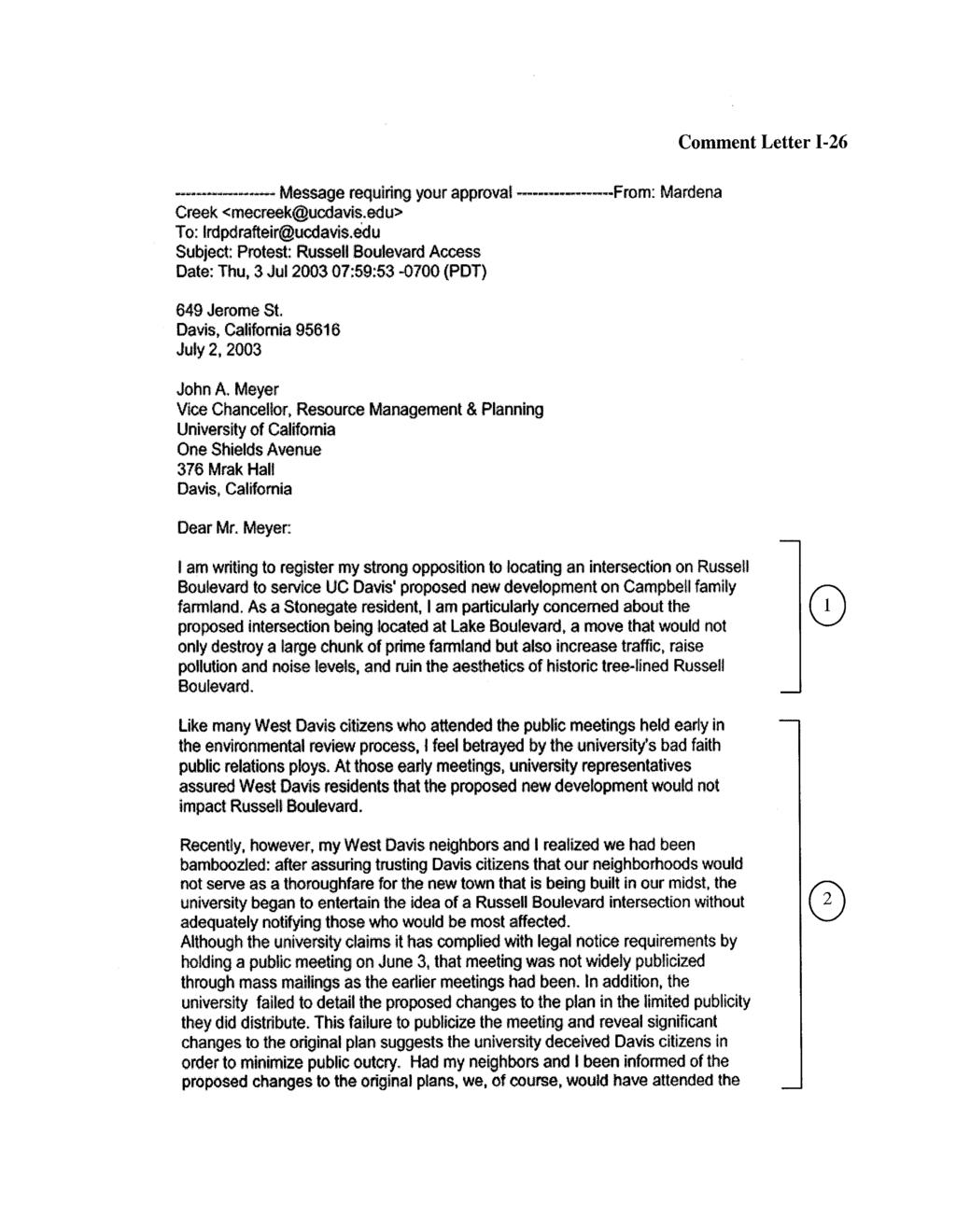
6 4.0 RESPONSE TO COMMENTS Response to Comment Letter I-26 Response to Comment I See Master Response Transportation 1. Response to Comment I Refer to response to comment ORG-7-2b Long Range Development Plan Final EIR Volume 5 formatted.doc\14-oct-03\oak
7
8 4.0 RESPONSE TO COMMENTS Response to Comment Letter I-27 Response to Comment I See Master Response Transportation Long Range Development Plan Final EIR Volume 5 formatted.doc\14-oct-03\oak
9
10 4.0 RESPONSE TO COMMENTS Response to Comment Letter I-28 Response to Comment I The proposed phasing of construction of each housing type in the NMP is detailed in Volume III, Table 2.3 of the Draft EIR. Exact details of providing disabled access housing units are not known at this time. However, planning for campus housing includes compliance with provisions of the Americans with Disabilities Act (ADA requirements) Long Range Development Plan Final EIR Volume 5 formatted.doc\14-oct-03\oak
11
12 4.0 RESPONSE TO COMMENTS Response to Comment Letter I-29 Response to Comment I Refer to response to comment ORG Response to Comment I See Master Response Transportation Long Range Development Plan Final EIR Volume 5 formatted.doc\14-oct-03\oak
13
14 4.0 RESPONSE TO COMMENTS Response to Comment Letter I-30 Response to Comment I See Master Response Transportation Long Range Development Plan Final EIR Volume 5 formatted.doc\14-oct-03\oak
15
16 4.0 RESPONSE TO COMMENTS Response to Comment Letter I-31 Response to Comment I See Master Response Transportation Long Range Development Plan Final EIR Volume 5 formatted.doc\14-oct-03\oak
17
18 4.0 RESPONSE TO COMMENTS Response to Comment Letter I-32 Response to Comment I Please see Master Response CEQA Process Long Range Development Plan Final EIR Volume 5 formatted.doc\14-oct-03\oak
19
20
21
22 4.0 RESPONSE TO COMMENTS Response to Comment Letter I-33 Response to Comment I Refer to response to comment ORG-7-2b. Response to Comment I Refer to Master Response CEQA Process 1 and Master Response Transportation 1. Response to Comment I See Master Response Land Use 1. Response to Comment I See Master Response Alternative Long Range Development Plan Final EIR Volume 5 formatted.doc\14-oct-03\oak
23
24
25 4.0 RESPONSE TO COMMENTS Response to Comment Letter I-34 Response to Comment I Refer to response to comment ORG-7-7b. Response to Comment I See Master Response Transportation 1. Response to Comment I See Master Response Land Use 1. Response to Comment I See Master Response Alternative Long Range Development Plan Final EIR Volume 5 formatted.doc\14-oct-03\oak
26 Comment Letter I-35 1
27 4.0 RESPONSE TO COMMENTS Response to Comment Letter I-35 Response to Comment I See Master Response CEQA Process Long Range Development Plan Final EIR Volume 5 formatted.doc\14-oct-03\oak
28
29
30 4.0 RESPONSE TO COMMENTS Response to Comment Letter I-36 Response to Comment I See Master Response Transportation Long Range Development Plan Final EIR Volume 5 formatted.doc\14-oct-03\oak
31
32
33 4.0 RESPONSE TO COMMENTS Response to Comment Letter I-37 Response to Comment I Campus planners have spent the last 2 years examining the land needs of the campus in detail and developing the proposed 2003 LRDP. Based on the space needs of existing and envisioned teaching and research programs, campus planners have proposed that land on the central campus is best used by devoting it to uses benefiting the largest number of students, staff and faculty. They have also proposed that uses that are land intensive and/or do not require locations adjacent to the main teaching and administrative facilities must be moved to the west or south campus, and in the case of certain agricultural research programs, such as the dairy program, to Russell Ranch so as to allow necessary teaching and research building space to be located on the central campus. The underlying planning principle is to keep most of the campus facilities within easy walking distance so that minimal time and effort is expended in going from one campus building to another for classes and research. Relocation of the dairy and some of the other agricultural facilities to Russell Ranch would generate some vehicle trips between the main campus and Russell Ranch, for the campus as a whole, the proposed land use plan would produce fewer vehicle trips and associated time, fuel and other costs. With respect to the commenter s concern regarding the development of the NMP on prime farmland acquired from the Campbell Ranch, please see Master Response Land Use 3 regarding eminent domain. Response to Comment I As noted in Section of the 2003 LRDP EIR, Volume I, archaeological sites have been found in a zone of cultural sensitivity along Putah Creek. These sites have been subjected to archaeological testing programs and/or construction monitoring as appropriate. To date no archaeological sites have been found west of SR 113 within the area of analysis for the LRDP EIR. The designated zone of cultural sensitivity on the campus recognizes both known archaeological sites and the potential for additional undiscovered archaeological sites on campus. Response to Comment I Please see Master Response Hazards 2. Response to Comment I Refer to response to comment ORG The proposed stadium would be served by Unitrans and Yolobus. Unitrans would serve visitors from the City of Davis and Yolobus would provide service to Sacramento, West Sacramento, Woodland, Winters, Dixon, Vacaville, and Fairfield. A transit stop is located along Hutchison Drive adjacent to the proposed stadium site. The Multi-Use Stadium is anticipated to generate approximately 8,600 total vehicle-trips during a Saturday home football game. This includes vehicles traveling to and from the stadium including spectators, teams, staff, and vendors. The traffic generated by a Saturday football game would result in unacceptable traffic operations for intersections in the vicinity of the Multi-Use Stadium, such as the Russell Boulevard/La Rue Road/Anderson Road intersection during the peak travel hour before and after the game. To mitigate the traffic impact, UC Davis will implement a Traffic Control Plan for all higher-attendance events, such as football games. To ensure LOS F operations only occurred during the one hour before and one hour after the event, UC Davis will monitor traffic operations during events and adjust the Traffic Control Plan as needed. Traffic effects from the proposed Research Park and other regional growth were adequately considered in the 2003 LRDP EIR Long Range Development Plan Final EIR Volume 5 formatted.doc\14-oct-03\oak
34 Volume V Response to Comment I See response to comment LA In addition, the Constitution grants to The Regents the full powers and organization of state-level government. Thus, it specifically provides that the University shall not be subject to local government control. The commenter expressed concerns that the RPMP development on campus would contribute to a growth boom in northeast Solano County, which would result in air quality, agricultural and traffic impacts. The potential impacts of the RPMP on air quality and traffic were analyzed in Volume III of the EIR (Sections and ) and found to be less than significant with mitigation, with the exception of criteria pollutants emitted during construction. While these emissions would be a significant and unavoidable air quality impact, the impact would be short term. The proposed RPMP would convert 27 acres of prime farmland to developed uses, which is acknowledged in the EIR to be a significant and unavoidable impact. The 2003 LRDP, including the RPMP, is anticipated to be growth inducing with respect to local and regional population and the related demands for housing and services. As acknowledged in the EIR, by virtue of inducing regional growth, the campus would contribute to the environmental effects of that growth. The EIR (Volume II, Section 6.2.2) also acknowledges the magnet effect and incubator effect of campus growth upon surrounding businesses. The RPMP is an element of the LRDP that provides for the magnet effects of campus growth by designating land for these uses. The impacts of development of the RPMP are analyzed in Volume III of the EIR. See also Master Response Land Use 2 and response to comment LA Response to Comment I See response to comment LA In addition, the Constitution grants to The Regents the full powers and organization of state-level government. Thus, it specifically provides that the University shall not be subject to local government control. The commenter expressed concerns that the RPMP development on campus would contribute to a growth boom in northeast Solano County, which would result in air quality, agricultural and traffic impacts. The potential impacts of the RPMP on air quality and traffic were analyzed in Volume III of the EIR (Sections and ) and found to be less than significant with mitigation, with the exception of criteria pollutants emitted during construction. While these emissions would be a significant and unavoidable air quality impact, the impact would be short term. The proposed RPMP would convert 27 acres of prime farmland to developed uses, which is acknowledged in the EIR to be a significant and unavoidable impact. The 2003 LRDP, including the RPMP, is anticipated to be growth inducing with respect to local and regional population and the related demands for housing and services. As acknowledged in the EIR, by virtue of inducing regional growth, the campus would contribute to the environmental effects of that growth. The EIR (Volume II, Section 6.2.2) also acknowledges the magnet effect and incubator effect of campus growth upon surrounding businesses. The RPMP is an element of the LRDP that provides for the magnet effects of campus growth by designating land for these uses. The impacts of development of the RPMP are analyzed in Volume III of the EIR. See also Master Response Land Use 2 and response to comment LA Volume 5 formatted.doc\14-oct-03\oak University of California, Davis
35
36
37
38 Volume V Response to Comment Letter I-38 Response to Comment I Please see response to comment I Response to Comment I Section of the 2003 LRDP EIR, Volume I, sets forth steps to be taken to address potential impacts and mitigation measures for significant archaeological resources on a programmatic level. Also see response to comment I The RMI project area has already been subjected to archaeological investigations, and archaeological resources have been identified on the project site and vicinity. The analysis of the environmental effects of the RMI project (Volume III, Section 5.4.5) includes specific archaeological mitigation measures for that project. Response to Comment I Please see Master Response Hazards 2. Response to Comment I Refer to response to comment I Response to Comment See response to comment LA In addition, the Constitution grants to The Regents the full powers and organization of state-level government. Thus, it specifically provides that the University shall not be subject to local government control. The commenter expressed concerns that the RPMP development on campus would contribute to a growth boom in northeast Solano County, which would result in air quality, agricultural and traffic impacts. The potential impacts of the RPMP on air quality and traffic were analyzed in Volume III of the EIR (Sections and ) and found to be less than significant with mitigation, with the exception of criteria pollutants emitted during construction. While these emissions would be a significant and unavoidable air quality impact, the impact would be short term. The proposed RPMP would convert 27 acres of prime farmland to developed uses, which is acknowledged in the EIR to be a significant and unavoidable impact. The 2003 LRDP, including the RPMP, is anticipated to be growth inducing with respect to local and regional population and the related demands for housing and services. As acknowledged in the EIR, by virtue of inducing regional growth, the campus would contribute to the environmental effects of that growth. The EIR (Volume II, Section 6.2.2) also acknowledges the magnet effect and incubator effect of campus growth upon surrounding businesses. The RPMP is an element of the LRDP that provides for the magnet effects of campus growth by designating land for these uses. The impacts of development of the RPMP are analyzed in Volume III of the EIR. See also Master Response Land Use 2 and response to comment LA Response to Comment I The commenter states that campus is becoming too urban, developed and crowded, and that this is affecting the ability to attract students, particularly Native Americans and those from rural backgrounds. This comment is noted. Volume 5 formatted.doc\14-oct-03\oak University of California, Davis
39
40 Volume V Response to Comment Letter I-39 Response to Comment I Comment noted. Response to Comment I Please see Master Response Hazards 2. Volume 5 formatted.doc\14-oct-03\oak University of California, Davis
41
42 Volume V Response to Comment Letter I-40 Response to Comment I Refer to Master Response Biological Resources 2 regarding the adequacy of mitigation for loss of Swainson s hawk habitat. Volume 5 formatted.doc\14-oct-03\oak University of California, Davis
43
44 Volume V Response to Comment Letter I-41 Response to Comment I See Master Response Transportation 1. Volume 5 formatted.doc\14-oct-03\oak University of California, Davis
45
46 Volume V Response to Comment Letter I-42 Response to Comment I Comment noted. As explained in Volume III, Section 2.2.3, the University would manage the long-term affordability of faculty and staff housing through the use of long-term ground leases and resale controls on for-sale housing. Volume 5 formatted.doc\14-oct-03\oak University of California, Davis
47
48 Volume V Response to Comment Letter I-43 Response to Comment I See Master Response Transportation 1. Response to Comment I Please see Master Response Agriculture 1. The Draft EIR acknowledges that the loss of prime farmland from the development of the NMP would, even with mitigation, be a significant and unavoidable impact. It should be noted though that if the housing provided in the NMP were not to be developed on the campus, and the same number of housing units were to be developed in the regional communities including the City of Davis, the amount of prime farmland that would be developed would likely be much greater than the affected acreage within the NMP. This is because the proposed density of residential development in the NMP is greater than the densities typically permitted in the regional communities. Response to Comment I Please see Master Responses Alternative 1, Alternative 4, and Alternative 6. Volume 5 formatted.doc\14-oct-03\oak University of California, Davis
49
50 Volume V Response to Comment Letter I-44 Response to Comment I See Master Response Transportation 1. Volume 5 formatted.doc\14-oct-03\oak University of California, Davis
51
52 Volume V Response to Comment Letter I-45 Response to Comment I See Master Response Transportation 1. Volume 5 formatted.doc\14-oct-03\oak University of California, Davis
53
54
55 Volume V Response to Comment Letter I-46 Response to Comment I See Master Response Transportation 1. Response to Comment I Please refer to Master Response Recreation 1. Volume 5 formatted.doc\14-oct-03\oak University of California, Davis
56
57 Volume V Response to Comment Letter I-47 Response to Comment I See Master Response Transportation 1. Volume 5 formatted.doc\14-oct-03\oak University of California, Davis

58
59 Volume V Response to Comment Letter I-48 Response to Comment I The campus appreciates the comment, and notes that the concern does not raise an environmental impact under CEQA. Agricultural research activities currently located on the NMP site would be relocated to prime farmland areas currently used for forage production on campus, and forage production on campus would either be moved off-site or would be reduced (with forage for livestock programs supplied commercially). This would help maintain the total amount of land used for agricultural research on campus, and the campus agricultural research programs would not be adversely affected. Please note that the facilities at the Heidrick Western Center for Agricultural Equipment are included in the NMP site plan and will be maintained in its current use. Use of undeveloped land by programs at the Center will be relocated to adjacent lands to the southwest. Response to Comment I Please see Master Response Alternative 1 and 4. Volume 5 formatted.doc\14-oct-03\oak University of California, Davis
60
61 Volume V Response to Comment Letter I-49 Response to Comment I See Master Response Transportation 1. Response to Comment I Refer to response to comment ORG-7-2b. Volume 5 formatted.doc\14-oct-03\oak University of California, Davis
62
63
64 Volume V Response to Comment Letter I-50 Response to Comment I See Master Response Transportation 1 and Master Response CEQA Process 1. Volume 5 formatted.doc\14-oct-03\oak University of California, Davis
65
66 Volume V Response to Comment Letter I-51 Response to Comment I The R4 recycling program is discussed on page of Volume II of the Draft EIR. As stated on page , UC Davis would continue its recycling programs in accordance with the spirit and intent of the 1989 Integrated Waste Management Act (AB 939). For a discussion of the University s sustainable design policy, please refer to the 2003 LRDP EIR, Volume I, Section 3.11, which has been revised and expanded in the Final EIR to better explain the policy. Sustainable design features of the NMP are described on pages 2-36 and 2-37 of Volume III of the Draft EIR. Volume 5 formatted.doc\14-oct-03\oak University of California, Davis
67
68 Volume V Response to Comment Letter I-52 Response to Comment I Please see Master Response CEQA Process 1 and Master Response Transportation 1. Volume 5 formatted.doc\14-oct-03\oak University of California, Davis
69
70 Volume V Response to Comment Letter I-53 Response to Comment I See Master Response Transportation 1. Volume 5 formatted.doc\14-oct-03\oak University of California, Davis
71
72
73 Volume V Response to Comment Letter I-54 Response to Comment I See Master Response Transportation 1. Volume 5 formatted.doc\14-oct-03\oak University of California, Davis
74
75
76
77
78
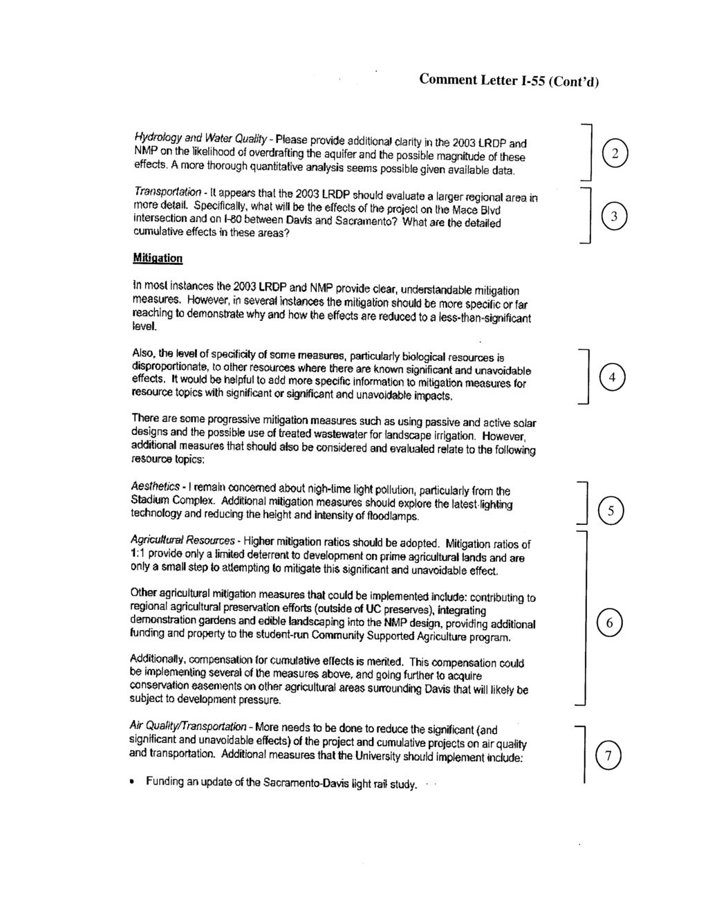
79 Volume V Response to Comment Letter I-55 Response to Comment I Please see Master Response Hazards 2. Response to Comment I As discussed in Section 4.8 (Hydrology and Water Quality) of Volume II of the Draft EIR, annual campus demand for water from the deep aquifer could increase from approximately 2,671 acre-feet per year (ac-ft/yr) in 2001 to approximately 5,301 ac-ft/yr through (including 424 ac-ft/yr projected for the NMP). This projected increase of approximately 2,620 ac-ft/yr conservatively overestimates water demand because it does not account for increased water conservation efforts or for the potential future use of alternate water sources that could also occur under the 2003 LRDP. While water demand can be projected through , the effects of increased demand on the volume of the deep aquifer are currently not well understood. The results of a recent hydrogeologic examination (discussed further in Section of Volume II) formed a conceptualization of the deep aquifer resources in the area. However, future groundwater characterization efforts (such as groundwater modeling and interpretation of hydrologic data) ultimately will help determine the ability of the deep aquifer to provide for long-term water needs. Consistent with LRDP Mitigation 4.8-5(b), the campus will continue to study the long-term production and quality trends of the deep aquifer. In compliance with LRDP Mitigation 4.8-5(d), if continued hydrogeologic monitoring and evaluation efforts identify constraints in the deep aquifer s ability to provide for the campus long-term water needs, the campus will use alternate water sources, such as treated shallow/intermediate aquifer water and/or surface water from the Solano Project. Response to Comment I To address the comments received on the Draft EIR, the locations listed below were analyzed under existing conditions and in Year 2015 with and without the implementation of the 2003 LRDP. The results are summarized below. 1. Chiles Road/I-80 Eastbound Off-Ramp 2. Chiles Road/Mace Boulevard 3. Chiles Road/I-80 Westbound Ramps 4. I-80 (Richards Boulevard to Mace Boulevard) 5. I-80 (East of Mace Boulevard) The intersections Chiles Road with Mace Boulevard and the I-80 off-ramp were found to operate acceptably based on City standards (i.e., LOS E or better) during the AM and PM peak hours under existing, 2015, and 2015 with 2003 LRDP conditions. The segments of I-80 listed below would operate at LOS F (i.e., unacceptably) in 2015 with the implementation of the 2003 LRDP. I-80 between Richards Boulevard and Mace Boulevard would degrade from LOS E to LOS F in the westbound direction during the PM peak hour. I-80 east of Mace Boulevard would continue to operate at LOS F in the eastbound direction during the AM and PM peak hours. I-80 east of Mace Boulevard would degrade from LOS E to LOS F in the westbound direction during the AM peak hour and would continue to operate at LOS F during the PM peak hour. Volume 5 formatted.doc\14-oct-03\oak University of California, Davis
80 4.0 RESPONSE TO COMMENTS The unacceptable traffic operations on I-80 with the implementation of the 2003 LRDP would fall under LRDP Impact This impact states that Implementation of the 2003 LRDP would cause unacceptable intersection and freeway LOS operations at off-campus facilities with and without the NMP connection to Russell Boulevard including facilities contained in the Yolo County and Solano County Congestions Management Plans and was identified as a significant and unavoidable impact in the Draft 2003 LRDP EIR. The text of the 2003 LRDP EIR has been revised to incorporate this revision. The Interstate 80 Transportation Concept Report (Caltrans District 3, January 2001) identifies I- 80 as currently operating at LOS E from the Solano/Yolo County line to Sacramento County and states that the LOS is expected to decline to LOS F by According to the concept report, the following improvements would provide LOS E operations in 2020: (1) construct HOV lanes (one in each direction); (2) increase Yolo County bus service; (3) increase Yolo bus service; (4) implement Smart Corridor Technology; and (5) implement Traffic Operation Systems such as ramp metering and changeable message signs. To determine if the improvements identified by Caltrans would provide acceptable operations in 2015 with the implementation of the 2003 LRDP, I-80 was re-analyzed with the addition of one HOV lane in each direction. Fehr & Peers collected traffic counts along I-80 in Solano County in March 2001 to determine the number of high occupancy vehicles (i.e., two or more persons) currently traveling on I-80. The percentage of HOVs ranged between 13 to 21 percent during the AM peak hour and 24 to 30 percent during the PM peak hour. Therefore, the HOV lanes on I-80 in the vicinity of Richards Boulevard and Mace Boulevard were assumed to serve 15 percent of vehicles traveling on I-80 during the peak hours. Although 15 percent is likely a low estimate for 2015 conditions, this level of utilization for the HOV lanes would improve peak hour operations to LOS E or better in 2015 with the implementation of the 2003 LRDP. Construction of this improvement has not been assumed in this EIR. Response to Comment I The Mitigation Monitoring Programs for the 2003 LRDP (Volume I) and the NMP (Volume III) provide additional details about how implementation of mitigation measures will be verified. Sustainability (including in building design and in campus operations) is discussed in Section 3, Volume I and in Section 2.3, Volume III. Response to Comment I Please refer to Master Response Aesthetics 2. Response to Comment I Please see Master Response Agricultural Resources 1, which explains how the University s mitigation program in conjunction with the ongoing contributions that the campus is making to the state s agricultural economy, is an appropriate response to the loss of prime agricultural lands, however, because this impact cannot be completely mitigated, the impact remains significant and unavoidable. Response to Comment I Refer to response to comment LA Response to Comment I Refer to response to comment LA-1-3. Response to Comment I The commenter notes that some mitigation measures require actions to be performed to the extent feasible or as feasible, and requests that the constraints on this feasibility should be specified so the effectiveness of the mitigation can be assessed. The potential constraints on the implementation of mitigation measures are discussed in the text following each mitigation, and typically are related to fiscal factors. The University recognizes that some mitigations may not be feasible in every instance. For that reason, in cases where this 2003 Long Range Development Plan Final EIR Volume 5 formatted.doc\14-oct-03\oak
81 Volume V term is used, additional mitigation measures are imposed and/or it is concluded that the impact will remain significant and unavoidable after mitigation. The term fair share is accurately defined on page of the Draft EIR. It should be noted that because of the City of Marina versus California State University lawsuit that is currently on appeal to the California Supreme Court, there is uncertainty regarding whether the University can in fact make fair share contributions for certain improvements that are not within the jurisdiction of the University. Therefore, this fair share measure may be modified in response to the ultimate decision in that case. Text to this effect has been added to page of the Final EIR. Response to Comment I The commenter asks why the larger alternative to the NMP was not assessed in detail. As discussed in section 2.5 of Volume III of the Draft EIR, although the Full Neighborhood Alternative appears to accomplish most of the NMP s objectives, it was rejected for three primary reasons. First, input from public workshops indicated a strong preference from people in established neighborhoods in West Davis for the campus to proceed with a smaller-scale neighborhood. Second, the amount of agricultural activity displaced by the Full Neighborhood alternative could not be adequately relocated to the remaining inventory of lands on the west campus. Third, the amount of development in the alternative probably could not be built out in the planning horizon of the 2003 LRDP, based on faculty/staff housing development rates experienced at other UC campuses. Please see Master Responses Alternative 1 and Alternative 4 in response to comments about the Central Campus Infill alternative to the NMP. The commenter also expresses concern about using the following as reasons to eliminate the North-South Orientation Alternative: proximity of the Environmental Service Facility, impacts on existing land uses, and previous site uses. Master Response Alternative 6 (North-South Alternative) discusses the limitations of the North/South Orientation Alternative, including proximity to the Environmental Services Facility and impacts associated with existing land uses. The Draft EIR does not identify previous use of the site as a drawback of the alternative. The commenter further requests additional quantitative information for trip reductions and intersection effects along SR 113 associated with the North-South Orientation Alternative. The North-South Orientation Alternative would accommodate the same number of residents as the proposed NMP, and like the NMP, primary peak hour vehicular use associated with the proposed development would be non-campus related trips that, like the proposed NMP, would exit the neighborhood via Hutchison Drive. Therefore, the Draft EIR identifies that the alternative would have traffic impacts similar to the proposed NMP. A detailed traffic intersection analysis was not performed, consistent with direction for evaluation of alternatives provided in the CEQA Guidelines (Section ). Response to Comment I The commenter asks whether the EIR includes mitigation for growth inducing effects and suggests that, if not, this mitigation should be provided. The potential for the 2003 LRDP to induce growth in the region is discussed in Section 6.0, Volume II of the Draft EIR. As explained in that section, the LRDP is considered growth inducing as it would bring new jobs and residential population to the campus and into nearby communities within easy commuting distance of the campus. The potential environmental impacts of this growth are analyzed in the Draft EIR and where significant impacts are indicated, Volume 5 formatted.doc\14-oct-03\oak University of California, Davis
82 4.0 RESPONSE TO COMMENTS mitigation measures are identified. For instance, environmental impacts of the new residential population on the campus (persons who would live in the proposed neighborhood) are analyzed in Volume III and a number of mitigation measures are identified for NMP impacts. Similarly, impacts of the new traffic generated by this campus-related population are analyzed in Section 4.14, and mitigation measures are provided. Sections 4.13, 4.12, and 4.15 of the EIR analyze the increased demand for services and utilities in the communities of Davis, Dixon, Woodland, and Winters as a result of LRDP-related growth in conjunction with cumulative growth. The University has committed to negotiate to determine its fair share (as defined in Section of the Draft EIR) for mitigation of significant environmental impacts associated with the construction of new infrastructure and facilities to meet this increased demand (see 2003 LRDP Impacts , , , , and associated mitigation measures). However, due to the nature of associated potential environmental impacts (including the irreversible loss of agricultural land and habitat), the impacts would remain significant and unavoidable. The Draft EIR notes that apart from the growth that is directly attributable to the LRDP, there would also be some indirect and induced growth related to the economic stimulus provided by the campus jobs and spending by the campus under the 2003 LRDP. Most of this growth would be expected to occur in the City of Davis. Adequate vacant or underutilized land is identified in the City s General Plan (and evaluated for impacts in the General Plan EIR) to handle this indirect and induced growth. Response to Comment I Significant and unavoidable impacts are those for which there is no practicable or feasible mitigation that will reduce the impact to a less-than-significant level. Impacts are concluded to be significant and unavoidable when the project cannot be conducted without resulting in the impact, all mitigation measures that may reduce the significance of the impact have been applied, and the impact still has not been reduced to a less-than-significant level. These characteristically are impacts that can only be avoided or reduced to less-thansignificant levels by not carrying out the proposed project, or by modifying the project to such an extent that its goals and objectives cannot be met. In some cases, an impact is determined to be significant and unavoidable because the impact can only be mitigated by or with the consent of outside parties, and it is beyond the authority of the University to enforce the mitigation. The commenter does not identify any specific significant and unavoidable effects for additional review, nor are further potentially feasible mitigations suggested for evaluation. The University believes it has evaluated all feasible mitigations and proposes adopting such measures Long Range Development Plan Final EIR Volume 5 formatted.doc\14-oct-03\oak
Responses to Comments Received on the Notice of Preparation
 Received on the Notice of Preparation APPENDIX A RESPONSES TO COMMENTS RECEIVED ON THE NOTICE OF PREPARATION The Notice of Preparation and Draft Initial Study for the proposed 2003 LRDP were circulated
TABLE OF CONTENTS. Tables Table UC Davis Park and Open Space Resources
 TABLE OF CONTENTS 4.13 Recreation... 4.13-1 4.13.1 Environmental Setting... 4.13-1 4.13.2 Impacts and Mitigation Measures... 4.13-4 4.13.3 References... 4.13-8 Tables Table 4.13-1 UC Davis Park and Open
MATHEMATICAL SCIENCES BUILDING
 Final Focused Tiered Environmental Impact Report State Clearinghouse No. 2002072048 Prepared By: OFFICE OF RESOURCE MANAGEMENT AND PLANNING University of California One Shields Avenue 376 Mrak Hall Davis,
3.11 LAND USE AND PLANNING
 3.11 LAND USE AND PLANNING This section evaluates the potential environmental impacts that could result from conflicts with land use plans and policies from buildout of the 2018 LRDP. A description of
Prepared by: Casey Kempenaar, Senior Planner
 CITY OF CITRUS HEIGHTS PLANNING DIVISION STAFF REPORT PLANNING COMMISSION MEETING September 13, 2017 Prepared by: Casey Kempenaar, Senior Planner REQUEST The applicant requests a Design Review Permit Modification
Notice of Preparation and Notice of Public Scoping Meeting. At Dublin Project
 Notice of Preparation and Notice of Public Scoping Meeting Date January 17, 2018 To Project Title Project Application Number Project Location Project Applicant Contact For questions or submitting comments.
3.10 LAND USE SETTING PROJECT SITE EXISTING LAND USE DESIGNATIONS AND ZONING. General Plan Land Use Designations.
 This section of the Draft EIR addresses the existing land uses on and adjacent to the project site and discusses the potential impacts of the proposed project on existing land uses. Key issues addressed
There are no federal programs or policies addressing visual resources that pertain to the 2018 LRDP.
 3.1 AESTHETICS This section describes the existing visual characteristics of the plan area and evaluates the potential of the 2018 LRDP to result in substantial adverse visual impacts. The visual impact
COMMUNITY DEVELOPMENT SERVICES PLANNING AND BUILDING DEPARTMENT PLACERVILLE OFFICE:
 COMMUNITY DEVELOPMENT SERVICES PLANNING AND BUILDING DEPARTMENT http://www.edcgov.us/devservices/ PLACERVILLE OFFICE: LAKE TAHOE OFFICE: 2850 Fair Lane Court, Placerville, CA 95667 924 B Emerald Bay Rd.
Goal 1: To Encourage the Orderly, Harmonious and Judicious Use of University Resources in the Development of University Land.
 2.0 Future Land Use Goal 1: To Encourage the Orderly, Harmonious and Judicious Use of University Resources in the Development of University Land. Objective 1.1: Make available future building sites that
2019 Hillcrest Campus LRDP EIR Scoping Meeting
 2019 Hillcrest Campus LRDP EIR Scoping Meeting March 21, 2018 Agenda Scoping Meeting Purpose Hillcrest Campus Context What Is The Long Range Development Plan (LRDP)? Why A New Plan? Key LRDP Components
LOS ANGELES MISSION COLLEGE MASTER PLAN Master Plan DESIGN & DEVELOPMENT PRINCIPLES
 LOS ANGELES MISSION COLLEGE MASTER PLAN DESIGN & DEVELOPMENT PRINCIPLES 34 Quality Learning Along the Arroyo PROGRAM SUMMARY BY PROJECT The following are program summaries for each of the projects planned
Appendix G Response to Comments
 Appendix G Response to Comments This appendix contains the comments received during the public circulation and comment period (May 27, 2008 to July 11, 2008). The comments have been numbered (Comment Set
SAN FRANCISCO PLANNING DEPARTMENT
 PLANNING DEPARTMENT Certificate of Determination EXEMPTION FROM ENVIRONMENTAL REVIEW Case No.: Project Address: Zoning: UMU (Urban Mixed Use) Zoning District 68-X Height and Bulk District Life Science
EXECUTIVE SUMMARY. Introduction
 EXECUTIVE SUMMARY Introduction State Route 68 is a designated scenic route that connects the world-renowned Monterey Peninsula to US Highway 101 and the Salinas Valley. SR 68 is a key route for bicycle,
ARLINGTON COUNTY, VIRGINIA. County Board Agenda Item Meeting of January 28, 2017 SUPPLEMENTAL REPORT-2
 ARLINGTON COUNTY, VIRGINIA County Board Agenda Item Meeting of January 28, 2017 SUPPLEMENTAL REPORT-2 DATE: January 27, 2017 SUBJECT: The Virginia Department of Transportation s Transform I-66 Inside the
NOTICE OF PREPARATION
 NOTICE OF PREPARATION DATE: January 6, 2016 TO: LEAD AGENCY: Responsible Agencies, Organizations, and Interested Parties Contact: Tyler Barrington, Principal Planner Planning Department Community Development
NOTICE OF PREPARATION OF AN ENVIRONMENTAL IMPACT REPORT AND SCOPING MEETING FOR THE WEST BROADWAY SPECIFIC PLAN COMMENT PERIOD
 DATE: July 11, 2018 TO: FROM: RE: Interested Persons Tom Buford, Principal Planner Community Development Department NOTICE OF PREPARATION OF AN ENVIRONMENTAL IMPACT REPORT AND SCOPING MEETING FOR THE WEST
ARLINGTON COUNTY, VIRGINIA. County Board Agenda Item Meeting of January 28, 2017 SUPPLEMENTAL REPORT
 ARLINGTON COUNTY, VIRGINIA County Board Agenda Item Meeting of January 28, 2017 SUPPLEMENTAL REPORT DATE: January 26, 2017 SUBJECT: The Virginia Department of Transportation s Transform I-66 Inside the
Chapter Master Planned Communities (MPC) District
 District") Sections 14.53.010 Purpose and Intent 14.53.020 Applicability 14.53.030 Procedure 14.53.040 MPC Standards 14.53.050 Required Findings 14.53.010 Purpose and Intent Chapter 14.53 Master Planned Communities
Sections 14.53.010 Purpose and Intent 14.53.020 Applicability 14.53.030 Procedure 14.53.040 MPC Standards 14.53.050 Required Findings 14.53.010 Purpose and Intent Chapter 14.53 Master Planned Communities
NOTICE OF PREPARATION
 NOTICE OF PREPARATION To: All Interested Parties Subject: Notice of Preparation of an Environmental Impact Report From: City of Petaluma Address: 11 English Street, Petaluma, CA 94952-2610 Contact: Heather
GENERAL PLAN CONSISTENCY ANALYSIS
 GENERAL PLAN CONSISTENCY ANALYSIS Prepared by Planning Staff 10/28/2013 APPLICABLE GOALS, POLICIES AND PROGRAMS FROM the LAND USE CHAPTER Goal LU-1 Policy LU-1.1 Policy LU-1.2 Goal LU-2 Protect the character
DRAFT MAP AMENDMENT FLU 04-4
 DRAFT MAP AMENDMENT FLU 04-4 SW 24 TH AVENUE ROADWAY CORRIDOR The University of Florida participates with the Metropolitan Transportation Planning Organization (MTPO) in its responsibilities for the continuing,
Venice Pumping Plant Dual Force Main Project Draft EIR
 City of Los Angeles 5.9 LAND USE PLANS 5.9.1 Environmental Setting Venice Pumping Plant Dual Force Main Project Draft EIR The Project lies within the bounds of Los Angeles County and the City of Los Angeles.
UAA School of Engineering Parking Garage Master Plan Amendment. 1. Purpose
 UAA School of Engineering Parking Garage Master Plan Amendment 1. Purpose Since the UAA campus master plan was drafted in 2003, adopted in 2004, and amended in 2009 a number of significant changes regarding
DISCUSSION ON VACAVILLE S2 INVESTORS PROPERTY IN URBAN RESERVE
 Agenda Item No. 9C April 25, 2017 TO: FROM: SUBJECT: Honorable Mayor and City Council Attention: Jeremy Craig, Interim City Manager Barton Brierley, AICP, Community Development Director (Staff Contact:
Department of Community Development. Planning and Environmental Review Division Revised Notice of Preparation
 Department of Community Development Michael J. Penrose, Acting Director Divisions Building Permits & Inspection Code Enforcement County Engineering Economic Development & Marketing Planning & Environmental
include playgrounds, sports fields, community gardens and picnic areas.
 DEVELOPMENT PLAN OPEN SPACE SYSTEM OPEN SPACE SYSTEM The neighborhood provides for a range of open space types. The Village Square is an important open space in the neighborhood. It serves as a gathering
NOTICE OF PREPARATION OF AN ENVIRONMENTAL IMPACT REPORT AND SCOPING MEETING FOR THE LAND PARK COMMERCIAL CENTER PROJECT
 NOTICE OF PREPARATION OF AN ENVIRONMENTAL IMPACT REPORT AND SCOPING MEETING FOR THE LAND PARK COMMERCIAL CENTER PROJECT PUBLIC COMMENT PERIOD November 12, 2015 to December 14, 2015 INTRODUCTION The City
NOTICE OF PREPARATION
 Date: June 30, 2017 CITY OF CITRUS HEIGHTS COMMUNITY & ECONOMIC DEVELOPMENT DEPARTMENT, PLANNING DIVISION 6360 Fountain Square Drive, Citrus Heights, CA 95621 (916) 727-4740 NOTICE OF PREPARATION To: Subject:
4.8 LAND USE AND PLANNING
 4.8 LAND USE AND PLANNING 4.8.1 INTRODUCTION This section describes existing and planned land uses at the Hayward campus and analyzes the impact of implementation of the proposed Master Plan on land uses
REPORT TO PLANNING COMMISSION
 CITY OF Meeting Date: October 25, 2011 Agenda Item: Community Development Department Planning Division P. O. Box 151560, San Rafael, CA 94915-1560 PHONE: (415) 485-3085/FAX: (415) 485-3184 Case Numbers:
CITY OF VACAVILLE PLANNING COMMISSION Agenda Item No. G.1 STAFF REPORT February 21, 2012 BRIGHTON LANDING SPECIFIC PLAN & DEVELOPMENT PROJECT
 CITY OF VACAVILLE PLANNING COMMISSION Agenda Item No. G.1 STAFF REPORT February 21, 2012 Staff Contact: Fred Buderi (707) 449-5307 TITLE: PURPOSE: BRIGHTON LANDING SPECIFIC PLAN & DEVELOPMENT PROJECT INFORMATIONAL
Right-of-Way Acquisitions and Relocations Technical Memorandum
 Right-of-Way Acquisitions and Relocations Technical Memorandum Southeast Extension Project Lincoln Station to RidgeGate Parkway Prepared for: Federal Transit Administration Prepared by: Denver Regional
Alaskan Way, Promenade, and Overlook Walk Final EIS Appendix D - Supplemental Draft EIS Comments and Responses October 2016.
 B-001-001 The use of Columbia Street for two-way transit was a decision made by King County Metro as part of its Southwest Transit Pathway evaluation. This project is separate from AWPOW. B-001-002 Modeling
SAN FRANCISCO PLANNING DEPARTMENT ,~} DCfav~ 7_ ~/s' 1s5oM~ss~o~s~. Suite 400 San Francisco, CA
 ~~~~0 COUNlpom u 'Z x ~~ lb3s 0 61 v,~} SAN FRANCISCO PLANNING DEPARTMENT Certificate of Determination EXEMPTION FROM ENVIRONMENTAL REVIEW 1s5oM~ss~o~s~. Suite 400 San Francisco, CA 94103-2479 Case No.:
New Student Housing Draft EIR Public Meeting
 New Student Housing Draft EIR Public Meeting May 8, 2017 Meeting Overview Purpose of Meeting Sophomore Success Project Objectives Alternatives Project Site/Design Overview Biological Resource Impacts/Mitigation
California Environmental Quality Act (CEQA) Environmental Review Process
 Environmental Review Process") California Environmental Quality Act (CEQA) Environmental Review Process Los Angeles Union Station Forecourt and Esplanade Improvements constitute a Project Los Angeles County Metropolitan Transportation
California Environmental Quality Act (CEQA) Environmental Review Process Los Angeles Union Station Forecourt and Esplanade Improvements constitute a Project Los Angeles County Metropolitan Transportation
Parks, Trails, and Open space Element
 Parks, Trails, and Open space Element Parks, Trails, and Open Space element Parks, Recreation, and Open Space are important components of the quality of life desired by the residents of Elk Grove. This
Southern Gateway Project and Public Green
 Southern Gateway Project and Public Green Transportation and Trinity River Project Committee May 23, 2016 Purpose of Presentation Provide the history and an overview of the Southern Gateway Project (SGP)
UNIVERSITY OF CALIFORNIA, SAN DIEGO
 UNIVERSITY OF CALIFORNIA, SAN DIEGO BERKELEY DAVIS IRVINE LOS ANGELES MERCED RIVERSIDE SAN DIEGO SAN FRANCISCO SANTA BARBARA SANTA CRUZ CAMPUS PLANNING 9500 GILMAN DRIVE # 0074 TEL: (858) 534 6515 LA JOLLA,
CITY OF SACRAMENTO GENERAL PLAN. UC Davis ESP 171 Urban and Regional Planning April 21, 2011
 CITY OF SACRAMENTO GENERAL PLAN UC Davis ESP 171 Urban and Regional Planning April 21, 2011 1 OUTLINE Background Growth and Change Placemaking Sustainability and Climate Change Economic Development 2 City
SAN RAFAEL GENERAL PLAN 2040 INTRODUCTION AND OVERVIEW
 SAN RAFAEL GENERAL PLAN 2040 INTRODUCTION AND OVERVIEW Steering Committee Presentation February 14, 2018 Purpose of General Plan Guide land use and development decisions Coordinate transportation, infrastructure,
PLANNING COMMISSION. Submitted
 PLANNING COMMISSION City Hall 1275 Main Street El Centro, CA 92243 Submitted PLANNING COMMISSION ACTION ITEM (1844) Meeting: 05/10/16 12:00 AM Department: Community Development Category: Public Hearing
LOS ANGELES CITY PLANNING DEPARTMENT STAFF REPORT
 LOS ANGELES CITY PLANNING DEPARTMENT STAFF REPORT LOS ANGELES CITY PLANNING COMMISSION CASE NO: CPC 2006-9374 CRA CEQA: Exempt DATE: December 21, 2006 Location: Valley Plaza and Laurel Plaza TIME: after
SOUTHEAST AREA SPECIFIC PLAN. Planning Commission Study Session August 18, 2016
 SOUTHEAST AREA SPECIFIC PLAN Planning Commission Study Session August 18, 2016 Background: How did we get here? Directed by City Council to prepare Specific Plan (2012) Sustainability focused grant from
3. Project Description
 3.1 PROJECT LOCATION The Platinum Triangle (herein after also referred to as the Project Area ) is located at the confluence of the Interstate 5 (I-5 Freeway) and the State Route 57 (SR-57 Freeway), in
Section 4.11 Traffic and Transportation 4.11 TRAFFIC AND TRANSPORTATION
 4.11 TRAFFIC AND TRANSPORTATION The following sections summarize the evaluation of the potential traffic/transportation impacts of the San Gabriel River Corridor Master Plan. First, the analysis methodology
3. VISION AND GOALS. Vision Statement. Goals, Objectives and Policies
 Vision Statement Queen Creek s interconnected network of parks, trails, open spaces and recreation opportunities provide safe and diverse activities and programs that sustain its unique, small town, equestrian
City Of Sparks Planning Commission Item
 Page 1 of 12 City Of Sparks Planning Commission Item Meeting Date: May17, 2012 Subject: PCN12009, Public Hearing, Consideration and possible action on a Master Plan Amendment and Rezoning request to change
3.0 PROJECT DESCRIPTION
 3.0 PROJECT DESCRIPTION 3.1 BACKGROUND Under California law (Government Code Section 65300 et seq.), every city and county is required to have a general plan. The general plan is to be comprehensive and
Parks, Trails, and Open Space Element
 P arks, Recreation, and Open Space are important components of the quality of life desired by the residents of Elk Grove. This Element of the General Plan addresses the City s goals, policies, and actions
East River Waterfront Esplanade and Piers New York, New York Draft Environmental Impact Statement
 East River Waterfront Esplanade and Piers New York, New York Draft Environmental Impact Statement October 12, 2006 CEQR No.: TO COME ULURP Nos.: TO COME Lead Agency: Lower Manhattan Development Corporation
~P'~'~; SAN FRANCISCO
 ~o counr~, ~P'~'~; SAN FRANCISCO ~'.~ PLANNING DEPARTMENT a 2 757 O~~~S 0 Case No.: Project Address: Zoning: Certificate of Determination COMMUNITY PLAN EVALUATION UMU (Urban Mixed Use) District 58-X Height
Mitchell Ranch South MPUD Application for Master Planned Unit Development Approval Project Narrative. Introduction
 Mitchell Ranch South MPUD Application for Master Planned Unit Development Approval Project Narrative Introduction Mitchell Ranch South is a proposed single family (detached) residential development on
4.0 LAND USE 4.1 EXISTING SETTING CITY OF ELK GROVE PROJECT AREA
 This section describes the existing and proposed land uses in the Project area, characterizes current and proposed surrounding land uses, and describes the land use designations according to the General
A. WHAT IS A GENERAL PLAN?
 I. Introduction A. WHAT IS A GENERAL PLAN? A general plan is the planning guideline for the future of a city. It contains goals and policies which regulate urban development, the protection of the natural
ADOPTED CAPITAL IMPROVEMENT PROGRAM BUDGET ARROYO PROJECTS
 ADOPTED CAPITAL IMPROVEMENT PROGRAM BUDGET ARROYO PROJECTS HAHAMONGNA FY 212-216 Capital Improvement Program Priority Description Total Estimated Costs Appropriated Through FY 211 Adopted FY 212 FY 213
ARROYO PROJECTS ADOPTED CAPITAL IMPROVEMENT PROGRAM BUDGET
 A RROYO P ROJECTS ADOPTED CAPITAL IMPROVEMENT PROGRAM BUDGET FISCAL YEARS 214-218 HAHAMONGNA Priority Description 1 Hahamongna Watershed Park - Implement Master Plan 211,6 211,6 (77565) 2 Hahamongna -
Jordan Harrison, Planner III, San Francisco Recreation and Park Department
 Date December 8, 2015 To: Through: From: Subject: Recreation and Park Commission Philip A. Ginsburg, General Manager Dawn Kamalanathan, Director, Capital & Planning Division Jordan Harrison, Planner III,
CHAPTER 10-D GREATER MONTEREY PENINSULA AREA PLAN
 CHAPTER 10-D GREATER MONTEREY PENINSULA AREA PLAN GREATER MONTEREY PENINSULA AREA PLAN SUPPLEMENTAL POLICIES 1.0 - Land Use GMP-1.1 GMP-1.2 GMP-1.3 GMP-1.4 GMP-1.5 GMP-1.6 GMP-1.7 The County shall overlay
NORTH-SOUTH CORRIDOR STUDY EXECUTIVE SUMMARY. Executive Summary
 Executive Summary Background As congestion continues to affect mobility in the region, the Ozarks Transportation Organization (OTO) is particularly concerned with traffic movement. The North-South Corridor
Appendix E Section 4(f) Evaluation
 Evaluation") Appendix E Section 4(f) Evaluation Appendix E Draft Section 4(f) Evaluation E.1 Introduction This appendix addresses a federal regulation known as Section 4(f), which protects parks, recreation areas,
Appendix E Section 4(f) Evaluation Appendix E Draft Section 4(f) Evaluation E.1 Introduction This appendix addresses a federal regulation known as Section 4(f), which protects parks, recreation areas,
Guiding Principles for the SR 520 Replacement Project
 Guiding Principles for the SR 520 Replacement Project Presentation to the Board of Regents Theresa Doherty Assistant Vice President for Regional Affairs May 18, 2006 F-14 The University of Washington is
CITY OF LOS ANGELES INTER-DEPARTMENTAL CORRESPONDENCE
 CITY OF LOS ANGELES INTER-DEPARTMENTAL CORRESPONDENCE 20000 Prairie St. DOT Case No. 41443 Date: November 5, 2014 To: R. Nicolas Brown, Associate Zoning Administrator Department of City Planning From:
CHAPTER FOUR: Alternatives to the Proposed Action
 CHAPTER FOUR: Alternatives to the Proposed Action CHAPTER FOUR: ALTERNATIVES TO THE PROPOSED ACTION 4.1 Alternatives to the West Campus Plan The following sections discuss alternatives to the proposed
4. ENVIRONMENTAL IMPACT ANALYSIS 7. LAND USE AND PLANNING
 4. ENVIRONMENTAL IMPACT ANALYSIS 7. LAND USE AND PLANNING 4.7.1 INTRODUCTION The following analysis discusses the consistency of the Proposed Project with the corresponding land use and zoning designations
SR-2 Freeway Terminus Improvement Project
 SR-2 Freeway Terminus Improvement Project Welcome! Public Hearing, Mayberry Elementary June 16, 2009, 6:30 p.m. 8:30 p.m. Agenda 6:30 PM 6:50 PM Registration and Open House 6:50 PM 7:00 PM Welcome and
SAN FRANCISCO. x ~ OT`s 0~5` PLANNING DEPARTMENT. Certificate of Determination COMMUNITY PLAN EVALUATION PROJECT DESCRIPTION CEQA DETERMNATION
 y;~~~ counr~on u "'s' 9z x ~ OT`s 0~5` SAN FRANCISCO PLANNING DEPARTMENT COMMUNITY PLAN EVALUATION Case No.: Project Address: Zoning: RTO-M (Residential Transit Oriented-Mission) Use District Calle 24
Glenborough at Easton Land Use Master Plan
 Implementation 114 9.0 IMPLEMENTATION 9.1 OVERVIEW This chapter summarizes the administrative procedures necessary to implement the proposed land use plan, infrastructure improvements, development standards,
Errata 1 Landmark Apartments Project Final Environmental Impact Report
 Errata 1 Project Final Environmental Impact Report This document addresses proposed refinements to the Project evaluated in the (EIR or Final EIR) prepared in September 2016. Specifically, in response
ENVIRONMENTAL IMPACT REPORT COMPREHENSIVE GENERAL PLAN AND ZONING ORDINANCE SCH NUMBER:
 ENVIRONMENTAL IMPACT REPORT FOR THE CITY OF BANNING COMPREHENSIVE GENERAL PLAN AND ZONING ORDINANCE SCH NUMBER: 2005011039 Prepared for: City of Banning 99 East Ramsey Street Banning, CA 92220 Prepared
CHAPTER 7: Transportation, Mobility and Circulation
 AGLE AREA COMMUNITY Plan CHAPTER 7 CHAPTER 7: Transportation, Mobility and Circulation Transportation, Mobility and Circulation The purpose of the Transportation, Mobility and Circulation Chapter is to
Attachment No. 8. SUMMARY OF IVY STATION INITIAL STUDY/MITIGATED NEGATIVE DECLARATION (IS/MND) COMMENTS RECEIVED AND RESPONSES February 2016
 COMMENTS RECEIVED AND RESPONSES February 2016") Attachment No. 8 SUMMARY OF IVY STATION INITIAL STUDY/MITIGATED NEGATIVE DECLARATION (IS/MND) COMMENTS RECEIVED AND RESPONSES February 2016 I. INDIVIDUAL COMMENT LETTERS The City received 17 comment letters
Attachment No. 8 SUMMARY OF IVY STATION INITIAL STUDY/MITIGATED NEGATIVE DECLARATION (IS/MND) COMMENTS RECEIVED AND RESPONSES February 2016 I. INDIVIDUAL COMMENT LETTERS The City received 17 comment letters
East Corridor Final Environmental Impact Statement
 East Corridor Final Environmental Impact Statement Alternatives Considered Operating Plan The requirements for opening day operations versus year 2030 are based on ridership and operations. Opening day
III. PROJECT DESCRIPTION
 III. PROJECT DESCRIPTION A. PROJECT LOCATION Regional Setting The project site is located in the southeast quadrant of the City of Chico in Butte County, California and is comprised of four parcels totaling
UNIVERSITY OF TEXAS BRACKENRIDGE TRACT THE TEAM
 UNIVERSITY OF TEXAS BRACKENRIDGE TRACT THE TEAM 1 JOHNSON FAIN / OLIN PARTNERSHIP Master Planning + Land Use Planning + Urban Design + Landscape Architecture TANIGUCHI ARCHITECTS Design Consultant + Public
CHAPTER 10 AESTHETICS
 CHAPTER 10 AESTHETICS CHAPTER 10 AESTHETICS This section identifies and evaluates key visual resources in the project area to determine the degree of visual impact that would be attributable to the project.
4/8/2015 Item #10D Page 1
 MEETING DATE: April 8, 2015 PREPARED BY: Christy Villa, Associate Civil Engineer DEPT. DIRECTOR: Glenn Pruim DEPARTMENT: Public Works CITY MANAGER: Larry Watt SUBJECT: NORTH COAST HIGHWAY 101 STREETSCAPE
CITY OF ALHAMBRA DEVELOPMENT SERVICES DEPARTMENT 111 S. First Street. Alhambra, CA (626) FAX (626)
 FAX (626)") CITY OF ALHAMBRA DEVELOPMENT SERVICES DEPARTMENT 111 S. First Street. Alhambra, CA 91801 (626) 570-5030 - FAX (626) 458-4201 NOTICE OF PREPARATION TO: SUBJECT: Agencies, Organizations and Interested Parties
CITY OF ALHAMBRA DEVELOPMENT SERVICES DEPARTMENT 111 S. First Street. Alhambra, CA 91801 (626) 570-5030 - FAX (626) 458-4201 NOTICE OF PREPARATION TO: SUBJECT: Agencies, Organizations and Interested Parties
Chapter 22. Alternatives to the Proposed Project
 Page 22-1 Chapter 22. Alternatives to the Proposed Project Introduction This chapter assesses the potential environmental effects of alternatives to the Proposed Project. The alternatives analyzed include
About 10% of the Borough's population lives in the seven rural parishes. Population figures from the 1991 census are given below:-
 8. THE DISTRICT VILLAGES 8.1 Population About 10% of the Borough's population lives in the seven rural parishes. Population figures from the 1991 census are given below:- Village No. of Persons Cottingham
TO MEMBERS OF THE COMMITTEE ON GROUNDS AND BUILDINGS:
 Office of the President June 22, 2004 102 TO MEMBERS OF THE COMMITTEE ON : For Meeting of ITEM FOR ACTION Click here for EXECUTIVE SUMMARY CERTIFICATION OF ENVIRONMENTAL IMPACT REPORT AND APPROVAL OF DESIGN,
4.8 Land Use and Planning Environmental Setting Impacts and Mitigation Measures References...4.
 TABLE OF CONTENTS 4.8 Land Use and Planning...4.8-1 4.8.1 Environmental Setting...4.8-1 4.8.2 Impacts and Mitigation Measures...4.8-5 4.8.3 References...4.8-11 FIGURES Figure 4.8-1 Figure 4.8-2 Figure
Neighborhood Districts
 NEIGHBORHOOD DISTRICTS SEVEN MAIN DISTRICTS Neighborhood Districts While the Development Plan provides a broad-scale overview of the neighborhood, this section focuses on uses and relationships at the
South Davis County COMMUNITY SPOTLIGHT
 South Davis County COMMUNITY SPOTLIGHT Davis/SLC Community Connector Bus Rapid Transit line connecting SLC & Davis County RTP Phase 1 Project Generate 3,100 average weekday riders Relieve congestion on
ATTACHMENT. To the west, north, and east of the block, primarily singlefamily detached residential patterns, with some townhouses, predominate.
 COMMENT / REVISION MATRIX (as of ) for Washington and Kirkwood Special GLUP Study "Plus" and Concept Plan 1 2 Resolve inconsistency between American Legion site area noted in Map 1 1.36 AC 1.29 AC and
Strategic Growth Area #1 Northampton Boulevard Corridor Area
 Strategic Growth Area #1 Northampton Boulevard Corridor Area Description Strategic Growth Area #1 has established itself as a major employment center in Southside Hampton Roads. Opportunities exist to
Hockessin Community Redevelopment Plan
 Hockessin Community Redevelopment Plan 3.1 Introduction The Community Redevelopment Plan for the Village of Hockessin is the result of the people s vision for a distinct village center that serves as the
Urban Planning and Land Use
 Urban Planning and Land Use 701 North 7 th Street, Room 423 Phone: (913) 573-5750 Kansas City, Kansas 66101 Fax: (913) 573-5796 Email: planninginfo@wycokck.org www.wycokck.org/planning To: From: City Planning
NORTH, NORTH REDWOOD BOULEVARD CORRIDOR STUDY
 BOULEVARD CORRIDOR STUDY Southern Central Northern STUDY AREA OPPORTUNITIES AND CONSTRAINTS BOULEVARD CORRIDOR WORKSHOP Constraints Wetlands For illustrative purposes only BINFORD RD RUSH LANDING RD BOULEVARD
9 CITY OF VAUGHAN OFFICIAL PLAN AMENDMENT NO BOCA EAST INVESTMENTS LIMITED
 9 CITY OF VAUGHAN OFFICIAL PLAN AMENDMENT NO. 631 - BOCA EAST INVESTMENTS LIMITED The Planning and Economic Development Committee recommends the adoption of the recommendations contained in the following
MEMORANDUM HONORABLE MAYOR AND CITY COUNCIL MEMBERS. SHERI REPP LOADSMAN, DEPUTY CITY MANAGER/ PLANNING & BUILDING DIRECTOR /s/
 MEMORANDUM Agenda Item #: 13 Meeting Date: 9/12/17 TO: THRU: FROM: SUBJECT: HONORABLE MAYOR AND CITY COUNCIL MEMBERS ANTON DAHLERBRUCH, CITY MANAGER /s/ SHERI REPP LOADSMAN, DEPUTY CITY MANAGER/ PLANNING
Subject: 30 Otis Street, Evaluation of Shadow on Proposed 11th and Natoma Park
 Date: September 5, 2018 To: Recreation and Park Commission Capital Committee Through: Philip A. Ginsburg, General Manager Toks Ajike, Director, Capital & Planning Division From: Brian Stokle, Planner,
PLNPCM Carl s Jr. Commercial Parking Lot at Redwood Road and 1700 South
 Staff Report PLANNING DIVISION COMMUNITY & NEIGHBORHOODS To: Salt Lake City Planning Commission From: Casey Stewart; 801-535-6260 Date: November 4, 2016 Re: PLNPCM2015-00874 Carl s Jr. Commercial Parking
Mill Woods Town Centre Proposed Rezoning LDA
 Mill Woods Town Centre Proposed Rezoning LDA15 0649 The City of Edmonton has received an application for rezoning and an amendment to the Mill Woods Station Area Redevelopment Plan (ARP) for the Mill Woods
Woodburn Comprehensive Plan Growth Management Goals and Policies
 Goal Woodburn Comprehensive Plan Growth Management Goals and Policies G-1. The City's goal is to manage growth in a balanced, orderly and efficient manner, consistent with the City s coordinated population
4.11 TRAFFIC Existing Conditions Existing Project Site. Existing Street System
 4.11 TRAFFIC This traffic and circulation section is based on a Traffic Impact Study conducted by Linscott Law & Greenspan Engineers, which is provided in full in Appendix F. This traffic analysis has
Gold Line Bus Rapid Transit Transit Oriented Development (BRTOD) Helmo Station Area Plan
 Helmo Station Area Plan") Appendix F Gold Line Bus Rapid Transit Transit Oriented Development (BRTOD) Helmo Station Area Plan Introduction and Purpose of the Plan The Gold Line Bus Rapid Transit facility is an eleven-mile dedicated
Appendix F Gold Line Bus Rapid Transit Transit Oriented Development (BRTOD) Helmo Station Area Plan Introduction and Purpose of the Plan The Gold Line Bus Rapid Transit facility is an eleven-mile dedicated
Honorable Mayor and Members of the City Council. Submitted by: Eric Angstadt, Director, Planning and Development
 Office of the City Manager ACTION CALENDAR January 29, 2013 To: From: Honorable Mayor and Members of the City Council Christine Daniel, City Manager Submitted by: Eric Angstadt, Director, Planning and