Using Green Infrastructure Planning To Support And Enhance Healthy Ecosystems and Communities
|
|
|
- Barbra Walker
- 5 years ago
- Views:
Transcription


1 Using Green Infrastructure Planning To Support And Enhance Healthy Ecosystems and Communities by Karen Firehock, Executive Director Green Infrastructure Center Inc. A Presentation to Master Gardeners, September 6, 2012

2 The mission of the nonprofit Green Infrastructure Center is to help localities evaluate their natural assets and manage them to maximize ecological, economic and cultural returns. We conduct green infrastructure planning at the regional, county, city and town scales.
 Accomack County (2010) Nelson County (2011) City of Richmond (2010-11) Richmond Bellemeade Watershed (on-going) We also provide consulting to other regions, such as the New River")
3 GIC field tests in Virginia Charlottesville City (2006) Madison County (2007) Lynchburg City(2008) New Kent County (2009) Crater and Richmond Regional Planning Districts (2009) GREEN INFRASTRUCTURE Staunton City (2009) Accomack County (2010) Nelson County (2011) City of Richmond ( ) Richmond Bellemeade Watershed (on-going) We also provide consulting to other regions, such as the New River Valley PDC, Northern Va. Regional Commission and Rappahannock Rapidan Regional Commission. These field tests are used to inform our planning guide now underway for VA, NC, AR.


4 Thanks to Our Current Funders!
5 Green Infrastructure Principles An interconnected network of a wide range of landscape elements that support native species, maintain natural ecological processes, sustain air and water resources, and contribute to the health and quality of life for communities and people. Source: Green Infrastructure: Linking Landscapes and Communities, Benedict and McMahon (2006)


6 Natural Assets are Green Infrastructure Green infrastructure includes all landscape elements that support our existence.


7 Soils suited for forestry or agriculture provide an ecosystem service and their locations vary and should be considered in land planning. While Virginia s forests have increased in acreage overall in the past 70 years, the state is losing an average of 16,000 acres annually to land conversion. And, while total acreage is important, the quality and intactness of these forests also matters. Forest fragmentation remains the greatest threat to southern forests. GREEN INFRASTRUCTURE Natural Assets Include Land Suited for Farms or Forestry


8 Natural Assets Also Support Cultural Assets Natural assets support the landscape context for historic and recreation features.

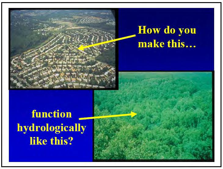
9 Why do we need to plan for green infrastructure? Impacts of poor or no planning on environment Traffic congestion GREEN INFRASTRUCTURE

10 Impacts of poor or no planning on environment GREEN INFRASTRUCTURE Traffic congestion Water quality
11 Impacts of poor or no planning on environment GREEN INFRASTRUCTURE Traffic congestion Water quality Air quality


12 Impacts of poor or no planning on environment GREEN INFRASTRUCTURE Traffic congestion Water quality Air quality Loss of critical habitat


13 Impacts of poor or no planning on environment GREEN INFRASTRUCTURE Traffic congestion Water quality Air quality Loss of critical habitat Loss of working lands While you viewed this slide, America lost another 3 acres of open space
14 Benefits of the forest Combats global warming (carbon sequestration) and improving air quality.

15 Benefits of the forest Combats global warming (carbon sequestration) and improving air quality. Protects and preserves water quality and supply.

16 Benefits of the forest Combating global warming (carbon sequestration) and improving air quality. Protects and preserves water quality and supply. Provides stormwater management, hazard mitigation.
17 Benefits of the forest Combats global warming (carbon sequestration) and improving air quality. Protects and preserves water quality and supply. Provides cost-effective stormwater management and hazard mitigation. Preserves biodiversity and wildlife habitat.

18 Benefits of the forest Combating global warming (carbon sequestration) and improving air quality. Protects and preserves water quality and supply. Provides stormwater management, hazard mitigation. Preserves biodiversity and wildlife habitat. Improves quality of life and fitness by access to recreation.


19 Why Green Infrastructure Plans Now? Growth and land use conflicts U. S. Region Pop. Change Change in Urbanized Land Midwest 7.06% 32.3% Northeast 6.91% 39.10% South 22.23% 59.61% West 17.02% 48.94% Total U.S % 47.14% Farm Photo Credit: Conservation Fund
20 Where to develop? Smart Growth = Using Existing (grey) Infrastructure But is this enough?
21 Typical plan = Save ½ Build ½ While this approach is simple, it does not conserve our best resources.
22 Need to consider: What are all the assets? Grey + Green = Smart + Green

23 Here s the problem when cluster developments don t look outside the parcel:
24 Green infrastructure approach helps keep corridors intact. GREEN INFRASTRUCTURE Undeveloped parcel: PDR, TDR, Easement?


25 Green Infrastructure Network GREEN INFRASTRUCTURE A green infrastructure network is made up of connected core habitats and connecting corridors that help animals, seeds, and people move across the landscape.


26 Who prefers interior forest cores? Birds, e.g. cerulean warbler, Scarlet tanager Mammals, e.g. black bear, bobcat, n. flying squirrel Amphibians, e.g. spotted salamander GREEN INFRASTRUCTURE


")
27 Who can use these corridors? (300 meters is ideal )


28 Who causes trouble at the edges? Brown Headed Cow Bird Invasive plants/trees Domestic (and wild) cats GREEN INFRASTRUCTURE
29 What kinds of forests will we have? More fragmented, less natives, more invasives
30 Ecological Principles by Alisa Hefner, Skeo Solutions GREEN INFRASTRUCTURE
31 patch relatively homogeneous nonlinear area that differs from its surroundings edge outer portion of patch where the environment differs significantly from the interior corridor strip of particular type that differs from the adjacent land on both sides = mosaic spatially heterogeneous, uneven, and occur as a nonrandom distribution of objects
32 Design implications of ecological patterns GREEN INFRASTRUCTURE patch Larger patches - more interior species, larger population, more habitat types, protect stream networks, provide core habitat and escape cover for large animals, and permit near natural regimes Smaller patches - more edge species, smaller populations, less habitat types, interrupt extensive stretches of matrix and act as stepping stones for species movement, and provide special habitat for some species.
33 Design implications of ecological patterns GREEN INFRASTRUCTURE patch The selection of patches for conservation should be based on their 1) contribution to the overall system, i.e. how well the location of a patch relates or links to other patches within the landscape or region; and 2) unusual or distinctive characteristics, e.g. whether a patch has any rare, threatened, or endemic species present.


34 Design implications of ecological patterns GREEN INFRASTRUCTURE patch & edge A more convoluted patch will have more edge habitat, less interior species and the more interaction, whether positive or negative, there is between the patch and the surrounding matrix. An ecologically optimum patch provides several ecological benefits and is generally spaceship shaped with a rounded core for protection with curvilinear boundaries and fingers for species dispersal.

 can provide connection and alternate routes size and spacing is dependent on the")
35 Design implications of ecological patterns corridor GREEN INFRASTRUCTURE Width and connectivity are the primary controls on the five major functions of corridors: habitat, conduit, filter, source, and sink. Similarity in structure is probably adequate in most cases for interior species movement between large patches. When a corridor is broken, a cluster of stepping stones (small patches) can provide connection and alternate routes size and spacing is dependent on the species utilizing corridor. Streams are natural corridors and the width of the vegetative corridor should reflect the stream category and surrounding influences.
36 Dividing a large patch into two smaller patches Removes interior habitat Reduces interior species population Reduces diversity of interior species Image source: Dramstad, Wenche E., et al. Landscape Ecology Principles in Landscape Architecture and Land Use Planning. Washington D.C., Island Press, 1996.
37 What happens when a patch is removed Causes habitat loss May reduce habitat diversity May reduce population size of species dependent upon that habitat type Image source: Dramstad, Wenche E., et al. Landscape Ecology Principles in Landscape Architecture and Land Use Planning. Washington D.C., Island Press, 1996.

38 Species protection in Virginia Wood turtles Karner blue butterfly Prairie tiger moth Bald eagles Hill's thistle Eastern massasauga rattlesnakes Red-shouldered hawks


39 Virginia Natural Landscape Assessment a landscape-scale GIS analysis for identifying, prioritizing, and linking natural habitats in Virginia

40 Area of Wildlife Action Plan Tier 1 Essential Habitats Conservation Site B-rank Index SCU and T&E Waters Index Variety of Unmodified Wetlands Total Area Ecological Integrity Topographic Relief Index Length of Streams in Interior Forest Image: VA Dept. of Conservation and Recreation Core Isolation Index Depth of Interior

41 Image: VA Dept. of Conservation and Recreation VCLNA Fragmentation Layer GREEN INFRASTRUCTURE

42 Image: VA Dept. of Conservation and Recreation GREEN INFRASTRUCTURE Fragmented Land Cover Image

43 Image: VA Dept. of Conservation and Recreation GREEN INFRASTRUCTURE Cores

44 Image: VA Dept. of Conservation and Recreation GREEN INFRASTRUCTURE Corridor Analysis

45 Image: VA Dept. of Conservation and Recreation GREEN INFRASTRUCTURE Corridor Analysis

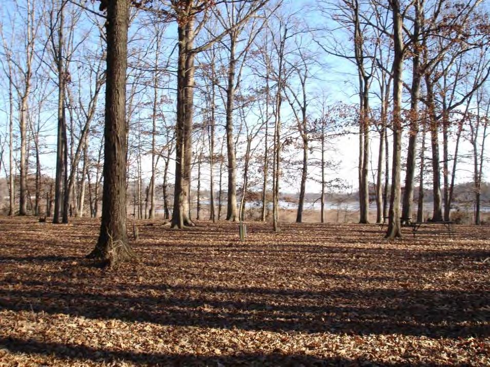
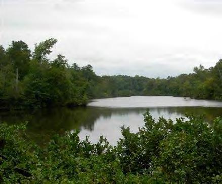
46 Nelson County, VA Nelson County is more than 2/3 forested. Forest cover is key for good water quality and quantity.

 has: 20,406 acres 14")
47 Why is Nelson County so special? 311,784 acres of habitat cores 249,274 acres are outstanding (red) to very high quality (orange). See example core at left (red core) has: 20,406 acres 14 element occurrences 5,523 drinking water acreage
48 Themed Maps GREEN INFRASTRUCTURE There is one base map for intact forests and then a series of themed overlays. Forests serve as the base map and show under each of the others. Forests: wildlife and forestry uses Water: water quality and human resources Agriculture: high value ag soils and ag uses Culture, Heritage, Recreation: historic and scenic assets, natural resource-based recreation
49 Green Assets: Forests and development patterns Cores Updated for New Development ( )

50 This map shows the highest value cores and connected corridors = High Integrity Cores Connector Patches

51 Agriculture Assets: Soils & Slopes GREEN INFRASTRUCTURE


52 Tourism Planning GREEN INFRASTRUCTURE

53 Culture, Heritage and Recreation Assets by Watershed The water in this region is an integral part of the success of our brewery process. Taylor Smack, Owner, Blue Ridge Mountain Brewery

54 Protect the Viewshed (which in Nelson, is also the brewshed ) GREEN INFRASTRUCTURE This view of the Priest and Three Ridges from Wintergreen Resort is an asset that supports Wintergreen. It is common that views that support local recreation enjoyment are not managed by the business that depends on that view

55 City of Charlottesville (small city example) Fall 2006 partnership with UVA Class, GIC and E² Inc. for city comprehensive planning Tree Canopy and Street Trees Streams and Stormwater Trails and Linkages Green Building


56 Transportation planning: roads and trails Change from circuit to network


57 Stream buffers are important for green infrastructure networks Meadow Creek Moore s Creek Rivanna River

58 Urban Buffer Plan Goal: 100 foot buffer GIS to evaluate impacts based on buffer widths of 50, 75 or 100 feet. Not to impact > 30% existing structures.


59 May need to restore eroded streams. Planting trees in the floodplain is key. Moore s creek in Charlottesville Before restoration After Habitat and geometry restored to natural patterns. Wow!


60 Tree Canopy Mapped forest canopy in GIS by digitizing aerial photos. Set goals for future canopy Today = 31.6 % Future = 40 %

61 Next: Where can we put new trees to get to 40%?


62 Street Trees: Simple Method Street tree inventory and gap list for 5 neighborhoods. 484 new locations for trees found.
 Water quality (contaminant loading) Alternate")
63 CITYgreen for Site Level Plans Developed by American Forests Land cover distribution Air pollution removal Carbon storage and sequestration Stormwater management savings Water quantity (runoff) Water quality (contaminant loading) Alternate scenarios
64 Pollution Removal Values 84.9% of 13.5-acre park is covered by trees Pollution removal value: $2,694/year Stormwater control value: $15,000/year

65 Park Example: City Green for Tree Planning Existing Conditions modeled in CITYGreen Quarry Park, Charlottesville, VA Doubles carbon sequestration from 63 to 104 tons! Alternative conditions modeled in CITYGreen to add more trees. Modeler Jonah Chirenza Helps meet Mayor s Climate Change Agreement
66 Summary of Charlottesville Results Tree canopy assessment and canopy goals Tree City USA and DOF urban forest management plan grant Tree survey and gap analysis methods Forested stream buffer protection expanded DOF adopts city as 1 of 5 Ches. Bay Model Cities New trails connections and trail design standards to protect water quality. New stormwater requirements and programs and green building goals too!
67 Green Infrastructure Planning Applications Park and open space planning Identify lands for PDR or TDR programs New ordinance development Species protection Heritage tourism and viewsheds Ag and Forestal Districts Transportation planning: roads/trails Public Regulatory Private Voluntary


68 Park and open space planning Where might future parks be located based on population centers, need to protect key habitats or species, opportunities to increase recreation or site interpretation?


69 PUD example William Taylor Plaza (Ridge and Cherry, Cville, VA) 60,000 square feet requested for 50 apartments 40,000 square feet commercial = 100,000 square feet on 2.9 acres Proffer examples: 22% of space arboretum LEED building Possible use of LID strategy Rezoning to PUD from Residential, Commercial

70 Species Protection (Virginia examples) Wood turtles Karner blue butterfly Prairie tiger moth Bald eagles Hill's thistle Eastern massasauga rattlesnakes Red-shouldered hawks

71 Tourism Planning GREEN INFRASTRUCTURE

72 Green Assets: for job development Small companies, especially those that are have well paid and skilled workforce place a strong importance on the green of the local environment. Crompton Love and Moore, 1997 The creative class: artists, media, lawyers, analysts, make up 30 percent of the U.S. workforce and they place a premium on outdoor recreation and access to nature. Florida, 2002 Meta Message: More trails = a better tax base!
73 Habitat Protection at Site Scale Replanting with natives (e.g. Chestnut project at Lesesne State Forest) Remove invasives such as tree of heaven or mustard plant. Participate in programs such as Don t move firewood. Encourage residents to plant noninvasive species. Think about connections even at the small backyard scale a network for birds, bees and butterflies can flow through an urban neighborhood too! GREEN INFRASTRUCTURE

74 What is stormwater? GREEN INFRASTRUCTURE Water generated from storms (by frequency e.g. 2 year storm, 10 year storm, 50 year storm). Most systems designed to treat the two year storm. Excessive stormwater is eroding the soil from these trees

75 Paved Areas Can Cause Extreme Flows 1. Impervious surfaces prevent rain infiltration, causing greater runoff volume and velocity GREEN INFRASTRUCTURE Total Rainfall Infiltration Runoff 2. Storm flows peak sooner in the stream at higher volumes. 0 Forested Parking lot Paved watershed 3. Higher volumes and velocities of runoff lead to more flooding and damages the firehose effect! Stream Flow Vegetated watershed Time


76 Approaches to Stormwater Management Good -- Detention Pond works in areas where you have room to maneuver. Better -- Improve pollution removal by adding wetland benches and plants to existing ponds. Best -- Utilize smaller scale biofiltration throughout development.


77 Urban Impacts = Need to Retrofit Using Low Impact Development Green Rooftops Filterra Box Parking lot biofilter Rain Barrel Downspout filtration Porous pavers


78 The goal is to manage runoff at the source with many small scale controls that infiltrate, filter, store, evaporate, and detain runoff. hen done right, these sites just look like gardens
79

80 Trees and Water Estimates for the amount of water a typical street tree can intercept in its crown, range from 760 gallons/tree/year to 4000 gallons/tree/year depending on species.

81 Site Scale Conservation Replanting with natives (e.g. Chestnut project at Lesesne State Forest) Remove invasives such as tree of heaven or mustard plant. Encourage residents to plant noninvasive species. Find ways to infiltrate water in the garden. Think about connections even at the small backyard scale a network for birds, bees and butterflies can flow through an urban neighborhood too! GREEN INFRASTRUCTURE

82 End Project Reports for Nelson are on line at:
Conservation Corridor Planning and Green Infrastructure Themes
 Conservation Corridor Planning and Green Infrastructure Themes Prepared by the Green Infrastructure Center Inc. and the Northern Virginia Regional Commission February 22, 2011 Brief Overview Project Background
Blue/Green Infrastructure Study Accomack County, VA
 Blue/Green Infrastructure Study Accomack County, VA Draft Asset Maps March 8-9, 2010 Green Infrastructure Center, Inc. 2 Overview What is Green and Blue Infrastructure Project Timeline & Tasks Literature
Green Infrastructure Policies and Ordinances
 Green Infrastructure Policies and Ordinances October 23, 2013 By Karen Firehock, Green Infrastructure Center 2013 Georgia Urban Forest Council s 23 rd Annual Conference The mission of the nonprofit Green
Green (and blue) Infrastructure Planning in VA
 Infrastructure Planning in VA") Green (and blue) Infrastructure Planning in VA Presentation to Rural Resiliency Forum By Karen Firehock Oct. 23, 2018 Green Infrastructure Center 2018 Slide Show Topics Definitions: Resilience Green Infrastructure
Green (and blue) Infrastructure Planning in VA Presentation to Rural Resiliency Forum By Karen Firehock Oct. 23, 2018 Green Infrastructure Center 2018 Slide Show Topics Definitions: Resilience Green Infrastructure
Map Development 5/15/2012. New Virginia Modeling Tools
 Regional Green Infrastructure Base Map Development 5/15/2012 RRRC Land Use & Environment Committee New Virginia Modeling Tools VA Natural Landscape Assessment Forest Habitats Cultural Model Historic Resources
Conservation Corridor Base and Thematic Maps
 Conservation Corridor Base and Thematic Maps August 20, 2010 This project is funded in part by the Virginia Coastal Zone Management Program at the Department of Environmental Quality through Grant #NAO9NOS4190163
Green Planning in Albemarle and Charlottesville
 Green Planning in Albemarle and Charlottesville Presentation to League of Women Voters February 10, 2019 By Karen Firehock, Executive Director Green Infrastructure Center 2019 The Green Infrastructure
Green Infrastructure. by Karen Engel, NYS DEC. NYS Department of Environmental Conservation
 Green Infrastructure by Karen Engel, NYS DEC What is Green Infrastructure? For some it s all about water Green Infrastructure techniques use soils and vegetation to infiltrate, evapotranspirate, and/or
Presentation Outcomes
 Green Infrastructure Rappahannock-Rapidan Living Lands Planning Workshop September 17, 2009 Presentation Outcomes Define green infrastructure principles and concepts (video). How are green infrastructure
Mapping and Planning for Green Infrastructure
 Mapping and Planning for Green Infrastructure Karen Firehock, Executive Director TransportiCA Webinar Series August 30, 2018 Today 1. Green infrastructure defined 2. Mapping green infrastructure in rural
NEW GRANTS PROGRAM. Today I will describe what green infrastructure planning entails, how the model works and the importance of the work to planners!
 NEW GRANTS PROGRAM The South Carolina Forestry Commission received funds from the USDA Forest Service s Southern Region to build a green infrastructure landscape scale model and to fund several implementation
Green Infrastructure. NYS Department of Environmental Conservation
 Green Infrastructure Green infrastructure is an interconnected network of natural areas and open spaces that sustains ecosystems. Benedict, M.A. and E.T. McMahon. 2006. Green Infrastructure Linking Landscapes
National Association of Conservation Districts. Kris Hoellen Vice President, Sustainable Programs The Conservation Fund September 19, 2013
 National Association of Conservation Districts Kris Hoellen Vice President, Sustainable Programs The Conservation Fund September 19, 2013 Our Mission The Conservation Fund forges partnerships to conserve
Working Group Meeting
 April 4,, 2017 Parks Operations Bldg Working Group Meeting Arts Districts Overview Stormwater/RPA/Stream Considerations First Principles Agenda 7:00pm 7:05pm 7:10pm 7:40pm 8:30pm 9:40pm 9:45pm Welcome
Countywide Green Infrastructure
 Montgomery County s Countywide Green Infrastructure F U N C T I O N A L M A S T E R P L A N The Maryland National Capital Park and Planning Commission INFRASTRUCTURE An underlying base or foundation especially
Biodiversity and Urban Streets
 Biodiversity and Urban Streets Urban Street Design for Engineers CPD Session 3 Constituent Elements Engineers Ireland Maryann Harris BSLA MSc Dip Law Past-President, Irish Landscape Institute Parks Services
Planning for and Managing Open Space and Natural Areas
 Planning for and Managing Open Space and Natural Areas Increasingly, development proposals in Delaware include large amounts of open space and natural areas. While open space is important as a community
The Benefits and Challenges Associated with Green Infrastructure Practices
 The Benefits and Challenges Associated with Green Infrastructure Practices Thomas M. Evans ASLA, LEED AP Regional Green Infrastructure Design Services Director OWEA Technical Conference, June 20, 2013
Introduction to Low Impact Development. Fred Milch. East Central Florida Regional Planning Council
 Introduction to Low Impact Development Fred Milch East Central Florida Regional Planning Council Low Impact Development (LID) Low impact development (LID) is a term used to describe a land planning and
One County s Success in Linking Watershed Protection and Land Use Planning
 One County s Success in Linking Watershed Protection and Land Use Planning Bob Thompson Porter County Plan Commission March 28, 2012 Indiana Watershed Leadership Academy Population 160,000 Approximately
Master Plan Objectives and Policies
 Master Plan Objectives and Policies Introduction This chapter identifies the Park issues and recommended policies established by this Master Plan. The issues were identified through meetings with staff,
Open Space, Natural Areas, Parks, and Recreation
 Open Space, Natural Areas, Parks, and Recreation WHAT ARE THE CITY S CURRENT VALUES? This section addresses open spaces, natural areas, parks and recreation, and stormwater multi-use projects under separate
Contents Introduction: Strategic Plan Why Focus on Green Infrastructure? Who Does GIC Serve?... 4
 2013-16 [STRATEGIC PLAN] The Green Infrastructure Center created its second strategic plan in 2013. The GIC is now expanding to new regions and developing new methods to advance the field of green infrastructure
SUSTAINABILITY PLAN OTTAWA COUNTY PARKS AND RECREATION COMMISSION FALL 2017
 SUSTAINABILITY PLAN OTTAWA COUNTY PARKS AND RECREATION COMMISSION FALL 2017 Table of Contents Introduction Natural Resources Quality of Life Community Continuing the Mission Sustainability Measuring Sustainability
Green Infrastructure and Low-Impact Development Technologies
 Green Infrastructure and Low-Impact Development Technologies The guiding principles of these technologies is to manage stormwater at their sources using natural means, and establish conditions so that
Stormwater Management Techniques WMPF LAND USE TRAINING INSTITUTE MARCH 14, 2018
 Stormwater Management Techniques WMPF LAND USE TRAINING INSTITUTE MARCH 14, 2018 Potential Impacts of New Development Urban development can significantly increase stormwater runoff Water quality considerations
Minnesota Department of Natural Resource - Natural Resource Guidance Checklist Conserving Natural Resources through Density Bonuses
 Minnesota Department of Natural Resource - Natural Resource Guidance Checklist Conserving Natural Resources through Density Bonuses NRDB Why Use Density Bonuses & This Checklist Local units of government
Rain Gardens. A Welcome Addition to Your Landscape
 Rain Gardens A Welcome Addition to Your Landscape Where Does The Rainwater Go? Naturally, forests provide a way for rainwater to percolate into the soil, filtering pollutants while trees are allowed to
Community Conservation Workshop. Saranac River Basin Communities
 Community Conservation Workshop Saranac River Basin Communities 2 Community Conservation Program Welcome! We have designed a Community Conservation Program that listens to the needs of community members.
Virginia DCR- Natural Heritage Program. Tools for Linking Conservation and Transportation Planning
 Virginia DCR- Natural Heritage Program Tools for Linking Conservation and Transportation Planning November 9, 2009 MISSION: to conserve Virginia's biodiversity through statewide biological inventory, protection,
Putting a LID on Stormwater Pollution. Michele Loudenback, RPES Stormwater Enforcement Water Quality Division
 Putting a LID on Stormwater Pollution Michele Loudenback, RPES Stormwater Enforcement Water Quality Division Outline Brief Regulatory History Conventional vs. Green Practices LID/GI Controls in Use Clean
Principles for Ecological Landscape Design in Brownfield Business Parks
 Principles for Ecological Landscape Design in Brownfield Business Parks Part of USDA Forest Service research project # 00-JV-11231300-033: Aligning Social and Ecological Drivers of Urban Landscape Change
Figure 1. Proposed Strategic Habitat Conservation Areas for Florida
 Figure 1. Proposed Strategic Habitat Conservation Areas for Florida Critical Lands and Waters Identification Project (CLIP) Cooperative Effort Century Commission for Sustainable Florida Florida Natural
Welcome! Rain Barrel Workshop. April 4th, 2011 Groveton Elementary School Alexandria, Virginia
 Welcome! Rain Barrel Workshop April 4th, 2011 Groveton Elementary School Alexandria, Virginia Regional Rain Barrel Program Partners Reston Association Why Rain Barrels? Part of a bigger picture: Water
Conservation Development
 Acknowledgements RIDEM: Scott Millar Anthony Lachowicz-Planning and Zoning Consultant Director of Planning 1 : a creative land use technique that allows a community to guide growth to the most appropriate
Chapter 5: Natural Resources and Environment
 NATURAL RESOURCES AND ENVIRONMENT 5-1 5 Chapter 5: Natural Resources and Environment BACKGROUND AND INTENT Urban expansion represents the greatest risk for the future degradation of existing natural areas,
PEOPLE, WATER, AND WILDLIFE: BLUE PRINCIPLES FOR RIVER DESIGN
 PEOPLE, WATER, AND WILDLIFE: BLUE PRINCIPLES FOR RIVER DESIGN Category One: People Protecting and Enhancing the Quality of Life Role of the Chicago River People and the River For many, the connection between
Community Conservation Workshop. Lake Placid
 Community Conservation Workshop Lake Placid 2 Community Conservation Program Welcome! We have designed a Community Conservation Program that listens to the needs of community members. We are conducting
SAN RAFAEL GENERAL PLAN 2040 INTRODUCTION AND OVERVIEW
 SAN RAFAEL GENERAL PLAN 2040 INTRODUCTION AND OVERVIEW Steering Committee Presentation February 14, 2018 Purpose of General Plan Guide land use and development decisions Coordinate transportation, infrastructure,
Appendix E: Illustrative Green Infrastructure Examples
 Appendix E: Illustrative Green Infrastructure Examples Integrating LID into San Francisco s Urban Landscape Figure E. High-density Residential Figure E. Low-density Residential Figure E. Mixed Use 7 Figure
Stormwater & South Carolina. A Case for Low Impact Development
 Stormwater & South Carolina A Case for Low Impact Development what is stormwater? stormwater & development Volume of Water stormwater & development Peak Flow Urban Natural Peak Flow Rain Event Time Components
Conservation in South Jersey Being Creative with Restoration
 Conservation in South Jersey Being Creative with Restoration Stewardship on a Shoestring: Public Land Management in Fiscally Constrained Times November, 30, 2011 Conservation and Restoration for Open Space
VACANT TO VIBRANT : GREEN INFRASTRUCTURE & URBAN REVITALIZATION
 VACANT TO VIBRANT : GREEN INFRASTRUCTURE & URBAN REVITALIZATION Calumet Summit 2013: Connecting for Action Lauren Riga, Director City of Gary Department of Green Urbanism Gary Storm Water Management District
Arlington, Virginia is a worldclass
 EXECUTIVE S U M M A RY Arlington maintains a rich variety of stable neighborhoods, quality schools and enlightened land use policies, and received the Environmental Protection Agency s highest award for
Chapter 3 Site Planning and Low Impact Development
 CHAPTER 3 Site Planning and Low Impact Development Chapter 3 Site Planning and Low Impact Development 3.0 Introduction The City of Charleston requires that major residential, large commercial (>1 acre),
Section 3 Non-Structural BMPs
 3.1 Stream Buffers A stream buffer or stream setback is a designated area around a stream, lake, or wetland left in a natural, densely vegetated state so as to protect the receiving water quality and provide
Green Infrastructure
 Statutory Authorization: 24 V.S.A. 4402, 4410, 4414, 4416-4418, 4424 Type: NONREGULATORY & REGULATORY Related Topic Areas: Land Use & Development Regulations; Open Space & Resource Protection Programs
Repurposing Stranded Office Parks Natural Environment
 Repurposing Stranded Office Parks Natural Environment Tavis Dockwiller/ Viridian Landscape Studio What is Green Infrastructure? Rethinking the large scale Rethinking the details Ecological Policy and Program
SUNY Green Infrastructure Summit. April 17, 2014
 SUNY Green Infrastructure Summit April 17, 2014 Environmental Facilities Corporation Public benefit corporation Mission: To promote environmental quality by providing low cost financing and technical assistance
Urban Stormwater Management
 State Regulations and Sustainable Infrastructure April 16, 2011 Urban Stormwater Management Drivers Ecosystem Services LID and Light Imprint New Urbanism Comments MD Stormwater Regulations Larry S. Coffman
Town of Peru Comprehensive Plan Executive Summary
 Town of Peru Comprehensive Plan Executive Communities that plan grow by choice, not by chance. A plan makes growth thoughtful, understandable, and predictable. A plan shows that a community is managing
STORMWATER GREEN INFRASTRUCTURE AND PLANNING/ZONING BOARDS
 STORMWATER GREEN INFRASTRUCTURE AND PLANNING/ZONING BOARDS Source: Center for Watershed Protection, 2007 Southern Tier Central Regional Planning & Development Board Chemung County Stormwater Team OUTLINE
Low Impact Development. Charlene LeBleu Auburn University Landscape Architecture (334)
") Low Impact Development Charlene LeBleu Auburn University Landscape Architecture leblecm@auburn.edu (334) 844-0192 What is Low Impact Development? Infiltrate Filter Store Evaporate Detain An innovative
Low Impact Development Charlene LeBleu Auburn University Landscape Architecture leblecm@auburn.edu (334) 844-0192 What is Low Impact Development? Infiltrate Filter Store Evaporate Detain An innovative
Stormwater Low Impact Development - A Natural Solution
 Stormwater Low Impact Development - A Natural Solution Sarah U Ren Program Director The Watershed Center of Grand Traverse Bay 231-935-1514, suren@gtbay.org Our Mission: The Watershed Center advocates
Importance of Master Planning Marcy Colclough
 Importance of Master Planning Marcy Colclough Senior Planner Southwest Michigan Planning Commission WHERE and HOW we develop Land affects Water Quality! 43.2 Acres total 20 Homes 35.8 Acres of open space
Key Elements of Successful Conservation Planning. John Paskus October 17, 2013 Pierce Cedar Creek Institute Michigan Natural Features Inventory
 Key Elements of Successful Conservation Planning John Paskus October 17, 2013 Pierce Cedar Creek Institute Michigan Natural Features Inventory What is Conservation Planning? Pressey et al (2008): The process
Stormwater and Ecological Management Opportunities May 2008
 Stormwater and Ecological Management Opportunities May 2008 University of Delaware Newark Campus Stormwater and Ecological Observations Unique geologic setting on fall line (divide between Piedmont and
319 Grant: Baker Creek & Centenary Creek Restoration Initiative
 319 Grant: Baker Creek & Centenary Creek Restoration Initiative Objectives: Overview of Watershed Characteristics: Discussion of Project Tasks: Discussion of Watershed Management Plan: Presented by: Erich
Planning for Staten. Habitat Restoration and Green Infrastructure. Island s North Shore
 Habitat Restoration and Green Infrastructure Planning for Staten Island s North Shore Community Board 1 March 1, 2018 NYC Parks Forestry, Horticulture, and Natural Resources Funded by the NYS Department
Stormwater Management at The University of New Orleans
 University of New Orleans ScholarWorks@UNO DRU Workshop 2013 Presentations Disaster Resistant University Workshop: Linking Mitigation and Resilience Conferences and Workshops 3-1-2013 Stormwater Management
The following principles guide the development of goals and strategies to protect and promote these amenities:
 OPEN SPACE/PARKS/TRAILS/RECREATION GOALS/STRATEGIES Cherry Hills Village is a living environment that offers low density development, open areas, public scenic vistas, public trails and public parks. This
12/7/2007. Christopher B. Burke Engineering West, Ltd Aux Sable Creek Watershed Plan Update 1
 The ABC s of BMP s Aux Sable Watershed Plan St. Charles, IL Why are BMP s Important Best Management Practices (BMPs) developed as a set of practices which help to achieve goals of the Clean Water Act and
COMMUNITY DESIGN. GOAL: Create livable and attractive communities. Intent
 COMMUNITY DESIGN Intent An attractive, well-designed County will attract quality development, instill civic pride, improve the visual character of the community, and create a strong, positive image for
THREE-STEP DESIGN PROCESS FOR OPEN SPACE SUBDIVISIONS
 00216106.DOC NMA/RRK 1/30/14 THREE-STEP DESIGN PROCESS FOR OPEN SPACE SUBDIVISIONS Open space subdivisions, sometimes called cluster developments, maintain a significant portion of a development site in
Planning for Staten. Habitat Restoration and Green Infrastructure. Island s North Shore
 Habitat Restoration and Green Infrastructure Planning for Staten Island s North Shore Walker Park December 7, 2017 NYC Parks Forestry, Horticulture, and Natural Resources Funded by the NYS Department of
Surrey Ecosystem Management Study
 Surrey Ecosystem Management Study Green Infrastructure Network Opportunities Public Open House & Information Session June 24 th, 2010 EMS Process Ecological Inventory Ecological Assessment Management Policy
CHAPTER 4 FUTURE LAND USE AND URBAN SERVICES DISTRICTS
 CHAPTER 4 FUTURE LAND USE AND URBAN SERVICES DISTRICTS Introduction This chapter discusses how Benzie County should grow and change in the future. A community can grow and change in many different ways.
Green Infrastructure Recommendations For Parks and Public Spaces
 Green Infrastructure Recommendations For Parks and Public Spaces Issued by the Jersey Water Works Green Infrastructure Committee And Prepared by Meliora Design This document recommends ways to integrate
Riparian Buffer on the Bushkill Creek. Policies
 Riparian Buffer on the Bushkill Creek Riparian buffers provide numerous benefits to landowners and the community by protecting groundwater recharge areas, providing flood control, providing stormwater
City of Petersburg, VA Stormwater Utility Frequently Asked Questions
 Q. What is stormwater runoff? A. Stormwater runoff is the water that flows off roofs, driveways, parking lots, streets and other hard surfaces during rain storms. Stormwater runoff is also the rain that
STORMWATER STRATEGY PROJECTS IN ACTION
 STORMWATER STRATEGY PROJECTS IN ACTION NEW JERSEY DEPARTMENT OF ENVIRONMENTAL PROTECTION 2018 WATER QUALITY RESTORATION GRANTS FOR NONPOINT SOURCE POLLUTION PUBLIC INFORMATION SESSION JUNE 2018 319(H)
INTRODUCTION TO GREEN INFRASTRUCTURE HOW WE CAN PROTECT OUR COMMUNITIES AND OUR WATERS Maywood Public Library Bergen County, New Jersey
 INTRODUCTION TO GREEN INFRASTRUCTURE HOW WE CAN PROTECT OUR COMMUNITIES AND OUR WATERS Maywood Public Library Bergen County, New Jersey Jeremiah D. Bergstrom, LLA, ASLA Rutgers Cooperative Extension Water
ADDENDUM TO BIOLOGICAL SCOPING SURVEY REPORT, BOTANICAL SURVEY AND WETLAND DELINEATION
 ADDENDUM TO BIOLOGICAL SCOPING SURVEY REPORT, BOTANICAL SURVEY AND WETLAND DELINEATION FOR AVALON INN (APN 069-241-27 & -04) 1201 & 1211 NORTH MAIN STREET FORT BRAGG, CA MENDOCINO COUNTY prepared for:
Green Infrastructure Planning for Sustainability and Resiliency
 Green Infrastructure Planning for Sustainability and Resiliency Linking Lands and Communities in the Land-of-Sky Region SAMAB Conference - November 18, 2010 www.linkinglands.org Linda Giltz, AICP, Regional
Cost Effective Low Impact Development
 Cost Effective Low Impact Development An Introductory Guide to Conserve Land, Restore Resources, Protect Water, and Save Money in Massachusetts Stefanie Covino Shaping the Future of Your Community Program
Agenda. Background Review of public process Recent project activities Current Status Next steps for construction
 January 30, 2019 Agenda Background Review of public process Recent project activities Current Status Next steps for construction Pond Background The pond was initially built as a dry pond to collect stormwater
Gloucester County s Comprehensive Plan. The Community Connection
 Gloucester County s Comprehensive Plan The Community Connection Current Comp Plan Adopted in 1991 with a 20 year planning horizon Updated in 1995 with Part V- Implementation Recommendations and Appendix
Regional Context Statement
 Regional Context Statement REGIONAL CONTEXT STATEMENT 3. REGIONAL CONTEXT STATEMENT In 1995, the Provincial Government passed into law the Growth Strategies Act. The purpose of this provincial initiative
ARLINGTON COUNTY NATURAL HERITAGE RESOURCE INVENTORY AND NATURAL RESOURCES MANAGEMENT PLAN
 ARLINGTON COUNTY NATURAL HERITAGE RESOURCE INVENTORY AND NATURAL RESOURCES MANAGEMENT PLAN BACKGROUND PUBLIC SPACES MASTER PLAN (2005) CREATE A NATURAL RESOURCE INVENTORY AND TO DEVELOP A MANAGEMENT STRATEGY
BISCUIT RUN PARK MASTER PLAN
 BOARD OF SUPERVISORS November 14, 2018 BISCUIT RUN PARK MASTER PLAN COUNTY OF ALBEMARLE ANHOLD ASSOCIATES Contents Project Introduction Property Background County Park Planning Process Existing Site &
Introduction to Low Impact Development. Dr Kathy Chaston Coral & Coastal Management Specialist NOAA Office of Ocean & Coastal Resource Management
 Introduction to Low Impact Development Dr Kathy Chaston Coral & Coastal Management Specialist NOAA Office of Ocean & Coastal Resource Management http://hawaii.gov/dbedt/czm/resource/publication.php A Comprehensive
COMMUNITY ENVIRONMENTAL MANAGEMENT
 COMMUNITY ENVIRONMENTAL MANAGEMENT CEM HANDBOOK FOR COMMUNITY CONSERVATION PLANNING ----- Draft ----- Prepared by the CENTER FOR COMMUNITY ENVIRONMENTAL MANAGEMENT in association with the NEW YORK STATE
Camden SMART Initiative Stormwater Management and Resource Training
 Camden SMART Initiative Stormwater Management and Resource Training www.camdensmart.com Camden s Struggle with Stormwater 1 The City of Camden is served by a combined sewer system, which uses the same
HUDSON VALLEY REGIONAL COUNCIL 3 Washington Center, Newburgh NY
 PROJECT AREA: HYDE PARK HUDSON VALLEY REGIONAL COUNCIL 3 Washington Center, Newburgh NY 12550 http://www.hudsonvalleyregionalcouncil Insert aerial site photo with streets labeled GREEN INFRASTRUCTURE CONCEPT
Phase I Ecological Network Report Terms of Reference
 Phase I Ecological Network Report Terms of Reference INTRODUCTION In 2007, the City of Edmonton created a new Natural Area Systems Policy (C-531) and a strategic plan, Natural Connections. Together, these
IV. Development in the Rural Overlay District
 Intracoastal Waterway Route 17 Route 168 Great Dismal Swamp VIRGINIA NORTH CAROLINA IV. Development in the Rural Overlay District IV-1 Route 17 in Chesapeake s Rural Overlay District affords distant views
INTRODUCING THE BALTIMORE CITY GREEN NETWORK VISION PLAN
 INTRODUCING THE BALTIMORE CITY GREEN NETWORK VISION PLAN GOALS OF THE GREEN NETWORK PLAN Protect and enhance the unique ecological resources of our city Support economic growth and sustainable redevelopment
Post Construction BMPs
 Post Construction BMPs Why are Post Construction BMPs important? With increased development brings the increase of impervious cover Parking lots, rooftops, driveways Storm water runoff volume increases
- Phase. Project. areas using. project from. Project Type: Project is
 Model Community Watershe ed Development - Phase I / Marais des Cannes Location: Lafayette Parish / Scott, LA Client: State of Louisiana / Office of Community Development Disaster Recovery Unit Design Firm(s):
Staff will be providing an overview of the project need, purpose and intent for consideration as part of the Amendment cycle.
 Agenda Item D-2 City of Tacoma Planning and Development Services To: Planning Commission From: Stephen Atkinson, Planning Services Division Subject: Open Space Corridors Project Meeting Date: March 1,
10.0 Open Space and Public Realm
 10.0 Open Space and Public Realm 10.0 Open Space and Public Realm The Public Open Space System is comprised of: outdoor spaces available for public use that are either publicly owned (e.g., parks and
Greenways as an alternative to traditional infrastructure. Green Infrastructure
 Greenways as an alternative to traditional infrastructure Green Infrastructure What is a Greenway? Little (1990) - A linear open space along a natural or human made corridor. Fabos - linked corridors nature
INTRODUCTION Key Issues and Findings Goals, Objectives, and Policies - Natural Resources - Map M18 - Environmental Resources
 Natural, Environmental, Cu INTRODUCTION This Element provides policies related to the preservation and protection of the Centre Region s natural, environmental, cultural, and historic resources. This Element
Stormwater Runoff and the District of Columbia RiverSmart Homes Defined:
 Stormwater Runoff and the District of Columbia Stormwater runoff is rainwater that flows off impervious surfaces such as rooftops, driveways, roads, sidewalks and sometimes even lawns. Stormwater runoff
Major Subdivision Sketch Plan Checklist
 This checklist provides specific requirements that are apart of the Sketch process. The entire process is described by the Huntersville Subdivision Review Process which details all the submittal and resubmittal
NYC Green Infrastructure Program
 NYC Green Infrastructure Program Parks Without Borders May 24, 2016 NYC Water Quality Improvement Program $10B investment since the early 2000s has yielded the highest water quality observed in the NYC
Update for City Council 7 Years of Progress. May 2013
 Update for City Council 7 Years of Progress May 2013 Setting the Stage Needs Assessment 2006 City of Charlottesville Inventory National Guideline Service Level School Sites Inventory Total Current Inventory
Karen Firehock. Strategic. Green Infrastructure. Planning. a multi-scale approach
 Karen Firehock Strategic Green Infrastructure Planning a multi-scale approach STRATEGIC GREEN INFRASTRUCTURE PLANNING STRATEGIC GREEN INFRASTRUCTURE PLANNING: A multi-scale approach By Karen Firehock
Executive Summary Purpose of the Plan Defining Open Space and Greenways
 Executive Summary Bucks County possesses a vast array of open space resources including natural areas, parks, farmland and historic and cultural resources that contribute to a high quality of life valued
Managing Stormwater Naturally. July 17, 2013
 Managing Stormwater Naturally July 17, 2013 1 This image cannot currently be displayed. Guiding Documents 2 Stormwater Purpose Statement The City Council hereby finds, determines and declares the City