COBBOSSEE CORRIDOR MASTER PLAN. For larger image, see end of Section I.
|
|
|
- Beatrix Parks
- 5 years ago
- Views:
Transcription

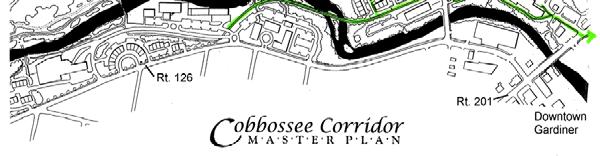
1 COBBOSSEE CORRIDOR MASTER PLAN For larger image, see end of Section I. 11

2 REDEVELOPMENT PARCELS For larger image, see end of Section I. 12


3 COBBOSSEE CORRIDOR S RICH HISTORY ACOBBOSSEE CORRIDOR HISTORICAL NARRATIVE Provided by Robbins Historical Research, Inc. The City of Gardiner owes her modern existence to the ancient Cabbossa. For centuries the local Native Americans camped and fished for sturgeon here. They also used the stream as a corridor of passage between the mighty Kennebec and the Chain of Ponds extending north and west almost to modern day Norridgewock and Farmington. It was here on the Cobbossee that Robert Hallowell Gardiner chose to locate the earliest lumber and grist mills from which the settlements of the entire upper Kennebec river valley grew. The first settlers of Gardinerston arrived in the fall of Included in their small company were a builder of Grist-mills, a saw-mill wright, a house carpenter, and a wheelwright. Landing their craft on the bank of the wide creek then marking the mouth of the Cobbiseconte, the first log huts were here erected, followed immediately by the first lumber and grist mills. Dr Gardiner had in a few years completed at Gardinerston, now Gardiner, two saw mills, a grist-mill, fulling mill, pot-ash, wharf, stores, and many houses, and was at great expense in introducing settlers and furnishing them with supplies His exertions gave great stimulus to the settlements; for many years his grist-mill was the only one in the country, and settlers came thirty miles with their meal bags upon their backs, from the interior, or in canoes by the river, to get their grists ground. (Hanson, History of Gardiner, 1852) By 1764, 200 settlers had arrived in Cabbassa and Cushnoc (Hallowell/Augusta). In 1771 Hallowell, Vassalboro, Winslow and 13

4 Winthrop were all incorporated thanks to the settlement brought about by the mills on the Cobbossee at Gardinerston. The valley of the Cabbassa-contiag must have presented a picturesque appearance before the hand of civilization had marred its natural beauty; and especially the deep gorge commencing near the New Mills, and continuing almost to the mouth. The wild, shaggy glen, filled with a rich growth of forest, the ever sonorous waterfalls, and the general beauty of the stream are not often equaled. Even as late as 1820 the young people of the town found beautiful places of resort among the tangled shrubbery that fringed its silver marge. (Hanson s History of Gardiner, 1852). develop a plan to reharness this strength of the stream as the City moves ahead (with a head over its shoulder learning from the past). The Cobbossee will always run through the heart of the city. History and Progress meet again in Gardiner. "Even as late as 1820 the young people of the town found beautiful places of resort among the tangled shrubbery that fringed its silver marge. This stream extends for approximately one and one-third miles and drops 127 feet in elevation. There are seven recognized mill sites, each of which has seen many changes of use and construction. Along the Cobbossee the foundry where John Stone made the first cast iron plows in this area of Maine; lead pipe works; carriage shops; shingle and match factories were all destroyed by the fire of There soon followed a string of paper, textile and shoe factories all nestled along the stream corridor taking their energy from the strength of the stream. Here the entire industrial mill/factory story of this City, State and Nation can be told. The Cobbossee presents wonderful opportunities today for physical and temporal passage. It is appropriate that Gardiner should now 14

5 SUMMARY OF THE MASTER PLAN PLAN DESCRIPTION This Cobbossee Corridor Master Plan describes the Corridor's redevelopment and open space potential. It is a guide to the revitalization of the Corridor as an economic engine, as an extension of Gardiner's vital downtown, and as a key natural and recreational resource. 1. Historic/Cultural Context Throughout the plan, the rich cultural heritage of the Corridor is emphasized calling for trails, the restoration of the old railroad trestle, and informative signage that interprets cultural artifacts and tell the story of the Cobbossee Stream s past. These features can and will attract residents, visitors, and tourists. They also highlight the Corridor's uniqueness, thereby attracting residential and commercial investment. The Stream has historically been a center for hydro-powered industry. With as many as 10 dams built between New Mills and the Kennebec River, in the 19 th century the Corridor was a powerhouse for numerous businesses. This fascinating history needs to be retold, perhaps in the form of an outdoor museum along the stream. Furthermore, the Corridor provides educational opportunities for history programs in the local schools. A museum-on-the-stream, a trail with informational, historic points of interest, would serve both as an outdoor classroom for local schools and as a cultural tourism feature. 2. Environmental Context Cobbossee Stream is an important natural resource that provides both wildlife & plant habitat, and recreational opportunities (kayaking, fishing). It is the defining feature of the Corridor, with remarkable physical characteristics that today make it a unique scenic and recreational resource. The Corridor s dramatic topography is part of its natural beauty; while these steep slopes (and the stream below) provide scenic views, they are also constraints to development within the Corridor. While past industry along the stream contributed to its pollution, the exodus of industry and today's environmental standards mean a cleaner stream environment. Only three dams remain today, one of which, the dam at Gardiner Paperboard (dam #5), is to be removed in the immediate future. While the removal of this dam marks the loss of an historic artifact, the benefits of removal (including fish passage, stream restoration, and removal of a safety hazard) have been determined to outweigh its preservation. 15

6 COBBOSSEE STREAM CORRIDOR CROSS-SECTIONS A C B A B C For larger image, see end of Section I. 16
 to support such development.")

7 CORRIDOR-WIDE INFRASTRUCTURE 3. Utilities In order to promote high-quality development in the Corridor, essential utilities must be available and must have the capacity and quality (of service) to support such development. Since the Corridor has long accommodated the demands of commercial and industrial development, its present utility infrastructure water, sewer, and electric generally has more than adequate capacity and is of reasonable quality to serve future commercial and residential development. Future upgrades of individual utility systems may be required in the long run. (See the Utilities Analysis in Section III of this report.) Since one of the remaining dams on the Stream is currently an active power generator and supplier (Consolidated Hydro), an opportunity exists to supply power directly to new development within the Corridor. Further research and coordination with the Consolidated Hydro should be pursued not only for its potential economic and marketing advantages, but for its environmental benefits. However, one service need that is not well met is communications services. Telephone and cable TV service is available, but the availability of wireless communications/ cellular phone service, and other telecommunications/fiberoptic services must be updated if future development within the Corridor is to include professional office, home office, or conference center development. 4. Traffic & Access While Route 126 between New Mills and downtown serves the southern side of the Corridor well, the capacity of the intersection of Routes 126 and 201, and along Bridge Street to the Randolph bridge intersection, is limited due to very high traffic volumes. There are also some high crash locations within this Bridge Street corridor, and hence major safety concerns. The number of intersections (Highland Ave., Summer Street) and entrance drives (Hannaford/Subway in particular) along Bridge Street, all place constraints on new development along this corridor. The impact of a new development on traffic capacity is based on whether or not the new use will increase traffic volume as compared to the previous use. As long as a new 17

8 This section of Route 201 (Water Street to the Randolph bridge) has high traffic volumes, and is at capacity already. Due to these MDOT permitting requirements, access management standards, and reduced traffic capacities of downtown intersections, several redevelopment sites in the Cobbossee Corridor face constraints. development does not increase current traffic volumes, it is usually permitable; if it is projected to increase traffic, then some type of mitigation is required (to bring traffic down to "pre-development" level). Under the Cobbossee Plan, this could mean installing traffic lights at the Highland Ave/Route 201 intersection. It is possible that some of the traffic constraints may be alleviated through increased alternative transportation opportunities and other creative solutions. Due to these MDOT permitting requirements, access management standards, and reduced traffic capacities of downtown intersections, several redevelopment sites in the Cobbossee Corridor face constraints. High trip generating uses (such as retail or fast-food/drive-thru services) will be more difficult to mitigate, particularly in the T.W. Dick/Summer Street area. For more detail on traffic analysis and permitting issues, see Section III. 5. Pedestrian/Bicycle Network: Sidewalks & Trails The Cobbossee pedestrian/bike network will provide new recreational opportunities, improve pedestrian and bike access and safety, expand upon alternative transportation routes, and also highlight the natural, scenic beauty of the Cobbossee Stream. The proposed trail network also features an outdoor "museum-on-the-stream", where interpretive and educational signage will be placed along trails and at historic points of interest. The pedestrian network will enhance existing and future businesses and residential development in the Corridor and downtown, by improving the overall walkability of Gardiner center and encouraging pedestrian activity. Improving recreational and alternative transportation opportunities in the Cobbossee Corridor will add to the livability and quality of life in Gardiner. The Cobbossee Corridor lies within a 5000-foot radius of the downtown 18
9 (~1/9 mile at its furthest point) and is part of the Central Business District, so that trail and sidewalk improvements in this area contribute to the overall walkability of central Gardiner. The proposed new sidewalks and trails, and area trail connections (i.e. the Kennebec River Rail Trail, KRRT), create better and safer options for walking and bicycling, which in turn provide for a healthier community. The current pedestrian/bicycle network in the Cobbossee area consists of an incomplete sidewalk system and informal/unmaintained off-street trails (see the Existing Sidewalk Infrastructure diagram). Pedestrian crossings, too, are in need of improvement. The goal of the pedestrian/bicycle plan for the Corridor is to improve access to the Stream and associated open space, and make connections between the Corridor, the KRRT, the downtown and waterfront park, and adjacent neighborhoods and three nearby schools. In order to stimulate interest and investment in the Cobbossee Stream Corridor, as well as draw visitors to the area, the plan proposes the rehabilitation of the railroad trestle that crosses the Cobbossee Stream, to serve as an eyecatching, scenic centerpiece for the Cobbossee trail system. The Cobbossee Corridor pedestrian network is already moving forward the City has recently applied for MDOT Enhancement Funds ( ) to develop a trail from the KRRT into the Cobbossee Corridor, and to rehabilitate the trestle (the Cobbossee Stream Trail ) (see Section III, Cobbossee Trails). In addition, the City s current Capital Improvement program will be replacing 3.73 miles (or 27%) of the total sidewalk inventory over the next 5 years. Finally, the stretch of Route 126 southwest of the Corridor, from the New Mills bridge to the Gardiner Middle School (West Gardiner town line) is scheduled for reconstruction by MDOT in the summer of The City has recently passed a Council Resolution urging MDOT to include a new sidewalk to the Middle School during its reconstruction. 6. Gateway/Streetscape Enhancements Route 126 is the major transportation spine through the Corridor, connecting the downtown with West Gardiner and I-95. This entire Corridor is a major gateway to the downtown, and should welcome visitors to Gardiner. The streetscape design proposed in the plan features street trees, street lights, new sidewalks and other design elements that provide a visual link between the Corridor and the downtown. The New Mills bridge marks the primary gateway entry into the Corridor. When it is replaced, it should be with a landmark/signature bridge. Further, under this plan the Water District yard next to the bridge is to be converted to an attractive Cobbossee trailhead, and Route 126 between the Middle School and the bridge is to be upgraded and sidewalk added. New landscaping is also proposed. 19


10 20 Trail segment that MDOT funding would be applied to.
LAND USE PLAN 7. Housing
 21 LAND USE PLAN While the land uses that have historically dominated the Corridor itself have been industrial/commercial, the Master Plan proposes a shift to mixed-use redevelopment, complimented by a
Below the trestle lie artifacts of past industry along the Cobbossee Stream. South end of the trestle, at the proposed trailhead area.
 The existing railroad trestle, when refitted as a pedestrian walkway, could be an important, eye-catching, scenic component to the Cobbossee Stream Trail. South end of the trestle, at the proposed trailhead
Niagara National Heritage Area
 Niagara National Heritage Area What is a National Heritage Area? It is a regional place where natural, cultural, historic and recreational resources combine to form a nationally distinctive landscape and
WILLAMETTE FALLS LEGACY PROJECT
 OPPORTUNITIES & CONSTRAINTS There are here three falls on a line of rocks extending across the river, which forms the bed of the upper channel. The water is precipitated through deep abrazed gorges, and
Ship Creek Redevelopment
 Ship Creek Redevelopment Three Concepts May 2013 Cambridge ARCHITECTURE Philadelphia ENGINEERING Raleigh INTERIORS San Francisco PLANNING Washington, DC www.klingstubbins.com contact@klingstubbins.com
Ivywild On The Creek PRELIMINARY CREEK DISTRICT MASTER PLAN
 Ivywild On The Creek PRELIMINARY CREEK DISTRICT MASTER PLAN Introduction: Rejuvenating an extraordinary Creekside neighborhood THE CREEKSIDE DISTRICT The Ivywild On The Creek Neighborhood District Master
Potential Green Infrastructure Strategies May 6, 2015 Workshop
 Potential Green Infrastructure Strategies May 6, 2015 Workshop Background The City of Cortland is developing the Tioughnioga Urban Headwaters Green Infrastructure Action Plan with funding from the National
TRANSPORTATION PROJECTS
 TRANSPORTATION PROJECTS 40 BUFFALO S LWRP PROPOSED PROJECTS T1. Niagara Street/Great Lakes Seaway Trail Streetscape Project City of Buffalo Department of Public Works Niagara Street from Niagara Square
Mississauga Waterfront. Parks Strategy - Draft
 Potential configuration for river s edge seating. Boating on Credit River: A regatta Boating on Credit River: Active enjoyment 5.2 Port Credit Memorial Park West Priority Park 5.2.1 Site Opportunities
2011 ASLA Design Awards. Centennial Park Merit Award Design Concepts CLA, Inc. Design over $500,000 Construction Budget
 2011 ASLA Design Awards Centennial Park Merit Award Design Concepts CLA, Inc. Design over $500,000 Construction Budget 2011 ASLA Colorado Professional Design Awards Project Name: Category: Location: Const.
A BLUEPRINT FOR BROCKTON A CITY-WIDE COMPREHENSIVE PLAN
 A BLUEPRINT FOR BROCKTON A CITY-WIDE COMPREHENSIVE PLAN Public Meeting October 2016 1 Plan Summary and Discussion Public Meeting May 4 2017 City of Brockton Bill Carpenter, Mayor Department of Planning
Please read the entire document
 projects impacting the waterfront revitalization area. The waterfront revitalization area of the town will have to subareas to the west and east of the village. Page 6 of 6 Wayfinding master plan create
Hockessin Community Redevelopment Plan
 Hockessin Community Redevelopment Plan 3.1 Introduction The Community Redevelopment Plan for the Village of Hockessin is the result of the people s vision for a distinct village center that serves as the
STUDY AREA. Tonight s Agenda. Project Tasks Completed. Next Steps. Town of Oyster Bay Eastern Waterfront Community Vision & Revitalization Plan
 Town of Oyster Bay Eastern Waterfront Community Vision & Revitalization Plan Public Meeting January 27, 2009 Opening Remarks Presentation Tonight s Agenda Introduction Study Area Overview Public Participation
Downtown Dubuque...it s a great time.
 Downtown Dubuque...it s a great time. Your timing could not be better to invest in Downtown. With hundreds of millions in public and private investment occurring on the City s downtown waterfront, millions
hermitage town center
 hermitage town center A Community Vision prepared by Strada for The City of Hermitage and The Mercer County Regional Planning Commission January 2007 table of contents introduction 3 design principles
SECTION II SECTION II STATEMENT OF GOALS, OBJECTIVES, PRINCIPLES, ASSUMPTIONS, POLICIES AND STANDARDS
 STATEMENT OF GOALS, OBJECTIVES, PRINCIPLES, ASSUMPTIONS, POLICIES AND STANDARDS 1 2 STATEMENT OF GOALS, OBJECTIVES, PRINCIPLES, ASSUMPTIONS, POLICIES AND STANDARDS INTRODUCTION The New Jersey Municipal
1. Lenox Dale Community Character Strengths and Opportunities Identified by Residents: Strong neighborhood identity and sense of community.
 LENOX DALE ISSUES AND OPPORTUNITIES -- EIGHT CATEGORIES: Concerns and opportunities identified by Lenox residents and in previous Community Surveys, along with thought-starter suggestions on possible Town
To qualify for federal Transportation Enhancement (TE) funds a project must meet two basic federal requirements:
 funds a project must meet two basic federal requirements:") Eligibility Requirements To qualify for federal Transportation Enhancement (TE) funds a project must meet two basic federal requirements: 1) Relate to surface transportation and 2) Be one of the 12 designated
Eligibility Requirements To qualify for federal Transportation Enhancement (TE) funds a project must meet two basic federal requirements: 1) Relate to surface transportation and 2) Be one of the 12 designated
CHAPTER 7: Transportation, Mobility and Circulation
 AGLE AREA COMMUNITY Plan CHAPTER 7 CHAPTER 7: Transportation, Mobility and Circulation Transportation, Mobility and Circulation The purpose of the Transportation, Mobility and Circulation Chapter is to
What Pioneer Grove Will Look Like?
 The City of Deerfield Beach has embarked on a journey to create a new town center within the old heart of Deerfield Beach. The new town center is known as Pioneer Grove. Pioneer Grove will be Everybody
MEADOW RIVER RAIL TRAIL
 MEADOW RIVER RAIL TRAIL Nicholas, Fayette and Greenbrier Rail Line CSX Abandonment 2008 Greenbrier and Fayette County Partnership 2009 16.7 mile Purchased in July 2011. Trail Development Begins: Obama
The transportation system in a community is an
 7 TRANSPORTATION The transportation system in a community is an important factor contributing to the quality of life of the residents. Without a sound transportation system to bring both goods and patrons
Trail Feasibility and Planning Project for Northern Dutchess County, New York
 for Northern Dutchess County, New York Funded in Part by Grants from the Hudson River Valley Greenway, Land Trust Alliance Conservation Partnership Program and the Thomas Thompson Trust 1 STEERING COMMITTEE
Status Update (2006 vs. Now) Citizen s Advisory Committee February Plan for Prosperity
 Citizen s Advisory Committee February Plan for Prosperity") Status Update (2006 vs. Now) Citizen s Advisory Committee February 2018 Plan for Prosperity 2000 2017 2000 2017 Gardnerville Population 6,000 5,760 5746 5,500 5,000 5,067 5,550 5,165 5,394 5,412 5,250
Status Update (2006 vs. Now) Citizen s Advisory Committee February 2018 Plan for Prosperity 2000 2017 2000 2017 Gardnerville Population 6,000 5,760 5746 5,500 5,000 5,067 5,550 5,165 5,394 5,412 5,250
BROOKHILL NEIGHBORHOOD MODEL ZONING MAP AMENDMENT PREFACE TO APPLICATION
 BROOKHILL NEIGHBORHOOD MODEL ZONING MAP AMENDMENT PREFACE TO APPLICATION June 15, 2015 Revised: August 1, 2016 I. VISION Brookhill is a proposed community based upon the principles of Albemarle County
Table L-1 Summary Action Strategy. Action Item Timing Status Responsible Agency
 CHAPTER 4: CIRCULATION ELEMENT ISSUE #1: MAJOR THOROUFARES AND TRANSPORTATION ROUTES A balanced transportation system for Fontana is provided that meets the mobility needs of current and future residents
Atlanta BeltLine Subarea 3 Master Plan Update
 Atlanta BeltLine Subarea 3 Master Plan Update April 14, 2018 Workshop Meeting 1 22 miles, connecting 45 neighborhoods 22 MILES of transit 46 MILES of streetscapes and complete streets 33 MILES of urban
5. Father Hennepin Blufs Park and Hennepin Island Father Hennepin Bluffs Park Supporting Initiatives (see Figure 36): 7-22
: 7-22") 5. Father Hennepin Blufs Park and Hennepin Island As described in existing conditions portion of Chapter 2, Father Hennepin Blufs Park lies on the upland portion of the park and Hennepin Island spans the
5. Father Hennepin Blufs Park and Hennepin Island As described in existing conditions portion of Chapter 2, Father Hennepin Blufs Park lies on the upland portion of the park and Hennepin Island spans the
LITTLETON RIVER DISTRICT REDEVELOPMENT PROJECT A LEGACY OF LEADERSHIP & COMMUNITY INVOLVEMENT
 LITTLETON RIVER DISTRICT REDEVELOPMENT PROJECT A LEGACY OF LEADERSHIP & COMMUNITY INVOLVEMENT Background Information Littleton Saranac Street Design Charrette Sponsored by the Town of Littleton and Plan
City of Plattsburgh DRI: Downtown Streetscapes & Riverfront Access. Downtown Streetscape and Riverfront Access Design
 City of Plattsburgh DRI: Downtown Streetscapes & Riverfront Access Welcome Thank you for coming this evening. Agenda PART I - Project Context The Downtown Revitalization Program Our DRI Projects Other
Hopkins. Development Guidelines May Overview. Sponsored by: Blake Road Corridor Collaborative City of Hopkins
 Hopkins Blake Road LRT Station Area Development Guidelines May 2015 Sponsored by: Blake Road Corridor Collaborative City of Hopkins Overview Hopkins is a dynamic community of over 17,000 residents located
CHAPTER 3 VISION, GOALS, & PLANNING PRINCIPLES. City of Greensburg Comprehensive Plan. Introduction. Vision Statement. Growth Management Goals.
 CHAPTER 3 VISION, GOALS, & PLANNING PRINCIPLES Introduction The Greensburg Comprehensive Plan is intended as a working community document. A combination of long and short-term goals, this document is intended
Issues, Challenges & Opportunities
 Below is a summary of issues, challenges, and opportunities relating to the revitalization of Downtown Romeoville and potential development of the Village s East Side TOD Area. Current Issues & Challenges
WARM SPRINGS PARK MASTER PLAN
 TABLE OF CONTENTS page 1.0 Introduction and Overview 1 2.0 Information Gathering 2 3.0 Conceptual Alternative Development 8 4.0 Master Plan Development 14 5.0 Construction Cost Estimates 19 LIST OF FIGURES
Improve Neighborhood Design and Reduce Non Point Source Water Pollution
 HOW TO Planning Guide Improve Neighborhood Design and Reduce Non Point Source Water Pollution This document was funded by a grant from the New Hampshire Coastal Program with funding from the National Oceanic
REGIONAL ACTIVITY CENTER
 DRAFT REGIONAL ACTIVITY CENTER 70 EAST BENCH MASTER PLAN DRAFT 06 Introduction The East Bench Regional Activity center is comprised of large educational, research, medical, and employment centers. These
Corridor Vision. 1Pursue Minnehaha-Hiawatha Community Works Project. Mission of Hennepin County Community Works Program
 1Pursue Minnehaha-Hiawatha Community Works Project Minnehaha-Hiawatha Community Works is a project within the Hennepin Community Works (HCW) program. The mission of the HCW program is to enhance how the
New-Cast Mixed-use Development Proposal King Street West, Newcastle, Ontario
 URBAN DESIGN BRIEF New-Cast Mixed-use Development Proposal King Street West, Newcastle, Ontario TABLE OF CONTENTS: 1.0 Executive Summary 2.0 Creating Vibrant and Sustainable Urban Places: Excerpts from
CHAPTER 7: VISION AND ACTION STATEMENTS. Noble 2025 Vision Statement
 CHAPTER 7: VISION AND ACTION STATEMENTS This chapter presents the vision, policy and action statements that transform the comprehensive planning study, an analysis of Noble s past, future trends and community
Whitemarsh Comprehensive Plan Update: Housing & Land Use. Public Workshop #3: September 20, 2018
 Whitemarsh Comprehensive Plan Update: Housing & Land Use Public Workshop #3: September 20, 2018 Agenda Welcome Process Recap What We ve Heard The Plan Framework Review of Recommended Actions Land Use Housing
A. Selma Park, Davis Bay and Wilson Creek
 A. Selma Park, Davis Bay and Wilson Creek This waterfront neighbourhood consists of three separate community areas, linked by Highway 101, but with different character, land use patterns and future potential.
Pittsfield Action Plan (West Branch of the Housatonic River)
") An initiative of the Massachusetts Executive Office of Energy and Environmental Affairs in partnership with the City of Pittsfield Pittsfield Action Plan (West Branch of the Housatonic River) The spring
An initiative of the Massachusetts Executive Office of Energy and Environmental Affairs in partnership with the City of Pittsfield Pittsfield Action Plan (West Branch of the Housatonic River) The spring
City of Le Sueur DOWNTOWN MASTER PLAN
 City of Le Sueur DOWNTOWN MASTER PLAN City Council Update 9/11/2017 Hoisington Koegler Group Inc. Presentation Agenda 01 Schedule Update / Tonight s Objectives 02 What We ve Heard - Engagement Comments
3. STRATEGY FOR NEIGHBORHOOD SUSTAINABILITY
 3. STRATEGY FOR NEIGHBORHOOD SUSTAINABILITY This neighborhood plan focuses on assuring that Government Hill retains a high degree of sustainability, in that it conserves built resources that are part of
TABLE OF CONTENTS. Transportation Chapter 1 - Introduction and Purpose of Planning to 1-3. Utilities
 Chapter 1 - Introduction and Purpose of Planning... 1-1 to 1-3 Pennsylvania Municipalities Planning Code (Act 247)...1-1 Previous County Planning Activities...1-1 Objectives of the Plan...1-2 Elements
Project Goal. RRRC Living Towns Planning Workshp. Town of Halifax Revitalization Project. Dynamic Planning & Management Duo: July 12, 2006
 Project Goal Town of Halifax Revitalization Project RRRC Living Towns Planning Workshp July 12, 2006 Town of Halifax Halifax County *** Revitalization Project Goal*** To create Economic Opportunity and
Silverdale Regional Center
 Silverdale Regional Center Vision for Silverdale Regional Center The Silverdale Regional Center Plan (Plan) will guide the evolution of the Silverdale Regional Center from a collection of strip malls and
WELCOME and introduction
 1 WELCOME and introduction Mobility Hub Locations within Burlington STUDY OVERVIEW STUDY OBJECTIVES The City of Burlington is developing four Area Specific Plans, one for each of Burlington s Mobility
Elliot Park 2. Neighborhood Master Plan. Historical Perspective
 Elliot Park 2 Neighborhood Master Plan Historical Perspective August 2002 Early History Development patterns and the growth of Minneapolis largely grew out of the city s historical response to its geography.
Somers Point Master Plan
 Somers Point Master Plan Progress Report and Public Meeting August 20, 2014 Master Plan Reexamination Municipal Land Use Law require that all municipalities reexamine their master plan every ten years.
Robbinsdale LRT Station. CDI Development Guidelines. August Overview
 Robbinsdale LRT Station August 2018 Overview The City of Robbinsdale may have the coolest opportunity site along the 13 mile stretch of the Bottineau LRT corridor / Blue Line extension. Located a block
ROBBINSDALE LRT STATION CDI DEVELOPMENT GUIDELINES
 August 2018 OVERVIEW The City of Robbinsdale has a prime-opportunity site in the middle of the 13 mile stretch of the Bottineau LRT corridor / Blue Line extension. Robbinsdale offers a prominent, vital,
124 Subarea Visions. Vision Plan. A. Nelessen Associates, INC I Visioning I Planning I Urban Design
 Subareas 124 Subarea Visions The next seven sections describe specific recommendations tailored to each subarea. Each subarea is discussed separately except for certain aspects of 95th Street and Antioch
HOT SPRINGS COMPREHENSIVE PLAN OUTLINE
 HOT SPRINGS COMPREHENSIVE PLAN OUTLINE 7/28/2015 Draft outline - Hot Springs Comprehensive Plan Draft outline of topics to be discussed at public hearings and in planning sessions. Order and topics and
TOWN COUNCIL / PLANNING COMMISSION
 Workshop #3 TOWN COUNCIL / PLANNING COMMISSION January 20, 2011 Consultant Team In Attendance Tonight BMS Design Group Nevada City and San Francisco Michael Smiley, AICP, ASLA Partner-in-Charge Nancy L.
DRAFT ROOSEVELT ROAD. District Recommendations. Figure 5.23 The Roosevelt Road Corridor
 CHAPTER 5 Figure 5.23 The Road Corridor Road will develop as a mixed-use corridor, emphasizing regional retail, west of the river and mixed-use development east of the river. KEY RECOMMENDATIONS 1. High
INTRODUCTION EXISTING CONDITIONS
 INTRODUCTION The Pedestrian Mobility Study and Plan is a Transportation Planning effort to identify Safe Mobility Alternatives for Pedestrian and Bicycle traffic within the City of Port Aransas. This plan
We are a determined group residents, industry, and government and by working together an incredible future lies ahead for Troy.
 PROPOSED EDITS TO COMPREHENSIVE PLAN April 5, 2018 Page Par Change Iv TOC Principle 2, page number is 3 should be 33 I Forward Par 3, delete Strike through: Troy is today experiencing 3 1.1 Par 3 change
City of Farmington. Downtown Plan. Amendment to the 1998 Master Plan Adopted October 11, 2004
 City of Farmington Amendment to the 1998 Master Plan Adopted October 11, 2004 Introduction Planning Background 1 Scope and Components of the Plan Amendment 2 Concept Introduction 3 Plan Concepts 3 Conceptual
V. Gateways GATEWAYS / V-1
 V. GATEWAYS / V-1 Many of Chesapeake s gateways are located on highways and call for bold and attractive designs that motorists can understand, appreciate, and enjoy. can also take the form of natural
BUDGETING FOR OUTCOMES TRINITY RIVER CORRIDOR
 BUDGETING FOR OUTCOMES TRINITY RIVER CORRIDOR Trinity River Corridor Team Members: Kelly High, Streets Department Megan Lam, Office of Financial Services Mike Mikeska, Dallas Water Utilities Diana Ochoa,
PART 1: PROJECT SUMMARY. The application is Attachment A. The site plan is Attachment B.
 Belleterre Subdivision Sketch Plan Town Board 8.7.17 Belleterre Subdivision Sketch Plan PART 1: PROJECT SUMMARY Applicant: Bowman Development Project Size: +/- 20.85 acres Parcel Number: 01115104 and 01115121
1. Parks & Recreation Neighborhood Parks Community Parks Special Use Sites 2. Open Space 3. Trails
 Appendix A: Park Classifications The intent of parks and recreation classifications is to aid in making acquisition and design decisions for park sites, facilities and the organization of recreation space
NATICK COMPREHENSIVE MASTER PLAN. Natick Center Outreach Meeting. After presentations about the Natick Master Plan process, town staff and
 Meeting Notes After presentations about the Natick 2030+ Master Plan process, town staff and consultants from Crosby, Schlessinger and Smallridge posed questions to the audience. Responses are cataloged
Gold Line Bus Rapid Transit Transit Oriented Development (BRTOD) Helmo Station Area Plan
 Helmo Station Area Plan") Appendix F Gold Line Bus Rapid Transit Transit Oriented Development (BRTOD) Helmo Station Area Plan Introduction and Purpose of the Plan The Gold Line Bus Rapid Transit facility is an eleven-mile dedicated
Appendix F Gold Line Bus Rapid Transit Transit Oriented Development (BRTOD) Helmo Station Area Plan Introduction and Purpose of the Plan The Gold Line Bus Rapid Transit facility is an eleven-mile dedicated
1.0 Circulation Element
 5/9/18 1.0 Circulation Element 1.1 Introduction As growth and development occur in Apache County, enhancements to its circulation system will be necessary. With time, more roads will be paved and air and
Long Branch-Wayne Local Park Renovation Project
 Montgomery Parks Long Branch-Wayne Local Park Renovation Project Community Meeting #2 September 20, 2016 Oak View Elementary School 7:00-9:00 PM Welcome / Team Introductions M-NCPPC (Montgomery Parks)
Danvers High Street I-1 District Study
 Danvers High Street I-1 District Study Presentation of Final Recommendations Planning Board Presentation June 26 th, 2018 1 Introductions Metropolitan Area Planning Council Sam Cleaves AICP, Principal
Al Hansen, Director of Parks and Recreation City of Petoskey, Michigan
 Al Hansen, Director of Parks and Recreation City of Petoskey, Michigan 231-347-2500 ahansen@petoskey.us What is Placemaking? Definitions Found Online: Creating a sense of place Creating a sense of belonging
Glenborough at Easton Land Use Master Plan
 Public Facilities 102 7.0 PUBLIC FACILITIES 7.1 OVERVIEW This chapter describes the public facilities that will provide high-quality services in the Glenborough at Easton community, to include three schools,
Anatomy of A Vibrant Downtown. Anatomy of a Vibrant Downtown
 Anatomy of A Vibrant Downtown The goal of MAIN ST. REVITALIZATION PLANNING is to provide a framework that will help transform your downtown into a VIBRANT DOWNTOWN a place where people love to LIVE, WORK,
Town of Peru Comprehensive Plan Executive Summary
 Town of Peru Comprehensive Plan Executive Communities that plan grow by choice, not by chance. A plan makes growth thoughtful, understandable, and predictable. A plan shows that a community is managing
Comprehensive Plan & Station Area Zoning
 Village of Tarrytown Comprehensive Plan & Station Area Zoning Public Workshop November 5, 2017 Warner Library WXY architecture + urban design Pace University - Land Use Law Center George M. Janes & Associates
MAIN STREET ECONOMIC DEVELOPMENT STRATEGY
 MAIN STREET ECONOMIC DEVELOPMENT STRATEGY A PATHWAY TO A BETTER POUGHKEEPSIE DRAFT Working Paper #2: Planning Strategies Submitted December 1 st, 2015 to the City of Poughkeepsie LAND USE LAW CENTER PACE
4 C OMMUNITY D ISTRICTS
 4 C OMMUNITY D ISTRICTS N ew development in the Area will include many different types of land uses, including a destination retail area that attracts people from all over the region; recreation opportunities
Creating a Main Street Strategy A Roadmap to a Community s Future
 Creating a Main Street Strategy A Roadmap to a Community s Future Creating a Main Street Strategy A Roadmap to a Community s Future 9:00 am Session 1: Creating a Main Street Strategy A Roadmap to a Community
Windsor Locks Transit-Oriented Development Planning Grant Request. Project Background
 Windsor Locks Transit-Oriented Development Planning Grant Request Project Background Downtown Windsor Locks runs along Main Street in the vicinity of the intersection of Routes 159 and 140. The current
APPENDIX C. Architectural and Environmental Design Standards. Environmentally sensitive areas should be protected.
 APPENDIX C Architectural and Environmental Design Standards Environmentally Sensitive Areas Goal A. Environmentally sensitive areas should be protected. Development, such as roads, houses, and other structures,
Bloor Street East Potential Ravine Portal Overlook and Access Passage to the Rosedale Valley and Don River Valley Ravine, Toronto, Canada
 TRANSFORMATIVE IDEA 2. GREAT STREETS Bloor Street Christie Pits Park Bloor St Spadina Ave Bathurst St Shaw St 1 Recognize the significant public realm improvements along Bloor Street and extend and enhance
Inventory of the Hamlets
 THE HERITAGE CORRIDORS OF BATH Inventory of the Hamlets 28 AN OHIO SCENIC BYWA Y GHENT The historic Ghent area extends to the east on Yellow Creek Road where the creek passes beneath the road, to the west
Small Area Plan. South Gateway
 Small Area Plan Adopted May 12, 2008 South Gateway Purpose. The South Gateway Small Area Plan defines the City s expectations for the future of the southern entrance to the City at Interstate 85 and Highway
A Vision for Walnut Creek
 A Vision for Walnut Creek Photo: City of Clive Walnut Creek Booklet 8 of 8 Greater Des Moines Water Trails and Greenways 1 Table of Contents Booklet 1: Water Trails Strategies and Policies Booklet 2: Beaver
Preserving Our Past. Securing Our Future.
 Heritage Woods/Traffic Montrose West Intersection Springside Dr./S.R. 18Intersection Flight Memorial Dr./ S.R. 18Intersection Red Roof Inn High Density Development Ridgewood/ Cleve-Mass Intersection Ridgewood/
WELCOME AN INTEGRATED APPROACH TO BOROUGH REVITALIZATION
 WELCOME TO AN INTEGRATED APPROACH TO BOROUGH REVITALIZATION AN INTEGRATED APPROACH TO BOROUGH REVITALIZATION Presented at the 2010 Annual Conference Pennsylvania Chapter of the American Planning Association
... the real city lives on... Character Area 5: LOWER WASHINGTON
 ... the real city lives on... Character Area 5: LOWER WASHINGTON 89 Boundaries This area is bordered by the extension of Fair Way to the north, the Napa River to the south, Gerard Street/Fire Station parking
Proposed Comprehensive Plan Strategies DRAFT for discussion June 28, 2017
 Proposed Comprehensive Plan Strategies DRAFT for discussion June 28, 2017 Land Use Rural Areas Refine the Farm and Forest area (FF) Update FF boundaries to account for existing lots less than five acres
Implementation Guide Comprehensive Plan City of Allen
 Implementation Guide 2030 Comprehensive Plan City of Allen DRAFT 2015 Implementation Guide Allen 2030 Comprehensive Plan INTRODUCTION The Comprehensive Plan serves as a guide for the growth and development
The Project. In 2013, construction was completed between 100 Street and 102 Street.
 The Project Jasper Avenue New Vision (JANV) is a major catalyst project identified in the Capital City Downtown Plan (2010) between 92 Street and 109 Street, including the streets half a block north and
8implementation. strategies
 PROGRAM STRATEGIES 8implementation strategies T he implementation actions of this chapter are designed to support and carry out the land use, economic development, transportation, urban design, and program
RE: Application for FERC Project No , Scott s Mill dam hydropower proposal
 RE: Application for FERC Project No. 14425, Scott s Mill dam hydropower proposal To Whom It May Concern: James River Association (JRA) is a conservation organization that has been solely dedicated to restoring
Planning Districts INTRODUCTION
 INTRODUCTION To facilitate detailed examination of development prospects for all areas of the community, Delano has been divided into 14 planning districts. The location of these planning districts is
Port of Camas-Washougal Waterfront Trail Master Plan
 Port of Camas-Washougal Waterfront Trail Master Plan The Port s facilities are the products of its mission: To make strategic investments that enhance the community s quality of life by bringing jobs,
Arlington, Virginia is a worldclass
 EXECUTIVE S U M M A RY Arlington maintains a rich variety of stable neighborhoods, quality schools and enlightened land use policies, and received the Environmental Protection Agency s highest award for
Stakeholders Advisory Working Groups (SAWGs) Smart Growth and TOD Land Use (#11) SAWG Meeting
 Smart Growth and TOD Land Use (#11) SAWG Meeting") Presentation - Part II Tappan Zee Bridge/I-287 Corridor Project July 21, 2010 Slide 1. David Kooris (Regional Plan Association) welcomed members of the Land Use Stakeholders Advisory Working Groups (SAWGs)
Presentation - Part II Tappan Zee Bridge/I-287 Corridor Project July 21, 2010 Slide 1. David Kooris (Regional Plan Association) welcomed members of the Land Use Stakeholders Advisory Working Groups (SAWGs)
TRANSPORTATION AND LAND USE
 CHAPTER 10 TRANSPORTATION AND LAND USE Transportation and land use are intimately linked. The expansion of a highway typically spurs housing, employment growth and land development in the communities that
Terra Nova Rural Park Plan
 Terra Nova Rural Park Plan Part 1 Getting to know the land The Surrounding Area North Side Airport, River, Trail East Side - Residential West Side- Sturgeon Banks, West Dyke Trail South Side:Terra Nova
Lower South Street/Louisa Street Charrette Final Presentation. September 22, 2009
 Lower South Street/Louisa Street Charrette Final Presentation September 22, 2009 Recap Mayor and Council called for a Charrette to engage the public on creating a vision for the Lower South Street area.
Sherri Ferguson. President/CEO Portland Chamber of Commerce. Tennessee Certified Economic Developer Capstone Project
 Sherri Ferguson President/CEO Portland Chamber of Commerce Tennessee Certified Economic Developer Capstone Project Strategic Plan Development for the North Gateway of Portland, Tennessee The New Gateway
BISCUIT RUN PARK MASTER PLAN
 BOARD OF SUPERVISORS November 14, 2018 BISCUIT RUN PARK MASTER PLAN COUNTY OF ALBEMARLE ANHOLD ASSOCIATES Contents Project Introduction Property Background County Park Planning Process Existing Site &