420 FANSHAWE PARK ROAD EAST London, ON
|
|
|
- Alannah Norton
- 5 years ago
- Views:
Transcription

1 420 FANSHAWE PARK ROAD EAST London, ON URBAN DESIGN BRIEF, CHARACTER STATEMENT & COMPATIBILITY REPORT April 2016 Prepared by MHBC Planning 630 COLBORNE STREET SUITE 202 LONDON, ON N6B 2V2
2
3 TABLE OF CONTENTS Section Introduction 1.2 Site Description 1.3 Surrounding Uses 1.4 Design Goals and Objectives 1.5 Design Response to the City of London Official Plan 1.6 Regional Spatial Analysis 1.7 Site Spatial Analysis Section Conceptual Design Site Design Built Form, Orientation, Massing and Articulation Architectural Treatment Vehicular and Pedestrian Circulation/ Access Character and Image Lighting and Signage 2.2 Height Transition 2.3 Sustainability Techniques 2.4 Public Realm 2.5 Conclusion Appendices A B C Neighbourhood Character Statement Compatibility Report Preliminary Building Elevations
4 Section INTRODUCTION MHBC has been retained by Ontario Limited to assist with applications to amend the City of London Official Plan (Official Plan) and City of London Zoning By- Law Z-1 (Zoning By-Law) support a residential development proposal for lands addressed as 420 Fanshawe Park Road East. The subject lands (Site) measures approximately 1.42 ha (3.51 ac) in area, and is situated along the north side of the Fanshawe Park Road East arterial street corridor, mid-block between the Hastings Drive and Phillbrook Drive intersections. The Site is vacant of buildings and structures, following the recent removal of the single family dwelling which existed on the premises. A preliminary concept plan and building design have been prepared to support the redevelopment of this project site for medium density residential purposes. The purpose of this Brief is to ensure that a comprehensive urban design plan will be implemented to promote an attractive redevelopment that is well integrated with the surrounding community. 1.2 SITE DESCRIPTION The subject lands are located on the north side of Fanshawe Park Road East, midblock between Hastings Drive and Phillbrook Drive. The property is generally described as Part of Lot 14, Concession 5. The figures on the opposite page illustrates the location of the subject lands both in the City-wide context and more immediate site context. The Site has a rectangular shape, having approximately 122 m (400 ft) of frontage along both Fanshawe Park Road East and Donnybrook Road, approximately 117 m (383 ft) of lot depth and a total area of approximately 1.42 ha (3.51 ac). This property is currently accessed via two vehicular entrances from Fanshawe Park Road East (east entrance: full-turn; west entrance: right-in, right-out). No vehicular entrance is currently provided from Donnybrook Road. The subject lands are vacant of buildings and structures. The Site is located within an established low density residential neighbourhood and forms part of the Uplands Planning Area; an area bounded by Sunningdale Road to the north, Adelaide Street to the east, Fanshawe Park Road to the south and Richmond Street to the west. Collectively, this development area integrates low and medium density residential forms, a variety of retail/service commercial enterprises associated with the Masonville and Fanshawe Park Road East/Adelaide Street North commercial nodes, institutional uses and public open space. The subject lands are also located within convenient walking distance of the London Transit Commission (LTC) bus routes along Fanshawe Park Road East, Hastings Drive and Phillbrook Drive. 1


5 SITE LOCATION CITY CONTEXT SITE LOCATION SITE CONTEXT 2
6 1.3 SURROUNDING USES The Site is a through lot with frontage on Fanshawe Park Road East to the south and Donnybrook Road to the north. The Fanshawe Park Road East corridor integrates four traffic lanes with centre turning lanes divided by a continuous concrete median (broken only to accommodate the east entrance to the Site). The Donnybrook Road corridor integrates two traffic lanes. Fanshawe Park Road East and Donnybrook Road are classified as arterial and local roads, respectively, pursuant to Schedule C Transportation Corridors of the Official Plan. Surrounding land uses are summarized as follows: TO THE NORTH: TO THE EAST: TO THE SOUTH: TO THE WEST: Donnybrook Road corridor, low density residential forms. Jack Chambers Public School and Virginia Park are located further to the north (approximately 750 metres from the subject lands). Low density residential forms, Phillbrook Drive. A grocery store is located further to the east at the intersection of Adelaide St. North and Fanshawe Park Road East. Fanshawe Park Road East corridor, low density residential forms. Stoneybrook Public School and St. Kateri Separate School are located further to the south. There is also a large park and trail system to the south which includes Hastings Park, Carriage Hill Park and Stoney Creek Meadows Park. Low density residential forms, Hastings Drive Corridor. A large shopping/commercial area with multiple food stores is located further to the west at the intersection of Fanshawe Park Road East and Richmond Street. 3


7 SURROUNDING USES TO THE NORTH Left: Single detached homes on the north side of Donnybrook Road. Right: Jack Chambers Public School and Virginia Park further to the north. TO THE EAST Left: Single detached homes on Phillbrook Drive. These homes abut the subject Site. Right: Shopping Centre at Adelaide and Fanshawe Park Road and Medium/High Density residential. TO THE SOUTH Left: The single detached homes south of the subject lands are backlotted with Fanshawe Park Road East separating these homes from the Site. Right: Two schools and a large open space system are located further to the south. TO THE WEST Left: Single detached homes on Hastings Drive. These homes abut the subject Site. shopping centres further to the west. Right: CF Mason Place Mall and other 4
8 1.4 DESIGN GOALS AND OBJECTIVES The design features associated with this concept plan support an attractive, contemporary building form which is engaging at a pedestrian level and is sensitive to the existing development context. Several design goals have been integrated into the conceptual plan in order to achieve the aforementioned design objective: Treat the Fanshawe Park Road East streetscape with particular attention to create a pleasant pedestrian experience at the street level and to provide an effective residential density transition; Create a strong visual presence that acts as a focal point along Fanshawe Park Road East. Enhance the visual qualities of the Fanshawe Park Road East streetscape by creating a positive addition to the existing development pattern in the immediate area; Provide a development that will be supportive of transit and alternative transportation modes and will allow residents to walk to nearby commercial uses and public amenities; Employ a building design that, through the combination of massing, orientation, pedestrian entrances, architectural elements, detailing, and material selection, will improve the pedestrian experience along the street frontages; Provide for development that will be supportive of transit and alternative transportation modes and will allow residents to walk to nearby commercial uses and public amenities; Maximize tree retention opportunities by pushing the building south towards Fanshawe Park Rd; Provide a building design that, through the combination of massing, orientation, pedestrian entrances, architectural elements, detailing, and material selection, is appropriate within the existing development context and improves the pedestrian experience throughout the project site; Treat property interfaces with particular attention through the use of terracing which orients the highest floors along the central Fanshawe Park Road frontage and reduces building height near the interfaces with existing residential properties (recognizing that these properties have substantial lot depths and the existing dwellings are positioned close to the Hastings Drive, Phillbrook Drive and Donnybrook Road frontages); Develop a landscape plan that helps to visually integrate the new development into the surrounding environment and incorporates a variety of hard and soft landscape materials; Orient building in a manner which provides adequate development setbacks between the planned building and existing residences external to the property (to address potential concerns regarding shadow effects, view obstruction and privacy loss); Integrate a consistent, contemporary façade style utilizing horizontal articulations, setbacks and colour/material variations to break up the massing of proposed structures; and Provide sufficient amenity space for residents including both indoor and outdoor amenity areas. 5
9 6
10 1.5 DESIGN RESPONSE TO THE CITY OF LONDON OFFICIAL PLAN The subject lands are currently designated Low Density Residential on Schedule A Land Use of the Official Plan. Single detached, semi-detached, and duplex dwellings are the primary permitted uses in this designation. Additionally, multiple-attached dwellings (e.g., row houses) may be permitted where such uses are consistent with applicable Official Plan policies. Residential intensification may also be supported through an amendment to the Zoning By-law. Given the context of Official Plan policies, the development concept for the site is more closely aligned with the residential permissions, locational criteria, and built form policies prescribed for the Multi-Family, Medium Density Residential designation. Accordingly, an OPA is proposed to redesignate the subject lands Multi-Family, Medium Density Residential in order to facilitate development of the proposed mid-rise apartment form in Section 2 of this Design Brief. Chapter 11- Urban Design Objectives Chapter 11 of the Official Plan provides direction for matters related to the visual character, aesthetics, and compatibility of land use, and to the qualitative aspects of development. Section itemizes a series of urban design principles that have relevance to this proposal. The revised Concept Plan demonstrates regard for the principles set out in Section In summary, this design was developed with consideration for the following core design objectives: 1. Create a strong visual presence that acts as a focal point along a primary gateway; 2. Enhance the visual qualities of the streetscape by creating a positive addition to the existing development pattern in the immediate area; 3. Provide a development that will be supportive of transit and alternative transportation modes and will allow residents to walk to nearby commercial uses and public amenities; 4. Employ a building design that, through the combination of massing, orientation, pedestrian entrances, architectural elements, detailing, and material selection, will improve the pedestrian experience along the street frontages; 5. Treat the Fanshawe Park Road East streetscape with particular attention to create a pleasant pedestrian experience at the street level and to provide an effective residential density transition; and 6. Develop a landscape plan that helps to visually integrate the new development into the surrounding environment. Based upon our preliminary site analysis, it is our opinion that the proposed development is appropriate for height/density bonusing. The following are key merits to support intensifying the Site and for implementing the proposed development layout: 7
11 1. The subject lands form part of an established, functioning residential neighbourhood which is supported by a range of public/private services and municipal infrastructure and is in close proximity to prominent shopping areas, institutional centres, services and parkland; 2. The property is well-suited for the intended development of a medium-density building form considering its physical size and shape, as well as its location adjacent to an arterial street and its proximity to public transit services; 3. The low-rise building type proposed for the lands is consistent with the permitted uses of the Multi-Family, Medium-Density Residential designation; 4. The positioning and form of the proposed building is designed to minimize impacts on the existing residential setting adjacent to the Site. In this regard, the development is positioned to be closest to Fanshawe Park Road to increase setbacks from and minimize conflicts with adjacent low density properties. These setbacks provide for adequate visual separation and privacy from existing dwellings and also allow for the maximum retention of existing mature vegetation and open space on the northern portion of the Site. The building transitions from higher density along the arterial street frontage to lower density towards the interior of the site. 5. Landscaping enhancements will be integrated into the site design to help screen the planned buildings and additional parking areas. Where practical and appropriate, mature trees will be protected in order to help screen views of the development from surrounding properties; and 6. The existing access arrangement along Fanshawe Park Road East will be maintained as the only vehicular entrance for the apartment building. Vehicle traffic will be limited to the interior of the site and ensure that there is no additional traffic on neighbourhood streets. This will also help to minimize vehicular noise. Based upon the foregoing discussion, it is our opinion that the proposal is consistent with the urban policy direction and objectives of the Official Plan. Further, the preliminary concept plan has been designed in a manner sensitive to the character of the existing development setting. 8
12 1.6 REGIONAL SPATIAL ANALYSIS A Regional Analysis was conducted around the Site at a 400 and 800 metre radius as illustrated on the right. The 400 metre radius primarily identifies low rise residential land uses. All residential development within the 400 metre radius has been backlotted or sidelotted to Fanshawe Park Road East. As a result this section of Fanshawe Park Road does not have an inviting or active pedestrian streetscape. Jack Chambers Public School is also located within 400 metres of the Site. Transit routes along Fanshawe Park Road East, Hastings Drive and Phillbrook Drive also fall within the 400 m and are supported by a multitude of transit stops. Within the larger 800 metre radius there are additional uses including the Community Commercial Node at Fanshawe Park Road East and Adelaide Street; the Regional Node at Richmond Street and Fanshawe Park Road East; Multi-Family Medium Density Residential areas; and additional community uses including parks, trail systems, places of worship and an additional elementary school to the south. 9
13
14
15 1.7 SITE SPATIAL ANALYSIS A Local Analysis was conducted to understand the Site s relationship with the surrounding uses in the immediate area. The Site is located in an area which has been zoned and developed with low density residential uses. The Site is zoned R1-7 and is surrounded by lands which have been zoned R1-7 and R1-8. An active frontage zone has been identified along the southern property boundary where the Site abuts Fanshawe Park Road East. The proposed development presents an opportunity to improve the streetscape along Fanshawe Park Road, while encouraging increased pedestrian movement and a more active streetscape. Traditionally development along this stretch of Fanshawe Park Road East has been backlotted which is not in keeping with current City design direction. Appropriate pedestrian walkways and landscaping will be provided along the Fanshawe Park Road frontage to enhance and activate this interface. A zone of sensitivity has been identified where the subject lands directly abut other lands designated for residential. Proposed building heights will provide for an appropriate transition between the proposed building and lower rise buildings to the north, east and west. It is recognized that lands to the east and west have very deep lots (approximately 87 metres deep on Phillbrook Drive and approximately 94 metres deep along Hastings Drive) and as a result these homes will be sufficiently separated from the proposed development. The closest home on Phillbrook Drive will be approximately 74 metres from the proposed building and the closest home on Hastings Drive will be almost 65 metres from the proposed building. An increased setback (40.7 m to the proposed building) has been provided from Donnybrook Drive where existing residential homes will face the proposed development. The site is well served by transit and will have direct access to the existing transit routes and transit stops on Fanshawe Park Road East, Hastings Drive and Phillbrook Drive. 12
16 Section CONCEPTUAL DESIGN The preliminary Concept Plan on the adjacent page has been prepared for the Site to support the addition of a mid-rise apartment buildings on the Site. The preliminary concept plan incorporates the following key elements: A mid-rise apartment structure transitioning in height from six stories fronting Fanshawe Park Road East to three storeys internal to the Site (total building area: 4,825 m 2 ; 51,937 ft 2 ); Enhanced building design and landscaping features, including hardscaping along the arterial frontage and a landscaped buffer area along the northern property boundary (retaining existing trees, where practical); A floating box that houses amenities and animates the central access. Indoor and outdoor amenity space, including a rooftop patio; Underground and at-grade parking providing a total of 233 vehicle stalls and 76 bicycle spaces; and One point of vehicular access to the arterial road network providing ingress/egress from Fanshawe Park Road East (full-turn entrance/exit) Site Design The proposed mid-rise apartment is oriented towards Fanshawe Park Road East in order to support a pedestrian orientation and to accentuate the prominence of the Site along the arterial road corridor. The apartment structure is positioned to offer residents with maximum exposure to light and views, and to minimize shadowing effects on adjacent properties. The proposed building is u-shaped and is a maximum of six-storeys along the Fanshawe Park Road East frontage, stepping down to a minimum height of threestoreys towards the rear of the site. Vehicular access to the development is proposed via Fanshawe Park Road East. One access is proposed. The apartment building lobby would be directly accessible to pedestrians via walkways from both Fanshawe Park Road East and Donnybrook Road, as well as the underground parking area. The pedestrian access point from Fanshawe Park Road East is centrally located in proximity to multiple London Transit Commission (LTC) bus stops. Two major LTC routes service the immediate area and connect to the downtown and major institutional and commercial centres throughout the City of London. 13
17 SITE DEVELOPMENT CONCEPTUAL SITE PLAN The adjacent diagrams illustrates the floating box concept. This design feature will house resident amenity space and also emphasises the main entrance into the site. 14


18 DEVELOPMENT CONCEPT BUILDING MASSING AND RESULTING SHADOW IMPACTS The above illustrates how the massing of the proposed apartment building has been flipped so that the bulk of the massing is oriented to Fanshawe Park Road E. Resulting shadow impacts are greatly reduced as a result of flipping the building massing and height. 15
19 2.1.2 Built Form, Orientation, Massing and Articulation The initial proposal for this Site focused on setting the building back from Fanshawe Park Road and to have the main elevation facing Donnybrook Road. Upon review of the initial proposals the proposed building has been flipped in order that the increased massing is facing Fanshawe park Road and the overall presence has been reduced on Donnybrook Road. As such, the massing of the mid-rise apartment is designed to create a building form that is compatible with the existing development context and maintains a comfortable pedestrian scale and orientation along the arterial street frontage. By positioning the building towards Fanshawe Park Road East, increased setbacks are provided between the apartment structure and existing residences in the vicinity of Donnybrook Road. These setbacks provide for significant visual separation and privacy and also allow for maximum retention of mature trees along the northern portion of the Site. A terrace theme is utilized which orients the highest floors along the central Fanshawe Park Road frontage and reduces building height near the interfaces with existing residential properties (recognizing that these properties have substantial lot depths and the existing dwellings are positioned close to the Hastings Drive, Phillbrook Drive and Donnybrook Road frontages). The massing of the proposed apartment structure is designed to be compatible with the existing development context and to create a comfortable pedestrian environment. The diagrams on the left illustrates proposed building massing and the benefits of the revised design Architectural Treatment As illustrated in architectural renderings found throughout this Brief, the apartment structure integrates a consistent, contemporary façade style. The façade treatments promote a mid-rise building form emphasizing a pedestrian scale where the private and public realms merge. Horizontal articulations and setbacks, terracing and colour/material variations will be utilized to break up the continuous mass of the structure. The design has focused on creating a dynamic façade along Fanshawe Park Road and minimize the presence of the building on the North side of the site. Fanshawe Park Road has become a major arterial road through the North side of London, and in our opinion the proposal will offer good quality architectural design to enhance this route. 16
20 2.1.4 Vehicular and Pedestrian Circulation/Access The proposed vehicular access to the Site is proposed from Fanshawe Park Road East. By creating a centralized access off of Fanshawe Park Road, vehicular traffic will be limited to the centre of the site. This will ensure that there will be no additional traffic on neighbouring residential streets and keep vehicular noise to a minimum. The main access, referred to as the Colonnade also provides pedestrian access through the Site and provides a connection from Fanshawe Park Road to the interior courtyard of the building. This connection will have a combination of hard and soft landscaping to provide a definitive barrier between pedestrian and vehicular traffic. There will also be increased lighting in this area and the floating box element of the building design provides increased activity and overlooking for greater security. A number of pedestrian connections are proposed out to both Fanshawe Park Road E and Donnybrook Road. This includes pedestrian connections to the external sidewalk system Character and Image The proposed development will enhance the overall character in the area through the addition of a contemporary buildings on a lot which is currently vacant. The proposed development will also enhance the character along Fanshawe Park Road East, especially within the immediate context where most development is back-lotted or side lotted to the street. Given the Site s location within an established neighbourhood, a Character Statement and Compatibility Report were required to demonstrate that the proposed development would not have an adverse impact on the character in the area. These documents are contained within Appendix A and Appendix B of this document. Building Elevations are contained within Appendix C. The proposed development will also support existing transit and the commercial areas to the east and south west. The proposal sets a positive example of a quality infill project which is sensitive to the surrounding area, while introducing a more modern quality and an improved streetscape along Fanshawe Park Road E Lighting and Signage The main building entrances will incorporate pot lights for illumination of their entranceways. On-site lighting will be designed at a pedestrian scale and will ensure safe movement along pedestrian routes at night. Reasonable amounts of outdoor lighting will be used for safety, utility, and security. However, glare from exterior luminaries will be reduced and minimized through the use of full cut-off lighting. Signage has not yet been determined. 17
21 SITE DEVELOPMENT VEHICULAR AND PEDESTRIAN CIRCULATION THE COLONNADE
22 2.2 HEIGHT TRANSITION The proposed development has been designed at a maximum height of 6 storeys, stepping down to 3 storeys towards Donnybrook Road. Adjacent lots on Hastings Drive and Phillbrook Drive are extremely deep and have large rear yard setbacks with the closest homes approximately 65 and 74 metres respectively from the proposed building. Homes on Donnybrook Road have a more direct interface with the proposed development as these homes will face the development. As such, the lower (3 storey) height has been oriented to this Street with an increased (40.7 metre) setback to this Street. Attempts will be made to retain mature trees on the site, which further reduces the impact of the proposed height on surrounding low-rise residential development. The scale and height of the proposed mid-rise apartment proposal are generally in keeping with other redevelopment/intensification projects in the general vicinity of the Site. Most notably, the characteristics of this proposal are similar in nature to the multi-storey, apartment projects planned for properties addressed as Fiddlehead Place, 112 North Centre Road, 307 Fanshawe Park Road East, 1589 Richmond Street, 1576 Richmond Street and 1643, 1649 and 1653 Richmond Street. Each of these proposals is intended to enhance housing choice in North London by increasing the available stock of medium-density residential dwellings in proximity to Richmond Street and Fanshawe Park Road arterial corridors, as well as the Masonville commercial node. The property addressed as 1643, 1649 and 1653 Richmond Street is currently being redeveloped to support three core elements; a five storey mixed-use building containing residential dwellings and medical/dental office space, a six storey apartment building and six townhouse dwellings. The six storey apartment structure included in this development is comparable to the 420 Fanshawe Park Road proposal in terms of its building height, residential density and proximity to an established low density residential neighbourhood. In each circumstance, the apartment building is positioned along the arterial road frontage to provide for an adequate building setback from existing development and an open space element at the rear of the properties to provide a buffer between the low density residential uses. The adjacent diagrams illustrate height considerations and the proposed terraced design of the building. 19

23 SITE DEVELOPMENT BUILDING HEIGHT AND TERRACE CONCEPT The proposed terracing of the building has been flipped so that the greater building height is located closer to Fanshawe Park Road E. 20
24 2.3 SUSTAINABILITY TECHNIQUES The proposed development will be designed and built with considerations to various sustainability techniques. Energy efficient construction practices, building technologies, and mechanical systems will be encouraged. Future residents wishing to seek alternative forms of transportation will have options for walking, biking and transit. This will be facilitated by the provision of on-site bicycle racks, as well as the provision of future pedestrian connections to the existing sidewalk system. The proposed development would support existing transit service in this established area of the City. Landscape plans will consider the incorporation of hard landscape elements and drought resistant landscaping to reduce water consumption. Salt tolerant landscaping in key locations will also be encouraged. Increased topsoil depths in landscaped areas are encouraged to reduce runoff volumes. Landscaped areas should be strategically planted to provided further shading opportunities. The majority of parking has been directed underground, minimizing land consumption. By locating most of the parking underground, there are also increased tree saving opportunities. 2.4 PUBLIC REALM The proposed development has been designed with the overall intent of integrating the built form into the existing streetscape in a way that improves the public realm at the pedestrian level. The Fanshawe Park Road East streetscape in will be treated with particular attention to create a pleasant pedestrian experience at the street level and to provide an effective residential density transition. The current development pattern of back-lotting along Fanshawe Park Road East does not encourage or support the City s vision of pedestrian friendly, animated streetscapes. The proposed development will create a strong visual presence that will act as a focal point along Fanshawe Park Road East. The subject lands are ideally located to serve as such a focal point as they are located approximately at the midpoint between the Regional Node to the west and the Community Node to the east. Visual qualities of the Fanshawe Park Road East streetscape will be improved through the provision of proposed site landscaping and high quality building materials and design. In total four pedestrian connections from the proposed development out to Fanshawe Park Road East are proposed. An additional pedestrian connection(s) is proposed to connect the development to Donnybrook Drive to the north. The proposed floating box design feature, large windows and unit balconies will further animate the public realm by providing eyes on the street. New street trees are proposed along the Fanshawe street edge and adjacent to the pedestrian walkways in front of the proposed building. Existing trees at the rear of the property are to be retained where possible. 21
25 Most development along Fanshawe Park Road has been backlotted. In many areas rear yard fencing and/or noise walls separate these homes from the streetscape. While sidewalks have been provided, the existing conditions do not support the City s vision for active, pedestrian friendly streets. N Newer developments along Fanshawe Park Road, including these stacked townhouses to the west of the Site, have been designed to face the streetscape. The proposed development will improve the public realm by: locating large windows and active indoor amenity space within the floating box, a prominent design feature; by proposing four pedestrian connections out to the external sidewalk system; by locating a number of private balconies along the Fanshawe Park Road frontage; by providing enhanced landscaping across the street frontage; and by orienting the building to face the street. 22
26 2.5 CONCLUSION The proposed development presented in this Urban Design Brief will contribute positively to the City of London and is consistent with it s Official Plan policies and general urban design objectives. The proposed development intensifies this undeveloped Site, while having consideration for the existing character in the area. The approval of the proposed development will support the existing transit in the area. The proposal introduces a new range of residential unit types to enhance the mixture of housing types in the area, and supports the large commercial areas to the east and west of the proposed development. The proposed development also presents an opportunity to improve the public realm and streetscape along Fanshawe Park Road East. The development will act as a focal point along this important transit corridor and serves as the mid-way point between two designated nodes. In our opinion the proposed development is appropriate for this location and will contribute positively to the character and built form in this area of the City. 23
27 24
28
29 420 Fanshawe Park Road East urban design brief London, ON APPENDIX A NEIGHBOURHOOD CHARACTER STATEMENT
30
31 Appendix A NEIGHBOURHOOD CHARACTER STATEMENT 420 Fanshawe Park Road East 1. INTRODUCTION This Neighbourhood Character Statement has been prepared in support of the proposed Official Plan and Zone Change Amendments for the redevelopment of the property known municipally as 420 Fanshawe Park Road East for higher density residential purposes. This document has been prepared in accordance with Section (a) of the City of London Official Plan which states: A detailed statement of the character of the existing neighbourhood that demonstrates how the proposed development respects the character of the existing neighbourhood shall be submitted by the applicant. This inventory of urban design characteristics shall include a review of structures and the natural environment within the surrounding neighbourhood. The following sections provide descriptions of the character and image within the Uplands Neighbourhood. 2. SITE DESCRIPTION The subject lands are located on the north side of Fanshawe Park Road East, mid-block between Hastings Drive and Phillbrook Drive. The property is generally described as Part of Lot 14, Concession 5. The Site has a rectangular shape, having approximately 122 m (400 ft) of frontage along both Fanshawe Park Road East and Donnybrook Road, approximately 117 m (383 ft) of lot depth and a total area of approximately 1.42 ha (3.51 ac). The subject lands are vacant of buildings and structures following the recent demolition of the single detached residential dwelling constructed on the premises. The Site is located within an established residential neighbourhood which forms part of the Uplands Planning Area.

32 3. UPLANDS PLANNING DISTRICT The Uplands Planning District is a rectangular shaped area located at the northern edge of the city, north of downtown. The District is bounded by The City of London Boundary / Sunningdale Road East to the north, Adelaide Street to the east, Fanshawe Park Road E to the south and Richmond Street to the west. The location of the Uplands Planning District within the broader context of the City is shown on the adjacent figure. Aerial imagery of the District is pictured below. The Uplands District is characterized as a predominantly low density residential area. The neighbourhood is primarily comprised of one and two storey brick and sided dwellings with porches and large lots. There are a few examples of mid-rise buildings within the District including the Richmond Woods Retirement development (5 storeys) and stacked townhouse (4.5 storeys) along Fanshawe Park Road E. There are also multiple townhouse developments within the District, particular near arterial corridors. Many of the streets within the neighbourhood are lined with mature trees. The street design of the neighbourhood generally follows a modified grid pattern. Most parcels are larger in size, however, decrease in size towards the northern portion of the neighbourhood. The neighbourhood contains open spaces, trails, parks and schools. There are two commercial nodes located near the Site at Fanshawe Park Road and Richmond Street (Masonville) and at Fanshawe Park Road and Adelaide Street (Stoneybrook Shopping Plaza). UPLANDS PLANNING DISTRICT BOUNDARY Subject Lands Source: Google Maps 2015 Aerial
33 Location of Uplands Planning District within Broader City Context UPLANDS DOWNTOWN

34 4. CHARACTER AND IMAGE The proposed development redevelops an existing vacant parcel that was previously used for residential purposes. Sufficient setbacks will be provided to maintain adequate spacing between the proposed development and existing low density residential forms. The building will be positioned to front onto Fanshawe Park Road East to increase the rear yard setback to allow for landscaped open space to maximize the buffer for existing residential uses. Fanshawe Park Road East is a major arterial corridor. The building has a contemporary design and incorporates materials such as stone, stucco, glass and wood. The terrace design reduces the building height towards Donnybrook Road and adjacent low density residential forms. The Site does not contain any significant natural features that will be affected by the redevelopment proposal. Mature trees and vegetation that exist on the Site will be maintained where practical and appropriate to contribute to the amenity space planned for the site. The character of the natural environment on the site and in the existing neighbourhood will be maintained.
.")


35 Stacked townhomes on Fanshawe Park Road E (west of the Site). SUBJECT LANDS Single-detached homes on Donnybrook Drive will directly interface with the proposed development. Richmond Wood Retirement Building north west of the Site.
36 5. SITE DESIGN The proposed building is positioned to front directly onto Fanshawe Park Road with the highest heights facing the arterial and terracing to lower heights towards the rear of the property. Building entrances along Fanshawe Park Road East will connect to the existing sidewalk and bicycle path networks. Pedestrian connections will also be provided through the site to Donnybrook Road to provide access to the existing neighbourhood. A centre driveway off of Fanshawe Park Road East that travels to the rear of the building minimizes the prominence of vehicle traffic and associated noise. The majority of parking spaces will be underground. By projecting the highest building heights towards Fanshawe Park Road, shadowing and other impacts on adjacent properties are minimized as illustrated in the Design Brief prepared in conjunction with this document. A large setback (40.7 m) is provided between the building and Donnybrook Road to provide a landscape buffer, minimize visual impacts and provide privacy. Positioning parking at the rear of the site reduces the visual impact of parking and creates a pedestrian scale. The building position will provide views from the building but will be located in a way that will not impose on adjacent residential properties. 5. SERVICING The site location is within an established, functioning residential neighbourhood which is supported by a range of public/private services and municipal infrastructure. The site is in close proximity and is well connected to prominent shopping areas and major institutional uses. Within the neighbourhood there are parks, schools and open spaces that are easily accessible from the site. Pedestrian connections will be provided through the site to Fanshawe Park Road East and Donnybrook Road to encourage pedestrian activity while vehicular traffic will be limited to one full access on Fanshawe Park Road East. Vehicle activity will occur behind the building at the rear of the site and the majority of parking spaces are located underground, with minimal surface parking. This will minimize the vehicle traffic and noise on the site. There will be one parking ramp to access the underground parking area. The Site has immediate access to Fanshawe Park Road East which has a sidewalk and bicycle path network on either side of the corridor and is serviced by multiple transit stops and routes. The connectivity of this site and the opportunities for various modes of transportation will help to minimize vehicle trips generated from this site. The Site has access to adequate municipal services and will help to optimize existing services within the City of London Urban Growth Boundary.
37 6. PROPOSED DEVELOPMENT The overall goal for the redevelopment of these lands is to provide for a mediumdensity, residential form that will intensify the Site in a sympathetic and appropriate manner. Redevelopment of this Site supports the intensification policies in the Official Plan. The vision for the site is a contemporary, compatible development that is sensitive to the surrounding residential community. Building orientation and location consider the surrounding built form and ensure adequate setbacks between the proposed development and existing residential lots. Vehicular access to the site is proposed via Fanshawe Park Road E. Pedestrian routes (sidewalks) will be provided to connect the Site to Donnybrook Road. The area is well served by transit. A combination of surface and underground parking is proposed for the new building, which will be screened from adjacent properties through the use of landscaping and/or visual screening/fencing. The architectural design features of the proposed development are contemporary in nature, and would be distinctive from the single-detached homes in the surrounding area. To date, the preferred designs are still preliminary in nature and may be subject to some variations in terms of building material colours, window types, and architectural features.
38
39 420 Fanshawe Park Road East urban design brief London, ON APPENDIX B COMPATIBILITY REPORT
40
41 Appendix B COMPATIBILITY REPORT 420 Fanshawe Park Road East 1. INTRODUCTION This Compatibility Report has been prepared in support of the proposed Official Plan and Zone Change amendments for the redevelopment of 420 Fanshawe Park Road East for a higher density residential purpose. This document has been prepared in accordance with Section (b) of the City of London Official Plan which states: As part of an application for residential intensification, the applicant shall be required to demonstrate that the proposed project is sensitive to, compatible with, and a good fit within the existing surrounding neighbourhood. The conceptual design of the project shall address the following items to demonstrate the compatibility of the proposal with the surrounding neighbourhood. The property is currently vacant and does not contain any existing structures. The Site is located along Fanshawe Park Road East, an arterial corridor and is also situated adjacent to existing low density residential forms. The proposed development is a mid-rise (six storey) apartment form with a terrace design that would transition down from six storeys at the front of the property along Fanshawe Park Road East to three storeys near the rear of the property to transition to be sensitive to the surrounding neighbourhood. There is one full access point to be provided off of Fanshawe Park Road East and parking will be located at the rear of the building and underground. A landscaped open space area will be provided at the rear of the site and will act as a visual buffer for adjacent properties. This Compatibility Report provides an overview of the built form elements, massing and articulation and architectural treatments for the proposal as per the Official Plan.
42 2. PROPOSED DESIGN Built Form Elements Elements of the proposed design such as height, setbacks, building location and transition of scale have been considered to minimize impacts on adjacent land uses. The following are key elements of the proposed building design: The building is oriented towards Fanshawe Park Road East to support a pedestrian orientation and to accentuate the prominence of the Site along the arterial road corridor. One point of full-turn vehicular access to the arterial road network provides ingress/egress from Fanshawe Park Road East. Parking is located at the rear of the building and underground. Pedestrian access is provided at various points throughout the site. There are two pedestrian entrances located along the Fanshawe Park Road East arterial. Designed to create a building form that is compatible with the existing development context and maintains a comfortable pedestrian scale and orientation along the arterial street frontage. An enhanced building design and landscaping features, including hardscaping along the Fanshawe Park Road East frontage and a landscaped buffer area along the rear of the property. Positioned to offer residents with maximum exposure to light and views, and to minimize shadowing effects on adjacent properties. Massing and Articulation The massing and articulation of the building design have been considered to minimize impacts on adjacent land uses and create a comfortable pedestrian street scale. The following design elements have been included: A terrace theme is utilized which orients the highest floors (six storeys) along the Fanshawe Park Road frontage and gradually reduces building height (three storeys) where it interfaces with existing residential properties. The building is well suited for the size of the property and the proposed massing has been broken up with projections, recessions, windows, balconies and changes in materials. The terraced design helps to minimize shadowing on surrounding land uses and amenity spaces. By positioning the building towards Fanshawe Park Road East, increased setbacks are provided between the apartment structure and existing residential forms in the vicinity of Donnybrook Road. These setbacks provide for significant visual separation and privacy and also allow for maximum retention of mature trees along the northern portion of the Site.
43 A centre drive way that travels to the rear of the building minimizes the prominence of vehicle traffic and associated noise. Architectural Treatment The proposed design integrates a consistent, contemporary façade style that is consistent with other new developments in the Masonville area. Various neutral colours will be used to provide visual interest and also keep the building contemporary in style. A variety of materials will be used including stucco, stone, wood and glass to break up the continuous mass of the structure. Large windows and balconies also contribute to the contemporary appearance of the building. The conceptual site plan illustrates how the proposed building will step back from a height of six storeys down to three storeys. The proposed building is setback approximately 40.7 metres from Donnybrook Drive and is approximately 65 metres and 74 metres from the closest abutting homes on Hastings Drive and Phillbrook Drive.
44 3. OFFICIAL PLAN INTENSIFICATION & COMPATIBILITY CONSIDERATIONS The City of London Official Plan contains policies related to intensification to ensure that intensification projects are appropriate and compatible with surrounding uses. These policies have been considered in the design of the proposed development. Section 2.3 of the Official Plan contains a number of guiding statements that reflect the objectives and policies contained in this Plan. Principles relevant to this proposal include: ii) Land use planning should promote compatibility among land uses in terms of scale, intensity of use and potentially related impacts. The scale and form of the preliminary concept plan are designed to be compatible with the surrounding residential setting (comprised of single detached dwellings). The positioning of the planned building also provides adequate development setbacks from adjacent residences. vii) Land use planning should promote attractive, functional and accessible site and building design which is sensitive to the scale and character of surrounding uses. The proposed building form and site layout provides for a highly functional and accessible development that will integrate a high quality form of urban design compatible with the existing scale and character of residential development within the Site. Section of the Official Plan describes a number of policies that will guide the City s Structure over the life of the Plan. Policies with particular importance to this proposal are discussed below: ix) While it is recognized that there may be redevelopment, infill, and intensification in some established residential neighbourhoods, higher intensity land uses will be directed to locations where the character of the residential area is enhanced and existing land uses are not adversely affected. The proposal supports the logical intensification of lands that are currently vacant and are of sufficient size to accommodate a mid-rise residential form. Moreover, the preliminary concept plan promotes an apartment form that is sensitive to existing neighbourhood character. xvii) Where lands and buildings are appropriately located in accordance with policy and appropriately serviced in accordance with Chapter 17, infill development and intensification of lands or buildings suitable for residential development shall be encouraged. As presented in the Urban Design Brief, the preliminary concept plan has been designed in a manner sensitive to the character of the existing development setting. In this respect, the development proposal addresses the referenced intensification objectives. Chapter 3 of the Official Plan contains general policies for all designations. Section 3.1. provides policy goals and objectives for all residential land use designations. Section lists overall planning objec-
45 tives for lands designated Low Density Residential, Multi-Family, Medium Density Residential and, Multi-Family, High Density Residential, which include: vii) Minimize the potential for land use compatibility problems which may result from an inappropriate mix of: low, medium and high density housing; higher intensity residential uses with other residential housing; or residential and non-residential uses; The preliminary concept plan has been designed in a comprehensive manner and with consideration for the land use transition between the planned buildings and existing development internal to the Site and the interface with adjacent development. Most notably, the positioning and massing of the proposed apartment provide an adequate density transition and development buffer between the planned building and the existing residential dwellings. Section states the following general objectives for lands designated Multiple-Family, Medium Density Residential : i) Support the development of multi-family, medium density residential uses at locations which enhance the character and amenity of a residential area, and where there is safe and convenient access to public transit, shopping, public open space, recreation facilities and other urban amenities. ii) iii) Encourage the development of well-designed and visually attractive forms of multi-family, medium density housing. Promote the retention of desirable natural features through the appropriate location of buildings and parking areas. The proposed development is located along the Fanshawe Park Road East frontage at a location providing excellent access to on-site amenities, as well as sidewalks, a bicycle network, transit routes shopping opportunities, a variety of services, public open space, schools and parks. The Site incorporates a variety of mature trees which providing screening for adjacent properties. As discussed, the proposing will integrate a landscaped buffer along Donnybrook Road frontage. Where practical and appropriate, existing trees within this buffer will be retained and integrated into the site design. Section of the Official Plan states that in relation to development scale, areas designated as Multi- Family, Medium Density Residential shall have a low-rise form normally not exceeding four storeys. Notwithstanding, as discussed in Policy i): In some instances, height may be permitted to exceed this limit, if determined through a compatibility report as described in Section to be appropriate subject to a site specific zoning by-law amendment and/or bonus zoning provisions of Section of this Plan (emphasis added). Section provides policy direction regarding the preferred location for medium density residential development:
46 In addition to areas predominantly composed of existing or planned medium density residential development, the preferred locations for the Multi-Family, Medium Density Residential designation include lands in close proximity to Shopping Areas, Commercial Districts, designated Open Space areas or Regional Facilities; lands adjacent to a Multi-Family, High Density Residential designation; and, lands abutting an arterial, primary collector or secondary collector street. As discussed, the Site is in proximity to multiple commercial nodes, institutional centres, a variety of services, public open space, schools and parks. This Site is located along the Fanshawe Park Road arterial corridor. The proposal is therefore consistent with this locational policy. Additional criteria for designating lands Multi-Family, Medium Density Residential are also provided in Section : i) Development of the site or area for medium density residential uses shall take into account surrounding land uses in terms of height, scale and setbacks and shall not adversely impact the amenities and character of the surrounding area. ii) Adequate municipal services can be provided to accommodate the needs of the development. iii) iv) Traffic to and from the location should not have a significant impact on stable, low density residential areas. The site or area is of suitable shape and size to accommodate medium density housing and to provide for adequate buffering measures to protect any adjacent low density residential uses. As illustrated in the proposed Concept Plan and associated conceptual elevations, the medium density development area achieves the noted locational prerequisites. In summary, the Site is of a sufficient physical size and shape to accommodate the proposed apartment form and provides a scale of development which should not adversely affect the character of the development area or local traffic patterns. As discussed, the only ingress/egress point is located along Fanshawe Park Road to keep traffic out of the existing low density residential neighbourhood. The building is positioned to provide maximum setbacks from adjacent residential forms and terraced to minimize the height and scale near adjacent properties. A large buffer at the rear of the property will provide a partial screen. The development also has access to adequate servicing infrastructure.
47 4. SUMMARY CONCLUSIONS The Site is ideally located for intensification as part of an established, functioning residential neighbourhood supported by a range of public/private services and municipal infrastructure. The merits of the proposal relative to intensification and compatibility considerations are summarized below: The subject lands form part of an established, functioning residential neighbourhood which is supported by a range of public/private services and municipal infrastructure and is in close proximity to prominent shopping areas, institutional uses and parkland; The redevelopment proposal supports the intensification of lands designated in the Official Plan for residential purposes and situated in the vicinity to existing medium density residential development and within convenient walking distance of the Masonville and Fanshawe Park Road East/Adelaide Street North commercial nodes, offices, institutional uses (e.g., Jack Chambers Public School, Stoneybrook Public School, and public open space area (e.g., Virginia Park, Hastings Park); The property is well-suited for the intended mid-rise apartment use considering its physical size/shape, its location adjacent to an arterial street and its proximity to existing public transit services and the proposed rapid transit system; The proposal introduces greater housing choice within an established residential neighbourhood that is currently comprised of predominately lowdensity residential forms; The massing, orientation and articulation of the buildings is designed (1) to be sensitive to the established neighbourhood character and (2) to integrate effectively into the existing development context. In this regard, building height and massing of the proposed apartment transitions from a mid-rise form along the Fanshawe Park Road East frontage to a low-rise form internal to the Site. Further, a landscaped buffer would be provided along the Donnybrook Road frontage to partially screen the proposed apartment structure from the street (existing trees will be retained within the buffer, where practical). Landscaping enhancements will be integrated into the site design to help screen the planned buildings and additional parking areas. Where practical and appropriate, mature trees will be protected in order to help screen views of the development from surrounding properties; and The existing access arrangement along Fanshawe Park Road East will be maintained as the primary vehicular/pedestrian entrance for the apartment building.
48
49 420 Fanshawe Park Road East urban design brief London, ON APPENDIX C PRELIMINARY BUILDING ELEVATIONS


50 4.2 Reference Documents - Elevations SOUTH ELEVATION EAST ELEVATION ELEVATIONS SK FANSHAWE 420 Fanshawe Park Road East, London - ON London, Ontario Westdell Corp 11/23/15


51 4.2 Reference Documents - Elevations NORTH ELEVATION WEST ELEVATION ELEVATIONS SK FANSHAWE 420 Fanshawe Park Road East, London - ON London, Ontario Westdell Corp 11/03/15


52 420 FANSHAWE PARK ROAD EAST London, ON ADDENDUM URBAN DESIGN BRIEF February 2017 Prepared by MHBC Planning 630 COLBORNE STREET SUITE 202 LONDON, ON N6B 2V2 Our File 13198A Renderings and Plans Provided by SRM Architects Inc.
53 TABLE OF CONTENTS 1 Introduction 2 Design Goals and Objectives 3 Conceptual Design 4 Site Design 5 Built Form 5.1 Architectural Treatment 5.2 Vehicular and Pedestrian Circulation/ Access 5.3 Character and Image Lighting and Signage 6 Landscape Design 7 Compatibility Considerations 8 Conclusion Appendices A Site Plan, Elevations and Renderings
54 1 INTRODUCTION MHBC has been retained by Ontario Limited to assist with applications to amend the City of London Official Plan (Official Plan) and City of London Zoning By- Law Z-1 (Zoning By-Law) to support a residential development proposal for lands addressed as 420 Fanshawe Park Road East. The subject lands (Site) measures approximately 1.42 ha (3.51 ac) in area, and is situated along the north side of the Fanshawe Park Road East arterial street corridor, mid-block between the Hastings Drive and Phillbrook Drive intersections. The Site is vacant of buildings and structures, following the removal of the single family dwelling which existed on the premises. An initial concept plan and building design was prepared and submitted to the City of London to support the redevelopment of this project site for medium density residential purposes. The initial concept was described in detail in the April 2016 Urban Design Brief, Character Statement and Compatibility Report, prepared by MHBC Planning. The preliminary plan proposed a six storey, u-shaped building which terraced down to three storeys at the rear of the site. After consideration of feedback provided by residents in the area and in consultation with City Planning staff, the concept plan has now been revised. The purpose of this Addendum is to describe the design changes that are being proposed. Previous information presented in the April 2016 Design Brief such as the site description, spatial analysis, policy summaries remain relevant. As such, this document is intended to be read in conjunction with the April 2016 Brief. 1
55 2 DESIGN GOALS AND OBJECTIVES The design features associated with this concept plan support an attractive, contemporary building form which is engaging at a pedestrian level and is sensitive to the existing development context. Several design goals have been integrated into the conceptual plan in order to achieve the aforementioned design objective: Treat the Fanshawe Park Road East streetscape with particular attention to create a pleasant pedestrian experience at the street level and to provide an effective residential density transition; Avoid the use of noise walls, which form visual barriers and which currently dominate the Fanshawe Park Road East streetscape. The proposed development provides an opportunity to visually open up the streetscape in this location; Create a strong visual presence that acts as a focal point along Fanshawe Park Road East. Enhance the visual qualities of the Fanshawe Park Road East streetscape by creating a positive addition to the existing development pattern in the immediate area; Provide a development that will be supportive of transit and alternative transportation modes and will allow residents to walk to nearby commercial uses and public amenities; Employ a building design that, through the combination of massing, orientation, pedestrian entrances, architectural elements, detailing, and material selection, will improve the pedestrian experience along the street frontages; Maximize tree retention opportunities along the property edge; Treat property interfaces with particular attention through the use of a reduced building height of four storeys (recognizing that abutting properties have substantial lot depths and the existing dwellings are positioned close to the Hastings Drive, Phillbrook Drive and Donnybrook Road frontages); Develop a landscape plan that helps to visually integrate the new development into the surrounding environment and incorporates a variety of hard and soft landscape materials; Orient building in a manner which provides adequate development setbacks between the planned building and existing residences external to the property (to address potential concerns regarding shadow effects, view obstruction and privacy loss); Integrate a consistent, contemporary façade style utilizing horizontal articulations, setbacks and colour/material variations to break up the massing of proposed structures; and Provide sufficient amenity space for residents including both indoor and outdoor amenity areas. 2


56 A carefully planned amenity area will break up the surface parking lot while providing an outdoor space for residents to enjoy. A large, park-like, amenity area is planned at the rear of the site with a pedestrian connection through to Donnybrook Road. 3
57 3 CONCEPTUAL DESIGN The preliminary Concept Plan on the following page has been prepared to support the addition of a low-rise apartment building on the Site. The preliminary concept plan incorporates the following key elements: A four storey, u-shaped, apartment building fronting Fanshawe Park Road East; Enhanced building design and landscaping features, including hardscaping at the building entrance and a landscaped buffer area along the northern property boundary and side yards (retaining existing trees, where possible); An increased building setback to 15 metres (from 10 metres) along Fanshawe Park Road East to maximum tree retention opportunities and to minimize impacts on homes on the opposite side of Fanshawe Park Road; Increased side yard depths (east and west sides of property) to provide further distance from abutting residential lots and to maximize tree saving opportunities. The building has side yards of approximately 11 and 16 metres respectively; A rear yard depth of almost 40 metres to allow for a substantial amenity area and to maximize tree retention opportunities; Multiple private amenity areas including two larger amenity areas at the rear of the site; A pedestrian connection through the site and out to Donnybrook Road to promote neighbourhood connectivity; Underground and at-grade parking with a total of 178 vehicle stalls and 107 bicycle spaces; and One point of vehicular access to the arterial road network, located along the eastern edge of the property, providing ingress/egress from Fanshawe Park Road East (3/4 turn movements). 4


58 SITE DEVELOPMENT CONCEPTUAL SITE PLAN The adjacent rendering shows the proposed interface with Fanshawe Park Road East. A wide pedestrian connection to the existing public sidewalk is proposed, along with seating and enhanced landscaping. A more detailed landscape plan is included under Section 6 of this Addendum. 5

59 4 SITE DESIGN The proposed low-rise building is oriented towards Fanshawe Park Road East in order to support pedestrian movement and to accentuate the prominence of the Site along the arterial road corridor. The building is positioned to provide residents with maximum exposure to light and views, and to minimize shadowing effects on adjacent properties. The proposed low-rise building is u-shaped and measures four storeys in height. A singular vehicular access to the development is proposed via Fanshawe Park Road East. The apartment building lobby would be directly accessible to pedestrians via walkways from both Fanshawe Park Road East and Donnybrook Road, as well as the underground parking area. The pedestrian access point from Fanshawe Park Road East is centrally located in proximity to multiple London Transit Commission (LTC) bus stops. Two major LTC routes service the immediate area and connect to the downtown and major institutional and commercial centres throughout the City of London. Surface parking has been located at the rear of the building to improve site aesthetics. Proposed Privacy Fence Vehicular Access Point Pedestrian Access Point Areas where the setback has been increased from previous concept Potential Tree Retention Areas 6
60 5 BUILT FORM The previous proposal for this Site featured a six storey building that terraced down to three storeys at the rear. Overall the building was larger and sat closer to the property boundaries. Following neighbourhood consultation and follow up with City planning staff, the proposed building height has been decreased and setbacks have increased to provide further tree saving opportunities. As such, the massing of the low-rise apartment is designed to create a building form that is compatible with the existing development context while maintaining a comfortable pedestrian scale and orientation along the arterial street frontage. Increased setbacks have been provided where the site interfaces with existing residential properties. The properties to the east and west have substantial lot depths and the existing dwellings on these properties are positioned close to the Hastings Drive, Phillbrook Drive and Donnybrook Road frontages). Side yard setbacks of 11.8 m (west side yard) and 16.1 m (east side yard) are now proposed. The large rear yards of homes along Phillbrook Drive and Hastings Drive provide further distance separation. The massing of the proposed low-rise building is designed to be compatible with the existing development context and to create a comfortable pedestrian environment. 5.1 Architectural Treatment As illustrated in architectural renderings found throughout this Brief, the apartment building has been designed with a contemporary façade. Horizontal articulations and setbacks, roofline variations, projections and recessions and colour/material variations will be utilized to break up the continuous mass of the building. The design has focused on creating an attractive, modern façade along Fanshawe Park Road while minimizing the presence of the building on the north side of the site. Fanshawe Park Road has become a major arterial road through the North side of London, and in our opinion the proposal will provide a high quality and attractive architectural design to enhance this route. 7


61 BUILT FORM MASSING AND ARCHITECTURAL TREATMENT The proposed building has been designed at a height that is appropriate for the area. The massing of the building has been broken up in a manner which makes the development comfortable at the pedestrian level. Extensive landscaping is also planned to complement the building form. Variations in roofline Recessions Projection Large windows Mix of materials The above illustrates some of the architectural techniques used to break up the mass of the building. Each of these techniques help to ensure a pedestrian scale is achieved by the proposed development. 8
62 5.2 Vehicular and Pedestrian Circulation/Access The proposed vehicular access to the Site is proposed from Fanshawe Park Road East and is located along the eastern edge of the Site. By creating one access off of Fanshawe Park Road there will be no direct access to Donnybrook Road. The main access also provides pedestrian access through the Site and provides a connection from Fanshawe Park Road to the rear yard amenity areas. The access drive will accomondate right-in, right-out and left-in movements. A second pedestrian connection is proposed from the existing sidewalk along Fanshawe Park Road East to the main building entrance. This connection will have a combination of hard and soft landscaping and will further enhance the aesthetics of streetscape along the Fanshawe Park Road frontage. An additional pedestrian connection at the rear of the site is proposed out to Donnybrook Road. The majority of parking is located underground, with some surface parking spaces proposed behind the building. Positioning parking at the rear of the site reduces the visual impact of parking from the street. The building is designed in a way which will restrict views of the surface parking area from abutting properties. Bicycle parking will also be provided. 5.3 Character and Image The proposed development will enhance the overall character in the area through the addition of a contemporary building on a large lot which is currently vacant. The proposed development will also enhance the character along Fanshawe Park Road East, especially within the immediate context where most development is back-lotted or side lotted to the street. Given the Site s location at the perimeter of an established neighbourhood, a Character Statement and Compatibility Report were previously completed to demonstrate that the proposed development would not have an adverse impact on the character in the area. Section 7 of this Addendum discusses compatibility as it relates to the revised building design. The proposed development will also support existing transit and the commercial areas to the east and south west. The proposal sets a positive example of a quality infill project which is sensitive to the surrounding area, while introducing a more modern quality and an improved streetscape along Fanshawe Park Road E. The Site does not contain any significant natural features that will be affected by the redevelopment proposal. Mature trees and vegetation that exist on the Site will be maintained where practical and appropriate to contribute to the amenity space planned for the site. The increased setback along Fanshawe Park Road East and along the west side of the Site provides further tree retention opportunities. The character of the natural environment on the site and in the existing neighbourhood will be maintained. 9


63 Most development along Fanshawe Park Road has been backlotted. In many areas rear yard fencing and/or noise walls separate these homes from the streetscape. While sidewalks have been provided, the existing conditions do not support the City s vision for active, pedestrian friendly streets. N Newer developments along Fanshawe Park Road, including these stacked townhouses to the west of the Site, have been designed to face the streetscape. The proposed development will improve the character along Fanshawe Park Road by: locating large windows and active amenity space along the Fanshawe Park Road frontage; by proposing pedestrian connections out to the external sidewalk system; by locating a number of private balconies along the Fanshawe Park Road frontage; by providing enhanced landscaping across the street frontage; and by orienting the building to face the street. 10

64 6 LANDSCAPE DESIGN A preliminary landscape concept plan has been prepared in support of the proposed development. The plan illustrates: Existing and proposed trees; Conceptual planting schemes for ground floor private patio areas; A mix of hardscape and landscaped vegetation at the building entrance; A carefully designed amenity area which breaks up the surface parking lot; A large amenity area at the rear of the site featuring a pedestrian connection to Donnyworth Road, a large gazebo structure, and outdoor seating. Landscaped entrance feature at the pedestrian access from the site to Donnybrook Road. A privacy fence on the east side of the development (to screen the vehicular access from abutting residential); Tree retention opportunities and new plantings along the west side of the development; Tree retention opportunities along Fanshawe Park Road East as a result of the increased setback. The preliminary landscape concept is shown below. Renderings of some of the planned amenity areas are shown on the following page. 11


65 The large amenity area at the rear of the site will be a tranquil park-like atmosphere. Efforts will be made to preserve as many mature trees as possible. The proposed landscape concept includes landscape and hardscape elements. A large gazebo is planned which would serve as a gathering place for residents. (Left) A patio area is proposed at the rear of the building. (Right) Private, ground floor patios will be landscaped. 12
66 7 COMPATIBILITY CONSIDERATIONS This Addendum provides an overview of the built form elements, massing and articulation and architectural treatments for the revised proposal as it relates to compatibility considerations. Elements of the proposed design such as height and setbacks have been revised to further minimize impacts on adjacent land uses. Such as: The building has been further setback from Fanshawe Park Road East to maximize tree retention opportunities and to minimize impacts (shadows, overlook) on properties on the opposite side of Fanshawe Park Road. The building height has been reduced to four storeys to create a building form that is compatible with the existing development context and maintains a comfortable pedestrian scale and orientation along the arterial street frontage. The building has been positioned to minimize shadowing effects on adjacent properties. The proposed side yard setbacks are approximately 11 metres (west side) and 16 metres (east side). In addition the proposed building is approximately 19.7 metres from the closest home on Donnybrook Road, 75 metres from the closest home on Hastings Drive, and 70 metres from the closest home on Phillbrook Drive. The building is well suited for the size of the property and the proposed massing has been broken up with projections, recessions, windows, balconies and changes in materials. One vehicular access/drive way that travels to the rear of the building minimizes the prominence of vehicle traffic and associated noise. 13


67 DEVELOPMENT CONCEPT SHADOW STUDIES The adjacent diagrams illustrate shadow impacts in the spring (March 21) and summer (June 21). For both of the tested dates shadows are, for the most part, contained within the Site. In the summer, when private amenity space is typically used the most, there are no impacts on neighbouring properties. In the spring there are minimal shadow impacts on three of the rear yards of homes that face Phillbrook Drive during one of four test times. It should be noted that these are deep lots and the shadows do not fall within existing swimming pools or on existing decks. At no point on these two dates do shadows fall on Fanshawe Park Road East (or the properties on the opposite side of Fanshawe Park Road E). 14


68 The adjacent diagrams illustrate shadow impacts in the fall (September 21) and winter (December 21). As to be expected, the longest shadows fall within the winter months. Similar to the spring shadow study, there are minimal shadow impacts on three of the rear yards of homes that face Phillbrook Drive during one of four test times. Prior to 4 pm the shadows fall entirely within the Site. In the winter there are minimal impacts on adjacent properties during the 2 pm and 4 pm test periods. It is generally acceptable for a development to cast shadows on abutting properties at some point in the day during winter months due to the length of shadows this time of year, and the reduced use of private amenity areas during this time. At no point on these two dates do shadows fall on Fanshawe Park Road East (or the properties on the opposite side of Fanshawe Park Road E). 15

69 DEVELOPMENT CONCEPT MINIMUM DISTANCE TO ABUTTING PROPERTIES The proposed building is located more than 75 metres from the closest home on Hastings Drive and more than 70 metres from the closest home on Phillbrook Drive. The low-rise character of the proposed building, combined with the generous lot depths of surrounding properties makes the development an appropriate and compatible fit within the community. The building is 19.7 and 29.7 metres to the closest two buildings on Donnybrook Road. The building has been designed so that no balconies are located on the end of the building facing Donnybrook Road. The interior layout has been configured so that bedrooms face Donnybrook Road as opposed to living space, resulting in little impact on privacy. 16
70 8 CONCLUSION The proposed development presented in this Addendum is consistent with London Official Plan policies and general urban design objectives. The proposed development intensifies this undeveloped Site, while having consideration for the existing character in the area. The property is well-suited for the intended low-rise apartment use considering its physical size/shape, its location adjacent to an arterial street and its proximity to existing public transit services and the proposed rapid transit system. The proposed height of four-storeys is consistent with Official Plan direction for development within Neighbourhoods and along Urban Thoroughfares. The proposal also introduces greater housing choice within an established residential neighbourhood that is currently comprised of predominately lowdensity residential forms. The massing, orientation and articulation of the building is designed (1) to be sensitive to the established neighbourhood character and (2) to integrate effectively into the existing development context. Landscaping enhancements will be integrated into the site design. Efforts will be made to retain mature trees, in particular at the rear of the site and along Fanshawe Park Road East. The proposed development and associated landscape plan also presents an opportunity to improve the public realm and streetscape along Fanshawe Park Road East. In our opinion the proposed development is appropriate for this location and will contribute positively to the character and built form in this area of the City. 17
71 420 Fanshawe Park Road East urban design brief addendum London, ON APPENDIX A SITE PLAN, ELEVATIONS & RENDERINGS
72 Project North True North SITE DATA: 420 Fanshawe Park Road East, London LEGAL DESCRIPTION: Lot 14, Concession 5 STREET FRONTAGE / STREET FLANKAGE: Fanshawe Park Road East (frontage) / Donnybrook Road EXISTING ZONE(S) IN Z.-1 ZONING BYLAW: Residential R1 (R1-7) BYLAW RESTRICTIONS PROPOSED ZONE(S) IN ZONING BYLAW: Residential R8 Bonus (R8-4*B-(_) DATA REQUIRED PROPOSED USE RESIDENTIAL RESIDENTIAL LOT AREA (sq.m.) MIN 1,000 m² 14,232.4m² ( ha) LOT FRONTAGE (m) MIN 30 m MIN m FRONT YARD 4 STOREY (14.565m HEIGHT**) = 8m 15.0 m Do not scale drawings. Contractors must check and verify all dimensions and report any discrepancies to the Architect before proceeding with the work. All documents remain the property of the Architect. Unauthorized use, modification, and/or reproduction of these documents is prohibitted without written permission. The Contract Documents were prepared by the Consultant for the account of the Owner. The material contained herein reflects the Consultants best judgement in light of the information available to him at the time of preparation Any use which a third party makes of the Contract Documents, or any reliance on or decisions to be made based on them are the responsibility of such third parties. The Consultant accepts no responsibility for damages, if any, suffered by any third party as a result of decisions made or actions based on the Contract Documents. C:\Users\swendland\Documents\ Fanshawe Park Apartments - Building - U-shaped_V5_swendland.rvt LOT 38 LOT 34 P.I.N LOT 33 P.I.N LOT 32 P.I.N LOT 31 P.I.N EXISTING TREES EXTENT OF UNDERGROUND PARKING STRUCTURE EXISTING SHRUBS H.P. L.S. H.P SETBACK SETBACK PATIO SPACE PATIO SPACE PATIO SPACE PATIO SPACE PATIO SPACE PATIO SPACE 2000 EXTENT OF UNDERGROUND PARKING STRUCTURE RAMP TO U/G PARKING PATIO SPACE PATIO SPACE PATIO SPACE PATIO SPACE PATIO SPACE 19 PARKING STALLS BUILDING ENTRANCE PROPOSED 4 STOREY APARTMENT BUILDING 142 UNITS BUILDING ENTRANCE EXISTING SIDEWALK GARBAGE / LOADING AREA FIRE ROUTE PATIO SPACE PATIO SPACE PATIO SPACE PATIO SPACE PATIO SPACE EXISTING TREES TO REMAIN NEW CONCRETE SIDEWALK ROAD WIDENING (1.212m) L.S DONNYBROOK RD m EA H.P. FIRE ROUTE m EA PATIO SPACE PATIO SPACE PATIO SPACE PATIO SPACE PATIO SPACE REFER TO LANDSCAPE DRAWINGS FOR PLANTING REFER TO LANDSCAPE DRAWINGS FOR PLANTING NEW CONCRETE SIDEWALK BARRIER FREE PARKING SIGN, TYP. r = 12m TO FIRE ROUTE FANSHAWE PARK ROAD EAST L.S. NEW CONCRETE SIDEWALK NEW CONCRETE SIDEWALK PATIO SPACE PATIO SPACE PATIO SPACE PATIO SPACE PATIO SPACE PATIO SPACE PATIO SPACE PROPOSED SITE ENTRANCE EXISTING FIRE HYDRANT, 51m TO BUILDING ENTRANCE NEW CONCRETE SIDEWALK 2511 FIRE ROUTE r = 12m L.S. SIB (AGM) (DISTURBED)0.032 EAST SOUTH SIB (AGM) (DISTURBED)0.023 EAST NORTH RE-SET ON CORNER LOT 40 P.I.N PART 5 (EASEMENT) EXTENT OF UNDERGROUND PARKING STRUCTURE PART 1 (EASEMENT) LOT 1 P.I.N LOT 2 P.I.N LOT 3 P.I.N LOT 4 P.I.N CONCRETE PAD (FOR REUSE) H.P. H.P. EXISTING SIDEWALK LOT 41 1 SITE PLAN 1 : 400 REAR YARD (MIN) INTERIOR YARD (MIN) EXTERIOR YARD LANDSCAPE OPEN SPACE (% MIN) (incl. sidewalks) OFF STREET PARKING BARRIER FREE SPACES PARKING AREA COVERAGE (%) MAX 39.5 m (THROUGH LOT) EAST SIDE 4 STOREY = 15.4m WEST SIDE 4 STOREY = 11.1m BICYCLE PARKING 107 SPACES (0.75 / UNIT) 107 PARKING SETBACK GROSS FLOOR AREA (m²) MAX 4 STOREY (14.565m HEIGHT**) = 8m 4 STOREY (14.565m HEIGHT**) = 8m LOT COVERAGE (%) MAX 40% 23.6% N/A 30 % 178 SPACES (1.25 / UNIT) 2 + 2% = = 6 * BONUS ZONE REQUESTED TO ADDRESS NOTED EXCEEDANCE ** m HEIGHT AT TOP OF LEVEL 4 N/A 60.1% (8, sq.m) BUILDING HEIGHT (MAX) 13 m m * GROSS FLOOR AREA FOR SPECIFIC USES (m²) MAX YARD ENCROACHMENTS (IF APPLICABLE) N/A 3 m (INCLUSIVE) NO PARKING ALONG FANSHAWE PARK RD E. FRONTAGE (FRONT YARD SETBACK) 37.5m (REAR YARD SETBACK) N/A 19,815.1m² DENSITY - UNITS PER HECTARE MAX 75 UNITS / HA 142 UNITS = 100 UNITS / HA* SPECIAL PROVISIONS N/A N/A OTHER BYLAW REGULATIONS N/A N/A N/A N/A ISSUED FOR REVIEW CLIENT REVIEW CLIENT REVISIONS ISSUED FOR CLIENT REVIEW No. Date Revision s r m ARCHITECTS INC. PRELIMINARY Project No Issue Date Drawn by Checked by Plot Date / Time Drawing Scale Status Drawing No. N/A N/A MV 01/02/ :43:20 AM FANSHAWE PARK APARTMENTS PROPOSED SITE PLAN ND As indicated Revision No. A1.1 - r4
73 FANSHAWE PARK ROAD EAST SETBACK LOW WALL LOW WALL SETBACK RAMP TO UNDERGROUND PARKING PROPOSED 4 STOREY APARTMENT BUILDING 142 UNITS HASTINGS DRIVE PHILLBROOK DRIVE DONNYBROOK DRIVE GENERAL NOTES 1. DO NOT SCALE DRAWINGS. WRITTEN DIMENSIONS SHALL HAVE PRECEDENCE OVER SCALED DIMENSIONS. 2. ALL WORK SHALL COMPLY WITH THE 2012 ONTARIO BUILDING CODE AND AMENDMENTS. 3. CONTRACTORS MUST CHECK AND VERIFY ALL DIMENSIONS AND SPECIFICATIONS AND REPORT ANY DISCREPANCIES TO THE ARCHITECT BEFORE PROCEEDING WITH THE WORK. 4. ALL CONTRACTORS AND SUB-CONTRACTORS SHALL HAVE A SET OF APPROVED CONSTRUCTION DOCUMENTS ON SITE AT ALL TIMES. 5. ALL DOCUMENTS REMAIN THE PROPERTY OF THE ARCHITECT. UNAUTHORIZED USE, MODIFICATION, AND/OR REPRODUCTION OF THESE DOCUMENTS IS PROHIBITED WITHOUT WRITTEN PERMISSION. THE CONTRACT DOCUMENTS WERE PREPARED BY THE CONSULTANT FOR THE ACCOUNT OF THE OWNER. 6. THE MATERIAL CONTAINED HEREIN REFLECTS THE CONSULTANTS BEST JUDGEMENT IN LIGHT OF THE INFORMATION AVAILABLE TO HIM AT THE TIME OF PREPARATION. ANY USE WHICH A THIRD PARTY MAKES OF THE CONTRACT DOCUMENTS, OR ANY RELIANCE ON/OR DECISIONS TO BE MADE BASED ON THEM ARE THE RESPONSIBILITY OF SUCH THIRD PARTIES. 7. THE CONSULTANT ACCEPTS NO RESPONSIBILITY FOR DAMAGES, IF ANY, SUFFERED BY ANY THIRD PARTY AS A RESULT OF DECISIONS MADE OR ACTIONS BASED ON THE CONTRACT DOCUMENTS. s r m ARCHITECTS INC. Project No Issue Date Drawn by Checked by Plot Date / Time Drawing Scale Status Drawing No. PRELIMINARY 1 CONTEXT PLAN 1 : 500 Project North True North ISSUED FOR REVIEW No. Date Revision MV 01/02/ :43:27 AM FANSHAWE PARK APARTMENTS CONTEXT PLAN SFB As indicated Revision No. A1.2 - r4 Do not scale drawings. Contractors must check and verify all dimensions and report any discrepancies to the Architect before proceeding with the work. All documents remain the property of the Architect. Unauthorized use, modification, and/or reproduction of these documents is prohibitted without written permission. The Contract Documents were prepared by the Consultant for the account of the Owner. The material contained herein reflects the Consultants best judgement in light of the information available to him at the time of preparation Any use which a third party makes of the Contract Documents, or any reliance on or decisions to be made based on them are the responsibility of such third parties. The Consultant accepts no responsibility for damages, if any, suffered by any third party as a result of decisions made or actions based on the Contract Documents. C:\Users\swendland\Documents\ Fanshawe Park Apartments - Building - U-shaped_V5_swendland.rvt


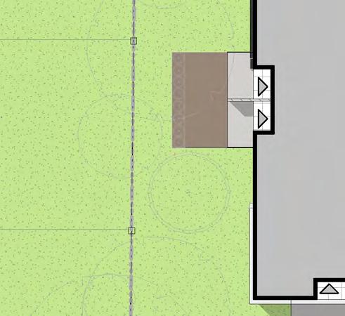
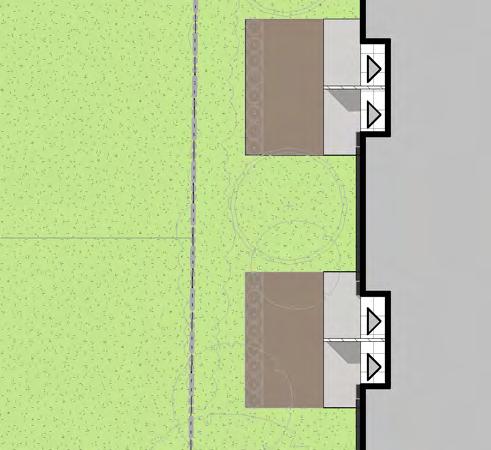
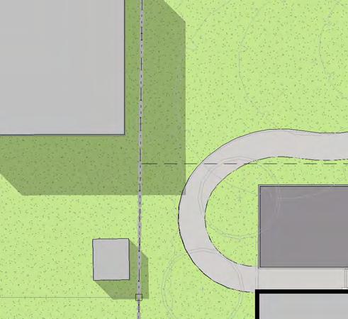
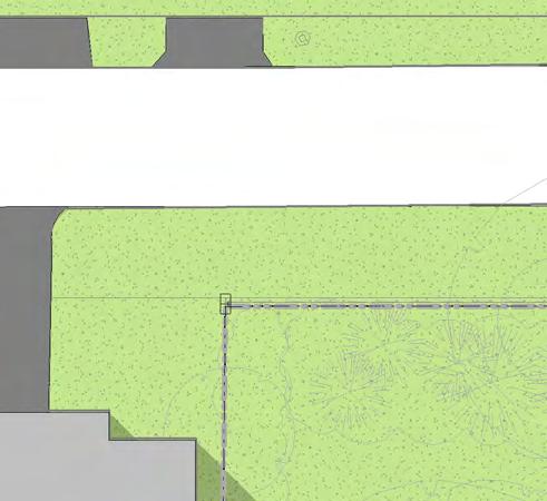
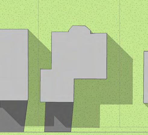
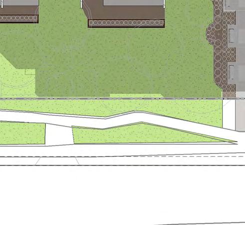
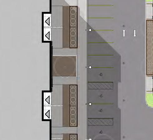
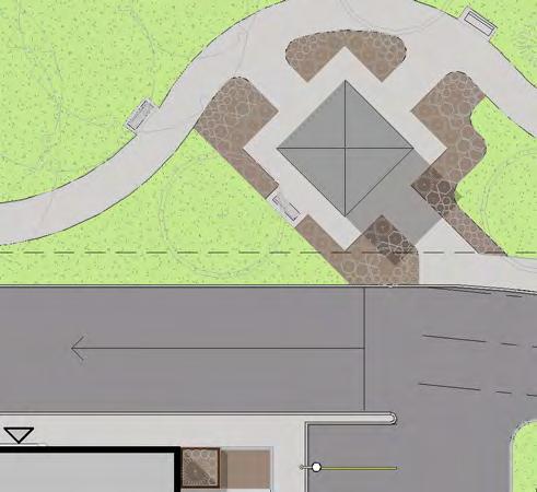
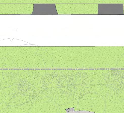

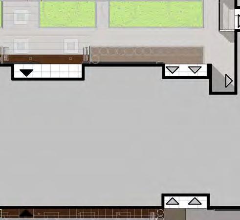
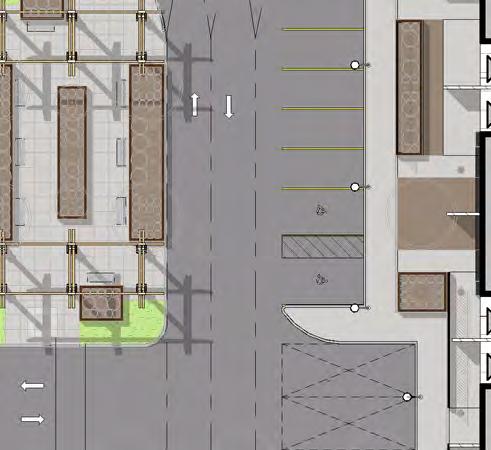
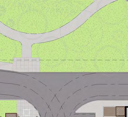

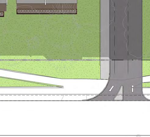
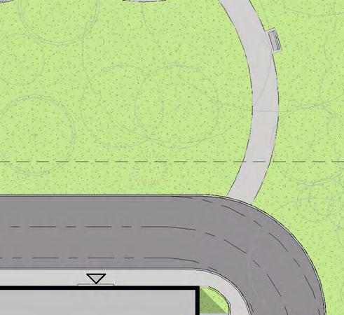
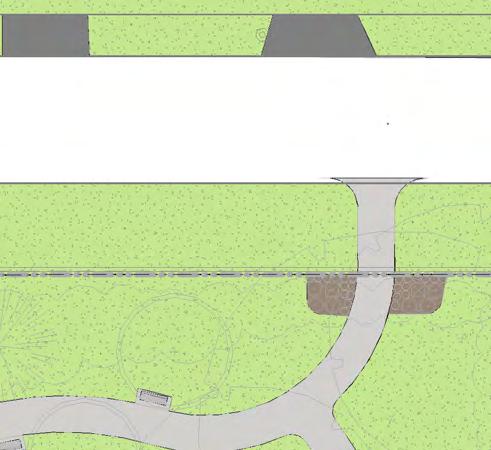
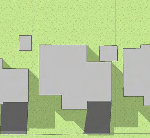

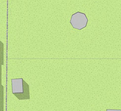
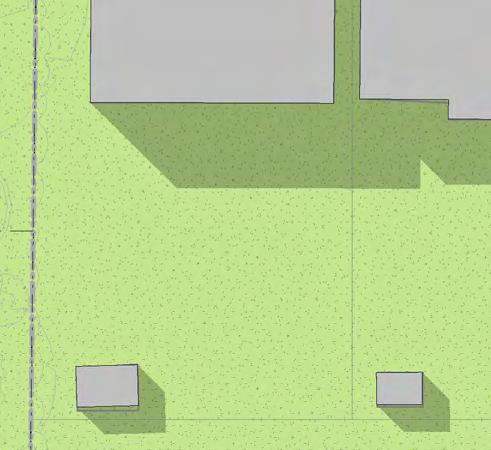


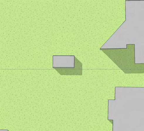
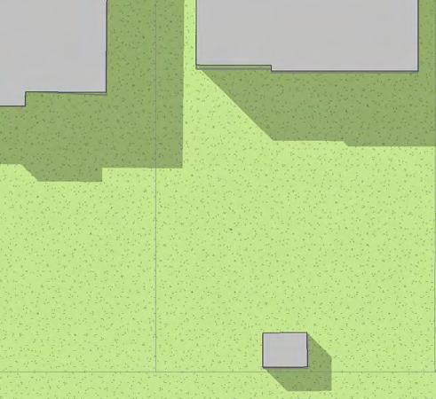
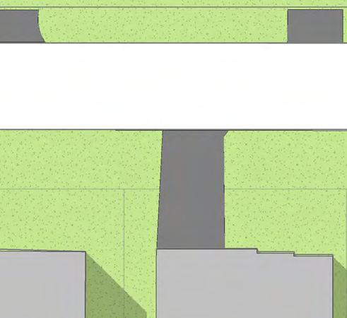
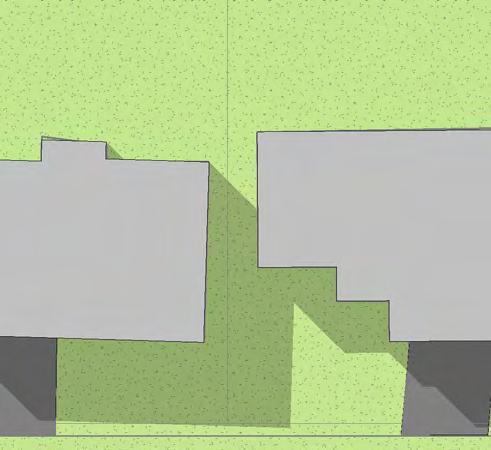
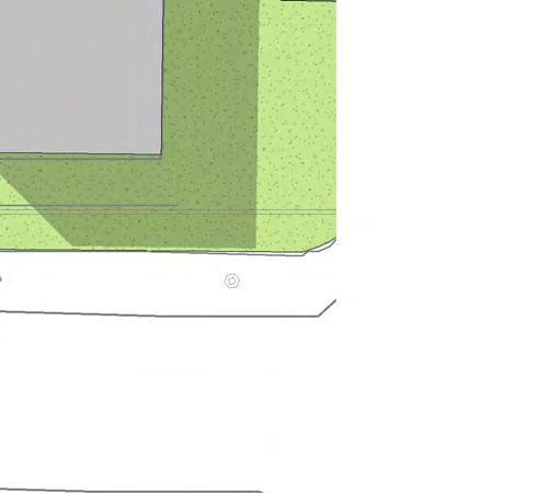
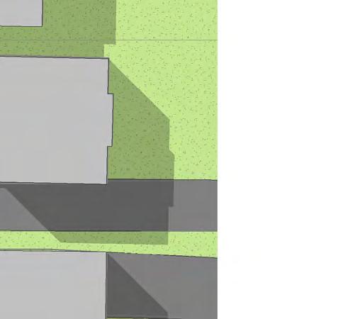
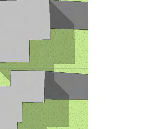
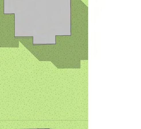
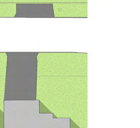
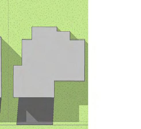
74 PATIO SPACE PATIO SPACE ROAD WIDENING (1.212m) PATIO SPACE PATIO SPACE FANSHAWE PARK ROAD EAST BUILDING ENTRANCE PATIO SPACE PATIO SPACE PATIO SPACE FIRE ROUTE PATIO SPACE PATIO SPACE PATIO SPACE PATIO SPACE PATIO SPACE PATIO SPACE PATIO SPACE PATIO SPACE NEW CONCRETE SIDEWALK PATIO SPACE GARBAGE / LOADING AREA PATIO SPACE FIRE ROUTE PATIO SPACE PATIO SPACE NEW CONCRETE SIDEWALK PATIO SPACE PATIO SPACE PATIO SPACE NEW CONCRETE SIDEWALK PATIO SPACE 19 PARKING STALLS NEW CONCRETE SIDEWALK PATIO SPACE LOT 33 P.I.N PATIO SPACE LOT 34 P.I.N PATIO SPACE PATIO SPACE SETBACK FIRE ROUTE AR Y EXISTING TREES RAMP TO U/G PARKING IN LOT 32 P.I.N PATIO SPACE LOT 38 LOT 2 P.I.N BUILDING ENTRANCE LOT 4 P.I.N CONCRETE PAD (FOR REUSE) EXISTING SIDEWALK PROPOSED SITE ENTRANCE 1 SITE PLAN - COLOURED 1 : 400 PR EL I LOT 31 P.I.N SETBACK DONNYBROOK RD. M C:\Users\swendland\Documents\ Fanshawe Park Apartments - Building - U-shaped_V5_swendland.rvt Do not scale drawings. Contractors must check and verify all dimensions and report any discrepancies to the Architect before proceeding with the work. All documents remain the property of the Architect. Unauthorized use, modification, and/or reproduction of these documents is prohibitted without written permission. The Contract Documents were prepared by the Consultant for the account of the Owner. The material contained herein reflects the Consultants best judgement in light of the information available to him at the time of preparation Any use which a third party makes of the Contract Documents, or any reliance on or decisions to be made based on them are the responsibility of such third parties. The Consultant accepts no responsibility for damages, if any, suffered by any third party as a result of decisions made or actions based on the Contract Documents. Project North No. Date PROPOSED 4 STOREY APARTMENT BUILDING 142 UNITS srm ARCHITECTS INC. True North SIB (AGM) (DISTURBED)0.032 EAST SOUTH SIB (AGM) (DISTURBED) EAST NORTH RE-SET ON CORNER REFER TO LANDSCAPE DRAWINGS FOR PLANTING LOT 40 P.I.N LOT 41 NEW CONCRETE SIDEWALK EXISTING SHRUBS LOT 1 P.I.N Revision LOT 3 P.I.N Project No Issue Date Drawn by Checked by SW MV Plot Date / Time 01/02/ :43:40 AM REFER TO LANDSCAPE DRAWINGS FOR PLANTING EXISTING SIDEWALK FANSHAWE PARK APARTMENTS PORPOSED SITE PLAN COLOURED Drawing Scale 1 : 400 Status Drawing No. Revision No. A1.3
75 CONCRETE GUTTER EDGE OF ASPHALT EDGE OF ASPHALT CONCRETE GUTTER CONCRETE CURB CONCRETE CURB SIB (AGM) (DISTURBED)0.032 EAST SOUTH ENTRANCE FEATURE c/w PILLARS SIB (AGM) (DISTURBED)0.023 EAST NORTH RE-SET ON CORNER 2.5m WIDE WALKWAY LOT 38 LOT 34 P.I.N LOT 33 P.I.N LOT 32 P.I.N LOT 31 P.I.N EXISTING TREES EXISTING SHRUBS SETBACK EXTENT OF UNDERGROUND PARKING STRUCTURE SETBACK SOD SOD SOD PATIO SPACE PATIO SPACE PATIO SPACE PATIO SPACE PATIO SPACE PATIO SPACE EXTENT OF UNDERGROUND PARKING STRUCTURE RAMP TO UNDERGROUND PARKING 19 PARKING STALLS BUILDING ENTRANCE PROPOSED 4 STOREY APARTMENT BUILDING 142 UNITS BUILDING ENTRANCE GARBAGE / LOADING AREA FIRE ROUTE PATIO SPACE PATIO SPACE PATIO SPACE PATIO SPACE PATIO SPACE SOD LOW WALL PATIO SPACE PATIO SPACE PATIO SPACE PATIO SPACE PATIO SPACE SOD SOD SOD SOD SOD SOD LOW WALL LOW WALL LOW WALL LOW WALL METAL GAZEBO SOD SOD METAL PERGOLA METAL PERGOLA EXTENT OF UNDERGROUND PARKING STRUCTURE FIRE ROUTE SOD SOD LOW WALL SOD SOD SOD SOD LOW WALL LOW WALL PATIO SPACE PATIO SPACE PATIO SPACE PATIO SPACE PATIO SPACE LOW WALL LOW WALL EXTENT OF UNDERGROUND PARKING STRUCTURE PATIO SPACE SOD PATIO SPACE PATIO SPACE PATIO SPACE PATIO SPACE PATIO SPACE PATIO SPACE LOW WALL LOW WALL LOW WALL EXTENT OF UNDERGROUND PARKING STRUCTURE FIRE ROUTE LOT 40 P.I.N PART 5 (EASEMENT) PART 1 (EASEMENT) LOT 1 P.I.N LOT 2 P.I.N LOT 3 P.I.N LOT 4 P.I.N CONCRETE PAD (FOR REUSE) LOT 41 SHORING MAY BE REQUIRED TO EXCAVATE NEAR EXISTING TREES EXISTING SIDEWALK EXISTING SIDEWALK CONCRETE CURB CONCRETE GUTTER ROAD WIDENING (1.212m) EXISTING CONCRETE CURB PROPOSED SITE ENTRANCE EXISTING CONCRETE CURB


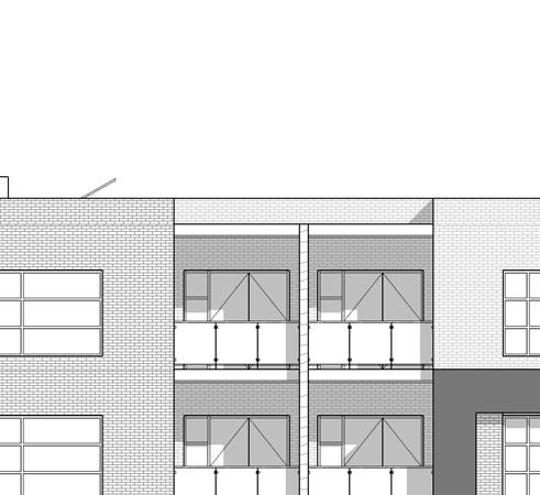
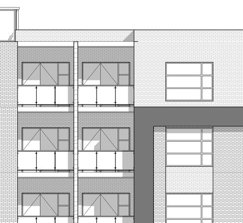
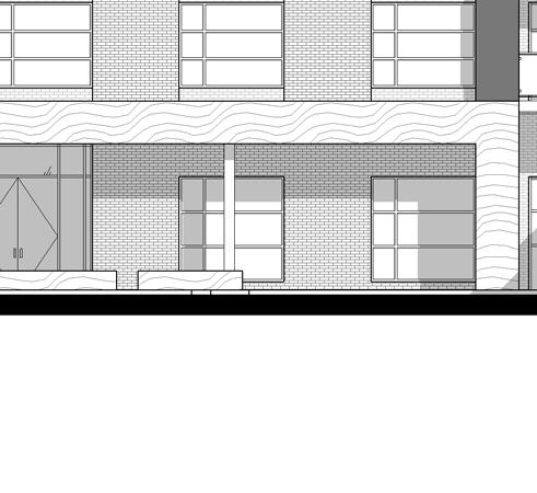
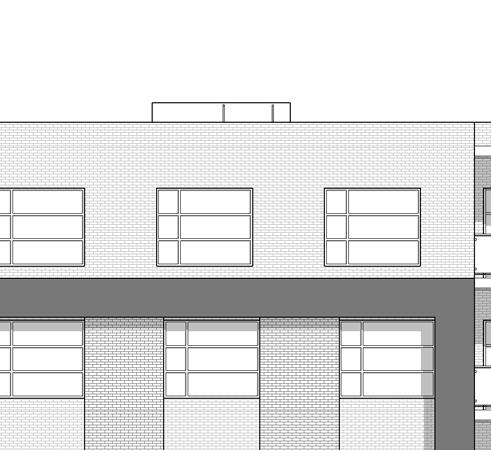
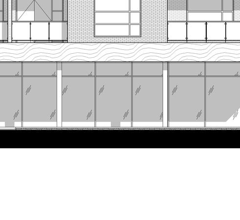
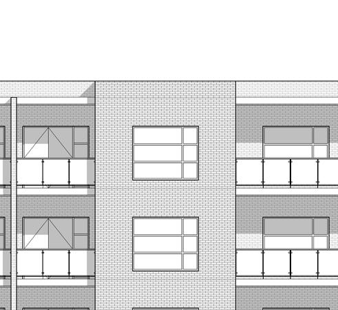
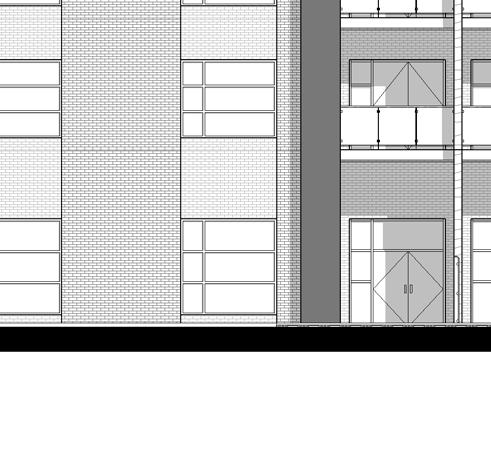

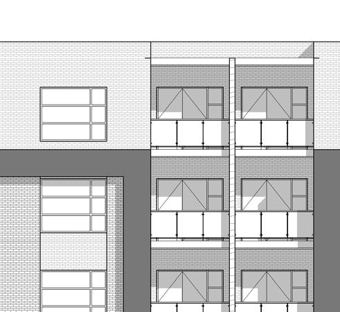
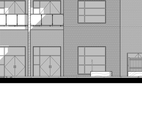
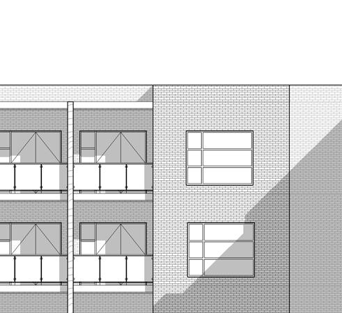
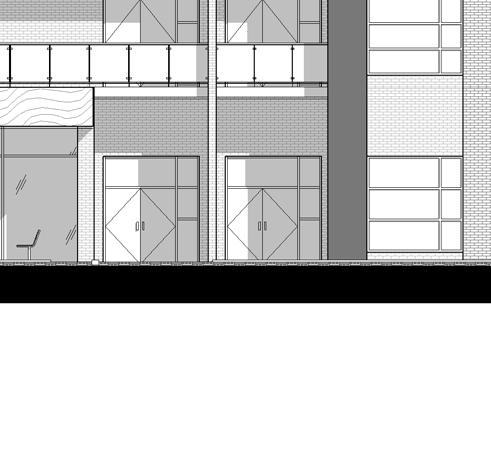
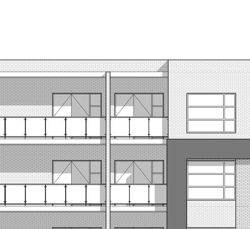
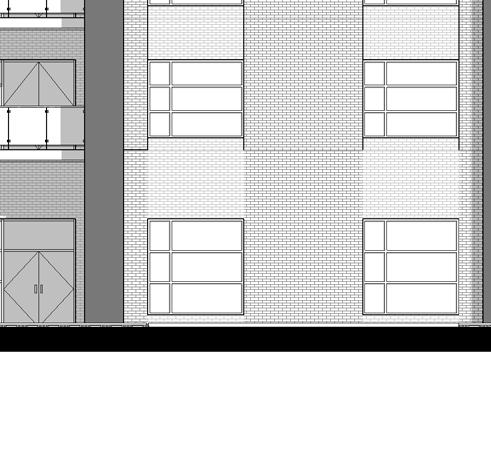
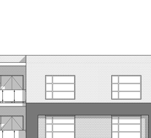
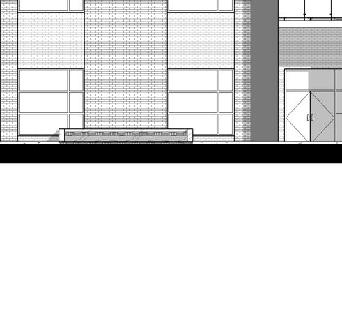
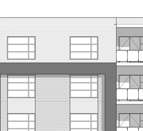
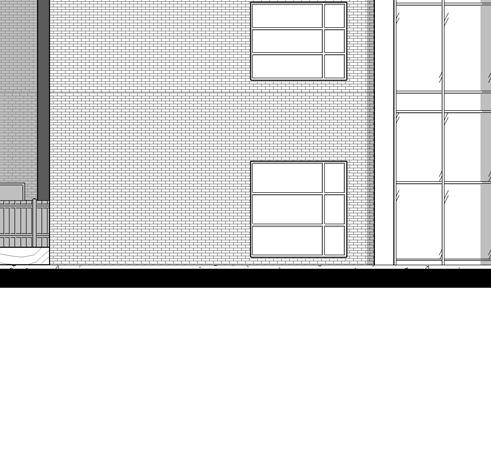
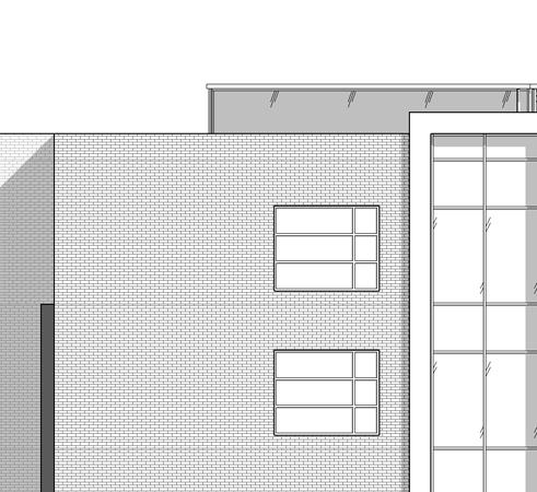
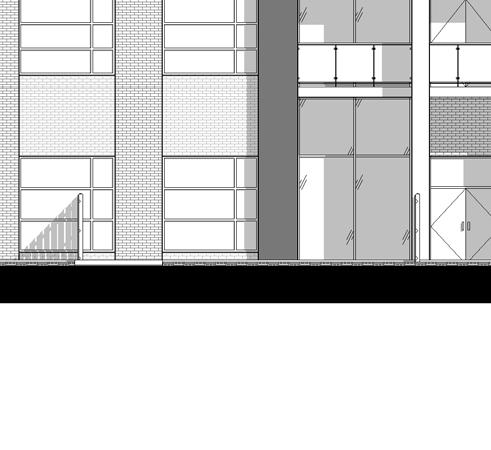
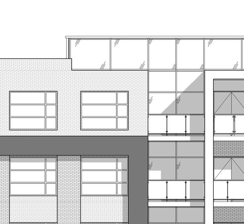
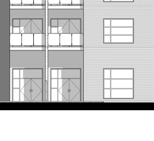
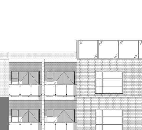
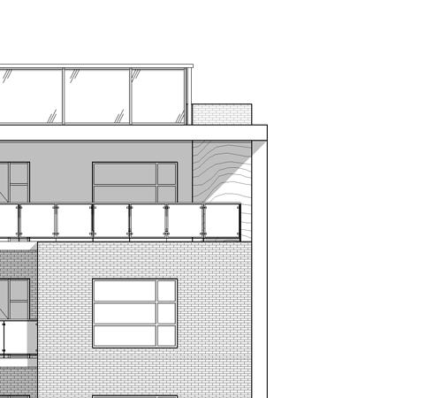
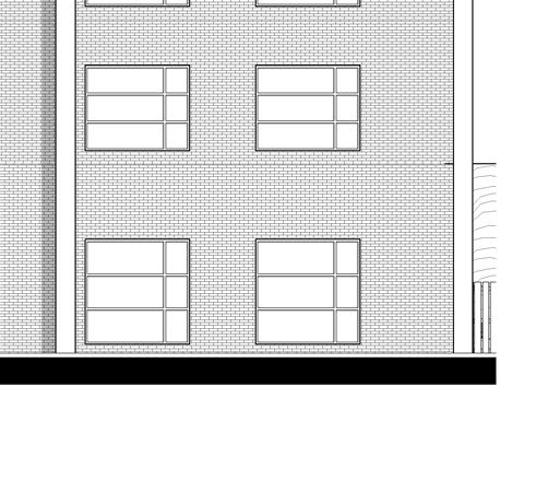
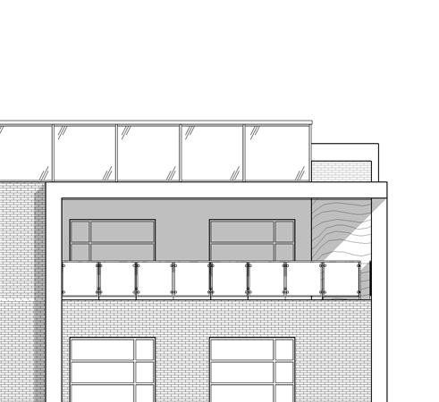
76 Level m GENERAL NOTES 1. DO NOT SCALE DRAWINGS. WRITTEN DIMENSIONS SHALL HAVE PRECEDENCE OVER SCALED DIMENSIONS ALL WORK SHALL COMPLY WITH THE 2012 ONTARIO BUILDING CODE AND AMENDMENTS. 10 Level m 3. CONTRACTORS MUST CHECK AND VERIFY ALL DIMENSIONS AND SPECIFICATIONS AND REPORT ANY DISCREPANCIES TO THE ARCHITECT BEFORE PROCEEDING WITH THE WORK. Do not scale drawings. Contractors must check and verify all dimensions and report any discrepancies to the Architect before proceeding with the work. All documents remain the property of the Architect. Unauthorized use, modification, and/or reproduction of these documents is prohibitted without written permission. The Contract Documents were prepared by the Consultant for the account of the Owner. The material contained herein reflects the Consultants best judgement in light of the information available to him at the time of preparation Any use which a third party makes of the Contract Documents, or any reliance on or decisions to be made based on them are the responsibility of such third parties. The Consultant accepts no responsibility for damages, if any, suffered by any third party as a result of decisions made or actions based on the Contract Documents. C:\Users\swendland\Documents\ Fanshawe Park Apartments - Building - U-shaped_V5_swendland.rvt WEST ELEVATION 1 : SOUTH ELEVATION 1 : NORTH ELEVATION 1 : EAST ELEAVTION 1 : Level m Level 2 (TYP) m Level m Level m Level m Level m Level 2 (TYP) m Level m Level m Level m Level m Level 2 (TYP) m Level m Level m Level m Level m Level 2 (TYP) m Level m 4. ALL CONTRACTORS AND SUB-CONTRACTORS SHALL HAVE A SET OF APPROVED CONSTRUCTION DOCUMENTS ON SITE AT ALL TIMES. 5. ALL DOCUMENTS REMAIN THE PROPERTY OF THE ARCHITECT. UNAUTHORIZED USE, MODIFICATION, AND/OR REPRODUCTION OF THESE DOCUMENTS IS PROHIBITED WITHOUT WRITTEN PERMISSION. THE CONTRACT DOCUMENTS WERE PREPARED BY THE CONSULTANT FOR THE ACCOUNT OF THE OWNER. 6. THE MATERIAL CONTAINED HEREIN REFLECTS THE CONSULTANTS BEST JUDGEMENT IN LIGHT OF THE INFORMATION AVAILABLE TO HIM AT THE TIME OF PREPARATION. ANY USE WHICH A THIRD PARTY MAKES OF THE CONTRACT DOCUMENTS, OR ANY RELIANCE ON/OR DECISIONS TO BE MADE BASED ON THEM ARE THE RESPONSIBILITY OF SUCH THIRD PARTIES. 7. THE CONSULTANT ACCEPTS NO RESPONSIBILITY FOR DAMAGES, IF ANY, SUFFERED BY ANY THIRD PARTY AS A RESULT OF DECISIONS MADE OR ACTIONS BASED ON THE CONTRACT DOCUMENTS. EXTERIOR FINISH LEGEND BRICK COLOUR: BRICK COLOUR: s r m ARCHITECTS INC. PRELIMINARY CHARCOAL WHITE PREFINISHED METAL PANEL COLOUR: CHARCOAL 4 PREFINISHED METAL PANEL COLOUR: WHITE 5 PRECAST CONCRETE COLOUR: WHITE COMPOSITE WOOD VENEER COLOUR: ALUMINUM FRAMES COLOUR: GLASS GLASS TYPE: GLASS GLASS TYPE: BALCONY GUARD GLASS TYPE: CHARCOAL VISION PANEL SPANDREL PANEL TEMPERED VISION PANEL No. Date Revision Project No Issue Date Drawn by Checked by Plot Date / Time ELEVATIONS 17/01/ :59:26 AM FANSHAWE PARK APARTMENTS Drawing Scale Status Drawing No Author Checker As indicated Revision No. A3.1


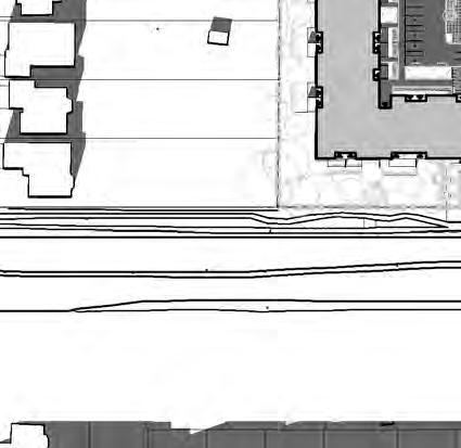
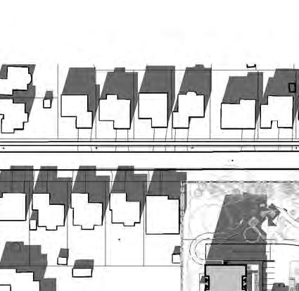
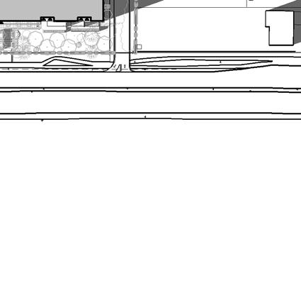
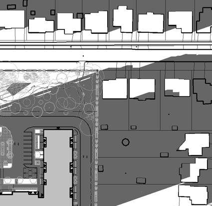
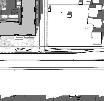
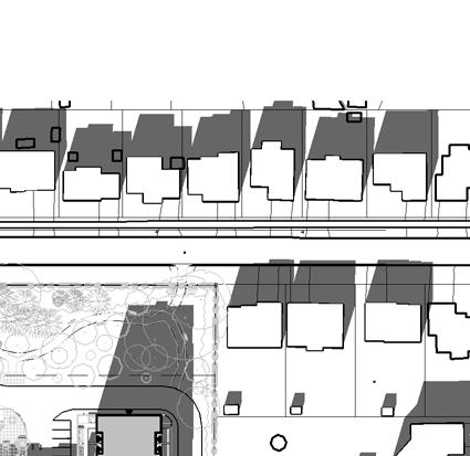
77 Project North True North 1 SHADOW STUDY - DEC 21 10AM 1 : : 2000 SHADOW STUDY - DEC PM 3 SHADOW STUDY - DEC 21 2 PM 1 : : 2000 SHADOW STUDIES DECEMBER 21 FANSHAWE PARK APARTMENTS SHADOW STUDY - DEC 21 4 PM /01/17 01/02/ :22:17 AM


78 Project North True North 1 SHADOW STUDY - MAR 21 10AM 1 : : 2000 SHADOW STUDY - MAR 21 12PM 3 SHADOW STUDY - MAR 21 2PM 1 : : 2000 SHADOW STUDIES MARCH 21 FANSHAWE PARK APARTMENTS SHADOW STUDY - MAR 21 4PM /01/17 01/02/ :22:23 AM


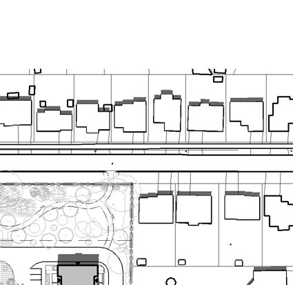
79 Project North True North 1 SHADOW STUDY - JUN 21 10AM 1 : : 2000 SHADOW STUDY - JUN 21 12PM 3 SHADOW STUDY - JUN 21 2PM 1 : : 2000 SHADOW STUDIES JUNE 21 FANSHAWE PARK APARTMENTS SHADOW STUDY - JUN 21 4PM /01/17 01/02/ :22:29 AM


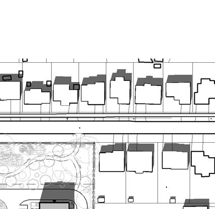
80 Project North True North 1 SHADOW STUDY - SEPT 21 10AM 1 : : 2000 SHADOW STUDY - SEPT 21 12PM 3 SHADOW STUDY - SEPT 21 2PM 1 : : 2000 SHADOW STUDIES SEPT 21 FANSHAWE PARK APARTMENTS SHADOW STUDY - SEPT 21 4PM /01/17 01/02/ :22:34 AM

81 RENDERINGS FANSHAWE PARK APARTMENTS /01/ :00:40 PM

82 RENDERING FANSHAWE PARK APARTMENTS /01/ :00:41 PM

83 RENDERING FANSHAWE PARK APARTMENTS /01/ :00:41 PM


84 RENDERINGS FANSHAWE PARK APARTMENTS /01/ :00:42 PM

85 RENDERING FANSHAWE PARK APARTMENTS /01/ :00:42 PM


86 RENDERING FANSHAWE PARK APARTMENTS /01/ :00:43 PM


87 RENDERINGS - PARK FANSHAWE PARK APARTMENTS /17/17 17/01/ :00:44 PM


88 RENDERINGS - PARK FANSHAWE PARK APARTMENTS /17/17 17/01/ :00:45 PM
URBAN DESIGN BRIEF URBAN DESIGN BRIEF 721 FRANKLIN BLVD, CAMBRIDGE August 2018
 URBAN DESIGN BRIEF URBAN DESIGN BRIEF 721 FRANKLIN BLVD, CAMBRIDGE August 2018 DESIGN BRIEF CONTENTS PART A 1.0 INTRODUCTION 2.0 DESCRIPTION & ANALYSIS OF SITE CONTEXT 3.0 DESIGN CONSTRAINTS AND OPPORTUNITIES
URBAN DESIGN BRIEF. 2136&2148 Trafalgar Road. Town of Oakville
 URBAN DESIGN BRIEF 2136&2148 Trafalgar Road Town of Oakville Prepared By: METROPOLITAN CONSULTING INC For 2500674 Ontario Inc November 2016 TABLE OF CONTENTS Page No. 1.0 Introduction/Description of Subject
Urban Design Brief 1576 Richmond Street City of London
 Urban Design Brief City of London Treadstone Developments October 31, 2014 Urban Design Brief October 31, 2014 TABLE OF CONTENTS Page No. INTRODUCTION... 1 SECTION 1 LAND USE PLANNING CONCEPT... 1 1.1
Urban Design Brief December 23, 2015 Southside Construction Group Official Plan & Zoning By-Law Amendment
 Urban Design Brief Proposed Official Plan & Zoning By-Law Amendment 3244, 3263 and 3274 Wonderland Road South Southside Group December 23, 2015 TABLE OF CONTENTS Page No. INTRODUCTION... 1 SECTION 1 LAND
Tel: (705) Fax: (705)
 Fax: (705)") 521 and 525 Essa Road City of Barrie Tel: (705) 812-3281 Fax: (705) 812-3438 Email: INFO@IPSCONSULTINGINC.com 1 5 0 D U N L O P S T R E E T E A S T, S U I T E 2 0 1, B A R R I E O N T A R I O L 4 M 1 B
521 and 525 Essa Road City of Barrie Tel: (705) 812-3281 Fax: (705) 812-3438 Email: INFO@IPSCONSULTINGINC.com 1 5 0 D U N L O P S T R E E T E A S T, S U I T E 2 0 1, B A R R I E O N T A R I O L 4 M 1 B
Urban Design Brief Proposed Residential Development 5219 Upper Middle Road City of Burlington
 Urban Design Brief Proposed Residential Development 5219 Upper Middle Road City of Burlington Prepared by Weston Consulting Prepared for BLOOMFIELD DEVELOPMENT INC. Date: March 2017 Table of Contents 1.
TABLE OF CONTENTS 1.0 INTRODUCTION... 3
 TABLE OF CONTENTS 1.0 INTRODUCTION... 3 1.1. BACKGROUND... 3 1.2. THE PROPOSAL... 5 2.0 EXISTING POLICY FRAMEWORK... 5 2.1. PROVINCIAL POLICY STATEMENT (PPS)... 5 2.2. CITY OF LONDON OFFICIAL PLAN (OP)...
Urban Design Brief to 1557 Gordon Street & 34 Lowes Road West
 Urban Design Brief 1533 to 1557 Gordon Street & 34 Lowes Road West Reid s Heritage Homes Ltd. & 883928 Ontario Ltd. and RHH Property Management Ltd. City of Guelph Zoning By-law Amendment November 2017
URBAN DESIGN BRIEF 305, 309, & 315 SOUTHDALE ROAD WEST LONDON ONTARIO
 URBAN DESIGN BRIEF 305, 309, & 315 SOUTHDALE ROAD WEST LONDON ONTARIO CARVEST PROPERTIES LTD. December 2013 Section 1 - Land Use Planning Context 1.1 Subject Lands The subject lands are located immediately
Urban Design Guidelines Townhouse and Apartment Built Form
 Urban Design Guidelines Townhouse and Apartment Built Form Town of Wasaga Beach Table of Contents 1. Introduction 1.1. Purpose 1.2. Urban Design Principles 1.3. Application of Guidelines 2. Site Design,
89-97 KING STREET London, ON URBAN DESIGN BRIEF DECEMBER 2016 (REVISED: FEBRUARY 2017)
") 89-97 KING STREET London, ON URBAN DESIGN BRIEF DECEMBER 2016 (REVISED: FEBRUARY 2017) Prepared by MHBC Planning 630 COLBORNE STREET SUITE 202 LONDON, ON N6B 2V2 Section 1 TABLE OF CONTENTS 1.1 Introduction
89-97 KING STREET London, ON URBAN DESIGN BRIEF DECEMBER 2016 (REVISED: FEBRUARY 2017) Prepared by MHBC Planning 630 COLBORNE STREET SUITE 202 LONDON, ON N6B 2V2 Section 1 TABLE OF CONTENTS 1.1 Introduction
Urban Design Brief. Watson Parkway North & Watson Road North Guelph, Ontario. Prepared by Coletara Development
 Urban Design Brief Watson Parkway North & Watson Road North Guelph, Ontario Prepared by Coletara Development December, 2013 Urban Design Brief, Coletara Development 1 Introduction This Urban Design Brief
5.1 Site Plan Guidelines
 5. Community Core Guidelines Development of the Community Core will take place by plan of subdivision and site plan approval. It will occur in a phased manner that will reflect the timing of residential
Clairtrell Area Context Plan
 Clairtrell Area Context Plan March 2005 Urban Development Services City Planning Contents 1. Introduction... 4 2. Development Structure... 6 2.1 Streets... 7 2.1.1 Sheppard Avenue and Bayview Avenue...
URBAN DESIGN BRIEF Gordon Street City of Guelph. Prepared on behalf of Ontario Inc. March 25, Project No. 1507
 URBAN DESIGN BRIEF 1131 Gordon Street City of Guelph Prepared on behalf of 1876698 Ontario Inc. March 25, 2016 Project No. 1507 423 Woolwich Street, Suite 201, Guelph, Ontario, N1H 3X3 Phone (519) 836-7526
ELMVALE ACRES SHOPPING CENTRE MASTER PLAN
 ELMVALE ACRES SHOPPING CENTRE MASTER PLAN Contents 1.0 INTRODUCTION... 2 2.0 LOCATION... 2 3.0 EXISTING CONTEXT... 2 4.0 VISION & GUIDING PRINCIPLES... 2 5.0 LAND USE AND BUILT FORM... 4 5.1 St. Laurent
DRAFT Northeast Quadrant of Kipling Avenue and Highway 7 DRAFT AUGUST 29, Goals Land Use. The goals of this Plan are to:
 AUGUST 29, 2017 12.15 Northeast Quadrant of Kipling Avenue and Highway 7 12.15.1 Goals 12.15.2 Land Use The goals of this Plan are to: 12.15.2.1 General Provisions: a) Ensure the development of a compact
East Bayshore Road Neighbourhood
 East Bayshore Road Neighbourhood Northridge Property Management Urban Design Brief 3195 East Bayshore Road City of Owen Sound January 2016 East Bayshore Road Neighbourhood Northridge Property Management
New-Cast Mixed-use Development Proposal King Street West, Newcastle, Ontario
 URBAN DESIGN BRIEF New-Cast Mixed-use Development Proposal King Street West, Newcastle, Ontario TABLE OF CONTENTS: 1.0 Executive Summary 2.0 Creating Vibrant and Sustainable Urban Places: Excerpts from
URBAN DESIGN BRIEF 181 Burloak Drive, Oakville
 URBAN DESIGN BRIEF 181 Burloak Drive, Oakville February 2017 Our File: 1730B 230-7050 WESTON ROAD / WOODBRIDGE / ONTARIO / L4L 8G7 / T: 905 761 5588/ F: 905 761 5589/WWW.MHBCPLAN.COM TABLE OF CONTENTS
CONTENTS 8.0 LAND USE 8.1 GENERAL LAND USE 8.2 RESIDENTIAL 8.3 MIXED USE 8.4 COMMERCIAL 8.5 EMPLOYMENT LANDS
 8-2 Land Use 8.0 LAND USE CONTENTS 8.1 GENERAL LAND USE 8.1.1 Uses provided for in all Land Use Designations 8.1.2 Uses prohibited in Hazardous Lands, Hazardous Sites and Special Policy Areas 8.1.3 Uses
FRUITVALE TRANSIT VILLAGE (Phase 2) Residential Project
 Residential Project") FRUITVALE TRANSIT VILLAGE (Phase 2) Residential Project DEVELOPER: SIGNATURE PROPERTIES ARCHITECT: HKIT ARCHITECTS April 23, 2010 TABLE OF CONTENTS 3 Vision 4 Description of Site 5 Guiding Concepts 6
FRUITVALE TRANSIT VILLAGE (Phase 2) Residential Project DEVELOPER: SIGNATURE PROPERTIES ARCHITECT: HKIT ARCHITECTS April 23, 2010 TABLE OF CONTENTS 3 Vision 4 Description of Site 5 Guiding Concepts 6
Urban Design Brief. 583, 585 and 589 OXFORD STREET EAST. Salt Clinic Canada Inc.
 Urban Design Brief 583, 585 and 589 OXFORD STREET EAST Salt Clinic Canada Inc. February 3, 2013 TABLE OF CONTENTS Page No. INTRODUCTION... 1 SECTION 1 LAND USE PLANNING CONCEPT... 1 1.1 The Subject Property...
Urban Design Brief Fanshawe Park Road. Competition Toyota
 Urban Design Brief 1300 Fanshawe Park Road Competition Toyota May 2, 2014 TABLE OF CONTENTS Page No. INTRODUCTION... 1 SECTION 1 LAND USE PLANNING CONTEXT... 1 1.1 The Subject Lands... 1 1.2 The Proposal...
135 VILLAGEWALK BOULEVARD London, ON
 135 VILLAGEWALK BOULEVARD London, ON URBAN DESIGN BRIEF Site Plan Approval Application (2560334 Ontario Limited c/o York Developments) Prepared by MHBC Planning 630 COLBORNE STREET SUITE 202 LONDON, ON
appendix and street interface guidelines
 appendix five: building and street interface guidelines appendix 5 building and street interface guidelines BOULEVARDS Boulevards are generally characterized by higher levels of traffic movement at higher
Bel-Air Lexus Automobile Service Station
 Bel-Air Lexus Automobile Service Station Design Brief 443-447 McArthur Avenue Ottawa April 30, 2015 14-1299-MCA Site Details Application: Site Plan Control Legal Description and Municipal Addresses: 443
*** DRAFT 2 FOR PUBLIC REVIEW ***
 6.7 The area is generally bounded by the Red Hill Valley Parkway to the west, Lake Avenue to the east, the Queen Elizabeth Way (QEW) to the north, and by the properties just south of Queenston Road to
URBAN DESIGN BRIEF REPORT
 URBAN DESIGN BRIEF REPORT PREPARED FOR 2568401 ONTARIO INC NEW GASBAR, CONVENIENCE STORE & CARWASH DEVELOPMENT @ 1509 FANSHAWE PARK ROAD WEST LONDON, ONTARIO GAMA ENGINEERING INC. PROJECT NUMBER 1669 PREPARED
BENSON / HUNT TERTIARY PLAN
 BENSON / HUNT TERTIARY PLAN TABLE OF CONTENTS 1.0 INTRODUCTION 1.1 Purpose 2 1.2 How to Read This Plan 3 1.3 Tertiary Plan Context 3 1.4 Vision and Principles 5 1.5 Public Consultation 5 2.0 PLANNING CONTEXT
WINDSOR GLEN DESIGN GUIDELINES
 WINDSOR GLEN DESIGN GUIDELINES Adopted by Council, 2006 WINDSOR GLEN REDEVELOPMENT DESIGN GUIDELINES August 2006 1.0 Master Plan Organization For this area of the Coquitlam Town Centre, a mix of high,
1.0 Purpose of a Secondary Plan for the Masonville Transit Village
 Report to Planning and Environment Committee To: Chair and Members Planning & Environment Committee From: John M. Fleming Managing Director, Planning and City Planner Subject: Masonville Transit Village
Regency Developments. Urban Design Brief. Holyrood DC2 Rezoning
 Regency Developments Urban Design Brief Holyrood DC2 Rezoning Stantec Consulting Ltd. 7-31-2017 1. Overview Regency Developments intends to rezone the lands located at 8510 and 8511 93 Avenue, within the
Urban Design Brief Woodland Cemetery Funeral Home 493 Springbank Drive
 Urban Design Brief Woodland Cemetery Funeral Home The Incorporated Synod of the Diocese of Huron April 15, 2016 Urban Design Brief April 15, 2016 TABLE OF CONTENTS Page No. INTRODUCTION... 1 SECTION 1
Proposed for Vic West Neighbourhood Plan. Design Guidelines for Intensive Residential Development - Townhouse and Attached Dwelling
 Proposed for Vic West Neighbourhood Plan Design Guidelines for Intensive Residential Development - Townhouse and Attached Dwelling Design Guidelines for Intensive Residential Development - Townhouse and
URBAN DESIGN BRIEF. April FREEPORT Street TOWNHOUSES. 711 FREEPORT St., LONDON
 URBAN DESIGN BRIEF April 2013 FREEPORT Street TOWNHOUSES 711 FREEPORT St., LONDON TABLE OF CONTENTS 1.0 Land Use Planning Context...... pg. 1 1.1 Subject Lands... pg. 1 1.2 Proposed Development... pg.
Urban Design Brief. 875 Wellington Road. Proposed One-Storey Fast Food Restaurant and Two-Storey Restaurant. Wellington Harlech Centre Inc.
 Urban Design Brief 875 Wellington Road Proposed One-Storey Fast Food Restaurant and Two-Storey Restaurant Wellington Harlech Centre Inc. Prepared By: (519) 433-7587 info@yorkdev.ca May 3 rd 2013 1 Table
URBAN DESIGN BRIEF NORTHVIEW FUNERAL HOME HIGHBURY AVE N, LONDON, ON
 URBAN DESIGN BRIEF NORTHVIEW FUNERAL HOME - 1490 HIGHBURY AVE N, LONDON, ON 1.1Purpose The intent of the following report is to identify an opportunity for redevelopment of two residential properties within
lot flankage Y street 16m 6m landscape strip for large site 3m landscape strip for small medium site
 Commercial General Commercial Objectives Create developments compatible with adjacent land uses in scale, function and character Define a consistent and attractive street edge with quality landscaping,
B L A C K D I A M O N D D E S I G N G U I D E L I N E S for Multi-family Development
 B L A C K D I A M O N D D E S I G N G U I D E L I N E S for Multi-family Development Adopted June 18, 2009 This section of the Design and focuses on site planning and design guidance for new multi-family
Highland Village Green Design Guidelines
 Highland Village Green Design Guidelines Publishing Information Title Highland Village Green Design Guidelins Author The City of Calgary Status DRAFT - Proposed document subject to changes Additional Copies
The West Vaughan Employment Area Secondary Plan Policies
 Part 2: The West Vaughan Employment Area Secondary Plan Policies 2.1 General Policies It is the policy of Council: 2.1.1. That the West Vaughan Employment Area (the WVEA), identified on Schedule 1, will
4.0 Design Guidelines For The Village Centre. South fields Community Architectural Design Guidelines Town of Caledon
 4.0 Design Guidelines For The Village Centre 4.0 Design Guidelines for the Village Centre The Village Centre is the focal point of the entire South Fields Community and is designed as a traditional commercial
Mark-up of the effect of the proposed Bronte Village Growth Area OPA No.18 on the text of section 24, Bronte Village, of the Livable Oakville Plan
 Mark-up of the effect of the proposed Bronte Village Growth Area OPA No.18 on the text of section 24, Bronte Village, of the Livable Oakville Plan Notes: This document is provided for information purposes
Complete Neighbourhood Guidelines Review Tool
 Complete Neighbourhood Guidelines Review Tool Prepared By: City of Regina Planning Department October 2014 Page 1 of 14 Community Development Review Checklist for Secondary Plans and Concept Plans The
178 Carruthers Properties Inc.
 178 Carruthers Properties Inc. Planning Rationale for 178 Carruthers Avenue Site Plan Control Application June 2014 Table of Contents 1.0 Introduction 2.0 Overview of Subject Property 3.0 Current Zoning
Urban Design Brief. Garden Drive Townhouse Development Matas Development Group. Oakville, Ontario
 Garden Drive Townhouse Development Matas Development Group Oakville, Ontario February 8, 2013 Urban Design and Architecture 2 Introduction This Urban Design Brief has been prepared in support of a rezoning
City of Vaughan Urban Design Guidelines for Infill Development in Established Low-Rise Residential Neighbourhoods
 City of Vaughan Urban Design Guidelines for Infill Development in Established Low-Rise Residential Neighbourhoods DRAFT - September 2016 Contents 1. Introduction 1 2. Policy Context 3 3. Characteristics
URBAN DESIGN BRIEF. Saginaw Subdivision 124 SAGINAW PARKWAY, CAMBRIDGE OCTOBER 2015 OUR FILE 1422A
 URBAN DESIGN BRIEF Saginaw Subdivision 124 SAGINAW PARKWAY, CAMBRIDGE OCTOBER 2015 OUR FILE 1422A Contents 1.0 INTRODUCTION AND SITE DESCRIPTION... 1 2.0 MUNICIPAL DESIGN DIRECTION... 7 3.0 MASTER CONCEPT
Housing and Coach House Guidelines - Ladner
 Housing and Coach House Guidelines - Ladner Policy D.8: Encourage Compatible Housing Design Encourage housing design that is sensitive to existing single family housing neighbourhoods by requiring a design
GUIDELINES. Transit Oriented Development. Approved by Edmonton City Council on February 15, 2012 in tandem with City Policy C565
 Transit Oriented Development GUIDELINES Prepared by the City of Edmonton Sustainable Development and Transportation Services Departments Approved by Edmonton City Council on February 15, 2012 in tandem
PLANNING JUSTIFICATION REPORT
 PLANNING JUSTIFICATION REPORT 55 DELHI STREET CITY OF GUELPH PREPARED FOR: VESTERRA PROPERTY MANAGEMENT PREPARED BY: LABRECHE PATTERSON & ASSOCIATES INC. SCOTT PATTERSON, BA, CPT, MCIP, RPP PRINCIPAL,
(DC1) Direct Development Control Provision DC1 Area 4
 Direct Development Control Provision DC1 Area 4") . General Purpose (DC) Direct Development Control Provision DC Area 4 The purpose of this Provision is to provide for an area of commercial office employment and residential development in support of the
. General Purpose (DC) Direct Development Control Provision DC Area 4 The purpose of this Provision is to provide for an area of commercial office employment and residential development in support of the
KANATA CENTRUM 255 KANATA AVENUE OFFICIAL PLAN AMENDMENT ZONING BY-LAW AMENDMENT
 KANATA CENTRUM 255 KANATA AVENUE OFFICIAL PLAN AMENDMENT ZONING BY-LAW AMENDMENT JUNE 2015 PREPARED BY: FOTENN Consultants Inc. 223 Mcleod Street Ottawa, ON K2P OZ8 (613) 730-5709 PREPARED FOR: Kanata
URBAN DESIGN BRIEF.. on behalf of the owner..sunningdale Commercial Inc.
 URBAN DESIGN BRIEF.. on behalf of the owner..sunningdale Commercial Inc.. in support a Site Plan Approval Application to permit a Shopping Areas commercial centre. at 1830 Adelaide Street North, in the
Re: 1110 Fisher Avenue Proposed Residential Development Revised Proposal File D PLANNING RATIONALE ADDENDUM
 October 23, 2014 Prestige Design & Construction 50 Camelot Drive Ottawa, ON K2G 5X8 Attention: Mr. Enzo DiChiara Dear Mr. DiChiara Re: 1110 Fisher Avenue Proposed Residential Development Revised Proposal
URBAN DESIGN BRIEF. Terms of Reference. Purpose. When is an Urban Design Brief Required
 Purpose An Urban Design Brief (UDB) is intended to describe and illustrate proposed designs for new development projects and demonstrate how the City s Urban Design Guidelines and other City policies have
599 Kennedy Road - Official Plan Amendment and Zoning Amendment Application - Preliminary Report
 STAFF REPORT ACTION REQUIRED 599 Kennedy Road - Official Plan Amendment and Zoning Amendment Application - Preliminary Report Date: March 7, 2017 To: From: Wards: Reference Number: Scarborough Community
POLICY AMENDMENT AND LAND USE AMENDMENT KILLARNEY/GLENGARRY (WARD 8) NW CORNER OF RICHMOND ROAD AND 33 STREET SW BYLAWS 1P2015 AND 7D2015
 NW CORNER OF RICHMOND ROAD AND 33 STREET SW BYLAWS 1P2015 AND 7D2015") Page 1 of 13 EXECUTIVE SUMMARY This application seeks to redesignate an RC-2 (Residential Contextual One/Two Dwelling) parcel to MC-Gd72 (Multi-Residential Contextual Grade-Oriented) to allow for multi-residential
Page 1 of 13 EXECUTIVE SUMMARY This application seeks to redesignate an RC-2 (Residential Contextual One/Two Dwelling) parcel to MC-Gd72 (Multi-Residential Contextual Grade-Oriented) to allow for multi-residential
Planning Board Briefing
 Planning Board Briefing Why Now? The Sector Plan Implementation Chapter States: Before Stage 1 begins, the following must occur: Approval of the Sectional Map Amendment. Approval of the Greater Lyttonsville
Urban Design Manual PLANNING AROUND RAPID TRANSIT STATIONS (PARTS) Introduction. Station Study Areas
 Introduction. Station Study Areas") 111111 PLANNING AROUND RAPID TRANSIT STATIONS (PARTS) Introduction The ION rapid transit system will link Waterloo, Kitchener and Cambridge through a central transit corridor (CTC). There are a number
111111 PLANNING AROUND RAPID TRANSIT STATIONS (PARTS) Introduction The ION rapid transit system will link Waterloo, Kitchener and Cambridge through a central transit corridor (CTC). There are a number
Urban Design Manual 2.0 DRIVE-THROUGH FACILITIES. Background. Urban Design Challenges
 222221 2.0 DRIVE-THROUGH FACILITIES Background In recent years, drive-through facilities have grown significantly in popularity with drive-through restaurants, in particular, being established on numerous
New Street Proposed Redevelopment Architecture & Urban Design Brief
 2130 2136 New Street Proposed Redevelopment Architecture & Urban Design Brief Prepared By: Cynthia Zahoruk Architect Inc. 3077 New Street, Burlington, ON, L7N 1M6 TABLE OF CONTENTS Background and Objective
URBAN DESIGN BRIEF New Street Burlington, ON
 3225-3237 New Street Burlington, ON MARCH 2017 Prepared for: Royal Living Development Group Inc. Prepared by: adesso design inc. 218 Locke Street South, 2nd Floor Hamilton, ON L8P 4B4 t. 905.526.8876 3225-3237
THE CITY OF VAUGHAN BY-LAW BY-LAW NUMBER A By-law to adopt Amendment Number 1 to the Official Plan of the Vaughan Planning Area.
 THE CITY OF VAUGHAN BY-LAW BY-LAW NUMBER 015-2014 A By-law to adopt Amendment Number 1 to the Official Plan of the Vaughan Planning Area. NOW THEREFORE the Council of the Corporation of the City of Vaughan
Uptown Rideau Street Secondary Plan [Amendment #166, January 12, 2016]
![Uptown Rideau Street Secondary Plan [Amendment #166, January 12, 2016]](/thumbs/76/73760497.jpg "Uptown Rideau Street Secondary Plan [Amendment #166, January 12, 2016]") [Amendment #166, January 12, 2016] The policies of this Secondary Plan are in effect, save and except for the property at 560 Rideau Street, for which there remains a site specific appeal to this Secondary
[Amendment #166, January 12, 2016] The policies of this Secondary Plan are in effect, save and except for the property at 560 Rideau Street, for which there remains a site specific appeal to this Secondary
YONGE STEELES CORRIDOR SECONDARY PLAN. Young + Wright / IBI Group Architects Dillon Consulting Ltd. GHK International (Canada) Ltd.
 Ltd.") PART A: PREAMBLE 1.0 PURPOSE The purpose of this Secondary Plan is to provide a development framework for intensification of the Yonge/ Steeles corridor including the north side of Steeles Avenue West
PART A: PREAMBLE 1.0 PURPOSE The purpose of this Secondary Plan is to provide a development framework for intensification of the Yonge/ Steeles corridor including the north side of Steeles Avenue West
2136 & 2148 Trafalgar Road Town of Oakville Region of Halton
 PLANNING JUSTIFICATION REPORT 2136 & 2148 Trafalgar Road Town of Oakville Region of Halton Zoning By-Law Amendment Application 2500674 Ontario Inc. November 2016 Table of Contents Page 1.0 Location/Summary
Attachment 1 TOWN OF NEW TECUMSETH. Manual for the Preparation of an Urban Design Report
 Attachment 1 TOWN OF NEW TECUMSETH Manual for the Preparation of an Urban Design Report July 2010 TABLE OF CONTENTS Background, Policy Framework and the Preparation of Urban Design Reports 1. Introduction
EXISTING COMPREHENSIVE PLAN
 EXISTING COMPREHENSIVE PLAN Town Center Land Use Element: V. LAND USE POLICIES Town Center Mercer Island's business district vision as described in "Your Mercer Island Citizen-Designed Downtown" was an
6.0 Land Use Policies for Rural Settlements. 6.1 Rural Settlement Strategy
 6.0 Land Use Policies for Rural Settlements 6.1 Rural Settlement Strategy INTRODUCTION AMENDMENT NO. 131 PURPOSE Designated rural settlements comprise Rural Clusters, Villages and Serviced Villages as
SCHEDULE 'A' TO BY-LAW as Amended by AMENDMENT NO. 90 TO THE WHITBY OFFICIAL PLAN
 SCHEDULE 'A' TO BY-LAW 6413-10 as Amended by 6553-11 AMENDMENT NO. 90 TO THE WHITBY OFFICIAL PLAN SECTION A: GROWTH PLAN CONFORMITY PURPOSE: LOCATION: BASIS: The purpose of this Amendment is to: conform
HIGHLAND VILLAGE GREEN URBAN DESIGN PRINCIPLES/GUIDELINES
 URBAN DESIGN GUIDING PRINCIPLES/GUIDELINES CONTEXT/CHARACTER The City of Calgary s Municipal Development Plan (MDP), Transit-Oriented Development (TOD) Policy Guidelines and Main Street/Corridor policy
Policies and Code Intent Sections Related to Town Center
 Policies and Code Intent Sections Related to Town Center The Town Center Vision is scattered throughout the Comprehensive Plan, development code and the 1994 Town Center Plan. What follows are sections
4. INDUSTRIAL 53 CASTLE ROCK DESIGN
 4. INDUSTRIAL 53 CASTLE ROCK DESIGN CASTLE ROCK DESIGN 54 4. INDUSTRIAL Overview Well-designed and attractive industrial centers are the product of blending economic realities with both functional and
VILLAGE OF SKOKIE Design Guidelines for Mixed-Use Districts NX Neighborhood Mixed-Use TX Transit Mixed-Use CX Core Mixed-Use
 VILLAGE OF SKOKIE Design Guidelines for Mixed-Use Districts NX Neighborhood Mixed-Use TX Transit Mixed-Use CX Core Mixed-Use TABLE OF CONTENTS CHAPTER 1 SITE DESIGN Purpose 1 CHAPTER 2 SITE DESIGN Streetscape
QUEEN-RIVER SECONDARY PLAN
 34 QUEEN-RIVER SECONDARY PLAN 34. QUEEN RIVER SECONDARY PLAN 1. INTRODUCTION The Queen-River area is approximately 6.4 hectares and is located at the eastern edge of the Downtown as shown on Map 34-1.
141 GEORGE STREET PLANNING RATIONALE
 141 GEORGE STREET PLANNING RATIONALE MINOR ZONING BY-LAW AMENDMENT NOVEMBER 2, 2016 PLANNING RATIONALE 223 McLeod Street Ottawa, ON K2P 0Z8 613.730.5709 fotenn.com INTRODUCTION FOTENN Consultants is acting
MOMENTUM. Design Brief. Site Plan Control and Minor Variance Applications. 59 Russell Avenue
 MOMENTUM PLANNING AND COMMUNICATIONS Design Brief Site Plan Control and Minor Variance Applications 59 Russell Avenue December 2014 Revised February 2015 Prepared by: Dennis Jacobs MCIP, RPP Index 1. Introduction
[PLANNING RATIONALE] For Site Plan Control and Lifting of Holding Zone By-Law 101 Champagne Avenue. May 23, 2014
![[PLANNING RATIONALE] For Site Plan Control and Lifting of Holding Zone By-Law 101 Champagne Avenue. May 23, 2014](/thumbs/75/71599615.jpg "[PLANNING RATIONALE] For Site Plan Control and Lifting of Holding Zone By-Law 101 Champagne Avenue. May 23, 2014") [PLANNING RATIONALE] For Site Plan Control and Lifting of Holding Zone By-Law 101 Champagne Avenue May 23, 2014 Contents 1.0 Introduction... 2 2.0 Site Context... 2 2.1 Adjacent Uses... 2 Figure 1: Site
[PLANNING RATIONALE] For Site Plan Control and Lifting of Holding Zone By-Law 101 Champagne Avenue May 23, 2014 Contents 1.0 Introduction... 2 2.0 Site Context... 2 2.1 Adjacent Uses... 2 Figure 1: Site
4.1.3 LAND USE CATEGORIES
 4.1.3 LAND USE CATEGORIES a. City Center District The City Center District incorporates the existing character and mix of uses in downtown Belmont to encourage redevelopment and new development in keeping
The Village. Chapter 3. Mixed Use Development Plan SPECIFIC PLAN
 The Village SPECIFIC PLAN Chapter 3 3.1 INTRODUCTION 3.1.1 Purpose This Chapter describes the development regulations applicable to the Mixed-Use and Transit Center Planning Areas. These form-based regulations
Westwind Developments Ltd. PIONEER LANDS AREA STRUCTURE PLAN - PROPOSED AMENDMENT
 FEBRUARY 2013 TABLE OF CONTENTS 1.0 BACKGROUND... 1 1.1 Amendment... 1 2.0 LOCATION & CONTEXT... 2 2.1 Land Ownership... 2 3.0 POLICY CONTEXT... 3 3.1 Municipal Development Plan... 3 3.2 Capital Region
Yonge Eglinton Centre Urban Design Guidelines
 Yonge Eglinton Centre Urban Design Guidelines City Planning Urban Design January 2009 YONGE EGLINTON CENTRE INTRODUCTION.................................................... 1 GENERAL SITE PLAN OBJECTIVES......................................
Wide asphalt driveway abutting school property. garage built with incompatible materials, too close to park. incompatible fencing materials
 Wide asphalt driveway abutting school property incompatible fencing materials garage built with incompatible materials, too close to park Lack of plantings as a buffer between private property and open
DESIGN GUIDELINES FOR: INTENSIVE RESIDENTIAL DEVELOPMENT TOWNHOUSE AND ROWHOUSE
 DESIGN GUIDELINES FOR: INTENSIVE RESIDENTIAL DEVELOPMENT TOWNHOUSE AND ROWHOUSE 1. Introduction Townhouse and Rowhouse Building Typologies Within these guidelines, the term rowhouse means a single row
10 COPE DRIVE. May 08, 2018 Planning Rationale and Design Brief. Site Plan Control
 10 COPE DRIVE May 08, 2018 Planning Rationale and Design Brief Site Plan Control Prepared for: Taggart Realty Management 225 Metcalfe Street, Suite 708 Ottawa, ON K2P 1P9 taggart.ca Prepared by: Fotenn
LIST OF FIGURES APPENDIX. Urban Design Brief: Proposed Townhouse Development, 299 Tartan Drive (City of London ON)
") URBAN DESIGN BRIEF PROPOSED TOWNHOUSE COMPLEX 299 TARTAN DRIVE, LONDON ON December 2013 TABLE OF CONTENTS 3.0 Neighbourhood Character Statement... pg. 14 1.0 Land Use Planning Context...... pg. 1 1.1 Subject
URBAN DESIGN BRIEF PROPOSED TOWNHOUSE COMPLEX 299 TARTAN DRIVE, LONDON ON December 2013 TABLE OF CONTENTS 3.0 Neighbourhood Character Statement... pg. 14 1.0 Land Use Planning Context...... pg. 1 1.1 Subject
PUBLIC RIGHT-OF-WAY IN THIS CHAPTER PUBLIC REALM
 PUBLIC RIGHT-OF-WAY This section provides design guidelines for improvements in the public right-of-way. The public right-of-way refers to streets, sidewalks, non-vehicular thoroughfares, parks and greenways
Mixed Use Centres Development Permit Guidelines
 1 Mixed Use Centres Development Permit Guidelines Area Commercial or Mixed Use development occurring in City Centre, Urban Centre, Neighbourhood Centre, or Institutional Complex land use designations is
13. New Construction. Context & Character
 13. New Construction Context & Character While historic districts convey a sense of time and place which is retained through the preservation of historic buildings and relationships, these areas continue
Planning & Development. Background. Subject Lands
 Planning & Development APPLICATION BRIEFING Prepared For: Planning Advisory Committee Submitted by: Jason Fox, Director of Planning & Development Date: Subject: Development Agreement Application by Brentwood
PLANNING RATIONALE FOR THE PROPOSED RIVERSIDE SOUTH ELEMENTARY SCHOOL 715 BRIAN GOOD AVENUE, OTTAWA, ON
 PLANNING RATIONALE FOR THE PROPOSED RIVERSIDE SOUTH ELEMENTARY SCHOOL 715 BRIAN GOOD AVENUE, OTTAWA, ON Conseil des écoles publiques de l'est de l'ontario (CEPEO) French Public School Board TABLE OF CONTENTS
11.4 Highway 400 North Employment Lands Secondary Plan APPROVED BY THE ONTARIO MUNICIPAL BOARD ON NOVEMBER 21, 2011
 11.4 Highway 400 North Employment Lands Secondary Plan APPROVED BY THE ONTARIO MUNICIPAL BOARD ON NOVEMBER 21, 2011 11.4.1 General 11.4.1.1. as approved by the Ontario Municipal Board on November 21, 2011,
Revitalization Guidelines for Corridors, Villages and Town Centres
 Revitalization Guidelines for Corridors, Villages and Town Centres July 2017 Updated May, 2018 Publishing Information Title: Prepared by: Revitalization Guidelines for Corridors, Villages and Town Centres
PORT WHITBY COMMUNITY
 PORT WHITBY COMMUNITY SECONDARY PLAN UPDATE COMMUNITY IMPROVEMENT PLAN URBAN DESIGN GUIDELINES September 2015 DRAFT PROPOSED AMENDMENT NUMBER # to the Whitby Official Plan PURPOSE: The intent of this Amendment
1296 Kennedy Road - Zoning Amendment Application - Preliminary Report
 STAFF REPORT ACTION REQUIRED 1296 Kennedy Road - Zoning Amendment Application - Preliminary Report Date: January 15, 2016 To: From: Wards: Reference Number: Scarborough Community Council Acting Director,
4780 Eglinton Avenue West - Zoning By-law Amendment and Draft Plan of Subdivision Applications - Preliminary Report
 STAFF REPORT ACTION REQUIRED 4780 Eglinton Avenue West - Zoning By-law Amendment and Draft Plan of Subdivision Applications - Preliminary Report Date: May 29, 2014 To: From: Wards: Reference Number: Etobicoke
Arterial Mainstreets ottawa.ca
 Urban Design Guidelines for Development along Arterial Mainstreets ottawa.ca Ce document est disponible en français sur ottawa.ca. This document is available in French on ottawa.ca. Approved by City Council
TRAFALGAR ROAD
 158-2192 TRAFALGAR ROAD URBAN DESIGN BRIEF PREPARED BY KLM PLANNING PARTNERS INC. FOR DUNPAR DEVELOPMENTS INC. TOWN OF OAKVILLE JUNE 2012 TABLE OF CONTENTS 1 INTRODUCTION 1.1 Project Description...1 1.1.1