CENTRAL PETALUMA SPECIFIC PLAN
|
|
|
- Robert Clark
- 5 years ago
- Views:
Transcription


1 CENTRAL PETALUMA SPECIFIC PLAN City of Petaluma Adopted June 2, 2003
2 Table of Contents Introduction Page 3 Chapter 1. Planning Concepts Page 7 Chapter 2. Site & Context Page 13 Chapter 3. Land Use Page 21 Chapter 4. Community Design Page 39 Chapter 5. Public Space & River Access Page 49 Chapter 6. Circulation Page 59 Chapter 7. Flooding & Noise Page 73 Chapter 8. Utilities & Public Services Page 77 Chapter 9. Historic Preservation Page 99 Appendix A SmartCode Appendix B Architectural Guidelines
3 Page 1 Central Petaluma Specific Plan ADOPTED JUNE 2, 2003 RESOLUTION N.C.S. Petaluma City Council David Glass, Mayor Keith Canevaro Mike Harris Mike Healy Bryant Moynihan Mike O Brien Pamela Torliatt
4 Page 2
5 Introduction Page 3 INTRODUCTION In late 1996, the City of Petaluma initiated a planning process for the central portion of the city adjacent to downtown and extending along the river. This process was intended to examine the existing conditions and future potentials of largely underutilized urban land comprising nearly 400 acres from the Highway 101 Bridge on the south to the Lakeville Bridge on the north. The Central Petaluma area is closely tied with the origins and identity of the city and represents its industrial core focused on the river and rail transportation corridors. While the area as a whole shares some common characteristics owing to its location along the river and its generalized pattern of land use, it at the same time, consists of a number of sub-areas each with their own distinct qualities and characteristics. The four primary districts within Central Petaluma include the North River area, adjacent to the Lakeville Bridge and extending to East Washington on both sides of the river; the Turning Basin area, extending from East Washington to D Street on both sides of the river; the Riverfront Warehouse District, which comprises the west side of the river from D Street to McNear Hill; and the Lower Reach, encompassing the majority of land within the planning area to the south of D Street and along the eastern side of the river to Highway 101. The focused issues, opportunities and geographic scope of Central Petaluma make it well-suited to Specific Planning consistent with the guidelines set forth by state law. A Specific Plan provides a vehicle to examine specific areas and districts of the city in greater detail than would be possible in a General Plan. It requires the preparation of recommendations for land use, circulation, community facilities, and implementation, and often makes community design an important element of the plan document. Adoption of the Specific Plan must follow certification of an Environmental Impact Report in accordance with state law. Although there have been a number of focused planning efforts undertaken in Petaluma in the past (most notably the River Access and Enhancement Plan), the Central Petaluma Specific Plan would be the second Specific Plan to be adopted within the City of Petaluma. To guide the formulation of planning concepts and approaches within Central Petaluma and its component sub-areas, a 25-member Advisory Committee was appointed by the City Council. Together with City staff, the Central Petaluma Specific Plan Advisory Committee initiated an effort which would span a number of years. Beginning in 1996, meetings were held on a monthly basis to discuss objectives, listen to community views and perspectives, brainstorm po-
6 Introduction Page 4 tential approaches, review plan concepts and give direction on draft planning documents. In addition, the Central Petaluma Advisory Committee hosted two community workshops to present and receive broad community input on planning concepts. At the outset of the planning process, the Advisory Committee set forth a preliminary list of concepts to help guide the formulation of a Specific Plan for the Central Petaluma area. These were developed for the entire area as well as the Depot area, which lies at the core of the planning area. They include: For the larger Specific Plan area: Consider 5,000 to 7,000 square foot national chains for the area, not big-box retail. Encourage mixed uses: retail first floor, office residential above. Consider three to four-story buildings. Concentrate on relationships and patterns; emphasize small-scale development. Create regulations to accommodate appropriate relationships of uses without constraining developments (i.e., Petaluma s Riverfront Warehouse District). Respect existing industrial uses. Create a network of pedestrian/ bicycle-accessible open space linkages that emphasize the river. Discourage land uses that are highly dependent on automobiles for accessibility and encourage bicycle and other low impact transportation modalities. Consider both east-west pedestrian/ bicycle and vehicular connections as well as north-south connections. Encourage public facilities, theaters, recreational uses, and parks. Minimize streets. Rehabilitate older shopping centers to integrate river orientation. Encourage riverside/riverbank development. Plan for people, but organize spaces to make more people have a positive experience. Provide larger areas for intensive landscaping and public use; create ecosystem opportunities.
7 Introduction Page 5 Ensure that the local population and projected tourist/visitor populations can support proposed uses. Allow for the continuity of freight service; an operations yard will be needed. For the Depot area: Concentrate intensive mixed-use development. Integrate uses with the downtown do not cut off the downtown. Provide a functional Town Square (public gathering place, plaza(s), public places). Provide common/shared parking. Consider the conflict/dichotomy of transportation uses and pedestrian/ bicycle use. The Central Petaluma Specific Plan is the result of a cooperative effort among City decision-makers, staff, consultants and the community, particularly the hard work and diligence of the Citizens Advisory Committee. Upon adoption, the Central Petaluma Specific Plan will serve to amend and implement the City s General Plan for this area. Provide a place that is uniquely Petaluma. Eliminate the Great Divide characteristic of Washington Street. Consider and preserve view corridors from the existing downtown through the Depot area. Provide a visual and physical extension of downtown. Establish a walkable and pedestrian/ bicycle-oriented district; architecture should relate to the pedestrian level.
8 Chapter 1. Planning Concepts Page 7 1. PLANNING CONCEPTS Overview of Planning Concepts The plan for Central Petaluma envisions a reinvigorated central district that accommodates a greater diversity and intensity of activities, including the continuation of traditional industries and older residential areas that give the area identity and interest, as well as new environments for living and working in proximity to the downtown and the river. The plan supports the diversity of transportation opportunities afforded by the river, rail lines, and vehicular movement corridors; and furthers the longstanding goal of the City to improve public access and enjoyment of the Petaluma River. More specifically, the plan responds to the following major concepts: Redirect Growth into Central Petaluma Throughout the 1980s, Sonoma County was one of the fastest growing areas of Northern California. Growth projections indicate that Sonoma County will continue to experience significant growth in both jobs and housing in the coming years. This growth reflects both the limited supply of land in other parts of the Bay Area and the attractiveness of Sonoma County s overall high quality of life for entrepreneurs and employees. While these projections indicate an enviable economic position, the specter of change wrought by new growth can be unsettling. Like many regions, Sonoma County is experiencing increasing problems of air quality deterioration, traffic congestion, and the loss of outlying lands devoted to agriculture and open space. Within this context, Petaluma has long favored city-centered growth. The City is well known for its pioneering efforts to contain urban sprawl and direct new growth within defined urban limit lines. As the city looks to its future, Central Petaluma emerges as a logical place for reinvestment and renewal. Central Petaluma is located at the geographic heart of the city, adjacent to downtown, and includes an active rail corridor with future transit potential, most of the key cross-town connections, several important long-term industries, and an extensive resource of vacant and underutilized land adjacent to downtown and the river. By directing new growth into this area, the City can address the larger regional issues of deteriorating air quality and traffic congestion while providing an infusion of new employees and residents to support the city s downtown businesses. The Central Petaluma Specific Plan provides for a mixture of new employment, housing, shopping and entertainment activities developed around the downtown,
9 Chapter 1. Planning Concepts Page 8 the riverfront warehouse district, and two future transit centers located at the historic Petaluma Depot and on Caulfield Lane. The proposed intensity of development and the pattern and design of streets and pedestrian ways are planned to promote a comfortable and amenable walking environment. Reconnect the City to and along the River The Petaluma River has historically served as an important artery for navigation and commerce, but has been largely overlooked as an open space and recreational amenity. Over the past decade, reclaiming the river as a principal focus of community life has become a major planning priority. Central Petaluma, which contains five-and-one-half miles of river frontage, offers significant opportunities to improve public access to the river while maintaining the traditional working waterfront that is valuable to commerce as well as the image and identity of the community. Due to the diversity of land uses and activities within Central Petaluma, a river trail within this reach will provide a rich variety of experiences. Throughout the study area, particularly in the North River area and below the Turning Basin, the river trail will provide views of the river and Petaluma s working industrial landmarks. Between East Washington and D streets, the experience along the river will be a public gathering place focused on the watery plaza of the Turning Basin. Within the River Warehouse District, a boardwalk will provide a unique experience with a close connection to the water and the uses and activities of the district. On the McNear Peninsula and Pomeroy site, the river trail will enjoy a more natural, park-like setting. Public streets in the planning area will also play a role in enhancing physical and visual connection to the river. Streets that connect directly to the river (such as F, G and H) but are currently fenced off will provide access to the river trail and frame views of the landscape beyond. A new connection from Copeland Street to the McNear Peninsula has recently been acquired by the City and several new streets in the Turning Basin area are planned to improve connections to the river. All of these connections to the riverfront will greatly enhance access to, and enjoyment of, the river. Encourage Diversity in Transportation Modes The Central Petaluma area contains tremendous opportunities to cultivate viable alternative modes of transportation. The area is traversed by a railroad and the river. The railroad, which is cur-
10 Chapter 1. Planning Concepts Page 9 rently used for freight, has the potential for passenger service. The river is navigable and currently used primarily for freight, and also has the potential for transit service. The street system, although fragmented by the river and the rail, provides three crossings over them, at Lakeville, East Washington and D streets. First Street, with its existing rail line, offers a unique opportunity to combine pedestrian, bicycle, automotive and street railway modes in one lively mix. The Central Petaluma Specific Plan recognizes the need to improve vehicular circulation as well as promote alternative modes, specifically pedestrian, bicycle, rail and bus transportation. The plan calls for renovation of the historic Petaluma Depot for passenger rail service along the proposed Sonoma-Marin line and to serve as the new hub for the city s bus transit center. In the meantime, a bus transit mall will be constructed on Copeland Street. A second passenger rail transit stop is planned in the southern portion of the planning area, near Caulfield Lane. Both of these stations are planned as focal points within larger mixed-use districts surrounding the stations that would integrate the transportation terminals into the life of the city. Bicycle and pedestrian systems in Central Petaluma will be improved through construction of the river trail and completion and enhancement of the street system. Completion of a fine-grained grid of streets is planned in the Depot/ Golden Eagle area to improve pedestrian and bicycle circulation. East Washington Street will be improved as a landscaped boulevard with an emphasis on enhanced bicycle and pedestrian amenities. The plan also recognizes the potential of the Petaluma River to take on a greater role in local and regional passenger transportation. Currently, Foundry Wharf runs a water taxi service for employees during the summer months. In the future, when redevelopment proceeds in the River Warehouse District and on the Pomeroy site, and when McNear Peninsula is fully improved as a city park, increased water taxi service along the river would be desirable. With increased congestion along U.S. 101, it may also become feasible in the future to provide ferry service from Petaluma to San Francisco and other ferry ports in the Bay Area. On a local level, bicycle taxis may be utilized to carry pedestrians from one location to another in Central Petaluma or environs. Reinforce the Working Character of Petaluma s Waterfront Within Central Petaluma, there are several major industrial users that are a valued part of the local economy and con-
11 Chapter 1. Planning Concepts Page 10 tribute to the identity of the community. These industries provide continuity with the city s agricultural and river-oriented heritage and set Petaluma apart from other cities in the region. Hunt & Behrens, Dairymen s Feed, and Clover- Stornetta, Inc. (adjacent to the planning area) form a cluster of agricultural processing facilities in the northern portion of the study area. Jerico Products, Shamrock Materials and Pomeroy Corporation are construction-related industries, located along the east bank of the Petaluma River. Sunset Line and Twine is a city landmark that is adjacent to the planning area. Along Petaluma Boulevard South, several industrial users, such as Van Bebber Bros. Steel are mixed in with strip commercial uses. The Central Petaluma Specific Plan supports a mixed-use waterfront, that provides for continued operations of viable industries. Site planning approaches and performance standards are encouraged that would reduce potential land use conflicts. In addition, there are opportunities to continue to attract industry to Central Petaluma. It is likely that these new industries will differ from their twentieth century counterparts and include uses such as research and development, and business services. In Central Petaluma, a new business park planned along the river would diversify activities in the area while maintaining the working nature of the waterfront. However, changes from industrial to a non-industrial use introduces a number of issues related to continued federal dredging of the river and may require the need to examine potential mechanisms that take this activity into account. Enhance Physical Structure and Identity As one of the oldest areas of town, Central Petaluma contains numerous physical features that make it a rich and interesting place. The Petaluma River, the Turning Basin and the McNear Channel; the open meadows of the McNear Peninsula; the railroad corridor; and a number of interesting structures contribute significantly to the area s unique sense of place. The plan seeks to increase the prominence and visibility of these features. Through the orientation of development to the riverfront and the creation of public open spaces and trails along the water s edge, the often-overlooked amenity of the riverfront will be brought into the community. The plan seeks to enhance the McNear Peninsula and the head of the McNear Channel in a manner that respects the natural riparian corridor and incorporates trails and amenities for public use and enjoyment of the landscape. The Central Petaluma Specific Plan carries forward the concepts re-
12 Chapter 1. Planning Concepts Page 11 garding enhancement of the McNear Peninsula from the Petaluma River Access and Enhancement Plan. The Specific Plan encourages the rehabilitation and reuse of architecturally interesting structures. The civic importance of the Petaluma Train Depot, for example, is planned for reuse for transportation and other purposes. A direct linkage from the depot to the river is proposed through a mixture of uses that will activate the area, and terminate in public open space at the water s edge. Within the Riverfront Warehouse District, the plan seeks to maintain and emulate the qualities of the warehouse structures while reinforcing the character of the leafy residential neighborhood. Foundry Wharf, located on H Street, provides an exemplary model of a new development that has blended old and new in a harmonious fashion. Promote Sustainable Development Recognizing that the growth anticipated for Petaluma and the level of development proposed for the Central Petaluma Specific Plan area has the potential to negatively impact the natural environment and the livability of the community, the Specific Plan encourages sustainable development that is, development which meets the current needs of our community without compromising the ability of the community to meet and the natural environment to support future needs. Through the commitment to the progressive elimination of waste and the implementation of development performance standards and economic incentives, the Central Petaluma Specific Plan promotes the conditions and strategies necessary for social, economic and ecological sustainability. These include sound stewardship of the land and restoration of sites deteriorated by neglect and misuse; reduction of dependence on fossil fuels through the use of non-polluting transportation systems; the preservation and restoration of open space and natural habitat; water-efficient landscape and innovative waste water technologies; optimizing energy performance in buildings and the use of renewable energy for power generation, heating, cooling and lighting; efficient use of renewable building materials, recycling and construction waste management; improved natural ventilation and indoor air quality; and innovative design modeled on natural systems. Implementation of these goals can be achieved through continuing efforts to adopt green building technologies and programs such as LEED (Leadership in Energy and Environmental Design), a consensus-based national standard for developing energyefficient and sustainable building technologies.

13 Chapter 1. Planning Concepts Page Illustrative Concept Plan In the December 1999 draft of the Central Petaluma Specific Plan, these concepts were graphically depicted in the Illustrative Concept Plan, above. Although the plan included land use designations that were recommended at the time as possible development options for the area, the main purpose of the plan was to establish an overall design framework for the area through the identification of a cohesive network of streets and open spaces that clearly promote the foregoing planning concepts. While the land use designations have been superceded by the Land Use Map and Zoning Map contained in later chapters of this plan, the Illustrative Concept Plan is included in this document to show how these planning concepts have consistently been at the forefront in the evolution of the Specific Plan since the inception of the process in The Illustrative Concept Plan has no regulatory or policy authority. For specific land use and development regulations, please refer to the appropriate sections of this plan.
14 Chapter 2. Site and Context Page SITE AND CONTEXT City Context Petaluma is located in central Sonoma County, 40 miles north of San Francisco. It began as a center of produce shipping, supplying the Bay Region with the harvests from its fertile river valley and nearby coastal plain. From its earliest days, Petaluma supported a broad mix of uses, including industry, navigation, shipping, and trade, as well as general commercial stores and housing. This mix of land uses set Petaluma apart from the suburban communities to the south, which provided a residential reservoir for employees commuting daily into San Francisco. Petaluma lies within a flat plain separated by coastal hills from the Sonoma Valley to the east and Point Reyes to the west. It occupies approximately fourteen square miles bordered by rural and open space lands and is bisected by the Petaluma River that today forms the centerpiece of the community. At the time the General Plan was drafted in 1986, approximately forty percent of the city s total land area was undeveloped, much of which located on the developing east side of the city, as well as on underutilized and vacant properties within the center of the city. Petaluma is a small town, with a resident population of approximately 54,000. Based on General Plan projections, its population is expected to grow to 67,000 in the first decade of the twenty-first century. According to the U.S. Census, the average density of the city was about 3,500 people per square mile in For comparison purposes, this is nearly one-third the density of Berkeley and about one-half the density of the city of Alameda, which are cities that both occupy about the same (somewhat smaller) geographic areas as Petaluma. Within Sonoma County, Petaluma accounted for ten percent of the total county population in 1980, and represents one of its denser communities. Although not as dense as Rohnert Park or Sebastopol, its density is similar to Santa Rosa, which occupies about double the land area of Petaluma. Although many of the older residential areas are developed on smaller lots, the more recent developments have been on larger lots of 7,500 square feet and greater. A large proportion of the housing stock (greater than 80%) consists of single family detached homes, and, consistent with City policy, no more than 500 units can be built in one year. Currently, there are 21,280 housing units within the City, and nearly the same number of jobs (23,370). Jobs within the community are distributed almost equally between retail, service and wholesale and manufacturing sectors.
15 Chapter 2. Site and Context Page 14 The companies that locate within Petaluma tend to be small, with a minority having more than 100 employees. Many traditional industries are still located along the river. Those that are agriculturally-oriented (Dairymen s Feed and Hunt and Behrens) can no longer use the river as a source of transportation, but the construction-oriented industries to the south utilize the river primarily to bring raw materials in and, in some cases, ship finished goods out. The rail, the river and the highway are all essential components of the industrial base of the community, but the newer industrial parks have located near 101, rather than in the historic center. The River in the City Petaluma is, first and foremost, a river town. The historical evolution of the community is closely tied to developments along the river, and the town s identity today comes from the legacy of buildings, urban pattern, and economic activities afforded by a navigable waterway. The presence of a natural element linking downtown Petaluma with the larger Bay Region adds value to the community not only through enhanced trade and commerce, but also by improving access to nature and providing a sense of open space in the heart of the city. Petaluma came into being as an American settlement within a single decade almost 150 years ago, when the burgeoning city of San Francisco began to place increasing demands on the surrounding region as a source of food and supplies. In 1850, a group of hunters established a primitive camp on the west bank of the river near the Lakeville Bridge, and they were soon followed by others seeking access to the hunting fields and ranch lands in Bodega Bay and the Point Reyes area. As an increasing number of settlers negotiated the complex meanders of the river, a trading post was built and settlement began, with buildings clustered along the river on the block along Main Street between Washington and Western. By 1852, a squatter named Keller surveyed the town and platted a 40-acre site on the west bank of the river, extending north from Western to Galland and east from Liberty Street to the river. The Hopper Street (Lakeville) Bridge was built in By 1857, a second bridge, the Washington Street Bridge, was built, following a small addition of a grid on a new alignment where the river changed direction at A Street. For a few decades, the old east side of Petaluma remained as undeveloped property held by the rail companies and subject to flooding. After it was platted, development began to occur on this side of the city, and the river became the central feature and focal point for
16 Chapter 2. Site and Context Page 15 neighborhoods on the periphery of the Central Petaluma area. The east bank of the river began to take on a more commercial/industrial character flanked by residential neighborhoods, comprising a large area known for years as Old East Petaluma. Rail service shifted to the east bank of the river, and was slowly extended in increments up the coast until it reached Eureka in Rail service was abandoned for a long while on the west bank, as the Main Line and the Depot were established on the east. In Petaluma s early days, the banks of the Petaluma River were crowded with piers and boat landings and local manufacturing businesses, such as tanneries, flour mills, carpentry shops, and wagonmaking shops. However, with the growth of the dairy and poultry industries, the riverfront began to change and evolve into a thriving center of agricultural businesses. Petaluma expanded beyond its role as the general shipping point for the produce of Sonoma and Mendocino counties, and became a center of intensive production as well. Like most river cities, the early grids of Petaluma were oriented in a perpendicular arrangement with respect to the river. The successive platting of the city resulted in the pinwheel pattern evident today on the west side of the river. Settlement was first focused on the west bank, and then extended to the south in additions of rectangular blocks. The first plat produced long blocks in the center of city approximately 250 feet in width and 620 feet in length, with buildings and development organized along the river and immediately adjacent to the shore. Alleys provided service access to downtown blocks in the oldest areas of town. Along the river, very long parcels were created, extending several hundred feet to the water s edge. Subsequent additions to the city were composed of smaller blocks, generally 220 feet by 320 feet, with larger parcels and a greater number of connections to the riverbank. Finally, the east bank of the river was platted with a much coarser grid pattern and large, irregular blocks extending from Hopper (Lakeville) to the river s edge, with bridges linking across the river to Lakeville and Washington streets. As soon as a permanent settlement was established in Petaluma, attempts were made to overcome the obstacles to navigation created by the river s complex meanderings. At first, these efforts were focused on the development of landside transportation routes that could facilitate direct access into the center of town. A landing was built on the south side of the city, and a stagecoach route into town was established. This was later followed by a rail line (the short-lived Petaluma & Haystack Railroad) along
17 Chapter 2. Site and Context Page 16 Second Street to B Street, terminating at what is today the edge of the Turning Basin. By the late nineteenth century, direct interventions were made to the river channel to eliminate the inconvenient twists and turns along the 16-mile stretch from downtown Petaluma to the open waters of the bay. In 1880, the United States Army Corps of Engineers made its first of many marks on the appearance and functionality of the river channel by widening it to 50 feet and deepening it to 3 feet at low tide. In 1898, the McNear Canal was built, which provided more direct access to the Petaluma and Santa Rosa Electric Railroad lines and businesses along Hopper. By 1917, the river channel was widened to 200 feet with a depth of 7 feet across the mud flats in San Pablo Bay, with four cutoffs and a turning basin. Today, the Corps of Engineers continues to maintain the navigable waterway, which was declared a river by an act of Congress in The D Street Bridge was added to the other two bascule bridges in 1933, providing another crossing of the river without limiting the navigability of the river up to the Lakeville Bridge. Today, the river continues to be used for trade and commerce, but navigation is limited north of the Balshaw Bridge. Water-dependent businesses are located in the lower reaches below the D Street Bridge, and receive materials by barge. The United States Army Corps of Engineers continues to be involved in improvement and maintenance of the channel, but as development has occurred throughout the watershed, the most recent focus has shifted from navigation, trade, and commerce to flood control, and to the reaches generally upstream of Lakeville Street. Improvements to the Payran Reach (from the spur rail bridge north) have been underway for some time, and involved reconstruction of the Lakeville Street Bridge as well as the rail bridges, and widening and reconfiguration of the channel to provide protection from potential flooding hazards. For almost 100 years, Petaluma was a small town organized around the river the central feature of the community. However, once the Golden Gate Bridge was built in 1936 and subsequently with suburbanization taking place after World War II, Petaluma began to transform in character, becoming more of a bedroom community to the Bay Area. As poultry farming declined, the sevenacre chicken farms surrounding Petaluma to the west were converted to large-lot residential use, and intense growth pressure was exerted on a community that had long maintained a population size of 11,000 to 12,000. Continued growth to the west was projected, but with the construction of US Highway 101, the community began to ex-
18 Chapter 2. Site and Context Page 17 pand to the east, where access was improved and land was fairly flat and readily available. Today, the freeway is a dominant element within Petaluma, providing linkages with the larger region. Over time, the city s center of gravity shifted eastward and the freeway replaced the river as the primary corridor within the community. Since the adoption of the voterapproved Urban Growth Boundary (UGB) in 1998, there is a greater commitment to the redevelopment of urban lands that no longer serve their original purposes, that can be used more efficiently or can be consolidated with adjacent properties.the opportunity of the Central Petaluma area is to reinvigorate lands that have long been the focus of the community, and to build for the future while retaining a sense of authenticity and connection to the past. Central Petaluma Central Petaluma encompasses nearly 400 acres within the heart of the city. It includes an area that is bounded by Lakeville Street on the east and north, Petaluma Boulevard on the west, and U. S. Highway 101 on the south. The Petaluma River, the McNear Channel and the Turning Basin are key features within the area, creating an extensive shoreline area, the majority of which is occupied by industrial uses today. Most of the land within the area is flat; much of which was formed through filling and dredging riparian areas. Much of the land area is also subject to periodic inundation, which, to some extent, accounts for the extensive amount of undeveloped and open land. Although a U. S. Army Corps of Engineers flood control project is nearly completed in the Payran Reach of the river, many parts of Central Petaluma will continue to be unprotected from the 100-year flood, unless properties are elevated by a range of 1-5 feet or more. Central Petaluma lies entirely within the jurisdiction of the City of Petaluma, although the presence of the river and lands formerly submerged or historically influenced by tidal action gives regulatory and permitting authority to certain state and federal agencies. The river is within the jurisdiction of the State Lands Commission and the US Army Corps of Engineers (as a navigable waterway). The US Army Corps of Engineers continues to dredge the river to maintain its economic role, and is undertaking flood control improvements above the Washington Street Bridge. The McNear Channel, however, is privately owned and was developed to create access to the river, rail and Lakeville Street for passenger and freight service. Most of the planning area falls within the bounds of two separate redevelop-
19 Chapter 2. Site and Context Page 18 ment districts. The Central Business District Project Area was established in 1976 and consists of 98 acres in and around Petaluma s historic downtown core. In 2001, the Central Business District Project Area boundary was expanded to take in those areas between Petaluma Boulevard and the river within the Specific Plan area. This addition increased the project area by 117 acres. The other redevelopment district, the Petaluma Community Development Project Area, was established in 1988 and encompasses approximately 2,500 acres, including much of the Central Petaluma area. Public ownership of parcels within Central Petaluma is primarily related to the river channel itself, however, the City also owns a number of smaller properties, including most significantly, the existing wastewater treatment plant along Hopper Street (12 acres), a portion of McNear Peninsula and Cavanagh Landing, near the Turning Basin. Most of the streets within the area are also publicly owned and maintained, but there are some exceptions, including Hopper Street which follows the railroad and serves industrial parcels along the McNear Channel, and Poultry Street. In addition to the City, the Northwestern Pacific Railroad Authority (NWPRA) owns a significant amount of land and trackage within the area, including the main line, drill line and former Petaluma and Santa Rosa railroad lines. The site of the historic Depot occupies a 7-acre city block in a key location along Lakeville and in the core of the planning area. Ownership patterns are discontinuous in some areas where the tracks are within City-owned streets; under these circumstances, the NWPRA has licenses or easements to run freight trains over the rail tracks. The Golden Gate Bridge District is the planning agency for the NWPRA. The planning area contains a number of parcels owned by individuals, businesses and family trusts. Parcel sizes are fairly small in the northern portion of the area, generally less than a half-acre in size, with some notable exceptions such as the traditional industries, Dairymen s Feed (3.7 acres), Hunt and Behrens (4.4 acres), and properties owned and developed as shopping centers (10 acres owned by Kieckhefer). In the lower reaches of the river, large industrial parcels are more common, with a number of properties over an acre in size. Of these, only an even fewer number exceed four acres in size. The Pomeroy Corporation, with one parcel comprising 38 acres, dominates the lower reach and the McNear Family still owns most of the McNear Peninsula (20 acres). Within the Central Petaluma area, there are a number of long term industrial op-
20 Chapter 2. Site and Context Page 19 erations covering about one-third of the developable land within the area. In the northern reaches, the three industries (Clover-Stornetta, Hunt and Behrens and Dairymen s Feed) are agriculturally-based operations, that mill feed for livestock and process milk and dairy products. The smaller industries (such as Spectrum Foods) are also foodrelated businesses. In the southerly reaches of the river, the three major industries (Shamrock Industries, Jerico Products, and the Pomeroy Corporation) make building materials for the construction industry. The three users in the north are truck and rail dependent; whereas those in the south less frequently use the rail, but depend more consistently upon the river and trucks to receive and distribute goods and materials. Other larger uses include properties that once were used for industry, but have been converted to new functions. Two retail developments the Golden Eagle Shopping Center (on the site of a historic mill) and the Great Petaluma Mill (an historic mill) mark the transition which began in the 1970 s toward retail uses, in particular, adjacent to the downtown. The development of the Long s Drug center at the intersection of East Washington further illustrated a reorientation along Lakeville Street from rail to the automobile. In addition, in the 1980 s, a mixed use (light manufacturing, office and retail) project was constructed in the southerly reaches of the Central Petaluma area, on the west side of the river. Called Foundry Wharf, this project was well received by the community and often cited as a development to be emulated elsewhere. With the exception of these more recent projects, very little has changed in Central Petaluma since the turn of the century. Buildings, streets, rail and water edge conditions appear in much the same way as they did decades ago, although there is now a greater need for repair and reinvestment in infrastructure. In addition, recent changes in land use, the potential for commuter rail service along the Main Line, trolley service on the P&S.R. tracks and changing values have refocused interest on the potential of certain key sites throughout the planning area. Key opportunity sites include the Golden Eagle shopping center and adjacent lands along the Turning Basin, the Depot site, the blocks immediately south of the Great Petaluma Mill and a portion of the Pomeroy lands adjacent to the freeway. These sites offer a potential framework for the future redevelopment of the area.
21 Chapter 3. Land Use Page LAND USE Existing Land Use Central Petaluma contains a range of commercial and industrial uses that reflect the city s growth as an agricultural and industrial services center oriented to the river and rail, and later to the highway. Much of the land area is vacant or underutilized, which is particularly unusual for an area that is located adjacent to a downtown and within the geographic heart of the city. The longevity of many uses and the relatively unchanged nature of the area are also characteristic features of land uses within Central Petaluma. Several large industrial operations have been in place for many years, and some lands have served support and warehousing functions since the turn of the century. Four specific districts with similar groupings of land use characterize Central Petaluma. These include the North River area, the Turning Basin area, the Riverfront Warehouse District, and the Lower Reach. The North River area contains a significant concentration of large agricultural industrial businesses, specifically Hunt and Behren s, Dairymen s Feed and Supply Cooperative, and the Clover-Stornetta creamery (which is outside the study area, but relevant in terms of context). Both Hunt and Behren s and Dairymen s Feed are grain milling operations that serve agricultural industries and have long been established in Petaluma; Hunt and Behren s was established in 1921, and Dairymen s Feed has been in its current location since Both operations receive grain shipments by rail and truck, process the grain into feed, and distribute the product by truck. Hunt and Behren s has a retail facility onsite, but Dairymen s Feed does not; they distribute feed to their cooperative owners. Much of the receiving and distribution activity takes place in the early morning hours. There are also significant manufacturing uses within the North River area, including Spectrum Naturals, served by existing rail spurs. Presently, activities include the pressing and bottling of cooking oils and the manufacturing of ceramics and water purification products. Other large users include the Long s and Kragen s shopping center oriented to East Washington Street. Petaluma Boulevard North is primarily dedicated to retail uses, many of which provide automotive services. Retail uses in the immediate vicinity of the Petaluma Boulevard North and Washington Street intersection are a transitional link between the historic downtown Petaluma area on the south side of Washington Street and the more automotive service-oriented uses further north along Petaluma Boulevard North. The turn-ofthe-century buildings, which are rela-
22 Chapter 3. Land Use Page 22 tively large in area, primarily contain dining, drinking and entertainment uses (i.e., billiard hall, batting cages, night club), home furnishing stores, and antique and thrift shops. The remainder of the Petaluma Boulevard North corridor in this area is primarily dedicated to automotive services. The Turning Basin, bounded by East Washington, Lakeville Street, D Street and the river lies at the heart of the study area as well as the city as a whole. Much of this area is vacant or underutilized property undergoing transition. The currently vacant Petaluma train depot is located on an undeveloped city block traversed by several track lines, including a drill line that diverges from the main line at Jefferson Street, crosses East Washington and the Petaluma River in the vicinity of Copeland Street, and rejoins the main line north of the study area. Moving west toward the river, the next block is also largely vacant, with the exception of a small parking area associated with the adjacent Golden Eagle Shopping Center and Riverhouse Restaurant, and a refrigeration equipment business in a structure facing Copeland Street. Across Weller Street along the riverfront, most of the land area is dedicated to the Golden Eagle Shopping Center, which is oriented to East Washington Street. This center contains approximately 70,000 square feet of buildings on a 7.3-acre site. Originally constructed in 1974 on the site of the historic Golden Eagle Mill, the Golden Eagle Shopping Center is developed in a U- shaped configuration oriented to East Washington Street and away from the riverfront. The center has become more successful since construction of the pedestrian bridge to the downtown and reorientation of the back buildings (Dempsey s and J. M. Rosen s Waterfront Grill) to the river. These buildings were formerly difficult to lease, as they had difficulty drawing shoppers back from the main anchor and parking area. The remainder of the riverfront along Weller Street is occupied by the recently renovated Riverhouse Restaurant and Inn, which is a relocated Victorian structure used for the past decade or so as a restaurant, warehouse structures near D Street, and a woodworking shop. The Riverfront Warehouse District comprises the west side of the river, from D Street to McNear Hill. It is bordered on the east by the river, on the north by D Street, on the west by Petaluma Boulevard South, and on the south by McNear Hill. In the area between D Street and Foundry Wharf, the grid of local streets provides the basic organizing structure for an unusually high mixture of industrial, commercial and residential land uses. Currently, about 50 percent of this area is in light industrial or warehouse
23 Chapter 3. Land Use Page 23 retail use, contained primarily within the large buildings that mark the river s edge with a bold, repeating pattern south of the D Street Bridge. While primarily concentrated along the river, some type of industrial use occurs on all but one of the district s blocks. Single-family residential uses, mostly clustered on three blocks at the southern end, occupy another 20 percent of the land. About half of the remaining 30 percent consists of currently vacant parcels, located primarily in the central part of the district. The other 15 percent is composed of assorted office, retail, restaurant, service and lodging uses scattered along Petaluma Boulevard South and at Foundry Wharf. Between Foundry Wharf and McNear Hill, land uses are larger in scale, and are composed of a combination of industrial and service commercial uses oriented to Petaluma Boulevard South. Foundry Wharf is a project that initiated a change in the perception of the area by introducing mixed uses within a rehabilitated stove factory with smaller new buildings overlooking the river. Maintaining a genuine diversity of uses within an eclectic group of structures has served to enhance, rather than dilute, the district s unique character, and has provided a successful example of nontraditional, mixed-use office and industrial space. Other changes are likely to occur within the area, particularly immediately adjacent to the river. The Lower Reach contains the majority of land focused around the lower reach of the Petaluma River. The area is bounded by the Petaluma River, Lakeville Street, and Highway 101 and is traversed by the railroad, which divides the area into two distinct areas: the riverfront, and the Lakeville Street corridor. The riverfront in this area is utilized by three large industrial enterprises associated with the construction industry: Jerico Products, Shamrock Materials, and Pomeroy Corporation. These uses are much different in character than the agricultural industrial uses north of Washington Street; they are larger in terms of land area, many of their operations are conducted outside, and as a result, they generate more noise and dust than uses conducted inside buildings. These industries are primarily water dependent and rely in varying degrees on the supply of raw materials by barge. As a result, they form an important part of the economic justification for periodic dredging of the river by the United States Army Corps of Engineers. Transportation linkages by truck and to the nearby rail tracks are also important to these industries. In addition to significant land resources, these three businesses also own portions of the McNear Channel, which is used for barging material to these sites.
24 Chapter 3. Land Use Page 24 The McNear Peninsula south of Jerico Products comprises approximately 28 acres of undeveloped land owned by the City of Petaluma, Jerico, Miller McNear, and the Pomeroy Corporation. This area is designated as a city park site in the Petaluma General Plan. The City of Petaluma wastewater treatment facility, corporation yard, and animal shelter are located on approximately 11 acres adjacent to the Pomeroy site. Along the Lakeville Street corridor, auto-oriented retail uses predominate. Many of the uses are service commercial in nature, including storage lockers, storage yards, automotive services and repair, as well as general retail. Market Overview Sonoma County was one of the fastest growing areas of Northern California during the 1980s, and Petaluma participated in this growth. During this period of fairly rapid growth, the Petaluma economy experienced a steady transition away from its agricultural heritage of poultry and egg production to providing housing and services for residents who worked in San Francisco and Marin County, and even as far as the East Bay. As the economy changed, so did the industrial sector, which was historically dependent upon the processing and distribution of agricultural products. However, Petaluma still boasts a very viable and important agricultural industrial sector that supports an equally viable agricultural community in the nearby unincorporated areas of southern Sonoma and western Marin counties. The recession of the early 1990s, which severely affected most of California, slowed growth in Sonoma County and Petaluma. However, the dislocation caused by that recession also accelerated the pace of structural change in the Northern California economy. After economic recovery occurred first on the national level and then more recently on the state level, high-technology firms stepped up their search for locations outside of Silicon Valley. The outmigration from Santa Clara County was caused by a scarcity of industrial land and high labor costs because of strong job growth and little new affordable housing construction. Many Northern California communities have captured some of this Silicon Valley spillover, and communities offering a high quality of living are particularly attractive to these highly skilled entrepreneurs and employees. Throughout this period, Petaluma and other areas of Sonoma County have seen the development and continuing evolution of Telecom Valley, the design and manufacture of telecommunications systems and software, as well as growth in the bio-tech sector of the economy. In the Central Petaluma area, there is the potential to accommodate the expansion, relocation, consoli-
25 Chapter 3. Land Use Page 25 dation, and modernization of Petaluma s existing industrial and distribution firms, as well as to develop a new highimage and prestigious technology park, taking advantage of the river as an amenity Central Petaluma could also become a very desirable mixed use area of neighborhood, enjoying proximity to the downtown and river. The plan s development regulations greatly expand the range of principally permitted uses in the area beyond those currently found in the City s Zoning Ordinance. These new regulations support expanded retail, office, dining and lodging opportunities throughout the Specific Plan area and simplify the entitlement process. An entertainment/cinema complex would provide considerable synergy to the restaurants and specialty shops that currently exist in the downtown. An entertainment retail/cinema complex that is integrated with restaurants, shops and public parking, developed around a waterfront promenade and/or open space surrounding a newly improved Turning Basin area, could prove to be highly successful. Such a centerpiece project would expand the trade area served by Central Petaluma. In addition, the demand for hotel rooms in Petaluma is expected to increase by 280 to 290 rooms and could be accommodated within Central Petaluma, if quality sites are available. Conceptual Approach The extent of vacant and underutilized land within the heart of the city creates the opportunity to complete a fragmented urban pattern, intensify activities, and create stronger linkages with surrounding neighborhoods and the downtown. In pursuing these opportunities, the land use recommendations of the Specific Plan place a greater value on mix and intensity than on limiting activities to single-purpose functions within specific locations. Allowances for new types and arrangements of activities are encouraged within buildings that can be adapted for different purposes and evolve over time. Each area of Central Petaluma has its own characteristic mix of land uses, and it is important that these unique identities are reinforced. At the same time, there are some common elements and activities that assert themselves throughout the recommended land use program. First, the plan is aimed at supporting existing viable industrial uses, from the feed mills in the northern reaches to the small-scale manufacturers and craftspersons in the Riverfront Warehouse District, to the large-scale construction industries on the east side of the river from D Street to the freeway. Compatibility of new uses with these existing
26 Chapter 3. Land Use Page 26 industrial uses is a priority. The plan incorporates policies to minimize potentially negative impacts associated with noise, light and glare, and truck traffic, and policies to promote positive environmental impacts via amenities and incentives which encourage walking and bicycling within the entire area. It requires that new uses recognize the potential impacts through disclosure statements and other such methods. The Specific Plan gives a greater priority to industrial use and the existing agricultural support uses than is currently reflected in the City s General Plan, which, for example, designates both Hunt and Behren s and Dairymen s Feed for mixed use. In addition, the Specific Plan provides for lands currently zoned for industrial use to be transformed into an employment use in the southern portion of the area, but only along with careful consideration of issues related to continued dredging of the Petaluma River. The Specific Plan encourages land use flexibility, recognizing that Central Petaluma is different from other parts of the city, and that a clear distinction between living and working environments is less important than intensity and character. The opportunity to build new, more flexible building prototypes that allow mixed uses within a single structure or which foster live/work environments is well suited to this part of the city and is encouraged in this plan. Furthermore, the ability to build more intensely is also advocated by this plan through recommendations for greater densities, mixed use incentives, and the development of structured parking facilities. Ground floor retail use is added to the mix of uses encouraged within the area. Priority is placed on retail adjacent to the Turning Basin, where entertainment, dining and complementary retail uses will enliven the riverfront and support the adjacent downtown. Much of the Turning Basin is already in retail use associated with the Golden Eagle Shopping Center. The plan recommends that these uses be reconfigured to create a much stronger orientation to the river and a more public-spirited sense of place. Retail uses in this location would be oriented to entertainment and dining, creating a more extroverted and lively edge along the riverfront. On the east side of the river, entertainment, dining and lodging uses are allowed, along with office uses that are also oriented to the river. Cinemas, theaters, lodging, nightclubs, restaurants, cafes, a brew pub and fresh produce markets are all examples of the types of activities that can be attracted to this area. On both the west and east sides of the Turning Basin, the intensification of retail uses and the creation of a pedestrian/bicycle environment depends upon the provision of facilities that provide secure parking for
27 Chapter 3. Land Use Page 27 vehicles and bicycles, and safe and direct routes that serve the shared needs of new uses. The implementation of plans for a heritage trolley operation on the P. &S.R. trackage could act as a highly visible catalyst, stimulating a broad range of uses in the North of Washington Street, Turning Basin and Riverfront Warehouse Districts. In the areas surrounding the Turning Basin, new uses are proposed that will require reconfiguration of infrastructure for improved access and orientation to the river. On these adjacent parcels, efforts will be required to focus the energies of individual property owners to realize development of a more intensive nature than elsewhere in the city. Densities and development standards are more urban than suburban in character. Incentives will be required to stimulate investment in more innovative building forms. The City can demonstrate its commitment to the area through the improvement of streets, open spaces and shared parking facilities. South of D Street, on the east side of the river, a somewhat different land use approach is taken. Along Lakeville Street, the commercial orientation would remain, but the focus would be on attracting smaller national chains and creating a shopping corridor that serves the broader community. Two new transit centers are envisioned as catalysts to help establish a new role for Lakeville Street and reorient the commercial uses within the area. In the southern portion of the planning area, new employment uses are planned on a site that has not been in active industrial use for years. The Land Use Map Except for designated Industrial areas, the plan establishes a single Mixed Use land use designation that represents the overall mix of land uses envisioned for the entire planning area. The appropriate mix of uses for each planning area is based on the existing character and future development potential for each. The intent of a single Mixed Use land use designation is to emphasize the Plan s central theme of promoting mixed use throughout the Specific Plan area and to insure that new development and redevelopment is consistent with that theme. Instead of a more traditional land use map with multiple land use designations and related definitions, this plan uses the smart code found in Appendix A to address the details of new development and redevelopment potential and to provide maximum flexibility for future development consistent with the policies of the Specific Plan. It is the intent of this Specific Plan that designated industrial lands, recognized by the Specific Plan as important to the character of the area and the local economy (the feed mills, raw materials processors, manu-
28 Chapter 3. Land Use Page 28 facturers, etc.), shall remain as designated and that any use of those properties in the future must be of a similar river-dependent or agricultural support use as those that presently occupy those sites. The purpose of this intent is to insure to the greatest extent possible that those uses that are so vital to the local economy and important to the character of the area continue to have the potential to operate in conformance with City land use regulations and to support subsequent use of those sites only for businesses that continue the long tradition of agricultural support and commercial river traffic. Mixed Use: This designation allows for a variety of residential, commercial office, retail and industrial uses consistent with the respective development regulations established within the Central Petaluma Specific Plan area. The intent of this designation is to promote mixed use throughout the area and, depending on the parcel and its surroundings, vertical mixed use (i.e., a mix of uses within the same structure) wherever possible. River-Dependent Industrial: Heavy industrial manufacturing, raw material processing and related uses that require river access as an integral part of daily operations for the purpose of regularly shipping or receiving raw materials and finished products by water transport. Businesses that locate on properties with this designation shall be dependent on the Petaluma River for transporting a significant portion of its goods and materials. Agricultural Support Industrial: Food processing, feed mills and related industrial uses which provide direct support to agricultural uses located in the Petaluma area. Agricultural uses include traditional dairy and poultry operations, but may also include organic farming and food processing and any other related uses that in the determination of City decision-makers are consistent with supporting local agricultural production. Land Use Goals Goal 1: Support existing viable uses, and provide for new uses that complement and complete the urban fabric. There are a number of existing viable industrial uses within Central Petaluma that contribute substantially to the identity of the area and the economy of the city and region. New development within Central Petaluma should not be at the expense of these existing businesses. Rather, compatibility of new uses with these long-established uses
29 Central Petaluma Specific Plan Chapter 3. Land Use Page 29
30 Chapter 3. Land Use Page 30 should be emphasized. Goal 2: Provide for a mix of new uses. New uses should be encouraged on vacant and underutilized parcels and on properties that are key in reorienting this area to the river. A broad spectrum of uses is envisioned, including those that are nontraditional, unique and unusual in nature, and which can contribute to the role of this area as the focal point of the community. Goal 3: Encourage intensification appropriate to the area s central location. The urban infill of lands within Central Petaluma is a priority, with future development having an intensity that is higher than elsewhere in the city in order to create a greater focus within the area, support the investment in transit facilities, and provide for pedestrian and bicycle-oriented activities that are linked with the surrounding neighborhoods and districts. Goal 4: Encourage flexibility in building form and in the nature of activities to allow for innovation and the ability to change over time. The land use plan objectives and policies are intended to provide a broader framework for a variety of activities in the future. Large areas devoted to specialized or single-purpose functions are discouraged in favor of a mix of uses. Variations of the mix of uses set forth in the smart code would be supported to the extent that they are consistent with the larger objectives set forth for the planning area. Building forms that are capable of being used for a variety of uses over time are encouraged. Goal 5: Orient activities to the Petaluma River. Land use patterns should be oriented to the Petaluma River, focusing development toward the edge and providing for continuity of activities along it. Wateroriented, water-dependent and waterrelated uses should be given the highest priority along the riverfront, and the future navigability of the river to the Balshaw Bridge should not be compromised by development. District Objectives and Policies North River Area The area to the north of East Washington Street contains agricultural industrial uses that are dependent on both rail and truck access, and which form landmarks within the city along the river. There are auto-oriented retail uses along East Washington Street, and restaurant, antique and service-oriented retail uses occur along Petaluma Boulevard North.
31 Chapter 3. Land Use Page 31 OBJECTIVE 1: Provide for a mixture of industrial, office, retail, and compatible residential development. The plan calls for increasing the intensity and mix of land uses in this area to create a vital mixed-use zone that is linked to the downtown and the nearby planned transit center. New development will be focused along East Washington Street, which is envisioned as a tree-lined boulevard that is attractive to pedestrians and bicyclists. Residential development is designated and along the river behind Petaluma Boulevard North. While new residential uses are proposed within the area, the plan seeks to maintain the existing viable industries and minimize potential incompatibilities between uses. Policy 1.1: Support the existing industrial uses. The plan places a priority on supporting the existing industries, which are well established and economically viable. The introduction of new uses into this area is predicated on the understanding that the industrial operations will remain, and new uses need to be carefully considered to ensure their compatibility with the ongoing industrial activities. Policy 1.2: Provide for a significant component of new housing within the area. Another key land use objective of the Central Petaluma Specific Plan is to establish a significant component of new housing near the downtown and the proposed transit center. In addition to providing needed housing, residential development can add vitality and interest to this area by introducing activity during both daytime and nighttime hours. New residents within this area would also support downtown retail businesses, and residential uses foster the highest transit usage of all land uses. Within this area, there are undeveloped contiguous parcels that are large and have river frontage, which can add amenity to the new residential development. It is anticipated that residential development will occur in a mixed-use configuration with retail and/or office uses. Policy 1.3: Provide for residential housing types that are compatible with the existing industrial businesses. New higher density housing is allowed within this area to complement the downtown and the future transit center and to create an environment that is active during both daytime and nighttime hours. However, new housing should be sited and designed in consideration of the existing industrial and rail operations within the area. Appropriate housing types such as live/work housing, which has precedent in industrial areas,
32 Chapter 3. Land Use Page 32 are encouraged as well as townhouses and courtyard housing. In addition, site planning and design mechanisms, such as noise insulation, setbacks, screen walls, and orienting buildings away from industrial uses, should be provided to minimize impacts and land use conflicts between new residential uses and industrial operations. Appropriate studies (i.e., noise, odors, toxics) should be undertaken on a site-by-site basis as new development is proposed. Policy 1.5: Allow new office development. Office development is permitted in this area, and is particularly encouraged near the transit station in order to provide the opportunity for employees and office patrons to use rail or bus transit. Policy 1.6: Encourage pedestrian oriented land use. Encourage pedestrian oriented land use by allowing low parking to floor area ratios, emphasizing pedestrian and bicycle access and orientation toward the river and the proposed heritage trolley on the P. & S. R. tracks. Turning Basin East This area lies at the geographic heart of the city, bounded by East Washington Street, Lakeville Street, D Street, and the Petaluma River. The geometry of the river is the most distinct characteristic of this area. At this location, the river bends northward, and the channel has been widened to allow vessels to change direction in the river channel. The historic Petaluma Train Depot is another noteworthy feature in this area. Overall, this area has relatively few property owners and several significant vacant or underutilized parcels that are strategically located with respect to the Petaluma River, the downtown and the train depot. The depot block is undeveloped, as is much of the adjoining block between Weller and Copeland. OBJECTIVE 2: Create an intense mixed-use district oriented to the river and the proposed transit station. This area, generally located east of the Turning Basin, has enormous potential to become a new river-oriented public gathering place in Petaluma. Toward this end, the plan calls for a mixture of retail, office, residential and transit uses developed at higher densities in order to promote a lively pedestrian and transit environment. It is envisioned that the Petaluma riverfront will become a significant public activity center within the planning area and the community as a whole and a car will not be seen as a necessity.
33 Chapter 3. Land Use Page 33 Policy 2.1: Create an active, publicly oriented commercial center at the riverfront. Through the redevelopment and reconfiguration of this area, a new public gathering place will be created at the riverfront, where Petalumans can enjoy the river and special activities and events can be accommodated. Active, publicly oriented uses (i.e., ground-level retail) should be encouraged along the riverfront to enliven the planned open space areas. Policy 2.2: Preserve and rehabilitate the Petaluma Train Depot as the city s primary transit center. The Petaluma Train Depot, an important civic landmark, is generally closed to public use. With the proposed future passenger rail service along this line and the eventual relocation of the city s bus transit hub to the station, the plan proposes to use these buildings and the site once again as a passenger terminal. In addition to passenger waiting areas, restrooms, and information and ticketing services, concessions such as a cafe, newspaper stand and bank teller machines should be sought to provide services to transit passengers. Bicycle parking, as well as bicycle related services (rental, repair, etc.) and bicycle taxis should also be provided in proximity to the station. Policy 2.3: Provide for more intense retail uses oriented to the river. The primary objective of the plan in this area is to create a new focus of activity at the water s edge that involves the interplay of retail and public space that are oriented to the water s edge. In order to achieve this objective, the plan envisions providing for a greater intensity of retail development in the Golden Eagle/ Weller Street area and reorienting development to take advantage of the waterfront setting. At the ground level, the riverfront should be lined with active shops, restaurants, entertainment, and possibly public/cultural uses that are pedestrian-intensive. Offices, multi-family residential uses and loft spaces are encouraged in the upper stories of retail buildings. Policy 2.4: Promote mixed-use office development around the transit station. The Petaluma Depot is planned as the primary intermodal transit station in Petaluma, and as a major destination within Sonoma County. The plan calls for the development of an employmentoriented mixed-use center, including offices and ground-level retail development, particularly leading toward the river. Upper floor residential development is also encouraged.
34 Chapter 3. Land Use Page 34 Policy 2.5: Encourage residential development on upper floors of commercial buildings. Residential development is encouraged to be developed within this area in order to create an active daytime and nighttime environment. New residents would benefit from proximity to shopping, transit and recreational amenities. Policy 2.6: Provide for the development of parking facilities. Structured parking will be necessary in order to create an intense pedestrian oriented district, as envisioned in this plan. Ground floor uses that hide parking and create a vibrant street atmosphere shall be incorporated into the design of any new parking facility. Turning Basin West This area is a transitional area between the downtown and the Riverfront Warehouse District. The area is bounded by East Washington Street, Petaluma Boulevard, D Street and the Petaluma River, and includes a portion of the downtown and the area between B and D streets. The plan focuses on the area between B and D streets, which contains underutilized parcels currently used for car sales and services as well as parking and storage functions. The City maintains a fire station at the corner of D and Second streets, and there is a PG&E substation where D Street meets the river. OBJECTIVE 3: Promote the development of retail, entertainment and related attractions that will establish a strong center focused on the Turning Basin and reinforce downtown businesses and new residential uses. Within this area, there is an opportunity to establish new uses that can revitalize this segment of the waterfront and reinforce the downtown businesses. Opening up the riverfront for public enjoyment between the Petaluma Mill and the PG&E substation is also a key objective for this area. Policy 3.1: Encourage the development of new entertainment uses, including a cinema. The size of the existing blocks and the adjacency to performance venues elsewhere in the downtown make this area attractive as a location for entertainment uses A cinema could become a major draw, attracting people to the larger downtown area at night and throughout the day. Other appropriate entertainment uses could include a jazz club, dance club, theater, and other types of entertainment uses. In order to attract a cinema and other entertainment uses to a downtown location, the City should consider incentives such as providing
35 Chapter 3. Land Use Page 35 parking and prohibiting the development of a new cinema complex within the city along the freeway. Policy 3.2: Encourage the development of visitor lodging. A small hotel or inn is another commercial use that would create a new focus of activity along the river and support the downtown retail district by attracting visitors to the area. A hotel or inn in this area could build on the amenity of the riverfront and the proximity of Petaluma s historic downtown. Policy 3.3: Provide for office uses. Office uses are permitted in the area, and are encouraged in order to provide additional activity and daytime patronage for downtown retail businesses. Policy 3.4: Provide for support retail uses. In addition to the Petaluma Mill and the existing downtown, intensive, small scale retail, including restaurants and small shops is encouraged in this area. Policy 3.5: Provide for the development of parking facilities to serve the downtown and new uses. Structured parking will be necessary in order to create an intense pedestrian oriented district, as envisioned in this plan. Ground floor uses that hide parking and create a vibrant street atmosphere shall be incorporated into the design of any new parking facility. Policy 3.6: Encourage the development of heritage trolley service. Trolley service along the west side of the Turning Basin (which includes the trestle and Water Street segments of the historic trolley tracks) will enhance the waterfront experience in this area and provide a potential transit link between this area and the River Warehouse area to the south and the North River area across Washington Street. Riverfront Warehouse District The Riverfront Warehouse District is noteworthy for its distinctive mix of warehousing and industrial uses that coexist with a small colony of residential bungalows and homes. Foundry Wharf, located at Second and F streets, is a mixed-use office and light industrial development that has combined adaptive reuse of old structures and development of new buildings in an exemplary way. Between Foundry Wharf and McNear Hill, there is a combination of traditional industrial uses and highwayoriented commercial uses. OBJECTIVE 4: Provide for a mix of compatible light industrial, office, retail and residential uses that main-
36 Chapter 3. Land Use Page 36 tains the unique character of the area. The plan seeks to maintain the unique character and mix of uses in the Riverfront Warehouse District while allowing for new uses and activities. During the past several years, proposals for both new employment and new housing development in the Riverfront Warehouse District have been presented to the City. Consistent with these indications of the market for the area, the plan proposes to continue the well-established patterns of living and working in the area. Policy 4.1: Allow office, research and development, and light industrial uses that are consistent and compatible with the existing use, scale and character of the area. It is anticipated that the Riverfront Warehouse District would attract new office and employment uses that are drawn to the amenity of the riverfront and the unique character of the area. The area is expected to accommodate office and light industrial businesses within new or rehabilitated buildings. Policy 4.2: Support existing riverdependent and agricultural support industrial uses. The plan places a high priority on maintaining the existing industrial uses in Central Petaluma. In contrast to the agricultural and construction-related activities in other portions of the study area, industrial uses in this area are smaller in scale and are generally conducted within a building. Within the Riverfront Warehouse District, existing industrial users will maintain their status as legal conforming uses and be allowed to continue and expand if desired by the business owners. The introduction of new uses within this area is predicated on the understanding that the industrial operations will remain, and any new use must be compatible with the ongoing industrial activities. However, this area is also an historic residential area, as well. Therefore, new industrial uses must have business practices that are compatible with the existing residential character of the area. Policy 4.3: Allow new housing within this area. New housing that is complementary to the existing scale and character of the area is encouraged. In this area, a combination of townhouses and live/work lofts could be developed in new structures or through the rehabilitation of existing buildings. (CDD, 3/02) Housing would be most appropriately developed in the area between D and H streets, which is close to the downtown and recreational amenities such as Walnut Park and the river, or in the vicinity of McNear Hill.
37 Chapter 3. Land Use Page 37 Policy 4.4: Encourage development of heritage trolley service. First Street between C and H Streets provides a unique opportunity to encourage land uses consistent with pedestrian, bicycle, street rail and automotive access. The existing historic rail features are a positive link between past and future intensive land uses in the Riverfront Warehouse District. Policy 4.5: Expand the Riverfront Warehouse District. South of Foundry Wharf, land between Petaluma Boulevard South and the river is designated as Industrial and Thoroughfare Commercial in the City s General Plan. The plan calls for expanding the mixed-use Riverfront Warehouse designation to include this area in order to provide for a more flexible mix of land uses in the area. Lower Reach Area The Lower Reach area includes the area on the east side of the river from D Street south to Highway 101. This area is the largest in the study area, comprising approximately 163 acres of land. The majority of the land area, utilizing all of the riverfront, accommodates three large industrial operations associated with the construction industry: Jerico Products, located on 8.3 acres at the head of the McNear Channel; Shamrock Materials, located on 4.6 acres between the McNear Channel and the railroad right-of-way; and Pomeroy Corporation, located on approximately 140 acres south of the Shamrock operations. On the west side of the railroad tracks, the City maintains approximately 11 acres of land, which are used for the wastewater treatment plant, city corporation yard and animal shelter. OBJECTIVE 5: Expand the Lower Reach area as a center of employment, mixed use and region-serving commercial activity consistent with maintaining river-dependent industrial uses. The Lower Reach area offers the greatest potential for redevelopment over the life of the Specific Plan. The plan accommodates the existing riverdependent industrial uses in the area, but also anticipates significant changes to the Lakeville Street corridor and at the southern end of the Pomeroy property. Mixed Use and River-Dependent Industrial are the primary land use designations (this area also includes the proposed McNear Peninsula park designation). Policy 5.1: Provide for continuation of the existing river-dependent industrial uses.
38 Chapter 3. Land Use Page 38 The Specific Plan provides for continuation of the existing large, riverdependent industrial users in this area and requires a similar type of subsequent use that is dependent on the river for transport of goods and materials. Policy 5.2: Locate a transit station in the vicinity of the Caulfield Lane extension. In the southern portion of the planning area, a new passenger transit station has been proposed by the City and the Sonoma-Marin Transportation and Land Use Study conducted by the Sonoma County Transportation Authority and the Marin Countywide Planning Agency. It is assumed that this station would include approximately 200 parking spaces for transit patrons. The station would be located adjacent to the railroad tracks and provide access via the proposed Caulfield Road extension. Policy 5.3: Allow for an intense Mixed Use development on land not utilized for industrial purposes. The southernmost 30 acres of the Pomeroy Corporation property have not been used by the company, and may be considered for new development. The plan allows for the redevelopment of this site consistent with the smart code regulations. Mixed use in this location would be an easy bicycle ride from many Petaluma neighborhoods, and could be accessible by the proposed passenger rail transit service. An employment destination at this location could capitalize on the amenity of the riverfront, incorporating public riverfront trails with restored riparian and/or wetland habitats. The plan encourages incorporating housing, restaurants, cafes, banking facilities, child care services, and showers and lockers and related services. Transportation alternatives are discussed in the Circulation element. Policy 5.4: Provide for the continuation of thoroughfare-oriented retail uses along the west side of Lakeville Street from Lindberg Lane to the Highway 101 interchange. Due to its location near a major freeway interchange, the plan provides for the continuation of thoroughfare-oriented commercial uses along the west side Lakeville Street in the vicinity of the Highway 101 interchange.
39 Chapter 4. Community Design Page COMMUNITY DESIGN Background and Context Central Petaluma has undergone significant change over the past 100 years, involving reconfiguration of the river, filling and dredging the shoreline to create new channels and docks, construction of mills and factories, the building of bridges and shaping of a peninsula, and the extension and abandonment of rail lines and spurs. During the early years of the city, a tremendous investment in infrastructure facilitated the rise of the city as a center of industry and commerce. Over the past several decades, as changes in transportation technology and industry have taken place, the area has slowly declined. Some commercial developments have replaced industrial uses and a handful of industries still remain; however, there is currently a significant amount of vacant and underutilized land. The intent of the Community Design chapter, in conjunction with the smart code regulations, is to help insure that new development will be compatible with the existing character of the Specific Plan area. See Appendix A, the Smart Code, for development regulations and standards that apply to the Specific Plan area and Appendix B, Architectural Guidelines for an extended discussion of significant design patterns and architectural character within the Specific Plan area. This Chapter also includes renderings intended to depict key design elements of the vision of how Central Petaluma could develop. These illustrations have no regulatory authority, and the areas depicted in the illustrations could develop quite differently in appearance from what is shown. Overall Goals Issues of community design are of great importance to Petaluma residents. As part of this Specific Plan process, a number of issues have been raised relating to the future of Central Petaluma and its role in bringing together the eastern and western portions of the city and focusing on the river as an amenity and linkage within the city. Goal 1: Enhance Central Petaluma s identity and unique sense of place. Petaluma has a local sense of place that is distinct from other towns in Sonoma County and the Bay Area. The Central Petaluma area gains its specific identity from the landmarks of agriculture, industry and rail, and the unique blend of urban and industrial activities. Few towns the size of Petaluma can claim a working waterfront of such vitality, focused on a river that ranks third in the state in terms of the tonnage of cargo
40 Chapter 4. Community Design Page 40 handled. Few agricultural regions process products within facilities that are more than 50 years old and near the heart of the downtown. These facilities support a remarkably robust agricultural region, comprising parts of Sonoma, Marin and Napa counties, that still maintains a large number of intact, family-owned ranches. Few regions have the opportunity to reclaim existing rail lines and buildings and add passenger service to existing freight service. Rail, water-dependent industry, and agricultural production and processing are elements that give Petaluma its sense of place not in a historic sense, as empty reminders of a bygone era, but as real, veritable functions that set Petaluma apart from other towns in the region. This links Petaluma to its origins and to distant places and other parts of the region. These elements should be enhanced in the future. Goal 2: Create a strong sense of entry and orientation within Central Petaluma. Central Petaluma comprises a broad stretch of land interposed between the eastern and western parts of town. Although it has the potential to become a crossroads and meeting place, the physical fabric of the city does not support this role. Grid patterns come together and meet awkwardly, streets are incomplete and fragmented, and parcels are not clearly defined. With the exception of the Riverfront Warehouse District, the urban experience is primarily oriented to the major streets, because the smaller ones are discontinuous. A stronger sense of orientation should be established through the restructuring of streets and the creation of a new gateway element that simultaneously resolves the change in direction of the street pattern, strongly encourages nonmotorized travel modes and provides a threshold into the heart of the city. More specifically, reconfiguration of the intersection of East Washington and Copeland streets is important to the sense of gateway and identity (as discussed further in the following policies), and the street pattern should be extended to create more usable parcels of land. Goal 3: Strengthen linkages to and along the river and to other districts of the city. One of the most important actions to be taken in the establishment of a rivercentered district will be creation of a continuous linkage along the water, creating an amenity for pedestrians and businesses and a framework for development. The River Access Plan shows the development of both banks only in the center section of the area, between East Washington and D streets. However, there are existing commercial and
41 Chapter 4. Community Design Page 41 industrial uses that front directly on the water, making connections very difficult. In addition, where linkages are physically possible, such as on portions of Water Street or along the Golden Eagle service alley, adjacent activities detract from the experience by turning away from the water. In the future, all new development should be oriented to the river. In addition, a continuous connection should be made along the western bank of the river, from Lakeville Boulevard to U.S. Highway 101, and on portions on the eastern side of the river as well. Connections should be emphasized not only along the river, but also to the river and to adjacent districts. In particular, the relationship to the downtown as well as surrounding neighborhoods should be enhanced with treelined sidewalks, bike paths, pedestrian bridges and a trolley. Visual linkages are also important in creating a strong sense of connection between the Central Petaluma area and the surrounding context of the city. Windows to the river should be established, and distant views to Sonoma and Burdell mountains should be preserved and enhanced from key points in the city. Goal 4: Enhance the livability of Central Petaluma. Currently, Central Petaluma is an interesting part of the community, but it lacks amenity and focus. Streets are unlandscaped; sidewalks are narrow; and public parks and places to observe the working waterfront or industrial and rail activities are virtually nonexistent. In only a few areas has the city embraced the river and integrated it within the life of the community, building on its amenity value and distinct identity. The efforts initiated by the River Access Plan should be continued to recapture the river and to introduce public spaces that extend the amenity of the waterfront inland, creating a meaningful public realm, with streets and other places designed for people as well as automobiles. More specifically, opportunities to develop public spaces in the core of the planning area, and to improve city streets with street trees and pedestrian and bicycle amenities, should be required. Goal 5: Establish a pedestrian scale within the public realm. In general, the scale of development increases as one travels south within the Central Petaluma area. In the upstream portions of the area, there are larger buildings but a tighter grain; that is, parcels are generally smaller and more human in scale. Even the industrial buildings were clearly built in an urban tradition, in that they are located on relatively small sites and surrounded by a
42 Chapter 4. Community Design Page 42 mixture of uses immediately adjacent to the downtown. South of the Washington Street Bridge, the vacant land and parking lots juxtaposed against the fine grain of the downtown and the parcels along Weller Street create the feeling of a place in transition a place that has not yet realized its potential. Further to the south, large assemblies of industrial land are actively used but are of a much coarser grain, making access into and within this area difficult. In the future, new development should be designed to provide a finer grain, making the area more accessible and attractive to pedestrians and bicyclists. Goal 6: Maintain visual landmarks. Despite the lack of clarity that exists within the urban pattern today, Central Petaluma has a strong sense of identity that, to a great extent, derives from the presence of the river and the existing landmarks that recall the city s heritage and traditions. Buildings such as Dairymen s Feed, Hunt and Behren s create stunning monuments that are especially interesting because they are not unused relics of a by-gone era, but still in active use. Other structures that add to the character of the area include the remaining Bar Ale Feed Supply buildings, the Clover-Stornetta creamery, the commercial/industrial building that houses Spectrum Foods and Sunset Line and Twine along Lakeville Street, the Depot building, and the Old River House (Farrell House) adjacent to the Turning Basin. In addition, elements that recall the history of Petaluma include the main line tracks, the spur or drill line that serves Hunt and Behren s and Dairymen s Feed, and the track on the western side of the river extending from Lakeville to Foundry Wharf over a wooden trestle on Water Street. To the extent feasible, the visibility of these interesting elements should be maintained. Goal 7: Emphasize creativity and sustainability in design. Over the past several years, tremendous advances have been made in building technologies that are oriented to the conservation of energy and natural resources, and an increasing interest in green buildings is likely to result in an even greater emphasis on resourceconserving buildings and landscapes. The plan encourages instituting measures such as the recycling of construction waste, the reduction of energy use within buildings (in particular, lighting and HVAC), incorporating recycled materials; using reclaimed water, installing commingled recycling bins and using architectural coatings and building materials in compliance with Air Quality Management District regulation. Buildings of the highest design quality should also be encouraged, with the use
43 Chapter 4. Community Design Page 43 of building materials, and construction practices that stand the tests of time and that improve the livability for residents and users of individual structures. Efforts should be made to ensure proper acoustical separation (particularly important adjacent to busy streets and industrial facilities), daylighting, floor to ceiling heights. In addition, building forms that reflect the tradition of building and at the same time innovate and provide for creative solutions within the context of the city are encouraged. Buildings should be designed so that they can serve the needs of multiple generations. In terms of the landscape, sustainability can be encouraged through a reliance on drought-resistant plantings and the use of reclaimed and recycled water for irrigation. An extensive use of landscape approaches that favor cool/wet environments uncharacteristic of Petaluma should be discouraged. future Poultry Street; Turning Basin: looking north across the Turning Basin at the arc formed by the former River Café and the Golden Eagle Shopping Center; Riverfront Warehouse: looking north up First Street toward D Street from Foundry Wharf; Lower Reach: looking north up the river with the southern portion of the Pomeroy property to the right and a portion of the existing McNear Landing development to the left. These renderings are intended to hint at the type of development that is possible as a result of the policy recommendations and regulatory language in the Specific Plan. The plan challenges property owners, developers and designers to use these visions to stimulate other possible design and architectural schemes that will ultimately create the vibrant urban environments suggested by the illustrations for these and other areas of the plan. Possible Development Scenarios The following four pages contain 11 x 17 color renderings illustrating possible development scenarios in each of the four designated Specific Plan sub-areas: North River, Turning Basin, Riverfront Warehouse and Lower Reach. They depict a particular view of only a small portion of the actual sub-area. North River: looking north along the river and

44 Chapter 4. Community Design Page 45 Figure 4.1 North River Area These renderings are for illustrative purposes only and are in no way intended to represent a preferred or recommended development outcome for this area.

45 Chapter 4. Community Design Page 46 Figure 4.2 Turning Basin Area These renderings are for illustrative purposes only and are in no way intended to represent a preferred or recommended development outcome for this area.

46 Chapter 4. Community Design Page 47 Figure 4.3 Riverfront Warehouse Area These renderings are for illustrative purposes only and are in no way intended to represent a preferred or recommended development outcome for this area.

47 Chapter 4. Community Design Page 48 Figure 4.4 Lower Reach Area These renderings are for illustrative purposes only and are in no way intended to represent a preferred or recommended development outcome for this area.
48 Chapter 5. Public Space & River Access Page PUBLIC SPACE & RIVER ACCESS Petaluma is a city that is set apart from other communities by a buffer of agricultural lands and undeveloped open space. Within the city, publicly owned parkland comprises some 290 acres (or about 6 acres per 1,000 population), with a number of large parks located at the eastern edge of the city and serving as a part of the urban separator system Within the city, the Petaluma River is perhaps the city s greatest open space. Comprising nearly 40 acres, the river establishes a strong element within the city, an opening within the urban fabric, with vistas framed by bridges and shoreline. The Petaluma River serves not only as linear open space, but creates a watery plaza the Turning Basin that creates a visual focus of waterborne activity. Although the river represents an open space resource, it is not capitalized upon as such. On the land side, few spaces engage, extend or enhance the experience of the water s edge. Some significant parks are located adjacent to Central Petaluma, including Walnut Park (at D and Petaluma Boulevard South), Penry (formerly Hill Plaza) Park and Putnam Plaza, but these do not join together to create a larger, connected system. In the future, with intensification and infill of Central Petaluma, there is the opportunity to take greater advantage of the river as an open space element within the city and to transform it from a functional corridor into an urban amenity. The community has already begun to take steps to recapture the river as an integral part of urban life, and has adopted policies for improving river access. Projects such as the Balshaw Bridge, Foundry Wharf, the River House and the planned acquisition of much of McNear Peninsula as a public park indicate a change in attitude about the river and its role within the city. Areawide Goals There are a number of goals that have been set forth for parks and open spaces within the Central Petaluma area. Some of these expand upon goals already articulated in the River Access Plan; others add another dimension and perspective to the role that the riverfront can contribute to the visual, social, recreational and ecological richness of the city. These Specific Plan goals include: Goal 1: Establish a continuous and interconnected system of public spaces along the river. The opportunity in the future lies in implementing the intent of the River Access Plan for continuity and linkage along the shoreline, not only through an
49 Chapter 5. Public Space & River Access Page 50 uninterrupted pathway, but also through a series of small parks and open spaces. Shoreline open space creates the opportunity for a unique set of recreational activities not available elsewhere in the city those that are oriented to the water. Shoreline open space is also extremely effective, because its apparent size can be magnified by the adjacent water space. The horizon expands, and the sense of retreat and relief from the everyday urban environment is more closely felt. Water-oriented recreational activities include contemplation, quiet viewing and walking as well as a variety of boating sports, such as sailing, motoring, kayaking and sculling. Along the riverfront, there is the opportunity to visually experience urban and industrial operations from a unique vantage point as well as enter into more natural environments and ecological habitats that are found at the edge of land and water. The system should be designed to provide safe passage for all users, as well as appropriate directional signage and information kiosks. Goal 2: Utilize public spaces to extend the amenity of the waterfront inland. Public space can be extremely useful in opening up the city and creating a greater connection to the water. A series of urban plazas, open spaces and green streets (well-landscaped local streets oriented to pedestrians and bicyclists) should be encouraged to tie the inland areas and the riverfront closer together, and to provide a stronger sense of the river on inland blocks. These parks and open spaces should be developed in such a fashion that they have a visual linkage to the river and enhance a sense of orientation to the water. Currently, the existing parks closest to Central Petaluma are concentrated on the west side, and were developed in the early years of the city. New parks should be planned that flank both sides of the river. The planned 32-acre McNear Peninsula park should form the centerpiece of the larger system. Goal 3: Provide urban public spaces that serve multiple purposes. The waterfront is an ideal location for city celebrations and special events, because of its central location, available land, and the ability to extend activities into adjacent water spaces. The spaces around the Turning Basin area are already used for the River Festival and other celebrations. However, the role of the waterfront as the place of celebration should be further expanded, to the benefit of the downtown and the community as a whole. The Turning Basin should continue to serve as the site for special events, and each of the individual open spaces on both sides of the river designed to serve complementary roles in accommodating special or sea-
50 Chapter 5. Public Space & River Access Page 51 sonal events within the community. The Water Street trestle/promenade, on the west side of the Turning Basin, should be restored. This long, linear feature provides historic interest and a very important spacial framing of the Turning Basin. The elevated view from the trestle, the history of community use for walking, biking and river festivals, plus the potential for heritage trolley use, point to the trestle as an important element both socially and functionally. Goal 4: Encourage a waterborne transportation system that interconnects the various waterfront public spaces. Ferries, water taxis, and other waterborne transportation should be encouraged in Petaluma, not only for purposes of getting around town, but also as a recreational activity that reinforces the system of parks and public spaces along the shoreline. Linkages to parks, such as the one planned at the McNear Peninsula, should be improved by water as well as by land. Landings can be accommodated adjacent to planned parks, and the activity of boarding and debarking made a part of the recreational experience. Goal 5: Utilize public space to open up views and vistas from inland areas to the river and the mountains. While access to the river is limited in the Central Petaluma area, there are a number of crossings over the river, each of which provides its own window to the water and the surrounding landscape. Three of the five river bridges in the core of Petaluma are located within the central area: on Lakeville, Washington, and D streets. In addition, the freeway bridge, because of its height, provides extraordinary vistas to the river and gives a sense of arrival to Petaluma. All of these bridges are designed, however, primarily for automobile circulation. They give fleeting impressions of the landscape, and are not environments conducive to lingering for pedestrians or bicyclists. New crossings of the river should be planned for pedestrians as well as bicyclists, with places to sit as well. Goal 6: Reinforce the watery open space within the Turning Basin. Within the linear setting of the river, the Turning Basin creates focal points and presents perhaps the most obvious opportunities to strengthen land and water open spaces. The Turning Basin is a 300-by-400-foot watery plaza that, unfortunately, is hidden behind buildings or visible only from sidelong perspec-
51 Chapter 5. Public Space & River Access Page 52 tives. Although Cavanaugh Park provides an opening to the water, there is no commanding view to the open water. Open spaces should be connected by a continuous path, to provide a greater focus on the Turning Basin and reinforce the unique geometry of this part of the river. Goal 7: Complete a recreational loop on both sides of the river, including multiple gathering areas of various sizes. The western bank of the shoreline presents opportunities for the creation of a continuous multi-use pathway along the water. Although there are portions of the east bank where a pathway could be developed, these are primarily located within the Turning Basin. A linkage on the east side of the river should be pursued to create a continuous recreational corridor around the river within Central Petaluma. A linkage along a parallel path to the existing rail corridor would be especially attractive to bicyclists because crossings are limited; however, care must be taken to design a secure pathway that is well protected from potential conflicts between recreational users and truck and rail traffic. Goal 8: Enhance the public space character of city streets. A well-conceived urban design framework is one that envisions public spaces connected to other elements within the city, including not only the river, but also streets and roadways. Streets constitute the primary form of public space within cities, but frequently they need to be reclaimed to serve a broader recreational and social role in addition to their traffic functions. In the case of Central Petaluma, many of the streets need to be improved, made more amenable and perceived as part of the public space within the city instead of functional corridors that serve vehicular movement at the expense of other modes of travel. Goal 9: Promote art in public spaces. The Specific Plan creates the potential for the development of numerous public spaces that could include public art of all types. A commitment to public art within the Specific Plan area would greatly contribute to and enrich the redevelopment of this area. District Objectives, Policies and Guidelines In Central Petaluma, there is the possibility for a wide variety of different types of open spaces that are distinguished by the context of surrounding uses and the character of the adjacent river landscape. For the most part, it is envisioned that these parks and open
52 Chapter 5. Public Space & River Access Page 53 spaces will likely be developed as private development occurs. Specifics about sizes and locations need to be developed at a later stage, however, the general role and potential character of each are discussed more fully by district, as follows: Turning Basin Area OBJECTIVE 1: Create a sequence of public spaces flanking both sides of the Turning Basin. The Turning Basin represents the primary focal space within Central Petaluma, marking the terminus of the navigable extent of the river and punctuating the linearity of the corridor with a watery plaza. While this area has become the center of special events and city celebrations, these activities are poorly accommodated in the narrow spaces surrounding the edges of the Turning Basin. This plan calls for an expansion of the open spaces surrounding the basin by creating a continuous walkway and more coherent and defined public spaces. Policy 1.1: Establish a band of public space around the Turning Basin. Consistent with the River Access Plan, a continuous band of public space should be developed around the entire perimeter of the Turning Basin to facilitate walking and promenading along the water s edge and to link the parks on both shores together. The promenade/public access spaces should be continuous, but will change in character in response to existing edge conditions and constraints. Reconfiguration of a portion of Water Street to provide for greater pedestrian movement should be undertaken, as well as top-of-bank improvements elsewhere along the water s edge. Constrained by existing activities and buildings, portions of the open space may need to be developed as boardwalks which should be combined with potential mooring areas. Two new public spaces should be established around the Turning Basin and linked to the waterfront promenade. On the east side of the Turning Basin, a crescent-shaped space (the Crescent Mews) should be created crowning the edge of the water. The primary purpose of this space should be to enhance public access to the river as well as activities along it. It should be designed as a flexible space extends the use and enjoyment of the riverfront, and should be easily accessible from throughout the surrounding area. On the other side of the basin, a new, smaller public space should be established along with new development along the water s edge. This space is envisioned as an extension of the promenade, that can be used for gatherings,
53 Chapter 5. Public Space & River Access Page 54 picnics, sitting and viewing of riverfront activities. Policy 1.2: Provide for special events and activities. The General Plan discusses the use of the Turning Basin as an amphitheater for musical events and special activities, such as the River Festival. Cultivating a role for this area that emphasizes special events and community festivals is one way that the City can recapture the river and better utilize the watery open space of the basin. However, it will be important to also develop a role for this area that serves lively public uses on a daily basis, providing a meeting and gathering place of value to the larger community. A program should be developed for the open spaces surrounding the Turning Basin to coordinate community events and activities that are of benefit not only to adjacent development, but to the downtown and city as a whole. Policy 1.3: Establish a sequence of public spaces extending the amenity of the river inland. Public spaces should be developed in inland areas and integrated with existing and proposed streets to create a stronger orientation and heightened awareness of the presence of the river. Two key public spaces are envisioned on both the east and west sides. On the east side of the river, a gateway space should be created at the intersection of Washington and Copeland. Called Washington Circle, this space is envisioned primarily as visual and passive space that helps to change the orientation of existing streets and influence vehicular behavior by calming traffic movement through the area. Connected by new streets to the waterfront, Washington Circle will help open up vistas to the water and to the adjacent public spaces. In addition to these small parks, a system of green streets that serve as visual linkages to the waterfront should be developed. These streets would not be major traffic carriers, but would provide for local traffic movement and emphasize recreational and social functions. They would also serve as primary visual corridors from inland areas to the water. All of these streets should be designed so that broad areas are maintained along both sides of the street as tree-lined pedestrian areas and lively cafe zones. Pavement widths within the roadway should be as intimately scaled as possible. Streets that would serve this broader recreational role include C Street Policy 1.5: Provide for a new public plaza associated with the Depot buildings and the new transit center. A public plaza should be created at the Depot site that consists of public spaces
54 Chapter 5. Public Space & River Access Page 55 that make the activities of waiting, boarding, greeting and meeting transit passengers more amenable. The space should be designed to include shaded and weather protected spaces, as well as benches and pedestrian-scale lighting. This space should also include bicycle parking, drinking fountains, and other such amenities. North River Area OBJECTIVE 2: Encourage the establishment of public spaces to and along the riverfront. Within this district, open spaces can be used to create amenity and focus for residential infill projects tucked in between industrial and commercial establishments. Public access along the waterfront is primarily focused on the western side of the river, joining with the public access created as part of the flood control project to the north. Policy 2.1: Establish a ribbon of landscaped and shaded public space on the west side of the river, connecting the flood control project to the East Washington Bridge. The open space in this area should be continuous from the bridge to existing industrial uses at Hunt and Behren s and the flood control project. This open space should include pathways, trees and other landscaping, and should make this reach of the river more amenable to pedestrians and bicyclists. Policy 2.2: Provide for public space improvements near the Washington Street Bridge. Public spaces should be integrated with new mixed-use development on the eastern bank of the river. The public space in this location should complement adjacent development, and link to the larger public access system to the south and west across a new pedestrian bridge. Policy 2.3: Utilize landscape setbacks to create buffers between industrial and non-industrial uses. Landscape setbacks should be utilized on properties adjacent to Dairymen s Feed and Hunt and Behren s to provide some physical separation from these uses and lessen the chance for conflicts and incompatibilities. These landscape setbacks can include a small access road and fencing, if necessary, and are envisioned as visual and physical separators, not recreational or social areas. Policy 2.4: Encourage linkages from the river to Penry (formerly Hill Plaza) Park. Landscaped linkages should be encouraged to connect the open spaces developed along the river with Penry Park.
55 Chapter 5. Public Space & River Access Page 56 These linkages would need to surmount the grade and be designed to provide safe and easy access across Petaluma Boulevard into the park. Policy 2.5: Establish a new public park in the North River area. As redevelopment occurs in this area, the City a identify potential site for a neighborhood park of sufficient size to break up the proposed pattern of urban development and provide adequate green space and recreational activities for local residents. Riverfront Warehouse District OBJECTIVE 3: Establish river access and public spaces within the Riverfront Warehouse District. The River Access Plan has established a number of improvements for access within this district of the city oriented toward creating a new boardwalk connection in front of the warehouses and all along the waterfront. As transformation of the area continues, new opportunities are created to implement these recommendations and potentially create an even stronger connection into the city at street ends and along green streets. Policy 3.1: Establish a specific design for shoreline access within the Riverfront Warehouse District. Currently, only small pockets of green space and public access exist within the Riverfront Warehouse District, and they are associated with parcels that have undergone a transition from industrial to new mixed uses. In particular, Foundry Wharf includes open spaces at the top of bank. Given the uncertainty of future use of the area and the presence of the warehouses immediately adjacent to the riverbank, the River Access Plan recommended a boardwalk in this area for continuous access. Whatever the treatment, efforts should be taken to develop a specific design approach for the entire reach to ensure that there is consistency along this important linkage of the river, connecting the larger downtown area to McNear Hill. Policy 3.2: Provide for a new public space at Thompson Creek (at the foot of F Street). Along with new development on this and adjacent parcels, a small public space should be established at the confluence of Thompson Creek and the Petaluma River. As part of this effort, the creek should be enhanced as a natural element, providing habitat for wildlife and special interest to pedestrians and bicyclists. This space should allow for access to the water and sitting and viewing areas into the creek and the river beyond.
56 Chapter 5. Public Space & River Access Page 57 Policy 3.3: Improve the street ends as open spaces. While the street ends of G and H streets are needed to access individual properties, they should also be improved as open areas with pedestrian-scale lighting, street tree landscaping and widened sidewalks in order to create a transition to the water. Policy 3.4: Establish green connections from inland areas to and along the water. Currently, the Riverfront Warehouse District is the only area within Central Petaluma that has landscaped, tree-lined streets. Along with the attractive pedestrian scale and mixture of uses, this creates a sense of coherency within the district and connection to the river, even though very little open space at the river exists. Street ends should remain open to the river, with no obstructions or structures (including utilities, such as water or sewer pump facilities) allowed within the visual corridor (or curb-tocurb dimension) of the street. Curb cuts should be minimized, and a consistent planting of canopy trees should be extended along the streets to complete the landscaped image of this area. Parking lots should be landscaped in an orchard planting to create a stronger sense of open space and greenery within the district. Policy 3.5: Encourage waterborne connections to McNear Peninsula Park and to other public spaces along the river. In this area of the riverfront, at Foundry Wharf, facilities and landings are already in place to facilitate boating along the river. Given the proximity of McNear Peninsula and its planned improvement as a public park, a greater connection between this area and the water can be achieved by expanding these facilities as public access and shoreline improvements are made. In particular, the street ends provide an ideal location for direct links to the peninsula by water transportation. Lower Reach OBJECTIVE 4: Provide for major new public spaces extending from the river to inland areas. Within the lower reach of the river, adjacent to the highway bridge, there is the opportunity for a large-scale transformation of the area and the creation of a new employment center on lands currently not utilized by Pomeroy for industrial purposes. In this new development area, public spaces should be used as a major structuring element, providing an opportunity for environmental enhancement of shoreline areas.
57 Chapter 5. Public Space & River Access Page 58 Policy 4.1: Provide for a major band of waterfront public space. A large band of open space should be created as development of the new employment center occurs. This open space should serve recreational, social, visual and environmental functions and be equipped with benches, pathways, trees and landscaping. Provisions for boat landings should be incorporated into the overall open space area. Policy 4.2: Establish an integrated network of public space. Public space within the southern reach of the river should be developed not as an isolated fragment along the water, but as part of a continuous network that is integrated into the new development area and improved with facilities for jogging, walking, sitting and viewing. It should be linked to the transit center and its adjacent plaza, and should also be tied to a corridor of open space planned along the rail tracks as a bike trail. Linkages should also be made along the river to the marina to the south. Policy 4.3: Develop a central green within the new employment area. A green should be developed within the new employment center to help organize and structure development areas and create an internal focus and direction to the river. This open space could be configured in a variety of ways, but should be publicly accessible and visible for those visiting the site or moving through the area. Policy 4.4: Establish a small plaza in conjunction with the planned transit terminal. A small plaza should be built in conjunction with transit improvements along the rail track, creating a place for sitting, viewing, waiting and resting. This plaza should be designed so that it serves recreational interests as well as transit patrons. Bicycle access should be accommodated, with provisions for bicycle parking facilities. Policy 4.5: Establish a new public park, as planned, at McNear Peninsula. A major new park has been planned for decades on the McNear Peninsula, which will eventually comprise slightly more than 25 acres of land. The park is envisioned as a natural open space with a number of small boat landings, bicycle and pedestrian paths, pedestrian-scale lighting, and a well-landscaped sequence of outdoor rooms. In addition, a portion of the park will be enhanced as habitat with interpretive exhibits that outline the history of the site and the riparian ecology of the area.
58 Chapter 6. Circulation Page CIRCULATION Existing Conditions Access and circulation considerations are critical to the future of Central Petaluma. The river and the railroad, which historically provided excellent regional access to Petaluma, act as parallel barriers to vehicular, pedestrian and bicycle movement. In the northern portion of the area, where rail is utilized for the delivery of freight, the railroad main line and spurs complicate access to parcels, particularly in the Lakeville Street area. While the river is not navigable north of the Balshaw Bridge, several parcels are oriented to river access, creating difficulties with respect to street access. In the southern portion of the planning area, existing industrial users utilize the river and the railroad for freight delivery and distribution. Local circulation is dominated by automobiles, with wide boulevards and fast-moving traffic creating an environment less conducive to bicycle and pedestrian movement. River Transportation While the prominence of the Petaluma River as a means of transportation has diminished over the years, it remains one of the few rivers in California that still has a significant role in the delivery and shipping of goods. The Petaluma River is a navigable waterway up to the Turning Basin, and is dredged periodically by the U.S. Army Corps of Engineers. In 1995, 196,000 tons of freight were shipped on the river, making it the third busiest river in California, following the San Joaquin and Sacramento rivers. The majority of tonnage on the river is inbound, or tonnage received. The river is also used for pleasure boating and transportation purposes. An excursion boat is docked at the Turning Basin, and there are docks and moorings for other pleasure craft. The yacht club located on the west bank of the river at the Turning Basin hosts regattas on the river. During the summer months, Foundry Wharf runs a water taxi service to the downtown for its employees. Rail Transportation Central Petaluma is traversed by two railroad alignments owned by the Northwestern Pacific Railroad Authority (NWPRA), a joint powers authority that is locally represented by the Golden Gate Bridge Highway Transportation District. The Northwestern Pacific (NWP) Railroad historically owned these lines, and currently operates freight traffic on the railroad main line. The two alignments lie on the northeast side of the river, with the main line track carrying all through traffic. The second drill line provides freight service to
59 Chapter 6. Circulation Page 60 businesses, specifically Dairymen s Feed and Supply and Hunt and Behren s. Currently, both alignments have a river crossing. At this time, the drill line is not a continuous track; trackage is buried beneath East Washington Street, requiring freight service to Hunt and Behren s and Dairymen s Feed from the north. The NWP Railroad runs two to four trains per day through Petaluma to serve local industries. In addition to these two principal alignments, there is a spur line that runs along Poultry, Water and First streets in downtown Petaluma. This spur is no longer in operation (the line was last used in 1993); however, the City and the NWPRA would like to protect the rightof-way for future transit service. Proposals have been made to reactivate this spur for heritage trolley service. Vehicular Access and Circulation U.S. Highway 101 provides regional access to Petaluma. Local interchanges leading to the planning area are Lakeville Street and East Washington Street. From the Depot, U.S. Highway 101 is approximately one mile east along East Washington Street or one mile southeast along Lakeville Street. U.S. 101 forms the southern boundary of the Central Petaluma area. Because they are limited, routes that cross the river and the railroad are the most critical elements of the local street circulation system. The northern portion of the planning area has high accessibility with respect to river and rail crossings; three important existing local street crossings of the river are within this area: Lakeville Street, East Washington Street, and D Street. South of D Street, there are no crossings of the river or the railroad, and any future crossings in this area would be complicated by the need to maintain the navigability of the river channel(s) as well as coordination with the NWPRA and the Public Utilities Commission regarding rail crossings. East Washington Street is the major east-west thoroughfare in Petaluma, linking east and west Petaluma, the highway, and the downtown, and carrying heavy traffic volumes, particularly during the evening peak hour. Within Central Petaluma, East Washington Street is a four-lane roadway (two lanes in each direction), with median turn lanes in some locations. Lakeville Street varies from two to four lanes through the central area. Between Petaluma Boulevard North and D Street, it is two lanes; south of D Street, it is four lanes. Traffic volumes are highest near the interchange with U.S. Highway 101 (26,000 vehicles per day) and much lower north of Washington Street (6,000
60 Chapter 6. Circulation Page 61 vehicles per day). D Street is a two-lane street with a drawbridge, which can create significant delays for automobiles, pedestrians and bicycles when it is periodically raised for boat traffic. Many of the existing streets within the planning area are in very poor condition, with below-standard pavement, curbs and gutters. Some streets have limited sidewalks or none at all. With the exception of the Riverfront Warehouse District and a portion of Lakeville Street, streets within the area are entirely devoid of street trees. In addition, as is frequently the case in waterfront areas, the overall street grid is incomplete and fragmented as it meets the water s edge. Consequently, access to individual parcels is a significant issue within certain areas, including the properties along the river to the north of Washington Street, the McNear Peninsula, industrial uses along the McNear Channel, and parcels along Lakeville Street that have access limitations imposed by the railroad and the lack of improved streets (specifically, Madison and Copeland). Bus service providers include Petaluma Transit, Golden Gate Transit and Sonoma County Transit. Petaluma Transit has been providing fixed-route bus service to the city of Petaluma since The fixed-route system comprises three routes that cover a good portion of the city, connecting Washington Square, Petaluma Plaza, the library, and the downtown. The route structure focuses service along the Washington Street corridor, which is anchored by the downtown on the west end and Petaluma Plaza/Washington Square shopping centers on the east end. The entire bus system is based at the stop on Keller Street between East Washington and Western in front of the Petaluma Market. Prior to 1996, the transit center was located at Fourth and C streets, but was moved to its current location because of problems with traffic congestion and limited parking. A new bus transit mall on Copeland Street between D Street and Washington Street is under development and will be utilized until the Depot property is fully developed. Golden Gate Transit also provides bus service to Petaluma, serving primarily as a commuter service along the U.S. Highway 101 corridor. More than a half dozen commute-period buses pass through Petaluma, either on Petaluma Boulevard or U.S. Highway 101. These services offer limited local service for Petaluma residents. Route 80 is the only Golden Gate Transit local service that operates within Petaluma, with limited stops along the entire length of Petaluma Boulevard. Service headways vary from 30 minutes during the peak commute periods to 1.5 hours during the offpeak periods.
61 Chapter 6. Circulation Page 62 Sonoma County Transit is the regional fixed-route service for Sonoma County. There are three routes that provide local service within Petaluma. Route 40 connects Petaluma and Sonoma using D Street, Lakeville Highway, and Frates Road. Service is provided every 90 minutes on weekdays only. Routes 44 and 48 provide service between Petaluma and Santa Rosa. Route 44 provides service along Washington Street and McDowell Boulevard, while Route 48 operates along Petaluma Boulevard and Old Redwood Highway. Service headways vary from 50 minutes to two hours, depending on the time of day. These routes operate on weekdays, with limited hours on weekends. Pedestrian and Bicycle Circulation The Central Petaluma area does not have well-developed pedestrian and bicycle networks at this time. Much of the area is not pedestrian or bicycle friendly, particularly East Washington and Lakeville streets, which are wide streets that carry fast-moving traffic. In the Turning Basin area, pedestrians are drawn to the riverfront, which is accessible, although in an informal fashion A pedestrian bridge across the Petaluma River links downtown with the Golden Eagle Shopping Center. The river is also accessible along the Turning Basin docks from the Golden Eagle Center to Cavanaugh Landing and the River House restaurant. The River Access and Enhancement Plan provides for extending the pedestrian and bicycle network into the area. A combined bicycle and pedestrian trail is planned along the river in the northern portion of the area. Through the downtown and Depot area, bicycles and pedestrians would use the Copeland Street alignment to link to McNear Peninsula, and a pedestrian trail would be established along the riverfront. A trail bridge over the Petaluma River is proposed to the north of the Washington Street Bridge. An optional crossing is identified over the McNear Channel to McNear Peninsula, south of D Street. Plans and Proposals Currently, there are a number of plans and proposals to improve circulation and access, both regionally and locally. One of the most significant of these are the regional improvements to U.S. Highway 101; State Route 116 (Lakeville Highway); the arterial road system; and rail, bus, ferry, pedestrian and bicycle systems. Conceptual-level plans for light rail transit along the NWP railroad line include two primary stations in Petaluma: one in north Petaluma, and the second near the current Depot on East Washington Street. Given private sector support or additional public funding, a third station is proposed for the Caulfield Lane area. Rail service
62 Chapter 6. Circulation Page 63 would operate at 10- to 15-minute headways during commute periods and at 30-minute headways during off-peak periods. New diesel or natural gas technology light rail vehicles are expected to be used on the existing tracks, resulting in lower capital costs for the system. Preliminary system-level analysis indicates that the full system would carry between 20,000 and 25,000 passengers daily. Locally, the City of Petaluma has initiated plans that would capitalize upon the location of the commuter rail station by eventually locating its new bus transit facility at the Depot site. This transit center would provide a central location for bus and passenger rail service within Petaluma. In the interim, the City will develop Copeland Street as its bus transit hub. The City has also developed specific policies for enhanced bicycle circulation throughout the city through the Petaluma Pedestrian and Bicycle Advisory Committee and its adopted Bicycle Plan. There has been a private, non-profit proposal to reactivate the Petaluma and Santa Rosa Railroad track and rights of way on the west side of the river as a heritage trolley operation. This proposal would link the Riverfront Warehouse, Turning Basin, Central Business District and the North River areas, with the West Payran residential neighborhood and the northern portion of the Petaluma Redevelopment District. Areawide Goals There are a number of issues related to circulation and access that provide a context for the formulation of a number of overall objectives for Central Petaluma. These have to do with building on the unique characteristics of the transportation system as it currently exists, making the existing streets more amenable, completing the urban pattern, binding land and water travel systems more closely together, and reducing the barrier effect of regional forms of movement. More specifically, the overall objectives for circulation and access are outlined below. Goal 1: Support diversity in the transportation system. One of Petaluma s unique features is that it has developed a transportation infrastructure with multiple layers. It has rail lines that traverse both sides of the river; it has a navigable river that penetrates the heart of the city; and it has streets and bridges that provide service throughout the community. All of these modes come together in Central Petaluma, providing the opportunity for greater accessibility than elsewhere in the city, and perhaps the region. It is extremely important that the different modes of travel are maintained and im-
63 Chapter 6. Circulation Page 64 proved, because diversity in the system offers greater choices to residents and has a direct influence on the quality of life that can be obtained. In improving the transportation system, the needs of the different users should be balanced to ensure that one form of transportation does not take place at the expense of another (e.g., truck and rail access to industrial users versus commuter travel for residents and visitors). Goal 2: Reduce the barrier effect of the diverse transportation corridors. Transportation corridors especially those that are regional in nature limit movement in one direction in order to optimize it in another. In Petaluma, the rail lines and spurs, the river and McNear Channel, and the highway all create physical barriers to movement within the city. Regional movement should not be achieved at the expense of circulation within the city. The addition of passenger service on the rail as well as along the river should be encouraged as one way of enhancing local accessibility. In addition, river and rail crossings should also be encouraged at strategic points in order to create greater distribution of movement and to support the activities within Central Petaluma. Goal 3: Reinforce the role of Central Petaluma as a center for transit and non-vehicular modes of travel. Transit can play an important role in reinforcing an intensity of uses within Central Petaluma. The creation of the commuter rail line through the city and the development of a new bus transfer facility at the depot site are two projects that will help to establish this area as a focal point for people. Efforts should be made to capitalize upon these proposed projects and support transit as well as pedestrian, bicycle, and other nonvehicular modes of travel that can feed into the larger transit system and establish a higher level of foot traffic, which will in turn benefit shops, restaurants, and employers within the area. Goal 4: Complete the urban pattern with a pedestrian-scaled grid of streets. Today, the streets in Petaluma read as service corridors for vehicular traffic. For the most part, they are unlandscaped and provide very few pedestrian or bicycle amenities. Although Central Petaluma has more crossings than elsewhere in the city, the grid of streets is fragmented around the river. In particular, the urban pattern on the east side is scaled to industrial uses. The limited number of streets is not pedestrian or bicycle friendly, and also raises access concerns. As redevelopment of Central Petaluma occurs, efforts should be made to complete the urban pattern at a scale that emulates the western side of Peta-
64 Chapter 6. Circulation Page 65 luma and creates a more amenable quality that is attractive to pedestrians and bicyclists. Transportation System Policies This element of the Specific Plan describes the program of transportation improvements that will support new development within Central Petaluma and serve the community as a whole. Due to the area s level topography and access to the river and rail, a diverse transportation network is planned within the area that incorporates streets, passenger rail, and bicycle and pedestrian systems. Transit OBJECTIVE 1: Improve and promote transit service. At the present time, transit service in Petaluma is primarily by bus. Bus services are currently based near downtown Petaluma. With the proposal to establish a regional rail transit system along the NWPRA railway, the focus of the transit system will shift to the rail corridor, where there will be opportunities to bring together rail and bus transit services at intermodal stations. In order to promote the use of transit, policies contained throughout the plan provide for the creation of transit hubs around the planned rail stations in Central Petaluma that are both functional and attractive. Policy 1.1: Establish the Petaluma Train Depot as the city s transit hub, accommodating rail transit as well as regional and local bus service. The plan supports the creation of an intermodal station at the Petaluma Depot that would accommodate local and regional buses and potential future passenger rail services. Other transit, such as intercity bus (i.e., Greyhound) and shuttles (i.e., airporters, employer-sponsored vans), could also be accommodated at this location. An additional track at the station has been assumed, as the train service would be a single-track system. However, the specific location of the double tracks must be closely studied by the transit authority in consideration of operations throughout the system. Provisions for secure bicycle parking, attractive pedestrian connections, and patron services such as ticketing and schedule information, restrooms and concessions should also be included. Commuter parking is not anticipated at this station except for bicycles. Policy 1.2: Focus transit functions at the Petaluma Depot. Due to insufficient parking and congestion, the City has been pursuing relocation of its bus transit hub to a location that is not within the downtown. Copeland Street has been identified as the
65 Chapter 6. Circulation Page 66 new location of a bus transit hub. In addition, the Petaluma Depot is the potential site for a future rail transit stop and these functions may be consolidated efficiently at this site in the future, with provision for transfers, bicycle parking and pedestrian amenities. Policy 1.3: Provide a transit station in the vicinity of Caulfield Lane. As envisioned in the Petaluma General Plan and the Sonoma-Marin Multimodal Transportation and Land Use Study, a second transit station is planned along the rail corridor in the vicinity of Caulfield Lane. This station is anticipated to be developed on the west side of the rail tracks. At this location, it is anticipated that there would be commuter parking, secure bicycle parking, and connecting bus services. Due to the convenient access from this station to the freeway, it may be particularly attractive for shuttle services. Patron services and amenities should also be provided, as described above. Policy 1.4 : Pursue an additional atgrade railroad crossing at Caulfield Lane. An additional railroad crossing should be pursued by the City to provide access to the planned Caulfield Lane station as well as the planned Caulfield Lane extension. Consideration should be given to trading existing crossings that are no longer needed for the new crossing. Policy 1.5: Activate the P&SR railroad right-of-way as a heritage trolley route. The Petaluma & Santa Rosa (P&SR) railroad right-of-way, which runs through the downtown via Poultry, Water and First streets, should be activated for future potential passenger trolley use. Reuse of this line will require structural investigation and possible rebuilding of the train trestle along Water Street. Policy 1.6: Develop the potential of the river for local and regional transit. In the future, as the lower reaches of the river are developed with new uses and new attractions are established in the area, such as McNear Peninsula Park, there will be opportunities to develop the potential of the river for local transportation. In addition, as regional freeways experience increasing congestion, there is a renewed interest throughout the Bay Area in ferry travel. Vallejo has recently installed a high-speed service to San Francisco, and new routes are planned to Fisherman s Wharf and the new Giants ballpark. A ferry route from Petaluma to San Francisco and other bay ferry ports may become an attrac-
66 Chapter 6. Circulation Page 67 tive regional transit option. Policy 1.7: Maintain a navigable channel in the Petaluma River up and including the Turning Basin. Continued use of the river for commercial and tourism purposes is an important economic benefit to the City. It is essential to examine, and where appropriate, support all possible methods of maintaining a regular schedule of dredging to keep the channel free for commercial and pleasure boats. Streets U.S. Highway 101 provides regional auto/truck access to Petaluma. Local interchanges leading to the planning area are Lakeville Street and East Washington Street. From the depot, U.S. Highway 101 is approximately one mile east along East Washington Street or one mile southeast along Lakeville Street. U. S. 101 forms the southern boundary of the Central Petaluma planning area. OBJECTIVE 2: Provide a street system that strengthens the existing roadway network, serves new development, and balances the need for through movement with livability and pedestrian/bicycle orientation. The existing street system in Central Petaluma is fragmented by the river, the railroad, and large parcels historically used for industrial purposes. Several parcels within the planning area have no or very constrained street access. In addition, major arterial streets dominate the Central Petaluma circulation system. East Washington Street, Petaluma Boulevard, Lakeville Street and D Street are all significant city arterials that carry large volumes of through traffic. Each of these streets connects to the highway and/or crosses the river and railroad. Due to the fragmented nature of the circulation system, traffic is funneled onto these major roadways through the planning area. The roadway circulation plan for Central Petaluma provides for completion of the street system where possible and as necessary to serve new uses. Extensions of the city grid and linkages to existing neighborhoods and districts are emphasized. In addition, the plan seeks to create a greater pedestrian orientation in the area through measures that will calm traffic and improve the character of major arterial streets. Policy 2.1: Establish a system of local streets between downtown and the future downtown transit center that extends the fine-grained pattern and pedestrian quality of downtown Petaluma streets. In the area on both sides of the Turning Basin, the plan calls for the extension of
67 Chapter 6. Circulation Page 68 a finely scaled street system to increase vehicular, pedestrian and bicycle access to the area. Within this area, the pattern of streets will improve visual and physical connections between the river, the downtown and the transit center, and greatly improve public access and enjoyment of the river. Policy 2.2: Maintain the street grid pattern in the downtown and the Riverfront Warehouse District. As a corollary to Policy 2.1, the City should maintain the grid street pattern where it exists on the west side of the river. Policy 2.3: Establish a roundabout on East Washington Street. A four-leg roundabout with an approximate curb-to-curb dimension of 150 feet is proposed at the intersection of East Washington and Copeland streets to create a gateway into the city, cause a change in the behavior of motorists at the threshold of downtown, calm traffic within a pedestrian-oriented district and help improve traffic flow. The roundabout should be designed so that it serves multiple purposes as a gateway element, a landscape feature and a traffic improvement. It should be designed to accommodate the need for the different types of vehicles that circulate through the area, including cars, bicycles, and buses, as well as large trucks serving nearby industries and recreational vehicles traversing Petaluma on the way to the coast. Modern roundabout design improves traffic flow at intersections because traffic moving through the intersections rarely stops, unlike a conventional signalized intersection. Two lanes that are constantly moving have roughly the same capacity as four lanes stopped half of the time at red lights. The roundabout or Washington Circle is intended to serve an important function in calming traffic on this busy arterial by requiring drivers to slow down and proceed with more caution than used in the typical stop-and-speed-up cycle of a traffic signal. It is very important to calm traffic and ask drivers to exercise more caution in this area in order to comfortably accommodate pedestrians and bicyclists. As Central Petaluma becomes more developed with a transit center, additional housing and retail attractions, heavier pedestrian and bicycle traffic can be expected, and should be encouraged through street design. Policy 2.4: Create new local streets to improve access and better serve potential development. Additional local streets may be necessary in order to provide access to certain development parcels. New local streets
68 Chapter 6. Circulation Page 69 should provide linkages to adjoining neighborhood and district streets, where appropriate, and should incorporate logical intersections with existing streets and safe sight distances. Local streets should be developed at an appropriate scale to serve new development. Policy 2.5: Reduce the number of travel lanes and reconfigure Petaluma Boulevard to improve bicycle and pedestrian access and reduce vehicle speed. The Specific Plan recommends a dramatic reconfiguration of Petaluma Boulevard (south of D Street and north of East Washington) in order to enhance the creation of new mixed use neighborhoods in the North River area; provide traffic calming; extend the pace of downtown traffic to those portions of Petaluma Boulevard that are now perceived as more suburban throughways; and improve bicycle and pedestrian access and safety to these areas. In other words, to recreate these streets in a more urban context that reflects one of the principal goals of the Specific Plan. Appendix A, the Smart Code, provides greater detail on the proposed reconfigurations. Pedestrian and Bicycle The Central Petaluma area does not have well-developed pedestrian and bicycle networks at this time. Much of the area is not pedestrian or bicycle friendly, particularly along the arterial streets that carry fast-moving traffic. In the Petaluma Boulevard North area, pedestrians are drawn to the riverfront, which is accessible in this area, although in an informal fashion. This area includes the more pedestrianoriented downtown area; a pedestrian bridge across the Petaluma River links the downtown with the Golden Eagle Shopping Center. The Petaluma River Access and Enhancement Plan and the Petaluma Bicycle Plan provide a comprehensive recommendations for extending the pedestrian and bicycle network along the river corridor and throughout the city. OBJECTIVE 3: Improve pedestrian and bicycle circulation. The plan provides for the improvement of bicycle and pedestrian circulation through the planning area. New connections are proposed along the river, particularly along the river corridor. As described in the River Plan, a Class I (separate path) bicycle and pedestrian trail is proposed along the river and along the railroad right-of-way through the planning area. The river trail would be phased in with new development and in consideration of adjacent uses. Consistent with policies throughout the plan
69 Chapter 6. Circulation Page 70 that support industrial uses, bicycle and pedestrian trails are directed away from those uses where feasible alternative routes exist. Policy 3.1: Provide a multi-use recreational bicycle and pedestrian trail along the NWP right of way, with connections to McNear Peninsula and the riverfront. A new recreational trail is proposed, beginning near the Lakeville Street crossing and running along the railroad right-ofway the length of the planning area and beyond. This trail would experience minimal disruption from street crossings and would traverse a diverse urban landscape. This trail could pass under the U.S. Highway 101 bridge and ultimately link to the Bay Trail, south of Petaluma. If the southern portion of the Pomeroy site is redeveloped, the trail alignment could continue through a greenbelt edge to the riverfront, where a potential water crossing (i.e., water taxi) to McNear Peninsula could be taken. Another linkage from this trail to the McNear Peninsula is provided around the head of the McNear Channel, south of D Street. Policy 3.2: In the North of Washington Street River Area, establish a pedestrian and bicycle trail along the west side of the river. Provide a river crossing in association with new development on the east and west sides of the river. In the area north of Washington Street, the plan proposes to focus pedestrian access on the west side of the bank, away from the industrial uses on the east side. A bank top bicycle and pedestrian trail is proposed along the west side of the river in association with new development. At Hunt and Behren s, a trailway is planned to be provided as part of the U.S. Army Corps of Engineers flood control project. A new pedestrian bridge should be provided as part of new residential and commercial mixed-use development on both sides of the river. This alignment is recommended in lieu of an alignment across the utility easement to Copeland Street, as it would direct public access along a street that will be the only means of street and rail access to Dairymen s Feed and Spectrum Naturals. Policy 3.3: Establish a pedestrianoriented promenade around the Turning Basin. A continuous promenade around the Turning Basin is recommended. On the east side, this promenade would be developed at the top of the bank in conjunction with a new public gathering place. This trail would connect to Water Street and the downtown via the existing Balshaw Bridge.
70 Chapter 6. Circulation Page 71 On the west side of the Turning Basin, the promenade would continue along Water Street to First Street and C Street. Connection across the river could be made via the existing walkway on the D Street Bridge. Policy 3.4: Establish a trail between D and H streets, and provide for bicycles along First Street. In the Riverfront Warehouse District, the waterfront promenade would continue as a boardwalk developed in association with new uses. In addition, First Street would be improved with sidewalks and bicycle facilities as well as landscaping and lighting amenities. Bicycle and pedestrian connections between First Street and the boardwalk trail would be made via existing street ends at G and H streets, as well as a new park at F Street. Policy 3.5: Provide on-street connections to the river trail (i.e., sidewalks, bike lanes and bike routes) to ensure a logical system of pedestrian and bicycle routes that links to citywide and regional systems. Sidewalks will be provided on all streets within the planning area. Provisions for bicycles, either within separate lanes (if adequate right-of-way exists) or as posted bike routes, will be incorporated along East Washington, Copeland Street (between East Washington and the McNear Channel, D Street, G Street, First Street and Caulfield Lane. Policy 3.6: Enhance street landscaping and design to improve the environment for pedestrians and bicyclists. Throughout the planning area, the plan recommends the enhancement of streets, including generous provisions for pedestrian circulation, street tree landscaping, and pedestrian-scaled light fixtures. Emphasis should be placed on street tree planting, particularly along gateway streets such as East Washington, Petaluma Boulevard and Lakeville, to improve the amenity for pedestrian and bicyclists as well as the overall district identity. Policy 3.7: Provide facilities for bicyclists in new commercial development and at transit stations. Secure and conveniently located bicycle parking facilities shall be provided at transit stations and in large new employment complexes in order to encourage the use of bicycles. Parking OBJECTIVE 4: Maximize opportunities for shared parking. Many of the projects to be developed in Central Petaluma will include a range of
71 Chapter 6. Circulation Page 72 uses that may have differing peak-load demands for parking (i.e., cinema and office). In these cases, the City should promote the shared use of parking facilities in order to minimize the use of land dedicated to parking. Policy 4.1: Encourage structured parking facilities. Structured off-street parking facilities should be encouraged to accommodate intensification of the area and the orientation to pedestrians. These facilities should be centrally located and should serve more than a single user, to the extent possible, and should be designed to be implemented over time. Policy 4.3: Establish procedures for financing structured parking facilities. In order to ensure that structured parking can be implemented in the Specific Plan area, the City and the Petaluma Community Development Commission (the City s redevelopment agency) should establish procedures for financing structured parking facilities. These could include, but are not limited to, direct financial investment by the redevelopment agency, assistance in the creation of assessment districts, or establishing a parking in-lieu fee to support the creation of new parking. OBJECTIVE 5: Develop transportation demand management programs that discourage single-occupancy vehicle trips and encourage the use of alternative modes of transportation. Transportation Demand Management (TDM) refers to specific measures that are aimed at discouraging individuals from driving in favor of travel by alternative modes, including transit, walking and bicycling. TDM measures are especially effective at large employment sites where a high density of employees exists. Policy 5.1: Apply TDM measures to new office development in Central Petaluma. New office development, particularly adjacent to transit stations, should incorporate a range of TDM measures encouraging employees to use alternative modes of transportation. A range of appropriate measures should be offered, such as transit information and subsidies, preferential parking for vanpool and carpool vehicles, staggered work hours and telecommuting, and guaranteed ride home programs as well as provision for direct routes between parcels to facilitate circulation. Transportation Demand Management
72 Chapter 7. Flooding and Noise Page FLOODING & NOISE Characteristics of the Petaluma River The Central Petaluma Study area is located in the lower reaches of the Petaluma watershed, The watershed is drained by a series of tributaries which converge into the Petaluma River which flows through the study area. The total drainage area of the watershed above San Pablo Bay is 146 square miles; the portion of the watershed above the Central Area is approximately 46 square miles. Within the study area, the Petaluma River is affected by the tidal fluctuations of San Francisco Bay. The river experiences diurnal tidal fluctuations with two high tides and two low tides each day. Although there is no flooding in the Central Area due directly to tidal fluctuations, high tides can restrict drainage and exacerbate flooding from storm flows. A significant amount of sediment is deposited within the lower reaches of the Petaluma River. The source of this sediment is a combination of erosion in the watershed draining to the river, degradation of portions of the river banks, and sediment carried upstream with the diurnal tidal flow. Approximately once every four years, the U.S. Army Corps of Engineers performs maintenance dredging from the mouth of the river to the Balshaw Pedestrian Bridge. Every six years, the San Pablo Bay Channel is dredged to main- tain a navigable channel up to the mouth of the river at Black Point. Regional Flood Issues Recent damaging floods in Petaluma have occurred in 1982, 1986, 1997 and 1998, with the 1982 flood resulting in the largest amount of damage. Historically, flooding in the Central Petaluma area has not been as extensive as in upstream reaches of the Petaluma River. Most of the damage from the 1986 flood, however, was in the downtown area. Flooding in Central Petaluma is primarily limited to the low areas adjacent to the banks of the river, with shallow flooding further away from the river due to the inability for local tributary runoff to drain into the channel when the river stage is high. Prior to the City and Corps of Engineer s flood control project, the most critical areas prone to flooding along the Petaluma River were the residential areas adjacent to the Payran Reach (from Lynch Creek to Lakeville Street) and upstream of the old Lakeville Street and railroad bridges (these two bridges are to be replaced as part of the new flood control project. The U.S. Army Corps of Engineers flood control project has been constructed to reduce flooding the in the Payran Reach. The Corps has constructed the Payran project to provide 100-year flood protection for the year
73 Chapter 7. Flooding and Noise Page basin conditions upstream of Lakeville Street within the Payran Reach. Although the Corps project will not directly affect flooding in the Central Area, overbank flow that previously existed in the Payran Reach will no longer continue to flow into the overbank sections upstream of the Washington Street Bridge. The Federal Emergency Management Agency (FEMA) has two main designations for lands that are subject to flooding: the 100-year floodplain and the regulatory floodway. The floodway and 100 year floodplain in Central Petaluma area shown in figure 42. The 100-year floodplain is that area which is subject to flooding in the 100-year flood event. The regulatory definition of a floodway is the portion of the river corridor that is capable of passing the 100-year flood with no more than a 1-foot rise in water surface from the original river channel and floodplain. Encroachment is typically allowed in the floodway fringe, the area outside of the floodway, but within the floodplain. The intent in designating the floodway is to limit construction adjacent to the river to activities that will not significantly affect the flow of water. The City of Petaluma generally does not allow any permanent construction in the floodway, and requires that all construction within the 100-year flood plain be elevated so that the first floor pad elevation is 1-foot above the 100-year flood level. Flooding Objectives and Policies Objective 1: Ensure that new development in Central Petaluma does not increase the potential for flooding in developed areas. Policy 1.1: Require that new development in the 100-year floodplain incorporate adequate mitigation to protect property from flood damage. Portions of the planning area which are within the 100-year floodplain are proposed for new development. To protect this development against flooding, fill or elevated floor levels will be required to raise the elevation of new development out of the floodplain. Objective 2: Promote awareness of flooding issues throughout the Petaluma River Watershed. Policy 2.1: Cooperate with Sonoma County and other responsible agencies to ensure that future upstream development in the Petaluma River watershed does not reduce flood capacity in Central Petaluma. Historically, one of the factors that has hindered development in the Central Petaluma area is the potential for flooding. Successful development of the Central Petaluma area will depend upon
74 Chapter 7. Flooding and Noise Page 75 the ability to adequately address flood issues. While new development in Central Petaluma can be physically adapted to address current flooding problems in the area, flooding is a regional issue, and essentially all development in the Petaluma River watershed will affect the channel capacity in Central Petaluma. The City should cooperate with Sonoma County in order to ensure that all development in the watershed be considered for its potential to exacerbate flooding in downstream areas. Noise Existing Noise Environment The major noise sources in the study area include vehicular traffic, industrial activities, and trains. The major local streets include East Washington Street, Lakeville Street, East D Street and Petaluma Boulevard. US Highway 101 affects noise levels in the southern portion of the study area. It is anticipated that noise levels would not change substantially within several hundred feet either moving towards or away from the freeway because of the elevated roadway section. Industrial sources in the northern portion of the study area, include Dairymen s Feed and Supply Cooperative and the Hunt and Behrens facility along Lakeville Street. Mechanical equipment at these facilities, as well as trucks generate noise. Other riverrelated industrial activities are located south of D Street along the river and the McNear channel. These include feed and grain operations, shell grinding, a concrete plant and cement pipe manufacturing facilities. The North Coast Rail Authority supports railroad freight service through Petaluma. The freight service has not been operating regularly for several years due to financial issues. Previously, approximately two trains per day and several switching operations occurred in the planning area. Because of infrequent train activity the railroad operations do not have a significant effect on the overall noise levels in the plan area. Noise Objectives and Policies Objective 3: Promote new land uses in Central Petaluma that are compatible with the existing noise in the area. Policy 3.1: Enforce local and state noise standards to protect new residents from excessive noise. The City of Petaluma has adopted Land Use/Noise Compatibility Standards in the Community Health and Safety Chapter of the Petaluma General Plan. Accordingly, interior noise levels for residential buildings will be mitigated to provide a level of 45 Ldn. The goal for outdoor residential activity areas is 60 Ldn. It shall be the responsibility of the
75 Chapter 7. Flooding and Noise Page 76 new developments to mitigate noise on their properties and protect their residents. The City recognizes that meeting the outdoor goal on private decks and patios in the Central Petaluma Area is not feasible and does not apply this standard to private decks and patios in multi-family developments. Policy 3.2: Require that new nonresidential developments incorporate adequate mitigation to achieve an acceptable noise environment. Non-residential land use development in the Central Petaluma area is also sensitive, at varying degrees, to environmental noise. The land use/noise compatibility standards will guide the degree of mitigation necessary to achieve an acceptable noise environment outside and inside of new developments in the Central Petaluma area. Noise control measures such as site planning, building design, and acoustical shielding may be required by the City as necessary to achieve a satisfactory noise environment. Where the potential for incompatibility exists between identified local industrial uses in the Specific Plan area and other uses which may have conflicts with noisy, 24-hour operations, require developers of such uses to require all tenants or future owners to sign and record advisory documents clearly indicating their acceptance of the nature of the industrial operations and the potential for noise and other impacts. Policy 3.3: Strictly enforce local noise standards. New noise sources in Petaluma are regulated by the City Noise Ordinance. Proposals for new development will be evaluated against the Noise Ordinance limits and mitigations incorporated into the new developments to control noise to the allowable limits.
76 Chapter 8. Utilities and Public Services Page UTILITIES & PUBLIC SERVICES Most of the Plan area has served as Petaluma s industrial core since the City s inception in the 1850's. Initially, the river, which bisects the Plan area, provided most of the infrastructure for the fast-growing 19th Century economy. The river quickly became the main street, storm drain, and sewer for the entire community. Utilities became systemized and segregated as public health demands grew and new forms of power became available to the general public. Just as a significant portion of the Plan area still supports industrial uses that have not changed significantly in the last 100 years, the utility systems serving the area have not been modernized to meet current market needs or to account for natural obsolescence. Consequently, most of the utility systems will require significant upgrading as the Plan area redevelops. WATER Physical Characteristics of the Plan Area With an elevation range of approximately seven to 32 feet, the entire Plan area falls within Zone I (zero to 60 feet) for water service and fire flow from the City of Petaluma. The Plan area lies at the floor of the Petaluma Valley where water pressure can be optimized, depending on the delivery system. Existing System Conditions The Plan area presently receives its entire water service from the SCWA s aqueduct, which runs underneath Petaluma Boulevard, and City wells. The Washington Street connection is a 12-inch main consists of old cast iron and steel. It provides the essential Zone I connection crossing the river and Highway 101 and serves as the only northeastsouthwest connector in town. The reservoir tanks at Oak Hill and Washington Street provide six million gallons of storage capacity to Zone I and establish hydraulic grade lines ranging from 150 feet to 170 feet, providing excellent water pressure to the Plan area. Within the Plan area, the Washington Street main line feeds a series of distribution lines ranging in size from 1.25 to 12 inches and consisting of cast iron, ductile iron, welded steel, asbestos concrete (AC), and polyvinyl chloride (PVC) pipe many of which date back to the 19th Century. Many of the present distribution pipes are the oldest in town and were installed incrementally without the benefit of a master plan. Additionally, there are only a few loop connections among pipes vital to the provision of fire flows in the Plan area. The lack of a master plan, aging pipes of
77 Chapter 8. Utilities and Public Services Page 78 inadequate size and outdated material, and the lack of loop connections make the water service system within the Plan area inadequate for existing and new development for service and fire protection purposes. SEWER Physical Characteristics of the Plan Area Topography, geology, climate and land use combine to create the setting in which a sewer system must operate. The Plan area exhibits relatively flat terrain not conducive to a gravity flow sanitary sewer system. Elevations on the east side of the river vary from 10 to 14 feet above sea level. Conditions on the west side of the river range from 7 feet in the warehouse district south of D Street to as high as 32 feet along Petaluma Boulevard North above Washington Street. The river itself acts as a topographic trough splitting the Plan area in two. Consequently, the existing sewer system relies on such features as reverse flow lines and pump stations to overcome these topographic constraints. Geologic formations, soil types, and groundwater levels affect sewer pipelines and structures and bear directly on the construction and maintenance costs of these facilities. Soils within the Plan area vary greatly and none of them provide ideal conditions for pipelines. Alluvial deposits contain sand, gravel and silt which cause pipe abrasions and clogs when they infiltrate the system. Other formations within the Plan area such as Franciscan mélange, the Knoxville formation and Novato conglomerate retain water which corrodes and infiltrates pipes. Poorly consolidated deposits of the Merced formation settle differentially, causing pipelines and above-grade facilities to shift and crack. Climatic conditions affect rates of infiltration and direct flows of water into sewer lines for which capacity must be provided, and place stress on pipelines. Rainfall in Petaluma generally falls between the months of November and March with an average of 38.9 inches during the season. Frost-free days range from days a year. Fog and high humidity commonly influence summer weather in the Plan area. While these latter two factors do not typically influence pipelines in a significant manner, they detrimentally affect the existing system by causing such features as masonry-lined manholes to crack, allowing infiltration to the system. Different land uses impose variable constraints on a sanitary sewer system. Sudden changes in the types and intensities of land uses can surcharge a sewer system causing damage to pipelines, pump stations and treatment facilities.
78 Chapter 8. Utilities and Public Services Page 79 Residential and most commercial uses place a generally stable demand on a sewer system. Some industrial uses, however, can substantially surcharge a system with irregular and variable inflows. While industrial uses dominate the Plan area, most of the businesses are not the type of land uses that place a disproportionate or irregular demand on the sewer system. Existing System Conditions Since 1965, the City of Petaluma has systematically tracked the existing condition and need for improvement to the citywide sewer system. A 1985 capacity study led to a series of incremental improvement projects and the recommendation that a new waste water treatment plant (WWTP), located in the southeast portion of the Plan area be constructed. The original study divides the sewer system service area into seven subareas, three of which contain land within the Plan area. That portion of the Plan area within the Northeast Basin contains the main 48-inch wide sewer trunk that collects all waste water flows except for the East Basin and the Lindberg Drive trunk line and the WWTP situated at the southern end of Hopper Street. In the Plan area portion of the West Basin, parallel 21- and 15-inch sewers and a 21-inch sewer trunk located underneath Petaluma Boulevard North collect wastewater from uphill sewers. These flows are conveyed by gravity to an 18- inch sewer elevated above the Petaluma River to a 21-inch sewer underneath Copeland Street. That portion of the Plan area within the Southwest Basin contains the majority of the older sewers in the City. Parallel 21- and 15-inch sewer lines located underneath Second Street collect sewage from uphill lines for conveyance to the C Street Pump Station where wastewater is transported underneath the river to 24- and 27-inch trunk sewers leading to the WWTP. As previously indicated, before 1938, the City had a combined storm drain and sewer system. When Petaluma constructed a separate system for wastewater treatment, remnants of the storm drain system were incorporated for transporting sewage. Due to their poor condition, these storm drains allowed significant stormwater infiltration causing sewer surcharging, manhole overflows, and direct wastewater discharges into the river during peak wet weather storm and high groundwater conditions. Over the past 30 years, the City has made improvements to remedy the worst of these conditions, such as plugging overflow pipes to the river. However, serious infiltration and inflow (I/I) problems persist because of the degraded conditions of many pipelines.
79 Chapter 8. Utilities and Public Services Page 80 Excessive I/I adversely affects sewage collection and treatment facilities. Sewers must have sufficient capacity to accommodate peak wet weather flows, resulting in insufficient flow velocities and solids deposition during dry weather, low flow periods. Pump stations must designed to pass peak flows, resulting in larger pumps with wider operating ranges or more pumps of varying capacities to cover the variation in flows. Treatment facilities and equipment also must be designed to accommodate peak wet weather flows for proper performance and pollution removal. All of these factors increase the capital and operating costs of the sewer system. STORM DRAIN Physical Characteristics of the Plan Area The Petaluma River courses through the center of the Plan area and serves as its ultimate point of discharge for stormwater. Because of the proximity of the river to the Plan area, most of the land lies within the 100-year floodplain. The Plan area contains a disjointed and sporadic series of storm drains, mostly dating back to the early portion of the century. Because of the limited capability of the existing storm drain system, properties within the Plan area rely on street surfaces and sheet flow over adjacent lots for drainage. This drainage pattern often results in large areas of ponding and flooded streets within the Plan area during storms. Existing System Conditions As previously indicated, the Plan are does not benefit from an interconnected trunk line system. On the east side of the river, the main drainage features include the following: 1. A 21-and a 24-inch culverts connecting to a 42-inch culvert in Hopper Street that drains the Highway 116/ Highway 101 interchange and conveying flows to earthen ditches leading through the Pomeroy site to the river; 2. A 24-inch pipe in Lakeville Street that collects cross drainage from larger pipes upstream in Payran Street and Caufield Lane around and within the Gateway Shopping Center and directs it to an earthen channel that also drains through the Pomeroy site to an outfall in McNear Channel; 3. The Wilson/Lakeville/Lindberg Drainage System collecting flows from the East D Street neighborhood and Lindberg industrial area in a 72-inch pipe leading to a pump station that discharges into McNear Channel; 4. Two 21-inch pipes conveying drainage from Jefferson Street and
80 Chapter 8. Utilities and Public Services Page 81 Lakeville Street around the rail depot to an outfall at McNear Channel; 5. A 30-inch pipe that collects most of the site drainage from the Golden Eagle Shopping Center and its East Washington Street frontage and deposits it the Turning Basin; and 6. A 12-inch pipe that drains Lakeville Street from East Washington Street to the river where it discharges. On the west side of the river, the main drainage features include the following: 1. A 60-inch pipe that runs under Lakeville Street accepts drainage from portions of the Oak Hill and Cherry Valley neighborhoods, Petaluma Boulevard North, and Lakeville Street businesses and discharges it into the river; 2. A 60-inch pipe that drains the Western Avenue community and downtown area and discharges into the river near the Balshaw bridge; 3. A 42-inch pipe that collects drainage from the B Street neighborhood with an outfall into the river underneath the railroad trestle at the Turning Basin; 4. A newly installed 48-inch pipe that drains the C Street neighborhood below 6th Street and the commercial area between 4th Street and the river and discharges into the river immediately below the Turning Basin; 5. A 30-inch pipe that collects drainage from the H Street neighborhood and part of the warehouse district with an outfall to the river; and 6. A 48-inch pipe collects drainage from the Mountain View Avenue neighborhood and conveys it to an outfall at the confluence of the river and McNear Channel. In addition to these main lines, much shorter pipes ranging in size from 12 to 20 inches convey flows from a limited number of properties and streets to the river. Properties in the Plan area that adjoin the river often provide for sheet flows to the river or have privately installed and maintained drainage pipes discharging directly into the river. ELECTRICITY Pacific Gas and Electric Company (PG&E) provides electrical service to the Plan area. PG&E transmits electrical power through the D Street substation and 60 kilovolt (kv) overhead lines running down D and Lakeville Streets. Two prominent steel towers support these lines as they cross the river. Distribution overhead lines with 4 kv capacity and situated mostly within public rights-of-way deliver power to individual properties in the Plan area. This ca-
81 Chapter 7. Utilities and Public Services Page 82 pacity adequately serves existing development in the Plan area. NATURAL GAS PG&E also provides natural gas service to the Plan area. Twelve inch mains in East Washington and Lakeville Streets and a six-inch main in Hopper Street with 50 pounds per square inch (psi) connect with local distribution links to individual properties provide adequate service needs for existing development. TELECOMMUNICATIONS American Telephone and Telegraph Company (AT&T) and SBC Corporation (formerly Pacific Bell) provide local land-line telephone service to the Plan area via overhead lines shared with PG&E facilities, except for East Washington Street. AT&T Broadband, Inc. provides cable television, radio, and Internet service in the same manner as telephone lines. All providers indicate that current lines offer sufficient service to existing development; although there is a need for improved cable access in the specific plan. Utility Policies The Utility Plan for the Central Petaluma Specific Plan area provides for the orderly and cost-effective construction of utilities, taking into account the longterm development objectives for the Plan area and the need for the upgrading of existing utility systems. The redevelopment of the Plan area and its transformation from a predominantly industrial to mixed use development with urban densities will require significant improvements to most utility systems. These improvements will require coordinated staging among private development projects, City Capital Improvement Program (CIP) projects, and utility company programs. It is anticipated that most of the secondary streets within the Plan area will require significant improvement as a result of redevelopment. The City of Petaluma adheres to a policy requiring the installation of a joint trench for all public utilities when substantial street improvements are made as part of a development project. Implementation of this policy within the Plan area offers an opportunity to make all utility upgrades in a more efficient and cost-effective manner. However, assuming that all private and CIP projects will not be undertaken at once, this Plan includes a Sub-area Plan that respects the comprehensive, systematic installation of utilities when streets are improved and the prospect that Sub-areas of the Plan area will be redeveloped individually. All private and City projects shall be consistent with the policies below. In the utility sections following these poli-
82 Chapter 8. Utilities and Public Services Page 83 cies, utility improvements are recommended based on a review of City master plans, utility company requirements, and professional engineering practice. Construction estimates regarding size, location, and cost provide an example of a feasible plan to redevelop the Plan area. WATER OBJECTIVE 1. Construct an adequate water system to provide service and fire flow capacity to serve new development. As indicated in the Environmental Baseline Report, the existing system suffers from aged, deteriorating pipes of varying materials that will not serve adequately existing development in the short term or new development in the long term. Facilities should be improved to comply with the requirements of the City for water service and fire flow purposes. Water conservation should be promoted as the Plan area redevelops. Policy 1.1. Upgrade the existing water system according to the Proposed Water System Plan, the Sub-area Plan, and the City s Water Master Plan and Capital Improvement Program (CIP). The Proposed Water System Plan (Figure ) calls for replacement of the existing 12-inch water main in East Washington Street with a 16-inch main, replacement of existing undersized and obsolescent service lines with six-, eight-, and 12-inch lines in a loop system to provide adequate capacity for service demands from new development and sufficient water pressure for fire flows in the Plan area. Policy 1.2. Apportion equitably the costs of utility improvements among private project sponsors, property owners, and the City. The cost of the water facility improvements should be distributed according to the need users impose on a particular utility system. For instance, the existing 12-inch main in East Washington Street serves most of the City east of the river, not just the Plan area through which it initially runs. The improvements recommended to be made to this facility in the Water Master Plan will be required regardless of new development in the Plan area. The costs of these improvements should account for these factors. In contrast, new line requirements should be attributable directly to new development. The City should examine the use of a variety of methods for distribution such as the CIP, benefit assessment districts, and conditions of approval of new development.
83 Chapter 8. Utilities and Public Services Page 84 Policy 1.3 Place all public water mains in public rights-of-way dedicated for public streets unless the City specifically authorizes the use of easements for ensuring access to and maintenance of water facilities. Public and private projects involving improvements to public water facilities should respect the public safety and convenience resulting from the placement these systems in public rights-ofway. However, some design elements, such as plazas, paseos, and other pedestrian-oriented features, may require the flexibility of easements through private sites to be developed successfully. Policy 1.4. Require public and private projects to conserve water resources and reduce discharge into the sewer system. Development projects should incorporate low-flow water fixtures, decorative hardscapes, drought-tolerant landscaping, and other water-conserving features. Policy 1.5. Encourage water conservation within existing development. The City should offer incentives to existing developments within the Plan area to retrofit buildings with low-flow fixtures and to replace water-intensive landscaping with drought-tolerant landscaping. SEWER OBJECTIVE 1. Construct an adequate sewer system to accommodate existing and new development. As indicated in the Environmental Baseline Report, the existing system includes some lines that are approximately 100 years old and also served as storm drains. Brick and mortar still line some manholes. These conditions have deteriorated pipes, allowing excessive infiltration and inflow (I/I). Without a systemic response to this condition, sewer upgrades must account for excessive capacity when upgrades are made to pipes, pump stations, and treatment facilities. The sewer system within the Plan area should be improved to comply with the City s Sewer Master Plan. Existing and new sewer system components should be monitored to ensure that I/I is minimized. Policy 1.1. Upgrade the sewer system according to the Proposed Sewer System Plan, the Sub-area Plan, and the City s Sewer Master Plan and Capital Improvement Program (CIP). The Proposed Sewer System Plan (Figure ) calls for replacement of the existing lines with six-inch to 12-inch lines depending on location and project load, upgrades to the C Street pump station, and pond influent pump station im-
84 Chapter 8. Utilities and Public Services Page 85 provements to provide adequate capacity for service demand for existing and new development. Policy 1.2. Apportion equitably the costs of sewer system improvements among private project sponsors, property owners, and the City. The cost of the identified sewer system improvements should be distributed according to the need users impose on the system. For instance, the C Street pump station serves most of the City west of the river. The improvements recommended to be made to this facility in the Sewer Master Plan will be required regardless of new development in the Plan area. The costs of these improvements should account for these factors. In contrast, new line requirements should be attributable directly to new development. The City should examine the use of a variety of methods for distribution such as the CIP, benefit assessment districts, and conditions of approval of new development. Policy 1.3 Place all public sewer mains in public rights-of-way dedicated for public streets unless the City specifically authorizes the use of easements for ensuring access to and maintenance of water facilities. Public and private projects involving improvements to public sewer facilities should respect the public safety and convenience resulting from the placement these systems in public rights-ofway. However, some design elements, such as plazas, paseos, and other pedestrian-oriented features, may require the flexibility of easements through private sites to be developed successfully. Policy 1.4. Require public and private projects to conserve water resources. Development projects should incorporate low-flow water fixtures and other water-conserving features to reduce water loads on the sewer system. Policy 1.5. Encourage water conservation within existing development. The City should offer incentives to existing developments within the Plan area to retrofit buildings with low-flow fixtures to reduce water loads on the sewer system. STORM DRAIN OBJECTIVE 1. Construct an adequate storm drain system to collect flows and direct them to the river. Policy 1.1. Construct a storm drain system according to the Proposed Storm Drain Facilities Plan, the Subarea Plan, the Sonoma County Water
85 Chapter 8. Utilities and Public Services Page 86 Agency Petaluma Watershed Master Plan and the City s CIP, consistent with the following criteria: All storm drainage pipes should be designed to convey the flows of a ten-year storm recurrence with no surcharging (a ten-year storm recurrence is a storm that has a ten percent chance of occurring in any given year); All basin-wide infrastructure (open channels, pump stations, detention ponds) should be designed to pass the level of storm recurrence as determined by the City without overflowing or being inundated; All areas should be protected from property damage during a 100-year storm recurrence by controlling flood waters two feet below the habitable area; Proposed public and private storm drainage systems should incorporate best management practices, such as pervious surfaces and bioswales to the extent feasible to improve water quality. The Proposed Storm Drain System Plan creates a trunk system according to the needs of individual basin areas, the Plan area, and the larger City areas that drain into the Plan area to augment and connect the disjointed and obsolescent collection of storm drains placed in various locations throughout the Plan area. Redevelopment of the Plan area so close to the River affords an excellent opportunity to improve water quality through the incorporation of environmentally sensitive storm drainage improvements. Policy 1.2. Apportion equitably the costs of storm drain system among private project sponsors, property owners, and the City. The cost of the identified storm drain system should be distributed according to the need users impose on the system. Where pipes drain a particular basin within the Plan area, the owners of the properties within that basin should be primarily responsible for paying the cost of the pipe. However, for those costs of storm drains that drain basin area(s) and properties outside the Plan area, costs should be distributed among basin area property owners and the City. The City should examine the use of a variety of methods for cost distribution such as the CIP, benefit assessment districts, and conditions of approval of new development. Policy 1.3 Place all public storm drains in public rights-of-way dedicated for public streets unless the City
86 Chapter 8. Utilities and Public Services Page 87 specifically authorizes the use of easements for ensuring access to and maintenance of storm drain facilities. Public and private projects involving improvements to public storm drain facilities should respect the public safety and convenience resulting from the placement these systems in public rights-of-way. However, some design elements, such as plazas, paseos, and other pedestrian-oriented features, may require the flexibility of easements through private sites to be developed successfully. JOINT TRENCH (ELECTRICITY, NATURAL GAS, TELEPHONE & TELECOMMUNICATIONS) OBJECTIVE 1. Provide for the underground installation of electric, natural gas, and telecommunications lines in a joint trench as existing streets are excavated for placement of other utilities and whenever new streets are developed. Most of the typical joint trench utilities except, of course, natural gas are distributed to properties by overhead wires on common poles throughout the Plan area. To promote the aesthetics of the streetscape and to improve public health and safety during storms and natural disasters, these utilities should be placed underground in a joint trench whenever existing streets are redeveloped and new streets are developed. Many of the electrical lines in the Plan area provide only four kilovolts (kv) of electrical capacity to individual properties. Policy 1.1. Install and upgrade appropriate utilities in a joint trench whenever existing streets are redeveloped or when new streets are developed according to the Sub-area Plan and the CIP. Joint trench utilities should be installed according to the Sub-area Plan and the CIP. Additionally, electrical line capacity for distribution lines should be upgraded from four kv to 12 kv to meet current PG&E requirements. Policy 1.2. Apportion equitably the costs of the joint trench installation among private project sponsors, property owners, and the City. Cost efficiencies in the installation of joint trench involving 12 kv electrical line can be maximized by following the Sub-area Plan. The cost of placing electrical lines with capacities larger than 12 kv can be prohibitive for frontage property owners and economically infeasible given the limited resources of the CIP. The City should examine the use of a variety of methods for cost distribution such as the CIP, benefit assessment districts, and conditions of approval of new
87 Chapter 8. Utilities and Public Services Page 88 development, including the use of Rule 20A funds to offset the cost of placing 12 kv and smaller capacity electrical lines underground. Policy 1.3 Place all joint trench utilities in public rights-of-way dedicated for public streets unless the City specifically authorizes the use of easements for ensuring access to and maintenance of joint trench facilities. Public and private projects involving placement of utilities in joint trenches should respect the public safety and convenience resulting from the placement these systems in public rights-ofway. However, some design elements, such as plazas, paseos, and other pedestrian-oriented features, may require the flexibility of easements through private sites to be developed successfully. Sub-area Plan INTRODUCTION Redevelopment of the Plan area will require a comprehensive approach to replacing utilities because most of the separate systems consist of lines that are too old, too small, and deficient to serve existing development in the short term and new development in the long term. Improvement of all utilities within the Plan area simultaneously would be infeasible since the one-time cost would exceed the citywide CIP budget and would not account for the relatively unpredictable, incremental pace of development. In contrast, utility improvements without a plan would result in constant disruption of streets, laborintensive and costly line construction, and an ultimately inferior system of links instead of relatively continuous line. The Sub-area Plan seeks to overcome these constraints by establishing criteria for utility improvement and designating Sub-areas within the Plan boundaries where utility upgrades can be made most efficiently and costeffectively. SUB-AREA CRITERIA The Phasing Plan identifies four primary criteria for determining when and where utilities systems should be improved. Public Health and Safety Utility lines breaks, especially to sewer lines, requires immediate repair or replacement to protect the health and safety of the surrounding population and environment. This criterion acknowledges that the necessity for quick repair may not result in optimum improvement of the line where the break occurs. Natural Constraints Natural constraints such as topography affect the timing and extent of utility development. For instance, storm drain
88 Chapter 8. Utilities and Public Services Page 89 system boundaries should respect the watersheds, no matter how small, that they drain. Sewer systems should rely on gravity to transport effluent through distribution lines, so systems should not be split between different topographic basins. Insufficient Capacity As previously indicated, the existing utility systems contains numerous lines and other components that do not provide sufficient capacity for existing and new development. Depending on the utility system, these deficiencies are concentrated in particular areas. Proposed and Capital Improvements The CIP and Water and Sewer Master Plans identify portions of utility systems that require trunk and distribution line improvements. Trunk line improvements can provide a practical boundary to Sub-areas. Sub-areas. The costs estimated in Tables 8.1 through 8.5 provide figures for improvements to each utility for the entire plan area and for each Sub-area, as well as estimated joint trench costs. Where trunk lines targeted for improvement runs along the common boundary of two Sub-areas, the costs of improvement are divided between the two areas. These cost estimates were developed through the specific plan process based on applicable City utility master plans in effect at the time. They are provided for illustrative purposes only and may not reflect the actual costs of installing required public improvements within a given Subarea or for a specific development project. Anticipated Development Patterns of existing land use, the amount of vacant and underutilized land, and the City staff s knowledge of anticipated development projects can establish practical boundaries for utility improvements. The Sub-area Plan applies the five criteria above to the Plan area to create ten
89 Chapter 8. Utilities and Public Services Page 90 Figure 8.1 Existing Water System Denotes Subarea Figure 8.2 Proposed Water (Note: Additional analysis may be necessary to determine exact requirements) Denotes Subarea
90 Chapter 8. Utilities and Public Services Page 91 Figure 8.3 Existing Sewer System Denotes Subarea Figure 8.4 Proposed Sewer (Note: Additional analysis may be necessary to determine exact requirements) Denotes Subarea
91 Chapter 8. Utilities and Public Services Page 92 Figure 8.5 Existing Storm Drain System Denotes Subarea Figure 8.6 Proposed Storm Drain (Note: Additional analysis may be necessary to determine exact requirements) Denotes Subarea
92 Chapter 8. Utilities and Public Services Page 93 TABLE 8.1 ESITIMATED UTILITY COSTS BY SUBAREA & UTILITY TYPE Subarea Water Sewer Storm Drain Joint Trench** Subarea Totals 1 $683,125 $174,750 $193,025 $298,000 $1,348,900 2 $597,250 $168,250 $174,250 $282,000 $1,221,750 3 $169,500 $71,425 $70,025 $36,000 $346,950 4 $372,875 $80,125 $99,150 $175,500 $727,650 5 $129,500 $72,500 $0 $310,500 $512,500 6 $169,000 $119,000 $211,725 $312,000 $811,725 7 $45,000 $0 $82,250 $139,500 $266,750 8 $30,000 $68,000 $0 $21,000 $119,000 9 $599,750 $695,250 $265,950 $420,000 $1,980, $210,000 $105,500 $528,300 $330,000 $1,173,800 TOTALS: $3,006,000 $1,554,800 $1,624,675 $2,324,500 $8,809,975 **Joint trench includes electrical, natural gas, telephone, telecommunications and cable lines.
93 Chapter 8. Utilities and Public Services Page 94 TABLE 8.2 ESTIMATED WATER SYSTEM COSTS Subarea* Master Plan** 12" 10" 8" 6" 16" 12" Phase Area Totals 1 $20,000 $222,000 $354,000 $87,125 $683,125 2 $120,000 $84,000 $168,000 $225,250 $597,250 3 $68,000 $9,000 $92,500 $169,500 4 $52,000 $138,000 $15,000 $167,875 $372,875 5 $20,000 $33,000 $76,500 $129,500 6 $33,000 $136,000 $169,000 7 $45,000 $45,000 8 $30,000 $30,000 9 $210,000 $348,500 $41,250 $599, $69,000 $141,000 $210,000 SUBTOTALS: $280,000 $306,000 $1,089,000 $107,500 $1,182,250 $41,250 $3,006,000 **City of Petaluma Water System Master Plan Update (Draft); Brown and Caldwell, February, 1998.
94 Chapter 8. Utilities and Public Services Page 95 TABLE 8.3 SEWER SYSTEM COSTS Subarea* 12" 10" 8" 6" Other Subarea Totals** 1 $100,000 $64,750 $10,000 $174,750 2 $42,750 $42,000 $73,500 $10,000 $168,250 3 $35,675 $32,000 $3,750 $71,425 4 $7,125 $68,000 $5,000 $80,125 5 $22,000 $45,500 $5,000 $72,500 6 $66,000 $45,500 $7,500 $119,000 7 $0 8 $63,000 $5,000 $68,000 9 $336,000 $325,500 $33,750 $695, $98,000 $7,500 $105,500 SUBTOTALS: $336,000 $85,550 $330,000 $715,750 $87,500 $1,554,800 **Other facilities include manholes and C Street pump station upgrades, as recommended in City of Petaluma Wastewater Master Plan Update (Draft); Winzler & Kelly, April, 1998.
95 Chapter 8. Utilities and Public Services Page 96 TABLE 8.4 ESTIMATED STORM DRAIN SYSTEM COSTS Subarea 15" 18" 24" 30" 36" 48" 60" Subarea Totals 1 $175,500 $11,750 $51,775 $193,025 2 $45,000 $129,250 $174,250 3 $32,900 $37,125 $70,025 4 $44,650 $54,500 $99,150 5 $0 6 $73,125 $40,500 $98,100 $211,725 7 $82,250 $82,250 8 $0 9 $121,500 $59,950 $84,500 $265, $94,000 $434,300 $528,300 SUBTOTALS: $73,125 $382,500 $394,800 $218,325 $37,125 $84,500 $434,300 $1,624,675
96 Chapter 8. Utilities and Public Services Page 97 TABLE 8.3 ESTIMATED SEWER SYSTEM COSTS Subarea* 12" 10" 8" 6" Other Subarea Totals** 1 $100,000 $64,750 $10,000 $174,750 2 $42,750 $42,000 $73,500 $10,000 $168,250 3 $35,675 $32,000 $3,750 $71,425 4 $7,125 $68,000 $5,000 $80,125 5 $22,000 $45,500 $5,000 $72,500 6 $66,000 $45,500 $7,500 $119,000 7 $0 8 $63,000 $5,000 $68,000 9 $336,000 $325,500 $33,750 $695, $98,000 $7,500 $105,500 SUBTOTALS: $336,000 $85,550 $330,000 $715,750 $87,500 $1,554,800 **Other facilities include manholes and C Street pump station upgrades, as recommended in City of Petaluma Wastewater Master Plan Update (Draft); Winzler & Kelly, April, 1998.
97 Chapter 8. Utilities and Public Services Page 98 TABLE 8.3 ESTIMATED JOINT TRENCH COSTS Subarea* New Existing (Reconstructed)** Subarea Totals 1 $183,000 $115,500 $298,000 2 $133,500 $148,500 $282,000 3 $36,000 $36,000 4 $97,500 $78,000 $175,500 5 $82,500 $228,000 $310,500 6 $312,000 $312,000 7 $12,000 $127,500 $139,500 8 $21,000 $21,000 9 $420,000 $420, $330,000 $330,000 SUBTOTAL: $1,591,500 $733,500 $2,325,000 ** Reconstructed means joint trench laid in existing road.
98 Chapter 9. Historic Preservation Page HISTORIC PRESERVATION Methodology The purpose of this chapter is to address historic preservation within the Specific Plan area through policy direction, as well as providing a survey of potential resources. Data gathering was done by the consulting firm of Carey & Company and involved site visits (September 25, and October 5 and 13, 2001), taking photographs, and conducting a windshield survey of the existing conditions and historic features to make a basic determination of the potential significance of the resources in the Specific Plan area. Research was also undertaken at the Petaluma Main Public Library, the Santa Rosa County Library History Annex, Petaluma Historical Museum and the Planning Division, Community Development Department of the City of Petaluma. The windshield survey results are contained in the matrix found on pages and represents those buildings with potential historic significance based on properties listed on the Sonoma County Historic Resource Inventory, and Dan Peterson s 1977 survey. Previous survey work by Dan Peterson, Dan Napoli, Katherine Johnson, Page and Turnbull, and Clark Historic Resources Consultants, Inc., was reviewed and incorporated into the matrix and evaluation. A phone interview was also conducted with Lauren Williams, President of the Petaluma Trolley corporation. It is anticipated that a more detailed historic resources survey, utilizing the rating criteria of the National Register of Historic Places and other related analysis will be necessary before a formal determination can be made as to the actual historic significance of any resource identified in this Chapter. It is also possible that there are potential historic resources within the boundaries of the Specific Plan area that were not identified through the windshield survey. An archaeological and historic resources records search was conducted for the project area by the Northwest Information Center of the California Historical Resources Information System. The results of the search and its conclusions are contained in a letter dated October 22, 2001 and is identified as File No Excerpts from this letter are included in the Implementation section. Overall Goal Issues of preserving Petaluma s historic resources form an important part of this Specific Plan. Within the plan boundaries are some of the community s most visible and historically significant structures, including industrial and commercial properties. These important re-
99 Chapter 9. Historic Preservation Page 100 sources are reminders of Petaluma s origins as this area is truly the heart of the community. That most of them continue in their original use or have been adapted for new uses is a testament to the continued viability of the area. Goal 1: Protect, enhance, perpetuate, and adaptively reuse properties of historic and architectural significance. Goal 2: Fund and complete a comprehensive survey and analysis of all potentially historic and architecturally significant properties within the Specific Plan area. The Specific Plan area contains a number of historic and architectural resources which are of value to the community. The extant resources reveal the richness and diversity of Petaluma s history, already discussed in previous chapters of the Specific Plan. Examples of agricultural, industrial, municipal and residential building types are scattered throughout the four areas described in the Specific Plan. Of the four the Riverfront Warehouse District contains the largest cohesive collection of resources, particularly warehouse structures. The North River is marked by the Dairymen s Feed and Supply Coop Grain elevator, and has a variety of adjacent agricultural support structures. The Lower Reach, although mostly vacant, has two potentially significant properties. The Turning Basin area, the most geographically central to the Plan, exemplifies the variety of resources found in Petaluma. The resources are related to water commerce, agricultural industries, both major railroad lines, and automobile interests. Of the potentially significant historic properties identified in the Turning Basin, Riverfront Warehouse District and North River, 28 resources had been previously recognized as National Registereligible. Thirty-two were previously surveyed and evaluated by Dan Peterson and Dan Napoli. Three have been locally designated as City Historic Landmarks and one area, the Petaluma Historic Commercial District, is listed in the National Register of Historic Places (NRHP). In addition to the above, the windshield survey conducted for this Specific Plan identified twenty properties that appear to merit a local interest status. A collection of seven properties in the North River and a collection of 16 warehouses in the Riverfront Warehouse District, including several in the Turning Basin and Lower Reach adjacent to the D Street Bridge area, both have the potential to be a locally designated historic district. Through an inspection of the area, it was determined that the warehouse area contains a unique collection
100 Chapter 9. Historic Preservation Page 101 of architectural resources with a unifying historic context. While these buildings are not necessarily individually significant, they do form an environment which is distinguished by its continuity, setting, urban design features, and integrity. Of note are the remaining railroad tracks (discussed more fully in the Circulation chapter of this Specific Plan). The original railroad in Petaluma, the Petaluma and Haystack Railroad, was powered by oats and delivered the mail but is no longer extant and any remaining tracks are hidden under Second Street. Beginning at Second and B Streets, the Petaluma and Haystack track continued south to the area near the current Highway 101. It lasted from 1864 to circa The Petaluma and Santa Rosa Railroad and the San Francisco and Northern Pacific Railroad tracks are both extant along with associated trestles and structures. The Petaluma and Santa Rosa Railroad began service in 1903 and the Northern Pacific Railroad in In 1907, both railroads were subsumed under the stewardship of the Northwestern Pacific Railroad which in turn became part of the Southern Pacific Railroad. OBJECTIVES, POLICIES, AND GUIDELINES North River Area OBJECTIVE 1: Preserve the industrial and commercial complex of structures including the Dairymen s Feed and Supply Coop, one of the community s most visible structures. The northernmost portion of the Petaluma Specific Plan, the North River area is defined to the north by the juncture of Lakeville Street and North Petaluma Boulevard and by East Washington Street to the south. Historically an area with a mixture of commercial, agricultural and industrial uses, it still retains examples of these building types. Most of these remnants of Petaluma s rich history, particularly the early twentieth century poultry boom, are still in use such as the Dairymen s Feed and Supply Coop. The Petaluma River runs directly through this area. Parallel to the river on Poultry Street there is a disused railroad spur from the time of the Petaluma and Santa Rosa Railroad. Known as the West Spur, the track follows the river and continues through the Turning Basin into the Riverfront Warehouse District. Potentially Significant Resources Industrial/Agricultural Petaluma & Santa Rosa Railroad, West Spur
101 Chapter 9. Historic Preservation Page Lakeville Street 323 East Washington Street 133 Copeland Street 153 Copeland Street 110 Baylis Street Petaluma Historic Commercial District 246/252 Petaluma Boulevard North 256 Petaluma Boulevard North 264 Petaluma Boulevard North 300 Petaluma Boulevard North 221 A Water Street 221 B Water Street 250 Water Street 260 Water Street Commercial Buildings 368 Petaluma Boulevard North 402 Petaluma Boulevard North Petaluma Boulevard North 426 Petaluma Boulevard North 430 Petaluma Boulevard North 438 Petaluma Boulevard North Petaluma Boulevard North Policy 1.1: Recognize the industrial structures in the North River as having local historic significance. The two major extant resources are the well documented Hunt and Behren s enterprise and the Dairymen s Feed and Supply Coop. These two industrial structures dominant the Petaluma skyline and are surrounded by a number of auxiliary warehouses and sheds. These could contribute to the formation of a local historic district totaling seven properties. Policy 1.2: Maintain the status of the Petaluma Historic Commercial District as a district listed in the National Register of Historic Places. The densest collection of historic resources is located at the edge of Petaluma Boulevard North. These resources, although part of the North River area, are also part of the National Register Petaluma Historic Commercial District. Primarily functioning as commercial spaces, the Petaluma Boulevard elevations are typically storefronts that create a cohesive street fabric. Some of these elevations were probably altered
102 Chapter 9. Historic Preservation Page 103 over time as commercial trends changed. The rear portions, facing the Petaluma River, are generally shed-like structures. These sheds appear to be a collection of corrugated metal clad warehouses when viewed from the river and complement the industrial uses in the North River Area. Between these warehouses and the discreet landmarks of the industrial mills and warehouses, the land is mostly vacant or underutilized. The integrity of this historic district should be maintained and enhanced through continued implementation of the Petaluma Commercial District Design Guidelines. Policy 1.3: Recognize the commercial buildings located north of the Petaluma Historic Commercial District along Petaluma Boulevard North (400 Block) as having historic significance. A small collection of seven commercial buildings constructed c. 1920s is located approximately six lots north of the Petaluma Historic Commercial District. These properties are within the period of significance ( ) of the historic district. DESIGN GUIDELINES AND STANDARDS Proposed Local Industrial Historic District The outward appearance of this industrial complex somewhat defies the accepted approach to design standards due in large measure to the priority given to functionality and economy over pure design considerations. For rehabilitation or new construction, existing code requirements are sufficient to protect the health, safety and welfare of Petaluma s citizens; no additional design standards or guidelines will be promulgated. Historic Commercial Properties (400 Block, Petaluma Boulevard North) Following the submission and acceptance of the amended Petaluma Historic Commercial District, the Petaluma Historic Commercial District Design Guidelines also should be amended to include the newly added commercial properties in the 400 block of Petaluma Boulevard North. Turning Basin OBJECTIVE 2: Preserve the industrial and commercial complex of structures, including the resources within the Petaluma Historic Commercial District. Central to the Petaluma Specific Plan and the City of Petaluma, the Turning Basin area is bounded by East Washington, Lakeville and D streets. The cur-
103 Chapter 9. Historic Preservation Page 104 vature of the river at this point, a result of United States Corp of Engineers efforts, highlights this central area. Historically, the Turning Basin area was the location of early development in Petaluma, although very few residential buildings are extant. However, barge traffic and river trade generated construction of warehouse type structures along the river s edge that are still visible. In conjunction with the river commerce, railroad spurs were laid on either side of the waterway. A major component of the manufacturing and industrial enterprises of Petaluma, the two major railroads were the Petaluma and Santa Rosa Railroad and the San Francisco and Northern Pacific Railroads. Located on the west end of the basin is an extant Petaluma and Santa Rosa Railroad trestle - which replaced a wharf used for agricultural trade. 2 The Petaluma and Santa Rosa Railroad car barns (recently incinerated) and tracks accessed McNear s freight operations at the terminus of McNear Channel just east of the D Street Bridge. The Petaluma Depot is sited on the eastern portion of the area. In addition to the depot, various railroad related structures remain. Adjacent to the D Street Bridge area, just east of Petaluma Boulevard North, are a number of resources, including agricultural and industrial warehouses, municipal buildings and residential buildings. Despite the centrality of this area in Petaluma, a large area of the land is vacant and underutilized. The western portion of the Turning Basin area is comprised of buildings that are located in the Petaluma Historic Commercial District which is listed in the National Register of Historic Places. Retail is the primary use and defines the character of the northwestern edge of the Petaluma Specific Plan. The district s National Register describes this retail character as follows: Retailing provides the main use of nearly all the buildings in the district. About two-thirds are used exclusively to provide goods and services to retail customers. The rest mix retail use on the ground floor with offices or apartments above. The buildings are designed to attract customers on foot. Almost all extend their lot lines on each side and front the sidewalk directly with no intervening set-backs. Most of the storefronts contain recessed entrances and flanking display windows. Some of these buildings along Water Street originally had industrial uses and were later converted to retailing. Potentially Significant Resources Industrial San Francisco and Northern Pacific Railroad Petaluma & Santa Rosa Railroad
104 Chapter 9. Historic Preservation Page Lakeville Road 103 Second Street Bridge 101 Petaluma Boulevard South 105 Petaluma Boulevard South 1 C Street 12 C Street 107 C Street 102 D Street 117 D Street 198 D Street 225 D Street D Street Bridge D Street Bridge House 222 Weller Street (moved from 108 Petaluma Boulevard South to site) 226 Weller Street Petaluma Historic Commercial District 6 Petaluma Boulevard North 16 Petaluma Boulevard North 34 Petaluma Boulevard North 108 Petaluma Boulevard North 114 Petaluma Boulevard North 120 Petaluma Boulevard North 132 Petaluma Boulevard North 134 Petaluma Boulevard North 136 Petaluma Boulevard North 150 Petaluma Boulevard North Petaluma Boulevard North 170 Petaluma Boulevard North 13 Petaluma Boulevard South Policy 2.1: Maintain the status of the Petaluma Historic Commercial District as a district listed in the National Register of Historic Places. A portion of the Petaluma Historic Commercial District lies east of Petaluma Boulevard North and South. The integrity of this historic district should be maintained and enhanced through continued implementation of the Petaluma Commercial District Design Guidelines. Policy 2.2: Recognize industrial structures with historic significance in
105 Chapter 9. Historic Resources Page 106 the transition area between the commercial historic district and Riverfront Warehouse District. A collection of warehouses, sheds and other service buildings, these resources vary in size and function and represent the industrial and agricultural character of Petaluma. Policy 2.3: Adaptively use the existing Depot buildings. Adaptive use of the Petaluma Train Depot should be an exemplary historic rehabilitation project. DESIGN GUIDELINES AND STAN- DARDS Petaluma Train Depot Plans and designs should comply with the Secretary of the Interior s Standards for the Treatment of Historic Properties with Guidelines for Preserving, Rehabilitating, Restoring and Reconstructing Historic Buildings (Secretary s Standards). For the Depot, the appropriate treatment would be rehabilitation. Rehabilitation is defined as the act or process of making possible a compatible use for a property through repair, alterations, and additions while preserving those portions or features which convey its historical, cultural, or architectural values. Riverfront Warehouse District OBJECTIVE 3: Preserve the industrial complex of structures on both sides of First Street between D and H Streets. Bounded by D Street to the north, McNear Hill to the south and by the Petaluma River and Petaluma Boulevard South on the east and west, the Riverfront Warehouse District area marks the southwest edge of the Petaluma Specific Plan. The area is mixed use in character with an almost equal amount of residential and industrial resources. Replacing earlier warehouses, the existing warehouses lining the bank of the Petaluma River were built in the early twentieth century during the Petaluma poultry business boom. Access to the warehouses occurred on the river side and from First Street. When the Petaluma and Santa Rosa Railroad Track was laid on First Street in 1923, the warehouse entrances oriented towards horse drawn business transferred to rail oriented operations. Several other warehouses and industrial enterprises are scattered within the area. In keeping with other agricultural/industrial resources of this type in Petaluma, the warehouses are gabled, corrugated metal with wood frame construction or masonry. The density and number of warehouses in this area, including several examples near the D Street Bridge in Turning Ba-
106 Chapter 9. Historic Preservation Page 107 sin area, comprise an important collection of agricultural/industrial building types in Petaluma. In a report on Petaluma s waterfront, Page and Turnbull describes the character of these buildings. These blocks of predominantly gabled metal buildings, specifically those bounded by First Street and the river, are unified by their industrial use and style. The older of these buildings was built around 1920, replacing others built from the mid-to-late 1800s for agriculture related industry. The present Bar Ale operation is a very unified industrial complex, lending great interest and vitality - along with a sense of the industrial activity authentic to Petaluma - to both the street and the river. Along with the agricultural/industrial warehouses several other extant resources include the Mission Revival style former Coca Cola Bottling Plant and an assemblage of residential buildings. In contrast to the larger Victorian dwellings across Petaluma Boulevard South, the residential dwellings within the Riverfront Warehouse District are more modest and were probably intended to be affordable for workers at the various industrial and agricultural enterprises in Petaluma. Between 1900 and 1920 a number of Victorian and Craftsmen cottages were built at the same time as manufacturing industry - including A.W. Horwege Saddle Tree Factory, the Centennial Planning Mill & Box Factory, the Petaluma Fruit Canning Company, the Sonoma Preserve Company, the Corliss Gas Engine Company (later Kresky Company), the Petaluma Box Factory and Foundry located along First Street.6 Prior to the cottages, residential structures were primarily farmhouses, of which two remain in the area. Potentially Significant Resources Industrial/Agricultural Petaluma and Santa Rosa Railroad, West Spur 200 First Street 209 First Street 219 First Street 301 First Street 317 First Street 419 First Street 425 First Street First Street 223 Second Street Second Street
107 Chapter 9. Historic Preservation Page G Street Residential 206 E Street twentieth century, these houses are located near First and Second Streets. DESIGN GUIDELINES AND STAN- DARDS 503 Second Street 110 G Street 517 Petaluma Boulevard South 523 Petaluma Boulevard South Policy 3.1: Recognize the industrial complex of structures along First and Second Streets, including those located across D Street in the Turning Basin. Warehouses, manufacturing buildings, and supporting uses such as the weighing station can be found along and immediately back from the Petaluma River. These properties form a complex of related uses that are historically important, reflecting industrial uses that have their origins in the 1800s, but which remain today. Policy 3.2: Recognize the properties at 503 Second Street, 206 E Street, 110 G Street, and 523 Petaluma Boulevard South as having historic significance. Examples of residential structures dating from the late 1800s and the early Riverfront Warehouse Historic District Proposed rehabilitation, changes, alterations, additions and new construction should comply with the Secretary of the Interior s Standards for the Treatment of Historic Properties with Guidelines for Preserving, Rehabilitating, Restoring and Reconstructing Historic Buildings. The nomination prepared for designation of the local historic district should identify the character-defining features of the historic district, and include specific guidelines tailored to maintaining the industrial character of the district. Individual Landmarks Proposed rehabilitation, changes, alterations and additions should comply with the Secretary of the Interior s Standards for the Treatment of Historic Properties with Guidelines for Preserving, Rehabilitating, Restoring and Reconstructing Historic Buildings. Lower Reach OBJECTIVE 4: Preserve the
108 Chapter 9. Historic Preservation Page 109 individual historic resources located in the Lower Reach. Comprising the largest portion of the Petaluma Specific Plan, the Lower Reach area is defined by the Petaluma River to the west, Lakeville Street to the east, and by the Highway and D Streets to the south and north. The center of the area contains the mostly vacant McNear Peninsula and the McNear Channel which is used by the industries located along its banks. The former Petaluma and Santa Rosa railroad tracks, now owned by the Northwest Pacific Railroad, run parallel to Lakeville Street. One of the larger industrial enterprises, Jerico Products is sited at the north end of McNear Peninsula at the D Street bridge. The facility faces the Riverfront Warehouse District. From this vantage point, the confluence of extant buildings at this point along the river is an indicator of the historic character of the Petaluma waterfront. More independently sited, the large industries and municipal services along the Channel are in keeping with the agricultural enterprises to the north. Potentially Significant Resources San Francisco and Northern Pacific Railroad 950 Hopper Street, City of Petaluma Sewer Plant 100 East D Street, Jerico Dredging Policy 4.1: Recognize one individual historic resource, City of Petaluma Sewer Plant, as a historically important resource to the community. Located at the south end of the McNear Channel, the Sewer Plant represents municipal architecture constructed in the 1930s throughout the United States. It is one of few resources within Petaluma of this type. Policy 4.2: Recognize 100 East D Street, Jerico Dredging as part of the industrial complex across the Petaluma River. A larger scale industrial enterprise, this resource is visually part of the collection of warehouses lining the Petaluma River at the D Street bridge. In conjunction with the warehouses on the opposite bank, a clear sense of the riverfront building fabric is evident. DESIGN GUIDELINES AND STAN- DARDS Individual Landmarks Proposed rehabilitation, changes, alterations and additions should comply with the Secretary of the Interior s Standards for the Treatment of Historic Properties with Guidelines for Preserving, Reha-
109 Chapter 9. Historic Preservation Page 110 bilitating, Restoring and Reconstructing Historic Buildings. Implementation Implementation Objectives and Policies Regulatory Changes Policy 1.5: Create local historic districts that recognize the historic significance of properties important to the community. Initial research indicates that two potential local historic districts exist within the Specific Plan area. They are both related to the industrial development of Petaluma and have resources important to the community. Additional research should be conducted and a nomination prepared for city designation of the properties as local historic districts. One is located in the North River and centers around the Hunt and Behren s and the Dairymen s Feed and Supply Coop properties. The second is the Riverfront Warehouse Historic District located in both the Turning Basin and Riverfront Warehouse District. Policy 1.6: Prepare an amendment to the Petaluma Commercial Historic District to include the six properties in the 400 block of Petaluma Boulevard North. The City of Petaluma should consider amending the existing National Register historic district by submitting a revised nomination form, which includes these properties, to the Office of Historic Preservation, State of California (SHPO). Policy 1.7: Conduct additional historical research on individual properties and prepare a nomination for designation as a local historic landmark. Initial research indicates that 110 G Street, 503 Second Street, 206 E Street and 523 Petaluma Boulevard South in Riverfront Warehouse District, and City of Petaluma Sewer Plant, and Jerico Dredging in the Lower Reach may possess historic significance. Additional research should be conducted and a nomination prepared for city designation of the properties as a local city landmark. Archaeology Policy 1.8: Engage the services of an archaeologist to conduct archival and field studies on a project specific basis. Review of records and literature on file at this office [Northwest Information
110 Chapter 9. Historic Preservation Page 111 Center of the California Historical Resources Information System] indicate that the proposed project area contains no recorded Native American yet several historic cultural resources listed with the Historical Resources Information System. Native American archaeological sites in this portion of Sonoma County tend to be situated along ridgetops, midslope terraces, alluvial flats, near ecotones, marsh regions, and near sources of water including springs. The project area is located near historic marsh margins including alluvial benches associated with the Petaluma River. In addition, several Native American archaeological sites have been recorded both up river and down river within the immediate vicinity of the project area. Given the environmental setting and the archaeological sensitive nature of the general area, there is a high potential for Native American sites in the project area.
111 Chapter 9. Historic Preservation Page 112 SURVEY MATRIX KEY The matrix on pages represents those buildings, based on the aforementioned windshield survey, deemed potentially significant by Carey & Co. staff within the Specific Plan s four areas (North River, Turning Basin, Riverfront Warehouse and Lower Reach). The matrix headings are defined as follows: Photo #: These numbers refer to the activity node figures which are labeled with relevant resources by block. Address: Resources that contain no street address are infrastructure related. Block/Lot: Listed on the County of Sonoma Assessor s Parcel Maps. Peterson Rating: As described on page 121. City Historic Landmark: Taken from the list of City Historic Landmarks obtained from the City of Petaluma Community Development Department. Carey & Co. Rating: The Carey & Co. rating utilizes the status code system of the National Register of Historic Places, which is described on the following pages. Street: These are the streets onto which the primary entrance of each resource faces. Construction Date: Exact construction dates are given when known. The date has been approximated if it is proceeded by c. Style: The historical style terms used in this matrix best describe the combination of exterior architectural elements for a given resource. Historic Use: These general terms best describe the original/historic use of a given resource.
112 Chapter 9. Historic Preservation Page 113 NATIONAL REGISTER OF HIS- TORIC PLACES STATUS CODES The codes found here represent a short list of the most frequently used status determinations selected from a more extensive list that is available from the State Office of Historic Preservation (OHP) on request. Note that districts themselves are given S ratings, while contributors receive D ratings. Thus, a district judged eligible for the National Register is rated 3S, but the district's contributors are rated 3D. The initial number in a code indicates the general status: 1. Listed in the National Register. 2. Determined eligible for the National Register in a formal process involving federal agencies. 3. Appears eligible for listing in the National Register in the judgment of the person(s) completing or reviewing the form. 4. Might become eligible for listing. 5. Ineligible for the National Register but still of local interest. 6. None of the above. 7. Undetermined. Each general status is divided into more specific codes as follows: 1. Listed in the National Register: 1S. Separately listed. 1D. Contributor to a listed district. 1B. Both 1S and 1D. 2. Determined eligible for listing in the National Register: 2Sl. Determined eligible for separate listing by the Keeper of the National Register. 2S2. Determined eligible for separate listing through a consensus determination by a federal agency and the State Historic Preservation Officer. 2S3. Determined eligible for separate listing by a unit of the National Park Service other than the Keeper of the National Register. 2Dl. Contributor to a district determined eligible by the Keeper. 2D2. Contributor to a district determined eligible for listing through a consensus determination.
113 Chapter 9. Historic Preservation Page 114 2D3. Determined eligible for listing as a contributor to a district by a unit of the National Park Service other than the Keeper. 2B5. Determined eligible by more than one method listed above. 3. Appears eligible for listing in the National Register: 3S. Appears eligible for separate listing. 3D. Contributor to a district that has been fully documented according to OHP instructions and appears eligible for listing. 3B. Both 3S and 3D. 4. Might become eligible for listing: 4R. Meets both of the following conditions: (1) Is located within the boundaries of a fully documented district that is listed in, determined eligible for, or appears eligible for the National Register; and (2) may become a contributor to the district when it is restored to its appearance during the district's period of significance. 4S. May become eligible for separate listing in the National Register when one of the following occurs (use the code for the most important reason if more than one applies): 4Sl. The property becomes old enough to meet the Register's 50-year requirement. 4S2. More historical or architectural research is performed on the property. 4S7. The architectural integrity of the property is restored. 4S8. Other properties, which provide more significant examples of the historical or architectural associations connected to this property, are demolished or otherwise lose their architectural integrity. 4D. Contributor to a fully documented district that may become eligible for listing when (use the code for the most important reason if more than one applies): 4Dl. The district becomes
114 Chapter 9. Historic Preservation Page 115 old enough to meet the Register's 50-year requirement. 4D2. More historical or architectural research is performed on the district. 4D7. The integrity of the district is restored. 4D8. Other districts, which provide more significant examples of the historical or architectural associations connected to this district, are demolished or otherwise lose their architectural integrity. 4X. May become eligible as a contributor to a district that has not been fully documented. 5. Not eligible for National Register but of local interest because the resource: 5Sl. Is separately listed or designated under an existing local ordinance, or is eligible for such listing or designation. 5S3. Is not eligible for separate listing or designation under an existing local ordinance but is eligible for special consideration in local planning. 5Dl. Is a contributor to a fully documented district that is designated or eligible for designation as a local historic district, overlay zone, or preservation area under an existing ordinance or procedure. 5D3. Is a contributor to a fully documented district that is unlikely to be designated as a local historic district, overlay zone, or preservation area but is eligible for special consideration in local planning. 5DX. May become eligible as a contributor to a local district that has not been fully documented. 5N. Needs special consideration for reasons other than the above. 6. None of the above: 6W. Removed from listing by the Keeper of the National Register. 6X. Determined ineligible for listing in the National Register by the Keeper of the National Register.
115 Chapter 9. Historic Preservation Page 116 6Y. Determined ineligible for listing in the National Register through a consensus determination of a federal agency and the State Historic Preservation Officer. 4. Indicates the building does not appear to meet the criteria of the National Register. 6Z. Found ineligible for listing in the National Register through an evaluation process other than those mentioned in 6X and 6Y above. 7. Not evaluated. DAN PETERSON RATING SYSTEM The following is taken from the Peterson report (1977): All the buildings on the state inventory forms were evaluated against the criteria for inclusion on the National Register of Historic Places at either a local, state or national level. The number designation indicates the following: 1. Indicates already listed on the National Register. 2. Indicates National Register Application Pending. 3. Indicates the building appears to meet the criteria of the National Register at a local, state or National level.
116 Chapter 9. Historic Preservation Page 117 RIVERFRONT WAREHOUSE AREA Address Street Building Name/ Historic Name n/a Petaluma & Santa Rosa Railroad 206 E Street Keays/Roberts House Construction Date Style Historic Use Block/Lot Peterson Rating (1977) 1903 Infrastructure Railroad 200 First Street River Town/Vosen c Corrugated Warehouse 209 First Street Bar Ale Feed Co c Corrugated Warehouse 219 First Street Bar Ale Feed Co c Corrugated Warehouse 301 First Street Bar Ale Feed Co, bldgs 2 & First Street Bar Ale Feed Co, bldg 4 City Historic Landmark Carey & Co. Rating c Greek Revival Residence S1 c Corrugated Warehouse c Corrugated Warehouse Agricultural/ Commercial X Ag/Industrial X Ag/Industrial X Ag/Industrial X Ag/Industrial X 419 First Street Wooden Shed Industrial X 419 First Street Corrugated Warehouse 425 First Street The Hay Warehouse c Corrugated Warehouse 429 First Street Kresky's Signs c Corrugated Warehouse 521 First Street A & G Inc c Corrugated Warehouse Industrial X Carey & Co Comments Industrial X K. Johnson rated 6Z Industrial X Industrial X 110 G Street Nauert/Flohr House c Folk Victorian Residence S1 200 G Street Quilted Angel/Coca Cola Bottling Plant 1937 Spanish Revival Industrial/ Commercial G Street c Folk Victorian Residence Z 200 H Street Tonni House c Folk Victorian Residence Z 201 H Street c Residence Z 204 H Street White/French House c Eclectic Bungalow Residence Z 206 H Street Martin/Elwell House c Neo-Classical Bungalow Residence Z 215 Petaluma Blvd South Residence Z 307 Petaluma Blvd South Motel Casa Grande c Moderne Commercial Z
117 Chapter 9. Historic Preservation Page 118 RIVERFRONT WAREHOUSE AREA (CONT D) Address Street Building Name/ Historic Nam Construction Date Style Historic Use Block/Lot Peterson Rating (1977) City Historic Landmark Carey & Co. Rating Carey & Co Comments 501 Petaluma Blvd South c Folk Victorian Residence Z 503 Petaluma Blvd South c Folk Victorian Residence Z 509 Petaluma Blvd South c Neo-Classical Bun- Residence Z 513 Petaluma Blvd South c Neo-Classical Bun- Residence Z 517 Petaluma Blvd South c Craftsman Bungalow Residence Z 523 Petaluma Blvd South Crook/Rima House c Queen Anne w/ a Residence Petaluma Blvd South c Craftsman Bungalow Residence Z 615 Petaluma Blvd South liquor store/bar c Mission Revival Commercial Z 619 Petaluma Blvd South gas station c Commercial Z sig. altered 701 Petaluma Blvd South c Neo-Classical Bun- Residence Z 801 Petaluma Blvd South various occupants c Warehouse Industrial/ Commercial Z 831 Petaluma Blvd South storage c Corrugated Shed Industrial Z 223 Second Street River Town/McNear's c Brick Warehouse Industrial/Commercial X 401 Second Street c.1941 Wood Shed Commercial Z 503 Second Street Benoit House c Craftsman Bungalow Residence S1 505 Second Street c Neo-Classical Bun- Residence Z 507 Second Street c Craftsman Bungalow Residence Z 508 Second Street c Craftsman Bungalow Residence Z 509 Second Street c Eclectic Bungalow Residence Z 510 Second Street c Craftsman Bungalow Residence Z 512 Second Street c Vernacular Residence Z 514 Second Street Goodwin House c Folk Victorian Bun- Residence Z 515 Second Street c Craftsman Bungalow Residence Z Second Street Morgan Manufacturing Inc/Vestal Hatchery 1928 Mission Revival Industrial/Agricultural X 608 Second Street c Folk Victorian Residence Z 610 Second Street c Queen Anne Residence Z
118 Chapter 9. Historic Preservation Page 119 TURNING BASIN AREA Address Street Building Name/Historic Name Approx. Construction Date Style Historic Use Block/Lot Peterson Rating (1977) City Historic Landmark Carey & Co. Rating Carey & Co Comments n/a Petaluma & Santa Rosa Rail Infrastructure Railroad n/a San Francisco & Northern 1868 Infrastructure Railroad 1 C Street Bay Bridge Garage c Industrial/Commercial Ver- Industrial X 12 C Street c Greek Revival Residence moved from 108 PBS 102 C Street GP McNear Grain Warehouse c Corrugated Warehouse Industrial X Susan Clark rated 4X 10² D Street Livery Stable c Vernacular Agricultural S1 D Petaluma R. "D" street Bridge & House c Draw Bridge River Crossing (8-12) D Street at First St PG&E Power Station c Period Revival Industrial S1 117 D Street at Second St Fire Station c Period Revival/ Art Deco Municipal S1 architect Brainard Jones 210 Lakeville Street Petaluma Depot c Mission Revival Commercial Petaluma Blvd North Great Petaluma Mill Warehouse Vernacular Agricultural City Hist. Landmark #8 Historic Commercial 16 Petaluma Blvd North Old Post Office 1920 Period Revival Municipal City Hist. Landmark #9 architect Brainard Jones 34 Petaluma Blvd North Maclay Building 1918 Commercial Historic Commercial 106 Petaluma Blvd North Gale's Central Club 1925 Commercial Historic Commercial 108 Petaluma Blvd North River Place 1870 Brick Commercial/ Commercial Historic Commercial 110 Petaluma Blvd North 1880 Commercial rehab 1987 His- 114 Petaluma Blvd North Moreda's Sporting Goods 1870 Brick Commercial Commercial Historic Commercial 120 Petaluma Blvd North Bluestone Main 1860 Commercial Historic Commercial 132 Petaluma Blvd North Steiger Building 1885 Italianate Commercial Historic Commercial 132 Petaluma Blvd North rear building Historic Commercial 134 Petaluma Blvd North Brick House 1886 Italianate Commercial Historic Commercial 136 Petaluma Blvd North Salvation Army 1880 Commercial Historic Commercial 140 Petaluma Blvd North Fourth Street Cutters 1880 Commercial Historic Commercial 144 Petaluma Blvd North 1871 Commercial Historic Commercial 148 Petaluma Blvd North Chelsea Antiques 1900 Commercial alt. c His- 150 Petaluma Blvd North Chelsea Antiques 1910 Commercial Historic Commercial 152 Petaluma Blvd North 1880 Commercial alt. c His- 154 Petaluma Blvd North Hong Kong Restaurant 1889 Commercial alt. c His Petaluma Blvd North Petaluma Café 1875/1910 Commercial /16 Historic Commercial 170 Petaluma Blvd North Graziano's/Wickersham 1910 Period Revival Commercial Historic Commercial 172 Petaluma Blvd North 1880 Commercial Historic Commercial
119 Chapter 9. Historic Preservation Page 120 TURNING BASIN AREA (CONT D) Address Street Building Name/ Historic Name 13 Petaluma Blvd South Victory Cheverolet Auto Sales/ Sanderson Motor Co. 101 Petaluma Blvd South Flying A Gas Station 1940 Streamline Moderne 115 Petaluma Blvd South Auto World/ Petaluma Adult School Construction Date Style Historic Use Block/Lot Peterson Rating (1977) City Historic Landmark Carey & Co. Rating Carey & Co Comments 1915 Mission Revival Commercial Historic Commercial Dist Streamline Moderne Commercial S1 former China Town area Commercial S1 former China Town area 103 Second Street Small's Public Scale 1939 Wood Shed Industrial X Susan Clark rated 6Z 222 Weller Burns/Farrell House 1903 Queen Anne Residence City Hist. Landmark #3 226 Weller P & SR Ticket Office & Depot LOWER REACH AREA n/a San Francisco & Northern Pacific Railroad 1904 Mission Revival Commercial Infrastructure Railroad 100 East "D" Street Jerico Dredging c.1941 Warehouse Industrial/ Agricultural 840 (218) Hopper Street Park & Landscape Maintenance Office 950 Hopper Street City of Petaluma Sewer Plant moved from 500 E Washington X c Craftsman Bungalow Residence (5-06) 6Z 1938 Art Moderne Municipal/Industrial (5-06) 5S1
120 Chapter 9. Historic Preservation Page 121 NORTH RIVER AREA Address Street Building Name /Historic Name Construction Date Style Historic Use Block /Lot Peterson Rating (1977) City Landmark Carey & Co. Rating Carey & Co Comments n/a Petaluma & Santa Rosa Railroad 1903 Infrastructure Railroad 110 Baylis Street c Industrial/Commercial Planing Mill D1 153 Copeland Street Dairymen's/Poultry Producers c Brick Warehouse Agricultural D1 133 Copeland Street Dairymen's/Poultry Producers c Brick Warehouse Agricultural D1 323 East Washington Dairymen's Feed & Supply Coop 1920 Mill/Grain Elevators Agricultural Lakeville Street Hunt and Behren's Inc c Mill/Grain Elevators Industrial/Commercial D1 208 Petaluma Blvd Thai Issan 1870 Italiannate Commercial Historic Commercial Dist. 216 Petaluma Blvd 1920 Commercial Historic Commercial Dist. 218 Petaluma Blvd Models and More 1860 Commercial Historic Commercial Dist. 226 Petaluma Blvd 1860 Commercial Historic Commercial Dist. 228 Petaluma Blvd Playa Azul 1860 Commercial Historic Commercial Dist. 246/252 Petaluma Blvd 1915 Commercial Historic Commercial Dist. 256 Petaluma Blvd 1910 Commercial Historic Commercial Dist. 260 Petaluma Blvd vacant 1900 Streamline Moderne Auto Repair Shop Hist. Comm. Dist. Façade c Petaluma Blvd Katie's Collectables 1918 Brick Commercial Commercial Historic Commercial Dist. 300 Petaluma Blvd Antique Market Place 1925 Brick Commercial Commercial Historic Commercial Dist. 368 Petaluma Blvd Baby Discount Warehouse c Industrial/Commercial Commercial DX 402 Petaluma Blvd Maytag c Commercial Craftsmen Commercial DX Petaluma Blvd c Industrial/Commercial Commercial DX 426 Petaluma Blvd c Commercial Craftsmen Commercial DX 430 Petaluma Blvd c Commercial Craftsmen Commercial DX 438 Petaluma Blvd c Commercial Craftsmen Commercial DX Petaluma Blvd Allstate/Computer Store c Brick Comm. Vernacular Commercial DX 221A Water Street Petaluma Alano Club 1885 Industrial/Commercial Commercial Historic Commercial Dist. 221B Water Street 1885 Industrial/Commercial Commercial Historic Commercial Dist. 250 Water Street 1920 Industrial/Commercial Commercial Historic Commercial Dist. 260 Water Street 1910 Industrial/Commercial Commercial Historic Commercial Dist. 300 Water Street Luedecke Woodworks c Period Revival/ Art Deco Poultry Processing Z

 as part of the Central Petaluma Specific Plan has been updated as a")

121 Appendix A SmartCode Amendments Adopted July 1, 2013 Ordinance No N.C.S. NOTE: The original SmartCode adopted in 2003 (Ordinance No N.C.S.) as part of the Central Petaluma Specific Plan has been updated as a result of the Petaluma SMART Rail Station Areas: TOD Master Plan. Development projects within the CPSP area should consult Appendix A: Smart- Code Amendments (Ordinance No N.C.S.), now available under separate cover.
122

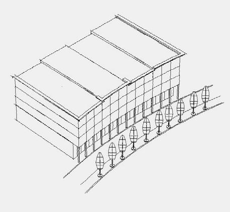


123 Appendix B Architectural Guidelines
124 Prepared by a Sub-Committee of the Central Petaluma Specific Plan Citizens Advisory Committee Wayne Miller, Cogenesis Design Mary Dooley, Ozborndooli Architects John Morgan, Burbank Housing Development Corp. Janet Gracyk, Site Plan and Architectural Review Committee (SPARC)
125 Architectural Guidelines Page 1 Architectural Character in the Specific Plan Area The architectural character of Petaluma is a fortuitous blending of nineteenth and twentieth century styles, materials and patterns. In particular, Petaluma west of the 101 Freeway, reflects an eclectic mix of the stately neo-classical public buildings, colorful and ornate Victorian residential and commercial buildings juxtaposed with utilitarian metal and brick commercial structures of simple form and post-wwii modernism. Throughout the Central Petaluma and Old Downtown area, this quilt-work of materials, forms and patterns co-exist amicably, often side by side. The central guiding principal for design and development within the Central Petaluma Specific Plan Area is that the architecture should preserve and strengthen the much prized character of the existing town and its distinct neighborhoods while creating a compatible character in newly developed areas. It is not the intention of the Specific Plan to promote historical reproductions of any existing architectural style or building type. Developers and designers are free to explore new ideas, forms and materials and to seek project design approval through the process outlined elsewhere in the Specific Plan. It is the intention of the Specific Plan that developers and designers take time to understand the patterns inherent in the existing architectural character of Petaluma in the belief that new structures can be designed which spring from and relate to the existing context without impeding innovation, and projects can be approved and constructed more expeditiously. It is expected that new designs will strengthen and enhance some existing patterns and precedents while de-emphasizing others and may set precedents for designs that follow. A pattern is any unique organization of elements which can be repeated. For instance, a pattern could be how close a building is to the street or to the adjacent building, or the way that window and door openings are organized in the facade of a building, or the predominant slope and shapes of a roofs in a neighborhood, or what type of materials are present and how they are typically used. The totality of all the patterns in an area describe and determine its architectural character. What are the key patterns which underlie the archi-
126 Architectural Guidelines Page 2 tectural character envisioned for each of the zoning districts of the Central Petaluma Specific Plan area? How will designers, planning staff and regulatory bodies evaluate whether a proposed architectural design is consistent with the intention of the Specific Plan and the promotion of these patterns? This section seeks to give guidance to prospective developers, designers and regulatory agents alike. The direction given here should be used in conjunction with the Smart Code, Zoning Map, and applicable Specific Plan policies
127 Architectural Guidelines Sub-Area Key Map


128 Architectural Guidelines Page 3 Area 1: Petaluma Boulevard Corridor from B Street to Lakeville Street Existing Patterns The existing building pattern along Petaluma Boulevard is predominantly one and two story Victorian storefronts and mid-century remodels from B Street to Lakeville Street. The condition and character of the building facades between B Street and Washington Street vary, but as a whole are strong because of the consistent relationship of buildings to the street edge and the mirroring of similar building type, form and level detail either side of Petaluma Boulevard. Some buildings have projected canopies and awnings at the sidewalk and some entrances are sufficiently recessed to provide cover or a location for sidewalk dining. There is sufficient detail on the buildings to create interest and some the larger structures are rich compositions of window, door and trim patterns and variation of scales. Openings and building facades are generally vertical in proportion. North of Washington Street, the consistency of this historic urban pattern along Petaluma Boulevard begins to breaks down. On the west side of the street, the Bank of America building is far less interestingly detailed and seems out of place. An inaccessible park and unattractive, single story retail stores and parking lots follow in succession. On the east side of the street, the urban pattern also breaks down because there are voids between and in front of some buildings. Recommended Design Approach The patterns of form, facade articulation, light and shadow, and color present in existing two and three story structures south of Washington should be used to guide design in new development both north and south of


 roof forms, irregular window sizes and placement, arched window heads, and other characteristic")
129 Architectural Guidelines Page 4 Washington Street to strengthen the existing urban character. Building heights should be two stories minimum with some variation of overall height at the cornice line allowed. Buildings should have sufficient detail to extend the richness already present, but need not be as elaborate or identical to the Victorian forms. Voids between buildings should be removed so that there is continuous building line along the street edge if possible. The proportion and placement of building elements such as openings, and the wall and finish materials selected should be compatible with the precedent pattern of north Petaluma Boulevard. Cement plaster, castin-place and precast concrete, brick, and smooth surfaced wood or composite materials may be acceptable wall siding materials when used in character with precedent patterns. Area 2: Water Street and Poultry Street Existing Patterns Water Street and Poultry Streets were originally access roads to the back sides of buildings fronting towards Petaluma Boulevard. The existing patterns of materials and form along the west side of the Petaluma River from Western to Lakeville Street is far more utilitarian and rough than the building fronts facing Petaluma Blvd. It is this roughness of form and material which gives this edge its unique character, and a strong design precedent. Existing patterns and materials include: brick, stone and metal walls, gable and shed (single slope) roof forms, irregular window sizes and placement, arched window heads, and other characteristic forms and details. Recommended Design Approach The Specific Plan envisions improvements and extension to Poultry Street and improved pedestrian access to the rivers edge. Unlike the aligned building walls and two story height along Petaluma Boulevard, greater variety in building height (2 to 4 stories), facade placement and articulation is desirable along Water and Poultry Streets. Balconies, Terraces, Arcades and Colonnades are possible along


130 Architectural Guidelines Page 5 the river side of the buildings. Gable and single pitch roofs are possible as well as flat roofs with parapet and cornices. Materials evocative of the utilitarian historical character of the area should be emphasized, such as brick, metal siding, stone and cast stone, wrought iron, metal or other durable material. Buildings may also front to interior courts, plazas, and walks providing light and views in multiple directions when they are connected to pedestrian ways along Water Street or Poultry Street. Detailing should be simple, emphasizing shape, proportion and texture rather than ornateness or repetition, for example: arched top windows and door openings, projected brick courses or interesting assemblages of finish materials. Area 3: Washington Street Corridor between Lakeville and Petaluma Boulevard Existing Patterns There are no significant urban patterns along Washington Street between Lakeville Street and Petaluma Boulevard. The majority of the boulevard is lined by undeveloped parcels and parking lots. With few exceptions, the buildings that exist sit well back from the street edge. The existing and dominant architectural character is determined by the 1970's strip mall shopping centers on either side of the boulevard. Because of the general openness of the area, there are significant vistas to the south and west. Recommended Design Approach The Specific Plan envisions this as a gateway boulevard, fronted on both sides of the street with continuous three to six story buildings built close to the street edge, and with tree-lined and covered sidewalks. New patterns of develop-

 and richness (shape) of forms present on the Downtown buildings, but detailing need")


131 Architectural Guidelines Page 6 ment are required in this area consistent with the envisioned higher densities and urban character. In developing the project scale, proportion and articulation of the building elevations, the developer and designer should look to patterns present in the Downtown, particularly the three story buildings along, Petaluma Boulevard, Kentucky Street and Western Avenue. Buildings should have at least sufficient detail to be evocative of the rhythm (placement) and richness (shape) of forms present on the Downtown buildings, but detailing need not be elaborate. Because this area includes larger parcels with longer street frontages, there is also the possibility of developing wider building facades which have common materials, fenestration and detailing. Local precedents for wide frontage buildings include the Line and Twine building and the old Ice House both on Lakeville Street, and the Petaluma Hotel on Washington Street. Area 4: Triangular area bounded by the Petaluma River, Washington Street and Lakeville Existing Patterns This area includes the those interior portions of the bounded area not directly fronting Washington Street. Located within this area are portions of the Long s Drug Shopping Center site, the monumental Dairyman s Feed and Hunt & Behrens structures, and several smaller commercial and historical warehouse structures. There is also substantial land within this area which is currently undeveloped or in use for parking and maneuvering of vehicles or as rail spur right of way. The existing architectural character of the area reflects this industrial base, with buildings that are detached, simple warehouse and processing structures constructed of wood, brick and metal. Roof forms are simple gables and


132 Architectural Guidelines Page 7 sheds. Recommended Design Approach A stated policy of the Specific Plan is the preservation of the existing industrial base along the river. Commercial and industrial uses located in the area are expected to remain and require substantial land area for access, parking and security. The development potential in the near term may be limited to infill and adaptive re-use opportunities. There are large historic commercial structures within the area with significant potential for adaptive re-use. Redevelopment, infill and adaptive re-use in this area should adopt the existing patterns of simple building forms, industrial materials and utilitarian detailing. The Dairyman s and Hunt and Behrens structures have already introduced complex and random window patterns and angular forms to the area which could be adopted and elaborated to create unique architectural solutions. Area 5: The Turning Basin River Edge Existing Patterns The Turning Basin river edge is largely occupied by the Golden Eagle Shopping Center. The plan of the shopping center locates the buildings as close as possible to the river edge, leaving only minimal access along the back sides of the buildings and large paved parking areas between the buildings and Washington Boulevard. This essentially suburban commercial center fronts the buildings towards the parking lot, not the river. Buildings are also located close to the foot of the Balshaw Bridge on the east side of the river, occupying the natural location for a public square of sufficient size


133 Architectural Guidelines Page 8 and shape to accommodate a large gathering people at the river edge and close to Downtown. The architecture of the center is a single story brick and concrete structure with aluminum storefronts and a metal mansard roof. The existing architecture bears no resemblance to the historic small town urban character and fails because it completely ignores the context and architectural character of Petaluma. Recommended Design Approach Consensus of the advisory committee in formulating the Specific Plan was that the existing structures are poorly sited to maximize the potential of the river and the development of Washington Avenue as a gateway street. Redevelopment of the site must consider the replacement of existing structures to meet the goals of the Specific Plan. A minimum of three and a maximum of six story structures are envisioned for this site. New patterns of development are required in this area consistent with the higher densities and character of the urban standards. The developer and designer therefore have a unique opportunity to introduce new architectural forms, patterns and uses of materials to Petaluma and also the responsibility not to repeat the mistakes of the existing site architecture by ignoring the context and character of Petaluma. The curve of the turning basin and a re-alignment of streets presents the greatest opportunity within the Specific Plan Area for a formal site plan and a more ordered architecture relating to the water s edge and a pedestrian way along the river. This approach would include more formalized geometric relationships between buildings and open spaces, axial connections, symmetries, and a balanced facade that has unifying elements overall. The objective is to create unique sense of place and a rich pedestrian experience as they move through the public space between the


134 Architectural Guidelines Page 9 river and the building edge. Any redevelopment of the site must include the development of a public plaza space formally related to the building forms with access to the water at or near the Balshaw Bridge. Area 6: D Street Corridor Existing Patterns D Street is and will remain a major traffic corridor from Petaluma Boulevard to Lakeville Street. At present, there is little pedestrian friendly development at the street edge. And due to limited number of buildings, there is not a strong architectural character or precedent along this thoroughfare. Recommended Design Approach The Specific Plan Urban Standards permit structures from two to four stories in height on either side of D Street. However, D Street is the boundary between two distinct patterns of architecture and development. On the north-east side of D, the Specific Plan envisions continuous building facades at the sidewalk edge (See Comments for Area 7). On the south-west side of D Street the patterns of the River Warehouse District prevail, with greater variation of building form (See comments for Area 11). The land use between D Street and the McNear Channel is currently industrial and protected by the Specific Plan. Therefore significant sections of the south-western frontage of D Street may remain unchanged for some time. Therefore, flexibility is key to development along D Street and either pattern of development will be allowed along the north-east side of D street in the area designated as T5 Urban Center. Area 7: Area bounded by Weller Street, Washington Boulevard, D Street and the Rail Depot Existing Patterns At present, there are few structures in this area. (The


135 Architectural Guidelines Page 10 Train Station is excluded and discussed separately). Two metal commercial buildings face Copeland Street mid block. The land bounded by Weller Street, Washington Street, Copeland Street and D Street is privately owned. The land to the east of Copeland is currently owned by the rail authority which continues to use the property for rail related purposes. Drawings of Nineteenth Century Petaluma show various commercial structures in this area and a different river course. None of these historical structures remain, and the area is largely undeveloped. A Sonoma County and Petaluma Bus Transfer location is planned for construction on the east side of Copeland Street. Recommended Design Approach The Specific Plan Urban Standards codes most of this area T6 Urban Core which permits buildings from 3 to 6 stories in height. A strip of land along the D Street Corridor is coded T5 Urban Center which permits buildings from 2 to 4 stories in height. T6 areas require that building facades be within 5' of the property line, while T5 areas require building facades to be within 10' of the property line. All types of building function are permitted with this area. S o many possibilities exist for buildings of mixed use and densities in this area, that there are few existing Petaluma buildings that provide cues and precedents. Some buildings of comparable scale do exist on Western Avenue, Petaluma Boulevard and Washington Street, and these may prove valuable in establishing patterns of building scale, articulation, light and shadow and relating the new development to exiting context of the Downtown. However, new patterns of development and building form will be required and expected. Developers and designers may look to other cities and resources in creating architectural character in this area.


136 Architectural Guidelines Page 11 Where feasible, private outside space should be provided for each residential unit. Where residential units are constructed, it is required that landscaped and developed open space for use primarily by residents be provided. This may include gardens, courtyards, terraces, roof gardens, plazas, walks, and other outside amenities. Areas 7 & 8: Copeland Landing and the Rail Depot Site Existing Patterns There are presently two historic, single story rail station buildings along the rail line. The architecture of the structures is unique in Petaluma, being an exuberant interpretation of California Spanish style architecture. There are quadrafoil and tresfoil ventilation openings in the walls that are quite detailed and have been used emblematically by the City, and copied by the Taco Bell built across the street. The stucco and tile roof buildings are in an advancing state of deterioration and disrepair. Recommended Design Approach The Specific Plan recognizes the buildings as being significant historical resources and worth preserving and restoring. They are local landmarks and strongly associated with the unique architectural character of Petaluma. They are at a location that continues to be considered as a destination point for light rail and excursion rail service, and which once again may become an entry point for travelers coming to Petaluma. The Specific Plan envisions that the bus transfer station planned for Copeland Street could be relocated adjacent to the Train Depot. Redevelopment and preservation of this site would require land for access roads, parking and landscaping. The preservation and re-use of this asset will require careful site design and landscape architecture. Consideration of the relationship and transition between these one story structures and any adjacent development which could be as much as five stories high, will be essential. Creating a visual and pedestrian linkage between the Depot Site and the Turn-


137 Architectural Guidelines Page 12 ing Basin will also be essential. Area 9: McNear Channel Industrial Area Existing Patterns This area includes river dependent industrial uses, commercial uses and open land. Buildings have a utilitarian industrial character metal, concrete and stucco structures surrounded by large crushed rock parking and truck maneuvering areas. Buildings are often separated by substantial open spaces, much of it left in a more or less natural state. Properties typically abut the Petaluma River and may also abut the railroad right of way. The prevalent pattern is largely one of open space interspersed with large building and processing structures that provide views toward the river from many directions. Recommended Design Approach A stated policy of the Specific Plan is the preservation of the existing industrial base along the river. Commercial and industrial uses located in the area are expected to remain and continue to require substantial land area for access, parking and security. The development potential in the near term may be limited to infill and adaptive re-use opportunities. Redevelopment and infill in this area should adopt the existing patterns of simple building forms, industrial materials and utilitarian detailing. Projects should strive to maintain view corridors to the river edge and natural habitat wherever possible. Projects should integrate well with the Petaluma River Enhancement Plan and pedestrian access to the river edge. Area 10: Lakeville Corridor Existing Patterns Lakeville Street forms the northerly border of the specific plan area and is a principal access route into Peta-


138 Architectural Guidelines Page 13 luma. The existing pattern of development is different on either side of the street. The easterly side abuts both existing residential and commercial zones and therefore has some vestiges of single story residential development. The building pattern includes single story commercial enterprises, vacant land, and retail shopping center. It also includes the historically significant landmark Line & Twine building, the premier example of brick industrial vernacular in Petaluma. There is no dominant recurring pattern of building mass, relationship of building to the street edge, or architectural character and building heights typically do not exceed two stories. The westerly side of Lakeville is comprised of properties of varying widths and depths that abut the railroad right of way to the rear. There is some retail development, but the most the most prevalent uses are industrial auto wrecking, storage yards, LP gas distribution, landscape irrigation supply, car wash. The quality and character of the buildings vary widely. Like the easterly side of the street, there is no dominant recurring pattern of building mass, relationship of building to the street edge, or architectural character and building heights typically do not exceed one and one half stories. Recommended Design Approach Except for the designated D-4 zoning district at the southerly end of the Lakeville corridor, the Specific Plan envisions Lakeville as an eventual gateway boulevard, fronted on both sides of the street with continuous two to four story buildings built close to the street edge, and with tree-lined sidewalks. New patterns of development are required in this area consistent with the envisioned higher densities and urban character. In developing the project scale, proportion and articulation of the building elevations, the developer and designer may look to patterns present in the Downtown, particularly the three story buildings along, Petaluma Boulevard, Kentucky Street and Western Avenue, or may approach the development of the intended denser urban fabric in a more contemporary manner. The patterns inherent in the Line and Twine Building offer the designer a strong and much admired precedent and an opportunity for unifying and architecture along the street. Buildings should have at least sufficient detail to be evocative of the rhythm (placement) and richness (shape) of forms present on the Downtown buildings, but detailing need not be elaborate. The D-4 District portion of the


139 Architectural Guidelines Page 14 Lakeville corridor will continue many of the existing patterns consistent with the thoroughfare commercial development focused in the vicinity of the intersection with Caulfield Lane and the interchange with Highway 101. Area 11: River Warehouse Area Existing Patterns The existing patterns of the River Warehouse area are very different from the Downtown and nearby residential neighborhoods. The mix of residential, commercial, industrial, and office uses and their correspondingly different building types gives this area its unique character. Brick, block and metal industrial buildings are interspersed with vacant land, and small residential bungalows. The area also includes the Foundary Wharf Project with recently constructed office and commercial buildings which employ many forms and materials present elsewhere along the river edge. The principal building type along First Street are long, rectangular metal warehouse buildings approximately two stories in height extending from First Street to the River edge. These structures have simple gable roofs running the length of the buildings and few windows. Some structures have elevated docks covered with continuous shed roofs. Along the street, there are breaks in the line of buildings providing stunning views to the McNear Peninsula and lands beyond. Even when side by side, the gable roofs allow the buildings to be seen as distinct structures. These structures represent the historical, river-based industrial character of the area, and the corrugated metal siding has developed a patina and rustic appearance that is an important part the existing character of the area. The pattern changes in the area between First and Second Streets: metal structures are intermixed with brick, concrete block and wood commercial buildings, vacant land and single family residences. In the area between Second Street and Petaluma Boulevard, small residential structures and the back sides of buildings fronting Petaluma Boulevard become the norm.
140 Architectural Guidelines Page 15 Recommended Design Approach The Specific Plan recognizes and intends to preserve the unique character of this area. As development of this area intensifies, it is important that the presence of detached single family homes be retained. The Specific Plan envisions that the existing architectural patterns be preserved and used in developing new structures. Building heights would range from two to three stories. The pattern of metal buildings with simple rectangular forms and recurring gable roofs at the river edge should be maintained. Adaptive re-use of the existing structures should be considered in any development plan. If this proves structurally or financially infeasible, buildings of similar scale and proportion are recommended. and re-use of the weathered materials should be considered. T h e existing irregularity of the street connection should be maintained, with buildings being constructed to the street most of the time, but retain sufficient breaks in the line of buildings so that buildings appear as detached structures and to allow for the creation of side yards and entrances, interior courts and passages through to the river edge. The designer should look to the model of Foundry Wharf for the design of window and door openings. Infill in this area should adopt this pattern of simple building forms, industrial materials (metal siding, brick and concrete block) and utilitarian detailing. Gable and shed roofs should predominate. The large metal industrial structures such as Dairyman s Feed and Hunt and Behrens, with their asymmetrical compositions of simple building forms and angular piping, conveying systems and bracketry, provide a wealth of forms and shapes that could be adopted and elaborated to create unique architectural solutions in the River Warehouse area.
141 Architectural Guidelines Page 16 Area 12: Middle Reach Area Existing Patterns This area includes the City of Petaluma Corporation Yard, Sewage Treatment Facility, Animal Shelter and Homeless Shelter. It also includes open land between the City Facilities and the McNear Channel edge. Hopper Street, running parallel to the railroad right of way, provides the only current access to this area. Recommended Design Approach Opportunities for development in this area will depend on the gradual relocation of City services to other locations. The Specific Plan envisions the creation of a new street grid developing between Hopper Street and the Petaluma River and extending into the Lower Reach area. Buildings from two to six stories are possible in this area. This area, in combination with the Lower Reach, offers the developer and designer the greatest latitude and opportunity for the creation of new architectural forms and patterns and the use of new materials and technologies. Developers are encouraged to go beyond the historical character and patterns that predominate in other parts of the Specific Plan area to create a character unique to this area. Area 13: Lower Reach Area Existing Patterns Most of the Lower Reach area is undeveloped and underdeveloped land. The area is strongly bounded by the 101 Freeway to the east and the Petaluma River to the South. Access to the area at present is limited to Hopper Street. This area and the adjacent Middle Reach Area include the longest stretch of undeveloped Petaluma River edge.


142 Architectural Guidelines Page 17 Recommended Design Approach The Specific Plan envisions the creation of a new street grid developing between Hopper Street and the Petaluma River and extending from the Middle Reach area into the Lower Reach and the highest densities in the Specific Plan Area. Buildings from two to six stories are possible in the Lower Reach. This area, in combination with the Middle Reach, offers the developer and designer the greatest latitude and opportunity for the creation of new architectural forms and patterns and the use of new materials and technologies. Developers are encouraged to go beyond the historical character and patterns that predominate in other parts of the Specific Plan area to create a character unique to this area. Area 14: Basin Street Landing Existing Patterns This area is bounded by the Petaluma River edge opposite the turning basin, D Street, Petaluma Boulevard and B Street. Once a key location for river based commerce, they area currently includes parking areas where once there were warehouses, and metal and brick industrial buildings. The current dominant pattern is openness. The historical Old Petaluma Mill and the brick commercial structure across B Street are likely to be preserved for the foreseeable future and set a strong precedent for forms and materials. Recommended Design Approach The Specific Plan envisions a far more dense and urban pattern of development than currently exists filling out the existing street network with buildings built to the street edge. This area forms an important transition from the relatively elaborate detailing of the Victorian era buildings along Western and Petaluma Boulevard to the more utilitarian building patterns along the river edge. The recommended emphasis is to extend the older urban character of the old downtown while respecting the river edge commercial roughness. It is recommended that designs reflect the scale and
1. PLANNING CONCEPTS. Central Petaluma Specific Plan Chapter 1. Planning Concepts Page 7
 Page 7 1. PLANNING CONCEPTS Overview of Planning Concepts The plan for Central Petaluma envisions a reinvigorated central district that accommodates a greater diversity and intensity of activities, including
3. LAND USE. Central Petaluma Specific Plan Chapter 3. Land Use Page 21
 Page 21 3. LAND USE Existing Land Use Central Petaluma contains a range of commercial and industrial uses that reflect the city s growth as an agricultural and industrial services center oriented to the
City Center Neighborhood Plan
 [1] City Center Neighborhood Plan As adopted by Ordinance No. 2014-09-049 and amended by Ordinance Nos. Formerly CBD Neighborhood as adopted by Ordinance No. 8868 and amended by Ordinance Nos. 8946, 9693,
Policies and Code Intent Sections Related to Town Center
 Policies and Code Intent Sections Related to Town Center The Town Center Vision is scattered throughout the Comprehensive Plan, development code and the 1994 Town Center Plan. What follows are sections
LAND USE OVERVIEW WHAT YOU WILL FIND IN THIS CHAPTER
 LAND USE WHAT YOU WILL FIND IN THIS CHAPTER Information about the City s expected population and employment growth. Description and capacity of existing and future land use designations. Policies that
Downtown Dubuque...it s a great time.
 Downtown Dubuque...it s a great time. Your timing could not be better to invest in Downtown. With hundreds of millions in public and private investment occurring on the City s downtown waterfront, millions
CHAPTER 3 VISION, GOALS, & PLANNING PRINCIPLES. City of Greensburg Comprehensive Plan. Introduction. Vision Statement. Growth Management Goals.
 CHAPTER 3 VISION, GOALS, & PLANNING PRINCIPLES Introduction The Greensburg Comprehensive Plan is intended as a working community document. A combination of long and short-term goals, this document is intended
YONGE STEELES CORRIDOR SECONDARY PLAN. Young + Wright / IBI Group Architects Dillon Consulting Ltd. GHK International (Canada) Ltd.
 Ltd.") PART A: PREAMBLE 1.0 PURPOSE The purpose of this Secondary Plan is to provide a development framework for intensification of the Yonge/ Steeles corridor including the north side of Steeles Avenue West
PART A: PREAMBLE 1.0 PURPOSE The purpose of this Secondary Plan is to provide a development framework for intensification of the Yonge/ Steeles corridor including the north side of Steeles Avenue West
Chapter 4. Linking Land Use with Transportation. Chapter 4
 Chapter 4 Linking Land Use with Transportation Chapter 4 59 Chapter 4 Linking Land Use with Transportation Community Design and Transportation Program Introduction Since the 1950s, the predominant development
The transportation system in a community is an
 7 TRANSPORTATION The transportation system in a community is an important factor contributing to the quality of life of the residents. Without a sound transportation system to bring both goods and patrons
Table of Contents. Elm Avenue Improvement Plan City of Waco, Texas. Introduction 1. Existing Context 1 Figure 1 2.
 Table of Contents Introduction 1 Existing Context 1 Figure 1 2 Plan Guidelines 3 Future Urban Form 4 The West-End 4 Main Street 6 The East-End 7 Figure 2 9 Public Improvement Recommendations 7 General
17.11 Establishment of Land Use Districts
 17.11 Establishment of Land Use Districts 17.11.010 Purpose. To promote the health, safety, and general welfare of City residents and those who come to South Salt Lake to work, exchange commerce and recreate.
Issues Requiring Future Study
 Issues Requiring Future Study Transportation planning is an ongoing process that tends to identify new issues as it finds solutions for others. Some issues are so complex that a solution to one problem
CHAPTER 7: Transportation, Mobility and Circulation
 AGLE AREA COMMUNITY Plan CHAPTER 7 CHAPTER 7: Transportation, Mobility and Circulation Transportation, Mobility and Circulation The purpose of the Transportation, Mobility and Circulation Chapter is to
Northwest Rail Corridor and US 36 BRT Development Oriented Transit Analysis 4.4 STATION AREA FINDINGS
 4.4 STATION AREA FINDINGS Each station is different, and each one requires a separate set of recommendations based on the vision for the site. This section outlines an initial TOD strategy and recommendations
CHAPTER ONE INTRODUCTION
 1.0 Introduction Bellingham s central waterfront is in a state of transition from its long history as an active industrial site to a new mixed-use neighborhood. Over the past several years, the Port of
A. WHAT IS A GENERAL PLAN?
 I. Introduction A. WHAT IS A GENERAL PLAN? A general plan is the planning guideline for the future of a city. It contains goals and policies which regulate urban development, the protection of the natural
POCKET COMMUNITY PLAN
 POCKET COMMUNITY PLAN Part Three : COMMUNITY PLAN AREAS AND SPECIAL STUDY AREAS CONTENTS Community Location... 3-P-3 Community Vision... 3-P-4 Community Profile... 3-P-4 Community Issues... 3-P-6 Land
Realities and Assets in an In-Town Shopping Center
 SUSTAIN SOUTHERN MAINE MILL CREEK PILOT LESSONS LEARNED April 15, 2013 Realities and Assets in an In-Town Shopping Center 1. An older shopping district that was laid out in a low-density, strip center
ELMVALE ACRES SHOPPING CENTRE MASTER PLAN
 ELMVALE ACRES SHOPPING CENTRE MASTER PLAN Contents 1.0 INTRODUCTION... 2 2.0 LOCATION... 2 3.0 EXISTING CONTEXT... 2 4.0 VISION & GUIDING PRINCIPLES... 2 5.0 LAND USE AND BUILT FORM... 4 5.1 St. Laurent
PUBLIC OPEN HOUSE SEPTEMBER 8 TH, 2010 CITY OF LETHBRIDGE DEVELOPMENT SERVICES
 PUBLIC OPEN HOUSE SEPTEMBER 8 TH, 2010 CITY OF LETHBRIDGE DEVELOPMENT SERVICES INTRODUCTION Why is the City creating the West Lethbridge Employment Centre Area Structure Plan? West Lethbridge Urbanization
A P P E N D I X B - O P P O R T U N I T Y S I T E S
 A P P E N D I X B - O P P O R T U N I T Y S I T E S OPPORTUNITY SITES As listed in the Land Use Element, the City has identified 15 Opportunity Sites expected to be the focus of change and revitalization
A Plan for the Heart of the Region: Tukwila, WA
 : Tukwila, WA 1 The Plan orchestrates the Restructuring of a 1,000-acre Regional Shopping Area into a Social and Symbolic for the Region. REGIONAL CONTEXT Downtown Seattle (Metropolitan ) 20 miles Bellevue
Bourne Downtown Site Planning
 Prepared for: The Town of Bourne, MA In Cooperation with: Bourne Financial Development Corporation Prepared by:, Inc. June 24, 2009 Table of Contents Introduction and Summary... 1 Site Existing Conditions...
6 PORT SYDNEY SETTLEMENT AREA
 Section 6 Port Sydney Page 61 6 PORT SYDNEY SETTLEMENT AREA 6.1 Basis and Principles Village of Port Sydney Waterfront Community Existing Services 6.1.1 Port Sydney is an historic settlement that has developed
This page intentionally blank.
 This page intentionally blank. Parks, Recreation, and Open Space Chapter Relationship to Vision Vision Parks, Recreation and Open Space Chapter Concepts County Government. County government that is accountable
Gold Line Bus Rapid Transit Transit Oriented Development (BRTOD) Helmo Station Area Plan
 Helmo Station Area Plan") Appendix F Gold Line Bus Rapid Transit Transit Oriented Development (BRTOD) Helmo Station Area Plan Introduction and Purpose of the Plan The Gold Line Bus Rapid Transit facility is an eleven-mile dedicated
Appendix F Gold Line Bus Rapid Transit Transit Oriented Development (BRTOD) Helmo Station Area Plan Introduction and Purpose of the Plan The Gold Line Bus Rapid Transit facility is an eleven-mile dedicated
Appendix A. SmartCode
 Appendix A Adopted June 16, 2003 Ordinance No. 2152 N.C.S. Appendix A of the uses material from SmartCode. Notwithstanding any other agreements with Duany Plater-Zyberk & Company (DPZ) or the Municipal
Strategic Growth Area #1 Northampton Boulevard Corridor Area
 Strategic Growth Area #1 Northampton Boulevard Corridor Area Description Strategic Growth Area #1 has established itself as a major employment center in Southside Hampton Roads. Opportunities exist to
V. Vision and Guiding Principles
 V. Vision and Guiding Principles The Master Plan for the Powers Ferry Corridor seeks a foundation in the desires of the community. At times, various elements of the community offered opposing viewpoints,
THE PLANNING AREA 2.1 PLANNING AREA LOCATION
 2. The Planning Area Brisbane Baylands Specific Plan 21 2 THE PLANNING AREA 2.1 PLANNING AREA LOCATION The Baylands is located approximately midway between San Francisco s central business district and
Hockessin Community Redevelopment Plan
 Hockessin Community Redevelopment Plan 3.1 Introduction The Community Redevelopment Plan for the Village of Hockessin is the result of the people s vision for a distinct village center that serves as the
Transportation. Strategies for Action
 Transportation A major priority for the Overlake Neighborhood is to develop a multimodal transportation system. To achieve this system, a balance has to be found among travel, circulation and access needs;
CHAPTER 8 ISSUES, CONCERNS, CONSTRAINTS AND OPPORTUNITIES
 CHAPTER 8 ISSUES, CONCERNS, CONSTRAINTS AND OPPORTUNITIES Introduction This River Conservation Plan was developed during a time of tremendous activity and effort in planning the transformation of the Delaware
Planning Districts INTRODUCTION
 INTRODUCTION To facilitate detailed examination of development prospects for all areas of the community, Delano has been divided into 14 planning districts. The location of these planning districts is
QUEEN-RIVER SECONDARY PLAN
 34 QUEEN-RIVER SECONDARY PLAN 34. QUEEN RIVER SECONDARY PLAN 1. INTRODUCTION The Queen-River area is approximately 6.4 hectares and is located at the eastern edge of the Downtown as shown on Map 34-1.
WEST OAKLAND SPECIFIC PLAN Final Plan. 2. Vision & Goals. 2.1 Community-Based Goals and Objectives
 WEST OAKLAND SPECIFIC PLAN Final Plan 2. Vision & Goals 2.1 Community-Based Goals and Objectives June 2014 2: Vision & Goals The vision of the West Oakland Specific Plan is to see this remarkable community
2040 LUP is a part of the Comprehensive Plan and carries the same legal authority. Economic Challenges
 1.1. Guiding Anchorage s Growth Where will new residents settle over the next two decades? Where will people work, shop, and play? Will there be enough room to grow? How will Anchorage look? Will growth
Windsor Locks Transit-Oriented Development Planning Grant Request. Project Background
 Windsor Locks Transit-Oriented Development Planning Grant Request Project Background Downtown Windsor Locks runs along Main Street in the vicinity of the intersection of Routes 159 and 140. The current
Draft for Public Review. The Market and Octavia Neighborhood Plan
 Draft for Public Review The Market and Octavia Neighborhood Plan San Francisco Planning Department As Part of the Better Neighborhoods Program December 2002 IOverview Why Plan a Better Neighborhood Here
Metro. Activity Center Design Guidelines. Recommendations For Developing Focused, Mixed-Use Commercial/Residential Centers
 Metro Activity Center Design Guidelines Recommendations For Developing Focused, Mixed-Use Commercial/Residential Centers Metro Activity Centers What is a MAC? Legacy, the adopted guide for the future growth
3.1 Existing Land Use
 3.0 Land Use This strategy has been developed taking into account the position of the Town of Sidney as the economic center of the Saanich Peninsula. It acknowledges existing land use patterns in the downtown
City Of Sparks Planning Commission Item
 Page 1 of 12 City Of Sparks Planning Commission Item Meeting Date: May17, 2012 Subject: PCN12009, Public Hearing, Consideration and possible action on a Master Plan Amendment and Rezoning request to change
hermitage town center
 hermitage town center A Community Vision prepared by Strada for The City of Hermitage and The Mercer County Regional Planning Commission January 2007 table of contents introduction 3 design principles
MALL REVITALIZATION CASE STUDIES
 MALL REVITALIZATION CASE STUDIES DECEMBER 9, 2012 MALL REVITALIZATION OVERVIEW Introduction Sample Case Studies prepared for Lacey Woodland District Steering Committee as it considers strategies to revitalize
and services The protection and conservation of environmentally significant and sensitive natural heritage features and functions.
 6. Land Use 6.0 Preamble A healthy and livable city is one in which people can enjoy a vibrant economy and a sustainable healthy environment in safe, caring and diverse neighbourhoods. In order to ensure
Overview of the Plan. The Building Blocks of Centers, Neighborhoods and Network INTERNAL DRAFT
 Overview of the Plan 4 East Davidson Ramah Church Rd June Washam Rd Bradford District Park Bradford Shearer Rd Campus District NC 73 Davidson-Concord North Rocky River This Master Plan projects an approximate
Chapter 2 District Context
 Chapter 2 District Context 2.1 REGIONAL OVERVIEW The City of Tampa is located on the west coast of Florida, anchoring a metropolitan region that includes diverse and economically vibrant communities. Tampa
Plano Tomorrow Vision and Policies
 Plano Tomorrow Vision and Policies PLANO TOMORROW PILLARS The Built Environment The Social Environment The Natural Environment The Economic Environment Land Use and Urban Design Transportation Housing
SECTION UNIFIED DEVELOPMENT ORDINANCE SECTION Part 1 Ordinance. ARTICLE 1 Zoning Districts
 SECTION 1-100 UNIFIED DEVELOPMENT ORDINANCE SECTION 1-300 Part 1 Ordinance SECTION 1-100. Introduction. ARTICLE 1 Zoning Districts Crystal Lake strives to maintain a balance of various land uses for a
Lower South Street/Louisa Street Charrette Final Presentation. September 22, 2009
 Lower South Street/Louisa Street Charrette Final Presentation September 22, 2009 Recap Mayor and Council called for a Charrette to engage the public on creating a vision for the Lower South Street area.
Anatomy of A Vibrant Downtown. Anatomy of a Vibrant Downtown
 Anatomy of A Vibrant Downtown The goal of MAIN ST. REVITALIZATION PLANNING is to provide a framework that will help transform your downtown into a VIBRANT DOWNTOWN a place where people love to LIVE, WORK,
2. Form and Character. 2.1 Introduction. 2.2 The Downtown Addition Plan. 2.1 Introduction
 2.1 Introduction 2.1 Introduction This section of the Specific Plan describes and illustrates the desired form, character and uses of the Downtown Addition and explains the underlying design principles.
3. STRATEGY FOR NEIGHBORHOOD SUSTAINABILITY
 3. STRATEGY FOR NEIGHBORHOOD SUSTAINABILITY This neighborhood plan focuses on assuring that Government Hill retains a high degree of sustainability, in that it conserves built resources that are part of
4. Shape Transitions. 4. Shape Transitions
 4. Shape Transitions 49 Zoning District Policies Overall Intent: Maintain neighborhood character by creating compatible transitions that minimize land use conflicts. Strategy: Define the character of zoning
Town Center (part of the Comprehensive Plan)
") Town Center (part of the Comprehensive Plan) Mercer Island Town Center Looking North (2014) In 1994, a year-long process culminated in a set of design guidelines and code requirements for the Town Center
Town Center (part of the Comprehensive Plan) Mercer Island Town Center Looking North (2014) In 1994, a year-long process culminated in a set of design guidelines and code requirements for the Town Center
Corridor Vision. 1Pursue Minnehaha-Hiawatha Community Works Project. Mission of Hennepin County Community Works Program
 1Pursue Minnehaha-Hiawatha Community Works Project Minnehaha-Hiawatha Community Works is a project within the Hennepin Community Works (HCW) program. The mission of the HCW program is to enhance how the
Land Use. Hardware Street Vendor Mixed-Use
 Land Use Definition Land Use is the way a piece of real estate is utilized. Existing, proposed, and adopted land uses all play a role in the planning process. Once a land use plan is adopted, the next
Ivywild On The Creek PRELIMINARY CREEK DISTRICT MASTER PLAN
 Ivywild On The Creek PRELIMINARY CREEK DISTRICT MASTER PLAN Introduction: Rejuvenating an extraordinary Creekside neighborhood THE CREEKSIDE DISTRICT The Ivywild On The Creek Neighborhood District Master
SECTION ONE: INTRODUCTION. introduction
 introduction 1 INTRODUCTION Since it was first established in 1843 as a trading post for the Hudson s Bay Company, Victoria has evolved into a Provincial capital city that is recognized across Canada and
Ten Mile Creek Planning Area
 PLANNING AREA POLICIES TEN MILE CREEK Ten Mile Creek Planning Area Location and Context The Ten Mile Creek Planning Area ( Ten Mile Creek area ) is located south of the current Boise AOCI, generally south
City of Farmington. Downtown Plan. Amendment to the 1998 Master Plan Adopted October 11, 2004
 City of Farmington Amendment to the 1998 Master Plan Adopted October 11, 2004 Introduction Planning Background 1 Scope and Components of the Plan Amendment 2 Concept Introduction 3 Plan Concepts 3 Conceptual
EXISTING COMPREHENSIVE PLAN
 EXISTING COMPREHENSIVE PLAN Town Center Land Use Element: V. LAND USE POLICIES Town Center Mercer Island's business district vision as described in "Your Mercer Island Citizen-Designed Downtown" was an
Status Update (2006 vs. Now) Citizen s Advisory Committee February Plan for Prosperity
 Citizen s Advisory Committee February Plan for Prosperity") Status Update (2006 vs. Now) Citizen s Advisory Committee February 2018 Plan for Prosperity 2000 2017 2000 2017 Gardnerville Population 6,000 5,760 5746 5,500 5,000 5,067 5,550 5,165 5,394 5,412 5,250
Status Update (2006 vs. Now) Citizen s Advisory Committee February 2018 Plan for Prosperity 2000 2017 2000 2017 Gardnerville Population 6,000 5,760 5746 5,500 5,000 5,067 5,550 5,165 5,394 5,412 5,250
greenprint midtown SUSTAINABILITY ACTION PLAN 2012
 greenprint midtown SUSTAINABILITY ACTION PLAN 2012 MIDTOWN ALLIANCE SOUTHFACE ENERGY INSTITUTE RENAISSANCE PLANNING GROUP SUSTAINABLE ATLANTA PERKINS+WILL 2 GREENPRINT MIDTOWN 1. Introduction Sustainability
Chapter 1 - General Design Guidelines CHAPTER 1 GENERAL DESIGN GUIDELINES
 CHAPTER 1 GENERAL DESIGN GUIDELINES 1.0 INTRODUCTION This Publication has been developed to provide current, uniform procedures and guidelines for the application and design of safe, convenient, efficient
M i s s i o n B a y W a t e r f r o n t
 114 M i s s i o n B a y W a t e r f r o n t Character of the Area: The Mission Bay Waterfront extends from Pier 48 at China Basin Channel to 18th Street in the Central Basin. This area of the waterfront
2.0 AREA PLANS. Lakeside Business District. Lakeside Business District Land Use Categories:
 Lakeside Business District Lakeside Business District Land Use Categories: Campus Commercial Campus Commercial means a mixture of uses which includes corporate offices, office parks, hotels, commercial,
CHAPTER 12 IMPLEMENTATION
 CHAPTER 12 IMPLEMENTATION The 2010 Town of Denton Comprehensive Plan is intended to capture a vision of the future of Denton. As such, it provides a basis for a wide variety of public and private actions
FUTURE LAND USE ELEMENT
 FUTURE LAND USE ELEMENT GOAL I: To create and sustain a great place to live, play, and prosper Objective 1: The City of Ocala shall incorporate the principles and strategies of the Ocala 2035 Vision into
A BLUEPRINT FOR BROCKTON A CITY-WIDE COMPREHENSIVE PLAN
 A BLUEPRINT FOR BROCKTON A CITY-WIDE COMPREHENSIVE PLAN Public Meeting October 2016 1 Plan Summary and Discussion Public Meeting May 4 2017 City of Brockton Bill Carpenter, Mayor Department of Planning
Queensborough Eastern Neighbourhood Node. Community Open House
 Queensborough Eastern Community Open House The Vision The Queensborough Eastern will become the heart of eastern Queensborough. Through a sensitive mix of viable commercial and residential areas, the neighbourhood
EXHIBIT A. Tax Increment Reinvestment Zone No. 1 (Town Center) First Amended Project Plan 1
 First Amended Project Plan 1") EXHIBIT A Tax Increment Reinvestment Zone No. 1 (Town Center) First Amended Project Plan 1 1 As amended by Resolution No. 2008-02-001(TR1R) of the Tax Increment Reinvestment Zone No.1, and approved to
EXHIBIT A Tax Increment Reinvestment Zone No. 1 (Town Center) First Amended Project Plan 1 1 As amended by Resolution No. 2008-02-001(TR1R) of the Tax Increment Reinvestment Zone No.1, and approved to
3.10 LAND USE SETTING PROJECT SITE EXISTING LAND USE DESIGNATIONS AND ZONING. General Plan Land Use Designations.
 This section of the Draft EIR addresses the existing land uses on and adjacent to the project site and discusses the potential impacts of the proposed project on existing land uses. Key issues addressed
A Growing Community Rural Settlement Areas
 Town of Huntsville Official Plan Review - POLICY BACKGROUND PAPER A Growing Community Rural Settlement Areas BACKGROUND: In addition to the fully municipally-serviced Urban Settlement Area and the Hidden
C. Westerly Creek Village & The Montview Corridor
 C. Westerly Creek Village & The VISION Community Vision When the goals of the city are achieved Westerly Creek Village, a distinctive community defined by Montview Boulevard and Westerly Creek, is a strong
6. DOWNTOWN. The Downtown Element focuses on supporting and expanding the vitality and enhancement of Downtown Chico as the City s central core.
 VISION In 2030, Downtown Chico is the heart of the community and the center of cultural activity. Engaging and active at the street level, it is a multi-story, mixed-use hub, with specialty retail, restaurants,
SQUAMISH 2010 AND BEYOND COMMUNITY VISION
 Our plan has been imagined and created to be both pragmatic and visionary. At the core of the strategy is a consideration of the highway s role and its impact on the community. First and foremost in creating
Living in Albemarle County s Urban Places
 Living in Albemarle County s Urban Places ALBEMARLE COUNTY, VIRGINIA A Closer Look at Albemarle s Approach to Managing Growth and Creating Quality Urban Environments www.albemarle.org Page 2 Living in
CHAPTER 4 COMMUNITY DEVELOPMENT AND DESIGN
 CHAPTER 4 COMMUNITY DEVELOPMENT AND DESIGN The Community Development and Design Chapter is extremely important because it, together with the Transportation and Circulation Chapter, provides the foundation
Regional Context Statement
 Regional Context Statement REGIONAL CONTEXT STATEMENT 3. REGIONAL CONTEXT STATEMENT In 1995, the Provincial Government passed into law the Growth Strategies Act. The purpose of this provincial initiative
CHAPTER 1. Ms. Guajardo s Class - Central Elementary CH 1 1
 INTRODUCTION CHAPTER 1 Ms. Guajardo s Class - Central Elementary CH 1 1 1.1 SETTING South Centre City is a linear corridor south of Downtown Escondido paralleling Centre City Parkway and South Escondido
APPENDIX D: BACKGROUND AND VISION
 APPENDIX D: BACKGROUND AND VISION BACKGROUND A. Specific Plan Location Jordan Downs is located at 9800 Grape Street in Los Angeles, California, 90002. The Jordan Downs Urban Village Specific Plan area
EXECUTIVE SUMMARY EXECUTIVE SUMMARY
 1 EXECUTIVE SUMMARY EXECUTIVE SUMMARY Penn s Landing is envisioned as a welcoming riverfront green space adjacent to a refurbished civic marina becoming the centerpiece for adjacent development. With a
WATERFORD Plan of Preservation, Conservation and Development Supplement Part 1 - Policy Element
 WATERFORD 2012 Plan of Preservation, Conservation and Development 2015 Supplement Part 1 - Policy Element Effective June 11, 2015 2015 Plan Update GOAL To respond to the evolving land use needs and continually
Wasatch CHOICE for 2040
 Wasatch CHOICE for 2040 Economic Opportunities We Can Choose a Better Future We enjoy an unparalleled quality of life along the Wasatch Front. People from all over the world are drawn to our stunning scenery,
CITY OF TARPON SPRINGS DCA#11-1AR
 Agenda Item #3.H.2 05/09/11 TAMPA BAY REGIONAL PLANNING COUNCIL LOCAL GOVERNMENT COMPREHENSIVE PLAN ADOPTED AMENDMENT REPORT CITY OF TARPON SPRINGS DCA#11-1AR 1 ADOPTED WITH THE FOLLOWING CHANGES: Ordinance
Mississippi Skyway Preliminary Engineering Report
 EXECUTIVE SUMMARY Mississippi Skyway Preliminary Engineering Report CITY OF RAMSEY, MINNESOTA DECEMBER 2014 City of RAMSEY EXECUTIVE SUMMARY Project Need and Intent The Mississippi Skyway pedestrian bridge
SECTION II SECTION II STATEMENT OF GOALS, OBJECTIVES, PRINCIPLES, ASSUMPTIONS, POLICIES AND STANDARDS
 STATEMENT OF GOALS, OBJECTIVES, PRINCIPLES, ASSUMPTIONS, POLICIES AND STANDARDS 1 2 STATEMENT OF GOALS, OBJECTIVES, PRINCIPLES, ASSUMPTIONS, POLICIES AND STANDARDS INTRODUCTION The New Jersey Municipal
The West Vaughan Employment Area Secondary Plan Policies
 Part 2: The West Vaughan Employment Area Secondary Plan Policies 2.1 General Policies It is the policy of Council: 2.1.1. That the West Vaughan Employment Area (the WVEA), identified on Schedule 1, will
Introduction 1. Contents. Draft:
 Draft: 1-9-2012 1 Contents 1.1 The Plan Area 1.1.1 Location 1.1.2 History 1.2 The Specific Plan 1.2.1 Specific Plan Process 1.2.2 Purpose and Intent 1.2.3 Goals and Vision 1.2.4 Planning Districts 1.2.5
Mark-up of the effect of the proposed Bronte Village Growth Area OPA No.18 on the text of section 24, Bronte Village, of the Livable Oakville Plan
 Mark-up of the effect of the proposed Bronte Village Growth Area OPA No.18 on the text of section 24, Bronte Village, of the Livable Oakville Plan Notes: This document is provided for information purposes
Plan Overview. Manhattan Area 2035 Reflections and Progress. Chapter 1: Introduction. Background
 Plan Overview The Manhattan Urban Area Comprehensive Plan (the Comprehensive Plan) is a joint planning initiative of the City of Manhattan, Pottawatomie County, and Riley County. The 2014 Comprehensive
THE 355/270 CORRIDOR:
 THE 355/270 CORRIDOR: Strategic Ideas for Sustaining a Livable Work Place Project Summary ACCESS LIFE DESIGN HEALTH WORK Montgomery County Planning Department The Maryland-National Capital Park and Planning
ARLINGTON COUNTY, VIRGINIA
 ARLINGTON COUNTY, VIRGINIA County Board Agenda Item Meeting October 15, 2005 DATE: September 28, 2005 SUBJECT: Request to Advertise the adoption of the 2005 Clarendon Sector Plan C. M. RECOMMENDATION:
Colchester Northern Gateway Master Plan Vision Review Draft. July 2016
 Colchester Northern Gateway Master Plan Vision Review Draft July 2016 Contents Introduction 4 Context 8 Purpose of the Report 8 Strategic Position 9 Overview of the Process 11 2012 Master Plan Vision 12
Sheridan Boulevard S TAT I O N A R E A P L A N S H E R I D A N B O U L E VA R D S TAT I O N A R E A P L A N
 Sheridan Boulevard S TAT I O N A R E A P L A N 1 City of Lakewood Adopted November, 2006 S H E R I D A N B O U L E VA R D S TAT I O N A R E A P L A N The Vision The City of Lakewood s overall vision is
PSRC REVIEW REPORT & CERTIFICATION RECOMMENDATION
 PSRC REVIEW REPORT & CERTIFICATION RECOMMENDATION KITSAP COUNTY COUNTYWIDE PLANNING POLICIES July 2, 2012 BACKGROUND A major emphasis of the Washington State Growth Management Act (GMA) is the need to
Urban Design Brief. Watson Parkway North & Watson Road North Guelph, Ontario. Prepared by Coletara Development
 Urban Design Brief Watson Parkway North & Watson Road North Guelph, Ontario Prepared by Coletara Development December, 2013 Urban Design Brief, Coletara Development 1 Introduction This Urban Design Brief
3.5 Historic Old Town Character Area
 3.5 Historic Old Town Character Area Downtown Suwanee is characterized by two areas: Historic Old Town and Town Center. Due to their proximity and similar purposes, the two areas can function together