COW BAY DEVELOPMENT LANDS
|
|
|
- Noreen Stephens
- 5 years ago
- Views:
Transcription
1 PRINCE RUPERT PORT AUTHORITY COW BAY DEVELOPMENT LANDS MARCH 28TH, 2012 % of Completion
2 4 guiding principles & OBJECTIVES
3 COMMUNITY FEEDBACK
4 BUSINESS & COW BAY MERCHANT FEEDBACK
5 COMMUNITY SERVICES & AGENCIES FEEDBACK
6 HERITAGE FEEDBACK
7 FIRST NATIONS FEEDBACK
8 ENVIRONMENTAL FEEDBACK
9 RECREATION & TOURISM FEEDBACK
10 LEARNING FEEDBACK
11 CULTURAL FEEDBACK
12 2


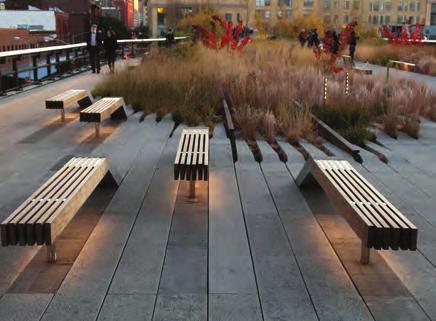
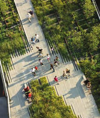
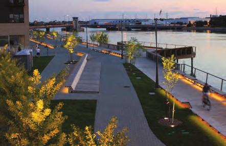
13 01 PUBLIC SPACES 02 MIXED USE BUILDINGS 03 DAY/NIGHT/YEAR ROUND ACTIVITY Provide a network of waterfront public spaces Pedestrian access given priority Well designed public realm Traffic calming measures Buildings engage Public Spaces Repurpose existing buildings Buildings that have multiple uses Opportunities for small businesses Encourage around the clock activities Year round destination Provide flexible spaces Mixed use development 04 SENSE OF PLACE 05 WATERFRONT ACTIVITY 06 GOOD MANAGEMENT Showcase Local Identity + Ecology Build on Existing History + Assets Public Art Program Publicly accessible waterfront Active use of waterfront e.g. fishing, light industry, tourism, docks, patios etc Establish Waterfront Improvement District (WID) Forge partnerships between community groups Creativity & Fun encourages social interaction Create program of regular events GUIDING PRINCIPLES 7
14 8 precedents


15 Steveston (Richmond), BC Population: 174,461 (2006) Granville Island, Vancouver Population: 578,041 (2006) Gibsons, BC Population: 4,182 (2006) Ganges, Salt Spring Island Population: 10,500 (2008) Lunenberg, Nova Scotia Population: 2,317 (2006) Prince Rupert, BC Population: 12,815 (2006) precedents 9


 Authentic experience Future expansion")
16 N First Impressions: 10 Active mixed-use waterfront Master-planned development compliments town Focused node of development Continuous water access Compliments town centre Waterfront trail (Cannery Museum and parks) Authentic experience Future expansion capability STEVESTON, BC


17 N First Impressions: Mixed-use Authentic experience Multiple events and activities - weekly market Accessible waterfront Traffic calming Pedestrian focus Active waterfront GANGES, SALT SPRING ISLAND 11


18 N First Impressions: Marine gateway to the Sunshine Coast Working Harbour Topographically challenged Adjacent to high street Pedestrian focus Small design moves highly successful Publically accessible jetty destination 12 Gibsons, BC


19 N First Impressions: Mixed-use Active waterfront / harbour Exceptional buildings Authentic historical experience HIghly accessible waterfront Organised Events LUNENBURG, NOVA SCOTIA 13


20 N First Impressions: Active mixed-use Extensive waterfront access Active waterfront Traffic calming Pedestrian focused public realm Year round / around the clock activities Parking provided throughout 14 GRANVILLE ISLAND, VANCOUVER
21 50 masterplan concepts


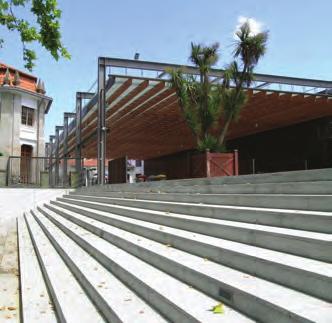
22 PEDESTRIAN EMPHASIS - SUGGESTED VEHICLE EMPHASIS - CURRENT CONDITION Vehicle accessible pedestrian realm Pedestrians and Vehicles co-exist Variety of paving textures & patterns At grade paving Distinctive quality & character Encourages community & interaction Safer traffic speeds Facilitates street parking & deliveries Durable long lasting materials Appropriate to dockside character Many successful worldwide examples Distinctive seperation of pedestrian and vehicles Utilitarean in character - conventional Wide traffic lanes Quicker traffic speeds Requires formal pedestrian crossings Inconsistant with pedestrian realm needs Lacks distinct waterfront quality TRAFFIC CALMING TECHNIQUE 51


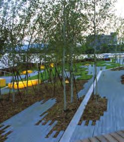
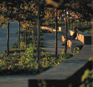
23 01 TREES 02 BEGINNINGS & ENDINGS 03 Most effective way to enhance public realm APPROPRIATE SCALE 04 Creates a sense of place SPECIAL DETAILS Ensure buildings and spaces appropriately sized Emphasis linearity and quality of streetscape 52


24 05 WEATHER PROTECTION 06 PERMEABLE EDGES & PUBLIC SPACE 07 Encourages use during all weather conditions MIXED USE 08 Multiple access & public spaces contribute to vibrancy INTEGRATED PARKING Mixed uses including residential animate area Parking integrated throughout PUBLIC REALM - KEY DESIGN CONSIDERATIONS 53


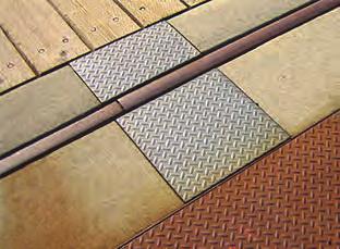
25 AREA CHARACTER THE INTENT IS TO MAINTAIN THE INDUSTRIAL CHARACTER OF THE STREET SPACES. THE STREETS SHOULD RESTORE THEIR OPEN AND CURBLESS CHARACTER LANDSCAPING Give greater spatial identity to streets and open spaces New areas should include street trees SIDEWALKS Use of wood decking to be expanded and where possible improve public access to waters edge. ROADS Special paving materials such as stamped concrete or pavers is encouraged over asphalt. Curbs should be used only to control vehicle movements GRAPHICS Provide identifying graphics to area. Graphics and colour to identify this area as unique PARKING Maximize in the area but does not detract AREA LIGHTING Street lighting should maintain maritime character COW BAY DESIGN GUIDELINES - AREA CHARACTER 70


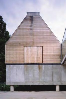
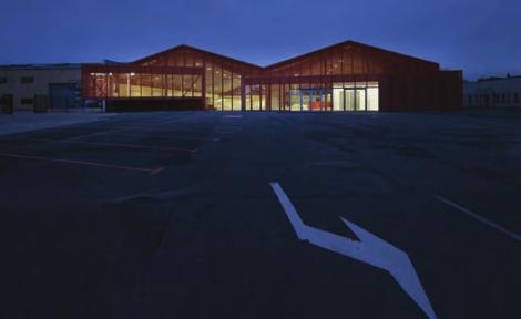
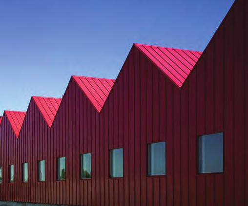
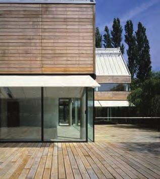
26 BUILDING CHARACTER NEW STRUCTURES SHOULD HAVE A MARITIME CHARACTER INCLUDING DECKS & BOARDWALKS FORM & SCALE New buildings should be developed with many small buildings rather than singular large buildings Variety of forms rather than repetitive is preferred, Sloping roofs preferable to flat roofs CANOPIES Industrial canopies encouraged, glass or steel MATERIALS Shingles, Horizontal Siding and metal cladding COLOUR Continuity of wall and roof colour is preferred if metal clad.wood buildings should be painted rather than natural stains. Bright colours are preffered over browns greys and earth tones WINDOWS & DOORS Small scale rather than shop front, sliding doors to be avoided STAIRS & HANDRAILS Wood and steel is encouraged LIGHTING Incandescent industrial fixtures are encouraged COW BAY DESIGN GUIDELINES - BUILDING CHARACTER 71


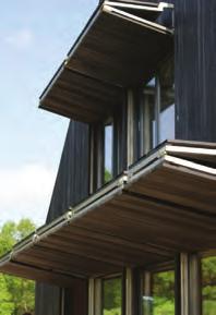
27 78 BUILDING CHARACTER - CONTEMPORARY INDUSTRIAL VERNACULAR


28 AREA CHARACTER - PUBLIC REALM 79
WINDSOR GLEN DESIGN GUIDELINES
 WINDSOR GLEN DESIGN GUIDELINES Adopted by Council, 2006 WINDSOR GLEN REDEVELOPMENT DESIGN GUIDELINES August 2006 1.0 Master Plan Organization For this area of the Coquitlam Town Centre, a mix of high,
MARINA MARKET & WATERFRONT DEVELOPMENT STUDY PORT ARANSAS, TEXAS
 MARINA MARKET & WATERFRONT DEVELOPMENT STUDY PORT ARANSAS, TEXAS FEBRUARY 2015 PRESENTATION OUTLINE 1 2 3 4 5 6 7 REGIONAL POSITIONING SITE IMPRESSIONS PLANNING & DESIGN PRINCIPLES EXISTING IMPROVEMENTS
2.0 Urban Design Concepts
 0 Urban Design Concepts Urban Design Concept diagrams The Waterfront Axis The Park Axis The Wharf Axis Waterfront Precincts 0.1 The Four Key Concepts: This Concept for the Wynyard Quarter establishes four
10.0 Open Space and Public Realm
 10.0 Open Space and Public Realm 10.0 Open Space and Public Realm The Public Open Space System is comprised of: outdoor spaces available for public use that are either publicly owned (e.g., parks and
Main Street Reconstruction From Ninth Line to Stouffer Street. Town of Whitchurch-Stouffville. Public Information Centre
 Main Street Reconstruction From Ninth Line to Stouffer Street Town of Whitchurch-Stouffville Public Information Centre November 23, 2016 4:30 to 6:00 pm & 7:00 to 8:00 pm 6240 Main Street, Stouffville
Mark-up of the effect of the proposed Bronte Village Growth Area OPA No.18 on the text of section 24, Bronte Village, of the Livable Oakville Plan
 Mark-up of the effect of the proposed Bronte Village Growth Area OPA No.18 on the text of section 24, Bronte Village, of the Livable Oakville Plan Notes: This document is provided for information purposes
Tauranga City Centre Spatial Framework
 Tauranga City Centre Spatial Framework Stakeholder Engagement Workshop 15 October 2015 Project Design Team Beca & LandLAB Our team Henry Crothers (LandLab) Landscape Architect/Urban Designer Urban and
East Bayshore Road Neighbourhood
 East Bayshore Road Neighbourhood Northridge Property Management Urban Design Brief 3195 East Bayshore Road City of Owen Sound January 2016 East Bayshore Road Neighbourhood Northridge Property Management
Hamilton Pier 7&8 Public Meeting and Workshop #1
 Hamilton Pier 7&8 Public Meeting and Workshop #1 May 12, 2015 May 01, 2015 Meeting Agenda 6:30 Doors Open 6:30-6:45 Review Boards 6:45-7:10 Introductions and Presentation Study Overview Policy Background
George Hotel application
 George Hotel application STAFF REVIEW FORM AND CHARACTER COMMITTEE OF THE WHOLE MARCH 25, 2014 Presentation Outline Purpose: Council direction on proposed form and character to inform drafting of the zoning
PUBLIC REALM STUDY AREA
 WELCOME PUBLIC REALM STUDY AREA WHAT IS PUBLIC REALM? Welcome to the Ballina Town Public Realm public consultation event. Mayo Council is in the process of producing a Public Realm Strategy for Ballina
Title: South Britannia Community Centre Tobi Fenton
 Title: South Britannia Community Centre Tobi Fenton South Britannia is laid out in a grid of 120x60 meter blocks with Main Street oriented towards Howe Sound. The concentrated centre is located at the
Official Community Plan Bylaw No. 4360, 2004, Amendment Bylaw No. 4897, 2016 (Sewell s Landing)
") District of West Vancouver Official Community Plan Bylaw No. 4360, 2004, Amendment Bylaw No. 4897, 2016 (Sewell s Landing) Effective Date: 1089612v1 District of West Vancouver Official Community Plan Bylaw
District of West Vancouver Official Community Plan Bylaw No. 4360, 2004, Amendment Bylaw No. 4897, 2016 (Sewell s Landing) Effective Date: 1089612v1 District of West Vancouver Official Community Plan Bylaw
Community Design Guidelines. Port Wallace DRAFT
 Community Design Guidelines Port Wallace DRAFT Energy 1 2 3 Nature Movement Connections Built Form DRAFT Layout Energy 1 Nature Community Design Guidelines GREAT COMMUNITIES PROTECT, CELEBRATE, AND CONSERVE
PIKE PINE RENAISSANCE: ACT ONE. October 19, 2017
 PIKE PINE RENAISSANCE: ACT ONE October 19, 2017 WATERFRONT SEATTLE PROGRAM PROJECT INTRODUCTION Pike and Pine streets, between First and Melrose avenues Pedestrian and streetscape improvements Budget:
14.0 BUILT FORM DESIGN CRITERIA
 14.0 BUILT FORM DESIGN CRITERIA CORPORATION OF THE TOWN OF CARLETON PLACE DEVELOPMENT PERMIT BY-LAW 123 124 CORPORATION OF THE TOWN OF CARLETON PLACE DEVELOPMENT PERMIT BY-LAW 14.1 MISSISSIPPI DISTRICT
DESIGN GUIDELINES. Planning Commission Re-Submittal. December 23, 2014 Revised to include Mixed-Use Design District Guidelines
 DESIGN GUIDELINES Planning Commission Re-Submittal December 23, 2014 Revised to include Mixed-Use Design District Guidelines Table of Contents I. INTRODUCTION 4 II. PROJECT VISION 5 III. PRAIRIEFIRE DISTRICTS
Program Schedule, Budget and Scope
 Sewer System Improvement Program + Program Schedule, Budget and Scope Mission & Valencia Green Gateway Presentation: July 9, 2013 San Francisco Public Utilities Commission Mission & Valencia Green Gateway
JACKsON STREET PIER CONCEPTUAL DESIGN PACKAGE SEPTEMBER 21, 2017
 JACKsON STREET PIER CONCEPTUAL DESIGN PACKAGE SEPTEMBER 21, 2017 JACKsON STREET PIER Process outline DESIGN PROCESS OVERVIEW: Sandusky s Jackson Street Pier Conceptual Design process included input from
Section 4 - Public Realm & Landscape proposals Landscape Masterplan. Section 4 52
 - Public Realm & Landscape proposals Landscape Masterplan 52 Proposed Masterplan - Green Infrastructure Strategy District Park 4.33 Ha to provide Passive and active recreation with a large play area which
MISSION STREETSCAPE PLAN. Neighborhood Commercial Streets handle continuous activity. Neighborhood Commercial STREET ROW: Main Design Treatments
 Neighborhood Commercial STREET ROW: 64-80 Main Design Treatments CORNER reduce crossing distance for pedestrians, create entrances to a residential area and slow cars down. help widen sidewalk allocating
KEY MAP DEVELOPMENT PERMIT AREA MAP. Sunnymede North Sub-Area Plan
 Richmond Official Community Plan BROADMOOR AREA SUNNYMEDE NORTH SUB-AREA PLAN Bylaw 7100 Schedule 2.6C SUNNYMEDE NORTH SUB-AREA PLAN SUNNYMEDE NORTH SUB-AREA PLAN SUNNYMEDE NORTH SUB-AREA PLAN KEY MAP
Highland Village Green Design Guidelines
 Highland Village Green Design Guidelines Publishing Information Title Highland Village Green Design Guidelins Author The City of Calgary Status DRAFT - Proposed document subject to changes Additional Copies
Appendix A COMMUNITY IMPROVEMENT PLAN DESIGN GUIDELINES
 Appendix A COMMUNITY IMPROVEMENT PLAN DESIGN GUIDELINES INTRODUCTION The continuous and desirable improvement of Arnprior requires a clear understanding of what is envisioned for the Town. These Design
Town of Essex Urban Design Guidelines for Downtown Harrow and Essex Centre May 2014
 Town of Essex Urban Design Guidelines for Downtown Harrow and Essex Centre May 2014 1 Table of Contents Section 1.0 Purpose and Intent.3 Section 2.0 Streetscapes 4 Section 3.0 Active and Inviting Streetscapes..5
Grafton Street < N September 2, 2015
 Grafton Street < N September 2, 2015 Project Background, Site Inventory + Analysis Brunswick Street Duke Street Scotia Bank Centre Carmichael Street Argyle Street City Hall Grand Parade Barrington Street
Waterfront Project VISION, GOALS AND OBJECTIVES
 Waterfront Project VISION, GOALS AND OBJECTIVES INTRODUCTION The City of North Vancouver created the Waterfront Project in 2005 in order to provide a focus for waterfront redevelopment opportunities and
3.5 Principle 5/Response
 5 Principle 5/Response Existing street network Proposed street network Pedestrian street hierarchy Existing streets Existing Regional Arterial 4 Existing Street Network Existing and proposed streets Indicative
appendix and street interface guidelines
 appendix five: building and street interface guidelines appendix 5 building and street interface guidelines BOULEVARDS Boulevards are generally characterized by higher levels of traffic movement at higher
CAMBIE CORRIDOR PLAN
 1 WELCOME TO THE OPEN HOUSE PUBLIC REALM PLAN - CAMBIE CORRIDOR Thank you for coming to the Cambie Corridor Public Realm Open House! Place a dot where you live Please provide us with your comments and
PRELIMINARY DESIGN + DEVELOPMENT PLAN
 WELCOME! To The Public Open House May 30 th, 2017 HARBOUR WEST PARKS Vision Project Overview The City s vision for Port Credit Harbour West Parks is to develop a vibrant waterfront destination that integrates
PROPOSED REDEVELOPMENT OF THE GLEN ABBEY GOLF CLUB. STREETSCAPE DESIGN STUDY (excerpt from the Urban Design Brief) TOWN OF OAKVILLE.
 TOWN OF OAKVILLE.") PROPOSED REDEVELOPMENT OF THE GLEN ABBEY GOLF CLUB STREETSCAPE DESIGN STUDY (excerpt from the Urban Design Brief) TOWN OF OAKVILLE OCTOBER, 2016 for 2.4.2 STREETS Streets are the single largest component
PROPOSED REDEVELOPMENT OF THE GLEN ABBEY GOLF CLUB STREETSCAPE DESIGN STUDY (excerpt from the Urban Design Brief) TOWN OF OAKVILLE OCTOBER, 2016 for 2.4.2 STREETS Streets are the single largest component
Terra Nova Rural Park Plan
 Terra Nova Rural Park Plan Part 1 Getting to know the land The Surrounding Area North Side Airport, River, Trail East Side - Residential West Side- Sturgeon Banks, West Dyke Trail South Side:Terra Nova
Project purpose. advise. The purpose of the Beaumaris Lake Open Space Rehabilitation project is to: + Develop a Functional Program Concept
 Project purpose owns Road Beaumaris Road The purpose of the Beaumaris Lake Open Space Rehabilitation project is to: + Develop a Functional Program Concept + Guide Rehabilitation of Landscape and Community
PUBLIC REALM STRATEGY
 Concept PUBLIC REALM STRATEGY The design approach for of the public realm is to provide a streetscape interface appropriate to supporting Alberni s consistent scale and residential character. A series
Figure Example of out door dining in the public right-of-way.
 Section 2 Core Area Goal 2.2.1 To maintain and enhance the character of existing streets in the Downtown Area. Character Figure 2.2.1 Example of out door dining in the public right-of-way. A. Provide street
Cleveland Park Streetscape and Drainage Improvement Project 1
 Cleveland Park Streetscape and Drainage Improvement Project 1 Urban Context Washington, D.C. Connecticut Avenue Cleveland Park Streetscape and Drainage Improvement Project 2 Neighborhood Context Contributing
PUBLIC RIGHT-OF-WAY IN THIS CHAPTER PUBLIC REALM
 PUBLIC RIGHT-OF-WAY This section provides design guidelines for improvements in the public right-of-way. The public right-of-way refers to streets, sidewalks, non-vehicular thoroughfares, parks and greenways
PORT OF VANCOUVER WATERFRONT DEVELOPMENT. Concept Development Plan City Center Redevelopment Authority April 20, 2017
 PORT OF VANCOUVER WATERFRONT DEVELOPMENT Concept Development Plan City Center Redevelopment Authority April 20, 2017 Port History PORT ESTABLISHED 1912 TERMINAL 1 ACQUIRED 1925 GWM SIGNS LEASE 1935 HARBOR
Lehigh Acres Land Development Regulations Community Planning Project
 Lehigh Acres Land Development Regulations Planning Effort Summary In July, 2010 Commissioner Frank Mann invited the Lehigh Acres community to start discussing how to achieve their recently adopted community
Highest & Best Use Study Marina Park Lands
 Executive Summary of Report MARCH 2006 TABLE OF CONTENTS 1. Introduction...1 2. Study Process...2 3. Highest And Best Use Program...3 4. Concept Plan...8 5. Public Area Animation...9 6. Marina Park Implementation
Overview of Land Use Framework for Victoria Harbourfront. Planning Department February 2011
 Overview of Land Use Framework for Victoria Harbourfront Planning Department February 2011 Background TPB set out Vision Statement for the Victoria Harbour in 1999 To make Victoria Harbour attractive,
SQUAMISH 2010 AND BEYOND COMMUNITY VISION
 Our plan has been imagined and created to be both pragmatic and visionary. At the core of the strategy is a consideration of the highway s role and its impact on the community. First and foremost in creating
Courthouse Square Planning & Urban Design Study. Courthouse Square Working Group #13 October 15, 2014
 Courthouse Square Planning & Urban Design Study Courthouse Square Working Group #13 October 15, 2014 1 Courthouse Square Process Working Group Community Courthouse Square Advisory Groups & Civic Associations
WEST BLACKHALL STREET PUBLIC REALM + TOWN CENTRE CONNECTIONS Public Exhibition 28 th June 2018
 WEST BLACKHALL STREET PUBLIC REALM + TOWN CENTRE CONNECTIONS Public Exhibition 28 th June 2018 Welcome Introduction Design Your Involvement Thank you for coming Engagement We would like to gather to this
New-Cast Mixed-use Development Proposal King Street West, Newcastle, Ontario
 URBAN DESIGN BRIEF New-Cast Mixed-use Development Proposal King Street West, Newcastle, Ontario TABLE OF CONTENTS: 1.0 Executive Summary 2.0 Creating Vibrant and Sustainable Urban Places: Excerpts from
Keyport. Vision for Keyport
 Keyport Vision for Keyport Keyport is a rural, historic waterfront village bounded and limited in size by its natural borders of water and the Naval Undersea Warfare Center. The community consists primarily
Prepared by: a for the of the. Waterspace Strategy Sustainable Development Liverpool South Docks
 Prepared by: a for the of the Waterspace Strategy Sustainable Development Liverpool South Docks a Waterspace Strategy for the Sustainable Development of the Liverpool South Docks British Waterways identified
Green System Planning Day 4 SALA Vancouver Summer Program
 Green System Planning Day 4 SALA Vancouver Summer Program OUTLINE 1. Lecture 1 Green Networks Cynthia Girling 2. Break 3. Lecture 2 Principles of Park Planning Jeff Fitzpatrick 4. Photo of the Day assignment
Report to: Development Services Committee Report Date: April 24, 2017
 SUBJECT: Cornell Rouge National Urban Park Gateway - Report on Design Charrette and Next Steps PREPARED BY: Lilli Duoba, MES, MCIP, RPP, Manager, Natural Heritage (ext. 7925) REVIEWED BY: Marg Wouters,
LOW DENSITY RESIDENTIAL
 LOW DENSITY RESIDENTIAL Corner lots with coach houses to increase diversity, provide unity to the streetscape and increase eyes on the street. Garages and ancillary units accessed via rear lanes. Parking
97 Lea Bridge Road, Leyton, E10 7QL London Borough of Waltham Forest December 2015
 97 Lea Bridge Road, Leyton, E10 7QL London Borough of Waltham Forest December 2015 Public Realm and Landscape Proposals LEA BRIDGE ROAD, WALTHAMSTOW Public Realm & Landscape Proposals BDP(90)RPT001 December
Arterial Mainstreets ottawa.ca
 Urban Design Guidelines for Development along Arterial Mainstreets ottawa.ca Ce document est disponible en français sur ottawa.ca. This document is available in French on ottawa.ca. Approved by City Council
The Proposed Auckland Unitary Plan (notified 30 September 2013)
") 3 Business zones Introduction There are 10 business zones in the Unitary Plan: City Centre Metropolitan Centre Town Centre Local Centre Neighbourhood Centre Mixed Use General Business Business Park Light
3 Business zones Introduction There are 10 business zones in the Unitary Plan: City Centre Metropolitan Centre Town Centre Local Centre Neighbourhood Centre Mixed Use General Business Business Park Light
COMPLETE GREEN STREET CHECKLIST
 COMPLETE GREEN STREET CHECKLIST This document was developed to dissect the structure of an urban street and explore opportunities to make our streets more complete while also integrating green street strategies.
II. SINGLE FAMILY RESIDENTIAL
 II. SINGLE FAMILY RESIDENTIAL Castle Rock is made up of numerous individually built houses and subdivision tracts that have been developed during the past century. Some of the tracts are diverse in architectural
Housing and Coach House Guidelines - Ladner
 Housing and Coach House Guidelines - Ladner Policy D.8: Encourage Compatible Housing Design Encourage housing design that is sensitive to existing single family housing neighbourhoods by requiring a design
Benches Trash & Recycling Containers Railings and Bullrail Edges Paving Planting Pier Apron Lighting Interpretive Signage
 130 Appendix C: PortWalk The PortWalk give guidance for improvements within the Port s public access and open space system to ensure a certain standard of design consistency while preserving opportunities
West Blackhall Street Public Realm Public Exhibition
 West Blackhall Street Public Realm Public Exhibition Welcome Introduction Thank you for coming to this public engagement, your input is sought to help to deliver high quality public realm improvements
400 West Georgia Street Urban Design Panel. Public Realm
 400 West Georgia Street Urban Design Panel Public Realm Public Benefits The main benefit in regards to the proposed development at 400 West Georgia Street will be to increase density of Commercial Office
Design Guidelines and Development Standards for Southwood Ranch. Prepared February, 2016 by
 Design Guidelines and Development Standards for Southwood Ranch D e s i g n D i s t r i c t Prepared February, 2016 by Table of Contents Introduction 2 District Overlay Map. 3 Development Standards. 4
chapter DESIGN GUIDELINES NEW RIVER MASTER PLAN REPORT
 chapter DESIGN GUIDELINES NEW RIVER MASTER PLAN REPORT .76 DESIGN GUIDELINES An Overview design guidelines NEW RIVER MASTER PLAN Design Guidelines can transform the image of a city. Specific, design-based
THE CORPORATION OF DELTA ADVISORY DESIGN PANEL. Laura Ryan, Planner Yvette Luke, Senior Planner Candice Dannhauer, Recording Clerk
 THE CORPORATION OF DELTA ADVISORY DESIGN PANEL Minutes of the Regular Meeting of the Advisory Design Panel held Thursday, February 28, 2013 at 6:30 p.m. in the Tilbury Room at Delta Municipal Hall, 4500
THE GARDEN CITY PLAN. City of St. Catharines Official Plan. City of St. Catharines
 THE GARDEN CITY PLAN City of St. Catharines Official Plan City of St. Catharines August 2010 APPROVAL INFORMATION This Official Plan of the City of St. Catharines Planning Area, known as the Garden City
CITY OF MERCER ISLAND DESIGN COMMISSION STAFF REPORT
 CITY OF MERCER ISLAND DESIGN COMMISSION STAFF REPORT Agenda Item: 2 March 9, 2011 Project: Description: Applicant: DSR11-004 The applicant is requesting approval to replace the existing exterior wood framed
Downtown Streetscape Manual & Built Form Standards
 City of Guelph Downtown Streetscape Manual & Built Form Standards July 2014 Prepared by Brook McIlroy Inc. in association with Unterman McPhail Associates and McCormick Rankin Inc. City of Guelph Downtown
Urban Design Brief 1576 Richmond Street City of London
 Urban Design Brief City of London Treadstone Developments October 31, 2014 Urban Design Brief October 31, 2014 TABLE OF CONTENTS Page No. INTRODUCTION... 1 SECTION 1 LAND USE PLANNING CONCEPT... 1 1.1
This chapter contains the design standards and guidelines for development and improvement of office and industrial buildings and
 CHAPTER 4: INDUSTRIAL AND OFFICE This chapter contains the design standards and guidelines for development and improvement of office and industrial buildings and projects. Applicants should discuss specific
Cit of Kitchener Ur 6 an Design Manual PARTA. Desi n for _--::
 Cit of Kitchener Ur 6 an Design Manual Date PARTA Year ) Desi n for k Nodes Corridors _--:: Section Page 01 of 12 2 INTRODUCTION Purpose & Application Nodes and Corridors have been identified as key intensification
Study Area. Capitol Way. Greening America s Capitals 11/13/2014. A Greening America s Capitals Project
 Olympia, WA: Greening Capitol Way Supporting Communities move towards sustainability is a priority for the federal government. A Greening America s Capitals Project Office of Sustainable Communities U.S.
RIVERSIDE DESIGN CD-1 GUIDELINES. Adopted by City Council August 9, 1983
 $1 City of Vancouver Land Use and Development Policies and Guidelines Community Services, 453 W. 12th Ave Vancouver, BC V5Y 1V4 F 604.873.7344 fax 873.7060 planning@city.vancouver.bc.ca RIVERSIDE DESIGN
MASTER PLAN QUEEN ST. WEST BIA
 QUEEN ST. WEST BIA MASTER PLAN QUEEN ST. WEST BIA EXECUTIVE COMMITTEE IN ASSOCIATION WITH PMA LANDSCAPE ARCHITECTS LTD. SWEENY STERLING FINLAYSON & CO ARCHITECTS INC. FUGITIVE GLUE MARCH 2013 4.5.4 PLAZA
QUESTION 8: What are your Public Realm priorities for implementation? What would you like to see happen first? TELL US WHAT YOU THINK
 Public Realm Plan How will the Public Realm Plan be implemented? The Public Realm Plan document will set out a vision for the next 30 years. Over time, Plan elements and aspects can be implemented as opportunities
Ipswich Issues and Options for the Ipswich Local Plan Review, August 2017, Public Consultation
 Ipswich Issues and Options for the Ipswich Local Plan Review, August 2017, Public Consultation Having reviewed the issues and options documents, the Society has made the following response: Part 1 Strategic
THE CORPORATION OF THE CITY OF VAUGHAN MAJOR MACKENZIE STREETSCAPE STUDY
 THE CORPORATION OF THE CITY OF VAUGHAN MAJOR MACKENZIE STREETSCAPE STUDY STANTEC CONSULTING LTD. 300-675 Cochrane Drive, West Tower Markham, ON L3R 0B8 Tel: (905) 944-7777 Fax: (905) 474-9889 April 2010
PUBLIC PARKS AND FACILITIES, SERVING NEIGHBORHOOD RECREATIONAL AND COMMUNITY EVENTS BUILDINGS BUILT TO THE LINE AND ORIENTED TOWARD THE STREET
 BUILDINGS BUILT TO THE LINE AND ORIENTED TOWARD THE STREET PUBLIC PARKS AND FACILITIES, SERVING NEIGHBORHOOD RECREATIONAL AND COMMUNITY EVENTS CONNECTED & COMPLETE STREETS AND STREET GRID VIEW SHEDS GROUND
Gas Stations ottawa.ca
 Urban Design Guidelines for Gas Stations ottawa.ca Ce document est disponible en français sur ottawa.ca. This document is available in French on ottawa.ca. Approved by City Council May 24, 2006 City of
Johnson Street Bridge Public Realm Update
 Johnson Street Bridge Public Realm Update August 20, 2015 Background Johnson Street Bridge Replacement Project impacts a diverse range of stakeholders In addition to a new bridge, the project also includes
Clairtrell Area Context Plan
 Clairtrell Area Context Plan March 2005 Urban Development Services City Planning Contents 1. Introduction... 4 2. Development Structure... 6 2.1 Streets... 7 2.1.1 Sheppard Avenue and Bayview Avenue...
PART AOTEA PRECINCT
 CONTENTS... PAGE AOTEA PRECINCT...4 14.5.1 INTRODUCTION...4 14.5.2 RESOURCE MANAGEMENT ISSUES...4 14.5.3 RESOURCE MANAGEMENT OBJECTIVES AND POLICIES... 4 14.5.4 RESOURCE MANAGEMENT STRATEGY...5 14.5.5
The Master Plan Framework
 The Master Plan Framework The East Harbour Master Plan advances the development of 60 acres of former industrial lands east of the Don River. The Master Plan outlines a vision for a vibrant, transit-oriented
Policies and Code Intent Sections Related to Town Center
 Policies and Code Intent Sections Related to Town Center The Town Center Vision is scattered throughout the Comprehensive Plan, development code and the 1994 Town Center Plan. What follows are sections
2017 STRATEGIC PLAN CITY OF ST. AUGUSTINE
 2017 STRATEGIC PLAN CITY OF ST. AUGUSTINE WHO WE ARE CITY OF ST. AUGUSTINE VISION St. Augustine will be a diverse, livable, authentic waterfront city that builds upon its rich history and environment to
URBAN DESIGN BRIEF 181 Burloak Drive, Oakville
 URBAN DESIGN BRIEF 181 Burloak Drive, Oakville February 2017 Our File: 1730B 230-7050 WESTON ROAD / WOODBRIDGE / ONTARIO / L4L 8G7 / T: 905 761 5588/ F: 905 761 5589/WWW.MHBCPLAN.COM TABLE OF CONTENTS
PRINCE EDWARD COUNTY HIGHWAY CORRIDOR OVERLAY DISTRICT DESIGN GUIDE
 PRINCE EDWARD COUNTY HIGHWAY CORRIDOR OVERLAY DISTRICT DESIGN GUIDE AUGUST 21, 2012 Table of Contents Introduction 3 Sample Architecture 4 Design Standards Access and Circulation 6 Buildings 7 Landscaping
Table of Contents. Elm Avenue Improvement Plan City of Waco, Texas. Introduction 1. Existing Context 1 Figure 1 2.
 Table of Contents Introduction 1 Existing Context 1 Figure 1 2 Plan Guidelines 3 Future Urban Form 4 The West-End 4 Main Street 6 The East-End 7 Figure 2 9 Public Improvement Recommendations 7 General
Proposed for Vic West Neighbourhood Plan. Design Guidelines for Intensive Residential Development - Townhouse and Attached Dwelling
 Proposed for Vic West Neighbourhood Plan Design Guidelines for Intensive Residential Development - Townhouse and Attached Dwelling Design Guidelines for Intensive Residential Development - Townhouse and
4.9 Mendocino Avenue Corridor Plan Design Guidelines
 4.9 Mendocino Avenue Corridor Plan Design Guidelines The Mendocino Avenue Corridor Plan addresses the area between College Avenue and Steele Lane. Mendocino Avenue is a busy arterial that runs parallel
Hamilton Pier 7&8 Draft Urban Design Plan
 Hamilton Pier 7&8 Draft Urban Design Plan Public Open House October 29, 2015 Contents 1. Study Overview 2. Area Design Goals 3. Urban Structure 4. Public Realm 5. Urban Design Plan Options 6. Next Steps
AIRPORT BUSINESS PARK
 PIER MAC PETROLEUM INSTALLATION LTD. AIRPORT BUSINESS PARK DEVELOPMENT APPLICATIONS March 2003 4.1 Airport Business Park Development Permit Area 4.1.1 Justification/Design Concept The design concept envisioned
FRUITVALE TRANSIT VILLAGE (Phase 2) Residential Project
 Residential Project") FRUITVALE TRANSIT VILLAGE (Phase 2) Residential Project DEVELOPER: SIGNATURE PROPERTIES ARCHITECT: HKIT ARCHITECTS April 23, 2010 TABLE OF CONTENTS 3 Vision 4 Description of Site 5 Guiding Concepts 6
FRUITVALE TRANSIT VILLAGE (Phase 2) Residential Project DEVELOPER: SIGNATURE PROPERTIES ARCHITECT: HKIT ARCHITECTS April 23, 2010 TABLE OF CONTENTS 3 Vision 4 Description of Site 5 Guiding Concepts 6
Design Guidelines. High Point Estates Design Guidelines April Gomberoff Bell Lyon Architects Group Inc.
 High Point Estates April 2006 Gomberoff Bell Lyon Architects Group Inc. 1 29 Contents Part One The Building Scheme Part Two Architectural Character and Siting Building Part One: The Building Scheme i 31
The Vision. Photo provided by The Minervini Group. 46 Vision, Objectives & Strategies
 Vision, Objectives & Strategies The is the public framework and guide for future development of the Grand Traverse Commons. The establishes public polices for infrastructure, the preservation of natural
8. Urban Villages. Other Relevant Policies & Bylaws Official Community Plan Development Permit Area Designations and Guidelines
 8. Urban Villages Urban villages provide walkable shops and services, encourage a neighbourhood social life, create a sense of place and provide different housing options. More housing near Urban Villages
2.0 DEVELOPMENT PERMIT AREA 2 MARINE WATERFRONT (DPA-2)
") 2.0 DEVELOPMENT PERMIT AREA 2 MARINE WATERFRONT (DPA-2) 2.1 DPA-2 OBJECTIVES & APPLICATION The objectives of this Development Permit Area are to encourage thoughtful building and site design in an effort
2.0 DEVELOPMENT PERMIT AREA 2 MARINE WATERFRONT (DPA-2) 2.1 DPA-2 OBJECTIVES & APPLICATION The objectives of this Development Permit Area are to encourage thoughtful building and site design in an effort
Potential Green Infrastructure Strategies May 6, 2015 Workshop
 Potential Green Infrastructure Strategies May 6, 2015 Workshop Background The City of Cortland is developing the Tioughnioga Urban Headwaters Green Infrastructure Action Plan with funding from the National
Fisherman s Wharf Public Realm Plan
 Fisherman s Wharf Public Realm Plan SPUR Presentation July 11, 2008 3 February 2010 WHY A PUBLIC REALM PLAN? Public Life 1900 1950 1965 2000 Mainstreet Copenhagen in 100 years From nessesary to optional
section 3: Vision, Values and Goals
 Vision, Values and Goals 3 2041 Vision: Victoria is an urban sustainability leader inspiring innovation, pride and progress towards greater ecological integrity, livability, economic vitality, and community
Mixed Use Centres Development Permit Guidelines
 1 Mixed Use Centres Development Permit Guidelines Area Commercial or Mixed Use development occurring in City Centre, Urban Centre, Neighbourhood Centre, or Institutional Complex land use designations is
Historic Yonge Street HCD Study Public Meeting #2
 Historic Yonge Street HCD Study Public Meeting #2 March 26, 2014 Archaeological Services Inc. Philip Goldsmith Architect Agenda: 7:00 p.m. Open House 7:30 p.m. Welcome and Presentation 8:00 p.m. Questions