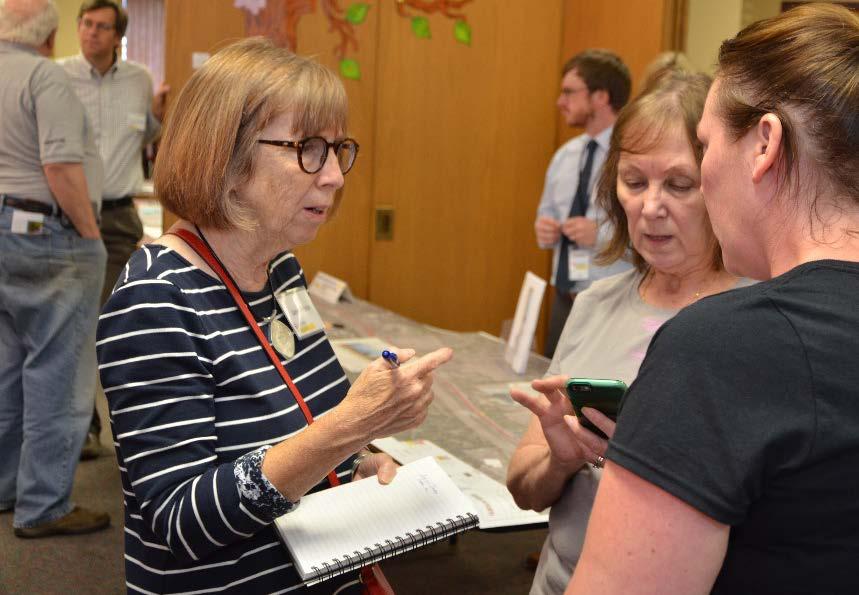
METRO Gold Line BRT CBAC Meeting. August 23, 2018
|
|
|
- Rafe Wilkerson
- 5 years ago
- Views:
Transcription

1 METRO Gold Line BRT CBAC Meeting August 23,
2 Today s Topics Introductions Corridor Management Committee Update Public Engagement Update History of Alignment Project Scope Discussions Upcoming CBAC Meetings 2


3 CBAC Co-Chairs Attending First CMC Meeting CBAC Co-Chairs Appointed in July Darrell Paulsen, Community Representative Steve Morris, Business Representative Both Co-Chairs are members of the Gold Line CMC Attended August 2 CMC Meeting CBAC Co-Chairs July 26 CBAC Meeting 3
4 Public Engagement Update 4
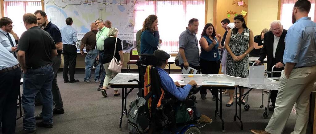
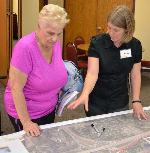
5 Stakeholder Engagement Update Open Houses Two corridor-wide events to review design updates and options 5 July 17 and 18 Open Houses


6 Stakeholder Engagement Update Neighborhood Meetings Three locations where input is needed on design options: Mounds vs. Maria Station Location Hudson Road between Etna and White Bear; mixed traffic vs. dedicated guideway White Bear Avenue Station Location July 31 Neighborhood Meeting 6


7 Stakeholder Engagement Update Door Knocking Two neighborhoods where input is needed on design options One-on-One Meetings With various stakeholders along the corridor Community Events Throughout the corridor Flyer Translation into Hmong Language July 31 East Metro Garage Open House 7
8 History of Alignment 8

9 Alternatives Analysis Many options were considered and ultimately eight alternatives were analyzed 9

10 Environmental Scoping Same route was considered for bus rapid transit and light rail transit service 10

11 Locally Preferred Alternative
12 Project Development
13 Project Scope in Environmental Assessment 13
14 GBRT Goals and Objectives Tier 1 goals must be considered first Improve Mobility (Ridership & Travel Time) Cost-Effective & Economically Viable Support Economic Development Protect the Natural Environment Preserve & Protect Quality of Life
15 Gold Line Committee Structure Issue Resolution Teams (IRTs) Technical Advisory Committee (TAC) Community and Business Advisory Committee (CBAC) Corridor Management Committee (CMC) Counties Metropolitan Council
16 Gold Line Scope Refinement Process Community Planning Ongoing Station Area Planning Environmental Assessment Scope Local Scope Gold Line Project Scope
17 Scope Refinement Tasks July Reviewed scope currently included in the Environmental Assessment August Discuss stakeholder feedback and areas along route where options exist Fall/Winter Review updated project costs at 15% design 2019 Review 30% Design, Cost Estimate, and Funding 17
18 Discussion Outline Consider all information presented to date Participate in the conversation Allow time for others to speak Be open to all ideas and comments Consensus is not required 18
19 Percent Dedicated Guideway 19
20 BRT as a Premium Service What makes the Gold Line a premiere service? BRT is like LRT Distinctive station architecture and design Station amenities like real time signage Uniquely branded buses Regular all-day reliable service Direct connection to METRO system Exclusive lanes 20


21 Types of Guideway Mixed Traffic Curbside Running Side Running Center Running 21
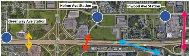
22 Gold Line BRT Mixed Traffic Where is mixed traffic proposed an why? Location Reason Sections of downtown Kellogg Bridge Maria Ave Option (not preferred option) Hudson from White Bear to Etna Tanners Lake Right of Way constraints Planned replacement of bridge is not part of GBRT Project Right of Way constraints Low ADT means it operates like dedicated guideway, avoids impact to vegetation and neighborhood character Right of Way constraints and environmental impacts to lake 4 th Street Planned replacement of bridge is not part of GBRT Project. Bridge width is constraint. Bielenberg/Tamarack Nature Preserve Right of Way constraints and environmental impacts to nature preserve. 22

23 Gold Line BRT Mixed Traffic 23
24 Mixed Traffic versus Dedicated Guideway Federal Transit Administration requires at least 50% dedicated LPA route is 78% dedicated Amount of dedicated lanes could be less depending on options selected CBAC Discussion 24
25 Mounds Blvd/Maria Ave Station Location 25

26 Mounds Boulevard Station Option 26

27 Mounds Boulevard Station Option 27

28 Mounds Boulevard Station Option 28

29 Maria Avenue Station Option 29

30 Maria Avenue Station Option 30

31 Maria Avenue Station Option 31
32 Mounds Blvd/Maria Ave Station Location BRT operations Mounds Blvd Preserves two-lane dedicated guideway Maria Ave Property impacts No impacts No impacts Noise wall Requires noise wall reconstruction I-94 impacts Changes to I-94 offramp and Mounds Blvd required Location City policy Station further from neighborhood center Adopted in city s Station Area Plan Cost Included in current $420M estimate Mixed-traffic: lower level of BRT service No impacts No impacts Station closer to neighborhood center Not in city policy $4M cost savings over Mounds 32
33 Mounds Blvd/Maria Ave Station Location Technical Advisory Committee (TAC) prefers Mounds Blvd option Pending review of Americans with Disabilities Act (ADA) concerns Final technical review by Minnesota Department of Transportation CBAC Discussion 33
34 Hudson Road Mixed Traffic/Dedicated Guideway 34

35 Hudson Rd Mixed Traffic Option 35

36 Hudson Rd Dedicated Guideway Option 36

37 Hudson Rd 37

38 Hudson Rd Mixed Traffic Option 38
39 Hudson Rd Dedicated Guideway Option 39
40 Hudson Rd Mixed Traffic / Dedicated Guideway Option Mixed Traffic Dedicated Guideway Pedestrian bridge No impacts Impacts Hazelwood bridge Noise wall Minimal impacts Impacts wall full length of Hudson Property impacts Reduced property / boulevard impacts by 8 Impacts properties / boulevard 8 more Parking Maintains on-street parking Eliminates on-street parking Hudson Rd No change: remains two-way One lane westbound BRT operations Neighborhood character Grace Lutheran Church Cost Operates as if dedicated (existing 200 cars/day traffic volumes) Limited impacts No impacts $7.5M cost savings over dedicated guideway 40 Highest level of operations Potential for perceived impacts Impacts driveway Included in current $420M estimate
41 Hudson Rd Mixed Traffic/Dedicated Guideway Option Technical Advisory Committee (TAC) has not indicated a preference CBAC Discussion 41
42 White Bear Avenue Station Location 42

43 Van Dyke Station Option 43

44 Van Dyke Station Option 44

45 Hazel Station Option 45

46 Hazel Station Option 46
47 White Bear Avenue Station Location Neighborhood access Property impacts Visibility Station spacing Van Dyke St Closer to White Bear Ave businesses Property impacts to provide station access Station may be obstructed by buildings Further from Sun Ray Station Cost Included in current $420M cost estimate Bike-ped links City policy No improvements planned for Van Dyke Adopted in city s Station Area Plan Hazel St Closer to high-density housing and potential redevelopment sites No impacts Greater visibility Closer to Sun Ray Station $400K increase over Van Dyke Hazel designated as future minor bikeway Not currently in city policy 47
48 White Bear Avenue Station Location Technical Advisory Committee (TAC) has not indicated a preference Station area planning process lead by the counties prefers Hazel CBAC Discussion 48
49 Upcoming CBAC Meetings 49
50 September CBAC Meeting Next CBAC meeting will be a bus tour Hold Tuesday September 25 from 10 am to 2 pm for tour Meet up location and exact times forthcoming 50
51 For more information: 51
METRO Gold Line BRT CMC Meeting
 METRO Gold Line BRT CMC Meeting April 26, 2018 Today s Topics Welcome and Introductions Project Overview CMC Roles and Responsibilities Current Project Baseline: Scope and Cost Estimate Overview Municipal
METRO Gold Line Corridor Management Committee Notes for the August 2, 2018 Meeting Metropolitan Council Chambers
 METRO Gold Line Corridor Management Committee Notes for the August 2, 2018 Meeting Metropolitan Council Chambers MEMBERS PRESENT: Chair Alene Tchourumoff, Steve Morris, Darrell Paulsen, Paul Reinke, Stan
Atlanta BeltLine Corridor Environmental Study. Scoping Meeting August 2008
 Atlanta BeltLine Corridor Environmental Study Scoping Meeting August 2008 What Will We Be Discussing Today? Study Overview - How Did We Get Here? - What Is the Study About? - Who Is Involved? - Where Is
Midtown Corridor Alternatives Analysis. Appendix A - Initially Considered Alternatives Screening
 Midtown Corridor Alternatives Analysis Appendix A - Initially Considered Alternatives Screening Arterial BRT on Lake Street - Overall Rating: RATING Metropolitan Council recommendations stated in the Transportation
POLICY ADVISORY COMMITTEE
 July 26, 2018 POLICY ADVISORY COMMITTEE ENVIRONMENTAL ANALYSIS PHASE Agenda 1. Welcome and introductions. 2. Overview of project activities. 3. Community Advisory Committee update. 4. Public engagement
Ashland BRT Environmental Assessment: logos of CTA, CDOT, Chicago Department of Housing and Economic Development
 Ashland BRT Environmental Assessment: logos of CTA, CDOT, Chicago Department of Housing and Economic Development Overview The Chicago Transit Authority (CTA), in partnership with the Chicago Department
CITY OF CHARLOTTESVILLE, VIRGINIA CITY COUNCIL AGENDA
 CITY OF CHARLOTTESVILLE, VIRGINIA CITY COUNCIL AGENDA Agenda Date: December 16, 2013 Action Required: Adoption of Resolution Presenter: Staff Contacts: Title: James E. Tolbert, AICP, Director of NDS James
Community Engagement Committee Meeting #1 December 10, :30pm-8:30pm
 Community Engagement Committee Meeting #1 December 10, 2014 6:30pm-8:30pm Welcome and Introductions Dana Murdoch Minneapolis Park and Recreation Board Project Manager Ryan French Walker Art Center Director
Scope of Services. River Oaks Boulevard (SH 183) Corridor Master Plan
 Corridor Master Plan") Scope of Services River Oaks Boulevard (SH 183) Corridor Master Plan PROJECT AREA The project area consists of the River Oaks Boulevard (SH 183) corridor bounded by SH 199 at the northern end and the Trinity
Scope of Services River Oaks Boulevard (SH 183) Corridor Master Plan PROJECT AREA The project area consists of the River Oaks Boulevard (SH 183) corridor bounded by SH 199 at the northern end and the Trinity
Transportation Committee
 Transportation Committee Business Item No. 2013-286SW Meeting date: October 14, 2013 For the Metropolitan Council meeting of October 16, 2013 Subject: Southwest Light Rail Transit (Green Line Extension):
SOUTHWEST TRANSITWAY (STAGE 2) PUBLIC OPEN HOUSE
 PUBLIC OPEN HOUSE") WELCOME! SOUTHWEST TRANSITWAY (STAGE 2) PUBLIC OPEN HOUSE Monday, November 18, 2013 3:30 to 5:30PM and 7:00 to 9:00PM Tuesday, November 19, 2013 3:30 to 5:30PM and 7:00 to 9:00PM Welcome to the Southwest
WELCOME! SOUTHWEST TRANSITWAY (STAGE 2) PUBLIC OPEN HOUSE Monday, November 18, 2013 3:30 to 5:30PM and 7:00 to 9:00PM Tuesday, November 19, 2013 3:30 to 5:30PM and 7:00 to 9:00PM Welcome to the Southwest
RESOLUTION NO. R Refining the route, profile and stations for the Downtown Redmond Link Extension
 RESOLUTION NO. R2018-32 Refining the route, profile and stations for the Downtown Redmond Link Extension MEETING: DATE: TYPE OF ACTION: STAFF CONTACT: Capital Committee Board PROPOSED ACTION 09/13/2018
1.0 PROJECT PURPOSE AND NEED
 1.0 PROJECT PURPOSE AND NEED The FasTracks Plan includes the extension of the Central Corridor from its current terminus at 30th/Downing to a connection to the East Corridor commuter rail service planned
Corridor Management Committee. September 29, 2017
 Corridor Management Committee September 29, 2017 1 Today s Topics Chair s Update Proposed Corridor Protection Wall Aesthetic Design Overview Public Outreach Environmental Review Civil Construction Update
SAN FRANCISCO MUNICIPAL TRANSPORTATION AGENCY
 THIS PRINT COVERS CALENDAR ITEM NO. : 10.3 DIVISION: Sustainable Streets BRIEF DESCRIPTION: SAN FRANCISCO MUNICIPAL TRANSPORTATION AGENCY Approving the removal of Municipal Railway bus zones at various
S C O P E O F W O R K A P R I L
 white flint 2 sector plan S C O P E O F W O R K A P R I L 2 0 1 2 MONTGOMERY COUNTY PLANNING DEPARTMENT M-NCPPC MontgomeryPlanning.org 1 white flint 2 sector plan Scope of Work abstract This scope of work
BeltLine Corridor Environmental Study
 BeltLine Corridor Environmental Study Joint TAC and SAC Meeting December 8, 2008 What We Will Discuss Today Outreach and Agency Coordination Scoping Results Existing Conditions Historical and Archeological
PROJECT BACKGROUND. Preliminary Design Scope and Tasks
 PROJECT BACKGROUND Preliminary Design Scope and Tasks The purpose of this Study is the development of preliminary designs for intersection improvements for Trunk Highway (TH) 36 at the intersections of
Gold Line Bus Rapid Transit Transit Oriented Development (BRTOD) Helmo Station Area Plan
 Helmo Station Area Plan") Appendix F Gold Line Bus Rapid Transit Transit Oriented Development (BRTOD) Helmo Station Area Plan Introduction and Purpose of the Plan The Gold Line Bus Rapid Transit facility is an eleven-mile dedicated
Appendix F Gold Line Bus Rapid Transit Transit Oriented Development (BRTOD) Helmo Station Area Plan Introduction and Purpose of the Plan The Gold Line Bus Rapid Transit facility is an eleven-mile dedicated
Don Mills Crossing Study and Celestica Lands Development Application Community Meeting, Open House, and Breakout Discussions
 Consultation Summary Don Mills Crossing Study and Celestica Lands Development Application Community Meeting, Open House, and Breakout Discussions This report is not intended to provide a verbatim transcript
Tyvola & Archdale Transit Station Area Plan. June 5, 2008
 Tyvola & Archdale Transit Station Area Plan Second Public Meeting June 5, 2008 Presentation Outline 1. Purpose and Process 2. Station Area Overview 3. Plan Recommendations 4. Comments Received and Proposed
St. Clair Avenue West Area Transportation Master Plan
 1 (Between Keele Street and Old Weston Road) Public Information Centre 1 December 2, 2015 2 Welcome Welcome to the first Public Information Centre for the St. Clair Avenue West Area. The panels will present
LOS ANGELES COUNTY METROPOLITAN TRANSPORTATION AUTHORITY (LACMTA)
") CE OF PREPARAT LOS ANGELES COUNTY METROPOLITAN TRANSPORTATION AUTHORITY (LACMTA) NOTICE OF PREPARATION OF AN ENVIRONMENTAL IMPACT STATEMENT (E1S)lENVIRONMENTAL IMPACT REPORT (EIR) TO: AGENCIES, ORGANIZATIONS
CE OF PREPARAT LOS ANGELES COUNTY METROPOLITAN TRANSPORTATION AUTHORITY (LACMTA) NOTICE OF PREPARATION OF AN ENVIRONMENTAL IMPACT STATEMENT (E1S)lENVIRONMENTAL IMPACT REPORT (EIR) TO: AGENCIES, ORGANIZATIONS
WHAT IS THE PURPOSE OF THE OPEN HOUSE?
 WHAT IS THE PURPOSE OF THE OPEN HOUSE? OPEN HOUSE PURPOSE The purpose of the open house is to provide an update on the study process and introduce the preliminary concept alternatives. The open house provides
Rapid Transit Implementation Working Group September 14, 2017
 Rapid Transit Implementation Working Group September 14, 2017 BACKGROUND Council approved the Rapid Transit Master Plan and Updated Business Case on July 25, 2017. Approval of the RTMP confirmed the BRT
Citizen Advisory Group Meeting 5: Land Use April 14, 2011
 Citizen Advisory Group Meeting 5: Land Use April 14, 2011 Meeting Agenda 1. Background Review 2. Transportation Follow-up 3. PED Overlay Approach 4. Land Use Mapping 5. Group Exercise 6. Wrap-up and Next
Local Growth Planning in North Central Green Line Communities
 2018 April 30 Page 1 of 6 EXECUTIVE SUMMARY This report outlines a high-level scope for local growth planning for north central Green Line communities. The catalyst for this review is the significant investments
Richmond Road Complete Street Meeting #1, April 25, 2016
 Richmond Road Complete Street Meeting #1, April 25, 2016 Agenda Overview Richmond Road Complete Street Other Ongoing Studies Discussion Map buses/day removed from Sir John A. Macdonald Parkway Confederation
Phase I Redevelopment Plan. First Community Meeting
 Hoboken Terminal and Yard Phase I Redevelopment Plan First Community Meeting May 31, 2011 One Hudson Place Phase I Redevelopment Plan Redevelopment Plan First Community Meeting Agenda 1. Redevelopment
Blueprint Denver Task Force Meeting #
 Blueprint Denver Task Force Meeting #1 6.23.16 1. Welcome and Introductions Your name and affiliation Name 1 thing you love about Denver Name 1 thing you d change about Denver All in 30 seconds! Ready,
Infrastructure Engineering Planning Construction Suite 300 Minneapolis, MN Tel: Fax:
 Infrastructure Engineering Planning Construction 701 Xenia Avenue outh uite 300 Minneapolis, MN 55416 Tel: 763-541-4800 Fax: 763-541-1700 Memorandum To: Minnehaha Creek Watershed District Board From: Tony
Eastern Terminus TECHNICAL MEMORANDUM CENTRAL BROWARD EAST-WEST TRANSIT ANALYSIS BROWARD COUNTY, FLORIDA
 Eastern Terminus TECHNICAL MEMORANDUM CENTRAL BROWARD EAST-WEST TRANSIT ANALYSIS BROWARD COUNTY, FLORIDA FINANCIAL PROJECT ID NUMBER 411189-2-22-01 FLORIDA DEPARTMENT OF TRANSPORTATION DISTRICT 4 Prepared
Planning for TOD Implementation at a Corridor Scale
 Planning for TOD Implementation at a Corridor Scale Bill Sadler, Reconnecting America Presentation to Gold Line Corridor Working Group July 2, 2013 What is Reconnecting America? Reconnecting America is
Dallas CBD Second Light Rail Alignment (D2)
") Dallas CBD Second Light Rail Alignment (D2) Subway Project Refinement Public Meetings January 19, 2017 Discussion Items Background Schedule Public/Stakeholder Involvement Subway Construction Overview Potential
Dallas CBD Second Light Rail Alignment (D2) Subway Project Refinement Public Meetings January 19, 2017 Discussion Items Background Schedule Public/Stakeholder Involvement Subway Construction Overview Potential
master plan of highways bus rapid transit amendment
 Scope of Work master plan of highways bus rapid transit amendment September 2011 Montgomery County Planning Department M-NCPPC MontgomeryPlanning.org 1 Scope of Work master plan of highways bus rapid transit
Dallas CBD Second Light Rail Alignment (D2)
") Dallas CBD Second Light Rail Alignment (D2) Subway Project Refinement City of Dallas Transportation and Trinity River Project Committee February 13, 2017 Discussion Items Background Schedule Public/Stakeholder
Dallas CBD Second Light Rail Alignment (D2) Subway Project Refinement City of Dallas Transportation and Trinity River Project Committee February 13, 2017 Discussion Items Background Schedule Public/Stakeholder
History: a Grand Urban Boulevard
 History: a Grand Urban Boulevard 1890 1910: At its peak, Euclid Avenue, "Millionaire's Row," was considered the second most beautiful urban street in the country next to Fifth Avenue in Manhattan. 1910-2030:
Cotton Belt Regional Rail Corridor Project
 Cotton Belt Regional Rail Corridor Project North Dallas AFG University of Texas at Dallas Administration Building March 1, 2018 0 Discussion Public Involvement Project Scope Alignment Stations Environmental
SHERIDAN PARKING STRUCTURE PUBLIC INFORMATION MEETING November 11, :00 pm - 8:00 pm
 SHERIDAN PARKING STRUCTURE PUBLIC INFORMATION MEETING November 11, 2010 6:00 pm - 8:00 pm 1 Project Area 2 Sheridan Parking Structure RTD Ownership 3 Project Elements Structure and amenities include: 1.
Executive Summary. NY 7 / NY 2 Corridor
 Executive Summary NY 7 / NY 2 Corridor Transportation and Land Use Study December 2005 Prepared for: Town of Colonie Capital District Transportation Committee Prepared by: Introduction: Land use decisions
Route 110 Alternatives Analysis
 Route 110 Alternatives Analysis Public Meeting #1 December 15, 2014 Source: Town of Babylon Agenda Welcome/Introduction Hon. Antonio A. Martinez Deputy Supervisor, Town of Babylon Update on East Farmingdale
Rapid Transit Implementation Working Group
 Rapid Transit Implementation Working Group October 12, 2017 1 Agenda 1. Consultation Update 2. Technical Work Update 3. LTC Rapid Transit Integration 4. Next Steps 2 Consultation Update 3 Consultation
TO: Denver Planning Board FROM: Analiese Hock, Senior City Planner DATE: March 13, 2018 RE:
 Community Planning and Development Planning Services 201 W. Colfax Ave., Dept. 205 Denver, CO 80202 p: 720.865.2915 f: 720.865.3052 www.denvergov.org/cpd TO: Denver Planning Board FROM: Analiese Hock,
Por favor, levanten la mano si necesita traduccion en espanol Please raise your hand if you need Spanish translation
 FEDERAL BOULEVARD CORRIDOR WIDE STUDY PUBLIC MEETING #1 APRIL 27, 2016 Por favor, levanten la mano si necesita traduccion en espanol Please raise your hand if you need Spanish translation HDR DESIGN WORKSHOP
TRANSIT ORIENTED DEVELOPMENT PINELLAS COUNTY MPO LIVABLE COMMUNITIES INITIATIVE PINELLAS COUNTY COMPREHENSIVE PLAN AMENDMENTS
 PINELLAS COUNTY MPO LIVABLE COMMUNITIES INITIATIVE MODEL LAND DEVELOPMENT CODE TRANSIT ORIENTED DEVELOPMENT PINELLAS COUNTY COMPREHENSIVE PLAN AMENDMENTS MPO Livable Communities Initiative Goal: Improve
TOWN COUNCIL / PLANNING COMMISSION
 Workshop #3 TOWN COUNCIL / PLANNING COMMISSION January 20, 2011 Consultant Team In Attendance Tonight BMS Design Group Nevada City and San Francisco Michael Smiley, AICP, ASLA Partner-in-Charge Nancy L.
Urban Planning and Land Use
 Urban Planning and Land Use 701 North 7 th Street, Room 423 Phone: (913) 573-5750 Kansas City, Kansas 66101 Fax: (913) 573-5796 Email: planninginfo@wycokck.org www.wycokck.org/planning To: From: City Planning
West Broadway Transit Study Initial Screening of Alternatives Memo
 West Broadway Transit Study Initial Screening of Alternatives Memo 5/22/2015 Prepared by the SRF Consulting Group Team for Table of Contents Purpose... 1 Methodology... 1 Screening... 5 Screening Criteria...
Northwest Rail Corridor and US 36 BRT Development Oriented Transit Analysis 4.4 STATION AREA FINDINGS
 4.4 STATION AREA FINDINGS Each station is different, and each one requires a separate set of recommendations based on the vision for the site. This section outlines an initial TOD strategy and recommendations
North Loop Paving. December 18th, Street Reconstruction Project. Forrest Hardy, Transportation Planner Minneapolis Public Works
 CITY OF MINNEAPOLIS Street Reconstruction Project December 18th, 2017 Forrest Hardy, Transportation Planner Minneapolis Public Works Forrest.Hardy@MinneapolisMN.Gov (612) 673-5951 Adam Hayow, Project Engineer
Shift Rapid Transit Public Participation Meeting May 3, 2017
 Shift Rapid Transit Public Participation Meeting May 3, 2017 Shift Rapid Transit Initiative Largest infrastructure project in the city s history. Rapid Transit initiative will transform London s public
SH 199 Corridor Master Plan. Community Meeting No. 2 May 31, 2017
 Community Meeting No. 2 May 31, 2017 Transportation Projects On or Near SH 199 SH 199 from 0.3 miles south of FM 1886 to south end of Lake Worth bridge Construct freeway mainlanes and frontage roads 10-Year
Kanata Light Rail Transit Planning and Environmental Assessment Study
 Kanata Light Rail Transit Planning and Environmental Assessment Study Public Open House #2 Transportation Services Department December 7, 2017 Agenda Review study progress Confirm the Preferred Corridor
Planning for TOD Implementation at a Corridor Scale
 Planning for TOD Implementation at a Corridor Scale Catherine Cox Blair, Reconnecting America Presentation to DRCOG and the Sustainable Communities Initiative May 14, 2012 What is Reconnecting America?
Transportation Working Team Duane Diggs, Co-Chair (VOICE Buffalo) Kelly Dixon, Co-Chair (GBNRTC) Paul Ray, Facilitator (UB Regional Institute)
 Kelly Dixon, Co-Chair (GBNRTC) Paul Ray, Facilitator (UB Regional Institute)") towards a more sustainable Buffalo Niagara Transportation Working Team Duane Diggs, Co-Chair (VOICE Buffalo) Kelly Dixon, Co-Chair (GBNRTC) Paul Ray, Facilitator (UB Regional Institute) Agenda Welcome,
towards a more sustainable Buffalo Niagara Transportation Working Team Duane Diggs, Co-Chair (VOICE Buffalo) Kelly Dixon, Co-Chair (GBNRTC) Paul Ray, Facilitator (UB Regional Institute) Agenda Welcome,
Isabel Neighborhood Plan: Alternatives
 Isabel Neighborhood Plan: Alternatives Presented by: Lori Parks, Associate Planner February 2, 2015 Agenda 1. Background on BART to Livermore 2. Isabel Neighborhood Plan 3. Alternative Scenarios 4. General
FDOT D4 Complete Streets
 FDOT D4 Complete Streets Context Sensitive Solutions Directs that complete street solutions will complement the context of the community. Collaborative approach to decision making, project development,
Eglinton West LRT Update
 Eglinton West LRT Update Community Consultation Update May 16, 2016 Background Rapid transit along Eglinton Ave between Kennedy Station and Pearson Airport was included in the Metrolinx Regional Transportation
The Lincoln Neighborhood Corridor Plan. The LiNC
 October 1, 2014 Planning Commission Study Session The Lincoln Neighborhood Corridor Plan The LiNC Purpose of Tonight s Meeting Introduction to The LiNC Review of Existing Conditions and Community Identified
September 28, 2017 Wentworth Avenue (CR 8) Sidewalk Improvements Open House
 Sidewalk Improvements Open House") TIME Anytime from 5:00 PM to 7:00 PM LOCATION City Hall Council Chambers Learn about the project Speak with project representatives Provide input YOU RE INVITED! September 28, 2017 Wentworth Avenue (CR
TIME Anytime from 5:00 PM to 7:00 PM LOCATION City Hall Council Chambers Learn about the project Speak with project representatives Provide input YOU RE INVITED! September 28, 2017 Wentworth Avenue (CR
The University District envisions, in its neighborhood
 Envisioning the University District Link Light Rail in Seattle s neighborhoods CIY OF SEALE CONCEP-LEVEL SAION AREA PLANNING RECOMMENDAION RESOLUION # 30165 EXHIBI L Vision 08.2000 he University District
IOWA HIGHWAY 57 / WEST 1 ST STREET STUDY PUBLIC INFORMATIONAL MEETING APRIL 22, 2014
 IOWA HIGHWAY 57 / WEST 1 ST STREET STUDY PUBLIC INFORMATIONAL MEETING APRIL 22, 2014 INTRODUCTION The City of Cedar Falls and the Iowa Department of Transportation are conducting a Public Informational
D2 Subway Project Development. Public Meeting September 12, 2018
 D2 Subway Project Development Public Meeting September 12, 2018 1 Agenda Project Background Process, Funding and Schedule Project Development (PD) Efforts Preliminary Engineering (PE) Environmental Impact
2017 General Obligation Bond
 2017 General Obligation Bond Presentation of Public and Council Projects to the Transportation & Mobility Stakeholder Committee April 13, 2017 Agenda Deferred Maintenance Project Development Process Projects
Old Town Neighborhoods Plan. Choices Event Wednesday, December 9, 2015
 Old Town Neighborhoods Plan Choices Event Wednesday, December 9, 2015 Agenda 6:00 6:10 p.m. Welcome + Sign In 6:10 6:30 p.m. Presentation 6:30 8:00 p.m. Workshop + Open House Seeking your input on: Neighborhood
Complete Streets Master Plan for Downtown New Britain CRCOG Transportation Committee Meeting Monday, December 9, 2013
 CRCOG Transportation Committee Meeting Monday, December 9, 2013 Introduction Why the Project was Initiated About Downtown New Britain Master Plan Goals Master Plan Overview Master Plan Study Areas and
TOWN OF NEW CASTLE - Master Plan Update
 Our Presentation Today (1) Recap the Master Planning Process To Date (2) Present the Outline of the Master Planning Work Plan (3) Present the Calendar for the Master Plan (4) Outline the scope of a Downtown
Grand Rounds Missing Link Development Study Report Minneapolis Park and Recreation Board Missing Link Citizen s Advisory Committee
 Grand Rounds Missing Link Development Study Report Minneapolis Park and Recreation Board Missing Link Citizen s Advisory Committee May 2008 Citizen s Advisory Committee (CAC) John Erwin (Chair) Larry Lamb
South Davis County COMMUNITY SPOTLIGHT
 South Davis County COMMUNITY SPOTLIGHT Davis/SLC Community Connector Bus Rapid Transit line connecting SLC & Davis County RTP Phase 1 Project Generate 3,100 average weekday riders Relieve congestion on
FATAL FLAW ANALYSIS. March 2014 FINAL. DRAFT Febru
 FATAL FLAW ANALYSIS March 2014 DRAFT Febru Table of Contents 1.0 Introduction... 1 1.1 Project Description... 1 1.2 Project Purpose and Need... 1 1.3 Project Goals and Objectives... 2 1.4 Alternative Development
Route 1 Corridor Study
 Route 1 Corridor Study Westbrook, Connecticut A Vision for the Connecticut Shoreline Public Informational Meeting July 28, 2015 Lower Connecticut River Valley Council of Governments Fitzgerald & Halliday,
COMMUNITY OPEN HOUSE. March 28, 2012
 COMMUNITY OPEN HOUSE March 28, 2012 THE CASE FOR URBAN INVESTMENT One of the best things that cities can do to create jobs especially in the private sector is to improve the quality of life of their inhabitants.
Chapter 1: Introduction
 Chapter 1: Introduction The Penn Avenue Community Works Corridor Vision and Implementation Framework presents an integrated communitybased vision and a coordinated, long-term implementation framework for
Corridor Management Committee. April 14, 2016
 Corridor Management Committee April 14, 2016 1 Today s Topics Chair s Update Corridor-wide Safety/Security Golden Valley Rd Park & Ride, Trails and Intersection Section 106 (Historic Properties) Update
REVIEW AND EVALUATION OF REGIONAL LAND USE
 REVIEW AND EVALUATION OF REGIONAL LAND USE AND TRANSPORTATION SCENARIOS #220831 Environmental Justice Task Force October 7, 2014 VISION 2050 Process Development of Guiding Vision for Land Use and Transportation
RESEDA - WEST VAN NUYS COMMUNITY PLAN
 RESEDA - WEST VAN NUYS COMMUNITY PLAN Executive Summary As part of the initial outreach effort, the Department of City Planning hosted two workshops for the Reseda-West Van Nuys Community Plan Area during
Green Line North Centre City Alignment
 Project overview The Green Line will be an important piece of Calgary's transit network, adding 40 kilometres of track to the existing 59 kilometre LRT system. End-to-end, the line will connect North Pointe
Lake Oswego to Portland Transit Project. Lessons Learned. John Cullerton Senior Project Manager, URS 2012 APTA/TRB Light Rail Conference
 Lake Oswego to Portland Transit Project Lessons Learned John Cullerton Senior Project Manager, URS 2012 APTA/TRB Light Rail Conference Overview Project Location and Context Corridor History and Project
Missing Link Study Grand Rounds Parkway Planning and Design Introduction
 Missing Link Study Grand Rounds Parkway Planning and Design Introduction June 19, 2007 Minneapolis Park and Recreation Board HNTB Hoisington Koegler Group Inc. Hess Roise 1 The Missing Link Study The Minneapolis
UNIVERSITY AVENUE CORRIDOR REDESIGN JULY 10, 2017 KICK-OFF MEETING
 UNIVERSITY AVENUE CORRIDOR REDESIGN JULY 10, 2017 KICK-OFF MEETING COLLABORATIVE COMMUNITY-BASED DESIGN IS THE FOUNDATION TO A SUCCESSFUL PROJECT AGENDA FOR TONIGHT 1 INTRODUCTIONS 2 PROJECT LIMITS & OVERVIEW
Expo Light Rail Line. Expo Line Community Meeting Phase 2 Design Update November 2011
 Expo Line Community Meeting Phase 2 Design Update November 2011 Meeting Agenda Phase 2 Design Update Meeting Meeting Purpose and Format Project Status Update Overview of Design Progress Next Steps Open
Knoxville Area Transit (KAT) Transit Development Plan Corridor Analysis
 Transit Development Plan Corridor Analysis") Knoxville Area Transit (KAT) Transit Development Plan Submitted to: Knoxville-Knox County Metropolitan Planning Commission Submitted by: PB Americas, Inc. Under contract to: The Corradino Group, Inc. October
Knoxville Area Transit (KAT) Transit Development Plan Submitted to: Knoxville-Knox County Metropolitan Planning Commission Submitted by: PB Americas, Inc. Under contract to: The Corradino Group, Inc. October
Introduction. Chapter 1. Purpose of the Comprehensive Plan Plan Organization Planning Process & Community Input 1-1
 Chapter 1 Introduction Lakewood 2025: Moving Forward Together Purpose of the Comprehensive Plan Plan Organization Planning Process & Community Input 1-1 Purpose of the Comprehensive Plan The Comprehensive
Congestion Management Safety Plan. Michael Corbett State Program Administrator September 2017
 Congestion Management Safety Plan Michael Corbett State Program Administrator September 2017 Agenda Topic 1 What is the Congestion Management Safety Plan (CMSP)? 2 Relevance to Congestion Investments 3
Seattle Transit Master Plan
 Seattle Transit Master Plan Seattle City Council Transportation Committee Briefing May 10, 2011 Seattle Department of Transportation Presentation Outline Review of project schedule and goals Review of
NORTH-SOUTH CORRIDOR STUDY EXECUTIVE SUMMARY. Executive Summary
 Executive Summary Background As congestion continues to affect mobility in the region, the Ozarks Transportation Organization (OTO) is particularly concerned with traffic movement. The North-South Corridor
Mississippi Skyway Preliminary Engineering Report
 EXECUTIVE SUMMARY Mississippi Skyway Preliminary Engineering Report CITY OF RAMSEY, MINNESOTA DECEMBER 2014 City of RAMSEY EXECUTIVE SUMMARY Project Need and Intent The Mississippi Skyway pedestrian bridge
UPDATE ON THE INDEPENDENCE BOULEVARD AREA PLAN. Citizen Advisory Group Meeting March 3, 2011
 UPDATE ON THE INDEPENDENCE BOULEVARD AREA PLAN Citizen Advisory Group Meeting March 3, 2011 Purpose: Why are we here? To provide an update on the Independence Boulevard Area Plan 1. Overview of the ULI
Regional Transportation District
 NORTHEAST AREA TRANSIT EVALUATION FINAL REPORT Prepared for: Regional Transportation District Prepared by: David Evans and Associates, Inc. URS, Corporation November 2007 LIST OF FIGURES Figure 1: Northeast
Long Lost Allies? Walking Advocates & Business District Organizations. Matt Kazinka Lake Street Council. Shaina Brassard Seward Redesign
 Long Lost Allies? Walking Advocates & Business District Organizations Shaina Brassard Seward Redesign Rob Hanson West Broadway Business and Area Coalition Matt Kazinka Lake Street Council Jamie Schumacher
ROBBINSDALE LRT STATION CDI DEVELOPMENT GUIDELINES
 August 2018 OVERVIEW The City of Robbinsdale has a prime-opportunity site in the middle of the 13 mile stretch of the Bottineau LRT corridor / Blue Line extension. Robbinsdale offers a prominent, vital,
Midtown Corridor Transitway Alternatives Analysis 11/30/12 PAC Meeting Notes & Visioning Exercise Summary. Prepared by the SRF Consulting Group Team
 Midtown Corridor Transitway Alternatives Analysis 11/30/12 PAC Meeting Notes & Visioning Exercise Summary Prepared by the SRF Consulting Group Team PAC Members in Attendance Midtown Corridor AA PAC Meeting
Places29: List of Implementation Projects
 Important Points to Keep in Mind When Using This List Places29: List of s Each of the projects in this List represents an action needed to implement the Places29 Master Plan. The projects are grouped first
Downtown Elkton Station Area Plan, Elkton, MD. Difficult enough to get support for new starts challenge to fund Houston transit
 Difficult enough to get support for new starts challenge to fund Houston transit More difficult to build Community Support for dense development at station areas Major Concerns: Traffic, Property values,
Right-of-Way Acquisitions and Relocations Technical Memorandum
 Right-of-Way Acquisitions and Relocations Technical Memorandum Southeast Extension Project Lincoln Station to RidgeGate Parkway Prepared for: Federal Transit Administration Prepared by: Denver Regional
Robbinsdale LRT Station. CDI Development Guidelines. August Overview
 Robbinsdale LRT Station August 2018 Overview The City of Robbinsdale may have the coolest opportunity site along the 13 mile stretch of the Bottineau LRT corridor / Blue Line extension. Located a block
Date: April 10, 2017 City Council Work Session April 24, 2017: Status Report on the Comprehensive Plan Update and Transportation Master Plan
 AGENDA REPORT To: From: By: Honorable Mayor and City Council Members Warren Hutmacher, City Manager Sharon Ebert, Director Community Development Date: April 10, 2017 Agenda: City Council Work Session April
The Illinois Department of Transportation and Lake County Division of Transportation. Route 173, including the Millburn Bypass
 The Illinois Department of Transportation and Lake County Division of Transportation welcome you to this Public Hearing for U.S. Route 45 from Illinois Route 132 to Illinois Route 173, including the Millburn
Aldershot GO Draft Mobility Hub Concepts. East Plains United Church September 13, :30 8:30 pm
 Aldershot GO Draft Mobility Hub Concepts East Plains United Church September 13, 2017 6:30 8:30 pm Today s Agenda 6:30pm: 6:35pm: 7:10pm: 8:10pm: 8:25pm: Opening Remarks Rosa Bustamante, Manager Mobility
Status Report: MD 355 Project
 Status Report: MD 355 Project OCTOBER 2006 M-NCPPC MONTGOMERY COUNTY PLANNING DEPARTMENT Summary of Community Comments, and break to the Results of the MD 355 Participation Session Brookside Gardens -