FONTANA URBAN GREENING
|
|
|
- Randolf Richard
- 5 years ago
- Views:
Transcription


1 FONTANA URBAN GREENING MASTER PLAN COMMUNITY WORKSHOP #1 DECEMBER 17th, 2018
2 GOALS Fontana Forward Comprehensive Plan Urban Greening Master Plan State/Local Landscape Regulations Fontana Active Transportation Master Plan

3 FONTANA URBAN GREENING ACTIVE MOBILITY SOCIAL EQUITY COSTS / BENEFITS CLIMATE ECONOMICS AIR QUALITY AESTHETICS WATER URBAN FOREST


4 TEAM STRUCTURE Lead Consultant: Urban Greening Strategic Planning Irrigation & Water Management Transportation Planning Arborist & Planting Strategy
5 DESIGN WORKSHOP

6 PROCESS OVERVIEW
7 TIMELINE

8 1. What zip code do you live in? A B C D E F G. Other


9 2. How long have you lived in Fontana? A. Less than 1 year B. 1-5 years C years D years E years F. More than 20 years
10 WATER ACTIVE MOBILITY SOCIAL EQUITY COSTS / BENEFITS CLIMATE ECONOMICS AIR QUALITY AESTHETICS WATER URBAN FOREST


11 WATER Groundwater Threats Drinking Water Contaminants


12 CALIFORNIA DROUGHT Currently, Fontana is under severe drought. Source: US Drought Monitor, December 6

13 HOW CAN URBAN GREENING HELP WITH WATER? Filter stormwater contaminates before entering underground aquifer. Slows runoff into storm drains resulting in more water entering underground aquifer.

14 WATER COSTS FONTANA WATER DISTRICTS Cucamonga Valley Water district West Valley Water district Fontana Water Company
15 3. What water district are you served by? A. Fontana Water District B. Cucamonga Valley Water District C. West Valley Water D. Marygold Mutual Water E. Crawford Canyon Mutual
16 4. What is your average monthly water bill? A. Less than $10 B. $10 - $20 C. $20 - $30 D. $30 - $40 E. $40 - $50 F. $50 - $60 G. $60 - $70 H. $70 - $80 I. More than $80
17 5. The Future landscape in Fontana should utilize drought tolerant landscape: A. Always B. Most of the time C. Some of the time D. A limited amount E. Never
18 6. What type of residence do you live in? A. Single family detached home B. Attached single-family home C. Attached multi-family residence D. Mobile home E. Other
19 7. If you own or rent a single-family residence what is your lot size? A. Less than 3000 SF B. 3,000 4,999 SF C. 5,000 6,999 SF D. 7,000 8,999 SF E. 9,000 10,999 SF F. Greater than 11,000 SF
20 AIR QUALITY ACTIVE MOBILITY SOCIAL EQUITY COSTS / BENEFITS CLIMATE ECONOMICS AIR QUALITY AESTHETICS WATER URBAN FOREST


21 EXISTING AIR QUALITY - OZONE


22 EXISTING AIR QUALITY PM 2.5

23 HEALTH IMPACTS OF AIR POLLUTION Respiratory Illness Cardiovascular Illness Cancer Risk Skin Irritation Nausea Source: American Lung Association

24 HOW CAN URBAN GREENING HELP WITH AIR QUALITY? Absorb particulate matter Sequester carbon dioxide Reduce volatile organic compounds Supply oxygen Source:
25 8. Are you in support of urban greening as a strategy to reduce air pollution? A. Yes B. No C. I don t know I d like to learn more.
26 CLIMATE ACTIVE MOBILITY SOCIAL EQUITY COSTS / BENEFITS CLIMATE ECONOMICS AIR QUALITY AESTHETICS WATER URBAN FOREST


27 EXISTING GREEN HOUSE GAS Fontana GHG Reduction Plan Summary Lincoln P Streetscape Creating vibrant mixed-use corridors with a well landscaped environment, can encourage maximum pedestrian and bicycle use opportunities, which will help reduce the GHG emissions in the city. Source: San Bernardino County - Regional Green House Gas Reduction Plan

28 CLIMATE - FIRE Communicating Wildfire Planning and Design Concepts Design Workshop Carly Klein Urban Greening Strategies for Fire Prevention


29 CLIMATE - WIND Creating Wind Blocks with Trees In Fontana, 287 out of 365 days has a wind speed that is over 7 mph, which is not the most comfortable condition for pedestrians to stay outside. Photo Courtesy: Charter Oaks Company Website


30 CLIMATE LAND SURFACE TEMPERATURE Fontana Veterans Park Parking Lot Trees and vegetation lower surface and air temperatures by providing shade and through evapotranspiration. Source: EPA website
31 SOCIAL EQUITY ACTIVE MOBILITY SOCIAL EQUITY COSTS / BENEFITS CLIMATE ECONOMICS AIR QUALITY AESTHETICS WATER URBAN FOREST


32 SOCIAL EQUITY Per Capita Income Poverty Unemployment

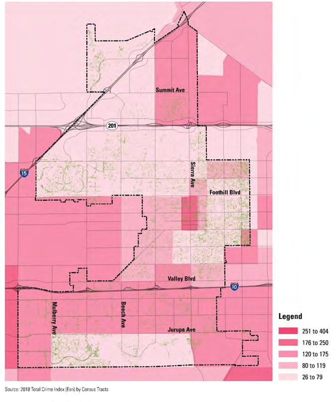
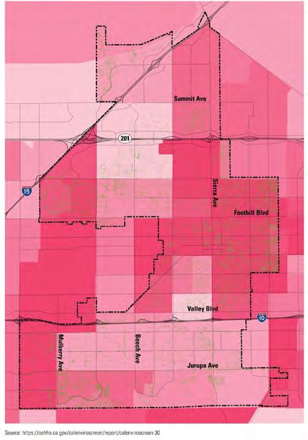
33 SOCIAL EQUITY - SAFETY Crime Index Bicycle or Pedestrian-involved Collisions


34 SOCIAL EQUITY - HEALTH Asthma Spending on Health Insurance


35 HOW CAN URBAN GREENING HELP WITH SOCIAL EQUITY? More trees = higher property values More trees = healthier people
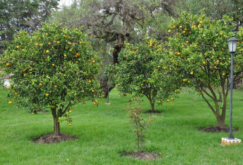
36 ACTIVE MOBILITY ACTIVE MOBILITY SOCIAL EQUITY COSTS / BENEFITS CLIMATE ECONOMICS AIR QUALITY AESTHETICS WATER URBAN FOREST


37 MOBILITY ACTIVE TRANSPORTATION Proposed Bicycle Network Class I Example Class II Example Shared-use path makes for more relaxed cycling for all ages and abilities Class IV Example Colored pavement bicycle lane, San Francisco, CA A separated bikeway provides a physical separation from motor vehicles

 - This photo was taken by")
38 HOW CAN URBAN GREENING HELP WITH ACTIVE TRANSPORTATION? More comfortable environment encourages more time outside. Traffic calming with planter and street trees Source: New York City bike lanes (Wikimedia) - This photo was taken by participant/team Jim Henderson

39 9. I am aware of the vision for the future defined in the recently-adopted Fontana Forward General Plan and Active Transportation Plan? A. Yes B. Somewhat C. No, but I d like to learn more D. No, not interested

40 10. I would walk more if : A. Sidewalks had more shade B. Wider sidewalks in better condition C. Sidewalks were physically separated from moving traffic with a landscape buffer D. Safer street crossings E. Better destinations in walking distance from my work or my residence F. Other ( use card on table to write answer).

41 11. I would bike more if : A. Bike lanes had more shade B. Wider bike lanes that were in better condition C. Bike lanes were physically separated from moving traffic with a landscape buffer D. Safer street crossings E. Better destinations in walking distance from my work or my residence F. Other ( use card on table to write answer).
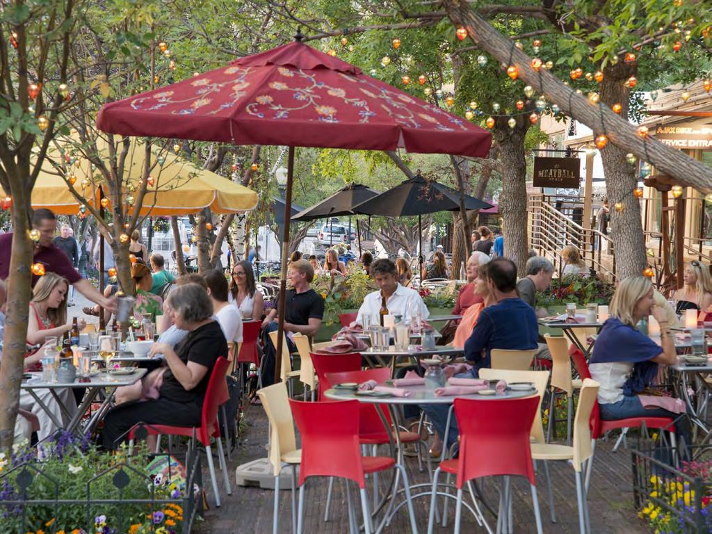
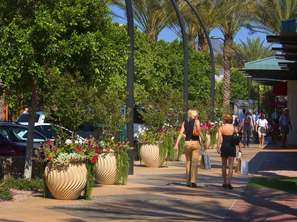
42 COSTS / BENEFITS ACTIVE MOBILITY SOCIAL EQUITY COSTS / BENEFITS CLIMATE ECONOMICS AIR QUALITY AESTHETICS WATER URBAN FOREST


43 $ BENEFIT OF TREES Existing Fontana street trees = $6.8 million dollars in public benefit

 London Plane Tree ($ per tree)")

44 TOP 5 SPECIES IN FONTANA Energy CO2 Air Quality Stormwater Aesthetic/Other Total Crape Myrtle ($ per tree) Pinus spp. ($ per tree) London Plane Tree ($ per tree) $19.66 $7.39 $18.32 $0.27 $0.37 $0.45 $4.36 $1.02 $2.56 $2.36 $3.32 $2.92 $62.82 $ $ $89.46 $ $256.03


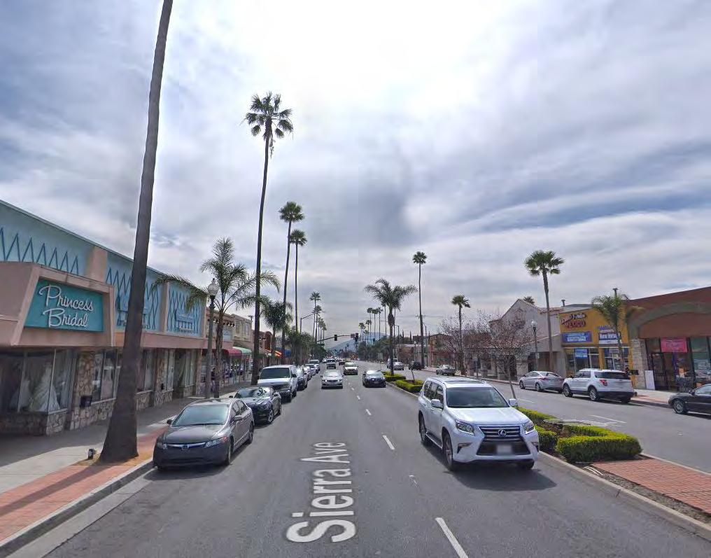
45 TOP 5 SPECIES IN FONTANA Energy CO2 Air Quality Stormwater Aesthetic/Other Total California Fan Palm $2.85 $0.13 $0.63 $0.94 $23.57 $28.13 American Sweetgum $9.53 $0.29 $-2.51 $0.94 $ $112.89
46 ECONOMIC DEVELOPMENT ACTIVE MOBILITY SOCIAL EQUITY COSTS / BENEFITS CLIMATE ECONOMICS AIR QUALITY AESTHETICS WATER URBAN FOREST

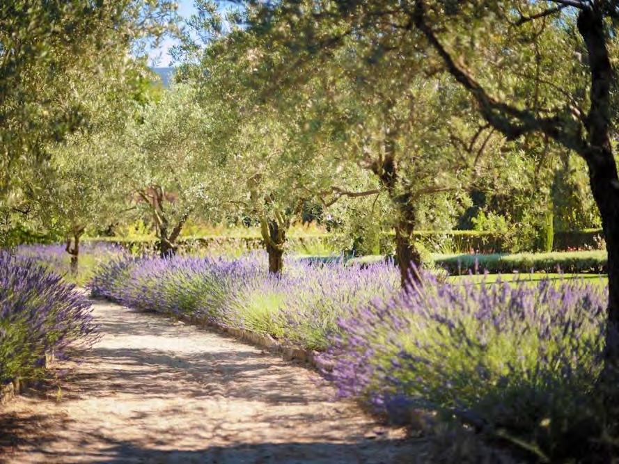
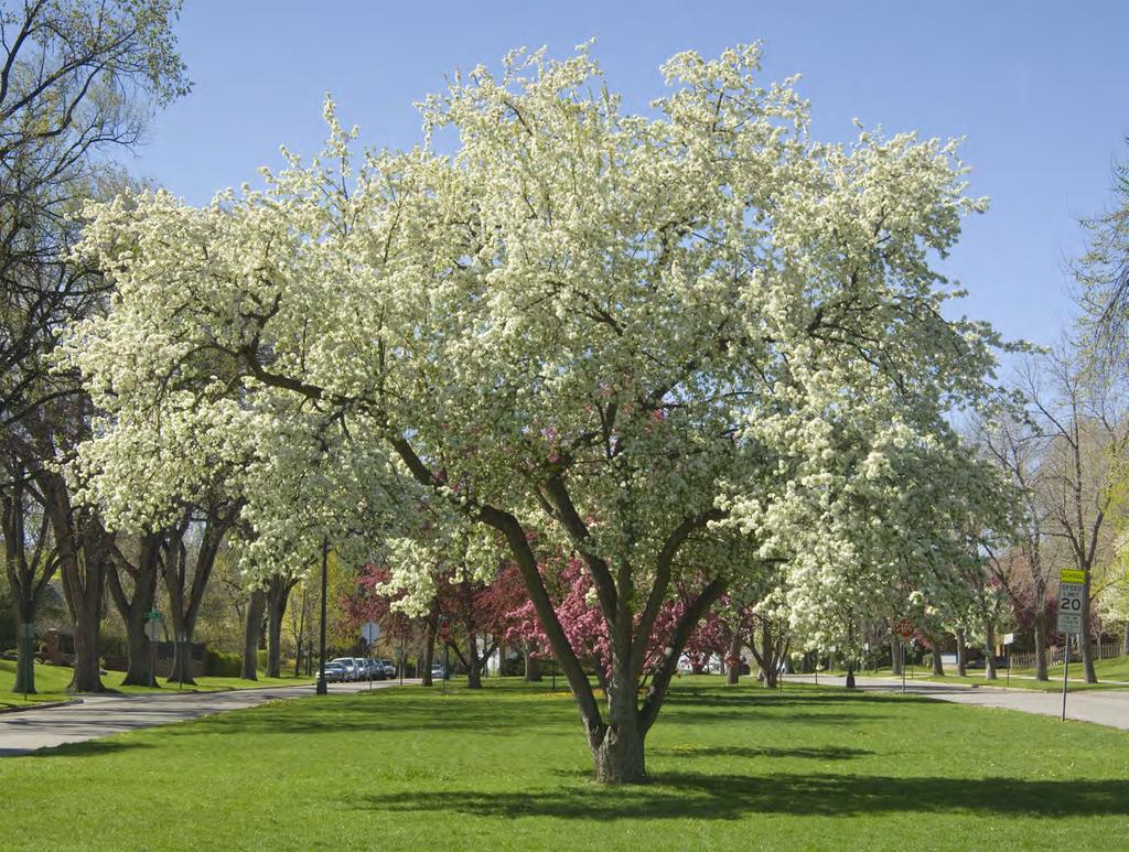
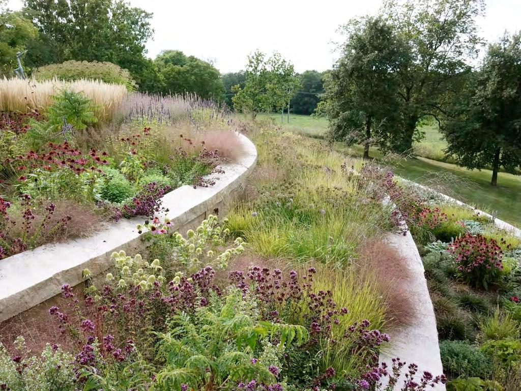
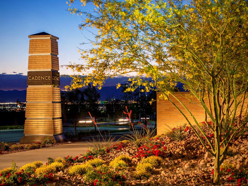
47 FONTANA FORWARD - LAND USE PATTERN Fontana is ready for a 21 st -century transformation from a bedroom community to a complete community - Fontana Forward

48 12. As a resident / business owner of Fontana I am concerned with the following: (choose your top 4 from the list below): A. Equity B. Jobs C. Mobility / Traffic (Safety / Congestion) D. Air quality E. The cost of living / doing business F. The aesthetics / visual character of the City G. Water quality / water shortages H. Crime I. Climate change J. Other ( use card on table to write answer).
49 FONTANA FORWARD - DOWNTOWN

50 HOW CAN URBAN GREENING HELP WITH ECONOMIC DEVELOPMENT? More comfortable environment encourages more time in a commercial district. More time in a commercial district = more money spent. Quality of life = employee retention. Fontana Existing Downtown Google Street View Rancho Cucamonga Victoria Gardens STIR Architecture

51 13. I would spend more time and money in downtown and in other commercial districts throughout Fontana if the public realm (spaces between the buildings) had the following: A. More attractive and plentiful landscape B. Better shade from sun and shelter from wind C. Better lighting D. More convenient parking E. Outdoor dining F. More events and activities G. Better seating areas H. Was cleaner / had better maintenance I. Other ( use card on table to write answer).
52 AESTHETICS ACTIVE MOBILITY SOCIAL EQUITY COSTS / BENEFITS CLIMATE ECONOMICS AIR QUALITY AESTHETICS WATER URBAN FOREST

53 14. The Future landscape in Fontana should utilize Southern California native landscape: A. Always B. Most of the time C. Some of the time D. A limited amount E. Never

54 15. What are the most attractive landscaped areas in the City (pick 2): A. Downtown B. Sierra Avenue between I-10 and the 210 Freeway C. Foothill Boulevard D. The Southern Pacific Rail Corridor E. My immediate neighborhood F. All residential neighborhoods

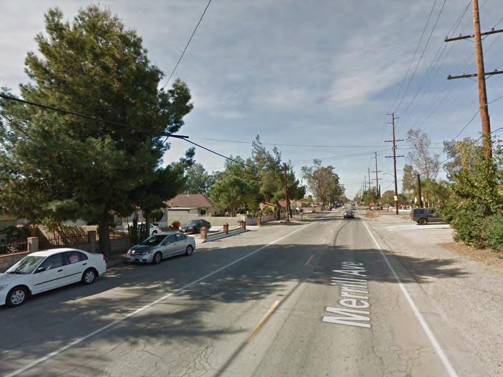
55 16. What statement do you agree with regarding Fontana s Citywide landscape? A. Generally, it is attractive and plentiful B. Generally, it is attractive but sparse C. Generally, it is ugly but plentiful D. Generally, it is ugly and sparse

56 17. In 15 years I would like the landscape of Fontana to look like the landscape of: (pick 2) A. Pasadena B. Palm Springs/Desert C. Redlands D. Riverside E. Irvine F. Rancho Cucamonga G. Santa Barbara H. San Diego I. Phoenix J. Other; please specify
57 On the following slides select: A - if you like what you see. B - if you don t like what you see.
58
59
60
61
62
63
64
65
66
67
68
69
70

71
72
73

74 URBAN FOREST ACTIVE MOBILITY SOCIAL EQUITY COSTS / BENEFITS CLIMATE ECONOMICS AIR QUALITY AESTHETICS WATER URBAN FOREST

75 EXISTING TREE CANOPY
76 EXISTING TREE CANOPY
 B. 1 % (1.5 X the existing tree canopy) C. 5 % (11.5 x the existing tree canopy) D.")
77 18. What do you think is the appropriate tree canopy target for Fontana (for reference Beverly Hills has a tree canopy of approximately 25%)? A. Maintain the existing tree canopy in Fontana (maintain current level less than.4 %) B. 1 % (1.5 X the existing tree canopy) C. 5 % (11.5 x the existing tree canopy) D. 10 % (24 x the existing tree canopy) E. 15 % (society of urban foresters' recommendation) (36.5 x the existing tree canopy) F. As high as possible!
78 19. I see the greatest benefits of Fontana s urban greening plan to be (pick 4)? A. A more beautiful city B. Increase in property values C. Conservation of water D. Establishment of habitat for birds / other animals E. Improved air quality F. Providing a more comfortable public realm G. Getting people to choose to walk and bike more H. Attraction and retention of retail and restaurants I. Reducing temperatures J. Other (please use note card at your table to write your answer

79 NEXT STEPS The second community workshop will be scheduled around March, For additional information, please check our website: Have questions? please contact: Shannon Casey City of Fontana, Senior Engineer Si tiene preguntas contacte a: Elisa Gomez City of Fontana, Development Services Permit Aide
Toronto Complete Streets Guidelines
 Toronto Complete Streets Guidelines 108 110 7.1 Green Infrastructure Design Principles 112 7.2 Context-Sensitive Green Streets 114 7.3 Key Green Street Elements Green infrastructure refers to natural and
Tonight s Agenda. Summary Presentation Open House. Group Discussion Next Steps: online community wide survey
 Community Open House February 22, 2018 Tonight s Agenda Summary Presentation Open House Station 1: Project Overview and Community Input Station 2: Draft Vision and Guiding Principles Station 3: Western,
GREENING THE BOULEVARD Master Plan Concepts for Venice Boulevard between Lincoln and Sawtelle
 GREENING THE BOULEVARD Katherine Spitz Associates Inc. 4212½ Glencoe Avenue Marina Del Rey, CA 90292 310 574 4460 Fax 574 4462 January 2008 Table of Contents Overview Proposed Design Improvements Illustration
EXPO LINE COMMUNITY WORKSHOPS NOVEMBER 27 TH & DECEMBER 3 RD Los Angeles Department of City Planning
 EXPO LINE COMMUNITY WORKSHOPS NOVEMBER 27 TH & DECEMBER 3 RD 2012 Los Angeles Department of City Planning Agenda for Tonight Open House 6:00 to 6:15pm Presentation and Questions 6:15 to 6:50 Small Group
3.0 PROJECT DESCRIPTION
 3.0 PROJECT DESCRIPTION 3.1 BACKGROUND Under California law (Government Code Section 65300 et seq.), every city and county is required to have a general plan. The general plan is to be comprehensive and
Juniper Networks CO-8
 Juniper Networks CO-8 Site Location: 1194 N. Mathilda Avenue Sunnyvale, CA Features: Multi-story buildings reduce building footprint Rocky swales and trees in parking lot Rooftop runoff drains to landscaping
Silverdale Regional Center
 Silverdale Regional Center Vision for Silverdale Regional Center The Silverdale Regional Center Plan (Plan) will guide the evolution of the Silverdale Regional Center from a collection of strip malls and
A BLUEPRINT FOR BROCKTON A CITY-WIDE COMPREHENSIVE PLAN
 A BLUEPRINT FOR BROCKTON A CITY-WIDE COMPREHENSIVE PLAN Public Meeting October 2016 1 Plan Summary and Discussion Public Meeting May 4 2017 City of Brockton Bill Carpenter, Mayor Department of Planning
SAN RAFAEL GENERAL PLAN 2040 INTRODUCTION AND OVERVIEW
 SAN RAFAEL GENERAL PLAN 2040 INTRODUCTION AND OVERVIEW Steering Committee Presentation February 14, 2018 Purpose of General Plan Guide land use and development decisions Coordinate transportation, infrastructure,
TRANSIT NEIGHBORHOOD PLANS PROGRAM OVERVIEW
 TRANSIT NEIGHBORHOOD PLANS PROGRAM OVERVIEW OCTOBER 2017 Los Angeles Department of City Planning @LATNP and @Planning4LA Outline Introduction Policy Framework The Transit Neighborhood Plans Program Overview:
REDLANDS TRANSIT VILLAGES SPECIFIC PLAN
 REDLANDS TRANSIT VILLAGES SPECIFIC PLAN CITY COUNCIL STUDY SESSION JANUARY 4, 2019 Redlands Blvd. Eureka St. Orange St. State St. Citrus Ave. Vine St. GENERAL PLAN TRANSIT VILLAGES WE ARE HERE SPECIFIC
Dogpatch/22nd Street Greening
 TEAM MEMBERS Prepared for: GreenTrustSF Central Waterfront www.gtsfcw.org Prepared by: Fletcher Studio San Francisco, CA www.fletcherstudio.com Landscape Architecture Urban Design Environmental Planning
ITEM #8. Regional Smart Growth Program. Regional Smart Growth Program. Presentation Overview. Coast Highway Vision and Stategic Plan.
 Regional Smart Growth Program Economic Development Commission What is Smart Growth? Adopted as part of the Regional Comprehensive Plan (RCP) RCP provides vision for region based on Smart Growth and sustainability
Draft Bergamot Area Plan
 ATTACHMENT 1 Draft Bergamot Area Plan Taskforce on the Environment April 15, 2013 www.bergamotplan.net 1 Overview WHAT IS THE BERGAMOT AREA PLAN? A Community-Based Planning Document Guiding the Future
Clovis Urban Greening Plan. Community Workshop #2 Northwest
 Clovis Urban Greening Plan Community Workshop #2 Northwest Thursday, October 9, 2014 WHAT IS AN URBAN GREENING PLAN? A guide to help the City to improve quality of life for residents Identification of
WELCOME and introduction
 1 WELCOME and introduction Mobility Hub Locations within Burlington STUDY OVERVIEW STUDY OBJECTIVES The City of Burlington is developing four Area Specific Plans, one for each of Burlington s Mobility
1.0 VISION STATEMENT. December 6, PRINCIPLES
 Vision Statement Lincoln Regional Airport 1.0 VISION STATEMENT 1.1 City LOCATION of AND OVERVIEW The Easton Lincoln Place Land Use Master Plan identifies the principles, goals, policies, and standards
THE GREEN VISION WORKSHOP Friday, November 6, 2009
 THE GREEN VISION WORKSHOP Friday, November 6, 2009 SUSTAINABLE LONG RANGE PLANNING IN SANTA MONICA Eileen Fogarty Director, Planning and Community Development GREEN BUILDINGS Santa Monica has the most
MISSION STREETSCAPE PLAN. Neighborhood Commercial Streets handle continuous activity. Neighborhood Commercial STREET ROW: Main Design Treatments
 Neighborhood Commercial STREET ROW: 64-80 Main Design Treatments CORNER reduce crossing distance for pedestrians, create entrances to a residential area and slow cars down. help widen sidewalk allocating
CHAPTER 8. Mrs. Zimman s Class - Central Elementary
 SUSTAINABILITY CHAPTER 8 Mrs. Zimman s Class - Central Elementary 8.1 OVERVIEW Green infrastructure also known as low impact development (LID) and environmental or sustainable site design is an environmentally
PIKE PINE RENAISSANCE: ACT ONE. October 19, 2017
 PIKE PINE RENAISSANCE: ACT ONE October 19, 2017 WATERFRONT SEATTLE PROGRAM PROJECT INTRODUCTION Pike and Pine streets, between First and Melrose avenues Pedestrian and streetscape improvements Budget:
Bayshore Boulevard Home Improvement District Design Guidelines
 Bayshore Boulevard Home Improvement District Design Guidelines guidelines for New construction projects and major alterations IN the bayshore boulevard home improvement special use DISTRICT SAN FRANCISCO
City of Los Angeles Department of Public Works
 City of Los Angeles Department of Public Works Environmental Scoping Meeting for the Proposed Sixth Street Park, Arts, River & Connectivity Improvements (PARC) Project May 3, 2017 1 Agenda Introductions
East Area Plan. Steering Committee Meeting May 24, Art Gym Denver
 East Area Plan Steering Committee Meeting May 24, 2018 Art Gym Denver East Area Plan Steering Committee Meeting May 24, 2018 ArtGym Denver, 1460 Leyden Street AGENDA 1 6:00-6:05 Approval of April Meeting
TOWN COUNCIL / PLANNING COMMISSION
 Workshop #3 TOWN COUNCIL / PLANNING COMMISSION January 20, 2011 Consultant Team In Attendance Tonight BMS Design Group Nevada City and San Francisco Michael Smiley, AICP, ASLA Partner-in-Charge Nancy L.
Zoning Code Issues Prioritization
 City of Streetsboro The City of Streetsboro has begun the process of updating its Zoning Code. The new Zoning Code will be based on the recently adopted Comprehensive Plan, which establishes the overall
Chapter 1: Introduction
 Chapter 1: Introduction The Penn Avenue Community Works Corridor Vision and Implementation Framework presents an integrated communitybased vision and a coordinated, long-term implementation framework for
THEMES, VISION, + PRINCIPLES
 CHAPTER 2: THEMES, VISION, + PRINCIPLES This page intentionally left blank. 20 VISION DRAFT AUGUST 2018 2 2 THEMES, VISION, + GUIDING PRINCIPLES The Key Themes, Vision, and Guiding Principles presented
East Central Area Plan
 East Central Area Plan Steering Committee Meeting March 8 th, 2018 CHUN Tears McFarlane House Vision Statement Development Opportunities Analysis Vision Elements 1. Equitable, Affordable and Inclusive
Coast Highway Oceanside, California
 Coast Highway Oceanside, California Coast Highway Plan Zones What We ve Heard - Walkable/Bikeable Community (Senior and Child Friendly) -Wider Sidewalks -Street Trees -Traffic Calming -Bike Lanes -Paseos
Lehigh Acres Land Development Regulations Community Planning Project
 Lehigh Acres Land Development Regulations Planning Effort Summary In July, 2010 Commissioner Frank Mann invited the Lehigh Acres community to start discussing how to achieve their recently adopted community
Stormwater Runoff and the District of Columbia RiverSmart Homes Defined:
 Stormwater Runoff and the District of Columbia Stormwater runoff is rainwater that flows off impervious surfaces such as rooftops, driveways, roads, sidewalks and sometimes even lawns. Stormwater runoff
Plano Tomorrow Vision and Policies
 Plano Tomorrow Vision and Policies PLANO TOMORROW PILLARS The Built Environment The Social Environment The Natural Environment The Economic Environment Land Use and Urban Design Transportation Housing
CAMBIE CORRIDOR PLAN
 1 WELCOME TO THE OPEN HOUSE PUBLIC REALM PLAN - CAMBIE CORRIDOR Thank you for coming to the Cambie Corridor Public Realm Open House! Place a dot where you live Please provide us with your comments and
Sustainability, Health, Safety, Recreation & Open Space Working Group August 3, 2017
 Sustainability, Health, Safety, Recreation & Open Space Working Group August 3, 2017 DOWNTOWN OAKLAND SPECIFIC PLAN WELCOME Sustainability, Health, Safety, Recreation & Open Space Working Group Social
Broadway District Specific Plan. Community Workshop #2 February 23,2016
 Broadway District Specific Plan Community Workshop #2 February 23,2016 1 Agenda Introductions Project Progress Status Upcoming Milestones Emerging Framework Land Use Urban Design Circulation Infrastructure
RESEDA - WEST VAN NUYS COMMUNITY PLAN
 RESEDA - WEST VAN NUYS COMMUNITY PLAN Executive Summary As part of the initial outreach effort, the Department of City Planning hosted two workshops for the Reseda-West Van Nuys Community Plan Area during
ORANGE LINE TRANSIT NEIGHBORHOOD PLANS VAN NUYS NEIGHBORHOOD COUNCIL, PLUM COMMITTEE DEPARTMENT OF CITY PLANNING, CITY OF LOS ANGELES
 Photo: Mission Meridian(Moule & Polyzoides) ORANGE LINE TRANSIT NEIGHBORHOOD PLANS VAN NUYS NEIGHBORHOOD COUNCIL, PLUM COMMITTEE DEPARTMENT OF CITY PLANNING, CITY OF LOS ANGELES JULY 18, 2018 Project partially
City of Hermosa Beach Administrative Policy #
 City of Hermosa Beach Administrative Policy # SUBJECT: Living Streets Policy Date: Approved by: City Council Authority: Public Works Department & Community Development Department Mayor, PURPOSE The City
Table L-1 Summary Action Strategy. Action Item Timing Status Responsible Agency
 CHAPTER 4: CIRCULATION ELEMENT ISSUE #1: MAJOR THOROUFARES AND TRANSPORTATION ROUTES A balanced transportation system for Fontana is provided that meets the mobility needs of current and future residents
Somers Point Master Plan
 Somers Point Master Plan Progress Report and Public Meeting August 20, 2014 Master Plan Reexamination Municipal Land Use Law require that all municipalities reexamine their master plan every ten years.
Yahoo! Inc. CO-7. Santa Clara Valley Urban Runoff. Site Location: 701 First Avenue Sunnyvale, CA
 Yahoo! Inc. CO-7 Site Location: 701 First Avenue Sunnyvale, CA Rocky swales Multi-story buildings reduce building footprint Access to the Bay Trail open space area including parking available for visitors
CHAPTER 5 Public Realm Improvements
 5.1 OVERVIEW This chapter focuses on the public realm, that is, spaces within and directly adjacent to public rights-of-way (ROWs), including streets, Oso Creek, the rail corridor, and the freeway edge.
St. Clair Avenue West Area Transportation Master Plan
 1 (Between Keele Street and Old Weston Road) Public Information Centre 1 December 2, 2015 2 Welcome Welcome to the first Public Information Centre for the St. Clair Avenue West Area. The panels will present
Neighborhood Districts
 NEIGHBORHOOD DISTRICTS SEVEN MAIN DISTRICTS Neighborhood Districts While the Development Plan provides a broad-scale overview of the neighborhood, this section focuses on uses and relationships at the
Transportation Land Use Integration & Regional Planning. Don Kostelec, AICP Senior Planner, Louis Berger Group February 1, 2010
 Transportation Land Use Integration & Regional Planning Don Kostelec, AICP Senior Planner, Louis Berger Group February 1, 2010 Transportation Land Use Integration DOT-HUD-EPA Sustainable Communities Initiative
DOMINION BOULEVARD CORRIDOR STUDY AND ECONOMIC DEVELOPMENT STRATEGIC PLAN A MODEL FOR CHESAPEAKE S FUTURE
 DOMINION BOULEVARD CORRIDOR STUDY AND ECONOMIC DEVELOPMENT STRATEGIC PLAN A MODEL FOR CHESAPEAKE S FUTURE Overview I. Draft Plan Process II. Draft Plan Overview a. Market Analysis b. Master Land Use Plan
VISION AND GUIDING DESIGN PRINCIPLES
 pleasure point commercial corridor VISION AND GUIDING DESIGN PRINCIPLES Public Draft November 26, 2018 County of Santa Cruz with assistance from MIG CONTENTS PART I: INTRODUCTION AND VISION... 3 Community
St. Anthony Park Community Council 10-year Planning Community Forum
 St. Anthony Park Community Council 10-year Planning Community Forum Introductions: Who are we? North SAP (North of Energy Park) South SAP (South of Energy Park) Introductions: Who are we? Live Play Work
Study Area. Capitol Way. Greening America s Capitals 11/13/2014. A Greening America s Capitals Project
 Olympia, WA: Greening Capitol Way Supporting Communities move towards sustainability is a priority for the federal government. A Greening America s Capitals Project Office of Sustainable Communities U.S.
Goals and Objectives Survey December 4, 2013
 Goals and Objectives Survey December 4, 2013 Process The 2006 Master Plan was based upon a set of 12 goals with various objectives tied to each goal. Goals = High level aspirations that provide general
BROADWAY-ARBUTUS POLICIES. Adopted by City Council on July 7, NOTE: To be considered in combination with applicable guidelines
 50 City of Vancouver Land Use and Development Policies and Guidelines Community Services, 453 W. 12th Ave Vancouver, BC V5Y 1V4 F 873.7344 fax 873.7060 planning@city.vancouver.bc.ca BROADWAY-ARBUTUS POLICIES
DRAFT. 10% Common Open Space
 % OF CHARLOTTE IS CATEGORIZED AS A. LAND USES : Placeholder map displaying location of Place Type GOALS: Accommodate XX% of future growth. Provide a concentration of primarily commercial and civic activity
Streets for People, Place-Making and Prosperity. #TOcompletestreets
 COMPLETE STREETS FOR TORONTO Streets for People, Place-Making and Prosperity COMPLETE STREETS: A NEW APPROACH A Complete Streets design approach considers the needs of all users people who walk, bicycle,
Rezoning Issues Setting a Foundation for Zoning Decisions
 Rezoning Issues Setting a Foundation for Zoning Decisions City Council Workshop May 2, 2016 Agenda Goal Need actionable items and sequence of steps Foundation for Zoning Decisions Council Workshop Discussion
2. Form and Character. 2.1 Introduction. 2.2 The Downtown Addition Plan. 2.1 Introduction
 2.1 Introduction 2.1 Introduction This section of the Specific Plan describes and illustrates the desired form, character and uses of the Downtown Addition and explains the underlying design principles.
East Central Area Plan
 East Central Area Plan Steering Committee Meeting January 10 th, 2019 Tears-McFarlane House Community Room East Central Area Plan Steering Committee Meeting January 10 th, 2019 CHUN Tears-McFarlane House
Design Alternatives Workshop. Hilfiker Park Master Plan Workshop #2
 Design Alternatives Workshop Hilfiker Park Master Plan Workshop #2 Agenda for Tonight Staff Presentation (40 min) Introduction Master Plan Process Planning Context What We ve Heard So Far Design Alternatives
INDEPENDENCE BOULEVARD AREA PLAN
 INDEPENDENCE BOULEVARD AREA PLAN Public Meeting October 28, 2008 Tonight s Agenda Introduction 4:00 4:05 Tom Warshauer Presentation 4:05 5:00 Blake Drury Group Exercises 5:00 5:50 All Wrap Up & Next Steps
GO Station Mobility Hubs: Draft Precinct Plans. Committee of the Whole July 12, 2018
 GO Station Mobility Hubs: Draft Precinct Plans Committee of the Whole July 12, 2018 Purpose of this Workshop Present Draft Precinct Plans for the 3 GO Station Mobility Hubs Continue the conversations that
Transportation. Strategies for Action
 Transportation A major priority for the Overlake Neighborhood is to develop a multimodal transportation system. To achieve this system, a balance has to be found among travel, circulation and access needs;
Executive Summary. NY 7 / NY 2 Corridor
 Executive Summary NY 7 / NY 2 Corridor Transportation and Land Use Study December 2005 Prepared for: Town of Colonie Capital District Transportation Committee Prepared by: Introduction: Land use decisions
DRAFT FOR PUBLIC REVIEW. Game Plan for a Healthy City
 DRAFT FOR PUBLIC REVIEW 2018 Game Plan for a Healthy City 2 Denveright. Parks & Recreation Game Plan Draft for Public Review Draft for Public Review Executive Summary Game Plan Overview Executive Summary
Welcome. Walk Around. Talk to Us. Write Down Your Comments
 Welcome This is an information meeting introducing the applications for proposed redevelopment of the Yorkdale Shopping Centre site at 3401 Dufferin Street and 1 Yorkdale Road over the next 20+ years,
5.1 AESTHETICS Environmental Setting Scenic Views FONTANA FORWARD GENERAL PLAN UPDATE DRAFT ENVIRONMENTAL IMPACT REPORT
 5.1 AESTHETICS This section describes the City s scenic resources, and landscape and neighborhood characteristics, and addresses the potential impacts on aesthetic and visual resources associated with
The Lincoln Neighborhood Corridor Plan. The LiNC
 October 1, 2014 Planning Commission Study Session The Lincoln Neighborhood Corridor Plan The LiNC Purpose of Tonight s Meeting Introduction to The LiNC Review of Existing Conditions and Community Identified
EXECUTIVE SUMMARY. Introduction
 EXECUTIVE SUMMARY Introduction State Route 68 is a designated scenic route that connects the world-renowned Monterey Peninsula to US Highway 101 and the Salinas Valley. SR 68 is a key route for bicycle,
4.9 Mendocino Avenue Corridor Plan Design Guidelines
 4.9 Mendocino Avenue Corridor Plan Design Guidelines The Mendocino Avenue Corridor Plan addresses the area between College Avenue and Steele Lane. Mendocino Avenue is a busy arterial that runs parallel
Little Mountain UDP Presentation
 Summary of UDP Evaluation of Dec 2015 Plan Dec 2015 Site Plan Transitional edges work well Central spine and permeability are strong Tree retention is good Establish Big Idea Sameness of built form contributes
DOWNTOWN GEORGETOWN PLANNING STUDY
 DOWNTOWN GEORGETOWN PLANNING STUDY Community Workshop #3 Thursday, May 4, 08 The Planning Partnership OVERVIEW OF STUDY, PROCESS & MILESTONES We are here PURPOSE OF THE STUDY To develop a clear vision
Joint Meeting City Council and the Plan Commission. September 1st, 2015
 Joint Meeting City Council and the Plan Commission September 1st, 2015 1 The City Plan Commission shall recommend a City Plan for the physical development of the City Article IX Section 2 of the City of
Transit-Oriented Development
 Transit-Oriented Development Path to Sustainability West Windsor February 22, 2007 George S. Hawkins Context for Presentation NJ Future is a non-partisan, 501(c)3 non-profit organization. Offer perspective,
Community Meeting #2.1
 Community Meeting #2.1 Thursday, October 20, 2016, 7:00 p.m. to 9:00 p.m. Eliot Elementary School, 475 Old Gilroy Street, Gilroy, CA 95020 Meeting Summary The City of Gilroy held its third community meeting
Don Mills Crossing Study and Celestica Lands Development Application Community Meeting, Open House, and Breakout Discussions
 Consultation Summary Don Mills Crossing Study and Celestica Lands Development Application Community Meeting, Open House, and Breakout Discussions This report is not intended to provide a verbatim transcript
The Vision. Photo provided by The Minervini Group. 46 Vision, Objectives & Strategies
 Vision, Objectives & Strategies The is the public framework and guide for future development of the Grand Traverse Commons. The establishes public polices for infrastructure, the preservation of natural
9/19/2018 TODAY S WEBINAR AGENDA CONTINUING EDUCATION UPCOMING TRAINING FROM APBP
 TODAY S WEBINAR AGENDA 3:00 pm: Introduction 3:05 pm: Presentation 3:45 pm: Questions 4:00 pm: Webinar Ends For technical assistance during the webinar: 1-800-263-6317 Choose these prompts: 1, 1, 1 CONTINUING
3.0 Project Description
 3.0 Project Description 3.0 PROJECT DESCRIPTION 3.1 PROJECT LOCATION AND SETTING PROJECT LOCATION The proposed Downtown Lancaster Specific Plan Project (project) is located in the City of Lancaster, California.
CENTRAL ESTUARY PLAN AVISION FOR OAKLAND S WATERFRONT
 Central Estuary Plan A VISION FOR OAKLAND S WATERFRONT Specific Plan and Environmental Assessment Presentation to the Parks and Recreation Advisory Commission December 9, 2009 This Afternoon s Presentation
East Area Plan. Steering Committee Meeting August 23, Art Gym Denver
 East Area Plan Steering Committee Meeting August 23, 2018 Art Gym Denver East Area Plan Steering Committee Meeting August 23, 2018 ArtGym Denver, 1460 Leyden Street AGENDA 1 6:00-6:05 Approval of July
CHAPTER 1. Ms. Guajardo s Class - Central Elementary CH 1 1
 INTRODUCTION CHAPTER 1 Ms. Guajardo s Class - Central Elementary CH 1 1 1.1 SETTING South Centre City is a linear corridor south of Downtown Escondido paralleling Centre City Parkway and South Escondido
BUILDING SCALE AND SETBACKS 5 ELEMENTS:... 5 FAÇADES (COMMERCIAL/RESIDENTIAL) 5
 5") VISION STATEMENT 3 UTILIZATION OF THE GUIDELINES 3 IMPLEMENTATION 3 PROCEDURES FOR DESIGN REVIEW 3 LAND USE AND ZONING 4 LAND USE 4 ELEMENTS:... 4 ZONING 4 ELEMENTS:... 4 BUILDING SCALE AND SETBACKS 5
VISION STATEMENT 3 UTILIZATION OF THE GUIDELINES 3 IMPLEMENTATION 3 PROCEDURES FOR DESIGN REVIEW 3 LAND USE AND ZONING 4 LAND USE 4 ELEMENTS:... 4 ZONING 4 ELEMENTS:... 4 BUILDING SCALE AND SETBACKS 5
City of Villages Parking Strategies. William Anderson, FAICP City Planning & Community Investment San Diego Parking Symposium July 14, 2006
 City of Villages Parking Strategies William Anderson, FAICP City Planning & Community Investment San Diego Parking Symposium July 14, 2006 City of Villages Strategy A hierarchy of walkable, mixed use districts
Green Infrastructure and Low-Impact Development Technologies
 Green Infrastructure and Low-Impact Development Technologies The guiding principles of these technologies is to manage stormwater at their sources using natural means, and establish conditions so that
Riverside County Flood Control and Water Conservation District LAKELAND VILLAGE MDP LINE H, STAGE 1
 Riverside Flood Control and Water Conservation District Riverside, California LAKELAND VILLAGE MDP LINE H, STAGE 1 CEQA ADDENDUM TO THE FINAL PROGRAM ENVIRONMENTAL IMPACT REPORT FOR THE LAKELAND VILLAGE
WEST OAKLAND SPECIFIC PLAN Final Plan. 2. Vision & Goals. 2.1 Community-Based Goals and Objectives
 WEST OAKLAND SPECIFIC PLAN Final Plan 2. Vision & Goals 2.1 Community-Based Goals and Objectives June 2014 2: Vision & Goals The vision of the West Oakland Specific Plan is to see this remarkable community
DESIGN REVIEW COMMITTEE AGENDA ITEM
 DESIGN REVIEW COMMITTEE AGENDA ITEM AGENDA DATE: AUGUST 2, 2017 TO: THRU: FROM: SUBJECT: Chair Imboden and Members of the Design Review Committee Anna Pehoushek, Assistant Community Development Director
City of Nogales General Plan
 Open Space, Parks, Recreation and Trails City of Nogales General Plan Residents of Nogales place a high priority in the development of a comprehensive system of open space, parks, recreation and trails
Potential Green Infrastructure Strategies May 6, 2015 Workshop
 Potential Green Infrastructure Strategies May 6, 2015 Workshop Background The City of Cortland is developing the Tioughnioga Urban Headwaters Green Infrastructure Action Plan with funding from the National
Community Advisory Group (CAG) Meeting #5
 Meeting #5") Community Advisory Group (CAG) Meeting #5 AGENDA 1. Process Update 2. Overview of Plan Options and Equity Assessment 3. Preliminary Recommendations 4. Community Engagement for Preliminary Draft Plan 5.
Community Advisory Group (CAG) Meeting #5 AGENDA 1. Process Update 2. Overview of Plan Options and Equity Assessment 3. Preliminary Recommendations 4. Community Engagement for Preliminary Draft Plan 5.
Danvers High Street I-1 District Study
 Danvers High Street I-1 District Study Presentation of Final Recommendations Planning Board Presentation June 26 th, 2018 1 Introductions Metropolitan Area Planning Council Sam Cleaves AICP, Principal
Green Infrastructure and the Urban Forest: Thinking Outside the Planter Box
 Green Infrastructure and the Urban Forest: Thinking Outside the Planter Box James DeRoussel RLA P r o g r a m M a n a g e r W a t e r s h e d M a n a g e m e n t G r o u p Let s put a tree there! What
TRANSPORTATION MATTERS. Creating solutions for sustainable and accessible places
 TRANSPORTATION MATTERS Creating solutions for sustainable and accessible places WE PUT PEOPLE FIRST Nelson\Nygaard solves livability challenges through transportation planning. We integrate all modes of
Tyvola & Archdale Transit Station Area Plan. June 5, 2008
 Tyvola & Archdale Transit Station Area Plan Second Public Meeting June 5, 2008 Presentation Outline 1. Purpose and Process 2. Station Area Overview 3. Plan Recommendations 4. Comments Received and Proposed
Presentation of the Staff Draft. July 17, 2014 SSRVP Team, Area 3
 Presentation of the Staff Draft July 17, 2014 SSRVP Team, Area 3 Presentation Overview Introduction Plan Framework Plan Recommendations Implementation Next Steps and Request for Public Hearing on September
Route 347. New York State Department of Transportation Region 10, Long Island. THE GREENING of ROUTE 347
 The GREENING of Route 347 The Greening of Route 347 The Greening of Route 347: History 3 The Greening of Route 347 4 The Greening of Route 347 5 The Greening of Route 347 Smith Haven Mall 6 The Greening
S A C R A M E N T O C O U N T Y JACKSON HIGHWAY & GRANT LINE EAST VISIONING STUDY
 JACKSON HIGHWAY & GRANT LINE EAST S A C R A M E N T O C O U N T Y P L A N N I N G D E P A R T M E N T SUMMARY AND WORKBOOK November 19, 2008 History of the Visioning Study Sacramento County has two growth
Ann Arbor Downtown Street Design Manual. Ann Arbor DDA IDA 2015 Awards Planning Category
 Ann Arbor Downtown Street Design Manual Ann Arbor DDA IDA 2015 Awards Planning Category 1 Ann Arbor s downtown streets are vibrant public spaces that accommodate multi-modal transportation, special events,
Subregion 4 Central Avenue-Metro Blue Line Corridor Transit-Oriented Development (TOD) Implementation Project. Community Meeting April 27, 2011
 Implementation Project. Community Meeting April 27, 2011") Subregion 4 Central Avenue-Metro Blue Line Corridor Transit-Oriented Development (TOD) Implementation Project Community Meeting April 27, 2011 Overview Introduction to Subregion 4 TOD Implementation Program
Subregion 4 Central Avenue-Metro Blue Line Corridor Transit-Oriented Development (TOD) Implementation Project Community Meeting April 27, 2011 Overview Introduction to Subregion 4 TOD Implementation Program
July 12, Columbus City Council City Hall 90 West Broad Street Columbus, OH RE: I-70/71 Columbus Crossroads Project
 OHIO DEPARTMENT OF TRANSPORTATION DISTRICT 6 400 EAST WILLIAM STREET DELAWARE, OHIO 43015 800.372.7714 Columbus City Council City Hall 90 West Broad Street Columbus, OH 43215-9015 RE: I-70/71 Columbus
A Vision Statement. In Progress
 A Vision Statement A Vision Statement A vibrant, multicultural, walkable neighbourhood comprised of distinct areas, each with its own special character. A Vision Statement A vibrant, multicultural, walkable