Local Plan Representation Appendices
|
|
|
- Elfreda Johnston
- 6 years ago
- Views:
Transcription
1 Local Plan Representation Appendices


2 ID: 862, 863, 864, 865, 866, 867, 868, 968, 870 Church Commissioners for England Land Ownership at North Bersted, Bognor Regis Church Commissioners for England Land Ownership at Eastergate, Westergate and Barnham
3


4 ID: A Vision for The Three Villages Barnham, Eastergate & Westergate Church Commissioners for England September 2012
5
6 The Team Church Commissioners for England Church House, Great Smith Street London SW1P 3AZ T. +44 (0) F. +44 (0) Carter Jonas Berger House, Berkeley Square, London W1J 5AE T. +44 (0) John Thompson & Partners London Studio Great Sutton Street, London EC1V 0DN T. +44 (0) F. +44 (0) Savell Bird & Axon Part of the WYG Group 100 St John Street, London, EC1M 4EH T. +44 (0) F. +44 (0) PAGE III
7
8 Contents 1. BACKGROUND 1 2. UNDERSTANDING THE THREE VILLAGES 3 3. DESIGN PRINCIPLES VISION SUMMARY 25 PROJECT CODE CREATED BY SXM CHECKED BY EC ISSUE TYPE FINAL ISSUED ON 7 SEPTEMBER 2012 DISCLAIMER: This report has been prepared for the sole use of Church Commissioners and for the intended purposes as stated in the agreement between Church Commissioners and John Thompson & Partners (JTP). No responsibility or liability is accepted towards any other person in respect of the use of this report or for reliance on the information contained in this report by any other person or for any other purpose. The use of this report by unauthorised third parties without written authorisation from JTP shall be at their own risk, and JTP accept no duty of care to any such third party. PAGE V
9
10 1. Background This Vision document has been prepared by John Thompson & Partners (JTP), Carter Jonas, and Savell Bird & Axon (SBA), on behalf of the Church Commissioners for England (CCE), to be submitted in response to Arun District Council s Consultation Draft Local Plan (July 2012). 1.1 CHURCH COMMISSIONERS FOR ENGLAND The Church Commissioners for England s (the Commissioners) role is to manage the Church of England s historic assets in order to help fund its ministry. Land and property comprises a large proportion of the Commissioners assets and they are involved in all stages of the promotion of land for a broad range of commercial and residential land uses at locations including Ashford, Peterborough, Ely, Lincoln and Carlisle. The Commissioners are able to take a short, medium or long term view of their investments and so are particularly well placed to oversee the planning and delivery of a new community south of the Three Villages - Barnham, Eastergate and Westergate - over the coming years. The site which is the subject of this document includes land in the control of third parties, included to demonstrate a comprehensive approach to the masterplanning of the new community. The Commissioners have engaged in dialogue with officers at Arun District Council (ADC) and recognise the importance of the key delivery partners working together. The Commissioners look forward to working with the principal development interest as well as the Council, and other key delivery bodies over the coming months. 1.2 A VISION FOR A SUSTAINABLE NEW COMMUNITY IN WEST SUSSEX The Commissioners support ADC s approach to preparing a comprehensive plan for the future of the Three Villages area over the period to The Commissioners understand the critical importance of partnership between the various organisations and interests concerned with delivery, to the success of the Vision. The Commissioners are committed to working closely with officers at the Council as they prepare further stages of the Local Plan, and any Neighbourhood Plan that may also be brought forward. This document sets out the approach taken to the preparation of an initial development concept for land at the Three Villages, initiated by a consultant team on behalf of the Commissioners. PAGE 1


11 EXTRACT FROM ARUN DISTRICT COUNCIL S PROPOSALS MAP FOR THE THREE VILLAGES AND SURROUNDING AREA JULY 2012

12 2. Understanding the Three Villages 2.1 Wider Arun District Context EXTRACT FROM LOCAL PLAN KEY DIAGRAM - ARUN DISTRICT COUNCIL - JULY 2012 The land at the Three Villages - Barnham, Eastergate and Westergate forms part of a wider area of land - The Six Villages - identified by ADC as a potential area for growth within their district. ADC is in the early stages of preparing a new draft Local Plan. The Key Diagram (to the left) indicates the main proposals over the Plan period to This includes the proposal for a new community in the Three Villages area of around 2,000 dwellings, together with a new alignment for the A29 that will bridge the railway line and remove the existing traffic bottleneck at the Woodgate level crossing. The Arun District Council s proposals map prepared by LUC (facing page) in July 2012, describes the land at the Three Villages as the Barnham-Eastergate-Westergate Growth Area. This Proposals Map categorises the area as Green Infrastructure Corridor (GIC) B, described as being also subject to community, infrastructure and housing growth. The study also highlights an Indicative Road Scheme routed north-south through the site connecting the A29 and Barnham Road. PAGE 3

13 W E S T S U S S E X C O N T E X T : L I N K S A N D T O P O G R A P H Y A 2 7 A29 A 2 7 A29 t o C h i c h e st e r to Littlehampton A259 A29 A 2 59
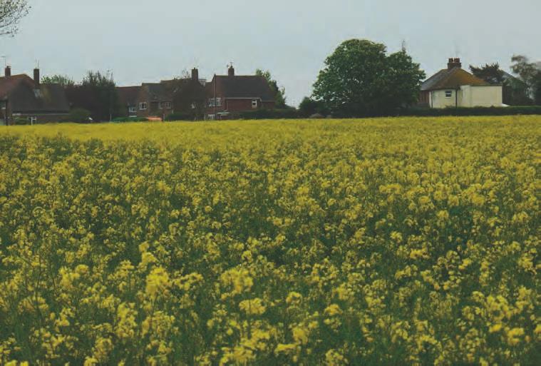
14 2. Understanding the Three Villages 2.2 Location of Land Identified The land at the Three Villages is situated in the wider context of West Sussex, on the Sussex coastal plain east of Chichester, north-east of Bognor Regis, and north-west of Littlehampton. The characteristics of the coastal plain define the area, namely low-lying fields - often small in size - divided by planting and/or watercourses. Much of the open land is devoted to agriculture and horticulture, and is subject to a high groundwater table. As the plan on the facing page shows, the landscape character changes dramatically to the north where it meets the South Downs, a distinctive topographical form of rolling escarpments rising to heights in excess of +110m, from which long range views over the coastal plain can be gained. The red line on the plan highlights the land owned by the Commissioners within the land identified for development by ADC. Villages Railway Church Commisioners land Green infrastructure Corridor B PAGE 5

15 CHURCH COMMISSIONERS LAND OWNERSHIP IN THE THREE VILLAGES CONTEXT EASTERGATE WESTERGATE BARNHAM


16 2. Understanding the Three Villages 2.3 The Three Villages THE THREE VILLAGES Westergate Eastergate Barnham Westergate, Eastergate and Barnham are located in close proximity to one another, and are not separated by expanses of open, agricultural land. However, the villages exhibit their own identities. To move east along Barnham Road - from Eastergate into the centre of Barnham - is to experience a distinct sense of arrival at the heart of the settlement. Much of the route is lined by mature planting and trees, with properties set back from the highway. The nurseries south of Barnham Road present a low intensity of development such that a sense of separation between Barnham and Eastergate is gained. Of the settlements adjoining the Green Infrastrusture Corridor-B, Barnham is the largest. Barnham Parish is home to approximately 1,500 residents, although it is important to note that the western part of the settlement lies within the parish of Eastergate, home to a further 3,000-3,500 residents. BARNHAM EASTERGATE WESTERGATE PAGE 7

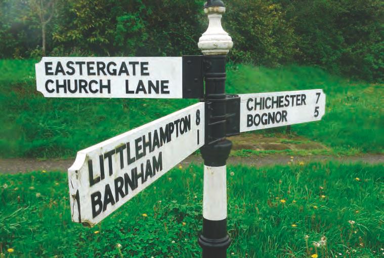
17 2. Understanding the Three Villages 2.4 Existing Connections The area south of the Three Villages is well served by public transport, both bus and rail. Barnham Railway Station is operated by Southern Railway and is located on the line between London Victoria and Southampton/Portsmouth, and Coastway West between Brighton and Southampton/ Portsmouth. It also provides access to the branch lines to Bognor Regis and Littlehampton. The A29 runs north - south between the A27 at Fontwell, and Bognor Regis, passing though Westergate and Woodgate to the west of the development area. There is a level crossing at Woodgate where the A29 crosses the existing railway and this acts as a recognised constraint to the highway network, with localised congestion occurring at this point owing to the time that the level crossing is closed. EXISTING RAIL CONNECTIONS towards Chichester towards Bognor Regis Barnham Railway Station towards Littlehampton EXISTING VEHICULAR CONNECTIONS towards Tangmere A29 A29 A27 Barnham Rd towards Bognor Regis towards Arundel towards Yapton The land identified enjoys good rail access. Barnham Railway Station offers access to London together with connections to Bognor Regis, Littlehampton and Brighton. The Three Villages have good vehicular connections to Bognor Regis, Fontwell and Chichester via the A29 and Barnham Road. EXISTING BUS CONNECTIONS EXISTING PEDESTRIAN CONNECTIONS 85, 665 to Chichester 85 to Arundel A29 Barnham Rd 66 to Bognor Regis 66 to Yapton / Bognor Regis A29 Several Bus links serve the area. The 66 and 66A towards Yapton and Bognor Regis, the 85 and 665 towards Chichester and the 85 towards Arundel being the primary bus routes. There are a number of pedestrian footpaths/public routes that go through and adjoin the identified land. PAGE 8


 the preferred option over the eastern alignment.")
18 2. Understanding the Three Villages 2.4 Existing Connections PARSONS BRINCKERHOFF ROAD ALIGNMENT OPTIONS BARNHAM RAILWAY STATION BARNHAM ROAD BUS CONNECTIONS An initial study undertaken by Parsons Brinckerhoff on behalf of ADC and West Sussex County Council (WSSC) concluded that a bypass would be desirable to provide relief for the existing A29 corridor and in particular eliminate the delay caused by the level crossing. The report considered various route options/alignments including replacing the existing level crossing with a bridge, an inner route to the east of Woodgate, route through the development site (eastern alignment) and western alignment. The study discounted the bridge and inner route options and concluded that a western alignment represented (albeit marginally so) the preferred option over the eastern alignment. SBA has reviewed the conclusions of the report and subsequently produced a full highways drawing of the eastern alignment (through the development site), so as to consider this option in more detail. From this is was concluded that an A29 bypass following the eastern alignment represented a viable and deliverable option in terms of cost, land take and overall environmental impact. PAGE 9

19 EXISTING LAND USE The diagram illustrates the existing land use across the Three Villages and the surrounding area. Residential development dominates the main access roads Barnham Road and the A27 - with the occasional presence of open space being nursery sites and play fields. Mixed uses are concentrated on Barnham road near Barnham railway station. The Three Villages are surrounded by open land most of which is devoted to agriculture and horticulture. Residential Mixed Uses Farm buildings/rural development Open Space Barnham Railway Station Places of Worship Camp Sites Industrial Uses Schools Villages Hall Surgery/GP Dentist Post Office Farmland Parish Boundaries


20 2. Understanding the Three Villages 2.5 Existing Land Uses and Local Amenities BARNHAM HIGH STREET FLEURIE NURSERY SITE SOUTH OF BARNHAM ROAD The construction of the railway station (Barnham Railway station opened in June 1864) shifted the focus of the village northwards from Old Barnham. The station is located south of the railway and is situated at what is now the heart of the village. Barnham Road contains a number of retail outlets including a convenience store, a barber s shop, a pub, takeaway, post office, a pharmacy and estate agents. Educational establishments include St. Philip Howard Catholic High School in Barnham, Aldingbourne Primary School, Barnham Primary School, Westgate Community School and Eastergate C of E Primary School. CHURCH OF ST. GEORGE, EASTERGATE ST. PHILLIP HOWARD CATHOLIC HIGH SCHOOL The Three villages also offer premises for community events, sports and recreation with the presence of the Six Villages Community Campus, the Eastergate Village Hall and sports grounds that belong to the schools. PAGE 11


21 2. Understanding the Three Villages 2.6 Site Constraints SUSTAINABLE WATER RESOURCES / FLOOD RISK HISTORIC CHARACTER Sustainable Water Resource Sustainable Water Resources / Listed Buildings Historic Character: Flood Risk: The plan highlights areas within the High Flood Risk The plan identifies the routes of existing Ancient and Semi-Natural Woodland vicinity of the identified site which display Flood Risk watercourses and areas which are subject Conservation Areas distinct historical qualities, and designated to the risk of occasional or extreme Conservation Areas. flooding events. PAGE 12
22 2. Understanding the Three Villages 2.7 Analysis Summary The Analysis Studies undertaken have brought to the fore the key factors which will influence any development in the identified area of the land at the Three Villages - Barnham, Eastergate and Westergate. They will determine: How development responds to ADC s proposal for the wider area, in particular, the potential for a new A29 through the identified land; How development is connected, integrated and permeable; How development protects / enhances existing watercourses whilst neither being exposed to existing flood risk nor increasing that risk by any degree; How development responds to areas of historic character, suitably and sensitively, whilst respecting the identity of existing settlements; How and where development offers new public open space for recreation. PAGE 13
23
24 3. Design Principles The diagrams on the following pages show a sequence of principles that could be applied in shaping a development proposal for this area. When combined as a sequence, these principles lead to a framework within which more detailed proposals for development can be established. Key principles include: 1. Green Swathe 2. Incorporating wetlands 3. Strategic highway link 4. New sustainable settlement 5. Green links 6. Sustainable movement PAGE 15


25 3. Design Principles 3.1 Green Swathe The establishment of a green swathe of enhanced landscape running north-south through the identified land in reponse to ADC s proposals in their Draft Local Plan. 1. PROPOSED GREEN SWATHE PAGE 16


26 3. Design Principles 3.2 Incorporating Wetlands Recognising the presence of existing watercourses and incorporating them into a sustainable drainage strategy for the area. 2. INCORPORATING WETLANDS PAGE 17


27 3. Design Principles 3.3 Strategic Highway Link The creation of the new A29 through the identified land in response to the ADC proposals plan and initial study by Parsons Brinckeroff. 3. STRATEGIC HIGHWAY LINK PAGE 18


28 3. Design Principles 3.4 New Sustainable Settlement The creation of a new settlement south-west of Barnham, close enough to benefit from, and complement, its services and amenities but formed and positioned such that it can display its own distinct identity. 4. NEW SUSTAINABLE SETTLEMENT PAGE 19


29 3. Design Principles 3.5 Green Links Enhancement of existing public footpaths with the introduction of a network of new pedestrian / cycle links north-south and east-west through the site, and linking existing neighbourhoods. 5. GREEN LINKS PAGE 20


30 3. Design Principles 3.6 Sustainable Movement The creation of a network of newly accessible green routes and parkland space that could define a Garden Village character for the new development and its setting. 6. SUSTAINABLE MOVEMENT 15 mins 10 mins 5 mins PAGE 21

31 CONCEPT MASTERPLAN
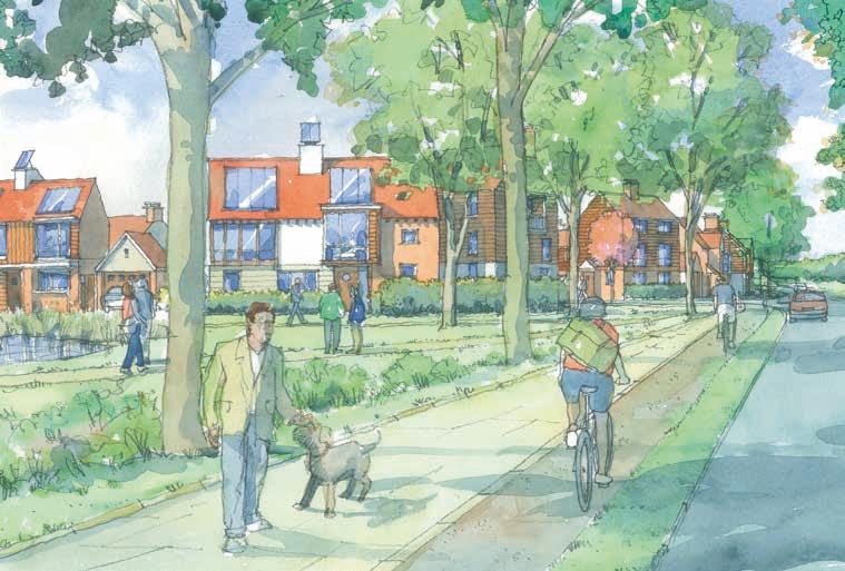
32 4. Vision 1. North-south green swathe providing opportunities for orchards, allotments, walking and cycle paths; 2. Existing wetlands incorporated in a sustainable drainage strategy (SuDS) extending from the residential neighbourhoods; 3. New A29 running through the identified land and crossing over the railway, thereby easing traffic congestion at grade level crossing and serving the new neighbourhood; 4. A permeable neighbourhood with increased access to open space and neighbouring villages, whilst maintaining its own identity; 5. Green links with walking and cycling opportunities integrate existing footpaths and provides easy access to the enhanced wetlands and green swathe; 6. New pedestrian and cycle links provide easy access to Barnham station, neighbouring schools, Barnham high street and existing sports facilities. The adjacent page shows our initial masterplanning response to the Barnham-Eastergate-Westergate Growth Area opportunity. The masterplan is based on the design principles set out in Section 3 of this document. The masterplan shown comprises: 95 hectares of developable land; Approximately 60 hectares of landscape including public open space, pedestrian / cyclist routes, nurseries, and sustainable drainage systems. The developable land could facilitate the construction of approximately 2,100 dwellings at varying densities, together with a range of local retail facilities, a foodstore, new healthcare and community facilities and a primary school. By setting the proposed development within defined parameters, the established setting of the existing villages will be ensured and protected in the longer term through the designation of clearly defined areas of public open space and parkland. Residents would benefit from increased access to open space as a result, and new development contained such that it did not result in any perceived coalescence of Westergate, Eastergate or Barnham. PAGE 23
33
34 5. Summary The Commissioners are pleased to support the Council s vision for Option 2 of the Local Plan, and in particular, the strategy for growth of a new community at the Three Villages. Our work on delivery and phasing confirms the potential, in principle, to deliver the Council s proposed level of growth, together with the key infrastructure required. As the preliminary analysis and development concept work demonstrates, the Council s proposal for a new community here represents a fantastic opportunity to create an attractive and sustainable new community to be enjoyed by existing and new residents alike, making full use of the existing connections and relationships between the Three Villages, while also maintaining a distinctly separate community. The Commissioners look forward to working with the Council and other key delivery partners to take forward the development of the vision and principles behind a new community at the Three Villages. PAGE 25
35
WELCOME LAND EAST OF TYE LANE, WALBERTON. Above all, it s about people
 WELCOME Welcome to this public exhibition relating to our draft residential proposals for the land east of Tye Lane, Walberton. Today gives you the opportunity to have an active role in shaping these ideas
North Littlehampton Community Newsletter 3 February 2011
 North Littlehampton Community Newsletter 3 February 2011 New Prospects for North Littlehampton Planning Application submitted It is now just over two and a half years since members of the community participated
Hampton Park North Littlehampton West Sussex
 North Littlehampton West Sussex SUMMARY Summary An opportunity to create a new community in West Sussex on the northern outskirts of Littlehampton with outstanding views across open countryside towards
Chapter 2: OUTLINE PLANNING APPLICATION PROPOSALS. A New Garden Neighbourhood Matford Barton 17
 Chapter 2: OUTLINE PLANNING APPLICATION PROPOSALS A New Garden Neighbourhood Matford Barton 17 2.1. SUMMARY AND STATUS OF THE PROPOSALS 2.1.1. The parameter plans and associated wording in this chapter
WHITELEY TOWN COUNCIL NORTH WHITELEY DEVELOPMENT SEPTEMBER 2014
 WHITELEY TOWN COUNCIL NORTH WHITELEY DEVELOPMENT SEPTEMBER 2014 Dear Resident This Special Edition of the Whiteley Voice which has been prepared in conjunction with the North Whiteley Consortium is to
Kibworth Harcourt. Introduction. Introduction
 Introduction Introduction Welcome to this public exhibition on the proposals for the delivery of new homes on land at The Kibworths. The purpose of today s exhibition is to give you the opportunity to
INTRODUCTION NORTH HEYBRIDGE GARDEN SUBURB
 INTRODUCTION This event is being hosted by the promoters of the proposed North Heybridge Garden Suburb who are working with Maldon District Council and other key stakeholders on the preparation of a comprehensive
Newcourt Masterplan. November Exeter Local Development Framework
 Newcourt Masterplan November 2010 Exeter Local Development Framework Background The Exeter Core Strategy Proposed Submission sets out the vision, objectives and strategy for the development of Exeter up
The Fairfield Partnership Vision for North-East Elsenham
 The Fairfield Partnership Vision for North-East Elsenham August 2009 Frequently Asked Questions Who is The Fairfield Partnership? The Fairfield Partnership is a joint venture between Marchfield Developments
Public Consultation. Land at Monks Farm, North Grove. Welcome
 Welcome Welcome to our public exhibition for development on Land at Monks Farm, orth Grove. Gallagher Estates and Gleeson Strategic Land are preparing an outline planning application for new homes, open
Draft to Clymping Parish Council for consideration on 23 May Arun District Council (ADC) Local Plan comment. 1. Introductory comments
 Local Plan comment. 1. Introductory comments") Draft to Clymping Parish Council for consideration on 23 May 2017 Arun District Council (ADC) Local Plan comment 1. Introductory comments This consultation is very welcome as it is first time Clymping
Draft to Clymping Parish Council for consideration on 23 May 2017 Arun District Council (ADC) Local Plan comment 1. Introductory comments This consultation is very welcome as it is first time Clymping
Joint Core Strategy Rushden Sustainable Urban Extension
 Date Page 1 of 18 Report Originator Title Planning Manager Joint Core Strategy Rushden Sustainable Urban Extension 1. PURPOSE OF REPORT 1.1 To consider representations received on the emerging Joint Core
1.0 INTRODUCTION. Brantham Industrial Area Regeneration - Factory Lane - Brantham
 1.0 INTRODUCTION Welcome to this exhibition of our proposals for the regeneration of the Brantham Industrial Area located off Factory Lane in Brantham. This presentation will give you an opportunity to
Statement of Community Involvement LAND OFF SOUTHDOWN ROAD HORNDEAN, HAMPSHIRE
 LAND OFF SOUTHDOWN ROAD HORNDEAN, HAMPSHIRE CONTENTS Page 1. Introduction 3 2. Pre-application Discussions 4 3. The Consultation Process 5 4. Consultation Feedback 7 5. Responses to Consultation Feedback
Proposed Amendment to the
 Proposed Amendment to the Carrigaline Electoral Area Local Area Plan Amendment No 1: Carrigaline (T-02, O-02 & U-02) August 2012 Proposed Amendment to the Carriagline Electoral Area Local Area Plan 2011
Colchester Northern Gateway Master Plan Vision Review Draft. July 2016
 Colchester Northern Gateway Master Plan Vision Review Draft July 2016 Contents Introduction 4 Context 8 Purpose of the Report 8 Strategic Position 9 Overview of the Process 11 2012 Master Plan Vision 12
Copyright Nigel Deeley and licensed for reuse under this Creative Commons Licence
 1 Copyright Nigel Deeley and licensed for reuse under this Creative Commons Licence Prepared by the Neighbourhood Plan Steering Group on behalf of Garway Parish Council with assistance from 2 Table of
INTRODUCTION. Land south of Bishopswood Lane, Tadley
 0 INTRODUCTION THE SITE Introduction Gladman Developments Ltd. has successfully invested in communities throughout the UK over the past 0 years, developing high quality and sustainable residential, commercial
8.0 Design and Form of Development 43/
 42/ 8.0 Design and Form of Development 43/ Rothwells Farm, Golborne/ Development Statement Figure 7. Site Constraints Key 44/ Site Boundary 360 Bus Route/Stops Existing Trees Underground Water Pipe Sensitive
LONGDEN VILLAGE DEVELOPMENT STATEMENT
 LONGDEN VILLAGE DEVELOPMENT STATEMENT 2017-2027 1 Longden Development Statement 2017-2027 15/01/18 1. Background 1.1 Longden Village Longden village is a very rural and traditional community first mentioned
Land at Rampton Road. Cottenham
 Land at Rampton Road Cottenham Introduction TEP is preparing an outline planning application for 54 dwellings on 6.9 hectares of land adjacent to Rampton Road, Cottenham on behalf of the owners Cambridgeshire
The proposals presented in September drew a large number of comments and feedback and have been grouped together as follows:
 Appendix A Stakeholder presentation + powerpoint slides Planning Context and Emerging Proposals presentation Nick Tyrrell, Alder King, Planning Consultants Alder King began by setting the site context
DESIGN & ACCESS STATEMENT
 DESIGN & ACCESS STATEMENT January 2016 Contents Introduction section 1 Section 1 - Introduction Section 2 - Assessment Section 3 - Involvement Section 4 - Evaluation Section 5 - Design Section 6 - Layout
Lower Hollow Copse. Questions and Answers on Proposals for Permanent Gypsy and Traveller Accommodation
 Lower Hollow Copse Questions and Answers on Proposals for Permanent Gypsy and Traveller Accommodation 0 Why does Mid Sussex District Council need to provide permanent gypsy and traveller accommodation?
ABOUT CALA HOMES CALA HOMES
 WELCOME Welcome to this public consultation event for our proposed development on land to the east of Salisbury Road, in Hungerford. Thank you for taking the time to come along today. Homes and Wates Developments
A VISION FOR BLAIRGOWRIE
 Welcome to the Westpark Partnership and Lidl UK GmbH Community Presentation. The purpose of this presentation is for you to view and comment upon the revised and updated proposals for the allocated development
WELCOME GYPSY LANE. Wider Site Location plan. Proposals for the development of LAND OFF FOXLYDIATE LANE WEBHEATH. Proposals for the development of
 WELCOME The developers are preparing an outline planning application for a residential led development and need the community s views in order to develop the proposals further WHAT IS PROPOSED? A high
PHASE III: Reserved Matters Submission
 Statement of Compliance with the outline approval for the proposed residential development of land at: BURGES LANE, WIVELISCOMBE PHASE III: Reserved Matters Submission Foreword Contents: This Statement
FOR SALE RESIDENTIAL DEVELOPMENT OPPORTUNITY BLAIRTUMMOCK EASTERHOUSE
 FOR SALE RESIDENTIAL DEVELOPMENT OPPORTUNITY BLAIRTUMMOCK EASTERHOUSE RESIDENTIAL DEVELOPMENT SITE Land at Blairtummock, Easterhouse Residential Development Opportunity Site area of 5.71 hectares (14.11
Frequently Asked Questions
 1. Where is Aylesbury Woodlands? Frequently Asked Questions Aylesbury Woodlands lies to the east of Aylesbury. It is bounded to the south by the A41. To the north is the Aylesbury Arm of the Grand Union
Welcome to our exhibition
 Welcome to our exhibition The Homes & Communities Agency (HCA) welcomes you to this public exhibition explaining our proposals for the redevelopment of the former Lea Castle Hospital site. About the Homes
Key Principles. 290 Phasing Principles and Programme
 4 Phasing principles and programme 4c The aims of the phasing strategy are to satisfy planning policy requirements and create a sustainable, strong and healthy new community where, from the outset, people
West of Chichester Proposals for land to the west of Centurion Way 1 Welcome Introduction
 West of Chichester Proposals for land to the west of Centurion Way Welcome Introduction Welcome to this public exhibition for Linden and Miller Homes in connection with their proposals for a 600 home mixed
Schedule of Planning Applications Committee Date: 23 May Reference: 06/17/0726/F Parish: Hemsby Officer: Mr J Beck Expiry Date:
 Schedule of Planning Applications Committee Date: 23 May 2018 Reference: 06/17/0726/F Parish: Hemsby Officer: Mr J Beck Expiry Date: 22-05-2018 Applicant: Proposal: Site: Mr Gillett Change of use to the
3.1 The hybrid planning application proposes the following description of development:
 CHAPTER 3: PROPOSED DEVELOPMENT 3.1 The hybrid planning application proposes the following description of development: Hybrid (part-outline/part-full) planning application for a single composite development
Welcome to our public exhibition
 About Our Scheme Welcome to our public exhibition This exhibition gives you the chance to view and comment upon our emerging proposals for a new residential development of 68 new homes on the site of the
AMENDMENTS TO SUBMISSION DRAFT
 FISHBOURNE... NEIGHBOURHOOD PLAN... 2014-2029 AMENDMENTS TO SUBMISSION DRAFT (February 2015) In response to comments made in the final round of consultation THE PLAN This page is intentionally left blank
Welcome. Site/11/04. Site/11/03. Proposed Site. 11,400 new homes needed in east Cambs
 Welcome Welcome to our consultation on our proposals for new homes on land north east of Soham Road, Fordham. Members of the project team are available to answer any questions you have and listen to feedback.
Neighbourhood Planning Site Assessment Pro-forma and Guide Version 2
 Neighbourhood Planning Site Assessment Pro-forma and Guide Version 2 September 2014 Site HNP 006 Land East of Stanbridge Road and North of Lower Road 1. Background information Site location and use Site
Story Homes. Land at Thirsk Road, Kirklevington. An Introduction to Story Homes. Our Foundations. Commitment to Consultation.
 Story Homes An Introduction to Story Homes Founded by Fred Story in 1987, Story Homes has a long and successful reputation of building high quality and high specification homes. The family owned business
Built Up Area Boundary (BUAB)
") Parish Boundary Built Up Area Boundary (BUAB) Potential Sites Map not to scale DWELLING SIZE POLICY Residential developments must provide a mix of dwelling sizes (market and affordable) that reflect the
Parish Boundary Built Up Area Boundary (BUAB) Potential Sites Map not to scale DWELLING SIZE POLICY Residential developments must provide a mix of dwelling sizes (market and affordable) that reflect the
Land East of Cromwell Lane
 Land East of Cromwell Lane VISION DOCUMENT AUGUST 2016 The proposals for Land East of Cromwell Lane will be defined by existing landscape features, ensuring that the development offers a quality place
BEDFORD BOROUGH COUNCIL PLAN IMPLEMENTATION MONITORING REPORT
 BEDFORD BOROUGH COUNCIL PLAN IMPLEMENTATION MONITORING REPORT 2017-18 Summary 1 Progress on local development documents 1 Local development documents adopted in the monitoring period 1st April 2017 31st
Environmental and Landscape Mapping
 Environmental and Landscape Mapping In support of the Calveley Neighbourhood Plan November 2016 Project Name and Number: Calveley Neighbourhood Plan 16-025 Document Name and Revision: Environmental and
STATEMENT OF OBJECTION TO THE PROPOSED DEVELOPMENT OF LAND AT CHURCH CLIFF DRIVE FILEY
 STATEMENT OF OBJECTION TO THE PROPOSED DEVELOPMENT OF LAND AT CHURCH CLIFF DRIVE FILEY You will be aware that Scarborough borough council have adopted a new local plan that includes land at Church Cliff
Blandford Forum Town Council, Blandford St Mary Parish Council and Bryanston Parish Council
 Blandford Forum Town Council, Blandford St Mary Parish Council and Bryanston Parish Council Blandford + Neighbourhood Plan 2 Pre-Submission Plan Consultation (November 2018) Representations submitted on
ENVIRONMENTAL AND LANDSCAPE MAPPING
 APPENDIX IV : Environmental and Landscape Mapping ENVIRONMENTAL AND LANDSCAPE MAPPING Calveley Neighbourhood Plan November 2016 ENVIRONMENTAL AND LANDSCAPE MAPPING Calveley Neighbourhood Plan Calveley
6 Growth Management Challenges and Opportunities
 6 Growth Management Challenges and Opportunities The Town has established a goal of attaining a 50% participation rate with respect to employment opportunities versus residential population. The Town s
INTRODUCTION. Land West of Main Road, Stanton Harcourt THE SITE. Why is the Site Suitable for Development?
 0 INTRODUCTION THE SITE Application Boundary Gladman Developments Ltd has successfully invested in communities throughout the UK over the past 0 years, developing high quality and sustainable residential,
3. Neighbourhood Plans and Strategic Environmental Assessment
 1. Introduction This report sets out a draft Screening Determination for the Preston Parish Council s Neighbourhood Plan and has been prepared by rth Hertfordshire District Council. The purpose of the
1. Welcome. Land at Cribbs Causeway. January The Joint Venture. Today s Exhibition. Project Team.
 1. Welcome Today s Exhibition This exhibition displays the latest proposals for a mixed-use development on which will be submitted as an outline planning application in February. The proposed development,
Settlement Boundaries Methodology North Northumberland Coast Neighbourhood Plan (August 2016)
") Introduction This background paper sets out a methodology for the definition of settlement boundaries in the North Northumberland Coast Neighbourhood Plan. The neighbourhood plan is planning positively
Introduction This background paper sets out a methodology for the definition of settlement boundaries in the North Northumberland Coast Neighbourhood Plan. The neighbourhood plan is planning positively
CLEVE PARK, THORNBURY
 CLEVE PARK, THORNBURY Community Planning Day Report Back Broadsheet February 206 A VISION FOR CLEVE PARK Over 0 local people attended the Cleve Park Community Planning Day at Armstrong Hall on Saturday
Land at Three Elms, Hereford PRE-SUBMISSION EXHIBITION June 2016
 Design Principles Emanating from the key themes from the Community Planning Weekend and technical assessment conducted, a series of design principles were developed.these principles were presented during
WELCOME TO THE NEW WILTON PARK
 WELCOME TO THE NEW WILTON PARK VISION HISTORY OF WILTON PARK TOWARDS A PLANNING APPLICATION Our objective is to create a truly outstanding environment at Wilton Park. At the heart of our proposals is a
University Park, Worcester Non Technical Summary December 2011
 University Park, Worcester Non Technical Summary December 2011 Introduction UW Wrenbridge LLP, a Joint Venture Company of the University of Worcester and Wrenbridge Land Ltd (the Applicants ) intend to
heuston gateway: sections heuston gateway: regeneration strategy and development framework plan
 B B1 A B1 B C A heuston gateway: sections B B1 C 117 4.3.3 Zoning The station is the central hub of the area and this function must be preserved and developed. However large areas of the Heuston Station
Making the case for Sustainable Transport Project Potential
 Making the case for Sustainable Transport Project Potential The Structural Investment Fund (SIF) Strategy for Greater Lincolnshire identifies the barriers to growth identified by having poor transport
Tāhuhu whakaruruhau ā-taone The sheltering ridge pole
 B2. Tāhuhu whakaruruhau ā-taone - Urban growth and form B2.1. Issues Tāhuhu whakaruruhau ā-taone The sheltering ridge pole Auckland s growing population increases demand for housing, employment, business,
EXTRACT FROM THE CUDDINGTON NEIGHBOURHOOD PLAN The Policies
 EXTRACT FROM THE CUDDINGTON NEIGHBOURHOOD PLAN The Policies Environment and Landscape Policy 1 - Landscape Setting Development should respect and wherever possible enhance the landscape setting of Cuddington
Application and Proposals. Part 211
 Application and Proposals Part 211 Site Location and Context The application site comprises two distinct land parcels totalling some 135 hectares. The site is bisected eastwest by Churchlands Development.
WELCOME. North East Haverhill. The Planning Process
 WELCOME North East The site to the North East of, known as Great Wilsey Park, is identified by St Edmundsbury Borough Council in its Core Strategy as capable of delivering a Sustainable Urban Extension.
GREENBANK DEVELOPMENT MASTERPLAN
 DEVELOPMENT MASTERPLAN POTENTIAL TRAIN STATION COMMUNITY CENTRE Greenbank will be a connected masterplanned community providing easy access to local and surrounding amenity. Affordable quality homes, green
Site Assessment Technical Document Appendix A: Glossary
 Central Bedfordshire Council www.centralbedfordshire.gov.uk Site Assessment Technical Document Appendix A: Glossary July 2017 1.1.11-1 - ii Appendix A: Glossary Term Agricultural Land Classification AONB
SOUTH EAST LINCOLNSHIRE LOCAL PLAN: HOUSING PAPER DONINGTON (JUNE 2016)
") SOUTH EAST LINCOLNSHIRE LOCAL PLAN: HOUSING PAPER DONINGTON (JUNE 2016) 1 DONINGTON S PLACE IN THE SPATIAL STRATEGY 1.1 Policy 2 of the South East Lincolnshire Local Plan 2011-2036 Draft for Public Consultation
SOUTH EAST LINCOLNSHIRE LOCAL PLAN: HOUSING PAPER DONINGTON (JUNE 2016) 1 DONINGTON S PLACE IN THE SPATIAL STRATEGY 1.1 Policy 2 of the South East Lincolnshire Local Plan 2011-2036 Draft for Public Consultation
DESIGN & ACCESS STATEMENT
 DESIGN & ACCESS STATEMENT Land to the South East of the A495, Bronington Erection of 31 Dwellings (27 dwellings and 4 bungalows including 4 Affordable Dwellings), Realignment and Improvements to A495 (including
Elderberry Walk. Developer HAB Housing
 Case studies Elderberry Walk Developer HAB Housing Development of 161 new homes on the former Dunmail Primary School site, focused around a central green street, with retained trees, new multifunctional
Neighbourhood Planning Local Green Spaces
 Neighbourhood Planning Local Green Spaces Introduction... 2 1. Why green space is important... 4 2. Neighbourhood plans and green space... 6 3. Evidence... 8 Statutory designations... 9 Green space audit...
Welcome. Proposals for land at Smug Oak Lane BRICKET WOOD
 Proposals for land at Smug Oak Lane BRICKET WOOD Previous Linden Homes and Wates Developments scheme Welcome Welcome to Linden Homes and Wates Developments public exhibition. Working together as joint
OKEFORD FITZPAINE NEIGHBOURHOOD PLAN
 OKEFORD FITZPAINE NEIGHBOURHOOD PLAN Dear Parishioner, The Neighbourhood Plan Project Team have prepared this leaflet to summarise the full Neighbourhood Plan document. It provides a summary of the Vision,
9 Pershore. Introduction. Pershore Abbey
 118 Introduction 9.1 The historic town of Pershore lies on the River Avon and has a population of 7,000 (2009 Mid-Term Population Estimates). The main areas of the town are centred on the Abbey, the bustling
Welcome. Land adjacent Sandy Lane WALTHAM CHASE THE PROPOSED SITE
 Land adjacent Sandy Lane WALTHAM CHASE Existing Linden Homes developments Welcome Welcome to Linden Homes Southern s ( Linden ) public exhibition about its proposals for a range of high-quality homes for
Alder View. Introduction. Alder View. Harwell. The Vision. The Team. Taylor Wimpey
 Introduction Welcome to the public exhibition for, a development by Taylor Wimpey on the land south of Grove Road,. This exhibition will provide an overview of the development proposals for the site and
Application Guide. Should you have any questions on the Outline Application please contact:
 Application Guide Application Guide This guide describes the structure of the Outline Application, explains the different documents that have been submitted with it and identifies what will happen next.
PLACE WORKSHOP REPORT. A+DS SNH sustainable placemaking programme
 PLACE briefing WORKSHOP REPORT A+DS SNH sustainable placemaking programme INTRODUCTION This report summarises the outcome of a Scottish Natural Heritage workshop on placemaking which was held on Wednesday
Draft Hailey Neighbourhood Plan
 Persimmon Homes (Wessex) Draft Hailey Neighbourhood Plan Representations to West Oxfordshire District Council s Regulation 16 Consultation December 2018 2 Copyright 2018 Persimmon Homes Ltd. All rights
Chichester District Council. Planning Committee 3 February Masterplan for the Westhampnett/NE Chichester Strategic Development Location (SDL)
") Chichester District Council Planning Committee 3 February 2016 1. Contacts Masterplan for the Westhampnett/NE Chichester Strategic Development Location (SDL) Report Author: Jo Bell, Development Manager
Chichester District Council Planning Committee 3 February 2016 1. Contacts Masterplan for the Westhampnett/NE Chichester Strategic Development Location (SDL) Report Author: Jo Bell, Development Manager
1. Nantwich - Planning for a Sustainable Future
 1. Nantwich - Planning for a Sustainable Future Cheshire East Council is charged with preparing its Development Plan to guide housing and other growth over the period to 2030. The Council intends to publish
CENTRAL BEDFORDSHIRE COMMITTED TO WORKING TOGETHER WITH LOCAL COMMUNITIES
 WELCOME Thank you for coming to our consultation event to find out more about our emerging proposals for Hayfield Park, a residential development jointly promoted by the Hayfield Consortium: Martin Grant
Welcome to our public exhibition
 About our development Welcome to our public exhibition This exhibition gives you the chance to view and comment on our proposals for a new residential development of 165 high-quality homes, along with
SPG 1. * the northern and western sections which are open fields used for pasture and grazing;
 SPG 1 1.0 INTRODUCTION This development brief is based on the allocation of the Priors Hall site for employment and countryside recreational purposes in the Corby Borough Local Plan. The brief is intended
DUNSFOLD NEIGHBOURHOOD PLAN Site Selection Policies
 DUNSFOLD NEIGHBOURHOOD PLAN Site Selection Policies The criteria for assessing sites for future housing and business development in Dunsfold are set out below. (Development criteria, covering what it is
Welcome to our Public Consultation
 About our development This exhibition gives you the chance to view and comment on our emerging plans for a proposed residential development located on land to the West of Alwyn Road, Rugby. Welcome to
Ebbsfleet Development Corporation
 Title of Paper Planning and Housing Delivery Report September 2018 Presented by Sub-Committee Mark Pullin, Chief Planning Officer Planning Committee Purpose of Paper and Executive Summary This paper provides
WELCOME. Land west of Great Canfield Road, Takeley. Welcome. Have your say. Pegasus Urban Design
 01 WELCOME Welcome Gladman Developments Ltd have successfully invested in communities throughout the UK over the past 20 years, developing high quality and sustainable residential, commercial and industrial
Briefing Document of CNP. June 2017
 Cholsey Parish Council Cholsey Neighbourhood Plan Briefing Document of CNP June 2017 Cholsey Neighbourhood Plan Page! 1 of! 8 Cholsey Plan Briefing v1.4 Page Left Intentionally Blank Cholsey Neighbourhood
What do you like about South Marston?
 What do you like about South Marston? What you have said so far: Strong and separate identity, distinct from Swindon Village character (Church, School, Green and Hall) Surrounding working countryside and
Welford-on-Avon Neighbourhood Plan Consultation Event Sunday, 6 April Your name Your address
 Welford-on-Avon Neighbourhood Plan Consultation Event Sunday, 6 April 2014 Your name Your email address Please either: - complete this feedback form and put it in the box before leaving the Memorial Hall
The journey so far. The new masterplan for Dargavel Village
 The journey so far Our vision for Dargavel Village began over ten years ago when the original masterplan for transforming the former Royal Ordnance Factory site into a thriving community was established.
A BEAUTIFUL PLACE FOR LIVING
 A BEAUTIFUL PLACE FOR LIVING BEAULIEU: A PLACE FOR LIFE Beaulieu is a vibrant new district taking shape in Chelmsford, Essex; offering residents inspirational architecture and landscape. Developers Countryside
Draft Western District Plan
 Powered by TCPDF (www.tcpdf.org) Draft Western District Plan Submission_id: 31440 Date of Lodgment: 15 Dec 2017 Origin of Submission: Online Organisation name: Goodman Property Services Australia Pty Ltd
WELCOME. Land North of STEVENAGE. We would like to thank you for attending our public exhibition today.
 WELCOME We would like to thank you for attending our public exhibition today. The purpose of this event is to share our proposals and hear your thoughts on our ideas. Members of the project team are on
Stowford Mill, Ivybridge Introduction
 Stowford Mill, Ivybridge Introduction 1. What is the purpose of this exhibition? Burrington Estates would like residents and interested parties to have the opportunity to review updated proposals for the
Oxford Green Belt Study. Summary of Final Report Prepared by LUC October 2015
 Oxford Green Belt Study Summary of Final Report Prepared by LUC October 2015 Project Title: Oxford Green Belt Study Client: Oxfordshire County Council Version Date Version Details Prepared by Checked by
Woodbrook - Shanganagh
 Section 4: Key Sites Framework Strategy Woodbrook - Shanganagh Local Area Plan 2017-2023 4. Site Framework Strategies The Master Plans shall have regard to the thematic objectives under the LAP Development
Welcome to this exhibition which shows emerging ideas for land owned by University of Bristol at Long Ashton.
 1 Introduction Welcome to this exhibition which shows emerging ideas for land owned by University of Bristol at Long Ashton. The University of Bristol owns a 170 acre site south of Long Ashton village
Plan Modification to Chapter B2 of the Auckland Unitary Plan(AUP) Operative in part (15 November 2016)
 Operative in part (15 November 2016)") UNITARY PLAN UPDATE REQUEST MEMORANDUM TO FROM Phill Reid Linley Wilkinson DATE 25 September 2018 SUBJECT Plan Modification to Chapter B2 of the Auckland Unitary Plan(AUP) Operative in part (15 November
UNITARY PLAN UPDATE REQUEST MEMORANDUM TO FROM Phill Reid Linley Wilkinson DATE 25 September 2018 SUBJECT Plan Modification to Chapter B2 of the Auckland Unitary Plan(AUP) Operative in part (15 November
HARDWICK GREEN, King s Lynn. Welcome to our Exhibition. What are your views? Introduction to the site and proposals. About us
 HARDWICK GREE, King s Lynn Welcome to our Exhibition Welcome to our exhibition, which is being held to provide you with the opportunity to understand and comment upon our proposals for new residential
Plumpton Neighbourhood Plan Site Assessment Report
 Plumpton Neighbourhood Plan Site Assessment Report May 2016 1 Contents 1. Introduction 3 2. Methodology 4 2.1 Identification of Potential Sites 4 2.2 Assessment Process 5 2.3 Assessment Criteria 6 2.4
Planning and Sustainability Statement
 Land adjacent to Manor Farm, Catterick Village Pallett Hill Sand and Gravel Co Ltd Proposed 10 new dwellings, (6 No market dwellings and 4 No affordable dwellings) with access, associated car parking and