Hampton Park North Littlehampton West Sussex
|
|
|
- Austin Lambert
- 6 years ago
- Views:
Transcription

1 North Littlehampton West Sussex

2 SUMMARY Summary An opportunity to create a new community in West Sussex on the northern outskirts of Littlehampton with outstanding views across open countryside towards Arundel and the South Downs. Comprehensive redevelopment of the site to comprise new residential accommodation of up to 1260 units incorporating retail, commercial space, community hall, a youth facility, primary school, a hotel and care home. The formation of a new road to the A259 comprising the southern section of the proposed Lyminster Bypass and the new Fitzalan link into the town giving easy access to the A27.
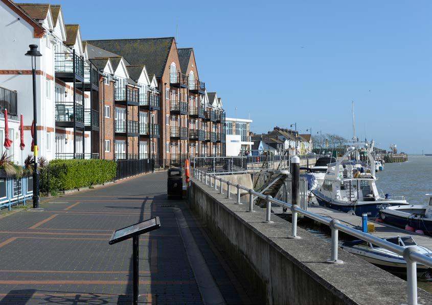
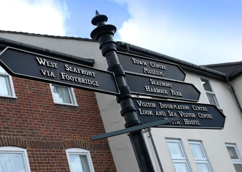
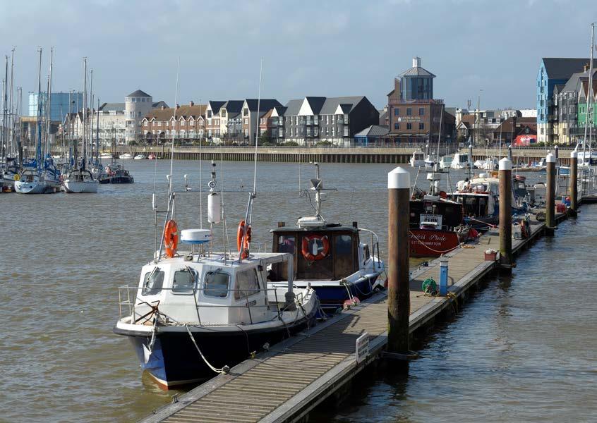
3 LOCATION LOCATION (which extends north up to the Blackditch water course) consists of approximately 85 hectares (210 acres) of land, largely covered with glass houses, warehouses and is located on the northern edge of the coastal town of Littlehampton in West Sussex. The South Coast mainline railway forms the southern boundary of the site. Toddington Lane crosses north over the railway, and serves a mixed use area located centrally on the site before turning west to connect, via Mill Lane, to the Lyminster Road. The residential area of Toddington is located south of the railway and the separate village of Lyminster lies to the north. The A284, which is the main road serving Littlehampton south from the A27 (trunk road) passes to the west of the site through Lyminster and then south to Littlehampton town centre. The Black Ditch water course follows the northern site boundary. Low lying land within the site south of the Black Ditch comprises grazing marshes of bio diversity value. Land to the north of the Black Ditch is intensively cultivated arable land with large scale fields and a few defining hedgerows and attractive long distance countryside views to the North West, North And North East including Arundel Castle / Cathedral. A public footpath from Poling connects the eastern part of the site between the glass houses, before joining Toddington Lane near the railway line.

4 HOME PRINT SAVE CLOSE BACK NEXT

5 HOME PRINT SAVE CLOSE BACK NEXT

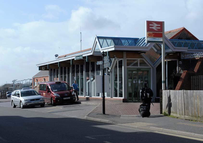
6 A284 to Cross bush & Arundel ForSALE A27 N LOCATION Rustington Toddington (which extends north up to the Blackditch water course) consists of approximately 85 hectares (210 acres) of land, largely covered with glass houses, warehouses and is located on the northern edge of the coastal town of Littlehampton in West River Arun Sussex. Wick The South Coast mainline railway forms the southern boundary of the site. Toddington Lane crosses north over the railway, and serves a mixed use area located centrally on the site before turning west to connect, via Mill Lane, to the Lyminster Road. The Littlehampton Town Centre residential area of Toddington is located south of the railway and the separate village of Lyminster lies to the north. The A284, which is the main road serving Littlehampton south from the A27 (trunk road) passes to the west of the site through Littlehampton Lyminster and then south to Littlehampton town centre. Railway Station A259 B2187 to Worthing The Black Ditch water course follows the northern site boundary. Low lying land within the site south of the Black Ditch comprises grazing marshes of bio diversity value. Land to the north of the Black Ditch is intensively cultivated arable land with large scale fields and a few defining hedgerows and attractive long distance countryside views to the North West, North And North East including Arundel Castle / Cathedral. Site Boundary B2140 Sea Road Main Route A public footpath from Poling connects the eastern part of the site between the glass houses, before joining Toddington Lane near the railway line. VIEW LOCATION PLAN Sea A259 Railway Littlehampton Town Centre River Arun/Sea Level Crossing A259 HOME PRINT SAVE CLOSE BACK NEXT
7 DESCRIPTION DESCRIPTION The key characteristics and features on the existing site are as follows: Substantially covered by buildings, glass houses, roads, hard surfacing and outdoor growing/storage. Mix of uses including large nurseries with associated storage and administration buildings, along with packing and distribution. The central part of the site comprises park land with ornamental tree and shrub species and close mown amenity grass land. Conifers and other trees are to be found around much of the perimeter of the site. Low lying area along the Black Ditch has water meadows of bio-diversity value. The land drains and ditches supports a range of wetland habitats. Lined water storage lagoons on site, the lagoon on the eastern boundary is used for fishing and has been managed to increase bio-diversity and the shallow margins make it suitable for water fowl, and is part of the wetland drainage system. A strip of undeveloped land extends southwards through the western part of the site, which has been identified to accommodate part of the southern section of the proposed Lyminster Bypass, The proposed new access road (which will connect with the proposed Lyminster bypass when built) extends from the A259 northwards across the allotments and over the railway line into the site.


8 HOME PRINT SAVE CLOSE BACK NEXT
9 PLANNING PLANNING The site benefits from two planning consents. The first, under Arun District Council Planning Application Ref: LU/47/11 grants outline planning consent for demolition of existing buildings and structures, up to 1260 residential dwellings (out of a potential 1460 dwelling Master Plan) up to 13,000 sq m of B1 employment floor space (including 3,000 sq m Enterprise Centre) up to 3,500 sq m of Class A local facilities, a 100 bed hotel, 60 bed care home, a new two form entry primary school, community centre, youth and leisure facilities, combined heat and power plant, extension to existing household recycling centre, landscaping, replacement and additional allotments, multi functional green infrastructure including sports pitches (and associated changing facilities) informal open space, children play areas, primary vehicular access from a new access from the A259 bridging over the railway line with additional access from Mill Lane and Toddington Lane. The consent was granted on 23 January 2013 and is accompanied by a further planning permission as follows. The second, Under Arun District Council Planning Application Ref: LU/63/11 outline planning permission was granted for the construction of the Fitzalan Link Road between the A259 Worthing Road and the East Street/Fitzalan Road roundabout. The consent was granted on the 6th June Section 106 Agreement dated 23 January 2013 accompanies the planning consents, and covers numerous issues in respect of the major development area.

10 KEY 1. Black Ditch Flood Plain 2. Lyminster Bypass (South Section) 3. Potential future Lyminster Bypass (North Section) 4. New access to enlarged recycling facility 5. Existing Allotments 6. Relocated and new Allotments 7. Recycling Centre extension 8. Commercial Area 9. Market Square Retail Area 10. Care Home 11. Youth Facility 12. Hotel 13. Primary School 14. Community Facility 15. Water Meadow 16. New Pond 17. Green Corridor 18. Existing Pond 19. Sports Pitches with New Pavilion 20. New Bridge over Railway 21. Listed Buildings 22. Higher Density Residential Neighbourhood 23. Lower Density Residential Neighbourhood 24. Privately Owned Land 25. Black Ditch 26. Railway 27. New Roundabout connecting Lyminster Bypass and Fitzalan Link with A A259 Worthing Road 29. A259 Rustington Bypass 30. Pedestrian Cycle Links 31. Wick Football Ground 32. Toddington Village 33. Eden Park 34. Bodyshop HQ HOME PRINT SAVE CLOSE BACK NEXT

11 HOME PRINT SAVE CLOSE BACK NEXT

12 HOME PRINT SAVE CLOSE BACK NEXT

13 TECH INFO Technical Information Full technical information including complete copies of both planning applications,together with the planning consents, S.106 Agreement, a Legal Summary, etc is available within the Data Room which can be accessed by obtaining a username and password from CBRE.

14 SALES INFO SALES INFO The site presents the opportunity to create a new community, and with it a new settlement and high quality environment with excellent green credentials. The setting and scale of the scheme is expected to command a premium over and above embedded values. An independent marketing report has been prepared by the Mclaren Clark Partnership in respect of the site, highlighting the opportunities in more detail and analysing the local and regional market. An Economic Development Apprasial has also been prepared by Peter Brett Associates to assist in the evaluation of this opportunity. Access to these reports is via the Data Room.
15 METHOD OF SALE METHOD OF SALE In view of the scale of the development and because of its mixed use nature, expressions of interest are invited from developers, investors and occupiers for the whole or part only (by area or land use) of the site. All proposals will be treated in the strictest confidence. If it is considered that a collaborative approach to a disposal has merit ie. more than one intending purchaser for the whole site, then introductions may be made with the prior consent of the parties. Expressions of interest, including financial proposals, are required to be received by CBRE no later than midday on Friday 23rd August It is anticipated discussions with seriously interested parties will be very early in September with a view to settling terms. Offers should be submitted on both of the following bases: A) The best terms for the purchase of the property, and B) The price offered for the purchase of the property as a whole, for a cash consideration, but with Completion deferred six months following Exchange of Contracts. All offers must be fully supported by financial and technical information designed to demonstrate the intending purchasers commitment to the project and ability to deliver. The vendors reserve the right not to accept the highest offer or indeed any offer, and their decision in such regard shall be final.
16 GALLERY


17 GALLERY
18 GALLERY
19 GALLERY
 these particulars")

20 CONTACT CONTACT For more information please contact the following: James Shelley Mark Budden T: T: M: M: The Quay The Quay 30 Channel Way 30 Channel Way Southampton SO14 3TG Southampton SO14 3TG Misrepresentation Act : All Agents and for the vendors or lessors of this property whose agents they are, give notice that (i) these particulars are produced in good faith, are set out as a general guide only and do not constitute any part of an offer or contract. They are believed to be correct but any intending purchasers or tenants should not rely on them as statements or representations of fact but must satisfy themselves as to the correctness of each of them. (ii) no person in the employment of all agents has any authority to make or give any representation or warranty in relation to this property. i-brochure designed by May NEXT
North Littlehampton Community Newsletter 3 February 2011
 North Littlehampton Community Newsletter 3 February 2011 New Prospects for North Littlehampton Planning Application submitted It is now just over two and a half years since members of the community participated
1.0 INTRODUCTION. Brantham Industrial Area Regeneration - Factory Lane - Brantham
 1.0 INTRODUCTION Welcome to this exhibition of our proposals for the regeneration of the Brantham Industrial Area located off Factory Lane in Brantham. This presentation will give you an opportunity to
North Littlehampton. Strategic Development Area Outline Planning Application. Environmental Statement - Non Technical Summary.
 A NATURAL EVOLUTION FOR YOUR TOWN N O R T H L I T T L E H A M P T O N North Littlehampton Strategic Development Area Outline Planning Application Environmental Statement - Non Technical Summary WYG February
FOR SALE RESIDENTIAL DEVELOPMENT OPPORTUNITY BLAIRTUMMOCK EASTERHOUSE
 FOR SALE RESIDENTIAL DEVELOPMENT OPPORTUNITY BLAIRTUMMOCK EASTERHOUSE RESIDENTIAL DEVELOPMENT SITE Land at Blairtummock, Easterhouse Residential Development Opportunity Site area of 5.71 hectares (14.11
SPG 1. * the northern and western sections which are open fields used for pasture and grazing;
 SPG 1 1.0 INTRODUCTION This development brief is based on the allocation of the Priors Hall site for employment and countryside recreational purposes in the Corby Borough Local Plan. The brief is intended
WELCOME. Land North of STEVENAGE. We would like to thank you for attending our public exhibition today.
 WELCOME We would like to thank you for attending our public exhibition today. The purpose of this event is to share our proposals and hear your thoughts on our ideas. Members of the project team are on
Newcourt Masterplan. November Exeter Local Development Framework
 Newcourt Masterplan November 2010 Exeter Local Development Framework Background The Exeter Core Strategy Proposed Submission sets out the vision, objectives and strategy for the development of Exeter up
Kibworth Harcourt. Introduction. Introduction
 Introduction Introduction Welcome to this public exhibition on the proposals for the delivery of new homes on land at The Kibworths. The purpose of today s exhibition is to give you the opportunity to
BRIDGE OF DON MASTERPLAN & PLANNING SUMMARY
 BRIDGE OF DON MASTERPLAN & PLANNING SUMMARY SITE LOCATION The site of the existing AECC lies in an area of predominately residential and business use in Bridge of Don and extends approximately 50 acres.
Land at Rampton Road. Cottenham
 Land at Rampton Road Cottenham Introduction TEP is preparing an outline planning application for 54 dwellings on 6.9 hectares of land adjacent to Rampton Road, Cottenham on behalf of the owners Cambridgeshire
Application Guide. Should you have any questions on the Outline Application please contact:
 Application Guide Application Guide This guide describes the structure of the Outline Application, explains the different documents that have been submitted with it and identifies what will happen next.
Public Consultation. Land at Monks Farm, North Grove. Welcome
 Welcome Welcome to our public exhibition for development on Land at Monks Farm, orth Grove. Gallagher Estates and Gleeson Strategic Land are preparing an outline planning application for new homes, open
1. Welcome. Background
 1. Welcome The purpose of this exhibition is to provide you with an update on progress on the Kilnwood Vale Scheme. In order to improve the scheme and deliver key facilities earlier in the development,
3.1 The hybrid planning application proposes the following description of development:
 CHAPTER 3: PROPOSED DEVELOPMENT 3.1 The hybrid planning application proposes the following description of development: Hybrid (part-outline/part-full) planning application for a single composite development
About 10% of the Borough's population lives in the seven rural parishes. Population figures from the 1991 census are given below:-
 8. THE DISTRICT VILLAGES 8.1 Population About 10% of the Borough's population lives in the seven rural parishes. Population figures from the 1991 census are given below:- Village No. of Persons Cottingham
Local Plan Representation Appendices
 Local Plan Representation Appendices ID: 862, 863, 864, 865, 866, 867, 868, 968, 870 Church Commissioners for England Land Ownership at North Bersted, Bognor Regis Church Commissioners for England Land
75-89 Wallis Road & 59 Berkshire Road, Hackney Wick, London, E9 5LN
 East London Mixed-Use Development Opportunity CGI of Proposed Scheme Summary A mixed-use development opportunity located in Hackney Wick within the jurisdiction of the London Legacy Development Corporation.
BODELWYDDAN KSS THE KEY STRATEGIC SITE FOR NORTH WALES 104 HECTARES (257 ACRES)
") BODELWYDDAN KSS THE KEY STRATEGIC SITE FOR NORTH WALES 104 HECTARES (257 ACRES) AIMS OF THE BODELWYDDAN KEY STRATEGIC SITE Bodelwyddan Key Strategic site is a fully integrated scheme aligned with the adopted
BODELWYDDAN KSS THE KEY STRATEGIC SITE FOR NORTH WALES 104 HECTARES (257 ACRES) AIMS OF THE BODELWYDDAN KEY STRATEGIC SITE Bodelwyddan Key Strategic site is a fully integrated scheme aligned with the adopted
BLETCHLEY BEACON RETAIL PARK 84,632 SQ FT (7,863 SQ M) OF ACCOMMODATION
 OF ACCOMMODATION") 84,632 SQ FT (7,863 SQ M) OF ACCOMMODATION LOCATION Beacon Retail Park is located just off Watling Street in the town of Bletchley, approximately 3.5 miles south east of Milton Keynes City Centre. The
84,632 SQ FT (7,863 SQ M) OF ACCOMMODATION LOCATION Beacon Retail Park is located just off Watling Street in the town of Bletchley, approximately 3.5 miles south east of Milton Keynes City Centre. The
FOR SALE REVISED PLANNING GUIDANCE. Former Middlefield Residential School, 26 Partickhill Rd, Glasgow G11 5BP. Development Site
 REVISED PLANNING GUIDANCE FOR SALE Development Site Former Middlefield Residential School, 2 Partickhill Rd, Glasgow G11 5BP 1 Highly desirable West End location. Suitable for residential use subject to
LAND EAST OF HORNDEAN. 1. Welcome. Morrisons supermarket. Keydell Nurseries A3(M)
") 1. Welcome Bloor Homes welcomes you to today s Public Exhibition relating to development proposals for Land to the East of Horndean. Idsworth Close Rowlands Castle Road Roa d Dell Piece East J2 Pyle Farm
1. Welcome Bloor Homes welcomes you to today s Public Exhibition relating to development proposals for Land to the East of Horndean. Idsworth Close Rowlands Castle Road Roa d Dell Piece East J2 Pyle Farm
Proposed Amendment to the
 Proposed Amendment to the Carrigaline Electoral Area Local Area Plan Amendment No 1: Carrigaline (T-02, O-02 & U-02) August 2012 Proposed Amendment to the Carriagline Electoral Area Local Area Plan 2011
University Park, Worcester Non Technical Summary December 2011
 University Park, Worcester Non Technical Summary December 2011 Introduction UW Wrenbridge LLP, a Joint Venture Company of the University of Worcester and Wrenbridge Land Ltd (the Applicants ) intend to
unitycampus.co.uk/works
 unitycampus.co.uk/works Welcome to The Works. Situated at the heart of Unity Campus, The Works can provide up to 63,000 sq ft of flexible modern business space with suites available from 7,500 sq ft. The
Public Consultation 23 January Peel Hall, Warrington Board 1. A message from Satnam... Site history...
 Board 1 A message from Satnam... Thank you for attending today s public consultation about proposals to develop a new residential neighbourhood at. The display boards show why the development is needed
GREENBANK DEVELOPMENT MASTERPLAN
 DEVELOPMENT MASTERPLAN POTENTIAL TRAIN STATION COMMUNITY CENTRE Greenbank will be a connected masterplanned community providing easy access to local and surrounding amenity. Affordable quality homes, green
WELCOME TO THE NEW WILTON PARK
 WELCOME TO THE NEW WILTON PARK VISION HISTORY OF WILTON PARK TOWARDS A PLANNING APPLICATION Our objective is to create a truly outstanding environment at Wilton Park. At the heart of our proposals is a
WHITELEY TOWN COUNCIL NORTH WHITELEY DEVELOPMENT SEPTEMBER 2014
 WHITELEY TOWN COUNCIL NORTH WHITELEY DEVELOPMENT SEPTEMBER 2014 Dear Resident This Special Edition of the Whiteley Voice which has been prepared in conjunction with the North Whiteley Consortium is to
WELCOME LAND EAST OF TYE LANE, WALBERTON. Above all, it s about people
 WELCOME Welcome to this public exhibition relating to our draft residential proposals for the land east of Tye Lane, Walberton. Today gives you the opportunity to have an active role in shaping these ideas
Site ref: AS06 Site Name or Address: Murreys Court, Agates Lane
 Site ref: AS06 Site Name or Address: Murreys Court, Agates Lane Proposed Land Use: Total Site Area (Ha): Housing 1.85 Ha Description: It is understood that the owner has no plans to dispose of the site
WICKES GIPSY LANE SWINDON, SN2 8DH PRIME FREEHOLD RETAIL WAREHOUSE INVESTMENT WICKES, GIPSY LANE, SWINDON SN2 8DH
 WICKES GIPSY LANE SWINDON, SN2 8DH WICKES, GIPSY LANE, SWINDON SN2 8DH PRIME FREEHOLD RETAIL WAREHOUSE INVESTMENT 1 INVESTMENT SUMMARY A prime modern retail warehouse unit of 54,096 sq ft purpose built
WELCOME. North East Haverhill. The Planning Process
 WELCOME North East The site to the North East of, known as Great Wilsey Park, is identified by St Edmundsbury Borough Council in its Core Strategy as capable of delivering a Sustainable Urban Extension.
Home. Sat Nav: Earle Road/Dennis Road, Widnes, WA8 0TA
 A57 WIDNES EXPRESSWAY Trade Counter & Industrial Home Sat Nav: Earle Road/Dennis Road, Widnes, WA8 0TA Runcorn Existing Mersey Crossing Proposed New Mersey Crossing To Runcorn & Widnes Bridge Venture Fields
Application Recommended for Approval Hapton with Park Ward
 Application Recommended for Approval Hapton with Park Ward APP/2017/0036 Outline Planning Application Outline application for the construction of a new 3 bedroom dwelling (with all matters reserved for
Application and Proposals. Part 211
 Application and Proposals Part 211 Site Location and Context The application site comprises two distinct land parcels totalling some 135 hectares. The site is bisected eastwest by Churchlands Development.
Congleton Congleton Retail Park, CW12 1LJ
 Retail Park, CW12 1LJ Potential for additional 14,500 sq ft (1,347 sq m) of A1 (non-food) retail Retail Park,, CW12 1LJ Retail Park M55 LEEDS BRADFORD Town Centre 5 2 1 2 8 6 M58 80 0 MANCHESTER 2 LIVERPOOL
Frequently Asked Questions
 1. Where is Aylesbury Woodlands? Frequently Asked Questions Aylesbury Woodlands lies to the east of Aylesbury. It is bounded to the south by the A41. To the north is the Aylesbury Arm of the Grand Union
Statement of Community Involvement LAND OFF SOUTHDOWN ROAD HORNDEAN, HAMPSHIRE
 LAND OFF SOUTHDOWN ROAD HORNDEAN, HAMPSHIRE CONTENTS Page 1. Introduction 3 2. Pre-application Discussions 4 3. The Consultation Process 5 4. Consultation Feedback 7 5. Responses to Consultation Feedback
Former North Works, Lickey Road, Longbridge, Birmingham
 Committee Date: 14/11/2013 Application Number: 2013/06431/PA Accepted: 27/08/2013 Application Type: Full Planning Target Date: 26/11/2013 Ward: Longbridge Former North Works, Lickey Road, Longbridge, Birmingham
Welcome. Land adjacent Sandy Lane WALTHAM CHASE THE PROPOSED SITE
 Land adjacent Sandy Lane WALTHAM CHASE Existing Linden Homes developments Welcome Welcome to Linden Homes Southern s ( Linden ) public exhibition about its proposals for a range of high-quality homes for
bristol 22,394 sq ft Retail Scheme
 bristol Key Details : Longwell Green Retail Park 10,216 sq ft with 1,000 sq ft mezzanine to let The subject scheme is situated off the East Bristol ring road. (A4174) Extremely prominent at the entrance
PHASE III: Reserved Matters Submission
 Statement of Compliance with the outline approval for the proposed residential development of land at: BURGES LANE, WIVELISCOMBE PHASE III: Reserved Matters Submission Foreword Contents: This Statement
Ringley Farm, 79 High Street, Bempton Asking price 399,950. Chartered Surveyors, Land & Estate Agents
 Ringley Farm, 79 High Street, Bempton Asking price 399,950 Chartered Surveyors, Land & Estate Agents OF INTEREST TO BUILDERS & DEVELOPERS - DEVELOPMENT PROJECT Situated in this popular East Yorkshire coastal
Longhorsley Neighbourhood Plan
 Site Assessment 1. The availability of the site 1.1 Is the land owner willing for their site to be made available for development? 1.2 If yes, do you have any written evidence to back this up? Planning
Welcome. Site/11/04. Site/11/03. Proposed Site. 11,400 new homes needed in east Cambs
 Welcome Welcome to our consultation on our proposals for new homes on land north east of Soham Road, Fordham. Members of the project team are available to answer any questions you have and listen to feedback.
Stratford Neighbourhood Plan Questionnaire
 Stratford Neighbourhood Plan Questionnaire Please tick the appropriate box or answer in the space provided. If you require further copies of the questionnaire, as more than one person in the household
Evesham 7. Reasoned Justification
 95 Reasoned Justification 7.1 Evesham is situated within the Vale of Evesham and has an estimated population of 22,800 (2009 Mid-Term Population Estimates). As a main town it provides a wide range of services
WELCOME SMDA
 WELCOME Indicative image of similar scheme Welcome to today s public consultation event regarding the emerging proposals for the South Macclesfield Development Area (SMDA) as part of the final amended
Welcome to our public exhibition
 About Our Scheme Welcome to our public exhibition This exhibition gives you the chance to view and comment upon our emerging proposals for a new residential development of 68 new homes on the site of the
Toddington Central Bedfordshire Stage 3 Green Belt Study December 2017
 Toddington Central Bedfordshire Stage 3 Green Belt Study December 2017 Site: ALP086 - Middle Lakes, Toddington Site size (ha): 2.83 Site: ALP086 - Middle Lakes, Toddington Site size (ha): 2.83 Site description
Reserved Matters application for a site that straddles the boundary between CBC and BBC
 BBC APPLICATION 15/02682/MAR NUMBER CBC APPLICATION CB/15/04294/RM NUMBER LOCATION Wixams Land at former storage depot, Bedford Road, Wilstead Bedfordshire PROPOSAL Reserved Matters Application for Strategic
The Fairfield Partnership Vision for North-East Elsenham
 The Fairfield Partnership Vision for North-East Elsenham August 2009 Frequently Asked Questions Who is The Fairfield Partnership? The Fairfield Partnership is a joint venture between Marchfield Developments
CENTRAL BEDFORDSHIRE COMMITTED TO WORKING TOGETHER WITH LOCAL COMMUNITIES
 WELCOME Thank you for coming to our consultation event to find out more about our emerging proposals for Hayfield Park, a residential development jointly promoted by the Hayfield Consortium: Martin Grant
Welford-on-Avon Neighbourhood Plan Consultation Event Sunday, 6 April Your name Your address
 Welford-on-Avon Neighbourhood Plan Consultation Event Sunday, 6 April 2014 Your name Your email address Please either: - complete this feedback form and put it in the box before leaving the Memorial Hall
PDP DESIGN & ACCESS STATEMENT
 PDP The Planning & Design Partnership Planning.. Architecture.. Interiors.. Landscape The Chicory Barn Studio, The Old Brickyards, Moor Lane, Stamford Bridge York, The East Riding Of Yorkshire, YO41 1HU.
ABBOTS COURT FARM BURMARSH, ROMNEY MARSH
 ABBOTS COURT FARM BURMARSH, ROMNEY MARSH A rarely available block of productive Grade 2 arable land on Romney Marsh. ABBOTS COURT FARM SHEAR WAY, BURMARSH, ROMNEY MARSH TN29 0JJ Ashford ~ 11.5 miles, Tenterden~
INTRODUCTION NORTH HEYBRIDGE GARDEN SUBURB
 INTRODUCTION This event is being hosted by the promoters of the proposed North Heybridge Garden Suburb who are working with Maldon District Council and other key stakeholders on the preparation of a comprehensive
Agent s Note: St Mary Bourne is renowned for its vibrant community, useful amenities and the beautiful surrounding countryside.
 1 POUND COTTAGES, ST MARY BOURNE, ANDOVER, HAMPSHIRE SP11 6EQ A SEMI-DETACHED CHARACTER COTTAGE THAT HAS BEEN WELL MODERNISED BY THE PRESENT OWNERS TOGETHER WITH AN ATTRACTIVE COURTYARD STYLE GARDEN AND
Land North of Hall Road, Rochford. Rochford District Council. Planning Application Index. Prepared on behalf of Bellway Homes Ltd
 Land North of Hall Road, Rochford Rochford District Council Planning Application Index Prepared on behalf of Bellway Homes Ltd April 2010 Land North of Hall Road, Rochford Rochford District Council Scope
Welcome to our exhibition
 Welcome to our exhibition The Homes & Communities Agency (HCA) welcomes you to this public exhibition explaining our proposals for the redevelopment of the former Lea Castle Hospital site. About the Homes
Butler s Farm, St Mary Bourne, Hampshire
 Butler s Farm, St Mary Bourne, Hampshire On the market for the first time in 47 years Lying on a quiet country lane, a 17th century Grade II listed farmhouse, beautifully maintained, with a magnificent
Rithe Cottage. Chidham, Chichester, West Sussex, PO18 8TG
 Rithe Cottage Chidham, Chichester, West Sussex, PO18 8TG Rithe Cottage is a beautifully proportioned and well-presented harbourside house set within a quiet setting with spectacular views towards the South
SOUTH CAMBRIDGESHIRE DISTRICT COUNCIL. Planning and New Communities Director
 SOUTH CAMBRIDGESHIRE DISTRICT COUNCIL REPORT TO: Planning Committee 9 January 2013 AUTHOR/S: Planning and New Communities Director S/2270/12/FL FEN DRAYTON 850m long flood defence embankment ranging in
SOUTH EAST LINCOLNSHIRE LOCAL PLAN: HOUSING PAPER DONINGTON (JUNE 2016)
") SOUTH EAST LINCOLNSHIRE LOCAL PLAN: HOUSING PAPER DONINGTON (JUNE 2016) 1 DONINGTON S PLACE IN THE SPATIAL STRATEGY 1.1 Policy 2 of the South East Lincolnshire Local Plan 2011-2036 Draft for Public Consultation
SOUTH EAST LINCOLNSHIRE LOCAL PLAN: HOUSING PAPER DONINGTON (JUNE 2016) 1 DONINGTON S PLACE IN THE SPATIAL STRATEGY 1.1 Policy 2 of the South East Lincolnshire Local Plan 2011-2036 Draft for Public Consultation
What I am going to cover
 What I am going to cover Environment Impact Assessments A Local Authority Perspective Kath Lawless Assistant Director, Planning Newcastle City Council Key stages in the consideration process Some examples
Land at Three Elms, Hereford PRE-SUBMISSION EXHIBITION June 2016
 Design Principles Emanating from the key themes from the Community Planning Weekend and technical assessment conducted, a series of design principles were developed.these principles were presented during
8.0 Design and Form of Development 43/
 42/ 8.0 Design and Form of Development 43/ Rothwells Farm, Golborne/ Development Statement Figure 7. Site Constraints Key 44/ Site Boundary 360 Bus Route/Stops Existing Trees Underground Water Pipe Sensitive
GRADE A OFFICE ACCOMMODATION IN THE HEART OF WAKEFIELD CITY CENTRE FROM 4,092-9,749 SQ FT
 GRADE A OFFICE ACCOMMODATION IN THE HEART OF WAKEFIELD CITY CENTRE FROM,0 -, SQ FT RECENT LETTING OF,00 SQ FT - TO WEST YORKSHIRE CRC LIMITED EXTENSIVE CAR PARKING - APPROX SPACES PER,000 SQ FT WWW.MERCHANTGATE.CO.UK
Derry City and Strabane District Council Planning Committee Report
 Derry City and Strabane District Council Planning Committee Report COMMITTEE DATE: 23 rd March 2016 APPLICATION No: APPLICATION TYPE: PROPOSAL: LOCATION: APPLICANT: LA11/2015/0395/F Residential Development
Creating places people love tegic Land Stra
 Strategic Land Creating places PEOPLE LOVE Creating Places People Love Countryside creates places of character and quality, where people aspire to live and where they feel a true sense of belonging. 1
Wiltshire Council s Core Strategy
 HAWKE Wiltshire Council s Core Strategy 2006-2026 As part of its Core Strategy (master plan), Wiltshire Council needs to find areas to develop for employment purposes up to 2026. This land was first suggested
Moon Cottage, Keir, Dunblane FK15 9NX. Offers over 375,000.
 Moon Cottage, Keir, Dunblane FK15 9NX. Offers over 375,000. Particulars of Sale M9 1 mile, Dunblane 2 miles, Bridge of Allan 3 miles, Doune 3 miles, Stirling 6 miles, Perth 30 miles, Glasgow 31 miles
83,532 sq ft Scheme size
 SAT NAV: XXX XXX Merry Hill Shopping Centre Name Merry Hill Type Retail of Park Park Location Phase 3 Part of the 2 million sq ft Regional Shopping & Leisure Destination DY5 1SY Sat Nav 83,532 sq ft Scheme
Land at Fiddington Hill Nursery, Market Lavington
 Land at Fiddington Hill Nursery, Market Lavington Briefing Report for Market Lavington Parish Council Persimmon Homes (Wessex) April 2016 Background This brief report has been prepared following the Market
Neighbourhood Planning Local Green Spaces
 Neighbourhood Planning Local Green Spaces Introduction... 2 1. Why green space is important... 4 2. Neighbourhood plans and green space... 6 3. Evidence... 8 Statutory designations... 9 Green space audit...
MORFA. 345,000 sq ft Open A1 Shopping Park SHOPPING PARK. Swansea, SA1 7DS
 345,000 sq ft Open A1 Shopping Park Summary 345,000 sq ft of predominantly open A1 (including food) retail accommodation 19 individual units ranging from 1,600 sq ft to 105,000 sq ft Anchored by 85,000
Business Park Dover. Location SAT NAV: XXX XXX. Planning. Scheme size. Sat Nav
 SAT NAV: XXX XXX Name B&Q Type White of Cliffs Park Location Business Park Dover B33 CT16 9AN 3PT Sat Nav 104,000 60,000 sq sq ft ft Scheme size Open Bulky A1 Goods non food Planning This image is published
Business Park Dover. Location SAT NAV: XXX XXX. Planning. Scheme size. Sat Nav
 SAT NAV: XXX XXX Name B&Q Type White of Cliffs Park Location Business Park Dover B33 CT16 9AN 3PT Sat Nav 104,000 60,000 sq sq ft ft Scheme size Open Bulky A1 Goods non food Planning This image is published
Units To Let on Prime Shopping Park. Wednesbury, WS10 9QY
 Units To Let on Prime Shopping Park Wednesbury, J10 A449 J10 Aldridge Wolverhampton A454 M6 Walsall A452 A453 A4039 A463 J9 Sutton Coldfield M6 A449 Wednesbury J8 A4123 A4196 A452 Dudley Tipton West Bromwich
Mill Conversion Overlay District Zoning Bylaw Amendment
 Mill Conversion Overlay District Zoning Bylaw Amendment To see if the Town will vote to amend the Zoning By-Law by adding a new Section 13, Mill Conversion Overlay District, and by amending Sections 2.1,
Story Homes. Land at Thirsk Road, Kirklevington. An Introduction to Story Homes. Our Foundations. Commitment to Consultation.
 Story Homes An Introduction to Story Homes Founded by Fred Story in 1987, Story Homes has a long and successful reputation of building high quality and high specification homes. The family owned business
6 Growth Management Challenges and Opportunities
 6 Growth Management Challenges and Opportunities The Town has established a goal of attaining a 50% participation rate with respect to employment opportunities versus residential population. The Town s
WELCOME GYPSY LANE. Wider Site Location plan. Proposals for the development of LAND OFF FOXLYDIATE LANE WEBHEATH. Proposals for the development of
 WELCOME The developers are preparing an outline planning application for a residential led development and need the community s views in order to develop the proposals further WHAT IS PROPOSED? A high
A BEAUTIFUL PLACE FOR LIVING
 A BEAUTIFUL PLACE FOR LIVING BEAULIEU: A PLACE FOR LIFE Beaulieu is a vibrant new district taking shape in Chelmsford, Essex; offering residents inspirational architecture and landscape. Developers Countryside
Replacement Golf Course Facilities and Residential Development, Churston. Environmental Statement Non-Technical Summary
 Replacement Golf Course Facilities and Residential Development, Churston Environmental Statement Non-Technical Summary July 2011 Reproduced from the Ordnance Survey s map with the permission of the Controller
Site Assessment Technical Document Appendix A: Glossary
 Central Bedfordshire Council www.centralbedfordshire.gov.uk Site Assessment Technical Document Appendix A: Glossary July 2017 1.1.11-1 - ii Appendix A: Glossary Term Agricultural Land Classification AONB
Lower Hollow Copse. Questions and Answers on Proposals for Permanent Gypsy and Traveller Accommodation
 Lower Hollow Copse Questions and Answers on Proposals for Permanent Gypsy and Traveller Accommodation 0 Why does Mid Sussex District Council need to provide permanent gypsy and traveller accommodation?
UTT/16/1466/DFO GREAT DUNMOW MAJOR
 UTT/16/1466/DFO GREAT DUNMOW MAJOR PROPOSAL: LOCATION: APPLICANT: AGENT: Reserved matters approval for the accesses to the site and principal roads within the site including spine road following outline
Applicant: Mr C Fletcher Agent: Ms B Stala Case Officer: Sally Smith (HBC) Jill Lee (WCC) Ward: Stakes Parish Southwick and Widley
 Jill Lee (WCC) Ward: Stakes Parish Southwick and Widley") Site Address: Berewood Phase 2 Development Site, London Road, Purbrook, Waterlooville Proposal: Reserved Matters Application for landscaping of Phase A of the Town Park (under Condition 6(i)d)), together
Site Address: Berewood Phase 2 Development Site, London Road, Purbrook, Waterlooville Proposal: Reserved Matters Application for landscaping of Phase A of the Town Park (under Condition 6(i)d)), together
PLANNING COMMITTEE DATE: 07/09/2015 REPORT OF THE SENIOR MANAGER PLANNING AND ENVIRONMENT SERVICE CAERNARFON. Number: 4
 Number: 4 Application Number: C15/0034/37/LL Date Registered: 21/05/2015 Application Type: Full - Planning Community: Llanaelhaearn Ward: Llanaelhaearn Proposal: Location: Summary of the Recommendation:
NORTH WEST SECTOR HORLEY, SURREY
 Welcome to our Exhibition We are delighted to present our plans for the first phase of the North-West Sector Horley development. We are holding this exhibition to give you the chance to view and comment
Test Valley Borough Council Southern Area Planning Committee 8 January 2019
 ITEM 11 APPLICATION NO. 18/02218/FULLS APPLICATION TYPE FULL APPLICATION - SOUTH REGISTERED 23.08.2018 APPLICANT Rugby Football Union SITE The Trojans Club, Stoneham Lane, Eastleigh, SO50 9HT, CHILWORTH
4 RESIDENTIAL ZONE. 4.1 Background
 4 RESIDENTIAL ZONE 4.1 Background The residential areas within the City are characterised by mainly lowrise dwellings sited on individual allotments. Past architectural styles, settlement patterns and
The Place Solar Farm
 The Place Solar Farm Environmental Statement Non-Technical Summary 28 August 2014 Produced for Prepared by St John s House Queen Street, Manchester M2 5JB Contents Contents... 2 1 Introduction... 3 1.1
PLANNING DECISION NOTICE
 PLANNING DECISION NOTICE TOWN AND COUNTRY PLANNING ACT, 1990 Applicant WILLITON VILLAGE HALL STEERING COMM. C/O ALISON CALLOWWAY 54 NORTHCROFT WILLITON TAUNTON TA4 4RT Date Registered 11/08/2006 Application
The Pinnacle of Quality.
 The Pinnacle of Quality. A New 17 Storey Grade A Landmark Office Building 4,642-130,873 sq ft (431-12,159 sq m) Furnival Square Sheffield S1 4QW FURNIVAL GATE Reach New Heights An exciting focus for the
THALASSA, 1 DUPORTH BAY, DUPORTH, PL26 6AG 650,000
 THALASSA, 1 DUPORTH BAY, DUPORTH, PL26 6AG 650,000 OFFERED WITH NO CHAIN. SITUATED IN A PRIME COASTAL LOCATION, ENJOYING BREATHTAKING PANORAMIC SEA VIEWS ACROSS ST AUSTELL BAY FROM THE GRIBBEN TO BLACK
Neighbourhood Planning Site Assessment Pro-forma and Guide Version 2
 Neighbourhood Planning Site Assessment Pro-forma and Guide Version 2 September 2014 Site HNP 006 Land East of Stanbridge Road and North of Lower Road 1. Background information Site location and use Site
Sheffield Victoria Station Development Prospectus January 2014
 6 Billion extra GVA growth for Sheffield City Region s economy Sheffield Victoria Station Development Prospectus January 2014 Document produced by Sheffield City Council Introduction The construction of
The proposals presented in September drew a large number of comments and feedback and have been grouped together as follows:
 Appendix A Stakeholder presentation + powerpoint slides Planning Context and Emerging Proposals presentation Nick Tyrrell, Alder King, Planning Consultants Alder King began by setting the site context