FINAL FORT WAINWRIGHT WEST POST DISTRICT AREA DEVELOPMENT PLAN JANUARY 2017
|
|
|
- Bryan Carter
- 5 years ago
- Views:
Transcription

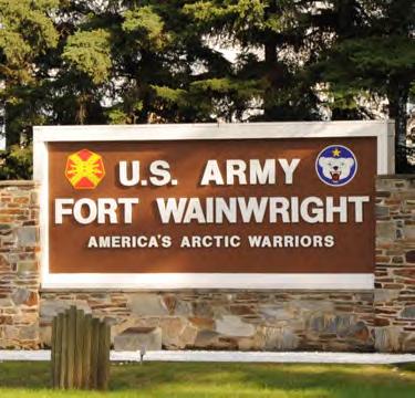

1 FINAL FORT WAINWRIGHT WEST POST DISTRICT AREA DEVELOPMENT PLAN JANUARY 2017


2 Fort Wainwright West Post District Area Development Plan Prepared By: Michael Baker Jr., Inc. AECOM Joint Venture Under Contract To: U.S. Army Corps of Engineers, Sacramento District Contract No. W D-0016 Funded By: Fort Wainwright
3 PART I EXECUTIVE SUMMARY

4

5 Area Development Planning Real Property Master Plan The U.S. Army is responsible for managing millions of acres of land and billions of dollars in plant replacement value of facilities and infrastructure worldwide. The effective longterm management of these resources requires thoughtful and thorough planning. This planning is accomplished primarily at the installation level through a comprehensive and collaborative planning process that results in a Real Property Master Plan (RPMP). This plan provides a means for sustainable installation development that supports mission and environmental requirements, and establishes and prescribes planning philosophies and strategies applicable across the Army. Unified Facilities Criteria The Unified Facilities Criteria (UFC) on Installation Master Planning establishes a consistent approach for master planning across the Department of Defense (DOD), while Army Regulation (AR) 420-1, Chapter 10, provides the specific guidance for Army installations. The RPMP will be sufficiently flexible to permit installation expansion, reduction and changes in mission and ensure that installation assets can meet mission requirements. The RPMP is the road map to ensure installation real property supports long-term mission requirements. A wellprepared RPMP expresses a long-term commitment to provide a high quality, sustainable, enduring installation. It covers a minimum 20-year planning horizon (3-5 years for contingencies) and provides the map to executing that commitment. Fort Wainwright The RPMP Vision Framework Plan divided Fort Wainwright into identifiable and connected districts based on geographical features, land use patterns, building types, and/or transportation networks. Focusing on districts allows for the identification of needs due to mission, requirements, or command priority changes. As part of the Long Range Component, Area Development Plans (ADPs) are prepared for each district identified in the Framework Plan. ADPs follow an iterative and collaborative planning process. This ADP includes the following components: Analysis of Real Property Vision, Goals, and Objectives Analysis of Existing Conditions Analysis of Planning Standards Development and Evaluation of Alternatives Fully Developed Preferred Alternative Preparation of the Regulating Plan / Form-Based Code Illustrative Plan Implementation Plan REAL PROPERTY MASTER PLAN PROCESS AND PRODUCTS Vision, Goals, Objectives 1. DEVELOP VISION PLAN Framework Plan Network & Green Infrastructure Plans 2. PREPARE INSTALLATION PLANNING STANDARDS Building Standards Street Standards Landscape Standards Constraints and Opportunities Maps Street and Transit Illustrative Plan Regulating Plan Plan Green Infrastructure Plan 4. DOCUMENT CAPITAL INVESTMENT STRATEGY Project Lists Vision Plan 3. UPDATE LONG-RANGE COMPONENT Area Development Plans *For Each District in the Framework Plan Sidewalk and Bikeway Plan Analysis of Requirements 5. CREATE PLAN SUMMARY ADP Executive Summaries Network Plans Primary Utility Plan Future Development Plan CIS Executive Summary 9


6 Fort Wainwright Vision and Goals The Fort Wainwright Real Property Vision Practicum took place on February Throughout those two days, stakeholders focused on creating a real property installation vision and goals that would provide a foundation for further planning at the district level. Fort Wainwright s vision and goals are in compliance with UFC , and are listed below. Fort Wainwright s Real Property Planning Vision: Our planning vision is to create an energy-efficient installation with compact districts, versatile buildings, and interconnected transportation networks. From the planning vision, four real property planning goals emerged to guide the development process. Each goal was further defined to provide meaningful guidance in implementing the real property vision. Gardens in West Post District 1 Energy-Efficient Installation In all aspects of planning for Fort Wainwright, energy-efficiency should be paramount to ensure the installation s viability in an era of fiscal uncertainty. 2 Compact District Compact development creates sustainable installations through measures including consolidation, multi-use, multi-story, and walkability. Chapel in West Post District 3 Versatile Buildings The planning of buildings concerns more than housing a function, and buildings at Fort Wainwright should be used to enhance architectural themes, encourage compact development, preserve cultural heritage, and enhance force protection, among other things. 4 Interconnected Transportation Networks Transportation at Fort Wainwright should incorporate many different characteristics and not focus only on automobiles, but include public transportation, sidewalks, and paths and include the installation Access Control Points (ACPs) in the design. Bassett Army Community Hospital 10


7 West Post District Planning Overview The West Post District ADP is a critical component of the consolidated master plan for Fort Wainwright. The workshop was held on June 2016, with the purpose of crafting a long-range development plan for the West Post District which supports the overall real property vision of Fort Wainwright. The Directorate of Public Works (DPW) Chief of Master Planning, Ms. Kate Siftar kicked off the workshop and provided insight on the master planning needs of Fort Wainwright and the West Post District. Ms. Siftar described the West Post District as the residential area of the installation and stressed the importance of providing communities and neighborhoods on post for Soldiers and their families. In particular, the need to incorporate the Residential Community Initiative (RCI) housing development areas with a safe and efficient transportation network that includes both pedestrian and vehicle access were emphasized. Of equal importance for the West Post District is the need for effective planning in the areas surrounding the Gaffney Road Main Gate to ensure adequate real estate is provided to incorporate a new ACP which will meet Army safety and security standards. The DPW introduction was followed by a discussion of Army Master Planning theory and tenets of sustainability. Afterwards, a facilitated exercise focused on the identification of West Post s strengths, weaknesses, opportunities, and threats. Approximately 20 people attended this first session, including personnel from the Directorate of Public Works, representatives of the USARAK 17 th Combat Sustainment Support Battalion (CSSB), 1 st Brigade- 25 th Infantry Division Stryker Brigade Combat Team (1/25 th SBCT), USARAK Range Planning, Bassett Army Community Hospital Medical Department Activities (MEDDAC), and representatives from Army and Air Force Exchange Stores (AAFES). In addition, representatives from RCI and Moral Welfare and Recreation (MWR) participated throughout the charrette. The following three days included informationgathering exercises and analysis. The participants worked collaboratively to analyze the existing conditions of the district, create concept maps documenting stakeholder preferences, craft a guiding real property vision statement for the district, and develop long-range alternatives. On the morning of 16 June 2016, the participants briefed Mr. Wesley Potter, Deputy to the Garrison Commander, on the results of the workshop. 11


8 West Post District Vision and Goals West Post District Real Property Vision: A family-oriented community connected by pedestrianfriendly streets and sidewalks that promote convenient access to health care, educational, recreational, and community services. From this planning vision, three planning goals emerged to guide the development process: Goal 1: Family-Oriented Community Collocate compatible functions such as family housing, child care, education, health care, recreation, and small-scale commercial services to create a welcoming neighborhood. Goal 2: Pedestrian-Friendly Streets and Sidewalks Provide a network of complete streets equipped with landscape strips, bike paths, wide sidewalks, and lighting. Goal 3: Convenient Access Provide efficient circulation to include secure, convenient access on, off, and within post. WEST POST DISTRICT KEY ASSUMPTIONS 1. The study area for this analysis is limited to the Fort Wainwright West Post District boundary. 2. New development will be consolidated in compatible districts to maximize flexibility. 3. Demolition of existing facilities to be based on each facility s condition and compatibility with the district s vision and Regulating Plan. 4. Existing Anti-Terrorism Force Protection policies will be followed. 5. New development will occur within the district boundary while incorporating considerations of critical natural, cultural, or mission constraints. 6. New projects will be developed in alignment with the regulating plan and building envelope standards. Glass Park Families Sledding in West Post District School Age Services 12


9 Planning Objectives The planning objectives define how the goals in the vision statement can be achieved. Each objective is specific and measurable. The rationale for the selection of the objectives was based on the consideration of the installation mission, analysis of the existing conditions in the district, desired end state, and the overall Fort Wainwright Real Property Vision. The district vision, goals, and objectives work in concert to achieve the desired development pattern within the West Post District. In A Pattern Language, Christopher Alexander argues that we need a common language for planning if we are to avoid the sterile and disjointed environments that are so prevalent today. The planning objectives were developed to provide clear, actionable guidance to Fort Wainwright in implementing the vision and goals. Goal 1: Family-Oriented Community Collocate Compatible Uses and Functions Create a Neighborhood Commercial Area Develop Residential-Oriented Services Goal 2: Pedestrian-Friendly Streets and Sidewalks Implement a Network of Complete Streets Increase Walkability within Communities Include Pedestrian-Friendly Safety Features Goal 3: Convenient Access Improve Circulation Increase Accessibility to Post Services Improve Safety and Efficiency of Access Control Point 13

10 Preferred Alternative Workshop participants worked in groups to develop alternatives for future development of the West Post District using guidance provided by planning team members and informed by the district vision, goals, and objectives. Three different courses of action were established in order to encourage diversity and creativity between alternatives. The stakeholders then evaluated the alternatives based on the goals as standard criteria to determine the alternative that best met the goals of the vision. The best ideas and common themes of each of the alternatives were combined and refined into a preferred alternative for the district. The preferred alternative, shown in the illustrative plan, incorporates all the known requirements at this time for future program requirements in phased plans. This illustrative plan represents only one construction variation, a snapshot in time, that meets the planning vision. A total of 90,163 square feet were identified for demolition with 13,914 square feet for proposed development, for a net change of -76,249 square feet for the preferred alternative. Major elements of the preferred alternative include the following: Renovate the ACP on Gaffney Road to meet Army standards Reconfigure Gaffney Road with a center lane median and turn lanes at key intersections Construct a pedestrian bridge across the Chena River to Chena Cove to link the passive and active recreation areas Implement pedestrian-friendly improvements to Neely Road to improve accessibility to Bassett Army Community Hospital, Child Development and Education Centers, and other community services Improve 10 th Street to accommodate Hospital growth Collocate Army Substance Abuse Program (ASAP) with Bassett Army Community Hospital Repurpose the Band Building as a new Frontier Club Demolition of the Outdoor Recreation building at the end of its life cycle (likely outside of the 20-year planning horizon) 14

11 Preferred Alternative Illustrative Plan The illustrative plan above demonstrates one possible alternative that incorporates the common themes, planning goals, and objectives that were derived from the workshop. 15
12 Preferred Alternative Illustrative Plan The illustrative plan above demonstrates one possible alternative that incorporates the common themes, planning goals, and objectives that were derived from the workshop. 16


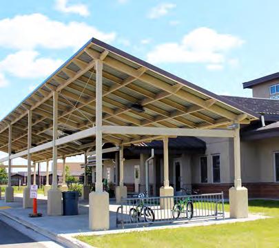
13 Gaffney Road Pedestrian Bridge The West Post District is comprised of mostly family-oriented development ranging from housing, small-scale commercial, schools, medical, and recreational areas that serve all ages. A key objective in planning neighborhoods is walkability. The location of the Main Gate to the west, Bassett Army Community Hospital to the east, Glass Park and neighborhood services to the north, and housing throughout the district creates high-vehicular traffic and unsafe pedestrian conditions along Gaffney Road. University Avenue, Fairbanks, Alaska The Shoppette and proposed commercial collocated with family-housing strengthens the walkability of the district, but without proper infrastructure families are unable to walk from their homes to various services and amenities. Providing a pedestrian bridge across Gaffney Road creates a safe, walkable route for families living in the southern portion of the district to access not only small-scale commercial but Glass Park as well. A pedestrian bridge also allows constant traffic flowing from the Main Gate to the rest of Fort Wainwright. Pedestrian bridges can be constructed in a utilitarian style or constructed in a park-like aesthetic to serve walking, biking, and larger scales of foot traffic. Centennial Pedestrian Bridge, Fairbanks, Alaska 17
14 Regulating Plan The Regulating Plan is the controlling document and principal tool for implementing the formbased code for the West Post District. The Regulating Plan provides clear parameters for allowable uses, height, massing, siting, and basic building elements. 18
FINAL FORT WAINWRIGHT NORTH POST DISTRICT AREA DEVELOPMENT PLAN FEBRUARY 2015
 FINAL FORT WAINWRIGHT NORTH POST DISTRICT AREA DEVELOPMENT PLAN FEBRUARY 2015 Fort Wainwright North Post District Area Development Plan Prepared By: Michael Baker Jr., Inc. AECOM Joint Venture Under Contract
ELK GROVE GENERAL PLAN VISION
 2-1 CHAPTER 2: 2-2 CREATING OUR The Community Vision for Elk Grove, expressed through a Vision Statement and a series of Supporting Principles, is a declaration of the kind of community that Elk Grove
Introduction. Chapter 1. Purpose of the Comprehensive Plan Plan Organization Planning Process & Community Input 1-1
 Chapter 1 Introduction Lakewood 2025: Moving Forward Together Purpose of the Comprehensive Plan Plan Organization Planning Process & Community Input 1-1 Purpose of the Comprehensive Plan The Comprehensive
PSRC REVIEW REPORT & CERTIFICATION RECOMMENDATION
 PSRC REVIEW REPORT & CERTIFICATION RECOMMENDATION KITSAP COUNTY COUNTYWIDE PLANNING POLICIES July 2, 2012 BACKGROUND A major emphasis of the Washington State Growth Management Act (GMA) is the need to
BROOKLYN PARK / 85TH AVE LRT STATION CDI DEVELOPMENT GUIDELINES DRAFT
 August 2018 Page intentionally left blank The Brooklyn Park Library adjacent to the 85th Ave LRT Station Area. OVERVIEW The Blue Line LRT Extension / Bottineau corridor offers a unique opportunity to leverage
DRAFT PLAN PRESENTATION
 DRAFT PLAN PRESENTATION 1.23.2018 AGENDA Process Project Schedule Results from Visioning Workshop Draft Plan Highlights Concept Plans Feedback Next Steps PROJECT SCHEDULE KICK-OFF WORKSHOP August 29 th
SUMMERSIDE / MT. CARMEL REINVESTMENT CORRIDOR COMMUNITY DEVELOPMENT STRATEGY
 SUMMERSIDE / MT. CARMEL REINVESTMENT CORRIDOR COMMUNITY DEVELOPMENT STRATEGY FEBRUARY 2013 I. Location of the Summerside/Mt. Carmel Reinvestment Corridor The Summerside/Mt. Carmel Reinvestment Corridor
Arlington, Virginia is a worldclass
 EXECUTIVE S U M M A RY Arlington maintains a rich variety of stable neighborhoods, quality schools and enlightened land use policies, and received the Environmental Protection Agency s highest award for
Municipal Plan*Assessment
 Municipal Plan*Assessment This tool was developed to assist in reviewing municipal master plans and in determining if these plans are consistent with smart growth principles, neighboring municipal plans,
Phase 1 : Understanding the Campus Context. Phase 2 : APPROACHES - Alternates & Preferred Plan
 Introduction MASTER PLAN PURPOSE WHY A CAMPUS MASTER PLAN? The purpose of the Master Plan at the University of Illinois at Chicago is to translate UIC s strategic goals and objectives into a compelling
CHAPTER 1. Ms. Guajardo s Class - Central Elementary CH 1 1
 INTRODUCTION CHAPTER 1 Ms. Guajardo s Class - Central Elementary CH 1 1 1.1 SETTING South Centre City is a linear corridor south of Downtown Escondido paralleling Centre City Parkway and South Escondido
Urban Planning and Land Use
 Urban Planning and Land Use 701 North 7 th Street, Room 423 Phone: (913) 573-5750 Kansas City, Kansas 66101 Fax: (913) 573-5796 Email: planninginfo@wycokck.org www.wycokck.org/planning To: From: City Planning
The Public Architect as City Builder
 The Public Architect as City Builder WE 203: The Public Architect as City Builder Wednesday, April 26, 2017, 8:30am 5:30pm Learning Units 7.50 LUs/HSW/RIBA This presentation is protected by U.S. and international
Small Area Plan. South Gateway
 Small Area Plan Adopted May 12, 2008 South Gateway Purpose. The South Gateway Small Area Plan defines the City s expectations for the future of the southern entrance to the City at Interstate 85 and Highway
Chapter 2: Vision, Goals and Strategies
 Chapter 2: Vision, Goals and Lake Elmo Today & Tomorrow Comprehensive Plan 2040 2 VISION, GOALS & STRATEGIES - DRAFT 4-6-2018 INTRODUCTION Comprehensive Plan Purpose Perhapse the most important objective
Animating the Rideau Canal December 2013
 Executive Summary Animating the Rideau Canal December 2013 Why study the Rideau Canal? The Rideau Canal has been an important part of Ottawa throughout its history, and has shaped and been shaped by the
SECTION TWO: Urban Design Concepts
 SECTION TWO: Urban Design Concepts The Gardnerville Plan for Prosperity shapes economic opportunities presented by regional growth. The Urban Design Concepts provide policies and concepts for land use,
History: a Grand Urban Boulevard
 History: a Grand Urban Boulevard 1890 1910: At its peak, Euclid Avenue, "Millionaire's Row," was considered the second most beautiful urban street in the country next to Fifth Avenue in Manhattan. 1910-2030:
MAIN STREET ECONOMIC DEVELOPMENT STRATEGY
 MAIN STREET ECONOMIC DEVELOPMENT STRATEGY A PATHWAY TO A BETTER POUGHKEEPSIE DRAFT Working Paper #2: Planning Strategies Submitted December 1 st, 2015 to the City of Poughkeepsie LAND USE LAW CENTER PACE
The transportation system in a community is an
 7 TRANSPORTATION The transportation system in a community is an important factor contributing to the quality of life of the residents. Without a sound transportation system to bring both goods and patrons
3. VISION AND GOALS. Vision Statement. Goals, Objectives and Policies
 Vision Statement Queen Creek s interconnected network of parks, trails, open spaces and recreation opportunities provide safe and diverse activities and programs that sustain its unique, small town, equestrian
December 1, 2014 (revised) Preliminary Report -- Thomas Jefferson Site Evaluation
 Preliminary Report -- Thomas Jefferson Site Evaluation") December 1, 2014 (revised) TO: FROM: RE Arlington County Board Thomas Jefferson Site Evaluation Working Group by Carrie Johnson, Chair Preliminary Report -- Thomas Jefferson Site Evaluation The Thomas
December 1, 2014 (revised) TO: FROM: RE Arlington County Board Thomas Jefferson Site Evaluation Working Group by Carrie Johnson, Chair Preliminary Report -- Thomas Jefferson Site Evaluation The Thomas
ITEM #8. Regional Smart Growth Program. Regional Smart Growth Program. Presentation Overview. Coast Highway Vision and Stategic Plan.
 Regional Smart Growth Program Economic Development Commission What is Smart Growth? Adopted as part of the Regional Comprehensive Plan (RCP) RCP provides vision for region based on Smart Growth and sustainability
TRANSIT-ORIENTED DEVELOPMENT POLICY DRAFT. City Planning and Development Department Kansas City, Missouri
 TRANSIT-ORIENTED DEVELOPMENT POLICY DRAFT City Planning and Development Department Kansas City, Missouri What is Transit Oriented Development (TOD)? Development that focuses land uses around a transit
City of Nogales General Plan
 Open Space, Parks, Recreation and Trails City of Nogales General Plan Residents of Nogales place a high priority in the development of a comprehensive system of open space, parks, recreation and trails
Gratigny Parkway East Extension Project Development & Environment (PD&E) Study
 Study") Gratigny Parkway East Extension Project Development & Environment (PD&E) Study Session 4: Presentation of Charrette Results December 8, 2010 MDX Work Program #: 92407 ETDM#: 11500 Project Location & Description
Gratigny Parkway East Extension Project Development & Environment (PD&E) Study Session 4: Presentation of Charrette Results December 8, 2010 MDX Work Program #: 92407 ETDM#: 11500 Project Location & Description
GUIDING PRINCIPLES IN THIS CHAPTER
 GUIDING PRINCIPLES The guiding principles and design concepts in this chapter work together with the Chapel Hill 2020 Comprehensive Plan to support new public places that can be enjoyed by all while also
PLANNING ADVISORY BOARD AGENDA OCTOBER
 ! City of Langley PLANNING ADVISORY BOARD AGENDA OCTOBER 1, 2014 3-5pm LANGLEY CITY HALL - 112 2 nd Street, Langley WA 1) Call to Order and Roll Call 2) Approval of the Minutes September 10, 2014 3) Public
CHAPTER 1 Introduction
 CHAPTER 1 Introduction From sea to summit, Lane County covers almost 4,800 square miles of diverse Oregon landscape. Stretching from the Pacific Ocean through the Coastal Range, the Willamette Valley to
PUBLIC ENGAGEMENT & SIX THEMES OF THE PLAN
 Connecting the heart of Eagle to the soul of the river - Kathy Chandler-Henry, Commissioner Eagle County CHAPTER 1 PUBLIC ENGAGEMENT & SIX THEMES OF THE PLAN town of eagle - river corridor plan 1 PUBLIC
Clair-Maltby Community visioning
 Clair-Maltby Community visioning workshop #1 Summary April 27th, 2017 Table of Contents INTRODUCTIon 1 PURPOSE 1 CONSULTATION STRUCTURE 2 PARTICIPANT FEEDBACK 3 VISIONING EXERCISE 8 ONLINE SURVEY RESULTS
CITY OF PUYALLUP. Background. Development Services
 CITY OF PUYALLUP Development Services 333 South Meridian Puyallup WA 98371 To: City Council From: Katie Baker, AICP, Planning Division Re: South Hill Neighborhood Plan Adoption Date: (Meeting date: February
SECTION II SECTION II STATEMENT OF GOALS, OBJECTIVES, PRINCIPLES, ASSUMPTIONS, POLICIES AND STANDARDS
 STATEMENT OF GOALS, OBJECTIVES, PRINCIPLES, ASSUMPTIONS, POLICIES AND STANDARDS 1 2 STATEMENT OF GOALS, OBJECTIVES, PRINCIPLES, ASSUMPTIONS, POLICIES AND STANDARDS INTRODUCTION The New Jersey Municipal
PLAN ELEMENTS WORKSHOP. April 5, 2016
 PLAN ELEMENTS WORKSHOP April 5, 2016 needs more housing. But there is no one-size fits-all solution. Every neighborhood has its own character. In some places, density is not only appropriate it is badly
Local Growth Planning in North Central Green Line Communities
 2018 April 30 Page 1 of 6 EXECUTIVE SUMMARY This report outlines a high-level scope for local growth planning for north central Green Line communities. The catalyst for this review is the significant investments
Overview of the Plan. The Building Blocks of Centers, Neighborhoods and Network INTERNAL DRAFT
 Overview of the Plan 4 East Davidson Ramah Church Rd June Washam Rd Bradford District Park Bradford Shearer Rd Campus District NC 73 Davidson-Concord North Rocky River This Master Plan projects an approximate
WELCOME and introduction
 1 WELCOME and introduction Mobility Hub Locations within Burlington STUDY OVERVIEW STUDY OBJECTIVES The City of Burlington is developing four Area Specific Plans, one for each of Burlington s Mobility
Town Center (part of the Comprehensive Plan)
") Town Center (part of the Comprehensive Plan) Mercer Island Town Center Looking North (2014) In 1994, a year-long process culminated in a set of design guidelines and code requirements for the Town Center
Town Center (part of the Comprehensive Plan) Mercer Island Town Center Looking North (2014) In 1994, a year-long process culminated in a set of design guidelines and code requirements for the Town Center
Welcome to the Oakridge Centre Open House
 Welcome to the Oakridge Centre Open House Why is the City hosting this event? This open house is to inform you of a rezoning application submitted to the City of Vancouver to amend the existing CD-1 (Comprehensive
Public input has been an important part of the plan development process.
 Lakewood s Comprehensive Plan recognizes that transportation helps shape the community, and that the way the community provides for the safe and efficient movement of people affects the character of the
NEC of Central Avenue and Indian School Road
 NEC of Central Avenue and Indian School Road For this location, there are two applicable plans that provide guidance on development. The two plans include the Indian School Specific Plan (1991) and the
Remi Mendoza City Planning Academy March 13, 2017
 Remi Mendoza City Planning Academy March 13, 2017 1 What is the General Plan? The 2030 General Plan 5-Year Update (2035 General Plan) Questions and Answers 2 Guidebook for development and growth Required
INDEPENDENCE BOULEVARD AREA PLAN. June 24, 2008
 INDEPENDENCE BOULEVARD AREA PLAN Public Meeting #1 June 24, 2008 Tonight s Agenda Introduction Welcome and Ground Rules Overview Presentation Purpose of the Plan What Brings Us Here? A Tour of the Corridor
Health and the Built Environment Placemaking Workshop, February 2018
 Health and the Built Environment Placemaking Workshop, February 2018 Vermont Department of Health Suzanne Kelley; Healthy Communities Program Coordinator Vision: Healthy People in Healthy Communities As
Highway 93 South Corridor. Planning
 Highway 93 South Corridor 1 Planning Suitable for all categories business and personal presentation, eaque ipsa quae ab illo inventore veritatis et quasi architecto Check It Out Presentation Steering Committee
Atlanta BeltLine. Subareas 9 & 10. Master Plan Updates. March 26, Washington Park Jamboree 1
 Atlanta BeltLine Subareas 9 & 10 Master Plan Updates March 26, 2018 Washington Park Jamboree 1 22 miles, connecting 45 neighborhoods 22 MILES of transit 46 MILES of streetscapes and complete streets 33
178 Carruthers Properties Inc.
 178 Carruthers Properties Inc. Planning Rationale for 178 Carruthers Avenue Site Plan Control Application June 2014 Table of Contents 1.0 Introduction 2.0 Overview of Subject Property 3.0 Current Zoning
ARLINGTON COUNTY, VIRGINIA
 ARLINGTON COUNTY, VIRGINIA County Board Agenda Item Meeting October 15, 2005 DATE: September 28, 2005 SUBJECT: Request to Advertise the adoption of the 2005 Clarendon Sector Plan C. M. RECOMMENDATION:
WEST OAKLAND SPECIFIC PLAN & DRAFT ENVIRONMENTAL IMPACT REPORT
 WEST OAKLAND SPECIFIC PLAN & DRAFT ENVIRONMENTAL IMPACT REPORT Landmarks Preservation Advisory Board Public Hearing February 10, 2014 1 Specific Plan Overview Plan Area is generally bounded by I-580 to
University of Saskatchewan CAMPUS MASTER PLAN. Senate Meeting Preliminary Presentation. April 21, 2018 DIALOG ECS DA WATT
 University of Saskatchewan CAMPUS MASTER PLAN Senate Meeting Preliminary Presentation April 21, 2018 DIALOG ECS DA WATT project process presentation agenda Stakeholder Engagement Project Control phase1
Living in Albemarle County s Urban Places
 Living in Albemarle County s Urban Places ALBEMARLE COUNTY, VIRGINIA A Closer Look at Albemarle s Approach to Managing Growth and Creating Quality Urban Environments www.albemarle.org Page 2 Living in
MEETING PURPOSE AND OVERVIEW
 MEETING PURPOSE AND OVERVIEW On February 23, 2012, the City of Elk Grove hosted the first of two community workshops related to the Southeast Policy Area. The workshop was held from 6:00 8:30 p.m. in the
North Fair Oaks Community Plan Summary and Information
 North Fair Oaks Community Plan Summary and Information WHAT IS THE NORTH FAIR OAKS COMMUNITY PLAN? The North Fair Oaks Community Plan is part of the San Mateo County General Plan, and establishes policies
CHAPTER 3 VISION, GOALS, & PLANNING PRINCIPLES. City of Greensburg Comprehensive Plan. Introduction. Vision Statement. Growth Management Goals.
 CHAPTER 3 VISION, GOALS, & PLANNING PRINCIPLES Introduction The Greensburg Comprehensive Plan is intended as a working community document. A combination of long and short-term goals, this document is intended
1 Welcome! UBC Okanagan Master Plan Update - Open House
 1 Welcome! UBC Okanagan Master Plan Update - Open House UBC is updating the Master Plan for the Okanagan Campus. The purpose of today s Open House is to: Present the draft 2015 Master Plan Answer any questions
Executive Summary. NY 7 / NY 2 Corridor
 Executive Summary NY 7 / NY 2 Corridor Transportation and Land Use Study December 2005 Prepared for: Town of Colonie Capital District Transportation Committee Prepared by: Introduction: Land use decisions
Committee Meeting: Downtown Today & Concept Refinement September 11, 2017
 Committee Meeting: Downtown Today & Concept Refinement September 11, 2017 AGENDA 1. Brief Input Update 2. Comprehensive Plan Principles 3. Downtown Today 4. Concept Updates 5. Future Schedule What is a
North Downtown Specific Plan MEMORANDUM
 North Downtown Specific Plan MEMORANDUM MEETING DATE: November 13, 2017 TO: Members of the North Downtown Specific Plan Advisory Committee FROM: Jeanine Cavalli, Senior Planner SUBJECT: Materials for the
INTRODUCTION. Strive to achieve excellence in all areas of operational sustainability.
 1 INTRODUCTION 1 INTRODUCTION A master plan guides the physical development of a campus, presenting long-range strategies for campus growth and transformation. As no single issue can be considered in isolation,
Subregion 4 Central Avenue-Metro Blue Line Corridor Transit-Oriented Development (TOD) Implementation Project. Community Meeting April 27, 2011
 Implementation Project. Community Meeting April 27, 2011") Subregion 4 Central Avenue-Metro Blue Line Corridor Transit-Oriented Development (TOD) Implementation Project Community Meeting April 27, 2011 Overview Introduction to Subregion 4 TOD Implementation Program
Subregion 4 Central Avenue-Metro Blue Line Corridor Transit-Oriented Development (TOD) Implementation Project Community Meeting April 27, 2011 Overview Introduction to Subregion 4 TOD Implementation Program
CITY OF CHARLOTTESVILLE, VIRGINIA CITY COUNCIL AGENDA
 CITY OF CHARLOTTESVILLE, VIRGINIA CITY COUNCIL AGENDA Agenda Date: December 16, 2013 Action Required: Adoption of Resolution Presenter: Staff Contacts: Title: James E. Tolbert, AICP, Director of NDS James
Town of Oakville Streetscape Strategy
 Town of Oakville Streetscape Strategy Endorsed by PDC on February 10, 2014 (PD-011-14) Town of Oakville Streetscape Strategy [endorsed by PDC February 10, 2014] 0 Town of Oakville Streetscape Strategy
Downtown Streetscape Manual & Built Form Standards
 City of Guelph Downtown Streetscape Manual & Built Form Standards July 2014 Prepared by Brook McIlroy Inc. in association with Unterman McPhail Associates and McCormick Rankin Inc. City of Guelph Downtown
Corridor Vision. 1Pursue Minnehaha-Hiawatha Community Works Project. Mission of Hennepin County Community Works Program
 1Pursue Minnehaha-Hiawatha Community Works Project Minnehaha-Hiawatha Community Works is a project within the Hennepin Community Works (HCW) program. The mission of the HCW program is to enhance how the
JANUARY 19, 2011 CENTRAL AVENUE-METRO BLUE LINE TRANSIT-ORIENTED DEVELOPMENT IMPLEMENTATION PROJECT COMMUNITY FORUM
 CENTRAL AVENUE-METRO BLUE LINE TRANSIT-ORIENTED DEVELOPMENT IMPLEMENTATION PROJECT COMMUNITY FORUM JANUARY 19, 2011 THE MARYLAND-NATIONAL CAPITAL PARK AND PLANNING COMMISSION PRINCE GEORGE S COUNTY PLANNING
Dwelling Units Max 12 dwelling units per acre/min 8 dwelling units per acre. Development Mix 80% non residential/20% residential
 13. OSTEEN LOCAL PLAN Background: The Osteen Local Plan area is located in southwest Volusia County along the SR 415 corridor between Lemon Bluff Road and Acorn Lake Road and includes 3,990 acres. The
The Vision. Photo provided by The Minervini Group. 46 Vision, Objectives & Strategies
 Vision, Objectives & Strategies The is the public framework and guide for future development of the Grand Traverse Commons. The establishes public polices for infrastructure, the preservation of natural
EXECUTIVE SUMMARY DRAFT CHAPTER 1 INTRODUCTION EXECUTIVE SUMMARY
 CHAPTER 1 EXECUTIVE SUMMARY INTRODUCTION Through the joint efforts of the City of Tulsa planning staff and the Land Services division of Indian Nations Council of Governments (INCOG), the Berryhill Land
Public Forum. Kelley s Corner: The Corner that Connects Us. The Cecil Group. March 7, Acton 2020 Town of Acton.
 Public Forum Acton 2020 Town of Acton March 7, 2013 AGENDA Purpose of Forum Kelley s Corner Project Examples of the Planning Processes Next Steps Dialogue: Questions and Answers PURPOSE Acton 2020 April
CITY OF VAUGHAN EXTRACT FROM COUNCIL MEETING MINUTES OF JUNE 7, 2016
 Item 5, Report No. 26, of the Committee of the Whole (Working Session), which was adopted without amendment by the Council of the City of Vaughan on June 7, 2016. 5 MUNICIPAL CLASS ENVIRONMENTAL ASSESSMENT
FOUR MILE RUN VALLEY WORKING GROUP AND CHARGE
 FOUR MILE RUN VALLEY WORKING GROUP AND CHARGE Adopted April 16, 2016 Amended July 19, 2016 Overview of Integrated Effort The overall goal of the Four Mile Run Valley (4MRV) initiative is to develop a comprehensive
Former Rockcliffe Airbase Community Design Plan Guiding Design Vision and Principles December 4, 2013
 APPENDIX 5 - Guiding Design Vision and Principles Former Rockcliffe Airbase Community Design Plan Guiding Design Vision and Principles December 4, 2013 Vision Statement The redevelopment of the former
TASK FORCE MEETING #6 SUMMARY
 TASK FORCE MEETING #6 SUMMARY CITY OF REDWOOD CITY INNER HARBOR SPECIFIC PLAN Tuesday, January 14, 2013 7:00 P.M. 9:30 P.M. Seaport Conference Center, 459 Seaport Court, Redwood City, CA 94063 I. WELCOME
UNIFIED FACILITIES CRITERIA (UFC) INSTALLATION MASTER PLANNING
 INSTALLATION MASTER PLANNING") UNIFIED FACILITIES CRITERIA (UFC) INSTALLATION MASTER PLANNING APPROVED FOR PUBLIC RELEASE; DISTRIBUTION UNLIMITED UNIFIED FACILITIES CRITERIA (UFC) INSTALLATION MASTER PLANNING Any copyrighted material
UNIFIED FACILITIES CRITERIA (UFC) INSTALLATION MASTER PLANNING APPROVED FOR PUBLIC RELEASE; DISTRIBUTION UNLIMITED UNIFIED FACILITIES CRITERIA (UFC) INSTALLATION MASTER PLANNING Any copyrighted material
Potential Green Infrastructure Strategies May 6, 2015 Workshop
 Potential Green Infrastructure Strategies May 6, 2015 Workshop Background The City of Cortland is developing the Tioughnioga Urban Headwaters Green Infrastructure Action Plan with funding from the National
2011 ASLA Design Awards. Westside Creeks Restoration Plan Merit Award AECOM, Fort Collins. Planning & Urban Design
 2011 ASLA Design Awards Westside Creeks Restoration Plan Merit Award AECOM, Fort Collins Planning & Urban Design Project Fact Sheet Category of Entry: Rotating Specialty Award: 2011 2011 ASLA Colorado
Building Great Neighbourhoods. Strathcona
 Building Great Neighbourhoods Strathcona March 21, 2018 Becky Redford Project Manager, Planning & Design Building Great Neighbourhoods Integrated Infrastructure Services Welcome and Purpose To provide
FOUR MILE RUN VALLEY WORKING GROUP AND CHARGE Adopted April 16, 2016 Amended July 19, 2016
 FOUR MILE RUN VALLEY WORKING GROUP AND CHARGE Adopted April 16, 2016 Amended July 19, 2016 Working Group Charge The Working Group is charged by the County Board to collaborate with staff to provide commission,
HISTORIC TOWN CENTER MASTER PLAN CITY COUNCIL PRESENTATION APRIL 3, 2012
 HISTORIC TOWN CENTER MASTER PLAN CITY COUNCIL PRESENTATION APRIL 3, 2012 REQUESTED CITY COUNCIL ACTIONS Certification of the Final Program Environmental Impact Report (PEIR); and, Approval of General Plan
Downtown by Design: The Bradenton CRA Master Plan. Glatting Jackson, Inc Robert Charles Lesser & Co. Downtown Bradenton Development Authority
 Downtown by Design: The Bradenton CRA Master Plan Glatting Jackson, Inc Robert Charles Lesser & Co. Downtown Bradenton Development Authority October 3, 2006 Our Goal for Today: Introduce Project Introduce
WELCOME TO THE CHOUTEAU GREENWAY DESIGN, DEVELOPMENT AND CONSTRUCTION WORKING GROUP!
 WELCOME TO THE CHOUTEAU GREENWAY DESIGN, DEVELOPMENT AND CONSTRUCTION WORKING GROUP! Chouteau Greenway Steering Committee and Working Groups Overview Overview January 9, 2019 Chouteau Greenway will transform
REZONING GUIDE. Zone Map Amendment (Rezoning) - Application. Rezoning Application Page 1 of 3. Return completed form to
 - Application. Rezoning Application Page 1 of 3. Return completed form to") Zone Map Amendment (Rezoning) - Application COMMUNITY PLANNING & DEVELOPMENT REZONING GUIDE Rezoning Application Page 1 of 3 PROPERTY OWNER INFORMATION* CHECK IF POINT OF CONTACT FOR APPLICATION Property
Zone Map Amendment (Rezoning) - Application COMMUNITY PLANNING & DEVELOPMENT REZONING GUIDE Rezoning Application Page 1 of 3 PROPERTY OWNER INFORMATION* CHECK IF POINT OF CONTACT FOR APPLICATION Property
SCTPO Project Summary September 2014
 A1A MULTIMODAL CORRIDOR PLANNING AND ENGINEERING ANALYSIS Florida Department of Transportation SCTPO Project Summary September 2014 PRESENTATION FOOTER Meeting Agenda What We Plan To Do Project Background
Danvers High Street I-1 District Study
 Danvers High Street I-1 District Study Presentation of Final Recommendations Planning Board Presentation June 26 th, 2018 1 Introductions Metropolitan Area Planning Council Sam Cleaves AICP, Principal
8implementation. strategies
 PROGRAM STRATEGIES 8implementation strategies T he implementation actions of this chapter are designed to support and carry out the land use, economic development, transportation, urban design, and program
SECTION ONE: INTRODUCTION. introduction
 introduction 1 INTRODUCTION Since it was first established in 1843 as a trading post for the Hudson s Bay Company, Victoria has evolved into a Provincial capital city that is recognized across Canada and
implementation r expression in landscape
 6 ubc okanagan implementation campus plan r expression in landscape 68 6 implementation campus plan sections The Campus Plan supports the academic mission, values and commitments of the University by providing
Sheridan Boulevard S TAT I O N A R E A P L A N S H E R I D A N B O U L E VA R D S TAT I O N A R E A P L A N
 Sheridan Boulevard S TAT I O N A R E A P L A N 1 City of Lakewood Adopted November, 2006 S H E R I D A N B O U L E VA R D S TAT I O N A R E A P L A N The Vision The City of Lakewood s overall vision is
Municipal Development Plan 2013
 UNIQUELY STONY PLAIN: Municipal Development Plan 2013 Quick Reference Guide What is a Municipal Development Plan (MDP)? The Town s highest-level planning document Sets the long-term vision and key themes
Chapter 3 Community Involvement
 Chapter 3 Community Involvement Public involvement has been a vital component of the planning process in the preparation of this master planning document. The purpose of this citizen-led effort was to
1.0 Purpose of a Secondary Plan for the Masonville Transit Village
 Report to Planning and Environment Committee To: Chair and Members Planning & Environment Committee From: John M. Fleming Managing Director, Planning and City Planner Subject: Masonville Transit Village
JASPER PLACE. Area Redevelopment Plan
 JASPER PLACE Area Redevelopment Plan Executive Summary Jasper Place is an established community where people live, work and play. The Jasper Place Area Redevelopment Plan (ARP) provides a tool to help
S A C R A M E N T O C O U N T Y JACKSON HIGHWAY & GRANT LINE EAST VISIONING STUDY
 JACKSON HIGHWAY & GRANT LINE EAST S A C R A M E N T O C O U N T Y P L A N N I N G D E P A R T M E N T SUMMARY AND WORKBOOK November 19, 2008 History of the Visioning Study Sacramento County has two growth
Chapter 1.0 Introduction
 Chapter 1.0 Introduction 1.1 Background The North Metro commuter rail line is part of the RTD FasTracks regional transit system expansion program to build more than 100 miles of rail transit throughout
Request for Proposal
 Request for Proposal 10 th Street Corridor Master Plan Department of Planning and Zoning 500 Quartermaster Court Suite 200 Jeffersonville, IN 47130 April 18, 2017 For further information contact: Chad
IMPLEMENTATION STRATEGIES. In This Chapter. Goals & Strategies 182 Project List 183 Future Land Use 186 CHAPTER 11 IMPLEMENTATION STRATEGIES
 In This Chapter Goals & Strategies 182 Project List 183 Future Land Use 186 11 IMPLEMENTATION STRATEGIES NORTH AUGUSTA, SC 2017 COMPREHENSIVE PLAN 179 Individual commitment to a group effort that is what
The bottom urban structure and guidelines City Council Briefing
 The bottom urban structure and guidelines City Council Briefing 4.1.2015 1 Provide information on the studio s community planning and design efforts for The Bottom Review process to date Review plan recommendations
Planning Commission April 4, 2013 BOCC Workshop Page 1
 Planning Commission April 4, 2013 BOCC Workshop Page 1 Planning Commission April 4, 2013 BOCC Workshop Page 2 Planning Commission April 4, 2013 BOCC Workshop Page 3 Planning Commission April 4, 2013 BOCC
VICTORIA DOWNTOWN DEVELOPMENT PLANNING
 VICTORIA DOWNTOWN DEVELOPMENT PLANNING A Vision & Guide for the Future Downtown Victoria thrives as a center for the community, offering a great mix of entertainment, culture, business, and recreational
Route 1 Corridor Study
 Route 1 Corridor Study Westbrook, Connecticut A Vision for the Connecticut Shoreline Public Informational Meeting July 28, 2015 Lower Connecticut River Valley Council of Governments Fitzgerald & Halliday,