BOARD OF SUPERVISORS BUSINESS MEETING ACTION ITEM
|
|
|
- Andrew Webster
- 5 years ago
- Views:
Transcription
1 BOARD OF SUPERVISORS BUSINESS MEETING ACTION ITEM Date of Meeting: July 21, 2016 # 4 SUBJECT: ELECTION DISTRICT: Design Endorsement for the Construction of Northstar Boulevard from John Mosby Highway (Route 50) to Tall Cedars Parkway Dulles CRITICAL ACTION DATE: July 21, 2016 STAFF CONTACTS: Mark Hoffman, Transportation and Capital Infrastructure Joe Kroboth, Transportation and Capital Infrastructure PURPOSE: To seek design endorsement from the Board of Supervisors (Board) for the construction of Northstar Boulevard from John Mosby Highway (Route 50) to Tall Cedars Parkway. RECOMMENDATION: Staff recommends the Board endorse the proposed design and direct staff to proceed with the completion of the final design and construction documents for the construction of Northstar Boulevard from John Mosby Highway (Route 50) to Tall Cedars Parkway. BACKGROUND: As part of its On Call Roadway/Transportation Design Services contract, Loudoun County awarded J2 Engineers, Inc. a contract in the amount of $1,111, on August 15, 2015, to perform the design of Northstar Boulevard from Route 50 to Tall Cedars Parkway. The contract s scope of work includes all engineering, surveying, traffic studies, environmental services, public information meetings, and construction estimates necessary to prepare a complete set of design and construction plans for the construction of Northstar Boulevard from Route 50 to Tall Cedars Parkway. The proposed project involves the construction of approximately 3,300 feet of four lane median divided minor arterial roadway, with turn lanes at the following intersecting roads: Route 50, Marrwood Drive, and Tall Cedars Parkway. The project also includes a 10-foot wide shared use path on either side (Attachment 1). Traffic signals with pedestrian controls will be installed at the Route 50 and Tall Cedars Parkway intersections as part of this project. This portion of roadway is a segment of the proposed VA-659 Relocated Northstar Boulevard from Croson Lane to Braddock Road as outlined in the 2010 Revised Countywide Transportation Plan. The construction of this segment of roadway will help to improve traffic flow in the area, relieve traffic
2 Item 4, Design Endorsement for the Construction of Northstar Boulevard from Route 50 to Tall Cedars Parkway Board of Supervisors Business Meeting July 21, 2016 Page 2 volume/congestion on surrounding roadways and intersections and ultimately provide a North/South corridor for Loudoun County residents. The 60 percent roadway widening plans were submitted to the Virginia Department of Transportation (VDOT) on June 24, Preliminary feedback shows that VDOT representatives are supportive of the present design. A public information meeting regarding the widening plan was held on December 15, 2015 at the Arcola Elementary School. The purpose of this meeting was to present the alignment, answer questions, solicit public input, and determine support for the project. Response from the attendees and those who submitted written comment was largely favorable. Copies of the public comments are contained in Attachment 2 entitled Route 659 Northstar Boulevard Extension. ISSUES: Environmental Impacts: One of the more significant environmental issues related to this project is the fact that it will cross the South Fork of Broad Run. This crossing will impact the 100 Year Federal Emergency Management Agency Floodplain. Also, there will be impacts to wetlands in the area of the stream crossing. Currently, the existing plans call for the use of two single span bridge structures (one per each direction). As currently designed, this system will allow the roadway to cross the floodplain with no expected rise in the 100 year flood elevation. Additionally, this type of design will help to minimize impacts and disturbances in the area of the stream crossing. Right-of-Way Impacts: There are approximately 11 properties that will be affected by the construction of this segment of Northstar Boulevard. A portion of the right=of-way needed for this roadway has been reserved along the south end of the proposed project. As it is currently designed, the alignment generally falls within the right-of-way that was reserved as a result of the adjacent residential developments at the South end. However, additional right-of-way will be required due to the fact that the width of the existing dedication/reservation does not meet the needed width of the proposed road section as well as the need for turn lanes. Also, temporary construction easements as well as permanent utility and storm drain easements will be required. Please note that, while no reservation/dedication exists for the northern end of the proposed alignment, County staff is currently working with a developer to try and obtain a portion of needed right of way for the project. Utility Impacts: There are various utilities present along the Northstar Boulevard Road Corridor, including a 24 water main, power and communication lines that will need to be relocated as part of this project. The proposed alignment has been developed so as to minimize impacts to utilities to the extent practical, and minimize utility relocation costs. Value Engineering Analysis Required: Due to the fact that this project has Revenue Sharing Funds and has a cost of more than $5 million, VDOT requires a Value Engineering (VE) Study (Attachment 3). This study was performed as part of VDOT s Locally Administered Projects (LAP) process on May 10, and May 11, The recommendation that was put forth by the study was to build this segment of roadway in the interim condition by constructing the inside
3 Item 4, Design Endorsement for the Construction of Northstar Boulevard from Route 50 to Tall Cedars Parkway Board of Supervisors Business Meeting July 21, 2016 Page 3 lanes first and utilize an open ditch section. The VE study concluded that this change to the design would potentially save approximately $407,000 (0.12% of the overall project cost). Staff is recommending against this component of the VE study for several reasons. First and foremost, constructing the roadway in this manner utilizing a ditch section would be in violation of the Countywide Transportation Plan (CTP), which specifies an urban section for this roadway in both the interim and ultimate conditions. This would not only require a significant redesign of the existing plans, but would require a Comprehensive Plan Amendment to the CTP; an extensive and time consuming process that requires a public hearing as well as action by the Planning Commission and Board of Supervisors. Also, the County s Consultant, J2 Engineers (J2), analyzed the open section concept and determined that an open section roadway that would meet VDOT criteria cannot be constructed within the footprint of the ultimate curbed section. Thus, additional right-of-way and easements would be required to construct the section as proposed by the VE study. Furthermore, additional stormdrain improvements would be required for the open ditch section in order to remove runoff from the ditches and direct it away from the road. In their analysis, J2 concluded that utilizing an open section roadway would actually increase the cost of the project by $262,500, exclusive of the cost of the additional needed right of way and easements. A summary of this analysis is presented in Attachment 4. Additionally, if the roadway was widened to the outside in the future, traffic would be required to cross the work zone as it enters and leaves the roadway, potentially causing an unsafe situation as well as requiring the need for increased maintenance of traffic on what would be a very busy roadway. Also, widening the roadway to the outside in the future could potentially negatively impact the adjacent neighborhoods and would likely cause a shutdown or diversion of pedestrian traffic. As it is currently designed, with a curbed section, the plans for the construction of this segment of Northstar Boulevard are in keeping with the CTP and the design acts to minimize the need for additional easements and right-of-way to the extent possible. As a result, staff recommends that the Board endorse the alignment as currently designed and reject the proposed design change recommended in the Value Engineering Study. FISCAL IMPACTS: Current appropriations for this project through FY 2017 in the Adopted CIP total $5.432 million. These funds are a combination of State Revenue Sharing, Northern Virginia Transportation Authority (NVTA) 30 percent Local funds, and cash proffers. An additional $ million dollars consisting of Revenue Share funds, NVTA 30 percent Local and 70 percent Regional funds, and proffer monies is slated through FY 2019, for a total project budget of $ million. The budget is intended to cover all design, right-of-way acquisitions, utility relocation, and construction costs. Currently, the design has a total estimated cost of $35.1 million, based on the Consultant s estimate.
4 Item 4, Design Endorsement for the Construction of Northstar Boulevard from Route 50 to Tall Cedars Parkway Board of Supervisors Business Meeting July 21, 2016 Page 4 ALTERNATIVES: 1. The Board may reject the recommendation of the VDOT Value Engineering Study, endorse the current design and direct Staff to complete the design and construction documents; or 2. The Board may accept the recommendations of the VDOT Value Engineering Study and direct staff to change the design consistent with the recommendations of the study and initiate an amendment to the CTP; or 3. The Board may choose to not endorse the design and direct Staff to revise and/or modify the proposed alignment. DRAFT MOTIONS: 1. I move the Board of Supervisors reject the recommendations from the Virginia Department of Transportation s Value Engineering Study and endorse the design for the construction of Northstar Boulevard from Route 50 to Tall Cedars Parkway as presented in the July 21, 2016 Action Item (Attachment 1). OR I further move the Board of Supervisors direct staff to proceed with the completion of the final design and construction documents. 2. I move an alternate motion. ATTACHMENTS: 1. Aerial Photo with Proposed Design Superimposed 2. Route 659 Northstar Boulevard Extension 3. Value Engineering Study Report: Northstar Boulevard Loudoun County 4. Memorandum to Loudoun County Department of Transportation and Capital Infrastructure Regarding Northstar Boulevard VDOT Value Engineering Assessment


")


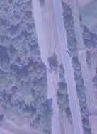


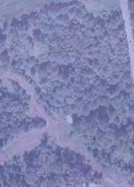

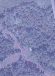

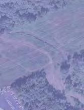


5 NORTHSTAR BOULEVARD (FROM TALL CEDARS PARKWAY- ROUTE 2200 TO JOHN MOSBY HIGHWAY - ROUTE 50) DULLES ELECTION DISTRICT

6 Route 659 Northstar Boulevard Extension Route 50 (John Mosby Highway) to Route 2200 (Tall Cedars Parkway) Project No R31, PE-101 UPC# January 2016 Prepared for Prepared by Department of Transportation and Capital Infrastructure Loudoun County Virginia J2 Engineers, Inc. 602 South King Street, Suite 100 Leesburg, Virginia ATTACHMENT 2
7 Route 659 Northstar Boulevard Extension January 2016 TABLE OF CONTENTS 1. Introduction 3 2. Project Narrative and Background 3 3. Purpose and Need Statement 3 4. Design Public Information Meeting Summary 4 APPENDICES A. Public Meeting Notice 5 B. Design Public Information Meeting Exhibits 10 C. Design Public Information Meeting Brochure 15 D. Design Engineer s Summary of December 15, 2015 Public Information Meeting 20 E. Written Comment Forms 25 F. Public Information Meeting Sign-in Sheets 34 2
8 Route 659 Northstar Boulevard Extension January Introduction Under contract to the Loudoun County, J2 Engineers, Inc. (J2) prepared the preliminary design for the proposed roadway extension of Northstar Boulevard (Route 659) from the intersection of Tall Cedars Parkway (Route 2200) north approximately 3,300 linear feet to John Mosby Highway (Route 50). The improvements consist of two (2) northbound and two (2) southbound lanes that will have associated turn lanes at the intersections of Tall Cedars Parkway, Marrwood Drive, and John Mosby Highway. A forty (40) foot wide depressed grass median, and two (2) ten (10) foot wide shared paths along each side of the proposed roadway. The scope of design services includes the development of preliminary design of storm water management facilities, storm drainage appurtenances and utility relocation. This document summarizes the Design Public Information Meeting process undertaken for this project, which consisted of the following activities: J2 authorized to proceed August 2015 Notice of Project Initiation mailed to property owners August 2015 Public Information Meeting Notice advertised in newspapers Nov & Dec 2015 Public Notice mailed to property owners November 2015 Public Information Meeting conducted December 15, 2015 Public Information Meeting comment period closed December 30, 2015 Public Information Meeting Report Summary January Project Narrative and Background The Countywide Transportation Plan (CTP) adopted in June 2010, identifies Northstar Boulevard is a major collector roadway from VA Route 659 (Belmont Ridge Road) south to VA Route 610 (Braddock Road). The proposed project is the segment from VA Route 2200 (Tall Cedars Parkway) to US Route 50 (John Mosby Highway). The roadway will ultimately become an urban arterial with a controlled access; median divided; with a proposed grade-separated interchange at US Route 50. This phase is defined as the interim condition with at grade intersections at Tall Cedars Parkway and Route 50. The roadway will also provide alternative access to residential developments within the Dulles South area. 3. Purpose and Need Statement The purpose of Northstar Boulevard is to complete another section of Route 659 extended providing an alternative northsouth connection to Route 50 to those currently used today. The project will improve capacity and safety of existing roadway networks within the Dulles South area. The project includes substantial turn lane and acceleration lane improvements on Route 50. Present needs associated with improving Route 659 within the study corridor include: Improving capacity and reduce congestion on local roadway networks. Constructing a safe traffic corridor through the use of designing proper roadway geometry and operations. Provide a critical segment of Northstar Boulevard to connect to Route 50 3
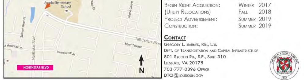
9 Route 659 Northstar Boulevard Extension January Public Information Meeting Summary The Design Public Information Meeting was held on Tuesday December 15, 2015 at Arcola Elementary School in Arcola, Virginia. The meeting was held from 6:30 pm to 8:30 pm with representatives from Loudoun County and the consultants available to respond to public comment. A total of 34 citizens signed in at the meeting. Most in attendance recognized the need to improve the roadway and supported the project, but were concerned with pedestrian crosswalk safety, traffic noise, and additional traffic. There were suggestions to evaluate a pedestrian underpass. A total of 8 written comments were submitted to Loudoun County during the Public Information Meeting and the subsequent public comment period. Several individuals commented using a form letter that identified suggestions to specific design elements of the project. Those comments/suggestions are summarized in Appendix D. Of the 8 total written comments received, 6 supported the project. Those comment not favoring the project expressed concerns of other traffic issues with the surrounding roadways that needed attention before the construction of Route 659. Those comments are also addressed in the Engineers Summary Appendix D. 4
10 Route 659 Northstar Boulevard Extension January 2016 APPENDIX A Public Meeting Notice 5

11 Route 659 Northstar Boulevard Extension January
12 Route 659 Northstar Boulevard Extension January

13 Route 659 Northstar Boulevard Extension January
14 Route 659 Northstar Boulevard Extension January

15 Route 659 Northstar Boulevard Extension January 2016 APPENDIX B Design Public Information Meeting Exhibits 10


16 Route 659 Northstar Boulevard Extension January


17 Route 659 Northstar Boulevard Extension January

18 Route 659 Northstar Boulevard Extension January
19 Route 659 Northstar Boulevard Extension January 2016 AM Actuated Coordinated PM Actuated Coordinated 170 Route 50 & Northstar EB NB WB SB Cycle Length (Sec) L R L R L R L R AM Peak Vol Avg Veh/Cycle Q (ft) PM Peak Vol Avg Veh/Cycle Q (ft) Max Q (ft) Rounded Max Q (ft) AM Actuated Un Coordinated 170 PM Actuated Un Coordinated 170 Tall Cedars & Northstar NB WB SB Cycle Length (Sec) L R L R L R AM Peak Vol Avg Veh/Cycle Q (ft) PM Peak Vol Avg Veh/Cycle Q (ft) Max Q (ft) Rounded Max Q (ft)
20 Route 659 Northstar Boulevard Extension January 2016 APPENDIX C Design Public Information Meeting Brochure 15


21 Route 659 Northstar Boulevard Extension January


22 Route 659 Northstar Boulevard Extension January


23 Route 659 Northstar Boulevard Extension January
24 Route 659 Northstar Boulevard Extension January
25 Route 659 Northstar Boulevard Extension January 2016 APPENDIX D Engineer s Summary of December 15, 2015 Public Information Meeting 20
26 Questions: Route 659 Northstar Boulevard Extension Design Public Information Meeting Tuesday December 15, 2015 Do you support this project? What are the major concerns that you would like to see considered in the design of this project? (Responses summarized in the Comments/Ideas/Suggestions column) Please provide us with any additional information which you feel would improve the project. (Responses summarized in the Comments/Ideas/Suggestions column) How did you hear about the meeting? No. Name/Address Questions Comments/Ideas/Suggestions Response and 3 1 Clarence Hoop Rutile Lane Stone Ridge, VA Hoopc@verizon.net 2 John Weigand High Plateau Ct. Weigajoh@comcast.net Yes Add underground tunnel for crosswalk Loudoun County has directed the consultant to provide an evaluation of a pedestrian underpass. Yes Stoneridge HOA The intersection of highway 50 and 15 make good use of a traffic circle (roundabout) in lieu of a traffic light. Recommend this at least at tall cedars parkway and Marrwood drive. The parkway passes so near schools and residences that pedestrian crossing the parkway will have a difficult time. Brambleton has implemented pedestrian tunnels under Northstar parkway and Belmont ridge road. Doing this at construction would be easier and benefits pedestrians. A signal is not currently warranted at the intersection of Northstar Boulevard and Marrwood Drive. The high traffic volumes would not support a roundabout at Northstar Boulevard and Marrwood Drive. The addition of a roundabout would require substantial geometric modifications which would reduce the capacity of Northstar Boulevard. Loudoun County has directed the consultant to provide an evaluation of a pedestrian underpass. 21
27 Questions: Route 659 Northstar Boulevard Extension Design Public Information Meeting Tuesday December 15, 2015 Do you support this project? What are the major concerns that you would like to see considered in the design of this project? (Responses summarized in the Comments/Ideas/Suggestions column) Please provide us with any additional information which you feel would improve the project. (Responses summarized in the Comments/Ideas/Suggestions column) How did you hear about the meeting? No. Name/Address Questions Comments/Ideas/Suggestions Response and 3 3 Candice Long Marrwood Homeowner Cwlong22@gmail.com Yes The project will propose fencing and buffering along Northstar Boulevard on school property. Lots of Trees (expect evergreens) between the school and Northstar. Please add a fence. I would prefer seeing a berm in addition to landscaping. Also, underground tunnels for pedestrian traffic would be ideal. Since this will not happen until 2020 is there any way a temporary bike path could be installed to allow homeowners west of the proposed Northstar access to the east part of proposed Northstar. Could this be used on Tall cedars extension? Berming would be difficult with the proposed roadway being substantial lower than the playground without impacting the existing school facilities, but will be investigated as the plans proceed forward. Loudoun County has directed the consultant to provide an evaluation of a pedestrian underpass. There is currently no funding to construct a temporary bike path to allow homeowners west of the proposed Northstar access to the east part of proposed Northstar Boulevard. The project proposes to connect the pedestrian facilities along Marrwood to the trails along Northstar Boulevard. 22
28 Questions: Route 659 Northstar Boulevard Extension Design Public Information Meeting Tuesday December 15, 2015 Do you support this project? What are the major concerns that you would like to see considered in the design of this project? (Responses summarized in the Comments/Ideas/Suggestions column) Please provide us with any additional information which you feel would improve the project. (Responses summarized in the Comments/Ideas/Suggestions column) How did you hear about the meeting? No. Name/Address Questions Comments/Ideas/Suggestions Response and 3 4 William Deal VP Stone Ridge HOA Mineral Springs Circle Stone Ridge, VA wdeal20105@gmail.com Yes Matt Letourneau Significant berm and buffering between road and school playground 25 or 30 mph max speed on Northstar during school hours significant speed monitoring along Northstar between 3 schools safety of vehicles getting onto Northstar from Schools traffic and pollution exposure to children Safety in school zone (3 schools) How to manage the ~150 to 200 cars that leave Arcola ES each weekday morning between 7:30 am and 8:00 am 50 mph road with pedestrian cross walks? The county must do CO2 studies due to the close proximity to the school and play ground The project will propose fencing and buffering along Northstar Boulevard on school property. Berming would be difficult with the proposed roadway being substantial lower than the playground without impacting the existing school facilities, but will be investigated as the plans proceed forward. School zones will be evaluated through the design process Speed monitoring suggestion is noted, but is not a requirement of this project If access to Northstar Boulevard from the school is proposed; the access will need to be evaluated for safety and approved by VDOT. Buffering and fencing around the school property should restrict students exposure to traffic along Northstar Boulevard. LCPS is aware of the traffic issues that exist at Arcola Elementary. Pedestrian Crossings are being evaluated with the design. If warranted, crossings would only occur at signalized intersections. CO2 studies are not required for this project. 23
29 Questions: Route 659 Northstar Boulevard Extension Design Public Information Meeting Tuesday December 15, 2015 Do you support this project? What are the major concerns that you would like to see considered in the design of this project? (Responses summarized in the Comments/Ideas/Suggestions column) Please provide us with any additional information which you feel would improve the project. (Responses summarized in the Comments/Ideas/Suggestions column) How did you hear about the meeting? No. Name/Address Questions Comments/Ideas/Suggestions Response and 3 5 Sarah Tegen & Bill Cook Yes Facebook group Noise abatement in Marrwood Noise abatement is not required for this project Dillinger Mill PL Sarah.tegen@gmail.com Pedestrian Safety Safety barriers on school properties The project will propose fencing and buffering along Northstar Boulevard on school property. Possible for Pedestrian overpass at Tall Cedars and proposed Northstar Loudoun County has directed the consultant to provide an evaluation of a pedestrian underpass. Pedestrian overpass will not be evaluated at this location. Pedestrian Crossings are being evaluated with the design. If warranted, crossings would only occur at signalized intersections. 6 NO Noted 7 Mary Virginia Polonsky mvpolonsky@aol.com 8 Westridge Homeowner across from John Champe H.S. Yes. I am in favor of the Northstar Blvd to be built. Traveling to Brambleton from South Riding at certain days needs much improvement and I NO VP of HOA, otherwise we saw no information about the meeting We really need a traffic light at Mattingly and John Champe exit as it is a very dangerous intersection during school hours. It will get more dangerous if Northstar is completed to Rt. 50. I don t see any rush to provide this short distance of Northstar until it can continue on beyond Rt. 50 toward Arcola. It will just cause traffic to bog down on Northstar where it is only two lanes. Noted A traffic signal at Mattingly and John Champe is outside this projects scope and would require meeting VDOT warrants to install a signal at that location. Noted This improvement will improve traffic flow on surrounding roadway networks without continuing beyond Route 50 to Arcola. 24
30 Route 659 Northstar Boulevard Extension January 2016 APPENDIX E Written Comment Forms 25
31 Route 659 Northstar Boulevard Extension January

32 Route 659 Northstar Boulevard Extension January

33 Route 659 Northstar Boulevard Extension January

34 Route 659 Northstar Boulevard Extension January

35 Route 659 Northstar Boulevard Extension January
36 Route 659 Northstar Boulevard Extension January
37 Route 659 Northstar Boulevard Extension January
38 Route 659 Northstar Boulevard Extension January
39 Route 659 Northstar Boulevard Extension January 2016 APPENDIX F Design Public Information Meeting Sign-in Sheets 34
40 Route 659 Northstar Boulevard Extension January
41 Route 659 Northstar Boulevard Extension January
42 Route 659 Northstar Boulevard Extension January
43 Route 659 Northstar Boulevard Extension January
44 Route 659 Northstar Boulevard Extension January


45 Value Engineering Study Report VDOT Northstar Boulevard Loudoun Co R31,P101, R201, C501 UPC# Study Date: 5/10/16 5/11/16 ATTACHMENT 3
46 A Value Engineering Study of the subject project was conducted on 5/10/2016 and 5/11/2016. Members of the VE team were: Abdul Hammadi Location and Design NOVA District Amir Salahshoor Local Assistance NOVA District Arun Raj Traffic Engineering NOVA District Bryan Campbell Environmental NOVA District Greg Barnes Project Manager Loudoun County John Leddy Right of Way NOVA District Jon Wilfong Project Engineer J2 Engineers Kyanna Jennings Materials NOVA District Kyle Kennedy Value Engineering Central Office Larry Hedgepeth Structure and Bridge Central Office Pawan Sarang Hydraulics NOVA District Ron Garrett Value Engineering Central Office Scott Burdick Construction NOVA District Susie Lue Local Assistance NOVA District Vicente Valeza Structure and Bridge NOVA District This Locally Administered Project will connect the existing Northstar Boulevard at Tall Cedars Parkway to Route 50. The Loudoun County Countywide Transportation Plan (CTP) has designated Northstar Boulevard as a minor arterial which will eventually connect from Route 7 in the north (via existing Belmont Ridge Road) to Braddock Road and south into Prince William County. This phase of the CTP will open up a new connection to the Stone Manor Subdivision and complete the connection of Northstar Boulevard from Braddock Road to Route 50. Creating additional north-south routes through Loudoun County is a priority of the county government and Northstar Boulevard helps to meet this need. Future phases of the CTP plan for Northstar to be widened to six lanes and the intersection of Northstar Boulevard and Route 50 to be rebuilt as a grade separated interchange. The roadway construction will be built on entirely new alignment through mostly wooded property. Much of the right of way to be used has been reserved for VDOT use by developers through proffers and has not been built on. The roadway will cross the South Fork of Broad Run which will require a 150 bridge. Much of the area around the project has been developed or is being developed into residential subdivisions. Arcola Elementary School is directly adjacent to the project at the intersection with Tall Cedars Parkway. The proposed typical section for this project includes two 12-foot lanes traveling in each direction with curb and gutter and enclosed storm sewer, ten-foot wide shared use path on
47 R31 UPC No both sides of the road and a 40-foot wide graded median. The future widening is planning to add lanes to the inside and reduce the width of the median. The basic functions of this project were identified by the study team as Connect Network" and Ease Congestion and a secondary function to Enhance Development. Major components for this project are Pavement, Right of Way, Bridge, Excavation, Stormwater Management, Utilities, Maintenance of Traffic and Traffic Signals. One recommendation was developed during the study to be submitted for review/approval by the identified Decision-Makers and Chief Engineer.

48 R31 UPC No End of Project Beginning of Project Project Location Map Northstar Blvd Loudoun County
49 R31 UPC No Recommendation 1 Build the Inside Lanes Now and Shift the Future Widening to the Outside Lanes The current design contains a four lane typical cross section with curb and gutter, enclosed storm sewer and a wide graded median. The median is designed to accommodate a future widening to six lanes by building into the median. Similarly, the storm sewer system is designed to meet the capacity requirements the ultimate condition of six lanes. While this project is anticipating the future widening, there is currently no timeline on when the extra lanes would be built, and future funding priorities will determine if the widening occurs. The proposed value engineering change would build a standard width median with the four inside lanes of the ultimate six lane configuration. Instead of curb and gutter with storm sewer, this configuration would include shoulders and ditches. The shared use paths would be constructed in the same location as the current design and the bridge would be constructed to meet the ultimate six lane typical section. Constructing the inner lanes first would be an overall cost savings to this project and reduce the construction duration. This change could eliminate nearly all of the curb and gutter, and most of the storm sewer system, while only adding paved shoulder to the outer edge of the roadway. Constructing the road in this sequence will allow future construction to occur to the outside of traffic, which is a safer and more efficient means of construction. Additionally, the extra space between the roadway and the shared use path provides more space for storage of plowed snow. Potential savings/cost avoidance: $407,000
50 R31 UPC No Current Design Typical Cross Section VE Suggested Cross Section
51 R31 UPC No Current Design Proposed Design Quantity Unit Cost Total Quantity Unit Cost Total Savings Northstar Blvd Asphalt SM-9.5A (ton) $8.84 $230, $8.84 $275,767 -$45,544 Asphalt IM-19.0A (ton) $17.07 $444, $17.07 $532,806 -$87,996 Asphalt BM-25.0 (ton) $32.94 $858, $32.94 $1,028,156 -$169,806 Cement Treated Aggr $16.77 $436, $16.77 $523,442 -$86,449 Aggr. Base 21B (ton) $21.00 $588, $21.00 $696,948 -$108,255 Phosporus Nutrient Credit 5 $38,000 $190,000 6 $38,000 $228,000 -$38,000 CG-7 (LF) $29.86 $358, $29.86 $43,297 $314,754 15" Pipe (LF) 4239 $54.41 $230, $54.41 $40,536 $190,112 18" Pipe (LF) 1440 $57.92 $83, $57.92 $44,022 $39,388 21" Pipe (LF) 57 $57.50 $3,278 0 $0.00 $0 $3,278 24" Pipe (LF) 614 $79.50 $48, $79.50 $15,901 $32,914 30" Pipe (LF) 847 $ $90,405 0 $0.00 $0 $90,405 36" Pipe (LF) 51 $ $6,120 0 $0.00 $0 $6,120 ES-1 15" (EA) 4 $ $1,940 7 $ $3,395 -$1,455 ES-1 18" (EA) 2 $ $1,130 0 $ $0 $1,130 ES-1 30" (EA) 1 $1, $1,195 1 $1, $1,195 $0 ES-1 36" (EA) 1 $1, $1,765 0 $1, $0 $1,765 EW-1 30" (EA) 1 $2, $2,133 0 $2, $0 $2,133 DI-1 (EA) 1 $3, $3,697 0 $0.00 $0 $3,697 DI-2 L=10' (EA) 2 $6, $13,822 0 $0.00 $0 $13,822 DI-3A (EA) 6 $4, $24,528 1 $4, $4,088 $20,440 DI-3B L=4' (EA) 11 $4, $47,069 0 $0.00 $0 $47,069 DI-3B L=6' (EA) 15 $4, $68,595 4 $4, $18,292 $50,303 DI-3B L=8' (EA) 14 $4, $68,446 1 $4, $4,889 $63,557 DI-3B L=10' (EA) 3 $5, $15,156 0 $0.00 $0 $15,156 DI-3BB L=4' (EA) 2 $4, $8,552 0 $0.00 $0 $8,552 DI-3BB L=6' (EA) 3 $4, $14,544 0 $0.00 $0 $14,544 DI-3BB L=8' (EA) 2 $5, $10,858 0 $0.00 $0 $10,858 DI-3C L=6' (EA) 2 $4, $8,026 0 $0.00 $0 $8,026 DI4AA L=4' (EA) 1 $6, $6,817 0 $0.00 $0 $6,817 Total Savings $407,335
52 R31 UPC No Comments 1. Flatten Fill Slopes and Install a Berm: The study team suggests using surplus excavated soil to flatten fill slopes where possible as well as to construct a stabilized earthen berm between Arcola Elementary School recreational fields and the proposed roadway. Although there will be some added earthwork cost, these actions can save the overall project money by reducing the need to haul and dispose of excess or unsuitable material from the project site. Additional cost savings could come from the use of unsuitable roadway fill material onsite rather than disposing it and the reduction of guardrail from steep slopes adjacent to the road. Earthen berms along the recreational fields could act as a visual screen and noise dampener. A potential draw back to using both flatter slopes and the earthen berm could be the need to acquire additional right-of-way to accommodate the expanded disturbed area. 2.Temporary Lane Shift/Maintain Two Lanes (each direction) of Rte 50: With the Extension of Northstar Blvd from Route 50 to Tall Cedars Parkway, maintenance of traffic (MOT) at the proposed intersection of Northstar Blvd and Rte 50 will be a significant concern and keeping two open lanes in each direction on Rte 50 is highly suggested. At the time of the Value Engineering Study there was no MOT plan available. As the plan is developed, it is suggested the engineer use temporary lane shifts and temporary pavement on Rte 50 to avoid lane closures, reduce the impact on traffic, and to improve safety in Work Zone area. 3. Use of Alternative BMPs and Purchasing of Nutrient Credits: The designer should investigate the use of alternative best management practices (BMPs) such as grass swales, bioretention basin, underground BMP etc. to be installed in lieu of the current stormwater management wet pond. The footprint of any alternative BMPs (or the current SWM wet pond) can be reduced if water quality nutrient credits are purchased (refer to VDOT IIM-L&D-251.2). If any proposed BMP/s are to be maintained by VDOT, then purchasing of nutrient credit first is the preferred method and should be performed before sizing of any BMP/s.
53 R31 UPC No Section 1 Study Information Project Description Authorizing Persons
54 R31 UPC No Study Identification Project No R31,P101, R201, Study Date: 5/10/2016-5/11/2016 C501 Project location: Loudoun County Field Inspection Date: 5/10/2016 From: Route 50 To: Tall Cedars Pkwy Project Description Length: Total Project Cost: Type of Funds: 0.61 mi $12,000,000 Major Project Components: Functional Class: Pavement, Right of Way, Bridge, Excavation, Stormwater Minor Arterial Management, Utilities, Maintenance of Traffic and Traffic Signals Design Speed: Projected Traffic Design Year Ad. Date 60 ADT: /1/2019 DHV: Project Manager Name Location Phone Susie Lue NOVA District (703) Authorizing Persons Name Location Position Joe Kroboth Loudoun County Transportation Director Helen Cuervo NOVA District District Administrator Bart Thrasher Central Office Location & Design State L&D Engineer
55 R31 UPC No Section 2 Recommendations Summary of Potential Savings/Cost Avoidance Function Analysis Creative Idea Listing Team Rating of Creative Ideas
56 R31 UPC No SUMMARY OF RECOMMENDATIONS # Description Initial Lifecycle Total 01 Build the Inside Lanes Now and Shift the Future Widening to the Outside Lanes $407,000 $407,000
57 Function Connect Network Ease Congestion Enhance Development Basic /Secondary B B S Creative Listing Savings Environmental Operational Construction Acceptance Total Enforce Proffers Build the Inside Lanes First Flatten Fill Slopes Berm In front of Elementary School Reconfigure Basin to Avoid Water Line Use Alternative BMPs/Purchase 0 Credits MOT Rte 50 Use Temp Lane Shift Maintain 2 Lanes 0
58 J2 Engineers, Inc. Civil Engineers Land Development Planning Transportation Surveyors Memorandum To: Attn: From: Loudoun County Department of Transportation and Capital Infrastructure Greg Barnes, P.E. James Bishoff, P.E. Date: 6/23/2016 Re: Northstar Boulevard VDOT Value Engineering Assessment R31, P101, R201, C501 This memorandum is to provide Loudoun County DTCI with an evaluation and conclusion of the VDOT Value Engineering Study Report on the above referenced project in May Background: VDOT Defines Value Engineering (VE) as a systematic, creative study process conducted by engineers and technicians to obtain optimum value for every dollar spent. The Code of Virginia requires VDOT to employ value engineering in conjunction with any project on any highway system, regardless of contract delivery system, using criteria established by the Department and including but not limited to all projects costing more than $5 million. The VE process consists of seven steps and is summarized below. Selection Identification of projects for VE studies, and selects specific projects to achieve: Maximum value Quality improvements (Environmental, operational performance and constructability) Energy savings and Other benefits, such as a shorter construction schedule An important part of this phase is the selection of VE team. Investigation Acquisition of knowledge of design to be studied, determine its basic functions, and assess its major functions, cost and relative worth. Speculation Brainstorm functions of design elements isolated by the investigation and develop alternatives for each. Evaluation Analysis of speculation results and selection of ideas for further study. Development Collection of additional data to analyze the best alternatives selected during the evaluation and preparation of cost estimates and initial designs that ensure acceptability and ultimate project implementation. Presentation Presentation of recommended alternatives to decision makers for their consideration and potential approval Lafayette Center Dr, Suite 330, Chantilly, Virginia Phone: Fax: ATTACHMENT 4
59 Northstar Boulevard Phase 2 VE Assessment June 21, 2016 Page 2 Implementation Ensure approved recommendations are rapidly and properly translated into action to achieve savings of proposed project improvements. Project Description: Northstar Boulevard is designated as an Urban Minor Arterial Road with an interim design speed of 50 mph. The horizontal and vertical design elements meet or exceed the ultimate design requirement of 60 mph. The roadway section is a U4M for the interim and U6M in the ultimate condition. The section consists of two -12 lanes with curb and gutter along the outer lanes, closed drainage system and shared use paths on both sides of the road. The section proposes a 40 depressed median for the interim condition and will be converted to an 18 median as the ultimate improvements are implemented. The project is approximately 0.61 mile in length and is located between Tall Cedars Parkway and Route 50. This section of roadway is a new alignment and utilizes right of way reservations for over half the alignment. The project will require right of way acquisition from at least four parcels that did not make reservations for the roadway improvements. Recommendation 1: Build the inside lanes now and shift the future widening to the outside lanes. We understand that VDOT policy has directed design engineers to design interim roadways from the outside. This reduces disruption to vehicular and pedestrian facilities; restrict works zones to within the median and eliminate/reduces potential offsite impacts. Below is the Proposed Typical Section proposed with the current design. It shows two -12 lanes with CG-7 to the outside and a 40 depressed median with 8 shoulders (4 paved). The proposed median ditch side slopes are 6:1 in tangent and varies when in superelevation. The section is consistent with typical sections currently being used by Loudoun County and VDOT on many projects located in the Northern Virginia District. This section is consistent with the County Transportation Plan. Proposed Typical Section The VE Suggested Typical Section provided with the report was graphically incorrect and did not provide dimensions for evaluation. This assessment took some liberties to develop the typical section based on dimensions and slopes provided. Below is what was prepared and used for this assessment. Redline markups of the VE Typical Section can be found in the Supporting Documents section of this memorandum. VE Suggested Typical Section 602 South King Street, Leesburg, Virginia Phone: Fax:

60 Northstar Boulevard Phase 2 VE Assessment June 21, 2016 Page 3 Deficiencies: VE Typical Section not in compliance with County Transportation Plan. This would require the Comprehensive Plan to be revised. VE Typical Section was not prepared to scale to show the proposed width of a 16 constructing from the inside out. Utilizing the information prepared by for the VE report, the typical section will create a 4 depressed median with a ditch depth of 8. This is not adequate to convey runoff from a 10-yr storm. Refer to the section right. VE Typical Section was not prepared to scale and does not accurately depict the shoulder and ditch section on the outside of the roadway. Utilizing the information prepared by for the VE report, the typical section will create a 9 depressed roadside ditch with a depth of 19. This is not adequate to convey runoff from a 10-yr storm, while maintaining freebroad from the edge of travelway. Refer to the section right. This section still requires median inlets and a closed drainage system not evaluated in the VE report. The closed system required to convey runoff from the roadside ditch will need to be offset from the ditch centerline to accommodate the future widening without reconstruction of the entire storm drainage system. The proposed shallow ditches in the median and roadside will not work when the roadway rolls into superelevation. This improvement was also evaluated assuming CG-3 was installed along the median. This concept modification requires additional inlets when the roadway is in superelevation to collect runoff along the low side of the median. Constructing the inner lanes first would generate additional costs to the project and increase life-cycle costs for maintenance of the shoulder and roadside ditches. The depressed median will not work as proposed, so this assessment evaluated the section with curbing along the median. With the introduction of curbing, the project will require drainage inlets on the high side of the median to reduce spread along the travelway. The following page has supporting documentation for the estimated cost increase. Potential Cost Increase of $262, South King Street, Leesburg, Virginia Phone: Fax:
61 Northstar Boulevard Phase 2 VE Assessment June 21, 2016 Page R31 UPC No Current Design Proposed Design Quantity Unit Cost Total Quantity Unit Cost Total Savings Northstar Blvd Asphalt SM 9.5A (ton) $ 8.84 $ 230, $ 8.84 $275,923 $45,570 Asphaslt IM 19.0A (ton) $ $ 444, $ $532,806 $87,996 Asphalt BM 25.0 (ton) $ $ 858, $ $1,028,156 $169,806 Cement Treated Aggr $ $ 436, $ $523,442 $86,449 Aggr. Base 21B (ton) $ $ 588, $ $696,948 $108,255 Phosphorus Nurtirent Credit 5 $ 38,000 $ 190,000 6 $ 38,000 $228,000 $38,000 Engineering Redesign 0 $ $ 1 $ 175,000 $175,000 $175,000 CG 7 (LF) $ $ 358, $ $43,297 $314,754 CG 3 (LF) 0 $ $ 6740 $ $205,031 $205,031 Ditch Lining (SY) 0 $ $ 2150 $ $80,625 $80,625 15" Pipe (LF) 4239 $ $ 230, $ $40,535 $190,109 18" Pipe (LF) 1440 $ $ 83, $ $44,019 $39,386 21" Pipe (LF) 57 $ $ 3,278 0 $ $0 $3,278 24" Pipe (LF) 614 $ $ 48, $ $15,900 $32,913 30" Pipe (LF) 847 $ $ 90,409 0 $ $0 $90,409 36" Pipe (LF) 51 $ $ 6,120 0 $ $0 $6,120 ES 1 15" (EA) 4 $ $ 1,940 7 $ $3,395 $1,455 ES 1 18" (EA) 2 $ $ 1,312 0 $ $0 $1,312 ES 1 30" (EA) 1 $ 1, $ 1,195 1 $ 1, $1,195 $0 ES 1 36" (EA) 1 $ 1, $ 1,765 0 $ 1, $0 $1,765 EW 1 30" (EA) 1 $ 2, $ 2,133 0 $ 2, $0 $2,133 DI 1 (EA) 1 $ 3, $ 3,697 0 $ 3, $0 $3,697 DI 2 L=10' (EA) 2 $ 6, $ 13,822 0 $ 6, $0 $13,822 DI 3A (EA) 6 $ 4, $ 24,528 1 $ 4, $4,088 $20,440 DI 3B L=4' (EA) 11 $ 4, $ 47,069 0 $ 4, $0 $47,069 DI 3B L=6' (EA) 15 $ 4, $ 68,595 4 $ 4, $18,292 $50,303 DI 3B L=8' (EA) 14 $ 4, $ 68,446 7 $ 4, $34,223 $34,223 DI 3B L=10' (EA) 3 $ 5, $ 15,156 0 $ 5, $0 $15,156 DI 3BB L=4' (EA) 2 $ 4, $ 8,552 0 $ 4, $0 $8,552 DI 3BB L=6' (EA) 3 $ 4, $ 14,544 0 $ 4, $0 $14,544 DI 3BB L=8' (EA) 2 $ 5, $ 10,858 0 $ 5, $0 $10,858 DI 3C L=6' (EA) 2 $ 4, $ 8,026 0 $ 4, $0 $8,026 DI4AA L=4' (EA) 1 $ 6, $ 6,817 0 $ 6, $0 $6,817 DI 12 L=8' 0 $ 6, $ 30 $ 6, $180,000 $180,000 Total Savings $262,502 This estimate assumes: Engineering fees to redesign the roadway 16' median cannot be a ditch section, therefore CG 3 is required. 3 inlets along median curb when road is in S/E first roadside ditch inlet begins 300' from HP and inlets are required every 200' to collect runoff in the ditch to maintain freeboard Assume ditch lining for slopes 2% and greater. Unit pricing from VDOT NOVA Bid Tabs This estimate DOES NOT include drainage pipe(s) to to connect required inlets 602 South King Street, Leesburg, Virginia Phone: Fax:
62 Northstar Boulevard Phase 2 VE Assessment June 21, 2016 Page 5 Comments Summary 1. Flatten fill slopes and install berms. We agree with this suggestion and will implement along the alignment in areas outside the existing flood plain of the South Fork of Broad Run. 2. Temporary lane shift/maintain two lanes (each direction) of Route 50. We agree with this suggestion and are consistent in both phases of the proposed TMP for Route Use of alternative BMP s and purchasing Nutrient Credits. We agree with this suggestion. This is consistent with the proposed facilities and discussions with District Hydraulics Engineers. 602 South King Street, Leesburg, Virginia Phone: Fax:
63 Northstar Boulevard Phase 2 VE Assessment June 21, 2016 Page 6 Supporting Documents 602 South King Street, Leesburg, Virginia Phone: Fax:

64

65
66

67


68


69
BOARD OF SUPERVISORS BUSINESS MEETING ACTION ITEM. Endorsement of Design for Route 7/George Washington Boulevard Overpass. Algonkian and Broad Run
 BOARD OF SUPERVISORS BUSINESS MEETING ACTION ITEM Date of Meeting: March 7, 2017 # 14 SUBJECT: ELECTION DISTRICTS: CRITICAL ACTION DATE: STAFF CONTACTS: Endorsement of Design for Route 7/George Washington
BOARD OF SUPERVISORS BUSINESS MEETING ACTION ITEM
 BOARD OF SUPERVISORS BUSINESS MEETING ACTION ITEM Date of Meeting: September 2, 2015 # 9 SUBJECT: ELECTION DISTRICT: Identification of Funds for the Traffic Signal at the Intersection of Northstar Boulevard
Response: The public school use, including the SWM facility, is within the R-1 District.
 Loudoun County School Board Dulles North Elementary School (ES-31) CMPT 2017-0006 and SPMI 2017-0015 First Response to Referral Comments Zoning Administration Comments dated October 2, 2017 Comment 1:
Public Hearing. Charlotte County-Punta Gorda MPO - Meeting Rooms A and B March 14, open house at 4 p.m., formal presentation at 5 p.m.
 Public Hearing Charlotte County-Punta Gorda MPO - Meeting Rooms A and B March 14, 2019 open house at 4 p.m., formal presentation at 5 p.m. Welcome to the Public Hearing for the Harborview Road (CR 776)
Rt. 29 Solutions Project Delivery Advisory Panel. January 7, 2016
 Rt. 29 Solutions Project Delivery Advisory Panel January 7, 2016 Agenda item 1: Introductions Project Delivery Advisory Panel Technical Team 2 Agenda item 2: Interaction and Feedback Live Streaming Dec
Project Overview. Get Involved. Public Information Meeting. Contact Information
 Get Involved VDOT representatives will review and evaluate information received as a result of this meeting. Please fill out the comment sheet provided in this brochure if you have any comments or questions.
Project Overview. Fairfax County Parkway Widening Fairfax County. Get Involved. Public Information Meeting. Contact Information
 Get Involved VDOT representatives will review and evaluate information received as a result of this meeting. Please fill out the comment sheet provided in this brochure if you have any comments or questions.
North Carolina Department of Transportation Project Development and Environmental Analysis Branch
 North Carolina Department of Transportation Project Development and Environmental Analysis Branch Citizens Informational Workshop I-85, from I-485 to NC 73 Mecklenburg and Cabarrus Counties October 30,
Capital Projects impacting Odenton Town Center
 Capital Projects impacting Odenton Town Center 1 2 E549700 W801600/ W801602 Anne Arundel County Department of Public Works Manor View Elementary School Transmission Main - MD 32 @ Meade Phase 2 $34,399,000
The Illinois Department of Transportation and Lake County Division of Transportation. Route 173, including the Millburn Bypass
 The Illinois Department of Transportation and Lake County Division of Transportation welcome you to this Public Hearing for U.S. Route 45 from Illinois Route 132 to Illinois Route 173, including the Millburn
PUBLIC HEARING. Thursday, December 14, 2017 FDOT Urban Office 2198 Edison Avenue Jacksonville, FL 32204
 DISTRICT TWO PUBLIC HEARING I 10 (SR 8) from I 295 to I 95 Project Development & Environment Study Duval County, Florida Financial Project Number 213326 2 22 01 Efficient Transportation Decision Making
2040 Long Range Transportation Plan
 2040 Long Range Transportation Plan Adopted: April 15, 2013 APPENDIX D HIGHWAY NEEDS PLAN PROJECTS FREDERICKSBURG Existing and Committed Projects Fall Hill Avenue/Mary Washington Blvd. (Fredericksburg)
WELCOME! 8 8:30 6: TH STREET IMPROVEMENTS. Open House. Presentation & Q&A
 WELCOME! 168 TH STREET IMPROVEMENTS 6:30 Open House 7 8 Presentation & Q&A 8 8:30 Open House WELCOME Todd Pfitzer City of Omaha Engineer Bob Stubbe City of Omaha Public Works Director Jon Meyer Project
12 January 12, 2011 Public Hearing APPLICANT: TAILWIND DEVELOPMENT GROUP,LLC PROPERTY OWNER: CITY OF VIRGINIA BEACH
 12 January 12, 2011 Public Hearing APPLICANT: TAILWIND DEVELOPMENT GROUP,LLC PROPERTY OWNER: CITY OF VIRGINIA BEACH STAFF PLANNER: Faith Christie REQUEST: Conditional Change of Zoning (from PD-H1 Planned
SECTION 4(f) DE MINIMIS DOCUMENTATION
 DE MINIMIS DOCUMENTATION") SECTION 4(f) DE MINIMIS DOCUMENTATION Illinois Route 60/83 IL 176 to the intersection of IL 60 (Townline Road) Lake County P-91-084-07 Mundelein Park and Recreation District Project Limit SECTION 4(f)
SECTION 4(f) DE MINIMIS DOCUMENTATION Illinois Route 60/83 IL 176 to the intersection of IL 60 (Townline Road) Lake County P-91-084-07 Mundelein Park and Recreation District Project Limit SECTION 4(f)
Clay Street Bridge Replacement Project
 Clay Street Bridge Replacement Project Frequently Asked Questions (FAQs) No. 2 April 4, 2018 The project is located in downtown Placerville on Clay Street between US Highway 50 and Main Street and Cedar
Capital Projects in and near Odenton Town Center
 Capital Projects in and near Odenton Town Center Map ID Anne Arundel County Department of Public Works This project provides for the design, right of way acquisition, and construction of approximately
ARGENTA TRAIL (CSAH 28/63) REALIGNMENT SOUTH PROJECT (CP 63-25)
 REALIGNMENT SOUTH PROJECT (CP 63-25)") ARGENTA TRAIL (CSAH 28/63) REALIGNMENT SOUTH PROJECT (CP 63-25) Preliminary Design Report February 2015 Prepared For: City of Inver Grove Heights Dakota County Prepared By: Kimley-Horn and Associates,
ARGENTA TRAIL (CSAH 28/63) REALIGNMENT SOUTH PROJECT (CP 63-25) Preliminary Design Report February 2015 Prepared For: City of Inver Grove Heights Dakota County Prepared By: Kimley-Horn and Associates,
Citizen Information Meeting
 Prince William County Government Citizen Information Meeting Vint Hill Road Extension May 11, 2016 Benefits: Route 28 Corridor Improvement Program Estimated significant cost savings versus bidding these
I-494 Rehabilitation Project SP (I-394 to Fish Lake Interchange) June 2014 Section 4(f) De Minimis Determination
 June 2014 Section 4(f) De Minimis Determination") I-494 Rehabilitation Project SP 2785-330 (I-394 to Fish Lake Interchange) June 2014 Section 4(f) De Minimis Determination State Project Number 2785-330 Federal Project No. NHPP-I494 (002) Trunk Highway:
I-494 Rehabilitation Project SP 2785-330 (I-394 to Fish Lake Interchange) June 2014 Section 4(f) De Minimis Determination State Project Number 2785-330 Federal Project No. NHPP-I494 (002) Trunk Highway:
Fairfax County Parkway (Route 286) Widening Project
 Widening Project") Fairfax County Parkway (Route 286) Widening Project Route 29 (Lee Highway) to Route 123 (Ox Road) State Project No. 0286-029-259, P101; UPC 107937 Fairfax Station HOA Meeting January 30, 2018 7:00 to 9:00
Fairfax County Parkway (Route 286) Widening Project Route 29 (Lee Highway) to Route 123 (Ox Road) State Project No. 0286-029-259, P101; UPC 107937 Fairfax Station HOA Meeting January 30, 2018 7:00 to 9:00
14 October 10, 2012 Public Hearing APPLICANT: MPB, INC
 14 October 10, 2012 Public Hearing APPLICANT: MPB, INC PROPERTY OWNER: MUNDEN & ASSOCIATES, LP STAFF PLANNER: Karen Prochilo REQUEST: Conditional Change of Zoning (AG-1 & AG-2 to Conditional O-2) ADDRESS
PROJECT BACKGROUND. Preliminary Design Scope and Tasks
 PROJECT BACKGROUND Preliminary Design Scope and Tasks The purpose of this Study is the development of preliminary designs for intersection improvements for Trunk Highway (TH) 36 at the intersections of
Princess Anne Road. Phase VII (CIP 2-195) Citizens Information Meeting
 Citizens Information Meeting") Citizens Information Meeting Princess Anne Road Phase VII (CIP 2-195) Wednesday, May 5, 2004 4:30 PM to 7:00 PM Red Mill Elementary School 1860 Sandbridge Road Virginia Beach, VA Welcome to the Citizens
Citizens Information Meeting Princess Anne Road Phase VII (CIP 2-195) Wednesday, May 5, 2004 4:30 PM to 7:00 PM Red Mill Elementary School 1860 Sandbridge Road Virginia Beach, VA Welcome to the Citizens
AGENDA ITEM: IOWA. west] that were not FISCAL IMPACT. the City of Clive. STAFF REVIEW. Resolution II. Amendment PREPARED BY: REVIEWED BY:
![AGENDA ITEM: IOWA. west] that were not FISCAL IMPACT. the City of Clive. STAFF REVIEW. Resolution II. Amendment PREPARED BY: REVIEWED BY:](/thumbs/93/112428810.jpg "AGENDA ITEM: IOWA. west] that were not FISCAL IMPACT. the City of Clive. STAFF REVIEW. Resolution II. Amendment PREPARED BY: REVIEWED BY:") AGENDA ITEM: CITY OF WAUKEE, IOWA CITY COUNCIL MEETING COMMUNICATION MEETING DATE: March 7, 2016 AGENDA ITEM: Consideration of approval of a resolution approving Engineering Services Amendment No. 1 with
AGENDA ITEM: CITY OF WAUKEE, IOWA CITY COUNCIL MEETING COMMUNICATION MEETING DATE: March 7, 2016 AGENDA ITEM: Consideration of approval of a resolution approving Engineering Services Amendment No. 1 with
Rt. 29 Solutions Project Delivery Advisory Panel. December 3, 2015
 Rt. 29 Solutions Project Delivery Advisory Panel December 3, 2015 Agenda item 1: Introductions Project Delivery Advisory Panel Technical Team 2 Agenda item 2: Interaction and Feedback Live Streaming Nov
TIRZ 17/Redevelopment Authority Capital Improvements Plan Projects
 Gessner Widening: T-1701 What: Widen the road from a six-lane divided boulevard to an eight-lane divided boulevard street section, increase turn lanes, update traffic signal system, improve drainage by
COMMUNITY DESIGN. GOAL: Create livable and attractive communities. Intent
 COMMUNITY DESIGN Intent An attractive, well-designed County will attract quality development, instill civic pride, improve the visual character of the community, and create a strong, positive image for
LOCATION AND DESIGN DIVISION
 VIRGINIA DEPARTMENT OF TRANSPORTATION LOCATION AND DESIGN DIVISION INSTRUCTIONAL AND INFORMATIONAL MEMORANDUM GENERAL SUBJECT: Landscape Architecture Program NUMBER: SPECIFIC SUBJECT: Integration of Landscape
FANSHAWE PARK ROAD/RICHMOND STREET INTERSECTION IMPROVEMENTS. PUBLIC INFORMATION CENTRE 2 June 16, 2016
 FANSHAWE PARK ROAD/RICHMOND STREET INTERSECTION IMPROVEMENTS Municipal Class Environmental Assessment PUBLIC INFORMATION CENTRE 2 June 16, 2016 ACCESSIBILITY Under the Accessibility Standards 2015 for
DESIGN PUBLIC HEARING MAY 10, 2018 GRANBY TOWN HALL FIRST FLOOR CONFERENCE ROOM 10 WEST STATE STREET GRANBY, MASSACHUSETTS 7:00 PM FOR THE PROPOSED
 DESIGN PUBLIC HEARING MAY 10, 2018 AT GRANBY TOWN HALL FIRST FLOOR CONFERENCE ROOM 10 WEST STATE STREET GRANBY, MASSACHUSETTS 7:00 PM FOR THE PROPOSED Reconstruction of Granby Road/West State Street (Route
Silver Line CPAM UPDATE. Transportation and Land Use Committee October 14, 2016
 Silver Line CPAM UPDATE Transportation and Land Use Committee October 14, 2016 Purpose Recap Project History and Map Changes Provide Overview of CPAM Components Discuss Transportation Impacts Discuss Fiscal
NORTH-SOUTH CORRIDOR STUDY EXECUTIVE SUMMARY. Executive Summary
 Executive Summary Background As congestion continues to affect mobility in the region, the Ozarks Transportation Organization (OTO) is particularly concerned with traffic movement. The North-South Corridor
DESIGN CRITERIA PACKAGE
 RFQ: 17-C-00003 DESIGN-BUILD SERVICES FOR THE DESIGN CRITERIA PACKAGE PREPARED BY: JAMES E. JACKSON, JR. AIA CITY ARCHITECT CONTRACT ADMINISTRATION DEPARTMENT and INTERFLOW ENGINEERING, L.L.C DESIGN CRITERIA
PROPOSED IMPROVEMENTS
 IV. PROPOSED IMPROVEMENTS The proposed improvements for each alternative carried forward are discussed below. A. FUNCTIONAL CLASSIFICATION AND ROADWAY CROSS-SECTIONS The classifications of the roadways
THREE-YEAR CAPITAL IMPROVEMENT PLAN FY
 THREE-YEAR CAPITAL IMPROVEMENT PLAN FY2016 2018 Annual CIP Development Process Public Works & Engineering Divisions Prepare List of Capital Needs and Recommended Deferred Maintenance Public Works & Engineering
Right-of-Way Acquisitions and Relocations Technical Memorandum
 Right-of-Way Acquisitions and Relocations Technical Memorandum Southeast Extension Project Lincoln Station to RidgeGate Parkway Prepared for: Federal Transit Administration Prepared by: Denver Regional
Alternatives Development Three conceptual alternatives were developed for the Race Road/Jessup Village Planning Study and are described below:
 Race Road/Jessup Village Planning Study (H550601) Project Newsletter Spring 2015 Project Description The Study Team, consisting of staff from Anne Arundel County (Department of Public Works and Department
ALTERNATIVES. NCDOT made an early decision to first determine how to build the project (construction method) followed by what to build (alternatives).
 followed by what to build (alternatives).") III. ALTERNATIVES A. CONSTRUCTION METHOD ALTERNATIVES NCDOT made an early decision to first determine how to build the project (construction method) followed by what to build (alternatives). One of the
III. ALTERNATIVES A. CONSTRUCTION METHOD ALTERNATIVES NCDOT made an early decision to first determine how to build the project (construction method) followed by what to build (alternatives). One of the
2 January 13, 2010 Public Hearing APPLICANT: AUTOBELL CAR WASH, INC
 REQUEST: Conditional Use Permit (car wash) 2 January 13, 2010 Public Hearing APPLICANT: AUTOBELL CAR WASH, INC PROPERTY OWNER: MESSER 1060 INDEPENDENCE BOULEVARD STAFF PLANNER: Carolyn A.K. Smith ADDRESS
Hunt Highway CELESTE PEMBERTON, CFM, CPM PINAL COUNTY CARLOS SANCHEZ SORIA, PE T.Y. LIN INTERNATIONAL
 Hunt Highway CELESTE PEMBERTON, CFM, CPM PINAL COUNTY CARLOS SANCHEZ SORIA, PE T.Y. LIN INTERNATIONAL Agenda Design Concept Report Phase 1 Phase 2 Phase 3 Phase 4 Phase 5 Questions Design Concept Report
WELCOME TO OPEN HOUSE TWO November 28, 2018
 Langstaff Road Weston Road to Highway 7 Class Environmental Assessment Study WELCOME TO OPEN HOUSE TWO November 28, 2018 Please sign in and join our mailing list Study Overview York Region is conducting
Town of Windham. Planning Department 8 School Road Windham, ME voice fax
 Town of Windham Planning Department 8 School Road Windham, ME 04062 voice 207.864-5960 fax 207.892.1916 MEMO DATE: TO: Staff Review Committee FROM: Amanda Lessard, Planner Cc: Ellen Rathbone, St. Germain
REQUEST: Conditional Change of Zoning (AG-1, B-1,R-15 to Conditional R-7.5)
") REQUEST: Conditional Change of Zoning (AG-1, B-1,R-15 to Conditional R-7.5) 26 March 14, 2012 Public Hearing APPLICANT: KROLL ENTERPRISES, INC. PROPERTY OWNER: N&K PROPERTIES, LLC/B&W DEVELOPMENT LLC STAFF
REQUEST: Conditional Change of Zoning (AG-1, B-1,R-15 to Conditional R-7.5) 26 March 14, 2012 Public Hearing APPLICANT: KROLL ENTERPRISES, INC. PROPERTY OWNER: N&K PROPERTIES, LLC/B&W DEVELOPMENT LLC STAFF
Municipality of Anchorage. Community Council Survey Capital Projects Needs Ranking Survey (ALPHABETICAL) Airport Heights
 Airport Heights") ANCHORAGE PARKS & RECREATION Nichols Park Design and improve neighborhood park 2008 Challenge Grant applicant. 2008 $500K State Grant for Neighborhood Parks. Tikishla Park Lighting, paved parking, hockey
ANCHORAGE PARKS & RECREATION Nichols Park Design and improve neighborhood park 2008 Challenge Grant applicant. 2008 $500K State Grant for Neighborhood Parks. Tikishla Park Lighting, paved parking, hockey
5-Year Street Reconstruction Plan ( )
") 5-Year Street Reconstruction Plan (2006-2010) City of Delano Wenck File #0564-37 Prepared for: CITY OF DELANO 234 2 nd Street West Delano, MN 55328 Prepared by: WENCK ASSOCIATES, INC. 1800 Pioneer Creek
5-Year Street Reconstruction Plan (2006-2010) City of Delano Wenck File #0564-37 Prepared for: CITY OF DELANO 234 2 nd Street West Delano, MN 55328 Prepared by: WENCK ASSOCIATES, INC. 1800 Pioneer Creek
Asbury Chapel Subdivision Sketch Plan
 Asbury Chapel Subdivision Sketch Plan PART 1: PROJECT SUMMARY Applicant: NVR Inc. Project Size: +/- 76.13 acres Parcel Numbers: 02101112,02116101,02116112, 02116113 Current Zoning: Transitional Residential
ARLINGTON COUNTY, VIRGINIA. County Board Agenda Item Meeting of January 28, 2017 SUPPLEMENTAL REPORT
 ARLINGTON COUNTY, VIRGINIA County Board Agenda Item Meeting of January 28, 2017 SUPPLEMENTAL REPORT DATE: January 26, 2017 SUBJECT: The Virginia Department of Transportation s Transform I-66 Inside the
Bostwick Road. Municipal Class Environmental Assessment. Public Information Centre #2 June 14, City of London
 Bostwick Road Municipal Class Environmental Assessment Public Information Centre #2 June 14, 2017 Welcome! Welcome to the 2 nd Public Information Centre for the. Representatives from the and the consulting
AGENDA ACTION ITEMS INFORMATION ITEMS
 NOACA Bicycle and Pedestrian Advisory Council Meeting Friday, March 21 st, 2014 10:30 a.m. NOACA Office 1299 Superior Avenue Cleveland, Ohio 44114 Phone: (216) 241-2414; website: www.noaca.org AGENDA ACTION
Cottage Grove Road Reconstruction. City of Madison Engineering
 Public Informational Meeting Cottage Grove Road Reconstruction October 8, 2015 Presentation Outline Introduction Project Purpose & Need Proposed Design Overview Environmental Concerns Pedestrian Needs
Outflow to Saw Mill Run
 Dormont Stormwater Fee Frequently Asked Questions What is stormwater, and why is it a problem in Dormont? Stormwater is runoff from rain or snow that falls and flows to Little Saw Mill Run or McNeilly
IMPLEMENTATION STRATEGIES. In This Chapter. Goals & Strategies 182 Project List 183 Future Land Use 186 CHAPTER 11 IMPLEMENTATION STRATEGIES
 In This Chapter Goals & Strategies 182 Project List 183 Future Land Use 186 11 IMPLEMENTATION STRATEGIES NORTH AUGUSTA, SC 2017 COMPREHENSIVE PLAN 179 Individual commitment to a group effort that is what
FINDINGS FOR APPROVAL SPEX and SPMI , Goose Creek Gardens and Pavilion
 FINDINGS FOR APPROVAL SPEX-2015-0028 and SPMI-2015-0011, Goose Creek Gardens and Pavilion 1. The proposed special exception use is consistent with the Comprehensive Plan. Specifically, the Revised General
VALLEY COUNTY MINIMUM STANDARDS FOR PRIVATE ROAD DESIGN AND CONSTRUCTION
 MINIMUM STANDARDS FOR PRIVATE ROAD DESIGN AND CONSTRUCTION Adopted November 28, 2005 TABLE OF CONTENTS DEFINITION OF TERMS...II I. DESIGN CRITERIA... 1 A. GENERAL DESIGN CRITERIA... 1 B. ROADWAY CLASSIFICATION...
PARISH OF ASCENSION OFFICE OF PLANNING AND DEVELOPMENT PLANNING DEPARTMENT. Joint Planning and Zoning Meeting
 1. Call To Order 2. Roll Call of Members 3. Chairman's Comments PARISH OF ASCENSION OFFICE OF PLANNING AND DEVELOPMENT PLANNING DEPARTMENT Joint Planning and Zoning Meeting January 11, 2017 6:00 PM Courthouse
4/8/2015 Item #10D Page 1
 MEETING DATE: April 8, 2015 PREPARED BY: Christy Villa, Associate Civil Engineer DEPT. DIRECTOR: Glenn Pruim DEPARTMENT: Public Works CITY MANAGER: Larry Watt SUBJECT: NORTH COAST HIGHWAY 101 STREETSCAPE
Date: April 10, 2017 City Council Work Session April 24, 2017: Status Report on the Comprehensive Plan Update and Transportation Master Plan
 AGENDA REPORT To: From: By: Honorable Mayor and City Council Members Warren Hutmacher, City Manager Sharon Ebert, Director Community Development Date: April 10, 2017 Agenda: City Council Work Session April
We d like to thank you for attending this Wekiva Parkway Section 8 Preliminary Design Update hosted by the Florida Department of Transportation.
 We d like to thank you for attending this Wekiva Parkway Section 8 Preliminary Design Update hosted by the Florida Department of Transportation. We will provide you information on the overall project and
Appendix G Response to Comments
 Appendix G Response to Comments This appendix contains the comments received during the public circulation and comment period (May 27, 2008 to July 11, 2008). The comments have been numbered (Comment Set
Community Development Rezoning Report REZ16-018
 Community Development Rezoning Report Planning Commission Board of Supervisors March 1, 2016 March 23, 2016 Applicant Tax Map Id Present Zoning Proposed Zoning Location Medical Center 125-(17)- L1, 125-(17)-
INDEX EXECUTIVE SUMMARY...1 BASIC INFORMATION AND PROCEDURES...3 EXISTING CONDITIONS EXISTING UTILITIES
 INDEX EXECUTIVE SUMMARY...1 INTRODUCTION...2 BASIC INFORMATION AND PROCEDURES...3 EXISTING CONDITIONS... 4-5 EXISTING UTILITIES... 6-7 MEDIAN BREAKS AND TURN LANE STORAGE REQUIREMENTS...8 PRELIMINARY DESIGN
CARVER COUNTY DIVISION OF PUBLIC WORKS LANDSCAPE POLICY. Adopted by the Carver County Board of Commissioners March 3, 2015
 CARVER COUNTY DIVISION OF PUBLIC WORKS LANDSCAPE POLICY Adopted by the Carver County Board of Commissioners March 3, 2015 Policy Statement Goals It is the goal of Carver County Public Works to provide
TRANSPORTATION. Part 1: Background. Section 1: Introduction. P a g e 70
 P a g e 70 Part 1: Background Section 1: Introduction TRANSPORTATION Round Hill is served by secondary state roads which are maintained by the Virginia Department of Transportation (VDOT). The Route 7
Appendix 18F: Tauriko Business Estate Services Strategy Statement and Sequencing Schedule
 Appendix 18F: Tauriko Business Estate Services Strategy Statement and Sequencing Schedule This statement describes key proposals for the development of infrastructure at Tauriko Business Estate. Appendix
MASTER DEVELOPMENT DRAINAGE PLAN FOR MONUMENT HEIGHTS
 MASTER DEVELOPMENT DRAINAGE PLAN FOR MONUMENT HEIGHTS DRAINAGE REPORT STATEMENT ENGINEER'S STATEMENT: The attached drainage plan and report were prepared under my direction and supervision and are correct
3. Additional driveways may be permitted where determined by the Planning Commission to adequately accommodate traffic or ensure public safety.
 ARTICLE 10 ACCESS MANAGEMENT Section 10.01 Purpose. The purpose of this Article is to protect the substantial public investment in the City s street system by preserving the traffic capacity of existing
Cobb County Design Guidelines Mableton Parkway & Veterans Memorial Highway Community Design Workshop January 12, 2017
 Community Design Workshop January 12, 2017 Agenda Opening Remarks / Introductions Scope of Work Existing Conditions Key Issues / Opportunities VPS Summary Draft Vision & Goal Statement Implementation Concepts
Places29: List of Implementation Projects
 Important Points to Keep in Mind When Using This List Places29: List of s Each of the projects in this List represents an action needed to implement the Places29 Master Plan. The projects are grouped first
Southeast Extension to RidgeGate Parkway Scoping Booklet
 Southeast Extension to RidgeGate Parkway Scoping Booklet PUBLIC SCOPING MEETING SCHEDULE Public Scoping Meeting Wednesday, November 2, 2011 6:00pm to 7:30pm City of Lone Tree Recreation Center Willow Room
PROJECT STATEMENT LOCATION/DESIGN PUBLIC HEARING. 19 th AVENUE NORTH EXTENSION PROJECT FROM SPRINGDALE DRIVE TO NORTH 2 ND STREET/U.S.
 PROJECT STATEMENT LOCATION/DESIGN PUBLIC HEARING 19 th AVENUE NORTH EXTENSION PROJECT FROM SPRINGDALE DRIVE TO NORTH 2 ND STREET/U.S. 67 HEARING LOCATION: ERICKSEN COMMUNITY CENTER 1401 11 TH AVENUE NORTH
ARLINGTON COUNTY, VIRGINIA. County Board Agenda Item Meeting of January 28, 2017 SUPPLEMENTAL REPORT-2
 ARLINGTON COUNTY, VIRGINIA County Board Agenda Item Meeting of January 28, 2017 SUPPLEMENTAL REPORT-2 DATE: January 27, 2017 SUBJECT: The Virginia Department of Transportation s Transform I-66 Inside the
Executive Summary. NY 7 / NY 2 Corridor
 Executive Summary NY 7 / NY 2 Corridor Transportation and Land Use Study December 2005 Prepared for: Town of Colonie Capital District Transportation Committee Prepared by: Introduction: Land use decisions
5. LOW IMPACT DEVELOPMENT DESIGN STANDARDS
 5. LOW IMPACT DEVELOPMENT DESIGN STANDARDS Low Impact Development (LID) requires a shift in stormwater management away from conveying runoff to a small number of downstream points through hydraulically
JOB CREATION PROJECTS
 SPRINGDALE INFRASTRUCTURE DEVELOPMENT PLAN JOB CREATION PROJECTS The following pages provide a narrative description, preliminary street alignment and a preliminary construction cost estimate for each
Community Development Rezoning Report REZ14-006
 Community Development Rezoning Report REZ14-006 Planning Commission Board of Supervisors March 4, 2014 March 26, 2014 Applicant M & N Real Estate, LLC Tax Map Id 125-(A)- L20E,125-(A)- L20E1, portion of
Application Number: SD Project Name: Walton Farms Preliminary Subdivision (acting as Master Plan)
") STAFF REPORT Town of Clayton Planning Department 111 E. Second Street, Clayton, NC 27520 P.O. Box 879, Clayton, NC 27528 Phone: 919-553-5002 Fax: 919-553-1720 Planning Board May 22, 2017 Application Number:
STAFF REPORT Town of Clayton Planning Department 111 E. Second Street, Clayton, NC 27520 P.O. Box 879, Clayton, NC 27528 Phone: 919-553-5002 Fax: 919-553-1720 Planning Board May 22, 2017 Application Number:
CITY PLANNING COMMISSION AGENDA ITEM: C STAFF: ROBERT TEGLER FILE NO: CPC PUD QUASI-JUDICIAL
 CPC AGENDA June 8, 2006 Page 37 CITY PLANNING COMMISSION AGENDA ITEM: C STAFF: ROBERT TEGLER FILE NO: CPC PUD 05-294 - QUASI-JUDICIAL PROJECT: APPLICANT: OWNER: PARKWOOD AT WOLF RANCH NASS DESIGN ASSOCIATES
PRELIMINARY PLAT DESIGN REQUIREMENTS Updated 4/8/2016
 PRELIMINARY PLAT DESIGN REQUIREMENTS Updated 4/8/2016 The following items are required for the preliminary plat. Numbers correspond with those on the example preliminary plat. RENO COUNTY SUBDIVISION REQUIREMENTS
I-66 EASTBOUND WIDENING INSIDE THE BELTWAY PARDON OUR DUST MEETING
 I-66 EASTBOUND WIDENING INSIDE THE BELTWAY From the Dulles Connector Road (Route 267) to Fairfax Drive (Route 237) PARDON OUR DUST MEETING Bill Cuttler, PE (VDOT District Construction Engineer, Northern
GREEN SHEET ENVIRONMENTAL COMMITMENTS FOR THE IOWA HIGHWAY 100 EXTENSION
 County: Linn County, IA GREEN SHEET Location: IA 100, from its terminus at Edgewood Rd. to US 30 southwest of Cedar Rapids Route: IA 100 Extension Project No.: NHS-100-1(36) 19-57 OLE Project Managers:
Executive Summary. The goals of the Plan are to:
 Executive Summary The Wiscasset Bath Road Master Plan (Plan) seeks to maximize development opportunities along Bath Road through the strategic coordination of traffic infrastructure improvements, land
Glenn Highway MP DSR. Landscape Narrative
 Glenn Highway MP 34-42 DSR Landscape Narrative Project Landscape Goals The Glenn Highway MP 34-42 Project extends through a variety of landscape types typical to the Matanuska-Susitna Valley. In general,
6:00 8:00 PM I-95 FROM EXIT 57 TO EXIT 60 PROJECT
 PUBLIC INFORMATIONAL MEETING TUESDAY, APRIL 27, 2010 AT NEWBURYPORT CITY HALL, AUDITORIUM 60 PLEASANT STREET NEWBURYPORT, MASSACHUSETTS 6:00 8:00 PM FOR THE PROPOSED WHITTIER BRIDGE / I-95 IMPROVEMENTS
Request Modification of Proffers Approved by City Council on May 8, 2012 Modification of Conditions (Mini- Warehouse) Staff Recommendation Approval
 Staff Recommendation Approval") Applicant & Property Owner Salem Lakes Storage, LLC, a VA Limited Liability Company Public Hearing February 8, 2017 City Council Election District Centerville Agenda Item 4 Request Modification of Proffers
Applicant & Property Owner Salem Lakes Storage, LLC, a VA Limited Liability Company Public Hearing February 8, 2017 City Council Election District Centerville Agenda Item 4 Request Modification of Proffers
PROJECT SHOWING MINUTES
 PROJECT SHOWING MINUTES North Lynn Street Esplanade Improvements Project No. 0029-000-859, C501, B605 UPC No. 109813 November 1, 2017 10:00 a.m. 1911 North Ft. Myer Drive, LL-10, Arlington, VA Overview
Mavis Road Class Environmental Assessment
 Mavis Road Class Environmental Assessment Public Information Centre #2 Wednesday November 9, 2016 6:00 to 8:00 p.m. Please sign in and complete a comment sheet Review the displays on your own or join in
master plan of highways bus rapid transit amendment
 Scope of Work master plan of highways bus rapid transit amendment September 2011 Montgomery County Planning Department M-NCPPC MontgomeryPlanning.org 1 Scope of Work master plan of highways bus rapid transit
6 March 9, 2011 Public Hearing APPLICANT: OLD DOMINION SOCCER CLUB
 REQUEST: Conditional Use Permit (outdoor recreational facility soccer fields) 6 March 9, 2011 Public Hearing APPLICANT: OLD DOMINION SOCCER CLUB PROPERTY OWNER: CALVARY ASSEMBLY OF GOD STAFF PLANNER: Leslie
Chain Bridge Road Sidewalk Improvements Citizen Council Work Session
 Chain Bridge Road Sidewalk Improvements Citizen Council Work Session May 10, 2016 Project Location 2 Project Objectives Provide a continuous pedestrian facility (sidewalk) connection from Downtown City
Route 29 Project Delivery Advisory Panel September 11, 2014 Meeting Minutes
 Route 29 Project Delivery Advisory Panel Meeting Minutes Meeting 5 of the Route 29 Project Delivery Advisory Panel (PDAP) was held at the Virginia Center for Transportation Innovation and Research in Charlottesville,
City of Toronto. Emery Village Transportation Master Plan
 City of Toronto Emery Village Transportation Master Plan May 2009 Emery Village Transportation Master Plan Toronto, ON May 2009 Consulting Inc. 100 York Blvd., Suite 300 Richmond Hill, ON L4B 1J8 Tel:
When planning stormwater management facilities, the following principles shall be applied where possible.
 2.0 Principles When planning stormwater management facilities, the following principles shall be applied where possible. 2.0.1 Drainage is a regional phenomenon that does not respect the boundaries between
Mitchell Ranch South MPUD Application for Master Planned Unit Development Approval Project Narrative. Introduction
 Mitchell Ranch South MPUD Application for Master Planned Unit Development Approval Project Narrative Introduction Mitchell Ranch South is a proposed single family (detached) residential development on
FY 2005 TRANSPORTATION CAPITAL PROGRAM
 Camden County Civic Center Access Study, Pennsauken 03340 This project will address operational and access improvements on Routes 30, 73 and 90 related to the Crossroads redevelopment project around the
CITY OF VACAVILLE PLANNING COMMISSION Agenda Item No. G.1 STAFF REPORT February 21, 2012 BRIGHTON LANDING SPECIFIC PLAN & DEVELOPMENT PROJECT
 CITY OF VACAVILLE PLANNING COMMISSION Agenda Item No. G.1 STAFF REPORT February 21, 2012 Staff Contact: Fred Buderi (707) 449-5307 TITLE: PURPOSE: BRIGHTON LANDING SPECIFIC PLAN & DEVELOPMENT PROJECT INFORMATIONAL
Request Conditional Rezoning (R-10 Residential & I-1 Light Industrial to Conditional I-1 Light Industrial) Staff Recommendation Approval
 Staff Recommendation Approval") Applicant & Property Owner Public Hearing January 9, 2019 City Council Election District Beach Agenda Item 1 Request Conditional Rezoning (R-10 Residential & I-1 Light Industrial to Conditional I-1 Light
Applicant & Property Owner Public Hearing January 9, 2019 City Council Election District Beach Agenda Item 1 Request Conditional Rezoning (R-10 Residential & I-1 Light Industrial to Conditional I-1 Light
Urban Planning and Land Use
 Urban Planning and Land Use 701 North 7 th Street, Room 423 Phone: (913) 573-5750 Kansas City, Kansas 66101 Fax: (913) 573-5796 Email: planninginfo@wycokck.org www.wycokck.org/planning To: From: City Planning
2 August 14, 2013 Public Hearing APPLICANT: CRESCENT COMMUNITY CENTER CORP. PROPERTY OWNER: S. L. ETHERIDGE, LLC
 2 August 14, 2013 Public Hearing APPLICANT: CRESCENT COMMUNITY CENTER CORP. PROPERTY OWNER: S. L. ETHERIDGE, LLC REQUEST: Conditional Use Permit (religious use) STAFF PLANNER: Karen Prochilo ADDRESS /
APPENDIX A SIMPLIFIED APPROACH TO STORMWATER MANAGEMENT FOR SMALL PROJECTS. In West Sadsbury Township, Chester County, Pennsylvania
 APPENDIX A SIMPLIFIED APPROACH TO STORMWATER MANAGEMENT FOR SMALL PROJECTS In West Sadsbury Township, Chester County, Pennsylvania TABLE OF CONTENTS I. Introduction 3 II. Importance of Stormwater Management