TABLE OF CONTENTS APPLICATION SUMMARIES... 1
|
|
|
- Donald Joseph
- 5 years ago
- Views:
Transcription

1 STAFF REPORT
2 TABLE OF CONTENTS APPLICATION SUMMARIES... 1 GENERAL DESCRIPTION... 1 STAFF RECOMMENDATIONS... 2 MAP SERIES... 3 BINDING DEVELOPMENT CONCEPT PLAN... 9 CRITICAL AREA PLAN DEVELOPMENT CONDITIONS AND MAPS CRITICAL AREA PLAN REPORT RECOMMENDED STIPULATIONS REZONE PETITION AND SPECIAL EXCEPTION REPORT CONCURRENCY SUMMARY REPORT PLANNING COMMISSION FINDINGS OF FACT PREVIOUS PETITIONS FILED APPENDIX A APPLICATION MATERIALS APPENDIX B NEIGHBORHOOD WORKSHOP APPENDIX C CRITICAL AREA PLAN STUDY/SCOPE OF WORK APPENDIX D ADDITIONAL INFORMATION TRAFFIC ANALYSIS APPENDIX E COMPREHENSIVE PLAN GOALS, OBJECTIVES AND POLICIES APPENDIX F CORRESPONDENCE
3 APPLICATION SUMMARIES General Description The Applicant, Benderson Development Company is proposing to develop a mixed-use project on 23.8 acres located in the western quadrant of U.S 41 and Stickney Point Road. The proposed development, upon build-out, will include 414 multi-family units, 65 hotel units, and 140,000 square feet of nonresidential buildings. The proposal includes a request to exceed the maximum building height of 35- feet to specified maximum heights on specified portions of the property. Also, a vacation of a portion of Crestwood Ave. within the subject property is requested. PROJECT NAME Siesta Promenade FILE NUMBERS CAP No SP, RZ 16 29, SE 1787 STAFF Steve Kirk, Kathy Eastley, Todd Dary AGENT Todd Mathes; Benderson Development Company, LLC OWNER Siesta 41 Associates, LLP PROJECT LOCATION West quadrant of U.S. 41 and Stickney Point Rd. ACREAGE/SIZE 23.8 acres (4 parcels) PARCEL IDs ; ; ; PUBLIC ROAD FRONTAGE/ACCESS U.S. 41, Stickney Point Rd., Glencoe Ave., Crestwood Ave. EXISTING USE FUTURE LAND USE IMPLEMENTING ZONE DISTRICTS ZONING PROPOSED USE FUTURE LAND USE IMPLEMENTING ZONE DISTRICTS ZONING CG NON RESIDENTIAL SQ FT 140,000 MULTI FAMILY UNITS 414 HOTEL UNITS SURROUNDING PROPERTIES Vacant. Previously occupied through 2006 by the Pine Shores Mobile Home Park (approximately 300 units); former site of gas station. Community Center (23 acres) and Commercial Corridor (0.8 acres) OPI, CN, CG, CI, PED RMH, RMF 1, CG, OPI Mixed Use Community Center (23 acres), Commercial Corridor (0.8 acres) OPI, CN, CG, CI, PED 65 (130 rooms without kitchens) FLU ZONING LAND USE North MODR, COMM. COR. RSF 2, OPI, CG Single Family, Commercial East COMM. CENTER CI U.S. 41, Commercial South MODR & CG, CN, RMF 3, Stickney Point Rd., Commercial, MEDR BRR/PD Residential, Hotel West MODR, MEDR RSF 2, RMF 1&4 Single Family, Hotel 1
 CAP No. 20")
4 The Siesta Promenade project application includes four parts: 1. Critical Area Plan (CAP) No SP; 2. Rezone Petition (RZ) No ; 3. Special Exception (SE) No. 1787; and 4. Street Vacation Application No. SV (No Planning Commission Action Required) CAP No SP A privately-initiated Critical Area Plan (CAP) implementing Future Land Use (FLU) Policy , allowing mixed use development and residential densities between 13 and 25 units/acre in a Commercial Center. The applicant requests a density of 20.4 unit/acre. RZ No and SE 1787 The companion rezone petition proposes to change the zoning districts from RMH (Residential, Manufactured Home, 5 units/acre), RMF-1 (Residential, Multi-family, 6 units/ acre), OPI (Office, Professional and Institutional), and CG (Commercial General) to CG with a Binding Development Concept Plan. A special exception application is required for a proposed hotel (transient accommodations) in a CG zone district. SV A request to vacate (realign) approximately 280-feet of Crestwood Ave. (50-foot R.OW.) running west from U.S 41. A realigned 50-foot right of way for Crestwood Ave. will be provided along the northern edge of the subject property. No action by the Planning Commission is required. Staff Recommendations CAP No SP - Staff recommends approval. RZ No and SE No recommendation provided. 2
5 MAP SERIES Page 4. Page 5. Page 6. Page 7. Page 8. Aerial Map ¾ Mile Radius Aerial Map Subject Property Future Land Use Designation Zoning and General Area Storm Evacuation Zones

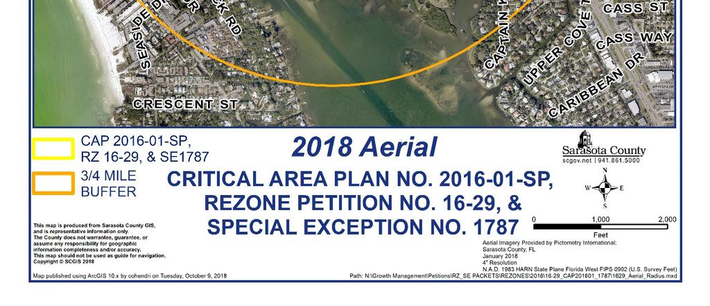
6 Aerial Map 4

7 Aerial Map 5


8 Future Land Use Designation 6


9 Zoning and General Area 7

10 Hurricane Storm Surge 8
11 BINDING DEVELOPMENT CONCEPT PLAN 9
12 10
13 CRITICAL AREA PLAN DEVELOPMENT CONDITIONS AND MAPS CRITICAL AREA PLAN SP CONDITIONS FOR DEVELOPMENT APPROVAL AND BINDING MAPS 1. All development on the subject property (i.e., building permits, preliminary plans, site and development plans, final plat and construction plans) shall comply with the Siesta Promenade Critical Area Plan (CAP). 2. Mixed Use Development Mixed Use Development may be permitted within the Siesta Promenade CAP. The Mixed Use Development will contain a mix of the following uses: (1) residential uses and; (2) office and/or institutional uses; or (3) retail and/or service uses. High residential density up to 25 units per acre may be permitted in Mixed Use Development. The mix of uses may be in a single building or in a mixed-use development. Mixed use buildings shall be defined as the combination of residential uses with either office and/or institutional uses, or retail and/or service uses, in a single building of two or more stories, wherein the first floor uses are non-residential. Mixed use development shall be defined as mixed use buildings, or a combination of residential and non-residential buildings in a development. 3. Development Totals - Development within the Siesta Promenade CAP shall not exceed the following development totals: Maximum total equivalent residential dwelling units: 479 dwelling units (DUs) Maximum multi-family DUs: 414 DUs Maximum hotel rooms (if approved Special Exception): Equivalent of 65 DUs (130 rooms without kitchens or 65 rooms with a kitchen) Total non-residential: 140,000 square feet Retail Maximum: 133,000 square feet Office Minimum: 7,000 square feet 4. Block Totals - Development within each of the blocks of the Siesta Promenade Future Land Use plan, Map 1.1, shall not exceed: Residential Hotel Non-residential Block 1: 479 units 0 rooms 5,000 square feet* Block 2: 0 units 0 rooms 9,000 square feet* Block 3: 65 units 130 rooms 14,500 square feet* Block 4: 0 units 0 rooms 2,500 square feet* Block 5: 0 units 0 rooms 130,000 square feet* TOTAL ALL BLOCKS: 479 units 130 rooms 140,000 square feet 11
14 *Allowable development shall be allowed per block up to the amount shown in the above table, however, development shall not exceed totals of 479 residential DUs including hotel rooms, and 140,000 square feet of non-residential development for the Siesta Promenade Critical Area Plan as a whole. 5. Block Specific Development Conditions: Block 1 Residential: Block 1 may consist of multiple-family residential uses with minor accessory commercial uses not to exceed 5,000 square feet. Buildings within block 1 shall adhere to the requirements of the underlying zoning district, except that they may exceed 35-feet in height to a limit of 40-feet in height when at least 25-feet away from a street, or 22-feet from abutting residential zoning where there is no intervening street, and buildings may exceed 35-feet in height to a limit of 65-feet in height when at least 100-feet away from a street, or 28-feet from abutting residential zoning where there is no intervening street (see Map 1.2). All non-residential uses shall be located a minimum of 200-feet from Glencoe or Crestwood Avenues. Block 2 Commercial: Development within block 2 shall adhere to the requirements of the underlying zoning district, except that buildings may exceed 35-feet in height to a limit of 50-feet in height when at least 40-feet away from Glencoe Avenue, and at least 25- feet away from Stickney Point Road (see Map 1.2). Block 3 Commercial/Hotel: Block 3 may consist of a hotel by Special Exception and other development consistent with the requirements of the underlying zoning district, except that buildings may be 80-feet in height when at least 150-feet away from Glencoe Avenue, and 40-feet away from Stickney Point Road (see Map 1.2). Block 4 Commercial: Block 4 may consist of development consistent with the underlying zoning district. Block 5 Commercial: Block 5 may consist of development consistent with the underlying zoning district, except that buildings may be 40-feet in height when at least 25- feet away from any street (see Map 1.2). 6. Affordable Dwelling Units - At a minimum, 15% of the dwelling units constructed in excess of 13 dwelling units per acre within the boundary of the Siesta Promenade Critical Area Plan shall be Affordable. This requirement shall be fulfilled as follows: Timing. The rate of construction of Market Rate dwelling units and Affordable dwelling units shall be specified in the rezone. Income and Eligibility Standards. A dwelling unit shall be deemed to be affordable when all housing costs (including Principal, Interest, Taxes and Insurance for homeownership, or total rent inclusive of water and sewer utilities, and parking for renters) do not exceed 30 % of the Income of a family 12
15 of four at or below 80% of the Area Median Income (AMI) of Sarasota County. Income shall be as defined in the Sarasota County Comprehensive Plan. Sale or Lease. Affordable dwelling units shall be the primary residence of the tenant or owner, and shall be leased at rental rates or the initial sale prices shall correspond to the latest calculated maximum mortgage and rental rates, based on annual Area Median Income data from the United States Department of Housing and Urban Development (HUD). Affordable dwelling units shall also be sufficiently sized to support an eligible household; for example, a 2 bedroom dwelling unit is sufficiently sized to support a family of four, and a 1 bedroom dwelling unit or studio efficiency is sufficiently sized to support a family of 2. Duration. The purchaser or leaseholder of each Affordable dwelling unit shall be verified as income eligible by the Owner or their designee (Administrative Agency) prior to any lease, sale or resale of an Affordable dwelling unit for a period of five years from the initial sale or lease date. Administrative Agency. An agency or organization (Administrative Agency) responsible for implementing the affordable housing (income-qualifying families, record keeping, Annual Monitoring Report) shall be identified with the first Annual Monitoring Report. Annual Monitoring Reports. Following the first sale or lease of an Affordable dwelling unit, the Administrative Agency shall submit an Affordable Housing Annual Monitoring Report (AMR) to Sarasota County Planning Services. The AMR shall demonstrate that the Owner is providing the required number of Affordable dwelling units, and shall include documentation reporting (i) the sale price or rental price for all Affordable dwelling units, (ii) verification of income eligibility for families within five years from the initial sale of lease date, and (iii) the date of the sale or lease. The Owner or their designee (Administrative Agency) charged with verifying income eligibility shall attest to and affirm in a notarized statement any representations made concerning verification of income eligibility. 7. Landscape Buffering - A 20-foot wide landscape buffer shall be provided along all street frontage and adjacent properties. U.S. 41 and Stickney Point Roads shall include, at a minimum, the plant material required by the Zoning Regulations for an arterial roadway buffer. Local roads shall include, at a minimum, the plant material required by the Zoning Regulations for non-residential development buffer along a local roadway. Along Glencoe Avenue and Crestwood Avenue, the required sidewalk within the right-ofway shall be constructed as close as practical to the required, planted buffer so as to take advantage of the shade offered by trees planted within the buffer. 8. Interconnectivity Plan - All development within the Siesta Promenade CAP shall also comply with Map 1.3, Interconnectivity Plan, as adopted by this CAP. Entrances to the CAP may be relocated 50 or less feet from where they are shown on Map 1.3 as a 13
16 matter of right, and more than 50-feet from where they are shown on Map 1.3 if the Planning Director and County Engineer determine that the alternative location complies with all other applicable regulations and provides equivalent connectivity and function consistent with the purposes of the CAP. 9. Pedestrian Plan - All development within the Siesta Promenade CAP shall comply with Map 1.4, Pedestrian Plan, as adopted by this CAP. Pedestrian network shall connect every access point to the internal pedestrian network. The pedestrian network shall consist of minimum 6-foot wide sidewalks, and shall connect all internal buildings and public spaces. Parking areas shall not exceed 250-feet in any direction without being transversed by a pedestrian pathway. A single block face shall not exceed 600-feet without a pedestrian connection between the internal network and a public sidewalk. A typical Pedestrian Plan following these criteria is depicted below as Figure 1. Figure Public Open Space - As depicted on the Siesta Promenade CAP Map 1.4, blocks 1 and 4 shall not be required to have a public open space, however blocks 2 and 3 shall each have a minimum of one public open space each. Block 5 shall have a minimum of 3 public open spaces. Public open spaces may be a plaza, courtyard, promenade exceeding the minimum 6-foot sidewalk width, or combination thereof, and shall be a minimum of 2,500 square feet per public space. Any area permanently occupied by business activity such as restaurant tables or seating, or display of merchandise, shall not count toward the minimum area requirement. Public spaces shall incorporate elements such as shaded seating, water features, public art, or other features intended to enhance the public experience of the space, and shall be located in close proximity to, and act as an 14
17 interface with commercial buildings that are generally accessible by the public. Examples of public open spaces are depicted below as Figure 2. Figure Specific Building Design Standards within block 1 - Buildings within block 1 shall be oriented with the fronts of buildings, defined by primary building entrances, facing toward Glencoe and Crestwood Avenues as well as the neighboring parcels. Long building fronts should use notches or recesses, change material, compose windows, space chimneys, and/or use other devices to set a rhythm at smaller intervals. 12. Specific Building Design Standards within blocks 2, 3, 4 and 5 - The east and south walls of any buildings within blocks 2, 3, 4 and 5, and the north walls of buildings within block 5 adjacent to Crestwood Avenue shall have a similar level of architectural finish and detailing as primary facades, and at a minimum: be stuccoed, painted or otherwise architecturally finished, but shall not be painted concrete block as its finish; and shall not exceed 50 linear feet without being interrupted by windows, doors, glass, glazing, green screens or other similar architectural elements. 13. Pedestrian - Consistent with TRAN Policy , TRAN Objective 1.4, TRAN Policy 1.4.5, TRAN Policy 1.4.7, and TRAN Policy 1.4.8, links in gaps within the pedestrian and bicycle network within the Siesta Promenade CAP area and the Siesta Promenade CAP Parks and Recreational/Multimodal Analysis ¾-mile radius shall be provided. The pedestrian and bicycle facility improvements (e.g. sidewalks, bicycle lanes, multi-use path, sharrows) shall be depicted on all site and development plans or concept plans submitted with a rezoning application. 14. Pedestrian - Development within the Siesta Promenade CAP shall provide internal bicycle and pedestrian circulation systems. a. Circulation systems shall be linked to existing or planned public sidewalks and bicycle lanes. 15
18 b. Use appropriate bicycle and pedestrian facilities, signs or variation in pavement materials or marking to improve bicycle and pedestrian safety. c. Circulation plans shall be submitted at the time of Site and Development Plan Review. 15. Traffic Calming - To preserve existing neighborhood environments, their cohesion, and integrity, traffic calming measures shall be evaluated on Glencoe Avenue, Crestwood Avenue, Brentwood Avenue, Beechwood Avenue, Hollywood Boulevard and Constitution Boulevard to deter traffic intrusion into the adjacent neighborhood. Consistent with TRAN Policy 1.6.1, public involvement shall occur with the neighborhood and county staff during the evaluation of traffic calming measures. The process and standards for evaluating and implementing traffic calming measures shall be stipulated with a rezoning application and adopting ordinance. 16. Transit - All new commercial, office, and multi-family development with over 240 residential units or 70,000 square feet of non-residential space that is located adjacent to existing or planned transit routes shall provide and maintain an ADA approved transit stop, including sheltered or shaded seating areas and transit route information. A waiver of these provisions may be approved by Sarasota County Area Transit, if it is clearly demonstrated that there is no reasonable means of providing transit services to the development. 17. Irrigation - Each development shall prioritize meeting irrigation needs through a hierarchy of (1) demand management strategies, (2) reclaimed water, (3) rain water or stormwater. Only after a Development demonstrates to Sarasota County that these measures are insufficient can community groundwater wells be considered as a supplement to these other strategies. Private irrigation systems will be pressurized, owned, and maintained by the development or master association. Private irrigation systems shall be designed to allow for the use of reclaimed water in accordance with County Supply Standards. 18. When reclaimed water becomes available, existing development shall be required to connect to reclaimed water supplies within 1 calendar-year of County notification. 19. To promote water conservation, indoor water plumbing fixtures shall meet EPA WaterSense certification, as applicable. 20. Each project shall pursue the feasibility of receiving SWFWMD s Water Star Certification for indoor and outdoor water use. 21. All building roofs shall be EPA Cool Roof certified. 22. To promote energy efficiency, all eligible appliances shall be EPA EnergyStar certified. 16
19 17
20 18
 map, and 0.8 acres are designated as Commercial Corridor.")
21 CRITICAL AREA PLAN REPORT Overview The 23.8-acre subject property is located in the western quadrant of the intersection of U.S. 41 and Stickney Point Road. Twenty-three acres are located within an area designated as Commercial Center on the Future Land Use (FLU) map, and 0.8 acres are designated as Commercial Corridor. The maximum residential density allowed for these designations is 13 units/acre, which would allow up to 270 units. The subject property has previously contained a mobile home development with 300 units, a gas station and approximately 7,400 square feet of office and commercial uses. These developments were vacated between 2006 and A CAP is required to allow multi-family, as part of mixed use development, in a CG zoning district, and in order to implement FLU Policy , which allows a request to increase the density above 13 units/acre up to a maximum of 25 units/acre. The applicant is requesting a total of 479 units, which equates to 20 units/acre. In addition, the proposed CAP will allow an increase of building heights above the 35-foot limitation of most implementing zoning districts, including the proposed CG district. Planning Services CAP Study - The CAP study (Siesta Promenade CAP No SP, Appendix C) was produced by the applicant based on the scope of work approved by the County Commission in January of The study includes sections on land use, affordable housing, the environment, stormwater, transportation, utilities, and parks and recreation. The CPA Study includes conditions for development approval and associated maps, which would be adopted 19
22 by ordinance. It is the intent that an adopted CAP function independently, and in support of, any associated or subsequent rezoning of the subject property. Maps 1.1 through 1.4 supplement the development conditions and provide graphic clarity. The maps subdivide the property into blocks that are defined by external access points and internal circulation. The maps include: Map 1.1 Overall Map Map 1.2 Building Height Limitation Map Map 1.3 Vehicular Access Map Map 1.4 Pedestrian Map. The conditions of development approval must be met by any future development within the CAP Study area. Below is a summary of the proposed conditions for development approval and maps: 1. Requires that future development must comply with the CAP. 2. Defines mixed use and designates the subject property for mixed use development and residential densities of up to 25 units/acre. 3. States the development s maximum number of units and maximum non-residential square footage. 4. States the development s maximum number of units and maximum non-residential square footage by block 5. Provides development criteria by block including where, and to what extent, building heights may exceed 35-feet. Building heights increase with additional separation from adjacent neighborhoods. CAP Map 1.2 illustrates the locations of building heights. 6. States the requirement to construct affordable housing and provides criteria for implementation. 7. Provides for a 20-foot landscape buffer along all adjacent streets and properties. 8. Identifies locations of vehicular and pedestrian access to the property, in association with Map Identifies and provides criteria for an internal pedestrian circulation network, in association with Map Identifies and provides for public open spaces in the form of plazas courtyards or promenades, in association with Map Provides architectural design standards for those building faces visible from public streets and adjoining properties in Block Provides architectural design standards for those building faces visible from public streets and adjoining properties in Blocks Provides for closing gaps in the pedestrian and bicycle network in the area of the CAP. Specific improvements are identified in recommended rezone stipulations Nos. 14 and Outlines the requirement for pedestrian and bicycle circulation system internal to the CAP in support of Condition No
23 15. Requires that with neighborhood participation, traffic calming measures will be evaluated for specific local streets in the area of the CAP. Recommended rezone stipulation No. 17 requires the owner to identify the traffic calming improvements and include them in any development plans. 16. Provides a development threshold for requiring a sheltered transit stop. Recommended rezone stipulation No. 7 requires the construction of a transit stop with any development on the property. 17. Provides criteria for development of onsite irrigation sources. 18. Requires connection to reclaimed water when available. 19. Requires EPA WaterSense certification for indoor plumbing fixtures. 20. Encourages indoor and outdoor water use conservation. 21. Requires EPA Cool Roof certification. 22. Requires EPA Energy Star certification for appliances. FLU Policy This policy provides for residential densities between 13 and 25 units/acre within Commercial Center, and Village and Town Center FLU designations, and provides the criteria under which the higher density can be granted. The full text of this policy is provided in Appendix E. Policy has previously been implemented in the Nokomis Village Center, and most recently in the Englewood Town Center through County initiated CAP amendments. For Commercial Centers, Policy requires that development be mixed use, and that certain issues listed in the policy be addressed. Below, each issue from the policy is stated, then followed by an explanation of how that issue is addressed by the proposed Siesta Promenade conditions for development approval and associated maps. Protection of existing residential neighborhoods adjacent to the proposed development area. o With the exception of two single-family lots on the west side of Glencoe Ave., all adjacent residential neighborhoods will be separated from the proposed development by public streets. o Condition No. 5 and the CAP Map 1.1, Overall Map, limits development adjacent to the residential neighborhoods east of Glencoe Avenue and west of Crestwood Avenue, to residential uses, providing a transition to more intense uses towards the eastern portion of the proposed development. The proposed commercial/office and hotel uses are generally located along the adjacent arterial streets, U.S 41 and Stickney Point Road. o Condition No. 7 requires that a 20-foot landscape buffer be provided along all adjacent streets and properties. The Zoning Regulations require 10-feet wide landscape buffers along arterial streets, 6-feet wide buffers along local streets, and 15- feet wide buffers along adjacent single family development. o Condition No. 5 and Map 1.2, Building Heights Limits Map, transitions requested increases in building heights away from adjacent neighborhoods. The map limits the requested increases in building heights above 35-feet adjacent to existing neighborhoods, to 40-feet when setback 25-feet from adjacent streets and 22-feet 21
24 from adjacent properties, and 65-feet when setback 100-feet from adjacent streets and 28-feet from adjacent properties. Creation of multi-modal (pedestrian, bicycle, public transit, and automobile) internal circulation systems. Creation of internal pedestrian circulation systems to link properties with one another and also to the surrounding area and to provide safe access to public transit stops. o Condition for Development Approval No. 9 and the Map 1.4 Pedestrian Plan outline and illustrate a required pedestrian network, and provides minimum standards, for connecting all buildings, public spaces and points of access within the proposed development. Also, minimum criteria is provided for pedestrian crossing of large parking areas, and connections to public sidewalks. Relative compatibility of mixed-use redevelopment versus continuation of existing use or redevelopment as traditional commercial development. o The Benefits of Mixed Use Development Versus Traditional Development at Siesta Promenade,on page 151 of the CAP study addresses how mixed use provides a transition of multi-family development between the existing single-family neighborhood and the commercial uses. In addition, mixed use development provides a walkable environment and reduces automobile trips. Also, other benefits of mixed use development are addressed including revitalization, economic development, and promoting a sense of place and community. Affordable housing provided in at least 15 percent of the residential densities granted over 13 dwelling units per acre. o Condition for Development Approval No. 6 provides for affordable housing and addresses how the affordable housing will be provided. Creation of public amenities including, for example, recreational opportunities, public squares and other publicly accessible open space areas. o Condition for Development Approval No. 10 and the Map 1.4 Pedestrian Plan provide minimum criteria and conceptual locations for public open space required to be constructed in the form of a courtyard, plaza or promenade, within the proposed development. Availability of, and opportunity to utilize existing urban infrastructure. o The subject property is an urban infill site with existing infrastructure. Each mixed use development project will contain a mix of the following three uses: (1) residential uses; (2) office and/or institutional uses; and (3) retail and/or service uses. o Conditions for Development Approval Nos. 3 and 4 provide a list of the proposed uses meeting the criteria for mixed use development. The mixed-use development shall be a minimum of 10 acres in size. o The Community Center designated property is 23 acres in size. The proposed Siesta Promenade CAP No SP may be found to be consistent with FLU Policy and other FLU policies provided in Appendix E. In particular, the proposed development helps to implement FLU Policy 3.2.5, related to smart growth principles, as noted below: 22
25 FLU Policy The smart growth principles that will be utilized by the County in encouraging redevelopment are as follows: Provide a mix of compatible uses and activities. Create a range of housing opportunities and choices. Create walkable communities. Provide multiple modes of transportation. Public infrastructure provided as a cooperative private-public venture. Foster distinctive, attractive communities with a strong sense of place. Make development decisions predictable, fair, and cost effective. Protect and enhance existing neighborhoods. Provide open space, natural beauty, and environmental areas. Encourage community and stakeholder collaboration and participation in the development process. Environmental Protection Staff of Sarasota County s Environmental Protection Division (EPD) has reviewed the proposed Critical Area Plan and have no objections. EPD staff will continue to review submitted development proposals to insure consistency with native habitat and listed species policies, open space requirements, and protection requirements for grand trees. Stormwater Overview: The Stormwater Division has reviewed this proposal and has no comment or objection to the proposed Siesta Promenade Critical Area Plan (CAP) CAP SP, to encompass a 23.38± acres site of three parcels (commonly owned) located at the northwest corner of Tamiami Trail (U.S. Highway 41) and Stickney Point Road (S.R. No. 72). Drainage Basin(s): Approximately 98% of the site is located in the Roberts Bay North Coastal Watershed and the remaining 2% of the site is located in the Phillippi Creek Drainage Basin (Sarasota Bay Watershed). Drainage Flow Patterns: The project site is located in the Roberts Bay North Coastal Watershed and the Phillippi Creek Drainage Basin (Sarasota Bay Watershed) in Sarasota County. Based on the Roberts Bay North Coastal Watershed Management Plan, the Phillippi Creek Basin Master Plan (Sarasota Bay Watershed), and the Southwest Florida Water Management District (SWFWMD) aerial topography maps, runoff from the site generally sheet flows to the southwest as overland flow where it is then collected into storm drain inlets along the north side of Stickney Point Road s existing storm sewer system. The existing storm sewer system conveys the runoff to the south- 23
26 southwest where it ultimately discharges into Roberts Bay North/Intercoastal Waterway and the Gulf of Mexico. Soils The soil information is based on data obtained from the United States Department of Agriculture (USDA) Soil Conservation Service. It should be noted that this information pertains to natural conditions and that the presence of adjacent man made drainage works can affect wet season water table depth and duration. Drainage Classification Poorly Drained Moderately Well Drained Soil EauGallie or Myakka (10) fine sands Pomello (33) fine sand 1. WSWT Wet Season Water Table Percent of Soil on Site () 92% Depth of WSWT 1 Below Existing Ground Surface (feet) 0.5 to to 1.5 Months for Wet Season Water Table June to October June to October 8% 2.0 to 3.5 July to November Floodplain The table below describes floodplain information for the subject property: Federal Emergency Management Agency s (FEMA) Flood Insurance Rate Map (FIRM) Map Panel 12115C0144F Flood Zone X (shaded) or areas of 0.2 percent annual chance (500-year) flood Roberts Bay North Coastal Watershed Management Plan, and SWFWMD Aerial Topography Areas determined to be located outside the 1% annual chance flood (100-year floodplain). Percent (%) of Property () 33% Percent (%) of Property 100% Element 3, Chapter 7 Future Land Use, Policy from the Sarasota County Comprehensive Plan allows development within the 100-year floodplain as long as the function of the floodplain is protected through floodplain compensation. Floodplain compensation must meet the requirements of the Land Development Regulations (LDR) and will be examined at the time of Site and Development Plan/Construction Plan Approval. Flooding History for the Area: A review of the Public Works Business Center Neighborhood Response Team (NRT) database and Staff reports did not indicate any reports of flooding of the subject site. This statement is not intended to indicate that the subject site is not susceptible to flooding, only that none has been 24
27 reported to the County. However, there was one (1) report of needed canal/ditch cleaning on site that was not related to flooding. The one report of onsite needed canal/ditch cleaning occurred along 6 th Street in the winter of 1998 due to gravel roadway washing away during heavy rains into ditch across from residence (previous mobile home at th Street). County Operations and Maintenance crews responded, however, there was no additional information provided in the report. In the surrounding areas to the subject site there was two (2) reports of street flooding, four (4) reports of needed canal/ditch cleaning, one (1) report of canal/ditch violation, and one (1) report of needed pipe/structure maintenance. The first report of street flooding was to the southeast of the site at 6637 Avenue A in the summer of County Operations and Maintenance crews responded to inspect the reported flooding, but did not find any flooding problems. The second report of street flooding was to the southeast of the site at intersection of Stickney Point Road and Avenue A in the spring of County Operations and Maintenance crews responded and completed work, however, no additional information was provided in the work report. The first report of needed canal/ditch cleaning was to the south of the site near intersection of Dawn Street and Duval Lane in the spring of 2004 due to blocked ditches and culverts. County Operations and Maintenance crews responded to clear obstructions and restore proper flows to the roadside ditches. The second report of needed canal/ditch cleaning was to the north of the site at 2012 Jo An Drive in the summer of 2005 due to clogged driveway culvert in roadside ditch. County Operations and Maintenance crews responded to remove sediment in ditch following resident required to remove privately owned collapsed headwall causing obstruction of flows in ditch. The third report of needed canal/ditch cleaning was to the south of the site near intersection of Avenue A and Avenue C in the summer of 2006 due to blocked pipes in roadway ditches on both sides of street. County Operations and Maintenance crews responded to open blocked pipes and restore proper flows to the roadside ditches. The fourth report of needed canal/ditch cleaning was to the north of the site near intersection of Jo An Drive and S. Tamiami Trail (US-41) in the summer of 2006 due to silt in roadside ditches blocking flows along Jo An Drive. County Operations and Maintenance crews responded to schedule ditch regrading work to remove silt and restore proper flows in ditches. The one report of canal/ditch violation was to the southeast of the site near the intersection of Dawn Street and Beechwood Avenue in the winter of 2005 due to construction workers building condo project along Stickney Point Road and parking equipment along roadway that was collapsing ditch embankment and roadside edge. County Operations and Maintenance crews responded with inspection and filed violation to Code Enforcement to have contractor repair damages. 25
28 The one report of needed pipe/structure maintenance was to the southeast of the site near 6637 Avenue A in the spring of 2004 due to blocked drainage structures causing minor ditch flooding. County Operations and Maintenance crews responded to remove the blockages and restore proper flows and function to the drainage structures. It is noted that there were several requests for general maintenance not related to flooding (i.e., potholes repairs in pavement, mowing and plant removal requests, cleaning/removing debris in right-of-way, etc.) within the 750 buffer area surrounding the subject site that were addressed by County Operations and Maintenance crews. Site Stormwater Management Plan The applicant has submitted a binding development concept plan that illustrates a proposed stormwater management facility comprised of eight (8) on-site underground stormwater vault systems located throughout the site in proposed parking areas. A Stormwater Narrative (dated March 17, 2018 by Benderson Development) was provided in the applicant s responses to staff that stated the following: Siesta Promenade's stormwater management system will be designed to improve the water quality discharge from the site and attenuate the peak runoff from the 1OOyr storm event to prevent any adverse impacts to adjacent properties and ROWs. The water quality treatment method will consist of a sand filter system within an underground pre-cast concrete vault structure. The runoff will first be directed to a sediment trap to remove the majority of the suspended solids, oils, and greases from the stormwater prior to entering the remainder of the vault system. The discharge portions of the vault will be equipped with a sand filter consisting of 2' minimum of clean sand for the water to pass through to remove the nutrients and phosphorus from the runoff. The volume from the first 1.0" of rainfall that falls on the project site will be directed to pass through the designed sand filter in accordance with the County's LOR and State's water quality standards. The vault will also be designed to encompass enough volume to attenuate the 1OOyr storm event from the proposed development. These vaults will be within parking lots as shown on the binding DCP and will be accessible at all times to perform the required routine inspections and maintenance of the underground stormwater management system. We recommend that the sediment trap be inspected and cleaned out every 6 months while the sand filter media shall be backwashed once a year. The project site is the subject of the SWFWMD ERP Permit # and any site improvements shall comply with the Permit as may be amended. The proposed stormwater management system shall be required to treat and attenuate stormwater for the site in accordance with the Sarasota County Comprehensive Plan and the Land Development Regulations (Ordinance No ). Existing drainage patterns through the site and final points of discharge will be maintained in the proposed conditions. 26
29 Concurrency Analysis: Stormwater drainage concurrency for new development is based in part on provisions of a new onsite stormwater management system designed to meet current level of service requirements of the Sarasota County Comprehensive Plan and the Land Development Regulations (Ordinance No ). Final determination of stormwater drainage concurrency is deferred to the time of Site and Development Plan / Construction Plan Approval. At the time of Site and Development Plan / Construction Plan Approval, the applicant must demonstrate that the proposed project shall not cause any adverse impacts to off-site property and shall not worsen any existing off-site drainage problems in order to obtain Construction Authorization. Applicant Commitments to be included as Development Order Conditions: None. Transportation Overview The subject of this privately-initiated Critical Area Plan (CAP) application contains ±23 acres and is located at the northwest corner of Stickney Point Road (State Road 72) and US 41. The Applicant is seeking a mixed-use, high-density (greater than 25 units per acre) redevelopment project containing up to 479 dwelling units, 130-room hotel, and 140,000 square feet of retail and office. Background On October 11, 2016, the Sarasota County Commission held a public hearing on the proposed CAP Boundary for the subject site. The CAP s Impact Area was also established at that time. The impact area also included lands outside of the CAP Boundary as those lands may be affected by the development. On January 25, 2017, the commission approved a staff-recommended Scope of Work for the CAP application. Criteria Area Plan Scope of Work As part of the board-approved Scope of Work, a detailed transportation impact analysis was performed for the following roadway segments and intersections: US 41 from Constitution Boulevard to Beneva Road SR 72 from Midnight Pass Road to Swift Road Swift Road from SR 72 to Constitution Boulevard US 41 and Constitution Boulevard US 41 and Beechwood Avenue US 41 and Upper Glencoe Avenue US 41 and Crestwood Avenue US 41 and SR 72 27
30 US 41 and Gulf Gate Drive US 41 and Beneva Road SR 72 and Midnight Pass Road SR 72 and Glencoe Avenue SR 72 and Avenue A SR 72 and Beechwood Avenue SR 72 and Avenue B and C SR 72 and Avenue D SR 72 and Gulf Gate Mall (Sarasota Pavilion) SR 72 and Gateway Avenue SR 72 and Swift Road Swift Road and Constitution Boulevard Trip Generation and Impact Analysis A transportation impact analysis (TIA) prepared by Kimley Horn Associates, Inc. (Consultant) was submitted. for the critical area plan application was based on the initial submittal dated, August 2017, and assumed the following: 506 multi-family dwelling units, 150 hotel rooms, and 140,000 square feet of neighborhood retail space. Table 1 shows the daily trip generation potential under the existing and proposed land use in the criteria area plan application. It is expected that the potential daily trips will increase by approximately 6,390 trips per day and increase by 571 trips during the PM peak hour. Table 1. Trip Generation (Based on Applicant s assumptions) Net New Trips Land Use 1,2 Land Use Intensity Code Daily Existing Residential du Residential du Office 710 6,400 sf 56 8 Subtotal Proposed Apartment du Residential du Hotel du Commercial ,000 sf 4, Subtotal 7, PM Peak Weekday Net Trip 6, Based on the Institute of Transportation Engineers (ITE), Trip Generation, 9th Ed. 2. Based on internal capture and pass by capture trips reduction, Page A.25, from submitted detailed analysis. 28
31 Impact Analysis Staff performed a generalized level of service analysis of the proposed criteria area plan amendment. The short range (2024) conditions analysis was based on 2017 traffic counts adjusted to estimate the 2024 conditions using the historical annual growth rate for each roadway segment. The results of the analysis are summarized in Table 2. The 2024 total traffic conditions indicate that the study area roadway segments are operating at or above the adopted level of service standard. However, the intersections of US 41 and Constitution Boulevard, US 41 and SR 72, and US 41 and Beneva Road are expected to operate below the adopted level of service standard with background traffic. The intersection improvements needed to mitigate background traffic in the short-range include modifying the westbound approach of US 41 and Constitution Boulevard from a shared left-turn/through and right-turn lane to an exclusive left-turn lane and a shared through/right-turn lane. Additionally, constructing an additional westbound, southbound, and northbound left-turn lane at the intersection of US 41 and SR 72 will mitigate the deficiencies. The analysis of future roadway conditions was based on the 2017 traffic counts adjusted to estimate the 2040 conditions using the historical annual growth rate for each roadway segment. The results of the analysis are summarized in Table 3. The 2040 total traffic conditions indicate that the roadway segments are operating at the adopted level service standard with background traffic except US 41 from Constitution Boulevard to Beechwood Avenue. Also, US 41 from Gulf Gate Drive to Beneva Road will need to be widened to its ultimate Thoroughfare Plan configuration of six (6) lanes to operate at its adopted level of service standard. Intersection Analysis The intersection analysis provided background improvements that are detailed in Table 4 below. An intersection analysis for the study area with the background improvements added showed that the intersections of US 41 and SR 72, US 41 and Beneva Road, and SR 72 and Swift Road operate below the adopted level of service. Based on the analysis, the intersections within the study area are anticipated to operate at or above an acceptable level of service (LOS) during the PM peak-hour and Saturday peak-hour except for the intersections of US 41 and Constitution Boulevard, US 41 and Beneva Road, US 41 and SR 72, and SR 72 and Swift Road. The results of the intersection analysis are summarized in Table 5. Table 4. Background Improvements Roadway / Intersection Background Improvements US 41 and Constitution Boulevard Modify westbound approach from a shared leftturn/through and right turn lane to an exclusive left turn lane and a shared through/right turn lane. 29
32 US 41 and SR 72 Construct an additional left turn lane in the westbound, southbound, and northbound directions and adjust the signal timing splits and offset. Table 5. Intersection Level of Service (LOS) Analysis Results. Adopted Intersection LOS Standards Background 1 Total Traffic 1 US 41 and Constitution Boulevard D F A 4 US 41 and Upper Glencoe Avenue D F B US 41 and Beechwood Avenue D n/a 2 n/a 2 US 41 and Crestwood Avenue D n/a 2 n/a 2 US 41 and SR 72 D E E 4 US 41 and Gulf Gate Drive D C C US 41 and Baywood Drive D n/a 2 n/a 2 US 41 and Beneva Road D F D 4 SR 72 and Midnight Pass Road D C D SR 72 and Beechwood Avenue D n/a 2 n/a 2 SR 72 and Avenue D D n/a 2 n/a 2 SR 72 and Elmwood Avenue D n/a 2 n/a 2 SR 72 and Glencoe Avenue D n/a 2 n/a 2 SR 72 and Avenue B and C D n/a 2 A 4 SR 72 and Avenue A D n/a 2 n/a 2 SR 72 and Gulf Gate Mall D B B SR 72 and Gateway Avenue D A A SR 72 and Swift Road D F D Swift Road and Constitution D B B 3 Boulevard 1. Based on the intersection operational analysis. 2. Two way stop control (TWSC) intersections; overall LOS not provided for TWSC intersections 3. With background improvements identified in Table With total project improvements identified in Table 3. 30
33 The TIA also provided total traffic improvements that are detailed in Table 6 below. The total traffic improvements assumed the background improvements identified in Table 4 were in place. The Consultant identified background and project improvements of an additional left-turn lane (triple left turns) at all approaches of the intersection of US 41 and SR 72. These improvements have been determined not to be feasible due to right-of-row (ROW) limitations and the planned improvement to add bicycle lanes on US 41 south of SR 72, as part of the multimodal improvements scheduled for construction in FDOT s 5-Year Work Program in Fiscal Year 2021 (Financial Project No ). This project is a Sarasota-Manatee Metropolitan Planning Organization (MPO) US 41 Multimodal Emphasis Corridor Project and Sarasota County MPO project priority. Acquiring ROW would require extensive business takings per the Florida Department of Transportation s (FDOT s) response to the Consultant, dated June 1, The Consultant also recommended signal timing adjustments for two of the intersections within the study area along the US 41 corridor. It should be noted that FDOT does not accept signal timing changes at US 41 and Stickney Point Road and at US 41 and Beneva Road because it s part of a coordinated system along US 41. However, per discussions with FDOT, a possible alternative to mitigate the deficiencies is a Continuous Flow Intersection (CFI) interchange. Table 6. Total Traffic Improvements Roadway / Intersection Project Traffic Improvements US 41 and SR 72 Extension of westbound merge land to create a continuous westbound right turn lane from US 41 to Avenue B and C. Adjust signal timing splits and cycle length. Construct additional eastbound to northbound left turn lane for a total of three left turn lanes US 41 and Beneva Road Adjust signal timing splits for PM peak hour. US 41 and Glencoe Avenue Close existing median opening. SR 72 and Avenue B and C Install traffic signal at intersection. Construct eastbound to northbound left turn lane. Multi-Modal Analysis As required by the CAP Scope of Work, the applicant was required to analyze multi-modal facilities and amenities within a study area defined as a 0.75 miles radius from the center of the subject site to adjacent points of interest which include nearby retail areas, local restaurants and recreational attractions which include Siesta Beach, Turtle Beach, Crescent Beach, Points of Rocks Beach, Legacy Trail/Culverhouse Nature Park and Phillippi Estate Park. The analysis identifies walking, biking and transit routes to these locations and provides a general description of each multi-modal route and provides suggested opportunities for enhancement within these corridors. Improvements include, but are not limited to the use of sharrows, consideration of multi-use paths and leveraging existing planned multimodal improvements by the FDOT. It 31
34 should be noted that the TIA submitted, estimated the mode share for non-vehicular traffic and transit to be 5 percent. Additionally, the multi-modal analysis evaluated the following local roadways for vehicular speeds and volumes: Glencoe Avenue Crestwood Avenue Brentwood Avenue Beechwood Avenue Hollywood Boulevard Constitution Boulevard The following traffic calming measures were identified as possible candidate for implementation without any specific one measure recommended for the study area local roads to address the speeds and volumes: Targeted Speed Enforcement Speed Feedback Signs Speed Hump Speed Cushion Speed Table The potential re-classification of Constitution Boulevard from a local roadway to a significant local roadway was also analyzed as part of the transportation impact analysis. The Comprehensive Plan defines significant local roads as local roads that provide a limited mobility function. They serve the accessibility role of local roads but have traffic characteristics and a collection/distribution function of low volume collector roads. Typically, the roadways are residential subdivision streets that are characterized by higher volumes than local roads. Traffic volumes are high enough that traffic calming, traffic abatement, or additional or enhanced pedestrian and bicycle amenities may be needed to ensure the road can serve its local road function. Constitution Boulevard is an approximate one-mile, two-lane local road that connects two arterial roadways (Swift Road and US 41) with a posted speed limit of 30 mph, 11-foot wide travel lanes, sidewalk on the north side and functions as a collector road. Based on the analysis submitted by the Consultant, using February 2017 counts, Constitution Boulevard has an Average Daily Traffic (ADT) of 2,149. Additionally, counts conducted by the county in July 2017, show an AADT of 3,902. For comparison, the following are the AADTs of other two-lane Thoroughfare Plan roadways, approximately one-mile long: Ashton Road: McIntosh Road to Honore Avenue 3,688 Baffin Road: Shamrock to US 41 2,007 Blackburn Point Road: Casey Key Road to US 41 2,474 Jacaranda Boulevard: Laurel Road to Border Road 3,371 Wilkinson Road: McIntosh Road to Honore Avenue 2,553 32
35 The roadway characteristics and traffic volumes indicate Constitution Boulevard should be reclassified as a significant local road in the Future Thoroughfare Plan. Per the county s transportation policy 1.3.3, Sarasota County shall adopt and maintain a Level of Service (LOS) standard of C (hereafter referred to as LOS C ), for all county maintained significant local roads. For significant local roads operating below LOS C, the County shall identify and program improvements that will minimize the impacts of motorized vehicular traffic on bicycle and pedestrian quality of service. The reclassification of the roadway would allow staff to address transportation issues related to vehicular traffic and better accommodate multi-modal use that is primarily surrounded by residential development. Planned Road Network Stickney Point Road (SR 72) from US 41 to Midnight Pass Road is a designated four-lane minor arterial and a designated six-lane major arterial from US 41 to Swift Road in the Future Thoroughfare Plan. A Florida Department of Transportation (FDOT) intersection safety improvement project is planned for the US 41 and SR 72 intersection. This project will modify the channelized right-turn lanes to operate under signalized control. The project is scheduled to be available for contractors to bid in July Recommended Conditions of Development Approval 1. Consistent with TRAN Policy , TRAN Objective 1.4, TRAN Policy 1.4.5, TRAN Policy 1.4.7, and TRAN Policy 1.4.8, gaps within the pedestrian and bicycle network within the Siesta Promenade CAP area and the Siesta Promenade CAP Parks and Recreational/Multimodal Analysis ¾-mile radius shall be provided. The pedestrian and bicycle facility improvements (e.g. sidewalks, bicycle lanes, multi-use path, sharrows) shall be depicted on all site and development plans or concept plans submitted with a rezoning application. 2. Development within the Siesta Promenade CAP shall provide internal bicycle and pedestrian circulation systems. d. Circulation systems shall be linked to existing or planned public sidewalks and bicycle lanes. e. Use appropriate bicycle and pedestrian facilities, signs or variation in pavement materials or marking to improve bicycle and pedestrian safety. f. Circulation plans shall be submitted at the time of Site and Development Plan Review. 3. To preserve existing neighborhood environments, their cohesion, and integrity, traffic calming measures shall be evaluated on Glencoe Avenue, Crestwood Avenue, Brentwood Avenue, Beechwood Avenue, Hollywood Boulevard and Constitution Boulevard to deter traffic intrusion into the adjacent neighborhood. Consistent with TRAN Policy 1.6.1, public involvement shall occur with the neighborhood and county staff during the 33
36 evaluation of traffic calming measures. The process and standards for evaluating and implementing traffic calming measures shall be stipulated with a rezoning application and adopting ordinance. 4. All new commercial, office, and multi-family development with over 479 residential units or 140,000 square feet of non-residential space that is located adjacent to existing or planned transit routes shall provide and maintain an ADA approved transit stop, including sheltered or shaded seating areas and transit route information. A waiver of these provisions may be approved by Sarasota County Area Transit, if it is clearly demonstrated that there is no reasonable means of providing transit services to the development. The following provision is not a development condition, but is a recommendation for future action by Sarasota County to further the objective of the Critical Area Plan. It may be implemented by actions of Sarasota County. 1. Consistent with TRAN Policy and TRAN Policy 1.3.3, as well as to provide a safe, energy efficient, interconnected, multi-modal transportation system, the county shall process a Comprehensive Plan Amendment to designate Constitution Boulevard from U.S. 41 to Swift Road as a Significant Local Road and amend Table 10-5, Maps 10-3a-c, 10-8, and 10-9 to reflect such designation. 34
37 Table 2: Criteria Area Plan Short Range (2024) Conditions Analysis Adopted Standards 1 Background Traffic Road Limits Lanes Service Volume LOS Volume 1 Volume LOS SR 72 US 41 Swift Road Midnight Pass Road to US 41 US 41 to Gulf Gate Mall Gulf Gate Mall to Gateway Avenue Gateway Avenue to Swift Road Constitution Boulevard to Beechwood Avenue Beechwood Avenue to SR 72 SR 72 to Gulf Gate Drive Gulf Gate Drive to Beneva Road Constitution Boulevard to SR 72 Project Traffic Total Traffic 4 3,759 D 2,597 2,812 D 349 3,161 D 6 5,660 D 3,278 4,486 D 241 4,727 D 6 5,390 D 3,278 4,486 D 235 4,721 D 6 5,390 D 3,278 4,486 D 228 4,714 D 6 5,390 D 4,185 4,532 D 139 4,671 D 6 5,660 D 4,185 4,532 D 259 4,791 D 6 5,660 D 4,208 4,557 D 169 4,726 D 4 3,759 D 3,199 3,464 D 127 3,591 D 4 3,020 D 1,955 2,117 C 60 2,177 C 1. Based on Sarasota County 2016 Generalized Level of Service Analysis 2. Background Traffic includes the annual growth rate for each roadway segment 3. Based on the Traffic Impact Analysis, dated March LOS
38 Table 3: Criteria Area Plan Long Range (2040) Conditions Analysis Road Limits Lanes Adopted Standards Background Project 2040 Total 2040 Service Volume LOS Volume 2 Traffic Traffic 3 Traffic LOS Midnight Pass Road to US ,759 D 3,298 N/A 349 3,647 D SR 72 US 41 to Gulf Gate Mall 6 5,660 D 4,162 N/A 241 4,403 D Gulf Gate Mall to Gateway Avenue 6 5,390 D 4,162 N/A 235 4,397 D Gateway Avenue to Swift Road 6 5,390 D 4,162 N/A 228 4,390 D Constitution Boulevard to Beechwood 6 5,390 D 5,314 N/A 139 5,453 F Avenue US 41 Beechwood Avenue to SR ,660 D 5,314 N/A 259 5,573 D SR 72 to Gulf Gate Drive 6 5,660 D 5,343 N/A 169 5,512 D Gulf Gate Drive to Beneva Road 6 4 5,660 D 4,062 N/A 127 4,189 D Swift Constitution Road Boulevard to SR ,020 D 2,868 N/A 60 2,928 D 1. Based on Sarasota County 2016 Generalized Level of Service Analysis 2. Based on generalized growth rate from Generalized LOS Tables 3. Based on the Traffic Impact Analysis, dated March Future Thoroughfare lane designation
39 Utilities PROJECT ASSESSMENT The Development is required to connect to Sarasota County Public Utilities water, wastewater and reclaimed water systems in accordance with current County rules and regulations. All connections to the potable water distribution and wastewater collection systems are required to pay the established Water Facilities Capacity Fee, Wastewater Facilities Capacity Fee and Wastewater Deferred Revenue Charges at the time of connection. Capacity can only be reserved through payment of those fees. All potable water, reclaimed water, and wastewater customers connected to the County s system shall be responsible for the monthly water, reclaimed water, and wastewater charges according the most recently adopted Utility Rate Resolution. Sarasota County Public Utilities has adequate capacity to serve the proposed development. No utility related comprehensive plan policy changes are required in support of this Critical Area Plan. No new utility projects need to be added to the list of 5-year capital improvements (Table 10-3) or to the unfunded projects (Table 10-4) in support of the comprehensive plan. The development is responsible for providing all on-site and off-site infrastructure that will be needed to serve the project. Due to the age of some of the existing infrastructure in and adjacent to the subject area additional discussions will be required with the Developer during land development review. Reclaimed water is not available to this area at this time. Any phases of development must demonstrate that the projects non-potable irrigation demands will be met through implementation of Comprehensive Plan Water Policy hierarchy of (1) demand management strategies, (2) reclaimed water, (3) rain water or stormwater. It is likely that a Utility Agreement with Sarasota County will be needed to address the oversize of improvements for this development, funding by the County for any oversize will be provided out of existing CIP program funds. All connections to the potable water distribution and wastewater collection systems shall be required to pay the currently established Water Facilities Capacity Fee, Wastewater Facilities Capacity Fee and Wastewater Deferred Revenue Charges at the time of connection. All potable water and wastewater customers connected to the County s system shall be responsible for the monthly water and wastewater charges according the most recently adopted Utility Rate Resolution. COMPREHENSIVE PLAN CONSISTENCY Chapter 12, Watershed Management WATER Policy The County shall continue to require new development to connect to central wastewater systems consistent with the requirements contained in the Land Development Regulations based on the size of the development and distance to the 37
40 existing system, the available capacity in the system, and the utility's rules allowing connection to the system. The development shall connect to Sarasota County s central wastewater system. The Developer shall participate with Sarasota County, who may oversize wastewater infrastructure to serve adjoining areas using existing adopted Capital Improvement Project funds in support of system wide improvements. Development shall remain responsible for any onsite and offsite improvements necessary to accommodate flows from the proposed project. WATER Policy No construction permit shall be issued for new development which will result in an increase in demand upon deficient wastewater treatment facilities prior to the completion of improvements needed to bring the facility up to adopted level of service standards, unless provided for by existing State and County laws. Prior to issuance of construction authorization for any phase, the development shall demonstrate that adequate capacity exists within the current wastewater collection system. The development shall provide hydraulic calculations, lift station optimization plans, and other supporting documents with each phase of the project in order to demonstrate that adopted level of service standards will be maintained in accordance with State and County rules. WATER Policy Sanitary Sewer Level of Service: 1. Minimum average daily flow to be treated from domestic units shall be 200 gallons per Equivalent Dwelling Unit per day; and 2. Wastewater effluent shall meet standards defined by state law, permit requirements of the Florida Department of Environmental Protection, and County Ordinance when discharged to groundwater or surface water in the County. The proposed amendment would support the development of up to 579 Equivalent Dwelling Units (EDU s). This equates to a potential wastewater flow generation of MGD (million gallons per day) at build out. Currently adequate treatment capacity exists to serve the development however, capacity can only be reserved upon the payment of the appropriate utility fees and charges. WATER Policy The County shall continue to require new development to connect to central water systems consistent with the requirements contained in the Land Development Regulations, based on the size of the development and distance to the existing system, if the capacity is available in the system and the Utility's rules allow connection to the system. 38
41 The development shall connect to the County s existing potable water system in accordance with State and County rules and regulations. Each phase of development will be responsible for providing the on-site and off-site infrastructure required to serve the phase. The water distribution system shall be extended in a manner that minimizes dead ends by providing a looped system to minimize the need for the flushing of water lines. Each phase will need to accommodate service to adjoining areas so that water mains can be looped or interconnected to form a water supply network. The County may require the oversize of certain potable water infrastructure improvements using existing adopted Capital Improvement Project funds in support of system wide improvements that will be installed by the developer during one or more phase of development. A potable Water Quality Plan is required to address the looping of water lines. WATER Policy New development shall prioritize meeting irrigation needs through (1) demand management strategies, (2) reclaimed water, if available, (3) rain water or stormwater, and finally, (4) community ground water wells. Reclaimed water is not available to this area at this time. Any phases of development must demonstrate that the projects non-potable irrigation demands will be met through implementation of Comprehensive Plan Water Policy hierarchy of (1) demand management strategies, (2) reclaimed water, (3) rain water or stormwater. WATER Objective 3.5. Ensure that the issuance of development permits shall be conditioned upon adequate potable water capacity. Prior to site plan approval or issuance of construction authorization for each phase of development, the developer shall demonstrate that adequate capacity exists within the current potable water distribution system and that the proposed waterlines have been designed in accordance with State and County rules and regulations. WATER Policy Potable Water Level of Service: 1. System capacity shall be based on 250 gallons per Equivalent Dwelling Unit per day based on peak flow plus the maintenance of minimum fire flow standards. 2. Minimum potable water quality shall be as defined by the U.S. Environmental Protection Agency, except where the State or County may impose stricter standards. The proposed amendment would support the development of up to 579 Equivalent Dwelling Units (EDU s). This equates to a potential potable water demand of MGD (million gallons 39
42 per day) at build out. Currently adequate potable water supplies exists to serve the development however, capacity can only be reserved upon the payment of the appropriate utility fees and charges. STAFF REVIEW Sarasota County Public Utilities Water/Wastewater Division has reviewed proposed CAP and has no objections. Please see the staff report for RZ for additional details. Parks and Recreation Park and recreation needs of on-site residents and visitors will primarily be met by visiting offsite parks, trails, and Siesta Key beaches. A small portion of park and recreation needs will be met by an on-site pool and associated amenities. Area and on-site retail establishments such as restaurants, clothing stores and other businesses will provide additional social and leisure opportunities. Access to off-site park, recreation and retail establishments has been adequately evaluated to determine deficiencies and opportunities for walking, bicycling, and utilizing public and/or private transit. Upgrades such as sharrows should be considered for walking and bicycle access to Phillippi Estate Park through adjacent neighborhoods for increased safety. Bicycle access to Siesta Key Beaches (Siesta, Crescent, Point of Rocks, Turtle Beach) should be improved via the addition of a bicycle facility (lane or similar) along Stickney Point Road where none currently exist. Expanded shuttle and/or other transit services should be employed to Siesta Key beaches since parking at these locations is limited. Access to the Legacy Trail is somewhat circuitous and not entirely pleasant in that no direct marked route currently exists. Walkers and bicyclists also would be required to cross busy vehicular intersections and traverse a series of sidewalks to reach Legacy Trail. There currently is no direct transit route to Legacy Trail. Upgrades to bicycle facilities, signage for walkers and bicylists, and expanded transit access should be considered in order to make access to the Legacy Trail a safer and more pleasant experience. Shuttle service, improved public transit, and improved pedestrian and bicycle facilities should be considered to improve access to area retail establishments such as U.S. 41 businesses, Southbridge Mall, Gulf Gate and Sarasota Pavilion, and Southpoint / Southbridge. Staff Recommendation: Staff recommends approval of CAP No SP 40
43 RECOMMENDED STIPULATIONS Rezone Petition No GENERAL 1. All development shall occur in substantial accordance with the Development Concept Plan, date stamped October 15, 2018 and attached hereto as Exhibit A. This does not imply or confer any variances from applicable development regulations. 2. Development of the subject property shall not exceed 414 Multi-family dwelling units, 65 units of hotel rooms with kitchens or 130 hotel rooms without kitchens, and 140,000 square feet of non-residential use consisting of 133,000 square feet of retail and 7,000 square feet of office. 3. All development on the subject property (i.e., Building Permits, Preliminary Plans, Site and Development Plans, Final Plat and Construction Plans) shall comply with the Sarasota County Comprehensive Plan and the Siesta Promenade Critical Area Plan No SP (Ordinance No ###). ENVIRONMENTAL 4. The Master Surface Water Management Plan shall be consistent with the Roberts Bay North Coastal Watershed Management Plan and the Phillippi Creek Basin Master Plan (Sarasota Bay Watershed). AFFORDABLE HOUSING 5. The maximum required affordable units is 25, based on 479 residential units requested (414 MF units and 65 hotel units). The affordable housing units shall be provided for families at or below 80% of Area Median Income (AMI). a. Administrative Agency An agency or organization responsible (Administrative Agency) for implementing the affordable housing (income-qualifying families, record keeping, Annual Monitoring Report) shall be identified with the first Annual Monitoring Report. b. Annual Monitoring Report (AMR) - The first AMR prepared by the Administrative Agency will be due with the sale or rent of the first Affordable Housing unit. The Administrative Agency will be responsible for reporting the sale or rent price for all affordable housing units, the date of the sale or lease, and verification of income eligibility for families within five years from the initial sale of lease date. The AMR will include a notarized statement that the Owner has complied with the verification of income eligibility requirements. c. Timing of Units - The Administrative Agency will confirm in a Monitoring Report that the 25 affordable housing units have been rented or sold to income-qualified families 41
44 in the first residential Multi-family building and prior to the building permit issuance of the 3rd Multi-family building. SCAT 6. Prior to or concurrent with any development of the subject parcel, or at any such later date as Sarasota County Area Transit deploys service to the project, a bus stop facility shall be provided when required by the Critical Area Plan. The Owner shall construct, in accordance with the American with Disabilities Act (ADA), accessible bus stop deployment and bus stop shelter pads, pedestrian connections to the bus stop pads, and install a bus stop shelter and bicycle racks. In consultation with the owner, the Director of SCAT shall determine the location of the bus stop, which shall be subject to FDOT approval. TRANSPORTATION 7. Prior to or concurrent with any development of the subject parcel, the Owner shall construct the following improvements at no cost to the county: a. A traffic signal at the intersection of Stickney Point Road and Avenue B and C. b. Close the existing median opening at the intersection of Stickney Point Road and Glencoe Avenue. c. Extend the existing westbound merge lane along Stickney Point Road to create a continuous westbound right-turn lane along Stickney Point Road from US 41 to Avenue B and C. The improvements shall be included in the first construction plans for the development. The improvements are subject to the Florida Department of Transportation (FDOT) approval. 8. Prior to or concurrent with any development of the subject parcel, the Owner shall construct an eastbound to northbound left-turn lane on Stickney Point Road (State Road 72) at Avenue B and C. The left-turn lane shall be designed in accordance with Indexes 301 and 526 of Florida Department of Transportation (FDOT) s Roadway and Traffic Design Standards. The improvements shall be included in the first construction plans for the development. The improvements are subject to FDOT approval. 9. Prior to or concurrent with any development of the subject parcel, the Owner shall construct a southbound to westbound right-turn lane on US 41 at Crestwood Avenue. The right-turn lane shall be designed in accordance with Indexes 301 and 526 of Florida Department of Transportation s (FDOT) Roadway and Traffic Design Standards. The improvements shall be included in the first construction plans for the development. The improvement is subject to FDOT approval. 10. Access to the easternmost driveway of the subject parcel along Stickney Point Road shall be restricted to right-in turning movements only. The improvements are subject to Florida Department of Transportation (FDOT) approval. 42
45 11. Access to the project s driveway located approximately 360 feet east of Avenue B and C along Stickney Point Road shall be restricted to right-in turning movements only. The improvements are subject to Florida Department of Transportation (FDOT) approval. 12. Prior to or concurrent with any development of the Siesta Promenade project, the Owner shall: a. Realign Crestwood Avenue consistent with the Development Concept Plan, dated October 15, The realignment of Crestwood Avenue shall be included in the first construction plans for the Siesta Promenade development; b. The right-of-way necessary to accommodate the realignment of Crestwood Avenue shall be deeded to the county within in 30 days from the execution of this Ordinance; and c. The existing travel lanes on Crestwood Avenue shall remain open during the construction of the roadway realignment. 13. Prior to or concurrent with any development of the subject parcel, the Owner shall install shared-lane pavement markings (hereafter referred to as sharrows ) to the following roadway segments: a. Hazelwood Street from Glencoe Avenue to Hollywood Boulevard; b. Hollywood Boulevard from Hazelwood Street to Southwood Street; c. Southwood Street from Hollywood Boulevard to Phillippi Estate Park (via Wildwood Avenue); d. Brentwood Avenue from Crestwood Avenue to Upper Beechwood Avenue; e. Upper Beechwood Avenue from Brentwood Avenue to Border Lane; f. Border Lane from Upper Beechwood Avenue to Meadowood Street; g. Gulf Gate Drive from US 41 to Gulf Gate Place; and h. Midnight Pass Road from Stickney Point Road to Beach Access #12. The improvements shall be included in the first construction plans for the development. 14. Prior to or concurrent with any development of the subject parcel, the Owner shall complete the following sidewalk gaps by installing sidewalks at the following locations: a. Hazelwood Street from Glencoe Avenue to Beechwood Avenue; and b. Southwood Street from Hollywood Boulevard to Phillippi Estate Park (via Wildwood Avenue). 43
46 The improvements shall be included in the first construction plans for the development. The County Engineer may grant variances to this, consistent with the Land Development Regulation requirements. 15. Prior to Construction Authorization of the Siesta Promenade development, the Owner shall provide internal bicycle and pedestrian circulation systems: a. Circulation systems shall be linked to existing or planned public sidewalks and bicycle lanes. b. Use appropriate bicycle and pedestrian facilities, signs or variation in pavement materials or marking to improve bicycle and pedestrian safety. c. Circulation plans shall be submitted at the time of Site and Development Plan Review. d. Construct a minimum 6-foot wide sidewalk along the realigned roadway segment of Crestwood Avenue/Brentwood Avenue from US 41 to the intersection of Crestwood Avenue. e. Construct a 10-foot wide sidewalk along Glencoe Avenue from Stickney Point Road to Crestwood Avenue. 16. Prior to any Construction Authorization of the Siesta Promenade development, the Owner (with public involvement) shall identify traffic calming measures that will best preserve existing neighborhood environments, their cohesion and integrity to mitigate the development s transportation impacts on surrounding neighborhoods. The traffic calming measures identified shall be included in the first construction plans for the subject property and approved in advance by the County Engineer. HISTORICAL RESOURCES 17. Prior to Construction Authorization, the Owner shall relocate the on-site Pine Shores chimney to a location determined by Sarasota County Parks, Recreation and Natural Resources and Sarasota County Historical Resources, and the Owner shall incur the cost to relocate the chimney and a provide stabilized base if necessary at new location. Special Exception No Development shall take place in substantial accordance with the Binding Development Concept Plan, dated October 15, 2018, and attached hereto as Exhibit A, except as necessary to comply with the stipulations herein. This does not imply or confer any variances from applicable zoning, environmental or land development regulations. 44
47 REZONE PETITION AND SPECIAL EXCEPTION REPORT Overview A request to change the zone district on a acre site located at the northwest quadrant of US 41 and Stickney Point Road (SR 72) from Residential, Manufactured Home, 5 units/acre (RMH), Residential, Multi-Family, 6 units/acre (RMF-1), Commercial General (CG), and Office, Professional, and Institutional (OPI) to CG with a Binding Development Concept Plan (DCP); and a Special Exception for Transient Accommodations (hotel) in the CG zone district. Section of the Zoning Regulations, describes Commercial General: The CG District provides for general commercial facilities of varying scales and may include either an individual business located on its own parcel, or multiple businesses located together on a parcel (such as a shopping center). Businesses in this district should be sited convenient to automotive traffic. Pedestrian traffic will also be found in this district, and therefore pedestrian connection to existing neighborhoods are important. In large-scale projects, access, internal vehicular and pedestrian circulation and transit access are also important. This district should be designed to serve a community-wide market area and offer a wide range of goods and services. It is further intended that sufficient buffering and design techniques be used to reduce or prevent impacts on adjacent or nearby residential uses. Development Concept Plans are binding when rezoning to the CG district. Section a. of Zoning Regulations, describes Special Exceptions, in part, as: A use that would not be appropriate generally or without restriction throughout a zoning division or district but which if controlled as to number, area, location, or relation to the neighborhood, would promote the public health, safety, welfare, morals, order, comfort, convenience, appearance, prosperity, or the general welfare. Such use may be permissible in a zoning district as a special exception if specifically provided in these zoning regulations. However, such uses are not deemed to be appropriate within a zoning district without demonstration by the applicant that the special exception use complies with this Section. PLANNING SERVICES Current Planning A. Previous Uses/Approvals The project area consists of four parcels, as shown on the map below: 1. Parcel A.48-acre parcel, located on US 41 at the northernmost end of the project area, was rezoned from OPI (Office, Professional, and Institutional) to CG 45

48 (Commercial, General) in 1995 (Ordinance No , RZ No ) with eight stipulations. The proposed applications for Siesta Promenade, if approved, will supersede the previous entitlement, and any relevant stipulations will be carried forward. 2. Parcel A.35-acre parcel located at the intersection of Crestwood Avenue and US 41, currently zoned OPI. 3. Parcel A.6-acre parcel at the intersection of Stickney Point Road and Tamiami Trail, zoned CG and formerly the location of a Shell Gas Station. 4. Parcel A acre parcel, of which 22.5 acres was the former Pines Shores Mobile Home Park, a 300± unit mobile home park that operated from the mid 1950 s until The mobile home park area zoned as RMH and has been vacant since This parcel also includes a.93-acre area of RMF-1 zoning at the intersection of Glencoe and Crestwood Avenues. 46

49 B. Existing Land Uses and Zoning The subject property is in a developed commercial area that includes a variety of retail, restaurant, and service-related land uses at the crossroads of US 41 and SR 72. This commercial area contains approximately 39 acres of Commercial Intensive zoning, 88.5 acres of Commercial General, 3.7 acres of Commercial Neighborhood, and 41 acres of Commercial Shopping Center for approximately 175 acres of zoned commercial area. Special Exceptions in the vicinity include a Place of Worship for the Pine Shores Presbyterian Church, a Motel for the Best Western on US 41, as well as drive-through restaurants, outdoor display, and parking/storage uses on US 41. Sarasota Pavilion Shopping Center is in the southeast quadrant of the US 41/Stickney Point intersection, and has over 340,000 square feet of commercial space including Publix, Michaels, Beall s, Bed Bath & Beyond, Suntrust Bank and Bank of America, to name a few of the tenants. Zoning along the US 41 corridor along this part of Sarasota County is predominantly Commercial with CG (Commercial, General), CI (Commercial, Intensive) and CN (Commercial Neighborhood) districts as shown on the adjacent map. C. Proposed Development - The proposed development, upon build-out, will include approximately 140,000 square feet of non-residential uses (133,000 square feet of retail and 7,000 square feet of office), 414 multi-family dwelling units, and a 65 room hotel with kitchens (or 130 rooms without kitchens). The resulting density of the site, units/acre, is permitted through the Critical Area Plan review, which also provides allowance for multi-family as part of a mixed use development, and allowance to increase building height above the maximum thirty-five feet permitted in the CG zone district. The Binding DCP provides the following: Thirteen building locations with prescribed uses; Maximum height allowances ranging from 35 feet for the retail commercial area, 40 to 65 feet for multi-family, to a maximum of 80 feet for the proposed hotel building; Seven access points, three located along Stickney Point Road (one signalized full movement and two right-in only), two access points onto Glencoe Avenue, and two accesses points on the proposed extension of Crestwood Avenue; A 20 foot perimeter landscape buffer; Increased setbacks based upon building height; Internal and external non-vehicular access via sidewalks. 47


50 D. Consistency with the Siesta Promenade Critical Area Plan (CAP) - The proposed rezone application is consistent with the Critical Area Plan: 1. CAP Map Series, including the following Overall Map 1.1 designates blocks and permitted uses, as well as internal and external access locations. The Binding DCP and associated Building Legend is consistent with uses and access as illustrated on Map 1.1; Building Heights Limits Map 1.2 provides maximum building height by block, as well as additional setbacks required when the height is increased above 35-feet. The Binding DCP includes the same maximum building height limitations as Map 1.2. Vehicular Access Map 1.3 provides vehicle ingress and egress from the site consistent with the Binding DCP. Stipulations are included regarding required improvements associated with the access, as well as limiting turn movements associated with several of the access locations. These include right-in only at two access locations no Stickney Point Road, as well as limits on the re-aligned Crestwood Road access to the site. Pedestrian Plan Map 1.4 illustrates pedestrian access locations, both internal and external to the site. The rezone petition stipulates correction of external sidewalk gaps that will enhance the connections to the internal pathways. 48
 provides a graphic and Site Data Table assuring a mix of uses in the development; The DCP provide maximum density/intensity and building heights and minimum")
51 2. CAP Proposed conditions for development approval: The rezone is to Commercial General (CG) which allows for a mix of uses including retail/service, office, and residential. The Binding Development Concept Plan (DCP) provides a graphic and Site Data Table assuring a mix of uses in the development; The DCP provide maximum density/intensity and building heights and minimum buffering requirements consistent with the CAP; The affordable housing requirements are being proposed and stipulated; Road improvements, including access, are being proposed and stipulated; Traffic calming measures in adjacent neighborhoods are stipulated in this rezone; and Proposed stipulations include provision of a transit shelter and other transportation related improvements for both roadways, sidewalks and cycling sharrows (shared lane marking). Requirements for public open spaces, design standards, water conservation and energy efficiency will be reviewed for consistency with the CAP at the time of construction permit. E. Future Land Use and Comprehensive Plan Analysis The area surrounding the US 41 and SR 72 intersection is designated as Commercial Center, as shown in red on the map below, while the roadway corridors are designated as Commercial Corridor. The Comprehensive Plan definitions describes Commercial Center, in part, as: The Functional Classification of Commercial Centers serves as a categorization of the varying intensities of development anticipated from small Neighborhood Centers up to a Regional Center. Not all Commercial Centers are appropriate for the maximum allowable acreage listed in the Functional Classification of Commercial Centers. Factors to be considered include, but are not limited to, market analysis, land use compatibility, environmental constraints and limited infrastructure. Comprehensive Plan Analysis - Staff has reviewed the proposed project against the Comprehensive Plan Goals, Objectives, and Policies and has generally found that the project furthers the recommendations in the Comprehensive Plan. This analysis results in a staff finding that the project is consistent with the Comprehensive Plan. A full list of compliant policies is contained in Appendix D of this report, however a general discussion is provided below. 49
52 1. Smart Growth FLU Policies , , and 3.2.6, Trans Policies , Siesta Promenade is located in an urbanized area of the County with available urban services and multi-modal transportation opportunities. The project will contain a mix of uses, with a residential density of 20.4 units/acre and 140,000 square feet of non-residential retail and service uses. This density and intensity is appropriate based upon Smart Growth principles adopted by the Comprehensive Plan including: A provision of a mix of compatible uses and activities, as the site will have residential, hotel, retail, restaurants and office uses as well as public spaces; Creating a range of housing opportunities as the residential units have a required affordable component that will result in 25 affordable housing units for Sarasota County; Creating a walkable community by providing pedestrian connections both on- and off-site, and Providing multiple modes of transportation. The distinctive community will have a strong sense of place at a well-known crossroad in Sarasota, and will provide protections and enhancements of the existing neighborhood by providing pedestrian connections, stepping down the building height, and providing perimeter buffers around the project. 2. Commercial Centers FLU Policies , , 2.5.3, 2.5.4; Trans Policies Siesta Promenade is located within an area designated as Commercial Center on the FLU map and is classified as a Community Commercial Center. Commercial Centers are appropriate for high density residential in a mixed use development consistent with a Critical Area Plan. Commercial Centers are limited to 25% residential in this policy, and the calculation is based on the total Community Center area. This Community Center is 119 acres and the acreage of proposed residential use (excluding parking) in Siesta Promenade is +5 acres, approximately 4.2% of the Community Center. There are no other residential land uses in this Community Center therefore the development meets the FLU restrictions on amount of residential permitted. Policy allows a request to 25 units/acre when the parcel has a Critical Area Plan, is a development of mixed uses and is located in an area designated as Commercial Center on the FLU map. Issues to be addressed include protection of existing residential neighborhoods, integration of multi-modal transportation systems to reduce trip length and provide safe and efficient methods of transportation, creation of internal pedestrian circulation with links to surrounding areas and public transit, public amenities, compatibility of mixed uses to contain residential, office and/or institutional, and retail and/or service uses. Siesta Promenade meets this policy: The site is undergoing the Critical Area Plan process; Exceeds 10 acres in size; Is located within a Commercial Center; Has provided multi-modal transportation opportunities and connections to transit; 50
53 Contains the required mix of uses; and Provides public spaces. Policy recommends evaluating a variety of issues such as compatibility with the existing Commercial Center area and market support for additional commercial uses, adequate infrastructure and potential level of service constraints, mitigation measures such as site design modifications and buffering, as well as access control, circulation and compliance with existing standards. 3. Affordable Housing FLU Policies ; Housing Policy 1.1.3, and , Siesta Promenade meets Housing Policies that recommends residential development be built on sites appropriate for higher densities and greater heights, and infill development along transportation corridors. Siesta Promenade is located on US 41, a major transportation corridor and is an infill development that has requested both higher densities and greater heights. Affordable Housing requirements are applicable to the project as determined by calculating the number of units above 13 du/ac (309.92) and requiring that fifteen percent of those units be provided as affordable. Siesta Promenade is proposing 25 affordable rental units based upon these calculations. Timing restrictions for provision of the units, and monitoring is required for the required five-year term of affordability. The fact that these units are not affordable in perpetuity is inconsistent with FLU Policy (5) which recommends that the affordability of the units be preserved in perpetuity. Siesta Promenade is not being built to the maximum 25 units/acre as recommended in Housing Policy 1.1.4, but to just over 20 units/acre to allow for issues such as height and massing to transition towards Glencoe Avenue to increase compatibility with the existing neighborhood character. 4. Compatibility and Character FLU Policies , and Trans Policy Various mitigation measures have been instituted to protect the adjacent residential neighborhoods including: a majority of the homes are separated from the development by a public street the exception being two parcels on the east side of Glencoe Avenue; a twenty foot landscaped perimeter buffer will be provided which exceeds the regulatory requirements; and that uses and heights of structures have been located to minimize impact to nearby residential units. Transportation Policy is compliant with adoption of a recommended stipulation that the Owner identify traffic calming measures to preserve the existing neighborhood environments and to mitigate the development s transportation impacts on the surrounding neighborhoods. 51

54 F. Compatibility & Buffering The site is located at a high volume crossroads area of Tamiami Trail (US 41) and Stickney Point Road (SR 72). This area is identified on the Future Land Use Map as a Commercial Center. The CG zoning and proposed mixed use development is compatible with the commercial characteristics of Tamiami Trail through south Sarasota, including the Sarasota Pavilion Shopping Center on the southeast corner of the intersection, and strip development along Tamiami Trail. Recommended Stipulations for RZ No : Residential neighborhoods surround these commercial areas as shown on the adjacent Future Land Use Map. Potential incompatibilities occur where these land uses abut, and mitigation measures are typically required to minimize any impacts or conflicts. As noted in the above Comprehensive Plan analysis, the project has proposed mitigation measures that will minimize incompatibilities of the proposed mixed use development in Siesta Promenade with the surrounding residential neighborhood, including locating the residential uses in Siesta Promenade adjacent to the existing neighborhood, separating the neighborhood from the development by a road, perimeter buffers, and stepping down of building heights to transition toward the neighborhood. 1. All development shall occur in substantial accordance with the Development Concept Plan, date stamped October 15, 2018 and attached hereto as Exhibit A. This does not imply or confer any variances from applicable development regulations. 2. Development of the subject property shall not exceed 414 Multi-family dwelling units, 65 units of hotel rooms with kitchens or 130 hotel rooms without kitchens, and 140,000 square feet of non-residential use consisting of 133,000 square feet of retail and 7,000 square feet of office. 3. Development of the subject property shall be in compliance with the Siesta Promenade Critical Area Plan. 52

55 SE No The special exception requests allowance for Transient Accommodations (hotel) within the CG zone district. This use is proposed to be located along Stickney Point Road at the signalized intersection of Avenues A and B and would consist of 65 hotel rooms with kitchens, or 130 hotel rooms without kitchens based upon a dwelling unit equivalency. The mixed use building would permit up to 14,500 square feet of non-residential uses of retail or office/service uses within the building that has a maximum allowable height of eighty feet. Special Exceptions are shown on the adjacent map, and include a Place of Worship for the Pine Shores Presbyterian Church, a Motel for the Best Western on US 41, drive-through restaurants, outdoor display, and parking/storage use along the US 41 corridor. A Special Exception was granted south of the Stickney Point/US 41 intersection on the west side of US 41, for Transient Accommodations at the Best Western Hotel which has 120 rooms. Multi-family residential use is permitted in a mixed use development within the CG zone through a Critical Area Plan with restrictions on percentage of residential versus non-residential uses. The request for a hotel use at this location is appropriate given the location proximate to tourist related activities; and the hotel use is adjacent to the Siesta Promenade residential areas, both of which will provide a transition from the commercial uses to the adjacent residential neighborhoods. The hotel use will add a tourist component to the vibrancy of this mixed use development, allowing the hotel guests to walk to near-by restaurants and retail uses in the development. Recommended Stipulations for SE No. 1787: 1. Development shall take place in substantial accordance with the Binding Development Concept Plan, dated October 15, 2018, and attached hereto as Exhibit A, except as necessary to comply with the stipulations herein. This does not imply or confer any variances from applicable zoning, environmental or land development regulations. Long Range Planning The subject properties are designated as Commercial Center and Commercial Corridor on the Future Land Use (FLU) Map. The Applicant has concurrently submitted a Critical Area Plan. The proposed development is for a mixed-use, open air retail center, hotel and multi-family (MF) residential project. 53

56 Based on FLU Policy , the mixed-use development may request above 13 units/acre and up to 25 units/acre when policy criteria are met. Within the Commercial Center the proposed development is seeking 469 residential units on 23acres, which equates to 20.4 units/acre. With the increased density, at least 15 percent of the residential units over 13units/acre are required to be affordable. Below are the tabulations to determine the number of Affordable Housing (AH) units required. 23 acres within the Commercial Center 469 residential units requested 23 ac x 13 u/ac = 299 units currently allowed 469 units units = 170 units (above the 13 u/ac) 170 x 15% for AH (FLU Policy ) = 25.5 units for AH Affordable Housing is defined in the Comprehensive plan as: Housing, regardless of tenure, which meets the Affordability definition for a household with an income of 80 percent or less of the AMI. The 2018 Sarasota County AMI Table (Source: HUD) is provided below: The proposed Siesta Promenade CAP Conditions for Development Approval (No. 6) provides the specifics and standards for providing the Affordable Housing Units. The topics include: Timing Income and eligibility standards Sale or lease Duration 54
57 Annual Reports Staff agrees with the standards provided in Condition No. 6. Recommended Stipulations for RZ No (Revised): 1. Development shall comply with all requirements in the Siesta Promenade Critical Area Plan, Conditions for Development Approval. 2. Affordable Housing - The maximum required affordable units is 25, based on 469 residential units requested. The affordable housing units shall be provided for families at or below 80% of Area Median Income (AMI). a. Annual Monitoring Report (AMR) - The first AMR will be due with the sale or rent of the first Affordable Housing unit. b. Timing of Units - The Owner will confirm in a Monitoring Report that the 25 affordable housing units have been rented or sold to income-qualified families in the first residential Multi-family building and prior to the building permit issuance of the 3rd Multi-family building. TRANSPORTATION Overview - The subject of this rezone petition is ±23.84 acres of parcels located on the northwest corner of Stickney Point (State Road 72) and Tamiami Trail (US 41). The subject parcels are currently zoned Residential, Manufactured Home (RMH), Office, Professional, and Institutional (OPI), and Residential, Multi-Family (RMF-1). The Applicant is requesting to rezone the parcels to Commercial, General (CG) with amended stipulations. Subject Area Roadway Conditions - The subject parcel has frontage on Stickney Point Road (SR 72), US 41, Glencoe Avenue, Crestwood Avenue, and Brentwood Avenue. The subject parcel has access to SR 72, US 41, Glencoe Avenue, and Crestwood Avenue. The Future Thoroughfare Plan designation for roadways in the subject area of the rezone petition application are as following: SR 72, four (4) lane minor arterial, from Midnight Pass Road to US 41 SR 72, six (6) lane major arterial, from US 41 to Swift Road US 41, six (6) lane major arterial, from Proctor Road to Beneva Road Glencoe Avenue, Crestwood Avenue, and Brentwood Avenue are local roads with no Future Thoroughfare Plan designation Brentwood Avenue from Upper Beechwood Avenue to Crestwood Avenue has an Overall Condition Index (OCI) of and is scheduled to be resurfaced by the county in Fiscal Year 2019 (FY19). Crestwood Avenue from US 41 to Hollywood Boulevard has an OCI of and is scheduled to be resurfaced by the county in FY19. 55
58 ROADWAY SEGMENT Right-of-Way (feet) Surface Type Pavement Width (feet) # Lanes Lane Width (feet) Condition Last Resurfaced Drainage (open/closed) Posted Speed Limit Stickney Point Road (SR 72) Glencoe Avenue to US Asphalt N/A N/A Closed 45 Brentwood Avenue Crestwood Avenue Upper Beechwood Avenue to Crestwood Avenue US 41 to Hollywood Boulevard 50 Asphalt Undesirable 1993 Open Asphalt Undesirable 1993 Open 30 US 41 Upper Glencoe Avenue to Gulf Gate Drive Asphalt N/A N/A Closed 45 Glencoe Avenue SR 72 to US Asphalt Satisfactory 1993 Open 30 SOURCE: Sarasota County Roadway Inventory, aerial photos with half section overlays, and/or site visit. ACCESS TO SUBJECT PARCEL Roadway Access Type Comment US 41 4 access locations along SR 72 Restricted (Right in/right out) Unrestricted Unrestricted Restricted (Right in only) Access is subject to Florida Department of Transportation (FDOT) approval. Access is via Glencoe Avenue. The Applicant is proposing to close the median opening. The proposed median opening closure is subject to FDOT approval. Proposed access located at existing median opening (Avenue B and C). The Applicant is proposing a traffic signal at this intersection. The construction of a signalized intersection is subject to FDOT approval. Access is subject to FDOT approval. Restricted (Right in only) The easternmost access to the commercial component is subject to FDOT approval. 56
59 RIGHT-OF-WAY NEEDS - The need for additional right-of-way is not anticipated at this time. TRIP GENERATION Zoning Reference Key Line 1 Trip Generation Scenario Current Use Land Use ITE LUC Number of Units Unit Type Gross Trips Daily PM Peak Percent Primary Primary Trips Daily Vacant sf % 0 0 PM Peak Existing RMH, RMF-1, & OPI Line 2 Current Zoning Residential du % Residential du % Office 710 6,400 sf % Residential du 2, % Proposed CG Line 3 Proposed Use Hotel du 1, % Retail ,000 sf 8, % 8, Office 710 7,000 sf % Line 4 Proposed Zoning Retail ,700 sf 12,406 1,184 70% 8, Line 5 Zoning Impact (Line 4 minus Line 2) 7, Line 6 Concurrency Impact (Line 4 minus Line 1) 8, Line 7 Impact of Proposed Use (Line 3 minus Line 1) 8, Based on the Institute of Transportation Engineers (ITE), Trip Generation, 9th Ed. 57
60 LEVEL OF SERVICE ANALYSIS Roadway SR 72 US 41 Swift Road Segment Midnight Pass Road to Upper Glencoe Avenue Upper Glencoe Avenue to US 41 US 41 to Gulf Gate Mall Gulf Gate Mall to Gateway Avenue Gateway Avenue to Swift Road Constiution Boulevard to Beechwood Avenue Beechwood Avenue to SR 72 SR 72 to Gulf Gate Drive Gulf Gate Drive to Beneva Road Constiution Boulevard to SR 72 Existing PM Peak Trips 1 LOS 1 Vested Trips 2 Existing + Vested PM Peak Trips LOS 1 Project Trips 3 Existing+Vested+ Project PM Peak Trips LOS 4 2,597 D 215 2,812 D 48 2,860 D 5 D 2,597 D 215 2,812 D 301 3,113 D 5 D 3,278 C 1,208 4,486 D 241 4,727 D D 3,278 C 1,208 4,486 D 235 4,721 D D 3,278 C 1,208 4,486 D 228 4,714 D D 4,185 C 347 4,532 D 139 4,671 D D 4,185 C 347 4,532 D 259 4,791 D 5 D 4,208 C 349 4,557 D 169 4,726 D 5 D 3,199 D 265 3,464 D 127 3,591 D 5 D 1,955 C 162 2,117 C 60 2,177 C D A D O P T E D L O S 1. Based on general level of service analysis. 2. Based on a 4% growth rate, plus any known vested trips. 3. Based on a distribution of Line 6: PM Peak trips, from the Trip Generation Table above. 4. Based on detailed level of service analysis. 5. With improvements as identified in the Roadway/Intersection Improvement for Build Out Year (2024) table below. 58
61 ROADWAY/INTERSECTION IMPROVEMENTS FOR BUILD-OUT YEAR (2024) Roadway / Intersection Background Improvements Total Traffic / Project Improvements US 41 and SR 72 SR 72 and Avenue B and C - Construct additional westbound to southbound left turn lane for a total of three (3). - Construct additional southbound to eastbound left turn lane for a total of three (3). - Construct additional northbound to westbound left turn lane for a total of three (3). - Extension of westbound merge lane to create a continuous westbound right turn lane from US 41 to Avenue B and C. - Adjust signal timing splits and cycle length. - Construct additional eastbound to northbound left turn lane for a total of three (3). - Install traffic signal at intersection. - Construct eastbound to northbound left turn lane. SR 72 and Glencoe Avenue - Close existing median opening. US 41 and Beneva Road - Adjust signal timing splits for PM peak hour. US 41 and Constitution Boulevard - Modify westbound approach from a shared left turn/through and right turn lane to an exclusive leftturn lane and a shared through/right turn lane. It should be noted that FDOT will not approve any signal timing modifications along the US 41 corridor. Additionally, the identified background and project improvements of an additional leftturn lane (triple left turns) at all approaches of the intersection of US 41 and SR 72. These improvements have been determined not to be feasible due to right-of-row (ROW) limitations and the planned improvement to add bicycle lanes on US 41 south of SR 72, as part of the multimodal improvements scheduled for construction in FDOT s 5-Year Work Program in Fiscal Year 2021 (Financial Project No ). 59
62 RECOMMENDED STIPULATIONS Transportation Planning recommends deleting Stipulation No. 5 in Ordinance No (Rezone Petition No ), and as follow: 5. Through traffic from U.S. 41 to Lower Crestwood Avenue shall be prohibited. Transportation Planning recommends the following new stipulations, as follows: 1. Prior to or concurrent with development of the subject parcel, the Owner shall construct the following improvements at no cost to the county: a. A traffic signal at the intersection of Stickney Point Road and Avenue B and C. b. Close the existing median opening at the intersection of Stickney Point Road and Glencoe Avenue. c. Extend the existing westbound merge lane along Stickney Point Road to create a continuous westbound right-turn lane along Stickney Point Road from US 41 to Avenue B and C. The improvements shall be included in the construction plans for the development. The improvements are subject to the Florida Department of Transportation (FDOT) approval. Justification: According to the submitted detailed traffic analysis, with the addition of traffic from this project, the improvements identified above are required to accommodate the project s traffic. [Land Development Regulations (LDR), Development Improvements Technical Manual, Section B.2.b] 2. Prior to or concurrent with the development of the subject parcel, the Owner shall construct an eastbound to northbound left-turn lane on Stickney Point Road (State Road 72) at Avenue B and C. The left-turn lane shall be designed in accordance with Indexes 301 and 526 of Florida Department of Transportation (FDOT) s Roadway and Traffic Design Standards. The improvements shall be included in the construction plans for the development. The improvements are subject to FDOT approval. Justification: The proposed development meets the warrant for a left-turn lane with project traffic. Therefore, to mitigate the impacts of the proposed development on Stickney Point Road, an eastbound to northbound left-turn lane at Avenue B & C is needed. [LDR, Development Improvements Technical Manual, Section B.2.b] 3. Prior to or concurrent with the development of the subject parcel, the Owner shall construct a southbound to westbound right-turn lane on Crestwood Avenue at US 41. The right-turn lane shall be designed in accordance with Indexes 301 and 526 of Florida Department of Transportation s (FDOT) Roadway and Traffic Design Standards. The improvements shall be included in the construction plans for the development. The improvement is subject to FDOT approval. 60
63 Justification: The proposed development meets the warrant for a right-turn lane with project traffic. Therefore, in order to mitigate the impacts of the proposed development on Crestwood Avenue, an southbound to westbound right-turn lane at US 41 is needed. [LDR, Development Improvements Technical Manual, Section B.2.b]. 4. Access to the easternmost driveway of the subject parcel along Stickney Point Road shall be restricted to right-in turning movements only. The improvements are subject to Florida Department of Transportation (FDOT) approval. Justification: Stickney Point Road is a Class 7 roadway facility as defined in Sarasota County s Access Management Technical Manual and Rule Chapter No of the Florida Administrative Code (FAC). Restricting the access locations to right-in turning movements only would reduce the number of points of conflict along Stickney Point Road and help promote safe, convenient, and efficient circulation for all road users (bicyclist, pedestrians, and motorist). [Comprehensive Plan TRAN Policy 1.3.7, LDR, Access Management Technical Manual, Section D.7 and Section E.4] 5. Access to the project s driveway located approximately 360 feet east of Avenue B and C along Stickney Point Road shall be restricted to right-in turning movements only. The improvements are subject to Florida Department of Transportation (FDOT) approval. Justification: Stickney Point Road is a Class 7 roadway facility as defined in Sarasota County s Access Management Technical Manual and Rule Chapter No of the Florida Administrative Code (FAC). Restricting the access locations to right-in turning movements only would reduce the number of points of conflict along Stickney Point Road and help promote safe, convenient, and efficient circulation for all road users (bicyclist, pedestrians, and motorist). [Comprehensive Plan TRAN Policy 1.3.7, LDR, Access Management Technical Manual, Section D.7 and Section E.4] 6. Prior to or concurrent with any development of the Siesta Promenade project, the Owner shall: a. Realign Crestwood Avenue consistent with the Development Concept Plan, dated October 15, The realignment of Crestwood Avenue shall be included in the construction plans for the Siesta Promenade development; b. The right-of-way necessary to accommodate the realignment of Crestwood Avenue shall be deeded to the county within in 30 days from the execution of this Ordinance; and c. The existing travel lanes on Crestwood Avenue shall remain open during the construction of the roadway realignment. Justification: The Applicant has submitted an application to vacate a portion of right-ofway (ROW) for Crestwood Avenue to Real Estate Services and proposes to realign the existing roadway to the north. The current alignment of Crestwood Avenue at US 41 presents safety concerns as it is in the functional area of the Stickney Point/US 41 intersection. The 61
64 existing intersection is in the deceleration lane for the US 41/Stickney Point southbound to westbound right-turn lane. The proposed realignment of Crestwood Avenue would make access to/from US 41 safer than its current alignment. Therefore, to facilitate 1) the vacation of the Crestwood Avenue, 2) ensure the deeding of the necessary ROW to accommodate the Crestwood Avenue realignment, and 3) ensure the existing travel lanes remain open during the construction, a condition is needed specifying timeframes. [LDR, Access Management Technical Manual, Section C.2.a] 7. Prior to or concurrent with the development of the subject parcel, the Owner shall install shared-lane pavement markings (hereafter referred to as sharrows ) to the following roadway segments: i. Hazelwood Street from Glencoe Avenue to Hollywood Boulevard; j. Hollywood Boulevard from Hazelwood Street to Southwood Street; k. Southwood Street from Hollywood Boulevard to Phillipi Estate Park (via Wildwood Avenue); l. Brentwood Avenue from Crestwood Avenue to Hollywood Boulevard; m. Gulf Gate Drive from US 41 to Gulf Gate Place; and n. Midnight Pass Road from Stickney Point Road to Beach Access #12. The improvements shall be included in the construction plans for the development. Justification: The Parks and Recreational/Multimodal Analysis of the submitted as part of the CAP application identified these improvements. These improvements facilitate automobile, bicycle and pedestrian accesses to compliment efficient multi-modal transportation system. Additionally, the Transportation Impact Analysis (TIA) submitted, estimated the mode share for non-vehicular traffic and transit to be 5 percent. [Per Scope of Work, CAP SP, Comprehensive Plan TRAN Policy , TRAN Objective 1.4 and TRAN Policies 1.4.5, and 1.4.8] 8. Prior to or concurrent with the development of the subject parcel, the Owner shall complete the following sidewalk gaps by installing sidewalks at the following locations: a. Hazelwood Street from Glencoe Avenue to Beechwood Avenue; and b. Southwood Street from Hollywood Boulevard to Phillipi Estate Park (via Wildwood Avenue). The improvements shall be included in the construction plans for the development. Justification: The Parks and Recreational/Multimodal Analysis submitted identified sidewalk gaps needed to facilitate pedestrian access. These improvements facilitate automobile, bicycle and pedestrian accesses to compliment efficient multimodal transportation system. Additionally, the TIA submitted estimated the mode share for nonvehicular traffic and transit to be 5 percent. [Per Scope of Work, CAP SP, Comprehensive Plan, TRAN Policy , TRAN Objective 1.4 and TRAN Policies 1.4.5, and 1.4.8] 62

65 9. Prior to Construction Authorization of the Siesta Promenade development, the Owner shall provide internal bicycle and pedestrian circulation systems: f. Circulation systems shall be linked to existing or planned public sidewalks and bicycle lanes. g. Use appropriate bicycle and pedestrian facilities, signs or variation in pavement materials or marking to improve bicycle and pedestrian safety. h. Circulation plans shall be submitted at the time of Site and Development Plan Review. i. Construct a minimum 6-foot wide sidewalk along the realigned roadway segment of Crestwood Avenue/Brentwood Avenue from US 41 to the intersection of Crestwood Avenue. j. Construct a 10-foot wide sidewalk along Glencoe Avenue from Stickney Point Road to Crestwood Avenue. Justification: The Applicant submitted an Interconnectivity Plan and Pedestrian Plan as part of the Criteria Area Plan application, depicted as Maps 1.3 and 1.4. The limits of the sidewalk include gaps that are not covered under the Land Development Regulations (LDR). 10. Prior to Construction Authorization of the Siesta Promenade development, the Owner (with public involvement) shall identify traffic calming measures that will preserve existing neighborhood environments, their cohesion and integrity to mitigate the development s transportation impacts on surrounding neighborhoods. The traffic calming measures identified shall be included in the construction plans. SCAT Justification: The Parks and Recreational/Multimodal Analysis evaluated several roadways for vehicular speeds and volumes. The analysis identified several traffic calming measures that could be implemented to address the speeds and volumes of traffic on the local roadways within the surrounding neighborhoods, which could be exacerbated with the proposed developments transportation impacts. Per TRAN Policy of the Comprehensive Plan, public involvement shall be assured by a presentation to neighborhood and/or other groups. [Comprehensive Plan TRAN Policy 1.6.1] Explanation: Currently there are two SCAT bus stops located on the southern part of this parcel, as shown in the adjacent map. An ADA compliant shelter pad and shelter are required. Stipulation: Prior to or concurrent with the development of the subject parcel a bus stop facility shall be provided. The Owner shall construct an American with Disabilities Act (ADA) accessible bus stop deployment and bus stop shelter pads, pedestrian connections to the bus stop pads, and install a bus stop 63
Mitchell Ranch South MPUD Application for Master Planned Unit Development Approval Project Narrative. Introduction
 Mitchell Ranch South MPUD Application for Master Planned Unit Development Approval Project Narrative Introduction Mitchell Ranch South is a proposed single family (detached) residential development on
Baumgarten MPUD. Exhibit 3 Evaluation Criteria
 Pursuant to LDC subsections 10.02.13 B, 10.02.08 F and Chapter 3 G. of the Administrative Code, staff s analysis and recommendation to the Planning Commission, and the Planning Commission s recommendation
AWH REPORT OF THE PLANNING AND DEVELOPMENT DEPARTMENT FOR APPLICATION FOR REZONING ORDINANCE TO PLANNED UNIT DEVELOPMENT
 AWH REPORT OF THE PLANNING AND DEVELOPMENT DEPARTMENT FOR APPLICATION FOR REZONING ORDINANCE TO PLANNED UNIT DEVELOPMENT MAY 8, 2014 The Planning and Development Department hereby forwards to the Planning
Hockessin Community Redevelopment Plan
 Hockessin Community Redevelopment Plan 3.1 Introduction The Community Redevelopment Plan for the Village of Hockessin is the result of the people s vision for a distinct village center that serves as the
TRANSPORTATION ELEMENT GOALS, OBJECTIVES, AND POLICIES
 TRANSPORTATION ELEMENT GOALS, OBJECTIVES, AND POLICIES GOAL 2 The City shall provide a safe, convenient, effective, and energy efficient multimodal transportation system which is coordinated with the Future
REQUEST Current Zoning: O-15(CD) (office) Proposed Zoning: TOD-M(CD) (transit oriented development mixed-use, conditional)
 (office) Proposed Zoning: TOD-M(CD) (transit oriented development mixed-use, conditional)") Rezoning Petition 2016-117 Zoning Committee Recommendation January 4, 2017 REQUEST Current Zoning: O-15(CD) (office) Proposed Zoning: TOD-M(CD) (transit oriented development mixed-use, conditional) LOCATION
Rezoning Petition 2016-117 Zoning Committee Recommendation January 4, 2017 REQUEST Current Zoning: O-15(CD) (office) Proposed Zoning: TOD-M(CD) (transit oriented development mixed-use, conditional) LOCATION
STAFF SUMMARY FOR S17-02 SPECIAL USE PERMIT APPLICATION
 APPLICATION SUMMARY Case Number: S17-02 Request: STAFF SUMMARY FOR S17-02 SPECIAL USE PERMIT APPLICATION SUP application in order to develop a convenience food store. Applicant: Property Owner(s): Cindee
TABLE OF CONTENTS APPENDIX A PUBLIC WORKSHOP INFORMATION APPENDIX B BUSINESS CENTER TECHNICAL REPORTS APPENDIX C CORRESPONDENCE IN SUPPORT/OPPOSITION
 TABLE OF CONTENTS RCTOD REZONE AMENDMENT DESCRIPTION... 1 MAP SERIES... 2 RESIDENTIAL COMMERCIAL TRANSITION OVERLAY DISTRICT... 7 FINDINGS OF FACT.15 CONCURRENCY SUMMARY REPORT... 16 APPENDIX A PUBLIC
ARTICLE 6: Special and Planned Development Districts
 ARTICLE 6: Special and Planned Development Districts 6-10 Traditional Neighborhood Development (TND) District 6-10.10 Purpose and Intent The Traditional Neighborhood Development (TND) District provides
Gold Line Bus Rapid Transit Transit Oriented Development (BRTOD) Helmo Station Area Plan
 Helmo Station Area Plan") Appendix F Gold Line Bus Rapid Transit Transit Oriented Development (BRTOD) Helmo Station Area Plan Introduction and Purpose of the Plan The Gold Line Bus Rapid Transit facility is an eleven-mile dedicated
Appendix F Gold Line Bus Rapid Transit Transit Oriented Development (BRTOD) Helmo Station Area Plan Introduction and Purpose of the Plan The Gold Line Bus Rapid Transit facility is an eleven-mile dedicated
Executive Summary. NY 7 / NY 2 Corridor
 Executive Summary NY 7 / NY 2 Corridor Transportation and Land Use Study December 2005 Prepared for: Town of Colonie Capital District Transportation Committee Prepared by: Introduction: Land use decisions
PLANNED UNIT DEVELOPMENT STAFF REPORT Date: June 2, 2016
 # 9 ZON2016-01032 PLANNED UNIT DEVELOPMENT STAFF REPORT Date: June 2, 2016 DEVELOPMENT NAME JJT Properties LLC LOCATION 1147 & 1151 East I-65 Service Road South and 1180 Sledge Drive (Southeast corner
The transportation system in a community is an
 7 TRANSPORTATION The transportation system in a community is an important factor contributing to the quality of life of the residents. Without a sound transportation system to bring both goods and patrons
PLANNING COMMISSION. Agenda Item # 3.
 PLANNING COMMISSION Agenda Item # 3. CASE SUMMARY Conditional District Rezoning Planning Commission February 4, 2015 CD-9-215 Jeff Walton, 341-3260, jeff.walton@wilmingtonnc.gov Staff recommendation CONDITIONAL
Chapter Master Planned Communities (MPC) District
 District") Sections 14.53.010 Purpose and Intent 14.53.020 Applicability 14.53.030 Procedure 14.53.040 MPC Standards 14.53.050 Required Findings 14.53.010 Purpose and Intent Chapter 14.53 Master Planned Communities
Sections 14.53.010 Purpose and Intent 14.53.020 Applicability 14.53.030 Procedure 14.53.040 MPC Standards 14.53.050 Required Findings 14.53.010 Purpose and Intent Chapter 14.53 Master Planned Communities
Chesapeake Bay Critical Area Conservation Plan
 The Maryland-National Capital Park and Planning Commission Prince George s County Planning Department Development Review Division 301-952-3530 Note: Staff reports can be accessed at www.mncppc.org/pgco/planning/plan.htm.
ROAD CLOSURE AND LAND USE AMENDMENT SILVER SPRINGS (WARD 1) NORTHEAST OF NOSEHILL DRIVE NW AND SILVER SPRINGS ROAD NW BYLAWS 2C2018 AND 29D2018
 NORTHEAST OF NOSEHILL DRIVE NW AND SILVER SPRINGS ROAD NW BYLAWS 2C2018 AND 29D2018") Page 1 of 19 EXECUTIVE SUMMARY This application proposes redesignating two parcels in the community of Silver Springs from Special Purpose Future Urban Development (S-FUD) District and undesignated road
Page 1 of 19 EXECUTIVE SUMMARY This application proposes redesignating two parcels in the community of Silver Springs from Special Purpose Future Urban Development (S-FUD) District and undesignated road
Ten Mile Creek Planning Area
 PLANNING AREA POLICIES TEN MILE CREEK Ten Mile Creek Planning Area Location and Context The Ten Mile Creek Planning Area ( Ten Mile Creek area ) is located south of the current Boise AOCI, generally south
12 January 12, 2011 Public Hearing APPLICANT: TAILWIND DEVELOPMENT GROUP,LLC PROPERTY OWNER: CITY OF VIRGINIA BEACH
 12 January 12, 2011 Public Hearing APPLICANT: TAILWIND DEVELOPMENT GROUP,LLC PROPERTY OWNER: CITY OF VIRGINIA BEACH STAFF PLANNER: Faith Christie REQUEST: Conditional Change of Zoning (from PD-H1 Planned
COLVER ROAD INDUSTRIAL CONCEPT PLAN
 COLVER ROAD INDUSTRIAL CONCEPT PLAN A CONCEPTUAL LAND USE AND TRANSPORTATION PLAN FOR TA-4 AN URBAN RESERVE AREA OF THE CITY TALENT City of Talent Adopted by City Council Resolution No., June, 2015 PART
Asbury Chapel Subdivision Sketch Plan
 Asbury Chapel Subdivision Sketch Plan PART 1: PROJECT SUMMARY Applicant: NVR Inc. Project Size: +/- 76.13 acres Parcel Numbers: 02101112,02116101,02116112, 02116113 Current Zoning: Transitional Residential
The Ritz-Carlton, Paradise Valley
 The Ritz-Carlton, Paradise Valley 7000 E. Lincoln Drive Keys to Success Community Conversation II June 4, 2015 RITZ-CARLTON PARADISE VALLEY Town Council Study Session June 4, 2015 General Plan 2012 Land
KASPER. City of Georgetown, Texas PUD Planned Unit Development. December 30, 2015 Revised January 27, 2016
 KASPER City of Georgetown, Texas PUD Planned Unit Development December 30, 2015 Revised January 27, 2016 Applicant: Sentinel Land Company, LLC 4910 Campus Drive Newport Beach, CA Prepared by: SEC Planning
Drexel, Barrell & Co.
 Drexel, Barrell & Co. June 18, 2018 Engineers/Surveyors Boulder Colorado Springs Greeley 3 South 7 th Street Colorado Springs, Colorado 80905-1501 719 260-0887 719 260-8352 Fax El Paso County Planning
Sewanee Village + Request for Builder/Developer Proposals
 Sewanee Village + Request for Builder/Developer Proposals Contact: Frank X. Gladu Special Assistant to the Vice Chancellor University of the South 735 University Ave Version 3 Sewanee TN 37383 Released:
14 October 10, 2012 Public Hearing APPLICANT: MPB, INC
 14 October 10, 2012 Public Hearing APPLICANT: MPB, INC PROPERTY OWNER: MUNDEN & ASSOCIATES, LP STAFF PLANNER: Karen Prochilo REQUEST: Conditional Change of Zoning (AG-1 & AG-2 to Conditional O-2) ADDRESS
Definitions. Average Daily Traffic Demand (ADT): The actual number or projected number of cars that pass a point in a 24-hour period.
: The actual number or projected number of cars that pass a point in a 24-hour period.") Definitions Access Management: A combination of physical techniques and transportation policies used to control the flow of traffic between roads and the surrounding lands. Alternative City Form Scenarios:
Definitions Access Management: A combination of physical techniques and transportation policies used to control the flow of traffic between roads and the surrounding lands. Alternative City Form Scenarios:
Project Name: MELWOOD HOTEL. Date Accepted: 1/12/04. Waived. Planning Board Action Limit: Plan Acreage: 1.7 Zone: Dwelling Units:
 The Maryland-National Capital Park and Planning Commission Prince George's County Planning Department Development Review Division 301-952-3530 Note: Staff reports can be accessed at www.mncppc.org/pgco/planning/plan.htm.
3.10 LAND USE SETTING PROJECT SITE EXISTING LAND USE DESIGNATIONS AND ZONING. General Plan Land Use Designations.
 This section of the Draft EIR addresses the existing land uses on and adjacent to the project site and discusses the potential impacts of the proposed project on existing land uses. Key issues addressed
Planning Districts INTRODUCTION
 INTRODUCTION To facilitate detailed examination of development prospects for all areas of the community, Delano has been divided into 14 planning districts. The location of these planning districts is
Description of Preferred Alternative
 Chapter 2 Description of Preferred Alternative 2.1 Introduction This chapter of the programmatic Sammamish Town Center Sub-area Plan Final EIS provides a more detailed description of the Preferred Alternative
Request Alternative Compliance to the prescribed criteria of the Oceanfront Resort District Form- Based Code. Staff Recommendation Approval
 Applicant Property Owner Steven H. Murden Public Hearing June 14, 2017 City Council Election District Beach Agenda Item 8 Request Alternative Compliance to the prescribed criteria of the Oceanfront Resort
Rezoning Petition Pre-Hearing Staff Analysis October 15, 2018
 Rezoning Petition 2017-137 Pre-Hearing Staff Analysis October 15, 2018 REQUEST Current Zoning: R-3 (single family residential) Proposed Zoning: B-2(CD) (general business, conditional) LOCATION Approximately
Staff Report and Recommendation
 Community Planning and Development Planning Services 201 W. Colfax Ave., Dept. 205 Denver, CO 80202 p: 720.865.2915 f: 720.865.3052 www.denvergov.org/cpd TO: City Council Neighborhoods and Planning Committee
Planning & Zoning Commission Staff Report
 Planning & Zoning Commission Staff Report Meeting Date: May 26, 2015 Drafted by: Katherine Harrison-Rogers CASE # Z2886 PROJECT NAME: APPLICANT/ REPRESENTATIVE: Shawna Runyan PROPERTY OWNER: 1840 (previously
Land Use Amendment in Southwood (Ward 11) at and Elbow Drive SW, LOC
 at and Elbow Drive SW, LOC") 2018 November 15 Page 1 of 10 EXECUTIVE SUMMARY This land use amendment application was submitted by Rick Balbi Architect on 2017 August 31 on behalf of Sable Developments Ltd, and with authorization from
2018 November 15 Page 1 of 10 EXECUTIVE SUMMARY This land use amendment application was submitted by Rick Balbi Architect on 2017 August 31 on behalf of Sable Developments Ltd, and with authorization from
PLANNED UNIT DEVELOPMENT Date: April 5, 2018
 PLANNED UNIT DEVELOPMENT Date: April 5, 2018 DEVELOPMENT NAME SUBDIVISION NAME LOCATION Robert Myers Robert Myers 2955 and 2989 Dauphin Street (Southeast corner of Dauphin Street and Sage Avenue) CITY
LAND USE AMENDMENT DOWNTOWN COMMERCIAL CORE (WARD 7) MACLEOD TRAIL SE AND 5 AVENUE SE BYLAW 254D2017
 MACLEOD TRAIL SE AND 5 AVENUE SE BYLAW 254D2017") Page 1 of 10 EXECUTIVE SUMMARY This Land Use Amendment application seeks to redesignate a full downtown block (currently the YWCA site) from a Direct Control based on the CM-2 District (Land Use Bylaw
Page 1 of 10 EXECUTIVE SUMMARY This Land Use Amendment application seeks to redesignate a full downtown block (currently the YWCA site) from a Direct Control based on the CM-2 District (Land Use Bylaw
open public hearing and allow public comment request to continue LPA public hearing to January 16, 2014 at 10:30 am
 TODAY S AGENDA Work Session LPA Transmittal Public Hearing open public hearing and allow public comment request to continue LPA public hearing to January 16, 2014 at 10:30 am staff will issue a recommendation
BROOKHILL NEIGHBORHOOD MODEL ZONING MAP AMENDMENT PREFACE TO APPLICATION
 BROOKHILL NEIGHBORHOOD MODEL ZONING MAP AMENDMENT PREFACE TO APPLICATION June 15, 2015 Revised: August 1, 2016 I. VISION Brookhill is a proposed community based upon the principles of Albemarle County
MEMORANDUM AGENDA ITEM #6c
 South Florida Regional Planning Council MEMORANDUM AGENDA ITEM #6c DATE: FEBRUARY 1, 2010 TO: FROM: SUBJECT: COUNCIL MEMBERS STAFF CITY OF PARKLAND PROPOSED COMPREHENSIVE PLAN AMENDMENT (ALTERNATIVE REVIEW)
Drexel, Barrell & Co.
 Drexel, Barrell & Co. December 21, 2018 Engineers/Surveyors Boulder Colorado Springs Greeley 3 South 7 th Street Colorado Springs, Colorado 80905-1501 719 260-0887 719 260-8352 Fax El Paso County Planning
EXHIBIT B PROJECT NARRATIVE POULSBO MEADOWS
 EXHIBIT B PROJECT NARRATIVE POULSBO MEADOWS Name of Project: Poulsbo Meadows; A Planned Residential Development (PRD)/Plat Applicants Name: PBH Group LLC/Byron Harris PO Box 1010 Silverdale, WA 98038 Description
TREASURE COAST REGIONAL PLANNING COUNCIL M E M O R A N D U M. To: Council Members AGENDA ITEM 5H
 TREASURE COAST REGIONAL PLANNING COUNCIL M E M O R A N D U M To: Council Members AGENDA ITEM 5H From: Date: Subject: Staff October 17, 2008 Council Meeting Local Government Comprehensive Plan Review Draft
CITY PLANNING COMMISSION AGENDA. ITEM NO(s): C.1 C.3 STAFF: STEVE TUCK
: C.1 C.3 STAFF: STEVE TUCK") Page 34 CITY PLANNING COMMISSION AGENDA ITEM NO(s): C.1 C.3 STAFF: STEVE TUCK FILE NOS: CPC ZC 12-00035 QUASI-JUDICIAL CPC NV 12-00036 QUASI-JUDICIAL AR DP 12-00039 QUASI-JUDICIAL PROJECT: APPLICANT: OWNER:
Page 34 CITY PLANNING COMMISSION AGENDA ITEM NO(s): C.1 C.3 STAFF: STEVE TUCK FILE NOS: CPC ZC 12-00035 QUASI-JUDICIAL CPC NV 12-00036 QUASI-JUDICIAL AR DP 12-00039 QUASI-JUDICIAL PROJECT: APPLICANT: OWNER:
From Sarasota County Optional Commercial Redevelopment Regulations. a. Intent.
 From Sarasota County Optional Commercial Redevelopment Regulations a. Intent. 1. In the County there are older commercial properties, particularly narrow strip commercial properties on arterial roadways
Tucson Koi & Water Gardens
 OV113-031 Tucson Koi & Water Gardens CONDITIONAL USE PERMIT SITE ANALYSIS 05.22.2014 Property Owners Walter & Jane Wong Family Investments, LLP 5437 East 3rd Street Tucson, Arizona 85711 Tucson Koi and
Request Alternative Compliance (Commercial Parking Lot in Restricted Area) Staff Recommendation Approval. Staff Planner Ashby Moss
 Staff Recommendation Approval. Staff Planner Ashby Moss") Applicant Property Owners Pacific Avenue West, LLC Public Hearing April 11, 2018 City Council Election District Beach Agenda Item 2 Request Alternative Compliance (Commercial Parking Lot in Restricted
Applicant Property Owners Pacific Avenue West, LLC Public Hearing April 11, 2018 City Council Election District Beach Agenda Item 2 Request Alternative Compliance (Commercial Parking Lot in Restricted
TRANSPORTATION ELEMENT
 TRANSPORTATION ELEMENT GOAL I: To create and maintain a safe, efficient and aesthetic transportation system that encourages multi-modal transportation and promotes the mobility strategies of the Ocala
VILLAGE OF CLEMMONS PLANNING BOARD DRAFT STAFF REPORT
 VILLAGE OF CLEMMONS PLANNING BOARD DRAFT STAFF REPORT PETITION INFORMATION Docket # C-226 Staff Megan Ledbetter Petitioner(s) JBJH Properties, LLC Owner(s) JBJH Properties, LLC Subject Property 5892-49-1766
Request for Statement of Interest in Implementation of the Roosevelt Road Redevelopment Plan
 425 Hillside Avenue Request for Statement of Interest in Implementation of the Roosevelt Road Redevelopment Plan I. INTRODUCTION The is seeking the services of a qualified consulting firm to prepare plans
Town of Portola Valley General Plan. Nathhorst Triangle Area Plan
 Town of Portola Valley General Plan Amended December 10, 1997 Table of Contents Introduction... 1 Planning Area... 1 Objectives... 2 Principles... 2 Standards... 4 Description... 4 Community Commercial...
Planning Commission Staff Report June 5, 2008
 Owner/Applicant Taylor Village Sacramento Investments Partners, LP c/o Kim Whitney 1792 Tribute Road #270 Sacramento, CA 95815 Staff Recommendation Planning Commission Staff Report Project: File: Request:
Secrest Short Cut and Monroe Expressway Small Area Plan AUGUST 29, 2018
 Secrest Short Cut and Monroe Expressway Small Area Plan AUGUST 29, 2018 Background and Process Monroe Expressway will be open by the end of 2018 Union County and Indian Trail identified a need to revisit
2.0 AREA PLANS. Lakeside Business District. Lakeside Business District Land Use Categories:
 Lakeside Business District Lakeside Business District Land Use Categories: Campus Commercial Campus Commercial means a mixture of uses which includes corporate offices, office parks, hotels, commercial,
PLANNED UNIT DEVELOPMENT & SUBDIVISION STAFF REPORT Date: May 18, 2017
 & PUD-0000102-2017 PLANNED UNIT DEVELOPMENT & SUBDIVISION STAFF REPORT Date: May 18, 2017 NAME SUBDIVISION NAME Dauphin Creek Estates Subdivision Dauphin Creek Estates Subdivision LOCATION CITY COUNCIL
MIDTOWN MIXED-USE VILLAGE. TECHNICAL DATA SHEET COMPONENT C-1 FOR PUBLIC HEARING - PETITION NUMBER Project No RZ1.1. Issued.
 N MIDTOWN MIXED-USE VILLAGE TECHNICAL DATA SHEET COMPONENT C- FOR PUBLIC HEARING - PETITION NUMBER 04-00 Project No. 496 Issued Revised SCALE: " = 0' N 0 0 0 40 RZ. c GENERAL PROVISIONS: a. SITE LOCATION.
PLANNED UNIT DEVELOPMENT & SUBDIVISION STAFF REPORT Date: March 15, 2012
 PLANNED UNIT DEVELOPMENT & SUBDIVISION STAFF REPORT Date: March 15, 2012 DEVELOPMENT NAME SUBDIVISION NAME LOCATION OSR Subdivision OSR Subdivision 5559 Old Shell Road (South side of Old Shell Road, 570
4.1.3 LAND USE CATEGORIES
 4.1.3 LAND USE CATEGORIES a. City Center District The City Center District incorporates the existing character and mix of uses in downtown Belmont to encourage redevelopment and new development in keeping
M E M O R A N D U M July 27, 2018
 M E M O R A N D U M July 27, 2018 To: Southlake 2035 Corridor Planning Committee From: Kenneth Baker, Sr. Director of Planning and Development Services Subject: Item #6 First National Bank Purpose Review,
Rezoning Petition Pre-Hearing Staff Analysis September 17, 2018
 Rezoning Petition 2017-043 Pre-Hearing Staff Analysis September 17, 2018 REQUEST Current Zoning: R-3 (single family residential), R-17MF (multi-family residential), and CC (commercial center) Proposed
PART 1: PROJECT SUMMARY. Proposed Land Use: 120 single-family lots. The application is Attachment A. The site plan is Attachment B.
 PART 1: PROJECT SUMMARY Applicant: JBH Development, LLC and Hopper Communities, INC Project Size: +/- 80.48 acres Parcel Number: 01513107, 01513108, 01513109, 01513113, 01513120, 01513121, 01513122, 01513124,
DRAFT Northeast Quadrant of Kipling Avenue and Highway 7 DRAFT AUGUST 29, Goals Land Use. The goals of this Plan are to:
 AUGUST 29, 2017 12.15 Northeast Quadrant of Kipling Avenue and Highway 7 12.15.1 Goals 12.15.2 Land Use The goals of this Plan are to: 12.15.2.1 General Provisions: a) Ensure the development of a compact
2.7 ac park. TOTAL 5,403 DU 1,297,900 sf 1,105,450 sf 3.87 ac 5,563 DU 1,121,200 sf 1,105,450 sf 3.87 ac
 PLAN AMENDMENT 2013-I-B1: SEVEN CORNERS SPECIAL STUDY Summary of Pre-staffing Comments Planner: Bernard Suchicital bsuchi@fairfaxcounty.gov (703) 324-1254 Background On October 29, 2013, the Board of Supervisors
City of Yelm. Tahoma Terra Final Master Plan Development Guidelines. Table of Contents
 City of Yelm Tahoma Terra Final Master Plan Development Guidelines Table of Contents Table of Contents... 1 Purpose... 2 Low Density Residential (R4-6)... 3 Moderate Density Residential (R6-10)... 5 Neighborhood
Application Number: SD Project Name: Walton Farms Preliminary Subdivision (acting as Master Plan)
") STAFF REPORT Town of Clayton Planning Department 111 E. Second Street, Clayton, NC 27520 P.O. Box 879, Clayton, NC 27528 Phone: 919-553-5002 Fax: 919-553-1720 Planning Board May 22, 2017 Application Number:
STAFF REPORT Town of Clayton Planning Department 111 E. Second Street, Clayton, NC 27520 P.O. Box 879, Clayton, NC 27528 Phone: 919-553-5002 Fax: 919-553-1720 Planning Board May 22, 2017 Application Number:
CHARLES PUTMAN CHARLES PUTMAN AND ASSOCIATES, INC
 MEMORANDUM CHARLES PUTMAN & ASSOCIATES, INC. LAND DEVELOPMENT CONSULTANTS PLANNING ZONING PERMITTING 4722 NW Boca Raton Boulevard, Suite C-106 Boca Raton, Florida 33431 Phone: 561/994-6411 FAX: 561/994-0447
Rapid City Planning Commission Rezoning Project Report
 Rapid City Planning Commission Rezoning Project Report April 5, 2018 Item # 4 Applicant Request(s) Case # 18RZ008 Rezoning request from General Agricultural District to Low Density Residential District
TIRZ 17/Redevelopment Authority Capital Improvements Plan Projects
 Gessner Widening: T-1701 What: Widen the road from a six-lane divided boulevard to an eight-lane divided boulevard street section, increase turn lanes, update traffic signal system, improve drainage by
Mobility Districts and Traffic Studies
 Mobility Districts and Traffic Studies During the last Comprehensive Plan update in 2008, the City of Sarasota identified the need to develop a citywide strategy for enhancing the mobility options of all
MEMORANDUM. DATE: March 15, Chairman and Members Community Redevelopment Agency. Leif J. Ahnell, C.P.A., C.G.F.O. Executive Director
 MEMORANDUM DATE: March 15, 2019 TO: FROM: Chairman and Members Community Redevelopment Agency Leif J. Ahnell, C.P.A., C.G.F.O. Executive Director SUBJECT: Camino Square, IDA No. CRP-16-02, located at 171
CITY OF CHARLOTTESVILLE, VIRGINIA CITY COUNCIL AGENDA
 CITY OF CHARLOTTESVILLE, VIRGINIA CITY COUNCIL AGENDA Agenda Date: December 16, 2013 Action Required: Adoption of Resolution Presenter: Staff Contacts: Title: James E. Tolbert, AICP, Director of NDS James
MONTGOMERY COUNTY PLANNING DEPARTMENT
 MONTGOMERY COUNTY PLANNING DEPARTMENT THE MARYLAND-NATIONAL CAPITAL PARK AND PLANNING COMMISSION MCPB Item No.: Date: 5-03-18 Pike and Rose, Phase I: Site Plan Amendment No. 82012002D Rhoda Hersson-Ringskog,
ELMVALE ACRES SHOPPING CENTRE MASTER PLAN
 ELMVALE ACRES SHOPPING CENTRE MASTER PLAN Contents 1.0 INTRODUCTION... 2 2.0 LOCATION... 2 3.0 EXISTING CONTEXT... 2 4.0 VISION & GUIDING PRINCIPLES... 2 5.0 LAND USE AND BUILT FORM... 4 5.1 St. Laurent
Gadsden County Planning Commission Agenda Request
 Date of Meeting: November 16, 2017 To: From: Through: Subject: Gadsden County Planning Commission Agenda Request Honorable Chairperson and Members of the Board Jill A. Jeglie, AICP, Senior Planner Clyde
Review of Opportunity Area C Draft Comprehensive Plan and Draft BOS Follow-On Motions. Special Working Group Meeting March 4, 2015
 Review of Opportunity Area C Draft Comprehensive Plan and Draft BOS Follow-On Motions Special Working Group Meeting March 4, 2015 The slides that follow identify where the draft Comprehensive Plan has
CHAPTER 7: Transportation, Mobility and Circulation
 AGLE AREA COMMUNITY Plan CHAPTER 7 CHAPTER 7: Transportation, Mobility and Circulation Transportation, Mobility and Circulation The purpose of the Transportation, Mobility and Circulation Chapter is to
Micco Park Village Development
 FOR SALE Call For Pricing Micco Park Village Development Proposed Project Property Details Micco Park Village Development PRICE Call For Pricing A monumental development opportunity of a lifetime! The
3. VISION AND GOALS. Vision Statement. Goals, Objectives and Policies
 Vision Statement Queen Creek s interconnected network of parks, trails, open spaces and recreation opportunities provide safe and diverse activities and programs that sustain its unique, small town, equestrian
Request Conditional Use Permit (Automobile Repair Garage) Staff Planner Kevin Kemp
 Staff Planner Kevin Kemp") Request Conditional Use Permit (Automobile Repair Garage) Staff Planner Kevin Kemp Location 845 Lynnhaven Parkway GPIN 14963473030000 Election District Rose Hall Site Size 0.40 acre portion of a 6.35 acre
Request Conditional Use Permit (Automobile Repair Garage) Staff Planner Kevin Kemp Location 845 Lynnhaven Parkway GPIN 14963473030000 Election District Rose Hall Site Size 0.40 acre portion of a 6.35 acre
VALLEY COUNTY MINIMUM STANDARDS FOR PRIVATE ROAD DESIGN AND CONSTRUCTION
 MINIMUM STANDARDS FOR PRIVATE ROAD DESIGN AND CONSTRUCTION Adopted November 28, 2005 TABLE OF CONTENTS DEFINITION OF TERMS...II I. DESIGN CRITERIA... 1 A. GENERAL DESIGN CRITERIA... 1 B. ROADWAY CLASSIFICATION...
Rezoning Transportation Analysis Petition Number: General Location Identifier: , ,
 From: Kelsie Anderson, PE Kelsie.Anderson@charlottenc.gov 704-432-5492 Staff Reviewer: Rick Grochoske, PE rgrochoske@charlottenc.gov 704-432-1556 CDOT s review of this rezoning petition is intended to
STAFF SUMMARY FOR S17-02 SPECIAL USE PERMIT APPLICATION
 APPLICATION SUMMARY Case Number: S17-02 Request: STAFF SUMMARY FOR S17-02 SPECIAL USE PERMIT APPLICATION SUP application in order to develop a convenience food store. Applicant: Property Owner(s): Cindee
VILLAGE OF CLEMMONS PLANNING BOARD DRAFT STAFF REPORT. Single Family Residential, Townhomes
 VILLAGE OF CLEMMONS PLANNING BOARD DRAFT STAFF REPORT PETITION INFORMATION Docket # C-212 Staff Megan Ledbetter Petitioner(s) Peacehaven Development LLC Owner(s) Larry Jarvis, William Alexander and Peacehaven
REPORT OF THE PLANNING AND DEVELOPMENT DEPARTMENT FOR APPLICATION FOR REZONING ORDINANCE TO PLANNED UNIT DEVELOPMENT AUGUST 18, 2016
 REPORT OF THE PLANNING AND DEVELOPMENT DEPARTMENT FOR APPLICATION FOR REZONING ORDINANCE TO PLANNED UNIT DEVELOPMENT AUGUST 18, 2016 AWH The Planning and Development Department hereby forwards to the Planning
McDonald s Restaurant - Purcellville Town of Purcellville Special Use Permit Statement of Justification July 24, 2014
 Introduction / Written Statement McDonald s Restaurant - Purcellville McDonald s Corporation is proposing to redevelop the existing McDonald s eating establishment with a drive-through located at 121 N
HEALTH SCIENCES BUILDING REDEVELOPMENT PROJECT
 INTRODUCTION In recent years, the University of Cincinnati (University) has demonstrated a commitment to identifying and implementing sustainable goals and objectives throughout University s Uptown Campuses.
City Council Special Meeting AGENDA ITEM NO. C.
 City Council Special Meeting AGENDA ITEM NO. C. DATE: 01/04/2019 TO: Honorable Mayor and City Council Members SUBJECT: Transit Villages Specific Plan project Study Session (Development Services Director
STATEMENT OF JUSTIFICATION CLARKSBURG PREMIUM OUTLETS AT CABIN BRANCH NORTH DISTRICT, PHASE
 STATEMENT OF JUSTIFICATION CLARKSBURG PREMIUM OUTLETS AT CABIN BRANCH NORTH DISTRICT, PHASE 1 Southwest Corner of Clarksburg Road and Interstate-270 Clarksburg, Maryland Application for Site Plan #820140160
CITY OF KEIZER MASTER PLAN APPLICATION & INFORMATION SHEET
 CITY OF KEIZER MASTER PLAN APPLICATION & INFORMATION SHEET PRE-APPLICATION CONFERENCE Prior to the actual filing of a Master Plan application, it is strongly recommended that the applicant contact Planning
FUTURE LAND USE ELEMENT
 FUTURE LAND USE ELEMENT GOAL I: To create and sustain a great place to live, play, and prosper Objective 1: The City of Ocala shall incorporate the principles and strategies of the Ocala 2035 Vision into
Dwelling Units Max 12 dwelling units per acre/min 8 dwelling units per acre. Development Mix 80% non residential/20% residential
 13. OSTEEN LOCAL PLAN Background: The Osteen Local Plan area is located in southwest Volusia County along the SR 415 corridor between Lemon Bluff Road and Acorn Lake Road and includes 3,990 acres. The
Proposed Comprehensive Plan Strategies DRAFT for discussion June 28, 2017
 Proposed Comprehensive Plan Strategies DRAFT for discussion June 28, 2017 Land Use Rural Areas Refine the Farm and Forest area (FF) Update FF boundaries to account for existing lots less than five acres
COMPLETE GREEN STREET CHECKLIST
 COMPLETE GREEN STREET CHECKLIST This document was developed to dissect the structure of an urban street and explore opportunities to make our streets more complete while also integrating green street strategies.
Town Center (part of the Comprehensive Plan)
") Town Center (part of the Comprehensive Plan) Mercer Island Town Center Looking North (2014) In 1994, a year-long process culminated in a set of design guidelines and code requirements for the Town Center
Town Center (part of the Comprehensive Plan) Mercer Island Town Center Looking North (2014) In 1994, a year-long process culminated in a set of design guidelines and code requirements for the Town Center
Community Development Rezoning Report REZ14-006
 Community Development Rezoning Report REZ14-006 Planning Commission Board of Supervisors March 4, 2014 March 26, 2014 Applicant M & N Real Estate, LLC Tax Map Id 125-(A)- L20E,125-(A)- L20E1, portion of
Today Land & People. Northeast Nampa Gateway District. Employment. Land Use Characteristics. Demographics. Current Zoning
 Today Land & People Employment Major employers include Saint Alphonsus, the College of Western Idaho, the Auto Mall, Sorrento Lactalis and Walmart. 3,004 jobs in 2010 (COMPASS-CIM 2040 TAZ data) 4,345
PART 1: PROJECT SUMMARY. The application is Attachment A. The site plan is Attachment B.
 Belleterre Subdivision Sketch Plan Town Board 8.7.17 Belleterre Subdivision Sketch Plan PART 1: PROJECT SUMMARY Applicant: Bowman Development Project Size: +/- 20.85 acres Parcel Number: 01115104 and 01115121
Be it enacted by the Town Board of the Town of Guilderland that the following new A (Transit Oriented Development (TOD) District) is adopted:
 District) is adopted:") Local Law No. 4 of 2018 (Adoption of 280-18A (Transit Oriented Development District) Be it enacted by the Town Board of the Town of Guilderland that the following new 280-18A (Transit Oriented Development
Local Law No. 4 of 2018 (Adoption of 280-18A (Transit Oriented Development District) Be it enacted by the Town Board of the Town of Guilderland that the following new 280-18A (Transit Oriented Development
9 th Street Sub Area Plan
 9 th Street Sub Area Plan In the 1990 s, when the Township prepared the last Master Plan, the 9 th Street corridor was studied as part of a larger 9 th Street Focus Area that included the West Main Street