Comprehensive Plan for Unincorporated Hillsborough County Florida
|
|
|
- Dwight Dorsey
- 5 years ago
- Views:
Transcription
 Department of Community Affairs Notice of Intent to Find Comprehensive Plan Amendments in Compliance published August 4, 2008 {DCA PA No.")
1 Future of Hillsborough Comprehensive Plan for Unincorporated Hillsborough County Florida FUTURE LAND USE As Amended by the Hillsborough County Board of County Commissioners June 5, 2008 (Ordinance 08-13) Department of Community Affairs Notice of Intent to Find Comprehensive Plan Amendments in Compliance published August 4, 2008 {DCA PA No. 08-1ER-NOI (A)-(l) } August 26, 2008 Effective Date Hillsborough County Future Land Use
2 TABLE OF CONTENTS GROWTH MANAGEMENT STRATEGY... 1 URBAN SERVICE AREA (USA)... 2 Minimum Density... 2 Compatibility... 3 Properties Split by the USA... 3 TIMING OF GROWTH... 4 review of expansions to the Urban Service Area... 4 TOOLS FOR IMPLEMENTATION... 5 RURAL AREA... 5 Rural Area Densities... 6 Extension of Water and Sewer in Rural Area... 7 IMPLEMENTATION OF THE GROWTH MANAGEMENT STRATEGY AND FUTURE LAND USE ELEMENT... 9 GROWTH MANAGEMENT STRATEGY AND LAND USE ALLOCATION... 9 RELATIONSHIP TO THE CONCEPT PLAN... 9 RELATIONSHIP TO THE FUTURE LAND USE MAP Flex Provision LAND USE CATEGORIES Calculating Density Calculating Floor Area Ratio blending RELATIONSHIP TO LAND DEVELOPMENT REGULATIONS non-conforming uses POLICIES GOVERNING DEVELOPMENT ACTIVITIES LAND USE SUITABILITY Bonuses Not Applicable in Coastal High Hazard Area PROVISION OF PUBLIC FACILITIES TO SERVE DEVELOPMENT PROVISION OF PUBLIC FACILITIES-TRANSPORTATION ENVIRONMENTAL CONSIDERATIONS Upland Forest Density/Intensity Bonus Environmentally Sensitive Land Credit wellhead protection program CLUSTERING HISTORIC PRESERVATION COMMUNITY DEVELOPMENT AND LAND USES NEIGHBORHOOD/COMMUNITY DEVELOPMENT NEIGHBORHOOD AND COMMUNITY SERVING USES Residential support uses Community facilities COMMUNITY PLANNING MIXED USE LAND USE CATEGORIES Incentives for Mixed Use RESIDENTIAL-TARGETED GROUPS & INCENTIVES affordable housing congregate living facilities farm worker housing INNOVATIVE HOUSING OPTIONS accessory dwelling commercial apartment COMMERCIAL-LOCATIONAL CRITERIA Hillsborough County Future Land Use
3 Maximum Building Square Footage Permitted For Neighborhood Serving Commercial Uses Per Quadrant of the Intersection Exceptions for Office Uses waiver to the intersection criteria DISCOURAGING STRIP COMMERCIAL DEVELOPMENT Residential Density Bonus for Infill Development NON-RESIDENTIAL USES IN SPECIFIC LOCATIONS interstate interchanges important medical facilities affordable housing COMMERCIAL-REDEVELOPMENT Incentive commercial infill development ECONOMIC DEVELOPMENT: INDUSTRIAL AND HEAVY COMMERCIAL USES, RESEARCH CORPORATE PARKS AND TOURIST/LEISURE INDUSTRIES Economic development areas industrial land use categories ECO-TOURISM WORKING WATERFRONTS AGRICULTURE-GENERAL CONSIDERATIONS family farm Agriculture Stewardship Program AGRICULTURE - RETENTION Agriculture related commercial uses AGRICULTURE - NATURAL RESOURCE PROTECTION SPECIAL AREAS OF CONSIDERATION TRANSFER OF DEVELOPMENT RIGHTS potential sending areas Potential receiving areas development of a multiplier PLANNED VILLAGES RP-2 Designated Parcels 160 Acres or Greater RP-2 Designated Parcels Less Than 160 Acres Zoning Conformance Exception Minimum Requirements For Planned Villages INTERSTATE 75 CORRIDOR DEVELOPMENT ACTIVITY CENTERS Regional Activity Center Community Activity Centers Activity Center Special Area Plan REDEVELOPMENT AND REVITALIZATION AREAS COMMERCIAL REDEVELOPMENT AND REVITALIZATION AREAS NEIGHBORHOOD REDEVELOPMENT AND REVITALIZATION AREA (NRRA) ELECTRICAL POWER GENERATION FACILITIES AND OTHER SIMILAR UTILITIES BULK ELECTRIC TRANSMISSION CORRIDORS AND LARGE FACILITIES TELECOMMUNICATIONS FACILITIES PLANNED ENVIRONMENTAL COMMUNITY ½ WIMAUMA VILLAGE RESIDENTIAL ADOPTION/CHILD CARING COMMUNITY FIXED GUIDEWAY TRANSIT ENERGY INDUSTRIAL PARK COMMUNITY DESIGN COMPONENT INTRODUCTION COMMUNITY DESIGN PURPOSE Hillsborough County Future Land Use
4 URBAN PATTERN CHARACTERISTICS SUBURBAN PATTERN CHARACTERISTICS RURAL PATTERN CHARACTERISTICS COUNTY LEVEL DESIGN MIXED USED DEVELOPMENT CRIME PREVENTION THROUGH ENVIRONMENTAL DESIGN RURAL PATTERN CHARACTERISTICS COUNTY LEVEL CONCERN CULTURAL COMMUNITY LEVEL DESIGN RURAL RESIDENTIAL CHARACTER SUBURBAN RESIDENTIAL CHARACTER COMMERCIAL CHARACTER COMMERCIAL CHARACTERISTICS NATURAL RESOURCE PRESERVATION NEIGHBORHOOD LEVEL DESIGN COMPATIBILITY URBAN/SUBURBAN RURAL ROADWAY LEVEL DESIGN INTRODUCTION PEDESTRIAN NETWORK PEDESTRIAN CROSSINGS PEDESTRIAN AMENITIES MULTI-USE TRAILS BICYCLE NETWORK TRANSIT NETWORK VEHICULAR NETWORK SAFETY AND TRAFFIC CALMING AESTHETICS ACCESS MANAGEMENT LANDSCAPE DESIGN SITE DESIGN DEVELOPMENT PATTERN SETBACKS PARKING DESIGN BUILDING FACADE IMPLEMENTATION Hillsborough County Future Land Use
5 DOCUMENT CONTEXT NEXT STEPS APPENDIX A: Hillsborough County Future Land Use
6 IV. GOAL, OBJECTIVES AND POLICIES Goal: Ensure that the character and location of land uses optimizes the combined potentials for economic benefit and the enjoyment and the protection of natural resources while minimizing the threat to health, safety and welfare posed by hazards, nuisances, incompatible land uses, and environmental degradation. GROWTH MANAGEMENT STRATEGY The Sustainable Growth Management Strategy serves as a vehicle to structure County spending and planning policies to optimize investment for services and infrastructure, protect the vulnerability of the natural environment, reduce the exposure and risk to natural hazards and provide a clear direction for achieving an efficient development pattern. This strategy is comprised of three primary components, an environmental overlay, an urban service area and a defined rural area. The rural area is that area planned to remain in long term agriculture, mining or large lot residential development. Within the rural area, some rural communities exist. These communities have historically served as a center of community activity within the rural environment. They include, Thonotosassa, Keystone, Lutz, and others. The diversity and unique character of these communities will be reflected through the application of community-based planning techniques specifically designed to retain their rural character while providing a level of service appropriate to the community and its surrounding environment. To foster the rural environment and reinforce its character, rural design guidelines will be developed to distinguish between the more urban environment. Additionally rural areas should have differing levels of service for supporting facilities such as emergency services, parks and libraries from those levels of service adopted in urban areas. This Plan also provides for the development of planned villages within rural areas. These villages are essentially self supporting communities that plan for a balanced mix of land uses, including residential, commercial, employment and the supporting services such as schools, libraries, parks and emergency services. The intent of these villages is to maximize internal trip capture and avoid the creation of single dimensional communities that create urban sprawl. Purpose Control Urban Sprawl. Create a clear distinction between long range urban and rural community forms. Define the future urban form through the placement of an urban service area that establishes a geographic limit of urban growth. Define areas within the urban service area where growth can occur concurrent with infrastructure capacities and where public investment decisions can be made more rationally in a manner that does not perpetuate urban sprawl. Identify a distinct rural area characterized by the retention of land intensive agricultural uses, the preservation of natural environmental areas and ecosystems and the maintenance of a rural lifestyle without the expectation of future urbanization. Hillsborough County Future Land Use 1
7 Apply an overlay of ecosystems and greenways that preserve natural environmental systems and open space while simultaneously reducing exposure to natural hazards. Create compatible development patterns through the design and location of land uses. Environmental Overlay The preservation of the natural environment and ecosystems, and the mitigation of exposure to natural hazards apply to urban and rural areas alike. Local, State and Federal regulations all play a part in determining the extent to which development can occur within these sensitive areas. These environmental features should be respected in the land planning process through the use of an ecosystem approach. The Greenways Master Plan and the emerging Integrated Conservation Plan begin to define the linear corridors and connections that constrain the land form. The policies adopted within these planning programs should be viewed as major components of this growth management strategy. Urban Service Area Boundary This boundary is established to designate on the Future Land Use Map the location for urban level development in the County. The boundary shall serve as a means to provide an efficient use of land and public and private investment, and to contain urban sprawl. Urban Service Area (USA) Objective 1: Hillsborough County shall pro-actively direct new growth into the urban service area with the goal that at least 80% of all population growth will occur within the USA during the planning horizon of this Plan. Within the Urban Service Area, Hillsborough County will not impede agriculture. Building permit activity and other similar measures will be used to evaluate this objective. Policy 1.1: Hillsborough County will maintain and update as needed a master plan for public water and sewer services within the USA to ensure that public utilities will be available to serve these areas. Policy 1.2: Minimum Density All new residential or mixed use land use categories within the USA shall have a density of 4 du/ga or greater unless environmental features or existing development patterns do not support those densities. Within the USA and in categories allowing 4 units per acre or greater, new development or redevelopment shall occur at a density of at least 75% of the allowable density of the land use category, unless the development meets the criteria of Policy 1.3. Policy 1.3: Within the USA and within land use categories permitting 4 du/ga or greater, new rezoning approvals for residential development of less than 75% of the allowable Hillsborough County Future Land Use 2
8 density of the land use category will be permitted only in cases where one or more of the following criteria are found to be meet: Development at a density of 75% of the category or greater would not be compatible (as defined in Policy 1.4) and would adversely impact with the existing development pattern within a 1,000 foot radius of the proposed development; Infrastructure (Including but not limited to water, sewer, stormwater and transportation) is not planned or programmed to support development. Development would have an adverse impact on environmental features on the site or adjacent to the property. The site is located in the Coastal High Hazard Area. The rezoning is restricted to agricultural uses and would not permit the further subdivision for residential lots. i Policy 1.4: Compatibility is defined as the characteristics of different uses or activities or design which allow them to be located near or adjacent to each other in harmony. Some elements affecting compatibility include the following: height, scale, mass and bulk of structures, pedestrian or vehicular traffic, circulation, access and parking impacts, landscaping, lighting, noise, odor and architecture. Compatibility does not mean the same as. Rather, it refers to the sensitivity of development proposals in maintaining the character of existing development. Policy 1.5: Within the USA, the use of new private potable water wells and new septic tanks to serve new development will be extremely limited. New development must connect to publicly owned and operated systems. Exceptions to this policy will be limited to documented hardships approved through a variance procedure, or in situations where reasonable use of the property would otherwise be unavailable. Policy 1.6: Development can occur with existing zoning but still must adhere to utility connection policies outlined in this plan, that is, through the creation or extension of public systems to serve the project. Policy 1.7: The County will create incentives to make development within the USA desirable and cost affordable. Such incentives may include but are not limited to expedited review processes, retrofitting existing development, increased density bonuses, tax incentives, impact fee structuring and pre-zoning of vacant, underutilized lands to achieve planned densities. Policy 1.8: ii RESERVED Policy 1.9: Properties Split by the USA Hillsborough County Future Land Use 3
9 Any parcels of record as of July 26, 1989 split by the Urban Service Area (USA) line shall be considered within the USA in its entirety if one or more of the following criteria are met: Lots and blocks that are part of a platted subdivision are inside the USA. 50% or more of a platted subdivision or record as of July 26, 1989 is within the USA. For parcels of record as of July 26, 1989 that are 100 acres or greater, at least 50% of the parcel must be inside the USA. For parcels less than 100 acres, at least 25% of the parcel must be in the USA. The portion of the property that is outside the USA is water or conservation area. If none of these criteria are met, the property will be considered to be part of the Rural Area. Objective 2: Timing of Growth To manage the timing of new development to coordinate with the provision of infrastructure, transportation, transit services, and other public services, such as schools, recreational facilities, etc., in a financially feasible manner. Policy 2.1: The timeliness of development within the Urban Service Area shall be evaluated by the County. A project is considered premature if any of the following indicators are present: There is a lack of planned or programmed urban services such as multi-modal transportation systems, central water and sewer, schools, fire, and emergency services. There are unaddressed LOS deficiencies for adequate public facilities. Policy 2.2: In the review of expansions to the Urban Service Area, each proposal shall be examined to determine if the project meets all of the following: The expansion is adjacent and contiguous to the established Urban Service Area. The expansion would be an extension of an existing suburban/urban development pattern and/or has a functional relationship to development within the Urban Service Area. Expansion of the Urban Service Area would result in development that would be compatible with its surroundings. Public water and sewer service exists within ¼ mile of the site. There is adequate capacity for infrastructure (including transportation, schools, parks, fire/ems and sheriff s office) in place or planned to serve development within the expansion area. All improvements needed to support the proposed expansion of the Urban Service Area with adequate public facilities shall be included by amendment into the Capital Improvements Element that is financially feasible. Expansion of the urban service area would include full cost recovery to the County for the services needed by the new development. Hillsborough County Future Land Use 4
10 The expansion would not adversely impact environmental, natural, historical or archaeological resources, features or systems to a degree that is inconsistent with the Plan Data is available to support the need for additional land within the Urban Service Area to provide for the projected population or economic development needs within the planning horizon of the Comprehensive Plan. The data methodology utilized shall be consistent with that used as the basis for the Comprehensive Plan. The expansion of the Urban Service Area would not conflict with any other goals, objectives or policies of the Comprehensive Plan and is consistent with the County s adopted build out plan or long term vision as outlined in Policy 11.2, if applicable. The expansions of 20 acres or greater shall include a mixed use development pattern that decreases the transportation impacts of the project; all other expansions should result in a mixed use development pattern when considered with the existing and/or planned land uses within ¼ mile of the project site. Policy 2.3: The County shall coordinate with adjacent local jurisdictions and conduct joint planning efforts for infrastructure to manage the timing and location of development. Objective 3: Tools for Implementation Implementation tools shall be provided to further support managing the timing of growth both inside and outside the USA, the rate of growth in the USA, and directing growth to areas with existing infrastructure. Policy 3.1: Hillsborough County shall evaluate implementation tools for their ability to direct growth and development to areas where public infrastructure investments have been made, and where facilities and services are available. The tools evaluated should include, but are not limited to, proportionate fair share mitigation and Multimodal Transportation Districts. Rural Area Rural areas will typically carry land use densities of 1 du/5 ga or lesser intense designations. There will be no new extension of public water or sewer service into the Rural Area unless there is a public health concern identified or the development is classified as a planned village as described in this Plan. New development will utilize private potable water wells and septic systems. In some cases, existing water and/or sewer lines may already be in place either by development approvals granted prior to the adoption of these policies or due to public health/safety issues. Expansion of those systems should be prohibited and limited to cases where public health is at risk. Within the rural area there are existing developments that are characterized as suburban enclaves or rural communities. These are residential developments which have a more dense development pattern and character, usually 1 or 2 du/ga. These enclaves are recognized through the placement of land use categories that permit densities higher Hillsborough County Future Land Use 5
11 than 1 du/5 acres. New development of a character similar to the established community will be permitted to infill in a limited manner, but not be permitted to expand into areas designated with lower land use densities. Rural communities, such as Lutz, Keystone and Thonotosassa will specifically be addressed through community-based planning efforts. These communities, and others like them, have historically served as centers for community activities within the rural environment Objective 4: The Rural Area will provide areas for long term, agricultural uses and large lot, low density rural residential uses which can exist without the threat of urban or suburban encroachment, with the goal that no more than 20% of all population growth within the County will occur in the Rural Area. iii Policy 4.1: Rural Area Densities Within rural areas, densities shown on the Future Land Use Map will be no higher than 1 du/5 ga unless located within an area identified with a higher density land use category on the Future Land Use Map as a suburban enclave, planned village, a Planned Development pursuant to the PEC ½ category, or rural community which will carry higher densities. Policy 4.2: For the purpose of this Plan, planned villages shall be considered areas identified as Residential Planned-2 or Wimauma Village-2 on the Future Land Use Map within the Rural Area. Rural communities are generally existing areas shown on the Future Land Use map at densities higher than 1 du/5ga and up to 1 du/ga outside the USA. Suburban enclaves are those existing areas shown on the Future Land Use Map as higher than 1 du/ga outside the USA. Policy 4.3: The Residential Planned-2 or Wimauma Village-2 land use category shall not be expanded outside of the Urban Service Area. Policy 4.4: Private wells and septic tanks are permitted for use in accordance with all adopted health regulations and the goals, objectives and policies of this Plan. Hillsborough County Future Land Use 6
12 Policy 4.5: Clustered development can only be used for projects where substantial open space can be maintained and still retain the rural character of the surrounding community or where clustering is used to achieve the requirements of the RP-2/WVR-2 or PEC ½ land use categories. The open space maintained in this case can be used for passive recreational use, bona fide agricultural purposes or placed into a conservation easement. These lands are not intended to be used for future development entitlements. Policy 4.6: Rural Levels of Service will be established for certain County services, such as emergency services, parks, and libraries. Policy 4.7: Extension of Water and Sewer in Rural Area Public water and sewer lines shall not be permitted to be extended into rural areas unless this extension occurs to: Serve a planned village (RP-2 or WVR-2) or Planned Environmental Community ½ as described in this Plan; Serve a project that has established vested rights for the use of these facilities; Address a public health hazard documented by the Health Department or other regulatory agency; Provide for the extension of centralized water or wastewater facilities to serve a school facility so long as the service lines are designed to accommodate solely the service demands of the school, consistent with the School Interlocal Agreement. Policy 4.8: The policies in this section do not prohibit the placement of transmission facilities through the Rural Area to serve development within the Urban Service Area. Nor shall these policies prohibit any maintenance of existing infrastructure systems within the Rural Area and/or other improvements intended to improve operational efficiency of those systems. Policy 4.9: Connections to existing water/wastewater systems in Rural Areas may be considered by the Hillsborough County Board of County Commissioners on a very limited basis, so long as such connections do not foster a development pattern that is in conflict with other Plan policies. The intent of this policy is to: (1) Allow some utilization of existing infrastructure for those properties located along existing lines, not to allow extensions to those systems. (2) Allow properties located within wellhead protection areas or Tampa Bay Water mitigation areas, to be developed for service by public utilities if adequate capacity is available and when public water and sewer service might provide an additional Hillsborough County Future Land Use 7
13 level of protection to potable water resources. All such properties shall conform to the following criteria: (A) New Development: Be the subject of an approved Planned Development Zoning; Contain building lots of not less than one-half (1/2) acre each; Located within 1000 feet of the urban service area boundary (inclusive of road rights-of-way and riverine systems); Utility service cannot be provided by any jurisdiction other than Hillsborough County unless provided for in pre-existing service area agreements e.g. City of Tampa or Temple Terrace; Maximum residential density cannot exceed 80% of the maximum density permitted under the comprehensive plan for properties where wetlands comprise less than 25% of the property; and Maximum residential density cannot exceed 90% of the maximum density permitted under the comprehensive plan for properties with at least 25% wetlands onsite (using wetland density calculations). (B) Existing Development: Located within 1000 feet of the urban service area boundary, (inclusive of road rights-of-way and riverine systems). Utility service cannot be provided by any jurisdiction other than Hillsborough County unless provided for in pre-existing service area agreements e.g. City of Tampa or Temple Terrace. These exceptions shall be permitted to promote the Goals, Objectives and Policies contained in the Conservation, Potable Water and Sanitary Sewerage sections of the Plan. Utilization of this provision could result in clustered development, achieving a greater amount of common open space in a project than projects using wells/septic systems. Such open space shall be identified on the zoning site plan as permanent conservation either through platting or other mechanism approved by Hillsborough County. This provision shall not be available for use within the boundaries of the Keystone- Odessa Community Plan. Any such connection and extension of lines shall be at the expense of the party requesting such service and permitted at the discretion of Hillsborough County. The existence of water/wastewater lines in the Rural Area will not be considered a basis for rezoning to allow uses that otherwise require public utility connections, nor shall these provisions be used as a basis to increase densities and intensities on the Future Land Use Map. Hillsborough County Future Land Use 8
14 Implementation of the Growth Management Strategy and Future Land Use Element Growth Management Strategy and Land Use Allocation Objective 5: The County will continue to evaluate the growth management strategy and policies of the Future Land Use Element through visioning and evaluation of land use allocation for residential and non-residential development in order to optimize the use of infrastructure and services. Policy 5.1 Hillsborough County and the Planning Commission will develop the needs/capacity analysis by land use category of land required to accommodate the projected population through the year 2025 using a professional acceptable methodology and evaluate it on an annual basis to coincide with the update of the Capital Improvements Element. Relationship to the Concept Plan Objective 6: The concept plan is the overall, conceptual basis for the long range, Comprehensive Plan, and all plan amendments must be consistent with, and further the intent of the concept plan, which advocates focused clusters of growth connected by corridors that efficiently move goods and people between each of the activity centers. Policy 6.1: All plan amendments and rezoning staff reports shall contain a section that explains how said report(s) are consistent with, and further, the intent of the concept plan and the Future of Hillsborough Comprehensive Plan. Policy 6.2: The development of a variety of employment areas and activity centers shall be encouraged at adopted locations and be preserved in mixed use categories, as defined by the concept plan and applicable development regulations, to provide employment opportunities throughout existing and planned development areas. Policy 6.3: The Hillsborough County City-County Planning Commission shall continue to assist developers with information in the location of development activities, wherever feasible, to fulfill the intent of the concept plan, and to facilitate the overall implementation process. Hillsborough County Future Land Use 9
15 Relationship to the Future Land Use Map Objective 7: The Future Land Use Map is a graphic illustration of the county's policies governing the determination of its pattern of development in the unincorporated areas of Hillsborough County through the year Policy 7.1: The Future Land Use Map shall be used to make an initial determination regarding the permissible locations for various land uses and the maximum possible levels of residential densities and/or non-residential intensities, subject to any special density provisions, locational criteria and exceptions of the Future Land Use Element text. Policy 7.2: All land use category boundaries on the Future Land Use Map coinciding with and delineated by man-made or natural features, such as but not limited to roads, section lines, property boundaries, surface utility rights-of-way, railroad tracks, rivers, streams or other water bodies or wetlands are precise lines. Policy 7.3: The land use category boundaries may be considered for interpretation as flexible boundaries in accordance with the Flex Provision as follows: Through application of the flex provision, the land use category boundaries shall be deemed to extend beyond the precise line to include property adjoining or separated by a man made or natural feature from the existing boundary line. The line may be relocated a maximum of 500 feet from the existing land use boundary of the adopted Land Use Plan Map. Right-of-Way is not included in the measurement of the 500 foot flex. iv All flexes must be parallel to the land use category line. Flexes are not permitted in the Rural Areaor in areas specified in Community Plans. v Flexes are also not permitted from the Urban Service Area into the Rural Area. All flexes in the Rural Area approved prior to July 2007 are recognized and are not to be considered non-conforming. Flexes to increase residential density are not permitted in the Coastal High Hazard Area. Flexes are not permitted from a municipality into the unincorporated county. A flex must be requested as part of planned development or site plan oriented rezoning application. Major Modification to approved zoning that changes the intensity, density or the range of uses will require that the previous flex request be re-evaluated for consistency and a new flex request may be required. vi Applicants requesting a flex must provide written justification that they meet the criteria for a flex as outlined below. The Board of County Commissioners may flex the plan category boundary to recognize or grant a zoning district which is not permitted in the land use category but lies within the distance of a conforming land use category, as Hillsborough County Future Land Use 10
16 described above. Prior to the determination by the Board of County Commissioner, the staff of the Planning Commission shall make a recommendation on the consistency of the request with the Comprehensive Plan. Policy 7.4: The criteria for consideration of a flex request are as follows: The availability and adequacy of public facilities to serve the proposed development accommodated by the flex; The compatibility with surrounding land uses and their density and intensity; The utilization of the flex furthers other goals, objectives and policies of the Future Land Use Element. Land Use Categories Objective 8: The Future Land Use Map will include Land Use Categories which outline the maximum level of intensity or density and range of permitted land uses allowed and planned for an area. A table of the land use categories and description of each category can be found in Appendix A. Policy 8.1: The character of each land use category is defined by building type, residential density, functional use, and the physical composition of the land. The integration of these factors sets the general atmosphere and character of each land use category. Each category has a range of potentially permissible uses which are not exhaustive, but are intended to be illustrative of the character of uses permitted within the land use designation. Not all of those potential uses are routinely acceptable anywhere within that land use category. Policy 8.2: Each potential use must be evaluated for compliance with the goals, objectives, and policies of the Future Land Use Element and with applicable development regulations. Policy 8.3: Calculating Density Densities are applied on a gross residential acreage basis which means that each development proposal is considered as a "project". Only those lands specifically within a project's boundaries may be used for calculating any density credits. Acreage dedicated to commercial, office and industrial land uses that fall within a project's boundaries are excluded. Density may be transferred between non-contiguous parcels in accordance with the County s transferable development rights regulations or when the parcels are physically separated from each other by a roadway, wetlands, stream, river, lake or railway. Hillsborough County Future Land Use 11
17 The following lands may be included when calculating gross residential density: planned but unconstructed roads and road rights-of-ways, utility rights-of-way, public and private parks and recreation sites, sites for schools and churches, open space sites and land uses, and community facilities sites such as sewage treatment plants, community centers, well fields, utility substations, and drainage facility sites. Policy 8.5: Calculating Floor Area Ratio For purposes of calculating the maximum permitted gross building square footage for non-residential uses within a development proposal the following procedure shall apply: In applying floor area ratios (FAR) to acreage, all residential land use types that fall within a project's boundaries are excluded. Also, only those lands specifically within a project's boundaries may be used for calculating maximum permitted gross building square footage. Except in accordance with the County s transferable development rights regulations, intensity cannot be transferred from one parcel of land to another when such parcels are physically separated from each other unless the separation is created by a roadway, wetlands, stream, river, lake or railway. Gross non-residential intensity refers to gross building square footage of nonresidential land use types within a given project or, in the case of mixed use projects, portion(s) of a project. A project's total non-residential acreage, for purposes of calculating its gross non-residential land uses to which the owner or owner's agent or developer has surface development rights, includes the following land within the nonresidential portion(s) of the project to be used for: planned and unconstructed roads and road rights-of-way, public and private parks and recreation sites, sites for schools and churches, open space sites and land uses, and public facilities such as sewage treatment plants, community centers, well fields, utility substations, and drainage facility sites. Policy 8.6: In coastal areas and for properties including lakes, only land above the mean high water line may be used in determining acreage size. Policy 8.7: Calculation of density/intensity of conservation and preservation land must follow the provisions of the Environmentally Sensitive Land Credit outlined in Policy Hillsborough County Future Land Use 12
18 Policy 8.8: For projects whose boundaries encompass more than one land use category, density and intensity calculations will allow for the blending of those categories across the entire project. All portions of the project must be contiguous to qualify for blending. Blending of densities and intensities is not permitted across improved public roadways or between the Urban Service Area (USA) and Rural Service Area (RSA) boundary. vii The combined total number of dwelling units and/or FAR possible under all the land use categories within the project will be used as a ceiling for review purposes. This provides maximum design flexibility for those projects, because the location or clustering of those units on the project site need not conform to the land use category boundary on the site as long as the maximum number of dwelling units permitted for the entire project are not exceeded. Relationship to Land Development Regulations Objective 9: All existing and future land development regulations shall be made consistent with the Comprehensive Plan, and all development approvals shall be consistent with those development regulations as per the timeframe provided for within Chapter 163, Florida Statutes. Whenever feasible and consistent with Comprehensive Plan policies, land development regulations shall be designed to provide flexible, alternative solutions to problems. Policy 9.1: Each land use plan category shall have a set of zoning districts that may be permitted within that land use plan category, and development shall not be approved for zoning that is inconsistent with the plan. Policy 9.2: Developments must meet or exceed the requirements of all land development regulations as established and adopted by Hillsborough County, the state of Florida and the federal government unless such requirements have been previously waived by those governmental bodies. Policy 9.3: In implementing this Comprehensive Plan, Hillsborough County shall continue to recognize legal non-conforming uses, and permit the rebuilding or expansion of existing legal non-conforming uses which do not have any significant adverse effects on adjacent properties. With the exception of principle residences, or uses or structures destroyed by an act of God, the expansion of non-conforming uses and rebuilding of non-conforming uses, shall not occur more than once. The expansion or rebuilding shall not result in an increase of the intensity of use which exceeds fifty (50) percent of the existing intensity or the maximum building square footage within the plan category. However, the expansion may permit the construction of a use that is less intense than the existing non-conforming use. The new use may still be nonconforming with the plan. All expansions or rebuilding shall be consistent with other plan policies. Hillsborough County Future Land Use 13
19 Policy 9.4: This plan permits the construction or reconstruction of residential structures (both single and multi-family) on legally established or vested lots of record which exceed the underlying density of the Plan. All other relevant provisions of this Plan shall apply including concurrency. To the greatest extent possible, the County shall require adjacent lots of record under single ownership to be combined to achieve as near to the underlying plan density as is attainable. Policy 9.5: In order to recognize that parcels may exist from prior to July 26, 1989, which cannot be subdivided due to a slight shortfall in area and for which, in some cases, variance relief is not possible due to density limits of the Comprehensive Plan, and in view of the de minimis effects posed by the subdivision of such parcels in certain circumstances and the substantial benefit that may be afforded the property owners, a maximum reduction of two percent of the minimum lot area required by the property s zoning shall be allowed, irrespective of density restrictions of the Comprehensive Plan, subject to the following provisions: viii 1. The parcel shall be a lawful lot created prior to July 26, The parcel shall be located in the Rural Service Area. 3. The parcel shall be agriculturally zoned or have a required minimum lot size of one acre or greater. 4. The parcel shall be divided into a maximum of two lots. 5. The lot size reduction shall be limited to one lot in the subdivision. Policy 9.6: Development must meet or exceed all airport zoning regulations, as established by the Land Development Code and by the Aviation Authority, unless such requirements are waived through established procedures. Hillsborough County Future Land Use 14
20 Policies Governing Development Activities Land Use Suitability Objective 10: Development orders shall not be issued unless development is suitable for the physical conditions of the land, including, but not limited to, topographical and soil conditions, and development mitigates those adverse impacts that it creates upon the physical conditions of the land that may affect the health, safety and/or welfare of the people who live and work within those particular areas. Policy 10.1: Development of land shall use appropriate methods, as adopted in the land development regulations, to control erosion and sedimentation to help minimize the destruction of soil resources. Policy 10.2: Soil capability analyses for flood hazards, stability, permeability and other relevant soil characteristics shall be considered when planning for new development. Policy 10.3: On-site sewage disposal facilities shall not be located on soils unsuitable for such uses, unless the soils on the site can be altered in a manner that meets state and local environmental land use regulations. Policy 10.4: Development within areas defined by the Hillsborough County as "volume or peak sensitive" shall require higher performance standards to mitigate stormwater runoff. Policy 10.5: If properties in the following areas, Section 25, Township 32, and Range 18 and in Section 19 and 30, Township 32, and Range 19, are developed utilizing septic systems, the development shall utilize the Performance-based Treatment System as defined in Rule 64E-6.025(10), F.A.C. Policy 10.6: Bonuses Not Applicable in Coastal High Hazard Area In order to further direct residential population growth from the vulnerable coastal areas of the County, all density bonuses outlined in the Future Land Use Element shall not be applicable to properties within the Coastal High Hazard Area. Note: Development that has significant environmental conditions on-site must also be in conformance with the objectives and policies of the Conservation Element. Development proposed within the Coastal High Hazard Area must also be in conformance with the Goals, Objectives and Policies found in the Coastal Management Element. Provision of Public Facilities To Serve Development Hillsborough County Future Land Use 15
21 Objective 11: All new development and redevelopment shall be serviced with potable water, sewerage, stormwater management facilities, solid waste disposal and parks that meet or exceed the adopted levels of service established by Hillsborough County. Policy 11.1: New development or redevelopment must meet adopted levels of service for public facilities as established by the Future of Hillsborough Comprehensive Plan. Policy 11.2: The County shall promote partnerships among state government, local governments and the private sector to identify and build needed public facilities and allocate the costs of such facilities among the partners in proportion to the benefits accruing to each of them. Policy 11.3: The County shall support the development of innovative, cost effective potable water and wastewater treatment techniques, facility designs, and reclaimed water reuse programs which will allow for maximum flexibility in the design and construction of regional and sub regional systems. Policy 11.4: Recreational development must be compatible with and sensitive to the surrounding natural systems. Policy 11.5: For public facilities which can be designed in a linear fashion, such as utilities, drainage improvements, and parks, the County shall seek opportunities for combining the objectives and funding of these projects with the objectives of the Hillsborough Greenways Master Plan, particularly when doing so would provide a connection to an existing or planned greenway on adjacent land. Provision of Public Facilities-Transportation Objective 12: All new development and redevelopment shall be serviced with transportation systems that meet or exceed the adopted levels of service established by Hillsborough County. Policy 12.1: Coordinate land use and transportation plans to provide for locally adopted levels of service consistent with the Transportation and Capital Improvements Elements of the Comprehensive Plan. Policy 12.2: The County shall maximize arterial capacity by acquiring and/or protecting adequate rights-of-way, consistent with the Corridor Plan adopted as a part of the Transportation Element. Hillsborough County Future Land Use 16
22 Policy 12.3: Restrict direct access to arterial roadways from development projects when access can be provided via a collector or local facility. Policy 12.4: Protect the capacity and integrity of interstate highways as high volume interstate traffic corridors through the development of an adequate arterial and collector support system that meets the adopted levels of service of the Transportation and Capital Improvements Elements. Policy 12.5: Land use planning efforts shall make a distinction between the land uses that may be considered within land areas adjacent to limited access highways but not directly accessible to an interchange, and those land areas that are directly accessible to an interchange. These distinctions shall include, but not be limited to, compatibility of the land use with the interstate highway system, effect of the land use on highway system levels of service, and availability of the county collector and arterial systems to serve the proposed land use. Policy 12.6: Control curb cuts and intersections on new and existing arterial roadways through access management standards adopted as part of the Hillsborough County land development regulations and the Florida Department of Transportation. Policy 12.7: Development proposals shall address effective multi-modal transportation systems including provisions for carpooling, vanpooling, mass transit, bicycling, and walking, where needed. Environmental Considerations Objective 13 New development and redevelopment shall not adversely impact environmentally sensitive areas and other significant natural systems as described and required within the Conservation and Aquifer Recharge Element and the Coastal Management Element of the Comprehensive Plan. Policy 13.1: ix The County shall encourage the retention and preservation of upland natural plant community vegetation, including trees and understory vegetation. This shall be accomplished through the upland forest density/intensity bonus as outlined below. Upland Forest Density/Intensity Bonus Upland forests in unincorporated Hillsborough County include Pine Flatwoods, Sandhill, Sand Pine Scrub, Xeric Hammock and Mesic Hammock. Definitions of these forest communities and rationales for preserving representative tracts are provided in Hillsborough County Future Land Use 17
23 the Conservation and Aquifer Recharge Element. The requirements and calculations of this bonus are: Any upland forest acreage used to calculate this bonus shall be recorded as a permanent Conservation Easement pursuant to Section , FS and shall not be eligible for any future development rights. This density bonus would not be applicable in the Agricultural/Mining, Agricultural, or Agricultural/Rural land use categories. The density/intensity formula for protection of wetlands would remain as presently defined elsewhere in the Future Land Use Element. Before the upland forest density bonus could be considered, the wetland credit must be calculated. The density/intensity bonus for upland forest preservation would provide a 25% bonus for Sandhill, Pine Flatwoods, Sand Pine Scrub, Xeric Hammock or Mesic Hammock. This 25% bonus would be calculated in the following manner. o Acreage preserved multiplied by 1.25 = Acreage eligible for Density/Intensity Bonus o Acreage eligible for bonus multiplied by Intensity/Density of Future Land Use Category = Total FAR or Density for that Area o Density and intensity on the remaining acreage of the site not to be preserved would be calculated in the normal manner. It is intended that any increase in dwelling units resulting from the upland forest density bonus, would be clustered and compatible with surrounding uses. x Policy 13.2: In an effort to assist projects preserving upland significant and essential wildlife habitat and for the purpose of calculating density and intensity, a 100% density transfer may be allowed. Policy 13.3: Environmentally Sensitive Land Credit Density and FAR calculations for properties that include wetlands will comply with the following calculations and requirements for determining density/intensity credits. Wetlands are considered to be the following: o Conservation and preservation areas as defined in the Conservation and Aquifer Recharge Element o Man-made water bodies as defined (including borrow pits). If wetlands are less than 25% of the acreage of the site, density and intensity is calculated based on: o Entire project acreage multiplied by Maximum intensity/density for the Future Land Use Category If wetlands are 25% or greater of the acreage of the site, density and intensity is calculated based on: o Upland acreage of the site multiplied by 1.25 = Acreage available to calculate density/intensity based on o That acreage is then multiplied by the Maximum Intensity/Density of the Future Land Use Category Example Hillsborough County Future Land Use 18
24 Total project = 100 acres Future Land Use Category Residential-4 40 Acres Conservation 60 acres upland Over 25% of the 100 acre project site is classified as conservation/preservation area. Calculations are as follows: 60 acres of uplands multiplied by 1.25 = 75 acres available to calculate maximum project density/intensity 75 acres multiplied by 4 units per acre = 300 units Policy 13.4: Areas that have a high potential for groundwater contamination, and/or areas of high aquifer recharge, as defined in the Conservation and Aquifer Recharge Element, and identified on the Natural Resources Map, shall be protected from the adverse impacts of development through the application of appropriate land use designations and by a system of performance standards. Policy 13.5: Sites identified for possible acquisition by the Environmental Land Acquisition and Protection (ELAP) Program shall be identified as such when such lands are wholly, or partially part of a land use plan amendment or rezoning request, and officials working with ELAP Program and appropriate County staff shall be notified that such lands are in the process of a land use plan amendment or rezoning. Policy 13.6: The County shall protect significant wildlife habitat, and shall prevent any further net loss of essential wildlife habitat in Hillsborough County, consistent with the policies in the Conservation and Aquifer Recharge Element and Land Development Code. Policy 13.7: The County will regulate land uses along the Tampa Bypass Canal in a manner that protects the potable water supply. The County will study techniques, such as the control of land use types, activities, densities and intensities and improved regulations for stormwater management and ground and surface discharges, and implement effective water quality protection strategies. Hillsborough County Future Land Use 19
25 Policy 13.8: a. The County shall continue a comprehensive wellhead protection program that shall include the determination of wellhead resource protection areas (WRPAs) surrounding potable water supply wells and criteria for restrictions and prohibitions to be applied within the delineated wellhead resource protection area. Clustering for Conservation and Natural Resources xi In many cases a proposed development will be designed to cluster structures together and leave large areas as open space. This generally results in small lot sizes with large areas of land retained as open space. Clustering can be a voluntary action on the part of a landholder or may be mandatory in certain other areas (pursuant to Administrative Commission Final Order AC ). When a proposed development intends to use clustering, the site plan should be designed to retain natural resources within the designated open space. In some cases the Comprehensive Plan or land development regulations will require that structures be clustered together to achieve open spaces in specified areas. By permitting clustering of units, the Plan is attempting to insure that development will occur in a manner which protects existing natural resources, retains the character of the areas surrounding protected natural resources, creates a greenway or contributes to an integrated greenway system or achieves some other public purpose. When clustering is required by the Comprehensive Plan, or by land development regulations, the following policies must be adhered to. However, all projects which utilize clustering should do so with the intent of preserving and protecting natural resources. Specific clustering ratios are not applicable in projects that voluntarily cluster, but the objective below should be met. Objective 14: New residential development and redevelopment shall provide open space that achieves one or more of the following purposes pursuant to requirements of the Land Development Code: protects natural resources (including wetlands, wildlife habitat, aquifer recharge, floodplains, and other resources), creates usable open spaces and/or permits the continuation of agricultural activities in areas suited for such uses. Policy 14.1: Clustering will be provided in a compact and contiguous fashion to the extent necessary to achieve the above referenced open space objective. Types of uses allowed in the open space areas must be consistent with the stated objective of clustering and open space. Clustering can be achieved as provided by the Land Development Code. Policy 14.2: For purposes of clustering, in the Rural Area, open spaces shall be conservation areas, preservation areas, mitigation areas, and passive recreational uses such as but not limited to nature observation and hiking. For purposes of clustering, in the Urban Service Area, open space may include, natural preservation and mitigation areas, stormwater systems (non vaulted), landscaping, Hillsborough County Future Land Use 20
26 and other passive uses, consistent with the goal of clustered development to achieve open spaces. Policy 14.3: Whenever feasible, open space should include all, or as much as possible, the most significant, productive, or sensitive natural resources areas on the site. The siting of development should be controlled to minimize impacts on the functions of the open space and the natural resources therein. Policy 14.4: RESERVED Policy 14.5: RESERVED Policy 14.6: Certain areas of the county are indicated on the Future Land Use Map with a CL 50%. In these areas, up to 50% of the site may be required for open space based on the natural characteristics of the property. These open space provisions are not intended to supersede regulations regarding the preservation of wetlands, significant wildlife habitat or other environmental lands. Policy 14.7: Wherever possible, open spaces for individual projects shall be integrated into a greenway system, particularly when contiguous parcels have already been identified or reserved for such purposes, such as but not limited to a wildlife corridor, bicycling, hiking, inline skating, and horseback riding. Policy 14.8: RESERVED Policy 14.9: xii RESERVED Hillsborough County Future Land Use 21
27 Historic Preservation Objective 15: Hillsborough County's heritage shall be recognized through the preservation of historical and archaeological sites, structures and districts significant to Hillsborough County. Policy 15.1: Hillsborough County shall continue to implement the landmark ordinance to protect from demolition and significant alteration historical and archaeological resources listed in or considered eligible by the State Historic Preservation Officer for listing in the National Register of Historic Places and those resources designated as landmarks or considered eligible for landmark designation by Hillsborough County. The county will update the survey of properties with potential historical significance every 5 to 10 years. Policy 15.2: The County shall development techniques including public education and the development of incentives to encourage property owners to request historic landmark designations. Policy 15.3: The adaptive reuse of historically significant and structurally sound buildings shall be encouraged through reuse incentives adopted as part of the Hillsborough County development regulations. Community Development and Land Uses Neighborhood/Community Development xiii Objective 16: Neighborhood Protection The neighborhood is the functional unit of community development. There is a need to protect existing, neighborhoods and communities and those that will emerge in the future. To preserve, protect, and enhance neighborhoods and communities, all new development must conform to the following policies. Policy 16.1: Established and planned neighborhoods and communities shall be protected by restricting incompatible land uses through mechanisms such as: a) locational criteria for the placement of non-residential uses as identified in this Plan, b) limiting commercial development in residential land use categories to neighborhood scale; c) requiring buffer areas and screening devices between unlike land uses; Hillsborough County Future Land Use 22
28 Policy 16.2: Gradual transitions of intensities between different land uses shall be provided for as new development is proposed and approved, through the use of professional site planning, buffering and screening techniques and control of specific land uses. Policy 16.3: Development and redevelopment shall be integrated with the adjacent land uses through: a) the creation of like uses; or b) creation of complementary uses; or c) mitigation of adverse impacts; and d) transportation/pedestrian connections Policy 16.4: To prevent the bisecting of established communities, the impact of major roadway and similar corridor projects on existing communities shall be evaluated by citizens and other affected parties through their inclusion in the pre-design evaluation of alternatives, including route selection. Policy 16.5: Development of higher intensity non-residential land uses that are adjacent to established neighborhoods shall be restricted to collectors and arterials and to locations external to established and developing neighborhoods. Policy 16.6: Incompatible, non-residential land uses within established neighborhoods that are not in conformance with the Future of Hillsborough Comprehensive Plan shall be given incentives to adaptively reuse or replace structures to uses that are compatible with the residential area through incentives such as the use of residential density credits for infill development and non-conforming use incentives. Policy 16.7: Residential neighborhoods shall be designed to include an efficient system of internal circulation and street stub-outs to connect adjacent neighborhoods together. Policy 16.8: The overall density and lot sizes of new residential projects shall reflect the character of the surrounding area, recognizing the choice of lifestyles described in this Plan. Policy 16.9: All land use categories allowing residential development may permit clustering of residences within the gross residential density limit for the land use category. Hillsborough County Future Land Use 23
29 Policy 16.10: Any density increase shall be compatible with existing, proposed, or planned surrounding development. Compatibility is defined as the characteristics of different uses or activities or design which allow them to be located near or adjacent to each other in harmony. Some elements affecting compatibility include the following: height, scale, mass and bulk of structures, pedestrian or vehicular traffic, circulation, access and parking impacts, landscaping, lighting, noise, odor and architecture. Compatibility does not mean the same as. Rather, it refers to the sensitivity of development proposals in maintaining the character of existing development. Policy 16.11: Within residential projects, site planning techniques shall be encouraged to ensure a variety and variation of lot sizes, block faces, setbacks and housing types. Policy 16.12: Future roadway construction and reconstruction shall be designed and planned to avoid adverse impacts on adjacent residential neighborhoods through such techniques as, but not limited to, landscaping to buffer visual effects and the use of sound and barrier walls. Policy 16.13: Medium and high density residential and mixed use development is encouraged to be located along transit emphasis corridors, potential transit corridors on the MPO 2050 Transit Concept Map and collector and arterial roadways within the Urban Service Area. Policy 16.14: Community gathering places shall be provided within residential developments, where feasible and necessary, to improve and enhance the quality of life within neighborhoods by providing areas that promote and encourage interaction among residents by allowing for neighborhood gatherings and providing for enhanced community cohesiveness. These places shall be functionally designed and improved to allow for leisure activity, and be accessible to the residents of the proposed development. Policy 16.15: Single family detached, single family attached, and townhome residential development of 50 units or greater shall include gathering places in accordance with requirements of the Land Development Code. Community gathering places shall be provided in a proportionate manner based on the size of the project, density of dwelling units, amount of private open space in the project or other similar manner. A minimum square footage shall be established ensuring a functional gathering place for residential developments at or near the threshold of 50 units. Community gathering places shall not be required in residential subdivisions with platted lot sizes of 1/3 acre or greater. To ensure minimum density policies can be achieved or greater, minimum lot size reductions may be considered. Incentives for a higher quality of design of the gathering places should be provided. The Land Development Code should Hillsborough County Future Land Use 24
30 address the location of gathering places to ensure compatibility with adjacent uses. Most community gathering places that do not require parking should be within walking distance of residences. The Land Development Code should include a process such as but not limited to variances or waivers to consider reductions in the gathering place requirement. Policy 16.16: Application of Densities to Lands Fronting Water Bodies In addition to the restrictions on the calculations of densities and on the prohibition against the use of naturally occurring open water bodies for density credits, the determination of the appropriate levels of density during the development review process for lands fronting on water bodies, as previously defined, shall be further limited to a density level comparable and compatible with other development parcels and lots fronting on lakes, streams and rivers. In the case of lakes, comparable and compatible development shall be determined by at least 51% of the land area adjacent to the lake having been developed in a similar fashion. In the case of streams and rivers, the 51% development pattern described above shall extend one-half mile from the subject parcel along either side of the stream or river. The purpose of this restriction is to insure the continuation and protection of the established large lot, lower density residential land uses and character of lands fronting on Hillsborough County's lakes, streams and rivers, and to prevent the application of other provisions in the Land Use Element from being construed as granting higher density uses in those locations xiv. Objective 17: Neighborhood and Community Serving Uses Certain non-residential land uses, including but not limited to residential support uses and public facilities, shall be allowed within residential neighborhoods to directly serve the population. These uses shall be located and designed in a manner to be compatible to the surrounding residential development pattern. Policy 17.1: Residential support uses (child care centers, adult care centers, churches, etc.) is an allowable land use in any of the residential, commercial and industrial land use plan categories consistent with the following criteria: a) The facility shall be of a design, intensity and scale to serve the surrounding neighborhood or the non-residential development in which it occurs, and to be compatible with the surrounding land uses and zoning; Policy 17.2: xv In order to accommodate the special needs of show business residents including limited storage, attendant servicing of show business equipment, and group quarters, show business uses may only be considered within the Gibsonton community as depicted on the map below within zoning districts that allow residential uses. Hillsborough County Future Land Use 25


 The County shall provide")
31 In order to recognize the suburbanization of Gibsonton, and to provide for the future expansion of show business uses, a future study should be conducted to determine if the boundary can be expanded or additional areas could be added. A. The Land Development Code shall provide locational criteria to ensure compatibility with surrounding uses. B. Show business zoning and overlays outside of this boundary remain in effect and approval of this boundary is not intended to make these zonings and overlays non conforming. Residential Show Business Use Map Future RSB uses may be considered with this boundary Policy 17.3: Prior to the location of any new or expanded major public facility or public building or grounds, the proposed site and possible impacts shall be evaluated in accordance with the criteria specified below: General Criteria a) The County shall provide opportunities at the time of planning and site selection for citizens and neighborhoods to express their viewpoints on major facility siting Hillsborough County Future Land Use 26
32 and design; and in order to ensure neighborhood preservation, the County shall take into consideration the viewpoints of citizens and neighborhoods in the final decision making process in major facility siting and design. b) In the planning, siting, land acquisition and development of major public facilities the County shall consider alternatives, including not siting the facility. The alternatives evaluation shall include consideration of such factors as technical aspects of the facility, costs, design, impacts on the environment and availability of public facilities and services, including transportation impacts and future operation and maintenance costs of alternative sites as well as public safety and welfare factors. c) Opportunities shall be provided for adjacent property owners and neighbor-hoods to choose to participate in the review process. d) The siting process for these facilities shall also avoid any detrimental effects on existing and planned development in the study area as well as consider the ancillary impacts associated with the particular facility and ensure that those uses also will not negatively affect the community. Policy 17.4: Hillsborough County will continue to develop master plans for community facilities to ensure that those facilities are provided to serve anticipated population growth. Community facilities include but are not limited to: community centers, parks and recreation areas, libraries, sheriff substations and EMS/Fire stations. Policy 17.5: Community facilities should be a focal point(s) in residential neighborhoods, and shall be designed in a scale that is compatible with the surrounding residential area and integrated into the residential neighborhoods to create a more walkable neighborhood with a greater sense of place. Policy 17.6: The County will coordinate the location of community facilities between agencies and departments to identify opportunities for collocation of facilities. In addition, the county will explore opportunities to partner with private and non-profit organizations during the planning and development of community facilities and programs. Policy 17.7: New development and redevelopment must mitigate the adverse noise, visual, odor and vibration impacts created by that development upon all adjacent land uses. Community Planning Objective 18: Hillsborough County is comprised of many diverse communities and neighborhoods, each with its own unique identity. While the comprehensive plan is effective in providing an overall growth management strategy for development within the Hillsborough County Future Land Use 27
33 entire County, it does not have detailed planning strategies for individual communities. The County shall develop strategies that ensure the long-range viability of its communities through a community and special area studies planning effort. Policy 18.1: The County shall assist the Hillsborough County City-County Planning Commission in developing community plans for each planning area that are consistent with and further the Comprehensive Plan. The community plans will be adopted as part of the Comprehensive Plan in the Livable Communities Element; these more restrictive community-specific policies will apply in guiding the development of the community. Additional policies regarding community planning and the adopted community plans can be found in the Livable Communities Element. Mixed Use Land Use Categories Objective 19: All development in the mixed use categories shall be integrated and interconnected to each other. Policy 19.1 xvi Larger new projects proposed in all mixed use plan categories shall be required to develop with a minimum of 2 land uses in accordance with the following: Requirements for 2 land uses will apply to properties 10 acres or greater in the RMU-35, UMU-20, and CMU-12 land use categories, and to properties 20 acres or greater in the SMU-6 and NMU-4 land use categories. At least 10% of the total building square footage in the project shall be used for uses other than the primary use. The mix of uses may be horizontally integrated (located in separate building). Horizontal integration may also be achieved by utilizing off-site uses of a different type located within ¼ mile of the project, on the same side of the street of a collector or arterial roadway connected by a continuous pedestrian sidewalk. The land uses that may be included in a mixed use project include: retail commercial, office, light industrial, residential, residential support uses, and civic uses provided that the use is permitted in the land use category. These requirements do not apply within ½ of an identified Community Activity Centers (if other mixed use standards have been adopted for that area or when the project is exclusively industrial). Policy 19.2: In the mixed use land use categories, when two or more uses are required on the same project, then the development shall be implemented through a zoning district that demonstrates street connectivity, description of land uses, and site placement, access locations and internal connections at a minimum. Policy 19.3: Incentives for Mixed Use xvii Hillsborough County Future Land Use 28
34 The following incentives are available to encourage mixed use and vertically integrated mixed use projects within the Urban Service Area: Parking structures shall not count towards the FAR for projects that include 3 or more land uses or vertically integrate two land uses. Projects that either include 3 or more land uses or vertically integrate two land uses may utilize a density bonus to the next higher land use category or the following FAR bonus: Property with a Future Land Use Category of 35 units per acre and/or 1.00 FAR and higher and within the USA may increase up to 50 units and/or an additional.50 FAR Property within a Future Land Use Category of 9 units per acre and/or.5 FAR and higher and within the USA Increase in FAR by.25 Property within a Future Land Use Category of 4 units per acre and/or.25 FAR and higher and within the USA Increase in FAR by.10 When considering mixed use projects of 3 or more land uses, a different housing type (multi-family, attached single family or detached single family) may be considered as one of the uses. Residential-Targeted Groups & Incentives There are a number of target groups of people in the County that have special needs that require additional attention in order to allow them the opportunity to enjoy an improved quality of life. The high cost of land and housing has made it difficult for low and moderate income residents to find affordable housing. The proportion of elderly people to the total population will increase in the future, and special considerations must be given to the needs of those who will live in adult congregate living facilities or on their own. The number of two income earning households and the single parent households is increasing, and the demand for day care facilities will be unprecedented. The Housing and Economically Disadvantaged/Minority and Non-Minority Groups Elements address target groups too, and residential development proposals must also be consistent with the goals, objectives and policies described in those elements. Ninety-five percent (95%) of the housing stock is provided by the private sector. The public sector is limited in its ways to encourage the private sector to build specific types of residential development. From a land use perspective, the incentive comes from lowering the cost of land and developing the site. Another incentive comes from the removal of blighting factors whose adverse impacts lower the property values and begin a downward spiral of decline within residential areas. These types of incentives must be used in combination with those discussed within the Housing and Economically Disadvantaged Groups Elements to achieve the fullest effect possible. Hillsborough County Future Land Use 29
35 Objective 20: The County shall encourage new development and redevelopment of residential housing for special target groups of people. The provisions specified within the Housing Element of the Comprehensive Plan shall be applied with respect to the following policies. Policy 20.1: The provision of affordable housing shall be given high priority consideration by Hillsborough County. By 2009, development incentives shall be explored and implemented by Hillsborough County that will increase the housing opportunities for very low, low income households and workforce housing that are consistent with and further the goals, objectives and policies within the Housing Element. Policy 20.2: Density bonuses will be utilized as an incentive to encourage the development of more affordable housing. These density bonuses are outlined in the Housing Element. Policy 20.3: Manufactured housing shall be recognized as a viable means to provide affordable housing. Policy 20.4 By 2009, a study shall be conducted to determine the feasibility of utilizing land owned by Hillsborough County for the provision of affordable housing. Policy 20.5: The development of congregate living facilities will be allowed within each of the land use plan categories that permit residential development; however, the locations of facilities shall be considered to prevent excessive concentration in any one area. Policy 20.6: The Land Development Code shall include appropriate development standards and/or placed persons-to-dwelling unit conversion factors shall be utilized for congregate living facilities to allow for the consistent application of residential densities otherwise established in this element. The resulting application of density equivalents to proposed congregate living facilities shall be utilized to ensure that cumulative impacts upon surrounding residential land uses are reasonable and to ensure compatible densities between congregate living facilities and other residential land uses in the surrounding area. Consideration should be given to having conversion factors which vary depending on the land use designation, to ensure compatibility with surrounding areas. Policy 20.7: Group quarters, temporary housing, and other residential structures for the use of permanent and/or temporary farm workers may be permitted in areas of agricultural activity, although such uses may exceed the maximum densities specified in the Hillsborough County Future Land Use 30
36 applicable land use category on a site. In no case shall a density in excess of 8 dwelling units per gross acre be permitted. This provision is intended to preserve and promote agricultural uses by making it possible for farm workers to both work and reside on or near property devoted to agricultural uses. Land development regulations shall specify density limits for farm worker housing projects based on land use categories as well as other design standards. Hillsborough County Future Land Use 31
37 Policy 20.8: In the event a farm worker housing project is no longer needed for farm workers, the County shall encourage the reuse of such projects into housing units for other persons in need of affordable housing. Innovative Housing Options Objective 21: The County will encourage innovative means of providing housing. Policy 21.1: The County shall continue to allow for an accessory dwelling unit associated with an owner occupied single family residence to be built on the single deeded lot. Policy 21.2: For the purpose of calculating residential density in this plan, the following shall not be considered as a separate dwelling type: (1) an accessory residential unit associated with an owner occupied single family residence, and (2) an individual room of a Community Residential Home where kitchen facilities are accessory or cooking facilities are auxiliary to the required main kitchen; Policy 21.3 Residential units that are located above office or commercial uses or that meet the commercial apartment definition in the Land Development Code may be calculated on the basis of Floor Area Ratio as opposed to units per acre. Commercial-Locational Criteria Objective 22: To avoid strip commercial development, locational criteria for neighborhood serving commercial uses shall be implemented to scale new commercial development consistent with the character of the areas and to the availability of public facilities and the market. Policy 22.1: The locational criteria for neighborhood serving non-residential uses in specified land uses categories will: - provide a means of ensuring appropriate neighborhood serving commercial development without requiring that all neighborhood commercial sites be designated on the Future Land Use Map; - establish a maximum square footage for each proposed neighborhood serving commercial intersection node to ensure that the scale of neighborhood serving commercial development defined as convenience, neighborhood, and general types Hillsborough County Future Land Use 32
38 of commercial uses, is generally consistent with surrounding residential character; and - establish maximum frontages for neighborhood serving commercial uses at intersections ensuring that adequate access exists or can be provided. Policy 22.2: The maximum amount of neighborhood-serving commercial uses permitted in an area shall be consistent with the locational criteria outlined in the table and diagram below. The table identifies the intersection nodes that may be considered for non-residential uses. The locational criteria is based on the land use category of the property and the classification of the intersection of roadways as shown on the adopted Highway Cost Affordable Long Range Transportation Plan. The maximums stated in the table/diagram may not always be achieved, subject to FAR limitations and short range roadway improvements as well as other factors such as land use compatibility and environmental features of the site. In the review of development applications consideration shall also be given to the present and short-range configuration of the roadways involved. The five year transportation Capital Improvement Program, MPO Transportation Improvement Program or Long Range Transportation Needs Plan shall be used as a guide to phase the development to coincide with the ultimate roadway size as shown on the adopted Long Range Transportation Plan. Maximum Building Square Footage Permitted For Neighborhood Serving Commercial Uses Per Quadrant of the Intersection Land Use Category Major Local/ 2 Lane or 4 Lane 2 Lane /2 Lane 2 Lane/4 Lane 4 Lane/ 4 Lane Rural-Agriculture 300 ft 660 ft 660 ft 660 ft Scale Distance Residential AM-1/20 5,000 20,000 30,000 40,000 A-1/10 5,000 20,000 30,000 40,000 AR-1/5 5,000 20,000 30,000 40,000 Rural-Residential 300 ft 660 ft 660 ft 660 ft Scale Distance Residential AE-1/2.5 5,000 15,000 15,000 20,000 RES-1 5,000 20,000 25,000 30,000 RP-2 5,000 50,000 75, ,000 PEC -1/2 * * * * Non-Residential HI 5,000 30,000 30, ,00 RCP 5,000 30,000 30,000 30,000 Hillsborough County Future Land Use 33
39 Suburban Scale 300 ft 900 ft 900 ft 900 ft Distance LI 5,000 30,000 50,000 75,000 LI-P 5,000 30,000 50,000 75,000 RES-2 5,000 50,000 75, ,000 RP-2 5,000 50,000 75, ,000 NMU-4(3) 5,000 50,000 75, ,000 RES-4 5, , , ,000 SMU-6 5, , , ,000 RES-6 5, , , ,000 Urban Scale 300 ft 1000 ft 1000 ft 1000 ft Distance RES-9 5, , , ,000 RES-12 5, , , ,000 RES-16 5, , , ,000 RES-20 5, , , ,000 RES-35 5, , , ,000 Roadways listed in the table as 2 or 4 lane roadways must be shown on the Highway Cost Affordable Long Range Transportation Plan; major local roadways are defined in the definitions section of this element. At least 75% of the subject property must fall within the specified distance from the intersection. All measurements should begin at the edge of the road right-of-way. * A Planned Development established by the PEC ½ category shall be exempt from the locational criteria listed in the above chart. Hillsborough County Future Land Use 34
40 Frontage Width and Building Area for Neighborhood Commercial Uses Under the Locational Criteria Policy 22.3: In order to address instances where a site does not exactly meet the dimension requirements of the Chart in Policy 22.2, the following will apply: Where a proposed neighborhood commercial use is located such that the major roadway frontage associated with the proposed use exceeds the maximum distance specified in the Chart in Policy 22.2 but at least 75% of the frontage associated with the use is within that distance and under single ownership, then such proposed use may also be considered for approval. When an intersection is shown on the adopted Highway Cost Affordable Long Range Transportation Plan, as a three way, or T intersection, consideration for commercial development can occur as if there were a full intersection for locational purposes, but when determining the appropriate size development for each quadrant the configuration of the road may not support maximum square footage s due to the limiting nature of the intersection. Hillsborough County Future Land Use 35
41 Policy 22.4: In any of the Plan categories where new commercial development is subject to the locational criteria, up to 20% of a larger mixed use project (typically, over 160 acres and 500 dwelling units) may be considered for neighborhood serving commercial uses, regardless of the limitations of the Chart in Policy These uses shall be integrated into and located internal to the mixed-use development and should not front on external roadways and should be appropriately scaled with other project uses. Generally, the amount of commercial uses permitted in this type of development will not exceed the maximum square footage shown in the chart with the locational criteria, unless a greater project demand has been demonstrated. Policy 22.5: When planning the location of new non-residential developments at intersections meeting the locational criteria, a transition in land use shall be established that recognizes the existing surrounding community character and supports the creation of a walkable environment. This transition will cluster the most intense land uses toward the intersection, while providing less intense uses, such as offices, professional services or specialty retail (i.e. antiques, boutiques) toward the edges of the activity center. Policy 22.6: Exceptions for Office Uses Office development may be considered outside of the locational criteria under Policy 22.2 when: a) proposed as a buffer between existing commercial and residential uses or adjacent to existing commercial uses other than offices; b) proposed on a parcel that is unsuitable or undevelopable for residential development. The rezoning must be to a site plan-controlled district or to a zoning district restricting uses to residential scale office. Sites which may be unsuitable or undevelopable may include but are not limited to: parcels altered due to the acquisition of adjacent land for public purposes or natural features (rivers, lakes or preservation areas) either of which may isolate a parcel, or if existing development has isolated a parcel along a roadway shown on the adopted Long Range Transportation Plan. Parcels must be five usable acres or less. However, all parcels under five usable acres may not qualify for consideration of this provision. Policy 22.7: Neighborhood commercial activities that serve the daily needs of residents in areas designated for residential development in the Future Land Use Element shall be considered provided that these activities are compatible with surrounding existing and planned residential development and are developed in accordance with applicable development regulations, including phasing to coincide with long range transportation improvements. Hillsborough County Future Land Use 36
42 The locational criteria outlined in Policy 22.2 are not the only factors to be considered for approval of a neighborhood commercial or office use in a proposed activity center. Considerations involving land use compatibility, adequacy and availability of public services, environmental impacts, adopted service levels of effected roadways and other policies of the Comprehensive Plan and zoning regulations would carry more weight than the locational criteria in the approval of the potential neighborhood commercial use in an activity center. The locational criteria would only designate locations that could be considered, and they in no way guarantee the approval of a particular neighborhood commercial or office use in a possible activity center. Policy 22.8: The Board of County Commissioners may grant a waiver to the intersection criteria for the location of commercial uses outlined in Policy The waiver would be based on the compatibility of the use with the surrounding area and would require a recommendation by the Planning Commission staff. Unique circumstances and specific findings should be identified by the staff or the Board of County Commissioners which would support granting a waiver to this section of the Plan. The Board of County Commissioners may reverse or affirm the Planning Commission staff's recommendation through their normal review of rezoning petitions. The waiver can only be related to the location of the neighborhood serving commercial or agriculturally oriented community serving commercial zoning or development. The square footage requirement of the plan cannot be waived. Policy 22.9: During the Zoning Conformance process, the Board of County Commissioners recognized the existence of neighborhood serving commercial uses or zoning which did not comply with the Locational Criteria for Neighborhood Serving Commercial uses. These sites are exempt from further review under the locational criteria, (location and specific square footage limitations outlined in the Chart) but are not exempt from review under all other policies of the Comprehensive Plan. Policy 22.10: The Locational Criteria outlined in Policy 22.2 will not apply in the following instances: where proposed neighborhood commercial uses are proposed as part of a Traditional Neighborhood Development meeting the requirements of this plan and the adopted land development regulations for Traditional Neighborhood Development; or in large mixed use developments within the mixed use future land use categories (typically over 40 acres in size). Hillsborough County Future Land Use 37
43 Policy 22.11: General commercial uses, as defined in the Land Development Code, may NOT be considered at the intersection of major local roadways unless it is determined to be infill development (see Policy 25.3) or as part of an industrial or office park project greater than 300,000 square feet. Discouraging Strip Commercial Development Objective 23: To maintain the vehicular capacity of public roads, the County discourages linear ("strip") non-residential development patterns and the multiple access points which accompany such linear neighborhood serving commercial development. Policy 23.1: The County shall work to consolidate and reduce the number of curb cuts in strip commercial areas through such methods as cross access agreements. Policy 23.2: Scattered, unplanned retail commercial development shall be discouraged, and commercial/office concentration shall be encouraged. Policy 23.3: Commercial development should be designed to decrease the need for motorized vehicle trips by designing convenient, safe, non-motorized access. Policy 23.4: The linear extension of existing strip commercial areas shall be prohibited, except in accordance with infill provisions of Policy Policy 23.5 Higher density residential development is encouraged along major corridors as an alternative to continued office or commercial development when developed in accordance with applicable development regulations; the following bonus is provided as an incentive for residential development as an alternative to commercial development. Residential Density Bonus for Infill Development To provide an incentive for residential development as an alternative to strip commercial or office development, the county may consider a density bonus for properties meeting certain provisions outlined below. The increase in residential density may be considered without a Plan Amendment, by the Board of County Commissioners, after receiving a recommendation from the staff of the Planning Commission. Hillsborough County Future Land Use 38
44 Density cannot be increased higher than the land use category with the next higher density limits. (i.e. Res-4 can be increased to Res-6 and no higher). Categories which permit up to 35 du/ga may increase to 50 du/ga using this bonus. To qualify for the density bonus: Property must be: Within the Urban Service Area Located along a collector or arterial street or a roadway designated as a transit emphasis corridor in the Transportation Element. In an area where, one of the following is present: - strip non-residential development presently exists; or - there is a trend toward strip non-residential development; or - existing zoning lots, although vacant, constitute a potential for the establishment or expansion of strip commercial development; or - an increase in density would result in a development pattern that is compatible to existing zoning or development patterns in the immediately surrounding area. The site of the requested bonus must be within a 660 foot distance perpendicular from the arterial or collector road. The density bonus must be applied for through a rezoning application. It must be demonstrated that the use of the bonus will promote residential infill on vacant or redeveloping sites within existing, developed, urbanized areas which are residential in character or to provide a residential development alternative to strip commercialization; arterial 660' Acreage to calculate infill bonus collector 660' Objective 24: Non-Residential Uses in Specific Locations In the residential land use categories, the County will encourage the location of higher intensity non-residential land uses at locations that complement interstate interchanges, high employment areas, and affordable housing. Policy 24.1: Recognize interstate interchanges as valuable resources for the location of more intensive commercial development pursuant to Policies 24.2, 24.3 and other Goals, Objectives and Policies of the Future Land Use Element. Hillsborough County Future Land Use 39
45 Policy 24.2: Permit consideration of commercial uses including hotels and motels at intensities at or above the neighborhood serving commercial scale at locations with direct or adequate road access to interstate connectors and within the designated commercial activity center of an interstate interchange. Development within the designated commercial activity center to commercial scale must be pursuant to a planned development (PD) zoning district, and is subject to all other applicable land development regulations. As used in this Policy, the term commercial activity center means the area extending to an appropriate, reasonable, natural or man-made boundary from the intersection of an interstate highway ramp and its connector road, and to a reasonable depth from the interstate connector road. Policy 24.3: The development of commercial uses at interstate interchanges as planned, unified development on single tracts of land shall be encouraged to enable the use of common accesses, and to encourage other site design measures to minimize impacts to surrounding areas. Policy 24.4: Recognize the University of South Florida Medical School, the Veterans Administration Hospital, the Florida Mental Health Institute, and the University Community Hospital as important medical facilities with support uses which may not comply with the locational criteria for neighborhood serving commercial development. Non-residential uses within 1,000 feet of the existing property lines of the above three medical facilities, the medical facilities themselves, and 1,000 feet from any existing University of South Florida medical school structure (measured from the structure) need not comply with the provisions of the locational criteria, but are guided by the FAR limits of the Plan and establishing compatibility with the surrounding uses. Policy 24.5: The County will permit consideration of a mixed use, site plan controlled development, with neighborhood serving commercial uses with a Floor Area Ratio at or above the neighborhood serving commercial scale, on sites where there is direct or adequate road access to collectors or arterials, if affordable housing (as defined in the Housing Element) is provided. Such housing must be part of a larger residential development at a ratio equivalent to that which is stated in the Density Bonus for Affordable Housing section of the implementation section of this Element. At no time may commercial uses exceed 20% of the total mixed-use development. Commercial-Redevelopment Qualitative assessments indicate that the need for commercial redevelopment or reuse strategies will become much greater in the future. Rundown, underutilized commercial areas within the City of Tampa have resulted indirectly by the outward movement of population (and commercial activities to serve that population) into the unincorporated County. As marketing and locational strategies change, certain commercial areas will become functionally obsolete. The functional tie between land use and provision of public facilities will create greater concentrations of land uses in the future. Hillsborough County Future Land Use 40
46 Objective 25: The County shall implement commercial redevelopment strategies to concentrate commercial uses, revitalize older commercial areas, and encourage mixed use projects that include commercial development. Policy 25.1: Incentive The redevelopment or revitalization of rundown strip commercial areas shall be encouraged. Redevelopment or infill office/mixed use projects choosing to locate in established areas of strip commercial development may attain a fifty percent incentive above the maximum F.A.R. of the respective land use category, subject to a site plan controlled development and that at least two of the three redevelopment provisions below are met: 1. An improvement to the transportation system and/or access management is clearly demonstrated by a reduction in the overall traffic impacts to adjoining roadways. Means to accomplish this include but are not limited to: providing transit amenities per the transit authority, reducing trip generation through the mix of uses, or deleting the number of access points, providing cross access, shared access, or realignment., 2. An improvement to the visual qualities of the site is provided by reduced signage, greater open space or enhanced landscaping. 3. Incorporation of vertically integrated mixed uses such as offices or residential above commercial space. Policy 25.2: It is not the intent of these Policies to cause existing areas of strip commercial development to become obsolete; therefore, in areas where there is an established pattern of strip commercial a parcel may be considered for a change in use and or zoning as long as the proposed changes are compatible with the surrounding area and generally do not extend the commercial uses any further along the roadway. Policy 25.3: To assist in the revitalization of rundown areas, commercial infill development may be considered in areas where over 50% of a given block is already zoned or used for commercial uses in all land use categories, otherwise new commercial development should be located at existing or planned activity centers or at appropriate locations within larger planned developments. The intensity of the new zoning district should be of a comparable intensity of the zoning and development on the surrounding parcels. Typically, a block is defined as the road frontage on one side of a street between two public road rights-of-way. In some cases, another boundary will be more reasonable to define a given block, such as a creek, or railroad. Hillsborough County Future Land Use 41
47 Commercial may be considered on the vacant residential parcels since the block is over 50% commercially zoned (labeled proposed) or utilized. Economic Development: Industrial and Heavy Commercial Uses, Research Corporate Parks and Tourist/Leisure Industries A healthy, stable economy contributes to the economic well-being of all Hillsborough County residents and makes possible a sound tax base sufficient to achieve the County s Comprehensive Plan. Desirable economic growth will contribute to, and be characterized by: full, productive, stable employment; high economic returns (wages and benefits) on individual labor effort; a minimal rate of poverty; and cost containment of basic living expenses for all residents. Strategies that generally enhance desirable economic growth include: encouraging the retention, expansion or attraction of export-base businesses firms that provide goods or services to markets beyond the Tampa Bay metropolitan area. These traditionally include many manufacturers, but may also include services, such as, financial service firms, universities, certain health services and tourism. Universities represent an ideal export-based firm they not only sell fouryear degrees to students from outside the metropolitan area, but they require their customers to purchase four years of food, lodging and other living expenses. This strategy may extend to key members of a significant industry cluster. stimulating the development of import-substitution businesses often smaller, sometimes home-based, firms that may fill an important missing link in the local economy, or may help lower costs by providing a less expensive, or more accessible, neighborhood supplier. providing better educational and work-force training to optimize the opportunities and productivity of the local work force. Hillsborough County Future Land Use 42
48 offering more affordable options for transportation, day care, medical, housing and energy to low income communities, thereby improving their economic well-being, while creating a more reliable workforce and a greater consumer base. To maximize Hillsborough County s economic potential while minimizing land use conflicts, it is advisable to identify specific, strategic geographic areas best suited to accommodate businesses chosen for their contribution to desirable economic growth and then provide incentives to encourage such businesses in these economic development areas. Objective 26: xviii The County shall identify specific target industry clusters, target industries, and target businesses; shall establish corresponding economic development areas and shall provide incentives for the location of desirable economic growth in these areas. Policy 26.1: Economic development areas shall be any area with a land use designation, including mixed use categories, consistent with the targeted business or industry associated with desirable economic growth. Policy 26.2: Economic development areas should be within designated transit corridors, accessible to economically disadvantaged populations, and within the County s Urban Service Area. Policy 26.3: Day care uses should be accommodated and encouraged both within economic development areas and within low-income neighborhoods. As incentive to have these facilities provided within residential or employment generating projects, child care facilities will not count towards a project s overall density or intensity calculations; in order to utilize this incentive, the project must utilize a site plan controlled zoning district. Policy 26.4: By 2010, the County will prepare analysis to target selected industries and develop incentives to encourage desirable economic growth within appropriate economic development areas; these could include: marketing, financing, workforce development, provision of infrastructure, efficient (low-cost) provision of public utilities, a streamline permitting and site plan-review process, or similar incentives. These incentives include allowing retail sales as an accessory use (not to exceed 20% of the overall floor area of a use) that do not count toward the overall allowable square footage for retail sales in the industrial and/or office park. In addition, the County shall evaluate the Land Development Code to ensure that regulations applicable to economic development areas support the development of businesses in those areas. Hillsborough County Future Land Use 43
49 Policy 26.5: Non-industrial land uses shall be restricted or prohibited in the industrial land use categories, and economic development areas will be preserved for employment centers, except as provided in Policy Policy 26.6: In industrial land use categories, up to twenty percent (20%) of the project land area, when part of larger industrial developments (those industrial and/or office parks greater than 300,000 square feet total) may be considered for certain retail, service and tourist-related uses; generally, the amount of commercial uses permitted in this type of development will not exceed the maximum square footage shown in the chart with locational criteria. Retail activities may also be considered in industrial areas as freestanding uses if it is demonstrated to serve the greater industrial area, pursuant to the provisions of the suburban-scale Locational Criteria xix. Policy26.7: A site plan controlled zoning district shall be required for all new and expanded industrial uses, other than government owned or leased facilities, located on major water bodies as identified on the Future Land Use Map. Policy 26.8: To cultivate entrepreneurs of small, home based, industries, the land development code shall provide for the establishment of home occupations and live work units, pursuant to specific performance standards. Compatibility with the surrounding area shall be a mandatory requirement for these uses. Policy 26.9: The County shall support efforts of low income neighborhoods in creating community development corporations and community self-reliance programs. Eco-Tourism Objective 27: Develop programs to increase Hillsborough County s sustainability and capitalize on its natural and man-made environments such as shorelines, marine facilities, lakes and forested areas for ecotourism. Policy 27.1: Hillsborough County shall continue to implement the Greenways Program to provide improved public access to the natural and man-made amenities specified above. Policy 27.2: Hillsborough County has many unique land areas and waterways which are suitable for camping, fishing, canoeing as well as other outdoor activities. The County shall develop strategies which would establish Hillsborough County as an "ecotourism" destination. Hillsborough County Future Land Use 44
50 Working Waterfronts Objective 28: Recognize the importance of protecting waterfront communities, recreational and commercial working waterfronts and shorelines from encroachment of incompatible land uses through the development incentive and design development standards that promote the continuation, expansion and economic viability of these area. Policy 28.1 By 2010, the County shall identify existing and threatened recreational and commercial working waterfronts areas and develop design standard standards to mitigate the impact of surrounding uses. Policy 28.2: By 2010, the County shall develop economic and development incentives to retain and expand existing recreational and commercial working waterfront uses and to preserve public access to recreational working waterfronts. Policy 28.3: The County shall explore opportunities to participate in programs such as Waterfronts Florida as a means of receiving technical and financial support of activities directed towards working waterfront preservation. Agriculture-General Considerations Objective 29: In recognition of the importance of agriculture as an industry and valuable economic resource, Hillsborough County shall protect the economic viability of agricultural activities by recognizing and providing for its unique characteristics in land use planning and land development regulations. Policy 29.1: Promote the development and maintenance of agriculture market centers to strengthen the agricultural economy, encouraging agricultural uses within and around such centers. Policy 29.2: Allow agriculture as a viable use both prior and subsequent to the mining of land designated or approved for mining purposes. Policy 29.3: Land development regulations shall provide for a shortened, simpler review process for the division or development of land for bona fide agricultural purposes. Policy 29.4: Pursuant to Florida Statute , to preserve and protect the viability of the basic family farm as well as to provide homesteads for the relatives of agricultural land holders, a family homestead parcel may be created in the Rural land use categories Hillsborough County Future Land Use 45
51 regardless of the underlying plan density assigned to the parcel. Residential development of agriculturally-designated land for the use of family members as their permanent residences is permitted at densities higher than normally permitted in the respective rural-agricultural categories but not to exceed 1 dwelling unit per gross acre. These parcels must be of at least one acre in size. This policy is intended to perpetuate the family farm by making it possible for family members to both work and reside on the property devoted to agricultural uses and shall apply only once to any individual. Policy 29.5: In the rural land use categories, where the clustering concept is allowed to promote the continuation of agricultural activities, minimum acreage needs for various agricultural commodities shall be established by the Hillsborough County Agriculture Economic Development Council coordinating with appropriate research and educational institutions, such as the University of Florida's Institute of Food and Agricultural Sciences, and then correlated to a regulation requiring a minimum amount of acreage for a parcel both before and after clustering is exercised. This is done to insure that the remaining acreage is indeed agriculturally viable. Legal methods shall be developed to assure, either by virtue of deed restrictions, zoning restrictions, or other restrictions, that the development potential of the open or agricultural space will not be misrepresented in the public records or that subsequent development of the property cannot take place unless increased density or intensity is determined to be appropriate by Hillsborough County government. Policy 29.6: Agricultural and agricultural related uses shall be permitted in non-rural land use categories. Policy 29.7: Hillsborough County shall explore opportunities to establish an incentive based long range agricultural policy program to help retain productive farmland and discourage its conversion to non-agricultural use. This may be accomplished through the land development code and/or other programs to compensate farmland owners for purchase or transfer of development rights, conservation easements, or other such mechanism as deemed appropriate. Participation in such a program would be voluntary on the part of the property owner and the development community. Policy 29.8: Hillsborough County shall continue to support programs such as the Agriculture Stewardship Program as a vehicle to encourage the economic viability of agriculture by recognizing and rewarding the benefits or services that agricultural land provides to the community. Agriculture - Retention Hillsborough County Future Land Use 46
52 Objective 30: Recognizing that the continued existence of agricultural activities is beneficial, the county will develop, in coordination with appropriate entities, economic incentives to encourage and expand agricultural activities. Policy 30.1: RESERVED Policy 30.2: Permit the continuation, on-site intensification, and changing of commodities for agricultural uses in non-rural land use categories even as non-agricultural development is introduced around it, provided that the agricultural uses, or zoning for agricultural uses existed at the time of the adoption of the Plan. Additionally, permit the establishment of new agricultural uses in non-rural categories, in a manner conforming with development regulations. Policy 30.3: Permit clustering of development in rural areas that will allow for the continuation of bona fide agricultural uses in conjunction with residential uses. Policy 30.4: Introduction of intense agricultural uses adjacent to non-agricultural use in non-rural areas shall meet applicable land development codes. Policy 30.5: Agriculture related commercial uses more intensive or heavy than neighborhood serving commercial, may be considered in the rural land use categories, provided it meets applicable policies of the comprehensive plan. These uses are not subject to the locational criteria for neighborhood serving commercial uses. Policy 30.6: Agriculture and agricultural support uses are the preferred uses in rural areas. Policy 30.7: This Plan supports and endorses the Florida Right to Farm Act (F.S ). Policy 30.8 When new non-agricultural development is introduced adjacent to an existing agricultural use, the non-agricultural use shall provide sufficient onsite buffering/mitigation to allow the agricultural operation to continue. Agriculture - Natural Resource Protection Objective 31: Protect the natural resources necessary to sustain agricultural activities. Hillsborough County Future Land Use 47
53 Policy 31.1: Promote public/private partnerships with agricultural landholders emphasizing incentive-based programs to protect the natural resources. Policy 31.2: Require adoption or conversion to water conservation techniques that are beneficial for aquifer recharge and the maintenance of near normal water tables. Use best management practices (BMP) if established. Policy 31.3: RESERVED Policy 31.4: RESERVED Policy 31.5: The County's land development regulations shall address and limit activities which have the potential to contaminate water, soil, or crops. Policy 31.6: Create incentive based programs such as, but not limited to, conservation easements, less than fee acquisition, tax incentives, conservation easement property assessment, or other options as deemed appropriate which will be designed to protect the environment. SPECIAL AREAS OF CONSIDERATION Transfer of Development Rights Objective 32: xx By 2014, the County will make further amendments to the Comprehensive Plan and revise its transferable development rights regulations in order to promote development in planned growth areas, preserve the unique character of established communities, support the agricultural industry, preserve environmental lands, preserve historical landmarks and promote the development of a recreational greenway system. The revisions to the transferable development rights regulations may be phased. Policy 32.1: Prior to the implementation of the transfer of development rights program outlined in the following policies, the County will amend the Comprehensive Plan to: Establish maximum density and intensity levels greater than the adopted Future Land Use categories in the receiving areas, outlined in Policy 32.4 Establish multipliers contemplated in Policy 32.7 Policy 32.2: Hillsborough County Future Land Use 48
54 The transferable development rights regulations will be revised to facilitate the desired development pattern. The regulations will be revised to create incentives that direct the use of transferable development rights to planned growth areas; thereby preserving the environmentally sensitive lands, historical landmarks, the rural character and encouraging the retention of agricultural areas. The County will develop a timeframe for completing the necessary revisions to the County s Land Development Code and administrative processes to revise the transferable development rights regulations. Policy 32.3: The following will be potential sending areas on the Future Land Use Map series TDR Sending and Receiving Area Map: lands located within the Coastal High Hazard Area, properties designated as Significant Wildlife Habitat, lands approved for the Environmental Lands Acquisition and Protection Program, properties designated as historical landmarks, areas identified in a Community Plan as sending areas shall be designated sending areas Properties in the Rural Area with Future Land Use categories with densities greater than 1 unit per acre. Historical Landmarks are not identified on the TDR Sending and Receiving Areas Map; locations of landmarks can be obtained from Hillsborough County. At such time as these development rights are depleted, the County adopts a vision plan, or the market for development warrants the expansion of the program, the County s regulations may be revised to protect additional rural and agricultural lands. The criteria for identifying additional sending areas are: a) Lands designated on the Adopted Future Land Use Map as Agricultural/Mining, Agricultural, or Agricultural/Rural, or any other designation that allows residential density less than one dwelling unit per five acres; b) Lands adjacent to properties nominated for the Environmental Lands Acquisition and Protection Program; c) Lands that meet the criteria for but that have not been nominated for the Environmental Lands Acquisition and Protection Program; d) Lands identified on the Greenways Master Plan; e) Lands adjacent to active farming or mining uses that could serve as a buffer between such uses and residential areas; f) Lands with designated historic or archaeological sites; and/or g) Lands included in the Environmental Overlay on the Adopted Future Land Use Map. Hillsborough County Future Land Use 49
55 Policy 32.4: Potential receiving areas on the Future Land Use Map series, TDR Sending and Receiving Areas Map will include: areas identified as such in adopted Community Plans, lands within designated activity centers, and lands located within the land use categories of 9 units per acre or greater and within close proximity to transit lines of the Urban Service Area lands currently designated as RP-2 on the Adopted Future Land Use Map may be eligible for consideration as a receiving area with further study and subsequent amendment of the Comprehensive Plan to establish appropriate multipliers for transfers to areas outside the Urban Service Area (See Policies 32.7 and 32.8). Sufficient infrastructure (water, sewer, transportation, and parks) must be available for the transfer of development rights to any of these receiving areas to occur. Additional receiving areas may be identified based on the following: a) Proximity to (within ¼ to ½ mile) an identified fixed guideway transit station (such fixed guideway facility shall be part of the adopted Long Range Transportation Plan); b) Ability to achieve workforce or affordable housing goals; c) Designation as a redevelopment and infill area; d) Designated for mixed use on the Adopted Future Land Use Map; and/or e) Joint Planning Area where additional density is desired. Policy 32.5: Adopted Community Plan TDR sending and receiving areas will be incorporated in the County TDR Sending and Receiving Area map as appropriate. In the event designate County sending and receiving areas map and policies conflict with adopted Community Plans related TDR programs, the Community Plan map and policies will supersede the County TDR program and related regulations and prevail in identifying specific sending and receiving areas. Policy 32.6: When the use of transferable development rights in a receiving area has not been previously approved by the County as part of a master plan, small area plan or adopted Community Plan, the County may require additional review of the proposed development to ensure the additional density is compatible with the area. Policy 32.7: The County will complete an analysis of the sending and receiving areas to determine the appropriate number of density and floor area ratio credits that are available for transfer and that are necessary to meet development goals in the receiving areas. The results of this analysis may result in the development of a multiplier to give greater credit value to one transferable development right than may be permitted under current regulations. The maximum density and intensity levels for the receiving areas Hillsborough County Future Land Use 50
56 and multipliers will be adopted into the Comprehensive Plan prior to the implementation of the transfer of development rights program. This will also be outlined in the Land Development Code. Policy 32.8: To encourage the transfer of development rights and create an effective market for their use, the County may establish multipliers that can be applied to specific density transfers. The value of the multiplier should be weighted based upon the desired public benefit and the ability to encourage sustainable development patterns. Receiving areas located outside the Urban Service Area should have a lower multiplier than receiving areas insider the Urban Service Area. Criteria to consider when establishing multipliers include: a) Dedication of the sending area to a state or federal environmental agency; b) Preservation of land adjacent to existing conservation or preserve areas, such as Environmental Land Acquisition and Protection Program properties, State or Federal Wildlife Management Areas, Water Resource Protection Areas, Significant Wildlife Habitat, or Surface Water Protection Areas; c) Preservation of an entire parcel designated as Significant Wildlife Habitat; d) Use of credits to develop affordable or workforce housing units; e) Use of credits as part of redevelopment or infill projects located within the urban service area; and/or (f) Use of credits in a designated activity center. (g) Whether receiving area is located insider or outside the Urban Service Area. In coordination with the County s schedule to revise and implement the TDR program, the County will determine the value of any multipliers prior to revising its land development regulations. Policy 32.9: In addition to or instead of the multipliers described in Policy 32.8, the County may consider revising its Land Development Code to provide incentives by allowing for example, density increases by right or for the waiver of certain bulk regulations (i.e. setbacks, landscaping, height limits, etc.) when transferred development rights are utilized. In coordination with the County s schedule to revise and implement the TDR program, incentives will be established by revising its Land Development Code. Policy 32.10: All properties must be left with the ability to accommodate one dwelling unit; no nonconformities shall be created through the TDR program. Policy 32.11: Hillsborough County Future Land Use 51
57 All transfers of development rights are deemed to sever the transferred development rights from the sending property and their use are subject to approval by the County. Policy 32.12: The County shall investigate other techniques successfully used in other communities to facilitate the administration of the TDR program. Policy 32.13: In order to ensure sufficient interest in the program on behalf of property owners within identified sending areas, the County may consider establishing a minimum dollar value for one transferable development right. This minimum value may be waived for transaction between properties under single ownership or related property owners. Policy 32.14: The County shall undertake a public outreach campaign in coordination with other visioning and community planning initiatives, targeting property owners in designated sending and receiving areas, to encourage the use of transferable development rights. Examples of outreach include production of a brochure explaining the program, creation of a web page specifically for the program, and preparation of a presentation that explains the program. Planned Villages There are several areas of the County which are located outside the Urban Service Area limits but may be appropriate for up to 2 units per acre development sometime in the future. However, Hillsborough County will not be planning or programming infrastructure to serve these areas within the planning horizon of this Plan. The capital costs associated with the provision of infrastructure needed to serve these planned villages must be provided by the developer of such a project and will not be funded by Hillsborough County. Objective 33: To prevent the sprawl of low density residential development into rural areas, the County shall continue to apply a two-tiered land use category in areas where the potential for sprawl exists. Policy 33.1: Subsequent to amendments to the Comprehensive Plan to implement the transfer of development rights program outlined in Objective 32, existing areas designated as RP- 2 on the Future Land Use Map may be considered as a receiving area for transfer of development rights as outlined in the following policies. Prior to allowance of transfers of development rights into the RP-2 category, multipliers for transfers will be established in the Comprehensive plan at appropriate levels given that this land use category is located predominantly outside the Urban Service Area. Policy 33.2: RP-2 Designated Parcels 160 Acres or Greater The Residential Planned-2 (RP-2) land use category is intended to implement a twotiered approach in the application of densities and intensities. The purpose of the RP- Hillsborough County Future Land Use 52
58 2 land use category is to promote self-sustainable development. The ability to obtain the maximum intensities and/or densities permitted in the RP-2 land use category on parcels 160 acres or greater shall be dependent on the extent to which developments are planned to achieve on-site clustering, meet the intent of the Planned Village concept and demonstrate consistency with Policies 33.5 and In order to achieve densities in excess of 1 du/5 ga in the RP-2 category, developments shall achieve the minimum clustering ratios and shopping provisions under the Planned Village option required by this Plan, except as noted in the Zoning Exception described in Policy Policy 33.2(a): Blending of Development Rights on RP-2 Designated Parcels of 160 acres or greater Two (2) non-contiguous parcels designated RP-2 that each are at least 160 acres or greater, may blend the density or intensity of those non-contiguous parcels across the entire project through one Planned Development (PD) zoning, transferring up to 50% of the density/intensity from one parcel to the other. Through the PD, both parcels shall function as separate planned villages with neighborhood and community commercial needs met. Policy 33.3: RP-2 Designated Parcels Less Than 160 Acres Aggregation With Existing Development Provisions The ability to develop tracts of land in the RP-2 land use categories of less than 160 acres may be accomplished at densities up to the maximum of 2 units per gross acre if the development can be shown: 1. To function as an integral and planned part of existing adjacent development together totaling 160 acres or more and its neighborhood and community commercial needs are met by the combined development and the tract meets Planned Village policies and development regulations. Developments aggregated with planned village projects may collectively achieve up to 100% of the demand for land uses found in the Table of Minimum Requirements. 2. If the property is less than 160 acres and cannot meet the requirements for mixed use or aggregation criteria in section 1 of this Policy, densities and intensity credits may be transferred from qualified sending areas, identified in the Transfer of Development Rights Program. Qualified sending areas include lands: Designated as Significant Wildlife Habitat Nominated for the Environmental Lands Acquisition and Protection Program Within Coastal High Hazard Areas; Within Community Plan boundaries in which the Plan calls for the reduction of density in specific areas; Developments utilizing the TDR option may achieve up to 100% of the demand for land uses found in the Table of Minimum Requirements consistent with Policy Hillsborough County Future Land Use 53

59 The minimum clustering ratios is required in both options. The establishment and guidelines for the transfer of density and intensity credits will be developed within a year of the adoption of this policy and implemented through the Land Development Code. 3. For parcels within the RP-2 land use category located within the boundaries set forth in this section that cannot meet the requirements for mixed use or aggregation criteria in section 1 or the transfer of development rights criteria in section 2 of this Policy, the following criteria shall apply: The areas set forth within the boundaries in this section are recognized as an Aggregated Planned Village (see map below) and subject to the following criteria: o Development of parcels less than 160 acres, but equal to or greater than 50 acres, may occur at densities up to the maximum of 2 units per gross acres, if the neighborhood commercial needs of the project can be met by existing or planned neighborhood commercial services located either within the Aggregated Planned Village or within 2 miles radius from the boundary of the primary development Aggregated Planned Village. Clustering ration shall be at a minimum of 3.5 unit per acre. o To ensure that the neighborhood commercial needs of the Aggregated Planned Village are met, Development of parcels less than 50 acres in the area may be considered for neighborhood commercial uses without meeting locational criteria. o Development shall occur in a manner that encourages aggregation with adjacent eligible properties. Map of Aggregated Planned Village Hillsborough County Future Land Use 54
60 Policy 33.4: Zoning Conformance Exception Some parcels within the RP-2 category may carry a zoning district more intense than 1du/5ga prior to the application of the RP-2 designation on a parcel. Zoning granted prior to the application of the RP-2 category on a property is considered conforming with the Plan and may develop in accordance with the applicable zoning district in place. All subsequent rezoning must comply with the standard requirements outlined in Policies 33.2 and Policy 33.5: As the size of the Planned Village increases from the 160 acre minimum, the density of the clustered area, and the amount of neighborhood and retail shopping provided must also increase. The minimum requirements for the Planned Village to achieve densities in excess of 1 du/5ga are given in the Table of Minimum Requirements For Planned Villages. Planned Villages which meet the minimum requirements may develop at 2 du/ga in RP-2. Planned Villages may utilize Transfer of Development Rights to achieve a density of 4 du/ga, consistent with the Transfer of Development Rights Program outlined in the Comprehensive Plan and Land Development Code. Land Development Code (LDC) adopted to implement this Plan may provide clustering and mixed use criteria for a range of Planned Village densities less than the maximum permitted gross densities for the RP-2. Hillsborough County Future Land Use 55
61 Table of Minimum Requirements For Planned Villages in RP-2 Land Use Designation Project Acreage 160/ / / Clustering Ratio for Planned Village projects of any size - Requires that the gross number of allowable dwelling units are clustered to achieve a minimum of 3.5 to 4 units per net acre. Clustering up to 6 units per net acre is permitted for planned villages that utilize Transfer of Development Rights. % of total Neighborhood Retail and Shopping Square Footage Required On-Site % of total Community Commercial Square Footage Required On-Site Open Space Requirement 50% 75% 100% 100% % 50% As determined by the net result of the required minimum clustering ratio. Policy 33.6: Clustering and Mixed Use shall be required in the RP-2 land plan category for projects of 160 acres or more in order to prevent urban sprawl, provide for the efficient provision of infrastructure, preservation of open space and the protection of the environment. Clustering and Mixed Use shall be encouraged in the other suburban and rural plans categories. Policy 33.7: Parcels within the RP-2 land use category shall not be split into smaller parcels to avoid the "Planned Village" criteria and requirements applicable to larger parcels, except as noted in the Zoning Exception found in the Policy Policy 33.8: Developments within the RP-2 land use plan category that are 160 acres or greater in size and request approval under the Planned Village concept and its associated minimum criteria shall be served by a central wastewater system. (i.e. franchise, interim plant, community plant, county/municipal regional or sub-regional service, or other privately owned central systems). Policy 33.9: All capital improvement costs associated with the provision of public facilities and services as determined by the appropriate regulatory agency or public service provider, including, but not limited to, public water, wastewater, schools, parks and libraries shall be the responsibility of the developer of a Planned Village and not the responsibility of Hillsborough County. All necessary public facilities and services shall be provided concurrent with the development. Hillsborough County Future Land Use 56
62 Policy 33.10: Community and Neighborhood Commercial uses are required on-site, consistent with the policies of the Plan for all parcels regardless of size, except as noted in the Policy Fifty percent (50%) of the on-site commercial development required under the RP-2 land use category shall be completed at the point that 75% of the residential units are constructed. Adequate acreage to accommodate the remaining on-site commercial requirements shall be identified and reserved on the project s site plan and will be developed prior to the 100% completion of construction of residential units. The developer may seek approval by the County for up to an 18 month grace period following build-out if the need and justification for an extension is sufficiently documented. However, these requirements may be waived for projects under 320 acres if it can be documented that required commercial development exists or is in operation within the surrounding area by the time 75% of the residential unit are built and the overall project satisfies the RP-2 development requirements and the intent of the Planned Village. At least 50% of the project area must be within 5 miles of existing Community Commercial uses and within 1.5 miles of developed and operating Neighborhood Commercial uses to be used to satisfy RP-2 commercial requirements. Criteria will be developed and implemented in the Land Development Code to establish standards and criteria for documenting adequate neighborhood and community use in proximity to the RP-2 project and a map identifying the general service zones will be prepared within one year from the date this policy is adopted. Policy 33.11: Achieving adequate road connectivity is a high priority in areas designated RP-2. RP- 2 projects shall be designed to the greatest extent possible to connect roadways shown on the Transportation Corridor Plan Map and as deemed appropriate and necessary to facilitate the development of Planned Villages by local reviewing agencies. The County will review and consider including those roadways that support the RP-2 land uses on the Countywide Corridor Plan within one year from the date this policy is adopted. Policy 33.12: The committee established to review the RP-2 land use category as part of the Comprehensive Plan update will continue to meet to propose additional refinements to this land use category in the next two Comprehensive Plan Amendment cycles. Interstate 75 Corridor Development Objective 34: Plan categories for the Interstate 75 corridor shall permit urban level intensities that will encourage mixed use patterns of development. Hillsborough County Future Land Use 57
63 Policy 34.1: Allow for developments at urban level intensities commensurate with the designated land use categories, but which do not endanger the viability and/or aesthetic characteristics of conservation and preservation areas, as defined. Policy 34.2: Encourage provision of affordable housing within mixed use developments through public and private sector incentives. Policy 34.3: Access to high density/intensity development shall be encouraged to be located onto the county arterial and collector system rather than the state highway system in the I-75 Corridor. This will be accomplished through the promotion of clustering of highest intensity uses with access to the county arterial system, through the review of access points by Florida Department Of Transportation (FDOT) and the requirement that new developments provide sufficient right-of-way for a future county parallel arterial system to serve I-75 Corridor development. Objective 35: Incentive programs and design sensitive regulations shall be developed and implemented that will promote high quality private and public development, and to assure creative and responsive approaches to the review of development within the I-75 mixed use categories. Policy 35.1: Develop and implement landscaping plans for Hillsborough County's arterial road rights-of-way in the I-75 Corridor. Policy 35.2: Require amenities such as landscaped buffer areas, bikeways and pedestrian trails, preferably interconnected, to be provided in new rezonings greater than 2 acres. Policy 35.3: xxi Encourage through site design techniques such as clustering of structures in order to promote a park-like quality in public and private development. Policy 35.4: Encourage high quality site designs through incentives or specific development standards for on-site lighting, perimeter landscaping, and signage. Policy 35.5: Encourage innovative planning and design projects by both the private and public sector within the mixed use categories of the I-75 corridor. Policy 35.6: Promote public/private partnerships to identify, plan, finance, and operate a high level of community amenities. Hillsborough County Future Land Use 58
64 Policy 35.7: Assure that the integrity of existing residential development is protected through established techniques and the principles of land use transition expressed in this plan. Policy 35.8: Require handicap accessibility as an important consideration in all aspects of development including structural designs, recreational areas, sidewalks, housing, transit accommodation, transportation systems and other amenities. Policy 35.9: Planned development districts or mixed use standard zoning districts are required for all new rezonings, except as provided for in applicable development regulations. Policy 35.10: When appropriate, participate in public-private partnerships during the development process to achieve such purposes as economies of scale in infrastructure construction and accelerated delivery of services. Objective 36: Employment centers shall be planned throughout the Interstate 75 corridor that will preserve employment opportunities (office and industrial), and residential opportunities shall be limited in each of the plan categories within one mile (east and west) from the Interstate 75 corridor in order to promote opportunities for all segments of the population to live and work within the corridor, regardless of age, sex, race and income. Policy 36.1: Encourage the inclusion of housing within mixed use projects. Policy 36.2: Encourage the provision and integration of low and moderate income housing dispersed throughout the mixed use categories. Policy 36.3: Encourage development of child care facilities in conjunction with both residential and employment generating activities in projects located in the mixed use categories. As incentive to have these facilities provided within residential or employment generating projects, child care facilities will not count towards a project s overall density or intensity calculations; in order to utilize this incentive, the project must utilize a site plan controlled zoning district. Policy 36.4: Encourage maximum employment and living opportunities for minorities within the mixed use categories. Hillsborough County Future Land Use 59
65 Policy 36.5: Quality employment opportunities (office/industrial) shall be provided within mixed use categories. Objective 37: Mass transit opportunities, including bus and/or rail, shall be expanded within the Interstate 75 corridor. Policy 37.1: Plan for and construct urban level infrastructure in proposed bus or rail station areas to attract high-intensity development that will support the operation of transit facilities. Policy 37.2: Encourage high intensity developments to locate in proposed transit emphasis corridors. Policy 37.3: Promote integrated transit station interfaces in site designs. Policy 37.4: Encourage pedestrian, bicycle and public transit use amenities in site designs. Objective 38: Public facilities and services that meet or exceed existing or established County levels of service shall be provided in advance of, or concurrent with, the impacts of development. Policy 38.1: Ensure that public facilities operating at adopted levels of service are available when Certificates of Occupancy are issued by: (1) Anticipating development and planning the Capital Improvements Programs accordingly; (2) Requiring conditions on development approvals that phase development with the availability of facilities; (3) Allowing developers to improve or provide public facilities at their own expense; (4) Entering into public-private partnerships, when appropriate, to provide public facilities. Policy 38.2: Tampa Executive Airport, in accordance with the Aviation Authority's master plans, shall be developed as an executive airport to serve the I-4 and I-75 corridors. The county shall plan for appropriate and compatible uses around Tampa Executive Airport to achieve this in compliance with Chapter 333 and Chapter 163 Florida Statutes. The graphic below illustrates the airport influence area around Tampa Executive Airport. The impacts of proposed land uses on the airport should be considered in future planning and rezoning of the area to protect people and property on the ground, as well as the utility of this airport. To this end, the County and Hillsborough County Future Land Use 60
66 Authority shall pursue entering into an interlocal agreement to carry out the requirements of Chapter 333 of Florida Statutes and to facilitate the exchange of information regarding land use compatibility issues. xxii Hillsborough County Future Land Use 61
67 Hillsborough County Future Land Use 62
68 Policy 38.3: The County shall develop plans to provide internal access for developments which front on collector or arterial roadways. Florida Department of Transportation participation shall be requested in the planning process for projects fronting on the State highway system. Policy 38.4: The County shall develop an Interstate-75 Corridor Long Range Transportation Plan to be adopted by the Metropolitan Planning Organization. The Plan shall demonstrate an adequate arterial and collector support system based on the existing roadway network and the proposed arterials and collectors required to support the anticipated traffic and satisfy criteria based on Interstate-75 interchange spacing, access to highways which intersect the interchanges, access to arterial streets and intersections, temporary access and internal access road requirements. The purpose of the arterial and collector support system shall maintain the Level of Service established in the plan for I-75. Policy 38.5: The concurrency management system shall take into account the effects of development on all transportation facilities based on individual analysis of the proposed development. Objective 39: Regulations and performance standards shall be developed to ensure that water quality and quantity, environmentally sensitive area, wildlife habitats, rivers and creeks are protected from degradation by development. Policy 39.1: The County shall require the landscaping of the littoral zone of stormwater detention ponds. Policy 39.2: The County shall require the location and design of public roads and bridges within stream riverine corridors to minimize impacts adverse to wildlife habitats and vegetative communities. Policy 39.3: Restrict fencing along riverine corridors that unduly prohibits wildlife passage, where feasible and appropriate. Policy 39.4: Restrict clearing or filling of natural plant communities within 50 feet of the Environmental Protection Commission wetland jurisdictional line of rivers and creeks designated as River Corridor Overlay Districts or within 100 feet of the mean and ordinary high water line of such rivers and creeks, whichever is greater. If no beneficial use of the property is possible without clearing or filling within this area, Hillsborough County Future Land Use 63
69 impose conditions which will mitigate the adverse impact of these activities on wildlife habitat, native vegetation and natural stormwater filtration systems. Policy 39.5: Encourage the use of stilted structures rather than fill to meet flood elevation construction requirements within the River Corridor Overlay District. Policy 39.6: Promote public land acquisition projects and public land dedications that remove land in the River Corridor Overlay District from development, particularly those lands vegetated by natural plant communities, those containing or buffering environmentally sensitive areas, those contributing to aquifer recharge, or those providing wildlife habitat. Activity Centers The Future of Hillsborough Comprehensive Plan is predicated upon a growth scenario that establishes a concept based upon activity centers to serve the needs of the residents of Hillsborough County. The activity centers will begin to form an urban structure that encourages the cohesiveness of the neighborhood unit while facilitating the connection and interdependence of the region as a whole. The activity centers will be designated by two classifications depending upon the function and character of the specific center. Regional Activity Center: This designation refers to the high concentration of government centers, high intensity commercial uses and potential high density residential development that will emphasize the Central Business District of Tampa as the central core of the Tampa Bay Region, as well as the Westshore Area with its major office and employment areas and the University of South Florida area with its higher educational facilities. Community Activity Centers: These activity centers designate Transportation Analysis Zone (TAZ) locations for existing and future major regional employment clusters that have more than 1,000 regional commercial or service employees and/or locations around fixed guideway transit stations. It is anticipated that these locations will emphasize a focal point for surrounding neighborhoods that will include a variety of public facilities and services including commercial and office development, integration of viable residential neighborhoods and the redevelopment of areas within the activity center appropriate for higher intensity uses. Higher residential densities can also be considered for these areas as services and facilities become available to provide the necessary infrastructure. Existing viable low density residential uses found within or adjacent to the Community Activity Centers should be protected through policies of the Comprehensive Plan. Ultimate limits of the Community Activity Center shall be coordinated with fixed-guideway transit plans (such as rail or bus rapid transit) where applicable and determined by a Special Area Plan and/or Multi-modal District analysis. Hillsborough County Future Land Use 64
70 The unique characteristics that form the neighborhoods of Hillsborough County can be emphasized and unified by the establishment of the interconnected activity center concept of community development. This concept can also begin to form the framework of a future system of mass transit to tie together the activity centers in Hillsborough County, and to reduce dependence upon the automobile as a primary means of transportation. Though the activity center/corridor concept is a concept only, it is one of the structural bases of the Comprehensive Plan. Future land uses have been programmed to enhance the development of existing activity centers, and to act as a catalyst for the development of new activity centers. In the future, land use plan amendments and rezonings will be reviewed to determine if each meets the intent of the Comprehensive Plan. Additional activity centers may emerge in the future, as a result of the cumulative decisions made during these processes. Description of Regional Activity Centers Activity center must be a dominant focal point for entire community (i.e., Hillsborough County). Activity centers must include high concentration of government centers, high intensity commercial uses and the potential for high density residential development. Activity centers must be considered central destination point for any fixed guideway transit system being planned. Activity centers should function as cultural focal point for entire community. Activity center must be located adjacent to a main interchange of the interstate/expressway transportation system. The Regional Activity Centers in Hillsborough County include the following areas: Central Business District of Tampa, the Westshore Business District, and the University of South Florida campus area. Description of Community Activity Centers Community activity centers must be located either: Within TAZ s where existing or potential regional uses have a minimum of 1,000 regional commercial or service employees and represent mixed use activity centers shown on the Future of Hillsborough land use plans by the designation of appropriate land use categories reflecting the desired future intensities and/or; Within ½ mile of a fixed guideway transit station. Community Activity centers should be located along potential transit emphasis corridors or in close proximity (1/2 mile) to existing or planned intersection of 2 major arterials, expressway interchanges. Community Activity centers should be located where public infrastructure investments are planned to exist at time of designation of the activity center. Hillsborough County Future Land Use 65
71 Community Activity Centers should have the capability of serving as the focal point for the existing surrounding community in terms of mixture of land use and compatibility of character. Community Activity centers should reflect a character compatible with the surrounding community land use structure and intensity. Special Area Plan analysis shall identify appropriate design solutions either through actual land use hierarchy or mitigation of impacts to the adjacent neighborhoods. The Community Activity Centers identified include the following areas: Water s Avenue / Veteran s Expressway N. Dale Mabry Corridor Citrus Park USF/I-275 USF/I-75 Harney Road/Tampa Bypass Canal Hillsborough Avenue/I-75 Crosstown Expressway/I-75 S.R. 60/I-75 Southshore/I-75 Racetrack Road/Hillsborough Avenue MLK Boulevard/I-75 Causeway Boulevard/U.S. 41 S.R. 60 Corridor Progress boulevard / I-75 U.S. 41/Big Bend Road U.S. 41/College Avenue Corridor Objective 40: The identification of the regional and community activity centers will help provide form and function to the community fabric by focusing growth within the Urban Service Area to these areas in a manner that is complementary to the community context and is supportive of multi-modal transportation systems. Hillsborough County Future Land Use 66
72 Policy 40.1: Potential Community Activity Centers will be designated by floating zone designations that area based on current TAZ boundaries, as shown in the Future Land Use Map Series. Community Activity Centers shall be located within the Urban Service Area. Actual implementation requires refinement of limits and ultimate compatibility with existing conditions through Special Area Plan analysis. New areas may become activity centers as they meet the qualifications specified for a community activity center. Policy 40.2: Implementation of the Community Activity Center designation and incentive provisions will require a Special Area Plan (SAP) or Multimodal Level of Service District Analysis, through amendment of the Comprehensive Plan. These efforts will analyze the local conditions and develop context sensitive solutions for the unique development/redevelopment activity. Policy 40.3: The Activity Center Special Area Plan process will be a plan amendment that is either the County, the Planning Commission or developer initiated analysis, or Multimodal Level of Service District Analysis consistent with FDOT Quality/Level of Service and Multimodal Handbooks, that demonstrates: the location of uses, ensures adequate mixture of uses on site and within the area, multi-modal accommodation, pedestrian oriented design, alternative development standards, if applicable (such as parking, stormwater, building design, etc.), accommodation of open space, resource protection, and appropriate community context. Policy 40.4: Designated Community Activity Centers shall meet the following requirements i. Special Area Plan analysis, or Multimodal District Analysis, as described above, ii. Be located within the Urban Service Area, iii. Requires minimum density of 8 du/acre for designated area, iv. Requires a minimum mix of 60% residential and 40% non-residential uses Community Activity Center locations, v. Requires pedestrian oriented design, vi. Requires multi-modal district if LOS of roadways are not adequate to support development, and vii. Requires transit supportive design. Hillsborough County Future Land Use 67

73 Policy 40.5: Designated Community Activity Centers shall be permitted the following incentives) to assist in their ultimate development. Once a Special Area Plan/ Multimodal District analysis has been completed, the following may be permitted Illustration of potential future redevelopment of underutilized commercial property i. Require establishment of a multi-modal transportation concurrency management system, ii. Permits increase of designated area density/intensity to 20 du/ac or 1.0 FAR by right, and iii. Permits increase of designated area density/intensity up to 35 du/acre or 2.0 FAR if Transfer of Development Rights are utilized. Density increases are not applicable to portions of Activity Centers that may lie within the Coastal High Hazard Area. Redevelopment and Revitalization Areas Commercial Redevelopment and Revitalization Areas Objective 41 The County shall implement commercial redevelopment strategies to concentrate commercial uses, revitalize older commercial areas, improve walkability, Hillsborough County Future Land Use 68
74 accommodate increases in transit service including transit connections, and encourage mixed use projects that include commercial development. Policy 41.1: The County seeks to improve social, economic, and physical conditions in areas of the community which have experienced declines in economic vitality and quality of life. Based on a review of previous planning studies and an analysis of readily available demographic, land use, and development data, two types of distressed areas have been defined: Neighborhood Revitalization and Redevelopment Areas (NRRA) and Commercial Revitalization and Redevelopment Areas (CRRA). Policy 41.2: The County shall officially designate areas as CRRA s, on a map adopted as part of the Future Land Use Map (FLUM) series, based upon the results of a Community Planning or Small Area Planning process and develop strategies for redevelopment or revitalization in each area. Policy 41.3: For CRRAs designated on a map adopted as part of the Future Land Use Map (FLUM) series, under a Community Plan or Small Area Plan, and located in the Urban Service Area, development may be allowed at a higher intensity than provided for in the underlying land use category. An increase to the next higher category may be allowed consistent with the provisions of the Community Plan or Small Area Plan. Policy 41.4: The feasibility of designating all or part of a CRRA as a Community Redevelopment Area or Urban Infill and Redevelopment Area will be considered as part of the formal CRRA designation process. Policy 41.5: The County will conduct a review of the rules, regulations and policies of Hillsborough County to identify and remove regulatory constraints to reinvestment in older commercial properties by The review will focus on the identification of code provisions limiting reinvestment in properties with site and building non-conformities. Policy 41.6: Designated CRRAs, on a map adopted as part of the Future Land Use Map (FLUM) series, will be considered priority areas for designation as Transportation Concurrency Exception Areas and Multimodal Districts. Hillsborough County Future Land Use 69

75 Policy Street Level View of a Redevelopment Area and Central Public Space 41.7: The map labeled Adopted or Approved CRRA and NRRA will be given priority to support changes consistent with the redevelopment and revitalization objectives in land use, zoning and infrastructure decisions. Neighborhood Redevelopment and Revitalization Area (NRRA) Objective 42: The County shall implement neighborhood redevelopment and revitalization strategies in order to improve the condition of blighted areas and promote neighborhood enhancement and stabilization. Policy 42.1: The County shall officially designate areas as NRRA s, on a map adopted as part of the Future Land Use Map (FLUM) series, based upon the results of a Community Planning or Small Area Planning process and develop strategies for redevelopment or revitalization. Policy 42.2: The County will conduct a review of the rules, regulations and policies of Hillsborough County over the next 5 years to identify and remove regulatory constraints to reinvestment in older neighborhoods. The review will focus on the identification of code provisions limiting reinvestment in properties with site and building nonconformities. Policy 42.3: For NRRAs designated on a map adopted as part of the Future Land Use Map (FLUM) series, under a Community Plan or Small Area Plan, and located in the Urban Service Area, residential infill development and redevelopment may be allowed at a higher intensity than provided for in the underlying land use category. An increase to the next higher category may be allowed consistent with the provisions of the Community Plan or Small Area Plan. Hillsborough County Future Land Use 70
76 Policy 42.4: The map labeled Adopted or Approved CRRA and NRRA will be given priority to support changes consistent with the redevelopment and revitalization objectives in land use and zoning. Policy 42.5: Private investment in the maintenance and improvement of declining neighborhoods and in the redevelopment and revitalization of deteriorated commercial corridors and districts shall be encouraged through some or all of the following public actions: Targeted Community and Small Area Planning Future Land Use Category Changes Land Development Code Modifications Transportation Concurrency Exception Area or Multimodal District Tax Incentives (Abatements & Credits) Code Enforcement Capital Investment Technical Assistance Intergovernmental Coordination Policy 42.6: Prior to or as a first step in the development of Community Plans or Small Area Plan, the County will initiate discussions with major institutions and employers such as USF, HCC, private industries, governmental entities and infrastructure and transit providers located within or adjacent to the study area and identify strategies to ensure their active engagement in revitalization and redevelopment focused planning efforts. Policy 42.7 The Hillsborough County City-County Planning Commission will evaluate and revise the Public/Quasi-Public land use classification to allow limited amounts of residential land uses for the purpose of providing workforce housing and to support redevelopment initiatives, consistent with the recommendations of an adopted Community Plan or Small Area Plan if applicable, and only in areas where sufficient infrastructure capacity exists. Objective 43: RESERVED Policy 43.1: RESERVED Policy 43.2: RESERVED Policy 43.3: Hillsborough County Future Land Use 71
77 RESERVED Policy 43.4: RESERVED Policy 43.5: RESERVED Policy 43.6: RESERVED Policy 43.7: RESERVED Policy 43.8: RESERVED Policy 43.9: RESERVED Policy 43.10: RESERVED Electrical Power Generation Facilities and Other Similar Utilities Because of the growth in all classifications experienced by Hillsborough County and projected increases as supported by this Plan, Hillsborough County is expected to require additional electric generation capacity to serve the needs of its citizens in all of their endeavors - industrial, commercial, agricultural and residential. In order to maximize a desirable development pattern and to minimize the potential for adverse impacts upon other types of land uses, it is necessary to provide the policy framework to analyze such facilities based upon various factors, such as the nature of the facility, the compatibility with surrounding uses, the need and obligation of Tampa Electric Company to provide reliable, low cost electric service and the County's obligations to require needed infrastructure for future growth. Development of an Electrical Power Generation Facility (EPGF) is subject to the Goals, Objectives and Policies of the Land Use Element, applicable development regulations and established locational criteria for specific land use. Objective 44: To locate future electric power generation facilities in geographical areas which are compatible with such use considering surrounding areas, accessibility to modes of transportation to support the facilities' fuel requirements, enhancement of employment and minimization of any potentially adverse impact to environmentally sensitive areas and residential areas, while balancing Tampa Electric Company's legal obligations to provide reliable, low cost electric service to all citizens in strict compliance with all Federal, State and local environmental laws, rules and regulations. Hillsborough County Future Land Use 72
78 Policy 44.1: Placement of future electric power generating facilities shall be given consideration in areas adjacent to other industrial areas, and/or adjacent to rail and/or adjacent to rail and/or water borne transportation for fuel required to serve that type of use. Policy 44.2: No construction, associated with an electrical power generating facility, shall be permitted in or through the Cockroach Bay Aquatic Preserve and adjoining environmentally sensitive areas. Policy 44.3: All land approved for an electrical power generation facility shall require a planned unit development rezoning. Policy 44.4: Electric power generating facilities shall have an affirmative duty to protect any environmentally sensitive areas through buffering and/or other mitigating techniques. The environmentally sensitive areas shall be specifically detailed on the site plan submitted as part of the rezoning. Policy 44.5: The location of all electric power generating facilities shall strictly comply with all federal, state, and local laws, rules, and regulations pertaining to the site, certification, permitting, and environmental requirements pertaining to same. See tables in background report for a listing of the minimum local, state and federal requirements which apply. Policy 44.6: The Board of County Commissioners shall not approve any rezoning for an electrical power generating facility that does not demonstrate adequate protection and preservation of natural resources, including air, water, plant and animal life, and adequate protection of human health, safety and welfare. Policy 44.7: An application for rezoning for the purpose of utilizing land for an Electrical Power Generating Facility may only be filed after submission of an application to the State under the Power Plant Siting Act. Further said zoning application shall include all information required by the State Department of Environmental Protection for initial submission in accordance with the Power Plant Siting Act and any additional studies required by the County. For the purposes of rezoning review the standard time requirements for processing an application shall be waived or otherwise altered to allow appropriate consideration of all information. Any rezoning shall be conditioned upon the issuance of a written order approving in whole, or approving with conditions, the application for power plant siting by the Governor and Cabinet sitting as the Siting Hillsborough County Future Land Use 73
79 Board. If the Siting Board denies the siting, then the zoning shall revert to Agricultural or the zoning in existence at the time of rezoning application if other than Agricultural. Bulk Electric Transmission Corridors and Large Facilities Objective 45: Any negative effects of bulk electric transmission corridors upon environmentally sensitive lands and residential areas shall be minimized through the use of locational criteria. Policy 45.1: The location and placement of bulk electric transmission corridors through environmentally sensitive lands and resources shall be in compliance with all applicable federal, state and local environmental regulations. Policy 45.2: The location of bulk electric transmission corridors shall be discouraged through existing residential neighborhoods. Policy 45.3: Bulk electric transmission corridors shall be encouraged to locate at the fringe of urban and urbanizing areas. Policy 45.4: Electric utilities shall be encouraged to use utilized shared utility corridors, wherever feasible. Policy 45.5: Electric utilities shall be encouraged to locate bulk electric transmission corridors adjacent to other utility and road corridors. Policy 45.6: New residential uses shall be discouraged in close proximity to bulk electric transmission corridors and minimum separation distances between these uses should be established based on best available information. When reviewing the relationship between residential uses and bulk transmission lines the following aspects shall be evaluated: a) The voltage rating of the transmission line b) The vertical and horizontal distance of the line to adjacent property lines Policy 45.7: Pursuant to the Hillsborough County Utility Accommodation and Rights of Way Use Ordinance, large facilities are defined as electric/power facilities, which when installed, will exceed 75 feet in height or poles greater than 24 inches in diameter at the finished grade. Such facilities shall be reviewed by County in a public hearing as part of a rights-of-way use permit application. Hillsborough County Future Land Use 74
80 Policy 45.8: The preferred location for large facilities are along roadways of 4 lanes or more that are listed on the Metropolitan Planning Organizations Long Range Transportation Map and in non-residential (Commercial and Industrial) zoned areas. Large facilities are encouraged to be co-located with other public infrastructure facilities. Policy 45.9: Large facilities that are requested in areas of existing or planned residential development should be compatible (as defined in Policy 1.4) with the surrounding area with regards to design, scale and location. The installation of these facilities should not create adverse impacts on adjacent property owners, scenic corridors, parks or historic properties. Setbacks, buffering and other measures should be considered as means to mitigate impacts. Telecommunications Facilities Objective 46: To ensure that telecommunications facilities are located in a manner that is compatible (as defined in Policy 1.4) with surrounding land uses and compliant with State and Federal law. Policy 46.1: Telecommunications facilities and towers should comply with applicable Land Development Code regulations including but not limited to setbacks, buffering, screening and camouflaging. Policy 46.2: Hillsborough County shall comply with State and Federal laws relating to the location of telecommunications facilities. Planned Environmental Community ½ The Planned Environmental Community ½ category is applicable to areas of Hillsborough County which provide: unique opportunities to expand protections of Regional Resources onto private land; local government water and wastewater utility service; enhanced buffering; and transition to adjacent urban and suburban areas. In such areas, a transitional land use category is appropriate. In order to induce these enhanced protections a Planned Environmental Community ½ designation shall be applied and allow residential densities of 1 dwelling unit per 2 acres (1 du/2 ga) as a transitional land use. Objective 47: To provide an orderly and well planned transition of residential and mixed use development and provide buffering and protection of Regional Resources, and to enhance environmental protections through the utilization of Conservation easements, the County shall apply this land use category in areas adjacent to Regional Resources areas or other property surrounded by property designated PEC ½. The residential Hillsborough County Future Land Use 75
81 density allowable shall be 1 du/2 ga provided that the development meets the policies outlined herein. Policy 47.1: If a planned community under this category includes a Riverine, Class I Public water supply source, special restrictions shall be included relative to the proximity of development to the main channel of the river and tributaries thereto; and protection of existing wetlands to further ensure protection of the River's water resources. Policy 47.2: Development pursuant to this category must utilize a Planned Development zoning and incorporate an Environmental Management Plan (EMP). The EMP must be developed with input from local and regional agencies including, minimally, the Environmental Protection Commission of Hillsborough County, the Planning Commission and the Regional Water Supply Authority. The EMP shall provide for expanded environmental protections to a Regional Resource, enhanced open space, public water and sewer, public access to a Regional Resource, and enhanced water quality protections. The EMP shall further specify the methods of implementation, enforcement (such as deed restrictions to prohibit dumping, clearing, and disturbance of buffers), maintenance, and protection including the enhancement of buffers through pine reforestation planting and planting other native vegetation (as may be required for habitat mitigation) where pasture exists adjacent to a Regional Resource in order to achieve a density of 1du/2 ac. Policy 47.3: Clustering shall be required and Mixed Use shall be encouraged as appropriate in the PEC ½ land plan category in order to provide for the efficient provision of infrastructure, preservation of open space, and environmental protection. Allowable development should be low density and clustered on the most suitable portions of a tract in order to preserve and enhance environmental resources. Policy 47.4: Developments within the PEC ½ land use plan category, which utilize the 1 dwelling unit per two acres option, shall be served by a central wastewater and potable water system (i.e. Local Government water and wastewater utility service area). Unless already available at the time development commences, the public facilities necessary to achieve concurrency for water and sewer shall be added to the capital improvements element of the appropriate local government in the next plan amendment cycle following approval of development and must be financially feasible. Hillsborough County Future Land Use 76
82 Policy 47.5: Acceptable activities within buffers/open space include access to passive amenities or other improvements (e.g. installation of picnic facilities and other structures for passive recreation) which are designated as amenities for the use of natural areas. Policy 47.6 Allowable construction within buffer/open space areas include habitat enhancement and limited construction of sidewalks (not within buffers), paths, trails or other amenities necessary to provide pedestrian access to trails or natural areas. Such paths, trails, etc. are allowed a minimal footprint, and not contain impervious surfaces, lighting or any other ancillary structure (such as restrooms, parking lots, etc.). Policy 47.7 Picnic facilities, boardwalks, or other structures for passive recreation which require minimal impact on native vegetation may be included within buffer open space areas and must be included as part of the Environmental Management Plan. Policy 47.8 The construction of Low Impact Development storm water discharge conveyances (e.g. spreader swales) and outfall structures (where possible and practical) for surface waters from the development s water quality treatment system to adjacent receiving bodies may be included within buffer/open space areas pursuant to Policy C and must be included as part of the Environmental Management Plan. Policy 47.9 The construction of improvements (e.g. sewer lines, force mains, water lines, electric, telephone and cable TV line) within road rights of way where wetland crossings occur must be specified as part of the Planned Development zoning and included as part of the Environmental Management Plan. The construction and maintenance of improvements through wetland crossings shall not impede wildlife and water movement through the wetland system. No overhead utilities may be constructed within 260 feet of any Class I water body (as defined by SWFWMD-FLUCFCS Code 5100 Rivers and Streams mapping of the riverbank. Policy Discharge of reclaimed water utilized in the development for irrigation purposes shall be encouraged and permitted pursuant to applicable Florida Department of Environmental Protection rules, Southwest Florida Water Management District rules, and the Regional Water Supply Authority policy. Policy If it is demonstrated that no Natural Plant Community exists within a portion of a buffer/open space area (e.g. the area is dominated by pasture grasses), then the developer may locate any required floodplain compensating storage areas (as defined Hillsborough County Future Land Use 77
83 in the SWFWMD Basis of Review) wetland or upland mitigation (for plants or animals) within such portions of the buffer/open space in order to create a more diverse habitat mosaic. The placement of floodplain compensation areas shall be approved by SWFWMD during permit reviews to ensure that adjacent wetland hydroperiods are not adversely affected. If located within a wildlife corridor, any buffer encroachment permitted in this Policy will maintain an upland corridor, as set forth in the Implementation Section hereof, between delineated wetlands and encroachment to allow for wildlife movement. Policy Development of a project under this category shall locate additional corridors for animal movement within the developable portions of the project (e.g. by strategic location of landscaping, open space, recreation, signage and easements), in order to encourage cross-mobility of wildlife between the project and offsite corridors. Policy Development of a project under this category shall provide for an enhanced public awareness program through a homeowners association or a community development district to provide for the establishment of: (1) Best management practices by residents and landscape maintenance personnel within the proposed community when utilizing fertilizers, pesticides and herbicides, and pet animal defecation control in order to reduce runoff contamination; (2) The prohibition of Homeowner land alteration activities within buffers such as: clearing, filling, mowing, trimming, dumping any material, fertilizing, pesticide application, fencing and hunting; and (3) Homeowner water conservation measures. Development approvals shall include nonrevocable deed restrictions and conservation easements by plat or other method of public recordation to regulate the prohibited activities within buffers. The deed restrictions and conservation easement shall be enforceable by the appropriate homeowner s association or other appropriate entity. Policy Residential builders shall be encouraged to (a) utilize green building-approved construction materials and (b) obtain certifications such as the Florida Green Development Standard. Policy Site development approval for the parcels designated PEC ½ on the future land use map and located in Township 27 South, Range 21 East, in all or portions of Sections 4, 5, 6, 7, 8 and 9 shall not exceed 110 residential units prior to July 1, Further transportation analysis for the maximum amount of development authorized by the comprehensive plan category shall be provided to Hillsborough County and FDOT prior to site development approval in excess of 110 residential units. This policy does not relieve any applicant from meeting concurrency requirements as specified in the Hillsborough County Land Development Code. Any transportation improvements shown to be needed to maintain the adopted level of service standards for impacted transportation facilities must be included within the five (5) year Schedule of Capital Hillsborough County Future Land Use 78
84 Improvements Element as required by law prior to site development approval in excess of 110 residential units. Any amendment(s) to update the schedule within the Capital Improvements Element are subject to the statutory procedures governing adoption of such amendments. xxiii Policy 47.16: Development occurring within the PEC ½ land use category which achieves an enhanced density of 1 du/2 ga shall be authorized only by a Planned Development (PD) rezoning which includes an Environmental Management Plan demonstrating the criteria referenced below in Table 1. TABLE 1 IMPLEMENTATION MATRIX OF PLANNED ENVIRONMENTAL COMMUNITY ½ Wetland Protection Direct Project Stormwater Discharge Wildlife Corridor Increased Water Treatmen Exceed Wildlife Total Total Wetland Quality t Must SWFWMD Corridor Width Upland Setback Must Include Treatment Required Width from Meet LID Criteria From Wetland Wetland Edge 1 Edge 1 Types of Water Bodies 1) Potable Water Supplies, Outstanding 300% Class I 2 YES Ch F.A.C. by 10% YES Ch.62- Florida Waters, and Aquatic Preserves 2) Named Rivers 250% Class III F.A.C. by 10% 3) Named Tributaries/ Creeks 4) Intermittent Sloughs 5 5) Herbaceous Isolated Wetlands 6) Non Herbaceous Isolated Wetlands YES Ch % Class III F.A.C. by 10% YES Ch % Class III F.A.C. by 10% YES Ch /3% Class III F.A.C. by 10% YES Ch.62-10% Class III F.A.C. by 10% Wildlife Crossing Required YES >400 feet 3 >200 feet Required 4 YES >400 feet 3 >105 feet Required 4 YES >300 feet 3 >60 feet Required 4 YES >130 feet 3 >30 feet Required 4 No n/a n/a n/a No n/a n/a n/a 1 Delineated Wetland Jurisdictional Line F.A.C. State Surface Water Quality Classification: Class I = Potable Water Supply, Class III = Recreation, Propagation and Maintenance of a Healthy, Well Balanced Population of Fish and Wildlife 3 Within Wildlife Corridor, the width must provide a continuous corridor along a designated riverine system. The corridor may include: wetlands, existing undisturbed uplands, floodplain compensation, wetlands mitigation, uplands mitigation, and LID discharge features. 4 Crossings required for roadways. 5 A wildlife corridor is required when the intermittent slough connects otherwise preserved areas. Hillsborough County Future Land Use 79
85 Policy 47.17: The Developer shall prepare a Planned Development and Environmental Management Plan in accordance with Table 1, providing the following protections to the Regional Resource: a. Preservation of the functional integrity of the Regional Resource. b. Provision of increased buffering to the Regional Resource. c. Provision for wildlife crossing(s) along wildlife corridors. d. Continuation of wildlife corridors on private land. e. Buffers shall lie on a line between the proposed development and the protected resource. f. A continuous buffer, wildlife crossing, wildlife corridor, or other buffer will not preclude the construction or development of a road, trail, or utility crossing if the necessity of the road, trail, or utility crossing can be adequately demonstrated and provided appropriate precautions and mitigation for impacts to the corridor are applied. Policy 47.18: The Planned Development must provide for the designation of public access through easements, dedications, or conveyances to portions of a Regional Resource. This requirement will not mandate trail access to all portions of a Regional Resource located within or adjacent to the Planned Development. If public policy prohibits public entry, access shall be limited to viewing access. The Planned Development must designate and provide for the construction of a publicly accessible trail located within the project which provides for a potential connection to trail(s) located on adjacent lands. Additionally, an area for public parking will be provided contiguous to the public trail system to allow access to the trail and to serve as a gathering place for users of mass transit. Policy 47.19: The Planned Development shall exceed all current Land Development Code and Comprehensive Plan requirements but in no case may provide less than 40% of the gross site area for Open Space to include wetlands, wetland buffers, preserved uplands, and other passive recreation areas located within the property. In no instance shall Open Space, exclusive of delineated wetlands, be less than 15% of gross site area. Portions of the Open Space which are exclusive of delineated wetlands (i.e. the 15% threshold) may be utilized for floodplain compensation, or wetland or upland creation mitigation where no natural plant community exists. Furthermore, LID applications, littoral shelves and planted berms are the only portions of stormwater attenuation/treatment ponds which may be counted towards the Open Space requirement. Policy 47.20: Wetland buffers shall be identified within the Planned Development and included in the Environmental Management Plan in order to maintain the integrity of buffers. Wetland setbacks shall exceed the current regulatory criteria. Wetland buffers shall Hillsborough County Future Land Use 80
86 be in accordance with Table 1. Wetland buffers shall be minimally increased above current requirements: adjacent to Potable Water Supplies, Outstanding Florida Waters, and Aquatic Preserves by 300%; adjacent to a Named River by 250%; adjacent to a Named Tributary/Creek by 100%; adjacent to Continuous Intermittent Sloughs by 100%; adjacent to any isolated Herbaceous wetlands as determined pursuant to , FAC, by 66 2/3%; and adjacent to all other Isolated wetlands by 10%. Furthermore, no building shall be constructed within 2000 feet of any Class I water body that is a drinking water supply (as defined by SWFWMD-FLUCFCS Code 5100 Rivers and Streams mapping of the riverbank) and there shall be no boat docks or ramps placed on abutting portions of a Potable Water Supply or a named river. No land alteration activities shall occur within buffers except as provided for in the PEC ½ Objectives and Policies and for approved activities which minimize impacts upon native wildlife habitat by requiring less disruptive, passive pursuits such as hiking, nature study, photography, picnicking, fishing and canoeing. In addition to required treatment standards, residential lot grading and land alteration activities adjacent to wetlands which are in excess of five (5) acres must minimize direct discharge of stormwater to the wetland by providing mechanisms such as: roof collection systems routed to the front of lots/adjacent street; together with either of the following: (1) Type A grading of lots (rear to front); or (2) By installation of rear yard swales. Policy 47.21: The construction plans for the Planned Development must provide enhanced storm water runoff quality treatment based on mutual agreement between the County and the Applicant and based upon reasonable scientific judgment that a selection of, but not limited to, the following Best Management Practices will achieve a target performance standard at least 10% greater than that of Ch F.A.C.: low impact development (L.I.D.) methods (e.g. spreader swale(s), overland sheetflow, rain garden (s), use of pervious pavement, and narrow roadways); enhancement (planting) of littoral shelves within each stormwater management system; enlargement of littoral shelves; additional volumetric detention-treatment by routing treated discharges through non-treatment manmade lakes; or increased residence time prior to discharge to any receiving wetland or natural surface water. LID shall be incorporated wherever possible unless it can be demonstrated these techniques are not reasonably feasible. Direct discharge of stormwater runoff from a project s water quality treatment system to riverine systems that are public drinking water supply sources shall comply with all applicable state and federal drinking water standards for Class I water bodies (F.A.C ). Septic tanks and potable water wells shall not be permitted as part of the Planned Development. Policy 47.22: The Planned Development shall provide for the continuation of any regionally significant wildlife corridor(s). Detailed wildlife corridor specifications shall be specified in the Environmental Management Plan, and as specified in Table 1, provided however, if FFWCC has determined that a wildlife species that requires area for mobility requires a greater width of wildlife corridor, said greater corridor width shall be reasonably provided. In cases where activities allowed under other parts of this Hillsborough County Future Land Use 81
87 rule occur in a particular portion of a buffer, then the required buffer must minimally exceed current wetland setback requirements and must be maintained in uplands. A continuous buffer shall be placed between the development and a Potable Water Supply or Named River. Crossings of this buffer may not occur except for access, utilities or project roadways on a finding that no other reasonable alternative exists and that the enhancements to mitigate any adverse functional impacts are provided. Policy 47.23: The Planned Development s platted lots shall exceed the lawn restriction provisions of Section D.8. of the Hillsborough County Land Development Code by a minimum of 20%. Remaining landscaping of the lot shall be with Florida friendly and native landscaping. No fencing, landscaping, irrigation, swimming pools or other lot owner improvements shall be allowed within buffers. These restrictions are required to be included as a non-revocable deed restriction and shall be placed under conservation easement by plat or by other recorded method said easement being enforced by the relevant homeowner s association or other appropriate entity. Policy 47.24: Development utilizing the PEC category must exceed the SWH LDC required minimum preservation by a minimum of 10%. Uplands that are proposed for protection within PEC buffers that are not classified as an LDC-defined natural plant community (e.g. improved pasture) must be restored in a manner which exceeds the County's standards for upland SWH restoration when project impacts to SWH occur. Upland acreage within proposed PEC wildlife corridors must equate to the LDC's requirement for upland SWH preservation as it relates to the overall boundaries of the land development application. These upland acres are to be comprised of natural plant communities and SWH restoration communities in a contiguous, non-fragmented manner. Actual wildlife corridor parameters will be considerate of the corridor widths prescribed by the SWH Guidelines of the LDC with a preference to augment them. Conservation easements within the corridors should be established over those areas defined as upland SWH and as SWH restoration uplands. Wimauma Village Residential -2 Objective 48: In order to avoid a pattern of development that could contribute to urban sprawl, it is the intent of this category to designate Wimauma Village Residential-2 areas inside the boundaries of the Wimauma Village Plan, that are suited for agricultural development in the immediate horizon of the Plan, but may be suitable for the expansion of the Village as described in this Plan. Location & Boundaries The Wimauma Village Residential-2 Future Land Use category is located inside the boundaries of the Wimauma Village Plan and generally conforms to those properties previously classified as Residential Planned-2. Residential Gross Density Hillsborough County Future Land Use 82
88 Residential densities in the Wimauma Village Residential-2 (WVR-2) would not increase above what is currently allowed in the Plan. The WVR-2 Allows up to 2 dwelling units per gross acre provided that the development is clustered at a minimum of 3.5 dwelling units per net acre on at least 10 acres. Otherwise the gross residential density may not exceed 1 dwelling unit per 5 gross acres. Clustering is required to obtain the maximum gross density of 2 dwelling units per gross acre. When calculating clustering ratios of 3.5 dwelling units per net acre, all required yards, parking, rights-of-way, and roadways in addition to the dwelling units shall be included in the net acreage. Required storm water ponds, when not internally located to the housing site and when associated with larger reserved open space, may be excluded from the net acreage calculation. In no event shall contiguous open space constitute less than 40% of the gross site acreage. Minimum Acreage The minimum acreage is the total land acreage within the boundaries of the Wimauma Village Plan. Floor Area Ratio Employment and shopping opportunities are generally centered in the Wimauma Village Downtown where existing Future Land Uses determine FAR. A maximum.25 FAR is allowed in the segment of the Wimauma Village Residential-2 identified as Wimauma Village Light Industrial and Office District on the Future Land Use Map. Typical Uses Agriculture, residential uses, multi-purpose and clustered projects. To satisfy locational criteria requirements for non-residential uses, the required non-residential square footage shall be contained, to the greatest extent possible, in the Wimauma Village Downtown, the Wimauma Village Light-Industrial / Office District & the West End Commercial District. Residential support uses are permissible uses in the Wimauma Village Residential-2 (WVR-2). Commercial uses in the WVR-2 are not allowed with the exception of those uses permitted inside the Wimauma Village Light Industrial and Office District of the WVR-2. The following uses are permitted in the Wimauma Village Light Industrial and Office District inside the WVR-2: Agricultural manufacturing, Agricultural packing house, Agricultural stands, Airport related activities, All Office & Professional Services Uses, Ambulance Services, Animal hospital/veterinary clinic large & small, Assembly Plants Bicycle repair, Blueprinting, Body shops, Brewery, Building materials lot, Building supply centers and do-it-yourself centers, Bus terminal, Business school, Catering, Commercial school, Contractor s office without open storage Hillsborough County Future Land Use 83
89 Electric/electronic repair large & small, Equipment rental & leasing light, Equipment storage yards, Exterminator, Farm & garden supply centers, Farm & garden equipment sales and service, Farm equipment sales and service, Furniture refinishing, repair, upholstery & manufacture Governmental offices, Heliport, Helistop, Hospital & medical centers, Industrial laundry, Kennels, Landscaping contractor nursery, Lawn care & landscaping, Life care treatment center, Lumber/building materials Mail and package services, Mail order office, Mail order pickup facilities, Manufacturing, Mini warehouses, Mortuaries, Motor repair small, Motor vehicle repair major & minor, Office equipment sales Packaging, Packing house, Parks with picnic areas, Plant farm, Printing services, Processing, Radio or TV broadcasting studios, Repair shops, Sales, rental & service of new or used domestic vehicles, farm & garden equipment & private pleasure crafts Sign painting, Stables public or private, Storage yards for equipment, machinery & supplies for building & trade contractors, Train terminal, Truck stop, Trucking & truck terminal, Vocational school, Wholesale distribution Open Space Open space (including parks, forestry, outdoor recreation, ELAPP, public uses, ponds, wetlands, corridors and agricultural open space) shall constitute an important component of the Village Residential. To avoid environmental isolation and fragmentation, the plan seeks contiguity and connection to other open space or conservation areas. Employment and Service Requirements The following assumptions will be used in determining compliance with the Wimauma Village Residential-2 employment and service requirements: 1. There are 2.7 persons per household 2. There are 1.5 job holders per household 3. One job is created for every 500 square feet of commercial development 4. One job is created for every 250 square feet of office development 5. One job is created for every 400 square feet of light industrial development 6. One job is created for every 400 square feet of government services (schools, parks, fire stations, etc.), and residential support uses (churches, day cares, nursing homes, etc.) 7. Neighborhood retail and community commercial demand is 10 square feet, respectively, per person 8. The Village shall provide 55% of the needed household jobs (households X 1.5 X.55 = needed jobs) Hillsborough County Future Land Use 84
90 9. The Village shall have available 75% of the needed household services (households X 2.7 X 10 = desired level of available commercial space in square feet) Employment Areas To satisfy the employment requirements of the plan, the proposed commercial square footage shall be contained in the Wimauma Village Downtown. Other employment square-footage requirements shall be contained in the Wimauma Village Light Industrial and Office District & the West End Commercial District. Shopping Areas The required commercial square footage shall be contained in the Wimauma Village Downtown. Sprawl Prevention Clustering and contiguous open space provisions reduce sprawl. Utilities The development shall be on a central public water and sewer system. All capital costs associated with the provision of infrastructure, including, but not limited to, public water, wastewater, parks, and libraries shall be the responsibility of the developer and not the responsibility of Hillsborough County. Approvals & Tracking All approvals shall be through a planned unit development requiring, at a minimum, integrated site plans controlled through performance standards to achieve developments that are compatible with surrounding land use patterns. All rezonings inside the Wimauma Village Residential-2 (WVR-2), Future Land Use category shall be through a Planned Development district and shall comply with PART , Hillsborough County Land Development Code as amended. The WVR-2 employment and shopping requirements shall be tracked through each individual Planned Development district and as part of the County s Annual Planned Development Review. Transfer of Development Rights (TDR) Allow for the transfer of up to 2 dwelling units per gross acre densities between 2 separately owned or commonly held properties, whether or not they are contiguous to each other. The designated sending area shall be inside the limits of the Wimauma Village Residential-2 category. The designated receiving areas shall be inside the Wimauma Village Residential-2 category or inside the Urban Service Area portion of the Wimauma Village Plan. No property shall be left with less development rights than there are existing dwellings on said properties, or less than 1 dwelling unit development for any parcel which would otherwise be eligible for a dwelling unit. TDR tracking shall be via filepermanent deed restriction. Hillsborough County Future Land Use 85
91 Policy 48.1: The ability to obtain the maximum intensities and/or densities permitted in the Wimauma Village Residential-2 (WVR-2) land use category shall be dependent on the extent to which developments are planned to achieve on-site clustering. In order to achieve densities in excess of 1 du/5 ga in the WVR-2 category, developments shall achieve the minimum clustering ratios, job opportunity provisions, and shopping provisions, required by this Plan except as noted in the Zoning Exception found in the Implementation Section of the FLUE. Policy 48.2: Clustering and Mixed Use shall be required in the Wimauma Village Residential-2 plan category for projects of 10 acres or more in order to prevent urban sprawl, provide for the efficient provision of infrastructure, and preservation of open space and the environment. Policy 48.3: Parcels within the Wimauma Village Residential-2 land use category shall not be split into smaller parcels to avoid clustering requirements applicable to larger parcels, except as noted in the Zoning Exception found in the Implementation Section of the FLUE. Policy 48.4: Developments within the Wimauma Village Residential-2 land use plan category that request approval under the Wimauma Village Plan concept shall be served by a central wastewater system. (i.e. franchise, interim plant, community plant, county/municipal regional or sub-regional service, or other privately owned central systems). Note: See Community and Special Area Studies, VI. LAND USE PLAN CATEGORIES and Definitions of the Future Land Use Element related to Wimauma Village Plan and Wimauma Village Residential-2 plan category. Adoption/Child Caring Community Objective 49: Areas of rural character are best suited for Adoption/Child Caring Communities in that: (i) they provide a needed respite from the challenges and influences of an urban setting by lessening the stress that children are otherwise subjected to in an urban setting; (ii) rural settings provide for and accommodate the exploration of natural outdoor habitats which positively contributes to the healing process and a child s mental well-being; (iii) rural settings provide a sense of freedom, albeit within the normal structure of a family, and an opportunity to create the sense of a safe family structure; (iv) rural settings provide the opportunity to enjoy and interact with nature. Hillsborough County Future Land Use 86
92 Policy 49.1: As such, Adoption/Child Caring Communities shall be a permitted use under this category, subject to the following conditions and limitations: 1. The project encompasses a minimum of 50 and a maximum of 200 gross acres; and 2. The project shall not exceed a density of 1 dwelling unit per gross acre and 75,000 square feet or.05 FAR (whichever is less intense) of ancillary nonresidential support uses (such as offices, places of worship, adoption centers, reception halls and/or multi-purpose buildings); and 3. Residential uses are clustered and located at least one hundred fifty (150) feet from the property boundary, and the project shall maintain at least fifty percent (50%) open space; and 4. An onsite wastewater treatment and disposal system (which may include a performance-based treatment system and/or aerobic treatment system) shall be utilized, subject to and in accordance with the provisions of F.S ; and 5. The site may not be located within an environmentally sensitive and/or wellhead protection areas. Environmentally sensitive areas are identified on the Comprehensive Plan s adopted Future Land Use Map as hatched areas designated as Significant Wildlife Habitat or Wetlands and well head protection areas are identified on the adopted Conservation and Aquifer Recharge Element Wellhead Resource Protection Areas Map; and 6. The proposed community can only be located in areas where there is adequate school capacity to serve the community; and 7. The site must be located within ½ mile of a road identified on the MPO s Long Range Transportation Plan (2025 Highway Cost Affordable Map, Long Range Transportation Plan); and 8. The project is developed in accordance with an approved Planned Development (PD) rezoning; and 9. No subdivision of land is involved. Policy 49.2: For purposes hereof, an Adoption/Child Caring Community shall be defined as a social services based planned community development that provides: housing for adoptive families; housing for families serving abused and neglected children; housing for individuals and/or families serving children with various professionally recognized types of special needs; housing for senior volunteer support staff; other residential structures for the use of permanent and/or temporary housing for support staff; and other nonresidential buildings for the provision of support services. Objective 50: RESERVED Hillsborough County Future Land Use 87
93 Objective 51: RESERVED Objective 52: RESERVED Objective 53: RESERVED Fixed Guideway Transit The development of a fixed-guideway mass transit system for the Tampa Bay region has been under consideration for several years. A Future Transit Envelope is visually depicted on the Future Transit Envelope Map adopted as part of the Future Land Use Map Series, and generally encompasses the area within which the following studies and planning projects have occurred. In 2002, the Hillsborough Area Regional Transit (HART) Authority completed a multi-year effort to examine the feasibility of a light rail system in Hillsborough County using CSXT rail lines and new track in other areas. A previous major investment study, "The Mobility Study," identified a rail system that one day could connect Pinellas, Pasco, Hillsborough, and Polk counties via CSXT lines. The HART Rail Study (Environmental Impact Study, Tampa Rail Project, 2002) refined the plans for the first phase of this system, examining lines in the most densely populated parts of Hillsborough. The first lines would link Downtown Tampa to the USF area and to the Westshore Business Area. The technical and planning information in the HART Rail Study has been integrated into current planning efforts. In 2006, the Hillsborough County MPO commenced an MPO Transit Study to examine the county's transit needs and choices to the year The MPO Transit Study responded to community values centered on sustainable growth, neighborhood preservation and economic vitality. A preferred transit concept for 2050 emerged from the study's recommendations demonstrating how transit investments can influence countywide growth patterns, creating a more efficient use of land that in turn makes walking and transit more viable and desirable as real transportation options. The Study was approved by the MPO in December These past efforts have been incorporated into the Hillsborough MPO 2035 Long Range Transportation Plan (LRTP), which serves as the primary transit and transportation plan for all of Hillsborough County. The adopted MPO Long Range Transportation 2035 Transit Needs Assessment map depicts the long range fixed guideway transit needs for Hillsborough County. In the preceding years leading up to any actual system construction, there is a heightened need for coordination between local land use and transportation planning efforts to establish supportive policies to assist in the ultimately selected system s implementation. Three major planning strategies, including establishment of a Transit Oriented Development Overlay, Station Area Plan criteria, and Area-Wide rezonings should be undertaken to implement transit supportive policies and support increased ridership and redevelopment along proposed transit corridors and station areas. Hillsborough County Future Land Use 88
94 As the development of a fixed-guideway transit system proceeds, it will be important to address land use policies within potential corridors to ensure that the appropriate land use framework is in place to encourage successful station area development. The Future Transit Envelope establishes the general boundary in which a fixed-guideway transit system may be considered, as well as creating a mechanism that sets forth a framework for the establishment of a Transit Oriented Development Overlay (TOD Overlay). The TOD Overlay will be in effect once the station area locations are determined in accordance with Objective and associated policies below. When investment plans are established and station sites are known, appropriate zoning changes will need to take place to allow transit supportive infill development and redevelopment to occur and to be consistent with the and implement the TOD overlay. The Goals, Objectives, and Policies within this section accomplish the following: 1. Create the Transit Oriented Development Overlay, linked to the Future Transit Envelope Map adopted as part of the Future Land Use Map Series); 2. Establish the process for the application of the Transit Oriented Development Overlay, which is intended to increase opportunities for development within the TOD Overlay area. 3. Establish a consistent methodology, utilizing form-based and transit-based development initiatives to assist in the development of priority Station Area Plans, for the purpose of developing transit-oriented development regulations. The Goals, Objectives, and Policies within this section serve as the planning framework to guide the processes that will occur once station locations have been determined. The general steps of this process are listed below, in chronological order (an illustrative flow chart of the overall process is included below as Figure 1): 1. Designation of the area of influence for the Transit Oriented Development Overlay (TOD Overlay) at the time that a station location is determined by the transit agency (e.g. 0.5 mile radius from approved fixed-guideway station locations). 2. Set thresholds and allow by Transit Station Area Typologies (Table TOD-2), as an overlay to the Future Land Use Designations, the densities, intensities, range of uses, and land use characteristics that may be achieved and are necessary for successful Transit Oriented Development. 3. Determination, approval and adoption of specific Station Area Plan Boundaries and typologies for each station. This will be a modified version of the initially designated Area of Influence and will become the fixed boundaries of the TOD overlay. 4. Implementation of these plans will include county-initiated area-wide rezonings. As a general overview, there are seven basic station types, High Intensity Urban Node, Mixed Use Regional Node, Community Center, Neighborhood, Park and Ride, Employment Center, and Special; characteristics of each are documented below in Table TOD-2. Three of these station types (Mixed Use Regional, Community Center, and Hillsborough County Future Land Use 89
95 Neighborhood) include urban and suburban characteristics, which will be utilized depending on where the station is located within the County. The first step, designation of the Area of Influence for the Transit Oriented Development Overlay, occurs when the fixed guideway transit station location is determined by the applicable transit agency. The initial designation includes all areas within a 0.5 mile radius of the station platform, which is called the Area of Influence. This area is to be studied and enables interim zoning options for those properties within the area of influence in accordance with e process described in the second step. The second step, linking the density, intensity, and range of use thresholds necessary for successful Transit Oriented Development (set forth in Table TOD-2), occurs with the adoption of the Transit Oriented Development Overlay, Objective and associated policies. Those densities, intensities, and range of uses described in Table TOD-2 will be applicable within the Area of Influence. In order to achieve additional development potential ( TOD bonus ), parcels within the TOD Overlay must provide transit-oriented amenities in accordance with Table TOD-4. In order to be granted the TOD bonus, the TOD Overlay requires that a property be rezoned to a TOD zoning designation or to a Planned Development which embodies the TOD design principles in the interim. This TOD bonus provision will ensure that new development provides transit-oriented amenities that enhance the quality of life in order to achieve the desired density and intensity needed for successful Transit Oriented Development. Transit-oriented amenities can include, but are not limited to improvements to pedestrian/bicycle facilities and connections, improvements or design amenities that would decrease automobile use and parking demands, provision of a mixture of uses within a unified development, and increased accessibility to transit for persons with disabilities. The third step, determination and approval by the Board of County Commissioners of specific Station Area Plan Boundaries for each station, occurs prior to end of the Preliminary Engineering Phase (see Figure 1). This process will be led by agencies and organizations as documented in an executed interlocal agreement, and take into account specific station contexts to determine appropriate Station Area Planning boundaries. The Station Area Plan Boundaries will become the fixed boundaries of the TOD Overlay, and will fall within the Future Transit Envelope. The County shall establish a consistent methodology, utilizing form-based and transit-based development initiatives to assist in the development of priority Station Area Plans, for the purpose of developing transitoriented development regulations. The following Goals, Objectives, and Policies allow for the flexibility and creativity needed to lead to successful Transit Oriented Development in and around future fixed-guideway transit stations. They represent the initial framework for realizing the transformative potential of the development of transit system. Hillsborough County Future Land Use 90


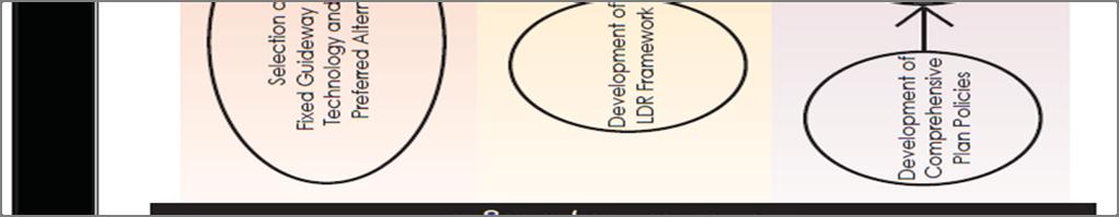
96 Hillsborough County Future Land Use 91
97 Hillsborough County Future Land Use 92
98 Hillsborough County Future Land Use 93
99 Hillsborough County Future Land Use 94

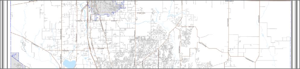
100 Hillsborough County Future Land Use 95
101 Objective 54: To plan for a fixed guideway transit system that connects activity centers within Hillsborough County and the Tampa Bay region. Policy 54.1: The County shall encourage the use of mass transit in order to decrease the dependency upon the automobile for work and non-work trips. Policy 54.2: Prior to the commencement of Station Area analysis for transit oriented development, an interlocal agreement will be executed defining specific roles and responsibilities for each of the responsible agencies (including but not limited to HART, TBARTA, FDOT, Metropolitan Planning Organization, Local Planning Agency, and Hillsborough County) and jurisdictions involved in the planning, design, and construction of the fixed-guideway transit system and its station areas. Once executed, a copy of this agreement will be maintained on file at each of the local agencies participating in this agreement so that it can be readily be read in conjunction with the agency s role in the process. Policy 54.3: The County shall coordinate with the Local Planning Agency (LPA), transit agency and the Metropolitan Planning Organization to designate the appropriate station typologies pursuant to Table TOD-2 for specific station locations, considering the unique context of each station area within the entire transit corridor and the regional system. Objective 55: Establish a Future Transit Envelope and Transit Oriented Development Overlay to guide development of a fixed guideway transit system and station areas. Policy 55.1: The TOD Overlay applies only to land that meets the following criteria: Within the Urban Service Area: Within the Future Transit Envelop as depicted on the Transit Envelope Map adopted as part of the Future Land Use Map Series: Located within ½ mile of a fixed guideway transit station, known as the Area of Influence. Policy 55.2: The allowable densities/intensities and ranges of allowable uses for the TOD Overlay are identified in Table TOD-2 Tampa and Hillsborough Fixed Guideway Transit Station Area Typologies, which is adopted as part of this section. Policy 55.3: The County shall adopt TOD Zoning Designations, consistent with Table TOD-2, which will be utilized on lands that are designated under the TOD Overlay. Hillsborough County Future Land Use 96
102 Policy 55.4 Property owners within the Area of Influence may choose one of the following options: Develop consistent with the existing zoning designation on site Rezone the site utilizing an appropriate and applicable TOD zoning designation, or prior to the adoption of TOD zoning designations, to a Planned Development requiring the development to embody the TOD design principles outlined in this section Policy 55.5: Transit Station Area Typologies (Table TOD-2) shall be used as an overlay to the Land Use Plan Categories (Appendix A), by defining the densities, intensities, and allowable range of uses that may be achieved, thereby creating the desired land use characteristics needed for successful Transit Oriented Development. Policy 55.6: In order to achieve additional development potential ( TOD bonus ), parcels within the TOD Overlay must provide transit-oriented amenities in accordance with Table TOD-4. This TOD bonus provision will ensure that new development provides transit-oriented amenities that enhance the quality of life in order to achieve the desired density and intensity needed for successful Transit Oriented Development. Transit-oriented amenities can include, but are not limited to improvements to pedestrian/bicycle facilities and connections, improvements or design amenities that would decrease automobile use and parking demands, provision of a mixture of uses within a unified development, and increased accessibility to transit for persons with disabilities. Objective 56: Efficiently plan for new development around transit stations by establishing a consistent methodology, utilizing form-based and transit-based development initiatives to assist in the development of priority Station Area Plans, for the purpose of developing transit-oriented development regulations. Policy 56.1: Following the establishment of the initial Area of Influence at a determined station location, a specific Station Area Plan Boundary for each station will be defined by the responsible entities as described in an executed interlocal agreement. The Station Area Plan Boundary, will generally include all areas within a 0.5-mile walking distance from the transit station. In determining the specific Station Area Plan Boundaries, physical, environmental, and community features, property boundaries, and borders shall be considered, thereby allowing the appropriate expansion or contraction of the Boundary. Hillsborough County Future Land Use 97
103 Policy 56.2: Station Area Plan boundaries are subject to approval by the Board of County Commissioners. The approved Station Area Plan Boundaries will become the fixed boundaries of the TOD Overlay and will fall within the Future Transit Envelope. Any TODrelated zoning change that was approved prior to the adoption of a specific Station Area Plan Boundary shall be included within that Boundary. Policy 56.3: RESERVED Policy 56.4: The County shall establish a consistent methodology, utilizing form-based and transitbased development initiatives to assist in the development of priority Station Area Plans, for the purpose of developing transit-oriented development regulations. Station typology definitions included in Table TOD-2 and a location-specific market analysis study should provide guidance for the Station Area Plan. Policy 56.5: Pursuant to the interlocal agreement (Policy 54.2), Station Area Plans will be created, consistent with the station typologies in Table 2. These plans can either be publicly or privately funded, but their completion must be overseen by a public agency. These plans will, at a minimum, consider those components identified in Table TOD-3 and inform zoning decisions based on this table, to the extent feasible in each unique station area. Table TOD-3 is adopted as part of this section. Policy 56.6 The Station Area Plan and associated transit oriented development land development code regulations shall be: consistent with the Comprehensive Plan. will recognize the community character of stable and historic neighborhoods where increased densities and intensities may be deemed inappropriate. Will recognize and maintain maximum allowable building heights and limitations on residential development within the Special Public Interest- Airport zoning categories. Policy 56.7: In addition to those Components of Station Areas documented in Table TOD-3, the Transit Station Area Design Principles in Table TOD-4, which is adopted as part of this section, should also be utilized as a guide in evaluating station areas for appropriate transit oriented development. Hillsborough County Future Land Use 98
104 Policy 56.8: A public involvement program, that includes community stakeholders, public agencies, and private developers, shall be part of the Station Area Planning Process. This process shall include community design and public workshops. Responsibility for public notice procedures shall be clearly spelled out in the adopted interlocal agreement and available for review as part of this document as described in Policy Policy 56.10: Following the completion of a Station Area Plan and during construction of the fixed guideway system, a County-initiated rezoning for parcels within station areas that are part of the fixed guideway transit alignment to transit supportive zoning categories (to be defined in the Land Development Code), will be completed. These actions will be consistent with the Comprehensive Plan. Policy 56.11: Based on the station type and compatibility (as defined in Policy 1.4) with the surrounding development pattern, transit stations and the area within 0.5-mile from the station may be designated as a Community Activity Center and be eligible for all of the benefits and incentives of the Activity Center designations. Objective 57: Utilize Transit Station Area Design Principles in Table TOD-4, and the subsequent policies listed below, to guide the development of Station Area Plans. Policy 57.1: The county and transit agency shall utilize the applicable adopted Community Plans in determining the appropriate station typology for a specific station. Community plans do not preclude change from occurring in station areas - opportunities for development and redevelopment need to be evaluated within station areas. The updates of adopted community plans should incorporate long range transit plans into the community s vision, goals and strategy. Should a Station Area Plan, as developed with community participation in accordance with Policy 56.8, propose densities, intensities or uses that are inconsistent with an adopted Community Plan, the Community Plan should be updated or amended prior to the adoption of the station area plan and any subsequent rezoning. If the Community Plan is not updated or amended accordingly, the Station Area Plan should be modified to comply with the Community Plan. Policy 57.2 Where the Transit Oriented Development Floating Designation covers areas that are designated with an industrial future land use categories, the existing categories prohibition to allowing residential development will remain in place. Increased intensity of non-residential uses may occur consistent with the Station Area Plan. Hillsborough County Future Land Use 99
105 Energy Industrial Park Provide for an Energy Industrial Park category to meet existing and future economic needs for renewable alternative energy, resource recovery and energy research needs in an environmentally responsible and economical manner in the County. An Energy Industrial Park will combine non-nuclear and other clean alternative energy generating technology, alternative energy research, educational/institutional facilities, manufacturing, distribution and ancillary service uses in one location to serve Hillsborough County residents and further the alternative energy technology knowledge base available. Industrial, warehousing, research, manufacturing, and distribution uses that find it advantageous to be located within the EIP are also permitted. Location Objective 58: Hillsborough County shall provide for an Energy Industrial Park (EIP) Future Land Use Category (which includes alternative energy, resource recovery, industrial, processing, manufacturing, warehousing, distribution, educational/institutional, research, ancillary Retail/Commercial and Office uses, and utility uses) that is located within an area that promotes sustainable development and that is within close proximity to areas that will support the agricultural product needs of renewable energy production facilities within the development. Policy: 58.1 The Energy Industrial Park will be located in an area meeting the following criteria: Within the Energy Industrial Park Urban Service Area (EIP-USA), which is adjacent to an existing Urban Service Area (refer to Policy 59.12); or within the existing Urban Service Area as it exists on August 5, Furthers sustainability goals by avoiding development of inappropriate sites, channels development to areas with existing infrastructure, and provides for redevelopment of damaged sites (such as formerly mined areas) Adjacent to and with direct access to a major arterial road Within one mile of electrical transmission grid lines. Within an area in which public utilities including potable water, sewer, and reclaimed water can be made available for connection to service the needs of the site Hillsborough County Future Land Use 100
106 Policy 58.2: Placement of future Energy Industrial Parks shall be encouraged in areas adjacent to rail to serve the types of uses found in such a facility. Development Standards Objective 59: The Energy Industrial Park (EIP) shall require set minimum development standards to ensure a sustainable project within the community. Policy 59.1 The EIP shall consist, at a minimum, of a mix of renewable alternative energy production and renewable alternative energy, resource recovery, and research type facilities with educational and employment uses to create a sustainable, viable economic base. The EIP can also include industrial, agricultural, warehouse, distribution, processing, commercial, institutional, and utility uses and ancillary Retail/Commercial and Office. The intent of the category, however, is an emphasis on renewable energy producing facilities and as such, the category requires such facilities be constructed first. More specifically, the EIP shall meet the following minimums and maximums: 1. Minimum of 40 percent of the gross land area within the EIP shall be specifically for alternative energy production, resource recovery facilities, agricultural, processing, research facilities supporting such uses or the manufacture and/or distribution of such technologies (Collectively the Energy Uses). The Park will include facilities that generate energy from at least two renewable (i.e.: sustainable) energy technologies which may include Biomass-to-energy, Wind, Solar, or Aquaculture and Municipal Solid Waste to Energy. Because this field is ever changing, other renewable alternative energy technologies shall also be permitted as they are deemed feasible and become available. 2. Renewable alternative energy production or research includes but is not limited to the following uses: agriculture, aquaculture, solar technology, windmills or similar machines designed for the capture of wind power, renewable energy research facilities and supporting structures and facilities such as greenhouses, silos, barns, warehouses, classrooms, research laboratories, etc. 3. Industrial, Research, Manufacturing, Institutional, Warehousing, and Distribution facilities that find it advantageous to locate next to renewable energy production and or renewable energy research type facilities shall also be permitted. Such uses shall not exceed 30 percent of overall net land area. Overall net acreage includes all contiguous portions of land owned or controlled by the same entity within the EIP designation, calculated by excluding right-of-way, wetlands, stormwater management areas, and environmental preservation areas dedicated to the public. The Planned Development (PD) zoning shall outline the phasing of the project Hillsborough County Future Land Use 101
107 in order to insure that at least two of the Renewable Energy Producing Facilities, as defined in the PD conditions, are constructed and are ready to operate in accordance with Hillsborough County Building Department permits before a Certificate of Occupancy can be issued for any nonrenewable energy oriented Industrial, Research, Manufacturing, Institutional, Warehousing, and Distribution use. 4. Retail/Commercial and Office uses shall be ancillary to Energy Uses, or to Industrial, Research, Manufacturing, Institutional, Warehousing and Distribution uses and shall not exceed 10 percent of the gross land area. The Planned Development (PD) zoning shall outline the phasing of the project in order to insure that at least two of the Renewable Energy Producing Facilities, as defined in the PD conditions, are constructed and are ready to operate in accordance with Hillsborough County Building Department permits before a Certificate of Occupancy can be issued for any Retail/Commercial use. 5. Retail/Commercial uses shall be located in clusters near or at the entries to the project or within the project rather than in a strip commercial development arrangement. Policy: 59.2 To promote the development and maintenance of agriculture to strengthen the agricultural economy, agricultural and aquaculture uses shall be encouraged in and around the Energy Industrial Park. Policy: 59.3 Development within any EIP shall conform to the following criteria: 1. Development within the Energy Industrial Park should strive to meet the standards set forth for Leadership in Energy and Environmental Design (LEED) certification (or an equivalent standard). 2. Buffering is required where the effects of lighting, noise, odors, and other such factors would adversely affect adjacent land uses. Where adjacent to single family residential uses or zoning, a minimum buffer greater than that required by the Land Development Code shall be provided. The width and type shall be determined within the applicable Planned Development (PD) zoning. 3. Direct access shall be required to a major arterial roadway. 4. The maximum floor area ratio shall not exceed 0.50 for Energy Uses and.35 for Industrial, Research, Manufacturing, Institutional, Warehousing and Distribution facilities. Ancillary Retail/Commercial and Office uses shall not exceed a 0.25 FAR. 5. Residential uses except for security and lodging ancillary to research, energy and education functions shall not be allowed within this district. Hillsborough County Future Land Use 102
108 Policy: 59.4 A site plan controlled Planned Development (PD) zoning district shall be required for all new and expanded Energy Industrial Parks. Policy 59.5 Energy Industrial Park developments shall be served by public water and wastewater services. Policy 59.6 Energy Industrial Park developments shall be served by reclaimed water services. Policy 59.7 All capital improvement costs associated with the provision of public facilities and services as determined by the appropriate regulatory agency or public service provider, including, but not limited to, public water and wastewater shall be the responsibility of the developer of an Energy Industrial Park and not the responsibility of Hillsborough County. This does not preclude the potential opportunities of Public/Private options, obtaining of grants or alternative funding. All necessary public facilities and services shall be provided concurrent with the development. Policy 59.8 Child care facilities in conjunction with Energy Industrial Park employment generating activities will not count towards a project s overall intensity calculations. Policy 59.9 Ancillary Retail/Commercial and Office activities allowed on site may be freestanding but are subject to all other requirements of the EIP plan category. Policy 59.10: All EIP development proposals shall address effective multi modal transportation systems including provisions for carpooling, vanpooling, mass transit, bicycling, and walking, where feasible as part of the site plan controlled zoning process. Proposed site specific policy Policy 59.11: The EIP land use designation within Sections 26, 27, 28, 33, 34, and 35 Township 29, and Range 21 shall provide the following features: 1. Intensities shall transition from greater intensities in the northwest and along SR 60 to more agriculture uses in the east and south reflecting the adjacent urban/suburban and rural areas. 2. Buffering/screening adjacent to existing residential uses along South Dover Road and along the southern property boundary shall include preservation of existing vegetation and topographic features (or as may be required or modified by any applicable reviewing agencies) Hillsborough County Future Land Use 103
109 3. Open space may include buffers and wetlands but shall not be less than 15% of the total project area. 4. The primary Industrial, Research, Manufacturing, Institutional, Warehousing, Distribution and Ancillary Retail/Commercial and Office facilities shall be limited to the 700 acres in the northwestern portion of the property and along SR EIP property south of the existing CSX railroad tracks is limited to agricultural and aquacultural uses including support uses and facilities. 6. Any resource recovery facilities including biomass facilities shall be located north of the existing CSX railroad tracks. 7. Research facilities may be located anywhere on site. 8. Retail/Commercial shall be located in clusters near or at the entries to the project or internal to the project rather than in a strip commercial development arrangement and are not permitted on SR 60 east of Turkey Creek. 9. Uses on site shall be phased to ensure all impacts are adequately addressed as part of construction of that particular phase. Significant improvements shall be included, in the CIE as part of the annual CIE update. 10. Any proposed development on this site that is not consistent with the above policy standards of this EIP will require the submittal and approval of a Comprehensive Plan map amendment. 11. The development of uses other than agricultural uses, Energy Uses or research facilities, as defined by Section and 2. shall be limited and phased as follows: a. Through January 1, 2016, no Building Permits may be issued for development (other than for agricultural uses, Energy Uses or research facilities) in excess of a cumulative maximum of 2,550,000 square feet of development as follows: 1,250,000 SF Industrial Park and 1,250,000 SF of Warehouse along with 50,000 SF of Ancillary Retail/Commercial and Office. Security housing, or lodging ancillary to research, energy and education functions of the project is allowed and shall be subject to a FAR of.5 and shall not be subject to residential dwelling unit criteria. b. After January 1, 2016, development of uses (other than Agricultural uses, Energy Uses or research facilities), is limited to a maximum cumulative total of 7,350,000 SF of Industrial, Manufacturing, Institutional, Warehousing, and Distribution and ancillary Retail/Commercial and Office uses. Security housing, or lodging ancillary to research, energy and education functions of the project is allowed and shall be subject to a FAR of.5 and shall not be subject to residential dwelling unit criteria. 12. Should development of any of these uses which are subject to DRI review be at or above the 100% DRI threshold then in effect but are less than 120% of the threshold, such development along with any development aggregable pursuant to (4), F.S., may be subject to Hillsborough County Future Land Use 104
110 DRI review. Should any of these uses which are subject to DRI review be at or above the 120% DRI threshold they along with any development aggregable pursuant to (4), F.S., shall be required to undergo DRI review. 13. The PD zoning approval shall include a staggered work shift plan to minimize peak morning and evening traffic impacts for the development. Policy Energy Industrial Park-Urban Service Area (EIP-USA) The Urban Service Area is expanded to include the EIP land use designation within Sections 26, 27, 28, 33, 34, and 35 Township 29, and Range. This Energy Industrial Park will be categorized as Energy Industrial Park Urban Service Area (EIP-USA) The EIP-USA area identifies parcels suitable for EIP designation; provided, however, that the location of property within the EIP-USA does not qualify it as an urban service area pursuant to (29), F.S., (2009) and therefore is not a TCEA pursuant to (5)(b), F.S., (2009) and does not exempt the property from the DRI program pursuant to (29), F.S. (2009), provided however, nothing stated herein shall limit the application of local ordinances that relate to levels of service for property located within an Urban Service Area. All of the criteria of Policy 2.2 shall be met when an area is considered for EIP-USA inclusion. Governmental Coordination Objective: 60:Development and operation of the Energy Industrial Park shall be coordinated with all appropriate Federal, State, regional and local agency regulations, including but not limited to the U.S. Army Corps of Engineers, Department of Environmental Protection, Department of Natural Resources, and Southwest Florida Water Management District. Policy: 60.1 The County shall encourage and review all policies to identify incentives for economic investment within an Energy Industrial Park. This may include creation of a Community Development District, Tax Increment Financing Districts, Industrial Revenue Bonds, and other special funding and infrastructure funding tools. Hillsborough County Future Land Use 105
111 COMMUNITY DESIGN COMPONENT Note: Formatting and numbering for this section of are different than other portions of this Future Land Use Element. Community Plans and Special Area Plans are now located in the Livable Communities Element (CPA 07-13) COMMUNITY DESIGN COMPONENT 106
112 1.0 INTRODUCTION 1.1 PURPOSE/OBJECTIVES/APPLICATION 1.0 INTRODUCTION 1.1 COMMUNITY DESIGN PURPOSE The purpose of the Community Design Component is to support the County s programs for growth management. It provides a specific vision for livability. A livable community represents the environmental and social quality of an area as perceived by residents, employees, and visitors. This includes safety and health (traffic safety, personal security, and public health), local environmental conditions (cleanliness, noise, air and water quality), the quality of social interactions (neighborliness, respect, community identity and pride), opportunities for recreation and entertainment, aesthetics, and existence of unique cultural and environmental resources (historic structures, wetlands, traditional architectural styles). A high level of community design benefits the people who live in, work in or visit an area, increases property values and business activity, and can improve public health and safety. Livability is largely affected by conditions in the relationships between the form and design of the public realm, where people naturally interact with each other and their community, including streets, parks, and other public facilities, and so is affected by public policy and planning decisions. Ultimately, the Community design component is intended to enhance the quality of life for Hillsborough County citizens, taking into account the following objectives: ELEMENT OBJECTIVES Pattern Development: The pattern and design of the community should be made to enhance the lifestyles and needs of its residents. Community Design seeks to establish policies that reinforce good design standards. Build Communities: Community involves the interaction of a collection of people with some shared elements. Community Design can provide the framework for the physical settings in which their interaction can take place. Establish Context: New development should relate to the whole community in which they are placed. Many of today's development problems are not a result of incompatible uses but rather incompatible designs. Good community design can help make things fit together better. Reduce Auto Dependence: One important basis of the Community design component is to provide a more balanced alternative to this prevalent pattern, an alternative which can produce communities in which life can be lead without total automobile reliance. Protect and Enhance Community Identities: Community design standards and plans for individual communities can help establish, protect, and enhance what is unique about individual communities, leading to the creation of a sense of identity. COMMUNITY DESIGN COMPONENT 113

113 1.0 INTRODUCTION 1.1 PURPOSE/OBJECTIVES/APPLICATION COMMUNITY DESIGN REQUIREMENT xxiv Due to the unique characteristics of the surrounding neighborhoods which reflect a transition into the rural area new residential development within Section 29 and 30, Township 27, Range 19, specifically along Livingston Avenue, north of Curry Road and south of the I-275 overpass, must be designed in a manner reflecting the established development pattern and character of this suburban enclave. This pattern is generally 1 or 2 du/ga as found in the neighborhoods of Fichenwald Country Homesites, Curry Cove, Livingston Oaks and Sutton Estates. New residential projects must specifically demonstrated compliance with the Community Design Component Section 5.1 Compatibility. (See Map Below) COMPONENT APPLICATION The Comprehensive Plan emphasizes three distinct choices in lifestyle - urban, suburban, and rural. Community design is a tool which enables these alternatives to be provided in a clear way which differentiates between the choices. The patterns which define these choices can be generally described, recognizing that there is great variety and sometimes there are exceptions to the COMMUNITY DESIGN COMPONENT 114
114 1.0 INTRODUCTION 1.1 PURPOSE/OBJECTIVES/APPLICATION rule. Transition design elements may bridge between urban, suburban, and rural parts of the community. COMMUNITY DESIGN COMPONENT 115
 dwelling units per acre or more.")
115 1.0 INTRODUCTION 1.2 URBAN PATTERN CHARACTERISTICS 1.2 URBAN PATTERN CHARACTERISTICS This pattern can be considered for parts of the County which have future land use designations of nine (9) dwelling units per acre or more. Generally, areas of the County considered urban possess the following characteristics: Urban Development Pattern Compact, interconnected spatial organization Few undeveloped spaces Tightly woven streets Relatively small blocks Multiple activity centers containing a mixture of residential and commercial Employment centers and civic uses Small scale open space - emphasis is placed on providing recreational facilities rather than large amounts of park land Housing Residential density - generally nine (9) or more dwelling units per acre Lot sizes - typically in the range of 7,000 square feet or less Use of the traditional community pattern of houses porches, garages at the rear, and alleys may be utilized Wide variety of housing types - may include multifamily, single family, and alternative housing such as congregate living quarters and granny flats, possibly in close proximity to one another Transportation Regularly-spaced arterials and collectors Interconnecting streets are mostly based on the grid pattern Accessible transit service Emphasis on urban streetscape and landscape, pedestrian-friendly walking environments, and human-scale furnishings Public Services Full range of public services available COMMUNITY DESIGN COMPONENT 116
 to nine (9) dwelling units per acre.")
116 1.0 INTRODUCTION 1.3 SUBURBAN PATTERN CHARACTERISTICS 1.3 SUBURBAN PATTERN CHARACTERISTICS Much of the populated portion of the County is in the suburban category. This applies primarily to areas covered by future land use designations of two (2) to nine (9) dwelling units per acre. The suburban pattern is characterized by the following: Suburban Development Pattern Suburban is transition between the urban and rural patterns - it can be very similar to either, depending on the location Less compact and intense than the urban pattern Tracts of undeveloped land may intersperse the developed portions Development may include residential subdivisions, community and neighborhood oriented commercial, agricultural uses, environmental areas, and fewer employment centers Activity centers are smaller and farther apart Open space tends to be large tracts of environmental parkland Because of the transitional nature of the suburbs, there tend to be more land use conflicts Housing Residential density - may range from two (2) to nine (9) dwelling units per acre Lot sizes - typically from 5,000 square feet up and higher Developments are likely to be more homogeneous in size and type Transportation The pattern is more dependent on the auto for all trips There may be limited transit service Streets have fewer pedestrian amenities Public Services Public facilities are required, however to a lesser degree than in urban areas. COMMUNITY DESIGN COMPONENT PAGE 117
 dwelling unit per five (5) acres and less (unless located within an area identified with a higher density land use category on the")
117 1.0 INTRODUCTION 1.4 RURAL PATTERN CHARACTERISTICS 1.4 RURAL PATTERN CHARACTERISTICS The largest land area of the County is rural in character. This covers all the future land use categories allowing one (1) dwelling unit per five (5) acres and less (unless located within an area identified with a higher density land use category on the Future Land Use Map as a suburban enclave, planned village or rural community which will carry higher densities). The characteristics of this pattern are in two components: (1) ruralagricultural and (2) rural-residential, but generally can be described as follows: Rural Development Pattern Predominance of agricultural use and agriculture related industry Predominance of undeveloped natural areas Very dispersed general pattern Widely scattered small-scale convenience -oriented retail Little employment available outside of agriculture/mining Large scale land-intensive public uses tend to locate in rural settings Residential uses are often on lots five (5) acres or larger Housing Housing type varies greatly, and may include conventional housing, manufactured housing, and farmworker quarters Most units are on lots larger than one acre Typical subdivision standards - setbacks, sidewalks, street edges and the like - are not appropriate Rural-residential uses are in relatively informal and irregular development pattern Transportation Transportation network tends to be very loose Widely dispersed roads Loose grid pattern Less interconnectedness Limited transit service Very few pedestrian facilities, except near schools Public Services Few public services Other Often a historic sense of tightly-knit small scale community PAGE 118
118 1.0 INTRODUCTION DEFINING THE FORMAT The Community design component has been organized in levels. This is a system for categorizing and understanding the livable design concepts for the unincorporated county, from the broadest to the most specific detail, from largest scale to the smallest. This component of the Future Land Use Element of the Comprehensive Plan is being reformatted in order to promote higher quality design standards in areas of new development and redevelopment throughout Hillsborough County. It addresses design related goals, objectives, and policies as they relate to people friendly community design. PAGE 119


119 2.0 COUNTY LEVEL DESIGN 2.1 MIXED-USE DEVELOPMENT 2.0 COUNTY LEVEL DESIGN 2.1 MIXED-USE DEVELOPMENT GOAL 1: Plan a pattern of compact, livable and walkable neighborhoods and communities within the urban service area which are supported by locallyoriented employment, goods and services. OBJECTIVE 1-1: Make it easier to develop in a traditional urban pattern in the Urban Service Area of the County. POLICIES 1-1.1: Encourage and provide incentives for developers to utilize traditional neighborhood development patterns, which encompasses the following policies: Neighborhood identity - compatibility with unique components of the neighborhood, distinctively designed streets and public spaces, entrance gateways, and natural features emphasized. Residential variety and diversity - varied residential densities, a mixture of housing types, accessory dwellings, and home-based employment opportunities. Compatible planning - compatible land use relationships, which incorporate open space, active uses facing public spaces, utilization of school sites as parks, and coordinated utilities placement. Central place - non-residential neighborhood serving uses at a central gathering place, with pedestrian friendly environments. Linkages - interconnection of internal neighborhood components and interconnection to the surroundings via a basic grid network of access and open space. Public spaces similar to the one pictured contribute to establishing a neighborhood identity. The diverse housing stock allows a range of incomes within the same neighborhood. Appropriately scaled parks within walking distance of each neighborhood are important community gathering spaces. PAGE 120

: Movement - walkable and shaded blocks and streets with sidewalks and crosswalks, facilities for bicycles, and transit stops where appropriate.")
120 2.0 COUNTY LEVEL DESIGN 2.1 MIXED-USE DEVELOPMENT GOAL 1: Plan a pattern of compact, livable and walkable neighborhoods and communities within the urban service area which are supported by locally-oriented employment, goods and services. (Continued) OBJECTIVE 1-1: Make it easier to develop in a traditional urban pattern in Urban Service Area of the County. (Continued) POLICIES 1-1.1: (Continued): Movement - walkable and shaded blocks and streets with sidewalks and crosswalks, facilities for bicycles, and transit stops where appropriate. Cars and streets - streets narrow enough to discourage speeding, but with room for on-street parking, encouraging cars stored toward the back of the lot, possibly accessible by alleys, allowing shared driveways and duplex or quadriplex garages at the rear lot line. Street-friendly housing - housing which is close to and faces the street, with active uses and porches on the front, and windows and doors establishing visual connection to the street - garages located to the side or rear, or at least set back. Social spaces - a variety of sizes and uses of open space is provided in each neighborhood, encouraging both active and passive uses and fostering interaction between neighbors. Design which is sensitive to natural, manmade, and cultural context, climate-appropriate design and materials, limited fill, water-wise landscape, preserved natural features, design features from local history and culture. Shaded blocks provide comfort for users and consequently facilitate pedestrian movement. Streets, like the one pictured, are narrow enough to discourage speeding but wide enough to allow on street parking. An example of street friendly housing. PAGE 121

 in addition to utilizing the TND option bonus (Policy 1.")
. 1-1.")
121 2.0 COUNTY LEVEL DESIGN 2.1 MIXED-USE DEVELOPMENT GOAL 1: Plan a pattern of compact, livable and walkable neighborhoods and communities within the urban service area which are supported by locally-oriented employment, goods and services. (Continued) OBJECTIVE 1-1: Make it easier to develop in a traditional urban pattern in Urban Service Area of the County. (Continued) POLICIES 1-1.2: Traditional Neighborhood Developments may be eligible to receive transfers of development rights (TDR) in addition to utilizing the TND option bonus (Policy 1.1.6) if they are located in one of the following: an identified activity center, an identified redevelopment area, or the boundaries of a community plan that supports TND development patterns (see the Future Land Use Map series, TDR Sending and Receiving Areas Map) : Promote home-based employment, including live work units and telecommuting, in both existing and new communities : Incorporate more open space in new development and redevelopment through the use of techniques such as clustering, preservation of environmentally sensitive areas, provision of recreation areas, higher design standards and/or transfer of development rights. An example of an activity center within Tampa. Creation of live work units, like this artist studio, is encouraged. By clustering development, more room is left for open space and recreation areas. PAGE 122
122 2.0 COUNTY LEVEL DESIGN 2.1 MIXED-USE DEVELOPMENT GOAL 1: Plan a pattern of compact, livable and walkable neighborhoods and communities within the urban service area which are supported by locally-oriented employment, goods and services. (Continued) OBJECTIVE 1-1: Make it easier to develop in a traditional urban pattern in Urban Service Area of the County. (Continued) POLICIES 1-1.6: As an incentive to implement Traditional Neighborhood Development (TND), TND projects are permitted to develop at increased density and intensity as outlined in the Traditional Neighborhood Development Option bonus below. Residential density and non-residential intensity increase may be considered by the Board of County Commissioners, without a plan amendment, in the land use categories as shown below when the purpose is to develop an alternative form in land use known as Traditional Neighborhood Development (TND). Traditional Neighborhood Development for the purpose of this option must be designed to provide for integration of uses, compatible scale, residential diversity, internal relationship of uses and linkages as well as provide shopping and job opportunities. The bonus shall be granted as part of an official request to rezone the subject to the TND development district found in the Hillsborough County Land Development Code. The TND Option Bonus shall be approved under the comprehensive TND development regulations of the Land Development Code. In order to qualify to use the TND Option Bonus, the site shall adhere to the following criteria: o Adequate infrastructure to service the project shall be in place at the site or within ½ mile of the site (including public water, wastewater and roadways). o Be within the boundaries of the Urban Service Area (USA). o Have direct access to public streets. o Be designed to accommodate the use of transit services within the project site. o Shall be in one of the residential or commercial land use categories allowing four (4) or more dwelling units to the acre. No industrial uses are permitted within properties developed with the TND option. Table of Maximum Allowable Density and Intensity for Traditional Neighborhood Development Option The following table represents the maximum amount of development that can be considered. Site constraints, compatibility with surrounding uses and other limitations may restrict these amounts. PAGE 123
123 2.0 COUNTY LEVEL DESIGN 2.1 MIXED-USE DEVELOPMENT Urban Land Use Category Density (Dwelling Units/Acre) Intensity (Square Footage*/ Floor Area Ratio) Res ,000*/.35 FAR Res ,000*/.35 FAR NMU-4(3) 6 300,000*/.35 FAR SMU ,000*/.50 FAR Res ,000*/.50 FAR Res ,000*/.50 FAR CMU ,000*/1.0 FAR Res ,000*/.50 FAR Res ,000*/.50 FAR Res ,000*/2.0 FAR OC ,000*/.75 FAR UMU FAR Residential units as part of vertical mixed-use structures are regulated by Floor Area Ratio (FAR), not by density. * Square footage cap is for retail commercial uses. PAGE 124
124 2.0 COUNTY LEVEL DESIGN 2.1 MIXED-USE DEVELOPMENT GOAL 1: Plan a pattern of compact, livable and walkable neighborhoods and communities within the urban service area which are supported by locallyoriented employment, goods and services. (Continued) OBJECTIVE 1-2: Promote a variety of uses in order to create vitality and bring many activities of daily life within walking distances of homes. POLICIES 1-2.1: Within proposed developments, encourage 50% of new housing units within 1/2 of a mile of parks and/or schools open to the public : Require a mix of housing types and lot sizes within mixed use neighborhoods, emphasizing harmonious design and building type : The County shall continue to allow for an accessory dwelling unit associated with an owner occupied single family residence to be built on the single deeded lot : Promote infill and rehabilitation activity. Reduce on-site parking requirements for small-lot infill projects, allowing parking demand to be satisfied by on-street, shared or remote parking or transit : Provide a greater variety of allowable development patterns, which encourage good community design and which reflect the character of the surroundings : Promote a wider range of uses in close proximity to each other within new and existing urban communities. These uses shall include: Mixed density housing with a variety of housing options Local-serving goods and services Civic uses Employment uses PAGE 125
125 2.0 COUNTY LEVEL DESIGN 2.2 CPTED 2.2 CRIME PREVENTION THROUGH ENVIRONMENTAL DESIGN (CPTED) GOAL 2: Create safer, more livable communities that foster interaction between people and discourage criminal activities through their effective use of the physical environment and proper design. OBJECTIVE 2-1: CPTED techniques and principles should be utilized in new development to achieve safe, livable communities. POLICIES 2-1.1: Support the incorporation of public safety considerations and CPTED techniques into project design and review for future development and redevelopment in the County : Natural surveillance techniques should be considered in the placement of physical features, mix of activities and uses, people and lighting in such a way as to maximize visibility : Promote the inclusion of pedestrian-friendly streets and sidewalks as a means of natural surveillance : Encourage site design of buildings that orients doors and windows to overlook streets and parking areas. Shaded blocks provide comfort for users and consequently facilitate pedestrian movement. PAGE 126
 OBJECTIVE 2-1: CPTED techniques and principles should be utilized in new development to achieve safe, livable communities. (Continued) POLICIES 2-1.")


126 2.0 COUNTY LEVEL DESIGN 2.2 CPTED GOAL 2: Create safer, more livable communities that foster interaction between people and discourage criminal activities through their environment and design. (Continued) OBJECTIVE 2-1: CPTED techniques and principles should be utilized in new development to achieve safe, livable communities. (Continued) POLICIES 2-1.5: Physical attributes that express ownership, such as pavement treatments, landscaping, art, signage, screening and fences should be used as a form of territorial reinforcement : Sidewalks, entrances, landscaping and fences should be used to provide physical guidance to and from entrances and exits and to prevent public access from dark or unmonitored areas, as a natural access control technique : The use of low maintenance landscaping and lighting treatments and the upkeep of property should be used to facilitate CPTED principles : Delineate private spaces from public spaces with plantings, pavement designs, gateway treatments, and low fencing, where feasible : Clearly delineate public routes while at the same time discouraging access to private areas : All open space areas, and access to them, should be carefully designed and located, using natural surveillance to maximize community safety and crime prevention and minimize opportunities for public nuisance. The picket fence along the front of this building serves as a form of territorial reinforcement. An example of good physical guidance. The provision of lighting is an important part of discouraging criminal activities. PAGE 127


127 2.0 COUNTY LEVEL DESIGN 2.3 SUSTAINABILITY 2.3 SUSTAINABILITY POLICIES 3-1.1: Encourage for the design of communities, subdivisions, site plans and individual buildings which follow criteria for energy efficiency. Encourage construction of LEED (Leadership in Energy and Environmental Design) : Select Florida Friendly plant material appropriate to the County s climate, soils, and water availability to conserve water, reduce use of pesticides, reduce plant mortality, and lower maintenance costs : Promote development within environmentally appropriate areas such as previously developed land, infill lots, and/or remediated brownfields : Discourage development in areas that possess the following characteristics: wetlands, 100-year floodplain, and/or habitat for species on the federal or state threatened or endangered list : Avoid major alterations to areas with sensitive topography, vegetation and wildlife habitat : Continue to limit the amount of site dedicated to building, parking and access road construction in order to maximize the amount of open space through efficient circulation and good design. The protection of prime agriculture areas is encouraged in sustainable development. Green Buildings like Seattle s public library incorporate many sustainable design principles. Acquire open space for the purpose of conservation. PAGE 128
128 2.0 COUNTY LEVEL DESIGN 2.3 SUSTAINABILITY THIS PAGE LEFT INTENTIONALLY BLANK PAGE 129
129 3.0 COUNTY LEVEL CONCERN 3.1 CULTURAL 3.0 COUNTY LEVEL CONCERN DESIGN 3.1 CULTURAL GOAL 6.1: Ensure that the cultural sector is a core component of economic and community development, planning, and programming. POLICIES 6-1.1: Enlist developers as partners to invest in and encourage cultural developments that add value to their communities and their projects : The County will develop incentives to offer developers to incorporate cultural space and public art to their projects : Maintain, support, and expand public art programs throughout Hillsborough County : Consider a gateway to establish a image for all of Hillsborough County : Market the region s cultural attractions to increase participation by residents and visitors : Provide life-long opportunities for arts, heritage, and science education for all county residents : The County should continue to invest in community facilities, libraries, schools, universities and recreation centers, especially those that accommodate mixed uses including arts, heritage, and interpretive sciences. Shaded blocks provide comfort for users and consequently facilitate pedestrian movement. PAGE 130
130 3.0 COUNTY LEVEL CONCERN 3.1 CULTURAL THIS PAGE LEFT INTENTIONALLY BLAN PAGE 131


131 4.0 COMMUNITY LEVEL DESIGN 4.1 RURAL RESIDENTIAL CHARACTER 4.0 COMMUNITY LEVEL DESIGN DESIGN 4.1 RURAL RESIDENTIAL CHARACTER GOAL 7: Preserve existing rural uses as viable residential alternatives to urban and suburban areas. OBJECTIVE 7-1: Support existing agricultural uses for their importance as a historical component of the community, their economic importance to the County and for the open space they provide. POLICIES 7-1.1: Preserve natural areas in rural residential lot development : Vary lot size in order to encourage diversity of housing product types and respect natural resources. Natural areas are an important part of the rural character. An example of rural housing. PAGE 132


132 4.0 COMMUNITY LEVEL DESIGN 4.2 SUBURBAN RESIDENTIAL CHARACTER 4.2 SUBURBAN RESIDENTIAL CHARACTER GOAL 8: Preserve existing suburban uses as viable residential alternatives to urban and rural areas. OBJECTIVE 8-1: Within future residential areas in the suburban locations promote better design that incorporates a greater mix of uses. An example of suburban housing. An aerial view demonstrating a suburban development pattern. PAGE 133


133 4.0 COMMUNITY LEVEL DESIGN 4.3 COMMERCIAL CHARACTER 4.3 COMMERCIAL CHARACTER GOAL 9: Evaluate the creation of commercial design standards in a scale and design that complements the character of the community. POLICIES 9-1.1: Provide incentives for the redevelopment of commercial structures to enhance building facades, signage, landscaping, general buffering and access management. Encourage zero lot line construction for new construction : Avoid "strip" development patterns for commercial uses : New commercial zoning is encouraged to locate at activity centers and commercial redevelopment areas : Encourage commercial structures to consist of more than one story and be vertically mixed. Additional landscaping and buffering, and improved sign and access management standards would improve the character of this commercial corridor. The commercial character along these streetscapes is pleasant and pedestrian friendly. PAGE 134
 they serve.")


134 4.0 COMMUNITY LEVEL DESIGN 4.4 SCHOOLS 4.4 SCHOOLS GOAL 10: Locate and design schools in a manner that creates community assets, which have a positive relationship and connection to the neighborhood(s) they serve. OBJECTIVE 10-1: The planning and development of schools should encourage pedestrian and bicycle travel, reflect the history and character of the community and be appropriately scaled to the community. POLICIES : Encourage the design of schools to have a scale similar to adjacent development : Provide siting of schools that is sensitive to the environment, avoiding construction within major environmental areas : Schools and other publicly-owned community facilities such as libraries, parks and community or cultural centers as well as private facilities should be collocated to allow for shared resources and savings in cost : Design middle and elementary schools to accommodate drop-offs and pick-ups on site, without interrupting traffic flow on local streets : School facilities should be sized and located to enable children to walk or bicycle to them : Encourage walk to school programs, e.g., walking school buses, to increase safety and to reduce school-related automobile trips : Connect destinations such as schools, neighborhoods and parks as well as greenways through links to various districts. Use techniques such as cooperative agreements, easement based public lands, and public rightsof-way : Coordination efforts between the School Board and County on the planning for new school sites should include coordination of sidewalk facilities plans with the Five Year School Facilities Plan. Whether in an urban setting (above) or a suburban one (below) schools should reflect the character of the community. Participants in a walking school bus program. PAGE 135

 surfaces and aeration techniques: screen and buffer ponds with natural vegetation or berms or at a minimum vinyl")

135 5.0 NEIGHBORHOOD LEVEL DESIGN 5.1 COMPATIBILITY 5.1 COMPATIBILITY 4.5 NATURAL RESOURCE PRESERVATION POLICIES : Require natural and attractive stormwater retention facilities, such as standards for gently sloping grass sides/ banks and prohibiting hard (i.e., concrete, asphalt) surfaces and aeration techniques: screen and buffer ponds with natural vegetation or berms or at a minimum vinyl fencing with vines, prohibit plain exposed chain link fencing. Encourage master stormwater facilities. Integrate links to natural resources within new developments. Natural and attractive treatment of stormwater systems and retention facilities is encouraged. Landscape treatment of stormwater as pictured can effectively address water management as well as provide an attractive amenity to developments. PAGE 136

 with the established character of the surrounding neighborhood. POLICIES 12-1.")

136 5.0 NEIGHBORHOOD LEVEL DESIGN 5.1 COMPATIBILITY 5.1 COMPATIBILITY 5.0 NEIGHBORHOOD LEVEL DESIGN DESIGN 5.1 COMPATIBILITY GOAL 12: Design neighborhoods which are related to the predominant character of the surroundings. OBJECTIVE 12-1: New developments should recognize the existing community and be designed in a way that is compatible (as defined in FLUE policy 1.4) with the established character of the surrounding neighborhood. POLICIES : Lots on the edges of new developments that have both a physical and visual relationship to adjacent property that is parceled or developed at a lower density should mitigate such impact with substantial buffering and/or compatible lot sizes : Walls and buffering used to separate new development from the existing, lower density community should be designed in a style compatible with the community and should allow pedestrian penetration. In rural areas, perimeter walls are discouraged and buffering with berms and landscaping are strongly encouraged : New development in existing, lower density communities should utilize the planned development process of rezoning in order to fully address impacts on the existing community. Additionally, preapplication conferences are strongly encouraged with the staffs of the Planning Commission and Hillsborough County Planning and Growth Management Department. Compatible lot sizes should be incorporated among adjacent developments. Using walls as buffers is discouraged (above) in favor of landscape buffers (below). PAGE 137
 OBJECTIVE 12-1: New developments should recognize the existing community and be designed in a way that is compatible with the established character of the surrounding neighborhood.")


137 5.0 NEIGHBORHOOD LEVEL DESIGN 5.1 COMPATIBILITY 5.1 COMPATIBILITY GOAL 12: Design neighborhoods which are related to the predominant character of the surroundings. (Continued) OBJECTIVE 12-1: New developments should recognize the existing community and be designed in a way that is compatible with the established character of the surrounding neighborhood. (Continued) POLICIES : Compatibility may be achieved through the utilization of site design techniques including but not limited to transitions in uses, buffering, setbacks, open space and graduated height restrictions, to affect elements such as height, scale, mass and bulk of structures, pedestrian or vehicular traffic, circulation, access and parking impacts, landscaping, lighting, noise, odor and architecture : In order to facilitate community understanding of issues, encourage early neighborhood-based input regarding rezonings which require public hearing : Include design related issues as part of the neighborhood planning process. An incompatible use among neighborhoods. Different building widths and materials are mitigated by the similar heights and setbacks of the structures. Compatible design in a residential setting. PAGE 138


138 5.0 NEIGHBORHOOD LEVEL DESIGN 5.2 URBAN/SUBURBAN 5.2 URBAN/SUBURBAN GOAL 13: Within urban and/or suburban areas of the County, encourage new developments or infill developments to incorporate a mix of uses. OBJECTIVE 13-1: Flexible urban design standards should be considered to guide new development and redevelopment in urban/suburban areas. POLICIES : Amendments to the land development code, aside from the Traditional Neighborhood Development considerations, shall be considered which will allow future residential development or redevelopment in urbanizing areas to assume a more urban character. This shall include such considerations as: Relatively narrow residential streets. Houses close to the street. Front porch easements. Garages set back to the rear of the property. Block patterns providing alleys. Granny flats : Refine subdivision regulations to allow for alternative design within the existing suburban development pattern : Form-based codes should be considered to regulate the scale and form of new development in activity centers. Accessory units similar to the one pictured are encouraged within traditional neighborhood developments. Even larger homes like the one shown above can be placed close to the street, giving the street a more urban feel. Small scale employment centers can enhance neighborhood developments. PAGE 139
 OBJECTIVE 13-1: Those areas within the County which may be considered as urban in character, or which are moving in that direction, shall be targeted for community planning to determine")


139 5.0 NEIGHBORHOOD LEVEL DESIGN 5.2 URBAN/SUBURBAN 5.2 URBAN/SUBURBAN (Continued) GOAL 13: Make it possible to develop in a traditional urban pattern in designated urbanizing areas of the County. (Continued) OBJECTIVE 13-1: Those areas within the County which may be considered as urban in character, or which are moving in that direction, shall be targeted for community planning to determine appropriate modifications to land development and other regulations. (Continued) POLICIES : Where conditions permit, design communities around a grid network of streets, or a modified grid, which will improve interconnections between neighborhoods and surrounding neighborhood-serving uses : The street network should provide all residents with direct links to community focal points, social services and major roads in the region : Produce a streetscape with pedestrian amenities, with safe and pleasant means to walk around in the commercial environment and to access the adjacent neighborhoods : Allow the design of neighborhoods to be more directly responsive to site conditions : Reduce the street corner radius in residential neighborhoods to better accommodate walkable environments and to provide additional pedestrian safety. Promote the use of a grid network of streets, which is more direct and a less confusing system for roadway users. Discourage meandering curvilinear streets that terminate with cul de sacs and dead ends, which are less efficient and make wayfinding difficult. An example of a pleasant, walkable urban street. PAGE 140


140 5.0 NEIGHBORHOOD LEVEL DESIGN 5.3 RURAL 5.3 RURAL GOAL 14: Provide standards within the land development code for development in the rural areas, which allow for developments of a specifically rural character. OBJECTIVE 14-1: By 2012, define a set of development standards in the Land Development Code to be used for each rural community through the Community Based Planning program. These standards should include the following considerations: POLICIES : Encourage a rural development pattern: Variable and larger lot sizes Shared driveways No curbs Variable set-backs No sidewalk - use asphalt, gravel, or other pervious surfaces Lighting only for multiple dwellings Use of xeriscape principles and natural treatment of retention Passive open green space Permeable parking : Build rural roadways: Discourage wide roads that are disruptive of community Allow local streets to be designed as narrow curving roads Leave existing vegetation, up to edge of road if visibility requirements are met Trees arching over roadway Stop signs : Describe a rural approach to buffering and fencing: Berms with vegetation, split rail fencing Brick columns with wrought iron A separation or setback distance may be considered in lieu of a vertical screening. Green or black chain link with planting Discourage walls and cinder block or stockade wood fencing A house within a typical rural development: large setback, no sidewalk, surrounded by passive open space. A narrow, rural roadway with trees arching over. A vegetation berm buffers these rural homes. PAGE 141
 GOAL 14: Provide standards within the land development code for development in the Rural Area, which allows for developments of a specifically rural")
 OBJECTIVE 14-2: By 2012, define standards to integrate commercial developments into rural settings which will enhance the quality of the rural environment and")

141 5.0 NEIGHBORHOOD LEVEL DESIGN 5.3 RURAL 5.3 RURAL (Continued) GOAL 14: Provide standards within the land development code for development in the Rural Area, which allows for developments of a specifically rural character. (Continued) OBJECTIVE 14-2: By 2012, define standards to integrate commercial developments into rural settings which will enhance the quality of the rural environment and provide appropriately scaled local serving goods and services and small scaled employment. POLICIES : These standards should include the following: * Locate interior to new development where applicable. * Architecturally compatible with rural surroundings, and residential in appearance. * Not more than two stories. * Having reverse frontage parking, with permeable surfaces allowed, and with a reduced number of spaces required where appropriate. * Signage and lighting of rural character, at ground level, externally lit. Typical rural commercial use, like the ones pictured above, should appear residential in character. PAGE 142
142 6.0 ROADWAY LEVEL DESIGN 6.1 INTRODUCTION 6.0 ROADWAY LEVEL DESIGN DESIGN 6.1 INTRODUCTION Livable Roadways is an approach to roadway planning and design that integrates transportation safety and function with other considerations. Among the considerations is the shared use of the roadway by alternative modes - bicycle, pedestrian, and transit. It includes user-friendly amenities, such as safe crosswalks, pedestrian lighting and street furniture where appropriate. It emphasizes landscaped medians and rights-of-way. It considers the impact of roadway construction on the surrounding communities and environmental areas, and seeks to provide the transportation solutions that contribute to the overall livability if the adjacent neighborhoods and the community at large. In August of 2006, the Livable Roadways Guidelines document was adopted by the Hillsborough County Metropolitan Planning Organization. The purpose of this document is to provide guidance on features and variables that contribute toward enhancing the experience of people using various transportation modes typically within the roadway corridor. It is the intention of this document to set forth guidelines consistent with local codes and ordinances. Guidelines within this document highlight best practices of roadway design. However, some changes are needed to employ all of the best practices. The intent of this document is to inspire a new approach to roadway design, emphasizing that our communities streets are significant public spaces for all modes of transportation; and embrace the concept of moving people, not just cars, to enhance the livability of roadways throughout Hillsborough County. The design standards within this document allow for flexibility in order to accommodate facilities for different users. This flexibility needs to be employed in order for our roadways to be livable. The following section includes some of the policies set forth by the Livable Roadway Guidelines as they relate to people friendly community design. PAGE 143


143 6.0 ROADWAY LEVEL DESIGN 6.2 PEDESTRIAN NETWORK 6.2 PEDESTRIAN NETWORK GOAL 15: Provide a transportation system throughout Hillsborough County that is safe and functional for all modes of transportation, is aestheticallypleasing, and is designed to meet the overall needs of the communities it serves. OBJECTIVE 15-1: Provide for pedestrian needs in the design of new and existing roadways. POLICIES : Design pedestrian facilities for designated roadways in urban and suburban areas to include the following considerations: Continuous sidewalks, free of obstruction, buffered from traffic by landscape or setbacks, and shaded by awnings or trees where appropriate. Street furnishings, including benches, trash receptacles, bus shelters, and lighting, as appropriate to the surroundings in urban settings : Provide direct routes between destinations, minimizing potential conflicts between pedestrians and automobiles, and connecting sidewalks and building entrances : Locate sidewalks along both sides of all public streets and in all residential areas, particularly near schools and adjacent to parks or recreational facilities, office buildings, local businesses and other similar locations that attract high amounts of pedestrian activity : Where roadside elements, such as fire hydrants, parking meters, landscaping, signs, and street furniture, are planned they should be placed between the sidewalk and the roadway to create a buffer for pedestrians in a manner that does not impair visibility by motorists, where allowed and appropriate per applicable transportation technical standards. Pedestrian routes should be direct and convenient for use. Awnings, landscape, and street level interest provide for a pleasant pedestrian corridor. Street furnishings enhance the look and feel of this urban streetscape. PAGE 144
 GOAL 15: Provide a transportation system throughout Hillsborough County that is safe and functional for all modes of transportation, is aestheticallypleasing, and is")


144 6.0 ROADWAY LEVEL DESIGN 6.2 PEDESTRIAN NETWORK 6.2 PEDESTRIAN NETWORK (Continued) GOAL 15: Provide a transportation system throughout Hillsborough County that is safe and functional for all modes of transportation, is aestheticallypleasing, and is designed to meet the overall needs of the communities it serves. (Continued) OBJECTIVE 15-1: Provide for pedestrian needs in the design of new and existing roadways. (Continued) POLICIES : Provide a clear passage zone equal to the required minimum sidewalk width in areas with movable obstructions. Place benches on a separate pad behind the back of sidewalk or between the sidewalk and the street to avoid clear passage zone obstruction : Explore the potential for moving the sidewalk to the edge of the rightof-way for roadways with high design speeds. A buffer consisting of swales, planting strips, road shoulders, and/or bike lanes should be considered when feasible : Continue sidewalk paths, including sidewalk material, across the entire length of all driveway aprons. Match the adjacent sidewalk materials : Where appropriate, include art, creative design, cultural and historical markers, and other similar enhancements along sidewalks. Outdoor seating should be placed behind clear passage zones. Continue sidewalk paths across driveway aprons. Artwork can be used to enhance pedestrian spaces. PAGE 145


, marked crosswalks and pedestrian signals at all approaches of signalized intersections where there is significant pedestrian activity. 15-2.")
145 6.0 ROADWAY LEVEL DESIGN 6.3 PEDESTRIAN CROSSINGS 6.3 PEDESTRIAN CROSSINGS GOAL 15: Provide a transportation system throughout Hillsborough County that is safe and functional for all modes of transportation, is aestheticallypleasing, and is designed to meet the overall needs of the communities it serves. (Continued) OBJECTIVE 15-2: Provide safe and convenient roadway crossings that are easily identifiable by pedestrians and motorists. POLICIES : Provide adequate roadway crossings, signalized and unsignalized, at appropriate intervals : Provide high visibility (ladder or triple-four style), marked crosswalks and pedestrian signals at all approaches of signalized intersections where there is significant pedestrian activity : Time pedestrian signals at intersection crosswalks so that bicyclists and pedestrians are not burdened with extended waits or insufficient crossing times : Where there are more than 10 through and turn lanes at the intersection, provide an alternative to an at-grade crossing for pedestrians. High visibility crosswalks are appropriate in locations with significant pedestrian activity. Do not burden users with extended wait times or insufficient crossing time. LED lights can increase safety of crosswalk users. PAGE 146
 GOAL 15: Provide a transportation system throughout Hillsborough County that is safe and functional for all modes of transportation, is aestheticallypleasing, and")
 POLICIES 15-2.5: Unsignalized pedestrian crossings should be installed with warning signs and adequate visibility for motorists and crosswalk users. 15-2.6: Countdown signals should be provided at crossings where there is significant pedestrian activity.")

146 6.0 ROADWAY LEVEL DESIGN 6.3 PEDESTRIAN CROSSINGS 6.3 PEDESTRIAN CROSSINGS (Continued) GOAL 15: Provide a transportation system throughout Hillsborough County that is safe and functional for all modes of transportation, is aestheticallypleasing, and is designed to meet the overall needs of the communities it serves. (Continued) OBJECTIVE 15-2: Provide safe and convenient roadway crossings that are easily identifiable by pedestrians and motorists. (Continued) POLICIES : Unsignalized pedestrian crossings should be installed with warning signs and adequate visibility for motorists and crosswalk users : Countdown signals should be provided at crossings where there is significant pedestrian activity : Provide new standards that provide for median islands for pedestrian safety to be included in the design of roadways having three or more travel lanes in each direction. If there is an inadequate amount of pedestrian crossings, unsafe crossings, outside of the intersections, may be more frequent. The contrasting color and material of this crosswalk make it more visible to pedestrians and motorists. Refuge islands can make crossing multiple lanes or traffic easier and safer. PAGE 147

 OBJECTIVE 15-3: Provide pedestrian amenities along roadways, sidewalks, and bike paths to increase the comfort, safety, and security of users. POLICIES 15-3.")

147 6.0 ROADWAY LEVEL DESIGN 6.4 PEDESTRIAN AMENITIES 6.4 PEDESTRIAN AMENITIES GOAL 15: Provide a transportation system throughout Hillsborough County that is safe and functional for all modes of transportation, is aestheticallypleasing, and is designed to meet the overall needs of the communities it serves. (Continued) OBJECTIVE 15-3: Provide pedestrian amenities along roadways, sidewalks, and bike paths to increase the comfort, safety, and security of users. POLICIES : Provide lighting and street furnishings, including benches and trash receptacles, where appropriate, especially main streets and transit stops : Ensure that funding for street lighting is a part of roadway budgeting on collector and arterial roadways : Require consideration of appropriately scaled street lights in new subdivisions and design street lighting to enhance the character of commercial areas : In urban areas, provide pedestrian scale lighting, with frangible bases, between the curb and sidewalk : Lighting levels and lighting design for the right-of-way should meet Crime Prevention Through Environmental Design standards : To consolidate the number of fixtures placed within the right-ofway, consider placing a tall pole with varying luminary heights and other streetscape elements, such as street banners, on a single pole. Light poles can be combined with landscape elements, as shown above. A lack of amenities make this sidewalk corridor appear not pedestrian friendly. An urban streetscape with a variety of pedestrian amenities. PAGE 148

 OBJECTIVE 15-4: Make communities more livable by making the roadway environment more pedestrian friendly for all users including those with disabilities. POLICIES 15-4.")
148 6.0 ROADWAY LEVEL DESIGN 6.5 ACCESSIBILITY 6.5 ACCESSIBILITY GOAL 15: Provide a transportation system throughout Hillsborough County that is safe and functional for all modes of transportation, is aestheticallypleasing, and is designed to meet the overall needs of the communities it serves. (Continued) OBJECTIVE 15-4: Make communities more livable by making the roadway environment more pedestrian friendly for all users including those with disabilities. POLICIES : Provide pedestrian signal push calls designed and constructed to be accessible to persons with disabilities : Provide textural and color contrasts on surfaces of walkways to warn pedestrians of abrupt grade changes, potentially dangerous exits and vehicular areas. Protruding objects can be particularly hazardous to blind individuals. The texture and color contrast before the crosswalk is used to warn pedestrians that they are entering a vehicular area. Wide walkways with a generous clear passage zone are recommended. PAGE 149


149 6.0 ROADWAY LEVEL DESIGN 6.6 MULTI-USE TRAILS 6.6 MULTI-USE TRAILS GOAL 15: Provide a transportation system throughout Hillsborough County that is safe and functional for all modes of transportation, is aestheticallypleasing, and is designed to meet the overall needs of the communities it serves. (Continued) OBJECTIVE 15-5: Encourage the maintenance and creation of trails that connect and enhance the communities in which they are placed. POLICIES : Connect or accommodate future connections to planned and/or existing trails within new development : Do not locate trails directly adjacent to roadways, except in urban situations where no other feasible alternative exists : Minimize the number of at-grade crossings with roadways or driveways along trails. Where crossings occur, or signalized intersections denote with high visibility crosswalks : Trails should connect to a variety of uses including existing and proposed civic, residential, commercial and recreational use. Trails should not be located directly adjacent to roadways. Coordinate trail planning among neighboring jurisdictions. Connection to a variety of uses, including commercial, is desirable. PAGE 150


150 6.0 ROADWAY LEVEL DESIGN 6.7 BICYCLE NETWORK 6.7 BICYCLE NETWORK GOAL 15: Provide a transportation system throughout Hillsborough County that is safe and functional for all modes of transportation, is aestheticallypleasing, and is designed to meet the overall needs of the communities it serves. (Continued) OBJECTIVE 15-6: Provide for the needs of bicyclists in the design of designated roadway improvements and of new roadways. POLICIES : Implement the Hillsborough County Comprehensive Bicycle Plan, adopted by the Hillsborough County Metropolitan Planning Organization in November : Design bicycle facilities for designated roadways to include the following considerations: Bike paths, lanes, and shoulders planned for designated roadways, in coordination with adjacent uses and appropriate to different roadway types. Facilities which are well marked and signed, and that are designed for ease of maintenance : Encourage private development to provide pedestrian and bicycle facilities on site by reducing parking requirements. Bike lane configuration through an intersection. Bike lanes should be included as part of the typical roadway. Where bike lanes are not feasible, signs should be installed informing vehicular users that bikes share the roadway. PAGE 151
 GOAL 15: Provide a transportation system throughout Hillsborough County that is safe and functional for all modes of transportation, is aestheticallypleasing, and is")
 POLICIES 15-6.4: Include bicycle-sensitive traffic control signals, appropriately identified with road marking and signs, in all intersection improvement projects and new construction.")

151 6.0 ROADWAY LEVEL DESIGN 6.7 BICYCLE NETWORK 6.7 BICYCLE NETWORK (Continued) GOAL 15: Provide a transportation system throughout Hillsborough County that is safe and functional for all modes of transportation, is aestheticallypleasing, and is designed to meet the overall needs of the communities it serves. (Continued) OBJECTIVE 15-6: Provide for the needs of bicyclists in the design of designated roadway improvements and of new roadways. (Continued) POLICIES : Include bicycle-sensitive traffic control signals, appropriately identified with road marking and signs, in all intersection improvement projects and new construction : Provide bike lockers or storage racks at major destinations and transit connections, close to main entrances of buildings in highly visible, or in high trafficked, easy to access location. Bicycle parking provided in a covered location is preferred : Paved shoulders for use by bicyclists should be included along roadways without designated bike lanes where feasible : Travel lane width reductions should be considered in order to provide expanded paved shoulders, wide outside lanes or bike lanes : Where bike lanes are not currently part of the road, install during road maintenance, resurfacing, or restriping where feasible : Where bike lanes are adjacent to transit stops signage should be added to make bicyclists aware of transit stop locations to ensure safety among pedestrian, bicyclists and busses. There is a greater tendency for conflicts to arise when bicyclists and pedestrians share sidewalks. Covered parking helps protect bikes from inclement weather. At this mall, bike racks with lids are provided. Enhance trail connectivity by coordinating trail planning among neighboring jurisdictions. PAGE 152


152 6.0 ROADWAY LEVEL DESIGN 6.8 TRANSIT NETWORK 6.8 TRANSIT NETWORK GOAL 15: Provide a transportation system throughout Hillsborough County that is safe and functional for all modes of transportation, is aestheticallypleasing, and is designed to meet the overall needs of the communities it serves. (Continued) OBJECTIVE 15-7: Ensure that roadway improvements and new roadways are designed to accommodate mass transit. POLICIES : Design designated new roadways and roadway improvements with transit lanes, pull-off areas, and/or bus stops where appropriate : Transit stops shall be easily accessible to pedestrians, bicyclists, and all persons with disabilities. Provide access to transit stops by providing sidewalks and ADA improvements as standard part of roadway projects. Provide these improvements as part of transportation mitigation for new developments : Provide standards and incentives for transit facilities, such as a reduction in the amount of parking required for development, where appropriate in private developments : Far side stops (stops located immediately past an intersection) are the preferred standard for bus stop location. Near side (stops located immediately before an intersection in the direction of bus travel) and midblock locations should be used where specific conditions make them preferable. This far side stop with a pull off area is the preferred design. The photograph above demonstrates a transit stop that is not easily accessible. This contrasts with the nicely planned and maintained stop in the photograph below. PAGE 153
 GOAL 15: Provide a transportation system throughout Hillsborough County that is safe and functional for all modes of transportation, is aestheticallypleasing, and is")


153 6.0 ROADWAY LEVEL DESIGN 6.8 TRANSIT NETWORK 6.8 TRANSIT NETWORK (Continued) GOAL 15: Provide a transportation system throughout Hillsborough County that is safe and functional for all modes of transportation, is aestheticallypleasing, and is designed to meet the overall needs of the communities it serves. (Continued) OBJECTIVE 15-8: Ensure those transit stops are designed taking into account user comfort and safety. POLICIES : Placement of benches at bus stops should not impede the use of sidewalks or trails : Support potential transit ridership through appropriately located land use designations of activity centers : Where feasible, well-lit access ways to transit stops and shelters are preferred : The provision of landscaping near the transit stop in the form of shade or ornamental/palm trees is encouraged to maximize passenger comfort. However, all landscaping should be located so as not to obstruct the shelter canopy (if present) or bus stop visibility. Good transit stop design. Poorly maintained landscape obstructs views to and from this shelter. Amenities surrounding this stop contribute to making this a pleasant place to wait. PAGE 154


154 6.0 ROADWAY LEVEL DESIGN 6.9 VEHICULAR NETWORK 6.9 VEHICULAR NETWORK GOAL 15: Provide a transportation system throughout Hillsborough County that is safe and functional for all modes of transportation, is aestheticallypleasing, and is designed to meet the overall needs of the communities it serves. (Continued) OBJECTIVE 15-9: Ensure that proper planning efforts coincide with roadway improvements and the creation of new roadways. POLICIES : Require that roadway planning reflect the long-term implications of the future allowable land uses and future utility easements affecting the surroundings through roadway corridor planning efforts. Roadway planning should take into account long term implications. Citizen involvement in roadway planning is recommended. PAGE 155


155 6.0 ROADWAY LEVEL DESIGN 6.10 SAFETY AND TRAFFIC CALMING 6.10 SAFETY AND TRAFFIC CALMING GOAL 15: Provide a transportation system throughout Hillsborough County that is safe and functional for all modes of transportation, is aestheticallypleasing, and is designed to meet the overall needs of the communities it serves. (Continued) OBJECTIVE 15-10: Provide design elements that contribute to a safe driving experience. POLICIES : Maintain asphalt and roadway striping. Maintain visibility, especially at intersections, by providing lighting, well maintained signals and signage, and appropriately spaced and maintained landscape : Utilize innovative design techniques to improve the safety and function of roadways including roundabouts and traffic circles in both residential and commercial areas : Provide visual cues to drivers that alert them to the presence of pedestrians and bicyclists : Roadside plantings, such as trees lining both sides of roadways provide a traffic calming effect and are encouraged : Roads should be designed with traffic calming features emphasizing horizontal deflection rather than retrofitted with traffic calming devices that rely on vertical deflection, such as speed humps. Roundabouts can serve as both traffic calming and decorative features. Visual cues such as these signs and crosswalk alert drivers of the presence of pedestrians and bicyclists. The presence of this tree canopy provides a traffic calming effect along this scenic rural road. PAGE 156

156 6.0 ROADWAY LEVEL DESIGN 6.11 AESTHETICS 6.11 AESTHETICS GOAL 15: Provide a transportation system throughout Hillsborough County that is safe and functional for all modes of transportation, is aestheticallypleasing, and is designed to meet the overall needs of the communities it serves. (Continued) OBJECTIVE 15-11: Preserve natural and historic features in the process of improving existing roadways or building new facilities, and in the process of developing adjacent properties. POLICIES : Recognize the scenic corridors, as illustrated in the Future Land Use Map series. By 2018, update the scenic corridor program or alternatively, replace with a corridor based landscaping requirement into the Land Development Code. If a corridor based landscape requirement is adopted, consider developing a new scenic corridor program to recognize and protect public roadways that provide unique and extraordinary vistas of manmade or natural features. xxv : Preserve existing stands of trees, and provide new tree planting associated with any roadway expansion or new construction : Provide design features to emphasize the gateway character of designated roadways at the entrances to the County and to local communities. A roadway with significant tree cover should be considered for scenic corridor designation. PAGE 157

 OBJECTIVE 15-12: Encourage clear and efficient patterns of movement for access and circulation by designing roadway improvements and new roadways with patterns of access which enhance the")

157 6.0 ROADWAY LEVEL DESIGN 6.12 ACCESS MANAGEMENT 6.12 ACCESS MANAGEMENT GOAL 15: Provide a transportation system throughout Hillsborough County that is safe and functional for all modes of transportation, is aestheticallypleasing, and is designed to meet the overall needs of the communities it serves. (Continued) OBJECTIVE 15-12: Encourage clear and efficient patterns of movement for access and circulation by designing roadway improvements and new roadways with patterns of access which enhance the livability of the transportation system. POLICIES : Provide access across property lines which will allow the users of commercial, office, and civic institutions, as well as mixed-use projects to travel between uses without returning to the roadway. This pattern should utilize the following: Interconnect parking areas on separate properties to accommodate cross traffic of people and cars. * Where the building placement is standard, require access across property lines in front of the building line. * Where reverse frontage building placement is used, require cross access at the rear of the property line. * Where vehicular cross access cannot be accommodated, a minimum of pedestrian cross access should be provided. There is a clear connection between the building and parking area in this example. This type of access management, where one business has multiple non connecting parking lots, is not recommended : Placement of walls or other permanent barriers that preclude the movement of people and cars between properties should be avoided. Provide access points as needed to allow for pedestrian passage. Placement of walls that preclude pedestrian movement should be avoided. PAGE 158
 GOAL 15: Provide a transportation system throughout Hillsborough County that is safe and functional for all modes of transportation, is aesthetically-pleasing, and is")
 OBJECTIVE 15-12: Encourage clear and efficient patterns of movement for access and circulation by designing roadway improvements and new roadways with patterns of access which enhance the")
158 6.0 ROADWAY LEVEL DESIGN 6.12 ACCESS MANAGEMENT 6.12 ACCESS MANAGEMENT (Continued) GOAL 15: Provide a transportation system throughout Hillsborough County that is safe and functional for all modes of transportation, is aesthetically-pleasing, and is designed to meet the overall needs of the communities it serves. (Continued) OBJECTIVE 15-12: Encourage clear and efficient patterns of movement for access and circulation by designing roadway improvements and new roadways with patterns of access which enhance the livability of the whole system. (Continued) POLICIES : Provide continuous and direct connections between sidewalks and building entrances : Allow a parking reduction for properties that share both cross access and a common entrance drive. xxvi : Access to parking areas should be provided primarily from side streets : Mid-block and rear alleys should be utilized where feasible for access to parking, utilities, service and unloading areas in order to minimize the number of required curb cuts along primary access routes. The placement of a planned median in this graphic reduces the potential for conflicts between motorists and non motorists. This is an example of rear parking. PAGE 159


159 6.0 ROADWAY LEVEL DESIGN 6.13 LANDSCAPE DESIGN 6.13 LANDSCAPE DESIGN GOAL 16: Provide aesthetically-pleasing landscape treatment along roadways and in the right-of-way. Support its creation and maintenance within adjacent developments. OBJECTIVE 16-1: Ensure that publicly owned land and right-of-way is attractively and appropriately landscaped. POLICIES : Design roadway landscaping to include the following considerations: Planting that follows guidelines for vehicular safety. Landscaping in both the right-ofway and the medians. Preservation of existing vegetation where feasible. Landscape that is planned to emphasize the unique character of each roadway and the adjacent uses through appropriately located land use designations of activity centers. Planting that follows safety guidelines for planting trees under or vegetation around powerlines : Provide for a unified and well designed landscape treatment. Landscaping in the right of way. Landscaping in the median. Landscape treatment should appear unified. PAGE 162
 OBJECTIVE 16-1: Ensure that publicly owned land and right-of-way is attractively and appropriately landscaped.")

160 6.0 ROADWAY LEVEL DESIGN 6.13 LANDSCAPE DESIGN 6.13 LANDSCAPE DESIGN (Continued) GOAL 16: Provide aesthetically-pleasing landscape treatment along roadways and in the right-of-way. Support its creation and maintenance within adjacent developments. (Continued) OBJECTIVE 16-1: Ensure that publicly owned land and right-of-way is attractively and appropriately landscaped. (Continued) POLICIES : Where narrow rights-of-way limit opportunities for landscaping, planting easements should be considered through agreements with adjacent property owners : Provide development incentives to encourage private development to provide enhanced landscaping and retention facilities as amenities : Plantings in the right-of-way should be self-sustaining, and should include low cost plant materials that require minimal maintenance : Encourage the provision of landscaping by requiring upright type F curb for collector and arterial roadways in urban and suburban plan categories where appropriate design speeds allow : Provide regularly spaced shade trees along the roads and adjacent to sidewalks. Planting easements agreements with private developers may be considered to facilitate opportunities for landscaping in narrow areas. Incentives may be provided to encourage enhanced landscape treatments. ʺType Fʺ curbs provide more room for the application of landscape. PAGE 163
 OBJECTIVE 16-1: Ensure that publicly owned land and right-of-way is attractively and appropriately landscaped.")

161 6.0 ROADWAY LEVEL DESIGN 6.13 LANDSCAPE DESIGN 6.13 LANDSCAPE DESIGN (Continued) GOAL 16: Provide aesthetically-pleasing landscape treatment along roadways and in the right-of-way. Support its creation and maintenance within adjacent developments. (Continued) OBJECTIVE 16-1: Ensure that publicly owned land and right-of-way is attractively and appropriately landscaped. (Continued) POLICIES : Where new development encroaches on existing stands of trees adjacent to the roadway, retain a viable strip of the existing vegetation at the front property line : Where retention areas must be fenced, paint the fencing dark green or black, and provide landscaping : Individuals, groups, or organizations should be permitted to plant within the road right-of-way, they must agree to also maintain or pay to maintain the planting area. Ongoing maintenance is an important consideration for roadway plantings and fencing. Root barriers can help minimize damage to roadways and sidewalks. Sponsoring of roadways is encouraged. PAGE 164


162 7.0 SITE DESIGN 7.1 DEVELOPMENT PATTERN 7.0 SITE DESIGN DESIGN 7.1 DEVELOPMENT PATTERN GOAL 17: Develop commercial areas in a manner which enhances the County's character and ambiance. OBJECTIVE 17-1: Facilitate patterns of site development that appear purposeful and organized. POLICIES : Coordinate site planning between properties : Coordinate building patterns that cross property lines. This should include the following considerations: Facades that are aligned. Similar landscape. Continuous sidewalks and landscape along the building fronts. Compatible scale, materials, signage, and details : To maximize street frontages of buildings, buildings should be orientated so the long side fronts the street corridor : Affect the design of new commercial structures to provide an organized and purposeful character for the whole commercial environment : Orient building entrances and roadways toward transit stops, if present. This unified wall with artwork required coordination of site planning. The aligned facades and compatible materials help make these buildings read as unified. Buildings orientated toward transit stops. PAGE 165
 GOAL 17: Develop commercial areas in a manner which enhances the County's character and ambiance.")


163 7.0 SITE DESIGN 7.1 DEVELOPMENT PATTERN 7.1 DEVELOPMENT PATTERN (Continued) GOAL 17: Develop commercial areas in a manner which enhances the County's character and ambiance. (Continued) OBJECTIVE 17-1: Facilitate patterns of site development that appear purposeful and organized. (Continued) POLICIES : Amend the regulations requiring loading docks for all commercial facilities, making the requirement optional, appropriate to the specific conditions of the development proposal : Reserve linear corridors for trails in new developments, particularly where such corridors would connect to an existing or planned county multi-use paved trail or destinations such as parks, school and shopping in the vicinity of the development. Enhanced commercial standards can make even typically big box retailers compatible with surrounding development. Loading docks should be optional for commercial facilities. Linear corridor in a new development. PAGE 166
 OBJECTIVE 17-2: Promote the use of setbacks that encourage multi-modal travel. POLICIES 17-2.")


164 7.0 SITE DESIGN 7.2 SETBACKS 7.2 SETBACKS GOAL 17: Develop commercial areas in a manner which enhances the County's character and ambiance. (Continued) OBJECTIVE 17-2: Promote the use of setbacks that encourage multi-modal travel. POLICIES : Provide a sense of vertical enclosure with relatively similar building heights, building recesses, and/or street trees : In urban areas, buildings should be located close or adjacent to the sidewalk : Provide shaded sidewalks across the front property line and along the front edge of the buildings : Connect areas internal to development as well as with adjacent land uses using continuous sidewalks. Ensure that sidewalks interconnect with existing or future sidewalks on adjacent properties and on the public right-of-way : Design building patterns that create public spaces and street edges, utilizing the reverse frontage layout where appropriate. Encourage the development of new plazas, seating areas, and displays that draw pedestrians toward buildings. Vertical enclosure. Developments with no sidewalks and garages close to the street diminish the County s character. Plazas and seating areas are encouraged. PAGE 167


165 7.0 SITE DESIGN 7.3 PARKING DESIGN 7.2 PARKING DESIGN GOAL 18: Promote parking design that reduces the presence of vehicles onsite.objective 18-1: Provide desirable parking lot configurations. POLICIES : Promote the design of parking structures designed to resemble adjacent buildings : Provide a parking credit for the preservation of trees within the parking area : Allow up to 25% of required parking area to be in a permeable surface - grass-crete, turf block, plastic egg crate, gravel, or grass : Encourage parking at sides and at rear of buildings, where the reverse frontage building layout is used : Allow off-site parking where appropriate in urban settings : Design the layout of parking bays within parking lots to facilitate safe and convenient walking to building entrances : Separate and screen parking areas from the sidewalk by a 3 tall visually opaque planted strip, allowing breaks for pedestrian passage : Amend standards for landscape in parking lots to allow for innovative solutions : Allow a reduction in the number of required parking spaces for a development if transit facilities are placed on site : Parking structures within designated urban area or activity centers should include ground floor retail or office use and be considered for a reduction in parking areas. Good examples are parking garages that have been made to resemble adjacent buildings. Well designed parking garages are encouraged. In this graphic several businesses share one central garage that is located internal to the block PAGE 168


166 7.0 SITE DESIGN 7.4 BUILDING FACADE 7.4 BUILDING FAÇADE GOAL 19: Encourage design of façades that capture street-level attention. OBJECTIVE 19-1: Provide for context-sensitive design of building façades. POLICIES : Design fronts of commercial buildings with a minimum of 50% transparent facades and clearly marked entrances : Buildings with facades greater than 100 feet in length should be broken down in scale by means of the articulation of well-proportioned and separate volumes. Strategic elements include the variation of architectural treatment and elements such as colors, materials, heights, setbacks : Provide exterior building lighting : In urban areas, buildings should include at the street level elements that attract pedestrian attention, such as large display windows and signage : Provide building guidelines for commercial development which reflect the climate and history of the County : Allow architectural conditions to be applied during the site plan review process. This large building mass is broken down with variation of height, setbacks, and architectural treatments. Exterior building lighting, or aesthetic treatments such as hanging plants, is encouraged. Many elements about this building, such as the large windows and signs, attract pedestrian attention. PAGE 169
RECREATION AND OPEN SPACE ELEMENT GOALS, OBJECTIVES, AND POLICIES
 RECREATION AND OPEN SPACE ELEMENT GOALS, OBJECTIVES, AND POLICIES Goal 7 To provide park facilities, recreation programs, and open space resources that are safe, adequate, and accessible to all City residents,
Planning Commission April 4, 2013 BOCC Workshop Page 1
 Planning Commission April 4, 2013 BOCC Workshop Page 1 Planning Commission April 4, 2013 BOCC Workshop Page 2 Planning Commission April 4, 2013 BOCC Workshop Page 3 Planning Commission April 4, 2013 BOCC
Dwelling Units Max 12 dwelling units per acre/min 8 dwelling units per acre. Development Mix 80% non residential/20% residential
 13. OSTEEN LOCAL PLAN Background: The Osteen Local Plan area is located in southwest Volusia County along the SR 415 corridor between Lemon Bluff Road and Acorn Lake Road and includes 3,990 acres. The
Rural Land Use Designations Kittitas County December 6, 2007 Draft
 KITTITAS COUNTY COMMUNITY DEVELOPMENT SERVICES 411 N. Ruby St., Suite 2, Ellensburg, WA 98926 CDS@CO.KITTITAS.WA.US Office (509) 962-7506 Fax (509) 962-7682 Rural Land Use Designations Kittitas County
Chapter 10 IMPLEMENTATION RECOMMENDATIONS
 Chapter 10 IMPLEMENTATION RECOMMENDATIONS The recommended land use plan presented in the previous chapter provides a design for the attainment of the urban and rural development and open space preservation
NEW CASTLE COUNTY S ZONING DISTRICTS
 NEW CASTLE COUNTY S ZONING DISTRICTS This is general information about New Castle County s zoning districts. The information included is by no means exhaustive or complete. Before designing plans to develop
LAND USE GOALS, OBJECTIVES AND POLICIES. Goal 1: [L] (EFF. 7/16/90)
![LAND USE GOALS, OBJECTIVES AND POLICIES. Goal 1: [L] (EFF. 7/16/90)](/thumbs/88/115018937.jpg "LAND USE GOALS, OBJECTIVES AND POLICIES. Goal 1: [L] (EFF. 7/16/90)") LAND USE GOALS, OBJECTIVES AND POLICIES Goal 1: [L] (EFF. 7/16/90) The Comprehensive Plan shall protect and enhance the quality of life in this community by providing economically sound educational, employment,
LAND USE GOALS, OBJECTIVES AND POLICIES Goal 1: [L] (EFF. 7/16/90) The Comprehensive Plan shall protect and enhance the quality of life in this community by providing economically sound educational, employment,
LAND USE ELEMENT. Purpose. General Goals & Policies
 LAND USE ELEMENT Purpose This Land Use Element contains the goals and policies necessary to support the City s responsibility for managing land resources and guiding development through implementing regulations,
TRANSPORTATION ELEMENT GOALS, OBJECTIVES, AND POLICIES
 TRANSPORTATION ELEMENT GOALS, OBJECTIVES, AND POLICIES GOAL 2 The City shall provide a safe, convenient, effective, and energy efficient multimodal transportation system which is coordinated with the Future
SECTION II SECTION II STATEMENT OF GOALS, OBJECTIVES, PRINCIPLES, ASSUMPTIONS, POLICIES AND STANDARDS
 STATEMENT OF GOALS, OBJECTIVES, PRINCIPLES, ASSUMPTIONS, POLICIES AND STANDARDS 1 2 STATEMENT OF GOALS, OBJECTIVES, PRINCIPLES, ASSUMPTIONS, POLICIES AND STANDARDS INTRODUCTION The New Jersey Municipal
1934 Commerce Lane Suite 1 Jupiter, Florida Ph Fax Lic # LC-C ATTACHMENT G.
 Landscape Architects I Land Planners I Environmental Consultants 1934 Commerce Lane Suite 1 Jupiter, Florida 33458 Ph 561.747.6336 Fax 561.747.1377 www.cotleurhearing.com Lic # LC-C000239 ATTACHMENT G
Baumgarten MPUD. Exhibit 3 Evaluation Criteria
 Pursuant to LDC subsections 10.02.13 B, 10.02.08 F and Chapter 3 G. of the Administrative Code, staff s analysis and recommendation to the Planning Commission, and the Planning Commission s recommendation
ARTICLE 6: Special and Planned Development Districts
 ARTICLE 6: Special and Planned Development Districts 6-10 Traditional Neighborhood Development (TND) District 6-10.10 Purpose and Intent The Traditional Neighborhood Development (TND) District provides
4. UTILITIES ELEMENT.
 4. UTILITIES ELEMENT. The purpose of this element is to provide for necessary public facilities and services correlated to future land use projections and population demand. Utilities Sub-Elements (A)
TREASURE COAST REGIONAL PLANNING COUNCIL M E M O R A N D U M. To: Council Members AGENDA ITEM 5I
 TREASURE COAST REGIONAL PLANNING COUNCIL M E M O R A N D U M To: Council Members AGENDA ITEM 5I From: Date: Subject: Staff December 12, 2008 Council Meeting Local Government Comprehensive Plan Review Town
Future Land Use and Transportation
 Planning & Zoning Board Workshop Comprehensive Plan for Village of Estero Future Land Use and Transportation April 6, 2017 January Kick-off Meeting Public Input What do you like about Estero? Location
Major Subdivision Sketch Plan Checklist
 This checklist provides specific requirements that are apart of the Sketch process. The entire process is described by the Huntersville Subdivision Review Process which details all the submittal and resubmittal
COMMUNITY DESIGN. GOAL: Create livable and attractive communities. Intent
 COMMUNITY DESIGN Intent An attractive, well-designed County will attract quality development, instill civic pride, improve the visual character of the community, and create a strong, positive image for
open public hearing and allow public comment request to continue LPA public hearing to January 16, 2014 at 10:30 am
 TODAY S AGENDA Work Session LPA Transmittal Public Hearing open public hearing and allow public comment request to continue LPA public hearing to January 16, 2014 at 10:30 am staff will issue a recommendation
13. VANDORF-PRESTON LAKE SECONDARY PLAN 13.1 INTRODUCTION
 13. VANDORF-PRESTON LAKE SECONDARY PLAN 13.1.1 Purpose 13.1 INTRODUCTION The Vandorf-Preston Lake Secondary Plan establishes the principles, objectives and general policies, as well as specific strategies
This page intentionally blank.
 This page intentionally blank. Parks, Recreation, and Open Space Chapter Relationship to Vision Vision Parks, Recreation and Open Space Chapter Concepts County Government. County government that is accountable
CHAPTER 12 IMPLEMENTATION
 CHAPTER 12 IMPLEMENTATION The 2010 Town of Denton Comprehensive Plan is intended to capture a vision of the future of Denton. As such, it provides a basis for a wide variety of public and private actions
HOUSING ELEMENT GOALS, OBJECTIVES, AND POLICIES
 HOUSING ELEMENT GOALS, OBJECTIVES, AND POLICIES Goal 6 Maintain and enhance the supply of decent, safe, energy efficient and affordable housing and maximize viable options and opportunities for present
Chapter Master Planned Communities (MPC) District
 District") Sections 14.53.010 Purpose and Intent 14.53.020 Applicability 14.53.030 Procedure 14.53.040 MPC Standards 14.53.050 Required Findings 14.53.010 Purpose and Intent Chapter 14.53 Master Planned Communities
Sections 14.53.010 Purpose and Intent 14.53.020 Applicability 14.53.030 Procedure 14.53.040 MPC Standards 14.53.050 Required Findings 14.53.010 Purpose and Intent Chapter 14.53 Master Planned Communities
3.10 LAND USE SETTING PROJECT SITE EXISTING LAND USE DESIGNATIONS AND ZONING. General Plan Land Use Designations.
 This section of the Draft EIR addresses the existing land uses on and adjacent to the project site and discusses the potential impacts of the proposed project on existing land uses. Key issues addressed
[THIS PAGE INTENTIONALLY LEFT BLANK]
![[THIS PAGE INTENTIONALLY LEFT BLANK]](/thumbs/77/76526040.jpg "[THIS PAGE INTENTIONALLY LEFT BLANK]") 1-1 LAND USE [THIS PAGE INTENTIONALLY LEFT BLANK] TABLE OF CONTENTS INTRODUCTION... 7 1-1. GOAL: TO DEVELOP AND MAINTAIN A WELL-BALANCED COMMUNITY WITH A VARIETY OF LAND USES THAT ARE COMPATIBLE WITH EACH
1-1 LAND USE [THIS PAGE INTENTIONALLY LEFT BLANK] TABLE OF CONTENTS INTRODUCTION... 7 1-1. GOAL: TO DEVELOP AND MAINTAIN A WELL-BALANCED COMMUNITY WITH A VARIETY OF LAND USES THAT ARE COMPATIBLE WITH EACH
2025 COMPREHENSIVE PLAN PASCO COUNTY, FLORIDA
 GOAL FLU 6: PASADENA HILLS FUTURE LAND USE: PASADENA HILLS AREA PLAN GOALS, OBJECTIVES, AND POLICIES PASADENA HILLS AREA PLAN: OVERVIEW The Pasadena Hills Area Plan Goals, Objectives, and Policies are
Intents and Purposes of Select Florida Statutes Dealing With Land Use and Development
 Intents and Purposes of Select Florida Statutes Dealing With Land Use and Development I. Community Planning Act, Generally A. [T]he traditional economic base of this state, agriculture, tourism, and military
TREASURE COAST REGIONAL PLANNING COUNCIL M E M O R A N D U M. To: Council Members AGENDA ITEM 5H
 TREASURE COAST REGIONAL PLANNING COUNCIL M E M O R A N D U M To: Council Members AGENDA ITEM 5H From: Date: Subject: Staff October 17, 2008 Council Meeting Local Government Comprehensive Plan Review Draft
Hibbing. Land Use. Hibbing Comprehensive Plan 8.1. Land Use
 Hibbing 8.1 Introduction 8.3 Information and Assessment 8.5-8.14 Recommendations 8.15-8.17 Implementation 8.18-8.19 8.2 Introduction Although land use was not identified as a discrete goal during the community
The West Vaughan Employment Area Secondary Plan Policies
 Part 2: The West Vaughan Employment Area Secondary Plan Policies 2.1 General Policies It is the policy of Council: 2.1.1. That the West Vaughan Employment Area (the WVEA), identified on Schedule 1, will
When planning stormwater management facilities, the following principles shall be applied where possible.
 2.0 Principles When planning stormwater management facilities, the following principles shall be applied where possible. 2.0.1 Drainage is a regional phenomenon that does not respect the boundaries between
CHAPTER 7: VISION AND ACTION STATEMENTS. Noble 2025 Vision Statement
 CHAPTER 7: VISION AND ACTION STATEMENTS This chapter presents the vision, policy and action statements that transform the comprehensive planning study, an analysis of Noble s past, future trends and community
Goal 1: To Encourage the Orderly, Harmonious and Judicious Use of University Resources in the Development of University Land.
 2.0 Future Land Use Goal 1: To Encourage the Orderly, Harmonious and Judicious Use of University Resources in the Development of University Land. Objective 1.1: Make available future building sites that
Chapter 12 GENERAL STRATEGY
 GOAL: Vision: Section 163.3245, Florida Statutes "supports innovative and flexible planning and development strategies" through the Sector Plan process as a tool to encourage long-term planning for conservation,
EXHIBIT A CITY OF FORT WALTON BEACH, FLORIDA COASTAL MANAGEMENT & CONSERVATION
 EXHIBIT A CITY OF FORT WALTON BEACH, FLORIDA INTRODUCTION The Coastal Management and the Conservation Elements required by Chapter 9J-5.012 and 5.013, F.A.C., respectively, have been combined into one
2025 COMPREHENSIVE PLAN PASCO COUNTY, FLORIDA
 GOAL FLU 6: PASADENA HILLS FUTURE LAND USE: PASADENA HILLS AREA PLAN GOALS, OBJECTIVES, AND POLICIES PASADENA HILLS AREA PLAN: OVERVIEW The Pasadena Hills Area Plan Goals, Objectives, and Policies are
SECTION UNIFIED DEVELOPMENT ORDINANCE SECTION Part 1 Ordinance. ARTICLE 1 Zoning Districts
 SECTION 1-100 UNIFIED DEVELOPMENT ORDINANCE SECTION 1-300 Part 1 Ordinance SECTION 1-100. Introduction. ARTICLE 1 Zoning Districts Crystal Lake strives to maintain a balance of various land uses for a
G. RECREATION AND OPEN SPACE ELEMENT. The following summarizes the Recreation and Open Space Element:
 G. RECREATION AND OPEN SPACE ELEMENT The purpose of the Element is to provide the framework and direction for a comprehensive system of public and private sites for recreation, including, but not limited
future land use element
 1 The purpose of this element is to establish future land use patterns consistent with the goals, objectives, and policies of this Plan. Future land use patterns are depicted on the Future Land Use Map
Urban Fringe Subarea Plan
 Urban Fringe Subarea Plan Updated February 27, 2018 Table of Contents Page I. Existing Goals and Policy Framework 2 A. Growth Management Act (GMA) B. County-wide Planning Policies C. Whatcom County Comprehensive
AREASTRUCTURE PLAN AMENDMENT COCHRANE NORTH
 AREASTRUCTURE PLAN AMENDMENT COCHRANE NORTH In order to implement the vision outlined in the Conceptual Scheme, the following three amendments to the Cochrane North ASP are proposed: 1. Allow commercial
Improve Neighborhood Design and Reduce Non Point Source Water Pollution
 HOW TO Planning Guide Improve Neighborhood Design and Reduce Non Point Source Water Pollution This document was funded by a grant from the New Hampshire Coastal Program with funding from the National Oceanic
RECREATION, OPEN SPACE AND GREENWAYS ELEMENT GOALS, OBJECTIVES, AND POLICIES
 RECREATION, OPEN SPACE AND GREENWAYS ELEMENT GOALS, OBJECTIVES, AND POLICIES GOAL R-1: DEVELOP A RECREATION, OPEN SPACE AND GREENWAYS SYSTEM AS AN INTEGRAL COMPONENT OF AN OVERALL, COUNTY-WIDE ECONOMIC
SECTION E. Realizing the Plan
 SECTION E Realizing the Plan 60 DESIGN REGINA - OFFICIAL COMMUNITY PLAN SECTION E Realizing the Plan Design Regina has been an ambitious plan-making exercise, with a high level of community, stakeholder,
CHARLES PUTMAN CHARLES PUTMAN AND ASSOCIATES, INC
 MEMORANDUM CHARLES PUTMAN & ASSOCIATES, INC. LAND DEVELOPMENT CONSULTANTS PLANNING ZONING PERMITTING 4722 NW Boca Raton Boulevard, Suite C-106 Boca Raton, Florida 33431 Phone: 561/994-6411 FAX: 561/994-0447
Provide and maintain sufficient public parks, recreation facilities, and open space to meet the recreational needs of County residents and visitors.
 (ROS) Goal Provide and maintain sufficient public parks, recreation facilities, and open space to meet the recreational needs of County residents and visitors. OBJECTIVE ROS.01 The County shall acquire,
CHAPTER 2 GOALS, OBJECTIVES AND POLICIES
 CHAPTER 2 GOALS, OBJECTIVES AND POLICIES The goals, objectives and policies of this Comprehensive Plan Update serve as guidelines for directing future growth, revitalization, development, adaptive reuse
OPEN SPACE CHAPTER 7: OVERVIEW. Preserve open space to protect natural resources, enhance character and provide passive recreation opportunities
 CHAPTER 7: OPEN SPACE OVERVIEW Ridgefield has made tremendous progress permanently preserving areas of town as open space. Open space preservation can serve many important purposes, including: protect
A Growing Community Rural Settlement Areas
 Town of Huntsville Official Plan Review - POLICY BACKGROUND PAPER A Growing Community Rural Settlement Areas BACKGROUND: In addition to the fully municipally-serviced Urban Settlement Area and the Hidden
6 PORT SYDNEY SETTLEMENT AREA
 Section 6 Port Sydney Page 61 6 PORT SYDNEY SETTLEMENT AREA 6.1 Basis and Principles Village of Port Sydney Waterfront Community Existing Services 6.1.1 Port Sydney is an historic settlement that has developed
Table of Contents. 1. Future Land Use FLU Housing H-1 Goal 1 H-1 Goal 2 H-4
 Table of Contents 1. Future Land Use FLU-1 Goal 1 FLU-1 2. Housing H-1 Goal 1 H-1 Goal 2 H-4 3. Infrastructure I-1 Goal 1: Potable Water I-1 Goal 2: Sanitary Sewer I-5 Goal 3: Stormwater Management (Drainage)
6 RURAL RESIDENTIAL. 6.1 Rural Use. Rural Use (RU) Goals and Objectives. Policy Goal
 Goals and Objectives. Policy Goal") 6 RURAL RESIDENTIAL The vast majority of East Hants 466,426 acres are considered rural in nature and are characterized by a great diversity of uses. Because of this, land use policies in rural areas of
6 RURAL RESIDENTIAL The vast majority of East Hants 466,426 acres are considered rural in nature and are characterized by a great diversity of uses. Because of this, land use policies in rural areas of
Secrest Short Cut and Monroe Expressway Small Area Plan AUGUST 29, 2018
 Secrest Short Cut and Monroe Expressway Small Area Plan AUGUST 29, 2018 Background and Process Monroe Expressway will be open by the end of 2018 Union County and Indian Trail identified a need to revisit
IMPLEMENTING SOMERSET COUNTY S INVESTMENT FRAMEWORK
 IMPLEMENTING SOMERSET COUNTY S INVESTMENT FRAMEWORK SMART CONSERVATION THROUGH SMART GROWTH NJ LAND CONSERVATION RALLY March 22, 2014 Laurette Kratina, PP, AICP, Supervising Planner Somerset County Planning
The City shall enhance and improve the accessibility of parks and recreational facilities while protecting their quality. by:
 GOALS, OBJECTIVES AND POLICIES GOAL 1: To provide open space and recreation as an essential element needed for the betterment of the City s character and quality of urban life. The City shall plan for
Planned Development Review Revisions (Project No. PLNPCM )
") Planned Development Review Revisions (Project No. PLNPCM2014-00139) Standard residential development Planned Development Example: Smaller lot sizes than what is allowed to create open space amenity. What
Planned Development Review Revisions (Project No. PLNPCM2014-00139) Standard residential development Planned Development Example: Smaller lot sizes than what is allowed to create open space amenity. What
CHAPTER 22 Rural Open Space Community Developments
 CHAPTER 22 Rural Open Space Community Developments Section 22.1 Description and Purpose The intent of this Chapter is to offer property owners an alternative to traditional zoning requirements for rural
CITY OF TARPON SPRINGS DCA#11-1AR
 Agenda Item #3.H.2 05/09/11 TAMPA BAY REGIONAL PLANNING COUNCIL LOCAL GOVERNMENT COMPREHENSIVE PLAN ADOPTED AMENDMENT REPORT CITY OF TARPON SPRINGS DCA#11-1AR 1 ADOPTED WITH THE FOLLOWING CHANGES: Ordinance
City of Palm Coast 2035 Comprehensive Plan - Goals, Objectives, and Policies EXECUTIVE SUMMARY
 EXECUTIVE SUMMARY INTRODUCTION The original Comprehensive Plan, with two adopted planning timeframes, was adopted in 2004, following the City s incorporation in 1999. The first timeframe is five (5) years
STREAM BUFFERS
 88-415 STREAM BUFFERS 88-415-01 PURPOSE In the Kansas City region and throughout the nation, vegetated stream buffers have been clearly shown to protect stream stability and related infrastructure, improve
IV. Development in the Rural Overlay District
 Intracoastal Waterway Route 17 Route 168 Great Dismal Swamp VIRGINIA NORTH CAROLINA IV. Development in the Rural Overlay District IV-1 Route 17 in Chesapeake s Rural Overlay District affords distant views
3. VISION AND GOALS. Vision Statement. Goals, Objectives and Policies
 Vision Statement Queen Creek s interconnected network of parks, trails, open spaces and recreation opportunities provide safe and diverse activities and programs that sustain its unique, small town, equestrian
GENERAL LAND USE PLAN ELEMENT
 CITY OF Prepared by City of Medford Planning Department 200 South Ivy Street Medford, Oregon 97501 plnmed@ci.medford.or.us James E. Huber, AICP, Planning Director COMPREHENSIVE PLANNING SECTION John Adam,
Mitchell Ranch South MPUD Application for Master Planned Unit Development Approval Project Narrative. Introduction
 Mitchell Ranch South MPUD Application for Master Planned Unit Development Approval Project Narrative Introduction Mitchell Ranch South is a proposed single family (detached) residential development on
GOALS, OBJECTIVES AND POLICIES
 GOALS, OBJECTIVES AND POLICIES GOAL 1: Growth Management and Land Uses. To direct growth to suitable areas and regulate land development, to provide for the location and distribution of the most appropriate
Clackamas County Comprehensive Plan. Chapter 4: LAND USE
 Chapter 4: LAND USE When the pioneers settled Clackamas County, the land resource appeared infinite. They cleared forest, carved towns from the wilderness, and used waterways as the arterials of commerce.
I. STAFF POLICY RECOMMENDATIONS. The following RMP policy strategies are proposed by staff in support of a Scenic Resource Protection Program:
 Policy Consideration: Scenic Resource Protection Program Status: For Consideration by the Highlands Council at September 14, 2006 Work session Date: September 12, 2006 I. STAFF POLICY RECOMMENDATIONS The
DISCUSSION TOPIC: ST JOHNS RIVER & ITS TRIBUTARIES (BPII) 2030 COMPREHENSIVE PLAN POLICES AND REGULATORY FRAMEWORK
 2030 COMPREHENSIVE PLAN POLICES AND REGULATORY FRAMEWORK") DISCUSSION TOPIC: ST JOHNS RIVER & ITS TRIBUTARIES (BPII) 2030 COMPREHENSIVE PLAN POLICES AND REGULATORY FRAMEWORK St. John s River & Its Tributaries Issue Summary: The St. Johns River is an important
DISCUSSION TOPIC: ST JOHNS RIVER & ITS TRIBUTARIES (BPII) 2030 COMPREHENSIVE PLAN POLICES AND REGULATORY FRAMEWORK St. John s River & Its Tributaries Issue Summary: The St. Johns River is an important
6 Growth Management Challenges and Opportunities
 6 Growth Management Challenges and Opportunities The Town has established a goal of attaining a 50% participation rate with respect to employment opportunities versus residential population. The Town s
The transportation system in a community is an
 7 TRANSPORTATION The transportation system in a community is an important factor contributing to the quality of life of the residents. Without a sound transportation system to bring both goods and patrons
Future Land Use Map. Goal. Monitoring Measures FLU-1
 Future Land Use Goal PROTECT AND IMPROVE THE TOWN S BUILT AND NATURAL ENVIRONMENT THROUGH THE USE OF LAND IN A MANNER THAT ENHANCES EXISTING NEIGHBORHOODS, CONSERVES RESOURCES, ENSURES THE AVAILABILITY
Incentive Zoning Regulations Florida Municipal City of Orlando
 Topic: Resource Type: State: Jurisdiction Type: Municipality: Year (adopted, written, etc.): 2002 Community Type applicable to: Title: Incentive Zoning Regulations Florida Municipal City of Orlando Document
2.4 FUTURE LAND USE ELEMENT Goals, Objectives and Policies
 GOAL 1: To create developmental patterns that direct future growth to appropriate areas on campus, in a manner that promotes the educational mission of the University, the protection of environmentally
PORT WHITBY COMMUNITY
 PORT WHITBY COMMUNITY SECONDARY PLAN UPDATE COMMUNITY IMPROVEMENT PLAN URBAN DESIGN GUIDELINES September 2015 DRAFT PROPOSED AMENDMENT NUMBER # to the Whitby Official Plan PURPOSE: The intent of this Amendment
TABLE OF CONTENTS APPENDIX A PUBLIC WORKSHOP INFORMATION APPENDIX B BUSINESS CENTER TECHNICAL REPORTS APPENDIX C CORRESPONDENCE IN SUPPORT/OPPOSITION
 TABLE OF CONTENTS RCTOD REZONE AMENDMENT DESCRIPTION... 1 MAP SERIES... 2 RESIDENTIAL COMMERCIAL TRANSITION OVERLAY DISTRICT... 7 FINDINGS OF FACT.15 CONCURRENCY SUMMARY REPORT... 16 APPENDIX A PUBLIC
Town of Washington Master Plan & Regulatory Audit: Interim Results
 Town of Washington Master Plan & Regulatory Audit: Interim Results May 20, 2008 Presented by: 30 Bank Street Lebanon, NH 03766 www.uvlsrpc.org Introduction & Purpose Compare the Master Plan to the regulations
CITY OF EUSTIS COMPREHENSIVE PLAN 2035
 FUTURE LAND USE GOALS, OBJECTIVES AND POLICIES EXHIBIT A GOAL FLU 1: DEVELOPMENT FRAMEWORK Implement a land use and development framework that will: Promote diversified economic development; Protect and
1. Parks & Recreation Neighborhood Parks Community Parks Special Use Sites 2. Open Space 3. Trails
 Appendix A: Park Classifications The intent of parks and recreation classifications is to aid in making acquisition and design decisions for park sites, facilities and the organization of recreation space
Subject: Hendry County Evaluation and Appraisal Report Letter of Understanding - Identification of Major Issues
 HENDRY COUNTY PLANNING & ZONING DEPARTMENT POST OFFICE BOX 2340 165 S. LEE STREET LABELLE, FLORIDA 33975 (863) 675-5240 FAX: (863) 675-5317 SUNCOM 744-4750 November 16, 2007 Mr. Mike McDaniel, Chief Office
Parks, Trails, and Open space Element
 Parks, Trails, and Open space Element Parks, Trails, and Open Space element Parks, Recreation, and Open Space are important components of the quality of life desired by the residents of Elk Grove. This
Warren County/Bowling Green Focus 2030 Comprehensive Plan VOLUME 1 INDEX
 Appendix 5: Index VOLUME 1 INDEX A Aesthetics ES-6, FLU-15, FLU-17, FLU-24, NCR-7 Agricultural Base FLU-18, FLU-20 Agricultural Centers, Rural FLU-11 Agricultural District NCR-17-NCR-18 Agricultural Economy
and services The protection and conservation of environmentally significant and sensitive natural heritage features and functions.
 6. Land Use 6.0 Preamble A healthy and livable city is one in which people can enjoy a vibrant economy and a sustainable healthy environment in safe, caring and diverse neighbourhoods. In order to ensure
Guiding Principles, Objectives, Strategies and Policies
 Guiding Principles, Objectives, Strategies and Policies Section 1 Introduction These Guiding Principles were adopted as part of the 1999 Athens-Clarke County Comprehensive Plan and are carried over, in
Intergovermental Coordination
 Intergovermental Coordination CITY OF WINTER PARK CHAPTER 8: INTERGOVERNMENTAL COORDINATION ELEMENT INTERGOVERNMENTAL COORDINATION ELEMENT GOAL 8-1: PROVIDE FOR IMPROVED INTERGOVERNMENTAL COORDINATION
HAZARD MITIGATION GOALS AND OBJECTIVES
 SEWRPC Community Assistance Planning Report No. 282, 2nd Edition CITY OF MILWAUKEE ALL HAZARDS MITIGATION PLAN UPDATE Chapter IV HAZARD MITIGATION GOALS AND OBJECTIVES [NOTE: Throughout this plan update
Future Land Use Element Goals, Objectives & Policies
 Future Land Use Element Goals, Objectives & Policies Future Land Use Element Goals, Objectives, and Policies 163.3177(6)(a) 9J-5.006(3) Overall Goal City of Bunnell Future Land Use Element Ensure that
CONSERVATION ELEMENT GOALS, OBJECTIVES, AND POLICIES
 CONSERVATION ELEMENT GOALS, OBJECTIVES, AND POLICIES Goal 4 To conserve, manage, appropriately use and protect the natural resources of the City ensuring continued resource availability and environmental
ARTICLE VII OVERLAY DISTRICTS AND AREAS
 ARTICLE VII OVERLAY DISTRICTS Section 7.1 Special Overlay Districts Special Overlay Districts may be created by the City of Mascotte to facilitate unique development activities where there is need for
EAST LAKE TARPON COMMUNITY OVERLAY
 EAST LAKE TARPON COMMUNITY OVERLAY East Lake Tarpon in Pinellas County Florida physical area is defined by the boundaries of the as shown in the map below and legal description in Appendix A. VISION: East
Exhibit A. 8:9 Scuffletown Rural Conservation District
 Exhibit A 8:9 Scuffletown Rural Conservation District 8:9.1 Intent and Purpose The Scuffletown Rural Conservation (SRC) District is intended to provide for residential development that supports the development
COLVER ROAD INDUSTRIAL CONCEPT PLAN
 COLVER ROAD INDUSTRIAL CONCEPT PLAN A CONCEPTUAL LAND USE AND TRANSPORTATION PLAN FOR TA-4 AN URBAN RESERVE AREA OF THE CITY TALENT City of Talent Adopted by City Council Resolution No., June, 2015 PART
DRAFT MAP AMENDMENT FLU 04-4
 DRAFT MAP AMENDMENT FLU 04-4 SW 24 TH AVENUE ROADWAY CORRIDOR The University of Florida participates with the Metropolitan Transportation Planning Organization (MTPO) in its responsibilities for the continuing,
17.11 Establishment of Land Use Districts
 17.11 Establishment of Land Use Districts 17.11.010 Purpose. To promote the health, safety, and general welfare of City residents and those who come to South Salt Lake to work, exchange commerce and recreate.
Vision Statement for the Town of Flower Mound Master Plan The Town of Flower Mound Master Plan furthers the established community based vision to:
 Vision Statement for the The furthers the established community based vision to: Preserve the country atmosphere and natural environment that makes Flower Mound a unique and desirable community; Mitigate
Ten Mile Creek Planning Area
 PLANNING AREA POLICIES TEN MILE CREEK Ten Mile Creek Planning Area Location and Context The Ten Mile Creek Planning Area ( Ten Mile Creek area ) is located south of the current Boise AOCI, generally south
SUBJECT: LOCAL GOVERNMENT COMPREHENSIVE PLAN PROPOSED AND ADOPTED AMENDMENT CONSENT AGENDA
 MEMORANDUM AGENDA ITEM #IV.C DATE: APRIL 15, 2019 TO: FROM: COUNCIL MEMBERS STAFF SUBJECT: LOCAL GOVERNMENT COMPREHENSIVE PLAN PROPOSED AND ADOPTED AMENDMENT CONSENT AGENDA Pursuant to the 1974 Interlocal
CHAPTER 4 FUTURE LAND USE AND URBAN SERVICES DISTRICTS
 CHAPTER 4 FUTURE LAND USE AND URBAN SERVICES DISTRICTS Introduction This chapter discusses how Benzie County should grow and change in the future. A community can grow and change in many different ways.
E. RURAL COMMERCIAL/INDUSTRIAL PARK MODEL
 E. RURAL COMMERCIAL/INDUSTRIAL PARK MODEL 1. PURPOSE The purpose of the Rural Commerce/Industrial Park Model is to provide parameters within which a grouping of business buildings with parking, loading
THREE-STEP DESIGN PROCESS FOR OPEN SPACE SUBDIVISIONS
 00216106.DOC NMA/RRK 1/30/14 THREE-STEP DESIGN PROCESS FOR OPEN SPACE SUBDIVISIONS Open space subdivisions, sometimes called cluster developments, maintain a significant portion of a development site in