Neighbourhood Structure Plan. Prepared For: Wenzel Developments Inc. Prepared By: Stantec Consulting Ltd
|
|
|
- Madison Peters
- 5 years ago
- Views:
Transcription


1 Neighbourhood Structure Plan Prepared For: Wenzel Developments Inc. Prepared By: Stantec Consulting Ltd Adopted By City Council Bylaw B - 26/2013 February 2014
2
3
4
5 Table of Contents 1.0 INTRODUCTION PURPOSE OF PLAN DEFINITION OF PLAN OWNERSHIP PLANNING FRAMEWORK AIRDRIE MUNICIPAL DEVELOPMENT PLAN LUXSTONE PARK ESTATES COMMUNITY AREA STRUCTURE PLAN GREAT PLACES MASTER PLAN NOSE CREEK WATERSHED MANAGEMENT PLAN Flood Risk Mitigation SITE CONTEXT AND DEVELOPMENT CONSIDERATIONS TOPOGRAPHY AND SOILS WETLAND IDENTIFICATION AND COMPENSATION ENVIRONMENTAL CLEARANCE HISTORICAL RESOURCES OVERVIEW ASSESSMENT MIDTOWN GUIDING PRINCIPLES MIDTOWN VISION Community Context & Fit DESIGN ELEMENTS Housing Elements Transition of Density Interfacing Elements LAND USE OVERVIEW RESIDENTIAL LAND USE HOUSING MIX DENSITY PUBLIC SERVICES NEIGHBOURHOOD COMMERCIAL OPEN SPACE SYSTEM MUNICIPAL RESERVE DEDICATION SUSTAINABILITY WATER SITE SELECTION...32 v:\1165\active\ \midtown\correspondence\nsp_asp_amendment\reports\2013\planning\nsp\midtown_nsp_25nov2013.docx mb i
6 8.3 LAND USE ENGINEERING TRANSPORTATION TRANSPORTATION NETWORK TRANSPORTATION IMPACT ASSESSMENT PEDESTRIAN AND BICYCLE CIRCULATION CONNECTIVITY INDEX PUBLIC TRANSIT ROAD NETWORK UTILITY INFRASTRUCTURE STORM DRAINAGE Stormwater Irrigation WATER DISTRIBUTION SANITARY SHALLOW UTILITIES PHASING PLAN AMENDMENTS...43 APPENDICIES APPENDIX A Urban Design APPENDIX B Midtown Open Space Concepts APPENDIX C Environmental Clearance APPENDIX D Canal Crossing Cross Section APPENDIX E Neighbourhood Structure Plan v:\1165\active\ \midtown\correspondence\nsp_asp_amendment\reports\2013\planning\nsp\midtown_nsp_25nov2013.docx mb ii
7 1.0 Introduction The subject application, on behalf of Wenzel Developments Inc. ( Wenzel ), is for Neighbourhood Structure Plan (NSP) approval by the City of Airdrie Municipal Planning Commission and City Council. All lands within the application are contained within the Northwest Quarter of Section 1, Township 27, Range 1, West of the Fifth Meridian which falls within the Luxstone Park Estates Community Area Structure Plan (CASP). The subject lands will hereafter be referred to as Midtown. The name is reminiscent of the site being in the middle of the west section of the city as well as its proximity to downtown Airdrie. 1.1 PURPOSE OF PLAN The purpose of the Midtown NSP is to describe the land use framework and development objectives for the lands. Through the preparation of Midtown NSP careful consideration has been given to existing City of Airdrie policy plans including the Municipal Development Plan, AirdrieOne Sustainability Plan, Great Places Master Plan and A Principled Approach to Growth. These plans were continuously referenced and at the forefront throughout the Midtown design process. The result is a community invested in the City of Airdrie which will develop in a manner that reflects a vibrant, healthy and sustainable community. The location of Midtown presents both opportunities and constraints. Locked by development on all sides the design pays close attention to the surrounding uses, ensuring their inclusivity into the design. From north to south the residential density transitions from higher to lower to provide an appropriate interface with adjacent existing developments. The neighbourhood commercial district in the northwest corner services not only Midtown residents but also the adjacent communities. One of the driving principles for Midtown was to develop a diversity of housing to creating a community with a strong character and ranging demographic important for social and community health. Acknowledging the Nose Creek Watershed Management Plan, engineering challenges of topography, effective stormwater retention, and site drainage, the stormpond has been located central to the development. Acting as an amenity to the community the linear open space systems stem out from the stormpond to connect open spaces, regional pathways, and encourages connectivity to adjacent neighbourhoods and the downtown core. The central location of the stormpond also resulted in linear street design and shorter block width encouraging walkability throughout the site. Further, a bridge connection has been identified across the stormpond providing an east / west connection for pedestrians. 1
8 1.2 DEFINITION OF PLAN The Midtown NSP consists of approximately ha± ( ac±) of land defined by the following boundary: Mackenzie Pointe to the north; CP rail line to the east; Luxstone to the south; and 8 th Street SW to the west. The property is located within the northwest Quarter of Section 1, Township 27, Range 1, West of the fifth Meridian, and is legally described as: Plan ; Block 8; Lot 1. Iron Horse Park located within the northernmost portion of the NSP area is approximately 4.63 ha± (11.44 ac±), the lands of which are owned by the City of Airdrie. The Midtown NSP proposes no changes to this site and therefore has excluded the site from the Net Developable Area and throughout the plan. 1.3 OWNERSHIP The City of Airdrie owns the lands identified as Iron Horse Park while the remaining ownership of the plan area is North Lumina Developments JV Inc. Figure 1.0 Subject Lands, illustrates the location of Midtown within the Airdrie context. Figure 1.2 Context Plan, illustrates the location of Midtown within a local context of the site. Figure 1.3 Aerial Photo, illustrates the existing status of the lands. 2


9 N FIGURE1.1 MIDTOWN SUBJECT LANDS PREPARED FOR: WENZEL DEVELOPMENTS NTS Design with community in mind November 2013 V:\1165\active\ \midtown\drawing\urban_planning\stage_01\outline_plan\cad\figures\midtown_op-figures_rev.dwg


10 N FIGURE 1.2 MIDTOWN CONTEXT PLAN PREPARED FOR: WENZEL DEVELOPMENTS NTS Design with community in mind November 2013 V:\1165\active\ \midtown\drawing\urban_planning\stage_01\outline_plan\cad\figures\midtown_op-figures_rev.dwg


11 N FIGURE1.3 MIDTOWN AERIAL PHOTO PREPARED FOR: WENZEL DEVELOPMENTS NTS Design with community in mind November 2013 V:\1165\active\ \midtown\drawing\urban_planning\stage_01\outline_plan\cad\figures\midtown_op-figures_rev.dwg
12 2.0 Planning Framework Development in Airdrie is governed by a series of policy documents, which provide the framework for overall development within the City. Midtown will be subject to the statutory policies contained within the Airdrie Municipal Development Plan and City of Airdrie Land Use Bylaw and is encouraged to follow the non-statutory policies of the AirdrieOne Sustainability Plan, Great Places Master Plan, Nose Creek Watershed Management Plan and A Principled Approach to Growth. 2.1 AIRDRIE MUNICIPAL DEVELOPMENT PLAN The Airdrie Municipal Development Plan (MDP) was adopted by Council in February 2004, amended July 2009 and is once again being amended by the City of Airdrie. The MDP indicates that the Midtown Lands are suitable for Mixed Use Commercial, General Urban Use and Open Space System. Within General Urban Use residential, neighbourhood commercial and institutional uses are permitted. The policies pertaining to this section of the MDP act as a guide to ensure that proposed development include a variety of housing types to accommodate a broad range of residents and income levels while also adding character and individuality to the aesthetics of the development. It also outlines the need to provide park space in a comprehensive land use pattern. Figure 2.1 MDP Land Use Concept, identifies the subject lands within the Land Use Concept of the MDP The following policies were drawn from the MDP to exemplify the influence of City policy on Midtown s design. 1-1B.3 The City encourages developers to establish design guidelines and architectural controls for housing developments, which enhance interaction and communication, provide a sense of community and are pedestrian friendly. Wenzel is committed to creating architectural guidelines specific to Midtown s residential lands. This action will allow for a diversity of materials and architectural features bringing a variety and uniqueness to Midtown and the City of Airdrie, avoiding sameness of building types which is an expressed concern in the AirdrieOne Sustainability Plan. Many land use districts, including R-1N required architectural guidelines to be established. Further an urban design section has been included as Appendix A to convey the sense of community Wenzel is creating. 6


13 N FIGURE 2.1 MIDTOWN MDP LAND USE CONCEPT PREPARED FOR: WENZEL DEVELOPMENTS NTS Design with community in mind November 2013 V:\1165\active\ \midtown\drawing\urban_planning\stage_01\outline_plan\cad\figures\midtown_op-figures_rev.dwg
14 1-2.2 Developers shall be required to demonstrate how proposed construction projects and new developments contribute to community health, utilise environmentally sound practices and conserve resources New development areas shall provide linear parkway systems, where possible linking school sites, recreation facilities and major open space areas such as Nose Creek to the rest of the community. Developing the Midtown NSP area will lead to a more cohesive city centre for Airdrie. Linear open space systems connected to adjacent uses and grid patterned streets improve walkability, reducing the reliance on personal vehicles. Reducing environmental impact and costs the central stormpond addresses runoff issues into Nose Creek and also offers a new landmark for the City of Airdrie. Planting of native and natural landscapes maintains existing specie populations and provides a natural oasis for residents both immediate and adjacent to the site Developers are encouraged to orient development sites to take advantage of winter sun in order to reduce the cost of heating Landscaping should be undertaken in a manner that provides natural cooling during summer months and protects development from prevailing winds. Road networks in Midtown are mostly oriented in an east-west direction, lining the houses along an axis which gives each side of the road morning or afternoon sunlight and provides protection for pedestrians from prevailing winds. Tree lined streets throughout Midtown provide shade and cooling effects in the summer months. Further where possible the block depths are deeper on the south facing lots to provide sunlight into backyards for residents All development shall respect and maintain the integrity of the Nose Creek corridor and environment New developments shall install stormwater retention facilities as a means of preventing direct drainage to existing watercourses. Stormwater lakes shall be dedicated as public utility lots Stormwater retention sites shall be designed to enhance open space and its usage as well as to avoid water stagnation problems. There were no water courses or habitat of significance to dedicate as environmental reserve in within Midtown. To control and maintain the natural drainage system that deposits into the Nose Creek Watershed a stormpond was put in place to ensure proper retention and filtration of stormwater runoff in the NSP area. As part of the stormwater 8
15 management plan, irrigation of open space has been proposed in order to meet runoff targets into Nose Creek Future development shall be permitted only in locations that can be accommodated by logical extensions of the municipal infrastructure, and that follow a logical sequencing of development. Surrounded by existing development and able to utilize existing municipal infrastructure, Midtown is a logical site to develop from a growth management perspective and beneficial to the City of Airdrie. The Development of the site will trigger cost recoveries to the City of Airdrie for infrastructure that was previously installed In keeping with the City s fiscal, environmental and land use goals, the City shall ensure through Community Area Structure Plans (CASPs) and Neighbourhood Structure Plans (NSPs) that new communities and neighbourhoods become more sustainable by adhering to the following principles: Residential land uses shall achieve a minimum density of 7.0 units per net developable acre within all new Neighbourhood Structure Plan areas. The minimum and maximum densities for Midtown are 6.5upac and 8.4upac respectively. The minimum density is slightly lower than required due to the increased size needed for the stormpond. As the maximum density is significantly higher than the minimum requirement, it is anticipated that the minimum density will be above 7.0upac. Ensuring through sound community and neighbourhood design, the development of pedestrian friendly communities and neighbourhoods (providing for and encouraging alternative modes of transport), reducing the reliance on the private automobile. Midtown has been comprehensively designed in a modified grid pattern creating short neighbourhood blocks and linear open space systems to facilitate easy pedestrian and active transportation mobility through the site. A bridge has been identified across the stormpond to provide easy pedestrian access east / west within Midtown. Appendix A Urban Design has been added to the report to identify the pedestrian, built form, streetscape interface, as well as the relationship between the streetscapes an open space system within Midtown. Providing attractive public spaces and commerce/business areas (where appropriate) that successfully integrate and support adjacent residential land uses and encourage walking and a vibrant community life. Midtown will integrate and connect existing surrounding uses. Walkable connections will be made easier and more enjoyable through the diverse neighbourhood blocks and 9
16 open space system. The neighbourhood commercial uses will provide the development and surrounding residential uses with access to amenities and support future connections made between the downtown and residential uses Suitable sound attenuation devices shall be required in areas where residential development is located adjacent to major arterial roadways or railway lines and creative solutions to sound attenuation which complement the aesthetics of an area are encouraged. 3-3A.3 Developers are encouraged to incorporate design features into neighbourhoods and individual buildings which reduce the impact and broadcast of excessive noise levels. On the east side of the site is the CPR railway line and on the west is 8 th Street SW, a major collector. To reduce noise levels on the site, lots have been flanked along these edges, as well as utilizing internal streets, side yards, and fencing to reduce the number of homes directly impacted. The use of a sound attenuation wall at a higher quality that was is currently along 8 th Street has been proposed. In order to reduce the barrier sound walls can create, breaks in the wall are proposed at the end of every sidewalk to encourage pedestrian permeability. The landscaping adjacent to the entrances will be enhanced to reduce vehicular noise and light pollution, but will signify to pedestrians entrance points into Midtown along 8 th Street Community Area Structure Plans and Neighbourhood Structure Plans shall demonstrate sensitivity to established residential edges with regard to style and density. Luxstone to the south of Midtown is predominantly comprised of single family detached housing, configured in a typical suburban pattern, and developed at a low density. Mackenzie Pointe to the north of Midtown is predominantly 4-storey apartments and townhomes, configured in larger private parcels, and developed at a medium density. As Midtown is sited between these two distinct neighbourhoods a transition in density from low in the south, to higher in the north, has been established as an appropriate transition and interface to these neighbours Medium density attached housing developments are encouraged to develop as part of the overall low density development in a manner which blends with, and enhances surrounding land uses The City shall encourage multi-unit high density development to locate in proximity to shopping facilities, institutions, parks or open space and have good access to arterial roadways and public transit service. Proximity to the downtown and varying adjacent residential densities inspired Midtown s design to incorporate a mixture of housing densities. The varying residential densities are strategically placed within the Midtown NSP area to best suit surrounding uses. 10
17 3-1.1 All new development areas shall be required to be serviced by all utilities including municipal services and private utilities. The location of these utilities is to be identified at the earliest possible time in the planning process. The City shall strive to insure that utility easements and rights of way are located in a manner which maximises utilisation, respects the natural environment and enhances the opportunity for the rights of way to complement the open space system. All the utility services are illustrated in the conceptual Midtown Outline Plan. The proximity of Midtown to existing municipal infrastructure provides cost effective and efficient servicing of the site. The City of Airdrie will also receive cost recoveries through the development of these lands for infrastructure previously installed by the City Where appropriate the City shall review and incorporate traffic calming techniques and design standards which slow traffic and enhance safety. As illustrated in Appendix B, traffic calming techniques have been included throughout the plan, and when the linear open space system intersects with a roadway. 2.2 LUXSTONE PARK ESTATES COMMUNITY AREA STRUCTURE PLAN Midtown is located within the Luxstone Park Estates Community Area Structure Plan (CASP), which was approved by Airdrie City Council on June 7 th, 2004 and amended on July 20 th, 2009 (Bylaw B-30/2009). The amended Luxstone Park Estates CASP looked specifically at the subject lands; in the previous CASP Midtown was labeled as future growth and referenced as Area D. As part of Midtown s development it is proposed to amend the Luxstone Park Estates CASP to achieve the proposed Midtown plan. Figure 2.2 Luxstone Park Estates Area Structure Plan illustrates the land use concept identified in the ASP which will guide future development within the ASP. 11
18 N FIGURE 2.2 MIDTOWN LUXSTONE PARK ESTATES AREA STRUCTURE PLAN PREPARED FOR: WENZEL DEVELOPMENTS NTS Design with community in mind November 2013 V:\1165\active\ \midtown\drawing\urban_planning\stage_01\outline_plan\cad\figures\midtown_op-figures_rev.dwg
19 2.3 GREAT PLACES MASTER PLAN The following are guidelines taken from the Great Places Master Plan and were strictly followed during the design process of the Midtown NSP area to ensure the development is a positive and beneficial addition to the City of Airdrie. 3.3 Open Space Principles raise the profile of parks, open space and trail systems within the City of Airdrie s Administration to ensure its importance is ranked high on Council priorities and long term planning for sustainable environments in Airdrie; Midtown incorporated the linear pathway system into the larger regional pathway system within Airdrie. By connecting both system Airdrie residents will start to recognize the larger role that the multi-modal pathway system within Airdrie plays in transporting residents and providing community alternative. reflect the environmental context of Airdrie through the respect of natural features and views, and the use of plants and other materials that are appropriate to the climate and context, and that protect and enhance biodiversity; The naturalized stormwater canal along the south boundary of the site will be respected through the use of a naturalize trail along the canal. In contrast to asphalt the use of stone fines, wood chips, or a clay trail mixture can enhance the naturalized aesthetic feel of the canal. provide a diversity of places for recreation, physical activity, and enjoyment of the outdoors, for a diverse population by ensuring that there is a complete range of open space types appropriate for Airdrie; The open space system within Midtown provides for a wide range of both passive and active recreational alternative. The North Park provides a playground and activity spaces for more active youth; Midtown Gate Park provides a more formal space for reflection and community gathering and event space; South Park provides a larger open green space (fit for a mini soccer field) which can accommodate more active play. The pathway system also connects to Nose Creek Park allowing residents quick access to a major amenity within Airdrie. recognize Airdrie s existing special places, create new ones, and provide good linkages through paths, good streets and linear parks; The Midtown lands are conveniently located in close proximity to Nose Creek Park. The pathway system within Midtown connects into a larger regional system that provides quick and convenient access to Nose Creek Park. The development of Midtown Gate Park combined with stormpond and pedestrian bridge crossing the stormpond will create a unique space within Airdrie. 13
20 Connected with the larger regional system this space will become a destination for Airdrie Residents. ensure a walkable and accessible city, neighbourhoods, and streets to the community s assets; The pathway system within Midtown combined with the grid street layout provides an Active Mode Connectivity Index of 1.84 which is above the target index of 1.6. This represents the walkability of the community and the connections created through the design to amenities within and surrounding Midtown. The Midtown NSP recognizes and supports the Great Places Master Plans emphasis on open space for social, environmental and economic prosperity. Acknowledging the surrounding environment, Midtown s design carefully places open space throughout the development that provides quality community spaces within the site and connects out to the existing open spaces including Nose Creek Park. The plan has a strong linear spin that CONNECTS the land to the north and to the south. At the terminus of the main entry road, a large plaza has been incorporated to provide a terminated vista as well as a gathering space for residents of Airdrie. This plaza is connected to park space on the east side of Midtown by a bridge resulting in an integrated and connected system from east to west. 2.4 NOSE CREEK WATERSHED MANAGEMENT PLAN The Nose Creek Watershed Management Plan (NCWMP) facilitates the protection of riparian areas and improvement of water quality in the Nose Creek Watershed. The following are prominent policies that guide developments within the watershed boundaries: Water Conservation Objectives should be implemented to maintain the quantity and quality of water for the management and protection of Nose Creek and West Nose Creek. Integrated stormwater management practices should be implemented to improve stormwater quality, preserve the natural hydrology of the watershed and to mitigate the negative impacts of urban development. Science-based riparian setbacks should be implemented to protect riparian functions in the Nose Creek watershed. Source water protection measures should be used to maintain source water quality and quantity for downstream users and the aquatic environment. Other watershed protection measures should be implemented to address channelization and cumulative effects in the Nose Creek watershed. A sustainable approach was taken when designing stormwater management for Midtown. The stormpond was designed to have two forebays to deal with high levels of stormwater runoff. Each forebay maintains water quality by reducing sedimentation and slowly filtering and releasing the water back into the Nose Creek watershed at reduced levels. It is also proposed 14
21 that stormwater retention be used to irrigate open spaces in close proximity to the stormpond to alleviate stress on water supply to Airdrie, reduce and reduce discharge into the Nose Creek watershed Flood Risk Mitigation The Alberta Environment Flood Risk Map information website (AENV) indicates that a portion of the Midtown development is within the flood fringe portion of the 1:100 year flood risk zone. As such the following flood proofing will be incorporated into the design of the Midtown development: All habitable floor space shall be developed above the 1:100 year flood elevation. The first floor and all mechanical and electrical installation within any structure shall be a minimum of 0.5m above the 1:100 year flood elevation. All storm weeping tile drains shall be connected to a sump pump, and will discharge to the surface onto landscaped areas. The buildings weeping tile system will require a sump pump with a looped outflow pipe which is set above the flood step elevation. 3.0 Site Context and Development Considerations As mentioned in Section 1.0 the Midtown lands are located in the center of west Airdrie and southwest of the downtown. Midtown is bound on all sides by development creating both opportunities and constraints to the site. These factors, as well as the geographic context of the land influenced the design process. 3.1 TOPOGRAPHY AND SOILS Geographically, the dominant relief feature is the high point in the east which slopes eastward towards the CPR rail line, the rest of the Midtown lands are gently undulating slopes. Midtown is dominated by non-native and disturbed grassland. 3.2 WETLAND IDENTIFICATION AND COMPENSATION Two wetlands, a naturally occurring Class II Temporary Pond, and a dugout that was created through the excavation of a Class III Seasonal Pond, as well as a naturally occurring seasonal drainage have been identified and assessed within the subject lands. The north portion of the site drains predominantly to the northeast while the south portion of the lands drain to the south to the canal. 15
22 Based on the existing conditions of the wetlands assessed within the site and the existing development surrounding the lands, it is unlikely that the wetlands would remain viable, making retention of the wetlands impractical. Based on the site assessment and previous impacts to the hydrological features of the site, monetary compensation for the loss of wetland area was recommended. A compensation agreement has been signed with Ducks Unlimited Canada (DUC) and was submitted to the province within the Water Act application. Figure 3.1 Topography and Elevation, identifies the contour information of the site. 3.3 ENVIRONMENTAL CLEARANCE In July of 2006 Ivey International Inc. (III) was hired to conduct an ESA on the Midtown lands. The initial phase determined there was no identified air, water or ecological receptor concerns of environmental significance. There was however, a concern regarding soil impacts which required further assessment. Over the course of 2007 and 2008 III continued the ESA to discover the degree of impacts on the soil. The assessment found that naturally occurring levels of primarily arsenic and to a much lesser degree selenium were prevalent and exceeded the applicable Alberta Environment and Sustainable Resource Development (ABESRD, formerly Alberta Environment) residential and commercial guidelines. From these findings the ABENV and Alberta Health Services (AHS, formerly Calgary Health Region) were apprised. Feedback from ABESRD and AHS resulted in excavation of contaminated soils on the site and a post excavation confirmatory sampling protocol was undertaken to ensure all soils exceeding the applicable ABESRD regulatory guidelines were removed. Following the remediation on site both ABESRD and AHS provided clearance letters for development on site which can be found within Appendix C. 3.4 HISTORICAL RESOURCES OVERVIEW ASSESSMENT In December of 2007 Bison Historical Services carried out a Historical Resources Overview Assessment. The study concluded that there was no material on site of historical value. In January of 2008 the Province of Alberta provided a letter stating that the Midtown development was able to proceed without further assessment of the land. 16
23 Elevations Table Number Min Elevation Max Elevation Color N FIGURE 3.1 MIDTOWN TOPOGRAPHY AND ELEVATION PREPARED FOR: WENZEL DEVELOPMENTS V:\1165\active\ \midtown\drawing\urban_planning\stage_01\outline_plan\cad\figures\midtown_slope_analysis.dwg 1:4000 Design with community in mind November 2013
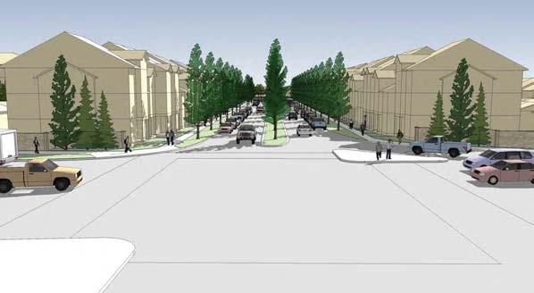
24 4.0 Midtown Guiding Principles Midtown is positioned as a unique infill site adjacent to downtown Airdrie. As such, the site represents a unique opportunity to complete a transition in land uses and density between neighbours to the south and north. Figure 4.1 Land Use Concept, illustrates the land uses within the NSP. 4.1 MIDTOWN VISION The vision for Midtown is premised on: Achieving a compatible fit with existing surrounding neighbourhoods; Suitably addressing the challenging conditions of the site; Achieving a distinct design for Midtown that is a natural reflection of the site conditions; Providing opportunity for a wide range of housing types, including products that are new to the local market; Reinforcing existing pedestrian linkages to surrounding areas; Defining special and unique parks that offer a wide range of amenity spaces for residents; and Defining Midtown as a unique place with a distinct character within Airdrie Community Context & Fit Given communities adjacent to Midtown, which are now largely completed, the current plan for Midtown is intended to ensure a suitable fit that will provide natural transitions in scale and land use to existing residents. The primary land use within Midtown is residential, with the potential for a wide range of groundoriented and apartment housing types and price points to emerge over the development period. 18


25 N FIGURE 4.1 MIDTOWN LAND USE CONCEPT PREPARED FOR: WENZEL DEVELOPMENTS Legend NTS Design with community in mind September 22, 2014 V:\1165\active\ \midtown\drawing\urban_planning\stage_01\outline_plan\cad\01-current\midtown_op.dwg CONCEPT ONLY: THIS DRAWING IS AN ARTISTIC REPRESENTATION OF DESIGNS PREPARED BY STANTEC CONSULTING LTD. IT IS CONCEPTUAL IN NATURE AND SUBJECT TO CHANGE. COPYRIGHT RESERVED.
26 4.2 DESIGN ELEMENTS Midtown is the last major development parcel within the area as it is surrounded by developed lands to the south, west, and north, and is bounded by the railway to the east. As such, the landform, edge conditions, and current servicing standards, significantly impact the ability to achieve an acceptable servicing solution of this site, and consequently a suitable design for the neighbourhood. A site design idea has not driven the outcome; rather the design is the result of a process that is premised on delivering an outcome that best integrates placemaking goals with efficient servicing needs to ensure an optimal outcome. The outcome is a neighbourhood that offers both excellent amenity and sense of place, and that will be developed applying best use of landform and efficiency of infrastructure. In order to achieve a workable stormwater system on-site, a significant stormpond must be placed at the centre of the site. This constraint is the primary driver of the design for Midtown, and it is around this element that the community is focused. The design has evolved to ensure that the stormpond is not simply a functional requirement but rather is a positive amenity that defines Midtown as a unique Community. This visual amenity is prominent from many places within the neighbourhood as an arrival vista, as a park edge, as a front and back yard view, and a pathway is provided along the entire pond edge and a pedestrian bridge crosses the pond at the mid-point. These elements and conditions result in a plan that is unique within Airdrie and that distinctly reflect the challenges and opportunities that the site represent. Additionally, many roads in the neighbourhood link to, or have vistas to the pond edge. The entire open space network is integral and linked with the pond, which also provides opportunity for irrigation of these spaces from the pond itself. The overall layout for Midtown is grid based to reinforce the proximity of the site to Downtown and the more urban nature of the project. This block pattern also provides for an efficient use of land, resources, and servicing while offering a highly adaptable block that is flexible to a wide range of housing products and typologies. While based on a grid, the intent is to manage access within the neighbourhood through traffic calming measures that not only manage traffic, but also assist in defining unique places and addresses within Midtown. Appendix A Urban Design, provides an overview of the built form, building to street and building to park interfaces, and example building typologies. 20
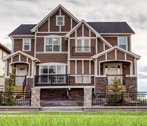
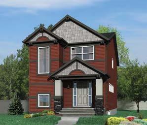
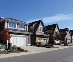
27 4.2.1 Housing Elements Midtown represents an opportunity to deliver between approximately 600 and 800 residential units. This density will be achieved through predominantly ground-oriented housing, including single family detached, semi-detached, duplex, rowhomes, brownstones, and park front homes. Additionally, opportunity exists for low-rise apartments closer to the commercial site in the northwest portion of the site. These typologies are achievable using a range of lot types, setbacks and configurations. Midtown represents an opportunity to deliver new and innovative housing types to the market. Consequently it is proposed that Midtown be partially controlled by a Direct Control (DC) Land Use that will facilitate a wide range of existing housing types as well as new types to emerge, as market opportunities warrant. A key objective in promoting a wide range of housing types is to provide flexibility in response to emerging and changing lifestyles, offering new or alternate housing types for current and future Airdrie residents. By providing a wide variety of housing types different demographics and lifestyles can be accommodated within a singular community, including first time homebuyers, young and mature families, empty nesters, snowbirds, and singles. This flexibility and a wider diversity of housing choice will strengthen the neighbourhood, diversity of built form, and dynamic demographic of Midtown, enhancing the quality of place Transition of Density Luxstone to the south of Midtown is predominantly comprised of single family detached housing, configured in a typical suburban pattern, and developed at a low density. Mackenzie Pointe to the north of Midtown is predominantly 4-storey apartments and townhomes, configured in larger private parcels, and developed at a medium density. As Midtown is sited between these two distinct neighbourhoods a transition in density from lower in the south, to higher in the north, is warranted as an appropriate transition to these neighbours. The DC district is intended to reflect this transition to ensure that neighbouring areas are not unduly impacted by emerging development in close proximity. This transition in density is also an appropriate approach given the wider context, as higher density residential is located north of the site and in close proximity to major retail and services, while further south the community is dominated by lower density residential and school sites Interfacing Elements Both the east and west edges of Midtown present less than ideal conditions railway noise on the east, and major traffic on the west. The concept plan response is intended to minimize the direct exposure of residents to these conditions. In order to achieve this objective, the plan 21
28 minimizes the number of homes that have a front or back yard directly exposed to these two edges. The plan configuration achieves this objective by flanking lots to these edges, rather than the typical approach of backing lots onto these edges. Consequently, the number of homes directly impacted by noise is significantly reduced. A further benefit is that the 8 th Street edge is not fronted by a continuous back fence, but is fronted by a variety of internal streets and side yards, which offer a more diverse exposure to the main public thoroughfare. At the railway edge, this similar arrangement allows for frequent access to a pathway within the PUL lot adjacent to the railway. This will promote Crime Prevention Through Environmental Design (CPTED) objectives and ultimately not only improve the safety of this pathway but the likelihood of the use of this pathway by residents. 22
29 5.0 Land Use Overview Major land use components in the NSP are a variety of residential uses, open space elements, and neighbourhood commercial uses. The following table provides a breakdown of the land use categories proposed for the community. Land Use Statistics LAND USE AREA DENSITY / UNITS % HECTARES ACRES MIN. MAX. TOTAL PLAN AREA Iron Horse Park Net Developable Area TOTAL NET PUBLIC SERVICES LANDS Municipal Reserve Public Utility Lot (Railway Setback) Canal with Naturalized Trail Stormpond TOTAL NET COMMERCIAL AREA TOTAL NET ROADWAYS TOTAL NET RESIDENTIAL LAND AREA Single Family Detached Townhouse / Rowhouse Residential Low Density Residential Park Front Low Density Residential Medium Density Residential Overall Density (units/acre) 6.8 upac 8.5 upac 23
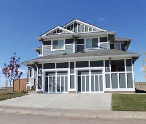
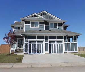
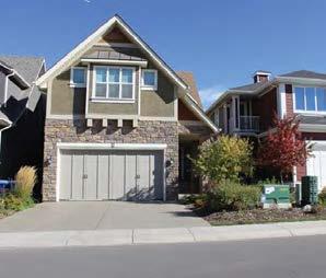
30 6.0 Residential Land Use The Midtown NSP responds to the City of Airdrie mandate to provide a broad range of housing types and lot sizes to meet the residential needs of future Airdrie residents. The NSP will provide mainly ground-oriented housing, including single family detached, semi-detached, rowhomes, brownstones, and park front homes, plus a provision for low-rise apartments. These typologies are achievable using a range of lot types, setbacks and configurations. The following outlines the non-typical housing typologies that the Midtown NSP will strive to achieve. Wenzel will work with the City to create a Direct Control District which achieves the following desired outcome. Brownstone / Townhouse Residential Intended to accommodate ground-oriented attached housing in a freehold configuration, fronting onto a street. Rear lane access to parking. Each building is intended to provide three or more units. Individual units are foreseen as two or three levels above grade. The front yard is intended as a stoop or porch with stairs leading to a front door for each unit. A rear yard garage, if provided, may be detached or attached to the dwelling. Low Density Residential Intended to accommodate semi-detached units in a freehold configuration. Rear lane or front drive access to parking. Each building is intended to provide two units side by side, with one common wall. Units are foreseen as two or three levels above grade. The front yard is intended as a stoop or porch with stairs leading to a front door for each unit. A rear yard garage, if provided, may be detached or attached to the dwelling. A front drive garage, if provided, is intended as an attached single car garage. Park-Font Low Density Residential Intended to accommodate attached housing in the form of Townhomes. 10.0m wide rear lane access to parking and to unit entry. Each building is intended to provide a pedestrian entry to the rear yard lane, and to the front yard park space. Units are foreseen as two or three levels above grade. A rear yard garage, if provided, may be detached or attached to the dwelling. 24
31 Single Family Detached Intended to accommodate single family detached units. Opportunities to back onto green space or stormpond amenity. Vary in lot with. Land use is flexible to accommodate 32 to 42 wide lots. Vary between single car and double car garage allowing a variation in street scape and built form. 6.1 HOUSING MIX The anticipated housing mix can be summarized as follows: LAND USE CATEGORY MAXIMUM # OF LOTS / UNITS PERCENTAGE Single Family Detached % Townhouse / Rowhouse Residential % Low Density Residential % Park Front Low Density Residential % Medium Density Residential % TOTAL LOTS/UNITS % 6.2 DENSITY Anticipated Density for Midtown NSP Area = ha± (89.45 ac±) =16.85 upha± (6.8 upac±) Maximum Density for Midtown NSP Area = ha± (89.45 ac±) =20.94 upha± (8.5 upac±) 25
32 7.0 Public Services The Midtown NSP area incorporates a multi-functional open space system, which will accommodate the active and passive recreational needs of future community residents. The main community access point is well defined with features, signage and crossings. A variety of open space areas are provided including community parks and linear open spaces. The arrangement of open space provides a high degree of connectivity within the community and allows the public to conveniently access and enjoy the open space system. There is a regional pathway located along the centre of the development, which will provide regional connectivity north/south and east/west. Figure 7.1 Pedestrian Connectivity, illustrates the connectivity created through the design of Midtown and the connections created through and integrated pathway system and sidewalks. 7.1 NEIGHBOURHOOD COMMERCIAL The extent of community commercial and services now offered at Creekside Crossing (corner of 8 th Street and 1 st Ave) only 700m from Midtown, has necessitated a market appropriate commercial component for Midtown that is significantly less than what was initially envisaged in The current plan indicates a commercial site suited to local and surrounding residents with services that could include but is not limited to a restaurant, local café, convenience store, and/or retail sales. The commercial site is located at the northwest corner of Midtown so as to minimize traffic impacts to area residents and to offer preferred access from 8 th Street and neighbouring areas. 7.2 OPEN SPACE SYSTEM Midtown is to include a range of local parks with a diversity of role and function appropriate to the immediate context. This range of parks includes the following spaces: Midtown Gate Park a formal promenade space sited at the terminus of the primary entrance street and at the edge of the central pond. This space is intended to establish a unique formal space that is the focal point for Midtown as a neighbourhood. The Pond Walk an accessible pathway around the entire edge of the pond that provides primary pedestrian linkages to all other open spaces within Midtown, and in portions also serves as the regional pathway through Midtown from north to south. This walk offers a diversity of experiences from a more formal regional pathway beside a street providing a path separating the naturalized edge of the pond to a manicured landscape. North Park a local park adjacent to the pond providing a playground and active space for younger children, and includes suitable sitting and sheltered space. This park is also 26
33 fronted by Park Front Homes with front porch spaces and front yards directly adjacent to the park. The South Entry a local park sited either side of the primary local internal street at the arrival from Luxstone to the south. The Eastern Wedge a local park sited to provide a more passive treed environment for adjacent residents. The North Block a local park that primarily serves as critical link in the regional path. South Park a local park sited at the terminus view of the primary local internal street and buffered on one side by park front homes. The park provides a play space and a large open green space which can accommodate an informal mini soccer field. Railway Walk a pathway running parallel to the railway track within a PUL. This pathway connects at many points along this frontage to parks and street sidewalks, and at either end to the existing regional trail network. Naturalized Pathway a naturalized pathway will run within the PUL of the canal connecting the Railway Walk pathway system to 8 th Street. This pathway will also connect to the larger crossing of the canal at Midtown Parkway. The intent of the pathway is to be naturalized through the use of stone fines, wood chips, gravel clay mixture, or similar natural materials. Figure 7.2 Open Space System, identifies the locations of the Open Space within Midtown Appendix B Midtown Concepts, provides park concepts, cross sections, and intersection details for Midtown. Entry Experience Primary access to Midtown is via 8 th Street SW. Given existing intersections on 8 th Street SW servicing adjacent development, these intersections establish entry locations to Midtown. The primary entrance to Midtown is at the mid-point of the 8 th Street frontage, and completes a full lighted intersection at Channelside Drive. This entrance will define the Midtown neighbourhood and provides an entry experience characterized by a treed boulevard, separated sidewalks, and a brownstone or townhome type streetwall on either side. This boulevard leads to a roundabout that is designed as an integral edge of Midtown Gate Park. A second entry to Midtown is via Railway Gate. This street also provides access to adjacent development and as such does not contribute to defining the Midtown neighbourhood. An access of Railway Gate south into Midtown is intended to provide a treed boulevard entrance street, fronted by attached residential. This character is consistent with the primary access from 8 th Street, and reinforces the character for Midtown. 27
34 A third entry is via Midtown Parkway connecting to Luxstone Landing SW across the drainage canal at the south edge of Midtown. This entry to Midtown is defined by the South Gate park. 7.3 MUNICIPAL RESERVE DEDICATION Portions of the Municipal Reserve (MR) requirement owing on the Midtown lands, has been previously dedicated. As such a deferred reserve caveat is registered on title identifying the remaining MR owing as 3.44 ha± (8.49 ac±) or 9.5% of the net developable area. The Midtown Plan proposes to dedicate 3.47 ha± (8.55 ac±) or 9.6% of the net developable area. Although MR was previously dedication off site there is significant amount of usable open space within Midtown that is not dedicated as MR, but will be utilized by residents in the same manner. An additional 1.86 ha± (4.6 ac±) of land dedication as Public Utility Lots (PUL) s will be developed along the railway and canal. These areas will be developed to include a regional pathway along the railway and a naturalized pathway along the canal. The additional amount of usable open space created though the landscaping and inclusion of pathways within the PUL s brings the open space within Midtown to 5.33 ha± (13.15 ac±) or 14.7%. 28
35 N FIGURE 7.1 MIDTOWN PEDESTRIAN CONNECTIVITY V:\1165\active\ \midtown\drawing\urban_planning\stage_01\outline_plan\cad\figures\midtown_op-figures_rev.dwg Design with community in mind PREPARED FOR: WENZEL DEVELOPMENTS September 22, 2014 NTS

36 N FIGURE 7.2 MIDTOWN OPEN SPACE PLAN V:\1165\active\ \midtown\drawing\urban_planning\stage_01\outline_plan\cad\figures\midtown_op-figures_rev.dwg Design with community in mind PREPARED FOR: WENZEL DEVELOPMENTS September 22, 2014 NTS
37 8.0 Sustainability Through the adoption of the Airdrie MDP, City Council has expressed a desire to encourage sustainable development concepts based on a triple bottom line approach in new communities. The Midtown Neighbourhood Structure Plan application is envisioned to create a community that balances elements of the natural environment, with the needs of a future community from an economic and social perspective. The Midtown NSP addresses sustainability concepts by applying the following: 8.1 WATER The following initiatives are proposed for the Midtown development: Developer Initiatives Midtown will include the following subdivision design conservation measures: Low Impact Development (LID) and Stormwater Management - Low Impact Development (LID) techniques for stormwater management are incorporated into the NSP design to promote more sustainable management solutions. In addition, onsite stormwater retention techniques that promote evapotranspiration, soil infiltration, reuse of stormwater and overland conveyance, will also be utilized wherever possible as appropriate source control Best Management Practices (BMP s) to reduce the volume of stormwater runoff entering Nose Creek. Naturalized Planting - Open spaces, where appropriate, will incorporate sustainable design initiatives such as naturalized planting in combination with site use programming requirements. Builder Initiatives The Developer will work with the Builder Groups to develop suitable guidelines for LID initiatives. Homeowner Initiatives The Developer will work with the Builder Groups to develop an information package for residents providing guidelines for homeowner LID initiatives. 31
38 8.2 SITE SELECTION Dependence on automobiles The Midtown NSP is located to encourage the reduction of automobile dependency by area residents. The subdivision design for Midtown includes: employment opportunities in and in close proximity to the NSP area (future neighbourhood commercial employment in the area and downtown employment to the northeast); convenient access to green spaces for all area residents within a comfortable walking distance; and multiple connections to regional pathways. Preservation and Enhancement of Topography Existing land features laid the foundation for the design of this community. The topography of the land and drainage options led to the central stormpond location. The relative flatness of the land allowed for easily connected and walkable grid patterns street systems with linear open spaces reaching out to all corners of the area. 8.3 LAND USE Diversity of Housing Types The Midtown NSP responds to the City of Airdrie mandate to provide a broad range of housing types and lot sizes to meet the residential needs of future Airdrie residents. The NSP will provide mainly ground-oriented housing, including single family detached, semi-detached, rowhomes, brownstones, and park front homes. These typologies are achievable using a range of lot types, setbacks and configurations. Additionally, opportunity exists for low-rise apartments closer to the commercial site in the northwest portion of the site. This diversity of housing will accommodate the needs of a variety of income groups and lifestyles, which in turn will encourage a sustainable community. Park and Leisure Activities A comprehensive open space plan has been prepared for the Midtown neighbourhood. The open space system will provide opportunities for active and passive recreational uses for the enjoyment by local residents and the general public. The open space system has been designed to be accessible to residents within short walking distances. The comprehensive design of parks and linear open space in Midtown efficiently and effectively integrates various modes of transport (i.e. walking, biking, and rollerblading) into the envisioned lifestyle of the neighbourhood. Landscaped areas will be developed in accordance with the local environment. 32
39 Plantings will be located and selected according to topography, soils type and sun exposure. Hardy, drought tolerant plant materials will be used where applicable. 8.4 ENGINEERING Site Servicing Midtown provides the opportunity to be economically sustainable through the utilization of existing infrastructure and does not create any issues of growth management. The site is a logical progression of development and will proceed on a phase-by-phase basis, starting at the west and moving south in a counter-clockwise direction in order to minimize overall infrastructure costs. 8.5 TRANSPORTATION Traffic flows The proposed road network allows for the dispersal of vehicles through various alternative routes effectively relieving the usual traffic flows expected along collector roadways and providing resident s choice when accessing or leaving the community. The plan identifies a vehicular connection south to Luxstone to provide a distribution in traffic patterns and connectivity between communities. 33
40 9.0 Transportation Network 9.1 TRANSPORTATION IMPACT ASSESSMENT A Transportation Impact Assessment (TIA) was completed by Stantec Consulting Ltd. in support of Midtown NSP and subsequently approved by the City of Airdrie. The City of Airdrie s Engineering Services staff selected a study area to help evaluate the site s traffic impact at the 80,000 population horizons. The study area includes the following intersections: 8 Street and Railway Gate/Bayside Boulevard 8 Street and Midtown Gate/Channelside Drive 8 Street and Luxstone Landing/Bayside Drive The proposed Midtown development consists of up to approximately 750 residential units (690 single-family units and 60 multi-family units) and can accommodate approximately 24,000 ft 2 of commercial land use located along 8 Street. The proposed development composition is summarized in below. Proposed Development Summary USE Multi-Family Residential Single-family / Semi-detached Residential Retail INTENSITY 60 units 750 units anticipated 24,000 ft 2 Gross Floor Area (GFA) All study intersections are expected to operate at an acceptable overall intersection level of service at the 80,000 population Post-Development horizon. 9.2 PEDESTRIAN AND BICYCLE CIRCULATION Within the areas surrounding Midtown, there are primary pathways throughout the communities of Ridgegate, Edgewater (east), Summerhill (southeast), and Luxstone (south). These pathways include: a north-south route between Downtown and Summerhill, through Nose Creek Park; 34
41 a north south route through the central area of Luxstone; and a north-south route adjacent to, and on the west side of, the rail alignment, which runs from just north of 40 Avenue to Yankee Valley Boulevard and further north along the east side of Luxstone. This route is intended to extend north from Luxstone through Midtown and further north as development occurs. The rail tracks act as a barrier to pedestrians and cyclists wanting to access the Downtown commercial and residential areas to the east of Midtown, with access being limited to major street crossings of the railway and an existing pedestrian underpass at the south boundary of Midtown. Pedestrian facilities in the community south of Midtown (Luxstone) include sidewalks on both sides of the streets. In the community to the north (Mackenzie Pointe) there are no sidewalks or pathways abutting Midtown. There are however opportunities to link through Ironhorse Park to the multi-family area to the north. On the west side of Midtown the recently completed sidewalks along 8 Street SW provide suitable access for pedestrians to and from Midtown. 9.3 CONNECTIVITY INDEX The Connectivity Index is a measure that descrives the leverl of connectedness of the street network, which in turn reflects some of the different way we can get from one place to another. The City of Calgary suggests to connectivity indices within the City of Calgary Connectivity Handbook: Street Connectivity and Active Modes Connectivity. These two connectivity indices are calculated as the ratio of links to nodes/intersections based on the infrastructure that is used by each mode. The City of Calgary provides connectivity goals for greenfield residential communities of 1.4 for Street Connectivity Index and 1.6 for Active Modes Connectivity Index. The design of Midtown these achieves a Street Connectivity index of 1.29 and an Active Modes Connectivity index of Although the Street Connectivity index of the Midtown is below the target goal the Active Modes Connectivity index is above. This strengthens the intent of the design as a multi-modal community not primarily focused on the circulation of the automobile. 9.4 PUBLIC TRANSIT Airdrie Transit currently operates three local bus routes within the city and two Intercity Express routes between Airdrie and Calgary. Of the local routes offered, Route 3 (Blue Route) circulates in south Airdrie. Currently, this route includes approximately 2 kilometres of travel on 8 Street S between Railway Avenue SW and Yankee Valley Boulevard. Route 902 West is the Intercity Express route that runs between Airdrie and Calgary. The service collects passengers on the west side of Airdrie and travels via 8 Street between Veterans Boulevard and Yankee Valley Boulevard Southwest for approximately 3 kilometres, eventually feeding on to Highway 2 at the Yankee Valley Boulevard / Highway 2 Interchange. 35
42 The Calgary Transportation Plan identifies two future connections between Calgary and Airdrie via Initial Bus Rapid Transit (BRT) Service. While the actual route into Airdrie has not yet been determined, it is anticipated that the north-south connection in west Airdrie will follow a route that eventually ties in with 8 Street in south Airdrie. This would be consistent with the designation of 8 Street as a Highway Arterial and a replacement for Main Street as the primary north-south transportation link. As the principal north-south connector, 8 Street provides access to crucial east-west arterials, highway 2 interchanges, and new communities. The design of Midtown response to the current and future transit needs of residents within Midtown. The connection south to Luxstone Drive provides opportunity for future bus service to collect residents within both Midtown and Luxstone without requiring access to 8 th Street between communities. The predominantly grid layout, pathway system, and bridge connection across the stormpond provides for easy pedestrian travel and linkages to future bus stops within Midtown. Locating commercial and multi-family close to bus stops along 8 th Street provides the opportunity for synergy between residents convenience needs and travel patterns. 9.5 ROAD NETWORK The internal road network will access the 8 Street at two locations; Railway Gate to the north and Midtown Gate located in the middle of the development. Midtown Parkway and Midtown Boulevard act as a north / south spin of the development connecting south into Luxstone. A connection to Luxstone Drive across the canal has been identified at the south end of the plan. This connection will provide both vehicular and pedestrian connectivity across the canal into Luxstone. The crossing will be constructed of a culvert and the road cross section will match what is currently constructed on the south side of the canal. A cross section has been included within Appendix D. Sidewalks on both sides of the crossing will connect pedestrians to the naturalized pathway along the canal and north and south into Midtown and Luxstone respectively. A shadow plan alignment has been identified within the Neighbourhood Plan for the extension of Railway Gate east within Iron Horse Park across the CPR Tracks connection 8 th Street to tower Lane Drive. This at grade connection may be required in the future to provide better access to downtown Airdrie and will ultimately be determined through a review by the City of all CPR crossings. Design treatments on streets internal as identified in Appendix B will enhance the walkability and livability of the community. Figure 9.1 Transportation Network, illustrates the road network within Midtown. 36
43 N FIGURE 9.1 MIDTOWN TRANSPORTATION NETWORK V:\1165\active\ \midtown\drawing\urban_planning\stage_01\outline_plan\cad\figures\midtown_op-figures_rev.dwg Design with community in mind PREPARED FOR: WENZEL DEVELOPMENTS September 22, 2014 NTS
44 10.0 Utility Infrastructure 10.1 STORM DRAINAGE The stormwater servicing for the proposed development will consist of a dual drainage system with both a minor and major system. The minor system consists of the underground storm sewers and its associated structures and provides a basic level of service for the 1:5 year storm event. For minor events the stormwater will be collected by a gravity sewer system which discharges into a stormpond (referred to as Pond A) located within the central area of the development. Pond A will discharge via an outlet pipe east under the existing CPR tracks into Nose Creek. The pond provides treatment, rate control and acts a water source to irrigate the surrounding park space and reduce the discharge volume to meet the requirements of the Nose Creek Watershed Water Management Plan. The outfall for pond A will be protected by a flap gate and a backup manual gate valve to prevent backwater from Nose Creek filling the pond which is set below the flood elevation of Nose Creek in order to service the development via gravity. All basement weeping tile connections will require a sump pump with a looped outflow pipe set above the flood step elevations for the area. The major system will convey runoff from extreme rainfall events that are in excess of the minor underground system and consist of overland drainage facilities including the roads, swales, lanes, trap lows and Pond A. The major system is also designed to drain to the center of the site into Pond A matching the minor system. Due to the central location the pond there is no practical overland escape route and the pond has been sized to contain a 1:500 year storm event instead of the traditional 1:100 year storm event. Details of the proposed stormwater system are provided in the revised staged master drainage plan prepared for this project by Stantec Consulting. All storm sewer designs will be in accordance to the parameters set within the report as well at the current City of Calgary and City of Airdrie design guidelines (with the City of Airdrie design guidelines taking precedence). Details of the proposed system will be included on the engineering drawings submitted for each phase of construction Stormwater Irrigation The Nose Creek Watershed Water Management Plan identifies target runoff depths for Nose Creek. In order to achieve this target significant Low Impact Development (LID) practices are required. The stormwater management plan includes the reuse of collected stormwater to irrigate open space areas within Midtown. The use of stormwater for irrigation has become common practice within the City of Calgary and has also been approved within the community of Hillcrest in Airdrie. The combination of pond size and irrigation demand are integral to each other in ensuring that the amount of stormwater discharged to Nose Creek meets the runoff depth target set by the province. 38
45 The reuse of stormwater is also economically sustainable for the City of Airdrie from an operations perspective. Utilizing stormwater for the irrigation of open space prevents the necessity of irrigating with costly and energy intense potable water WATER DISTRIBUTION The proposed watermain system will tie into the existing 400mm PVC stubs located under Railway Gate along the north boundary of the development and the utility right-of-way at the south east boundary of the site. Completing the connection between these two stubs will improve the overall water distribution network within the area. The development will also tie into the existing 300mm PVC stub located on the east side of the intersection of 8th Street and Channelside Drive which will provide a looped water system for the first phase of the project. Hydrants spacing, valves locations and the remaining watermain sizes will meet City of Airdrie standards and will be detailed on the engineering drawings submitted for each phase of construction SANITARY The sanitary flows for the proposed development will be collected by a gravity sewer system and tie to the existing 675mm concrete sanitary sewer that runs along the north and east boundaries of the development. The north quarter of the project drains towards the center of the development and then north where it will tie to the existing sanitary line by constructing a manhole over the existing sanitary sewer line within the proposed extension to Railway Gate. The remainder of the site drains east where it will also tie into the existing sanitary line via the construction of a manhole over the existing sanitary sewer. The existing 675mm sanitary line drains south into a 900mm sanitary trunk which drains to the east under the CPR tracks and ties into the main sanitary lift station. All sanitary sewers will be designed in accordance with the City of Calgary Subdivision Design Guidelines which have been adopted by the City of Airdrie and will be detailed on the engineering drawings submitted for each phase of construction SHALLOW UTILITIES The existing residential developments of Luxstone to the south, the Canals to the west, and the multi-family development to the north surrounding the proposed development are currently serviced with electric, phone, cable and natural gas facilities. The proposed development will be serviced by extension of the existing networks provided by Fortis (electric), Telus (phone), Shaw (cable) and ATCO (natural gas) PHASING The site is a logical progression of development in Airdrie and will proceed on a phase-by-phase basis, starting at the west and moving north then south in order to minimize overall infrastructure costs. The phasing plan is conceptual only and may be subject to change based on market demands and servicing considerations. 39
46 As the development proceeds, offsite infrastructure will be required to support the phasing of development. The following identifies the offsite utility requirements of certain phases as well as the staging of the access to the site: Phase 1: Single divided Road access from 8 th Street; Offsite Water, Sanitary, and Storm Sewer; and Portions of Stormpond. Phase 2: Second access point to 8 th Street via Railway Gate. Phase 3: Offsite Water Servicing. Development still has two access points to 8 th street Phase 4: Third Access Point to 8 th Street via Luxstone Landing. All access points to 8 th street are now available and will remain open during the development of phases 5 and 6. Figure 10.1 Site Servicing, illustrates the water, sanitary, and stormwater servicing for Midtown. Figure 10.2 Phasing Plan, illustrates the potential phasing of Midtown and required infrastructure. 40
47 N FIGURE 10.1 MIDTOWN SITE SERVICING V:\1165\active\ \midtown\drawing\urban_planning\stage_01\outline_plan\cad\figures\midtown_op-figures_rev.dwg Design with community in mind PREPARED FOR: WENZEL DEVELOPMENTS September 22, 2014 NTS
48 N FIGURE 10.2 MIDTOWN PHASING PLAN PREPARED FOR: WENZEL DEVELOPMENTS NTS Design with community in mind September 22, 2014 V:\1165\active\ \midtown\drawing\urban_planning\stage_01\outline_plan\cad\figures\midtown_op-figures_rev.dwg
49 11.0 Plan Amendments Neighbourhood Structure Plan amendments may be initiated by City Council, the Planning Department, developers, landowners, or school boards. Generally, amendments to an NSP are required in the following circumstances: Where shifts in the location of community facilities such as parks or schools are proposed and / or; When shifts in land use categories, such as from residential to industrial are proposed and / or; Where shifts in the design or layout of infrastructure such as roads and sanitary and storm services are proposed and / or; Where shifts within a land use category that result in changes to density, such as from a single family designation to a multi-family designation, are proposed and / or; At the discretion of the City of Airdrie, where the interests of the public necessitate that formal amendments occur. 43
50 Appendix A Urban Design 44


51 BUILT FORM STUDIES Ground-Level View Elevated View Over eral l Pl an View Th e following images are int nten de d to dem emon st rate the gen eral mas sing, bu ilt form and r elationships bet etwe en homes, streets and parks wit hi n Midtown. Wh il e the entire pla lan ar ea has not be en rendered, the areas illustrated provide an ove rv iew of all typi cal co nd it ions withi hin Midt dtow n. 5 The 3D model images illustra ting buil t forms are in dica tive only and ar e in tended to illustrate possis bl e ou tcomes based on the pr oposed land use ses. s. The de pi ctio ion of buildings is pri rima mari rily i ntende d to illustrate ma ssing, height variation, gar arag ag e and driveway con onfi figu guration s, and la ndsc ape re lati tion ship ips and inte terf rface be twee een buil ding ngs an d st reetet scap apes es. Midtown - Perspective Views Key Plan Client WENZEL DEVELOPMENTS INC. Project No. Date October 2013


52 Midtown Gate Entry The following sequence of images demonstrate the entry experience for the primary entrance to Midtown. The images illustrate the scale of built form along the entrance, which street fronted by brownstone type townhouses, and the streetscape environment with front doors close to the street, separated sidewalks, treed boulevards, and a vista to the central plaza and pond. This entrance experience sets the tone for a community that is more urban in nature. View 1 View 2

53 View 3 View 4


54 South Entry The south entrance to Midtown is defined by a formal park with a bosque of trees and road treatment that clearly define Midtown as a more urban setting that is differentiated from Luxstone. The experience of moving through a park is key to defining this entrance, with houses set back and facing into the park space. North of the entry park, the experience walking, cycling and driving north are all defined by housing on the west side and the pond edge environment on the east side. This environment leads into the heart of the community. The housing edge is comprised of rear lane product to maximize eyes on the park and activation of the street and park. View 5 View 6


55 Midtown Gate Park & Pond The centre of the site, and terminus of Midtown Gate Entry is dominated by the storm pond. At this terminus the formal promenade space projects into the pond and serves as a prime gathering space for the community. A pedestrian bridge from the east half of the community leads into this plaza area, as do pathways and park areas north and south of the promenade. The edges to this space are dominated by homes that front directly into this space, with rear lane garages to maximize eyes on the park. As a result, the entire western edge of this central green spine through the community is fronted by a strong façade of windows and front doors, which reinforces activation and use of the park areas. The east edge of the pond has a pedestrian walkway with the rear yards of homes opening onto this environment. Vi ew 7 View 8


56 The west edge of the pond offers a pedestrain walkway leading from the Eastern Wedge park to the pedestrian bridge. This bridge leads directly to the central promenade plaza space at the terminus of Midtown Gate Entry at the heart of the community. View 9 View 10

57 Street Leading to Park & Park Front Homes The top image is an example of a principle applied to several locations in the plan of streets leading to green space, which offers a visual and physical connection to green space for residents that are not located on parks. The image also illustrates a transition in scale and housing types across a local street, where rear and front loaded products are opposite. The bottom image illustrates homes that front directly onto green space. This condition applies to a number of locations within the community. The intent is that a mix of townhouses, semi-detached and detached homes would have front doors and yards leading onto a sidewalk that forms the edge of the park. These traffic free areas are intended to provide pedestrian friendly walkways through the community and offer eyes onto the park. View 11 View 12


58 Pedestrians First These images illustrate the deliberate intent to provide pedestrians top priority in movements where possible, including this mid-block crossing where the street is narrowed, and traffic is slowed. This offers pedestrians the primary movement at this location. There is the potential to provide a raised road surface so that the pedestrain has a flat crossing point. The bottom view also illustrates the potential for buildings within Midtown to act as markers within the community, offering terminated views, supporting wayfinding and defining distinct places. View 13 View 14


59 Midtown Boulevard This internal boulevard street is a key route within Midtown with a mix of uses fronting onto the street. This image illustrates retail commercial activities and potential apartments on the west side and townhousing and semidetached on the east side. The streetscape character is supported by minimal building setbacks, a diverse vertical scale, front doors facing the street, and commercial uses that define this boulevard as a more urban mixed-use street. The pedestrian movement is reinforced by separated sidewalks, rows of street trees, and on-street parking. Vi ew 15 View 16

60 Typical Street Views These images illustrate typical street conditions fronted by homes with and without front drive garages. Standard residential street cross-sections are applied. Given the diversity of lot and house types proposed, the built form is anticipated to be varied, with a particular differentiating element being the mix of one and two car garages along the street front. This diversity will mitigate the dominance of garage doors and hard surface driveways along the street and offer opportunities for a greater number of front porches, as illustrated in the top image. Additionally, this image illustrates a street-end park view. The bottom view illustrates a condition with front drive opposite rear lane product. This mix of built forms allows for porches and onstreet parking on one side of the street, with a diversity of one and two car garages on the opposite side. View 17 View 11

61 8th Street Edge This image illustrates the proposed view along 8th Street south of Midtown Gate. The intent is to achieve a varied built form edge along this frontage with building setbacks varied and houses oriented to limit the exposure of houses to the 8th Street environment. The wall, which is required for sound attenuation, is punctuated by gaps in the wall at all points where a sidewalk leads from streets within Midtown. At each entrance point, the wall will be defined by a feature element and distinct landscape treatment in the boulevard. The principle of providing multiple breaks in the wall is to maximize pedestrian safety and permeability along the 8th Street edge, offering multiple and frequent ways to enter Midtown from the 8th Street sidewalk. View 18


62 HOUSING TYPOLOGIES The following images offer examples of housing types that are anticipated within Midtown, and also based on the proposed land use districts. These photos include local, regional, and USA examples and are intended to provide an insight to built form, street to building interfaces, and site layout, and are not necessarily intended to demonstrate exact examples of the eventual building architecture or style. Townhomes


63 Parkfront Townhomes Parkfront Homes


64 Semi-Detached Rear Lane Semi-Detached Front Drive


65 Detached Rear Lane


66 Detached Front Drive


67 Rear Garage Attached (Detached or Semi) Mix of Semi-Detached & Detached Rear Lane
68 Appendix B Midtown Open Space Concepts 45

69 Railway Gate Park Railway Walk North Park A The Eastern Wedge Midtown Gate Entry 4 1 Midtown Gate Park C 2 B The Pond Walk 3 C South Gate Bosque B South Park A Naturalized Path Midtown Open Space Concept Client WENZEL DEVELOPMENTS INC. Project No. Date November 2013

70 Midtown Gate Enrty Sidewalk Street and median trees with formal pattern The main entry into Midtown includes a formal pattern replicated by the street and boulevard trees. The medians use rock mulch rather than sod to create a relationship between Midtown and the medians on 8 St SW. Client WENZEL DEVELOPMENTS INC. Project No. Date October 2013


71 Naturalized Pond Edge Pedestrian and cycle bridge over stormpond Seating Space Midtown Gate Park Formal Plaza A formal promenade space sited at the terminus of the primary entrance street and at the edge of the central pond. This space is intended to establish a unique formal space that is the focal point for Midtown as a neighbourhood. Planted turning circle as entry feature Shaded plaza space 3.5m Recreational trail Native planting around pond Sample bridge over water Client WENZEL DEVELOPMENTS INC. Project No. Date October 2013

72 North Park Raised textured paving and bulb-out Native planting around pond A local park adjacent to the pond providing a playground space and more active space for young children, and including suitable sitting and sheltered space. This park is also fronted by Park Frond Homes with front porch spaces and front yards directly adjacent to the park. 3.5m Recreational trail Play space Client WENZEL DEVELOPMENTS INC. Project No. Date October 2013

73 Open park space with a mix of lawn and native planting Connections to Railway Walk The Eastern Wedge a local park sited to provide a more passive treed environment for adjacent residents. Seating spaces Textured paving and bulb-out Client WENZEL DEVELOPMENTS INC. Project No. Date October 2013

74 Regional pathway Bosque of trees on gravel mulch base Seating throughout bosque South Gate Bosque Two formal park spaces that create a south entrance from Luxstone. The proposed surface is hard packed covered stone allowing for minimal maintenance,and offering a canopy of trees with benches and pathways. Local sidewalk Client WENZEL DEVELOPMENTS INC. Project No. Date October 2013


75 Local pathway Informal mini-soccer fi eld. Painted lines are optional South Park A local park sited at the terminus view of the primary local internal street and buffered on either side by park front homes. The park provides a play space and a large open green space which can accomidate an informal mini soccer fi eld Play space Native planting zone Client WENZEL DEVELOPMENTS INC. Project No. Date October 2013


76 Bollards with refl ective strips Adjoining driveways when adjacent bulb outs Raised sidewalk with textured paving Refl ective Strip Property lines are centered on bulb out radii A Typical Road Bulb-out A Bollard Enhanced planting around wall opening Bollards with refl ective strips Driveway locations to be located beyond bulb out radii Pathways join at center of bulb out radii Raised sidewalk with textured paving 8th Street sidewalk Lane 1.5m sidewalk Sound wall B Typical Road Bulb-out B C Typical opening in sound wall to 8th Street sidewalk Client WENZEL DEVELOPMENTS INC. Project No. Date October 2013


77 9.0m Road Roundabout with Entry 9.0m Road Planting 3.5m Planting Planting Protected Retention Feature and Planting Beds Pathway Beds Beds Viewing Pond Space 1 Midtown Gate Park Paved Plaza Space Retaining Wall Property Line Retention Pond 9.0m Road 3.5m Pathway Open Lawn Planted Safety Buffer Native Planting 2 Midtown Parkway SW adjacent The Pond Walk Property Line Property Line Property Line Property Line 9.0m Road with monocurb 6.50m Road Planted 6.50m Road Median 3 Typical 9.0m wide road 4 Midtown Gate SW Entry Road Separated Sidewalk Client WENZEL DEVELOPMENTS INC. Project No. Date October 2013
LAND USE AMENDMENT CORNERSTONE (WARD 3) COUNTRY HILLS BOULEVARD AND STONEY TRAIL NE BYLAW 9D2017
 COUNTRY HILLS BOULEVARD AND STONEY TRAIL NE BYLAW 9D2017") Page 1 of 12 EXECUTIVE SUMMARY This Land Use Amendment application covers an area of 54.92 hectares ± (135.71 acres ±) located in northeast Calgary, bound by Country Hills Boulevard NE to the north and
Page 1 of 12 EXECUTIVE SUMMARY This Land Use Amendment application covers an area of 54.92 hectares ± (135.71 acres ±) located in northeast Calgary, bound by Country Hills Boulevard NE to the north and
LAND USE AMENDMENT CORNERSTONE (WARD 3) 60 STREET NE AND COUNTRY HILLS BOULEVARD NE MAP 26NE BYLAW 22D2017
 60 STREET NE AND COUNTRY HILLS BOULEVARD NE MAP 26NE BYLAW 22D2017") Page 1 of 14 EXECUTIVE SUMMARY This Land Use Amendment application covers an area of 43.76 hectares ± (108.14 acres ±) located in northeast Calgary, bound by Country Hills Boulevard NE to the south and
Page 1 of 14 EXECUTIVE SUMMARY This Land Use Amendment application covers an area of 43.76 hectares ± (108.14 acres ±) located in northeast Calgary, bound by Country Hills Boulevard NE to the south and
ADMINISTRATION RECOMMENDATION 2016 November 03. That Calgary Planning Commission recommends APPROVAL of the proposed Land Use Amendment.
 Page 1 of 12 EXECUTIVE SUMMARY This Land Use Amendment application covers an area of 75.76 hectares ± (187.20 acres ±) located in northeast Calgary, bound by Stoney Trail NE to the north, 128 Avenue NE
Complete Neighbourhood Guidelines Review Tool
 Complete Neighbourhood Guidelines Review Tool Prepared By: City of Regina Planning Department October 2014 Page 1 of 14 Community Development Review Checklist for Secondary Plans and Concept Plans The
Westwind Developments Ltd. PIONEER LANDS AREA STRUCTURE PLAN - PROPOSED AMENDMENT
 FEBRUARY 2013 TABLE OF CONTENTS 1.0 BACKGROUND... 1 1.1 Amendment... 1 2.0 LOCATION & CONTEXT... 2 2.1 Land Ownership... 2 3.0 POLICY CONTEXT... 3 3.1 Municipal Development Plan... 3 3.2 Capital Region
OP Council Resolution June 16, Planning and Development Services
 OP-08-01 Council Resolution June 16, 2008 Planning and Development Services Kingsgate Landing Outline Plan Table of Contents 1.0 Introduction 1 1.1 Purpose of Plan 1 1.2 Plan Area Location 1 1.3 Ownership
Bylaw No. B-03/2011 Adopted by Airdrie City Council February 21, 2012
 COOPER S CROSSING STAGE 4 Neighbourhood Structure Plan City of Airdrie WESTMARK HOLDINGS LTD. Bylaw No. B-03/2011 Adopted by Airdrie City Council February 21, 2012 CONSULTANTS: LAND USE PLANNING: Southwell
URBAN DESIGN BRIEF. 2136&2148 Trafalgar Road. Town of Oakville
 URBAN DESIGN BRIEF 2136&2148 Trafalgar Road Town of Oakville Prepared By: METROPOLITAN CONSULTING INC For 2500674 Ontario Inc November 2016 TABLE OF CONTENTS Page No. 1.0 Introduction/Description of Subject
Leduc Industrial Outline Plan SE W4
 Leduc Industrial Outline Plan SE 1-50-25-W4 Within the North Leduc Industrial ASP Prepared for: Leduc Energy Park Ltd. Prepared by: Stantec Consulting Ltd. File No. 1161 104655 V5 Table of Contents 1.0
City of Grande Prairie Development Services Department
 City of Grande Prairie Development Services Department ROYAL OAKS NORTH OUTLINE PLAN OP-07-03 NW 35-71-6 W6M May 7, 2007 Royal Oaks North Outline Plan TABLE OF CONTENTS 1.0 INTRODUCTION........ 3 1.1 Purpose
City of Grande Prairie Development Services Department KENNEDY DEVELOPMENTS LTD. OUTLINE PLAN OP-09-01
 City of Grande Prairie Development Services Department KENNEDY DEVELOPMENTS LTD. OUTLINE PLAN OP-09-01 July 27, 2009 TABLE OF CONTENTS 1.0 Introduction... 1 1.1 Plan Area Location & Context... 1 1.2 Ownership
Outline Plan in Belvedere (Ward 9) at Street SE, LOC (OP)
 at Street SE, LOC (OP)") 2018 October 04 Page 1 of 12 EXECUTIVE SUMMARY This outline plan application was submitted by B&A Planning Group on 2016 July 15, on behalf of Tristar Communities Inc. for 50.14 hectares (123.89 acres)
2018 October 04 Page 1 of 12 EXECUTIVE SUMMARY This outline plan application was submitted by B&A Planning Group on 2016 July 15, on behalf of Tristar Communities Inc. for 50.14 hectares (123.89 acres)
FORMER CANADIAN FORCES BASE (CFB) ROCKCLIFFE SECONDARY PLAN. Official Plan Amendment XX to the Official Plan for the City of Ottawa
 ROCKCLIFFE SECONDARY PLAN. Official Plan Amendment XX to the Official Plan for the City of Ottawa") FORMER CANADIAN FORCES BASE (CFB) ROCKCLIFFE SECONDARY PLAN Official Plan Amendment XX to the Official Plan for the City of Ottawa 1 INDEX THE STATEMENT OF COMPONENTS PART A THE PREAMBLE PAGE Purpose...
FORMER CANADIAN FORCES BASE (CFB) ROCKCLIFFE SECONDARY PLAN Official Plan Amendment XX to the Official Plan for the City of Ottawa 1 INDEX THE STATEMENT OF COMPONENTS PART A THE PREAMBLE PAGE Purpose...
C ity of Grande Prairie Development Services Department
 C ity of Grande Prairie Development Services Department FAIRWAY DEVELOPMENT OUTLINE PLAN OP 08 09 Approved April 6, 2009 Prepared by: Focus Corporation Table of Contents 1.0. Introduction 2 3 1.1. Plan
Prepared for: Prepared by: Revised November 2013 by Stantec Consulting Ltd. 200, th Street Se Calgary, AB, T2A 7H8
 Prepared for: Prepared by: PLANNING PROTOCOL INC. 3916 1 ST STREET N.E. CALGARY, AB. T2E 3E3 Revised November 2013 by Stantec Consulting Ltd. 200, 325 25 th Street Se Calgary, AB, T2A 7H8 Table of Contents
S o u t h C e n t r a l O u t l i n e P l a n. Leduc Business Park. North Leduc Industrial Area Structure Plan C it y of Led u c.
 Leduc Business Park North Leduc Industrial Area Structure Plan C it y of Led u c Prepared for Farm Air Properties Inc. January, 2007 Table of Contents Page Number 1.0 Purpose of Plan and Definition of
Bylaw C-1262 Adopted February 6, Planning and Development Department
 Bylaw C-1262 Adopted February 6, 2012 Planning and Development Department CITY OF GRANDE PRAIRIE BYLAW C-1262 A Bylaw to adopt the Brookfield Neighbourhood Outline Plan THE MUNICIPAL COUNCIL OF THE CITY
ROAD CLOSURE AND LAND USE AMENDMENT SILVER SPRINGS (WARD 1) NORTHEAST OF NOSEHILL DRIVE NW AND SILVER SPRINGS ROAD NW BYLAWS 2C2018 AND 29D2018
 NORTHEAST OF NOSEHILL DRIVE NW AND SILVER SPRINGS ROAD NW BYLAWS 2C2018 AND 29D2018") Page 1 of 19 EXECUTIVE SUMMARY This application proposes redesignating two parcels in the community of Silver Springs from Special Purpose Future Urban Development (S-FUD) District and undesignated road
Page 1 of 19 EXECUTIVE SUMMARY This application proposes redesignating two parcels in the community of Silver Springs from Special Purpose Future Urban Development (S-FUD) District and undesignated road
CONTENTS 8.0 LAND USE 8.1 GENERAL LAND USE 8.2 RESIDENTIAL 8.3 MIXED USE 8.4 COMMERCIAL 8.5 EMPLOYMENT LANDS
 8-2 Land Use 8.0 LAND USE CONTENTS 8.1 GENERAL LAND USE 8.1.1 Uses provided for in all Land Use Designations 8.1.2 Uses prohibited in Hazardous Lands, Hazardous Sites and Special Policy Areas 8.1.3 Uses
Regency Developments. Urban Design Brief. Holyrood DC2 Rezoning
 Regency Developments Urban Design Brief Holyrood DC2 Rezoning Stantec Consulting Ltd. 7-31-2017 1. Overview Regency Developments intends to rezone the lands located at 8510 and 8511 93 Avenue, within the
URBAN DESIGN BRIEF URBAN DESIGN BRIEF 721 FRANKLIN BLVD, CAMBRIDGE August 2018
 URBAN DESIGN BRIEF URBAN DESIGN BRIEF 721 FRANKLIN BLVD, CAMBRIDGE August 2018 DESIGN BRIEF CONTENTS PART A 1.0 INTRODUCTION 2.0 DESCRIPTION & ANALYSIS OF SITE CONTEXT 3.0 DESIGN CONSTRAINTS AND OPPORTUNITIES
Urban Design Manual PLANNING AROUND RAPID TRANSIT STATIONS (PARTS) Introduction. Station Study Areas
 Introduction. Station Study Areas") 111111 PLANNING AROUND RAPID TRANSIT STATIONS (PARTS) Introduction The ION rapid transit system will link Waterloo, Kitchener and Cambridge through a central transit corridor (CTC). There are a number
111111 PLANNING AROUND RAPID TRANSIT STATIONS (PARTS) Introduction The ION rapid transit system will link Waterloo, Kitchener and Cambridge through a central transit corridor (CTC). There are a number
North Oakville East Parks Facilities Distribution Plan. November, 2009
 North Oakville East November, 2009 POLICY CONTEXT 1) Purpose a) The purpose of this document is to be a guide for the location, configuration, design and development of the parks system for the North Oakville
Highland Village Green Design Guidelines
 Highland Village Green Design Guidelines Publishing Information Title Highland Village Green Design Guidelins Author The City of Calgary Status DRAFT - Proposed document subject to changes Additional Copies
4.1.3 LAND USE CATEGORIES
 4.1.3 LAND USE CATEGORIES a. City Center District The City Center District incorporates the existing character and mix of uses in downtown Belmont to encourage redevelopment and new development in keeping
Urban Design Brief. Watson Parkway North & Watson Road North Guelph, Ontario. Prepared by Coletara Development
 Urban Design Brief Watson Parkway North & Watson Road North Guelph, Ontario Prepared by Coletara Development December, 2013 Urban Design Brief, Coletara Development 1 Introduction This Urban Design Brief
SQUAMISH 2010 AND BEYOND COMMUNITY VISION
 Our plan has been imagined and created to be both pragmatic and visionary. At the core of the strategy is a consideration of the highway s role and its impact on the community. First and foremost in creating
Red Fox Commercial Outline Plan
 Red Fox Commercial Outline Plan City of Cold Lake, Alberta Prepared by Durrance Projects Ltd and Ross W. Sharp & Associates Ltd October 2014 Rupert 1 Table of Contents 1. PURPOSE...3 1.1. Location...4
ADMINISTRATION RECOMMENDATION(S) 2018 January 25. That Calgary Planning Commission recommend APPROVAL of the proposed Land Use Amendment.
 2018 January 25. That Calgary Planning Commission recommend APPROVAL of the proposed Land Use Amendment.") Page 1 of 9 EXECUTIVE SUMMARY This land use amendment proposes to redesignate a parcel from DC Direct Control District to Multi-Residential Contextual Grade-Oriented (M-CG) District to allow for multi-residential
Page 1 of 9 EXECUTIVE SUMMARY This land use amendment proposes to redesignate a parcel from DC Direct Control District to Multi-Residential Contextual Grade-Oriented (M-CG) District to allow for multi-residential
Gold Line Bus Rapid Transit Transit Oriented Development (BRTOD) Helmo Station Area Plan
 Helmo Station Area Plan") Appendix F Gold Line Bus Rapid Transit Transit Oriented Development (BRTOD) Helmo Station Area Plan Introduction and Purpose of the Plan The Gold Line Bus Rapid Transit facility is an eleven-mile dedicated
Appendix F Gold Line Bus Rapid Transit Transit Oriented Development (BRTOD) Helmo Station Area Plan Introduction and Purpose of the Plan The Gold Line Bus Rapid Transit facility is an eleven-mile dedicated
NEIGHBORHOOD STRUCTURE PLAN
 June 19, 2006 BYLAW 05/2006 NEIGHBORHOOD STRUCTURE PLAN ADOPTED BY CITY COUNCIL June 19, 2006 BYLAW 05/2006 Prepared for: Hopewell Residential Communities Prepared by: Brown & Associates Planning Group
Palisades Outline Plan
 NE ¼ 25 36 28 W4 Town of Penhold Approved August 13, 2012 Contents Figures & Tables... 2 Introduction... 1 Overview... 1 Purpose... 1 Development Area... 3 Ownership... 3 Topography... 3 Existing & Surrounding
New-Cast Mixed-use Development Proposal King Street West, Newcastle, Ontario
 URBAN DESIGN BRIEF New-Cast Mixed-use Development Proposal King Street West, Newcastle, Ontario TABLE OF CONTENTS: 1.0 Executive Summary 2.0 Creating Vibrant and Sustainable Urban Places: Excerpts from
Clair-Maltby Community visioning
 Clair-Maltby Community visioning workshop #1 Summary April 27th, 2017 Table of Contents INTRODUCTIon 1 PURPOSE 1 CONSULTATION STRUCTURE 2 PARTICIPANT FEEDBACK 3 VISIONING EXERCISE 8 ONLINE SURVEY RESULTS
Queensborough Eastern Neighbourhood Node. Community Open House
 Queensborough Eastern Community Open House The Vision The Queensborough Eastern will become the heart of eastern Queensborough. Through a sensitive mix of viable commercial and residential areas, the neighbourhood
DRAFT Northeast Quadrant of Kipling Avenue and Highway 7 DRAFT AUGUST 29, Goals Land Use. The goals of this Plan are to:
 AUGUST 29, 2017 12.15 Northeast Quadrant of Kipling Avenue and Highway 7 12.15.1 Goals 12.15.2 Land Use The goals of this Plan are to: 12.15.2.1 General Provisions: a) Ensure the development of a compact
Land Use Amendment in Southwood (Ward 11) at and Elbow Drive SW, LOC
 at and Elbow Drive SW, LOC") 2018 November 15 Page 1 of 10 EXECUTIVE SUMMARY This land use amendment application was submitted by Rick Balbi Architect on 2017 August 31 on behalf of Sable Developments Ltd, and with authorization from
2018 November 15 Page 1 of 10 EXECUTIVE SUMMARY This land use amendment application was submitted by Rick Balbi Architect on 2017 August 31 on behalf of Sable Developments Ltd, and with authorization from
Design Specifications & Requirements Manual
 11 PARKS & OPEN SPACES 11.1 DEFINITIONS... 1 11.1.1 Neighbourhood Parks... 1 11.1.2 District Parks... 1 11.1.3. Sport Parks... 1 11.1.4 Urban Parks... 1 11.1.5 Civic Spaces... 1 11.1.6 Open Space System...
Subdivision Design Criteria. Penihana North GUIDELINES TO THE RULES
 Created September 2013 Penihana North Subdivision Design Criteria GUIDELINES TO THE RULES This part of the Plan sets out the design criteria for subdivision in Penihana North. The criteria will be considered
BRIDGES OF LANGDON CONCEPTUAL SCHEME
 BRIDGES OF LANGDON CONCEPTUAL SCHEME Office Consolidation This page contains the history of relevant bylaws affecting this office consolidation. A copy of the original Bylaw and all amending Bylaws can
URBAN DESIGN BRIEF 305, 309, & 315 SOUTHDALE ROAD WEST LONDON ONTARIO
 URBAN DESIGN BRIEF 305, 309, & 315 SOUTHDALE ROAD WEST LONDON ONTARIO CARVEST PROPERTIES LTD. December 2013 Section 1 - Land Use Planning Context 1.1 Subject Lands The subject lands are located immediately
Urban Design Brief Proposed Residential Development 5219 Upper Middle Road City of Burlington
 Urban Design Brief Proposed Residential Development 5219 Upper Middle Road City of Burlington Prepared by Weston Consulting Prepared for BLOOMFIELD DEVELOPMENT INC. Date: March 2017 Table of Contents 1.
East Bayshore Road Neighbourhood
 East Bayshore Road Neighbourhood Northridge Property Management Urban Design Brief 3195 East Bayshore Road City of Owen Sound January 2016 East Bayshore Road Neighbourhood Northridge Property Management
ELMVALE ACRES SHOPPING CENTRE MASTER PLAN
 ELMVALE ACRES SHOPPING CENTRE MASTER PLAN Contents 1.0 INTRODUCTION... 2 2.0 LOCATION... 2 3.0 EXISTING CONTEXT... 2 4.0 VISION & GUIDING PRINCIPLES... 2 5.0 LAND USE AND BUILT FORM... 4 5.1 St. Laurent
3.1 community vision. 3.3 required plan elements
 Chapter 3 Community Form 3.1 community vision 3.2 Parks & landscaping concepts 3.3 required plan elements D R A F T 20 Community Form Chapter 3 3.0 Community form 3.1 community vision The Specific Plan
QUEENSTOWN LAKES DISTRICT COUNCIL SUBDIVISION DESIGN GUIDELINES
 Attachment C: Draft QLDC Subdivision Design Guidelines QUEENSTOWN LAKES DISTRICT COUNCIL DESIGN GUIDELINES A DESIGN GUIDE FOR AND DEVELOPMENT IN THE URBAN ZONES QUEENSTOWN OFFICE 10 Gorge Road Queenstown
PORT WHITBY COMMUNITY
 PORT WHITBY COMMUNITY SECONDARY PLAN UPDATE COMMUNITY IMPROVEMENT PLAN URBAN DESIGN GUIDELINES September 2015 DRAFT PROPOSED AMENDMENT NUMBER # to the Whitby Official Plan PURPOSE: The intent of this Amendment
URBAN DESIGN BRIEF 181 Burloak Drive, Oakville
 URBAN DESIGN BRIEF 181 Burloak Drive, Oakville February 2017 Our File: 1730B 230-7050 WESTON ROAD / WOODBRIDGE / ONTARIO / L4L 8G7 / T: 905 761 5588/ F: 905 761 5589/WWW.MHBCPLAN.COM TABLE OF CONTENTS
Bylaw C-1186 Adopted November 5, Planning and Development Services
 Bylaw C-1186 Adopted November 5, 2007 Planning and Development Services CITY OF GRANDE PRAIRIE OFFICE CONSOLIDATION BYLAW C-1186 A Bylaw to adopt the Westgate Area Structure Plan (As Amended by Bylaw C-1186-1,
Ten Mile Creek Planning Area
 PLANNING AREA POLICIES TEN MILE CREEK Ten Mile Creek Planning Area Location and Context The Ten Mile Creek Planning Area ( Ten Mile Creek area ) is located south of the current Boise AOCI, generally south
Design Specifications & Requirements Manual
 11 PARKS & OPEN SPACES 11.1 DEFINITIONS... 1 11.1.1 Neighbourhood Parks... 1 11.1.2 District Parks... 1 11.1.3. Sport Parks... 1 11.1.4 Urban Parks... 1 11.1.5 Civic Spaces... 1 11.1.6 Open Space System...
Community Design Guidelines. Port Wallace DRAFT
 Community Design Guidelines Port Wallace DRAFT Energy 1 2 3 Nature Movement Connections Built Form DRAFT Layout Energy 1 Nature Community Design Guidelines GREAT COMMUNITIES PROTECT, CELEBRATE, AND CONSERVE
Bel-Air Lexus Automobile Service Station
 Bel-Air Lexus Automobile Service Station Design Brief 443-447 McArthur Avenue Ottawa April 30, 2015 14-1299-MCA Site Details Application: Site Plan Control Legal Description and Municipal Addresses: 443
URBAN DESIGN BRIEF Gordon Street City of Guelph. Prepared on behalf of Ontario Inc. March 25, Project No. 1507
 URBAN DESIGN BRIEF 1131 Gordon Street City of Guelph Prepared on behalf of 1876698 Ontario Inc. March 25, 2016 Project No. 1507 423 Woolwich Street, Suite 201, Guelph, Ontario, N1H 3X3 Phone (519) 836-7526
HURON COMMUNITY PLAN
 CITY OF KITCHENER DEPARTMENT OF DEVELOPMENT AND TECHNICAL SERVICES PD 94/7 HURON COMMUNITY PLAN Recommended by Planning and Economic Development Committee: October 31, 1994 Adopted by Kitchener City Council:
The West Vaughan Employment Area Secondary Plan Policies
 Part 2: The West Vaughan Employment Area Secondary Plan Policies 2.1 General Policies It is the policy of Council: 2.1.1. That the West Vaughan Employment Area (the WVEA), identified on Schedule 1, will
*** DRAFT 2 FOR PUBLIC REVIEW ***
 6.7 The area is generally bounded by the Red Hill Valley Parkway to the west, Lake Avenue to the east, the Queen Elizabeth Way (QEW) to the north, and by the properties just south of Queenston Road to
This application has been applied for with support of an Outline Plan to provide the technical details for the site s development.
 Page 1 of 13 EXECUTIVE SUMMARY This application consists of a Land Use Amendment application proposing redesignation from Special Purpose Future Urban Development (S-FUD) District to an assortment of multiresidential,
URBAN DESIGN BRIEF. Saginaw Subdivision 124 SAGINAW PARKWAY, CAMBRIDGE OCTOBER 2015 OUR FILE 1422A
 URBAN DESIGN BRIEF Saginaw Subdivision 124 SAGINAW PARKWAY, CAMBRIDGE OCTOBER 2015 OUR FILE 1422A Contents 1.0 INTRODUCTION AND SITE DESCRIPTION... 1 2.0 MUNICIPAL DESIGN DIRECTION... 7 3.0 MASTER CONCEPT
Derry Green Corporate Business Park
 Town of Milton Derry Green Corporate Business Park Urban Design Guidelines BMI/Pace - June 2010 Draft 3 Prepared by: Brook McIlroy Planning + Urban Design / Pace Architects Suite 300-51 Camden Street Toronto,
Neighborhood Districts
 NEIGHBORHOOD DISTRICTS SEVEN MAIN DISTRICTS Neighborhood Districts While the Development Plan provides a broad-scale overview of the neighborhood, this section focuses on uses and relationships at the
POLICY AMENDMENT AND LAND USE AMENDMENT KILLARNEY/GLENGARRY (WARD 8) NW CORNER OF RICHMOND ROAD AND 33 STREET SW BYLAWS 1P2015 AND 7D2015
 NW CORNER OF RICHMOND ROAD AND 33 STREET SW BYLAWS 1P2015 AND 7D2015") Page 1 of 13 EXECUTIVE SUMMARY This application seeks to redesignate an RC-2 (Residential Contextual One/Two Dwelling) parcel to MC-Gd72 (Multi-Residential Contextual Grade-Oriented) to allow for multi-residential
Page 1 of 13 EXECUTIVE SUMMARY This application seeks to redesignate an RC-2 (Residential Contextual One/Two Dwelling) parcel to MC-Gd72 (Multi-Residential Contextual Grade-Oriented) to allow for multi-residential
Official Plan Review: Draft Built Form Policies
 PG.30.1 REPORT FOR ACTION Official Plan Review: Draft Built Form Policies Date: May 15, 2018 To: Planning and Growth Management Committee From: Chief Planner and Executive Director, City Planning Division
SYRINGA VALLEY SPECIFIC PLAN NARRATIVE
 SYRINGA VALLEY SPECIFIC PLAN NARRATIVE Introduction With this application, Pleasant Valley South LLC ( Pleasant Valley ) seeks the City of Boise s approval of a new Specific Plan Ordinance to be added
Toronto Complete Streets Guidelines
 Toronto Complete Streets Guidelines 108 110 7.1 Green Infrastructure Design Principles 112 7.2 Context-Sensitive Green Streets 114 7.3 Key Green Street Elements Green infrastructure refers to natural and
I615. Westgate Precinct
 I615. Westgate Precinct I615.1. Precinct Description The Westgate Precinct is located approximately 18km west of the Auckland city centre. There are seven Sub-precincts in the Westgate Precinct: Sub-precinct
[PLANNING RATIONALE] For Site Plan Control and Lifting of Holding Zone By-Law 101 Champagne Avenue. May 23, 2014
![[PLANNING RATIONALE] For Site Plan Control and Lifting of Holding Zone By-Law 101 Champagne Avenue. May 23, 2014](/thumbs/75/71599615.jpg "[PLANNING RATIONALE] For Site Plan Control and Lifting of Holding Zone By-Law 101 Champagne Avenue. May 23, 2014") [PLANNING RATIONALE] For Site Plan Control and Lifting of Holding Zone By-Law 101 Champagne Avenue May 23, 2014 Contents 1.0 Introduction... 2 2.0 Site Context... 2 2.1 Adjacent Uses... 2 Figure 1: Site
[PLANNING RATIONALE] For Site Plan Control and Lifting of Holding Zone By-Law 101 Champagne Avenue May 23, 2014 Contents 1.0 Introduction... 2 2.0 Site Context... 2 2.1 Adjacent Uses... 2 Figure 1: Site
CHAPTER 5: GUIDING PRINCIPLES
 CHAPTER 5: GUIDING PRINCIPLES The following 10 principles were developed based on public consultation, planning policy and the background analysis conducted during Phase 1. The Guiding Principles significantly
178 Carruthers Properties Inc.
 178 Carruthers Properties Inc. Planning Rationale for 178 Carruthers Avenue Site Plan Control Application June 2014 Table of Contents 1.0 Introduction 2.0 Overview of Subject Property 3.0 Current Zoning
burlington mobility hubs study Downtown Burlington Mobility Hub
 burlington mobility hubs study Downtown Burlington Mobility Hub Draft Precinct Plan Workbook PIC #3, September 7, 2017 downtown mobility hub objectives City staff and their consultants are proposing an
5.1 Site Plan Guidelines
 5. Community Core Guidelines Development of the Community Core will take place by plan of subdivision and site plan approval. It will occur in a phased manner that will reflect the timing of residential
AREASTRUCTURE PLAN AMENDMENT COCHRANE NORTH
 AREASTRUCTURE PLAN AMENDMENT COCHRANE NORTH In order to implement the vision outlined in the Conceptual Scheme, the following three amendments to the Cochrane North ASP are proposed: 1. Allow commercial
CHAPTER 1. Ms. Guajardo s Class - Central Elementary CH 1 1
 INTRODUCTION CHAPTER 1 Ms. Guajardo s Class - Central Elementary CH 1 1 1.1 SETTING South Centre City is a linear corridor south of Downtown Escondido paralleling Centre City Parkway and South Escondido
EXISTING COMPREHENSIVE PLAN
 EXISTING COMPREHENSIVE PLAN Town Center Land Use Element: V. LAND USE POLICIES Town Center Mercer Island's business district vision as described in "Your Mercer Island Citizen-Designed Downtown" was an
Gateway commercial MIXED USE MASTER SITE PLAN. CITILAND AIrDRIE GATEWAY VENTURE INC. airdrie GATEWAY COMMERCE CENTRE. airdrie, ALBERTA FEBRUARY 2012
 Gateway commercial MIXED USE MASTER SITE PLAN 1914 CENTRE STREET NORTH CALGARY, AB CANADA T2E 2S8 T. 403.264.7177 F. 403.264-7175 WWW.CITILAND.CA CITILAND AIrDRIE GATEWAY VENTURE INC. airdrie GATEWAY COMMERCE
LAND USE AMENDMENT DOWNTOWN COMMERCIAL CORE (WARD 7) MACLEOD TRAIL SE AND 5 AVENUE SE BYLAW 254D2017
 MACLEOD TRAIL SE AND 5 AVENUE SE BYLAW 254D2017") Page 1 of 10 EXECUTIVE SUMMARY This Land Use Amendment application seeks to redesignate a full downtown block (currently the YWCA site) from a Direct Control based on the CM-2 District (Land Use Bylaw
Page 1 of 10 EXECUTIVE SUMMARY This Land Use Amendment application seeks to redesignate a full downtown block (currently the YWCA site) from a Direct Control based on the CM-2 District (Land Use Bylaw
THE CITY OF SPRUCE GROVE BYLAW C PIONEER LANDS AREA STRUCTURE PLAN AMENDMENT
 THE CITY OF SPRUCE GROVE BYLAW C-797-11 PIONEER LANDS AREA STRUCTURE PLAN AMENDMENT WHEREAS, pursuant to the Municipal Government Act, R.S.A., 2000, c.m-26, a municipality shall adopt Area Structure Plans
Urban Design Brief December 23, 2015 Southside Construction Group Official Plan & Zoning By-Law Amendment
 Urban Design Brief Proposed Official Plan & Zoning By-Law Amendment 3244, 3263 and 3274 Wonderland Road South Southside Group December 23, 2015 TABLE OF CONTENTS Page No. INTRODUCTION... 1 SECTION 1 LAND
ADMINISTRATION RECOMMENDATION(S) 2017 February 09. That Calgary Planning Commission recommends APPROVAL of the proposed Land Use Amendment.
 2017 February 09. That Calgary Planning Commission recommends APPROVAL of the proposed Land Use Amendment.") Page 1 of 10 EXECUTIVE SUMMARY This land use amendment application is to accommodate changes to the location of a stormwater retention pond and land use boundaries adjacent to Environmental Reserve in
Page 1 of 10 EXECUTIVE SUMMARY This land use amendment application is to accommodate changes to the location of a stormwater retention pond and land use boundaries adjacent to Environmental Reserve in
LOW DENSITY RESIDENTIAL
 LOW DENSITY RESIDENTIAL Corner lots with coach houses to increase diversity, provide unity to the streetscape and increase eyes on the street. Garages and ancillary units accessed via rear lanes. Parking
NEIGHBOURHOOD STRUCTURE PLAN
 NEIGHBOURHOOD STRUCTURE PLAN December 2012 2437.0023.06 This report is prepared for the sole use of Vesta Properties Ltd. No representations of any kind are made by Urban Systems Ltd. or its employees
Figure 3-1: Public Realm Plan
 3 Public Realm Figure 3-1: Public Realm Plan 3.1 Public Realm Concept The public realm concept for the Little Mountain site integrates a clear and accessible movement network with public spaces for social
Municipal Development Plan Update Urban Service Area and Hamlets
 ENCLOSURE 1 Municipal Development Plan Update Urban Service Area and Hamlets Priorities Committee January 24, 2017 MUNICIPAL DEVELOPMENT PLAN UPDATE SHAPING OUR FUTURE MDP Update - Agenda MDP Update Public
EXHIBIT B PROJECT NARRATIVE POULSBO MEADOWS
 EXHIBIT B PROJECT NARRATIVE POULSBO MEADOWS Name of Project: Poulsbo Meadows; A Planned Residential Development (PRD)/Plat Applicants Name: PBH Group LLC/Byron Harris PO Box 1010 Silverdale, WA 98038 Description
Further input invited as Colchester Growth Strategy nears final phase
 IUE 3 / NOVEMBER 2015 Further input invited as Colchester Growth trategy nears final phase trathcona County is seeking public feedback as it enters the final phase of work on a Growth Management trategy
Mark-up of the effect of the proposed Bronte Village Growth Area OPA No.18 on the text of section 24, Bronte Village, of the Livable Oakville Plan
 Mark-up of the effect of the proposed Bronte Village Growth Area OPA No.18 on the text of section 24, Bronte Village, of the Livable Oakville Plan Notes: This document is provided for information purposes
YONGE STEELES CORRIDOR SECONDARY PLAN. Young + Wright / IBI Group Architects Dillon Consulting Ltd. GHK International (Canada) Ltd.
 Ltd.") PART A: PREAMBLE 1.0 PURPOSE The purpose of this Secondary Plan is to provide a development framework for intensification of the Yonge/ Steeles corridor including the north side of Steeles Avenue West
PART A: PREAMBLE 1.0 PURPOSE The purpose of this Secondary Plan is to provide a development framework for intensification of the Yonge/ Steeles corridor including the north side of Steeles Avenue West
Policies and Code Intent Sections Related to Town Center
 Policies and Code Intent Sections Related to Town Center The Town Center Vision is scattered throughout the Comprehensive Plan, development code and the 1994 Town Center Plan. What follows are sections
SECTION II SECTION II STATEMENT OF GOALS, OBJECTIVES, PRINCIPLES, ASSUMPTIONS, POLICIES AND STANDARDS
 STATEMENT OF GOALS, OBJECTIVES, PRINCIPLES, ASSUMPTIONS, POLICIES AND STANDARDS 1 2 STATEMENT OF GOALS, OBJECTIVES, PRINCIPLES, ASSUMPTIONS, POLICIES AND STANDARDS INTRODUCTION The New Jersey Municipal
Mayliewan Neighbourhood Structure Plan Neighbourhood 7 of the Edmonton North Area Structure Plan
 Mayliewan Neighbourhood Structure Plan Neighbourhood 7 of the Edmonton North Area Structure Plan Office Consolidation November 2008 Prepared by: Planning and Policy Services Branch Planning and Development
GREENBANK DEVELOPMENT MASTERPLAN
 DEVELOPMENT MASTERPLAN POTENTIAL TRAIN STATION COMMUNITY CENTRE Greenbank will be a connected masterplanned community providing easy access to local and surrounding amenity. Affordable quality homes, green
, C-MS I June 3, 2016 $1500 pd chk #216918
 , C-MS-8 LOTS 21 THROUGH 40, INCLUSIVE, BLOCK 299 CLEMENTS ADDITION TO THE CITY OF DENVER SOUTHEAST QUARTER OF SECTION 34, TOWNSHIP 3 SOUTH, RANGE 68 WEST, SIXTH PRINCIPAL MERIDIAN, CITY
A Growing Community Rural Settlement Areas
 Town of Huntsville Official Plan Review - POLICY BACKGROUND PAPER A Growing Community Rural Settlement Areas BACKGROUND: In addition to the fully municipally-serviced Urban Settlement Area and the Hidden
TABLE OF CONTENTS 1.0 INTRODUCTION GENERAL OBJECTIVES LAND USE DESIGNATIONS, OBJECTIVES AND POLICIES 4
 Schedule I- Redstone Golf Course Resort Area Sector Plan 1 TABLE OF CONTENTS 1.0 INTRODUCTION 3 2.0 GENERAL OBJECTIVES 3 3.0 LAND USE DESIGNATIONS, OBJECTIVES AND POLICIES 4 4.0 TRANSPORTATION AND ROAD
Urban Design Brief Woodland Cemetery Funeral Home 493 Springbank Drive
 Urban Design Brief Woodland Cemetery Funeral Home The Incorporated Synod of the Diocese of Huron April 15, 2016 Urban Design Brief April 15, 2016 TABLE OF CONTENTS Page No. INTRODUCTION... 1 SECTION 1
The Uplands Area Structure Plan. City of Cold Lake, NE & SE W4
 City of Cold Lake, NE & SE 13-63-2-W4 July 2009 1 Contents 1 Background information... 1 1.1 Foreword... 1 1.2 Purpose... 1 1.3 Plan Area and Location... 1 1.4 Ownership... 2 2 Factors Influencing Development...
Mariposa Lakes. Planned Community. Project Overview. Stockton, CA
 Planned Community Stockton, CA Project Overview March 2007 Summary of Proposed Community is a master-planned community proposed for development on approximately 3,810 acres in southeast Stockton. In 2004,
Wide asphalt driveway abutting school property. garage built with incompatible materials, too close to park. incompatible fencing materials
 Wide asphalt driveway abutting school property incompatible fencing materials garage built with incompatible materials, too close to park Lack of plantings as a buffer between private property and open
section five BEAUTIFICATION PLAN
 section five BEAUTIFICATION PLAN BEAUTIFICATION PLAN Section Five Beautification Plan The goal of the Beautification Plan is to improve the Route 8-Sunnyland Corridor in terms of aesthetics and to create
4 RESIDENTIAL ZONE. 4.1 Background
 4 RESIDENTIAL ZONE 4.1 Background The residential areas within the City are characterised by mainly lowrise dwellings sited on individual allotments. Past architectural styles, settlement patterns and