COMMUNITY MEETING #1 AUGUST, 2017
|
|
|
- Buddy Booker
- 5 years ago
- Views:
Transcription


1 COMMUNITY MEETING #1 AUGUST, 2017
2 AGENDA 1. Welcome & Introductions 2. Project Overview 3. Existing Conditions & Planning Context 4. Next Steps 5. Group Mapping Activity Missing links What would you like to see? 2


3 PROJECT PARTNERS Kelly Coffman Senior Strategic Parks Planner Glenn Coyne, FAICP Executive Director County Planning Andrew Stahlke TLCI Project Manager CONSULTANTS: 3
4 PROJECT OVERVIEW Cuyahoga County Greenway Plan

5 PROJECT PURPOSE Develop a strategic plan describing a series of interconnected greenways and urban trails across Cuyahoga County. Build on the existing trail network and fill in the major missing links. Establish a regionally significant network of routes to serve all users, ages, and abilities. 5


6 GREENWAYS & URBAN TRAILS Greenways are dedicated, linear spaces that provide opportunities for recreation, nonmotorized transportation, and natural features. Typically includes shared-use trails, landscaping, natural amenities, and site furnishings Typically off-street Designed for all ages and all abilities Urban Trails are dedicated facilities that provide non-motorized connections through and between communities for recreation and access to jobs to community assets. Typically located within public rights-of-way or other constrained spaces Typically includes bicycle facilities and/or pathways separated from vehicle roadways Designed for all ages and all abilities May include additional landscaping, natural features, and site furnishings 6 Dequindre Cut, Detroit Indianapolis Cultural Trail

7 BENEFITS OF GREENWAYS Increases mobility and transportation options Connect jobs, commercial areas, institutions, and residents Improves community health through active living Create attractive, safe and accessible places to walk, bike, hike, run, and more Generates economic activity Add to property value, attract businesses and residents, and contribute to tourism Provides environmental benefits Manage stormwater, protect and restore habitat, and improve air and water quality Enhancing cultural awareness and community identity Connect to local heritage, interpretive opportunities, and community recreation 7
8 PROJECT AREA 59 Cities, Villages, and Townships + County-wide park district 8


9 PROJECT AREA REGION BOUNDARIES Three regions established to better focus community engagement and outreach efforts. Roughly correspond to watersheds. Eastside Greenway Area WEST CENTRAL EAST 9
10 STRUCTURE + ROLES Core Team Project Team Steering Committee Technical Committee Public Engagement 10
11 STRUCTURE + ROLES Core Team - primary contact for this project responsible for providing guidance, direction and decision-making (15+ meetings) Core Team Cuyahoga County Planning Commission Glenn Coyne Executive Director Jim Sonnhalter Manager of Planning Michael Mears Senior Planner Cleveland Metroparks Kelly Coffman Sara Byrnes Maier Isaac Smith NOACA Andrew Stahlke Melissa Thompson Consultants Neal Billetdeaux Oliver Kiley Nancy Lyon-Stadler Cathy Fromet Gina Gerkin Senior Strategic Park Planner Senior Strategic Park Planner Conservation Program Manager TLCI Project Manager Active Transportation Engineer SmithGroupJJR SmithGroupJJR WSP Guide Guide 11
12 STRUCTURE + ROLES Core Team - primary contact for this project responsible for providing guidance, direction and decision-making (15+ meetings) Project Team - responsible for providing a regional perspective (6 meetings) Project Team Participating organizations: NOACA Cleveland Metroparks NEORSD GCRTA Bike Cleveland City of Cleveland Planning Commission West Creek Conservancy The Trust for Public Land Cleveland Neighborhood Progress Greater Cleveland Partnership 12
13 STRUCTURE + ROLES Core Team - primary contact for this project responsible for providing guidance, direction and decision-making (15+ meetings) Project Team - responsible for providing a regional perspective (6 meetings) Technical Committee - responsible for providing technical information and review with respect to their individual organizations (4 meetings) Technical Committee Representatives from: City of Broadview Heights City of Cleveland Office of Sustainability City of Cleveland Traffic Engineering City of Lakewood City of Shaker Heights Cuyahoga County Public Works Cuyahoga County Dept. of Sustainability Cuyahoga Greenway Partners Cuyahoga River Restoration Cuyahoga Soil & Water Conservation District Cuyahoga Valley National Park First Suburbs Consortium LAND studio National Park Service ODOT District 12 Rails to Trails Conservancy UH Bikes Western Reserve Land Conservancy 13
14 STRUCTURE + ROLES Core Team - primary contact for this project responsible for providing guidance, direction and decision-making (15+ meetings) Project Team - responsible for providing a regional perspective (6 meetings) Technical Committee - responsible for providing technical information and review with respect to their individual organizations (4 meetings) Steering Committee Mayors and City Managers Plus Other Community Stakeholders Steering Committee - responsible for providing perspective on important trail and greenway issues from their respective communities (5 meetings) 14
15 STRUCTURE + ROLES Core Team - primary contact for this project responsible for providing guidance, direction and decision-making (15+ meetings) Project Team - responsible for providing a regional perspective (6 meetings) Technical Committee - responsible for providing technical information and review with respect to their individual organizations (4 meetings) Steering Committee - responsible for providing perspective on important trail and greenway issues from their respective communities (5 meetings) Public Workshops Area-wide meetings Regional meetings (West, Central, East regions) Online Engagement Surveys Project website / portal Public Engagement - responsible for providing perspective on important trail and greenway issues from their respective communities 4 public meetings/workshops Surveys Project website / portal 15
16 SCOPE SUMMARY MAY - JUNE JULY - AUGUST SEPTEMBER 1: Project Initiation Confirm project team compositions and region boundaries Initiate logo and branding strategies 2: Current Conditions Existing Conditions + Spatial Inventory & Analysis based on critical attributes: Connectivity Economic Impact Health & Safety Environmental 3: Shaping the Vision Develop a broad-based vision of candidate corridors Core Team Project Team Technical Team Steering Committee Community Meeting Stakeholder Interviews 16
17 SCOPE SUMMARY OCTOBER - DECEMBER JANUARY - MARCH APRIL - JULY 4: Concept Development Utilize weighted goals/priorities to evaluate trail corridors and identify a connected network 5: Draft Master Plan With Implementation Strategy + Short & Long-term Recommendations 6: Final Report Core Team Project Team Technical Team Steering Committee Community Meeting Stakeholder Interviews 17
18 EXISTING CONDITIONS Cuyahoga County Greenway Plan 18


19 CUYAHOGA COUNTY - TRAILS Collaborative Planning: Trails & Bikeways 19
20 CUYAHOGA COUNTY PLANNING EFFORTS Master Plans in: Bay Village Beachwood Brecksville Cleveland Heights Euclid Maple Heights Mayfield Village Olmsted Falls Parma Parma Heights Richmond Heights Rocky River Strongsville University Heights TLCI Plans in: Highland Hills North Randall Shaker Heights Warrensville Heights 20

21 GREENWAY NETWORKING Existing greenways and off-road trails mostly within the Cleveland Metroparks system Need to integrate and refine the Eastside Greenway into a county-wide network 21

22 CLEVELAND METROPARKS Greenway origins trace back to the Metroparks system c

23 CLEVELAND METROPARKS Park System Today

24 CLEVELAND METROPARKS Internal Planning: Walk-Bike Shed Analysis Trails Matrix Surveys Demographic & Trends Analysis Studies External Planning: Community Master Plans NOACA TLCI Studies 24
 Regional/Statewide Park District/Countywide Local Community Benefit (choose all relevant) Filling \"gap\" in CM Trails or Regional")
25 CLEVELAND METROPARKS Trail Matrix Attributes Tool to evaluate potential opportunities for Cleveland Metroparks to pursue or support 14 attributes such as public benefit, user populations, and trail experiences Type of Trail/Potential Popularity (choose all relevant) Regional/Statewide Park District/Countywide Local Community Benefit (choose all relevant) Filling "gap" in CM Trails or Regional Trails Links to CM Connect CM to urban core Opportunity to reach under-served areas Link CM to Adjacent Park Districts/Trails High visibility of trail/trailheads/community identity Uses (choose all relevant) Potential commuter route Fills recreational need (mountain bike, water trail, etc.) Trail off-public roadways Draw non-recreation users(wildlife Connects CM to community Trail Experiences (choose all relevant) Provides a destination Scenic/natural/vistas or urban funky experiences Wayfinding - easy/direct route to follow Ease of parking and access to trail Cultural/historic sites Variety of habitats/sights/views/overlooks Length of Trail (choose one) >3 miles 1 to 3 miles < 1 mile Population Within One Mile of Trail (choose one) >25,000 (or considered a regional/statewide trail) 10,000-25,000 < 10,000 Community Support/Partnerships (choose all relevant) Regional and/or Statewide Support County/Park District Support Local Support and meshes with community goals/plans Partnerships agreed to cost share studies/construction Known major opposition Planning (choose one) Planning & design complete & meshes w/cm Planning complete & meshes with CM vision Planning in process No planning or does not mesh w/cm vision & design Ease of Implementation (choose one) Relatively easy implementation (CM property/crews) Some difficulties, but nothing significant Plan not implementable as conceived/some redesign Difficult implementation (ex: railroads/adverse owners) Known Challenges (choose all relevant) No/minimal challenges Significant site issues (slopes, soils, terrain, drainage) Perceived safety concerns/isolation Traffic congestion/several street crossings Ownership not secured Environmental (brownfields; contaminated) Not compatible with natural resources (sensitive areas) 25
26 CLEVELAND METROPARKS Regional Trail Planning Lake Erie Coastal Ohio Trail & Scenic Byway (ODOT) Industrial Heartland Trail (RTC) National and State Bike Routes (ODOT) Vibrant NEO 2040 Northeast Ohio Sustainable Communities Consortium (NEOSCC)/Northeast Ohio Areawide Coordinating Agency (NOACA) Northeast Ohio Regional Parks Group 26
/Northeast Ohio Areawide Coordinating Agency (NOACA) Northeast Ohio Regional Parks Group 27")
27 CLEVELAND METROPARKS Regional Trail Planning Lake Erie Coastal Ohio Trail & Scenic Byway (ODOT) Industrial Heartland Trail (RTC) National and State Bike Routes (ODOT) Vibrant NEO 2040 Northeast Ohio Sustainable Communities Consortium (NEOSCC)/Northeast Ohio Areawide Coordinating Agency (NOACA) Northeast Ohio Regional Parks Group 27

28 CUYAHOGA GREENWAY PARTNERS The Cuyahoga Greenway Partners is a collaboration to facilitate communication, keep focus and drive the regional trail effort raising the visibility, prioritization, funding methods and implementation of relevant actions in order to complete the recreation, transportationchoice network. Active member organizations include: Bike Cleveland Cleveland Metroparks Cleveland Planning Commission (CPC) Cuyahoga County Board of Health (CCBH) Cuyahoga County Planning Commission (CCPC) and Public Works (PW) Cuyahoga Valley National Park (CVNP) Greater Cleveland Regional Transit Authority (GCRTA) Northeast Ohio Areawide Coordinating Agency (NOACA) Northeast Ohio Regional Sewer District (NEORSD) Rails-to-Trails Conservancy (RTC) The Trust for Public Land (TPL) 28


29 CUYAHOGA GREENWAY PARTNERS Primary Activities/Goals Routine communication & feedback loop with municipalities Tracking progress, coordination with local trail plans, leadership engagement Support for regional greenway network planning Trail inventory Build management capacity Leverage & maximize funding Develop project sheets for projects Voice for trail and greenway advocacy Messaging, marketing, promotion, regional collaboration 29

30 NOACA TECHNICAL ASSISTANCE PROGRAM What We Are Doing: Developing recommendations to improve the safety and functionality of five existing and future trail crossing locations: 1. Broadview Rd. 2. Brecksville Rd. 3. Richmond Rd. 4. Mastick Rd./Puritas Ave. 5. Highland Rd. Developing crossing typologies, to better understand and improve all Emerald Necklace bike and pedestrian crossings Public Meeting Schedule: Seek public feedback: August 8 th and 9 th Present recommendations to public: January


31 EASTSIDE GREENWAY Planning Process Identified Missing Links Identified other greenway route opportunities Developed goals and associated evaluation criteria Evaluated the potential benefits of candidate greenway routes Selected high scoring and high community priority routes to form a primary network of greenways Developed an implementation framework and conceptual design for the primary network. 31


32 DATA ENRICHED, COMMUNITY DRIVEN Planning process uses data and analysis resources to strengthen and empower stakeholder decision-making. Where are the opportunities? How well do candidates meet our goals? Greenways Off-Street Open Space Urban Trails On-Street Constrained Identification of CANDIDATE ROUTES Stakeholder Engagement Known opportunities Gap Identification Planning projects Technical Analysis Availability of: Rights-of-Way Land Properties Framework Plan Priorities Alignment with CIP and other projects Funding Implementation Equity Economic Connectivity Ecology Development of EVALUATION CRITERIA Stakeholder Engagement What are the priorities & critical issues/factors? Technical Analysis Metrics and maps 32 7/25/2017
33 KEY TOPICS EQUITY CONNECTIVITY ECONOMIC ECOLOGY Socioeconomics - Age - Household Income - Ethnicity Mobility - Car Ownership - Types of commute Physical Safety - Crime - Bike/Pedestrian crashes Health & Wellness - Activity Levels - Fitness - Civic Engagement Links to Existing Non- Motorized Facilities - GAP analysis Access to Transit Services - Limited transit service vs. high transit service Connectivity to Open Spaces - Parks - Linear corridors - Natural Areas Connectivity to Assets - Employment Centers - Retail / Entertainment - Cultural Centers - Schools/Universities - Institutions / Hospitals Regional Trails & Tourism Property Value Visual Character - Industrial - Large roadway - Tree canopy cover - Waterway and water body - Landmarks Habitat Protection - Within existing natural land cover - Protected areas - Within floodplain - Within steep slope - Within riparian/wetland buffer zone Restoration & Open Space Creation - Proximity to existing natural features - % Tree Canopy Cover Stormwater & Green Infrastructure 33 7/25/2017
34 NEXT STEPS Cuyahoga County Greenway Plan 34 7/25/2017

35 NEXT STEPS Inventory & analysis mapping Identify & evaluate candidate routes Steering Committee & Project Team meetings Community Meetings January, 2018 Website/Survey: How you get around (mode) Use characteristics (frequency, barriers) Greenway benefits 35 7/25/2017


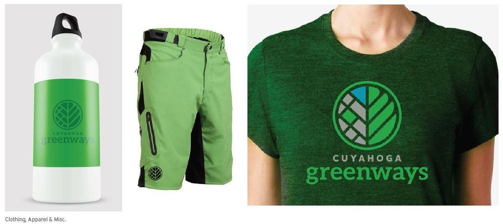
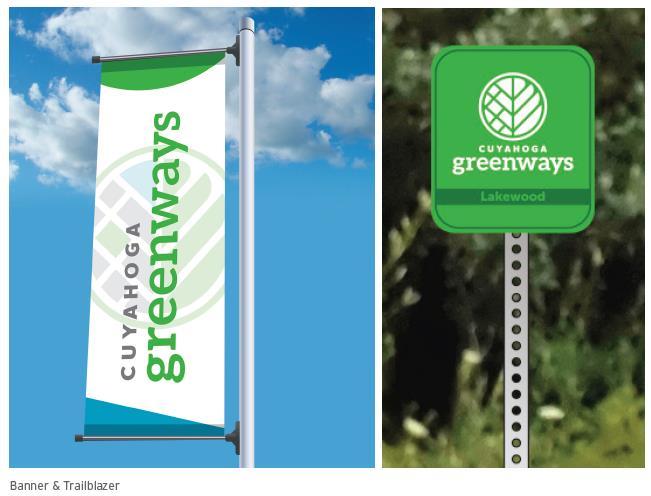
36 BRANDING & LOGO 36

37 DISCUSSION Cuyahoga County Greenway Plan 37 7/25/2017
38 GROUP MAPPING SESSION Use BLUE dots/markers to identify destinations that you currently access from the non-motorized network. E.g. employment centers, parks, retail districts Use GREEN dots/markers to identify destinations that you would like to access from the greenway or urban trail system E.g. Gaps in the trail system, Use RED dots/markers to indicate places where major problems or concerns exist. E.g. dangerous intersections, barrier streets If you leave a dot, leave a note with it! Website/Survey: 38
A BLUEPRINT FOR BROCKTON A CITY-WIDE COMPREHENSIVE PLAN
 A BLUEPRINT FOR BROCKTON A CITY-WIDE COMPREHENSIVE PLAN Public Meeting October 2016 1 Plan Summary and Discussion Public Meeting May 4 2017 City of Brockton Bill Carpenter, Mayor Department of Planning
DRAFT FOR PUBLIC REVIEW. Game Plan for a Healthy City
 DRAFT FOR PUBLIC REVIEW 2018 Game Plan for a Healthy City 2 Denveright. Parks & Recreation Game Plan Draft for Public Review Draft for Public Review Executive Summary Game Plan Overview Executive Summary
ELK GROVE GENERAL PLAN VISION
 2-1 CHAPTER 2: 2-2 CREATING OUR The Community Vision for Elk Grove, expressed through a Vision Statement and a series of Supporting Principles, is a declaration of the kind of community that Elk Grove
Public Meeting & Workshop 1 April 26,2016
 Public Meeting & Workshop 1 April 26,2016 Northeast Ohio Areawide Coordinating Agency City of Cleveland ODOT Bike Cleveland Downtown Cleveland Alliance Ohio City Incorporated Warehouse District Agenda
1 ESRI User Conference Eastside Greenway
 1 ESRI User Conference Eastside Greenway Grand Rapids, Michigan ~200,000 residents 45 sq. miles Leader in smart public investment Green infrastructure program ArtPrize BeerCity USA 2 ESRI User Conference
Toronto Parks Renaissance Strategy
 Toronto Parks Renaissance Strategy Overview, Emerging Themes and Directions Presentation to EDPC, May 4, 2006 Parks Renaissance Strategy Presentation Agenda Project Overview Emerging Themes and Directions
SAN RAFAEL GENERAL PLAN 2040 INTRODUCTION AND OVERVIEW
 SAN RAFAEL GENERAL PLAN 2040 INTRODUCTION AND OVERVIEW Steering Committee Presentation February 14, 2018 Purpose of General Plan Guide land use and development decisions Coordinate transportation, infrastructure,
PLAN ELEMENTS WORKSHOP. April 5, 2016
 PLAN ELEMENTS WORKSHOP April 5, 2016 needs more housing. But there is no one-size fits-all solution. Every neighborhood has its own character. In some places, density is not only appropriate it is badly
IMPLEMENTING SOMERSET COUNTY S INVESTMENT FRAMEWORK
 IMPLEMENTING SOMERSET COUNTY S INVESTMENT FRAMEWORK SMART CONSERVATION THROUGH SMART GROWTH NJ LAND CONSERVATION RALLY March 22, 2014 Laurette Kratina, PP, AICP, Supervising Planner Somerset County Planning
Preliminary Plan Framework: Vision and Goals
 Preliminary Plan Framework: Vision and Goals Draft: May 2015 Introduction Since the Town of Milliken s comprehensive plan was last updated in 2010, the community was heavily impacted by the 2013 flood,
Northeast Ohio Areawide Coordinating Agency. Regional TOD Scorecard and Implementation Plan. July 28, 2016
 Northeast Ohio Areawide Coordinating Agency Regional TOD Scorecard and Implementation Plan July 28, 2016 Agenda Introduction and Overview Wrap-Up of Phase I Task 1: TOD Typology, Metrics, and Scorecard
North Fair Oaks Community Plan Summary and Information
 North Fair Oaks Community Plan Summary and Information WHAT IS THE NORTH FAIR OAKS COMMUNITY PLAN? The North Fair Oaks Community Plan is part of the San Mateo County General Plan, and establishes policies
Chapter 1: Introduction
 Chapter 1: Introduction The Penn Avenue Community Works Corridor Vision and Implementation Framework presents an integrated communitybased vision and a coordinated, long-term implementation framework for
FUNDING CORRIDOR REVITALIZATION
 FUNDING CORRIDOR REVITALIZATION Integrated corridor planning for the 21 st Century America Planning Association Annual Conference Atlanta, GA April 27, 2014 Mariia Zimmerman, MZ Strategies, LLC mariia@mzstrategies.com
BeltLine Corridor Environmental Study
 BeltLine Corridor Environmental Study Citywide Conversation on Transit and Trails April 2, 2009 Agenda & Introductions Introductions Environmental Study Process Overview of the BeltLine Project BeltLine
City of Tacoma Planning and Development Services
 Agenda Item E-1 City of Tacoma Planning and Development Services To: Planning Commission From: Elliott Barnett, Planning Services Division Subject: Tacoma Mall Regional Center Subarea Plan and EIS Meeting
Sustainability, Health, Safety, Recreation & Open Space Working Group August 3, 2017
 Sustainability, Health, Safety, Recreation & Open Space Working Group August 3, 2017 DOWNTOWN OAKLAND SPECIFIC PLAN WELCOME Sustainability, Health, Safety, Recreation & Open Space Working Group Social
WAC #7 3/14/14. Coachella General Plan Update
 WAC #7 3/14/14 Coachella General Plan Update Agenda 2 Introductions Public Draft General Plan Overview and Discussion of Next Steps Implementation and Evaluation Health Element Process Evaluation (discussion)
Atlanta BeltLine Corridor Environmental Study. Scoping Meeting August 2008
 Atlanta BeltLine Corridor Environmental Study Scoping Meeting August 2008 What Will We Be Discussing Today? Study Overview - How Did We Get Here? - What Is the Study About? - Who Is Involved? - Where Is
Whitemarsh Comprehensive Plan Update: Housing & Land Use. Public Workshop #3: September 20, 2018
 Whitemarsh Comprehensive Plan Update: Housing & Land Use Public Workshop #3: September 20, 2018 Agenda Welcome Process Recap What We ve Heard The Plan Framework Review of Recommended Actions Land Use Housing
Portage County Parks, Trails and Greenways Plan
 Portage County Parks, Trails and Greenways Plan Agenda for Local Planning Meeting Introductory Presentation Why we need a Plan Plan project goals and process Benefits Overview of local planning region
WELCOME TO THE CHOUTEAU GREENWAY EQUITY WORKING GROUP!
 WELCOME TO THE CHOUTEAU GREENWAY EQUITY WORKING GROUP! Chouteau Greenway Steering Committee and Working Groups Overview Overview January 9, 2019 Chouteau Greenway will transform St. Louis by connecting
Streets, Connectivity & Built Environment Working Group August 2, 2017
 Streets, Connectivity & Built Environment Working Group August 2, 2017 DOWNTOWN OAKLAND SPECIFIC PLAN WELCOME Streets, Connectivity & Built Environment Working Group Social Equity Meeting August 2, 2017
2035 General Plan Update and Belmont Village Specific Plan. Joint Study Session with the City Council and Planning Commission April 12, 2016
 2035 General Plan Update and Belmont Village Specific Plan Joint Study with the City Council and Planning Commission April 12, 2016 Agenda 1. Welcome and Introductions 2. General Plan Update Status of
East Bench Master Plan Update
 Community & Economic Development Office of the Director East Bench Master Plan Update To: From: Planning Commission Wayne Mills, Senior Planner Date: November 18, 2015 CC: Re: Nora Shepard, City Planning
Streets for People, Place-Making and Prosperity. #TOcompletestreets
 COMPLETE STREETS FOR TORONTO Streets for People, Place-Making and Prosperity COMPLETE STREETS: A NEW APPROACH A Complete Streets design approach considers the needs of all users people who walk, bicycle,
Summary of Action Strategies
 Strategic Action Plan 6 Summary of Action Strategies Action Strategy Categories: 1. Organization and Management 2. Implementation 3. Marketing and Promotion This chapter summarizes all of the action strategies
CHAPTER 8 ISSUES, CONCERNS, CONSTRAINTS AND OPPORTUNITIES
 CHAPTER 8 ISSUES, CONCERNS, CONSTRAINTS AND OPPORTUNITIES Introduction This River Conservation Plan was developed during a time of tremendous activity and effort in planning the transformation of the Delaware
RECREATION, OPEN SPACE AND GREENWAYS ELEMENT GOALS, OBJECTIVES, AND POLICIES
 RECREATION, OPEN SPACE AND GREENWAYS ELEMENT GOALS, OBJECTIVES, AND POLICIES GOAL R-1: DEVELOP A RECREATION, OPEN SPACE AND GREENWAYS SYSTEM AS AN INTEGRAL COMPONENT OF AN OVERALL, COUNTY-WIDE ECONOMIC
University of Saskatchewan CAMPUS MASTER PLAN. Senate Meeting Preliminary Presentation. April 21, 2018 DIALOG ECS DA WATT
 University of Saskatchewan CAMPUS MASTER PLAN Senate Meeting Preliminary Presentation April 21, 2018 DIALOG ECS DA WATT project process presentation agenda Stakeholder Engagement Project Control phase1
Comprehensive Plan ADOPTED APRIL 2014
 Comprehensive Plan ADOPTED APRIL 2014 8 8. Outstanding Recreational & Cultural Opportunities We are proud of our community s parks and recreation system. Our community will ensure that the legacy of our
Office of Greenways & Trails Providing Statewide Leadership and Coordination. Southeast Greenways and Trails Summit October 1-3, 2017
 Office of Greenways & Trails Providing Statewide Leadership and Coordination Southeast Greenways and Trails Summit October 1-3, 2017 1 Office of Greenways and Trails The Office of Greenways and Trails
WELCOME TO THE CHOUTEAU GREENWAY ECONOMIC DEVELOPMENT WORKING GROUP!
 WELCOME TO THE CHOUTEAU GREENWAY ECONOMIC DEVELOPMENT WORKING GROUP! Chouteau Greenway Steering Committee and Working Groups Overview Overview January 9, 2019 Chouteau Greenway will transform St. Louis
WELCOME TO THE CHOUTEAU GREENWAY DESIGN, DEVELOPMENT AND CONSTRUCTION WORKING GROUP!
 WELCOME TO THE CHOUTEAU GREENWAY DESIGN, DEVELOPMENT AND CONSTRUCTION WORKING GROUP! Chouteau Greenway Steering Committee and Working Groups Overview Overview January 9, 2019 Chouteau Greenway will transform
Welcome! Far Northeast Area Plan Meeting #3 Council District 11 Town Hall Meeting Resource Fair. Jan. 30, 2018
 Welcome! Far Northeast Area Plan Meeting #3 Council District 11 Town Hall Meeting Resource Fair Jan. 30, 2018 Tonight s Agenda 6:15- Welcome and Councilmember Remarks 6:25- Presentation 6:45- Activities
Toronto Complete Streets Guidelines
 c. DTAH 58 60 3.1 70 3.2 Performance Measurement 71 3.3 Exceptions Chapter 3 describes the five general steps in the street design process. Not all projects follow these steps, as the number of steps and
Potential Green Infrastructure Strategies May 6, 2015 Workshop
 Potential Green Infrastructure Strategies May 6, 2015 Workshop Background The City of Cortland is developing the Tioughnioga Urban Headwaters Green Infrastructure Action Plan with funding from the National
Corridor Vision. 1Pursue Minnehaha-Hiawatha Community Works Project. Mission of Hennepin County Community Works Program
 1Pursue Minnehaha-Hiawatha Community Works Project Minnehaha-Hiawatha Community Works is a project within the Hennepin Community Works (HCW) program. The mission of the HCW program is to enhance how the
PUBLIC SPACES MASTER PLAN UPDATE (POPS) Crystal City Citizen s Review Council October 24, 2018
 Crystal City Citizen s Review Council October 24, 2018") PUBLIC SPACES MASTER PLAN UPDATE (POPS) Crystal City Citizen s Review Council October 24, 2018 1 PLANNING CONTEXT Arlington County Comprehensive Plan UPDATE Related Documents: CIP Sector Plans Area Plans
PUBLIC SPACES MASTER PLAN UPDATE (POPS) Crystal City Citizen s Review Council October 24, 2018 1 PLANNING CONTEXT Arlington County Comprehensive Plan UPDATE Related Documents: CIP Sector Plans Area Plans
Animating the Rideau Canal December 2013
 Executive Summary Animating the Rideau Canal December 2013 Why study the Rideau Canal? The Rideau Canal has been an important part of Ottawa throughout its history, and has shaped and been shaped by the
Broken Arrow Comprehensive Plan Update Public Workshop Meeting #3 January 23,
 Broken Arrow Comprehensive Plan Update Public Workshop Meeting #3 January 23, September 25,2018 2018 26 April 2016 AGENDA 1. Status Presentation - Charrette Recap - Proposed Vision Framework - Preliminary
City of Fort Lauderdale UPTOWN URBAN VILLAGE. Public Workshop December 7, 2016
 Public Workshop December 7, 2016 Workshop Agenda Introductions Project Presentation o o o History Project Scope/Timeline Character of Study Area o o o o Land Use Public Realm/Pedestrian Mobility Multimodal
Plano Tomorrow Vision and Policies
 Plano Tomorrow Vision and Policies PLANO TOMORROW PILLARS The Built Environment The Social Environment The Natural Environment The Economic Environment Land Use and Urban Design Transportation Housing
1.0 Purpose of a Secondary Plan for the Masonville Transit Village
 Report to Planning and Environment Committee To: Chair and Members Planning & Environment Committee From: John M. Fleming Managing Director, Planning and City Planner Subject: Masonville Transit Village
Dyersville Downtown Plan. Open House October 24, 2017
 Dyersville Downtown Plan Open House October 24, 2017 What is a Comprehensive Plan? - Vision - Guidance for decisions - Basis for regulations What is a Downtown Plan? - Understand priorities - Identify
Introduction. Chapter 1. Purpose of the Comprehensive Plan Plan Organization Planning Process & Community Input 1-1
 Chapter 1 Introduction Lakewood 2025: Moving Forward Together Purpose of the Comprehensive Plan Plan Organization Planning Process & Community Input 1-1 Purpose of the Comprehensive Plan The Comprehensive
This page intentionally blank.
 This page intentionally blank. Parks, Recreation, and Open Space Chapter Relationship to Vision Vision Parks, Recreation and Open Space Chapter Concepts County Government. County government that is accountable
The transportation system in a community is an
 7 TRANSPORTATION The transportation system in a community is an important factor contributing to the quality of life of the residents. Without a sound transportation system to bring both goods and patrons
10.0 Open Space and Public Realm
 10.0 Open Space and Public Realm 10.0 Open Space and Public Realm The Public Open Space System is comprised of: outdoor spaces available for public use that are either publicly owned (e.g., parks and
Trail Feasibility and Planning Project for Northern Dutchess County, New York
 for Northern Dutchess County, New York Funded in Part by Grants from the Hudson River Valley Greenway, Land Trust Alliance Conservation Partnership Program and the Thomas Thompson Trust 1 STEERING COMMITTEE
edmonton.ca/ribbonofgreen #ribbonofgreen
 WHAT IS THE RIBBON OF GREEN? The Ribbon of Green is Edmonton s entire river valley and ravine system. The Ribbon of Green (2018) Project will provide strategic guidance for the southwest and northeast
Blueprint Denver Task Force Meeting #
 Blueprint Denver Task Force Meeting #1 6.23.16 1. Welcome and Introductions Your name and affiliation Name 1 thing you love about Denver Name 1 thing you d change about Denver All in 30 seconds! Ready,
Harlem Avenue Corridor Plan: Corridor Planning Across Municipal Boundaries
 Harlem Avenue Corridor Plan: Corridor Planning Across Municipal Boundaries Heather Tabbert, Manager, Local Planning and Programs Division Regional Transportation Authority (RTA) Jen McNeil Dhadwal, Principal
City of Nogales General Plan
 Open Space, Parks, Recreation and Trails City of Nogales General Plan Residents of Nogales place a high priority in the development of a comprehensive system of open space, parks, recreation and trails
NORTH CLAYMONT AREA MASTER PLAN COMMUNITY WORKSHOP #1 FEBRUARY 3, 2016
 NORTH CLAYMONT AREA MASTER PLAN COMMUNITY WORKSHOP #1 FEBRUARY 3, 2016 1. Introduction To the team and to the Plan Planning Partners The Claymont Community WILMAPCO New Castle County Claymont Renaissance
Ten Mile Creek Planning Area
 PLANNING AREA POLICIES TEN MILE CREEK Ten Mile Creek Planning Area Location and Context The Ten Mile Creek Planning Area ( Ten Mile Creek area ) is located south of the current Boise AOCI, generally south
THE COMMUNITY-DRIVEN DESIGN PROCESS
 THE COMMUNITY-DRIVEN DESIGN PROCESS A PUBLIC DRIVEN PROCESS STEERING COMMITEE THE COMPREHENSIVE PLAN OPPORTUNITIES AND CONSTRAINTS THE COMMUNITY DRIVEN DESIGN PROCESS A Public Driven Process Beginning
Statewide Greenways Vision
 Greenways Vision The formation of a greenways vision is based on a thorough analysis of the current state of recreation and open space in a region and the existing pressures that threaten it. Lehigh and
Secrest Short Cut and Monroe Expressway Small Area Plan AUGUST 29, 2018
 Secrest Short Cut and Monroe Expressway Small Area Plan AUGUST 29, 2018 Background and Process Monroe Expressway will be open by the end of 2018 Union County and Indian Trail identified a need to revisit
7Page 1 CLEMMONS COMMUNITY COMPASS 1 PLAN OVERVIEW
 1 Plan Overview WHAT IS I THE CLEMMONS COMMUNITY COMPASS? The Clemmons Community Compass is our community s comprehensive plan. It serves as our blueprint and provides direction for the future of the Village
SALISBURY TOMORROW Our Vision
 SALISBURY TOMORROW Our Vision Salisbury is committed to supporting a high quality of life and sense of community for all residents. These commitments need to be reflected in our community programs, services
Denver Moves: Transit Task Force
 Insert transit picture Denver Moves: Transit Task Force Meeting #8 October 5, 2017 1. Welcome & Introductions Opening remarks and housekeeping Task Force and audience introductions Upcoming events and
1 October Dear Citizens of Charlotte and Mecklenburg County,
 1 October 2011 Dear Citizens of Charlotte and Mecklenburg County, As co-chairs of the Center City 2020 Vision Plan Steering Committee, we are proud to present the Center City 2020 Vision Plan, which sets
Executive Summary. NY 7 / NY 2 Corridor
 Executive Summary NY 7 / NY 2 Corridor Transportation and Land Use Study December 2005 Prepared for: Town of Colonie Capital District Transportation Committee Prepared by: Introduction: Land use decisions
Phase I Redevelopment Plan. First Community Meeting
 Hoboken Terminal and Yard Phase I Redevelopment Plan First Community Meeting May 31, 2011 One Hudson Place Phase I Redevelopment Plan Redevelopment Plan First Community Meeting Agenda 1. Redevelopment
Onondaga County Sustainable Streets Project. Onondaga County Planning Federation June 7, Onondaga County Sustainable Streets Project 1
 Onondaga County Sustainable Streets Project Onondaga County Planning Federation June 7, 2012 Onondaga County Sustainable Streets Project 1 Sustainable Streets 1. Introduction to the SMTC 2. Sustainable
Downtown Streetscape Manual & Built Form Standards
 City of Guelph Downtown Streetscape Manual & Built Form Standards July 2014 Prepared by Brook McIlroy Inc. in association with Unterman McPhail Associates and McCormick Rankin Inc. City of Guelph Downtown
Introduction and Overview
 Introduction and Overview Articulate local values and priorities Guide land use and development decisions Coordinate transportation, infrastructure, and City services with expected growth and available
3. VISION AND GOALS. Vision Statement. Goals, Objectives and Policies
 Vision Statement Queen Creek s interconnected network of parks, trails, open spaces and recreation opportunities provide safe and diverse activities and programs that sustain its unique, small town, equestrian
Transportation Land Use Integration & Regional Planning. Don Kostelec, AICP Senior Planner, Louis Berger Group February 1, 2010
 Transportation Land Use Integration & Regional Planning Don Kostelec, AICP Senior Planner, Louis Berger Group February 1, 2010 Transportation Land Use Integration DOT-HUD-EPA Sustainable Communities Initiative
PLACEMAKING & MOBILITY WORKSHOP. January 27, 2016
 PLACEMAKING & MOBILITY WORKSHOP January 27, 2016 Boston needs more housing. But there is no one-size fitsall solution. Every neighborhood has its own character. In some places, density is not only appropriate
REGIONAL ACTIVITY CENTER
 DRAFT REGIONAL ACTIVITY CENTER 70 EAST BENCH MASTER PLAN DRAFT 06 Introduction The East Bench Regional Activity center is comprised of large educational, research, medical, and employment centers. These
INDEPENDENCE BOULEVARD AREA PLAN. Economic Development Committee Overview May 25, 2010
 INDEPENDENCE BOULEVARD AREA PLAN Economic Development Committee Overview May 25, 2010 Presentation Outline Plan Purpose and Development Process Draft Plan Policies and Implementation Strategies Request
implementation r expression in landscape
 6 ubc okanagan implementation campus plan r expression in landscape 68 6 implementation campus plan sections The Campus Plan supports the academic mission, values and commitments of the University by providing
Loved hearing what others shared and having a dialogue about the possibilities/opportunities
 MEMO To: Dave Efland, Director of Planning & Community Development November 7, 2018 From: Sarah Kelly and Emily Long, planning NEXT Re: Round 1 of Public Engagement, Delaware Together, Comprehensive Plan
JANUARY 19, 2011 CENTRAL AVENUE-METRO BLUE LINE TRANSIT-ORIENTED DEVELOPMENT IMPLEMENTATION PROJECT COMMUNITY FORUM
 CENTRAL AVENUE-METRO BLUE LINE TRANSIT-ORIENTED DEVELOPMENT IMPLEMENTATION PROJECT COMMUNITY FORUM JANUARY 19, 2011 THE MARYLAND-NATIONAL CAPITAL PARK AND PLANNING COMMISSION PRINCE GEORGE S COUNTY PLANNING
Atlanta BeltLine. Subareas 9 & 10. Master Plan Updates. March 26, Washington Park Jamboree 1
 Atlanta BeltLine Subareas 9 & 10 Master Plan Updates March 26, 2018 Washington Park Jamboree 1 22 miles, connecting 45 neighborhoods 22 MILES of transit 46 MILES of streetscapes and complete streets 33
Public input has been an important part of the plan development process.
 Lakewood s Comprehensive Plan recognizes that transportation helps shape the community, and that the way the community provides for the safe and efficient movement of people affects the character of the
John M. Fleming Managing Director, Planning and City Planner. Old East Village Dundas Street Corridor Secondary Plan Draft Terms of Reference
 Report to Planning and Environment Committee To: From: Subject: Chair and Members Planning & Environment Committee John M. Fleming Managing Director, Planning and City Planner Old East Village Dundas Street
City of Farmington. Downtown Plan. Amendment to the 1998 Master Plan Adopted October 11, 2004
 City of Farmington Amendment to the 1998 Master Plan Adopted October 11, 2004 Introduction Planning Background 1 Scope and Components of the Plan Amendment 2 Concept Introduction 3 Plan Concepts 3 Conceptual
City of Brookfield 2035 Comprehensive Plan. DRAFT #2 October 6, 2009
 City of Brookfield 2035 Comprehensive Plan DRAFT #2 October 6, 2009 Public Hearing Presentation: December 1, 2009 Process Overview Phase I: Community Visioning (2008) - Developed long-term vision to direct
Concord Community Reuse Project Goals and Guiding Principles. Overarching Goals (OG)
") Concord Community Reuse Project Goals and Guiding Principles Overarching Goals (OG) No priority is implied by the order of presentation of the goals and guiding principles. Overarching goals for the Concord
Concord Community Reuse Project Goals and Guiding Principles Overarching Goals (OG) No priority is implied by the order of presentation of the goals and guiding principles. Overarching goals for the Concord
India Basin/Hunters Point Shoreline Community Workshop May 21, 2008
 India Basin/Hunters Point Shoreline Community Workshop May 21, 2008 Workshop Agenda Welcome Process Overview Context & Existing Conditions Presentation of Draft Concepts Land Use and Open Space Priorities
Planning for Waterfront Communities
 Planning for Waterfront Communities Redevelopment Ready Communities Supplemental Training Program OFFICE OF THE GREAT LAKES Waterfront Community Best Practices and Guidelines New supplemental criteria
Preface. Erie. Scranton. Allentown. Pittsburgh. Harrisburg. Philadelphia
 The Southern Alleghenies Region The Southern Alleghenies Region spans the Laurel Highlands and Allegheny Front in the west across the Appalachians to the east. It is comprised of Blair, Bedford, Cambria,
CITY OF VAUGHAN EXTRACT FROM COUNCIL MEETING MINUTES OF NOVEMBER 15, 2016
 Item 11, Report No. 38, of the Committee of the Whole, which was adopted without amendment by the Council of the City of Vaughan on November 15, 2016. Regional Councillor Di Biase declared an interest
Northside Interjurisdictional Specific Plan and EIR
 Northside Interjurisdictional Specific Plan and EIR Presented by: DAVE MURRAY, Senior Planner City Of Riverside BRIAN MOONEY, FAICP Rick Community Planning And Sustainable Development KURT CULBERTSON,
Sherri Ferguson. President/CEO Portland Chamber of Commerce. Tennessee Certified Economic Developer Capstone Project
 Sherri Ferguson President/CEO Portland Chamber of Commerce Tennessee Certified Economic Developer Capstone Project Strategic Plan Development for the North Gateway of Portland, Tennessee The New Gateway
Atlanta BeltLine Subarea 3 Master Plan Update
 Atlanta BeltLine Subarea 3 Master Plan Update April 14, 2018 Workshop Meeting 1 22 miles, connecting 45 neighborhoods 22 MILES of transit 46 MILES of streetscapes and complete streets 33 MILES of urban
Mendota-Lebanon Hills Greenway Master Plan Executive Summary. August draft for more information visit
 Mendota-Lebanon Hills Greenway Master Plan Executive Summary August 2013 draft for more information visit www.hkgi.com/projects/dakota INTRODUCTION The Mendota-Lebanon Hills Greenway Master Plan portrays
Oroville Area Urban Greening Plan. Joint Meeting of the Oroville Planning, Park, and Arts Commissions October 12, 2015
 Oroville Area Urban Greening Plan Joint Meeting of the Oroville Planning, Park, and Arts Commissions October 12, 2015 Project Team Lead Agency Butte County Department of Development Services Claudia Stuart,
Town of Cobourg Heritage Master Plan. Statutory Public Meeting
 Town of Cobourg Heritage Master Plan Statutory Public Meeting April 25 th 2016 Presentation Overview 1. Introduction 2. Project background and schedule overview 3. Review of strategic direction content
TRANSIT-ORIENTED DEVELOPMENT POLICY DRAFT. City Planning and Development Department Kansas City, Missouri
 TRANSIT-ORIENTED DEVELOPMENT POLICY DRAFT City Planning and Development Department Kansas City, Missouri What is Transit Oriented Development (TOD)? Development that focuses land uses around a transit
RECREATION AND OPEN SPACE ELEMENT GOALS, OBJECTIVES, AND POLICIES
 RECREATION AND OPEN SPACE ELEMENT GOALS, OBJECTIVES, AND POLICIES Goal 7 To provide park facilities, recreation programs, and open space resources that are safe, adequate, and accessible to all City residents,
BeltLine Corridor Environmental Study
 BeltLine Corridor Environmental Study Joint TAC and SAC Meeting December 8, 2008 What We Will Discuss Today Outreach and Agency Coordination Scoping Results Existing Conditions Historical and Archeological
MAYFIELD VILLAGE GREENWAY TRAIL
 1 Shared use 10 wide asphalt all purpose trail Includes 60 ft. steel truss bridge, 549 ft. of boardwalk, three underpasses Connects Village center to Library, Metroparks, and Village recreational areas
Hopkins. Development Guidelines May Overview. Sponsored by: Blake Road Corridor Collaborative City of Hopkins
 Hopkins Blake Road LRT Station Area Development Guidelines May 2015 Sponsored by: Blake Road Corridor Collaborative City of Hopkins Overview Hopkins is a dynamic community of over 17,000 residents located
PUBLIC SPACES MASTER PLAN UPDATE (POPS) Joint Facilities Advisory Commission (JFAC) November 28, 2018
 Joint Facilities Advisory Commission (JFAC) November 28, 2018") PUBLIC SPACES MASTER PLAN UPDATE (POPS) Joint Facilities Advisory Commission (JFAC) November 28, 2018 1 AGENDA POPS Planning Context Timeline Public Input Final POPS Draft Next Steps 2 PLANNING CONTEXT
PUBLIC SPACES MASTER PLAN UPDATE (POPS) Joint Facilities Advisory Commission (JFAC) November 28, 2018 1 AGENDA POPS Planning Context Timeline Public Input Final POPS Draft Next Steps 2 PLANNING CONTEXT
Gary & Regional Investment Project. October 27, Creating Tomorrow Today Comprehensive Regional Plan - NIRPC
 Creating Tomorrow Today 2040 Comprehensive Regional Plan Gary & Regional Investment Project October 27, 2010 Creating Tomorrow Today - 2040 Comprehensive Regional Plan - NIRPC What is NIRPC? - Northwestern
PUBLIC ENGAGEMENT & SIX THEMES OF THE PLAN
 Connecting the heart of Eagle to the soul of the river - Kathy Chandler-Henry, Commissioner Eagle County CHAPTER 1 PUBLIC ENGAGEMENT & SIX THEMES OF THE PLAN town of eagle - river corridor plan 1 PUBLIC