COMMUNITY IMPROVEMENT DISTRICTS
|
|
|
- Dennis Fletcher
- 6 years ago
- Views:
Transcription


1 MASTER PLAN EXECUTIVE SUMMARY May 11, 2017

 and Airport South While each CID remains an independent (Clayton County).")


2 TWO DISTRICTS, ONE APPROACH The Aerotropolis Atlanta Community Improvement In January 2016 the leaders of the two CIDs decided Districts is a combination of the two Airport Area to unite under the name Aerotropolis Atlanta CIDs. CIDs: Airport West (Fulton County) and Airport South While each CID remains an independent (Clayton County). organization, both Boards of Directors work in Both Aerotropolis Atlanta CIDs were established to partnership and share an administrative staff which represent commercial property owners in proximity is overseen by Airport West CID Executive Director to Hartsfield-Jackson Atlanta International Airport. Gerald McDowell. The Airport West CID, formed in 2014, represents This unique partnership positions the Aerotropolis properties to the north and west of the Airport. Atlanta CIDs to fulfill the unified comprehensive plan The Airport South CID, formed in 2015, represents outlined in this summary report. By following the properties to the south and within Clayton County. companion Five Year Action Plan, South Metro can Both CIDs expanded their boundaries in grow to become Atlanta's most desirable place to live Together, the Aerotropolis Atlanta CIDs encompass and work into the future. 15 square miles, including more than 1,100 unique The Aerotropolis Atlanta Master Plan defines properties with a total appraised value of more than the challenges and opportunities that will $500 million in shape CID investments through THE AEROTROPOLIS ATLANTA CIDS ARE COMMITTED TO CREATING AN ECONOMICALLY STRONG, SAFE, ATTRACTIVE AND VIBRANT COMMUNITY SURROUNDING THE WORLD S MOST-TRAVELED PASSENGER AIRPORT. WE ARE A CATALYST FOR INFRASTRUCTURE ENHANCEMENT THROUGH NEW INVESTMENTS, PROJECT PLANNING, RESOURCE MANAGEMENT AND PARTNERSHIP DEVELOPMENT. WE SEEK TO RAISE THE COLLECTIVE VALUE OF OUR COMMUNITY S COMMERCIAL PROPERTIES WHILE MAKING THE CIDS A DESTINATION FOR NEW BUSINESSES, RESIDENTS AND VISITORS. Aerotropolis Atlanta CIDs Mission Statement AEROTROPOLIS ATLANTA CIDS Hartsfield-Jackson Atlanta International Airport Airport West CID 2016 Expansion Airport South CID 2016 Expansion INTRODUCTION AEROTROPOLIS ATLANTA CIDS 1 May 11,
3 GOALS OBJECTIVES! As the result of conversations with board members representing both CIDs, regional stakeholders, elected officials, and community members, two clear goals emerged and serve as the foundation for this Aerotropolis Atlanta CIDs Master Plan. Each of the plan's recommended projects and initiatives, outlined in this report and within the control of the CIDs, have been considered with the purpose of both enhancing regional perceptions of the area and/or fostering economic development of South Metro Atlanta. ENHANCE BRAND AND PERCEPTIONS Projects in the combined Aerotropolis CIDs should work together to tell a story that helps establish an authentic brand for the Aerotropolis area, while simultaneously improving the area's identity and perception. FOSTER ECONOMIC DEVELOPMENT Projects should continue to make the Aerotropolis area attractive for business and industry. Well-designed projects will make the CIDs a desired market for future development of multiple uses and sectors. The Aerotropolis Atlanta CIDs Master Plan outlines projects to enhance and improve the area over the next 5-10 years. Recommended projects and initiatives generally fall into one of four categories: PUBLIC SAFETY Improve the visibility and effectiveness of public safety for community members who live and work within the area WAYFINDING Simplify the ability to navigate within and across the districts with the use of clear and contemporary vehicular and pedestrianscaled wayfinding and signage BEAUTIFICATION Enhance the overall area aesthetic and perceptions through the beautification of interchanges and corridors INFRASTRUCTURE Strengthen the functionality of existing infrastructure by expanding connectivity and mobility options, addressing conflict points, and creating new means and routes of transportation throughout the CIDs Article IX, Section VII of the Georgia Constitution gives Community Improvement Districts the ability to utilize generated revenue on: Street and road construction and maintenance, including curbs, sidewalks, street lights, and devices to control the flow of traffic on streets and roads Parks and recreational areas and facilities Stormwater and sewage collection and disposal systems Development, storage, treatment, purification, and distribution of water Public transportation Terminal and dock facilities and parking facilities GOALS AND OBJECTIVES AEROTROPOLIS ATLANTA CIDS 3 May 11,
4 MARKET ANALYSIS Population Employment To better understand the Aerotropolis Atlanta CIDs market forces and trends, the planning team undertook a market study for the greater Aerotropolis area. This study extended beyond the CIDs boundaries to areas within a minute drive of the Airport. The analysis included a review of demographic and employment trends including residential, industrial, retail, and office real estate demand models. While the Aerotropolis Area s underlying demographics do not provide a positive case for investment, a deeper look at the area's population, diversity, and employment trends presents a different case. For the Aerotropolis area to grow and succeed, it is vital that the CIDs, Aerotropolis Atlanta Alliance, and the organizations' partners, work closely to tell the full story of the area s momentum and economic potential to build the case for further investment and reinvestment. Airport/ Aerotropolis Market Area Median Age Household Size $ $ $38,305 Median Income $57, % Secondary Degree Atlanta Metropolitan Statistical Area % The market analysis area is larger than the combined boundaries of the CIDs. The analysis area contains more than 360,000 residents; 31,760 of them arrived since Young adults (ages 20 to 37), including families, are the most common group living in this area; however, the net growth over the last 15 years is almost entirely Baby Boomers (ages 52 to 71). Aerotropolis Primary Population Segments FAMILY FOUNDATIONS Married couples, single parents, grandparents, and children (young and adult) Retired workers contribute to lower labor force participation Drives demand for single-family housing METRO FUSION Young, diverse population Single-adult households (more than 1/2 of total households) Drives demand for rental property AMERICAN DREAMERS Younger married-couple with children Multigenerational homes are common High levels of diversity Drives demand for single-family housing (typically outside urban centers) In 2014, the market analysis area included more than 210,000 jobs (8.4% of the regional total). Of those jobs, roughly 160,000 are filled by employees who commute into the area for work daily. This is contrasted by the approximately 90,000 residents who commute to their employment destinations outside the area. Of the 360,000 full-time residents, approximately 35,000 both live and work within the study area. Market Considerations The area s market potential will shift. The Aerotropolis Atlanta CIDs have the opportunity to maximize return on investment and reinvestment by prioritizing areas of focus that will build momentum over time. NEAR-TERM MID-TERM LONG-TERM INDUSTRIAL RESIDENTIAL RETAIL OFFICE The Aerotropolis area has recorded the region's highest levels of net absorption, occupancy rates, and rent growth since Sites with proximity to the Airport and major transportation thoroughfares should be preserved for industrial development. By clustering industrial uses, the area can capitalize on nearby skilled labor. Forecasted population growth will drive short-term demand for housing. New rooftops should be considered in a variety of types and price points in response to the area's shifting market preferences and evolving demographics. Housing that provides access and proximity to jobs and services is key to the area's future success. Retail opportunities will follow new rooftops and jobs. High visibility locations with access to commuters will strengthen the case for new retail; this also helps offset the area's lower average incomes. Mixed-use opportunities should be located in prime locations with access to jobs, housing, and visitors to enhance the Atlanta region. Office development should be adaptable for changing employee/ employer preferences. Opportunities for new office space will be driven by available properties with superior access and visibility, as well as proximity to connected employee amenities such as multi-use trails, parks, shopping, and dining destinations. MARKET ANALYSIS AEROTROPOLIS ATLANTA CIDS 5 May 11,


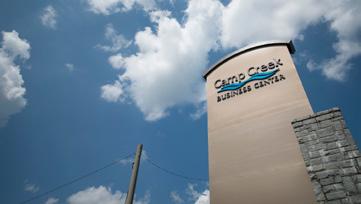
5 COMMUNITY CHARACTER The Airport West and Airport South CIDs are expansive districts covering more than 11 miles from end-to-end, spanning seven jurisdictions, and containing 15+ square miles of properties. This massive area has been subject to a variety of different plans and policies, but previous efforts have lacked a cohesive approach for advancing the area as a whole. As organizations that span the Aerotropolis District, five municipalities and two counties, the CIDs in partnership with the Aerotropolis Alliance, are well positioned to provide the vision, oversight and leadership required to unleash the area's economic potential and long-term prosperity. Given the size of the combined CIDs, subdividing the overall area into eight character areas allows for the unique assets and needs of each to be understood and addressed. These character areas were identified through a comprehensive analysis of the land uses and transportation, and a series of conversations with key stakeholders and community members. (and City of South Fulton) CIDs Area Aerotropolis Atlanta Blueprint is a vision for the area around Hartsfield-Jackson Atlanta International Airport and Atlanta s South Metro area. This plan envisions the Aerotropolis area as a preeminent location for economic investment in the southeastern U.S. This Master Plan utilized the Blueprint as a foundational document to help identify CID needs and strategies. COWART LAKE WEST CAMP CREEK Redevelopment Nodes 1 S. FULTON PARKWAY SOUTH FULTON EAST CAMP CREEK MARKETPLACE With the assistance of stakeholders and community members, the planning team identified nine areas most likely to experience future development based on their current activity and market potential. The needs and opportunities of each redevelopment node was studied to shape and prioritize the CIDs project list and Five Year Action Plan. 1. Marketplace - The retail center west of I-285 along Camp Creek Parkway 2 RIVERDALE/SULLIVAN GATEWAY/GICC 2. South Fulton Parkway - The corridor and properties along South Fulton Parkway and Roosevelt Highway 3. College Park Property - Redevelopment property on Camp Creek Parkway owned by College Park 4. Georgia Intercontinental Convention Center - The GICC property and surrounding area. 5. Downtown College Park - Main Street and the properties surrounding Woodward Academy 6. Corporate Crescent - Virginia Avenue Corridor near Delta Airlines Headquarters 7. Downtown Hapeville - Properties in Downtown Hapeville particularly along Central Avenue 8. Airport Impact Zone - Properties impacted by the expansion of facilities at the Airport 9. Phoenix Boulevard - Riverdale Road, Phoenix Boulevard and the I-285 interchange GICC DOWNTOWN COLLEGE PARK COLLEGE PARK PROPERTY AIRPORT IMPACT ZONE 9 PHOENIX BLVD PHOENIX/FOREST NORTHERN CRESCENT CORPORATE CRESCENT DOWNTOWN HAPEVILLE 7 COMMUNITY CHARACTER AEROTROPOLIS ATLANTA CIDS 7 May 11,


6 PROJECTS AND INITIATIVES ECONOMIC DEVELOPMENT PRINCIPLES From review and analysis of redevelopment areas, potential projects and initiatives were identified by the planning team, in partnership with community members and key stakeholders. With the purpose of growing the Aerotropolis area as an economic engine and enhancing community perceptions a total of 29 projects, spread across both CIDs, were recognized. In addition to these projects, a comprehensive and unified wayfinding signage plan is proposed bringing the total to 30 projects overall. Each of the 30 projects falls into one of the following categories and meets one or more of the CID's four primary objectives. PROJECT TYPE Future Connections (3 Projects) Roadway and/or Streetscape Improvements (8 Projects) Interchange Beautification and/or Improvements (13 Projects) Intersection Improvements (5 Projects) Wayfinding and Signage (1 Project) OBJECTIVES PUBLIC SAFETY WAYFINDING BEAUTIFICATION INFRASTRUCTURE AEROTROPOLIS ATLANTA CIDS' PROJECT LIST As the Aerotropolis District evolves, redevelopment and community improvement efforts should leverage the area three key economic assets as long-term drivers of economic development: Leverage the Airport Hartsfield-Jackson Atlanta International Airport is the metro area's most significant economic asset. With 63,000+ employees working around the clock, the Airport is the area s largest employer. In addition to being a major hub, the Airport continues to grow. The ATLNEXT program will invest $6 billion into the Airport over the next 20 years. Leverage the Existing Businesses The Aerotropolis area accommodates approximately 210,000 jobs, with a majority of employees commuting from outside of the area. As such, the day-time population is significantly larger than the area's residential population. While area employment is spread across many sectors, 90% of job growth has been limited to transportation and warehousing since Leverage the Expanding Population The Airport area is growing at a consistent pace. Since 2000, the area has seen a 13.4% increase in overall population. Proximity to the Airport and the City of Atlanta, as well as relatively low priced homes, has driven growth. Due to strong increases in Baby Boomers seeking to age-in-place and younger residents seeking affordable housing near the City, planning of mixed-income housing and new housing types is vital to the area s continued economic success. OPPORTUNITIES Develop a synergistic relationship between the Aerotropolis area and the Airport Prioritize investments that attract people traveling to or through Atlanta Create activity centers near the Convention Center and Virginia Avenue OPPORTUNITIES Encourage proximity to the Airport and major transportation infrastructure Protect major transportation corridors for efficient travel Create activity nodes that provide amenities for area employees OPPORTUNITIES Use public investments to support activity nodes for people that live and work in the Aerotropolis area Elevate key nodes to support mixeduse centers and new destinations PROJECTS AND INITIATIVES AEROTROPOLIS ATLANTA CIDS 9 May 11,


7 OBJECTIVE 1: PUBLIC SAFETY PUBLIC SAFETY TODAY PUBLIC SAFETY TOMORROW Public safety presence is vital to enhancing the perception of area within the CIDs boundaries. Stakeholders and community members agree that the area's perception of public safety is fundamental to growth and must be addressed. To date, one of the biggest investments of the Aerotropolis Atlanta CIDs is working to address public safety concerns in a real and tangible way. Currently, the CIDs coordinate 24-hour surveillance by both local police and a private security. Those patrols include two private security vehicles and one local patrol car. Along with increased surveillance, the CIDs have monthly coordinating meetings to share critical information and maintain an open dialogue between the multiple police jurisdictions and community members. AFTER ONE YEAR OF IMPLEMENTATION TOTAL CRIME IS DOWN 34% IN THE AIRPORT WEST CID Ongoing public safety coordination organized by the CIDs include: Law Enforcement Meetings Local police jurisdictions and private security teams assemble regularly to discuss current trends and coordinate enforcement across jurisdictional lines. Community Police Meetings Community and business owners interact regularly with local police departments and learn techniques to make their individual properties safer. ATL Aerotropolis Hotel Security Council Local hoteliers gather to discuss patterns and trends in that impact their properties and how they can best communicate to resolve issues across the Districts. TOTAL CRIME IS DOWN 7% IN THE AIRPORT SOUTH CID (WITHOUT ADDITIONAL OFF-DUTY LAW ENFORCEMENT) CONTINUOUS CHAIN OF COMMUNICATION AND OPEN DIALOGUE HAS BEEN ESTABLISHED BETWEEN BUSINESS OWNERS, COMMUNITY MEMBERS, LAW ENFORCEMENT, AND THE AEROTROPOLIS ATLANTA CIDs Taking advantage of new and evolving law enforcement technology and crime prevention is a top priority for the CIDs. The Aerotropolis CIDs staff is working with local police chiefs to evaluate a partnership to purchase fixed license plate readers for strategic locations within the Aerotropolis Atlanta CIDs. These readers will assist local police by tracking criminal behavior and notifying law enforcement immediately if a suspect tag is captured. License plate readers have the ability to scan up to 1,800 cars per minute at a travel speed over 150 mph. Additionally, the CIDs, in partnership with the College Park Police Department (CPPD), are working to create a pilot program for video integration systems to monitor CID properties along Phoenix Boulevard. This open platform system will allow CPPD and the CIDs to utilize shared private cameras owned by existing businesses in addition to City owned equipment. The Atlanta Police Department (APD) has a similar video integration system to monitor portions of the Airport West CID.! LONG-TERM IMPLEMENTATION PLANS AND STATISTICAL GOALS Increase police presence by one additional car per shift Increase security officers by two additional officers per shift Decrease the total crime within the combined CIDs district by 50% PUBLIC SAFETY AEROTROPOLIS ATLANTA CIDS 11 May 11,


8 OBJECTIVE 2: WAYFINDING SIGNAGE AND BRANDING Creating a unified look and brand for the Aerotropolis area is important for the combined CIDs. As part of the master plan effort, the planning team created three signage scales that provide a framework for a wayfinding, include regional, district and local-scale signs. Regional signage should be monumental in size and located near major entry and exit points. District signage would be scaled for vehicular traffic and should be used within activity centers, such as Camp Creek Parkway and Riverdale Road. Local signs are pedestrian scale and located in walkable districts like Virginia Avenue and Camp Creek Parkway. The design and installation of unified wayfinding signage will allow the CIDs to create a consistent look across the area. This brand would be easily identifiable and work for all areas within the CIDs boundaries. While the design is still to be developed, it may include a public art component that can be incorporated across the three signage types. REGIONAL Large-scale monuments Used to establish gateway entrances to the CIDs Located at interchanges and along main corridors Generally landmark signage without directional information DISTRICT Vehicular-scale signs Simple directional information to districts and major landmarks. Located along arterial roadways LOCAL Pedestrian-scale signs Provides directional information, including local landmarks and attractions Denotes pathways and key locations for community members and area visitors on foot or bike LOCAL DISTRICT REGIONAL POTENTIAL SIGNAGE LOCATIONS WAYFINDING AEROTROPOLIS ATLANTA CIDS 13 May 11,


 is recommended I-85 at Virginia Avenue Approximately 9 acres (smallest interchange) Adjacent to")
9 OBJECTIVE 3: BEAUTIFICATION INTERCHANGES The Aerotropolis area serves as the first and last impression for many travelers, making it the region's most important gateway based on daily impressions. Most of these impressions come from those arriving from the southeast along one of the interstate corridors through the Aerotropolis area. Each interchange along this route offers the opportunity to enhance the Aerotropolis brand and improve perceptions. Throughout the engagement process, community members and stakeholder expressed a desire for these interchanges to create a better visual representation of the community. The interchanges provide a important opportunity to shape first and last impressions for travelers, workers, and residents. While every interchange contributes to area identity, four interchanges were prioritized and studied. Following the direction of the community and CID Boards, each interchange was evaluated to maximize the visual benefit of increased beautification investments. In addition to identifying high, medium, and low visibility areas within each interchange, the planning team provided a series of strategies and I-285 AT S. FULTON PARKWAY I-85 AT RIVERDALE ROAD I-85 AT VIRGINIA AVENUE I-285 AT RIVERDALE ROAD I-285 at Riverdale Road Approximately 50 acres Abuts the southern portion of the Airport runway Due to Airport proximity, low height vegetation and xeriscaping (native planting requiring little to no irrigation) is recommended I-85 at Virginia Avenue Approximately 9 acres (smallest interchange) Adjacent to existing pedestrian routes along Virginia Avenue Installation of smaller and denser plant material to create a welcoming gateway and comfortable pedestrian-scale is recommended I-285 at S. Fulton Parkway Approximately 80 acres (largest interchange) Convergence of multiple interstates Installation of large landscape patterns to create an appropriate sense of scale is recommended I-85 at Riverdale Road Approximately 18 acres Western portion of the interchange is most visible to traffic moving along the roadway Plant material clustered heavily around the intersection to help beautify and stabilize the grade change is recommended I-285 AT RIVERDALE RD I-85 AT VIRGINIA AVE PHOENIX BLVD RIVERDALE RD FOREST PKWY I-285 AT S. FULTON PKWY I-85 AT RIVERDALE RD ROOSEVELT HWY 285 VIRGINIA AVE High Visibility Medium Visibility Low Visibility Additional Streetscape Improvements BOBBY BROWN PKWY RIVERDALE RD BEAUTIFICATION AEROTROPOLIS ATLANTA CIDS 15 May 11,
 and Camp Creek Parkway (Between")


10 OBJECTIVE 3: BEAUTIFICATION CORRIDORS The Aerotropolis Atlanta CIDs Master Plan identified three corridors that will guide future growth and contribute to the area's identity. Airport West includes two major corridors with significant redevelopment potential: Virginia Avenue (between Downtown Hapeville and Downtown College Park) and Camp Creek Parkway (Between College Park's Main Street and Butner Road). Within Airport South the greatest potential for growth and placemaking is along Phoenix Boulevard/ Forest Parkway, located immediately south of I-285 at Riverdale Road. Virginia Avenue The Virginia Avenue Corridor was identified as a priority within the Aerotropolis Atlanta CIDs. This corridor has the greatest potential to become a walkable, mixed-use corridor. While redeveloping Virginia Avenue would provide a spark for the area, it is not without challenge. The corridor extends across four separate jurisdictions (College Park, East Point, Atlanta and Hapeville), SHALLOW BUILD-TO BEFORE AND AFTER BEFORE meaning any cohesive Virginia Avenue redesign will require communication, policy coordination, and consistent design standards. Virginia Avenue also has overhead utility lines along the north sidewalk, a significant obstacle that must be addressed as part of any improvement effort. With those considerations in mind, the team studied Virginia Avenue, and a typical four-lane section with a central median or turning lane. The planning team provided two approaches for enhancing the Virginia Avenue street section. One approach followed a shallow build-to zone that would create a more urban walkable street while the other looked at establishing a controlled setback to provide limited parking along the corridor frontage. RETAINED OVERHEAD UTILITY LINES CONTROLLED SETBACK AFTER RELOCATED OVERHEAD UTILITY LINES BEAUTIFICATION AEROTROPOLIS ATLANTA CIDS 17 May 11,

 to the Piedmont Driving Club and Princeton Lakes.")


11 Camp Creek Parkway Camp Creek Parkway is a major arterial linking Hartsfield-Jackson Atlanta International Airport to Camp Creek Marketplace and many of the Airport West CID's commercial and residential areas. Stakeholders expressed a desire to see Camp Creek become more functional, attractive, and walkable. As a primary thoroughfare, there is also a desire for the Camp Creek corridor to provide more opportunities for active and passive recreation through the provision of a multi-use trail between the Georgia International Convention Center (GICC) to the Piedmont Driving Club and Princeton Lakes. The Camp Creek Corridor has room within the available state-owned right-of-way to invest in pedestrian and biking connections. The addition of a multi-use trail, landscaping, and lighting would require no additional right-of-way acquisition or realignment of travel lanes. Stakeholders envisioned the areas around the GICC, Marketplace at Camp Creek, and Piedmont Driving Club to have an increased level of pedestrian amenities along both sides and landscaping whereas the typical section throughout the remainder of the corridor would feature a multi-use trail, and associated lighting, landscaping, and user amenities along one side of the street. BEFORE AND AFTER CAMP CREEK PARKWAY BEFORE AT MARKETPLACE MARKETPLACE TO PIEDMONT DRIVING CLUB AFTER BEAUTIFICATION AEROTROPOLIS ATLANTA CIDS 19 May 11,

.")

12 Phoenix Boulevard/Forest Parkway The Phoenix Boulevard/Forest Parkway corridor is Airport South s main employment center. Stakeholders and community members identified the area's potential to become the focal point of business growth south of the Airport. The three biggest needs for the corridor are: Extending sidewalks along the entire of the corridor; Adding effective street and pedestrianscaled lighting; and Incorporating pedestrian amenities (transit shelters, benches, and trash receptacles). In addition to enhancements along Phoenix Boulevard, the intersection at Phoenix Boulevard and Riverdale Road is crucial to the area's identity and perception. This intersection should be improved to enhance access and overall attractiveness, to improve the connectivity and walkability between area businesses. PHOENIX BOULEVARD PHOENIX BOULEVARD BEFORE AND AFTER BEFORE EXISTING CONCEPTUAL AFTER BEAUTIFICATION AEROTROPOLIS ATLANTA CIDS 21 May 11,


13 OBJECTIVE 4: INFRASTRUCTURE TRANSPORTATION IMPROVEMENTS In addition to wayfinding and beautification improvements, a variety of infrastructure projects were identified as opportunities to improve connectivity within the combined CIDs. Truck Connections The area around the Airport must balance being one of the nation's largest employment and industrial centers with remaining a great place live. Traffic in the area is often worsened by the conflicting commuting patterns of residents and service trucks serving area businesses. The planning team studied options for creating a needed truck connection between Camp Creek and South Fulton Parkways. This alternative would provide options for trucks and alleviate congestion at I-285. Washington Road Intersection Improvements The intersection of Camp Creek Parkway and Washington Road is an operational bottleneck and a safety concern. The planning team studied the viability of an extended turn lane along Camp Creek Parkway and the potential it would have to improve access to Washington Road. Two scenarios were modeled to enhance access to Redwine Road from Washington Road: Left Turn Lane at Ale Circle: Providing a left-turn lane onto Ale Circle from Washington Road allows traffic to access Ale Circle and Redwine Road without blocking Washington Road and the intersection at Camp Creek Parkway. Landscaped Median: Installing a landscaped median directs traffic to Redwine Road which alleviates the bottleneck created by cars turning left onto Ale Circle from Washington Road. Both concepts improve operations at Camp Creek Parkway and Washington Road, and enhance access to Redwine Road. SOUTHBOUND TRUCK CONNECTIONS WASHINGTON ROAD TURN LANE MEDIAN INFRASTRUCTURE AEROTROPOLIS ATLANTA CIDS May 11,
14 FIVE-YEAR ACTION PLAN The Aerotropolis Atlanta CIDs Five-Year Action Plan is ambitious yet achievable. Each short-term initiative is listed with a recommended design year, estimated costs, and estimated target construction date. In total, the projects identified in the Aerotropolis Atlanta CIDs Master Plan amount to $84 million in potential investments over the next five years. This figure is estimated in 2016 dollars and does not include an estimation of potential right-ofway costs, or inflation. Project implementation funding will come from a variety of sources. The current millage rate for each of the Aerotropolis CIDs is 5 mils. In addition to the CIDs partnership with the Aerotropolis Atlanta Alliance, possible funding sources that may be leveraged with CID dollars include Fulton County, Clayton County, Atlanta Regional Commission (ARC) grants and funding, state and local maintenance and improvement grants, and other federal dollars. Cooperation and partnerships with local municipalities, ARC, the State of Georgia and federal agencies is vital to implementation of the Five Year Action Plan. The projects identified in the Aerotropolis Atlanta CIDs Master Plan amount to $84 million in potential investments. 25 May 11, Design Wayfinding and Signage Virginia Avenue Corridor Study Virginia Avenue at I-85 Interchange Riverdale Road at I-285 Interchange Camp Creek Corridor at Marketplace South Bound Truck Connections Additional Airport West Interchanges Design Virginia Avenue Corridor Enhancement Camp Creek from GICC to Marketplace Phoenix Boulevard Corridor Welcome All Road at Camp Creek Additional Airport South Interchanges Build Wayfinding and Signage (ongoing) Virginia Avenue at I-85 Interchange Riverdale Road at I-285 Interchange Camp Creek Corridor at Marketplace Additional Airport West Interchanges Design S. Fulton Parkway at I-285 Interchange Build Phoenix Boulevard Corridor Additional Airport South Interchanges Design Camp Creek Marketplace to Piedmont Camp Creek Infrastructure Improvements Riverdale Road at I-85 Interchange Build Virginia Avenue Corridor Enhancement Camp Creek from GICC to Marketplace S. Fulton Parkway at I-285 Interchange Welcome All Road at Camp Creek Build Riverdale Road at I-85 Interchange Airport West CID Priority Project Name Project Type Description Design Year Design Cost 1 Wayfinding and Signage Wayfinding 2A 2B Streetscape and Corridor Virginia Avenue Corridor Study Study Virginia Avenue Corridor Enhancement Streetscape and Corridor Enhancements Regional, District and Local Wayfinding Signage From East Main Street in College Park, GA to South Central Avenue in Hapeville, GA. Lane width reduction, sidewalk widening, appropriate landscaping, potential relocation of overhead power. From East Main Street in College Park, GA to South Central Avenue in Hapeville, GA. Lane width reduction, sidewalk widening, appropriate landscaping, potential relocation of overhead power. Note 1: Riverdale Road at Interstate 85 Interchange is a joint project with total costs of $200,000 (Design) and $2,000,000 (Construction) split between both CIDs Construction Year Construction Cost 2017 $250, $3,000, $50,000 N/A N/A 2018 $500, $6,000,000 Virginia Avenue at Interstate 85 Interchange Beautification Maintenance and landscaping 2017 $100, $1,000,000 Interchange Enhancements Camp Creek Corridor Enhancement (at Marketplace) Southbound Truck Connections Camp Creek Corridor Enhancement (from Marketplace to GICC) South Fulton Parkway at Interstate 285 Interchange Enhancements Camp Creek Corridor Enhancement (from Piedmont Driving Club to Marketplace) Camp Creek Corridor Infrastructure Improvements Welcome All Road at Camp Creek Parkway Intersection Additional Airport West Interchanges Airport South CID Streetscape, Corridor Enhancements, Multi-use trail Infrastructure Improvements and Roadway Connections Streetscape, Corridor Enhancements, Multi-use trail Corridor enhancements around the Marketplace on Camp Creek Corridor including additional landscaping and a multi-use trail Connection between Camp Creek Parkway and South Fulton Parkway to help disperse truck traffic Corridor enhancements from the Marketplace to the GICC along Camp Creek Corridor including additional landscaping and a multi-use trail 2017 $350, $5,000, $650, $8,000, $400, $5,000,000 Interchange Beautification Maintenance and landscaping 2019 $200, $2,000,000 Streetscape, Corridor Enhancements, Multi-use trail Intersection and Roadway Improvements Corridor enhancements from the Piedmont Driving Club to the Marketplace along Camp Creek Corridor including additional landscaping and a multi-use trail Realignment and roadway/intersection improvements at Washington Road and Ale Circle $400, $5,000, $310, $3,000,000 Interchange Beautification Maintenance and landscaping 2020 $100, $1,000,000 (Note 1) (Note 1) Intersection and Roadway Improvements Roadway/intersection improvements at Washington Road and Ale Circle $500, $5,000,000 Interchange Beautification Maintenance and landscaping 2017 $2,300, $21,000,000 Priority Project Name Project Type Description Design Year Design Cost 1 Wayfinding and Signage Wayfinding Riverdale Road at Interstate 85 Interchange Enhancements Regional, District and Local Wayfinding Signage Total: $6,110,000 $65,000,000 Construction Year Construction Cost 2017 $250, $3,000,000 Riverdale Road at Interstate Interchange Beautification 285 Interchange Enhancements Maintenance and landscaping 2017 $100, $1,000,000 Phoenix Blvd Corridor Enhancements Riverdale Road at Interstate 85 Interchange Enhancements Additional Airport South Interchanges Streetscape and Corridor Enhancements Lane width reduction, sidewalk construction, appropriate landscaping $100, $1,500,000 Interchange Beautification Maintenance and landscaping 2020 $100, $1,000,000 (Note 1) (Note 1) Interchange Beautification Maintenance and landscaping 2018 $1,250, $12,500,000 Total: $1,800,000 $19,000,000 ACTION PLAN AEROTROPOLIS ATLANTA CIDS 26


15 Airport South CID Board Steve Berman, Chair Frank Farrell, Vice Chair Gita Berman, Secretary Doug Dunn, Treasurer Austin McDonald Delanie Dunivin Tanner Hicklin Airport West CID Board Natalie Martin, Chair Vance Burgess, Vice Chair Shannon Jones, Secretary Kevin Parrish, Treasurer Dr. Stuart Gulley Austin McDonald Aerotropolis Atlanta CIDs Staff Gerald McDowell, Executive Director Kirsten Berry, Program Director Jon Antoine, Public Safety Director Neel Shah Kali Wilson Beyah Chris Brown Joseph S. Folz Dan Halpern Josh Warthman Stan Reecy, Project Manager Yvette Hunter, Admin. Assistant Aerotropolis Atlanta CIDs 3800 Camp Creek Pkwy SW Building 1400, Suite 132 Atlanta, GA Facilitated by:
Chapter 1: Introduction
 Chapter 1: Introduction The Penn Avenue Community Works Corridor Vision and Implementation Framework presents an integrated communitybased vision and a coordinated, long-term implementation framework for
Corridor Vision. 1Pursue Minnehaha-Hiawatha Community Works Project. Mission of Hennepin County Community Works Program
 1Pursue Minnehaha-Hiawatha Community Works Project Minnehaha-Hiawatha Community Works is a project within the Hennepin Community Works (HCW) program. The mission of the HCW program is to enhance how the
CHAPTER 7: Transportation, Mobility and Circulation
 AGLE AREA COMMUNITY Plan CHAPTER 7 CHAPTER 7: Transportation, Mobility and Circulation Transportation, Mobility and Circulation The purpose of the Transportation, Mobility and Circulation Chapter is to
The Lower SaLuda Greenway
 The Lower SaLuda Greenway InITIaTIve a FLourIShInG Greenway. a hub For economic GrowTh. a ConneCTIon BeTween CoMMunITIeS. In April 2017 the Michael J. Mungo Foundation and Lexington County commissioned
The Five Components of the McLoughlin Area Plan
 The Five Components of the McLoughlin Area Plan This documents contains the complete language of the five components of the McLoughlin Area Plan: The Vision Statement The Values The Guiding Principles
The University District envisions, in its neighborhood
 Envisioning the University District Link Light Rail in Seattle s neighborhoods CIY OF SEALE CONCEP-LEVEL SAION AREA PLANNING RECOMMENDAION RESOLUION # 30165 EXHIBI L Vision 08.2000 he University District
V. Vision and Guiding Principles
 V. Vision and Guiding Principles The Master Plan for the Powers Ferry Corridor seeks a foundation in the desires of the community. At times, various elements of the community offered opposing viewpoints,
Transportation. Strategies for Action
 Transportation A major priority for the Overlake Neighborhood is to develop a multimodal transportation system. To achieve this system, a balance has to be found among travel, circulation and access needs;
The transportation system in a community is an
 7 TRANSPORTATION The transportation system in a community is an important factor contributing to the quality of life of the residents. Without a sound transportation system to bring both goods and patrons
CITY OF COLWICH COMPREHENSIVE PLAN LAND USE LAND USE 1
 LAND USE LAND USE 1 WHAT YOU WILL FIND IN THIS CHAPTER: Discussion of today s conditions and tomorrow s projections Discussion of challenges and opportunities Discussion of the environmental quality goals,
greenprint midtown SUSTAINABILITY ACTION PLAN 2012
 greenprint midtown SUSTAINABILITY ACTION PLAN 2012 MIDTOWN ALLIANCE SOUTHFACE ENERGY INSTITUTE RENAISSANCE PLANNING GROUP SUSTAINABLE ATLANTA PERKINS+WILL 2 GREENPRINT MIDTOWN 1. Introduction Sustainability
124 Subarea Visions. Vision Plan. A. Nelessen Associates, INC I Visioning I Planning I Urban Design
 Subareas 124 Subarea Visions The next seven sections describe specific recommendations tailored to each subarea. Each subarea is discussed separately except for certain aspects of 95th Street and Antioch
Hockessin Community Redevelopment Plan
 Hockessin Community Redevelopment Plan 3.1 Introduction The Community Redevelopment Plan for the Village of Hockessin is the result of the people s vision for a distinct village center that serves as the
Ivywild On The Creek PRELIMINARY CREEK DISTRICT MASTER PLAN
 Ivywild On The Creek PRELIMINARY CREEK DISTRICT MASTER PLAN Introduction: Rejuvenating an extraordinary Creekside neighborhood THE CREEKSIDE DISTRICT The Ivywild On The Creek Neighborhood District Master
GPA FALL 2017 CONFERENCE
 Change in Doraville Doraville at the beginning of a new era Design Doraville (Comp. Plan) adopted in 2016 Doraville Town Center Masterplan LCI (2005) Downtown Doraville Masterplan LCI (2010) 2014 Adoption
A BLUEPRINT FOR BROCKTON A CITY-WIDE COMPREHENSIVE PLAN
 A BLUEPRINT FOR BROCKTON A CITY-WIDE COMPREHENSIVE PLAN Public Meeting October 2016 1 Plan Summary and Discussion Public Meeting May 4 2017 City of Brockton Bill Carpenter, Mayor Department of Planning
Silverdale Regional Center
 Silverdale Regional Center Vision for Silverdale Regional Center The Silverdale Regional Center Plan (Plan) will guide the evolution of the Silverdale Regional Center from a collection of strip malls and
Implementation Guide Comprehensive Plan City of Allen
 Implementation Guide 2030 Comprehensive Plan City of Allen DRAFT 2015 Implementation Guide Allen 2030 Comprehensive Plan INTRODUCTION The Comprehensive Plan serves as a guide for the growth and development
TEMPLE MEDICAL & EDUCATION DISTRICT
 City of Temple, Texas TEMPLE MEDICAL & EDUCATION DISTRICT 1 Description. The City of Temple joined in partnership with key public and private entities to jointly promote education and medical activities
REGIONAL ACTIVITY CENTER
 DRAFT REGIONAL ACTIVITY CENTER 70 EAST BENCH MASTER PLAN DRAFT 06 Introduction The East Bench Regional Activity center is comprised of large educational, research, medical, and employment centers. These
Public input has been an important part of the plan development process.
 Lakewood s Comprehensive Plan recognizes that transportation helps shape the community, and that the way the community provides for the safe and efficient movement of people affects the character of the
City of Long Beach. creating vibrant and exciting places
 City of Long Beach creating vibrant and exciting places Land Use Element Urban Design Element Overview of the two draft General Plan elements Discuss areas of change Economic goals of the plans Case study
Chapter 4: The Vision
 Chapter 4: The Vision This plan is organized around the community vision detailed in this chapter. The vision describes the collective thoughts, values, and hopes of the community for its future. The community
4.1.3 LAND USE CATEGORIES
 4.1.3 LAND USE CATEGORIES a. City Center District The City Center District incorporates the existing character and mix of uses in downtown Belmont to encourage redevelopment and new development in keeping
Table of Contents. Elm Avenue Improvement Plan City of Waco, Texas. Introduction 1. Existing Context 1 Figure 1 2.
 Table of Contents Introduction 1 Existing Context 1 Figure 1 2 Plan Guidelines 3 Future Urban Form 4 The West-End 4 Main Street 6 The East-End 7 Figure 2 9 Public Improvement Recommendations 7 General
Plano Tomorrow Vision and Policies
 Plano Tomorrow Vision and Policies PLANO TOMORROW PILLARS The Built Environment The Social Environment The Natural Environment The Economic Environment Land Use and Urban Design Transportation Housing
38 Queen s University Campus Master Plan Part 1
 38 Queen s University Campus Master Plan Part 1 46 The Campus at the City Scale Chapter 4 The Campus at the City Scale 39 Queen s is an urban University centrally located in Kingston. Decisions made by
Subarea 4 Indian Creek. Vision The combination of park networks and transportation amenities make Subarea 4 the greenest hub in the Corridor.
 indian creek 180 extends south from 101st Street to I-435. The I-435 and Metcalf intersection is one of the primary intersections in the Kansas City Metro Area. The area includes several residential neighborhoods
Urban Planning and Land Use
 Urban Planning and Land Use 701 North 7 th Street, Room 423 Phone: (913) 573-5750 Kansas City, Kansas 66101 Fax: (913) 573-5796 Email: planninginfo@wycokck.org www.wycokck.org/planning To: From: City Planning
THEMES, VISION, + PRINCIPLES
 CHAPTER 2: THEMES, VISION, + PRINCIPLES This page intentionally left blank. 20 VISION DRAFT AUGUST 2018 2 2 THEMES, VISION, + GUIDING PRINCIPLES The Key Themes, Vision, and Guiding Principles presented
PILLAR FOUR INTEGRATE LAND USE & TRANSPORTATION
 PILLAR FOUR INTEGRATE LAND USE & TRANSPORTATION 8 Scarborough Centre on the Move Transportation Master Plan 123 8 Transportation Pillar Four Integrate Land Use & The fourth pillar focuses on the relationship
Kenilworth Avenue and Town of Cheverly Industrial Study Briefing
 Kenilworth Avenue and Town of Cheverly Industrial Study Briefing The Maryland-National Capital Park and Planning Commission Prince George s County Planning Department www.pgplanning.org Vanasse Hangen
The West Vaughan Employment Area Secondary Plan Policies
 Part 2: The West Vaughan Employment Area Secondary Plan Policies 2.1 General Policies It is the policy of Council: 2.1.1. That the West Vaughan Employment Area (the WVEA), identified on Schedule 1, will
ROBBINSDALE LRT STATION CDI DEVELOPMENT GUIDELINES
 August 2018 OVERVIEW The City of Robbinsdale has a prime-opportunity site in the middle of the 13 mile stretch of the Bottineau LRT corridor / Blue Line extension. Robbinsdale offers a prominent, vital,
LUNDY S LANE COMMUNITY IMPROVEMENT PLAN STUDY
 PUBLIC INFORMATION MEETING #2 October 12, 2016 LUNDY S LANE COMMUNITY IMPROVEMENT PLAN STUDY AGENDA 5:00 to 5:30pm: Open House 5:30 to 6:15pm: Presentation 6:15 to 7:00pm: Individual paced workshop with
IMPLEMENTATION STRATEGIES. In This Chapter. Goals & Strategies 182 Project List 183 Future Land Use 186 CHAPTER 11 IMPLEMENTATION STRATEGIES
 In This Chapter Goals & Strategies 182 Project List 183 Future Land Use 186 11 IMPLEMENTATION STRATEGIES NORTH AUGUSTA, SC 2017 COMPREHENSIVE PLAN 179 Individual commitment to a group effort that is what
Today Land & People. Northeast Nampa Gateway District. Employment. Land Use Characteristics. Demographics. Current Zoning
 Today Land & People Employment Major employers include Saint Alphonsus, the College of Western Idaho, the Auto Mall, Sorrento Lactalis and Walmart. 3,004 jobs in 2010 (COMPASS-CIM 2040 TAZ data) 4,345
Complete Neighbourhood Guidelines Review Tool
 Complete Neighbourhood Guidelines Review Tool Prepared By: City of Regina Planning Department October 2014 Page 1 of 14 Community Development Review Checklist for Secondary Plans and Concept Plans The
Long Lost Allies? Walking Advocates & Business District Organizations. Matt Kazinka Lake Street Council. Shaina Brassard Seward Redesign
 Long Lost Allies? Walking Advocates & Business District Organizations Shaina Brassard Seward Redesign Rob Hanson West Broadway Business and Area Coalition Matt Kazinka Lake Street Council Jamie Schumacher
Strategic plan framework Steering Committee Meeting
 Strategic plan framework Steering Committee Meeting September 26, 2018 1 agenda 1 Welcome and Strategic Planning introductions Process Strategic Analyses Plan Framework 2 3 Brand Brand Development Naming
ULI St. Louis Technical Assistance Panel
 ULI St. Louis Technical Assistance Panel ULI St. Louis Technical Assistance Panel Sponsored by: Citizens for Modern Transit in partnership with METRO ULI St. Louis Mission Statement The mission of the
Potential Green Infrastructure Strategies May 6, 2015 Workshop
 Potential Green Infrastructure Strategies May 6, 2015 Workshop Background The City of Cortland is developing the Tioughnioga Urban Headwaters Green Infrastructure Action Plan with funding from the National
Community Design Plan
 Gardena General Plan 2006 Authority While the is not a required element of a General Plan, it is included because improving the community appearance and image is paramount to the overall quality of life
City of Farmington. Downtown Plan. Amendment to the 1998 Master Plan Adopted October 11, 2004
 City of Farmington Amendment to the 1998 Master Plan Adopted October 11, 2004 Introduction Planning Background 1 Scope and Components of the Plan Amendment 2 Concept Introduction 3 Plan Concepts 3 Conceptual
Subarea 5 Southern Gateway. Vision. Mobility The proposed street network will create developable blocks that are scaled appropriately for the area.
 southern gateway 194 Southern Gateway extends south of I-435 to 123 rd Street and includes the area past the Blue Valley Parkway division. This area is adjacent to major office centers such as the College
Urban Design Manual PLANNING AROUND RAPID TRANSIT STATIONS (PARTS) Introduction. Station Study Areas
 Introduction. Station Study Areas") 111111 PLANNING AROUND RAPID TRANSIT STATIONS (PARTS) Introduction The ION rapid transit system will link Waterloo, Kitchener and Cambridge through a central transit corridor (CTC). There are a number
111111 PLANNING AROUND RAPID TRANSIT STATIONS (PARTS) Introduction The ION rapid transit system will link Waterloo, Kitchener and Cambridge through a central transit corridor (CTC). There are a number
Mississippi Skyway Preliminary Engineering Report
 EXECUTIVE SUMMARY Mississippi Skyway Preliminary Engineering Report CITY OF RAMSEY, MINNESOTA DECEMBER 2014 City of RAMSEY EXECUTIVE SUMMARY Project Need and Intent The Mississippi Skyway pedestrian bridge
CITY OF NORCROSS LILLIAN WEBB PARK REDEVELOPMENT AREAS
 7/2/2016 CITY OF NORCROSS LILLIAN WEBB PARK REDEVELOPMENT AREAS 2016 Potential Development Around Lillian Webb Park The Lillian Webb Park Development Project is located north of Buford Highway; east of
DRAFT Land Use Chapter
 Stevens Creek Urban Village DRAFT 1 18 17 Land Use Chapter INTRODUCTION This Land Use Chapter describes how the Stevens Creek Urban Village will accommodate the growth that is planned for it in the Envision
Point A Point B Point C Point D. City of Hapeville Public Meeting July 25, 2017
 City of Hapeville Public Meeting July 25, 2017 Fulton County Transit Master Plan Overview Following last year s ¾-cent TSPLOST effort, the Mayors of the 14 Cities outside of Atlanta and the Fulton County
Town Center. Block 5 Existing multifamily residential units are expected to remain.
 Area Guidelines Germantown s districts should be developed as distinct communities with unique features that are supported through the guidelines. The guidelines not only help distinguish these districts
FUTURE LAND USE ELEMENT
 FUTURE LAND USE ELEMENT GOAL I: To create and sustain a great place to live, play, and prosper Objective 1: The City of Ocala shall incorporate the principles and strategies of the Ocala 2035 Vision into
Chapter 2: Vision, Goals and Strategies
 Chapter 2: Vision, Goals and Lake Elmo Today & Tomorrow Comprehensive Plan 2040 2 VISION, GOALS & STRATEGIES - DRAFT 4-6-2018 INTRODUCTION Comprehensive Plan Purpose Perhapse the most important objective
Former Rockcliffe Airbase Community Design Plan Guiding Design Vision and Principles December 4, 2013
 APPENDIX 5 - Guiding Design Vision and Principles Former Rockcliffe Airbase Community Design Plan Guiding Design Vision and Principles December 4, 2013 Vision Statement The redevelopment of the former
Gold Line Bus Rapid Transit Transit Oriented Development (BRTOD) Helmo Station Area Plan
 Helmo Station Area Plan") Appendix F Gold Line Bus Rapid Transit Transit Oriented Development (BRTOD) Helmo Station Area Plan Introduction and Purpose of the Plan The Gold Line Bus Rapid Transit facility is an eleven-mile dedicated
Appendix F Gold Line Bus Rapid Transit Transit Oriented Development (BRTOD) Helmo Station Area Plan Introduction and Purpose of the Plan The Gold Line Bus Rapid Transit facility is an eleven-mile dedicated
ARLINGTON COUNTY, VIRGINIA
 ARLINGTON COUNTY, VIRGINIA County Board Agenda Item Meeting October 15, 2005 DATE: September 28, 2005 SUBJECT: Request to Advertise the adoption of the 2005 Clarendon Sector Plan C. M. RECOMMENDATION:
The Vision. Photo provided by The Minervini Group. 46 Vision, Objectives & Strategies
 Vision, Objectives & Strategies The is the public framework and guide for future development of the Grand Traverse Commons. The establishes public polices for infrastructure, the preservation of natural
About Momentum Midland
 About Momentum Midland Achieving a community s full potential in terms of economic development and quality of life is critically important to its long term sustainability. Core to achieving this is a vibrant
Corridors. Re-vitalize our Corridors and Gateways
 Corridors Re-vitalize our Corridors and Gateways Artist s rendering from the 287 Strategic Plan, 2015 Corridors are the major throughways of Loveland but they also provide important commercial, community
ELMVALE ACRES SHOPPING CENTRE MASTER PLAN
 ELMVALE ACRES SHOPPING CENTRE MASTER PLAN Contents 1.0 INTRODUCTION... 2 2.0 LOCATION... 2 3.0 EXISTING CONTEXT... 2 4.0 VISION & GUIDING PRINCIPLES... 2 5.0 LAND USE AND BUILT FORM... 4 5.1 St. Laurent
Strategic Target: Utilize Pay-For-Use Services Whenever Possible
 2004 Strategic Planning Report The 2003 Strategic Planning Steering Committee compiled and presented this report to the Olathe City Council on March 25, 2004. This is the result of community meetings conducted
Route 1 Corridor Study
 Route 1 Corridor Study Westbrook, Connecticut A Vision for the Connecticut Shoreline Public Informational Meeting July 28, 2015 Lower Connecticut River Valley Council of Governments Fitzgerald & Halliday,
Comprehensive Plan. Faribault, Minnesota. Hoisington Koegler Group Inc. Claybaugh Preservation Architecture Inc. Howard R. Green Company Bonz/REA
 Comprehensive Plan Faribault, Minnesota Adopted by the Faribault City Council July 8, 2003 prepared for: prepared by: Hoisington Koegler Group Inc. Claybaugh Preservation Architecture Inc. Howard R. Green
TOD 101 CREATING LIVABLE COMMUNITIES WITH TRANSIT
 1 CREATING LIVABLE COMMUNITIES WITH TRANSIT What are transit Centered Communities? Benefits of Partnerships to Support and Implement What You Will Learn Portland s Pearl District Your Trainers Today Catherine
C. Westerly Creek Village & The Montview Corridor
 C. Westerly Creek Village & The VISION Community Vision When the goals of the city are achieved Westerly Creek Village, a distinctive community defined by Montview Boulevard and Westerly Creek, is a strong
PLAN ELEMENTS WORKSHOP. April 5, 2016
 PLAN ELEMENTS WORKSHOP April 5, 2016 needs more housing. But there is no one-size fits-all solution. Every neighborhood has its own character. In some places, density is not only appropriate it is badly
Volume 2: Implementation Plan
 Volume 2: Implementation Plan February 25 th 2002 Implementation Introduction This document outlines the steps that should be taken to implement the Washington Heights Neighborhood Plan. The City Council
8implementation. strategies
 PROGRAM STRATEGIES 8implementation strategies T he implementation actions of this chapter are designed to support and carry out the land use, economic development, transportation, urban design, and program
Danvers High Street I-1 District Study
 Danvers High Street I-1 District Study Presentation of Final Recommendations Planning Board Presentation June 26 th, 2018 1 Introductions Metropolitan Area Planning Council Sam Cleaves AICP, Principal
Good Neighbor Plan Dallas Love Field Airport Transportation and Environment Committee
 June 25, 2012 Good Neighbor Plan Dallas Love Field Airport Transportation and Environment Committee Overview Vision for Dallas Love Field Downtown Dallas 360 Plan Targeted Improvement Zones Lemmon Avenue
TENNESSEE STATE ROUTE 109 CORRIDOR MANAGEMENT AGREEMENT MEMORANDUM OF UNDERSTANDING CORRIDOR MANAGEMENT ALONG STATE ROUTE 109
 TENNESSEE STATE ROUTE 109 CORRIDOR MANAGEMENT AGREEMENT MEMORANDUM OF UNDERSTANDING CORRIDOR MANAGEMENT ALONG STATE ROUTE 109 I. Purpose The purpose of this Agreement is to provide a framework for the
DRAFT City of Titusville 2040 Comprehensive Plan Future Land Use, Housing, and Transportation Elements April 16, 2018
 DRAFT City of Titusville 2040 Comprehensive Plan Future Land Use, Housing, and Transportation Elements April 16, 2018 Prepared by Canin Associates for the City of Titusville About the Comprehensive Plan:
Blue Line LRT Extension
 v e Noble Pkwy Noble Pkwy Xerxes Ave N Shingle Creek Penn Ave N Penn Ave N Fremont Ave N Lyndale Ave N S Washington Ave University Ave NE Blue Line LRT Extension LIGHT RAIL PLATFORM AND STATION DESIGN
Economy Vision Statements: Social Wellbeing Vision Statements: Natural Environment Vision Statements:
 Economy Vision Statements: 1. Our business environment makes us a region of choice for new employers as we encourage entrepreneurship and have a vibrant, diversified and resilient regional economy. 2.
Corridor Background. Defining the Corridor Study Area. Lake Street. 38th Street. 46th Street
 1 Corridor Background Defining the Corridor Study Area Minnehaha Avenue (CSAH 48) and Hiawatha Avenue (MN 55) are parallel diagonal roadways, approximately three blocks apart, that provide two direct arterial
40 Years of Smart Growth Arlington County s Experience with Transit Oriented Development in the Rosslyn-Ballston Metro Corridor
 40 Years of Smart Growth Arlington County s Experience with Transit Oriented Development in the Rosslyn-Ballston Metro Corridor A presentation by the Arlington County Department of Community Planning,
Executive Summary. NY 7 / NY 2 Corridor
 Executive Summary NY 7 / NY 2 Corridor Transportation and Land Use Study December 2005 Prepared for: Town of Colonie Capital District Transportation Committee Prepared by: Introduction: Land use decisions
Robbinsdale LRT Station. CDI Development Guidelines. August Overview
 Robbinsdale LRT Station August 2018 Overview The City of Robbinsdale may have the coolest opportunity site along the 13 mile stretch of the Bottineau LRT corridor / Blue Line extension. Located a block
The Private Role in a Public-Private Partnership. Ask Me Anything Conference May 30, 2018
 The Private Role in a Public-Private Partnership Ask Me Anything Conference May 30, 2018 1 Thoughts to Share Today Schmit+Associates Essential Elements of a P3 Community Vision Market Demand Economic Viability
Welcome to the Oakridge Centre Open House
 Welcome to the Oakridge Centre Open House Why is the City hosting this event? This open house is to inform you of a rezoning application submitted to the City of Vancouver to amend the existing CD-1 (Comprehensive
6. DOWNTOWN. The Downtown Element focuses on supporting and expanding the vitality and enhancement of Downtown Chico as the City s central core.
 VISION In 2030, Downtown Chico is the heart of the community and the center of cultural activity. Engaging and active at the street level, it is a multi-story, mixed-use hub, with specialty retail, restaurants,
MAIN STREET ECONOMIC DEVELOPMENT STRATEGY
 MAIN STREET ECONOMIC DEVELOPMENT STRATEGY A PATHWAY TO A BETTER POUGHKEEPSIE DRAFT Working Paper #2: Planning Strategies Submitted December 1 st, 2015 to the City of Poughkeepsie LAND USE LAW CENTER PACE
7Page 91 CLEMMONS COMMUNITY COMPASS 7 COMMUNITY CHARACTER
 7 Community Character The beauty of Clemmons won t necessarily be a reflection of our past, but our future. This quote from Comprehensive Plan Steering Committee member Wayne Dodson captures the essence
Chapter 7: Streetscape & Design Elements
 OVERVIEW Chapter 7: Streetscape & Design Elements During the public input phase of The Dixie Fix, the area of streetscape generated much interest. While safety and traffic flow are primary objectives of
10 Implementation. Implementation. Responsibility for Implementation. Blueprint for Bloomsburg. Town of Bloomsburg Comprehensive Plan 10-1
 Implementation 10 Implementation This chapter overviews how to use the comprehensive plan as a land use and programming tool for the Town of Bloomsburg and recommends annual review of the plan by the Town
Atlanta BeltLine. Subareas 9 & 10. Master Plan Updates. March 26, Washington Park Jamboree 1
 Atlanta BeltLine Subareas 9 & 10 Master Plan Updates March 26, 2018 Washington Park Jamboree 1 22 miles, connecting 45 neighborhoods 22 MILES of transit 46 MILES of streetscapes and complete streets 33
THE 355/270 CORRIDOR:
 THE 355/270 CORRIDOR: Strategic Ideas for Sustaining a Livable Work Place Project Summary ACCESS LIFE DESIGN HEALTH WORK Montgomery County Planning Department The Maryland-National Capital Park and Planning
Study Area. Capitol Way. Greening America s Capitals 11/13/2014. A Greening America s Capitals Project
 Olympia, WA: Greening Capitol Way Supporting Communities move towards sustainability is a priority for the federal government. A Greening America s Capitals Project Office of Sustainable Communities U.S.
UTSC SECONDARY PLAN COMMUNITY OPEN HOUSE
 WELCOME TO THE UTSC SECONDARY PLAN COMMUNITY OPEN HOUSE 1 Welcome to the first Community Open House for the UTSC Secondary Plan. Hosted by the University of Toronto Scarborough (UTSC), the following panels
Diridon Station Area: Framework for Implementation
 Diridon Station Area: Framework for Implementation LAND USE MISSION: The Diridon Station Area is the most significant opportunity for placemaking in San Jose. Development should integrate and expand into
Joint Meeting City Council and the Plan Commission. September 1st, 2015
 Joint Meeting City Council and the Plan Commission September 1st, 2015 1 The City Plan Commission shall recommend a City Plan for the physical development of the City Article IX Section 2 of the City of
EXISTING COMPREHENSIVE PLAN
 EXISTING COMPREHENSIVE PLAN Town Center Land Use Element: V. LAND USE POLICIES Town Center Mercer Island's business district vision as described in "Your Mercer Island Citizen-Designed Downtown" was an
DALY CITY VISIONING PROCESS COMMUNITY WORKSHOP 3 MAY 8, 2008
 DALY CITY VISIONING PROCESS COMMUNITY WORKSHOP 3 MAY 8, 2008 PROCESS General Plan - a statement of the community s values, vision and aspirations for now and into the future... Timeframe LONG TERM - 2030
EXECUTIVE SUMMARY DRAFT CHAPTER 1 INTRODUCTION EXECUTIVE SUMMARY
 CHAPTER 1 EXECUTIVE SUMMARY INTRODUCTION Through the joint efforts of the City of Tulsa planning staff and the Land Services division of Indian Nations Council of Governments (INCOG), the Berryhill Land
Small Area Plan. South Gateway
 Small Area Plan Adopted May 12, 2008 South Gateway Purpose. The South Gateway Small Area Plan defines the City s expectations for the future of the southern entrance to the City at Interstate 85 and Highway
Cumberland Region Tomorrow is a private, non-profit, citizen based regional organization working with Greater Nashville Regional Council
 Cumberland Region Tomorrow is a private, non-profit, citizen based regional organization working with Greater Nashville Regional Council and others in the public and private sectors, dedicated to planning
Seneca Meadows. Block 4 Locate office, technology, and medical development adjacent to I Screen views of garage structures from I-270.
 Seneca Meadows Seneca Meadows has an industrial park in its southern end and a mixed-use employment area planned for the north end. The district benefits from extensive I-270 visibility, stream valley
Port Lavaca Future Land Use
 Port Lavaca Future Land Use Introduction The City of Port Lavaca is beginning to see sustained growth, after many years of relative stable population. New single family homes, apartments, and businesses
QUINCE ORCHARD/FIRSTFIELD CORRIDOR CITY OF GAITHERSBURG MTAP 2017
 QUINCE ORCHARD/FIRSTFIELD CORRIDOR CITY OF GAITHERSBURG MTAP 2017 ULI LEADERSHIP INSTITUTE 2017 The Team Allison Davis, WMATA Daniel Park, Rodgers Consulting Debbie Albert, Arlington County Harry Ross,
VICTORIA DOWNTOWN DEVELOPMENT PLANNING
 VICTORIA DOWNTOWN DEVELOPMENT PLANNING A Vision & Guide for the Future Downtown Victoria thrives as a center for the community, offering a great mix of entertainment, culture, business, and recreational