Appendix A Terminology and Component Changes
|
|
|
- Allison Norton
- 6 years ago
- Views:
Transcription
1
2 Appendix A Terminology and Component Changes Numerous changes in terminology were made when The Visual Management Sys-tem was updated. Following are lists of terminology changes in the Scenery Management System from The Visual Management System. Scenery Management System Concern levels Constituent information Distance zones Scenic attractiveness Landscape character Section Very Low Scenic Integrity Low Scenic Integrity Moderate Scenic Integrity Very High Scenic Integrity High Scenic Integrity Scenic integrity objective Travelways and use areas Unacceptably Low The Visual Management System Concern levels Sensitivity levels Distance zones Variety class Characteristic landscape Landscape character type Maximum modification Modification Partial retention Preservation Retention Visual quality objective Travelways and use areas Unacceptable modification Some components of the Scenery Management System are from subsystems developed after 1974, when The Visual Management System was published. Here is a list of components with new and old terminology from subsystems. Scenery Management System Corridor viewshed Desired landscape character Existing scenic integrity Visual absorption capability Visual magnitude Original Subsystem Terminology Corridor viewshed Desired character Existing visual condition Visual absorption capability Visual magnitude Some terminology and components of the Scenery Management System are new, having never been part of The Visual Management System or any previous sub-system, as follows: Basin or feature viewshed Existing landscape character Ecological land unit Landscape character goal Landscape character theme Scenic class Scenic integrity level Scenic viewing opportunity A Terminology and Component Changes
3
4 Appendix B Legislation and Directives Numerous Federal laws require all Federal land management agencies to consider scenery and aesthetic resources in land management planning, resource planning, and project design, implementation, and monitoring. These Federal laws include the following: Wilderness Act of Wild and Scenic Rivers Act of National Trails System Act of National Environmental Policy Act of Environmental Quality Act of Forest and Rangeland Renewable Resources Planning Act of National Forest Management Act of Surface Mining Control and Reclamation Act of Public Rangelands Improvement Act of In addition, the Forest Service has routinely included both scenery and recreation as part of the 1960 Multiple Use-Sustained Yield Act. The following are summaries of these Federal statutes referring to aesthetic, scenic, and visual resources. Wilderness Act The Wilderness Act of 1964 established a National Wilderness Preservation System of federally owned lands: "[These lands] shall be administered for the use and enjoyment of the American people... so as to provide for the protection of these areas, the preservation of their wilderness character..." (Emphasis added.) "...wilderness, in contrast with those areas where man and his own works dominate the landscape, is hereby recognized as a area where the earth and its community of life are untrammeled by man, where man himself is a visitor who does not remain. (Emphasis added.) "Wilderness... is an area of Federal land retaining its primeval character and influence, without permanent improvement or human habitation, which is protected and managed so as to preserve its natural condition and which generally appears to have been affected primarily by the forces of nature, with the imprint of man's work substantially unnoticeable..." (Emphasis added.) B Legislation and Directives
5 Wild and Scenic Rivers Act The Wild and Scenic Rivers Act of 1968 declared: "...certain selected rivers of the Nation which, with their immediate environments, possess outstandingly remarkable scenic, recreation, geologic, fish and wildlife, historic, cultural, or other similar values, shall be preserved in free-flowing condition." A river within the system may be classified, designated, and administered as one of the following: wild river, scenic river, or recreational river. Scenic rivers are "...those rivers or sections of rivers that are free of impoundments, with shorelines or watersheds still largely primitive and shorelines largely undeveloped, but accessible in places by roads." (Emphasis added.) National Trails System Act The National Trails System Act of 1968 provides "for the ever-increasing outdoor recreation needs of an expanding population and in order to promote the preservation of public access to, travel within, and enjoyment and appreciation of the open-air, outdoor areas and historic resources of the Nation, trails should be established (1) primarily, near the urban areas of the Nation, and (2) secondarily, within scenic areas and along historic travel routes of the Nation, which are often more remotely located." (Emphasis added.) National Environmental Policy Act (NEPA) NEPA is the National Environmental Policy Act of NEPA covers procedures for considering all resources and values and documenting Federal land management decisions. It gives general direction for management of scenic and aesthetic resources. NEPA states that it is the "continuing responsibility of the Federal Government to use all practicable means to... assure for all Americans safe, healthy, productive, and aesthetically and culturally pleasing surroundings." (Emphasis added.) There is a difference between the words practicable and practical. Practicable deals with methodologies that are possible to practice or perform. Practicable concentrates on methods that are workable, feasible, or capable of being put into practice. Practicable methods may not be in practice currently, even though they are technically possible to put into practice. Conversely, practical deals with methodologies that are actually being used, or are commonly engaged in practice or actual use. Therefore, NEPA mandates agencies to develop methodologies for scenery management of "aesthetically and culturally pleasing surroundings" that are capable of being put into practice, even if they are not currently in use. B Legislation and Directives
6 NEPA also requires "a systematic and interdisciplinary approach which will insure the integrated use of the natural and social sciences and the environmental design arts in planning and decision-making which may have an impact on man's environment." (Emphasis added.) NEPA requires federal land management agencies to "identify and develop methods and procedures... which will insure that presently unquantified environmental amenities and values may be given appropriate consideration in decisionmaking along with economic and technical considerations." (Emphasis added.) Environmental Quality Act The Environmental Quality Act of 1970 "declares that there is a national policy for the environment which provides for the enhancement of environmental quality. This policy is evidenced by statutes heretofore enacted relating to the prevention, abatement, and control of environmental pollution, water and land resources, transportation, and economic and regional development." (Emphasis added.) Resources Planning Act RPA is the Forest and Rangeland Renewable Resources Planning Act of (RPA) RPA states that "the Forest Service, by virtue of its statutory authority for management of the National Forest System, research and cooperative programs, and its role as an agency in the Department of Agriculture, has both a responsibility and an opportunity to be a leader in assuring that the Nation maintains a natural resource conservation posture that will meet the requirements of our people in perpetuity..." (Emphasis added.) Regarding timber harvesting and scenery management, RPA states the following: "cuts designed to regenerate an even-aged stand of timber will be used as a cutting method on National Forest System lands only where... the interdisciplinary review has been completed and the potential... aesthetic... impacts have been assessed; [and where] cut blocks, patches, or strips are shaped to the extent practicable with the natural terrain; [and where] such cuts are carried out in a manner consistent with the protection of... recreation and aesthetic resources..." (Emphasis added.) RPA requires that "Program benefits shall include, but not be limited to, environmental quality factors such as aesthetics, public access, wildlife habitat, recreational and wilderness use, and economic factors such as the excess of cost savings over the value of foregone benefits and the rate of return on renewable resources." (Emphasis added.) B Legislation and Directives
7 National Forest Management Act (NFMA) NFMA is the National Forest Management Act of Identical language to all of the above language in RPA concerning regeneration timber cutting is found also in NFMA. In addition, the following excerpts are taken from the most recent Code of Federal Regulations (CFR) dated Sept. 30, CFR Part 219 concerns implementation of NFMA. 36CFR Part directs the Forest Service to use an "Interdisciplinary approach... Through interactions among its members, the team shall integrate knowledge of the physical, biological, economic and social sciences, and the environmental design arts in the planning process. (Emphasis added.) Regarding "Estimated effects of alternatives. The physical, biological, economic, and social effects of implementing each alternative... shall be estimated... (1) The expected outputs for the planning periods, including appropriate marketable goods and services, as well as nonmarket items, such as recreation and wilderness use, wildlife and fish, protection and enhancement of soil, water, and air, and preservation of aesthetic and cultural resource values; (Emphasis added.) "During formulations and evaluation of each alternative... combinations of resource management prescriptions shall be defined to meet management objectives for the various multiple uses including outdoor recreation, timber, watershed, range, wildlife and fish, and wilderness. "Forest planning shall identify t (1) The physical and biological characteristics that make land suitable for recreation opportunities; (2) The recreational preferences of user groups and the settings needed to provide quality recreation opportunities; and (3) Recreation opportunities on the National Forest System lands. (Emphasis added.) Part (f) requires: "The visual resource shall be inventoried and evaluated as an integrated part of evaluating alternatives in the forest panning (sic) process, addressing both the landscape's visual attractiveness and the public's visual expectation. Management prescriptions for definitive land areas of the forest shall include visual quality objectives. (Emphasis added.) "All management prescriptions shall... (7) Be assessed prior to project implementation for potential physical, biological, aesthetic, cultural, engineering, and economic impacts and for consistency with multiple uses planned for the general area; (Emphasis added.) Regarding vegetative manipulation, Part states: "(b) Vegetative manipulation. Management prescriptions that involve vegetative manipulation of tree cover for any purpose shall... (1) Be best suited to the multiple-use goals established for the area with potential environmental, biological, cultural resource, aesthetic, engineering, and economic impacts, as stated in the regional guides and forest plans, being considered in this determination; B Legislation and Directives
8 (2) Assure that lands can be adequately restocked as provided in paragraph (c)(3) of this section, except where permanent openings are created for wildlife habitat improvement, vistas, recreation uses and similar practices;... (6) Provide the desired effects on water quantity and quality, wildlife and fish habitat, regeneration of desired tree species, forage production, recreation uses, aesthetic values, and other resource yields;... (Emphasis added.) "(6) Timber harvest cuts designed to regenerate an even-aged stand of timber shall be carried out in a manner consistent with the protection of soil, watershed, fish and wildlife, recreation, and aesthetic resources, and the regeneration of the timber resource. (Emphasis added.) Regarding even-aged management of timber: "When openings are created in the forest... (1) Openings shall be located to achieve the desired combination of multipleuse objectives. The blocks or strips cut shall be shaped and blended with the natural terrain, to the extent practicable, to achieve aesthetic, wildlife habitat, or other objectives established in the plan... As a minimum, openings in forest stands are no longer considered openings once a new forest is established... Regional guides shall provide guidance for determining variations to this minimum in the forest plan, based on requirements for watershed, wildlife habitat, scenery or other resource protection needs, or other factors. (Emphasis added.) "The following factors shall be considered in evaluating harvest cuts of various sizes and shapes to determine size limits by geographic areas and forest types: Topography; relationship of units to other natural or artificial openings and proximity of units; coordination and consistency with adjacent forests and regions; effect on water quality; visual absorption capability... (Emphasis added.) Surface Mining Control and Reclamation Act The Surface Mining Control and Reclamation Act of 1977 "establishes a nationwide program to protect society and the environment from the adverse effects of surface coal mining operations..." (Emphasis added.) The act states that "a surface area may be designated unsuitable for certain types of surface coal mining operations if such operations will... result in significant damage to important... aesthetic values and natural systems..." (Emphasis added.) Public Rangelands Improvement Act The Public Rangelands Improvement Act of 1978 declares that "unsatisfactory conditions on public rangelands... reduce the value of such lands for recreational and aesthetic purposes..." (Emphasis added.) B Legislation and Directives
9

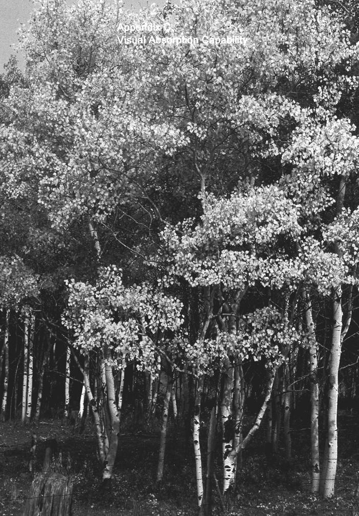
10 Visual absorption capability indicates the relative ability of any landscape to accept human alteration without loss of landscape character or scenic condition. Visual Absorption Capability Background Since the late 1960's, landscape architects have recognized visual absorption capability as a pertinent part of a scenery inventory on land of diverse topography. Visual absorption capability has also been referred to as "visual vulnerability" or "landscape fragility." Landscape visibility, as a "perceptual factor," is dynamic. It varies dramatically depending upon the location of the observer. Although many may think landscape visibility part of visual absorption capability because it is associated with perceptual aspects of scenery management, it is not. In this handbook, visual absorption capability is associated only with "physical factors" of the landscape in scenery management. For discussion of perceptual factors of landscape visibility, also known as visual magnitude, see Appendix E. Visual absorption capability relates to physical characteristics of the landscape that are often inherent and often quite static in the long term. Purpose Visual absorption capability is a classification system used to indicate the relative ability of any landscape to accept human alteration without loss of landscape character or scenic condition. Visual absorption capability is a relative indicator of the potential difficulty, and thus the potential cost, of producing or maintaining acceptable degrees of scenic quality. It can be used to predict achievable scenic condition levels resulting from known management activities in a landscape. Thus, visual absorption capability is a useful tool in forest planning and in modifying management activities to meet landscape character goals and scenic condition objectives. It may be used to specify the most efficient location for a human alteration or structure on the landscape, so that a project will be accomplished easily, at low cost, and with minimal reduction in scenic quality. C Visual Absorption Capability

11 C Visual Absorption Capability


12 Discussion The degree of visual screening provided by landform, rockform, or vegetative cover affects visual absorption capability. Variety or diversity of landscape pattern particularly the amount and extent provided by landform, rockform, waterform, or vegetative cover affects visual absorption capability. Heavily dissected landform and rockform partially screen and break up the visual continuity of landscape alterations, while smooth landform does not. Tall vegetation, such as trees, screen and break up the visual continuity of landscape alterations. Short vegetation, such as grasses and low shrubs, does not. Heavily patterned and diverse, dense vegetative cover, especially if mixed with waterforms, break up the perceived continuity of landscape alterations. Homogeneous vegetative cover and lack of waterforms do not. Dense vegetation on flatter slopes provides more screening of landscape alterations than the same vegetative cover on steep slopes. Vegetative regeneration potential affects visual absorption capability. A landscape with good soil productivity and favorable climate quickly reproduces vegetative cover. This "greening-up" tends to screen and blend human alterations into the landscape matrix more quickly. A landscape with poor soil and climate takes longer to recover. Soil color contrasts to the normal vegetative cover affect visual absorption capability. Darker soil tends to reduce visual contrast of landscape alterations. Light-colored soil tan, white, yellow, and red tends to visually emphasize landscape alterations in heavily vegetated areas. Geologic stability, soil stability, and potential of erosion of a landscape affect its visual absorption capability. A landscape prone to landslide, soil slippage, and erosion exacerbates the visual impact of landscape alterations. A stable landscape does not. C Visual Absorption Capability


13 Slope Vegetative cover C Visual Absorption Capability
14 Recommended Inventory Factors 1. Slope On steep mountainous terrain, slope is the most important visual absorption capability factor. Slope includes factors relating to landform screening, vegetation screening, geologic stability, soil depth, and soil stability. Therefore, scenery managers generally consider it to be the best single physical factor of relative visual absorption capability. Since it is not likely to change, slope is the most constant inventory factor of visual absorption capability. Slope is usually not an appropriate visual absorption capability factor for flat landscapes. Many other resource professionals consider slope to be important, and it is often a basic inventory factor in forest planning. With the increased availability of computerized GIS with digitized data for topographic maps, it is becoming easier to obtain and customize slope-class maps for forest planning. 2. Vegetative cover On gently rolling landscapes, vegetative cover is the most important visual absorption capability factor. It is also a key factor on hilly or mountainous landscapes. Vegetative cover is largely dependent upon climate, landform, waterform, and soils of an area. Vegetative cover is the end product of these environmental processes that determine regeneration potential. Vegetative cover is innately able to produce a certain level of visual absorption capability, but it is the least stable factor. Natural disasters and human activities can easily modify vegetation, thus altering a factor of visual absorption capability. Vegetative cover is often a basic inventory element in forest planning. Rapidly advancing technology in remote sensing is expected to improve the capacity to gather more detailed and uniform data on several attributes of vegetative cover. Vegetative screening capability is primarily a function of the height and physical structure of the leaves, branches, and stems of individual plants, including trees, shrubs, and herbaceous layers. Inventories of vegetation type, density, and ageclass will normally capture information needed for vegetative screening ability. Vegetative patterns and diversity are a complex function of soils, micro-climates, and past management activities. Inventories of vegetation type, density, and ageclass will often provide information needed for pattern and diversity, but may need to be supplemented by a more visually oriented approach to the vegetation inventory. C Visual Absorption Capability


15 3. Soils and Geology Soils and geology are very important factors when determining visual absorption capability. However, because soils fertility is aligned with vegetation, its effect on visual absorption capability may already be considered in the vegetation inventory. Other soils factors, such as mass stability, erosion hazard, and soil color contrast, would also need to be analyzed. Geologic formations such as rock outcrops, slides, and cliffs can effect visual absorption capability by providing natural openings from which to borrow when designing human alterations. Soils are important to many other resources, and soils information is often a basic inventory factor in forest planning. Rapidly advancing technology in remote sensing may improve the ability to gather more detailed and uniform data on several attributes of soils that affect visual absorption capability. Soil-type mapping will normally capture information needed to assess effects of stability, erosion hazard, and soil color contrast. Mapping Process Determining Pertinent Map Scale The inventory of visual absorption capability can be most efficiently used if it is mapped at the same scale as other components of the scenery inventory. Determining Pertinent Visual Absorption Capability Factors Because all landscapes vary, the factors used to inventory visual absorption capability also vary. Although slope is often the most important single factor in steep mountainous landscapes, there is little value in developing slope information for flat terrain. The exception is where one area having flat terrain is compared to another having steep terrain. Similarly, if vegetative cover or soils are quite homogeneous throughout a planning area, there is little value in analyzing and mapping these factors for visual absorption capability. Therefore, the first step in the mapping process is to analyze which physical factors affect the visual absorption capability of a landscape. Determining Data Sources Next, landscape architects determine the availability of existing inventories for other resources or other purposes that could assist the visual absorption capability inventory. In certain cases, it may be necessary to interpret another discipline's existing inventory for visual absorption capability. The author of the other inventory may be able to assist with interpretations, or have the ability to develop an efficient process to make such interpretations. Various disciplines, including landscape architects, can share existing data or join in the effort to obtain them. C Visual Absorption Capability

16 Ranking Visual Absorption Capability Factors Landscape architects must determine whether to "rank" or "weigh" visual absorption capability factors. This will depend upon which factors have been selected, analyzed, and mapped. A general rule is that all factors should be ranked equally, unless there is evidence that one or more factors are clearly more important. Some previous studies in mountainous terrain have determined that slope is the most important factor, and have ranked it three times higher than the least important factor, site recoverability. Forest Service Manual Supplements should be prepared by each region to establish visual absorption capability factors and ranking values, preferably for each landscape province. Classifications of Visual Absorption Capability Normally, three classes of visual absorption capability are adequate high, moderate, and low. With increased use of computerized GIS, it may be appropriate to increase the number of classes. C Visual Absorption Capability
17 Utilization In both forest planning and project planning, landscape architects may utilize visual absorption capability to determine achievable scenic condition levels. They may use it in either of two modes, "proactive" or "reactive." Proactive In a proactive mode, a landscape architect supplies visual absorption capability information to other resource management specialists. Visual absorption capability information is then used as a guide in determining appropriate types of management activities commensurate with the following: Theme and variations of each alternative of the forest plan. Relative value of the other (non-scenery) resources. Relative value of scenery and closely related resources, such as recreation. Reactive In a reactive mode, a landscape architect uses visual absorption capability information to determine: The predicted achievable scenic condition level of others' management activities, without benefit of design input for scenic quality. Potential adjustments in other management activities that would improve the achievable scenic condition level and integrate the activities with scenic values. Modifications of other resource management activities and prescriptions to better meet landscape character goals and scenic condition objectives. In reality, usually both modes are employed. First, other resource disciplines use visual absorption capability information to help determine types and intensities of management activities for each alternative (proactive). Then, the proposed management activities and intensities are analyzed to determine the achievable scenic condition level (reactive). C Visual Absorption Capability
18

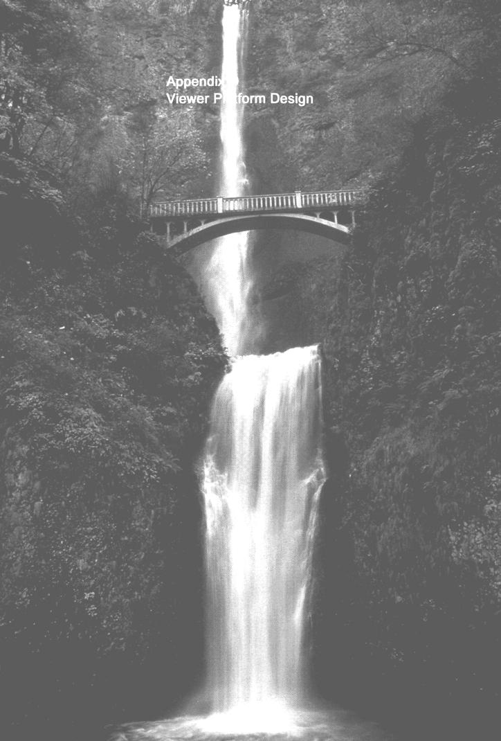
19 Viewer Platform Design To be functional, facilities in immediate foregrounds must be visible and ordinarily create more contrast than will be acceptable in areas designated for retention and partial retention scenic condition objectives. However, they are actually a part of the expected image of the public being served. Purpose Discussion Structures in immediate foregrounds of important national forest travelways and recreation areas often require special consideration in meeting scenic condition objectives. When travelers move through a landscape, while in a somewhat modified setting, they should obtain impressions that they are viewing a natural-appearing landscape outside the immediate foreground. The somewhat modified immediate foreground setting of their own viewer platform (a road, for instance) is accepted as a necessary component allowing them to experience the greater landscape. Thus, expected images of naturalness exist for the foreground, middleground, and background that do not exist for the immediate foreground. Scenery management strives for excellence in design of all structures to be viewed. Not only should they blend sufficiently with the backdrop at greater distances to meet strict definitions of scenic condition objectives, but they should be positive additions to landscapes when viewed in immediate foreground. Those structures serving purposes other than scenic viewing and recreation should ordinarily be located at sufficient distances from such routes and use areas that they can meet the definitions of the scenic condition objectives. Obviously, an alternative is to completely screen them from view from such routes and areas. Another alternative is to design them to effectively mimic positive cultural elements identified for landscape character goals. A further alternative is to incorporate and conceal them in a structure that serves scenic and recreation purposes. D Viewer Platform Design
20 Where structures must also meet ROS setting needs, it is necessary to identify the recreation opportunity class of an area and determine if uses and structures are consistent with settings. If not, structures should be designed and located in an appropriate ROS setting or denied as an inconsistency. Structures required for serving public use of scenic and recreation resources include viewing platforms, such as roads, parking areas, trails, trail heads, buildings, decks, observation points, ski lifts, and so on. To be functional, these facilities are normally visible in immediate foregrounds and often create more contrast than will be acceptable in areas designated for retention and partial retention scenic condition objectives. They are actually a part of the expected image of the public being served. However, allowable limits of contrasts only go to the extent that functions of structures are served. They should also reflect design excellence. Such structures should be a positive element of the built environment that does not detract from scenic experiences. Structures should blend into the landscape while still retaining their function. They should be an indicator of sensitive land stewardship. Travel route structures need to be clearly distinguishable for a distance commensurate with normal speeds or intended use of such routes. For functional and safety purposes, a road and its safety markers and signs need not be distinguishable in middleground distances. Therefore, more distant portions of a road and its appurtenant structures should meet scenic condition objectives and be judged on that basis. Appurtenant structures exempted from meeting scenic condition objectives in immediate foregrounds may include those associated with roadways as well as other structures, such as an interpretive sign or kiosk, visitor center, observation point, resort or winter sports complex, or similar recreation and tourist facilities. However, utility structures along travelways and in recreation sites such as storage tanks, communication structures, or electrical transmission facilities that are not directly used by the public and do not need to be distinguished by them should be judged as structures serving purposes other than scenery and recreation. They should meet scenic condition objectives, even when viewed in foreground. D Viewer Platform Design

21 D Viewer Platform Design
22

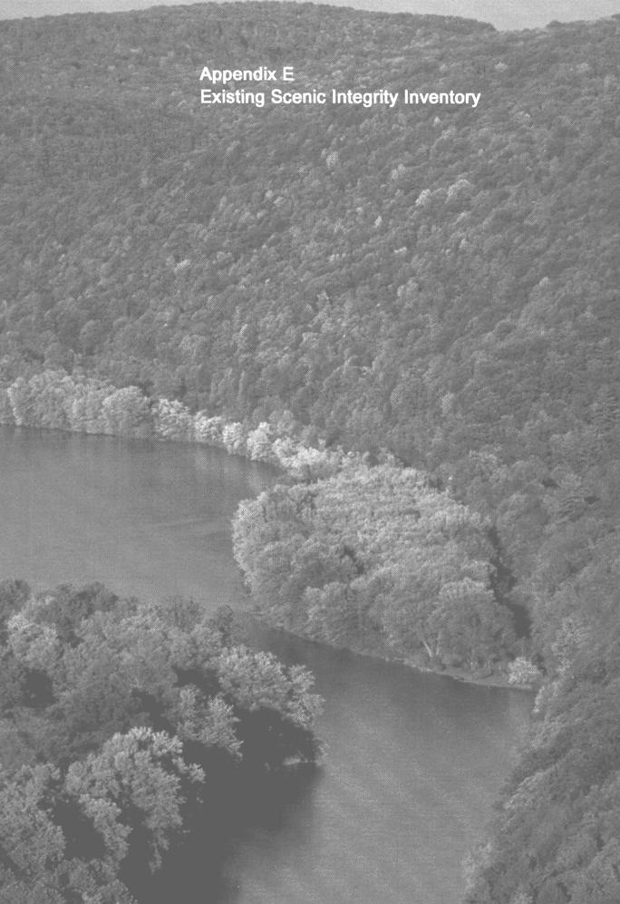
23 Appendix E Existing Scenic Integrity Inventory In National Forest System lands, existing scenic integrity indicates the current status of a landscape. It indicates existing degrees of alteration from the attributes form, line, color, and texture of the landscape character. Purpose Existing scenic integrity represents the current status of a landscape. It is determined on (he basis of visual changes that detract from the scenic quality of the area. An inventory of existing scenic integrity serves multiple purposes throughout forest planning, continuing on into project implementation and monitoring, as follows: It provides important benchmarks for prudent decision-making. It serves as a historical record of the degree, location, and extent of physical alteration of the landscape at given points in time. It is used to develop trends during forest planning. It helps determine the location, cost, and extent of rehabilitation required to achieve the desired scenic integrity levels of alternative forest plans. These rehabilitation needs are described in environmental documents. Once the forest plan is adopted, an inventory of existing scenic integrity is used to determine prioritization, location, and extent of rehabilitation required during forest plan implementation. Combined with visual absorption capability, type and intensity of planned activities anticipated during the forest planning period, existing scenic integrity will assist landscape architects in predicting future scenic integrity levels for alternative forest plans. Existing scenic integrity and its trends assist managers in monitoring progress toward meeting predicted future scenic integrity levels in a forest plan. Discussion In National Forest System lands, existing scenic integrity indicates the current status of the landscape. It indicates existing degrees of alteration from the attributes form, line, color, and texture of the existing landscape character. Harsh alterations decrease the existing scenic integrity of a national forest landscape, while subtle alterations do not. E Existing Scenic Integrity Inventory
 As viewed from existing travelways and use areas, using typical on-the-ground observer positions (above center).")
 and (3) are physical inventories that are detailed and specific.")
24 Description Existing scenic integrity may be described using three viewing situations, either separately or in combination. (1) As viewed from the air, which is most revealing (above left). (2) As viewed from existing travelways and use areas, using typical on-the-ground observer positions (above center). (3) As viewed from unusual and more unpredictable on-the-ground observer positions, while the observer wanders through the national forest (above right). Situations (1) and (3) are physical inventories that are detailed and specific. Situations (2) is more experiential, relating to a space-sequence, as it is a generalization of the experiences gained along an entire travelway or series of use areas. Process Regardless of the viewing situation that is used, the following background knowledge, resources, and data should be available: Familiarity with the land base, resource activities, and their effects from ground-based observer positions. Recent low-level aerial photographs covering the entire land base. Study of recent orthophoto quadrangles, color aerial photography, or stereo pairs of color aerial photos. GIS inventories of vegetation and other data where available. Review aerial photographs to gain a better perspective of how they relate to personal knowledge of on-the-ground situations. Identify and delineate the existing landscape integrity on transparent overlays of orthophotos or on overlays of aerial photographs if the former is not available. Steps a) through g) below develop an inventory of existing scenic integrity for the entire landscape, called existing landscape integrity. a) Map all classified wilderness, research natural areas, and previously inventoried but unaltered roadless areas. Identify them as Very High, unless there are some portions of these areas that appear to be in a landscape condition other than Very High. b) Move some portions of previously inventoried roadless areas into High scenic integrity if, from aerial views, they obviously have vehicular routes crossing them or if they have other low-impact scenic deviations. E Existing Scenic Integrity Inventory
 Delineate all Very High areas of 100 acres or more not identified above in steps a) and b) above. e) Identify and map all High Scenic integrity areas.")

25 c) Identify all areas of Unacceptably Low scenic integrity. Such areas are generally readily apparent, well-known, and easily corroborated from aerial photographs or other sources. d) Delineate all Very High areas of 100 acres or more not identified above in steps a) and b) above. e) Identify and map all High Scenic integrity areas. f) Identify all Low and Very Low areas in a sequence that best facilitates stratification. g) Identify all remaining areas as Moderate scenic integrity. Spot-check and develop systematic translations of aerial views to on-the-ground views. This refines the delineation of existing landscape integrity either from specific viewing locations or within entire viewsheds. Spot-check reliability of the translated classifications with one or more landscape architects, preferably someone from an adjacent national forest, to improve the uniformity of classifications. Related Recommendations Inventory the entire landscape base inside the national forest boundary, including non- Federal inholdings, when such inclusion simplifies and expedites the preliminary mapping process. Thus, continuity of mapping is enhanced. However, when completing the final version of the maps, document existing landscape integrity for National Forest System lands only. Human-caused alterations are often located in small clusters of spots, patches, or linear patterns. These are scattered within large areas of unaltered landscape matrix, as shown below. Conversely, there is often a large matrix containing human-caused alterations interspersed with small spots, patches, or corridors of unaltered landscape. In such cases, the entire landscape should be inventoried and mapped as a single aggregate level. This recognizes impressions generally perceived by constituents and also simplifies the mapping and recording process. Mapping existing landscape condition. This. Not this. E Existing Scenic Integrity Inventory
26


27 Recreation Opportunity Spectrum The Recreation Opportunity Spectrum has matured to become a very useful planning and management tool in the Forest Service. P u r p o s e Discussion Recreation planners, landscape architects, and other Forest Service resource managers are interested in providing high quality recreation settings, experiences, and benefits for their constituents. This is accomplished, in part, by linking the Scenery Management System and the Recreation Opportunity Spectrum (ROS) System. In addition, providing a single constituent inventory and analysis for both systems is helpful in coordinating management practices. The ROS System was developed in the late 1970's. The Forest Service issued guidelines for implementing the ROS System in 1980, almost a decade after implementing The Visual Management System. Since 1980, the Recreation Opportunity Spectrum has matured to become a very useful planning and management tool in the Forest Service. It has been adopted for use in several States, the first two being Oregon and Washington, where it is linked to the State Comprehensive Outdoor Recreation Plan (SCORP). Esthetic value is an important consideration in the management of recreation settings. This is especially so in National Forest settings where most people expect a natural appearing landscape with limited evidence of "unnatural" disturbance of landscape features. It is important to use the SMS and ROS system as complementary systems for the following reasons: The Scenery Management System measures the degree of deviation from the existing landscape character (Scenic Integrity), the relative importance of scenery (Concern Levels), and the scenic attractiveness for specific land areas; all of which are factors important to the management of recreation settings. The information gathered for the "evidence of humans" inventory for the ROS system will also serve as a measure of deviations from existing landscape character for determining scenic integrity for the Scenery Management System. The constituent analysis information used to determine concern levels for scenery can also be used to determine peoples concern for specific recreation settings and setting characteristics. F Recreation Opportunity Spectrum
28 Alternative Landscape Character Variations and Scenic Integrity Levels will have varying effects on Recreation Setting characteristics. Alternative Recreation Setting Variations will likewise have varying effects on Landscape Character and on Scenic Integrity. Mapping Existing ROS Classes In order to establish and map existing ROS classes, three "settings" are inventoried: physical, social, and managerial. Figure F -1 shows some different attributes of the three ROS settings. Figure F -1 Physical Setting Social Setting Managerial Setting Size Number of Encounters Regimentation Remoteness Type of Encounters Control Evidence of Humans Facilities Based upon combinations of these attributes, all National Forest System lands are categorized into one of six different ROS classes shown below. (See ROS User's Guide for details of inventory process.) Primitive (P) Semi-Primitive Non-Motorized (SPNM) Semi-Primitive Motorized (SPM) Roaded Natural-Appearing (RN) Rural (R) Urban(U) Recreation Value Although the ROS User's Guide mentions the need for establishing a value for different landscapes and recreation opportunities within a single ROS class in the attractiveness overlay, there is currently no systematic approach to do so. For instance, in most ROS inventories, all lands that are classified semi-primitive non-motorized are valued equally. Some semi-primitive non-motorized lands are more valuable than others because of existing scenic integrity or scenic attractiveness. The Scenery Management System provides indicators of importance for these in all ROS settings. Attractiveness for outdoor recreation also varies by the variety and type of activities, experience, and benefits possible in each setting. A systematic process is needed to inventory and rate all of these recreation attributes for each setting with the character and condition data coming from the Scenery Management System. F Recreation Opportunity Spectrum
29 Scenic Integrity Objectives There are obviously some combinations of scenic integrity objectives and Recreation Opportunity Spectrum classes that are more compatible than others. For instance, it would be inconceivable to have a scenic integrity objective of low in a primitive ROS class, because there should be no roads or on-site developments within 3 miles (or equivalent screening) of an area designated for primitive recreation opportunities. The Recreation Opportunity Spectrum Primer and Field Guide has addressed this issue. On page 10 of the Primer, there is a chart of naturalness linking ROS classes to scenic condition objectives (from the VMS), repeated here in Figure F - 2 with changes that reflect the change in terminology from the VMS to the SMS. Figure F - 2 Scenic Integrity Objectives ROS Class Primitive (?) Semi-Primitive Non-Motorized CSPNM) Semi-Primitive Motorized (SPM) Roaded Natural- Appearing HUSH Very High High Moderate Low Very Low Norm Inconsistent Unacceptable Unacceptable Unacceptable Fully Compatible Fully Compatible Fully Compatible Norm Inconsistent Unacceptable Unacceptable Fully Compatible Norm(l) Inconsistent Unacceptable Norm Norm Norm (2) Inconsistent^) Rural (K) Fully Compatible Fully Compatible Norm Norm (2) Inconsistent^) Urban Fully Compatible Fully Compatible Fully Compatible Fully Compatible Not Applicable (1) Norm from sensitive roads and trails. (2) Norm only in middleground-concern level 2 (Mg-2), where a Roaded Modified subclass is used. (3) Unacceptable in Roaded Natural-Appearing and Rural where a Roaded Modified subclass is used. It may be the norm in a Roaded Modified subclass. F Recreation Opportunity Spectrum
30 Apparent Conflicts In the past, there have been apparent conflicts between The Visual Management System sensitivity levels and ROS primitive or semi-primitive classes. One apparent conflict has been where an undeveloped area, having little existing recreation use and seldom seen from sensitive travel routes, was inventoried using The Visual Management System. The inventory led to a "sensitivity level 3" classification, and thus apparently contradicted ROS inventory classes of primitive or semi-primitive non-motorized or semi-primitive motorized. Using criteria in The Visual Management System, in a variety class B landscape with a sensitivity level 3, the initial visual quality objective is "modification" or "maximum modification," depending on surrounding land classification. However, because of factors such as few social encounters, lack of managerial regimentation and control, and feelings of remoteness, the same area having little existing recreation use may establish an ROS primitive, semi-primitive nonmotorized, or semi-primitive motorized inventory classification. There have been concerns over the premise of The Visual Management System that the visual impact of management activities become more important as the number of viewers increases; yet The ROS System emphasizes solitude, infrequent social encounters, and naturalness at the primitive end of the spectrum, with frequent social encounters and more evident management activities at the urban end. Value or importance are dependent on more than the number of viewers or users, and the key is that both the Scenery Management System and ROS are first used as inventory tools. Land management objectives are established during, not before, development of alternatives. Where there does appear to be a conflict in setting objectives for alternative forest plans, the most restrictive criteria should apply. An example might be an undeveloped land area in a viewshed managed for both middleground partial retention and semi-primitive non-motorized opportunities. Semi-primitive non-motorized criteria are usually the more restrictive. Recommendations The Scenery Management System and ROS serve related, but different, purposes that affect management of landscape settings. In some cases, ROS provides stronger protection for landscape settings than does the Scenery Management System. This is similar to landscape setting protection provided by management of other resources, such as cultural resource management, wildlife management, and old-growth management. In all these examples, there may be management directions for other resources that actually provide higher scenic integrity standards than those reached by the Scenery Management System. Different resource values and systems (the Scenery Management System, the ROS System, cultural resource management, wildlife management, and old growth management) are developed for differing needs, but they are all systems that work harmoniously if properly utilized. In all these examples, there are management decisions made for other resources that result in protection and enhancement of landscape settings. F Recreation Opportunity Spectrum
31


32 National forest lands surrounding Yellowstone, 1991 North Carolina National Forests, 1991 Professor Frank Waugh, Arthur Carhart, Late 1920's Superior National Forest, 1921 Early logging practices for scenery management. "A Sunday drive among the giant Redwoods in the Six Rivers National Forest, California, was a popular diversion in 1913." G Background and History

33 Background and History of Scenery Management Objectives of scenery management (or "landscape management") in the national forests in the United States were not specifically stated, but were implied as far back as 1891 when the first forest reserves were established. The first political evidence of concern for management of landscapes may have occurred as early as 1902, when A. A. Anderson, a New York artist and Wyoming rancher, was appointed Special Superintendent of Forest Reserves surrounding Yellowstone National Park. The Annual Report of the Forester mentioned "beauty" for the first time in The Forestry Division (predecessor of the U.S. Forest Service) advised a private forest owner in North Carolina to plan a timber harvest so that "the beauty of the forest would not be impaired." The first known, documented application of landscape management in a national forest occurred in May The timber marking rules for sugar pine areas in California specified light sanitation and salvage timber-cutting in a 100-foot-wide strip along public highways, lake frontages, and river corridors. Regulations were established to preserve the "scenic values" of these highway corridors, lake front areas, and river corridors. Following establishment of the National Park Service in 1916, the U.S. Forest Service realized the importance of hiring professionals who specialized in landscape management and recreation site design. In 1916, the Forest Service hired a landscape architecture professor, Frank Waugh, as a consultant and collaborator to study the agency's recreation and scenery values. Waugh paved the way for the hiring of the first full-time landscape architect, Arthur Carhart, in From his base in the Rocky Mountain Region, Carhart originated new landscape management concepts at Trapper's Lake, Colorado. He soon shared the idea of wilderness preservation with Aldo Leopold. Carhart developed the first broad Forest Service recreation plans that also recognized scenic values. at the end of 1922, until the New Deal Era (Age 82) D'Arcy Bonnet, 1988 From the time of Carhart's resignation in 1933, landscape management efforts were limited to occasional summer consulting work by Waugh. Massive public works programs in the 1930's prompted the Forest Service to hire a substantial number of site designers with landscape management abilities. These included Harvard graduate D'Arcy Bonnet, who worked under Bob Marshall in the Washington Office and later became Regional Landscape Architect in California. World War II decimated the ranks and roles of these professionals. Until the advent of Operation Outdoors in 1957, application of scenery management was spotty. The few remaining landscape architects were each covering about 20 million acres of national forest lands. G Background and History


34 Clearcutting in the Olympic National Forest, 1964 Dame Sylvia Crowe's book R. Burton Litton, 1975 Edward Stone, 1972 G Background and History


35 The end of the war had brought about not only the need for massive rehabilitation and construction of long neglected recreation and tourism facilities, but increased demand for timber to meet the needs of the country. By the 1960's, it was evident that the national forests were going to play a major role in supplying timber for growing construction demands in this country. It was becoming clear that a collision of public desires for both high-quality scenery and timber products was inevitable. The newly appointed Chief Forester, Ed Cliff, while in Great Britain in 1962, met with Dame Sylvia Crowe. Her work described how large-scale landscape design could mitigate the adverse scenic effects of timber management. As a result of the interest created by this important meeting in Great Britain, the Forest Service hired a part-time researcher in landscape management, Professor R. Burton Litton, in By 1965, Forest Service managers could foresee the necessity of clearcutting in national forests. Clearcutting, the most economically efficient silvicultural treatment, was also the most disruptive to scenic quality. Landscape managers in some Forest Service regions began to map near-view and farview distance zones to differentiate scenic sensitivity for timber harvesting. In a first attempt to apply a systematic approach to landscape management, the Forest Service identified Travel Influence Zones (TIZ) and Water Influence Zones (WIZ). Also in 1965, the Forest Service employed a landscape management specialist in Washington, DC, in the Chief Forester's Office. Chief Cliff and Recreation Director Dick Costley selected Edward H. Stone II as Chief Landscape Architect. They brought him to Washington from the Rocky Mountain Region to help the agency address the clearcutting dilemma. and Inventories. In 1968, Ed Stone presented a slide show to Secretary of Agriculture Orville L. Freeman on a new Forest Service program called "environmental architecture." Also in 1968, the U.S. Department of Agriculture published researcher Litton's Litton's book booklet Forest Landscape Description That same year, the timber industry proposed a National Timber Supply Bill, calling for an increase of 7 billion board feet per year in Forest Service timber harvesting one and one-half times the level of timber harvesting at the time. Although this bill failed in Congress because of strong opposition from environmental concern groups, President Richard Nixon later endorsed a Forest Service report that led to the same result as if the bill had passed. Litton's landscape inventory The conflict between scenery management and clearcutting was getting more evident. Stone and Costley, with Chief Cliff's strong backing, set up an environmental architecture workshop in St. Louis, Missouri, in June That workshop brought together the regional landscape architects and their assistants with key leaders in other Forest Service disciplines. Jerry Coutant, Wayne Iverson, Howard Orr, and researcher Professor R. Burton Litton assisted Ed Stone in the workshop program. This workshop could rightfully be called the birthplace of the Forest Service's official landscape management program. G Background and History


36 Warren Bacon, Southern Region, 1972 VISUAL MANAGEMENT SYSTEM Northern Region's book, 1971 Southern Region's book, 1972 Pacific Northwest Region's book, 1972 Warren Bacon, Steve Galliano, and Robert Ross, 1993 G Background and History

37 Forest Service leaders determined that a systematic process of landscape management was needed. The workshop laid the groundwork for development of the National Forest Landscape Management series of handbooks. Scenery rapidly gained stature in the hierarchy of Forest Service goals for resource planning and commodity/amenity outputs. In 1971, the Forest Service formally recognized scenic quality in the landscape management section of the Forest Service Manual. It documented a system of landscape management responsive to both current and future needs. The Forest Service Manual declared that the "visual landscape" is a basic resource and is to be "treated as an essential part of and receive equal consideration with the other basic resources of the land." Jerry Coutant and Rai Behnert of the Northern Region and Howard Orr of the Southern Region initially developed separate landscape management systems in Orr's assistant, Warren Bacon, was transferred to the Pacific Northwest Region where, from 1970 to 1972, he amplified the work of the other three people and combined it with the work of R. Burton Litton into one systematic approach. The Pacific Southwest Region began utilizing Bacon's system in late Ed Stone soon adopted it as the Service-wide approach. Stone's decision resulted eventually in the publication National Forest Landscape Management, Volume 2 Chapter 1, The Visual Management System. The Forest Service published it in April 1974, almost 5 years after the workshop in St. Louis. The Forest Service Visual Management System has since gained an international reputation as a basic means of inventorying, planning, and managing scenic resources in wildland settings. Other Federal, State and county agencies have adopted the Visual Management System. By the early 1980's, Forest Service landscape architects across the Nation had developed seven additional chapters of Volume 2. They had also developed several subsystems, including visual absorption capability, existing visual condition, visual quality index, and visual effect prediction. It was evident that development of these subsystems, along with the advent of new technology and information, was creating a need to update The Visual Management System. In response, Chief Landscape Architect Bob Ross arranged for a task force to meet in Milwaukee, Wisconsin in 1984, and in Washington, DC in 1985, to make recommendations regarding feasibility and contents of such an update. In 1986, the Report of the President's Commission on America's Outdoors reported that natural beauty ranked highest among adults as an attribute for a recreation area. This finding reinforced the resolve of Forest Service landscape management specialists to update The Visual Management System. In 1991, Chief Landscape Architect Bob Ross directed Warren Bacon and Steve Galliano to prepare a request for proposals for a contract to update The Visual Management System. In October 1991, a contract was awarded to Environmental Consulting, Planning, and Design (ECPD), headed by Lee Roger Anderson. ECPD's team included Lee Anderson, Wayne Iverson, Perry Brown, and others. (See acknowledgements.) This handbook is the product of that contract. Other handbooks in the landscape management series G Background and History


38 During the formulation of this handbook, Forest Service landscape architects began to explore possible new names for the "Visual Management System" and the "visual resource management" program. After perusing historical writings of Leopold, Flader, Callicott, and modern writing by Runte regarding land aesthetics, scenery, scenic beauty, ecosystems management, and landscape ecology, the Forest Service decided to drop The Visual Management System as a title and to rename it Landscape Aesthetics: A Handbook for Scenery Management. This handbook supersedes Agriculture Handbook Number 463, National Forest Landscape Management, Volume 2, Chapter 1, The Visual Management System that was issued in April Landscape Aesthetics Handbook and The Visual Management System Future of Scenery Management Highway 140 Viewshed Implementation Guide, 1990 With this wealth of history in scenery management, where is the program likely to go in the future? Land managers and the public are obviously increasingly concerned with landscape aesthetics, scenery management, recreation settings, landscape ecology, and ecosystem management. In his cover letter entitled "A Vision for the Future" for the Highway 140 Viewshed Implementation Guide, written to the employees of the Winema National Forest in Oregon, Anderson looked forward 30 years by looking back 30 years. He cited the legacy of Federal legislation regarding natural resource protection Multiple Use- Sustained Yield Act (1959), Wilderness Act (1964), Wild and Scenic Rivers Act (1968), National Environmental Policy Act (1970), and others. Plotting a trend in environmental concern and protection, he said, "Where will this line be plotted in the next 30 years, from 1989 to 2019? No one can say for sure, but it is a safe bet that the environmental values of the American public are not likely to drop down to the levels of 1959." The history of Forest Service scenery management might be summarized as follows: : Limited scenery management in timber cutting along primary highways and lakeshores : Scattered efforts to preserve scenery in special places of national significance : Scenery management primarily limited to recreation site design : Conflict developing between scenic quality and landscape altering activities : Development of environmental laws and scenery management systems : Forest plan development with scenic quality targets. 1990's: Integration of scenery management, recreation settings, benefits of leisure, landscape ecology, and ecosystem management to guide desired future condition and appearance of National Forest System lands. G Background and History
39


40 Preservation Wilderness This heavily traveled trail in the Daniel Boone National Forest creates enough contrast to be noticed, but, when viewed from beyond immediate foreground distances, would not be evident in this natural-appearing landscape. This is an excellent example of the preservation scenic condition level. Wilderness This bridge of native materials and simple design, located in the Three Sisters Wilderness in Oregon, is an appropriate example of low impact recreation development for preservation. When the new pole railings weather to a natural grey color, the structure will blend in better than it does in this scene. H Examples of Scenic Integrity Levels


41 Preservation Wilderness This camping area meets the preservation scenic condition level. The evaluation of this site is based upon the path clearing and sign only. There are no controls over the colors of backpacks and tents, although they blend with fall colors at this time of year. It is necessary that a camping area be visible in immediate foreground, but at middleground and background distances, any sign of human occupancy must fade out of view in the natural landscape character. Special Interest Area Brice Creek, a coastal stream in the "black water area" of the Croatan National Forest in North Carolina, is an excellent example of management for preservation scenic condition level in an area of special interest. H Examples of Scenic Integrity Levels


42 Retention Passive Relay Electronic Site This is an outstanding example of siting and camouflage painting of a huge rectangular structure. The paint colors and pattern mimic those of the natural landscape character. The location takes advantage of visual absorption capability and avoids any potential for skyline silhouetting of the structure. The passive relay is on Carson Pass Highway, a State scenic highway in California, passing through the Eldorado National Forest. This structure retains the natural character and condition of the landscape. It is not evident unless attention is directed to it. Even though this is a telephoto view, the scene meets retention. Electronic Site This series of four photographs, taken in the Coronado National Forest in Arizona, illustrates details of reducing visual impact of large structures through techniques of paint color and pattern. The slim-line tower design keeps it imperceptible at distance zones from far-middleground to background views. As is true for many structures that must be located on ridgetops and are subsequently silhouetted, the site does not achieve retention in the foreground, but, from distant-middleground and background, where it is primarily viewed, it remains virtually unnoticed. H Examples of Scenic Integrity Levels


43 Retention Boat-in Campground This boat-in campground in the Ottawa National Forest meets retention. The evaluation of the scenic condition level of this site is based solely on the path clearing and sign. There are no regulations governing the colors of boats or canoes. It is necessary that the sign be visible in foreground views, but at middleground and background distances the trailhead and sign fade out of view in the existing landscape character. Given the colors of the simple vertical lines of tree trunks, the sign color might have been selected to blend more with the backdrop, yet be clearly visible. Avalanche Control "Jet Roofs" Because of their function, "jet roofs" utilized for highway avalanche control must often be seen as silhouetted structures against the skyline. At Carson Pass in the Eldorado National Forest, they are viewed in middleground near the focal point of the scene. The "filtered screen" of structures repeats the line of the mountain ridgeline. From this distance, the "jet roofs" are on the low end of retention. Selection of colors from graytan to gray instead of the rust color may have reduced the contrast and raised the "jet roofs" to a solid retention. H Examples of Scenic Integrity Levels


44 Retention Stream Improvement This log across a stream in the Green Mountain National Forest helps create improved conditions for watershed and fisheries. The log has been sensitively placed and appears to be natural. Although it may have caused a tiny waterfall to form, thus deviating from the natural landscape character, a fallen log in a forest stream is a common occurrence. This scene meets retention. Fish Structures The boulders placed in this stream in the Huron-Manistee National Forest are of such natural sizes and shapes that it is difficult to know for certain if they were placed there by humans. The boulders provide both cover and stream flow rate diversity for aquatic life while maintaining or enhancing the natural scenic beauty of the stream. The uneven distribution, uneven depths, and variable sizes of boulders create an outstanding example of retention with structural elements added to the landscape. H Examples of Scenic Integrity Levels


45 Retention Fish Structures Placement of fish structures in the Huron-Manistee National Forest may achieve the objectives of fisheries management, but the structures barely meet a high scenic integrity level. If there were some larger boulders in this natural-appearing landscape character, their use as "anchors" for the "islands and peninsulas" of small rock piles would have improved the naturalness. Wildlife Pond This pond in the Mark Twain National Forest appears to be natural. Close inspection reveals its human-caused origins. The site has outstanding vegetative recovery. The duration of visual impact is expected to be a few months because of the abundance of water and fertile soil. Although this wildlife pond may not have been common to the natural-appearing landscape character, the subtle departure to meet other resource objectives is probably not evident, nor disagreeable, to most people. H Examples of Scenic Integrity Levels


46 Retention Wildlife Pond A reclaimed clay pit in the Thunder Basin National Grassland near Upton, Wyoming, is now a bass fishery. The landform shaping and revegetation blend beautifully with the landscape. This pond in the Western plains may not repeat characteristic waterforms, but it probably enhances landscape attractiveness. Such departures from the natural landscape character would not normally be viewed as negative by the public. This wildlife pond meets retention. Range Management Grazing land in the Mark Twain National Forest is managed in a manner that is natural appearing. The patterns of grasses, wild flowers, shrubs, and trees make this scene difficult to distinguish from a natural landscape. It meets retention. H Examples of Scenic Integrity Levels


47 Retention Fuelbreak/Timber Harvest This foreground view shows a forest fuelbreak in the Klamath National Forest. The vegetative recovery by grasses, combined with the presence of low stump heights and the absence of debris, makes it difficult to discern whether this is a human-altered roadside. Maintenance of individual trees, together with variations in lower-limb pruning, improves the natural appearance. The project achieves retention. Fuelbreak This fuelbreak in a forested site is located in the Wenatchee National Forest. It meets the low end of retention. It could have been raised to a solid retention if the stumps had been somewhat lower (flush-cut), better screened by grasses and groundcovers, or manually covered with duff and needles. The diversity of groundcover, most importantly the inclusion of leave-trees of varying sizes in the opening, improved the natural appearance of the project. H Examples of Scenic Integrity Levels


48 Retention Timber Harvest This timber harvest, combining overstory removal/shelterwood/group selection, on a foreground ridge in the Klamath National Forest, was helicopter logged. The only possible evidence of any activity on this ridge the uneven tree height on the middle section would probably not be noticed by anyone but forest managers and woodsworkers. The mixed species and patterns of this forest landscape do not draw attention to such subtle differences. It meets retention. Timber Management This roadside scene of a managed timber stand in the Chequamegon National Forest would be considered a natural landscape by most people driving along the highway. However, closer inspection reveals some remaining brush piles and piled cordwood further back in the newly opened stand. When the brush is removed or scattered, and the cordwood is hauled off, this site will meet the upper end of retention. This opening in an otherwise dense forest may vary from the natural-appearing landscape character, but it would likely be a positive change associated with a selected landscape character goal. H Examples of Scenic Integrity Levels

49 Retention Reforestation This area in the Wayne-Hoosier National Forest has been planted with yellow poplars in the immediate foreground and with white pine behind. It has the appearance of an abandoned field that will one day be a forest again. The plantings are not evident in the scene. It barely meets retention and could be considered to fall between retention and partial retention. However, it is probably looked upon as a positive deviation from the natural-appearing landscape character. Cable Logging A view from U.S. Highway 219 of a uniform textured ridge of timber on the Monongahela National Forest reveals no tell-tale linear vertical pattern of the cable logging that has taken place. This is an excellent example of retention, because cable logging in a continuous, even-textured forest ordinarily makes it difficult to achieve retention. H Examples of Scenic Integrity Levels

50 Retention Timber Management This roadside view into a timber stand in the White Mountain National Forest provides a natural-appearing scene to most people. Forest managers and woods-workers would be able to distinguish this as a managed forest with trees removed. The dense vegetation in the immediate foreground helps to screen off views into the forest that might reveal stumps. It easily meets retention. Timber Harvest A timber harvest, located in the middleground in the Sequoia National Forest, repeats some of the lighter patterns created by rock outcrops. Since this timber harvest lies on a ridge top and has excellently feathered edges, the open forest appears natural. It is an outstanding example of retention, because it borrows so heavily from form, line, color, and texture of the natural landscape character that it appears to be a natural occurrence. H Examples of Scenic Integrity Levels


51 Retention Timber Harvest This timber harvest in the Lolo National Forest in Montana is evidenced only by a slight discoloration in some areas. Most people would interpret the timber harvest as an area of subtle soil color changes. As seen from above, the site benefits from considerable vegetative pattern and several natural, barren soil patterns on the left. The major concern of scenery and recreation managers was to meet retention from a trail below. Retention is met because the harvest is not evident from the trail. Seed Tree Cut This seed tree cut was carried out in the Mark Twain National Forest. There is subtle evidence of a reduction in tree crown density on the left near the ridgetop. The photograph was taken from off the roadway so that the reduction in tree crown density is distinguishable. In some sidelighting conditions, the break in the treecanopy texture may be more pronounced. From this viewpoint, the cut meets the lower end of retention. H Examples of Scenic Integrity Levels


52 Retention Road The North River Road in the Cherokee National Forest lies lightly on the land. Even when viewed as foreground, the natural-appearing edge effect, reduced cut and fill slopes, and fall colors tend to soften the visual impact of the road. Ordinarily, a long road tangent has a strong negative visual effect. This road blends with the landscape and meets retention. Trail This trail in the Huron-Manistee National Forest in Michigan lies lightly on the land and creates minimal visual impact. Although there is no functional reason to align the trail in a more curvilinear nature, to do so could further improve the scenic condition by making the trail invisible in middleground. The trail meets retention. H Examples of Scenic Integrity Levels

53 Retention Trail This trail in the Klamath National Forest creates only enough contrast to be noticed. Beyond immediate
54 H Examples of Scenic Integrity Levels foreground distances, it would not be evident in this natural landscape character. The rocky trail repeats the appearance of the naturally occurring rocky slope with its scattered groundcover of low shrubs. The sawn log, however, detracts from the natural appearance. The trail itself represents an excellent example of achieving retention.


55 Retention Winter Sports Site These two early summer views of Mt. Bachelor Ski Area, located in the Deschutes National Forest in Oregon, exemplify excellent planning, design, and construction of a major ski facility in a landscape with good visual absorption capability. Summer offers the highest visual contrasts, yet the ski area easily meets retention. Above is a normal view from Century Drive, a National Forest Scenic Byway, and below left is a telephoto view from the same observer position. Numerous ski runs, chairlifts, maintenance roads, and a day lodge are visible from the highway, yet they remain virtually unnoticed unless pointed out. The computer graphic below, by revealing areas of low visual magnitude, enabled the planning team to decide where the new Pine Marten day lodge would be constructed. Existing ski area facilities are located in the red, orange, and yellow zones that indicate areas of highest visual magnitude. H Examples of Scenic Integrity Levels


56 Retention Winter Sports Site With the Three Sisters Wilderness in the background, the Pine Marten Lodge and top terminal of a detachable-quad chairlift at Mt. Bachelor Ski Area are very evident when seen from ski runs above timberline. The ski facilities are located on a barren, rocky topographic bench at timberline. Because of careful landscape architectural design and material selection, the form, line, color, and texture of the lodge borrow from the natural landscape. The lodge and chairlift terminal are quite evident to skiers and are their expected image, yet the structures blend very well and remain virtually unnoticed when seen from Century Drive National Scenic Byway. (See photo on opposite page.) This is an excellent example of recreation structures in the landscape meeting retention. Underburn This immediate foreground view in the Croatan National Forest in North Carolina shows an area of longleaf pine trees that has been recently underburned. The area has revegetated sufficiently to meet retention. Before revegetation, it probably met partial retention for one growing season. H Examples of Scenic Integrity Levels


57 Partial Retention Powerline It appears that an attempt was made to reduce contrasts of cross-arms for this powerline viewed as foreground in the White River National Forest. The contrast of poles with the lighter backdrop, however, causes the structure to be quite evident. The strong verticals of the conifers naturally dictated that horizontal forms should be minimized. This powerline barely achieves the partial retention scenic condition level from this distance, although it may achieve a higher level when viewed from middleground. Use of gray green poles in this particular section of powerline could have possibly moved this project to the high end of partial retention from foreground distances. Powerline Another section of this powerline achieves the high end of partial retention due to the dark-colored poles against a dark backdrop. If it would have been technically feasible to eliminate the short crossarms, the visual evidence of the powerline would have been further reduced. Flat, low reflectivity colors against dark forest vegetation greatly aid the achievement of partial retention. H Examples of Scenic Integrity Levels
58 Partial Retention Created Openings The created openings in this middleground landscape are evident but do not visually dominate. They are in scale and shaped like natural openings. This scene meets partial retention. Microwave Repeater Station A microwave installation in the Sequoia National Forest is located on 9,900-foot Sherman Peak. Fortunately, the natural landscape character has a dominant pattern of rock and vegetation. The structures, located on the silhouetted ridgeline in a rocky component of the landscape, have colors that emulate those of the rock. All structures are in scale with those of the natural landscape and generally repeat the horizontality of the rockforms. The station is evident not enough to be a focal point and it meets partial retention. Use of some camouflaging techniques, such as those illustrated in the passive relay in the retention series, could have further blended the structures on the left. Use of a light gray-blue paint on the elevated dish may have been another desirable alternative. H Examples of Scenic Integrity Levels


59 Partial Retention Overstory Removal This overstory removal is located along a major highway in the Bitterroot National Forest in Montana. The road and landing at the back of the unit are not evident; however, the activity slash and debris is evident but not visually dominant. This harvest activity meets partial retention. Stream Improvement A low log dam in the Green Mountain National Forest in Vermont was constructed to improve the stream for aquatic life and watershed purposes. At this distance it is quite visible. Once the decision is made to use log construction, there is little to borrow from the natural-appearing landscape character. The zig-zag form of the logs reduces the impact of a straight line, but in itself creates another unnatural form. The dam achieves a scenic condition level between low partial retention and high modification. It could have blended better if it were less symmetrical and if the logs had been overlapped rather than butted, thus more closely resembling natural windfall logs in a stream. If the dam had been built with rocks, the dam may have met retention. H Examples of Scenic Integrity Levels


60 Partial Retention Stream Improvement Log-cover structures, located on the shore of the Paint River in the Ottawa National Forest, provide cover and flow diversity. They borrow from naturally occurring characteristics of down trees in the stream. Although this scene is natural appearing, the uniformity of the nearest structure on the right strongly hints of human intervention. The scene meets partial retention. Introducing greater variation in log size, leaving branches on the logs, and creating less uniformity in spacing of the downstream "stringers" might have led to the achievement of retention. Wildlife Habitat Improvement A wildlife brush-crushing project in the Klamath National Forest helped create the conversion to a more usable vegetation condition. There are indications of color contrasts in the slope and some rather sharp contrasts of color on the upper edges of the project at mid-slope. This project meets the lower end of partial retention. Reduction in the sharper contrasts on the upper edge of the treated area through feathering of brush might have raised its rating to a solid partial retention. Because of these sharp upper edges, the project draws attention to artificial, rather than natural, focal points. H Examples of Scenic Integrity Levels


61 Partial Retention Fuelbreak and Road A fuelbreak was developed in the Los Padres National Forest. The fuelbreak borrowed from the tendency of the existing landscape character to be more barren on ridgetops having shallow soils. The islands and peninsulas of shrubs allowed to remain in the fuelbreak were key to the reduction of visual contrasts. The road lies lightly on the landscape and is only intermittently visible from this viewpoint. The scene is an outstanding example of partial retention, perhaps at the upper end. A bit more feathering of the near ridge could have further improved the quality of the scene. Fuelbreak and Road Another fuelbreak, also in the Los Padres National Forest, shows immediate foreground and middleground detail. Again, individual and groups of small trees and shrubs have been retained within the fuelbreak to create a more natural-appearing condition that detracts little or nothing from the effectiveness of the fuelbreak. From this viewpoint, the road is barely discernible in the middle of the photograph through the fuelbreak. The fuelbreak seems to "belong" and clearly meets partial retention. H Examples of Scenic Integrity Levels

62 Partial Retention Created Opening A created opening viewed as middleground in the White Mountain National Forest creates shadow patterns on the far edge of the opening. That line of shadow, however, emulates the undulating ridgelines above. The lighter color of the regenerating timber attracts considerable attention, but has textural contrast. This project now achieves the lower end of partial retention. If there were an opportunity to soften the shadow pattern by selective thinning at the far edge, it is likely that the resulting feathering would have raised this to a solid partial retention.

63 Created Openings and Structure Another example in the White Mountain National Forest also creates heavy shadow patterns on the far edge. Only the middle of the three vegetative alterations allows a view of the lighter color and smoother texture of the regeneration unit. The patterns formed by these created openings borrow from the upper ridge line and intermediate low ridge. The structure in back of the beach is aided by its linear form and park walls. The reflectivity of the roof creates a color and texture contrast. The scene barely meets partial retention. If the lower created openings were separated into two or three units to break up the linearity, and if the roof of the structure were darker, it would have better met partial retention. H Examples of Scenic Integrity Levels


64 Partial Retention Timber Harvest This two-stage timber harvest in the Pisgah National Forest in North Carolina was carefully designed and implemented to borrow from all the elements found in the natural-appearing landscape. The irregular shape, heavily feathered edges, and carefully selected leave-trees of varying sizes create a natural appearance. Because the timber harvest is a noticeable human activity to forest visitors, it meets the definition of partial retention. However, in l-to-2 growing seasons, the area will "green-up" and probably meet retention. Roadside Opening Situated in the Allegheny National Forest, a roadside opening, which probably provides some visual and spacial relief along a tunnel effect roadway, has been created. It has recovered with grasses and other low vegetation, but some lopped branches are indicative of a recent project. Possibly, the limbless tree trunk was retained to provide interest and character, but it stands out strongly from the multistoried edge. This project barely meets partial retention. H Examples of Scenic Integrity Levels

65 Partial Retention
66 Created Opening These two views of the same scene in the Allegheny National Forest demonstrate the effect of seasons upon achievement of scenic condition levels. The primary scenic factor is the heavy shadow created by the rear edge of the created openings in both summer and winter. As might be expected, the problem is greater in the summer "leafon" period when there is less light filtering through the forest. The front edge of the created openings borrows line from the natural-appearing landscape character and blends beautifully in both seasons. The rear shadowed edge borrows from the ridgeline above, but creates a rather heavy contrast. The winter scene is a good example of partial retention, but the summer scene barely achieves it. The best means of reducing the contrast of these created openings may have been to thin and feather the rear edge. Incidentally, these scenes also provide a vivid comparison of the effect of seasonal variations on the vegetative screening on the structure in the middle foreground. What meets retention in summer would barely meet modification in winter. H Examples of Scenic Integrity Levels

67 Partial Retention Shelterwood Timber Harvest This foreground view in the Sequoia National Forest resulted from a shelterwood cut. The only evidence of the activity are some stumps and the heavier tree density in the rear. The road near the back is barely distinguishable. Retaining several small fir trees amongst the large red-barked character trees undoubtedly improved the scenic attractiveness of the site. The sensitive cutting and cleanup of this project cause it to meet the high end of partial retention. H Examples of Scenic Integrity Levels


68 Partial Retention Shelterwood Timber Harvest This middleground view of a project in the Klamath National Forest reveals an area harvested by the shelterwood method. It borrowed from the natural opening on the ridgetop. Its design might have borrowed from the natural light-green opening on the right, but it would have been difficult to emulate the greens of wetter sites. Slight evidence on the left and top of the shelterwood of a skid trail or some other linear disturbance is not sufficient to cause the activity to dominate the scene, but without the surrounding natural openings, it could have become dominant. It barely meets partial retention. More feathering of the edges on the two sides and retaining clumps of trees would have created an even higher level of scenic condition. Shelterwood Timber Harvest This shelterwood harvest in the Klamath National Forest was carried out by helicopter; thus, roads would not have a potential impact. There were few shapes and patterns from which to borrow in the natural landscape character. However, the excellent transition of the edges into the surrounding forest makes this a good example of partial retention. H Examples of Scenic Integrity Levels

69 Partial Retention Timber Harvest This is another Sequoia National Forest foreground view where the timber harvest activity appears to have removed all of the larger trees. A linear pattern at mid-slope and at the bottom of the scene would seem to indicate the existence of roadways. Logging debris and fresh stump faces are fairly evident. This project falls into the lower end of partial retention. Cleanup of logging debris and a growing season to heal the groundcover could raise it to the upper end of partial retention.

70 Partial Removal Timber Harvest In this foreground view in the Willamette National Forest, a partial removal cut was made to harvest timber. It is virtually impossible to distinguish a landscape alteration, except for some exposure of the ridgetop landform. This scene meets the high end of partial retention. Lighter cutting on the ridgetop could have raised the achieved scenic condition level to retention. H Examples of Scenic Integrity Levels

71 Partial Retention Partial Removal Timber Harvest This foreground view in the same forest illustrates a "clump and randomly spaced" timber removal project. The primary evidence of the activity is the high limbless condition of the larger trees. To most people, it would appear that this forest differs only slightly from the adjacent forest. Conversely, forest managers would immediately see the area as a heavy partial removal cut. Cleanup has been thorough, and the majority of the scene has a natural ground appearance of outstanding quality. Slight evidence of logging debris appears in the upper right. Partial retention has been solidly met.

72 Underburn The immediate foreground in this photograph, taken in the Deschutes National Forest, shows a forest area that was lightly underburned to improve its visibility and to reduce fuel loading. The color contrast created by the leaf and needle die-off clearly makes it evident that something has happened here. Given some time, the scorched leaves and needles will fall off and significantly reduce color contrasts. At the time of the photograph, the low end of partial retention was met. H Examples of Scenic Integrity Levels


73 Partial Retention Road This is a middleground view of a road in the Fremont National Forest. The road, rather than the fire scar, is being evaluated in this scene, although both appear to barely meet partial retention. The road may have been a solid partial retention prior to the fire, which removed some of the vegetative screening. The soil color contrast of the road is a key factor in increasing its visibility. It also appears evident that the lower part of the hill has either burned or has been vegetatively altered in the past, as it lacks the characteristics of the natural cover. Road This foreground/middleground summer scene in the Allegheny National Forest is bisected by a road. Summer is probably a more critical season than winter for color and texture contrasts. The slight notch in the treeline silhouetted against the sky, together with the shadow pattern in the right one-third of the scene, creates the only visual evidence of the road. Therefore, it meets partial retention. H Examples of Scenic Integrity Levels

74 Partial Retention Road This foreground/middleground scene in the Crooked River Valley of the Ochoco National Forest is traversed by a highway. The alignment of the highway and the relationship of its structure to the clearing width mimic the river and its adjacent meadows. The color contrast of the highway is moderate. The highway is evident, but does not form a focal point in this powerful landscape, which has its own strong focal points of the river amidst the meadows, the distinctive silhouetted rockforms on the left, and the convergence of lines in front of the more distant mountain ridge. The dark soil colors in the cut banks on the left greatly enhance the scene. This is an outstanding example of partial retention.

75 Trail and Road A trail is shown crossing a slope in this national forest in Montana. The trail has little opportunity to borrow from the natural landscape character from this vantage point, but it undulates similarly to the ridgetops, and its dominance is broken up by its intermittent visibility. The road at the bottom of the hill is also intermittently visible. Once again, a powerful landscape draws focus to other points, such as the knob-ridge in the center right, the distant mountain ranges, and the distinctive spire-like trees on the open ridge. The trail and road meet partial retention.. H Examples of Scenic Integrity Levels


76 Partial Retention Trail A middleground view in the Russian Wilderness of the Klamath National Forest reveals a section of the Pacific Crest Trail on the upper slopes of steep mountains. The trail crosses through drifts of conifers, rocky areas, and brushfields. The greatest visual problems are the soil color contrasts that create an unnatural line in the evenly textured, dark-green brushfields. On the right half of the photograph, the trail is undetectable except for two or three short segments. Where it passes through the rocky areas on the left, it is barely distinguishable. The trail forms a linear pattern that is too smooth to borrow from any part of the natural landscape character other than possibly the background mountain silhouette. Achieving retention would have required a longer trail that switched back up the rocky areas, entered conifer stands, then followed more of the rocky areas. The only other way to reduce contrasts in the brushfields would have been to clear brush in patterns, borrowing from the shapes and textures of the rocky areas. This is not permissible in wilderness. The trail meets partial retention from this viewpoint. Trail Bridge A trail bridge connects two promontories on a lake in the White Mountain National Forest. The powerful landscape draws some attention away from the light bridge structure. The structure carries out the horizontal line of the two peninsulas jutting into the lake. It is evident, but does not detract from the scene. It meets partial retention. H Examples of Scenic Integrity Levels


77 Partial Retention Structure In this scene at Coghill Lake in the Chugach National Forest, a trailhead structure stands out in the immediate foreground. This "stairs trailhead," common in Alaska but not elsewhere in the Forest Service, gives access to people from the shore up a steep, rocky bank. The major visual contrasts are the vertical lines and uniformity of the steps. Time might possibly reduce the color contrast as the wood turns gray. At this distance, the trailhead structure meets partial retention. From middleground distances, it is likely to be undetectable and would meet retention. Structure Another immediate foreground view of a scene in Alaska's Prince William Sound reveals a cabin located just onshore. The shape of the A-frame cabin reflects the shape of the conifers, and its dark color borrows from the shadows. Only the yellow sign and the people in brightly colored clothing draw attention to the site. The cabin structure meets partial retention. It might have been simpler to tuck the cabin behind the trees, consequently raising the structure from partial retention to retention. H Examples of Scenic Integrity Levels


78 Partial Retention Winter Sports Site This middleground view in the Eldorado National Forest reveals a major ski area development. The cabin at the right meadow-treeline edge is on private land, while the ski area lies beyond on the right of the mountain backdrop. The primary evidence of the development from this view is the vegetative clearing for the chairlift in mid-photo and a ski run down the forested slope on the right. The ski run design borrows from natural openings in the existing landscape character. The line created by chairlift clearing was too narrow to emulate the existing landscape character. This is an example of partial retention. Additional clearing of trees to create a more natural opening for the chairlift could have further improved the scenic condition of the landscape, but could have created unfavorable conditions, such as excessive winds, for people riding the lift. Winter Sports Site This is the same ski area viewed with a telephoto lens in the summer a few years later. The resort configuration ties in with the tree patterns, but the roofs create less than desirable reflectivity. The new runs and slope stabilization material colors do not completely blend into the natural landscape character. The reflections off the chairlift are distracting. Yet without a telephoto, the site continues to meet partial retention although at the lower end. Reduction in reflectivity of the structures and feathering the sharp even edge of the new ski run (as seen mid-photo) would help greatly. H Examples of Scenic Integrity Levels

79 Partial Retention Ski Area Structure This is an immediate foreground view of a ski patrol hut in the Eldorado National Forest. The hut was built of on-site stone, tied into a natural light to dark gray volcanic rock formation at the crest of the mountain. It successfully borrowed color, texture, and scale from the existing landscape character. The form suffers more than necessary from the human tendency to build with cubes and rectangles. The hut meets partial retention despite the small but sharp contrast of the light-gray square corner on the left backed by the dark rock backdrop. A more natural shaping on the left side and a more uneven roof line on top, together with the use of some dark rock in that corner of the structure, might have helped blend it into this unique site. Furthermore, it may have been possible to develop a more natural window shape that did not exhibit the use of traditional window hardware. This hut might have been an excellent example of retention if a bit more creativity had been applied in its design and construction. H Examples of Scenic Integrity Levels


80 Modification Electronics Site An electronics installation in the Los Padres National Forest is silhouetted against the sky. It is clearly dominant and forms a focal point in foreground views. These structures are of an appropriate scale to repeat the sizes of rock outcrops and are painted in flat tones common to this existing landscape character. Vegetative screening of the lower structures would have been desirable. The scene meets modification. Gas Exploration An immediate foreground scene in the Monongahela National Forest illustrates the results of gas exploration. The linear scar has been reshaped and seeded. Some rocks protrude to break up the contrast. Neither vegetative debris cleanup nor scattering is sufficient to move this foreground view beyond the modification scenic condition level. H Examples of Scenic Integrity Levels


81 Modification Microwave Installation A middleground view in the Great Plains of the Nebraska National Grassland shows the difficulty of blending structures into a natural-appearing landscape character that lacks diversity. The steel lattice tower helps reduce visibility, but necessary bulky hardware on the tower top creates a definite focal point. Even the use of light gray-blue, flat paint may not be adequate to reduce the contrasts. The focalization on this tower is greatly increased due to its placement on the lonely knob of wooded landscape in a sea of flat land. The installation meets modification. Stream Improvement This pleasant setting an immediate foreground view of a stream improvement structure is located in the Monongahela National Forest. The evenness and uninterrupted exposure of the log dam is enough to lower this scene barely into the upper end of modification. Several large borders in front to break up the exposure of the waterfall over the log would have raised the scene to partial retention. Additional use of rocks might have moved it up to retention. H Examples of Scenic Integrity Levels

82 Modification Fuelbreak and Road This ridgetop fuelbreak in the Los Padres National Forest borrows forms that resemble natural patterns in this chaparral landscape. Only the sharp edges of grass and brush bring an unnatural element to this scene. The road in the middleground at the right is also dominant, primarily because of the horizontal line it introduces. Both the fuelbreak and road meet modification.

83 Created Opening Continuous forest texture, seen in this middleground view in the Pisgah National Forest, makes it difficult to introduce any clearings that do not attract attention. The shape of the opening follows a slight side ridge and borrows diagonal lines from that form. The freshness of the broadcast burn and lack of any regrowth creates high contrast in color and texture. The shadow line stands out on the far edges. The road through the center of the clearing is evident but not a focal point. This project meets the low end of modification at the time of this photograph. It would be expected to move up to the high end of modification by the end of one growing season. Feathering of the sharp edges could have further reduced their visual contrasts. H Examples of Scenic Integrity Levels


84 Modification Final Harvest A foreground view in the Allegheny National Forest reveals a timber harvest area following the last stage of tree removal. Edges are strong in contrast, but logging debris, although visible, is not dominant in this scene. This scene meets the low end of modification. Reduction in edge contrast is necessary to bring this landscape up to the middle or high end of modification. Created Opening This foreground view of another created opening in the Pisgah National Forest demonstrates high degrees of varying contrasts between the near and far edges of the opening. The near edge blends exceedingly well and appears to be feathered. Typically, the far edges are more critical because of their sharp edges, color and texture contrasts, and prominent shadows. This forest opening repeats the line of the ridge upon which it lies, but is so close that it introduces a heavy linear component. The opening forms a focal point that dominates the scene. It meets modification. H Examples of Scenic Integrity Levels


85 Modification Roadside Timber Harvest This immediate foreground view in the Allegheny National Forest in Pennsylvania illustrates an opening created by a timber harvest at the roadside. The maintenance of a screen of young trees helps to mute the contrasts. No sharp edges are visible, except for the logging residue at the extreme left. From this viewpoint, the project meets the upper end of modification. Created Openings and Shelterwood Harvests This scene in the Northern Region illustrates the effects of several timber harvest openings. The shapes of the openings resemble natural forms in this existing landscape character. One exception is the lowest opening at the middle right, which has far too straight an upper edge. The patterns of the openings relate well to each other, yet they dominate the landscape. With the one exception stated, this is an excellent example of modification for multiple timber harvests. H Examples of Scenic Integrity Levels


86 Modification Created Openings This middleground view in the Jefferson National Forest in Virginia illustrates the effects of well-designed and skillfully implemented created openings in an extremely sensitive scenic area. The shapes of these openings borrow from the natural ridgelines. Feathering the far edges could have reduced the linear effect of the shadows. This is an excellent example of the high end of modification. Green-Tree Retention A middleground view in the Mt. Hood National Forest includes this "green-tree retention" timber harvest on the left side of the photograph. The landscape character has some subtle vegetative patterns, including the natural opening on the right. The shape of the introduced opening borrows somewhat from those patterns. The size and color contrast are strong enough to cause the opening to be dominant, drawing attention. This scene meets the high end of modification. If a few more full-crowned trees had remained in the harvest area, it would have met partial retention. H Examples of Scenic Integrity Levels


87 Modification Created Opening This detailed immediate foreground view in the Willamette National Forest exposes a recently broadcast burned regeneration harvest unit. Color contrasts of the burn are strong. The opening meets foreground modification. Upon greening-up of the burn, it may stand out even more until the regeneration reaches a sufficient height for effective screening. Seed Tree Cut This Klamath National Forest scene provides a detailed foreground look into a seed tree timber harvest unit. Soil color contrast is high on this recently logged site. Saving seed trees and scattered young trees in the opening helps greatly to soften the visual impact. Logging residue is subordinate to the remainder of the activity, as specified for foreground modification. H Examples of Scenic Integrity Levels


88 Modification Small Created Opening A small created opening is located mid-slope on a small ridge in the Fremont National Forest. This foreground view indicates that the logging residue is subordinate to the remainder of the activity as it should be. The soil color contrast is quite high at completion of logging. This created opening meets modification. Created Opening This created opening, seen in the foreground near the skyline in the Fremont National Forest, shows some soil color contrast. It is located at a point that creates focal attention near a small rounded ridgetop. The road on the upper side of the created opening and the logging residue are subordinate to the remainder of the activity. Cable-line scars remain but are not dominant. Islands of small trees are retained in the opening between cable-line corridors. It meets modification. H Examples of Scenic Integrity Levels


89 Modification Timber Thinning In the Malheur National Forest, a thinning project in the foreground has altered the landscape. Logging residue is heavy and the reflectivity of the slash remains dominant. Once the slash is removed, the project should easily meet modification. Retaining a few untreated islands of various sized tree clumps may have allowed it to move up into partial retention, following cleanup activities. Created Openings A mountainside in the Gifford Pinchot National Forest was altered by a series of created openings after insect infestation. This is a difficult landscape; it is steep and has an even texture of tall conifers. The picturesque ranch competes for attention. There are a few natural rock outcrops at the top right that have color and texture characteristics similar to the exposed soils in the created openings. The created openings borrowed from the natural openings, but perhaps the larger one is out of scale. The harvest included some helicopter logging, which reduced the impact of linear road clearings in this sensitive landscape. This is an example of modification. H Examples of Scenic Integrity Levels


90 Modification Created Opening In the Malheur National Forest, a middleground created opening emulates natural patterns of the natural landscape character behind it. Its linear form resembles that of the partial opening at the upper right but its apparent size is dominant. Soil color differs little from exposed grasslands in the scene. It easily achieves modification. It could have easily met partial retention if a few islands and peninsulas of trees had been left in the created opening to resemble the middleground patterns. Created Opening In Alaska, a middleground created opening is partially screened by foreground vegetation along the shoreline. Its shape and color are similar to the natural opening on the mountaintop to the left. The shadow pattern on the far side of the created opening produces considerable contrast with the lighter green interior, but that linear pattern undulates with the natural ridgelines. The opening meets the upper end of modification. H Examples of Scenic Integrity Levels


91 Modification Created Opening Another created opening in Alaska is shaped to a form that could be taken as "natural" in this landscape. Its degree of contrast forms a focal point, but borrows somewhat from the smaller natural openings above. The edge treatment is very well handled and is aided by the presence of dark vegetation intrusions. This is a good example of modification. Created Opening A created opening in Alaska generally demonstrates an appropriate scale and mimics the shape of the landform upon which it sits. The site has revegetated sufficiently to reduce color contrasts to a minimum, although texture contrast remains. The far edge shadow pattern creates the most dominant contrast but fades out on the right, where a shelterwood harvest has occurred. This project now meets the upper end of modification. H Examples of Scenic Integrity Levels

92 Modification Road The Moffet Road in the Roosevelt National Forest gracefully winds up the valley. Its alignment borrows from the landforms. Its color contrast creates its dominance. Soil color contrasts at this season are minimal. The cutbank at the upper curve blends exceedingly well, as do the cut and fill slopes on the mountainside above. The strong patterns of the natural landscape character do much to help reduce the dominance of the road. The valley highway is an excellent example of modification. The railroad grade across the right middleground slope is at the upper end of partial retention. Road A scenic road in the Pisgah National Forest traverses a landform having smoothly textured vegetative cover. The light color of the roadway sharply contrasts with the existing landscape character. Shadow patterns of cut slopes create additional attention to the road, yet the scale of the road is such that it meets modification. A darkened road surface might move this roadway up to the low end of partial retention. H Examples of Scenic Integrity Levels


93 Modification Road A road passing through the Coronado National Forest follows rather than fights the contours of the landform. The light color of the road surface sharply conflicts with the grassland cover. Soil color contrast is moderately low. From this viewpoint, the road meets modification. A darker colored road surface might have allowed this scene to reach the low end of partial retention. Roads and Recreation Development This foreground view looks down on a recreation site in the Coronado National Forest. The typical desert vegetation is not sufficient to screen the roads, trails, and structures. The light colors of the loop road and trails are dominant. The color of the structure is not of high contrast, but it could have blended in quite well through a better color choice. From this viewpoint, the entire development meets modification. H Examples of Scenic Integrity Levels

94 Modification Road Moffet Road at DeviL Slide in Colorado cuts across a scenically sensitive landform that has only limited, low vegetation. The straight line of the road borrows little from the natural landscape character. Fortunately, soil color contrast is low; otherwise, the cuts, fills, and slides caused by the road would be overwhelming. The road meets modification. With higher soil color contrasts, the scene would probably drop to unacceptable alteration scenic condition level. Trail This trail in the Pisgah National Forest traverses an evenly textured landform. The surface color of the trail creates an extreme contrast with surrounding vegetation. It meets modification. A darker trail surface could possibly move this up to the high end of partial retention. H Examples of Scenic Integrity Levels


95 Modification Winter Sports Site Located in the lightly patterned portion of the natural landscape character, Beaver Creek Ski Area in Colorado is situated on the forested slopes above the valley floor. The barren ridge, on the left and upper right, offers only minimal opportunity to design clearings for chairlifts and ski runs that borrow from nature. The linear needs of ski facilities make it difficult to blend them into this natural landscape character. As the area re vegetates, color contrasts of new construction activities will gradually decline but they will remain dominant. The ski area meets modification. Only massive feathering of vegetative clearings could raise this scene to partial retention. Winter Sports Site At the same ski area, winter heightens the color contrast between the snow and the dark conifers, reinforcing the conclusion that only massive feathering of the forested areas adjacent to chairlifts and ski runs could effectively improve the scenic condition. In winter, the ski hill development barely achieves modification. H Examples of Scenic Integrity Levels

96 Modification Winter Sports Site A summer view of Copper Mountain Ski Area reveals similar problems, although variation in run widths has been helpful in reducing their dominance. Joining the runs to the natural mountain ridgetop openings may be another effective mitigation measure. There is an indication that shapes from natural landscape patterns were borrowed to use in the design of this ski area. The project is an excellent example of modification. Lodge Entry The entry to Keystone Lodge in Colorado illustrates how a structure can be designed to borrow form from the existing natural landscape character. The roof projecting above the tree-tops repeats the form of the mountain peak behind it. Unfortunately, the color selected for the roof contrasts with the yellow aspens in this autumn scene. The entry probably would have barely met partial retention when the aspen backdrop was light green. With proper paint color selection, this landscape scene could easily be rehabilitated to move it from modification to partial retention. H Examples of Scenic Integrity Levels


97 Marginally Acceptable Powerline This coastline of the Tongass National Forest in Alaska is paralleled by a major electric transmission line. The clearing width appears to be excessive. Although the clearing repeats the distinctive shoreline, it remains dominant in this natural landscape character of timbered slopes. The high contrast of the towers further emphasizes the clearing. It is rated marginally acceptable. In this situation, it may have been possible to minimize clearing limits and paint the towers a drab olive-green to bring the landscape up to modification. Electronic Site This antenna on Mt. Pisgah in North Carolina is of such scale and color contrast that if forms an obvious focal point that is extremely evident at foreground and middleground distances. Federal Aviation Administration safety regulations provide no options to reduce color contrasts of such tall structures. When viewed as background, the colors become slightly muted and the scale of the antenna is not overwhelming in comparison to surrounding landforms and forest patterns. Although this tower is accepted as a necessary communications facility within this area, it barely achieves the marginally acceptable alteration scenic condition level. A less visually impacting structure may have been possible through the use of a slim-line central tower pole and multiple tension cable design or a shorter tower that did not require the alternating red-and-white paint pattern. H Examples of Scenic Integrity Levels


98 Marginally Acceptable Mining Operation This foreground view of a mining operation in North Carolina represents a very high degree of visual impact caused by color and texture contrasts. It would be visible as a strong focal point from background as well. This is not so much a matter of scale or form as it is contrast. This landscape scene is marginally acceptable. Dam The Kinzua Dam in the Allegheny National Forest, viewed as middleground, forms a very definite dominance over the natural-appearing landscape character. It would be expected to do so in background as well. Although there are linear patterns on the far ridge and along the river, the sharp color contrast and straight edges of the dam stand out strongly. The linear pattern of the dam does not align with natural linear patterns, but forms a new diagonal line. From this viewpoint, the dam is rated marginally acceptable. Staining the structure a mottled, flat olive-drab color would greatly reduce its dominance. H Examples of Scenic Integrity Levels


99 Marginally Acceptable Created Openings This scene in the Northern Region frames a view of created openings behind an island. The visual impact is heightened by the photo composition. The size of the multi-staged created openings would be dominant in the background. This scene is marginally acceptable. The road and rectangular created opening on the shoreline to the left is unacceptable because it borrows nothing from the existing landscape character. Created Openings A series of created openings in the Klamath National Forest is viewed in middleground. The upper opening takes on a form that seems to borrow from the existing landscape character but contains unnatural horizontal patterns. Scale and color of the openings cause them strongly dominate the scene. They would continue to do so from background distances. Because of the scattered trees and clumps of trees left in the openings, the openings rate at the high end of marginally acceptable. The arrow-shaped created opening, fined further by outlining road scars, does not borrow from the natural landscape character and is unacceptable. H Examples of Scenic Integrity Levels


100 Marginally Acceptable Regeneration Harvests These created openings and shelterwood harvests, in the middleground in this Northern Region scene, borrow only slightly from the natural landscape character. The scale of the harvests and their proximity to one another create a major dominance. They are barely marginally acceptable. Created Openings This series of three created openings in the Klamath National Forest is located high on a mountain ridge viewed as middleground. The shapes of these created openings borrow somewhat from the natural landscape character; however, their linear arrangement on the mountainside, combined with the linear road pattern on the right, creates an unnatural appearance. They are marginally acceptable. H Examples of Scenic Integrity Levels

101 Marginally Acceptable Created Openings The size and shape of these created openings in the Northern Region clearly dominate the scene. Although the shapes of the created openings are not rectangular, their long straight edges and narrow strips of leave-trees make them stand out as dominant features from background distances. These created openings are rated at the lower end of marginally acceptable. Created Openings A series of created openings in the Klamath National Forest borrow somewhat from the natural landscape character, but their similarity in size and shape causes them to dominate the natural landscape character. They would be dominant in background views as well. This set of created openings is at the upper end of marginally acceptable. H Examples of Scenic Integrity Levels

102 Marginally Acceptable Created Opening Although viewed in a foreground situation, this large created opening, located in the Eastern Region in an evenly textured landscape, causes it to be rated marginally acceptable. Saving the lone twin birch did not adequately improve the scenic condition above that level. Evidently there was an opportunity to save many more birch trees and to feature their positive scenic effects. Created Opening A created opening on South Mitkof Island in Alaska's Tongass National Forest has borrowed heavily from existing landform shapes, yet the extent of this alteration places it in the upper end of marginally acceptable. Color and texture contrasts would be dominant even at background distances. H Examples of Scenic Integrity Levels


103 Marginally Acceptable Created Openings and Roads These large created openings in the Tongass National Forest attempt to borrow from the natural landscape character. However, the uniformity of the cover on the upper slope creates strong contrasts. The created openings and roads will continue to dominate in background distances because of these contrasts. It is at the low end of marginally acceptable. Winter Sport Site Copper Mountain Ski Area, when viewed from this foreground view, creates strongly dominating alterations to this landscape. The sharply defined edges and the uniform widths of some of the ski runs reinforce this dominance. Only a massive edgefeathering project could move this up from marginally acceptable to modification. The ski runs at the far left and right meet partial retention in this scene. H Examples of Scenic Integrity Levels
104 Appendix I Case Study OVERVIEW This case study describes the Scenery Management System (SMS) process being implemented by Kisatchie National Forest in the Forest Land and Resource Management Plan (FLRMP) revision. SMS is designed to be implemented as part of the Forest Plan revision process and is basically broken into two phases, the inventory phase and the implementation phase. The inventory phase requires a series of sequential steps to produce a map that displays the Initial Scenic Class Assignments. The implementation phase incorporates SMS into the Forest Planning process from alternative development to monitoring and evaluation. The process presented here goes through the development of FLRMP alternatives. The Kisatchie National Forest relied heavily on the use of GIS capabilities and existing data bases. GIS analysis and mapping is a tremendous time saver, produces a very high quality product, allows great freedom to make revisions and most importantly, insures the management of scenery is fully integrated with the management of other resources. The Kisatchie National Forest incorporated eight primary components to integrate SMS into the FLRMP process: INVENTORY: Determine Landscape Character Analyze Existing Scenic Integrity Determine Inherent Scenic Attractiveness Determine Landscape Visibility Determine Initial Scenic Class Assignments IMPLEMENTATION: Consolidate Scenic Class Assignments Assign Scenic Integrity Objectives to Management Areas Produce Scenic Integrity Objective Maps DETERMINE LANDSCAPE CHARACTER (Product - Narrative Description) INVENTORY PHASE Landscape character descriptions were determined for the forest. Each landscape description focuses on key attributes found consistently throughout the area. Landscape descriptions give an overview of the landform patterns, water characteristics, vegetative patterns, and cultural elements. Landscape character descriptions were developed within the ecological framework as described in Ecological Subregions of the United States: Section Descriptions July 1994 and based upon the map Ecoregions and Subregions of the United States (Bailey and others 1994). Bailey's publication (Bailey and others 1994), maps the Domain, Division, Province, and Section levels of the United States. The Kisatchie National Forest is located within 3 provinces and 3 subsections as described by Bailey and others (1994): Southeastern Mixed Forest Province, Mid Coastal Plains, Western Section; Outer Coastal Plain Mixed Forest Province, Coastal Plains and Flatwoods, Western Gulf Section; and the Lower Mississippi Riverine Forest Province, Mississippi Alluvial Basin Section. Some regions are currently in the process of delineating subsections which will aid in Forest Plan analysis. Each forest is responsible for mapping the next lower levels in the hierarchy, Landtype Associations and I Case Study

105 Landtypes. Landtype Associations are considered the appropriate level for forestwide planning and analysis. Landtype Associations were developed by the forest ID Team, which included one or more of the following: soil scientist, an ecologist, forester, hydrologist, botanist and landscape architect. ANALYZE EXISTING SCENIC INTEGRITY (Product - Existing Scenic Integrity Maps) Existing scenic integrity (ESI) is defined as the current state of the landscape, considering previous human alterations. Although ESI is not actually needed to map the final scenic class assignments, it serves multiple purposes in forest planning and provides important benchmarks for decision making. There are several methods referenced in Chapter 2 of the SMS Handbook which could be used to determine ESI, however, the Kisatchie National Forest took another approach. Utilizing GIS, criteria were developed to map ESI based upon the standards and guides in the current Forest Plan. This process inventories all areas on the forest that currently meet Very High, High, Moderate, Low, Very Low, and Unacceptably Low scenic integrity levels based upon the standards and guides in the current plan. Figure 1 shows the ESI as mapped using the current FLRMP standards and guidelines. The map shows that the majority of the forest meets the criteria for High Scenic Integrity, even though most of the forest is currently assigned a Low Scenic Integrity Objective. Figure 1. Existing Scenic Integrity Levels I Case Study

106 Once the preferred forest plan alternative is developed, a new ESI map can be produced based upon new standards and guidelines. This map will be used to determine the location and extent of rehabilitation required to achieve the assigned Scenic Integrity Objective. DETERMINE INHERENT SCENIC ATTRACTIVENESS (Product - Inherent Scenic Attractiveness Maps) Inherent Scenic Attractiveness (ISA) measures the scenic importance of a landscape based upon human perceptions of the intrinsic beauty of landform, rock form, vegetation patterns, water characteristics, and cultural land use. Forest landscape character descriptions serve as the frame of reference for determining ISA. Landscapes with distinctly different characteristics should be evaluated differently, because each landscape has an inherent ability to produce varying levels of intrinsic beauty. Features such as landform, rock formations, water forms, vegetative patterns, and special areas are compared singularly or in combination with those features found in the landscape character. Through this comparison, an area's overall degree of inherent scenic attractiveness can be determined. There are 3 ISA classifications: Class A - Distinctive; Class B - Typical or Common; and Class C - Indistinctive. However, based upon an individual forest's needs and conditions, these classes could be broken into one or more levels. These ISA classifications will be used along with distance zones and concern levels to produce Scenic Class Assignments, the final product in the inventory phase of SMS. Using the landscape character descriptions for the 3 provinces described by Bailey and others (1994) as occurring on the Kisatchie National Forest, criteria were developed for landform (slope), presence of rock formations, vegetation, water form, and special areas. Using existing GIS layers, 30 meter square units of land were awarded points for varying characteristics of landform, rock form, vegetative patterns, water bodies, and special areas. Intermediate maps were produced for landform and rock form, vegetative patterns, and water bodies and special areas (Figures 2-4). Figure 2. Landform and Rock Form Map I Case Study
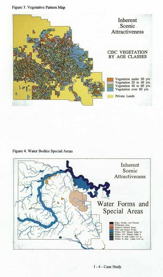
107

108 Points awarded to each 30 meter square land unit for each characteristic were totaled and assigned to A, B, or C Classes. However, during field verification it was determined that the inherent scenic attractiveness within the B class varied significantly. We felt that those areas at the higher end of the B class deserved more recognition for ISA than those areas that just barely had enough points to rate in the B class. Therefore the Kisatchie NF divided the B class into 3 subclasses, B+, B, and B-. The subdivision of class B allowed greater refinement and flexibility in Scenic Class assignments. From this new point distribution, the ISA map was produced (Figure 5). Figure 5. Kisatchie National Forest ISA Map DETERMINE LANDSCAPE VISIBILITY (Product - Seen Area and Distance Zone Map) Landscape visibility is a combination of the seen area in relation to the context and types of viewers that view it. The interconnected elements of landscape visibility include; context of viewers, duration of view, degree of discernible detail, seasonal variation, and number of viewers. In order to determine landscape visibility, it must first be determined which areas are seen from travelways or use areas, known as seen area mapping. The next step is to determine the importance people place on these travelways and use areas, which is known as concern level assignments. I Case Study
 C or better, canoeable and boatable streams, and recreational lakes.")
109 Seen Area Mapping The first step in seen area mapping is to determine which travelways and use areas will be inventoried for landscape visibility. The Kisatchie NF chose to inventory all roads which are traffic service level (TSL) C or better, canoeable and boatable streams, and recreational lakes. There are basically two methods for mapping the seen area, either by manual means or by using GIS. GIS can be used efficiently and effectively to analyse both distance zones and viewsheds. Because the Kisatchie NF is relatively flat, distance zones were used to determine the seen area. Using GIS, all TSL C or better roads, canoeable and boatable streams, and recreational lakes were mapped for foreground, middle ground, and background. Foreground was determined to be 2000 feet (approximately 3/8 mile), middle ground was determined to be from 2001 to feet (from 3/8 mile to 4 miles), and anything greater than 4 miles was considered background. After GIS ran the distance zone analysis, it was determined that the Kisatchie NF does not have any background. This was expected due to the Kisatchie's high road density. Concern Level Assignments The next step is to determine the importance people place on these travelways. Concern levels are a measure of the degree of public importance and can be divided into three categories: levels 1,2, and 3. The Kisatchie NF assigned concern levels to all travelways and use areas, based upon comments received during the FLRMP scoping process, open houses, and district visits. Constituent analysis was integrated into the scoping process. Once the concern levels were digitized into our GIS system, they were combined with the distance zone buffers, foreground and middle ground, which produced the landscape visibility map (Figure 6). Figure 6. Kisatchie National Forest Landscape Visibility Map I Case Study

110 DETERMINE INITIAL SCENIC CLASS ASSIGNMENTS (Product - Initial Scenic Class Maps) The Initial Scenic Class assignments are the final product in the inventory phase. Scenic classes are determined by combining the inherent scenic attractiveness classes with the distance zones and concern levels of landscape visibility. Scenic classes define the relative value of scenery on all lands and will help determine how scenic resources will be allocated during the FLRMP plan alternative development process. The Kisatchie NF modified the scenic class matrix as outline in the SMS handbook to better fit conditions on the forest (Table 1). Table 1. Kisatchie National Forest Scenic Class Assignment Matrix Utilizing GIS, both the ISA and landscape visibility maps were merged based upon the above matrix to produce the initial scenic class assignment map (Figure 7). Figure 7. Kisatchie National Forest Scenic Class Assignment Map I Case Study

111 IMPLEMENTATION PHASE The Kisatchie NF developed Desired Future Conditions (DFCs) based upon the issues and concerns identified during the public scoping process. The next step was to build a set of forest management alternatives that responded in various ways to the issues and concerns. The Kisatchie NF did this by allocating the entire forest area the full range of DFCs varying in proportion and location for each alternative theme. Groups of similar DFCs became Management Areas (MAs). Each FLRMP alternative is built from the same palette of MAs. The Management Areas vary in size and location from alternative to alternative. CONSOLIDATE SCENIC CLASS ASSIGNMENTS (Product - Final Scenic Class Maps) The thin black lines in Figure 11 represent stand boundaries. Many of the stands have two or more Scenic Classes assigned. This resulted, primarily because of the detailed biophysical GIS Inherent Scenic Attractiveness analysis. This was not acceptable because it would result in many stands with multiple Scenic Integrity Objectives, which would greatly complicate implementation and compliance. A process was developed to convert stands with more than one Scenic Class assigned, except those cut by distance zone and desired future condition boundaries, to just one Scenic Class per stand. The process is weighted to give greater value to management areas and consequently FLRMP alternatives that emphasize scenery and other non-commodity values. In other words, the higher the management emphasis for scenery of a management area, the greater the likelihood the whole stand will be converted to a higher (numerically lower) Scenic Class. Final Scenic Class Assignment maps were produced for each FLRMP alternative. Figure 11 shows a sample Scenic Class Map before consolidation and Figure 12 the same area after consolidation. This step is considered a component of the implementation phase because it is management area dependent, consequently Final Scenic Class Maps will vary from FLRMP alternative to alternative. Figure 8. Detail of Initial Scenic Class Map I Case Study
112 I Case Study

113 ASSIGN SCENIC INTEGRITY OBJECTIVES TO MANAGEMENT AREAS (Product - Matrix) The ID team determined how the Scenic Classes would be allocated to each Management Area to yield Scenic Integrity Objective assignments, as Table 2 illustrates. Management Area boundaries are based on the DFC boundaries, and vary by FLRMP Alternative. We felt this was the most logical way of assigning Scenic Integrity Objectives because the relative management concern for scenery is linked closely to assigned DFCs or Management Areas. Other approaches such as simply varying Scenic Class allocation scenarios by FLRMP Alternative would not reflect scenery values or concerns as accurately. Table 2. Scenic Integrity Objective Assignment Matrix PRODUCE SCENIC INTEGRITY OBJECTIVE MAPS (Product - Scenic Integrity Objective Maps for each FLRMP alternative) Based on the management area assignments Scenic Integrity Objective maps were developed for each FLRMP alternative. Figures represent sample Scenic Integrity Objective assignment maps for three of the six FLRMP alternatives on one district. These maps are being used in the analysis of the FLRMP alternatives that will ultimately result in the selection of a preferred alternative. The SIO alternative maps will be included in the draft FLRMP and subject to public review and comment. We consider this a key element of constituent analysis and could result in revisions of the previous steps. We do not consider these products to be final at this stage of the process. I- 10-Case Study
114 Figure 10. Scenic Integrity Objective Map - Wildlife Alternative Figure 11. Scenic Integrity Objective Map - Amenity Alternative I Case Study

115 Figure 12. Scenic Integrity Objective Map - Commodity Alternative I- 12-Case Study
116
117 Glossary Acceptable Levels of Quality The lowest standard permissible in the constituents' view. Aesthetics (Esthetics) Generally, the study, science, or philosophy dealing with beauty and with judgments concerning beauty. In scenery management, it describes landscapes that give visual and sensory pleasure. Attribute An inherent landscape characteristic, trait, or quality. Background The distant part of a landscape. The landscape area located from 4 miles to infinity from the viewer. Balance A visual stability produced, and an equilibrium established in a landscape, by natural forces or human intervention. Base Map The document that graphically records existing physical and administrative features of a given landscape area. Characteristic Qualities that constitute a character, that characterize a landscape; a distinguishing trait, feature, or quality; uniqueness; attribute. Coherence Quality or state of being united in principles and relationships or to be logically and aesthetically connected, Color The property of reflecting light of a particular wavelength that enables the eye to differentiate otherwise indistinguishable objects. A hue (red, green, blue, yellow, and so on), as contrasted with a value (black, white, or gray). Composition Assembly and organization of components in a work of art or such organization in a landscape. Contrast Diversity or distinction of adjacent parts. Effect of striking differences in form, line, color, or texture of a landscape. Constituents People who authorize others to act for them or a body of citizens entitled to elect a representative to act for them. Forest Service personnel manage publie lands for their constituents, whether or not they are visitors to the national forest, Cultural Element Attributes in a human-altered landscape; scenically positive cultural elements, most of which have historical backgrounds or nostalgic connotations. Examples include split-rail fences, stone walls, barns, orchards, hedgerows, and cabins. Cultural Landscape Human-altered landscapes, especially those slowly evolving landscapes with scenic vegetation patterns or scenic structures. Addition of these elements creates a visually pleasing complement to the natural character of a landscape, Cumulative Effect The effect on the environment that results from the incremental impact of a proposed action when added to other past, present, and reasonably foreseeable future actions. Desired What constituents would like to have if they were unconstrained in their choices, Desired Future Condition The combination of desirable attributes to be attained in the future by management of a national forest. For scenery management, desired future con dition is comprised of interrelated components, including desired travelways, desired use areas, desired landscape character and desired scenic condition. Desired Landscape Character Appearance of the landscape to be retained or created over time, recognizing that a landscape is a dynamic and constantly changing community of plants and animals. Combination of landscape design attributes and opportunities, as well as biological opportunities and constraints. Deviation Departure from existing landscape character or from landscape character goals. Deviation from existing landscape character can be positive, negative, or have no effect. Glossary-1
118 Distance Zones Landscape areas denoted by specified distances from the observer. Used as a frame of reference in which to discuss landscape attributes or the scenic effect of human activities in a landscape. Distinctive Refers to extraordinary and special landscapes. These landscapes are attractive, and they stand out from common landscapes. Disturbance A discrete event, either natural or human induced, that causes a change in the existing condition of an ecological system. Dominance Elements In scenery management, the dominance elements are form, line, color, and texture. They are the attributes that make up the landscape character. Dominant Human Alterations In scenery management, dominant human alterations override the natural character of the landscape and are very noticeable. Dynamic Active or changing, marked by continuous activity or change. In a landscape, vegetative screening is dynamic, being subjected to natural forces or human alteration. Ecological Approach Natural resource planning and management activities that assure consideration of the relationship among all organisms (including humans) and their environment. Ecological Classification A multifactor approach to categorizing and delineating, at different levels of resolution, areas of land and water having similar characteristic combination of the physical environment (such as climate, geomorphic processes, geology, soil, and hydrologic function), biological communities (such as plants, animals, microorganisms, and potential natural com munities), and the human dimension (such as social, economic, cultural, and infrastructure). Ecological Principles The biological bases for sound ecosystem management through which ecosystem sustainability is ensured. Ecological Process The actions or events that link organisms (including humans) and their environment such as disturbance, successional development, nutrient cycling, carbon sequestration, productivity, and decay. Ecological Unit An assessment area based on vegetation, soils, geoli gy, and geomorphology. Ecoregion A continuous geographic area over which the macroclimate is sufficiently uniform to permit development of similar ecosystems on sites with similar properties. Ecoregions contain multiple landscapes with different spatial patterns of ecosystems, Ecosystem Function The process through which the constituent living and nonliving elements of ecosystems change and interact, including biogeochemical processes and succession. Ecosystem Management The use of an ecological approach that blends social, physical, economic, and biological needs and values to assure productive, healthy ecosystems, Ecosystem Structure The spatial arrangement of the living and nonliving elements of an ecosystem, Edge The line where an object or area begins or ends. Edge serves to define borders, limits, or boundaries. Enhancement A short-term management prescription with the express purpose of increasing positive scenic attributes where few exist. Evident That which is noticeable, apparent, conspicuous, or obvious, Existing Scenic Integrity ("Existing visual condition") Current state of the landscape, considering previous human alterations, Expected What constituents anticipate encountering in the national forests. Expected Image A mental picture that a person expects to see in a national forest. Feature A visually distinct or outstanding part, quality, or characteristic of a landscape. Glossary-2
119 Foreground Detailed landscape generally found from the observer to 1/2 mile away. See also immediate foreground. Form Structure, mass, or shape of a landscape or of an object. Landscape form is often defined by edges or outlines of landforms, rockforms, vegetation patterns, or waterforms, or the enclosed spaces created by these attributes. Frame of Reference An area or framework against which various parts can be judged or measured. Harmony Combination of parts of a landscape into a pleasing or orderly whole. A state of agreement, congruity, or proportionate arrangement of form, line, color, and texture. tern which is determined by interacting ecosystems. Hierarchical Approach An analysis approach accounting for differences in space and time. Hierarchy A sequence of sets composed of smaller subsets. High Scenic Integrity Level A scenic integrity level meaning human activities are not visually evident. In high scenic integrity areas, activities may only repeat attributes of form, line, color, and texture found in the existing landscape character. Historical Ecosystem An ecosystem at a specified previous time. Historical Variation The range of the spatial, structural, compositional, and temporal characteristics of ecosystem elements during a period specified to represent "natural " conditions. Human Dimension An integral component of ecosystem management that recognizes people are part of ecosystems, that people's pursuits of past, present, and future desires, needs, and values (including perceptions, beliefs, attitudes, and behaviors) have and will continue to influence ecosystems and that ecosystem management must include consideration of the physical, emotional, mental, spiritual, social, cultural, and economic well-being of people and communities. Human Impact or Influence A disturbance or change in ecosystem composition, structure, or function caused by humans. Immediate Foreground The detailed feature landscape found within the first few hundred feet of the observer, generally, from the observer to 300 feet away. This distance zone is normally used in project level planning, not broad scale planning.) Intactness Untouched or unaltered, especially by anything that harms or diminishes its character. Landform One of the attributes or features that make up the Earth's surface, such as a plain, mountain, or valley. Landscape An area composed of interacting ecosystems that are repeated because of geology, land for, soils, climate, biota, and human influences throughout the area, Landscapes are generally of a size, shape, and pat Landscape Character Particular attributes, qualities, and traits of a land scape that give it an image and make it identifiable or unique. Landscape Character Goal A management prescription designed to maintain or modify the existing landscape character to a desired future state. See desired landscape character, Landscape Fragility See visual absorption capability. Landscape Setting The context and environment in which a landscape is set; a landscape backdrop. Landscape Unit A small area of land that, at a micro-scale, has similar existing landscape character attributes landform, rockform, waterform, and vegetative commu nities patterns. A geographic area that is useful for inventorying and analyzing scenery. Landscape Visibility Accessibility of the landscape to viewers, referring to one's ability to see and perceive landscapes. Line An intersection of two planes; a point that has been extended; a silhouette of form. In landscapes ridges, skylines, structures, changes in vegetation, or individual trees and branches may be perceived as line. Glossary-3
120 Low A scenic integrity level meaning human activities must remain visually subordinate to the attributes of the existing landscape character. Activities may repeat form, line, color, or texture common to these landscape characters, but changes in quality of size, number, intensity, direction, pattern, and so on, must remain visually subordinate to these landscape characters. Management Activity An activity humans impose on a landscape for the purpose of managing natural resources. Middleground The zone between the foreground and the back ground in a landscape. The area located from 1/2 mile to 4 miles from the observer. Mystery Characteristics in a landscape that excite wonder, curiosity, or surprise. Natural Disturbance Periodic impact or natural events such as fire, severe drought, insect or disease attack, or wind. Natural Ecosystem An ecosystem that is minimally influenced by humans and that is, in the larger sense, diverse, resilient, and sustainable. Natural Landscape Character Landscape character that originated from natural disturbances, such as wildfires, glaciation, succession of plants from pioneer to climax species, or indirect activities of humans, such as inadvertent plant suecession through fire prevention. Natural-Appearing Landscape Character Landscape character that has resulted from human activities, yet appear natural, such as historic conver sion of native forests into farmlands, pastures, and hedgerows that have reverted back to forests through reforestation activities or natural regeneration. NEPA The National Environmental Policy Act of NEPA establishes legal requirements for management of aesthetic resources. NFMA The National Forest Management Act of NFMA establishes legal requirements for scenery management (called "visual resource management" in the Act). Observer Position Specific geographic position in the landscape where the viewer is located. Also known as viewer platform, Pastoral Landscape Character Landscape character that has resulted from human activities, containing positive cultural elements such as historic conversion of native forests into farmlands, pastures, and hedgerows, plus some remnants of native forests. Pattern An arrangement of parts, elements, or details that suggests a design or somewhat orderly distribution. Perception Human impression of a landscape. Perception translates and evaluates the landscape that one "sees" in context of previous experiences and expected images, Positive Cultural Element Human alterations that are scenically positive attributes, most of which have historical back-grounds or nostalgic connotations. Examples include split-rail fences, stone walls, barns, orchards, hedgerows, and cabins. There may be nodes, enclaves or constellations of positive cultural elements, Positive Cultural Landscape A landscape having human alterations that are positive cultural elements, complementing and improving a particular landscape by adding variety, unity, vividness, intactness, coherence, mystery, balance, uniqueness, harmony, or pattern, Preferred What constituents would choose from among a set of available options, Potential Vegetation Vegetation that would develop if all successional sequences were completed under present site conditions (e.g., habits type). Range of Variability The spectrum of conditions possible in ecosystem composition, structure, and function considering both temporal and spatial factors. Recreation Visitor One who is in an area temporarily for refreshment of the body and mind. In the national forests, the visitor usually has a significant conscious or subconscious interest in the scenic qualities of the area. Glossary-4
121 Reference Conditions Conditions characterizing ecosystem composition, structure and function, and their variability. Rehabilitation A short-term management goal used to return a landscape with existing visual impacts and deviations to a desired level of scenic quality formerly found in the natural landscape. RPA The Forest and Rangeland Renewable Resources Planning Act of RPA establishes legal requirements for scenery management. A Distinctive. B Typical or Common, C Undistinguished. Scenic Class A system of classification describing the importance or value of a particular landscape or portions of that landscape, Scenic Integrity State of naturalness or, conversely, the state of disturbance created by human activities or alteration. Integrity is stated in degrees of deviation from the existing landscape character in a national forest. Rockform Scenic Quality A significant composition of mineral matter consti- The essential attributes of landscape that when tuting the Earth's crust. One of the attributes or fea- viewed by people, elicit psychological and physiotures that make up part of the Earth's surface, such logical benefits to individuals and, therefore, to socias a mountain, cliff, peak, bluff, valley wall, or ety in general, bedrock. Scenic Resource Rural/Agricultural Landscape Character Attributes, characteristics, and features of landscapes Landscape character that has resulted from extensive that provide varying responses from, and varying human activities, no longer appearing natural, such degrees of benefits to, humans. as conversion of native landscapes into extensively cultivated farmlands, vineyards, pastures, or an area Seeing of intensive domestic livestock production. Stimulation of one's sense of sight by reflected light. Seeing is a physiological process. Scale The degree of resolution at which ecological process- Seen Area es, structures, and changes across space and time are The total landscape area observed based upon landobserved and measured. form screening. Seen-areas may be divided into zones of immediate foreground, foreground, middle- Scenery ground, and background. Some landscapes are sel- General appearance of a place, general appearance of dom seen by the public, a landscape, or features of a landscape. Seldom-Seen Scenery Management Areas of the landscape that are infrequently viewed The art and science of arranging, planning, and by the public, designing landscape attributes relative to the appear ance of places and expanses in outdoor settings. Shape Contour, spatial form, or configuration of a figure. Scenic Shape is similar to form, but shape is usually consid- Of or relating to landscape scenery; pertaining to nat- ered to be two-dimensional, ural or natural appearing scenery; constituting or affording pleasant views of natural landscape attrib- Space utes or positive cultural elements. A limited extension in one, two, or three dimensions or a volume. Expanse of a landscape, such as the Scenic Attractiveness floor, walls, and ceiling of an "outdoor room." The scenic importance of a landscape based on human perceptions of the intrinsic beauty of land- Spatial Scale form, rockform, waterform, and vegetation pattern. The level of resolution in space perceived or consid- Reflects varying visual perception attributes of vari- ered. ety, unity, vividness, intactness, coherence, mystery, uniqueness, harmony, balance, and pattern. It is Special Classified Area classified as: Those areas such as wilderness, historical, biologi- Glossary-5
122 cal, scenic, or geological sites that are of such significance that specific management direction is given as part of policy or legislation. Special Places Those specific locations and expanses in outdoor settings that have attractions and features that are identified as unique, different, distinctive, and extraordinary to people. Special places may range from a small areas, such as a particular fallen log, to large areas, such as a landscape unit. Subordinate Landscape features that are inferior to, or placed below, another in size, importance, brightness, and so on. Features that are secondary in visual impact or importance. Sustainability The ability of an ecosystem to maintain ecological processes and functions, biological diversity, and productivity over time. Texture Visual interplay of light and shadow created by variations in the surface of an object. Grain or nap of a landscape or a repetitive pattern of tiny forms. Visual texture can range from smooth to coarse. ground distances, Theme The general focus or subject of variations on landscape character settings. Detailed description of desired landscape character. Themes range from a natural landscape to an urban landscape. Transition Passing from one state, stage, place, or subject to another, especially without abruptness. Typical or Common Landscape Refers to prevalent, usual, or widespread landscapes within a landscape province. It also refers to landscapes with ordinary and routine scenic attractiveness. Unacceptable Alteration A scenic integrity level (never an objective) where human activities of vegetative and landform alterations are excessive and totally dominate the natural or natural-appearing landscape character. Unacceptable alterations are "what not to do to any landscape," regardless of the distance from which the management activity may be observed. Unique A landscape that is unequalled, very rare, or uncommon. Unity Landscape with a quality or state of being made whole or a condition of harmony. Urban Landscape character that has resulted from extensive human activities, no longer appearing natural, such as conversion of native landscapes into an extensively altered landscape, such as a town, city, or metropolitan area, Variety An intermixture, diversity, or succession of different things, forms, or qualities in the landscape, Variety Class Term from The Visual Management System. See scenic attractiveness. Very High Scenic Integrity Level A scenic integrity level that generally provides for ecological change only. Very Low Scenic Integrity Level A scenic integrity level meaning human activities of vegetative and landform alterations may dominate the original, natural landscape character but should appear as natural occurrences when viewed at back View Something that is looked toward or kept in sight, especially a broad landscape or panorama. Act of looking toward this object or scene. Viewer Platform Position in the landscape where the viewer is located. (See observer position.) Viewshed Total visible area from a single observer position, or the total visible area from multiple observer positions. Viewsheds are accumulated seen-areas from highways, trails, campgrounds, towns, cities, or other viewer locations. Examples are corridor, feature, or basin viewsheds. Visitor Temporary occupants of an area. See recreation visitor. Vista A confined view, especially one seen through a long passage, as between rows of trees or down a canyon. A vista often focuses upon a specific feature in the landscape. Unlike a view, the vista is sometimes human created and, if it is, thereby subject to design. Glossary-6
123 Visual A mental image attained by sight. Visual Absorption Capability A classification system used to denote relative ability of a landscape to accept human alterations without loss of character of scenic quality. Visual Magnitude A detailed classification system used to denote relative visibility of a landscape, including distance, slope and aspect relative to observer, and number of times seen. Visual Perception Human impression of an optical experience; comprehension of an object or a space based on the sense of sight. Perception translates and evaluates what one sees in the context of previous experiences and expected images. Visual Vulnerability See visual absorption capability. Waterform One of the attributes or features that make up the Earth's surface, such as a pond, lake, stream, river, waterfall, estuary, or ocean. Watershed An area of land with a characteristic draining age network that contributes surface or ground water to the flow at that point; a drainage basin or a major subdivision of a drainage basin. Glossary-7
124 Bibliography Anderson, L.M Application of Wildland Scenic Assessment Methods to the Urban Landscape. Landscape Planning. Oct. p Anderson, Lee Roger, Rick Bennetts, Geoff Chandler, Steve Galliano, Dennis Holcomb, and Bob Neville Visual Absorption Capability for Forest Landscapes. Klamath National Forest. California Region. Yreka, CA. 25 p. Anderson, Lee Roger, Jerry Mosier, and Geoffrey Chandler. April Visual Absorption Capability. In: Proceedings of Our National Landscape. General Technical Report PSW-35. USDA Forest Service. Berkeley, CA. p Anderson, Lee Roger Visual Effect Predictions and Public Perceptions of the Visual Management System. Unpublished paper. 2 p. Anderson, Lee Roger, Jerry Mosier, and Geoffrey Chandler. April Visual Management Support System. In: Proceedings of Our National Landscape. General Technical Report PSW-35. USDA Forest Service. Berkeley, CA. p Anderson, Lee Roger Visual Resource Analysis. In: Environmental Impact Statement Proposed Celeron, All American, and Getty Pipeline Projects. California State Lands Commission and USDI Bureau of Land Management. Sacramento, CA. 608 p. Anderson, Lee Roger Visual Resources, Land Use, and Recreation Study. In: Pacific Pipeline Project Proponent's Environmental Assessment. California State Lands Commission. Sacramento, CA. 537 p. Anderson, Lee Roger Visual Resource, Wilderness, and Recreation Analysis. In: Grider Fire Recovery Project. Klamath National Forest. California Region. Yreka, CA. 216 p. Anderson, Linda, Daniel J. Levi, Terry C. Daniel and John H. Dieterich The Esthetic Effects of Prescribed Burning: A Case Study. Rocky Mountain Research Note 413.4p. Anderson, Linda M Land Use Designations Affect Perception of Scenic Quality in Forest Landscapes. Forest Science. Vol. 27, No. 2. p. 392^100. Anderson, Linda M Scenic Quality Modeling Proposal Summary of a Technical Workshop. Atlanta, GA. Anderson, Paul F. April Analysis of Landscape Character for Visual Resource Management. In: Proceedings of Our National Landscape. General Technical Report PSW-35. USDA Forest Service. Berkeley, CA. p Bacon, Warren R Visual Management System Handbook Draft. Pacific Northwest Region. USDA Forest Service. Portland, OR. 70 p. Bacon, Warren R., and Steven J. Galliano Response to the Milwaukee Task Force Report. 3 p. Bibliography-1
125 Becker, Robert, F. Dominic Dottavio, and Barbara McDonald The Use of Interpretation to Gain Visitor Acceptance of Vegetation Management. In: Visual Preferences of Travelers Along the Blue Ridge Parkway. Edited by Francis P. Noe and William E. Hammit. Scientific Monograph Series No. 18. USDI National Park Service. US Government Printing Office. Washington, DC p Bitterroot Social Research Institute Social Assessment of the Bitterroot Valley, Montana, with Special Emphasis on National Forest Management. Missoula, MT: USDA Forest Service, Northern Region. Blahna, Dale J. and Susan Yonts-Shephard "Public involvement in resource planning: Toward bridging the gap between policy and implementation." Society and Natural resources 2(3): Brown, Perry J Understanding Scenes. In: Toward a Technique for Quantifying Aesthetic Quality of Water Resources. Edited by Perry J. Brown. Utah State University p Blair, William G.E., Larry Isaacson, and Grant R. Jones Comprehensive Approach to Visual Resource Management for Highway Agencies. In: Proceedings of Our National Landscape. General Technical Report PSW-35. USDA Forest Service. Berkeley, CA. p Brown, Perry J Book Summary. In: Toward a Technique for Quantifying Aesthetic Quality of Water Resources. Edited by Perry J. Brown. Utah State University p Buhyoff, Gregory J., John D. Wellman, and Terry Daniel Predicting Scenic Quality for Mountain Pine Beetle and Western Spruce Budworm Damaged Forest Vistas Forest Science. Vol. 28, No. 4. p Buhyoff, Gregory J., and John D. Wellman Seasonality Bias in Landscape Preference Research. Leisure Sciences. Vol. 2, No. 2. p Buhyoff, Gregory J., and Michael Riesnman Manipulation of Dimensionality in Landscape Preference Judgments: A Quantitative Validation. Leisure Sciences. Vol. 2, 3,and4. p Buhyoff, Gregory J., J.D. Wellman, H. Harvey, and R.A. Fraser Landscape Architect's Interpretations of People's Landscape Preferences. Journal of Environmental Management. June. p Case, Pamela (draft). The "Common Social Unit" Geographic Information System. Fort Collins, CO: USDA Forest Service, Rocky Mountain Region. Chenoweth, Richard God, Mother, Apple Pie and Scenic Beauty. Unpublished paper. Daniel, Terry C Measuring the Quality of the Natural Environment. American Psychologist. May. p Daniel, Terry C, and Ervin H. Zube Assessment of Esthetic Resources. In: Assessing Amenity Resource Values. Edited by Terry C. Daniel, Ervin H. Zube, and B.L. Driver. General Technical Report RM-68. USDA Forest Service, p Bibliography-2
126 Daniel, Terry C, and Ron S. Boster Measuring Landscape Esthetics: The Scenic Beauty Estimation Method. USDA Forest Service. Research Paper RM p. Daniel, Terry C, Linda M. Anderson, Herbert W. Schroeder, and Lawrence Wheeler Mapping Scenic Beauty of Forests. Manuscript. University of Arizona. 22 p. Dearden, Phillip Forest Harvesting and Landscape Assessment Techniques in British Columbia, Canada. Landscape Planning. Oct. p Diaz, Nancy, and Dean Apostol Forest Landscape Analysis and Design. USDA Forest Service. 110 p. Driver, B.L., Perry J. Brown, and George L. Peterson Benefits of Leisure. State College, PA.: Venture Publishing, Inc. 483 p. ECOMAP, USDA Forest Service National Hierarchical Framework of Ecological Units. Washington, D.C. Eleftheriadis, Nikos, Ionnis Tsalikidus, and Basil Manos Coastal Landscape Preference Evaluation: Comparison Among Tourists in Greece. Environmental Management. Vol. 14, No. 4. p. 475^487. Feimer, Nikolaus R Improving the Reliability of Visual Impact Assessment Procedures. PSW p. Feimer, Nikolaus R., R. Smardon, and K. Craik Evaluating Effectiveness of Observer Based Visual Resource and Impact Assessment Methods. Landscape Research. Vol. 6, No. 1. p Feimer, Nickolaus R., Kenneth H. Craik, R. Smardon, and S.J.R. Sheppard Appraising the Reliability of Visual Impact Assessment Methods. In: Proceedings of Our National Landscape. General Technical Report PSW-35. USDA Forest Service. Berkeley, CA. p Forman, Richard T.T., and Michael Godron Landscape Ecology. New York: John Wiley and Sons. 620 p. Francaviglia, Richard V The Mormon Landscape. University of Oregon. 3 p. Gilpin, Willaim Remarks on Forest Scenery and Other Woodland Views (Relative Chiefly to Picturesque Beauty) Illustrated by the Scenes of New-Forest in Hampshire In Three Books. London. Printed for R. Blamire, Strand. Reprinted 1973 by Richmond Publishing Co. Ltd. Surrey, England. Grapel, Alan Fitting Structures into the Landscape A Process. Unpublished paper. 3 p. Grden, Blaise Evaluation and Recommendations Concerning the Visual Resource Inventory and Evaluation Systems Used Within the Forest Service and the Bureau of Land Management In: Proceedings of Our National Landscape. General Technical Report PSW-35. USDA Forest Service. Berkeley, CA. p Bibliography-3
127 Gussow, Alan Conserving the Magnitude of Usefulness A Philosophical Perspective. In: Proceedings of Our National Landscape. General Technical Report PSW-35. USDA Forest Service. Berkeley, CA. p Hammitt, William E Visual Management Preferences of Sightseers. In: Visual Preferences of Travelers Along the Blue Ridge Parkway. Edited by Francis P. Noe and William E. Hammit. Scientific Monograph Series No. 18. USDI National Park Service. US Government Printing Office. Washington, DC. p Hampe, Gary D The Influence of Sociocultural Factors upon Scenic Preference. In: Visual Preferences of Travelers Along the Blue Ridge Parkway. Edited by Francis P. Noe and William E. Hammit. Scientific Monograph Series No. 18. USDI National Park Service. US Government Printing Office. Washington, DC. p Hebbelthwaite, R.L Landscape Assessment and Classification Techniques. In: Land Use and Landscape Planning. Edited by Derek Lovejoy. Aylesbury, Bucks, Great Britain: Leonard Hill Books, p Heberlein, Thomas A "Some observations on alternative mechanisms for public involvement: The hearing, public opinion poll, the workshop and the quasi-experiment." Natural Resources Journal 16(1): Higuchi, Tadihiko The Visual and Spatial Structure of the Landscape. Translated by Charles Terry. The MIT Press. Cambridge, Mass., London. (Original Gihodo Press Pub. Ltd. Tokyo ) 218 p. Hiss, Tony The Experience of Place. New York: Alfred A. Knopf. 233 p. Holcomb, Dennis B Scenery Management Guides. Six Rivers National Forest. California Region. Eureka, CA. 71 p. Hubbard, Henry Vincent, and Theodora Kimball An Introduction to the Study of Landscape Design. New York: The Macmillan Company. 406 p. Iverson, Wayne D The Theories and Principles of Design Which Apply to Environmental Architecture. Unpublished paper. USDA Forest Service Environmental Architecture Workshop. St. Louis. 89 p. Iverson, Wayne D Scenic Quality Inventory. Unpublished paper. Iverson, Wayne D Managing and Monitoring a Visual Resource Management Program. In: Proceedings of the C'ouncil of Education in Landscape Architecture. University of Wisconsin Madison. 14 p. Iverson, Wayne D Research Needed to Improve Quantification of Scenic Resources in Forest Planning. In: Proceedings IUFRO Symposium on Forest Management Planning and Managerial Economics. Univ. of Tokyo, p Jackie, John A The Visual Elements of the Landscape. Amherst. The University of Press. 200 p. Jackson, J.B The Historic Landscape. In: Landscape Assessment Values, Perceptions, and Resources. Edited by Ervin H. Zube, Robert O. Brush, and Julius Gy Fabos. Stroudsburg, PA: Dowden, Hutchinson & Ross. p Bibliography-4
128 Jones, Grant R Esthetics and Visual Resource management for Highways. FHWA Seminar Notes. Kaplan, Rachel Some Methods and Strategies in the Prediction of Preference. In: Landscape Assessment Values, Perceptions, and Resources. Edited by Ervin H. Zube, Robert O. Brush, and Julius Gy Fabos. Stroudsburg, PA: Dowden, Hutchinson & Ross. p Kaplan, Rachel, and Stephen Kaplan The Experience of Nature. Cambridge: Cambridge University Press. 340 p. Kaplan, Stephen Perception and Landscape: Conceptions and Misconceptions. In: Proceedings of Our National Landscape. General Technical Report PSW-35. USDA Forest Service. Berkeley, CA. p Kellomaki, Seppo, and Risto Savolainen The Scenic Value of the Forest Landscape as Assessed in the Field and Laboratory. Landscape Planning. Nov. p Kellomaki, Seppo, and Risto Savolainen The Scenic Value of the Forest Landscape as Assessed in the Field and Laboratory. In: Multiple-Use Forestry in Scandinavian Countries. Proceedings of the Scandinavian Symposium held in Rovaniemi and Saariselka, Finland. September 13-17, Helsinki, p Kempton, Willet; Boster, J.S. and J.A. Hartley Environmental Values in American Culture. Cambridge, MA: MIT Press. Kopka, Sue, and Mark Ross A Study of the Reliability of the Bureau of Land Management Visual Resource Management Scheme. Landscape Planning Nov. p Laughlin, Nora A., and Margot W. Garcia Attitudes of Landscape Architects in the USDA Forest Service Toward the Visual Management System. Landscape Journal. Vol. l,no. 5. p Laurie, land Aesthetic Factors in Visual Evaluation. In: Landscape Assessment Values, Perceptions, and Resources. Edited by Ervin H. Zube, Robert O. Brush, and Julius Gy Fabos. Stroudsburg, PA: Dowden, Hutchinson & Ross. p Lee, Robert G Assessing Public Concern for Visual Quality Landscape Sensitivity Research and Administrative Studies. PSW-19. USDA Forest Service. Berkeley, CA. 76 p. Lewis, Bernard J Problem Analysis: The Social Dimension of Ecosystem Management. St. Paul, MN: USDA Forest Service, North Central Forest Experiment Station. Litton, R. Burton, Jr Forest Landscape Description and Inventories A Basis for Land Planning and Design. Research Paper PSW-49. USDA Forest Service. Berkeley, CA. 64 p. Litton, R. Burton, Jr Descriptive Approaches to Landscape Analysis. In: Proceedings of Our National Landscape. General Technical Report PSW-35. USDA Forest Service. Berkeley, CA. p Bibliography-5
129 Litton, R. Burton, Jr Visual Assessment of Natural Landscapes. In: Western Geographical Series. Volume 20. Edited by Barry Sadler and Allen Carlson. University of Victoria, B.C. p Litton, R. Burton, Jr Silviculture and Visual Resources. In: Proceedings, 1977 Society of American Foresters Convention, p Litton, R. Burton, Jr Visual Vulnerability of Landscape: Control of Visual Quality. USDA Forest Service. Research Paper WO p. Litton, R. Burton, Jr Visual Fluctuations on River Landscape Quality. Manuscript for Proceedings of the National River Recreation Symposium. 12 p. Marsh, George Perkins Man and Nature. Reprint. Edited by David Lowenthal. Cambridge, Mass.: The Belknap Press of Harvard Univ. Press McCarthy, Michael Complexity and Valued Landscapes. In: Proceedings of Our National Landscape. General Technical Report PSW-35. USDA Forest Service. Berkeley, CA. p McGregor, Mark D Landscape and Visual Management Concerns. In: Integrating Management Strategies for the Mountain Pine Beetle with Multiple-Resource Management of Lodgepole Pine Forests. Edited by Mark D. McGregor and Dennis M. Cole. USDA Forest Service. General Technical Report. Intermountain Forest and Range Experiment Station. Ogden, Utah. p. 44. McGuire, John R Managing the Forest Landscape for Public Expecta-tions. In: Proceedings of Our National Landscape. General Technical Report PSW-35. USDA Forest Service. Berkeley, CA. p Nassauer, Joan Managing the Naturalness in Wildland and Agricultural Landscapes. In: Proceedings of Our National Landscape. General Technical Report PSW-35. USDA Forest Service. Berkeley, CA. p Newby, Floyd Indicators for Aesthetic Opportunity. In: Toward a Technique for Quantifying Aesthetic Quality of Water Resources. Edited by Perry J. Brown. Utah State University, p Noe, Francis P., and William E. Hammit Introduction. Visual Preferences of Travelers Along the Blue Ridge Parkway. Edited by Francis P. Noe and William E. Hammit. Scientific Monograph Series No. 18. USDI National Park Service. US Government Printing Office. Washington, DC. p Noe, Francis P Effects of Recreational and Environmental Values on Tourist Scenic Preferences. In: Visual Preferences of Travelers Along the Blue Ridge Parkway. Edited by Francis P. Noe and William E. Hammit. Scientific Monograph Series No. 18. USDI National Park Service. US Government Printing Office. Washington, DC. p Palmer, James F., and Ervin H. Zube Numerical and Perceptual Landscape Classification. In: Studies in Landscape Perception. Edited by Ervin H. Zube. Publication No. R Institute for Man and His Environment. Amherst: University of Mass. p Bibliography-6
130 Penning-Roswell, Edmund C The Social Value of English Landscapes. In: Proceedings of Our National Landscape. General Technical Report PSW-35. USDA Forest Service. Berkeley, CA. p Polakowski, Kenneth J Landscape Assessment on the Upper Great Lakes Basin Resources: A Macro-Geomorphic and Micro-Compositional Analysis. In: Landscape Assessment Values, Perceptions, and Resources. Edited by Ervin H. Zube, Robert O. Brush, and Julius Gy Fabos. Stroudsburg, PA: Dowden, Hutchinson & Ross. p Price, Uvedale From Essays on the Picturesque As Compared to the Sublime and Beautiful and, On the Use of Studying Pictures, for the Purpose of Improving the Real Landscape. Volume 1 of 3. London. Printed for J. Mawman, 22, Poultry. Ross, Robert The Bureau of Land Management and Visual Resource Management An Overview. In: Proceedings of Our National Landscape. General Technical Report PSW-35. USDA Forest Service. Berkeley, CA. p Rudis, Victor A., James H. Gremann, Edward J. Ruddell, and Joanne Westfal Forest Inventory and Management-Based Visual Preference Models in Southern Pine Stands. Forest Science. Vol. 34, No. 4. p Schomaker, John H Measurement of Preference for Proposed Landscape Modifications. In: Assessing Amenity Resource Values. Edited by Terry C. Daniel, Ervin H. Zube and B.L. Driver. General Technical Report RM-68. USDA Forest Service, p Shafer, Elwood L., Hamilton, and Schmidt Natural Landscape Prefer-ences: A Predictive Model. Journalof Leisure Research. Vol. l,no. l.p Shafer, Elwood. L Perceptions of Natural Landscapes. Environment and Behavior, p Shafer, Elwood L., and Michael Tooby Landscape Preferences: An International Replication. Journalof Leisure Research, p Shafer, Elwood L., and Robert O. Brush How to Measure Preferences for Photographs of Natural Landscapes. Landscape Planning 4. p Schauman, Sally The Countryside Visual Resources. In: Proceedings of Our National Landscape. General Technical Report PSW-35. USDA Forest Service. Berkeley, CA. p Simonds, John Ormsbee Landscape Architecture The Shaping of Man's Environment. New York: F. W. DodgeCorp. 244 p. Smardon, Richard C, St. Lawrence River Scenic Access Study. (Published source not known) Smardon, Richard C, Final Project Report. Development of Visual Activity Classification and Advance Testing on Visual Impact Assessment Manual Procedures. PSW Co-Op Agreement. PSW Berkeley. 100 p. Smardon, Richard C, Timothy R. Day, James F. Palmer, Tad Redway and Lawrence Reichardt Historical Overview and landscape Classification of Vistas and Rural Bibliography-7
131 Landscapes Along the Blue Ridge Parkway. In: Visual Prefer-ences of Travelers Along the Blue Ridge Parkway. Edited by Francis P. Noe and William E. Hammit. Scientific Monograph Series No. 18. USDI National Park Service. US Government Printing Office. Washington, DC. p Smardon, Richard C, Timothy R. Day, James F. Palmer, Tad Redway and Lawrence Reichardt Simulating and Evaluating Management Practices. In: Visual Preferences of Travelers Along the Blue Ridge Parkway. Edited by Francis P. Noe and William E. Hammit. Scientific Monograph Series No. 18. USDI National Park Service. US Government Printing Office. Washington, DC. p Smardon, Richard C Historical Evolution of Visual Resource Manage-ment Within Three Federal Agencies. Journal of Environmental Management 22(4). p Stankey, George H. and Roger N. Clark. July Social Aspects of New Perspectives in Forestry. Milford, PA.: Grey Tower Press. 33 p. Stilgoe, John R Common Landscape of America. New Haven & London: Yale University Press. 429 p. Stix, Jody Site Specific Visual Analysis Building Upon the Forest Service Visual Management System. MLA Thesis. University of Oregon Eugene. 103 p. Strunk, William, Jr., and E.B. White The Elements of Style. New York: MacMillan Publishing Co. Inc. 92 p. Tetlow, R. J., and S.R.J. Sheppard Visual Unit Analysis: A Descriptive Approach to Landscape Assessment. In: Proceedings of Our National Land-scape. General Technical Report PSW-35. USDA Forest Service. Berkeley, CA. p Tuan, Yi-Fu Topophilia A Study o f Environmental Perception, Attitudes and Values. Englewood Cliffs, NJ: Prentice-Hall, Inc. 260 p. Tlusty, Wayne The Use of Perspective Plot to Assist in Determining the Landscape's Visual Absorption Capability. In: Proceedings of Our National Landscape. General Technical Report PSW-35. USDA Forest Service. Berkeley, CA. p Ulrich, RogerS., UlfDimberg, and B.L. Driver In: Benefits of Leisure. Edited by B.L. Driver, Perry J. Brown, and George L. Peterson. State College, PA.: Venture Publishing, Inc. p USDA Forest Service Quantitative Analysis of the Visual Resource. Northern Region LA Branch. Missoula. 40 p. USDA Forest Service Forest Landscape Management. Volume One. Revision. Landscape Architecture Branch. Division of Recreation and Lands. Northern Region. Missoula. 137 p. USDA Forest Service R Supplements to FSM 113, p. USDA Forest Service R Supplements to FSM 143, p. USDA Forest Service R-6 Supplement 70 to FSM. 13 p. Bibliography-8
132 USDA Forest Service Milwaukee Landscape Management Task Force Report. 20 p. USDA Forest Service VMS Revision Consensus. Report on Regional Landscape Architects Meeting at Friday Harbor, WA. USDI Bureau of Land Management Visual Resource Management. Bureau of Land Management. USDI. Washington, DC. 39 p. US Government Printing Office Style Manual. 479 p. Word Division Supplement to Style Manual. US GPO. Washington, DC. 142 p. Utton, Albert E.; Sewell, D. and T. O'Riordan Natural Resources for a Democratic. Society: Public Participation in Decision-Making. Boulder, CO: Westview Special Studies in Natural Resource Management.. Vining, Joanne, Terry C. Daniel, and Herbert W. Schroeder Predicting Scenic Values in Forested Residential Landscapes. Journal of Leisure Research. Second Quarter, p Watershed Evaluation & Analysis for Viable Ecosystems (WEAVE)., Social Domain Slider, Terry C, Burns, Jennifer L, and Lewis, Bernard J Deschutes N. F. Bend Or USDA Forest Service, Northwest Pacific Region. Weddle, A.E Applied Analysis and Evaluation Techniques. In: Land Use and Landscape Planning. Edited by Derek Lovejoy. Aylesbury, Bucks, Great Britain: Leonard Hill Books, p Wellman, J. Douglas, Gregory J. Buhyoff, Nick Feimer, and Michael Patsfall. Visual Experiences of Sightseers. In: Visual Preferences of Travelers Along the Blue Ridge Parkway. Edited by Francis P. Noe and William E. Hammit. Scien-tific Monograph Series No. 18. USDI National Park Service. US Government Printing Office. Washington, DC p Willhite, Robert, and William R. Sise Measurement of Reaction to Forest Practices. Journal of Forestry, p Wohlwill, Joachim What Belongs Where: Research on Fittingness of Manmade Structures in Natural Settings. In: Assessing Amenity Resource Values. Edited by Terry C. Daniel, Ervin H. Zube and B.L. Driver. General Technical Report RM-68. USDA Forest Service, p Wohlwill, Joachim F Environmental Aesthetics: The Environment as a Source of Affect. In: Human Behavior and the Environment Advances in Theory and Research. Vol. 1. Edited by Irwin Altman and Joachim F. Wolwill. New York: Plenum Press, p Wooden, Rebecca C Measurement of Public Preference for Proposed Land-scape Modifications. M.S. Thesis. University of Idaho Graduate School. 89 p. Yeomans, W.C A Proposed Biophysical Approach to Visual Absorption Capability (VAC). In: Proceedings of Our National Landscape. General Technical Report PSW-35. USDA Forest Service. Berkeley, CA. p Bibliography-9
133 Zube, Ervin H., David G. Pitt, and Thomas W. Anderson Perception and Measurement of Scenic Resources in the Southern Connecticut River Valley. Institute for Man and His Environment. Amherst: University of Mass. 191 p. Zube, Ervin H., Thomas W. Anderson, and William P. MacConnell Pre-dicting Scenic Resource Values. In: Studies in Landscape Perception. Edited by Ervin H. Zube. Publication No. R Institute for Man and His Environment. Amherst: University of Mass. p Zube, Ervin H., and Louis V. Mills, Jr. March Cross Cultural Explorations in Landscape Perception. In: Studies in Landscape Perception. Edited by Ervin H. Zube. Publication No. R Institute for Man and His Environment. Amherst: University of Mass. p Zube, Ervin H., David G. Pitt, and Thomas W. Anderson Perception and Prediction of Scenic Resource Values in the Northeast. In: Landscape Assessment- Values, Perceptions, and Resources. Edited by Ervin H. Zube, Robert O. Brush, and Julius Gy Fabos. Stroudsburg, PA: Dowden, Hutchinson & Ross, p Zube, Ervin H Perception of Landscape and Land Use. In: Human Behavior and the Environment Advances in Theory and Research. Vol. 1. Edited by Irwin Airman and Joachim F. Wolwill. New York: Plenum Press. p Bibliography-10

134
The analysis area for the scenic resource is the project area described in Chapter 1. Affected Environment/Existing Condition
 Chapter 3 - Scenic Resource SCENIC RESOURCES Introduction The Spotted Bear Ranger District is a destination point for outdoor recreation activities and offers a variety of recreation opportunities: driving
Reviewing Officer, USDA Forest Service, Rocky Mountain Region. Greg Warren, 22 S Juniper Ct, Golden, CO ; phone is not available
 To: Attn: Reviewing Officer, USDA Forest Service, Rocky Mountain Region Objection Reviewing Officer Planning Department 740 Simms, Golden, CO 80401 Email to: r02admin_review@fs.fed.us Subject: From: SBEADMR
Galiuro Drilling EA Scenery Debby Kriegel 12/9/16
 Galiuro Drilling EA Scenery Debby Kriegel 12/9/16 INTRODUCTION The 1.7 million acre Coronado National Forest (CNF) is comprised of 12 sky island mountain ranges. CNF visitors have opportunities to sightsee
6.8 SCENIC HIGHWAYS Introduction
 6.8 SCENIC HIGHWAYS 6.8.1 Introduction The Scenic Highways Element is an optional General Plan element authorized by Section 65303 of the Government Code. The Scenic Highways Element is intended to establish
MANAGEMENT. Table 7. Forest Scenery Goal and Objectives: Takatz Lake Hydroelectric Project
 Management MANAGEMENT The second phase of Scenic Management Systems is establishing the management requirements including the development of scenery goals and objectives. This phase references the established
Arizona National Scenic Trail Planning Considerations
 Arizona National Scenic Trail Planning Considerations Prepared by Greg Warren NSTrail.org National Scenic Trail Technical Paper Tonto Forest Plan Revision Assessment and Need for Change January 4, 2017
Glossary. Acceptable Levels of Quality The lowest standard permissible in the constituents' view.
 Glossary Acceptable Levels of Quality The lowest standard permissible in the constituents' view. Aesthetics (Esthetics) Generally, the study, science, or philosophy dealing with beauty and with judgments
3. Highway Landscaping Assessment
 Guidelines for Highway Landscaping 3-1 3. Highway Landscaping Assessment 3.1 Introduction This section outlines the steps necessary to assess the highway landscaping component of a state highway construction
Long Distance Landscapes
 Long Distance Landscapes CONDUCTING A BASELINE VISUAL ASSESSMENT FOR THE PACIFIC NORTHWEST NATIONAL SCENIC TRAIL Presented by: Brad Cownover and Matt Ramich Landscape Architects, US Forest Service OVERVIEW:
3.10 LAND USE SETTING PROJECT SITE EXISTING LAND USE DESIGNATIONS AND ZONING. General Plan Land Use Designations.
 This section of the Draft EIR addresses the existing land uses on and adjacent to the project site and discusses the potential impacts of the proposed project on existing land uses. Key issues addressed
I. STAFF POLICY RECOMMENDATIONS. The following RMP policy strategies are proposed by staff in support of a Scenic Resource Protection Program:
 Policy Consideration: Scenic Resource Protection Program Status: For Consideration by the Highlands Council at September 14, 2006 Work session Date: September 12, 2006 I. STAFF POLICY RECOMMENDATIONS The
FOREST SERVICE MANUAL NATIONAL HEADQUARTERS (WO) WASHINGTON, DC
 WASHINGTON, DC") Page 1 of 11 FOREST SERVICE MANUAL NATIONAL HEADQUARTERS (WO) WASHINGTON, DC FSM 2300 RECREATION, WILDERNESS, AND RELATED RESOURCE MANAGEMENT Amendment No.: 2300-2011-2 Effective Date: October 19, 2011
Page 1 of 11 FOREST SERVICE MANUAL NATIONAL HEADQUARTERS (WO) WASHINGTON, DC FSM 2300 RECREATION, WILDERNESS, AND RELATED RESOURCE MANAGEMENT Amendment No.: 2300-2011-2 Effective Date: October 19, 2011
2011 ASLA Design Awards
 2011 ASLA Design Awards Interstate 70 Mountain Corridor Aesthetic Guidance Honor Award Design Workshop, Aspen / THK Associates, Inc. / CH2MHill Planning and Urban Design Project Title: Interstate70 Mountain
Analysis of Landscape Character for Visual Resource Management 1
 Analysis of Landscape Character for Visual Resource Management 1 Paul F. Anderson 2/ Abstract: Description, classification and delineation of visual landscape character are initial steps in developing
Planned Development Review Revisions (Project No. PLNPCM )
") Planned Development Review Revisions (Project No. PLNPCM2014-00139) Standard residential development Planned Development Example: Smaller lot sizes than what is allowed to create open space amenity. What
Planned Development Review Revisions (Project No. PLNPCM2014-00139) Standard residential development Planned Development Example: Smaller lot sizes than what is allowed to create open space amenity. What
Preservation of Scenery National Historic Trails. Rob Sweeten BLM Kevin Rauhe EPG
 Preservation of Scenery National Historic Trails Rob Sweeten BLM Kevin Rauhe EPG EPG Background Landscape architects with expertise in visual resources Resource staff includes: archaeologists, biologists,
APPENDIX C. Architectural and Environmental Design Standards. Environmentally sensitive areas should be protected.
 APPENDIX C Architectural and Environmental Design Standards Environmentally Sensitive Areas Goal A. Environmentally sensitive areas should be protected. Development, such as roads, houses, and other structures,
Green Infrastructure Policies and Ordinances
 Green Infrastructure Policies and Ordinances October 23, 2013 By Karen Firehock, Green Infrastructure Center 2013 Georgia Urban Forest Council s 23 rd Annual Conference The mission of the nonprofit Green
Describing the Integrated Land Management Approach
 Describing the Integrated Land Management Approach ISBN No. 978-0-7785-8902-0 (Online Edition) Pub No. I/422 What is Integrated Land Management? Integrated land management (ILM) is the strategic, planned
TOWN OF SPRINGFIELD, NEW HAMPSHIRE
 TOWN OF SPRINGFIELD, NEW HAMPSHIRE NATURAL RESOURCES INVENTORY EXECUTIVE SUMMARY March 2008 Prepared by: Watershed to Wildlife, Inc. Natural Resource Consultants 42 Mill Street, Suite 3 Littleton, NH 03561
Protecting Scenic Views
 The Genesee-Finger Lakes Region is distinguished by roadway corridors and locations from which outstanding scenic views can be appreciated. Our special views encompass agricultural lands, natural areas,
Scenic Resources Revised 7/19/2011
 1 Scenic Resources Revised 7/19/2011 Affected Environment The existing characteristic landscape of the Kiowa and Rita Blanca National Grasslands includes high mesas, dissected plateaus, deep canyons, volcanic
Chapter 5: Recreation
 Chapter 5: Recreation Introduction and Setting Recreational opportunities within Nevada County are varied, ranging from public parks with intensively used active recreational facilities, to vast tracts
Objection to the Draft ROD, FEIS, and Revised LMP Inyo National Forest (83 FR 38118)
") Reviewing Officer Barnie Gyant Deputy Regional Forester, USDA Forest Service Pacific Southwest Region 1323 Club Drive, Vallejo, CA 94592 objections-pacificsouthwest-regional-office@fs.fed.us October 2,
Reviewing Officer Barnie Gyant Deputy Regional Forester, USDA Forest Service Pacific Southwest Region 1323 Club Drive, Vallejo, CA 94592 objections-pacificsouthwest-regional-office@fs.fed.us October 2,
Glenn Highway MP DSR. Landscape Narrative
 Glenn Highway MP 34-42 DSR Landscape Narrative Project Landscape Goals The Glenn Highway MP 34-42 Project extends through a variety of landscape types typical to the Matanuska-Susitna Valley. In general,
CHAPTER 10 AESTHETICS
 CHAPTER 10 AESTHETICS CHAPTER 10 AESTHETICS This section identifies and evaluates key visual resources in the project area to determine the degree of visual impact that would be attributable to the project.
Rural Land Use Designations Kittitas County December 6, 2007 Draft
 KITTITAS COUNTY COMMUNITY DEVELOPMENT SERVICES 411 N. Ruby St., Suite 2, Ellensburg, WA 98926 CDS@CO.KITTITAS.WA.US Office (509) 962-7506 Fax (509) 962-7682 Rural Land Use Designations Kittitas County
Sherman Pass Project Post-Fire Treatment Scenery Report Barbara Jackson, Landscape Architect, 3/30/2016
 Sherman Pass Project Post-Fire Treatment Scenery Report Barbara Jackson, Landscape Architect, 3/30/2016 Introduction This report updates the 2015 Sherman Pass Project Scenery Report based on changes in
Visual Impact Rating Form - Instructions
 Visual Impact Rating Form Instructions Project Name: Baron Winds Project EDR Project No: 13039 Date: 05.16.17 Reference: Visual Impact Rating Form - Instructions These instructions are intended to guide
Policy & Procedure Effective Date: Parks Department Page of
 City of Arvada Policy & Procedure Effective Date: Parks Department Page of TITLE: City of Arvada Prairie Dog Habitat Plan APPROVAL: PURPOSE: To establish a plan for the preservation of black-tailed prairie
4.1 AESTHETICS AND VISUAL QUALITY
 SCOPE AND METHODOLOGY 4.1 AESTHETICS AND VISUAL QUALITY This section evaluates the potential impacts to aesthetics and visual quality. Aesthetics refers to visual resources and the quality of what can
Nob Hill Pipeline Improvements Project EIR
 Section 3.1 Aesthetics This section addresses the visual aspects that may affect the views experienced by the public, including the potential to impact the existing character of each area that comprises
glenwood canyon design process I-70 Statement of Direction TRG Recreation Subcommittee Colorado Division of Highways August 11, 1976 prepared by the
 glenwood canyon I-70 design process Statement of Direction TRG Recreation Subcommittee August 11, 1976 prepared by the TRG Recreation Subcommittee for the Colorado Division of Highways glenwood canyon
Cheyenne River Range Area Management Plan. Buffalo Gap National Grassland Wall Ranger District. Scenery Resource Specialist Report
 Cheyenne River Range Area Management Plan Buffalo Gap National Grassland Wall Ranger District Scenery Resource Specialist Report Prepared by: /s/ Stephen P. Keegan Stephen Keegan, June 1, 2016 Forest Landscape
Appendix 17A Scenic Quality Rating Forms
 1 2 Appendix 17A Scenic Quality Rating Forms UNITED STATES DEPARTMENT OF THE INTERIOR BUREAU OF LAND MANAGEMENT SCENIC QUALITY RATING SUMMARY Date: March 7, 2018 Landscape Character Unit: N/A Key Observation
FAQ S about Restoration Planning FROM THE Department of Ecology WEBSITE:
 FAQ S about Restoration Planning FROM THE Department of Ecology WEBSITE: http://www.ecy.wa.gov/programs/sea/sma/st_guide/smp/restoration/qanda.html Notations in parentheses are staff notes directing you
Growth Management: Common Value 2 of Community Character
 Growth Management: Common Value 2 of Community Character 24 Why is Growth Management a Common Value? Effective Growth Management is essential to protecting our surrounding ecosystem and reinforcing our
Integrated Visual Design Procedures and Standards
 FOREST STEWARDSHIP FOREST INVESTMENT ACCOUNT Integrated Visual Design Procedures and Standards Revised April 10, 2008 TABLE OF CONTENTS 1.0 Introduction... 1 2.0 Minimum Content... 1 3.0 Defining the
National Scenic Trail Planning Handbook. National Scenic Trail Technical Paper
 National Scenic Trail Planning Handbook National Scenic Trail Technical Paper March 24, 2018 National Scenic Trail Planning Handbook I. Introduction...3 II. Nature & Purposes...5 A. Trails for America...5
COMMUNITY DESIGN. GOAL: Create livable and attractive communities. Intent
 COMMUNITY DESIGN Intent An attractive, well-designed County will attract quality development, instill civic pride, improve the visual character of the community, and create a strong, positive image for
National Association of Conservation Districts. Kris Hoellen Vice President, Sustainable Programs The Conservation Fund September 19, 2013
 National Association of Conservation Districts Kris Hoellen Vice President, Sustainable Programs The Conservation Fund September 19, 2013 Our Mission The Conservation Fund forges partnerships to conserve
Project Analysis and Evaluation. UNIT 10 Project Analysis and Evaluation
 Project Analysis and Evaluation UNIT 10 Project Analysis and Evaluation 1 Objective Provide accurate and complete information to the decision maker. 2 Initial Project Considerations What is your role?
Chapter WAC SHORELINE MASTER PROGRAM GUIDELINES. Table of Contents WAC AUTHORITY, PURPOSE AND EFFECTS OF GUIDELINES.
 Chapter 173-26 WAC SHORELINE MASTER PROGRAM GUIDELINES Table of Contents WAC 173-26-171 AUTHORITY, PURPOSE AND EFFECTS OF GUIDELINES. 5 WAC 173-26-176 GENERAL POLICY GOALS OF THE ACT AND GUIDELINES FOR
Chapter IV: Development Pattern
 Chapter IV: Development Pattern Introduction The 2002 Prince George s County Approved General Plan designates three growth policy tiers Developed, Developing, and Rural as well as three center designations
-MENDOCINO COUNTY PLANNING AND BUILDING SERVICES- DIVISION II OF TITLE 20--COASTAL ZONING CODE
 CHAPTER 20.504 VISUAL RESOURCE AND SPECIAL TREATMENT AREAS Sec. 20.504.005 Applicability. Sec. 20.504.010 Purpose. Sec. 20.504.015 Highly Scenic Areas. Sec. 20.504.020 Special Communities and Neighborhoods.
CLACKAMAS COUNTY ZONING AND DEVELOPMENT ORDINANCE
 704 RIVER AND STREAM CONSERVATION AREA (RSCA) 704.01 PURPOSE Section 704 is adopted to: A. Maintain the integrity of the rivers and streams in the County by minimizing erosion, promoting bank stability,
Conservation Corridor Planning and Green Infrastructure Themes
 Conservation Corridor Planning and Green Infrastructure Themes Prepared by the Green Infrastructure Center Inc. and the Northern Virginia Regional Commission February 22, 2011 Brief Overview Project Background
Chapter 19: Cultural Resources
 Chapter 19: Cultural Resources Introduction and Setting Traditionally the term "cultural resources" has been used rather narrowly to refer to archaeological remains and to historical structures. Archaeologists,
SUSTAINABLE MANAGEMENT
 . Sustainable Management.1 The Concept of Sustainable Management The concept of sustainable management recognises there are limits to the use of natural and physical resources and there is a need to balance
City of Lafayette Staff Report
 City of Lafayette Staff Report For: By: Design Review Commission Greg Wolff, Senior Planner Meeting Date: April 27, 2015 Subject: SS03-15 Gundi & Peter Younger (Owners), R-40 Zoning: Request for a Study
Chapter 6: Community Character
 Chapter 6: Community Character The term "community character" covers a broad spectrum of concerns. First and foremost, community character is a visual concept. In Long Grove, however, community character
STEWARDSHIP OF LONG ISLAND SOUND S ECOLOGICAL AND RECREATIONAL RESOURCES
 STEWARDSHIP OF LONG ISLAND SOUND S ECOLOGICAL AND RECREATIONAL RESOURCES Robin Kriesberg, Save the Sound, Inc. Thomas Halavik, US Fish and Wildlife Service Coastal Program An Initiative to Identify, Protect
Shoreline Master Program Town of La Conner, Washington
 Shoreline Master Program Town of La Conner, Washington Department of Ecology approval effective Adopted September 24, 2013 by Town of La Conner Ordinance No.1106 Amended May 13, 2014 by Town of La Conner
CHAPTER FIVE COMMUNITY DESIGN
 CHAPTER FIVE COMMUNITY DESIGN CHAPTER FIVE - COMMUNITY DESIGN Assumptions Frazier Park and Lebec have historically developed according to different patterns of spatial form. While both communities are
THREE-STEP DESIGN PROCESS FOR OPEN SPACE SUBDIVISIONS
 00216106.DOC NMA/RRK 1/30/14 THREE-STEP DESIGN PROCESS FOR OPEN SPACE SUBDIVISIONS Open space subdivisions, sometimes called cluster developments, maintain a significant portion of a development site in
Wilderness Act. Wilderness Character Monitoring and the Saguaro Wilderness. Wilderness Character in Stewardship. Wilderness Character in Court
 Wilderness Character degraded improved Wilderness Character Monitoring and the Saguaro Wilderness Wilderness and Protected Area Management Jesse Engebretson The purpose of the Wilderness Act is to preserve
6.3 VISUAL RESOURCES. Landscape Character
 6.3 VISUAL RESOURCES 6.3.1 Affected Environment The DMR discussion is divided into two areas, DMR and Dillingham Trail, which would extend from SBMR to DMR. The ROI includes all areas within the line of
CHAPTER 4 FUTURE LAND USE AND URBAN SERVICES DISTRICTS
 CHAPTER 4 FUTURE LAND USE AND URBAN SERVICES DISTRICTS Introduction This chapter discusses how Benzie County should grow and change in the future. A community can grow and change in many different ways.
Site Design (Table 2) Fact Sheet & Focus Questions:
 Fact Sheet & Focus Questions:") Site Design (Table 2) Fact Sheet & Focus Questions: BACKGROUND WHAT IS SITE DESIGN? Site design refers to the arrangement of buildings and open spaces on adjacent sites to maximize the shared benefits
Site Design (Table 2) Fact Sheet & Focus Questions: BACKGROUND WHAT IS SITE DESIGN? Site design refers to the arrangement of buildings and open spaces on adjacent sites to maximize the shared benefits
Lewisville Lake Master Plan Revision Public Information Meeting May 2 & 4, 2017
 Lewisville Lake Master Plan Revision Public Information Meeting May 2 & 4, 2017 Presented By Rob Jordan Lake Manager U.S. Army Corps of Engineers Fort Worth District US Army Corps of Engineers Purpose
This page intentionally blank.
 This page intentionally blank. Parks, Recreation, and Open Space Chapter Relationship to Vision Vision Parks, Recreation and Open Space Chapter Concepts County Government. County government that is accountable
2.1 Decision Making Matrix
 2.1 Decision Making Matrix The following decision-making matrix merges the elements of architectural and historical significance and current condition within the over-arching treatment recommendation of
Presented to the BCCFA by Peter Rennie, RPF Clearwater, June 12, 2015
 Presented to the BCCFA by Peter Rennie, RPF Clearwater, June 12, 2015 Topics: Public Perceptions - why scenery is important. Visual Impact Assessments what to do BEFORE you harvest. Visual Design Principles
Lower Joseph Creek Restoration Project Scenery Resources
 Lower Joseph Creek Restoration Project Scenery Resources Prepared by 1 : Ayn Shlisky, and Barb Wales, Blue Mountains Restoration Strategy September 23, 2014 Introduction Scenic quality is an important
Minnesota Department of Natural Resource - Natural Resource Guidance Checklist Conserving Natural Resources through Density Bonuses
 Minnesota Department of Natural Resource - Natural Resource Guidance Checklist Conserving Natural Resources through Density Bonuses NRDB Why Use Density Bonuses & This Checklist Local units of government
Tables of Criteria and Matrices for Landscape Assessment (LSCA & LVIA)
") Carly Tinkler CMLI Environmental, Landscape and Colour Consultancy 46 Jamaica Road, Malvern, Worcestershire WR14 1TU Tel +44 (0)7711 538854 carlytinkler@hotmail.co.uk Tables of Criteria and Matrices for
Carly Tinkler CMLI Environmental, Landscape and Colour Consultancy 46 Jamaica Road, Malvern, Worcestershire WR14 1TU Tel +44 (0)7711 538854 carlytinkler@hotmail.co.uk Tables of Criteria and Matrices for
Visual Impact Assessment 830 Pratt Avenue St Helena, CA
 Visual Impact Assessment 830 Pratt Avenue St Helena, CA 1. Introduction The following aesthetic visual impact assessment has been prepared pursuant to the California Environmental Quality Act (CEQA). The
RV Park/Campground Operator s Manual
 RV Park/Campground Operator s Manual Chapter 9 Principles For Designing A New RV Park/Campground The Region The Site (Land) / maps, conditions, climate, topography, drainage, site evaluation Facilities
Design Guidance. Introduction, Approach and Design Principles. Mauritius. November Ministry of Housing and Lands. .. a
 sig evelo r D Mauritius s. Utilities.. Individu a s. er itects.to ls chpers.po e Public. T. h rban D Sc U e me Promot e h ners. A Design Guidance o.h Planne rs n w iticians r l useholde National Development
6 PORT SYDNEY SETTLEMENT AREA
 Section 6 Port Sydney Page 61 6 PORT SYDNEY SETTLEMENT AREA 6.1 Basis and Principles Village of Port Sydney Waterfront Community Existing Services 6.1.1 Port Sydney is an historic settlement that has developed
Ch. 13 Urbanization. Global urbanizing trends 2/9/2016. Our urbanizing world. Central Case: Managing growth in Portland, Oregon
 Ch. 13 Urbanization Central Case: Managing growth in Portland, Oregon Oregon residents feared sprawling development would ruin their communities Urban Growth Boundaries (UGBs) allow development in urban
City of Lafayette Study Session Staff Report Design Review Commission
 City of Lafayette Study Session Staff Report Design Review Commission Meeting Date: April 24, 2017 Staff: Payal Bhagat, Senior Planner Subject: HDP18-15 & HDP31-15 Ramesh Patel & Melcor Development (Owners),
Chapter 14. Shorelines
 Chapter 14 Shorelines Contents City of Spokane Comprehensive Plan 14.1 INTRODUCTION... 7 14.2 SPOKANE S SHORELINE MASTER PROGRAM...11 14.3 ENVIRONMENTS AND MANAGEMENT POLICIES...15 14.5 GOALS AND POLICIES...22
SENSITIVE LANDS OVERLAY
 SENSITIVE LANDS OVERLAY Chapter 22 Sensitive Lands Overlay 22.1 PURPOSE 22.2 APPLICATION AND ANALYSIS REQUIREMENTS 22.3 SENSITIVE LAND REGULATIONS 22.4 ADMINISTRATIVE PROVISIONS 22.5 DESIGN STANDARDS 22.6
This definition is from the Soil Science Glossary (Soil Science Society of America).
.") What is Soil? This definition is from the Soil Science Glossary (Soil Science Society of America). soil - (i) The unconsolidated mineral or organic material on the immediate surface of the earth that serves
What is Soil? This definition is from the Soil Science Glossary (Soil Science Society of America). soil - (i) The unconsolidated mineral or organic material on the immediate surface of the earth that serves
Chapter 4 Urban Design Element
 Chapter 4 Urban Design Element "The general tenor of the responses indicates a strong preference to not allow low-intensity development into natural areas, resource lands or highly visible open space.
Visual Analysis. Prepared for: State of Alaska Department of Transportation and Public Facilities. and
 Prepared for: State of Alaska Department of Transportation and Public Facilities and Prepared by: HDR Alaska, Inc. 2525 C Street, Suite 305 Anchorage, AK 99503 Land Design North/USKH 2515 A Street Anchorage,
EXPERIMENT 6 PREPARATION OF LAND CAPABILITY CLASS MAP
 EXPERIMENT 6 PREPARATION OF LAND CAPABILITY CLASS MAP Structure 6.0 Objectives 6.1 Intnxluction 6.2 Experiment 6.21 Deciding Factors for Land Capability 6.2.2 Requirements 6.23 Procedure 6.3 Observations
Appendices. Contents. Appendices - Sep 1997 CP-1 AP-1
 Appendices Contents 1. Goals for Protected Areas in British Columbia... AP-3 2. Guiding Principles for Protected Areas... AP-4 3. Resource and Recreation Use Guidelines for Protected Areas... AP-5 4. Aboriginal
New Tools for Land Management: A Quick Introduction to Ecological Site Descriptions
 New Tools for Land : A Quick Introduction to Ecological Site Descriptions Land management agencies have the job of managing natural resources for multiple uses in a sustainable manner. A sound understanding
Town of Peru Comprehensive Plan Executive Summary
 Town of Peru Comprehensive Plan Executive Communities that plan grow by choice, not by chance. A plan makes growth thoughtful, understandable, and predictable. A plan shows that a community is managing
National Scenic Trail Planning Handbook
 National Scenic Trail Planning Handbook Prepared by Greg Warren NSTrail.org National Scenic Trail Technical Paper Nantahala and Pisgah National Forests Plan Revision Version August 11, 2017 Contents I.
APPENDIX D: PARKS AND RECREATION ACTION PLAN
 APPENDIX D: PARKS AND RECREATION ACTION PLAN Goals The following goals are specific to the development, maintenance, and operation of the existing parks in the Township, as well as the acquisition and
5.8 Visual Resources and Aesthetic Qualities
 I-70 East Supplemental Draft EIS 5.8 Visual Resources and Aesthetic Qualities 5.8 Visual Resources and Aesthetic Qualities This section discusses the visual resources and aesthetic qualities of the study
Preserving National Historic Trail Settings Advancing the Principles of BLM Manual 6280
 Preserving National Historic Trail Settings Advancing the Principles of BLM Manual 6280 National Historic Trails Workshop Jeremy Call and Craig Johnson Logan Simpson Design October 2014 NTS Experience
VISUAL RESOURCES PLAN
 VISUAL RESOURCES PLAN BIG CREEK HYDROELECTRIC SYSTEM MAMMOTH POOL PROJECT (FERC PROJECT NO. 2085) BIG CREEK NOS. 1 AND 2 (FERC PROJECT NO. 2175) BIG CREEK NOS. 2A, 8, AND EASTWOOD (FERC PROJECT NO. 67)
When planning stormwater management facilities, the following principles shall be applied where possible.
 2.0 Principles When planning stormwater management facilities, the following principles shall be applied where possible. 2.0.1 Drainage is a regional phenomenon that does not respect the boundaries between
WASHINGTON COUNTY OREGON
 WASHINGTON COUNTY OREGON LONG RANGE PLANNING DIVISION North Bethany Subarea Stream Corridors: Existing Regulations In Oregon, there is a distinct difference between the land use rules that apply in rural
City of Lafayette Study Session Staff Report Design Review Commission
 ++ City of Lafayette Study Session Staff Report Design Review Commission Meeting Date: January 08, 2018 Staff: Subject: Chris Juram, Planning Technician SS12-17 Miramar Homebuilders, R-20 Zoning: Request
IV. Development in the Rural Overlay District
 Intracoastal Waterway Route 17 Route 168 Great Dismal Swamp VIRGINIA NORTH CAROLINA IV. Development in the Rural Overlay District IV-1 Route 17 in Chesapeake s Rural Overlay District affords distant views
I-70 Corridor Enhancement Plan
 i - Table of Contents Table of Contents Chapter I Overview Chapter II Bridge and Roadway Improvements Chapter III Landscape Enhancements Chapter IV Riparian Corridors Chapter V Showcase Missouri Plan Chapter
Neil Bosworth, Forest Supervisor April 25, 2017 Tonto National Forest Attention: Plan Revision 2324 E McDowell Road Phoenix, Arizona 85006
 Neil Bosworth, Forest Supervisor April 25, 2017 Tonto National Forest Attention: Plan Revision 2324 E McDowell Road Phoenix, Arizona 85006 RE: Notice of intent to revise the Tonto National Forest Land
Example Codes. City of Brentwood, Tennessee Brentwood Hillside Protection Overlay District Summary
 Example Codes City of Brentwood, Tennessee Brentwood Hillside Protection Overlay District Summary The City of Brentwood in July 2007 adopted a Hillside Protection (HP) Overlay District to address the problems
DRAFT MAP AMENDMENT FLU 04-4
 DRAFT MAP AMENDMENT FLU 04-4 SW 24 TH AVENUE ROADWAY CORRIDOR The University of Florida participates with the Metropolitan Transportation Planning Organization (MTPO) in its responsibilities for the continuing,
Draft Stillwater 2030 Comprehensive Plan- Goals and Policies
 Draft Stillwater 2030 Comprehensive Plan- Goals and Policies Instructions- Review each goal and policy and discuss with group any changes, deletions for additions to the list using your groups pen. Keep
Preface. Erie. Scranton. Allentown. Pittsburgh. Harrisburg. Philadelphia
 The Southern Alleghenies Region The Southern Alleghenies Region spans the Laurel Highlands and Allegheny Front in the west across the Appalachians to the east. It is comprised of Blair, Bedford, Cambria,
Canyon Lake Master Plan Revision Public Information Meeting March 18, 2016
 Canyon Lake Master Plan Revision Public Information Meeting March 18, 2016 Marcus Schimank Canyon Lake Manager Capital Regional Office U.S. Army Corps of Engineers Fort Worth District US Army Corps of
CONSERVATION ELEMENT GOALS, OBJECTIVES, AND POLICIES
 CONSERVATION ELEMENT GOALS, OBJECTIVES, AND POLICIES Goal 4 To conserve, manage, appropriately use and protect the natural resources of the City ensuring continued resource availability and environmental
7.0 SOCIAL, ECONOMIC, AND ENVIRONMENTAL ISSUES
 7.0 SOCIAL, ECONOMIC, AND ENVIRONMENTAL ISSUES The following list of social, economic, and environmental issues have been identified based on a preliminary inventory of resources in the project area, an
2.4 FUTURE LAND USE ELEMENT Goals, Objectives and Policies
 GOAL 1: To create developmental patterns that direct future growth to appropriate areas on campus, in a manner that promotes the educational mission of the University, the protection of environmentally