Framework for Sustainable Recreation
|
|
|
- Lisa Roberts
- 6 years ago
- Views:
Transcription


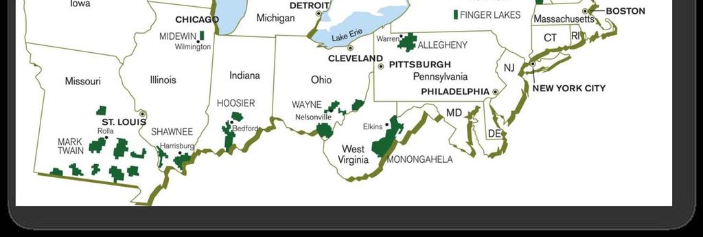
1 Framework for Sustainable Recreation USDA Framework for Sustainable Recreation Laurie Thorpe, USFS Rachel Franchina, USFS Robert Burns, WVU Service USDAForest Forest Service
2 Presentation Outline USFS Framework for Sustainable Recreation Case studies/examples of Sustainable Recreation Regional perspective Forest and community perspective Summary & Dialogue

3 Framework for Sustainable Recreation Renewing body and spirit, inspiring passion for the land


4 Generative Phase III Deliver Innovation Allocate Resources Collective Leadership Scaling & Replication Spiral Phase I Build Core Container Opening & Potential Mapping the System Create a Core Container Whole Systems Design V5.0 Phase II Create Collective Capacity Identity and Capability Transform Structures & Memory Build Collective Capacity Commit to Purpose
5 Core Principles Connect people with their natural and cultural heritage Promote healthy lifestyles Recognize interconnections of sustainability Cultivate community engagement Manage national forest and grasslands as part of a larger landscape Integrate recreation more deeply into Forest Service mission


6 Sustainable Recreation Program Components Strategy Building Planning Evaluation & Learning Operations

 Dialogue, community visioning,")

7 Community Engagement Framework for Sustainable Recreation Tasks, Tools, & Questions Task Tools Questions Community Engagement through Recreation and Tourism (CERT) Dialogue, community visioning, What is the community known for? What is my agency s role in contributing to sustainability? Go back
8 Future of Sustainable Recreation Each region develops guidance, identifies key tasks Forests may also develop key tasks tied to national/regional guidance and local context


9 Framework for Sustainable Recreation Questions? Service USDAForest Forest Service

10 Eastern Region Approach
11 Community Engagement Through Recreation and Tourism (CERT) encourages forests to work with communities across broad landscapes toward a common vision of sustainability.
12 CERT Premises Enduring benefits accrue where social, economic, and environmental contributions overlap Sustainability is achieved through collective actions toward a common vision A common vision recognizes the importance of understanding each other s role and contributions in a larger context
13 CERT Premises Recreation provides a logical place to join together with collective actions across a broad landscape Collective actions are most relevant when contributing toward a common vision of sustainability Engaging with communities across a broad landscape places us among the we to learn, evaluate and adapt together for an all lands all hands approach
14 Lessons Learned The role changes Forming a we sooner than later is important Engage where you re at! The Engagement Model works best at a landscape scale Sustainability encompasses all resource areas Discovery and learning is part of the journey


15 Framework for Sustainable Recreation Eastern Region CERT Contact: Claudia Mielke (414) Service USDAForest Forest Service


16 Columbia River Gorge National Scenic Area

17 GP NF Alone Again, Naturally Portland s Back Forty The Quiet National Forest In the Green Forest A Day to get Away Hot & Cold National Forest The Lay of the CRG Mountains to River CRGNSA Walls to Falls Portland s Front Yard Columbia River Gorgeous Play for the Day Afternoon Delight Accessibility Framework for Sustainable Recreation MTH NF Mountain Madness Portland s Back Yard Portland s Psyche Play for the Whole Day Major Market Share East West Forest

18 R6 Forest Visits (in Thousands)

19 Recreation Density (people/acre)


20 Recreation Settings Map Approx. Scale
21 CRGNSA Settings Framework for Sustainable Recreation Columbia River This internationally known broad ribbon of water draining an immense watershed ties Washington and Oregon together. A dominant scenic feature, the river and its banks serve as an East/West transportation corridor and only sea level pass through the Cascade Mountains. It provides electricity and river transportation and supports wetlands & riparian habitats for birds and fish. The river corridor and islands are rich in pre historic and historic features. Western Gateway Distant views of steep gorge walls and a rolling, pastoral landscape dotted with small farms provide a physical sense of entry; where the urban lights go out and the natural character of the Gorge begins. Skamania Highlands Wild lands, woodlots, pastoral farms, small towns and the Columbia River exist in a unique balance. Lakes and wildlife refuges provide waterfowl habitat.


22 CRGNSA Settings Framework for Sustainable Recreation Columbia Tributaries White Salmon WSR spring fed, narrow gorges & whitewater, Klickitat WSR Klickitat gorge, Sandy River delta & estuary, Hood River scenic corridor, and Wind River secluded falls and the Deschutes served as a transportation routes for First Nations and emigrants. Walls and Falls The precipitous Gorge walls, cascading waterfalls, and lush vegetation mark entry into the actual Columbia Gorge. This dramatic backdrop draws millions of people from the nearby Portland/Vancouver Metro area for short day trips. Features such as the Historic Columbia River Highway, Crown Point, Multnomah Falls Lodge and CCC era structures blend into the spectacular landscape and interpretation provides depth for those who seek it. The sites also serve as portals to the relatively wild upland section of this setting.


23 CRGNSA Settings Framework for Sustainable Recreation Oak Pine Flowers This dry east side setting offers open views and sunshine. The oak woodlands, wildflowers, grassland, and Rowena Plateau present a breathtaking backdrop for day use recreations during the dreary days of winter. The unique combination of the Historic Columbia River Highway, important Native American areas, small farms & residential developments contribute to the areas rich culture. Celilo Grasslands Vast, open, treeless views, with rolling steep hills provide a striking setting for the eastern gateway to the CRGNSA. Miller Island, State Parks, Chenoweth Table and the mouth of the Deschutes represent unique physical features of the area. Lands outside the urban areas are dominated by large, privately owned farms and ranches. Celillo Falls and The Dalles were the center of Native American Commerce.


24 The 2012 CRGNSA Effort Task: Interagency Recreation Strategy to help with unmanaged recreation. Meta Analysis Identify Opportunities/Desires Community engagement on dealing with unmanaged recreation use Develop Recreation Strategy
25 Framework for Sustainable Recreation Questions? Service USDAForest Forest Service


26 Framework for Sustainable Recreation Thank You! Service USDAForest Forest Service
Terra Nova Rural Park Plan
 Terra Nova Rural Park Plan Part 1 Getting to know the land The Surrounding Area North Side Airport, River, Trail East Side - Residential West Side- Sturgeon Banks, West Dyke Trail South Side:Terra Nova
Development Reviews. An overview of the Commission s review process, primarily in Klickitat County. March 13, 2018
 Development Reviews An overview of the Commission s review process, primarily in Klickitat County March 13, 2018 Who should a landowner work with? Oregon Counties Washington Counties Multnomah County Land
Rural Land Use Designations Kittitas County December 6, 2007 Draft
 KITTITAS COUNTY COMMUNITY DEVELOPMENT SERVICES 411 N. Ruby St., Suite 2, Ellensburg, WA 98926 CDS@CO.KITTITAS.WA.US Office (509) 962-7506 Fax (509) 962-7682 Rural Land Use Designations Kittitas County
Eightmile River O F A. COOPERATIVE EXTENSION SYSTEM College of Agriculture and Natural Resources
 W E L C O M E T O T H E Eightmile River W A T E R S H E D T H E H E A R T O F A L A S T G R E A T P L A C E COOPERATIVE EXTENSION SYSTEM College of Agriculture and Natural Resources The Connecticut River
Skamania County Community Development Department
 Skamania County Community Development Department Building/Fire Marshal Environmental Health Planning Skamania County Courthouse Annex Post Office Box 1009 Stevenson, Washington 98648 Phone: 509-427-3900
National Association of Conservation Districts. Kris Hoellen Vice President, Sustainable Programs The Conservation Fund September 19, 2013
 National Association of Conservation Districts Kris Hoellen Vice President, Sustainable Programs The Conservation Fund September 19, 2013 Our Mission The Conservation Fund forges partnerships to conserve
SALISBURY TOMORROW Our Vision
 SALISBURY TOMORROW Our Vision Salisbury is committed to supporting a high quality of life and sense of community for all residents. These commitments need to be reflected in our community programs, services
SUSTAINABILITY PLAN OTTAWA COUNTY PARKS AND RECREATION COMMISSION FALL 2017
 SUSTAINABILITY PLAN OTTAWA COUNTY PARKS AND RECREATION COMMISSION FALL 2017 Table of Contents Introduction Natural Resources Quality of Life Community Continuing the Mission Sustainability Measuring Sustainability
Member Service Plan Sierra Nevada AmeriCorps Partnership
 Member Service Plan Sierra Nevada AmeriCorps Partnership Service plans lay the framework for what each Member will be doing during their service. Service plans detail the major projects and expected results
2 PLANNING AREA DESCRIPTION
 2 PLANNING AREA DESCRIPTION 2.1 LOCATION Hecker Pass is located within the City of Gilroy near the western city limit. Figure 2-1 illustrates the regional location of the Hecker Pass Area. Figure 2-1:
Regional Context Statement
 Regional Context Statement REGIONAL CONTEXT STATEMENT 3. REGIONAL CONTEXT STATEMENT In 1995, the Provincial Government passed into law the Growth Strategies Act. The purpose of this provincial initiative
Achieving Regional Metropolitan Area Nature Conservation: Ingredients for Success
 Achieving Regional Metropolitan Area Nature Conservation: Ingredients for Success Presentation to the 2015 George Wright Society Conference Lynn Wilson, MCIP RPP March 31, 2015 Outline The challenge of
Introduction. while the eastern end has wide temperature ranges and approaches a semiarid condition." (Congressional Record, Representative Vento)
") Introduction God shaped these great mountains round about us, and lifted up these mighty domes He fashioned the Gorge of the Columbia, fixed the course of the broad river, and caused the crystal streams
Introduction God shaped these great mountains round about us, and lifted up these mighty domes He fashioned the Gorge of the Columbia, fixed the course of the broad river, and caused the crystal streams
Green Infrastructure. by Karen Engel, NYS DEC. NYS Department of Environmental Conservation
 Green Infrastructure by Karen Engel, NYS DEC What is Green Infrastructure? For some it s all about water Green Infrastructure techniques use soils and vegetation to infiltrate, evapotranspirate, and/or
Fresh Kills Park in Regional Context
 Fresh Kills Park in Regional Context Fresh Kills Location On Staten Island Community District 1 THE SITE TODAY TRAVIS William T. Davis Wildlife Refuge New Jersey NEW SPRINGVILLE MOUND 3/4 Little Fresh
Physical Structure. This historic image from 1882 emphasizes the dramatic topography that distinguishes Cornell s setting at the top of East Hill.
 Physical Structure The natural, agrarian and urban setting for Cornell s campus is a precious resource to protect and enhance. It has also shaped the physical structure of the campus. Buildings, roads
PUBLIC ENGAGEMENT & SIX THEMES OF THE PLAN
 Connecting the heart of Eagle to the soul of the river - Kathy Chandler-Henry, Commissioner Eagle County CHAPTER 1 PUBLIC ENGAGEMENT & SIX THEMES OF THE PLAN town of eagle - river corridor plan 1 PUBLIC
Scenic Resources KEY ISSUES SCENIC AREA ACT PROVISIONS CHAPTER 1
 CHAPTER 1 Scenic Resources The Columbia Gorge is world renowned for its outstanding scenic beauty. The sea level chasm the Columbia River has cut through the Cascade Mountains, and the dramatic diverse
This page intentionally blank.
 This page intentionally blank. Parks, Recreation, and Open Space Chapter Relationship to Vision Vision Parks, Recreation and Open Space Chapter Concepts County Government. County government that is accountable
AREASTRUCTURE PLAN AMENDMENT COCHRANE NORTH
 AREASTRUCTURE PLAN AMENDMENT COCHRANE NORTH In order to implement the vision outlined in the Conceptual Scheme, the following three amendments to the Cochrane North ASP are proposed: 1. Allow commercial
Chukkar Farm Polo Club & Event Facility presents
 Chukkar Farm Polo Club & Event Facility presents 1140 Liberty Grove Rd. Alpharetta, GA 30004 www.chukkarfarmpoloclub.com (770) 664-1533 Corporate Outing Wedding Setup Fund-raiser Polo Match Chukkar Farm
Town of Peru Comprehensive Plan Executive Summary
 Town of Peru Comprehensive Plan Executive Communities that plan grow by choice, not by chance. A plan makes growth thoughtful, understandable, and predictable. A plan shows that a community is managing
Scotland s 2020 Biodiversity Challenge: Loch Lomond & The Trossachs National Park Authority Delivery Agreement
 Scotland s 2020 Biodiversity Challenge: Loch Lomond & The Trossachs National Park Authority Delivery Agreement Scotland s National Parks Both of Scotland s National Park Authorities contribute to the Scottish
Verde Valley Landscape Character Type
 Existing Condition Landscape Character The existing landscape character describes the existing set of valued aesthetic attributes for the current landscape. The landscape character descriptions include
Preface. Erie. Scranton. Allentown. Pittsburgh. Harrisburg. Philadelphia
 The Southern Alleghenies Region The Southern Alleghenies Region spans the Laurel Highlands and Allegheny Front in the west across the Appalachians to the east. It is comprised of Blair, Bedford, Cambria,
2011 ASLA Design Awards. Coyote Gulch Honor Award and Land Stewardship Designation Valerian LLC. Environmental Restoration and Reclamation
 2011 ASLA Design Awards Honor Award and Land Stewardship Designation Valerian LLC Environmental Restoration and Reclamation Project Name: Category : Project Location: 5 2011 Environmental Restoration and
Greenways as an alternative to traditional infrastructure. Green Infrastructure
 Greenways as an alternative to traditional infrastructure Green Infrastructure What is a Greenway? Little (1990) - A linear open space along a natural or human made corridor. Fabos - linked corridors nature
Connecting people to parks
 Connecting people to parks Introduction from the Governor It is up to all of us to ensure the conservation of our State s wonderful national parks, marine parks and other conservation reserves continues
Washington Pass Overlook
 Washington Pass Overlook The Washington Pass Overlook is located on the Methow Valley Ranger District on the Okanogan-Wenatchee National Forest. The overlook is at the crest of Washington Pass and is part
Making the case for Sustainable Transport Project Potential
 Making the case for Sustainable Transport Project Potential The Structural Investment Fund (SIF) Strategy for Greater Lincolnshire identifies the barriers to growth identified by having poor transport
Cultural Heritage Tourism What How Why. Nancy B. Kramer Program Coordinator Northwest Colorado Heritage
 Cultural Heritage Tourism What How Why Nancy B. Kramer Program Coordinator Northwest Colorado Heritage What? What Is It - I Travel With a Purpose! Cultural heritage tourism is traveling to experience the
The role of Universities: Civic Design and planning futures
 What did planning ever do for us? A celebration of Civic Design and Planning The role of Universities: Civic Design and planning futures 24 th May 2013 Sue Kidd Head of Civic Design Dept of Geography and
3. STATEMENTS OF DESIRED CHARACTER FOR PLANNING AREAS AND PRECINCTS
 3.30 Planning Area No. 30 Mary River Valley 3.30.1 Location and Role This Planning Area encompasses rural lands in the western part of the Shire. These lands are located within the catchment area of the
CHAPTER 1 Introduction
 CHAPTER 1 Introduction From sea to summit, Lane County covers almost 4,800 square miles of diverse Oregon landscape. Stretching from the Pacific Ocean through the Coastal Range, the Willamette Valley to
Q&As. 1. Considering other public lands. 2. N & P NFs visitation and opportunities. 3. Sustainable Recreation Definition and Need
 Nantahala and Pisgah NFs Stakeholders Forum Meeting November 2015 1. Considering other public lands 2. N & P NFs visitation and opportunities 3. Sustainable Recreation Definition and Need 4. National/regional
New Official Plan Quest November 2013
 City of Markham New Official Plan Quest November 2013 Building Markham s Future Together - 6 Key Strategic Priorities 1. Growth - Managing our Growth 2. Transportation/Transit - Improving transportation
SPG 1. * the northern and western sections which are open fields used for pasture and grazing;
 SPG 1 1.0 INTRODUCTION This development brief is based on the allocation of the Priors Hall site for employment and countryside recreational purposes in the Corby Borough Local Plan. The brief is intended
RECREATION, OPEN SPACE AND GREENWAYS ELEMENT GOALS, OBJECTIVES, AND POLICIES
 RECREATION, OPEN SPACE AND GREENWAYS ELEMENT GOALS, OBJECTIVES, AND POLICIES GOAL R-1: DEVELOP A RECREATION, OPEN SPACE AND GREENWAYS SYSTEM AS AN INTEGRAL COMPONENT OF AN OVERALL, COUNTY-WIDE ECONOMIC
Arlington, Virginia is a worldclass
 EXECUTIVE S U M M A RY Arlington maintains a rich variety of stable neighborhoods, quality schools and enlightened land use policies, and received the Environmental Protection Agency s highest award for
PARKS AND RECREATION
 PARKS AND RECREATION WHAT YOU WILL FIND IN THIS CHAPTER: Background information on the development of the Park, Recreation, and System Plan (PRSP). General overview of Ellensburg s parks and recreation
2011 ASLA Design Awards. Top of the Rockies National Scenic and Historic Byway Merit Award Bluegreen. Planning & Urban Design
 2011 ASLA Design Awards Top of the Rockies National Scenic and Historic Byway Merit Award Bluegreen Planning & Urban Design ASLA Colorado 2011 Design Awards Category 2: Planning Project Fact Sheet Project
Oregon Parks Foundation Fund
 2013 Coos Watershed Association (Charleston) $2,500 for the Placed-Based Natural Systems Learning for At-Risk Youth pilot program Coyote Trails School of Nature (Medford) $1,000 for interpretive signage
A Delta Renewed: A Guide to Science Based Ecological Restoration in the Delta
 A Delta Renewed: A Guide to Science Based Ecological Restoration in the Delta J. Letitia Grenier, San Francisco Estuary Institute, letitia@sfei.org Julie Beagle, San Francisco Estuary Institute, julieb@sfei.org
Types of Reserves. Recreational activities
 VALLEY FLOOR AND EASTERN HILLS Physical and ecological features Large, flat valley floor and river plain with intensive urban development Hutt River / Te Awa Kairangi and tributaries Waiwhetu Stream Eastern
Wasatch CHOICE for 2040
 Wasatch CHOICE for 2040 Economic Opportunities We Can Choose a Better Future We enjoy an unparalleled quality of life along the Wasatch Front. People from all over the world are drawn to our stunning scenery,
Colorado Outdoor Partnership
 Colorado Outdoor Partnership Quick Facts 2017 SHIFT Award Winner Public Land Management Innovation Category Year Founded: 2016 Member agencies and organizations: 32 Executive Summit Coalition The Problem:
Grantsburg Community Design Team (CDT)
") Grantsburg Community Design Team (CDT) Summary Report Overview On April 10-13, 2014, a team of (19) volunteer planners, design professionals, and community development educators volunteered their time
Grantsburg Community Design Team (CDT) Summary Report Overview On April 10-13, 2014, a team of (19) volunteer planners, design professionals, and community development educators volunteered their time
COLIN RUGGIERO CASE FOR SUPPORT ROCKY MOUNTAIN WEST
 COLIN RUGGIERO AARON KINDLE PAT CLAYTON TOM WOODS USDA JACK DYKINGA CASE FOR SUPPORT ROCKY MOUNTAIN WEST AARON KINDLE THE WESTERN WILDLIFE HERITAGE Soaring mountain peaks, free flowing rivers, and roving
Green Infrastructure. NYS Department of Environmental Conservation
 Green Infrastructure Green infrastructure is an interconnected network of natural areas and open spaces that sustains ecosystems. Benedict, M.A. and E.T. McMahon. 2006. Green Infrastructure Linking Landscapes
An Introduction to the Far North Land Use Strategy
 An Introduction to the Far North Land Use Strategy December, 2013 Ministry of Natural Resources Table of Contents PREFACE... 3 About the Far North... 3 Evolution of Land Use Planning in the Far North...
Position Description Sierra Nevada AmeriCorps Partnership
 SNAP Position Description 2016/2017 Position Description Sierra Nevada AmeriCorps Partnership Position Title: Education Coordinator Host Site: Eastern Sierra Land Trust Site Supervisor: Kay Ogden, Executive
Balancing Conservation and Development on the Jordan River
 Balancing Conservation and Development on the Jordan River Jordan River Parkway Trail Regional Athletic Complex Conservation & Restoration Balancing Conservation and Development on the Jordan River Jordan
SQUAMISH 2010 AND BEYOND COMMUNITY VISION
 Our plan has been imagined and created to be both pragmatic and visionary. At the core of the strategy is a consideration of the highway s role and its impact on the community. First and foremost in creating
Bethesda Downtown Plan
 Bethesda Downtown Plan Planning Board Update Connecticut Avenue Location Economic Sustainability Social Environmental Scope Coming Soon! Team Listening, Twitter Outreach We Are Here Engagement Challenge
RECOMMENDATIONS. Design Recommendations
 RECOMMENDATIONS While the San Diego River Park will serve to unify the river as a whole, each reach of the river park maintains distinct resources and character. Recommendations for each reach have been
BISCUIT RUN PARK MASTER PLAN
 BOARD OF SUPERVISORS November 14, 2018 BISCUIT RUN PARK MASTER PLAN COUNTY OF ALBEMARLE ANHOLD ASSOCIATES Contents Project Introduction Property Background County Park Planning Process Existing Site &
10.0 Open Space and Public Realm
 10.0 Open Space and Public Realm 10.0 Open Space and Public Realm The Public Open Space System is comprised of: outdoor spaces available for public use that are either publicly owned (e.g., parks and
Planning for Staten. Habitat Restoration and Green Infrastructure. Island s North Shore
 Habitat Restoration and Green Infrastructure Planning for Staten Island s North Shore Community Board 1 March 1, 2018 NYC Parks Forestry, Horticulture, and Natural Resources Funded by the NYS Department
TOWN OF SPRINGFIELD, NEW HAMPSHIRE
 TOWN OF SPRINGFIELD, NEW HAMPSHIRE NATURAL RESOURCES INVENTORY EXECUTIVE SUMMARY March 2008 Prepared by: Watershed to Wildlife, Inc. Natural Resource Consultants 42 Mill Street, Suite 3 Littleton, NH 03561
1.16 million KM 2 5 States, 2 Provinces Integrated Partnerships with neighboring LCCs, NW and NC Climate Science Centers, PNW
 GNLCC Goal: Coordinate, facilitate, promote and add value to large landscape conservation to build resource resilience in the face of climate change and other landscape level stressors through: Support
Green Infrastructure Planning for Sustainability and Resiliency
 Green Infrastructure Planning for Sustainability and Resiliency Linking Lands and Communities in the Land-of-Sky Region SAMAB Conference - November 18, 2010 www.linkinglands.org Linda Giltz, AICP, Regional
DESERT DISCOVERY CENTER
 DESERT DISCOVERY CENTER Project Definition Summary Mission Statement Educate and inspire a global audience to value, thrive in, and conserve desert Thinc Design, the Desert Discovery Center experience
Redesigning Vogel Flat Angeles National Forest, California
 Redesigning Vogel Flat Angeles National Forest, California WRPI Watershed Management Internship 2017 Cristina Plemel, Master s of Landscape Architecture California State Polytechnic University, Pomona
6.8 SCENIC HIGHWAYS Introduction
 6.8 SCENIC HIGHWAYS 6.8.1 Introduction The Scenic Highways Element is an optional General Plan element authorized by Section 65303 of the Government Code. The Scenic Highways Element is intended to establish
SECTION FOUR: MISSION STATEMENT, GOALS & OBJECTIVES
 SECTION FOUR: MISSION STATEMENT, GOALS & OBJECTIVES Chapter Summary Chapter Ten: Mission Statement, Goals & Objectives To fulfill its mission, the Parks and Recreation Commission has identified four basic
The Planning Partnership Baird + Associates TCI Management Consultants Ltd. Plan B Natural Heritage Wills Consulting Engineers Poulos & Chung Limited
 Little Lake Master Plan The Planning Partnership Baird + Associates TCI Management Consultants Ltd. Plan B Natural Heritage Wills Consulting Engineers Poulos & Chung Limited May 26, 2009 Purpose of Study
THE COMMUNITY-DRIVEN DESIGN PROCESS
 THE COMMUNITY-DRIVEN DESIGN PROCESS A PUBLIC DRIVEN PROCESS STEERING COMMITEE THE COMPREHENSIVE PLAN OPPORTUNITIES AND CONSTRAINTS THE COMMUNITY DRIVEN DESIGN PROCESS A Public Driven Process Beginning
LANDSCAPES FOR EVERYONE: CREATING A BETTER FUTURE. A shared vision of why we must treasure our landscapes and how Government can help
 LANDSCAPES FOR EVERYONE: CREATING A BETTER FUTURE A shared vision of why we must treasure our landscapes and how Government can help BRITAIN S DIVERSE LANDSCAPES NEED CHAMPIONS A consortium of national
Vision Russell Look Book I n s p i r a t i o n f o r I n f i l l
 Vision Russell Look Book I n s p i r a t i o n f o r I n f i l l Capturing the Past Classic Masonry Italianate Craftsman Various Victorian interpretations Architectural Character Russell s uniquely diverse
RECREATION AND OPEN SPACE VISION
 City of South Lake Tahoe General Plan Policy Document Recreation and Open Space Element INTRODUCTION This element provides the policy context for the City of South Lake Tahoe to achieve its vision for
How does the Program Work?
 Is your school interested in participating in a dynamic program that supports the development of a Schoolyard Habitat program at your school in association with a local National Wildlife Refuge? If so,
Aquatic, Terrestrial and Landscape Conservation Design Tools and Products of the North Atlantic LCC
 Aquatic, Terrestrial and Landscape Conservation Design Tools and Products of the North Atlantic LCC Scott Schwenk Science Coordinator, North Atlantic LCC Chesapeake Bay FWS Partners Meeting Annapolis,
Call for Artists Deadline: April 27, 2018
 DOWNTOWN COMMONS NORTHWEST WALL and MAIN AVE. ELECTRICAL BOX WRAPS TWIN FALLS, IDAHO Call for Artists Deadline: April 27, 2018 INTRODUCTION The Magic Valley Arts Council on behalf of the City of Twin Falls
Standards (R-3) Figure B-11: R-3 Residential Standards Exhibit
 Figure B-11: R-3 Residential Standards Exhibit") Avila Ranch Avila Ranch Specific Plan Development Standards High Medium Density - High Residential Density Residential Lot and Building Lot and Standards Building (R-3) Standards (R-3) EXAMPLES These sketches
Avila Ranch Avila Ranch Specific Plan Development Standards High Medium Density - High Residential Density Residential Lot and Building Lot and Standards Building (R-3) Standards (R-3) EXAMPLES These sketches
I-70 Corridor Enhancement Plan
 i - Table of Contents Table of Contents Chapter I Overview Chapter II Bridge and Roadway Improvements Chapter III Landscape Enhancements Chapter IV Riparian Corridors Chapter V Showcase Missouri Plan Chapter
1 Introduction. Chapter. In this chapter:
 Chapter 1 Introduction In this chapter: 1.1 A Snapshot of the Region 1.2 Towards a Sustainable Region 1.3 The Provincial Context 1.4 Purpose and Organization The Regional Municipality of York Official
2015 Campus Master Plan Update
 September 15, 2015 2015 Campus Master Plan Update Campus and Community Analysis Summary Presentation A G E N D A 1. Scope & Schedule of the Master Plan 2. Planning Principles & Draft Goals 3. Background
Preservation of Scenery National Historic Trails. Rob Sweeten BLM Kevin Rauhe EPG
 Preservation of Scenery National Historic Trails Rob Sweeten BLM Kevin Rauhe EPG EPG Background Landscape architects with expertise in visual resources Resource staff includes: archaeologists, biologists,
Regulation Changes for Open Space and Similar Uses
 Regulation Changes for Open Space and Similar Uses What is the Project? This project is an analysis of the Zoning Ordinance relating to public lands and open space regulations. The proposed text amendments
Telling the Oregon Story
 Telling the Oregon Story Our legacy, our future (Title) This presentation is intended as a brief, 20 minute INTRODUCTION to the value of good planning and provides a general background on Oregon s unique
Washington State s Growth Management Act
 Washington State s Growth Management Act A Framework for Smart Growth Anne Aurelia Fritzel, AICP Growth Management Services Department of Community, Trade and Economic Development The GMA A Framework for
THE LAND CONSERVANCY OF SAN LUIS OBISPO COUNTY
 THE LAND CONSERVANCY OF SAN LUIS OBISPO COUNTY WWW.LCSLO.ORG WHO WE ARE Through voluntary and collaborative measures, we work to permanently protect and enhance lands having important scenic, agricultural,
A Joined-up Regional Landscape: A Roadmap to connect the parts
 Breaking the Barriers: Engineering Solutions to Ecological Problems A Joined-up Regional Landscape: A Roadmap to connect the parts Associate Professor Darryl Low Choy Urban Research Program Outline Nature
PUBLIC ART CALL LIONS GATE COMMUNITY CENTRE. For Expressions of Interest Submission Deadline: March 18, 2018 Project Value: $85,000(inclusive)
") LIONS GATE COMMUNITY CENTRE PUBLIC ART CALL For Expressions of Interest Submission Deadline: March 18, 2018 Project Value: $85,000(inclusive) LGCC EOI 1 LIONS GATE COMMUNITY CENTRE (LGCC) PUBLIC ART CALL
LIONS GATE COMMUNITY CENTRE PUBLIC ART CALL For Expressions of Interest Submission Deadline: March 18, 2018 Project Value: $85,000(inclusive) LGCC EOI 1 LIONS GATE COMMUNITY CENTRE (LGCC) PUBLIC ART CALL
Local Wildlife Sites in Leicestershire and Rutland
 Local Wildlife Sites in Leicestershire and Rutland What are Local Wildlife Sites? From mystical ancient woodlands to quiet churchyards and bustling flower-rich roadsides; and from field-bordering hedgerows
Green Infrastructure Policies and Ordinances
 Green Infrastructure Policies and Ordinances October 23, 2013 By Karen Firehock, Green Infrastructure Center 2013 Georgia Urban Forest Council s 23 rd Annual Conference The mission of the nonprofit Green
Rosemount Greenway Master Plan Executive Summary. draft. Spring for more information visit
 Rosemount Greenway Master Plan Executive Summary Spring 2012 draft for more information visit www.hkgi.com/projects/dakota INTRODUCTION The Rosemount Greenway Master Plan portrays a vision to establish
Park Board Strategic Framework. (Mission, Vision, Directions, Goals and Objectives) June 27, 2012
 June 27, 2012") Park Board Strategic Framework (Mission, Vision, Directions, Goals and Objectives) June 27, 2012 Planning Process Overview Phase 1: Renewed Strategic Framework Phase 2: Objectives Phase 3: Prioritization
Park Board Strategic Framework (Mission, Vision, Directions, Goals and Objectives) June 27, 2012 Planning Process Overview Phase 1: Renewed Strategic Framework Phase 2: Objectives Phase 3: Prioritization
2 Vision. Master Plan
 19 2 Vision Master Plan 20 Chapter 2 MASTER PLAN VISION 2.1 Master Plan Organization Lake Calhoun/Bde Maka Ska and Lake Harriet are places where complex human and natural systems intersect and converge.
CHAPTER 7: VISION AND ACTION STATEMENTS. Noble 2025 Vision Statement
 CHAPTER 7: VISION AND ACTION STATEMENTS This chapter presents the vision, policy and action statements that transform the comprehensive planning study, an analysis of Noble s past, future trends and community
Blue/Green Infrastructure Study Accomack County, VA
 Blue/Green Infrastructure Study Accomack County, VA Draft Asset Maps March 8-9, 2010 Green Infrastructure Center, Inc. 2 Overview What is Green and Blue Infrastructure Project Timeline & Tasks Literature
Parks and Open Space Preservation and Dedication. January 26, 2016 Fort Worth City Council Pre-Council Meeting Randle Harwood and Richard Zavala
 Parks and Open Space Preservation and Dedication January 26, 2016 Fort Worth City Council Pre-Council Meeting Randle Harwood and Richard Zavala Purpose How does the City of Fort Worth preserve and protect
HALIFAX GREEN NETWORK PLAN
 HALIFAX GREEN NETWORK PLAN Community Planning & Economic Development Standing Committee June 21, 2018 Photo credit: Vlastimil Koutecky, Flickr Creative Commons HGNP PROCESS PHASE 1 FOUNDATIONS PHASE 2
CHAPTER 5: GUIDING PRINCIPLES
 CHAPTER 5: GUIDING PRINCIPLES The following 10 principles were developed based on public consultation, planning policy and the background analysis conducted during Phase 1. The Guiding Principles significantly
Goleta Community Plan Update
 Goleta Community Plan Update Ecology, Biology, and Habitats GVPAC Meeting Agenda [Wednesday, December 17, 2008, 6:00PM] Pledge of Allegiance and Roll Call Public Comment Period Administrative December
ELIGIBILITY CRITERIA CHECKLIST OPEN SPACE CLASSIFICATION
 THURSTON COUNTY DEVELOPMENT SERVICES OPEN SPACE TAX PROGRAM ELIGIBILITY CRITERIA CHECKLIST OPEN SPACE CLASSIFICATION Use this checklist to help you determine whether your property is eligible for open
3-2 Environmental Systems
 3-2 Environmental Systems 3.0 ENVIRONMENTAL SYSTEMS CONTENTS 3.1 GREENWAY SYSTEM 3.1.1 General Policies 3.1.2 Natural Heritage Network 3.1.3 Natural Heritage Network Enhancement Lands 3.1.4 Rouge Watershed
Policy & Procedure Effective Date: Parks Department Page of
 City of Arvada Policy & Procedure Effective Date: Parks Department Page of TITLE: City of Arvada Prairie Dog Habitat Plan APPROVAL: PURPOSE: To establish a plan for the preservation of black-tailed prairie
Page 1 of 19 URBAN DESIGN FRAMEWORK FOR BOLTON STREET WATERFORD
 Page 1 of 19 URBAN DESIGN FRAMEWORK FOR BOLTON STREET WATERFORD 1.0 Introduction: The relocation of the City Council stores and depot from Bolton Street creates an exciting opportunity for development
Environmental Assessment (Scotland) Act 2005: Clackmannanshire Council Sustainability Strategy Scoping Request
 Act 2005: Clackmannanshire Council Sustainability Strategy Scoping Request") TAYSIDE & CLACKMANNANSHIRE Tel: 01738 458582(direct line) Fax: 01738 458616 e-mail addresses: denise.reed@snh.gov.uk Niall Urquhart Team Leader Sustainability Clackmannanshire Council Kilncraigs Greenside
TAYSIDE & CLACKMANNANSHIRE Tel: 01738 458582(direct line) Fax: 01738 458616 e-mail addresses: denise.reed@snh.gov.uk Niall Urquhart Team Leader Sustainability Clackmannanshire Council Kilncraigs Greenside