Avenues & Mid-Rise Buildings Study
|
|
|
- Corey Snow
- 6 years ago
- Views:
Transcription

1 Avenues & Mid-Rise Buildings Study Brook McIlroy Planning + Urban Design/Pace Architects with E.R.A. Architects Quadrangle Architects Limited Urban Marketing Collaborative May 2010
2 Avenues & Mid-Rise Buildings Study May 2010 Brook McIlroy Planning + Urban Design/Pace Architects 51 Camden Street, Suite 300 Toronto, ON, M5V 1V2 T F E.R.A. Architects 10 St. Mary Street, Suite 801 Toronto, ON, M4Y 1P9 T F Quadrangle Architects Limited 380 Wellington Street West Toronto, ON, M5V 1E3 T F Urban Marketing Collaborative 17 Dundonald Street, 3rd floor Toronto, ON, M4Y 1K3 T F
3 TABLE OF CONTENTS Executive Summary i - vi 1. Introduction The Avenues Mid-Rise Urbanism 4 2. Applying the Avenues and Mid-Rise Recommendations Where the Recommendations Apply Land Use Designations & the Avenues How Mid-Rise Building Heights are Determined Heritage & Retail Analysis Character Areas Avenues Where Retail-Commercial At-Grade is Required Performance Standards for Mid-Rise Buildings Introduction Using the Performance Standards Optimal Site Conditions Performance Standards Recommendations Introduction Implementing the Performance Standards As-of-Right Zoning Character Areas Official Plan Reconsidering the Avenues City Administration & Processes Mid-Rise Interdivisional Team Mid-Rise Design Review Panel Site Plan Approval Process Other Recommendations Compliance Alternatives Parking Requirements Bicycle Parking Requirements Indoor Amenity Space Requirements Outdoor Amenity Space Requirements Ontario Building Code Issues Areas for Further Study 114 Appendices A Character Area Study A-2 B Retail Study A-54 C Avenues Not Included in this Study A-62 D Related City Initiatives A-64 E Mid-Rise Building Typologies A-74 F Summary of Completed Avenue Studies A-92 G Summary of Consultation A-134 H Prototypical Sites A-136 I Urban Design Glossary A-142 Acknowledgements A-148 Image Sources A-150


4 Executive Summary Introduction The City of Toronto is forecast to have approximately 3.08 million residents by 2031 representing a growth in population of approximately 500,000 over the next 20 years. Strategies for how and where to accommodate this growth are of increasing importance. The City s Official Plan encourages a significant portion of this growth to be directed towards intensification areas, one of which is the Avenues. An important component of this study has been to understand the role that mid-rise buildings on the Avenues can play in accommodating Toronto s growth. Understanding the potential of mid-rise redevelopment also provides an important perspective as the City assesses the appropriate extent to which low-rise and tall building development may also accommodate this growth. The Avenues amount to approximately 324 kilometres of property frontage. About 200 kilometres of this frontage can theoretically be redeveloped through mid-rise built form. If half of these properties were developed over the next twenty years through mid-rise built form, the Avenues could accommodate a new population of approximately 250,000 residents. Mid-rise redevelopment of the Avenues therefore has the ability to address a significant portion of the City s anticipated growth needs over the next twenty years. The Avenues policies in the Official Plan are intended to help the City direct growth to key main streets, and areas with existing infrastructure, including transit, retail, and community services, while protecting the character and stability of existing adjacent neighbourhoods. The character of growth that will occur through mid-rise built form will recognize the unique connection to these neighbourhoods through a development form that is moderate in scale and reflects high quality design and materials. Mid-Rise Building on the Avenues Mid-rise buildings are no taller than the width of the street right-of-way or between 5 and 11 storeys. The as-of-right height of a mid-rise building will be determined by a series of factors. The maximum height is established based on a 1:1 ratio where the maximum height of a building is equivalent to the width of the right-of-way. The ability to realize the maximum height is tempered by angular planes applied to the front of the site and the rear of the site respectively. Not all sites on the Avenues will be able to achieve the maximum height, as some properties are physically constrained. See Section 2.2 for further detail. Where the Recommendations of the Study Apply The segments of the Avenues that are designated in the Official Plan as Mixed-Use Areas, Employment Areas, Institutional Areas and Regeneration Areas are the locations where Avenues are to be reurbanized and targeted for growth. The recommended mid-rise Performance Standards of this study apply to these areas with the following exceptions: portions of Avenues where an Avenue Study is completed or underway, portions of an Avenue within a Secondary Plan Area, and portions of an Avenue that have been subject to other City-led studies that have resulted in an Official Plan Amendment and/or new Zoning By-laws. While other land use designations on the Avenues, including Neighbourhoods, Apartment Neighbourhoods, Parks and Open Space Areas, and Natural Areas are not intended for intensification, they should follow the public realm and streetscape improvement Performance Standards of this study. See Section 2.1 for further detail. i Avenues & Mid-Rise Buildings Study
. According to Official Plan Map 3 - Right-of-Way Widths Associated with Existing Major Streets, there are four widths - 20, 27, 30 and 36 metres that prevail on the Avenues.")
5 30m height max. 20m height max. 20m R.O.W. 30m R.O.W. Maximum allowable height is determined by the width of the public right-of-way (all references to the R.O.W. or R.O.W. widths, denote the public R.O.W.). According to Official Plan Map 3 - Right-of-Way Widths Associated with Existing Major Streets, there are four widths - 20, 27, 30 and 36 metres that prevail on the Avenues. Avenues (refer to Official Plan Map 2 - Urban Structure) Not to Scale Areas where the Recommendations of the study will apply - specifically land use designations including: Mixed Use Areas, Employment Areas, Regeneration Areas & Institutional Areas Areas excluded from the Study - (Avenue Studies, Secondary Plans, other City Initiated Study) Map of areas with the land use designations where the Performance Standards should apply (Mixed Use Areas, Employment Areas, Regeneration Areas and Institutional Areas). BMI/Pace ii


6 front property line required setback A B 4.8m min. sidewalk below grade parking permitte to property line Objectives of the Study The objective of the Avenues & Mid-Rise Buildings Study is to recommend policies and processes that can be adopted by the City to catalyze the reurbanization of the Avenues through the development of well-designed midrise buildings. The objective of this study is to develop recommendations for urban design, policy and process that will encourage the development of more and better designed mid-rise buildings on the Avenues, where growth is expected and encouraged. Over the last decade, the City has been compiling information on the barriers to mid-rise development through: the Mid-Rise Symposium; Avenue Studies; consultation with the development community; consultation with the public; and through feedback from City staff. These processes have resulted in a number of ideas for encouraging well-designed midrise development along the Avenues. This study will focus on the following recommendations: Update zoning that reflects the Official Plan, and urban design guidelines. As-of-right zoning for mid-rise buildings on the Avenues is generally seen as a positive advancement towards removing barriers to mid-rise development. The development community has acknowledged that new zoning will provide an incentive to develop mid-rise buildings on the Avenues. Recommendations that will assist in preparing the zoning are included in Section 3: Performance Standards. Providing an expedited approvals process: A dedicated Mid-Rise Interdivisional Team that is familiar with the past constraints to mid-rise development should be formalized to expedite the approvals process for mid-rise buildings on the Avenues (see Section 4: Recommendations). Developing Compliance Alternatives for constrained sites: A series of acceptable Compliance Alternatives for servicing, loading, parking, amenity space, etc. should be adopted by the City, allowing more constrained sites to be developed (see Section 4: Recommendations) Overall, one of the most important factors that will catalyze the Avenues vision is certainty in the development process, which can be achieved through an adoption of mid-rise zoning. Achieving this certainty will be beneficial to the general public and surrounding communities as well, providing them with a cohesive and consistent vision for the Avenues. iii Avenues & Mid-Rise Buildings Study
 identifying the characteristics of appropriate")

 recommending a series of mid-rise building")
 identifying the optimal site and dimensional characteristics for efficient mid-rise development that informs a series of prototypes that are tailored to each of the")
7 20m height max. 20m R.O.W. Stockholm 1 Building on the Official Plan This Study is built on, and will help implement, policies and directions from the City s Official Plan, by: a) identifying the characteristics of appropriate growth, referred to here as mid-rise urbanism, that will revitalize the Avenues while protecting adjacent neighbourhoods; b) referencing previous City initiatives that influence mid-rise recommendations, including: Main Streets Initiative, Mid-Rise Symposium, completed Avenue Studies, Heritage Conservation Districts, Transit City, Tall Buildings - Inviting Change in Downtown Toronto, Toronto Green Standard, Green Roof By-law, and the Vibrant Streets Manual; c) engaging the public through open house events and focus groups, including discussions with development industry representatives, community stakeholders, and City Staff, including the Mid-Rise Interdivisional Team, Planning Reference Group, and Mid-Rise Core Team; d) recommending a series of mid-rise building Performance Standards to be implemented through various tools (i.e. Zoning By-law, urban design guidelines); e) examining a series of mid-rise building precedents that have been built in Toronto and international cities; f) identifying the optimal site and dimensional characteristics for efficient mid-rise development that informs a series of prototypes that are tailored to each of the prevailing right-of-way widths; g) assessing the development potential of sites with site specific constraints in a variety of contexts; h) recommending amendments to the policy and regulatory framework (i.e. Official Plan, Zoning By-laws, and urban design guidelines) to create a better climate for the development of mid-rise buildings on the Avenues, while providing the broader community with a level of comfort about the character of development; i) recommending modifications to City processes and procedures related to development application review, agreements and approvals processes; j) categorizing those segments of the Avenues where the City encourages growth, and identifying special circumstances that will inform how the Avenues are reurbanized, including Character Areas and retail at-grade requirements; and, k) identifying potential compliance alternatives related to technical requirements. BMI/Pace iv


 Official Plan The City s Official Plan review will commence in 2011.")


8 Key Recommendations Below is a summary of the key recommendations from this study. The recommendations are a result of information gathering and analysis, consultation with the public, development community and City Staff, and a review of existing conditions on the Avenues. Performance Standards for Mid-Rise Buildings To realize the vision for the Avenues, updated zoning is required. As-of-right zoning will remove bottlenecks which presently discourage mid-rise redevelopment of the Avenues, and will provide certainty to both the public and development community. The City should implement the recommendations contained in Section 3: Performance Standards for Mid-Rise Buildings through new zoning and urban design guidelines for the Avenues. (See Section 4.2.1) The Character Area Study should provide additional preliminary guidance, through the Character Area descriptions in Appendix A and the Character Area Performance Standards 19A - G, for architectural and urban design for areas identified as Character Areas. Applications for buildings within Character Areas should include a Character Area Response Statement. (See Section 4.2.2) Official Plan The City s Official Plan review will commence in This study has examined at the Avenues on a citywide basis and through site visits, analysis, test sites, etc., and have developed several recommendations regarding the Avenues that should be taken into consideration during the Official Plan review. The City should broaden the Avenues to incorporate more of the arterial road network, including all Transit City corridors. (See Section 4.3.1) Presently segments of the Avenues with a land use designation of Apartment Neighbourhoods are not included in the Avenues mid-rise intensification policies. The City should consider including Apartment Neighbourhoods as part of the growth management framework for Avenues. (See Section 4.3.1) The City should consider redesignating some segments along Avenues that currently have a Neighbourhoods land use designation, particularly those that have, or are planned to have, high-order transit. (See Section 4.3.1) 75% M 25% v Avenues & Mid-Rise Buildings Study


 The City s Design Review Panel should review select applications for mid-rise buildings on the Avenues, with the objective of elevating the quality of design. (See Section 4.4.2) The City should utilize Official Plan Amendment 66 to secure high-quality building materials and streetscapes.")
 Other Recommendations The City should utilize the Compliance Alternatives developed as part of this study (currently under review) when reviewing applications on constrained sites or on sites")
 The City should consider alternative parking requirements for mid-rise buildings on Avenues that have a high-level of transit service or that apply acceptable Compliance Alternatives for providing")

9 City Administration & Processes Implementation of updated Avenues zoning and urban design guidelines requires a concerted effort from City Staff, in all Divisions and ABCDs, to adopt a holistic city-wide system for public education, development application review and approval for mid-rise buildings. Such a system should reduce the approvals time for applicants, which has been identified as a major barrier to mid-rise development. The City should permanently appoint a Mid-Rise Interdivisional Team that will review mid-rise building applications on the Avenues. This team should be familiar with the recommendations of this study with the purpose of expediting the approvals process for mid-rise buildings. (See Section 4.4.1) The City s Design Review Panel should review select applications for mid-rise buildings on the Avenues, with the objective of elevating the quality of design. (See Section 4.4.2) The City should utilize Official Plan Amendment 66 to secure high-quality building materials and streetscapes. Submissions for the Site Plan Approvals process should include 1:50 scale detailed building elevations to facilitate discussions with the City focused on design quality. (See Section 4.4.3) Other Recommendations The City should utilize the Compliance Alternatives developed as part of this study (currently under review) when reviewing applications on constrained sites or on sites that have difficulty in meeting certain technical requirements, but that otherwise meet the intent of the Performance Standards included in this study. (See Section 4.5.1) The City should consider alternative parking requirements for mid-rise buildings on Avenues that have a high-level of transit service or that apply acceptable Compliance Alternatives for providing vehicular and bicycle parking. (See Section & 4.5.3) The City should consider amending indoor and outdoor amenity space requirements for mid-rise buildings on the Avenues, particularly in areas that have a high-level of community amenities and open space. (See Section & 4.5.5) The City should initiate discussion with the Province to amend certain Ontario Building Code regulations that are major barriers to the development of midrise buildings. (See Section 4.5.6) The City should study certain Avenue segments with larger redevelopment sites, that may be appropriate for a different set of built form standards. This includes: sites that are so large they require new streets and blocks, sites that are adjacent to rail corridors (or other utilities), large sites in close proximity to subway / rail nodes, and the portion of Eglinton Avenue West between Martin Grove Road and Jane Street that has a 45 metre R.O.W. (See Section 4.5.7) BMI/Pace vi


10
11 Section 1: Introduction

12 1.1 The Avenues What are the Avenues? The Avenues are important corridors along major streets where reurbanizaton is anticipated and encouraged to create new housing and job opportunities while improving the pedestrian environment, the look of the street, shopping opportunities and transit service for community residents. (source: Official Plan) The City of Toronto is forecast to have approximately 3.08 million residents by Strategies for how and where to accommodate this growth are important. The objective of this study is to develop the policies and processes that will encourage the appropriate development and reurbanization of the Avenues through the construction of more, and betterdesigned mid-rise buildings, accommodating the future population growth along Toronto s Avenues. This Avenues and Mid-Rise Buildings Study builds on the directions of the City s Official Plan. The purpose of the City s Official Plan is to direct physical growth by: Identifying areas where the City wishes to see growth occur (Downtown and Central Waterfront, Centres, Employment Districts and Avenues); Focusing civic resources to ignite this change; and, Creating a new regulatory framework (i.e. Zoning By-laws and urban design guidelines) that creates certainty for development, with a degree of design flexibility, while continuing to provide the broader community with a level of comfort about the character and form of future development. Avenues Centres Employment Districts Downtown & Central Waterfront Not to Scale Green Space System Official Plan Map 2 - Urban Structure (map should be referred to in colour). 2 Avenues & Mid-Rise Buildings Study
13 The City has undertaken, and is currently undertaking, a number of studies and activities that have shaped the recommendations in this report. Below is a list of some of these initiatives: Main Street Initiative (1987) Mid-Rise Symposium (2005) Avenue Studies ( present) Transit City ( present) Tall Buildings - Inviting Change in Downtown Toronto ( present) Toronto Green Standard ( present) See Appendix D: Related City Initiatives, for a summary of these initiatives. Toronto s Official Plan encourages intensification in identified growth areas, which comprise approximately 25% of the City s land area, including Mixed Use Areas, Employment Areas, Institutional and Regeneration Areas. The Official Plan directs that most future growth in the City will occur in designated growth areas identified as the Downtown and Central Waterfront, Centres, Employment Areas, and Avenues. These areas are identified on Map 2 of the Official Plan - Urban Structure. The Avenues policies in the Official Plan are intended to help the City direct growth to areas with existing infrastructure, including transit, retail, services, etc., while creating vibrant, livable communities and protecting existing neighbourhoods. What is Reurbanization? Reurbanization is a co-ordinated approach to the redevelopment of land within the existing urban fabric to accommodate regional growth. Reurbanization improves and makes better use of existing urban infrastructure and services before introducing new ones on the urban fringe. This helps reduce impacts on the natural environment and improves the livability of the urban region by: reducing the pace at which the countryside is urbanized; preserving high quality agricultural lands to protect Toronto s food security; reducing our reliance on the private automobile; reducing greenhouse gas emissions; and, reducing our consumption of nonrenewable resources. (Source: Official Plan) BMI/Pace 3
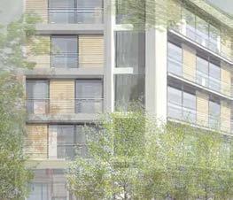
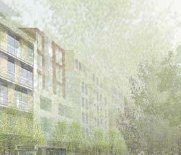
14 1.2 Mid-Rise Urbanism Toronto s neighbourhoods are one of its greatest assets. They provide a setting that has long supported a high quality of life for the City s residents. The protection of these neighbourhoods is a priority embedded in the policies that control the City s growth. This growth will be directed to areas of the City that can accommodate and support new development without disrupting the integrity of the neighbourhoods and enjoy a high level of transit and transportation service. The Official Plan has identified the Avenues as one of these areas. The Avenues are intimately linked to the identity and vitality of the neighbourhoods that surround them. As main streets, they have both a functional relationship, providing a range of services that are used by area residents on a daily basis, as well as a symbolic role as the social nerve centre of communities. The character of growth on the Avenues must recognize the unique connection to these neighbourhoods through a development form that is moderate in scale and reflects high quality design and materials. This energizing growth for the City is termed as Mid-Rise Urbanism. The Avenues vision calls for beautiful tree-lined streets and sun-lit sidewalks, framed by carefully articulated mid-rise buildings providing a multiplicity of retail and community uses at the sidewalk level, with residential and commercial units above. As better transit service is incrementally introduced, and the population increases, the Avenues will be re-energized, supporting improved levels of commercial, retail and community services. Combined with investments in the streetscape and public realm, the setting for a vibrant community life will emerge. This illustration at right demonstrates the potential evolution of an Avenue with a 20 metre wide R.O.W. through mid-rise built form. 4 Avenues & Mid-Rise Buildings Study


15 A 20 metre wide R.O.W. with several sites that may accommodate potential redevelopment. The Avenue can gradually intensify through the introduction of mid-rise buildings Eventually the Avenues will transform as vibrant streets providing a high level of services and amenities while protecting the character of adjacent neighbourhoods BMI/Pace 5


16
17 Section 2: Applying the Avenues and Mid-Rise Recommendations BMI/Pace 7
18 2.1 Where the Recommendations Apply The segments of the Avenues that are designated in the Official Plan as Mixed-Use Areas, Employment Areas, Institutional Areas and Regeneration Areas are the locations that are to be reurbanized and targeted for growth. The recommended Performance Standards apply to these areas with the following exceptions: portions of Avenues where an Avenue Study is completed or underway, portions of an Avenue within a Secondary Plan Area, and portions of an Avenue that have been subject to other City-led studies that have resulted in an Official Plan Amendment and/or new Zoning Bylaw. See Appendix C for an outline of these areas. The Official Plan states that: Not all lands that fall within Avenues are designated for growth. These Avenues have been identified at a broad scale to help assess urban design, transit and service delivery issues. However, where a portion of an Avenue is designated as a Neighbourhood, the neighbourhood protection policies of Chapter 4.1 will prevail to ensure that any new development respects and reinforces the general physical character of established neighbourhoods. (Official Plan, p. 2-15) The different land use designations that overlap with the identification of an Avenue will require different approaches. As the Official Plan is clear in its intent to protect stable residential neighbourhoods, Neighbourhoods, Parks and Open Space Areas, and Natural Areas are not subject to intensification. Therefore, these areas will only be subject to streetscape improvements. Avenues, or segments of Avenues designated as Neighbourhoods will be reurbanized through improvements to the public realm so that they may become part of the overall neighbourhood and pedestrian networks. See Map 2: Avenues and Land Use Designations for the land use designations that front onto the Avenues. In addition to contacting Planning Staff, developers/applicants should determine whether the recommendations of this study apply by following the steps outlined below: Step 1: Step 2: Is the property on an Avenue and do the recommendations apply to this portion of the Avenue? See Map 1: Avenues Excluded from the Study; check underlying Land Use designation in the Official Plan What is the right-of-way width of the Avenue? See Map 3: Avenues & R.O.W. Widths and Section 2.2: How Mid-Rise Building Heights are Determined Step 3: Review the Performance Standards in Section 3 Step 4: Step 5: Is the property in a Character Area? See Map 4: Avenues & Character Areas; Section 2.3.1: Character Areas; and Appendix A: Character Area Study. Performance Standards 19A - G may be applicable. Is the property in an area that requires retail-commercial at-grade? See Map 5: Avenues & Retail-Commercial At-Grade; Section 2.3.2: Avenues Where Retail- Commercial At-Grade is Required; and Appendix B: Retail Study. 8 Avenues & Mid-Rise Buildings Study
19 2.1.1 Land Use Designations & the Avenues Mixed Use Areas & Employment Areas The intent of this Study is primarily to identify Performance Standards that will be appropriate for the areas designated as Mixed Use Areas and Employment Areas. The Performance Standards in Section 3 generally apply to these areas. Not all Performance Standards will apply uniformly across the Avenues. For instance, the Avenues Character Area Study and the Avenues Retail Study, outline special considerations that will influence the application of the Performance Standards. Neighbourhoods, Parks and Open Space Areas, and Natural Areas The creation of cohesive and continuous Avenues will result from investments in a well-designed public realm and streetscape. Even though Neighbourhoods, Parks and Open Space Areas, and Natural Areas are not subject to intensification or reurbanization, the streetscapes, plazas, and parkettes that abut the Avenues should adhere to Performance Standards that address the requirement for a high-quality public realm. Apartment Neighbourhoods The Official Plan acknowledges that significant growth is generally not intended within developed Apartment Neighbourhoods. However, there are opportunities for public realm improvements and there may be opportunities for compatible infill on sites that are underutilized and have sufficient space to accommodate new buildings fronting Avenues. Sites on Avenue segments that are designated as Apartment Neighbourhoods must comply with the Development Criteria in Apartment Neighbourhoods contained in Sections and of the Official Plan. If sites/proposals are compliant with these policies (as per the City s direction), then new mid-rise buildings should refer to the Performance Standards contained in this document. Other City initiatives may apply in Apartment Neighbourhoods, including Tower Renewal (see Appendix D: Other City Initiatives for a summary). Table 1 below outlines the land use designations in the Official Plan and how the street should be treated when an Avenue coincides with that designation. The Avenues will either be subject to reurbanization through intensification or simply reurbanization in the form of streetscape improvements (e.g. within the public realm). Table 1: Avenues and Official Plan land use designations. Official Plan Land Use Designations Approach Neighbourhoods Streetscape Improvements only Apartment Neighbourhoods Potential for Infill & Streetscape Improvements * Parks & Open Space Areas, Natural Areas Streetscape Improvements only Mixed Use Areas Growth & Streetscape Improvements Employment Areas Growth & Streetscape Improvements Institutional Areas Growth & Streetscape Improvements Regeneration Areas Growth & Streetscape Improvements Utility Corridors Streetscape Improvements only * Refer to Official Plan Policies and for further information on Apartment Neighbourhoods. BMI/Pace 9

20 Map 1: Areas Excluded from the Study Not to Scale Portions of the Avenues with Avenue Studies, Secondary Plans and other City-initiated Studies will not be subject to the recommendations of this Study. 10 Avenues & Mid-Rise Buildings Study
21 Avenues (refer to Official Plan Map 2 - Urban Structure) Areas excluded from the Mid-Rise Performance Standards (Avenue Studies, Secondary Plans, other City Initiated Study) BMI/Pace 11
22 Map 2: Avenues & Land Use Designations The total length of all the City s Avenues is approximately 162 km, which equates to 324 km of Avenues frontage. Approximately seventy-five percent of this frontage is designated for growth, while the balance will remain stable. 12 Avenues & Mid-Rise Buildings Study

23 Neighbourhoods Apartment Neighbourhoods Mixed-Use Areas Parks & Open Space Areas Natural Areas Parks Other Open Space Areas (including Golf Courses, Cemeteries, Public Utilities) Institutional Areas Regeneration Areas Employment Areas Utility Corridors Avenues as illustrated on Map 2 - Urban Structure, showing all land use designations fronting onto the Avenues (map should be referred to in colour). Mixed Use Areas = 70% Employment Areas = 4% Institutional Areas = less than 1% Growth Areas Regeneration Areas = less than 1% Apartment Neighbourhoods = 9% Potential for Infill Neighbourhoods = 10% Parks & Open Space Areas, Natural Areas = 6% (Percentages have been estimated by the Consultant Team) Not to Scale BMI/Pace 13


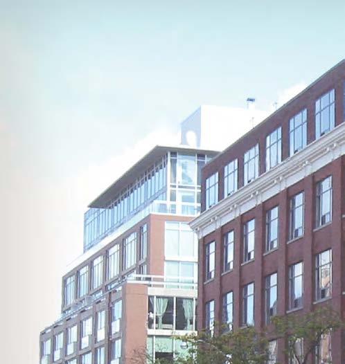
24 Ideal Condominium - College Street 550 Wellington - Wellington Street 2 George Brown College - Richmond Street East 2.2 How Mid-Rise Building Heights are Determined Mid-rise buildings are no taller than the width of the street right-of-way or between 5 and 11 storeys. The as-of-right height of a mid-rise building should be determined by a series of factors. The potential maximum height is established based on a 1:1 ratio where the maximum height of a building is equivalent to the width of the right-of-way which the building faces. The ability to realize the maximum height is tempered by angular planes applied to the front of the site and the rear of the site respectively (see Performance Standards 4 and 5). Not all sites on the Avenues will be able to achieve the maximum height, because some sites may be physically constrained. The dimensions of the development lot particularly lot depth impact the ability of a given site to be built to its maximum height. The Avenue right-of-ways (R.O.W.) fall into one of seven widths: 20, 23, 27, 30, 33, 36 and 45 metres - see Map 3: Avenues and R.O.W. Widths. There are four widths - 20, 27, 30 and 36 metres that prevail on the Avenues, while the others - 23, 33 and 45, are limited. In the context of the Avenues, which generally range in R.O.W. width from 20 to 36 metres, this translates into as-of-right mixed-use buildings that range in height from 6 to 11 storeys, and commercial buildings from 5 to 9 storeys. For instance, an Avenue right-of-way width of 20 metres would result in a mid-rise/mixed-use building of up to 20 metres in height or 6 storeys. R.O.W. widths of 27, 30 and 36 metres would result in mixed-use buildings of 8, 9 and 11 storeys respectively. The Saint 14 James Avenues & Mid-Rise Buildings Study Image Courtesy of Quadrangle Architects Ltd. Massey Harris Lofts - King Street West Trinity Park Lofts - Queen Street West
25 20m height max. 20m R.O.W. 27m height max. 27m R.O.W. For the purposes of this study, a mid-rise building ranges from 5 storeys to 11 storeys. The intent of this study is to provide guidance explicitly on the design of mid-rise buildings - therefore the recommendations are not intended to define a base of a tower or tall building. See Map 3: Avenues and R.O.W. Widths for the widths of Existing Major Streets overlaid with the Avenues. 30m R.O.W. 30m height max. Table 2 R.O.W. Width 1 Mixed-Use Commercial storeys height (m) 2 storeys height (m) 3 20m m m m Assumptions 1 - R.O.W. widths as identified in Official Plan Map Mixed Use heights assume 4.5m for ground floor and 3.0m for all floors above 3 - Commercial heights assume 4.5m for ground floor and 3.6m for all floors above 36m R.O.W. 36m height max. Maximum allowable height is determined by the width of the right-of-way (Note, in some cases, where sidewalk width is not sufficient, front setbacks from the property line will be necessary. This will not affect the overall height or angular plane provisions applied to the building). BMI/Pace 15
26 Map 3: Avenues & R.O.W. Widths Not to Scale Map should be referred to in colour 16 Avenues & Mid-Rise Buildings Study
27 Avenues (refer to Official Plan Map 2 - Urban Structure) Avenue Study, Secondary Plans, and other City Initiated Study Areas (excluded from the Performance Standards) 45 Metres & Over* 36 Metres 33 Metres* 30 Metres 27 Metres 23 Metres* 20 Metres Non-Uniform * non-prevailing widths According to Official Plan Map 3 - Right-of-Way Widths Associated with Existing Major Streets, the Avenue right-of-ways fall into one of seven widths: 20, 23, 27, 30, 33, 36, and 45 metres. There are four widths - 20, 27, 30 and 36 metres that prevail. In instances where the right-of-way width is 23 and 33 metres, maximum building heights should not exceed the R.O.W. width. The 45 metre wide R.O.W. along Eglinton Avenue West should be considered for area-specific study. BMI/Pace 17
28 2.3 Heritage & Retail Analysis From a review of the sixteen completed Avenues Studies and a visual survey of the Avenues throughout the City, it is clear that there is no one size fits all approach to the development of the Avenues. The Avenues differ in many respects, including right-of-way widths, lot dimensions, urban context, historical evolution, prevailing land uses, traffic volumes, transit service and retail environment. It is recognized that not all Avenues or segments of Avenues have, or should be planned to have, the same character. The categorization of the various Avenues is an important component of this Study. The previous section identified where the Performance Standards will apply - primarily Mixed- Use Areas and Employment Areas, and possibly some Apartment Neighbourhoods - this study proposes that there are additional unique conditions which relate to the character of the area and the nature of retail on these Avenues. This section includes a categorization of the Avenues based upon the information from the Character Area Study and Retail Study. See Appendices A and B for the full reports. 18 Avenues & Mid-Rise Buildings Study
29 2.3.1 Character Areas To date, the City of Toronto has not undertaken a full survey of cultural resources or historic places. This study outlines areas that are currently identified as Heritage Conservation Districts (HCDs), HCDs Under Study, or Areas that Warrant Further Heritage Analysis, and identifies an additional consideration, identified in this study as Character Areas. Character Areas were identified primarily through visual analysis and mapping as areas with an existing character that should be considered in the design of redevelopment projects on the Avenues. While the scope of this study cannot provide full analysis and recommendations for each area, it identifies their location and provides the historical context of each area. The Character Area Study highlights areas along the Avenues that should be noted for their natural, built or cultural significance to the neighbourhood, Avenue, or City as a whole. (See Appendix A: Character Area Study). A range of Performances Standards have also been created which may be applied to these Character Areas. Appreciation of the character of an area should be carefully considered during the design, review and implementation process. The intent of identifying Character Areas, is not to prohibit redevelopment but to highlight the role that the existing context can play in shaping the form and function of new mid-rise buildings on the Avenues. Character Areas Each Avenue has been studied to identify portions of Avenues where there is an existing character that should be considered in the development of new mid-rise buildings. These Character Areas have characteristics that require additional consideration of the existing context in terms of architectural and urban design. Additional Performance Standards (Performance Standards 19A - G) may apply in these areas. Sections of Avenues may include significant built, cultural and natural resources. These can be designated, listed or simply identified as significant. The Character Areas are typically on a much larger scale than individual sites or even heritage conservation districts, and may include: Significant groupings of identified and/or listed heritage buildings; Identified Heritage Conservation Districts (HCDs) or areas identified for study as potential heritage conservation districts; Natural heritage areas such as parks, and ravine systems; Groups of buildings that have potential cultural significance related to their use rather than architectural merit; Portions of an Avenue that contain a cultural use that should be considered during a process of redevelopment (i.e. ethnically specific commerce / cultural activities); and, Portions of an Avenue that have adjacencies to built form that may require special consideration during the process of intensification (i.e. Apartment Neighbourhoods). Thus, a Character Area will be of significance for the Avenues if it demonstrates identifiable natural, built or cultural themes associated with the underlying historical development of the specific Avenue. BMI/Pace 19
30 Using the Character Area Description & Performance Standards Performance Standards 19A - G will provide guidance on massing and architectural character for the portions of Avenues identified as Character Areas. Performance Standards 19A - G may also apply to areas not identified as Character Areas. The identification of the Character Areas indicates that consideration should be given to segment specific attributes during the development process and the Performance Standards will be used as guidance for mid-rise building character in a given segment. It will allow staff to review developments and give guidance where a Character Area has been identified and will help developers to design buildings that respond to existing segment attributes or historical context. The Character Area descriptions and associated Performance Standards are not intended to be overly restrictive, they are merely provided to give guidance. There are four types of culturally significant, built and natural resources along the Avenues: 1. Existing Heritage Conservation Districts (see: ca/heritage-preservation/heritage_ districts.htm) 2. Heritage Conservation Districts under study (see: ca/heritage-preservation/heritage_ districts.htm) 3. Areas that Warrant Further Heritage Analysis (see: legdocs/bylaws/2008/law1118.pdf) 4. Character Areas HCDs already have guidelines designed to protect and enhance their special character as redevelopment occurs, and this Study does not intend to change these. HCDs Under Study will be subject to guidelines upon completion of their study. Areas that Warrant Further Heritage Analysis are identified in the City s By-law No and Official Plan Amendment No. 38. The Zoning by-law and Official Plan Amendment authorized the use of Section 37 funding for heritages studies in or within close proximity to the areas identified by the City-led Study. Existing HCDs, HCDs Under Study, and Areas that Warrant Further Heritage Analysis, include areas of an Avenue that contain: Identified and/or designated built and/or natural cultural heritage resources. Potential built and natural cultural heritage resources that are not listed or designated. The desired outcomes for these Avenues is: Conservation of the character of the area. Alterations and infill development that are sensitive to, and strengthen the character of the area. Development that is in accordance with Performance Standard 19A - G, the Ontario Heritage Toolkit and the Parks Canada Standards and Guidelines for Historic Places. Character Areas typically consist of a healthy mixeduse fabric. They have been identified as sections of an Avenue that contain potential built, natural, and/or cultural heritage resources that are not listed or designated. These are not intended to become HCDs, but have a character that will be important to consider as redevelopment occurs. New mid-rise development in these Character Areas should: Mitigate impacts of new development that may destabilize the function and character of the area. Be developed through alterations and infill development that are sensitive to, and where appropriate, strengthen the character of the area. Reference Performance Standard 19A - G 20 Avenues & Mid-Rise Buildings Study
31 Process Along the Avenues, and especially within Character Areas, the diversity of building typologies, heritage buildings, streetscapes and existing city fabric requires that each new building consider and respond to the surrounding context. Within Character Areas, it will be especially important that new buildings recognize and reflect the important elements that define the existing context. The Character Area Study (See Appendix A) contains a brief description and overview of each of the Character Areas. In order to ensure that developments respect this character, this Study recommends an addition to the submission process for buildings within a Character Area. Following a preliminary meeting with City Planning Staff, developers, owners, and/or architects will be asked to submit a brief narrative - a Character Area Response Statement - that outlines how the design integrates with, or reflects important elements of, the existing context. The Character Area summaries may provide a basis for this. This narrative should accompany drawings submitted for the Site Plan Review Process. The steps below should be followed for proposed developments in a Character Area: Step 1: Step 2: Step 3: Step 4: Is the property within a Character Area? See Map 4: Avenues & Character Areas Read the Character Area description See Appendix A Determine which Character Area Performance Standards should apply See Performance Standards 19 A - G (Character Area descriptions in Appendix A identify some of the specific Character Area Performance Standards that should apply, but others may apply) Prepare a Character Area Response Statement Prepare a statement that identifies how the proposed design reflects the key attributes of the Character Area. Some attributes are identified in the written descriptions, but the applicant is responsible for a more detailed response. The Character Area Response Statement should respond to the following: Does the written description refer to specific Character Area Performance Standards that should be adhered to? If yes, how does the proposed development respond to these Performance Standards? Are other Character Area Performance Standards applicable? If yes, how does the proposed development respond to these Performance Standards? Please prepare a statement about the existing context of the Avenue segment, and describe how the proposed development fits into this context. Description of the proposed development should include, but is not limited to, the following: building height, openings & glazing, building materials, and cornice line. BMI/Pace 21


32 Map 4: Avenues & Character Areas Not to Scale Portions of the Avenues identified as Character Areas (as prepared by E.R.A. Architects). See Appendix A for Character Area mapping of each individual Avenue. 22 Avenues & Mid-Rise Buildings Study
 Character Areas Character")


33 Avenues (refer to Official Plan Map 2 - Urban Structure) Character Areas Character Areas that overlap with portions of Avenues that have already been studied are identified only to provide additional consideration with regards to the Performance Standards. BMI/Pace 23
34 2.3.2 Avenues Where Retail-Commercial At-Grade is Required Consistent at-grade retail uses lining the edges of the streetscape is a fundamental component in the community role and design character of the Avenues. Goals, Objectives, and Criteria The overarching goal for the retail analysis is to answer the following question: Where is at-grade retail required within Mixed Use Areas on the Avenues? The objectives for the Retail Study are: 1. To enhance community amenity 2. To support pedestrian amenity, comfort, and safety 3. To support (maintain, improve) the health and vibrancy of the shopping area 4. To provide adequate and appropriate retail services for the local neighbourhood 5. To provide space for new businesses 6. To support adjacent transit Existing Retail Areas on the Avenues The retail categorization analysis began with an understanding of where existing and future communities are located or evolving. This is a key driver in determining where retail is required and supports an understanding of the hierarchy of retail on the Avenues. The categories of existing retail on the Avenues are generally: Established Districts (e.g. Danforth Avenue from Broadview Avenue to Pape Avenue, The Beach, Bayview Avenue, The Junction) These stable communities are supported by stable main-street type retail corridors, with a sizeable residential base that supports local shopping such as grocery stores, drug stores, banks, and other local-serving businesses. Primarily, there are opportunities for mixed-use retail infill to strengthen the continuity of these corridors. Transitioning Districts (e.g. Cliffside Village, Danforth Avenue east of Jones Avenue, Queen Street West from Trinity Bellwoods to Dufferin Street, Dundas Street West at Highway 427, Weston Road at Lawrence Avenue West) These places have a good residential base in the community but there may be greater opportunities to increase the residential density in the area (beyond small infill projects) and thereby affect the demand for retail space to a greater degree. The City will want to enhance these corridors and provide greater continuity of the retail at grade environment. Suburban Avenues (e.g. Sheppard Avenue East, portions of Kingston Road) The existing retail situation along many of these corridors is not well defined. The current retail function is not in the form of main-street type retail but rather in the form of plazas, malls, and freestanding buildings, which are primarily vehicle dependent. This is the most difficult Avenue portion to plan for with particular concern regarding phasing of the developments and the ability for the mixed-use developments to support retail. Undefined Areas There are segments of the Avenues within the urban, built-up areas of the City that do not have a strong community role/function and it is unlikely that they will be able to support a community role in the future (e.g., Queen Street East from Coxwell Avenue to Kingston Road, Finch Avenue West, Dundas Street West south of Humberside Avenue). Retail may be permitted but not required at grade as it should not interfere or be overly competitive with the adjacent nearby corridors that rely on the same residents for retail shopping. 24 Avenues & Mid-Rise Buildings Study
35 Retail At-Grade Recommendations There are three categories for retail at-grade within Mixed Use Areas on the Avenues: Required, Encouraged and Permitted; and these are outlined below. Map 5: Avenues and Retail-Commerical At- Grade illustrates only the first category - those areas where retail at-grade is required. 1. Required: Commercial-Retail (non-residential) would be required in the following circumstances: Established Districts Examples include Yonge Street from Eglinton Avenue to Glenview Avenue, Bloor Street West from Jane Street to High Park, Queen Street W. from Roncesvalles Avenue to Dufferin Street 2. Encouraged: Commercial-Retail (non-residential) would be encouraged in the following circumstances: Transitioning Urban Communities Examples include Broadview Avenue, Dundas Street West east of Jane Street in The Junction Suburban Avenues Where there is a current or foreseeable urban community that can support main street type retail activity, primarily anchored at key intersections. Note: Where retail at grade is Encouraged, it would be permitted, but further study is needed to identify if there are portions of these Avenues where retail should be Required. 3. Permitted: Commercial-Retail (non-residential) should be permitted, but not required, in sections of the Avenues that are Undefined Areas. The retail may be in the form of destination type retailers that draw from outside the local trade area. Additional considerations such as parking, accessibility, and visibility will be required. Typically, rents will be lower and the retail uses tend to be larger. These areas may be suburban corridors that are transitional, cannot support double-loaded retail, or are not long enough to support a community retail shopping function. Other uses may also be considered such as community centres, schools, learning institutions and residential uses. There may be an opportunity for ground floor residential uses to transition into retail functions at a future date. Hybrid developments may also be considered, for example, where there is retail at the corners of a building or block, but the frontage may include other uses such as residential along the length of the building. Areas where commercial-retail is permitted may also include existing retail areas that are already thriving and need additional residential population, not additional retail. See Appendix B for the full Retail Study. BMI/Pace 25
36 Map 5: Avenues & Retail-Commercial At-Grade Not to Scale 26 Avenues & Mid-Rise Buildings Study
37 Avenues (refer to Official Plan Map 2 - Urban Structure) Avenues excluded from the Retail Study include: Avenue Studies, Secondary Plans, other City Initiated Study Areas, Employment Areas, Neighbourhoods, Apartment Neighbourhoods, Natural Areas, Parks, and Other Open Spaces Established Districts with Retail- Commercial At-Grade Required Areas Recommended for Further Consideration for Retail-Commercial have been identified by the study consultants as areas where further analysis is warranted to determine if mid-rise buildings should be required to include retail-commercial space on the ground floor (Retail Encouraged), based on factors such as the existing commercial character of the area and future prospects for successful pedestrian-oriented commercial development. It should be noted that the Commercial Residential (CR) Zone that will apply to all Mixed Use Areas will permit retail/commercial uses. See Appendix B for further detail. BMI/Pace 27

38
39 Section 3: Performance Standards for Mid-Rise Buildings BMI/Pace 29
40 3.1 Introduction This section proposes a series of Performance Standards that will guide the design of mid-rise buildings in a manner appropriate to the Avenues. The Performance Standards are guided by the objective to create healthy, livable and vibrant main streets while protecting the stability and integrity of adjacent neighbourhoods. To this end, built form controls embedded in these standards will ensure that the Avenues develop in an appropriate and context-sensitive manner. The Performance Standards are intended to provide simple, straightforward guidance for those seeking to develop midrise projects on the Avenues. Key provisions are as follows: Buildings are moderate in height - no taller than the R.O.W. is wide; Buildings provide an appropriate transition in scale to adjacent neighbourhoods; Sidewalks are wide enough to include and support trees, generate a lively pedestrian culture and ensure accessibility for all; Sidewalks on the Avenues enjoy at least five hours of sunlight from the spring through to the fall; The ground floor of buildings provide uses that enliven sidewalks and create safe pedestrian conditions; The public realm should be protected and enhanced by limiting vehicle access from the Avenue, encouraging shared access, and creating a public laneway system that is accessed from side streets; Streetscape and building design reflects excellence in sustainability, urban design and architecture, recognizing the important public role of the Avenues in defining the quality of life for the city and its neighbourhoods; and, Mid-rise development sites located within Existing HCDs, HCDs Under Study, areas that warrant further heritage analysis, and Character Areas (see Section 2.3.1), should reflect local conditions and reference additional design guidelines that promote context sensitive intensification. 30 Avenues & Mid-Rise Buildings Study
.")
41 May 2010 Key recommendations contained in this section are intended to form the basis for a new as-ofright zoning for mid-rise buildings on the Avenues. This new zoning will apply mainly to those Avenue segments designated as Mixed-Use Areas and Employment Areas (see Section 2.1: Where the Recommendations Apply). It is anticipated that this new zoning may reduce the need to prepare area specific studies for all segments. However, certain areas of the Avenues with unique characteristics may continue to require area specific study. Through an as-of-right zoning strategy and other changes to City processes (see Section 4: Recommendations), the City will provide a level of certainty to the development process that is absent today. Land owners and developers working within this new regulatory framework will know how much they can build and the general timeframes they can expect for the application process. In return, they will be expected to build to a high standard of design excellence. The community will be offered a greater degree of assurance that the standards controlling building heights and massing will be adhered to. mechanical penthouse (within angular plan) rooftop amenity space and/or green roof transition to adjacent neighbourhood (angular plane & setbacks) 45o 1.5m min. step-back above streetwall 80% of R.O.W. width rear lane access / limit vehicle interruption on the Avenue streetwall up to 6 storeys SID (ide lot dep al 3 t 0m h min.) ES 36m / 11 storeys max. building height all eetw.) of str 30m min y it u l n conti ge - idea onta (lot fr tall ground floor animated ground floor TR wide sidewalk with trees AV EN UE min. 10.5m / 3 storey building base allow for sunlight on the opposite sidewalk EE T Diagram illustrating key components of the Performance Standards. BMI/Pace 31
42 How can Performance Standards help create great Mid- Rise buildings on the Avenues? Performance Standards are based on best principles (Official Plan policies) and best practices (urban design criteria and guidelines) and will guide the design of mid-rise buildings and ensure they are responsive to both their existing and planned context. The creation and implementation of Performance Standards for mid-rise buildings will help to ensure high quality, appropriately-scaled mid-rise urban form along the Avenues. The creation of welldesigned, pedestrian-scaled streets will result in mid-rise buildings that are of the highest design character and respond to their district and city-wide context. Successful mid-rise buildings employ design strategies such as street-oriented character, massing that responds to all frontages, a variety of architectural detail and context-sensitive massing. The design of Avenues-oriented buildings must be mindful of limiting shadows on sidewalks and neighbouring properties, and should stimulate pedestrian environments through the careful use of scale, setbacks and step-backs. Implementation of the Performance Standards Section 3.2 outlines Performance Standards recommended by this study. The Performance Standards refer to an integrated set of measurable criteria used to establish how existing and planned buildings behave towards each other or perform in relation to a set of criteria or principles, within an area specific setting or context. Some Performance Standards include criteria (e.g. Design Quality) that are not as easily measurable and provide guidance on urban design quality and character within the context of this study. Some of the following Performance Standards define requirements that could be integrated into new zoning by-laws, while others will be used as design guidelines to complement the zoning regulations. Exceptions to the Performance Standards When implementing the urban design recommendations of this section, whether through zoning or design guidelines, it is important to recognize that exceptions may sometimes be warranted and that at times a project that strives for excellence in design can demonstrate that a specific guideline is not appropriate in that instance. It is the responsibility of the designer / developer / builder to demonstrate to the City where this exception exists and it is at the discretion of the City to support or not support a justification. In cases where the City requires further review of applications, the City s Design Review Panel may assist the process. 32 Avenues & Mid-Rise Buildings Study
43 3.1.1 Using the Performance Standards The application of the Performance Standards will vary according to location on the Avenues (i.e. width of the R.O.W., Character Area, Retail Priority Area) as well as physical site characteristics (i.e. lot depth and width, topography), and site location (i.e. corner or mid-block sites). The following Key Considerations are provided to give users of this document a step-by-step guide to determining which Performance Standards to use, and how they will apply in a site-specific manner. These steps are provided as a guide only, and it is recommended that the Performance Standards be read it in their entirety. Key Considerations 1. What is the maximum allowable height? Refer to Performance Standard 1 for R.O.W. widths and provisions for maximum allowable heights 2. What angular planes will apply to the rear? The property dimensions and land use to the rear will influence applicability of the rear transition. Refer to Performance Standards 5A - 5D 3. What provisions will apply to the side property? Is the property on a corner or mid-block location? Refer to Performance Standards 6, 8A - 8E, and Will front setbacks be required? What is the width of the existing sidewalks? In combination with the width of the R.O.W., this will determine if front setbacks are applicable. Refer to Performance Standard 7 (setbacks will vary by use i.e. commercial-retail or residential at-grade). 5. Is there an existing public lane at the rear of the property? Refer to Performance Standards 5A - 5D, 16A and 16B 6. Is the property in a Character Area? Refer to Performance Standards 19 A - G, and Appendix A: Character Area Study 7. Is the property in an area where retail at grade is required? Refer to Performance Standard 3, and Appendix B: Retail Study 8. Is the use at grade (fronting the Avenue) residential? Refer first to Section 2.4.2: Recommendations for Retail At Grade, and refer to Performance Standards 3 and 16 BMI/Pace 33
44 3.1.2 Optimal Site Conditions A thorough review of the Avenues existing context reveals that no two Avenues are identical, nor are there sites with identical characteristics or conditions. This section outlines some of the ideal site conditions for the optimal development of a mid-rise building within the context of this study. 1. Table 3 identifies the maximum allowable heights based on R.O.W. width. To achieve these heights, minimum lot depths are required as per Table 4. These depths assume the integration of: angular planes - front and rear; setbacks, including rear lanes; a depth of 11.6 metres for the uppermost floor at the maximum height (identified as a minimum dimension for a double-loaded corridor), following the application of the angular planes; and potential for typical below-grade parking layouts, including ramps and access. See section diagrams on opposite page. Mid-rise buildings may be developed on properties shallower than those identified in Table 4. Generally, a lot depth of approximately 30 metres will permit the development of a 5 to 6- storey mid-rise building and can integrate belowgrade parking. For example, to achieve a top floor of 11.6 metres on a 6-storey building, a depth of 32.6 metres is required (see section diagrams on opposite page). The optimal conditions are dependent on a combination of both lot width and depth. Table 3 R.O.W. Width 1 Mixed-Use Commercial storeys height (m) 2 storeys height (m) 3 20m m m m Assumptions 1 - R.O.W. widths as identified in Official Plan Map Mixed Use heights assume 4.5m for ground floor and 3.0m for all floors above 3 - Commercial heights assume 4.5m for ground floor and 3.6m for all floors above Table 4 R.O.W. Width Lot Depth Ideal Minimum 20m 32.6m 27m 41.0m 30m 44.6m 36m 51.8m Assumes a depth of 11.6 metres at the uppermost height per R.O.W. (using a setback of 7.5m & 45-degree angular plane from 10.5m above the setback). 34 Avenues & Mid-Rise Buildings Study
45 45-degree angular plane 11.6m front property line 80% of R.O.W. = 16m 20 m 45-degree angular plane 10.5 m rear property line 32.6 m 7.5m 45-degree angular plane 11.6m 45-degree angular plane 2. Minimum lot widths of 30 metres will: allow for the integration of structured on-site parking; be able to incorporate side step-backs at upper storeys; and potentially encourage property owners to consider consolidation of narrow properties. 3. Other ideal lot conditions include: existing rear lane or potential to extend a rear lane system; and adequate sidewalk widths of 4.8 to 6.0 metres. front property line front property line 45-degree angular plane 80% of R.O.W. = 21.6m 80% of R.O.W. = 24m 27 m 11.6m 30 m 41.0 m 45-degree angular plane 10.5 m rear property line 7.5m 10.5 m rear property line 44.6 m 7.5m 11.6m 45-degree angular plane 45-degree angular plane front property line 80% of R.O.W. = 28.8m 36 m 10.5 m rear property line Illustration of ideal minimum lot depths by R.O.W. width. Rear set back can include public lane where they exist m 7.5m BMI/Pace 35

 at the street frontage. 3. Minimum Ground Floor Height The minimum floor to floor height of the ground floor should be 4.5 metres to facilitate retail uses at grade. 4A.")

46 3.2 Performance Standards 1. Maximum Allowable Height The maximum allowable height of buildings on the Avenues will be no taller than the width of the Avenue right-of-way, up to a maximum mid-rise height of 11 storeys (36 metres). 2. Minimum Building Height All new buildings on the Avenues must achieve a minimum height of 10.5 metres (up to 3 storeys) at the street frontage. 3. Minimum Ground Floor Height The minimum floor to floor height of the ground floor should be 4.5 metres to facilitate retail uses at grade. 4A. Front Façade: Angular Plane The building envelope should allow for a minimum of 5-hours of sunlight onto the Avenue sidewalks from March 21st - September 21st. 4B. Front Façade: Pedestrian Perception Step-back Pedestrian Perception step-backs may be required to mitigate the perception of height and create comfortable pedestrian conditions. 4C. Front Façade: Alignment The front street wall of mid-rise buildings should be built to the front property lines or applicable setback lines. 5A. Rear Transition to Neighbourhoods: Deep The transition between a deep Avenue property and areas designated Neighbourhoods, Parks and Open Space Areas, and Natural Areas to the rear should be created through setback and angular plane provisions. 5B. Rear Transition to Neighbourhoods: Shallow The transition between a shallow Avenue property and areas designated Neighbourhoods, Parks and Open Space Areas, and Natural Areas to the rear should be created through alternative setback and angular plane provisions. 5C. Rear Transition to Employment Areas The transition between an Avenue property and areas designated Employment Areas to the rear should be created through setback and step-back provisions. 5D. Rear Transition to Apartment Neighbourhoods The transition between an Avenue property and areas designated Apartment Neighbourhoods to the rear should be created through setbacks and other provisions. 6. Corner Sites: Heights & Angular Planes On corner sites, the front angular plane and heights that apply to the Avenue frontage will also apply to the secondary street frontage. 7A. Minimum Sidewalk Zones Mid-rise buildings may be required to be set back at grade to provide a minimum sidewalk zone. 7B. Streetscapes Avenue streetscapes should provide the highest level of urban design treatment to create beautiful pedestrian environments and great places to shop, work and live. 8A. Side Property Line: Continuous Street Walls Mid-rise buildings should be built to the side property lines. 8B. Side Property Line: Limiting Blank Side Walls Blank sidewalls should be designed as an architecturally finished surface and large expanses of blank sidewalls should be avoided. 8C. Side Property Line: Step-backs at Upper Storeys There should be breaks at upper storeys between new and existing mid-rise buildings that provide sky-views and increased sunlight access to the sidewalk. This can be achieved through side step-backs at the upper storeys. 8D. Side Property Line: Existing Side Windows Existing buildings with side wall windows should not be negatively impacted by new developments. 8E. Side Property Line: Side Street Setbacks Buildings should be setback along the side streets to provide transition to adjacent residential properties with front yard setbacks. 36 Avenues & Mid-Rise Buildings Study


47 9. Building Width: Maximum Width Where mid-rise building frontages are more than 60 metres in width, building façades should be articulated or broken up to ensure that façades are not overly long. 10. At-Grade Uses: Residential Where retail at grade is not required, and residential uses are permitted, the design of ground floors should provide adequate public/private transition, through setbacks and other methods, and allow for future conversion to retail uses. 11. Setbacks for Civic Spaces In special circumstances where civic or public spaces are desired, additional setbacks may be encouraged. 12. Balconies & Projections Balconies and other projecting building elements should not negatively impact the public realm or prevent adherence to other Performance Standards. 13. Roofs & Roofscapes Mechanical penthouses may exceed the maximum height limit by up to 5 metres but may not penetrate any angular planes. 14. Exterior Building Materials Buildings should utilize high-quality materials selected for their permanence, durability and energy efficiency. 15. Façade Design & Articulation Mid-rise buildings will be designed to support the public and commercial function of the Avenue through well articulated and appropriately scaled façades. 16A. Vehicular Access Whenever possible, vehicular access should be provided via local streets and rear lanes, not the Avenue. 16B. Mid-Block Vehicular Access For mid-block sites without rear lane access, a front driveway may be permitted, provided established criteria are met. 17. Loading & Servicing Loading, servicing, and other vehicular related functions should not detract from the use or attractiveness of the pedestrian realm. 18. Design Quality Mid-rise buildings will reflect design excellence and green building innovation, utilizing high-quality materials that acknowledge the public role of the Avenues. 19A. Heritage & Character Areas All mid-rise buildings on the Avenues should respect and be sensitively integrated with heritage buildings in the context of Heritage Conservation Districts. 19B. Development in a HCD The character and values of HCDs must be respected to ensure that the district is not diminished by incremental or sweeping change. 19C. Development Adjacent to a Heritage Property Development adjacent to heritage properties should be sensitive to, and not negatively impact, heritage properties. 19D. Character Area: Fine Grain Fabric New mid-rise buildings in Character Areas that have a fine grain, main street fabric should be designed to reflect a similar rhythm of entrances and multiple retail units. 19E. Character Area: Consistent Cornice Line Buildings in a Character Area should maintain a consistent cornice line for the first step-back by establishing a datum line or an average of the existing cornice line. 19F. Character Area: Vertical Additions Additions to existing buildings is an alternative to redevelopment projects on the Avenues, and should be encouraged in areas with an existing urban fabric. 19G. Character Area: Other Considerations Additional context sensitive design and massing guidelines should be considered for development in Character Areas. BMI/Pace 37
48 Performance Standard #1: Maximum Allowable Height The maximum allowable height of buildings on the Avenues will be no taller than the width of the Avenue right-of-way, up to a maximum mid-rise height of 11 storeys (36 metres). Using the four prevailing right-of-way widths: 20, 27, 30, & 36 metres. The maximum height may only be achieved if the built form demonstrates compliance with all applicable Performance Standards. Not all sites on the Avenues will be able to achieve the maximum height. The dimensions of the development lot particularly lot depth impact the ability of a given site to be built to its maximum height. Achieving the maximum building heights will be dictated by the required angular planes set out in subsequent Performance Standards. Rationale The City has generally defined mid-rise buildings as being taller than a typical house or townhouse but no taller than the width of the street s public right-of-way. For example, on a street with a 20 metre right-of-way, a mid-rise building consisting of commercial uses at grade and residential uses above, can be up to 20 metres in height, or 6 storeys. Official Plan Map 3 - Right-of-Way Widths Associated with Existing Major Streets, identifies Avenues with seven different right-of-ways (R.O.W.) widths: 20, 23, 27, 30, 33, 36, and 45 metres. There are four widths - 20, 27, 30 and 36 metres that prevail. In instances where the right-of-way width is 23 and 33 metres, Performance Standards for mid-rise buildings will apply, permitting maximum building heights are the same as the R.O.W. Eglinton Avenue West is the only Avenue that has a 45 metre wide R.O.W. As the maximum mid-rise height is defined as 11 storeys, or approximately, 36 metres, the City should undertake further study of this area to determine appropriate building heights. The Design Criteria for Review of Tall Building Proposals defines tall buildings as those which are taller than the right-of-way they are located on. For the purposes of this study, it is assumed a mid-rise building is never taller than 11 storeys or 36 metres high (equal to the width of the widest prevailing rightof-way found on the Avenues). Table 5 R.O.W. Width 1 Mixed-Use Commercial storeys height (m) 2 storeys height (m) 3 20m m m m Assumptions 1 - R.O.W. widths as identified in Official Plan Map Mixed Use heights assume 4.5m for ground floor and 3.0m for all floors above 3 - Commercial heights assume 4.5m for ground floor and 3.6m for all floors above 38 Avenues & Mid-Rise Buildings Study
49 20m height max. 20m R.O.W. The former City of Toronto s Main Streets By-law (Bylaw ) was created after a study of existing context along Toronto s main streets as well as extensive public consultation. The resulting By-law created a building envelope within the 4 to 6 storey range. However, the City has seen very little uptake based on this zoning and today there are still very few buildings in this height range along the former City s main streets. The creation of a context-appropriate height regime might encourage land owners to consider the midrise building as a feasible typology for development. Sites that are constrained by size or context and cannot meet the Performance Standards for front, side and rear transitions (Performance Standards 4, 5, and the 7) will generally not be permitted to develop at the maximum height. The maximum allowable height defined in this Performance Standard is the determining factor for height maximums and supersedes other angular plane restrictions which could potentially be more permissive. This study recognizes that building height is only one aspect of regulating building design. Imperative to the success of the Avenues is the ability of midrise buildings to fit into a variety of existing contexts and contribute positively to the overall character of the Avenues. Subsequent Performance Standards outline additional methods to shape and design midrise buildings. Official Plan Reference Built Form Policies: 1, 3 a), and 4 27m R.O.W. 30m R.O.W. 27m height max. 30m height max. 36m height max. 36m R.O.W. Maximum allowable height is determined by the width of the right-of-way (Note, in some cases, where sidewalk width is not sufficient, front setbacks from the property line will be necessary. This will not affect the overall height or angular plane provisions applied to the building). BMI/Pace 39

50 Map 6: Avenues & R.O.W. Widths Not to Scale Map should be referred to in colour 40 Avenues & Mid-Rise Buildings Study
51 Avenues (refer to Official Plan Map 2 - Urban Structure) Avenue Study, Secondary Plans, and other City Initiated Study Areas (excluded from the Performance Standards) 45 Metres & Over* 36 Metres 33 Metres* 30 Metres 27 Metres 23 Metres* 20 Metres Non-Uniform * non-prevailing widths According to Official Plan Map 3 - Right-of-Way Widths Associated with Existing Major Streets, the Avenue right-of-ways fall into one of seven widths: 20, 23, 27, 30, 33, 36, and 45 metres. There are four widths - 20, 27, 30 and 36 metres that prevail. In instances where the right-of-way width is 23 and 33 metres, maximum building heights should not exceed the R.O.W. width. The 45 metre wide R.O.W. along Eglinton Avenue West should be considered for area-specific study. BMI/Pace 41

52 Performance Standard #2: Minimum Building Height All new buildings on the Avenues must achieve a minimum height of 10.5 metres (3 storeys) at the street frontage. Rationale The City s strategy to reurbanize the Avenues will strengthen community focal points as well as intensify mixed-uses in appropriate locations. By identifying the Avenues as locations for new residents and jobs, the City can make better use of existing infrastructure and create a more vibrant street life on the Avenues. In order to do this, the inefficient development of sites on the Avenues needs to be prevented through the requirement of a minimum building height on the Avenues. Onestorey retail buildings and townhomes are examples of inefficient building typologies. A minimum height of 10.5 metres will allow for up to three storeys, but different uses may result in one or two storey buildings. The minimum building height also supports the objective to create a pedestrian environment through street walls that are generally consistent along the Avenues, as well as achieving a minimum density along the Avenues to support improved public transit. min. 10.5m building height integrated loading & parking Example of a 3 storey building. Examples of minimum total building height of 3 storeys. 42 Avenues & Mid-Rise Buildings Study

53 Official Plan Reference 2.2 Structuring Growth in the City: Integrating Land Use and Transportation Policies: 2 a), 2 b), and 2 d) Avenues: Reurbanizing Arterial Corridors Policies: 2 b) i), and 2 b) v) (1) min. 10.5m street wall Example of a 3 storey street wall. Examples of minimum street wall height of 3 storeys. BMI/Pace 43
54 Performance Standard #3: Minimum Ground Floor Height The minimum floor-to-floor height of the ground floor should be 4.5 metres to facilitate retail uses at grade. Ground floor heights should be a minimum of 4.5 metres (floor to floor, measured from average grade) to accommodate retail uses and provide sufficient clearance for loading areas. Where residential uses front onto Avenues at grade level, the vertical distance from grade to the top of the second storey floor level should also measure 4.5 metres. Rationale Floor heights for commercial uses are generally higher than a typical residential floor. A taller floorto-floor height at grade will provide for flexibility of grade level uses and increase the marketability of retail spaces. A floor-to-floor height of 4.5 metres has been cited as the desirable height to achieve this. A taller floor-to-floor height at the street level also emphasizes this portion of the building and thereby increases the visibility of any developed retail. A floor-to-floor height of 4.5 metres provides clearance for loading spaces and trucks into internal spaces of a building (i.e. would not require double height garage door openings), which should be met at the rear of the site. A 4.5 metre floor-to-floor height is also required for at-grade residential uses fronting onto an Avenue. For residential uses, the 4.5 metres height would be taken from exterior grade to the top of the second storey floor level. See Performance Standard 10 for a description of design measures for residential at grade. As the Avenues mature, residential uses at grade may be converted to retail uses. The 4.5 metre height considered with a horizontal setback required for residential uses (see Performance Standard 10), provides an infill zone that can accommodate this transition. 44 Avenues & Mid-Rise Buildings Study

55 Official Plan Reference 2.2 Structuring Growth in the City: Integrating Land Use and Transportation Policies: 2 c) The Future of Retailing front property line 4.5m minimum Example of minimum ground floor height for commercial-retail uses. Example of tall ground floors for flexible commercial space. BMI/Pace 45


56 Performance Standard #4A: Front Façade: Angular Plane The building envelope should allow for a minimum of 5-hours of sunlight onto the Avenue sidewalks from March 21st - September 21st. Rationale The success of the Avenues is contingent on the ability to create great main streets with comfortable, attractive public spaces, especially sidewalks. The Official Plan reiterates this notion, stating that Great cities are judged by the look and quality of their squares, parks, streets and public spaces and the buildings which frame and define them. Extensive research about the effects of sunlight on Toronto s sidewalks was compiled in the Sun, Wind, and Pedestrian Comfort: A Study of Toronto s Central Area by Bosselman et al., Key recommendations of this study support the objective to maintain a minimum of 5-hours of sunlight on Toronto s commercial streets or Avenues between the spring equinox and fall equinox. N 5 Hours West East 9:18am 10:18am 11:18am 12:18pm 1:18pm 2:18pm North-south street on September 21st 5 Hours South North 11:00am 12:00pm 1:00pm 2:00pm 3:00pm 4:00pm East-west street on March 21st 46 Avenues & Mid-Rise Buildings Study
57 45 o 80% of R.O.W. width = 16m 20m height max. 20m R.O.W. This Performance Standard results in a building envelope that allows for 5-hours of sunlight access on the opposite sidewalk as well as ensuring that the street wall height is in proportion with the R.O.W. An angular plane will be taken from a height equivalent to 80% of the R.O.W. width and subsequent storeys must fit within a 45-degree angular plane from this point. The minimum street wall height is 10.5 metres as per Performance Standard 2. Given that there may be buildings as high as the right-of-way width, the upper storeys of buildings will need to be massed to provide sunlight on the opposite sidewalk. Buildings built to the front property line and to the maximum allowable height will need to step-back to fit within this angular plane. The recommendations of this Performance Standard should also apply to diagonal streets, buildings that are set back from the property line, and streets that have a grade difference from one side of the R.O.W. to the other, in order to achieve consistency of built form along the Avenues, even though the five hours of sunlight may be achieved through different tools. 27m R.O.W. 30m R.O.W. 45 o 80% of R.O.W. width = 21.5m 45 o 80% of R.O.W. width = 24m 27m height max. 30m height max. Official Plan Reference Built Form Policies: 3 c), 3 d), and 3 e) 4.5 Mixed Use Areas Policies: 2 e) 45 o 80% of R.O.W. width = 28.5m 36m height max. 36m R.O.W. BMI/Pace 47
58 Performance Standard #4B: Front Façade: Pedestrian Perception Step-back Pedestrian Perception stepbacks on buildings taller than 23 metres should be required to mitigate the perception of height and create buildings at the street that are of a comfortable scale for pedestrians. Rationale The provisions of Performance Standard 4A will generally result in a step-back of the upper floors of mid-rise buildings. An additional step-back may be appropriate for buildings taller than 7 storeys in height as a means of mitigating the perception of height on the Avenue. The ideal location of this additional Pedestrian Perception step-back is not prescribed and should be determined as part of the design process. Front step-backs articulate building massing, reduce shadow impacts within the public realm, and help to mitigate the pedestrian s perception of height. The minimum step-back dimension is 1.5 metres. 6th storey 5th storey 4th storey 3rd storey For buildings taller than 23 metres, an additional step-back may be required. The location of this step-back is flexible. The above example illustrates a 9 storey building on a 30 metre R.O.W. which integrates step-backs in accordance with Performance Standard 4A: Front Façade: Angular Plan and an additional Pedestrian Perception step-back. 48 Avenues & Mid-Rise Buildings Study


59 Buildings on a 20 and 23 metre right-of-way are not required to meet this Guideline. For R.O.W.s, larger than 23 metres, an additional Pedestrian Perception step-back should be considered between the third floor and the 80% height of the façade. Official Plan Reference Built Form Policies: 4 Visualization of front step-backs on a 30 metre wide R.O.W. BMI/Pace 49

 for the first 3 storeys at a minimum.")
60 Performance Standard #4C: Front Façade: Alignment The front street wall of mid-rise buildings should be built to the front property lines or applicable setback lines. The street wall is defined as the portion of a buildings façade comprised of the building base (minimum of 10.5 metres or 3 storeys in height and up to the 80% of the permitted maximum building height). A building should have a minimum of 75% of its frontage built to the setback line (see Performance Standard 7A) for the first 3 storeys at a minimum. The remaining 25% may setback an additional distance up to a maximum of 5 metres to provide a deeper area for lobby entrances, bike parking or outdoor marketing areas such as café seating (for residential uses at-grade see Performance Standard 10). 75% 25% Max. 5m Setback Rationale The ground floors of buildings are generally required to provide retail fronting onto the Avenue. Mid-rise buildings should be built to the setback line (as identified in Performance Standard 7A) so that they create a continuous street wall with direct connections between grade-related commercial and community uses and the public realm. This relationship of sidewalk to grade-related uses encourages diverse economic stimulation and social interaction at a pedestrian scale. (City s Vibrant Streets Manual, p. 26). Total 25% of Facade Max. 5m Setback The front façade build-to requirement may allow for some flexibility in design. 50 Avenues & Mid-Rise Buildings Study
13 THORNHILL YONGE STREET STUDY IMPLEMENTATION CITY OF VAUGHAN OPA 669 AND TOWN OF MARKHAM OPA 154
 13 THORNHILL YONGE STREET STUDY IMPLEMENTATION CITY OF VAUGHAN OPA 669 AND TOWN OF MARKHAM OPA 154 The Planning and Economic Development Committee recommends the adoption of the recommendations contained
St. Lawrence Neighbourhood Focused Area - Official Plan Amendment Status Report
 STAFF REPORT ACTION REQUIRED St. Lawrence Neighbourhood Focused Area - Official Plan Amendment Status Report Date: May 21, 2015 To: From: Wards: Reference Number: Toronto and East York Community Council
Bloor St. W. Rezoning - Preliminary Report
 STAFF REPORT ACTION REQUIRED 1638-1644 Bloor St. W. Rezoning - Preliminary Report Date: April 1, 2008 To: From: Wards: Reference Number: Toronto and East York Community Council Acting Director, Community
PART 1. Background to the Study. Avenue Study. The Danforth
 The Danforth 1.1/ Study Purpose & Key Municipal Goals 1.2/ The Local Advisory Committee 1.3/ The Project Team 1.4/ Study Process/Summary of Method 1.5/ Summary of Consultation 1.1 Study Purpose and Key
Official Plan Review: Draft Built Form Policies
 PG.30.1 REPORT FOR ACTION Official Plan Review: Draft Built Form Policies Date: May 15, 2018 To: Planning and Growth Management Committee From: Chief Planner and Executive Director, City Planning Division
Urban Design Manual PLANNING AROUND RAPID TRANSIT STATIONS (PARTS) Introduction. Station Study Areas
 Introduction. Station Study Areas") 111111 PLANNING AROUND RAPID TRANSIT STATIONS (PARTS) Introduction The ION rapid transit system will link Waterloo, Kitchener and Cambridge through a central transit corridor (CTC). There are a number
111111 PLANNING AROUND RAPID TRANSIT STATIONS (PARTS) Introduction The ION rapid transit system will link Waterloo, Kitchener and Cambridge through a central transit corridor (CTC). There are a number
YONGE STEELES CORRIDOR SECONDARY PLAN. Young + Wright / IBI Group Architects Dillon Consulting Ltd. GHK International (Canada) Ltd.
 Ltd.") PART A: PREAMBLE 1.0 PURPOSE The purpose of this Secondary Plan is to provide a development framework for intensification of the Yonge/ Steeles corridor including the north side of Steeles Avenue West
PART A: PREAMBLE 1.0 PURPOSE The purpose of this Secondary Plan is to provide a development framework for intensification of the Yonge/ Steeles corridor including the north side of Steeles Avenue West
QUEEN-RIVER SECONDARY PLAN
 34 QUEEN-RIVER SECONDARY PLAN 34. QUEEN RIVER SECONDARY PLAN 1. INTRODUCTION The Queen-River area is approximately 6.4 hectares and is located at the eastern edge of the Downtown as shown on Map 34-1.
178 Carruthers Properties Inc.
 178 Carruthers Properties Inc. Planning Rationale for 178 Carruthers Avenue Site Plan Control Application June 2014 Table of Contents 1.0 Introduction 2.0 Overview of Subject Property 3.0 Current Zoning
Welcome. Walk Around. Talk to Us. Write Down Your Comments
 Welcome This is an information meeting introducing the applications for proposed redevelopment of the Yorkdale Shopping Centre site at 3401 Dufferin Street and 1 Yorkdale Road over the next 20+ years,
burlington mobility hubs study Downtown Burlington Mobility Hub
 burlington mobility hubs study Downtown Burlington Mobility Hub Draft Precinct Plan Workbook PIC #3, September 7, 2017 downtown mobility hub objectives City staff and their consultants are proposing an
1.0 Purpose of a Secondary Plan for the Masonville Transit Village
 Report to Planning and Environment Committee To: Chair and Members Planning & Environment Committee From: John M. Fleming Managing Director, Planning and City Planner Subject: Masonville Transit Village
Queen Street West - Zoning Amendment Application - Preliminary Report
 STAFF REPORT ACTION REQUIRED 944-952 Queen Street West - Zoning Amendment Application - Preliminary Report Date: February 6, 2013 To: From: Wards: Reference Number: Toronto and East York Community Council
Mark-up of the effect of the proposed Bronte Village Growth Area OPA No.18 on the text of section 24, Bronte Village, of the Livable Oakville Plan
 Mark-up of the effect of the proposed Bronte Village Growth Area OPA No.18 on the text of section 24, Bronte Village, of the Livable Oakville Plan Notes: This document is provided for information purposes
[PLANNING RATIONALE] For Site Plan Control and Lifting of Holding Zone By-Law 101 Champagne Avenue. May 23, 2014
![[PLANNING RATIONALE] For Site Plan Control and Lifting of Holding Zone By-Law 101 Champagne Avenue. May 23, 2014](/thumbs/75/71599615.jpg "[PLANNING RATIONALE] For Site Plan Control and Lifting of Holding Zone By-Law 101 Champagne Avenue. May 23, 2014") [PLANNING RATIONALE] For Site Plan Control and Lifting of Holding Zone By-Law 101 Champagne Avenue May 23, 2014 Contents 1.0 Introduction... 2 2.0 Site Context... 2 2.1 Adjacent Uses... 2 Figure 1: Site
[PLANNING RATIONALE] For Site Plan Control and Lifting of Holding Zone By-Law 101 Champagne Avenue May 23, 2014 Contents 1.0 Introduction... 2 2.0 Site Context... 2 2.1 Adjacent Uses... 2 Figure 1: Site
Town of Cobourg Heritage Master Plan. Statutory Public Meeting
 Town of Cobourg Heritage Master Plan Statutory Public Meeting April 25 th 2016 Presentation Overview 1. Introduction 2. Project background and schedule overview 3. Review of strategic direction content
Clairtrell Area Context Plan
 Clairtrell Area Context Plan March 2005 Urban Development Services City Planning Contents 1. Introduction... 4 2. Development Structure... 6 2.1 Streets... 7 2.1.1 Sheppard Avenue and Bayview Avenue...
ELMVALE ACRES SHOPPING CENTRE MASTER PLAN
 ELMVALE ACRES SHOPPING CENTRE MASTER PLAN Contents 1.0 INTRODUCTION... 2 2.0 LOCATION... 2 3.0 EXISTING CONTEXT... 2 4.0 VISION & GUIDING PRINCIPLES... 2 5.0 LAND USE AND BUILT FORM... 4 5.1 St. Laurent
SCHEDULE 'A' TO BY-LAW as Amended by AMENDMENT NO. 90 TO THE WHITBY OFFICIAL PLAN
 SCHEDULE 'A' TO BY-LAW 6413-10 as Amended by 6553-11 AMENDMENT NO. 90 TO THE WHITBY OFFICIAL PLAN SECTION A: GROWTH PLAN CONFORMITY PURPOSE: LOCATION: BASIS: The purpose of this Amendment is to: conform
Mid-Rise Buildings on Toronto s Avenues Responding to the Public Realm Andrea Oppedisano, City of Toronto
 Mid-Rise Buildings on Toronto s Avenues Responding to the Public Realm Andrea, City of Toronto Introduction The Avenues and Mid-Rise Buildings Study explores opportunities to encourage a built form that
Complete Neighbourhood Guidelines Review Tool
 Complete Neighbourhood Guidelines Review Tool Prepared By: City of Regina Planning Department October 2014 Page 1 of 14 Community Development Review Checklist for Secondary Plans and Concept Plans The
Avenues and Mid-Rise Buildings Study and Action Plan Supplementary Report
 STAFF REPORT ACTION REQUIRED Avenues and Mid-Rise Buildings Study and Action Plan Supplementary Date: June 1, 2010 To: From: Wards: Reference Number: Planning and Growth Management Committee Chief Planner
City of Toronto Official Plan Indicators
 City of Toronto Official Plan Indicators Attachment 1 2017 Gladki Planning Associates in association with Hemson Consulting & Studio Jaywall City of Toronto Official Plan Indicators 1 Introduction What
CONTENTS 8.0 LAND USE 8.1 GENERAL LAND USE 8.2 RESIDENTIAL 8.3 MIXED USE 8.4 COMMERCIAL 8.5 EMPLOYMENT LANDS
 8-2 Land Use 8.0 LAND USE CONTENTS 8.1 GENERAL LAND USE 8.1.1 Uses provided for in all Land Use Designations 8.1.2 Uses prohibited in Hazardous Lands, Hazardous Sites and Special Policy Areas 8.1.3 Uses
CITY CLERK. Parkland Acquisition Strategic Directions Report (All Wards)
") CITY CLERK Clause embodied in Report No. 10 of the, as adopted by the Council of the City of Toronto at its meeting held on November 6, 7 and 8, 2001. 10 Parkland Acquisition Strategic Directions Report
CITY CLERK Clause embodied in Report No. 10 of the, as adopted by the Council of the City of Toronto at its meeting held on November 6, 7 and 8, 2001. 10 Parkland Acquisition Strategic Directions Report
WELCOME. The Yonge-Eglinton area has experienced significant growth and change in the last decade.
 WELCOME DID YOU KNOW? MIDTOWN IS REPRESENTED BY 3 CITY COUNCILLORS: WARD 16 EGLINTON-LAWRENCE WARD 22 ST. PAUL S WARD 25 DON VALLEY WEST Midtown in Focus: Building a Livable Yonge-Eglinton The Yonge-Eglinton
ONTARIO MUNICIPAL BOARD
 PL 120483 ONTARIO MUNICIPAL BOARD Applicant/Appellant: 2124123 Ontario Limited Subject: OPA, Rezoning and Draft Plan of Subdivision Municipal Address: 3940 Highway 7 East Municipality: City of Markham
SCARBOROUGH SUBWAY EXTENSION. Scarborough Subway Extension. Final Terms of Reference
 Scarborough Subway Extension Final Terms of Reference 1 1.0 Introduction and Background 1.1 Introduction Toronto City Council recently confirmed support for an extension of the Bloor-Danforth Subway from
John M. Fleming Managing Director, Planning and City Planner. Old East Village Dundas Street Corridor Secondary Plan Draft Terms of Reference
 Report to Planning and Environment Committee To: From: Subject: Chair and Members Planning & Environment Committee John M. Fleming Managing Director, Planning and City Planner Old East Village Dundas Street
CHAPTER 5: GUIDING PRINCIPLES
 CHAPTER 5: GUIDING PRINCIPLES The following 10 principles were developed based on public consultation, planning policy and the background analysis conducted during Phase 1. The Guiding Principles significantly
38 Queen s University Campus Master Plan Part 1
 38 Queen s University Campus Master Plan Part 1 46 The Campus at the City Scale Chapter 4 The Campus at the City Scale 39 Queen s is an urban University centrally located in Kingston. Decisions made by
1071 King Street West Zoning Amendment Application - Preliminary Report
 STAFF REPORT ACTION REQUIRED 1071 King Street West Zoning Amendment Application - Preliminary Report Date: August 9, 2012 To: From: Wards: Reference Number: Toronto and East York Community Council Director,
Downtown Streetscape Manual & Built Form Standards
 City of Guelph Downtown Streetscape Manual & Built Form Standards July 2014 Prepared by Brook McIlroy Inc. in association with Unterman McPhail Associates and McCormick Rankin Inc. City of Guelph Downtown
GOLDEN MILE SECONDARY PLAN. Community Consultation Meeting #3 June 26, 2018
 GOLDEN MILE SECONDARY PLAN Community Consultation Meeting #3 June 26, 2018 Meeting Overview 1. Introduction 2. Principles + Vision 3. Street + Block Alternatives 4. Parks + Open Space Alternatives 5. Land
SECTION ONE: INTRODUCTION. introduction
 introduction 1 INTRODUCTION Since it was first established in 1843 as a trading post for the Hudson s Bay Company, Victoria has evolved into a Provincial capital city that is recognized across Canada and
New-Cast Mixed-use Development Proposal King Street West, Newcastle, Ontario
 URBAN DESIGN BRIEF New-Cast Mixed-use Development Proposal King Street West, Newcastle, Ontario TABLE OF CONTENTS: 1.0 Executive Summary 2.0 Creating Vibrant and Sustainable Urban Places: Excerpts from
WELCOME and introduction
 1 WELCOME and introduction Mobility Hub Locations within Burlington STUDY OVERVIEW STUDY OBJECTIVES The City of Burlington is developing four Area Specific Plans, one for each of Burlington s Mobility
Sustainable Growth. Sustainable Growth
 2 Sustainable Growth Sustainable Growth SUSTAINABLE GROWTH 2.1 COMMUNITY VISION... 2-5 2.2 THE CITY SYSTEM... 2-7 2.2.1 AREAS... 2-7 2.2.2 CITY-WIDE SYSTEMS... 2-8 2.2.3 PROVINCIAL PLAN BOUNDARIES AND
Town Center (part of the Comprehensive Plan)
") Town Center (part of the Comprehensive Plan) Mercer Island Town Center Looking North (2014) In 1994, a year-long process culminated in a set of design guidelines and code requirements for the Town Center
Town Center (part of the Comprehensive Plan) Mercer Island Town Center Looking North (2014) In 1994, a year-long process culminated in a set of design guidelines and code requirements for the Town Center
Official Plan Review
 Official Plan Review Summary Report - The Built Environment August 2014 Part 1: Introduction Planning for a healthy, prosperous and sustainable community is an important goal for our municipality. From
and Richmond Street West - Official Plan Amendment Application - Preliminary Report
 STAFF REPORT ACTION REQUIRED 822-838 and 860-862 Richmond Street West - Official Plan Amendment Application - Preliminary Report Date: August 14, 2017 To: From: Wards: Reference Number: Toronto and East
Public Open House. Overview of the Downtown Plan Official Plan Amendment April 23, 2018
 Public Open House Overview of the Downtown Plan Official Plan Amendment April 23, 2018 1 A 25-Year Plan for Downtown To ensure growth contributes positively to Toronto s Downtown as a great place to live,
Bathurst Bloor Four Corners Study Official Plan Amendment and Zoning By-law Amendment Final Report
 STAFF REPORT ACTION REQUIRED Bathurst Bloor Four Corners Study Official Plan Amendment and Zoning By-law Amendment Final Report Date: November 2, 2016 To: From: Wards: Reference Number: Toronto and East
KING-SPADINA SECONDARY PLAN
 16 KING-SPADINA SECONDARY PLAN 16. KING-SPADINA SECONDARY PLAN 1. INERPREAION 1.1 he lands affected by this Secondary Plan for the King-Spadina Area are shown on Map 16-1. 1.2 Where a building within a
VILLAGE OF BOLTON HERITAGE CONSERVATION DISTRICT PLAN
 Page 1 1. INTRODUCTION AND BACKGROUND 1.1 THE PROJECT VILLAGE OF BOLTON HERITAGE CONSERVATION DISTRICT PLAN TERMS OF REFERENCE The Town of Caledon (Town) is a large, predominantly rural municipality with
Town of Oakville Streetscape Strategy
 Town of Oakville Streetscape Strategy Endorsed by PDC on February 10, 2014 (PD-011-14) Town of Oakville Streetscape Strategy [endorsed by PDC February 10, 2014] 0 Town of Oakville Streetscape Strategy
DRAFT DRAFT DRAFT DRAFT
 # 19 EXPAND GREEN AND OPEN SPACES AND COMMUNITY FACILITIES IN TANDEM WITH NEW DEVELOPMENT The role of Eglinton will change in the coming years, along with the intensity of activity and land uses. As more
K. SMART ASSOCIATES LIMITED
 Planning Justification Report Zoning By-Law Amendment 185 King Street North Waterloo, Ontario April 7th, 2017 Project Reference Number 16-245 K. SMART ASSOCIATES LIMITED CONSULTING ENGINEERS AND PLANNERS
Appendix C: Interim Mixed-Use Evaluation Criteria
 Appendix C: Interim Mixed-Use Evaluation Criteria C-1 Appendix C: Interim Mixed-Use Evaluation Criteria PURPOSE: The implementation of numerous policies contained within the Master Plan hinges on the creation
STREETSCAPE MANUAL ONLINE TRAINING SESSION 1: Background
 TRAINING SESSION 1: The Urban Design Streetscape Manual is a reference tool developed to help implement City policy and guide the design, construction and maintenance of streetscape improvements in Toronto.
Regency Developments. Urban Design Brief. Holyrood DC2 Rezoning
 Regency Developments Urban Design Brief Holyrood DC2 Rezoning Stantec Consulting Ltd. 7-31-2017 1. Overview Regency Developments intends to rezone the lands located at 8510 and 8511 93 Avenue, within the
GO Station Mobility Hubs: Draft Precinct Plans. Committee of the Whole July 12, 2018
 GO Station Mobility Hubs: Draft Precinct Plans Committee of the Whole July 12, 2018 Purpose of this Workshop Present Draft Precinct Plans for the 3 GO Station Mobility Hubs Continue the conversations that
The Master Plan Framework
 The Master Plan Framework The East Harbour Master Plan advances the development of 60 acres of former industrial lands east of the Don River. The Master Plan outlines a vision for a vibrant, transit-oriented
Long Branch Neighbourhood Character Guidelines Final Report
 STAFF REPORT ACTION REQUIRED Long Branch Neighbourhood Character Guidelines Final Report Date: October 26, 2017 To: From: Wards: Reference Number: Etobicoke York Community Council Director, Community Planning,
TABLE OF CONTENTS 1.0 INTRODUCTION... 3
 TABLE OF CONTENTS 1.0 INTRODUCTION... 3 1.1. BACKGROUND... 3 1.2. THE PROPOSAL... 5 2.0 EXISTING POLICY FRAMEWORK... 5 2.1. PROVINCIAL POLICY STATEMENT (PPS)... 5 2.2. CITY OF LONDON OFFICIAL PLAN (OP)...
Midtown Oakville will be a vibrant, transit-supportive, mixed use urban community and employment area.
 Livable Oakville Part E: Growth Areas, Special Policy Areas and Exceptions 20. MIDTOWN OAKVILLE 20.1 Goal The interchange of Trafalgar Road and the QEW and the Oakville GO Station are major entry points
Eglinton Connects Planning Study Phase 1 (Part 2) Implementation Report
 Implementation Report") STAFF REPORT ACTION REQUIRED Eglinton Connects Planning Study Phase 1 (Part 2) Implementation Report Date: July 24, 2014 To: From: Planning and Growth Management Committee Chief Planner and Executive Director,
STAFF REPORT ACTION REQUIRED Eglinton Connects Planning Study Phase 1 (Part 2) Implementation Report Date: July 24, 2014 To: From: Planning and Growth Management Committee Chief Planner and Executive Director,
Old East Village Dundas Street Corridor Secondary Plan
 Old East Village Dundas Street Corridor Secondary Plan DRAF T February 2019 Contents 1.0 INTRODUCTION 1 1.1 Background 1 1.2 Location 2 1.3 Purpose and Use 3 1.4 Vision and Principles 4 2.0 CHARACTER
King-Spadina Secondary Plan Community Consultation Meeting. Michelle Knieriem, City Planner October 11, 2017
 King-Spadina Secondary Plan Community Consultation Meeting Michelle Knieriem, City Planner October 11, 2017 Agenda 6:30 Welcome 6:35 Presentation 7:15 Question and Answer Session 8:15 Closing Remarks HOW
URBAN DESIGN BRIEF. 2136&2148 Trafalgar Road. Town of Oakville
 URBAN DESIGN BRIEF 2136&2148 Trafalgar Road Town of Oakville Prepared By: METROPOLITAN CONSULTING INC For 2500674 Ontario Inc November 2016 TABLE OF CONTENTS Page No. 1.0 Introduction/Description of Subject
4.1.3 LAND USE CATEGORIES
 4.1.3 LAND USE CATEGORIES a. City Center District The City Center District incorporates the existing character and mix of uses in downtown Belmont to encourage redevelopment and new development in keeping
URBAN DESIGN BRIEF. Terms of Reference. Purpose. When is an Urban Design Brief Required
 Purpose An Urban Design Brief (UDB) is intended to describe and illustrate proposed designs for new development projects and demonstrate how the City s Urban Design Guidelines and other City policies have
AGINCOURT SECONDARY PLAN
 1 AGINCOURT SECONDARY PLAN 1. AGINCOURT SECONDARY PLAN The following policies and principles apply to the area herein referred to as Agincourt, as outlined on Map 1-1. 1. GENERAL POLICIES 1.1 This Secondary
POLICY AMENDMENT AND LAND USE AMENDMENT TUXEDO PARK (WARD 9) CENTRE STREET N AND 26 AVENUE NE BYLAWS 36P2017 AND 234D2017
 CENTRE STREET N AND 26 AVENUE NE BYLAWS 36P2017 AND 234D2017") Page 1 of 11 EXECUTIVE SUMMARY This application proposes to redesignate a single parcel of land in the Community of Tuxedo Park from Commercial Corridor 2 (C-COR2 f1h10) District to Mixed Use Active Frontage
Page 1 of 11 EXECUTIVE SUMMARY This application proposes to redesignate a single parcel of land in the Community of Tuxedo Park from Commercial Corridor 2 (C-COR2 f1h10) District to Mixed Use Active Frontage
EXISTING COMPREHENSIVE PLAN
 EXISTING COMPREHENSIVE PLAN Town Center Land Use Element: V. LAND USE POLICIES Town Center Mercer Island's business district vision as described in "Your Mercer Island Citizen-Designed Downtown" was an
SECTION E. Realizing the Plan
 SECTION E Realizing the Plan 60 DESIGN REGINA - OFFICIAL COMMUNITY PLAN SECTION E Realizing the Plan Design Regina has been an ambitious plan-making exercise, with a high level of community, stakeholder,
CITY OF VAUGHAN D R A F T YONGE STREET STUDY. June 2008 YOUNG + WRIGHT /IBI GROUP ARCHITECTS DILLON CONSULTING LTD.
 CITY OF VAUGHAN June 2008 YOUNG + WRIGHT /IBI GROUP ARCHITECTS GHK SUSTAINABILITY INTERNATIONAL + LIVABILITY (CANADA) LTD. = COMMUNITY VALUE DILLON CONSULTING LTD. Public Open House Tonight s Meeting WELCOME
PUBLIC OPEN HOUSE HURONTARIO-MAIN CORRIDOR SECONDARY PLAN
 PUBLIC OPEN HOUSE HURONTARIO-MAIN CORRIDOR SECONDARY PLAN Tuesday, February 28, 2012 6pm 9pm 1 st Floor Atrium, City Hall 2 Wellington Street West, Brampton 1 POLICY FRAMEWORK The 2006 Provincial Growth
Director, Community Planning, Etobicoke York District
 STAFF REPORT ACTION REQUIRED Baby Point Gates Planning Study 227-430 Jane Street, 665-685 Annette Street, 494 Armadale Avenue, 143 Evans Avenue and 502 504 Willard Avenue Status Report Date: August 11,
30 and 44 Zorra Street - Zoning By-law Amendment Application - Preliminary Report
 STAFF REPORT ACTION REQUIRED 30 and 44 Zorra Street - Zoning By-law Amendment Application - Preliminary Report Date: March 14, 2016 To: From: Wards: Reference Number: Etobicoke York Community Council Director,
Eglinton Avenue East & 50 Thermos Road - Official Plan Amendment Application Preliminary Report
 STAFF REPORT ACTION REQUIRED 1966 2050 Eglinton Avenue East & 50 Thermos Road - Official Plan Amendment Application Preliminary Report Date: March 15, 2016 To: From: Wards: Reference Number: Scarborough
GUIDELINES. Transit Oriented Development. Approved by Edmonton City Council on February 15, 2012 in tandem with City Policy C565
 Transit Oriented Development GUIDELINES Prepared by the City of Edmonton Sustainable Development and Transportation Services Departments Approved by Edmonton City Council on February 15, 2012 in tandem
and services The protection and conservation of environmentally significant and sensitive natural heritage features and functions.
 6. Land Use 6.0 Preamble A healthy and livable city is one in which people can enjoy a vibrant economy and a sustainable healthy environment in safe, caring and diverse neighbourhoods. In order to ensure
2494 Danforth Avenue - Official Plan Amendment and Zoning Amendment Application - Preliminary Report
 STAFF REPORT ACTION REQUIRED 2494 Danforth Avenue - Official Plan Amendment and Zoning Amendment Application - Preliminary Report Date: March 15, 2018 To: From: Wards: Reference Number: Toronto and East
Land Use Amendment in Southwood (Ward 11) at and Elbow Drive SW, LOC
 at and Elbow Drive SW, LOC") 2018 November 15 Page 1 of 10 EXECUTIVE SUMMARY This land use amendment application was submitted by Rick Balbi Architect on 2017 August 31 on behalf of Sable Developments Ltd, and with authorization from
2018 November 15 Page 1 of 10 EXECUTIVE SUMMARY This land use amendment application was submitted by Rick Balbi Architect on 2017 August 31 on behalf of Sable Developments Ltd, and with authorization from
FORMER CANADIAN FORCES BASE (CFB) ROCKCLIFFE SECONDARY PLAN. Official Plan Amendment XX to the Official Plan for the City of Ottawa
 ROCKCLIFFE SECONDARY PLAN. Official Plan Amendment XX to the Official Plan for the City of Ottawa") FORMER CANADIAN FORCES BASE (CFB) ROCKCLIFFE SECONDARY PLAN Official Plan Amendment XX to the Official Plan for the City of Ottawa 1 INDEX THE STATEMENT OF COMPONENTS PART A THE PREAMBLE PAGE Purpose...
FORMER CANADIAN FORCES BASE (CFB) ROCKCLIFFE SECONDARY PLAN Official Plan Amendment XX to the Official Plan for the City of Ottawa 1 INDEX THE STATEMENT OF COMPONENTS PART A THE PREAMBLE PAGE Purpose...
Employment and Commercial Review Analysis of Policy Directions
 Employment and Commercial Review Analysis of Policy Directions Appendix A The following analysis is town staff s response to the policy directions provided by the consultants who prepared the Employment
Welcome to the Oakridge Centre Open House
 Welcome to the Oakridge Centre Open House Why is the City hosting this event? This open house is to inform you of a rezoning application submitted to the City of Vancouver to amend the existing CD-1 (Comprehensive
Derry Green Corporate Business Park
 Town of Milton Derry Green Corporate Business Park Urban Design Guidelines BMI/Pace - June 2010 Draft 3 Prepared by: Brook McIlroy Planning + Urban Design / Pace Architects Suite 300-51 Camden Street Toronto,
Arlington County Retail Plan
 Arlington County Retail Plan Draft April 28, 2015 EXECUTIVE SUMMARY Arlington will be a community where retail is convenient, appealing, activating and sustainable; that provides interest and authenticity,
V. Vision and Guiding Principles
 V. Vision and Guiding Principles The Master Plan for the Powers Ferry Corridor seeks a foundation in the desires of the community. At times, various elements of the community offered opposing viewpoints,
Port Lavaca Future Land Use
 Port Lavaca Future Land Use Introduction The City of Port Lavaca is beginning to see sustained growth, after many years of relative stable population. New single family homes, apartments, and businesses
The Humber Bay Shores. Urban Design Guidelines Update and Public Realm Plan. January, 2008
 The Humber Bay Shores Urban Design Guidelines Update and Public Realm Plan January, 2008 prepared by Brook McIlroy Planning and Urban Design / Pace Architects Content i EXECUTIVE SUMMARY KEY RECOMMENDATIONS
DRAFT Northeast Quadrant of Kipling Avenue and Highway 7 DRAFT AUGUST 29, Goals Land Use. The goals of this Plan are to:
 AUGUST 29, 2017 12.15 Northeast Quadrant of Kipling Avenue and Highway 7 12.15.1 Goals 12.15.2 Land Use The goals of this Plan are to: 12.15.2.1 General Provisions: a) Ensure the development of a compact
2370 Finch Avenue West - Official Plan and Zoning Bylaw Amendment Application Request for Interim Directions Report
 REPORT FOR ACTION 2370 Finch Avenue West - Official Plan and Zoning Bylaw Amendment Application Request for Interim Directions Report Date: June 14, 2018 To: Etobicoke York Community Council From: Director,
PILLAR FOUR INTEGRATE LAND USE & TRANSPORTATION
 PILLAR FOUR INTEGRATE LAND USE & TRANSPORTATION 8 Scarborough Centre on the Move Transportation Master Plan 123 8 Transportation Pillar Four Integrate Land Use & The fourth pillar focuses on the relationship
DAVENPORT VILLAGE SECONDARY PLAN
 27 DAVENPORT VILLAGE SECONDARY PLAN 27. DAVENPORT VILLAGE SECONDARY PLAN 1. VISION FOR THE DAVENPORT VILLAGE SECONDARY PLAN Davenport Village, municipally known as 830, 940, 980 and 1100 Lansdowne Avenue,
Yonge Eglinton Centre Urban Design Guidelines
 Yonge Eglinton Centre Urban Design Guidelines City Planning Urban Design January 2009 YONGE EGLINTON CENTRE INTRODUCTION.................................................... 1 GENERAL SITE PLAN OBJECTIVES......................................
WQW Study Community Meeting June 26, 2017
 WQW Study Community Meeting June 26, 2017 Agenda 7:00 Introductions Councillors Ana Bailao, Mike Layton, Gord Perks City Staff Team 7:10 Summary of WQW HCD Study Pourya Nazemi, Heritage Preservation Services
Wellington Street West - Zoning Amendment Application - Preliminary Report
 STAFF REPORT ACTION REQUIRED 485-489 Wellington Street West - Zoning Amendment Application - Preliminary Report Date: September 26, 2016 To: From: Wards: Reference Number: Toronto and East York Community
GUIDELINES WESTON LOCATION: URBAN DESIGN GUIDELINES
 Development in the Weston area will be consistent with the following urban design guidelines. The guidelines correspond to Site and Area Specific Policies 45, 46, 47, 48, 49, 51, 52 and 232 in Chapter
Director, Community Planning, North York District
 STAFF REPORT ACTION REQUIRED 5925 5997 Yonge Street, 11 25 Wedgewood Drive, 1 8 Doverwood Court, and 42 54 Cummer Avenue Official Plan Amendment Application Request for Direction Report Date: April 21,
3. Endorse the LRT vision in transforming Surrey into Connected-Complete-Livable communities, and more specifically, the official vision statement:
 CORPORATE REPORT NO: R038 COUNCIL DATE: February 20, 2017 REGULAR COUNCIL TO: Mayor & Council DATE: February 16, 2017 FROM: General Manager, Engineering FILE: 8740-01 SUBJECT: Surrey Light Rail Transit
Broadview Avenue Zoning Amendment Application Final Report
 STAFF REPORT ACTION REQUIRED 796-802 Broadview Avenue Zoning Amendment Application Final Report Date: May 26, 2017 To: From: Wards: Reference Number: Toronto and East York Community Council Director, Community
City of Welland Commercial Policies. Public Information Centre March 25 th, 2009
 City of Welland Commercial Policies Public Information Centre March 25 th, 2009 Presentation Outline Presentation will address the following four areas: Purpose of this Public Information Centre? Why does
2161 Yonge Street - Zoning Amendment Application - Preliminary Report
 STAFF REPORT ACTION REQUIRED 2161 Yonge Street - Zoning Amendment Application - Preliminary Report Date: September 29, 2017 To: From: Wards: Reference Number: Toronto and East York Community Council Director,
Policies and Code Intent Sections Related to Town Center
 Policies and Code Intent Sections Related to Town Center The Town Center Vision is scattered throughout the Comprehensive Plan, development code and the 1994 Town Center Plan. What follows are sections
3 TOWN OF WHITCHURCH-STOUFFVILLE OFFICIAL PLAN AMENDMENT NOS. 116 & 117
 3 TOWN OF WHITCHURCH-STOUFFVILLE OFFICIAL PLAN AMENDMENT NOS. 116 & 117 The Planning and Economic Development Committee recommends the adoption of the recommendations contained in the following report,
11.4 Highway 400 North Employment Lands Secondary Plan APPROVED BY THE ONTARIO MUNICIPAL BOARD ON NOVEMBER 21, 2011
 11.4 Highway 400 North Employment Lands Secondary Plan APPROVED BY THE ONTARIO MUNICIPAL BOARD ON NOVEMBER 21, 2011 11.4.1 General 11.4.1.1. as approved by the Ontario Municipal Board on November 21, 2011,
URBAN DESIGN POLICY DEVELOPMENT STEP 1: BACKGROUND RESEARCH
 URBAN DESIGN POLICY DEVELOPMENT STEP 1: BACKGROUND RESEARCH Final Report August 2016 P2. A. OVERVIEW, METHODOLOGY & ENGAGEMENT The City of Toronto s Urban Design Policy Development Background Research