Downtown Mississauga Road Improvements Master Plan Class Environmental Assessment Environmental Study Report
|
|
|
- Erik Garey McCormick
- 6 years ago
- Views:
Transcription


1 Downtown Mississauga Road Improvements Master Plan Class Environmental Assessment Environmental Study Report City of Mississauga Volume I: Main Report
2 Downtown Mississauga Road Improvements Master Plan Class Environmental Assessment City of Mississauga R.J. Burnside & Associates Limited 6990 Creditview Road, Unit 2 Mississauga ON L5N 8R9 CANADA
3 City of Mississauga i Distribution List No. of Hard PDF Organization Name Copies 7 Yes No City of Mississauga Record of Revisions Revision Date Description 0 October 31, 2014 Draft Submission to City (Technical Reports) 1 November 14, 2014 Draft Submission to City (Technical Reports & ESR) 2 December 10, 2014 Draft Submission to City (Technical Reports & ESR) 3 December 30, 2014 Draft Submission to City (ESR) 4 January 8, 2015 Final for Public Review Period R.J. Burnside & Associates Limited Report Prepared By: Devin Soeting, B.A., Environmental Technologist DS:mp Jennifer Vandermeer, P.Eng. Environmental Engineer / EA Coordinator David Argue, P.Eng., PTOE Transportation and Traffic Lead
4 City of Mississauga ii Report Reviewed By: Philip Rowe, C.E.T. Project Manager Leonard Rach, P.Eng. QA / QC Constructability Reviewer
5 City of Mississauga iii Executive Summary The City of Mississauga (City) has undertaken a Municipal Class Environmental Assessment (EA) to investigate opportunities for improvement to the Downtown Core of Mississauga in the area of the Square One Shopping Centre. The study has followed a comprehensive planning and design process in order to recognize and accommodate the multi modal transportation needs of Mississauga s Downtown and its relationship to future land use to support the Downtown21 Master Plan, the City s Official Plan and the new Downtown Core Local Area Plan / Mississauga Office Plan Amendment (MOPA) 8 (under appeal). The study has been undertaken in accordance with the Master Plan process outlined in the Municipal Class Environmental Assessment (October 2000, as amended in 2007 and 2011), which is approved under the Ontario EA Act. Description of Study Area The downtown road improvements identified by the City are located in the area of the Square One Shopping Centre. The overall road improvements project (herein referred to as the Project ) is divided into four individual projects: Project 1 - Square One Drive has been dedicated to the City and leased back to Oxford. Improvements are proposed from Duke of York Boulevard to Hammerson Drive; Project 2 - Extension of Princess Royal Drive from Duke of York Boulevard to the proposed Mercer Street; Project 3 - Proposed The Exchange (formerly Main Street; some correspondence and reports below may refer to the former name) from City Centre Drive to the proposed private extension of Princess Royal Drive; and, Project 4 - Proposed Mercer Street (formerly North-South Road; some correspondence and reports below may refer to the former name) from City Centre Drive to the proposed private extension of Princess Royal Drive. The overall Study Area is bounded by Rathburn Road West to the north, Burnhamthorpe Road to the south, City Centre Drive / Kariya Gate to the east and Duke of York Boulevard to the west. Project 1 is a section of Square One Drive, which currently serves as a private road access to the Square One Shopping Centre. The City's Official Plan and moreover, the Downtown21 Master Plan proposes that Square One Drive ultimately be a two-way minor collector street, continuous from Rathburn Road East to Rathburn Road West. Project 2, Project 3, and Project 4 are newly planned city roads that will facilitate a much improved pedestrian, cyclist, and traffic environment in the southwest corner of the Square One Shopping Centre.
6 City of Mississauga iv Municipal Class EA and Master Planning Process The planning of major municipal infrastructure projects or activities is subject to the EA Act, R.S.O. 1990, and requires the proponent to complete an EA. The Municipal Class EA solicits input and approval from regulatory agencies, the municipality and the public at the local level. This process leads to an evaluation of the alternatives in view of the significance of environmental impacts and the choice of effective mitigation measures. The Master Plan Study Approach The Downtown Mississauga Road Improvements Master Plan EA Study has been undertaken using Approach #3 of the Municipal Master Planning Process. By using this approach, this Master Plan (ESR) integrates the Municipal Class EA process with the Master Planning process together in one document. This report documents the decision making process throughout Phases 1 through 4 of the Municipal Class EA process for each of the four road improvement projects. Although, Projects 2, 3 and 4 are classified as Schedule B Road Projects, which only require completion of Phase 1 and 2 of the Municipal Class EA process, the study of these projects was completed as if they were Schedule C Road Projects. The Notice of Completion issued for this Master Plan Class EA will be the final public notice for the Schedule B Projects (Project 2, 3 and 4) and Schedule C Project (Project 1). Planning Overview This Project is a step in the ongoing induction of the City of Mississauga s Downtown21 Master Plan and Strategic Plan process as well as the City s Official Plan and the new Downtown Core Local Area Plan / Mississauga Office Plan Amendment (MOPA) 8 (under appeal). The Downtown21 Master Plan sets the direction for transforming the Downtown Core from a suburban model to an urban mixed use centre. The objective of these Plans is to create a high quality, pedestrian friendly, human scaled environment that is a meaningful place for all citizens and also continues to attract lasting public and private investment in the Downtown to support existing and planned infrastructure, particularly higher order transit. The existing road pattern is made up of super blocks. An expanded road network is proposed that will create an urban pattern of development blocks that are walkable in scale and well connected. The new fine grain road network will result in urban scaled blocks, providing routing options for vehicular, servicing and goods movement, pedestrian and cycling movement within the Downtown Core.
7 City of Mississauga v The project being studied therein must interconnect with the City's Street Framework, Park and Greenways, and Transit as they all play their part in the effective growth of the Downtown Core. In addition to these municipal planning initiatives, there are also provincial and regional planning policies that apply to this study including the Provincial Policy Statement, the Growth Plan for the Greater Golden Horseshoe and the Region of Peel s Official Plan. Traffic Forecasts and Operations A Transportation Analysis Report was undertaken to determine the need and justification for road improvements within the Study Area. Transportation Model The transportation analysis built upon the Hurontario - Main LRT Project Preliminary Design / TPAP Environmental Project Report ( Hurontario - Main LRT Project ) dated June The City of Mississauga provided existing models that had been used in the Hurontario - Main LRT Project. The model was derived from the existing Higher Order Transit ( HOT ) Model, which had been developed through earlier efforts by the University of Toronto and other consultants. Both VISSIM and EMME model files related to the Hurontario - Main LRT Project were provided together with some associated documentation. Updated traffic data and signal timings were provided by the City of Mississauga. Generally the AM peak hour occurred between 8:00 a.m. and 9:00 a.m. while the PM peak hour occurred between 5:00 p.m. to 6:00 p.m. This traffic data was used to update the models that were provided. In developing the traffic projections, the Hurontario - Main LRT Project population and employment projections were reviewed in the Downtown as they were based upon Hemson projections. These projections are different from the Downtown21 projections. As a result, population and employment projections were reviewed and provided by the City s Planning and Building Department as to what could be reasonably expected to be developed by 2031 considering the Downtown21 projections. The development potential utilized is summarized below. Downtown21 Development Potential by 2031 Development Potential Residential 11,305 units Retail 80,616 m 2 Office 449,048 m 2 Hotel 200 rooms
8 City of Mississauga vi The HOT Model includes land use forecasts consistent with the Master Plan Study and "Places to Grow" population and employment targets. For the purposes of this study, the modified land use forecasts for Downtown21 (Downtown21 by 2031) were assumed for the Downtown. The above projections were converted to population and employment forecasts. The table below illustrates the difference between the HOT Model land use forecasts and the Downtown21 by 2031 forecasts noted that population and employment numbers include existing population and employment numbers. Land Use Summary for Downtown Mississauga Land Use Scenario Population Employment 2006 TTS 26,565 22, LRT Model 57,890 29,710 Downtown21 by ,463 43,487 Based upon the Downtown21 by 2031 projections, the transportation model was updated to determine future 2031 traffic volumes. Screenlines 1 were identified and the traffic volume growth reviewed. The eastbound traffic growth varies from 1.1% to 3.5% annually (peak direction in the AM), and the northbound traffic growth varies from 1.3% to 0.8% (peak direction in the AM) annually through the study area. Southbound traffic exiting the study area remains static at 0% growth. Existing Operations Existing intersection operations were analyzed at area intersections for the weekday PM peak hour. The Duke of York Boulevard / City Centre Drive intersection, City Centre Drive / Square One Driveway intersection, and Duke of York Boulevard / Princess Royal Drive intersection operate with overall intersection Levels of Service C or better. Intersections such as Hurontario Street / Burnhamthorpe Road, Burnhamthorpe Road / Confederation Parkway, and Rathurn Road / Confederation Parkway are essentially operating at capacity during the weekday PM peak hour. There is a high volume of pedestrians crossing between City Centre Transit Terminal and Square One Shopping Centre with peak hour volumes in the order of 1400 to There is also in the order of 250 pedestrians crossing the east leg and 100 pedestrians crossing the north leg of the City Centre Drive / Duke of York Boulevard intersection. 1 A screenline is an imaginary boundary that spans over a series of roads where crossing traffic can be analyzed.
9 City of Mississauga vii 2031 Operations with Light Rail Transit The Light Rail Transit (LRT) plays a major role in ultimate make of the transit condition of the Downtown Core. The general study limits defined in the Hurontario - Main LRT Project Report (an approved Environmental Assessment) are the Brampton GO Station to the north, the Port Credit GO Station to the south, and the lands within and immediately adjacent to the Hurontario Street - Main Street corridor right-of-way. For 2031 conditions, the LRT was assumed to be in place with operations as per the approved Hurontario - Main LRT Project. Assumptions have been made on development access connections; however, these may change during development proposals and access connections which would be subject to review at that time. Problem / Opportunity Statement (EA Phase 1) Based on the projected growth and development in the City of Mississauga Downtown Core, Square One Drive and area known as the Square One Southwest Expansion area will generally operate at vehicle Levels of Service above typical standards (i.e., increased congestion and unsafe traffic and pedestrian conditions) if no improvements are undertaken. It is intended that the improvements recommended must also include the City's ultimate vision, Social and Environmental Health, Movement of Pedestrian, Parking, Transit and Streetscaping. This EA study identified the problems and deficiencies of the existing roadway and intersections within the Study Area. Our investigation was based on a detailed transportation and traffic analysis. This provided a basis for the justification required for the Municipal Class EA process. This study has evaluated impacts and investigated opportunities available for all of these road improvement projects. The City now has an opportunity to: Review road and access options in the vicinity of Square One Shopping Centre; Plan City roads that will facilitate an improved pedestrian, cyclist, and vehicle traffic environment in connection with anticipated mixed use context; Provide additional network to improve connectivity, movement, and access in the area; Enhance the character of the Downtown Core, providing a high quality public realm; Create the urban and pedestrian environment in a manner that aligns with the strategic directions of the City; and, Provide a multi-modal facility that can be shared by commuter and commercial vehicles, pedestrians, and cyclists.
10 City of Mississauga viii Alternative Solutions (EA Phase 2) As part of the Class EA process, a thorough investigation of the potential alternative solutions for the project are described and analyzed. However, in order to properly determine and evaluate the alternative solutions, a thorough understanding of the existing conditions of the Study Area is necessary. The nature of each existing and prospective road were characterized and described, including discussions on their nature as described in the Downtown21 Master Plan. Physical Environment The Study Area has been highly influenced by anthropogenic processes with the entirety of the local region being developed. As such, the native soil and topography within the Study Area has been modified with fill and related earthworks to form a relatively flat to undulating relief that allows for designed surficial drainage to constructed storm water outlets. According to the water well records provided by the Ministry of Environment and Climate Change (MOECC) in the vicinity of the Study Area, there is approximately 3 to 5 m of overburden over the bedrock (MOECC, 2014). Natural Environment In order to characterize the existing conditions of the natural environment within the Study Area, a tree inventory and surveys of terrestrial and aquatic habitat were conducted. Terrestrial Habitat The vast majority of natural vegetation has previously been removed to allow for urban development within the Study Area. Existing vegetation is strictly ornamental, with trees and plants in ornamental flowerbeds or sidewalk planters and is a product of urban design and landscaping. With the exception of Peregrine Falcon (Falco peregrinus), the Study Area does not provide habitat to support the other rare species recorded in the vicinity of the Study Area as identified in the Ministry of Natural Resources and Forestry (MNRF) Natural Heritage Information Centre (NHIC) database. Peregrine Falcon have recently been observed nesting on the rooftop of the Mississauga Executive Centre located near Rathburn Road East and Hurontario Street. The proposed road improvements will not require changes to the high-rise buildings or require use of large cranes that could obstruct the species flight path; therefore, impact to these species is not anticipated as a result of the Project. The Ontario Breeding Bird Atlas (OBBA) was reviewed for records of rare birds in the vicinity of the Study Area. Of the 173 records returned, 17 hold federal designations under SARA. Of the species listed, the Study Area has the potential to support Chimney
11 City of Mississauga ix Swift, Common Nighthawk and Peregrine Falcon. The proposed road improvements will not impact these three species. No designated areas (ANSIs, Significant wetlands, woodlands, valleylands, or coastal lands) are within the vicinity of the Study Area. Tree Inventory A Tree Inventory was conducted in August 2014 and concluded that the majority of existing trees that are in conflict with the proposed road design, have a condition rating of fair to poor. Trees that have been assigned a good condition rating are recommended for transplant, if their current location will be impacted by the proposed improvements. Aquatic Environment Though no aquatic environments are located within the boundaries of the Study Area, an Aquatic Assessment was conducted for Cooksville Creek. Cooksville Creek is the closest watercourse in proximity to the Study Area and will receive the stormwater discharge from the reconfigured stormwater management network proposed as part of the road improvement projects. No fish Species at Risk (SAR) were identified as being located within the creek in the areas near the Study Area. If appropriate mitigation measures are followed, no impact to Cooksville Creek is anticipated. Transit Services and Cycling / Trail System The City Centre Transit Terminal is located within the Study Area that faces Rathburn Road and Square One Drive, adjacent to the Square One Shopping Centre. The transit terminal serves GO Transit and Mississauga Transit Bus Routes, and is the main transit hub and bus station for MiWay, the City of Mississauga s public transit system. No designated bike lanes or trails are located within the Study Area. The majority of the roads within the Study Area are identified as proposed Secondary Cycling Routes including proposed Downtown21 Master Plan Secondary Routes. Underground Services The Study Area contains a configuration of existing public and private services including storm and sanitary trunk alignments, and existing watermains. The majority of proposed alignments are to shift these services from beneath private lands, to beneath the municipal roadways where they connect to existing municipal services.
12 City of Mississauga x Archaeology Archaeological Services Inc. (ASI) was retained to conduct a Stage 1 Archaeological Assessment (Background Study and Property Inspection) for the Study Area (October 2014). The Stage 1 background study determined that one previously registered archaeological site of an undetermined cultural affiliation is located within one kilometre of the Study Area and that two previous archaeological assessments have been conducted within 50 m of the Study Area. The Stage 1 property inspection determined that the entire Study Area has been disturbed by previous ROW construction and the Square One Shopping Centre development. In light of these results, the Study Area does not retain archaeological potential and does not require further archaeological assessment. Cultural Heritage ASI was also retained to conduct a Cultural Heritage Resource Assessment for the Study Area (October 2014). The impact assessment conducted by ASI as part of the cultural heritage assessment identified the Square One Shopping Centre as a built heritage resource due to the presence of significant buildings associated with cultural, social, and economic importance within the community. The study determined that no negative impacts are anticipated to occur to the Square One Shopping Centre resulting from the proposed construction undertaking. As such, no specific mitigation measures are recommended for the proposed Project. Alternative Solutions The following alternative solutions were identified to address the problem / opportunity statement: Alternative 1 - Do Nothing; Alternative 2 - Limit Future Growth in Population and Employment; Alternative 3 - Transit Improvements; Alternative 4 - Improve Travel Demand Management (TDM); Alternative 5 - Complete all four road improvement projects according to City Standards; and, Alternative 6 - Combination of Alternatives 3, 4 and 5. Evaluation of Alternative Solutions The overall objective of the evaluation was to identify a preferred solution that will allow for the safe and efficient movement of traffic and provide access to the development area, at the least cost, while minimizing impacts on the environment. The Evaluation
13 City of Mississauga xi Criteria used for the evaluation and to assess how well each Alternative Solution addressed the problem / opportunity statement included: Transportation and Transit Management; Natural Environment; Social and Health Environment; Built Environment; Cultural Environment; Engineering Environment; and, Economic Environment. Completion of EA Phase 2 Based on the results of the evaluation, the preliminary preferred solution was identified by the study team to be Alternative 6 (the combination of Alternatives 3, 4, and 5) and was presented as such at the first Public Information Centre (PIC) in order to obtain input from stakeholders. No concerns with this preliminary preferred alternative were raised by stakeholders at PIC#1. Therefore, the study team was able to confirm that Alternative 6 was the preferred solution to the problem / opportunity statement identified in Phase 1 of the Municipal Class EA process. This decision marks the completion of Phase 2 of the process. Alternative Design Concepts (EA Phase 3) Description of Alternative Design Concepts As there are four road improvement projects, each project has distinct alternative design concepts. The alternative design concepts that were evaluated as part of Phase 3 of the Municipal Class EA process are discussed below. Square One Drive Option A: 2 Lanes Option B: 2 Lanes and Parking Lanes Option C: 2 Lanes, Bus Bays, and Modified Parking Lanes Princess Royal Drive Option A: 3 Lanes with Parking Lay-bys Option B: 4 Lanes Option C: 4 Lanes with dedicated left turn lane at Duke of York Boulevard Option D: 5 Lanes at Duke of York Boulevard and 4 Lanes at Mercer Street
14 City of Mississauga xii The Exchange Option A: 2 Lanes Option B: 2 Lanes with Parking Lay-bys Mercer Street Option A: 2 Lanes with Parking Lay-bys Option B: 3 Lanes with Parking Lay-bys Option C: 4 Lanes (curb lanes) with on-street parking during off-peak times Evaluation of Alternative Design Concepts The overall objective of this evaluation is to identify a Preliminary Preferred Design Concept for the Preferred Solution identified in Phase 2 of the Municipal Class EA process. To this end, a set of Evaluation Criteria were grouped under eight key areas established as part of the Class EA process to comparatively evaluate the Alternative Design Concepts identified above. The Evaluation Criteria included: Transportation and Transit Management; Natural Environment; Socio-Economic Environment; Cultural Environment; City Building; Land Use; Implementation; and, Financial. The evaluation of the Alternative Design Concepts was based on an assessment of potential impacts and a review of input received from the public and regulatory agencies during Phase 2 of the study process. Completion of EA Phase 3 The preliminary preferred design concepts for each of the four road improvement projects were those design concepts (options) that received the most favorable overall rating. These preliminary preferred options were presented at the second PIC in order to obtain input from stakeholders. With the exception of traffic signal concerns and vehicular access concerns in the areas of The Exchange and Mercer Street, no concerns with these preliminary preferred options were raised by stakeholders at PIC#2. Therefore, the study team was able to confirm these options as the preferred design concepts for the preferred solution identified in Phase 2 of the Municipal Class EA process. This decision marks the completion of Phase 3 of the process.
15 City of Mississauga xiii Recommended Design Concept Description of Recommended Design Concept The preferred design concepts for each of the four road improvement projects were determined and have been prepared for two planning horizons: Opening Day (2016) and Ultimate (2031). Project 1 - Square One Drive Square One Drive exists east of Hammerson Road as a four lane cross-section. With implementation of the LRT, the existing roundabout at the Square One Drive / Duke of York Boulevard intersection would be replaced with a signalized intersection. Between Duke of York Boulevard and Hammerson Road, Square One Drive can be divided into three sections: west of the transit terminal, through the transit terminal, and east of the transit terminal. The north-south driveway west of the transit terminal will experience operational constraints in the future for westbound traffic. A right turn lane should be provided from the north and south driveways and the intersection should continue to be an all-way stop. The City can review the intersection operations on an as required basis to determine if changes are required. Square One Drive west of the transit terminal, between Duke of York Boulevard and the north-south driveway will have a four lane cross-section, with the eastbound curb lane dropping at the north-south driveway as a right turn lane. The preferred option includes a bus stop on the east side of the driveway to address MiWay s request to operate local transit along Square One Drive. The Duke of York Boulevard / Square One Drive intersection will operate with available capacity. The area through the transit terminal is restricted due to building locations. There is an existing traffic signal that controls pedestrian crossings of Square One Drive. This should remain given the volume of pedestrian traffic. The cross-section is being narrowed from three lanes to two lanes to provide more pedestrian platform and reduced crossing distance. East of the transit terminal, one lane per direction plus a wide on-street parking lane was preferred as it will be consistent with the section east of Hammerson Drive and provide flexibility in roadway function. Traffic controls at the intersection on Hammerson Drive and Square One Drive will remain a four-way stop, though a traffic signal will be installed when warranted. Square One Drive will be constructed as per the ultimate condition with the exception of the connection to Duke of York Boulevard. The ultimate condition for the Duke of York
16 City of Mississauga xiv Boulevard intersection will be included with the LRT Project. There is capacity within the roundabout to continue to accommodate traffic demands. Project 2 - Princess Royal Drive Operations were reviewed at the Princess Royal Drive intersections with Duke of York Boulevard and Mercer Street. Issues related to pedestrian crossings and accommodating LRT traffic were analyzed. Since Princess Royal Drive on the west side of Duke of York Boulevard has a five lane cross-section; a five lane cross-section would match the opposing section in the area of that intersection. A four lane cross-section with five lanes at Duke of York Boulevard was selected as the preferred alternative. The five lane cross-section at Duke of York Boulevard allows vehicles in the westbound direction to pass vehicles waiting to turn right onto Duke of York Boulevard if they are waiting on pedestrians to cross. Pedestrian activity at the Princess Royal Drive / Duke of York Boulevard intersection will be significant given the proposed LRT stop on Duke of York Boulevard. Princess Royal Drive will be constructed as per the ultimate condition with the physical change being the connection to Duke of York Boulevard as the LRT will not be in place. The Duke of York Boulevard / Princess Royal Drive intersection will continue to function as a signalized intersection. The Princess Royal Drive / Mercer Street intersection should have an all-way stop implemented day one with traffic signals being installed when warranted. Project 3 - The Exchange The Exchange will be constructed with one travel lane in each direction plus parking lay-bys. Where The Exchange meets the private driveway within Square One, the intersection should be an all-way stop controlled intersection. At The Exchange / City Centre Drive intersection, traffic signals will ultimately be required to provide adequate operations for pedestrians, cyclists and vehicles. Traffic signals should be installed when warranted. The Exchange will be constructed to its interim condition on day one including access points located mid-block to surface parking. The ultimate condition of The Exchange (with no access points) will be constructed with development of the adjacent blocks. Traffic signals at the City Centre Drive intersection should be installed when warranted, but the intersection could be stop controlled intersection on opening day. Project 4 - Mercer Street The preferred design concept for Mercer Street is a four lane cross-section. It is desirable to signalize the Mercer Street / City Centre Drive intersection with relocation of the signals at 201 City Centre Drive, due to Mercer Street being the public street,
17 City of Mississauga xv pedestrian needs, and traffic volumes. Also, curb lanes along Mercer Street will be utilized for off-peak parking. The alignment of Mercer Street will be slightly shifted to the east to accommodate increased boulevard space for building development on the west side of Mercer Street. The developer will be responsible for shifting the alignment of the north-south driveway north of Princess Royal Drive to minimize the offset. To mitigate impacts on 201 City Centre Drive, the City will permit a right-in right-out driveway to Burnhamthorpe Road. Mercer Street will be constructed to its ultimate configuration on day one. Based upon the operational analysis, the City Centre Drive / Mercer Street intersection should be signalized upon opening. The intersection of Princess Royal Drive and Mercer Street will be signalized in the ultimate scenario (by 2031). Geotechnical Assessment Peto MacCallum Ltd. (PML) was retained to complete a Geotechnical Investigation in the areas of the road improvement projects. The assessment included review of background material including previous subsurface investigations as well as advancing boreholes and submitting soil samples for quality analysis in the areas of each of the four road improvement projects. As expected, the areas of the projects are underlain by varying thicknesses of fill and a combination of native silt and clay. The majority of the soil samples that were analyzed were impacted with salt, metals, PHCs and PAHs and were not leachate toxic. The report recommended that impacted soils should be disposed of at a licensed landfill site and that additional geoenvironmental sampling and soil testing will be required to delineate the extent of impacted soils. It is also recommended that the site earthwork operations and disposal of the impacted soils be monitored and documented by issuance of bills-of-lading under full-time inspection and review of a field staff under supervision of a Qualified Person (QP, as defined under Ontario Regulation 511/09) to ensure that the removed soils are consistent with the geoenvironmental soil characterization program that was carried out during the sampling and testing programs. Stormwater Management Report A Stormwater Management (SWM) Report was completed as part of the Project. Current alignments were identified and new alignments were proposed mostly within proposed and existing roadways. Existing flows from this segment of the City s storm sewer network eventually outlet to Cooksville Creek just north of the crossing at Central Parkway East. This area of Cooksville Creek has known historic flooding issues related to storm events. Portions of the existing storm sewer network will are proposed to be relocated to accommodate future development with no impact on capacity.
18 City of Mississauga xvi Two options were developed for the Ultimate Condition, where the proposed stormwater alignments would connect to existing services at City Centre Drive (Option One) or Burnhamthope Road (Option Two). The overall flows from the site are expected to be lower following re-development. This is attributable to sewer re-location and minor adjustments to some drainage areas. As a result, no flood controls are proposed as part of the road improvements. Stormwater quality treatment is not proposed as part of the improvements described in this report. The options for routing the storm sewer will be evaluated at the design stage when more information is collected and the status / timing of the LRT is better understood. Streetscape Design The streetscape design was developed in close consultation with the City s Planning and Building, and Community Services departments. The Downtown21 Master Plan proposes that Square One Drive will be a two-way street through the Civic District. A pedestrian friendly roadway will encourage slow and safe speeds, while maintaining similar volumes as a conventional street; therefore, performing better due to its safer pedestrian environment. This philosophy has been carried over and applied to the preliminary design for all four road improvement projects. The standard 26 m City Centre cross section includes a 0.75 m concrete splash pad, a 2 m wide continuous structural soil trench that afford an environment for shade trees to flourish and reach their full potential. Square One Drive and Princess Royal Drive, between Duke of York Boulevard and Mercer Street, utilizes the standard 26 m City Centre cross-section. Mercer Street and The Exchange are distinctive in the use of precast concrete unit pavers for road surfaces, lay-by parking spaces on The Exchange, as well as the use of cast in place concrete planters and wide sidewalks to allow for patio and sidewalk space. A lighting strategy to reinforce the pedestrian qualities is being developed for Mercer Street and The Exchange as part of the public realm. All four road improvement projects include considerable tree planting as part of the ultimate streetscaping plans and consider planter box spacing, open space, paver types, stormwater management and the eventual mature tree canopy. Utilities and Illumination Formal definition of impacts on utilities is to be determined during detailed design. All utility information should be updated prior to construction to ensure that the data is accurate and to finalize relocation requirements as necessary. The need for and type of illumination within the various sections of the study corridor is to be confirmed at the detailed design stage. Should the existing light standards within the corridor not be salvageable for reinstallation, new light standards are to be installed to City of
19 City of Mississauga xvii Mississauga standards. Full conventional illumination to City of Mississauga's downtown standards is adequate and appropriate for this application. As noted previously, a lighting strategy is being developed for Mercer Street and the Exchange. Environmental Impacts, Mitigation Measures, and Monitoring In order to mitigate potential impacts of the proposed Project on the environmental features of the study area, several mitigation measures are proposed for the implementation stage (pre-construction and construction). In general, mitigation measures have been proposed for the following aspects of the environment: Vegetation, Terrestrial Wildlife and Habitat; Surface Water, Soils and Sedimentation; Groundwater; Fish and Fish Habitat; Air Quality; Noise; Vibration; Human Health and Safety; Pedestrian and Cyclist Safety; and, Transportation Infrastructure. Monitoring activities which will begin prior to mobilization by the contractor and end at the conclusion of the construction maintenance period (i.e., one or two years following construction completion depending on contract requirements) include: Preconstruction photographs, records and contact with existing residents. Silt fencing and / or tree protection fencing shall be inspected regularly by an environmental monitor to ensure they are functioning and are maintained as required. Controls requiring repair or replacement to be addressed immediately. Erosion and sedimentation controls to be inspected daily and following rain events during the resident inspection period by a Certified Inspector of Sediment and Erosion Control. Controls requiring repair or replacement to be addressed immediately. Under the direction of a Qualified Professional, a soil quality monitoring plan should be developed and conducted by an appropriate environmental professional(s) in conjunction with site earthwork operations. Traffic management conditions, developed and implemented by the contractor, are to be assessed on a daily basis and adjustments made as necessary to ensure safe vehicle operation on the roadways. An ongoing review of the storm water management controls to ensure that they are operating properly.
20 City of Mississauga xviii The boundaries of the road construction project are to be inspected weekly to ensure all works and materials are kept within the assigned limits of the project. Controls requiring repair or replacement to be addressed immediately. An environmental monitor shall regularly monitor construction air quality including dust and noise and ensure control measures are being adequately applied. Controls requiring repair or replacement to be addressed immediately. One week following site restoration, review all seeding and sodding and landscaping to check for washouts or areas requiring remediation. During the contractor s maintenance period, all new vegetation and natural restoration must continue to be watered and monitored. Construction Traffic Management Traffic management during construction will be subject to actual issues raised during the detailed design phase of the Project. In general, based on preliminary design, it appears Square One Drive from Duke of York Boulevard to Hammerson Drive will be closed for the duration of construction. Sections of Square One Drive will be open to construction traffic only; however, pedestrian movement is to be maintained between the Transit Terminal and Square One Shopping Centre. The contractor should provide construction staging plans to be approved by the City. At Duke of York Boulevard and Hammerson Drive intersections with Square One Drive, the outside lanes should generally be constructed first, while maintaining traffic on existing pavement. Traffic can then travel on new road sections while the interior lanes are constructed. As part of the detailed design, a well thought out traffic staging plan at these intersections should be included in the contract drawings. Utility relocations and other underground service installations may require short-term lane closures. Provisions must be made in the construction contract drawings for these lane closures including detours, traffic control, flag persons, etc. based on discussions with City of Mississauga traffic staff. Study Consultation A wide range of stakeholders were identified and contacted at the onset of the study and during the EA process including relevant review agencies and organizations, key landholders / development groups, Aboriginal groups and local residents who may be affected or have interest in the study. The table below details the consultation program:
21 City of Mississauga xix EA Phase 1 and 2: Notice of Study Commencement / Public Information Centre #1 June 9, 2014 Letter and Notice of Commencement and PIC #1 Property Owners, Residents, Property Development groups and Potentially Interested Organizations June 12, 2014 Letter and Notice of Commencement and PIC #1, Agency / Aboriginal Consultation Form Review agencies and Aboriginal groups / organizations delegated by ATRIS June 4, 5, 18 &19, 2014 Newspaper Notices Mississauga News June 25, 2014 PIC #1 All interested persons EA Phase 3 : Public Information Centre #2 September 11, 2014 Letter and Notice of PIC #2 Property Owners, Residents, Property Development groups, Potentially Interested Organizations, Review agencies and Aboriginal groups / organizations September 11 &18, 2014 Newspaper Notices Mississauga News September 25, 2014 PIC #2 All interested persons EA Phase 4: Notice of Study Completion and Filing of ESR Letters Property Owners, Resident Ratepayers and Condominium Corporations, Property Development groups, Potentially Interested Organizations, Review agencies and Aboriginal groups / organizations Newspaper Notices Mississauga News File ESR Public Record: Civic Centre (Clerk s Department) Central Library Master Plan ESR (EA Phase 4) The Master Plan ESR fulfilled the requirements of Phase 1 through 4 of the Municipal Class EA process and the Notice of Completion issued for this Master Plan EA
22 City of Mississauga xx represents the completion of the Schedule B Road Projects (Project 2, 3 and 4) and Schedule C Road Projects (Project 1) composite within the Master Plan. In accordance with the Municipal Class EA process, if no Part II Order requests are received within the 30 calendar-day Public Record review period, the City intends to proceed to implementation of the four road improvement projects. Project Implementation (EA Phase 5) The construction of Project 1 (Square One Drive) will be managed by the City, while the construction of Project 2 (Princess Royal Drive), Project 3 (The Exchange) and Project 4 (Mercer Street) will be managed by the development community. Construction is expected to be initiated in Permits will need to be applied for from various regulatory agencies and some of the construction mitigation measures and monitoring plans will need to be in place prior to and during construction. Follow-up Commitments The following list provides a preliminary set of commitments to be undertaken during the detailed design phase or construction phase of the Project to ensure that work is being completed in accordance with the Master Plan EA. Natural Heritage Trees that have been assigned a good condition rating are recommended for transplant, if their current location will be impacted by the proposed improvements. If trees cannot be transplanted immediately, they should be staged by planting them in a soft landscaped area (e.g., park) and maintained (e.g., watered) as needed. A sediment and erosion control plan and spills prevention plan will be required. Should dewatering be deemed necessary during the construction and development phases, a monitoring and mitigation plan will be required to ensure that water quantity and quality is not compromised in Cooksville Creek, should the water be pumped into the stormwater management network. Archaeology Should the proposed work extend beyond the current study area then further Stage 1 assessment must be conducted to determine the archaeological potential of the surrounding lands. Cultural Heritage Construction activities should be suitably planned to avoid impacts to identified cultural heritage resources (Square One Shopping Centre).
23 City of Mississauga xxi Should future work require an expansion of the Downtown Mississauga study area then a qualified heritage consultant should be contacted in order to confirm the impacts of the proposed work on potential cultural heritage resources. Geotechnical Assessment Pavement design and construction details as recommended in the Geotechnical Report provided in Appendix G of the Master Plan ESR. Considering the elevated levels of metals (zinc), PHCs, PAHs, and salt detected in soil samples analyzed, it is recommended that the impacted soils should be disposed of off-site at a licensed landfill site. Additional geoenvironmental sampling and chemical testing will be required to delineate the extent of impacted soils. It is recommended that site earthwork operations and disposal of the impacted soils be monitored and documented by issuance of bills-of-lading under full-time inspection and review of a field staff under supervision of a Qualified Person (QP, as defined under Ontario Regulation 511/09). If indications of questionable materials or evidence of higher concentrations or other contaminants, and / or other deleterious materials at the excavation locations are observed during site removal, the soils should be segregated for further assessment. Variations in conditions identified during construction may necessitate modifications in design recommendations or additional field investigation. Streetscaping Plans Lane widths to be finalized during the Detailed Design phase. Finalize design of the streetscaping elements and above ground details. Construction Commitments Archaeology In the event that archaeological remains are found during subsequent construction activities, the consultant archaeologist, approval authority, and the Cultural Programs Unit of the MTCS should be immediately notified. Construction Plans The following plans will need to be prepared by the contractor and implemented prior to construction: Erosion and Sediment Control Plan; Emergency Response and Communications Plan; Stormwater Management Plan; Complaint Response Protocol; Health and Safety Plans; and,
24 City of Mississauga xxii Traffic Management Plan. Permit Requirements The following list provides a preliminary set of permit requirements that will need to be undertaken by the contractor. A final list of permits should be determined during the detailed design phase of the Project. Contractor will need to obtain an Occupancy Permit from the City of Mississauga; and, A Permit to Take Water (PTTW) may be required should dewatering be necessary. Cost Estimate The estimated cost of the recommended design for each of the four road improvement projects has been prepared based on the preliminary design plans for the Ultimate Scenario (2031). This cost estimate will need to be revisited and revised accordingly during the detailed design phase of each project once detailed design plans are established. The cost estimates for each project are provided in the tables below. Project Estimated Amount Project 1 - Square One Drive $2,868, Project 2 - Princess Royal Drive $1,282, Project 3 - The Exchange $ 978, Project 4 - Mercer Street $1,425, Total Estimate (Excl. HST) $6,553, Validation of the Problem / Opportunity Statement The key components of the Problem / Opportunity Statement are the projected growth and development of Mississauga s Downtown, increased congestion and unsafe traffic and pedestrian conditions. The provision of these four projects moves toward meeting the objectives of the Official Plan and new Downtown Local Area Plan / MOPA8 (under appeal) and the Downtown21 Master Plan. Square One Drive, Princess Royal Drive, The Exchange and Mercer Street create a fine grain street network envisioned in the City s Planning documents. The network of streets provides connectivity including improved pedestrian circulation, provisions for transit, support for parking and capacity for vehicle traffic.
25 City of Mississauga xxiii Table of Contents 1.0 Introduction Description of Study Area Municipal Class EA and Master Planning Process Municipal Class EA Process Master Planning Process Downtown Mississauga Road Project Class EA Schedule Confirmation The Master Plan Study Approach Benefits of Integrating the Master Plan and Municipal EA Process Project Team Organization Project Schedule Need and Justification Problem / Opportunity Statement Planning Overview Region of Peel Provincial Planning Policies City of Mississauga New Official Plan Downtown Core Local Area Plan Moving Mississauga: From Vision to Action Mississauga s Interim Transportation Strategy Strategic Plan: Our Future Mississauga City of Mississauga Cycling Master Plan Downtown21 Master Plan - Main Street Downtown21 Master Plan - Framework Plan Traffic Forecasts and Operations Level of Service Definition Transportation Model Existing Operations Model with Light Rail Transit Alternative Solutions (EA Phase 2) Transportation Characteristics Physical Environment Physiography, Geology and Topography Soils and Agricultural Capability Groundwater Resources Natural Environment Terrestrial Habitat Tree Inventory Aquatic Environment Socioeconomic and Cultural Environments... 41
26 City of Mississauga xxiv Land Use Transit Services and Cycling / Trail System Underground Services Archaeology Cultural Heritage Alternative Solutions Alternative 1 - Do Nothing Alternative 2 - Limit Future Growth in Population and Employment Alternative 3 - Transit Improvements Alternative 4 - Improve Travel Demand Management (TDM) Alternative 5 - Complete all four Improvement Projects according to City Standards Alternative 6 - Combination of Alternative 3, 4 and Evaluation of Alternative Solutions Completion of EA Phase Alternative Design Concepts (EA Phase 3) Description of Alternative Design Concepts Square One Drive Princess Royal Drive The Exchange Mercer Street Evaluation of Alternative Design Concepts Completion of EA Phase Recommended Design Concept Description of Recommended Design Concept Project 1 - Square One Drive Project 2 Princess Royal Drive Project 3 The Exchange Project 4 - Mercer Street Opening Day Conditions Project 1 - Square One Drive Project 2 - Princess Royal Drive Project 3 - The Exchange Project 4 - Mercer Street Validation of the Problem / Opportunity Statement (EA Phase 1) Geotechnical Assessment Subsurface Condition for Project Subsurface Condition for Project 2, 3, Soil Quality Stormwater Management Report Streetscape Design Utilities and Illumination... 76
27 City of Mississauga xxv 5.8 Environmental Impacts, Mitigation Measures, and Monitoring Construction Traffic Management Cost Estimate Study Consultation Introduction EA Phase 1 Consultation Public Involvement Notice of Commencement and Public Information Centre # Review Agency Involvement Aboriginal Consultation Phase 2 Consultation Public Involvement Review Agency Involvement Key Landholder / Development Group Involvement Phase 3 Consultation Public Involvement Review Agency Involvement Aboriginal Consultation Key Landholders / Development Group Involvement Oxford Development Group - Issues and Responses Morguard Investment Limited - Issues and Responses Utility Involvement Phase 4 Consultation Master Plan ESR (EA Phase 4) Project Implementation (EA Phase 5) Follow-up Commitments Detailed Design Commitments Construction Commitments Permit Requirements General Permitting Requirement Utilities References Tables Table 2.1: 2006 to 2031 Growth Projection Table 2.2: Downtown21 Development Potential by Table 2.3: Land Use Summary for Downtown Mississauga Table 3.1: NHIC Designated Species Table 3.2: Evaluation of Alternative Solutions Table 3.3: Evaluation of Alternative Solutions Table 4.1: Evaluating of Alternative Design Concepts for Project 1 - Square One Drive... 54
28 City of Mississauga xxvi Table 4.2: Evaluation of Alternative Design Concepts for Project 2 - Princess Royal Drive Table 4.3: Evaluation of Alternative Design Concepts for Project 3 - The Exchange Table 4.4: Evaluation of Alternative Design Concepts for Project 4 - Mercer Street Table 5.1: Environmental Impacts, Mitigation Measures and Monitoring Plan Table 5.2: Square One Drive Cost Estimate Table 5.3: Princess Royal Drive Cost Estimate Table 5.4: The Exchange Cost Estimate Table 5.5: Mercer Street Cost Estimate Table 6.1: Consultation Program Activities Table 6.2: Contact List for Review Agencies, Aboriginal Groups and Other Key Stakeholders Table 6.3: Verbal Comments Received at PIC#1 and Responses Provided Table 6.4: Stakeholder Comments Received After Notice of Commencement and PIC Table 6.5: Review Agency Correspondence Received and Responses Sent Table 6.6: Key Landholders / Development Group Correspondence Received and Responses Sent Table 6.7: Stakeholder Correspondence Received at or Following PIC Table 6.8: Summary of Utility Correspondence Figures Figure 1.1: Study Area... 2 Figure 1.2: Complete Municipal Class EA Process... 6 Figure 1.3: Municipal Class EA Schedule B Process Figure 2.1: The Downtown Core Local Area Figure 2.2: The Downtown Core Local Area Land Use Plan Figure 2.3: Cycle and Multi-Use Trail Map Figure 2.4: Existing Peak Hour Volumes on Selected Sections Figure 2.5: 2006 to 2031 AM Peak Hour Annual Growth Rates Figure 2.6: Figure 2031 Directional Section Volumes Appendices Appendix A Appendix B Appendix C Appendix D Appendix E Appendix F Appendix G Appendix H Appendix I Transportation Analysis Report Terrestrial Environment Report Arborist Report Aquatic Environment Report Stage 1 Archaeological Assessment Report Cultural Heritage Resources Assessment Report Geotechnical Investigation Report Stormwater Management Report Public, Review Agency, Key Landholder and Aboriginal Consultation
29 City of Mississauga xxvii Appendix I-1 Appendix I-2 Appendix I-3 Appendix I-4 Appendix I-5 Appendix I-6 Appendix I-7 Appendix J Appendix K Appendix L Study Commencement and PIC#1 PIC#2 Stakeholder Correspondence Review Agency Correspondence Aboriginal Correspondence Key Landholder / Developer Correspondence Utility Correspondence Cost Estimates Streetscaping Plans Recommended Design Concepts, Plans and Profiles
30 City of Mississauga xxviii Disclaimer Other than by the addressee, copying or distribution of this document, in whole or in part, is not permitted without the express written permission of R.J. Burnside & Associates Limited.
31 City of Mississauga Introduction The City of Mississauga (City) has undertaken a Municipal Class Environmental Assessment (EA) to investigate opportunities for improvement to the Downtown Core of Mississauga in the area of the Square One Shopping Centre. R.J. Burnside & Associates Limited (Burnside) has facilitated the EA on behalf of the City. The study has followed a comprehensive planning and design process in order to recognize and accommodate the multi-modal transportation needs of Mississauga s Downtown and its relationship to future land use to support the Downtown21 Master Plan, the City s Official Plan and the new Downtown Core Local Area Plan / Mississauga Official Plan Amendment (MOPA) 8 (under appeal). The study has been undertaken in accordance with the Master Plan process outlined in the Municipal Class Environmental Assessment (October 2000, as amended in 2007 and 2011), which is approved under the Ontario EA Act. The unique aspect of this project is that lands are being transferred from private ownership to public ownership for the purposes of building new municipal roads and infrastructure. This work is being proposed in the heart of downtown Mississauga, adjacent to the Square One Shopping Centre, one Canada s largest shopping centres. As such, smart long-range planning with today s infrastructure needs must be effectively brought together. The Master Plan / Municipal Class Environmental Assessment process provides that flexibility. 1.1 Description of Study Area The downtown road improvements identified by the City are located in the area of the Square One Shopping Centre. The overall road improvements project (herein referred to as the Project ) is divided into four individual projects: Project 1 - Square One Drive has been dedicated to the City and leased back to Oxford. Improvements are proposed from Duke of York Boulevard to Hammerson Drive; Project 2 - Extension of Princess Royal Drive from Duke of York Boulevard to the proposed Mercer Street; Project 3 - Proposed The Exchange (formerly Main Street; some correspondence and reports below may refer to the former name) from City Centre Drive to the proposed private extension of Princess Royal Drive; and, Project 4 - Proposed Mercer Street (formerly North-South Road; some correspondence and reports below may refer to the former name) from City Centre Drive to the proposed private extension of Princess Royal Drive.
32 City of Mississauga 2 The overall Study Area is bounded by Rathburn Road West to the north, Burnhamthorpe Road to the south, City Centre Drive / Kariya Gate to the east and Duke of York Boulevard to the west. Figure 1.1 illustrates the Study Area limits and the four individual project areas. The Study Area is comprised of several roads and related infrastructure, some of which are privately owned. Project 1 is a section of Square One Drive, which currently serves as a private road access to the Square One Shopping Centre. The City's Official Plan and moreover, the Downtown21 Master Plan proposes that Square One Drive ultimately be a two-way minor collector street, continuous from Rathburn Road East to Rathburn Road West. The proposed road improvements will focus on creating a more multi-modal street that will suit all users, including pedestrians, cyclists, transit riders and drivers. Project 2, Project 3, and Project 4 are newly planned city roads that will facilitate a much improved pedestrian, cyclist, and traffic environment in the southwest corner of the Square One Shopping Centre as shown in Figure 1.1. Figure 1.1: Study Area
33 City of Mississauga Municipal Class EA and Master Planning Process The planning of major municipal infrastructure projects or activities is subject to the EA Act, R.S.O. 1990, and requires the proponent to complete an Environmental Assessment (EA). The Municipal Class EA process was developed by the Municipal Engineers Association (MEA), in consultation with the Ministry of the Environment (MOE), as an alternative method to Individual Environmental Assessments for recurring municipal projects that were similar in nature, usually limited in scale and with a predictable range of environmental impacts, which were responsive to mitigating measures. The Municipal Class EA solicits input and approval from regulatory agencies, the municipality and the public at the local level. This process leads to an evaluation of the alternatives in view of the significance of environmental impacts and the choice of effective mitigation measures Municipal Class EA Process A flow chart in Figure 1.2 portrays the Municipal Class EA process. There are three categories of assessment within the Municipal Class EA process that are dependent on the complexity and potential for environmental impact. Schedule A - Projects are limited in scale, have minimal adverse environmental impacts and require no public notification or documentation. Schedule A+ - Projects are limited in scale, have minimal adverse environmental impacts and require no documentation. The public is to be advised prior to implementation. Schedule B - Projects have the potential for some adverse environmental impacts. The proponent is required to undertake a screening process, involving mandatory contact with the directly affected public and regulatory agencies, to ensure that they are aware of the Project and that their concerns are addressed. Schedule B Projects require that a Project File be prepared and made available for public review. Proponents undertaking Schedule B Projects are required to complete Phase 1, 2 and 5 of the Municipal Class EA Process. Schedule C - Projects have the potential for significant environmental impacts and must proceed under the full planning and documentation procedures of the Municipal Class EA document. Schedule C projects require that an Environmental Study Report (ESR) be prepared and filed on the public record for review by the public and regulatory agencies. Proponents undertaking Schedule C Projects are required to complete Phase 1 through 5 of the Municipal Class EA Process. The phases of the Municipal Class EA are summarized in the Municipal Class EA document as follows:
34 City of Mississauga 4 Phase 1 - Identify the problem (deficiency) or opportunity. Phase 2 - Identify alternative solutions to address the problem or opportunity by taking into consideration the existing environment, and establish the preferred solution taking into account public and review agency input. At this point, determine the appropriate schedule for the undertaking and document decisions in a Project File for Schedule B projects, or proceed through the following phases for Schedule C projects. Phase 3 - Examine alternative methods of implementing the preferred solution, based upon the existing environment, public and review agency input, anticipated environmental effects and methods of minimizing negative effects and maximizing positive effects. Phase 4 - Document, in an ESR a summary of the rationale, and the planning, design and consultation process of the project as established through the above phases, and make such documentation available for scrutiny by review agencies and the public. Phase 5 - Complete contract drawings and documents, and proceed to construction and operation; monitor construction for adherence to environmental provisions and commitments. Where special conditions dictate, also monitor the operation of the completed facilities. Public consultation is required at two stages under a Schedule B project. At the completion of Phase 2 of the Municipal Class EA process, if there are no outstanding concerns with the Schedule B projects, the City may proceed to implementation. Public consultation is required at all four stages under a Schedule C project. At the completion of Phase 4, if there are no outstanding concerns with the Schedule C projects, the City may proceed to implementation. Phase 4 of the Municipal Class EA process represents the culmination of the planning and design procedures set out in the Class EA. This Master Plan ESR documents the activities undertaken to date to Phases 1, 2, and 3 of the Municipal Class EA. The ESR is intended to be a record of the decision-making process for the project and includes the following general requirements: a) A description of the problem or opportunity and other background information. b) The rationale employed in selecting the preferred solution to the problem. c) The rationale employed in selecting the preferred design.
35 City of Mississauga 5 d) A description of the environmental considerations and impacts. e) The mitigating measures which will be undertaken to minimize environmental effects. f) A description of the consultation process and an explanation of how concerns raised by the public and review agencies have been addressed in developing the project. g) A description of the monitoring program which will be carried out during construction and if necessary, during operation of the facility. In addition the above Municipal EA requirements this ESR will also include information: Defining and describing the existing environment within the Study Area; Defining transportation deficiencies within the Study Area; Examining a range of alternative solutions to address future travel demands and access within the Study Area; Selecting a preliminary preferred solution to address the above-noted deficiencies; Identifying and evaluating alternative design concepts and selecting a preferred design concept; and, Presenting project-specific information to and receiving input from, the public and relevant regulatory agencies throughout the duration of the study. The final step in the Phase 4 is the preparing, completion, and filing of the ESR for a minimum 30 day public review period (or 45 days at the discretion of the Proponent). The ESR fully documents the Class EA process, including mitigation and monitoring measures required during the implementation of the proposed improvements. Provided that the approved Class EA planning process is followed, the municipality has complied with Section 13 (3) of the EA Act. The Class EA process ensures that an adequate EA process is followed for various types of projects. Class EA s place emphasis on project assessment and public and agency involvement, rather than on review and approvals. The Municipal Class EA also provides an opportunity for any member of the public or agency to request the Minister of the Environment to order a Municipal Class EA project to become subject to an Individual Environmental Assessment. This is known as a Part II Order (or bump-up ) request and is made in certain circumstances where concerns are unresolved during the Municipal Class EA planning process.

36 City of Mississauga 6 Figure 1.2: Complete Municipal Class EA Process (Source: MEA, 2000, as amended 2007 and 2011) R.J. Burnside & Associates Limited
37 City of Mississauga Master Planning Process The Municipal Class EA document also outlines a Master Planning Process that can be followed by municipal proponents. A Master Plan is a long range plan that ties together the various needs of an overall system, such as a stormwater management system, water system or a road network. Typically, a Master Plan is comprised of a set of separate projects that are dispersed geographically over a broad study area and are to be individually implemented over an extended period of time. At a minimum, Master Plans must address Phases 1 and 2 of the Municipal Class EA Process. There are four Master Planning approaches that could be adopted by municipal proponents when conducting Master Plans. The Municipal Class EA document describes the four approaches as follows. Approach #1 This approach involves the preparation of a Master Plan document at the conclusion of Phases 1 and 2 of the Municipal Class EA process. The Master Plan document would be made available for public comment prior to being approved by the municipality. Approach #2 This approach involves the preparation of a Master Plan document at the conclusion of Phases 1 and 2 of the Municipal Class EA process where the level of investigation, consultation, and documentation are sufficient to fulfill the requirements for Schedule B projects. Accordingly, the final public notice for the Master Plan could become the Notice of Completion for the Schedule B projects within it. Any Schedule C projects, however, would have to fulfill Phases 3 and 4 prior to filing an ESR(s) for public review. The Master Plan would provide the basis for future investigations for the specific Schedule C projects identified within it. Approach #3 This approach involves the preparation of a Master Plan document at the conclusion of Phase 4 of the Municipal Class EA process. In this approach one document is prepared: the Master Plan to document Phases 1 to 4 of the Class EA process for Schedule B and/or Schedule C projects. Therefore, the final public notice for the Master Plan could become the Notice of Completion for the Schedule B and C projects within it. Depending on the scope of the Master Plan, this approach would likely result in extensive documentation should the Master Plan include numerous Schedule C projects. The proponent should take this into consideration when determining the appropriateness of using this approach.
38 City of Mississauga 8 Approach #4 - Integration with the Planning Act Given the broad scope of Master Plans, it may be appropriate to integrate with approvals under the Planning Act. For example, the preparation of a new official plan or a comprehensive official plan amendment could be accompanied by master plans for water, wastewater and transportation. When these planning documents are prepared simultaneously, alternatives can be assessed taking into account land use and servicing issues while addressing a preferred alternative which minimizes, to the extent possible, the impact on the community, natural environment and the economy. Often the ranges of alternatives that can be assessed for servicing are greater because the land use plan has not been finalized. A master servicing plan prepared in this fashion establishes need and justification in a very broad context. This approach would satisfy early phases of the Class EA including Phases 1 and 2 for Schedule B projects and may satisfy early phases of the Class EA including Phases 1 and 2 for Schedule B projects and may satisfy, in addition, Phases 3 and 4 for Schedule C projects. This approach is best suited when planning for a significant geographical area in the long term where interdependent decisions which impact servicing and land use are being made and the range of servicing alternatives needs to be addressed in an integrated fashion in order to recommend the best overall solution for the community. Requests for an order to comply with Part II of the Environmental Assessment Act would be possible only for those projects identified in the Master Plan which are subject to the Municipal Class EA, and not the Master Plan itself Downtown Mississauga Road Project Class EA Schedule Confirmation As the four road improvements projects vary in size, complexity and cost, the City is required to follow the Municipal Class Environmental Assessment (October 2000, as amended in 2007 and 2011) for road projects for both Schedule B and Schedule C road projects. Project 1 Project 1, the reconstruction of Square One Drive from Duke of York Boulevard to Hammerson Drive, the supporting infrastructure including the transfer of private lands to municipal ownership is identified as a Schedule C Project under Appendix 1 - Project Schedule of page 1 to 5 under Item 20 of the Municipal Class EA document. Reconstruction or widening where the reconstructed road or other linear paved facilities (e.g. HOV lanes) will not be for the same purpose, use capacity or at the same location as the facility being reconstructed
39 City of Mississauga 9 (e.g., additional lanes, continuous centre turn lane) and the construction value is greater than 2.4 million. In addition, given that Square One Drive from Duke of York Boulevard to Hammerson Drive will also be transferred to the municipality prior to design and construction, the city believed it to be prudent to conduct a Schedule C Project. Therefore, Project 1 is classified as a Schedule C Road Project and must include the steps defined in Phase 1 through Phase 4 of the Municipal Class EA process. Projects 2, 3 and 4 Projects 2, 3 and 4 are identified as a Schedule B Project under Appendix 1 - Project Schedule on page 1 to 5 under Item 21 of the Municipal Class EA document. Construction of new roads or other linear paved facilities (e.g., HOV lanes) and the construction value is less than 2.4 million. Projects 2, 3 and 4 are smaller in scope and complexity than the road improvements for Square One Drive and as such the costs of these projects are anticipated to be under $2.4 million. Where the Schedule C process will follow the complete process as shown previously in Figure 1.2; the Schedule B Class EA Process that Projects 2, 3 and 4 will follow is illustrated in Figure 1.3.
40 City of Mississauga 10 Figure 1.3: Municipal Class EA Schedule B Process PHASE 1 Problem or Opportunity PHASE 2 Alternative Solutions PHASE 5 Implementation 1. Identify problem or Opportunity 1. Identify Alternative Solutions to Problem or Opportunity 1. Complete Contract Drawings and Tender Documents 2. Discretionary Public Consultation to Review Problem or Opportunity Select Schedule (Appendix I) 2. Proceed to Construction and Operation 2. Inventory Natural, Social, Economical Environmental 3. Identify Impact of Alternative Solution on the Environment, and Mitigating Measures 4. Evaluate Alternative Solutions: Identify Recommended Solutions Part II Order granted. Proceed with Individual E.A. or Abandon Project If No Part II Order, May Proceed Opportunity of Part II Order Request to Minister within 30 days of Notification 3. Monitor for Environmental Provision and Commitments 5. Consult Review Agencies and Public re: Problem or Opportunity And Alternative Solutions Notice of Completion to Review Agencies and Public Schedule B 6. Select Preferred Solution Legend Indicates Flow of Events Review and Confirm Choice of Schedule Mandatory Public Contact Points Decision Points on Choice of Schedule
41 City of Mississauga The Master Plan Study Approach The Downtown Mississauga Road Improvements Master Plan EA Study is being undertaken using Approach #3 of the Municipal Master Planning Process. By using this approach, this Master Plan ESR integrates the Municipal Class EA process with the Master Planning process together in one document. This report documents the decision making process throughout Phases 1 through 4 of the Municipal Class EA process for each of the four road improvement projects. The unique aspect of this project is that lands are being changed from private ownership to public ownership for the purposes of reconstructing a municipal road with the required infrastructure; as well as constructing new road to municipal standards. However this is also being done in the heart of downtown Mississauga and within the one Canada s businesses shopping areas. As such, smart long range planning with today s infrastructure needs must be effectively brought together. The Master Plan / Class EA process provides that flexibility. Although, Projects 2, 3 and 4 are classified as Schedule B Road Projects, the study team has completed the study of these projects as if they were Schedule C Road Projects. It is planed that the developer and current owner of these lands will construct Projects 2, 3 and 4 in conjunction with Square One Southwest Expansion currently under way. The southwest expansion is planned for completion in spring Work is now under way for the construction of a 120,000 ft 2 space; however the supporting road infrastructure must also be in place. Therefore, in addition to completing Phase 1 and 2 of the Municipal Class EA process, (which is mandatory for Schedule B Road Projects), the study team has also identified and evaluated alternative design concepts for Projects 2, 3 and 4 and has selected a preferred design concept for these Projects. This additional step fulfilled two roles: The City was able to work with the development community to create preliminary plans that included Downtown21's current vision for the City Centre; and, It provided the Developer and eventual Constructer an approved preliminary design that has already been vetted through the City's planning department, thus considerably reducing the City's planning process. The Notice of Completion issued for this Master Plan Class EA will be the final public notice for the Schedule B Projects (Project 2, 3 and 4) and Schedule C Project (Project 1).
42 City of Mississauga Benefits of Integrating the Master Plan and Municipal EA Process The integration of the Master Plan process with the Municipal Class EA process allows the City of Mississauga to holistically and comprehensively evaluate all road projects in an inter-connective manner. The scope of work for this assignment entailed addressing the development, environmental and public / agency participation with the functional and technical aspects associated with all proposed roads. This integrated approach allows for the examination of land use and transportation planning within the Downtown Core and development blocks based. The process includes public and external agency consultation, an evaluation of alternative solutions, alternative designs, the identification of preferred design, an assessment of potential impacts associated with proposed improvements and the formulation of measures to mitigate identified impacts. This process allows for the: Confirmation for the need and timing of all four road projects; Develop opening day vs. ultimate area requirements; Comprehensive discussions with major stakeholders to advance; Consultation with the various City Departments to reduce process, review and approval efforts; Analysis of alternate preferred designs for and their impacts to each other and adjacent roadway and the transit plans; Evaluation of land capacity necessary to serve existing and future transportation demands of the surrounding area; Identification of necessary improvements to existing roads, future roads and existing intersections; Evaluation of the potential overall impact of the proposed work on cross-sectional elements such as traffic operations, socio-economic, natural and cultural environments of the surrounding area; and, The development of measures to mitigate identified potential impacts. In summary, this combined process supports an opportunity to include of planning initiatives and concepts (such as Downtown21, Creating an Urban Place in the Heart of Mississauga and the Moving Mississauga From Vision To Action, Mississauga s Interim Transportation Strategy), as part of the preliminary design process during the EA process thus brining municipal visioning to life. 1.4 Project Team Organization This study has been carried out pursuant to the Municipal Class EA process by a Project Team consisting of municipal and consultant and sub-consultant staff led by Burnside. In addition, a number of external regulatory agencies, adjacent property owners (i.e., development groups) and other stakeholders have participated throughout the process. Each of the participants has provided input throughout, and has therefore
43 City of Mississauga 13 played an integral role in the planning and decision-making process. Key staff involved in the study included: City of Mississauga Steve Barrett, City Project Director Abdul Shaikh, City Project Manager Leslie Green, City Project Manager Farhad Shahla, City EA Coordinator Jonathan Famme Steven Bell Marianne Cassin Ghazwan Yousif Jay Lee Norbert Orzel Sue Ann Laking Steve MacRae R.J. Burnside & Associates Limited Doug Keenie, Project Director Philip Rowe, Consultant Project Manager David Argue, Transportation Lead Jennifer Vandermeer, EA Coordinator Paul Hausler, Road Design Lead Leonard Rach John Velick Nicholle Smith Kevin Butt Devin Soeting Dan Vink Ashley Gallaugher Sub-consultants Timcon Associates (Timcon) Timothy Oketch Peto MacCallum Ltd. (PML) Nadia Elgohary Aboud & Associates Inc. (Aboud) Marc Garon-Nielsen Archaeological Services Inc. (ASI) Paul David Ritchie
44 City of Mississauga 14 Joel Konrad 1.5 Project Schedule The project schedule was based on an aggressive turnaround time. The project started in May 2014 with an estimated finish date in February of Due to the relatively short timeline proposed for the project, several technical studies were conducted concurrently. However, the project schedule was organized according to the Class EA document and respected that process. Two Public Information Centres (PICs) were held throughout the process on June 25, 2014 and September 25, 2014, respectively and are discussed further in Section 9. Phase 1 - Completed in August 2014 Phase 2 - Completed in September 2014 (including first PIC) Phase 3 - Completed in November 2014 (including second PIC) Phase 4 - Completed in (including placement of Master Plan ESR on the Public Record for a 30-day review period) Provided that a Request for a Part II Order is not received by the Minister of the Environment within the 30-day review period, the proponent may proceed to Phase 5 of the Municipal Class EA process, that is, completion of detailed design drawings and specifications, and implementation of the Project. Construction for Projects 2, 3 and 4 is expected to be initiated in 2015, while construction for Project 1 is scheduled for 2016.
45 City of Mississauga Need and Justification 2.1 Problem / Opportunity Statement Based on the projected growth and development in the City of Mississauga Downtown Core, Square One Drive and area known as the Square One Southwest Expansion area; will generally operate at vehicle Levels of Service above typical standards (i.e., increased congestion and unsafe traffic and pedestrian conditions) if no improvements are undertaken. It is intended that the improvements recommended must also include the City's ultimate vision, Social and Environmental Health, Movement of Pedestrian, Parking, Transit and Streetscaping. This EA study identified the problems and deficiencies of the existing roadway and intersections within the Study Area. Our investigation was based on a detailed transportation and traffic analysis. This provided a basis for the justification required for the Municipal Class EA process. This study has evaluated impacts and investigated opportunities available for all of these road improvement projects. The City now has an opportunity to: Review road and access options in the vicinity of Square One Shopping Centre; Plan City roads that will facilitate an improved pedestrian, cyclist, and vehicle traffic environment in connection with anticipated mixed use context; Provide additional network to improve connectivity, movement, and access in the area; Enhance the character of the Downtown Core, providing a high quality public realm; Create the urban and pedestrian environment in a manner that aligns with the strategic directions of the City; and, Provide a multi-modal facility that can be shared by commuter and commercial vehicles, pedestrians, and cyclists. 2.2 Planning Overview This Project is a step in the ongoing induction of the City of Mississauga s Downtown21 Master Plan and Strategic Plan process. A key goal of the City s Strategic Plan is to create a vibrant downtown that will be the civic and cultural soul of the city as well as a strong economic centre. The Downtown21 Master Plan sets the direction for transforming the Downtown Core from a suburban model to an urban mixed use centre. The objective of these Plans is to create a high quality, pedestrian friendly, human scaled environment that is a meaningful place for all citizens and also continues to attract lasting public and private investment in the Downtown to support existing and planned infrastructure, particularly higher order transit.
46 City of Mississauga 16 The existing road pattern is made up of super blocks. An expanded road network is proposed that will create an urban pattern of development blocks that are walkable in scale and well connected. The new fine grain road network will result in urban scaled blocks, providing routing options for vehicular, servicing and goods movement, pedestrian and cycling movement within the Downtown Core. The scale of the streets is to be narrower with special attention paid to the public realm and elements within the boulevard to ensure a comfortable and safe pedestrian environment. The future growth of downtown Mississauga is positioned to be weaved into the context of the City through a framework of new streets, parks and greenways, and transit. The Street Framework establishes future streets and blocks for development, creates new connections to downtown and identifies key linkages to new area-wide connections. Park and Greenways include east-west links between the Credit River (Riverwood) to Cooksville Creek via Rathburn Road, Burnhamthorpe Road and City Centre Drive; green connections to surrounding neighbourhoods, new north-south connection across Highway 403 via a future transit bridge; and connection to Mary Fix Creek. Moreover, transit includes crossroads of the Mississauga BRT corridor and Hurontario Higher Order Transit Corridor; and Downtown alignment of the Hurontario Transit Corridor which includes locations for five stations to put all of downtown within a five minute walk of higher order transit. As such, the project being studied therein must interconnect with the City's Street Framework, Park and Greenways, and Transit as they all play their part in the effective growth of the Downtown Core Region of Peel The Regional Municipality of Peel and its constituent municipalities, more specifically, the City of Mississauga, are expected to experience significant growth over the next two decades as demand for development continues to shift westerly within the Greater Toronto Area. As noted in Table 2.1 below, the Region s population is projected to reach 812,000 by 2031, which represents an increase of approximately 114,000 since 2006 (approximately 16% increase). Similarly, employment is forecasted to reach 519,000 by 2031, or increase by approximately 20%. Table 2.1: 2006 to 2031 Growth Projection Population Employment Growth Growth Mississauga 698, ,000 16% 431, ,000 20% Brampton 453, ,000 63% 156, , % GTHA 6,250,000 8,318,000 33% 3,227,000 4,574,000 42%
47 City of Mississauga 17 In keeping with the planning policies discussed below, much of the growth that is anticipated to occur in Mississauga is directed toward in-filling, especially in the region of the Study Area. As mentioned, the study is following a comprehensive planning and design process in order to recognize and accommodate the multi-modal transportation needs of Mississauga s Downtown and its relationship to future land use to support the Downtown21 Master Plan, the City s Official Plan and the new Downtown Core Local Area Plan / MOPA8 (under appeal). In addition to these municipal planning initiatives, there are also provincial and regional planning policies that apply to this study including the Provincial Policy Statement, the Growth Plan for the Greater Golden Horseshoe and the Region of Peel s Official Plan. A discussion of all plans and policies relevant to the Downtown Mississauga Road Improvements projects are provided in the following sections. According to Schedule D of the Region of Peel s Official Plan (RPOP) (2013), the lands with the Study Area are designated as Conceptual Urban Growth Centre. Section addresses this designation: Urban growth centres and the Regional Intensification Corridor, as shown on Schedule D, are major locations of intensification that include compact forms of urban development and redevelopment providing a range and mix of housing, employment, recreation, entertainment, civic, cultural and other activities for Peel residents and workers and other residents of the Greater Toronto and Hamilton Area (GTHA). The urban growth centres and the Region Intensification Corridor are also focal areas for investment in region-wise public services and infrastructure, including major transit infrastructure. In addition to the urban growth centres and the Regional Intensification Corridor that are identified in the Plan, there are also urban nodes and corridor in Peel that are identified in the areas municipal officinal plans and Metrolinx has also identified a series of mobility hubs in Peel throughout the GTHA in the Regional Transportation Plan. All of these urban forms support intensification and public transit. As such, the Downtown Mississauga road improvements are consistent with the RPOP. The Region of Peel was consulted during the Class EA process and members of the Region staff attended both Public Information Centres. In addition, we have received the Region's as-built information and future infrastructure plans that have been considered and / or incorporated within the preliminary road design plans. We understand that the Region is supportive of these road expansion projects.
48 City of Mississauga Provincial Planning Policies Pursuant to the Planning Act (2006), the Province of Ontario is the primary planning authority in Ontario. The Planning Act enables the Province to delegate some of its planning authority to the upper-tier municipalities while retaining control through the approval process. Municipalities must conform to approved policies of the Provincial government and its agencies. Matters of provincial interest, as discussed in the Planning Act, include the protection of the natural environment, the provision of educational, health, transportation services, the financial well-being of the municipalities and the provision of a range of housing types. There are several provincial policies affecting this project. Details regarding policies directly affecting the proposed developments are summarized below Provincial Policy Statement The 2014 Provincial Policy Statement (PPS) is the complimentary policy document to the Planning Act, issued under Section 3 of the Planning Act. The PPS states that municipal projects should be directed to existing settlement areas, create stronger and improved communities, and have little to no impact on the natural features of the area. In general projects should have consideration for future needs to ensure the benefits of the project are far-reaching. Section 1.6 of the PPS contains specific guidance on Infrastructure and Public Service Facilities: Infrastructure and public services facilities shall be provided in a coordinated, efficient and cost-effective manner that considers impacts from climate changes while accommodating projected needs. Planning for infrastructure and public service facilities shall be coordinated and integrated with land use planning so that they are: a) financially viable over their life cycle, which may be demonstrated through asset management planning; and b) available to meet current and projected needs Before consideration is given to developing new infrastructure and public service facilities: a) the use of existing infrastructure and public service facilities should be optimized; and
49 City of Mississauga 19 b) opportunities for adaptive re-use should be considered, wherever feasible Public service facilities should be co-located in community hubs, where appropriate, to promote cost-effectiveness and facilitate service integration, access to transit and active transportation. As such, improvements made to public infrastructure, including the Downtown Mississauga road improvements are consistent with the PPS Places to Grow Growth Plan for the Greater Golden Horseshoe In June 2006 the Provincial Government produced Places to Grow, a Growth Plan for the Greater Golden Horseshoe (GGH) that outlines policies to shape growth and infrastructure planning in the GGH to The underlying philosophy behind the Growth Plan is to intensify the existing build-up areas and maximize the use of existing infrastructure in the GGH. A major component to the Growth Plan vision is the proposed transportation network for the GGH that focuses on a multi-modal approach to moving people and goods. To move forward with the transportation network set forth in the Growth Plan, Metrolinx released a Regional Transportation Plan (RTP) for the GTA and Hamilton Area (GTHA) in November of The RTP provides a 15 and 25 year transit plan for the GTHA with policies geared towards increasing the efficiency and capacity of the existing transportation network. Both of these documents set the policy framework for many of the actions and directions in the City s Strategic Plan and Official Plan. According to Ontario's 'Places to Grow' Growth Plan, Mississauga's downtown is an urban growth centre and transit hub; the number of people living in the core is expected to grow from 32,000 to 70,000 by This falls well within the Places to Grow minimum gross density target of 200 residents and jobs combined per hectare for Mississauga's Downtown Core. As the Study Area is located within the GGH area, the proposed road improvements should be in agreement with the Places to Grow Growth Plan for the Greater Golden Horseshoe (2006, office consolidation, June 2013), provided by the Ministry of Infrastructure (MOI). The GGH is one of the fastest growing regions in North America, with 2031 population projections for this area is forecast to grow by an additional 3.7 million (from 2001) to 11.5 million people (MOI, 2006). The magnitude and pace of this growth necessitates a plan for building healthy and balanced communities and maintaining and improving our quality of life (MOI, 2006). This Growth Plan is aimed to: Revitalize downtowns to become vibrant and convenient centres;
50 City of Mississauga 20 Create complete communities that offer more options for living, working, learning, shopping, and playing; Provide housing options to meet the needs of people at any age; Curb sprawl and protect farmland and green spaces; and, Reduce traffic gridlock by improving access to a greater range of transportation options. The Growth Plan desires increasing intensification of the existing built-up area, with a focus on urban growth centres, intensification corridors, major transit station areas, brownfield sites, and greyfields. This Growth Plan designates Mississauga City Centre as an Urban Growth Centre (MOI, 2006). Since the proposed road improvements are an infilling project and an intensification of an existing urbanized area, aid in the completion of the community by offering more options for living, working, learning, shopping, and playing, the proposed road improvements; this Class EA are in agreement with the goals of the Places to Grow Growth Plan for the Greater Golden Horseshoe area City of Mississauga New Official Plan The Mississauga Official Plan (OP) was adopted by City Council in 2010 and was consolidated in May 21, The Mississauga OP provides a policy framework to protect, enhance, restore and expand the Natural Areas System, to direct growth to where it will benefit the urban form, support a strong public transportation system, and address the long term sustainability of the City. As a key element to the consolidated OP the City adopted a new approach to land use planning in Mississauga, one that blends transportation, land use, and urban design objectives. Key to the delivery of this new approach is the OP s section on building a multi-modal city by: Developing and promoting an efficient and safe transportation system for all users; Promoting a transportation network that connects nodes with a range of transportation modes to reduce dependency on cars for local trips; Promoting transit as a priority for moving people; Implementing a viable, active transportation network for cyclists and pedestrians; Encouraging the application transportation demand management techniques; Developing a seamless network of mobility hubs; and, Developing a goods movement network. The Mississauga OP has classified City land into general land use designations. The Study Area is within the Downtown land use designation and is described in Chapter 12 of the OP. The Downtown designation and is further comprised of four different
51 City of Mississauga 21 character areas: Downtown Core, Downtown Fairview, Downtown Cooksville, and Downtown Hospital. The Study Area is located within the Downtown Core Character Area. OP policies for lands within the Downtown Core are contained in the Downtown Core Local Area Plan under a separate cover Downtown Core Local Area Plan The Downtown Core Local Area Plan is to be read in conjunction with the Mississauga OP principal document and provides guidance on general development objectives, urban design visions, public and private realm design, and the central pedestrian system. The Downtown Core Local Area Plan is described in the Mississauga Official Plan Amendment (MOPA) 8, was adopted by the City on March 6, 2013 and is currently under appeal. The Downtown Core Area is further classified into individual Districts. Each District has distinct policies that articulate in great detail the Urban Design policies for specific areas of the Downtown Core. These policies apply to the built form, public boulevard, and streetscape elements, which are intended to support an urban form that further supports the Development Concept and Urban Design policies for the subject character area (City of Mississauga, 2013). The Study Area is encompassed within the Square One District and a Partial Approval Area in the areas of Project 2, 3 and 4. According to the Square One District urban design vision, the built environment should encourage increased connectivity of the Square One Shopping Centre to the surrounding area and street network. This intensification is expected to be aided by the evolution of the shopping centre and the development of under-utilized surface parking lots. Office uses combined with ground floor retail and possible residential units on the upper floors are encouraged in this District. The development of this District is largely reliant on the development of the Square One Shopping Centre. The Downtown Core Local Area Plan describes that additions to Square One Shopping Centre will: Be expressed in an outward fashion and designed to support a pedestrian friendly environment along the frontages; Be designed in accordance with A street frontage requirements when additions surround, have proximity or have frontage facing public or private open space; Have the highest level of architectural expression, articulation and use of materials at the frontage; Have active ground floor uses to animate the adjoining walkway area, street or public or private open space; and, Have ground floor uses that incorporate transparent windows and entrances that have direct access to the adjoining walkway, street, or public or private open space.
 is shown below and the Land Use Plan is shown in Figure 2.")

52 City of Mississauga 22 The Downtown Core Local Area location (Figure 2.1) is shown below and the Land Use Plan is shown in Figure 2.2. The land use in the Study Area is designated as Downtown Core Commercial, mixed use, and public open space. Duke of York Boulevard is classified as a major collector road, while Square One Drive and City Centre Drive are classified as minor collector roads. Figure 2.1: The Downtown Core Local Area Figure 2.2: The Downtown Core Local Area Land Use Plan
53 City of Mississauga 23 General design guidance related to road system and storm water management for the Downtown Core Area is also provided in this document. Based on a review of the Downtown Core Local Area Plan, the Downtown Mississauga road improvements are generally in agreement with the policies described within this Plan. As the urban form in the Downtown Core will develop incrementally, the submission of this Class EA is just one of many steps in the continued development of the Downtown Core. The design of the built environment should recognize that the Downtown Core will mature over time and flexible built form conditions should aim at the end product. Concept plans will be required for all development applications and must demonstrate how the urban design policies will be implemented. Development applications will have regard for the Downtown Core Urban Design Guidelines as demonstrated in this Class EA as both open day and ultimate design concepts have both been included Moving Mississauga: From Vision to Action Mississauga s Interim Transportation Strategy Moving Mississauga (2011) was developed by the City as a first step in the development of a transportation master plan. Within the strategy document, the City has identified 46 actions to be pursued over a five year period following the release of the strategy. Moving Mississauga builds upon several key City initiatives including: City of Mississauga New Official Plan, 2010; City of Mississauga Strategic Plan Our Future Mississauga; City of Mississauga Cycling Master Plan, 2010; Hurontario / Main Street Master Plan, 2010; Downtown21 Master Plan, 2010; Strategic Transit Network Opportunities Study, 2008; Mississauga BRT Environmental Assessment, March 2010; City of Mississauga Transit Ridership Growth Strategy; and, City Centre Parking Strategy, The Vision of Moving Mississauga is: The City of Mississauga will have a safe and connected multi-modal transportation system that enhances our environment, supports our economy, connects people to places and moved goods to market. Moving Mississauga identifies a number of Emerging Issues. Two of those issues are: Road Widening The City s Strategic Plan has many concepts and actions that require further analysis and study. One of them is the limitation of new
54 City of Mississauga 24 automobile lanes to existing streets. Section in the City s New Official Plan recognizes this concept, however also acknowledges that additional road capacity may be required for goods movement or transit, cycling and pedestrian facilities under certain conditions. Complete Streets As Mississauga intensifies to accommodate future growth the design of streets play a significant role in facilitating movement of pedestrians, cyclists, transit, trucks and the private automobile. Balancing this broad spectrum of potential users in the design of our road network is an important aspect as the City retrofits the existing road network that was originally designed predominantly for the automobile. To support the complete street concept the City s Official Plan re-defines the road hierarchy to ensure the design speeds and volume of traffic support the safe integration of pedestrians, cyclists and transit within the road right-of-way where appropriate. Through the process of several workshops and meetings with the Planning, Transportation Works, Operations, Transit and the impacted Developers the Class EA has strived to find a balance to accommodate the many future uses of the proposed new and reconstructed roadways. The strategy within Moving Mississauga is supporting the following goals: Safety, Customer Satisfaction, Environmental Quality, Fiscal Responsibility, Economic Prosperity and Context Sensitivity Design. As such, the proposed road improvements and this Class EA are in alignment and consistent with the goals and approach outlined in Moving Mississauga Strategic Plan: Our Future Mississauga The City s Strategic Plan Our Future Mississauga (2009) provides a long term vision to guide Mississauga into its next stage of development. A key goal of the City s Strategic Plan is to create a vibrant downtown that will be the civic and cultural soul of the city as well as a strong economic centre. The plan has five key pillars of change including: Within the Strategic Plan each pillar is connected with specific action items that have key indicators, targets, actions and potential funding options for each pillar of change.
 focuses on fostering cycling as a way of life in the city, building an integrated network of over 900 km")
55 City of Mississauga City of Mississauga Cycling Master Plan The Mississauga Cycling Master Plan (2010) focuses on fostering cycling as a way of life in the city, building an integrated network of over 900 km on-road and off-road cycling routes over the next 20 years and aims to adopt a safety first approach to cycling. The plan is comprised of 17 recommendations and 79 action items including the establishment of a cycling office, fostering community cycling events, adding an average of 30 km/year to the cycling network, developing and implementing a comprehensive signage and way finding system and establishing an educational plan for motorists and cyclists. The City of Mississauga recognizes the importance of cycling as an active and environmentally sustainable transportation option and is actively working to improve cycling facilities across the city. Through its existing Official Plan (Mississauga Plan), the City articulates the current policy for planning the cycling and walking infrastructure in Mississauga. The policies in the Official Plan emphasize the development of the trail system to fulfill the need for recreational cycling and walking and, to some extent, for commuting. The Mississauga Plan acknowledges that cyclists are also road users, and includes the following policies to accommodate cycling on a broader scale: Design standards for roadways will be reviewed to identify opportunities for encouraging the use of bicycles; The private sector will be encouraged to provide facilities to promote cycling; Access and parking facilities for cyclists will be incorporated into the design of all buildings, as appropriate;


56 City of Mississauga 26 Secure parking facilities for bicycles may be provided for existing developments and as a condition of development; and, When reviewing development applications, regard will be given to allow for adequate rights-of-way for the development of a pedestrian and bicycle path system. The effect of these policies has been to enable the City to act upon opportunities as they arise to expand cycling facilities. The continued development and placement of on-road and off-road cycling routes is every evolving. Although the road network is nearly built out, Figure 2.3 illustrates that proposed share lanes on City Centre Drive will intersect all proposed roads and the reconstruction of Square One Drive. Figure 2.3: Cycle and Multi-Use Trail Map Mississauga Planning will continue to seek out opportunities to increase pedestrian and bicycle path systems when reviewing development applications and reconfiguring green space sections and areas of the Downtown core Downtown21 Master Plan - Main Street The Main Street District (as noted above has been renamed The Exchange) is envisioned as the heart of the Downtown Core, with a broad mix of active street level retail, restaurants, cafes, patios and entertainment facilities with a mix of uses above.
57 City of Mississauga 27 The District is planned to be a vibrant, walkable place that is active at all times of the day. The Main Street District is intended to bring together the commercial activity of the north, the Civic Centre district to the west, with the residential developments to the south. The District encompasses Burnhamthorpe Road West to the south, and the Square One Shopping Centre. The Civic District and Duke of York Boulevard are the western boundary with Kariya Drive and the Office District being the eastern boundary. The vision for this District is to create an active lively pedestrian oriented urban place in the heart of the emerging downtown that would serve as a model, catalyst and attractor for on-going investment in the larger area. Some of the key objectives include: creating a main street district that connects from the Square One Shopping Centre across Burnhamthorpe Road West to the larger residential communities to the south of Burnhamthorpe Road West; and to incorporate a broad mix of uses and users that would contribute to making this a vibrant part of the city fabric Downtown21 Master Plan - Framework Plan The basis for the Downtown Core Local Area Plan is the Downtown21 Master Plan, which was received by Council in April The Downtown21 Master Plan sets the direction for transforming the Downtown Core from a suburban model to an urban mixed use centre. The objective is to create a high quality, pedestrian friendly, human scaled environment that is a meaningful place for all citizens and also continues to attract lasting public and private investment in the Downtown to support existing and planned infrastructure, particular higher order transit. With the on-going commitment to public transit infrastructure combined with transit supportive developments this area will develop as a key mobility hub within the Greater Toronto Area. The existing road pattern is made up of super blocks. An expanded road network is proposed that will create an urban pattern of development blocks that are walkable in scale and well connected. The new fine grain road network will result in urban scaled blocks, providing routing options for vehicular, servicing and goods movement, pedestrian and cycling movement within the Core. The scale of the streets is to be narrower with special attention paid to the public realm and elements within the boulevard to ensure a comfortable, enjoyable and safe pedestrian environment.
58 City of Mississauga Traffic Forecasts and Operations A Transportation Analysis Report was undertaken to determine the need and justification for road improvements within the Study Area. A copy of this report is provided in Appendix A Level of Service Definition Level of service is defined in terms of delay for signalized and un-signalized intersections, which is a measure of driver comfort and fuel consumption. Level of service is rated between A and F. Level of service A is considered excellent and assigned when the volume to capacity ratio is low, progression is good and there is little delay. Level of service F is considered the worst and assigned typically when the volume to capacity ratio is high, progression is very poor, and there are long delays. There are other performance measures including volume to capacity ratios, queues, and speeds that are also considered in operational analysis Transportation Model The transportation analysis built upon the Hurontario Main LRT Project Preliminary Design / TPAP Environmental Project Report ( Hurontario Main LRT Project ) dated June The City of Mississauga provided existing models that had been used in the Hurontario Main LRT Project. The model was derived from the existing Higher Order Transit ( HOT ) Model, which had been developed through earlier efforts by the University of Toronto (UOT) and other consultants. Both VISSIM and EMME model files related to the Hurontario Study were provided together with some associated documentation. Updated traffic data and signal timings were provided by the City of Mississauga. They included turning movement counts undertaken at several intersections within the Square One Area. Generally the AM peak hour occurred between 8:00 a.m. and 9:00 a.m. while the PM peak hour occurred between 5:00 p.m. to 6:00 p.m. The traffic counts were also supplemented with traffic data provided by Oxford Properties traffic consultant BA Group. Higher traffic volumes occur during the PM peak hour and the analysis focuses on the weekday PM peak hour. This traffic data was used to update the models that were provided. Existing traffic volume projections at some of the roadway sections within the Study Area are shown in Figure 2.4.


59 City of Mississauga 29 Figure 2.4: Existing Peak Hour Volumes on Selected Sections In developing the traffic projections, the Hurontario Main LRT Project population and employment projections were reviewed in the Downtown as they were based upon Hemson projections. These projections are different from the Downtown21 projections. As a result, population and employment projections were reviewed and provided by the City s Planning and Building Department as to what could be reasonably expected to be developed by 2031 considering the Downtown21 projections. The development potential was also reviewed with landowners in the immediate vicinity of the four projects. Some refinements were made with the ultimate additional development in the Downtown as summarized in Table 2.2. The development potential was distributed to various zones within the Downtown. Table 2.2: Downtown21 Development Potential by 2031 Development Potential Residential 11,305 units Retail 80,616 m 2 Office 449,048 m 2 Hotel 200 rooms The HOT Model includes land use forecasts consistent with the Master Plan Study and "Places to Grow" population and employment targets. For the purposes of this study,
60 City of Mississauga 30 the modified land use forecasts for Downtown21 (Downtown21 by 2031) were assumed for the Downtown. The Downtown21 allocations differed from the previous land use allocations and consequently impact trip making patterns within the Square One area. The above projections were converted to population and employment forecasts. Table 2.3 illustrates the difference between the HOT Model land use forecasts and the Downtown21 forecasts. It should be noted the numbers also contain existing population and employment within the number. Table 2.3: Land Use Summary for Downtown Mississauga Land Use Scenario Population Employment 2006 TTS 26,256 22, LRT Model 57,890 29,710 Downtown21 by ,463 43,487 The HOT Model is an AM Peak Hour model. For the LRT Study, the PM model was prepared specifically to facilitate the VISSIM assignment. The PM networks were based on the AM networks and the only changes implemented were to include zone centroids in the reverse direction to the AM. The traffic demand matrix was approximated from the AM matrix by transposing and scaling up (uplift) by a factor 16% for the existing and 7.2% for the future, recognizing that the AM trips are usually less than the PM ones. The PM uplift factor estimates the additional trips expected in the afternoon peak due to increased discretionary travel and commercial trips within the study area for This is the same as was applied in the Hurontario - Main LRT Project. The model was also used to develop traffic growth across customized screenlines 2. Growth patterns are important in estimating turning movement patterns since direct model outputs from the EMME model may not reflect the future conditions accurately. The model typically assumes unconstrained turning movement patterns and hence may not reliable predict future patterns to a satisfactory level of accuracy. The screenline level growth rates from 2006 to 2031 for the AM Peak Hour are illustrated in Figure A screenline is an imaginary boundary that spans over a series of roads where crossing traffic can be analyzed.
, and the northbound traffic growth varies from 1.3% to 0.8% (peak direction in the AM) annually through the study area.")
61 City of Mississauga 31 Figure 2.5: 2006 to 2031 AM Peak Hour Annual Growth Rates As shown in Figure 2.5, the eastbound traffic growth varies from 1.1% to 3.5% annually (peak direction in the AM), and the northbound traffic growth varies from 1.3% to 0.8% (peak direction in the AM) annually through the study area. Southbound traffic exiting the study area remains static at 0% growth. These patterns were taken in consideration in the preparing future turning movement volume patterns within the Study Area. Traffic volumes on individual roadway sections and intersection turning movement were then estimated from the above growth rates as well as the screen growth rates established above. Figure 2.6 shows the highest directional volumes on selected sections.
62 City of Mississauga 32 Figure 2.6: Figure 2031 Directional Section Volumes 1850 Centre View Rathburn Square One Conferederation Living Arts Princes Royal Duke of York City Centre 1800 Robert Speck Closed Burnhamthorpe Existing Operations Existing intersection operations were analyzed at area intersections for the weekday PM peak hour. The Duke of York Boulevard / City Centre Drive intersection, City Centre Drive / Square One Driveway intersection, and Duke of York Boulevard / Princess Royal Drive intersection operate with overall intersection Levels of Service C or better. Intersections such as Hurontario Street / Burnhamthorpe Road, Burnhamthorpe Road / Confederation Parkway, and Rathurn Road / Confederation Parkway are essentially operating at capacity during the weekday PM peak hour. There is a high volume of pedestrians crossing between City Centre Transit Terminal and Square One Shopping Centre with peak hour volumes in the order of 1,400 to 1,500 during the weekday PM peak hour. Pedestrian volumes crossing on a Saturday between 1 p.m. and 3 p.m. ranged 950 and 1,300 pedestrians per hour. There is also in the order of 250 pedestrians crossing the east leg and 100 pedestrians crossing the north leg of the City Centre Drive / Duke of York Boulevard intersection observed during the weekday PM peak hour.
63 City of Mississauga Model with Light Rail Transit The Light Rail Transit (LRT) plays a big role in ultimate make of the transit condition of the Downtown Core. The general study limits defined in the Hurontario - Main LRT Project are the Brampton GO Station to the north, the Port Credit GO Station to the south, and the lands within and immediately adjacent to the Hurontario Street - Main Street corridor right-of-way. This approved Environmental Assessment study also encompasses the area around Downtown Mississauga, generally within the area bounded by Hurontario Street on the east, Burnhamthorpe Road on the south, Confederation Parkway on the west and the northern limit of the Parkway Belt West on the north. This study adheres to the requirements of the Transit Projects Assessment Process (TPAP). The 23.2 km LRT alignment runs from the Port Credit GO Station in the City of Mississauga to the Brampton GO Station in Downtown Brampton. The alignment is double track throughout, is generally at-grade, and is within the existing road right-of-way, except at the north end, where it leaves the Main Street corridor and runs parallel to the CN Rail corridor into the Brampton GO Station, and along a new connection between Rathburn Road and Hurontario Street north of the Mississauga City Centre. Over most of the route the number of road traffic lanes is reduced to accommodate the LRT tracks. For 2031 conditions, the LRT was assumed to be in place with operations as per the approved Hurontario - Main LRT Project. Assumptions have been made on development access connections; however, these may change during development proposals and access connections would be subject to review at that time.
64 City of Mississauga Alternative Solutions (EA Phase 2) As part of the Class EA process, a thorough investigation of the potential alternative solutions for the project are described and analyzed. However, in order to properly determine and evaluate the alternative solutions, a thorough understanding of the existing conditions of the Study Area is necessary. Sections 3.1 to 3.4 provide a discussion of the existing land use and transportation characteristics within the Study Area as well as its physical, natural, socioeconomic, and cultural environments. Section 3.5 and 3.6 document the alternative solutions identified for each of the four road projects as well as the results of the evaluation of these alternative solutions and how the selected solution was reached. 3.1 Transportation Characteristics All study roadways are under the jurisdiction of the City of Mississauga and the nature of key roads within the study area is described below. Street frontages are designated in the Downtown21 Master Plan as A-Street, B-Street, and Access Street Frontages. A-Street frontages are the primary streets in the Downtown and are the most important streets for pedestrian activity and downtown character. B-Street frontages are secondary streets, connecting A-Streets to each other and providing motor vehicle access to private property in the Downtown, while Access Streets provide tertiary connections, and service and parking access to development sites. Rathburn Road Rathburn Road is an east-west major collector road with a four lane cross-section plus turn lanes at intersections. The speed limit is 50 km/h in the vicinity of the study area. Sidewalks are provided along both sides of the road to accommodate pedestrian traffic. It serves as a transit corridor providing direct access to the City Centre Transit Terminal that services MiWay, GO Transit, and Brampton Transit. The Hurontario LRT will operate on Rathburn Road in the future between Hurontario Street and Duke of York Boulevard with a station located east of Station Gate Road. Burnhamthorpe Road West Burnhamthorpe Road West is an east-west arterial road with a six lane cross-section plus turn lanes at intersections. The speed limit is posted at 60 km/h in the vicinity of the study area. Sidewalks are provided along both sides of the street. In the future, the Hurontario LRT will operate on Burnhamthorpe Road West between Duke of York Boulevard and Hurontario Street. A station will be provided in the vicinity of The Exchange (also known as Main Street).
65 City of Mississauga 35 Duke of York Boulevard Duke of York Boulevard is a north-south major collector road with a four lane cross-section. The speed limit is 50 km/h in the vicinity of the study area. Sidewalks are provided along both sides of the street. The Hurontario LRT will operate on Duke of York Boulevard between Burnhamthorpe Road West and Rathburn Road. The Hurontario - Main LRT Project modified the lane configuration on Duke of York Boulevard to accommodate the LRT in the east boulevard. One lane per direction will be provided with left turn lanes at intersections. A station will be located between Princess Royal Drive and Prince of Wales Drive. Square One Drive Square One Drive is currently an east-west private road mainly to serve the Square One Shopping Centre between Duke of York Boulevard and Hammerson Drive. East of Hammerson Drive and west of Duke of York Boulevard, Square One Drive is a public road. East of Hammerson Drive, Square One Drive has a four lane cross-section with sidewalks on both sides. West of Duke of York Boulevard, Square One Drive has a single lane per direction with on-street parking bays and pedestrian sidewalks on both sides. The private area of Square One Drive has an incomplete pedestrian system and one travel lane per direction. Square One Drive is identified as a minor collector road in the City s Official Plan. With the City Centre Transit Terminal located north of Square One (the shopping centre), there is a large pedestrian crossing demand between the terminal and shopping center. Peak hour pedestrian crossings were in the order of 1,500 pedestrians per hour, which represents a significant pedestrian demand. The pedestrian crossing of Square One Drive is controlled by a traffic signal. Taxis currently wait along Square One Drive for customers and this is likely to continue in the future. There are also private autos picking-up and dropping-off passengers. The location of the transit terminal and Square One Shopping Centre buildings restrict the amount of right-of-way available to accommodate pedestrians, cyclists, and vehicles. There is limited room to expand Square One Drive in this area, which has a functional width of three lanes, but is currently a functioning through lane in each direction. Currently no transit service is provided along Square One Drive. MiWay identified the desire to provide local transit service along Square One Drive with accommodations for a bus stop in the vicinity of the transit terminal. Downtown21 envisions Square One Drive as an A-Street Frontage with no curb cuts, direct pedestrian access to buildings, minimum 1.8 m wide sidewalks, on-street parking, and one lane per direction.
66 City of Mississauga 36 City Centre Drive City Centre Drive is a minor collector road with a four lane cross-section. The speed limit is 50 km/h in the vicinity of the study area. There are bicycle lanes signed along the roadway as a shared bicycle / vehicle lane. Sidewalks are provided along both sides of the street. City Centre Drive is an east-west road that By Council order, City Centre Drive was closed between Duke of York Boulevard and Living Arts Drive. The closure of City Centre Drive for the section has resulted in a limitation of continuous east-west streets through the Downtown. Between Burnhamthorpe Road and Square One Drive, Princess Royal Drive would be the only other continuous east-west street, should it be extended further west through Square One. This will place some traffic pressure on Duke of York Boulevard or north-south streets on either side of the closure to accommodate the traffic. A modified pedestrian crossing symbol has been used for the crosswalks at City Centre Drive and Duke of York Boulevard to draw attention to the pedestrians crossing there. Prince of Wales Drive Prince of Wales Drive is an east-west minor collector road with a two lane cross-section and it maintains a speed limit of 50 km/h in the vicinity of the study area with sidewalks on both sides of the road. West of Duke of York Boulevard, it is a public road. East of Duke of York Boulevard, it is a private driveway that extends into Square One. The Downtown21 Master Plan identifies Prince of Wales Drive as a B-Street, which has 1.8 m sidewalks as a minimum, shared bicycle accommodation, on-street parking, and one lane per direction. Princess Royal Drive Princess Royal Drive is an east-west minor collector road with a four lane cross-section (two lanes in each direction) and maintains a speed limit of 50 km/h in the vicinity of the study area. West of Duke of York Boulevard, it is a public road and sidewalks are provided on sides with on-street parking bays provided on the south side between Duke of York Boulevard and Living Arts Drive. East of Duke of York Boulevard, it is a private driveway that leads into Square One. The Downtown21 Master Plan envisions it extending as a public street to Main Street as an A-Street frontage and beyond as a B-Street frontage. Through a development application by Oxford Properties, the owner of Square One, it was negotiated that Princess Royal Drive would extend into Square One as a public street to Mercer Street. This was subject to an Ontario Municipal Board approval. The street will dip south of its current private alignment within Square One.
67 City of Mississauga 37 Mercer Street Mercer Street exists today, but as a private driveway within Square One and on a slightly different alignment. Today the driveway provides two lanes in each direction with a pedestrian way along the east side. The Downtown21 Master Plan sees it as an A-Street frontage with no curb cuts, direct pedestrian access to buildings, minimum 1.8 m wide sidewalks, on-street parking, and one lane per direction. The plan shows it being off-set from its present alignment at City Centre Drive, where there is a traffic signal today. The existing driveway would be removed and replaced with a street on essentially a direct extension of Square One s driveway along the west side of the building, which results in an offset to the driveway for 201 City Centre Drive. This was to accommodate a City park on the north side of City Centre Drive between Mercer Street and The Exchange. The Exchange The Exchange does not exist today in any form, but is identified with the Downtown21 Master Plan as a Main Street that is to have wide sidewalks, parallel parking bays, 3.4 m wide brick driving lanes, and one lane per direction. The Exchange will exist between Princess Royal Drive and Webb Drive. The subject of this EA study is for the section between City Centre Drive and Princess Royal Drive. The Hurontario - Main LRT Project has The Exchange connecting to Burnhamthorpe Road. The Exchange and its intersection with Burnhamthorpe Road will connect in a full movement signalized intersection and then continue further south to Webb Drive. The Main Street LRT stop will be located immediately east on Burnhamthorpe Road. 3.2 Physical Environment Physiography, Geology and Topography The Study Area is situated in the South Slope Physiographic Region, which extends from the Niagara Escarpment to the Trent River. In the vicinity of the Study Area, this physiographic region is composed of a ground moraine of limited relief consisting of clayey soils with irregular knolls and hollows (Chapman and Putnam, 1984). The quaternary geology of the Study Area verifies the surface soil material as a red to brown, clay to silt-textured till that has been derived by sedimentation of glaciolacustrine deposits or shale of the historic glacial Lake Peel. The bedrock geology in the Study Area is underlain by the Georgian Bay Formation, a Paleozoic sedimentary rock of the Upper Ordovician period. The Georgian Bay
68 City of Mississauga 38 Formation is characterized by thinly bedded, blue-grey and green-grey shales with inter-bedded sandstone, and green-grey and grey shaley limestones and siltstone. According to the water well records provided by the Ministry of Environment and Climate Change (MOECC) in the vicinity of the Study Area, there is approximately 3 to 5 m of overburden over the bedrock (MOECC, 2014). The Study Area has been highly influenced by anthropogenic processes with the entirety of the local region being developed. As such, the topography of within the Study Area has been modified to a relatively flat to undulating relief that allows for designed surficial drainage to constructed storm water outlets. The highest elevations occur on the west side of the Study Area, near the intersection of Duke of York Boulevard and Square One Drive, generally 155 meters above sea level (masl). The topography then generally gently slopes east, towards Lake Ontario, to a low of approximately 147 masl Soils and Agricultural Capability The soils in the vicinity of the Study Area are described as a variety of clay loam soils. These soils are characterized as moderate to imperfect drained clay loam to clay soils with shale bedrock occasionally found within 1 m of the soil surface. Shale fragments occur throughout the soil profile (Agriculture Canada, 2012). Prior to development, these soils were useful agriculturally however, as the Study Area has become highly urbanized, very little naturally deposited native soil exists in the area today Groundwater Resources The regional hydrogeology is characterized by a shallow bedrock aquifer that is anticipated to flow in a south to southeast direction towards Cooksville Creek and Lake Ontario. As the Study Area is predominantly a paved surface, very little infiltration is capable of occurring. Precipitation runoff is directed to the local stormwater management network where it is discharged to Cooksville Creek, southeast of the Study Area (just north of creek crossing at Central Parkway East). According to MOECC water well records, water is generally found at a relatively shallow depth (less than 3 m below ground surface), though none of the reviewed records were for wells that were used for domestic water / potable water use. However, this is not unexpected as the City of Mississauga is serviced by municipal water that is sourced from Lake Ontario. 3.3 Natural Environment Terrestrial Habitat As discussed, the majority of lands within the Study Area, likely to be affected by construction activities, are highly disturbed or constructed urban areas. The vast
69 City of Mississauga 39 majority of natural vegetation has previously been removed to allow for urban development within the Study Area. Existing vegetation is strictly ornamental, with trees and plants in ornamental flowerbeds or sidewalk planters and is a product of urban design and landscaping. A discussion of the tree inventory completed for this study is provided in Section With the exception of Peregrine Falcon (Falco peregrinus), the Study Area does not provide habitat to support the other rare species identified in the Natural Heritage Information Centre (NHIC) database. The Peregrine Falcon is federally designated as Threatened under SARA. This designation defines these species as likely to become endangered if nothing is done to reverse the factors leading to their extirpation or extinction. Peregrine Falcon has adapted to use high-rise buildings and urban areas for nesting and hunting. They have recently been observed nesting on the rooftop of the Mississauga Executive Centre located near Rathburn Road East and Hurontario Street. The proposed road improvements will not require changes to the high-rise buildings or require use of large cranes that could obstruct the species flight path; therefore, impact to these species is not anticipated as a result of the project. Descriptions of the rare species identified in the NHIC database are included in Table 3.1. Table 3.1: NHIC Designated Species Common Name Henslow s Sparrow Redside Dace Peregrine Falcon Eastern Musk Turtle Scientific Name Ammodramus henslowii Clinostomus elongates Falco peregrinus Eastern Musk Turtle Federal SARA Status Provincial OESA Status S-Rank Last Observed Date END END SHB 2 records both END END S2 6 records dated: 2 dated , 2 dated and 2 dated THR SC S3B 2 records both dated: THR THR S3 2 records both dated: 1969-? A detailed description of these species and their habitat requirements are included in Terrestrial Environment Memorandum including in Appendix B. The Ontario Breeding Bird Atlas (OBBA) was reviewed for records of rare birds in the vicinity of the Study Area. Of the 173 records returned, 17 hold federal designations under SARA. Eight species are federally designated as Threatened: Canada Warbler (Cardellina Canadensis), Chimney Swift (Chaetura pelagica), Common Nighthawk
70 City of Mississauga 40 (Chordeiles minor), Golden-winged Warbler (Vermivora chrysoptera), Least Bittern (Ixobrychus exilis), Olive-sided Flycatcher (Contopus cooperi), Red-headed Woodpecker (Melanerpes erythrocephalus), Whip-poor-will (Caprimulgus vociferous). These species are therefore likely to become endangered if nothing is done to reverse the factors leading to their extirpation or extinction. Three species are federally designated as Endangered: Acadian Flycatcher (Empidonax virescens), Henslow's Sparrow (Ammodramus henslowii), and Northern Bobwhite (Colinus virginianus). This designation indicates that these species are facing imminent extirpation or extinction throughout their range in Canada. Six bird species are federally designated as Special Concern: Cerulean Warbler (Setophaga cerule), Louisiana Waterthrush (Seiurus motacilla), Peregrine Falcon (Falco peregrinus anatum / tundrius), Red-shouldered Hawk (Buteo lineatus), Short-eared Owl (Asio flammeus) and Yellow-breasted Chat, Virens Subspecies (Icteria virens virens). This designation means that these species are of special concern particularly sensitive to human activities or natural events. Of the species listed, the Study Area has the potential for support Chimney Swift, Common Nighthawk and Peregrine Falcon. Chimney Swift commonly nests in urbanized areas, using old chimneys and church belltowers for nesting and foraging over rooftops. Common Nighthawk will also nest on gravel rooftops and forage in artificially lit areas, including sports fields and aggregate pits and quarries. As previously discussed, Peregrine Falcons have the potential to nest in high-rise buildings in urban areas which are present within and adjacent to the Study Area. Peregrines will hunt birds that have adapted to urban environments including Rock Pigeons (Columba livia). The proposed road improvements will not impact these three species. No designated areas (ANSIs, Significant wetlands, woodlands, valleylands, or coastal lands) are within the vicinity of the Study Area Tree Inventory A Tree Inventory was conducted in August 2014 and concluded that the majority of existing trees that are in conflict with the proposed road design, have a condition rating of fair to poor. Trees that have been assigned a good condition rating are recommended for transplant, if their current location will be impacted by the proposed improvements. Further details about trees included in the tree inventory can be found in the Arborist Report in Appendix C Aquatic Environment Though no aquatic environments are located within the boundaries of the Study Area, an Aquatic Assessment was conducted for Cooksville Creek. Cooksville Creek is the
71 City of Mississauga 41 closest watercourse in proximity to the Study Area and will receive the stormwater discharge from reconfigured stormwater management network proposed as part of the road improvement projects. Cooksville Creek is a permanent watercourse that flows south towards Lake Ontario and is located approximately 330 m east of the Site. This Creek is part of the Lake Ontario Shoreline East Tributaries subwatershed within the Credit River watershed. Similar to the Study Area, Cooksville Creek is also characterized by its highly urbanized environment. This creek is classified as containing a warmwater thermal regime and was observed to contain relatively poor conditions for potential fish habitat. Retaining walls line the creek corridor and riparian vegetation was observed to be minimal. Several staging pools were observed within the watercourse, although impassible fish barriers were noted north of the Robert Speck Parkway Bridge, limiting fish access and seasonal movement. It has been reported that Cooksville Creek has had a history of serious flooding issues, downstream of the Study Area and that water quality conditions are such that only tolerant fish species reside in the creek as a result of degraded water quality, poor habitat conditions, and in-stream barriers. No fish Species at Risk (SAR) were identified as being located within the creek in the areas near the Study Area. The Eastern Musk Turtle (Sternotherus odoratus) was identified by the Natural Heritage Information Center as being located in the area of the creek in a record dated The presence of the Eastern Musk Turtle is not anticipated as there is no existing habitat nearby that would be suitable for its use. A copy of the complete Aquatic Assessment Memorandum is shown in Appendix D. 3.4 Socioeconomic and Cultural Environments Land Use The Study Area generally encompasses the central urban core of Mississauga. According to the Downtown Core Local Area Plan of the Mississauga OP, land use within the Study Area is designated as a combination of downtown mixed use, core commercial and public open space. Sheridan College s Hazel McCallion Campus is located on the southwest corner of Duke of York Boulevard and Square One Drive. Parkland is located west of the Sheridan College buildings between Prince of Wales Drive and Rathburn Road West. Various other commercial and residential developments are located on the streets surrounding the Study Area as well as retail uses along Rathburn Road West, office uses in 151 and 201 City Centre Drive, and civic uses including the Living Art Centre, Central Library, City Hall, and Mississauga Celebration Square on the west side of Duke of York Boulevard.
72 City of Mississauga 42 The existing road network is comprised of a mix of both public and private road ways. Square One Drive is in the middle of the City s Transit hub and operates as a two lane private roadway that supports the City Centre Transit Terminal interconnecting GO Transit and Brampton Transit buses. This right-of-way ranges from approximately m wide to 26.5 m wide and primarily facilitates access to the Square One Shopping Centre. Princess Royal Drive east of Duke of York Boulevard is an existing four lane private roadway aligned east-west. This private roadway acts as an entrance and exit to the Square One Shopping Centre and is in the location of the proposed extension of Princess Royal Drive. The areas of the two new proposed roads, The Exchange and Mercer Street, are presently asphalt covered parking lots and a two lane private roadway that provides access to the onsite parkade for the Square One Shopping Centre. The new roads will connect at their southern ends to City Centre Drive. City Centre Drive is a four lane public roadway with designated bike lanes Transit Services and Cycling / Trail System As previously mentioned, the City Centre Transit Terminal is located within the Study Area that faces Rathburn Road and Square One Drive, adjacent to the Square One Shopping Centre. The transit terminal serves GO Transit and Mississauga Transit bus routes, and is the main transit hub and bus station for MiWay, the City of Mississauga s public transit system. The upper level of the transit terminal (facing Rathburn Road) are used by buses, while there is an existing taxi stand and kiss and ride on the lower level (accessed by Square One Drive). GO Transit s Square One Bus Terminal is located north of Rathburn Road, adjacent to the City Centre Transit Terminal. The City of Mississauga Cycling Master Plan (September, 2010) was reviewed for its integration with the City of Mississauga s Official Plan, existing and future cycling routes, and design policies. The Cycling Master Plan proposes an extensive cycling network that, in addition to providing recreational cycling routes, will develop cycling as a viable transportation option over time. Connections to existing and future infrastructure including GO stations, bus rapid transit, higher-order station locations, and the City Centre Transit Terminal have been incorporated into the bicycle route network development. As shown in the Existing Cycling Route Network map from the City of Mississauga Cycling Master Plan, no designated bike lanes or trails are located within the Study Area. However, the Proposed Mississauga Cycling Route Network map in the same document shows a relatively extensive system of bike lanes and trails. The majority of the roads within the Study Area are identified as proposed Secondary Cycling Routes including proposed Downtown21 Master Plan Secondary Routes.
73 City of Mississauga 43 Secondary Cycling Routes are described in the Cycling Master Plan as having a community focus, providing connections to the primary cycling network and off-road multi-use trail routes. On-road secondary routes typically include pavement markings or are signed along major collector roads. They provide linkages to neighborhood locations such as schools, community centres, parks, local shops and services. Secondary routes are typically shorter and do not require the level of corridor protection needed for primary routes and do not need to be included in the Official Plan Underground Services The Study Area contains a configuration of existing public and private services including storm and sanitary trunk alignments, and existing watermains. The immediate Project 1 area contains an existing storm and sanitary trunk sewer, and existing watermain utilities. Other utilities within the Square One Drive ROW include natural gas mains, cable, hydro and infrastructure for street lighting and traffic signals. Similarly the Project 2 area contains existing storm and sanitary trunk alignments along its western portion, while the existing watermain in that area is aligned along the northern portion of the proposed Princess Royal Drive extension. The proposed sewer and watermain alignments in the area of Project 2 are a combination of both public and private services and converge at the proposed intersection of the Princess Royal Drive extension and Mercer Street (Project 4). Public services are aligned along the proposed public section of the Princess Royal Drive Extension, while additional private services from the northern private extension of Mercer Street are also proposed to converge there. The existing utility servicing in the area of Project 3 is located in a north-south direction, through the approximate middle of The Exchange, and is also aligned in an east-west direction along its southern portion. The utility servicing in the area of Project 4 contains two sections of existing watermains (one in northern portion, one in southern portion) along with existing storm and sanitary trunk alignments that traverse the approximate middle of the Project 4 area Archaeology Archaeological Services Inc. (ASI) was retained to conduct a Stage 1 Archaeological Assessment (Background Study and Property Inspection) for the Study Area (October, 2014). The objectives of a Stage 1 Archaeological Assessment are to provide information about the history, previous archaeological fieldwork, archaeological potential, and to recommend appropriate strategies for a Stage 2 Archaeological Assessment of the Study Area.
74 City of Mississauga 44 The report documenting the methodology and findings of this assessment is provided in Appendix E. The Stage 1 background study determined that one previously registered archaeological site of an undetermined cultural affiliation is located within one kilometre of the Study Area and that two previous archaeological assessments have been conducted within 50 m of the Study Area. The archeological site is identified as being located in proximity to a tributary of Cooksville Creek, outside of the project Study Area. The Stage 1 property inspection determined that the entire Study Area has been disturbed by previous ROW construction and the Square One Shopping Centre development. In light of these results, the Study Area does not retain archaeological potential and does not require further archaeological assessment Cultural Heritage ASI was also retained to conduct a Cultural Heritage Resource Assessment for the Study Area (October 2014). The report documenting the methodology and findings of this assessment is provided in Appendix F. The results of ASI s background historic research and their review of secondary source materials revealed the Study Area has a history of rural land use dating back to the early nineteenth century. The Square One Shopping Centre was identified as a built heritage resource within the Study Area due to the presence of significant buildings with cultural, social and economic importance within the community. The impact assessment conducted by ASI as part of the cultural heritage assessment determined that no negative impacts are anticipated to occur to the Square One Shopping Centre resulting from the proposed construction undertaking. As such, no specific mitigation measures are recommended for the proposed project. 3.5 Alternative Solutions The following alternative solutions were identified to address the problem / opportunity statement: Alternative 1 - Do Nothing; Alternative 2 - Limit Future Growth in Population and Employment; Alternative 3 - Transit Improvements; Alternative 4 - Improve Travel Demand Management (TDM); Alternative 5 - Complete all four Improvement Projects according to City Standards; and, Alternative 6 - Combination of Alternatives 3, 4 and 5.
75 City of Mississauga Alternative 1 - Do Nothing Under the Do Nothing solution, improvements would only consist of ongoing regular maintenance of privately owned roadway (i.e., Square One Drive) and it would also mean that the new roads in the southwest corner of the shopping centre property would not be constructed. The privately owned roadways would not be brought up to City standards and would remain in private ownership Alternative 2 - Limit Future Growth in Population and Employment Limiting population includes assuming that all future plans for growth in the Study Area are either dramatically reduced or stopped in order to stay within the current road capacity and infrastructure service capacity as it exists today Alternative 3 - Transit Improvements Reduce the need for additional road capacity by implementing improvements to the transit, thereby reducing traffic volumes Alternative 4 - Improve Travel Demand Management (TDM) Travel Demand Management consists of a toolbox of possible measures to encourage travelers to reduce peak-period auto use through: The use of alternative modes of travel, such as transit, walking, or cycling; Carpooling; and, Alternative work arrangements, such as telecommuting, variable (flexible) and / or staggered (inflexible) working hours Alternative 5 - Complete all four Improvement Projects according to City Standards Project 1 - Square One Drive from Duke of York Boulevard to Hammerson Drive. Project 2 - Extension of Princess Royal Drive from Duke of York Boulevard to the proposed North-South Road. Project 3 - Proposed Main Street from City Centre Drive to the proposed private extension of Princess Royal Drive. Project 4 - Proposed North-South Road from City Centre Drive to the proposed extension of Princess Royal Drive. The construction of these roads includes streetscaping plans, which would enhance the character of the downtown core and pedestrian environments and integrate land use transportation.
76 City of Mississauga Alternative 6 - Combination of Alternative 3, 4 and 5 A transit improvements and TDM are seen as complementary alternatives to Alternative 5. As such, a combination of Alternative 3, 4 and 5 was also considered. 3.6 Evaluation of Alternative Solutions The overall objective of the evaluation was to identify a Preferred Solution that will allow for the safe and efficient movement of traffic and provide access to the development area, at the least cost, while minimizing impacts on the environment. To this end, a set of Evaluation Criteria were grouped under eight key areas established as part of the Class EA process to comparatively evaluate the Alternative Solutions identified in the Section above. The Evaluation Criteria used for the evaluation and to assess how well each Alternative Solution addressed the problem / opportunity statement included: Transportation and Transit Management; Natural Environment; Social and Health Environment; Built Environment; Cultural Environment; Engineering Environment; and, Economic Environment. The evaluation of the Alternative Solutions was based on an assessment of potential impacts and a review of input received from the public and regulatory agencies during Phase 2 of the study process. The evaluation of the alternative solutions is presented graphically in Table 3.2 and is further summarized in Table 3.3.
77 City of Mississauga 47 Table 3.2: Evaluation of Alternative Solutions Transportation and Transit Management Alternative 1: Do Nothing Alternative 2: Limit Growth Alternative 3: Improve Transit Alternative 4: Improve TDM Alternative 5: Complete Road Improvements Alternative 6: Combination of A3, A4, and A5 Natural Environment Social and Health Environment Cultural Environment Engineering Environment Economic Environment Addresses Problem Statement Recommendation Not Carried Forward Not Carried Forward Combine with A6 Combined with A6 Combine with A6 Carried Forward Understanding the Rating System Least Preferred to Most Preferred Recommended Alternative
78 City of Mississauga 48 Table 3.3: Evaluation of Alternative Solutions Alternative Solutions Alternative No. 1 - Do Nothing No improvements made to the surrounding roadways. No reconstruction of Square One Drive. No road extension of Princess Royal Drive. No reconstruction of new link roads to Princess Royal Drive. Alternative No. 2 - Limit Future Growth in Population Employment: Limit population and employment levels in the downtown core. Limit Square One Shopping Centre Development Expansion Plans. Alternative No. 3 - Improve Transit Access and Shopping Centre Access Improve movement of commuters. Improve entrance ways and access to parking areas. Improves safety conditions of parking access and cross-walk. Improves traffic flow in the south west corner of the Square One Shopping Centre property. Evaluations Will not address the Problem / Opportunity Statement. Will not provide opportunities for corridor improvements. Will not support approved growth. Recommendation - Not Carried Forward Limiting population and employment growth in the areas served by Square One and the Downtown core is neither reasonable, nor practical, as a longterm strategy and this solution will not address the Problem / Opportunity Statement. It is noted that Square One Drive is nearing its capacity, and in the absence of improvement, could not accommodate the approved levels of population and employment growth. In the south west corner (Projects 2, 3, and 4) new roads are required to build approved growth. Recommendation - Not Carried Forward The City of Mississauga recognizes that the existing road network even with additions and expansions will not accommodate the long term travel demand of the projected population and employment based at an acceptable level of service. To this end, the City of Mississauga encourages and promotes the use and continued development of the public transit systems a means to reduce the number of private vehicles using the local and surrounding road network. Recommendation - Combine with Alternative No. 5
79 City of Mississauga 49 Alternative Solutions Alternative No. 4 - Improve Travel Demand Management (TDM) Promote carpooling, work from home, increased transit use, cycling. Alternative work arrangements, such as telecommuting, variable or staggered working hours. Promote live-work urban development designs. Alternative No. 5 - Complete All Four Road Improvement Projects Project 1 - Square One Drive from Duke of York Boulevard to Hammerson Drive. Project 2 - Extension of Princess Royal Drive from Duke of York Boulevard to the proposed North-South Road. Project 3 - Proposed Main Street from City Centre Drive to the proposed private extension of Princess Royal Drive. Project 4 - Proposed North-South Road from City Centre Drive to the proposed extension of Princess Royal Drive. Evaluations Will not fully address the Problem / Opportunity Statement. TDM is an integral part of the overall transportation strategies for the City of Mississauga. The Official Plan supports the planning and implementation of TDM measures. However, TDM cannot stand on its own as a solution to the problem of insufficient transportation capacity in the downtown corridor. This alternative was therefore not carried forward as a stand-alone solution for further consideration in the context of this study. Recommendation Combine with Alternative No. 5 Alternative No. 5 provides the greatest opportunity to address the identified deficiencies in the existing road network and existing road structure and is most in keeping with the goals and objectives provided in the Downtown 21 Master Plan, the OP and approved development plans. The implementation of Alternative No. 5 will provide access to future development in the area and provide a dramatically improved access and connectivity to the heart of the downtown core and the Square One Shopping Centre. This option also allows for the construction of pedestrian friendly facilities and road features. Recommendation - Combination Alternatives No. 3,4, and 5 Preliminary Preferred Solution is the Combination of Alternatives No. 3, 4, and 5 called Alternative No. 6
80 City of Mississauga Completion of EA Phase 2 Based on the results of the evaluation, the preliminary preferred solution was identified by the study team to be Alternative 6 and was presented as such at the first Public Information Centre (PIC) in order to obtain input from stakeholders. No concerns with this preliminary preferred alternative were raised by stakeholders at PIC#1. Therefore, the study team was able to confirm that Alternative 6 was the preferred solution to the problem / opportunity statement identified in Phase 1 of the Municipal Class EA process. This decision marks the completion of Phase 2 of the process. In keeping with Master Planning Process, Approach 3, the completion of Phase 2 of the Municipal Class EA process also marks the completion the mandatory steps for Schedule B Projects. Since Projects 2, 3 and 4 are classified as Schedule B Projects, Sections 1 through 3 (as well as Section 6.2 to 6.3, which document the public consultation components of Phases 1 and 2) satisfy the documentation requirements for Schedule B Projects. However, given the aggressive timeline for developing the road improvements as established by the activities of Oxford Properties in their re-development of the Square One Shopping Centre, the City has undertaken preliminary design plans for Project 2, 3 and 4 and evaluated alternative design concepts for these three Schedule B Projects. The evaluation of alternative design concepts, which is a key step in Phase 3 of the Municipal Class EA process, is discussed in Section 4.
81 City of Mississauga Alternative Design Concepts (EA Phase 3) 4.1 Description of Alternative Design Concepts As there are four road improvement projects, each project has distinct alternative design concepts. The alternative design concepts that were evaluated as part of Phase 3 of the Municipal Class EA process are discussed below Square One Drive Option A: 2 Lanes Option B: 2 Lanes and Parking Lanes Option C: 2 Lanes, Bus Bays, and Modified Parking Lanes Princess Royal Drive Option A: 3 Lanes with Parking Lay-bys Option B: 4 Lanes Option C: 4 Lanes with dedicated left turn lane at Duke of York Boulevard Option D: 5 Lanes at Duke of York Boulevard and 4 Lanes at Mercer Street The Exchange Option A: 2 Lanes Option B: 2 Lanes with Parking Lay-bys Mercer Street Option A: 2 Lanes with Parking Lay-bys Option B: 3 Lanes with Parking Lay-bys Option C: 4 Lanes (curb lanes) with on-street parking during off-peak times 4.2 Evaluation of Alternative Design Concepts The overall objective of this evaluation is to identify a preliminary preferred design concept for the preferred solution identified in Phase 2 of the Municipal Class EA process. To this end, a set of Evaluation Criteria were grouped under eight key areas established as part of the Class EA process to comparatively evaluate the Alternative Design Concepts identified in the Section above. The Evaluation Criteria used for the evaluation and to assess how well each alternative design concepts addresses the preferred solutions included:
82 City of Mississauga 52 Transportation and Transit Management Balancing of all travel modes Facilitating active transportation Traffic management Existing and future transit routing Impacts to vehicular level of service Impacts and reliability of transit Impacts on modal choice Impacts to transit level of service Natural Environment Impacts to the natural environment Landscaping Required mitigation for trees Terrestrial assessment Impact to existing vegetation Number of species impacted Socio Economic Environment Provision for a safe and comfortable pedestrian and cycling environment Routing, walkability and short-trips Pedestrian quality of street sections, streetscape amenity and urban design elements Promoting development of downtown as envisioned Impacts to existing and planned development Interface with streets to support adjacent land use Commercial land use Cultural Environment Impacts to archaeological and heritage features City Building Strategic Priorities Promoting balanced mobility Multi-purpose public right-of-way Supports Downtown Local Area Plan Downtown21 Master Plan Objectives Light Rail Transit (LRT) and Transit way Downtown Parks Provision Strategy Land Use Supports existing and planned land use context Create development blocks with potential for active street frontage Relationship to mixed-use urban vision for downtown core and Main Street District Property acquisition Implementation Impacts to existing utilities Street tree conflicts with utilities Ability to phase implementation of works Construction timing Financial Cost of construction and implementation Ongoing maintenance (roads and streetscape costs) Cost of utility (relocation of existing and new utilities) Property acquisition cost
83 City of Mississauga 53 The evaluation of the alternative design concepts was based on an assessment of potential impacts and a review of input received from the public and regulatory agencies during Phase 2of the study process. The evaluation of the alternative design concepts for Projects 1, 2, 3 and 4 is presented in Tables 4.1 through 4.4 respectively. Within each table, a description is provided for how each alternative design concept (option) compares to the other for each major criterion. The options that received the most favorable overall rating (taking in account all criteria) were put forward by the study team as the preliminary preferred design concepts.
84 City of Mississauga 54 Table 4.1: Evaluating of Alternative Design Concepts for Project 1 - Square One Drive A B C CRITERIA FOR EVALUATING ALTERNATIVES Option A Option B Option C Transportation and Transit Management Rating: Balancing all travel modes Facilitating active transportation Traffic management Existing and future transit routing Impacts to vehicular level of service Impacts and reliability of transit Impacts on modal choice Impacts to transit level of service Natural Environment Rating: A Impacts to the natural environment Landscaping Required mitigation for trees Terrestrial assessment Impact to existing vegetation Number of species impacted Socio-Economic Environment Rating: Provision for a safe and comfortable pedestrian and cycling environment Routing, walkability and short-trips Pedestrian quality of street sections, streetscape amenity and urban design elements Promoting development of downtown as envisioned Impacts to existing and planned development Does not provide for lay-by parking or dedicated areas for buses, taxis or passenger pick-up and drop-off and limits options for modal choice. The lack of these features will increase traffic congestion during peak travel times and does not provide satisfactory accessibility to the area. No difference among alternatives. Provides lay-by parking. Lay-by parking can be used by taxis and for general pick/up and drop/off; however, this option does not provide dedicated areas for these functions. These features provide some level of traffic management and adequate level of service for vehicles and transit. Without bus bays, local transit services may not be as efficient or reliable during peak traffic volumes. Provides lay-by parking, dedicated bus bays for transit, dedicated waiting area for taxis and pick/up drop/off area for shoppers. All of these features will provide the best level of traffic management and level of service for vehicles and transit. Transit services can operate more efficiently and reliably with bus bays. There are a total of 35 existing ornamental (planted) trees located along Square One Drive from Duke of York Boulevard to Hammerson Drive. Most of these trees are within the road improvement development area and will need to be either removed or relocated. However, most of these trees are in poor condition and are not recommended for preservation. Three trees within the development area are in in good condition and are recommended for transplant. Three trees located within planter boxes at the location of Target can be retained. High of aesthetic appeal to pedestrian however does not address short term or long term full use requirements of the road corridor in terms of parking and transit plans. High of aesthetic appeal to pedestrian. This option does address the parking requirements but does not accommodate Transit growth plans. High of aesthetic appeal to pedestrian and accommodates parking requirements and future Transit growth plans by establishing bus bays. Understanding the Rating System Least Preferred to Most Preferred Recommended Alternative
85 City of Mississauga 55 D CRITERIA FOR EVALUATING ALTERNATIVES Option A Option B Option C Cultural Environment Rating: Impacts to Archaeological and Heritage features No differences among alternatives. E F City Building Rating: Strategic Priorities Promoting balanced mobility Multi-purpose public right-of-way Supports Downtown Local Area Plan Downtown21 Master Plan Objectives Light Rail Transit (LRT) and Transit way Downtown Parks Provision Strategy Land Use Rating: Supports existing and planned land use context Create development blocks with potential for active street frontage Relationship to mixed-use urban vision for downtown core and Main Street District Property acquisition No potential for archaeological resources in study area. No negative impacts to identified cultural heritage resources resulting from the proposed road improvements. Does not provide for an efficient flow of vehicles and buses. Signalized pedestrian cross-walk provides for easy and safe access to shopping centre from transit terminal. Provided the least flexible corridor use. All options address the planned land use as stated below: Lay-by parking can provide for more efficient flow of vehicles through roadway; however, without bus bays, transit services may not be as efficient or reliable during peak traffic volumes. Signalized pedestrian cross-walk provides for easy and safe access to shopping centre from transit terminal. In addition to the road expansion, this option provides parking but does accommodate the growth plans of Transit. Provides dedicated area for local transit services. Signalized pedestrian cross-walk provides for easy and safe access to shopping centre from transit terminal. Dedicated pick-up and drop-off areas also facility safe access for shoppers reaching the shopping centre by automobile. Integration of services for both vehicles and transit supports Downtown21, LRT and Transit plans. In addition to the road expansion, this option provides parking and accommodates the growth plans of Transit. Accommodates and supports all forms of transportation. The 2014 Provincial Policy Statement (PPS) states that municipal projects should be directed to existing settlement areas, create stronger and improved communities, and have little to no impact on the natural features of the area. As such, improvements made to public infrastructure, including the Downtown Mississauga road improvements are consistent with the PPS. According to Ontario's 'Places to Grow' Growth Plan, Mississauga's downtown is an urban growth centre and transit hub; the number of people living in the core is expected to grow from 32,000 to 70,000 by This falls well within the Places to Grow minimum gross density target of 200 residents and jobs combined per hectare for Mississauga's downtown core. Since the proposed road improvements are an infilling project and an intensification of an existing urbanized area, aid in the completion of the community by offering more options for living, working, learning, shopping, and playing, the proposed road improvements and this Class EA are in agreement with the goals of the Places to Grow Growth Plan for the Greater Golden Horseshoe area. The vision for this District is to create an active lively pedestrian oriented urban place in the heart of the emerging downtown that would serve as a model, Understanding the Rating System Least Preferred to Most Preferred Recommended Alternative
86 City of Mississauga 56 G H CRITERIA FOR EVALUATING ALTERNATIVES Option A Option B Option C catalyst and attractor for on going investment in the larger area. Some of the key objectives include: creating a main street district that connects from the Square One Shopping Centre across Burnhamthorpe Road West to the larger residential communities to the south of Burnhamthorpe Road West; and to incorporate a broad mix of uses and users that would contribute to making this a vibrant part of the city fabric. The scale of the streets is to be narrower with special attention paid to the public realm and elements within the boulevard to ensure a comfortable, enjoyable and safe pedestrian environment. Implementation Rating: Impacts to existing utilities No differences among alternatives. Street tree conflict with utilities Construction complexity Ability to phase implementation of works Construction timings Financial Rating: Cost of construction and implementation Ongoing maintenance (roads and streetscape costs) Cost of utility (relocation of existing and new utilities) Property acquisition costs Lowest cost of construction compared to Option B and C. Cost of construction is higher compared to Option A due to added features including lay-by parking. Cost of construction is higher compared to Option B due to added features such as bus bays and shelters and more complex curb alignments. Ongoing maintenance of road (street cleaning) could be higher than Option A and B due to variability in curb alignments. RECOMMENDATION Not Preferred Not Preferred Preferred Understanding the Rating System Least Preferred to Most Preferred Recommended Alternative
87 City of Mississauga 57 Table 4.2: Evaluation of Alternative Design Concepts for Project 2 - Princess Royal Drive CRITERIA FOR EVALUATING ALTERNATIVES Option A Option B Option C Option D A Transportation and Transit Management Rating: B C Balancing all travel modes Facilitating active transportation Traffic management Existing and future transit routing Impacts to vehicular level of service Impacts and reliability of transit Impacts on modal choice Impacts to transit level of service Natural Environment Rating: Impacts to the natural environment Landscaping Required mitigation for trees Terrestrial assessment Impact to existing vegetation Number of species impacted Socio-Economic Environment Rating: Provision for a safe and comfortable pedestrian and cycling environment Routing, walkability and short-trips Pedestrian quality of street sections, streetscape amenity and urban design elements Promoting development of downtown as envisioned Impacts to existing and planned development Although provision for lay-by parking along Princess Royal Drive will provide more options for parking for vehicles access to shopping or other amenities within this area of the Downtown Core, vehicle and cyclist safety could be compromised by drivers negotiating parking in this short road segment. Overall traffic management would be impacted. Does not provide for sufficient capacity or distance for queuing of vehicles. No difference among alternatives. No dedicated left turn lane, which will impact movement of traffic, especially when the LRT is implemented. Would require modifications to Princess Royal Drive west of Duke of York Boulevard. Provides a dedicated left turn lane at Duke of York Boulevard to facilitate efficient movement of traffic, especially when LRT is implemented. Only one eastbound lane at Duke of York Boulevard intersection could inhibit ease of flow of traffic moving through intersection from west of Duke of York Boulevard. Provides a dedicated left-turn lane at Duke of York Boulevard to facilitate efficient movement of traffic, especially when LRT is implemented. Accommodates better service for movement of pedestrians and vehicles. There are a total of 25 existing ornamental (planted) trees located within or nearby Princess Royal Drive east of Duke of York Boulevard. 8 of these trees are recommended for preservation as they are outside the development area. Of the 12 trees that are within the development area, two are recommended for transplant due to their good health, the others are not recommended for preservation. No difference among alternatives. All options provide wide boulevards which will promote a safe and walkable environment for pedestrians. Access for cyclists and vehicles does vary among alternatives. The additional road network also increases walkability of the area and also promotes and supports the development of the Main Street Common as described in the Downtown21 Master Plan. Temporary impacts on the local economy would be largely as a result of nuisance impacts during construction and would be similar for all alternatives. All alternatives provide positive lasting economic impacts in allowing for smaller block size and thus increased pedestrian access and walkability, access to smaller scale retail opportunities, and adaptability for future urban uses. Understanding the Rating System Least Preferred to Most Preferred Recommended Alternative
88 City of Mississauga 58 CRITERIA FOR EVALUATING ALTERNATIVES Option A Option B Option C Option D D Cultural Environment Rating: Impacts to Archaeological and Heritage No difference among alternatives. features All options provide wide boulevards which will promote a safe and walkable environment for pedestrians. Access for cyclists and vehicles does vary among alternatives. E City Building Rating: Strategic Priorities No difference among alternatives. Promoting balanced mobility Multi-purpose public right-of-way Supports Downtown Local Area Plan Downtown21 Master Plan Objectives Light Rail Transit (LRT) and Transit way Downtown Parks Provision Strategy F Land Use Rating: Supports existing and planned land use context Create development blocks with potential for active street frontage Relationship to mixed-use urban vision for downtown core and Main Street District Property acquisition Understanding the Rating System Least Preferred to Most Preferred Recommended Alternative The three lane option was symmetrical at the intersection. The three lane option did not create a smooth transition through the intersection. All options address the planned land use as stated below: This configuration worked well but not as well as the 5 lane option. This configuration worked well but not as well as the 5 lane option. Most symmetrical and accommodates the best truck turning movements and vehicle and pedestrian movements. The 2014 Provincial Policy Statement (PPS) states that municipal projects should be directed to existing settlement areas, create stronger and improved communities, and have little to no impact on the natural features of the area. As such, improvements made to public infrastructure, including the Downtown Mississauga road improvements are consistent with the PPS. According to Ontario's 'Places to Grow' Growth Plan, Mississauga's downtown is an urban growth centre and transit hub; the number of people living in the core is expected to grow from 32,000 to 70,000 by This falls well within the Places to Grow minimum gross density target of 200 residents and jobs combined per hectare for Mississauga's downtown core. Since the proposed road improvements are an infilling project and an intensification of an existing urbanized area, aid in the completion of the community by offering more options for living, working, learning, shopping, and playing, the proposed road improvements and this Class EA are in agreement with the goals of the Places to Grow Growth Plan for the Greater Golden Horseshoe area. The vision for this District is to create an active lively pedestrian oriented urban place in the heart of the emerging downtown that would serve as a model, catalyst and attractor for on going investment in the larger area.
89 City of Mississauga 59 CRITERIA FOR EVALUATING ALTERNATIVES Option A Option B Option C Option D G Implementation Rating: H Impacts to existing utilities Street tree conflict with utilities Construction complexity Ability to phase implementation of works Construction timings Financial Rating: Cost of construction and implementation Ongoing maintenance (roads and streetscape costs) Cost of utility (relocation of existing and new utilities) Property acquisition costs No major differences among alternatives. The complexity and construction are the same for all alternatives. However, Option B has no parking and no turning lanes and as such will operate the least efficient. Cost of construction is lowest compared to Option B, C and D since there are only three lanes. Cost of construction will be very similar among Option B, C and D since they are all four lanes and have no lay-bys. RECOMMENDATION Not Preferred Not Preferred Not Preferred Preferred Understanding the Rating System Least Preferred to Most Preferred Recommended Alternative
90 City of Mississauga 60 Table 4.3: Evaluation of Alternative Design Concepts for Project 3 - The Exchange A B C CRITERIA FOR EVALUATING ALTERNATIVES Option A Option B Transportation and Transit Management Rating: Balancing all travel modes Does not provide for vehicular parking. Provides lay-by parking, which increases level of service for vehicles. Facilitating active transportation Traffic management Existing and future transit routing Impacts to vehicular level of service Impacts and reliability of transit Impacts on modal choice Impacts to transit level of service Natural Environment Rating: Impacts to the natural environment No difference among alternatives. Landscaping Required mitigation for trees No impact to natural environment over existing conditions. Terrestrial assessment Impact to existing vegetation Streetscaping with ornamental trees and planter boxes will bring some natural features to the roadway, which is seen as a net positive benefit Number of species impacted Socio-Economic Environment Rating: Provision for a safe and comfortable pedestrian and cycling environment Routing, walkability and short-trips Pedestrian quality of street sections, streetscape amenity and urban design elements Promoting development of downtown as envisioned Impacts to existing and planned development Though pedestrian and streetscape quality will be slightly improved with the lack of parking, this option will limit access to commercial and residential properties for future planned development. The additional road network also promotes and supports the development of the Main Street Common as described in the Downtown21 Master Plan, but does not provide for the on-street parking. Both options provide positive lasting economic impacts in allowing for smaller block size and thus increased pedestrian access and walkability, access to smaller scale retail opportunities, and adaptability for future urban uses. Lay-by parking will provide more access to commercial and residential properties for future planned development. The additional road network also promotes and supports the development of the Main Street Common as described in the Downtown21 Master Plan. Both options provide positive lasting economic impacts in allowing for smaller block size and thus increased pedestrian access and walkability, access to smaller scale retail opportunities, and adaptability for future urban uses. Understanding the Rating System Least Preferred to Most Preferred Recommended Alternative
91 City of Mississauga 61 D CRITERIA FOR EVALUATING ALTERNATIVES Option A Option B Cultural Environment Rating: Impacts to Archaeological and Heritage features No differences among alternatives. E F G City Building Rating: Strategic Priorities Promoting balanced mobility Multi-purpose public right-of-way Supports Downtown Local Area Plan Downtown21 Master Plan Objectives Light Rail Transit (LRT) and Transit way Downtown Parks Provision Strategy Land Use Rating: Supports existing and planned land use context Create development blocks with potential for active street frontage Relationship to mixed-use urban vision for downtown core and Main Street District Property acquisition Implementation Rating: Impacts to existing utilities Street tree conflict with utilities Construction complexity Ability to phase implementation of works Construction timings No potential for archaeological resources in study area. No negative impacts to identified cultural heritage resources resulting from the proposed road improvements. Lack of lay-by parking limits use of roadway as multi-purpose public right-of-way. Does not aligne with Downtown 21 vision for having layby parking. Active street frontage is maximized without lay-by parking. Supports many of the goals and objectives of the Downtown21 Master Plan, and the City's Official Plan. Follows intend of Downtown21 Master Plan more closely except does not provide lay-by parking. No difference among alternatives. Lay-by parking provides for a multi-purpose public right-of-way. Lay-by parking limits active street frontage. Supports many of the goals and objectives of the Downtown21 Master Plan, and the City's Official Plan. Supports vision of having lay-by parking within Downtown21. Understanding the Rating System Least Preferred to Most Preferred Recommended Alternative
92 City of Mississauga 62 H CRITERIA FOR EVALUATING ALTERNATIVES Option A Option B Financial Rating: Cost of construction and implementation Ongoing maintenance (roads and streetscape costs) Cost of utility (relocation of existing and new utilities) Property acquisition costs Cost of construction and implementation is lower due to no lay-by parking. Cost of construction and implementation is higher due to construction of lay-by parking. Ongoing maintenance of road (street cleaning) could be higher due to variability in curb alignments. RECOMMENDATION Not Preferred Preferred Table 4.4: Evaluation of Alternative Design Concepts for Project 4 - Mercer Street A B CRITERIA FOR EVALUATING ALTERNATIVES Option A Option B Option C Transportation and Transit Management Rating: Balancing all travel modes Facilitating active transportation Traffic management Existing and future transit routing Impacts to vehicular level of service Impacts and reliability of transit Impacts on modal choice Impacts to transit level of service Natural Environment Rating: Impacts to the natural environment Landscaping Required mitigation for trees Terrestrial assessment Impact to existing vegetation Number of species impacted Traffic operational analysis did not support a two lane option given insufficient capacity. 2 lanes will not support the anticipated traffic volumes for operations or queuing. No difference among alternatives. The three lane option was not supportable given queuing distances south from Princess Royal Drive and north from City Centre Drive. To complicate matters, there will be a driveway on the east side of Mercer Street approximately midway between Princess Royal Drive and City Centre Drive. Left turn queues would overlap, which would result in spill over into the through lane, thus blocking the through lanes. The four lane option may have some queues at peak times; however, the lane structure allows a vehicle to by-pass a left-turning vehicle in the adjacent through-lane. Additional distance is provided for vehicles to store. On-street parking could be provided when traffic does not require all the lanes. Most of these trees are within the road improvement development area and will need to be either removed or relocated. However, most of these trees are in poor condition and are not recommended for preservation. Understanding the Rating System Least Preferred to Most Preferred Recommended Alternative
93 City of Mississauga 63 C D CRITERIA FOR EVALUATING ALTERNATIVES Option A Option B Option C Socio-Economic Environment Rating: Provision for a safe and comfortable pedestrian and cycling environment Routing, walkability and short-trips Pedestrian quality of street sections, streetscape amenity and urban design elements Promoting development of downtown as envisioned Impacts to existing and planned development All options provide wide boulevards which will promote a safe and walkable environment for pedestrians and allow for a high quality streetscape and urban design. All options also promote and support the development of the Main Street Common as described in the Downtown21 Master Plan. Access for cyclists and vehicles does not vary among alternatives. Temporary impacts on the local economy would be largely as a result of nuisance impacts during construction and would be similar for all alternatives. All alternatives provide positive lasting economic impacts in allowing for smaller block size and thus increased pedestrian access and walkability, access to smaller scale retail opportunities, and adaptability for future urban uses. 2 lanes negatively impact the overall operation of this corridor. Significant queues will occur. Cultural Environment Rating: Impacts to Archaeological and Heritage features No differences among alternatives. E City Building Rating: Strategic Priorities Promoting balanced mobility Multi-purpose public right-of-way Supports Downtown Local Area Plan Downtown21 Master Plan Objectives Light Rail Transit (LRT) and Transit way Downtown Parks Provision Strategy No potential for archaeological resources in study area. No negative impacts to identified cultural heritage resources resulting from the proposed road improvements. Does not provide for an efficient flow of vehicles and buses. 3 lanes can provide for more efficient flow of vehicles through roadway; however, the middle turning lane would need to support a left-turn in both directions. Given the short storage length, operationally grid lock could occur when through volumes are high. Widest pavement option. Most efficient options. 4 lanes with on-street parking have a narrower pavement width than the 3-lane option with lay-by parking. The additional space has been included in the boulevard landscaping plans. Supports Downtown21 objectives. Understanding the Rating System Least Preferred to Most Preferred Recommended Alternative
94 City of Mississauga 64 F CRITERIA FOR EVALUATING ALTERNATIVES Option A Option B Option C Land Use Rating: Supports existing and planned land use context Create development blocks with potential for active street frontage Relationship to mixed-use urban vision for downtown core and Main Street District Property acquisition 2 lanes do not meet operational requirements. 3 lanes do not meet operational requirements. 4 lanes meet operational requirements at acceptable levels. Downtown21 is designed to promote the continued evolution of a livable, compact, accessible, sustainable downtown centre for the entire city which will enhance Mississauga s competitive advantage and reputation as a forward looking community. The preferred design concept for Mercer Street meets the objectives of Downtown21 Master Plan and allows the development efficient access and allow pedestrian future access to parks and green space G Implementation Rating: Impacts to existing utilities No difference among alternatives. Street tree conflict with utilities Construction complexity Ability to phase implementation of works Construction timings H Financial Rating: Cost of construction and implementation Ongoing maintenance (roads and streetscape costs) Cost of utility (relocation of existing and new utilities) Property acquisition costs RECOMMENDATION Not Preferred Not Preferred Preferred Understanding the Rating System Least Preferred to Most Preferred Recommended Alternative
95 City of Mississauga Completion of EA Phase 3 As noted in Section 4.1, the preliminary preferred design concepts for each of the four road improvement projects were those design concepts (options) that received the most favorable overall rating. These preliminary preferred options were presented at the second PIC in order to obtain input from stakeholders. With the exception of traffic signal concerns and vehicular access concerns in the areas of The Exchange and Mercer Street, no concerns with these preliminary preferred options were raised by stakeholders at PIC#2. The City Project Team has committed to working with the Developer to resolve traffic signal concerns and vehicular access concerns during the site plan approval process and detail design. This was acceptable to Oxford Properties (the major stakeholder Developer in the study area), and as such, the study team was able to confirm these options as the preferred design concepts for the solution identified in Phase 2 of the Municipal Class EA process. This decision marks the completion of Phase 3 of the process.
96 City of Mississauga Recommended Design Concept 5.1 Description of Recommended Design Concept The preferred design concepts for each of the four road improvement projects are illustrated on the drawings in Appendix L. Design concepts have been prepared for two planning horizons: Opening Day (2016) and Ultimate (2031) Project 1 - Square One Drive Square One Drive exists east of Hammerson Road as a four lane cross-section. With implementation of the LRT, the existing roundabout at the Square One Drive / Duke of York Boulevard intersection would be replaced with a signalized intersection. The macro modeling exercise indicates that Square One Drive between Hammerson Road and Duke of York Boulevard may have to be four lanes at some point. However, the existing condition between City Centre Transit Terminal and Square One Shopping Centre constrains the number of lanes possible to one lane per direction. This will control the amount of traffic that can pass on Square One Drive. Between Duke of York Boulevard and Hammerson Road, Duke of York Boulevard can be divided into three sections: west of the transit terminal, through the transit terminal, and east of the transit terminal. Three concepts were considered in the area west of the transit terminal; however, the lane concepts were all the same. The section between Duke of York Boulevard and the north-south driveway west of the transit terminal will have a four lane cross-section, with the eastbound curb lane dropping at the north-south driveway as a right turn lane. The preferred option includes a bus stop on the east side of the driveway to address MiWay s request to operate local transit along Square One Drive. The Duke of York Boulevard / Square One Drive intersection will operate with available capacity. The Square One Drive / north-south driveway west of the transit terminal will experience operational constraints in the future for westbound traffic. A right turn lane should be provided from the north and south driveways and the intersection should continue to be an all-way stop. The City can review the intersection operations on an as required basis to determine if changes are required, with the dedicated bus bay in the eastbound direction to be changed to a through-right turn lane. Buses would still be permitted to stop.
97 City of Mississauga 67 The area through the transit terminal is restricted due to building locations. There is an existing traffic signal that controls pedestrian crossings of Square One Drive. This should remain given the volume of pedestrian traffic. The cross-section is being narrowed from three lanes to two lanes to provide more pedestrian platform and reduced crossing distance. This does not affect the capacity through the area, but will not allow vehicles to stop and pick-up or drop-off in the immediate vicinity of the traffic signal. That function will still happen on either side of the pedestrian crossing through parking bays to the west and parking lanes to the east. The City is evaluating options for City Centre Transit Terminal of leaving it at its current location or relocating it. If it remains at its present location, high pedestrian crossings of Square One Drive between the transit terminal and Square One Shopping Centre will continue. East of the transit terminal, three alternatives were considered: One lane per direction; One lane per direction plus on-street parking; and, One land per direction plus wide on-street parking lane. The one lane per direction, but without the parking, provides the capacity; however, it does not provide the on-street parking identified as part of the Downtown21 Master Plan. The one lane per direction with on-street parking provides the required capacity. The wider on-street parking lane was chosen as preferred as it will be consistent with the section east of Hammerson Drive and provide flexibility in roadway function. The east north-south driveway to Square One Drive will operate with some constraints to westbound movements in the long term. This intersection will come under all-way stop control. The City can monitor the operations if required and it might be necessary to limit parking on the north side of Square One Drive between Hammerson Drive and the driveway. That would allow a right turn lane into the driveway to be developed. The preferred plan would permit this in the future. Ultimately, the Hammerson Drive / Square One Drive will need to be signalized when traffic signals are warranted. To address MiWay s requirements, the through lane was increased in width from 3.25 m to 3.5 m to accommodate buses along Square One Drive Project 2 Princess Royal Drive Operations were reviewed at the Princess Royal Drive intersections with Duke of York Boulevard and Mercer Street. Considered were the following: Three lane cross-section with on-street parking;
98 City of Mississauga 68 Four lane cross-section; Four lane cross-section with three westbound lanes and one eastbound lane at Duke of York Boulevard; and, Four lane cross-section with five lanes at Duke of York Boulevard. The three lane cross-section would not accommodate the traffic volumes with the four lanes being an issue at Duke of York Boulevard. The four lane cross-section could accommodate traffic; however, there are about 290 westbound left turns and 170 eastbound right turns projected. With the LRT station immediately north on Duke of York Boulevard, there will be high pedestrian movements through the intersection. Due to the LRT, a dedicated phase is required for LRT vehicle movements where other vehicles cannot move, which reduces the amount of time typically available at a standard intersection. The chance of a pedestrian blocking the ability of a vehicle turning left or right is increased and would result in blockage of vehicles to get through westbound and reducing capacity for turning vehicles further. That resulted in consideration for providing a westbound right-through lane, through lane, and left turn lane with one eastbound receiving lane or having two eastbound receiving lanes. Princess Royal Drive on the west side of Duke of York Boulevard has a five lane cross-section; therefore, a five lane cross-section would match the opposing section. Even with providing the westbound left turn lane, queues will extend beyond the left turn lane into the through lane resulting in a defacto left turn lane, but the other through lane will be able to accommodate the demand. A driveway would be proposed to Princess Royal Drive to service the future development on the south side and the existing driveway to the parking lot would remain in the interim condition. There is also a balance to the pedestrians and their crossing distances and the need to accommodate vehicles. Narrowing to one eastbound lane would save a pedestrian 2 m in crossing distance, which is not sufficient enough given the proximity of the driveway to the east and to maintain expected traffic lanes. Given this it was decided that two eastbound lanes needed to be provided Project 3 The Exchange The Exchange will be constructed with one travel lane in each direction plus parking lay-bys. Where The Exchange meets the private driveway within Square One, the intersection should be an all-way stop controlled intersection.
99 City of Mississauga 69 At The Exchange / City Centre Drive intersection, traffic signals will ultimately be required to provide adequate operations for pedestrians, cyclists and vehicles. Traffic signals should be installed when warranted. When The Exchange connects to Burnhamthorpe Road West and the LRT station is constructed, The Exchange will provide a north-south pedestrian route and provide convenient access to the station Project 4 - Mercer Street A number of options were considered for Mercer Street including: Two lane cross-section with on-street layby parking; Three lane cross-section with on-street layby parking; and, Four lane cross-section. Traffic operational analysis did not support a two lane option given insufficient capacity. The three lane option was not supportable given queuing distances south from Princess Royal Drive and north from City Centre Drive. To complicate matters, there will be a driveway on the east side of Mercer Street approximately midway between Princess Royal Drive and City Centre Drive. Left turn queues would overlap, which would result in spill over into the through lane, thus blocking the through lanes. The four lane option will still have queues that extend; however, the lane structure allows a vehicle to by-pass a left turning vehicle in the adjacent through lane. Additional distance is provided for vehicles to store. The operation at the Mercer Street / Princess Royal Drive intersection was previously discussed and will operate with available capacity. Ultimately, traffic signals will be required when warranted, but can operate as an all-way stop controlled intersection in the interim. Mercer Street / City Centre Drive will require traffic signals. The intersection is being off-set from the existing signalized intersections with the Square One driveway that will be removed and the east driveway to 201 City Centre Drive. The Mercer Street alignment was to accommodate a City Park on the north side of City Centre Drive and is consistent with the conceptual alignment in the Downtown21 study. The corridor right-of-ways were developed by the City of Mississauga during the development of Downtown21 in consultation with the local developers and stakeholders. Within the Study Area, Oxford Properties advanced the required right-of-ways as part of the site plan approval process. Although the right-of-ways were defined through negotiations and discussions during the early stages of the site plan approval process, the final operational and functional make-up of the road corridor has been determined through
100 City of Mississauga 70 this Class EA process. It is desirable to signalize the Mercer Street / City Centre Drive intersection with relocation of the signals at 201 City Centre Drive, due to Mercer Street being the public street, pedestrian needs, and traffic volumes. Also, curb lanes along Mercer Street will be utilized for off-peak parking. The alignment of Mercer Street will be slightly shifted to the east to accommodate increased boulevard space for building development on the west side of Mercer Street. The Developer (Oxford) will be responsible for shifting the alignment of the north-south driveway north of Princess Royal Drive to minimize the offset. 5.2 Opening Day Conditions Opening day conditions were assessed for existing traffic operations for each project. The results are described below Project 1 - Square One Drive Square One Drive will be constructed as per the ultimate condition with the exception of the connection to Duke of York Boulevard. The connection to Duke of York Boulevard will be to the existing roundabout. The ultimate condition for the Duke of York Boulevard intersection will be included as part of the LRT project. There is capacity within the roundabout to continue to accommodate traffic demands. Traffic controls at the intersection on Hammerson Drive and Square One Drive will remain a four-way stop, though a traffic signal will be installed when warranted Project 2 - Princess Royal Drive Princess Royal Drive will be constructed as per the ultimate condition, except where it connects to Duke of York Boulevard. The ultimate design incorporates the LRT along Duke of York Boulevard and upon opening day there will be no LRT. Ultimately the curb radius at Duke of York Boulevard will be shifted east to accommodate the LRT. There will be no change in the Princess Royal Drive alignment or number of lanes. The Duke of York Boulevard / Princess Royal Drive intersection will continue to function as a signalized intersection. The Princess Royal Drive / Mercer Street intersection should have an all-way stop implemented day one with traffic signals being installed when warranted Project 3 - The Exchange The Exchange will be constructed to its interim condition on day one including access points located mid-block to surface parking. The ultimate condition of The Exchange (with no access points) will be constructed with development of the adjacent blocks.
101 City of Mississauga 71 Traffic signals at the City Centre Drive intersection should be installed when warranted, but the intersection could be stop controlled intersection on opening day Project 4 - Mercer Street Mercer Street will be constructed to its ultimate configuration on day one. Based upon the operational analysis, the City Centre Drive / Mercer Street intersection should be signalized upon opening. However, the appropriate location for the traffic signals will be determined as part of the next phase of the Project. Alternatives including installation of signals at The Exchange and monitoring of the un-signalized accesses at Mercer Street and 201 City Centre Drive will be considered. The intersection of Princess Royal Drive and Mercer Street will be signalized in the ultimate scenario (by 2031). 5.3 Validation of the Problem / Opportunity Statement (EA Phase 1) As identified earlier in Section 2.1, the key components of the problem / opportunity statement are the projected growth and development of Mississauga s Downtown, increased congestion and unsafe traffic and pedestrian conditions. As stated above in Section 2.3, our traffic analysis has helped define lane configurations necessary to address congestion and provide safe pedestrian conditions. The provision of these four projects moves toward meeting the objectives of the Official Plan and new Downtown Local Area Plan / MOPA8 (under appeal) and the Downtown21 Master Plan. Square One Drive completes a street network that will improve pedestrian circulation and make provisions for transit. The pedestrian sidewalk network will be completed and enhancements at the pedestrian crossing between Square One and City Centre Transit Terminal to provide improved safety. On-street parking will remain east of the transit terminal. Princess Royal Drive starts to complete the street connection identified in the Downtown21 Master Plan and the five lane cross-section at Duke of York Boulevard is to accommodate both vehicle queuing to improve traffic operations and pedestrian movements. Sidewalks will be provided along both sides of the road to accommodate pedestrians. The Exchange will embody the vision of the Downtown21 Master Plan with providing one lane per direction, parking lay-bys, and wide boulevards for pedestrians, while providing for capacity to accommodate the traffic. Mercer Street achieves providing the connection of a public street as shown within the Downtown21 Master Plan, but will be wider than the one-lane per direction envisioned. To accommodate the traffic demands and queues, two lanes per direction will be
102 City of Mississauga 72 provided. This resulted in the removal of the parking lay-bys, but the curb lane can be used for parking when traffic demands do not require two travel lanes. A wider boulevard for pedestrians will be provided along the west side of the street to provide more pedestrian area between the street and future buildings. A narrower boulevard on the east side of the street will be provide, which will be against the future park where the boulevard can be integrated into the park. Developing a city-wide cycling network includes establishing primary and secondary bicycle route networks, and supportive infrastructure such as bicycle parking and other trip-end facilities. As such, all the projects will accommodate cyclists in mixed traffic lanes as per the City s plans. 5.4 Geotechnical Assessment Peto MacCallum Ltd. (PML) was retained to complete a Geotechnical Investigation in the areas of the proposed Projects. The purpose of the investigation was to assess the subsurface soil and groundwater conditions at the subject road sections by a series of boreholes, in-situ tests and laboratory tests of selected soil samples, and to provide recommendations for the design and construction of the pavement and provide off-site disposal options of excess excavated soils. Several previous geotechnical and subsurface investigations have previously taken place in the Study Area. Coffey Geotechnics Inc. completed two geotechnical assessments in the area of Square One Drive that involved an interior and exterior borehole drilling program, and near the intersection of Duke of York Boulevard and City Centre Drive for the proposed Holt Renfrew expansion, respectively. Pinchin Environmental Ltd. (Pinchin) conducted a Phase One and Phase Two Environmental Site Assessment in October 2007 and May 2012 respectively and assessed the general subsurface conditions. In total, PML advanced 14 boreholes to depths between 1.5 and 4.6 m below the ground surface. Boreholes 1 to 7 are located within the Project 1 area under the existing Square One Drive pavement footprint, while boreholes 8 to 14 are located approximately under the footprints of Projects 2, 3, and Subsurface Condition for Project 1 The existing pavement structures at the borehole locations comprised asphaltic concrete material underlain by a gravelly sand material granular base. This was generally underlain by a fill material comprised of sand and gravel, cobbles, sandy silt, silty clay, and clayey silt soils. Beneath the fill material was a combination of fine-grained native soil predominantly comprised of silt, to clayey silt / silty clay. Shale bedrock was
103 City of Mississauga 73 encountered below the silty clay and fill materials in boreholes 1, 4, 6, and 7 at depths ranging from 0.9 m to 2.9 m below ground surface Subsurface Condition for Project 2, 3, 4 Similar to Project 1, the existing subsurface condition in the area of Project 2, 3, and 4 is comprised of an asphalt layer underlain by a gravelly sand granular base material. Also similar to Project 1, fill material was encountered in several boreholes extending to depths between 1.5 to 4.3 m below ground surface. The fill was comprised of sand and gravel, cobbles, sandy silt, and clayey silt soils. In general, native materials were encountered beneath the fill and were comprised of silt, clayey silt / silty clay, and silty sand. Beneath the native overburden layer(s), weathered shale bedrock was encountered in boreholes 9 and 12 at depths of approximately 3.8 and 3.3 m below ground surface, respectively Soil Quality As mentioned, selected soil samples were submitted to AGAT Laboratories for the analysis of several parameters, including: Eighteen soil samples were analyzed for trace metals and inorganic parameters as listed in the Ontario Regulation 153/04 as amended by Ontario Regulation 511/09. Eleven soil samples were analyzed for benzene, toluene, ethylbenzene, xylenes (BTEX), and F1 to F4 fraction petroleum hydrocarbons (PHCs). One soil sample was analyzed for polynuclear aromatic hydrocarbons (PAHs) and one sample was analyzed for polychlorinated biphenyls (PCBs). Two soil samples were analyzed for Toxicity Characteristic Leachate Procedure (TCLP) for metals and inorganic parameters. These analytical results were compared to Table 2 and Table 3 Site Condition Standards for residential / parkland and industrial / commercial land uses. In general, the soil samples complied with the Table 2 and Table 3 Site Condition Standards with the following exceptions: Sodium absorption ratio and electrical conductivity (salt-related parameters) measurements in samples obtained from boreholes 4, 8, 12, and 14 exceeded the Table 2 and 3 residential / parkland Standards. While the salt-related parameters in soil samples obtained from boreholes 1, 2, 3, 5, 7, 9, 10, and 11 exceeded Table 2 and 3 residential / parkland and industrial / commercial Standards, respectively.
104 City of Mississauga 74 F3 and F4 fraction PHCs in samples obtained from boreholes 8, 9, 11, and 14 exceeded the Table 2 and 3 Standards for residential / parkland. While concentrations in the samples from borehole 9 and 11 also exceeded the Table 2 and 3 Standards for industrial / commercial land uses. Zinc concentrations in soil samples retrieved from boreholes 2, 5, 6, and 7 exceeded the Table 2 and 3 residential / parkland and industrial / commercial Standards. The measured PAH concentrations in soil samples retrieved from borehole 10 exceeded the Table 2 and 3 residential / parkland and industrial / commercial Standards. The soil samples that were submitted for TCLP analyses found that the analyzed soils were not of a leachate toxic nature. The PML report concluded that the majority of the soil samples analyzed are impacted with salt, metals (zinc), PHCs and PAHs and are not leachate toxic. The report recommended that impacted soils should be disposed of at a licensed landfill site and that additional geoenvironmental sampling and soil testing will be required to delineate the extent of impacted soils. It is also recommended that the site earthwork operations and disposal of the impacted soils be monitored and documented by issuance of bills-of-lading under full-time inspection and review of a field staff under supervision of a Qualified Person (QP, as defined under Ontario Regulation 511/09) to ensure that the removed soils are consistent with the geoenvironmental soil characterization program that was carried out during the sampling and testing programs. If indications of questionable materials and / or other contaminants / deleterious materials at the excavation locations are observed during site removal, the soils should be segregated for further assessment. The complete PML Geotechnical Investigation is shown in Appendix G. 5.5 Stormwater Management Report A Stormwater Management (SWM) Report was completed as part of the Project. Currently, stormwater runoff originating from the existing private driveways within the Square One Shopping Centre collects into a system of existing private storm sewers and is conveyed through to the 1,500 mm diameter municipal storm sewer main on City Centre Drive, south of the study area. Flows from this segment of the City s storm sewer network eventually outlet to Cooksville Creek just north of the crossing at Central Parkway East. This area of Cooksville Creek has known historic flooding issues related to storm events. Stormwater in this area will continue to be managed in this manner following the proposed road improvements. However, the configuration will be slightly altered and will be mostly aligned within proposed and existing roadways.
105 City of Mississauga 75 Two options were developed for the Ultimate Condition, where the proposed stormwater alignments would connect to existing services at City Centre Drive (Option One) or Burnhamthope Road (Option Two). Under relocation Option One, the total flow at the stormwater outlet to City Centre Drive has been calculated to be approximately 6,356 L/s. With the development and re-servicing of Blocks 2.1, 2.2, 2.3 and 5, the equivalent flow rate is expected to be about 5,117 L/s, a reduction of about 20%. Under relocation Option Two, the total flow at the stormwater outlet to Burnhamthorpe Road West has been calculated to be approximately 8,450 L/s. With the development and re-servicing of Blocks 2.1, 2.2, 2.3 and 5, the equivalent flow rate is expected to be about 6,925 L/s, a reduction of about 18%. The Options for routing the storm sewer will be evaluated at the design stage when more information is collected and the status / timing of the LRT is better understood. As flows are expected to decrease with the future developments, no controls are being proposed in association with the road upgrades described in this report. Stormwater quality treatment is also not proposed as part of the improvements. A copy of the complete SWM Report is found in Appendix H. 5.6 Streetscape Design The City s commitment to enjoyable public spaces demanded that special attention be paid to the urban form and the role that streetscaping plays in the development of that form. The streetscape design was developed in close consultation with the City s Planning and Building, and Community Services departments. The Downtown21 Master Plan proposes that Square One Drive will be a two-way street through the Civic District. In order to provide the safest walkable and drivable environment for the students, faculty, the public, and cyclists, a pedestrian friendly roadway must take into account various design elements including: Open space located between the travel lanes to break up scale of street; Narrow roads to slow vehicular movement and provide shorter crossing distances for pedestrian safety; Wide sidewalks for pedestrian movement and shopping; Multiple pedestrian crossing points; A barrier free environment for the pedestrian; Strategically placed street furniture and bicycle parking; Incorporation of art and nature; and, A sense of enclosure through trees and other means to focus the driver on the near and middle distance. A pedestrian friendly roadway will encourage slow and safe speeds, while maintaining similar volumes as a conventional street; therefore, performing better due to its safer
106 City of Mississauga 76 pedestrian environment. This philosophy has been carried over and applied to the preliminary design for all four road improvement projects. All four projects within the downtown core shared recreational, residential, commercial and retail at-grade uses. The interface between private uses and the public sidewalk needs to be designed to create adequate separation and frontage treatment to create effective transition areas, therefore landscaping and streetscaping is necessary within the transition / setback zone to ensuring that the public uses are properly transitioned to commercial uses in the future. The design of Square One Drive continues with the streetscape precedent recently completed east of Hammerson Drive. The standard 26 m City Centre cross-section includes a 0.75 m concrete splash pad, a 2 m wide continuous structural soil trench that afford an environment for shade trees to flourish and reach their full potential. Above the structure soils are standard tree grates / tree guards and concrete unit pavers, with the cross section completed with a 2.8 m wide concrete sidewalk. The portions of boulevard adjacent to the northwest mall expansion between Target and the future Simons department stores are to be completed as part of the Square One Shopping Centre expansion. The crosswalk between the Square One Shopping Centre and City Centre Transit Terminal has been improved by reducing lane widths and increasing the crosswalk width to accommodate additional users. Princess Royal Drive, between Duke of York Boulevard and Mercer Street, utilizes the standard 26 m City Centre cross section, similar to Square One Drive. Mercer Street and The Exchange are distinctive in the use of precast concrete unit pavers for road surfaces, lay-by parking spaces on The Exchange, as well as the use of cast in place concrete planters and wide sidewalks to allow for patio and sidewalk space. A lighting strategy to reinforce the pedestrian qualities of Mercer Street and The Exchange is being developed as part of the pedestrian realm. Concrete planters with tree and low shrub plantings are also planned. In summary, all four road improvement projects include considerable tree planting as part of the ultimate streetscaping plans and consider planter box spacing, open space, paver types, stormwater management and the eventual mature tree canopy. The Streetscaping Plans are provided in Appendix K. 5.7 Utilities and Illumination Formal definition of impacts on utilities is to be determined during detailed design. All utility information should be updated prior to construction to ensure that the data is accurate and to finalize relocation requirements as necessary. The need for and type of
107 City of Mississauga 77 illumination within the various sections of the study corridor is to be confirmed at the detailed design stage. Should the existing light standards within the corridor not be salvageable for reinstallation, new light standards are to be installed to City of Mississauga standards. Full conventional illumination to City of Mississauga's downtown standards is adequate and appropriate for this application. As noted previously, a lighting strategy is being developed for Mercer Street and The Exchange.
108 City of Mississauga Environmental Impacts, Mitigation Measures, and Monitoring As previously discussed, the road improvement projects are being completed in a highly urbanized environment. As such, appropriate potential environmental impacts, mitigation measures, and monitoring are described in Table 5.1. Table 5.1: Environmental Impacts, Mitigation Measures and Monitoring Plan Environmental Component Vegetation, Terrestrial Wildlife and Habitat Potential Environmental Impacts Loss of trees. Construction impacts (e.g., damage to rootzone). General Mitigation Mitigation Measures Transplant trees where feasible and preserve retainable trees in accordance with tree preservation plans provided in the Arborist Report (see Appendix C). Replace trees to replace lost benefits of trees (shade, air pollution reduction, etc.). Promote greater variety of tree species and provision conditions to encourage tree vitality (i.e. adequate soil volume and drainage). Restorative landscape plans will be developed to stabilize and re-vegetate any disturbed areas surrounding the Project footprint. Landscape plans will include native, non-invasive, salt-tolerant vegetation to the extent possible. Construction Mitigation All areas that will be used for construction vehicle access and material stockpile must not occur within the rootzones of trees that will be retained in the final design. Drawings provided to the contractor(s) must identify all trees to be retained. Orange plastic mesh snow fence installed at the limits of the sidewalk planters may be used to identify these preserved trees and provide limited tree protection. Monitoring Plan Silt fencing and / or tree protection fencing shall be inspected regularly by an environmental monitor to ensure they are functioning and are maintained as required. If the silt fencing and / or tree hoarding are not functioning properly, alternative measures shall be implemented and prioritized above other construction activities. Following construction, all new vegetation must continue to be watered and monitored until established. Surface Water, Soils and Sedimentation Potential for sediments to enter watercourses (Cooksville Creek) as a result of the following project activities: Site clearing; Stockpiling; Ideally, trees removed from their existing locations should be installed in their final location, as coordinated with the streetscape design. No grading (cut or fill) should occur adjacent to the trees once the trees are installed at their final recipient sites. Trees moved during their dormant period (i.e. late fall, winter, early spring) generally perform better than trees in the leaf-on period; however, trees can be moved outside of this optimal period if adequate soil moisture, fertilization and other care are performed. If trees cannot be transplanted immediately, they should be staged by planting them in a soft landscaped area (e.g., park) and maintained (e.g., watered) as needed. Storing the trees on-site in pots or burlap is not desirable due to the inability to provide adequate soil moisture as needed. General Mitigation City of Mississauga is required to comply with the Ontario Water Resources Act with respect to the quality of water discharging into natural receivers. The only existing pathway to impact Cooksville Creek is through stormwater discharge. The footprint of disturbed area will be minimized as much as possible. For example, minimizing distribution of excavated soil to minimize sedimentation to storm sewers. An erosion and sediment control plan will be developed in consultation with CVC. Implementation of the erosion and sediment control measures will conform to recognized standard specifications such as Ontario An environmental monitor shall perform regular inspection to ensure that equipment and stockpiles do not extend beyond construction areas. Erosion and sediment control measures shall be inspected daily and following rain events during
109 City of Mississauga 79 Environmental Component Potential Environmental Impacts Cut / fill activities; Excavation (including potential to encounter contaminated materials); Construction (including soil compaction); Storm water management; and, Operation of the project. Mitigation Measures Provincial Standards Specification (OPSS) and the requirements of the CVC. The erosion and sediment control plan will also take into account the Greater Golden Horseshoe Area Conservation Authorities (GGHACA) Erosion and Sediment Control Guidelines for Urban Construction. A stormwater management plan will be prepared as part of the detailed design process for all Project improvements and will be developed in consultation with the CVC, City of Mississauga, and private landowners, where appropriate. The stormwater management plans will incorporate TRCA s stormwater management criteria for water quantity, quality and erosion control for watercourses potentially being impacted by the road improvements. Monitoring Plan the resident inspection period by a Certified Inspector of Sediment and Erosion Control (CISEC) to ensure they are functioning and are maintained as required. If erosion and sediment control measures are not functioning properly, alternative measures shall be implemented immediately and prioritized above other construction activities. Construction Mitigation Stockpiled material shall be stored at a safe distance from the stormwater drain intakes to ensure that no deleterious substances enter the stormwater system and subsequently, Cooksville Creek. Sediment and erosion control measures (e.g., silt curtains, silt fence, temporary sedimentation basins) shall be installed prior to site clearing, grubbing, excavation, filling or grading works and shall be maintained during the construction period and until after construction when the site has been stabilized. Potential of encountering contaminated soil during earthwork operations Wet weather restrictions shall be applied during site preparation and excavation. Construction Mitigation As contaminated soil is potentially located in areas of proposed excavation, it is recommended that the site earthwork operations and disposal of the potentially impacted soils be monitored and documented by issuance of bills-of-lading under full-time inspection and review of a field staff under supervision of a Qualified Person (QP, as defined under Ontario Regulation 511/09), to ensure that the removed soils are consistent with the geoenvironmental soil characterization program that was carried out during the previous sampling and testing programs. Under the direction of the QP, a soil quality monitoring plan should be developed and conducted by an appropriate environmental professional(s) in conjunction with site earthwork operations. Potential for localized water quality and soil quality impacts as a result of accidental spills of construction equipment fuels / oils. If indications of questionable materials and / or other contaminants / deleterious materials at the excavation locations are observed during site removal, the soils should be segregated for further assessment under the direction of the QP. Construction Mitigation The contractor will be required to develop spill prevention and contingency plans for construction and operational phases of the project. Personnel will be trained on how to implement the mitigation plans, and these will be reviewed to strengthen their effectiveness and ensure continuous improvement. Spills will be immediately contained and cleaned up in accordance with provincial regulatory requirements and the contingency plan. A hydrocarbon spill response kit will be on site at all times during the work. Spills will be reported to the Ontario Spills Action Centre at An environmental monitor shall regularly inspect the hydrocarbon spill response kit to ensure that is it appropriately stocked with spill response materials. As appropriate, spills shall be reported to the MOE Spills Action Centre. All equipment fuelling and maintenance will be done at least 30 m from any stormwater drain intake to ensure that no deleterious substances enter the stormwater system and subsequently, any waterway.
110 City of Mississauga 80 Environmental Component Groundwater Potential Environmental Impacts Potential for localized groundwater quality impacts as a result of accidental spills of construction equipment fuels / oils. General Mitigation Mitigation Measures An emergency response and communications plan will be developed during detailed design to ensure proper mitigation and notification procedures are in place regarding groundwater quality during project operation. Construction Mitigation Monitoring Plan Regular site inspection shall occur by designated environmental monitors. The level of monitoring and reporting would be based on the severity of the occurrence and may be discussed with the MOE Spills Action Center and MNR. Fish and Fish Habitat Air Quality Noise Vibration Human Health and Safety Pedestrian and Cyclist Safety Potential water quality impairments (sediment loading; fuels and lubricants from machinery). Potential air quality impacts during construction. Potential temporary noise impacts during construction. Potential vibration impacts during construction. Potential safety hazard from construction activities, heavy equipment and increased construction traffic. Use of certain sidewalks to be eliminated or restricted during the construction process. Refueling of equipment and fuel storage shall be conducted in designated areas with spill protection. General Mitigation Projects are required to comply with the Ontario Water Resources Act with respect to the quality of water discharging into natural receivers. General Mitigation A complaint response protocol for nuisance impacts including dust emissions will be prepared during the detailed design phase of the project and implemented prior to construction. Construction Mitigation Vehicles / machinery and equipment shall be in good repair, equipped with emission controls, as applicable, and operated within regulatory requirements. The contractor shall also be required to implement dust suppression measures to reduce the potential for airborne particulate matter resulting from construction activities. This should be in the form of water applications on exposed soils. General Mitigation A complaint response protocol for nuisance impacts including construction noise shall be prepared during the detailed design phase of the project and implemented prior to construction. Construction Mitigation Noise control measures shall be implemented where required during the construction phase, such as restricted hours of operation and the use of appropriate machinery and mufflers. General Mitigation A complaint response protocol for nuisance impacts including vibration will be prepared during the detailed design phase of the project and implemented prior to construction. Construction Mitigation The contractor shall develop a Health and Safety Plan (HASP) and have it reviewed and approved by the City of Mississauga prior to implementing. The HASP shall follow the Occupational Health and Safety Act and regulatory requirements. General Mitigation Signage identifying pedestrian safe passage will be provided. An environmental monitor shall perform regular inspection to ensure that equipment and stockpiles do not extend beyond construction areas. An environmental monitor shall regularly inspect construction work areas to ensure that dust suppression measures are being adequately applied. If dust suppression measures are not functioning properly, alternative measures shall be implemented immediately and prioritized above other construction activities. An environmental monitor shall regularly monitor construction noise to ensure that noise control measures are being adequately applied. If noise control measures are not functioning properly, alternative measures shall be implemented immediately and prioritized above other construction activities. N/A. N/A. N/A. No existing bicycle lanes and Cyclists to be subject to same road restrictions as vehicles; however, Square One Drive will have wider lanes between Transit Terminal and Hammerson Drive for improved cyclist comfort.
111 City of Mississauga 81 Environmental Component Transportation Infrastructure Potential Environmental Impacts none planned. Potential safety hazard from construction activities, heavy equipment and increased construction traffic. Mitigation Measures Maintain continuity of pedestrian walkway system as much as possible. General Mitigation Operation of construction related vehicles will be done in accordance with all appropriate safety policies and procedures, and based on Canadian Standards (Transport Canada, etc.). Construction Mitigation All contractors will be required to complete and follow appropriate construction site training and adhere to appropriate road safety regulations during construction. Monitoring Plan An environmental monitor shall regularly inspect construction work areas to ensure that noise control measures and dust suppression measures are being adequately applied. If noise control measures and dust suppression measures are not functioning properly, alternative measures shall be implemented immediately and prioritized above other construction activities. Temporary traffic flow / access disruptions. Work shall be done in such a manner as to minimize disruption to the adjacent residential and commercial neighbourhood. Noise and dust emissions shall be controlled. Contract specifications shall ensure that all equipment and vehicles are compliant with noise and air emission standards for applicable equipment. General Mitigation Additional easement beyond road right-of-way to be determined through development process. N/A. Preserve existing amenities as much as possible. Consult with public agency and / or adjacent land owners / tenants regarding temporary access routes. Construction Mitigation Contractor will be required to develop and implement a traffic management plan in coordination with region(s) / municipality(ies). Adequate signage to give advance notice of disruptions and detours is to be provided by the contractor.
112 City of Mississauga Construction Traffic Management Traffic management during construction will be subject to actual issues raised during the detailed design phase of the Project. In general, based on preliminary design, it appears Square One Drive from Duke of York Boulevard to Hammerson Drive will be closed for the duration of construction. Sections of Square One Drive will be open to construction traffic only; however, pedestrian movement should be maintained between the Transit Terminal and Square One Shopping Centre. The contractor should provide construction staging plans to be approved by the City. At Duke of York Boulevard and Hammerson Drive intersections with Square One Drive, the outside lanes should generally be constructed first, while maintaining traffic on existing pavement. Traffic can then travel on new road sections while the interior lanes are constructed. As part of the detailed design, a well thought out traffic staging plan at these intersections should be included in the contract drawings. Utility relocations and other underground service installations may require short-term lane closures. Provisions must be made in the construction contract drawings for these lane closures including detours, traffic control, flag persons, etc. based on discussions with City of Mississauga traffic staff Cost Estimate The estimated cost of the recommended design for each of the four road improvement projects has been prepared based on the preliminary design plans for the Ultimate Scenario (2031). This cost estimate will need to be revisited and revised accordingly during the detailed design phase of each project once detailed design plans are established. Summaries of the cost estimates for each project are provided in the Table 5.2 to 5.5. A detailed breakdown of the cost estimate is provided in Appendix J. Table 5.2: Square One Drive Cost Estimate Section Estimated Amount Section 1 - Removals / General Items $ 350, Section 2 - Roadworks $ 465, Section 3 - Storm Sewers $ 260, Section 4 - Sanitary Sewers $ 110, Section 5 - Miscellaneous $ 805, Section Total $1,990,000.00
113 City of Mississauga 83 Section Estimated Amount Allowance for Streetscaping $ 430, Allowance for Utility Relocation $ 50, Contingency (20%, Excl. Streetscape & Utility Relocate Allowances) $ 398, Table 5.3: Princess Royal Drive Cost Estimate TOTAL ESTIMATE (Excl. HST) $2,868, Section Estimated Amount Section 1 - Removals / General Items $ 135, Section 2 - Roadworks $ 320, Section 3 - Storm Sewers $ 70, Section 4 - Sanitary Sewers $ 20, Section 5 - Watermain $ 80, Section 6 - Miscellaneous $ 310, Section Total $ 935, Allowance for Streetscaping $ 130, Allowance for Utility Relocation $ 30, Contingency (20%, Excl. Streetscape & Utility Relocate Allowances) $ 187, Table 5.4: The Exchange Cost Estimate TOTAL ESTIMATE (Excl. HST) $1,282, Estimated Section Amount Section 1 - Removals / General Items $ 75, Section 2 - Roadworks $ 225, Section 3 - Storm Sewers $ 25, Section 4 - Miscellaneous $ 260, Section Total $ 615, Allowance for Streetscaping $ 210, Allowance for Utility Relocation $ 30, Contingency (20%, Excl. Streetscape & Utility Relocate Allowances) $ 123, TOTAL ESTIMATE (Excl. HST) $ 978,000.00
114 City of Mississauga 84 Table 5.5: Mercer Street Cost Estimate Section Estimated Amount Section 1 - Removals / General Items $ 125, Section 2 - Roadworks $ 315, Section 3 - Storm Sewers $ 120, Section 4 - Sanitary Sewers $ 50, Section 5 - Watermain $ 60, Section 6 - Miscellaneous $ 255, Section Total $ 925, Allowance for Streetscaping $ 285, Allowance for Utility Relocation $ 30, Contingency (20%, Excl. Streetscape & Utility Relocate Allowances) $ 185, TOTAL ESTIMATE (Excl. HST) $1,425,000.00
115 City of Mississauga Study Consultation 6.1 Introduction Public and agency consultation is a significant and integral component of the Municipal Class EA Process. In order to ensure public and agency consultation, a consultation program was initiated from the onset of the study and continued throughout. The objectives of the consultation program were to: Identify potentially affected stakeholders; Inform stakeholders of project status and components; Obtain input from stakeholders during all phases of the study; and, Integrate information received into the planning and decision-making processes. A wide range of stakeholders were identified and contacted at the onset of the study and during the EA process including relevant review agencies and organizations, key landholders / development groups, Aboriginal groups and local residents who may be affected or have interest in the study. These stakeholders were contacted through direct distribution of notices as well as publications within local newspapers and on the City of Mississauga website. A number of consultation activities were undertaken to achieve the above objectives: Placement of Notice of Study Commencement within the Mississauga News (see Notice in Appendix I-1); Scheduling of two Public Information Centre (PIC) events during Phases 2 and 3 of the study (see display boards in Appendix I-1 and I-2); Placement of Notice of PIC within the Mississauga News prior to each PIC (see Notices in Appendix I-1 and I-2); Distribution of notices and letters to review agencies and organizations, key landholders / development groups and Aboriginal groups (see Appendix I-1 and I-2); Receiving and responding to written comment submissions from members of the general public (see Appendix I-3); Receiving and responding to written submissions from review agencies (see Appendix I-4); Receipt of written submissions from aboriginal groups (see Appendix I-5) Participation in meetings with key landholders / development groups (see Appendix I-6); Correspondence with key landholders / development groups (see Appendix I-6); Placement of Notice of Study Completion within the Mississauga News; Placement of this ESR on the Public Record and provision of a Notice of Study Completion to all stakeholders on the study contact lists during Phase 4 of the study.
116 City of Mississauga 86 Table 6.1 summarizes the consultation program activities undertaken as part of this study. Details pertaining to the consultation program are provided in the following sections. Table 6.1: Consultation Program Activities EA Phase 1 and 2: Notice of Study Commencement / Public Information Centre #1 June 9, 2014 Letter and Notice of Commencement and PIC#1 Property Owners, Residents, Property Development groups and Potentially Interested Organizations June 12, 2014 Letter and Notice of Commencement and PIC#1, Agency / Aboriginal Consultation Form Review agencies and Aboriginal groups / organizations delegated by ATRIS June 4, 5, 18 &19, 2014 Newspaper Notices Mississauga News June 25, 2014 PIC#1 All interested persons EA Phase 3: Public Information Centre #2 September 11, 2014 Letter and Notice of PIC#2 Property Owners, Residents, Property Development groups, Potentially Interested Organizations, Review agencies and Aboriginal groups / organizations September 11 &18, 2014 Newspaper Notices Mississauga News September 25, 2014 PIC#2 All interested persons EA Phase 4: Notice of Study Completion and Filing of ESR Letters Property Owners, Residents Ratepayers and Condominium Corporations, Property Development groups, Potentially Interested Organizations, Review agencies and Aboriginal groups / organizations Newspaper Notices Mississauga News File ESR Public Record: Civic Centre (Clerk s Department) Central Library
117 City of Mississauga EA Phase 1 Consultation Public Involvement Notices were circulated to owners of all properties (residential, commercial or institutional) south of Rathburn Road West, north to Burnhamthorpe West, east of Living Arts Drive and west to City Centre Drive / Kariya Gate. A list of property owners (including key landholders / development groups) within these boundaries was compiled at the onset of the project based on available municipal property ownership / assessment roll information. The list comprised approximately 1,700 property owners. A copy of the combined Notice of Commencement and PIC#1 was distributed on June 4, 2014 to all property owners listed Notice of Commencement and Public Information Centre #1 A combined Notice of Commencement and Public Information Centre #1 was placed in the Mississauga News on June 4, 5, 18 and 19, 2014 and published on the City of Mississauga website. The notice advised the study commencement and PIC#1, outlined its purpose and rationale and invited further comments or concerns relating to the project. Contact information for the Project Managers was provided so the public could request additional information if desired Review Agency Involvement A list of potentially interested or affected review agencies was compiled at the onset of the project based off of a comprehensive list of screening criteria used to determine potential for interest or involvement in the project. This list included regional and local municipal departments, provincial ministries, agencies and organizations (including the Ministry of Aboriginal Affairs), federal agencies, local conservation authorities and various utility companies. Table 6.2 provides a list of these review agencies. This list was updated as per correspondence and notifications received through the duration of the EA study to ensure it remained current and that the correct representatives received future notice. With the circulation of the Notice of Commencement and PIC 1, review agencies were also provided an accompanying letter and project response form providing agencies with an opportunity to indicate interest in participating in the study. A copy of the review agency contact list used for the Notice of Commencement and PIC#1 as well as the letter and response form is provided in Appendix I-1. Comments received from review agencies through returned response forms and s are available in Appendix I-4. A summary of the comments received from review agencies in response to the Notice of Commencement and PIC#1 as well as other points in the study process is provided in Table 6.5. Correspondence received was used to guide the compilation of background information used to identify and assess potential
118 City of Mississauga 88 impacts on the environment, or communities as a result of the project. Unless indicated to the study team, all review agencies circulated on the Notice of Commencement and PIC#1 were retained on the contact list for other notifications provided during the course of the study Aboriginal Consultation Notices were mailed or ed to First Nation communities located within 100 km radius of the Study Area determined through the Chiefs of Ontario First Nation Directory Map. The Aboriginal and Treaty Rights Information System (ATRIS) was also used to help the study team identify which First Nation or Metis communities may be interested or potentially impacted by the proposed road improvement projects. A copy of the ATRIS results is found in Appendix I-5. A Preliminary Assessment Checklist: First Nation and Metis Community Interests and Rights was provided by the MOECC and completed by the Project Team. Completion of this checklist indicated that the proposed road improvements are not anticipated to impact Aboriginal or treaty rights, and the Ontario duty to consult is not triggered. A copy of the completed checklist is available in Appendix I-5. A list of Aboriginal groups and associations included in notice circulation is provided in Table 6.2. The Notice of Commencement and PIC#1included an accompanying letter and project response form providing communities with an opportunity to indicate interest in participating in the study. A copy of this response form is available in Appendix I-1. Comments received from aboriginal groups through returned response forms and s are available in Appendix I-5. Correspondence received was used to guide the compilation of background information used to identify and assess potential impacts on the environment, or communities as a result of the project. Unless indicated to the study team, all aboriginal groups circulated on the Notice of Commencement and PIC#1 were retained on the contact list for other notifications provided during the course of the study. A response form was received from the Mississaugas of Scugog Island First Nation in response to the Notice of Commencement and PIC#1. A copy of this faxed response form can be found in Appendix I-5. The community indicated that they had no interest in providing input regarding the study, but would like to remain informed of the process. Contact information was updated as per the comment, and the comment was recorded within the Aboriginal Contact list.
119 City of Mississauga 89 Table 6.2: Contact List for Review Agencies, Aboriginal Groups and Other Key Stakeholders Provincial Agencies GO Transit / Metrolinx Hydro One Inc. Hydro One Networks Inc. Hydro One Distributions Infrastructure Ontario Ministry of Aboriginal Affairs - Policy and Relationships Branch Ministry of Economic Development and Innovation Ministry of Municipal Affairs and Housing - Central Municipal Service Office Ministry of Natural Resources - Aurora District (Southern Region) Ministry of the Environment - Central Region Ministry of the Environment - Environmental Assessment and Approvals Branch Ministry of the Environment - Halton-Peel District Office Ministry of Tourism, Culture and Sport, Culture Services Unit Ministry of Transportation - Central Region Ministry of Transportation - Central Region, Corridor Management Section Ontario Provincial Police - Highway Safety Division, Headquarters Ontario Provincial Police - Operations Policy and Strategic Planning Bureau Federal Agencies / Departments Aboriginal Affairs and Northern Development Canada - Environmental Assessment Coordination, Environment Unit, Lands and Trusts Services Canadian Transportation Agency - Rail, Air and Marine Disputes Directorate Department of Fisheries and Oceans Canada - Fish Habitat Management Department of Fisheries and Oceans Canada - Southern Ontario District Environment Canada - Ontario Region Municipalities City of Mississauga, Fire and Emergency Services Peel Regional Paramedic Services Region of Peel (Capital Works Water Division, Development Services Department, Collection and Communal Treatment Wastewater Division, Health Services, Public Health, Environmental Health, Chronic Disease and Injury Prevention, Integrated Planning Department, Transportation Planning Region of Peel Ambulance Services Region of Peel Public Works (Transportation Division, Water & Wastewater Program Planning)
120 City of Mississauga 90 Aboriginal Groups and Associations Chippewas of Georgina Island Mississaugas of Scugog Island First Nation Mississaugas of the New Credit First Nation Six Nations of the Grand River Haudenosaunee Confederacy - Chiefs Council Métis Nation of Ontario Local Utilities Bell Canada Bell Canada, Municipal Operations Centre Enbridge Gas Distribution Inc. Enbridge Pipelines Ltd. Enersource Mississauga MTS - Allstream PWS Service Requests Rogers Communications Sun-Canada Pipeline Trans-Canada Pipeline Trans-Northern Pipeline Other Stakeholders Amacon APDS BA Group Baif Developments Credit Valley Conservation - Planning Department Desjardins Dufferin-Peel Catholic District School Board Green Park / Kerava Mississauga Board of Trade Mississauga Cycling Advisory Committee Mississauga Heritage Advisory Committee Mississauga Transit - Service Department Morguard Investments Limited Oxford Properties Group Peel District School Board Peel District School Board - Planning & Accommodation Support Services Peel Regional Police - 12 Division Office Sheridan Institute of Technology and Advanced Learning The Daniels Corp Wood Bull LLP
121 City of Mississauga Phase 2 Consultation Public Involvement Public Information Centre #1 Public Information Centre #1 was held on June 25, 2014 to present and receive public input regarding the project. PIC#1 was held at the Mississauga Civic Centre, Great Hall, located at 300 City Centre Drive, Mississauga from 5:30 p.m. to 8:00 p.m. The purpose of the PIC was to introduce the project to potentially affected property owners and interested stakeholders. As discussed in Section 1.2.2, a combined Notice of Commencement and PIC#1 was published in the Mississauga News and circulated to approximately 1,700 property owners and / or residents within the determined boundaries of the Study Area. In addition to the notice, letters and a response form were mailed to review agencies, aboriginal groups and other key stakeholders listed in Table 6.2. Contact information for the Project Managers was provided to allow public and agencies to request additional information. Copies of the notice, accompanying letters and the response form for the Notice of Commencement and PIC are provided in Appendix I-1. The PIC was held in drop-in format. Presentation boards describing the EA process, the project and alternatives being considered were placed around the room to facilitate discussion. Members of the Study Team consisting of City of Mississauga and consultant staff (Burnside) were available to answer questions and offer detailed explanation. Comment forms were provided upon entry, and attendees were invited to submit completed forms either at the PIC or through or mail within two weeks following the PIC. The following display boards were displayed at PIC #1: 1. Welcome to Public Information Centre #1 2. Agenda 3. Purpose of the Public Information Centre 4. Project Descriptions 5. Master Planning Process 6. Master Class EA Process 7. Class EA Project Classification 8. Existing Natural Environment 9. Existing Land Use 10. Traffic Volumes 11. Existing MiWay Transit Service 12. Existing Downtown Trails and Cycling Routes 13. Proposed Trails and Cycling Concept Plan 14. Study Background 15. Study Background Transit Plan 16. Problem / Opportunity Statement 17. Alternative Solutions 18. Evaluation Criteria 19. Evaluation of Alternative Solutions 20. Preliminary Preferred Solution 21. Sample Design Concepts 22. Invitation for Participation 23. Project Pictorial
122 City of Mississauga 92 As noted above, representatives from the City of Mississauga and Burnside were present at PIC#1 to provide information, answer questions and receive comments from participants. The following representatives were in attendance: City of Mississauga: Abdul W. Shaikh Farhad Shahla Steve Barrett Steven Bell Sue Anne Laking Jessica Lee Jacquelyn Gulati Burnside: Philip Rowe Devin Soeting Jennifer Vandermeer David Argue The attendance record indicates that 23 people officially signed in at the PIC including a number of City of Mississauga staff members. Most of the participants were residents and / or property owners living near the Project Area. A redacted copy of this attendance record can be found in Appendix I-1. Public Comment Sheets were made available to collect feedback on the study and progress made to date. Three Public Comment Sheets were received at the meeting. No comment sheets were received after the meeting prior to the July 11, 2014 response deadline. A summary of the comments received and issues raised is provided below. Verbal questions and comments were also received and addressed during the meeting. Comments were also received through following the PIC. Redacted versions of these comments are available in Appendix I-3. A summary of comments received at and following the PIC, as well as related correspondence received before the PIC is provided below. The summary has been prepared based on a review of Comment Sheets and verbal comments submitted by the PIC participants as well as comments received following the PIC (available in Appendix I-3). A summary of the verbal comments received at PIC#1 and the study team s response to these comments is provided in Table 6.3. A summary of written comments received through comment sheets or through following PIC#1 is provided in Table 6.4.
123 City of Mississauga 93 Table 6.3: Verbal Comments Received at PIC#1 and Responses Provided Participant Name Comment Provided Study Team Response Brian Spratley, Desjardin Main Street Resident asked why Main Street South was not included in the EA Study Area, and if the Main Street North alignment is coordinated with the future Main Street South Alignment. The Project Team member explained that there is an aggressive timeline on this EA to accommodate Oxford s development plans. He also noted that the design for Main Street South could take more time. Since the EA is being completed under the Master Plan, however, the City could issue an addendum to cover other road improvements in the study area, potentially including Main Street South. The Project Team member also explained that the Main Street North and South alignment would be further reviewed and confirmed when developing the design alternatives. Resident Timeline of EA Resident asked when the EA was planned to be complete. Comments where received verbally, then were summarized in a comment sheet received at the PIC. Comments were answered in person by members of the Project Team. Project Team member noted that filing of the ESR was anticipated by end of Project Team member encouraged the resident to summarize comments in a comment sheet, and noted that the written comments would be followed up with. Damage to Cooksville Creek creating flooding in area and damage to homes as well as increase in rat population - In particular, there was concern for the breakdown of the structural integrity of the wall surrounding the creek depositing sediment into the creek. Complaints about long wait for busses and need for increased numbers. Comment about requirement for increased full time employment at Square One. This comment was noted, and this issue will be considered during detailed design and mitigation measure determination. Transit is not a component of this EA, but this issue has been brought to the attention of City staff involved in this EA. Operational improvements to bus routes will be followed up with by City Staff. This comment was noted, though this comment is beyond the scope of structural improvements involved in this EA study. Lack of shelters - Stakeholder was concerned that there need to be more shelters to support the number of people using the busses, in particular the elderly who require shelter from the elements. This comment was noted, and such infrastructure improvements as relate to the scope of this EA will be considered in later phases of the study. Salman Noor Ali, Morguard Concern regarding letter about Morguard s access issue to 201 City Centre. City staff noted that team is aware of this issue, but it is the scope of this EA study. Resident Resident generally pleased with proposed road improvements. Inquired whether multi-use path would continue east along Rathburn from Station Gate. Comment noted. Project Team Member advised that the multi-use trail would be extended. Heather Jefferson, Region Advised that the Region of Peel will be undertaking a twinning of watermain along Comment noted. of Peel, Capital Works, Water Division Burnamthorpe and will be commencing EA soon. Noted that would like to keep in touch to share information between projects, and will send Burnside a plan illustrating proposed upgrades. Ralph Bond, BA Group Access concerns for trucks and Morguard. Project Team member noted that still in the early stages of the EA, and that land use and traffic projections would be examined later. Truck access would be addressed along the four projects.
124 City of Mississauga 94 Table 6.4: Stakeholder Comments Received After Notice of Commencement and PIC 1 Stakeholder Comment Received Response Provided Comment Sheet 1 Residential Property and Local Traffic Safety Issues - The stakeholder expressed support for Alternative 6 as well as expansion of Square One Drive due to increased traffic in area, and requirement for increased access and traffic flow. This comment was noted. Comment Sheet 2 Comment Sheet 3 Comment 1 Comment 2 Suggested underground passageways for pedestrians. This comment sheet summarized questions that the resident asked verbally at the meeting, and which were answered in person by members of the Project Team. Damage to Cooksville Creek creating flooding in area and damage to homes as well as increase in rat population - In particular, there was concern for the breakdown of the structural integrity of the wall surrounding the creek depositing sediment into the creek. Complaints about long waits for busses and need for increased numbers Comment about requirement for increased full time employment at Square One Lack of shelters - Stakeholder was concerned that there need to be more shelters to support the number of people using the busses, in particular the elderly who require shelter from the elements. Cyclist / Pedestrian Safety - Main concern was that alternative design concept drawings show single lanes with parking adjacent, and did not include bike lanes. The stakeholder was concerned that this would be unsafe for cyclists, and that this design does not match the Master Plan. Traffic Circle at Square One Drive and Duke of York Boulevard - This stakeholder commented that the round-about was not user friendly, and was creating confusion for drivers. He suggested an all way stop or traffic signal to avoid accidents. Two residents ed the Project Team in response to the Notice of Commencement and PIC, requesting to be added to the Project Mailing List, and one noted that they would not be able to attend the upcoming PIC #1. This comment was noted, and will be considered during detailed design of the EA. Project Team member encouraged the resident to summarize comments in a comment sheet, and noted that the written comments would be followed up with. This comment was noted, and this issue will be considered during detailed design and mitigation measure determination. Transit is not a component of this EA, but this issue has been brought to the attention of City staff involved in this EA. Operational improvements to bus routes will be followed up with by City Staff. This comment was noted, though this comment is beyond the scope of structural improvements involved in this EA study. This comment was noted, and such infrastructure improvements as relate to the scope of this EA will be considered in later phases of the study. This comment was noted, and during detailed design pedestrian and cyclist safety measures will be determined. A response was sent by a representative from the City of Mississauga indicating that this would be considered during detailed design of the EA. The resident was also encouraged to attend the upcoming PIC. Responses were sent from the Project Team thanking stakeholders for their comments, and confirming that they had been added to the project circulation list.
125 City of Mississauga 95 Correspondence Received After the PIC Several comments were received through which related to PIC#1. Copies of these redacted comments are available in Appendix I-3. These comments and responses provided are provided in Table Review Agency Involvement Consultation with relevant review agencies continued during Phase 2, and involved review of feedback received during Phase 1, and discussion regarding specific concerns raised. These discussions aided in the establishment of mitigation measures to minimize or alleviate potential impacts as a result of construction of the Preferred Solution. Permitting and approval requirements were also identified throughout this consultation to ensure that requirements were met in advance of the detailed design stage of the project. A summary of all correspondence with review agencies is provided in Table 6.5. A copy of correspondence with review agencies can be found in Appendix I Key Landholder / Development Group Involvement There are a number of key landholders / development groups that own lands within and adjacent to the Study Area. A complete list of the development groups consulted during the study is provided in Table 6.2. Consultation with several of the development groups continued during Phase 2, and involved review of feedback received during Phase 1, and discussion regarding specific concerns raised. A summary of all correspondence with development groups is provided in Table 6.6. A copy of correspondence with key landholders / development groups can be found in Appendix I-6.
126 City of Mississauga 96 Table 6.5: Review Agency Correspondence Received and Responses Sent Agency / Stakeholders Correspondence Received Response Provided Credit Valley Conservation (CVC) - Planning Department received from Liam Murray on June 17, Confirmed that CVC had Comments noted. received Notice of Commencement and PIC#1 and that only a small portion of the Study Area is regulated with none of the project areas being regulated. Noted that CVC s main concern is with stormwater management; recommended that LID be considered. Noted that CVC is interested in providing input and remaining on mailing list. Enbridge Pipelines Ltd. response received June 12, 2014 from Mark-Ups at Enbridge. They received receipt of a mark-up request and gave the following tracking number: EGD Comment noted. Enersource Mississauga GO Transit / Metrolinx - West Region Hydro One Networks Inc. Hydro One Distributions Infrastructure Ontario (IO) response received September 15, 2014 from Mark-Ups at Enbridge. They received receipt of a mark-up request and gave the following tracking number: EGD ed response form received June 19, 2014 from Chris Kafel via Lisa Colgan. Noted that agency is not interested in providing input regarding this study but would like to be kept informed and wishes to remain on Study Mailing List. received from David Hewitt on July 2, Had spoken to planning department about upcoming project. Would like to see minimal impacts to passengers and would prefer Stages 5 and 6 done between May and August at night if possible. received from Tianyuan Li on June 23, In initial review, confirmed that no Hydro One Transmission Facilities (above 115 kv) in the subject area. Suggested that Hydro One Distribution (under 115 kv) should be contacted to confirm if distribution facilities within Study Area. Noted that this was only a preliminary assessment based on current information. response received from Tianyuan Li on July 4, 2014 requesting that Ms. Victal be contacted regarding information on distribution facilities within the subject area. with attached letter from Lisa Myslicki received from Matthew Litner on June 13, Letter outlined next steps if project lands determined to impact lands owned / managed by IO. Included information on potential negative impacts to IO tenants and lands, heritage management process and EA process, potential triggers related to MOI's Class EA and specific comments. Specific comments noted that IO to be removed from contact list, unless impacts to IO lands anticipated. Noted to only send future electronic notices to Keith.norohna@infrastructureontario.ca (unless impacts to IO lands). Comment noted. sent from Dan Vink (Burnside) on October 30, 2014 providing Enbridge with a copy of preferred design plans asking for the utility to provide mark-ups of any existing services or possible conflicts. Comment noted, and contact remains on contact list. Comment noted. Response sent by Ashley Gallaugher (Burnside) on June 23, 2014 noting that Hydro One Networks Inc. would be removed from contact list unless any changes to current conditions. Also requested further contact information for Hydro One Distributions. Hydro One Distributions Comment noted. Note added to contact list that Mr. Norohna to be added as only, and that Lisa Myslicki to be removed / not to receive further notices.
127 City of Mississauga 97 Agency / Stakeholders Correspondence Received Response Provided Letter dated October 16, 2014 received from Corwin Troje thanking Burnside for informing them of our project. Acknowledged that MAA have identified the following Aboriginal communities / organizations: Chippewas of Georgina Island, Mississaugas of Scugog Island FN, Mississaugas of the New Credit FN; Six Nations of the Grand River, & Metis Nation of Ontario. MAA also advised that Six Nations of the Grand River Territory, Haudenosaunee Confederacy, and Mississaugas of the New Credit FN may have been impacted by the project and should be contacted. Ministry of Aboriginal Affairs (MAA) - Policy and Relationships Branch Ministry of Natural Resources and Forestry (MNRF) - Aurora District (Southern Region) Ministry of the Environment and Climate Change (MOECC) - Central Region Ministry of Tourism, Culture and Sport, Culture Services Unit Ministry of Transportation - Central Region Ministry of Transportation - Central Region, Corridor Management Section MTS Allstream received form Jackie Burkart on September 23, 2014 stating MNRF has no concerns with the EA. with attached letter received from Amanda Graham on June 23, Noted that had reviewed the Notice of Commencement and PIC#1. Attached letter identified areas of interest as: Ecosystem Protection and Restoration (noted that Study Area includes watercourses and woodlots), Surface Water, Groundwater, Air Quality, Dust and Noise, Servicing and Facilities, Contaminated Soils, Mitigation and Monitoring, Planning and Policy, Class EA Process, Aboriginal Consultation. Included Aboriginal Consultation Information and Preliminary Assessment Checklist: First Nation and Metis Community Interests and Rights. received from Laura Hatcher on June 16, 2014 confirming that Dan Minkin to be main contact for this project. Provided contact details. received from Thanga Murugesu on September 23, 2014 thanking for Notice of PIC #2. This project is of interest to her and she would like to be placed on the project mailing list. She also requested she would like to receive plans for Project 1 for their review and comments. Response form received from Ted Lagakos via on June 12, Noted that agency wished to be removed from list as proposed work is outside permit control limit. No further comments. received from Utility Circulations Allstream on June 17, 2014 with a completed response form. Noted that MTS Allstream does have plant in the area indicated in our submission and that they appear to be present in the Study Area. They have no objection but to maintain a "standard clearance: 0.6 m horizontal, 0.3 m vertical and hand trench within 1.0 m". received on September 16, 2014 stating that MTS Allstream does have a plant in the area indicated in our submission and that they appear to be present in the Study Area. They have no objection but to maintain a "standard Comment noted. Aboriginal group contact list updated to include Haudenosaunee Confederacy for future notifications. Comment noted. response to be sent and recorded response sent by Jennifer Vandermeer (Burnside) on June 17, 2014 nothing that contact Mr. Minkin would be added as main contact, and that master agency contact list would be updated to reflect change in team lead (acting). Noted that if Mr. Minkin wishes to comment to fill out the response form provided with the NOCM letter sent June 9, Forwarded NOCM from Laura Hatcher. response sent by David Argue (Burnside) on October 14, 2014 providing a copy of the preferred option for Project 1 presented at PIC #2. Comment noted. Contact removed from contact list. Comment noted.
128 City of Mississauga 98 Agency / Stakeholders Correspondence Received Response Provided clearance: 0.6 m horizontal, 0.3 m vertical and hand trench within 1.0 m". Peel District School Board (PDSB) Letter received from Branko Vidovic dated September 23, 2014 thanking for Comment noted. PIC#2 Notice and letter. Advised that the PDSB does not have any concerns, but would like to remain informed of the status of the project. Peel Regional Paramedic Services received from Dana Ralph Banke on June 13, Noted that interest Contact information updated on Master Contact list. limited to awareness of closures, detours or hazards that would impede access to the area or those areas in the community that require traversing construction areas. Asked that information on closures and detours be provided well in advance to ensure alternative routes determined. PWS Service Requests Received on September 19, 2014 asking if Burnside was requesting engineering drawings or if this is just a notice. response from Martina Paznar (Burnside) on September 19, 2014 providing clarification that it was just a notice. Region of Peel - Public Works, Transportation Division received from Gary Kocialek on June 19, 2014 noting that Steve Ganesh and Gary Kocialek to be main contacts for this department. Previous fax received from Gary on behalf of this department (June 13, 2014) noted that interest is in transportation matters. response sent by Ashley Gallaugher (Burnside) on June 20, 2014 thanking for information and noting that would be added to contact list. Inquired about contact details for names provided. Region of Peel - Public Health, Environmental Health Region of Peel - Public Health, Chronic Disease and Injury Prevention Region of Peel - Region of Peel - Public Works, Transportation Division response with further contact details received from Gary Kocialek on June 20, 2014 in response to Ashley Gallaugher. received from Kiran Ghai and Aimee Powell on July 7, 2014 noting that they were both unable to meet deadline for informing interest in the project, but that interested in providing comments. Noted interest in how road improvements will enhance a safe, well integrated and comfortable pedestrian environment. Noted that Kiran interested on air pollution and population health. received from Liz Brock on June 17, 2014 inquiring whether the draft PIC boards were available for circulation to staff in advance of the PIC. Noted that water / wastewater staff would be very involved. response received from Liz Brock on June 17, 2014 thanking for information and noting that she is the coordinator for external EAs including comments from Development Services (Alex Masley's group). Suggested that easier to have comments funneled through one source, and prevents missed comments from Regional Departments. Noted that would circulate boards to all departments if City approves. response sent by Philip Rowe (Burnside) on July 7, 2014 noting that comments have been received and will be considered during design options stage of EA. response sent by Philip Rowe (Burnside) on June 17, 2014 noting that boards being completed for submission to City that day. Noted that has to get sign off from City before sending to another Agency. Noted that Burnside has had meetings with Alex Masley regarding servicing and infrastructure requirements. Noted also that PIC a Community Intro meeting, and that definitive engineering, SWM, transportation etc. work to be presented in September along with preferred design options. response sent by Ashley Gallaugher (Burnside) on July 9, 2014 requesting confirmation that Ms. Brock would be circulating to internal (Peel Region) departments or whether separate contact necessary. Requested contact information if individual circulation necessary. Thanked for contribution and noted that information noted. received from Liz Brock on June 23, 2014 noting that she had circulated
129 City of Mississauga 99 Agency / Stakeholders Correspondence Received Response Provided the notice to internal staff. Included summary of comments received: Road Operations: No interest or impact. Health Planning: Aimee Powell will provide input. Infrastructure and Planning: Eric Chan would like to be involved with overall transportation system planning. Infrastructure Programming and Studies: Does not impact any regional roads / intersections. Transportation Planning: Margie Chung will be contact for active transportation and wishes to be kept informed. Water Capital Works: Heather Jefferson, Anthony Parente and Darrin Dodds interested and currently reviewing proposals for schedule B EA for 1500 watering on Burnhamthorpe Rd etc. Water / Wastewater program planning: Imran and Mahtab will be key participants as will affect growth related and State of Good Repair infrastructure. Development Services: Already involved. Region of Peel - Region of Peel - Public Works - Water & Wastewater Program Planning response received from Liz Brock July 15, 2014 noting that Mahtab Tavana to be Region s lead on this external EA. Contact information provided. As per received on July 15, 2014 from Liz Brock, Mahtab Tavana will be the Region's lead on this external EA. response sent to Ms. Brock on July 16, 2014 by Ashley Gallaugher (Burnside) thanking for information. Noted that Ms. Tavana would be added to contact list and to contact Burnside if any other department leads wished to be added to circulation list. Ms. Tavana to circulate to other department. response was sent to Tavana Mahtab on July 18, 2014 by Ashley Gallaugher (Burnside). received from Mahtab Tavana on July 15, Noted to contact her if any further info required. Rogers Communications with attached letter from Monica LaPointe received September 16, 2014 advising that Rogers Communications Partnership has buried coaxial and fibre plant in this area, as indicated on the attached plans. Comment noted. Contact added to contact list. Comments noted.
130 City of Mississauga 100 Table 6.6: Key Landholders / Development Group Correspondence Received and Responses Sent Key Landholder / Development Group Correspondence Received Response Provided The Daniels Corp received from Carmela Liggio on July 2, Included attached Comment noted. response form which noted that group interested in providing input regarding the study and wishes to remain on Study Mailing List. Wood Bull LLP Letter received from Johann Shapira August 6, 2014 via from Valeria Maurizio requesting that information regarding Downtown Road Improvements EA be made available on an ongoing basis (for example: Timely notice of any open house, community consultation meetings or public meetings; Timely notice of any meetings of Council or any Committee of Council, or Committee of Adjustment; Agendas and Minutes of Council or Committee of Council; Any reports prepared by City staff; Notification of any decision(s) when issued; Notification of any passing of any official plan amendments or by-law(s). Phone call and response by Philip Rowe (Burnside) on August 6, Thanked for conversation and noted that would be added to contact list to receive future notices. Noted that reports will be available for review when ESR filed for public review, and that related Council Reports could be obtained from City. Morguard Investments Limited received from Valeria Maurizio on August 8, 2014 thanking for confirmation . received from Margaret Knowles on June 23, 2014 including agency response form from Morguard. Noted that insufficient time given for comment by June 20th deadline, as letter dated June 12 only received June 17th. Noted that as major land owner in downtown Mississauga, Morguard has concerns especially with redevelopment potential on all its holdings, but specifically 201 City Centre Drive and its access to Burnamthorpe, which must be addressed now. Attached response form noted that agency is interested in providing input regarding the study and wishes to stay on mailing list. Areas of interest included: Access / Egress from 201 City Centre Drive on Burnamthorpe, Access / Egress, 201, 55, 77 and 33 City Centre Drive. received from Salman Moor Ali on September 4, 2014 thanking for recent meeting and looking forward to working with the City to create solutions that work for both parties. Noted that Morguard is looking forward to future meeting to build upon discussions and: Contact added to contact list as per information provided. Comments noted. Comment noted. Study the traffic advantages of double signals at 201 City Centre Drive and North-South Road (instead of one signal on Main Street) in conjunction with the right-in / right-out for 201 City Centre Drive along Burnhamthorpe Road; Understand the proposed easements and / or takings on Morguard properties (33 / 55 / 77 and 201 City Centre Drive); and Schedule another meeting to focus on the Duke of York Boulevard.
131 City of Mississauga Phase 3 Consultation Public Involvement Public Information Centre #2 In keeping with the Municipal Class EA process, a second PIC was held on September 25, 2014 at the Mississauga Civic Centre, Great Hall located at 300 City Centre Drive, Mississauga from 5:30 p.m. to 8:00 p.m. The purpose of PIC#2 was to present and receive public input on the results of environmental studies completed to date, alternative design concepts evaluated and the preliminary preferred design concepts for all four projects. A notice inviting the public to attend PIC#2 was published in the Mississauga News on September 11 and 18, Copies of the Notice of PIC#2 were also mailed to property owners and / or residents living with the Study Area and all interested stakeholders who had request to be included on the mailing list (approximately 1,700 recipients). Review agencies and Aboriginal groups and key landholders / development groups were also mailed copies of the Notice of PIC#2 with an accompanying letter. A copy of the Notice of PIC#2, the accompanying letter and the mailing list can be found in Appendix I-2. The PIC was conducted in drop-in format from 5:30 p.m. to 8:00 p.m. Participants were asked to sign in upon entry, and were provided a comment form which could be submitted in the comment box, or mailed, ed or faxed following the PIC. A copy of this comment form and sign in sheet used are available in Appendix I-2. Display boards illustrating studies completed to date, the evaluation of alternative design concepts and the preliminary preferred design concepts were displayed around the room to facilitate discussion. The following display boards were presented at the PIC covering a wide range of topics including: 1. Welcome to Public Information Centre #2 2. Agenda 3. Project Description 4. Study Purpose and Background 5. Purpose of Public Information Centre #2 6. Municipal Class EA Process 7. Class EA Project Classification 8. Environmental Studies 9. Existing Land Use 10. Existing Traffic Volumes 11. Study Background 12. Needs and Opportunities 13. PIC #1 Feedback 14. Alternative Design Concepts 15. Design Concept Drawings Traffic Volumes 17. Evaluation Criteria 18. Evaluation of Alternative Design Concepts 19. Impact and Mitigation of the Preliminary Preferred Design 20. Streetscape Renderings 21. Invitation for Participation
132 City of Mississauga 102 Representatives from the City of Mississauga and the Consultant Project Team were available to provide information, answer questions and receive comments regarding the project. The following representatives were in attendance: City of Mississauga: Abdul W. Shaikh Leslie Green Farhad Shahla Steve Barrett Steve MacRae Sue Ann Laking Marianne Cassin Jonathan Famme Jay Lee R.J. Burnside & Associates Limited: Philip Rowe Leonard Rach David Argue Jennifer Vandermeer Ashley Gallaugher Based off of the sign on sheet, a total of 18 people attended the PIC including several City of Mississauga staff members and representatives of involved development groups. There were also a few residents in attendance who reside in the vicinity of the Study Area. Issues / Concerns Raised at PIC#2 No comment sheets were submitted at the PIC, though discussions were held with representatives from the Study Team, and two comments were received following the PIC. A redacted copy of these comments is available in Appendix I-3. A summary of comments received at and following the PIC is provided below. The summary has been prepared based on a review of issues / concerns recorded following one-on-one discussion with individual attendees and comments received following the PIC. A summary of the verbal and written comments received from PIC#2 and the study team s response to these comments is provided in Table 6.7.
133 City of Mississauga 103 Table 6.7: Stakeholder Correspondence Received at or Following PIC 2 Name Comment Received Response Provided Stakeholder Comment 1 Request for copy of PIC 1 and 2 Presentation boards. Stakeholder Comment 2 Verbal Comment 1 Interest in Exchange Street interaction with future Main Street - Inquired about the details of this alternative specifically whether the design will extend south and intersect with Burnamthorpe, and whether there was a satellite image of the preliminary preferred option available for reference. She also inquired whether PIC 2 comments were still being accepted. Pedway system recommended by resident - After experiencing a pedway (electronic walkway for pedestrians) system in Edmonton, this resident felt that the same sort of technology would be well received on this site. Two members of the Project Team provided responses to this stakeholder, directing her to the City of Mississauga website where PIC materials have been posted. This comment was noted. Verbal Comment Received at PIC 2 The project team member conversing with resident noted that this would be considered during the detailed design stage of the EA.
134 City of Mississauga Review Agency Involvement The Study Team continued to consult with applicable review agencies during Phase 3 of the process. The purpose of these discussions were to address specific concerns raised during earlier consultation, and to collect information necessary for formulation of mitigation measures to reduce potential risks resultant of construction of the Preferred Design. Discussion with the review agencies enabled the Study Team to identify permitting and approvals that may be required during detailed design and construction phases of the Project. This allowed the team to document all requirements and mitigation measures in advance of the detailed design stage. A summary of all consultation with agencies is available in Table 6.5. A copy of this correspondence can be found in Appendix I Aboriginal Consultation In addition to stakeholders and agencies, First Nation communities within 100 km of the Project area, or who had interest in the Project were circulated the Notice of PIC#2. Correspondence received in response to the notice was used to guide the compilation of background information used to identify and assess potential impacts on the environment, or communities as a result of the project. Those who indicated interest in the project were included in continued project notification. Only one letter was received in response to the Notice of PIC#2 from the Ministry of Aboriginal Affairs (MAA) on October 16, This letter noted Six Nations of the Grand River Territory, the Haudenosaunee Confederacy, and Mississauga of the New Credit First Nation as communities that may have interest in the study. Contact information for these communities was provided. The Haudenosaunee Confederacy was added as an additional First Nation Contact as per this letter. All other communities listed were already included on the Aboriginal group contact list, but contact information was updated as per details provided. This letter also included a summary of the appropriate consultation required with First Nation communities which was reviewed for adherence and noted by the Study Team. A copy of this correspondence can be found in Appendix I Key Landholders / Development Group Involvement Prior to PIC#2, the Study Team held meetings with two key development groups with particular interest in the study including Oxford Development Group who own the lands at the Square One Shopping Centre and Morguard Investments Limited who own the lands south of City Centre Drive within the Study Area. The purpose of these meetings was to present the preliminary preferred design concepts to these stakeholders and receive specific comments on the design concepts so that any comments received could
135 City of Mississauga 105 be incorporated prior to presenting the concepts to the general public at PIC#2. Following PIC#2, the Study Team met again with Oxford and Morguard to receive any additional comments they had and generally seek that approval in principle of the design concepts in advance of documenting the preferred designs in the ESR. Copies of the minutes from these meetings as well as copies of correspondence exchanged between the Study Team and development groups are provided in Appendix I Oxford Development Group - Issues and Responses Oxford Development Group (Oxford) staff and their representative consultants met with the EA Study Team on four occasions during the study process (July 22, 2014, August 14, 2014, August 26, 2014 and September 3, 2014); however, Oxford also met with City officials and a number of City departments on several occasions to work towards resolution of their concerns. Oxford also attended both Public Information Centres. Their concerns included the following: Land use; Square One Drive: Parking Lane Width; Safety of pedestrian crossing of Square One Drive between the City Centre Transit Terminal and Square One Shopping Centre (i.e., concerned that sight lines would be hampered by parked vehicles and buses); Keeping driveway connections to Square One Drive; Princess Royal Drive Lanes; The Exchange; Mercer Street Number of Lanes; Lane Widths; and, Access to Development Blocks Land Use Oxford submitted a proposed development level to be considered within the Downtown area and supporting traffic analysis. The development level was higher than that envisioned in either the Hurontario - Main LRT Project or Downtown21 Master Plan with key areas of difference being residential and office development levels. The proposed development levels had no status. Population and employment projections were reviewed and provided by the City s Planning and Building Department as to what could be reasonably expected to be developed by 2031 considering the Downtown21 projections.
136 City of Mississauga 106 Meetings were held with Oxford to review development projections with a block by block review completed within the Downtown for development that could be expected by This resulted in the land use projections referred to as Downtown21 by 2031 that was utilized in the transportation modelling exercise Square One Drive Parking lane width Parking lanes are proposed along Square One Drive, which were proposed at 2.1 m, specifically between the transit terminal and Hammerson Drive. Oxford suggested additional lanes were required along Square One Drive and widening the parking lanes to a through lane width would accommodate additional lanes if necessary and reduce future construction costs. This would mirror the cross-section east of Hammerson Drive. The parking lanes were widened to 3.25 m and narrowed closer to the transit terminal where parking lanes were discontinued. Safety of pedestrian crossing of Square One Drive between the City Centre Transit Terminal and Square One Shopping Centre There was a bump out developed to limit the crossing to two lanes width, which narrows the width of the existing crossing. The length of the bump out was extended to provide a wider crossing platform for improved visibility. The crossing would continue to be signalized. Keeping driveway connections to Square One Drive There a currently a number of driveway connections to Square One Drive within the study area. These are being consolidated into one driveway connection for the section between Duke of York Boulevard and the transit terminal and one driveway connection for the section between the transit terminal and Hammerson Drive. The City will require the consolidation of the driveways to meet City objectives Princess Royal Drive Lanes Discussions were held on the lane configuration along Princess Royal Drive between Duke of York Boulevard and Mercer Street. Oxford requested a four lane cross-section as they were concerned about traffic access Square One Shopping Centre and the driveway on the south side of Princess Royal Drive within the section. The preferred concept is a four lane cross-section with a left turn lane added at Duke of York Boulevard. This addressed their comments.
137 City of Mississauga The Exchange Oxford questioned the use of bulb-outs and proposed a continuous parking lane with a row of street tress within the 5.5 m boulevard. Concerns raised were maintenance, reduction in amount of on-street parking, and flexibility to use curb lanes for peak period travel. The City position is the bulb-outs would be maintained to keep the character of the street envisioned in the Downtown21 Master Plan Mercer Street Number of Lanes Oxford raised concerns of the ability of two or three lanes to accommodate traffic demand and requested that a four lane option be considered. A four lane option was considered with the recommended plan having four lanes to accommodate traffic operations and queuing. Parking lay-bys were removed with the recommended plan. The recommended plan for Mercer Street varied from the Downtown21 Master Plan, which had a fewer lanes and lay-by parking; however, to mitigate operations, the four lane cross-section is the recommended plan Access to Development Blocks Oxford identified concerns about access to future development blocks along Square One Drive, The Exchange, and Mercer Street. Access along Square One Drive has been consolidated. When blocks develop along the corridor, the development proposals would be subject to a review at that time to determine appropriate access. Interim access will be provided to the surface parking lots along The Exchange, but no access will be permitted when adjacent blocks are developed. Coordination on access point locations occurred between the City and Oxford. Access to the block in the southwest quadrant of Princess Royal Drive and Mercer Street was raised. A driveway to Princess Royal Drive will be permitted. Interim access will be permitted to Mercer Street. When applications are made, consideration will be made for type and location of access including consideration of access to City Centre Drive Lane Widths Oxford were concerned that 3.25 m wide lanes were not sufficient to properly accommodate bike traffic if the City intends to promote the use of these streets for bicycle travel. Bicycle lane requirements were reviewed with City staff and lane widths
138 City of Mississauga 108 would remain 3.25 m, which would accommodate cyclists with the exception where lanes need to accommodate transit vehicles. Lanes accommodating transit vehicles were increased to 3.5 m. Accordingly the through lanes on Square One Drive were increased to 3.5 m Morguard Investment Limited - Issues and Responses Morguard Investment Limited (Morguard) staff and representative met with the EA Study Team on two occasions during the study process, (September 5, 2014 and October 31, 2014); however, Morguard also met with City officials and a number of City departments on several occasions to work towards resolution of their concerns. They were also present at the two Public Information Centres. Those concerns included: Proposed location of existing and new traffic signals; Needing to maintain reasonable access to the 201 City Centre building; and, Impacts to current parking supply. Morguard acknowledged that creating additional surface parking was very challenging; however, in order to remain competitive in the commercial and office space leasing business that maximizing the number of parking spaces per square foot was essential for their on-going business plan, (see 'Existing Parking Control' drawing on page 117). Below is a summary of issues raised by Morguard and the official response by City of Mississauga Traffic Signals Morguard expressed concern regarding the need to maintain reasonable access to the 201 City Centre building. As part of the EA study, the City proposes relocation of the existing traffic signals at 201 City Centre Drive to Mercer Street (preferred) as part of the opening day scenario. The relocation of the traffic signals is required to support the public street and meet both traffic and pedestrian needs. As part of the City s mitigation measures for the relocation of the traffic signals from 201 City Centre Drive, it is proposed that a right-in / right-out driveway be constructed to Burnhamthorpe Road West. The intersection of City Centre Drive and Mercer Street is preferred to be signalized upon opening. However, the appropriate location for traffic signals will be determined as part of the next phase of the Project. Alternatives such as installation of traffic signals at The Exchange and monitoring of the un-signalized accesses at Mercer Street and 201 City Centre Drive will be considered.
139 City of Mississauga Additional Access Morguard has proposed a right-in / right-out driveway that is to be constructed to Burnhamthorpe Road West and proposed a right-in / right-out driveway at Duke of York Boulevard to maintain similar site access as today. Given the above, City staff reviewed the parking implications of constructing the proposed right-in / right-out access on Burnhamthorpe Road West based on the existing parking lot configuration. It is anticipated that this access will result in the removal of approximately five existing parking spaces. To mitigate this removal, the City proposes relocating five City staff on-site parking spaces to the City-owned parking garages by end of In addition, in order to accommodate the future LRT widening along Duke of York Boulevard, an additional 6 parking spaces will be removed. As a result, at the time of implementation of LRT, the City proposes relocating an additional six City staff on-site parking spaces to the City-owned parking garages. As a result, Morguard will maintain the existing number of parking spaces as they have today. See the City's concept aerial plan on page 188 illustrating the parking spaces to be removed. Based on City staff review, the City is not supportive of the implementation of a right-in / right-out access on Duke of York Boulevard given the recommendation of Light Rail Trail (LRT) proposed along the east side of the street as part of the approved Hurontario - Main LRT Project Report. However, as part of future redevelopment of the site, the City will further review the feasibility of this access location Parking Supply Morguard has advised that they cannot lose any of their current parking supply as they currently do not meet the City s zoning bylaw requirement and, as a result, it is difficult to lease space in 201 City Centre Drive. To address their parking supply concerns, Morguard proposed reconfiguration of their parking lot to increase their parking supply by approximately 12 parking spaces, (see the concept parking plan labeled 'With Right In / Out on Burnhamthorpe Road & Duke of York Boulevard', on page 119). Reconfiguration of the parking lot would result in reducing the existing landscape buffer along Burnhamthorpe Road West. As part of this proposal, Morguard submitted a landscape concept demonstrating a revised landscape buffer. In part, this proposal also included the proposed right-in / right-out driveway at Duke of York Boulevard. Given the proposal for the Light Rail Transit to run along the east side of this road, the City cannot presently support the implementation of this right-in / right-out access to 201 City Centre Drive from Duke of York Boulevard. In the event that the Light Rail Transit Line is relocated, the City will consider a right-in / right-out access from Duke of York Boulevard as part of the future development of the site.
140 City of Mississauga 110 City staff also proposed to relocate five City staff parking spaces to the City-owned garage by the end of 2015, plus six additional spaces once the LRT is implemented. This mitigation measure only has effect as long as the City is a tenant of the building. City staff reviewed the reconfigured parking lot (noted above) and concept landscaped plans considering the City s objective to preserve the existing landscape treatment along Burnhamthorpe Road and the need to maintain an appropriate landscaped buffer. As a result, through extensive internal discussions, City staff does not support extending the parking lot south and reducing the existing landscaped area from 7.7 m to 2.5 m. The proposal would result in the removal of the existing mature trees, which have the same lifespan as the building. In addition, the proposed reduction to 2.5 m will not provide sufficient width for a successful landscape buffer to support the typically required 50% coniferous plant material between a parking area and the street or multi-use trail. The City will continue to work with Morguard as part of the next phase of the Project Correspondence The following is a reverse chronological account of correspondence between the City of Mississauga and Morguard Investment Limited. These s document Morguard concerns and the City s commitment to continue to work with Morguard during future phases of this project:
141 From: Salman Noor Ali Sent: 2014/12/23 11:50 AM To: Margaret Knowles; Tullio Capulli; Abdul Shaikh; Ralph F. Bond Subject: RE: 201 City Centre Dr Hello everyone, In response to the City's below, attached is a scanned copy of the letter that is being delivered to the City today. Best wishes, Salman From: Leslie Green [mailto:leslie.green@mississauga.ca] Sent: Thursday, December 04, :56 AM To: Salman Noor Ali Cc: Margaret Knowles; Tullio Capulli; Abdul Shaikh; Steve Barrett; Steven Bell; Arjun Chowdhury; Jonathan Famme; Ralph F. Bond; Martin Powell; Helen Noehammer; Lesley Pavan; Sharon Mittmann; Marianne Cassin Subject: RE: 201 City Centre Dr Good morning Salman, I am coordinating the Downtown Mississauga Road Improvement Master Plan EA Study in Abdul's absence. Thank you for preparing the landscape concept plans. City staff have reviewed the plans provided considering the City's objective to preserve the existing landscape treatment along Burnhamthorpe Road and the need to maintain an appropriate landscaped buffer. As a result, through extensive internal discussions, City staff does not support extending the parking lot south and reducing the existing landscaped area from 7.7 m to 2.5 m. The proposal would result in the removal of the existing mature trees, which have the same lifespan as the building. In addition, the proposed reduction to 2.5 m will not provide sufficient width for a successful landscape buffer to support the typically required 50% coniferous plant material between a parking area and the street or multi-use trail. In addition, at this time, City staff does not support the implementation of a right-in/right-out access on Duke of York Boulevard given the recommendation of Light Rail Trail (LRT) proposed along the east side of the street as part of the approved Hurontario-Main LRT Environmental Project Report. However, as part of future redevelopment of the site, the City will further review the feasibility of this access location. Given the above, City staff have reviewed the parking implications of constructing the proposed right-in/right-out access on Burnhamthorpe Road based on the existing parking lot configuration. It is anticipated that this access will result in the removal of approximately 5 existing parking spaces. To mitigate this removal, the City proposes relocating 5 City staff on-site parking spaces to the City-owned parking garages by end of In addition, in order to accommodate the future LRT widening along Duke of York Boulevard, an additional 6 parking spaces will be removed. As a result, at the time of implementation of LRT, the City proposes relocating an additional 6 City staff on-site parking spaces to the City-owned parking garages. Please see the attached plan prepared by the City that shows the Burnhamthorpe Road right-in/right-out access, the shift of the property line to accommodate the future LRT and the parking space modifications. This proposal will be presented to City Senior Management next week.
142 The City anticipates filing of the for the Master Plan EA study on January 8, 2015 for a 30-day review period. Thank you, Leslie [cid:caaa3ce2-efcc-4490-b1a9-7d f9] Leslie Green Manager, Transportation Projects T ext.4197 leslie.green@mississauga.ca<mailto:leslie.green@mississauga.ca> City of Mississauga< Transportation & Works Department, Transportation & Infrastructure Planning Division Please consider the environment before printing. From: Salman Noor Ali [mailto:snoorali@morguard.com] Sent: 2014/11/27 2:55 PM To: Abdul Shaikh; Steve Barrett; Steven Bell; Jonathan Famme; Leslie Green Cc: Margaret Knowles; Tullio Capulli; Arjun Chowdhury; Ralph F. Bond Subject: RE: 201 City Centre Dr Hello everyone, It was a pleasure meeting with you on October 31st. We are keen to resolve the traffic and access issues on 201 City Centre Dr in the context of the LRT planning and EA study, and appreciate the opportunity to dialogue with you and your colleagues to find safe, efficient, mutually acceptable, and commercially reasonable solutions. The on-site parking supply for Morguard's office building at 201 City Centre Drive in the Mississauga City Centre has been critically deficient in meeting tenant demand and the City's zoning bylaw requirement for many years. The existing building has a net rentable area of approximately 215,967 square feet. The existing on-site parking supply is 443 spaces for both tenants and visitors, resulting in a supply rate of 2.05 spaces per 1000 square feet. The City's zoning by-law requirement is 3.2 spaces per hundred square metres GFA or 2.97 spaces per 1000 sq.ft, resulting in a need for 642 parking spaces - a 199 space deficiency (the City's by-law definition of GFA for office parking purposes appears to be similar to net rentable area). The City's current by-law requirement generally approximates average demand for office parking in the City Centre. However, office parking demand is variable depending on tenant type. Many tenants and commercial real estate brokers routinely ask for a supply of 4.0 spaces per 1000 sq.ft. for leasing purposes. This would require a supply of approximately 750 spaces assuming a 15% oversell rate and a potential on-site supply deficiency approximately 307 spaces. Therefore, the 199 space by-law deficiency should be viewed as the absolute minimum supply need for the building for the foreseeable future. More recently, Morguard has had difficulty in leasing vacant space in the building because of the on-site parking deficiency. This has led Morguard to work with the City (who is a tenant in the building) to access 91 on-site spaces. If this arrangement is achieved, it would reduce the on-site parking deficit to approximately 108 spaces.
143 Implementing the proposal we shared in advance of our last meeting would yield an additional 12 spaces and would help reduce our shortfall to 95 cars. In developing this proposal, we are cognizant of the City's feedback to screen the parking from Burnhanthorpe Rd and, following our last meeting, have engaged Strybos Barron King Landscape Architecture to develop a landscape concept plan to show how this can be achieved. The attached perspectives, elevations, notes, and plan illustrate what the frontage along Burnhamthorpe would look like and how parked cars will be effectively screened. As we proposed in the meeting, the attachments also show significant improvements to the existing landscaping along Burnhamthorpe Rd and also the Burnhamthorpe / Duke of York corner. We trust this information reiterates the criticality of added parking to our property at 201 City Centre Dr and demonstrates our willingness to dialogue with the City to achieve an optimal solution. We welcome the opportunity to discuss this further with you and facilitate a conclusion. Best wishes, Salman From: Abdul Shaikh [mailto:abdul.shaikh@mississauga.ca] Sent: Monday, November 10, :38 AM To: Salman Noor Ali; Steve Barrett Cc: Margaret Knowles; Tullio Capulli; Arjun Chowdhury; Ralph F. Bond Subject: RE: 201 City Centre Dr Hi Salman, I would like to follow-up to our meeting held on October 31st. The City staff requested (and Morguard agreed) the following supporting information with the parking layout configuration provided at the meeting. Parking statistics i.e. By-law requirements and offsite parking arrangements etc; Landscape Concept showing how the surface parking could potentially be screened with a high standard of design within the 2.5 metres strip. This above information would be extremely necessary before any decision made regarding allowing parking within this highly visible and important corridor of the Downtown. As mentioned at the meeting, we are planning to file the for the Downtown Roads Improvements EA project by mid-december so it will be really helpful if the above information could be provided by the end of this week. Please call if you have any questions. Thank you. [cid:caaa3ce2-efcc-4490-b1a9-7d f9] Abdul W. Shaikh, P.Eng., PMP Manager, Rapid Transit T ext.3734 F abdul.shaikh@mississauga.ca<mailto:abdul.shaikh@mississauga.ca> City of Mississauga< Transportation and Works Department, Engineering and Construction Division Please consider the environment before printing.
144 From: Salman Noor Ali Sent: 2014/10/30 11:12 AM To: Steve Barrett; Abdul Shaikh Cc: Margaret Knowles; Tullio Capulli; Arjun Chowdhury; Ralph F. Bond Subject: 201 City Centre Dr Hello Steve, Abdul, As per your suggestion in our meetings in September regarding the impacts of losing the existing traffic signal serving the east driveway at 201 City Centre Drive, we have had BA Group prepare a site access and parking plan that we think will mitigate the loss of the signal to a significant extent. The proposed plan (first attachment - Drawing No. PK-201-1) illustrates a new right turn in/out access driveway on Burnhamthorpe Road approximately midway along the south site boundary. It also includes a new right turn in/out driveway on Duke of York Boulevard, similar to what exists directly across the street for the Library parking garage. Last, but not least it also includes the impact of the 4m property requirement for the future LRT along our Duke of York Frontage. Drawing No. PK illustrates the existing condition for comparison purposes. BA Group conducted traffic counts at our existing City Centre site access driveways Wednesday October 1. These counts and their estimates of future near term traffic use of the new driveways are illustrated on attached Figure 1 (second attachment). As identified in our last meeting with you and City staff, in order to mitigate the lost parking supply associated with the introduction of the new access driveways and the land requirement for the future LRT, the existing parking lot at 201 City centre will have to be extended south into the existing landscaped area reducing it by approximately 5.2 metres from approximately 7.7 metres to 2.5 metres. The attached plan proposes a re-landscaped strip of low shrubs/bushes, some increased landscaped island areas inside the site and some new large tree plantings in the Burnhamthorpe Road Boulevard. We have proposed the additional right turn in/out access in order to assist our tenants who wish to travel north on Duke of York Blvd. This exit will allow them to avoid the Burnhamthorpe Road westbound traffic queue which will likely block the proposed Burnhamthorpe Road exit on occasion. The inbound access on Duke of York will also allow tenants approaching from the west on Burnhamthorpe to enter the site, thereby reducing travel on City Centre Drive and at our remaining City Centre Drive access points. We look forward to meeting with you this Friday, October 31 to discuss the attached plan in more detail and move forward expeditiously in order to resolve our concerns regarding the impact of losing the existing signal at our east driveway on City Centre Drive. Warm regards, Salman SALMAN NOOR ALI Director, Development 55 City Centre Drive, Suite 800 Mississauga, Ontario L5B 1M3 D M T F E snoorali@morguard.com<mailto:snoorali@morguard.com> [Morguard_Logo_and_Tagline_RGB.jpg]< image001.png image002.jpg Response to City's of pdf
145

146


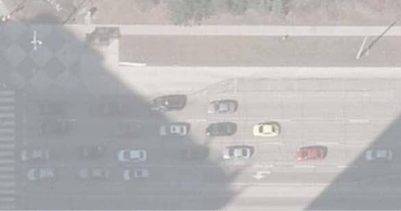
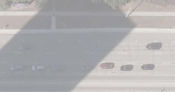

147


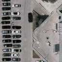


148


149
Master Plan Class Environmental Assessment for Downtown Mississauga Road Improvements
 Master Plan Class Environmental Assessment for Downtown Mississauga Road Improvements Public Information Centre # 1 Wednesday June 25, 2014 5:30 p.m. to 8:00 p.m. Mississauga Civic Centre Great Hall Welcome
City of Toronto. Emery Village Transportation Master Plan
 City of Toronto Emery Village Transportation Master Plan May 2009 Emery Village Transportation Master Plan Toronto, ON May 2009 Consulting Inc. 100 York Blvd., Suite 300 Richmond Hill, ON L4B 1J8 Tel:
Mavis Road Class Environmental Assessment
 Mavis Road Class Environmental Assessment Public Information Centre #2 Wednesday November 9, 2016 6:00 to 8:00 p.m. Please sign in and complete a comment sheet Review the displays on your own or join in
GEOMETRIC IMPROVEMENTS AND WATERMAIN LOOPING MUNICIPAL CLASS ENVIRONMENTAL ASSESSMENT
 GEOMETRIC IMPROVEMENTS AND WATERMAIN LOOPING MUNICIPAL CLASS ENVIRONMENTAL ASSESSMENT Veterans Way (previously Powerline Road) and Klondike Park Road Wasaga Beach Welcome Please sign in Take a comment
Heritage Road Improvements from Steeles Avenue to Rivermont Road
 The Corporation of the City of Brampton Heritage Road Improvements from Steeles Avenue to Rivermont Road Class Environmental Assessment Study (Schedule C) September 19, 2013 The Corporation of the City
Environmental Study Report
 Square One Drive Extension Municipal Class Environmental Assessment and Preliminary Design Prepared for: City of Mississauga Prepared by: Stantec Consulting Ltd. 300W-675 Cochrane Drive Markham, ON L3R
St. Clair Avenue West Area Transportation Master Plan
 1 (Between Keele Street and Old Weston Road) Public Information Centre 1 December 2, 2015 2 Welcome Welcome to the first Public Information Centre for the St. Clair Avenue West Area. The panels will present
9 CITY OF VAUGHAN OFFICIAL PLAN AMENDMENT NO BOCA EAST INVESTMENTS LIMITED
 9 CITY OF VAUGHAN OFFICIAL PLAN AMENDMENT NO. 631 - BOCA EAST INVESTMENTS LIMITED The Planning and Economic Development Committee recommends the adoption of the recommendations contained in the following
Bostwick Road. Municipal Class Environmental Assessment. Public Information Centre #2 June 14, City of London
 Bostwick Road Municipal Class Environmental Assessment Public Information Centre #2 June 14, 2017 Welcome! Welcome to the 2 nd Public Information Centre for the. Representatives from the and the consulting
CITY OF VAUGHAN EXTRACT FROM COUNCIL MEETING MINUTES OF NOVEMBER 15, 2016
 Item 11, Report No. 38, of the Committee of the Whole, which was adopted without amendment by the Council of the City of Vaughan on November 15, 2016. Regional Councillor Di Biase declared an interest
WELCOME TO OPEN HOUSE TWO November 28, 2018
 Langstaff Road Weston Road to Highway 7 Class Environmental Assessment Study WELCOME TO OPEN HOUSE TWO November 28, 2018 Please sign in and join our mailing list Study Overview York Region is conducting
ENBRIDGE GAS DISTRIBUTION INC. Proposed Relocation for Ninth Line, Markham and Whitchurch-Stouffville. Environmental Screening Report
 Page 1 of 18 ENBRIDGE GAS DISTRIBUTION INC. Proposed Relocation for Ninth Line, Markham and Whitchurch-Stouffville Environmental Screening Report July 2011 Page 2 of 18 Table of Contents 1.0 INTRODUCTION
Toronto Complete Streets Guidelines
 Toronto Complete Streets Guidelines 108 110 7.1 Green Infrastructure Design Principles 112 7.2 Context-Sensitive Green Streets 114 7.3 Key Green Street Elements Green infrastructure refers to natural and
Second Line West Pedestrian/Cyclist Crossing of Highway 401 Class EA. Second Line West Pedestrian/Cyclist Crossing of Highway 401 Class EA
 1 1 Purpose of Public Information Centre #2 To provide interested and/or potentially affected stakeholders with an opportunity to participate in the planning and decision-making process for this Municipal
Portage Parkway Environmental Assessment Public Information Centre No. 1
 City of Vaughan Portage Parkway Environmental Assessment Public Information Centre No. 1 November 25, 2015 Welcome to the Public Information Centre This first Public Information Centre (PIC) introduces
Edward R. Sajecki Commissioner of Planning and Building
 Corporate Report Clerk s Files Originator s Files CD.04.HUR DATE: TO: FROM: Chair and Members of Planning and Development Committee Meeting Date: April 14, 2014 Edward R. Sajecki Commissioner of Planning
Bostwick Road. Municipal Class Environmental Assessment. October 13, City of London. Bostwick Road Municipal Class Environmental Assessment
 Bostwick Road Municipal Class Environmental Assessment October 13, 2016 Welcome! Welcome to the first Public Information Centre for the Bostwick Road Municipal Class Environmental Assessment. Representatives
Rapid Transit Implementation Working Group September 14, 2017
 Rapid Transit Implementation Working Group September 14, 2017 BACKGROUND Council approved the Rapid Transit Master Plan and Updated Business Case on July 25, 2017. Approval of the RTMP confirmed the BRT
FANSHAWE PARK ROAD/RICHMOND STREET INTERSECTION IMPROVEMENTS. PUBLIC INFORMATION CENTRE 2 June 16, 2016
 FANSHAWE PARK ROAD/RICHMOND STREET INTERSECTION IMPROVEMENTS Municipal Class Environmental Assessment PUBLIC INFORMATION CENTRE 2 June 16, 2016 ACCESSIBILITY Under the Accessibility Standards 2015 for
Lower Don River West Remedial Flood Protection Project TABLE OF CONTENTS. Page. Executive Summary
 TABLE OF CONTENTS Page Executive Summary 1.0 INTRODUCTION...1-1 1.1 Purpose of the Undertaking...1-1 1.2 Study Area Description...1-1 1.3 Description of the Undertaking...1-1 1.4 Rationale for the Undertaking...1-2
Vaughan Metropolitan Centre (VMC) Black Creek Renewal CLASS ENVIRONMENTAL ASSESSMENT
 Black Creek Renewal CLASS ENVIRONMENTAL ASSESSMENT") PUBLIC INFORMATION CENTRE Vaughan Metropolitan Centre (VMC) Black Creek Renewal Wednesday, May 10, 2017 6:00 p.m. to 8:00 p.m. Add photo Project Management, Environmental Assessment, Stormwater Management
PUBLIC INFORMATION CENTRE Vaughan Metropolitan Centre (VMC) Black Creek Renewal Wednesday, May 10, 2017 6:00 p.m. to 8:00 p.m. Add photo Project Management, Environmental Assessment, Stormwater Management
PUBLIC OPEN HOUSE HURONTARIO-MAIN CORRIDOR SECONDARY PLAN
 PUBLIC OPEN HOUSE HURONTARIO-MAIN CORRIDOR SECONDARY PLAN Tuesday, February 28, 2012 6pm 9pm 1 st Floor Atrium, City Hall 2 Wellington Street West, Brampton 1 POLICY FRAMEWORK The 2006 Provincial Growth
GLEN ROAD PEDESTRIAN BRIDGE ENVIRONMENTAL ASSESSMENT STUDY PUBLIC INFORMATION CENTRE #2 OCTOBER 24, 2017
 GLEN ROAD PEDESTRIAN BRIDGE ENVIRONMENTAL ASSESSMENT STUDY PUBLIC INFORMATION CENTRE #2 OCTOBER 24, 2017 Glen Road Pedestrian Bridge Class Environmental Assessment 1 WELCOME! Welcome to the second Public
Burloak Drive Grade Separation
 Burloak Drive Grade Separation Transit Project Assessment Process Public Meeting #1 March 30, 2017 GO Lakeshore West Service Plan Weekday Rush Hour 15-minute, two-way service between Aldershot* and Union
McKay Road Interchange and Salem / Lockhart Crossing
 McKay Road Interchange and Salem / Lockhart Crossing The McKay Road Interchange Class EA has two components: 1. A new MacKay Road Interchange at Highway 400; and 2. A new bridge crossing of Highway 400
TOWN OF AURORA HERITAGE IMPACT ASSESSMENTS AND CONSERVATION PLANS GUIDE
 PLANNING AND DEVELOPMENT SERVICES Development Planning Division Heritage Planning Section Phone: 905-727-3123 ext. 4226 Fax: 905-726-4736 Email: planning@aurora.ca Town of Aurora 100 John West Way, Box
Public Information Centre #1
 and Highway 401 Interchange Improvements WELCOME Public Information Centre #1 Veterans Memorial Parkway Extension and Highway 401 Interchange Improvements Study May 23, 2012 4 p.m. to 7 p.m. Brief Overview
Highway 427 Industrial Secondary Plan Area 47 Schedule C Class Environmental Assessment For Arterial Roadways
 Welcome to Pubic Information Centre #1 Highway 427 Industrial Secondary Plan Area 47 Schedule C Class Environmental Assessment For Arterial Roadways Welcome to Open House # 1 Tonight, we invite you to.
VILLAGE OF BOLTON HERITAGE CONSERVATION DISTRICT PLAN
 Page 1 1. INTRODUCTION AND BACKGROUND 1.1 THE PROJECT VILLAGE OF BOLTON HERITAGE CONSERVATION DISTRICT PLAN TERMS OF REFERENCE The Town of Caledon (Town) is a large, predominantly rural municipality with
TABLE OF CONTENTS Page
 TABLE OF CONTENTS Table of Contents Page 1 INTRODUCTION... 1-1 1.1 Introduction and Background... 1-1 1.1.1 Current Class Environmental Assessment Study... 1-1 1.2 Study Area (Section 1)... 1-3 1.3 Ontario
~!VAUGHAN NOV Z November 21, Mr. Denis Kelly, Regional Clerk The Regional Municipality of York Yonge Street Newmarket, ON L3Y 6Z1
 ~!VAUGHAN NOV Z 5 2016 November 21, 2016 Mr. Denis Kelly, Regional Clerk The Regional Municipality of York 17250 Yonge Street Newmarket, ON L3Y 6Z1 Dear Mr. Kelly: RE: NEW KIRBY GO STATION IN BLOCK 27
City of Cornwall Municipal Class Environmental Assessment. Proposed Improvement and Extension of Lemay Street
 Welcome City of Cornwall Municipal Class Environmental Assessment Proposed Improvement and Extension of Lemay Street Redevelopment and Design of the Municipal Works Yard Public Information Centre #1 Thursday,
South of Eastern Strategic Direction Status Update
 STAFF REPORT ACTION REQUIRED South of Eastern Strategic Direction Status Update Date: July 10, 2014 To: From: Planning and Growth Management Committee Chief Planner and Executive Director, City Planning
APPENDIX 1. Long Range Planning and the Vision for the Future of the Town
 APPENDIX 1 Long Range Planning and the Vision for the Future of the Town Long Range Planning and the Vision for the Future of the Town Given the requirements of the Provincial Policy Statement and Growth
City of Larkspur. Notice of Mitigated Negative Declaration for the 285
 Notice of Mitigated Negative Declaration for the 285 Magnolia Avenue Mixed-Use Project Date: December 2, 2013 Responsible Agency: Project Title: 285 Magnolia Avenue Mixed-Use Project Project Address: 285
DAVENPORT VILLAGE SECONDARY PLAN
 27 DAVENPORT VILLAGE SECONDARY PLAN 27. DAVENPORT VILLAGE SECONDARY PLAN 1. VISION FOR THE DAVENPORT VILLAGE SECONDARY PLAN Davenport Village, municipally known as 830, 940, 980 and 1100 Lansdowne Avenue,
THAT the attached Terms of Reference for the Thornhill Centre Street Study be approved.
 COMMITTEE OF THE WHOLE AUGUST 18, 2003 THORNHILL CENTRE STREET STUDY PLANNING FILE: 15.92 Recommendation The Commissioner of Planning recommends: THAT the attached Terms of Reference for the Thornhill
Introduction. Public Information Package. Project website. Overview. Class Environmental Assessment Process
 1 Introduction Public Information Package Baseline Road Extension between Lambs Road and Bennett Road, Bowmanville Schedule B Municipal Class Environmental Assessment November 6, 2017 Overview The purpose
Elevated Water Storage Facility and Pumping Station Municipal Class EA for Pressure District 7: PIC # 1 Summary
 Memorandum DATE: March 14, 2018 TO: FROM: CC: OUR REF.#: SUBJECT: Winston Wang, M.A.Sc., P.Eng Project Manager, City of Hamilton Jennifer Whittard, B.E.S., PMP Shelley Kuan, Jessica Mollo WM16-0435 Elevated
Elfrida Growth Area Study
 Elfrida Growth Area Study Public Information Centre #2 December 6, 2017 6:00-8:30 pm PLANNING & ECONOMIC DEVELOPMENT DEPARTMENT Purpose of the Study The Elfrida Area has been identified as the preferred
SCARBOROUGH SUBWAY EXTENSION. Scarborough Subway Extension. Final Terms of Reference
 Scarborough Subway Extension Final Terms of Reference 1 1.0 Introduction and Background 1.1 Introduction Toronto City Council recently confirmed support for an extension of the Bloor-Danforth Subway from
Ashbridges Bay TTC Maintenance and Storage Facility
 Ashbridges Bay TTC Maintenance and Storage Facility September 8, 2010 Presented to Government Review Team 1 Presentation Overview Overview of the Project Status of Transit Project Assessment Process Potential
Municipal Class EA Study Public Information Centre No. 1 December 13, :00 pm 7:00 pm. Please sign in so we can keep you updated on this study
 Reconstruction of Regional Road 45 (Creek Road) Between Regional Road 27 (River Road) and Regional Road 63 (Canborough Road) in the Township of Wainfleet Municipal Class EA Study Public Information Centre
Lambeth Main Street Streetscape Improvements
 Lambeth Main Street Streetscape Improvements Open House October 5th, 2017 Agenda 1. Introduction 2. Project Background 3. Context 4. Project Objectives 5. Design Principles & Approach 6. Streetscape Design
STAGE 1 ARCHAEOLOGICAL ASSESSMENT OF RATHBURN ROAD, FROM DUKE OF YORK BOULEVARD TO SHIPP DRIVE, CITY OF MISSISSAUGA. Submitted to:
 STAGE 1 ARCHAEOLOGICAL ASSESSMENT OF RATHBURN ROAD, FROM DUKE OF YORK BOULEVARD TO SHIPP DRIVE, CITY OF MISSISSAUGA Submitted to: McCormick Rankin Corporation 2655 North Sheridan Way, Suite 280 Mississauga,
THE CORPORATION OF THE CITY OF WINDSOR Office of the City Solicitor Planning Department
 THE CORPORATION OF THE CITY OF WINDSOR Office of the City Solicitor Planning Department REPORT TO THE CITY OF WINDSOR PLANNING ADVISORY COMMITTEE DATE OF REPORT: August 19, 2010 SUBJECT: Official Plan
Public Information Centre. Welcome
 Transportation Improvements from the Beaver Creek Bridge to the Entrance of Santa s Village District of Muskoka Municipal Class Environmental Assessment Welcome Please sign in Take a comment sheet Staff
The purpose of tonight s PIC is to:
 The purpose of tonight s PIC is to: Provide an overview of the work completed to date and a summary of the Class EA process being followed; Provide a summary of public input received so far, including
Commissioners Road West Realignment Environmental Assessment
 City of London Commissioners Road West Realignment Environmental Assessment Public Information Centre No. 2 November 29, 2017 Welcome to the Public Information Centre This 2 nd Public Information Centre
Commissioners Road West Realignment Environmental Assessment
 City of London Commissioners Road West Realignment Environmental Assessment Public Information Centre No. 1 March 30, 2017 Welcome to the Public Information Centre This first Public Information Centre
Emery Village Road 2A Municipal Class Environmental Assessment Study
 PW12.11 STAFF REPORT ACTION REQUIRED Emery Village Road 2A Municipal Class Environmental Assessment Study Date: March 30, 2016 To: From: Wards: Reference Number: Public Works and Infrastructure Committee
Edward R. Sajecki Commissioner of Planning and Building
 Corporate Report Clerk s Files Originator s Files CD.03.POR DATE: TO: FROM: SUBJECT: Chair and Members of Planning and Development Committee Meeting Date: February 27, 2012 Edward R. Sajecki Commissioner
13 THORNHILL YONGE STREET STUDY IMPLEMENTATION CITY OF VAUGHAN OPA 669 AND TOWN OF MARKHAM OPA 154
 13 THORNHILL YONGE STREET STUDY IMPLEMENTATION CITY OF VAUGHAN OPA 669 AND TOWN OF MARKHAM OPA 154 The Planning and Economic Development Committee recommends the adoption of the recommendations contained
Ashbridges Bay Erosion and Sediment Control Project
 Ashbridges Bay Erosion and Sediment Control Project Project Brief Overview Toronto and Region Conservation Authority, in partnership with the City of Toronto, intends to carry out remedial erosion control
CITY OF VAUGHAN EXTRACT FROM COUNCIL MEETING MINUTES OF JUNE 7, 2016
 Item 5, Report No. 26, of the Committee of the Whole (Working Session), which was adopted without amendment by the Council of the City of Vaughan on June 7, 2016. 5 MUNICIPAL CLASS ENVIRONMENTAL ASSESSMENT
SPECIAL COMMITTEE OF THE WHOLE DECEMBER 9, 2002 BLOCK 57/58 WEST BLOCK PLAN BLOCK PLAN FILE BL.57/58W.99 HUNTINGTON BUSINESS PARK LAND OWNERS
 SPECIAL COMMITTEE OF THE WHOLE DECEMBER 9, 2002 BLOCK 57/58 WEST BLOCK PLAN BLOCK PLAN FILE BL.57/58W.99 HUNTINGTON BUSINESS PARK LAND OWNERS Recommendation The Commissioner of Planning recommends: THAT
Appendix M4 - Part 1. Public Information Centre Summary Report. Appendix M4
 Appendix M4 - Part 1 Public Information Centre Summary Report Appendix M4 Public Information Centre Summary Report Sheridan Park Drive Municipal Class Environmental Assessment City of Mississauga R.J.
Public input has been an important part of the plan development process.
 Lakewood s Comprehensive Plan recognizes that transportation helps shape the community, and that the way the community provides for the safe and efficient movement of people affects the character of the
Station Street/Haig Road Extension Environmental Assessment (EA)Study. Welcome
Study. Welcome") Station Street/Haig Road Extension Environmental Assessment (EA)Study Welcome Welcome to this Public Information Centre (PIC) meeting. Please record your attendance and obtain a comment sheet at the registration
Station Street/Haig Road Extension Environmental Assessment (EA)Study Welcome Welcome to this Public Information Centre (PIC) meeting. Please record your attendance and obtain a comment sheet at the registration
THE CITY OF VAUGHAN BY-LAW BY-LAW NUMBER A By-law to adopt Amendment Number 1 to the Official Plan of the Vaughan Planning Area.
 THE CITY OF VAUGHAN BY-LAW BY-LAW NUMBER 015-2014 A By-law to adopt Amendment Number 1 to the Official Plan of the Vaughan Planning Area. NOW THEREFORE the Council of the Corporation of the City of Vaughan
Port Credit Local Advisory Panel October 20 th Meeting
 Port Credit Local Advisory Panel October 20 th Meeting Focus Of This Evening s Meeting: 1. Hurontario Main Street Higher Order Transit Study 2. Port Credit Mobility Hub & GO Station Parking Structure Study
Figure 1- Site Plan Concept
 Figure 1- Site Plan Concept Parking will be provided underground on three levels at rate of 1.0 space/ unit; this rate includes all visitors parking. MMM Group has prepared a parking assessment (April,
Welcome. Walk Around. Talk to Us. Write Down Your Comments
 Welcome This is an information meeting introducing the applications for proposed redevelopment of the Yorkdale Shopping Centre site at 3401 Dufferin Street and 1 Yorkdale Road over the next 20+ years,
MOUNT PLEASANT SECONDARY PLAN & VILLAGE BLOCK PLAN. Wednesday, March 5, 2008 Informal Public Open House
 MOUNT PLEASANT SECONDARY PLAN & VILLAGE BLOCK PLAN Wednesday, March 5, 2008 Informal Public Open House 1. Welcome & Introductions 2. Highlights of Provincial Growth Plan 3. Overview and Status Update -
Report to: Development Services Committee Report Date: September 11, 2017
 ~RKHAM Report to: Development Services Committee Report Date: September 11, 2017 SUBJECT: PREPARED BY: Conceptual Master Plan for the Future Urban Area - Community Structure Plan and Key Policy Direction
London s Bus Rapid Transit System
 London s Bus Rapid Transit System HERITAGE WORKSHOP November 7, 2017 1 Agenda 1. Introductions 2. Overview of Transit Project Assessment Process 3. Archaeology and Heritage Approval Process 4. Role of
Master Environmental Servicing Plan & Secondary Plan
 East Side Lands Stage 2 1 Master Environmental Servicing Plan & Secondary Plan Public Information Centre #1 June 16, 2016 Welcome! Today s Agenda Please sign in at the front desk. 5:30 pm 6:30 pm: Open
PLANNING JUSTIFICATION REPORT
 PLANNING JUSTIFICATION REPORT 556, 560 and 576 Conservation Drive 2115881 Ontario Limited City of Waterloo, Regional Municipality of Waterloo Zoning By-law Amendment Draft Plan of Subdivision July 2016
THE CORPORATION OF THE TOWN OF OAKVILLE BY-LAW NUMBER
 THE CORPORATION OF THE TOWN OF OAKVILLE BY-LAW NUMBER 2017-120 A by-law to adopt an amendment to the Livable Oakville Plan, Official Plan Amendment Number 20 (Downtown Oakville Growth Area) WHEREAS the
CONSULTING SERVICES FOR THE WHITEBELT VISIONING EXERCISE ADDENDUM TO THE GTA WEST LAND USE STUDY WORK PROGRAM
 CONSULTING SERVICES FOR THE WHITEBELT VISIONING EXERCISE ADDENDUM TO THE GTA WEST LAND USE STUDY 1. Introduction WORK PROGRAM The Town of Caledon is a large, local municipality located in the Greater Toronto
Land Use Amendment in Southwood (Ward 11) at and Elbow Drive SW, LOC
 at and Elbow Drive SW, LOC") 2018 November 15 Page 1 of 10 EXECUTIVE SUMMARY This land use amendment application was submitted by Rick Balbi Architect on 2017 August 31 on behalf of Sable Developments Ltd, and with authorization from
2018 November 15 Page 1 of 10 EXECUTIVE SUMMARY This land use amendment application was submitted by Rick Balbi Architect on 2017 August 31 on behalf of Sable Developments Ltd, and with authorization from
Don Mills Crossing Study and Celestica Lands Development Application Community Meeting, Open House, and Breakout Discussions
 Consultation Summary Don Mills Crossing Study and Celestica Lands Development Application Community Meeting, Open House, and Breakout Discussions This report is not intended to provide a verbatim transcript
Relief Line Project Assessment
 Relief Line Project Assessment Public Information Centre April 5, 2017 Tonight s Meeting PURPOSE To review the preferred alignment for the Local Segment. AGENDA 6:30 Open House 7:00 Presentation / Discussion
COMMUNITY SUSTAINABILITY AND ENVIRONMENTAL MASTER PLAN IMPLEMENTATION UPDATE
 Attachment 1 COMMUNITY SUSTAINABILITY AND ENVIRONMENTAL MASTER PLAN IMPLEMENTATION UPDATE Priorities and Key Initiatives Committee May 2013 Page E-1 How we grow Goal 2: To ensure sustainable development
Services Department F May 28, 2007
 Report To: Development Services Committee Item: Date of Report: From: DS-07-144 May 23, 2007 Commissioner, Development File: Date of Meeting: Services Department F-7000-0013 May 28, 2007 Subject: Gibb
AGINCOURT SECONDARY PLAN
 1 AGINCOURT SECONDARY PLAN 1. AGINCOURT SECONDARY PLAN The following policies and principles apply to the area herein referred to as Agincourt, as outlined on Map 1-1. 1. GENERAL POLICIES 1.1 This Secondary
THE CORPORATION OF THE TOWN OF OAKVILLE BY-LAW NUMBER
 THE CORPORATION OF THE TOWN OF OAKVILLE BY-LAW NUMBER 20012-08530 A by-law to adopt an amendment to the Official Plan of the Oakville Planning Area (Official Plan Amendment 198) Land North of Dundas Street.
Blackfriars Bridge Municipal Class Environmental Assessment. Public Information Centre #1 November 19 th, 2014
 Blackfriars Bridge Municipal Class Environmental Assessment Public Information Centre #1 November 19 th, 2014 Why are you here tonight? To determine the future requirements of the river crossing at Blackfriars
Northeast Anthony Henday Drive Manning Freeway to Whitemud Drive Welcome to this Construction Information Session
 Manning Freeway to Whitemud Drive Welcome to this Construction Information Session Purpose To inform interested residents and businesses about the plans accommodation. Background: The Government of Alberta
DESIGN CRITERIA PACKAGE
 RFQ: 17-C-00003 DESIGN-BUILD SERVICES FOR THE DESIGN CRITERIA PACKAGE PREPARED BY: JAMES E. JACKSON, JR. AIA CITY ARCHITECT CONTRACT ADMINISTRATION DEPARTMENT and INTERFLOW ENGINEERING, L.L.C DESIGN CRITERIA
SUBJECT: Waterfront Hotel Planning Study Update TO: Planning and Development Committee FROM: Department of City Building. Recommendation: Purpose:
 Page 1 of Report PB-23-18 SUBJECT: Waterfront Hotel Planning Study Update TO: Planning and Development Committee FROM: Department of City Building Report Number: PB-23-18 Wards Affected: 2 File Numbers:
Western Road/Wharncliffe Road North Widening from Platts Lane to Oxford Street. Municipal Class Environmental Assessment Public Information Centre #1
 Western Road/Wharncliffe Road North Widening from Platts Lane to Oxford Street Municipal Class Environmental Assessment Public Information Centre #1 June 11, 2014 Welcome Welcome to the first Public Information
WELCOME TO OPEN HOUSE # 3
 Bayview Avenue Class Environmental Assessment Study Steeles Avenue to Elgin Mills Road WELCOME TO OPEN HOUSE # 3 Please sign in and join our mailing list Why Are We Here Tonight? Study Process and Purpose
THE GARDEN CITY PLAN. City of St. Catharines Official Plan. City of St. Catharines
 THE GARDEN CITY PLAN City of St. Catharines Official Plan City of St. Catharines August 2010 APPROVAL INFORMATION This Official Plan of the City of St. Catharines Planning Area, known as the Garden City
Purpose of Open House #3
 Public Meeting #3 May 9, 2009 MVVA Team Purpose of Open House #3 The main purpose of this Open House is to present and seek input on the: Evaluation of transportation and infrastructure design alternatives
Public Meeting #3 May 9, 2009 MVVA Team
 Public Meeting #3 May 9, 2009 MVVA Team Welcome to the third Public Meeting for the Lower Don Lands Municipal Class Environmental Assessment (EA) Infrastructure Master Plan and Keating Channel Precinct
3 Development Process 3.1 Stage One page Stage Two page Stage Three page CENTRAL PICKERING DEVELOPMENT PLAN
 3 Development Process 3.1 Stage One page 24 3.2 Stage Two page 25 3.3 Stage Three page 28 22 CENTRAL PICKERING DEVELOPMENT PLAN The Central Pickering Development Plan establishes the key elements of new
John M. Fleming Managing Director, Planning and City Planner. Old East Village Dundas Street Corridor Secondary Plan Draft Terms of Reference
 Report to Planning and Environment Committee To: From: Subject: Chair and Members Planning & Environment Committee John M. Fleming Managing Director, Planning and City Planner Old East Village Dundas Street
1.1.1 Growth Plan for the Greater Golden Horseshoe 2006 Office Consolidation January 2012
 HDR Corporation 100 York Blvd. Suite 300 Richmond Hill, ON L4B 1J8 Tel: (905) 882-4100 Fax: (905) 882-1557 www.hdrinc.com File: 2.0 Memorandum To: Amber Parnell Town of Innisfil Cc: From: Carl Wong - HDR
8 Oak Street - Official Plan and Zoning By-law Amendment Application - Preliminary Report
 STAFF REPORT ACTION REQUIRED 8 Oak Street - Official Plan and Zoning By-law Amendment Application - Preliminary Report Date: March 17, 2014 To: From: Wards: Reference Number: Planning and Growth Management
150 Eighth Street Zoning By-law Amendment Application Preliminary Report
 REPORT FOR ACTION 150 Eighth Street Zoning By-law Amendment Application Preliminary Report Date: March 27, 2019 To: Etobicoke York Community Council From: Director, Community Planning, Etobicoke York District
Adelaide Street / Canadian Pacific Railway (CPR) Grade Separation. Public Information Centre #1
 Grade Separation. Public Information Centre #1") 1 Adelaide Street / Canadian Pacific Railway (CPR) Why Are We Here? 2 The purpose of Public Information Centre (PIC) #1 is to: Introduce the study Provide the study background and context Identify the
1 Adelaide Street / Canadian Pacific Railway (CPR) Why Are We Here? 2 The purpose of Public Information Centre (PIC) #1 is to: Introduce the study Provide the study background and context Identify the
City Of Owen Sound. 10th Street Bridge Evaluation - Schedule 'C' Environmental Study Report. Version 2 (Phase 3) GMBP File: June 26, 2018
 GMBP File: June 26, 2018") Prepared By: City Of Owen Sound 10th Street Bridge Evaluation - Schedule 'C' Environmental Study Report Version 2 (Phase 3) GMBP File: 215235 June 26, 2018 GUELPH OWEN SOUND LISTOWEL KITCHENER LONDON HAMILTON
Prepared By: City Of Owen Sound 10th Street Bridge Evaluation - Schedule 'C' Environmental Study Report Version 2 (Phase 3) GMBP File: 215235 June 26, 2018 GUELPH OWEN SOUND LISTOWEL KITCHENER LONDON HAMILTON
Environment and Sustainability. Environment and Sustainability
 4 Environment and Sustainability Environment and Sustainability ENVIRONMENT AND SUSTAINABILITY 4.1 CLIMATE CHANGE AND AIR QUALITY... 4-5 4.1.1 OBJECTIVES... 4-6 4.1.2 POLICIES... 4-6 4.2 NATURAL HERITAGE
Project phasing plan (if applicable) 12 copies of site plan
 12 copies of site plan") SITE PLAN REVIEW PERMIT APPLICATION City of Grand Haven, 11 N. Sixth Street, Grand Haven, MI 49417 Phone: (616) 847-3490 Fax: (616) 844-2051 Website: www.grandhaven.org 1. Project Information Address/location
SITE PLAN REVIEW PERMIT APPLICATION City of Grand Haven, 11 N. Sixth Street, Grand Haven, MI 49417 Phone: (616) 847-3490 Fax: (616) 844-2051 Website: www.grandhaven.org 1. Project Information Address/location
Town of Oakville Streetscape Strategy
 Town of Oakville Streetscape Strategy Endorsed by PDC on February 10, 2014 (PD-011-14) Town of Oakville Streetscape Strategy [endorsed by PDC February 10, 2014] 0 Town of Oakville Streetscape Strategy
AMENDMENT NO. 30 TO THE OFFICIAL PLAN OF THE TOWN OF MILTON
 AMENDMENT NO. 30 TO THE OFFICIAL PLAN OF THE TOWN OF MILTON Subject: Boyne Survey Secondary Plan and Related Official Plan Amendments The following text and schedules constitute Amendment No. 30 to the
Complete Neighbourhood Guidelines Review Tool
 Complete Neighbourhood Guidelines Review Tool Prepared By: City of Regina Planning Department October 2014 Page 1 of 14 Community Development Review Checklist for Secondary Plans and Concept Plans The
Official Plan Review: Draft Built Form Policies
 PG.30.1 REPORT FOR ACTION Official Plan Review: Draft Built Form Policies Date: May 15, 2018 To: Planning and Growth Management Committee From: Chief Planner and Executive Director, City Planning Division
CITY OF NIAGARA FALLS. By-law No
 CITY OF NIAGARA FALLS By-law No. 2018- A by-law to provide for the adoption of Amendment No. 128 to the City of Niagara Falls Official Plan (OPA #128). THE COUNCIL OF THE CORPORATION OF THE CITY OF NIAGARA