The Comprehensive Plan
|
|
|
- Amelia Mills
- 6 years ago
- Views:
Transcription


1 The Comprehensive Plan for the Town of Morrison Preserving the Nearest Far Away Place 2008
2 TABLE OF CONTENTS Contents Acknowledgements...i Adoption... ii Introduction Community Vision...1 Historic Perspective...1 Statutory Authority (Enabling Legislation)...2 Three Mile Plan...2 Purpose of the Comprehensive Plan...3 Town Planning Process...3 Implementing the Plan...4 Amending the Comprehensive Plan...5 Planning Areas Central Planning Area...6 East Planning Area...8 South Planning Area...9 Growth and Small Town Design Introduction...12 Goals, Policies and Strategies Transportation Introduction...17 Goals, Policies and Strategies Parks, Trails and Open Space Introduction...23 Goals, Policies and Strategies Economic and Commercial Development Introduction...28 Goals, Policies and Strategies Historic District Introduction...31 Goals, Policies and Strategies Community Involvement and Services Introduction...35 Goals, Policies and Strategies
3 Public Improvements Introduction...37 Goals, Policies and Strategies Water Resources Introduction...40 Goals, Policies and Strategies Resources and Environment Introduction...43 Goals, Policies and Strategies Public Safety Introduction...46 Goals, Policies and Strategies Mapping Planning Area *Map Land Use Map *Map Transportation and Gateways Map *Map Old Town Morrison Transportation and Gateways Map *Map 3A...19 Parks, Trails and Open Space Map *Map Old Town Historic District Map *Map Water and Sewer Lines Map *Map Soils, Slopes and Floodplains Map *Map Appendix Appendix A - Definitions Appendix B - Community Survey Summary

4 Acknowledgements Morrison Board of Trustees Allen Williams, Mayor Gordan Speir, Trustee Virginia Paul Trustee Loren Oswalt Trustee John Mikity Trustee Earl Aukland Trustee Sean Forey Trustee Morrison Planning Commission Jamee Chambers - Chairperson Kevan Fitzgerald - Vice Chairperson Virginia Paul - Commissioner Sandy Weeks - Commissioner Susan Hall - Commissioner Lisa Look - Commissioner/Alternate John Price - Commissioner/Alternate The 2008 Morrison Comprehensive Plan update was funded, in part by DRCOG and the Colorado Center for Community Development UCD/DOLA. Prepared by: Colorado Center for Community Development UCD/DOLA Campus Box 128 P.O. Box Denver, CO Public Meeting Presentations and Town Hall forums Graduate Student Interns: Ben Pershouse, Todd Swirczek, Andrew Tadross, Comprehensive Documentation and Mapping Graduate Student Interns: Ben Pershouse, Todd Swirczek CCCD Project Manager: J. Bergquist Town of Morrison Staff: Jerry Smith, Special Projects Coordinator Kara Powis, Town Clerk Deanna Glass, Deputy Town Clerk McCool Development Solutions, LLC 538 South Devinney Street Lakewood, Colorado Special thanks to the citizens, business owners, landowners of Morrison and interested citizens in the surrounding area who participated in comprehensive plan update process. i
5 Adoption The Morrison Comprehensive Plan, 2008, was adopted by The Planning Commission On July 22, 2008 By: Jamee Chambers, Planning Commission Chair ii

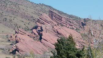
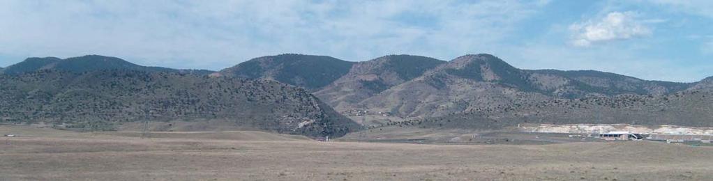
6 Introduction Community Vision Morrison, embracing the historic, natural yet eclectic characteristics of the community will strive to provide its citizenry with a safe, healthy and prosperous environment to live, learn, work and play while encouraging planned and wellbalanced growth. - Morrison Planning Commission, 2008 Historic Perspective Morrison is located in Jefferson County, four miles south of the City of Golden and approximately 18 miles west of downtown Denver. Morrison, with a population of 417, sits at the western edge of the Denver Metropolitan area and includes a C-470 interchange and property both east and west of the Hogbacks and C-470. Morrison is primarily connected to the Denver Metropolitan area by Interstates I-70, C-470, and Highway 285. Morrison Market ca 1864 The area around Morrison began to be settled in 1860 and was originally known as Mt. Morrison. The settlement had a population of between two and twenty five people who were mainly located near the confluence of Mount Vernon and Bear Creeks. The area grew quickly after the Civil War and became a center for coal mining, rock quarries, timbering, and other mineral extraction services that were needed to meet the construction and building needs of the growing Denver area. By 1880 the population in and around Morrison had grown to 750. The physical setting of the Town is dominated by two creeks and spectacular land forms associated with hogbacks and sandstone formations which separate Morrison from the Great Plains to the east. In the late 1800 s and early 1900 s, the close proximity to Denver and the beauty of the area started to attract tourists from Denver. At the time, the Denver South Park and Pacific Railroad later named the Colorado and Southern Railway connected Mt. Morrison to downtown Denver. Transporting visitors to the activities and sights around Morrison, as well as moving freight, coal, stone, lumber, cement, and gypsum back to the burgeoning City of Denver. At its peak in 1913, the Colorado and Southern Railway ran four daily roundtrips to and from Morrison. The Town has been significantly flooded four times in the last 112 years. In 1896, Morrison was flooded, killing 27 and causing $6 million in damages (in 1999 dollars). This flood was 200 feet wide and 15 feet deep and is now recorded as the third most disastrous flood in Colorado. The other three Morrison floods happened in 1906, 1


7 1925 and Although Bear Creek has been channeled and some storm mitigation is in place the likelihood of another disastrous flood is great. Morrison School 1945 As was common with many of Colorado s early mountain communities, Morrison s population declined sharply at the turn of the 20 th Century. Morrison was incorporated in 1906 and by 1910 the Town s population had dropped to 250. As road and highway connections to Morrison were constructed to accommodate automobile and truck traffic, rail services declined and scheduled train service ended in Rail services were all together abandoned following a series of disastrous floods in the 1930 s. Morrison s population grew slowly from 1910 to the 1980 s when it topped out at just over 500. Morrison is unique in terms of population change since World War II. While most Front Range and foothills communities have mushroomed in growth, the Town s population numbers have declined to approximately 425, and have remained relatively unchanged for over a quarter of a century. This is, in part, a result of the Town s policies related to land use, annexation, and the fact that large pieces of nearby property are devoted to governmentally owned park and open space. Physical barriers such as creeks, canyons, hogbacks, and steep slopes have also contributed to a relatively low population growth. Statutory Authority (Enabling Legislation) Colorado State Law (CRS ) provides the framework for master plans or comprehensive plans within the State. This document complies with the State statute by providing for planned and orderly development and balancing basic human needs for a changing population with legitimate environmental concerns. It is the policy of the State of Colorado to clarify and provide broad authority to local governments to plan for and regulate 2
8 the use of land within their respective jurisdictions. The Comprehensive Plan has legal status in that once adopted, no street, square, park or other public way, ground or open space, public building or structure, or publicly or privately owned public utility may be built or authorized with out review and approval by the Planning Commission (CRS ). In keeping with this definition, the Comprehensive Plan for the Town of Morrison will guide development and growth within Morrison, while also providing direction to other municipalities and governmental entities within a three-mile area of Morrison. The Plan is designed to work with these other agencies by encouraging Intergovernmental Agreements, such as the one which exists between Morrison and Lakewood in the Rooney Valley, and other area plans that address all the concerns of nearby municipalities and government organizations. This Comprehensive Plan is intended to serve as the Three Mile Plan as required by CRS Land Uses shall be as identified in the Master Plans of the respective jurisdictions (City of Lakewood or Jefferson County) except for the land use designations within the Town s planning area boundaries as illustrated on the Land Use Plan, Map 2. Purpose of the Comprehensive Plan The purpose of the Comprehensive Plan is to articulate Morrison s vision for the community. This plan will help decision makers evaluate proposals and form the comprehensive strategy for guiding future development and managing growth of the Town in a manner that is consistent with their vision. It is intended to serve as a road map for Town staff, Town Board, Planning Commission, advisory committees, developers and citizens to achieve the goals set forth in this plan. Town Planning Process In the 1960 s, Town leaders, concerned with the encroaching growth of the Denver metropolitan area, made a decision to control the population growth of Morrison. They did so by purchasing and thereby controlling, utility facilities needed for future growth. In addition to establishing control over and improving these public utilities, the Town prepared its first Comprehensive Plan in The Plan was intended to guide growth and development for the next 20 years until The Plan did not foresee, however, the annexation of 400 commercial acres east of the Hogback in This annexation, coupled with the fact that the unincorporated communities of Conifer and Evergreen began growing rapidly during this timeframe, led Morrison to update the Comprehensive Plan in Further, growth in the late 1980s and 1990s in Lakewood and unincorporated Jefferson County, along with the construction and eventual completion of C-470 prompted the Town to update the 1988 Comprehensive Plan in Since 2000, actual and impending growth to the east of C-470 and to the south of Highway 285, along with the changes of the Rooney Valley have made it necessary to update the Comprehensive Plan for This current update of the Comprehensive Plan is intended to provide guidance for the Town and development interests through 2015, when it will become necessary to update it once again. Conflicts between mutually desirable goals are inevitable. Such 3
9 conflicts should be resolved in the interest of building a cohesive community. The Town recognizes that the interests of residents of a particular neighborhood may need to be balanced with the overall needs and greater goal of the community. The Comprehensive Plan provides guidelines for these potential conflicts in the best overall interest of the community. The initial process of updating Morrison s Comprehensive Plan began when community surveys were given to Town residents and businesses (Summer 2007). These surveys requested information about what is unique and important to the citizens of Morrison and how they see the future growth and development of the Town proceeding. A selected group of stakeholders were surveyed as well. After receiving survey and stakeholder feedback, three community workshops were held to: 1) identify and prioritize the community goals; 2) recognize the Town s areas of opportunities and constraints and identify preferred land use locations; and 3) present the community s consensus plan for comment and discussion. By encouraging citizen participation in the planning process, the Town has ensured that the Comprehensive Plan will be an inclusive document that has taken the concerns of Morrison s citizens into account. The Comprehensive Plan was updated in conjunction with the Mile High Compact, a voluntary agreement among Denver metro area cities to manage growth, in which Morrison agreed to produce an updated comprehensive plan that addresses areas such as: Extent of Urban Development Transportation Systems Preserving open space and natural environment Collaboration with neighbouring jurisdictions on planning issues The information gathered from the Town s citizens, staff, and Planning Commission suggests that there are several key areas of concern for Morrison. In general, citizens want to preserve the small town character, open space, view vistas, and geological features that make Morrison a unique place. People are open to residential and commercial growth south of the existing Town and east of the Hogback as long as it occurs in a way which complements the character of the existing Town as well as providing tax revenue. Implementing the Plan Implementation of The Morrison Comprehensive Plan requires a commitment by the Planning Commission and Board of Trustees, as well as Town Administration, to use it as a daily decision-making guide for Town growth, development, and design. Individual citizens must also support the Plan by following its direction in the choices that they make as residents of Morrison. This combined, committed effort will allow the citizens vision for their community become a reality. 4
10 The Comprehensive Plan is organized by goals, policies and strategies (Action steps), all of which stem from the vision of the Comprehensive Plan. A Goal is a broad statement of values or aspirations needed to achieve the vision. A Policy provides more precise directions and guides the actions of staff, developers and policy makers necessary to achieve the goal. An Action is a specific task/process used to implement a policy and work toward achieving the goals. The Plan is implemented by following the policies and carrying out the actions contained in the Plan. Regulatory tools such as zoning, subdivision regulation, and capital improvements programs transform policy into actuality. For these tools to effectively implement the Plan, they must be updated to reflect the goals, policies and actions contained within the Plan. Amending the Comprehensive Plan This Comprehensive Plan is a citizen-based document for the Planning Commission and Board of Trustees to use to direct decision making for the Town. As the community grows, the Plan must be able to adapt accordingly. The Planning Commission, Board of Trustees, Town staff, should re-evaluate and update the Plan in response to major changes in the community every three to five years. Citizens may also request amendments to the Plan. Both the written and graphic components of the Comprehensive Plan may be amended. The Planning Commission must review all requests to amend the Plan. If an amendment is suggested, the Board of Trustees and Planning Commission must determine if the suggested change is in the best interest of the Town and hold a public hearing regarding the amendment. An amendment to the Comprehensive Plan must be done by an adopted resolution of the Board of Trustees. The Comprehensive Plan may be amended provided the following criteria are met: The amendment improves the implementation of one or more of the goals, policies, and strategies of the Comprehensive Plan. The amendment will not pose a detrimental impact on existing or planned Town facilities, services, or transportation facilities. Significant community concerns regarding the proposed change have been adequately addressed. 5
. Each of the planning areas is unique and poses its own challenges.")
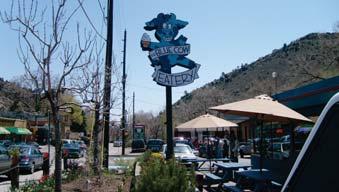
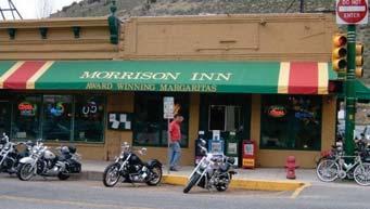
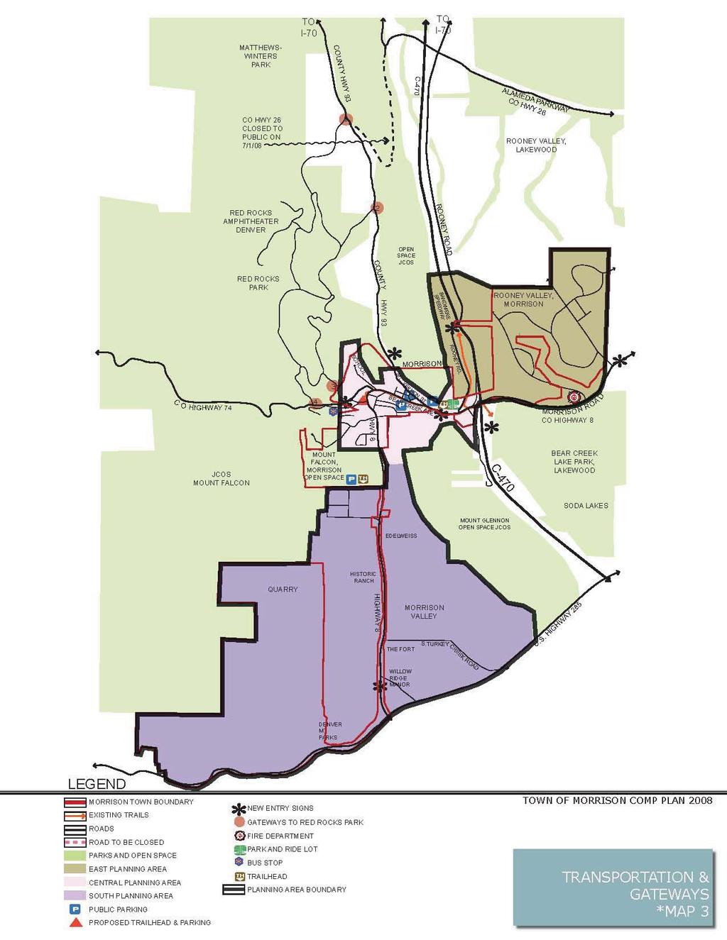
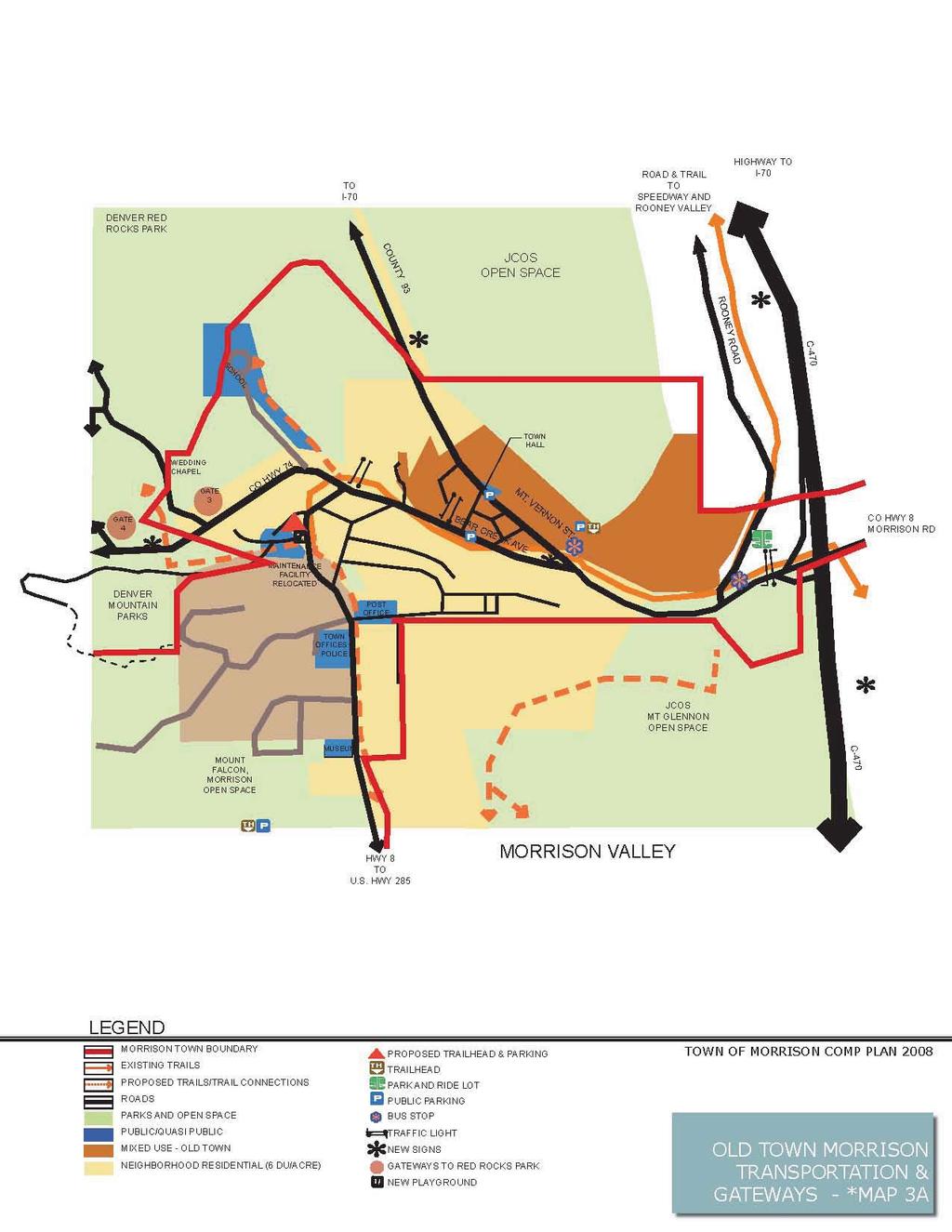
11 Planning Areas For purposes of the Comprehensive Plan, the Town has been divided into three Planning Areas: East Planning Area (Rooney Valley), Central Planning Area (Old Town Morrison) and South Planning Area (Morrison Valley). Each of the planning areas is unique and poses its own challenges. Central Planning Area The Central Planning Area contains Old Town Morrison (downtown) and its surrounding residential and commercial areas. The area is bordered by Mt Vernon Street (County Hwy 93) at the town limits on the North; Red Rocks Park Entry Gate # 4 on Highway 74 on the West; the Hogback and Colorado Highway 8 near the C470 intersection on the East; and the Natural History Museum and the Post Office at Highway 8, as the southern edge. This area also contains rolling to steep terrain, north of the downtown, limited tree cover, the tree lined Bear Creek corridor, and beautiful views of Red Rocks Park. Town residents encourage and support the unique and eclectic character of Old Town Morrison. Modifications to the existing commercial or residential in this area should retain this character. The views and open areas north of old town should be preserved. GOAL 1: Emphasize the significance of key community places and buildings in Old Town. Policy CA 1: Assess planning area for key community places, buildings and historic resources. Action CA1.1: Designate historic structures. Action CA1.2: Encourage restoration or reuse by exploring grant possibilities. Action CA1.3: Prioritize preservation efforts and develop preservation policy. Action CA1.4: Support public art to further the historic and cultural heritage of the community. 6

12 GOAL 2: Preserve the historic and eclectic character of Old Town Morrison. Policy CA 2: The unique and eclectic character of the Central Planning Area will be preserved and enhanced through the use of complementary architectural styles by using similar height and bulk, building forms and streetscape as well as and adhering to existing residential densities. Action CA2.1: Building design should reflect the existing style of Old Town Morrison. Ground floor windows, storefronts, and prominent entries will be incorporated into new and remodeled buildings. Action CA2.2: Land uses within Old Town will create a unique identity, without competing with highway-oriented business along the C-470 corridor. Businesses that promote travel to Downtown during evenings and weekends should also be encouraged, such as hotels, bed and breakfasts, restaurants, bars and entertainment. Action CA2.3: Explore the interest level of business and property owners in the formation of a downtown development committee charged with the mission of strengthening Old Town Morrison. Action CA2.4: Develop streetscape design guidelines that can be applied in Old Town Morrison. Action CA2.5: Implement a lighting program, and coordinate façade design, outdoor eating areas and streetscape design, with the creation of a pedestrian environment. Action CA2.6: Encourage trail connectivity through Old Town Morrison. 7
13 EAST PLANNING AREA The East Planning Area consists of Morrison s land to the east of the Hogback and encompasses the southern portion of Rooney Valley known as Red Rocks Business Centre. This area is highly visible from C-470 and represents the best opportunity for the Town to increase its tax base. This area is separated from the Central Planning Area by the Hogback and C-470, which allows more intensive development to occur while limiting the impacts to the historic Central Planning Area. The East Planning Area is controlled under an Intergovernmental Agreement (IGA) with the City of Lakewood. The Rooney Valley Master Plan is an amendment to the Morrison and Lakewood Comprehensive Plans and discusses issues specific to Rooney Valley. Both the Town (July 1999) and City of Lakewood (May 1998) adopted separate but similar versions of the Rooney Valley Master Plan. The 2002 Master Plan combines the 1998 and 1999 plans into one Master Plan for the entire Intergovernmental Agreement area of Rooney Valley. GOAL 1: Encourage high-quality mixed use development that will generate revenue for the Town. All policies and action items for the East Planning Area are included in the Rooney Valley Master Plan, 2002 as adopted by the Planning Commission, Resolution 99-5 and the Rooney Valley Development Guidelines adopted by Ordinance
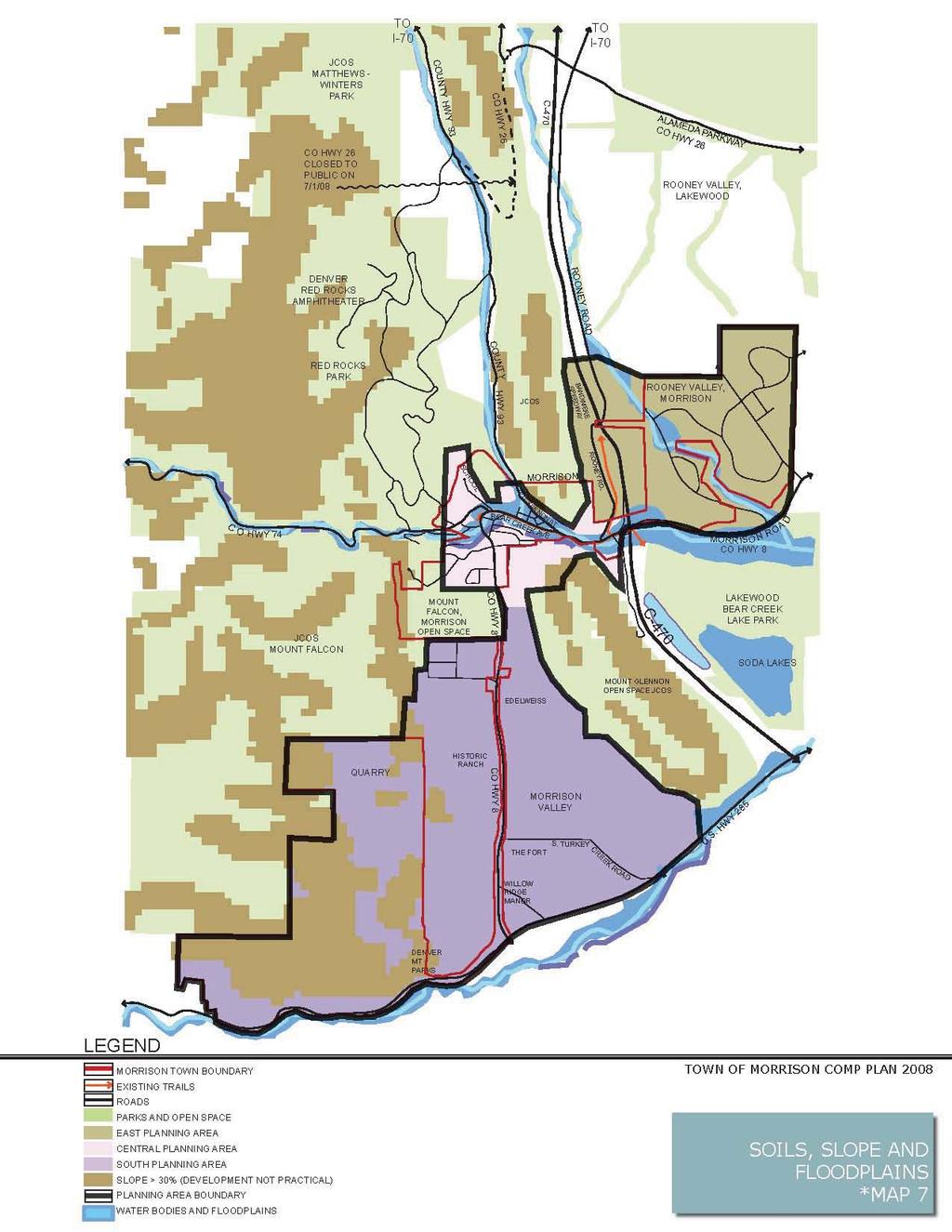
14 SOUTH PLANNING AREA The South Planning Area, also referred to as Morrison Valley lies south of the Natural History Museum and the Post Office on Highway 8. It is located south of the Central Planning Area along both sides of Colorado Highway 8, south to U.S. Highway 285 and is bordered on the east by Jefferson County s Mt. Glennon Open Space Hogback, on the west by Jefferson County s Mount Falcon Open Space as well as, Aggregate Industries mining operations area and the Town s water reservoir. Currently, about half of the south planning area is in unincorporated Jefferson County. The area is home to Aggregate Industries, the Town s water reservoir, several large parcels under private ownership, and the Fort Restaurant. This planning area includes stunning views of the Hogbacks, Mt. Falcon, Mt Glennon, and several unique rock formations throughout the valley. This area has residential development along the Highway 8 corridor. Forest Avenue provides access to Pine Grove Park subdivision and the eastern entrance to Mount Falcon Park. Development in the South Planning Area is appropriate in nodes close to the southern edge of Town and also near the intersections of Highway 8 and Highway 285. This future development could include residential, employment commercial, industrial, recreation, lodging and educational or cultural facilities wherein a high percentage of open space is encouraged. GOAL 1: Preserve significant natural, cultural and agricultural resources within the planning area and maintain the rural character of Morrison. Policy SA.1: Identify and encourage the preservation and enhancement of agricultural lands, scenic view corridors, wildlife habitat, and geologic rock formations. Action SA1.1: Direct development close to the core community and designated development nodes to maximize the funds invested in public infrastructure and to preserve open lands, natural areas, scenic view corridors, wildlife habitat and geologic rock formations. Action SA1.2: Adopt regulations that encourage cluster development, protect habitat and sensitive areas from degradation, provide adequate buffering and provide site design standards that consider a property s natural features in the site design. 9
15 Action SA1.3: Require wildlife habitat, natural areas, scenic view corridors, geologic rock formations and community gateways be identified and discussed at the initial stages of the development review process. 10
16 11
17 Growth and Small Town Design Morrison s population has remained fairly consistent over the past 30 years (See Table A below). The developed land area has also remained nearly the same over that time span. It should be noted that approximately 42% of Morrison s current population are residents in the Bear Creek Nursing and Rehabilitation Center. Table A Morrison Population Table Population Year est. 564 est.* 5,164 est ** *Population estimate based on Jefferson County 10.6% annual population change **Population estimate based on total build-out (2,300 Central/South Planning Areas and 2,300 East Planning Area) Due to the predicted growth of the Denver metropolitan area over the next 20 years, Morrison is at a crossroads in terms of development and population growth. It has been noted that in the past the Town did not see residential growth as a primary goal, in fact wanting to stay as small a population as possible. Today, citizens are comfortable with the current rate of growth in old town Morrison but noted that development in the Rooney Valley is either slow or too slow. Because of the Town s increased exposure due to C-470, Highway 285, the Alameda Interchange, and development east of the Hogback, Morrison is at a cusp of making major decisions related to development. Citizens identified two areas for potential growth: Rooney Valley and designated nodes along Highway 8 south of town. The abundant open space and small town character are extremely important to Morrison s residents and should be retained and enhanced when considering future development. It is also important to note that citizens are accepting of more contemporary development patterns east of the Hogback, in the Rooney Valley, but prefer more traditional single family residential homes followed by mixed use development with limited commercial development in designated nodes along the Highway 8 corridor between the Post Office and Highway 285. Most survey respondents cited that proximity to public sewer and water service as the most important requirement for future growth. Morrison School now a residence 12
18 Overwhelmingly, citizens voiced their strong support of preserving community character, abundance of open space and trails, historic old town, independently owned businesses and unique architecture. The vast majority of citizens that participated in the community workshops or sent in surveys spoke of the appreciation for Morrison s strong sense of community. Preserving important historic structures, supporting individual and cultural expression, parks and open space connectivity and encouraging public art all contribute to a community s unique identity. They felt that the following qualities contribute to Morrison s small-town feel: Rich history Isolated, yet close to the Denver metro area Strong community identity/sense of community Size Caring community Good restaurants and shops (independently owned) Small incorporated town (local control) Safe, walkable community Scenic location, landscape and views The challenge for the Town will be to maintain and enhance the characteristics that contribute to the small town atmosphere while responding to development pressures. Morrison should grow responsibly and efficiently, considering the balance of economic, environmental concerns, as well as ensuring that development pays its way and support the sustainability of the Town. GOAL 1: Grow with the intention of maintaining Morrison s small town atmosphere. Policy A1: Review annexation requests to ensure conformance with the Comprehensive Plan. Action A1.1: Expand the annexation review criteria to encourage: Consistency with the Comprehensive Plan goals and policies. Developments that benefit the Town economically and are consistent with the Land Use Map. The efficient provision of public facilities and services. 13
19 Action A1.2: Require annexation applications to include concept plans that conform with the intent of the Comprehensive Plan before annexing into Morrison. Action A1.3: Encourage the areas that are designated as Agricultural/Rural Residential on the Land Use Map to provide a variety of housing types and lot sizes while conserving large amounts of open space. Action A1.4: Foster cooperation with City of Lakewood and Jefferson County in establishing and/or updating intergovernmental agreements relating to issues such as: land use, open space, transportation, revenue sharing, provision of public facilities and services. Policy A2: Adequate public facilities and services should be available to serve current and future residents in a cost-effective, efficient manner. Development should occur where it can be served by Town infrastructure. Action A2.1: Adopt public facilities ordinance to establish a standard for the level of service that should be provided for all public facilities and services, including water, sewer, stormwater, parks, streets, trails, police, and fire protection prior to annexing new properties. Require development to pay its proportional share of expanding public facilities and services. Action A2.2: Ensure that Morrison s Capital Improvements Plan helps to promote the goals and strategies that are set forth in the Comprehensive Plan and that all public facilities are properly maintained and all citizens receive quality public services. Action A2.3: Coordinate with the School District, Fire Protection District, Police, Public Works, Town Water and Town Utilities Department to review the public dedication standards and impact fees to ensure that they include adequate land for all public facilities including parks, trails, open space, schools, police and fire stations. Policy A3: Development should pay its share of the cost to provide needed public services, facilities and infrastructure. Action A3.1: Regularly evaluate dedication requirements, development fees and impact fees to ensure that development is paying its share of development expenses. Policy A4: Maintain and enhance the Town s character and sense of place as defined by its neighborhoods, districts, planning areas, corridors and edges. 14
20 Action A4.1: Public spaces such as plazas, civic buildings, parks, gateways and landscaping should be integrated into the overall development pattern of the Town and be designed to be safe, attractive, functional and accessible. Action A4.2: Doors, windows and porches, not garages or blank walls, will be the dominant features that are seen from the street. Buildings will be designed to be proportional to the street, with appropriate mass, bulk and height and setback. Action A4.3: Attractive landscaping will be incorporated thoughtout the Town, and provide visual interest, screening of unsightly areas, enhance views, cover for wildlife, shade from the summer sun, and protection from the winter wind. Regionally appropriate plant materials will be encouraged, while the expansive use of mulches and non-living plant material should be discouraged. GOAL 2: Create a healthy balance between housing, employment, availability of goods and services, recreation and cultural opportunities within the community. Policy A5: Evaluate projects with respect to magnitude, scale and diversity of project type so that no one project or combination of projects overtakes the character of the existing community. Action A5.1: Use the Land Use Plan as a general guide to land use decision-making. Evaluate development proposals in conjunction with the Land Use Plan to ensure there is a balance of land uses. Action A5.2: Develop and adopt design guidelines for the Town and require all new development to comply with said guidelines. Action A5.3: In cooperation with the City of Lakewood, develop and adopt design and development standards for the Rooney Valley. 15
21 16
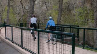
22 Transportation Planning The Town s intent is to provide for safe and efficient vehicular and pedestrian traffic within the Town limits while maximizing visitor access to businesses, natural attractions and recreation areas. The Town desires to accommodate visitor traffic without undue detriment to residential traffic needs in Town. Despite Morrison s small size and desire to remain a small town, it faces traffic problems consistent with much larger municipalities. The need to provide adequate streets, safe pedestrian and vehicular mobility, and providing ample public parking are, and will continue to be, among the Town s highest priorities. Traffic routing and the provision of parking will continue to be important issues as the Town and local business and property owners attempt to solicit additional visitor traffic to Morrison. Perimeter parking and the reuse of other facilities for public parking would help reduce some of the parking congestion in the Central Planning Area. Due to the popularity of Red Rocks Park, Bandimere Speedway, and The Lariat Loop Historic and Scenic Byway, Morrison will continue to experience traffic congestion throughout the Central Planning Area. It is important for the Town to work cooperatively with the City and County of Denver and other governmental and private entities in the scheduling of events at Red Rocks Park and Bandimere Speedway to accommodate traffic congestion whenever possible. Morrison s transportation system development includes safety, convenience, and efficiency, by incorporating a variety of modes of transportation including automobiles, transit, bicycle and pedestrians. GOAL 1: Provide and maintain a roadway network, which meets Morrison s circulation, and access needs in a safe, economical and efficient manner. Policy C-1: Ensure that the transportation system is compatible with adjacent land uses to maintain a high level of mobility. Action C1.1: Establish a roadway classification system of arterial, collectors, local streets, and alleys that promote appropriate levels of service. Action C1.2: Establish a system of street standards that accommodate bicycles, pedestrians, and on-street parking needs. Action C1.3: Manage future traffic congestion with all modes of travel. Action C1.4: Coordinate additions and improvements to the transportation system with the City of Lakewood, Jefferson County, and CDOT. 17
23 Action C1.5: Develop a continuous system of bicycle/pedestrian routes including connections to schools, natural attractions, businesses, and recreation areas. Action C1.6: Investigate ways to improve safety of pedestrians and bicyclist crossing at C-470, Highway 8 and County Road 93. Action C1.7: Designate bicycle lanes with signage and pavement markings where existing roadway widths permit. Action C1.8: Provide separate bicycle/pedestrian pathway in the design of future development. Action C1.9: Establish Old Town Morrison as a bicycle/pedestrian system hub to enhance the viability of Old Town. Policy C-2: Incorporate mechanisms within the transportation system to protect and enhance the environmental quality and small-town character of Morrison. Action C2.1: Minimize the environmental impacts of transportation through appropriate traffic control measures. Action C2.2: Include environmentally efficient design in site development and roadway facilities by matching facility function and capacity to projected traffic demand, through appropriate use of traffic control, and through the concept of shared parking in mixed use areas. Action C2.3: Direct access on Highway 8 should be limited and the use of shared curb cuts should be encouraged. Action C2.4: Work with the Red Rocks Elementary School to improve safety regarding pedestrian access to the school and Old Town from the surrounding residential neighbourhoods. Action C2.5: Research the feasibility of a transportation connection between Rooney Valley and future outlying parking areas and to Old Town Morrison. GOAL 2: Enhance the aesthetic image of Morrison by improving the appearance of gateway entries to Town. Policy C-3: Develop and maintain the gateways into Morrison in an aesthetically pleasing manner, using natural and local resources, to create a favourable visual and unique impression for resident s and visitors. 18
24 Gateway entries will be developed at appropriate locations along roads, streets and highways to identify the Town to visitors and residents. Action C3.1: Create welcoming entries into Morrison by improving the appearance of major intersections. Action C3.2: Develop gateway design guidelines in order to maintain the Town s distinct and separate identity. Guidelines shall address community image, identity, appearance and design including, but not limited to lighting and structural design, landscaping and signage. Action C4.3: Work with CDOT to improve signage on C-470, and Highway 285 to better serve those attending events at Red Rocks and Bandimere Speedway. Action C4.4: Develop strategies for public improvements at town gateways as identified on the Transportation and Gateways Map as well as the Old Town Morrison Transportation and Gateways Map. Policy C-4: Encourage the use of C-470 for regional traffic, arterial streets such as Highway 8, Highway 74, and Bear Creek Avenue, for cross-town traffic, and discourage commercial or through traffic on residential streets. Action C4.1: Utilize traffic calming tools such as speed bumps or dips, existing dead end streets, wayfinding signage, and street signage indicating Local Traffic Only to deter commercial and through traffic on residential streets. Action C4.2: Encourage businesses to require deliveries to occur at non-peak traffic times to avoid congestion. Policy C-5: Improve or expand parking on public right-of-ways in Old Town Morrison. Action C5.1: Move the existing maintenance facility and equipment storage to a higher elevation, away from Bear Creek, and reuse the site for a new trail-head and downtown parking area. Action C5.2: Engage the Lariat Loop Historic and Scenic Byway and Jefferson County Open Space in discussions related to financing of public and/or private pay for parking systems. Revenues from these systems should be used to develop additional parking opportunities. 19
25 Action C5.7: Research outlying parking possibilities for bikers and hikers, to alleviate the downtown parking congestion. 20
26 21
27 22
28 Parks, Trails, and Open Space Morrison is surrounded by a significant amount of public open space that provides a variety of outdoor recreational opportunities. The citizens of Morrison view this public open space as a valuable asset that not only provides a recreational outlet and a wildlife corridor and refuge area, but also acts as a buffer from encroaching development. This buffer has historically provided the Town with a small town feel in the midst of a county that has seen enormous growth over the past few decades. Morrison s sense of seclusion is further emphasized by large tracts of private land surrounding the Town that are either utilized for agriculture or lie undeveloped. The citizens of Morrison and a number of private landowners have identified some areas of private land which should be retained as privately owned open space. The agriculturally zoned land surrounding the Red Rocks Elementary School should remain so zoned. Much of that land contains geologic features that are unique to the area and should be preserved for future generations. Much of the land along Strain Gulch, south of Town, should be preserved as conservation, agricultural, open space and/or low density residential. The citizens of Morrison and a number of private landowners have indicated that having an improved trail system, which highlights the area s unique geological history, is an important goal for both recreational and economic development purposes. By expanding and improving the trail system, the Town can economically benefit from a greater influx of recreational hikers and cyclists. GOAL 1: Create and plan for the future public recreational opportunities for both residents and day visitors to improve tourism and support existing retail businesses. Policy D-1: Develop and adopt a community-based Parks, Trails and Open Space Master Plan. 23
29 Action D1.1: The master plan will provide identification and development strategies of recreational opportunities in all three planning areas. It will look at providing additional parks and park improvements in the Central and East Planning Areas. Action D1.2: The master plan will provide identification and implementation strategies for protection and preservation for the potential open space, view corridors, geological features, and wildlife corridors. Action D1.3: The master plan will provide identification and development opportunities that provide revenue to the Town. Action D1.4: Work with and assist Denver Mountain Parks in upgrading Morrison Park to encourage more use by Town residents and visitors. Action D1.5: Encourage the preservation of public open space and geological points of interest in and around Morrison. Policy D-2: Develop multi-use trails, pedestrian sidewalks and bike routes that provide safe and enjoyable access throughout Morrison. Action D2.1: Evaluate existing sidewalks and trails for maintenance needs, missing connections, and other below-standard issues. Prioritize improvement based on available funding and community input. Action D2.2: Encourage the identification and development of trailheads with multiple-use parking which accommodates visitors to the Town. Action D2.3: Evaluate the potential for adding on-street and off-street bike lanes to existing streets to allow bicycles to be separated from traffic lanes. 24
30 Action D2.4: Facilitate pedestrian and bicycle connectivity by ensuring that trails, sidewalks and bicycle lanes make the following connections: Existing Bear Creek Trail to Red Rocks Park at entry gate #3 or #4 off Highway 74 to the west and to Bear Creek Lake Park, Soda Lakes, and new open space in the Rooney Valley to the east. Morrison s Mount Falcon Open Space Park, with additional trails connecting the Town to Jefferson County s Mount Falcon Open Space, Red Rocks Park and Denver s Mountain Park s Morrison Park. Old Town Morrison, Red Rocks Elementary School and the Natural History Museum to the south of Town along Highway 8. Policy D-3: Parks, trails and open space shall be designed and constructed concurrently with new development. In addition, new parks and trails shall be multi-purpose and enhance the area s quality of life and small town character. Action D3.1: Proposed development shall locate parks, trails and open space in accordance with the Parks, Trials and Open Space Map. GOAL 2: Preserve, protect and enhance significant open spaces, natural and wildlife habitat. Policy D-4: Protect and enhance significant wildlife habitat, vegetation communities, geologic features, viewsheds, agricultural land and natural areas. Action D4.1: Update Morrison s Municipal Code to encourage cluster development, protect habitat, view corridors and sensitive areas from degradation, provide adequate buffering and provide site design standards that consider a property s natural features in the site design. Require wildlife habitat, cultural resources, significant trees, etc. to be identified and discussed at the initial stages of the development review process. Action D4.2: Encourage landowners to cluster development and 25
31 preserve and manage the majority of the property as open space. Action D4.3: Encourage the preservation and improvement of the natural streambed of Bear Creek. This will increase the scenic value, water quality and natural wildlife habitat of Bear Creek in Old Town Morrison. Action D4.4: Work with local and regional citizen recreation and conservation groups to retain and improve the natural streambed quality and sustainability of Bear Creek. 26
32 27
33 Economic and Commercial Development A healthy local economy is essential for retaining existing businesses, attracting new businesses, improving the economic vitality of the community, and strengthening the quality of life for residents. Morrison residents have determined that Old Town Morrison is the heart of the community. A majority of survey respondents indicated that focusing on Old Town Morrison as a catalyst for economic growth and stability was very important. As such, the Town should continue to maintain the character of the existing historic district by actively pursuing the smaller businesses and encouraging the eclectic mix of businesses and services. The Town of Morrison is almost completely surrounded by public open space including: Red Rocks Amphitheatre (Denver Mountain Parks), Jeffco open spaces, Bear Creek Lake Park and a natural community separator, the hogback. This unique locational situation has made Morrison rely heavily on sales tax revenue from Old Town Morrison as it continues to be the major source of revenue for the Town. In the mid 1980 s, Morrison took actions that expanded its potential economic base. Annexation of the Red Rocks Centre, the C-470 interchange area, and portions of Rooney Valley, east of the Hogback, have given the Town the potential for growth. In addition to potential mixed use development in Rooney Valley and support of Old Town Morrison s growth and vitality, citizens identified economic development opportunities to the south of Town along Highway 8 in appropriate nodes as identified on the Land Use Map. GOAL 1: Enhance commercial corridors and attract high-quality commercial development when combined with the residential base, can support the Town s operation and capital improvements needs. Policy E-1: Facilitate access of existing Morrison s businesses to low cost capital from public and private sources for historic preservation, business retention and expansion and improvements in physical appearance of business both in terms of buildings and interior space. Action E1.1: Explore collaboration with Clear Creek Economic Development Corporation or other programs to establish a small business loan program. 28
34 Action E1.2: Ensure that the infrastructure needed to support the economy is in place by implementing a master utility plan. Action E1.3: Conduct a detailed study of parking opportunities in Old Town Morrison. Policy E-2: Enhance the appearance and economic viability of Old Town Morrison through streetscape enhancement, economic aid and incentives. Action E2.1: Develop and acquire funding to implement a downtown revitalization program for Old Town Morrison which will provide an improved consistent streetscape which is historic in character and pedestrian friendly. Action E2.2: Develop a short and long term plan to underground overhead utility lines in Old Town Morrison using Xcel Energy s undergrounding program and a combination of public and private funding. Action E2.3: Collaborate and financially participate with the Lariat Loop Historic and Scenic Byway organization. Action E2.4: Encourage and work with the Morrison Natural History Museum Foundation to develop a more active role for the Foundation s participation in developing financial support for the Museum and increased public awareness through marketing activities. Action E2.5: Develop design guidelines for Old Town Morrison. Policy E-3: Encourage local businesses to be active and invest in the community. Action E3.1: Approach the ownership of the Bandimere Speedway to encourage a collaborative approach related to current and future operations and development changes at Bandimere Speedway. Action E3.2: Develop appropriate incentive strategies to facilitate mixed-use development in the Morrison portion of the Rooney Valley. Action E3.3: Evaluate the effects of the fee and tax structures on the economic climate of Morrison and revise on an as needed basis. 29
35 Action E3.4: Encourage the downtown community to participate in park and trail improvements. Action E3.5: Encourage an art in public places program and encourage business owners to participate. Action E3.6: Support the creation and growth of neighborhood businesses that enhance the vitality and quality of life Morrison for residents. 30
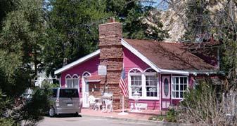
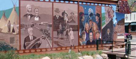
36 HISTORIC DISTRICT During the process of updating the Comprehensive Plan in Fall 2007, Morrison s citizens, through surveys and community meetings, placed a great deal of positive emphasis on the Town s historic aspects and the preservation of Morrison s small town character. Citizens and business owners also expressed that the historic and natural surroundings are major contributors to the quality of life and the vitality of commerce in the Town. These are consistent assets that have been identified on every Comprehensive Plan from 1975 to This perceived ambiance and natural beauty are typified by the Town s informal adoption of the catch phrase Morrison: The nearest faraway place. Background Efforts to preserve or enhance the historic character of Morrison have not, in the past, received the universal support that the surveys and community meetings indicate. Although citizens agree that the historic character helps to make Morrison a wonderful place, there is no unanimity on how to retain this charm. Previous attempts at preserving this character have either been quietly successful or vigorously opposed. On September 28, 1976 the efforts of preservationist Lorene (Reenie) Horton and others resulted in the State of Colorado s designation of the Morrison Historic District. The district is comprised of most of the downtown structures and houses throughout the adjacent residential neighborhoods. Ms. Horton eventually published a walking tour brochure based on her extensive research and a paper-bound monograph of historic photographs. The designated structures, however, remain unprotected by any Town ordinance. Then, in 1989, a citizen initiated project received a small seed grant from the Kellogg Foundation enabling the formation of the Morrison Action Committee. The group, which consisted of business owners and residents acting as a chamber of commerce type organization, leveraged several grant sources to restore the 1886 Town Hall in In 1999, grant funds were used to develop the Downtown District Design Guidelines (Resolution 99-5) which would have provided for adaptive re-use of only those downtown structures contributing to 31
37 the 1976 Historic District. The guidelines were never enacted due to a lack of support from some business owners and the Town Board. A recent lighting ordinance to enhance the historic district by using period lighting was voted down by the Town Board and a sign ordinance to enhance the historic district has been unevenly enforced. Changing Conditions In 1988, Interstate C-470 opened and brought all of metropolitan Denver to Morrison s front door. Some Town merchants had fears that the re-routing of traffic would devastate local businesses. Instead, business flourished as the interstate removed thousands of daily commuters for whom Morrison had become a bottleneck. Also due to the alignment of C-470, a 1940 s era log home in its path had to be removed or demolished. Jefferson County Open Space funds were used to move and remodel the Cox Cabin into what is currently the Morrison Natural History Museum. In 2004, the Town celebrated the completion of a major segment of the Jefferson County Open Space Trail system that runs along Bear Creek from Soda Lakes Road west to the Highway 8 Bridge. These changes have transformed Morrison into a vibrant tourism center and outdoor recreational area. GOAL 1: To maintain a sense of community identity and civic pride by preserving, maintaining, and enhancing the unique and eclectic architectural and natural assets of the Town while embracing both economic and residential growth. Policy F-1: Continue to actively seek ways to encourage business owners and Town staff to recognize, preserve, enhance and re-use historical structures. Action F1.1: Continue utilizing the Town s Historical Commission to designate buildings and structures that meet Historic Landmark criteria for listing on the National Register of Historic Places. Action F1.2: Engage the property and business owners in order to pursue funding solutions for the preservation and rehabilitation of the Historic District structures. Action F1.3: Develop and adopt design guidelines for Old Town Morrison. Action F1.4: Engage business and property owners in efforts to identify funding for incentives regarding voluntary historic preservation and enhancement efforts. 32
38 Action F1.5: Utilize current building codes and ordinances to encourage adaptive re-use and restoration of buildings in the Historic District. Action F1.6: Develop public awareness regarding the benefits of LEED certified building material and systems in existing and new construction. Action F1.7: Investigate membership in the Main Street USA Program and the Colorado Community Revitalization Association to obtain technical assistance and funding for Old Town Morrison. 33
39 34
40 Community Involvement and Service Although much of the emphasis of the Morrison Comprehensive Plan is placed on the physical and economic development of the Town, it is also important to remember that community involvement, cultural growth and area attractions are very important aspects of Morrison s continued prosperity. The Town benefits from a vibrant downtown with numerous restaurants and retail options, along with museums and close proximity to Red Rocks Park and Bandimere Speedway. As development occurs in new areas of Morrison and in the Rooney Valley, the Morrison community will need to integrate the new businesses, residents, and other community institutions into the greater Morrison community. GOAL 1: Maintain a high quality of life for Morrison residents by supporting and expanding cultural, historic, educational and human service opportunities. Policy G-1: Expand the cultural and historic opportunities available to residents and visitors. Action G1.1: Support museums and encourage additional exhibits about the culture and history of Morrison. Policy G-2: Encourage community leadership and participation in Town government. Action G2.1: Continue to post meetings and agendas via newspaper, physical postings and the Town website. Action G2.2: Encourage the revitalization of citizen advisory committees that actively involve residents and business owners in Town decision making processes and activities. Policy G-3: Collaborate with community organizations to provide social, cultural, and educational events that will create a strong sense of community identity. Action G3.1: Town staff will, when appropriate and feasible, promote and coordinate community events in and around Morrison. 35
41 Action G3.2: Encourage other entities such as parent groups, service clubs and church organizations, to become actively involved in organizing and attending Town events and activities. Action G3.3: Continue to support the Town s Museum functions and events as well as provide support for their foundation to expand the Town s role in museum activities. Action G3.4: Approach local businesses and ask them to participate in or sponsor community events. Action G3.5: Continue, expand, and encourage citizens to get involved in traditional celebrations and activities such as Fourth of July, and CiderFest, etc. 36
42 Public Improvements An important challenge facing any community is having the level of its infrastructure keep pace with the growth of the community. Like most desirable communities that are facing growth, Morrison must address several infrastructure needs. The first includes those needs generated by obsolescence, federal and state mandates, or new goals for the existing Town. The second type of infrastructure need involves those generated by new development. The Town of Morrison, like other small communities, has not consistently followed a specific planned public improvement program. The traditional approach for Morrison has been reactive and repair oriented. With substantial growth on the horizon, it is in the best interest of the Town to move to a more formalized capital improvements and capital replacement program for both governmental general fund investments and utility enterprise funds. Fundamental to accommodating new growth in Morrison are adequate water supply, storage and distribution systems. Currently, Morrison will have sufficient water storage capacity once the Town reservoir is constructed and the expanded water treatment plant is completed in There is, however, a current need to make short term decisions based on how growth related wastewater treatment will be provided. GOAL 1: The Town will plan for the future and update public infrastructure that keeps pace with the current and future growth of the community Policy H-1: Make provisions for public improvements in a manner appropriate for a modern, efficiently functioning town. Action H1.1: Develop, implement and annually review a program that will identify the Town s future, public improvement priorities. Action H1.2: Identify and develop a strategic plan to address existing deficiencies in the Town s utility systems on a prioritized basis. Action H1.3: Develop a plan for providing and relocating public facilities to accommodate the future governmental and maintenance needs of the Town. Policy H-2: Identify appropriate methods of financing public improvements. Action H2.1: Establish and monitor on an annual basis, five year capital investment plans for general and enterprise fund programs. These programs will include vehicle and major equipment 37
43 inventory, building development and maintenance investment, and streets, bridges, and public property inventory, and investment schedules. Action H2.2: Develop a profile for all Town owned properties and evaluate those properties current and desired future uses. Action H2.3: Budget a minimum of 10% of the general fund sales and use tax proceeds for capital replacement items. Policy H-3: Public improvements serving new development, both on-site and off-site, will be connected to the Town s existing systems in such a way as to allow for extension of the service(s) to adjoining parcels. Action H3.1: Require developers to install all public improvements necessary to serve their development. Policy H-4: New development areas should bear the full costs of infrastructure associated with that development. Action H4.1: Require all new development and redevelopment to provide adequate storm drainage facilities and mitigation. Action H4.2: Review and update storm drainage development ordinances. Action H4.3: Ensure, through cooperation with Jefferson County (or other governmental entities) that all development outside the Town s jurisdiction but, within the Town s planning area, design and construct utility systems consistent with the Town standards. Policy H-5: Create a planned improvement program for streets, sidewalks, lighting, curbs, and gutters. Action H5.1: Identify and prioritize locations where sidewalks, curbs, and gutters should be installed or repaired and develop financing plans for implementation. Action H5.2: Create, adopt and implement a street maintenance and improvement program which will include regular bridge maintenance. 38
44 39
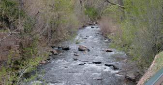
45 Water Resources Bear Creek provides Morrison with a source of drinking water in addition to the scenic value it adds to the Town. In the 1960 s, local leaders, concerned with the approaching growth from the Denver Metropolitan area, made a decision to control Morrison s population by purchasing the basic public water and wastewater facilities needed for current and future populations. In 1968, Morrison constructed a wastewater treatment facility on Bear Creek. This led to residents to abandon their septic systems and connect to the Town s wastewater system. During the 1970 s and 1980 s, the Town built a new water treatment plant, constructed the town s water reservoir, and installed larger water mains in Town. Then, in 1986, the Town constructed a wastewater facility designed to serve the residents of Morrison. Water resources are still one of the most important factors in managing the future growth in and around Morrison. Morrison s existing water rights on Bear Creek have the potential to meet all existing residential and commercial needs and some future growth. Full realization of the potential of Morrison s water rights is currently underway, as the Town is constructing new water treatment improvements in 2008 and is undertaking improvements on raw water storage. The Town s existing water rights and the supply and distribution system are one of Morrison s most valuable assets. Morrison s economic base needs to grow to keep pace with the utility services required to support the Town s existing and anticipated customer demands. State and Federal mandates related to environmental protection will cause expenses to rise beyond the level which can be supported by current utility customers. The Town is over dependent upon sales tax revenue from Old Town Morrison. In the past, sales taxes, Town bond issues and funds received through intergovernmental agreements have allowed for the financing and construction of water and wastewater system improvements, but the scale of future improvements will require additional funding sources. GOAL 1: Complete the Town reservoir and water treatment improvements in order to take full advantage of the Town s current water rights. Policy I-1: Develop a water system capable of providing an adequate year-round water supply in dry years and for future residential and commercial growth by creating storage and treatment facilities. Action I1.1: Design and complete the construction of a new reservoir with sufficient storage capacity to assure water supply to customers during periods of drought and allow for water storage in wet years. 40
46 Action I1.2: Complete construction of the water treatment facility improvements. Policy I-2: Require developers to bear the cost of planning, negotiating and obtaining water rights and water facilities to serve their development. Action I2.1: Review impacts on water rights caused by proposed development and require developers to provide sufficient rights to cover needs driven by their development projects. Action I2.2: Require extension of service lines where necessary and require developers to be financially responsible for the related cost of such service. Policy I-3: Assure that businesses comply with regulations governing water and wastewater usage as well as solid waste storage and disposal. Action I3.1: Begin planning and reviewing options for a new wastewater treatment facility. Analyze and review long and short term options. Action I3.2: Reduce per capita residential solid waste delivered to landfills by expanding private recycling practices and by raising public awareness of the benefits or recycling. Policy I-4: Continue working with the City of Denver in the provision of sanitary sewer services for Red Rocks Park and explore whether there is interest in developing similar arrangements with Bandimere Speedway properties. Action I4.1: Actively pursue meeting opportunities with representatives from City of Denver and Bandimere Speedway. Action I4.1: Annex Bandimere Speedway. Policy I-5: Work with local, regional and national groups and cooperate with scientific studies to improve the water quality in the Bear Creek Drainage Basin. Action I5.1: Actively pursue opportunities to study the causes and sources of pollution throughout the Bear Creek Drainage Basin thereby identify improvements and mitigation to the Bear Creek Drainage Basin s water quality and degradation to the stream bank. Policy I-6: Improve the natural streambed increasing the scenic value, water quality and natural habitat of Bear Creek. 41
47 Action I6.1: Work with local, regional and national citizen, recreation, and conservation groups to retain and improve the natural streambed contours of Bear Creek. 42
, and consumption of resources.")
48 Resources and Environment The natural environment in and around Morrison includes many prized assets: Bear Creek, diverse wildlife, clear air, abundant open spaces, parks and trails, geologic features, and beautiful views. Environmental challenges confronting Morrison include managing growth, lessen environmental degradation (air and water), and consumption of resources. Balancing public policy decisions, the needs of the private market, and sustainable environmental strategies is critical. Morrison citizens value the natural environment and its ability to enhance quality of life. Sustainability implies reclaiming, conserving and managing environmental assets and resources to minimize the impact of development at both a Town and regional level. Over the long term, maintaining Morrison s resources and environment will have a positive correlation with both economic growth and quality of life. GOAL 1: Promote the conservation of natural resources and the efficient use of energy while encouraging sustainable development practices. Policy J-1: Require any existing and future industrial development to comply with environmental regulations and seek cooperation with appropriate agencies to ensure that compliance. Policy J-2: Encourage water and energy conservation by both public and private consumers in Morrison. Action J2.1: Conduct an energy and water conservation audit on town buildings and facilities and initiate activities to reduce consumption and costs related to utilities, water usage, and vehicle fuel consumption. Action J2.2: Create and adopt landscaping design guidelines that require native Xeric plantings, or low water use landscaping. Action J2.3: Identify opportunities for the Town to use native plants in landscape design and demonstrate Xeriscaping techniques in 43
49 civic areas, parks and community gateways in accordance with landscape design guidelines. Policy J-3: Development proposals shall be environmentally sensitive by preserving desirable natural features, wildlife corridors, and protecting view corridors. Action J3.1: Development and implement a weed management program that focuses on eliminating invasive species while promoting native species. Action J3.2: Protect and restore, wherever possible, natural habitat for wildlife and native plants within the region. Action J3.3: Identify view corridors that should be protected. Policy J-4: Encourage sustainable building and development guidelines such as Leadership in Energy and Environmental Design (LEED) certified projects. Action J4.1: Follow green building standards and recognize builders that abide by these standards. Action J4.2: Encourage building orientations which take advantage of the sun, and prevent adjacent structures from blocking direct sunlight. Policy J-5: Ensure enforcement for existing Town, State, and Federal regulations for mining subsurface and aggregate resources. Policy J-6: Ensure that the environment and streetscape be maintained free from unsightly materials, including inoperable vehicles, unscreened outdoor storage, refuse, litter, dilapidated buildings, and billboards. Action J6.1: Maintain public rights-of-way and property by removing litter and unsightly materials. Action J6.2: Encourage and recognize actions which promote the beautification of the Town such as landscaping and architectural design by businesses and residents. Action J6.3: Draft and adopt an ordinance to ensure that the environment and streetscape be maintained free from unsightly materials as outlined in Policy J-6. 44
50 Policy J-7: Create and adopt natural hazard regulations in order to guide development. Action J7.1: Review the existing hazard regulations currently adopted for the Rooney Valley, for applicability to the Central and South Planning areas. Rock outcrops along Hwy 8 Morrison gullies and natural resources Hwy 8 45
51 Public Safety The provision of public safety services in Morrison is atypical for a community of its size. This is due to the location of two major visitor attractions within a couple of miles of the Town. Bandimere Speedway and Red Rocks Park bring tens of thousands of visitors to the Town for events, many of which occur on the same days. Adding to the need to provide public safety is the proximity of C-470, Highway 285, Highway 8, and The Lariat Loop Historic and Scenic Byway, which combine to bring thousands of travellers into the Town each week. Because of the high volume of vehicular traffic, the Town practices strict enforcement of traffic laws to ensure the safety of residents and visitors. Traffic control for major events is contracted with the Town to provide special services to Bandimere Speedway and Red Rocks Park. The Town relies on a small police department with additional reserve officers to assist during periods of peak demand. The department maintains effective working relationships with the Jefferson County Sheriff s Office and the Colorado State Patrol. These relationships should be enhanced by participating in the county wide emergency response efforts, 911, and reverse 911 systems. Anticipated new growth, particularly in the Rooney Valley, will signal a more obvious need for 24/7 police protection. New revenues should be able to sustain more police protection. Accordingly, planning for expansion of Town police service requirements for space, equipment, and personnel must be addressed. This planning should include review of police compensation, training, experience, and other operational issues. Fire and emergency medical services are provided by the West Metro Fire Protection District. A station is located within the Town limits just to the east of C-470 on Morrison Road in the Rooney Valley Development. During the Rooney Valley interim development and build out, safety provisions are provided for within an Intergovernmental Agreement between the City of Lakewood and the Town. In summary, during early development of the area, police service will be provided by the City of Lakewood. As development continues, Morrison will begin to provide police protection. At full build out, each municipality will be responsible for police protection within their boundaries. As development will bring in additional revenue it should be financially possible to add staffing, facilities and equipment as needed. One of the most significant threats to the safety and welfare of the Town, centers on the probability of severe flooding. Four of these serious and life threatening floods have occurred since The 1896 flood resulted in 27 deaths and in excess of six million dollars in property damage. Little has been done to contain these possible floodwaters which result from major cloudbursts over the constricted mountain canyons and narrow drainages. These floodwaters could 46
52 rise over the banks of Bear Creek and Mt. Vernon Creek basin and flood the existing Old Town Morrison, the Town s maintenance equipment storage building, and nearby residential properties. Because of this threat, the Town has enacted restrictions on construction in the 100 year floodplain and also participates in the national floodplain insurance program. The Town has also worked with the Urban Drainage and Flood Control District in an effort to improve the basins ability to handle high volumes of water flow. Even with these efforts, Morrison is still at risk for substantial flooding. In addition to limiting new risks, the Town should take immediate action to eliminate one of the most serious risks to the Town s safety and recovery response abilities. Having the Town s street and maintenance equipment located in the floodplain of Bear Creek could well result in the loss of the equipment needed for flood recovery. Consideration should be given to relocating the Town maintenance facility and equipment storage as soon as possible, particularly during the late spring and early summer when flash flooding presents the greatest risk. GOAL 1: Continue to ensure adequate flood, police, fire, and emergency protection for Morrison residents and property by collaborating with other agencies during major events and relocating some Town facilities out of the floodplain. Policy K-1: Continue to expand the positive working relationship with Denver s Theatres and Arenas, Bandimere Speedway, the Jefferson County Sheriff's Office, the Colorado State Patrol, the West Metro Fire Protection District, and other entities associated with public safety and emergency response in the area. Action K1.1: Relocate the maintenance equipment storage building and Town maintenance shops out of the Bear Creek floodplain. Action K1.2: Continue coordination with Denver s Theatres and Arenas as well as Bandimere Speedway, for all the event information they can provide on a regular basis to assist with planning for public safety and traffic concerns. Action K1.3: Review and update current and future needs during development of the Rooney Valley to accommodate public safety staffing needs, budgetary requirements, and additional equipment or facilities. Policy K-2: Continue to participate in the federal flood insurance program and work to maintain and improve its working relationship with the Urban Drainage and Flood Control District. 47
53 Action L2.1: Review current practices related to assuring conformity with flood control ordinances and national flood insurance standards. 48
54 49
55 Appendix A Definitions The Land Use Plan graphically illustrates the elements of the Comprehensive Plan that will guide the growth of the Town. The Land Use Plan and other supporting maps contained within the Plan cannot function without the accompanying goals, policies and strategies. The Land Use Plan illustrates the general form of Morrison in terms of land use patterns and intensity of land use activities. The Morrison Zoning Map identifies more precise land uses by zoning districts. Details regarding the permitted, accessory and uses by special review for zoning districts are contained within the Zoning section of the Morrison Municipal Code. The zoning map and regulations should be brought into conformance with the Land Use Plan within a reasonable period after its adoption. The Comprehensive Plan contains the goals, policies and strategies to guide the public, developers and government officials towards the successful growth of the Town. Land Use Categories Patterns and symbols, defined on the map legend, are used on the Land Use Plan to identify land use categories, corridors, major land features and significant public facilities. Brief descriptions for each land use category are contained below. Agricultural/Rural Residential: Typically includes large parcels of land that are used to cultivate crops and nursery stock, to raise animals and to provide farm-related products. This category provides a setting for traditional single-family residential on a variety of lot sizes, with an overall density of one (1) unit per ten (10) acres. Residential development should be clustered to maintain significant areas of open space. Large Lot Residential: This category provides a setting for large single family residential lots on a variety of lot sizes, with an overall density of 1-2 dwelling units per acre. Similar to the agricultural/rural residential land uses, residential development should be clustered to maintain significant areas of open space. Neighborhood Residential: Represents the traditional development pattern in Old Town Morrison. Housing types may include single family homes, duplexes, townhomes, additional density units/mother-in-lay units, etc. Provides a setting for a variety of housing types, ranging from small lot single-family to attached and multi-family housing with an overall density of six (6) to eight (8) units per acre, ranging in lot sizes from less than 6,250 square feet to one parcel or lot and overseen by one association. 1
56 Mixed Use Old Town: This is a linear commercial district that provides a setting for Downtown Morrison with complementary civic and residential uses with an overall density of six (6) dwelling units per acre. Mixed Use Sites that provide a combination of retail, offices, services, cultural facilities, civic uses and residential uses. High density residential is anticipated wherein offices and dwellings are encouraged to locate above ground floor retail and services. The intensity is higher in mixeduse areas than in other land use designations. Land uses are not necessarily mixed in each building, development or even within each block. But within the neighborhood, residential and non-residential uses are within walking distance of one another. Employment: Sites that provide locations for a variety of workplaces including industrial, light industrial uses, research and development activities, offices and institutions. This Land Use Designation also is intended to accommodate secondary uses that complement or support the primary workplace uses, such as hotels, restaurants, convenience shopping, childcare and housing. Light industrial use refers to manufacturing, assembly and research and development. Administrative offices that support manufacturing and wholesaling are included. Housing is allowed as a secondary use to offset job growth and the balance of housing. Industrial: Industrial uses have access to major highways through the Town s arterial street system with minimal travel through other less intense land uses. Sites are intended to provide a location for a variety of work processes and work places such as manufacturing, warehousing and distributing, and a wide range of commercial and industrial operations. Compatibility with nearby land uses and proximity to other industries are relevant criteria for siting industrial uses. Public/Quasi-Public: This designation is applied to public land, such as town facilities, government offices, police and fire stations, libraries, recreation and cultural facilities, schools and civic buildings. This designation also includes privately owned land for utility entities or special districts, which serve the general public. Public facilities should be inviting public spaces that serve as informal gathering areas, with an appearance reflecting their intended use. Parks and Open Space: This designation is applied to land owned by the public and used for recreation. Characteristics of parks and open space include public gathering places such as plazas, parks, natural areas and major trail corridors. It is also applied to private open space, recreational lands, conservation easements or other open lands. 2

57 Stakeholders (Interested Parties): Stakeholders for local land use planning typically include people who wish to influence the outcome of the decision-making processes (e.g., business owners, landowners, developers, and citizens). During the Community Input phase of the project, designated Planning Commissioners and staff conducted interviews with key community stakeholders including but not limited to: business leaders/owners (i.e., Bandimere Speedway property owners, etc), Denver Mountain Parks and Theatres and Arenas, and key property owners, etc. These stakeholders were asked a series of questions to help staff assess issues, concerns, plans, needs, and health of existing community services. LEED: The Leadership in Energy and Environmental Design (LEED) Green Building Rating System developed by the U.S. Green Building Council (USGBC), provides a suite of standards for environmentally sustainable construction. It encourages and accelerates global adoption of sustainable green building and development practices through the creation and implementation of universally understood and accepted tools and performance criteria. LEED is a third-party certification program and the nationally accepted benchmark for the design, construction and operation of high performance green buildings. LEED gives building owners and operators the tools they need to have an immediate and measurable impact on their buildings performance. LEED promotes a whole-building approach to sustainability by recognizing performance in five key areas of human and environmental health: sustainable site development, water savings, energy efficiency, materials selection and indoor environmental quality. 3
58 Appendix B Community Survey Fall of 2007: Survey Summary The following appendix highlights citizen responses to questions in the Morrison Comprehensive Plan survey The intent of this survey was to inform the rewriting of the Comprehensive plan based on feedback from the community. The following graph explains respondent s views on quality of life issues in Morrison. The majority of those who responded listed preserving community character and the abundance of trails and open space as the highest quality of life indicators in Morrison. QUALITY OF LIFE ISSUES 1% 2% 5% 4% 4% No answer (1%) 12% 11% Attainable housing (2%) Access to public transportation (4%) Affordable utilities (11%) Abundant open space and trails (15%) 15% Locally owned bus./restaurants (10%) Jobs available locally (4%) Safe for walking and biking (14%) 18% Preservation of community character (18%) Economically vibrant downtown (12%) 14% 4% 10% Investment in cultural attractions / activities (5%) Quality educational opportunities (4%) The following graph illustrates respondent s opinions on future development and growth patterns. Respondents also prefer single family large lot development followed by mixed use development. A smaller percentage would like to see more single family small lot development in the future. 4
59 FUTURE DEVELOPMENT Would you support policies that would allow the following types of development to be developed? No answer (10%) 4% 23% 29% 10% 3% 5% 9% 17% Apartments (3%) Condos (5%) Town homes (9%) Single family on small lots (17%) Single family on large lots (29%) Co-housing (4%) Mixed-use (23%) The following graph shows what factors survey respondents felt were important requirements regarding future development. Most respondents cited that being close to existing public sewer and water is a key issue. FUTURE DEVELOPMENT REQUIREMENTS Ranking in Importance (from most to least) public sew er/w ater provide paved roads locate in quick response time allow w ells septic development build near existing development near exist parks & OS near existing trails near existing schools The following graph illustrates that most of the respondents believe the Town should seek grants and intergovernmental funding for trails and open space. Other respondents believe that developers should pay for trails and a smaller percentage believe that the Town should not even pursue trail connections. 5

60 OPEN SPACE AND TRAIL CONNECTIONS What statements best reflect your viewpoint on open space and trail connections? 24 % 16% 2% 47% No answer Town should seek grants and intergovernmental funding for trails Other regional governments should develop trail connections Developers should pay for trails 11% Town should not pursue trail connections The following graph shows that the respondents had a variety of answers as to what constitutes the most important Town services. Water and sewer utilities topped the list for many respondents. TOWN SERVICES Ranking in Importance (most to least important) water/sewer utilities street maintenance parks/ open space trails streetscape design public parking improvement parking enforcement museums The following graph illustrates the survey respondent s opinions regarding investment in downtown Morrison. A majority of respondents indicated that is was very important or somewhat important that the Town of Morrison focus on the downtown area as a catalyst for economic growth and stability. 6
Acknowledgements. Colorado Center for Community Development UCD/DOLA Campus Box 128 P.O. Box Denver, CO
 Acknowledgements Morrison Board of Trustees Allen Williams, Mayor Gordan Speir, Trustee Virginia Paul Trustee Loren Oswalt Trustee John Mikity Trustee Earl Aukland Trustee Sean Forey Trustee Jamee Chambers
3. VISION AND GOALS. Vision Statement. Goals, Objectives and Policies
 Vision Statement Queen Creek s interconnected network of parks, trails, open spaces and recreation opportunities provide safe and diverse activities and programs that sustain its unique, small town, equestrian
CHAPTER 7: Transportation, Mobility and Circulation
 AGLE AREA COMMUNITY Plan CHAPTER 7 CHAPTER 7: Transportation, Mobility and Circulation Transportation, Mobility and Circulation The purpose of the Transportation, Mobility and Circulation Chapter is to
The transportation system in a community is an
 7 TRANSPORTATION The transportation system in a community is an important factor contributing to the quality of life of the residents. Without a sound transportation system to bring both goods and patrons
Town of Peru Comprehensive Plan Executive Summary
 Town of Peru Comprehensive Plan Executive Communities that plan grow by choice, not by chance. A plan makes growth thoughtful, understandable, and predictable. A plan shows that a community is managing
Small Area Plan. South Gateway
 Small Area Plan Adopted May 12, 2008 South Gateway Purpose. The South Gateway Small Area Plan defines the City s expectations for the future of the southern entrance to the City at Interstate 85 and Highway
Port Lavaca Future Land Use
 Port Lavaca Future Land Use Introduction The City of Port Lavaca is beginning to see sustained growth, after many years of relative stable population. New single family homes, apartments, and businesses
EXISTING COMPREHENSIVE PLAN
 EXISTING COMPREHENSIVE PLAN Town Center Land Use Element: V. LAND USE POLICIES Town Center Mercer Island's business district vision as described in "Your Mercer Island Citizen-Designed Downtown" was an
Town Center (part of the Comprehensive Plan)
") Town Center (part of the Comprehensive Plan) Mercer Island Town Center Looking North (2014) In 1994, a year-long process culminated in a set of design guidelines and code requirements for the Town Center
Town Center (part of the Comprehensive Plan) Mercer Island Town Center Looking North (2014) In 1994, a year-long process culminated in a set of design guidelines and code requirements for the Town Center
CHAPTER 3 VISION, GOALS, & PLANNING PRINCIPLES. City of Greensburg Comprehensive Plan. Introduction. Vision Statement. Growth Management Goals.
 CHAPTER 3 VISION, GOALS, & PLANNING PRINCIPLES Introduction The Greensburg Comprehensive Plan is intended as a working community document. A combination of long and short-term goals, this document is intended
City of Farmington. Downtown Plan. Amendment to the 1998 Master Plan Adopted October 11, 2004
 City of Farmington Amendment to the 1998 Master Plan Adopted October 11, 2004 Introduction Planning Background 1 Scope and Components of the Plan Amendment 2 Concept Introduction 3 Plan Concepts 3 Conceptual
V. Vision and Guiding Principles
 V. Vision and Guiding Principles The Master Plan for the Powers Ferry Corridor seeks a foundation in the desires of the community. At times, various elements of the community offered opposing viewpoints,
CHAPTER 7: VISION AND ACTION STATEMENTS. Noble 2025 Vision Statement
 CHAPTER 7: VISION AND ACTION STATEMENTS This chapter presents the vision, policy and action statements that transform the comprehensive planning study, an analysis of Noble s past, future trends and community
Planning Districts INTRODUCTION
 INTRODUCTION To facilitate detailed examination of development prospects for all areas of the community, Delano has been divided into 14 planning districts. The location of these planning districts is
1.0 Introduction. Purpose and Basis for Updating the TMP. Introduction 1
 1.0 Introduction The Town of Castle Rock is situated between the metropolitan areas of Denver and Colorado Springs, amidst a unique terrain of rolling hills, mesas, ravines, and waterways. Like many Front
The West Vaughan Employment Area Secondary Plan Policies
 Part 2: The West Vaughan Employment Area Secondary Plan Policies 2.1 General Policies It is the policy of Council: 2.1.1. That the West Vaughan Employment Area (the WVEA), identified on Schedule 1, will
Sheridan Boulevard S TAT I O N A R E A P L A N S H E R I D A N B O U L E VA R D S TAT I O N A R E A P L A N
 Sheridan Boulevard S TAT I O N A R E A P L A N 1 City of Lakewood Adopted November, 2006 S H E R I D A N B O U L E VA R D S TAT I O N A R E A P L A N The Vision The City of Lakewood s overall vision is
REGIONAL ACTIVITY CENTER
 DRAFT REGIONAL ACTIVITY CENTER 70 EAST BENCH MASTER PLAN DRAFT 06 Introduction The East Bench Regional Activity center is comprised of large educational, research, medical, and employment centers. These
4. INDUSTRIAL 53 CASTLE ROCK DESIGN
 4. INDUSTRIAL 53 CASTLE ROCK DESIGN CASTLE ROCK DESIGN 54 4. INDUSTRIAL Overview Well-designed and attractive industrial centers are the product of blending economic realities with both functional and
Chapter 2: Vision, Goals and Strategies
 Chapter 2: Vision, Goals and Lake Elmo Today & Tomorrow Comprehensive Plan 2040 2 VISION, GOALS & STRATEGIES - DRAFT 4-6-2018 INTRODUCTION Comprehensive Plan Purpose Perhapse the most important objective
City of Golden. Annexation Study Area Report
 City of Golden Annexation Study Area Report July 2016 Adopted by Planning Commission Resolution No. PC16-11 City Council Resolution No. 2497 RESOLUTION PC16-11 A RESOLUTION OF THE CITY OF GOLDEN PLANNING
Corridor Vision. 1Pursue Minnehaha-Hiawatha Community Works Project. Mission of Hennepin County Community Works Program
 1Pursue Minnehaha-Hiawatha Community Works Project Minnehaha-Hiawatha Community Works is a project within the Hennepin Community Works (HCW) program. The mission of the HCW program is to enhance how the
2.0 AREA PLANS. Lakeside Business District. Lakeside Business District Land Use Categories:
 Lakeside Business District Lakeside Business District Land Use Categories: Campus Commercial Campus Commercial means a mixture of uses which includes corporate offices, office parks, hotels, commercial,
Corridors. Re-vitalize our Corridors and Gateways
 Corridors Re-vitalize our Corridors and Gateways Artist s rendering from the 287 Strategic Plan, 2015 Corridors are the major throughways of Loveland but they also provide important commercial, community
PSRC REVIEW REPORT & CERTIFICATION RECOMMENDATION
 PSRC REVIEW REPORT & CERTIFICATION RECOMMENDATION KITSAP COUNTY COUNTYWIDE PLANNING POLICIES July 2, 2012 BACKGROUND A major emphasis of the Washington State Growth Management Act (GMA) is the need to
LAND USE ELEMENT. Purpose. General Goals & Policies
 LAND USE ELEMENT Purpose This Land Use Element contains the goals and policies necessary to support the City s responsibility for managing land resources and guiding development through implementing regulations,
Preliminary Plan Framework: Vision and Goals
 Preliminary Plan Framework: Vision and Goals Draft: May 2015 Introduction Since the Town of Milliken s comprehensive plan was last updated in 2010, the community was heavily impacted by the 2013 flood,
Policies and Code Intent Sections Related to Town Center
 Policies and Code Intent Sections Related to Town Center The Town Center Vision is scattered throughout the Comprehensive Plan, development code and the 1994 Town Center Plan. What follows are sections
This page intentionally blank.
 This page intentionally blank. Parks, Recreation, and Open Space Chapter Relationship to Vision Vision Parks, Recreation and Open Space Chapter Concepts County Government. County government that is accountable
A. WHAT IS A GENERAL PLAN?
 I. Introduction A. WHAT IS A GENERAL PLAN? A general plan is the planning guideline for the future of a city. It contains goals and policies which regulate urban development, the protection of the natural
Implementation Guide Comprehensive Plan City of Allen
 Implementation Guide 2030 Comprehensive Plan City of Allen DRAFT 2015 Implementation Guide Allen 2030 Comprehensive Plan INTRODUCTION The Comprehensive Plan serves as a guide for the growth and development
CITY OF CHARLOTTESVILLE, VIRGINIA CITY COUNCIL AGENDA
 CITY OF CHARLOTTESVILLE, VIRGINIA CITY COUNCIL AGENDA Agenda Date: December 16, 2013 Action Required: Adoption of Resolution Presenter: Staff Contacts: Title: James E. Tolbert, AICP, Director of NDS James
Transportation. Strategies for Action
 Transportation A major priority for the Overlake Neighborhood is to develop a multimodal transportation system. To achieve this system, a balance has to be found among travel, circulation and access needs;
SECTION II SECTION II STATEMENT OF GOALS, OBJECTIVES, PRINCIPLES, ASSUMPTIONS, POLICIES AND STANDARDS
 STATEMENT OF GOALS, OBJECTIVES, PRINCIPLES, ASSUMPTIONS, POLICIES AND STANDARDS 1 2 STATEMENT OF GOALS, OBJECTIVES, PRINCIPLES, ASSUMPTIONS, POLICIES AND STANDARDS INTRODUCTION The New Jersey Municipal
COMMUNITY DESIGN. GOAL: Create livable and attractive communities. Intent
 COMMUNITY DESIGN Intent An attractive, well-designed County will attract quality development, instill civic pride, improve the visual character of the community, and create a strong, positive image for
Complete Neighbourhood Guidelines Review Tool
 Complete Neighbourhood Guidelines Review Tool Prepared By: City of Regina Planning Department October 2014 Page 1 of 14 Community Development Review Checklist for Secondary Plans and Concept Plans The
DRAFT Amsterdam/Churchill Community Plan (4/17/08) Adopted By the Gallatin County Commission
 Adopted By the Gallatin County Commission") DRAFT Amsterdam/Churchill Community Plan (4/17/08) Adopted By the Gallatin County Commission Table of Contents Acknowledgements Chapter 1: Introduction A Brief History What s Next Authority Organization
DRAFT Amsterdam/Churchill Community Plan (4/17/08) Adopted By the Gallatin County Commission Table of Contents Acknowledgements Chapter 1: Introduction A Brief History What s Next Authority Organization
hermitage town center
 hermitage town center A Community Vision prepared by Strada for The City of Hermitage and The Mercer County Regional Planning Commission January 2007 table of contents introduction 3 design principles
Executive Summary. NY 7 / NY 2 Corridor
 Executive Summary NY 7 / NY 2 Corridor Transportation and Land Use Study December 2005 Prepared for: Town of Colonie Capital District Transportation Committee Prepared by: Introduction: Land use decisions
In surveys, Dallas residents say what they want to change most
 NEIGHBORHOODS ELEMENT In surveys, Dallas residents say what they want to change most in the city is its appearance they want it to look beautiful, with trees and pedestrian-friendly neighborhoods. The
Chapter 5: Recreation
 Chapter 5: Recreation Introduction and Setting Recreational opportunities within Nevada County are varied, ranging from public parks with intensively used active recreational facilities, to vast tracts
Concord Community Reuse Project Goals and Guiding Principles. Overarching Goals (OG)
") Concord Community Reuse Project Goals and Guiding Principles Overarching Goals (OG) No priority is implied by the order of presentation of the goals and guiding principles. Overarching goals for the Concord
Concord Community Reuse Project Goals and Guiding Principles Overarching Goals (OG) No priority is implied by the order of presentation of the goals and guiding principles. Overarching goals for the Concord
The Five Components of the McLoughlin Area Plan
 The Five Components of the McLoughlin Area Plan This documents contains the complete language of the five components of the McLoughlin Area Plan: The Vision Statement The Values The Guiding Principles
LAND USE AMENDMENT DOWNTOWN COMMERCIAL CORE (WARD 7) MACLEOD TRAIL SE AND 5 AVENUE SE BYLAW 254D2017
 MACLEOD TRAIL SE AND 5 AVENUE SE BYLAW 254D2017") Page 1 of 10 EXECUTIVE SUMMARY This Land Use Amendment application seeks to redesignate a full downtown block (currently the YWCA site) from a Direct Control based on the CM-2 District (Land Use Bylaw
Page 1 of 10 EXECUTIVE SUMMARY This Land Use Amendment application seeks to redesignate a full downtown block (currently the YWCA site) from a Direct Control based on the CM-2 District (Land Use Bylaw
RECREATION AND OPEN SPACE ELEMENT GOALS, OBJECTIVES, AND POLICIES
 RECREATION AND OPEN SPACE ELEMENT GOALS, OBJECTIVES, AND POLICIES Goal 7 To provide park facilities, recreation programs, and open space resources that are safe, adequate, and accessible to all City residents,
THEMES, VISION, + PRINCIPLES
 CHAPTER 2: THEMES, VISION, + PRINCIPLES This page intentionally left blank. 20 VISION DRAFT AUGUST 2018 2 2 THEMES, VISION, + GUIDING PRINCIPLES The Key Themes, Vision, and Guiding Principles presented
SECTION ONE: INTRODUCTION. introduction
 introduction 1 INTRODUCTION Since it was first established in 1843 as a trading post for the Hudson s Bay Company, Victoria has evolved into a Provincial capital city that is recognized across Canada and
The Lower SaLuda Greenway
 The Lower SaLuda Greenway InITIaTIve a FLourIShInG Greenway. a hub For economic GrowTh. a ConneCTIon BeTween CoMMunITIeS. In April 2017 the Michael J. Mungo Foundation and Lexington County commissioned
Public input has been an important part of the plan development process.
 Lakewood s Comprehensive Plan recognizes that transportation helps shape the community, and that the way the community provides for the safe and efficient movement of people affects the character of the
FUTURE LAND USE ELEMENT
 FUTURE LAND USE ELEMENT GOAL I: To create and sustain a great place to live, play, and prosper Objective 1: The City of Ocala shall incorporate the principles and strategies of the Ocala 2035 Vision into
Sherri Ferguson. President/CEO Portland Chamber of Commerce. Tennessee Certified Economic Developer Capstone Project
 Sherri Ferguson President/CEO Portland Chamber of Commerce Tennessee Certified Economic Developer Capstone Project Strategic Plan Development for the North Gateway of Portland, Tennessee The New Gateway
ECONOMIC DEVELOPMENT. Guiding Principles
 ECONOMIC DEVELOPMENT Consistent with the Guiding Principle Make Fort Lupton a comable place for everyone, Fort Lupton will strive to create a sustainable standard of living and high quality of life for
Urban Planning and Land Use
 Urban Planning and Land Use 701 North 7 th Street, Room 423 Phone: (913) 573-5750 Kansas City, Kansas 66101 Fax: (913) 573-5796 Email: planninginfo@wycokck.org www.wycokck.org/planning To: From: City Planning
Comprehensive Plan. Faribault, Minnesota. Hoisington Koegler Group Inc. Claybaugh Preservation Architecture Inc. Howard R. Green Company Bonz/REA
 Comprehensive Plan Faribault, Minnesota Adopted by the Faribault City Council July 8, 2003 prepared for: prepared by: Hoisington Koegler Group Inc. Claybaugh Preservation Architecture Inc. Howard R. Green
6. DOWNTOWN. The Downtown Element focuses on supporting and expanding the vitality and enhancement of Downtown Chico as the City s central core.
 VISION In 2030, Downtown Chico is the heart of the community and the center of cultural activity. Engaging and active at the street level, it is a multi-story, mixed-use hub, with specialty retail, restaurants,
ARLINGTON COUNTY, VIRGINIA
 ARLINGTON COUNTY, VIRGINIA County Board Agenda Item Meeting October 15, 2005 DATE: September 28, 2005 SUBJECT: Request to Advertise the adoption of the 2005 Clarendon Sector Plan C. M. RECOMMENDATION:
City of Royalton Comprehensive Land Use Plan 2005 to Revision February 8, 2011
 City of Royalton Comprehensive Land Use Plan 2005 to 2015 2011 Revision February 8, 2011 PART ONE: INTRODUCTION TO THE COMPREHENSIVE PLAN 1.0 Purpose and Introduction The Comprehensive Land Use Plan provides
4.1.3 LAND USE CATEGORIES
 4.1.3 LAND USE CATEGORIES a. City Center District The City Center District incorporates the existing character and mix of uses in downtown Belmont to encourage redevelopment and new development in keeping
Wadsworth Boulevard S TAT I O N A R E A P L A N
 Wadsworth Boulevard S TAT I O N A R E A P L A N City of Lakewood Adopted November, 2006 The Vision The City of Lakewood s overall vision is to transform the area around the light rail station into a mixed-use
Land Use Amendment in Southwood (Ward 11) at and Elbow Drive SW, LOC
 at and Elbow Drive SW, LOC") 2018 November 15 Page 1 of 10 EXECUTIVE SUMMARY This land use amendment application was submitted by Rick Balbi Architect on 2017 August 31 on behalf of Sable Developments Ltd, and with authorization from
2018 November 15 Page 1 of 10 EXECUTIVE SUMMARY This land use amendment application was submitted by Rick Balbi Architect on 2017 August 31 on behalf of Sable Developments Ltd, and with authorization from
Silverdale Regional Center
 Silverdale Regional Center Vision for Silverdale Regional Center The Silverdale Regional Center Plan (Plan) will guide the evolution of the Silverdale Regional Center from a collection of strip malls and
13 THORNHILL YONGE STREET STUDY IMPLEMENTATION CITY OF VAUGHAN OPA 669 AND TOWN OF MARKHAM OPA 154
 13 THORNHILL YONGE STREET STUDY IMPLEMENTATION CITY OF VAUGHAN OPA 669 AND TOWN OF MARKHAM OPA 154 The Planning and Economic Development Committee recommends the adoption of the recommendations contained
Table L-1 Summary Action Strategy. Action Item Timing Status Responsible Agency
 CHAPTER 4: CIRCULATION ELEMENT ISSUE #1: MAJOR THOROUFARES AND TRANSPORTATION ROUTES A balanced transportation system for Fontana is provided that meets the mobility needs of current and future residents
Section 9 NEIGHBORHOOD DESIGN
 Section 9 NEIGHBORHOOD DESIGN City of Lancaster Comprehensive Plan D u n k i n, S e f k o & A s s o c i a t e s, I n c. NEIGHBORHOOD DESIGN INTRODUCTION There are many ways in which a neighborhood can
Chapter Master Planned Communities (MPC) District
 District") Sections 14.53.010 Purpose and Intent 14.53.020 Applicability 14.53.030 Procedure 14.53.040 MPC Standards 14.53.050 Required Findings 14.53.010 Purpose and Intent Chapter 14.53 Master Planned Communities
Sections 14.53.010 Purpose and Intent 14.53.020 Applicability 14.53.030 Procedure 14.53.040 MPC Standards 14.53.050 Required Findings 14.53.010 Purpose and Intent Chapter 14.53 Master Planned Communities
38 Queen s University Campus Master Plan Part 1
 38 Queen s University Campus Master Plan Part 1 46 The Campus at the City Scale Chapter 4 The Campus at the City Scale 39 Queen s is an urban University centrally located in Kingston. Decisions made by
Living in Albemarle County s Urban Places
 Living in Albemarle County s Urban Places ALBEMARLE COUNTY, VIRGINIA A Closer Look at Albemarle s Approach to Managing Growth and Creating Quality Urban Environments www.albemarle.org Page 2 Living in
WEST LOOP DESIGN GUIDELINES CHECKLIST
 WEST LOOP DESIGN GUIDELINES CHECKLIST Section 1.0 General Strategies 1.1 DESIGN EXCELLENCE: ENCOURAGE HIGH QUALITY AND INNOVATIVE DESIGN OF NEW BUILDINGS WITHIN THE WEST LOOP WITHOUT BEING PRESCRIPTIVE
WATERFORD Plan of Preservation, Conservation and Development Supplement Part 1 - Policy Element
 WATERFORD 2012 Plan of Preservation, Conservation and Development 2015 Supplement Part 1 - Policy Element Effective June 11, 2015 2015 Plan Update GOAL To respond to the evolving land use needs and continually
Downtown Whitby Action Plan
 Downtown Whitby Action Plan Final Report October 2016 Table of Contents Introduction 1 Public Consultation 2 Walkability 3 Downtown Whitby Walkability Map 4 Vision 5 Goal & Objectives 6 Objective 1 7 Objective
C. Westerly Creek Village & The Montview Corridor
 C. Westerly Creek Village & The VISION Community Vision When the goals of the city are achieved Westerly Creek Village, a distinctive community defined by Montview Boulevard and Westerly Creek, is a strong
1.0 Circulation Element
 5/9/18 1.0 Circulation Element 1.1 Introduction As growth and development occur in Apache County, enhancements to its circulation system will be necessary. With time, more roads will be paved and air and
EXHIBIT A. Tax Increment Reinvestment Zone No. 1 (Town Center) First Amended Project Plan 1
 First Amended Project Plan 1") EXHIBIT A Tax Increment Reinvestment Zone No. 1 (Town Center) First Amended Project Plan 1 1 As amended by Resolution No. 2008-02-001(TR1R) of the Tax Increment Reinvestment Zone No.1, and approved to
EXHIBIT A Tax Increment Reinvestment Zone No. 1 (Town Center) First Amended Project Plan 1 1 As amended by Resolution No. 2008-02-001(TR1R) of the Tax Increment Reinvestment Zone No.1, and approved to
TEMPLE MEDICAL & EDUCATION DISTRICT
 City of Temple, Texas TEMPLE MEDICAL & EDUCATION DISTRICT 1 Description. The City of Temple joined in partnership with key public and private entities to jointly promote education and medical activities
A. Background Summary of Existing Challenges and Potential Possibilities. 1. Summary of Existing Assets and Potential Opportunities
 A. Background 1 A Main Street Master Plan Study was performed and completed in October of 2007. The study was initiated to review current land uses and development patterns along Main Street, from Parrish
Route 1 Corridor Study
 Route 1 Corridor Study Westbrook, Connecticut A Vision for the Connecticut Shoreline Public Informational Meeting July 28, 2015 Lower Connecticut River Valley Council of Governments Fitzgerald & Halliday,
2040 LUP is a part of the Comprehensive Plan and carries the same legal authority. Economic Challenges
 1.1. Guiding Anchorage s Growth Where will new residents settle over the next two decades? Where will people work, shop, and play? Will there be enough room to grow? How will Anchorage look? Will growth
Illustration of Eastlake Farmer s Cooperative Grain Elevator. Chapter 5: implementation 5-1
 Illustration of Eastlake Farmer s Cooperative Grain Elevator Chapter 5: implementation 5-1 chapter 5: implementation Introduction The Eastlake Subarea Plan includes a wide range of recommendations intended
CHAPTER FIVE COMMUNITY DESIGN
 CHAPTER FIVE COMMUNITY DESIGN CHAPTER FIVE - COMMUNITY DESIGN Assumptions Frazier Park and Lebec have historically developed according to different patterns of spatial form. While both communities are
PORT WHITBY COMMUNITY
 PORT WHITBY COMMUNITY SECONDARY PLAN UPDATE COMMUNITY IMPROVEMENT PLAN URBAN DESIGN GUIDELINES September 2015 DRAFT PROPOSED AMENDMENT NUMBER # to the Whitby Official Plan PURPOSE: The intent of this Amendment
New-Cast Mixed-use Development Proposal King Street West, Newcastle, Ontario
 URBAN DESIGN BRIEF New-Cast Mixed-use Development Proposal King Street West, Newcastle, Ontario TABLE OF CONTENTS: 1.0 Executive Summary 2.0 Creating Vibrant and Sustainable Urban Places: Excerpts from
Gold Line Bus Rapid Transit Transit Oriented Development (BRTOD) Helmo Station Area Plan
 Helmo Station Area Plan") Appendix F Gold Line Bus Rapid Transit Transit Oriented Development (BRTOD) Helmo Station Area Plan Introduction and Purpose of the Plan The Gold Line Bus Rapid Transit facility is an eleven-mile dedicated
Appendix F Gold Line Bus Rapid Transit Transit Oriented Development (BRTOD) Helmo Station Area Plan Introduction and Purpose of the Plan The Gold Line Bus Rapid Transit facility is an eleven-mile dedicated
4-Town Comprehensive Plan DRAFT 7/30/07
 4-Town Comprehensive Plan DRAFT 7/30/07 Acknowledgements ning Committee Town of Harrisburg Norman Roof Randy Nicol Town of Martinsburg Terry Thisse Paul Kelly Town of Montague Jan Bagdanowicz Wendy Perry
MEMO 1. INTRODUCTION PURPOSE & PROCESS REQUEST
 MEMO Date: August 22, 2017 To: Board of Commissioners From: Jason Burdette, Planning Director Re: Davidson Commons East Hotel Stakeholder Feedback 1. INTRODUCTION PURPOSE & PROCESS This memorandum summarizes
Status Update (2006 vs. Now) Citizen s Advisory Committee February Plan for Prosperity
 Citizen s Advisory Committee February Plan for Prosperity") Status Update (2006 vs. Now) Citizen s Advisory Committee February 2018 Plan for Prosperity 2000 2017 2000 2017 Gardnerville Population 6,000 5,760 5746 5,500 5,000 5,067 5,550 5,165 5,394 5,412 5,250
Status Update (2006 vs. Now) Citizen s Advisory Committee February 2018 Plan for Prosperity 2000 2017 2000 2017 Gardnerville Population 6,000 5,760 5746 5,500 5,000 5,067 5,550 5,165 5,394 5,412 5,250
CHAPTER 12 IMPLEMENTATION
 CHAPTER 12 IMPLEMENTATION The 2010 Town of Denton Comprehensive Plan is intended to capture a vision of the future of Denton. As such, it provides a basis for a wide variety of public and private actions
A BLUEPRINT FOR BROCKTON A CITY-WIDE COMPREHENSIVE PLAN
 A BLUEPRINT FOR BROCKTON A CITY-WIDE COMPREHENSIVE PLAN Public Meeting October 2016 1 Plan Summary and Discussion Public Meeting May 4 2017 City of Brockton Bill Carpenter, Mayor Department of Planning
The Vision. Photo provided by The Minervini Group. 46 Vision, Objectives & Strategies
 Vision, Objectives & Strategies The is the public framework and guide for future development of the Grand Traverse Commons. The establishes public polices for infrastructure, the preservation of natural
City of Heath. Town Center Concept
 In the give-and-take of getting projects designed, financed, and approved, the famous refrain from the film Field of Dreams is heard often: if you build it, they will come. From the perspective of the
17.11 Establishment of Land Use Districts
 17.11 Establishment of Land Use Districts 17.11.010 Purpose. To promote the health, safety, and general welfare of City residents and those who come to South Salt Lake to work, exchange commerce and recreate.
The University District envisions, in its neighborhood
 Envisioning the University District Link Light Rail in Seattle s neighborhoods CIY OF SEALE CONCEP-LEVEL SAION AREA PLANNING RECOMMENDAION RESOLUION # 30165 EXHIBI L Vision 08.2000 he University District
Visioning Statement and Guiding Principles
 Visioning Statement and Guiding Principles Planning for the Future The General Plan The General Plan represents Woodland's shared vision of the future and defines a path to lead the community toward its
Northwest Rail Corridor and US 36 BRT Development Oriented Transit Analysis 4.4 STATION AREA FINDINGS
 4.4 STATION AREA FINDINGS Each station is different, and each one requires a separate set of recommendations based on the vision for the site. This section outlines an initial TOD strategy and recommendations
Queensborough Eastern Neighbourhood Node. Community Open House
 Queensborough Eastern Community Open House The Vision The Queensborough Eastern will become the heart of eastern Queensborough. Through a sensitive mix of viable commercial and residential areas, the neighbourhood
Introduction. Chapter 1. Purpose of the Comprehensive Plan Plan Organization Planning Process & Community Input 1-1
 Chapter 1 Introduction Lakewood 2025: Moving Forward Together Purpose of the Comprehensive Plan Plan Organization Planning Process & Community Input 1-1 Purpose of the Comprehensive Plan The Comprehensive
Economy Vision Statements: Social Wellbeing Vision Statements: Natural Environment Vision Statements:
 Economy Vision Statements: 1. Our business environment makes us a region of choice for new employers as we encourage entrepreneurship and have a vibrant, diversified and resilient regional economy. 2.
The following principles guide the development of goals and strategies to protect and promote these amenities:
 OPEN SPACE/PARKS/TRAILS/RECREATION GOALS/STRATEGIES Cherry Hills Village is a living environment that offers low density development, open areas, public scenic vistas, public trails and public parks. This
Dyersville Downtown Plan. Open House October 24, 2017
 Dyersville Downtown Plan Open House October 24, 2017 What is a Comprehensive Plan? - Vision - Guidance for decisions - Basis for regulations What is a Downtown Plan? - Understand priorities - Identify
Welcome. Comprehensive Plan & Transportation Plan Open House November 7, 2012
 Welcome Comprehensive Plan & Transportation Plan Open House November 7, 2012 Agenda Proposed future land use plan Comprehensive Plan strategies Traffic forecasts Future traffic operations Possible future
EXECUTIVE SUMMARY DRAFT CHAPTER 1 INTRODUCTION EXECUTIVE SUMMARY
 CHAPTER 1 EXECUTIVE SUMMARY INTRODUCTION Through the joint efforts of the City of Tulsa planning staff and the Land Services division of Indian Nations Council of Governments (INCOG), the Berryhill Land