PARK MASTER PLAN. for MANITOWOC ROAD PARK. HARRISON, WI August Ayres Associates, Inc. Manitowoc Road Park Master Plan 1
|
|
|
- Sylvia Moody
- 5 years ago
- Views:
Transcription


1 PARK MASTER PLAN for MANITOWOC ROAD PARK HARRISON, WI August 2017 Ayres Associates, Inc. Manitowoc Road Park Master Plan 1
2 Ayres Associates, Inc. Manitowoc Road Park Master Plan i
3 Table of Contents 1 Introduction 2 Site Observations 2 Public Process 3 Design Program 3 Public Participation 4 Preliminary Concept Plans 10 Master Plan Recommendations 12 Preliminary Budget 12 Implementation 14 Appendix A Context Maps B Site Photos C Public Informational Meeting Comments D Preliminary Concept Plans E Master Plan F Cost Estimate ii Manitowoc Road Park Master Plan
4 Ayres Associates, Inc. Manitowoc Road Park Master Plan iii
5 Acknowledgments: VILLAGE BOARD: Jim Salm, Village President Kevin Hietpas, Trustee Dave La Shay, Trustee Buddy Lisowe, Trustee Tyler Moore, Trustee Tamra Nelson, Trustee Joe Sprangers, Trustee PARK COMMITTEE: Buddy Lisowe Tyler Moore Tamra Nelson Wally Kussmann VILLAGE STAFF: Village Manager, Travis Parish Village Planner, Mark Mommaerts iv CONSULTANTS Ayres Associates, Inc Blake Theisen, ASLA, Project Manager Manitowoc Road Park Master Plan PLAN PREPARED BY: Ayres Associates, Inc E. Terrace Drive Madison, WI

")
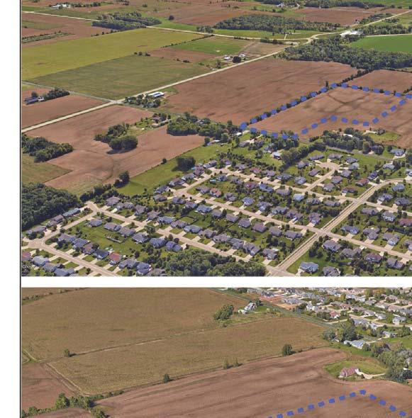

6 Manitowoc Road Park (google earth) Ayres Associates, Inc. Manitowoc Road Park Master Plan 1

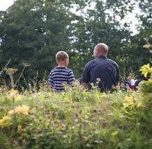
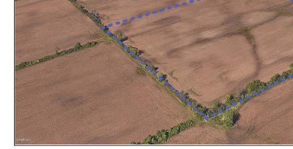
7 Manitowoc Road Park Harrison, WISCONSIN EXECUTIVE SUMMARY: Manitowoc Road Park is the newest addition to the Village s Park system. Currently agriculture land, the site provides a blank slate to develop a park that fulfi lls the highest and best use of the land to serve the community. This Master Plan serves as a guide to plan and prioritize future investment and development in the park, making it a destination for recreation, gatherings and enhancing natural resources. INTRODUCTION: In 2015, the Village of Harrison purchased approximately 18 acres of land along Manitowoc Road between County Road N and North Coop Road with a future park in mind. The site is bordered by agriculture land to the east, west, south, and single family residential development to the north. Housing developments are located to the north and west of the site as well as Woodland Elementary to the west. There is potential for future expansion of the park into a parcel immediately to the west should the demand for additional recreational facilities increase based on continued growth in the community. In October 2016, the Village issued a Request for Qualifi cations for the development of a Master Plan document for Manitowoc Road Park. On January 31st, 2017 the Village board voted unanimously to approve the consulting services of Ayres Associates to complete the Master Plan based on presentation, process and methodologies, time line, staff qualifi cations and cost. Optimizing functionality while maintaining and improving the natural resources of the site was a primary goal throughout the process. Open communication with Village staff and the community was paramount to ensure the development of a space that would serve users of all ages, and abilities. The following document outlines the analysis of the site, public process, and design evolution of Manitowoc Road Park. The process undertaken to develop this master plan involved a variety of people with differing interest and concerns. Their involvement in the process has helped to insure that the recreational needs of the community are satisfi ed for generations. 2 Manitowoc Road Park Master Plan

8 SITE OBSERVATIONS Examining the current conditions of the site supports decision making as the development of the park space moves forward. A site visit and kick off discussion with Village staff introduced opportunities and constraints that this space offers. These early fi ndings helped to steer the design and shape the outcomes. PUBLIC PROCESS The Master Plan for Manitowoc Road Park was a collaborative venture with input and recommendations from Village staff, elected offi cials and members of the community. Communication between vested parties and the design team was paramount to ensure a unifi ed vision of the park. Below is a schedule of meetings held during the planning process: Kick-off Meeting February 14, 2017 Village Hall Public Information Meeting I April 25, 201 Village Hall Parks Committee Meeting June 6 Village Hall Parks Committee / Village Board Meeting Sept XX Village Hall On the evening of April 25th, 2017 a public information meeting was held at the Harrison Village Hall. The meeting was advertised by the Village and notices were sent out to the nearby residents to invite them to participate in this meeting. Approximately 25 members of the community were in attendance to engage in the discussion and be a part of the design exercises. After introductions and outlining the agenda, participants were asked to identify three things about the park that they thought should be preserved or enhanced, and three concerns that should be eliminated or addressed. Next, participants were asked to share their vision for the park including land-use, programming, uses and connectivity. The subsequent activity incorporated a visual element to let participants express ideas that they would like or not like to see as a part of this park space. Using a series of character images individuals identifi ed elements that they liked using a green sticker, and elements they disliked using red. Areas identifi ed included community gathering / event space, playgrounds, water, trails / open space, active use, landscape character, passive recreation, and miscellaneous improvements (See Appendix XX). Finally, attendees were split into two groups to participate in an exercise that allowed them to graphically depict their ideas on paper and engage in one-on-one discussion. With the aid of base maps, aerial photos, and ideas from the visual preference exercise, participants developed several rough concepts that they deemed worthy of further explorations. The benefi t of this task is that it encourages participants to communicate corroboratively their ideas and concerns. After completing this study, a short presentation was given displaying each concept to the group as a whole. Driven by the information gathered from this meeting and the design team analysis, three concept plans were developed. Each concept took a unique approach to address desired elements for the future improvement to the park. Continued dialogue between Village staff was maintained before Ayres presented the three concepts to the Parks Board on June 6th (See Appendix XX). All plans presented were made available to the public on Ayres website for comment as well as posted on the Village s website. Based on comments from Village staff and the public, a master plan graphic was prepared and reviewed by the park board in September. Final revisions were made and a estimate of probable cost of construction was presented and approved by the Village Board on xxxx, Project Area Ayres Associates, Inc. Manitowoc Road Park Master Plan 3

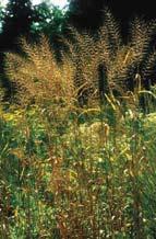
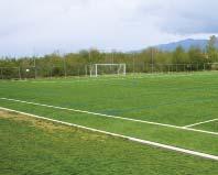
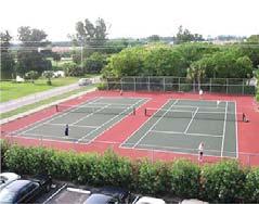
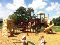
9 DESIGN PROGRAM Overview The design program statement is derived from public input, discussion with Village staff, existing conditions analysis, on-site observations, opportunities and constraints analysis, and design ideas from the consultant. Purpose and Goal of the Project This document is intended to provide a long range vision for the development and management of Manitowoc Road Park. This plan identifi es community needs, addresses public expectations, and establishes a framework for future development of the park. PUBLIC PARTICIPATION The following lists represent broad topics identifi ed as hopes and concerns expressed during the Public Information Meeting and follow up comments presented to the consultant. A complete list of written comments gathered throughout the process can be found in Appendix C. Concerns Reported common concerns associated with the current conditions and proposed uses of the park. Disruption to neighborhoods nearby Light pollution Safe access Preservation of natural space Loud Gatherings Elements to be Preserved/Enhanced Reported elements that should be preserved or enhanced that where identifi ed during the public process. Natural features Wetlands Future Opportunities Reported potential uses and future opportunities that were identifi ed during the public process. Open shelter/pavilion Soccer fi elds of various sizes Trails Possibilities playground Dog park Educational opportunities Tennis courts Basketball courts Tournaments or event hosting Music festivals Frisbee Picnic shelters Flexible open space Aesthetics Desired Natural trails Prairie paths Trees Fishing Pond Screening of neighbors Wildlife Habitat 4 Manitowoc Road Park Master Plan


10 PRELIMINARY CONCEPT PLANS After analyzing the information from the public information meetings and ongoing discussion with Village staff, three concepts were developed. Each concept is unique and represented many of the ideas offered by the public. The concepts, labeled 1, 2, and 3 represent different design solutions that address many of the comments and concerns put forth. CONCEPT 1 Park Amenities: The fi rst concept focuses much of the organized and active recreation at the northern portion of the site. A parking lot has been sited just off of Manitowoc Road and features a drop-off area for the Community building. Located around the parking lot is a series of 3 youth soccer fi elds, community building/shelter and a playground (2-5 and 5-12 features). South of the soccer fi elds are 2 tennis courts with connecting pathways. Much of the southern portion of the site has been preserved as open space, and the wetland areas have been expanded and enhanced to add habitat and improve the natural aesthetics. Concept 1 also includes a dedicated dog exercise area fenced in at the northwest corner of the site. Two small open-air shelters are located along the trail system for small gathering, shade, picnic or other miscellaneous uses. Landscape Features: Many of the existing trees on the east and south borders of the park will remain. Additional plantings are added on the northwest to provide screening of the adjacent properties. Structured around the existing wetlands of the site, native prairie plantings are proposed in the core of the park and wrap around the western border. The prairie with intermittent trees provide a serene setting for the path system. Circulation: Stemming from the parking lot a series of trails and paths direct users to all areas of the park. A perimeter path navigates around the entire site will secondary paths spur off to access other features within the interior of the park. Future access points are shown to the east and west for expansion, or connectivity to future developments. Public Meeting Group Concepts Ayres Associates, Inc. Manitowoc Road Park Master Plan 5

11 6 Manitowoc Road Park Master Plan

12 CONCEPT 2 Park Amenities: Concept 2 brings users into the site via an access drive along the eastern edge of the property. Two parking areas that correspond to the courts sports and the play area are located off the main road. A larger parking lot at the south end of the park supports the community shelter building and 2 full size soccer fi elds. The northern portion of the site is preserved largely as fl exible open space that can accommodate a variety of events and activities. A small open shelter with a small patio area is also located near the playground. The court sports area of the park offer 2 tennis courts and a full size basketball court. Maximizing visibility, an entry sign is located along Manitowoc Road. Landscape Features: Like concept 1, much of the existing tree rows on the site will remain. Additional plantings are proposed to give the site a sense of enclosure. At key locations such as the entry sign, community building and playground, ornamental plantings are proposed. Proposed as a functional amenity, a stormwater management area has been located in the southeast portion of the park. Trails are proposed to circulate around this area. Circulation: Access to the site is off Manitowoc Road through an access drive. A looping path connects activity nodes within the northern half of the site, with a secondary trail on the southern portion of the site. Future access points are shown to the east and west for expansion, or connectivity to future developments. Public Meeting Group Concepts Ayres Associates, Inc. Manitowoc Road Park Master Plan 7

13 8 Manitowoc Road Park Master Plan


14 CONCEPT 3 Park Amenities: Concept 3 maintains access off of Manitowoc Road. A lengthy row or parallel parking is directly off of the access drive and serves the two U13 Soccer fi elds. The access drive terminates at a centralized parking lot close to the shelter/restroom building and playground. The proposed shelter would be partially enclosed with a small exposed patio area, and be equipped for gatherings and events. Key areas adjacent to the parking lot have been identifi ed as stormwater management features to treat surface stormwater. Connected by the path system, a softball fi eld is located to the west of the main parking lot. This concept also develops the southern portion of the site with a 9 hole disc golf course with the fi rst and last holes located near the shelter. Like the other concepts, the existing wetlands have been expanded, and in this concept incorporated into the disc golf course. Boardwalks have been proposed at the wetland crossing or wet areas where necessary. Landscape Features: Perimeter landscaping echoes much of what is proposed in previous concepts by retaining existing trees and adding screening around the remainder of the site. Shade trees are proposed in the parking lot interior as well as in intermittent islands along the access drive. Scattered amongst the improved native areas several groups of tree plantings have been proposed. Circulation: Organizing the main parking in the core of the park allows good access to many of the park amenities. Opportunity to connect to future expansion of the park is shown on the east and west sides of the park. A perimeter path rounds the northern half of the park leaving the southern portion relatively undeveloped. Public Meeting Group Concepts Ayres Associates, Inc. Manitowoc Road Park Master Plan 9

15 10Manitowoc Road Park Master Plan
16 MASTER PLAN RECOMMENDATIONS After review of the feedback from the public and Village staff, the consultant generated a preferred concept to be presented to the Parks Commission. Final comments from the Parks Commission were incorporated, and the fi nal park Master Plan report was developed. The following discussion details the recommendations for Manitowoc Road Park. Existing Facilities The current condition of the site offers no facilities that function as public access or recreation. Existing wetlands and some perimeter trees will be incorporated into the design and are seen as an asset to the future park character. Parking Facilities The fi nal plan structures parking around high use areas. The playground area, court sports area and the soccer/shelter areas all have parking located nearby. The main parking lot provides approximately 54 stalls with potential to expand another 50 stalls. The additional 2 parking locations add another 20 stalls each. Playground After analyzing the results of the exercises from the public meeting, comments provided by community members and village staff, the presence of an all ages and all abilities playground in the park was highly desirable. The fi nal Master Plan separates the play spaces by ages and suggests activities accessible for all abilities throughout the playscape. An open-air shelter and small patio is located adjacent to the playground to offer shade and a place to gather or picnic. Sports Fields The Final Master Plan includes the addition of 2 championship size soccer fi elds on the site to serve the growing regional interest of the sport. Multiple comments where received stressing the need for additional soccer fi elds in the area. These fi elds will also provide suitable geometry for lacrosse, another growing team sport. The shelter with restrooms is located near the fi elds to serve users and support the potential of tournament or league play. Towards the entrance of the site, a softball/baseball backstop is proposed to accommodate organized play in this area. While these facilities serve a specifi c use, due to limited equipment/infrastructure, this space can be fl exible for use when organized play is not programmed. Circulation Movement, fl ow, access, and aesthetics were all taken into consideration while laying out the fi nal design of the site. Responding to the large number of comments and recommendation in the Comprehensive Outdoor Recreation Plan, a circuit walking paths navigate the site. The plan includes a main loop system that moves users between the highest activity areas. Capitalizing on the enhanced natural area a secondary, more naturalized path maneuvers around the perimeter of the site. Connecting to existing trail facilities is also recommended where feasible and should be investigated with any future trail plans by the village. Court Sports The fi nal plan focuses all court sports in a centralized location of the site. A small open-air shelter is located nearby to support this function. The addition of 2 tennis courts, and a full size basketball court are grouped together to gain effi ciency of construction materials and minimize impervious footprint in the park. Pickleball striping should be included in the fi nal tennis court layout. Landscaping Preserving and enhancing the natural environment was a common theme heard from the public throughout the process. Using the delineated wetlands as the backbone for native area enhancements, sweeping areas of native plantings are recommended throughout the site. The fi nal plan strikes a balance of active use space and passive use space. The preservation of existing tree rows on the property lines is recommended with the addition of vegetative screening where it isn t currently present. Deciduous trees are proposed in various locations throughout the site to add shade, habitat and interest in the landscape. A fi nal planting scheme should integrate strategically placed evergreen cluster to screen views and Ayres Associates, Inc. Manitowoc Road Park Master Plan 11
17 provide year round interest. Relocating material from the creation of the stormwater area, a small sledding hill has been proposed in the southeast corner of the site near the main parking area. Support Buildings The master plan depicts four structures on the site, offering various levels of comfort services. The main shelter/restroom building located adjacent to the parking lot is envisioned to provide concessions, restrooms, and an open air pavilion housed under one roof. This structure will need utility services including sanitary sewer, water, gas, and electric. Two auxiliary open air shelters are located in area to provide shade to park patrons. One is located by the court sports complex, one is located by the pond and sledding hill. The fourth structure is situated adjacent to the playground area and will provide open air shelter to the mid-park uses. The four buildings should be of the same architectural style and be constructed of durable, commercial grade materials. Materials such as metal roofi ng, concrete or masonry walls provide robust and attractive design aesthetics. 12Manitowoc Road Park Master Plan


18 Preferred Concept Ayres Associates, Inc. Manitowoc Road Park Master Plan 13

19 PRELIMINARY BUDGET An estimate of probable construction costs was assembled for the recommended improvements and can be found in Appendix XX. The following section outlines the proposed phasing strategy. IMPLEMENTATION Currently, the site has no utility infrastructure. The development of the park shelter is predicated on the completion of a water and sewer main project to serve the site and future adjacent development. Future utilities would be provided from the southwest. Phasing Strategy Currently the park is approximately 18 acres but there is the possibility of expansion to the west if the Village could acquire the property. This would be a future phase of the park. Detailed design and engineering for each area should be completed prior to public bidding. Funding Site Improvements It is likely that the bulk of project funding will come from capital budgeting, however, the following section outlines a few potential sources for grant funding to supplement Village funds. Wisconsin Department of Natural Resources Knowles Nelson Stewardship Program This program provides 50% matching funding for local park construction and renovation of nature (passive recreation) and water based facilities. These dollars can be requested for the park s general renovation work, access, trails, trailhead and shelter facilities, and water edge enhancements. The program also provides funds for acquisition of property for park development or expansion. Grant requests are typically due May 1 of each year. Wisconsin Department of Natural Resources Urban Nonpoint Source and Storm Water Grants This program could be applicable to managing the off-site sources of runoff pollution impacting the water quality. It would also be applicable for addressing the runoff that will be part of the new parking, and hardscape area construction. Grant applications are due three times (May, June, and August) each fi scal year. Wisconsin Department of Transportation Congestion Mitigation and Air Quality Improvement Program (CMAQ) This program focuses on transportation alternatives that improved air quality. A 20% local match is required and funding is granted on a two year cycle. Targeted project fund raising Special one of a kind projects can often be funded (or partially funded) through targeted fund raising from local businesses, institutions, services clubs or foundations. Potential Future Expansion 14Manitowoc Road Park Master Plan
20 APPENDIX Appendix A Appendix B Appendix C Appendix D Appendix E Appendix F Context Map Site Photos Public Informational Meeting Comments Preliminary Concept Plans Master Plan Cost Estimate Ayres Associates, Inc. Manitowoc Road Park Master Plan 15


21 EXISTING SITE Looking Northeast PROPOSED PARK Looking Northeast 16Manitowoc Road Park Master Plan
22 Ayres Associates, Inc. Manitowoc Road Park Master Plan 17
23 Appendix A - Context Map 18Manitowoc Road Park Master Plan
24 Ayres Associates, Inc. Manitowoc Road Park Master Plan 19
25 Appendix B - Site Photos 20Manitowoc Road Park Master Plan
26 Ayres Associates, Inc. Manitowoc Road Park Master Plan 21
27 Appendix C - Public Comments 22Manitowoc Road Park Master Plan
28 Ayres Associates, Inc. Manitowoc Road Park Master Plan 23
29 Appendix D - Preliminary Concept Plans 24Manitowoc Road Park Master Plan
30 Ayres Associates, Inc. Manitowoc Road Park Master Plan 25
31 Appendix E - Master Plan 26Manitowoc Road Park Master Plan
32 Ayres Associates, Inc. Manitowoc Road Park Master Plan 27
33 Appendix F - Cost Estimate 28Manitowoc Road Park Master Plan
34 Ayres Associates, Inc. Manitowoc Road Park Master Plan 29
WARM SPRINGS PARK MASTER PLAN
 TABLE OF CONTENTS page 1.0 Introduction and Overview 1 2.0 Information Gathering 2 3.0 Conceptual Alternative Development 8 4.0 Master Plan Development 14 5.0 Construction Cost Estimates 19 LIST OF FIGURES
APPENDIX D: PARKS AND RECREATION ACTION PLAN
 APPENDIX D: PARKS AND RECREATION ACTION PLAN Goals The following goals are specific to the development, maintenance, and operation of the existing parks in the Township, as well as the acquisition and
TAO S PARKS MASTER PLAN
 TAO S PARKS MASTER PLAN December 2017 Kit Carson Park Fred aca Park Eco Park Youth + Family Center Eco Park TAOS PARKS MASTER PLAN December 2017 SCOPE OF WORK Town of Taos Parks + Recreation Master Plan
Long Branch-Wayne Local Park Renovation Project
 Montgomery Parks Long Branch-Wayne Local Park Renovation Project Community Meeting #2 September 20, 2016 Oak View Elementary School 7:00-9:00 PM Welcome / Team Introductions M-NCPPC (Montgomery Parks)
Marshview Park. Concept Briefing and Feedback Session. Aquarium/Owls Creek Plan Steering Committee March 20, 2012
 Marshview Park Concept Briefing and Feedback Session Aquarium/Owls Creek Plan Steering Committee March 20, 2012 1 Outline of Today s Discussion Introductions Context for Marshview Park Site analysis -
Las Colonias Park Master Plan
 2013 Las Colonias Park Master Plan City of Grand Junction June 2013 Introduction Las Colonias Park, a 101 acre parcel on the edge of the Colorado River south of downtown, was deeded to the City of Grand
Gold Line Bus Rapid Transit Transit Oriented Development (BRTOD) Helmo Station Area Plan
 Helmo Station Area Plan") Appendix F Gold Line Bus Rapid Transit Transit Oriented Development (BRTOD) Helmo Station Area Plan Introduction and Purpose of the Plan The Gold Line Bus Rapid Transit facility is an eleven-mile dedicated
Appendix F Gold Line Bus Rapid Transit Transit Oriented Development (BRTOD) Helmo Station Area Plan Introduction and Purpose of the Plan The Gold Line Bus Rapid Transit facility is an eleven-mile dedicated
Chris James Park Planner July 16, Master Plan Kick Off Meeting
 Chris James Park Planner July 16, 2014 Master Plan Kick Off Meeting Meeting Overview Introductions Purpose of Meeting and Master Plan History & Background of Park Property Prior Planning Considerations
A cknovvledgements. Table of Contents. Project Introduction...1
 Pashek Asscx::iates MARCH2007 A cknovvledgements Pashek Associates would like to thank Jackson Township and the Jackson Township Recreation Board for their valuable contributions, support, and input during
CHAPPLES PARK MASTER PLAN
 CHAPPLES PARK MASTER PLAN Presentation of Preliminary Development Options Public Open House #2 Wednesday November 2 nd, 2016 TONIGHT S AGENDA 1. Welcome & Introductions 2. Presentation by Sierra Planning
APPENDIX C: PUBLIC INPUT SUMMARY
 APPENDIX C: PUBLIC INPUT SUMMARY OVERVIEW The public process for the development of the GO! Green Oshtemo Plan was designed to follow both the legislative requirements for master plan adoption and the
master plan hodge park
 KCMO Parks & Commissioners Recreation Board of Parks & Recreation Kansas City, Missouri Mark McHenry Director Heather Runkel Project Manager LAND3 Studio L.L.C. Bob G Bushyhead Principle Michael H Malyn
Montana Rail Link Park
 Montana Rail Link Park Neighborhood Open House A Missoula Community Partnership WITH LEADERSHIP FROM THE FRANKLIN TO THE FORT & SOUTHGATE TRIANGLE NEIGHBORHOODS Sovereign Hope Church, (1919 North Ave.)
City of Bonney Lake Allan Yorke Park. MASTER PLAN SUMMARY REPORT June 30, 2016
 City of Bonney Lake Allan Yorke Park MASTER PLAN SUMMARY REPORT June 30, 2016 TABLE OF CONTENTS INTRODUCTION PUBLIC INVOLVEMENT PROCESS MASTER PLAN North Park Central Park South Park East Park Field Development
ARLINGTON COUNTY, VIRGINIA. County Board Agenda Item Meeting of April 21, 2018 SUPPLEMENTAL REPORT
 ARLINGTON COUNTY, VIRGINIA County Board Agenda Item Meeting of April 21, 2018 SUPPLEMENTAL REPORT DATE: April 18, 2018 SUBJECT: Request to authorize advertisement of public hearings by the Planning Commission
(Exhibit A) Site Plan Adoption Detail and Support Information
 Site Plan Adoption Detail and Support Information") McCormick Park Master Site Plan (Exhibit A) Site Plan Adoption Detail and Support Information July, 2003 McCormick Park Site Plans.... 2-3 McCormick Park Site Plan Comparison... 4 Basic Assumptions about
McCormick Park Master Site Plan (Exhibit A) Site Plan Adoption Detail and Support Information July, 2003 McCormick Park Site Plans.... 2-3 McCormick Park Site Plan Comparison... 4 Basic Assumptions about
Park Types and Attributes
 02 APPENDIX B APPENDIX B s and s 194 APPENDIX B 04 Size Level of Service Any privately owned park, of any size, is a neighborhood park Primary Service Area - 1/2 mile or within 15 minutes walking distance
February 27, 2018 City Council Presentation The Crown Jewel Park in the City of Fairfax
 February 27, 2018 City Council Presentation The Crown Jewel Park in the City of Fairfax Master Planning Charge Van Dyck Park s first Master Plan will provide the City with a road map as to how best incorporate
South East Sports Complex Phase I
 South East Sports Complex Phase I City of Spokane Design Review Board August 29, 2018 (Revised) Objectives 1. Early discussion and collaboration. 2. Provide framework / catalyst for future improvements
City Council March 27, Parks, Recreation, and Trails Master Plan
 City Council March 27, 2018 Parks, Recreation, and Trails Master Plan Planning Process Develop Goals and Objectives Inventory of Areas and Facilities Needs Assessment And Identification Public Participation
1. Parks & Recreation Neighborhood Parks Community Parks Special Use Sites 2. Open Space 3. Trails
 Appendix A: Park Classifications The intent of parks and recreation classifications is to aid in making acquisition and design decisions for park sites, facilities and the organization of recreation space
CHAPPLES PARK MASTER PLAN. Presentation to Council April 10, 2017
 CHAPPLES PARK MASTER PLAN Presentation to Council April 10, 2017 1 PRESENTATION AGENDA 1. Project Background, Aim and Process 2. The Site Issues and Opportunities 3. Community Engagement 4. Vision and
100 Dix Drive Conceptual Master Plan. Wyatt Thompson, PLA, ASLA, Assistant Director Lindsay Stucki, Intern Park Planner
 100 Dix Drive Conceptual Master Plan Wyatt Thompson, PLA, ASLA, Assistant Director Lindsay Stucki, Intern Park Planner Final Draft Prepared August 2018 Introduction On September 20, 2016, the City of Manhattan
THE COMMUNITY-DRIVEN DESIGN PROCESS
 THE COMMUNITY-DRIVEN DESIGN PROCESS A PUBLIC DRIVEN PROCESS STEERING COMMITEE THE COMPREHENSIVE PLAN OPPORTUNITIES AND CONSTRAINTS THE COMMUNITY DRIVEN DESIGN PROCESS A Public Driven Process Beginning
Parks Master Plan Implementation: Phase I Waterfront Use and Design REPORT #: September 7, 2016 File #
 0 'O DI Lan-171-14 1 - THE CORPORATION OF THE TOWN OF COBOURG..,. STAFF REPORT TO: FROM: Mayor and Members of Council Dean A. Hustwick, Director of Recreation and Culture DATE OF MEETING: Committee of
Chapter 6. Overall Vision RECOMMENDATIONS. More Trail and Trail. Connections. Equal Access to Park. Facilities and Programs. Water Access.
 Overall Vision More Trail and Trail Connections Equal Access to Park Facilities and Programs Water Access Environment Variety Chapter 6 RECOMMENDATIONS Chapter 6 The following recommendations for park,
PUBLIC ENGAGEMENT & SIX THEMES OF THE PLAN
 Connecting the heart of Eagle to the soul of the river - Kathy Chandler-Henry, Commissioner Eagle County CHAPTER 1 PUBLIC ENGAGEMENT & SIX THEMES OF THE PLAN town of eagle - river corridor plan 1 PUBLIC
WILLIAM PAYNE SPORTS PARK MASTER PLAN BOARD OF DIRECTORS PRESENTATION
 WILLIAM PAYNE SPORTS PARK MASTER PLAN BOARD OF DIRECTORS PRESENTATION December 12, 2018 PROJECT OVERVIEW GOALS OF MASTER PLAN 1. Engage Community in Master Plan Process 2. Maximize Park Space for Sports
4 January 11, 2012 Public Hearing APPLICANT:
 . 4 January 11, 2012 Public Hearing APPLICANT: MID-ATLANTIC AUTO PROPERTY OWNER: DZR, LLC STAFF PLANNER: Leslie Bonilla REQUEST: Conditional Use Permit (truck rental, automobile service, and automotive/bulk
MADISON MANOR PARK RENOVATIONS
 MADISON MANOR PARK RENOVATIONS COMMUNITY KICK-OFF MEETING MINUTES To: Wilfredo Calderon, Steven Torgerson (AMT), Tom Mitchler, Kevin Stalica, Vincent Verweij, Greg Anselene, Chris Willett, Peter Alchin,
Elm Fork Land Use. Trinity River Corridor Project Committee May 13, 2013
 Elm Fork Land Use Trinity River Corridor Project Committee May 13, 2013 Purpose Discuss Trinity River planned Land Use and Appropriate Compatible Uses, particularly with respect to the Elm Fork Area 2
Appendix E Section 4(f) Evaluation
 Evaluation") Appendix E Section 4(f) Evaluation Appendix E Draft Section 4(f) Evaluation E.1 Introduction This appendix addresses a federal regulation known as Section 4(f), which protects parks, recreation areas,
Appendix E Section 4(f) Evaluation Appendix E Draft Section 4(f) Evaluation E.1 Introduction This appendix addresses a federal regulation known as Section 4(f), which protects parks, recreation areas,
3. VISION AND GOALS. Vision Statement. Goals, Objectives and Policies
 Vision Statement Queen Creek s interconnected network of parks, trails, open spaces and recreation opportunities provide safe and diverse activities and programs that sustain its unique, small town, equestrian
Master Plan Presentation August 12, 2015
 Master Plan Presentation August 12, 2015 A vision for tomorrow... May, 13 2015 prepared for: prepared by: SITE LOCATION SITE NTS SITE ANALYSIS +/- 17.8 Ac. RESIDENTIAL HOMES 1 2 RAIL ROAD (SAFETY CONCERNS)
Charles P. Johnson and Associates. Annapolis Landscape Architects
 Charles P. Johnson and Associates Annapolis Landscape Architects AGENDA Introduction Project Limits and Scope Site Analysis Opportunities & Constraints Program Goals Image Boards Design Alternatives Pros
DESIGN CONCEPTS. Option C: Seasons
 DESIGN CONCEPTS Option C: Seasons Colorado is known for its snowy active winters, hot fun summers, brilliant spring blooms, and dramatic fall color. This design highlights all of these elements in order
CARMODY PARK MASTER PLAN
 the site Smith Reservoir Cottonwood Lake Kendrick Lake Carmody Rec Center Carmody Middle School Pool Court Play Carmody Pond Sanderson Ditch Sports Fields Foothills Ice Arena Open Field why a master plan?
9 th Street Sub Area Plan
 9 th Street Sub Area Plan In the 1990 s, when the Township prepared the last Master Plan, the 9 th Street corridor was studied as part of a larger 9 th Street Focus Area that included the West Main Street
Call for Artists for: Design and Construction of Environmental Art Activation Story Mill Community Park, Bozeman, MT
 Call for Artists for: Design and Construction of Environmental Art Activation Story Mill Community Park, Bozeman, MT Seeking artists to design, fabricate and install art elements in the nature sanctuary
Description of Preferred Alternative
 Chapter 2 Description of Preferred Alternative 2.1 Introduction This chapter of the programmatic Sammamish Town Center Sub-area Plan Final EIS provides a more detailed description of the Preferred Alternative
STAFF RECOMMENDATION: Adopt the Parks and Recreation Master Plan 2013, or take other action as deemed appropriate.
 Regular 7. CITY COUNCIL AGENDA Meeting Date: 12/02/2013 TITLE: Parks and Recreation Master Plan 2013 Adoption Proposal - Dwight Curtis Responsible Staff: Dwight Curtis Backup Material: Backup material
Caroline Freeland Park Facility Plan Project
 Montgomery Parks Caroline Freeland Park Facility Plan Project Community Meeting #1 November 6, 2013 Bethesda Library 7:00-9:00 PM Welcome / Team Introductions Parker Rodriguez, Incorporated (Landscape
PARKS & RECREATION SUBCOMMITTEE. Oct. 1, 2015
 PARKS & RECREATION SUBCOMMITTEE Oct. 1, 2015 1999 Bond - $22,000,000 Land Acquisition Allen Station Phase II Neighborhood Parks PREVIOUS BOND ELECTIONS 1999 & 2007 2002 Bond - $4,000,000 Allen Senior Recreation
Design Alternatives Workshop. Hilfiker Park Master Plan Workshop #2
 Design Alternatives Workshop Hilfiker Park Master Plan Workshop #2 Agenda for Tonight Staff Presentation (40 min) Introduction Master Plan Process Planning Context What We ve Heard So Far Design Alternatives
Neighborhood Districts
 NEIGHBORHOOD DISTRICTS SEVEN MAIN DISTRICTS Neighborhood Districts While the Development Plan provides a broad-scale overview of the neighborhood, this section focuses on uses and relationships at the
Pittsfield Action Plan (West Branch of the Housatonic River)
") An initiative of the Massachusetts Executive Office of Energy and Environmental Affairs in partnership with the City of Pittsfield Pittsfield Action Plan (West Branch of the Housatonic River) The spring
An initiative of the Massachusetts Executive Office of Energy and Environmental Affairs in partnership with the City of Pittsfield Pittsfield Action Plan (West Branch of the Housatonic River) The spring
Draft Master Plan for Franklin Park
 Draft Master Plan for Franklin Park Metro Parks Tacoma with SiteWorkshop November 2009 I. overview & background Process & History Master Plan Process The Master Plan is based on a community involvement
SOUTHEAST SPORTS COMPLEX MASTER PLAN
 REPORT TO SOUTHGATE NEIGHBORHOOD COUNCIL APRIL 13, 2016 Visioning Process April 30: Stakeholder Meeting with Sports Groups May 5: Stakeholder Meeting with Southgate Land Use Committee May 13: SNC Meeting
Appendix A. Park Land Definitions
 Appendix A Park Land Definitions Mini Park May serve specific function for any and all ages, depending on need of the user area. Size range 1-5 acres with optimum size being 3 acres. Service area is sub-neighborhood
City of Naples Parks Master Plan (Draft)
") City of Naples (Draft) CSAB April 12, 2016 OVERVIEW Presentation Outline Overview Needs Assessment Recap Response to Needs Implementation Strategy Questions, Discussion Preserving Naples: A vision plan
City of Naples (Draft) CSAB April 12, 2016 OVERVIEW Presentation Outline Overview Needs Assessment Recap Response to Needs Implementation Strategy Questions, Discussion Preserving Naples: A vision plan
Silverwood Masterplan Kickoff Meeting. Jim Neidhart Dane County Parks Planning
 Silverwood Masterplan Kickoff Meeting Jim Neidhart Dane County Parks Planning 608-224-3614 January 30, 2014 Silverwood County Park Public Information Meeting Notice Sent notice to all landowners adjacent
RECREATION AND OPEN SPACE ELEMENT
 RECREATION AND OPEN SPACE ELEMENT Last amended August 19, 2008 Table of Contents Objective Page 5.1 Park system defined... 5-1 5.2 Access to parks and recreational facilities... 5-2 5.3 Recreation and
CITY OF GAINESVILLE PARKS, RECREATION AND CULTURAL AFFAIRS DEPARTMENT VISION 2020
 CITY OF GAINESVILLE PARKS, RECREATION AND CULTURAL AFFAIRS DEPARTMENT VISION 2020 A BLUE PRINT FOR THE NEXT 20 YEARS The PRCA Vision 2020 Master Plan, adopted in November 2012, addresses the current state
Mitchell Ranch South MPUD Application for Master Planned Unit Development Approval Project Narrative. Introduction
 Mitchell Ranch South MPUD Application for Master Planned Unit Development Approval Project Narrative Introduction Mitchell Ranch South is a proposed single family (detached) residential development on
Courthouse Planning Area
 Courthouse Planning Area Current Reality The Courthouse Planning Area is the characterized by expansive suburbanscale residential areas as well as the community resource planned area of athletic, educational,
ARISE: The Rock Renaissance Area Redevelopment & Implementation Strategy
 2014 Professional Awards 1 ARISE: The Rock Renaissance Area Redevelopment & Implementation Strategy Janesville, WI Completed December 2014 Analysis & Planning Purpose of Project 2 The purpose of the Rock
2. Analysis. DRAFT Gerald Richards & Pleasantview Park Master Plan
 DRAFT Gerald Richards & Pleasantview Park Master Plan 19 Historic Features According to the National Register of Historic Places and the National Historic Landmarks Program, there is nothing of national
Request for Statement of Interest in Implementation of the Roosevelt Road Redevelopment Plan
 425 Hillside Avenue Request for Statement of Interest in Implementation of the Roosevelt Road Redevelopment Plan I. INTRODUCTION The is seeking the services of a qualified consulting firm to prepare plans
ADOPTED CAPITAL IMPROVEMENT PROGRAM BUDGET ARROYO PROJECTS
 ADOPTED CAPITAL IMPROVEMENT PROGRAM BUDGET ARROYO PROJECTS HAHAMONGNA FY 212-216 Capital Improvement Program Priority Description Total Estimated Costs Appropriated Through FY 211 Adopted FY 212 FY 213
POPS Advisory Committee Meeting May 31, 2018
 POPS Advisory Committee Meeting May 31, 2018 NOTE: This presentation is a working document, and some recommendations or ideas may have evolved or changed based on continued discussions and additional analyses.
Y Sports Complex PROGRAMMING Capitol Improvement Plan. Anticipated/Suggested Improvements. Sedgwick County Park: Sports Complex:
 PROJECT OVERVIEW Location: East of Ridge Road, between 21 st Street and 13 th Street, not including SCZ In conjunction with The Sedgwick County Park Facilities Observation Report Compilation of improvements
Lowe Park Master Plan Update Marion, IA August 25 th, 2011
 Lowe Park Master Plan Update Marion, IA August 25 th, 2011 Lowe Park Master Plan Update Concept Plan - June 1 st, 2011 Agenda 1 - INTRODUCTION Vision Statement Aerial of Existing Condition 2 MASTER PLAN
FORT MISSOULA REGIONAL PARK
 FORT MISSOULA REGIONAL PARK Master Plan Refinement/ Design Development www.missoulaparks.org DHM Design/WGM Group December 3, 2008 Master Plan Report Fort Missoula Regional Park Guiding Principals i 6/14/01
ACADEMY AREA CONCEPT PLAN
 ACADEMY AREA Strip ling C hape l Roa d CONCEPT PLAN 7 S2 U Stripling 52 ROADWAYS AND PARKING: ADVENTURE PLAYGROUND AND SPRAYGROUND: Current roadways follow existing drives. It is recommended that the Folds
HUMBER BAY PARK PROJECT - BUILDING CONCEPT
 WELCOME 1 Humber Bay Park, with its system of trails, rugged shoreline, and dramatic views, is a unique and rare waterfront experience within the larger metropolitan Toronto area offering a place for quiet,
April 11, 2016 Park Board Chair and Commissioners General Manager Vancouver Board of Parks and Recreation New Brighton Salt Marsh - Preferred Concept
 TO: FROM: SUBJECT: April 11, 2016 Park Board Chair and Commissioners General Manager Vancouver Board of Parks and Recreation New Brighton Salt Marsh - Preferred Concept RECOMMENDATION A. THAT the Vancouver
REQUEST FOR COUNCIL ACTION
 REQUEST FOR COUNCIL ACTION Date: 04/15/13 Item No.: 10.b Department Approval City Manager Approval 1 2 3 4 5 6 7 8 9 10 11 12 13 14 15 16 17 18 19 20 21 22 23 24 25 26 27 28 29 30 31 32 33 34 35 Item Description:
PARTF Scoring System for Grants
 PARTF Scoring System for Grants The members of the N.C. Parks and Recreation Authority use the PARTF scoring system as one of several tools to select grant recipients. Please provide all of the information
Scope of Services. River Oaks Boulevard (SH 183) Corridor Master Plan
 Corridor Master Plan") Scope of Services River Oaks Boulevard (SH 183) Corridor Master Plan PROJECT AREA The project area consists of the River Oaks Boulevard (SH 183) corridor bounded by SH 199 at the northern end and the Trinity
Scope of Services River Oaks Boulevard (SH 183) Corridor Master Plan PROJECT AREA The project area consists of the River Oaks Boulevard (SH 183) corridor bounded by SH 199 at the northern end and the Trinity
Kibworth Harcourt. Introduction. Introduction
 Introduction Introduction Welcome to this public exhibition on the proposals for the delivery of new homes on land at The Kibworths. The purpose of today s exhibition is to give you the opportunity to
Washington Park Diagonal
 Public Input Meeting August 3, 2011 Nicole Stahly RLA DPR Project Manager Jesse Clark RLA, LEED Stream Design Paul Thomas RLA Stream Design Kerry White RLA Urban Play Studio Tonight s Agenda 1st Meeting:
FY Capital Improvement Program Arroyo Projects
 FY 219-223 Capital Improvement Program FY 218 FY 219 FY 22 FY 221 FY 222 FY 223 1 2 3 4 5 6 7 8 9 1 Hahamongna - Implement Master Plan - Oak Grove Area Improvements (7756) Hahamongna - Implement Master
Outdoor Recreation Facilities Inventory
 Outdoor Recreation Facilities Inventory Allouez Neighborhood Parks: East Lawn Park (4.90 acres) is located in the northeastern corner of Allouez near Boyd Street. This site contains: Baseball diamond with
MEMORIAL DRIVE DESIGN DEVELOPMENT PLAN
 DESIGN DEVELOPMENT PLAN prepared for The City of Calgary Parks June 2005 cover images: Glenbow Alberta Archives Thomas Mawson Plan for Calgary c. 1914 panoramic view of Calgary from Crescent Heights c.1940
South th E ast Communit ity Centre (SECC)
") South East Community Centre (SECC) 1 New Park Design & Community Centre Update Thursday, February 8, 2018 Public Open House Thank you for attending this Open House! The town and the Consulting Team will
South East Community Centre (SECC) 1 New Park Design & Community Centre Update Thursday, February 8, 2018 Public Open House Thank you for attending this Open House! The town and the Consulting Team will
ARROYO PROJECTS ADOPTED CAPITAL IMPROVEMENT PROGRAM BUDGET
 A RROYO P ROJECTS ADOPTED CAPITAL IMPROVEMENT PROGRAM BUDGET FISCAL YEARS 214-218 HAHAMONGNA Priority Description 1 Hahamongna Watershed Park - Implement Master Plan 211,6 211,6 (77565) 2 Hahamongna -
FY Capital Improvement Program Parks and Landscaping. 8 - Summary
 PARK PROJECTS FY 211-215 Capital Improvement Program Description FY 21 FY 211 FY 212 FY 213 FY 214 FY 215 1 Restroom Bldgs (Replace or Construct)-Jefferson, McDonald, 5,774,623 4,669,623 1,15, Allendale,
Parks, Open Space and Trails
 Introduction Parks have often been referred as the lungs of our cities, cleansing the air of pollutants and particulate matter. Parks are also gathering places for families and community. They offer spaces
South Bend Park. Visioning Plan
 South Bend Park Visioning Plan 2007 South Bend Park, Visioning Program, Executive Summary The South Bend Park Visioning Program began with the receipt of an application from the Friends of South Bend Park,
DRAFT PLAN PRESENTATION
 DRAFT PLAN PRESENTATION 1.23.2018 AGENDA Process Project Schedule Results from Visioning Workshop Draft Plan Highlights Concept Plans Feedback Next Steps PROJECT SCHEDULE KICK-OFF WORKSHOP August 29 th
Philip A. Ginsburg, General Manager Toks Ajike, Acting Planning and Capital Program Director
 Date: March 7, 2018 To: Through: From: Subject: Recreation and Park Commission Capital Committee Philip A. Ginsburg, General Manager Toks Ajike, Acting Planning and Capital Program Director Dan Mauer,
Martin Pastucha, Director of Public Works Karen Ginsberg, Director of Community and Cultural Services
 Information Item Date: August 11, 2015 To: From: Subject: Mayor and City Council Martin Pastucha, Director of Public Works Karen Ginsberg, Director of Community and Cultural Services Reed Park Improvement
Dowdy Park. Concept Plans TOWN OF NAGS HEAD NORTH CAROLINA. Developed by: Albemarle & Associates, Ltd VHB/ Vanasse Hangen Brustlin, Inc.
 TOWN OF NAGS HEAD NORTH CAROLINA Concept Plans Developed by: Albemarle & Associates, Ltd VHB/ Vanasse Hangen Brustlin, Inc. Site Looking Southeast Dowdy Park Existing Conditions Nags Head Woods Sound Future
Emerson Park Master Plan Update. Public Meeting III August 27, 2014
 Emerson Park Master Plan Update Public Meeting III August 27, 2014 Meeting Agenda: Project Update Presentation of Master Plan Components Discussion and Feedback The Path Forward: Building on the Concept
7Page 1 CLEMMONS COMMUNITY COMPASS 1 PLAN OVERVIEW
 1 Plan Overview WHAT IS I THE CLEMMONS COMMUNITY COMPASS? The Clemmons Community Compass is our community s comprehensive plan. It serves as our blueprint and provides direction for the future of the Village
Master Site Development Plan (MSDP) Rocky View County Campus at Balzac East
 Rocky View County Campus at Balzac East") Master Site Development Plan (MSDP) Rocky View County Campus at Balzac East Balzac East, Alberta July 2009 CONTENTS 1.0 purpose 1 2.0 guiding principles 2 3.0 site description 3 4.0 site analysis and county
Master Site Development Plan (MSDP) Rocky View County Campus at Balzac East Balzac East, Alberta July 2009 CONTENTS 1.0 purpose 1 2.0 guiding principles 2 3.0 site description 3 4.0 site analysis and county
Town of Cobourg Heritage Master Plan. Statutory Public Meeting
 Town of Cobourg Heritage Master Plan Statutory Public Meeting April 25 th 2016 Presentation Overview 1. Introduction 2. Project background and schedule overview 3. Review of strategic direction content
NEIGHBORHOOD 8: NORTHEAST AREA
 NEIGHBORHOOD 8: NORTHEAST AREA Carillon Tower Aerial View of Northeast Area Northeast Area Map 288 neighborhoods NEIGHBORHOOD 8: NORTHEAST AREA Campus View Apartments Student Recreational Sports Center
Ten Mile Creek Planning Area
 PLANNING AREA POLICIES TEN MILE CREEK Ten Mile Creek Planning Area Location and Context The Ten Mile Creek Planning Area ( Ten Mile Creek area ) is located south of the current Boise AOCI, generally south
MEMO 1. INTRODUCTION PURPOSE & PROCESS REQUEST
 MEMO Date: August 22, 2017 To: Board of Commissioners From: Jason Burdette, Planning Director Re: Davidson Commons East Hotel Stakeholder Feedback 1. INTRODUCTION PURPOSE & PROCESS This memorandum summarizes
Toronto Parks Renaissance Strategy
 Toronto Parks Renaissance Strategy Overview, Emerging Themes and Directions Presentation to EDPC, May 4, 2006 Parks Renaissance Strategy Presentation Agenda Project Overview Emerging Themes and Directions
Public Workshop #2 Summary
 Public Workshop #2 Summary Project Number: Project Title: 2320.01 (R&M) MOA Parks and Recreation Muldoon Town Square Park Master Plan Subject: Muldoon Town Square Park Master Plan Public Workshop #2 Author:
The following principles guide the development of goals and strategies to protect and promote these amenities:
 OPEN SPACE/PARKS/TRAILS/RECREATION GOALS/STRATEGIES Cherry Hills Village is a living environment that offers low density development, open areas, public scenic vistas, public trails and public parks. This
Clovis Urban Greening Plan. Community Workshop #2 Northwest
 Clovis Urban Greening Plan Community Workshop #2 Northwest Thursday, October 9, 2014 WHAT IS AN URBAN GREENING PLAN? A guide to help the City to improve quality of life for residents Identification of
6 August 11, 2010 Public Hearing APPLICANT AND PROPERTY OWNER: CAVALIER GOLF AND YACHT CLUB
 6 August 11, 2010 Public Hearing APPLICANT AND PROPERTY OWNER: CAVALIER GOLF AND YACHT CLUB REQUEST: Conditional Use Permit (outdoor recreational facility) STAFF PLANNER: Faith Christie ADDRESS / DESCRIPTION:
Parks, and Recreation & Cultural Arts Master Plan Update
 Parks, and Recreation & Cultural Arts Master Plan Update Community Profile Public Input Summary: Staff Interviews conducted April 14 and 15, 2014 Citizens Workshop - conducted April 15 th and 24 th, May
North Adelaide Playspace and Pocket Orchard
 The Adelaide City Council invites engagement from the community about Playspace and Pocket Orchard Project Summary Adelaide City Council invites feedback from the community on the Tidlangga (Park 9) Playspace
Northeast Quadrant Plan
 Northeast Quadrant Plan Northeast Quadrant Distinctive Features Land Use The Northeast Quadrant includes all the area within the planning area that is east of Interstate 5 and to the north of State Route
EASTSIDE REGIONAL PARK MASTER PLAN
 EASTSIDE REGIONAL PARK MASTER PLAN Goal 3: Promote the visual image of El Paso Goal 4: Enhance El Paso s Quality of Life through Recreational, Cultural and Educational Environments Goal 4.1: Deliver bond
Planning Districts INTRODUCTION
 INTRODUCTION To facilitate detailed examination of development prospects for all areas of the community, Delano has been divided into 14 planning districts. The location of these planning districts is