Preserve the past. Learn outside. Homelike features
|
|
|
- Nelson Miller
- 5 years ago
- Views:
Transcription

1 bethany school Glendale meeting 8/28/2017


2 Bethany Values: Walking outside between classes Handicap accessibility Improved security and safety Identity awareness - distinct and obvious entries Natural daylight Home-like atmosphere Maintain the beautiful grounds and ample green space Preserve and celebrate the history and tradition of Bethany Outdoor learning opportunities Environmental Education to increase children s exposure to conservation Preserve the past Learn outside Homelike features Glendale Values: Promote existing art, education, and social activities Encourage arts, education, and social activities in new areas. Insure that local schools are assets which attract families to Glendale Insure Glendale is an environmentally balanced community Insure that the Village of Glendale has a perpetual green canopy. Preserve the historic character of the village Strengthen the community s recreation facilities and programs Minimize the impact of vehicular and rail traffic and insure a safe, peaceful, and quiet village. Increase awareness of environmental and natural resource issues
3 TOTAL MASTER PLAN


4 TOTAL MASTER PLAN


5 TOTAL MASTER PLAN


6 TOTAL MASTER PLAN


7 TOTAL MASTER PLAN

8 PHASE 1: MASTER PLAN
9 storm water management concerns
10 ALBION AVE HEDGEROW LN The existing detention basin receives approximately 3.1 Ac of runoff, the area north of the existing basin is undetained runoff. The proposed solution includes 5.84 Ac of runoff in the storm detention system. The proposed development is capturing an additional 2.74 Ac of runoff that was not previously being detained or treated for water quality. This results in an overall IMPROVED situation for neighbors downstream. The proposed stormwater detention system is designed per Hamilton County Stormwater Drainage Rules and Regulations. This project will result in a 30% reduction of the stormwater runoff rate currently directed into the existing swale from the Bethany School property. The proposed design of the bioretention areas and underground detention tanks will exceed Hamilton County s release rate requirements by 32%. OAK RD

11 ALBION AVE HEDGEROW LN The existing detention basin receives approximately 3.1 Ac of runoff, the area north of the existing basin is undetained runoff. The proposed solution includes 5.84 Ac of runoff in the storm detention system. The proposed development is capturing an additional 2.74 Ac of runoff that was not previously being detained or treated for water quality. This results in an overall IMPROVED situation for neighbors downstream. The proposed stormwater detention system is designed per Hamilton County Stormwater Drainage Rules and Regulations. This project will result in a 30% reduction of the stormwater runoff rate currently directed into the existing swale from the Bethany School property. The proposed design of the bioretention areas and underground detention tanks will exceed Hamilton County s release rate requirements by 32%. OAK RD


12 REVISED STORM LINE LOCATION ORIGINAL STORM LINE LOCATION


13 APPROVALS
14 Tree line concerns


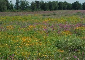
15 Bethany Goals: Restore tree line to a healthy native habitat: Eradicate all honeysuckle, Poison Ivy, and Virginia Creeper Remove Dead and severely stresses trees Introduce native species Introduce Diversity Provide an opportunity for students and visitors to learn about various native species
16 Bethany Property Line Tree Assessment Tree # per tag Species Dead? (Y/N) Stressed? (Y/N) DBH Native to Ohio (Y/N) C of C Value (0 to 10) Conservation Comments 1 Osage orange (Maclura pomifera) N N 11" No 0 Approximately 80% foliage, being crowded by trees #2 and 3 2 Osage orange (Maclura pomifera) N N 11.1" No 0 Approximately 80% foliage, being crowded by trees #1 and 3 3 Osage orange (Maclura pomifera) N N 11" No 0 Approximately 80% foliage, being crowded by trees #2 and 4 4 Osage orange (Maclura pomifera) N N 20.9" No 0 Approximately 80% foliage 5 Osage orange (Maclura pomifera) Y 7.2" No 0 6 Osage orange (Maclura pomifera) N Y 12.6" No 0 Approximately 60% foliage 7 Osage orange (Maclura pomifera) Y 9.6" No 0 8 Osage orange (Maclura pomifera) N N 33" No 0 Approximately 80% foliage 9 Osage orange (Maclura pomifera) N Y 9.9" No 0 Multi-stemmed, approximately 20% foliage 10 Osage orange (Maclura pomifera) N Y 9.1" No 0 Multi-stemmed, approximately 20% foliage 11 Osage orange (Maclura pomifera) N Y 7.8" No 0 Approximately 50% foliage 12 Osage orange (Maclura pomifera) N Y 16.8" No 0 Approximately 30% foliage, leaning 13 Osage orange (Maclura pomifera) N N 17.7" No 0 Approximately 80% foliage 14 Osage orange (Maclura pomifera) N Y 10.85" No 0 Approximately 50% foliage 15 Osage orange (Maclura pomifera) N Y 9.575" No 0 Approximately 50% foliage 16 Osage orange (Maclura pomifera) N Y 13.85" No 0 Approximately 50% foliage 17 Osage orange (Maclura pomifera) Y 13.2" No 0 Grape vine growing on limbs 18 Osage orange (Maclura pomifera) N Y 19.5" No 0 Approximately 30% foliage 19 Osage orange (Maclura pomifera) N Y 12.9" No 0 Approximately 20% foliage, grape vine and poison ivy 20 Osage orange (Maclura pomifera) Y 8.5" No 0 Multi-stemmed 21 Osage orange (Maclura pomifera) Y 11.7" No 0 Multi-stemmed 22 Osage orange (Maclura pomifera) N Y No 0 Multi-stemmed, approximately 50% foliage - Stem A = 10.3", Stem B = 20.5" 23 Osage orange (Maclura pomifera) Y 15.3" No 0 Multi-stemmed 24 Osage orange (Maclura pomifera) Y * No 0 Multi-stemmed, grapevine growing on limbs - Stem A = 11.6", Stem B = 10.2" 25 Osage orange (Maclura pomifera) Y 12.85" No 0 Grape vine growing on limbs 26 Osage orange (Maclura pomifera) Y 12.6" No 0 Multi-stemmed, grapevine and poison ivy growing on limbs 27 Osage orange (Maclura pomifera) Y 9" No 0 Grape vine and virginia creeper vine growing on limbs 28 Osage orange (Maclura pomifera) Y * No 0 Multi-stemmed, poison ivy and virginia creeper growing on limbs - Stem A = 8.2", Stem B = 6.4", Stem C = 6.5" 29 Osage orange (Maclura pomifera) Y 8.3" No 0 Poison ivy and virginia creeper growing on limbs 30 Osage orange (Maclura pomifera) N Y * No 0 Multi-stemmed, approximately 10% foliage, virginia creeper growing on limbs - Stem A = 31 Osage orange (Maclura pomifera) Y 9" No 0 Grape vine and poison ivy growing on limbs 32 Osage orange (Maclura pomifera) Y * No 0 Multi-stemmed, virgingia creeper vine growing on limbs, Stem A = 8.4", Stem B = 10.5" 33 Osage orange (Maclura pomifera) Y * No 0 Multi-stemmed, virgingia creeper vine growing on limbs, Stem A = 8.2, Stem B = 7.1" 34 Osage orange (Maclura pomifera) Y 8" No 0 Virginia creeper and poison ivy growing on limbs 35 Osage orange (Maclura pomifera) N Y * No 0 Multi-stemmed, approximately 50% foliage - Stem A = 15.1", Stem B = 10.8" 36 Osage orange (Maclura pomifera) N Y * No 0 Multi-stemmed, moderately healhty, growing at angle, approximatley 70% foliage - Stem A = 12.1", Stem B = 13.2" 37 Osage orange (Maclura pomifera) N Y * No 0 Multi-stemmed, approximately 20% foliage - Stem A = 18.1", Stem B = 7.3" 38 Osage orange (Maclura pomifera) N N 15.8" No 0 Approximately 85% foliage 39 Osage orange (Maclura pomifera) N Y 28.7" No 0 Approximately 70% foliage 40 Osage orange (Maclura pomifera) N Y 14.1 No 0 Approximately 50% foliage, grape vine growing on limbs


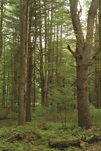
17 HEALTHY WOODED AREA HIGHLY DISTURBED WITH INVASIVE SPECIES
18 Parking concerns

 From the")
19 Typical School Day (approx. 44 parking spaces get used) From the 07/10/17 mtg
20 ALBION AVE HEDGEROW LN Parking Zoning Requirements Business (only defined in code for business district which we are not) Elementary School Gymnasium (not defined in code so church use was assumed) Existing Parking on Campus # of Spaces Bus Drop Off 17 Staff Lot 22 Main Oak Rd lot 63 Center Drive of campus 28 Hedgerow parking Other (around convent) 48 Buildings/Uses 1 space/300 sf 2 spaces/clsrm 1 space/50 SF or 1 space/4 occ New Parking on Campus # of Spaces Bus Drop Off 17 Main Oak Rd lot 101 Center Drive of campus 20 Connector road (event) 16 Hedgerow parking Other (around convent) 48 Bethany School Parking Analysis Current: Parking Spaces Phase I: Parking spaces Phase II: Parking spaces St. Faith (5100 sf) CLSRMS (10 clsrms) 20 N/A N/A Business Require. N/A Bethesda (1667 sf) Business Use Beth Eva (2 clsrms) Educational Use Bethlehem (4 clsrms) Educational Use Bethel (4 clsrms) Educational Use Bethsaida (4 clsrms) Educational Use 8 N/A N/A Business use (2037 SF) N/A 7 7 Hope (Library) 2357 sf LIB: accomodated in classroom parking 0 0 N/A Business use (Multi-purpose) N/A N/A 8 Halaritus (6 clsrms now 4 clsrms Phase II) Educational Use Building (16 clsrms) Educational Use Cafeteria Addition accomodated in classroom parking K-2 Building (9 clsrms) Educational Use N/A N/A 18 TOTAL SCHOOL DAY PARKING PER CODE other From the 07/10/17 mtg 10 EVENT PARKING: Non-Simultaneous Use This always exceeds school day use and dictates total parking spaces required EVENT PARKING (1 space/50 sf): BAC (Gym) EVENT PARKING (1 space/4 occ): BAC (Gym) Parking Spaces available during the School Day
21 ALBION AVE HEDGEROW LN Parking Zoning Requirements Business (only defined in code for business district which we are not) Elementary School Gymnasium (not defined in code so church use was assumed) Existing Parking on Campus # of Spaces Bus Drop Off 17 Staff Lot 22 Main Oak Rd lot 63 Center Drive of campus 28 Hedgerow parking Other (around convent) 48 1 space/300 sf 2 spaces/clsrm 1 space/50 SF or 1 space/4 occ New Parking on Campus # of Spaces Bus Drop Off 17 Main Oak Rd lot 101 Center Drive of campus 20 Connector road (event) 16 Hedgerow parking Other (around convent) other From the 07/10/17 mtg 10 Buildings/Uses Bethany School Parking Analysis Current: Parking Spaces Phase I: Parking spaces Phase II: Parking spaces St. Faith (5100 sf) CLSRMS (10 clsrms) 20 N/A N/A Business Require. N/A Bethesda (1667 sf) Business Use Beth Eva (2 clsrms) Educational Use Bethlehem (4 clsrms) Educational Use Bethel (4 clsrms) Educational Use Bethsaida (4 clsrms) Educational Use 8 N/A N/A Business use (2037 SF) N/A 7 7 Hope (Library) 2357 sf LIB: accomodated in classroom parking 0 0 N/A Business use (Multi-purpose) N/A N/A 8 Halaritus (6 clsrms now 4 clsrms Phase II) Educational Use Building (16 clsrms) Educational Use Cafeteria Addition accomodated in classroom parking K-2 Building (9 clsrms) Educational Use N/A N/A 18 TOTAL SCHOOL DAY PARKING PER CODE EVENT PARKING: Non-Simultaneous Use This always exceeds school day use and dictates total parking spaces required EVENT PARKING (1 space/50 sf): BAC (Gym) EVENT PARKING (1 space/4 occ): BAC (Gym) Parking Spaces available for Events
22 Enrollment and Planned Use

23 Provide additional information on the planned uses of each building upon completion of the project. Will there be additional traffic coming to and from campus as a result? See the chart on the next page. We do not anticipate additional traffic coming to campus as a result of the added square footage and change of use to some buildings. The additional square footage will allow the school operate on a right-sized campus. Staff will be able to operate in appropriately sized offices, and staff that currently have no office to work out of will be provided one. Classes will take place in appropriately sized classrooms. And additional spaces for staff to use for pull-out, team teaching and projectbased curriculum will be provided. The additional square footage will also supply the school with adequate storage and swing space for future building phases. While the parking space requirement for day-time school use is increasing, simply due to the increase in square footage, we do not anticipate an actual increase in cars coming to and from the site. The existing event parking requirement for the Gymnasium building still dictates the total number of spaces needed on site per code.
24 traffic pattern concerns: Analysis with max enrollment of 270 students

25 HEDGEROW LN EXISTING TRAFFIC PATTERN AND CAR COUNTS ALBION AVE M O R N I N G Existing Car Stacking (MORNING) Stack length (LF) within campus on center drive 525 On Albion North of entrance 250 On Albion South of entrance 175 TOTAL STACKING LENGTH 950 Approximate Number of cars: 47.5 Distribution of cars per times # of cars 7:00-7:15 2 1% 7:15-7: % 7:30-7: % 7:45-8: % 8:00-8: % 8:15-8:30 2 1% Total Cars at Drop-off ### ### Line waiting to pick up / drop off Pick up / drop off location Vehicles exiting site Bus traffic (accommodates 26 of Bethany s 169 families) Approx # of cars ENTERING site at pick-up / drop-off Approx # of cars EXITING site at pick-up / drop-off A F T E R N O O N Existing Car Stacking (AFTERNOON) Stack length (LF) within campus on center drive 525 On Albion North of entrance 250 On Albion South of entrance 175 Parked on Hedgerow Waiting 250 TOTAL STACKING LENGTH 1200 Approximate Number of cars: 60 Distribution of cars per times # of cars 2:00-2:15 6 8% 2:15-2:30 7 9% 2:30-2: % 2:45-3: % DISMISSAL 3:00-3: % 3:15-3:30 1 1% Total Cars at Pick-up cars stacked up before kids dismiss 143 Demographics of drivers # of Families % Morning stack length (LF) Afternoon stack length (LF) Total Families at Bethany 169 Families that take the bus 26 Families in Latchkey 86 Families that Drive ONLY K % Kids in Both 3-8 & K % ONLY % OAK RD
 50 30% 336 423 Kids")
26 ALBION AVE ALBION AVE HEDGEROW LN HEDGEROW LN Current Traffic on the Bethany Campus (based on max enrollement) Demographics of drivers # % Morning stack length (LF) Afternoon stack length (LF) Total Number of students 270 Total Families at Bethany % Families that take the bus 30 15% Families in Latchkey % Families that Drive % ONLY K-2 (cars) 50 30% Kids in Both 3-8 & K-2 (cars) 23 14% ONLY 3-8 (cars) 94 56% ### ONLY K-2 Parents (solid lines indicate stack length) ONLY 3-8 Parents (solid lines indicate stack length) Parents with BOTH K-2 & 3-8 (solid lines indicate stack length) Bus traffic: 6 Total Buses (no change from current process) Connector Drive: Gated top and bottom outside of pick-up and drop-off times Proposed NO PARKING during pick up and drop off times Per Glendale Fire Dept, there should be NO PARKING on Hedgerow at ALL times. Approx # of cars anticipated to ENTER site at pick-up / drop-off ### Approx # of cars anticipated to EXIT site at pick-up / drop-off STOP 2-way stop to alternate traffic turning east through campus STOP STOP OAK RD OPTION 1: Morning (max enrollment of 270) OAK RD OPTION 1: Afternoon (max enrollment of 270)
27 ALBION AVE ALBION AVE HEDGEROW LN HEDGEROW LN Current Traffic on the Bethany Campus (based on max enrollement) Demographics of drivers # % Morning stack length (LF) Afternoon stack length (LF) Total Number of students 270 Total Families at Bethany % Families that take the bus 30 15% Families in Latchkey % Families that Drive % ONLY K-2 (cars) 50 30% Kids in Both 3-8 & K-2 (cars) 23 14% ONLY 3-8 (cars) 94 56% ### ONLY K-2 Parents (solid lines indicate stack length) ONLY 3-8 Parents (solid lines indicate stack length) Parents with BOTH K-2 & 3-8 (solid lines indicate stack length) Bus traffic: 6 Total Buses (no change from current process) Connector Drive: Gated top and bottom outside of pick-up and drop-off times Proposed NO PARKING during pick up and drop off times Per Glendale Fire Dept, there should be NO PARKING on Hedgerow at ALL times. Approx # of cars anticipated to ENTER site at pick-up / drop-off ### Approx # of cars anticipated to EXIT site at pick-up / drop-off STOP 2-way stop to alternate traffic turning east through campus STOP STOP OAK RD OPTION 2: Morning (max enrollment of 270) OAK RD OPTION 2: Afternoon (max enrollment of 270)
28 Hedgerow / connector drive intersection w/ merge HEDGEROW LN OPTION 1: Afternoon (max enrollment of 270) ALBION AVE ONLY K-2 Parents (solid lines indicate stack length) ONLY 3-8 Parents (solid lines indicate stack length) Parents with BOTH K-2 & 3-8 (solid lines indicate stack length) Bus traffic: 6 Total Buses (no change from current process) Connector Drive: Gated top and bottom outside of pick-up and drop-off times Proposed NO PARKING during pick up and drop off times Per Glendale Fire Dept, there should be NO PARKING on Hedgerow at ALL times. STOP OAK RD
29 Intersection public roads
30 Intersection concerns An analysis was completed of the available intersection sight distance at five intersections exiting the Bethany School property. The sight distance calculations were performed using the methodology published in the Ohio Department of Transportation Location and Design Manual (ODOT L&D) Section and on field measurements performed by CEC (See Appendix 1 Intersection Sight Distance). The report will provide the results of our sight distance measurement and the required sight distances for vehicles exiting the Bethany School making both left turn and right turn movements. The current traffic circulation at Bethany School enters the school from Albion at the chapel. The proposed traffic circulation at Bethany School is to reverse the direction through the school property to enter on the west side of the school and exit at the chapel onto Albion. The proposed change will provide several benefits to the school and surrounding roadways, including; eliminating cars stacking on Albion; safety for the students to drop off on the right side of the car directly to the sidewalk; the administration building will be relocated to Saint Faith and will become the entry point to the school, providing better access to the administration building; and, the chapel will become the focal point along the axis of the school property on the drive through the school property. This will also provide clarity to visitors in terms of what is Convent/Retreat Center use vs. School use.

31 SITE DISTANCE ANALYSIS: INTERSECTION
32 SITE DISTANCE ANALYSIS: INTERSECTION 2 1 The various solutions consisted of the following options: Option 1 - Can the location of the assumed driver s eye height used to perform sight distance measurement be reduced from 14.4 per American Association of State Highway and Transportation Officials (AASHTO) for low volume roads? Option 2 - Can stopping sight distance requirements be met per the ODOT L&D manual? Required stopping sight distance is Option 3 - Should the intersection be controlled with a 4-way stop per warrants for the installation of multi-way stop control published in the Manual of Uniform Traffic Control Devices (MUTCD)? 3 4 5
33 3-8 classroom building

34 3-8 classroom building & cafeteria addition

35 K-2 classroom building (phase II)
36 End of Presentation
37 REMAINING SLIDES REF ONLY IF NEEDED:
38 This graphic shows an overlay of the existing parking lot with drop off procedures for CHCA. CHCA has been suggested as a model to reference for Bethany. CHCA s main parking lot is about 3-times the size of Bethany s lot. Additionally, their staff does not park in their main lot. These attributes allow them to line up their carpool lines in a series of rows across the whole empty lot. They are then funneled through the single file drop off lane that runs across the front of the building. This option does not apply to Bethany given the differences in space. BUT it is important to note, that like Bethany, CHCA has a dedicated drop off lane that allows cars to drop children off along a sidewalk in a single file line in the safest manner.
39 What is the maximum enrollment, based on current best practices, that this campus would support if the school were to be sold? See the chart below. The classrooms are right-sized for the number of children that Bethany has per class. This would seem to indicate that even if another school were to take over the campus, they would not have the available space to increase the enrollment above what is currently the Bethany enrollment cap of 15/class or 30/grade with a total enrollment max of 270 students. While it is true that we are adding square footage to the campus, that square footage is to fill a large shortage in space that is needed to operate a modern 21st century 270 student school. They currently have classrooms that are 1/2 the size of recommended. They lack breakout spaces, project lab spaces, teacher collaboration spaces and multi-purpose spaces. Their Building Services spaces are not appropriate in the existing buildings. This includes restroom space, mechanical space, storage space and circulation space. The square footage available for office space is extremely short. This is evident when you see closets in cottages being used for offices. Classroom Square Footage Analysis (Best Practice) Teacher Area 85 SF Casework Area 110 SF With 3' space clear in front Regardless of overall classroom 195 SF Total Sf needed regardless of student count SF/Student 30 SF This is the SF/per student for main work area Desk area for 15 students 450 SF Total Min Classroom size for SF Actual Designed Classroom Size 665
40 An alternate route was suggested using the current service road already in existence. This would address the traffic safety issue per Police Chief Dave Warman while avoiding the removal of several large trees. It would also substantially lower the costs of construction of the project. The savings of tree removal, moving of utility pole, rerouting McSwain water and underground electric, removal and temporary drive replacement, and reduction of the construction cost of the connector road would be a savings in the hundreds of thousands of dollars. The space provided west of the planned connector would also allow present drainage plans and above ground water retainage without the planned removal of trees. This possibly would eliminate the usage of Bioswales which could result in high maintenance and a safety hazard for children. We have evaluated the possibility of shifting the connector to the east, but it would be detrimental to the planned outdoor learning spaces, the play space area, and our ability to provide appropriate, maintainable slopes on our property. It would also force us to add significant swales and underground storm detention on the West side of the property which would result in the same tree removal. Furthermore, it would result in deeper cuts along the West side of the property to accommodate more swales and the underground tanks. This would cause additional harm to the root system of trees that are remaining. This idea was discussed with both Glendale village engineer, Tim Casto, as well as Hamilton County Soil & Water Conservation. Both of these entities are in favor of our concept and believe it to be an appropriate solution.

41 An alternate route was suggested using the current service road already in existence. This would address the traffic safety issue per Police Chief Dave Warman while avoiding the removal of several large trees. It would also substantially lower the costs of construction of the project. The savings of tree removal, moving of utility pole, rerouting McSwain water and underground electric, removal and temporary drive replacement, and reduction of the construction cost of the connector road would be a savings in the hundreds of thousands of dollars. The space provided west of the planned connector would also allow present drainage plans and above ground water retainage without the planned removal of trees. This possibly would eliminate the usage of Bioswales which could result in high maintenance and a safety hazard for children. Off-setting the connector drive, such that it does not align with hedgerow, results in a hard-to-navigate and unsafe intersection. It also results in a loss of ½ of the visitor parking spaces. Our plan allows us to spread out the egress and ingress points for cars and provide relief on all of the roads around the Bethany Property. Hedgerow and Albion neighbors will all see a reduction on traffic. The addition of Bioswales brings a much-added benefit to our site as well as the neighbors. The use of bioswales was also recommended by Hamilton County Soil & Water Conservation as well as the Village Engineer. Bio-swales promote the infiltration of rainwater into the ground such that it stays on site instead of entering the Glendale storm system. While they do require maintenance like any landscape does, it can provide an opportunity for studying of plants and species. We do not anticipate these being a nuisance or an eye-sore.
PLANNING APPROVAL & PLANNED UNIT DEVELOPMENT Date: November 2, 2017
 PLANNING APPROVAL & PLANNED UNIT DEVELOPMENT Date: November 2, 2017 DEVELOPMENT NAME LOCATION Mobile Christian School 5900 Cottage Hill Road (North side of Cottage Hill Road, 230 ± West of Freemont Drive
MONTGOMERY COUNTY PLANNING DEPARTMENT THE MARYLAND-NATIONAL CAPITAL PARK AND PLANNING COMMISSION
 MONTGOMERY COUNTY PLANNING DEPARTMENT THE MARYLAND-NATIONAL CAPITAL PARK AND PLANNING COMMISSION William H. Farquhar Middle School Modernization MCPB Item No. 10 Date: 09-18-2014 Description Summary Fred
LOS ANGELES MISSION COLLEGE MASTER PLAN Master Plan DESIGN & DEVELOPMENT PRINCIPLES
 LOS ANGELES MISSION COLLEGE MASTER PLAN DESIGN & DEVELOPMENT PRINCIPLES 34 Quality Learning Along the Arroyo PROGRAM SUMMARY BY PROJECT The following are program summaries for each of the projects planned
Homeowners Guide to Stormwater BMP Maintenance
 Homeowners Guide to Stormwater BMP Maintenance What You Need to Know to Take Care of Your Property Rain Barrel Dry Well Rain Garden Pervious Asphalt Porous Pavers City of El Monte Stormwater BMP Management
5. LOW IMPACT DEVELOPMENT DESIGN STANDARDS
 5. LOW IMPACT DEVELOPMENT DESIGN STANDARDS Low Impact Development (LID) requires a shift in stormwater management away from conveying runoff to a small number of downstream points through hydraulically
The Vision. Photo provided by The Minervini Group. 46 Vision, Objectives & Strategies
 Vision, Objectives & Strategies The is the public framework and guide for future development of the Grand Traverse Commons. The establishes public polices for infrastructure, the preservation of natural
Introduction to Low Impact Development. Fred Milch. East Central Florida Regional Planning Council
 Introduction to Low Impact Development Fred Milch East Central Florida Regional Planning Council Low Impact Development (LID) Low impact development (LID) is a term used to describe a land planning and
HEALTH SCIENCES BUILDING REDEVELOPMENT PROJECT
 INTRODUCTION In recent years, the University of Cincinnati (University) has demonstrated a commitment to identifying and implementing sustainable goals and objectives throughout University s Uptown Campuses.
GENERAL INFORMATIONaaaaaaaaaaaaaaaaaaaaaaaaaaaaaaaa
 To: Planning and Zoning Commission From: City Staff Date: November 15, 2016 Re: Case #16026 Raymore Activity Center Site Plan GENERAL INFORMATIONaaaaaaaaaaaaaaaaaaaaaaaaaaaaaaaa Applicant/ Property Owner:
COMMUNITY DESIGN. GOAL: Create livable and attractive communities. Intent
 COMMUNITY DESIGN Intent An attractive, well-designed County will attract quality development, instill civic pride, improve the visual character of the community, and create a strong, positive image for
ESTABLISH AN EFFICIENT TOWN CENTER
 ESTABLISH AN EFFICIENT TOWN CENTER 4 Overview Lisbon residents are proud of the history of Newent and at the same time recognize its current importance as a centralized location for a variety of municipal
SEATTLE PUBLIC UTILITIES Drainage Design Options for street right of ways.
 SEATTLE PUBLIC UTILITIES Drainage Design Options for street right of ways. Numerous ecosystem-based functional stormwater quantity and quality design alternatives are possible within the street ROW. Several
Dear High Meadows Community,
 Dear High Meadows Community, We are excited that the work on our new animal care facility and parking area will be completed in short order, to the benefit of our children, animals, and animal caretakers.
WELCOME! 8 8:30 6: TH STREET IMPROVEMENTS. Open House. Presentation & Q&A
 WELCOME! 168 TH STREET IMPROVEMENTS 6:30 Open House 7 8 Presentation & Q&A 8 8:30 Open House WELCOME Todd Pfitzer City of Omaha Engineer Bob Stubbe City of Omaha Public Works Director Jon Meyer Project
APPENDIX D: Visual and Aesthetic Conditions for NCCU Station Refinement. Durham-Orange Light Rail Transit Project
 APPENDIX D: Visual and Aesthetic Conditions for NCCU Station Refinement Durham-Orange Light Rail Transit Project October 2016 1. Introduction The Combined FEIS/ROD summarizes the effects of the D-O LRT
VEHICULAR AND PEDESTRIAN CIRCULATION
 This perspective sketch communicates the intended character and quality of a proposed streetscape design. Locate benches near a major intersection where people tend to gather. Seating and lighting provide
F. Driveways. Driveways which provide access to off-street parking or loading from public streets shall comply with the following:
 Section 20.945.040 General Design Standards for Surface Parking Areas. A. Review Authority. Parking lot design and drainage shall be subject to review and approval of the City Transportation Manager. B.
CAMPUS PLANNING COMMITTEE STAFF REPORT SAMARITAN SPORTS MEDICINE INSTITUTE AT OSU 10/21/2013
 Office of Capital Planning and Development; 130 Oak Creek Building; Corvallis, Oregon 97331-2001 CPC STAFF REPORT: SAMARITAN SPORTS MEDICINE INSTITUTE AT OSU CAMPUS PLANNING COMMITTEE STAFF REPORT SAMARITAN
Potential Green Infrastructure Strategies May 6, 2015 Workshop
 Potential Green Infrastructure Strategies May 6, 2015 Workshop Background The City of Cortland is developing the Tioughnioga Urban Headwaters Green Infrastructure Action Plan with funding from the National
Sign System Recommendations
 4.1 Sign System Recommendations 4.2 Recommended sign types required for a complete wayfinding system on the TCNJ campus are described below. Detailed sign messages and their typical locations are included
Comprehensive Study N A G L E H A R T R A Y A R C H I T E C T U R E GILBANE BUILDING C O M P A N Y P R O J E C T M A N A G E M E N T A D V I S O R S
 N A G L E H A R T R A Y A R C H I T E C T U R E GILBANE BUILDING C O M P A N Y P R O J E C T M A N A G E M E N T A D V I S O R S BOE COW Meeting October 6, 015 Comprehensive Study North Shore School District
OPPORTUNITIES AND CONSTRAINTS - OXBOW PARK ENTRANCE AND PUT-IN
 OPPORTUNITIES AT OXBOW EXISTING WETLANDS Site is undeveloped and we can design a park that works well from the start. SAND BEACH Potential to eliminate invasive species. DEBRIS (CONCRETE, OLD CARS) VEGETATION
Sustainable Design Return On Investment - Case Study. PERMEABLE PAVERS VS NON-POROUS ASPHALT PAVING (LARGE SCALE AREA) September, 2013
 September, 2013") Sustainable Design Return On Investment - Case Study PERMEABLE PAVERS VS NON-POROUS ASPHALT PAVING (LARGE SCALE AREA) September, 2013 STEWARDSHIP COMMITTEE MEMBERS: TIM SMITH, ASLA - CHAIRMAN JOE ESPOSITO,
Sustainable Design Return On Investment - Case Study PERMEABLE PAVERS VS NON-POROUS ASPHALT PAVING (LARGE SCALE AREA) September, 2013 STEWARDSHIP COMMITTEE MEMBERS: TIM SMITH, ASLA - CHAIRMAN JOE ESPOSITO,
Grandview area secondary school FAQ
 Grandview area secondary school FAQ Design Are there savings involved in using a repeat design? Although the Grandview area secondary school is not a complete repeat design, it has elements that are repeated
Neighborhood Districts
 NEIGHBORHOOD DISTRICTS SEVEN MAIN DISTRICTS Neighborhood Districts While the Development Plan provides a broad-scale overview of the neighborhood, this section focuses on uses and relationships at the
CHAPTER 26 LANDSCAPING (Chapter added in its entirety 05-08)
") CHAPTER 26 LANDSCAPING (Chapter added in its entirety 05-08) 26.01 DESCRIPTION AND PURPOSE. Landscaping is an important element of the use, development and preservation of land, and a significant factor
CHAPTER 26 LANDSCAPING (Chapter added in its entirety 05-08) 26.01 DESCRIPTION AND PURPOSE. Landscaping is an important element of the use, development and preservation of land, and a significant factor
New Berlin City Center Concept Review PDQ Food Stores, Inc
 September 23, 2016 City of New Berlin Planning Commission 3805 S Casper Dr New Berlin, WI 53151 RE: New Berlin City Center Concept Review PDQ Food Stores, Inc Dear Plan Commission Members, On behalf of
This is the East Carolina University Comprehensive Facilities Master Plan Final Draft Plan Review. This workbook reviews the campus draft master plan
 This is the East Carolina University Comprehensive Facilities Master Plan Final Draft Plan Review. This workbook reviews the campus draft master plan first presented on campus on June 29 and June 30, 2011.
Wold Architects and Engineers. 332 Minnesota Street Suite W2000 Saint Paul, MN
 Wold Architects and Engineers 332 Minnesota Street Suite W2000 Saint Paul, MN 55101 651 227 7773 PLANNERS ARCHITECTS ENGINEERS ISD #15 St. Francis Area Schools East Bethel Elementary School Additions and
CITY OF VIRGINIA BEACH PLANNING COMMISSION DESIGN AWARDS PROGRAM 2012
 Virginia Beach City Public Schools COLLEGE PARK ELEMENTARY SCHOOL CITY OF VIRGINIA BEACH PLANNING COMMISSION DESIGN AWARDS PROGRAM 2012 NOMINATION APPLICATION SUSTAINABLE DEVELOPMENT PROJECT NARRATIVE
Transportation. Strategies for Action
 Transportation A major priority for the Overlake Neighborhood is to develop a multimodal transportation system. To achieve this system, a balance has to be found among travel, circulation and access needs;
Century Highfield Sub Area Plan
 Century Highfield Sub Area Plan The Century Highfield Sub Area Plan provides an opportunity to re evaluate the vision that was set forth for this area when the Township conducted a similar planning exercise
STORMWATER REPORT FOR WALMART SUPERCENTER STORE # SIOUX FALLS, LINCOLN COUNTY, SOUTH DAKOTA BFA PROJECT NO
 STORMWATER REPORT FOR WALMART SUPERCENTER STORE # 2443-00 SIOUX FALLS, LINCOLN COUNTY, SOUTH DAKOTA BFA PROJECT NO. 3286 March 1, 2012 I hereby certify that this engineering document was prepared by me
SITE FEASIBILITY TEST FIT LAYOUT NORTHERN AREA INTERNATIONAL SCHOOL DECEMBER 2016
 SITE FEASIBILITY TEST FIT LAYOUT NORTHERN AREA INTERNATIONAL SCHOOL DECEMBER 2016 OWNER & DESIGN TEAM GENERAL BACKGROUND INFORMATION PGCPS received a Carnegie Corporation Opportunity by Design grant to
NEW ELEMENTARY SCHOOL AT THOMAS JEFFERSON MIDDLE SCHOOL
 JULY 27, 2016 NEW ELEMENTARY SCHOOL AT THOMAS JEFFERSON MIDDLE SCHOOL Joint BLPC - PFRC Meeting 1 Project Parameters 1. New Elementary School for the Henry Community 2. Support Strategic Plan Goal #4 Provide
6.1. INTRODUCTION AND SUMMARY OF FINDINGS
 Chapter 6: Stormwater Management 6.1. INTRODUCTION AND SUMMARY OF FINDINGS A Stormwater Pollution Prevention Plan (SWPPP) has been prepared for the Proposed Project in accordance with the requirements
Billing Code: DEPARTMENT OF HOUSING AND URBAN DEVELOPMENT [Docket No. FR-6072-N-01]
![Billing Code: DEPARTMENT OF HOUSING AND URBAN DEVELOPMENT [Docket No. FR-6072-N-01]](/thumbs/91/107309814.jpg "Billing Code: DEPARTMENT OF HOUSING AND URBAN DEVELOPMENT [Docket No. FR-6072-N-01]") This document is scheduled to be published in the Federal Register on 12/18/2017 and available online at https://federalregister.gov/d/2017-27194, and on FDsys.gov Billing Code: 4210-67 DEPARTMENT OF HOUSING
This document is scheduled to be published in the Federal Register on 12/18/2017 and available online at https://federalregister.gov/d/2017-27194, and on FDsys.gov Billing Code: 4210-67 DEPARTMENT OF HOUSING
McDonald s Restaurant - Purcellville Town of Purcellville Special Use Permit Statement of Justification July 24, 2014
 Introduction / Written Statement McDonald s Restaurant - Purcellville McDonald s Corporation is proposing to redevelop the existing McDonald s eating establishment with a drive-through located at 121 N
Moreno Valley College: Conceptual Master Planning - Site Analysis Lasselle Street, Moreno Valley, CA 92551
 Master Plan Architect School Name Moreno Valley College District Riverside Community College District Architecture and Urban Design 5898 Blackwelder Street Ground Floor Culver City, CA 90232 T: 310.559.5720
The University District envisions, in its neighborhood
 Envisioning the University District Link Light Rail in Seattle s neighborhoods CIY OF SEALE CONCEP-LEVEL SAION AREA PLANNING RECOMMENDAION RESOLUION # 30165 EXHIBI L Vision 08.2000 he University District
campus master plan VIRGINIA STATE UNIVERSITY
 campus master plan VIRGINIA STATE UNIVERSITY agenda 01 INTRODUCTION & GENERAL OVERVIEW 02 03 04 LAND USE CONCEPT PROGRAM ACCOMMODATION MAXIMIZE EXISTING INFRASTRUCTURE SUMMARY AND NEXT 05 STEPS agenda
Toronto Complete Streets Guidelines
 Toronto Complete Streets Guidelines 108 110 7.1 Green Infrastructure Design Principles 112 7.2 Context-Sensitive Green Streets 114 7.3 Key Green Street Elements Green infrastructure refers to natural and
COMPLETE GREEN STREET CHECKLIST
 COMPLETE GREEN STREET CHECKLIST This document was developed to dissect the structure of an urban street and explore opportunities to make our streets more complete while also integrating green street strategies.
Community Response Buchanan Elementary. December 13, 2016
 Community Response Buchanan Elementary December 13, 2016 SITE EVALUATION FOLLOWING INITIAL COMMUNITY INPUT BUCHANAN ELEMENTARY SCHOOL Design Concepts for the new Buchanan Elementary School have been shared
Dogpatch/22nd Street Greening
 TEAM MEMBERS Prepared for: GreenTrustSF Central Waterfront www.gtsfcw.org Prepared by: Fletcher Studio San Francisco, CA www.fletcherstudio.com Landscape Architecture Urban Design Environmental Planning
Prepared for: East Park Leadership Conservation Center Prepared by: CVM Construction Managers, Inc.
 Environmental Assessment East Park Reservoir Prepared for: East Park Leadership Conservation Center Prepared by: CVM Construction Managers, Inc. Environmental Assessment, East Park Reservoir 1 Contents
ARTICLE 3 LANDSCAPING AND SCREENING REQUIREMENTS
 ARTICLE 3 CHAPTER 4 LANDSCAPING AND SCREENING REQUIREMENTS SEC 3.401 SEC 3.402 (D) (E) PURPOSE: The purpose of this Chapter is to establish minimum standards for the design, installation, and maintenance
12/7/2007. Christopher B. Burke Engineering West, Ltd Aux Sable Creek Watershed Plan Update 1
 The ABC s of BMP s Aux Sable Watershed Plan St. Charles, IL Why are BMP s Important Best Management Practices (BMPs) developed as a set of practices which help to achieve goals of the Clean Water Act and
Uniformity Avg. : Min. Maintained Use/Task
 WEST WHITELAND TOWNSHIP SUBDIVISION AND LAND DEVELOPMENT ORDINANCE OUTDOOR LIGHTING SECTION 03/10/04 REVISION Section 428. Lighting Control 1. Purpose. The standards established in this section set forth
30% Design Community Meeting
 Monday, September 17, 2018 30% Design Community Meeting Site 85-E-W-4 Please sign in on your mobile device: http//communitymeeting.ocps.net/ Site 85-E-W-4 Meeting Agenda September 17, 2018, 6:45PM Welcome
PRELIMINARY CONDITIONAL USE SUBMITTAL CHECKLIST REQUIREMENTS
 This checklist must accompany your submittal as the cover page. CONDITIONAL USE Application Submittal Checklist for PRELIMINARY AND FINAL APPROVAL Per Winter Park Land Development Code Sec. 58-90 PRELIMINARY
JCCC Campus Stormwater Project: Retrofitting Yesterday s Parking Lots With Today s Best Management Practices
 JCCC Campus Stormwater Project: Retrofitting Yesterday s Parking Lots With Today s Best Management Practices JCCC CAMPUS SUSTAINABILITY o Student self-imposed green fee for campus wide sustainability
MONTGOMERY COUNTY PLANNING DEPARTMENT
 MONTGOMERY COUNTY PLANNING DEPARTMENT THE MARYLAND-NATIONAL CAPITAL PARK AND PLANNING COMMISSION Ashburton Elementary School Addition, Mandatory Referral, MR2018009 MCPB Item No. Date: 02-15-18 Troy Leftwich,
Article 10: Landscaping and Buffering
 10.01: Purpose Article 10: Landscaping 10.01: Purpose The purpose of this article is to: A) Promote and protect the interest of the public convenience, comfort, prosperity, or general welfare in accordance
Green Infrastructure and Low-Impact Development Technologies
 Green Infrastructure and Low-Impact Development Technologies The guiding principles of these technologies is to manage stormwater at their sources using natural means, and establish conditions so that
V. Vision and Guiding Principles
 V. Vision and Guiding Principles The Master Plan for the Powers Ferry Corridor seeks a foundation in the desires of the community. At times, various elements of the community offered opposing viewpoints,
More than 30 adults and 19 children were involved in these community workshops.
 Linwood Workshops held at Household of Faith Deliverance Church 3.29.08 and 4.05.08 What is a Design Workshop? We use the term workshop (often called charrette among design professionals) to describe a
The Benefits and Challenges Associated with Green Infrastructure Practices
 The Benefits and Challenges Associated with Green Infrastructure Practices Thomas M. Evans ASLA, LEED AP Regional Green Infrastructure Design Services Director OWEA Technical Conference, June 20, 2013
ALTERNATIVE STATION AREA -
 ALTERNATIVE STATION AREA - THE 10 TH STREET GARDEN STATION Two alternative land use scenarios and designs are illustrated here: Scheme A - Transit-Oriented Development High to Mid-Density Residential /Office
CITY OF ZEELAND PLANNING COMMISSION
 APPLICATION FOR SITE PLAN REVIEW AND SPECIAL LAND USE Date City Official App. Filing Fee Rec'd ($350) NOTE TO APPLICANT: Please submit this application for Site Plan Review along with twenty (20) copies
ANCHOR TO ANCHOR. Rescale the street to create an iconic boulevard.
 ANCHOR TO ANCHOR Rescale the street to create an iconic boulevard. UR NE ER UV GO NE LA OBJECTIVES 1. Maintain appropriate traffic flow and prioritize commercial curb access 2. Mark gateways at the street
Landscaping Standards
 CHAPTER 29 ARTICLE 403 29.403 Landscaping Standards Purpose: The purpose of this section is to protect and promote the public health, safety and general welfare by requiring landscaping in relation to
ACADEMY AREA CONCEPT PLAN
 ACADEMY AREA Strip ling C hape l Roa d CONCEPT PLAN 7 S2 U Stripling 52 ROADWAYS AND PARKING: ADVENTURE PLAYGROUND AND SPRAYGROUND: Current roadways follow existing drives. It is recommended that the Folds
Net Land Area (NLA): Area within zoning lot boundaries NLA= 1,076,181 sq. ft.
: Area within zoning lot boundaries NLA= 1,076,181 sq. ft.") PROJECT FACT SHEET Section A: Project Information Application type: Project Name: Special Use Permit Date: June 29, 215 Merin Road Community Use Type: (check/list all that apply) Office/Institutional x
PROJECT FACT SHEET Section A: Project Information Application type: Project Name: Special Use Permit Date: June 29, 215 Merin Road Community Use Type: (check/list all that apply) Office/Institutional x
New High School Concept
 Approved Bond Projects for Alamance-Burlington Schools In November 2018, Alamance County citizens approved a $150 million bond project proposal. Bond funds will pay to construct a new high school and provide
WESTERN ILLINOIS UNIVERSITY
 WESTERN ILLINOIS UNIVERSITY Quad Cities Riverfront Campus Master Plan March 1, 2006 Preliminary Master Plan Total Site Build Out Western Illinois University Quad Cities Municipal Park Mississippi River
include playgrounds, sports fields, community gardens and picnic areas.
 DEVELOPMENT PLAN OPEN SPACE SYSTEM OPEN SPACE SYSTEM The neighborhood provides for a range of open space types. The Village Square is an important open space in the neighborhood. It serves as a gathering
The subject site plan amendment proposes the following revisions to the approved site plan:
 PROPOSED AMENDMENT The subject site plan amendment proposes the following revisions to the approved site plan: 1. The building footprint was modified to accommodate the revised architectural design. 2.
Public may provide comments on the GDP within the next two weeks (December 24)
") 25/70 General Development Plan (GDP) Public Meeting Wednesday, December 10, 2014 6:00 8:00 P.M. District 1 Police Station Community Room 1311 W 46th Ave, Denver, CO 80211 Council Woman Montero: This particular
25/70 General Development Plan (GDP) Public Meeting Wednesday, December 10, 2014 6:00 8:00 P.M. District 1 Police Station Community Room 1311 W 46th Ave, Denver, CO 80211 Council Woman Montero: This particular
Los Angeles Beautification Team
 Los Angeles Beautification Team Location: 1741 N. Cherokee Ave., Hollywood, CA 90028 Telephone: (323) 962-2163 Email: hbteam@earthlink.net Website: www.hbteam.org 501 3 Non-Profit Organization Contractor
POLE BRIDGE ROAD NEAR FIVE LOT FARM
 Drainage Improvements Village of Avon Pole Bridge Road near Five Lot Farm December 2014 POLE BRIDGE ROAD NEAR FIVE LOT FARM Pole Bridge Road is the eastern border of the Village south of NYS route 5 &
Asbury Chapel Subdivision Sketch Plan
 Asbury Chapel Subdivision Sketch Plan PART 1: PROJECT SUMMARY Applicant: NVR Inc. Project Size: +/- 76.13 acres Parcel Numbers: 02101112,02116101,02116112, 02116113 Current Zoning: Transitional Residential
R E S O L U T I O N. 2. Development Data Summary:
 R E S O L U T I O N WHEREAS, the Prince George s County Planning Board has reviewed Departure from Design Standards DDS-631 requesting a departure to allow the loading space and the driveway to the loading
Catalina Magnet High School Project
 Catalina Magnet High School Project Lunch Patio Design Phase 1 existing trees existing shrubs proposed phase 1 trees (3) proposed phase 1 tables (4) 2011 proposed phase 1 shrubs (20) proposed flagstone
Moon Brook FRP BMP Summary Sheet. Ownership of Land where BMP is Located
 Outlet Retrofit Hitzel Terrace The town owned parcel along Hitzel Terrace is a natural wetland area which currently provides some level of stormwater detention and peak-flow attenuation. The proposed project
Developer s Program. The Station at East 54
 Developer s Program The Station at East 54 Existing Conditions The Station at East 54 is proposed for a 1.12 acre site at the northeast corner of Hamilton Road and Prestwick Road, tucked between the East
Principles for Ecological Landscape Design in Brownfield Business Parks
 Principles for Ecological Landscape Design in Brownfield Business Parks Part of USDA Forest Service research project # 00-JV-11231300-033: Aligning Social and Ecological Drivers of Urban Landscape Change
Community Design Guidelines. Port Wallace DRAFT
 Community Design Guidelines Port Wallace DRAFT Energy 1 2 3 Nature Movement Connections Built Form DRAFT Layout Energy 1 Nature Community Design Guidelines GREAT COMMUNITIES PROTECT, CELEBRATE, AND CONSERVE
Fall 2017 Construction Update
 Fall 2017 Construction Update Ward 4 Southeast Engineering Department Riverwalk Red Multi-Use Trail Bridge Rehabilitation The Riverwalk Red Multi Use Trail Bridge was awarded to Cramer and Associates,
SITE PLAN REVIEW ITEMS - REFERENCE CHECKLIST
 City of Seminole 9199 113 th Street N. Seminole, FL 33772 Ph: (727) 392-1966 Fx: (727) 319-6583 SITE PLAN REVIEW ITEMS - REFERENCE CHECKLIST Note: This checklist is designed to aid designers in the review
Fitting Green Infrastructure In a Historic Neighborhood
 Fitting Green Infrastructure In a Historic Neighborhood May 17, 2017 Presented by Marcia Davis, PE Spokane Stormwater Map of stormwater infrastructure throughout the City of Spokane The City s Stormwater
PLANNED UNIT DEVELOPMENT & SUBDIVISION STAFF REPORT Date: March 15, 2012
 PLANNED UNIT DEVELOPMENT & SUBDIVISION STAFF REPORT Date: March 15, 2012 DEVELOPMENT NAME SUBDIVISION NAME LOCATION OSR Subdivision OSR Subdivision 5559 Old Shell Road (South side of Old Shell Road, 570
City of Sun Prairie Wetland Buffer Reduction Request
 City of Sun Prairie Wetland Buffer Reduction Request Westside Development Area January 9, 2017 Prepared by: City of Sun Prairie 300 E. Main Street Sun Prairie, WI 53590 BACKGROUND The City of Sun Prairie
Does Green Infrastructure Pay? WASHOE COUNTY COMMISSION CHAMBERS RENO, NEVADA
 Does Green Infrastructure Pay? WASHOE COUNTY COMMISSION CHAMBERS RENO, NEVADA JANE KULIK, ASLA WENK ASSOCIATES, INC MARCH 30, 2006 the dollars and sense of green infrastructure: examining costs and benefits
Parks & Recreation Tree Board - Tree Ordinance Angola, Indiana
 Parks & Recreation Tree Board - Tree Ordinance Angola, Indiana 97.01 PURPOSE. (A) Promote and enhance the beauty of the city through tree preservation and landscaping. (B) Safeguard the ecological environment
4. CONCEPT PLAN DEVELOPMENT
 4. CONCEPT PLAN DEVELOPMENT Concept Plan Step 1: Identify Site Constraints and Opportunities Review the existing site to identify constraints and opportunities for GI Practices to meet the RRv. Constraints
ARTICLE VI: SITE PLAN REVIEW
 Section 6.01 - Site Plan Review (All Districts) ARTICLE VI: SITE PLAN REVIEW Site plans give the Planning commission an opportunity to review development proposals in a concise and consistent manner. The
Puyallup School District Emergency Response Procedures Supported by Communities In Schools of Puyallup
 Puyallup School District Emergency Response Procedures Supported by Communities In Schools of Puyallup Approved November 17, 2016 Table of Contents: Page 2: Fire Evacuation Procedure Page 4: Earthquake
At Your Disposal CUP Amendment, Lot 20, Village Service Commercial, at 128 Bastille Dr. (PLN17-208)
") MEMORANDUM Archuleta County Development Services Planning Department 1122 HWY 84 P. O. Box 1507 Pagosa Springs, Colorado 81147 970-264-1390 Fax 970-264-3338 TO: Archuleta County Planning Commission FROM:
MEMORANDUM Archuleta County Development Services Planning Department 1122 HWY 84 P. O. Box 1507 Pagosa Springs, Colorado 81147 970-264-1390 Fax 970-264-3338 TO: Archuleta County Planning Commission FROM:
LOUISIANA STATE UNIVERSITY COMPREHENSIVE & STRATEGIC CAMPUS MASTER PLAN. APPENDIX G - Stormwater Study Findings & Stormwater Solutions
 LOUISIANA STATE UNIVERSITY COMPREHENSIVE & STRATEGIC CAMPUS MASTER PLAN APPENDIX G - Stormwater Study Findings & Stormwater Solutions LSU: MP Narrative July 2017 3.5 Open Space Existing Conditions The
Urban Planning and Land Use
 Urban Planning and Land Use 701 North 7 th Street, Room 423 Phone: (913) 573-5750 Kansas City, Kansas 66101 Fax: (913) 573-5796 Email: planninginfo@wycokck.org www.wycokck.org/planning To: From: City Planning
ADDENDUM NO. 1 BID-CONTRACT DOCUMENTS FOR. RFP No Professional Design Services for CCC Le-Jao Student Resource Center
 ADDENDUM NO. 1 BID-CONTRACT DOCUMENTS FOR RFP No. 2030 Professional Design Services for CCC Le-Jao Student Resource Center COAST COMMUNITY COLLEGE DISTRICT COSTA MESA, CALIFORNIA COUNTY OF ORANGE COAST
Public input has been an important part of the plan development process.
 Lakewood s Comprehensive Plan recognizes that transportation helps shape the community, and that the way the community provides for the safe and efficient movement of people affects the character of the
PLANNED UNIT DEVELOPMENT & PLANNING APPROVAL STAFF REPORT Date: April 4, 2013
 PLANNED UNIT DEVELOPMENT & PLANNING APPROVAL STAFF REPORT Date: April 4, 2013 NAME LOCATION The North American Islamic Trust, Inc. 63 East Drive (East side of East Drive, 400 South of Old Shell Road, and
Chapter 1 Introduction
 Chapter 1 Introduction Bioretention systems, also known as biofiltration systems, biofilter or rain gardens, is a common stormwater mitigation measure. It utilises a low energy consumption treatment technology
University of the District of Columbia Van Ness Campus Master Plan Community Open House 3. December 8, 2010
 University of the District of Columbia Van Ness Campus Master Plan Open House 3 December 8, 2010 Introductions Sequence of Work: Campus Master Plan BEGIN: INTRODUCE AND START WORK Project Initiation Team
NOTICE OF PREPARATION OF A DRAFT ENVIRONMENTAL IMPACT REPORT
 NOTICE OF PREPARATION OF A DRAFT ENVIRONMENTAL IMPACT REPORT TO: SUBJECT: Interested Parties Notice of Preparation of a Draft Environmental Impact Report for the Marywood Residential Development project.
Phasing and Implementation
 Phasing and Implementation Adaptive Reuse and New Construction Opportunities The reuse of existing buildings at UW Tacoma S 21st St S 17th St Tacoma Ave is highly valued for maintaining the history, character,
GUIDELINES FOR ECOLOGICAL PERFORMANCE
 3 Landscape........................................... 3.2 Stormwater Management................................... 3.3 Hardscape........................................... 3.4 Streetscape..........................................
ESD # 122 UNION RIDGE MODULAR CLASSROOM
 page 1 CITY of RIDGEFIELD TYPE I DECISION SITE PLAN REVIEW - (SPR 99-08) ESD # 122 UNION RIDGE MODULAR CLASSROOM TO: Mayor, and Members of the Ridgefield City Council and Planning Commission FROM: ERIC