IK Ranch Property Park Master Plan
|
|
|
- Ralph Anderson
- 5 years ago
- Views:
Transcription


1 Spring 2015
2 TABLE OF CONTENTS SECTION 1 Introduction Acknowledgments CCCD/ UTA Information Location and Context (Gypsum Background Information) History of Gypsum & Site. Background analysis of existing Gypsum Parks Project Goals Overarching Goals. Initial Stakeholder Meeting SECTION 2 Site Information. Analysis Existing conditions Design Inspiration Design Concepts Various Alternatives Initial Public Meeting Information SECTION 3 Preferred Design Concept Refi nement Feedback analysis Active Options Passive Options Final Feedback Final Design Option SECTION 4 Cost Estimate Funding Opportunities Resources Sited SECTION 5 Appendix 3

3 SECTION 1 Introduction Acknowledgments CCCD/ UTA Information Location and Context (Gypsum Background Information) History of Gypsum & Site. Background analysis of existing Gypsum Parks Project Goals Overarching Goals. Initial Stakeholder Meeting 7
4 INTRODUCTION The University Technical Assistance Program at CCCD has been requested to provide design and planning assistance services to the Town of Gypsum. Gypsum desires to develop a conceptual master plan for a community park of roughly 13 acres of town property between Gypsum Creek Middle School and Red Hill Elementary School off Grundel Way. Work is to be based on community input from past surveys and meetings along with current input and will include follow up meetings as the plans are prepared. Over the duration of the project the design team, led by Supervisor Chris Endreson, will develop a series of conceptual designs based on site visit, contextual research and public input. Through various iterations these designs will be refi ned to match the goals and visions of the stakeholders and community. 8
5 ACKNOWLEDGMENTS Town of Gypsum Town Council Steve Carver, Mayor Richard Mayne, Mayor Pro Tem Tom Edwards, Council Member Beric Christiansen, Council Member Gary Lebo, Council Member Chris Estes, Council Member Pam Shultz, Council Member Town of Gypsum Administration and Staff Jeff Shroll, Town Manager Lana Gallegos, Senior Town Planner Gypsum Recreation Committee Citizens of Gypsum Department of Local Affairs Greg Winkler Regional Manager University of Colorado Denver College of Architecture and Planning Colorado Center for Community Development University Technical Assistance Chris Koziol Executive Director Chris Endreson Technical Assistance Coordinator Graduate Student Interns Lisa Hanano Daniel Navarro-Gomez Connor Krause Daniel Wheeler 9


6 CCCD/ UTA INFORMATION Community Development (CCCD) The Colorado Center for Community Development (CCCD) is a clinical teaching practice of the University of Colorado Denver, College of Architecture and Planning. Our mission is to provide students with real world e experiences in design and planning as they provide communities and neighborhoods with services in these areas. CCCD strives to enhance the quality of community life through collaboration, applied research and innovative design for the betterment of all community residents. In the process, students educational experience is enhanced by taking what is learned in the classroom and academic studio and employing it in projects of public and civic interest. Communities benefi t through design work that is continuously being improved through research and innovation. Moreover, together we become partners in the design thinking process, thus expanding our mutual and individual capacities to further envision and implement projects of signifi cant public impact. Started in 1967, CCCD has worked in partnership with communities and neighborhoods to complete over 2000 projects around Colorado. Projects range in size and scope, but have the common element of improving the community as a place to live, work and play. About University Technical Assistance (UTA) The UTA program provides rural and small communities with assistance on projects that enhance places and spaces. A decades-long partnership between the Colorado Department of Local Affairs (DOLA) and CCCD, the UTA program puts the cost of preliminary design work within fi nancial reach of small communities. Students complete preliminary plans and designs that can be used to inform and engage community members in the project. These plans are used to apply for grants from DOLA and other funders. This saves the community money in preliminary design and community engagement and provides students with valuable experience. 10
7 LOCATION AND CONTEXT Gypsum, Colorado town history The town of Gypsum, Colorado was fi rst settled in 1881 and later incorporated as a city in The town was named after gypsum deposits that were found in a nearby creek. Gypsum has a strong history of agriculture as well as ranching, which are crucial infl uences contributing to the growth of their city. Growth from the farming and ranching industry prompted other business ventures like retails stores, blacksmiths, restaurants, and lodging. These businesses formed what is now the downtown area. In addition to these businesses an industrial marketplace formed; for example mills to process wheat into fl our. Park, Gypsum Estates Park, Town Hall Park (lower), Mountain Glen Park, Quail Run Park, Second Street Park, Sports Complex (upper), Gypsum Shooting Sports Facility, Lundgren Amphitheater, Recreating Center, Buckhorn Pocket Park, McHatten Creek Park, Buckhorn Sports Complex, Fox Den, and Yorkview Park. Gypsum also has a long stretch of bike and walking paths that supports connectivity throughout the park system and other communities within the valley. The railroad service played a vital role for the survival and growth of Gypsum, much like any western American town. Railroad services that contributed to the town s existence were the Denver and Rio Grande Railroad systems. GYPSUM WYOMING COLORADO 70 FORT COLLINS DENVER 76 Town of Gypsum Community Profile GRAND JUNCTION 25 COLORADO SPRINGS PUBELO General Background The Town of Gypsum is a Home Rule Municipality with a population around 6,700 residents in Eagle County situated along the Eagle River and the I-70 corridor. Outdoor activities are very popular around the area including hiking, fi shing, camping, biking, skiing, hunting, and off highway recreation. The town sits at an elevation of around 6,300 feet, where a primary economic driver in the region is mining of local gypsum deposits. Residents enjoy affordable family housing in a great mountain valley setting. nts N GYPSUM GLENWOOD SPRINGS NEW MEXICO VAIL SILVERTHORNE 70 DENVER Gypsum Parks There are currently eighteen parks identifi ed in Gypsum Colorado ranging from small pocket parks to large recreation centers. Gypsum also has a 6,900 yard 18 hole golf course, The Gypsum Creek Golf Course. The parks identifi ed that will later be further assessed are: Chatfi eld Corners I, Chatfi eld Corners II, Eagle River Estates Park, Estes Lane nts N 11
8 PROJECT GOALS The goal of this study is to develop a conceptual park master plan that includes drawings and illustrations to identify potential uses of the undeveloped open space for the community park. In order to develop future use of the open space preparation of site mapping, design concept alternatives, community meetings, and a fi nal design and presentations will be completed. This study will be guided and heavily infl uenced by historical research of the town, the overall character of Gypsum, community input from public meetings, as well as survey results. The fi nal master plan developed within this study is intended to be used to direct future design, funding, and construction phases. 12
9 INITIAL STAKEHOLDER MEETING GOALS The fi rst stakeholder meeting was held on October 14th,2014 at Gypsum s Town Hall. The design team created various mapping such as site analysis, park proximity analysis, and park inventory analysis to aid future design goals for the IK Bar Ranch property. After understanding the proximate parks amenities, the design team and the stakeholders discussed various ideas and visions that would be appropriate for the site. Goals identifi ed in this meeting are but not limited to: Create an identity for the IK Bar Ranch Ensure community input throughout process Amend site analysis diagrams Inclusion of multiple park concepts for community eedback active vs passive design concepts Minimum parking requirements Pavilion space Neighborhood connection + privacy Seasonal activities 13

10 SECTION 2 Site Information. Analysis Existing conditions Design Inspiration Design Concepts Various Alternatives Initial Public Meeting Information 15


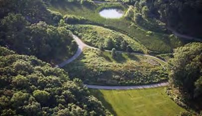
11 SITE INFORMATION The IK Bar Ranch property lies on the south end of Gypsum, CO near the intersection of Valley Road and Grundel Way. This location is extremely suitable for use as a park due to the surrounding land use including residential homes and schools. To the east and west sit Red Hill Elementary School and Gypsum Creek Middle School, respectively. In the future, the city plans to develop the property directly adjacent to the east as a third school. To the north lies a golf course with a small community of approximately 50 homes. The southern land contains a suburban residential community of approximately 150 homes with bike trails leading to Valley Road and a small playground. Currently the site is relatively fl at with a slight grade to the north, although a steep hill rises to meet Gypsum Creek Middle School, which is approximately 20 feet higher in elevation. Water drains through a small stream on the east side of the site and continues off-site fl owing under Grundel Way. 16


12 SITE INFORMATION Plants are limited to native grasses and other species that may have taken root after disturbance of the area. A social trail shows evidence of desire to link the southern community to Red Hill Elementary School. Another trail links Gypsum Creek Middle School to this trail and others to the east. Other types of use include dog walking, and jumps for bikes. In addition to the golf course to the north other recreation in the immediate area includes basketball courts, baseball fi elds, a football fi eld, playgrounds at the schools, as well as a multi-use recreation trail. Although there are views of the mountains throughout the site, two areas exist that provide better vistas of the surrounding topography. One location is at the south end of the site looking north towards the ridge on the north side of I-70, the other is on the east side of the site looking southwest towards Hardscrabble Mountain. Overall this site sits at an intersection of social, ecological, and cultural realms. Developing the site as a park will link communities and schools while providing a place for social interaction and exercise. The site can aid in cleaning run-off water and allow people to connect to, and appreciate, the adjacent stream all in a beautiful setting surrounded by the Rocky Mountains. 17

13 SITE CONTEXT MAP.5 Mile GOLF COURSE SPORTS FIELDS SITE FUTURE SCHOOL EXISTING SCHOOL RESIDENTIAL HOMES BIKE PATHS SOCIAL PATHS 18
14 DESIGN CONCEPTS After diagramming and evaluating the I K Bar property the design team developed eight different designs to test various scenarios that were established within the initial objectives highlighted by the community. These eight designs were then refi ned and consolidated into fi ve different themed designs that were showcased at the fi rst public meeting for feedback. Each themed design was comprised of an overall plan, section/perspectives and a short narrative in order to aid the clarity of each proposal. The fi ve design themes were titled as follows: mountain seasons fi elds sports and rec water play + overlook 19
15 DESIGN INSPIRATION Basic design inspirations were given during the initial meeting with stakeholders. This list of ideas gave us a foundation for which to develop various concepts for the IK Bar Ranch. Certain design inspiration was pulled from the need to include physical and recreation activities that can be found across Gypsums various parks. Some of these activities also address the current trend that can be found across the county, including pump track/bmx style racing. Leisure and passive activities were also suggested by the town of Gypsum, an amenity that is not highly prevalent throughout their parks systems. Some of these amenities include open space, moveable chairs and tables, and shade structures. The adjacent schools and the proposal of an additional school inspired the design team to include various educational amenities, for instance, educational gardens or plant identifi cation tags throughout the park. Inspiration was also found in some of the unique characteristics surrounding the sites including the slight topography of the overall and its abrupt edges along with the quaint irrigation creek. The design team sought to fi nd a way to break up the fl atness of the sight with the inclusion of mounded elements. The mounds could be used for sitting, vegetation, or view/sound blocking mechanisms. A developed water space also adds a unique opportunity for this site that addresses the interest of a water feature without the high maintenance cost but also an educational element. 20


16 IMAGES 21


17 DESIGN CONCEPTS Option A: Mountain The Sawatch Mountain Range is described as high, massive, and relatively gentle in contour and plays an infl uential role throughout this design process. By utilizing scale, the relationship between elements within a space, we are able to create a more alpine experience, which also represents the surrounding landscape. Gently sloping, yet grand hills lie on the south side of the park with paths carving between each hilltop. The hill tops, which create expansive views, are covered with predominantly evergreen type trees and some rugged rocks for climbing and light hiking. The park also includes a walking and bike trail, fl owering nature trail, tennis courts, playground, and an athletic fi eld. 22


18 DESIGN CONCEPTS [SEE APPENDIX A FOR OPTION A SITE PLAN] 23


19 DESIGN CONCEPTS Option 2: Fields Finding inspiration from regional agricultural farming techniques, Fields Park creates a series of designated spaces offering users unique views and activities. Moving north to south, the fi elds vary in size in order to accommodate different activities including a community garden, fl oral garden and a children s play structure and picnicking spaces. The site is divided by a miniature alpine forest that includes regional and local tree types. On the south portion of the site, three unique spaces offer user opportunities for various activities. An athletic fi eld accommodates recreational activities, a leisure fi eld, and a riparian fi eld that exposes portions of the creek. The site is oriented in a manner that frames the local mountain landscape. 24


20 DESIGN CONCEPTS [SEE APPENDIX B FOR OPTION B SITE PLAN] 25
DESIGN CONCEPTS. Option C: Seasons
 DESIGN CONCEPTS Option C: Seasons Colorado is known for its snowy active winters, hot fun summers, brilliant spring blooms, and dramatic fall color. This design highlights all of these elements in order
FINAL DESIGN DESCRIPTION
 FINAL DESIGN DESCRIPTION Pump Track Situated around the fenced in dog park is the pump track. Providing a new type of biking excursion both locally and regionally, this feature gives reason for users to
BISCUIT RUN PARK MASTER PLAN
 BOARD OF SUPERVISORS November 14, 2018 BISCUIT RUN PARK MASTER PLAN COUNTY OF ALBEMARLE ANHOLD ASSOCIATES Contents Project Introduction Property Background County Park Planning Process Existing Site &
Las Colonias Park Master Plan
 2013 Las Colonias Park Master Plan City of Grand Junction June 2013 Introduction Las Colonias Park, a 101 acre parcel on the edge of the Colorado River south of downtown, was deeded to the City of Grand
Draft Stillwater 2030 Comprehensive Plan- Goals and Policies
 Draft Stillwater 2030 Comprehensive Plan- Goals and Policies Instructions- Review each goal and policy and discuss with group any changes, deletions for additions to the list using your groups pen. Keep
6. RECREATION AND OPEN SPACE ELEMENT
 6. RECREATION AND OPEN SPACE Introduction This Recreation and Open Space Element includes Goals, Objectives and Policies (GOP) that apply to the main campus in Gainesville and the Lake Wauburg Recreation
WARM SPRINGS PARK MASTER PLAN
 TABLE OF CONTENTS page 1.0 Introduction and Overview 1 2.0 Information Gathering 2 3.0 Conceptual Alternative Development 8 4.0 Master Plan Development 14 5.0 Construction Cost Estimates 19 LIST OF FIGURES
4 C OMMUNITY D ISTRICTS
 4 C OMMUNITY D ISTRICTS N ew development in the Area will include many different types of land uses, including a destination retail area that attracts people from all over the region; recreation opportunities
Member Service Plan Sierra Nevada AmeriCorps Partnership
 Member Service Plan Sierra Nevada AmeriCorps Partnership Service plans lay the framework for what each Member will be doing during their service. Service plans detail the major projects and expected results
T O W N O F H I G H R I V E R
 T O W N O F H I G H R I V E R o p e n s p a c e p l a n The Town of High River, 30 minutes South of Calgary, still retains much of its distinctive small town character and provides residents with a high
PARKS & RECREATION SUBCOMMITTEE. Oct. 1, 2015
 PARKS & RECREATION SUBCOMMITTEE Oct. 1, 2015 1999 Bond - $22,000,000 Land Acquisition Allen Station Phase II Neighborhood Parks PREVIOUS BOND ELECTIONS 1999 & 2007 2002 Bond - $4,000,000 Allen Senior Recreation
Welcome to the Neighborhood! COPPERLEAF NEIGHBORHOOD GUIDE
 Welcome to the Neighborhood! COPPERLEAF NEIGHBORHOOD GUIDE 2017 At Copperleaf, feeling at home just comes naturally. Not surprising when you take a look around at the abundance of resources we offer to
Town of Sahuarita Open Space Plan Element. University of Arizona Planning Program Projects Team
 Town of Sahuarita Open Space Plan Element University of Arizona Planning Program Projects Team Introduction Planning students in the Planning Program Project Class Overall Goal Potential uses of $1.5 Million
Mendota Heights 2040 Comprehensive Plan Draft Vers
 4 Parks and Trails The City of Mendota Heights boasts a variety of recreational and open space opportunities. Few cities can claim access to regional trails, riverside and lakeside parks, scenic bluffs
Comprehensive Parks and Recreation Master Plan. Executive Summary. Submitted To: City of Milton, GA October 2012
 Comprehensive Parks and Recreation Master Plan Executive Summary Submitted To: City of Milton, GA October 2012 Executive Summary The City of Milton envisioned the need for an effective Master Planning
Appendix A. Park Land Definitions
 Appendix A Park Land Definitions Mini Park May serve specific function for any and all ages, depending on need of the user area. Size range 1-5 acres with optimum size being 3 acres. Service area is sub-neighborhood
2011 ASLA Design Awards. Westside Creeks Restoration Plan Merit Award AECOM, Fort Collins. Planning & Urban Design
 2011 ASLA Design Awards Westside Creeks Restoration Plan Merit Award AECOM, Fort Collins Planning & Urban Design Project Fact Sheet Category of Entry: Rotating Specialty Award: 2011 2011 ASLA Colorado
AVONDALE ESTATES GREENSPACE AD-HOC COMMITTEE
 AVONDALE ESTATES GREENSPACE AD-HOC COMMITTEE INVENTORY AND RECOMMENDATIONS REPORT November 7, 2018 Our Mission Statement: To provide assistance and support, through professional expertise in matters of
Northeast Quadrant Plan
 Northeast Quadrant Plan Northeast Quadrant Distinctive Features Land Use The Northeast Quadrant includes all the area within the planning area that is east of Interstate 5 and to the north of State Route
An Ambitious Plan: Transforming the blighted South Platte River and surrounding environment into Denver s greatest natural resource.
 CONNECTING THE PEOPLE TO THEIR RIVER SOUTH PLATTE RIVER VISION IMPLEMENTATION PROGRAM: GRANT-FRONTIER PARK TO OVERLAND POND PARK REACH The South Platte River Vision Implementation Program (River Vision)
CITY OF BOCA RATON GOVERNMENTAL CAMPUS Master Plan Progress August 22, 2017
 CITY OF BOCA RATON GOVERNMENTAL CAMPUS Master Plan Progress August 22, 2017 This is a rare moment in the City s history which affords us the opportunity to create a civic landmark born of comprehensive
Town of Rico Three Mile Plan for Annexation
 Town of Rico Three Mile Plan for Annexation 10.20.2010 Adopted by Resolution 2010-2 Produced with funding support from the Colorado Department of Local Affairs 2 Content Guide Introduction. 3 Annexation
Appendix 4 Park, Trail, and Recreation Facilities For more information, call the Park Planning and Stewardship Division at
 Appendix 4 Park, Trail, and Recreation Facilities For more information, call the Park Planning and Stewardship Division at 301-650-4380 montgomery county planning board maryland-national capital park and
Standards (R-3) Figure B-11: R-3 Residential Standards Exhibit
 Figure B-11: R-3 Residential Standards Exhibit") Avila Ranch Avila Ranch Specific Plan Development Standards High Medium Density - High Residential Density Residential Lot and Building Lot and Standards Building (R-3) Standards (R-3) EXAMPLES These sketches
Avila Ranch Avila Ranch Specific Plan Development Standards High Medium Density - High Residential Density Residential Lot and Building Lot and Standards Building (R-3) Standards (R-3) EXAMPLES These sketches
Chapter 5: Recreation
 Chapter 5: Recreation Introduction and Setting Recreational opportunities within Nevada County are varied, ranging from public parks with intensively used active recreational facilities, to vast tracts
Neighborhood Districts
 NEIGHBORHOOD DISTRICTS SEVEN MAIN DISTRICTS Neighborhood Districts While the Development Plan provides a broad-scale overview of the neighborhood, this section focuses on uses and relationships at the
Section 3 INVENTORY OF RECREATION LAND AND FACILITIES
 Photo of Juan Bautista de Anza Park Section 3 INVENTORY OF RECREATION LAND AND FACILITIES Summary of Findings Park Definitions Summary of Recreation Facilities Other Recreation Facilities Nearby Recreation
The urban parks in Charlottesville include Jackson Park, Lee Park, and McGuffey Park.
 Park Classifications Charlottesville s parks can be grouped into 4 different classifications: urban parks, neighborhood parks, community parks, and regional parks. Figure 1 on page 5 inventories the facilities
Focus Groups. 8 Focus Group meetings including 2 with staff, 1 with seniors, and 1 with students
 Project Team Nan Lanahan, Parks & Recreation Jason Gallo, Parks & Recreation Rob Leslie, DEDP John Smolinsky, Planning Board Brent Meredith, Highway Joan Gavrilik, Friends of Parks & Rec MaryLyn Koval,
North Oakville East Parks Facilities Distribution Plan. November, 2009
 North Oakville East November, 2009 POLICY CONTEXT 1) Purpose a) The purpose of this document is to be a guide for the location, configuration, design and development of the parks system for the North Oakville
The following principles guide the development of goals and strategies to protect and promote these amenities:
 OPEN SPACE/PARKS/TRAILS/RECREATION GOALS/STRATEGIES Cherry Hills Village is a living environment that offers low density development, open areas, public scenic vistas, public trails and public parks. This
HE VISION. Building a Better Connected Place
 HE VISION Building a Better Connected Place WALK INTO THE FUTURE. Life in Cranberry, 2030 Here s what our residents told us they wanted to see in their community by 2030: The Cranberry of 2030 is a place
Section 4 BUILDING THE MASTER PLAN
 The Master Plan 33 Section 4 BUILDING THE MASTER PLAN Figure 4:1. A collaborative effort characterized the two design workshops sponsored by DISC to create hypothetical Master Plans for the Towers Property
master plan hodge park
 KCMO Parks & Commissioners Recreation Board of Parks & Recreation Kansas City, Missouri Mark McHenry Director Heather Runkel Project Manager LAND3 Studio L.L.C. Bob G Bushyhead Principle Michael H Malyn
Dowdy Park. Concept Plans TOWN OF NAGS HEAD NORTH CAROLINA. Developed by: Albemarle & Associates, Ltd VHB/ Vanasse Hangen Brustlin, Inc.
 TOWN OF NAGS HEAD NORTH CAROLINA Concept Plans Developed by: Albemarle & Associates, Ltd VHB/ Vanasse Hangen Brustlin, Inc. Site Looking Southeast Dowdy Park Existing Conditions Nags Head Woods Sound Future
Arlington, Virginia is a worldclass
 EXECUTIVE S U M M A RY Arlington maintains a rich variety of stable neighborhoods, quality schools and enlightened land use policies, and received the Environmental Protection Agency s highest award for
Policy & Procedure Effective Date: Parks Department Page of
 City of Arvada Policy & Procedure Effective Date: Parks Department Page of TITLE: City of Arvada Prairie Dog Habitat Plan APPROVAL: PURPOSE: To establish a plan for the preservation of black-tailed prairie
OAKLAND COUNTY PARKS AND RECREATION DEPARTMENT 2800 Watkins Lake Road, Waterford, Michigan
 OAKLAND COUNTY PARKS AND RECREATION DEPARTMENT 2800 Watkins Lake Road, Waterford, Michigan 48328 248-858-0906 http://www.oakgov.com/parksrec OAKLAND COUNTY PARKS AND RECREATION COMMISSION Pecky D. Lewis,
Call for Artists Deadline: April 27, 2018
 DOWNTOWN COMMONS NORTHWEST WALL and MAIN AVE. ELECTRICAL BOX WRAPS TWIN FALLS, IDAHO Call for Artists Deadline: April 27, 2018 INTRODUCTION The Magic Valley Arts Council on behalf of the City of Twin Falls
SALISBURY TOMORROW Our Vision
 SALISBURY TOMORROW Our Vision Salisbury is committed to supporting a high quality of life and sense of community for all residents. These commitments need to be reflected in our community programs, services
REGIONAL ACTIVITY CENTER
 DRAFT REGIONAL ACTIVITY CENTER 70 EAST BENCH MASTER PLAN DRAFT 06 Introduction The East Bench Regional Activity center is comprised of large educational, research, medical, and employment centers. These
Southeast Quadrant Plan
 Southeast Quadrant Plan Southeast Quadrant Distinctive Features Land Use The Southeast Quadrant includes all the area within the planning area that is east of Interstate 5 and south of State Route 44.
RECREATION AND OPEN SPACE VISION
 City of South Lake Tahoe General Plan Policy Document Recreation and Open Space Element INTRODUCTION This element provides the policy context for the City of South Lake Tahoe to achieve its vision for
University of Saskatchewan CAMPUS MASTER PLAN. Senate Meeting Preliminary Presentation. April 21, 2018 DIALOG ECS DA WATT
 University of Saskatchewan CAMPUS MASTER PLAN Senate Meeting Preliminary Presentation April 21, 2018 DIALOG ECS DA WATT project process presentation agenda Stakeholder Engagement Project Control phase1
Call for Artists for: Design and Construction of Environmental Art Activation Story Mill Community Park, Bozeman, MT
 Call for Artists for: Design and Construction of Environmental Art Activation Story Mill Community Park, Bozeman, MT Seeking artists to design, fabricate and install art elements in the nature sanctuary
Public Art Plan. We have elected to submit Public Art Plans before or concurrently with the CSP Submittal per the FDP Manual
 Public Art Plan The intent of the Horizon Uptown Public Arts Program is to create great places that engage the community and leverage the neighborhood development and economic vitality. The Horizon Uptown
1. Executive Summary. SECTION 1 Executive Summary. City of Arlington Lake Arlington Master Plan
 1. In December 2009, the engaged the environmental engineering and science consulting fi rm of Malcolm Pirnie to assist the City in developing a master plan for Lake Arlington (the Project ). Over a period
Moreno Valley College: Conceptual Master Planning - Site Analysis Lasselle Street, Moreno Valley, CA 92551
 Master Plan Architect School Name Moreno Valley College District Riverside Community College District Architecture and Urban Design 5898 Blackwelder Street Ground Floor Culver City, CA 90232 T: 310.559.5720
Land Use Amendment in Southwood (Ward 11) at and Elbow Drive SW, LOC
 at and Elbow Drive SW, LOC") 2018 November 15 Page 1 of 10 EXECUTIVE SUMMARY This land use amendment application was submitted by Rick Balbi Architect on 2017 August 31 on behalf of Sable Developments Ltd, and with authorization from
2018 November 15 Page 1 of 10 EXECUTIVE SUMMARY This land use amendment application was submitted by Rick Balbi Architect on 2017 August 31 on behalf of Sable Developments Ltd, and with authorization from
2 PLANNING AREA DESCRIPTION
 2 PLANNING AREA DESCRIPTION 2.1 LOCATION Hecker Pass is located within the City of Gilroy near the western city limit. Figure 2-1 illustrates the regional location of the Hecker Pass Area. Figure 2-1:
February 27, 2018 City Council Presentation The Crown Jewel Park in the City of Fairfax
 February 27, 2018 City Council Presentation The Crown Jewel Park in the City of Fairfax Master Planning Charge Van Dyck Park s first Master Plan will provide the City with a road map as to how best incorporate
Executive Summary. Parks and Recreation Plan. Executive Summary
 Parks and Recreation Plan Executive Summary The Whitemarsh Township Parks and Recreation Plan sets forth a vision for how Whitemarsh Township can provide a premiere parks and recreation system reflective
1.0 Background. 1.1 Study Process
 1.0 Background Planning for Terwillegar Park began in 2005 with the preparation of A Vision for Terwillegar Park (Randall Conrad & Associates), a City wide public consultation and visioning exercise. The
Bullhead City Rotary Park Plan Update
 Bullhead City Rotary Park Plan Update PLANNERS/LANDSCAPE ARCHITECTS: RBF Consulting 16605 N 28 th Avenue Suite 100 Phoenix, Arizona 85053-7550 (602) 467-2200 CIVIL ENGINEER: RBF Consulting 16605 N. 28
Visioning Committee Kick-Off Meeting
 Visioning Committee Kick-Off Meeting June 11, 2018 The Team Project management, technical analysis, implementation, report preparation Public engagement, park review Recreation facilities review, operations
FORT MISSOULA REGIONAL PARK
 FORT MISSOULA REGIONAL PARK Master Plan Refinement/ Design Development www.missoulaparks.org DHM Design/WGM Group December 3, 2008 Master Plan Report Fort Missoula Regional Park Guiding Principals i 6/14/01
Montana Rail Link Park
 Montana Rail Link Park Neighborhood Open House A Missoula Community Partnership WITH LEADERSHIP FROM THE FRANKLIN TO THE FORT & SOUTHGATE TRIANGLE NEIGHBORHOODS Sovereign Hope Church, (1919 North Ave.)
CHAPTER 7: Transportation, Mobility and Circulation
 AGLE AREA COMMUNITY Plan CHAPTER 7 CHAPTER 7: Transportation, Mobility and Circulation Transportation, Mobility and Circulation The purpose of the Transportation, Mobility and Circulation Chapter is to
CONTEXT: the Highway, the River + the Railroads run through us.
 CONTEXT: the Highway, the River + the Railroads run through us. I-25 36 In the past they have divided us, now we have an opportunity to unite us. I-76 I-270 I-76 CSU I-25 LEGEND Cut + Cover River North
Ivywild On The Creek PRELIMINARY CREEK DISTRICT MASTER PLAN
 Ivywild On The Creek PRELIMINARY CREEK DISTRICT MASTER PLAN Introduction: Rejuvenating an extraordinary Creekside neighborhood THE CREEKSIDE DISTRICT The Ivywild On The Creek Neighborhood District Master
PEQUITSIDE FARM ONE PROPERTY, MANY USES
 PEQUITSIDE FARM ONE PROPERTY, MANY USES Laura Campbell March 8, 2016 A plan for the public use of a historic estate Introduction At 33 acres, Peuitside Farm is the largest public owned open space in the
2.0 AREA PLANS. Lakeside Business District. Lakeside Business District Land Use Categories:
 Lakeside Business District Lakeside Business District Land Use Categories: Campus Commercial Campus Commercial means a mixture of uses which includes corporate offices, office parks, hotels, commercial,
CAL POLY MASTER PLAN UPDATE, March 2015
 Some Key Themes in the General Guiding Principles Academic Mission The plan must foremost advance the University s academic mission and student success. Foresight and Adaptability The plan should take
(ALL TIMES LISTED ARE APPROXIMATE AND SUBJECT TO CHANGE. )
") AGENDA TANGENT CITY COUNCIL AND PLANNING COMMISSION JOINT PUBLIC HEARING Wednesday March 16, 2011 PARK COMMISSION SESSION 7:00 p.m.. Bass Estate 32166 Old Oak Drive, Tangent, OR 97389 (ALL TIMES LISTED
AGENDA TANGENT CITY COUNCIL AND PLANNING COMMISSION JOINT PUBLIC HEARING Wednesday March 16, 2011 PARK COMMISSION SESSION 7:00 p.m.. Bass Estate 32166 Old Oak Drive, Tangent, OR 97389 (ALL TIMES LISTED
City of Heath. Town Center Concept
 In the give-and-take of getting projects designed, financed, and approved, the famous refrain from the film Field of Dreams is heard often: if you build it, they will come. From the perspective of the
SMEDLEY TRACT MASTER SITE PLAN Draft Master Plan Presentation
 SMEDLEY TRACT MASTER SITE PLAN Draft Master Plan Presentation Public Meeting #3 03.16.2010 Middletown Township, Pennsylvania MEETING AGENDA Project Schedule Site Analysis Site Concepts Draft Master Site
Daniels Park Master Plan
 Daniels Park Master Plan Prepared for: Douglas County & The City and County of Denver October, 2007 EXHIBIT A Contents Daniels Park Overview 2 Project History & Goals 2-3 Regional Context Map 4 Park Zone
Chris James Park Planner July 16, Master Plan Kick Off Meeting
 Chris James Park Planner July 16, 2014 Master Plan Kick Off Meeting Meeting Overview Introductions Purpose of Meeting and Master Plan History & Background of Park Property Prior Planning Considerations
PUBLIC SPACES MASTER PLAN UPDATE (POPS) Crystal City Citizen s Review Council October 24, 2018
 Crystal City Citizen s Review Council October 24, 2018") PUBLIC SPACES MASTER PLAN UPDATE (POPS) Crystal City Citizen s Review Council October 24, 2018 1 PLANNING CONTEXT Arlington County Comprehensive Plan UPDATE Related Documents: CIP Sector Plans Area Plans
PUBLIC SPACES MASTER PLAN UPDATE (POPS) Crystal City Citizen s Review Council October 24, 2018 1 PLANNING CONTEXT Arlington County Comprehensive Plan UPDATE Related Documents: CIP Sector Plans Area Plans
Concept Master Plan. for. Draft of. Wildlife Management Area. Prepared for. June, 2008
 Draft of Concept Master Plan for Vermillion Highlands: A Research, Recreation and Wildlife Management Area Prepared for Vermillion Highlands Steering Committee - Minnesota Department of Natural Resources
Applicant Name Phone / Fax / Address City State Zip Code . Property Owner Phone / Fax / Address City State Zip Code
 Master Development Plan Application Community Development Department City of Redmond 411 SW 9 th Street Redmond, Oregon 97756 541-923-7721 541-548-0706 FAX Master Development Plan Fee $38,862.52 File Number
A BLUEPRINT FOR BROCKTON A CITY-WIDE COMPREHENSIVE PLAN
 A BLUEPRINT FOR BROCKTON A CITY-WIDE COMPREHENSIVE PLAN Public Meeting October 2016 1 Plan Summary and Discussion Public Meeting May 4 2017 City of Brockton Bill Carpenter, Mayor Department of Planning
2011 ASLA Design Awards
 2011 ASLA Design Awards Interstate 70 Mountain Corridor Aesthetic Guidance Honor Award Design Workshop, Aspen / THK Associates, Inc. / CH2MHill Planning and Urban Design Project Title: Interstate70 Mountain
Grand Junction, Colorado
 Grand Junction, Colorado Brought to you by: THE RIVERFRONT STORY RIVERFRONT at las colonias PARK offers the next generation company and workforce an immersive experience geared toward wellness, community
APPENDIX D: PARKS AND RECREATION ACTION PLAN
 APPENDIX D: PARKS AND RECREATION ACTION PLAN Goals The following goals are specific to the development, maintenance, and operation of the existing parks in the Township, as well as the acquisition and
Clovis Urban Greening Plan. Community Workshop #2 Northwest
 Clovis Urban Greening Plan Community Workshop #2 Northwest Thursday, October 9, 2014 WHAT IS AN URBAN GREENING PLAN? A guide to help the City to improve quality of life for residents Identification of
Enhance the High Line Canal Projects
 Enhance the High Line Canal Projects Joint Project Proposal for Arapahoe County Open Spaces Funding Partner Sponsors: South Suburban Park and Recreation District City of Centennial City of Littleton October
Additional information about land use types is given in Chapter 5. Design guidelines for Centers and Neighborhoods are given in Chapter 7.
 4. Place Types Introduction In Albemarle County s Development Areas, the Neighborhood is the fundamental unit of community planning. The County s Neighborhood Model, an adopted part of the Comprehensive
a) Inventory of all existing privately-owned, state-owned, or local governmentowned recreational facilities and open spaces within the context area
 Inventory of all existing privately-owned, state-owned, or local governmentowned recreational facilities and open spaces within the context area") 8.0 RECREATION AND OPEN SPACE ELEMENT (1) DATA REQUIREMENTS a) Inventory of all existing privately-owned, state-owned, or local governmentowned recreational facilities and open spaces within the context
8.0 RECREATION AND OPEN SPACE ELEMENT (1) DATA REQUIREMENTS a) Inventory of all existing privately-owned, state-owned, or local governmentowned recreational facilities and open spaces within the context
glenwood canyon design process I-70 Statement of Direction TRG Recreation Subcommittee Colorado Division of Highways August 11, 1976 prepared by the
 glenwood canyon I-70 design process Statement of Direction TRG Recreation Subcommittee August 11, 1976 prepared by the TRG Recreation Subcommittee for the Colorado Division of Highways glenwood canyon
PREVIOUS PUBLIC PARTICIPATION BRIEF October 2014
 Comprehensive Planning During the development of the county comprehensive plan, Cultivating Community: A Plan for Union County s Future from 2007 through 2009, and three concurrent multi municipal plans
Gold Line Bus Rapid Transit Transit Oriented Development (BRTOD) Helmo Station Area Plan
 Helmo Station Area Plan") Appendix F Gold Line Bus Rapid Transit Transit Oriented Development (BRTOD) Helmo Station Area Plan Introduction and Purpose of the Plan The Gold Line Bus Rapid Transit facility is an eleven-mile dedicated
Appendix F Gold Line Bus Rapid Transit Transit Oriented Development (BRTOD) Helmo Station Area Plan Introduction and Purpose of the Plan The Gold Line Bus Rapid Transit facility is an eleven-mile dedicated
Goals & Objectives (best derived from an input
 Goals & Objectives (best derived from an input process) Goal - sets an intent of the project States the expected result or outcome of the project The trail will provide recreation and transportation opportunities
City Council March 27, Parks, Recreation, and Trails Master Plan
 City Council March 27, 2018 Parks, Recreation, and Trails Master Plan Planning Process Develop Goals and Objectives Inventory of Areas and Facilities Needs Assessment And Identification Public Participation
Phase 1 : Understanding the Campus Context. Phase 2 : APPROACHES - Alternates & Preferred Plan
 Introduction MASTER PLAN PURPOSE WHY A CAMPUS MASTER PLAN? The purpose of the Master Plan at the University of Illinois at Chicago is to translate UIC s strategic goals and objectives into a compelling
PUBLIC ENGAGEMENT & SIX THEMES OF THE PLAN
 Connecting the heart of Eagle to the soul of the river - Kathy Chandler-Henry, Commissioner Eagle County CHAPTER 1 PUBLIC ENGAGEMENT & SIX THEMES OF THE PLAN town of eagle - river corridor plan 1 PUBLIC
GOCO Grants Awarded to Projects in Arapahoe County through June 2015
 Grant Type Open Space Fiscal Year Applicant Project Title Grant Amount 2015 City of Aurora Acres Protected Triple Creek Greenway Corridor Phase 3 $2,050,000.00 0 Planning 2015 Arapahoe County High Line
The difference is everywhere. Parkhaven. Bothell
 The difference is everywhere Parkhaven Bothell The MainVue Story A new view on living MainVue Homes is a worldwide leader in new home design and construction. As part of the Henley Properties Group, we
Chapter 6. Overall Vision RECOMMENDATIONS. More Trail and Trail. Connections. Equal Access to Park. Facilities and Programs. Water Access.
 Overall Vision More Trail and Trail Connections Equal Access to Park Facilities and Programs Water Access Environment Variety Chapter 6 RECOMMENDATIONS Chapter 6 The following recommendations for park,
Broadway District Specific Plan. Community Workshop #2 February 23,2016
 Broadway District Specific Plan Community Workshop #2 February 23,2016 1 Agenda Introductions Project Progress Status Upcoming Milestones Emerging Framework Land Use Urban Design Circulation Infrastructure
RESILIENT COMMUNITIES PROJECT CITY OF MINNETONKA
 RESILIENT COMMUNITIES PROJECT CITY OF MINNETONKA BUILDING COMMUNITY-UNIVERSITY PARTNERSHIPS FOR SUSTAINABILITY Presentation to The League of Women Voters March 16, 2013 Julie Wischnack, Community Development
Downtown Hazard, KY Walking Tour
 1. The River Arts Greenway is a planned two-mile walk/bike trail along the river in downtown Hazard that will feature temporary and permanent art installations. Phase 1, the first 0.3 mile section, was
To: Planning Commission D.. June 3, 2009
 Agenda Item No. 9(a~ CITY OF WOODINVILLE, WA REPORT TO THE PLANNING COMMIS ION 17301 133 1'd Avenue NE, Woodinville, WA 98072 WWW.CI.WOODINVILLE.WA.US To: Planning Commission D.. June 3, 2009 From: Subject:
SCHOOLS, PARKS AND TRAILS
 Schools, Parks, and Trails Page 1 of 12 SCHOOLS, PARKS AND TRAILS BACKGROUND Public Schools in the Clifton-Fruitvale Community include Clifton Elementary, Rocky Mountain Elementary, Grand Mesa Middle,
PUBLIC ART CALL LIONS GATE COMMUNITY CENTRE. For Expressions of Interest Submission Deadline: March 18, 2018 Project Value: $85,000(inclusive)
") LIONS GATE COMMUNITY CENTRE PUBLIC ART CALL For Expressions of Interest Submission Deadline: March 18, 2018 Project Value: $85,000(inclusive) LGCC EOI 1 LIONS GATE COMMUNITY CENTRE (LGCC) PUBLIC ART CALL
LIONS GATE COMMUNITY CENTRE PUBLIC ART CALL For Expressions of Interest Submission Deadline: March 18, 2018 Project Value: $85,000(inclusive) LGCC EOI 1 LIONS GATE COMMUNITY CENTRE (LGCC) PUBLIC ART CALL
Courthouse Planning Area
 Courthouse Planning Area Current Reality The Courthouse Planning Area is the characterized by expansive suburbanscale residential areas as well as the community resource planned area of athletic, educational,
Town of Portola Valley General Plan. Nathhorst Triangle Area Plan
 Town of Portola Valley General Plan Amended December 10, 1997 Table of Contents Introduction... 1 Planning Area... 1 Objectives... 2 Principles... 2 Standards... 4 Description... 4 Community Commercial...
SAN RAFAEL GENERAL PLAN 2040 INTRODUCTION AND OVERVIEW
 SAN RAFAEL GENERAL PLAN 2040 INTRODUCTION AND OVERVIEW Steering Committee Presentation February 14, 2018 Purpose of General Plan Guide land use and development decisions Coordinate transportation, infrastructure,
WELCOME TO THE CHOUTEAU GREENWAY DESIGN, DEVELOPMENT AND CONSTRUCTION WORKING GROUP!
 WELCOME TO THE CHOUTEAU GREENWAY DESIGN, DEVELOPMENT AND CONSTRUCTION WORKING GROUP! Chouteau Greenway Steering Committee and Working Groups Overview Overview January 9, 2019 Chouteau Greenway will transform
Elm Fork Land Use. Trinity River Corridor Project Committee May 13, 2013
 Elm Fork Land Use Trinity River Corridor Project Committee May 13, 2013 Purpose Discuss Trinity River planned Land Use and Appropriate Compatible Uses, particularly with respect to the Elm Fork Area 2