To learn more about the Waverley West B planning process, please visit winnipeg.ca/waverleywestb
|
|
|
- Clarence Morrison
- 5 years ago
- Views:
Transcription
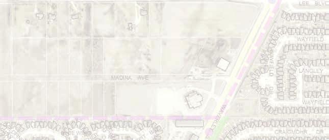
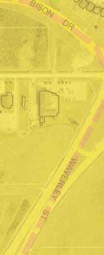
; bound by Kenaston Boulevard, the Bison Drive extension, averley Street, and the north limit of")
1 Appendix A orkshop Task Sheet (for orkshop discussion) averley est B Secondary Planning Process Open House #1 Summary July 2018 Background The City of innipeg (the City) is undertaking a process to develop a secondary plan by-law for the area known as averley est Neighbourhood 'B' (averley est B ); bound by Kenaston Boulevard, the Bison Drive extension, averley Street, and the north limit of South Pointe. The following is a summary of the first public open house event, in which the project team provided project information and asked for participants comments on how the neighbourhood could develop. More information about the secondary planning process can be found online at winnipeg.ca/averleyestb. Promotion activities Public Open House Engagement Engagement activities undertaken so far include a stakeholder information session, two stakeholder workshops. Feedback gathered through the workshops was used by the project team to create materials for the first public open house, held on April 25, At the public open house, participants had a chance to learn about the project, view potential future plan concepts, speak with project team members, and provide feedback on where certain land uses (like single family residential, multi-family residential, parks, institutional, and commercial uses) should be located. Approximately 200 people attended the open house, and 65 exit surveys and worksheets were completed. Personalized letter to all 55 landowners, announcing second landowner workshop and first open house March 9, 2018 Personalized letter to all properties immediately surrounding planning area March 21, 2018 Bilingual postcard mail drop to over 5,725 households in averley est and surrounding neighbourhoods eek of April 18, 2018 News release April 12, 2018 Public engagement newsletter April 12, 2018 Twitter posts April 12, 18, 24, 25 Facebook posts April 12, 24, 25 Format Information boards were set up around the outside of the room, with central tables displaying three potential scenarios for development (Figure 1) on maps in the middle of the room. Examples of all three scenarios can be found in the Scenario-specific Feedback section. Participants provided comments about the three scenarios directly to staff at the central table, and those who were interested wrote comments (and other detailed feedback) on worksheets. Participants also provided comments on exit surveys. Comments from the worksheets and exit surveys can be found in Appendix A, and map feedback on scenarios can be found in Appendix B. The project team answered questions, and helped explain the development process. The following hat we heard section outlines the general themes gathered from public input. Feedback from all three scenarios will be considered when developing a final scenario, and the general themes from what we heard will form the basis of the draft plan to be presented in fall Figure 1 - Room setup at South Pointe School To learn more about the averley est B planning process, please visit winnipeg.ca/averleyestb
2 Appendix C orkshop Task Sheet (for orkshop discussion) hat we heard All comments recorded (including peoples comments on the scenarios, and additional scenario-related comments on the exit surveys and worksheet) can be found in Appendices A and B. Based on the comments received on all three scenarios, the project team developed themes related to specific land uses. The project team is working to integrate thesethemes into the policies (and a final development scenario) that will be presented with the draft plan at the next open house in fall Greenspaces, wildlife and natural areas Participants indicated that green space is desirable throughout the neighbourhood, and in the southwest in particular. Using greenspaces as buffers between existing neighbourhoods, and as a transition between low to high-density residential areas was also suggested. Existing green spaces and corridors could also provide connections to the surrounding neighbourhoods. Participants indicated that preserving existing wildlife habitats (e.g. deer habitat in the northeast) was important; and noted marshland, tree stands near Lee Boulevard, and other wildlife areas. Pedestrian and cycling infrastructure Participants valued pedestrian and cycling infrastructure, including sidewalks, bike paths along collector roads (roads with moderate amounts of traffic that move people between smaller local roads and major roads), and off-street trails and paths. Connectivity between residential neighbourhoods and the Town Centre was also important. Commercial land uses Feedback indicated that although some small neighbourhood commercial uses (like corner stores) would be appropriate, participants noted that commercial development should largely be directed to Bridgwater Centre. A few stakeholders suggested that they would like to see commercial land uses in the northeast part of Area 3 along Bison Drive. Road network, access, traffic and parking ithin the planning area, participants generally preferred that there be no direct connection between Kenaston Boulevard and averley Street within averley est B. There were mixed feelings about the future Bison Drive extention. Many participants wanted construction to begin as soon as possible so they can better connect with the places they want to go (like University of Manitoba), while people whose properties back onto the future roadway were concerned about increased road noise. Traffic and parking needs from multi-family developments and other institutional uses were also a concern. Participants generally agreed with the limited accesses onto averley Street, but noted concerns about access for residents on Cadboro Road, as this road is to be closed at averley Street. Transit between neighbourhoods, and better public transportation to Pembina Highway and the University of Manitoba were also noted. Estate residential Landowners living in the area indicated a strong desire for lower density land uses along Lee Boulevard to accommodate and maintain the existing larger lot residential development in these areas. In the draft plan, there will be an area accommodating this desire, labelled estate residential. Higher density residential The draft plan includes areas that will accommodate higher density residential buildings, like row houses, duplexes, and multi-family apartment-style housing. Some participants suggested the areas designated for higher density residential were too large, while others said there was not enough space designated for higher density residential structures. e heard from both landowners and the general public that a diverse mix of housing options and affordability is needed, especially for seniors and students. Participants also acknowledged that it is important to have enough people in the neighbourhood to support transit service. There was general support for higher density residential along proposed collector roads. However, it was important that transitions between higher and lower density areas be addressed through adequate buffers and context-sensitive development. Participants also indicated that higher density residential areas would be a good transition between institutional land uses and lower density residential areas. Schools and recreation Participants indicated an immediate need for recreation facilities, community spaces, and schools in the averley est area. They were generally supportive about the proposed land uses and locations to accommodate facilities, and indicated support for a shared education and recreation complex with transit service and vehicle and pedestrian access to and from the existing neighbourhoods. To learn more about the averley est B planning process, please visit winnipeg.ca/averleyestb 2

3 Appendix C Scenario-specific Feedback orkshop Task Sheet (for orkshop discussion) The following section includes summaries of comments from each of the three scenarios. All participant comments can be found in Appendices A and B. Scenario One At least six participants supported the idea of having a recreational centre in the neighbourhood; two comments noted how co-locating school(s) and recreational centre was a good idea. The northeast and southwest corners of the area were noted as being significant spaces for wildlife. Comments supported Active Transportation (AT) pathways on averley, to University of Manitoba, from the middle of the neighbourhood to Town Centre, and along the southern edge of the neighbourhood. One participant liked the larger collector road around the inside of the neighbourhood, while another participant felt that the road network would be disorienting to navigate, and would make transit difficult. A few participants did not like the idea of higher density residential in the area. To learn more about the averley est B planning process, please visit winnipeg.ca/averleyestb 3

4 Appendix C orkshop Task Sheet (for orkshop discussion) Scenario Two There was disagreement between participants about whether Bison Drive should be high speed with minimal lights and intersections. Three participants noted that higher density areas along the future Bison Drive made sense. One person observed that this location would make transit more viable, but all three scenarios were relatively unambitious in terms of promoting sustainability. The northeast and southwest corners of the area were noted as being significant spaces for wildlife. Five people recorded their desire for a central park, to increase peoples standards of living. There was a desire for medium/high density to the south of the institutional lands owned by the School Division and the City of innipeg (northwest area). To learn more about the averley est B planning process, please visit winnipeg.ca/averleyestb 4
5 Appendix C orkshop Task Sheet (for orkshop discussion) Scenario Three One participant liked the use of dense development to buffer possible school sites from Kenaston Boulevard and the future Bison Drive, but wanted more density along Bison Drive to make transit more viable. There was disagreement as to the scale and placement of multi-family areas. If multifamily areas were designated in the south-central part of the neighbourhood, two comments preferred townhomes or a maximum of three storeys. There were concerns about intersections by Lee Boulevard and averley (because of a lack of lights), as well as the access to Kenaston (because a signalized intersection will likely be added) A concern was also noted with the road that connects Kenaston Boulevard with averley Street, as a through road could increase traffic speeds in the middle of the neighbourhood. Similar to Scenarios 1 and 2, the northeast and southwest corners of the area were noted as being significant spaces for wildlife. To learn more about the averley est B planning process, please visit winnipeg.ca/averleyestb 5
6 Appendix C orkshop Task Sheet (for orkshop discussion) Limitations orksheet responses: Public feedback was solicited through the project worksheets (Appendix A) and the mapping exercise (Appendix B). Only four worksheets were submitted, but about 10 participants chose to leave their comments on the exit survey (also included in Appendix A). All other feedback was received through the mapping exercise (Appendix B). Diverse feedback: Although general themes and values can be gleaned from the public feedback received, we heard a wide variety of opinions through our engagement activities. All opinions will be considered along with internal feedback, feasibility analysis, available funding, land ownership, existing plans (i.e. - indicating placement of the future Bison Drive) and other stakeholder needs. Responses to concerns Natural areas: Although the City strives to protect mature trees and natural areas when land is developed, it is within a landowner s rights to be able to remove vegetation or trees from property they own. Preserving specific wildlife areas must also be balanced with other parks and recreation values, like the provision of active transportation (AT) linkages, linear parks, recreation centre land, and other public spaces. Placement of Bison Drive and closure of Cadboro Road: This route has been determined since the initial averley est Secondary Plan was approved in 2006, and there are currently no plans to change this route. Final location of major amenities: In winter 2018, the City acquired land for a future recreation complex. This decision was based on the best information available about land ownership and future land uses in the general area. Parks and greenspaces: As a wide variety of feedback was received regarding placement of parks, final plans will respond to parks related values (e.g. linkages for AT, greenspace at future schools and recreation complex) rather than specific suggestions. Specific uses: In all three scenarios, participants had specific requests and recommendations, like an indoor water park, child care spaces, corner stores, fire station, community gardens, fountain, etc. Although a secondary plan can allow for these specific uses in designated areas, it cannot ensure that these suggestions get constructed; this is largely up to private entrepreneurs, developers (and development agreements between developers and the City), and organizations. Exceptionsinclude the fire station or any other City operated facility, where placement is guided by City research and policy, as well as community gardens, where creation and placement is determined through conversations between the City and interested community groups. Fragmented ownership of land: There are 55 different landowners in the averley est B area. Some of these landowners are interested in developing their properties for residential (or other) uses, but others do not intend to change the use of their property in the near future. Landowners preferences for their own properties will affect placement of parks, pathways, water retention ponds, roads, etc. Sustainable growth: Some comments we received expressed a desire for little or no higher density residential in the area. However, it is important to offer a range of housing options, and plan new subdivisions with environmental and economic sustainability in mind. In addition, higher density could also help support small businesses, schools, and other neighbourhood amenities. Secondary plan policies can help ensure proper transitions between lower and higher density areas. Fountains: Constructing fountains is one way to showcase the uniqueness and character of a neighbourhood. However, fountains are also costly and difficult to maintain. One way to support a fountain in the future would be for neighbourhood residents to form an organization which could fundraise for construction and maintenance. To learn more about the averley est B planning process, please visit winnipeg.ca/averleyestb 6
7 Appendix C orkshop Task Sheet (for orkshop discussion) Next Steps The project team is now undertaking engineering studies, consulting internally with City departments, and considering public feedback to create a plan concept, a draft parks and greenspaces map, and policies related to each of the different future land uses. The project team will present an overview of the draft secondary plan at a second open house on ednesday, September 26, 2018 from 5 p.m. to 8 p.m., at South Pointe School. An explanation of how input was considered and incorporated in the draft secondary plan will be provided at the open house. Those who live in the area will receive notification by mail. Those who requested project updates will receive notice by . Appendices Appendix A Additional Comments on Scenarios (from orksheet and Exit Survey) Appendix B Map Feedback on Scenarios Relevant Online Information The documents listed below contain hyperlinks to documents used at the April 25 open house event, or documents used to advertise the open house event. Documents can also be found online at winnipeg.ca/waverleywestb. Open House Boards Open House orksheet News Release Newspaper Ad Postcard Landowner and Stakeholder workshop summary To learn more about the averley est B planning process, please visit winnipeg.ca/averleyestb 7

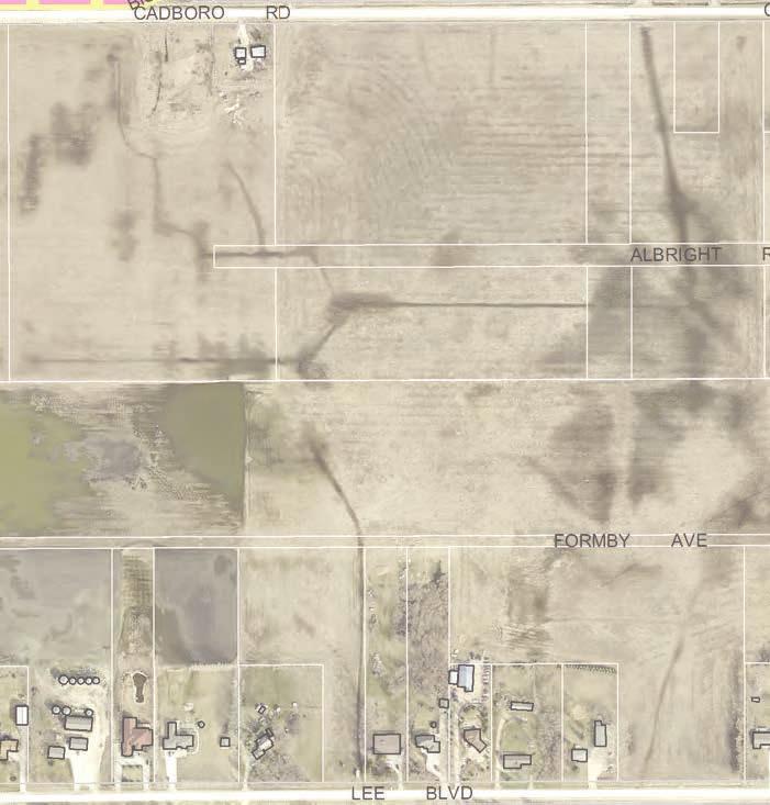
8 Appendix A Comments on Scenarios (from orksheet and Exit Survey) Participants provided scenario-comments about the three scenarios in the following ways: Central tables displayed the three potential scenarios for development. Participants provided comments directly to staff at the central table, and written directly on the three scenarios. All comments provided to staff can be found in Appendix B. orksheets were provided, and four (4) people completed a worksheet. Sixty five (65) exit surveys were completed. About 10 participants chose to add scenario-related comments directly on their exit survey. Scenario-related comments from exit surveys and worksheets can be found below. Scenario 1 Future Bison Drive Scenario description: Existing religious institutional lands and existing houses are accommodated; proposed lowerdensity areas are located by existing residential areas. Active transportation network and park locations to be determined. The irregular shape of institutional lands may provide some site design challenges for future development. Higher-density areas provide a transition between lower-density areas and institutional uses. There is no direct connection between Kenaston and averley. Existing Albright Avenue and Madina Avenue right-of ways are used for collector roads. i
9 Feedback from worksheets and exit surveys: 1. Smart to co-locate medium and high density with schools. Impossible to make transit in this area viable due to the indirect roads and poor distribution of dense housing and services. Disorienting to navigate. Lack of continuity may keep the neighbourhood from feeling cohesive. 2. Institutional buildings are on the collector roads. 3. Larger area for "institutional" (I'm guessing religious, school + rec) is wonderful and beneficial. All scenarios have low density residential in this area where there is a wonderful marsh [Area 6, east of C-D]. There are many, many species that call this marsh home. To name a few: deer, owls, hawks, ducks, geese, frogs, fox, skunk and many more. A number of large birds nest in this area and it would by a shame for this natural ecosystem to be destroyed for development. 4. Too many high density residential lands. 5. My favourite. I'm concerned about green space, would be nice to have some idea what % age of residential will be allocated to green space, even if just an estimate. 6. Less multi-family space, area growing too quick, add child care spaces, green space, fountain, playground areas. 7. [This] works best. 8. All don t care, re: road alignment, don t want to see commercial space. That's what Bridgwater Centre is for, want schools (every grade), dog park (fenced/off leash) community centre, pool, library. 9. All - YMCA is needed, more commercial area, [and] bike trails. 10. [I] like this best, larger institutional land at bison and Kenaston [Boulevard]. Larger circle road in centre. 11. Not good, institutional lands sandwiched between road and high density. This weakens neighbourhood feel. [The] neighbourhood [is] also too sectored with many split zones. This is not appealing. 12. e preferred a buffer strip with trees next to our existing back yards. 13. This would be the best choice with plans for community centre including swimming pool. ii
10 Scenario 2 Future Bison Drive Scenario description: Existing religious institutional lands and existing houses are accommodated; proposed lowerdensity areas are by existing residential areas. Active transportation network and park locations to be determined. More low-density residential land than other scenarios; higher-density land along future Bison Drive collector road. There is no direct connection between Kenaston Boulevard and averley Street. Small-scale commercial adjacent to high-density residential and institutional lands. Existing Formby Avenue and Madina Avenue right-of-ways are used for collector roads. Feedback from worksheets and exit surveys: 1. The placement of mid/high density makes transit along Bison Drive towards the University more viable. Has a great layout to promote medium density. Street and institution layout area great for density and walkability - take advantage of it! Best plan of the bunch but relatively unambitious in terms of promoting sustainability. 2. More low density residential land than other two scenarios. High density residential lands are close to the collector road. 3. b-c like, d-c like. 4. Less multi-family space, add child care spaces, green space, fountain, playground area. 5. I like the plan for high residential areas roadway. 6. Best balance. Very logical zoning. Good link between Kenaston [and] averley and high density, best for traffic. 7. Similar to scenario one. iii

11 Scenario 3 Future Bison Drive Scenario description: Existing religious institutional lands and existing houses are accommodated; proposed lowerdensity areas are by existing residential areas. Active transportation network and park locations to be determined. Two additional accesses to averley Street may pose road safety concerns. Small-scale commercial adjacent to high-density residential and institutional lands; higher density areas by Kenaston Boulevard and averley Street. Access from averley Street to institutional lands (south) to accommodate anticipated traffic volumes. Existing Madina Avenue right-of way is used for collector roads. Feedback from worksheets and exit surveys: 1. Great use of dense development to buffer possible school sites from Kenaston [Boulevard] and Bison [Drive]. Needs more density along Bison [Drive] to make transit more viable. Street connections H and F make sense, but Lee should be prioritized with a set of lights. 2. Good size of commercial land and location. Too many high density residential lands. 3. It has south Pointe Road as an arterial road. 4. I don t like much about this scenario. 5. Less multi-family spaces, add child care spaces, green space, fountain, playground area. 6. Three is best for multi access ways. 7. Safety concern with through roads to averley [Street], high density houses at c-d road not good, neighbourhood most sectored with different zones. Not friendly feel. 8. Highly recommend community centre with swimming pool. iv


12 Appendix Map I DON T LIKE ALL THE INTERSECTIONS. Scenario 1 CONNECT THIS PATH. KEEP TRAFFIC SPEED LO. As kids use crossings from BF to go to school. High speed and kids/bikes do not mix well. BUS STOP HERE. I OULD STRONGLY RECOMMEND A SIMMING POOL, IN A RECREATIONAL FACILITY FOR HEALTHY LIVING. THE MORE INSTITUTIONAL SPACE THE BETTER. DEER CROSSING. I Leave room for future endeavors, like a library. RECREATION CENTRE HERE PLEASE. CHILD CARE SPACES REQUIRED. MEDIUM/ HIGH-DENSITY HERE. AT PATHAY SHOULD CONNECT TO U OF M. MAINTAIN TREES AND FOREST IN THIS AREA! LEAVE ROOM FOR STORES TO CATER TO HIGH-SCHOOL STUDENTS. PLAYGROUNDS BUILT BY DEVELOPER BEFORE PEOPLE MOVE IN. BIKE PATH TRAIL LOCATED AT THE CENTRE. here is the fire station? & connect to commercial areas. CONNECTION HERE. AY TOO MUCH HOUSING. More land for schools and recreational complexes. TREE BUFFER FOR HIGHAY. AT PATHAY ON AVERLEY. LEAVE SOME GREEN SPACE. FIRE STATION? PLEASE KEEP ROOM FOR THE ILDLIFE. NO MULTI-FAMILY. DISAGREE KEEP A BUFFER ZONE ITH TREES. BIKE TRAIL ALONG HERE. S


 ITH")


13 Scenario 2 REMOVING TREES ILL MAKE DEERS DISAPPEAR. DISAGREE DISAGREE I D LIKE TO SEE BISON DRIVE HIGH SPEED (70/80K) ITH MINIMAL LIGHTS & INTERSECTIONS. SCHOOL CROSSING. Kids dictate a slower vehicle speed (applies to all 3 scenarios). Perhaps build pedestrian bridges over Bison and no I D LIKE TO SEE ALL SCHOOL, CHILD-CARE AND RECREATIONAL PROPERTIES TOGETHER. BUILD SCHOOLS LARGE ENOUGH! MAINTENANCE YARD LARGE ENOUGH TO SERVICE ALL OF AVERLEY EST! Less residential. NEED YMCA. MEDIUM/HIGHDENSITY HERE. MEDIUM/HIGHDENSITY HERE. MEDIUM/HIGHDENSITY HERE. BIKE TRAIL CONNECTING TO TON CENTRE. KEEP THE TREES DEERS LIVE IN THE AREA. PUBLIC GARDENS. schools in the area. POOL ITH ATERSLIDES. ACCESS/PARKING OTHER IMPACTS DURING CONSTRUCTION. A CENTRAL PARK TO CONNECT BRIDGATER, SOUTH POINT & PRAIRIE POINT. MEDIUM/HIGHDENSITY HERE. MORE SMALLER AREAS FOR SMALL COMMERCIAL. For people to relax in some nice gardens and ponds and have a family space for large groups. It probably wouldn t create a tax base but would create a higher standard of living. A destination for all with active transportation. BIKE PATH. Nobody walks very far very stores are so far away. i.e. Superstore, Save-On Foods, corner stores. COMMUNITY GARDENS. MAINTAIN ILDLIFE AND OPEN GREEN SPACES. SIDEALKS PLEASE. MORE BIKE TRAILS. MORE FOUNTAIN, GREEN SPACE & PLAYSTRUCTURE AREAS. CORNER STORE? NO MULTI-FAMILY. A BIKE PATH ALONG SOUTH EDGE OF DEVELOPMENT. S vi


14 Scenario 3 MEDIUM/HIGHDENSITY HERE. STRONGLY OBJECT TO THE BEND IN THE ROAD. DEER PARK. MEDIUM/HIGHDENSITY HERE. CONNECT PATH TO BRIDGATER FOREST. DISAGREE NO SCHOOLS RIGHT ON KENASTON. CONCERN ABOUT ANOTHER SIGNALIZED INTERSECTION. RE-ALIGN BISON DRIVE. NOT A GOOD IDEA TO LEAVE ENCLAVE OF RESIDENTIAL (LO-DENSITY). SIDEALK (LANDSCAPING) ON BISON PLUS A SOUND BARRIER. NO MULTI-FAMILY. PARK AND DRIVE on t happen! BIKE PATHS ALONG COLLECTOR ROADS FOR COMMUTERS (ECO). ALL SCENARIOS. Fire station here? DOG PARK. INDOOR ATER PARK. TRANSIT ACCESS TO COLLECTOR ROADS CHILD CARE SPACES. COMMUNITY GARDENS! BIKE TRAIL CONNECTING TO TON CENTRE. LIGHTS. NATURALIZED HABITAT AREA. GREAT PARK LOCATION! NEED FOR IMPROVED INTERSECTION CONTROLS. GYM OR YMCA. KEEP ROOM FOR THE BIRDS. PARK. DISAGREE NO MULTI-FAMILY. PARKS & GREEN SPACES. MORE ROOM FOR BUFFER STRIP PLEASE. BUS ROUTE BETEEN SOUTH POINTE & BRIDGATER. TONHOUSES COULD ORK ELL HERE. MAX 3-STOREY. OULD LIKE MULTI-FAMILY + ALTERNATIVE HOUSING USES HERE. S OULD LIKE TO SEE A BIKE PATHAY CONNECTED THROUGH HERE. vii
Waverley West B Secondary Planning Process. Open House South Pointe School April 25, 2018
 averley est B Secondary Planning Process South Pointe School April 25, 2018 averley est B Secondary planning process open house Please review the boards and provide your feedback. 1 The Role of a Secondary
Crofton Manor 2803 West 41st Avenue WHAT WE HEARD. Public Consultation: Phase 1
 Crofton Manor 2803 West 41st Avenue WHAT WE HEARD Public Consultation: Phase 1 Background CROFTON MANOR What s Happening The City of Vancouver is undertaking a planning and public engagement process to
Don Mills Crossing Study and Celestica Lands Development Application Community Meeting, Open House, and Breakout Discussions
 Consultation Summary Don Mills Crossing Study and Celestica Lands Development Application Community Meeting, Open House, and Breakout Discussions This report is not intended to provide a verbatim transcript
Urban Planning and Land Use
 Urban Planning and Land Use 701 North 7 th Street, Room 423 Phone: (913) 573-5750 Kansas City, Kansas 66101 Fax: (913) 573-5796 Email: planninginfo@wycokck.org www.wycokck.org/planning To: From: City Planning
The Cambie Corridor 2015 Fall workshop series. What we heard WORKSHOP OUTLINE
 The Cambie Corridor 2015 Fall workshop series W 16 AVE Area 5 CAMBIE CORRIDOR Phase 3 What we heard ovember 21, 2015, 9am-noon, 1:30-4:30pm Peretz Centre 89 Participants* WORKSHOP OUTLIE Introductions
Clair-Maltby Community visioning
 Clair-Maltby Community visioning workshop #1 Summary April 27th, 2017 Table of Contents INTRODUCTIon 1 PURPOSE 1 CONSULTATION STRUCTURE 2 PARTICIPANT FEEDBACK 3 VISIONING EXERCISE 8 ONLINE SURVEY RESULTS
Planning, Property and Development Department Report. To the Riel Community Committee
 Planning, Property and Development Department Report To the Riel Community Committee Date: October 30, 2006 File: SP 5/2006 Subject: Waverley West Northeast Neighbourhood Area Structure Plan Location:
Gold Line Bus Rapid Transit Transit Oriented Development (BRTOD) Helmo Station Area Plan
 Helmo Station Area Plan") Appendix F Gold Line Bus Rapid Transit Transit Oriented Development (BRTOD) Helmo Station Area Plan Introduction and Purpose of the Plan The Gold Line Bus Rapid Transit facility is an eleven-mile dedicated
Appendix F Gold Line Bus Rapid Transit Transit Oriented Development (BRTOD) Helmo Station Area Plan Introduction and Purpose of the Plan The Gold Line Bus Rapid Transit facility is an eleven-mile dedicated
OPEN HOUSE. Future. Neighborhood. Thursday April 27, :30 8:30 PM Refreshments provided Discovery Center, 4444 Hadley Avenue North
 OPEN HOUSE Thursday April 27, 2017 6:30 8:30 PM Refreshments provided Discovery Center, 4444 Hadley Avenue North The City Council has ini ated a planning process to guide future development on 206 acres
WHAT WE HEARD REPORT - Summary Bonnie Doon Mall Redevelopment Application (LDA )
") WHAT WE HEARD REPORT - Summary Bonnie Doon Mall Redevelopment Application (LDA18-0184) PROJECT ADDRESS: 1 Bonnie Doon Shopping Centre NW, 8420 85 Street NW & 8715 85 Street NW PROJECT DESCRIPTION: Rezoning
WHAT WE HEARD REPORT - Summary Bonnie Doon Mall Redevelopment Application (LDA18-0184) PROJECT ADDRESS: 1 Bonnie Doon Shopping Centre NW, 8420 85 Street NW & 8715 85 Street NW PROJECT DESCRIPTION: Rezoning
ROAD CLOSURE AND LAND USE AMENDMENT SILVER SPRINGS (WARD 1) NORTHEAST OF NOSEHILL DRIVE NW AND SILVER SPRINGS ROAD NW BYLAWS 2C2018 AND 29D2018
 NORTHEAST OF NOSEHILL DRIVE NW AND SILVER SPRINGS ROAD NW BYLAWS 2C2018 AND 29D2018") Page 1 of 19 EXECUTIVE SUMMARY This application proposes redesignating two parcels in the community of Silver Springs from Special Purpose Future Urban Development (S-FUD) District and undesignated road
Page 1 of 19 EXECUTIVE SUMMARY This application proposes redesignating two parcels in the community of Silver Springs from Special Purpose Future Urban Development (S-FUD) District and undesignated road
PLAN ELEMENTS WORKSHOP. April 5, 2016
 PLAN ELEMENTS WORKSHOP April 5, 2016 needs more housing. But there is no one-size fits-all solution. Every neighborhood has its own character. In some places, density is not only appropriate it is badly
What We Heard Report: Westmount Architectural Heritage Area Rezoning Drop-in Workshop
 What We Heard Report: Westmount Architectural Heritage Area Rezoning Drop-in Workshop August 2018 What We Heard Report: Westmount Architectural Heritage Area Rezoning Drop-in Workshop Executive Summary
THE CITY OF WINNIPEG BY-LAW NO. 4/2013. A By-law of THE CITY OF WINNIPEG to adopt a Secondary Plan for the Waverley West Southwest Neighbourhood.
 THE CITY OF WINNIPEG BY-LAW NO. 4/2013 A By-law of THE CITY OF WINNIPEG to adopt a Secondary Plan for the Waverley West Southwest Neighbourhood. THE CITY OF WINNIPEG, in Council assembled, enacts as follows:
U Boulevard Area, 2018 Update. U Boulevard Area Update. Public Consultation Summary Report
 U Boulevard Area 2018 Update Public Consultation Summary Report March 16 to April 8, 2018 1 Table of Contents 1. Executive Summary... 3 2. The History and Changing Needs of the U Boulevard Area... 3 3.
Public Open House. Yonge Street and Bernard Avenue (Bernard KDA) Planning Study Update Town of Richmond Hill. March 30, 2017
 Planning Study Update Town of Richmond Hill. March 30, 2017") Public Open House Yonge Street and Bernard Avenue (Bernard KDA) Planning Study Update Town of Richmond Hill March 30, 2017 Open House Review of Project Purpose and Process Policy Refresher Highlights of
Public Open House Yonge Street and Bernard Avenue (Bernard KDA) Planning Study Update Town of Richmond Hill March 30, 2017 Open House Review of Project Purpose and Process Policy Refresher Highlights of
CHAPTER 7: Transportation, Mobility and Circulation
 AGLE AREA COMMUNITY Plan CHAPTER 7 CHAPTER 7: Transportation, Mobility and Circulation Transportation, Mobility and Circulation The purpose of the Transportation, Mobility and Circulation Chapter is to
Inform you of the purpose and scope of the study for PTH 100 and a proposed future St. Norbert Bypass;
 WELCOME The intent of today s Open House is to: Inform you of the purpose and scope of the study for PTH 100 and a proposed future St. Norbert Bypass; Review highway crossing locations, future access closures
Land Use Amendment in Southwood (Ward 11) at and Elbow Drive SW, LOC
 at and Elbow Drive SW, LOC") 2018 November 15 Page 1 of 10 EXECUTIVE SUMMARY This land use amendment application was submitted by Rick Balbi Architect on 2017 August 31 on behalf of Sable Developments Ltd, and with authorization from
2018 November 15 Page 1 of 10 EXECUTIVE SUMMARY This land use amendment application was submitted by Rick Balbi Architect on 2017 August 31 on behalf of Sable Developments Ltd, and with authorization from
Further input invited as Colchester Growth Strategy nears final phase
 IUE 3 / NOVEMBER 2015 Further input invited as Colchester Growth trategy nears final phase trathcona County is seeking public feedback as it enters the final phase of work on a Growth Management trategy
DOMINION BOULEVARD CORRIDOR STUDY AND ECONOMIC DEVELOPMENT STRATEGIC PLAN A MODEL FOR CHESAPEAKE S FUTURE
 DOMINION BOULEVARD CORRIDOR STUDY AND ECONOMIC DEVELOPMENT STRATEGIC PLAN A MODEL FOR CHESAPEAKE S FUTURE Overview I. Draft Plan Process II. Draft Plan Overview a. Market Analysis b. Master Land Use Plan
GATEWAY AREA STRUCTURE PLAN
 CHESTERMERE GATEWAY AREA STRUCTURE PLAN COMMUNITY OPEN HOUSE SEPTEMBER 22 nd, 2015 PLAN AREA ± 512 hectares (± 1,265 acres) GATEWAY LOCATION UNDEVELOPED LANDS PRESENT AGRICULTURAL USE REGIONAL LAND USE
GREENBANK DEVELOPMENT MASTERPLAN
 DEVELOPMENT MASTERPLAN POTENTIAL TRAIN STATION COMMUNITY CENTRE Greenbank will be a connected masterplanned community providing easy access to local and surrounding amenity. Affordable quality homes, green
Create Policy Options Draft Plan Plan Approval. Public Consultation Events. Phase 2
 Background Grandview-Woodland Community Plan In the spring of 2012, the City of Vancouver embarked on a comprehensive community planning program in the Grandview-Woodland neighbourhood. The process has
FROM: General Manager, Planning and Development FILE: (North Grandview Heights)
") Corporate NO: C009 Report COUNCIL DATE: May 18/05 COUNCIL-IN-COMMITTEE TO: Mayor & Council DATE: May 12, 2005 FROM: General Manager, Planning and Development FILE: 6520-20 (North Grandview Heights) SUBJECT:
Corporate NO: C009 Report COUNCIL DATE: May 18/05 COUNCIL-IN-COMMITTEE TO: Mayor & Council DATE: May 12, 2005 FROM: General Manager, Planning and Development FILE: 6520-20 (North Grandview Heights) SUBJECT:
SOUTHWEST TRANSITWAY (STAGE 2) PUBLIC OPEN HOUSE
 PUBLIC OPEN HOUSE") WELCOME! SOUTHWEST TRANSITWAY (STAGE 2) PUBLIC OPEN HOUSE Monday, November 18, 2013 3:30 to 5:30PM and 7:00 to 9:00PM Tuesday, November 19, 2013 3:30 to 5:30PM and 7:00 to 9:00PM Welcome to the Southwest
WELCOME! SOUTHWEST TRANSITWAY (STAGE 2) PUBLIC OPEN HOUSE Monday, November 18, 2013 3:30 to 5:30PM and 7:00 to 9:00PM Tuesday, November 19, 2013 3:30 to 5:30PM and 7:00 to 9:00PM Welcome to the Southwest
CITY OF VAUGHAN EXTRACT FROM COUNCIL MEETING MINUTES OF NOVEMBER 15, 2016
 Item 11, Report No. 38, of the Committee of the Whole, which was adopted without amendment by the Council of the City of Vaughan on November 15, 2016. Regional Councillor Di Biase declared an interest
Town Center (part of the Comprehensive Plan)
") Town Center (part of the Comprehensive Plan) Mercer Island Town Center Looking North (2014) In 1994, a year-long process culminated in a set of design guidelines and code requirements for the Town Center
Town Center (part of the Comprehensive Plan) Mercer Island Town Center Looking North (2014) In 1994, a year-long process culminated in a set of design guidelines and code requirements for the Town Center
What We Heard Public Engagement - Stage 1
 What We Heard Public Engagement - Stage 1 Background Early planning is underway for a potential new river crossing over the North Saskatchewan River, in the northeast part of the Edmonton region. The City
Building Great Neighbourhoods. Strathcona
 Building Great Neighbourhoods Strathcona March 21, 2018 Becky Redford Project Manager, Planning & Design Building Great Neighbourhoods Integrated Infrastructure Services Welcome and Purpose To provide
Por favor, levanten la mano si necesita traduccion en espanol Please raise your hand if you need Spanish translation
 FEDERAL BOULEVARD CORRIDOR WIDE STUDY PUBLIC MEETING #1 APRIL 27, 2016 Por favor, levanten la mano si necesita traduccion en espanol Please raise your hand if you need Spanish translation HDR DESIGN WORKSHOP
Ridgewood Precinct Plan
 June 20, 2011 PUBLIC OPEN HOUSE - COMMENT FORM RESULTS A public open house and workshop session were held on June 20, 2011 at the Charleswood United Church at 4820 Roblin Avenue. Approximately 400-500
Shared Principles and Emerging Plan Directions
 Shared Principles and Emerging Plan Directions Introduction Since the Fairfield Neighbourhood planning process launched in June 2016, we have heard from many residents, businesses, groups and other people
10.0 Open Space and Public Realm
 10.0 Open Space and Public Realm 10.0 Open Space and Public Realm The Public Open Space System is comprised of: outdoor spaces available for public use that are either publicly owned (e.g., parks and
PMP PRINTING SITE COMMUNITY ENGAGEMENT - PHASE 2
 PMP PRINTING SITE COMMUNITY ENGAGEMENT - PHASE 2 FEBRUARY 2019 0317-0511 - PMP Printng - M001 (8 -Floors) -Final date 14.11.2018 Vision: The PMP Printing site will be transformed into a contemporary mixed-use
Introduction. Chapter 1. Purpose of the Comprehensive Plan Plan Organization Planning Process & Community Input 1-1
 Chapter 1 Introduction Lakewood 2025: Moving Forward Together Purpose of the Comprehensive Plan Plan Organization Planning Process & Community Input 1-1 Purpose of the Comprehensive Plan The Comprehensive
2. AGENCY COORDINATION AND PUBLIC INVOLVMENT
 2. AGENCY COORDINATION AND PUBLIC INVOLVMENT This chapter discusses the process carried out for conducting agency coordination and public involvement activities. TECHNICAL ADVISORY COMMITTEE A Technical
Design Alternatives Workshop. Hilfiker Park Master Plan Workshop #2
 Design Alternatives Workshop Hilfiker Park Master Plan Workshop #2 Agenda for Tonight Staff Presentation (40 min) Introduction Master Plan Process Planning Context What We ve Heard So Far Design Alternatives
TOWN OF BRUDERHEIM Report to the capital region board
 TOWN OF BRUDERHEIM Report to the capital region board Introduction to the Town of Bruderheim Municipal Development Plan amendment and Relation to the CRB Evaluation Criteria 02 march 2017 1 Introduction
participant feedback summary
 participant feedback summary phase 1 themes: 4 may 2011 6:45pm 9:15pm old brooklin community centre Page 1 of 9 workshop details 16 participants attended 2 participants signed up to become an interested
City of Toronto. Emery Village Transportation Master Plan
 City of Toronto Emery Village Transportation Master Plan May 2009 Emery Village Transportation Master Plan Toronto, ON May 2009 Consulting Inc. 100 York Blvd., Suite 300 Richmond Hill, ON L4B 1J8 Tel:
OP Council Resolution June 16, Planning and Development Services
 OP-08-01 Council Resolution June 16, 2008 Planning and Development Services Kingsgate Landing Outline Plan Table of Contents 1.0 Introduction 1 1.1 Purpose of Plan 1 1.2 Plan Area Location 1 1.3 Ownership
Agincourt Mall Planning Framework Review Public Open House #2 Consultation Summary
 Agincourt Mall Planning Framework Review Public Open House #2 Consultation Summary This summary provides a high level summary of participant feedback. It is not intended to provide a verbatim transcript
June 19th Public Workshop #3 Summary
 Norval Secondary Plan Review June 19th Public Workshop #3 Summary SUBMITTED BY: Macaulay Shiomi Howson Ltd June, 2013 Table of Contents 1.0 Introduction 1 1.1 Workshop Outline 1 1.2 Who Came to the Workshop?
3. VISION AND GOALS. Vision Statement. Goals, Objectives and Policies
 Vision Statement Queen Creek s interconnected network of parks, trails, open spaces and recreation opportunities provide safe and diverse activities and programs that sustain its unique, small town, equestrian
GRANDVIEW HEIGHTS NCP AREA #3 CITIZEN ADVISORY COMMITTEE (CAC) MEETING #6
 MEETING #6") WELCOME TO THE NCP AREA #3 CITIZEN ADVISORY COMMITTEE (CAC) MEETING #6 For more information visit the city of surrey webpage at: www.surrey.ca/gh3ncp 1 Feb 1, 2018 CAC Meeting NEIGHBOURHOOD CONCEPT PLAN
WELCOME TO THE NCP AREA #3 CITIZEN ADVISORY COMMITTEE (CAC) MEETING #6 For more information visit the city of surrey webpage at: www.surrey.ca/gh3ncp 1 Feb 1, 2018 CAC Meeting NEIGHBOURHOOD CONCEPT PLAN
HE VISION. Building a Better Connected Place
 HE VISION Building a Better Connected Place WALK INTO THE FUTURE. Life in Cranberry, 2030 Here s what our residents told us they wanted to see in their community by 2030: The Cranberry of 2030 is a place
Ten Mile Creek Planning Area
 PLANNING AREA POLICIES TEN MILE CREEK Ten Mile Creek Planning Area Location and Context The Ten Mile Creek Planning Area ( Ten Mile Creek area ) is located south of the current Boise AOCI, generally south
[PLANNING RATIONALE] For Site Plan Control and Lifting of Holding Zone By-Law 101 Champagne Avenue. May 23, 2014
![[PLANNING RATIONALE] For Site Plan Control and Lifting of Holding Zone By-Law 101 Champagne Avenue. May 23, 2014](/thumbs/75/71599615.jpg "[PLANNING RATIONALE] For Site Plan Control and Lifting of Holding Zone By-Law 101 Champagne Avenue. May 23, 2014") [PLANNING RATIONALE] For Site Plan Control and Lifting of Holding Zone By-Law 101 Champagne Avenue May 23, 2014 Contents 1.0 Introduction... 2 2.0 Site Context... 2 2.1 Adjacent Uses... 2 Figure 1: Site
[PLANNING RATIONALE] For Site Plan Control and Lifting of Holding Zone By-Law 101 Champagne Avenue May 23, 2014 Contents 1.0 Introduction... 2 2.0 Site Context... 2 2.1 Adjacent Uses... 2 Figure 1: Site
1120 Haist Street - Pelham Arena Community Co-Design Recommendation Report Haist Street - Pelham Arena Community Co-Design Recommendation Report
 1120 Haist Street - Pelham Arena Community Co-Design Executive Summary: In May, 2017 the Town retained the services of The Planning Partnership to undertake a community design charrette process to determine
Laird in Focus Community Information Session
 Laird in Focus Community Information Session Tuesday, December 5, 2017 St. Anslem Catholic School, 182 Bessborough Drive Session 1: 5:30 pm - Presentation and Question and Answer Period 6:15 pm - Breakout
Linden Homes Proposals for land off Ringwood Road, Verwood
 Welcome Welcome to Linden Homes first public exhibition displaying proposals for new homes on land off Ringwood Road in Verwood. Award-winning house builder Linden Homes, part of the Galliford Try Group,
TORONTO DISTRICT SCHOOL BOARD SCHOOLS WITHIN MIXED USE BUILDINGS: COMMERCIAL AND CONDOMINIUM BUILDINGS. Planning and Priorities Committee
 23 Report No. 15-05-2615 TORONTO DISTRICT SCHOOL BOARD SCHOOLS WITHIN MIXED USE BUILDINGS: COMMERCIAL AND CONDOMINIUM BUILDINGS TO Planning and Priorities Committee 10 June 2015 RECOMMENDATION IT IS RECOMMENDED
MAYFIELD WEST SECONDARY PLAN PHASE 2
 MAYFIELD WEST SECONDARY PLAN PHASE 2 Public Open House #3 February 25, 2010 Draft Preferred Land Use Scenario TOWN OF CALEDON PLANNING & DEVELOPMENT DEPARTMENT Open House Agenda TOWN OF CALEDON 1. Welcome
Complete Neighbourhood Guidelines Review Tool
 Complete Neighbourhood Guidelines Review Tool Prepared By: City of Regina Planning Department October 2014 Page 1 of 14 Community Development Review Checklist for Secondary Plans and Concept Plans The
The Illinois Department of Transportation and Lake County Division of Transportation. Route 173, including the Millburn Bypass
 The Illinois Department of Transportation and Lake County Division of Transportation welcome you to this Public Hearing for U.S. Route 45 from Illinois Route 132 to Illinois Route 173, including the Millburn
Date: April 10, 2017 City Council Work Session April 24, 2017: Status Report on the Comprehensive Plan Update and Transportation Master Plan
 AGENDA REPORT To: From: By: Honorable Mayor and City Council Members Warren Hutmacher, City Manager Sharon Ebert, Director Community Development Date: April 10, 2017 Agenda: City Council Work Session April
Whitemarsh Comprehensive Plan Update: Housing & Land Use. Public Workshop #3: September 20, 2018
 Whitemarsh Comprehensive Plan Update: Housing & Land Use Public Workshop #3: September 20, 2018 Agenda Welcome Process Recap What We ve Heard The Plan Framework Review of Recommended Actions Land Use Housing
Project Overview. Get Involved. Public Information Meeting. Contact Information
 Get Involved VDOT representatives will review and evaluate information received as a result of this meeting. Please fill out the comment sheet provided in this brochure if you have any comments or questions.
Report to: Development Services Committee Report Date: April 24, 2017
 SUBJECT: Cornell Rouge National Urban Park Gateway - Report on Design Charrette and Next Steps PREPARED BY: Lilli Duoba, MES, MCIP, RPP, Manager, Natural Heritage (ext. 7925) REVIEWED BY: Marg Wouters,
Municipal Development Plan Update Urban Service Area and Hamlets
 ENCLOSURE 1 Municipal Development Plan Update Urban Service Area and Hamlets Priorities Committee January 24, 2017 MUNICIPAL DEVELOPMENT PLAN UPDATE SHAPING OUR FUTURE MDP Update - Agenda MDP Update Public
New Brighton Park Shoreline Habitat Restoration Project
 Vancouver Board of Parks and Recreation and Port Metro Vancouver New Brighton Park Shoreline Habitat Restoration Project Conceptual Design Public Consultation August 26 September 9, 2015 Discussion Paper
East Central Area Plan
 East Central Area Plan Steering Committee Meeting January 10 th, 2019 Tears-McFarlane House Community Room East Central Area Plan Steering Committee Meeting January 10 th, 2019 CHUN Tears-McFarlane House
SUBJECT: GO Station Mobility Hubs Preferred Concepts: Aldershot GO, Burlington GO and Appleby GO. Planning and Development Committee - Public Meeting
 Page 1 of Report PB-76-17 SUBJECT: GO Station Mobility Hubs Preferred Concepts: Aldershot GO, Burlington GO and Appleby GO TO: FROM: Planning and Development Committee - Public Meeting Planning and Building
LOW DENSITY RESIDENTIAL
 LOW DENSITY RESIDENTIAL Corner lots with coach houses to increase diversity, provide unity to the streetscape and increase eyes on the street. Garages and ancillary units accessed via rear lanes. Parking
Neighborhood Districts
 NEIGHBORHOOD DISTRICTS SEVEN MAIN DISTRICTS Neighborhood Districts While the Development Plan provides a broad-scale overview of the neighborhood, this section focuses on uses and relationships at the
~!VAUGHAN NOV Z November 21, Mr. Denis Kelly, Regional Clerk The Regional Municipality of York Yonge Street Newmarket, ON L3Y 6Z1
 ~!VAUGHAN NOV Z 5 2016 November 21, 2016 Mr. Denis Kelly, Regional Clerk The Regional Municipality of York 17250 Yonge Street Newmarket, ON L3Y 6Z1 Dear Mr. Kelly: RE: NEW KIRBY GO STATION IN BLOCK 27
New York Avenue Streetscape and Trail Project Public Meeting #1 Summary
 New York Avenue Streetscape and Trail Project Public Meeting #1 Summary I. King Jordan Student Academic Center (SAC) Gallaudet University, Washington, DC February 23, 2017 Table of Contents 1.0 Introduction...
REVIEW AND EVALUATION OF REGIONAL LAND USE
 REVIEW AND EVALUATION OF REGIONAL LAND USE AND TRANSPORTATION SCENARIOS #220831 Environmental Justice Task Force October 7, 2014 VISION 2050 Process Development of Guiding Vision for Land Use and Transportation
The West Vaughan Employment Area Secondary Plan Policies
 Part 2: The West Vaughan Employment Area Secondary Plan Policies 2.1 General Policies It is the policy of Council: 2.1.1. That the West Vaughan Employment Area (the WVEA), identified on Schedule 1, will
Welcome. Walk Around. Talk to Us. Write Down Your Comments
 Welcome This is an information meeting introducing the applications for proposed redevelopment of the Yorkdale Shopping Centre site at 3401 Dufferin Street and 1 Yorkdale Road over the next 20+ years,
9 th Street Sub Area Plan
 9 th Street Sub Area Plan In the 1990 s, when the Township prepared the last Master Plan, the 9 th Street corridor was studied as part of a larger 9 th Street Focus Area that included the West Main Street
Schedule B to Report PLS
 Page 25 Q1. The land use concept is made up of many different land uses (residential, commercial, parks, schools, environmental areas etc.) A number of land uses are concentrated in the Community Core,
BROOKLYN PARK / 85TH AVE LRT STATION CDI DEVELOPMENT GUIDELINES DRAFT
 August 2018 Page intentionally left blank The Brooklyn Park Library adjacent to the 85th Ave LRT Station Area. OVERVIEW The Blue Line LRT Extension / Bottineau corridor offers a unique opportunity to leverage
URBAN DESIGN BRIEF URBAN DESIGN BRIEF 721 FRANKLIN BLVD, CAMBRIDGE August 2018
 URBAN DESIGN BRIEF URBAN DESIGN BRIEF 721 FRANKLIN BLVD, CAMBRIDGE August 2018 DESIGN BRIEF CONTENTS PART A 1.0 INTRODUCTION 2.0 DESCRIPTION & ANALYSIS OF SITE CONTEXT 3.0 DESIGN CONSTRAINTS AND OPPORTUNITIES
Johnson Street Bridge Public Realm Update
 Johnson Street Bridge Public Realm Update August 20, 2015 Background Johnson Street Bridge Replacement Project impacts a diverse range of stakeholders In addition to a new bridge, the project also includes
2035 General Plan Update and Belmont Village Specific Plan. Joint Study Session with the City Council and Planning Commission April 12, 2016
 2035 General Plan Update and Belmont Village Specific Plan Joint Study with the City Council and Planning Commission April 12, 2016 Agenda 1. Welcome and Introductions 2. General Plan Update Status of
DRAFT Northeast Quadrant of Kipling Avenue and Highway 7 DRAFT AUGUST 29, Goals Land Use. The goals of this Plan are to:
 AUGUST 29, 2017 12.15 Northeast Quadrant of Kipling Avenue and Highway 7 12.15.1 Goals 12.15.2 Land Use The goals of this Plan are to: 12.15.2.1 General Provisions: a) Ensure the development of a compact
Arbour Lake Development Application
 Arbour Lake Development Application This public engagement session is intended to share information about the proposal to develop the Hawkwood Farm, answer questions and collect feedback on various parts
THE CITY OF WINNIPEG BY-LAW NO. 48/2014
 THE CITY OF WINNIPEG BY-LAW NO. 48/2014 A By-law of THE CITY OF WINNIPEG to adopt a secondary plan for Precinct K of the Complete Communities Direction Strategy By-law No. 68/2010. THE CITY OF WINNIPEG,
NORTHEAST RIVER CROSSING FUNCTIONAL PLANNING STUDY
 WELCOME Northeast River Crossing Functional Planning Study Phase 2 Public Meeting 4 to 8 PM Informal drop-in format and discussion tables Meeting Purpose Introduce the Northeast River Crossing Functional
ADMINISTRATION RECOMMENDATION 2016 November 03. That Calgary Planning Commission recommends APPROVAL of the proposed Land Use Amendment.
 Page 1 of 12 EXECUTIVE SUMMARY This Land Use Amendment application covers an area of 75.76 hectares ± (187.20 acres ±) located in northeast Calgary, bound by Stoney Trail NE to the north, 128 Avenue NE
Statement of Community Involvement LAND OFF SOUTHDOWN ROAD HORNDEAN, HAMPSHIRE
 LAND OFF SOUTHDOWN ROAD HORNDEAN, HAMPSHIRE CONTENTS Page 1. Introduction 3 2. Pre-application Discussions 4 3. The Consultation Process 5 4. Consultation Feedback 7 5. Responses to Consultation Feedback
Chapter 4 - Master Plan
 MAUKA / EAST NORTH SOUTH CAMPUS Illustrative Plan MAKAI / WEST 39 Open Space Network & Parks Open space trails Armory Park in Lahaina Waipuilani Gulch Open space is essential to a healthy community. Successfully
Getting and Giving the Most
 Getting and Giving the Most It s OUR meeting participate enthusiastically Focus on the future Terminology expertise is secondary There is such a thing as a bad idea! Respect (for each other and the process)
Southwest Fleetwood Enclave
 Southwest Fleetwood Enclave Development Concept Plan Southwest Fleetwood Enclave 1 st Land Owners Meeting April 30 th, 2012 Presentation Overview Why the Plan? ; Overview & Purpose of Study; Constraints
Outline Plan in Belvedere (Ward 9) at Street SE, LOC (OP)
 at Street SE, LOC (OP)") 2018 October 04 Page 1 of 12 EXECUTIVE SUMMARY This outline plan application was submitted by B&A Planning Group on 2016 July 15, on behalf of Tristar Communities Inc. for 50.14 hectares (123.89 acres)
2018 October 04 Page 1 of 12 EXECUTIVE SUMMARY This outline plan application was submitted by B&A Planning Group on 2016 July 15, on behalf of Tristar Communities Inc. for 50.14 hectares (123.89 acres)
Scope of Services. River Oaks Boulevard (SH 183) Corridor Master Plan
 Corridor Master Plan") Scope of Services River Oaks Boulevard (SH 183) Corridor Master Plan PROJECT AREA The project area consists of the River Oaks Boulevard (SH 183) corridor bounded by SH 199 at the northern end and the Trinity
Scope of Services River Oaks Boulevard (SH 183) Corridor Master Plan PROJECT AREA The project area consists of the River Oaks Boulevard (SH 183) corridor bounded by SH 199 at the northern end and the Trinity
Town of Peru Comprehensive Plan Executive Summary
 Town of Peru Comprehensive Plan Executive Communities that plan grow by choice, not by chance. A plan makes growth thoughtful, understandable, and predictable. A plan shows that a community is managing
APPENDIX C: PUBLIC INPUT SUMMARY
 APPENDIX C: PUBLIC INPUT SUMMARY OVERVIEW The public process for the development of the GO! Green Oshtemo Plan was designed to follow both the legislative requirements for master plan adoption and the
PUBLIC OPEN HOUSE SEPTEMBER 8 TH, 2010 CITY OF LETHBRIDGE DEVELOPMENT SERVICES
 PUBLIC OPEN HOUSE SEPTEMBER 8 TH, 2010 CITY OF LETHBRIDGE DEVELOPMENT SERVICES INTRODUCTION Why is the City creating the West Lethbridge Employment Centre Area Structure Plan? West Lethbridge Urbanization
Welcome to the Oakridge Centre Open House
 Welcome to the Oakridge Centre Open House Why is the City hosting this event? This open house is to inform you of a rezoning application submitted to the City of Vancouver to amend the existing CD-1 (Comprehensive
LAND USE AMENDMENT CORNERSTONE (WARD 3) COUNTRY HILLS BOULEVARD AND STONEY TRAIL NE BYLAW 9D2017
 COUNTRY HILLS BOULEVARD AND STONEY TRAIL NE BYLAW 9D2017") Page 1 of 12 EXECUTIVE SUMMARY This Land Use Amendment application covers an area of 54.92 hectares ± (135.71 acres ±) located in northeast Calgary, bound by Country Hills Boulevard NE to the north and
Page 1 of 12 EXECUTIVE SUMMARY This Land Use Amendment application covers an area of 54.92 hectares ± (135.71 acres ±) located in northeast Calgary, bound by Country Hills Boulevard NE to the north and
Town of Oakville Streetscape Strategy
 Town of Oakville Streetscape Strategy Endorsed by PDC on February 10, 2014 (PD-011-14) Town of Oakville Streetscape Strategy [endorsed by PDC February 10, 2014] 0 Town of Oakville Streetscape Strategy
Edward R. Sajecki Commissioner of Planning and Building. Land Use Review- Former Parkway Belt West Lands- Fieldgate Drive and Audubon Boulevard
 Corporate Report Clerk s Files Originator s Files CD.04.FOR DATE: November 15, 2011 TO: FROM: SUBJECT: Chair and Members of Planning and Development Committee Meeting Date: December 5, 2011 Edward R. Sajecki
S o u t h C e n t r a l O u t l i n e P l a n. Leduc Business Park. North Leduc Industrial Area Structure Plan C it y of Led u c.
 Leduc Business Park North Leduc Industrial Area Structure Plan C it y of Led u c Prepared for Farm Air Properties Inc. January, 2007 Table of Contents Page Number 1.0 Purpose of Plan and Definition of
BROOKHILL NEIGHBORHOOD MODEL ZONING MAP AMENDMENT PREFACE TO APPLICATION
 BROOKHILL NEIGHBORHOOD MODEL ZONING MAP AMENDMENT PREFACE TO APPLICATION June 15, 2015 Revised: August 1, 2016 I. VISION Brookhill is a proposed community based upon the principles of Albemarle County
Mill Woods Town Centre Proposed Rezoning LDA
 Mill Woods Town Centre Proposed Rezoning LDA15 0649 The City of Edmonton has received an application for rezoning and an amendment to the Mill Woods Station Area Redevelopment Plan (ARP) for the Mill Woods
December 1, 2014 (revised) Preliminary Report -- Thomas Jefferson Site Evaluation
 Preliminary Report -- Thomas Jefferson Site Evaluation") December 1, 2014 (revised) TO: FROM: RE Arlington County Board Thomas Jefferson Site Evaluation Working Group by Carrie Johnson, Chair Preliminary Report -- Thomas Jefferson Site Evaluation The Thomas
December 1, 2014 (revised) TO: FROM: RE Arlington County Board Thomas Jefferson Site Evaluation Working Group by Carrie Johnson, Chair Preliminary Report -- Thomas Jefferson Site Evaluation The Thomas
Welcome. Community Consultation Meeting November 28, Review and discuss the Bathurst Quay Neighbourhood Plan Framework
 Welcome Community Consultation Meeting November 28, 2016 Why Are We Here Today? Review and discuss the Bathurst Quay Neighbourhood Plan Framework Review and discuss an Action Plan for Implementation Next