Coastal hazard assessments in Victoria
|
|
|
- Joy Farmer
- 5 years ago
- Views:
Transcription


1 Coastal hazard assessments in Victoria Viktor Brenners
2 Future Coasts program 4 year program established in Outputs included: Coastal Digital Elevation Models Victorian Coastal Inundation Dataset Victorian Coastal Hazard Guide Coastal Asset Information Library Historic aerial imagery 4 pilot (local) coastal hazard assessments 2
3 4 pilot CHAs Port Fairy: open coast with headland and river estuary Bellarine Peninsula-Corio Bay: a large peninsula with open coast on one side and large embayment on the other Western Port Bay: large shallow embayment Gippsland Lakes/90 Mile Beach: long open coastal sand barrier protecting estuarine lake system 3


4 Location of pilot CHAs Port Fairy LE & 90 mile beach Bellarine Western Port 4
5 2 stage technical assessment Each pilot CHAs used a basic two-stage methodology focused on inundation and erosion hazards. Stage 1: data assimilation and gap analysis (i.e. desktop research) across the entire study area to collate all available information on relevant coastal and catchment processes for use in the coastal hazard assessment and identifying data gaps Stage 2: detailed investigation of prioritised sites, including site visits, additional data collection and modelling work. 5
6 Erosion and inundation For both erosion and inundation, multiple coastal processes were considered - broadly defined into the following main components: EROSION 1. short-term storm erosion; a) beach erosion, b) dune stability 2. shoreline recession: a) underlying recession, b) future recession 3. rocky cliff of bluff instability INUNDATION 1. sea level rise 2. storm surge 3. coincident catchment flooding 6
7 Outputs All 4 pilots produced mapped and/or tabulated outputs that estimated: the landward extent of foreshore erosion for a present-day designated storm event, including the landward extent of any zone of reduced foundation capacity the extent of oceanic inundation at present, including storm surge computation, wave set-up, wave run-up and dune overtopping and, where relevant, flood extent from an adjacent estuary or catchment the impacts of future climate change, based on the time period for the study and the intervals for assessment consideration of uncertainty or safety factors based on the adequacy of available data and the existing knowledge of processes and effects 7

8 Different approaches Due to the differing nature of the coastline and size of each project area, it was not logical for the 4 pilots to use similar project methodologies. The varying availability of data, approaches chosen to fill data gaps, and local priorities in each project area, also led to different modelling approaches (differing hazard planning horizons, differing local dynamic forcings) and different applications being chosen for each area. CHA Inundation model Erosion model Hazard horizons Stage 2 sites Port Fairy MIKE SWAN, current, 2050 (0.4m SLR), 2 SBEACH 2080 (0.8), 2100 (1.2) Bellarine Peninsula- SOBEK DHI LITPACK current, 0.2m SLR, 0.5, 0.8, 4 Corio Bay 1.1, 1.4 Western Port Bay MIKE 21 MIKE 21 current, 0.2m SLR, 0.5, Gippsland Lakes/90 Mile Beach SOBEK DHI LITPACK current, 2040 (0.2m SLR), 2070 (0.4), 2100 (0.8) 5 8
9 Project governance / management approach Governance approach 3 tier: Project control/steering group (PCG): strategic/political guidance Technical reference group (TRG): subject matter expertise Project management team (PMT): operational Project manager Port Fairy: DELWP Region/LGA Bellarine Peninsula-Corio Bay: LGA Western Port Bay: Melbourne Water Gippsland Lakes/90 Mile Beach: DELWP Region 9
10 Project management Budget and scope Funding secured based on a high level funding application, then projects crafted to suit the budget. Would have preferred more detailed assessments during Stage 2. 2 stage tendering Allowed project scope to be amended. Except for the Westernport CHA, a different consultant was selected to complete each stage. 10
11 Community engagement Port Fairy was the only pilot that undertook proactive community engagement activities. Others thought that: content of CHA was not suitable for community engagement CHAs are a new form of assessment, there is lack of clarity about how the outputs of the pilots will be used for longer-term plans and actions once made aware of the project, the community would expect action to be taken project area too large to undertake meaningful engagement. 11

12 Big picture Community engagement during a CHA makes sense as: awareness is increased not just of the CHA project, but also of the broader program of work on adaptation feedback is obtained on issues of concern to them engages the community in assessing their risk. So when the program moves to planning and implementing adaptation responses, an already informed and engaged community is able to able to provide more targeted and meaningful inputs - and may even feel empowered as individuals and communities to make changes themselves. 12
13 Where is the information now? Pilot projects were all completed by about 2014, but it took several years before they were all made available to the public on the following websites. Port Fairy: Bellarine: Westernport: Gippsland: 13
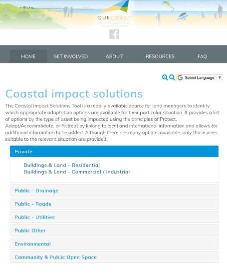
14 Other website info Port Fairy and Bellarine CHA websites also invite the public to become involved in further action. Port Fairy website provides information about the community coastal hazards survey, and the on-going citizen science beach monitoring program. Bellarine website provides a coastal impacts solutions tool that provides links to information to help land managers identify appropriate adaptation options. 14

15 15
16 Local govt led follow up projects Port Fairy Coastal and Structure Plan (draft report 2017) Port Fairy Climate Adaptation Plan (draft report 2018) Greater Geelong and Queenscliffe Flood Adaptation Effectiveness Study (2016) Greater Geelong and Queenscliffe Planning Schemes Implementation options (2018) Port Phillip Bay coastal planning - land use adaptation project: Development of Coastal Hazard Planning Guide, and preparation of baseline assessments of planning responses for 10 councils (will use info from Bellarine and Westernport projects and inform brief for PPB CHA). (in progress) Lakes Entrance Growth and Adaptation Strategy (in progress) 16
17 State govt led follow up projects Priority locations for detailed coastal hazard mapping and adaptation planning along the Victorian coastline (2015) Guidelines for Developing a Coastal Hazard Assessment (draft 2016) Local Coastal Hazard Assessment Learnings Project (2017) Victorian Coastal Hazard Assessment 2017: 2 nd pass statewide assessment of erosion and inundation hazards resulting from future climate change scenarios to inform the VCMP 17

18 Future CHA priority locations Barwon South West Port Phillip Bay 18
19 Other State govt led follow up Victorian Coastal Monitoring Program (VCMP): started in 2017 to set up long term monitoring, data collection, storage and retrieval. Statewide Coastal Programs team: established in late 2017 to coordinate the statewide delivery of coastal programs, including policy and planning integration, business case development, technical standards and advice, and engagement co-ordination. One task is to develop a database of coastal protection assets and coastal assets. 19
20 Did CHA program meet its objectives? Pilot CHA program objectives increase awareness and build capacity of coastal land managers/practitioners to assess and understand the relationship between climate change impacts and coastal hazards develop and test coastal hazard assessment methodologies for representative coastal landform systems in Victoria develop datasets which will facilitate/inform improved and more consistent coastal planning and management practices Program was ambitious. Aim holistic, but outputs not specifically defined. This led to a fragmented approach. 20
21 Conclusions (1) The scope of each project had to be modified to match the limited project budget. Coastal inundation better understood than coastal erosion issues. Inadequate correlation between inundation and erosion. CHAs are very complex and may need consortium approach or multiple contracts. Terminology currently used is complex and not being consistently applied. Some concepts aren t easy for practitioners to understand or assimilate; so how does the coastal practitioner community present all this to the public in a way that can be adequately comprehended? - What s the difference between a coastal compartment / unit /cell? Geomorphic and sediment? - How are exposure, sensitivity and adaptive capacity defined, and then evaluated to provide a vulnerability rating? - What s the difference between - region / zone; significance / value, etc? 21
22 Conclusions (2) There is not enough definitive guidance from state government how technical information developed during CHAs should be applied. How does an LGA plan for SLR of 0.8m by 2100? Outputs of Future Coasts program (including CHAs) available for 5+ years, but only a few councils have updated flood planning controls to consider coastal flooding and SLR. No erosion controls have been updated. Coastal erosion and coastal flooding affect each other: No conclusion whether a combined coastal flood and erosion overlay should apply or whether separate flood and erosion overlays should apply. Better guidance needed on what an adaption plan should contain, or how to prepare strategic planning documents for long term adaptation, that consider transitioning communities that will be impacted by SLR. 22


23 Conclusions (3) We ve made a good start on the journey, but there are still many blockers of actions rather than enablers. There is still a generic fear of using information from CHAs because not only is it complex, it is also not consistently derived and developed, and is not well understood. 23

24 Questions? Comments! 24
ASSESSING DEVELOPMENT IN RELATION TO SEA LEVEL RISE
 ASSESSING DEVELOPMENT IN RELATION TO SEA LEVEL RISE V Brenners, M Edwards and S Peacock 1 1 All from the Department of Sustainability and Environment, Melbourne, Victoria. Abstract In June 2012 the Victorian
Coastal Climate Change Vulnerability and Flexible Adaptation Planning: the Cockburn Sound Coastal Alliance Experience
 Coastal Climate Change Vulnerability and Flexible Adaptation Planning: the Cockburn Sound Coastal Alliance Experience Presentation to Climate Change Forum by Doug Vickery Manager Infrastructure Services,
City of Rockingham. Local Management Practices, Costs and Strategic Coastal Planning
 City of Rockingham Local Management Practices, Costs and Strategic Coastal Planning Decision Making Process Considerations Climate Change Response Action Plan Ongoing observations/major Storm events Ongoing
Empowering Local Action for Coastal Resilience in Massachusetts. Bruce K. Carlisle MA Office of Coastal Zone Management
 Empowering Local Action for Coastal Resilience in Massachusetts Bruce K. Carlisle MA Office of Coastal Zone Management Context Coastal communities continue to face both chronic and acute storm surge, erosion,
Severn Estuary Shoreline Management Plan What does it mean for planning in North Somerset?
 Severn Estuary Shoreline Management Plan What does it mean for planning in North Somerset? Coastal planning The National Planning Policy Framework sets out the Government s planning policies for England.
Legal implications of failing to
 Legal implications of failing to plan for sea level rise Gavin Leydon, Partner 30 April 2010 Outline Relevance to local l government & developers assessment & policy Developments in case law Climate change
Coastal Planning in Texas. Tony Williams Senior Director of Planning Coastal Resources Division Texas General Land Office
 Coastal Planning in Texas Tony Williams Senior Director of Planning Coastal Resources Division Texas General Land Office e The Texas General Land Office (GLO) and the Texas Coast Since 1836: Manager of
Construction of upgraded stormwater outfall at the Ozone Road Jetty
 Construction of upgraded stormwater outfall at the Ozone Road Jetty Background The City of Greater Geelong (CoGG) is responsible for stormwater management within Barwon Heads. There is an existing 750
NJ Department of Environmental Protection
 NJ Department of Environmental Protection COASTAL AND LAND USE PLANNING New Jersey Coastal Management Program Covers NJ coastal waters to limit of tidal influence including 239 municipalities in 19 counties,
Rhode Island Shoreline Change Special Area Management Plan
 Rhode Island Shoreline Change Special Area Management Plan Draft Document Outline REVISED 10/12/2017 VOLUME 1 Executive Summary & How to Use this Document (Draft by Dec 2017) 1. Introduction (Revised draft
LEOPOLD LAND CAPABILITY AND BAY ACCESS REPORT
 LEOPOLD LAND CAPABILITY AND BAY ACCESS REPORT JULY 2015 Prepared by Spiire for City of Greater Geelong This report has been prepared by the office of Spiire Level 2 10 Moorabool Street PO Box 4032 Geelong
Preliminary Sea Level Rise Case Study: Navarre Beach, FL
 Preliminary Sea Level Rise Case Study: Navarre Beach, FL This publication was funded in part, through a grant agreement from the Florida Department of Environmental Protection, Florida Coastal Management
Coastal Erosion Protection Strategies Private Works on Public Land
 Coastal Erosion Protection Strategies Private Works on Public Land Arron Broom Coastal Policy Planner Coastal Management Branch, SA DEW Delegate for the Coast Protection Board 2016 Storm Events SA experienced
CHATHAM COUNTY S PATH TO SUSTAINABILITY - THE NATURAL RESOURCES SIDE
 CHATHAM COUNTY S PATH TO SUSTAINABILITY - THE NATURAL RESOURCES SIDE GEORGIA ENVIRONMENTAL CONFERENCE SAVANNAH, GEORGIA AUGUST 23, 2012 Jackie Jackson Teel Chatham County-Savannah Metropolitan Planning
Virginia Beach and Sea Level Rise: Where Do We Go From Here?
 Virginia Beach and Sea Level Rise: Where Do We Go From Here? Clay Bernick City of Virginia Beach Environment & Sustainability Office Bayfront Advisory Committee Presentation July 19, 2012 Five Items to
Planning Commission Report
 Planning Commission Report To: From: Subject: Planning Commission Meeting: January 6, 2016 Agenda Item: 8-B Planning Commission David Martin, Planning & Community Development Director Introduction to the
Policy for management and protection of the coast
 Policy for management and protection of the coast Policy for management and protection of the coast Mona Ohlsson Samhällsbyggnadsförvaltningen Ystads kommun, 2008 3 THE MUNICIPALITY GUIDELINES REGARDING
STRATEGIC IMPLEMENTATION PANEL SUBMISSION
 STRATEGIC IMPLEMENTATION PANEL SUBMISSION AMENDMENT C375 to the GREATER GEELONG PLANNING SCHEME BARWON HEADS STRUCTURE PLAN IMPLEMENTATION Part A Submission to the Independent Panel Panel: Con Tsotsoros
SHORELINE, FLOOD AND COASTAL DEFENCE MANAGEMENT PLANS
 These plans may provide opportunities as well as concern for recreational boating. They are currently being revised and consulted on. This document explains how we can engage in the process. Shoreline,
COMMUNITY ACTIONS for a SUSTAINABLE BARWON HEADS. February 2016
 COMMUNITY ACTIONS for a SUSTAINABLE BARWON HEADS February 2016 Acknowledgements Traditional Owners We acknowledge the traditional owners of this land and pay our respects to their elders past and present,
Getting to Resilience webinar
 Getting to Resilience webinar A brief description of two NJDEP Projects: Resilient Coastal Communities Initiative & Municipal Public Access & Resiliency Small Grants Program June 26, 2014 Marty Rosen NJ
Ashbridges Bay Erosion and Sediment Control Project
 Ashbridges Bay Erosion and Sediment Control Project Project Brief Overview Toronto and Region Conservation Authority, in partnership with the City of Toronto, intends to carry out remedial erosion control
Planning for Historic/Cultural Resources Coastal Resiliency in Connecticut. Presented to CAFM s 3 rd Annual Conference
 Planning for Historic/Cultural Resources Coastal Resiliency in Connecticut Presented to CAFM s 3 rd Annual Conference October 25, 2016 Agenda Introduction and Project Overview Background Historic and Cultural
Goals and Strategies. Goals. Strategies. Long-term Beach and Shoreline Management Program
 Goals and Strategies Goals Long-term Beach and Shoreline Management Program Qualify for and Maintain Static-line Exception Qualify for and Maintain FEMA Engineered Beach Lockwoods Folly Inlet Management
Mollers Lane, Leopold, Victoria Significant Landscape Overlay Re-assessment
 XURBAN Mollers Lane, Leopold, Victoria Significant Landscape Overlay Re-assessment For: TGM Group November 2016 Final Mollers Lane, Leopold, Victoria Significant Landscape Overlay Re-assessment Client
RESILIENCY, ADAPTATION, & SUSTAINABILITY AT THE CITY OF ST. AUGUSTINE
 RESILIENCY, ADAPTATION, & SUSTAINABILITY AT THE CITY OF ST. AUGUSTINE PROGRAM UPDATE JANUARY 14, 2019 MICHAEL G. CULLUM, P.E. DIRECTOR, PUBLIC WORKS PROGRESSION OF PLANNING FOR RESILIENCY / ADAPTATION
Mitigation + Adaptation Strategies for Historic Structures and Sites
 Mitigation + Adaptation Strategies for Historic Structures and Sites Adrienne Burke, Esq., MSAS, LEED AP+ Executive Director, Riverside Avondale Preservation, Jacksonville, FL Cultural Resources, Disaster
.MANAGED RETREAT. Need for managed retreat
 602 MANAGED RETREAT hazards. This strategy is based on a philosophy of moving out of harm's way, and is proactive in recognizing that the dynamics of the coastal zone should dictate the type of management
MUNICIPAL RESILIENCE PLANNING ASSISTANCE PROJECT
 MUNICIPAL RESILIENCE PLANNING ASSISTANCE PROJECT William R. Rath, Esq. Legal Research Fellow Center for Energy & Environmental law University of Connecticut School of Law 860-570-5058 William.Rath@ UConn.edu
July 22, 2013 REQUEST FOR PROPOSALS TO PROVIDE ENGINEERING DESIGN SERVICES FOR A PROJECT ALONG THE WESTERN SHORE OF MOBILE BAY
 Mobile Bay National Estuary Program 4172 Commanders Drive Mobile, AL 36615 Phone: 251-431-6409 Fax: 251-431-6450 Contact: Tom Herder, Watershed Protection Coordinator Email: therder@mobilebaynep.com July
Integrated Urban Structuring in Australia An Overview of Principles and Practice
 ACNU08 Brisbane Integrated Urban Structuring in Australia An Overview of Principles and Practice Wendy Morris Ecologically Sustainable Design Pty Ltd Melbourne, Australia esdesign@netspace.net.au Ecologically
THE PROTECTION OF CHATHAM COUNTY S NATURAL RESOURCES - THE POLICY SIDE
 THE PROTECTION OF CHATHAM COUNTY S NATURAL RESOURCES - THE POLICY SIDE SEA GRANT TIDAL CREEK SUMMIT CHARLESTON, SOUTH CAROLINA DECEMBER 5, 2011 Jackie Jackson Teel Chatham County-Savannah Metropolitan
Published in March 2005 by the. Ministry for the Environment. PO Box , Wellington, New Zealand ISBN: X.
 Action Pack Published in March 2005 by the Ministry for the Environment Manatū Mō Te Taiao PO Box 10-362, Wellington, New Zealand ISBN: 0-478-18994-X ME number: 580 This document is available on the Ministry
What Planners Do. Heather Wade, Coastal Planning Specialist Texas Sea Grant
 What Planners Do Heather Wade, Coastal Planning Specialist Texas Sea Grant What Planners Do Seminar Series Department of Landscape Architecture and Urban Planning College of Architecture ABOUT ME B.S.
INCREMENTAL CHANGE AREA REVIEW March 2015 Page 1
 INCREMENTAL CHANGE AREA REVIEW March 2015 Page 1 Table of Contents Introduction... 3 Background to Review... 3 Comparison of the Schedules to the General Residential Zone... 7 Methodology... 7 Policy Context...
Coastal safety- case studies in Flanders
 Coastal safety- case studies in Flanders Duinkerke, June 12th 2018 ir. Daphné Thoon MDK-Coastal Division Content 1. Introduction 2. Coastal Safety Masterplan - status 3. Management of the sandy coast 4.
An Integrated Approach for Water Management Examples from The Netherlands. Addressing Climate Change and Sea Level Rise
 An Integrated Approach for Water Management Examples from The Netherlands Addressing Climate Change and Sea Level Rise Superstorm Sandy Forum College of Staten Island March 8 2013 Water: a challenge and
Scope of Services. River Oaks Boulevard (SH 183) Corridor Master Plan
 Corridor Master Plan") Scope of Services River Oaks Boulevard (SH 183) Corridor Master Plan PROJECT AREA The project area consists of the River Oaks Boulevard (SH 183) corridor bounded by SH 199 at the northern end and the Trinity
Scope of Services River Oaks Boulevard (SH 183) Corridor Master Plan PROJECT AREA The project area consists of the River Oaks Boulevard (SH 183) corridor bounded by SH 199 at the northern end and the Trinity
Improvement of the Atlantic Coast of New York City,
 Improvement of the Atlantic Coast of New York City, Rockaway Inlet to Norton Point Project at Sea Gate Meeting Purpose The U.S. Army Corps of Engineers, the New York State Department of Environmental Conservation,
EEA Capital Investment in Green Infrastructure
 EEA Capital Investment in Green Infrastructure Goal: Advance local efforts to implement measures to increase natural storm damage protection, flood control, and community resilience State capital funding
City of Norfolk Coastal Flood Mitigation Program. March 13, 2013
 City of Norfolk Coastal Flood Mitigation Program March 13, 2013 Topics Brief overview of Norfolk s Coastal Flood Program Data-driven analysis and decision making City-wide vulnerability, project concepts,
BELLARINE PENINSULA Draft Localised Planning Statement JUNE 2014
 BELLARINE PENINSULA Draft Localised Planning Statement JUNE 2014 BELLARINE PENINSULA Draft Localised Planning Statement JUNE 2014 The Bellarine Peninsula Draft Localised Planning Statement has been developed
Planning for Historic/Cultural Resources Coastal Resiliency in Connecticut. Presented to ASFPM 41 st Annual Conference, Kansas City, MO
 Planning for Historic/Cultural Resources Coastal Resiliency in Connecticut Presented to ASFPM 41 st Annual Conference, Kansas City, MO May 3, 2017 Agenda Introduction and Project Overview Historic and
Coast Protection, Development and Coastal Biodiversity. Brian Caton Member CEMAC, AMLR NRM Former Chair & Member, Coast Protection Board
 Coast Protection, Development and Coastal Biodiversity Brian Caton Member CEMAC, AMLR NRM Former Chair & Member, Coast Protection Board Saltmarsh: an extensive problem for Biodiversity and Planning Law
Nature-Based Adaptation Projects Challenges and Opportunities in California Marilyn Latta, Project Manager California State Coastal Conservancy
 Nature-Based Adaptation Projects Challenges and Opportunities in California Marilyn Latta, Project Manager California State Coastal Conservancy Restore America s Estuaries California State Coastal Conservancy
Smart growth on the Oregon Coast: Addressing Impacts of climate change. What I will Cover: Oregon Land Use and OCMP Connection
 Smart growth on the Oregon Coast: Addressing Impacts of climate change Laren Woolley, Panelist Costal Shores Specialist Oregon Coastal Management Program Oregon Department of Land Conservation and Development
Implementing sustainable water strategy through development industry engagement
 Implementing sustainable water strategy through development industry engagement Ian Director, Organica Engineering, Melbourne, Australia E-mail: iadams@organicaeng.com.au Edward Cotter Sustainability Leader,
Building Ecological Solutions to Coastal Community Hazards: Guidance and NJ Coastal Community Assistance
 Building Ecological Solutions to Coastal Community Hazards: Guidance and NJ Coastal Community Assistance Stacy Small-Lorenz National Wildlife Federation Restore America s Estuaries Summit New Orleans,
Sunshine Coast Council Coastal Management Overview. January 2016 edition
 Sunshine Coast Council Coastal Management Overview January 2016 edition Mayor Mark Jamieson Mayor s foreword Our impressive beaches are fundamental to our Sunshine Coast lifestyle, economy and coastal
Raewyn Peart. Policy Director Environmental Defence Society
 1 Raewyn Peart Policy Director Environmental Defence Society www.eds.org.nz Coastal Environment Where the sea impacts on the land and the land impacts on the sea 2 www.eds.org.nz Section 6 RMA matters
Fact Sheet Regulating Oceanfront Accessory Structures Updated June 10, 2013
 What is being considered? Fact Sheet Regulating Oceanfront Accessory Structures Updated June 10, 2013 The Town of Duck is considering an ordinance that would limit how close pools, decks, and other accessory
Rocky Areas Project Guidance HABITAT
 Rocky Areas Project Guidance HABITAT Introduction Rocky habitats are surface areas dominated by exposed rock, such as mountain peaks, inland cliffs, buttes and rocky outcrops. In many cases, rocky areas
Preparing New Hampshire for Projected Storm Surge, Sea-Level Rise, and Extreme Precipitation
 NEW HAMPSHIRE COASTAL RISK AND HAZARDS COMMISSION Preparing New Hampshire for Projected Storm Surge, Sea-Level Rise, and Extreme Precipitation July 14, 2017 The Beaches Conference Wells High School Wells,
Funding, Designing, and (eventually) Building Miles of Shoreline and Acres of Wetlands and Oyster Reefs on an Urbanized River!
 Building Miles of Shoreline and Acres of Wetlands and Oyster Reefs on an Urbanized River!") CW Gaskill City of Norfolk Funding, Designing, and (eventually) Building Miles of Shoreline and Acres of Wetlands and Oyster Reefs on an Urbanized River! Don Cole Brown and Caldwell C. W. Gaskill City
CW Gaskill City of Norfolk Funding, Designing, and (eventually) Building Miles of Shoreline and Acres of Wetlands and Oyster Reefs on an Urbanized River! Don Cole Brown and Caldwell C. W. Gaskill City
FUTURES: Regional Growth Modeling for NC Building a FUTURES Forecasting Model for the Triangle and Rocky Mount Regions
 FUTURES: Regional Growth Modeling for NC Building a FUTURES Forecasting Model for the Triangle and Rocky Mount Regions Presented by: Jeff Michael, RENCI at UNC Charlotte John Vogler, UNCC Center for Applied
Libby Zemaitis October 18, 2017 Climate Outreach Specialist, NYS DEC Hudson River Estuary Program
 1 Supporting Hudson Riverfront communities as Climate-Adaptive Leaders Libby Zemaitis October 18, 2017 Climate Outreach Specialist, NYS DEC Hudson River Estuary Program The Hudson River Estuary Program
CHAPTER 1 Introduction
 CHAPTER 1 Introduction From sea to summit, Lane County covers almost 4,800 square miles of diverse Oregon landscape. Stretching from the Pacific Ocean through the Coastal Range, the Willamette Valley to
HARVARD PROJECT ON SOUTHWEST FLORIDA AND SEA LEVEL: THE CASE OF COLLIER COUNTY (INCLUDING NAPLES, MARCO ISLAND & EVERGLADES CITY)
") HARVARD PROJECT ON SOUTHWEST FLORIDA AND SEA LEVEL: THE CASE OF COLLIER COUNTY (INCLUDING NAPLES, MARCO ISLAND & EVERGLADES CITY) PROPOSAL DATE: MAY 21, 2016 Professor Charles Waldheim, Principal Investigator
HARVARD PROJECT ON SOUTHWEST FLORIDA AND SEA LEVEL: THE CASE OF COLLIER COUNTY (INCLUDING NAPLES, MARCO ISLAND & EVERGLADES CITY) PROPOSAL DATE: MAY 21, 2016 Professor Charles Waldheim, Principal Investigator
Baylands Segment J. Bay between the Golden Gate and Segment J. Coyote Point. of For managed ponds. included habitat enhancement.
 Baylands Segment J Crissy Field Alameda Naval Air Station Heron's Head Park COLMA CREEK SFO Millbrae San Mateo BAYLANDS 2009 SAN FRANCISCO AREA san francisco area Western side of central San Francisco
NC Coastal Management Program Update. Mike Lopazanski Policy & Planning Section Chief April 3, 2015
 NC Coastal Management Program Update Mike Lopazanski Policy & Planning Section Chief April 3, 2015 NC Coastal Area Management Act (1974) Balances competing coastal pressures through development permitting
Appendix to Amicus Curiae Brief: Selected Provisions of the South Carolina Beachfront Management Act
 Loyola Marymount University and Loyola Law School Digital Commons at Loyola Marymount University and Loyola Law School Loyola of Los Angeles Law Review Law Reviews 6-1-1992 Appendix to Amicus Curiae Brief:
Sierra Club Comments on ACOE Public Notice NAE Re: Proposed Town Neck Beach Project at Sandwich, Massachusetts
 August 27, 2015 US Army Corps of Engineers New England District 696 Virginia Road Concord, MA 01742-2751 Attn: Phillip W. Nimeskern Dear Mr. Nimeskern, Sierra Club Comments on ACOE Public Notice NAE-2014-259
FOUR MILE RUN VALLEY WORKING GROUP AND CHARGE Adopted April 16, 2016 Amended July 19, 2016
 FOUR MILE RUN VALLEY WORKING GROUP AND CHARGE Adopted April 16, 2016 Amended July 19, 2016 Working Group Charge The Working Group is charged by the County Board to collaborate with staff to provide commission,
Staff will be providing an overview of the project need, purpose and intent for consideration as part of the Amendment cycle.
 Agenda Item D-2 City of Tacoma Planning and Development Services To: Planning Commission From: Stephen Atkinson, Planning Services Division Subject: Open Space Corridors Project Meeting Date: March 1,
50-year Water & Wetland Vision for England WORKSHOP DETAILS
 50-year Water & Wetland Vision for England Workshop 3: Wetland vision maps; your feedback on draft maps, methodology and ways forward 7 th December 2006 WORKSHOP DETAILS Theme 1: Methodology and prioritisation
OCEAN GROVE STRUCTURE PLAN
 OCEAN GROVE STRUCTURE PLAN December 2015 1 WWW.GEELONGAUSTRALIA.COM.AU 2 Contents Part A Structure Plan 1 Introduction... 5 1.1 Purpose of the Structure Plan 5 1.2 How will this plan be used? 5 1.3 Plan
Applying the Heritage Overlay
 Practice Note 01 Revised September 2012 Applying the Heritage Overlay This practice note provides guidance about the use of the Heritage Overlay. What places should be included in the Heritage Overlay?
Townsville Coastal Hazard Adaptation Strategy pilot project adaptation decision-making in practice
 Townsville Coastal Hazard Adaptation Strategy pilot project adaptation decision-making in practice Author Harper, Bruce, Smith, Mitchell, Weir, Nick, Wall, Carol, Lane, John, Erhart, Dorean, Anderson,
Natural Resource Adaptation Action Area Addressing Sea Level Rise in Estuarine Ecosystems TO: TOWN OF YANKEETOWN MAY
 Natural Resource Adaptation Action Area Addressing Sea Level Rise in Estuarine Ecosystems TO: TOWN OF YANKEETOWN MAY 6 2013 University of Florida Conservation Clinic Vivek Babbar, Student Associate, J.D.
Blue/Green Infrastructure Study Accomack County, VA
 Blue/Green Infrastructure Study Accomack County, VA Draft Asset Maps March 8-9, 2010 Green Infrastructure Center, Inc. 2 Overview What is Green and Blue Infrastructure Project Timeline & Tasks Literature
FOUR MILE RUN VALLEY WORKING GROUP AND CHARGE
 FOUR MILE RUN VALLEY WORKING GROUP AND CHARGE Adopted April 16, 2016 Amended July 19, 2016 Overview of Integrated Effort The overall goal of the Four Mile Run Valley (4MRV) initiative is to develop a comprehensive
BRE Strategic Ecological Framework LI Technical Information Note 03/2016
 BRE Strategic Ecological Framework Technical Information Note 03/2016 September 2016 Contents 1. Introduction 2. Aims of BRE s Strategic Ecological Framework 3. How SEF is different from previous approaches
Pontchartrain Coastal Lines of Defense Program Figure 1 Figure 2 Figure 1
 Pontchartrain Coastal Lines of Defense Program Coastal Sustainability Program February 2006 The Pontchartrain Coastal Lines of Defense Program consists of ten priority project areas within the Pontchartrain
Sandscaping in Bacton, North Norfolk
 Sandscaping in Bacton, North Norfolk Protecting critical infrastructure and benefitting communities Flood & Coast 29 March 2017 Jaap Flikweert CEng FCIWEM C.WEM Jaap.flikweert@rhdhv.com @JaapJFlikweert
Coastal Erosion Commission: context, examples, and next steps
 Coastal Erosion Commission: context, examples, and next steps Overview Themes from other national and state level reports 2007 MA Coastal Hazards Commission Best practices and examples Financial i and
Design Guidelines for the Enhancement and Creation of Estuarine Habitats in the Middle Reaches of the Lower Columbia River
 Design Guidelines for the Enhancement and Creation of Estuarine Habitats in the Middle Reaches of the Lower Columbia River Astoria, May 16, 2012 1 Outline I. Nature of Project/Background II. Approach to
Managing our Landscapes Conversations for Change
 Managing our Landscapes Conversations for Change Frequently Asked Questions The new State Government is committed to a significant reform program that will change the way natural resources are managed.
REPORTING BACK TO YOU ON THE RIG NETWORK SURVEYS A snapshot of findings
 REPORTING BACK TO YOU ON THE RIG NETWORK SURVEYS A snapshot of findings We d like to thank everyone who participated in RIG Network s recent surveys and who sent the survey information on to other people.
2017/18 Financial Year Living Rivers Funded Projects
 2017/18 Financial Year Living Rivers Funded Projects Title Description City of Port Phillip LR502 Alma Park Stormwater Harvesting Project Construction of a stormwater harvesting scheme that will provide
COMMUNITY RESILIENCE IN COASTAL NEW HAMPSHIRE
 COMMUNITY RESILIENCE IN COASTAL NEW HAMPSHIRE Kirsten Howard Coastal Resilience Specialist New Hampshire Department of Environmental Services Coastal Program Kirsten.Howard@des.nh.gov Coastal Hazard Vulnerability
Otway Community Conservation Network (OCCN)
") South East Coastal Plain Project Otway Community Conservation Network (OCCN) Scoping Paper April 2011 TABLE OF CONTENTS 1 INTRODUCTION...3 1.1 South East Coastal Plain Project... 3 1.2 The Need for an
South East Coastal Plain Project Otway Community Conservation Network (OCCN) Scoping Paper April 2011 TABLE OF CONTENTS 1 INTRODUCTION...3 1.1 South East Coastal Plain Project... 3 1.2 The Need for an
Climate Change and Physical Development Threats, Challenges and Adaptation Responses in Coastal Communities: Grand Riviere, Trinidad
 Climate Change and Physical Development Threats, Challenges and Adaptation Responses in Coastal Communities: Grand Riviere, Trinidad Michelle Mycoo Ph.D. and Michael Sutherland Ph.D. Geomatics Engineering
Port of San Diego Sea Level Rise Ad Hoc Committee Meeting 1 of 3.. September 18, 2018
 Port of San Diego Sea Level Rise Ad Hoc Committee Meeting 1 of 3. September 18, 2018 Agenda Welcome Introductions Rules of the Ad-Hoc Presentation Background Vulnerability Assessment Results Non-Agenda
Introducing Green Infrastructure for Coastal Resilience
 Introducing Green Infrastructure for Coastal Resilience National Oceanic and Atmospheric Administration (NOAA) Office for Coastal Management Gloucester, MA Office of Travel Courtesy, Tim Grafft What Is
PHASE ONE. A summary report: What the community told Alcoa during Phase One of the community engagement program for Point Henry 575.
 PHASE ONE A summary report: What the community told Alcoa during Phase One of the community engagement program for Point Henry 575. DECEMBER 2015 FEBRUARY 2016 INTRODUCTION In 2014 Alcoa closed its Point
Appendix A. Planning Processes. Introduction
 1 Planning Processes Introduction This appendix outlines a number of planning processes which are used in the Auckland Region to support the effective management of development in the region s rural and
VACANT TO VIBRANT : GREEN INFRASTRUCTURE & URBAN REVITALIZATION
 VACANT TO VIBRANT : GREEN INFRASTRUCTURE & URBAN REVITALIZATION Calumet Summit 2013: Connecting for Action Lauren Riga, Director City of Gary Department of Green Urbanism Gary Storm Water Management District
Collaborative Conservation across Landscapes: Experiences from the Upper Midwest and Great Lakes LCC 2/29/2016. GreatLakesLCC.org
 Collaborative Conservation across Landscapes: Experiences from the Upper Midwest and Great Lakes LCC 2/29/2016 GreatLakesLCC.org Personal introduction Brad Potter - Science Coordinator for the Upper Midwest
Date of Advertisement: January 14, 2019 Deadline for Receipt of Qualification Statements and Priced Proposal: February 12, :00 pm.
 MARYLAND COASTAL BAYS PROGRAM REQUEST FOR PROPOSALS TO PROVIDE PROFESSIONAL ENGINEERING AND TECHNICAL SERVICES FOR TIZZARD ISLAND COASTAL RESILIENCY PLANNING AND DESIGN Date of Advertisement: January 14,
C. Guinn Garrett 1, Kimberly A. Counts 2, Blaik P. Keppler 3, April Turner 4
 A 6,000 Stormwater Pond Task: Meeting the Needs of Diverse Audiences for Stormwater Pond Management Outreach in the Berkeley, Charleston and Dorchester Communities C. Guinn Garrett 1, Kimberly A. Counts
Point Spaniard to Land s End MA23 PDZ9
 Location reference: Management Area reference: Policy Development Zone: Point Spaniard to Land s End MA23 PDZ9 Chapter 4 PDZ9 10 February 2011 DISCUSSION AND DETAILED POLICY DEVELOPMENT Management Area
Presenta/on Outline. Sea Level Rise Adapta/on Guidelines for Sea Dikes & Coastal Development 11/24/11
 Sea Level Rise Adapta/on Guidelines for Sea Dikes & Coastal Development 2011 UBCM Conven-on Rising Oceans & Raising Dikes: Rethinking Coastal Development in a Changing Climate September 27, 2011 Jesal
Florida Forever Conservation Needs Assessment Overview Maps
 Florida Forever Conservation Needs Assessment Overview Maps Prepared by Florida Natural Areas Inventory, The maps in this document are derived from the Florida Forever Conservation Needs Assessment, an
CANADIAN GUIDE FOR GREENER ROADS AND SUSTAINABILITY CONSIDERATIONS FOR BRIDGES GUIDE 2016 CANADIAN CONSULTING ENGINEERING AWARDS
 CANADIAN GUIDE FOR GREENER ROADS AND SUSTAINABILITY CONSIDERATIONS FOR BRIDGES GUIDE 2016 CANADIAN CONSULTING ENGINEERING AWARDS SUSTAINABILITY CONSIDERATIONS PROJECT TITLE PAGE Member Firm Submitting
Stormwater Master Plan Update. City Council Briefing January 8, 2019
 Stormwater Master Plan Update City Council Briefing January 8, 2019 1 Stormwater Master Plan Update January 8, 2019 Agenda Background for Update Stormwater Modeling and Calibration Visualizations of Results
Northland Regional Landscape Assessment Worksheet
 Northland Regional Landscape Assessment Worksheet DESCRIPTION AND CHARACTERISATION Component Land Types (refer to list overleaf) Coastal cliffs / escarpment Bays and headlands Dune complex Beach Reefs
Queensland Coastal Plan. Presented by John Lane Director Environment Planning
 Queensland Coastal Plan Presented by John Lane Director Environment Planning Queensland Coastal Plan - Status Released 7 April 2011, but NOT YET IN EFFECT Formatting & operational amendments required Yet
SB1 Grant. Regional Sea Level Rise Adaptation Guidance for Transportation Infrastructure PRESENTED BY SARAH PIERCE & SARAH RICHMOND OCTOBER 4, 2018
 SB1 Grant Regional Sea Level Rise Adaptation Guidance for Transportation Infrastructure PRESENTED BY SARAH PIERCE & SARAH RICHMOND OCTOBER 4, 2018 Project Team SANDAG (Sarah Pierce, Katie Hentrich) Dudek
COASTAL CONSERVANCY. Staff Recommendation December 13, 2007 COASTAL TRAIL AT LAND S END. File No Project Manager: Joan Cardellino
 COASTAL CONSERVANCY Staff Recommendation December 13, 2007 COASTAL TRAIL AT LAND S END File No. 07-086-01 Project Manager: Joan Cardellino RECOMMENDED ACTION: Authorization to disburse up to eight hundred
Reimagining Arnolds Creek. Community engagement report. May 2018
 Reimagining Arnolds Creek Community engagement report May 2018 Melbourne Water is owned by the Victorian Government. We manage Melbourne s water supply catchments, remove and treat most of Melbourne s