GREENING THE BOULEVARD Master Plan Concepts for Venice Boulevard between Lincoln and Sawtelle
|
|
|
- Stephen Bradley
- 5 years ago
- Views:
Transcription

1 GREENING THE BOULEVARD Katherine Spitz Associates Inc. 4212½ Glencoe Avenue Marina Del Rey, CA Fax January 2008
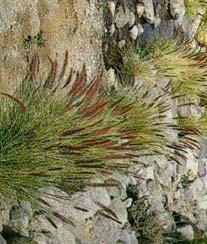
2 Table of Contents Overview Proposed Design Improvements Illustration 1 - Venice Boulevard between Lincoln and Sawtelle Master Plan Illustration 2 - Mar Vista Town Center Detail Master Plan Illustration 3 - Future Visions along the Boulevard Illustration 4 - Sidewalk Tree Plantings Illustration 5 - Median Plantings Illustration 6 - Stormwater Parkways Illustration 7 - Corner Curb Extensions Illustration 8 - Bike Lane Concepts Illustration 9 - Design Palette Cost Estimate References Acknowledgements GREENING THE BOULEVARD

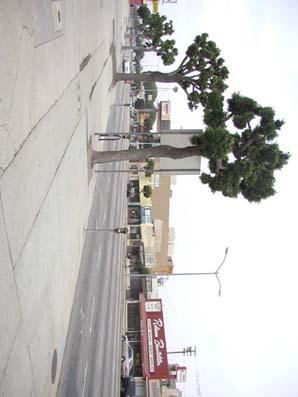
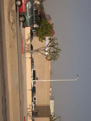
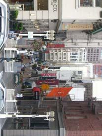
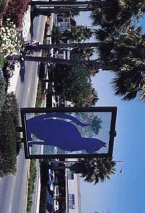
3 Overview Project Location Venice Boulevard stretches eastward from the Pacific Ocean to downtown Los Angeles, California. Along its 13-mile length it traverses many diverse urban communities. This master plan concerns itself with the portion of the boulevard that transects the historic core of the Mar Vista neighborhood from Lincoln Boulevard to Sawtelle Boulevard. Mar Vista History The community of Mar Vista was first named and annexed as a district of the City of Los Angeles in the 1920s. During the first half of the 20 th century, it was an integral component of the Pacific Electric Railway mass transit system that connected much of southern California. The Venice Short Line streetcar or the Red Car travelled through Mar Vista along Venice Boulevard. Today Mar Vista is an economically diverse neighborhood and its boundaries as defined by the Mar Vista Community Council (MVCC) are shown on the diagram below. Master Plan Background This master plan is the result of community efforts commencing in 2002 with the founding of the Merchants of Venice group. Since then the master plan has been guided and developed through the efforts of these community members and the subsequent commitments of time and effort by city staff, council office and additional community members and groups. GREENING THE BOULEVARD
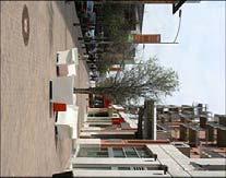
4 Overview (cont d) Master Plan Implementation Goals The master plan demonstrates strategies for transforming Venice Boulevard in Mar Vista into a vibrant, successful and sustainable neighborhood street. The master plan design improvements are to be implemented in several phases over a period of time. The purpose of the master plan is multifold. It will establish a framework for a series of future streetscape improvements. Secondly, it will help determine the following criteria for the proposed components: Ability to be funded Ease of implementation Degree of independence from other proposed components It will also help realize and participate in specific catalytic events to provide energy and enthusiasm for the future fundraising of the proposed components. Several of these events have already been implemented. The year-round Mar Vista Farmers Market on Grand View Boulevard at Venice Boulevard started in August This Sunday market has been used several times as a forum to collect community input on overarching concepts and individual components of the master plan. The newly landscaped medians along Venice Boulevard between Centinela Boulevard and Inglewood Boulevard, implemented as a preview of the master plan, were another a catalytic event. Most recently, several sidewalk parkway plantings outlined in the master plan were installed by community volunteers during the 2008 Mar Vista, Venice, Del Rey Mayor s Day of Service. Urban Design Strategies We envision Mar Vista as an outdoor dining destination with attractive and successful shops, lively evening uses and an expanding farmers market, rather than a district where vehicular traffic speeds through en route to other destinations. Venice Boulevard in Mar Vista is a unique street with its broad dimensions and continuous median. Its wide sidewalks, traffic lanes and parking lanes can easily accommodate reconfigured bike and vehicular traffic lanes, enhanced stormwater percolation, a drought-tolerant plant palette, energy-efficient pedestrian lighting, pedestrian-friendly intersections, additional trees with overhead canopy and festive banners and street furniture. The subsequent pages of this booklet illustrate the two major design thrusts of the master plan: Create a sustainable, green street Create a vibrant, beautiful neighborhood street that will be a magnet for Mar Vista These illustrations have been previewed by the community at both the Mar Vista Farmers Market and the Mar Vista Public Library to start to gather input and garner enthusiasm for the master plan. GREENING THE BOULEVARD
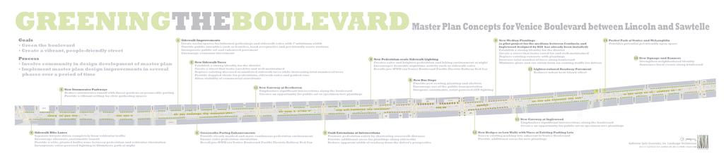
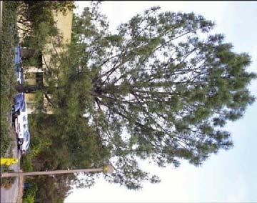
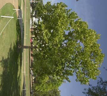
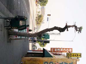
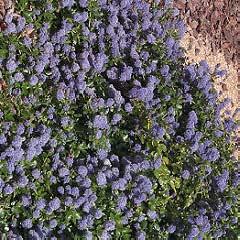
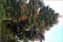
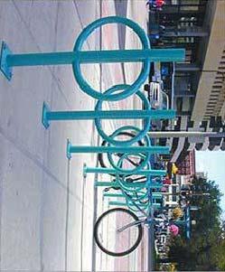
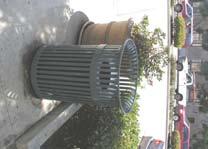
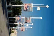
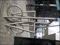
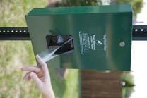
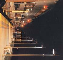
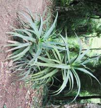
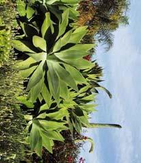
5 Proposed Design Improvements The numbers below correspond with the numbers on Illustration 1 - Venice Boulevard between Lincoln and Sawtelle Master Plan. 1 Sidewalk Improvements Create social spaces for informal gatherings and sidewalk cafes with 7 minimum width Provide public amenities such as benches, trash receptacles and pet-friendly waste stations Incorporate public art and enhanced pavement Encourage economic investment 2 New Sidewalk Trees Establish a strong identity for the district Create a street that looks cared for and well-maintained Replace existing diseased or mutilated sidewalk trees while increasing total number of trees Provide dappled shade for pedestrians, sidewalk cafes and parked cars Allow visibility of commercial storefronts 3 New Stormwater Parkways Reduce stormwater runoff with linear gardens or permeable paving Provide a vibrant setting for civic gathering spaces 4 Sidewalk Bike Lanes Separate bicycle riders completely from vehicular traffic Encourage alternate, sustainable transit Provide a wide, planted buffer zone between pedestrian and vehicular circulation Incorporate solar-powered lighting to illuminate path at night 5 New Pedestrian-scale Sidewalk Lighting Creates safer and brighter pedestrian and biking environment at night Encourages desirable nighttime activity such as sidewalk cafes Recalls pre-wwii era Venice Boulevard Pacific Electric Railway Red Car 6 New Bus Stops Provide new seating, planting and shelters Encourage use of the public transportation Integrate sustainable, solar-powered LED lighting GREENING THE BOULEVARD
6 Proposed Design Improvements (cont d) The numbers below correspond with the numbers on Illustration 1 - Venice Boulevard between Lincoln and Sawtelle Master Plan. 7 Curb Extensions at Intersections Promote pedestrian safety by shortening crosswalk distance Provide additional areas for plantings along sidewalks Reduce apparent width of roadway from the driver s perspective 8 Crosswalks Paving Enhancements Provide clearly marked and more continuous pedestrian environment Ensure safer pedestrian circulation Recall pre-wwii era Venice Boulevard Pacific Electric Railway Red Car 9 New Median Plantings Establish a strong identity for the district Create a street that looks cared for and well-maintained Replace existing concrete with plantings Increase total number of trees along the boulevard Minimize glare and eye strain from on-coming traffic for drivers 10 New Signage and Banners Strengthen neighborhood identity Announce local events along boulevard such as the farmers market 11 New Gateways Emphasize significant intersections along the boulevard Create opportunity for public art or specimen tree plantings 12 New Hedges or Low Walls with Vines at Existing Parking Lots Screen existing parking lots adjacent to Venice Boulevard Provide additional areas for new plantings 13 Lighter-colored Roadway Pavement Reduces urban heat island effect 14 Pocket Park at Venice Boulevard and McLaughlin Provides potential pet-friendly open space GREENING THE BOULEVARD
7
8
9

10
11
12
13
14


15
16 Cost Estimate Item Unit Cost Sub-item Cost Subtotal 1 Sidewalk Improvements $1,666,000 Benches every 40 (450 total) $3,000 $1,350,000 Trash Receptacles every 150 (120 total) $2,300 $276,000 Bike Racks every 500 (40 total) $500 $20,000 Pet-friendly Waste Stations every 500 (40 total) $500 $20,000 Public Art* Enhanced Pavement* 2 New Sidewalk Trees $1,800,000 Shade Trees, 36 Box, 12 at Installation (520 total) $2,500 $1,300,000 Palm Trees, 12 Brown Trunk (250 total) $2,000 $500,000 3 New Stormwater Parkways $2,048,000 Stormwater Parkway Plantings (128,000 s.f.) $8 $1,024,000 Allowance for Excavation and Replacement of Existing Soil (128,000 s.f.) $8 $1,024,000 4 Sidewalk Bike Lanes* NIC 5 New Pedestrian-Scale Lighting $1,550,000 Light Fixtures every 60 (310 total) $5,000 $1,550,000 6 New Bus Shelters $484,000 Bus Shelters (22 total) $22,000 $484,000 Bus Shelter Planting 7 Curb Extensions at Intersection $450,000 Curb Bulbouts at 4 corners of 9 Intersections (36 total) $12,500 $450,000 GREENING THE BOULEVARD
17 Cost Estimate (cont d) Item Unit Cost Sub-item Cost Subtotal 8 Enhanced Paving at Crosswalks $1,850,000 Crosswalks w/ Interlocking Pavers at 9 Intersections and 1 $50,000 $1,850,000 Mid-Block (37 total) Deduct. Alt. - Crosswalks w/ Stamped Asphalt at 9 Intersections and 1 Mid-Block (37 total) $25,000 $925,000 9 New Median Plantings $1,735,000 Shade Trees, 36 Box, 12 at Installation (200 total) $2,500 $500,000 Shrubs and Groundcovers (95,000 s.f.) $10 $950,000 Irrigation (95,000 s.f.) $3 $285, New Signs and Banners* NIC 11 New Gateways* NIC 12 New Hedges or Low Walls w/ Vines at Existing Parking Lots $550,000 Low Walls w/ Vines (2,200 l.f.) $250 $550,000 Deduct. Alt. - Hedge Plantings (2,200 l.f.) $75 $165,000 NIC 13 Lighter Colored Roadway Pavement 14 Pocket Park at Venice Boulevard and McLaughlin $77,500 Shade Trees, 36 Box, 12 at Installation (5 total) $2,500 $12,500 Benches (10 total) $3,000 $30,000 Shrubs and Groundcover (7,000 s.f.) $5 $35,000 Grand Total $12,210,500* *Cost Estimate Grand Total does not include the cost for public art, enhanced pavement, sidewalk bike lanes, gateways, lighter colored roadway pavement, roadway striping, site utilities, site demolition, site preparation, soil, irrigation and construction unless otherwise noted. GREENING THE BOULEVARD
18 References Electric Railway Historical Association of Southern California Mar Vista Community Council Mar Vista Historical Society GREENING THE BOULEVARD
19 Acknowledgements This booklet was prepared by Katherine Spitz Associates, Inc. Landscape Architecture for the Mar Vista community. We look forward to Venice Boulevard becoming a more lively, friendly center for Mar Vista. We thank the many community members who have given their time and consideration to the project over the last 6 years. GREENING THE BOULEVARD
VEHICULAR AND PEDESTRIAN CIRCULATION
 This perspective sketch communicates the intended character and quality of a proposed streetscape design. Locate benches near a major intersection where people tend to gather. Seating and lighting provide
VISION AND GUIDING DESIGN PRINCIPLES
 pleasure point commercial corridor VISION AND GUIDING DESIGN PRINCIPLES Public Draft November 26, 2018 County of Santa Cruz with assistance from MIG CONTENTS PART I: INTRODUCTION AND VISION... 3 Community
Dogpatch/22nd Street Greening
 TEAM MEMBERS Prepared for: GreenTrustSF Central Waterfront www.gtsfcw.org Prepared by: Fletcher Studio San Francisco, CA www.fletcherstudio.com Landscape Architecture Urban Design Environmental Planning
COMPLETE GREEN STREET CHECKLIST
 COMPLETE GREEN STREET CHECKLIST This document was developed to dissect the structure of an urban street and explore opportunities to make our streets more complete while also integrating green street strategies.
MISSION STREETSCAPE PLAN. Neighborhood Commercial Streets handle continuous activity. Neighborhood Commercial STREET ROW: Main Design Treatments
 Neighborhood Commercial STREET ROW: 64-80 Main Design Treatments CORNER reduce crossing distance for pedestrians, create entrances to a residential area and slow cars down. help widen sidewalk allocating
The open space system should provide connective elements, relate to natural resources, and enhance the suburban character of the landscape..
 The open space system should provide connective elements, relate to natural resources, and enhance the suburban character of the landscape.. Mixed-use and infill development should maintain or enhance
4.9 Mendocino Avenue Corridor Plan Design Guidelines
 4.9 Mendocino Avenue Corridor Plan Design Guidelines The Mendocino Avenue Corridor Plan addresses the area between College Avenue and Steele Lane. Mendocino Avenue is a busy arterial that runs parallel
Concluding Improvement Recommendations and Opinions of Probable Cost (calculated in may 2010 construction rates).
.") Pelican Bay Community Improvement Plan Traffic,JI Concluding Improvement Recommendations and Opinions of Probable Cost (calculated in may 2010 construction rates). D1 -A: Provide consistent signing, marking
Pelican Bay Community Improvement Plan Traffic,JI Concluding Improvement Recommendations and Opinions of Probable Cost (calculated in may 2010 construction rates). D1 -A: Provide consistent signing, marking
Lower Merion Commercial Districts Issues and Characteristics Handbook November 2013
 Lower Merion Commercial Districts Issues and Characteristics Handbook November 2013 DRAFT TOWNSHIP-WIDE VISION: To maintain and enhance commercial areas to complement the surrounding high-quality residential
GYPSUM PARKWAY CORRIDOR ENHANCEMENT Gypsum, Colorado. Schematic Design January 2015
 GYPSUM PARKWAY CORRIDOR ENHANCEMENT Gypsum, Colorado Schematic Design January 2015 1 2 3 4 5 6 7 8 9 DESIGN WORKSHOP Landscape Architecture Land Planning Urban Design Tourism Planning Asheville Aspen Austin
FRUITVALE TRANSIT VILLAGE (Phase 2) Residential Project
 Residential Project") FRUITVALE TRANSIT VILLAGE (Phase 2) Residential Project DEVELOPER: SIGNATURE PROPERTIES ARCHITECT: HKIT ARCHITECTS April 23, 2010 TABLE OF CONTENTS 3 Vision 4 Description of Site 5 Guiding Concepts 6
FRUITVALE TRANSIT VILLAGE (Phase 2) Residential Project DEVELOPER: SIGNATURE PROPERTIES ARCHITECT: HKIT ARCHITECTS April 23, 2010 TABLE OF CONTENTS 3 Vision 4 Description of Site 5 Guiding Concepts 6
SFMTA PHELAN LOOP AND PUBLIC PLAZA PHELAN OCEAN AVENUE
 SFMTA Municipal Transportation Agency Image: a bus in front of the Palace of the Legion of honor SFMTA PHELAN LOOP AND PUBLIC PLAZA PHELAN AVENUE @ OCEAN AVENUE Community Meeting May 23, 2012 San Francisco,
Public input has been an important part of the plan development process.
 Lakewood s Comprehensive Plan recognizes that transportation helps shape the community, and that the way the community provides for the safe and efficient movement of people affects the character of the
Pedestrian and Bike Bridge LOGO
 6.2.2 Pedestrian and Bike Bridge The proposed pedestrian and bike crossing re-envisions the existing bridge at Pismo Creek on Cypress Street. The bridge is currently underutilized by vehicular through
Chapter 14 Streetscape Improvements
 This chapter presents streetscape design concepts for key streets and gateways in the Downtown Specific Plan area. This chapter is organized as follows: 14 Streetscape Improvements 14.1 Streetscape Treatments
Fifth and Detroit Street Design May 2017 Capital Improvements Committee. DOWNTOWN Street Design
 1 Fifth and Detroit Street Design May 2017 Capital Improvements Committee Agenda 2 Review Street Configuration Prior Meeting Review Outreach Synopsis Functional Street Design Refinements Curb Edge, Turning
Community Mixed Use Zone Districts (CMU)
") 18.28.500 Community Mixed Use Zone Districts (CMU) The Community Mixed Use Zone Districts (CMU) are intended to help implement the land use goals and strategies found in the Golden Vision 2030 values,
18.28.500 Community Mixed Use Zone Districts (CMU) The Community Mixed Use Zone Districts (CMU) are intended to help implement the land use goals and strategies found in the Golden Vision 2030 values,
Corridor Identity. Section 9. Introduction. Corridor Guiding Principles
 Corridor Identity An attractive and healthy community is a critical element of a quality place, and the design of quality places is a balance between environmental, economic, and social considerations.
Maplewood Avenue Downtown Complete Street Project
 Maplewood Avenue Downtown Complete Street Project Second Public Meeting January 24, 2018 Welcome and Introduction of Project Team City Planning and Public Works Staff City of Portsmouth Juliet Walker Planning
CHAPTER 8. Mrs. Zimman s Class - Central Elementary
 SUSTAINABILITY CHAPTER 8 Mrs. Zimman s Class - Central Elementary 8.1 OVERVIEW Green infrastructure also known as low impact development (LID) and environmental or sustainable site design is an environmentally
Table of Contents. Elm Avenue Improvement Plan City of Waco, Texas. Introduction 1. Existing Context 1 Figure 1 2.
 Table of Contents Introduction 1 Existing Context 1 Figure 1 2 Plan Guidelines 3 Future Urban Form 4 The West-End 4 Main Street 6 The East-End 7 Figure 2 9 Public Improvement Recommendations 7 General
ANCHOR TO ANCHOR. Rescale the street to create an iconic boulevard.
 ANCHOR TO ANCHOR Rescale the street to create an iconic boulevard. UR NE ER UV GO NE LA OBJECTIVES 1. Maintain appropriate traffic flow and prioritize commercial curb access 2. Mark gateways at the street
Landscape and Streetscape Design 2.5
 Landscape and Streetscape Design 2.5 2.5.1 Goals 2.5.2 Planting 2.5.3 Sidewalks and Pavement 2.5.4 Furnishings 2.5.5 Walls 2.5.6 Lighting 2.5.7 Stormwater 2.5.8 Street Cross Sections 2.5 LANDSCAPE AND
3.1 community vision. 3.3 required plan elements
 Chapter 3 Community Form 3.1 community vision 3.2 Parks & landscaping concepts 3.3 required plan elements D R A F T 20 Community Form Chapter 3 3.0 Community form 3.1 community vision The Specific Plan
appendix and street interface guidelines
 appendix five: building and street interface guidelines appendix 5 building and street interface guidelines BOULEVARDS Boulevards are generally characterized by higher levels of traffic movement at higher
The George Washington University Streetscape Concept Plan. May 6 th 2009 Public Presentation for Discussion EHRENKRANTZ ECKSTUT & KUHN ARCHITECTS
 The George Washington University Streetscape Concept Plan May 6 th 2009 Public Presentation for Discussion EHRENKRANTZ ECKSTUT & KUHN ARCHITECTS Agenda 1. Introduction & Overview 2. Background & Context
PUBLIC REALM STANDARDS AND DESIGN GUIDELINES
 8.0 Public Realm Standards and Design Guidelines 8.1 Introduction...8.0-1 8.2 Landscaping...8.0-4 8.3 Sidewalks and Crosswalks...8.0-11 8.4 Street Furniture...8.0-13 8.5 Public Art...8.0-18 8.6 Signage...8.0-19
Division VI Community Mixed Use (CMU) Architectural Guidelines and Standards
 Architectural Guidelines and Standards") Division VI 18.40.800 Community Mixed Use (CMU) Architectural Guidelines and Standards 18.40.810 Guidelines The goals of the Comprehensive Plan include a focus on pedestrian safety, amenities and aesthetics
Division VI 18.40.800 Community Mixed Use (CMU) Architectural Guidelines and Standards 18.40.810 Guidelines The goals of the Comprehensive Plan include a focus on pedestrian safety, amenities and aesthetics
Draft Memorandum #1: Goals and Vision for Revitalization
 Keizer Revitalization Plan Draft Memorandum #1: Goals and Vision for Revitalization Submitted to: City of Keizer April 12, 2018 (revised) Prepared By: Angelo Planning Group and Otak, Inc. Project No. 17482.A
Streets Vision
 streets 86 2.9 Vision : The Most Prevalent and Important Public Spaces Fixed routes of human travel have served as corridors for commerce and places for human interaction from the earliest trails and foot
1 st now. Design Elements. iii STREET TREES PATTERNED CROSSWALKS SPECIAL SIDEWALK PAVING. First Street ELEMENTS TRANSIT SHELTER / LANTERN
 Design Elements A framework for Design Elements has been developed in response to Project Restore s vision and goals for the First Street Corridor. Guided by the principles good urban design and smart
THE CIVIC DISTRICT DEVELOPMENT OPPORTUNITIES
 1 THE CIVIC DISTRICT DEVELOPMENT OPPORTUNITIES The Civic District is the physical and emotional heart of the downtown. It is also a major gateway into the central core, establishing the image and identity
Sheridan Boulevard S TAT I O N A R E A P L A N S H E R I D A N B O U L E VA R D S TAT I O N A R E A P L A N
 Sheridan Boulevard S TAT I O N A R E A P L A N 1 City of Lakewood Adopted November, 2006 S H E R I D A N B O U L E VA R D S TAT I O N A R E A P L A N The Vision The City of Lakewood s overall vision is
The Anaheim Resort Public Realm Landscape Program. City of Anaheim. Adopted September 1994 (94R-239)
") Public Realm Landscape Program City of Anaheim Adopted September 1994 (94R-239) Amendment No. 1 October 1996 (96R-178) Amendment No. 2 June 1999 (99R-137) Amendment No. 3 February 2001 (2002R-56) Amendment
Public Realm Landscape Program City of Anaheim Adopted September 1994 (94R-239) Amendment No. 1 October 1996 (96R-178) Amendment No. 2 June 1999 (99R-137) Amendment No. 3 February 2001 (2002R-56) Amendment
Pine Avenue Improvement Project
 Seaside Way to ocean Boulevard ocean Boulevard to 7 th Street 7 th Street to anaheim Street L O ng BeACh DeveLOpment ServiC e S Building a Better long Beach Pine Avenue Improvement Project Seaside Way
Wayfinding. North Gateway: Integrate a vertical gateway marker on the west side of Ward Street at the south corner of Vernon Street.
 3.3.6.2 Wayfinding Existing Conditions Wayfinding signage is important to direct visitors and tourists to different locations in the downtown. A significant part of the wayfinding signage in the downtown
Hamilton Road Corridor Streetscape Master Plan. Open House October 4 th, 2017
 Hamilton Road Corridor Streetscape Master Plan Open House October 4 th, 2017 Agenda 1. Introductions Agenda Overview 2. Project Background 3. Existing Conditions 4. Strengths, Weaknesses, Opportunities
City of Dallas Complete Streets Program. SAME Infrastructure Forum February 2, 2018
 City of Dallas Complete Streets Program SAME Infrastructure Forum February 2, 2018 Complete Streets Design Manual Adopted by City Council January 27, 2016 JANUARY 27, 2016 2 What are Complete Streets?
Gas Stations ottawa.ca
 Urban Design Guidelines for Gas Stations ottawa.ca Ce document est disponible en français sur ottawa.ca. This document is available in French on ottawa.ca. Approved by City Council May 24, 2006 City of
Lehigh Acres Land Development Regulations Community Planning Project
 Lehigh Acres Land Development Regulations Planning Effort Summary In July, 2010 Commissioner Frank Mann invited the Lehigh Acres community to start discussing how to achieve their recently adopted community
LOWER DIVISADERO STREETSCAPE DESIGN CONCEPT
 LOWER DIVISADERO STREETSCAPE DESIGN CONCEPT October 2006 AsianNeighborhoodDesign A Vision for Lower Divisadero: In Five Years The Lower Divisadero streetscape design concepts were developed over the course
PUBLIC RIGHT-OF-WAY IN THIS CHAPTER PUBLIC REALM
 PUBLIC RIGHT-OF-WAY This section provides design guidelines for improvements in the public right-of-way. The public right-of-way refers to streets, sidewalks, non-vehicular thoroughfares, parks and greenways
New Berlin City Center Concept Review PDQ Food Stores, Inc
 September 23, 2016 City of New Berlin Planning Commission 3805 S Casper Dr New Berlin, WI 53151 RE: New Berlin City Center Concept Review PDQ Food Stores, Inc Dear Plan Commission Members, On behalf of
Please see attached for more detailed project information. Project Schedule Designer Award by SBC Executive Sub-Committee December 21, 2015
 Project Title Campus Beautification Projects Volunteer Blvd Ph 1 540/009-08-2015 Institution Description UT Knoxville This project will improve Volunteer Boulevard from West Cumberland Ave. to East Cumberland
Urban Design Manual 2.0 DRIVE-THROUGH FACILITIES. Background. Urban Design Challenges
 222221 2.0 DRIVE-THROUGH FACILITIES Background In recent years, drive-through facilities have grown significantly in popularity with drive-through restaurants, in particular, being established on numerous
Cleveland Park Streetscape and Drainage Improvement Project 1
 Cleveland Park Streetscape and Drainage Improvement Project 1 Urban Context Washington, D.C. Connecticut Avenue Cleveland Park Streetscape and Drainage Improvement Project 2 Neighborhood Context Contributing
PROPOSED REDEVELOPMENT OF THE GLEN ABBEY GOLF CLUB. STREETSCAPE DESIGN STUDY (excerpt from the Urban Design Brief) TOWN OF OAKVILLE.
 TOWN OF OAKVILLE.") PROPOSED REDEVELOPMENT OF THE GLEN ABBEY GOLF CLUB STREETSCAPE DESIGN STUDY (excerpt from the Urban Design Brief) TOWN OF OAKVILLE OCTOBER, 2016 for 2.4.2 STREETS Streets are the single largest component
PROPOSED REDEVELOPMENT OF THE GLEN ABBEY GOLF CLUB STREETSCAPE DESIGN STUDY (excerpt from the Urban Design Brief) TOWN OF OAKVILLE OCTOBER, 2016 for 2.4.2 STREETS Streets are the single largest component
Community Design Plan
 Gardena General Plan 2006 Authority While the is not a required element of a General Plan, it is included because improving the community appearance and image is paramount to the overall quality of life
Johnson Street Bridge Public Realm Update
 Johnson Street Bridge Public Realm Update August 20, 2015 Background Johnson Street Bridge Replacement Project impacts a diverse range of stakeholders In addition to a new bridge, the project also includes
Cit of Kitchener Ur 6 an Design Manual PARTA. Desi n for _--::
 Cit of Kitchener Ur 6 an Design Manual Date PARTA Year ) Desi n for k Nodes Corridors _--:: Section Page 01 of 12 2 INTRODUCTION Purpose & Application Nodes and Corridors have been identified as key intensification
The Vision. Photo provided by The Minervini Group. 46 Vision, Objectives & Strategies
 Vision, Objectives & Strategies The is the public framework and guide for future development of the Grand Traverse Commons. The establishes public polices for infrastructure, the preservation of natural
Lambeth Main Street Streetscape Improvements
 Lambeth Main Street Streetscape Improvements Open House October 5th, 2017 Agenda 1. Introduction 2. Project Background 3. Context 4. Project Objectives 5. Design Principles & Approach 6. Streetscape Design
Standards (R-3) Figure B-11: R-3 Residential Standards Exhibit
 Figure B-11: R-3 Residential Standards Exhibit") Avila Ranch Avila Ranch Specific Plan Development Standards High Medium Density - High Residential Density Residential Lot and Building Lot and Standards Building (R-3) Standards (R-3) EXAMPLES These sketches
Avila Ranch Avila Ranch Specific Plan Development Standards High Medium Density - High Residential Density Residential Lot and Building Lot and Standards Building (R-3) Standards (R-3) EXAMPLES These sketches
Roanoke Rapids Streetscape Master Plan. City Council Presentation
 SCHEDULE: Stakeholder Meeting/Kick off November,2016 Master Planning Phase (November March 2017) Public Meeting #1 December 13, 2016 Review Meeting with Key Stakeholders Refine Concepts Based on Input
Carson Street Streetscape Improvements. Request for Proposals
 Carson Street Streetscape Improvements Request for Proposals Complete Design Services for a Landscape/Streetscape Plan for Carson Street (Pioneer Boulevard to Norwalk Boulevard) Submittal Deadline: October
Design Guidelines for the Route 30 Corridor Master Plan: Subdivision and Land Development Elements
 Design Guidelines for the Route 30 Corridor Master Plan: Subdivision and Land Development Elements East Whiteland Township- Chester County, PA Prepared by: Draft: May 7, 2018 Design Guidelines for the
BROOKHILL NEIGHBORHOOD MODEL ZONING MAP AMENDMENT PREFACE TO APPLICATION
 BROOKHILL NEIGHBORHOOD MODEL ZONING MAP AMENDMENT PREFACE TO APPLICATION June 15, 2015 Revised: August 1, 2016 I. VISION Brookhill is a proposed community based upon the principles of Albemarle County
BUILDING SCALE AND SETBACKS 5 ELEMENTS:... 5 FAÇADES (COMMERCIAL/RESIDENTIAL) 5
 5") VISION STATEMENT 3 UTILIZATION OF THE GUIDELINES 3 IMPLEMENTATION 3 PROCEDURES FOR DESIGN REVIEW 3 LAND USE AND ZONING 4 LAND USE 4 ELEMENTS:... 4 ZONING 4 ELEMENTS:... 4 BUILDING SCALE AND SETBACKS 5
VISION STATEMENT 3 UTILIZATION OF THE GUIDELINES 3 IMPLEMENTATION 3 PROCEDURES FOR DESIGN REVIEW 3 LAND USE AND ZONING 4 LAND USE 4 ELEMENTS:... 4 ZONING 4 ELEMENTS:... 4 BUILDING SCALE AND SETBACKS 5
11.0. Design Manual: Sustainable Initiatives. Chapel Hill Streetscape and Lighting Master Plan mikyoung kim design all rights reserved.
 11.0 Design Manual: Sustainable Initiatives 2008 mikyoung kim design all rights reserved. Chapel Hill Streetscape and Lighting Master Plan 109 110 Chapel Hill Streetscape and Lighting Master Plan DESIGN
TURN TO THE RIVER CITY PLAZA LANDSCAPE DESIGN CONCEPT May 25, 2016
 Turn to the River is a multi-year project of Art Spaces - Wabash Valley Outdoor Sculpture Collection, Inc. to connect downtown Terre Haute with the Wabash River through public art and design. The four-square
GPA FALL 2017 CONFERENCE
 Change in Doraville Doraville at the beginning of a new era Design Doraville (Comp. Plan) adopted in 2016 Doraville Town Center Masterplan LCI (2005) Downtown Doraville Masterplan LCI (2010) 2014 Adoption
City of Hermosa Beach Administrative Policy #
 City of Hermosa Beach Administrative Policy # SUBJECT: Living Streets Policy Date: Approved by: City Council Authority: Public Works Department & Community Development Department Mayor, PURPOSE The City
DOWNTOWN RESIDENTIAL DISTRICT DEVELOPMENT OPPORTUNITES
 DOWNTOWN RESIDENTIAL DISTRICT DEVELOPMENT OPPORTUNITES Out of all the areas in Downtown Painesville, this district provides the greatest opportunity for change with the vacation of Lake East Hospital.
Draft Bergamot Area Plan
 ATTACHMENT 1 Draft Bergamot Area Plan Taskforce on the Environment April 15, 2013 www.bergamotplan.net 1 Overview WHAT IS THE BERGAMOT AREA PLAN? A Community-Based Planning Document Guiding the Future
ELEMENT 16 - LANDSCAPE DESIGN GUIDELINES ELEMENT
 16 ELEMENT 16 - LANDSCAPE DESIGN GUIDELINES ELEMENT Goal 1 To establish an overall landscape character that provides: A pedestrian friendly environment that provides ample tree canopy and shade. An overall
ATTACHMENT A. SILVERDALE DESIGN STANDARDS Amendments to the Waaga Way Town Center Chapter
 ATTACHMENT A SILVERDALE DESIGN STANDARDS Amendments to the Waaga Way Town Center Chapter Chapter 10. Waaga Way Town Center 10.1 Physical Identity Elements & Opportunities The Waaga Way Town Center includes
CHARLOTTESVILLE. Streetscape ENTRANCE CORRIDOR DESIGN GUIDELINES. Amendments adopted by City Council March 7, Design Principles...
 CHARLOTTESVILLE ENTRANCE CORRIDOR DESIGN GUIDELINES Amendments adopted by City Council March 7, 2011 2 Streetscape A. B. C. D. E. F. G. H. I. Design Principles...5 Plantings & Open Space...6 Pedestrian
SOUTH UNIVERSITY Street Design Alternatives in Progress
 1 Alternatives in Progress 2016.01.20 Meeting Agenda 2 1. Progress & Schedule 2. Utilizing the Street Design Manual 3. Site Characteristics and Input Received 4. Street Geometry What can we accomplish
INSTITUTIONAL USE DESIGN COMPATIBILITY TECHNIQUES
 INSTITUTIONAL USE DESIGN COMPATIBILITY TECHNIQUES INTRODUCTION Community institutions are an important part of the character and vitality of neighborhoods in Forsyth County. Institutional uses include
A Vibrant Downtown. Chapter 5 Cary Public Art Opportunities 31
 A Vibrant Downtown Cary s vision for Downtown is a unique, vibrant, dynamic, pedestrian friendly location; a regional destination and a place to live, work, and recreate, according to the 2001 Town Center
1.0 VISION STATEMENT. December 6, PRINCIPLES
 Vision Statement Lincoln Regional Airport 1.0 VISION STATEMENT 1.1 City LOCATION of AND OVERVIEW The Easton Lincoln Place Land Use Master Plan identifies the principles, goals, policies, and standards
GPCID Mall Boulevard & Gwinnett Place Drive Complete Street: Sectional View of Concepts
 Sectional View of Concepts PAVEMENT FEATURES PAVEMENTS INTERSECTION INTERSECTION TREATMENTS LANDSCAPE BUFFER LANDSCAPE DESIGN GPCID CD D: GWINNETT P LACE DRIVE & MALL B COMPLETE STREET DESIGN ELEMENTS
Wadsworth Boulevard S TAT I O N A R E A P L A N
 Wadsworth Boulevard S TAT I O N A R E A P L A N City of Lakewood Adopted November, 2006 The Vision The City of Lakewood s overall vision is to transform the area around the light rail station into a mixed-use
Design Guidelines and Standards for Sight Triangles. Sight Triangle MANUAL
 Design Guidelines and Standards for Sight Triangles Sight Triangle MANUAL Table of Contents 1.0 Introduction..............................................7 1.1 Key Terms..............................
MASTER PLAN QUEEN ST. WEST BIA
 QUEEN ST. WEST BIA MASTER PLAN QUEEN ST. WEST BIA EXECUTIVE COMMITTEE IN ASSOCIATION WITH PMA LANDSCAPE ARCHITECTS LTD. SWEENY STERLING FINLAYSON & CO ARCHITECTS INC. FUGITIVE GLUE MARCH 2013 4.5.4 PLAZA
R STREET CORRIDOR NEIGHBORHOOD Site Plan and Design Review Supplemental Guidelines Checklist
 R STREET CORRIDOR NEIGHBORHOOD Site Plan and Design Review Supplemental Guidelines Checklist Applicant s Name: Project Address: Phone: Email: Applicant shall fill out the design guidelines checklist for
Long Branch Sector Plan
 June 2012 Long Branch is one of Montgomery County s most affordable, older communities and has served as a gateway community, especially for newly arriving immigrants, since the 1960s. Many within this
DRAFT. 10% Common Open Space
 % OF CHARLOTTE IS CATEGORIZED AS A. LAND USES : Placeholder map displaying location of Place Type GOALS: Accommodate XX% of future growth. Provide a concentration of primarily commercial and civic activity
Chapter 1: Introduction
 Chapter 1: Introduction The Penn Avenue Community Works Corridor Vision and Implementation Framework presents an integrated communitybased vision and a coordinated, long-term implementation framework for
3.13. Development Guidelines
 3.3 Landscaping Elements Landscaping should be used to frame and soften structures, define site functions, enhance the quality of the environment, and screen undesirable views. Safety, environmental impacts,
Tonight s Agenda. 7:45 p.m. Next Steps 8:00 p.m. Close
 Community Workshop #3 January 28, 2016 Team Tonight s Agenda 6:00 p.m. Welcome and Introductions! 6:15 p.m. Draft Specific Plan Overview Project Process Update Vision and Objectives Overview Key Findings
Project Consulting Team:
 THE DOWNTOWN CHERRYVILLE LAND USE + STREETSCAPE MASTER PLAN WAS FUNDED THROUGH THE GENEROUS DONATIONS OF THE FOLLOWING: The Community Foundation of Gaston County ElectriCities of North Carolina The Cherryville
Millbrae TOD #2 Project Analysis
 Millbrae TOD #2 Project Analysis Project Description A Site Development Permit and Conditional Use Permit are proposed to allow for a mixed-use transitoriented development on approximately 9 Acres located
1 Adapted from the Statewide Transit-Oriented Development Study by CalTrans, 2006
 APPENDIX C: LAND USE PLANNING FOR ENHANCED RAIL SERVICE 72 BACKGROUND One of the consistent themes heard from localities in the Route 29 corridor Planning Forums was the need for expanding rail service
City of Burlington Downtown Street Design & Construction Standards
 City of Burlington Downtown Street Design & Construction Standards Adopted April 16, 2018 b City of Burlington Downtown Street Design Standards CITY OF BURLINGTON, VT The Great Streets Initiative is a
Sierra Springs Regional Commercial Master Site Plan Airdrie, Alberta Hopewell Development Corporation Project No May 26, 2010
 Sierra Springs Regional Commercial Master Site Plan Airdrie, Alberta Hopewell Development Corporation Project No. 205-077 May 26, 2010 TABLE OF CONTENTS Purpose... 2 Master Site Plan Guidelines... 3 Overall
To ensure human scale design, the towers step back from the facade of the building after four stories.
 41 40 SPRING GARDEN WEST A DESIGN BY PUBLIC ENGAGEMENT Chapter 3 Design SETBACK (SPRING GARDEN WEST LOOKING SOUTH) To ensure human scale design, the towers step back from the facade of the building after
SPRINGHILL LAKE TRANSIT VILLAGE
 Greenbelt Metro Area Sector Plan - Subarea Design Policies and Guidelines - Springhill Lake Transit Village 113 SPRINGHILL LAKE TRANSIT VILLAGE Residential Neighborhood and Village Center CONCEPT Springhill
Figure Example of out door dining in the public right-of-way.
 Section 2 Core Area Goal 2.2.1 To maintain and enhance the character of existing streets in the Downtown Area. Character Figure 2.2.1 Example of out door dining in the public right-of-way. A. Provide street
Mixed Use Centres Development Permit Guidelines
 1 Mixed Use Centres Development Permit Guidelines Area Commercial or Mixed Use development occurring in City Centre, Urban Centre, Neighbourhood Centre, or Institutional Complex land use designations is
Shell Beach Road Streetscape Frequently asked Questions
 Shell Beach Road Streetscape Frequently asked Questions General What is the Shell Beach Road Streetscape Improvements Project? The overall goal of the Shell Beach Road Streetscape Improvement project is
BUSINESS DISTRICT DESIGN GUIDELINES
 Des Plaines, Illinois Prepared for the City of Des Plaines by: The Lakota Group Laurie Marston, AICP March 2005 Section 5: Streetscape Elements Business District Design Guidelines STREETSCAPE ELEMENTS
3.0 master plan concept
 3.0 master plan concept 3.1 introduction The purpose of the Huron Church Road Master Plan Concept is to provide an overview of the Master Plan design process, identify preliminary streetscape installations
FROM DUPONT CIRCLE NORTH TO CALIFORNIA STREET, NW. Welcome!
 FROM DUPONT CIRCLE NORTH TO CALIFORNIA STREET, NW Welcome! Meeting Agenda 6:00 PM Open House 6:30 PM Presentation 7:00 PM Open House / Q&A at the Boards Project Design Team Connecticut Avenue, NW Project
PIKE PINE RENAISSANCE: ACT ONE. October 19, 2017
 PIKE PINE RENAISSANCE: ACT ONE October 19, 2017 WATERFRONT SEATTLE PROGRAM PROJECT INTRODUCTION Pike and Pine streets, between First and Melrose avenues Pedestrian and streetscape improvements Budget:
RECLAIMING PUBLIC SPACE
 RECLAIMING PUBLIC SPACE INTRODUCTION PRECEDENT STUDIES AREAS OF FOCUS VISION IMPLEMENTATION CHURCH ST WEST END AVEBROADWAY BROADWAY DIVISION ST DEMONBREUN ST Reclaiming Public Space Like most cities, Nashville
Planning Board Hearing October 20th, 2016
 Planning Board Hearing October 0th, 06 Developer: Real Estate Management & Leasing: Architect: Transportation Engineers: Landscape Architect: Civil Engineer: THE ARSENAL PROJECT Planning Board AGENDA Introduction
STREETSCAPE IMPROVEMENTS - RECOMMENDATIONS
 STREETSCAPE IMPROVEMENTS - RECOMMENDATIONS Figure 4.3.1- A map of all of the recommended streetscape improvements. The key component of downtown s public realm, apart from its public spaces, is its street
Ville de. Côte Gelée
 Ville de Côte Gelée ARCHITECTURE & DESIGN GUIDELINES - DRAFT JUNE 28, 2006 Youngsville Hwy (LA Hwy 89) Youngsville Hwy (LA Hwy 89) Project Summary & Site Context Evangelline Hwy (US 90) La Neuville Road
Technical Advisory Committee
 CULVER DOWNTOWN STREETSCAPE PLAN STREETSCAPE IDEAS REPORT 01.08.2008 Project Team Matt Crall, Transportation and Growth Management Quick Response Program Donna McCormack, City of Culver Darrell Newton,