6 THE LECHT AND STRATHDON
|
|
|
- Corey McCormick
- 5 years ago
- Views:
Transcription
1 6 THE LECHT AND STRATHDON This section of the LCA includes the Lecht and Strathdon. This character assessment is presented, working from west to east, as follows: 40. The Lecht 41. Strathdon: Corgarff and Cockbridge 42. Strathdon: Upper Strathdon 43. Strathdon: Mid Strathdon 44. Strathdon: Glen Nochty 45. Strathdon: Glen Buchat 46. Strathdon: Waters of Deskry, Carvie and Conrie 179
2 180

3 6.1 The Lecht Cairngorms National Park Landscape Character Assessment: Final Report 181
4 6.1.1 Landscape Character This high pass is formed by a deep, steep sided river valley which cuts through the bulky but rounded hill summits and long, smooth ridges of the Ladder Hills The summits and upper slopes are a mosaic of heather, patches of burnt heather moor and swathes of pale upland grassland To the north, the pass is further contained by conifer woodland as it narrows The road, following the route of an old military way, climbs on a long even gradient along the upper edge of the deep river valley, elevated well above the valley, at times even perched on a ridgeline The ski centre at the Lecht is close to the highest point on the road, and some of the lifts and other infrastructure are seen on the skylines of the long ridges The cluster of buildings and carparks associated with the ski centre sit either side of the road, although they are focussed on a single stretch of road The only other feature is the Well of the Lecht and the old mines, which are accessible on foot from an associated carpark at the northern end of the pass Landscape experience There is a sense of openness in this expansive and elevated landscape The high road offers panoramic views and easy, vehicular access to a landscape of mountain and upland character The landscape is still in essence simple and sparse, despite the woodland and ski centre as well as other infrastructure such as the overhead line The upland hill forms are bold and formidable, creating a sense of solidity and bulk in the landscape which dominates over the human interventions Relationship to adjacent character areas This upland, relatively sparse landscape is in marked contrast to the diverse valley landscapes in the glens and straths on either side. 182


5 6.1.4 Assessment of distinctiveness The sense of openness, the semi-natural vegetation, the elevation, and the strong presence of the formidable heft of the landform still dominates this upland landscape despite the infrastructure, ski centre buildings and the forestry. Rounded hills, clad in moor mottled with burnt heather, enclose the deep river valley The road sits on the edge of the valley, sometimes on an exposed ridge Infrastructure associated with the ski centre, as well as the pylon line, clustered at a high point on the road The Well of the Lecht, and the former mid-nineteenth century mine which was the largest manganese mine in Scotland Conifer woodland at the northern end of the pass 183
6 184

7 6.2 Strathdon: Corgarff and Cockbridge Cairngorms National Park Landscape Character Assessment: Final Report 185
8 6.2.1 Landscape Character Cairngorms National Park Landscape Character Assessment: Final Report This wide, shallow, elevated glen is contained by steep hills with rounded summits and narrow side valleys The very meandering River Don winds across a narrow, flat floodplain, but this sits within a wider valley floor of extensive undulating glacialfluvial deposit which has been eroded to form smooth ridges The landscape is relatively open, but there are some large areas of conifer woodland at the western end of the character area, particularly on steeper side slopes which frame the lower valley Heather moorland, with patches of burnt heather, and upland grassland extend over the unplanted hillsides, with rough grazing even on lower slopes and along the floor of the glen Small groups of trees are associated with the farms and other buildings, and there is the occasional conifer shelter wood Late 18 th /19 th century improved fields, fenced and grazed, are interspersed with rough grazing and fields which are reverting to wetland and unimproved grassland. These tend to be on the south facing slopes in places well above the river Farms and individual houses are dispersed across the farmed land, on the terraces or higher ground above the floodplain The white painted Corgarff castle is a landmark building at the conjunction of Strath Don and the pass to the Lecht. It sits on an alluvial fan, surrounded by bright green improved fields From the east, the A939 sweeps through this landscape in long curves undulating with the gentle curvature of the landform before striking uphill in a series of switch back bends to the high pass at the Lecht The A939 in part strikes well away from the winding river, deviating from the route of the old military road Landscape experience This landscape feels marginal in terms of agriculture, as many of the fields are interspersed with rough grazing, and former improved land is not being intensively farmed The striking colour contrast between the white painted Corgarff castle and its setting of bright green fields reinforces its pivotal location within the valleys and its role as a landmark feature There are dramatic views of the strath from the elevated A939 where it begins to climb up to the pass towards the Lecht 186


9 6.2.3 Relationship to adjacent character areas Cairngorms National Park Landscape Character Assessment: Final Report This area forms a transition between the more diverse and fertile lower reaches of Strath Don and the upland areas and high pass at the Lecht, and therefore has characteristics which reflect both these neighbouring character areas Assessment of distinctiveness The mixture of enclosed fields and rough grazing alternating across the floor of parts of the strath reflects its location as a transition between upland and lowland areas. The strategic placement of Corgarff castle at the conjunction of the strath and the pass to the Lecht within its setting of green fields, combine to create a striking landmark feature. Fields on more gentle slopes, with heather moorland on the upper slopes There is more woodland to the west of this character area Corgarff castle surrounded by green fields The road sweeps through the undulating land form. The farms are often sheltered by small groups of trees 187
10 188

11 6.3 Strathdon: Upper Strathdon Cairngorms National Park Landscape Character Assessment: Final Report 189
12 6.3.1 Landscape Character Cairngorms National Park Landscape Character Assessment: Final Report This narrow section of valley, a pass carved by the River Don, winds broadly west/east between steep sided hills with rounded, often domed summits Bands of scree on some of the slopes have been created by glacial erosion exposing bands of bedrock which have subsequently been subject to frost weathering, resulting in rockfalls The steep valley sides stop abruptly at the edge of a narrow, very flat flood plain, although they also alternate with arcs of more gentle gradients along the length of the valley, creating a complex topography which reflects the underlying diverse lithology At Lonach Hill the River Don carves a fine, incised meander where the floodplain is contained within the higher amplitude bends of the valley The north facing slopes of this valley are covered with conifer forest, which often reaches down to the edge of the floodplain On the south facing slopes, the conifer woodland focuses around the narrowest sections of the pass, where the side slopes are steepest, and where again woodland comes down to the edge of the floodplain Occasional policy woodland features such as the avenue at Skellater House add some diversity to this landscape Late 18 th /19 th century improved fields, often enclosed by walls, occupy the more gentle gradients of the side slopes, regardless of aspect These small fields of grassland and some arable alternate with the woodland on the steeper slopes Most of the very level floodplain is also subdivided into small, fenced 18 th /19 th century improved fields, but these alternate with areas of wetland which are subject to frequent flooding Remarkably, there are a couple of farms located on the edge of the narrow floodplain, but otherwise, farms are sited on the gentle, farmed upper slopes, overlooking the strath. This part of the valley of the River Don is not heavily settled. At the narrowest sections of valley floor, the A944 hugs the very edge of the steeper slopes, right on the edge of the floodplain, where it has a stone retaining wall along the upside of the roadway Landscape experience The sense of winding through a narrow pass is reinforced by the dense conifer woodland 190


13 There is a sequence of open farmed land associated with more gentle gradients alternating with woodland on steeper side slopes which is experienced when travelling through the valley The flat floodplain, and its abrupt juxtaposition with steep side slopes channels views along the valley, although they are never far-reaching Relationship to adjacent character areas This area is very self contained, although it provides a sense of a pass between the settled, diverse lower strath and the upper reaches of the River Don west of Corgarff Assessment of distinctiveness The drama of the flat floodplain framed by the steep valley sides is reinforced by the alternating sequence of woodland and farmland, a pattern which is closely allied to slope gradient. A similar alternating sequence of farmed land and wetland along the floodplain creates a further rhythmic pattern to this landscape. Conifer woodland on the steeper slopes enclose the narrow, level floodplain There are fields, framed by woodland, across the more gentle slopes, alternating with woodland on the steeper slopes Scree created by frost weathering on bands of bedrock which have been exposed by glacial erosion An avenue of mature broadleaves at Skellater 191
14 192

15 6.4 Strathdon: Mid Strathdon Cairngorms National Park Landscape Character Assessment: Final Report 193
16 6.4.1 Landscape Character This winding valley is relatively narrow, contained by gently sloping and rounded lower slopes beneath steeper, enclosing upper slopes Rounded hill summits and long ridges form the pronounced containment of the valley, with only the narrow-mouthed side glens occasionally breaching the valley sides The winding River Don meanders in long loops from side to side across the floodplain. This varies in width, lying between undulating slopes of glacial-fluvial deposit Extensive mixed conifer woodland covers most of the upper, steeper slopes, occasionally linked seamlessly to narrow shelter belts which reach down to the floor of the strath Several designed landscapes of policy woodland and planted features, including beech and lime in the species mix, avenues, occasional clumps of parkland trees on the floodplain and specimen trees, add to diversity These wooded designed landscapes associated with a number of estate mansions create a pattern of woodland on steep slopes alternating with farmland on gentle slopes along the sides of the strath Gaps in the woodland means that in places farmland extends well up the hill sides, with relatively small, late 18 th /19 th century improved fields on well drained and gently graded slopes, regardless of aspect. These are sometimes contained by walls The lower fields, some of which are quite large, enclose arable crops as well as grassland, but occasionally on the very highest slopes there is some reversion to more poorly drained, unimproved grassland The area is well settled. Four or five small linear settlements are located along the valley sides Loose clusters of estate and farm buildings are sited at intervals, often associated with the sites of now ruined castles. The architectural style of individual estates adds to the diversity of built structures Strathdon and Bellabeg are associated with the conjunction of glens combined with an ancient crossing point of the River, which is further marked by the striking pre-historic motte and more recent church. This pattern is repeated at the mouth of the Buchat Dispersed farms are often located on the upper slopes The A944 winds along this strath, following the sinuous river valley. All the roads are very tightly located against clearly defined breaks in slope, slightly elevated above the floodplain. Several have stone retaining walls along the upside of the roadway 194
17 6.4.2 Landscape experience The sinuous form of this strath creates a sense of intrigue, as when travelling along the length of the valley, the landscape is revealed only in small stages, and it is impossible to see the valley as a whole The roads wind through a sequence of woodland alternating with patches of open farmland which increases the sense of anticipation as the landscape is revealed and views change at each bend in the road and at every new open space The strath is very diverse, in large part due to the influence of the individual estates, some of which occupy very old sites, and have well established designed landscapes and many individual features Relationship to adjacent character areas This character area is very self contained, with only occasional views into other character areas along side glens. 195


18 6.4.4 Assessment of distinctiveness Small fields extend high up the smooth, undulating side slopes of the strath, reinforcing the sequence of open farmland alternating with enclosed woodland, some of which is associated with designed landscapes along the strath. Roads are firmly tucked into the winding break in slope, so that travelling through this strath reveals its sinuous form. Rolling land form and gentle slopes support fields of grassland and arable land up the side slopes of the strath Fields extend up higher slopes, although some are reverting to upland grassland and whin Woodland, including shelterbelts and, on the level floodplain, roundels of pine A linear settlement one of several adjacent to the River Don, which is hidden within riparian woodland The sequence of woodland and farmland along the glen Walls around these fields, and some mature policy woodland 196

19 6.5 Strathdon: Glen Nochty Cairngorms National Park Landscape Character Assessment: Final Report 197
20 6.5.1 Landscape Character Cairngorms National Park Landscape Character Assessment: Final Report This steep sided glen is contained by low rounded hills and relatively even slopes divided by a series of small, quite deeply incised side valleys which are suspended above the main glen The steep side slopes frame dramatic river terraces along the floor of the main glen, and the narrow, V-shaped valley of the Water of Nochty where it branches west into the Ladder Hills The meandering Water of Nochty has carved river terraces into the deep deposit which fills this valley and which still fall away into the river after heavy rain The glen is heavily wooded, with conifer woodland over many of the side slopes, occasionally reaching down to the valley floor or stopping at the upper edge of the fields. It also extends over and closes around former fields in the narrow upper glens Small, fenced, late 18 th /19 th century improved fields, mostly under grass, lie across the more gentle gradients, particularly on the west facing slopes, and sit on top of the flat, well drained river terraces The floodplain of the river is narrow, framed by the terraces and occupied by wetland as well as grassland Dispersed farms are located prominently on the top of river terraces, or sit along the upper slopes, overlooking the mouths of the small, elevated side glens The roads are narrow, and are largely perched on the valley sides, elevated well above the river, except at the most northerly reaches, where it winds along the valley floor, hugging the slightly sinuous landform The motte at Strathdon is a striking land mark feature at the foot of this glen Landscape experience The narrowness and containment of the glen is reinforced by the enclosure created by the extensive conifer woodland The river terraces are dramatic, and, with erosion still taking place, dynamic features along the valley floor The elevated roads offer fine views along the length of the glen and down to these features, as well as an elevated view of the dramatic motte The farmed land offers some relief to the extent of woodland enclosure along this glen 198


21 6.5.3 Relationship to adjacent character areas This area is relatively self contained and visually there is little relationship with any other character area Assessment of distinctiveness The elevated open views of the dramatic river terraces and the motte are a striking contrast to the more densely wooded stretches of this glen. The consistent location of farms on either river terraces or at the mouths of side glens is a recognisable pattern. Fields on the west facing slopes, with a farm located on the edge of a side valley Woodland extends down to the upper edge of the fields, with a farm perched on the river terrace There is extensive conifer woodland in this glen The Water of Nochty meanders through a narrow floodplain contained by dramatic river bluffs. The valley floor has been in filled by glacial deposits and then re-excavated. 199
22 200

23 6.6 Strathdon: Glen Buchat Cairngorms National Park Landscape Character Assessment: Final Report 201
24 6.6.1 Landscape Character The complex landform of this southeast/north west orientated glen is underpinned by a diverse lithology which shows very few signs of glacial erosion The wide glen is contained by low, smooth, rounded hill forms and undulating side slopes, and punctuated by small isolated hills The glen narrows part way up, to create a slightly steeper pass linking the two wider sections of the glen. Here the river is contained by sloping ledges of bedrock covered by a thin layer of deposit between rounded hillsides There is extensive conifer woodland over the western hills, which occasionally extends down to the edge of the glen floor In addition, there are smaller conifer shelter woods across the floor of the strath, often associated with the small, individual hills, and sometimes along the sides of the Water of Buchat The eastern slopes are open, clad in heather moor with some upland grassland Numerous, straight-edged, small 18 th /19 th century improved fields, enclosed with walls or fences, extend across the whole width of the glen floor and up onto the gently graded side slopes and small hills Rich soils over basic igneous rocks underpin the southern part of the valley, and here the fields contain arable crops as well as grassland, The upper glen, on less rich bedrock, is more dominated by grassland and occasional rough grazing on lower slopes The many late 19 th century farmsteads are dispersed across the glen, often located on higher slopes, with additional clusters of small settlement associated with river crossing points Areas of pre-improvement farming, with slight remains of buildings and shielings can be found on the open, unwooded south west facing slopes The northern head of the glen is marked by Glenbuchat Lodge, which is set in extensive conifer woodland, while the ruined Glenbuchat castle overlooks the mouth of the glen to the south There is a network of narrow public roads which criss-cross the wider parts of the glen, and link to an extensive network of estate and forestry tracks across the low hills on both sides of the glen Landscape experience The complex landform of undulations, low hills and smooth interlocking ridges creates a small scale landscape 202
25 The expanse of small fields, especially in the lower part of the glen, creates a colourful patchwork of diverse crops intermixed with small scale woodlands which complements the small scale land form features The contrast between the dark green conifer woodland on the north east facing slopes and the open, south west facing hill sides is pronounced The narrow, winding roads, which wriggle their way around the undulating topography, sometimes cross higher ridges, offering elevated views of the glen floor Although well settled, the area is slightly tucked away, and becomes more secluded especially towards the northern end of the glen Relationship to adjacent character areas This area is largely self-contained, with very little inter-visibility with adjacent character areas. 203


26 6.6.4 Assessment of distinctiveness The small scale of this landscape, created by the landform of a wide, undulating glen floor punctuated by individual hills, is further reinforced by the small size of the fields, the narrow winding network of roads and the small farms. Low rounded hills across the wide floor of this lower part of the glen, with farmland and small shelter woods Small fields contained by sloping ledges of bedrock, which are underneath a relatively thin layer of deposit, in the narrower part of the glen Some fields are enclosed with walls, and many are relatively small Farms tucked in and around the small scale landform 204

27 6.7 Strathdon: Waters of Deskry, Glen Carvie and Glen Conrie 205
28 6.7.1 Landscape Character These three shallow valleys are elevated above the main valley of the Don, extending broadly south/south west from the main glen, contained by gently rounded hills and long ridges. This is a pre-glacial landscape, with little evidence of glacial erosion The watercourses meander tightly through narrow floodplains of wetland, although the lower courses are more incised as they drop down to the main valley. Occasional small pools and lochans can be found on the glen floors. There is extensive conifer forest on the side slopes and many of the hill tops, and smaller conifer woodlands and shelter woods in the glens There are small patches of pine woodland, often encountered as mature stands on hill tops, supplemented by more extensive regenerating pine across the moorland and grassland on the remaining unforested upper slopes There is extensive farmed land on the wide valley floors and gently graded lower slopes of these shallow glens Small, straight edged, late 18 th /19 th century improved fields, some of which are enclosed with walls and some of which are now fenced, enclose grazing land with very occasional arable crops Frequent small, generally vernacular 19 th century farmsteads, arranged in no particular pattern, but often sited to avoid the best land, are linked to the public road by short farm tracks There are several abandoned farmsteads within these glens, and some of the former improved fields are reverting to unimproved pasture The narrow, winding public roads are dead ends, petering out to become forest roads and estate tracks. Several have stone retaining walls along the upside of the roadway Although each glen is self contained, they are linked by a series of tracks and footpaths Landscape experience The shallow landform generally limits enclosure, so that this landscape feels open, although the woodland creates some sense of containment, perhaps most obviously in Glen Conrie The small scale of the fields and frequency of the farmsteads creates an impression of a landscape of some historic integrity, in places less affected by later field improvements 206


29 The glens feel secluded, although they are close to the Strath of the River Don, in part because of the narrow, dead end road which limits traffic Relationship to adjacent character areas These glens are very self contained, with limited inter-visibility with other surrounding character areas, and a degree of detachment from Strathdon Assessment of distinctiveness The secluded and marginal, upland character, and the apparent historic integrity of the small fields and pattern of dispersed but frequent late 18 th /19 th century farmsteads sets this area apart from the Strath of the River Don. Wide, shallow valleys of farmed land Watercourses in narrow, wet floodplains, and scattered pine regenerating on the upper slopes across moorland Dispersed farmsteads, including abandoned buildings are scattered across the gentle slopes hummocky deposit is revealed by the grassland in the foreground Stone retaining walls along the upside of the narrow roads 207
30 208
Landscape Guidelines. Landscape type: Valley Pasture Character areas: Frome Valley Pasture Stour Valley Pasture. Landscape change
 Landscape type: Valley Pasture Character areas: Frome Valley Pasture Stour Valley Pasture The valley pasture landscape type is found along the lower reaches of the Stour and Frome, formed from alluvial
Rolling Wooded Pasture Lulworth Wooded Pasture Rempstone Wooded Pasture
 Landscape type: Character areas: Rolling Wooded Pasture Lulworth Wooded Pasture Rempstone Wooded Pasture The rolling wooded pasture landscape type is found around the margins of the Dorset Heaths. Although
Lower Sensitivity. VS Classification Level 2: Hills, Lower Plateau & Scarp Slopes (74%)/ Lowland Valleys (17%) / Exposed Upland/Plateau (7%)
/ Lowland Valleys (17%) / Exposed Upland/Plateau (7%)") S06 Coedwig Gwydyr Reproduced from the Ordnance Survey map with the permission of Ordnance Survey on behalf of the Controller of Her Majesty s Stationery Office, Crown copyright Licence No. 100023387 Location
S06 Coedwig Gwydyr Reproduced from the Ordnance Survey map with the permission of Ordnance Survey on behalf of the Controller of Her Majesty s Stationery Office, Crown copyright Licence No. 100023387 Location
Warwickshire County Council. Upper and Lower Brailes. Landscape Study
 Warwickshire County Council Upper and Lower Brailes Landscape Study Produced by WCC Landscape Architects March 2016 Landscape Assessment of Potential Development Sites within the parish of Brailes 1.0
Landscape Character Assessment
 Landscape Character Assessment What Is It? Survey of the county landscapes For what purpose? To analyse and define character Says Who? Planning and Development Act 2000 Applications To provide a basis
Landscape Guidelines. Landscape type: Wooded Hills Character areas: Landscape change. Planning guidelines
 Landscape type: Wooded Hills Character areas: Axe Valley Hills Wootton Hills Chideock Hills Powerstock Hills Powerstock Woods Landscape change Policy driven farming changes over the last sixty years, resulting
Landscape Assessment CEUGP/SR9B
 Landscape Assessment CEUGP/SR9B TABLE OF CONTENTS 1 STUDY PHILOSOPHY... 3 2 GENERAL DESCRIPTION OF SITE... 4 3 LANDSCAPE THEMES... 8 TABLE OF FIGURES Table 1: Landscape... 5 Table 2: Landscape Themes...
SETTLEMENT ASSESSMENT PROFORMA
 SETTLEMENT ASSESSMENT PROFORMA Surveyors(s):Clare Sheridan Character Area: Park Estate = Midland Rd, Severn Rd, Festival Rd, Park Rd, Willow Rd, Rylands Rd. Date: Feb Weather: cloudy Look through all the
CORNWALL AND ISLES OF SCILLY LANDSCAPE CHARACTER STUDY
 LCA - East Cornwall and Tamar Moorland Fringe LCA No CA26 JCA Constituent LDUs Total 10: 211, 217U, 233U, 310, 312, 311, 313, 413, 420U, 421U Crown copyright. All rights reserved. Cornwall County Council
Toddington Central Bedfordshire Stage 3 Green Belt Study December 2017
 Toddington Central Bedfordshire Stage 3 Green Belt Study December 2017 Site: ALP086 - Middle Lakes, Toddington Site size (ha): 2.83 Site: ALP086 - Middle Lakes, Toddington Site size (ha): 2.83 Site description
B - Coalfield River Corridor Landscape Character Type
 B - Coalfield River Corridor Landscape Character Type Landscape Character Type - Coalfield River Corridor The Coalfield River Corridors Landscape Character Type is located in the two converging valleys
Landscape Guidelines. Landscape type: Chalk Ridge/Escarpment Character areas:
 Landscape type: Chalk Ridge/Escarpment Character areas: Purbeck Ridge North Dorset Escarpment South Dorset Escarpment West Dorset Escarpment Landscape change Policy driven farming changes over the last
- - - Key Characteristics
 S23 Dyffryn Dysynni Reproduced from the Ordnance Survey map with the permission of Ordnance Survey on behalf of the Controller of Her Majesty s Stationery Office, Crown copyright Licence No. 100023387
Lower Sensitivity. VS Classification Level 2: Exposed Upland/Plateau
 S04 Moel Hebog Reproduced from the Ordnance Survey map with the permission of Ordnance Survey on behalf of the Controller of Her Majesty s Stationery Office, Crown copyright Licence No. 100023387 Location
CHAPTER 18 - Strategy Area: Dundry and River Valleys
 This south-eastern part of the Community Forest is a complex area with a wide variety of different landscapes close together, including the Chew Valley, the southern part of the Avon Valley and the eastern
National Character Area 70 Melbourne Parklands
 Summary The are a landscape of rolling farmland, parkland and woodland on the northern flanks of the ridge between Burton upon Trent and Swadlincote. The land slopes down to the River Trent, which borders
Northland Regional Landscape Assessment Worksheet
 Northland Regional Landscape Assessment Worksheet DESCRIPTION AND CHARACTERISATION Component Land Types (refer to list overleaf) Volcanic cones Geology (including geopreservation sites) Soil Types Unit
LANDSCAPE UNIT 10 Te Kawau, Turipeka & Otautu Point
 Location Map LANDSCAPE VALUES Landscape Unit No. 10 Description: Te Kawau, Turipeka, & Otautu Point KEY LANDSCAPE FACTORS / VARIABLES LANDSCAPE UNIT 10 Te Kawau, Turipeka & Otautu Point LEGEND Outstanding
The analysis of key visual characteristics and attributes that contribute to variations in the
 15.0 CHIGWELL/CHIGWELL ROW 15.1 Overview 15.1.1 Chigwell and Chigwell Row settlements are situated in the south of Epping Forest District, to the south of Abridge and southwest of Stapleford Abbotts. Both
coastal plain coastal plain
 NORFOLK O R F O L K COAST C O A SAONB T A O NIntegrated B I n t elandscape g r a t e d L Guidance a n d s c a p e G u i d a n c e 1 Integrated landscape character MAP 23a - Coastal Plain Key Plan This
S08 Dyffryn Y Ddwyryd
 S08 Dyffryn Y Ddwyryd Reproduced from the Ordnance Survey map with the permission of Ordnance Survey on behalf of the Controller of Her Majesty s Stationery Office, Crown copyright Licence No. 100023387
SOUTH TIPPERARY LANDSCAPE CHARACTER ASSESSMENT PHASE ONE UPLANDS
 CUNNANE STRATTON REYNOLDS SOUTH TIPPERARY LANDSCAPE CHARACTER ASSESSMENT PHASE ONE UPLANDS CUNNANE STRATTON REYNOLDS 3 Molesworth Place, Dublin 2 South Tipperary County Council September 2006 South Tipperary
Genex Kidston Connection Project: Draf t Environmental Assessment Report Powerlink Queensland
 : Draf t Environmental Assessment Report Powerlink Queensland Chapter 14 \\autsv1fp001\projects\605x\60577456\6. Draft Docs\6.1 Reports\4. Compiled draft 17 September\Covers\Chapters\Ch 14.docx Rev ision
Environmental and Landscape Mapping
 Environmental and Landscape Mapping In support of the Calveley Neighbourhood Plan November 2016 Project Name and Number: Calveley Neighbourhood Plan 16-025 Document Name and Revision: Environmental and
Strip Enclosure. Summary of Dominant Character
 Strip Enclosure Summary of Dominant Character This zone is characterised by long thin curving fields, sometimes all running in the same direction and sometimes forming a patchwork pattern across the landscape.
Rural Subdivision and Development
 Rural Subdivision and Development Design Guidelines MAY 2012 1 Rural Subdivision and Development Design Guidelines 2The open spaciousness of the rural environment in the foreground of Mount Taranaki from
Lower Sensitivity. VS Classification Level 2: Exposed Upland/Plateau
 S02 Y Carneddau Reproduced from the Ordnance Survey map with the permission of Ordnance Survey on behalf of the Controller of Her Majesty s Stationery Office, Crown copyright Licence No. 100023387 Location
2014 Iowa FFA Soil Judging CDE Exam
 2014 Iowa FFA Soil Judging CDE Exam 1. Landscape position is one aspect of evaluating the surface features of a certain tract of land. Identifying the correct landscape position will indicate: a. If the
tributary farmland tributary farmland
 NORFOLK O R F O L K COAST C O A SAONB T A O NIntegrated B I n t elandscape g r a t e d L Guidance a n d s c a p e G u i d a n c e 1 Integrated landscape character MAP 23a - Landscape Character Type - Tributary
Lower Sensitivity. VS Classification Level 2: Exposed Upland/Plateau (86%)/ Upland Valleys (10%)
/ Upland Valleys (10%)") S09 Y Mignient Reproduced from the Ordnance Survey map with the permission of Ordnance Survey on behalf of the Controller of Her Majesty s Stationery Office, Crown copyright Licence No. 100023387 Location
S09 Y Mignient Reproduced from the Ordnance Survey map with the permission of Ordnance Survey on behalf of the Controller of Her Majesty s Stationery Office, Crown copyright Licence No. 100023387 Location
Totternhoe Central Bedfordshire Stage 3 Green Belt Study December 2017
 Totternhoe Central Bedfordshire Stage 3 Green Belt Study December 2017 Site description The site is comprised of a single arable field on the southern side of the washed over settlement of Totternhoe.
Longhorsley Neighbourhood Plan
 Site Assessment 1. The availability of the site 1.1 Is the land owner willing for their site to be made available for development? 1.2 If yes, do you have any written evidence to back this up? Planning
ENVIRONMENTAL AND LANDSCAPE MAPPING
 APPENDIX IV : Environmental and Landscape Mapping ENVIRONMENTAL AND LANDSCAPE MAPPING Calveley Neighbourhood Plan November 2016 ENVIRONMENTAL AND LANDSCAPE MAPPING Calveley Neighbourhood Plan Calveley
Design Guidelines. High Point Estates Design Guidelines April Gomberoff Bell Lyon Architects Group Inc.
 High Point Estates April 2006 Gomberoff Bell Lyon Architects Group Inc. 1 29 Contents Part One The Building Scheme Part Two Architectural Character and Siting Building Part One: The Building Scheme i 31
APPENDIX 4. 5 ST AGNES LOCAL LANDSCAPE CHARACTER ASSESSMENT TABLE ST AGNES BEACON
 APPENDIX 4. 5 ST AGNES LOCAL LANDSCAPE CHARACTER ASSESSMENT TABLE ST AGNES BEACON CHARACTER AREA: ST AGNES BEACON DATE OF ASSESSMENT May 2016 Character Attribute Landscape reference guide ST AGNES BEACON
CB1 Moderately undulating landscape with slight gilgai (few inches) formation: broad ridge tops and upper slopes of moderately shallow grey cracking
 formation: broad ridge tops and upper slopes of moderately shallow grey cracking") CB1 Moderately undulating landscape with slight gilgai (few inches) formation: broad ridge tops and upper slopes of moderately shallow grey cracking clays (Ug5.22 and Ug5.23). Associated are: (i) some
CB1 Moderately undulating landscape with slight gilgai (few inches) formation: broad ridge tops and upper slopes of moderately shallow grey cracking clays (Ug5.22 and Ug5.23). Associated are: (i) some
1 Amec Foster Wheeler Environment & Infrastructure UK Limited. Appendix 9.D: Descriptions of Landscape Character Units within 10km
 1 Amec Foster Wheeler Environment & Infrastructure UK Limited Appendix 9.D: Descriptions of Landscape Character Units within km August 2015 2 Amec Foster Wheeler Environment & Infrastructure UK Limited
Assessment of Landscape, Visual and Natural Character Effects
 Assessment of Landscape, Visual and Natural Character Effects Consent Footprint Amendments Mangamaunu Half Moon Bay Okiwi Bay South Report prepared for: New Zealand Transport Agency and KiwiRail Holdings
Physical Structure. This historic image from 1882 emphasizes the dramatic topography that distinguishes Cornell s setting at the top of East Hill.
 Physical Structure The natural, agrarian and urban setting for Cornell s campus is a precious resource to protect and enhance. It has also shaped the physical structure of the campus. Buildings, roads
Guidance for Wind Turbine Development in the Dorset Area of Outstanding Natural Beauty
 DRAFT January 2012 Guidance for Wind Turbine Development in the Dorset Area of Outstanding Natural Beauty Photo 1: Rew Manor Farm, West Dorset, chalk downland landscape (Planning application ref: 1/D/09/001280
Lower Sensitivity. VS Classification Level 2: Exposed Upland/Plateau
 S05 Y Moelwynion Reproduced from the Ordnance Survey map with the permission of Ordnance Survey on behalf of the Controller of Her Majesty s Stationery Office, Crown copyright Licence No. 100023387 Location
Guidance for Wind Turbine Development in the Dorset AONB
 Photo 1: Rew Manor Farm, West Dorset, chalk downland landscape (Planning application ref: 1/D/09/001280 1 ) Scale & siting: 12m to hub / 16m to blade tip. A well sited small scale turbine, grouped with
Dene pastures. Subtypes. Disturbed land. Subtypes LANDSCAPE CHARACTER THE WEAR LOWLANDS LOCAL LANDSCAPE TYPES
 Dene pastures Incised denes and steeply sloping bluffs of improved or semi-improved pasture or rough grazing. Steeply sloping pastures are often difficult to manage or improve agriculturally and tend to
IOWA FFA STATE SOILS CDE SATURDAY, OCTOBER 13, 2007 AMES, IOWA
 IOWA FFA STATE SOILS CDE SATURDAY, OCTOBER 13, 2007 AMES, IOWA 1. Moderately sloping has what percent slope: a. 9-14% b. 2-5% c. 5-9% d. over 14% 2. Which of the following horizons is the loose underlying
Soil resources in upper Basho Valley.
 Soil resources in upper Basho Valley. Åge A. Nyborg, 2007 Norwegian Forest and Landscape Institute. Soil management challenges in Upper Basho Valley Low nutrient content, low organic matter content, deficient
Soil Geography Notes JC-Learn. JC-Learn. Geography Notes Soil. 1 P a g e
 JC-Learn Geography Notes Soil 1 P a g e Soil Soil is the thin covering of loose material that makes up the outermost layer of our planet. It is a living thing and a rich natural resource. Plants need soil
Group 3: River Valley Floodplains
 Group 3: River Valley Floodplains Group 3: River Valley Floodplains Group 3 Pages 119-134 River channels bordered by riparian habitat are characteristic of the River Valley Floodplains ( River Nene Regional
Problem soils & its management. Satira Udomsri, LDD
 Problem soils & its management Satira Udomsri, LDD Kingdom of Thailand Location: Southeast Asian mainland 5 o -20 o N 97 o -105 o E Area total: land: water: Capital: 513,120 sq km 510,890 sq km 2,230 sq
kilmahew: landscape overview
 prepared by erz Limited February 2009 draft report: for comment contents: Introduction 4 Study approach 5 Strategic overview: - site location 6 - topography 7 - site history 8 - circulation 10 - built
Summary Note on Landscape and Visual Impact and Mitigation
 East Anglia TWO Offshore Windfarm Appendix 4.4 Summary Note on Landscape and Visual Impact and Mitigation Preliminary Environmental Information Volume 3 Document Reference EA2-DEVWF-ENV-REP-IBR- 000799_004
East Harptree Landscape & Character Assessment
 East Harptree Landscape & Character Assessment Produced by East Harptree Parish Council in consultation with local residents September 2014 Contents The Parish of East Harptree: Objective Introduction
The 3 Common Landscape Challenges. & How to Transform them into Features
 The 3 Common Landscape Challenges & How to Transform them into Features Think That Your Landscape is Doomed Because of its Limited Size, Slope, or Drainage Issue? There are many common issues that homeowners
SECTION 5: REACH RECOMMENDATIONS/MAPS
 SECTION 5: REACH RECOMMENDATIONS/MAPS This section describes areas of concern and provides specific recommendations for each project reach. Locations of stormwater drains were from GIS coverage supplied
vision & process willowburn, tarves community engagement 04/18
 vision & process Historic Conservation area Scotia intend to create a high quality residential development based upon best practice urban design principles. This will include a contemporary reinterpretation
Landscape Character Assessment
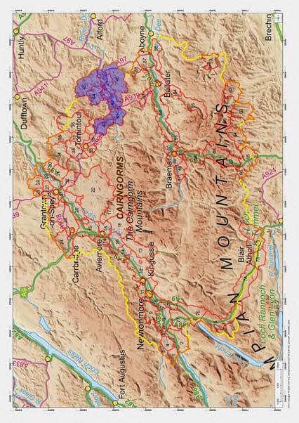
 Cairngorms National Park Landscape Character Assessment Prepared for the Cairngorms National Park Authority in partnership with British Geological Survey by Alison Grant, Landscape Architect December 2009
Viewpoint 1. Location: View from Murch Road on the north eastern boundary of Application Site. Viewing south / southwest.
 Application Site (eastern field) Former site of St. Cyres Lower School Murch Road 1 Location: View from Murch Road on the north eastern boundary of Application Site. Viewing south / southwest. Baseline
Northumberland Key Land Use Impact Study PART B. Proposed Extension of the Green Belt Around Morpeth
 Northumberland Key Land Use Impact Study PART B Proposed Extension of the Green Belt Around Morpeth 1. INTRODUCTION 1.1. The study brief requires that an assessment is carried out of the landscape qualities
WELLINGTON HOSPITAL DESIGN GUIDE TABLE OF CONTENTS
 WELLINGTON HOSPITAL DESIGN GUIDE TABLE OF CONTENTS 1.0 Introduction Page 2 The Place of Wellington Hospital 2 The Future of the Hospital 2 2.0 The Intention of the Design Guide 3 3.0 Analysis 4 General
PONTELAND NEIGHBOURHOOD PLAN LANDSCAPE QUALITY ASSESSMENT
 PONTELAND NEIGHBOURHOOD PLAN LANDSCAPE QUALITY ASSESSMENT UPDATED CONSULTATION ISSUE NOVEMBER 2016 CONTENTS 2 Introduction 2 Methodology 4 Landscape Quality Areas Plan 5 Landscape Quality Area 1 SMALLBURN
Appendix 9.D: Additional Landscape Character Survey Sheets
 9D1 Appendix 9.D: Character Survey Sheets 9.1 Introduction 9.1.1 A further five additional Character Survey Sheets have been provided in addition to those provided in the ES. The Character Survey Sheets
INTRODUCTION. Land south of Bishopswood Lane, Tadley
 0 INTRODUCTION THE SITE Introduction Gladman Developments Ltd. has successfully invested in communities throughout the UK over the past 0 years, developing high quality and sustainable residential, commercial
SOIL CONSERVATION METHODS OF SOIL CONSERVATION
 1 SOIL CONSERVATION Soil erosion in rubber plantations can be greater, which are situated on undulating to steep terrain with high intensity of rainfall, especially during the early years after planting.
WELCOME. Land west of Great Canfield Road, Takeley. Welcome. Have your say. Pegasus Urban Design
 01 WELCOME Welcome Gladman Developments Ltd have successfully invested in communities throughout the UK over the past 20 years, developing high quality and sustainable residential, commercial and industrial
RURAL DEVELOPMENT FRAMEWORK
 Appendix 5 SUPPLEMENTARY PLANNING GUIDANCE RURAL DEVELOPMENT FRAMEWORK BUCHANAN SOUTH Final Draft for Committee Approval May 2017 Contents Buchanan South Rural Development Framework 1. Purpose 2. Local
Photos to help you identify Box
 Introduction - places to see Box Photos to help you identify Box There are several places in the Chilterns where Box grows in areas accessible to the general public. It is worthwhile to visit these places
2012 FINAL SOILS AREA 2 Envirothon Questions Answer KEY
 2012 FINAL SOILS AREA 2 Envirothon Questions Answer KEY Questions 1-6 to be answered at the soil pit: 1. Soil scientists categorize soils by drainage classes. What is the drainage class of the soil at
4.3 Dudley Area Plan. Introduction. History and Existing Character. Desired Future Character for Dudley
 4.3 Dudley Area Plan Introduction The suburb of Dudley has developed as a result of various circumstances including its topography, history and mineral resources. Dudley development has been identified
PART 05 VISUAL SETTING
 PART 05 VISUAL SETTING 5.1 How to use the Visual Settings 5.2 Views from the Headland 5.3 Creek Foreshore Park Looking North 5.4 Bridge looking North 5.5 Bridge looking West 5.6 Bridge looking South 5.7
Appendix One. Landscape. Areas of Outstanding Landscape Value: Criteria for Selection. Landscape Character
 Areas of Outstanding Value: Criteria for Selection The dimensions of landscape are landscape character and landscape quality. The analysis of landscape character and quality draws heavily on the visual
Pits 1 & 3 Questions. 7. Subsurface: Texture (5 pts) A. Coarse B. Moderately course C. Medium D. Fine E. Very Fine
 A. Coarse B. Moderately course C. Medium D. Fine E. Very Fine") Minnesota Soils Scorecard Questions for Pits 1-4 Scantron # 105481 Use your soils scorecard to fill out the answers on your scantron Bubble in the front side of the sheet for Pit 1 (# 1-45) and Pit 2 (#51-95)
Minnesota Soils Scorecard Questions for Pits 1-4 Scantron # 105481 Use your soils scorecard to fill out the answers on your scantron Bubble in the front side of the sheet for Pit 1 (# 1-45) and Pit 2 (#51-95)
INVENTORY NARRATIVE BUILDING AND COMMON AREA LANDSCAPING
 INVENTORY NARRATIVE BUILDING AND The information within these Inventories was gathered between of March and August, 2015. Many aspects of the Inventories will be on-going as major features and minor elements
Sunday's Well Proposed Architectural Conservation Area
 1 Sunday's Well Proposed Architectural Conservation Area D A E C B F Old City Gaol Saint Vincent s RC Church Saint Albert s Former Good Shepherd Convent Boundary of Area Sunday's Well is an area located
Landscape considerations in Forests & Woodlands. Jill Bullen, Senior Landscape Specialist
 Landscape considerations in Forests & Woodlands Jill Bullen, Senior Landscape Specialist UK Forestry Standard (UKFS) Sustainable forest management Landscape sub-section (S6.4, page 96) Standards and requirements
Name: Former Ornamental Garden and Trees at 1 Harestone Drive. Site is Grounds of 1 Harestone Drive formerly the Marie Curie Hospice.
 Name: Former Ornamental Garden and Trees at 1 Harestone Drive Location: Site is Grounds of 1 Harestone Drive formerly the Marie Curie Hospice. No.48 Coloured Red on plan. Description. Former site of Harestone
Warwickshire County Council. Wellesbourne & Walton Parish. Landscape Study
 Warwickshire County Council Wellesbourne & Walton Parish Landscape Study Produced by WCC Landscape Architects January 2016 Contents LANDSCAPE ASSESSMENT FOR THE PARISH OF WELLESBOURNE & WALTON 1.0 The
2 PLANNING AREA DESCRIPTION
 2 PLANNING AREA DESCRIPTION 2.1 LOCATION Hecker Pass is located within the City of Gilroy near the western city limit. Figure 2-1 illustrates the regional location of the Hecker Pass Area. Figure 2-1:
S18 Mynyddoedd Yr Aran
 S18 Mynyddoedd Yr Aran Reproduced from the Ordnance Survey map with the permission of Ordnance Survey on behalf of the Controller of Her Majesty s Stationery Office, Crown copyright Licence No. 100023387
A Research Framework for the Archaeology of Wales Version 01, Final Paper Neolithic and Earlier Bronze Age
 NEOLITHIC AND EARLIER BRONZE AGE Introduction The introduction of farming around 4000 BC had a dramatic impact on the landscape of Wales and fundamentally changed they ways in which people lived and interacted.
2017 Iowa FFA Soil Judging CDE Exam
 2017 Iowa FFA Soil Judging CDE Exam 1. Landscape positions vary in soil composition and makeup. What landscape position would be characterized by having strata and lenses of different textures in the profile:
How we find the sites
 How we find the sites Many of the archaeological sites mapped by aerial archaeologists have been levelled by ploughing and are identified from the photos as cropmarks or soilmarks. Archaeological sites
18 South of St Pegas Rd including west of Foxcovert Rd, south of Werrington parkway and east to the Car Dyke
 18 South of St Pegas Rd including west of Foxcovert Rd, south of Werrington parkway and east to the Car Dyke Information reviewed Historical background: SAJ ver2 June 2016 Classification Comments NCA 75
LANDSCAPE CHARACTER ASSESSMENT
 THE COUNTY DURHAM LANDSCAPE CHARACTER ASSESSMENT FOREWORD The landscape of County Durham is one of great contrast and diversity. From the North Pennines in the west to the Durham Coast in the east it contains
PHYSICAL CHAtlACTERISTICS REPORT FOR THE PROPOSED SAND AND GRAVEL SITE AT MANOR FARM, UFFINGTON
 PHYSICAL CHAtlACTERISTICS REPORT FOR THE PROPOSED SAND AND GRAVEL SITE AT MANOR FARM, UFFINGTON Introduction Following the" request for detailed information on the physical characteristics of soil at Manor
LANDSCAPE GUIDELINES. Countryside & Coastal Countryside Environments. Landscape, Natural Character & Amenity Values Guide
 Landscape, Natural Character & Amenity Values Guide Copyright WDC 2009 Version A2 18May09 Environmental Services Group Publication Countryside & Coastal Countryside Environments START HERE Quality Land
Lancaster Conservation Area Appraisal. Character Area 8. Cathedral
 Lancaster Conservation Area Appraisal Character Area 8. Cathedral March 2013 118 3.8 Character Area 8. Cathedral 3.8.1. Definition of Special Interest "This character area is distinctive for the fine group
ENVIRONMENTAL INVENTORY
 Hungarton Neighbourhood Plan ENVIRONMENTAL INVENTORY Sites scoring 25/36 or more (70%) are judged to be the most important environmental and community sites and are proposed as Local Green Space. Other
DESIGN AND MANAGEMENT PART 3 HA 57/92 NEW ROADS INTEGRATION WITH RURAL LANDSCAPES SUMMARY
 DESIGN MANUAL FOR ROADS AND BRIDGES VOLUME 10 SECTION 1 ENVIRONMENTAL DESIGN AND MANAGEMENT NEW ROADS PART 3 HA 57/92 NEW ROADS INTEGRATION WITH RURAL LANDSCAPES SUMMARY This Advice Note gives guidance
Horner-McLaughlin Woods: Soil Types
 Horner-McLaughlin Woods: Soil Types Not present at HMW Adrian Muck Conover Loam 0-4% Slopes Houghton Muck Miami Loam 2-6% Slopes Miami Loam 6-12% Slopes Miami Loam 12-18% Slopes t 0 0.125 0.25 Miles Mary
Land Capability Classifications
 Land Capability Classifications Unit: Soil Science Problem Area: Basic Principles of Soil Science Student Learning Objectives. Instruction in this lesson should result in students achieving the following
Route Alignment Options Summary Report
 Brechfa Forest Connection Project February 2014 Summary report 1. RSK Environment Ltd (RSK) was commissioned by Western Power Distribution (WPD) to provide environmental consultancy support services for
SOIL EROSION COMBATING IS ESSENTIAL IN ORDER TO CONSERVE OUR VALUABLE SOIL RESOURCES
 SOIL EROSION COMBATING IS ESSENTIAL IN ORDER TO CONSERVE OUR VALUABLE SOIL RESOURCES A. Introduction - Land is also a precious resource. Land is needed for agriculture and occupation. Land is under pressure
Northland Regional Landscape Assessment Worksheet
 Northland Regional Landscape Assessment Worksheet Unit name TE POUAHI HEADLAND DESCRIPTION AND CHARACTERISATION Component Land Types (refer to list overleaf) Dune complex Coastal cliffs / escarpment Reefs
BISCUIT RUN PARK MASTER PLAN
 BOARD OF SUPERVISORS November 14, 2018 BISCUIT RUN PARK MASTER PLAN COUNTY OF ALBEMARLE ANHOLD ASSOCIATES Contents Project Introduction Property Background County Park Planning Process Existing Site &
section five BEAUTIFICATION PLAN
 section five BEAUTIFICATION PLAN BEAUTIFICATION PLAN Section Five Beautification Plan The goal of the Beautification Plan is to improve the Route 8-Sunnyland Corridor in terms of aesthetics and to create
Daugleddau. Seascape Character Area Name: No: Near Picton Point on Daugleddau. Looking east from Cleddau Bridge. Ancient oaks at water's edge
 No: 33 Seascape Character Area Name: Daugleddau Near Picton Point on Daugleddau Ancient oaks at water's edge Looking east from Cleddau Bridge 33-1 Summary Description The reaches of the Daugleddau and
- 1 - ENCLOSURES DYKES AND HEDGES
 - 1 - ENCLOSURES DYKES AND HEDGES About 300 years ago there were hardly any walls (dykes), fences or hedges around fields in Scotland. By 150 years later, all this had changed. Almost every field boundary
APPENDIX C. Architectural and Environmental Design Standards. Environmentally sensitive areas should be protected.
 APPENDIX C Architectural and Environmental Design Standards Environmentally Sensitive Areas Goal A. Environmentally sensitive areas should be protected. Development, such as roads, houses, and other structures,
Daniels Park Master Plan
 Daniels Park Master Plan Prepared for: Douglas County & The City and County of Denver October, 2007 EXHIBIT A Contents Daniels Park Overview 2 Project History & Goals 2-3 Regional Context Map 4 Park Zone
Upper Dean Landscape Character Area: A1 Landscape Character Type: River Valley
 Upper Dean Landscape Character Area: A1 Landscape Character Type: River Valley Key characteristics A well wooded river valley landscape Strong human influence with urban development and sections of engineered
The Prehistoric Landscape Coaxial Field Systems
 The Prehistoric Landscape We know that much of Cornwall was densely populated in prehistory but that most of the fields laid out during this time were reorganised and overlain by medieval and later field