CITY OF ROCK ISLAND, ILLINOIS COLLEGE HILL DISTRICT VISUAL PREFERENCE SURVEY PREPARED BY THE LAKOTA GROUP NOVEMBER 1, 2011 LAKOTA
|
|
|
- Lesley York
- 5 years ago
- Views:
Transcription


1 COLLEGE HILL DISTRICT VISUAL PREFERENCE SURVEY PREPARED BY THE LAKOTA GROUP NOVEMBER 1, 2011 LAKOTA
2
3 COLLEGE HILL DISTRICT VISUAL PREFERENCE 1: INTRODUCTION Project Mission 06 Visual Preference Goals 06 College Hill District Context 06 Focus Group Summary 08 2: Survey Process 12 General Questions 12 Streetscape 16 Transportation 20 Open Space 24 Branding + Identity 28 Street Furniture 36 Architecture 44 Visualizations 52 3: RECOMMENDATIONS Overview 62 Streetscape 62 Transportation 66 Architecture Building Improvements 67 General Recommendations 68 DRAFT COLLEGE HILL DISTRICT VISUAL PREFERENCE TABLE OF CONTENTS TOC
4


5 INTRODUCTION SECTION 1
6 SECTION 1: INTRODUCTION PROJECT MISSION Over the past year, the City of Rock Island has been engaged in a planning process to create a future revitalization vision for the College Hill District. As part of this process, the City commissioned The Lakota Group, a Chicago-based planning, urban design and landscape architecture firm, to help craft a Visual Preference Survey, engage stakeholders in discussions about the area and facilitate a community Open House. The purpose of the Visual Preference Survey is to introduce concepts pertaining to community character related to the streetscape and building facades and gauge stakeholder opinions regarding aesthetics of various elements and ideas. The survey was given in the form of a PowerPoint presentation, using electronic key pad polling to create an interactive process with instantaneous results. The survey focused on the following broad design categories, with other key urban design ideas and concepts encompassed within these categories: Streetscape Transportation Open Space Branding & Identity Street Furniture Architecture (Existing and New) Urban Design Visualizations All community residents, students, local leaders and business/property owners were invited to participate in the survey and Open House. Lakota and the City used multiple forms of outreach and communication, including flyers posted in storefront windows, press releases and a project website link. Over 60 people participated in the survey at the Open House on September 29 and 59 additional people completed the survey online, which was linked to the project website for a week following the Open House. The following report summarizes the results of the survey and analysis of the findings, as well as recommendations meant to guide decisions about future College Hill District improvements. VISUAL PREFERENCE GOALS Contribute information to the larger College Hill District Revitalization Plan. Identify a shared community vision for the physical appearance of the CHD. Assist in the development of aesthetics regulations for the District. Guide and help with prioritization for capital improvement programming. Test the community s preference for potential enhancements. Determine strategies for visually linking the district s two major nodes/intersections. COLLEGE HILL DISTRICT CONTEXT The College Hill District (CHD) study area centers around two key commercial nodes the 14th Avenue/ 38th Street intersection and the 14th Avenue/30th Street intersection and approximately six residential blocks of 14th Avenue that link the two. The district is comprised of 90 properties and 60 businesses, mostly locally owned. The majority of these businesses are located in small commercial buildings built between 1900 and th Avenue has a two-lane crosssection with parallel parking on each side and is considered an arterial roadway with a range of 6,800 to 8,500 automobiles using this street per day. The CHD draws shoppers and visitors from nearby Augustana College and surrounding residential neighborhoods, as well as attracts shoppers from greater Rock Island and the region for the unique mix of retail and services the district provides. There are a wide variety of businesses, including long-time neighborhood fixtures, such as Harris Pizza, Handy True Value Hardware and Mulkey s Diner and newer shops and restaurants, such as Cool Beanz coffee shop and La Rancherita Mexican restaurant. Overall, the offerings in this district range from a cluster of antique stores to a comic book shop to beauty and hair salons to multiple pizza and informal family dining establishments. This variety inspired the CHD s new tag line: College Hill District. Eclectic Vibe. Neighborhood Businesses. 6 COLLEGE HILL DISTRICT VISUAL PREFERENCE INTRODUCTION
7 29TH STREET STREET 30TH STREET 32ND STREET 33RD STREET 34TH STREET 30TH STREET STREET 31ST STREET 32ND STRE STREET 32ND STREET STREET STREET 34TH 34TH STREET 35TH STREET STREET 35TH STREET 37TH STREET 35TH STREET STREET 37TH STREET 38TH STREET STREET 39TH STREET 39TH STREET STREET STREET 41ST STREET 42ND STREET 42ND STREET STREET STREET FIGURE 1: COLLEGE HILL DISTRICT BOUNDARIES AND ZONING AVENUE College Hill District, Rock Island IL 9TH AVENUE 9TH AVEN 9TH 1/2 AVE µ 10TH AVENUE Augustana College Lincoln Park Prepared By: City of Rock Island, Community and Economic Development Dept., Planning and Redevelopment Division January RD STREET 10TH AVE 11TH AVENUE 11TH AVENUE 11TH 1/2 AVE 12TH AVENUE 13TH AVENUE 30TH STREET 14TH AVENUE 12TH AVENUE Augustana College 13TH AVE 14TH AVENUE 12TH AVENUE 36TH STREET 37TH STREET 13TH AVENUE 14TH AVENUE 40TH STREET Alleman High School 41ST STREET 42ND STREET 43RD STREET 15TH AVENUE Old Horace Mann Park 29TH STREET 16TH AVENUE 17TH AVENUE 18TH AVENUE 29TH 1/2 STREET 20TH 15TH AVENUE 31ST STREET 16TH AVENUE 17TH AVE 18TH AVENUE AVENUE 33RD STREET 20TH AVENUE 15TH AVENUE 36TH STREET 16TH AVENUE 18TH AVENUE 20TH 37TH STREET AVENUE 38TH STREET 15TH AVENUE 40TH STREET Legend 20TH AVENUE 41ST STREET 18TH AVENUE 15TH AVEN College Hill Distict Revised Parks Churches Alleman High School B1-Neighborhood Business Zoning District B3-Community Business Zoning District O1-Office Zoning District U1 -University/College Zoning District R2-One Family Residence Zoning District R3-One and Two Family Residence Zoning District R4-One to Six Family Residence Zoning District R5-Multiple Family Residence Zoning District R6-Multi-Family Residence Zoning District PUD-Planned Unit Development Zoning District COLLEGE HILL DISTRICT BOUNDARY AND ZONING MAP PROVIDED BY THE CITY OF ROCK ISLAND 43RD STREET COLLEGE HILL DISTRICT VISUAL PREFERENCE INTRODUCTION 7
8 SECTION 1: INTRODUCTION FOCUS GROUP SUMMARY Prior to facilitating the evening Open House, representatives from the Lakota Group engaged key stakeholders in discussions about the strengths, weaknesses, opportunities and constraints of the district. These informal discussions invited various user groups to provide additional input into the process by sharing their thoughts about the future of CHD, such as the types of physical improvements, new businesses, events and strategies they envision. Six separate focus groups comprised of more than 35 people total included the following participants: College Hill District Design Committee Augustana College Representatives City of Rock Island Economic Development, Planning and Engineering Staff Local Aldermen and the Mayor of Rock Island Property and Business Owners Residents and Neighborhood Organization Representatives The following is a summary of consistent themes and individual stakeholder thoughts and responses from these sessions. District Character, Streetscape and Physical Issues The mix of buildings is eclectic, but the streetscape feels old and worn out. There is a need for something to make it more cohesive. Stakeholders noted that future improvements should highlight the uniqueness of the district and avoid making it feel too corporate. Potential streetscape elements that would improve the character include new awnings and business signs; benches and trash receptacles; custom signs that promote a brand; planters and landscaping; additional bike racks; new street lights with banners; pedestrian markers; and cobblestone or brick paved crosswalks and sidewalks. Many feel the biggest challenge for the district from a physical standpoint is linking the east and west sides together. Participants noted that the speed limit on 14th Avenue is too fast and does not promote walking and biking. Notable downtowns and districts that participants discussed as having the type of character they would like to see include the Village in East Davenport, Downtown Galena; LaGrange, Illinios (outside of Chicago); Grandview Avenue in Columbus, Ohio; and LeClaire, Iowa. The CHD is one of the City Council s highest priority areas and has some capital improvement program money set aside for improving the district. The strengths of the district include accessibility (30th and 14th are main thoroughfares), the eclectic mix of businesses and the long-time businesses that have a devoted customer base. Many feel building and property owners need to invest more effort into maintaining sidewalks and facades in order to improve the overall feel and appearance. Many participants noted that the property on southeast corner of 14th and 30th is a key redevelopment site that is currently an eyesore. The corner property is critical to adding an additional active use within a new building in the district. There is the perception of a parking problem throughout the district especially on the east around Harris Pizza and La Rancherita. Promotion and Marketing Some of the promotions and marketing efforts that have been implemented or discussed include a website; Facebook page; discounts for Augustana students; coupon packets; farmers market; and an Octoberfest art fair. 8 COLLEGE HILL DISTRICT VISUAL PREFERENCE INTRODUCTION

9 The perception is that the district does not take advantage of its proximity to Augustana. In addition to the student population, there are a number of large events that attract visitors to the campus and area; the district has not yet capitalized on this influx of people. Business owners noted that the Augustana student population is difficult to promote to the college shields them from getting coupons, flyers or s. One concept that would help promote the shops and businesses is the idea of a kiosk that had a directory and/or a map of the area. Many leaders within Augustana have invested time to help develop marketing materials, including the new CHD logo, as well as have participated in the City s planning process and CHD organizational structure. Business Mix Businesses that stakeholders would like to see in the district include a candy store; popcorn store, boutique clothing shops; a wider variety of food options (e.g. Buffalo Wild Wings, which draws college and high school students); bed and breakfasts/boutique hotels; and bars/pubs. Variety is good. Many feel that it would benefit the district if more businesses were open on Sunday and were open longer hours during the week Could be a more of a night market. Stakeholders noted the desire to see more localism and farm to fork type restaurants as part of an overall sustainable initiative for the district. Some business owners feel that there is a disconnect between the east and west sides of the district and are concerned about all events focusing on the 14th/30th intersection. Some discussed the option of holding events at Old Horace Mann Park. General Stakeholders noted that the biggest weaknesses are aesthetics; lack of branding and marketing; lack of gateways into the district; little outdoor seating/ dining or gathering spaces; and perception against Rock Island. The zoning for the district is B-1, which allows a 20- foot front yard setback. Zoning will need to be changed to maintain the zero setbacks found throughout the CHD. Stakeholders discussed building upon the design and promotion committees and Keystone Neighborhood strengths. Some participants noted the opportunity for additional student housing in the area and the potential positive impact that would have on the CHD. Currently, there is a distinct difference in the types of businesses on the east versus the west within the CHD. Generally, participants noted there are more vacancies on the east, as well as a lack of character compared to the west side. Stakeholders noted that people don t know we re here and there is not a sense of place because the district has not changed. When there is change, people notice. THE COLLEGE HILL DISTRICT BUSINESS ASSOCIATION DE- VELOPED A LOGO MELDING THE ECLECTIC CHARACTER OF THE AREA WITH ITS PROXIMITY TO AUGUSTANA. COLLEGE HILL DISTRICT VISUAL PREFERENCE INTRODUCTION 9
10


11 VISUAL PREFERENCE RESULTS SECTION 2

12 SECTION 2: SURVEY PROCESS The survey was conducted in the form of a PowerPoint presentation using interactive key pads distributed to participants at the beginning of the Open House. Participants had 10 seconds per slide to place his or her vote. The following rating system was used throughout the survey to record preferences. GENERAL QUESTIONS How long have you lived in Rock Island? Some general questions were asked to gain understanding of who was participating in the survey, as well as initial thoughts and feelings about the College Hill District, before engaging in the visual preference categories. The survey was posted for a week on the project website to elicit additional participation. The following are the accumulated results from both the Open House and on-line survey. What do you think about how the existing College Hill District roadways function? 12 COLLEGE HILL DISTRICT VISUAL PREFERENCE

13 What do you think about how the existing College Hill District roadways look? What do you think of how the existing CHD buildings look? What do you think about how the existing CHD pedestrian and bicycle facilities function? What do you think of how the existing CHD streetscapes look? COLLEGE HILL DISTRICT VISUAL PREFERENCE 13


14 SECTION 2: How often do you shop in the CHD? Or if you are a business owner/employee, how often do you shop at other CHD businesses? What is your biggest obstacle to shopping in the College Hill District? How far do you live from one of the nodes in the CHD (14th/30th or 14th/38th)? What promotional events would you attend in the CHD? 14 COLLEGE HILL DISTRICT VISUAL PREFERENCE


15 What is the best way for the College Hill District to inform you of promotional events? The CHD has a higher walkability (according to Walk Score) compared to similar Quad Cities shopping districts. What would encourage you to walk rather than drive to the CHD? What do you think of the current business mix in the CHD? COLLEGE HILL DISTRICT VISUAL PREFERENCE 15

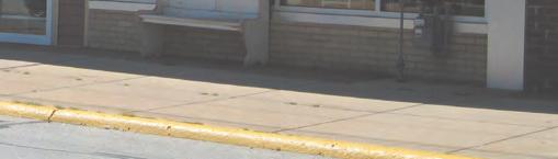
16 SECTION 2: STREETSCAPE The images shown in the Streetscape category are meant to gauge stakeholders opinions about overall district character and aesthetics, as well as safety and activity of the pedestrian environment. A range of images was chosen for the survey, including existing conditions of the College Hill District, representing a full continuum of streetscape design and character. These images show a variety of elements that form the look and feel of a streetscape including planters, paving treatments, street trees, landscaping, signage, street furniture and other elements. STREETSCAPE: SURVEY ANALYSIS The top two rated images in this category were Examples 1 and 2. Combining the Strongly Like and Like categories for these elicits 97 percent and 95 percent positive responses, respectively. Examples 6 and 7 also achieved highly favorable scores, both at 90 percent in the two favorable categories combined, while also receiving little negative response. The commonalities within these four images provide clues to the reasons for the high scores. Generally, each of these streetscapes has the following characteristics: Landscape variety, including trees, flowering/ ornamental shrubs and perennials A mix of special paving materials, such as brick or concrete pavers, with concrete walks Traditional or historic street lights Clearly defined and separated pedestrian areas Other vertical elements that provide unity and interest to the streetscape, such as moveable planters/ urns, stone walls, brick piers, bollards and street signs Seating pockets, (shown in 3 of the images), either as benches or seat walls The images that did not score as high, such as Examples 4, 5 and 8 lack many of the features listed above, especially a variety of landscaping and paving materials. These images show a more simple, scaledback version of streetscape character and do not convey the attention to detail and design quality that the preferred images show. Taking cues from the visual preference results and stakeholder discussions, the College Hill District streetscapes should ultimately be cohesive environments with a rich palette of landscaping and changes in paving. The sidewalk should be clearly delineated from the street, regardless of width, and opportunities should be provided for seating/ gathering throughout the district. The following rating system was used throughout the survey to record preferences. EXISTING CONDITIONS 1 16 COLLEGE HILL DISTRICT VISUAL PREFERENCE


17 EXISTING CONDITIONS 2 EXAMPLE 1 EXAMPLE 2 IMAGE 1: IMPROPERLY CONVERTED SINGLE-FAMILY HOME COLLEGE HILL DISTRICT VISUAL PREFERENCE 17


18 EXAMPLE 6 EXAMPLE 7 EXAMPLE 8 18 COLLEGE HILL DISTRICT VISUAL PREFERENCE


19 SECTION 2: EXAMPLE 3 EXAMPLE 4 EXAMPLE 5 COLLEGE HILL DISTRICT VISUAL PREFERENCE 19
20 SECTION 2: TRANSPORTATION The images in the Transportation category were selected to show examples of various improvements to street and parking conditions. The concept of multi-modal transportation how cars relate to bicycles and pedestrians was introduced to elicit thought about how the streets in the College Hill District currently function, particularly 14th Avenue. Some of the improvements or elements shown in the survey images include corner bump-outs, crosswalk enhancements, parking lot screening, bike lanes and bus shelters. The goals are to understand how participants feel about the safety of the streets, bicycle traffic, aesthetics of the current roadway and balance of the pedestrian versus the vehicular realms. TRANSPORTATION: SURVEY ANALYSIS Within the Transportation category, there were no overwhelmingly high scores, but a number of key concepts or ideas received favorable results. Most of the combined positive scores fell within the mid-50 to mid-60 percent range, with Example 1 receiving the overall high score with 70 percent of participants rating it as Strongly Like or Like. The results for these images provide support for the following concepts to be integrated in the district: Clearly defined and highly visible crosswalks. Examples 1, 2 and 4 all show varying types of crosswalks with different widths, colors and patterns. While they all received favorable ratings, suggesting additional delineation of crosswalks is desired, Example 1, with a relatively simple red crosshatch pattern and a white border, received a more favorable response to than the comparable images. Parking lot screening. Both examples 3 and 7 depict parking lot screening with various levels of landscape treatment and fencing. These images got very similar, but positive, results. Depending on the location and width available, a combination of these elements would improve the visual appearance of CHD streetscapes considerably. Bike amenities. Providing a bike lane or a shared bike lane (which would be more feasible) on 14th Avenue, as depicted in Example 6, received positive support in the survey and stakeholder discussions. Bump-outs. 62 percent of participants liked the small bump-out shown in Example 5. Bump-outs would not be feasible at all intersections, but this concept would create a safer pedestrian environment, while also providing opportunities for additional landscape space the type of landscaping that received favorable results in the Streetscape category. Bus shelter. Both Examples 8 and 10 showed bus shelters, but Example 8 received a more favorable response, likely due to the more traditional look of the shelter. Within the proper context, such as near Old Horace Mann Park, a bus shelter should be provided on 14th Avenue. EXAMPLE 1 20 COLLEGE HILL DISTRICT VISUAL PREFERENCE


21 EXAMPLE 2 EXAMPLE 3 EXAMPLE 4 COLLEGE HILL DISTRICT VISUAL PREFERENCE 21


22 EXAMPLE 5 EXAMPLE 6 EXAMPLE 7 22 COLLEGE HILL DISTRICT VISUAL PREFERENCE


23 EXAMPLE 8 EXAMPLE 9 EXAMPLE 10 COLLEGE HILL DISTRICT VISUAL PREFERENCE 23
24 SECTION 2: OPEN SPACE The Open Space images focus on small public plazas and pocket parks that relate to streetscapes and buildings. The selected imagery was chosen to test how participants view public space and to invite them to critically think about and envision the College Hill District with a landmark gathering space or series of smaller spaces. The images represent various levels of activity, from passive plazas to active, kid-oriented parks to small spaces between buildings. Inherent within the images are the concepts of landscape character, paving, public art, fountains, gathering areas and overall form, as well as other details that combine to create a successful public space. OPEN SPACE: SURVEY ANALYSIS Not surprisingly, the Open Space images received highly favorable results across the board. Example 1 and Example 7 were rated the highest, garnering combined positive scores of 84 percent and 83 percent, respectively. Each received more than 50 percent in the Strongly Like category. Examples 2, 3, 4 and 5 were all scored by the majority of participants in the Strongly Like category, ranging from 42 to 47 percent. Example 6 also had an overall combined positive score of 82 percent, but only received 31 percent in the Strongly Like. Example 8 was the lowest scoring image with only 59 percent positive response, 22 percent neutral and 19 percent negative. Overall, stakeholders and survey participants have noted their desire to have more public open spaces that provide the opportunity for meeting and gathering, locations for art or other focal point elements (clocks, water features, etc.), and/or event space. Within the context of the College Hill District space is limited, but the examples shown (and preferred) are all generally small spaces and often are located adjacent to streets, between buildings or next to parking lots. The CHD has a number of opportunities to provide a key plaza or series of plazas connected to the streetscape. Generally, the elements that are part of the preferred Open Space images include: Landscape variety. A variety of landscaping, such as trees, shrubs and perennials. In most cases, the planting design is simple, but interesting. This was a key factor in the highest rated streetscape images, as well. Paving materials. A range of paving materials or paving materials that differ from standard concrete. Brick pavers or other paving treatment creates visual interest, while also marking a space as unique or special. Focal point elements or sculptures. Within many of the spaces public art or fountains are prominent features. The College Hill District would benefit from engaging local artists to develop elements that may be incorporated throughout the district, in plazas, streetscapes or other venues. Seating pockets or gathering spaces. The majority of the images have some form (or multiple forms) of seating opportunities, such as benches, walls, steps or curbs. Defined space. Each of the successful plazas or open spaces has a different form. However, they all have a defined space that creates a comfortable environment. 24 COLLEGE HILL DISTRICT VISUAL PREFERENCE


25 EXAMPLE 1 EXAMPLE 2 EXAMPLE 3 COLLEGE HILL DISTRICT VISUAL PREFERENCE 25


26 SECTION 2: EXAMPLE 4 EXAMPLE 5 EXAMPLE 6 26 COLLEGE HILL DISTRICT VISUAL PREFERENCE


27 EXAMPLE 7 EXAMPLE 8 COLLEGE HILL DISTRICT VISUAL PREFERENCE 27
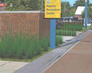
28 SECTION 2: BRANDING + IDENTITY The Branding + Identity category more specifically addresses signage, logos and elements that contribute to the creation of a brand for urban areas and districts. Within this category, examples of gateways, information kiosks, directional signs, street signs and banners are shown. Survey participants were expected to respond with their opinions about the shape/form, color, style, materials and overall character of the elements, while also thinking about how the College Hill District brand can be incorporated into the public realm. BRANDING + IDENTITY: SURVEY ANALYSIS The Branding + Identity category provided a broad range of elements from larger gateways and piers to kiosks to smaller directional and street signs. The highest rated images within each of the sub-categories include the following: Gateway Signs. Gateway Example 3 was the highest scoring gateway, with 60 percent of participants responding positively to and only 12 percent negative. Example 3 consists of stone veneer piers with a metal arch denoting the brand or name of the place (in this case, a trail). These materials, as well as the form, are relatively traditional, as opposed to the more contemporary feel and materials of Gateway Examples 1 and 2, which did not score as well. Kiosks. Kiosk Example 3 received 70 percent positive responses and 14 percent negative. This example depicts a kiosk with a map of the district, which is an element that many stakeholders thought would be beneficial to getting people familiar with the College Hill District and spreading the word about businesses in the area. Additionally, the form of the sign portrays a traditional feel, while the other kiosk examples, 1 and 2, have decidedly strong design themes that are meant to complement architectural elements of landmark buildings found in their respective districts. These examples did not receive nearly the positive feedback of Example 3, with Example 1 slightly favorable and Example 2 53 percent negative responses. Directional Signs. Directional Example 1 had the highest score within the overall Branding + Identity category with 74 percent Strongly Like or Like votes, as opposed to only 10 percent negative. Like many of the other favored elements, this sign has a more traditional design. Directional Example 2 received the lowest score in the Branding + Identity category. Participants did not respond well to the simple Art Deco inspired theme and colors. Example 3 had a slightly higher positive to negative response ratio, but participants did not prefer the more modern look. Street Signs. Only two street sign images were shown in the survey, with Example 1 receiving a relatively favorable response (54 percent positive). Example 2 did not generate favorable results (only 27 percent positive and 38 percent negative). Ultimately, it is unclear whether participants felt these elements are a necessary or a priority component of an overall revitalization plan. As a more detailed streetscape or branding process moves forward, this should be further explored within the context of a holistic branding strategy or family of streetscape elements. Banners. Banner Example 2 scored 58 percent positive and 12 percent negative. This example shows a more classic metal banner with a clean, simple demarcation of the district with a stylized type face. Interestingly, feedback for Banner Example 1, which shows the College Hill District logo, was not resoundingly strong. 49 percent of participants selected Strongly Like or Like and 21 percent Dislike or Strongly Dislike. A high percentage (30 percent) were neutral. From discussions with some stakeholders, primarily Augustana students, there were some comments that this design was too much like the college s, with the main focus on the colors of the logo. Options should be explored for the color and design of the banners if this is an element that the City and CHD organization want to incorporate throughout the district. 28 COLLEGE HILL DISTRICT VISUAL PREFERENCE


29 GATEWAY EXAMPLE 1 GATEWAY EXAMPLE 2 COLLEGE HILL DISTRICT VISUAL PREFERENCE 29


30 SECTION 2: GATEWAY EXAMPLE 3 KIOSK EXAMPLE 1 30 COLLEGE HILL DISTRICT VISUAL PREFERENCE


31 KIOSK EXAMPLE 2 KIOSK EXAMPLE 3 COLLEGE HILL DISTRICT VISUAL PREFERENCE 31


32 SECTION 2: DIRECTIONAL EXAMPLE 1 DIRECTIONAL EXAMPLE 2 32 COLLEGE HILL DISTRICT VISUAL PREFERENCE


33 DIRECTIONAL EXAMPLE 3 STREET SIGN EXAMPLE 1 COLLEGE HILL DISTRICT VISUAL PREFERENCE 33


34 SECTION 2: STREET SIGN EXAMPLE 2 BANNER EXAMPLE 1 34 COLLEGE HILL DISTRICT VISUAL PREFERENCE


35 BANNER EXAMPLE 2 BANNER EXAMPLE 3 COLLEGE HILL DISTRICT VISUAL PREFERENCE 35
36 SECTION 2: STREET FURNITURE The Street Furniture category more specifically focuses on the elements that form a streetscape, such as lights, benches, bike racks, trash receptacles and planters. These elements come in a broad range of forms and styles and can vary from the very traditional to modern to funky to playful. The purpose of this exercise is to narrow the spectrum of choices by eliminating the outliers and analyzing the commonalities among the preferred images or elements. Ultimately, a more thorough process should be undertaken to establish a specific family of street furniture/elements to be installed within the College Hill District. STREET FURNITURE: SURVEY ANALYSIS The following are the results for the individual subcategories of the Street Furniture group: Street Lights. Street Light Example 1 received easily the highest combination of positive responses in this group with 65 percent Strongly Like or Like scores. The style of this light is common throughout many downtown historic districts and traditional commercial streets. On the other end of the spectrum, Street Light Example 2 received 51 percent negative responses and only 29 percent positive. This example exemplifies a very modern approach to lighting design. Example 4 received the second most positive feedback and is a more contemporary take on a classic light style. Ultimately, when selecting a new light, the choices should fall within the range of Examples 1 and 4. Benches. Bench Examples 1 and 3 received very similar results, with 67 and 66 percent positive responses, respectively. Most likely, participants reacted to the designs for their colors (black and silver), which work well with a wide range of elements, as well as their forms and durable materials. These examples have flexibility to complement nearly all other styles and types of streetscape characters. The funky choice (Example 2) and the modern choice (Example 4) had more negative scores than positive. Again, bench options within the streetscape design process should begin with an exploration of similar styles as the Examples 1 and 3. Bike Racks. The Bike Rack examples that were preferred were Example 4 (59 percent positive/17 percent negative) and Example 3 (51 percent postitive/33 percent negative). These examples differ greatly and, therefore, the City and CHD organization should explore additional options. It should also be noted that it may not be necessary for all bike racks within the district to be the same; it is common for commercial areas and corridors to have a variety of bike rack styles, depending on location. Trash Receptacles. Trash Receptacle Example 3 and Example 2 received 70 percent and 66 percent positive response, respectively. As with the benches, participants probably reacted well to the black color and simple forms of these examples. They would basically match and look well in any streetscape. Planters. Both Planter examples received favorable response, with over 60 percent reacting positively. Ultimately, stakeholders noted that they would like to see planters and urns as part of the streetscape and feel these are the types of elements that can be installed in the short-term. It is suggested that a more extensive selection process be conducted prior to choosing a definitive planter style. 36 COLLEGE HILL DISTRICT VISUAL PREFERENCE


37 STREET LIGHT EXAMPLE 1 STREET LIGHT EXAMPLE 2 COLLEGE HILL DISTRICT VISUAL PREFERENCE 37


38 SECTION 2: STREET LIGHT EXAMPLE 3 STREET LIGHT EXAMPLE 4 38 COLLEGE HILL DISTRICT VISUAL PREFERENCE


39 BENCH EXAMPLE 1 BENCH EXAMPLE 2 BENCH EXAMPLE 3 COLLEGE HILL DISTRICT VISUAL PREFERENCE 39


40 SECTION 2: BENCH EXAMPLE 4 BIKE RACK EXAMPLE 1 BIKE RACK EXAMPLE 2 40 COLLEGE HILL DISTRICT VISUAL PREFERENCE


41 BIKE RACK EXAMPLE 3 BIKE RACK EXAMPLE 4 TRASH RECEPTACLE EXAMPLE 1 COLLEGE HILL DISTRICT VISUAL PREFERENCE 41


42 SECTION 2: TRASH RECEPTACLE EXAMPLE 2 TRASH RECEPTACLE EXAMPLE 3 42 COLLEGE HILL DISTRICT VISUAL PREFERENCE


43 TRASH RECEPTACLE EXAMPLE 4 PLANTER EXAMPLE 1 PLANTER EXAMPLE 2 COLLEGE HILL DISTRICT VISUAL PREFERENCE 43
44 SECTION 2: ARCHITECTURE The Architecture category is broken down into two subcategories: Existing Building Enhancements and New Development. The Existing Building Enhancements images focus on facade improvements, storefront window displays, signage, awnings, color and lighting to show how these elements, either individually or combined, affect a building s appearance. The New Development images depict a range of smaller scale 1 to 3-story commercial/mixed-use buildings. The continuum of building materials, setbacks, height, bulk and architectural style all play a role in the perception and rating of each image. This exercise was meant to generate thought about how each participant views potential future new development or redevelopment, although the College Hill District currently has few opportunities for new buildings. ARCHITECTURE: SURVEY ANALYSIS Existing Building Enhancements. The highest scoring examples within the Existing Building Enhancement sub-category were Examples 2 (78 percent combined Strongly Like and Like ) and 1 (76 percent), respectively. Example 2 shows a building with a simple storefront design and enhanced facade with a striking color scheme. The facade does not have awnings and no signage is visible. Participants noted the large, clear windows, color scheme and clean, effective simplicity of the building as strong points. Example 1 depicts a entryway/window display for a business within a traditional commercial district. Participants likely reacted to the wide entrance with flanking planters, navy and white colors on the knee wall and columns and organized, well-designed display windows. Other examples that received high scores include Examples 6 and 7, which both scored at 72 percent positive and Example 4 at 71 percent. Example 6 shows a very simple facade/storefront makeover, which included cleaning the bricks, opening the boarded up windows, adding an awning and subtle signage. Stakeholders noted the how small actions combined to make a vacant eyesore into an attractive building. In Example 7, they noted the gooseneck lighting and new awning as desirable elements for a storefront. Notably, the elements that were preferred, such as gooseneck lighting, awnings, storefront colors and displays, are generally elements of traditional commercial storefronts. Example 5, which shows a more contemporary awning and funky design received one of the lowest scores in this category (30 percent negative responses). Stakeholders often referred to the College Hill District as eclectic, but the survey results generally show that classic and traditional elements and buildings are preferred. New Development. Within the New Development sub-category, Examples 1 and 3 received the highest scores by far. Example 1 had a combined positive score of 78 percent. The example depicts a 3-story brick building with a pitched roof, awnings, sign bands and outdoor seating. The building also has prominent windows, a corner entry and zero setback. Example 3 received 77 percent positive feedback. Participants noted the small scale, brick facade, interesting display windows and zero setback as key elements to their perceptions. Overall, the common elements within the images that received the highest scores include brick as the primary facade material, zero setbacks, traditional awnings and sign bands and large, well-defined commercial spaces. 44 COLLEGE HILL DISTRICT VISUAL PREFERENCE


45 EXISTING BUILDING ENHANCEMENT EXAMPLE 1 EXISTING BUILDING ENHANCEMENT EXAMPLE 2 EXISTING BUILDING ENHANCEMENT EXAMPLE 3 COLLEGE HILL DISTRICT VISUAL PREFERENCE 45


46 SECTION 2: EXISTING BUILDING ENHANCEMENT EXAMPLE 4 EXISTING BUILDING ENHANCEMENT EXAMPLE 5 46 COLLEGE HILL DISTRICT VISUAL PREFERENCE


47 EXISTING BUILDING ENHANCEMENT EXAMPLE 6 EXISTING BUILDING ENHANCEMENT EXAMPLE 7 EXISTING BUILDING ENHANCEMENT EXAMPLE 8 COLLEGE HILL DISTRICT VISUAL PREFERENCE 47


48 SECTION 2: NEW DEVELOPMENT EXAMPLE 1 NEW DEVELOPMENT EXAMPLE 2 NEW DEVELOPMENT EXAMPLE 3 48 COLLEGE HILL DISTRICT VISUAL PREFERENCE


49 NEW DEVELOPMENT EXAMPLE 4 NEW DEVELOPMENT EXAMPLE 5 NEW DEVELOPMENT EXAMPLE 6 COLLEGE HILL DISTRICT VISUAL PREFERENCE 49


50 SECTION 2: NEW DEVELOPMENT EXAMPLE 7 NEW DEVELOPMENT EXAMPLE 8 NEW DEVELOPMENT EXAMPLE 9 50 COLLEGE HILL DISTRICT VISUAL PREFERENCE


51 NEW DEVELOPMENT EXAMPLE 10 NEW DEVELOPMENT EXAMPLE 11 NEW DEVELOPMENT EXAMPLE 12 COLLEGE HILL DISTRICT VISUAL PREFERENCE 51
52 SECTION 2: VISUALIZATIONS As part of the exercise, a series of visualizations were created to show potential improvements to the College Hill District. These focused on streetscape/ intersection improvements, parking lot and landscaping enhancements and facade and storefront display modifications, as well as a potential green alley linkage to Augustana College. Both the existing conditions, or before image, and the visualization, or after image, were shown for each location to understand the baseline perception of the district versus a future scenario. In each case, multiple enhancements were shown within a single image to help participants envision the overall character that could be created when improvements are combined. In some cases, two or three visualizations of the same area show a building progression of enhancements with added layers or options. VISUALIZATIONS: SURVEY ANALYSIS Visualization 1. The first visualization focuses on a view of the 14th Avenue/30th Street intersection looking southeast. Example 1 shows the existing conditions of the intersection and received 85 percent negative response and only 1 percent positive response. Intersection Improvements Example 1 depicts a modified image with new ladder style painted crosswalks, moveable planters on the sidewalks, hanging baskets, new street signs, street lights with banners, benches and street trees. This image dramatically changed the scores with 47 percent of participants rating it Strongly Like or Like, 40 percent Neutral and only 14 percent Strongly Dislike or Dislike. Intersection Improvements Example 2 received an even higher score with 61 percent positive response and 21 percent negative response. New elements in this image show brick paver crosswalks, bollards at the corner and the College Hill District logo painted in the intersection. Stakeholders reacted positively to the pedestrian enhancements in both improvement examples, but preferred the brick crosswalks and corner treatments overall. The concept of painting the district logo in the intersection was discussed as an interesting way to create a gateway and brand for the area. Visualization 2. The second visualization shows a view of the sidewalk on the north side of 14th Avenue, looking west toward 41st Street. The existing streetscape conditions image received the lowest score in the visual preference survey, with 96 percent of participants responding negatively. Streetscape Improvement Example 1 shows a new concrete sidewalk, moveable planters and some benches. This image received 22 percent positive, 44 percent neutral and 35 percent negative scores. The next iteration in this series, Streetscape Improvement Example 2, shows the streetscape with the overhead wires and utility poles removed and adds street trees, new pedestrian lights with CHD banners, defined on-street parking and a shared bike lane to the street. This image also depicts a storefront facade improvement for the building in the foreground. This image received the highest score in the Visualization category with 92 percent positive results and only 3 percent negative. 52 COLLEGE HILL DISTRICT VISUAL PREFERENCE
53 Streetscape Improvement Example 3 builds further upon the second example with paver banding on the sidewalk and a bump-out at 41st Street that defines the parking and adds outdoor cafe space. This image also received a very high positive score (82 percent) and only 7 percent negative. Participants noted the benefit of removing the overhead wires with an emphasis on adding trees, lights and benches throughout the district. Visualization 3. The third visualization focuses on the north-south alley located east of 30th Street behind Cool Beanz coffee shop. The alley terminates at the new sports fields on Augustana s campus and was noted as a primary connection point between the College and the district. The Existing Alley Conditions image received an 89 percent negative response rate in the survey. The Green Alley Improvement Example envisions the alley as a public space that is used as a link to Augustana, as well as a potential space for future activity and gathering. The image depicts permeable pavers throughout the alley, bike lanes on each side, new lighting with banners, directional signage to and from campus, trash enclosures and pockets of native plantings that could serve as bioswales for stormwater management. This image rated very high in the survey, with 72 percent positive responses and only 10 percent negative. Open House participants, including multiple Augustana students, felt this concept would be a great way to connect to campus and provide opportunities to highlight new ideas in sustainable, green technologies, methods or materials. Some other participants expressed a concern for potential lost parking. Visualization 4. The fourth visualization image shows the intersection of 14th Avenue/30th Street looking southeast toward Happy Joes. The existing conditions image rated poorly with 67 percent negative response and 4 percent positive. The first visualization, Parking Lot Improvement Example 1, shows an ornamental metal fence and landscaping screening the parking lot, a corner gateway plaza with pavers and ornamental trees, new street trees and lights and outdoor seating at Happy Joes. This image received 52 percent combined positive results, 35 percent neutral and 12 percent negative. Parking Lot Improvement example 2 shows the same view and enhancements previously depicted, but adds a gateway pier or sculpture at the corner. The scores for this image were not as good as the previous image with 47 percent positive responses, 35 neutral and 19 percent negative. Generally, it appears that participants reacted well to screening the parking lot, but may have been unclear about what the image was showing. In addition, the sculpture or gateway element did not appear to be well-received. The survey cannot definitively conclude that respondents did not like the idea of a gateway or the particular gateway that is shown in the image. Stakeholders noted their desire to see some form of gateway or brand created at the key intersections, suggesting that this concept should be further explored. It should also be noted that the existing conditions image was taken before Happy Joes replaced their sign and painted their facade. In interviews, stakeholders indicated what a big impact those small updates made. The look could be further enhanced through landscaping and parking lot screening, as shown in these visualizations. COLLEGE HILL DISTRICT VISUAL PREFERENCE 53
54 SECTION 2: Visualization 5. The final existing conditions image shows a portion of 38th Street looking west toward the side of Autozone. In the foreground is an asphalt parking lot leading to a narrow sidewalk condition. Overall, the image depicts an area of the district that has a lot of paving and very little landscaping, This image received only 5 percent positive results and 66 percent negative scores, making it one of the least desirable shown in the survey. The Landscape Improvement Example depicts a number of enhancements to the area, both within the right-of-way and private property. These include landscaping and screening of the parking lot in the foreground, new streetscape treatments on 38th Street (lights, planters, trees, benches, trash receptacles) and simple landscaping along the blank wall at Autozone, such as ornamental trees, shrubs and perennials. This image represents one of the highest shifts in perception in the Visualization portion of the survey. Participants rated this as 85 percent positive and only 4 percent negative. Overall, they reacted to the increase in green space and landscaping, parking lot improvements and simple streetscape enhancements that essentially creates a desirable character in an area that currently has little. Overall. These visualizations help build understanding that a few small streetscape improvements would have a large impact on perception. Additional enhancements or a higher level streetscape may not create much additional benefit. From discussions following the visual preference survey, it was apparent that participants are savvy to the cost of maintenance that comes with a high end streetscape and recognize that some basic upgrades to infrastructure along with a few high-quality streetscape amenities may benefit the district more in the long term. 54 COLLEGE HILL DISTRICT VISUAL PREFERENCE


55 EXISTING CONDITIONS EXAMPLE 1 INTERSECTION IMPROVEMENTS EXAMPLE 1 INTERSECTION IMPROVEMENTS EXAMPLE 2 COLLEGE HILL DISTRICT VISUAL PREFERENCE 55


56 SECTION 2: EXISTING STREETSCAPE CONDITIONS STREETSCAPE IMPROVEMENT EXAMPLE 1 STREETSCAPE IMPROVEMENT EXAMPLE 2 56 COLLEGE HILL DISTRICT VISUAL PREFERENCE


57 STREETSCAPE IMPROVEMENT EXAMPLE 3 EXISTING ALLEY CONDITIONS GREEN ALLEY IMPROVEMENT EXAMPLE COLLEGE HILL DISTRICT VISUAL PREFERENCE 57

58 SECTION 2: EXISTING INTERSECTION PARKING EXAMPLE PARKING LOT IMPROVEMENT EXAMPLE 1 PARKING LOT IMPROVEMENT EXAMPLE 2 58 COLLEGE HILL DISTRICT VISUAL PREFERENCE

59 EXISTING LANDSCAPE CONDITIONS EXAMPLE LANDSCAPE IMPROVEMENT EXAMPLE COLLEGE HILL DISTRICT VISUAL PREFERENCE 59
60


61 RECOMMENDATIONS SECTION 3

62 SECTION 3: RECOMMENDATIONS OVERVIEW There are a number of both short-term and long-range strategies and recommendations for improving and revitalizing the College Hill District streetscapes and buildings. The following recommendations describe a comprehensive approach to enhancing the district, while also highlighting actions or elements that may be acted upon relatively quickly. STREETSCAPE Detailed Streetscape Plan. As a long-term strategy, a more detailed streetscape plan should be developed. This includes engaging the College Hill District organization in a planning and design process to provide specific direction regarding paving materials, lighting, tree and landscaping locations and species, street furniture and signage. The following are recommendations to consider within a detailed streetscape plan: Consider adding new street trees in tree grates for all CHD sidewalks that are 11 feet or wider. Trees should be spaced 25 to 30 feet apart and be appropriate species for urban environments. A minimum of 5 feet of clear sidewalk space should be provided throughout the district. Consult with the City Forester for types of species for the varying conditions throughout the district. Careful consideration needs to be given in regard to the relationship of trees to overhead wires and building signage and display window locations. Develop a banner design based on the new College Hill District logo to be applied to existing light poles in the area. In the long-term, if new lights are installed within the district, these can be reused. Consider having local businesses sponsor the banners, which allows them to promote the name of their business, while helping fund the banner program. Conduct an additional process to select a family of streetscape elements and furniture. The visual preference survey narrowed the choices of benches, trash receptacles, bike racks and moveable planters/ urns, but additional discussion should take place to reach a consensus on the specific elements to install. 62 COLLEGE HILL DISTRICT VISUAL PREFERENCE


63 Consider installing hanging baskets or planters on light poles and/or buildings, as well as window boxes in storefronts to provide additional locations for annual flowers or seasonal color display. Hanging baskets may provide a better opportunity to introduce plant material in locations where street trees are not appropriate. A logo has already been developed for the district, but needs to be used to promote and create an identity Consider developing a gateway plaza/pocket park space on the southwest corners of 30th Street/ 14th Avenue and 38th Street/14th Avenue. These intersections are the main vehicular entrance points for the district and provide opportunities to create gateways into College Hill. These plaza spaces would require coordination and cooperation with both Happy Joe s and Autozone since a portion of these parcels would be improved in addition to the rightsof-way. Potential plaza design elements could include College Hill District gateway elements/signs, special paving, benches or other seating opportunities, lighting and landscaping. for the area. The logo can be modified to be used as banners, stickers to be applied to storefront windows, design elements in street and wayfinding signs or kiosks, small plaques, bronze sidewalk inlays or markers as part of the streetscape design and/or painted in the intersections of 14th Avenue with 30th and 38th Streets. Create a family of wayfinding and signage elements to be installed as part of a future streetscape enhancement project. This family may include gateways, wayfinding signs, kiosks and street signs. Consider burying power lines and other above grade utilities. Currently, the overhead wires and poles detract from the appearance of the area, take up valuable sidewalk space and make it difficult to plant street trees in the right-of-way. Continue discussions with business and building owners that have parking lots about adding screening and both perimeter and internal parking lot landscaping. Perimeter fencing and landscaping defines the pedestrian realm and increases the amount of permeable surface, which improves storm water drainage. COLLEGE HILL DISTRICT VISUAL PREFERENCE 63


64 SECTION 3: RECOMMENDATIONS Linking the two main nodes. One key to creating a more cohesive district will be to link the two main intersections with a unified streetscape along 14th Avenue, including the predominantly residential portion of the corridor. One existing obstacle is the presence of overhead wires and electrical poles in the right-of-way. In the short term, strategies will need to work with the existing conditions and focus on smaller scale elements that may include many of the elements previously discussed, such as: New College Hill District banners on existing light poles Moveable planters at regular intervals or concentrated at the intersections Signage elements, such as custom wayfinding signs or street signs Removal of existing trees that are in poor condition and/or have been topped, and therefore do not positively contribute to the appearance of the area Temporary art/sculpture installments Within the long range streetscape plan, when/if the overhead wires and electrical poles are removed, additional unifying elements may include: New pedestrian and roadway lighting Street trees in the parkway (shade trees) New concrete sidewalks with College Hill District bronze inlays in the pavement at regular intervals. These can be singular art pieces or be linked together to tell a story. Brick or concrete pavers at the intersections Curb bump outs at the intersections, where feasible Bike racks, benches and street furniture (in appropriate locations) 64 COLLEGE HILL DISTRICT VISUAL PREFERENCE

65 Green Alley. The green alley concept was well received at the community Open House by neighborhood residents, students and business owners. Most stakeholders recognized the potential to improve the connection to Augustana, provide safe bicycle and pedestrian routes, enhance aesthetics, provide a sustainable environment and educational opportunity and create a truly unique public space. The area around the 14th Avenue/30th Street intersection currently has momentum created by active business owners and the new sports field. The green alley provides an opportunity to capitalize on that momentum, extend the impact of the district and activate the rears and sides of key buildings within the district. The green alley concept could consist of permeable paving (either pavers, asphalt or concrete), bioswales with native plantings, parking lot screening, consolidated trash enclosures/screening, wayfinding/ signage, lighting, banners and public art. In the long term, beyond physical alley enhancements, there are additional opportunities for activating the alley with small shops and storefronts at the rear property lines, plaza spaces and outdoor seating and events or markets. Creating and fostering unique spaces and events will reinforce College Hill District s eclectic brand and the green alley concept provides an ideal opportunity to build upon that. COLLEGE HILL DISTRICT VISUAL PREFERENCE 65

66 SECTION 3: RECOMMENDATIONS Short-Term Streetscape Elements The following are elements or items that can be installed in the short-term without reconstructing the entire street: Banners Street furniture Moveable planters Street signs Kiosks with maps, business directory or historic information Window boxes on buildings Hanging baskets or planters on lights and/or buildings Public Art, sculptures, murals (both permanent and temporary) Provide more visible and defined pedestrian crosswalks throughout the district. Crosswalks should be high contrast to increase awareness of pedestrians. Provide better definition of on-street parallel parking areas with striping or using a paving material that differs from the travel lanes. Defining the travel lanes versus parking areas decreases vehicular speeds, while also assisting motorists in understanding where they are allowed to park on the street. Consider providing curb bump-outs where feasible. Bump-outs increase sidewalk space, define on-street parking areas and decrease crossing distances for pedestrians. Engage in discussions with City engineers to develop a plan for potential bump out locations. TRANSPORTATION Conduct additional coordination with City engineers to determine the feasibility of adding bike lanes or sharrows (shared bike/vehicular lanes) on 14th Avenue. Many stakeholders noted the desire to accommodate bicycles. Add a bus shelter in the block between 36th and 37th Streets at Old Horace Mann Park. Consider customizing the bus shelter design with a College Hill District theme, as well as incorporating the shelter into a small plaza to link it to the park. 66 COLLEGE HILL DISTRICT VISUAL PREFERENCE
67 ARCHITECTURE BUILDING IMPROVEMENTS Promote the City s façade improvement program to all College Hill District building owners. Some owners will need additional education regarding the services provided and benefits of the program. Consider providing design assistance or an educational program for building owners including assistance with storefront displays, façade improvements and graphic design of logos and signs. Consider developing facade improvement ideas for a series of adjacent buildings to help generate interest and participation among other business/building owners (see Model Block concept, next page). COLLEGE HILL DISTRICT VISUAL PREFERENCE 67
68 SECTION 3: RECOMMENDATIONS GENERAL RECOMMENDATIONS Model Block. Consider developing a model block within the district, preferably at or near a key intersection such as the 14th Avenue/30th Street. The model block would combine improvements for adjacent building facades with streetscape enhancements for the frontages of those buildings. The idea would be to concentrate enhancements in one block to show how the College Hill District could look, while at the same time creating an immediate, noticeable impact. The building improvements could include (depending on the location and specific buildings) new signage and awnings, façade cleaning and maintenance, new storefront windows and doors, well-designed storefront displays, new lighting and other commercial storefront enhancements. The streetscape improvements could include installing street furniture, such as benches, trash receptacles, bike racks and moveable planters, as well as new College Hill District banners. Concentrating improvements on adjacent buildings would allow a local architect to assess and develop simple designs for multiple buildings at once. The model block would also provide a relatively simple way to show quick results, gain momentum and generate interest from other building owners and stakeholders in the area. 68 COLLEGE HILL DISTRICT VISUAL PREFERENCE
, crosswalk improvements, bike")
69 Immediate and High Impact. Focus efforts and funding on items that will have an immediate and high impact, such as: banners, moveable planters, hanging baskets (on street lights and buildings), crosswalk improvements, bike lane and parallel parking definition and branding elements. Increased Activity. Promote outdoor cafes to restaurant owners in the district. Develop design standards for minimum clear pedestrian space requirements and definition of the café space with fencing and planters. Explore Funding Options. Research and create a list of potential funding sources and grants that can be applied to various priority action items and revitalization strategies. Local, state and Federal funding is often available for streetscape, signage and transportation projects. Local Flavor. Tap into the local creative talent by commissioning or purchasing public art and sculptures for key locations. There may also be opportunities for murals, temporary installations as part of a 14th Avenue Art Walk or Green Alley Art Walk and/or contests for various design elements (seasonal banners, bus stop/shelter art, etc.). COLLEGE HILL DISTRICT VISUAL PREFERENCE 69
PUBLIC RIGHT-OF-WAY IN THIS CHAPTER PUBLIC REALM
 PUBLIC RIGHT-OF-WAY This section provides design guidelines for improvements in the public right-of-way. The public right-of-way refers to streets, sidewalks, non-vehicular thoroughfares, parks and greenways
Table of Contents. Elm Avenue Improvement Plan City of Waco, Texas. Introduction 1. Existing Context 1 Figure 1 2.
 Table of Contents Introduction 1 Existing Context 1 Figure 1 2 Plan Guidelines 3 Future Urban Form 4 The West-End 4 Main Street 6 The East-End 7 Figure 2 9 Public Improvement Recommendations 7 General
BUSINESS DISTRICT DESIGN GUIDELINES
 Des Plaines, Illinois Prepared for the City of Des Plaines by: The Lakota Group Laurie Marston, AICP March 2005 Section 5: Streetscape Elements Business District Design Guidelines STREETSCAPE ELEMENTS
4.9 Mendocino Avenue Corridor Plan Design Guidelines
 4.9 Mendocino Avenue Corridor Plan Design Guidelines The Mendocino Avenue Corridor Plan addresses the area between College Avenue and Steele Lane. Mendocino Avenue is a busy arterial that runs parallel
VEHICULAR AND PEDESTRIAN CIRCULATION
 This perspective sketch communicates the intended character and quality of a proposed streetscape design. Locate benches near a major intersection where people tend to gather. Seating and lighting provide
4. INDUSTRIAL 53 CASTLE ROCK DESIGN
 4. INDUSTRIAL 53 CASTLE ROCK DESIGN CASTLE ROCK DESIGN 54 4. INDUSTRIAL Overview Well-designed and attractive industrial centers are the product of blending economic realities with both functional and
Policies and Code Intent Sections Related to Town Center
 Policies and Code Intent Sections Related to Town Center The Town Center Vision is scattered throughout the Comprehensive Plan, development code and the 1994 Town Center Plan. What follows are sections
Appendix A COMMUNITY IMPROVEMENT PLAN DESIGN GUIDELINES
 Appendix A COMMUNITY IMPROVEMENT PLAN DESIGN GUIDELINES INTRODUCTION The continuous and desirable improvement of Arnprior requires a clear understanding of what is envisioned for the Town. These Design
Streets Vision
 streets 86 2.9 Vision : The Most Prevalent and Important Public Spaces Fixed routes of human travel have served as corridors for commerce and places for human interaction from the earliest trails and foot
BUILDING SCALE AND SETBACKS 5 ELEMENTS:... 5 FAÇADES (COMMERCIAL/RESIDENTIAL) 5
 5") VISION STATEMENT 3 UTILIZATION OF THE GUIDELINES 3 IMPLEMENTATION 3 PROCEDURES FOR DESIGN REVIEW 3 LAND USE AND ZONING 4 LAND USE 4 ELEMENTS:... 4 ZONING 4 ELEMENTS:... 4 BUILDING SCALE AND SETBACKS 5
VISION STATEMENT 3 UTILIZATION OF THE GUIDELINES 3 IMPLEMENTATION 3 PROCEDURES FOR DESIGN REVIEW 3 LAND USE AND ZONING 4 LAND USE 4 ELEMENTS:... 4 ZONING 4 ELEMENTS:... 4 BUILDING SCALE AND SETBACKS 5
VILLAGE OF SKOKIE Design Guidelines for Mixed-Use Districts NX Neighborhood Mixed-Use TX Transit Mixed-Use CX Core Mixed-Use
 VILLAGE OF SKOKIE Design Guidelines for Mixed-Use Districts NX Neighborhood Mixed-Use TX Transit Mixed-Use CX Core Mixed-Use TABLE OF CONTENTS CHAPTER 1 SITE DESIGN Purpose 1 CHAPTER 2 SITE DESIGN Streetscape
INSTITUTIONAL USE DESIGN COMPATIBILITY TECHNIQUES
 INSTITUTIONAL USE DESIGN COMPATIBILITY TECHNIQUES INTRODUCTION Community institutions are an important part of the character and vitality of neighborhoods in Forsyth County. Institutional uses include
Maplewood Avenue Downtown Complete Street Project
 Maplewood Avenue Downtown Complete Street Project Second Public Meeting January 24, 2018 Welcome and Introduction of Project Team City Planning and Public Works Staff City of Portsmouth Juliet Walker Planning
Landscape and Streetscape Design 2.5
 Landscape and Streetscape Design 2.5 2.5.1 Goals 2.5.2 Planting 2.5.3 Sidewalks and Pavement 2.5.4 Furnishings 2.5.5 Walls 2.5.6 Lighting 2.5.7 Stormwater 2.5.8 Street Cross Sections 2.5 LANDSCAPE AND
Roanoke Rapids Streetscape Master Plan. City Council Presentation
 SCHEDULE: Stakeholder Meeting/Kick off November,2016 Master Planning Phase (November March 2017) Public Meeting #1 December 13, 2016 Review Meeting with Key Stakeholders Refine Concepts Based on Input
Fifth and Detroit Street Design May 2017 Capital Improvements Committee. DOWNTOWN Street Design
 1 Fifth and Detroit Street Design May 2017 Capital Improvements Committee Agenda 2 Review Street Configuration Prior Meeting Review Outreach Synopsis Functional Street Design Refinements Curb Edge, Turning
R STREET CORRIDOR NEIGHBORHOOD Site Plan and Design Review Supplemental Guidelines Checklist
 R STREET CORRIDOR NEIGHBORHOOD Site Plan and Design Review Supplemental Guidelines Checklist Applicant s Name: Project Address: Phone: Email: Applicant shall fill out the design guidelines checklist for
Urban Design 9Identity
 Urban Design 9Identity URBAN DESIGN IDENTITY Urban design is about connecting people to their places through the built environment, nature, and overall urban form. Done well, it creates a memorable space
Hockessin Community Redevelopment Plan
 Hockessin Community Redevelopment Plan 3.1 Introduction The Community Redevelopment Plan for the Village of Hockessin is the result of the people s vision for a distinct village center that serves as the
SECTION TWO: Overall Design Guidelines
 SECTION TWO: Overall Design Guidelines This section provides overall design principles and guidelines for the Gardnerville Mixed-use Overlay. They provide criteria for mixed-use places consisting of residential,
EXISTING COMPREHENSIVE PLAN
 EXISTING COMPREHENSIVE PLAN Town Center Land Use Element: V. LAND USE POLICIES Town Center Mercer Island's business district vision as described in "Your Mercer Island Citizen-Designed Downtown" was an
FLORIN ROAD CORRIDOR Site Plan and Design Review Guidelines Checklist
 FLORIN ROAD CORRIDOR Site Plan and Design Review Guidelines Checklist Applicant s Name: Project Address: Phone: Email: Applicant shall fill out the design guidelines checklist for all guidelines applicable
Lower Merion Commercial Districts Issues and Characteristics Handbook November 2013
 Lower Merion Commercial Districts Issues and Characteristics Handbook November 2013 DRAFT TOWNSHIP-WIDE VISION: To maintain and enhance commercial areas to complement the surrounding high-quality residential
VISION AND GUIDING DESIGN PRINCIPLES
 pleasure point commercial corridor VISION AND GUIDING DESIGN PRINCIPLES Public Draft November 26, 2018 County of Santa Cruz with assistance from MIG CONTENTS PART I: INTRODUCTION AND VISION... 3 Community
GREENING THE BOULEVARD Master Plan Concepts for Venice Boulevard between Lincoln and Sawtelle
 GREENING THE BOULEVARD Katherine Spitz Associates Inc. 4212½ Glencoe Avenue Marina Del Rey, CA 90292 310 574 4460 Fax 574 4462 January 2008 Table of Contents Overview Proposed Design Improvements Illustration
Figure Example of out door dining in the public right-of-way.
 Section 2 Core Area Goal 2.2.1 To maintain and enhance the character of existing streets in the Downtown Area. Character Figure 2.2.1 Example of out door dining in the public right-of-way. A. Provide street
I-70/71 Innerbelt Project
 I-70/71 Innerbelt Project Project Progress Meeting and Design Enhancement Update November 9, 2009 Ohio Department of Transportation MS Consultants MSI Design Overview of Presentation 1. Recap Recent Project
City of Plattsburgh DRI: Downtown Streetscapes & Riverfront Access. Downtown Streetscape and Riverfront Access Design
 City of Plattsburgh DRI: Downtown Streetscapes & Riverfront Access Welcome Thank you for coming this evening. Agenda PART I - Project Context The Downtown Revitalization Program Our DRI Projects Other
P A I N E S V I L L E D O W N T O W N P L A N
 DEVELOPMENT YIELDS In addition to the qualitative aspects of the plan, it is important to understand the redevelopment concepts from a quantitative standpoint. How many new homes are being proposed p in
BRADENTON RIVERWALK EXPANSION MASTER PLAN
 BRADENTON RIVERWALK EXPANSION MASTER PLAN INTRODUCTION & AGENDA Process Update Community Engagement Summary Center for Active Design (CfAD) Recommendations Context and Existing Conditions Master Plan Alternatives
PARDI MARKET PLAZA MASTER PLAN
 PARDI MARKET PLAZA MASTER PLAN CITY OF DIXON PLANNING COMMISSION MAY 16, 2017 Presented by: 1 CITY STAFF INTRODUCTION Deborah Barr Associate Civil Engineer, Project Manager Joe Leach City Engineer/Public
The Vision. Photo provided by The Minervini Group. 46 Vision, Objectives & Strategies
 Vision, Objectives & Strategies The is the public framework and guide for future development of the Grand Traverse Commons. The establishes public polices for infrastructure, the preservation of natural
Highland Village Green Design Guidelines
 Highland Village Green Design Guidelines Publishing Information Title Highland Village Green Design Guidelins Author The City of Calgary Status DRAFT - Proposed document subject to changes Additional Copies
Project Overview & Summary of Existing Conditions
 Project Overview & Summary of Existing Conditions 1 Project Overview Project Goals, History, Scope 2 Timeline / Process Overall Process & Where We Are Task Force Process & Role of Task Force Existing Conditions
WEST LOOP DESIGN GUIDELINES CHECKLIST
 WEST LOOP DESIGN GUIDELINES CHECKLIST Section 1.0 General Strategies 1.1 DESIGN EXCELLENCE: ENCOURAGE HIGH QUALITY AND INNOVATIVE DESIGN OF NEW BUILDINGS WITHIN THE WEST LOOP WITHOUT BEING PRESCRIPTIVE
LUNDY S LANE COMMUNITY IMPROVEMENT PLAN STUDY
 PUBLIC INFORMATION MEETING #2 October 12, 2016 LUNDY S LANE COMMUNITY IMPROVEMENT PLAN STUDY AGENDA 5:00 to 5:30pm: Open House 5:30 to 6:15pm: Presentation 6:15 to 7:00pm: Individual paced workshop with
Community Design Plan
 Gardena General Plan 2006 Authority While the is not a required element of a General Plan, it is included because improving the community appearance and image is paramount to the overall quality of life
This Review Is Divided Into Two Phases:
 Semiahmoo Town Centre Review The purpose of this review: To review the Semiahmoo Town Centre Concept Plan, originally approved in 1993, to ensure that this centre will continue to serve the needs of South
Streetscape Patterns. Design Guidelines, Ridgewood Village Center Historic District, Ridgewood, N.J. page 20
 North Broad Street has a unique streetscape pattern with broad curving street, tight enclosure on the east side with attached commercial buildings aligned with the sidewalk, and landscaped open space on
Scope of Services. River Oaks Boulevard (SH 183) Corridor Master Plan
 Corridor Master Plan") Scope of Services River Oaks Boulevard (SH 183) Corridor Master Plan PROJECT AREA The project area consists of the River Oaks Boulevard (SH 183) corridor bounded by SH 199 at the northern end and the Trinity
Scope of Services River Oaks Boulevard (SH 183) Corridor Master Plan PROJECT AREA The project area consists of the River Oaks Boulevard (SH 183) corridor bounded by SH 199 at the northern end and the Trinity
DRAFT. October Wheaton. Design Guidelines
 October 2011 DRAFT Wheaton Design Guidelines 2 Draft - Design Guidelines - Wheaton Sector Plan Contents 04 Section 1: Introduction 06 Section 2: Context 08 Section 3: Design Guidelines 09 Goal 1: Create
urban design Introduction
 ACHIEVE SP RI NGF I ELD.3 Introduction Urban Design Areas Design Areas are areas within Springfield that have a unique and recognizable character that is different from other areas in the community. The
Town Center Design Guidelines
 Adopted by City Council on September 18, 2018 Design Theme The Draper Town Center Design Theme is defined as encompassing those architectural design styles that were prevalent in the construction of civic
New-Cast Mixed-use Development Proposal King Street West, Newcastle, Ontario
 URBAN DESIGN BRIEF New-Cast Mixed-use Development Proposal King Street West, Newcastle, Ontario TABLE OF CONTENTS: 1.0 Executive Summary 2.0 Creating Vibrant and Sustainable Urban Places: Excerpts from
SFMTA PHELAN LOOP AND PUBLIC PLAZA PHELAN OCEAN AVENUE
 SFMTA Municipal Transportation Agency Image: a bus in front of the Palace of the Legion of honor SFMTA PHELAN LOOP AND PUBLIC PLAZA PHELAN AVENUE @ OCEAN AVENUE Community Meeting May 23, 2012 San Francisco,
WELLINGTON STREET WEST COMMUNITY DESIGN PLAN
 36 3.CDP POLICIES 37 Wellington Street West CDP Vision Statement 38 3.1 Introduction 3.1.1 Purpose The development of buildings and public spaces is influenced by a variety of factors over time. City of
Sierra Springs Regional Commercial Master Site Plan Airdrie, Alberta Hopewell Development Corporation Project No May 26, 2010
 Sierra Springs Regional Commercial Master Site Plan Airdrie, Alberta Hopewell Development Corporation Project No. 205-077 May 26, 2010 TABLE OF CONTENTS Purpose... 2 Master Site Plan Guidelines... 3 Overall
Main Street Reconstruction From Ninth Line to Stouffer Street. Town of Whitchurch-Stouffville. Public Information Centre
 Main Street Reconstruction From Ninth Line to Stouffer Street Town of Whitchurch-Stouffville Public Information Centre November 23, 2016 4:30 to 6:00 pm & 7:00 to 8:00 pm 6240 Main Street, Stouffville
Pedestrian and Bike Bridge LOGO
 6.2.2 Pedestrian and Bike Bridge The proposed pedestrian and bike crossing re-envisions the existing bridge at Pismo Creek on Cypress Street. The bridge is currently underutilized by vehicular through
Buildings may be set back to create small plazas provided that these setbacks do not substantially disrupt the street wall s continuity.
 6-22 Community Design Street Walls and Street-front Setbacks The siting of buildings will play a critical role in establishing the character and sense of place for the District. Siting buildings at the
CENTERS AND CORRIDORS
 INITIAL DESIGN STANDARDS AND GUIDELINES for CENTERS AND CORRIDORS City of Spokane Planning Services Third Floor, City Hall 808 W. Spokane Falls Blvd. Spokane, WA 99201-3329 (509) 625-6300 www.spokaneplanning.org
38 Queen s University Campus Master Plan Part 1
 38 Queen s University Campus Master Plan Part 1 46 The Campus at the City Scale Chapter 4 The Campus at the City Scale 39 Queen s is an urban University centrally located in Kingston. Decisions made by
5.1 Site Plan Guidelines
 5. Community Core Guidelines Development of the Community Core will take place by plan of subdivision and site plan approval. It will occur in a phased manner that will reflect the timing of residential
Study Area. Capitol Way. Greening America s Capitals 11/13/2014. A Greening America s Capitals Project
 Olympia, WA: Greening Capitol Way Supporting Communities move towards sustainability is a priority for the federal government. A Greening America s Capitals Project Office of Sustainable Communities U.S.
Public input has been an important part of the plan development process.
 Lakewood s Comprehensive Plan recognizes that transportation helps shape the community, and that the way the community provides for the safe and efficient movement of people affects the character of the
CHAPTER 12 DESIGN GUIDELINES FOR PUBLIC IMPROVEMENTS
 CHAPTER 12 DESIGN GUIDELINES FOR PUBLIC IMPROVEMENTS Introduction This chapter provides design guidelines for public sector improvements in the downtown. This includes streetscape design, as well as the
Chapter 7: Streetscape & Design Elements
 OVERVIEW Chapter 7: Streetscape & Design Elements During the public input phase of The Dixie Fix, the area of streetscape generated much interest. While safety and traffic flow are primary objectives of
Blood Alley Square/Trounce Alley Redesign
 June 216 Kick-Off Events Questionnaire and Engagement Summary Background The City of Vancouver is redesigning Blood Alley Square and Trounce Alley, important public spaces in the heart of Gastown, which
Project Consulting Team:
 THE DOWNTOWN CHERRYVILLE LAND USE + STREETSCAPE MASTER PLAN WAS FUNDED THROUGH THE GENEROUS DONATIONS OF THE FOLLOWING: The Community Foundation of Gaston County ElectriCities of North Carolina The Cherryville
STREETSCAPE IMPROVEMENTS - RECOMMENDATIONS
 STREETSCAPE IMPROVEMENTS - RECOMMENDATIONS Figure 4.3.1- A map of all of the recommended streetscape improvements. The key component of downtown s public realm, apart from its public spaces, is its street
Town Center (part of the Comprehensive Plan)
") Town Center (part of the Comprehensive Plan) Mercer Island Town Center Looking North (2014) In 1994, a year-long process culminated in a set of design guidelines and code requirements for the Town Center
Town Center (part of the Comprehensive Plan) Mercer Island Town Center Looking North (2014) In 1994, a year-long process culminated in a set of design guidelines and code requirements for the Town Center
The George Washington University Streetscape Concept Plan. May 6 th 2009 Public Presentation for Discussion EHRENKRANTZ ECKSTUT & KUHN ARCHITECTS
 The George Washington University Streetscape Concept Plan May 6 th 2009 Public Presentation for Discussion EHRENKRANTZ ECKSTUT & KUHN ARCHITECTS Agenda 1. Introduction & Overview 2. Background & Context
ATTACHMENT A. SILVERDALE DESIGN STANDARDS Amendments to the Waaga Way Town Center Chapter
 ATTACHMENT A SILVERDALE DESIGN STANDARDS Amendments to the Waaga Way Town Center Chapter Chapter 10. Waaga Way Town Center 10.1 Physical Identity Elements & Opportunities The Waaga Way Town Center includes
appendix and street interface guidelines
 appendix five: building and street interface guidelines appendix 5 building and street interface guidelines BOULEVARDS Boulevards are generally characterized by higher levels of traffic movement at higher
MASTER PLAN QUEEN ST. WEST BIA
 QUEEN ST. WEST BIA MASTER PLAN QUEEN ST. WEST BIA EXECUTIVE COMMITTEE IN ASSOCIATION WITH PMA LANDSCAPE ARCHITECTS LTD. SWEENY STERLING FINLAYSON & CO ARCHITECTS INC. FUGITIVE GLUE MARCH 2013 4.5.4 PLAZA
The open space system should provide connective elements, relate to natural resources, and enhance the suburban character of the landscape..
 The open space system should provide connective elements, relate to natural resources, and enhance the suburban character of the landscape.. Mixed-use and infill development should maintain or enhance
Lehigh Acres Land Development Regulations Community Planning Project
 Lehigh Acres Land Development Regulations Planning Effort Summary In July, 2010 Commissioner Frank Mann invited the Lehigh Acres community to start discussing how to achieve their recently adopted community
Corridor Identity. Section 9. Introduction. Corridor Guiding Principles
 Corridor Identity An attractive and healthy community is a critical element of a quality place, and the design of quality places is a balance between environmental, economic, and social considerations.
SOUTH UNIVERSITY Street Design Alternatives in Progress
 1 Alternatives in Progress 2016.01.20 Meeting Agenda 2 1. Progress & Schedule 2. Utilizing the Street Design Manual 3. Site Characteristics and Input Received 4. Street Geometry What can we accomplish
13. New Construction. Context & Character
 13. New Construction Context & Character While historic districts convey a sense of time and place which is retained through the preservation of historic buildings and relationships, these areas continue
SOUTH UNIVERSITY Street Design Setting a Direction for Schematic Design
 1 SOUTH UNIVERSITY Street Design Setting a Direction for Schematic Design Meeting Agenda 2 1. Project Scope 2. Design Direction 3. Design Details 4. Schedule and Construction Logistics 3 SOUTH UNIVERSITY
PARDI MARKET PLAZA MASTER PLANS
 PARDI MARKET PLAZA MASTER PLANS CITY OF DIXON APRIL 25, 2017 Presented by: 1 CITY STAFF INTRODUCTION Deborah Barr Associate Civil Engineer, Project Manager Joe Leach City Engineer/Public Works Director
Design Guidelines for the Route 30 Corridor Master Plan: Subdivision and Land Development Elements
 Design Guidelines for the Route 30 Corridor Master Plan: Subdivision and Land Development Elements East Whiteland Township- Chester County, PA Prepared by: Draft: May 7, 2018 Design Guidelines for the
RESEDA - WEST VAN NUYS COMMUNITY PLAN
 RESEDA - WEST VAN NUYS COMMUNITY PLAN Executive Summary As part of the initial outreach effort, the Department of City Planning hosted two workshops for the Reseda-West Van Nuys Community Plan Area during
Division VI Community Mixed Use (CMU) Architectural Guidelines and Standards
 Architectural Guidelines and Standards") Division VI 18.40.800 Community Mixed Use (CMU) Architectural Guidelines and Standards 18.40.810 Guidelines The goals of the Comprehensive Plan include a focus on pedestrian safety, amenities and aesthetics
Division VI 18.40.800 Community Mixed Use (CMU) Architectural Guidelines and Standards 18.40.810 Guidelines The goals of the Comprehensive Plan include a focus on pedestrian safety, amenities and aesthetics
4.0 Design Guidelines For The Village Centre. South fields Community Architectural Design Guidelines Town of Caledon
 4.0 Design Guidelines For The Village Centre 4.0 Design Guidelines for the Village Centre The Village Centre is the focal point of the entire South Fields Community and is designed as a traditional commercial
SECTION TWO: Urban Design Concepts
 SECTION TWO: Urban Design Concepts The Gardnerville Plan for Prosperity shapes economic opportunities presented by regional growth. The Urban Design Concepts provide policies and concepts for land use,
V. Vision and Guiding Principles
 V. Vision and Guiding Principles The Master Plan for the Powers Ferry Corridor seeks a foundation in the desires of the community. At times, various elements of the community offered opposing viewpoints,
Community Mixed Use Zone Districts (CMU)
") 18.28.500 Community Mixed Use Zone Districts (CMU) The Community Mixed Use Zone Districts (CMU) are intended to help implement the land use goals and strategies found in the Golden Vision 2030 values,
18.28.500 Community Mixed Use Zone Districts (CMU) The Community Mixed Use Zone Districts (CMU) are intended to help implement the land use goals and strategies found in the Golden Vision 2030 values,
Denton. A. Downtown Task Force
 2 Public Involvement Early and ongoing public involvement was solicited so that the public had ample opportunity to help direct the DTIP s concepts and implementation strategies. The residents of Denton
Jewel. Platte. of the. Plattsmouth Main Street Landscape Architecture by HDR
 Jewel of the Platte Plattsmouth Main Street Landscape Architecture by HDR Plattsmouth, Nebraska is a historic community of 6,500 residents located along the west bank of the Missouri River, just south
open house 3 CITY OF SALEM Downtown Streetscape Plan
 open house 3 Streetscape concepts CITY OF SALEM Downtown Streetscape Plan analysis concepts we are here refined concepts & document Feb 13th 1 2 3 apr 18th KICKOFF OPEN HOUSE Streetscape Work Group Walking
COMPLETE GREEN STREET CHECKLIST
 COMPLETE GREEN STREET CHECKLIST This document was developed to dissect the structure of an urban street and explore opportunities to make our streets more complete while also integrating green street strategies.
Metro. Activity Center Design Guidelines. Recommendations For Developing Focused, Mixed-Use Commercial/Residential Centers
 Metro Activity Center Design Guidelines Recommendations For Developing Focused, Mixed-Use Commercial/Residential Centers Metro Activity Centers What is a MAC? Legacy, the adopted guide for the future growth
CHAPTER 3. Design Standards for Business, Commercial, Industrial, Recreational and Institutional Uses
 CHAPTER 3 Design Standards for Business, Commercial, Section Number Title Ordinance Number Date of Ordinance 16-3-1 Applicability 2006-11 2008-04 07-01-08 16-3-2 Uniform Standards for Architectural Design
FRUITVALE TRANSIT VILLAGE (Phase 2) Residential Project
 Residential Project") FRUITVALE TRANSIT VILLAGE (Phase 2) Residential Project DEVELOPER: SIGNATURE PROPERTIES ARCHITECT: HKIT ARCHITECTS April 23, 2010 TABLE OF CONTENTS 3 Vision 4 Description of Site 5 Guiding Concepts 6
FRUITVALE TRANSIT VILLAGE (Phase 2) Residential Project DEVELOPER: SIGNATURE PROPERTIES ARCHITECT: HKIT ARCHITECTS April 23, 2010 TABLE OF CONTENTS 3 Vision 4 Description of Site 5 Guiding Concepts 6
Neighborhood Districts
 NEIGHBORHOOD DISTRICTS SEVEN MAIN DISTRICTS Neighborhood Districts While the Development Plan provides a broad-scale overview of the neighborhood, this section focuses on uses and relationships at the
Figure 3-1: Public Realm Plan
 3 Public Realm Figure 3-1: Public Realm Plan 3.1 Public Realm Concept The public realm concept for the Little Mountain site integrates a clear and accessible movement network with public spaces for social
WINDSOR GLEN DESIGN GUIDELINES
 WINDSOR GLEN DESIGN GUIDELINES Adopted by Council, 2006 WINDSOR GLEN REDEVELOPMENT DESIGN GUIDELINES August 2006 1.0 Master Plan Organization For this area of the Coquitlam Town Centre, a mix of high,
URBAN DESIGN BRIEF 305, 309, & 315 SOUTHDALE ROAD WEST LONDON ONTARIO
 URBAN DESIGN BRIEF 305, 309, & 315 SOUTHDALE ROAD WEST LONDON ONTARIO CARVEST PROPERTIES LTD. December 2013 Section 1 - Land Use Planning Context 1.1 Subject Lands The subject lands are located immediately
hermitage town center
 hermitage town center A Community Vision prepared by Strada for The City of Hermitage and The Mercer County Regional Planning Commission January 2007 table of contents introduction 3 design principles
Official Community Plan Bylaw No. 4360, 2004, Amendment Bylaw No. 4897, 2016 (Sewell s Landing)
") District of West Vancouver Official Community Plan Bylaw No. 4360, 2004, Amendment Bylaw No. 4897, 2016 (Sewell s Landing) Effective Date: 1089612v1 District of West Vancouver Official Community Plan Bylaw
District of West Vancouver Official Community Plan Bylaw No. 4360, 2004, Amendment Bylaw No. 4897, 2016 (Sewell s Landing) Effective Date: 1089612v1 District of West Vancouver Official Community Plan Bylaw
Chapter 1: Introduction
 Chapter 1: Introduction The Penn Avenue Community Works Corridor Vision and Implementation Framework presents an integrated communitybased vision and a coordinated, long-term implementation framework for
Carlsbad Village Redevelopment Concept Summary of Features
 Carlsbad Village Redevelopment Concept Summary of Features Calthorpe Associates November 5, 2003 The Redevelopment Concept illustrates a vision for the future of Carlsbad Village. The overall vision of
1. General Purpose. 3. Uses
 1. General Purpose The purpose of this DC1 Provision is to facilitate the development of a pedestrian friendly Community Commercial Centre that may accommodate a range of commercial, residential, office,
Status Update (2006 vs. Now) Citizen s Advisory Committee February Plan for Prosperity
 Citizen s Advisory Committee February Plan for Prosperity") Status Update (2006 vs. Now) Citizen s Advisory Committee February 2018 Plan for Prosperity 2000 2017 2000 2017 Gardnerville Population 6,000 5,760 5746 5,500 5,000 5,067 5,550 5,165 5,394 5,412 5,250
Status Update (2006 vs. Now) Citizen s Advisory Committee February 2018 Plan for Prosperity 2000 2017 2000 2017 Gardnerville Population 6,000 5,760 5746 5,500 5,000 5,067 5,550 5,165 5,394 5,412 5,250
Chapter 2, Section C: Urban Design and Visual Resources A. INTRODUCTION
 Chapter 2, Section C: Urban Design and Visual Resources A. INTRODUCTION This attachment considers the potential of the proposed East River Waterfront Access Project at Peck Slip to effect urban design
7Page 91 CLEMMONS COMMUNITY COMPASS 7 COMMUNITY CHARACTER
 7 Community Character The beauty of Clemmons won t necessarily be a reflection of our past, but our future. This quote from Comprehensive Plan Steering Committee member Wayne Dodson captures the essence
Courthouse Square Planning & Urban Design Study. Courthouse Square Working Group #13 October 15, 2014
 Courthouse Square Planning & Urban Design Study Courthouse Square Working Group #13 October 15, 2014 1 Courthouse Square Process Working Group Community Courthouse Square Advisory Groups & Civic Associations
Ivywild On The Creek PRELIMINARY CREEK DISTRICT MASTER PLAN
 Ivywild On The Creek PRELIMINARY CREEK DISTRICT MASTER PLAN Introduction: Rejuvenating an extraordinary Creekside neighborhood THE CREEKSIDE DISTRICT The Ivywild On The Creek Neighborhood District Master