5.0 Public Realm and Landscape
|
|
|
- Zoe Singleton
- 5 years ago
- Views:
Transcription
1 5.0 Public Realm and Landscape 5. Introduction 5. Existing Public Realm Context 5. The Place Today 5. Evolving the Design 5.5 Hierarchy of Landscape Spaces 5. Public Realm Network 5.7 Landscape Masterplan

2 5.0 Public Realm and Landscape 5. Introduction 5. Existing Public Realm Context This chapter describes the public realm and landscape proposals associated with the overall Blossom Street, E scheme, and is formed of six parts; The existing public realm context; setting a background for how the places history and heritage, and in particular traces of which that are still visible today, have helped inform the character and interventions in the public realm. This section also sets the local public realm within the bigger picture of this part of London, within the context of future developments, and current and projected movement through and to the Blossom Street area. The place today; a documentary of the character, quality and content of the public realm as it exists today. This section also includes a summary of the Public Realm Audit, conducted as part of the initial analysis of the Site, documenting the areas public realm in terms of materials, furniture and objects, planting and soft landscape, and the thresholds between the public realm and adjacent buildings. Evolving the design; describing how engagement with the local community and statutory bodies has helped inform the scheme, as well as detailing public realm specific engagement events. Hierarchy of landscape spaces; establishing the high-level strategy for the public realm with specific approaches to various conditions within the areas interior and around its edges. Public realm network; an overview of the complete network of public realm proposals developed as part of the project. This section of the DAS reviews the Site within its wider urban context as well as its historic and proposed context. Section 5., The Place Today, provides documents and reviews the local physical context of the Site and includes an assessment of its character and quality and a Public Realm Audit documenting the existing public realm s physical and material content. 5.. The wider context The Blossom Street project area is located within part of a bigger block stretching from Norton Folgate in the West to Commercial Street in the East and bound by the railway to the North and edges of Spitalfields Market to the South. Within these distinct edges the block has a clear interior character as a result of a distinct change in scale, grain and materiality on Blossom Street, Elder Street, Fleur De Lis Street and Folgate Street. Blossom Street block is one of a number of such interiors that can be found bordering the A0, each with a distinct character and feel. The Blossom Street area character is strongly defined by its industrial heritage and particular grain of domestic buildings. Unlike the retail led Spitalfields Market, the large -scale corporate nature of Broadgate or the bustling street life of Petticoat Lane, Blossom Street has a calm but eclectic atmosphere derived from both the character of its buildings and its streetscape. Principal Place Broadgate Finsbury Circus Liverpool Street LIVERPOOL STREET Bishopsgate Goodsyard SHOREDITCH HIGH STREET Blossom Street Spitalfields Market Petticoat Lane Landscape masterplan; an area-by-area description of the public realm and landscape proposals that make up the overall landscape masterplan. A0 ALDGATE Diagram locating the Blossom Street estate within a wider context of estates, or interiors, attached to the A0 8


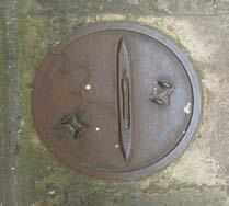
3 5.0 Public Realm 5.. History and Heritage For a detailed history of the Site please refer to the Heritage Appraisal. Morphology The diagrams here trace the changes to the streetscape, yard spaces and routes in the area from 87 to 98. The overall street pattern has changed very little over the past 0 years, with consistent threshold alignments and street widths. Between 890 and 98 a passage to the North of the Site along the railway edge can be seen in the maps which no longer exists. During this period the formation of each block has changed considerably in terms of the location and scale of yard spaces - both as a result of continued redevelopment of buildings and bomb damage during the Second World War. Designations The public realm is located within the Elder Street Conservation Area, and its lined with a number of listed buildings and facades. A key designation within this area relating to public realm proposals is the listed carriageway setts on Fleur De Lis Street, Elder Street and Folgate Street which contribute strongly to the overall grain and positively to the character of the public realm. Heritage Assets While there are significant heritage assets associated with buildings on and adjacent to the project area - as outlined in the Blossom Street, E: Existing Building Heritage Analysis, December 0 - there are also a number of key assets that make-up the local public realm. These elements, while often quite small, have a profound impact on the character of the streets that make up the wider Blossom Street area. A mix of varied, but texturally consistent, ground materials and a number of objects, and historic fragments, can be found across the Site. 87 (OS map) 890 (Goad Plan) 9 (Bomb damage map) Elder Street Conservation Area Listed building Locally listed building Listed carriageway setts 9-8 (OS map) Diagram locating key heritage designations relating to the public realm and adjacent buildings. 87


4 Site of Priory (Augustinian Nuns) SP Posts Cycle Hire Station CR Ward Bdy SL SL 5.0 Public Realm and Landscape 5.. Surrounding Developments The context of the Blossom Street area is set to change significantly over the coming years. Principal Place and The Stage developments will alter the scale and permeability of Shoreditch High Street adjacent to the Site. This collection of projects will give a new frontage to Shoreditch High Street opposite the Blossom Street area, with a new public space and pedestrian links to the Site. The Bishopsgate Goods Yard project will change the relationship between Commercial Street, Shoreditch High Street and Bethnal Green Road. A number of new routes are proposed as part of this project that have the potential to better connect the Blossom Street area to Bethnal Green Road in the North East across the railway and improve accessibility to Shoreditch High Street station. The sizable public realm associated with this project offers the potential for the intimate spaces of the Blossom Street area to be brought into closer proximity with larger open green space. Industrial heritage at Blossom Street. 5.. Movement context There is currently a low level vehicular movement through the Site as a result of restrictions along Elder Street and Folgate Street. There is a steady but relatively low level of pedestrian movement through the Site. This is mostly taking advantage of East-West connections via Folgate Street and, to a lesser extent, Fleur De Lis Street. Future proposals for Principal Place and Bishopsgate Goods Yard have the potential to further increase this East-West movements through the Site. While pedestrian movement in this direction across Norton Folgate is currently provided for, this increased connectivity may benefit from improved crossing provisions on Commercial Street to make movement to and from Bishopsgate Goodsyard more convenient as well as improving access to Shoreditch High Street Station from the Site. It is understood that LBTH and Transport for London (TfL) are currently pursuing proposals to introduce a new pedestrian crossing at Commercial Street, South of the junction with Elder Street which will help to address future movement needs in this area. 88 Examples of historic objects and fragments that can be found throughout the project area. Historic route and materials at Fleur De Lis Street passage. Domestic basements express in the public realm and historic route and materials at Fleur De Lis Street alley. Existing vehicular and pedestrian movement diagrams. A P P O L D S T R E E T C U R T A I N R O A D P R I N C I P A L P L A C E B E T H N A L G R E E N R O A D C H E S H I R E S T R E E T B I S H O P S G A T E G O O D S Y A R D Future pedestrian movement opportunities to and through the Site as a result of forthcoming projects. V A L L A N C E R O A D
5 5. The Place Today 5.0 Public Realm The character of the Blossom Street area, and its immediate surroundings can be broadly divided into the streets that make up the interior of the area (Blossom Street, Fleur De Lis Street, Fleur De Lis Passage, Elder Street and Folgate Street) and the major roads of Norton Folgate/Shoreditch High Street to the West and Commercial Street to the East. The following paragraphs describe the public realm character of each of these areas, and the specific qualities of the each of the streets and spaces within the Site area and its immediate surroundings. 0 Norton Folgate 0 Commercial Street 0 Elder Street, Fleur De Lis Street and Blossom Street 0 Folgate street 05 Fleur De Lis Street Passage There are two key parts to this review: - Public realm character assessment: examining and describing the existing character of the place and identifying key character areas. - Public realm audit: an audit of the existing public realm within and around the Blossom Street area including surface materials, street furniture and objects, soft landscape and planting, interfaces with surrounding areas and key movement patterns to and through the area The review is based on detailed observation and documentary of the Site as it exists. The Site has been visited a number of times and recorded through detailed mapping and photographic documentary. Historic assessments have been conducted through a combination of on-site observations and desktop analysis, building on the existing building heritage analysis. 0 Diagram identifying the key public realm character areas associated with the Blossom Street project. 89


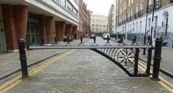
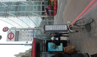
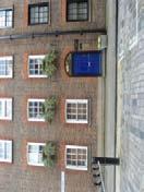
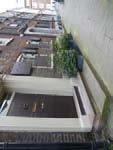
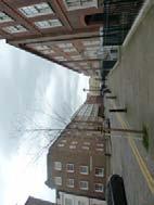
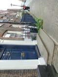
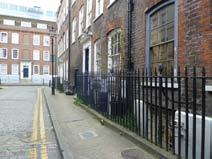
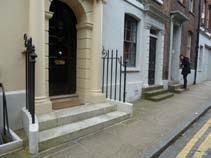
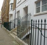
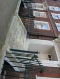
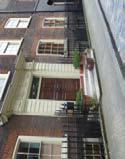
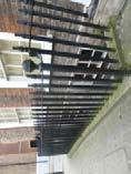
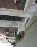
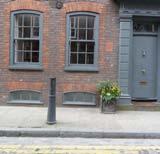
6 5.0 Public Realm and Landscape Looking South along Shoreditch High Street opposite the future Principal Place Site. Entrance to Elder Street from Commercial Street. Looking North along Elder Street towards Commercial Street. Looking East along Fleur De Lis Street towards Commercial Road. 5.. Norton Folgate/ Shoreditch High Street Norton Folgate/ Shoreditch High Street forms the Western fringe of the Site. This short stretch of the A0, becomes Bishopsgate to the South and Shoreditch High Street to the North. It has a distinctly commercial feel with large office blocks on its Western side and medium scale buildings with retail ground floors to the East. The public realm of Norton Folgate/Shoreditch High Street has a fairly neutral character with relatively comfortable footway widths paved in natural stone, street lighting focussed on carriageway illumination and little street furniture. The footways accommodate a busy pedestrian thoroughfare with consistent movement along the length of the road and little opportunities, or requirement, for stopping or gathering. The key exception is the bus stop located directly opposite the entrance to the Fleur De Lis Passage, where the character of the street also begins to change as result of the railway bridge. There is a continuous flow of vehicular traffic along Norton Folgate/Shoreditch High Street mostly consisting of buses, taxis and delivery vehicles. Pedestrian movement across the road is helped by a zebra crossing to the South of the junction with Worship Street and a crossing at the controlled junction with Spital Square. 5.. Commercial Street Commercial Street, forming the project area s Eastern fringe, has a significantly more lively character than Norton Folgate owing in part to its location between the City and Shoreditch, a more varied collection of buildings and uses, and busier pedestrian and vehicular movement. A key characteristic of Commercial Street is the collection of strong, chamfered building corners that define both clear junction spaces within the street and a sense of entrance from Commercial Street into the Blossom Street area. The quality and width of the public realm along the Western footway of Commercial Street varies greatly along its length. The footway is composed of a mix of stone paving flags, patches of asphalt and glass-block basement lights. Unlike Norton Folgate, the footways of Commercial Street feel much more cluttered with bollards, litter bins, columns and traffic signage. Where the interior streets of the Blossom Street area interface with Commercial Street their carriageway cobbles, or pavers at Elder Street, are laid up to the kerb line of Commercial Streets asphalt carriageway, giving a clear sense of these quieter interior streets pushing up to the busy edge of Commercial Street. Pedestrian movement across Commercial Street is poor, the main formal opportunity at the junction with Wheeler Street, and more distant crossings at the junctions with Lamb Street to the South and Shoreditch High Street to the North. 5.. Elder Street, Fleur De Lis Street and Blossom Street Blossom Street, Fleur De Lis Street and Elder Street form the heart of the project area, and define the interior character of the block. These three streets contrast greatly to their Western and Eastern fringes in terms of scale, materiality, use and overall character. The general character of these three streets is given continuity through the presence of setts on the carriageways. They are relatively narrow, quiet street spaces with minimal footway widths, little pedestrian or vehicular through traffic and a mix of masonry industrial and residential buildings. Within this consistency the three streets hold a rich and varied collection of smaller scale public realm elements, and each streets has variations in its character. Elder Street: Elder Street is the most prominently domestic of the interior streets, with mainly residential buildings and very little vehicular movement owing to the control gate located to the South of its junction with Fleur De Lis Street. The public realm of Elder Street is very consistent with a cobbled carriageway and narrow flag paved footways. The footways are further narrowed by a number of residential entrance steps and basement thresholds with intricate ironwork grilles and surrounds projecting into the footway space. This, alongside the presence of private potted plants located on the footways, strengthens the intimately domestic character of the street, and invests it with a much stronger sense of resident ownership than the adjacent streets. Fleur De Lis Street: By comparison Fleur De Lis Street feels much less consistent and more open than Elder Street as a result of both the more varied building stock over its short length, and the walled - but unbuilt - triangular corner at its junction with Elder Street as well as the fenced yard space on the North side of the street at the corner with Blossom Street. There are very few entrances off Fleur De Lis Street with residential buildings accessed either from adjacent streets or via courtyards. Where industrial and commercial buildings interface with Fleur De Lis Street this is typically though inactive frontages, service entrances or fences. This, alongside, its location along the railway edge to the North of the area, gives Fleur De Lis Street a definite sense of being a secondary street within the blocks interior. 90


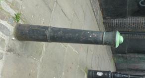
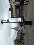
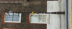
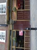
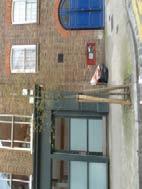
7 5.0 Public Realm Looking South along Blossom Street towards Folgate Street. Looking West along Folgate Street towards Norton Folgate. Entrance to Fleur De Lis Passage from Shoreditch High Street. Looking West along Fleur De Lis Passage towards Shoreditch High Street. While Fleur De Lis Street shares the setts in the carriageway with its neighbouring streets its footways vary much more. Bays of in-situ cast concrete are used throughout, although of differing ages and quality. To the Western end of the street a high number of bollards are located inbound of the kerb, further reducing the already narrow footways and giving the street the characteristics of a service road rather than an inviting pedestrian environment. Within the streets limited public realm, however, are a number of details and items of value - including some of its collection of historic bollards and the more textured patches of exposed aggregate concrete within the footways. Blossom Street: Blossom Street is the main street at the heart of the Site. The North end of Blossom Street has a distinctly more industrial character than the other streets within the block. These taller buildings, typically with dark masonry, contribute to the narrow, intimate, quality of the street. Like Fleur De Lis Street there are few existing active frontages onto Blossom Street. The presence of shuttered industrial and service entrances to the North and ground floor windows with closed blinds to the South give the street a yard-like character. The Water Poet pub on the South-West corner of Blossom Street and Folgate Street is the only indication of activity on the street, heightening the importance of this corner within the overall block and suggesting the transition between the interior and the wider city. The public realm of Blossom Street is, comparable to that of Fleur De Lis Street with carriageway setts and very narrow footways. Footway materials include sets with in-situ cast concrete bays and newer flag paving. The presence of small clusters of varied bollards along the streets length contributes to the sense of narrowness and variety. Within this variety exists some surprising, often delightful, details and objects. A number of unusually shaped bollards, building mounted luminaires, peculiar ironwork and old crane armatures add to the eclectic, post-industrial character of the street. While limited in terms of the scale of its public realm, Blossom Streets offers the most intense and varied spatial experience of the streets within the project area, and contains the greatest density of fragments from the areas industrial past. 5.. Folgate Street Although also an interior street of the Blossom Street block Folgate is spatially distinct from Elder Street, Fleur De Lis and Blossom Street. Unlike its neighbours it is possible to see out from one end of Folgate Street to the other, either towards Commercial Street or Norton Folgate. There are also clear passages to the South from Folgate Street towards to Spitalfields Market via Lamb Street, Elder Gardens and Spital Square which, in combination with its wider section, give the street a sense of being at the threshold between surrounding places. The image and public realm of Folgate Street also differs from the adjacent streets in terms of the larger building frontages of differing ages, and a less varied treatment of the ground. While the carriageway is again consistently surfaced in setts the streets footways are less varied, and more neutral in their materially, than the surrounding streets. Natural stone flag paving is used along Folgate Street, and the bollards and street furniture used on the footways are more consistent that its neighbours. Also, while there are a variety of thresholds between the building frontages and the public realm, these encroach on the footway less than elsewhere in the block, maintaining regular footway widths throughout the street Fleur De Lis Passage The Fleur De Lis Passage is a small passage linking Fleur De Lis Street, at its junction with Blossom Street, to Shoreditch High Street in the West. This short passage is bound by inactive walls on both sides, with some unused service entrances and windows towards Blossom Street. The quality of these thresholds are varied and comprise building flanks, retaining structures and the railway bridge parapet, each of varied types and colours of masonry - some painted and some with dense layers of graffiti. The surface treatment of the space is of natural stone flags, cut and laid to a fall at the passages centre. The shaded nature of the space has lead to collections of mosses and other small scale wall plants emerging both between the paving units and along the passages walls. The space contains three iron lamp columns centred along its centre which further contribute to the intimacy of the space. Where the Fleur De Lis Passage meets Shoreditch High Street is currently a disappointing situation. The passage has very little presence on the street, which is further compromised by the location of the bus shelter at its entrance. 9

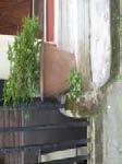
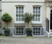
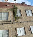
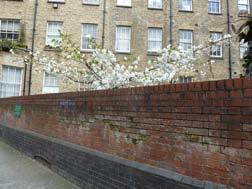
8 5.0 Public Realm and Landscape 5.. Public Realm Audit Overall quality: The overall quality of the area may be consistent in the types of materials, however, there are at least sixteen different types of paving and a similar number of bollards, for example. Material audit: While there are many differing types of paving in the area. These tend to be grouped into families or groups on the different streets. The carriageways throughout the block s interior are consistently surfaced in setts, allowing the road space to give a sense of material continuity to the project area. Street furniture and object audit: The public realm local to the project area contains a varied collection of street furniture within a catalogue of furniture types. Street furniture within the areas is comprised of bollards, signs, CCTV and lamp columns, litter bins, parking meters and electrical control boxes. The eclectic collection of objects found throughout the Blossom Street Site holds a number of delightful items including a collection of unusually shaped bollards, vehicular access gates, and ductile iron covers and plates set into the ground which contribute positively to the overall character and quality of the public realm. Soft landscape and planting audit: and window troughs. The presence of private planting in the public realm invests a sense of care and domesticity into the public realm. This are also many traces of naturally occurring small scale plant growth throughout the area in the form of mosses and wall plants. These plants add to the overall fine-grained texture of the local streets as well as contributing a sense of time and curiosity that is consistent with the contribution of the areas more formal heritage fragments. Thresholds audit: Building thresholds throughout the Site have a variety of relationships with the public realm. Building entrance rarely meet the street directly, as a result of threshold level differences or the presence of basements. Domestic entrance are typically stepped, quite often projecting into the narrow footways, amplifying the domestic character of those streets. On broader streets, such as Folgate Street bridged entrance over basement lightwells have a much grander presence in the public realm. The presence of basements is consistent throughout the area either through bridged lightwells with iron fencing, or through smaller basement windows with kerbed surrounds or intricate iron grilles projecting to the footway space. As with the varied and small-scaled materiality, planting, and families of objects in the area, these intimate details contribute to the rich overall quality of the public realm. Due to the limited capacity of the existing public realm, and the narrow nature of the blocks interior streets, there is very little formal street planting. There are only three trees within the Site; two relatively young street trees and one flourishing mature tree located within the walled space at the junction of Elder Street and Fleur De Lis Street. Looking North into Blossom Street from Folgate Street. There are, however, other types of planting that can be found in the area - both incidental and deliberate - that contribute to the overall richness and texture of the area, and its sense of domestic ownership. There is evidence of quite extensive domestic planting, most prominently on Elder Street and to a lesser extent Folgate Street, in the form of potted plants 9


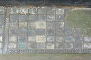
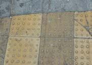
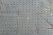


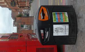
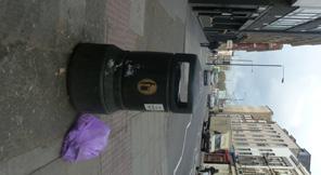
9 5.0 Public Realm Asphalt Black ceramic tiles Buff blister paving Stepped back Electrical boxes Post box CCTV post Bus stop Street trees Charcoal blister paving Concrete and metal Exposed aggregate concrete Basement extrusions Sign posts Lamp columns Parking ticket machine Litter bins Glass blocks and concrete Granite cobbles (Grey/blue) Granite cobbles (multi) Domestic planting Herringbone (new) Herringbone (old) Metal and glass blocks Vehicular access gates Ductile iron covers and plates Basement windows Natural New yorkstone paving Yorkstone paving setts Yorkstone paving Yorkstone blister paving Bollards Bridged entrances Material audit Street furniture and objects audit Soft landscape and planting audit Threshold audit 9


10 F L E U R D E L I S S T R E E T C O M M E R C I A L S T R E E T 5.0 Public Realm and Landscape 5. Evolving the Design PUBLIC REALM WALKABOUT S H O R E D I T C H H I G H S T R E E T F L E U R D E L I S S T R E E T E L D E R S T R E E T Start / finish: The Water Poet B L O S S O M S T R E E T E L D E R S T R E E T F O L G A T E S T R E E T 0 5 N O R T O N F O L G A T E F O L G A T E S T R E E T Blossom Street, E Public realm consultation walk map Previously proposed location of entrance to Blossom Place from Norton Folgate Currently proposed location of entrance to Blossom Place from Norton Folgate Proposed one-way working on Fleur De Lis Street and Blossom Street The public realm and landscape proposals have evolved through continued engagement with statutory authorities and local community groups. These include workshops, exhibition, pre-application meetings and public realm specific walks. The public consultation outcomes are summarised in Section. 5.. Public Realm Walks On the th and th June 0 two public realm walks were conducted inviting local stakeholders to discuss emerging public realm and landscape proposals on Site. As part of the walk attendees where also given the opportunity to contribute their opinions and observations about the existing public realm in the area in order to gain a greater knowledge of what was liked, disliked, valued and could be improved within the local area. Area. Material character and quality. - It was strongly felt that Elder Street should be altered as little as possible. There was wide support for proposals to create new routes that would minimise the impact on residential streets (i.e. new passages and yards). Strong support for maintaining the existing historic setts, and expanding were possible through the Conservation Area. Many where opposed to the existing herringbone paving found in parts of the carriageway. It was felt that the use of York Stone should be retained on Elder Street. received varied responses; - Some felt the space was dirty and needed improving, while others where concerned with its preservation. - Some felt that it should not have active frontages but remain a passage, while others felt some activating would be good. - The sense of transition from Shoreditch High Street to the Conservation Area provided by the passage was largely appreciated It was generally felt that the introduction of greenery and tree planting to the area would be a good thing as it signifies the tranquillity of the area and its residential status. 5.. Key Changes Proposals for one-way traffic on Fleur De Lis Street and Blossom Street. The location of the entrance to the proposed yard at Blossom Place from Norton Folgate. The distribution of proposed public realm materials. The scope of works to the listed carriageway on Fleur De Lis Street. The following is a summary of the key verbal and written comments received from attendees over the two days: It was widely felt maintaining and strengthening the existing character of the streets is important in terms of; - A sense of quiet, peace and tranquillity. - A strong sense of a quiet interior with a clear threshold to the busy streets beyond the Conservation It was widely felt the existing kerb heights should be maintained throughout the area. Many where opposed to the idea of introducing public art It was felt that an increase in cycle parking facilities would be desirable The role and image of Fleur De Lis Street passage The proposals for the landscape and public realm presented in this application aim to respond to this input, alongside the wider consultation input and feedback from consultation with LBTH and TfL, in order to develop a balanced and achievable set of improvements for the local area. Key changes as a result of these dialogues include; 9
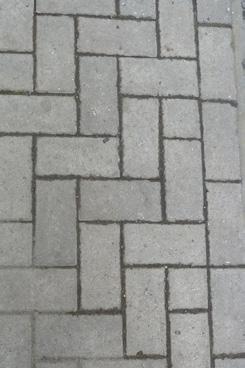
11 5.5 Hierarchy of Landscape Spaces 5.0 Public Realm 5.5. Overview of Approach The Public Realm strategy is to maintain and strengthen the identity of the Blossom Street area, celebrating and adding to what is already good while improving its relationship with the surrounding city. An approach has been taken that joins- in with and adds- to the existing place. In this way the proposed improvements are concerned with preserving, repairing and curating what is already good in the area, and adding a new layer to the landscape that contributes to the existing character while offering necessary improvements to aid the quality, function and legibility of the public realm. P R I N C I P A L P L A C E N O R T O N F O L G A T E S H O R E D I T C H H I G H S T R E E T C O M M E R C I A L S T R E E T B I S H O P S G A T E G O O D S Y A R D 5.5. Landscape and Public Realm Strategy: Crust, Interior and Entrances S P I T A L F I E L D S M A R K E T The ambition for the Blossom Street public realm is to enhance the strong sense of interior felt within the block, to make a good edge between the area and Norton Folgate, and to adjust the entrances to the wider area at Commercial Street and towards Spitalfields Market. Big Interior Crust Entrances. A big interior:. Crust:. Entrances: The strategy identifies three roles for the public realm associated with the Site. Within each of these roles a more nuanced and specific suite of improvements is proposed. The Site is part of a larger urban block stretching from Norton Folgate in the West to Commercial Street in the East, and bound by the railway to the North and Spitalfields Market to the South. Within these varied edges the block has a clear interior quality as a result of distinct changes in scale, grain and materiality from the surrounds to Blossom Street, Fleur De Lis Street, Elder Street and Folgate Street. The public realm maintains and strengthens this intimate interior while reacting specifically to the nuanced differences of each of the streets that make up the block. The project proposal adds new yard spaces to the block which contribute to the overall tapestry of spaces in the area, each with a subtle variation in character and use. The idea of crust refers to an approach towards the relationship between the blocks interior and its immediate edges, especially at Norton Folgate. The public realm proposes to carefully and precisely manage the relationship between these two conditions, to maintain the differences between them without weakening either, and to enhance the sense of transition from the interior to the City. In addition to the entrances within the Site a number of more remote, but important, entrances to the Blossom Street area have been identified as part of a wider approach to the public realm. These range from existing passages from Norton Folgate and Spitalfields Market to the distinctive corner spaces on Commercial Street flanked by strong chamfered building frontages. These spaces offer the opportunity for improved legibility, wayfinding and, as with the crusts, the opportunity to manage and make good relationships between the interior of the block and the surroundings. 95
12 5.0 Public Realm and Landscape 5. Public Realm Network 5.. Access The proposals have all been developed to improve access. An inclusive design approach has been taken to propose careful adjustments to the existing historic streetscape in order to improve access for all, while maintaining the existing character as much as possible: The proposals tie in with the wider route network; The Western pavement of Blossom Street is proposed widened; The capacity of the footway on Shoreditch High Street is proposed increased while improving the loading bay and providing disabled parking; All paving to footways is proposed to be smooth, including where setts are used; Unused bays and vehicular crossovers are proposed removed; Unnecessary street furniture is proposed removed to reduce clutter. It is proposed to change vehicular access to one-way operation on Fleur De Lis Street (entrance) and Blossom Street (exit). While reflecting the prevailing movement patterns this will enable traffic calming, the introduction of cycle parking in the carriage way and footway widening. 5.. Area by area overview Norton Folgate / Shoreditch High Street At Norton Folgate/Shoreditch High Street it is proposed to upgrade the existing public realm, maintaining its status as the High Street crust to the Conservation Area, and the Sites main interface with the City. Proposals in this area include: York stone flag paving; Widening, resurfacing and adjusting levels of the existing loading bay; Relocated highway lighting; New cycle parking. Outside the scope of this application it has been discussed with TfL that it would be beneficial to the wider area if TfL were to pursue relocation of the existing bus shelter at the entrance to the Fleur De Lis Passage to increase its visibility and to consider improvements to the raised table at Folgate Street and the pedestrian crossing across Norton Folgate. Blossom Street, Fleur De Lis Street, Folgate Street and Elder Street: At Blossom Street, Fleur De Lis Street and the Fleur De Lis Street Passage it is proposed to build upon the existing intimate and richly textured character of the streets, building on their industrial heritage and improving them as an attractive and unique pedestrian environment to support the proposed commercial and residential uses in the area. The proposals for Blossom Street, Fleur De Lis Street, Folgate Street and the Fleur De Lis Passage include: Retained and repaired carriageway setts; Widened Western footway to Blossom Street with retained setts complemented by reclaimed setts laid to create a smooth accessible footway; York stone flags elsewhere; within the alley it is proposed to carefully relay the existing flags; Granite kerbs replaced with reclaimed kerbs as needed to adjust footway width, crossovers and bays; New granite quadrants at the Southern end of Blossom Street with inset reused bollards; Cycle parking on Fleur De Lis Street protected by kerb height granite pieces with inset reused bollards; Building mounted highway lighting is proposed where feasible, with existing historic luminaires repaired or matched. On Elder Street and Folgate Street pavements associated with the Blossom Street project are proposed relaid with York stone; reused as far as possible. S Blossom Yard: The yard space associated with Plot S will provide a new publicly accessible space between the buildings S, Sa and Sb as well as a new pedestrian connection between Blossom Street and Norton Folgate. It is proposed that this yard become a new piece within the interior of the block, sharing a material relationship with Blossom Street whilst accommodating uses spilling out from the buildings at its edges. The proposals for Blossom Yard include: Reclaimed sett paving; Mats of concrete with setts inlaid to provide seating areas; Terrazzo tiles within the covered entrance spaces to the yard; A potted cherry tree (pink blossom) with integrated seating and smaller scale pot planting; Cycle parking; Catenary lighting; Entrance gates to Norton Folgate/ Blossom Street Nicholls & Clarke Yard and Elder Passage and Elder Court: S is made-up of two spaces; Nicholls & Clarke Yard to the end of Blossom Street and the interior passages and courtyard within the proposed S block. It is proposed to build on the existing material and spatial qualities of the Blossom Street Yard to create a public space able to accommodate a variety of uses, including people spilling out from the proposed A uses on either side. The proposals for the Nicholls & Clarke Yard and interior Elder Passage and Elder Court include: Retained and reclaimed sett paving; Mats of concrete with setts inlaid to provide seating areas; A new section of railway boundary wall; A planted screen to the railway boundary wall and basement proposed staircase enclosure; A piece of furniture for seating; Terrazzo tiles to the passages and interior courtyard; York stone flags extending the pavement on Elder Street into the Elder Passage off Elder Street Potted plants to the interior courtyard; Catenary lighting. Outside the scope of this application it has been discussed with TfL that it would be beneficial to the wider area if TfL were to improve the raised table at the Northern end of Elder Street including increasing the pavement width at the Western side of the raised table through an adjustment to the kerb line S garden: The S garden will be a private shared garden space for the future residents of the S block. The garden will provide a key amenity space for both private and affordable housing occupants. Proposals for the S garden include: Play provision; Grass and shrub planting. Carriageways: It is proposed to repair and improve the existing carriageway setts on Blossom Street and Fleur De Lis Street. The carriageway surface on Fleur De Lis Streets is Listed. Both streets makes a significant contribution to the overall character of the Conservation Area and sense of intimacy within the interior streets of the block. Proposals for the carriageway setts to Fleur De Lis Street include: Lift, remove and store the setts Install new road beds Clean and repair setts as required Relaying of carriageway with retained setts (and new / reclaimed as necessary) in a coherent and historically consistent pattern. On Blossom Street repairs will be carried out to localised areas of ware and tear and areas where new below ground services will need to be laid. 9
13 5.0 Public Realm N 5 Proposed network of public realm spaces Shoreditch High Street Blossom Street, Fleur De Lis Street and Folgate Street Blossom Yard Nicholls & Clarke Yard and Elder Passage and Elder Court S garden Carriageways 5 97


 via Blossom Yard.")


14 5.0 Public Realm and Landscape 5.7 Landscape Masterplan 5.7. Access and inclusive design The public realm proposals have been carefully considered in order to manage the relationship between conserving the historic nature of the streets and improving their accessibility. In order to achieve this a suite of both large and small adjustments are proposed, along with a tailored approached to the type and location of footway materials. Blossom Street and junction of Fleur De Lis Street and the Fleur De Lis Street passage to allow continuous footway levels at key routes; Remove unnecessary street furniture to improve footway capacity. Proposed footway materials: Key access improvements: The following proposals improve the physical layout of the local public realm in order to improve access both to and from the area, and its along its adjacent footways. Tie-in with the wider route network by: Providing a new route from Commercial Street to Shoreditch High Street via the Elder Passage and Elder Court and Fleur De Lis Passage; Provide a new route from Blossom Street to Norton Folgate (adjacent to the existing pedestrian crossing) via Blossom Yard. At Shoreditch High Street: Increase the footway capacity on this busy pedestrian route by altering the levels of the existing loading-bay to be level with the footway; Providing a new arcade at the interface of the footway and plot S to providing additional space for pedestrians; Surfacing both the loading-bay and arcade with Yorkstone to match the footway surface. At Blossom Street it is proposed to: Widen the Western footway to increase pedestrian capacity on this very narrow footway. Change Blossom Street and Fleur De Lis Street to one-way operations in order to; Calm traffic in response to prevailing movement patterns; Allow for increased footway widths where carriageway capacity is no longer required; Enable new cycle parking facilities. Further to these improvements the type and distribution of footway materials is proposed to improve accessibility and quality of the public realm whilst contributing to the existing historic character of the area. The following footway materials are proposed within the public realm: Yorkstone flags: Norton Folgate; Folgate Street; Blossom Street Eastern footway; Fleur De Lis Street; Elder Street. Yorkstone setts; Shoreditch High Street loading bay. Granite setts; Blossom Street Western footway (where currently existing. It is proposed that these are retained, repaired and relaid with new / reclaimed material to match as required. Laid with flush joints for access); Blossom Yard (where currently existing. It is proposed that these are retained, repaired and relaid with new / reclaimed material to match as required. Laid with flush joints for access); Blossom Yard (new / reclaimed material to match adjacent setts in Blossom Street (laid with flush joints for access), materially integrating this space with the existing public realm network). Terrazzo tiles; Covered entrance spaces to Blossom Yard; Covered entrance spaces to Elder Passage and Elder Court to Plot S. Example of Yorkstone flags. Example of existing Yorkstone setts at Shoreditch High Street loading bay. Example of reclaimed granite setts as main ground material for Blossom Yard, Blossom Street West and Nicholls and Clarke Yard. Example reclaimed granite setts cast in concrete mats to create smoother areas for seating within proposed yards. In addition it is also proposed to: Removal of unused bays and vehicle cross-overs at 98 Examples of terrazzo tiles proposed at covered yard entrances and passages. Example of setts laid in the pedestrian environment at Somerset House.

15 5.0 Public Realm N New routes tied into wider desire-lines Localised footway widening on Blossom Street Increased footway capacity on Shoreditch High Street Removal of redundant cross-overs enabling continuous footways Proposed access improvements and footway materials 99


16 5.0 Public Realm and Landscape 5.7 Landscape Masterplan 5.7. Norton Folgate/ Shoreditch High Street Footway and arcade: It is proposed that the Eastern footway of Norton Folgate/ Shoreditch High Street and the arcade is surfaced in York stone as per adopted design guidance. Ways in: It is proposed that the entrance to the Fleur De Lis Street Passage is marked by larger flag stones, potentially with engravings celebrating aspects of the place such as the name of the alley. It is proposed that the way into Blossom Yard is paved in Portland stone which will support a sense of interior and better reflect light into the space. The flank wall of 9 Norton Folgate which will be revealed as part of the project could (subject to condition) accommodate a hand painted sign highlighting the way through. It has been discussed with TfL to relocate the existing bus stop shelter, currently Sited in front of the entrance to the Fleur De Lis Passage North by approximately m in order to reduce footway congestion at this point and improve access and visibility to the Fleur De Lis Passage. Likewise improvements could be considered to the existing crossing across Norton Folgate. These improvements would benefit the wider area and are included here as recommendations only. Cycle parking: Ten no new cycle stands (0.no cycle parking spaces) are proposed on Norton Folgate between the loading bay and the pedestrian crossing to provide short-stay cycle parking. Lighting: Highways lighting is proposed relocated to reduce clutter. Yorks stone paving flags are proposed on the Eastern footway of Norton Folgate/Shoreditch High Street as per adopted design guidance. Hand painted sign at Sutton High Street highlighting a lateral connection and providing interpretation of a local feature. Loading bay and disabled parking: It is proposed to widen the loading bay to m in order to accommodate delivery vehicles. It is also proposed to accommodate disabled parking. It is proposed to adjust the levels of the loading bay in order to be flush with the existing footways levels, enabling the bay to be part of the footway extents when not in use. A ramped kerb would be provided along the carriageway edge to allow vehicles to access the bay, and the loading bay would be resurfaced in York stone setts in the same orientation as the adjacent footway. This, in combination with the proposed arcade space to Plot S, will improve the capacity and quality of the public realm at Shoreditch High Street. Decluttering: General de-cluttering of obsolete or redundant street furniture is proposed. Example of loading bay with ramped kerb at Shafetsbury Avenue. Existing bus stop shelter and pedestrian crossing: 00 Proposed sections at Shoreditch High Street. Existing bus stop shelter on Shoreditch High Street / Norton Folgate.

17 5.0 Public Realm N 5 7 York stone flag paving Entrance to Fleur De Lis Passage Entrance to Blossom Yard Potential interpretation signage at flank wall Existing loading bay widened to m and made flush with footway Disabled parking 0nr. new cycle stands (0.no cycle parking spaces) 5 7 Norton Folgate proposals plan 0
 and Blossom Street (exit).")


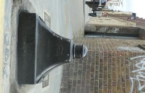
18 5.0 Public Realm and Landscape 5.7. Blossom Street, Fleur De Lis Street, Folgate Street and Elder Street It is proposed to change vehicular access to one-way operation on Fleur De Lis Street (entrance) and Blossom Street (exit). While reflecting the prevailing movement patterns this will enable traffic calming, the introduction of cycle parking in the carriage way and footway widening. Footways and kerbs: The Western footway of Blossom Street will be widened with retained setts complemented by reclaimed setts laid to create a smooth accessible footway. Reclaimed setts are proposed as a mix of grey, brown, blue and red natural granite to match as closely as possible the texture and tonal variety of the existing areas of setts. Granite kerbs are proposed replaced with reclaimed kerbs as needed to adjust footway width, crossovers and bays. Elsewhere York stone flags are proposed to the footways (use of existing where possible). New granite quadrants at the Southern end of Blossom Street with inset reused bollards. Fleur De Lis Passage: Relationship with the Elder Passage and Elder Court and Nicholls and Clarke Yard: The Nicholls and Clarke Yard is located at the Northern end of Blossom Street. It is proposed to maintain granite setts as the main material within these spaces. The York stone paving on Fleur De Lis Street is therefore arranged to allow the setts to flow through. There is not a vehicular crossover into the yard and all surfaces are flush and smooth to ensure accessibility. See section on the Nicholls and Clarke Yard. Carriageways: It is proposed that the existing carriageway setts throughout Blossom Street and Fleur De Lis Street be retained and repaired. Repairs are proposed in relation to proposed adjustments (adjusted kerb-lines / installation of cycle parking) and where localised areas of wear or damage are identified. On Fleur De Lis Street the carriageway will need to be temporarily dug up to enable installation of new services. The setts (carriageway) on Fleur De Lis Street are listed and Listed Building Consent will be sought. Please refer to section of this report for more further information of proposed carriageway improvements. Cycle parking: Cycle parking is proposed installed on Fleur De Lis Street protected by kerb height granite pieces with inset reused bollards. It is proposed to install no cycle stands, providing no cycle parking spaces. Lighting: In order to maximise the footway capacity and improve the pedestrian environment on Blossom Street it is proposed that street lighting be building mounted in line with the historic lighting associated with the warehouses where possible, and lamp columns located on the northern footway of Fleur De Lis Street. Existing historic luminaires are proposed repaired or matched, including within the Fleur De Lis Passage. Decluttering: General de-cluttering of obsolete or redundant street furniture is proposed. Existing historic footway setts on Blossom Street The existing Fleur De Lis Passage has a number of unique characteristics that are considered of value to the collection of spaces within the project area including its mixed sizes of York stone flags, the valley profile of the drainage. As the passage will need to be cleared in order to construct new basements below it is proposed to carefully document the existing paving, store the materials during construction and reinstall as existing, with careful repairs as necessary. Retained and re-used street furniture: There are a number of bollards within the existing public realm of heritage and spatial value, and which contribute to the eclectic and intimate nature of the existing streets. On Blossom Street and Fleur De Lis Street in particular there is a selection of bollards that are proposed to be retained. Where the existing locations of these items are inappropriate or redundant it is proposed to re-use and relocate these within the project area. Example of setts laid in the pedestrian environment at Somerset House. 0 Examples of historic and spatially valuable bollards proposed for retention within the project area.
19 5.0 Public Realm N Blossom Street, Fleur De Lis Street, Folgate Street and Elder Street proposals plan Retained and reclaimed setts at Western footway of Blossom Street York stone flag paving New granite quadrant kerbs at junction with Folgate Street Fleur De Lis Street Passage reinstated with improved entrances Vehicle crossover removed to allow continuous footway levels Existing carriageway setts retained and repaired nr. new cycle stands (nr. cycle parking spaces) Building mounted lighting

20 5.0 Public Realm and Landscape Blossom Street The existing carriageway setts throughout Blossom Street and Fleur De Lis Street will be retained and repaired. Blossom Street 0

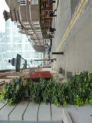
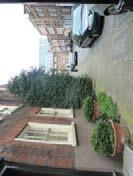
21 5.0 Public Realm Blossom Yard The yard space associated with building S will provide a new publicly accessible space between the buildings S, Sa and Sb as well as a new pedestrian connection between Blossom Street and Norton Folgate. Blossom Yard 05


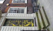
22 5.0 Public Realm and Landscape 5.7. Blossom Yard It is proposed that this yard become a new piece within the interior of the block, sharing a material a material language with the interior streets of Blossom Street and Fleur De Lis Street whilst accommodating uses spilling out from the buildings at its edges. Ground materials: It is proposed that the main ground material in this space be of reclaimed setts as on Blossom Street. These setts are proposed to have smooth, or very shallow domed top surface, and be laid with flush mortar joints in order to enable access for all users. Where areas are allocated for seating or spill-out uses it is proposed to provide in-situ cast concrete mats in which setts are inlaid. This will provide a smoother surface for locating furniture related to A uses. Ways in: Interpretation: As well as the hand-painted Blossom Yard sign described in the Norton Folgate paragraphs it is proposed to introduce a cast bronze disk into the ground of the yard making reference to the rich history beneath the ground in the area. It is proposed that the exact content of this element be developed in dialogue with local residents and community groups. Please see example images overleaf in section Cycle parking: 7no cycle parking spaces are proposed at Blossom Yard. Lighting: It is proposed that the yard space be lit by catenary lighting mounted between S and Sb. Proposed elevation of precast concrete tree pot with integrated seating. It is proposed that the way into the S yard from Norton Folgate is paved in a Terrazzo tile which will support a sense of interior and better reflect light into the space. The entrance from Blossom Street is proposed to have the setts flowing through, with an inset matt of terrazzo to reflect the entrance treatment opposite (please see example images overleaf in section 5.7.5). Example of reclaimed granite setts as main ground material for Blossom Yard. Planting and pots: A semi-mature Cherry tree is proposed located within the yard in a large bespoke concrete pot. The pink blossom will introduce colour into the space, and reference the floral connotations of the areas place names. The pot is proposed with integrated seating. Example of cherry tree and moss planting between cobbles. Further to this a collection of small-scale pot planting and mosses are proposed for the space as described in the previous paragraphs. The potted plants are proposed to be native species to support the biodiversity of the area including Dog Rose, Yarrow, Ox-Eye Daisy, Herb-Robert, Common Toadflax, Common Bird s Eye Trefoil, Red Clover and Sweet Vernal grass. 0 Example reclaimed granite setts cast in concrete mats to create smoother areas for seating. Native pot planting.

23 5.0 Public Realm N Reclaimed granite setts Seating area New concrete platform with pot planting New platform with setts and moss planting Entrance spaces surfaced in terrazzo New Cherry tree in large concrete pot New small scale pot planting New cycle stands New catenary lighting Blossom Place / S yard proposals plan 07


.")


24 5.0 Public Realm and Landscape Nicholls and Clarke Yard and Elder Passage and Elder Court This is comprised of two spaces; Nicholls and Clarke Yard at the end of Blossom Street and Elder Passage and Elder Court within Plot S. It is proposed to build on the existing material and spatial qualities of the Blossom Street yard to create a public space able to accommodate a variety of uses, including people spilling out from the proposed A uses on either side. Ground materials: At the Blossom Street Yard it is proposed to work with the existing industrial yard quality of the space retaining and repairing the existing setts with adjusted levels in order to remove the kerb-line currently located adjacent to the existing warehouse building. As with Blossom Yard, where areas are allocated for seating or spill-out uses it is proposed to provide in-situ cast concrete mats in which setts are inlaid. This will provide a smoother surface for locating furniture related to A uses (please see example images in section 5.7.). At the passages and interior courtyard within the S block it is proposed to use terrazzo tiles which will support a sense of interior and better reflect light into the space. As with Blossom Yard a collected on plants in bespoke pots are also proposed within the passages of the S block, these include native species such as Dog Rose, Yarrow, Ox-Eye Daisy, Herb-Robert, Common Toadflax, Common Bird s Eye Trefoil, Red Clover and Sweet Vernal grass. Interpretation It is proposed to introduce a cast bronze disk into the ground of the yard making reference to the rich history beneath the ground in the area. It is proposed that the exact content of this element be developed in dialogue with local residents and community groups. Lighting: It is proposed that the yard space be lit by catenary lighting mounted between the Western elevation of S and the 887 warehouse building. At the North of the space posts are proposed to extend the catenary lighting from S along the railway boundary wall. Luminaires are proposed as simple units. Example of terrazzo tile proposed for Elder Passages (and covered entrance spaces to Blossom Yard). Example of Honeysuckle proposed for the parapet wall at Nicholls and Clarke Yard. York stone flags extend the pavement on Elder Street into the Elder Passage off Elder Street to highlight this way through. Planting and steps to sit on: A planted screen of native plants (such as Traveller s Joy or Honeysuckle) is proposed along the railway boundary wall and along the staircase enclosure. Example of Travellers Joy proposed for the parapet wall at Nicholls and Clarke Yard This will support biodiversity within the area and provide an attractive backdrop to the space. A stepped piece of furniture is proposed alongside the planted wall to provide informal seating opportunities, enjoying the view back across the space towards the main part of Blossom Street. 08 Example of cast interpretation disk making reference to the Meridian Line. Native pot planting.

25 5.0 Public Realm N Reclaimed granite setts Seating area Terrazzo surfacing at new passages York stone at interface with Elder Street New small scale pot planting New planted screen at railway parapet wall New stepped seating piece New catenary lighting Nicholls and Clarke Yard proposals plan 09

26 5.0 Public Realm and Landscape 5 Reclaimed granite setts Seating area Terrazzo tile surfacing at new passages New planted screen at railway parapet wall New stepped seating piece 5 New catenary lighting Nicholls and Clarke Yard to end of Blossom Street Nicholls and Clarke Yard 0

 are proposed. Informal play: An informal timber play object is proposed.")
27 5.0 Public Realm 5.7. S Garden The S garden will be a private shared garden space for the residents of the S block. The garden will provide a key amenity space for both private and affordable housing occupants. 0m 0m N Planting: The ground is proposed as grass with a semi-mature native tree (such as Elder - recalling the name of the adjacent street). Alongside the boundary wall shrubs (such as bramble) are proposed. Informal play: An informal timber play object is proposed. This could include a small slide, steps and ropes providing both informal seating opportunities and opportunities for play. It could be constructed from timber of a type and profile similar to the cladding of the building to provide a calm decorative element in the garden. Indicative design for informal timber play element with reference to the monasterial history of the area New grass planting New shrub planting at boundary wall Informal timber play element Example of Bramble in flower S garden proposals plan


28 5.0 Public Realm and Landscape Carriageways As well as being statutorily Listed, the existing granite carriageway setts on Elder Street, Folgate Street and Fleur De Lis Street are key heritage asset within the Conservation Area, and major contributors to the character and sense of intimacy within these streets. Over the years this surface has been altered significantly as a result of utility works and other uncoordinated works. As part of the public realm and landscape improvements associated with this project it is proposed to repair and re-instate this historic surface to Fleur De Lis Street - in combination with accessibility improvements - to the benefit of the Conservation Area and to improve the functionality and visual amenity of these important streets. Works to historic carriageway surfaces on Fleur De Lis Street: The approach to improving and repairing the existing carriageway is focussed on the retention of historic material, its reuse in a fashion that is historically consistent, and the quality of the implementation of the works. In order to achieve this the following principles are proposed: The lifting, removal and safe storage of granite setts and kerbs, along with bollards and other street furniture of historic value. The careful removal of mortar and street markings from recovered material, and the undertaking of any other necessary repairs (such as paint removal and redecoration of bollards, etc). The installation of a road bed to appropriate highways standards. consistent pattern, with junction and corner details, and cuts, being traditionally detailed in relation to methods currently evident on the Site, and other similar historic surfaces. Where new / reclaimed materials are required these are to be sourced to ensure visual consistency in terms of colour, format and size of the units - as well as the overall mix of colours distributed through the surface. Further to this it is proposed that the reinstated surface be laid with joints that are consistent in width, and historically accurate in terms of proportion and layout. Alterations to existing street layout: A number of carefully considered alterations to the existing street layout are proposed in order to improve the accessibility and function of Blossom Street and Fleur De Lis Street. Footway widening is proposed at the Northern end of Blossom Street, on the Western side of the street. While minor in terms of adjustment this alteration will allow this very narrow footway to be increased from.70m to approximately.m. This adjustment maintains as close as possible a parallel relationship between the kerb line and the adjacent building threshold, as is typical of historical streets of this nature. At the junction of Blossom Street and Fleur De Lis Street it is proposed to remove the existing vehicle cross-over on the Northern footway of Fleur De Lis Street (adjacent to the proposed entrance to Nicholls and Clarke Yard and the Fleur De Lis Passage. This will allow a continuous footway surface through this section of the street, improving the accessibility of the route from Fleur De Lis Street, and proposed route through Elder Passage and Elder Court to Shoreditch High Street via Fleur De Lis Passage. Blossom Street Local repairs will be made to the carriageway on Blossom Street. Where new underground services routes are required to connect Plots S and S, the carriageway will be taken up locally and relaid. The principles of the implementation of these works is as per proposed for Fleur De Lis Street. Existing condition of carriageway setts at junction of Blossom Street and Folgate Street. Visible evidence of inconsistencies in surface resulting from uncoordinated works carriageway works. The relaying of salvaged street surface materials along with new / reclaimed matching material and the reinstallation of street furniture to the new layout and design. It is proposed that the relaid, salvaged material and the introduction of new / reclaimed granite setts and kerbs be carefully and intelligently balanced to maintain the historic character of the streets. These are to be laid to a historically On the North side of Fleur De Lis Street it is proposed to introduce and area of cycle parking within the carriageway. As a result of the proposed one-way vehicular movement on these streets the current carriageway width is not required to enable proposed vehicle movement. Therefore this proposal is designed to improve the cycling provision within the public realm while maintaining the historic kerb line and street layout, without encroaching on the limited footway space within the area. Existing vehicle cross-over proposed to be removed to improve accessibility.

29 5.0 Public Realm N 5 Proposed area of carriageway works at Fleur De Lis Street Proposed area of localised carriageway repairs at Blossom Street Proposed footway widening at north-western extents of Blossom Street Existing vehicle cross-over proposed to be removed to improve access Proposed location of new cycle parking within carriageway 5 Proposed extents of works to existing carriageway setts
97 Lea Bridge Road, Leyton, E10 7QL London Borough of Waltham Forest December 2015
 97 Lea Bridge Road, Leyton, E10 7QL London Borough of Waltham Forest December 2015 Public Realm and Landscape Proposals LEA BRIDGE ROAD, WALTHAMSTOW Public Realm & Landscape Proposals BDP(90)RPT001 December
Surface Materials Strategy Reference Images
 2.0 RETAIL & HOTEL PLOTS, BRENT CROSS MAIN SQUARE THRESHOLD SPACES & ENERGY CENTRE Surface Materials Strategy Reference Images Riparian themes and patterns reflected in the paving Palette of warm granite
10 Proposed Redevelopment, Tewkesbury Road, Cheltenham SCHEME EVOLUTION STARBUCKS
 SCHEME EVOLUTION STARBUCKS The proposed Starbucks Drive Thru alongside the proposed food store provides an appropriate mix of uses, suitable for this location. The proposed store is bespoke, designed specifically
East Grove Public Realm
 H - - MP - Elephant Park Public Realm RO EY DN NEW KENT ROAD E AC PL The public realm has been designed to create an environment which is easy to move through, accessible to all, safe and playful. The
Chapter 2: OUTLINE PLANNING APPLICATION PROPOSALS. A New Garden Neighbourhood Matford Barton 17
 Chapter 2: OUTLINE PLANNING APPLICATION PROPOSALS A New Garden Neighbourhood Matford Barton 17 2.1. SUMMARY AND STATUS OF THE PROPOSALS 2.1.1. The parameter plans and associated wording in this chapter
BROWNFIELD REGENERATION LONDON
 P A V I N G CASE STUDY October 2015 Edition 2 Uniclass 572/1677 Public realm regeneration Iconic conservation area Shared surfaces Designing in detail BROWNFIELD REGENERATION www.paving.org.uk Introduction
Chapter 13 Residential Areas: Appendices APPENDIX 1 Residential Areas
 Chapter 13 Residential Areas: Appendices Page 1 Chapter 13 Residential Areas: Appendices APPENDIX 1 Residential Areas Design Code for Intensive Housing INTRODUCTION DESIGN ELEMENTS A NEIGHBOURHOOD DESIGN
To the Lord Mayor and Report No. 312/
 To the Lord Mayor and Report No. 312/2017 Members of Dublin City Council Report of the Chief Executive Dublin City Council -----------------------------------------------------------------------------------------------------------
PUTTING THE HEART INTO BATTERSEA. A vision
 PUTTING THE HEART INTO BATTERSEA A vision INTRODUCTION This document is a vision for creating a Battersea that its community can be proud of and it is about putting Battersea on the map. It is being proposed
Memorial Business Park Site. Proposed Future Development. Design guidelines. August
 Memorial Business Park Site Proposed Future Development Design guidelines August 2014 www.designenvironment.co.nz 0064 3 358 3040 Contents 1.0 Background 1.1 Introduction 3 1.2 Objectives 4 2.0 Context
WINDSOR GLEN DESIGN GUIDELINES
 WINDSOR GLEN DESIGN GUIDELINES Adopted by Council, 2006 WINDSOR GLEN REDEVELOPMENT DESIGN GUIDELINES August 2006 1.0 Master Plan Organization For this area of the Coquitlam Town Centre, a mix of high,
GREATER CAMBRIDGE CITY DEAL. Urban Design Guidance for Transport Infrastructure Projects
 GREATER CAMBRIDGE CITY DEAL Urban Design Guidance for Transport Infrastructure Projects KEY OBJECTIVES OF CITY DEAL The City Deal aims to help Greater Cambridge maintain and grow its status as a prosperous
PUBLIC RIGHT-OF-WAY IN THIS CHAPTER PUBLIC REALM
 PUBLIC RIGHT-OF-WAY This section provides design guidelines for improvements in the public right-of-way. The public right-of-way refers to streets, sidewalks, non-vehicular thoroughfares, parks and greenways
SCHEDULE 12 TO THE DESIGN AND DEVELOPMENT OVERLAY GLEN WAVERLEY ACTIVITY CENTRE STRUCTURE PLAN
 DD/MM/YY Proposed C120 SCHEDULE 12 TO THE DESIGN AND DEVELOPMENT OVERLAY Shown on the planning scheme map as DDO12. GLEN WAVERLEY ACTIVITY CENTRE STRUCTURE PLAN 1.0 Design objectives DD/MM/YY Proposed
8.0 Design and Form of Development 43/
 42/ 8.0 Design and Form of Development 43/ Rothwells Farm, Golborne/ Development Statement Figure 7. Site Constraints Key 44/ Site Boundary 360 Bus Route/Stops Existing Trees Underground Water Pipe Sensitive
Drainage. Alignment K:\D (D102241) SHERFORD\CONSOLIDATED PLANNING DOCUMENTS\MAIN STREET\SHERFORD MAIN STREET NARRATIVE REVISION
 SHERFORD\CONSOLIDATED PLANNING DOCUMENTS\MAIN STREET\SHERFORD MAIN STREET NARRATIVE REVISION") The Main Street therefore provides a key link for a HQPT bus system between the Park and Ride, through Sherford onto the A379 and Plymouth City Centre. There is no definitive description of an HQPT system,
The Main Street therefore provides a key link for a HQPT bus system between the Park and Ride, through Sherford onto the A379 and Plymouth City Centre. There is no definitive description of an HQPT system,
4. MASTERPLAN FRAMEWORK
 6a 6b 4. MASTERPLAN FRAMEWORK 6. Car Parks 6c Car Parks 6a and 6b will provide permanent parking. Area 6a will serve the foodstore with tarmac surfacing within a defined area to the west of the adjacent
Former North Works, Lickey Road, Longbridge, Birmingham
 Committee Date: 14/11/2013 Application Number: 2013/06431/PA Accepted: 27/08/2013 Application Type: Full Planning Target Date: 26/11/2013 Ward: Longbridge Former North Works, Lickey Road, Longbridge, Birmingham
6 Site Framework Strategies
 6 Site Framework Strategies 6.1 Introduction Section 6 identifies a number of specific areas which are considered to be key sites within the Plan area and which may have potential for development / redevelopment.
Response to the London Bridge Area Vision and Site Allocations within the New Southwark Plan
 1 Melior Place London SE1 3SZ 020 7407 4701 teamlondonbridge.co.uk info@teamlondonbridge.co.uk 28 April 2017 Response to the London Bridge Area Vision and Site Allocations within the New Southwark Plan
22.15 OUTDOOR ADVERTISING SIGNAGE POLICY
 22.15 OUTDOOR ADVERTISING SIGNAGE POLICY This policy applies to all land where a planning permit is required to construct or display a sign under the provisions of the Kingston Planning Scheme. 22.15-1
West Blackhall Street Public Realm Public Exhibition
 West Blackhall Street Public Realm Public Exhibition Welcome Introduction Thank you for coming to this public engagement, your input is sought to help to deliver high quality public realm improvements
Public Consultation. Land at Monks Farm, North Grove. Welcome
 Welcome Welcome to our public exhibition for development on Land at Monks Farm, orth Grove. Gallagher Estates and Gleeson Strategic Land are preparing an outline planning application for new homes, open
Streets for All East of England
 Streets for All East of England Summary In 2017 Historic England published an updated national edition of Streets for All, a practical guide for anyone involved in planning and implementing highways and
TRAFALGAR PLACE LONDON
 January 2017 Uniclass L534:L217 Award-winning and Stirling Prize shortlisted Urban regeneration high density housing scheme Exemplary public realm with precast concrete paving Careful detailing carried
Wide asphalt driveway abutting school property. garage built with incompatible materials, too close to park. incompatible fencing materials
 Wide asphalt driveway abutting school property incompatible fencing materials garage built with incompatible materials, too close to park Lack of plantings as a buffer between private property and open
Stoke Newington High Street 1.0 Site Analysis
 1.0 Site Analysis 9-11 Stoke Newington Church Street Grade II Existing Entrance via Wilmer Place Stoke Newington Church Street 187-191, 18th C; Grade II* including forecourt wall, railings and gates Rights
Introduction to MP3. MP3 H4 Park Central (North)
") MP H4 Park Central (North) Introduction to MP A visualisation of the Illustrative Masterplan with MP shaded in blue MP is the third phase of the Elephant Park regeneration and is bounded by on the north,
MP H4 Park Central (North) Introduction to MP A visualisation of the Illustrative Masterplan with MP shaded in blue MP is the third phase of the Elephant Park regeneration and is bounded by on the north,
Alma Road Rain Gardens, London
 Alma Road Rain Gardens, London SuDS used Rain gardens Permeable paving Tree planting Benefits 1. Location Reduction in flooding from intense rainfall. Reduced surface water pollution to receiving water
New-Cast Mixed-use Development Proposal King Street West, Newcastle, Ontario
 URBAN DESIGN BRIEF New-Cast Mixed-use Development Proposal King Street West, Newcastle, Ontario TABLE OF CONTENTS: 1.0 Executive Summary 2.0 Creating Vibrant and Sustainable Urban Places: Excerpts from
Village Enhancement Scheme Barton under Needwood
 Barton Village Enhancement Scheme Village Enhancement Scheme Barton under Needwood Executive summary May 2014 Village enhancement scheme: executive summary 1 Barton Village Enhancement Scheme Executive
ILLUSTRATIVE MASTERPLAN
 ILLUSTRATIVE MASTERPLAN The Development Dairy Crest (Imperial College) The Proposed Development aims to create a new high quality residential neighbourhood, alongside a new public park for White City.
Colchester Northern Gateway Master Plan Vision Review Draft. July 2016
 Colchester Northern Gateway Master Plan Vision Review Draft July 2016 Contents Introduction 4 Context 8 Purpose of the Report 8 Strategic Position 9 Overview of the Process 11 2012 Master Plan Vision 12
Phase 1C. Phase 2B. Phase 1A. Phase 1B. Phasing. Lighting. Phase 2A. Staff House Project. Library Project. p p
 11 Phasing 12 Lighting Lighting will play a key role in the success of the Green Heart redevelopment. The various public spaces will be used a great deal after dark, and in particular during the busy winter
APPENDIX MATAKANA COMMERCIAL URBAN DESIGN GUIDELINES
 APPENDIX MATAKANA COMMERCIAL URBAN DESIGN GUIDELINES 1.0 INTRODUCTION The following urban design guidelines are to be utilised by landowners, planners and other persons involved in development at early
This image is an illustration of a similar scale scheme on a different site by Stitch
 Stitch design approach Site 74 - MALTON HOUS This image is an illustration of a similar scale scheme on a different site by Stitch Stitch has been appointed as architect for six sites across the northern
6.0 Access & Maintenance
 Design and Access Statement April 2017 125 6.1 Inclusive Design - Site This proposal has been designed with consideration of the principles of inclusive design, as to be as inclusive as possible including
Design & Access Statement
 PI 007 RIBA Chartered Architects Design & Access Statement Ocean Beach Pleasure Park South Shields 1.0 Appraising the Context 1.1 Assessment of the sites immediate and wider context 1.2 Involvement Consultation
Longbridge Town Centre Phase 2 Planning Application
 Longbridge Town Centre Phase 2 Planning Application Non-Technical Summary of the Environmental Statement December 2013 Introduction A full application for Planning Permission has been submitted to Birmingham
Traffic management in historic areas
 Traffic Advisory Leaflet 1/96 January 1996 Traffic management in historic areas Introduction This leaflet highlights how traffic engineering and highway improvements can be designed sensitively in historic
Introduction. Welcome to this consultation regarding the draft redevelopment proposals for the former CeramTec factory on Sidmouth Road, Colyton.
 Introduction Welcome to this consultation regarding the draft redevelopment proposals for the former CeramTec factory on Sidmouth Road, Colyton. We are currently considering options for the mixed-use redevelopment
Lighting. Lighting Strategy. Public Realm
 2.0 RETAIL & HOTEL PLOTS, BRENT CROSS MAIN SQUARE THRESHOLD SPACES & ENERGY CENTRE 2.13.9 Lighting Lighting Strategy Public Realm The public realm lighting for Fenwick Place will compliment the landscape
Artists impression of the Park Promenade and plot H4 with café and restaurant uses that is still subject to change
 The Park Promenade Artists impression of how a café might look Artists impression of the Park Promenade and plot H4 with café and restaurant uses that is still subject to change Precedent images for balconies
Wolverton Public Realm Design Manual DRAFT
 Urban Design & Landscape Architecture Wolverton Public Realm Design Manual DRAFT www.milton-keynes.gov.uk/urbandesign Wolverton Public Realm This document has been prepared by Milton Keynes Council s Urban
medium desnity housing
 This section updated September 2013 This part of the Plan sets out the assessment criteria for medium density housing. The criteria are designed to give designers and builders flexibility and to provide
WELLINGTON STREET WEST COMMUNITY DESIGN PLAN
 36 3.CDP POLICIES 37 Wellington Street West CDP Vision Statement 38 3.1 Introduction 3.1.1 Purpose The development of buildings and public spaces is influenced by a variety of factors over time. City of
REPORT BACK BROADSHEET 3 May 2016
 Paddington Place REPORT BACK BROADSHEET May 06 Architects and planners should work with the community first and then thinking about developers profits second. - Quote from participant at Paddington Place
SECTION TWO: Overall Design Guidelines
 SECTION TWO: Overall Design Guidelines This section provides overall design principles and guidelines for the Gardnerville Mixed-use Overlay. They provide criteria for mixed-use places consisting of residential,
Design and Access Statement Volume I Part 7 of 9 Masterplan. May 2018 Allies and Morrison
 Design and Access Statement Volume I Part 7 of 9 Masterplan May 2018 Allies and Morrison 4.3 Central Cluster 303 CANADA WATER MASTERPLAN Design and Access Statement May 2018 4.3 Central Cluster L H K
4. INDUSTRIAL 53 CASTLE ROCK DESIGN
 4. INDUSTRIAL 53 CASTLE ROCK DESIGN CASTLE ROCK DESIGN 54 4. INDUSTRIAL Overview Well-designed and attractive industrial centers are the product of blending economic realities with both functional and
lot flankage Y street 16m 6m landscape strip for large site 3m landscape strip for small medium site
 Commercial General Commercial Objectives Create developments compatible with adjacent land uses in scale, function and character Define a consistent and attractive street edge with quality landscaping,
4.9 Mendocino Avenue Corridor Plan Design Guidelines
 4.9 Mendocino Avenue Corridor Plan Design Guidelines The Mendocino Avenue Corridor Plan addresses the area between College Avenue and Steele Lane. Mendocino Avenue is a busy arterial that runs parallel
Building and Public Space Design Guidelines
 AMERICA'S CUP WYNYARD HOBSON Building and Public Space Design Guidelines INTRODUCTION 10 April 2018 The 36 th America s Cup in Auckland requires the construction of new wharf and breakwater structures.
1) Masterplan and design principles
 Masterplan and design principles") Friedrich Ludewig ACME 76 Tabernacle Street London EC2A 4EA Thursday 21 st January 2016 Dear Friedrich, We would like to thank you and the client team for bringing the Northgate development proposal to
Friedrich Ludewig ACME 76 Tabernacle Street London EC2A 4EA Thursday 21 st January 2016 Dear Friedrich, We would like to thank you and the client team for bringing the Northgate development proposal to
Boundaries and Fencing
 Boundaries and Fencing Introduction 7.1 The purpose of this chapter of the design code is to establish design principles and parameters to guide the development and erection of site boundaries within the
Poole Park Furniture Strategy February Design Stage C. Prepared by the Borough of Poole. First issue. Doc.no. PPL-SW-03
 Poole Park Furniture Strategy February 2017 Prepared by the Borough of Poole Design Stage C Doc.no. PPL-SW-03 First issue Prepared by the Borough of Poole, Environmental Services Team Address: Environmental
PART AOTEA PRECINCT
 CONTENTS... PAGE AOTEA PRECINCT...4 14.5.1 INTRODUCTION...4 14.5.2 RESOURCE MANAGEMENT ISSUES...4 14.5.3 RESOURCE MANAGEMENT OBJECTIVES AND POLICIES... 4 14.5.4 RESOURCE MANAGEMENT STRATEGY...5 14.5.5
Welcome. To download the materials on display today, please visit the project website
 Welcome Welcome to this public exhibition hosted by Hadley Property Group. This marks the start of our public consultation for the proposed redevelopment of the underutilised Hawes & Curtis site at 590
Housing development on the edge of Forres
 Project Reference Dallas Dhu Details Housing development on the edge of Forres Location Forres, Moray Use Type Housing / Masterplan Client/Developer Sir Alastair Gordon-Cumming, Altyre Estate Lead Designers
Statement of Community Involvement LAND OFF SOUTHDOWN ROAD HORNDEAN, HAMPSHIRE
 LAND OFF SOUTHDOWN ROAD HORNDEAN, HAMPSHIRE CONTENTS Page 1. Introduction 3 2. Pre-application Discussions 4 3. The Consultation Process 5 4. Consultation Feedback 7 5. Responses to Consultation Feedback
MATURE SUBURBS RESIDENTIAL DEVELOPMENT GUIDELINES
 MATURE SUBURBS RESIDENTIAL DEVELOPMENT GUIDELINES DRAFT FEBRUARY 2005 BIRMINGHAM CITY COUNCIL 1 Introduction Mature Suburbs Residential Development Guidelines - Interim Supplementary Planning Advice -
GREENFORD HALL & ADJOINING LAND
 GREENFORD HALL & ADJOINING LAND CONTENTS 1. Introduction 1. Introduction 2. Urban Context 2.1 The Site and Surroundings 2.2 Urban Context Map 2.3 Access and Movement 3. Planning Context 3.1 Planning History
STATEMENT OF OBJECTION TO THE PROPOSED DEVELOPMENT OF LAND AT CHURCH CLIFF DRIVE FILEY
 STATEMENT OF OBJECTION TO THE PROPOSED DEVELOPMENT OF LAND AT CHURCH CLIFF DRIVE FILEY You will be aware that Scarborough borough council have adopted a new local plan that includes land at Church Cliff
REDEFINING QUEENSWAY CONCEPT DESIGN DESIGN RATIONALE
 DESIGN RATIONALE INTRODUCTION The council and its partners are passionate about Queensway and we are excited about the opportuni es to redefine it as part of these streetscape proposals. We would like
SUBCHAPTER 4-B GUIDELINES FOR THE B-3 COMMERCIAL CHARACTER AREA
 1 SUBCHAPTER 4-B GUIDELINES FOR THE B-3 COMMERCIAL CHARACTER AREA Downtown Bozeman should be the location of buildings of greatest height and intensity in the community. The following guidelines apply
appendix and street interface guidelines
 appendix five: building and street interface guidelines appendix 5 building and street interface guidelines BOULEVARDS Boulevards are generally characterized by higher levels of traffic movement at higher
WEST BLACKHALL STREET PUBLIC REALM + TOWN CENTRE CONNECTIONS Public Exhibition 28 th June 2018
 WEST BLACKHALL STREET PUBLIC REALM + TOWN CENTRE CONNECTIONS Public Exhibition 28 th June 2018 Welcome Introduction Design Your Involvement Thank you for coming Engagement We would like to gather to this
Former Temple Cowley Pools, Oxford TEMPLE COWLEY LIBRARY * ELEVATION SHOWN IS INDICATIVE AND SUBJECT TO FINAL DESIGN AND AGREEMENT.
 OPEN SPACE TEMPLE COWLEY LIBRARY library beyond Proposed apartments Proposed apartments Proposed houses Temple Road * ELEVATION SHOWN IS INDICATIVE AND SUBJECT TO FINAL DESIGN AND AGREEMENT. * Welcome
Blood Alley Square/Trounce Alley Redesign
 June 216 Kick-Off Events Questionnaire and Engagement Summary Background The City of Vancouver is redesigning Blood Alley Square and Trounce Alley, important public spaces in the heart of Gastown, which
New Street Proposed Redevelopment Architecture & Urban Design Brief
 2130 2136 New Street Proposed Redevelopment Architecture & Urban Design Brief Prepared By: Cynthia Zahoruk Architect Inc. 3077 New Street, Burlington, ON, L7N 1M6 TABLE OF CONTENTS Background and Objective
Urban Design Guidelines
 Urban Design Guidelines These Urban Design Guidelines comprise the Key Design Objectives below, the Roads Design Guidelines overleaf and Neighbourhood Framework Plans. Together with Section 3: Urban Design
Highland Village Green Design Guidelines
 Highland Village Green Design Guidelines Publishing Information Title Highland Village Green Design Guidelins Author The City of Calgary Status DRAFT - Proposed document subject to changes Additional Copies
Character Area 1: Town Core
 Character Area 1: Town Core Map S 354 Copyright Cotswold District Council 109 Character Area 1: Town Core Key Characteristics 355 356 357 358 359 360 361 362 363 364 365 366 367 368 369 370 Copyright Cotswold
PHASE III: Reserved Matters Submission
 Statement of Compliance with the outline approval for the proposed residential development of land at: BURGES LANE, WIVELISCOMBE PHASE III: Reserved Matters Submission Foreword Contents: This Statement
Clairtrell Area Context Plan
 Clairtrell Area Context Plan March 2005 Urban Development Services City Planning Contents 1. Introduction... 4 2. Development Structure... 6 2.1 Streets... 7 2.1.1 Sheppard Avenue and Bayview Avenue...
3.1 Streetscape Overview
 3.0 Streetscape 3.1 Streetscape Overview Existing streetscape There are four main elements within the streetscape, these include: street lighting, surfacing, street furniture, street trees and planting.
Nelson Residential Street Frontage Guideline
 DRAFT 22-06-2012 Nelson Residential Street Frontage Guideline June 2012 1317273 Contents and purpose Residential s are important Residential s are much more than corridors which move traffic. Streets allow
Welcome. Walk Around. Talk to Us. Write Down Your Comments
 Welcome This is an information meeting introducing the applications for proposed redevelopment of the Yorkdale Shopping Centre site at 3401 Dufferin Street and 1 Yorkdale Road over the next 20+ years,
Welcome to our public exhibition
 About our development Welcome to our public exhibition This exhibition gives you the chance to view and comment on our proposals for a new residential development of 165 high-quality homes, along with
SECTION ONE North East Industrial Zone Design Guide Palmerston North City Council June 2004
 SECTION ONE North East Industrial Zone Design Guide Palmerston North City Council June 2004 young heart easy living 1 Preface Industrial areas are a very important component of the economic well-being
Site Planning. 1.0 Site Context. 2.0 Pedestrian Circulation Systems. Pag e 2-23
 The following photographs from throughout the country illustrate key urban design principles. Photographs are provided to illustrate the overall urban design concepts described in Chapter 1 of the Downtown
Buildings may be set back to create small plazas provided that these setbacks do not substantially disrupt the street wall s continuity.
 6-22 Community Design Street Walls and Street-front Setbacks The siting of buildings will play a critical role in establishing the character and sense of place for the District. Siting buildings at the
VIEW SHAFTS. Figure 32: Existing view shafts which are to be protected and enhanced and desirable new view shafts ANNEX 2
 VIEW SHAFTS 2.9.1 Sight lines, both from within the Viaduct Harbour area, and into the area from without, are a vital component of the character of the area. They are also an invaluable means by which
Derry City and Strabane District Council Planning Committee Report
 Derry City and Strabane District Council Planning Committee Report COMMITTEE DATE: 23 rd March 2016 APPLICATION No: APPLICATION TYPE: PROPOSAL: LOCATION: APPLICANT: LA11/2015/0395/F Residential Development
I539. Smales 2 Precinct
 I539. Smales 2 Precinct I539.1. Precinct Description The Smales 2 Precinct applies to a 4.8 hectare block of land located on the southern side of Northcote Road and fronting Lake Pupuke, Takapuna. The
NORTH CIRCULAR ROAD - REGENERATION IN ACTION
 NORTH CIRCULAR ROAD - REGENERATION IN ACTION Notting Hill Housing is a social enterprise which has been at the forefront of vibrant urban regeneration since 1963. Notting Hill has over 25,000 homes across
4- PA - LD - LIVELY DOWNTOWN. LD - Background
 4- PA - LD - LIVELY DOWNTOWN LD - Background The downtown has been the service centre for the community since the city s inception and the area continues to supply people with their personal services,
North Somerset Council Local Development Framework
 North Somerset Council Local Development Framework Sites and Policies Development Plan Document Evidence Paper Re-opening Portishead Railway Line and Options for the Location of Portishead Railway Station
DRAFT. October Wheaton. Design Guidelines
 October 2011 DRAFT Wheaton Design Guidelines 2 Draft - Design Guidelines - Wheaton Sector Plan Contents 04 Section 1: Introduction 06 Section 2: Context 08 Section 3: Design Guidelines 09 Goal 1: Create
Midtown Greenway Land Use and Development Plan Executive Summary
 Midtown Greenway Land Use and Development Plan Executive Summary Introduction The Midtown Greenway Land Use and Development Plan sets policy direction for land use and development in the Midtown Greenway
Long Branch Neighbourhood Character Guidelines Final Report
 STAFF REPORT ACTION REQUIRED Long Branch Neighbourhood Character Guidelines Final Report Date: October 26, 2017 To: From: Wards: Reference Number: Etobicoke York Community Council Director, Community Planning,
Urban Design Brief to 1557 Gordon Street & 34 Lowes Road West
 Urban Design Brief 1533 to 1557 Gordon Street & 34 Lowes Road West Reid s Heritage Homes Ltd. & 883928 Ontario Ltd. and RHH Property Management Ltd. City of Guelph Zoning By-law Amendment November 2017
Market Place Bythell Place Queen Street Park Riverside Park. Public Spaces. Blenheim CBD Streetscape Final Report 36
 37 39 41 43 Market Place Bythell Place Queen Street Park Riverside Park Final Report 36 Market Place Market Place is a key space for Blenheim s street life, it is a meeting place, retail edge and pedestrian
Public Realm Improvements: background
 Page 1 Public Realm Improvements: background In Autumn 2012 we worked with public realm designers to develop ideas to enhance Worcester Park town centre Enhance greenery on the street with micro parks
Section 4 - Public Realm & Landscape proposals Landscape Masterplan. Section 4 52
 - Public Realm & Landscape proposals Landscape Masterplan 52 Proposed Masterplan - Green Infrastructure Strategy District Park 4.33 Ha to provide Passive and active recreation with a large play area which
Newcourt Masterplan. November Exeter Local Development Framework
 Newcourt Masterplan November 2010 Exeter Local Development Framework Background The Exeter Core Strategy Proposed Submission sets out the vision, objectives and strategy for the development of Exeter up
Horwood Map of London, Westminster & Southwark First edition
 Barratt London is developing plans in tandem with Southwark Council and TfL to transform the southern end of Blackfriars Road. The residential-led, mixed-use scheme will deliver new private and affordable
WHITELEY TOWN COUNCIL NORTH WHITELEY DEVELOPMENT SEPTEMBER 2014
 WHITELEY TOWN COUNCIL NORTH WHITELEY DEVELOPMENT SEPTEMBER 2014 Dear Resident This Special Edition of the Whiteley Voice which has been prepared in conjunction with the North Whiteley Consortium is to
Environmental and Landscape Mapping
 Environmental and Landscape Mapping In support of the Calveley Neighbourhood Plan November 2016 Project Name and Number: Calveley Neighbourhood Plan 16-025 Document Name and Revision: Environmental and
Walnut Creek Transit Village Design Guidelines. Part Three III - 25
 C. General Design Criteria Part Three DRAFT 0/6/ III - 5 Frontage Types Frontage is a semi-public transition zone at the ground level where public and private realms meet. An understanding of various frontage