Inventory for Rare and Uncommon Plants in Fen and Fen-like Ecosystems on Okanogan-Wenatchee National Forest
|
|
|
- Lisa Bryan
- 5 years ago
- Views:
Transcription

1 Inventory for Rare and Uncommon Plants in Fen and Fen-like Ecosystems on Okanogan-Wenatchee National Forest Lightly wooded portion of the very groundwater-rich Poison Springs fen, Entiat-Chelan Ranger District Rick Dewey Deschutes National Forest January 2014
, Laurie Malmquist")
2 Kelly Evans encounters her first Drosera plants, ever. Hyas Lake Meadow, Cle Elum Ranger District Acknowledgements This project was funded by a USFS R6 ISSSSP grant spanning Thanks to Rod Clausnitzer, Okanogan-Wenatchee NF Ecologist-Botanist, for supporting the project proposal, and to Helen Lau, Kelly Evans and Sallie Herman (Cle Elum botanists), Laurie Malmquist (Wenatchee River botanist) and Brigitte Ranne (Entiat-Chelan botanist) for their enthusiastic and expert assistance in the field. Thanks also to Bill Ehinger (Cle Elum soils), Dean McFetridge (Methow range) and Rod Clausnitzer for sharing site-specific knowledge, and to Joe Rocchio (WA DNR wetland ecologist) for his companionship and professional acumen during field days at Fish Lake Bog and in the Union Gap area, Wenatchee River RD. Finally, verifications of the identifications of Carex capillaris by Nick Otting of The Carex Working Group, and of Sphagnum sphaericum by David Wagner of the Northwest Biological Institute, were much appreciated.

3 Introduction This project is part of a series of Forest-level inventories within USFS Region 6 that are focused on better understanding the regional distribution of rare and uncommon fen-loving plants, as well as of the fen and fen-like ecosystems which include them. These inventories typically involve several days of pre-field analysis followed by 3-4 weeks of fieldwork by 1-2 persons. To date, such inventories by this project s lead have been conducted on the Deschutes, Ochoco, Fremont-Winema, Malheur and Umatilla National Forests in Oregon, and on the Gifford Pinchot National Forest in Washington. Emerging understandings based on these inventories include: 1) over the relatively large geographic area where these inventories have been conducted, the floras of fens and fen-like ecosystems include many shared species; 2) fens are spatially very minor components of the landscape, and not evenly distributed among, or within, R6 field units; 3) the numbers of rare and uncommon plant species found within R6 fens is disproportionately large relative to the collective area occupied by these fens; 4) species commonly found in R6 fens, while conveniently referred to as fen-loving species or perhaps, fen indicator species a) are generally not restricted to sites persistently wetted by groundwater and some may also be found at sites only seasonally wetted by groundwater or, evidently, even at sites primarily wetted by seasonal surface water, and b) within North America, typically have boreal distributions which, within the western U.S., feature fingerlike southward extensions along the Cascadian-Sierra and Rocky Mountain Cordillera; 5) fens typically do not stand alone on the landscape, but rather, are often smallish inclusions within larger wetland systems which might include seasonally groundwater-fed communities as well as predominantly surface water-fed communities; 6) the soils of fens are often, but not necessarily, deep (16+ ) peats. The sundew Drosera rotundifolia (with Hypericum anagalloides) at Hyas Lake Meadow, Cle Elum Ranger District
 state rank of S1 and one is S2.")
4 Of the nine bryophytes listed as target taxa for this project (Appendix A), eight are personally known to the project lead as fen-loving species. Three of these nine species have a Washington Natural Heritage Program (WA NHP) state rank of S1 and one is S2. The other five species are likely rare, or at least uncommon in Washington, but a WA NHP state rank has yet to be assigned. Of the 17 vascular plants included as target species for this project, only three (Carex capitata, Utricularia minor and U. intermedia) are personally known to the project lead. The Utricularia species are very much fen-loving species, while C. capitata is more likely to be found at the edges of fens, or at sites only seasonally wetted by groundwater. Suitable habitats for the other 14 vascular plant target species, by various accounts, are likely to include fens. Of the 17 target vascular plant species, 15 are either WA NHP state rank 1 or 2. Carex magellanica ssp. irrigua is WA NHP state rank 3, while a state rank for Utricularia gibba has not yet been assigned. Objectives The intent of this study was to identify a group of sites on Okanogan-Wenatchee National Forest (OKW NF) that were reasonably likely to include fen or fen-like ecosystems, and could be visited and examined with preferably no more than 1-2 hours hiking time, each way. Examination was to include development of a list of on-site bryophytes and vascular plants, and a cursory description of vegetative structure, site wetness and soils, and site condition. It was hoped that this examination would allow at least a tentative recognition of sites as fens as opposed to some other type of wetland or meadow, and comparison among fens. The moss Meesia triquetra at Fish Lake Bog, Wenatchee River Ranger District
5 Methods The proposal for this project included fieldwork on only four Okanogan-Wenatchee NF Ranger Districts (RD): Cle Elum, Wenatchee River, Entiat/Chelan and Methow. This was largely due to the desire to complete at least a week of fieldwork on each of the Forest s districts, but not exceed a total of one month of fieldwork. Preliminary, pre-proposal analysis indicted that Naches District, and particularly, Tonasket District, have a compelling number of fen candidate sites. Fen inventory on these districts should be regarded as an important action item. During the pre-field analysis, four basic data sources were used to identify candidate fen sites. These sources included Okanogan-Wenatchee NF GIS, the USF&W National Wetland Inventory, the Eastern Washington Core Data Set (at Ecoshare.info), and the Consortium of Pacific Northwest Herbaria ( Initial candidate sites identified from these sources were then examined using 2011 Washington NAIP imagery in order to develop a final set of fen candidate sites to be field-visited. Sometimes, as initial fen candidate sites were being examined with NAIP imagery, nearby promising looking sites not included in the basic data sources would be noticed. Several of these incidental sites were included in the final set as well. First-hand knowledge of forest staff was also solicited. The specific data sources used, and the number of initial and final fen candidate sites associated with each, are presented in Table 1 below. Table 1. Number of initial and final fen candidate sites associated with each specific data source used in pre-field analysis. Source # Source Categories* Initial sites Final sites 1 OKW NF GIS, Layer Non-forested wetland File/Vegetation/Ecology Series 2 OKW NF GIS, Layer MW, MW-C-9, MS, MS-C9, 30 2 File/Vegetation/Ecology Type 3 OKW NF GIS, Natural Resource Manager (NRM) Threatened, Endangered, Sensitive Plant (TESP) database MM30 CACA12, CADIG2, ERVI9, VAMY, UTMI USF&W National Wetland Inventory PEMB Ecoshare, Eastern Washington Core Data ELPA, ELPO 19 2 Set/EWA/Plot Visit 6 Consortium of Pacific Northwest Herbaria HAVE Incidental n/a n/a 7 8 Forest staff n/a n/a 1 *USDA PLANTS Database standardized species codes for Source # 3, 4, 5, and 6. Field visits to fen candidate sites usually involved driving, parking, and some amount of trail and/or cross-country hiking. Upon arrival at a site, an effort was made to identify and walk through structurally differentiable plant communities within the site. Typically, the time spent in particular communities, and at sites in general, was directly related to spatial extent of the community and the extent to which community or site exhibited fen features. Types of information collected at a site included a plant species list, plant collections, a brief description of site character (vegetation structure, wetness, adjacent

6 topography), soil probes, photographs and GPS coordinates of selected features. Plant species lists were never comprehensive. Known taxa were generally always recorded. Unknown taxa, after consideration of taxon s potential significance in interpreting site conditions, were either collected to provide an opportunity for later identification, simply noted in field notebook, or left for some other, less timesensitive visit. Field visits to fen candidate sites are best done in late summer or fall, in order to better identify the site, or portions of site, as 1) wetted primarily by early season surface water, or 2) most strongly influenced by early season groundwater, or 3) persistently wetted by non-point sources of groundwater discharge. The moss Tomentypnum nitens at East Blue Creek Meadow, Entiat-Chelan Ranger District Results Twenty-five fen candidate sites were visited during 20 field days between 7/8/2013 and 9/19/2013. A map illustrating the distribution of these sites on Okanogan-Wenatchee NF is presented in Appendix B. Sites ranged in elevation from feet. Descriptions of these sites are presented in Appendix C. A total of 154 plant taxa were noted at these sites, including 109 identified species (Appendix D). Two target vascular plant species (Carex gynocrates, Utricularia minor) and two vascular plant species of interest (Carex capillaris and Cicuta bulbifera) were detected in the course of this project. Three target moss species (Helodium blandowii, Meesia triquetra and Tomentypnum nitens) and three bryophytes of
7 interest (Harpanthus flotovianus, Splachnum sphaericum and Tritomaria quinquedentata) were also detected. Target species and species of interest detected are presented in Table 2 below. A brief discussion of each of these species follows Table 2. Table 2. Project target taxa and taxa of interest detected. District Site Vascular Taxa Bryophyte Taxa Cle Elum Hyas Lake (south) Utricularia minor Helodium blandowii Meesia triquetra Upper Tucouala Meadow Meesia triquetra Kachess Lake (west) Utricularia minor Haney Meadow Helodium blandowii Wenatchee River Fish Lake Bog Cicuta bulbifera Helodium blandowii Utricularia minor Meesia triquetra Tomentypnum nitens Mountaineer Creek (south) Helodium blandowii Meesia triquetra Entiat/Chelan Blue Creek Meadow Harpanthus flotovianus Tomentypnum nitens Tritomaria quinquedentata East Blue Creek Meadow Tomentypnum nitens Whistling Pig Meadow area Harpanthus flotovianus Upper Blue Creek meadows Harpanthus flotovianus Lower Pawn Lake Helodium blandowii Poison Springs Helodium blandowii Meesia triquetra Tomentypnum nitens Methow Falls Creek Bog Utricularia minor (+/-) Falls Creek (upper) Carex capillaris Helodium blandowii Carex gynocrates Splachnum sphaericum Utricularia minor Tomentypnum nitens
 Carex capillaris. This currently is a WA NHP S1 species.")
8 Looking north over the southern two-thirds of Fish Lake Bog, Wenatchee River Ranger District The following are brief notes concerning target species and species of interest detected during this project. OKW NF and Washington records are taken from OKW NF NRM TESP database and/or the Consortium of Pacific Northwest Herbaria: 1) Carex capillaris. This currently is a WA NHP S1 species. A small patch was found in the upper Falls Creek drainage on the Methow RD. This species was previously known on OKW NF from two sites on the Tonasket RD. 2) Carex gynocrates. This currently is a WA NHP S1 species. It was found within numerous fens in the upper Falls Creek drainage on the Methow RD. This species was previously known on OKW NF from one site on upper Falls Creek (likely re-visited by Dewey), and two sites on Tonasket RD. 3) Cicuta bulbifera. This currently is a WA NHP S2 species. It was found at the southern end of Fish Lake Bog on the Wenatchee River RD. The species was previously documented at this site. 4) Utricularia minor. This species currently has no rare plant status with WA NHP. As this project s proposal was being written (March, 2012), this species was WA NHP S2(?) R1. It was found at the Hyas Lake (south) and Kachess Lake (west) sites on Cle Elum RD, Fish Lake Bog on the Wenatchee River RD, and at Fall Creek Bog (probably) and within several fens in the upper Falls Creek drainage on Methow RD. The species was previously known on OKW NF from 4 sites in the upper Falls Creek drainage and at Black Pine Lake on Methow RD, one site on Tonasket RD, and at Swamp Lake on the Cle Elum RD. 5) Harpanthus flotovianus. Liverworts are currently not ranked by WA NHP. This species has an Oregon (ORBIC) rank of G5S1, List 2 and is an Oregon sensitive species. Harpanthus flotovianus was found at three sites in the Blue Creek Meadow area on Entiat/Chelan RDs. It was previously not documented on the OKW NF. There are nine records for this species in Washington with five of these from Steven s Pass, and four from two locations (Paradise Valley and Reflection Lakes) on Mt. Rainier. These are all old records dating from ) Helodium blandowii. This moss currently is a WA NHP S1species. It was found at the Hyas Lake (south) site and Haney Meadow on Cle Elum RD, Fish Lake Bog and the Mountaineer Creek (south) site

9 on Wenatchee River RD, Lower Pawn Lake and Poison Springs on Entiat/Chelan RDs and at upper Falls Creek on the Methow RD. This species was not previously documented on OKW NF. The moss Helodium blandowii at Lower Pawn Lake, Entiat-Chelan Ranger District 7. Meesia triquetra. This moss currently is a WA NHP S1species. It was found at the Hyas Lake (south) site and upper Tucouala Meadow site on Cle Elum RD, at Fish Lake Bog and the Mountaineer Creek (south) site on Wenatchee River RD, and at Poison Springs on the Entiat/Chelan RDs. This species was previously known on OKW NF from one site on Tonasket RD. 8. Splachnum sphaericum. This species is not currently on the WA NHP List of Rare Mosses, but may be rare or uncommon in Washington. It was found on decomposing cow manure in several fens in the upper Falls Creek drainage. This species was previously documented on OKW NF at Roger Lake, Tonasket RD. Five other sites are documented in Washington, all in or west of the Puget Trough. 9. Tomentypnum nitens. This moss is currently a WA NHP SNR species (= unranked; sub-national conservation status not yet assessed). It was found at Fish Lake Bog on the Wenatchee River RD, two sites in the Blue Creek Meadow area, at Poison Springs on the Entiat/Chelan RDs, and in nearly all fens in the upper Falls Creek drainage. This species was previously documented on OKW NF at Fish Lake Bog on Wenatchee River RD. 10. Tritomaria quinquedentata. Liverworts are currently not ranked by WA NHP. This species has an Oregon (ORBIC) rank of G5S1, List 2 and is an Oregon strategic species. Tritomaria quinquedentata was found at Blue Creek Meadow on Entiat-Chelan RD. This species was previously documented on OKW NF at two sites on Swamp Creek, one site in the upper State Creek drainage, three sites along the East Fork of Buttermilk Creek, all on Methow RD, and two sites within the Pasayten Wilderness Area. Elsewhere in Washington this species is documented in Snohomish Co. (3), Whatcom Co. (2), and Stevens Co. (1).

10 Carex gynocrates (northern bog sedge) at the upper Falls Creek fen system, Methow Ranger District The 25 fen candidate site visited during this project can be somewhat crudely sorted according to number of fen indicator taxa detected at each site. This sorting is presented in Table 3 below. Table 3. Fen candidate sites sorted according to number fen indicator taxa detected at each site. (f) indicates sites including fen/fen-like habitat recognized by apparent persistent, groundwater-fed wetness, and by vegetative structure and composition. * indicates sites where the fen indicator Eleocharis quinqueflora is present. Bold site names indicate sites at which at least one soil probe detected pure organic soil at least 40 cm thick. Fen candidate site # Fen indicator taxa Elevation # Target taxa and Species of Concern Fish Lake Bog*(f) Hyas Lake (s)*(f) Falls Creek (upper)*(f) Whistling Pig Meadow area*(f) Mountaineer Creek (s)(f) Upper Blue Creek meadow system*(f) Squitch Lake*(f) Union Gap area(f) Lower Pawn Lake*(f) Poison Springs(f) Keechelus Lake (se)(f) Blue Creek Meadow*(f) Haney Meadow*(f) East Blue Creek Meadow*(f) Tucouala Meadows (upper)(f) Means
11 Fen candidate site # Fen indicator taxa Elevation # Target taxa and Species of Concern Pine Creek headwaters Mountaineer Creek (n) Cooper Lake North Fork Libby Creek Falls Creek Bog* Cle Elum Lake (nw) Kachess Lake /9712 road jct (e) Big Meadow Twin Lakes (se) Means Discussion Largely, observations made in the course of this project are in conformity with those generalized in the opening paragraph of this report. Some project-specific notes that seem worthy of brief discussion are as follows: 1. Defining a fen. Much has been written on the subjects of fen classification and the differentiation of fens and bogs. There seems to be a general consensus that bogs are ombrotrophic systems (receiving their water and nutrients primarily from precipitation) while fens are minerothophic systems (receiving their water and nutrients primarily from streams or groundwater). Within minerotrophic systems, fens are often set apart based on depth and organic content of peat. For instance, in some usages, the term fen is considered appropriately applied only to peatlands whose soils qualify as histosols (i.e., with a profile featuring an organic soil layer that is at least 16 /40cm thick and has with a qualifying percentage of organic matter). Workers focusing on wetlands in higher latitudes may be particularly prone to recognize a peat-depth criterion. The peat-depth criterion is found in in recent classification of wetlands in British Columbia (Mackenzie and Moran, 2004) and for the whole of Canada (Warner and Rubec, 1997). Perhaps following the Canadian lead, the peat-depth criterion has been adopted by the USDA USFS (2012).
 noted that in central Europe, many wetland habitats are occupied exclusively by fen-loving species such as low sedges, cotton grasses (Eriophorum spp.")
12 Carex capillaris (hair sedge) at the upper Falls Creek fen system, Methow Ranger District However, Hajek et al. (2002) noted that in central Europe, many wetland habitats are occupied exclusively by fen-loving species such as low sedges, cotton grasses (Eriophorum spp.), and brown mosses, despite having soils with low organic content and shallow peat. Based on a rather extensive review of published data across the Northern Hemisphere, including the authors cited above, Hajek et al. (2006) have proposed that fens be defined as groundwater-fed wetlands that host low productive nutrient-limited vegetation dominated by Cyperaceae and bryophytes. Similarly, following a review of numerous, largely North American definitions, Bedford and Godwin (2003) choose to recognize fens as wetlands that develop where a relatively constant supply of ground water to the plant rooting zone maintains saturated conditions most of the time and the water chemistry reflects the mineralogy of the surrounding and underlying soils and geological materials. Notably, neither of these fen definitions includes a soil criterion. In this project, sites recognized as including fens based on evidence of persistent groundwater-fed wetness and plant community structure and composition showed no greater correlation with peat depth than sites not recognized as including fens (Table 3). More pointedly, of the 15 project sites recognized as including fens, 10 of these sites appeared likely to exhibit either too little organic soil depth and/or too little organic matter content to qualify as fens, were a soil criterion used in the recognition process. Similarly, an inventory of groundwater-rich wetlands on Umatilla NF (Dewey, 2012) found little correlation between persistence of groundwater-fed soil wetness and thickness of soil organic layer at the sites visited. To be sure, some Oregon and Washington montane fens are associated with deep, peaty soils. However, for this project s lead, a fen definition that does not include soil criteria fits well with his field experience to date.
13 2. Structural-compositional fen types. In the experience of the project lead, there are perhaps four basic structural types of plant communities associated with fen ecosystems: a) short-statured, b) tall sedge, c) shrub and d) forested. In turn, particular plant species, or plant species sets, are often associated with these basic structural types. Transitional communities between these basic types are typical, and two or more basic types are often present within the same wetland system. Short-statured fen communities are characterized by persistently high water tables, high diversity of graminoids, forbs and bryophytes, and low stature of the vegetation. Height of vegetation in these communities is typically or less, even while some included species are generally much taller outside of this community (e.g., Carex aquatilis, Carex utriculata, Betula glandulosa, Kalmia microphylla, and several Vaccinium and Salix species). This is the basic community type in which rare and uncommon vascular and nonvascular plant species, including sensitive species, are most likely to be found. It is the basic fen community type that includes the brown mosses which typify rich and extremely rich fens (Hajek et al., 2006; Bedford and Godwin, 2003; examples of brown mosses include species of Tomentypnum, Drepanocladus, Warnstorfia, Calliergon, Calliergonella and Campylium). This is also the basic fen community type from which the project lead s fen indicator species set is drawn. Tall sedge fen communities generally have low species diversity, little moss or forb ground cover, and are often dominated by tall Carex aquatilis and/or Carex utriculata. It currently appears that the soil surface in tall-sedge fen communities is commonly saturated or inundated early in the growing season, but becomes damp, moist or even dry by late summer. Shrub fens are often intermediate between short-statured and tall sedge fen communities with regard to species diversity, and likely include a patchy cover of graminoids, forbs and mosses. High early-season water tables commonly dip down towards the end of the growing season, but perhaps not so much as within tall sedge communities. In the Oregon Cascades, Vaccinium uliginosum (bog huckleberry) is perhaps the most frequent and abundant species within shrub communities, but is often accompanied by Betula glandulosa, Kalmia microphylla and various Salix species. On Okanogan-Wenatchee NF, bog huckleberry seems to be rare, while Spiraea douglasii and various Salix species, particularly S. pedicellaris, are often important taxa. Forested fens appear to be uncommon within the forests visited to date by the project lead. These generally are areas that, in viewing aerial imagery, have more the character of forest than of meadow. On the ground, however, the wetland character of the site is evident. Persistent groundwater-fed wetness and a moderate level of species diversity (shrubs, graminoids, forbs and bryophytes) may be typical of forested fens. Lodgepole pine (Pinus contorta) and/or Engelmann spruce (Picea engelmannii) are most commonly present but a variety of other conifer species may be represented as well. While these basic fen types are largely a product of the project lead s subjective field observations, it is interesting to note that Cooper and Wolf (2006) recognize a rather similar set of fen types in the Sierra Nevada of California. Using TWINSPAN analysis, and after removing basin fens and extremely rich fens, they recognize three basic fen types: 1) tall and dense sedge stands with low diversity, 2) shrub/sphagnum moss fens, and 3) sedge/moss fens that they split out into a few-flowered spikerush
 work at the basic level of the plant association, a finer scale than")
14 (ELQU2)/moss fen and a fen type with larger and smaller sedges and forbs such as TRGL2, HYAN2 and MIPR. A number of larger PNW wetland classification efforts (MacKenzie and Moran, 2004; Kovalchik and Clausnitzer, 2004; Rocchio, 2013) work at the basic level of the plant association, a finer scale than that of structural types. And while it is being proposed here that structural typing can be an intuitive and meaningful part of the field site description process, it must be noted that in the actual practice of timeefficient, initial site visits, the project lead has come to place highest value on efforts, as fully as possible, to develop site-specific comprehensive plant species lists. The dung moss Splachnum sphaericum on old cow dung at upper Falls Creek fen system, Methow Ranger District 3. Field recognition of fens. Efforts at fen recognition in the field sometimes result in an uncertain assessment, and generally require considering multiple lines of evidence including topography, hydrology, site wetness, plant community structure and composition and soil character. Although fens may occupy mid-slope locations, sites in valley bottoms or along toeslopes are particularly well-situated to intercept groundwater flow from adjacent slopes. Favorable topography and soppy soil late in the summer are especially suggestive. If possible, it is very helpful to assess site wetness in late summer. Many fen candidate sites have wet soil in the spring or early summer due to direct, on-site wetting by rain or snow-melt and/or due to surface transport and delivery of rain and melt-waters by laminar or channeled flow, or even season groundwater discharge. In late summer, high water tables are most likely due to proximity to lakes, perennial streams, or to a groundwater aquifer perennially at or near the soil surface. Vegetation also can be an important guide in the recognition of fens. While fens may be dominated by shrubs or rarely, trees, most commonly the dominant vegetation is herbaceous and the community
15 structure is that of a meadow, which may have minor inclusion of shrubs or trees. The presence of a vegetative structural-compositional type described in the section above is indicative of a fen ecosystem. Fen location also appears to correlate with elevation; fens within the Pacific Northwest forests visited to date are most often found within the range of feet. Finally, while it may not be necessary to tie the presence of deep, peaty soil to fen recognition (see above), many fens do exhibit such soils. 4. Fen indicator taxa. These are taxa that the project lead has consistently detected within fens, especially short-statured fen communities, during his visits to fen candidate sites across multiple national forests within the Pacific Northwest (Appendix E). This list, which is admittedly subjective and always open to edits, seems to be largely applicable across the Cascadian national forests visited to date, although the incidence of certain species can change geographically. For instance, Eleocharis quinqueflora, Carex jonesii, Vaccinium uliginosum and the mosses Tomentypnum nitens and Meesia triquetra are more frequently encountered in the Cascadian fens of Oregon than those of Washington. Conversely, Salix pedicellaris, Vaccinium oxycoccos, Eriophorum species and the mosses Campylium stellatum and Calliergon species appear to be better represented in fens of the Washington Cascades than those of Oregon. Notably, several taxa on this list (Scheuchzeria palustris ssp. americana, Drosera rotundifolia, Triantha glutinosa, Vaccinium oxycoccos, Vaccinium uliginosum, and the moss Drepanocladus aduncus) were simply not detected or otherwise not documented in fens in the Blue Mountains of Umatilla NF in northeastern Oregon/southeastern Washington (Dewey, 2012). 5. Biogeography of fen indicator taxa. The Oregon and Washington fen indicator taxa recognized by project lead (Appendix E) are largely higher latitude, boreal taxa. North American distributions of 12 of these taxa that are generally representative of the group are illustrated in Appendix F. It s evident from Appendix F that the distributions of the fen indicator taxa have one or more southward extensions into decidedly non-boreal latitudes. For the most part, these southward distributional extensions are possible due to the presence of mountains (e.g., in the western US, the Cascades, Sierra Nevada, Ochoco, Blue and Wallowa Mountains and the Rockies). This seems to be simply another case of the long-standing observation that, at lower latitudes, sites at higher elevations can be climatically similar to sites at higher latitudes. Hence, while at higher latitudes these Oregon and Washington fen indicator species are components of boreal fen communities, in Oregon and Washington, these same species are components of montane fen communities. But while the presence of mountains makes the presence of the Oregon and Washington fen communities possible, it is the presence of particular, coincident topographic, geologic and hydrologic features that seem to dictate the distribution of suitable montane fen habitats. As noted earlier, at the scale of USFS Region 6, the rate of this coincidence of fen-enabling features seems generally to be between uncommon and rare.

16 The insectivorous flowering plant Utricularia minor (lesser bladderwort) at the upper Falls Creek fen system 6. Post-project sorting of fen candidate sites. Table 3 ranks the fen candidate sites according to incidence of fen indicator taxa which as noted above, is essentially a ranking the sites according to the extent to which each includes presence of the short-statured fen community type (discussion item #s 2-4 above). As can be seen, 15 of the 25 fen candidate sites include varying extents of recognizable fen habitat. As fully expected, there is evident correspondence between site recognition as a fen (which includes use of hydrologic as well as vegetative evidence), and incidence of fen indicator taxa. Perhaps most notably, Table 3 provides evidence, also observed through these studies on other R6 forests, of a correspondence between a site s fen/non-fen status and incidence of rare and uncommon plant species. The mean number of target taxa and species of interest detected at fen sites was 8.5 times that at non-fen sites (1.7 vs. 0.2). It also appears that a correlation between site elevation and fen/non-fen designation, with the mean elevations of each set being 4590 vs. 3379, a difference of over 1200 feet. In contrast, the percentage of sites with evident fen habitat with at least local presence of histosol soil type is the same as that for sites without evident fen habitat (33%; 5/15 vs. 3/10). It is interesting that in their classification of aquatic. riparian and wetland sites on national forests of eastern Washington (Kovalchik and Clausnitzer, 2004) found that the incidence of 14 sensitive vascular plant species was greater within meadows than for all other vegetation series combined. Further, two of the thirteen major meadow plant associations included at least twice as many sensitive species as any other plant association. Eleven sensitive species were detected within the Eleocharis pauciflora (now E. quinqueflora) association sites, while 10 sensitive species were found among the Carex utriculata association sites. The high incidence of sensitive species within the Eleocharis quinqueflora association
17 agrees well with the observations of this project s lead, whom has come to regard Eleocharis quinqueflora as one of the most important indicators of the short-statured fen structural-compositional class, which, in turn, is consistently found to be the most species diverse of the basic fen structuralcompositional types. On the other hand, the high incidence of sensitive species noted in the Carex utriculata plant association is very baffling. In this project lead s experience, the Carex utricularia association/community is associated with among the lowest levels of species diversity found among fens. Biophysical feature Recognizable fens No apparent fen habitat Mean # FIT Mean # target taxa and SOC Mean elevation (feet) Notable sites. Several sites or site sets more or less stood apart from others based on a combination of robust, persistent, groundwater-fed wetness and incidence of fen indicator and target taxa. a) Hyas Lake wetlands (including upper Tucouala Meadows). This is a very large, very wet system with a combination of groundwater and surface water inputs, including a pair of rather large groundwater upwelling mounds. Good species richness and incidence fen indicator and target taxa. Description of site hydrology by experienced hydrologist would be very important addition to existing knowledge about this special wetland. b) Haney Meadow. Robust, persistent groundwater-fed soil saturation over good-sized area of shortstatured fen in southeastern corner of this much larger, sloping meadow is special. Patchy fens occur in clustered meadows within forested area shortly to north of meadow as well. c) Fish Lake Bog. Already a Resource Natural Area, this is one of the wetland highlights of this project. Presents itself as a very large bog but apparently is actually a fen whose water table is shared with that of adjacent Fish Lake. The fen is actively growing eastward, converting open lake water to peatland. Very puzzling that at time of visit, fen water table appeared to be well below the moss-dominated surface of fen s mid-portion. Mosses were mostly straw-colored, dry and apparently dead, including the ubiquitous Meesia triquetra which occurs here as the largest Oregon and Washington population ever seen by the project lead. The obvious question here: how do these mosses persist in such abundance when apparently the deep water table cannot wet them for much of the growing season, even by capillary action. There is evident groundwater-fed surface wetness at the central, western edge of the fen. Distributions within the fen of the target mosses Tomentypnum nitens and Helodium blandowii are almost entirely restricted to this area of apparent groundwater-fed surface wetness. This is also the only area of the fen within which green, thrifty Meesia triquetra was detected. Twenty fen indicator taxa and 5 target taxa and species of interest were detected at Fish Lake Bog. d) Blue Creek Meadow area (Blue Creek Meadow, East Blue Creek Meadow, Whistling Pig Meadow area, Upper Blue Creek meadows). Collectively, this is an impressive meadow system including multiple patchy, smallish, persistently groundwater-fed fens with much included short-statured fen community at elevations between feet. A moderate to higher number of fen indicator taxa were detected across the system. USFS trails within the area are heavily used by motorcyclists who seem to be responsibly keeping their bikes on the trails. Without knowing the full extent of fen systems on the Entiat-Chelan RD, the Blue Creek Meadow system appears to be a strong candidate for designation as an RD-level Botany Special Interest Area.
 Upper Falls Creek fen system.")
18 e) Poison Springs. This is a small, steep, sliver of a persistently wet (soppy) groundwater-fed wetland, much of which is occupied by short-statured fen community. Surprisingly, three target mosses that are also important fen indicator taxa were detected within this tiny, 300 x 20 meter wetland. f) Upper Falls Creek fen system. This is in several regards the most remarkable wetland site visited during the course of this project. One of the most notable features of this system is the great abundance of the target fen moss, Tomentypnum nitens throughout. It currently appears that this moss may be rare in Washington below this latitude. The Falls Creek fen system is comprised of perhaps 13 spatially distinguishable fen systems within reaches up to two miles in length along upper Falls Creek. Generally, these fen systems are characterized by steep slopes, persistently groundwater-saturated soils of 6-12 peat over loose sand and gravel, collectively high incidence of target taxa and fen indicator taxa, and a very high level of soil disturbance cause by the hooves of large ungulates. A single sighting of cattle shortly below the confluence of the Creek s upper branches, the presence (although not abundant) of cattle manure in virtually all fen systems, the generally close-cropping of graminoids within the fen systems and the high intensity of hoof pits throughout the fen systems are evidence that the agents of disturbance were cattle. Hoof pits routinely accounted for 30-50% of soil surface over large portions of the fen systems (10% bare peat is the threshold between yes and no in Weixelman and Coopers [2009] 10-item checklist for assessing proper functioning condition of a fen). Due to the generally steep fen slopes and the robust subsurface movement of groundwater, water is welling up in these hoof pits, and in flowing from pit to pit, eroding the peat matrix between pits, creating variously incised and interconnected active, erosive channels coursing down the fen slopes. Redevelopment of peat over these newly generated raw sand and gravel eroded surfaces seems likely to be a very slow process, even if the agents of disturbance were to be immediately removed. One of several exclosures constructed for study of grazing effects on rare fen plants; Methow Ranger District While numerous occurrences of target species and species of interest were detected within these damaged and eroding fen slopes, the overarching concern among these fens seems clearly to be the continuing

 that any")


19 degradation of the fen ecosystems themselves. At the same time, these degraded fen systems beg the question of why, after presumed decades of similar annual levels of disturbance, is the degradation of these fen systems not far greater that currently observed. An important footnote to this discussion: following fieldwork in the upper Fall Creek fen systems, it was learned (McFetridge,2013) that any cattle grazing within the upper Falls Creek fen systems in 2013 was accidental and, with the permittee s continuing consent, will be discontinued at least through the near future. 8. Site condition. Recent site disturbance was not evident at any sites visited on the Cle Elum, Wenatchee River or Entiat-Chelan RDs. This correlates with the apparent absence of recent livestock grazing at these sites. In contrast, grazing impacts, especially at Falls Creek Bog and the upper Falls Creek fen system, were conspicuously evident (see Notable Sites above, and Site Descriptions in Appendix). Various stages of the essentially ubiquitous fen damage caused by hooves in the upper Falls Creek fen system, Methow Ranger District
20 9. Follow-up. Several opportunities for furthering the understanding and management of groundwater ecosystems on Okanogan-Wenatchee NF have become evident during the course of fieldwork on this project. a) Continuing efforts at inventory and condition assessment of groundwater ecosystems on the Forest is very much warranted. This project was an initial, but hardly comprehensive inventory. Its results can hopefully be added to any existing, Forest-level groundwater ecosystem data set. This project utilized a semi-formal protocol that includes a pre-field process for identifying and prioritizing candidate fen sites and a field process for the characterization and condition assessment of sites selected for visits. A protocol for formalized characterization and condition assessment of groundwater ecosystems has recently become available (USDA-FS, 2012). Because this project did not include any pre-field analysis or fieldwork for either the Naches or Tonasket RDs, inventory and condition assessment of groundwater ecosystems on these RDs would be especially appropriate. Information gained through the groundwater ecosystem inventory process is especially useful in the processes of i) Forest Plan revision, ii) selection of groundwater ecosystem sites that may be candidates for recognition as Forest special status habitats and iii) recognition of sites where change in existing management practices is appropriate - perhaps especially important on the Methow and Tonasket RDs where the incidence of fens is likely higher than elsewhere on the Forest (Clausntizer, 2013) - and active grazing allotments exist over much of each RD. b) Soil surveys in Forest groundwater ecosystems, especially those in this project where five or more fen indicator taxa were detected. This soil data would provide a much needed opportunity to describe the range of soil types associated with wetland sites that qualify as fens based on groundwater-fed wetness and botanical structure and composition. More specifically, this soil data would contribute to a more informed assessment of the practice of linking fen recognition to the presence of a histosol soil type. c) Perhaps no less than acquiring good soil descriptions for selected fen sites (see b above), good hydrological data would be very welcomed in attempting to better under the general structure and function, as well as individual variances, of Forest fens. Better understanding the structure and process of the specific groundwater aquifers that feed Forest fens is not within the typical range of responsibilities of USFS hydrologists, and in some instances, appears to have been embraced by forest and district geologists. In either case, these resource specialists need encouragement and support in learning more about this rather complex, difficult, but important subject. Interest on this subject already exists on the Forest (Ehinger, 2013). d) Improved plant identification at fen and fen candidate sites would be very helpful in better characterizing these sites and, particularly, improving the existing fen indicator species list as it applies to the montane fens of Washington. The ability to confidently identify most species of Salix, Carex and Sphagnum, would be especially helpful. The general use of Sphagnum species as indicators of fen water chemistry, particularly ph (Hajek, ei al., 2006) suggests that these mosses could also help with the sorting of fens and fen-like ecosystems on Okanogan-Wenatchee NF and elsewhere in Washington. e) In the opinion of the project lead, reassessment of the status of groundwater ecosystems in Forest Plans is currently overdue. The major ecosystem types recognized in these planning documents typically include only aquatic, riparian and terrestrial. Groundwater ecosystems, or as they are perhaps more conventionally labelled, groundwater-dependent ecosystems (GDEs), are generally unmentioned in forest plans. Springs and seeps, which are groundwater features, are typically included as riparian habitats. It is quite possible that no current R6 forest plan, many of which may be two decades, or more old, even note the existence of fens. Forests that are becoming aware of fens within their boundaries are likely to regard them as another type of riparian habitat. This practice is inappropriate for several reasons. Perhaps first
21 and foremost, fens (apparently much more so that springs) include plant (and perhaps fungal and invertebrate) communities that are largely unique, and not found in true riparian habitats. Many of the sensitive plant species currently attributed to riparian habitats on individual forests actually occur within GDEs, not riparian habitats. And while the majority of fens on any forest are likely to be included within mapped Riparian Habitat Conservation Areas, a certain number likely occur outside of mapped drainages and hence, outside of mapped RHCAs. Moreover, the hydrology of GDEs is distinct from that of riparian zones. Groundwater-dependent ecosystems (fens, springs, seeps) occur at or very near the site of groundwater/soil surface interface. Sites of groundwater discharge (fens, springs, seeps) can feed intermittent or perennial steams, but downstream of these discharge points, communities almost immediately assume riparian composition. Finally, fens are not just habitats that support an inordinately large number of rare USFS R6 rare plant species, but are themselves variously rare or uncommon ecosystems that in their own right, merit recognition and appropriate restorative or protective management. This is likely best achieved by recognizing at least four major ecosystems on national forests: terrestrial, aquatic, riparian, and groundwater-dependent.
22
23 References Bedford, Barbara and Kevin Godwin Fens of the United States: Distribution, Characteristics and Scientific Connection versus Legal Isolation. Wetlands 23(3), pp Clausnitzer, Rodrick Personal communication on September 19, Clausnitzer is the Forest Botanist-Ecologist on Okanogan-Wenatchee National Forest. Cooper, David and Evan Wolf Fens of the Sierra Nevada, California. Department of Forest, Rangeland and Watershed Stewardship, Colorado State University, Fort Collins, CO Dewey, Rick Bryophyte and Sedge Inventory of Groundwater-rich Wetlands on Umatilla National Forest. Unpublished Forest Service report. Hajek, M., P. Hekera and P. Hajkova Spring fen vegetation and water chemistry in the Western Carpathian flysch zone. Folia Geobot. 37, pp Hajek, Michal, Michal Horsak, Petra Hajkova and Daniel Dite Habitat diversity of central European fens in relation to environmental gradients and an effort to standardize fen terminology in ecological studies. Perspectives in Plant Ecology, Evolution and Systematics 8 (2006), pp Kovalchik, Bernard and Rodrick Clausnitzer Classification and Management of Aquatic, Riparian, and Wetland Sites on the National Forests of Eastern Washington: Series Description. USDA PNW GTR-593, September, MacKenzie, William and Jennifer Moran Wetlands of British Columbia: a guide to identification. Res. Br., B.C. Min. For., Victoria, B.C. Land Manage. Handb. No. 52. McFetridge, Dean Personal communication on September 19, McFetridge is a Range Conservationist on the Methow Ranger District of Okanogan-Wenatchee National Forest. Rocchio, Joe Personal communication on July 30, Rocchio is a wetlands ecologist with the Washington Department of Natural Resources. USDA USFS Groundwater-Dependent Ecosystems: Level I Inventory and Field Guide. General Technical Report WO-86A, March Warner, B.G. and C.D.A. Rubec, eds The Canadian Wetland Classification System. Wetlands Research Centre, University of Waterloo, Waterloo, Ontario. Weixelman, Dave and David Cooper Assessing Proper Functioning Condition for Fen Areas in the Sierra Nevada and Southern Cascade Ranges in California A User Guide. USDA R5-TP-028, April pp.
24 Appendix A Target species and species of interest Group Species State Heritage Status Bryophytes Calliergon richardsonii ORBIC G4S1, List 3 Calliergon (Pseudocalliergon) trifarium ORBIC G4S1, List 2; WA NHP G4, SNR Campylium stellatum WA NHP G5, SNR Harpanthus flotovianus ORBIC G5S1, List 2 Helodium blandowii WA NHP G5S1 Meesia triquetra WA NHP G5S1 Meesia uliginosa WA NHP G4S1 Polytrichum strictum WA NHP G4S2 Splachnum ampullaceum ORBIC G5S1, List 2 Splachnum sphaericum Tomentypnum nitens ORBIC G5S2, List 2; WA NHP G5, SNR Flowering plants Carex capitata WA NHP G5S1, R1 Carex comosa WA NHP G5S2, S Carex capillaris WA NHP G5S1, T Carex gynocrates WA NHP G5S1, S Carex magellanica ssp. irrigua WA NHP G5T5S2S3, S Carex rostrata WA NHP G5S1, S Carex stylosa WA NHP G5S1S2, S Carex tenuiflora WA NHP G5S1, T Eriophorum viridicarinatum WA NHP G5S2, S Platanthera chorisiana WA NHP G3G4S2, T Platanthera obtusata WA NHPG5S2, S Salix maccalliana WA NHP G5?S1, S Salix pseudomonticola WA NHP G4G5S1, S Spiranthes porrifolia WA NHP G4S2, S Utricularia gibba WA NHP G5, R1 Utricularia intermedia WA NHP G5S2, S Utricularia minor Recently removed from WA NHP status Vaccinium myrtilloides WA NHP G5S1, S

25 Appendix B Distribution of field sites on Okanogan-Wenatchee National Forest
26 Appendix C Site descriptions (codes of fen indicator taxa are in bold) Cle Elum Ranger District 1. Cooper s Lake (shortly above) Elevation: 2800 feet TRS: T23N, R13E, S34 Date: 7/8/2013 Reference: OKW NF GIS Vegetation Ecology Series Non-forested wetland Plants: Graminoids CACA11, CAVE6, JUBA Forbs PLATA2, UTMA Shrubs ALNUS, PHYLL3, SALIX, SPDO Bryophytes AUPA70, BAKU, BRPS70, CACO70, FONTI, LOGU2, POLYT5, SCUN6, SPHAG2, WAEX Notes: Typical shrubby border with sedge interior. Central sedge zone +/- pure, apparent CAUT in shallow standing H2O. North end seems slightly higher than south end, but no evident movement within standing H2O; no evident H2O channels of any sort. Eastern edge of wetland, which topographically, is where any GW discharge would seem most likely, is dry. Shrub fields along N, W and S edges are wet, but not so much as sedge central portion. No obvious surface drainage into wetland from any direction. Source of wetland wetness a bit of mystery. Soil probe(s): In central sedge zone, seemingly pure organic soil to 28, then mostly organic with some fine-textured inorganic to 51+. Along southern edge, organic with evident (scratchy) inorganic component from Cle Elum Lake (NW edge) Elevation: 2500 feet TRS: T21N, R14E, S5/6 Date: 7/8/2013 Reference: Suggestion by Forest staff Plants: Graminoids CAEC, CALE10, CAPE42/CALAA, CAUT, CAVE6, JUBA, PHAR3 Forbs CIAR4, EQAR, NUPHA, POTOM Shrubs ALNUS, SPDO Bryophytes AUPA70, BRPS70, PHFO6 Notes: Northern half of wetland dominated by tallish sedge with high cover of CAVE6 in central portion transitioning to high cover of CAPE42/CALAA to north. Peaty soil damp to wet but generally not soppy. Frequent shallow pools. Southern half of wetland with extensive shallow standing water within and adjacent to area that had been a shallow pond earlier in spring; patches of slightly raised topography with CAVE6 and CAPE42/CALAA. Minor drainage channel along eastern edge becoming more developed along its course toward southern end of wetland. Very little presence of mosses across the whole wetland. Western edge of wetland, which topographically, is where any GW discharge would seem most likely, is occupied by Alnus grove on moist to damp soil; no GW discharge evident here, or along any other edge. Shallow pools commonly encountered within wetland are simply shallow pools, not sites of GW upwelling.
27 Soil probe(s): Probe in northern half of wetland encountered soft, apparently pure organic soil to 51+. Probes in southern half of wetland found soft organic soil with minor or more evident inorganic component from Squitch Lake Elevation: 4500 feet TRS: T24N, R14E, S33 Date: 7/9/2013 Reference: OKW NF GIS Vegetation Ecology Series Non-forested wetland Plants: Graminoids ELQU2, ELEOC, ERIOP, CAAQ (+/-) Forbs DODEC, HYAN2, PEGR2, PLATA2, VALER, VIOLA Shrubs KAMI, LEGL, VACCI Bryophytes AUPA70, BRFR70, CHPO14, DIPA20, DRAD2, FONTI, PHFO6, RHSQ70, SAUN8, SCUN6, SPHAG2 Notes: A central shallow water body bordered by a patchy short-statured fen community which appears to be fed by GW discharge from forested edge to W, S and E. Much wet soil in wetland on 7/9, but difficult to predict surface wetness by late summer. More or less persistent GW-fed surface wetness may be indicated by the moderate number of short-statured fen indicator species (11) detected within this wetland. Soil probes: Organic soil with fine-grained inorganic component from surface to firm base at Hyas Lake (immediately south) Elevation: 3480 feet TRS: T24N, R14E, S20 Date: 7/9-7/10/2013 Reference: OKW NF GIS Vegetation Ecology Series Non-forested wetland Plants: Graminoid CAAQ, CACA11, CACU5, CAUT, ELQU2, ELEOC, ERANA3, JUBA Forbs DODEC, DRRO, HYAN2, PEGR2, PLDI3, TRGL5, UTMI Shrubs KAMI, LEGL, SALIX, SPDO Bryophytes AUPA70, BRPS70, CACO70, CACU18, DRAD2, HEBL2, METR70, PHFO6, PLEL2, SPHAG2, WAEX Notes: A large, complex, frequently soppy wet, valley-bottom, toe-slope wetland featuring taller sedge communities as well and mixed moss-forb-sedge short-statured fen communities. The wetland system includes prominent surface water input along its eastern edge as well as multiple points of groundwater upwelling/discharge. Very notably, 19 short-statured fen indicator taxa were detected in this wetland complex. Soil probe(s): Interesting that, given high number of short-statured fen indicator taxa detected here, soils are neither soft, highly organic nor especially deep. Soil density is variable, but generally quite resistant to passage of probe. A scratchy, inorganic component is notably present at all depths. A firm base, or point of barely penetrable density, reached as deeply as 51+, but generally, at Tucouala Meadow (upper) Elevation: 3360 feet
28 TRS: T24N, R14E, S28 Date: 7/10/2013 Reference: Incidental Plants: Graminoids - CAREX, ERANA3, JUBA Forbs - DODEC, EQAR, MIGU, PEGR2, SETR, TRGL5 Shrubs SALIX Bryophytes BRPS70, CAPO17, MAPO16, METR70, PHFO6 Notes: Patch of short-statured fen community observed from near northern end of 4330 road, at far northern end of Tucouala Meadow. Standing water in valley bottom shortly to west. Very soppy wet at this fen site, evidently due to GS discharge near forest-meadow interface shortly upslope to east. Physical conditions appearing very similar to those at Hyas Lake wetland (#4, above), but small size of this site probably contributing to modest number of short-statured fen indicator species detected. Tucouala Meadow dominated by taller sedge communities, but at least 2-3 other likely short-statured fen communities noted in Meadow when driving back down 4330 road. Soil probe(s): Variably dense organic soil with scratchy inorganic component to Kachess Lake (west side) Elevation: 2400 feet TRS: T21N, R13E, S28 Date: 7/11/2013 Reference: OKW NF GIS Vegetation Ecology Type MM (moist meadow) Plants: (Second target meadow) Graminoids CACA11, CALAA/CAPE42, CAUT, PHAR3, SCMI2 Forbs NUPHA, UTMI Shrubs SPDO Bryophytes AUPA70, DREPA3 Notes: Major wetland immediately north and west of lower portion of road is a marsh with 18 standing H2O on its eastern side. Second target wetland, south of road about 250 meters from its junction with road appears to be seasonally inundated with a near-absence of mosses and forbs. Soil probe(s): None conducted. 7. Keechelus Lake (southeast edge) Elevation: 2500 feet TRS: T21N, R11E, S13 Date: 7/11/2013 Reference: OKW NF GIS Vegetation Ecology Series Non-forested wetland Plants: Graminoids CACA11, CAEC, CALE10, CAUT, ERANA3 Forbs HYAN2, MIGU, PLDI3 Shrubs ALNUS, SALIX, SPDO Bryophytes AUPA70, BRPS70, CACU18, DRAD2, SPHAG2
29 Notes: Explored wetland in NE corner of Section 13. Damp, soft, spongy surfaces common, but soppy wetness found only in northern portion of east-most meadow in system (intersected by eastern borderline of Section 13). This site supported the largest number of short-statured fen indicator species detected within this wetland system. Water source at this particular site, and throughout this wetland system, is not obvious. No evident GW discharge areas detected within this wetland system. Soil probe(s): A soft/low resistance organic soil to 51+ ; a thin, scratchy, 2-4 -thick inorganic layer lies within this organic soil, its upper face encountered at a depth ranging from /9712 road junction (east) Elevation: 4900 feet TRS: T21N, R18E, S16 Date: 7/12/2013 Reference: Incidental Plants: Graminoids CAUT, JUEN Forbs - EQAR Bryophytes AUPA70, BRACH10 Notes: Conspicuous wetland immediately south of 9712 road, shortly east of 9716/9712 junction. At time of visit, looking like shallow marsh dominated by CAUT (+/-) in standing H2O, bordered by JUEN and EQAR, at least on western side. Soil probe(s): None conducted. 9. Haney Meadow Elevation: 5385 feet TRS: T21S, R18E, S13 Date: 7/12/2013 Reference: Ecoshare Eastern WA Core Data Set EWA_Plot_Visit Plant Association ELPA Plants: Graminoids CACA11, CAJO, CASCB, CAUT/CAVE6, ELQU2, JUBA, PHAL2 Forbs: ACMI2, EPILO, EQAR, MIPR, PENST, POLEM, POBI6, PAPSP2, PLDI3, VERAT Shrubs: SALIX Bryophytes: AUPA70, BRPS70, FONTI, HEBL2, HYOC5, PHFO6, PLEL2, RHPS70, SAUN8, WAEX Notes: This is a very large, sloping, western-aspect meadow. Much of the western, central and northern portions of this meadow are seasonally wet, and at the time of this visit were only moist or even +/- dry (at surface). In contrast, the two lobes that comprise the far SE corner of the meadow system appear to be persistently soppy wet due to GW discharge. These lobes appear to amply qualify as short-statured fens. Small patches of short-statured fen also occur in the far NE corner of the Meadow. The only Veratrum noted within the Meadow occurs at the northern edge of the Meadow as multiple small patches of 1-several plants and a larger, linear patch of perhaps 200 plants spread along a distance of meters. North of this main meadow, additional short-statured fen communities occur within two sets of interconnected wet meadow within very wet forest. The flora of these wet meadows is similar to that of the short-statured fen communities within Haney Meadow proper.
30 Soil probe(s): The soppy soils in the SE lobes of the main meadow appear to be a mix of organic matter and fine, to coarser grained inorganic matter. Probe results ranged from mildly scratchy from to coarsely scratchy by 10 and reaching a gravelly-rocky base at 18. Wenatchee River Ranger District 1. Twin Lakes (southeast) Elevation: 2800 feet TRS: T28N, R16E, S26 Date: 7/29/2013 Reference: OKW NF GIS Vegetation Ecology Series Non-forested wetland Plants: Graminoids CACA11, CAUT, CAVE6, POPR (+/-), SCMI2 Forbs LYAM3 Shrubs: ALNUS, SALIX, SPDO Notes: The portion of valley bottom examined is a mosaic of shrub-dominated patches and graminoiddominated patches. The three graminoid patches examined were dominated by either a mix of taller sedges and grasses or taller sedges alone. Each patch was rather species-poor, with the soil surface beneath the graminoids being mostly bare, lacking both mosses and forbs. The soil surface was occasionally soppy wet, but generally spongy and damp, with free H2O generally expressed with finger tips, but not with a boot toe. Soil probe(s): Probes within each graminoid patch detected a deep organic soil with intermixed very fine or fine-grained inorganic component. One probe detected coarse inorganic material at a depth of Big Meadow Elevation: 2400 feet TRS: T28N, R17E, S31 Date: 7/29/2013 Reference: OKW NF GIS Vegetation Ecology Series Non-forested wetland Plants: Graminoids CAAQ, CAJO (+/-), CABU6, CALU7, CAUT, JUBA, JUEN (+/-) Forbs: EQLA (+/-), COPA28 Shrubs: ACER, ALNUS, SALIX, SPDO Bryophytes: AUPA70 Notes: Transitional ACER-ALNUS border at edge of broad valley bottom. Portion of valley bottom explored a mosaic of tall SALIX dominated communities and tallish graminoid communities, with SPDO often at the SALIX/graminoid interface. Graminoid communities often a mosaic of JUBA-dominated stands and CAUT-CAAQ stands. Scant forb cover and virtually no moss cover. Surface of graminoid communities was crunchy-dry. Soil probe(s): Single probe detected smooth organic soil (no evident intermixed inorganic matter) to 50 ; possible intermixed inorganic at Fish Lake Bog
31 Elevation: 2230 feet TRS: T27N, R17E, S21 Date: 7/30 and 8/2/2013 Reference: Consortium of PNW Herbaria (online database) query for WA sites of HAVE70 Plants: Graminoids CABU6, CACU5, CADI4, CAIN11, CALI7, CAUT, ELQU2, ERCH7, ERGR8, RHAL3, SCPAA3 Forbs CIBU, DRAN, DRRO, EPILO, EQLA (+/-), METR3, PLDI3, COPA28, SPRO, TRGL5, TYLA, UTMI Shrubs ALNUS, COSE16, LONIC, SAPE2, SALIX, SPDO, VAOX Bryophytes AUPA70, BRPS70, CAPO17, HAVE70, HEBL2, MAPO16, METR70, PELLI, PLEL2, SPHAG2, TONI70 Notes: Only the southern two thirds of Fish Lake Bog were explored. This wetland is very notable with regard to both its physical features and its botanical diversity. It is large, somewhat more than 1000 meters long (N-S) by 600 meters wide (E-W), and absolutely flat. While referred to as a bog, it is probably best classified as a fen, albeit, an unusual one (at least in the USA PNW). Whereas the base of a bog typically sits above the local water table, and USA PNW montane fens seem generally to experience a throughput of GW, the Fish Lake Bog wetland and the adjacent Fish Lake appear to share the same water table. There seems to be no reason to suppose that there is any unidirectional movement of GW through the wetland peat. It appears that the wetland likely initiated its development at the western shoreline of Fish Lake and has been expanding eastward, slowly displacing lake water with peat. Numerous rare or uncommon WA plants were noted here, including the vascular species Carex buxbaumii, Carex diandra, Scheuchzeria palustris ssp. americana, Cicuta bulbifera, Utricularia minor, and the mosses Hamatocaulis vernicosus, Helodium blandowii, Meesia triquetra and Tomentypnum nitens. While this is a deeply spongy, moss-dominated wetland, the wetland surface, particularly a broad central (N-S) swath, was absolutely dry at the time of visits. While H2O was not far below the surface, the water table was too low to wet the surface mosses, even by capillary action. Consequently, over large expanses, the mosses were dry, appearing dead and straw-colored. This hardly seems like optimal growth, or even occupancy, conditions for these mosses, and yet here they are, in very great abundance. This is a bit of a puzzle. While low topography to the west of the wetland does not appear to favor groundwater input on this side, such input is circumstantially evident about midway along the wetland s western edge. Here, the rare WA fen moss, Meesia triquetra ubiquitous but generally dead-looking elsewhere at the wetland is its usual vibrant green. Additionally, this is also the only detected location within the wetland of the rare WA fen moss Helodium blandowii, and is the principal location of another rare WA fen moss, Tomentypnum nitens. Soil probe(s): All probes similarly detected only pure peat to the depth of the probe (51 ). 4. Union Gap area Elevation: feet TRS: T27N, R13E, S23/26, 25 Date: 7/31/2013 Reference: Incidental Plants: Graminoids AGROS2, CAEC, CALU7, CANI2, CASCB, ELEOC, EQAR, ERANA3 (+/-), JUEN
32 Forbs ASTER, CABI2, CASTI2, DODEC, HYAN2, PEGR2, PLATA2, TRGL5 Shrubs KAMI, PHYLL3, SAPE2, SPDO Bryophytes AUPA70, BRPS70, DIPA20, HYDI3, JUEX3, PELLI, PHFO6, SCPA24, SPHAG2, WAEX Notes: These notes refer to three wetlands, the first about 100 meters south of the hairpin turn in the 6700 road, and the other two about 800 meters apart, on either side of Union Gap. The physical and biological features of each of these wetlands appears to be relatively similar. Each of these wetlands has sites where wetness due to GW discharge is evident, and certainly, each wetland is topographically favorably situated for receiving GW. There is a moderate, but notable number of short-statured fen indicator taxa associated with each site. Soil probe(s): Probes at each site found very dense soil with evident large component of fine grained inorganic material and an uncertain but perhaps smallish component of organic matter. Probes bottomed-out in coarse inorganic material or simply reached a point of refusal due to density at At the eastern-most wetland (below the 6700 road hairpin), at the area with the greatest surface wetness and strongest short-statured fen character, Dewey accidentally got probe stuck in the very dense soil at a depth of 32. Releasing the probe required digging down around the probe to a depth of 24. The upper was thick with graminoid roots (primarily the ELQU2-like ELEOC). From 12-24, the soil looked much like a very fine sand or ash. At 20-24, if not even less deeply than this, the soil seemed to be essentially dry. This single soil pit suggests that the GW so obviously wetting the soil surface near the pit (and perhaps similarly at the other two wetlands), is simply moving downslope in a rather shallow layer within the graminoid rooting zone, across the surface of a confining layer formed by the fine texture and high density of the largely inorganic soil beneath. 5. Mountaineer Creek/ Lake Stuart Trail (north) Elevation: 4500 feet TRS: T23N, R16E, S9 Date: 8/1/2013 Reference: OKW NF GIS Vegetation Ecology Series Non-forested wetland Plants: Graminoids - CACA11, CASCB, CAUT Forbs: EQAR, EQLA, METR3, PLDI3 Shrubs: ALNUS, LEGL (+/-), LONIC, SALIX, SPDO Bryophytes: AUPA70, CACO70 (+/-), CHPO14, FONTI, MAPO16, SCAPA, SPHAG2 Notes: This is a wetland complex comprised of perhaps five non-forested wetlands with wet wooded borders of varying thickness. At the time of visit, the non-forested components of this complex were either soppy wet or more often, with a shallow surface layer of standing, or slowly moving H2O. Bryophytes and forbs are present, but with very low cover or completely absent; sedge and grass are the dominant vegetation. The flora of this wetland complex does not suggest strong GW influence. Rather, it seems likely that in this largely flat, low gradient valley bottom, the complex shares the same water table reflected in the water level of the perennial creek channels that flow through and beside the wetland. Soil probe(s): Soils generally deep ( ), with low density (but resistant at one site), and evident high organic content.
33 6. Mountaineer Creek/ Lake Stuart Trail (south) Elevation: 4600 feet TRS: T23N, R16E, S9 Date: 8/1/2013 Reference: Incidental Plants: Graminoids AGROS2, CAEC, CALU7, CASCB, CAUT, ELEOC, ERGR8 (+/-), JUEN Forbs BOTRY, CASTI2, DODEC, EQAR, EQLA (+/-), GENTI, METR3, PEGR2, PLDI3, SOLID, SYFOF, TRGL5 Shrubs SALIX, SPDO, VACCI Bryophytes AUPA70, BRPS70, HEBL2, METR70, PHFO6, RHIZO2, SPHAG2, WAEX Notes: Immediately evident that relative to wetland complex described in #6 above, this non-forested wetland is less wet and more biodiverse. The lower, northern, main portion of this wetland is dominated by apparent CAVE6 on damp (but not wet) soil. The smaller, upper, SW portion of this wetland accounts for most of the system s biodiversity. Soils here range from wet to soppy. As this portion of wetland is situated above the valley bottom, it seems likely that the wetness at this site is due to GW discharge. Soil probe(s): Soil in wetter, SW portion of wetland is dense, with an evident inorganic component throughout, and as deep as 51+. Entiat-Chelan Ranger District 1. Blue Creek Meadow Elevation: 5400 feet TRS: T28N, R18E, S19 Date: 9/9/2013 Reference: National Wetlands Inventory PEMB Plants: Graminoids CASCB, DANTH, DECE, ELQU2, LUZUL Forbs CABI2, DODEC, GENTI, PEGR2, PLATA2, POLEM, SPRO Shrubs KAMI, SALIX Bryophytes AUPA70, BRPS70, CEPHA5, HAFL9, PHFO6, RHPS70, RHSQ70, SPHAG2, TONI70, TRQU, WAEX Notes: A largish meadow (main, uninterrupted portion about 600x200 meters) with the perennial Blue Creek running along its western edge and several winding, wet channels within the meadow s main body. At time of visit, only far southern portion of meadow has damp to squishy soil and a solid ground cover of moss; most of the plant list above, as developed here. This is also the only part of the meadow with evident GW discharge; seepage banks are common along this area s small winding channels. PICO encroachment is conspicuous in the southern half of the meadow. The southern portion of the meadow appears to be good habitat for sedges, so it was surprising to detect but a single species. Soil probe(s): In the southern portion of meadow, soil ranged from 6-12 deep over bedrock, to mildly scratchy, dense, and stopping the probe at 36 due to resistance. 2. East Blue Creek Meadow
34 Elevation: 6000 feet TRS: T28N, R18E, S20 Date: 9/10/2013 Reference: National Wetlands Inventory PEMB Plants: Graminoids AGROS2, CALU7, CASCB, DANTH, DECE, ELQU2, JUNCU Forbs ARLA8 (+/-), SYFOF, CABI2, DODEC, GENTI, PEGR2, POLEM, SPRO Shrubs CASSI3, KAMI, PHYLL3, SALIX Bryophytes AUPA70, BAFL5, BRFR70, BRWE70, RHIZO2, SAUN8, SCAPA, TONI70 Notes: Meadow is bisected by Trail #1424. Significantly more GW seepage area, and larger TONI70 population, than noted at southern end of Blue Creek Meadow. Portion of meadow above the trail has numerous soil pedestals and small ridges; this micro-topography apparently due to disturbance but by what agent(s)? Soil probe(s): Soils apparently a mix of organic and fine-grained inorganic components, dense, deep. 3. Whistling Pig Meadow area Elevation: feet TRS: T28N, R18E, S20/29 Date: 9/10/2013 Reference: OKW NF GIS Vegetation Ecology Type MS-C9 (subalpine/alpine moist meadow) Plants: Graminoids AGROS2, CALU7, CASCB, DANTH, DECE, ELQU2, ERIOP, LUZUL, PHLEU Forbs SYFOF (+/-), BOTRY, CABI2, DODEC, EQAR, GENTI, HYAN2, PEGR2, PLATA2, POTEN, SPRO, TRGL5 Shrubs KAMI, SALIX, VACCI Bryophytes AUPA70, BRFR70, BRWE70, CAST70, CEBI4, DIPA20, HAFL9, HYLI70/HYPR70, MAPO16, PELLI, PHFO6, SPHAG2, WAEX Notes: This survey area includes Whistling Pig Meadow, and several other fen-wetlands further down the drainage to a fen-wetland at the junction of the #1417 and #1415 (Cougar Meadow) trails. The geographic proximity and similar physical and biological character of these fen-wetlands warranted lumping the several together. Each of these several wetlands is a mosaic of soppy wet seeps on moderate to steep slopes and less-wet to relatively dry areas. Collectively, at least, these wetlands support a notable number of short-statured fen indicator taxa and basically look as though they should be occupied by any number of rare or uncommon fen-loving vascular or non-vascular plants. However, perhaps the only such plant detected during these visits was the leafy liverwort HAFL9. Soil probe(s): Probes found soil depths of ; soils appear to be largely organic with intermixed finegrained inorganic matter. 4. Upper Blue Creek meadow system Elevation: feet TRS: T28N, R18E, S18/19 Date: 9/11/2013 Reference: National Wetlands Inventory PEMB
35 Plants: Graminoids CACA11, CALU7, CASCB, DECE, ELQU2, ERIOP, LUZUL Forbs ACONI, ARNIC, SYFOF (+/-), CABI2, CASTI2, DODEC, EQAR, GENTI, HYAN2, PEGR2, PLATA2, POLEM, SETR, SPRO, TRGL5, VALER Shrubs CASSI3, KAMI, PHYLL3, SALIX, VACCI Bryophytes AUPA70, BRWE70, CAST70, CAFI12, CAPO17, CEBI4, CELU, HAFL9, MAPO16, PELLI, PHFO6, RHSQ70, SPHAG2, WAEX Notes: This is a valley bottom wetland system consisting of a lower meadow nearly 300 meters in length and an upper meadow about 800 meters long. Within this system, particularly the upper portion, toe-slope and valley-bottom GW seepage areas are abundant and extensive. Wetness gradients abound and consequently, the distribution of micro-habitats within this system is very complex. Not surprisingly, a notable number of short-statured fen indicator taxa were detected here. Soil probe(s): Soils in soppy areas typically about 24 of a moderately dense mix of organic and inorganic components atop a coarse sand/gravelly base. 5. Lower Pawn Lake Elevation: 4600 feet TRS: T29N, R19E, S28 Date: 9/12/2013 Reference: Ecoshare Eastern WA Core Data Set EWA_Plot_Visit Plant Association ELPA Plants: Graminoids CABU6, CASCB, CAUT, ELQU2, ELEOC, ERIOP, JUBA, JUEN Forbs BOTRY, DODEC, EQAR, FRAGA, HYAN2, PLATA2, SOLID, SPRO, SYFOF (+/-) Shrubs LEGL, SALIX, SPDO Bryophytes AUPA70, BRFR70, BRPS70, CEPHA5, HEBL2, JUNGE, LOHE9, LOPHO9, PELLI, SPHAG2, WAEX Notes: Large, main meadow wetness ranging from very soppy to with 3-4 of standing H2O. Species diversity is highest along edges. Soppy edges may have much moss cover; inundated areas generally with bare mucky peat. Main meadow is absolutely flat, apparently occupying a former lake bed. No obvious areas of GW discharge anywhere within or along meadow edge were detected; creeks or smaller channels currently bringing H2O into the meadow were not evident either. A complex of interconnected soppy meadows and soppy lightly forested areas immediately to east of main meadow features a complex micro-topography largely associated with the local distribution of woody plants. It s upon micro-topographic rises of this area that the rare/uncommon fen moss HEBL2 was detected. As with the nearby main meadow, the source of the H2O wetting this area of complex micro-topography is not evident. It is possible that snow-melt and precipitation draining into the Lower Pawn Lake area is retained by some type of subsoil confining layer. Soil probe(s): Probes indicate pure organic soil or organic-rich soil with a minor component of intermixed inorganic material overlying a dense inorganic layer at a depth of Poison Springs Elevation: 5800 feet TRS: T30N, R21E, S22 Date: 9/13/2013
36 Reference: National Wetlands Inventory PEMB Plants: Graminoids CADI6, CALA13, CASCB, JUEN, JUNCU, PHLEU Forbs EPILO, EQAR, PLATA2, SETR, SYFOF Shrubs ALNUS, LEGL, SALIX Bryophytes AUPA, BRFR70, BRPS70, BRWE70, CELU, CHPO14, DIPA20, HEBL2, MAPO16, METR70, PHFO6, PLME4/PLIN11, PLEL2, RHPS70/RHMA12, SPHAG2, TONI70, WAEX Notes: This is a west-aspect, steep-sloped, sliver-shaped (300x17 meters), valley bottom, very wet, GWfed wetland. There are very high cover values here for both sedge and moss. Depending of locality within wetland, moss dominants are AUPA70, WAEX or PHFO6. Somewhat less abundant, but still common are the bryophytes BRPS70, MAPO16, and SPHAG2. Vascular plant species diversity here seems to be rather low, but bryophyte species diversity is notably high, and includes three target bryophytes (HEBL2, METR70 and TONI70). The wetland is located at the headwaters of Poison Creek. A pumper takeout pond is mapped on the Creek, apparently shortly below the wetland. The relatively high species diversity (in this case, bryophytes) is rather surprising given the steepness of this groundwater dependent ecosystem. Soil probe(s): Appear to be pockets of relatively pure organic soil over a firm inorganic base as well as pockets of organic soil with amount of inorganic component increasing with depth. Soil depths of Methow Ranger District 1. Pine Creek headwaters Elevation: 4000 feet TRS: T32N, R21E, S6 Date: 9/15/2013 Reference: Incidental Plants: Graminoids CAAQ, CAIN11, CAUT, CAVE6, DECE, JUEN, LUZUL, PHAR3, SCMI2 Forbs EQAR, GEMA4, PLATA2, TYLA Shrubs SALIX Bryophytes AUPA70, BRFR70, BRPS70, CAGI70, DRAD2, MAPO16, PLEL2 Notes: Visited two wetlands, a bi-lobed system at the absolute top of the headwaters of Black Pine Creek, and a much smaller wetland, down-drainage less than 400 meters to the west. The eastern lobe of the bi-lobed wetland is a Typha marsh with a few sedge, grass and moss species along its edges. The western lobe of this wetland is +/- a seasonally wet grass and sedge meadow which becomes increasingly drier from east to west. PHAR3 is thinly spread within the eastern portion of this meadow and forms a large, nearly mono-culture stand at the meadow s western end. There are several channels within this meadow with varying amount of standing water. It appears that early season runoff from adjacent slopes is a significant contributor to water currently observed within this bi-lobed meadow system. Groundwater contributions were not evident at the time of visit. The small wetland shortly down-drainage from the bi-lobed meadow (near a hairpin turn in the 43 road) is very wet, being mostly very soppy or under shallow standing H2O. There is much cover of SCMI2. The southern edge of this wetland, at the base of a large, steep forested slope, is very soppy and covered with a dense community
37 of mosses (none of which are fen indicator species). The great wetness of this small wetland in mid- September indicates that persistent GW discharge is occurring here (Black Pine Creek is not an active channel at this point in its drainage). This aquifer may be occur along the axis of the Black Pine Creek valley, but it is at least evident in apparent toe-slope discharge along the wetland s southern edge. Soil probe(s): Soil at DRAD2 site at edge of Typha marsh was resistant mix of organic and inorganic components until probe stopped due to high resistance (density) at 46. Probe at southern edge of smaller, lower wetland found sandy organic mixture to 12 followed by mostly sand/gravel mixture to apparent bedrock as deep as North Fork Libby Creek Elevation: 3000 feet TRS: T32N, R21E, S17 Date: 9/15/2013 Reference: Incidental Plants: Graminoids CAIN11 (+/-), CAUT, ELEOC, JUBA, JUEN, SCMI2 Forbs EPILO, EQAR, LEMNA Shrubs COSE16 Bryophytes BRPS70, CAGI70, MAPO16, PHFO6, WAEX Notes: This crescent-shaped wetland is largely occupied by a pond (formed by a small earthen dam on a small creek immediately above its origin) and the gentle slopes on its western and northern edges. About 25% of the wetland area occurs below the dam in the tapering SW end of the crescent. From pond, the small, apparently perennial creek flows into local forest, eventually reaching North Fork of Libby Creek. This would suggest that pond is situated atop a spring, but this couldn t be confirmed while standing at edge of the pond. There is no evident GW discharge evident along the edge of the pond, nor in the bit of wetland below the pond. Vegetation on the gentle slope on the western edge of the pond is stratified, with CAUT and SCMI2 at the pond edge transitioning to JUEN, CAIN11 and EPILO and then SYMPH and the forest edge. Soil probe(s): Soil is consistently shallow, with coarse sand and gravel reached only a few inches down. 3. Falls Creek bog (south unit) Elevation: 4500 feet TRS: T37N, R21E, S18 Date: 9/16/2013 Reference: Incidental Plants: Graminoids ELQU2, JUEN Forbs EQLA, UTMI (+/-) Shrubs - COSE16, SALIX Bryophytes AUPA70, BRPS70, PAFA* Notes: This was an unplanned (no pre-field analysis) visit to a site visited in 2003, at which time the fen moss TONI70 was detected here. Surprisingly, the bog appears to be principally a species-poor marsh with a narrow border, between water and upland forest, of species-poor fringe. In walking the full perimeter of the marsh, no GW discharge sites were noted. Only three fen indicator species were
38 noted. The wet marsh fringe has been heavily disturbed by the hooves of cattle. Areas around the periphery of the marsh were hoof pits and gouge accounted for 25-50% of local soil surface area were commonly encountered. Later examination of this marsh using NAIP imagery resulted in the detection of another wetland, shortly to the north of the marsh. It seems likely that this was actually to site of the TONI70 seen in A species of Utricularia was abundant in the shallow water at the western edge of the marsh. As multiple sites of Utricularia minor were documented in the upper Falls Creek drainage during the next few days (9/16-9/19), it is likely that the marsh UTRIC is also UTMI. Soil probe(s): Soil under shallow H2O on western edge of marsh with 6-22 of high organic content layer (generally </= 12 ) atop a base of coarse sand or gravel. 4. Falls Creek (above end of 5140 road) Elevation: feet TRS: T38N, R21E, S19/30 Date: 9/16-9/19/2013 Reference: OKW NF NRM TESP EO polys UTMI, CAGY2 Plants: Graminoids CABU6, CACA12, CAEC, CAGY2, CAJO, CALE10, CALU7, CANI2, CASCB, ELQU2, ELEOC, ERIOP, JUEN Forbs CABI2, EPILO, EQAR, EQLA (+/-), LYCOP2, PIVU, PLATA2, SAFE, SETR, SPRO, TRGL5, UTMI, VERAT Shrubs CASSI3, KAMI, LEGL, PHYLL3, SALIX Bryophytes AUPA70, BAFL5, BRFR70, BRPS70, CAST70, CAPO17, DIPA20, DRAD2, HEBL2, HYLI70/HYPR70, PHFO6, RHMA12, SAUN8, SPHAG2, SPSP70, TONI70 Notes: This was initially intended to be a 1.5 day visit, but several factors resulted in this becoming a 3.5 day visit: a) initial sites visited were surprisingly robust physically and diverse botanically, creating a curiosity about the extent of such notable fens, b) initial sites visited were locate on surprisingly steep slopes, creating a curiosity about the prevalence of such steep-sloped fens within the drainage, c) immediate detection/re-detection of four rare fen-loving species created a curiosity about the number of additional rare fen-loving species to be detected, d) extensive and severe hoof damage within the fens created curiosity about the extent of such damage to fens higher in the drainage. In the course of the 3.5 days, visits ranged from the lowest fen detected on the creek to a major confluence on Falls Creek, about 1100 meters to the north, then continuing up Falls Creek to the extent of +/- contiguous fens to a point about 1370 meters north of the confluence, and then back to the confluence and up the unnamed fork to the extent of contiguous fens to a point about 2100 meters north of the confluence. These visits included both sides (E and W) upper Falls Creek and its higher tributary and noted the presence of perhaps 13 spatially distinguishable fens Soil probe(s): Typically 6-12 (30 ) organic soil over base of coarse sand and gravel. Further notes on this upper Falls Creek fen system are included in the main body of this report.
39 Appendix D Plant taxa noted at project field sites Graminoids Code AGROS2 CAAQ CABU6 CACA11 CACA12 CACU5 CADI4 CADI6 CAEC CAGY2 CAIN11 CAJO CALA13 CALAA/CAPE42 CALE10 CALI7 CALU7 CANI2 CAREX CASCB CAUT CAVE6 DANTH DECE ELEOC ELQU2 ERANA3 ERCH7 ERGR8 ERIOP JUBA JUEN JUNCU LUZUL PHAL2 PHAR3 PHLEU POPR Scientific name Agrostis sp. Carex aquatilis Carex buxbaumii Carex canescens Carex capillaris Carex cusickii Carex diandra Carex disperma Carex echinata Carex gynocrates Carex interior Carex jonesii Carex laeviculmis Carex lasiocarpa/pellita Carex leptalea Carex limosa Carex luzulina Carex nigricans Carex sp. Carex scopulorum var. bracteosa Carex utriculata Carex vesicaria Danthonia sp. Deschampsia cespitosa Eleocharis sp. Eleocharis quinqueflora Eriophorum angustifolium ssp. angustifolium Eriophorum chamissonis Eriophorum gracile Eriophorum sp. Juncus balticus Juncus ensifolius Juncus sp. Luzula sp. Phleum alpinum Phalaris arundinacea Phleum sp. Poa pratensis
40 RHAL3 SCMI2 SCPAA3 Rhynchospora alba Scirpus microcarpus Scheuchzeria palustris ssp. americana Forbs Code ACMI2 ACONI ARLA8 ARNIC ASTER BOTRY CABI2 CASTI2 CIAR4 CIBU COPA28 DODEC DRAN DRRO EPILO EQAR EQLA FRAGA GEMA4 GENTI HYAN2 LEMNA LYAM3 LYCOP2 METR3 MIGU MIPR NUPHA PAPSP2 PEGR2 PIVU PLATA2 PLDI3 POBI6 POLEM POTEN Scientific name Achillea millefolium Aconitum sp. Arnica latifolia Arnica sp. Aster sp. Botrychium sp. Caltha biflora Castilleja sp. Cirsium arvense Cicuta bulbifera Comarum palustre Dodecatheon sp. Drosera anglica Drosera rotundifolia Epilobium sp. Equisetum arvense Equisetum laevigatum Fragaria sp. Geum macrophyllum Gentiana sp. Hypericum anagalloides Lemna sp. Lysichiton americanus Lycopodium sp. Menyanthes trifoliata Mimulus guttatus Mimulus primuloides Nuphar sp. Packera pseudaurea var. pseudaurea Pedicularis groenlandica Penguicularis vulgaris Platanthera sp. Platanthera dilatata Polygonum bistortoides Polemonium sp. Potentilla sp.
41 POTOM SAFE SETR SOLID SPRO SYFOF TRGL5 TYLA UTMA UTMI VALER VERAT VIOLA Potomageton sp. Saxifraga ferruginea Senecio triangularis Solidago sp. Spiranthes romanzoffiana Symphyotrichum foliaceum var. foliaceum Triantha glutinosa Typha latifolia Utricularia macrorhiza Utricularia minor Valeriana sp. Veratrum sp. Viola sp. Shrubs Code ACER ALNUS CASSI3 COSE16 LEGL LONIC PHYLL3 SALIX SAPE2 SPDO VACCI VAOX Scientific name Acer sp. Alnus sp. Cassiope sp. Cornus sericea Ledum glandulosum Lonicera sp. Phyllodoce sp. Salix sp. Salix pedicellaris Spiraea douglasii Vaccinium sp. Vaccinium oxycoccos Bryophytes Code AUPA70 BAFL5 BAKU BRFR70 BRPS70 BRWE70 CACO70 CACU18 CAFI12 CAGI70 Scientific name Aulacomnium palustre Barbilophozia floerkei Barbilophozia kunzeana Brachythecium frigidum Bryum pseudotriquetrum Bryum weigelii Calliergon cordifolium Calliergonella cuspidata Calypogeia fissa Calliergon giganteum
42 CAPO17 CAST70 CEBI4 CELU CEPHA5 CHPO14 DIPA20 DRAD2 DREPA3 FONTI HAFL9 HAVE70 HEBL2 HYDI3 HYLI70/HYPR70 HYOC5 JUEX3 JUNGE LOGU2 LOHE9 LOPHO9 MAPO16 METR70 PAFA* PELLI PHFO6 PLEL2 PLME4/PLIN11 POLYT5 RHIZO2 RHPS70 RHPS70/RHMA12 RHSQ70 SAUN8 SCAPA SCPA24 SCUN6 SPHAG2 SPSP70 TONI70 TRQU WAEX Campylium polygamum Calliergon stramineum Cephalozia bicuspidata Cephalozia lunulifolia Cephalozia sp. Chiloscyphus polyanthos Dicranella palustris Drepanocladus aduncus Drepanocladus sp. Fontinalis sp. Harpanthus flotovianus Hamatocaulis vernicosus Helodium blandowii Hypnum dieckii Hypnum lindbergii/pratense Hygrohypnum ochraceum Jungermannia exsertifolia Jungermannia sp. Lophozia guttulata Lophocolea heterophylla Lophozia sp. Marchantia polymorpha Meesia triquetra Palustriella falcata Pellia sp. Philonotis fontana Plagiomnium ellipticum Plagiomnium medium/insigne Polytrichum sp. Rhizomnium sp. Rhizomnium pseudopunctatum Rhizomnium pseudopunctatum/magnifolium Rhytidiadelphus squarrosus Sanionia uncinata Scapania sp. Scapania paludosa Scapania undulata Sphagnum sp. Splachnum sphaericum Tomentypnum nitens Tritomaria quinquedentata Warnstorfia exannulata
43 Appendix E Oregon-Washington montane fen indicator taxa Taxon Group Taxon Code Scientific Name Graminoids CAAQ Carex aquatilis CAEC Carex echinata CAJO Carex jonesii CALAA Carex lasiocarpa var. americana CALI7 Carex limosa CASI2 Carex simulata ELQU2 Eleocharis quinqueflora ERIOP Eriophorum spp.(especially E. gracile and/or E. polystachion) JUEN Juncus ensifolius JUNE Juncus nevadensis Forbs DODEC Dodecatheon spp. (especially D. jeffreyi) DROSE Drosera spp. (D. anglica and/or D. rotundifolia) HYAN2 Hypericum anagalloides METR3 Menyanthes trifoliata MIPR Mimulus primuloides PEGR2 Pedicularis groenlandica PLATA2 Platanthera spp. (especially P. dilatata) SAOR2 Saxifraga oregana SCPAA Scheuchzeria palustris ssp. americana SPRO Spiranthes romanzoffiana TRGL5 Triantha glutinosa UTRIC Utricularia spp. (U. minor and/or U. intermedia) Shrubs BEGL Betula glandulosa KAMI Kalmia microphylla SAPE Salix pedicellaris VAOX Vaccinium oxycoccos VAUL Vaccinium uliginosum Mosses CACU18 Calliergonella cuspidata CAST51 Campylium stellatum CAST70 Calliergon stramineum DIPA20 Dicranella palustris DRAD2 Drepanocladus aduncus HAVE70 Hamatocaulis vernicosus HEBL2 Helodium blandowii METR70 Meesia triquetra PLEL2 Plagiomnium ellipticum SPAM5 Splachum ampullaceum SPHAG2 Sphagnum spp. TONI70 Tomentypnum nitens WAEX Warnstorfia exannulata


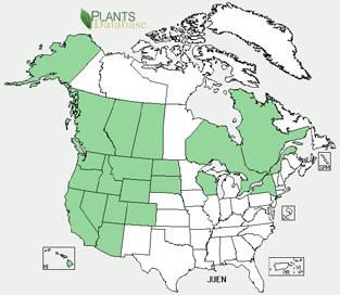

44 Appendix F North American distribution of selected fen indicator taxa
EXPLORING WASHINGTON S PEATLAND DIVERSITY: ENVIRONMENTAL GRADIENTS & ASSOCIATED VEGETATION PATTERNS
 EXPLORING WASHINGTON S PEATLAND DIVERSITY: ENVIRONMENTAL GRADIENTS & ASSOCIATED VEGETATION PATTERNS Joe Rocchio Senior Vegetation Ecologist WA DNR, Natural Heritage Program Olympia, WA First Washington
Supplement of Carbon dynamics in boreal peatlands of the Yenisey region, western Siberia
 Supplement of Biogeosciences, 12, 7057 7070, 2015 http://www.biogeosciences.net/12/7057/2015/ doi:10.5194/bg-12-7057-2015-supplement Author(s) 2015. CC Attribution 3.0 License. Supplement of Carbon dynamics
Rangeland Health (Rangeland only)
") Chapter 20 Rangeland Health (Rangeland only) 20.1 Overview This chapter covers data elements relating to Rangeland Health. Rills Infiltration and Runoff Waterflow patterns Compaction Layer Pedestals and/or
Chapter 20 Rangeland Health (Rangeland only) 20.1 Overview This chapter covers data elements relating to Rangeland Health. Rills Infiltration and Runoff Waterflow patterns Compaction Layer Pedestals and/or
TRCA Field Staking Protocol December 2016
 Page 1 of 6 TRCA Field Staking Protocol December 2016 This Protocol describes TRCA staff s current practice for field staking the physical top of bank, the physical toe of slope, and the limit of existing
STEWARDSHIP OF LONG ISLAND SOUND S ECOLOGICAL AND RECREATIONAL RESOURCES
 STEWARDSHIP OF LONG ISLAND SOUND S ECOLOGICAL AND RECREATIONAL RESOURCES Robin Kriesberg, Save the Sound, Inc. Thomas Halavik, US Fish and Wildlife Service Coastal Program An Initiative to Identify, Protect
systems is available on the Colorado Wetland Information Center (CWIC) website.
 website.") Colorado Natural Heritage Program Wetland Program Plan -- Dec 2015 Status Update and Addendum -- The Colorado Natural Heritage Program (CNHP) developed a Wetland Program Plan (WPP) in 2010 for the planning
Colorado Natural Heritage Program Wetland Program Plan -- Dec 2015 Status Update and Addendum -- The Colorado Natural Heritage Program (CNHP) developed a Wetland Program Plan (WPP) in 2010 for the planning
Proper Functioning Condition. And. Amendment 6 Assessments and Ratings. For. Mulkey Allotment. Summer 2011
 Proper Functioning Condition And Amendment 6 Assessments and Ratings For Mulkey Allotment Summer 2011 Prepared by: Lisa Sims, Inyo National Forest Aquatic Biologist Vegetation Analysis by: Brianna Goehring,
This definition is from the Soil Science Glossary (Soil Science Society of America).
.") What is Soil? This definition is from the Soil Science Glossary (Soil Science Society of America). soil - (i) The unconsolidated mineral or organic material on the immediate surface of the earth that serves
What is Soil? This definition is from the Soil Science Glossary (Soil Science Society of America). soil - (i) The unconsolidated mineral or organic material on the immediate surface of the earth that serves
Inventory of Plant Species of Special Concern and the General Flora of Dinosaur National Monument
 University of Wyoming National Park Service Research Center Annual Report Volume 13 13th Annual Report, 1989 Article 9 1-1-1989 Inventory of Plant Species of Special Concern and the General Flora of Dinosaur
Great Lakes Conservation Blueprint for Terrestrial Biodiversity on the Canadian Shield
 Great Lakes Conservation Blueprint for Terrestrial Biodiversity on the Canadian Shield Bonnie L. Henson 1, Kara E. Brodribb 2 and John L. Riley 3 1 Ontario Ministry of Natural Resources 2,3 The Nature
4. What are the goals of the Kawarthas, Naturally Connected project? 7. What are watersheds and why are they being used as the project boundaries?
 Frequently Asked Questions (FAQs) 1. What are Natural Heritage Systems (NHS)? 2. Why are they important? 3. Which areas of the province have undertaken NHS projects? 4. What are the goals of the Kawarthas,
Florida Forever Conservation Needs Assessment Overview Maps
 Florida Forever Conservation Needs Assessment Overview Maps Prepared by Florida Natural Areas Inventory, The maps in this document are derived from the Florida Forever Conservation Needs Assessment, an
Key Elements of Successful Conservation Planning. John Paskus October 17, 2013 Pierce Cedar Creek Institute Michigan Natural Features Inventory
 Key Elements of Successful Conservation Planning John Paskus October 17, 2013 Pierce Cedar Creek Institute Michigan Natural Features Inventory What is Conservation Planning? Pressey et al (2008): The process
Riparian Ecology and Plant Identification Ventura River and Casitas Springs Community Center Nov 7-8, 2007
 The CNPS Plant Science Training Program is proud to present a two-day Riparian workshop, at the, Casitas Springs (between Ventura and Ojai) Target audience: Professional and student botanists, biologists,
2011 ASLA Design Awards. Westside Creeks Restoration Plan Merit Award AECOM, Fort Collins. Planning & Urban Design
 2011 ASLA Design Awards Westside Creeks Restoration Plan Merit Award AECOM, Fort Collins Planning & Urban Design Project Fact Sheet Category of Entry: Rotating Specialty Award: 2011 2011 ASLA Colorado
III. PROJECT DESCRIPTION
 III. PROJECT DESCRIPTION A. PROJECT LOCATION Regional Setting The project site is located in the southeast quadrant of the City of Chico in Butte County, California and is comprised of four parcels totaling
Healthy Living Strategy: Shorelines
 Healthy Living Strategy: Shorelines Shoreline Vegetation in Muskoka The basis of a natural ecosystem is a complex combination of vegetation that forms canopy, understory, and herbaceous layers. It is easier
Basic Information: Vernal Pool Systems
 Basic Information: Assessment Area Name: Project Name: Assessment Area ID #: Project ID #: Assessment Team Members for This AA Date: AA Location: Latitude: Longitude: Datum: Wetland Category: Natural Constructed
Landscape Conservation Design April, 2014
 Designing Sustainable Landscapes in the Northeast A project of the North Atlantic Landscape Conservation Cooperative & Northeast Climate Science Center Landscape Conservation Design April, 2014 Conceptual
TOWN OF SPRINGFIELD, NEW HAMPSHIRE
 TOWN OF SPRINGFIELD, NEW HAMPSHIRE NATURAL RESOURCES INVENTORY EXECUTIVE SUMMARY March 2008 Prepared by: Watershed to Wildlife, Inc. Natural Resource Consultants 42 Mill Street, Suite 3 Littleton, NH 03561
Arkansas River Corridor
 Planning for Access Welcome to the Access Project. This project is a recreational planning effort in response to an interest by regional communities along the Arkansas River corridor. The project plan
Takings Permit Application
 Takings Permit Application NorthMet Project Prepared for Poly Met Mining, Inc. November 2017 4300 MarketPointe Drive, Suite 200 Minneapolis, MN 55435 952.832.2600 www.barr.com Takings Permit Application
3.10 LAND USE SETTING PROJECT SITE EXISTING LAND USE DESIGNATIONS AND ZONING. General Plan Land Use Designations.
 This section of the Draft EIR addresses the existing land uses on and adjacent to the project site and discusses the potential impacts of the proposed project on existing land uses. Key issues addressed
Santa Barbara Restoration Project Database. Cheadle Center for Biodiversity and Ecological Restoration University of California, Santa Barbara
 University of California, Santa Barbara 1 CONTENTS Introduction... 2 Setting... 2 Methods... 3 Results... 5 Discussion... 10 Conclusions... 12 2 INTRODUCTION The Santa Barbara Restoration Project Database
BEST MANAGEMENT PRACTICES Spurge Laurel(Daphne laureola) (Family Thymelaeaceae Daphne Family)
 (Family Thymelaeaceae Daphne Family)") JEFFERSON COUNTY NOXIOUS WEED CONTROL BOARD 380 Jefferson Street, Port Townsend WA 98368 360 379-5610 Ext. 205 noxiousweeds@co.jefferson.wa.us BEST MANAGEMENT PRACTICES Spurge Laurel(Daphne laureola) (Family
JEFFERSON COUNTY NOXIOUS WEED CONTROL BOARD 380 Jefferson Street, Port Townsend WA 98368 360 379-5610 Ext. 205 noxiousweeds@co.jefferson.wa.us BEST MANAGEMENT PRACTICES Spurge Laurel(Daphne laureola) (Family
Grave Creek Riparian Revegetation 2011 Implementation Report
 Task Order #1008 Grave Creek Riparian Revegetation 2011 Implementation Report Prepared for: Kootenai River Network P.O. Box 491 Libby, MT 59923 Prepared by: Geum Environmental Consulting, Inc. 307 State
ADDENDUM TO BIOLOGICAL SCOPING SURVEY REPORT, BOTANICAL SURVEY AND WETLAND DELINEATION
 ADDENDUM TO BIOLOGICAL SCOPING SURVEY REPORT, BOTANICAL SURVEY AND WETLAND DELINEATION FOR AVALON INN (APN 069-241-27 & -04) 1201 & 1211 NORTH MAIN STREET FORT BRAGG, CA MENDOCINO COUNTY prepared for:
TAXONOMY Family Names Family Scientific Name: Scientific Names
 TAXONOMY Family Names Family Scientific Name: Pinaceae Family Common Name: Pine family Scientific Names Genus: Abies Species: Abies procera Species Authority: Rehder Variety: Sub-species: Cultivar: Authority
Policy & Procedure Effective Date: Parks Department Page of
 City of Arvada Policy & Procedure Effective Date: Parks Department Page of TITLE: City of Arvada Prairie Dog Habitat Plan APPROVAL: PURPOSE: To establish a plan for the preservation of black-tailed prairie
Wisconsin NRCS Direct Volume Method Bank Recession Rate Categorizations
 2 Executive Summary The City of Ramsey contracted the Anoka Conservation District to complete an inventory of riverbank condition along the entire 5.8 miles of City that border the Mississippi River. The
UNIT 1 SUSTAINING ECOSYSTEMS
 UNIT 1 SUSTAINING ECOSYSTEMS Chapter 3 Sustaining Terrestrial Ecosystems Science 1206 / 2200 Sustainable Systems One that survives and functions over time In human terms One that meets the needs of present
Prioritizing Tidal Wetlands: A Landscape Approach
 Prioritizing Tidal Wetlands: A Landscape Approach Laura Brophy Director, Estuary Technical Group Institute for Applied Ecology Corvallis, OR College of Earth, Ocean and Atmospheric Sciences, Oregon State
Level 1 Downstream Analysis
 Level 1 Downstream Analysis Newcastle Way Apartments Newcastle, Washington King County April 14, 2014 Revised July 10, 2014 Prepared by: Dean A. Furr, P.E. Reviewed by: Donald Scarberry, P.E. Coffman Engineering,
1/21/2014. Definitions vary widely Legal vs. functional Not always obvious. Wetlands are legally protected by Clean Water Act (1972)
") What is a Wetland? Freshwater Wetlands of Gulf Coast Plains Definitions vary widely Legal vs. functional Not always obvious What is a Wetland? Wetlands are legally protected by Clean Water Act (1972) Corps
What is a Wetland? Freshwater Wetlands of Gulf Coast Plains Definitions vary widely Legal vs. functional Not always obvious What is a Wetland? Wetlands are legally protected by Clean Water Act (1972) Corps
Master Plan Objectives and Policies
 Master Plan Objectives and Policies Introduction This chapter identifies the Park issues and recommended policies established by this Master Plan. The issues were identified through meetings with staff,
Boardman River Watershed VILLAGE OF KALKASKA. WATER QUALITY ACTION PLAN Fall 2009
 Boardman River Watershed VILLAGE OF KALKASKA WATER QUALITY ACTION PLAN Fall 2009 Partners: The Watershed Center Grand Traverse Bay Northwestern Michigan College - Great Lakes Water Studies Institute Grand
3-2 Environmental Systems
 3-2 Environmental Systems 3.0 ENVIRONMENTAL SYSTEMS CONTENTS 3.1 GREENWAY SYSTEM 3.1.1 General Policies 3.1.2 Natural Heritage Network 3.1.3 Natural Heritage Network Enhancement Lands 3.1.4 Rouge Watershed
Nate Hough-Snee ESRM 412 Plant Propagation Protocol One 11 APR 2007
 1 of 5 4/7/2008 10:07 AM Family Names Family Scientific Name: Family Common Name: Scientific Names Genus: Species: Species Authority: Common Synonym Genus: Species: Species Authority: General Information
In the tall grass prairie, grasses can be up to 2 meters tall! This is tall grass prairie at a state park in Iowa.
 This presentation is designed to give you a feel for what tall, mixed and short grass prairie environments on North America look like. I hope that these pictures will help you understand more deeply when
River Restoration Practices:
 River Restoration Practices: Comparison of British Columbia and Central European Practices by David Matsubara and Dave Murray Add Map of North America VANCOUVER, Wa. Add Map of Vancouver OUTLINE Introduction
Community Conservation Workshop. Saranac River Basin Communities
 Community Conservation Workshop Saranac River Basin Communities 2 Community Conservation Program Welcome! We have designed a Community Conservation Program that listens to the needs of community members.
Biodiversity Conservation
 Biodiversity Conservation and Site Plan Review Biodiversity conservation principles Threats to biodiversity Location of development Reviewing site plans Lunch Reviewing site plans (continued) LEED and
New Tools for Land Management: A Quick Introduction to Ecological Site Descriptions
 New Tools for Land : A Quick Introduction to Ecological Site Descriptions Land management agencies have the job of managing natural resources for multiple uses in a sustainable manner. A sound understanding
GIS to Estimate Archaeological Site Loss and Develop Conservation Strategies
 GIS to Estimate Archaeological Site Loss and Develop Conservation Strategies Terry Jackson Office of Decision Support Systems Planning and Environmental Management Division Georgia Department of Community
ELIGIBILITY CRITERIA CHECKLIST OPEN SPACE CLASSIFICATION
 THURSTON COUNTY DEVELOPMENT SERVICES OPEN SPACE TAX PROGRAM ELIGIBILITY CRITERIA CHECKLIST OPEN SPACE CLASSIFICATION Use this checklist to help you determine whether your property is eligible for open
SUSTAINING ECOSYSTEMS
 UNIT 1 SUSTAINING ECOSYSTEMS Chapter 3 Sustaining i Terrestrial Ecosystems Science 1206 / 2200 Sustainable Systems One that survives and Short Activity: functions over time In human terms One that meets
Soil Temperature on the Long Term Soil Productivity Study
 Extension Note #32 April 2000 RESEARCH ISSUE GROUPS Soil Conservation Soil Temperature on the Long Term Soil Productivity Study Wildlife Habitat Hydrology Forest Health Reforestation Stand Tending Ecosystem
WASHINGTON COUNTY OREGON
 WASHINGTON COUNTY OREGON LONG RANGE PLANNING DIVISION North Bethany Subarea Stream Corridors: Existing Regulations In Oregon, there is a distinct difference between the land use rules that apply in rural
Principles for Ecological Landscape Design in Brownfield Business Parks
 Principles for Ecological Landscape Design in Brownfield Business Parks Part of USDA Forest Service research project # 00-JV-11231300-033: Aligning Social and Ecological Drivers of Urban Landscape Change
CONSERVATION ELEMENT GOALS, OBJECTIVES, AND POLICIES
 CONSERVATION ELEMENT GOALS, OBJECTIVES, AND POLICIES Goal 4 To conserve, manage, appropriately use and protect the natural resources of the City ensuring continued resource availability and environmental
Incorporating Traditional Ecological Knowledge and Cultural Information Into Wetland Protection, Management, and Restoration - Tulalip Reservation
 Incorporating Traditional Ecological Knowledge and Cultural Information Into Wetland Protection, Management, and Restoration - Tulalip Reservation By Jonathan Hall, Wetland Biologist, Tulalip Tribes Weallup
The analysis area for the scenic resource is the project area described in Chapter 1. Affected Environment/Existing Condition
 Chapter 3 - Scenic Resource SCENIC RESOURCES Introduction The Spotted Bear Ranger District is a destination point for outdoor recreation activities and offers a variety of recreation opportunities: driving
ST. MARY S SOIL CONSERVATION DISTRICT (SMSCD) AND DPW&T CONCEPT EROSION AND SEDIMENT CONTROL AND STORMWATER MANAGEMENT GUIDELINES AND CHECKLIST
 AND DPW&T CONCEPT EROSION AND SEDIMENT CONTROL AND STORMWATER MANAGEMENT GUIDELINES AND CHECKLIST") St. Mary s Soil Conservation District 26737 Radio Station Way, Suite B Leonardtown, MD 20650 Phone: 301-475-8402 ext. 3 Fax: 301-475-8391 www.stmarysscd.com St. Mary s County Government Department of Public
St. Mary s Soil Conservation District 26737 Radio Station Way, Suite B Leonardtown, MD 20650 Phone: 301-475-8402 ext. 3 Fax: 301-475-8391 www.stmarysscd.com St. Mary s County Government Department of Public
7.0 SOCIAL, ECONOMIC, AND ENVIRONMENTAL ISSUES
 7.0 SOCIAL, ECONOMIC, AND ENVIRONMENTAL ISSUES The following list of social, economic, and environmental issues have been identified based on a preliminary inventory of resources in the project area, an
North Bellingham and Urban Growth Boundary Wetland, Stream, Habitat Conservation Area and Buffer Assessment TECHNICAL MEMORANDUM
 Northwest Ecological Services, LLC North Bellingham and Urban Growth Boundary Wetland, Stream, Habitat Conservation Area and Buffer Assessment TECHNICAL MEMORANDUM Prepared For: City of Bellingham Planning
McArthur Swamp Planning Unit. Fish, Plant, and Wildlife Habitat MCARTHUR SWAMP PLANNING UNIT
 McArthur Swamp Planning Unit Fish, Plant, and Wildlife Habitat Conduct surveys of the planning unit to identify biological resources and enable their protection. Most of the McArthur Swamp land acreage
University of Washington Botanic Gardens Collections Policy January 1, 2009
 University of Washington Botanic Gardens Collections Policy January 1, 2009 INTRODUCTION The purpose of this document is to guide the development and management of the University of Washington Botanic
A Landowner s Guide to Creating Woodland Pools for Amphibians and Other Wildlife
 Cornell Department of Natural Resources Conservation Education Program Fact Sheet Kristi L. Sullivan and Stephen J. Morreale A Landowner s Guide to Creating Woodland Pools for Amphibians and Other Wildlife
BLACK/HARMONY/FAREWELL CREEK WATERSHED EXISTING CONDITIONS REPORT CHAPTER 5 IMPERVIOUS SURFACES
 BLACK/HARMONY/FAREWELL CREEK WATERSHED EXISTING CONDITIONS REPORT CHAPTER 5 IMPERVIOUS SURFACES Draft November 2009 TABLE OF CONTENTS 1.0 INTRODUCTION... 3 2.0 STUDY AREA AND SCOPE... 4 3.0 METHODOLOGY...
Shared History, Shared Future
 Open Space is Shared History, Shared Future Builds upon past and current regional planning: PSP Action Agenda, Vision 2040, the Cascade Agenda, and Mountains to Sound Greenway The ROSS Approach Building
TERRESTRIAL NATURAL HERITAGE SYSTEM STRATEGY APPENDIX F: MODEL POLICIES FOR THE IMPLEMENTATION OF THE TARGET TERRESTRIAL NATURAL HERITAGE SYSTEM
 TERRESTRIAL NATURAL HERITAGE SYSTEM STRATEGY APPENDIX F: MODEL POLICIES FOR THE IMPLEMENTATION OF THE TARGET TERRESTRIAL NATURAL HERITAGE SYSTEM C H A P T E R 1 M O D E L P O L I C I E S F O R I M P L
Mendota Heights 2040 Comprehensive Plan Draft Vers
 4 Parks and Trails The City of Mendota Heights boasts a variety of recreational and open space opportunities. Few cities can claim access to regional trails, riverside and lakeside parks, scenic bluffs
The Landscape Project. New Jersey Department of Environmental Protection Division of Fish and Wildlife Endangered and Nongame Species Program
 The Landscape Project New Jersey Department of Environmental Protection Division of Fish and Wildlife Endangered and Nongame Species Program New Jersey is One of the smallest states in the country Yet
Soil Health Practices in the Landscape
 Soil Health Practices in the Landscape Salvatore Mangiafico Rutgers Cooperative Extension Environmental and Resource Management Agent In this session... Benefits of healthy soils in the landscape Plant
Rural Land Use Designations Kittitas County December 6, 2007 Draft
 KITTITAS COUNTY COMMUNITY DEVELOPMENT SERVICES 411 N. Ruby St., Suite 2, Ellensburg, WA 98926 CDS@CO.KITTITAS.WA.US Office (509) 962-7506 Fax (509) 962-7682 Rural Land Use Designations Kittitas County
APPENDIX I Presentations
 APPENDIX I Presentations Workshop Summary Report 11 Peel Region Official Plan Review May 5, 2010 Compatible Active Recreation Workshop July 29, 2010 Components of PROPR Sustainability Planning Tools/Updates
I. STAFF POLICY RECOMMENDATIONS. The following RMP policy strategies are proposed by staff in support of a Scenic Resource Protection Program:
 Policy Consideration: Scenic Resource Protection Program Status: For Consideration by the Highlands Council at September 14, 2006 Work session Date: September 12, 2006 I. STAFF POLICY RECOMMENDATIONS The
Introduction. In the United States, over 19,000 soil series have been identified.
 Introduction The USDA soil taxonomic developed by United States Department of Agriculture and the National Cooperative Soil Survey provides hierarchy includes orders, suborders, great groups, subgroups,
INTRODUCTION PLANNING HISTORY
 INTRODUCTION The Upper Rock Creek Master Plan Area lies in the east central part of Montgomery County. The Master Plan Area is adjacent to the City of Rockville to the south, the Olney Planning Area to
University of Washington Botanic Gardens Collections Policy Revised February 6, 2018
 University of Washington Botanic Gardens Collections Policy Revised February 6, 2018 INTRODUCTION The purpose of this document is to guide the development and management of the University of Washington
Fire Effects on Soil. Factsheet 2 of 6 in the Fire Effects on Rangeland Factsheet Series PHYSICAL AND CHEMICAL PROPERTIES
 1 of 5 9/11/2009 1:58 PM Factsheet 2 of 6 in the Fire Effects on Rangeland Factsheet Series Fire Effects on Soil This factsheet will focus on how fire affects soils. All fires, regardless of whether they
Verde Valley Landscape Character Type
 Existing Condition Landscape Character The existing landscape character describes the existing set of valued aesthetic attributes for the current landscape. The landscape character descriptions include
O horizon: the O-horizon is made up of organic material. The horizon is found at the soil surface.
 A Good Dirty n Soil Lab: References: Wagner & Sanford. Environmental Science. Wiley & Sons, 2005. Molnar. Laboratory Investigations for AP* Env. Science. Peoples Ed, 2005. Soil Porosity & Permeability
Community Conservation Workshop. Lake Placid
 Community Conservation Workshop Lake Placid 2 Community Conservation Program Welcome! We have designed a Community Conservation Program that listens to the needs of community members. We are conducting
Brine Generation Study
 DOE/WIPP 00-2000 Brine Generation Study April 2000 Waste Isolation Pilot Plant Carlsbad, New Mexico Processing and final preparation of this report was performed by the Waste Isolation Pilot Plant Management
APPENDIX 1: SCOPED ENVIRONMENTAL IMPACT STATEMENT (EIS) FORM
 FORM") APPENDIX 1: SCOPED ENVIRONMENTAL IMPACT STATEMENT (EIS) FORM This form is intended for use by applicants (primarily private landowners) who need to conduct a Scoped EIS in support of minor development
APPENDIX 1: SCOPED ENVIRONMENTAL IMPACT STATEMENT (EIS) FORM This form is intended for use by applicants (primarily private landowners) who need to conduct a Scoped EIS in support of minor development
MEMORANDUM OF BOG TURTLE HABITAT INVESTIGATION
 MEMORANDUM OF BOG TURTLE HABITAT INVESTIGATION 410-728-2900 Fax: 410-728-3160 www.rkk.com To: From: CC: U.S. Fish and Wildlife Service, Pennsylvania Fish and Boat Commission Jennifer A Ottenberg Miller,
** Ecological Sites tied to soil data accessible through Web Soil Survey
 Ecological Site: A distinctive kind of land with specific physical characteristics that differs from other kinds of land in its ability to produce a distinctive kind and amount of vegetation, and in its
Wetland Types. Grade Level: Basic. Duration: 30 minutes. Setting: Classroom
 Wetland Types Adapted from: An original Creek Connections activity created by Cassandra Hamilton. Creek Connections, Box E, Allegheny College, Meadville, PA 16335 http://creekconnections.allegheny.edu
Rangeland Interagency Ecological. Dennis W. Thompson National Range and Grazing Lands Ecologist USDA Natural Resources Conservation Service
 Rangeland Interagency Ecological Site Manual Dennis W. Thompson p National Range and Grazing Lands Ecologist USDA Natural Resources Conservation Service Rangeland Interagency Ecological Site Manual (RIESM)
SCIENCE AND RESEARCH INTERNAL REPORT NO.75 DATABASES AND THEIR APPLICATION TO MANAGEMENT PLANNING. W. Mary McEwen
 SCIENCE AND RESEARCH INTERNAL REPORT NO.75 DATABASES AND THEIR APPLICATION TO MANAGEMENT PLANNING by W. Mary McEwen This is an internal Department of Conservation report and must be cited as Science and
Sustainable Natural Environment Wetlands
 Town of Huntsville Official Plan Review - POLICY BACKGROUND PAPER Sustainable Natural Environment Wetlands BACKGROUND: Wetlands are an important natural resource. The ecological, social and economic benefits
Beckwourth Fen Report for 2007 & Catie & Jim Bishop, February 2009
 Beckwourth Fen Report for 2007 & 2008 Catie & Jim Bishop, February 2009 TABLE OF CONTENTS INTRODUCTION... 1 Fen Definition... 2 REGIONAL SETTING... 5 SCOPE AND METHODOLOGY... 8 Locating the Fens... 8 Fen
TAXONOMY. Plant Family
 Plant Family Scientific Name Common Name Species Scientific Name Scientific Name (A full scientific name consists of Genus, epithet, and authority e.g., Elymus glaucus Buckley. Protocols are prepared for
INTRODUCTION Key Issues and Findings Goals, Objectives, and Policies - Natural Resources - Map M18 - Environmental Resources
 Natural, Environmental, Cu INTRODUCTION This Element provides policies related to the preservation and protection of the Centre Region s natural, environmental, cultural, and historic resources. This Element
Rain Gardens. A Welcome Addition to Your Landscape
 Rain Gardens A Welcome Addition to Your Landscape Where Does The Rainwater Go? Naturally, forests provide a way for rainwater to percolate into the soil, filtering pollutants while trees are allowed to
New Tools for Conservation: Ecological Site Descriptions and Their Role in Conservation Planning
 New Tools for Conservation: Ecological Site Descriptions and Their Role in Conservation Planning Creating effective conservation policies and programs requires knowledge of land resources, the ecosystem
April 11, 2016 Park Board Chair and Commissioners General Manager Vancouver Board of Parks and Recreation New Brighton Salt Marsh - Preferred Concept
 TO: FROM: SUBJECT: April 11, 2016 Park Board Chair and Commissioners General Manager Vancouver Board of Parks and Recreation New Brighton Salt Marsh - Preferred Concept RECOMMENDATION A. THAT the Vancouver
las vegas wash coordination committee
 las vegas wash coordination committee lvwash.org DU Wetlands No. 1 Weir Planting Plan February 2013 DU Wetlands No. 1 Weir Planting Plan SOUTHERN NEVADA WATER AUTHORITY Las Vegas Wash Project Coordination
 108 40' 29'' W Soil Map Mesa County Area, Colorado 108 36' 55'' W 39 10' 11'' N 39 6' 31'' N 4331700 4332500 4333300 4334100 4334900 4335700 4336500 4337300 4338100 701100 701900 702700 703500 704300 705100
Minnesota Department of Natural Resource - Natural Resource Guidance Checklist Conserving Natural Resources through Density Bonuses
 Minnesota Department of Natural Resource - Natural Resource Guidance Checklist Conserving Natural Resources through Density Bonuses NRDB Why Use Density Bonuses & This Checklist Local units of government
2.1 Decision Making Matrix
 2.1 Decision Making Matrix The following decision-making matrix merges the elements of architectural and historical significance and current condition within the over-arching treatment recommendation of
OPEN SPACE CHAPTER 7: OVERVIEW. Preserve open space to protect natural resources, enhance character and provide passive recreation opportunities
 CHAPTER 7: OPEN SPACE OVERVIEW Ridgefield has made tremendous progress permanently preserving areas of town as open space. Open space preservation can serve many important purposes, including: protect
I ll be talking about the Designing Sustainable Landscapes project today. This is a large integrated modeling effort our group at UMass has been
 1 I ll be talking about the Designing Sustainable Landscapes project today. This is a large integrated modeling effort our group at UMass has been working on for the past 5 years, in close collaboration
9 th Street Sub Area Plan
 9 th Street Sub Area Plan In the 1990 s, when the Township prepared the last Master Plan, the 9 th Street corridor was studied as part of a larger 9 th Street Focus Area that included the West Main Street
Galiuro Drilling EA Scenery Debby Kriegel 12/9/16
 Galiuro Drilling EA Scenery Debby Kriegel 12/9/16 INTRODUCTION The 1.7 million acre Coronado National Forest (CNF) is comprised of 12 sky island mountain ranges. CNF visitors have opportunities to sightsee
Team number Page 1 of Canon Envirothon Soils Station Test. Soils and Climate Change
 Team number Page 1 of 9 2006 Canon Envirothon Soils Station Test Soils and Climate Change There are many kinds of soil on the surface of the earth. The kind of soil that is present at a given location
Jessica Taylor ESRM 412 Native Plant Production Protocol for Symphyotrichum jessicae, Jessica's Aster
 Jessica Taylor ESRM 412 Native Plant Production Protocol for Symphyotrichum jessicae, Jessica's Aster Image by John Gamon http://biology.burke.washington.edu/herbarium/imagecollection/wtu8500-8999/lg/wtu008884_lg.jpg
Fen Survey Report Bucks Lake Wilderness Plumas National Forest CATIE AND JIM BISHOP 2005 & 2006
 Fen Survey Report Bucks Lake Wilderness Plumas National Forest CATIE AND JIM BISHOP 2005 & 2006 TABLE OF CONTENTS INTRODUCTION... 1 REGIONAL SETTING... 3 SCOPE AND METHODOLOGY... 6 DESCRIPTION OF FEN CHARACTERISTICS...
Natural Heritage areas are characterized by one or more of the following values:
 SECTION 6: LAND USE POLICIES - NATURAL HERITAGE The Natural Heritage policies reference features and areas that provide ecological functions critical to the survival of all species - including humans.