Urban Design Principles
|
|
|
- Penelope Stewart
- 5 years ago
- Views:
Transcription
1
2 Urban Design Principles 3.0
3 Harbouside Waterfront Rezoning Submission - November 2012


4 3.1 Urban Design Principles Twelve distinct design principles have been identifi ed for the Harbourside Waterfront development. They are: 1. Overall Development Form Legibility Development is to create a legible overall form that reinforces the idea of peaks and valleys in which higher buildings oriented north south are interspaced with lower buildings oriented east west in order to frame views through to the north shore mountains and to the water, as well as to maximize light penetration into interior blocks. 2. Distinct Public Realm Character Precincts The Harbourside Waterfront Public Realm consists of three neighbourhood precincts that derive their character from the transition from the natural character inspired by the riparian corridor of Mackay Creek and the western section of Kings Mill Walk to a more urban/village character at the Foot Fell Avenue where there will be a concentration of retail activity, to a working Marine character on the west side of the site where the community interfaces with the adjacent Burrard Yacht Club. 3. Integrated Community Integration of all sub-areas is to occur through street pattern, lighting, ground plane design, and overall building form. 4. Street Hierarchy The street network is to maximize pedestrian access and permeability while limiting access and through traffi c circulation for motor vehicles to high activity commercial areas 0 and 20 underground mparking and service access. 5. Connected Public Open Space and Parks Parks and public open spaces are to be central features in organizing the community, and open spaces are to connect with adjacent areas by foot and bicycle paths to create a walking and cycling friendly neighbourhood. 6. Integrated Transit Development is to allow for an integrated bus connection to serve Harbourside and adjacent neighbourhoods with stops along Harbourside Drive. 7. Vibrant Commercial Heart A vibrant commercial focus along the Foot of Fell Avenue and Harbourside Place is to act as a heart for the community, anchored by a public plaza and waterfront terrace at the foot of Fell Avenue, and activated by retail frontages along Fell Avenue and Harbourside Place. 8. Waterfront Animation Development is to engage and animate the public waterfront through the selection of land uses and design of shoreline features. 9. Clustered Community Services Development is to include a centrally located broad range of community services and amenities with good access to parks and waterfront. 10. Contextual Recognition Recognition of adjacent patterns of natural features as well as industrial and marine activity is important in defi ning the character of the community. 11. Incremental Varied Development Development is to encourage land parceling and a coordinated parking strategy that allows for incremental development at a variety of scales. 12. Demonstrated Sustainability Harbourside Waterfront aims to demonstrate a comprehensive approach to sustainability refl ected in both open space and building design. Urban Design Principles 3.1


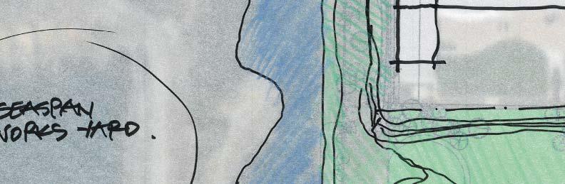
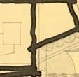
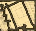
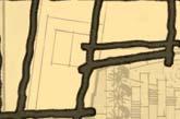
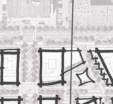
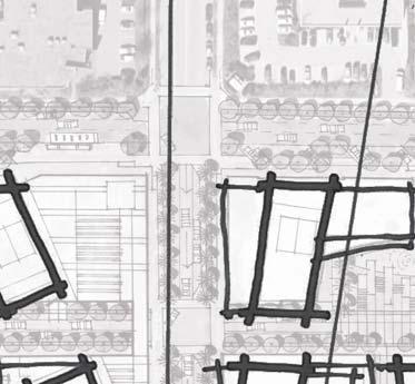
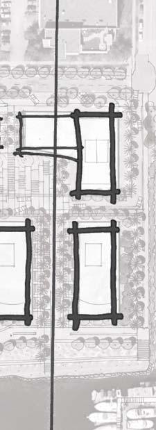
5 3.2 Masterplan Structure The heart of this mixed-use community is the central retail area down Fell Ave and across Harbourside Place which serves to provide a retail amenity for Harbourside Waterfront and the surrounding neighbourhoods, including Seaspan. A central Mews acts as the main connecting street to each of the parcels and their integral garden courtyards and provides a series of compressing and expanding visual experiences along its path. Harbourside Drive with its elevated dock path, both visually and physically, responds to the current sea level rise and places storefront work places opposite the commercial uses to the north. Lions Lane provides a unique and very compressed street-like experience for pedestrians only and is comprised of multi-use artisanal work spaces with fl ats above, or residential townhouses. A semi-protected multi-purpose open space is publically accessible and is shared by all the users along this path. Urban Blocks Urban Core A progressively phased park, both new and enhanced, responds to Harbourside Waterfront s construction over time and expands Kings Mill Walk, originally provided by Concert to the community when Harbourside Business Park was fi rst developed. The park also plays an important role in mitigating the effects of sea level rise and its risk to lives and property. The Spirit Trail expansion is a critical part of Harbourside Waterfront and will be extended, together with the Kings Mill Walk, following consultation with the neighbours, City, and the greater community. Focused on Views A. Large offi ce complex located to provide buffer between the new residential areas and Seaspan Shipyards B. Storefront offi ces along Harbourside Drive relate to the offi ce and light industrial uses to the north C. A special laneway frames an axial view to The Lions mountains and provides an opportunity for a unique kind of live and work accommodation. D. Building forms splay to provide a panoramic view from The Lions to Grouse Mountain E. Fell Avenue forms the High Street with shops on both sides and the water view entry to the development. F. Taller buildings are orientated north/south to allow views through the site from within and from the north. G. Public passages run throughout the project connecting streets and courtyards to the waterfront park and Spirit Trail H. A hotel acts as the visual and functional anchor to the development and Fell Plaza. I. Fell Plaza forms the activity intersection between the development and the Spirit Trail. It also forms the connection between land and waterbased transportation. J. Harbourside Place is an important esplanade street with spectacular views to the south and commercial retail to the north. K. A substantial public space, with open weather protection provides for multi-purpose uses and events and relates to a bike station for public use. L. Feature garden couryards provide open space along the central Mews, a beautiful overview, and use opportunities for the residents. M. The Spirit Trail, for bikes and pedestrians, forms an important alternative east/west link along the north shore. N. Courtyards expand, capturing and integrating park and water access and views to the south. Engaged with Harbour Setting Harbouside Waterfront Rezoning Submission - November 2012 Views to Harbour from above Marine Drive

6 A B C D E D F N M L K J I H G Conceptual Site Plan Masterplan Structure 3.2


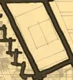
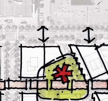
7 3.3 Orientation Analysis Views C,D,E View Trajectory. The diagrams below show the view trajectory to the landmark mountains peaks identifi ed on the map, right. The sections demonstrate that the proposed scale of development will maintain direct visual links to these. Harbouside Waterfront Rezoning Submission - November 2012


8 View A Fell Plaza, as a major node along the Spirit Trail and terminus to Fell Avenue is highlighted as a position to capture a panoramic view of the mountainscape from The Lions to across to Grouse mountain. The buildings on either side have been set back to frame this spectacular view. View B Through-site potential has also been capitalized on Lot C with an angled axial view directly of the Lions. The passage is intended to be named Lions Lane in recognition of this special view. View C, D, E Other views of the mountains are possible through street extensions and courtyard passages through the development areas. View B View A Orientation Analysis 3.3

9 3.4 Scale and Massing In response to desires from neighbours to the north and up the mountain foothills to enjoy the views to Vancouver and the water, tall buildings have been massed generally in a north/south orientation with lower buildings oriented in an east/west orientation. Heights have been calculated from the new FCL to the top of the main roof slab, with mechanical uses and rooftop amenity spaces exempt from this height calculation. In accordance with the OCP Amendment, four buildings are proposed to have heights of 27.5m (90 ); with the remaining buildings having a maximum height of 21.3m (70 ). Gaps have been created between buildings and courtyards for more close range views through. Buulding Elements 6m to12m (20 to 40 ) in height are intended to create a friendly interface with the park and Spirit Trail to the south. The proposed hotel on sub-area D and the south most buildings on sub-area A are planned to contravene this principle as a means to reinforce their landmark status. Scale and Massing Axonometric Sketch Harbouside Waterfront Rezoning Submission - November 2012


10 ROOFTOP MECHANICAL & AMENITY EXCLUDED FROM BUILDING HEIGHT VARIED BUILDING HEIGHTS CREATE PEAKS & VALLEYS FLOOD CONSTRUCTION LEVEL m 4 STOREYS EXPRESSION TO PARK HIGH 27.4M 9 STOREYS RESIDENTIAL - HOTEL MID 21.3M 4 STOREYS RESIDENTIAL 5 STOREYS OFFICE LOW VARIES 1 TO 4 STOREYS PARK Scale and Massing 3.4


11 THE LIONS THE LIONS BEAUTY PEAK GROUSE 3.5 Views North MOUNTAIN VIEWS BUILDINGS FRAME MOUNTAIN VIEWS FELL PLAZA m As important as views through to the water and Vancouver have been to the massing development of Harbourside Waterfront, the public process has indicated a similar concern for views of the mountains to the north. The building forms have been molded to facilitate these views. Lions Lane has been carefully articulated to provide an unobstructed view to The Lions and Fell Avenue Plaza with views to Crown and Grouse Mountains. Harbouside Waterfront Rezoning Submission - November 2012


12 VIEW THROUGH FROM ABOVE MARINE DRIVE 3.6 Views South TALL BUILDINGS ORIENTED NORTH/SOUTH LOW BUILDINGS ORIENTED EAST/WEST m VIEW TO WATER & VANCOUVER Views
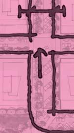
13 3.7 Context & Connectivity Harbouside Waterfront Rezoning Submission - November 2012

14 Context & Connectivity 3.7
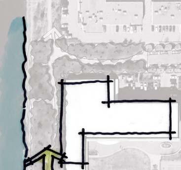
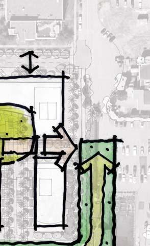
15 Open Space New dedicated park areas have been created in response to public input. A substantial new park on Lot D helps to extend the existing park to the east and a new public plaza at the foot of Fell Avenue further expand the public realm. A 5m widening of the park expands the existing park, helps to accommodate the Spirit Trail, and helps to mitigate effects of sea level rise, and a triangular park wedge to the west (on sub-area D) expands the existing park and helps transition park area in front of Bodwell School. A total of approximately 600 m2 of park has been added. In addition to the park area, a considerable increase in public open space is being proposed. The central Mews provides pedestrian and vehicular access through the centre of Harbourside Waterfront and combined with portions of the courtyards increases the amount of publicly accessible surface parking for visitors. Publicly accessible pedestrian passages connect from Harbourside Drive through the courtyards to the park. A total of approximately 4800 m2 of public open space has been added. View of second fl oor public rooftop Harbouside Waterfront Rezoning Submission - November 2012


16 m BODWELL SCHOOL NEW EXPANSION FOR PARK 5M WIDENING EXISTING CITY PARK SPACE INCREASE IN PARK SPACE FROM ORIGINAL REZONING 3.8 Open Space GREEN BUFFER TO BYC PUBLICALLY ACCESSIBLE OPEN SPACE THROUGH PRIVATE DEVELOPMENTS Open Space 3.8
17 Public Realm Concept The heart of this mixed-use community is the central retail area down Fell Ave and across Harbourside Place which serves to provide a retail amenity for Harbourside Waterfront and the surrounding neighbourhoods, including Seaspan. A central Mews acts as the main connecting street to each of the parcels and their integral garden courtyards and provides a series of compressing and expanding visual experiences along its path. Harbourside Drive with its elevated dock path, both visually and physically, responds to the current sea level rise and places storefront work places opposite the commercial uses to the north. Lions Lane provides a unique and very compressed street-like experience for pedestrians only and is comprised of multi-use work spaces with fl ats above, or residential townhouses. A semi-protected multi-purpose open space is publicly accessible and is shared by all the users along this path. A progressively phased park, both new and enhanced, responds to Harbourside Waterfront s construction over time and expands Kings Mill Walk, originally provided by Concert to the community when Harbourside Business Park was first developed. The park also plays an important role in mitigating the effects of sea level rise and its risk to lives and property. The Spirit Trail expansion is a critical part of Harbourside Waterfront and will be extended, together with the Kings Mill Walk, following consultation with the neighbours, City, and the greater community. Harbouside Waterfront Rezoning Submission - November 2012


18 3.9 Public Realm Concept A SERIES OF INTERCONNECTED GARDEN COURTYARDS PUBLIC USE SPACE AN ACTIVE RETAIL HEART WORK INTERFACE BODWELL SCHOOL PUBLIC DOCK m SPIRIT TRAIL CONNECTION PROGRESSIVE PARK DEVELOPMENT & IMPROVEMENT Public Realm Concept 3.9


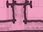
19 3.10 Permeability & Connectivity EXISTING BUS STOP HARBOURSIDE DRIVE -PEDESTRIAN, BUS, BIKE ROUTE NEW BUS STOP BODWELL SCHOOL PUBLIC DOCK m SPIRIT TRAIL FOR BIKES & PEDESTRIANS A fi ne grain network of streets, lanes and pedestrian linkages provide for a high degree of permeability and connectivity for cyclists, pedestrians and vehicles. Two bus stops provide access to bus service and a ferry fl oat is proposed at the foot of Fell Avenue for future ferry service. A normalized street grid through the site provides for improved vehicular circulation with the option of closing off Harbourside Place without limiting access to Harbourside Waterfront. Each subarea would also provide north-south and east-west pedestrian access through mid-blocks, further improving connectivity between the private development and the park/waterfront. The Spirit Trail becomes the primary east-west connector linking Harbourside with Lower Lonsdale and West Vancouver for cyclists and pedestrians. Harbouside Waterfront Rezoning Submission - November 2012


20 3.11 Pedestrian, Bikes & Transit m Harbourside Waterfront is a part of a new east west necklace of waterfront developments connected by the Spirit Trail, providing connectivity to West Vancouver, Lower Lonsdale and beyond. The community is easily accessible by the Spirit Trail, Fell Avenue and Bewicke Avenue enabling access to the Sea bus, Lonsdale Quay, and the retail and employment services along the Marine Drive corridor are within a matter of minutes on foot or by bike. Enhanced bus service will also improve transportation choices before resorting to private automobile use to access destinations within the community. Permiability and Connectivity


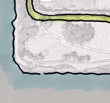
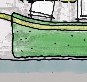
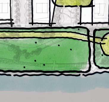
21 3.12 Shoreline Concept BODWELL SCHOOL A B C D m Kingsmill Park and the easterly park extension can be separated into a series of distinctive program/use areas. Area A includes the dog park and passive open space takes on an informal, naturalistic quality that extends from the riparian zone along Mackay Creek. Moving eastward the park becomes progressively more urban, transitioning into a more actively programmed waterfront, Area B, that includes a perched view deck, shoreline play area and seating terraces. The Fell Avenue Plaza, Area C, becomes a larger pedestrian landing with a food and beverage kiosk with public washrooms, wharf and pier extension. The east extension of Kings Mill Walk, Area D, includes boardwalk segments fronting onto a perched beach that anticipates programming including volleyball, picnicking and sunbathing during the summer months with terraced access to the water s edge though an urban saltwater marsh. Harbouside Waterfront Rezoning Submission - November 2012


22 3.13 Key Shoreline Elements LANDMARK BUILDING EXPRESSION LANDMARK BUILDING EXPRESSION RETAIL INTERFACE Dog Park SPIRIT TRAIL - BIKE & PEDESTRIAN LINKAGE m CHILDREN S PARK HEADLAND & FERRY DOCK The shoreline character is defi ned through both the character of built form as well as open space. The waterfront is linked by the Spirit Trail which becomes a continuous thread lining distinctive moments or nodes along its path. A landmark residential building defi nes and creates a sense of arrival/departure at the most westerly extent of Harbourside Waterfront, as well as at the foot of Fell Avenue with the introduction of the waterfront hotel. Important nodes in the park space include a children s park alongside the perched view deck, a landmark sculpture and plaza defi ning the eastern end of Harbourside Place, and the Foot of Fell that is characterized as a pedestrian landing with a food and beverage kiosk, wharf and pier extension. FOOD & BEVERAGE KIOSK IMPORTANT NODES Shoreline

23 Primary Uses The area has been conceived as a complete, integrated, mixed-use community General allocation of uses as per the current OCP amendment and, with the exception of Rental which is not counted in FSR calculations, are distributed similarly within the Concert and Knightsbridge properties as follows; Market Residential 1.35 FSR Commercial (includes Offi ce, Hotel and Retail 0.70 FSR Rental (bonus density not counted in FSR) 0.15 FSR Primary Land Uses - Axonometric Harbouside Waterfront Rezoning Submission - November 2012


24 3.14 Primary Uses STOREFRONT OFFICES STOREFRONT OFFICES RETAIL RETAIL m RESIDENTIAL OFFICE RETAIL HOTEL RENTAL Primary uses The project has been designed as a complete and integrated mixed-use community with opportunities to live, work, shop, play and go to school. The shopping area at the foot of Fell Avenue and Harbourside Place are intended to be the heart and energy centre for the development. Commercial uses have been maintained to the existing ratio of land as well as that of the OCP Amendment. A hotel forms the key landmark piece to the east of Fell Plaza atop this retail district. Residential uses distribute evenly across the site with an offi ce buffer to the west between this area and the re-energized Seaspan Shipyards. This is placed for ease of access and to provide an acoustic buffer to the residential uses. Storefront offices form a connection to the light industrial uses found along Harbourside Drive. Primary Uses 3.14
25 Access and Parking Generally speaking 1 to 2 levels of underground parking will serve each of the four principle parcels. 1 ramp to each parcel is anticipated in order to minimize curb cuts and disturbance to the street character. Access is proposed to be provided at aproximately 5.04 m, clkose to the elevated Flood Construction Level (FCL) along the Mews system or alternatively to the south of the Mews and off of the north/south streets. Pedestrian access to entrance lobbies will similarly be at the FCL and placed along the Mews and alternatively on the north/south streets to the south of the Mews. Individual unit entries will be located in residential buildings on the north south streets as well as along Lions Lane. Ratios Vehicle Parking 1.5 space / Unit - Residential 4 spaces / 1000sqm - Commercial Bicycle Parking 1.3 spaces / Unit - Residential 1 space / 36sqm - Offi ce 1 space / 31sqm - Retail Harbouside Waterfront Rezoning Submission - November 2012


26 3.15 Access & Parking STOREFRONT OFFICE ENTRIES ALONG HARBOURSIDE DRIVE E P E E P E E E P E P E E E m E LOBBY ENTRY P UNDERGROUND PARKING ENTRY Access and Parking 3.15
27 Street Types A variety of street types are proposed for the overall development including modifi cations and extensions to existing north/south roads, modifi cations to Harbourside Drive, and the introduction of a new central Mews connecting the various sub-areas. The streetscape environment is intended to be an important part of the public realm in terms of defi ning the distinctive character of the community. The working waterfront-oriented character is defi ned through the use of distinctive ground plane materials, lighting, planting, street furnishings and spatial modulation between built forms that defi ne the street walls and elevation changes. Each street is intended to be unique in terms of its spatial defi nition and character as a means to defi ne a variety of unique corridors within the community. Streetscape design at Harbourside Waterfront emphasizes pedestrian walkability though the provision of generously-sized sidewalks, seating and a high degree of permeability through sub-areas. Vehicular traffi c is slowed through shared space street environments along Harbourside Place and the east/west Mews. The lines of separation between the pedestrian realm and vehicular realm are intended to become decidedly blurred to increased awareness between transportation modes, and to discourage a sense of entitlement among each transportation mode whether it is motor vehicles, cyclists or pedestrians. As an example, bollard separation is favoured over curbs and special paving runs continuously across the pedestrian and vehicular space to create the sense of a singular space. In response to the sea level rise, many of the pedestrian walkways are elevated above the street to meet the required elevated building grades for the new fl ood construction level (FCL). The response to grade change has created unique opportunities to modulate level changes with steps, ramping and a variety of seating conditions that are oriented to the street and encourage a greater pedestrian vitality and animation in the public realm. Harbouside Waterfront Rezoning Submission - November 2012


28 3.16 Street Types m SETBACK ROW ONE WAY NEW ROAD 1 NEW ROAD 2 HARBOURSIDE DRIVE THE MEWS HARBOURSIDE PLACE FELL L AVE GOSTICK PL Street Types 3.16


29 3.17 Street Types - Sections D C A B A. Fell Avenue Fell Avenue south of Harbourside Drive is proposed to be changed to one-way, with parallel parking on both sides of the street. Parallel parking framed by treelined boulevards along Fell contribute to an urban streetscape environment that maximizes views to the water. The one-way traffi c pattern affords a reduction in row width from 20m to 18m. The north section will have elevated dock commercial access walkways and a minimum building setback of 2.4m with an elevated walkway extension of 1.2m into the ROW. The road and lower sidewalks will ramp up at 5% to the new Mews and will be universally accessible. Grade changes between sidewalks are defi ned by steps and seating edges that create greater pedestrian comfort and amenity in the streetscape environment. Harbouside Waterfront Rezoning Submission - November 2012


30 B. The Mews This new street is intended to be the main connector between the various sub-parcels. Character-wise, it is designed to be an intimate traffi c calmed, pedestrian oriented laneway. The ROW is proposed to be 15m with a minimum building setback of 0.8m for building ends conditions, with open courtyards expanding the visual width of each of the parcels. It will be raised up to very close to the new FCL. C. Harbourside Place (North - South) This is a one-way road with 3.6m wide travel lane and 6m wide 45 degree angled parking. A road modifi cation is being proposed to ramp down to the north from the Mews at 5% slope with sidewalk on both sides of the road to access the offi ce and residential spaces. D. New Road 1 An existing 18m ROW extends south from the Harbourside Drive turnaround. It is proposed that this ROW will become a new road that will ramp up to the elevation of the Mews. The road is intended to provide vehicular and pedestrian access to the Mews and pedestrian access to the park. An elevated path system is proposed to access the offi ces to the east and will display an attractive exposure to Bodwell School to the west. The new street is intended to be a woonerf style laneway with alternating bands of trees and bollards to create narrower stretches that help to slow traffi c. Bollard separation over a continuous expanse of special paving creates a singular street environment while providing safe separation of pedestrians and vehicles. Alternating stretches of parallel parking are provided for public use and limited time drop-off and loading. Catenary lighting over the Mews creates a more intimate scale and ambiance by creating an overhead ceiling of suspended lighting over the space while minimizing the need for conventional streetlight light standards. Street Type Sections 3.17

31 3.17 Street Types - Sections G H E F E. Gostick Extension An extension of Gostick Place is proposed to the south to provide road access to the Mews. Its character and materiality would be an extension of the Mews with special paving, a narrow street width and bollard separation from the pedestrian path. It will ramp up close to the proposed new FCL and will be shared with the Spirit Trail linkage to connect to Bewicke Avenue. Attention will be paid to display an attractive exposure to the Burrard Yacht Club to the east. The road is intended be a 15.3 m ROW, with 6 m dedicated for the Spirit Trail. Buildings will be set back at a minimum of 2.4m. The Gostick Place extension will also provide a buffer between sub-area D and the Burrard Yacht Club. Harbouside Waterfront Rezoning Submission - November 2012


32 F. New Road 2 This 18m ROW has a roadway north of the Mews with a 6.6m width and parallel parking on each side. The north end is being proposed to ramp down from the Mews to Harbourside Drive at 5% with elevated walkways on both sides of the road to access the offi ce and residential spaces. The ROW portion south of the Mews is dedicated to public passage to the park. G. Harbourside Drive Harbourside Drive is a unique situation in that it will remain at its existing elevation of approximately 3.0m; until such time it could be raised by the City. Storefront offi ces along Harbourside Drive have been lowered to 4.5m to maintain a suitable exiting distances to grade. These spaces have been designed with over-height ceilings and can be adapted in the future by raising the fi nished fl oor elevation to the new FCL when Harbourside Drive is raised in the future. Raised walkways will provide access to the offi ces and borrow 1.2m of the ROW for that purpose. The south side of the street provides pockets of angled and parallel parking with the north side remaining as parallel parking. Lay-bys will be provided for transit along with transit infrastructure (bus stop, shelter, signage, etc.). The street also incorporates the on-street Spirit Trail route. H. Harbourside Drive (Bus Stop) Street Type Sections 3.17
33 3.17 Street Types - Sections K I J Perspective of elevated walkway and angled parking interface along Harbourside Drive Section of seating step and elevated walkway along Fell Avenue Harbouside Waterfront Rezoning Submission - November 2012
34 I. Fell Avenue North - Retail As part of the project s response to sea level rise, the north end of Fell Avenue will ramp up to the FCL. This makes it necessary to provide an elevated walkway system to access retail shops in this area. Buildings will be set back 2.4m and the walkway will extend out into the ROW by 1.2m. Steps will provide access on the corners. J. Harbourside Place - Retail Harbourside Place will respond to sea level rise with an adaptive design. A more conventional fl ush relationship between shops and sidewalks is proposed here. Floors could be raised by 0.2m as time progresses to meet the new FCL. Opportunities for pocket retail pods occupying parking spaces are seen here to further activate the street. K. New Road - Office at Harbourside Drive Like the north end of Harbourside Place, the road ramps up close to the new FCL and requires an elevated walkway system to provide access to the storefront offi ces at its base. In some cases, this will be reserved as terrace space for the ground fl oor tenants and public access will be blocked. An 8 building setbacks is being proposed from property line. Brick, together with planting screens, will provide an attractive exposure to Bodwell School to the west. Street Type Sections 3.17
35 3.17 Street Types - Sections M N L O L. North/South Street Upper Residential Once past the Mews close to the new FCL, slightly raised residential terraces and grade entries will overlook street, providing security and privacy for the owners. Planting will serve to transition between hard sidewalk and terrace guards. Harbouside Waterfront Rezoning Submission - November 2012

36 M. New Road - Residential at Harbourside Drive For residential buildings along Harbourside Drive (if any) or at returns onto a north south street, a semi raised residential access walkway will be used to create a separation between the entry terraces and walkway. Brick and planting will be used to enhance the wall. N. View from Mews to Fell Avenue O. Harbourside Place (East-West) The existing ROW for the south portion of this street has been adjusted 3m to the north to increase the park space to accommodate the Spirit Trail and has also been narrowed from 18m to 16m to incorporate sea level rise mitigation measures. The south side of the street is proposed as angled parking, looking directly to the Vancouver skyline while the north side is intended as parallel parking and street loading. A 2 setback is proposed for buildings, with canopies allowed to span into the ROW for weather protection. The street is characterized by a continuous expanse of special paving between the vehicular and pedestrian spaces that are defi ned with bollard separation. This consistent ground plane treatment allows universal accessibility across the street and during event times when the street could be closed to motor vehicle traffi c. Street Type Sections 3.17
Figure 3-1: Public Realm Plan
 3 Public Realm Figure 3-1: Public Realm Plan 3.1 Public Realm Concept The public realm concept for the Little Mountain site integrates a clear and accessible movement network with public spaces for social
Clairtrell Area Context Plan
 Clairtrell Area Context Plan March 2005 Urban Development Services City Planning Contents 1. Introduction... 4 2. Development Structure... 6 2.1 Streets... 7 2.1.1 Sheppard Avenue and Bayview Avenue...
appendix and street interface guidelines
 appendix five: building and street interface guidelines appendix 5 building and street interface guidelines BOULEVARDS Boulevards are generally characterized by higher levels of traffic movement at higher
PUBLIC RIGHT-OF-WAY IN THIS CHAPTER PUBLIC REALM
 PUBLIC RIGHT-OF-WAY This section provides design guidelines for improvements in the public right-of-way. The public right-of-way refers to streets, sidewalks, non-vehicular thoroughfares, parks and greenways
DRAFT Northeast Quadrant of Kipling Avenue and Highway 7 DRAFT AUGUST 29, Goals Land Use. The goals of this Plan are to:
 AUGUST 29, 2017 12.15 Northeast Quadrant of Kipling Avenue and Highway 7 12.15.1 Goals 12.15.2 Land Use The goals of this Plan are to: 12.15.2.1 General Provisions: a) Ensure the development of a compact
AMBLESIDE WATERFRONT
 Overview: An Integrated Vision for the Waterfront The waterfront concept plan shown above is the result of 40 years of acquiring, planning and improving a publicly-owned waterfront. Consistent community
Highland Village Green Design Guidelines
 Highland Village Green Design Guidelines Publishing Information Title Highland Village Green Design Guidelins Author The City of Calgary Status DRAFT - Proposed document subject to changes Additional Copies
Design Guidelines. Roosevelt. Mike Podowski DPD Design Guidelines Ordinance ATT 13 August 13, 2012 Version #1
 Roosevelt Design Guidelines The Roosevelt Neighborhood Design Guidelines apply within the Neighborhood Boundary. Map 1 2 Map 2 3 Map 3 4 CS1 Natural Systems and Site Features Citywide Guideline: Use natural
11.5 Kipling Avenue Corridor Secondary Plan
 11.5 Kipling Avenue Corridor Secondary Plan ADOPTED BY VAUGHAN CITY COUNCIL NOT YET APPROVED BY THE ONTARIO MUNICIPAL BOARD 11.5.1 Development Principles and Objectives The following principles support
WEST LOOP DESIGN GUIDELINES CHECKLIST
 WEST LOOP DESIGN GUIDELINES CHECKLIST Section 1.0 General Strategies 1.1 DESIGN EXCELLENCE: ENCOURAGE HIGH QUALITY AND INNOVATIVE DESIGN OF NEW BUILDINGS WITHIN THE WEST LOOP WITHOUT BEING PRESCRIPTIVE
Regency Developments. Urban Design Brief. Holyrood DC2 Rezoning
 Regency Developments Urban Design Brief Holyrood DC2 Rezoning Stantec Consulting Ltd. 7-31-2017 1. Overview Regency Developments intends to rezone the lands located at 8510 and 8511 93 Avenue, within the
Waterfront Project VISION, GOALS AND OBJECTIVES
 Waterfront Project VISION, GOALS AND OBJECTIVES INTRODUCTION The City of North Vancouver created the Waterfront Project in 2005 in order to provide a focus for waterfront redevelopment opportunities and
Cit of Kitchener Ur 6 an Design Manual PARTA. Desi n for _--::
 Cit of Kitchener Ur 6 an Design Manual Date PARTA Year ) Desi n for k Nodes Corridors _--:: Section Page 01 of 12 2 INTRODUCTION Purpose & Application Nodes and Corridors have been identified as key intensification
HIGHLAND VILLAGE GREEN URBAN DESIGN PRINCIPLES/GUIDELINES
 URBAN DESIGN GUIDING PRINCIPLES/GUIDELINES CONTEXT/CHARACTER The City of Calgary s Municipal Development Plan (MDP), Transit-Oriented Development (TOD) Policy Guidelines and Main Street/Corridor policy
WINDSOR GLEN DESIGN GUIDELINES
 WINDSOR GLEN DESIGN GUIDELINES Adopted by Council, 2006 WINDSOR GLEN REDEVELOPMENT DESIGN GUIDELINES August 2006 1.0 Master Plan Organization For this area of the Coquitlam Town Centre, a mix of high,
New-Cast Mixed-use Development Proposal King Street West, Newcastle, Ontario
 URBAN DESIGN BRIEF New-Cast Mixed-use Development Proposal King Street West, Newcastle, Ontario TABLE OF CONTENTS: 1.0 Executive Summary 2.0 Creating Vibrant and Sustainable Urban Places: Excerpts from
Buildings may be set back to create small plazas provided that these setbacks do not substantially disrupt the street wall s continuity.
 6-22 Community Design Street Walls and Street-front Setbacks The siting of buildings will play a critical role in establishing the character and sense of place for the District. Siting buildings at the
Queensborough Eastern Neighbourhood Node. Community Open House
 Queensborough Eastern Community Open House The Vision The Queensborough Eastern will become the heart of eastern Queensborough. Through a sensitive mix of viable commercial and residential areas, the neighbourhood
The Master Plan Framework
 The Master Plan Framework The East Harbour Master Plan advances the development of 60 acres of former industrial lands east of the Don River. The Master Plan outlines a vision for a vibrant, transit-oriented
4.0 Design Guidelines For The Village Centre. South fields Community Architectural Design Guidelines Town of Caledon
 4.0 Design Guidelines For The Village Centre 4.0 Design Guidelines for the Village Centre The Village Centre is the focal point of the entire South Fields Community and is designed as a traditional commercial
QUEEN-RIVER SECONDARY PLAN
 34 QUEEN-RIVER SECONDARY PLAN 34. QUEEN RIVER SECONDARY PLAN 1. INTRODUCTION The Queen-River area is approximately 6.4 hectares and is located at the eastern edge of the Downtown as shown on Map 34-1.
Urban Design Brief December 23, 2015 Southside Construction Group Official Plan & Zoning By-Law Amendment
 Urban Design Brief Proposed Official Plan & Zoning By-Law Amendment 3244, 3263 and 3274 Wonderland Road South Southside Group December 23, 2015 TABLE OF CONTENTS Page No. INTRODUCTION... 1 SECTION 1 LAND
Town Center (part of the Comprehensive Plan)
") Town Center (part of the Comprehensive Plan) Mercer Island Town Center Looking North (2014) In 1994, a year-long process culminated in a set of design guidelines and code requirements for the Town Center
Town Center (part of the Comprehensive Plan) Mercer Island Town Center Looking North (2014) In 1994, a year-long process culminated in a set of design guidelines and code requirements for the Town Center
Official Community Plan Bylaw No. 4360, 2004, Amendment Bylaw No. 4897, 2016 (Sewell s Landing)
") District of West Vancouver Official Community Plan Bylaw No. 4360, 2004, Amendment Bylaw No. 4897, 2016 (Sewell s Landing) Effective Date: 1089612v1 District of West Vancouver Official Community Plan Bylaw
District of West Vancouver Official Community Plan Bylaw No. 4360, 2004, Amendment Bylaw No. 4897, 2016 (Sewell s Landing) Effective Date: 1089612v1 District of West Vancouver Official Community Plan Bylaw
RIVERSIDE DESIGN CD-1 GUIDELINES. Adopted by City Council August 9, 1983
 $1 City of Vancouver Land Use and Development Policies and Guidelines Community Services, 453 W. 12th Ave Vancouver, BC V5Y 1V4 F 604.873.7344 fax 873.7060 planning@city.vancouver.bc.ca RIVERSIDE DESIGN
Mixed Use Centres Development Permit Guidelines
 1 Mixed Use Centres Development Permit Guidelines Area Commercial or Mixed Use development occurring in City Centre, Urban Centre, Neighbourhood Centre, or Institutional Complex land use designations is
Revitalization Guidelines for Corridors, Villages and Town Centres
 Revitalization Guidelines for Corridors, Villages and Town Centres July 2017 Updated May, 2018 Publishing Information Title: Prepared by: Revitalization Guidelines for Corridors, Villages and Town Centres
This Review Is Divided Into Two Phases:
 Semiahmoo Town Centre Review The purpose of this review: To review the Semiahmoo Town Centre Concept Plan, originally approved in 1993, to ensure that this centre will continue to serve the needs of South
DRAFT. October Wheaton. Design Guidelines
 October 2011 DRAFT Wheaton Design Guidelines 2 Draft - Design Guidelines - Wheaton Sector Plan Contents 04 Section 1: Introduction 06 Section 2: Context 08 Section 3: Design Guidelines 09 Goal 1: Create
PROPOSED REDEVELOPMENT OF THE GLEN ABBEY GOLF CLUB. STREETSCAPE DESIGN STUDY (excerpt from the Urban Design Brief) TOWN OF OAKVILLE.
 TOWN OF OAKVILLE.") PROPOSED REDEVELOPMENT OF THE GLEN ABBEY GOLF CLUB STREETSCAPE DESIGN STUDY (excerpt from the Urban Design Brief) TOWN OF OAKVILLE OCTOBER, 2016 for 2.4.2 STREETS Streets are the single largest component
PROPOSED REDEVELOPMENT OF THE GLEN ABBEY GOLF CLUB STREETSCAPE DESIGN STUDY (excerpt from the Urban Design Brief) TOWN OF OAKVILLE OCTOBER, 2016 for 2.4.2 STREETS Streets are the single largest component
McCowan Precinct Plan Study Background & Deliverables
 1 DRAFT & WITHOUT PREJUDICE McCowan Precinct Plan Study Background & Deliverables In September, 2011, City Planning (Scarborough District) began a study of an area within the Scarborough Centre, identified
Policies and Code Intent Sections Related to Town Center
 Policies and Code Intent Sections Related to Town Center The Town Center Vision is scattered throughout the Comprehensive Plan, development code and the 1994 Town Center Plan. What follows are sections
BROADWAY-ARBUTUS POLICIES. Adopted by City Council on July 7, NOTE: To be considered in combination with applicable guidelines
 50 City of Vancouver Land Use and Development Policies and Guidelines Community Services, 453 W. 12th Ave Vancouver, BC V5Y 1V4 F 873.7344 fax 873.7060 planning@city.vancouver.bc.ca BROADWAY-ARBUTUS POLICIES
Wide asphalt driveway abutting school property. garage built with incompatible materials, too close to park. incompatible fencing materials
 Wide asphalt driveway abutting school property incompatible fencing materials garage built with incompatible materials, too close to park Lack of plantings as a buffer between private property and open
Stadium District Masterplan
 Stadium District Masterplan Masterplan (noun): an evolving long-term planning document that establishes the framework and key elements of a site. It reflects a clear vision synthesizing developer goals
DOWNTOWN GEORGETOWN PLANNING STUDY
 DOWNTOWN GEORGETOWN PLANNING STUDY Community Workshop #3 Thursday, May 4, 08 The Planning Partnership OVERVIEW OF STUDY, PROCESS & MILESTONES We are here PURPOSE OF THE STUDY To develop a clear vision
ELMVALE ACRES SHOPPING CENTRE MASTER PLAN
 ELMVALE ACRES SHOPPING CENTRE MASTER PLAN Contents 1.0 INTRODUCTION... 2 2.0 LOCATION... 2 3.0 EXISTING CONTEXT... 2 4.0 VISION & GUIDING PRINCIPLES... 2 5.0 LAND USE AND BUILT FORM... 4 5.1 St. Laurent
URBAN DESIGN BRIEF. 2136&2148 Trafalgar Road. Town of Oakville
 URBAN DESIGN BRIEF 2136&2148 Trafalgar Road Town of Oakville Prepared By: METROPOLITAN CONSULTING INC For 2500674 Ontario Inc November 2016 TABLE OF CONTENTS Page No. 1.0 Introduction/Description of Subject
BROADWAY-ARBUTUS C-3A AND 2000 BLOCK WEST 10TH AVENUE (NORTH SIDE) GUIDELINES. Adopted by City Council on July 7, 2004
 GUIDELINES. Adopted by City Council on July 7, 2004") $3 City of Vancouver Land Use and Development Policies and Guidelines Community Services, 453 W. 12th Ave Vancouver, BC V5Y 1V4 F 873.7344 fax 873.7060 planning@city.vancouver.bc.ca BROADWAY-ARBUTUS C-3A
$3 City of Vancouver Land Use and Development Policies and Guidelines Community Services, 453 W. 12th Ave Vancouver, BC V5Y 1V4 F 873.7344 fax 873.7060 planning@city.vancouver.bc.ca BROADWAY-ARBUTUS C-3A
Yonge Eglinton Centre Urban Design Guidelines
 Yonge Eglinton Centre Urban Design Guidelines City Planning Urban Design January 2009 YONGE EGLINTON CENTRE INTRODUCTION.................................................... 1 GENERAL SITE PLAN OBJECTIVES......................................
401/Keele Provincial Campus Ontario Realty Corp.
 1.0 INTRODUCTION 1.1 Site Location and Description The study area consists of approximately 74 acres (30 ha) located in the Keele Street and Wilson Avenue area. It is bounded by Wilson Avenue to the north,
FRUITVALE TRANSIT VILLAGE (Phase 2) Residential Project
 Residential Project") FRUITVALE TRANSIT VILLAGE (Phase 2) Residential Project DEVELOPER: SIGNATURE PROPERTIES ARCHITECT: HKIT ARCHITECTS April 23, 2010 TABLE OF CONTENTS 3 Vision 4 Description of Site 5 Guiding Concepts 6
FRUITVALE TRANSIT VILLAGE (Phase 2) Residential Project DEVELOPER: SIGNATURE PROPERTIES ARCHITECT: HKIT ARCHITECTS April 23, 2010 TABLE OF CONTENTS 3 Vision 4 Description of Site 5 Guiding Concepts 6
5.1 Site Plan Guidelines
 5. Community Core Guidelines Development of the Community Core will take place by plan of subdivision and site plan approval. It will occur in a phased manner that will reflect the timing of residential
FRASER LANDS CD-1 GUIDELINES (BLOCKS 68 AND 69) Adopted by City Council April 1989
 Adopted by City Council April 1989") $1 City of Vancouver Land Use and Development Policies and Guidelines Community Services, 453 W. 12th Ave Vancouver, BC V5Y 1V4 F 604.873.7344 fax 873.7060 planning@city.vancouver.bc.ca FRASER LANDS CD-1
$1 City of Vancouver Land Use and Development Policies and Guidelines Community Services, 453 W. 12th Ave Vancouver, BC V5Y 1V4 F 604.873.7344 fax 873.7060 planning@city.vancouver.bc.ca FRASER LANDS CD-1
DENVER DESIGN DISTRICT GDP
 DENVER DESIGN DISTRICT GDP Urban Design Standards and Guidelines November 17, 2008 Amended February 3, 2016 City and County of Denver CF Property Management, Inc. C/O Denver Design District - Starboard
East Bayshore Road Neighbourhood
 East Bayshore Road Neighbourhood Northridge Property Management Urban Design Brief 3195 East Bayshore Road City of Owen Sound January 2016 East Bayshore Road Neighbourhood Northridge Property Management
TSAWWASSEN TOWN CENTRE REDEVELOPMENT BLOCK A 004
 Current Context The context for the project includes storey multi-family residential to the northwest, a TD bank immediately north, highway oriented commercial to the east, a surface parking lot to the
AIRPORT BUSINESS PARK
 PIER MAC PETROLEUM INSTALLATION LTD. AIRPORT BUSINESS PARK DEVELOPMENT APPLICATIONS March 2003 4.1 Airport Business Park Development Permit Area 4.1.1 Justification/Design Concept The design concept envisioned
Context Plan and Urban Design Guidelines for the lands west of Provost Drive
 Concord Park Place Context Plan and Urban Design Guidelines for the lands west of Provost Drive Amendment to the Bessarion-Leslie Context Plan October 2013 Concord Park Place Urban Design Guidelines The
GUIDELINES. Transit Oriented Development. Approved by Edmonton City Council on February 15, 2012 in tandem with City Policy C565
 Transit Oriented Development GUIDELINES Prepared by the City of Edmonton Sustainable Development and Transportation Services Departments Approved by Edmonton City Council on February 15, 2012 in tandem
Urban Design Guidelines Townhouse and Apartment Built Form
 Urban Design Guidelines Townhouse and Apartment Built Form Town of Wasaga Beach Table of Contents 1. Introduction 1.1. Purpose 1.2. Urban Design Principles 1.3. Application of Guidelines 2. Site Design,
SQUAMISH 2010 AND BEYOND COMMUNITY VISION
 Our plan has been imagined and created to be both pragmatic and visionary. At the core of the strategy is a consideration of the highway s role and its impact on the community. First and foremost in creating
8. Urban Villages. Other Relevant Policies & Bylaws Official Community Plan Development Permit Area Designations and Guidelines
 8. Urban Villages Urban villages provide walkable shops and services, encourage a neighbourhood social life, create a sense of place and provide different housing options. More housing near Urban Villages
URBAN DESIGN BRIEF URBAN DESIGN BRIEF 721 FRANKLIN BLVD, CAMBRIDGE August 2018
 URBAN DESIGN BRIEF URBAN DESIGN BRIEF 721 FRANKLIN BLVD, CAMBRIDGE August 2018 DESIGN BRIEF CONTENTS PART A 1.0 INTRODUCTION 2.0 DESCRIPTION & ANALYSIS OF SITE CONTEXT 3.0 DESIGN CONSTRAINTS AND OPPORTUNITIES
[PLANNING RATIONALE] For Site Plan Control and Lifting of Holding Zone By-Law 101 Champagne Avenue. May 23, 2014
![[PLANNING RATIONALE] For Site Plan Control and Lifting of Holding Zone By-Law 101 Champagne Avenue. May 23, 2014](/thumbs/75/71599615.jpg "[PLANNING RATIONALE] For Site Plan Control and Lifting of Holding Zone By-Law 101 Champagne Avenue. May 23, 2014") [PLANNING RATIONALE] For Site Plan Control and Lifting of Holding Zone By-Law 101 Champagne Avenue May 23, 2014 Contents 1.0 Introduction... 2 2.0 Site Context... 2 2.1 Adjacent Uses... 2 Figure 1: Site
[PLANNING RATIONALE] For Site Plan Control and Lifting of Holding Zone By-Law 101 Champagne Avenue May 23, 2014 Contents 1.0 Introduction... 2 2.0 Site Context... 2 2.1 Adjacent Uses... 2 Figure 1: Site
SECTION TWO: Urban Design Concepts
 SECTION TWO: Urban Design Concepts The Gardnerville Plan for Prosperity shapes economic opportunities presented by regional growth. The Urban Design Concepts provide policies and concepts for land use,
EXISTING COMPREHENSIVE PLAN
 EXISTING COMPREHENSIVE PLAN Town Center Land Use Element: V. LAND USE POLICIES Town Center Mercer Island's business district vision as described in "Your Mercer Island Citizen-Designed Downtown" was an
CONTENTS 6.1 URBAN DESIGN
 6-2 Urban Design and Sustainable Development 6.0 URBAN DESIGN AND SUSTAINABLE DEVELOPMENT CONTENTS 6.1 URBAN DESIGN 6.1.1 General Policies 6.1.2 The Public Realm 6.1.3 Streets and Blocks 6.1.4 Streetscapes
ELK GROVE TOWN CENTER DESIGN GUIDELINES
 ......... ELK GROVE TOWN CENTER DESIGN GUIDELINES LAGUNA RIDGE SPECIFIC PLAN... June 2008 ............ DESIGN GUIDELINES Table of Contents Contents Section A: Town Center Overview...1 A.1. Purpose and
DRAFT. 10% Common Open Space
 % OF CHARLOTTE IS CATEGORIZED AS A. LAND USES : Placeholder map displaying location of Place Type GOALS: Accommodate XX% of future growth. Provide a concentration of primarily commercial and civic activity
PROPOSED URBAN STRUCTURE
 CHAPTER 3 PROPOSED URBAN STRUCTURE PLANNING PARTNERS: CENTURY CITY URBAN DESIGN FRAMEWORK October 2005 13 THE PROPOSED URBAN STRUCTURE The urban design rationale outlined in the previous chapter provides
Streets Vision
 streets 86 2.9 Vision : The Most Prevalent and Important Public Spaces Fixed routes of human travel have served as corridors for commerce and places for human interaction from the earliest trails and foot
(DC1) Direct Development Control Provision DC1 Area 4
 Direct Development Control Provision DC1 Area 4") . General Purpose (DC) Direct Development Control Provision DC Area 4 The purpose of this Provision is to provide for an area of commercial office employment and residential development in support of the
. General Purpose (DC) Direct Development Control Provision DC Area 4 The purpose of this Provision is to provide for an area of commercial office employment and residential development in support of the
Bel-Air Lexus Automobile Service Station
 Bel-Air Lexus Automobile Service Station Design Brief 443-447 McArthur Avenue Ottawa April 30, 2015 14-1299-MCA Site Details Application: Site Plan Control Legal Description and Municipal Addresses: 443
TALL BUILDING GUIDELINES
 TALL BUILDING GUIDELINES Urban Design Guidance for the Site Planning and Design of Tall Buildings in Milton May, 2018 A Place of Possibility Contents 1.0 INTRODUCTION 1 1.1 What is a Tall Building? 2
URBAN DESIGN BRIEF New Street Burlington, ON
 3225-3237 New Street Burlington, ON MARCH 2017 Prepared for: Royal Living Development Group Inc. Prepared by: adesso design inc. 218 Locke Street South, 2nd Floor Hamilton, ON L8P 4B4 t. 905.526.8876 3225-3237
DESIGN GUIDELINES CITY OF OTTAWA
 DESIGN GUIDELINES CITY OF OTTAWA DECEMBER 17, 2015 BASED ON THE ISLES: DOMTAR LANDS REDEVELOPMENT MASTER PLAN DATED APRIL 22, 2014 AND PREPARED BY PERKINS+WILL ZIBI DESIGN GUIDELINES Prepared by FOTENN
Create Policy Options Draft Plan Plan Approval. Public Consultation Events. Phase 2
 Background Grandview-Woodland Community Plan In the spring of 2012, the City of Vancouver embarked on a comprehensive community planning program in the Grandview-Woodland neighbourhood. The process has
VILLAGE OF SKOKIE Design Guidelines for Mixed-Use Districts NX Neighborhood Mixed-Use TX Transit Mixed-Use CX Core Mixed-Use
 VILLAGE OF SKOKIE Design Guidelines for Mixed-Use Districts NX Neighborhood Mixed-Use TX Transit Mixed-Use CX Core Mixed-Use TABLE OF CONTENTS CHAPTER 1 SITE DESIGN Purpose 1 CHAPTER 2 SITE DESIGN Streetscape
Old East Village Dundas Street Corridor Secondary Plan
 Old East Village Dundas Street Corridor Secondary Plan DRAF T February 2019 Contents 1.0 INTRODUCTION 1 1.1 Background 1 1.2 Location 2 1.3 Purpose and Use 3 1.4 Vision and Principles 4 2.0 CHARACTER
Harbourside Waterfront Development Permit Area Guidelines
 Harbourside Waterfront Development Permit Area Guidelines December 9, 2013 Version 9.1 Table of Contents Part I General Regulations...4 1.0 General...4 1.1 Introduction... 4 1.2 Exemptions... 6 Part II
The Humber Bay Shores. Urban Design Guidelines Update and Public Realm Plan. July, 2008
 Urban Design Guidelines Update and Public Realm Plan July, 2008 prepared by Brook McIlroy Planning and Urban Design / Pace Architects Content i EXECUTIVE SUMMARY KEY RECOMMENDATIONS iii ONE INTRODUCTION
The Humber Bay Shores. Urban Design Guidelines Update and Public Realm Plan. January, 2008
 The Humber Bay Shores Urban Design Guidelines Update and Public Realm Plan January, 2008 prepared by Brook McIlroy Planning and Urban Design / Pace Architects Content i EXECUTIVE SUMMARY KEY RECOMMENDATIONS
3.0 URBAN DESIGN. December 6, OVERVIEW
 Urban Design 3.0 URBAN DESIGN December 6, 2007 3.1 OVERVIEW The highly urban character of Easton Place is defined by the overall design of the community. The following sections provide an overview of the
Table of Contents. Elm Avenue Improvement Plan City of Waco, Texas. Introduction 1. Existing Context 1 Figure 1 2.
 Table of Contents Introduction 1 Existing Context 1 Figure 1 2 Plan Guidelines 3 Future Urban Form 4 The West-End 4 Main Street 6 The East-End 7 Figure 2 9 Public Improvement Recommendations 7 General
Establish a network of streetscaped vehicle and pedestrian routes that connect within and outside the Plan area.
 This Plan s urban design goals are to create an urban scale, walkable community with connections to transit, parks, and services and with amenities and facilities for residents and employees. The 1992
Workshop 3. City of Burlington Waterfront Hotel Planning Study. September 14, The Planning Partnership
 Workshop 3 City of Burlington Waterfront Hotel Planning Study September 14, 2017 The Planning Partnership The Waterfront Hotel Planning Study 01 The Brant & Lakeshore Planning Study will establish a Strategic
Derry Green Corporate Business Park
 Town of Milton Derry Green Corporate Business Park Urban Design Guidelines BMI/Pace - June 2010 Draft 3 Prepared by: Brook McIlroy Planning + Urban Design / Pace Architects Suite 300-51 Camden Street Toronto,
2.0 Urban Design Concepts
 0 Urban Design Concepts Urban Design Concept diagrams The Waterfront Axis The Park Axis The Wharf Axis Waterfront Precincts 0.1 The Four Key Concepts: This Concept for the Wynyard Quarter establishes four
Walnut Creek Transit Village Design Guidelines. Part Three III - 25
 C. General Design Criteria Part Three DRAFT 0/6/ III - 5 Frontage Types Frontage is a semi-public transition zone at the ground level where public and private realms meet. An understanding of various frontage
/05 Architectural Response
 /05 Architectural Response 5.1 Inspiration Stacked Boxes (Artist : Rachael Whiteread) Cubism ( Architect : Le Corbusier) 52 1133 Melville Rezoning Submission Patterns ( Textile Artist : Annie Albers) Overlapping
Wheaton CBD & Vicinity Sector Plan D E S I G N G U I D E L I N E S
 Wheaton CBD & Vicinity Sector Plan D E S I G N G U I D E L I N E S 1 a b s t r a c t This document contains the design guidelines the property owners, community members, and planners should use to implement
Public Consultation Summary: Lakeview Place Making Workshop January 30, 2008.
 Page 1 of 11 Public Consultation Summary: Lakeview Place Making Workshop January 30, 2008. 1.0 Introduction: On January 30, 2008 the City of Mississauga, in conjunction with the consulting team of Brook
Mark-up of the effect of the proposed Bronte Village Growth Area OPA No.18 on the text of section 24, Bronte Village, of the Livable Oakville Plan
 Mark-up of the effect of the proposed Bronte Village Growth Area OPA No.18 on the text of section 24, Bronte Village, of the Livable Oakville Plan Notes: This document is provided for information purposes
Arterial Mainstreets ottawa.ca
 Urban Design Guidelines for Development along Arterial Mainstreets ottawa.ca Ce document est disponible en français sur ottawa.ca. This document is available in French on ottawa.ca. Approved by City Council
SCHEDULE D Official Community Plan Bylaw No. 4360, 2004, Amendment Bylaw No. 4937, 2017
 SCHEDULE D Official Community Plan Bylaw No. 4360, 2004, Amendment Bylaw No. 4937, 2017 Marine Drive Local Area Plan and Design Guidelines April 2017 2 District of West Vancouver Contents 1.0 2.0 3.0 4.0
SECTION TWO: Overall Design Guidelines
 SECTION TWO: Overall Design Guidelines This section provides overall design principles and guidelines for the Gardnerville Mixed-use Overlay. They provide criteria for mixed-use places consisting of residential,
CHAPTER 3. Design Standards for Business, Commercial, Industrial, Recreational and Institutional Uses
 CHAPTER 3 Design Standards for Business, Commercial, Section Number Title Ordinance Number Date of Ordinance 16-3-1 Applicability 2006-11 2008-04 07-01-08 16-3-2 Uniform Standards for Architectural Design
FLEETWOOD TOWN CENTRE
 FLEETWOOD TOWN CENTRE LAND USE PLAN and URBAN DESIGN CONCEPT PLAN DECEMBER, 2000 Planning and Development Department Cloverdale Town Centre Land Use Plan and Urban Design Concept FLEETWOOD TOWN CENTRE
3.1 Existing Land Use
 3.0 Land Use This strategy has been developed taking into account the position of the Town of Sidney as the economic center of the Saanich Peninsula. It acknowledges existing land use patterns in the downtown
Winston Road Neighbourhood Town of Grimsby. Urban Design Manual. February 2016
 Winston Road Neighbourhood Town of Grimsby Urban Design Manual February 2016 FEBRUARY 2016 Winston Road Neighbourhood Urban Design Manual Town of Grimsby 1 2 3 Contents Introduction Document Overview...
Courthouse Square Planning & Urban Design Study. Courthouse Square Working Group #13 October 15, 2014
 Courthouse Square Planning & Urban Design Study Courthouse Square Working Group #13 October 15, 2014 1 Courthouse Square Process Working Group Community Courthouse Square Advisory Groups & Civic Associations
Little Mountain UDP Presentation
 Summary of UDP Evaluation of Dec 2015 Plan Dec 2015 Site Plan Transitional edges work well Central spine and permeability are strong Tree retention is good Establish Big Idea Sameness of built form contributes
REZONING POLICY FOR CHINATOWN SOUTH (HA-1A) Adopted by City Council on April 19, April 2011
 Adopted by City Council on April 19, April 2011") $1 City of Vancouver Land Use and Development Policies and Guidelines Community Services, 453 W. 12th Ave Vancouver, BC V5Y 1V4 F 604.873.7000 fax 604.873.7060 planning@vancouver.ca REZONING POLICY FOR
$1 City of Vancouver Land Use and Development Policies and Guidelines Community Services, 453 W. 12th Ave Vancouver, BC V5Y 1V4 F 604.873.7000 fax 604.873.7060 planning@vancouver.ca REZONING POLICY FOR
Table of Contents. 5.1 Introduction Parks and Open Spaces Cooksville Creek Corridor Stormwater Management...
 SCHEDULE "A" Table of Contents 1.0 How to Read the Downtown Core Local Area Plan... 1 2.0 Context... 2 3.0 Collaboration... 2 4.0 Vision... 2 4.1 Guiding Principles... 3 4.2 Community Concept... 3 4.3
Planning Board Briefing
 Planning Board Briefing Why Now? The Sector Plan Implementation Chapter States: Before Stage 1 begins, the following must occur: Approval of the Sectional Map Amendment. Approval of the Greater Lyttonsville
GUIDING PRINCIPLES IN THIS CHAPTER
 GUIDING PRINCIPLES The guiding principles and design concepts in this chapter work together with the Chapel Hill 2020 Comprehensive Plan to support new public places that can be enjoyed by all while also
TRAFALGAR ROAD
 158-2192 TRAFALGAR ROAD URBAN DESIGN BRIEF PREPARED BY KLM PLANNING PARTNERS INC. FOR DUNPAR DEVELOPMENTS INC. TOWN OF OAKVILLE JUNE 2012 TABLE OF CONTENTS 1 INTRODUCTION 1.1 Project Description...1 1.1.1
VANCOUVER CONVENTION AND EXHIBITION CENTRE (VCEC) CD-1 GUIDELINES THURLOW STREET. Adopted by City Council November 5, 2002
 CD-1 GUIDELINES THURLOW STREET. Adopted by City Council November 5, 2002") $2 Land Use and Development Policies and Guidelines Community Services, 453 W. 12th Ave Vancouver, BC V5Y 1V4 F 604.873.7344 fax 873.7060 planning@city.vancouver.bc.ca VANCOUVER CONVENTION AND EXHIBITION
$2 Land Use and Development Policies and Guidelines Community Services, 453 W. 12th Ave Vancouver, BC V5Y 1V4 F 604.873.7344 fax 873.7060 planning@city.vancouver.bc.ca VANCOUVER CONVENTION AND EXHIBITION
Landscape and Streetscape Design 2.5
 Landscape and Streetscape Design 2.5 2.5.1 Goals 2.5.2 Planting 2.5.3 Sidewalks and Pavement 2.5.4 Furnishings 2.5.5 Walls 2.5.6 Lighting 2.5.7 Stormwater 2.5.8 Street Cross Sections 2.5 LANDSCAPE AND