Access. Proposed Location (Existing Buidings/Site) 1:18,056. June 6, Subdivisions. Parcels. Sections
|
|
|
- Rhoda Cunningham
- 5 years ago
- Views:
Transcription


1 Access Proposed Location (Existing Buidings/Site) June 6, 2018 Subdivisions Parcels DISCLAIMER: This map is not intended for conveyances, nor is it a legal survey. The information is presented on a best-efforts basis, and should not be relied upon for making financial, survey, legal or other commitments. 1:18, ,150 2,300 4,600 ft ,400 m Sections McKenzie County GIS Workshop, LLC.
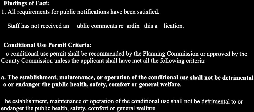
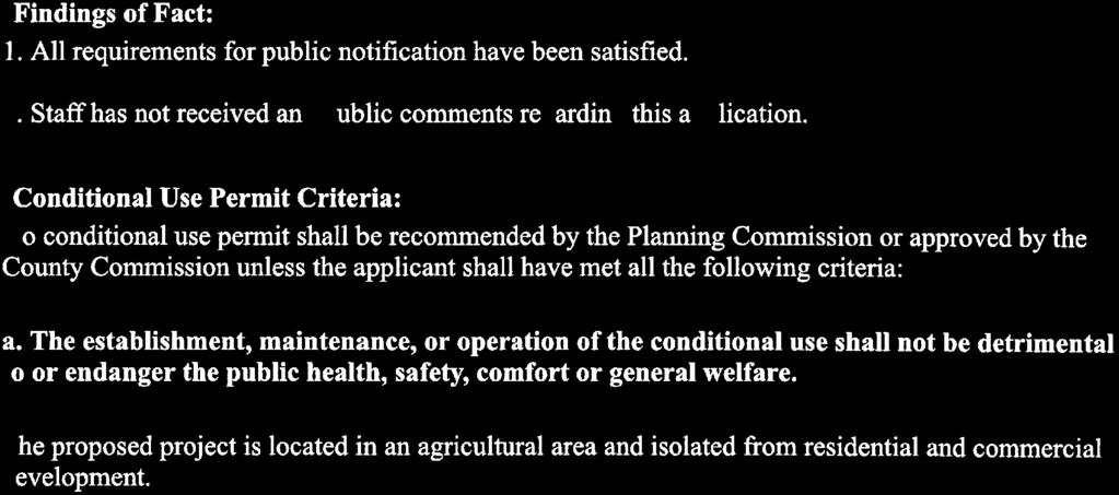
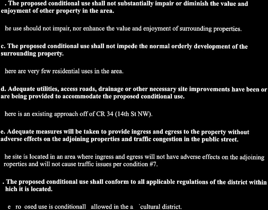
2 Summit Counseling Planned Unit Development Permit (PUD) Reason for Request: The applicant is requesting a zone change from Agricultural to a Planned Unit Development. Description: NE1/4NW1/4 Section 30, Township 150N, Range 101W Owner(s)/Applicant: Owners on file as of date of this report: Ethyl M and Charles Wade Aasen Applicant: Summit Counseling Services Hearing Date: July 9 th, 2018 Comprehensive Plan Land Use: Agricultural Zoning: Agriculture Findings of Fact: 1. All requirements for public notification have been satisfied. 2. There is an existing structure on site. 3. Alex Township met on Thursday, June 28 th PUD Intent: The Planned Unit Development (PUD) is a design and development technique which allows flexibility to create a development or project which may not be required to adhere to standards set elsewhere in this Ordinance, provided the overall development unit fits the general nature of the district and reflects creative and efficient use of structures and open space. Residential Component: 1- The lot is approximately 20 acres, there is a 16,590 square foot, 40 room structure on the property that will be used to provide clients housing for their treatment. The center will consist of 16 patient rooms, a large common and cafeteria area, 4 resident staff beds, 10 administrative offices, 6 meeting/activity/therapy rooms and 4 rooms that will be used for office, training and recreational material storage. 2- Approximately 5 of the 20 acres will include a parking lot for staff and visitors, a large community garden and a recreational area. 3- The rest of the area will be designated as open space.
3 PUD Allowed Uses: All conditionally allowed uses in Residential and Light Industrial Zoning Districts are under the following provisions: A) Setbacks and buffer zones are designed to the Planning Commission satisfaction. Structure setbacks shall be 25 feet from all property lines. B) Adequate and appropriate areas of the PUD are set aside for open space and parks. Approximately fifteen (15) acres will be designated as open space, and may include volleyball and basketball court, horseshoe pits, a playground structure, BBQ areas, a covered open-air picnic/meeting area structure and a large community garden. C) Interior streets, parking areas and utility service facilities are safe, adequate and efficient in design and are covered under a maintenance program. The roadways and facilities will be maintained by the facility management from Highway 68 to the facility. d) The overall unit is compatible with the surrounding land uses in that district. The surrounding area is all zoned Agricultural. e) Conditions. 1. Providing signed off updated approvals for septic from Upper Missouri Health Department, for the new updated system. This shall happen before the facility is opened for business. 2. Green space (outdoor recreation space) shall be completed by end of June 2020, along with all tree and shrub planting. 3. The applicant shall adhere to the noxious weed containment plan as submitted to the County Weed Control Officer. 4. The applicant shall maintain a site free of garbage, from within the site or from outside sources. 5. Any occupied building shall adhere to all applicable Fire Safety regulations in the International Fire Code. 6. The applicant shall provide a schedule of completion 90 days from County Commission approval for the recreation area. 7. The entry road and parking area shall be completed prior to opening. The cross slope is to be a minimum of three (3%) percent from the centerline. 26 th St NW from Hwy 68 for about a quarter (.25) mile shall be built to County Standards, thirty-two (32 ) feet wide. The access road from
4 26 th St NW shall be twenty-six (26 ) feet wide with an eight (8 ) inch base and six (6 ) inch top, class 13 or equivalent gravel top. Completed to County standards. 8. The secondary access road shall also be built twenty-six (26 ) feet wide with an eight (8 ) inch base and a six (6 ) inch class 13 or equivalent top to 26 th St NW which shall be built to County Standards, thirty-two (32 ) feet wide. 9. Culverts shall be sized and located per registered North Dakota civil engineer and approved by the Planning Director. 10. Building improvements and fire inspections shall be completed by the County Fire Inspector prior to opening. 11. Any change of use and/or density shall require an amendment of the PUD by the Planning and Zoning Board. Staff Recommendation: Staff recommends approval of the Planned Unit Development Permit Suggested motion: Recommend approval of the Planned Unit Development (PUD), Summit Counseling, to the County Commission. Adopt the findings and conditions as provided in the staff report.

5 Vicinity Map Highway 85 Highway 68 Site

6 Site Comp Plan is Agricultural

7 Site Zoned Agricultural


8

9
10 SUMMIT COUNSELING SERVICES RESIDENTIAL TREATMENT CENTER PLANNED UNIT DEVELOPMENT APPLICATION Contents ABSTACT... 3 PHYSICAL CHARCTERISTICS OF SITE... 4 PROPOSED LAND USE... 4 ALLOWED AND PROHIBITED USES... 4 SETBACKS... 5 UTILITY SETBACKS... 5 RESIDENTIAL DISTRICTS LOT REQUIREMENTS... Error! Bookmark not defined. OPEN SPACE QUANITY AND AMENITIES PROVIDED... 5 DESIGN STANDARDS... 5 STREET WIDTHS... 5 SITE FURNITURE... 5 SIGNAGE... 5 COMPATIBILITY AND IMPACTS ON ADJACENT PROPERTIES... 6 LAND USE AND SITE PLAN... 6 LOCATION AND SIZE OF EACH LAND USES... 6 OPEN SPACE, PARKS, TRAILS, AND PEDESTRIAN ACCESS... 6 STREET LAYOUT AND DESIGN... 6 INFRASTRUCTURE... 6 ROADS, DRIVES, AND ACCESS... 7 INTERNAL ROAD NETWORK... 7 ROAD MAINTENANCE... 7 DUST CONTROL FREQUENCY... 7 WATER SUPPLY... 7 SEWAGE SYSTEM... 7 STORM WATER MANAGEMENT PLAN... 7 PHASING PLAN FOR EACH STAGE... 7 Phase One... 7 Phase Two... 7 Phase Three... 8 Phase Four
11 Phase Five... 8 Phase Six... 8 TIMEFRAME... 8 Phase One... 8 Phase Two... 8 Phase Three... 8 Phase Four... 8 Phase Five... 8 Phase Six... 8 MAINTENANCE... 9 ADDITIONAL INFORMATION... 9 FENCING... 9 SAFTEY PROCEDURES... 9 SITE IMPROVEMENT... 9 LANDSCAPING... 9 GRAVEL... 9 WEED MANAGEMENT... 9 MINIMUM PUD AREA... 9 EXHIBIT
12 ABSTACT The goal of the Planned Unit Development (PUD) application for Summit Counseling Services Residential Treatment Center is to provide the Northwest North Dakota Region with a treatment facility to aid in the recovery of individuals with substance abuse disorders in a substantially underserved region of the state. The 20-acre property that will be used is located in the NE1/4NW1/4 of Section 30, Township 150N, Range 101W, within Alexander Township. The 16,590-square foot, 40-room structure located on the property will be used to provide clients a safe and comfortable environment to receive their required treatment. The structure will include 16 patient beds, a large common and cafeteria area, 4 residential staff beds, 10 administrative offices, 6 meeting/activity/therapy rooms, and 4 rooms that will be used for office, training, and recreational material storage. Approximately 5 of the 20-acres on the property will include a parking lot for staff and visitors, a large community garden, a recreation area that will eventually have a volleyball and basketball court, horseshoe pits, a playground for clients children on family days, a BBQ area, and an open air covered structure that can be used for outdoor meetings and picnics. The property also includes an approximately 900-square foot shed that houses a large water tank for the fire suppression system; the shed will also be used to house landscaping equipment. The remaining 15 acres will be designated as open space. 3
13 3.9.3 PUD APPLICATION AND PLAN PHYSICAL CHARCTERISTICS OF SITE The 20-acre property is located in the NE1/4NW1/4 of Section 30, Township 150N, Range 101W, within Alexander Township. There is a 16,590-square foot structure on the property. The structure includes 40 individual bedrooms, an industrial kitchen with a walk in-freezer and a walk-in refrigerator, and a large common/cafeteria area. There is also an approximately 900- square foot maintenance/utility shed located adjacent to the main structure that houses a large water tank for the fire suppressant system. PROPOSED LAND USE The 16,590-square foot, 40-room structure located on the property will be used to provide clients a safe and comfortable environment to receive their required treatment. The center will include 16 patient beds, a large common and cafeteria area, 4 residential staff beds, 10 administrative offices, 6 meeting/activity/therapy rooms, and 4 rooms that will be used for office, training, and recreational material storage. The 900-sqaure foot maintenance/utility shed located adjacent to the main structure houses a large water tank for the fire suppressant system and will be used for landscaping equipment storage (e.g., lawnmowers, trimmers, gardening equipment, etc.). Approximately 5 of the 20-acres on the property will include a parking lot for staff and visitors, a large community garden, a recreation area that will eventually have a volleyball and basketball court, horseshoe pits, a playground for clients children on family days, a BBQ area, and an open air covered structure that can be used for outdoor meetings and picnics. The remaining 15 acres will be designated as open space. See Exhibit 1 for the proposed landscaping plan. ALLOWED AND PROHIBITED USES The property will be used to provide any services related to substance abuse disorder treatment, including but not limited to regular group and individual therapy, guest speakers, life-training workshops, intern training and oversite, and outdoor recreation and gardening. Any activities involving the use of alcohol or drugs will be strictly prohibited. 4
14 SETBACKS SETBACKS 25 minimum building setback from all property limes. The minimum setback for structures from the centerline of the county and townships road is in accordance with the standard McKenzie County setback and property requirements. UTILITY SETBACKS The minimum setback for utility poles is in accordance with the standard McKenzie County setback and property requirements. OPEN SPACE QUANITY AND AMENITIES PROVIDED Of the 20-acres, approximately 15 acres will be designated as open space. The open space area will be either landscaped or left in a natural or agricultural setting to ensure ongoing aesthetic appeal of the overall property. The outdoor recreation amenities, which will be dispersed around the property may include a volleyball and basketball court, horseshoe pits, a playground structure, BBQ areas, a covered open-air picnic/meeting area structure, and a large community garden DESIGN STANDARDS STREET WIDTHS 1. The entry road and parking area shall be completed prior to opening. The cross slope is to be a minimum of three (3%) percent from the centerline. 26 th St NW from Hwy 68 for about a quarter (.25) mile shall be built to County Standards, thirty-two (32 ) feet wide. The access road from 26 th St NW shall be twenty-six (26 ) feet wide with an eight (8 ) inch base and six (6 ) inch top, class 13 or equivalent gravel top. Completed to County standards. The secondary access road shall also be built twenty-six (26 ) feet wide with an eight (8 ) inch base and a six (6 ) inch class 13 or equivalent top to 26 th St NW which shall be built to County Standards, thirty-two (32 ) feet wide. SITE FURNITURE Shall include picnic tables, BBQ pits, gazebo or picnic shelter, etc. SIGNAGE Site location signage will be posted on the turnoff from highway 68 at approximately mile marker 27. Additional signage will be placed at the entrance of the property from the 5
15 two access roads and on the front of the treatment center building. Signage location and text to be approved by Planning Director. COMPATIBILITY AND IMPACTS ON ADJACENT PROPERTIES The location of the treatment center is more than a mile from the nearest neighbor. To ensure there are no potential disruptions there will be quiet time hours at the center from 9:00 pm to 6:00 am daily. Traffic in and out of the property will be limited to normal workday hours, apart from emergency vehicles, or special circumstances, such as to accommodate visitors or clients coming from out of town and arriving at off-hour times. The entire property will be highly maintained to ensure an aesthetically pleasing environment for visitors, staff, clients, and neighbors. LAND USE AND SITE PLAN LOCATION AND SIZE OF EACH LAND USES 16,590-square foot structure will house the treatment center beds, offices, meeting/activity rooms, kitchen, and common area/cafeteria. The 900-sqaure foot maintenance/utility shed located adjacent to the main structure houses a large water tank for the fire suppressant system and will be used for landscaping equipment storage. Approximately 5 acres will be designated as outdoor recreational use, including BBQ area, horseshoe pits, volleyball and basketball courts, community garden, parking, and covered open-air structure. The remaining 15 acres will be designated as open-space area. OPEN SPACE, PARKS, TRAILS, AND PEDESTRIAN ACCESS Approximately 15 of the 20-acre property will be designated as open space area. The open space area may be landscaped or remain in an agricultural setting. Given the rural location of the property there will be no pedestrian-designated access. There will be a maintained walking trail around the perimeter of the property, resulting in an approximately 1.25 mile trail. STREET LAYOUT AND DESIGN See Exhibit 1 for access road and parking lot layout. 6
16 INFRASTRUCTURE ROADS, DRIVES, AND ACCESS INTERNAL ROAD NETWORK Main access to be from Highway 68 with a secondary emergency access from 144 th Ave. ROAD MAINTENANCE Road maintenance will be provided by facility management. DUST CONTROL FREQUENCY Dust control methods will be applied at least two times per year, or more, if needed. WATER SUPPLY The property will comply with all Federal, State, Local and District water-testing requirements. Dept. SEWAGE SYSTEM The property will have the approved by Upper Missouri Health District or ND Health STORM WATER MANAGEMENT PLAN The property s Storm Water Management Plan will comply with all Federal, State, Local, and District requirements. PHASING PHASING PLAN FOR EACH STAGE Phase One: The first phase of the plan is to secure the funding for the purchase of the property. Phase Two: The second phase of the plan will be ensuring the building is up to code, and to work with construction companies to prepare access roads for use. This will include widening the road, as needed, and putting gravel and dust retardant on the roads. The second phase will also include preparing all the necessary information for residential treatment center credentialing, and making sure all residential and staff beds, offices, kitchen, and other rooms have all necessary materials. For example, all linens, towels, etc. for each of the residential rooms; getting all necessary cooking and kitchen equipment; getting all necessary office equipment; and so forth. 7
17 Phase Three: The third phase of the plan is to hire all necessary staff to operate the treatment center. Phase Four: The fourth phase of the plan is to begin accepting residents and beginning treatment center activities. Phase Five: The fifth phase of the plan is to begin beautifying the property, including landscaping, putting in outdoor recreational areas (e.g., sand volleyball court, BBQ area, etc.). Also, we will place bids for the construction of a covered, open-air structure to be used for outdoor meeting activities and to provide shade for picnics and other recreational activities. Phase Six: The sixth and final phase of the plan is to ensure consistent maintenance of all property components. TIMEFRAME Phase One: Funding will be secured within 90 days upon approval of this rezoning request. Phase Two: Building codes and preparation of access roads will be done within 120 days after Phase One. The credentialing process will begin after successful completion of Phase One, which takes approximately six to nine-months. All residential equipment and supplies (i.e., kitchen supplies, beds, desks, etc..) will be purchased and installed with six months after completion of Phase One Phase Three: All required staff will be hired within three months after Phase Two is complete. Phase Four: the treatment center will accept clients immediately after completion of Phase Three. Phase Five: Landscaping, construction of outdoor recreational areas (e.g., sand volleyball court, BBQ area, etc.), and construction of a covered, open-air structure will begin in conjunction of Phase Two and be an ongoing process, dependent on funding availability, until completed approximately one to two years after completion of Phase Two. Phase Six: Maintenance of all property components will be ongoing for the life of the property. 8
18 MAINTENANCE Maintenance of the property, and all related equipment, will be conducted on a regular basis to ensure the property is up-to-date to ensure on-going patient and staff safety. Regular landscaping of the recreation and open-space areas will be done to ensure property is aesthetically pleasing. ADDITIONAL INFORMATION FENCING A five-strand barb wire fence has been installed along the perimeter of the property. The fencing will be regularly maintained. SAFTEY PROCEDURES Safety procedures for the residential, storage, recreational, and open-space areas of the property will be maintained in accordance with all Federal, State, Local, and District requirements. SITE IMPROVEMENT Continuous site improvements will be done in accordance to the phasing plans, dependent on fund availability, and as needed to maintain property safety requirements. LANDSCAPING The property will maintain an approved landscape plan with the McKenzie County Planning and Zoning Department, and will comply with all county requirements. GRAVEL All non-grassed areas used for the access roads and parking will be covered will gravel and dust retardant, and recovered and reapplied as needed. WEED MANAGEMENT The property will have an approved Weed Management plan with McKenzie County, and will comply with all county requirements. MINIMUM PUD AREA This property sits on a 20-acre parcel so meets the minimum 5-acre requirement for PUD designation. 9
19 N Summit Counseling Proposed Alexander Facility Map Cleanup / Regrade Landscape Cleanup / Regrade Gravel Surfacing Cleanup / Regrade to Drain 300 ft
 2018 Google")
20 Summit Counseling Proposed Alexander Facility Map Install Culvert Install Culvert Install Culvert Begin Grading Roadway and Gravel End Grading Roadway and Gravel Regrade Roadway & Slopes (+/ Ft) 2018 Google 1000 ft N


21 45 ft 25 ft 30 ft N Summit Counseling Proposed Alexander Facility Map Existing "Main" Building Existing Concrete Patio / Sidewalk Existing Garage / Fire Suppression 35 ft 25 ft 350 ft 35 ft 15 ft 300 ft

22 Hiland Partners Holdings, LLC Vicinity Map Site 3
23 Planning & Zoning Commission Hiland Partners Holdings, LLC CP, ZC The applicant is requesting a Comprehensive Plan Amendment in order to Reason for Request Zone Change, from Agricultural to Heavy Industrial for the construction of a pipe yard for purposes of storing equipment. Hearing Date: July 9, 2018 Location: The property is located SE1/4 of Section 1, Township 149N, Range 99W. Owner(s)/Applicant: Owners on record as of date of this report: Richard Satter & Susan Jensen Applicant: Hiland Partners Holdings, LLC Existing: Proposed: CP Land Use: Agricultural CP Land Use: Heavy Industrial Zoning: Agricultural Zoning: Heavy Industrial Front Yard: fifty (50) feet Setbacks: Twenty-five (25) feet from all property lines. Setbacks: Side Yard: twenty five (25) feet Back Yard: fifty (50) feet No less that fifteen (15 ) feet between buildings unless a one (1) hour fire wall is provided Lot Area: Forty (40) acres Lot Area: Two (2) acre minimum 1
24 Findings of Fact: 1. All requirements for public notification have been satisfied. 2. Staff has not received any phone or written comments on the proposal. 3. All affected state agencies have been notified of the project and have received their respective project applications. No objection to the project have been provided by the applicable state agencies 4. Building permits would be required for any additional buildings added to the site. 5. Applicant stated in writing that they will put up an opaque desert tan slats for fencing Growth Management Plan Consistency The subject land area is designated in the land use plan as Agricultural. Suggested Motion: Suggested motion: Recommend approval of Zone Change , Hiland Partners Holdings, LLC, to the County Commission to change the Comprehensive Plan for the Zone Change from Agricultural to Heavy Industrial. Adopt the findings as provided in the staff report. 2

25 Comp Plan Is Agricultural Site 4

26 Zoned Agricultural Site 5
27 From: To: Subject: Date: Fisher, Myles Peyman Kadir FW: Additional info for Wild Basin pipe yard Wednesday, June 20, :17:46 PM Peymon, Here is the I sent to Jim last week. Please let me know if you need anything else. Thanks, Myles Fisher Land & ROW KINDER~MORGAN PO Box 1207 Williston, ND th Ave SE, Bldg 29 Williston, ND Phone# Cell# Myles_Fisher@kindermorgan.com From: Fisher, Myles Sent: Wednesday, June 13, :08 PM To: 'Jim Talbert' <jtalbert@co.mckenzie.nd.us> Subject: Additional info for Wild Basin pipe yard Jim, To memorialize our conversation earlier this morning, in regards to my Wild Basin Pipe yard zone change/comprehensive plan change applications; Hiland Partners Holdings LLC will comply with section 3.11 Highway Corridor Overlay District requirements Hiland Partners Holdings LLC will also chain link fence the perimeter of the proposed property, with opaque desert tan slats incorporated into the entire fence. This would be in lieu of tree/shrub plantings for screening and buffering purposes. Also, I will be mailing you address labels as requested for the adjacent property owners as requested. Thank you, and please let me know if you need anything else from me. Sincerely,
28 Myles Fisher Land & ROW KINDER~MORGAN PO Box 1207 Williston, ND th Ave SE, Bldg 29 Williston, ND Phone# Cell#

29 Hurley s Vicinity Map Site


30


31

32 Comp Plan is Light Industrial Site

33 Zoned Agricultural Site


34

35

36 Vicinity Map Site Highway 85

37

38


39

40 Comp Plan is Light Industrial

41 Zoned Agricultural


42


43


44

45

46 PM Water, LLC Dahl Pond Vicinity Map Site County Road 34


47


48


49

50 Site Comp Plan is Agricultural

51 Zoned Agricultural
Exhibit A. 8:9 Scuffletown Rural Conservation District
 Exhibit A 8:9 Scuffletown Rural Conservation District 8:9.1 Intent and Purpose The Scuffletown Rural Conservation (SRC) District is intended to provide for residential development that supports the development
CONSENT CALENDAR CITY PLANNING COMMISSION AGENDA ITEM NO: A.1, A.2 STAFF: LARRY LARSEN
 Page 8 CONSENT CALENDAR CITY PLANNING COMMISSION AGENDA ITEM NO: A.1, A.2 STAFF: LARRY LARSEN FILE NO: CPC PUZ 14-00013 - QUASI-JUDICIAL FILE NO: CPC PUD 14-00014 QUASI-JUDICIAL PROJECT: APPLICANT: OWNER:
Procedures IV. V. Rural Road Design Option
 i IV. Procedures A. All applicants required to prepare a Conservation Design Subdivision shall provide the Planning Board with a conceptual conventional subdivision design as well as a proposed layout
Eastcreek Farm. Planned Development Standards September, 2014
 Eastcreek Farm Planned Development Standards September, 2014 ekfarm Contents 01. General Standards 02. Residential Development Standards 03. Architectural Design Standards 04. Landscape Design Standards
CHAPTER SPECIAL PURPOSE AND OVERLAY ZONING DISTRICTS
 Special Purpose and Overlay Zoning Districts 106.28.010 CHAPTER 106.28 - SPECIAL PURPOSE AND OVERLAY ZONING DISTRICTS SPECIAL PURPOSE AND OVERLAY ZONING DISTRICTS Sections: 106.28.010 - Purpose 106.28.020
#8) T-1409 CENTENNIAL & LAMB TENTATIVE MAP
 T-1409 CENTENNIAL & LAMB TENTATIVE MAP") #8) T-1409 CENTENNIAL & LAMB TENTATIVE MAP STAFF REPORT To: Planning Commission Meeting Date: June 14, 2017 Item: T-1409 Prepared By: Robert Eastman GENERAL INFORMATION: Applicant: Property Owner(s): Requested
#8) T-1409 CENTENNIAL & LAMB TENTATIVE MAP STAFF REPORT To: Planning Commission Meeting Date: June 14, 2017 Item: T-1409 Prepared By: Robert Eastman GENERAL INFORMATION: Applicant: Property Owner(s): Requested
RESIDENTIAL PLANNED UNIT DEVELOPMENT / SUBDIVISION AND REZONING CONCEPT AND DEVELOPMENT STAGE PLAN SUBMITTAL NARRATIVE
 RESIDENTIAL PLANNED UNIT DEVELOPMENT / SUBDIVISION AND REZONING CONCEPT AND DEVELOPMENT STAGE PLAN SUBMITTAL NARRATIVE DEVELOPMENT TEAM DONEGAL SOUTH Maple Grove, Minnesota March 27, 2017 Applicant/Developer/Builder:
3.4 REL: Religious Use District
 3.4 Intent - The s are established to promote and maintain the development facilities for divine worship within the Town of Plainfield. The development of religious facilities or the major expansion of
EXHIBIT B PROJECT NARRATIVE POULSBO MEADOWS
 EXHIBIT B PROJECT NARRATIVE POULSBO MEADOWS Name of Project: Poulsbo Meadows; A Planned Residential Development (PRD)/Plat Applicants Name: PBH Group LLC/Byron Harris PO Box 1010 Silverdale, WA 98038 Description
REQUEST FOR COUNCIL ACTION 6A AGENDA ITEM ORIGINATING DEPT. AGENDA ITEM CITY ADMINISTRATOR APPROVAL
 DATE REQUEST FOR COUNCIL ACTION 6A AGENDA ITEM ORIGINATING DEPT. AGENDA ITEM CITY ADMINISTRATOR APPROVAL Community Development Territorial Greens PUD Concept Plan Development Stage Plan Subdivision (Preliminary
R E S O L U T I O N. Single-Family Residence/ Church. 2,488 sq. ft. 2,488 sq. ft. Area Parking Required: Church
 R E S O L U T I O N WHEREAS, the Prince George s County Planning Board is charged with the approval of Detailed Site Plans pursuant to Part 3, Division 9 of the Zoning Ordinance of the Prince George s
CHAPTER ADDITIONAL REQUIREMENTS IN THE NC, NEIGHBORHOOD COMMERCIAL ZONE
 CITY OF MOSES LAKE MUNICIPAL CODE CHAPTER 18.31 ADDITIONAL REQUIREMENTS IN THE NC, NEIGHBORHOOD COMMERCIAL ZONE Sections: 18.31.010 Purpose 18.31.020 Minimum Lot Area 18.31.030 Setbacks 18.31.040 Maximum
Article 7.05 Manufactured Home Park Districts
 Article Manufactured Home Park Districts.01 Intent The purpose of the MHP Manufactured Home Park District is to give recognition to the fact that manufactured homes can provide satisfactory living conditions
Appendix E Section 4(f) Evaluation
 Evaluation") Appendix E Section 4(f) Evaluation Appendix E Draft Section 4(f) Evaluation E.1 Introduction This appendix addresses a federal regulation known as Section 4(f), which protects parks, recreation areas,
Appendix E Section 4(f) Evaluation Appendix E Draft Section 4(f) Evaluation E.1 Introduction This appendix addresses a federal regulation known as Section 4(f), which protects parks, recreation areas,
ARTICLE 9: Landscaping
 ARTICLE 9: Landscaping 9-10 Legislative Intent The purpose of this Article is to regulate the planting and preservation of landscape materials; to facilitate the creation of an attractive and healthy environment;
3.2 P - Park District
 3.2 P - Intent - The P: s are established to promote and maintain the development of recreational opportunities within the. The development of new parks or the major expansion of existing parks within
APPENDIX J PERFORMANCE STANDARDS FOR GRAVEL MINE, PIT MINE, OR QUARRY
 APPENDIX J PERFORMANCE STANDARDS FOR GRAVEL MINE, PIT MINE, OR QUARRY A. Purpose: 1. Regulatory Requirement and Use Mitigation: The purpose of this appendix is to provide a regulatory context (standards)
SITE PLAN REVIEW PROCESS
 BOWNE TOWNSHIP PO Box 35, 8240 Alden Nash Road, Alto, Michigan 49302 Ph. 616-868-6846 Fax 616-868-0110 http://www.bownetwp.org SITE PLAN REVIEW PROCESS 1. Application Form and Fee Schedule Site Plan Review
Millcreek City Planning and Community Development 3330 South 1300 East Millcreek, Utah Phone: (801) Inspections: (385)
 Inspections: (385)") Millcreek City Planning and Community Development 3330 South 1300 East Millcreek, Utah 84106 Phone: (801) 214-2750 Inspections: (385) 468-6690 STAFF MEMORANDUM From: Robert May, Planner To: Millcreek Community
Millcreek City Planning and Community Development 3330 South 1300 East Millcreek, Utah 84106 Phone: (801) 214-2750 Inspections: (385) 468-6690 STAFF MEMORANDUM From: Robert May, Planner To: Millcreek Community
BYLAW C A Bylaw of Rocky View County to amend Land Use Bylaw C
 BYLAW C-7720-2017 A Bylaw of Rocky View County to amend Land Use Bylaw C-4841-97. The Council of Rocky View County enacts as follows: PART 1 TITLE This Bylaw shall be known as Bylaw C-7720-2017. PART 2
3.10 ROW Overlay District
 3.10 A. Purpose The purpose of this Overlay District is to regulate items which could be placed or constructed within the Rights-of-way lying wholly or partially within the jurisdictional area of the Town
PART 1: PROJECT SUMMARY. Proposed Land Use: 120 single-family lots. The application is Attachment A. The site plan is Attachment B.
 PART 1: PROJECT SUMMARY Applicant: JBH Development, LLC and Hopper Communities, INC Project Size: +/- 80.48 acres Parcel Number: 01513107, 01513108, 01513109, 01513113, 01513120, 01513121, 01513122, 01513124,
5.1.1 The streetscape along US Highway 64 (Brevard Road); and, The built environment within new residential developments; and,
; and, The built environment within new residential developments; and,") Article 5. Landscaping 5.1 Purpose The Town of Laurel Park s landscape standards are designed to create a beautiful, aesthetically pleasing built environment that will complement and enhance community
Article 5. Landscaping 5.1 Purpose The Town of Laurel Park s landscape standards are designed to create a beautiful, aesthetically pleasing built environment that will complement and enhance community
PLANNING COMMISSION Work Session Meeting Agenda
 PLANNING COMMISSION Work Session Meeting Agenda 5200 85TH AVENUE NORTH BROOKLYN PARK MN 55443 PHONE (763) 424-8000 FAX (763) 493-8391 Wednesday, September 27, 2017-7:00 P.M. Brooklyn Township Room If due
Approved: CITY OF ARDEN HILLS, MINNESOTA PLANNING COMMISSION WEDNESDAY, AUGUST 5, :30 P.M. - ARDEN HILLS CITY HALL
 Approved: CITY OF ARDEN HILLS, MINNESOTA PLANNING COMMISSION WEDNESDAY, AUGUST 5, 2015 6:30 P.M. - ARDEN HILLS CITY HALL PLANNING CASES A. Planning Case 15-016; Final Planned Unit Development Arden Plaza;
Watertown City Council
 City of Watertown Watertown City Council April 14 th, 2015 Agenda Item: City Comment on Sun Share CUP Application Request for Action: Motion to Approve City Comments regarding CUP Application Department:
CITY OF ZEELAND PLANNING COMMISSION
 APPLICATION FOR SITE PLAN REVIEW AND SPECIAL LAND USE Date City Official App. Filing Fee Rec'd ($350) NOTE TO APPLICANT: Please submit this application for Site Plan Review along with twenty (20) copies
November 21, Planning Commission Charter Township of Lyon Grand River Ave. New Hudson, MI 48165
 Planning Commission Charter Township of Lyon 58000 Grand River Ave. New Hudson, MI 48165 Subject: AP-18-68; 11 Mile and Milford Road Park, Site Plan Review #1 Based on site plan dated 11/12/18 Location:
ARTICLE 3 LANDSCAPING AND SCREENING REQUIREMENTS
 ARTICLE 3 CHAPTER 4 LANDSCAPING AND SCREENING REQUIREMENTS SEC 3.401 SEC 3.402 (D) (E) PURPOSE: The purpose of this Chapter is to establish minimum standards for the design, installation, and maintenance
SECTION 1000 HIGHWAY CORRIDOR OVERLAY DISTRICT REGULATIONS
 SECTION 1000 HIGHWAY CORRIDOR OVERLAY DISTRICT REGULATIONS 1001.00 INTENT AND PURPOSE... 1000-1 1002.00 CLASSIFICATIONS... 1000-1 1003.00 DEVELOPMENT STANDARDS TABLES Page 1003.01 Buffer Requirements...................................
SITE PLAN REVIEW APPLICATION
 SITE PLAN REVIEW APPLICATION CITY OF THE DALLES Community Development Department 313 Court Street The Dalles, OR 97058 (541) 296-5481, ext. 1125 Fax (541) 298-5490 www.ci.the-dalles.or.us Date Filed File#
CHEBOYGAN COUNTY PLANNING COMMISSION
 CHEBOYGAN COUNTY PLANNING COMMISSION 870 SOUTH MAIN ST. PO BOX 70 CHEBOYGAN, MI 49721 PHONE: (231)627-8489 FAX: (231)627-3646 CHEBOYGAN COUNTY PLANNING COMMISSION MEETING & PUBLIC HEARING WEDNESDAY, NOVEMBER
ARTICLE IX SPECIAL PERMIT USES
 ARTICLE IX SPECIAL PERMIT USES All special permit uses cited in Article IX and Attachment A of this Ordinance or any other Section of this Ordinance shall be subject to Site Plan Review. The procedures
PLANNED DEVELOPMENT (MASTER PLAN & UNIT PLAN)
") Central Permit Center 555 Santa Clara Street Vallejo CA 94590 Business License Building Fire Prevention Planning Public Works 707.648.4310 707.648.4374 707.648.4565 707.648.4326 707.651.7151 PLANNED DEVELOPMENT
Central Permit Center 555 Santa Clara Street Vallejo CA 94590 Business License Building Fire Prevention Planning Public Works 707.648.4310 707.648.4374 707.648.4565 707.648.4326 707.651.7151 PLANNED DEVELOPMENT
D1 September 11, 2013 Public Hearing APPLICANT:
 D1 September 11, 2013 Public Hearing APPLICANT: BEACH MUNICIPAL FEDERAL CREDIT UNION PROPERTY OWNER: SISTERS II, LLC STAFF PLANNER: Karen Prochilo REQUEST: Conditional Change of Zoning (AG-2 Agriculture
Asbury Chapel Subdivision Sketch Plan
 Asbury Chapel Subdivision Sketch Plan PART 1: PROJECT SUMMARY Applicant: NVR Inc. Project Size: +/- 76.13 acres Parcel Numbers: 02101112,02116101,02116112, 02116113 Current Zoning: Transitional Residential
REPORT TO: Council FOR: Regular Meeting. PRESENTED: April 1, 2008 FILE: , Byl 1932 & 1936
 DISTRICT OF SQUAMISH REPORT TO: Council FOR: Regular Meeting PRESENTED: April 1, 2008 FILE: 2006-08, Byl 1932 & 1936 DEPARTMENT: Planning Department SUBJECT: First and Second Readings for Bylaws 1932 (rezoning)
CITY OF KEIZER MASTER PLAN APPLICATION & INFORMATION SHEET
 CITY OF KEIZER MASTER PLAN APPLICATION & INFORMATION SHEET PRE-APPLICATION CONFERENCE Prior to the actual filing of a Master Plan application, it is strongly recommended that the applicant contact Planning
CHAPTER 20: INSTITUTIONAL USE DEVELOPMENT STANDARDS
 CHAPTER 20: INSTITUTIONAL USE DEVELOPMENT STANDARDS ARTICLE 1: GENERAL INSTITUTIONAL USE STANDARDS 320-01. Application The provisions of this Chapter shall apply to the following uses in any zone: (e)
Sheet Index. Legal Description. General Notes: Vicinity Map Scale 1" = 600'
 LOCATED IN THE SOHWEST QUARTER OF SECTION, TOWNSHIP SOH, Case # Z 6 - Legal Description Tract G, H and J of the Villages at Riverdale Filing No., a part of the Southwest quarter of Section, Township South,
ARTICLE 9: LANDSCAPING AND FENCING REQUIREMENTS
 ARTICLE 9: LANDSCAPING AND FENCING REQUIREMENTS Section 9.01 Intent The intent of the landscaping requirements are to improve the appearance of lot areas and soften paved areas and buildings; to provide
Chapter RM MULTI FAMILY BUILDING ZONES
 Chapter 19.17 RM MULTI FAMILY BUILDING ZONES 19.17.010 Established 19.17.020 Primary Permitted Uses 19.17.030 Accessory Permitted Uses 19.17.040 Secondary Permitted Uses 19.17.050 Conditional Property
PLANNED UNIT DEVELOPMENT APPLICATION
 PLANNED UNIT DEVELOPMENT APPLICATION CITY OF THE DALLES Community Development Department 313 Court Street The Dalles, OR 97058 (541) 296-5481, ext. 1125 Fax (541) 298-5490 www.ci.the-dalles.or.us Date
4 January 11, 2012 Public Hearing APPLICANT:
 . 4 January 11, 2012 Public Hearing APPLICANT: MID-ATLANTIC AUTO PROPERTY OWNER: DZR, LLC STAFF PLANNER: Leslie Bonilla REQUEST: Conditional Use Permit (truck rental, automobile service, and automotive/bulk
COMMUNITY DESIGN. GOAL: Create livable and attractive communities. Intent
 COMMUNITY DESIGN Intent An attractive, well-designed County will attract quality development, instill civic pride, improve the visual character of the community, and create a strong, positive image for
GRAND COUNTY Planning Commission April 27, :00 P.M. Regular Meeting GRAND CENTER North End Meeting Room 182 No. 500 W.
 Type of Meeting: Facilitator: Attendees: Regular Meeting Dave Tubbs, Chair GRAND COUNTY Planning Commission April 27, 2016 6:00 P.M. Regular Meeting GRAND CENTER North End Meeting Room 182 No. 500 W.,
Landscaping Standards
 CHAPTER 29 ARTICLE 403 29.403 Landscaping Standards Purpose: The purpose of this section is to protect and promote the public health, safety and general welfare by requiring landscaping in relation to
Neo-Traditional Overlay Application
 MAYOR AND CITY COUNCIL OF LAUREL DEPARTMENT OF ECONOMIC AND COMMUNITY DEVELOPMENT 8103 Sandy Spring Road Laurel, Maryland 20707 (301) 725-5300 Internet Address http://www.cityoflaurel.org E-mail: ecd@laurel.md.us
Gloucester County s Comprehensive Plan. The Community Connection
 Gloucester County s Comprehensive Plan The Community Connection Current Comp Plan Adopted in 1991 with a 20 year planning horizon Updated in 1995 with Part V- Implementation Recommendations and Appendix
M E M O R A N D U M. Consider a recommendation of a site plan for Sherwin Williams, a proposed approximately 4,500 square-foot paint store.
 M E M O R A N D U M Meeting Date: February 10, 2014 Item No. E- 8 To: From: Subject: Planning and Zoning Commission Cassie Harashe, Planner I Consider a recommendation of a Site Plan for Sherwin Williams,
ARTICLE IV: DEVELOPMENT STANDARDS 404 MASTER PLANNING
 IV 13 404 MASTER PLANNING Master Planning through the Site Analysis (Master Planning Site Analysis) or Planned Development (Master Planning Planned Development) is provided to encourage development which
Village of Glenview Plan Commission
 Village of Glenview Plan Commission STAFF REPORT January 22, 2019 TO: Chairman and Plan Commissioners CASE #: P2018-047 FROM: Community Development Department CASE MANAGER: Tony Repp, Senior Planner SUBJECT:
CASE NUMBER: 16SN0701 APPLICANT: Hanky, LLC
 STAFF S ANALYSIS AND RECOMMENDATION Planning Commission (CPC) Public Hearing Date: MAY 17, 2016 CPC Time Remaining: 100 DAYS Applicant s Agent: DANIEL L. CASKIE (804-569-7060) Applicant s Contact: MICHAEL
SECTION II SECTION II STATEMENT OF GOALS, OBJECTIVES, PRINCIPLES, ASSUMPTIONS, POLICIES AND STANDARDS
 STATEMENT OF GOALS, OBJECTIVES, PRINCIPLES, ASSUMPTIONS, POLICIES AND STANDARDS 1 2 STATEMENT OF GOALS, OBJECTIVES, PRINCIPLES, ASSUMPTIONS, POLICIES AND STANDARDS INTRODUCTION The New Jersey Municipal
DEPARTMENT OF PLANNING JEFFERSON PARISH, LOUISIANA
 DEPARTMENT OF PLANNING JEFFERSON PARISH, LOUISIANA DESIGN REVIEW REPORT : CPZ-3-1 : (S) Cynthia Lee-Sheng AT LARGE: A Chris Roberts B Elton M. Lagasse ADVERTISING DATES: 06/03/1 06/10/1 06/17/1 PAB PUBLIC
D3 January 14, 2015 Public Hearing
 D3 January 14, 2015 Public Hearing APPLICANT: DONALD J. BOUCHER, JR. PROPERTY OWNER: D.J.B. SERVICE CENTER, LLC STAFF PLANNER: Kristine Gay REQUEST: A. Conditional Change of Zoning (I-1 to B-2) B. Conditional
Major Subdivision Sketch Plan Checklist
 This checklist provides specific requirements that are apart of the Sketch process. The entire process is described by the Huntersville Subdivision Review Process which details all the submittal and resubmittal
PLANNING REPORT CITY OF EAGAN. APPLICANT: Cedar Grove Hospitality, LLC HEARING DATE: December 18, 2014
 PLANNING REPORT CITY OF EAGAN REPORT DATE: December 8, 2014 CASE: 19-PA-11-11-14 APPLICANT: Cedar Grove Hospitality, LLC HEARING DATE: PROPERTY OWNER: The Flats at Cedar APPLICATION DATE: Nov. 21, 2014
RRW Stonebrook, LLC Tentative Map Findings
 RRW Stonebrook, LLC Tentative Map Findings FINDING T1: The request conforms to the Master Plan and zoning ordinances. RELATIONSHIP TO THE MASTER PLAN 1. The respective development is located within an
SITE PLAN (REVISED 8/13/18) l. Development Data Table
 l. Development Data Table") SITE PLAN (REVISED 8/13/18) l. Development Data Table a. Site Acreage: 9.25 b. Tax Parcels included in rezoning: #108-081-07 and #108-081-23 c. Existing Zoning (including overlays and vesting): R-3 (see
SITE PLAN (REVISED 8/13/18) l. Development Data Table a. Site Acreage: 9.25 b. Tax Parcels included in rezoning: #108-081-07 and #108-081-23 c. Existing Zoning (including overlays and vesting): R-3 (see
REPORT OF THE PLANNING AND DEVELOPMENT DEPARTMENT FOR APPLICATION FOR REZONING ORDINANCE TO PLANNED UNIT DEVELOPMENT AUGUST 18, 2016
 REPORT OF THE PLANNING AND DEVELOPMENT DEPARTMENT FOR APPLICATION FOR REZONING ORDINANCE TO PLANNED UNIT DEVELOPMENT AUGUST 18, 2016 AWH The Planning and Development Department hereby forwards to the Planning
BUFFERS, TREE PROTECTION AND LANDSCAPING. Sec Purpose and Intent.
 ARTICLE 20 BUFFERS, TREE PROTECTION AND LANDSCAPING Sec. 20.1. Purpose and Intent. Trees improve air and water quality, reduce soil erosion, reduce noise and glare, provide habitat for desirable wildlife,
AWH REPORT OF THE PLANNING AND DEVELOPMENT DEPARTMENT FOR APPLICATION FOR REZONING ORDINANCE TO PLANNED UNIT DEVELOPMENT
 AWH REPORT OF THE PLANNING AND DEVELOPMENT DEPARTMENT FOR APPLICATION FOR REZONING ORDINANCE TO PLANNED UNIT DEVELOPMENT MAY 8, 2014 The Planning and Development Department hereby forwards to the Planning
Town of Windham. Planning Department 8 School Road Windham, ME voice fax
 Town of Windham Planning Department 8 School Road Windham, ME 04062 voice 207.864-5960 fax 207.892.1916 MEMO DATE: TO: Staff Review Committee FROM: Amanda Lessard, Planner Cc: Ellen Rathbone, St. Germain
ARTICLE RRCO RED ROCK CORRIDOR OVERLAY DISTRICT
 ARTICLE 11.10 RRCO RED ROCK CORRIDOR OVERLAY DISTRICT (adopted 11/22/2011 MC16-116-11) SECTIONS: 11.10.01 Intent 11.10.02 Boundaries of District 11.10.03 Development Standards 11.10.04 Variance 11.10.01
SITE PLAN REVIEW APPLICATION AND CHECKLIST
 SITE PLAN REVIEW APPLICATION AND CHECKLIST PROJECT SUMMARY: Project Name: City/ETA Location: City ETA (Application fee & number of copies needed are based on location) Property Location (Legal Description
Applicant Name Phone / Fax / Address City State Zip Code . Property Owner Phone / Fax / Address City State Zip Code
 Master Development Plan Application Community Development Department City of Redmond 411 SW 9 th Street Redmond, Oregon 97756 541-923-7721 541-548-0706 FAX Master Development Plan Fee $38,862.52 File Number
At Your Disposal CUP Amendment, Lot 20, Village Service Commercial, at 128 Bastille Dr. (PLN17-208)
") MEMORANDUM Archuleta County Development Services Planning Department 1122 HWY 84 P. O. Box 1507 Pagosa Springs, Colorado 81147 970-264-1390 Fax 970-264-3338 TO: Archuleta County Planning Commission FROM:
MEMORANDUM Archuleta County Development Services Planning Department 1122 HWY 84 P. O. Box 1507 Pagosa Springs, Colorado 81147 970-264-1390 Fax 970-264-3338 TO: Archuleta County Planning Commission FROM:
To encourage commercial development which is consistent with the long range, comprehensive, general plan for Knoxville and Knox County.
 Page 1 of 5 9. - C-6 general commercial park district. A. Legislative purpose, intent and application. The legislative purpose, intent and application of the general commercial park development [district]
WEST HILL BUSINESS PARK AREA STRUCTURE PLAN
 MUNICIPAL DISTRICT OF PEACE NO. 135 WEST HILL BUSINESS PARK AREA STRUCTURE PLAN Prepared by: TABLE OF CONTENTS 1.0 Introduction... 1 1.1 Purpose of Plan........ 1 1.2 Plan Area..... 1 1.3 Existing Conditions...
DRIVEWAY REGULATIONS
 TOWN OF NEW LONDON PLANNING BOARD DRIVEWAY REGULATIONS INSTRUCTIONS TO APPLICANTS FOR THE CONSTRUCTION OR ALTERATION OF DRIVEWAYS IMPORTANT: READ CAREFULLY BEFORE FILLING OUT ATTACHED APPLICATION Revised
ORDINANCE AN ORDINANCE TO ADD A NEW SECTION 4.N. IN THE ZONING CODE FOR THE TOWN OF MIDDLETOWN, RELATING TO MIXED-USE DEVELOPMENT
 Introduced: November 5, 2018 Approved: ORDINANCE 18-11-01 AN ORDINANCE TO ADD A NEW SECTION 4.N. IN THE ZONING CODE FOR THE TOWN OF MIDDLETOWN, RELATING TO MIXED-USE DEVELOPMENT BE IT ENACTED BY THE MAYOR
ARTICLE VI LANDSCAPE REQUIREMENTS
 ARTICLE VI LANDSCAPE REQUIREMENTS 6.0 Landscaping and Screening. 6.1 Purpose. The landscaping and screening requirements specified herein are intended to foster aesthetically pleasing development which
ELECTION DISTRICT: PRINCESS ANNE
 D3 April 10, 2013 Public Hearing APPLICANT: HOLLOMON- BROWN FUNERAL HOME, INC. PROPERTY OWNER: HOLLOMON- BROWN FUNERAL HOME, INC. & TIDEWATER CEMETERY CORP. STAFF PLANNER: Karen Prochilo REQUEST: Conditional
Staff Report to the North Ogden City Planning Commission
 Staff Report to the North Ogden City Planning Commission SYNOPSIS / APPLICATION INFORMATION Application Request: Concept review on a legislative application to rezone land located at approximately 1750
SUBDIVISION, REZONING, PLANNING APPROVAL, PUD & SIDEWALK WAIVER STAFF REPORT Date: May 3, 2007
 SUBDIVISION, REZONING, PLANNING APPROVAL, PUD & SIDEWALK WAIVER STAFF REPORT Date: May 3, 2007 APPLICANT NAME SUBDIVISION NAME LOCATION TOG Properties, LLC Highland Professional Park, Resubdivision of
TEN MILE PLANNING COMMISSION AGENDA January 10, :30 p.m. Buffalo Mountain Meeting Room, County Commons 0037 Peak One Dr., SCR 1005, Frisco, CO
 PLANNING DEPARTMENT 970.668.4200 0037 Peak One Dr. PO Box 5660 www.summitcountyco.gov Frisco, CO 80443 TEN MILE PLANNING COMMISSION AGENDA January 10, 2019-5:30 p.m. Buffalo Mountain Meeting Room, County
PLNPCM Carl s Jr. Commercial Parking Lot at Redwood Road and 1700 South
 Staff Report PLANNING DIVISION COMMUNITY & NEIGHBORHOODS To: Salt Lake City Planning Commission From: Casey Stewart; 801-535-6260 Date: November 4, 2016 Re: PLNPCM2015-00874 Carl s Jr. Commercial Parking
The Highway Overlay District applies to an area within the City of Papillion's zoning jurisdiction described as:
 ARTICLE XXVIII. HOD Highway Overlay District 205-164. Intent. The Highway Overlay District recognizes the strategic importance of the Highway 370 corridor as an entrance to Papillion from Interstate 80
City of Royalton Comprehensive Land Use Plan 2005 to Revision February 8, 2011
 City of Royalton Comprehensive Land Use Plan 2005 to 2015 2011 Revision February 8, 2011 PART ONE: INTRODUCTION TO THE COMPREHENSIVE PLAN 1.0 Purpose and Introduction The Comprehensive Land Use Plan provides
CHESAPEAKE LANDSCAPE ORDINANCE
 CHESAPEAKE LANDSCAPE ORDINANCE CONSERVATION PRESERVATION CZO 19-600 Effective October 16, 2008 BUFFER YARD C PARKING LOT REFORESTATION YEAR 1 REFORESTATION YEAR 4 BUFFER YARD F CBPA REFORESTATION Page
PART 1: PROJECT SUMMARY. The application is Attachment A. The site plan is Attachment B.
 Belleterre Subdivision Sketch Plan Town Board 8.7.17 Belleterre Subdivision Sketch Plan PART 1: PROJECT SUMMARY Applicant: Bowman Development Project Size: +/- 20.85 acres Parcel Number: 01115104 and 01115121
DEPARTMENT OF PLANNING JEFFERSON PARISH, LOUISIANA
 DEPARTMENT OF PLANNING JEFFERSON PARISH, LOUISIANA DESIGN REVIEW REPORT DOCKET NO: CPZ--16 SUMMAR NO.: : : Paul D. Johnston AT LARGE: A: Christopher L. Roberts B: Cynthia Lee-Sheng ADVERTISING DATES: PAB
Chapter SAR, SENSITIVE AREA RESORT ZONE
 Moab Municipal Code Chapter 17.32 SAR, SENSITIVE AREA RESORT ZONE Page 1 of 8 Sections: 17.32.010 Objectives and characteristics. 17.32.020 Use regulations. Chapter 17.32 SAR, SENSITIVE AREA RESORT ZONE
Environmental Protection Ordinances (Performance Zoning) Bedminster Township, Bucks County
 Bedminster Township, Bucks County") Environmental Protection Ordinances (Performance Zoning) Bedminster Township, Bucks County ARTICLE VI. PERFORMANCE STANDARDS Section 600 Compliance All uses, activities, subdivisions and/or land developments
Environmental Protection Ordinances (Performance Zoning) Bedminster Township, Bucks County ARTICLE VI. PERFORMANCE STANDARDS Section 600 Compliance All uses, activities, subdivisions and/or land developments
WASHINGTON COUNTY OREGON
 WASHINGTON COUNTY OREGON July 9, 2009 Revisions to Chapter 2 of the Bethany Community Plan The North Bethany Subarea Plan Exhibit pages 7 and 8 The sections for the Core and Flexible Streets were amended
Public Hearing. Charlotte County-Punta Gorda MPO - Meeting Rooms A and B March 14, open house at 4 p.m., formal presentation at 5 p.m.
 Public Hearing Charlotte County-Punta Gorda MPO - Meeting Rooms A and B March 14, 2019 open house at 4 p.m., formal presentation at 5 p.m. Welcome to the Public Hearing for the Harborview Road (CR 776)
ARTICLE VI. LANDSCAPING, BUFFERING, AND OPEN SPACE REQUIREMENTS.
 ARTICLE VI. LANDSCAPING, BUFFERING, AND OPEN SPACE REQUIREMENTS. 6-1. Landscaping Standards. (A) Landscaping. In order to maintain and enhance the existing tree coverage in Norwood, to promote careful
V-5 TREE PROTECTION AND LANDSCAPING REQUIREMENTS
 V-5 TREE PROTECTION AND LANDSCAPING REQUIREMENTS V-5.1 General A. Intent: It is the intent of this section to establish protective regulations for trees within the City of Milton, in order to better control
COUNTY OF PRINCE WILLIAM 5 County Complex Court, Suite 120 Prince William, Virginia (703) Metro Fax: (703)
 Metro Fax: (703)") COUNTY OF PRINCE WILLIAM 5 County Complex Court, Suite 120 Prince William, Virginia 22192-5308 (703) 792-6930 Metro 631-1703 Fax: (703) 792-5285 DEPARTMENT OF DEVELOPMENT SERVICES Wade A. Hugh Director
COUNTY OF PRINCE WILLIAM 5 County Complex Court, Suite 120 Prince William, Virginia 22192-5308 (703) 792-6930 Metro 631-1703 Fax: (703) 792-5285 DEPARTMENT OF DEVELOPMENT SERVICES Wade A. Hugh Director
CITY of RIDGEFIELD TYPE I DECISION SITE PLAN REVIEW (SPR 99-10) PDM MOLDING INC. PHASE II EXPANSION
 PDM MOLDING INC. PHASE II EXPANSION") Page 1 CITY of RIDGEFIELD TYPE I DECISION SITE PLAN REVIEW (SPR 99-10) PDM MOLDING INC. PHASE II EXPANSION TO: Mayor, and Members of the Ridgefield City Council and Planning Commission FROM: Eric Eisemann
Page 1 CITY of RIDGEFIELD TYPE I DECISION SITE PLAN REVIEW (SPR 99-10) PDM MOLDING INC. PHASE II EXPANSION TO: Mayor, and Members of the Ridgefield City Council and Planning Commission FROM: Eric Eisemann
GENERAL INFORMATIONaaaaaaaaaaaaaaaaaaaaaaaaaaaaaaaa
 To: Planning and Zoning Commission From: City Staff Date: November 15, 2016 Re: Case #16026 Raymore Activity Center Site Plan GENERAL INFORMATIONaaaaaaaaaaaaaaaaaaaaaaaaaaaaaaaa Applicant/ Property Owner:
12 January 12, 2011 Public Hearing APPLICANT: TAILWIND DEVELOPMENT GROUP,LLC PROPERTY OWNER: CITY OF VIRGINIA BEACH
 12 January 12, 2011 Public Hearing APPLICANT: TAILWIND DEVELOPMENT GROUP,LLC PROPERTY OWNER: CITY OF VIRGINIA BEACH STAFF PLANNER: Faith Christie REQUEST: Conditional Change of Zoning (from PD-H1 Planned
DESIGN AND LANDSCAPE GUIDELINES FOR DEVELOPMENT
 DESIGN AND LANDSCAPE GUIDELINES FOR DEVELOPMENT IN THE SECOND SUPERVISORIAL DISTRICT (REVISED) ADOPTED BY RIVERSIDE COUNTY BOARD OF SUPERVISORS ON SEPTEMBER 15, 1998 REVISED OCTOBER 23, 1998 REVISED AUGUST
City of Sun Prairie Wetland Buffer Reduction Request
 City of Sun Prairie Wetland Buffer Reduction Request Westside Development Area January 9, 2017 Prepared by: City of Sun Prairie 300 E. Main Street Sun Prairie, WI 53590 BACKGROUND The City of Sun Prairie
Mill Conversion Overlay District Zoning Bylaw Amendment
 Mill Conversion Overlay District Zoning Bylaw Amendment To see if the Town will vote to amend the Zoning By-Law by adding a new Section 13, Mill Conversion Overlay District, and by amending Sections 2.1,
CITY-COUNTY PLANNING BOARD DRAFT STAFF REPORT
 CITY-COUNTY PLANNING BOARD DRAFT STAFF REPORT PETITION INFORMATION Docket # W-3174 Staff Aaron King Petitioner(s) O Reilly Auto Parts Owner(s) Glenn Crossing Associates, LLC Subject Property Portion of
CITY PLANNING COMMISSION AGENDA. ITEM NO(s): C.1 C.3 STAFF: STEVE TUCK
: C.1 C.3 STAFF: STEVE TUCK") Page 34 CITY PLANNING COMMISSION AGENDA ITEM NO(s): C.1 C.3 STAFF: STEVE TUCK FILE NOS: CPC ZC 12-00035 QUASI-JUDICIAL CPC NV 12-00036 QUASI-JUDICIAL AR DP 12-00039 QUASI-JUDICIAL PROJECT: APPLICANT: OWNER:
Page 34 CITY PLANNING COMMISSION AGENDA ITEM NO(s): C.1 C.3 STAFF: STEVE TUCK FILE NOS: CPC ZC 12-00035 QUASI-JUDICIAL CPC NV 12-00036 QUASI-JUDICIAL AR DP 12-00039 QUASI-JUDICIAL PROJECT: APPLICANT: OWNER:
BOULEVARD AND PARKWAY STANDARDS
 88-323 BOULEVARD AND PARKWAY STANDARDS 88-323-01 PURPOSE Considerable public and private investment exists and is expected to occur adjacent to boulevards and parkways within the city. The following standards
LANCASTER COUNTY PLANNING COMMISSION PUBLIC MEETING AGENDA. Monday, August 27, 2018
 LANCASTER COUNTY PLANNING COMMISSION PUBLIC MEETING AGENDA Monday, August 27, 2018 150 North Queen Street, Binns Park Annex, 1 st Floor LCPC Meeting Rooms Lancaster, Pennsylvania NOTE: The Planning Commission